Section 18. White Pass to Snoqualmie Pass

Section 18. White Pass to Snoqualmie Pass. 17-20 September. I had a coffee in the shop and tried to glean more information about the fire closure but there was nothing new. However the general consensus was that it would start raining in the afternoon and continue for about 4 days on and off. I walked the half mile back to the PCT and turned north.
The PCT was open to Chinook Pass in 20 miles, I was just going 13 to the path junction to Bumping Lake. These 13 miles were a delight as I cruised along the flattish path in the hemlock and fir forest. There were many small lakes and ponds each side of the path, surrounded by conifers. Occasionally there were some ducks on lakes. The huckleberries were still ripe in places and I ate a few handfuls. The path was quite busy with day trippers, but the further I got from White Pass the less there were. There were also some bow hunters in their tight fitting camouflage, usually with a gut.
Just before I reached the junction to Bumping Lake the weather arrived. First it was drizzle but then it got stronger. I put my jacket and rain poncho on and also the rucksack cover. Just my legs were exposed to the rain. The poncho kept the warm air underneath it.

03. The mossy stream that is some typical of the lush temperate Washington forest. This stream was to become the Bumping Creek
Near the junction was a creek. It was thick with moss on each side and the rocks were covered in moss also. It was the typical image one conjures up of Washington. Later this creek became the Bumping Creek and it was quite wide. Luckily there was a large hemlock across it. The trail down to Bumping Lake was much more rustic with dripping vegetation overhanging the path and soaking my shoes.
As this rough path dropped through the forest I came across many Elk deer. There were large with powerful antlers. It was the mating season and the males were bellowing to attract the females. I saw most of them in the meadows each side of the creek. There was also a mother and calf which was just about half an adult size. My camera was tucked away and I could only get a few poor photos in the rain.

04. An Elk deer and her calf in a rainy meadow beside Bumping Creek on the way down to my campsite near Bumping Lake
The rain was persistent now and puddles were appearing on the rustic trail. My fingers were getting cold, but the poncho helped. The path went on for longer than I thought with very little camping opportunities. It was only towards dusk when I found a flatter dry site. It was raining quite heavily now and it was a joy to get the tent up and get into my sleeping bag. I was almost at the lake and tomorrow I could reach a campsite at the bottom of the Manastash ridge.
The rain continued all night, at times belting off the tent loudly, but by the morning it had returned to a drizzle. One of the hardest things to do on this trip, physically and especially mentally, is to get up is bad weather. I had not done it yet, but today was perhaps the first of many in Washington. I put on cold damp socks and then packed everything into bags, trying but failing to avoid the wet tent fabric. I had to keep my feather sleeping bag and down jacket dry at all costs or they would get soggy. Once it was all in waterproof bags I got out and stuffed it all into my rucksack, put on all the waterproofs and poncho and headed off down the Swamp Lake path.
After a half mile it came to the wide shallow Bumping River which I had to wade. It was only ankle deep and my wet socks had barely warmed up eo getting wet feet was no great hardship. The path continued on the east side of the river for another half mile to reach the trailhead at the end of the dirt road. All I had to do now was follow it down for about 15 miles until it hit the highway 410.
I had only walked a few hundred yards when I saw a Cascade Red Fox cross the track. It was very furry and perhaps had its winter coat already. It vanished into the forest in a flash. After a few miles the rough track turned into a dirt road and then after a few more miles it reached Bumping Lake Campground. There were lots of fire fighters and wood cutters here clearing ladder fuel beside the road to try and make a barrier should the fire reach here. I understood it was not a closed area so greeted them and carried on.
I had gone a mile along the now paved road through big conifers and just crossed the Bumping River on a bridge when a pickup stopped and two military police got out and told me they had been instructed to escort me out of the area. I protested my innocence and explained, quite strongly, why I was here, my ambition to get to Canada without getting in a car and the fact I had not crossed any signs. After 5 minutes of stalemate when I explained I would not get in their truck they decided to phone their supervisor, called Columbo, who had initially instructed them to escort me off. Columbo said he was nearby and would soon arrive to talk to me.
When Columbo arrived he said the whole road was shut as 700 firemen, foresters and the National Guard were doing timber operations along it. There were roadblocks manned by military police but as I had come in the back entrance I had eluded them. He said I had to be escorted out in the back of the police vehicle for my own safety due to the ongoing timber operations.
I could see my carless to Canada going down the tubes and protested again, pleaded and suggested I take an open track to the south of the Bumping River where there were no timber operations. He as safety officer had quite a firm line, but had the compassion to refer it to his boss, Dan, who was summoned and arrived within 10 minutes.
Dan was a forester in his 50’s who had seen it all in his time. He was also the type of man you could easily have a beer with. I explained my situation again explaining I was here in good faith after talking to the Forestry Service and that I had even kayaked over the Columbia River in my carless to Canada bid.
He said if I walk down the road I should be fine. He stood the police down, having given me clearance. Columbo returned to his duties of overseeing the felling of dangerous trees before the foresters went in to tidy up the brush beneath. Dan and myself chatted for half an hour and then he said he would inform others I had been given clearance. I breathed a huge sigh of relief and shook hands heartily with Dan when he went.
As I continued down the road I passed more crews who gave me the thumbs up and shouted good luck, then medics beside an ambulance did the same and shouted hope you reach Canada. Then a white pickup stopped and a forester got out and introduced himself as Brad and shook my hand and asked me questions on the trip so far. Then another 5 pickups in all stopped and heaped snacks into my pockets. I don’t know what Dan said on the radio but suddenly I felt like a mini-celebrity with everyone stopping to talk to the Scottish PCT hiker. The police came back and stopped, got out shock my hand and said “so glad you got clearance”. Columbo the same when he passed by.
I sauntered past Goose Prairie, a charming hamlet of log cabins and scout camps, which had been evacuated except 4 who refused to leave. In the next 7 miles to highway 410 at least another 5 pickups stopped to chat and heap more snacks into my bulging pockets. Tough working men in pickups appreciating a stubborn dogmatic Scottish hiking purist.
Near highway 410 Columbo reappeared. His men were just ahead felling problematic trees. He would drive beside me for a mile as they did their work. I walked in the middle of the road and chatted with him the whole way, and was fascinated by the complexity of this fire fighting operation. We paused occasionally while his men felled the marked trees before moving on. I got even more snacks from Columbo as he went.
When I got to the highway 410 there was a military roadblock, but the portion I wanted to walk now was open. It was 5 pm and there was a stream of fire fighters and foresters leaving the Bumping River Road and also the closed section of the 410 highway. As I walked away nearly 200 firefighting/ forestry vehicles went past with many double beeping their horns as they went past, including the ambulance. What a friendly sociable group they were.
I walked another 3 miles to cross the Little Naches River on a bridge and reached the Little Naches Campground. The rain of the morning had turned into sporadic showers and it was dry at the moment. I decided to camp here as I had already done about 20 miles. I could also use the damp picnic table to write the blog and plan my route tomorrow over the Manastash Ridge. My vote for fire fighting hero of the day must go to Dan who conjured me from felon to mini-celebrity.
I was away by 0700 and started up the road to Kaner Flats Campground 3 miles up the Little Naches River where there was another roadblock manned by military police. I would essentially have to leave the road here and head NE away from the fire closure area.
A few pickups went by, and a few tooted and waved, and then Dan pulled up. We chatted a bit about my route and then he gave me an invaluable copy of map of the Manastash Ridge. Looking at the map we could instantly see I would be better for me to continue 5 miles past the next military roadblock, to Four Way Meadow and take a path from there up Mount Clifty. He said it should be OK given the weather and today’s forecast, which had completely subdued the fire. He went off to clear it with the military police at the roadblock.

05. The second road block manned by the military police stopping the public going up Little Naches Road.
When I arrived at the roadblock the two police knew exactly who I was and started asking me questions about my Norway trip. Obviously Dan had briefed them. They were both very chatty and I was there for about half an hour. During this time a few deer and elk hunters wanted to drive through but they were all refused, which pleased me and no doubt the deer and elk. Then after a round of selfie photos and handshakes I was on my way up the closed road.
It was a pleasant and quiet walk beside the river. There was a beaver dam on it but no lodge. There was a bit of fire and wood clearing traffic but it was generally quiet. 3 or 4 pickups stopped for a chat and to refill my pockets with snacks. Two of them were Jonathan and Alex from yesterday.
At Four Way Meadow I left the road and starting following path 947. I thought it was a hiking path, but it was for motocross bikes. There were no bikes about on a cold misty Tuesday in September and I had it all to myself. It was just like a hikers trail really and I could easily imagine I was on the PCT. The path climbed quite steeply at times as it headed up past Douglas Firs, pines and a relatively newcomer to the trail; Englemann Spruce, all rising from a autumnal carpet of reddening berry bushes.

06. Atmospheric scenery when the mist lifted for an while on my way up Mount Clifty while crossing the Manastash Ridge
After a couple of hours it started to drizzle. I feared it was the cold front the foresters and firefighters had been talking about. It was not heavy but as I climbed further it got misty and colder. Then i came across a log covered in snow and pretty soon there was snow lying on everything. There were plenty of grouse about in these woods and I saw a few deer.
The path twisted up the mountain until the snow was settling on the tree branches almost an inch thick. There were a few trail junctions but with Dan’s map I knew which path to take. As the path reached the top of Mount Clifty the snow was dry and powdery, but the mist was thick and there was no view.
I took the trail down the north ridge of Mount Clifty. The snow stopped for a while and the mist cleared and I got a great view over the gentler mountains of the Manastash Ridge. There were grouse everywhere up here and I was flushing out a group every 10 minutes.

07. The arrival of the cold front with a gale and frequent snow showers at about 6000 foot on Mount Clifty
As I started the descent the snow returned, and with a wind. This must be the start of the cold front. Soon it was a heavy snow shower and the wind was near gale. It was as good as a blizzard and it lasted for an hour. In the trees there was some shelter but on the treeless ridge it was dramatic. Only when I dropped from 6000 to 5000 feet did it soften. I was on the lee side of the Cascades so further to the west it must have been very wet.

08. It did not take long for the snow to start to accumulate on the branches of the hemlocks and firs on the North Ridge of Mount Clifty
The North Ridge of Mount Clifty was a sharp ridge and quite rocky. Between the snow showers there were some dramatic views. It undulated badly and the motocross bike trail I was following went up and down all the undulations. I just had to walk them.
After 5 hours of descent the trail finally reached a road. There were some camping areas near and I had just filled my water bottles at the only water since leaving Little Naches Valley. Luckily the wet cold weather did not linger and the snow turned to rain and then the rain stopped. I put up the tent and was inside just as another rain shower arrived, but I was protected now.
It had been a great day. The scenery was dramatic and ever changing especially in the wind snowy conditions on the exposed ridge. But I enjoyed that weather, as it was out of the ordinary for the PCT. The campsite was great and I had almost completed the Manastash Ridge crossing. There was just a short section left but that was an old footpath, and I was worried it might disappear and this was steep terrain and would be difficult to bushwhack.
The rain pretty much petered out in the night but everything was damp the next morning. I started on what I thought was the trail down but after 100 yards realised it was a animal or hunters trail and it would take me into a nightmare of a rocky overgrown gorge, so backtracked. In another half mile I found another trail down. It was even signposted “1341 Big Creek Trail Junction”. I followed it down steep zig-zags into Big Creek Gorge. It was a built trail but had not been maintained for 5 years or so, and there were a few windfalls across the path, but without this trail the terrain would have been near impossible to negotiate. Once I reached Big Creek the trail almost vanished, swallowed up by the tireless temperate jungle. I just managed to follow faint signs and judgement as to where the path might go. Frequently I had to wade across Big Creek to avoid areas where the creek had eroded a earth bank. I knew it was only for a mile but was worried I might get ensnared or the creek might go over a waterfall and I could not climb down. It was an inhospitable, dank, gorge full of thick wet dripping vegetation.

10. In the depths of Big Creek Gorge with an intact section of the path. Frequently it dissappeared and I had to cross the creek pr walk down the middle of it.
Eventually the gorge sides opened out and the path became more pronounced before it spilled out of the dripping jungle onto a track under power lines. I followed this track for 2 miles north while being prevented from getting to an old railroad trail by a deep and sinister canal. After the 2 miles I reached a bridge and crossed it to reach the civilized homesteads around the small town of Easton. These homesteads were probably all retiree owned and were mostly hobby ranches. Many had horses but there were also a few with llamas.
Reaching Easton was like reaching the promised land. The old railway line from Chicago to Seattle went this way. It was now abandoned but the route had been turned into a hiking/cycling trail in the summer and ski-touring/dog-sledding route in the winter. All I had to do was follow its benign gradient up to Snoqualmie 20 miles away. The trail was called the John Wayne Pioneer Trail after the actor. It was an easy route slicing a path through the mixed forest with the dark green conifers slightly overhanging the trail, and glades of acer shrubs turning into their bright autumn red colours.
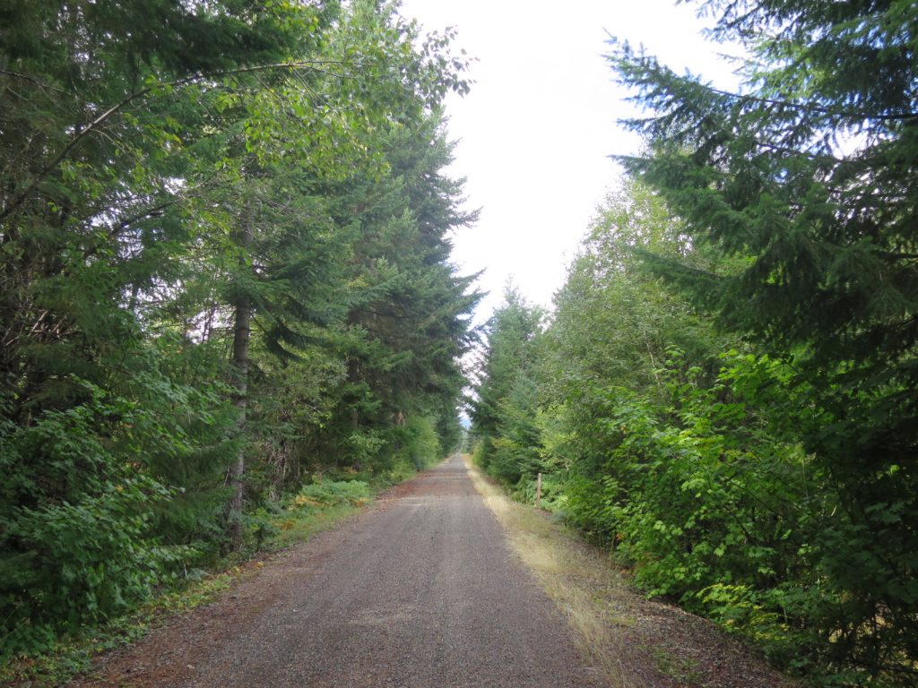
11. A view down the John Wayne Pioneer Trail which was.on the bed of the old Chicago to Seattle railway. I followed this trail for and easy 20 miles between Easton and Snoqualmie Pass.
I made good time and only stopped once to eat some snacks. The drizzle came and went but when it was falling it was so light I did not need to put a jacket on. As the afternoon unfolded and I walked along the west shoreline of Keechelus Lake I realised I could easily reach Snoqualmie Pass an hour after nightfall, where there was a hotel used by PCT hikers and where I had my next resupply box. At dusk the the drizzle returned with a vengeance and I had to don my poncho, but it mattered not as I would surely be in bath in under 2 hours. The hotel was a typical Best Western type and I got a room with twin queen beds and bathroom. I did not bother with dinner but just bathed and went to bed.
This 100-mile Section 17 was almost entirely off the PCT trail. The route I took when I started it was perhaps the shortest possible reroute and one I thought was perfectly legal and open. However it was not, and it was by sheer good fortune that someone like Dan was working as a senior forester in the fire Norse Peak/American Ridge fire closure area that I managed to get through. The Manastash Ridge was perhaps the highlight, and the wild weather of the cold front with heavy snow showers made it all the more interesting. It was again a revelation that going off piste and making up your own reroute was more exciting than following the tyranny of the trail. The PCT Association suggested that there were no reroute options other than to hitchhike the entire 100 miles. Initially I thought this was lily-livered, but there was no way it could suggest anything like my route, or even the Manastash Ridge crossing, or it would be considered irresponsible.