Section 10. East Central Tanzania
September 1, 2025
Day 119. 05 September. Msata to Bagamoyo. 71 km. 5 Hours. 360m up. 600m down. The lodge gave me a huge breakfast, including a portion of goat stew to go with the omelette. The owner came and introduced himself as I was leaving. He was a retired Brigadier General in the Tanzania army who built this lodge on leaving the army. He was a large, gentle, affable soul who I could not imagine leading troops into guerilla warfare. Once I left the lodge I had to cycle the 2 kilometres north on the T2 into the centre of Msata to a T junction. The main T2 continued north and connected to virtually the whole of north Tanzania and also Kenya. The road I wanted was the T35 and it met the T2 here at Msata. Unfortunately it was nowhere near as quiet as I hoped as all the traffic from the north of Tanzania and Kenya came down the T2 but then left it here if they were going to Dar-es-Salem, which most were, and followed the T35. It looked like I was going to have to put up with 65 kilometres of traffic. However this road did have a better verge than the T1 and T2 of yesterday.

724. From Msata to Bagamoyo I followed the T35 highway for 65 kilometres. It was quite a fast road but had a tangible verge.
It was not an enjoyable cycle though. The traffic was quite fast and there were many more buses than yesterday and fewer trucks. The trucks were actually a benefit on a road like this as they tended to slow everything up. For the first 30 kilometres or so the landscape was quite dry and barren with few villages or towns enroute. Those that were there lined the road and owed half their existence to selling produce or meals to passing traffic, and then the other half to the meagre agriculture.

725. The villages beside the T35 showed more and more of an Islamic influence with more mosques than churches and many people in Islamic dress.
Slowly as I travelled further east the villages became more prosperous. There was still little agriculture as there was not the necessary water but the crops were according to this like coconuts, teak plantations and even pineapples. The maize in the fields was all harvested and dried and now just fodder for the tended cattle and goats. I passed a huge steel mill beside the road, which was Chinese owned and then dropped down to the Ruvu River as I neared Bagamoyo. I considered the steel mill and how any in the UK or USA, tariffs or not, could really compete with it in this global economy.

726. There was some agriculture around the villages and grazing between them. Here are pineapples growing under teak trees growing under coconut trees at Kiwanga village.
This large river had split into a number of channels as it crossed the coastal floodplain before reaching the sea. It was intensively farmed with well organised rice fields across the plain as far as I could see. There were people working in the fields and many scarecrows to keep the birds off. I saw quite a few kingfishers on the electricity cables, mostly white and black, but one was a huge black one with a rapier beak as long as its body. Beside the river channels were gravel banks where the Maasai herdsmen had gathered their cattle for the afternoon. They were the larger Sanga type of cattle as opposed to the Zebu type and they all had huge horns. I had to pass a few on the road earlier in the last week and although the cattle might be docile the horns were something to avoid and even if the cow was flicking some flies from its head the tips of the horns moved considerably.

727. Towards Bagamoyo the road crossed a number of rivers and grazing areas between them. The were a few herds of the Sangea type breeds about with large horns wich the Maasai favour.

728. There were also many rice fields between the rivers and these fields looked like they irrigated so could produce rice throughout the year not just in the rainy season.
On the other side, the east side of the Ruva valley, the landscape rose very slightly to reach an imperceptibly shallow ridge which was the edge of Bagamoyo town. At last after some 4 hours I could get off the T35 highway and dive off down a side street into the town. I was initially very surprised to see the strong Arabian influence. Virtually everybody was dressed in long islamic robes. They must be very practical for this hot climate but then many women were in burkas which would not be that comfortable, especially black ones, in the heat of the day. There were small mosques on many streets and no signs of any churches. I cycled down for about 15 minutes stopping to look at my phone to home in on the Firefly lodge. As I approached it I came round one corner and saw something turquoise at the end of the street. It then dawned on me it was the sea. It was just at the end of the street and just to confirm it was the sea I saw a couple of white horses. I had to turn off down a side street to get to the Firefly lodge but knew I was getting close.

729. On the beach at Bagamoyo there were lots of small dugout outriggers and larger boats which fished the more protected waters of the Zanzibar Channel between Bagamoyo and Zanzibar Island.
At the Firefly they had a room but it was more expensive than I bargained for and was twice what I had paid anywhere else on the trip so far. It looked like a nice place and potentially full of backpackers. I however decided to check out one other place which was the Millennium Breeze. It was twice the price of the Firefly and seemed to be for rich businessmen from Dar-es-Salem. It was not my scene at all so it was back to the Firefly. Once back I unloaded the panniers into my room, which was only £48, and then went back to the empty bicycle.
I wheeled the bike down through the gardens to the gate at the bottom and opened it onto what I thought was the beach. However it was a thriving and busy fishing village with lots of shacks, hundreds of fisherman and many boats, all side to side along the beach. I managed to tread a route down to near the water. I asked one young guy if he spoke English but they all shook their heads and pointed to a small shack with a young Rastafarian outside. I asked him if he could take some photos and explained why. He told the others and I heard them all exclaiming “Namibia”. I gave the Rastafarian the phone and then carried the bike into the sea, having asked him to take as many photos as possible while I held the bike aloft out of the knee deep salty water of the Indian Ocean. It was the celebratory photo I wanted and he managed to capture some. I thanked him and then returned to the Firefly lodge with squelching shoes.

730. After 5639 kilometres and 40340 metres of ascent I finally reached the Indian Ocean having left the Atlantic Ocean and crossing Africa in 119 days.
The lodge was quite quiet and I carried the bike up to the room and then had a great shower. For once I was not bothered if the water was warm or not as even the tap water was lukewarm. The water however was roasting, scalding even, and I managed to wash everything I needed. I then went down for a burger. By way of celebration I just had a crate full of passion sodas and some icecreams. I had intended to try and catch up with the blog but by the time the sun went down I was tired. After some 5,639 kilometres with over 40,000 metres of ascent and descent I could go to bed knowing I did not have to continue east. I will now spend a couple of days in Bagamoyo finishing the blog so it does not hang over me and then try and get some cardboard and tape to cobble together a bike box so I can book a ticket home in a few days time.
As I went up to the room I noticed what an extraordinary building the Firefly lodge was. From the outside it did not look much at all. There was about 50 metres of street frontage of an old 2 story building which looked tired. In the garden area on the other side of this were a large amount of Bohemian chill out areas each with its own unique day beds and cushioned areas. All of these were around a small clear clean pool. At the bottom of the garden before the gate to the fisherman’s shacks on the beach was a large open area shaded by trees where people could camp in their own vehicles or where the overland lorries with 10 off travellers parked every other night. However the real gem was the house itself. Behind that tired facade was an grand merchants house with cool balconies and huge rooms. There were shuttered windows on each side of the room to allow the sea breezes to pass through and keep the house cool. Upstairs there were perhaps 6 rooms and most were 30 or 40 square metres with high ceilings. When I asked more about the house I found out that the the merchant who lived here dealt in slaves up to just over 150 years ago and long after the Atlantic slave trade was banned in 1807 On the East coast of Africa the slave trade still flourished for another 50 years, with the Arabs of Zanzibar shipping slaves to the Middle East. The merchants here at Bagamoyo bought slaves which had been captured from the interior, and shipped them to Zanzibar where they were sold on. David Livingstone was instrumental in getting this East African slave trade banned in 1873 by lobbying the British and French governments and this is part of the reason he is reverred in East Africa.
Day 118. 04 September. Morogoro to Msata. 111 km. 9 Hours. 1110m up. 1360m down. After a restful day at Mama Pierina’s lodge in Morogoro I was ready for the final stretch. I was not really looking forward to it. There was little I could do to avoid the main road without going on unknown footpaths. Initially I had 20 kilometres of the Old-Dar es-Salam road which was not consumed by the building of the New Dar-es-Salem road or the T1 highway. It was essentially a continuation of the road I had been on from Kipera to Morogoro a few days ago. It took me a few kilometres to get out of the city with ever diminishing traffic until there were just tuk tuks and motorbikes left. To the south were the Uluguru Mountains which rose steeply, their heads buried in the low cloud on this overcast morning. These lofty summits, some 2 kilometres above me, caught rain from the winds coming off the Indian Ocean and apparently there was never a month there was no precipitation up there. The streams which came down its jungle-clad slopes nourished agriculture at the mountain’s base. Without these mountains there would not be anything like this level of agriculture or population.

714. Leaving Morogoro city and looking south towards the high jungle clad peaks of the Uluguru Mountains.

715. Leaving Morogoro and looking north over some homesteads to the flat drier savannah.
To the north of the track I was on was a more arid plain which did not have the benefit of the mountain streams. It had to rely on the seasonal rains to nourish the crops during the wet months from November to March. After 15 kilometres or so I reached the village of Pangawe. Here there was a small river from the mountains which was diverted into the rice fields, and even at this time at the end of the dry season there was enough water to irrigate the rice and crops which were growing beside the track. I stopped here just to see the rest of the way towards the main T1 road and have a soda. My route from here was on a track which got smaller and smaller until it was a footpath. This then went under the new electric railway connecting Morogoro with Dar-es-Salem and finally rose up to the main road. My rural sojourn was over.

716. To the east of Morogoro there were some hamlets blessed with streams and springs from the Uluguru Mountains which allowed farming, even rice farming, throughout the year.

717. The track through the village of Pangawe to the east of Morogoro and halfway between it and joining the busy T1 main road.
As soon as I was on the road my attitude changed. I was no longer ambling along, curious at my surroundings and stopping to look at things. I was now on a mission to get through the next 45 kilometres unscathed on the T1 highway. No sooner had I crossed the road to the east bound side a convoy of some 15 lorries all rumbled past their wheels spinning quite slowly, but with unstoppable force, just a meter or a meter and a half away. The lorries moved so slowly it took them 4-5 seconds to overtake me and I could see what they were carrying, from sacks of rice and maize, to half a million dollars of copper plate. The lorries however were predictable, slow, lumbering beasts similar to those giant herbivorous dinosaurs, like a herd of brontosaurus. Once they passed came the intercity buses, desperate to keep a timetable and pick up passengers before their rivals did. They were eager and frustrated and flew along like a hungry Tyranosaurous Rex looking for a meal. These beasts were the real danger on the road and I was constantly looking in my mirror to see when they were approaching and then I would go off the road verge and sometimes even onto the earth beside it.

718. I had to cycle along the T1 main road for about 43 km between Mkambarani and Ubenazomozi. The real problem was not the well driven trucks but the long distance buses and the 4×4, especially those with government number plates.

719. Beside the T1 main road there were many market places selling fruit and vegetables all stacked in pyramids with colourful ladies at the stalls.
It was an unpleasant 45 kilometres and I was frequently looking at my odometer counting down the distance. The only redeeming feature of the road were the roadside markets and stalls every 2-5 kilometres. Here the road builders had widened the road to allow for lorries to rest but the locals had commandeered the rest places to sell their produce. When a lorry or car did stop here it parked on the verge so I would have to wait until the carriage way was clear before overtaking. During the 2-3 hours I did not really stop and take any photos, but was just on a mission to get to the turn off as soon as possible. Eventually I reached Ubenazomozi and was able to pull off the road and find a cafe. Here I ordered chips and eggs, a popular meal like a chip omelette.

720. At Ubenazomozi I left the main T1 main road and headed NE on a small road. At Ubenazomozi I stopped for a chip omelette in a local cafe.
I still had another 50 kilometres to go today but the next section was on a small gravel road. It was the long side of a triangle or hypotenuse between two tarmac highways. It was great to be able to relax and look around again. I could veer into the middle of the track if I wanted, and stop at will to take photos. Sleepy hamlets appeared and herders followed their animals up the middle of the road. This is what cycling in Africa should be about and the previous stressful 3 hours was really just a link between rural sections which I had to grin and bear. This track however was anything but flat and as the afternoon passed it got extremely hot. Some of the longer climbs in the lowest gear were very taxing and there was just some small relief at the top with a cooling breeze.

721. The small dirt road from Ubenazomozi and Lugoba was about 30 kilometres and very rural with a few remote villages, mostly of cattle herders.
The hamlets and villages here were quite sparse and I only passed about 3 in the entire distance. There was virtually no agriculture at all and what there was, like long since harvested fields of maize, looked quite half hearted. These hamlets were primarily occupied by Maasai and their cattle, sheep, plus a few goats were grazing here. They have a disdain for agriculture and to be fair this land did not look that suitable for it. The Maasai houses here were different to the ones I had seen for most of the trip and made out of bricks. Here the houses were constructed from a wooden framework of sticks which were lashed or woven together in a framework leaving apertures of about 20 by 10 centimetres. These apertures were then filled with a clod of mud smeared onto and encompassing the sticks. It looked much easier, faster but much more temporary and short-lived than the brick houses elsewhere. Many had corrugated roofs and the rest grass roofs. The area around the houses was also quite barren and dusty with no flowers or shrubs planted. There were quite a few motorbikes on this stretch and most had Maasai tribesmen on them with their crimson and red robes flowing in the wind behind them. I assumed they were going from their homes to their herds to watch over them for a spell and relieve the others who were already there.

722. The architecture of the herders houses between Ubenazomozi and Lugoba was different and it was mud daubed on a wooden framework. The were few brick houses on this stretch.
After 3 hours on this small track I reached Lugoba at 1700 in the afternoon. It was getting late but I still had 2 hours of daylight to do the final 15 kilometres up to Msata. This was another large road, the T2, although it was nowhere as busy as the T1. At Lugoba there were dozens of trucks already parked up for the evening and at first glance it made a frightening sight. However, as I left the town I saw very few lorries and buses and even the cars and 4X4 were not that frequent. The road was reasonably flat and the small breeze was now behind me so I made good time up the dull road. The only excitement came when I had to cycle through an area where the grasses were burning at the side of the road and the flames were 2-3 metres high. Apart from having to hold my breath as I passed the smoke the heat was terrific. I reached the lodge I had earmarked at 1800 quite exhausted. However they had great showers and also large portions. There was no way I was going to write anything in the evening as I was too tired and put it off until after I had finished in Bagamoyo.

723. At Lugoba I left the small gravel road and joined the T2 highway. It was much quieter than the T1. I followed it for 15 kilometres in all.
Day 117. 03 September. Morogoro Rest Day. 0 km. 0 Hours. 0m up. 0m down. I was a bit behind with my writing and generally felt a bit tired. I had a cough which I was sure was from the dust of the earth roads and the dry air, and occasional fumes from roadside fires or passing trucks. So last night when I was in the warm shower in the spacious room in the quiet tranquil guesthouse I decided to spend another day. When morning came I was quite relaxed and had a lazy breakfast chatting with Dimitrea.
After breakfast I went to look at the airlines which flew from Dar-es-Salem to Edinburgh, and of which ones could take a bike. It seemed that KLM, Emirates and Turkish Airlines were the only contenders, and of these KLM had the best times without a long wait at their hub in Dubai or Istanbul respectively.
With that research done I then turned to the blog. I was reasonably up to date anyway but I could just not get started on yesterday, and had some sort of writer’s block which I eventually overcame as I started bashing away on the keyboard. Perhaps the greatest curse of this trip was writing the blog. If I was too tired I simply could not do it and then that would mean I would have 2 or perhaps even 3 days to do at once in the near future. This would entail a day off, which to be fair my body also needed especially if there was a 100 km or 1000 metre ascent day previously.

713. The lovely tranquil gardens of the quiet Mama Pierina hotel in the middle of Morogoro was an easy place to spend a rest day before the final push.
I had it finished by dinner and then could chat to the other 2 guests in the evening. However blog or not I always felt tired and ready for bed around 2100. I felt a bit guilty I had not even left the hotel compound all day as I am sure Morogoro was a city well worth exploring. Tomorrow I would start the final 180 kilometres, a good proportion of which was on larger main roads, which I was not looking forward to that much but needed to do if I was to have a continuous journey under my own stream.
Day 116. 02 September. Doma to Morogoro. 75 km. 7.5 Hours. 620m up. 640m down. There was no breakfast at the Kilimsuli Lodge, and that was perhaps a good thing as it was pretty filthy. However, there was fried chipatis and hot water for coffee in the roadside restaurants nearby. I had 3 chipatis and 2 of my own coffees and was ready to go by 0900. As I was packing up Cheng appeared from his room wheeling his fully packed bike down the narrow corridor. He was just going a short distance today so I said goodbye and wheeled my bike across the busy T1 road to the east side and then found the road to Msongozi. I cycled down it and after 50 metres I was already in a different world where the stench of diesel and fried foods and the noise of the traffic was soon forgotten as tomato fields appeared on each side of the track.
It was about 14 km to Msongozi on a rough stony track, no different to the ones I had been on for the last 2 weeks really. I was quite surprised how arid it was all of a sudden and apart from the irrigated tomato fields and some maize fields everything was brown and parched. There were quite a few baobab trees on the undulating hillsides and this is always a sign that the climate is dry most of the time. There was a village after a few kilometres but it looked quite poor but with plenty of bougainvillea bushes to brighten up the single dusty street. Women in headscaves and one even in a full burkha carried large yellow water buckets on their heads from the various hand pumps back to their relatively small brick houses. The men were almost suspicious as I cycled through and there were no shouts and the silence was a bit unnerving. It was one of the very few places in Africa where I was not a welcome novelty. After a good kilometre I was through the village and then heading down the gentle hill on the other side.

705. Leaving Doma for Msongozi i initially passed through a strongly muslim village where there was a lot of vegetables grown, especially tomatoes.
Soon I saw cattle in the fields and a few Maasai in their traditional robes and sandals tending them. There all had a large knife and also their club, or rungu. This club was a 50 centimetre long stick which had a lump at the end and would be a formidable weapon. As I passed the Maasai they always waved and smiled. They had a confidence which the muslim inhabitants of the last village lacked. I expect that down the millennia of looking after cattle they have had to protect them from predators and thieves and as a result are quite ready to fight. I think today in Tanzania they easily find work as security guards and watchmen if they are not herding anymore.
As I left the irrigated fields of the muslim village the landscape became very dry and there was no greenery at all. The leaves on the small trees and shrubs all seemed to have dropped off and I think this was the vegetation’s strategy of coping with the dry season. It was essentially to shut down as deciduous trees do in the temperate zones of the Northern Hemisphere. In the occasional dry river course there were tall coconut trees and other green trees which must have had their roots into the moisture, deep in the sand. Before I reached Msongozi I passed another village where the people were much more friendly and there was plenty of “how are you” shouted as I went past, by kids and men alike.

706. The smaller village, I think called Kibungo, which was just west of Msongozi. The village was friendly and there were some Maasai herdsmen here.
After a good hour I reached Msongozi. It was a village a little lost on an isolated plain at least 14 kilometres from the main road. It was very much a sleepy farming village and there was a curious plant, a 2 meter high bush, which bore pea type pods growing everywhere. I looked them up later and found out they were called pigeon peas and they grew on perennial bushes. This and the irrigated vegetables seemed to be the main crops, but I saw fields of harvested maize and sunflowers. Maasai were tending their cattle and sheep as they grazed on the stubble. The village had a population of a couple of thousand inhabitants and it also had a small hospital or health clinic. I paused for a drink here and chatted with the shop owner before moving on.

707. The larger village of Msongozi was based on irrigated agriculture and also the tall legumes bushes producing “pigeon peas”. It was quite remote with the way I had just come for 14 kilometres as the lifeline to the world.
For the next 20 odd kilometres I turned north now and headed up the Melela Mlandizi. The route on a rough road took me through a very inhospitable landscape. The trees were mostly bare and the ground cover virtually non-existent. The earth was a reddish brown and looked sterile. The only redeeming feature was the towering Uluguru Mountains to the east which looked very high and towered over everything but they were some distance away still, and looked lost in the haze. As I cycled north in this near alien landscape I passed a few small mines. I was not sure if they were mining for minerals or they were quarries for a white stone, possibly quartzite. After a few undulations I reached the roadside town of Melela Mlandizi and cycled up the side street where Maasai herders had parked their motorbikes and were sitting outside various groceries drinking soda. I joined a group at one and chatted with them and was pleased to see they were in awe of my nomadic cycle across Africa. At the end of the street I could see lorries roar past like roving dinosaurs and knew I would soon be amongst them.

708. My rural sojourn came to an end at Melela Mlandizi where there was a small roadside town through which the main T1 road and all its traffic passed. I had to follow the T1 for 10 kilometres next.
For the next 10 kilometres I had to cycle on the main road as there was no option. However I was pleasantly surprised that there was something of a verge and the lorries were nowhere nearly as frequent as I feared. Furthermore there was a gentle downhill run so I got up quite a bit of speed and covered the first half in about 15 minutes. On the other side of the road were larger parking areas and there were Maasai tribesmen trying to coax drivers, especially lorry drivers, into them, where there were large cuts of meat displayed on sticks for sale. Much of it looked like the shoulder of a sheep or goat. After 10 kilometres I reached an uphill climb on a long sweeping bend and could then escape the main road and head off to the SE on a smaller dirt road down to the small town of Kipera.

709. After 10 kilometres on the main T1 road I could escape again and go down to Kipera and along the base of the mountains on an older minor road for 30 kilometres to reach Morogoro city.
As I bounced down the earth road for 5 kilometres or so to Kipera I suddenly noticed just how close the Uluguru Mountains now were. While they were still in the haze they loomed large above the town. Their highest peaks were around 2500 metres, some 2 kilometres higher than I was. These mountains were a barrier to the moisture laden ocean winds and forced the air to rise creating rain. I read that it can rain in any month of the year up there on the high montane clad peaks and that meant that the streams which flowed down from their heights could irrigate all year round. There was plenty of evidence to see that was the case and there were fields of maize growing well under coconut trees and these fields were being watered by people with large hosepipes.

710. On the route down to Kipera on the earthen road I passed a few hamlets and fields and some coconut groves.

711. Before reaching Kipera I passed coconut groves under which were large fields of irrigated maize watered by hose from streams coming off the adjacent Uluguru Mountains.
Once at Kipera I had another stop and was thrilled to see that there was now smooth tarmac. I assumed this would be the case for the next 20 kilometres as I followed what was the Old Dar-es-Salem Road. It went past a few large training colleges and a hospital and was bustling with pedestrians, cyclists, motorbikes and tuk tuks. However after some 5 kilometres the road veered off to the main highway and I now had 20 kilometres of quite bumpy track along the base of the mountains all the way to the outskirts of Morogoro. Although the road was in poor shape and quite narrow it was reasonably busy as it passed a large army camp, an animal research centre with many cows and even a few camels and finally a University. It took nearly 3 hours from leaving the main highway to complete the 30 kilometres and finally reach the large city of Morogoro.

712. Passing through Kipera under the Uluguru Mountains my hopes were raised by a lovely tarmac stretch but this soon reverted to bumpy dirt for another 15 kilometres all thr way to Morogoro city.
Morogoro has a population of over half a million inhabitants and was the biggest city I had been in since Lilongwe in Malawi, which I just passed through. However Morogoro looked quite wealthy with a few taller buildings of 10 stories or more. Because of the now looming Uluguru Mountains the plains around it are well watered and there is a thriving agriculture to support the population. With the training colleges and the University it felt more sophisticated than anything else I had been in since Windhoek. There are also good train links, including a new electric train, to Dar-es-Salem less than two hours away. I imagine people often come up here from this major port to escape the heat and turmoil. I cycled through the city on wider roads and round a couple of roundabouts homing in on Mama Pierina, a recommended mid range hotel. I navigated using Google Maps as I was on the old quiet Dar es-Salem Road and not the truck laden highway, which bypassed the old city centre to the north through more modern suburbs. I found the hotel quite easily and met Dimetria, the welcoming owner. She was of Greek and Italian parents and had been running the hotel for decades since she inherited it from her parents. I got a nice room for 40000 shillings, (£12) with a large table and great hot water. Dimetria was about my age and quite a character with perfect English. There were a few other white travellers at the hotel and I felt very much at home. I had not seen another European since the disabled centre at Ikonda at least 2 weeks ago. Once settled in I decided to spend a rest day here and write the blog tomorrow, so after a dinner of genuine moussaka I went to bed without doing any digital chores.
Day 115. 01 September. Mikumi to Doma. 53 km. 3 Hours. 240m up. 220m down. I had arranged to have breakfast at 0700 and went up for it then, and it was ready. It was good with plenty of hibiscus flower fruit juice, fresh fruit and eggs on toast. The Mukumi Lodge and Resort was just right for £25 for dinner, bed and breakfast. I still had the blog to do from yesterday so went back to my room at 0800 and typed for the next 2 hours until checkout time. There was no worthwhile signal here so I did not waste time trying to upload it.
I had spoken to the manager the evening before and he said the main T1 road was the best way to get to Dar-es-Salem or Bagamoyo. He gave me an assurance there was a good verge, he said the lorries only travel by night and he said the other way I was considering was much longer. I took his word and assurance with a pinch of salt and as it turned out he was speaking nonsense, but I had already made up my mind to go through the park to Doma and then the small roads which different cyclists told me about. Once I left I weaved through the sandy side streets of Mikumi for a good kilometre before reaching the tarmac T1. Here the manager’s assurances all fell by the wayside as there was a queue of lorries waiting to go through a roadblock and the verge was a broken shambles with a ragged edge.

700. At the entrance to Mikumi National Park there were many signs encouraging drivers to keep their speed down for the next 50 kilometres.
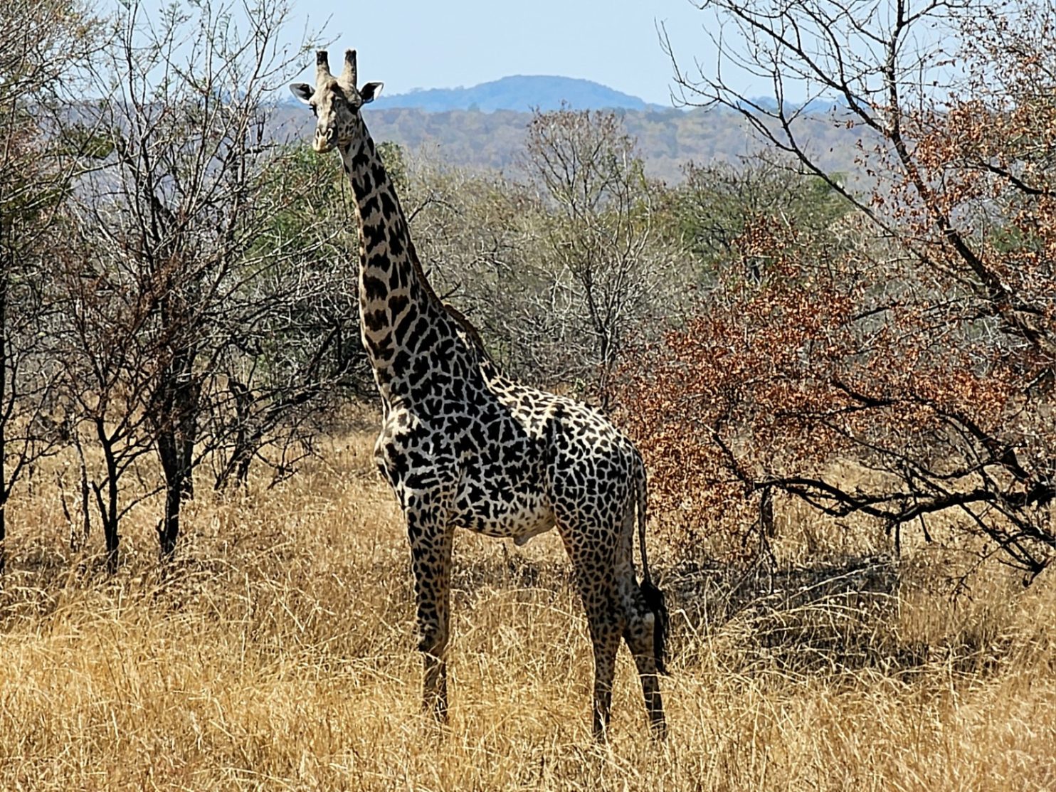
However, as soon as I left the town I entered Mikumi National Park and there were large signs saying the speed limit was 70 km per hour in the day, and 50 km per hour in the night and there were fines for not adhering to it. There were also signs for fines if you hit and killed an animal and some of these were a lot. The cheapest was a guinea fowl at US$150 and the most expensive was a giraffe at US$15,000. This would have been a huge amount of money to a Tanzanian. As I entered the National Park I noticed the traffic was adhering to the speed limit, especially the trucks.
I did not see anything except for a couple of warthogs for the first few kilometres and then suddenly there was a giraffe at the side of the road. As I watched it another 2 crossed the road and joined it and then as a truck was coming in the opposite direction another darted across the road and the truck had to stop quite sharply. If it was going any faster it would have hit the giraffe and been severely out of pocket. I watched them for about 5 minutes aware they might be the last wildlife I would see.

701. There were quite a few giraffe in Mikumi National Park. This group of 4 were beside the road near Mikumi town
I noticed that the trucks would come along in convoys with about 3-10 in each batch. Then there would be nothing for about 5 minutes before the next lot came. It made it quite easy to navigate the road and when I saw a convoy approaching in my mirror I pulled right over to the side and let them pass. Most gave me good space but I could never be sure there was not an intercity bus or a 4×4, both of which were more gung ho, overtaking them and preventing them from giving me space. The road surface for me was quite fast and I managed to keep an average speed of around 20 km per hour. It was mostly due to the flat road and the lack of headwind. There were a few more animals I saw, notably gazelle and baboons. The latter were quite road savvy and looked up and down first and then ventured alongside the road to see if there were any morsels discarded.

702. The were many baboons beside the road in the Mikumi National Park looking for discarded food I think. The were quite traffic savvy and quite confident when I went past.
On each side of the road the grass had been burnt. I am sure this was deliberate to prevent a fire spreading from one side to the other. The fires would have been set earlier in the year when it was not so dry and then probably with a fire crew in attendance as I saw in Botswana. If there was a fire now there was a good 40 metres on each side with no grass. Beyond this scorched area there was taller dry grass, perhaps a metre high and slowly swaying in the thermals and breezes. I am sure there were gazelle hidden here and there, and also perhaps lions although I should imagine they would be much further from the road.

703. There were also quite a few gazelle in the park and I alo saw wildebeast and buffalo a little distance from the road.
I did also see some buffalo and some wildebeast but they were some distance from the road. About half way there was a main gate into the park where visitors would have to pay a fee to drive in. From what I had seen so far this was not a prime park by any means and a poor substitute for Chobe in Botawana or South Luangwe in Zambia. The brown arid landscaper looked very uninviting and it did not look like it would sustain many herbivores. As I travelled further east it got even drier and there were more and more baobab trees appearing. I passed one huge tree whose lower branches were grazed in a perfectly flat line. There were 10 giraffes sheltering from the sun under its vast canopy. Much quicker than I thought I reached the east edge of the park after 50 kilometres and I knew that the roadside town of Doma was just after this. In the last two kilometres the road did not improve and the verge was still very poor, however the traffic remained quite slow.

704. At the east side of the park nearer the town of Doma I saw 10 giraffe sheltering from the sun under the canopy of a vast tree.
Doma was just a roadside stop. It had a large vegetable, tomato and sweet potato essentially, at the west end in some dusty patches beside the road. Then the town itself started with a collection of shanties and these graduated to a row of local fast food outlets. Every restaurant was just selling chips and small chunks of meat barbecued on a stick over a charcoal fire. There must have been 10 such restaurants on each side and none looked very alluring. There were trucks, cars, motorbikes and 4X4’s parked up along the widened street. There was a single guesthouse here called the Kilimsuli Lodge and I had already earmarked it as a place to stay.
There was a Swiss cyclist, Joerg, who had been a week to two weeks ahead of me ever since Livingstone in Zambia. I had picked his brains in the last few days and he gave me some good tips about riding along the T1 main road. He said that Mikumi National Park was tolerable because the traffic was slow and the unpleasantness of nose to tail lorries was offset by the sightings of animals. However after Doma he said it was terrible and gave me a few alternatives. It was due to these alternatives Joerg mentioned that gave me the confidence to come this way as I knew the manager at the lodge last night was quite naive and a bit clueless about my questions, as I suspected he might be. If it was not for Joerg I would have gone a different but longer way via Kilosa, Mziha and Mbwewe. It was only 1400 in the afternoon but my aim this afternoon was to plot the exact route and send it to my gadgets.
As I went down the slight lane and pulled the brakes at the Kilimsuli Lodge another cyclist arrived 5 seconds later. He was Cheng and had been cycling for the last 18 months from China, around SE Asia, then Nepal and now a great circular trip in Africa. He had also just come from Mikumi and was going to Dar-es-Salem but he was now going slowly as he had 14 days to do 300 kilometres. We both took a room and then went for some chicken and chips in one of the many restaurants and swapped tales. I then went back to the room and had a snooze. When I woke I spent about 3 hours plotting my route to Msata and then to Bagamoyo where I will finish. It is about 200 kilometres to Masta and of that I will have 50 on the T1 Highway in two different sections, and 150 km on smaller roads which is as good as I hoped. Once this was done I knocked on Cheng’s door but there was no answer so I wrote the blog and hoped I would see him in the morning before I went off on a tiny road to the east.
Day 114. 31 August. Ifakara to Mikumi. 109 km. 8 Hours. 710m up. 460m down. After breakfast, where I was reprimanded for taking two eggs, I packed and set off just after 0900. I did not really have a goal for the day and would just let it unfold as I went. I carried on north through the rest of Ifakara and then after a few kilometres of busy urban traffic, mostly motorbikes and tuk tuks, I got to a roundabout on the very fringe of town. After going round it I suddenly found myself on a beautiful, flat, smooth tarmac road with a large shoulder. It was relatively quiet also. I had forgotten how quick new tarmac was and I was blasting along at 20 km per hour with the tyres back up to 40 PSI. At one specially constructed bus stop was the police officer who interviewed me yesterday. I had a quick chat with her and said I had put my account of the crash on my blog if she wanted the address. She said that because I did not see the crash it was of limited use and they are pursuing another line of inquiry.
Although the road was generally quiet with vehicles, the verge was busy with cyclists and pedestrians. Many were heading off to the various churches. Everybody was dressed up and looking smart. The women on their older “sit up and beg” bicycles looked elegant in their flowing dresses and a scarf wrapped around their neck and trailing in the wind like a Parisian. The men were in their suits and with polished shoes. I suppose all over the world people try and look their best for Sunday services and nowhere more so than Africa. I did hear some singing but in general the churches were a distance from the road. I had been told the best choirs and singing belong to the T.A.G. congregations and this is the Tanzania Assemblies of God, which is a fairly prolific church here.

693. Looking east across the vast Kilombero Plain to the hills on the other side. Each edge of the plain was cultivated but the centre with the flood prone channels was the real of wild animals.
As I headed out of town the superb road climbed a small ridge and I could get a view over the Kilombero Plain to the east. It was the lower or eastern half of the vast plain, split into two by the protrusion of a higher wedge of land at Ifakara. I could see the hills on the other side and I could see the vast floodplain between. It seemed there was agriculture on each side of this plain but in the middle there was a brown area where the channels were and it was liable to flood and this was where the wildlife was. There was a large lodge built in the style to cater for western tourists, with thatched cabins and a large open sided central dining area, also under thatch, about to open.

694. East of the road were many villages before the agricultural land on the Kilombero Plain. There were many vegetable nurseries here bring on seedlings to transplant.
It was initially quite dry and parched here but as I cycled north the Udzungwa Mountains started to approach from the left hand side (north west) as they got closer so the landscape got greener. I think this was primarily due to the small streams which tumbled down their flanks and then flowed under the road and across the plain to reach the channels of the Kilombero River. The mountains rose so abruptly from the plain the air hitting them was forced to rise would have condensed releasing any moisture. The whole escarpment was verdant green and as I approached its main ramparts got even lusher with everything dripping in vegetation. I passed some lovely small vegetable plots on the side valley floors here which looked like they were nurseries, with the thriving small vegetables ready to be transplanted to larger gardens or fields when they were robust.

695. The Udzungwa Mountains rose steeply on the west side of the road for most of the day. Much of it was a national park.
I also passed a sign with an elephant and an European Union flag on it and was curious about it. While I was taking a photo an man in camouflage came up to me and explained what it was. There was a large underpass under the road and fences on each side of the road funnelling into the underpass on each side. He explained this was a wildlife corridor which connected the Udzungwa Mountains on the west side with the vast Nyerere National Park on the east side, beyond the Kilonbero Floodplain across which there was also a wildlife corridor. He was a ranger and monitored movements. It seemed that elephants used the underpass regularly as it connected the lush, wet mountains with the more arid park and they migrated at certain times of year between the two. I noticed the funnel of fences into the underpass were electric and on the plain side there was lush vegetation, especially sugar cane, out of reach of the elephants and protected by a fence on each side of the corridor.

696. There where many villages between the road and the corporation farmed sugar cane fields south of Ruaha. Most looked similar to this.
The road here was a delight to cycle along after the bumpy dusty roads of the last two weeks. It was quite built up on one side, the east side, where there was a continual series of villages. Beyond them were some small fields and then vast areas of sugar cane. The sugar cane was perhaps hundreds of thousands of hectares as it formed a band about 3-5 kilometres wide and maybe 60-70 long. I saw one factory belching black smoke towards the north of this band, near Ruaha. Here the sweet sappy stems were crushed and then the crushed stems were fed into the furnace to evaporate some of the liquid and turn the sap into syrup or even raw sugar. The sugar industry here was obviously a big employer and it looked like this sustained the population rather than subsistence farming – which I did not see that much of. There was the occasional rice threshing mill but nothing like what I had seen in the 3 days before Ifakara around Mlimba and Mbingu. I guess the sugar estates here had bought or acquired all the farmers’ lands and turned them into employers of their industry.

697. The vast corporate sugar cane fields where part of a huge plantation and a sugar cane factory near Ruaha.
I was getting parched riding in the mid afternoon sun and stopped at a couple of places for a soda. In a lot of the villages there were large gatherings which looked like weddings. It was obviously wedding season as some villages had two parties on this Sunday afternoon. If it was not a wedding then it was a very flamboyant church service. As I went north, and especially around Ruaha I noticed there were more and more muslims, to the extent that the men in a head cap and long flowing shirts and women in headscarves outnumbered those without. However everybody mixed fluently and in the Christian African local grocer I was in there were plenty of Muslim customers. I only passed one mosque where there was a call to prayer and the iman was singing it himself rather than using a scratched gramophone record or digital recording. His voice was powerful but a little out of tune.

698. North of Ruaha the Udzungwa Mountains started to diminish and the sugar cane grew on their lower slopes. I think these were individual cash crop farmers growing it here.
North of Ruaha, where there was a large river across the road, the villages continued for 10 kilometres but then started to peter out. The Udzungwa Mountains started to diminish and withdrew from the roadside. They also looked more arid now and not covered in the lush vegetation as earlier in the day. However the sugar cane was now on both sides of the road in smaller fields. I think these fields were cultivated by private farmers looking for a cash crop, rather than the large estates which employed all its labour. The area was not nearly as densely populated and there were just a few smaller villages scattered about in the undulating fields.
As I left them and headed further north towards Mikumi the road, which was an older tarmac road without the smooth surface and magnificent verges south of Ruaha, started to climb up a forested valley. There had been baboons all day venturing onto the road to retrieve sticks of sugar cane which had fallen from lorries or search for scraps of food but now they thrived in the forest on each side of the road. The stream got smaller and smaller as I climbed until it was eventually dry. The road crossed this stream bed about 10 times, all on very narrow bridges and without any sort of parapet and a 5-10 metre drop onto the rocks or sandbanks on the streambed below. It would have been very easy to cycle or drive off the edge totally unimpeded.

699. There had been baboons along the road all day but as I climbed up a jungle clad valley to the plateau where Mukumi lay the baboons became more numerous.
At the top of this valley the road reached a plateau which it crossed for a few kilometres to reach the larger town of Mikumi. The town sat astride the T1 highway and this might be the reason it has thrived. The highway connects Dar-es-Salem, the biggest port in East Africa, with Tanzania, Zambia, Malawi, Congo and even Rwanda and is busy with nose to tail trucks. I would have to cycle it tomorrow through the Mikumi National Park before escaping on smaller roads to the east as it approached the coast. I had to ride on a two kilometre stretch through the town to reach the Mikumi Lodge and Resort and it was busy and stressful. At last I escaped off it and cycled through sandy lanes, past schools, small shops and houses to reach the lodge. I had hoped to find more people here but I was the only guest. I got a lovely welcome drink of hibiscus and melon which was so cold it gave me a small headache after 5 glasses. I then got a nice cabin with copious amounts of hot water. I sat on my own in the empty restaurant for dinner. Despite a coffee I could not stay awake to write and went to bed early at 2100 under the novel mosquito net. The lodge was good value and I suspect the western safari type guests were at one of the more expensive lodges in town.