Main Alpine Divide. Section 14. Cottian Alps
February 9, 2022

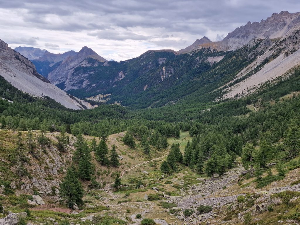
Day 90. Modane to Rifugio Terzo Alpini. 21 Km. 7 Hrs. 1470m up. 740m down. I thought we would have a longer day than estimated so we set the alarm for 0600. Breakfast was quite easy in the apartment with the cereal, milk, yoghurt, bread, jam and cheese we had left over. However we had to do some washing up before we left and by the time we got onto the street it was just after 0730. To our surprise it was raining slightly and it looked like there was more coming up the valley. We walked down the main street of Modane and entered the adjacent town of Fourneaux without really noticing we were in a different place as there was no break. Fourneaux looked exactly the same except there were more buildings between the main street and the railway sidings. In the middle of Fourneaux we turned off the main road, crossed the railway lines over a bridge and then walked up some small roads to the south for a few hundred metres to go under the high flyover which supported the motorway.
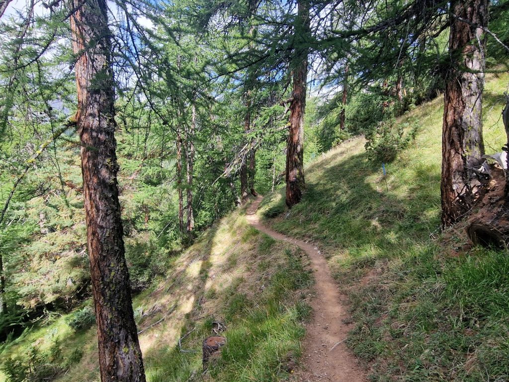
Once past the pillars supporting the motorway we quickly entered the forest which swallowed us up and soon the urban bustle of Modane was fading. After a few minutes I looked back and I could just see the motorway slightly below us a few hundred metres away but the surrounding trees muffled the sound. We now started a long sustained climb up some 400 metres until we reached the skiing holiday apartments at Valfrejus. They were 4-5 stories high, but they were at least in an alpine style as opposed to the tower blocks of Tignes. The path did not take us into Valfrejus at all and we just glimpsed this part of it through the trees and then it was gone and we were back in the forest, but from the map it looked like a holiday village. A kilometre further we got to a small meadow with a few houses clustered together which was the hamlet of Les Herbiers. It was quite horticultural and the gardens all had small vegetable plots. Beyond it the route reverted back to the gravel track and it was easier than the forest path and we climbed quite quickly to a small concrete structure which was a small hydroelectric intake. There were many old military defences around here, perhaps from the Second World War or even earlier. We had been walking for 3 hours now and gained about 900 metres so started looking for a place for a snack. Just at that point we walked into a carpark which was at the end of the road and there were some benches here for our break.

598. Going up to the Col de la Valle Etroite (Valle Stretta in Italian), 2433m, with the Refuge du Mont Thabor centre right beside the scree.
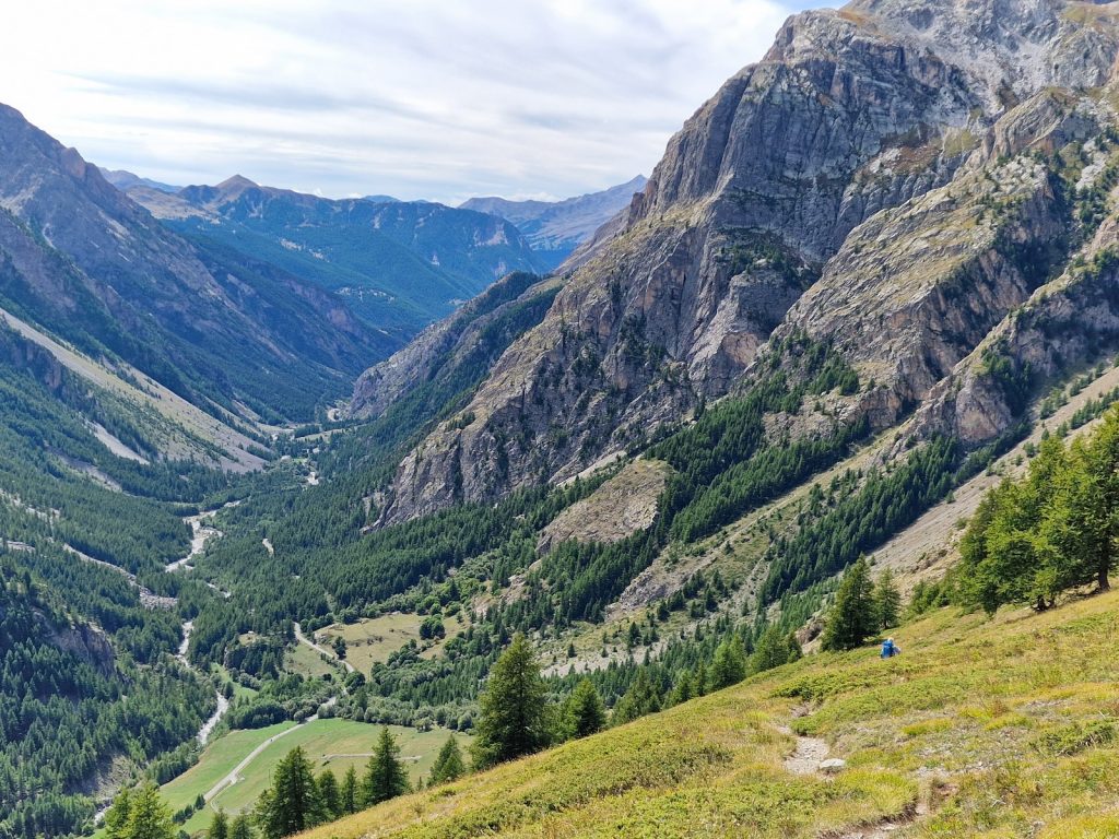
Just as we finished Remy appeared up the track. After a short chat we walked together past a few alm houses at the treeline and then continued up the open mountainside. The track made quite a few zig-zags to climb up the lip of a smaller side valley for a short half hour. At the top of it we were back in a high alpine valley with very jagged rocky mountains on two sides and a pass ahead in the distance. It was quite a pastoral valley, despite the aridness of it, and there were a few alm houses up here with small farmers trying to make a living in the small scale but vanishing style of their grandfathers. One of the rocky peaks which appeared in front of us was Mont Thabor, 3178m, a modest mountain but one of the highest in the area and very serrated and jagged with many pinnacles on its sawtooth ridges. At the bottom of its east ridge was the Refuge du Mont Thabor which was perhaps a kilometre to the west of the col we were heading for, Col de la vallee Etroite, 2433m. It was an easy pleasant path up the grassy slopes to get there and before we knew it we reached the pass. It was overcast with a cold wind on the col so we enjoyed the view for just a few minutes then decided to continue down the south side to a sheltered spot.
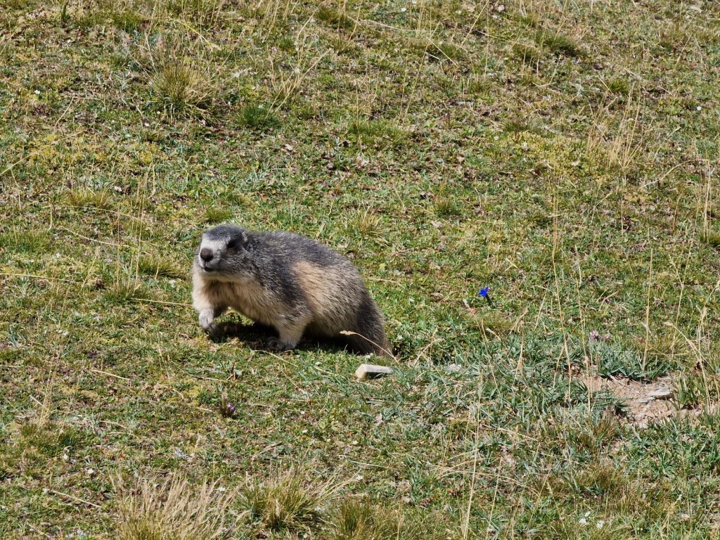
The col was the boundary between the Department of Savoie and Hautes Alpes and on the descent it felt we had entered a different land as the terrain was very rocky with huge screes and the pastures which were brown and arid. However, further down the valley we could see extensive forests. After a few minutes the wind stopped and we found a sheltered spot in the grassland to have lunch. Fiona and I had bread, cheese and tomatoes while Remy whipped out a small stove and with great ease boiled half a litre of water and poured it into a foil bag with dehydrated pasta and fish. The meadow we sat in was alive with plump marmots and there must have been 25 around us. The valley which we were to follow down to the trees and the refuge was called Vallee Etroite in French and Valle Stretto in Italian, and it was renowned for its beauty. It was a valley which was Italian previously, but was then transferred to France for some reason.

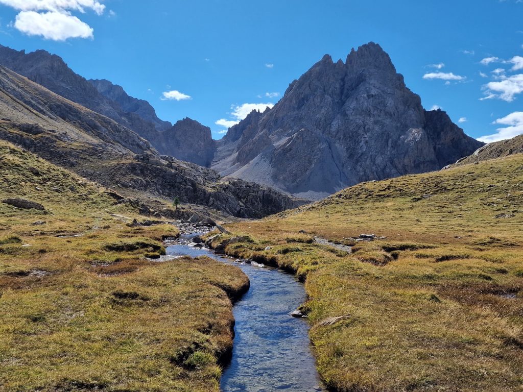
599. Going south down Vallee Etroite to the pastoral Plaine de Tavernette where a few brooks and springs met to form the stream in the valley.
After our al fresco lunch we headed down between the scree slopes which rose up from the grassy floor. Above the scree slopes were steep rock walls which lead up to the lofty jagged peaks. The mountainsides here reminded me of the Dolomites and the minerals in the rocks must have been full of nutrients as the pastures were healthy. After half an hour we dropped down onto a small plain with a crystal clear spring running through it. It would have been a great place to camp but as we descended even nicer ones appeared. Below this lovely plain with lush grass and the clear stream the valley continued its gentle descent into the hardiest of the larch trees which started around 2200 metres. They had a special quality to them with their slow growth and stunted appearance. The main valley became more and more beautiful as we descended and the trees became larger and more protective. The path then reached a small escarpment with a 100 metre drop which took us down into the mature larch forests with glades of meadows between them. It was a magical area with venerable old trees, bright glades full of verdant grass and clear streams. Here and there were scattered clumps of juniper bushes. Further down the valley was the small summer farming hamlet of Les Granges. The few notices further down the valley were in Italian first and French second and most people now said Bon Journo rather than Bon Jour.
600. Looking down the beautiful Vallee Etroite from the edge of the small escarpment with the hamlet of Les Granges in the meadow centre left surrounded by larch forest.
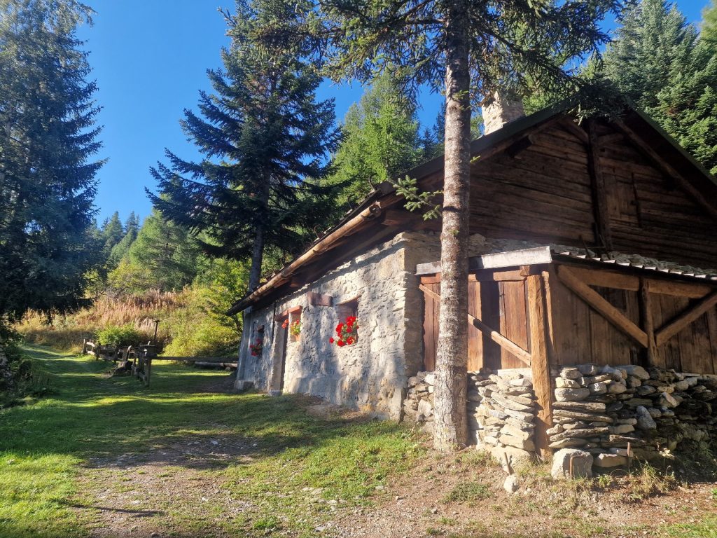
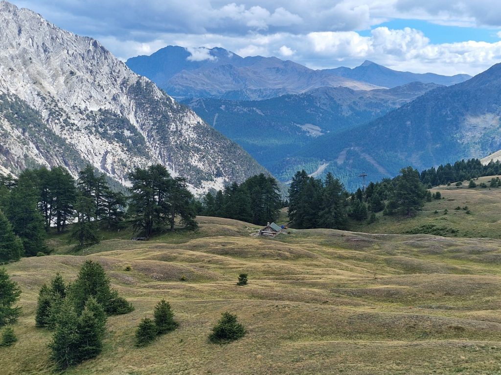
We walked through the larch forest for about 3 km to this hamlet. There were some scattered cabins in the woods and many close cropped glades and meadows between the trees and near the clear stream which would have been wonderful to camp in with the maternal protection of the larches. After this delightful amble on the gentle track we reached Les Granges. It had perhaps 40 buildings, most were renovated chalets and haylofts and they looked old and characterful. Two of the buildings here were Refuges. The first we came to, Refugio Magi, looked lovely and reminded me of a Nepali teahouse with its seperate dining room whose walls covered in glass windows in a single story building. Unfortunately the other, Rifugio Terzo Alpini was not so salubrious and it was the one we were booked into. We were given a small 4 bed room with a bunk on each side and we had to share it with one other. It did not look as nice as I suspect the other refuge was, and it was a disappointment.

601. The alpine hamlet of Les Granges in the Vallee Etroite. The hamlet had 2 refuges, the lovely Magi and scruffy Terzo Alpini.
After changing clothes and having a snack I went into the dining room to write while Fiona sat in the sun and chatted with Remy for a couple of hours. We were all seated at the same table for supper with a French mother and daughter. The daughter spoke great English but had strong opinions and was very dogmatic about them. On the adjacent table were 12 elderly Italians who were very jocular and rowdy and raised the roof a few times with their joyous laughter and banter. The refuge was closing tomorrow and I felt what they gave us for dinner was what was left in the storeroom. There were quite a few courses but it was a haphazard selection. Me and the French mother and daughter were all given gorgonzola cheese to melt into our polenta, while Remy and Fiona shared a large terrine of sausages and stew. It was great to dine with Remy again as he was so knowledgeable about virtually anything and yet easy going and witty. We would part ways tomorrow, but hopefully we would meet down the trail sometime before Menton. After the meal everyone went to bed at around 2100 and I set the alarm for 0515.
Day 91. Rifugio Terzo Alpini to Rifugio Baita Gimont. 30 Km. 10 Hrs. 1840m up. 1570m down. We knew today would be a very long day and we were likely to arrive around sunset. To make the most of the day and ensure we had the best possibility to arrive in daylight we decided to leave at first light. That was 0615, so we set the alarm for 0515. When it went off we gathered up our few belongings in the room and sneaked down to where our rucksacks were in the boot room and packed them there. We then went into the dining room where our breakfast was laid out for us with the tea in a thermos. It was a miserable breakfast, typically Italian with a lot of sweet and airy bread which would all be spent in no time. Looking into the packed lunch bags provided for us added to the disappointment as that would be spent in an hour or two also and there was nothing enroute. Rifugio Terzo Alpini was a miserly place. We quickly finished breakfast and went out at 0615. It was still dark with a glow to the SE and many stars still shining. We walked down the road for about 10 minutes with head torches until the twilight was enough to see the road.
It was a very easy ascent down the road for about half an hour. The road followed the floor of the Stretta Valley (In Italian) of Vallee Etroite (in French). The valley had changed nationality a few times in the last 200 years. After the half hour, passing quite a few parked cars and campervans beside the road, we passed a restaurant combined with dairy selling products to the public. We then reached a small bridge over to the east side of the stream. We crossed it and continued down for another short half hour. Somewhere near the bottom, by a small hydroelectric plant on the other side of the stream, and beneath a series of hairpin bends on the road over the ridge to the west and on to Briancon, we crossed into Italy. On the west side of the valley the sun was now illuminating the row of steep limestone crags which formed a sheer rampart above the scree slopes. We passed a holiday park at Pian de Colle on the valley floor with a fence around it where some 100 caravans with wooden extensions and deckings were crammed together like they were on a congested reservation. It looked like a very uninviting place to own a static caravan and we thought most of the owners were from industrial urban sprawls like Turin. There was a road here which went down to the rural town of Bardonecchia some 4-5 kilometres down the valley. We could see its church spires and buildings and it seemed like a very nice town.
603. The lovely cabin of Gr Giuaud in the larch forest on the climb up from Pian del Colle to Col des Acles, 2292m. this 800m climb was all in italy.
We circled round the east side of the compact ugly static caravan park, passed a small rustic golf course and then started to climb up the forested valley to the south. It was initially on a steep track which served a few clusters of cabins in the forest. The cabins at Grange Teppa, 1627m, looked like they were about to become derelict with the rusty roofs covered in fir tree needles and the stone walls starting to crack. However a bit further the cabin at Grange Guiaud, 1794m, in the larches looked well cared for and recently restored to an idyllic leisure cabin. After Grange Guiaud the track seemed to peter out a bit and a path continued through the beautiful larches. Although the walk was without let up as it climbed through the trees, it was very pleasant. It was still cool as the sun was low and the spider webs across the path and the large needles on the adjacent trees were covered in dew drops. Above us in the higher trees the forest was humming with hover flies which were emerging from crevices in the venerable rugged and fissured larches. We saw a tree creeper with it white cap searching for insects. As we climbed further the larches started to thin and we could see the jagged limestone ridges on each side soaring above us with a mantle of scree below them. However the larch forest never disappeared completely as the pass we were heading for was still below their limit of about 2200 metres. As we approached the pass we walked into a herd of about 50 cattle who were leaving the forest to wander up onto the alpine pastures above for the days grazing. We followed some of them up to the pass, called Col des Acles, 2292m. It marked the end of this 800 metre climb, which was the first of three climbs today. At the col we crossed back into France.

602. Climbing up to the Col des Acles, 2292m, and looking back north up the Vallee Etroite where Les Granges hamlet and the refuges were located near the shadow. The photos bottom right was in Italy.

604. Looking south from the Col des Acles towards the slightly higher Col de Dormillouse, 2445m, situated in the shadows above the screes. There was another pass a little beyond this pass called Col de la Lauze, 2529m, out of the picture behind the triangular hill to the left of the screes
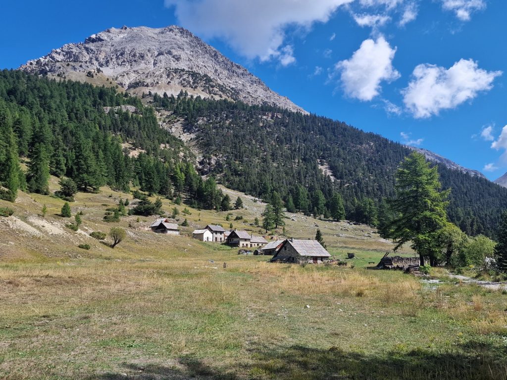
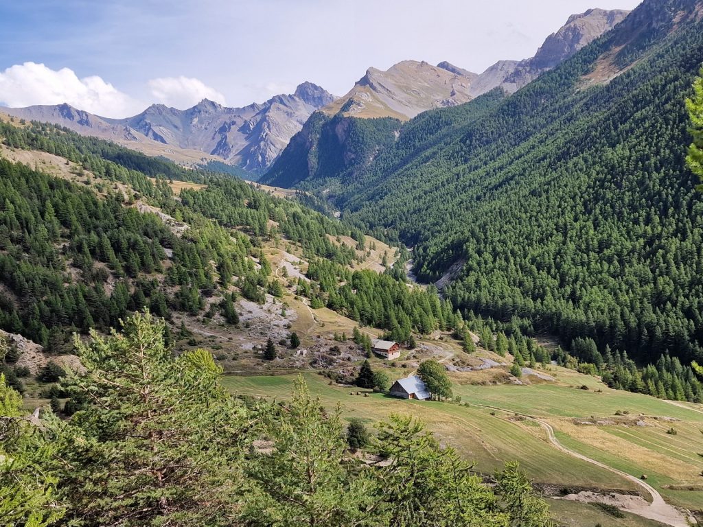
At the pass there were great views back to Valle Stretta and the mountains around Mont Thabor where we were earlier this morning. There were perhaps even better views to the south over a wild and rugged landscape of serrated limestone ridges, huge scree slopes and extensive forests. It looked like a wild and lost corner of the Alps. The weather was fantastic and it was still relatively cool. We had been going for 4 hours now so had the paltry lunch in the morning sun near grazing marmots. From Col des Acles we had to make a 400 metre descent into the small Valle Acles. Initially the path went past some crumbling fortifications and barracks when this disputed frontier was contested. We then dropped into the larches on the arid south facing slopes and followed a stony track down to the valley floor where firs replaced the larches. On the valley floor the heat was beginning to build and it did not bode well for our imminent climb. Firstly we followed an easy quiet track up the gentle valley for a good kilometre with the small stream beside us until we reached the lovely hamlet of summer farms at Chalets des Acles where there were about 10 houses or barns and a chapel in a beautiful meadow surrounded by forest. It was a serene place with a pastoral history which probably stretched back into the mists of the collective recollection of the farming community here.
605. The Chalets des Acles, 1867m in the open Vallee Acles valley lay between the two main passes of the day.
At Chalets des Acles we hopped across stones on the diminished stream and entered the fir forest. There was a steep stony track here we followed for an hour as it climbed up the side valley of Vallon de l’Opon. To our west were steep barren scree fields where nothing could grow as the scree were arid and unstable. Above the screes were the lofty jagged limestone peaks from where the screes came. On our east was a large forest called Bios de l’Opon. Lower down the trees here were fir and pine but as we climbed the larch took over. After an hour we had climbed about 300 metres and the track veered off into the woods so we followed the path up the gentle valley floor. It was a very beautiful section with many open glades between copses of verdant larch. There were a few seeps and small springs here to keep the meadows verdant. We wandered from one glade to the next on ungrazed meadow weaving between copse and grassed over piles of moraine until the woods petered out and the veldt-like yellow grasslands of the upper mountains took over and covered the valley. Ahead of us was a pass called the Col de Dormillouse, 2445m. The last few hundred metres up were more rocky than lower down but they were still rough pasture. We could see the cross on the pass ahead and it grew quickly as we approached it. Beside it there was some movement.
606. Heading up the final slopes to the Col de Dormillouse, 2445m, pass where we met Seb the shepherd with his 950 sheep and assortment of dogs
We thought it was cows but then saw it was a huge flock of 900 sheep and then I saw there were a few guard dogs with them. A man on a scrambler bike came across the rocky pastures towards us with two dogs leaping after him. He circled us and then disappeared up the mountainside again with the dogs. He looked a wild character with a deeply lined face and flowing hair and could have been mistaken for a brigand or pirate. We reached the pass and settled down to finish our snacks as the sheep grazed below to the west of the pass looked over by the shepherd. However they were heading in our direction quickly and I could see 3 or 4 large dogs embedded with them. The shepherd then mounted his scrambler and blasted up towards us. I thought he was coming to ward us off. Before he arrived an enormous Pyrenean Mountain dog came over the ridge and ambled towards us. He went straight over to Fiona who was sitting down and nuzzled up. Fiona’s dog whispering charm soon overwhelmed the guard dog and he was looking for cuddles – which he got. The shepherd arrived soon afterwards and we started to chat in terrible English from him and French from me.

607. Fiona with the large Pyrennean Mountain guard dog. This dog would probably not have been so friendly is the shepherd, Seb, hd not been nearby. This was on the Col de Dormillouse, 2445m.

608. The herd of 950 sheep on the Col de Dormillouse, 2445m. The herd were also guarded by 4 Kangal dogs from Anatolia as well as the Pyrennean Mountain dog. The Kangals are introduced to the sheep as puppies and live their entire lives in the flock. They are highly inteligent and are constantly on the look out. In this area there is a pack of wolves and the 4 Kangal would protect the sheep ftom them constantly.
The shepherd, who was called Seb, was a picture book character and could easily have been an actor. His wild features and deeply furrowed smile lines, back flowing hair and green eyes came from years of living off grid and outwith normal society. I learnt he had 900 sheep and he spent the summers up here in his hut and the winters down on the plains near Marseille. I assumed he was born into this lifestyle and after a short period at school adopted it again. As we chatted the sheep came close and I could see 4 large Sivas Kangal dogs moving with the sheep positioning themselves on knolls to act as sentries. I had seen these dogs a lot in Kurdistan when I spent some time with pastoral nomads there and started to show him some pictures on my phone. He was enthralled at the sheep, shepherds, black tents and dairy practices he saw on the 100 odd photos. When he found out I had walked from Vienna we reached a real rapport. Meanwhile the large Sivas Kangals had discovered Fiona, and were also coming over for some attention also – although 2 stayed with the flock. Seb told me there were wolves about here but with his 4 Kangal and 1 Pyrenean guard dogs and the assorted 5 other herding or smaller sentry dogs his flock was safe. As we chatted a shepherdess appeared who seemed to be Seb’s partner. She was also a wild and heroic figure and owned half of the 900 sheep. Seb asked me to show her the photos of the Kurdish shepherds and we spent half an hour discussing it with her. Fiona joined in the chat but with 4 or 5 dogs around her looking for attention she was spoilt for choice. Eventually after a good hour we had to push on but it was easily the highlight of the last month for Fiona and myself meeting Seb and his partner and hearing about his shepherding lifestyle and seeing his unique dogs and how he worked with them to maintain his romantic livelihood.

609. Seb the shepherd on the Col de Dormillouse had 950 sheep. Here he is with a few of his herding dogs who would also alert the five 60-70 kg guard dogs should any predator approach the sheep.

610. Seb, his partner and myself looking at photos on my phone of the shepherds, their lifestyle, their sheep and their dogs at Ikiyaka village, Kurdistan where I spent 2 summers in the mid 1980’s. They were fascinated by the similarities with themselves
Although we were at the pass, we still had to climb another 100 metres or so for the next half hour. We had to reach another pass on the side of a deep grassy bowl with a small shepherd’s hut nestled in the bottom of the cirque beside a bare patch where the sheep spent the night. I think this was Seb’s partner’s cabin. The higher pass was called Col de la Lauze, 2528m. It was the highest point of the day and about 700 metres above the Chalet des Acles at the bottom of our climb a few hours ago. From this Col there was an easy but long descent down the veldt-like grassland to the edge of the larch woods where there was a track to some unobtrusive ski lifts. We then followed this track down for a good hour into the forest descending some 800 metres until we crossed the border into Italy again and reached the ski resort and summer tourist town of Claviere, 1750m. It was a tourist town with a few cafes and souvenir shops but all the hotels seemed to be closed. However it had a relaxed atmosphere and the ski developments were quite small scale and I thought tolerable. We went into one of the cafes which looked like a quaint English tea room and had a snack to replenish what last night’s Rifugio Terzo Alpini failed to do.
611. Looking south from near Col de la Lauze, 2529m, down the side valley with the Italian town of Claviere about 800 metres below. Refugio Baita Gimont is in the forests in the middle of the picture across the valley.
We still had the final climb of the day, a 300 metre ascent up through the forest on a mixture of tracks, grassy ski pistes and pleasant paths to the south of Claviere to reach our destination. Our legs were tired but the gradient was gentle and after an hour of not too strenuous effort we finally reached it. Although it was called a Rifugio it was not and had no dormitories, sticky tables or set menu. The Rifugio Baita Gimont, 2035m, was a large old alm house from quite a rich farm I suspect. It was 2 stories high with 9 double bedrooms and a nice restaurant. It was not luxurious but it was very comfortable and characterful and the owners were extremely welcoming. It was exactly what we wanted after 2 longer days, and the poor rifugio yesterday. Within an hour we had showered and washed everything and then went down for a nice meal chosen from an uncomplicated and easy menu of delicious dishes. We finished the meal by 2100. Fiona then retired to read on the bed and relax while I spent the next 3 hours writing until midnight.
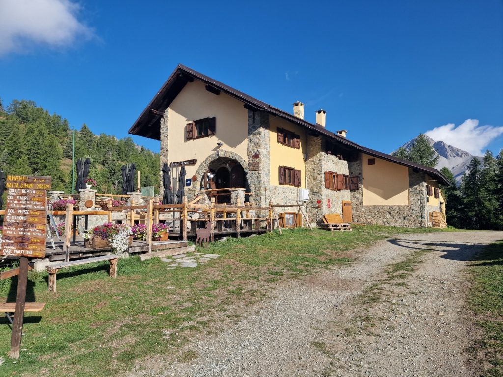
612. The chracterful Refugio Baita Gimont was in an idyllic setting in the upper larch forests beside a large pond. It was in Italy close to France.
Day 92. Rifugio Baita Gimont to Refuge des Font. 14 Km. 4.5 Hrs. 550m up. 560m down. It was a leisurely start to the day as we had planned two short days to catch up after yesterday’s efforts. So breakfast was at 0800 and it was well worth waiting for. It was quite a large breakfast but the quality of the ingredients set it apart from hotel buffets. The fruit especially was perfectly ripe and juicy. Our hosts were very helpful and phoned the next refuge at Les Fonts just to confirm everything was in order. They were a very easy young couple and judging from the art books and the detail of decoration we thought they were well educated and quite sophisticated. When she started to play jazz in the bar area as she opened up it was confirmed. As we were the only guests the goodbye ws protracted and we learnt they were both from Argentina and had emigrated back to the land of their forefathers. He spoke 5 languages well. Although we were the only guests, the beautiful refuge had a large terrace with many tables and I suspect they were sitting on a small goldmine as they would have summer walkers and winter skiers all dropping in for the large profit drink and snack trade during the day. In the evening when the punters had gone, then Baita Gimont would return to its serene meadow by the pond all surrounded by beautiful larch forests.

613. The upper larch forest between Baita Girmont, 2030m and the pass on the Italian French border near Cima de Saurel. The yellow bushes are blueberrie bushes with their first flush of autumn colours.
On leaving we went down to the pond which was surrounded by pasture teeming with marmots. From the pond we found the path which went south up through the larch forest on the west side of the Valle Gimont for about 3 km climbing steadily to reach the ridge just to the east of the peak Cima de Saurel, 2449m. It was quite a confusing area backwards and forwards on the French Italian border in an area covered in small paths and tracks to service both Italian and French ski lifts. I had the route already programmed into my GPS so followed the course knowing it would see me over the other side. Eventually the path went east back into Italy and dropped down into a small shallow valley with a few high larches in it. It was really a stunning area both in itself and for the distant views of where we had been yesterday and south to the craggy mountains of the Queyras region in France. At the end of this small shallow valley was a lovely lake with a few mossy islands. Each end of the lake was covered in weed which wildfowl were swimming in but the centre of the lake was clear blue water. Just beyond the end of the lake was a very easy shallow pass called Col Bousson at about 2170 metres. Beyond it we went back into France and stayed there.

614. Looking NW from the pass to the east of Cima de Saurel towards Mont Chaberton, 3431m across the valley with the town of Claviere. In the bottom right is the cream coloured spect of Refugio Baita Gimont, 2030m. The pass of Col de Lauze we came over yesterday is upper left.
From Col Bousson we could look south down across a few more small tarns in the yellowed veldt-like grasslands to the larch forests in the Vallee Cerveyette just three kilometres below us. It looked a very pastoral valley with many hay meadows and small hamlets of summer farms. Beyond it were the modest jagged peaks of the Queyras, an area of renowned beauty in France, known for its traditional culture and pastoral farming. We would spend the next few days in the Queyras and had been here before. So we set off with some excitement from the Col to get down to the Valle Cerveyette. As were descended down the yellowed dry pastures we saw clusters of white patches on the hillsides. I was perplexed what they were until we came across one. They were patches of huge field mushrooms, some the size of a large dinner plates. I had heard about such field mushrooms but never encountered them in all my foragings. Marmots thrived on these pastures and we must have passed nearly 100 on the hour long descent. There were also many kestrels hovering over the grass and prostrate juniper bushes. We passed a few more beautiful tarns and shepherds’ houses before we reached the hamlet of Le Bourget on the valley floor, 1876m, where the Cerveyette stream ran.

615. The lovely tarn to the south of Col du Bousson, 2154m, on the Italian French border. In the distance across the Cerveyrette Valley with the forests is the northern massifs of the Queyras.
On the south side of the valley there was extensive larch and swiss pine forests between the stream and the crags of the mountains until they rose up above the treeline. On the northside however all the trees had been removed long ago to create hay meadows. There were a cluster of summer alm houses and barns here which looked like they were full of hay. These meadows and the hay in the barns would be used in the autumn and spring when the animals were coming down from or going up to the more alpine pastures. The valley floor was occasionally quite wide and there were some marshlands here and there also. I don’t think anyone would stay at Le Bourget all year but there was the Refuge Tord here and it might have catered for cross country skiers in the winter season, which is popular in the Queyras.
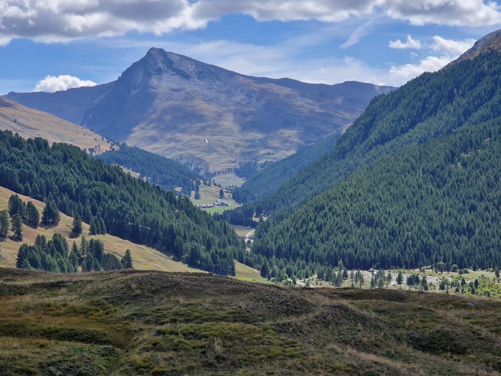
616. Looking up the Cerveyrette Valley to the hamlet of Les Chalps and in the far distance Les Fonts where there was the Characterful Refuge Les Fonts.

617. The lovely hamlet of Le Bourget, 1875m, in the Cerveyrette valley was one of the most northerly hamlets in the pastoral Queyras region
From Le Bourget we had a gentle walk up the quiet tarmac road for 6 km. We could have branched off the road at the old rustic hamlet of Les Chelps and gone up a track in the woods on the south side of the stream, but chose to stay on the cultural side. The hamlet of Chelps was even more traditional and pastoral than Le Bourget and there was a business selling local dairy products from their barn. All the barns and houses were quite tall and narrow and either under a traditional roof of larch planks or a newer lighter easily maintained roof of aluminium/zinc sheets. We passed a beautiful alp restaurant with picnic tables just sitting in the grassy meadow. It was quite busy with day trippers and drivers but we did not stop as it was just half an hour from our refuge at Les Fonts.

618. Looking down the Cerveyrette Valley from near the hamletof Les Fonts, 2040m, to the upper larch forests on the south side of the valley.
Les Fonts was a very traditional cluster of 20 odd old houses at 2040m, just at the tree line. The large summer houses and barns were all two storeys and often with a small attic above under the wooden roofs with huge eaves. Our refugio was one of the largest buildings and it had also acquired a few other adjacent houses as store rooms and annexes. It was a beautiful characterful house which was a popular stop on a few trekking routes, so had the money to be improved to a standard which most trekkers would find acceptable. We were shown into a large room with 10 beds on 4 wooden platforms and a south facing window and were told we would be the only ones in it. We then went down to the outside terrace and had the best bread, cheese and tomato roll of the whole trip with a small cake to follow. I remembered from my last stay that the Refuge Les Fonts served great food. I wrote the blog and sorted out pictures to use for 3 hours in the empty dining room, while all the other guests sat outside in the sun. I finished by dinner at 1900. Dinner was fantastic. The salad was huge and a real blast of much needed vitamins, The main course was very generous. Then there was cheese course followed by creme caramel. Not only was the host generous with his half pension meal but the cook was good. I have heard of refuges serving pasta with chopped up tinned tomatoes as the accompanying sauce to guests. Refuge des Fonts was at the other end of the scale. Everyone suddenly went to bed at about 2100 so we followed. The spartan room of 10 beds was still empty except for us.

619. The hamlet of Les Fonts from the start of the climbup to Col de Peas. This is the view of the hamlet from the south. The refuge is on the left with the brown roof.
Day 93. Refuge des Font to Souliers. 12 Km. 4 Hrs. 630m up. 820m down. Today was the second of our easy days after the very long day and although there was no hurry we were still up for a 0700 breakfast. For the first time in a mountain refuge the breakfast defeated us and there was still a quarter of a basket of bread left when we finished. I remembered this refuge from exactly 10 years ago and it had as excellent food then as it did now with generous portions. We left at 0800 , slightly behind a group of very elderly French who were in their mid seventies at least. They were quite slow but admirably dogged and persistent and all 10 of them were doing the entire 8 day Tour de Queyras. You could not help but admire them.

620. Heading up to Col de Peas, 2629m, (centre top) from Les Fonts, 2040m. The tall spire of Pic de Rochebrune, 3320m, is hidden in the cloud to the right.
The first part of today’s short walk was a near 600 metre ascent from Les Fonts up to Col de Peas, 2629m. When we set off at 0800 there was a threat of rain, especially on the hidden peaks around the Pic de Rochebrune, which were lost in the dark mist. It was a great shame as this was a remarkable mountain, which looked like a Nunatak on a pedestal and was higher than anything else in the vicinity. As we walked up the side valley to the south one could easily be forgiven for thinking one was in the Scottish Highlands in drought. The grasslands went all the way up to the modest peaks and ridges which had small mantels of scree on their lower slopes. There was a herd of some 40 brown cows grazing on the gently sloping valley floor and they looked like the Tarentaise breed of the Beaufortain area. We overtook the elderly French group who were quite spread out and joked a little with each of them in a pidgin language with some signs. It took us under two hours to reach the pass on the easy gravel path, which would have been easier to ascend than descend. There was a cold wind at the top but remarkably we remained dry all the way.
621. Col de Peas, 2629m from the south before the descent to Souliers. In the side valley to the right is a large flock of 500 odd sheep and guard dogs beside a shepherds hut.
We did not stop at the top but decided to continue down the south side. Here there were some sunny patches on the yellowed veldt grasslands. The grasslands descended down the slopes to the larch forests, which were so typical of the Queyras region. Below these forests was the Combe du Queyras valley which was the arterial valley of the whole region. Beyond the valley were ridge after ridge, each one a bit higher than the nearer one, until they disappeared into the distant blue haze and cloud of the Ubaye region to the south and the Mercantour beyond that. It was still a wild and jagged skyline but the valleys and plateaus were more gentle than the high Alps further to the north. We started our descent down these grassy slopes. As we descended a valley to the east revealed itself and it had a shepherd’s hut in it and a large flock of about 500 sheep nearby. The sheep were beige but the dogs were white and it was easy to spot them among the sheep. We skirted across a small side valley descending slightly until we reached the edge of the larch forest.
622. The bright larch woods on the final descent to Soulier, 1844m. Between the old trees were clusters of the bright yellow slippery jack mushroom.
The forest floor was covered in bright yellow mushrooms which I knew as “slippery jack” on account of their mucous-like covering. They were apparently edible but I had never tried them. I only saw them in larch forests and there must be a symbiosis between them. The forest curved round a spur and then started to descend more seriously on a long series of comfortable zig-zags on the path which was generally soft and easy underfoot. We dropped about 400 metres on the bends until we heard the cowbells of the cows in the pastures around Souliers. These pastures had already been harvested for their hay which was now stored in barns but I was still surprised to see cows in them. I thought they would still have been in the higher pastures and these meadows saved until the mid autumn when the snows started to settle higher up.

623. The delightful hamlet of Soulier had a refuge and a gite and a very beautiful small church. It lay at 1844m and was probably the upper limit for all year farms as it was south facing.
In the middle of these meadows on the south facing side of the valley floor was the hamlet of Souliers. I think it’s farms were occupied in the winter too despite it being at 1800 metres. There were perhaps 40 buildings in this hamlet which included a couple of gites or refuges for hikers on different trails. There was also a small church with a wooden roof and a rounded end. The hamlet was very picturesque with old houses adorned in farm implements and window boxes. An open attic eaves had some 10 old wooden beehives stacked in it and they were darkened by years sitting in fields in the sun. Our Gite was called Le Grande Rochebrune and it was quite idyllic. We ordered an omelette lunch made from the eggs of the hens in the field below. The food was excellent. As we ate, many of the hikers from Les Fonts arrived and they greeted us like long lost friends, especially the elderly team. After lunch we were shown a room in the adjacent building. It had a shower so we washed clothes and the little sweat we had accumulated in the last 2 easy days. In the afternoon I wrote while Fiona relaxed on the sunny balcony terrace of the gite. We learnt Remy was camped just north of us and we arranged to meet up for supper tomorrow.

624. The Gite Le Grand Rochebrune at Soulier was a characterful refuge with great food in the middle of this delightful hamlet. It was popular with hikers.
Day 94. Souliers to Ceillac 21 Km. 7 Hrs. 1110m up. 1290m down. There was a thunderstorm in the night with heavy rain but by the time dawn arrived the streets were drying and the sky was overcast but without threat of rain. We sat at the same table with the 4 French who were doing the Tour de Queyras hike of which there are various versions taking 7-10 days. Breakfast was good. The hosts made an effort to provide good quality ingredients and there was cereal, yoghurt jams and enough bread for everyone. We eventually finished at 0800 and set off. Most people were going north over the ridge to Brussinard on the Tour de Queyras while we were going south down to Chateau Queyras deep in the main valley.

625. One of the pretty old houses in the hamlet of Souliers. There were about 40 buildings and a small chapel in Souliers
Both routes went through the lovely village to the small beautiful church which had a characteristic Queyras sundial painted on it. We now went down the road onto the track and veered south through pastures where there were 20 odd cows and a large bull amongst them. The meadows continued as we headed south with the valley dropping away from us. There was a superb view back to Souliers from the track here. As we wandered along we surprised 2 roe deer who were moving from the larch woods below the road to the higher woods. It was a very easy hike along the lovely track and after a few kilometres it brought us to a dammed lake called Lac de Roue, which was covered in weeds round the edges. There were a few campers about and lots of old picnic tables covered in lichen and moss which were returning to the earth from which they once came.

626. The hamlet of Souliers lay at about 1800m altitude which was the limit of year round farms. The farmers had to collect enough hay to see them through November and April when snows might cover the meadows, although the south facing aspect would help keep them clear longer.
At the Lac de Roue the path made a sharp turn to the east and went down through beautiful larch woods getting steeper and steeper as it went down. The further it descended the more the soft needle covered path changed to a gravel path in the pine trees, which thrived on this arid hillside where the larch would struggle. We soon started to zig-zag down hairpin bends for the final descent. At one bend the trees were thinner and we could see down to Fort Queyras, an imposing mediaeval looking stronghold on a knoll in the main valley, which was almost a gorge now. It was quite a surprising sight to see a fort of this magnitude in such a rural location. As we descended further the trees shielded it again until we reached the road at the bottom of the valley. We had to follow the road along the side of the gorge for a few hundred metres to reach the village of Chateau Queyras at the bottom of the Fort. The village had a coffee shop and a few other unusual businesses like a laundry, but otherwise was quiet and pretty with old houses and colourful window boxes. The main road into the Queyras, serving a few villages and towns further up, went through and it was reasonably busy and it killed the serenity of the village.
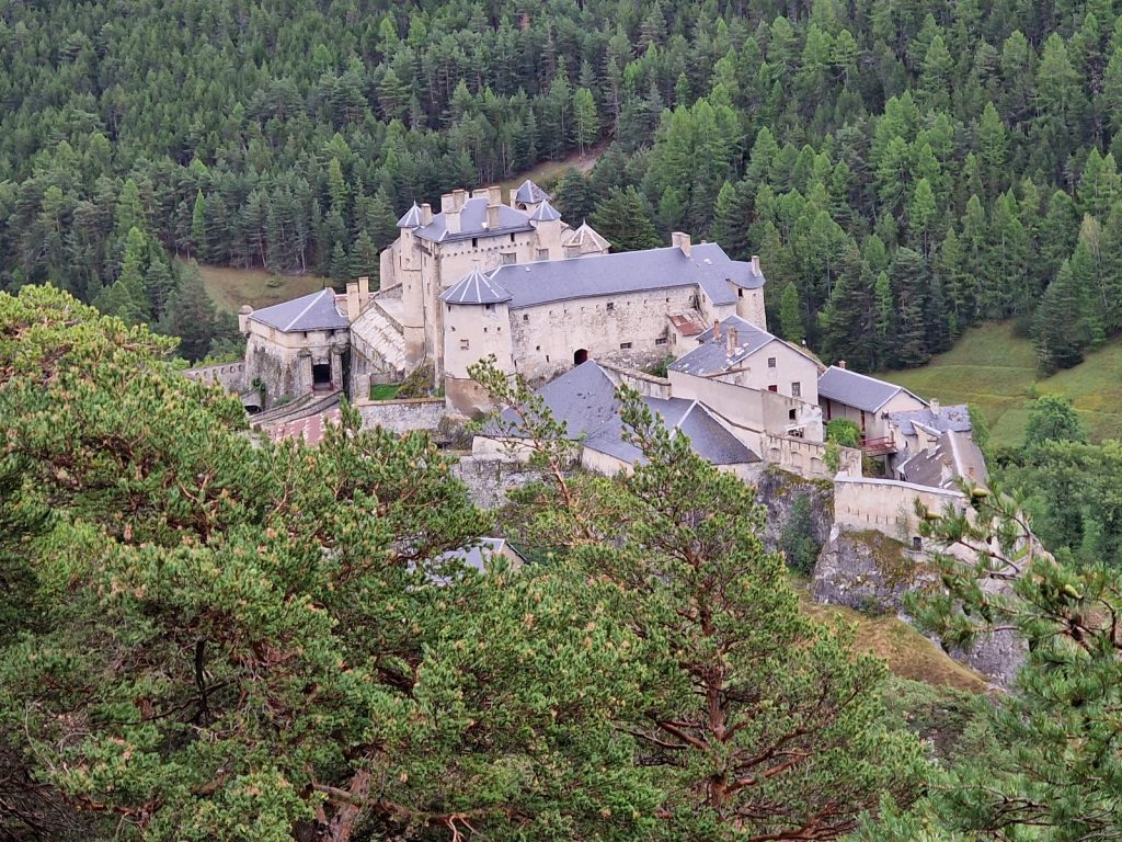
627. The castle of Fort Queyras in the deep valley by the hamlet of Chateau Queyras was medieval dating from the 12th Century.
We crossed a bridge here over the Guill river which drains the Queyras region and then started our 1000 metre ascent. At the bridge there was a small Via Ferrata route on the side of the gorge and some people were clambouring along it on wires. I met an older Norwegian man here who had come all the way from Norway on a Vespa scooter and was going over all the cols in SE France over 2000m. It seemed like a barking retirement project but he was very enthusiastic about it. The climb up the south side of the gorge was initially very steep for 20 minutes but it soon eased off as we gained height. The path occasionally followed or crossed a track which went up the steep side valley in a series of hairpin bends. The scruffy small pine trees soon gave way to the lovely larch and the valley changed character afterwards. It was now much greener on the forest floor and the canopy had more light. We passed a scattering of small restored cabins at Le Pre Premier, which looked like they were now rented out, and then came across an older one in a small meadow with a rustic table outside. We had been going for over 3 hours so we stopped here for our picnic lunch the Gite at Souliers had provided. It was quite good also.

628. The small pastoral chalet at Le Pre Premier on the way up to Col Fromage made a great picnic stop.
After lunch by the cabin the route became easy and delightful. The forest had thinned sufficiently so that there were glades of meadows here and there and they were verdant and welcoming. Also we could see some of the peaks around us through the trees, especially impressive were the spires of Pointe de Rasis, 2844m, which looked like something out of the Badlands in Arizona. As we wandered up through the shade of the larches we came across Remy who was just starting to cook his lunch. He must have overtaken us while we were sitting on the picnic bench. It was great to see him and chat about the last days. He was pleased his tent had withstood the thunderstorm last night. After 10 minutes chat we let him eat his now hydrated meal while we carried on up for another hour or so in quite stunning surroundings with the characteristic green grass of the limestone rich fertile Queyras with the lime coloured larches scattered on the hillsides in larger woods and smaller copses. This combination was so easy on the eye and easy on the soul. As we neared the top we could look back across the main valley and see Souliers behind us to the north. At last we reached the top of the ridge at Fontantie, 2250m. It was not the Col Fromage which was another two kilometres away but between here at Fontantie and Col Fromage it was flat and easy walking.

629. The jagged peaks of Pointe de Rasis, 2844m formed the eastern side of the Col Fromage, 2301m, pass. This is the view of it from the north.
The view from Fontantie was exceptional, to the west were the arid craggy ridges of Queyras stretching into the blue but before them was a forest filled side valley covered in forest lower down and scree higher up. Across this valley the mountain of Brunet, 2582m dominated everything and its higher slopes were covered in blueberry bushes which were just turning red. In places the sun shone on the patches at a certain angle and they were bright crimson. We walked a few metres and then looked down into a vast landslide, perhaps centuries old where the looser limestone rock had been washed away leaving an open wound which was constantly weeping small stones and gravel. The whole area had been eroded into a myriad of white sharp ridges and steep gullies. It was perhaps 400 metres wide and nearly a kilometre long and I am sure visible from space. It was very steep and if anything fell into it it would tumble down a gully into the depths. I think even ibex and chamois would be wary of crossing it. The path went round the top of it for 10 minutes before we were free of it and on the open scree of the mountainside. The path traversed this hillside horizontally until it got to the col between the mountain of Brunet and Pointe de Rasis. There another superb view burst upon us to the south of the Ubaye region where we would be walking for the next 3 days. It looked even more rugged than the Queyras. At the bottom of the slope south of the col was the Cristillan valley and the alpine hamlet of Le Villard. We had walked up this valley 10 years ago going from Ceillac to St Veran.

631. Looking NW from near Col Fromage across the Combe de Queyras valley to the mountians on the edge of the National Park and beyond.

630. Contouring across the hillside from La Fontaine to Col Fromage at about 2300 metres and looking over the autumnal blueberry bushes on the mountain of Brunet, 2582m. Brunet was on the west side of Col Fromage.
As we gazed over the rugged view Remy caught us up and we descended as a trio. The path was a series of zig-zags covered in loose gravel. It was easy for a foot to slide 10-20 centimetres before it stuck on a larger embedded stone and it made for uncomfortable walking. However we chatted the whole way down and before we knew it we were on the track on the valley floor. It only took half an hour to come down this steeper section. It took another half hour on the road from the historic hamlet of Le Villard to reach the exceptionally beautiful large village of Ceillac. It had some of the most characterful of the buildings found in the Queyras and the church tower was unique in that the bells were just mounted in the middle of the single wall. There were fountains, typical sundials, bakers, window boxes and small quirky balconies everywhere. We walked down the main street passing quite a few cafes which were heaving with 60 year old French hikers for whom the Queyras is considered a connoisseurs region for trekkers. There were perhaps 10 groups of 5-10 people and they all had broad smiles and the glint of victory in their eyes as if they had finished a multi day tour and were now celebrating with ice cream and much backslapping. Remy went off to find the campsite while we headed to the large Gite de Baladins, our refuge for the night.
632. Looking up to Col del Estronques, 2651m, on the route between the villages of Ceillac and St Veran from the hamlet of Le Villard at the bottom of the descent from Col Fromage
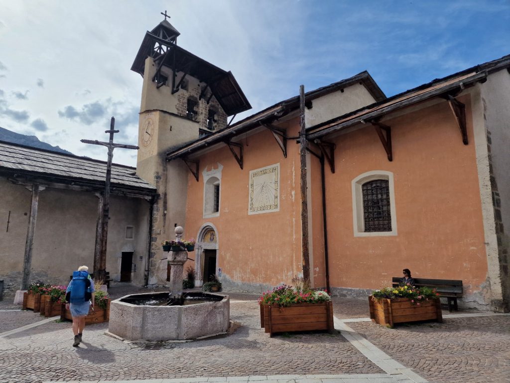
633. The church at Ceillac with its characteristic Queyras sundial and its bells mounted in a thick wall rather than a square tower.
It was a huge establishment in a lovely old building which had been tastefully modified. I would estimate it could sleep and feed 100 guests in small 5 bed rooms. We had to share a room with 3 others. I wrote in the afternoon while Fiona went and investigated the alleys and crannies of Ceillac. At supper we were sat at a table for 4 next to 2 very bright erudite English sisters who were very cultured. They were just starting their Tour de Queyras hike. The food was very good and I and one of the sisters got a great vegetarian option. I wrote again after the meal and finally finished by 2200 when it was lights out in the Gite.
Day 95. Ceillac to Fouillouse. 26 Km. 8.5 Hrs. 1470m up. 1230m down. It was a hot sleep in the congested room and neither of us felt refreshed when the alarm went off. Breakfast was at 0700 and it was a large and generous breakfast which helped compensate for the dormitory in this battery farm of older hikers doing the Tour de Queyras. We were ready to go at 0730 when the rain and mist of the previous night was starting to clear, revealing a perfect blue sky above. Before we left Ceillac we thought it best to go to the cash machine as most of the refuges we would be staying in for the next 10 days would only take cash. It was a wonderful opportunity to go back into the streets bursting with colour and character and now completely empty. We got the cash opposite the church and then walked out of town on the road heading south east up the Melezet valley.

634. Climbing up from Peid Melezet towards Lac Mirror and looking NE over the Melezet Valley with the early morning mist clearing
We passed the campsite and continued walking on the quiet road for nearly 2 kilometres until we reached the modest ski lift at Pied Melezet, 1692m. The valley here was still in the shade and the mist lingered and it was quite cold on the exposed hands. However all that changed as soon as we started the steep climb up through the firs and pines. The path was well used and quite greasy in the damp of the morning but as we were slogging up it we could easily place our steps with care. After a two hour climb up beside the Cascade de la Pisse stream, which flowed down the hillside in a series of small white waterfalls without having carved any sort of streambed let alone a ravine, we reached Lac Mirror, 2214m. Lac Mirror was absolutely stunning. It was a small lake perhaps 300 metres long and 100 wide but it was set in a beautiful larch forest with a small forested ridge behind it and then a vast jagged ridge of limestone peaks beyond that. It would have graced any tourist brochure and I am sure features in almost every book about the Queyras. We both took plenty of photos and marvelled at the beauty of the place for a good ten minutes and then chatted to two English hikers who we met yesterday, and seemed very chatty and open.

635. Looking across the serene Lac Miirror, 2214m, towards the limestone peaks of the Crete de la Font Sancte ridge which culminate in the highest peak at 3292m, some 1000 metres above the lake.

636. Climbing from Lac Mirror towards Lac Sainte Anne and crossing the moraines from the departed glaciers which came down from Pic de la Font Sancte, 3292m, which is out of the picture to the right.
From the Lac Mirror the path went on up through the thinning larch woods for another kilometre at least until they started to peter out. There was a small shepherds cottage in the middle of a glade and there were plenty of signs that a large herd of sheep spent the night here gathered together with a dog or five guarding them. At the edge of the forest the open veldt-like hillside started but there was a lot of moraine in the area, dumped by glaciers that vanished in the last 200 years. In the moraine there was a wide ski piste and also a rough track to service the lifts and we followed them until we ascended another 200 metres to reach another beautiful lake of a completely different character, called Lac Sainte Anne, 2415m. It had a small chapel beside it, but it was locked. The lake itself was quite circular and a deep turquoise colour. There was no outlet and I think the water percolated out of the moraine wall which formed a dam. It was in a depression and after this dry summer there was a natural bare patch around the lake. Beyond it were screes and debris from vanished glaciers and then the serrated limestone peaks nearly 3300m high in a jagged arc. We stopped here as we had been going for 3 hours and had our picnic, provided by the Gite de Baladins in Ceillac, which was very good.

637. The beautiful turquoise Lac Sainte Anne, 2415m, was formed when the glacier which deposited the terminal moraine to form the natural dam for the lake melted leaving a vast depression. In the back fround the the Pic de la Font Sancte, 3292m.

638. Looking up to the Col Girardin, 2699m, which we had to cross, from just above Lac Sainte Anne.
However, there was yet more to ascend to reach the highest point of the day, Col Girardin, 2699m. We could see it from our picnic spot a good kilometre to the south up the mountain. As we climbed the mountain side became rockier and rockier as the vegetation petered out in the crumbly, friable rock fragments. The path zig-zagged up in quite wide hairpins where thousands of feet and hooves had trampled it into a smooth surface. It did not take long to plod up it and suddenly we were at the col. The view back to the north over the Queyras and glaciated peaks of the Ecrins further to the NW was stunning. However, it was the view to the south over the wild Ubaye region which really took the prize. Across the deep Ubaye valley to the south was the very furrowed and heavily buttressed Chamberyon massif with its myriad of sharp peaks. The highest was Aiguille de Chamberyon, 3412m. It was really a breathtaking view of the quality which I only got once a week on this entire walk.

639. Looking south from Col Girardin, 2699m, across the deep Ubaye Valley to the Aguille de Chamberyon massif, 3412m.
The descent down the south side of the pass was long. Not quite at long as the 1000m ascent but it felt like it was. Initially we went down steep zig-zags on loose friable rock where there was a good path with the odd boulder in it to step over. It quickly took us down a couple of hundred metres to a beautiful lawn bordered by a large moraine. The lawn must have once been a lake formed by the large moraine blocking the small stream. However the lake had since filled in with the small rock fragments which these friable mountains were crumbling into. The lawn was full of grazing marmots, some of whom hardly bothered to move when we approached and others just ambled off to the large boulders of the moraine. It was interesting to see that the marmots used certain areas to go to the toilet and there were piles here and nowhere else.
640. One of the very confident marmots on the descent from the Col Girardin in the lawn area at the bottom of the first section of the descent.
Just after the lawn we met the two English guys again, who we now knew were Richard and David, and a little later bumped into Remy who was having his dehydrated lunch. We chatted to Remy for 5 minutes and then continued down to where the path split. One branch went steeply down to Maljasset, a remote and small summer village and the other went down to La Berge, a small hamlet 2 kilometres down the road from Maljasset. Both paths looked steep but the one to La Berge was shorter and it was the route of the GR5 so we took it. Not long after the split it went across a steep open spur on the friable rock fragments. There was grass on each side of the path but it was patchy. Above the path was mountainside and crags and below was a steep slope which ended in crags. It got more and more exposed as we went along it and if one slipped off the path here one would tumble over the crags below. However I could now see the other path down to Maljasset and it also looked tricky. So we proceeded with great caution along this 300 metre section until the exposure eased again and the mountainside started to become covered in juniper scrub. At this point it was easier to look around and see the magnificent view down the Ubaye Valley to where we thought the town of St Paul might be. As we descended the larch trees soon appeared and they welcomed us back into the forest where it would now have been very difficult to fall down the slope. The path zig-zagged steeply down through the forest for about 40 bends with the trees getting bigger and the forest floor getting bushier until at last we finished the knee jaring 800 metre descent and tumbled onto the very quiet tarmac road. Just down the road was the rustic and ancient hamlet of La Barge, 1877m, where there were about 20 gorgeous old stone buildings under heavy stone slab roofs. There was a fountain in the hamlet and a bench nearby so as we had been going for another 3 hours we stopped here for our second lunch. As we ate the English, Remy arrived. All of them had found the exposed section over the spur quite worrying and Remy said he would have been very apprehensive in a rainstorm.
641. The latter half of the descent from Col Girardin, just after the exposed corner, looking down the Ubaye Valley. The hamlet of La Barge is just out of the pictuure on the bottom left.

642. A typical Queyras sundail on one of the old stone houses under a stone slab roof in the small hamlet of La Barge, 1870m.
The English went on but we teamed up with Remy for the 6 km saunter down the quiet asphalt road. We chatted the whole way and the time passed quickly as we strode out. The cliffs on the east side of the valley were astounding at one point in this wild landscape. Along the bottom of the cliffs was the narrow valley floor and we now saw that the autumn colours were starting to appear on the deciduous trees. Remy mentioned a few times we had to cross a spectacular bridge but we thought nothing of it. About a km north of this bridge we passed a very well restored and quaint summer farmhouse, chapel and bell tower at St Antoine, 1651m. The chapel had a large mural painted on the side of it which was protected by the large eaves. A bit later we saw the bridge. It was sensational. It spanned the gorge which the Ubaye stream had carved and I think the gorge was perhaps 150 metres deep and less than 10 wide. The sides of the gorge went straight up with the old stone arched bridge sitting with an end on each side. It was like a miniature version of the Ronda bridge in Andalucia but higher. 20 minutes later we were crossing it and peering over the parapet to the stream far below in the narrow slot. It must have been a huge and brave feat of building to construct this bridge some 100 years ago when the area was very poor and impoverished.

643. The Pont du Chatelat bridge spanned the gorge where the L’Ubaye stream was still carving the gorge ever deeper some 150 metres below the bridge in a deep slot.
After the bridge, called Pont de Chatelet, our route went up the tiny road through a small narrow tunnel. We left the road here which continued up to Fouillouse in the hanging valley above and stopped. We could now see down to St Paul 4 km away which was the highest town in the Ubaye Valley. After the tunnel we left the road and followed the path up through the pine woods. Fiona found her second steam and marched off leaving Remy and I in her wake. It took a short hour from the bridge to reach the hamlet of Fouillouse on the lip of the hanging valley at the end of the road. The first building we came to was the Gite des Grange and it was our place for the night.
We had already booked a room and Remy and the two English also managed to get a room. It was a large building, bigger than a traditional farmhouse with 3 floors. It was being done up and the top two floors were now some 15 rooms and 2 dormitories. We got a lovely room with an ensuite showerroom. After last night’s cramped battery farm for hikers Fiona was overjoyed. After showering and washing some clothes we went down for dinner as it was 1830 already. We chatted with David and Richard and then went in to eat at 1900. It was quite busy with 25-30 people, all of retirement age. The five of us all sat at one table in an enormous vaulted dining room which was the ground floor of the whole building. We guessed its origins and Remy thought it was perhaps 300 years old and was a landowning farmers house. He would have been the lowest rung of the aristocracy. The meal was good and the conversation was fast and witty. Remy was so good at English having worked abroad a lot he could easily keep up, and even hold court. After dinner I retired to write at 2030 while the others kept chatting for another hour. I eventually finished at 2300. It had been a great day.
Day 96. Fouillouse to Larche. 14 Km. 5 Hrs. 840m up. 1050m down. We slept well in the dark quiet comfortable room and the alarm woke me up at 0630. It was still dawn outside at 0630 as the nights were getting longer. By the time we went down for breakfast at 0700 it was fully light. Breakfast was a generous buffet with granola, quark, fruit juices, breads and plenty of jam. All served in the splendid vaulted cellar like a mediaeval banqueting hall. The price of the stay here was slightly less than most places I had stayed and it was great value for money. We left at 0800 with the sun on the meadows on the south side of the valley but with most of the hamlet of Fouillouse in the shade. I learnt our Gite was built in 1801 and many of the other large farm buildings here also dated from the same era. As we left the gite and wandered up the main street we passed another 5-6 large buildings which were once farms. Their ground floors were all buttressed to support the vaulted ground floor. In one of the buildings was a small shop and in another a cafe. I think the economy of Fouilouse was now built around hikers and motorists coming over the bridge. There was a small chapel with its three bells in the flat wall which extended up from the gable end. The wall was just a metre thick, which was enough to house the bells in the apertures meant for them.

644. The chapel in the hamlet of Fouillouse, 1900m, in the morning before the sun had breathed some life into it. The bells were housed in a single thick wall, like they were in Ceillac, as opposed to a square bell tower.
It did not take long to leave the hamlet and continue up the track past meadows and then on into the larch forests of the upper valley which was hemmed in on each side by the giant walls of the rugged limestone peaks. After an hour or so of climbing the early chill of the day was soon banished by the sun which had now risen above the peaks and was filtering through the larches. We reached a small shepherd’s hut and then spotted the herd of perhaps 500 sheep moving out of the night time enclosure to the higher pastures. The guard dogs embedded amongst them must have seen us but did not bark to alert the shepherd or bound towards us even though we were just 200 metres away, albeit on the path. The sheep were moving like a bucket of maggots across the hillside and had not dispersed yet.

645. The shepherdess at her cabin just getting ready to take her flock from their night time sanctuary up to the higher pastures. In the distance, centre left, is the first pass of the day Col de Vallonnet, 2609m.
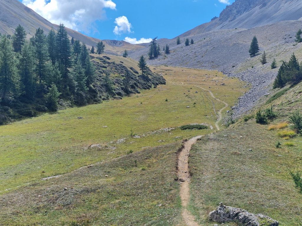
We continued through the larches and came to another herd. They were still in their nighttime enclosure of an electric mesh fence. There were 3 large Pyrenean Mountain dogs sleeping amongst them. I am sure they had one eye open for predators. Beside the flock was a larger hut with the shepherdess just preparing to take them out of the earth covered compound and onto the higher pastures for the day. We went past them and reached the edge of the treeline soon afterwards where the veldt-like grasses took over. There had been a definite greening of the grass over the last two weeks with the nighttime rains, which had made a small dent into the summer’s drought. We climbed up through marmot country and eventually reached the top of Col du Vallonnet, 2609m. To the south of us there were a number of jagged peaks in a semicircle round a huge bowl. It was a very wild and desolate corner of the Alps and except for a small shepherd’s hut it was empty.

646. Looking south from nesr the Shepherdess’s cabin to the mountain of Tete de la Combe, 3089m. This mountain formed the left flank of the Col du Vallonnet pass.
We had to contour round the side of this bowl with the mountains to our east and the side valley which drained this bowl disappearing to the west and the hamlet of St Ours, which was out of sight far down the valley. The path remained quite level as it headed south dropping a bit to reach an old track. I think this track was built between the two World Wars to service the derelict forts which were on the south side of the bowl under the pass of Col de Mallemort, 2558m. This col was our southern escape from the desolate bowl and we had to climb a couple of hundred metres to reach it. En route we passed one of the crumbling forts which was a barracks for the troops stationed on the Maginot Line, a series of forts and defences stretching along the border of France to prevent an eventual German invasion. It later transpired that the Maginot Line was breached by the Germans who went around the end of it and encircled the French troops defending it, who later surrendered.
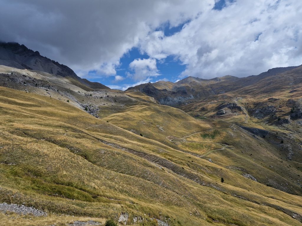
647. The wild country in the cirque between the passes of Col du Vallonnet, 2609m, and Col du Mallemort, 2558m.
At the col we looked south over the bare hillsides which descended all the way to the village of Larche in the Ubayette Valley. It was surrounded by exceptionally green pastures which were emerald and must have been well irrigated. There was a road in the valley and I was surprised to see lorries on it and later found out that the road went over a pass, Col de Larche, 1948m, just 5 km to the east of Larche and on the Italian border before descending to Italy. Beyond the Ubayette Valley was the start of the Mercantour, the southernmost range of Alps on the west side which went all the way down to the Mediterranean Sea. It was our last section and it would take about 10 days to cross. It looked quite similar to the Queyras and Ubaye regions of the Cottian Alps but it seemed to be slightly greener and not quite as rugged, although it was slightly higher overall.

648. The reasonably gentle descent from Col du Mallemort down to the Ubayette valley where the very small village of Larche lay. Across the valley is the northernmost massif of the Mercantour or Maritime Alps. These alps are the final section of our walk.
The descent down to the valley was relatively easy but it was long and involved some 800 metres of descent. Initially it was down steep gravel zig-zags on a stoney hillside with little grass. But this led down to great sloping grasslands which were a joy and easy on the knees. Rain was pouring just down the valley and it looked to be heading our way so we increased the pace in the vain hope of beating it. However it stopped short just to the west of us and then petered out and by the time we were on the last section the skies were clearing up again and sunny patches appeared on the valley floor. The last two kilometres were down another series of zig-zags into a small arid valley with a clear stream tumbling down it. At the bottom of the valley we met a track which took us into the village of Larche.
Larche, 1700m, was not very pretty or idyllic. There were some shops but they had all closed as the summer was over. We had already booked a gite and went down to it to discover it was locked until 1600 when the host returned from a shopping trip down the valley to get more supplies for the gite. However there was another one nearby which was serving food. In it we found Remy, David and Richard. They told us the quite shocking news that Queen Elizabeth had died yesterday and indeed on the television in the corner of the restaurant there was constant coverage of the UK Royal family. We had a meal and then went back to our gite to check in and get a small room with two beds only. The showers were in a shared room but there was plenty of hot water to wash our clothes and hang them to dry in the breeze outside. I then wrote for an hour before dinner approached. Remy, who was camping nearby joined us and the other 5 guests in the gite. However we did not see Richard and David who were supposed to stay here but had disappeared as we think Richard had some bad news. Dinner was great as the gite had a once a week no meat or fish day and it was today. Lentil curry was the fare and it was very good. We chatted to Remy after the meal who would go on tomorrow and our paths would probably not cross for another 4-5 days. I wrote a bit more after dinner and then called it a day at 2230.
This was the end of the very pastoral and culturally rich Cottian Alps, which were for us a traverse of the Mont Thabor, Queyras and Ubaye regions. While the mountains here were not as high as in other parts of the Alps they were still spectacular as the limestone ridges and peaks were very serrated and angular with steep crags and cliffs on all sides. They reminded me very much of the Dolomites. However these regions also had open pastures on the nutrient rich plateaus and beautiful larches in the numerous side valleys and these were ideal for sheep herding. Many of these herders were tranhumants who spent the winters in the warmer foothills in the south of France and then came up here for the summer to live in small cabins with their flocks. This transhumant culture and the local farming culture and architecture of the high villages also helped make this one of the best sections both scenically and culturally.
Section 14. The Cottian Alps. 138 km. 46 Hours. 7910m up. 7260m down.
Section 14. The Cottian Alps. 03 September to 10 September 2022.