Main Alpine Divide. Section 03. Niedere Tauern Alps
February 9, 2022

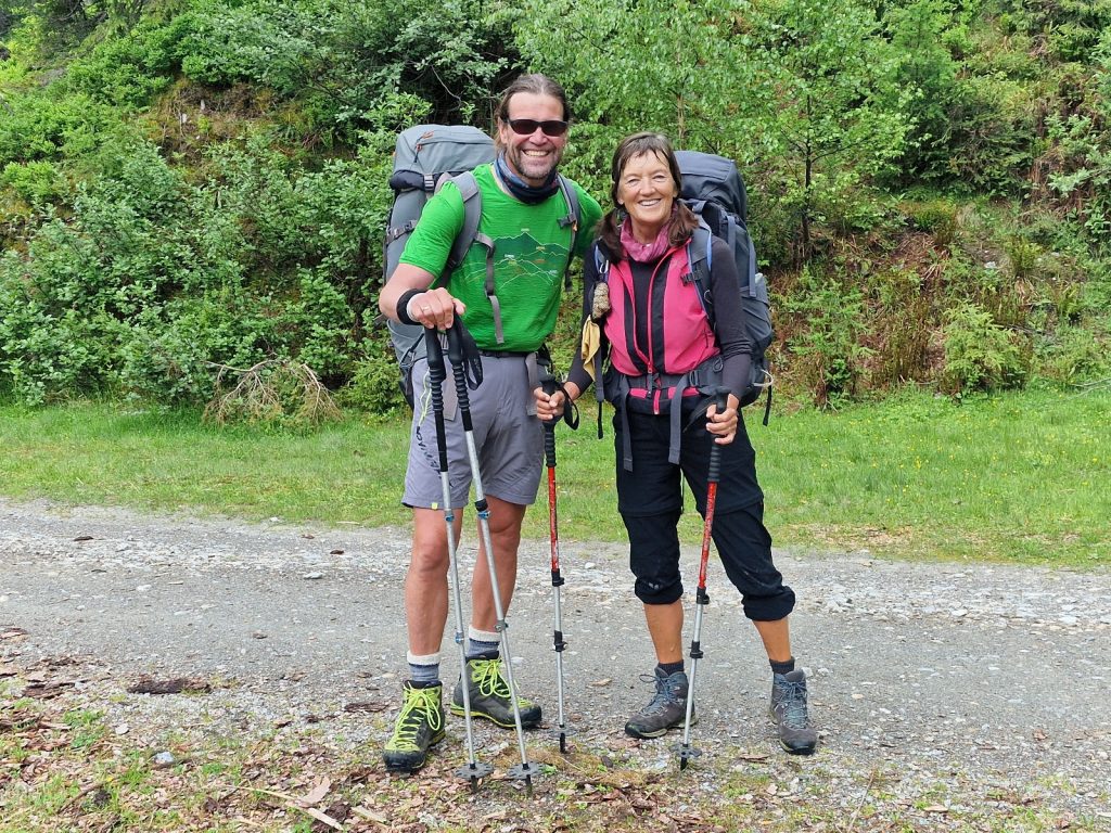
Day 016. Trieben to Perwurzpolster. 16 Km. 8.5 Hrs. 1720m up. 720m down. Given the good weather forecast for the next couple of days and the bad forecast for a couple of days after that it made sense for me not to take a day off in Trieben as planned and push on for the next couple of days which had some tricky sections. Klaus, who ran the Triebnerhof waived the second night at the Guesthouse and also help me with printing labels to ship two packages. After the very large breakfast, I headed off into town to dispatch the parcels and buy some snacks for the next two days. Before I could even have an ice cream on this warm morning I was already heading out of town on the road leading south by 1000, knowing my legs were about to have an ordeal with about 4000 metres of ascent and descent over the next 2 days.
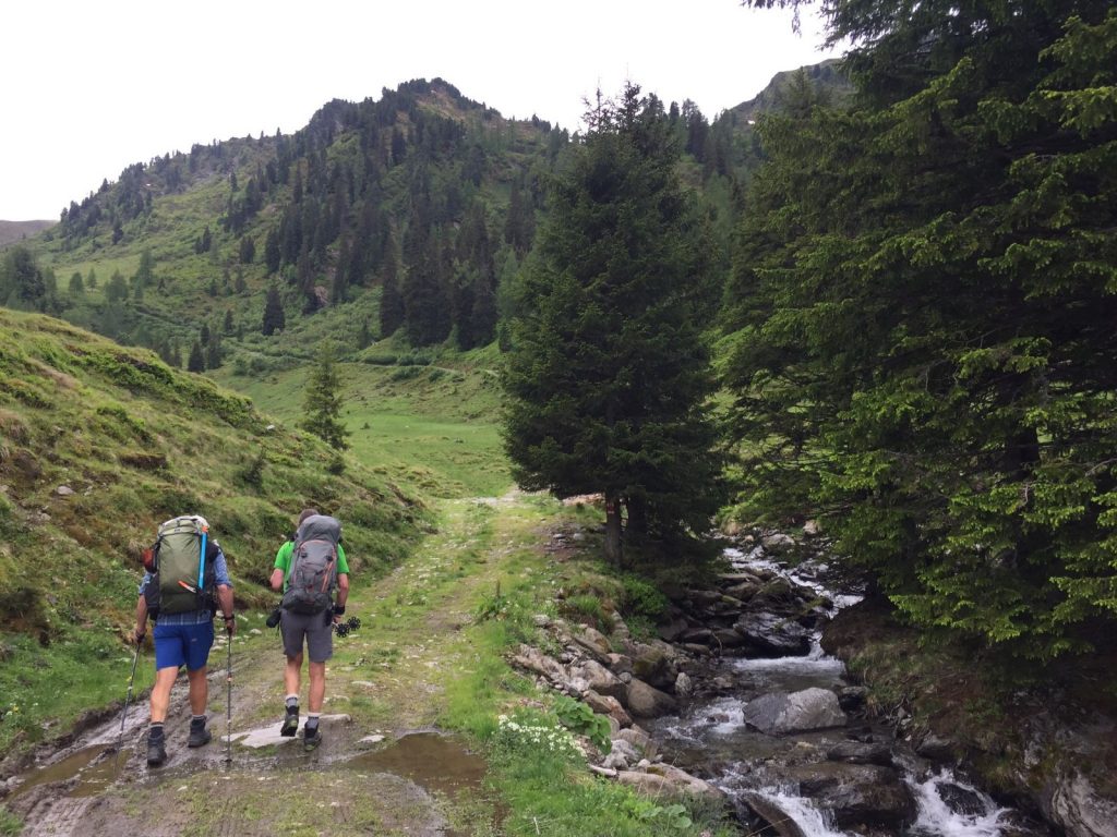
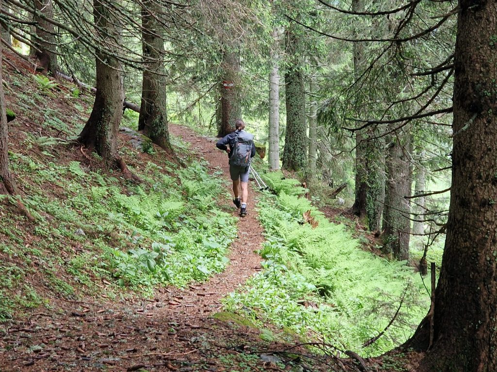
The lanes on the southside of the town eventually led me to the leafy track which went up the west side of the Triebnerbach stream and adjacent to the country road heading south from the town. The stream had been subdued by concrete barricades to help slow the torrent in heavy rains and a small hydro plant, and the road had frequent grumblings of cars and motorbikes. Hence the walk was not serene for a couple of km until it turned off to the west after an hour.
It now climbed pleasantly on a forest track beside the Sunkbach stream for a good hour to reach the edge of the meadows around Hohentauern. It was a nice climb through conifer forest with willow groves scattered along the wetter parts of the valley floor. Willow catkins were streaming across the valley floor in the gentle breeze like snow and were settling on the forest and numerous ponds, where they would drift to the windward side and form fluffy rafts. Some of the ponds up here seemed man made for various small hydroplants and others were natural. There were liesure cabins beside a few ponds, some with big fences to keep their ponds, which were full of farmed trout, from being harvested.
Many cyclists passed me along here as it seemed to be an off road cycling track. All the cyclists were dressed in athletic lycra attire which had the advantage of expanding to fit most girths, but gave completely the false impression that they were engaged in a sporting activity. All the bikes were electric and the passive riders just sat there, even on the uphill sections, without peddling at all, while the jelly, barely contained within the lycra, wobbled profusely as the wheels went over every pebble and pothole. They probably all thought they were working up an appetite, so they could eat at one of those easily accessible alpine restaurants, under the black and white glare of their hardy forefathers in their tackety boots, which were hanging from the timber walls. It is not a far fetched thought that affluent mankind is eating itself to a standstill.
The route now veered away from the ponds and headed up through the larger firs with an forest floor of blueberry bushes almost lumnescent in the bright sun. As I climbed I heard the most unusual bellowing. In the end I thought it must have been a deer in distress, either chasing off a dog from its fawn or searching in panic for a missing fawn. I have noticed in Austria the rules regarding dogs in the forest are very strict and there are many “Hund Verboten” notices. A good hour after leaving the ponds I reached a large carpark, where those who were not kidding themselves with an electric bike, could drive too and walk the 300 metres to Edelrautehutte.
When I got there it was busy, with perhaps 100 people sitting outside eating alpine fare and drinking beer. There was a lot of outdoor brands on display here, much of it pristine, as the outdoor fashion world has become mainstream, and style has triumphed over function. My own Rohan shirt, full of wicking technology and anti odour silver enhancements was a sweat-drenched, stinking rag which bore little resemblance to the salesman’s pitch. I ordered a litre bottle of water, ate a couple of snacks I bought in Trieben prepared to head up out of the forest for the second climb of the day and away from the rustic-gourmet diners.
Within minutes I was looking down on the carpark and the busy Edelrautehutte cabin and returning to a world which was rapidly becoming what I considered normal. The larch trees were making a last stand for the forest as I climbed beyond 1800 metres but soon they got smaller and smaller until they eventually dwindled. The hardy forest ants who made their nest up here had to use larch needles and their mounts of nests looked much more silky and luxurious compared to the coarse fir and pine needles of the montane forest ants below.
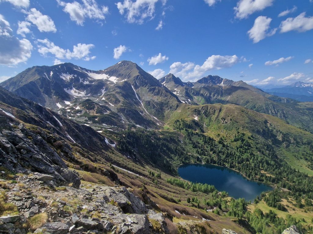
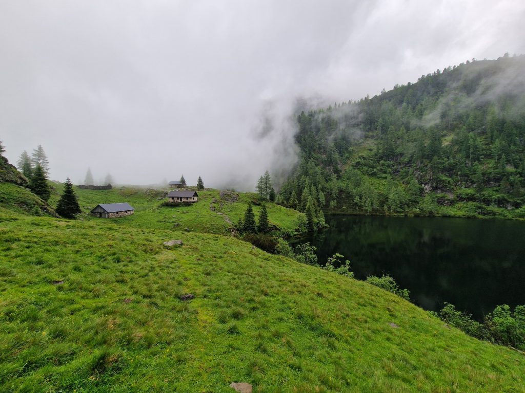
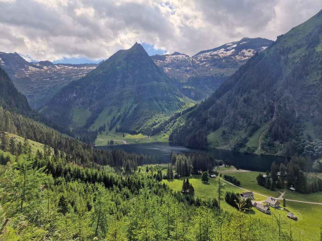
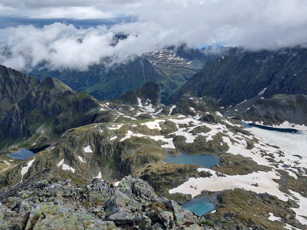
108. Climbing the ridge to Kliener Bosenstein with Grosser Bosenstein next to it and Scheibelsee in the bottom of the bowl.
As I climbed, sometimes quite steeply, a wonderful view started to unfold. Just beyond Edelraute Hutte, to the west, were two alpine lakes, Grosser and Kleiner Scheibelsee, appeared in a large forest fill basin below. The lakes were absolutely pristine on this warm calm day and I could see ripples from someone swimming in the larger. Beyond them a valley led up, hemmed in by two alpine ridges, where there were many snowfields and higher alpine, some still partially covered in ice. The ridges on each side led up to the Grosser Bosenstein, 2448m, and Kleiner Bosenstein, 2395m, mountains which were joined by a narrow arete at the head of the valley. I was going up the southern ridge of this large basin to the slightly shorter of the two mountains.
The climb was about 700m in all, which was on top of the 1000 odd metres I had already climbed in the morning, but the breeze stopped me from become a sweaty mess again. The alpine flowers which I had become familiar with over the last 2 weeks started to appear again, especially numerous was the Alpine anemone, Pulsatilla alpina. There were also many of the larger sapphire trumpets of the Stemmless Gentian, Gentiana acaulis. They were too deep for a bumble bee to enter and extract the nectar and I had heard they chew a hole at the base of the flower to extract nectar. I saw one doing exactly this. Eventually the narrow path reached a crest on the ridge, Grosser Hengst where the steeper climbing stopped and the route levelled off.
109.Looking up the dry rocky east ridge of Kliener Bosenstein.
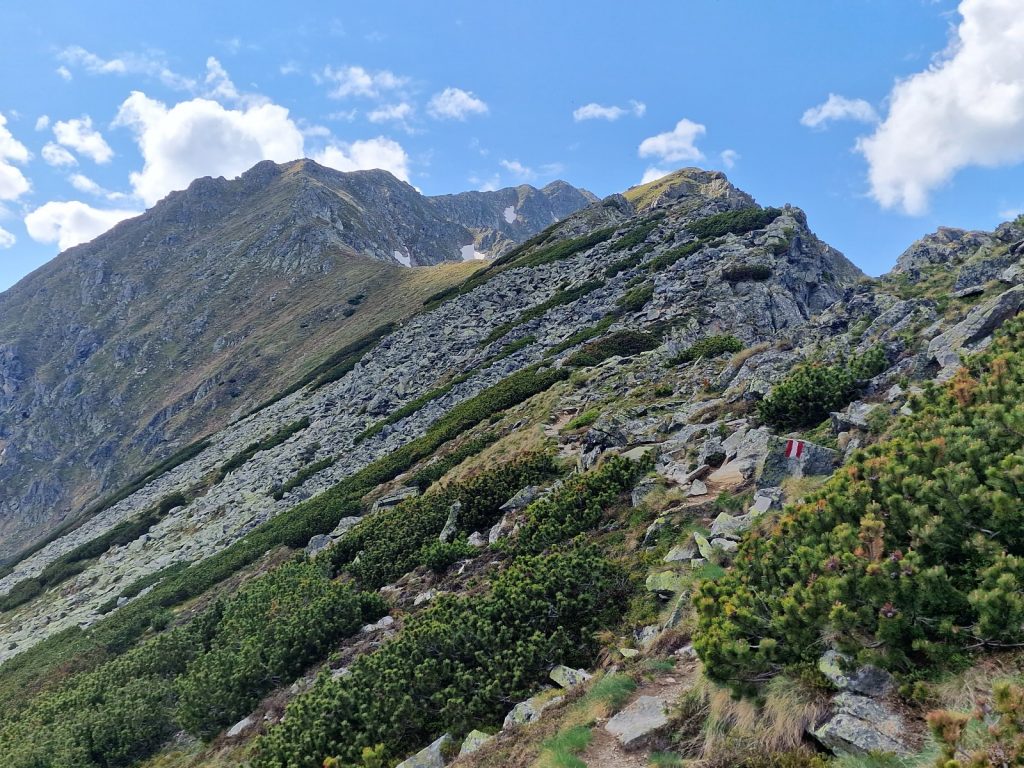
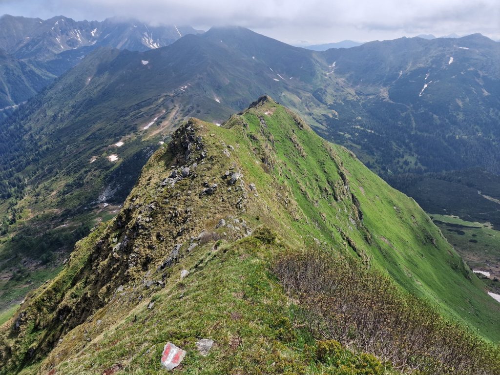
The next 2 km were a absolutely magnificent walk along the rocky apex of the sharp ridge which rose and fell slightly. The views to my right on the north were over the beautiful Scheibel valley with its alpine forest, two lakes and rim of alpine ridges. While to my left on the south side were my route along the Wolzer Tauern mountains for the next 2 days. There were small dwarf alpine shrubs, occasional Pinus mugo and rocks along the crest. The rocks here were no longer limestone but seemed to be a far more granular igneous type which my boots adhered to very well and confidently.
As I neared the top at about 2300 metres of this rocky, sparsely vegetated terrain I was very surprised to see an adder sunning itself on the trail. It was a good 40 cm long and quite sandy coloured with the black pattern down the spine. I stamped my feet, but it was not moving, so eventually I stepped back and prodded it gingerly with my walking pole. It turned and squared up to the pole. I jiggled the pole and the adder bit it. I goaded it so much with the pole that after biting it several times it turned and retreated away from me slinking off into the dwarf pine and allowed me safe passage. I was very surprised to see one so high and wondered if they migrate up here for the summer from their dens in the montane forest in the winter.
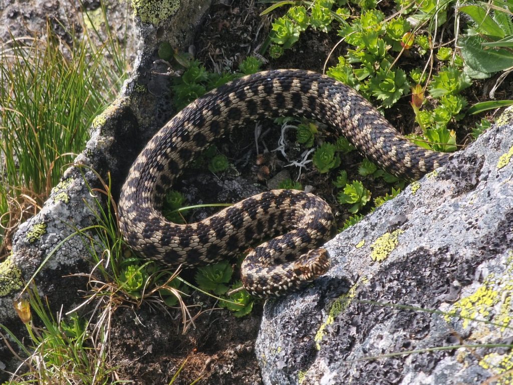
110. A European viper which was sunning itself on the rocks just shy of the summit of Kliener Bosenstein
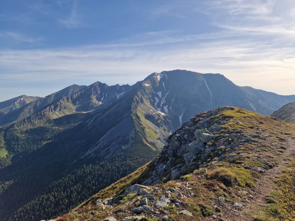
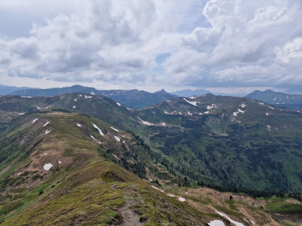
As I reached the top I could not help think that the better way to have come would have been up the more gradual path on the other side of the valley to Grosser Bosenstein and then across on the broad easy arete to where I was on Kleiner Bosenstein. My attention now turned to the west where there was a magnificent display of ridge after ridge disappearing off into the grey blue horizon. This was the Niedere Tauern range and it would be my home for the next 2 weeks. Right at the end of it, just where the opaque atmospheric haze engulfed everything, perhaps 150km to the west rose the unmistakable giants of the Hohe Tauern, like Gross Glockner and Gross Venediger where I would be in 3 weeks.

111. Looking down the south ridge of Kleiner Bosenstein to the Perwurzpolster saddle and the small tarn in the sun beside which I camped
It was now about 1800 and I spied some 600m below me a small tarn surround by a sunny grass lawn and thought that would be a good place to camp. It was at the bottom of the south ridge which descended from the mountain I was on, at a saddle called the Perwurzpolster. The route down was quite steep and the rough rocky path could not stick to the apex of the arete all the time and frequently went onto the west side. Here is wove its way through outcrops and everntually reached the dwarf pine. I could see an alp on the west side of the saddle with a small cottagge and barn, but my heart was set on the grassy lawn beside the tarn. After a good hour of descent I eventually reached the saddle and then bashed a route down through scattered dwarf pine clumps to reach the lake.
The campsite was a bit of a dissapointment and I think I might have been better going of the west side to the alp. The sunny lawn beside the lake was now in the shadow and it was a spread of huge, damp tussocks which were growing well in the moist soil. I manage to find a spot to put the tent up which was lumpy but all that was available and then fetched some clear crisp water from the bubbling stream which fed the tarn. I watched the water boatman beetles on the surface of the lake as I ate my supper out of the bag. They only seemed to have 4 legs all of which bend out to provide the maximum length so as not to break the capillary surface on which they walked. I expected to see 6 legs. I was asleep by 2030 as large drops of a half hearted and short lived rain shower slammed onto the cuben fibre of the tent.

112. My camouflaged cube fibre tent is always useful for discreet camping. Here at Perwurzpolster saddle.
Day 017. Perwurzpolster to Planneralm. 22 Km. 11.5 Hrs. 2130m up. 2280m down. I woke early and was not well rested and slightly uncomfortable on the lumpy ground. I needed an early start so got up at 0600 on the clear morning. There was some dew about and the tent was covered in condensation as one would expect. I was slightly trepidation about today. From what I had read it was very long, remote, at times exposed with a huge amount of ascent and descent. So I was a bit anxious at I made my way round the tarn and threaded a path through the shrubs on lumpy tussock ground to gain the Perwurzpolster saddle again.
Once on the saddle the route was easier as there was faint path, but it was well marked with painted stones. Enough people had used the path that a rustic set of steps had begun to form and the distance was just right for my gait. About half way up what was to be the first of many mountains today I saw a red deer jog over the ridge. It stopped and gazed at me and then continued again. It was slightly more petite and graceful compared to a Scottish red deer. I assume these deer spent much time in the forest and glades and less time on the open hill. After one and a half hours climbing I finally stepped onto the summit of Zinkenkogel, 2233m, having climbed nearly 500 metres from the camp. It was a beautiful day and I was wise to do this stretch early in good weather. Just at the summit an adder popped its head out of a hole in the turf between stones. It swivelled its head and 10 cm of body like a submarines periscope and then saw me. I think it would have liked to have reversed back in again but didn’t. Instead it emerged fully and wriggled its sandy-coloured body off to another hole and dived in head first disappearing quickly.
113. Looking back to Kleiner Bosenstein from near the summit of ZInkenkogel as the morning sun comes up.
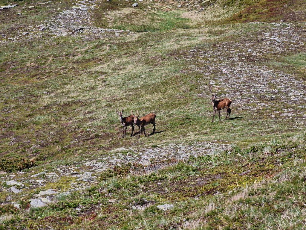
As I walked SW along the ridge descending Zinkenkogel I saw a large group of about 20 chamois about 500 metres away. I noticed that some were grazing with their heads down while others were rushing about. Then I realized it was mothers and kids group. The kids, nourished by mothers milk had boundless energy and were just running for fun. I looked at them through the camera lens at 10 magnification at the very enchanting scene. They were reminescent of spring lambs in their energy but seemed to be even more mischievious and full of fun. Occasionally two would leap in the air collide in a haphazard fashion and tumble to the ground, only to get up and do it another 10 times before sprinting off and joining in others frolics or returning to mum to nuzzle her udder to get another burst of energy. It was quite a joy to watch them.

114. A mother and kids chamois group with the kids having a heap of fun leaping about in the morning sun
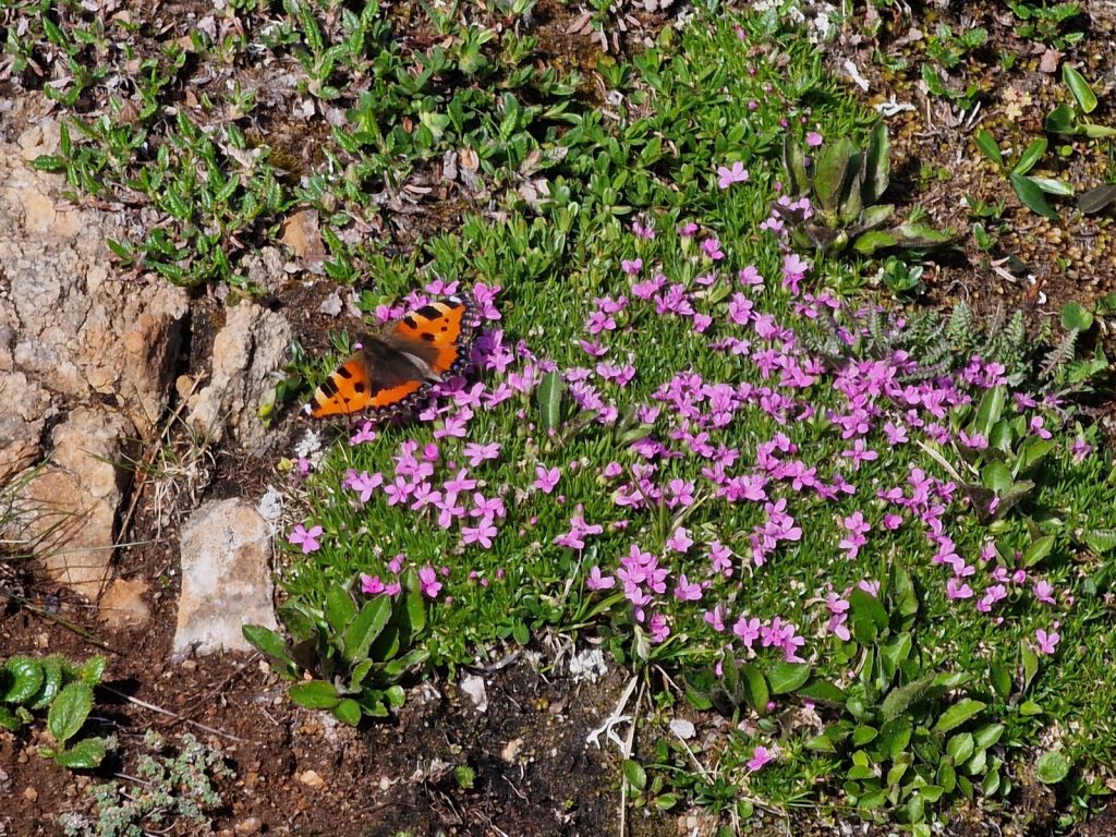
116. On the ridge down from ZInkenkogel the prostrate plants like this Moss campion hugged the hillside. Many were in flower and attracted butterflies like this tortoiseshell
Along this part of the ridge, exposed to the weather and wind, it was mostly ground hugging plants which thrived. Moss campion and the tiniest Trailing Azalea, Kalmia procumbens, brightened up large patches as they were just coming into flower. Bees, hoverflies and butterflies, especially tortoiseshells were all darting from one small flower to another. The walking was very easy as it gently headed down. I saw group of 3 deer cross the ridge all showing some alarm, but no panic, with me walking towards them. The path continued down to another saddle on the ridge where the crux of the day was the climb up Hochschwung, 2196m.
117. Just before the climb up Grosser Gieterkogel a small herd of red deer crossed the ridge in front of me

115. Looking forwards to the steep NE arete of Grosser Gieterkogel which has a fearful reputation
This ridge was supposed to be very steep and exposed, and it certainly looked that as I approached it. I knew I was seeing a foreshortened view as it was directly ahead and hoped it would not be a bad in reality. After the small hill of Kliener Gieterkogel, a knoll really the next was Grosser Gieterkogel. When I reached its base it was indeed steep and daunting. There was cable here which reinforced the seriousness of it. The cable was just attached at the top and hung down with rubberized lumps every half metre. It was designed to hold onto while you hauled yourself up. I was wary of the top fixing some 10 metres above me which I could not see so did not use it. However, unlike some Via Ferrata in the remoter regions of the Dolomites where the Latin fixings are suspect and some of the anchor points are detached and swing freely these Austrian anchor points are Teutonic and bombproof. There were another 6 or 7 ten meter cable lengths hanging down up the ridge and all were absolutely solid and faultless. You could have hung a large tractor on any of them. The climb was perhaps 150 metres in all and it was essentially an easy scramble and it was a little exposed. Had you slipped at any point and lost your footing I don’t think there was enough gradient to tumble. Once you started tumbling with a bit of momentum I dont think you would stop either. Half way up I came across a striking flower I had not see before called Creeping avens, Geum reptans, with its striking yellow flowers.

118. The view up on of the cable section on the NE ridge of Grosser Gieterkogel. The cables were well anchored.
However the weather was now started to close in and patches of mist were appearing on all the summits around me and the patches of blue sky disappearing fast. I had a bail out option if it all went belly up and that was to rush down to Schwarberghutte and seek shelter there but that was still in a good few hours. By the time I finished the scrambling section and was onto top of Hochschwung I was in the mist and when I got an occasional glimpse then I could see upwind of me to the south the skies looked very dark. I feared the worse and was worried about potential lightening.
119. Looking back down the ridge to the prow of Grosser Gieterkogel below which the steep cabled arete falls away
However, it came to nothing and the weather slowly cleared again and blue sky took up half the sky again. I saw another group of chamois with kids, but they were perhaps a kilometre away. The kids had all ventured onto a snow patch and were doing acrobatic leaps and even tumbles on it, just for the joy of it. I could now relax a bit and ease the pace as I climbed over another 3 mountains on the ridge each about 200metres up and 200 down again over the next 3 hours by which time I had reached the saddle of Grosser Windlucken, 1857m. It was the path to my bail out option, Schwarberghutte, a high alpine summer farm which I didn’t know was open or not, headed down to the south. It was just 1430 so I decided to push on. However, the tank was empty and my breakfast was long spent. I was running on fumes and needed a refill. I saw a small tarn with what I thought was a trickle into it but by the time I got there the rivulet was dry and the tarn stagnant. However it was clean enough so I boiled a half litre for a dehydrated meal. As I ate it on a rock the blue patches started to vanish again.

120. The mountain of Seitnerzinken, 2164m, was one of 10 I had to climb today. It was about halfway
Reenergised, but nowhere like those frisky chamois kids earlier in the day I started the second part of the day. It inevitably involved another climb, this time up Kreuzkogel, 2109m. The skies were dark now and the mist frequent, and worst of all there was the near continual rumble of thunder far to the south, where the wind was coming from, at a force 6. Kruezkogel has a large iron cross on top of it so I gave it a wide berth as if lightning was to strike them the cross would be the place. The faint but well marked path now went on to Brieteckkuppe, which at 2144m was the highest point in the second half of the day and a bit of a mental milestone.
121. Looking NW from Breiteckkuppe, 2144m, to the 3 remaining mountains I had to climb as thunder approached
The thunder continued to rumble and it seemed to be getting closer and almost coming round the back of me. The mist was not too bad and I could see heavy squalls perhaps 20 km to the SE which should pass behind me. However, there were still another 3 hills to go up and down each with 100 metres of ascent and descent. I saw a few ptarmigan on the next mountain, Kruezberg. I was tempted to cut across the side on a chamois path but then saw it went into thick steep scrub just before reaching my destination at the saddle and knew from experience what hell that could be at 100 metres per hour.
At last I stood atop, Grosser Rotbuhel and my uphill for the day was done. I had been over 10 mountains today and a few knolls enroute and I was tired. The saving grace of the day was that the drop and climb between them got progressively less as the day went on starting at 400 metres and ending up at 100 metres. The much anticipated rain started just at the summit and I quickly put my jacket on and bagged my gadgets. A bit further and I could look down the piste and see the ski resort of Plannerheim. I knew the German couple, Peter and Maria, who I met 2 weeks ago and were also doing a length of the alps walk this summer were down there, as we had been in contact. I got a text saying they were an hour ahead of me and already at the Jufa Hotel. I could see it just below me so I strode down the soft piste for 30 minutes until I walked into the Jufa and greeted Peter who was waiting for me at the bar. It was 1930
There were high fives all round, even from the staff as Peter and myself congratulated each other with a glint of victory in our eyes. He had sorted a room for me and arranged supper at 2030 after we had showered. We were both tired after our long day as Peter and Maria had camped just a couple of hours ahead of me last night. I threw my wet clothes on the bathroom floor to deal with another time and had a great shower. The pressure in the jets ripped the dirt from my back. Downstairs Maria was already at the table refreshed and bright, but tired. We were all very tired and my knees were aching. The meal was Quality and Quantity and I barely finished the huge jam filled dumpling which was the desert. By 2200 I was in bed, there would be no writing today. I was now 2 days ahead of schedule and almost certain to take a day off or two soon when the poorer weather arrives.
Planneralm Rest Day. 0 Km. 0 Hrs. 0m up. 0m down. It was a nice morning when I woke at 0730. Through the open window I could see blue sky and dozens of swallows darting about. They seemed to be nesting under the eaves of the hotel’s roof. Breakfast was huge and I made the most of it. Peter put up some competition to see who could eat most but Maria took the title by using the breakfast buffet to make her packed lunches. Something I have always been tempted to do, but never had the brass neck to carry it out. They considered the weather forecast and decided that despite their weary legs they would continue the 4 hours to Donnerswald today. While I decided to have the day off to catch up and would risk walking in the rain tomorrow. I did not want to push injury, especially to my knees.
I spent much of the moring sorting through photos and writing the blog in the very friendly hotel. It seemed the staff here were enjoying the peace and quiet before the season kicked off in a few weeks. Today they had one guest, namely me, and yet in a month they would be fully booked with 170.

122. The alpine resort of Planneralm seen on a sunny morning from one of the pistes above it.
In the afternoon I went for a wander around the resort. I suppose layers of crystal white snow covers blemishes like a sun tan does, and at the moment Planneralm was blotchy and laid bare. Some ski resorts have to aestivate during the summer as being dormant is the only option, while Planneralm had just about enough going for it to bring in summer hikers and school groups. It was clinging on to some vestiges of a middle class resort due to the older type buildings, walking trails and the clonking of cow bells from the animals which grazed the piste.
However the Ewis Hutte was doing its best to undermine this by creating an appalling “Robin Hood Trail” They had littered the forest with about 30 large rubber animals and built duckboards between them. On each rubber animal, all of which look like they had been imported from the US as there were Dall sheep and Bighorn sheep amongst them, had targets moulded on them. The idea was to go round the trail with an air rifle and accrue a score. It was the type of thing you would expect at a Chav’s stag party, a while before the haggard stripper comes on in a policewoman’s uniform, and well before the fighting starts. I made a detour to Ewis Hutte on the way back and they were proudly advertising this “mustn’t miss” attraction.
123. Part of the laughable Robin Hood Trail in Planneralm which was run by the classless Ewis Hutte. It compromised 30 rubber animals to shoot at with air rifles
I did see a plant which I never even knew existed and had to look it up. It looked like a fern with a salvia top. Back in the sanctuary of the Jufa hotel I discovered and it was a Beakless Red Lousewort, Pedicularis recutita.

124. The very unusual Red beakless lousewort, Pedicularis recutitam, which I found growing between pistes above Planneralm.
I was the only guest at supper and they made me another great meal. The very good Slovak chef kept things simple, but tasty, and it was all beautifully presented.
I got a message from Peter and Maria in the late afternoon saying they had really enjoyed their recreational walk and would probably stay put in Donnaswald for a couple of days while the wet weather, which is expected from tomorrow morning onwards passes through, so I will hopefully see them there tomorrow.
Day 018. Planneralm to Donnerwald. 14 Km. 5.5 Hrs. 550m up. 1160m down. The forecast bad weather seemed to have already arrived when I woke at 0630. There was a very thick mist and the ground was wet but it was not raining.I don’t think the swallows nesting under the eaves could have flown in this as you could only see 10 metres. The staff at the Jufa hotel put on a truly magnificent breakfast for me and I sat alone in the dining room and ate for half an hour but by which time I was full and had enough fuel in me for the day. I paid and said goodbye to the very friendly staff, nearly all of whom were Slovak. It is a tragedy of Brexit that Europeans of this calibre are no longer allowed to work in the UK, especially for the hospitality industry who now, exasperatingly, have to rely on entitled British youth to plug the gap.
I set off at 0800 and walked up through the cluster of dormant lodges and ski lifts until I found the path that went up through the forest beside the pistes. I had to pass a few more of the rubber animals on the Robin Hood Trail. Many of the rubber animals, especially the deer, had big eyes like Bambi and were made to look cute. It was almost as if they were saying “Shoot me! It will be such fun for both of us and I don’t mind” and so the myth perpetuates and imbues itself into another generation of detached youngsters.
The ground was sodden and squenchly with perhaps last night’s rain and still a couple of melting snowfields. Beside the track the firs quickly gave way to the dwarf pines which lent over the track heavy with dew. I was still just in a shirt so I had to shake a few before I brushed past them to avoid a soaking. Spiders webs were now clearly visible as they were covered in dew. As I climbed up the easy 400 meters or so to the pass I disturbed a couple of blackcock hens who were sitting in a fir and they launched and flew off down hill with their chuckling alarm sound.
The mist remained all the way up the path to the Goldbachscharte at about 2000m, although it thinned a bit as I climbed. When I turned west and started heading up the easy west ridge of Karlspitze, 2097m, it cleared for a bit and I could see perhaps 500m up the ridge to the cross on top. However, it was completely still and it was dry and I was still in a shirt only. It had been a very pedestrian ascent and my legs barely felt it.

125. Towards the top of karlspitze, 2097m, the mist cleared for the first time of the day to reveal a soft alpine landscape
The descent started in the mist again as the path gently dropped down the north ridge to Karlscharte for 10 minutes and then left the ridge and doubled back on itself and started to head south into a big bowl, which I could not see. Out of the mist loomed a few pines. They looked very ancient and I was surprised to see them here, even above the larch. They were 5 needle pines with each one being 8 cm long. I think they were the very slow growing Swiss or Arolla Pine, Pinus cembra. A bit below these gnarled old venerable pines were the scattered larch trees of the expected treeline and then suddenly out of the mist some buildings appeared.
It was Michelirlingalm, at about 1700m and it lay right on the treeline. First a barn loomed out of the grey mist and then 3 very sweet small alpine log cabins. I could imagine how cosy it would be inside such a cabin with a stove burning. It took me back to dull autumn days in the Norwegian mountains. As I walked past these evocative cabins the mist cleared slightly and I could see the few hundred meters to the bottom of the meadow where the talls firs started. And just like that I went from the mist ensgrounded hilltop where I was walking in a small bubble to suddenly being in a secure safe forest with the tall trees protecting me.
126. The romantic cosy cabins at Michelirlingalm looked very inviting on this misty day. They were in pastures just above the forest
The mist stayed away for the rest of the long descent from Michelirlingalm all the way down to the main valley floor. The route alternated between forest track and the old drove road where the animals would have come up in the olden days. The old drove road cut across the hairpins of the newer forest track and was much more pleasant. Beside the drove road the forest floor was vibrant with blueberry bushes for much of its descent. I passed 2 more alps, both looking quite humble with old wooden building in disrepair and with muddy cattle hoof marks around the barns. Both alps were being used but there were only about 10 cows at each.
127. The old drove road up to the alps was in a stony rut in the forest where centuries of cattle and other animals had gone up and down each year
A long hour after leaving Michelirlingalm and the treeline I finally reached the valley floor with its huge lush meadows full of long grasses and wildflowers. Scattered along the valley were larger farms, virtually all with big log barns, perhaps an old old house and a new chalet type log house. This was a rich cultural landscape and I bet some of these farmers have been working in their barns and in the old houses for perhaps 10 generations or more. Each farm would probably have had a large old Bible with a family tree on the first pages which went back into the mists of history. The current custodians of the farms would have a tremendous sense of belonging, knowing their forefathers had worked on the same land and in the same barn.
128. The valley of Donnersbach was lined with luxurient meadows and farms which were centuries old. The village of Donnersbachwald was at the end of the public road about 2 km from here
I followed the tarmac road south for about 3 km. It ended in the large village of Donnerswald so it was not busy and there was plenty to see in the farmyards. Donnerswald itself was something of a winter resort also but it had the resident population who farmed the land so there was a school here, a church and playing fields. There were also many chalets and guest houses but as I had already booked into the Jufa hotel, albeit for tomorrow, I headed there. Peter and Maria were in another and we arranged to meet later. The Jufa had a large school group at it but they were well behaved. The staff here were mostly Hungarian but had the same welcoming professional manner the Slovaks did in Planneralm. The Jufa chain of hotels are for youth and families and the staff they recruit seemed perfect for this younger clientele.
In the evening Peter and Maria came over from their guesthouse to have dinner in the Jufa hotel as it was perhaps the only place open in Donnersbachwald. It was a buffet dinner and I loaded up my plate. It was great taking time out from either walking, writing or washing clothes, the 3 W’s which dominate my life at the moment and that order. The food here was not at the same level as at the Jufa in Planneralm. Peter and Maria were also going to Sankt Nikolai tomorrow so we agreed to meet up at 0830 for the climb over the hill to the next valley where it lay.
129. From Donnersbackwald to St Nikolai I walked with Peter and Maria who were walking from Vienna to Nice and I had the fortune to cross paths with a few times
Day 019. Donnerbachwald to St Nikolai. 16 Km. 6 Hrs. 1050m up. 900m down. The Jufa Hotel in Donnersbachwald felt obliged to give me a packed lunch, on top of the one I surreptitiously made from the breakfast buffet, which was kind of them. I had arranged to meet Peter and Maria in the centre of the village at 0830 and we would walk together today over the ridge and down to St Nikolai. It was overcast when we set off up the track past the small hydro plant. The track was lined with tall firs which went up each side of the steep side valley, called Morsbach, to the misty ridges above. Usually I would be monitoring my progress and keeping a careful, if not neurotic, oversight of my location. But today I was lost in enthusiastic conservation and after a good hour we suddenly, and unexpectedly, reached Morsbackwirt. It was an alm which had been converted into an alpine resturant. To get customers up from Donnersbachwald village the owner had made a trailer similar to the ones you find on small trains at tourist attactions, which he hitched onto the back of his tractor. He seemed quite a character and Peter chatted with him briefly as he headed down to get his first batch with his tractor and train carriage.

130. The working alp of Morsbachalm was a good hours walk above the village of Donnersbachwald
Just above Morsbachwirt the the alp continued up the hill to Obere Morsbbachalm, which was a working alm or alp. Thickset, brown, alpine cows with huge udders grazed the lush damp meadows while an older man was doing some carpentry on the log cabin. Apart from the food this must have been the main attraction the punters in the train carriage were getting pulled up for, to see how their forefathers spent romantic summers at the alp, without a care in the world for the commuters traffic jams.
131. Deep iin conversation with Peter as we headed up the track beyond Morsbachalm and about to turn up the small path to Gstemmerscharte
After this alm the track continued to climb up the floor of the pastoral valley for another km, veering further to the south, until we reached a small footpath which climbed more steeply to the west towards Gstemmerscharte pass. The path was quite narrow and sometimes faint but there were plenty of painted red and white flash marks on the rock and boulders to guide us. We walked more in silence here as the path was too narrow to walk abreast. I noticed how the Alpenrose, Rhododendron ferrugineum, were just about to bloom and within a few days would be in their prime. Already there was a mauve glow to the hillside where the flowers where just about to open. Especially lower down where the bushes where perhaps as much as a week ahead of their brethren 400 metres higher. The Alpenrose gave way to alder shrubs whose long springy boughs, ideal for being flattened under the snow pack, where full of leaf buds and catkins. On an adjacent ridge a small stand of Swiss Pine, Pinus cembra, extended up the hill. They seemed more hardy that the larch which previously I noticed always defined the treeline. As we neared the pass the mists on the higher ridges and peaks cleared slightly.

132. The Alpenrose, Rhododendron ferrugineum, were about to burst into flower across the Alps. These were above the alp of Morsbachalm
We pooled my packed lunch from the hotel and our plunderings from the breakfast buffets and had a rest at the pass as it was about midday and we had finished the near 1000m climb. Blue patches of sky appeared quickly and any threat of rain rapidly vanished. We could see the descent before us, down 900m to pastures of the Solktal Valley far below.
133. Heading down the west side of Gstemmerscharte towards the Solktal valley in the forest far below
The first third of the descent was across open grassy hillside which was surprisingly wet and boggy. It was more a soggy autumnal Scottish hillside rather than a spring alpine hillside. As we descended into the small alpine side valley which was forming, squelching with most footsteps, we reached a small very pretty alpine cottage in the high alm. Beyond it was a bowl hemmed in by high peaks and jagged ridges. In this bowl there were perhaps 100 sheep or goats who seemed to be fending for themselves for the summer, as the alm house was empty.
134. Looking up into the bowl below Gstemmerscharte pass to the pretty alpine cottage and the beyond to where the sheep or goats grazed
The remaining two thirds of the descent was down through the fir forest on a steep path, beside the Mossnakarbach stream which drained the bowls and hillside above the pretty cottage. It was often wet too, and was also strewn with the roots and cones of the firs, so it was a slow considered descent and just this part took an hour. At last we tumbled out of the forest path and came to rest on a forest track which zig-zagged down the hillside more gently until we reached the meadows and centuries old sun-blackened farms of Mossna.
135. Heading down through the large firs on the steep path towards the Solktal Valley
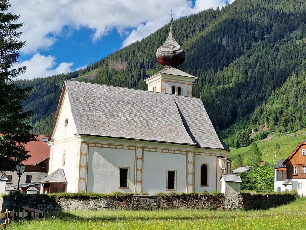
We were not done yet as there were still a good 2 km to go to reach St Nikolai. Unfortunately they were all up beside the road, which was not that busy, but busy enough so as not to be able to walk side by side. There was regular traffic coming and going along this country road to the 1800m Solk Pass at the head of the valley. The farms beside the road gave a great inside into the cultural history and livelihood of the valley, which was entirely pastoral, with no arable land. After a long half hour in the warm afternoon we reached the small road which led down to St Nicolai and took it for 500 metres to reach the historic village with a few old farms, a beautiful church with its onion topped tower and the large squat block of the Gamsjager guesthouse, which apparently dated back to the 13th Century.
136. The massive squat chalet type guesthouse of Gamsjager in St Nikolai was centuries old
The guesthouse let us in. I was already booked for 2 nights while Peter and Maria took a night. A group of 5 Dutch who I met in Donnersbachwald would also be joining us that evening and a couple more Austrian hikers too. St Nikolai seemed to be a bit of a hiking mecca with a few trails crossing here, and plenty of day hikes also in the stunning Solktal valley. The Gamsjager Guesthouse was perhaps 30 metres by 30 metres square and 3 stories high with another in the attic. Perhaps 25 large bedrooms in all. On the ground and first floor the rooms and hallway were vaulted like a monastery. I showered, washed clothes and had a small walk. When I returned the chatty Dutch had arrived and I spoke to them for an hour. I joined Peter and Maria for supper. The menu was great for a carnivore but offer little to vegetarians so my meal was a disspointment. The owner was too professional to scoff aloud when I told him I was vegetarian, but I could sense he thought it. He was a big burly Austrian with an enourmous belly and a heavy smoker to boot. He wont be long for this world unless he discovers restraint and broccoli.
St Nikolai Rest Day. 0 Km. 0 Hrs. 0m up. 0m down. Breakfast was not huge, but to be fair we asked for more bread and it was given. The Dutch decided to head on but rather than hike in the forecast rain to the Rudolf Schoder Hutte they would take a taxi further. This lodge was likely to not accept them as it was closed for repair for another week. They decided to go to Preintaler Hutte lodge where I hoped to be in 3 days. Peter and Maria had no worries and headed up to Rudolf Schober Hutte in the hope something would sort itself out and if it did not then they always had their tent. Our routes would digress after that until the Majola Pass in about 6 weeks when they briefly overlap again so I hoped to see them then.

137. Peter and Maria continuing westwards before the rain started for the day, while I had a rest day
I went up to my room as the drizzle started and wrote the blog for a few hours and then had a siesta. It wasn’t raining when I woke and I was a bit worried I might have made the wrong decision and squandered a day. However by midday the drizzle started again and it continued all afternoon occasionally becoming rain before settling back to drizzle again. By mid afternoon I needed some air so went for a small walk exploring the village on a 3 km track I found called the St Nikolai Rundweg. It took me on a circuit around the hamlet, which was really dominated by the Gasthus Gamsjager and the church although there were some 30 other houses, many of them old and characterful, in the hamlet. the inside of the church was much more lavish than I expected. I suspect that the Gasthus Gamsjager was once the rural landlord’s house in centuries past and it was also part barn, dairy and storerooms for the local community too and the church was connected to this landowning lower aristocrat.
138. The small church in St Nikolai with its onion shaped roof on the tower which was clad in wooden shingles

139. Inside the church at St Nikolai. The decor was surprisingly opulent for a church in such a small village.
In the evening I got a message from Peter and Maria saying it had been a difficult day with stormy conditions on the pass over to Rodulf Schober lodge, which was indeed closed with only an old caretaker there, and he sent them on their way down to Landhaus Etrasee. Which is where I will probably end up tomorrow. It justified my day off when I heard it was so stormy on the pass, especially as I was a day ahead of schedule.
Day 020. St Nikolai to Etrachsee. 17 Km. 7 Hrs. 1250m up. 990m down. There was a disappointing mist hanging over the hamlet when I woke. Worse still it was dripping off the eaves into the gutters below on the old building outside my window and higher up the mist was being driven by a fresh breeze. The forecast said it would stay like this until mid afternoon and then clear up. I had already decided to go, come what may, so after the perfunctory breakfast I was given I set off a bit after 0900. It was just a drizzle really so I decided not to don my waterproofs, but just walk in shorts and my softshell jacket.
I headed out past the church and then took the track which went up the Braualmbach valley beside the stream. About 15 cows were sheltering under trees and when they saw me they all came towards me at a brisk pace. I had to shout and wave my arms and sticks to get them to stop. I think they assumed I was bringing them salt or something. It was a beautiful calm valley on this misty morning and I followed the track through the meadows with the large stream meandering along the valley floor.
A good half hour after leaving I passed the Braualm alp with its 2 or 3 houses and some 100 cows and a few horses scattered about in the surrounding meadows. Many of the cattle were sheltering under isolated giant firs which had been spared the axe. It was a very peaceful place and I felt I was wandering through a romantic era painting of a misty pastoral scene, which it was. The valley extended up for about 3 km from St Nikolai with flat meadows on the valley floor and then steeper meadows extending up either side where the forest had been fairly recently removed as the rotting stumps still littered the meadow.
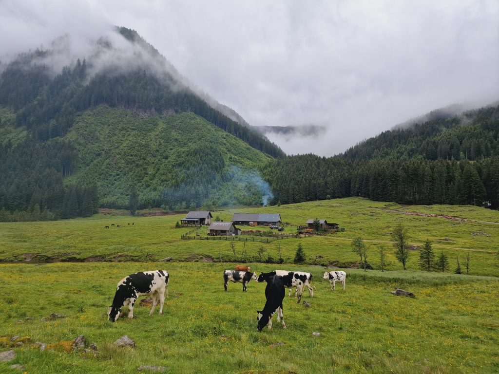
140. Heading up the pastoral Braualmbach valley with the Braualm behind the cows
After 3 km the valley came to a headwall with about 5 streams tumbling down it from various high hanging valleys and alpine bowls high above and lost in the mist. All of these streams were tumbling down the steep headwall in white torrents and one cascaded down steep rock slabs in a waterfall, called the Durmoos waterfall. The path now had to go up this headwall in a series of zig-zags through a harvested area of forest for perhaps half an hour. It then eased off and went into the tall firs on a metre wide drove road which would be used to drive the cattle up and down. An hour after leaving the main valley the forest thinned and I was crossing a sodden alp when 2 houses and a barn appeared out of the mist and I realized I must have reached Hohenseealm. As I passed the buildings the mist cleared momentarily and revealed the lake, Hohensee. There were some small fish rising near the shoreline, probably trout, and there was an upturned dinghy beside the barn, obviously used for fishing by the alp owner.
141. After climbing for well over an houur from the Braualmbach valley I reached Hohenseealm beside the deep lake
For the next hour the path climbed, sometimes quite steeply through the larches with alpenrose as ground cover. The flowers were almost out now. Here and there I noticed an Arolla pine. It was slow going because the path was small and greasy, with a mix of bare rock and wet turfy soil. I had to place each foot carefully as I climbed. On one section there were 3 small ladders of 6-8 rungs each but they were not at all exposed and it was more of an aid to get up a steep 45 degree slab. Occasionally the mist cleared enough for me to see the Hohensee lake below but usually I was just plodding up, disorientated by the mist.
The small, well marked path crossed a ridge and then dropped down into an small alpine valley containing another of the streams which tumbled down the headwall. I crossed the stream and then slithered up on muddy boulders in the scrub alder until I got to a very small lake at about 1900 metres. Virtually all the larch and scrub willow had vanished now and I was onto the bare hillside covered in alpines. Many of the alpine flowers have the ability to close up and hunker down in poor weather and most had done so. As I climbed further the larger Schimpelsee appeared just below me, but I was going up away from it on the final slopes which led up to the Schimpelscharte pass at 2276m. There was the odd snowfield to cross on this north facing slope before the final rocky 25 metres. Occasionally I got a glimpse back of some of the route I had come up when the stiff breeze cleared the mist for a while. I did not linger as I was still in my shorts and softshell jacket and the northerly wind was chilling my hands.
142. Looking back down the north side of the Schimpelscharte pass to the Schimplesee lake
The top was misty but just 10 metres on the other side there were cleared pockets and the wind had completely ceased as I was in the lee of the ridge. As I descended a further 30-40 meters I was in another world looking down the Grafen Valley which was initially a large boulder strewn bowl beyond which was the upper sparse tree clad slopes, and then the fir forest with meadows dotted about them. It was dry here and this was probably a combination of the vanishing drizzle as per forecast and the lack of mist which coated everything in a veneer of water. I could start to trust my boots again on the rock, which I think was gneiss. After a good half hour I made it through the boulderfield unscathed and was approaching the treeline.

143. Looking down the south side of the Schimplescharte towards the Rudolf Schoder Hutte and Etrachsee
There were some magnificent old Arolla pine in the upper forest, even above the larch and at the same altitude as the highest Pinus mugo pine shrub. As I descended these Arolla pine trees became more plentiful. I noticed that only the large ones had cones beneath them as the medium or small trees have not reached the requisite 40 odd years of age when they started to produce cones. These cones have become very fashionable to flavour schnapps or grappa with but are hard to come by. After another 100 metres of descent I entered the denser firs forest and followed it down to the Rudolf Schoder Hutte cabin. It was closed as Peter and Maria warned. The opening times of this particular hut seem very erratic year to year. I had already decided to continue to Etrachsee lake anyway.
144. A small copse of the Arolla Pines which were growing at abouut 1900m, even higher than the larch
I dropped onto the track and followed it down to the main stream in the valley which it crossed and the track then turned to parallel the stream south. It reached Grafenalm within a few minutes and perhaps 10 from Rudolf Schoder Hutte. Grafenalm was a mix of beautiful old log alm houses, blackened by the sun and smelling slightly bitter and a few newer alm houses with solar panels. There seemed to be signs of cattle about but it also looked like a few houses were leisure only.

145. The delightful cabins of the alm on the northside of Etrachsee lake, which is hidden in the trees beyond
A good half hour after Grafenalm I reached the lovely alm with its pretty cottage and barn on the northside of Etrachsee. This was very much a working alm and there were many cows with bulging, taut, udders full of milk and looking awkward to walk with. There was a large bull here too who looked peaceful enough but I gave it a wide berth. The track came down the east side of the very idyllic looking tree fringed Etrachsee Lake which was about half a km in diameter. At the south end of it was a cluster of very old looking log cabins, most were 2 storey and this was Landhaus Etrachsee, one of the nicest places I should imagine I will stay on this entire trip.
146. Landhaus Etrachsee is a guesthouse in the old cabin, barn and boathouse of the original alm. This is the boathouse of the wonderful homestead
Landhaus Etrachsee was owned and run by Christine whose father bought this place some 55 years ago. Christine was kind, helpful, arty, well-educated and slightly bohemian or eccentric. The two larger 2 storey cabins were part of the bed and breakfast accommodation, and the third cabin of the old homestead was a very characterful cosy fish restaurant, with trout and char from the lake. I should imagine it was very much on the driving/electric bike foodies tour. Christine had no food except breakfast and this is where her guests ate dinner and snacks. She leased it out to a chef who ran the place leaving Christine free to socialize. I ate a very filling dish of cheese filled dumplings here.
I was sleeping in the annexe which was probably once the barn and boatshed. I was right beside the water and looked onto the lake. The accommodation was old and quirky, but full of character. However the main old house was brimming with history with books, hunting trophies, wooden skis and all sorts of old dairy implements on the walls. I sat in this main room and wrote while Christine chatted with a few of her local friends on this Friday evening. It was a delightful place, a hidden alpine treasure just rustic enough to keep the pampered out.
Day 021. Etrachsee to Zauneralm. 21 Km. 9 Hrs. 1120m up. 1420m down. I had an early breakfast as today was a bit of an unknown day. The promised good weather did just not arrive and there was cloud on the mountains and a threat of rain from the dark skies. I chatted with Christine over the excellent breakfast she served. She told me she was 72 but it did not show. She had built a 500kwh hydrostation just below the cabin and it provided all her power and she was now starting to get a good price selling it also, repaying the million euro plus investment.
I set off at 0800 and this time went round the west side of the lake on a small path. Fish were rising everywhere, with some leaping out of the water. There were plenty of mayflies on the path and many ventured out over the water where they were snatched by the 15-25cm trout. There were so many trout rising I wondered if it was stocked. Christine had a few casts of historic trout hanging in the dining room and they were 2-3 kg and one was 6 kg and it had morphed into a ferox. I would never have imagined there were ferox trout in this small lake.
147. The cows at Obere Trattenbaueralm were hoping for some salt or another treat and crowded round me.
The path soon reached the delightful alm at the north end of the lake to meet the track I was on yesterday. Soon after I turned off and followed another track to the NW as it climbed up through the firs passing a couple of pretty alms hidden in the forest and only revealled by the clonking of cow bells. Again, as I walked through one, the cows ran towards me in the hope of some snack. They were big powerful cows and it would be dangerous to come here with a dog who goaded them to stampede. Before the forest ended then mist turned to drizzle. I walked on until I got to a small cottage, possibily for hunters, and I took off my soft shell and put on my rain jacket as who knows what awaited me up the mountain now covered in mist.
148. The beautiful cabins at Obere Trattenbaueralm were some of the nicest I had seen so far.
From the hunters cabin I plodded on up to the top of a pass called Hubenbauertorl at 2051m. I had no orientation at all and just followed the markings on the rocks and my GPS as I undulated for the next hour. Occasionally I could tell I was on an exposed ledge and other times I was crossing snowfields, but other than that I was in a small bubble of visibility which was about 25 metres. I am sure there would have been some great views and it felt a shame to miss them. At one stage it got very bright and I was sure the sun would break through.
And then suddenly the mist pulled away and I was in the midst of impressive peaks, before the white veil covered everything again. But then the mist started to clear more frequently, and for longer periods and I could work out the lie of the land. I was crossing a north facing bowl between 2 peaks. I had to cross a ridge from one of the jagged peaks to enter another bowl and there was the odd steep bit but nothing exposed. Then I came to a larger snowfield which was reasonably steep at about 35 degrees, with boulders at the bottom. Had I slipped there would have been no stopping me until I hit the boulders at 15-20 km per hour. So for the first time this trip I got my ice axe out to stop a fall. The snow was surprisingly hard and only once in the 100 metre cross did one foot slide a bit. I could have avoided the snowfield by going round below it but this would have taken half an hour on the greasy lichen clad boulders.

149. Crossing the high north facing bowl between Hubenbauertorl pass and Hinterkarscharte pass when the mist cleared to reveal an alpine landscape
After the snowfield it was an easy walk up the steep stoney path to reach the second pass, Hinterkarscharte, 2274m. The weather was improving rapidly all the time and I could see down both sides of the pass now to the grasses below the stones, and boulders, and then the trees, and finally the deep valleys below. With patches of blue sky getting bigger all the time I went steeply down the west side of the pass into a large bowl called Rantenalm. There were a number of lakes on its various levels but I only went to the first lake, and not the lower one where there was a grassed over track. The route followed a small path contouring across the steep hillside from the upper lake to the day’s third pass, which was called Rantentorl at 2166m. I flushed a number of ptarmigan on this traverse who flew off and landed further down the path just to be frightened off again.
150. Loooking back to the Hinterkarscharte from Rantentorl pass across the Rantenalm alpine meadows
Rantentorl was quite a narrow ridge where a glacier had been working away on the valley on each side creating a steep headwall. I had to go down the one on the northside. I was surprised it contained no snowfields as it faced north. It was a simple 100 metre descent on a stoney zig-zag path to the bowl below where there was a shallow lake and loads of springs welling up. There merged to form a stream which dropped out of this bowl into the upper forest of larch. The path followed the stream steeply down for the first bit until it slackened off where the larch gave gave to the firs.
151. Looking up at the steep valley side of the valley where the Innere and Vordere Neualm meadows were
The descent down the fir filled valley was easy as it went from alm to alm. On the first was a small rustic unlocked cabin where the hardy could easily have spent then night. The next two were Innere Neualm, which had no buildings, and Vordere Neualm which had a gorgeous house, smaller cabin and barn. Between the two Neualm I came across another herd of Highland cattle who were sitting under the trees in the shade chewing cud. The rocks were quite greasy on the descent and on one occasion I slipped and broke the lower segment of a walking pole. It looked easily fixed with a hacksaw though. Soon the path reached a track and I followed ity down into the valley with the scenic darkwaters of Schwarzensee across the valley floor and high jagged mountains all around it. Beside Schwarzenzee was an old hunting lodge and a few alms. The alms had all become small resturants catering for day trippers. I had my mind set on going to Jageralm and eating, and then see if I could find a campsite or even a shed to sleep in.
152. Coming down into the Kleiner Solkerobertal and looking over the dark waters of Schwarzensee
I had a necessary meal at Jageralm as I had been on the go for 8 hours straight. Then I tentatively asked about somewhere to stay and suggested some alms or the Brietlahn hutte. They either did not do overnight accomodation and just catered for the motorist/electic bike foodie or the were closed. Then the cook came through and suggested Zauneralm, over the river on the quiet side of the valley from the closed Brietlahn Hutte. It sounded perfect but like all these things something might have got lost in translation and the whole thing could be a dissapointing red herring.
I set off down the valley on the track and passed Hamaralm quite quickly. It sold cheese and had a waterwheel and it might have been a slightly more authentic place to eat. About half an hour later I passed Grafenalm. It was empty but the main house had a large veranda I could have slept under and table to write the blog on. But I decided to give the information I had on Zauneralm the benefit of the doubt. It was another half hour until the Brietlahn Hutte appeared by the large carpark where everyone parked to walk to the alm resturants by Schwarzsee. Breitlahn hutte was the usual choice for people walking the Zentralalpenweg as it was an Alpenverein cabin. However there was now new host and it was not opening for another month. It looked lovely but with its proximity to the carpark it would really be a day trippers resturant rather than a hikers watering hole.

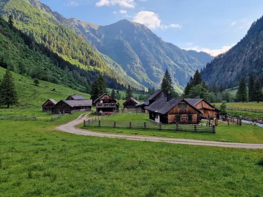
153. The absolutely beautiful Zauneralm was cluster of 8-9 cabins and barns, some 200 years old
I followed the track to Zauneralm over the bridge and came to a cluster of beautiful sun bronzed cabins, many adorned with window boxes brimming with geraniums. There were people about so I went through a gate onto a beautiful lawn in the midst of the cabins and spoke to a lady who was called Matilda. Her husband Franz, was dressed in a grey dairy coat looking like a large apron. He was leading a cow out of one of the cabins just the other side of the fence. There was another couple talking to Matilda seated at an old table under a balcony. Matilda, who was about my age, and spoke less English than my poor German, but she said she had a room. She led me up a narrow wooden staircase through a trapdoor to the balcony above and then opened one of the door off it. It was a sweet, simple room with two pine beds and red checked bedding. A chocolate box bedroom. There was a shower and toilet nearby. I unpacked and changed and went downstairs and was ushered into the main room of the cabin which was the dining room, with a big table.
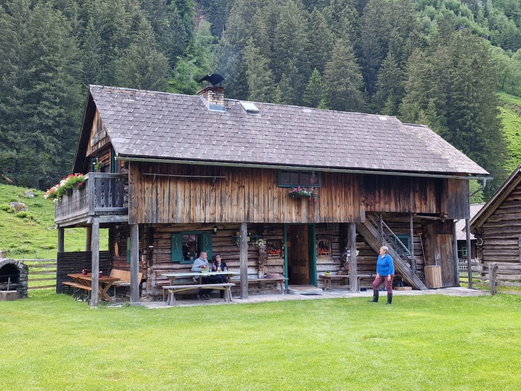
156. Matilda on the lawn in from of alm’s cabin. The kitchen is in the middle and the bedrooms are up the small external stairs behind her..
It was a lovely room with a rich ambience and history. An old but clean and shiny metal oven warmed the place, beside it was the old clay oven and on top of it were some 10 large Styrian Cheeses sitting on round boards. It was the typican and unique Styrian crumbly cheese. Matilda gave me a radler and a styrian bread, like a fried chapati, with some of the crumbly cheese dropped on it, before it was all wrapped up like a pancake. There was nothing shy about this crumbly cheese and it was no passive Emmental. I find it delicious. I then wrote the blog for an hour when Franz appeared at the door with my broken walking pole. We hacksawed the kinked broken end off and inserted the rest into the middle section and it worked perfectly.

154. Inside Matilda’s kiitchen at Zauneralm with the gleaming polished range and a batch of the most recent Styrian crumbly cheese just drying off before it starts to mature in the store room.
Matilda kept coming through to the kitchen next door to get treats for her friends outside, including a bottle of Scotch Whiskey. There was lots of laughter as Franz joined them also. Eventually at 2030 they went, Franz I think went to bed and Matilda came through to join me. I put the blog away unfinished and chatted to her for almost an hour, gleaning what I could of their life. Her and Franz were grandparents and his family, and I think hers also, were farmers. They lived in Ennstal, 15 km down the track in the main valley in a typical large chalet, perhaps 4 stories high, with multiple balconies under the eaves and plently of window boxes of flowers. It was a large and solid house and looked gorgeous.
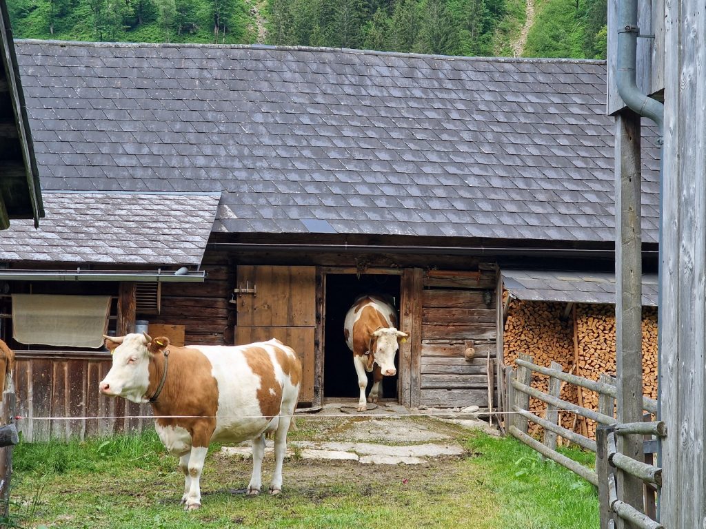
155. Two of the 11 milk cows coming out of the milking parlour after they have been milked
However, for the last 20 years and perhaps longer for Franz they left in mid May and came up to the family alp of Zauernalm for 4 months. There were 7 farmers who had cabins here, but they were the only ones who had animals. Many of the bronzed cabins were 200 years old. Then in Mid September, they walked back down the track to their main valley farm. The beloved and precious milk cows, of which there were only 11, led the procession of other cattle, namely calves and bullocks of which there were about 100. She showed me photos of the milk cows returning down the road with their horns adorned with ribbons and decoration. Many of the other cattle were scattered around the pastures on the valley floor and the bullocks were up at Lassachalm, a short hour up a side valley where Franz’s sister and husband looked after them. Matilda loved it up here and relished the lack of television or mobile signal. They lived for the whole summer in bliss with nothing more than the romantic, idealized dairy tasks to perform in this idyllic spot. Matlida asked what time I wanted breakfast. Anytime from 0400 onwards made me realize I was on a farm and not at a guesthouse or mountain hut where I had to stuggle to get breakfast at 0700. I settled for breakfast at 0600 and went up to the cosy room, of which I think there were 3, all with 2 beds. It was a fascinating end to a great day.
Day 022. Zauneralm to Preintalerhutte. 10 Km. 7 Hrs. 1420m up. 820m down. I went down from my large homely breakfast at 0600. The sun was already lighting up the higher west facing slopes above the valley. Matilda kept looking out of the window waiting for the milk cows and at the end of breakfast at 0630 all 11 arrived, walking down the track with their taut udders bulging with veins, and Franz following them trying, to seperate a non milking hiefer from them, who was wanting to gatecrash the milking and the special fodder. Matilda jumped up and went to prepare for her tasks. I came out 5 minutes later to see what was happening.

157. Franz in the milking parlour with the milk cows who were happy eating fodder while being milked. Franz was attentive to his cows
All 11 milk cows were in the milking shed with suction cups attached to their udders. The extracted milk went up to a pipe at the ceiling and through into another room. The cows were all eating a special fodder which they loved and it must have enticed them out of the meadow and down to the alm track in the morning. They were very content and Franz was going along checking the cows and making sure they were well, feeling and patting them. He was proud of his milk cows and obviously loved them.
In the other room the milk dribbled into a machine which separated the cream from the rest of the milk. The cream poured into a stainless steel pail, and then when it was full it was emptied into a butter churner. Matilda made 8 kg of high quality butter every day, which she patted into shape, wrapped in grease proof paper and froze. The milk was then turned into cheese by adding rennet and letting it curdle. It was then heated, she used the term “cooked” by I dont think it was boiled. The small globules of cheese were then put into 3 moulds and pressed so all the whey was squeezed out. The round cheeses in these 3 moulds were then taken into the kitchen for about 4 days to start to mature, and then were taken into the cheese store room. Once there they would remain at 14 degrees for the rest of the summer and stay there all winter until they were ready in the spring. I guess each cheese weighed 5 kg so at the end of summer they would have about 1500 kg of cheese and 1000 kg of butter, all of it handmade, organic and high quality.

158. The dairy at Zauneralm. On the right cheese milk and butter cream are separated. Left is is butter churner. On the far wall is the cheese cooker and and presses
It was a fascinating insight into their lives and I was very grateful they showed it to me. This was probably a centuries, if not millenia, old practice and it occured all of the the Northern Hemisphere of the Old World in many variations. Social scientists call it Transhumance, but to those involved it is an unquestioned tradition where the rich, snow-watered pastures of the summer mountains are best used without squandering the grasses and hay in the valley which is used for autumn and winter respectively. Perhaps the Siberian reindeer herders or Tajikistan nomads or Kurdish pastoralists of Asia would do it slightly differently to the Romanian shepherds or the Alpine pastoralists of Europe, but these differences would be neglible compared to the similarities. And just below our urban veneer of coffee shops, fine dining and German cars, it is still lurking in the cultural DNA of every one of us.
159. A last mornful look back to the idyllic Zauneralm as I headed up the mountain again
I left the idyllic alp at 0700 when it seemed Franz and Matilda’s day was half done and walked up the track having a mournful, sorry look back at the departing cabins. I could see the milk cows leaving the milking parlouur and returning down the lane. However, I was also full of joy knowing this still goes on and euphoric at having seen it. The clearing skies helped with my mood and I sauntered up through the forest feeling very comfortable until an hour later when I walked over the lip of a hanging valley into an alpine Shangri-la with a hidden valley ringing with clonking cow bells as the bullocks ate the lush grasses in the meadows surrounded by fir forest and very high, jagged, angular peaks full of snow fields. In the midst of this sat Lassachalm with its very pretty barn and absolutely idyllic cabin, with smoke slowly rising from the chimney. It was where Franz’s sister and her husband spent the summer. Just next to the barn and cabin was a hunting cabin probably used by different people in the autumn when the farmers and their animals had gone home.

160. Franz’s sister and brother in law ran Lassachalm where the non milking cows and bullocks grazed in the higher side valley

161. Some of the non milking cows in Lassachalm just before the climb up to Trattenscharte started in earnest
The track ended at the alm and now I was just following a well marked but barely used path as it went up the hillside on the northern flank of this side valley. It crossed a few rocky areas where houseleeks were flourishing in the stony soil, free from competition. With each hundred metres I climbed, the skies cleared even more until at least half was blue. The larch trees dominated all the way up the side of the valley, probably because it was quite dry and south facing so a bit arid. The alpenroses were still holding out from opening their flowers fully, perhaps a bit unsure of ther weather as it had not been great the last week. After a further hour’s climbing I reached the treeline beyond which not even the larch or Arrola pines would go and eached another small hut. Again it was probably a hunters cabin for the autumn hunting season for chamois, deer and possibily even Ibex.
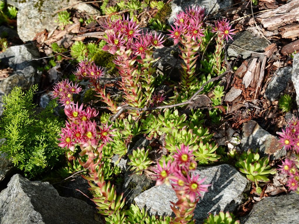
162.. The curious Houseleek is a type of sedum which thives on dry stoney ground where other plants cannot compete

163. Looking back down to the hunters cabin and the valley below where Lassachalm sat in the meadow surrounded by firs
From the cabin the path took on more of an alpine character for the next few hours. It climbed easily to the top of the ridge on the north side of the valley, where there was a big cave with firewood stacked in it, but I should imagine questionable in a electrical storm. From the top of this ridge I could see down to Stummeralm far down on the floor of this side valley whch was also hanging above the main Klienersolker Obertal valley where I spent the night. However at the head of this valley was a jumble of high peaks and snowfields where I had to follow the faint path. It looked spectacular and alpine.

164. On the ridge between the hanging valleys were Lassachalm and Sturmmeralm were respectively located
From the ridge the path dropped slightly into a tarn strewn bowl where I had a good drink before starting up steep grassy slopes, small rocky outcrops and crossing occaional shallow snowfields for a good hour. The path treaded an ancient route through all the obstacles, perfected by centuries of knowledge gleaned from hunters and farmers. It avoided the steeper snowfields and outcrops and was very managable. After two hours it reached a very snowy plateau with some still snow covered lakes on it. My map and GPS indicated there was a route to the pass on the west called Trattenscharte, 2408m. However, I could only see very steep snowfields leading up here so was getting a bit worried.
165. A herd of sheep surprised me on the snowy plateau just I was about to cross the snowy Trattenscharte Pass in the middle of the picture
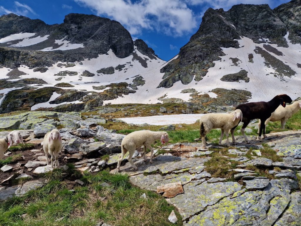
Suddenly out of the blue in this most isolated and snowy place a herd of sheep came bounding towards me. I was initially enchanted until about 15 of them surrounded me and started to acost me. They were mostly rams and they were large, perhaps 100 kg each. They were licking my hands with coarse tounges and I could feel their hard noses nudging my hips begging for morsels or salt. Had anyone of them got frustrated and butted me they would had floored me. I shouted, swung my arms and backed off, then swung my sticks to deter their advance. It seemed to work and I could retreat towards the steep snowfield I had to climb.
166. Loooking back to the snowy plateau where the sheep ambushed me from the final meters up to Trattenscharte pass.
I had been looking at the snowfields to the pass from a forshortened view. That and the streaks down them from melting surface water made them look much steeper than they actually were. It took me little effort to climb the soft surface, kicking shallow steps where necessary until I reached the top half an hour later. In fact the snow covered all the boulders with a smooth even firm surface and I made good progress. I post holed a couple of times when I strayed to close to rocks which were sticking through and had allowed the thinner snow around them to melt more and become soft.
167. At the top of the Trattenscharte pass looking at the route south towards the lakes and eventually Prientalerhutte
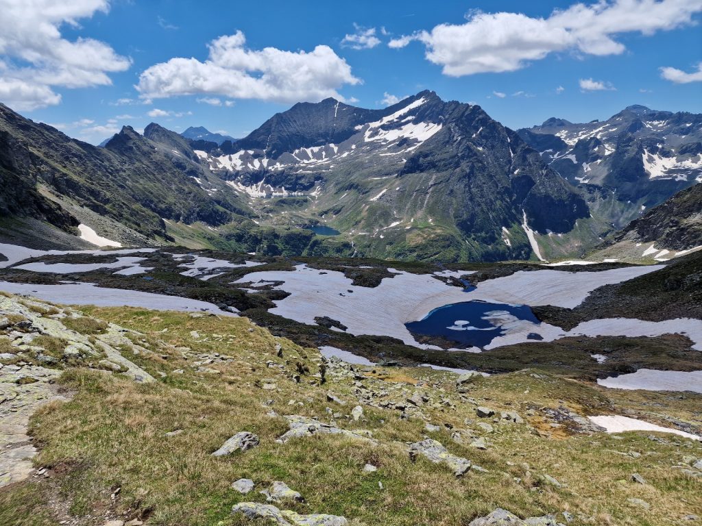
At the pass at great view opened up to the SW over the ridges of the Niedre Tauern each increasing in height slightly. They looked a gnarly range with steep sides, deep valleys and many small lakes in alpine bowls. This part of the Niedere Tauern range is called the Schladminger Tauern and I will be following its serrated spine for about the next 4 days. Especially striking were the two high, very deep blue, alpine lakes to my south across the valley under the spire of Waldhorn, 2702m, one of the biggest of the many lofty peaks in the area.

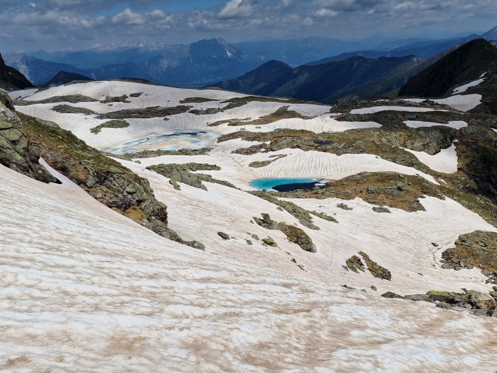
168. The small tarn of Trattensee was still largely covered in snow and ice. It was just before the descent started in earnest.
The descent down the SW side of the pass was glorious. High snowfields covered the boulders and I could contour round the bowl on snowfields until it was time to descent one of them down for 100 metres. I managed to link a few up and before I knew it I had dropped a couple of hundred metres to the partially uncovered Trattensee, a small alpine tarn, with a turquoise snowdrift submerged across one side. From Trattensee the path started to traverse down the hillside into the deep valley which I could not see into, but knew was there. Eventually the Preintaler Hutte appeared at the bottom of the valley surrounded by peaks on all sides except for the way down the valley below it. It took almost an hour to reach the Hutte down the small rocky path where I alway had to watch my step. Soon I was in the larch trees covering the steep hillside. Here the alpenrose were much more advanced and a few bushes were in their full glory with other soon to follow. Perhaps the near perfect blue sky was encouraging them. Bees were hovering over them with 2 or 3 to a bush.

169. The start of the descent down to Prientalerhutte. In the middle distance is the climb up to Klafferkessel plateau for tomorrow.
I crossed a log bridge over the stream which originated in the bowl with the two dark blue alpine lakes, and also from the bowl I had descended, and reached the large hut. It was Sunday and the tables outside were busy with day trippers. Many smelt of perfume and had brightly coloured new shoes. The hosts, a bright, efficient, couple who worked well as a team where serving the day trippers but still had time to show me to my room. It was perfect with a single bed, hard mattress and single charging point. I went out to eat and order a macaroni cheese dish using the same traditional crumble Styrian cheese Matilda and Franz made back at their lovely alm. Later in the afternoon I escaped the sun and went inside to write in the large dinning room which could seat perhaps 80 guests. In the course of the afternoon many day trippers arrived and a few hikers arrived from the higher peaks and paths but only 10 spent the night.
Day 023. Preintalerhutte to Landawirseehutte. 13 Km. 8 Hrs. 1830m up. 1510m down. Wolfgang and Marit who ran Preintalerhuttte did superb job. I noticed the previous evening how Wolfgang circulated round all his guests and go to know them. When he came to me I told him what I was doing and he said about every 5 years someone comes through the Niedere Tauern enroute to Monaco. Most people he said avoid it and go south. He said in a normal year I would find it difficult with extensive snowfields, but this year there was little snow so I would find the going much faster. Wolfgang should know as he was 50 years old and had been here virtually every summer all his life as his father was the hut warden before he took over. When I came to pay I noticed it was extremely cheap and pointed out he had forgotten the accomodation. He said he hadn’t forgotten but to consider it a gift to help me finish my journey. Yet another plus point for his hut was that he and Marit offered a buffet breakfast from 0600 onwards. I took advantage of this and was saying goodbye at 0645 for an early start on what promised to be a long day with over 1800 metres of ascent.
The weather was not good though and the skies were grey and the clouds moving west to east. There was no blue sky at all and infact there was a real threat of rain. I headed up the to the south towards Klafferscharte and had barely gone a kilometre when the first rain fell. At least the mountains remained clear of mist and I could see them which was the main thing. I could put up with a bit of rain as long as the views remained. The route left the valley floor and started to climb up the hillside to the west towards the Klafferscharte pass. I could see 2 couples ahead of me who also took advantage of the early breakfast. One pair were very fast like fell runners.
As I reached the Klafferscharte the mist which had been threating for the whole hours climb quickly enveloped the summits and then came down and enveloped everything. There was nothing to see and I was just about to walk across the Klafferkessel, a unique plateau with numerous tarns and a place of renouned beauty. I felt cheated, but had to plug on anyway in the mist. Occasionally it would thin and I could see perhaps 200 metres but then the thick mist would return and I could only see 20. It was dissapointing.
However suddenly the mist cleared and I could see small lakes and tarns all around me and then the high jagged mountains beyond them. It was a spectacular landscape and quite a wet one as there were many snowfields feeding rivulets which flowed over the damp ground to soon find a tarn. Up ahead I could see one of the couples going up the rocky slope to Greifenbergscharte and within 20 minutes I was there too. It was a notch in an alpine ridge below the steep bulk of Greifenberg mountain itself. There was a steep marked descent on the otherside of this saddle but my route was to continue up to the summit of Greifenberg itself at 2618m, which was the highest I had been all trip.
The route to the top ascended perhaps 150 metres, some of which were marginally exposed and protected by good wire cables for 20-30 metres. At the summit there was a metal cross and a great view however the mist lingered on some of the tops including the massive steep bulk of Hochgolling, 2862m, which I was heading towards. I could see the Trattenscharte pass I had come over yesterday below me to the north but not the summits around it. It was a great view all in all but the overcast skies and high mist took the edge of it. I suppose it could have been much worse.
170. Looking down on the Klafferkessel plateau from the summit of Greifenberg.
The descent was also 1000 metres and was quite relentless. The small well marked path dropped down in a series of zig-zags with some quite steep short sections. The rain returned and then it cleared only to return again and my jacket was on and off frequuently. When it rained the path was a bit trickier especially the steeper sections. Wispy waterfalls cascaded down the crags beside the path as I entered the upper larches. Soon Gollinghutte appeared on the valley floor in the larch forest. As I neared it the rain became intense for 5 minutes but then it cleared and they was blue sky again. The final run down to the lodge was through Alpenrose which were almost all out and tainting the hillside crimson with their bright flowers.
At the lodge I had a quick meal as it was midday now and then prepared to head off on the second half of my day. It involved another large climb but this one was only 700 metres. I left the hut and went up the valley into what looked like a dead end with huge, near 1000 metre, rock faces encircling the valley floor. However, there was one way out up a steep stony couloir. At the bottom of the couloir and under the north face of the imposing Hochgolling was a meadow which was yellow with buttercups. It brightened up this otherwise grey day. On the meadow were 4 horses and 4 foals. The foals were very young and were running around playing with each other like spring lambs, despite the rain showers. It was a joy to watch them with their unbounded energy.

171. Some of the 4 foals in the buttercup filled meadow just above Gollinghutte and before the climb up to Gollingscharte
The climb up the couloir took nearly 2 hours. The path was often submerged by a snowfield and I had to work hard to slither up it. Once higher the path appeared and it was easy to follow. As I neared the top the mist cleared from most of the tops briefly but not Hochgolling which loomed dark and hidden above me. The bright yellow flowers were all over the hillside and where they formed clumps they were almost luminious on this dull day. I reached the top of the pass, Gollingscharte, 2326m, at the same time as two ladies who came up from the other side. We congratuated each other and had a 10 minute chat. We both had a downhill run to our various huts.
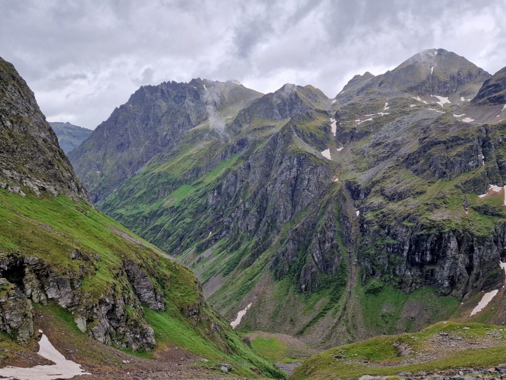
172. The view back down to the meadow with the foals below which is the Gollinghutte, from the steep climb up to Gollingscharte
I could see mine across on the otherside of the valley. First I had to come down a long snowfield. I was tentative at first but soon realized it was perfect and I almost ran down descending some 200 metres in 10 minutes. The remaining 400 metres to the valley floor were a bit more laboured as it was down a steeper hillside of turf and gravel with the occasional rocky outcrop. I eventually reached the track on the valley floor. I could see Landawirseehutte at the end of the track on the far side of the valley in a high alpine bowl at about 2000 metres. It was only a kilometre up the track but it poured the whole way. For the first time this trip my shorts and underpants were soaked and I should have put my overtrousers on but didn’t.
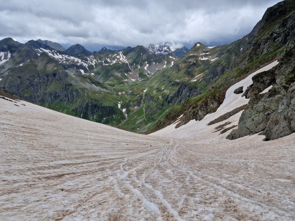
173. The view down the snowfield on the west side of Gollingscharte was an easy descent to the valley below where Landawirseehutte lies
Landawirsee hutte was small cosy hut with a roaring fire inside a huge ceramic stove. It was pumping out heat into dining room. The young, easing going staff made me feel welcome and then showed me my tiny simple room. Once I got out of my wet clothes I went down to the cosy dining room and wrote the blog for a couple of hours before supper. There was no internet here either so I was oblivious to what had happened in the world for the last 3-4 days and I had no idea anymore of what the weather bring.
Just as I finished two other younger guests arrived. They were given a room and then came down and were talking a lot to the staff. There was lots of laughter and animated converstion. After my supper of spinach dumplings in a sea of metled butter I tentatively introducted myself to the other guests, who were Leon and Sarah. Leon replied in fluent English with an Australian accent, and it tuurned out he was half Australian. He worked in a hut in Upper Austria in the limestone region near the Czech border. The laughter with the staff at Landawirseehutte before supper was the comparing problems and clients they both had to put up with. Leon was bright and well read so was very easy to talk to and we chatted for a good two hours before the shadows of the surrounding mountains consumed the last flashes on sunlight on the hills. It was perhaps the first time on this trip I was able to have a fluent chat in English, and also about topics which were not just practical or about the weather. With the big clay oven pumping out warmth into the characterful room with its log walls it was exactly the sort of evening one hopes for in a mountain hut.
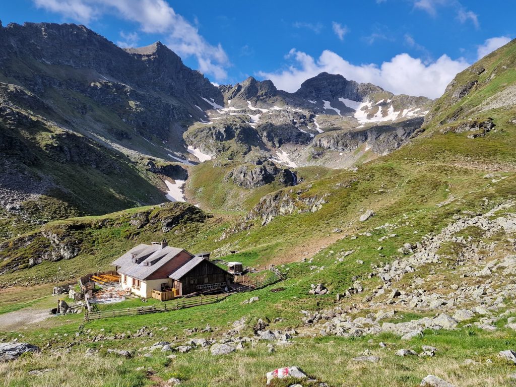
174. Landawirseehutte is a cosy huutte run by a cool crew in alpiine meadows at nearly 2000m
Day 024. Landawirseehutte to Giglachseehutte. 12 Km. 6.5 Hrs. 960m up. 1040m down. It was a typical hut breakfast with muesli and milk, dark homemade bread and slices of cheese, and strong coffee, all at the usual time of 0700. It was a great morning with just a bit of retreating mist of the huge massive bulk of Hochgolling. Leon and Sarah were heading off in that direction to see if they wanted to give Hochgolling a go while I was going in the other direction. I said goodbye to the very friendly staff at the hut, swapped emails with Leon and set off at 0830, a bit later than I would have wanted, but I was assured it was a short day. Blue sky and high cloud were about 50/50.
My first project was to climb the 200m high ridge to the north of the hut. This took me back over the Main Alpine Divide again to the northside. The view from the pass was good but not as alpine as I anticipated. Instead I was looking down a large valley to the north which headed down to the enourmous Ennstal valley below it. Ennstal valley drained the entire north side of the Niedere Tauren and was one of the giant valleys that dissected the mountan massifs of Austria. Beyond Ennstal valley I could see the light grey south face of a the lofty Dachstein Massif, with its near 3000m peaks. Behind me Hochgolling was now clear and slowly lightening up as more and more of the sun illuminated its west facing slope, previously in the shadow.
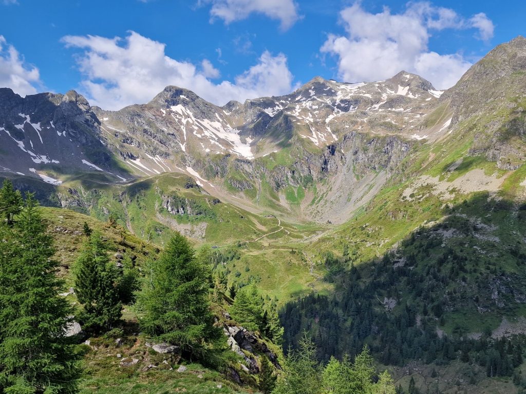
175. The view west from the Trockenbrotscharte pass between Landawirseehutte and Keinprechthutte towards the latter
It was a pleasant, easy hike down the otherside into the upper reaches of Obertal valley. As I descended the the path veered west and it took me into a much more impressive landscape which had previously eluded me. Obertal ended in a cirque of jagged peaks, where there were a couple of alms and the lodge of Kienprechthutte. Far below me a large herd of golden brown cows milled around on a large pasture which was now basking in the sun. I kept my height and contoured round high above them until I reached the track which led me to the hutte. It was only 1100 but I went in for some cheese and bread and a large glass of sparkling water.
The hutte was quite quaint with the usual terrace of orange stained and heavily varnished tables and benches on it south facing side. I prefered the shade so went it. There was a middle aged Austrian owner, a sheepish woman scurring around and not looking up, who could easily have been his subserviant wife and a young Nepali waiter. The owner was small in stature with a large belly. He had a hawkish features with lively eyes but his skin was swarthy and pockmarked and he looked as unwashed as his jeans. Here was Napoleon gone to seed. He was hovering over the Nepali waiter who looked like he was expecting another row. I ordered my bread, cheese and water in Nepali which confused Napoleon but delighted the waiter.
It seemed there were two ways to Giglachsee from here. However the one I had preplanned to do was seldom done, difficult and still covered in steep snowfiields. Whereas the other way over Rotmandisp was the normal way and Napoleon said it was the only option at the moment, so around midday I headed down for 5 minutes to the small tarn to start the climb up the south facing slope. The route zig-zagged up for about half an hour in the glorious sunshine. About half way up my footsteps disturbed another sandy coloured adder, about 60 cm long, who slithered off into the grass as I approached. As I climbed the view got more and more spectacular especially behind me to Hochgolling and the peaks all around it and eventually the large snowfield I came down yesterday.
As I climbed higher I entered a sunny high bowl, strewn with rocks but also with alpine grasses and small rivulets of meltwater. I passed a small herd of 4 goats here. Two venerable elders, with beards like a Chinese sage, sat impassively looking at me chewing cud, while the two younger ones were pawing on their elders backs to goad them into some sort of defence plan. The sages had seen hikers before and carried on chewing cud. Just before Krukekscharte there was a narrow 100m ledge to walk along which broke the monotony of the climb with a bit of adrenaline.

176. The final metres up to Rotmandisp on the pass between Keinprechthutte and Giglachseehutte. The biggest mountain is Hochgolling to the east and to the left of it is the snowfield down from yesterdays pass
Krukenscharte was a false top and from here the real top of Rotmandisp revealled itself. There was a large north facing bowl to cross to get to it, and it was largely covered in snow. There were many footprints across it and it was never steep. It took about half an hour to cross it and gain the orange rocks and gravel which made up this ridge. It was the highpoint of the day both literally and figuratively as by now the weather was perfect with not a cloud in the otherwise blue sky and just the slightest breeze. On the other side of the pass to the west lay a large alpine plateau with the two Giglachsee lakes on it. Beyond this plateau was a ridge of smaller mountains of bare grey rock. I was just about to head down when I saw a herd of about 25 sheep flaked out and spreadeagled on a grassy patch. They looked listless and drowsey from sunbathing. I gave them a berth to avoid disturbing them too much.

177. The view west from Rotmandisp looking down to the two Giglachsee lakes
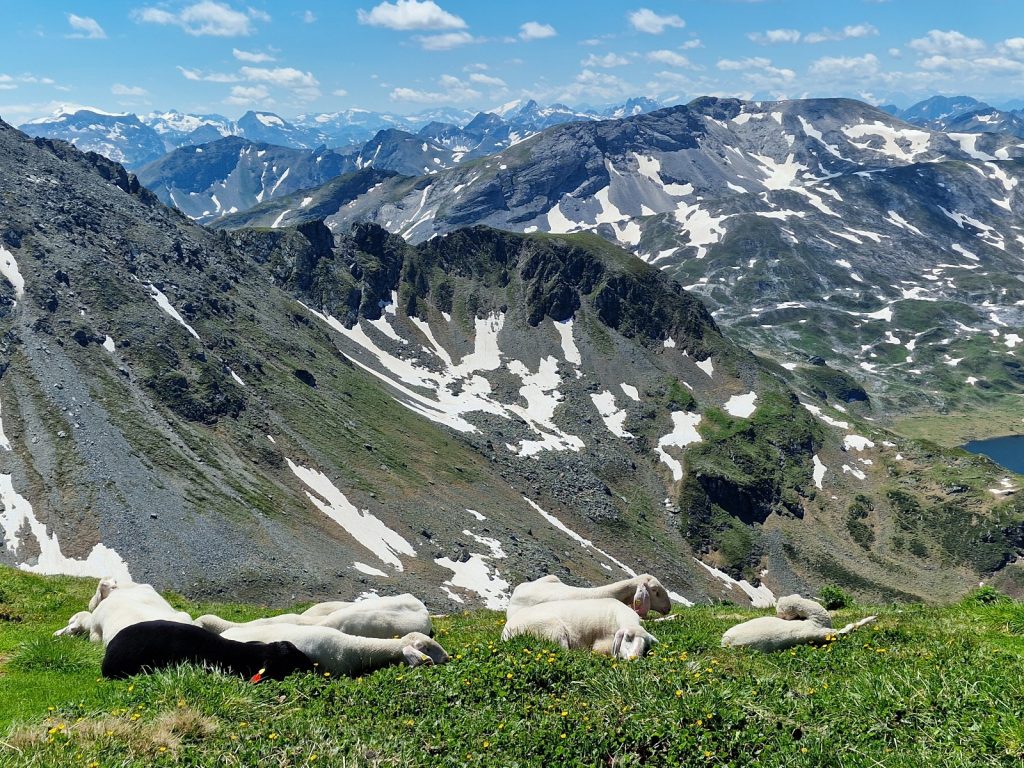
178. On the grassy summit of Rotmandisp I came across a herd of sunbathing sheep who were spreadeagled and drowsy
The descent down the west side of Rotmandisp was easy on a wide zig-zagged path for nearly half an hour until I got to the plateau. Wide small streams welled up from springs and flowed across small stones and glacier buttercups were starting to grow along these very shallow watercourses. Soon their white blooms would be stream down the hillsides. I passed another flock of sheep. This time they were all huddled together as if trying to find shade in each other. Many were sitting with their heads on the ground like a sleeping dog. Before long I reached the larger of the two lakes. The route should have gone on the north side of them passing the modest Ignaz Mattis Hutte but I decided to follow the more level track on the south side of the lakes. There were many fish, I presumed trout, in the shallows, their shadows on the bottom paralleling their every move. Between the lakes I continued on the track to the north side of the upper one and reached the Giglachseehutte at the end of it.
It was a very lovely hut with a fantastic atmospheric dining room and a friendly young owner who also ran a hotel in the valley called the Hinkerhof. He had a good team here with a super manager and two sherpas from Namche Bazaar in Nepal. I felt very welcomed and was show the room straight away so I could change. There was hot water in the sink so I washed my clothes, armpits and feet, none of which had seen any hygiene since Etrachsee 5 days ago. I was the only guest so it was easy for me to write and then chat to the owner, his manager and the two Sherpas. The owner told me that this year the snow was exceptionally little for two reasons. Firstly it had been a warm winter with little snowfall and secondly there had been two Fohn winds from the Sahara which were not only warm, but carried a lot of brown sand dust which fell on the snow making it more susceptible to melting when the suns rays warmed it. He said in the 31 years since the hut was opened there have only been 4 such years, and usually he had to dig the hut entrance out on the 1st June when the plateau was still covered in deep snow and the lakes remained frozen well into June. The Sherpas spoke no German so they relished chatting with me. They did speak Sherpa, Nepali and English through.
Day 025. Giglachseehutte to Sudwienerhutte. 20 Km. 7 Hrs. 890m up. 1060m down. I had a good nights sleep in my sleeping bag with the window wide open, so the light was pouring into the room when I woke at 0600. It had the promise of a beautiful day. The hut manager, Petzer, made me a fantastic breakfast. He was an exceptional manager and the owner, Gerhardt, was lucky to have such an able enthusiastic and hardworking guy to run his hut when he was in the valley.

179. A cushion pf Moss Campion, Silene aculis, growing on a limestone rich boulder up to Akarscharte pass
I set off at 0730 as everyone said it was a long day to Sudwienerhutte, although the statistics did not indicate it. The first task was to climb some 400 metres up to a pass, Akarscharte, 2315, which lay between the two locally well know peaks of Lungauer Kalkspitze and Steirische Kalkspitze, both about 2560m. The climb up to the pass was a delight. The view got better and better with each step as I climbed up above the lakes with the infant sun, still low in the horizon, just taking the chill off. The path went south initially to the Main Alpine Divide and then doubled back and went up a open valley to the pass. This open valley had all the features of a karst landscape with deep sinkholes, fissures and holes. There was a lot of snow in the small valley but I tried to keep to the path rather than go freestyle as some of the fissures were covered in snow and I could have fallen through like a rocky crevasse.
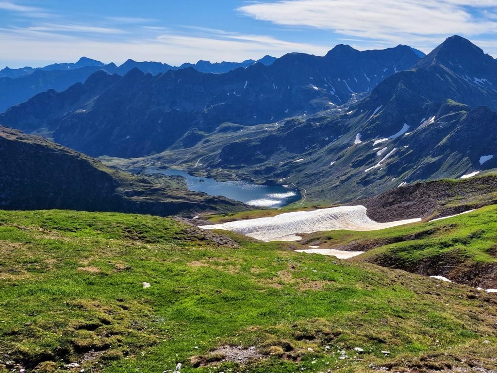
180. Looking east back down to the Giiglachsee lakes and Hutte and then beyond to the Schladminger Tauern where I had spent the last week hiking
When I got to the pass wth the easy Kalkspitze peaks on each side I was rewarded with perhaps the best view of the the trip so far. Behind me to the east was the beautiful plateau with the two lakes and then row upon row of jagged mountains I had wandered through for the last week. Ahead of me lay next weeks work with ridge after ridge until they rose up to the glaciated massifs of the Hohe Tauern, Zillertal and even Stubai in the distance. And all this under a faultless blue sky. On top of Petzer’s superb breakfast and strong coffee I was full of joy and energy. There were a few sheep at the pass also with whom I could share my euphoria.
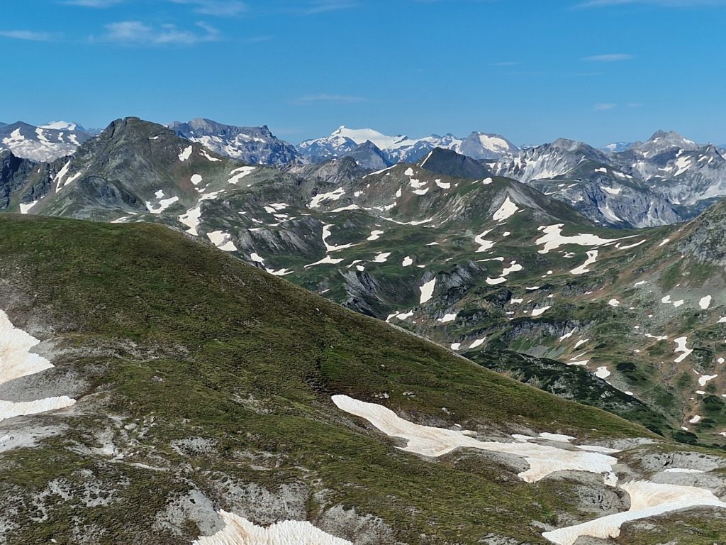
181. Looking west from the Akarscharte pass towards the Hohe Tauern in the very far distance which I will be skirting around the south side of in a week.
The journey down the west side of the pass was quite easy but there was the odd section of steep gravel to negotiate, but some 2 hours after leaving Giglachseehutte I was going down through the dwarf pine to reach a lake on the saddle. On the far side of the lake was the Oberhutte lodge. At this saddle on the Alpine Divide a spring which gushed out of the ground and should have gone south, but was diverted so it flowed into the lake and then went north. It meant there was aerated water entering the lake and there were many fish rising in it.
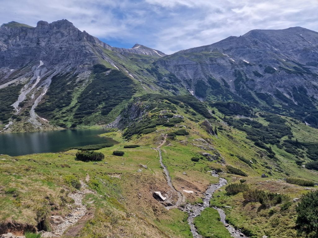
182. Looking back to the Akarscharte with the Steirsche Kalkspitze on the left and the Lungauer Kalkspitze on the right. In the foreground is the spring diverted into Oberhuttensee
I had one more saddle to go over to get to the town of Obertauern where I planned to eat something. This saddle was quite shallow with just a 200m climb over nearly 3 km to Seekarscharte. It was really a high plateau with a few tarns and grassy areas. There were a few other hikers here, mostly day trippers as they all had big cameras or baby carriers. At the indiscernable pass I got a view down the various pistes of this winter resort to the town of Obertauern, beyond which the mountains started again with the high alpine triangular shaped Zehnerkarspitze. My preplanned route took me one way but I decided to go another looking at the lie of the land.
I went far too far to the SE and ended up walking down pistes and then a tarmac road into the highest part of Obertauern right at the pass. Instead I should have headed SW and walked along a more gravelled section of road to enter Obertaurern much further down the road on the north side. It was not a big deal as it meant I had to walk perhaps an extra km. What it did mean through was I had to walk an extra km in Obertauern. There was nothing nice about Obertauern. It was a 2 km long strip of closed hotels each side of a road which would otherwise have been quite scenic. The hotels were all closed and there were vans outside each on with “…..technik” written on them. They were plumbers, sheetmetal workers, roofers, carpenters, beavering away in most of them. Most were modest with a slight nod towards Austrian or Alpine architecture but one, the Romanerhof, seemed to borrow some of its design features from Las Vagas. I walked past 30-40 hotels and large apartment complexes and not one was open, and there were no shops either. Obertauern was culturally bankrupt and existed solely for the ski season, when would spring into life with middleclass Europeans in headbands fawning over gluwein after a hard day on the piste. To add to the mediocrity of the eyesore the road was full of large, portly men, slightly beyond the last flushes of midlife, on motorbikes crossing the pass. I resented Obertauern for intruding into my idyllic Alpine sojourn and bringing out the cynic in me. After a kilometre of walking down the pavement I at last managed to escape on a track to the south and suddenly found myself in a meadow with cows.

183. The meadow at the bottom of Obertauern where tranquility returned after the dormant ski resort
I followed the track through sparse larches with an abundance of wild flowers beneath then on the sunny forest floor. But Obertauern was not done yet and I soon came to Tauernhof, a large perfunctory hotel looking complex which was youth camp. Some 30 older teenage men, all of whom looked like they had been cloned from the cover of the Boys Own Manual – Aryan Edition, were either playing football, sand volley ball or setting up a slackline over a shallow swimming pool. They all had blond hair, cut short at the back and sides, but with a healthy quiff which bounced about as they lept. I hurried through and was soon back in the larch forest.
The final 4 km were a delight. The track quickly became a footpath after another youth training camp which was dormant. The path contoured the hillside which must have had some limestone in it as the forest floor was teeming with flowers, especially the bright blue small gentians and geraniums. The larch continued all the way with the odd Arolla Pine or fir scattered here or there. There was the occasional narrow ledge which was protected with cables but this was overly cautious and probably installed for the benefit of the youth camps. Generally though the path seemed to follow a wide shelf and at the end even a small valley between the hillside and an old lateral morraine. I sauntered along here passing resting cattle chewing cud in the shade of the larch. To the north was a gentle view north down the Taurachtal valley with its tranquil pastures which the old, portly men on motorbikes where trying their best to disrupt.
As I neared the gentle pastoral saddle where I presumed the Sudwienerhutte was I saw many roofs through the trees. The smell of cattle, the pockmarked footpath, which their hooves had pummeled, and the deep clonk of cow bells also told me I was near an alm. A hundred meters further all was revealed with the lovely old Sudwienerhutte just across the saddle from 4-5 wooden buildings from an alm. There were perhaps 20 milk cows with full udders milling about them waiting to be milked. I later learnt that there were 25 milking cows and 180 nonmilking cows. They belonged to 8 different farmers with one doing the milking. He did not make cheese through but took the milk down to the valley to see each day.

184. Sudwiener hutte is an Alpenverien lodge which is well over 100 years old.
The hut was very lovely but I did not warm to the older Austrian/German couple running it. The first thing they said was what do you want to drink hoping for a profit of 4 euros on a 5 euro beer. I said I wanted to change first and settle down before anything. I made up for it later and ate and drank plently of profit into their large innkeepers wallet. I have noticed all the huts have a hard sell policy, especially with the hugely profitable drinks and it irks me. There were 2 Nepalis working in this lodge too, from Salleri in Solu-Khumbu, where a lot of people I know hail from. I was the only guest and the Nepalis made me Dahl-Bhat for my evening meal which was a nice change from the heavy dumpling meals.
Day 026. Sudwienerhutte to Franz Fischer Hutte. 15 Km. 5.5 Hrs. 1100m up. 870m down. I managed to get an early breakfast at 0600, which caused a bit of a stir with the hut warden. When one of the other guests heard, he also changed to 0600. We were both walking to the same place, Tappenkarseehutte, and it was about 8 hours away and thunderstorms were forecast for the early afternoon. There was absolutely no sign of anything untoward at 0600 and they sky was completely clear with the morning sun brightening up the east facing faces. Breakfast was a small buffet and was very good really. I paid, and was off by 0630 with the other hiker who spoke no English and did not understand my bad German about 10 minutes behind me.
The farmer with 25 milk cows was already milking them in the barn. It was a different system to the beautiful Zauneralm, where Franz had them all 11 of his hooked up at the same time. Here the cows had to line up, and wait their turn. They went single file into slot in the side of the lovely new log barn where there were two milking apparatus. The farmer, who was quite young, hooked up 2 cows to the suction cups and then switched it on. The cows contently ate their special fooder as they were milked. The milk passed into tubes and then into a large stainless container which sat in a large car trailer. Beside the stainless steel container, which might also have had an motor to provide the suction were 6-7 traditional large milk churns. I assumed once the milking was over the farmer would hitch up the trailer and take everything down to sell as milk.
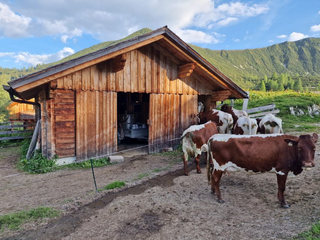
185. The alm near Sudwiener Hutte has 25 milk cows who go into the barn in single file and milk goes into containers on the trailer beyond the door
I watched for a bit and then headed off south up through the larch forest in the warm still air. The forest had a beautiful green vibrant hue to it as the sun shone at a low angle through the trees. It took a good half hour to walk up through the forest to the treeline, and it was a gentle saunter throught this lime rich landscape with lush meadows. It was a lovely start to the day. Far behind me I could see the older Austrian hiker well below me and thought he will never catch me.
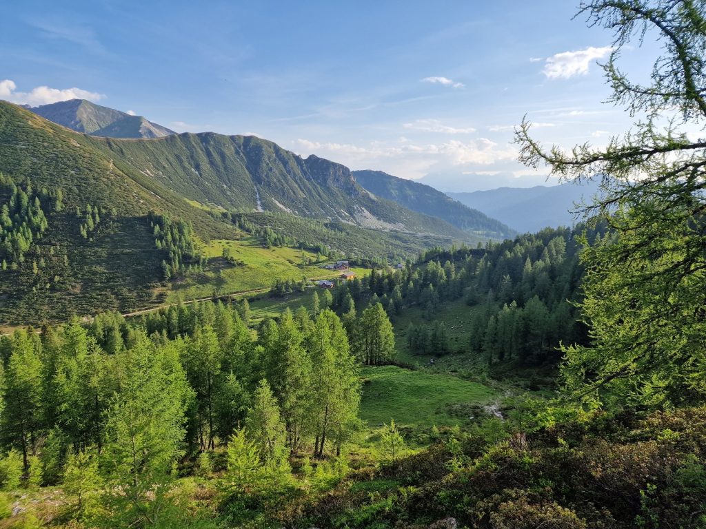
186. Looking back down to meadows around the alm and Sudweinerhutte from the path heading south
At the top of the forest I walked onto the bare hillside. Unfortunately it was ruined by a line of pylons which also went up the same high valley and over the same pass, Tafelscharte, 2236m, where my route was going. It was not a particularly scenic valley to start with but this tipped it into a necessary walk to link better sections. Far down in the valley on the north side I could also see a motorway which went through a tunnel under the Tauern range right were I was walking. After a good hour in this valley I reached the pass and was rewarded with a much nicer view. The whole way up here I suspected the older Austrian was gaining on me and now I was sure of it.

187. Looking west from Taferlscharte pass across the huge alpine bowl between this pass and the Mosermandl mountain in the distance
The next part of the day’s walk dropped down into the head of a large wide bowl. Perhaps 2-3 km across. There were the odd steep bits on loose gravel initially but after that the small rough path contoured round the head of the bowl. To the north was a ring of grey limestone rich cliffs with a jagged crest, and between the path and the base of the cliffs were huge screefields, which the jagged mountains were very slowly crumbling into with a geological speed. It was a very nice alpine section with great flowers and grassy knolls. It led me down to 3 large ugly concrete structures which were the ventilation shafts for the motorway deep in the mountain below me. Just as I left the bowl on its west side I passed through a wood of exceptionally old, wise Arolla Pines, some of which were centuries old.
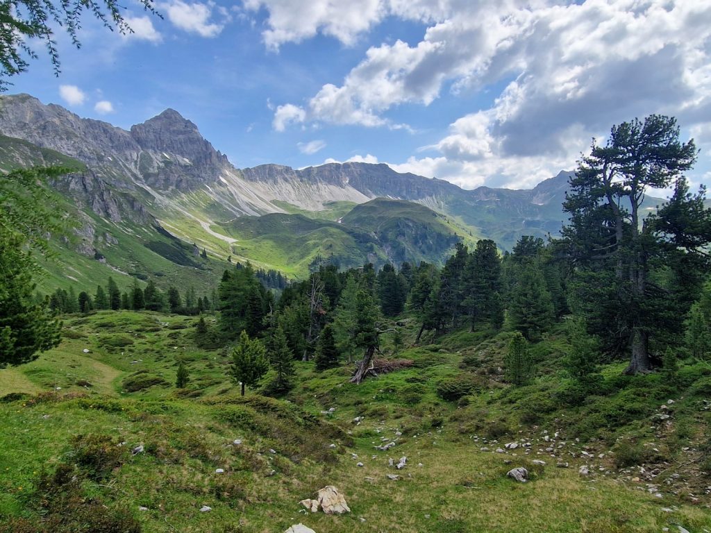
188. Looking back to Taferlscharte Pass in the far distance over a beautiful copse of Arolla pines

189. On the path towards the dormant alp of Jakobsalm with the impressive Weisseck mountain in the distance
The path now contoured along the alpine hillside high above the upper reaches of the Zederhaustal valley. It was a beautiful walk across bare grassy hillside and the occasional larch copse which extended up to this altitude of about 1900m. The sun was cooler now as the sky was half full of cloud. Across the valley rose the very spectacular jagged grey block of Wiesseck, 2711m, The highest mountain in the area. It rose from a turquoise lake in the valley far below. Half way along this section I reached Jakobalm, which I had bookmarked for a pause, but it was closed and looked much more agricultural than touristic with its rickerty wooden thunderbox outside toilet. The small footpath now climbed, a bit vindictively I thought, through dwarf pines and grassy passages between them which were filled with flowers of all colours. The skies were getting dark enough now so the large trumpet gentians and many of the bright small saphire ones were starting to close up. High above me was Mosermandl, 2680m. I would not have wanted to be on its craggy bare ridges at the moment as the skies continued to darken. The older Austrian must have stopped for a pause and was a good 15 minutes behind me now. I passed two alpine tarns under the ramparts of Mosermandl and then saw the Franz Fischer Hutte. I thought I would go in here for a drink and cake before continueing for 2 hours to Tappenkarsee.

190. The large barn at Jakobsalm is sometimes open catering for tourists and and other years it remains closed.

191. The flowers in the limestone rich landscape between Jakobsalm and Franz Fisher Hutte were full of flowers
As I reached the front door the very enthusiastic warden came bounding out. His English was perfect and he was immeadiately very likable and genuine. We chatted as we went in. He was a long distance hiker also and had done roughly the same trip as I was doing. He had also hiked in Nepal and a few other place I had. We had a lot in common. He introduced me to his wife who was also instantly likable. We had chatted for about 10 minutes when the older Austrian hiker arrived and as the hut warden was welcoming him the heavens opened and it started to rain violently with many flashes of lightning and thunderclaps. We had just made it and our 0600 breakfast was not in vain.
The hut warden was called Tom and his wife Evelyn. With the rain pouring and their exceptional welcome and the likelihood of a great evenings conversation it was easy for them to persuade me to stay, and not continue the 2 hours to Tappenkarseehutte. Evelyn had ski-toured a lot in Norway and Tom had hiked a 6000 metre pass in Nepal and out came the phones to compare photos. They wanted to do the Great Himalaya Trail and were quizzing me about that. The staff at this hut were very cool also and quite multilingual. It was a no brainer I should stay here. The older Austrian it transpired was also on a long walk from his home in Graz to his sister’s in Bavaria, about a 6 week hike. Once the thunder and rain had passed, after an hour, the sky turned blue again he said he was continuing on, so we shock hands with a mutual understanding and bravado of the slightly competitive mornings hike, which given he was continuing I would say he won.
To the west of the hut and outside the main windows were the beginings of the Hohe Tauern. You could see some of the heavily glaciated peaks on the Ankogel Group and then further to the west the Glockner Group. Tom showed me books from the hut library of the routes through it but they were essentially mountaineering routes and not wise for the solo hiker. I was essentially skirtly the southern flanks of this massif, barely flirting with its snowfields.

192. On the ridge just befor Franz Fischer Hutte there is a view west ti some of the highest mountains in Austria in the Hohe Tauern range
I was already feeling very content with my descision to stay when Tom said he and Evelyn had just written a book. I expected it to be about Thru hiking, or Wiet Wandertage in German, but no it was a vegan cookbook. In the 6 years Evelyn had been running the hut she had developed a vegan and vegetarian cuisine and the Franz Fischer Hutte was now entirely vegetarian. It was the first and only hut in Austria to be so and it was now becoming very popular with young hikers who would come just for the cuisine. I had really landed on my feet here. The thoughtfullness of the hosts, Tom and Evelyn, their cool crew and the vibrance from the gentle young hikers who were staying here put it ahead of any other hut I have stayed in. The very nice Petzel at Giglachseehutte, The kind hosts of Zauneralm, Matilda and Franz, and the intelligent and artistic Christine of Etrachsee all came in a close second but I felt I was with my kin at Franz Fischer Hutte.
I had my meal with a friendly young couple from Bavaria and Salzburg. We chatted while we waited for the meal and when it came it was well worth waiting for. I had vegetable curry with spelt rice and a nettle and spinach strudel. Desert was vanilla ice cream with pumpkin seed oil. The food was not just good, it was high quality restaurant food. Avant garde cuisine for which you would pay a fortune in a trendy city. Just a quick glance at the hut dining room would tell you it was special. Usually there are me and a couple of others at a mountain hut but this one was rammed full with young hikers.
Day 027. Franz Fischer Hutte to Huttschlag. 18 Km. 6.5 Hrs. 830m up. 1820m down. Being an outdoorsman Tom and Evelyn started breakfast early at 0630. It was a superb buffet of carefully selected ingredients from the local area. I had had the last of the excellent coffee by 0700 and was ready to go. Saying goodbye to everyone took a while. Tom and Evelyn said they wanted to visit Scotland so hopefully we will keep in contact. It was a beautiful day when I set off in my shorts and sleeves rolled up as usual.

193. Looking back to the lovely Franz Fischer Hutte with the backdrop of the craggy Mosermandl in the background
Initially I went down to the alpine tarn just below the hut, which streams of scree tumbled into from the imposing heights of Rothorn. I then headed generally SW over a series of very shallow ridges until about half an hour later I reached another tarn called Ligsee. It still had large snow drifts along its south shore which overhung the water. About 20 minutes later by a couple of small ponds the path divided. I did not notice it and was not paying attention to my GPS so carried on for another 20 minutes following the wrong track. By the time I noticed it was too late to turn back so I just headed up the ridge of steep grass reaching it a far bit to the south of Weissgrubenscharte. I had to work hard to get up some of the grassy slopes and I was tense like a coiled spring to stop myself slipping, which cost a lot of energy. Once on the ridge it was easy to follow it north for half a km to the pass I should have gone to initially. The whole time I had Mosermandl and the impressive peaks round it to the east and some of the glaciated giants of the Hohe Tauern to the west beyond the immediate valley. In this valley I could see the Tappenkarsee Hutte where I had a booking for the coming evening.
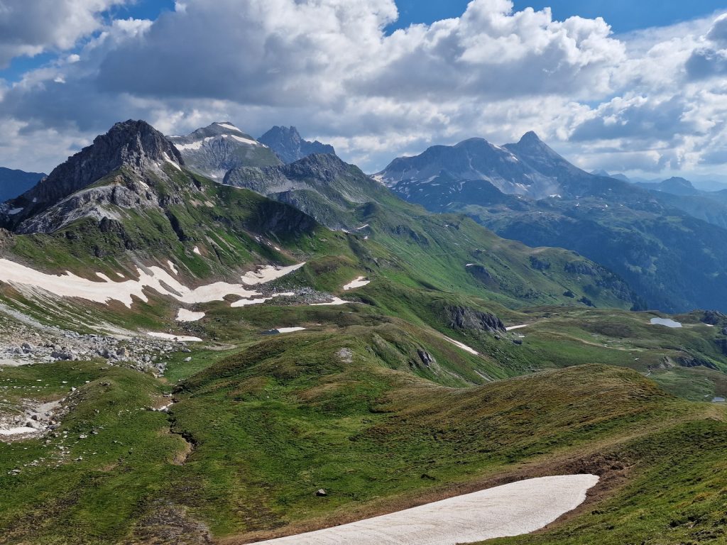
194. Looking east from Weissgrubenscharte to the mountains around Franz Fischer Hutte
It was an easy 400m descent to the hut which was beautifully sited at the end of a lake in a pastoral valley where horses and cattle grazed. I crossed the river at the bottom and went up to the hut to cancel my booking and squander the 20 Euro deposit I had made to alleviate my guilt at cancelling so late. The lady who was serving was fine about it, but I would have been pushing my luck to ask for the deposit back.

195. Tappenkarseehutte sits in a pastoral valley with lush meadows beside the high lake of Tappenkarsee
From Tappenkarsee Hutte there are two ways over the ridge to the west and down to Huttschlag. The southern one looked slightly shorter so I took it, climbing up some 300 metres to reach the grassy Karteistorl. The view to the west and the Hohe Tauern was not much better here than it had been previously but I could look down the grassy slopes to the larch forest of the valley I had to go down next. There was a steady stream of people coming up the grassy slope, either to climb one of the easier peaks each side of Karteistorl pass or go over to Tappenkarsee Hutte. These were no day tripping motorists out for a country meal, but hard working hikers climbing 1000 metres under the sun.
It did not take long until I was in the upper larch. They quickly grew in size as I descended and soon I could smell cattle and hear the clonk of the cow bells. There were luminous green fields of blueberry bushes amongst the larch which were going to produce an enormous crop in a few months. Down and down the path went until I was in the firs. It was the first time I had been in them since the lovely Zauneralm a week ago as the path through the Niedere Tauern stayed above 1800m all that time. After dropping some 500m I reached Karteisalm. It had a lovely old barn and cabin but both were in need of urgent rescue, otherwise they would be lost soon.There was also a cable tramway here but it looked old and in need of maintenance also.

196. Heading down past Karteisalm on the way from Tappenkarseehutte and the large valley were Huttschlag lies
The footpath soon turned into a very rough steep track as it crashed down through the firs. I met someone here labouring up like an old misfiring tractor. He quizzed me about the alm and if it was busy and what the food was like. I thought he meant Tappenkarsee Hutte so I told him yes, but it was 3-4 hours away, but he meant Draugsteinalm. I pointed it out to him on the other side of the valley. He had just got out of his car and started walking in search of a schnitzel without any clue where he was going, like a lemming setting out across a glacier.
When the rough track became a good forest track it did a large hairpin which I made a shortcut across. It was probably not worth it as it was a jungle lined, wet cow path. The last part of it involved climbing a barbed wire fence to cross a very steep meadow which somehow someone had managed to cut, despite it being nearly 45 degrees. It took a lot of effort to stop myself slipping down. As I reached the good forest track at the next bend it changed into a tarmac road with haylofts and farms beside it. The land was still very steep and it was all freshly cut for hay.
I followed the tarmac road down past 5-6 bends, too wary about cutting corners on the steep land wondering how someone had cut it. I assumed it was with a hand scythe. Then I came across a fit young farmer cutting a meadow with a motorised scythe with wide wheels with spikes on. He was following it wearing a hefty pair of climbing boots which he was almost stamping into the hillside as if he were crossing a steep snowfield. I watched for a bit fascinated that he could control this machine on the steep ground but he seemed a master at it.
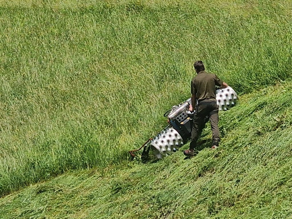
197. Cutting the steep meadows with the motorized scythes with spiked wheels. Some of the meadows were much steeper than this
Once down on the valley floor I had to find somewhere to stay. I had already cancelled the place I previously booked. However there was nothing in the first two hamlets of Karteis and Wolfau so I carried on to Huttschlag to try at the guesthouse I cancelled. The walk was never on the main valley road but followed a grassy track and then a side road on the south side of the valley. On the floor were beautiful meadows all with 2 or 3 old log haylofts in them. Old tractors were in the fields turning the grass over with mechanical rakes. On the north side of the valley was a huge vertical wall of rock perhaps 250 metres high and very threatening. I would not want to live under it, as some did.
At last I came to the small, charming hamlet of Huttschlag, built on the south slope of the valley between the meadows on the valley floor and a knoll on which its white church proudly sat. Huttschlag was a cluster of some 40-50 buildings, farmhouses, chalets and a couple of guesthouses. I went to the one I originally booked and cancelled and incognito got a room there at half the original price. It was very nice and had a south facing balcony. I spent the rest of the afternoon washing my slightly revolting walking clothes and doing digital tasks like the blog.
Day 028. Huttschlag to Bad Gastein. 19 Km. 7 Hrs. 1270m up. 1170m down. I was woken at 0600 by a chorus of bells from the church’s belltower. It was the sensible time to rise in these summer months but it was almost done with the same vigour as a zealous iman would from a minaret. The Huettenwirt provided a great breakfast to round off their comfortable room and sunny balcony. I had warmed to the Toferer family who ran the historic guesthouse in the old building dating from 1520. It must have been the local landlords house as it was the oldest in the valley and had its own chapel.
I said goodbye at 0900 and stepped out into the almost blinding sun of a perfect day. I wondered through the small village of Huttschlag which seemed to have a few other guesthouses and host of wealthy chalet type villas. At the west end were two exceptional chalets which looked like they were once the holiday villas of royalty or aristocrats. High on the steep meadows above me local farmers were turning the hay on what was forecast to be a perfect drying day. It was a small village but it oozed charm and punched well above its weight in character.
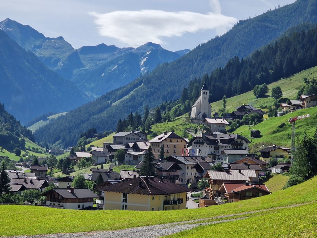
198. The village of Huttschlag was full of charm and had some refined historic villas and houses
The route soon left the lane above the 2 salubrious villas and headed up across more steep meadows, whose grasses were in their prime for cutting. As I climbed I could see more and more of the Grossarltal valley stretching down to the north. The valley floor was filled with meadows and old farms which crept up the steep sides until the forests started. Soon I had climbed into these same fir forests, which were still cool.
After nearly two hours I passed a small beautiful log chapel which had pews for about 12 people. It was in the forest beside the track and just before the gate to the extensive pastures around Harbachalm. There were a lot of cows at the lower end of the meadow, perhaps 50 in all. Many were sitting in the sun chewing cud. However there was constant movement from the cows with their tails swishing flies away and all their ears were constantly flapping. The flies must have been intense after this spell of warm weather. The alm looked like it had some milking equipment and I noticed quite a few of the cows had udders which were already filling after the morning’s milking.
It was an easy hike up the rest of the 500 metres through the remainder of the firs and then through a band of larch before the open hillside took over. A lot of the areas where the larch petered out were covered in alpen rose which were now in full bloom. The bushes were just a bit sparse to give the hillside a magenta tint. There was a path at the Tafernscharte, 2091m, which went up Gamskarkogel, 2467m, where there was an Alpenverein Huette run by two women, who were friends of Tom and Evelyns.

199. Looking NE from the Tofernscharte back down the side valley I hiked up which descends down to the Grossarltal valley in which Huttschlag lies
While the view back down the side valley to Huttschlag was good the view on the south side of the pass was sensational. At the bottom of the 1000m high slope of grass and then forest lay the town of Bad Gastein, which I was told was initially developed as a tourist resort in the times of the Habsburg monarchy, for them. It looked surprisingly big. However the main show was beyond where the slopes of the mountains rose up and up, well above me to the main jagged ridge of the Hohe Tauern. Glaciers filled many of the north facing cirques all the way from Hochalmspitze in the east to the GrossGlockner, the highest mountain in Austria, in the west. I was now entering the proper alpine mountains where everything was above 3000 metres as opposed to 2500 in the Niedere Tauern and 2000 in Sections One and Two. And this view was under a faultless blue sky.
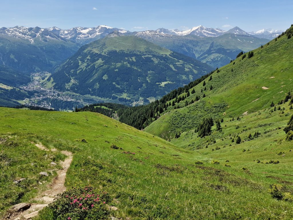
200. Looking SW from the Tofernscharte to the resort of Bad Gastein in the middle left and then the Hohe Tauern range beyond it with its high heavily glaciated mountains.
The descent was long and quite hot. Once in the trees the path seemed to plateau out and it was a lovely saunter, but it was hardly losing any height. The path crossed meadows with great views to the Hohe Tauern mountains and then alternated back into the very large firs again. By the time I reached the pretty Poseralm I was parched so stopped for some water. Then the descent started in earnest as the path zig-zagged, often in small sections down the steep rocky hillside. There were many cables and iron posts but they were all unnecessary really as it was never that steep and exposed. I dont think many people would have bothered to use them. At last the path went into a meadow rising up from the floor of the gorgeous Kotschachtal valley and this led me down to the road.
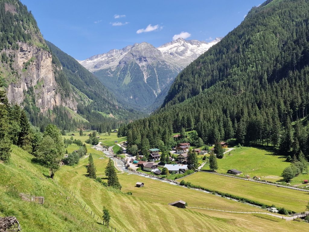
201.The final descent down to the Bad Gastein goes steeply down into the spectacular Kotschachtal valley. Bad Gastein lies where this valley and the main valley meet and to the right out of the picture
I did not have any booking but wanted to go on for another couple of km to Bad Gastein. It was just as well as there were many guesthouses here but they all looked like they had been abandoned at least 10 years ago. It was a shame as some were magnificent chalets. I took the high road for a good km and then a series of paths for another km until I approached the northern part of the town. There was much more below me down in the valley but I did not want to go down there just to climb back up again. The footpath signs seemed to indicate it was leading to the “Zentrum” of the town. A good half hour after arriving in the valley I was looking down into the town.
There was the lower bit of chalets and even farms and this slowly rose up to a large bowl with a waterfall cascading down the middle of it. The town was mainly built around this bowl. The buildings mostly consisted of 5-8 storeys of large grand salubrious hotels. There were at least 20 of them. Some were very opulent like Hotel Europa and others were just condominiums with an alpine influence. I went past the quite modest church for such a town and then went onto the main street. I had expected it to be full of the big names in French and Italian fashion like some ritzy alpine towns. However, it was not and many of the shops were boarded up. Bad Gastein it seemed had lagged behind its peers like St Moritz and since the Hapsburgs and rather than go upmarket had slowly gone down market. It was still clinging on to some level of sophistication but I could see the class was ebbing out of the town.
I walked through the centre and then climbed up the very steep streets which formed the sides of the bowl to reach the upper valley above the bowl. It did not improve especially around the train station where the souvenir shop was just full of tacky junk. I was tired and hot and looked for a family run guest house. I found one but there was no one about inside so I went to the next place. It was called the Barenhof and it had sunny balconies. Inside everybody was wearing covid masks and I should have twigged. I was given one which I put on so as not to rock the boat. The room price was more than I budgeted for but I now wanted a shower and to get cracking on the blog before the afternoon ebbed away. Once I had checked in I realized it was a hotel for the injured, infirm or otherwise unwell who sought the healing powers of the spring water. There were wheelchairs dotted about everywhere and all sorts of lifts to help the bariatric into the swimming pool. By the time I got to my room it was too late to escape.
I showered and then sat on the terrace with the smokers who were here for hotels’ Wellness Centre, and gazed down on Bad Gastein below me. I sat too long and missed the restaurant which closed at 1900 so I went down for 5 minutes to find a restaurant. It was not great and the outside seating was full of smokers. There was a heavily tattooed older man with a scruffy beard and drunks nose, flattened at the bridge due to a fight. He had been shopping in town and had bought a Burberry baseball hat. There was no way back for Bad Gastein once I spotted that. After a small serving I stole a spoon and went to the adjacent petrol station and got a few pots of yoghurt and returned to the infirmary. I had planned to spend a rest day here but there is nothing to tempt me so will push on first thing now, two days ahead of schedule.
This brought my trip through the Niedere Tauern to a close. It had been a fantastic section, especially the more mountainous part from Etrachsee to Huttschlag. Those 7 days had been the best of the whole walk so far and that was despite the misty weather on at least 3 days. It was nice to immerse myself into a mountain environment and stay in the mountain lodges rather than have it compromised too much by places like Obertauern, and especially Bad Gastein. For the next week I will be skirting to the south of the glaciated mountains of the Hohe Tauern and only occasionally flirting with their snowfields.
Section 03. 213 km. 95 Hours. 16110m up. 15760m down.
04 June to 18 June 2022.