September 1, 2025

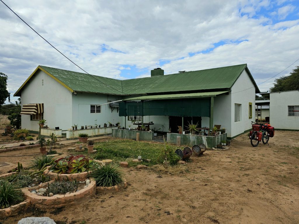
Day 119. 05 September. Msata to Bagamoyo. 71 km. 5 Hours. 360m up. 600m down. The lodge gave me a huge breakfast, including a portion of goat stew to go with the omelette. The owner came and introduced himself as I was leaving. He was a retired Brigadier General in the Tanzania army who built this lodge on leaving the army. He was a large, gentle, affable soul who I could not imagine leading troops into guerilla warfare. Once I left the lodge I had to cycle the 2 kilometres north on the T2 into the centre of Msata to a T junction. The main T2 continued north and connected to virtually the whole of north Tanzania and also Kenya. The road I wanted was the T35 and it met the T2 here at Msata. Unfortunately it was nowhere near as quiet as I hoped as all the traffic from the north of Tanzania and Kenya came down the T2 but then left it here if they were going to Dar-es-Salem, which most were, and followed the T35. It looked like I was going to have to put up with 65 kilometres of traffic. However this road did have a better verge than the T1 and T2 of yesterday.

724. From Msata to Bagamoyo I followed the T35 highway for 65 kilometres. It was quite a fast road but had a tangible verge.

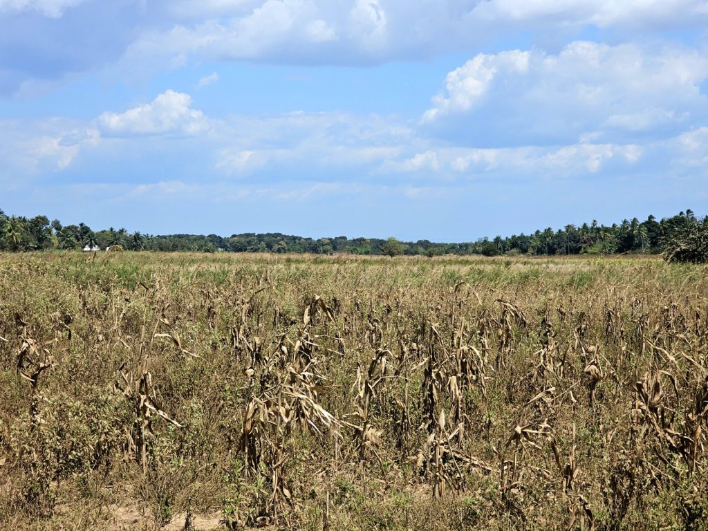
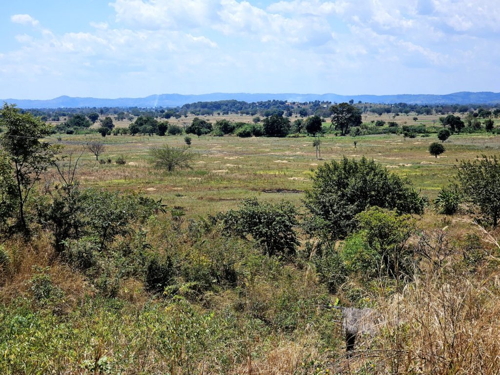
It was not an enjoyable cycle though. The traffic was quite fast and there were many more buses than yesterday and fewer trucks. The trucks were actually a benefit on a road like this as they tended to slow everything up. For the first 30 kilometres or so the landscape was quite dry and barren with few villages or towns enroute. Those that were there lined the road and owed half their existence to selling produce or meals to passing traffic, and then the other half to the meagre agriculture.

725. The villages beside the T35 showed more and more of an Islamic influence with more mosques than churches and many people in Islamic dress.

Slowly as I travelled further east the villages became more prosperous. There was still little agriculture as there was not the necessary water but the crops were according to this like coconuts, teak plantations and even pineapples. The maize in the fields was all harvested and dried and now just fodder for the tended cattle and goats. I passed a huge steel mill beside the road, which was Chinese owned and then dropped down to the Ruvu River as I neared Bagamoyo. I considered the steel mill and how any in the UK or USA, tariffs or not, could really compete with it in this global economy.

726. There was some agriculture around the villages and grazing between them. Here are pineapples growing under teak trees growing under coconut trees at Kiwanga village.

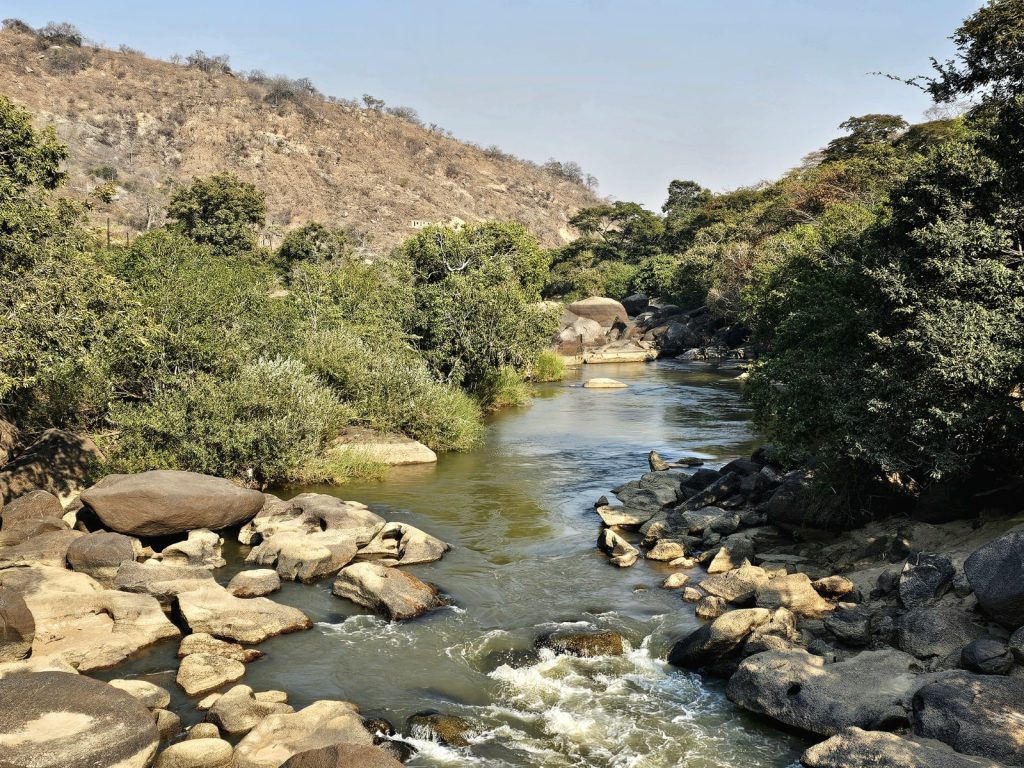
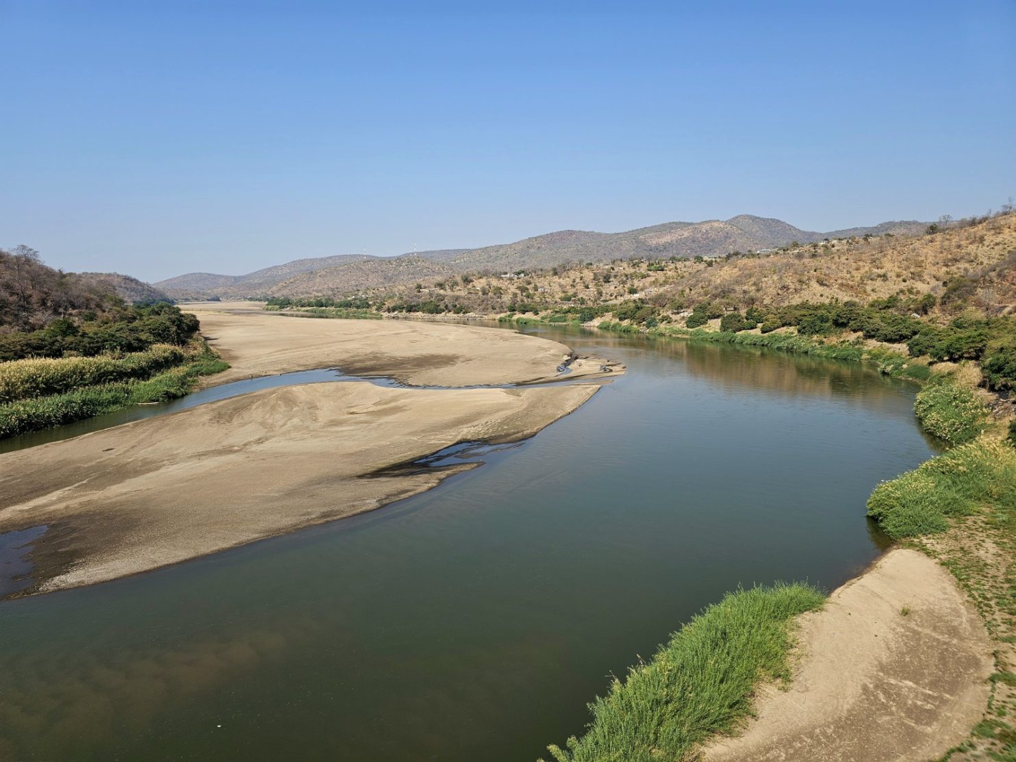
This large river had split into a number of channels as it crossed the coastal floodplain before reaching the sea. It was intensively farmed with well organised rice fields across the plain as far as I could see. There were people working in the fields and many scarecrows to keep the birds off. I saw quite a few kingfishers on the electricity cables, mostly white and black, but one was a huge black one with a rapier beak as long as its body. Beside the river channels were gravel banks where the Maasai herdsmen had gathered their cattle for the afternoon. They were the larger Sanga type of cattle as opposed to the Zebu type and they all had huge horns. I had to pass a few on the road earlier in the last week and although the cattle might be docile the horns were something to avoid and even if the cow was flicking some flies from its head the tips of the horns moved considerably.

727. Towards Bagamoyo the road crossed a number of rivers and grazing areas between them. The were a few herds of the Sangea type breeds about with large horns wich the Maasai favour.

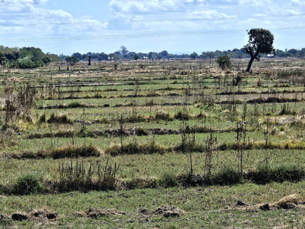
728. There were also many rice fields between the rivers and these fields looked like they irrigated so could produce rice throughout the year not just in the rainy season.

On the other side, the east side of the Ruva valley, the landscape rose very slightly to reach an imperceptibly shallow ridge which was the edge of Bagamoyo town. At last after some 4 hours I could get off the T35 highway and dive off down a side street into the town. I was initially very surprised to see the strong Arabian influence. Virtually everybody was dressed in long islamic robes. They must be very practical for this hot climate but then many women were in burkas which would not be that comfortable, especially black ones, in the heat of the day. There were small mosques on many streets and no signs of any churches. I cycled down for about 15 minutes stopping to look at my phone to home in on the Firefly lodge. As I approached it I came round one corner and saw something turquoise at the end of the street. It then dawned on me it was the sea. It was just at the end of the street and just to confirm it was the sea I saw a couple of white horses. I had to turn off down a side street to get to the Firefly lodge but knew I was getting close.

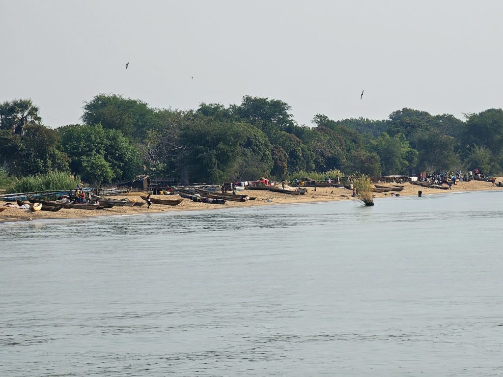
729. On the beach at Bagamoyo there were lots of small dugout outriggers and larger boats which fished the more protected waters of the Zanzibar Channel between Bagamoyo and Zanzibar Island.

At the Firefly they had a room but it was more expensive than I bargained for and was twice what I had paid anywhere else on the trip so far. It looked like a nice place and potentially full of backpackers. I however decided to check out one other place which was the Millennium Breeze. It was twice the price of the Firefly and seemed to be for rich businessmen from Dar-es-Salem. It was not my scene at all so it was back to the Firefly. Once back I unloaded the panniers into my room, which was only £48, and then went back to the empty bicycle.

I wheeled the bike down through the gardens to the gate at the bottom and opened it onto what I thought was the beach. However it was a thriving and busy fishing village with lots of shacks, hundreds of fisherman and many boats, all side to side along the beach. I managed to tread a route down to near the water. I asked one young guy if he spoke English but they all shook their heads and pointed to a small shack with a young Rastafarian outside. I asked him if he could take some photos and explained why. He told the others and I heard them all exclaiming “Namibia”. I gave the Rastafarian the phone and then carried the bike into the sea, having asked him to take as many photos as possible while I held the bike aloft out of the knee deep salty water of the Indian Ocean. It was the celebratory photo I wanted and he managed to capture some. I thanked him and then returned to the Firefly lodge with squelching shoes.

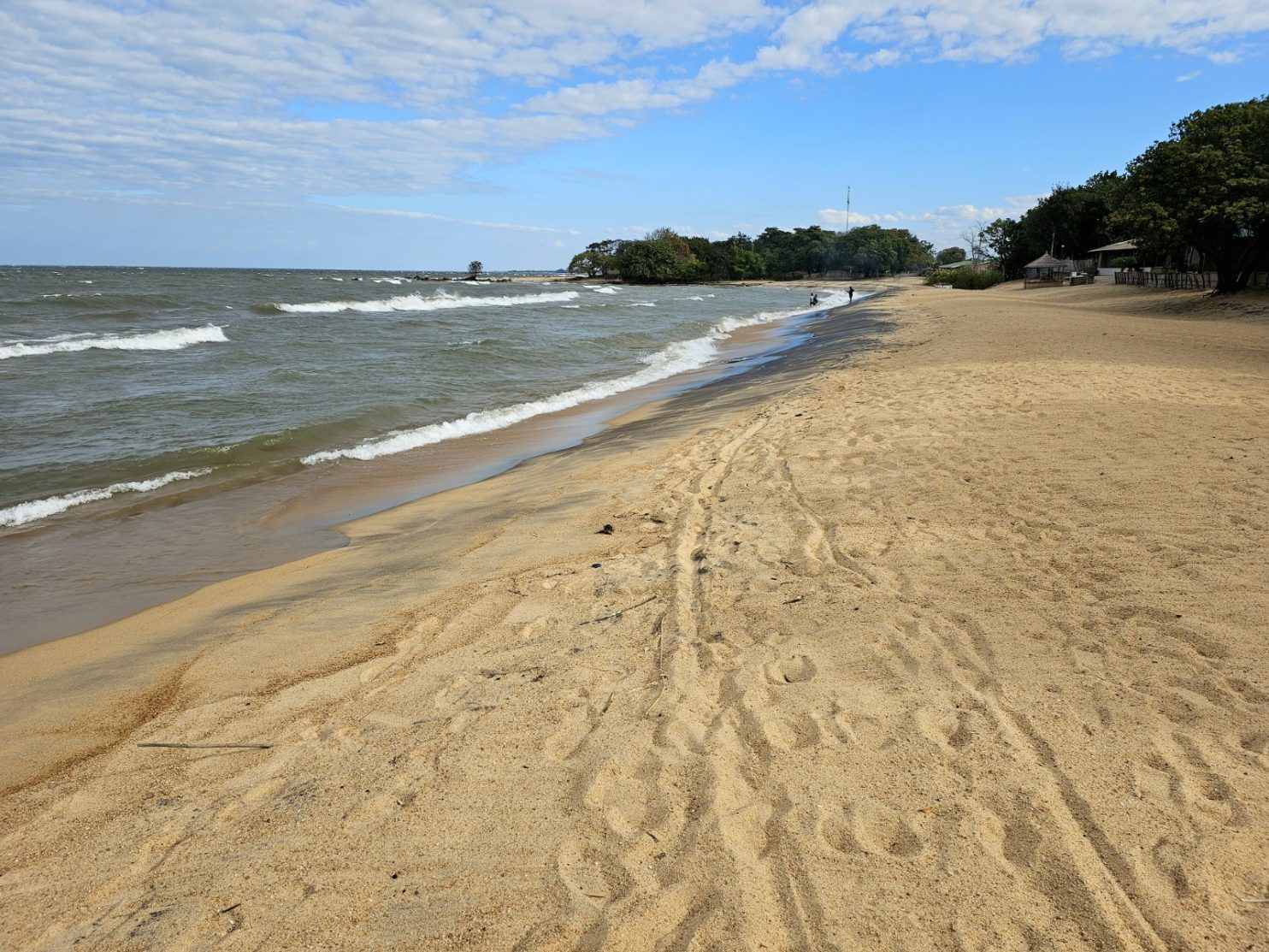
730. After 5639 kilometres and 40340 metres of ascent I finally reached the Indian Ocean having left the Atlantic Ocean and crossing Africa in 119 days.

The lodge was quite quiet and I carried the bike up to the room and then had a great shower. For once I was not bothered if the water was warm or not as even the tap water was lukewarm. The water however was roasting, scalding even, and I managed to wash everything I needed. I then went down for a burger. By way of celebration I just had a crate full of passion sodas and some icecreams. I had intended to try and catch up with the blog but by the time the sun went down I was tired. After some 5,639 kilometres with over 40,000 metres of ascent and descent I could go to bed knowing I did not have to continue east. I will now spend a couple of days in Bagamoyo finishing the blog so it does not hang over me and then try and get some cardboard and tape to cobble together a bike box so I can book a ticket home in a few days time.

As I went up to the room I noticed what an extraordinary building the Firefly lodge was. From the outside it did not look much at all. There was about 50 metres of street frontage of an old 2 story building which looked tired. In the garden area on the other side of this were a large amount of Bohemian chill out areas each with its own unique day beds and cushioned areas. All of these were around a small clear clean pool. At the bottom of the garden before the gate to the fisherman’s shacks on the beach was a large open area shaded by trees where people could camp in their own vehicles or where the overland lorries with 10 off travellers parked every other night. However the real gem was the house itself. Behind that tired facade was an grand merchants house with cool balconies and huge rooms. There were shuttered windows on each side of the room to allow the sea breezes to pass through and keep the house cool. Upstairs there were perhaps 6 rooms and most were 30 or 40 square metres with high ceilings. When I asked more about the house I found out that the the merchant who lived here dealt in slaves up to just over 150 years ago and long after the Atlantic slave trade was banned in 1807 On the East coast of Africa the slave trade still flourished for another 50 years, with the Arabs of Zanzibar shipping slaves to the Middle East. The merchants here at Bagamoyo bought slaves which had been captured from the interior, and shipped them to Zanzibar where they were sold on. David Livingstone was instrumental in getting this East African slave trade banned in 1873 by lobbying the British and French governments and this is part of the reason he is reverred in East Africa.

Day 118. 04 September. Morogoro to Msata. 111 km. 9 Hours. 1110m up. 1360m down. After a restful day at Mama Pierina’s lodge in Morogoro I was ready for the final stretch. I was not really looking forward to it. There was little I could do to avoid the main road without going on unknown footpaths. Initially I had 20 kilometres of the Old-Dar es-Salam road which was not consumed by the building of the New Dar-es-Salem road or the T1 highway. It was essentially a continuation of the road I had been on from Kipera to Morogoro a few days ago. It took me a few kilometres to get out of the city with ever diminishing traffic until there were just tuk tuks and motorbikes left. To the south were the Uluguru Mountains which rose steeply, their heads buried in the low cloud on this overcast morning. These lofty summits, some 2 kilometres above me, caught rain from the winds coming off the Indian Ocean and apparently there was never a month there was no precipitation up there. The streams which came down its jungle-clad slopes nourished agriculture at the mountain’s base. Without these mountains there would not be anything like this level of agriculture or population.

714. Leaving Morogoro city and looking south towards the high jungle clad peaks of the Uluguru Mountains.

715. Leaving Morogoro and looking north over some homesteads to the flat drier savannah.

To the north of the track I was on was a more arid plain which did not have the benefit of the mountain streams. It had to rely on the seasonal rains to nourish the crops during the wet months from November to March. After 15 kilometres or so I reached the village of Pangawe. Here there was a small river from the mountains which was diverted into the rice fields, and even at this time at the end of the dry season there was enough water to irrigate the rice and crops which were growing beside the track. I stopped here just to see the rest of the way towards the main T1 road and have a soda. My route from here was on a track which got smaller and smaller until it was a footpath. This then went under the new electric railway connecting Morogoro with Dar-es-Salem and finally rose up to the main road. My rural sojourn was over.

716. To the east of Morogoro there were some hamlets blessed with streams and springs from the Uluguru Mountains which allowed farming, even rice farming, throughout the year.

717. The track through the village of Pangawe to the east of Morogoro and halfway between it and joining the busy T1 main road.

As soon as I was on the road my attitude changed. I was no longer ambling along, curious at my surroundings and stopping to look at things. I was now on a mission to get through the next 45 kilometres unscathed on the T1 highway. No sooner had I crossed the road to the east bound side a convoy of some 15 lorries all rumbled past their wheels spinning quite slowly, but with unstoppable force, just a meter or a meter and a half away. The lorries moved so slowly it took them 4-5 seconds to overtake me and I could see what they were carrying, from sacks of rice and maize, to half a million dollars of copper plate. The lorries however were predictable, slow, lumbering beasts similar to those giant herbivorous dinosaurs, like a herd of brontosaurus. Once they passed came the intercity buses, desperate to keep a timetable and pick up passengers before their rivals did. They were eager and frustrated and flew along like a hungry Tyranosaurous Rex looking for a meal. These beasts were the real danger on the road and I was constantly looking in my mirror to see when they were approaching and then I would go off the road verge and sometimes even onto the earth beside it.

718. I had to cycle along the T1 main road for about 43 km between Mkambarani and Ubenazomozi. The real problem was not the well driven trucks but the long distance buses and the 4×4, especially those with government number plates.

719. Beside the T1 main road there were many market places selling fruit and vegetables all stacked in pyramids with colourful ladies at the stalls.

It was an unpleasant 45 kilometres and I was frequently looking at my odometer counting down the distance. The only redeeming feature of the road were the roadside markets and stalls every 2-5 kilometres. Here the road builders had widened the road to allow for lorries to rest but the locals had commandeered the rest places to sell their produce. When a lorry or car did stop here it parked on the verge so I would have to wait until the carriage way was clear before overtaking. During the 2-3 hours I did not really stop and take any photos, but was just on a mission to get to the turn off as soon as possible. Eventually I reached Ubenazomozi and was able to pull off the road and find a cafe. Here I ordered chips and eggs, a popular meal like a chip omelette.

720. At Ubenazomozi I left the main T1 main road and headed NE on a small road. At Ubenazomozi I stopped for a chip omelette in a local cafe.

I still had another 50 kilometres to go today but the next section was on a small gravel road. It was the long side of a triangle or hypotenuse between two tarmac highways. It was great to be able to relax and look around again. I could veer into the middle of the track if I wanted, and stop at will to take photos. Sleepy hamlets appeared and herders followed their animals up the middle of the road. This is what cycling in Africa should be about and the previous stressful 3 hours was really just a link between rural sections which I had to grin and bear. This track however was anything but flat and as the afternoon passed it got extremely hot. Some of the longer climbs in the lowest gear were very taxing and there was just some small relief at the top with a cooling breeze.

721. The small dirt road from Ubenazomozi and Lugoba was about 30 kilometres and very rural with a few remote villages, mostly of cattle herders.

The hamlets and villages here were quite sparse and I only passed about 3 in the entire distance. There was virtually no agriculture at all and what there was, like long since harvested fields of maize, looked quite half hearted. These hamlets were primarily occupied by Maasai and their cattle, sheep, plus a few goats were grazing here. They have a disdain for agriculture and to be fair this land did not look that suitable for it. The Maasai houses here were different to the ones I had seen for most of the trip and made out of bricks. Here the houses were constructed from a wooden framework of sticks which were lashed or woven together in a framework leaving apertures of about 20 by 10 centimetres. These apertures were then filled with a clod of mud smeared onto and encompassing the sticks. It looked much easier, faster but much more temporary and short-lived than the brick houses elsewhere. Many had corrugated roofs and the rest grass roofs. The area around the houses was also quite barren and dusty with no flowers or shrubs planted. There were quite a few motorbikes on this stretch and most had Maasai tribesmen on them with their crimson and red robes flowing in the wind behind them. I assumed they were going from their homes to their herds to watch over them for a spell and relieve the others who were already there.

722. The architecture of the herders houses between Ubenazomozi and Lugoba was different and it was mud daubed on a wooden framework. The were few brick houses on this stretch.

After 3 hours on this small track I reached Lugoba at 1700 in the afternoon. It was getting late but I still had 2 hours of daylight to do the final 15 kilometres up to Msata. This was another large road, the T2, although it was nowhere as busy as the T1. At Lugoba there were dozens of trucks already parked up for the evening and at first glance it made a frightening sight. However, as I left the town I saw very few lorries and buses and even the cars and 4X4 were not that frequent. The road was reasonably flat and the small breeze was now behind me so I made good time up the dull road. The only excitement came when I had to cycle through an area where the grasses were burning at the side of the road and the flames were 2-3 metres high. Apart from having to hold my breath as I passed the smoke the heat was terrific. I reached the lodge I had earmarked at 1800 quite exhausted. However they had great showers and also large portions. There was no way I was going to write anything in the evening as I was too tired and put it off until after I had finished in Bagamoyo.

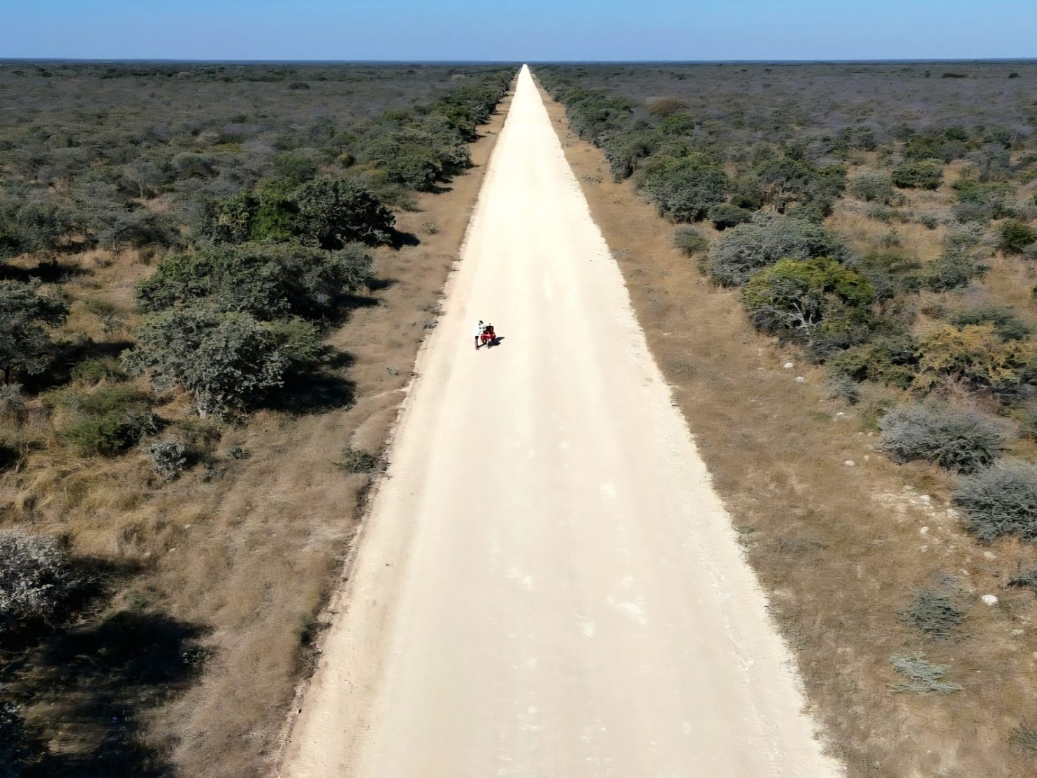
723. At Lugoba I left the small gravel road and joined the T2 highway. It was much quieter than the T1. I followed it for 15 kilometres in all.

Day 117. 03 September. Morogoro Rest Day. 0 km. 0 Hours. 0m up. 0m down. I was a bit behind with my writing and generally felt a bit tired. I had a cough which I was sure was from the dust of the earth roads and the dry air, and occasional fumes from roadside fires or passing trucks. So last night when I was in the warm shower in the spacious room in the quiet tranquil guesthouse I decided to spend another day. When morning came I was quite relaxed and had a lazy breakfast chatting with Dimitrea.

After breakfast I went to look at the airlines which flew from Dar-es-Salem to Edinburgh, and of which ones could take a bike. It seemed that KLM, Emirates and Turkish Airlines were the only contenders, and of these KLM had the best times without a long wait at their hub in Dubai or Istanbul respectively.

With that research done I then turned to the blog. I was reasonably up to date anyway but I could just not get started on yesterday, and had some sort of writer’s block which I eventually overcame as I started bashing away on the keyboard. Perhaps the greatest curse of this trip was writing the blog. If I was too tired I simply could not do it and then that would mean I would have 2 or perhaps even 3 days to do at once in the near future. This would entail a day off, which to be fair my body also needed especially if there was a 100 km or 1000 metre ascent day previously.

713. The lovely tranquil gardens of the quiet Mama Pierina hotel in the middle of Morogoro was an easy place to spend a rest day before the final push.

I had it finished by dinner and then could chat to the other 2 guests in the evening. However blog or not I always felt tired and ready for bed around 2100. I felt a bit guilty I had not even left the hotel compound all day as I am sure Morogoro was a city well worth exploring. Tomorrow I would start the final 180 kilometres, a good proportion of which was on larger main roads, which I was not looking forward to that much but needed to do if I was to have a continuous journey under my own stream.

Day 116. 02 September. Doma to Morogoro. 75 km. 7.5 Hours. 620m up. 640m down. There was no breakfast at the Kilimsuli Lodge, and that was perhaps a good thing as it was pretty filthy. However, there was fried chipatis and hot water for coffee in the roadside restaurants nearby. I had 3 chipatis and 2 of my own coffees and was ready to go by 0900. As I was packing up Cheng appeared from his room wheeling his fully packed bike down the narrow corridor. He was just going a short distance today so I said goodbye and wheeled my bike across the busy T1 road to the east side and then found the road to Msongozi. I cycled down it and after 50 metres I was already in a different world where the stench of diesel and fried foods and the noise of the traffic was soon forgotten as tomato fields appeared on each side of the track.

It was about 14 km to Msongozi on a rough stony track, no different to the ones I had been on for the last 2 weeks really. I was quite surprised how arid it was all of a sudden and apart from the irrigated tomato fields and some maize fields everything was brown and parched. There were quite a few baobab trees on the undulating hillsides and this is always a sign that the climate is dry most of the time. There was a village after a few kilometres but it looked quite poor but with plenty of bougainvillea bushes to brighten up the single dusty street. Women in headscaves and one even in a full burkha carried large yellow water buckets on their heads from the various hand pumps back to their relatively small brick houses. The men were almost suspicious as I cycled through and there were no shouts and the silence was a bit unnerving. It was one of the very few places in Africa where I was not a welcome novelty. After a good kilometre I was through the village and then heading down the gentle hill on the other side.

705. Leaving Doma for Msongozi i initially passed through a strongly muslim village where there was a lot of vegetables grown, especially tomatoes.

Soon I saw cattle in the fields and a few Maasai in their traditional robes and sandals tending them. There all had a large knife and also their club, or rungu. This club was a 50 centimetre long stick which had a lump at the end and would be a formidable weapon. As I passed the Maasai they always waved and smiled. They had a confidence which the muslim inhabitants of the last village lacked. I expect that down the millennia of looking after cattle they have had to protect them from predators and thieves and as a result are quite ready to fight. I think today in Tanzania they easily find work as security guards and watchmen if they are not herding anymore.

As I left the irrigated fields of the muslim village the landscape became very dry and there was no greenery at all. The leaves on the small trees and shrubs all seemed to have dropped off and I think this was the vegetation’s strategy of coping with the dry season. It was essentially to shut down as deciduous trees do in the temperate zones of the Northern Hemisphere. In the occasional dry river course there were tall coconut trees and other green trees which must have had their roots into the moisture, deep in the sand. Before I reached Msongozi I passed another village where the people were much more friendly and there was plenty of “how are you” shouted as I went past, by kids and men alike.

706. The smaller village, I think called Kibungo, which was just west of Msongozi. The village was friendly and there were some Maasai herdsmen here.

After a good hour I reached Msongozi. It was a village a little lost on an isolated plain at least 14 kilometres from the main road. It was very much a sleepy farming village and there was a curious plant, a 2 meter high bush, which bore pea type pods growing everywhere. I looked them up later and found out they were called pigeon peas and they grew on perennial bushes. This and the irrigated vegetables seemed to be the main crops, but I saw fields of harvested maize and sunflowers. Maasai were tending their cattle and sheep as they grazed on the stubble. The village had a population of a couple of thousand inhabitants and it also had a small hospital or health clinic. I paused for a drink here and chatted with the shop owner before moving on.

707. The larger village of Msongozi was based on irrigated agriculture and also the tall legumes bushes producing “pigeon peas”. It was quite remote with the way I had just come for 14 kilometres as the lifeline to the world.

For the next 20 odd kilometres I turned north now and headed up the Melela Mlandizi. The route on a rough road took me through a very inhospitable landscape. The trees were mostly bare and the ground cover virtually non-existent. The earth was a reddish brown and looked sterile. The only redeeming feature was the towering Uluguru Mountains to the east which looked very high and towered over everything but they were some distance away still, and looked lost in the haze. As I cycled north in this near alien landscape I passed a few small mines. I was not sure if they were mining for minerals or they were quarries for a white stone, possibly quartzite. After a few undulations I reached the roadside town of Melela Mlandizi and cycled up the side street where Maasai herders had parked their motorbikes and were sitting outside various groceries drinking soda. I joined a group at one and chatted with them and was pleased to see they were in awe of my nomadic cycle across Africa. At the end of the street I could see lorries roar past like roving dinosaurs and knew I would soon be amongst them.

708. My rural sojourn came to an end at Melela Mlandizi where there was a small roadside town through which the main T1 road and all its traffic passed. I had to follow the T1 for 10 kilometres next.

For the next 10 kilometres I had to cycle on the main road as there was no option. However I was pleasantly surprised that there was something of a verge and the lorries were nowhere nearly as frequent as I feared. Furthermore there was a gentle downhill run so I got up quite a bit of speed and covered the first half in about 15 minutes. On the other side of the road were larger parking areas and there were Maasai tribesmen trying to coax drivers, especially lorry drivers, into them, where there were large cuts of meat displayed on sticks for sale. Much of it looked like the shoulder of a sheep or goat. After 10 kilometres I reached an uphill climb on a long sweeping bend and could then escape the main road and head off to the SE on a smaller dirt road down to the small town of Kipera.

709. After 10 kilometres on the main T1 road I could escape again and go down to Kipera and along the base of the mountains on an older minor road for 30 kilometres to reach Morogoro city.

As I bounced down the earth road for 5 kilometres or so to Kipera I suddenly noticed just how close the Uluguru Mountains now were. While they were still in the haze they loomed large above the town. Their highest peaks were around 2500 metres, some 2 kilometres higher than I was. These mountains were a barrier to the moisture laden ocean winds and forced the air to rise creating rain. I read that it can rain in any month of the year up there on the high montane clad peaks and that meant that the streams which flowed down from their heights could irrigate all year round. There was plenty of evidence to see that was the case and there were fields of maize growing well under coconut trees and these fields were being watered by people with large hosepipes.

710. On the route down to Kipera on the earthen road I passed a few hamlets and fields and some coconut groves.

711. Before reaching Kipera I passed coconut groves under which were large fields of irrigated maize watered by hose from streams coming off the adjacent Uluguru Mountains.

Once at Kipera I had another stop and was thrilled to see that there was now smooth tarmac. I assumed this would be the case for the next 20 kilometres as I followed what was the Old Dar-es-Salem Road. It went past a few large training colleges and a hospital and was bustling with pedestrians, cyclists, motorbikes and tuk tuks. However after some 5 kilometres the road veered off to the main highway and I now had 20 kilometres of quite bumpy track along the base of the mountains all the way to the outskirts of Morogoro. Although the road was in poor shape and quite narrow it was reasonably busy as it passed a large army camp, an animal research centre with many cows and even a few camels and finally a University. It took nearly 3 hours from leaving the main highway to complete the 30 kilometres and finally reach the large city of Morogoro.

712. Passing through Kipera under the Uluguru Mountains my hopes were raised by a lovely tarmac stretch but this soon reverted to bumpy dirt for another 15 kilometres all thr way to Morogoro city.

Morogoro has a population of over half a million inhabitants and was the biggest city I had been in since Lilongwe in Malawi, which I just passed through. However Morogoro looked quite wealthy with a few taller buildings of 10 stories or more. Because of the now looming Uluguru Mountains the plains around it are well watered and there is a thriving agriculture to support the population. With the training colleges and the University it felt more sophisticated than anything else I had been in since Windhoek. There are also good train links, including a new electric train, to Dar-es-Salem less than two hours away. I imagine people often come up here from this major port to escape the heat and turmoil. I cycled through the city on wider roads and round a couple of roundabouts homing in on Mama Pierina, a recommended mid range hotel. I navigated using Google Maps as I was on the old quiet Dar es-Salem Road and not the truck laden highway, which bypassed the old city centre to the north through more modern suburbs. I found the hotel quite easily and met Dimetria, the welcoming owner. She was of Greek and Italian parents and had been running the hotel for decades since she inherited it from her parents. I got a nice room for 40000 shillings, (£12) with a large table and great hot water. Dimetria was about my age and quite a character with perfect English. There were a few other white travellers at the hotel and I felt very much at home. I had not seen another European since the disabled centre at Ikonda at least 2 weeks ago. Once settled in I decided to spend a rest day here and write the blog tomorrow, so after a dinner of genuine moussaka I went to bed without doing any digital chores.

Day 115. 01 September. Mikumi to Doma. 53 km. 3 Hours. 240m up. 220m down. I had arranged to have breakfast at 0700 and went up for it then, and it was ready. It was good with plenty of hibiscus flower fruit juice, fresh fruit and eggs on toast. The Mukumi Lodge and Resort was just right for £25 for dinner, bed and breakfast. I still had the blog to do from yesterday so went back to my room at 0800 and typed for the next 2 hours until checkout time. There was no worthwhile signal here so I did not waste time trying to upload it.

I had spoken to the manager the evening before and he said the main T1 road was the best way to get to Dar-es-Salem or Bagamoyo. He gave me an assurance there was a good verge, he said the lorries only travel by night and he said the other way I was considering was much longer. I took his word and assurance with a pinch of salt and as it turned out he was speaking nonsense, but I had already made up my mind to go through the park to Doma and then the small roads which different cyclists told me about. Once I left I weaved through the sandy side streets of Mikumi for a good kilometre before reaching the tarmac T1. Here the manager’s assurances all fell by the wayside as there was a queue of lorries waiting to go through a roadblock and the verge was a broken shambles with a ragged edge.

700. At the entrance to Mikumi National Park there were many signs encouraging drivers to keep their speed down for the next 50 kilometres.

However, as soon as I left the town I entered Mikumi National Park and there were large signs saying the speed limit was 70 km per hour in the day, and 50 km per hour in the night and there were fines for not adhering to it. There were also signs for fines if you hit and killed an animal and some of these were a lot. The cheapest was a guinea fowl at US$150 and the most expensive was a giraffe at US$15,000. This would have been a huge amount of money to a Tanzanian. As I entered the National Park I noticed the traffic was adhering to the speed limit, especially the trucks.

I did not see anything except for a couple of warthogs for the first few kilometres and then suddenly there was a giraffe at the side of the road. As I watched it another 2 crossed the road and joined it and then as a truck was coming in the opposite direction another darted across the road and the truck had to stop quite sharply. If it was going any faster it would have hit the giraffe and been severely out of pocket. I watched them for about 5 minutes aware they might be the last wildlife I would see.

701. There were quite a few giraffe in Mikumi National Park. This group of 4 were beside the road near Mikumi town

I noticed that the trucks would come along in convoys with about 3-10 in each batch. Then there would be nothing for about 5 minutes before the next lot came. It made it quite easy to navigate the road and when I saw a convoy approaching in my mirror I pulled right over to the side and let them pass. Most gave me good space but I could never be sure there was not an intercity bus or a 4×4, both of which were more gung ho, overtaking them and preventing them from giving me space. The road surface for me was quite fast and I managed to keep an average speed of around 20 km per hour. It was mostly due to the flat road and the lack of headwind. There were a few more animals I saw, notably gazelle and baboons. The latter were quite road savvy and looked up and down first and then ventured alongside the road to see if there were any morsels discarded.

702. The were many baboons beside the road in the Mikumi National Park looking for discarded food I think. The were quite traffic savvy and quite confident when I went past.

On each side of the road the grass had been burnt. I am sure this was deliberate to prevent a fire spreading from one side to the other. The fires would have been set earlier in the year when it was not so dry and then probably with a fire crew in attendance as I saw in Botswana. If there was a fire now there was a good 40 metres on each side with no grass. Beyond this scorched area there was taller dry grass, perhaps a metre high and slowly swaying in the thermals and breezes. I am sure there were gazelle hidden here and there, and also perhaps lions although I should imagine they would be much further from the road.

703. There were also quite a few gazelle in the park and I alo saw wildebeast and buffalo a little distance from the road.

I did also see some buffalo and some wildebeast but they were some distance from the road. About half way there was a main gate into the park where visitors would have to pay a fee to drive in. From what I had seen so far this was not a prime park by any means and a poor substitute for Chobe in Botawana or South Luangwe in Zambia. The brown arid landscaper looked very uninviting and it did not look like it would sustain many herbivores. As I travelled further east it got even drier and there were more and more baobab trees appearing. I passed one huge tree whose lower branches were grazed in a perfectly flat line. There were 10 giraffes sheltering from the sun under its vast canopy. Much quicker than I thought I reached the east edge of the park after 50 kilometres and I knew that the roadside town of Doma was just after this. In the last two kilometres the road did not improve and the verge was still very poor, however the traffic remained quite slow.

704. At the east side of the park nearer the town of Doma I saw 10 giraffe sheltering from the sun under the canopy of a vast tree.

Doma was just a roadside stop. It had a large vegetable, tomato and sweet potato essentially, at the west end in some dusty patches beside the road. Then the town itself started with a collection of shanties and these graduated to a row of local fast food outlets. Every restaurant was just selling chips and small chunks of meat barbecued on a stick over a charcoal fire. There must have been 10 such restaurants on each side and none looked very alluring. There were trucks, cars, motorbikes and 4X4’s parked up along the widened street. There was a single guesthouse here called the Kilimsuli Lodge and I had already earmarked it as a place to stay.

There was a Swiss cyclist, Joerg, who had been a week to two weeks ahead of me ever since Livingstone in Zambia. I had picked his brains in the last few days and he gave me some good tips about riding along the T1 main road. He said that Mikumi National Park was tolerable because the traffic was slow and the unpleasantness of nose to tail lorries was offset by the sightings of animals. However after Doma he said it was terrible and gave me a few alternatives. It was due to these alternatives Joerg mentioned that gave me the confidence to come this way as I knew the manager at the lodge last night was quite naive and a bit clueless about my questions, as I suspected he might be. If it was not for Joerg I would have gone a different but longer way via Kilosa, Mziha and Mbwewe. It was only 1400 in the afternoon but my aim this afternoon was to plot the exact route and send it to my gadgets.

As I went down the slight lane and pulled the brakes at the Kilimsuli Lodge another cyclist arrived 5 seconds later. He was Cheng and had been cycling for the last 18 months from China, around SE Asia, then Nepal and now a great circular trip in Africa. He had also just come from Mikumi and was going to Dar-es-Salem but he was now going slowly as he had 14 days to do 300 kilometres. We both took a room and then went for some chicken and chips in one of the many restaurants and swapped tales. I then went back to the room and had a snooze. When I woke I spent about 3 hours plotting my route to Msata and then to Bagamoyo where I will finish. It is about 200 kilometres to Masta and of that I will have 50 on the T1 Highway in two different sections, and 150 km on smaller roads which is as good as I hoped. Once this was done I knocked on Cheng’s door but there was no answer so I wrote the blog and hoped I would see him in the morning before I went off on a tiny road to the east.

Day 114. 31 August. Ifakara to Mikumi. 109 km. 8 Hours. 710m up. 460m down. After breakfast, where I was reprimanded for taking two eggs, I packed and set off just after 0900. I did not really have a goal for the day and would just let it unfold as I went. I carried on north through the rest of Ifakara and then after a few kilometres of busy urban traffic, mostly motorbikes and tuk tuks, I got to a roundabout on the very fringe of town. After going round it I suddenly found myself on a beautiful, flat, smooth tarmac road with a large shoulder. It was relatively quiet also. I had forgotten how quick new tarmac was and I was blasting along at 20 km per hour with the tyres back up to 40 PSI. At one specially constructed bus stop was the police officer who interviewed me yesterday. I had a quick chat with her and said I had put my account of the crash on my blog if she wanted the address. She said that because I did not see the crash it was of limited use and they are pursuing another line of inquiry.

Although the road was generally quiet with vehicles, the verge was busy with cyclists and pedestrians. Many were heading off to the various churches. Everybody was dressed up and looking smart. The women on their older “sit up and beg” bicycles looked elegant in their flowing dresses and a scarf wrapped around their neck and trailing in the wind like a Parisian. The men were in their suits and with polished shoes. I suppose all over the world people try and look their best for Sunday services and nowhere more so than Africa. I did hear some singing but in general the churches were a distance from the road. I had been told the best choirs and singing belong to the T.A.G. congregations and this is the Tanzania Assemblies of God, which is a fairly prolific church here.

693. Looking east across the vast Kilombero Plain to the hills on the other side. Each edge of the plain was cultivated but the centre with the flood prone channels was the real of wild animals.

As I headed out of town the superb road climbed a small ridge and I could get a view over the Kilombero Plain to the east. It was the lower or eastern half of the vast plain, split into two by the protrusion of a higher wedge of land at Ifakara. I could see the hills on the other side and I could see the vast floodplain between. It seemed there was agriculture on each side of this plain but in the middle there was a brown area where the channels were and it was liable to flood and this was where the wildlife was. There was a large lodge built in the style to cater for western tourists, with thatched cabins and a large open sided central dining area, also under thatch, about to open.

694. East of the road were many villages before the agricultural land on the Kilombero Plain. There were many vegetable nurseries here bring on seedlings to transplant.

It was initially quite dry and parched here but as I cycled north the Udzungwa Mountains started to approach from the left hand side (north west) as they got closer so the landscape got greener. I think this was primarily due to the small streams which tumbled down their flanks and then flowed under the road and across the plain to reach the channels of the Kilombero River. The mountains rose so abruptly from the plain the air hitting them was forced to rise would have condensed releasing any moisture. The whole escarpment was verdant green and as I approached its main ramparts got even lusher with everything dripping in vegetation. I passed some lovely small vegetable plots on the side valley floors here which looked like they were nurseries, with the thriving small vegetables ready to be transplanted to larger gardens or fields when they were robust.

695. The Udzungwa Mountains rose steeply on the west side of the road for most of the day. Much of it was a national park.

I also passed a sign with an elephant and an European Union flag on it and was curious about it. While I was taking a photo an man in camouflage came up to me and explained what it was. There was a large underpass under the road and fences on each side of the road funnelling into the underpass on each side. He explained this was a wildlife corridor which connected the Udzungwa Mountains on the west side with the vast Nyerere National Park on the east side, beyond the Kilonbero Floodplain across which there was also a wildlife corridor. He was a ranger and monitored movements. It seemed that elephants used the underpass regularly as it connected the lush, wet mountains with the more arid park and they migrated at certain times of year between the two. I noticed the funnel of fences into the underpass were electric and on the plain side there was lush vegetation, especially sugar cane, out of reach of the elephants and protected by a fence on each side of the corridor.

696. There where many villages between the road and the corporation farmed sugar cane fields south of Ruaha. Most looked similar to this.

The road here was a delight to cycle along after the bumpy dusty roads of the last two weeks. It was quite built up on one side, the east side, where there was a continual series of villages. Beyond them were some small fields and then vast areas of sugar cane. The sugar cane was perhaps hundreds of thousands of hectares as it formed a band about 3-5 kilometres wide and maybe 60-70 long. I saw one factory belching black smoke towards the north of this band, near Ruaha. Here the sweet sappy stems were crushed and then the crushed stems were fed into the furnace to evaporate some of the liquid and turn the sap into syrup or even raw sugar. The sugar industry here was obviously a big employer and it looked like this sustained the population rather than subsistence farming – which I did not see that much of. There was the occasional rice threshing mill but nothing like what I had seen in the 3 days before Ifakara around Mlimba and Mbingu. I guess the sugar estates here had bought or acquired all the farmers’ lands and turned them into employers of their industry.

697. The vast corporate sugar cane fields where part of a huge plantation and a sugar cane factory near Ruaha.

I was getting parched riding in the mid afternoon sun and stopped at a couple of places for a soda. In a lot of the villages there were large gatherings which looked like weddings. It was obviously wedding season as some villages had two parties on this Sunday afternoon. If it was not a wedding then it was a very flamboyant church service. As I went north, and especially around Ruaha I noticed there were more and more muslims, to the extent that the men in a head cap and long flowing shirts and women in headscarves outnumbered those without. However everybody mixed fluently and in the Christian African local grocer I was in there were plenty of Muslim customers. I only passed one mosque where there was a call to prayer and the iman was singing it himself rather than using a scratched gramophone record or digital recording. His voice was powerful but a little out of tune.

698. North of Ruaha the Udzungwa Mountains started to diminish and the sugar cane grew on their lower slopes. I think these were individual cash crop farmers growing it here.

North of Ruaha, where there was a large river across the road, the villages continued for 10 kilometres but then started to peter out. The Udzungwa Mountains started to diminish and withdrew from the roadside. They also looked more arid now and not covered in the lush vegetation as earlier in the day. However the sugar cane was now on both sides of the road in smaller fields. I think these fields were cultivated by private farmers looking for a cash crop, rather than the large estates which employed all its labour. The area was not nearly as densely populated and there were just a few smaller villages scattered about in the undulating fields.

As I left them and headed further north towards Mikumi the road, which was an older tarmac road without the smooth surface and magnificent verges south of Ruaha, started to climb up a forested valley. There had been baboons all day venturing onto the road to retrieve sticks of sugar cane which had fallen from lorries or search for scraps of food but now they thrived in the forest on each side of the road. The stream got smaller and smaller as I climbed until it was eventually dry. The road crossed this stream bed about 10 times, all on very narrow bridges and without any sort of parapet and a 5-10 metre drop onto the rocks or sandbanks on the streambed below. It would have been very easy to cycle or drive off the edge totally unimpeded.

699. There had been baboons along the road all day but as I climbed up a jungle clad valley to the plateau where Mukumi lay the baboons became more numerous.

At the top of this valley the road reached a plateau which it crossed for a few kilometres to reach the larger town of Mikumi. The town sat astride the T1 highway and this might be the reason it has thrived. The highway connects Dar-es-Salem, the biggest port in East Africa, with Tanzania, Zambia, Malawi, Congo and even Rwanda and is busy with nose to tail trucks. I would have to cycle it tomorrow through the Mikumi National Park before escaping on smaller roads to the east as it approached the coast. I had to ride on a two kilometre stretch through the town to reach the Mikumi Lodge and Resort and it was busy and stressful. At last I escaped off it and cycled through sandy lanes, past schools, small shops and houses to reach the lodge. I had hoped to find more people here but I was the only guest. I got a lovely welcome drink of hibiscus and melon which was so cold it gave me a small headache after 5 glasses. I then got a nice cabin with copious amounts of hot water. I sat on my own in the empty restaurant for dinner. Despite a coffee I could not stay awake to write and went to bed early at 2100 under the novel mosquito net. The lodge was good value and I suspect the western safari type guests were at one of the more expensive lodges in town.

Back

August 15, 2025

Day 113. 30 August. Mbingu to Ifakara. 62 km. 6 Hours. 210m up. 220m down. I was up at 0700 and then went for breakfast. Today the Sisters gave me two pancakes, a large omelette, a bowl of fried plantains and as much milky coffee as I wanted. It was exactly what I wished for. I packed up soon afterwards and then left at 0830. Initially I went to see if I could see anything of the large convent next door but it was all behind closed gates. There was not even a sign on the gates to indicate there was a convent here. Not being able to see much I turned round and headed for Mbingu and the main track which was an easy 2 kilometres away. I had let some of the air out of my tyres, and instead of 40 psi I was running them at 30 psi and it made all the difference to smoothing out the stony surface, and I glided along with a spring in my step. The rest day at the retreat had done me the world of good.

687. The unnamed river which drained an arc of the Udzungwa Mountains a little to the north. It crossed the road some 5 km east of Mbingu.

I crossed a bridge over a stagnant stream and then entered Mbingu again. It was quite a scruffy town and it was difficult to imagine that the refined Convent and Retreat was just down the lane. There was another guesthouse in this small town but I did not see it and I don’t think it could have given the Retreat any competition. Before long I was leaving the last of the stalls and heading out into the countryside again. I had only gone about 5 kilometres before I crossed a small girder bridge over a brown river which drained an arc of the Udzungwa Mountains to the north. Just after it was a stretch of irrigated fields, mostly with maize. The maize was planted in many places and a lot of farmers were in these fields weeding their crops. Most were using the digging hoe with the long handle and it was by far the most common form of implement in farming. The next was a slasher which was a curved machete on a sturdy stick which was swung from a height and would go through a 3 centimeter diameter log. Everybody also carried a normal machete and this was used for everything like collecting firewood, harvesting bananas and plantains, and I am sure as some sort of defence but there were no threats here, neither human or animal.

688. The digging hoe is the main farm implement I have seen in the Central and East Southern Africa. The next most popular is the slasher for clearing land.

As I continued east there was a bit of traffic on the road and it was very dusty. The motorbikes kicked a bit up but the larger vehicles were the main culprits. The dust coated all the vegetation beside the road with a reddish brown hue. There was a correlation between how fast a vehicle was going and how much dust it produced and the infrequent 4X4 were the worst. Suddenly I saw one coming towards me going really fast, well over 100 km per hour, which on this road was extreme. There were clouds of dust behind it. I gestured for him to slow down. It was a white Toyota landcruiser, without a roof rack and without letters on the side. I pulled my hoodie up over my mouth and cycled into the cloud. As I cycled through it and it cleared I noticed there was another girder bridge 100 meters ahead.

There was something on the bridge and it seemed strange. As I got closer I realized it was a person lying down. As I approached him he sat up, but seemed totally bewildered. Then I noticed there was a motorbike on its side and jammed into the girders which stopped it going off the edge into the stream below. Then I noticed there was another person at the east end of the bridge and she was an older lady perhaps in her 50 or 60 and she was groaning and on her back. It did not take long to work out what had happened. The landcruiser and motorbike were both travelling in the same direction towards Mbingu and they got to the narrow bridge at the same time. The landcruiser was going much faster and overtook the motorbike and hit it, and as it did so knocked the bike over. It must have known it hit the motorbike and caused the crash but rather than hang around and help as he was morally and legally obliged to do he decided to bolt and hope the motorbike rider and passenger did not recognize the vehicle. It was a hit and run essentially and that is the reason he was going so fast when passed me; to escape the scene.

Within a minute there were a few more motorbikes around and we blocked off each end of the bridge. The motorbike riders went to the two injured people while I and another pulled the motorbike from the girders, got it upright and wheeled it off the bridge. There was soon a bus at each end of the bridge and the passengers went to help. The young man who was the motorbike driver looked like a really strong tough guy but he was a bit bloody on a bare foot and his leg. A few men got him standing and then escorted him over to a motorbike and sat him behind the rider while another passenger got behind him so he could not fall off backwards. He was pinned between two people and then the bike drove off, presumably to the nearby health clinic.

I tried to explain what happened to one man who was early on the scene and was quite involved in the rescue. He was on the phone to someone and I could hear him say “cruiser” a few times. Hopefully he was asking people further west to stop, or at least get the number plate, of the escaping culprit. Google translate did not seem to work that well but I think he had already grasped what had happened. In the meantime they managed to get the older lady onto the back of another motorbike and pinned her between the driver and a passenger. There was a lot of groaning though and she was in pain as if she had broken a limb. I was surprised they did not commandeer one of the minibuses for half an hour to help her to the health clinic. When she had gone there were a few people milling around, but there was little I could do. In fact I had not done that much at all despite being first on the scene. Those who arrived just after me were so efficient, responsible and helpful, and knew Swahilli, that it made me redundant. The only person who acted shamefully was the culprit who fled in his landcruiser.

689. The homesteads here were not so sheltered from the sun and where not so overhung by large trees.

The whole scenario played on my mind a bit for the next hour and I could think of little else as I went through a few villages. In one of them I saw one of the main helpers and we greeted each other. Soon though it started to recede from the forefront of my mind and I began to observe the landscape again. The Udzungwa Mountains were now a long way to the north and I was well onto the floodplain and in the middle of an intensive rice growing area. There was no rice at the moment but there were plenty of ponds of water beside the road and tiny trickles in the stream but not enough to irrigate rice. Its cultivation here would obviously have to wait until the rainy season was in full swing to soak the fields. Here and there some Maasai herdsmen were tending their cattle which were grazing on the stubble. The Maasai cattle had absolutely huge horns, some almost a meter long on each side. It was very tempting to photograph the Maasai but I did not want to intrude or get into a discussion about payment.

690. The Maasai cattle had huge horns with some bulls having a tip to tip span of over two metres.

I passed rice mills and threshing plants frequently as I passed through villages heading to Ifakara. In one of them an ambulance came up behind me with its siren blazing and lights flashing. It was the same as the speeding Landcruiser I had seen earlier but this one had the light on the roof, while the other had nothing, not even a roof rack. I then passed a barrier and was approaching Ifakara when I noticed a policewoman under a tree sitting on a chair. As I approached she got up and walked to the edge of the road and flagged me down. She said something but I did not understand so I got the phone out and she spoke Swahili into it which the phone then translated. She said “I want you to tell me about the accident”. Obviously the news had travelled fast and the authorities were on the ball and investigating already. I used Google to translate what I thought had happened but I don’t think it translated well as she looked unconvinced. Perhaps it was when I said ”I arrived 30 seconds after the accident” she thought I was no use as a witness. But the driver of the white landcruiser was a marked man now. She explained that the ambulance which passed me was taking the older lady passenger from the health clinic near the accident to the hospital for further treatment.

691. As I got closer to the regional capital of Ifakara the landscape got drier and the maize and rice crops were not irrigated and would only thrive in the rainy season.

After the police interview I crossed a few more rice growing areas in the increasingly brown and dried landscape and then entered the outskirts of Ifakara. It was a larger town, a district capital, with a population of around 200,000 I guess. It was not hectic and chaotic as I feared but quite calm, with plenty of small lanes and trees. I cycled through a few of them to get to the Ifakara Health Institute Main House, which was a lodge and restaurant for the Health Institute. However the lodge was busy and quite noisy and the room opened onto the bar area. So I left and went past the St Francis Regional Referral Hospital where I guess the older lady on the motorbike was now. It looked like a very new, well organised and up to date hospital. I think it shares links with the convent and retreat I was at this morning. I am also sure both the convent and hospital here have links with a Catholic order in Switzerland and have had for nearly a century. Next to it was the main Catholic church in Ifakara and I am sure I met the priest or even bishop from this church yesterday at the retreat. I tried one more lodge, The Cliften, which looked like it was an office, and then settled on the Mountain Peak Hotel which ticked all the boxes. I had intended to spend an extra day here but have now abandoned that idea and will split the 130 kilometres to Mikumi town on the T1 highway into two days instead.

692. St Andrew Catholic Church in Ifakara seemed to be the main Catholic church in the region and had connections to the Mbingu Convent and Retreat and also the St Francis Hospital in Ikafara.

That brings to an end the penultimate Section 09. West Central Tanzania. It has been one of the best but also one of the hardest. What I really liked about it were the kind, straight-forward, hard-working people all of whom made me feel welcome but without going over the top or with a hidden agenda. I also loved the countryside and the very varied agriculture and land use from the fruit orchards, timber and tea to the rice and potato fields. However it was hard with over 10,000 metres of ascent and descent in a little over two weeks, and much of that was on dirt roads. It was one of the most rewarding sections.

Day 112. 29 August. Mbingu Rest Day. 0 km. 0 Hours. 0m up. 0m down. I initially slept very well but woke in the night with some coughing. This turned into a bit of a fit and I was awake for a good hour coughing. I am sure it is from the dust on the roads and I will have to find some sort of filter or mask. After that I slept again and did not wake until 0730 when the receptionist was knocking on the door to say breakfast was ready. It was a hearty meal with a large portion of chicken and potato stew, a pancake, an omelette and a lot of milky coffee. The Mbingu Sisters certainly don’t skip on portion sizes. I was joined at breakfast by Nestor and two other priests. At the other tables there was plenty of laughter and leg pulling. It was almost as if this was a group of lads on holiday rather than the spiritual elite of the Catholic Church in Kilombero Region. They were all a very good natured group and typical of all Tanzanians I have met so far who are very straightforward, more serious than their Malawian and Zambian brothers, but as friendly if not more so. If a couple had three sons the Tanzanians would be the eldest, reliable and steadfast, the Zambians the middle son, also dependable, and the Malawians would be the happy go lucky, slightly mischievous, but the most fun youngest son.

685. One one the quiet peaceful verandahs in the Mbingu Sister’s Spiritual Centre where I spent the rest day writing.

Unfortunately the priests and higher clergy were leaving today as their retreat had come to an end and they were going back to the parishes for the services on Sunday. I had enjoyed their company. When they had all got into their very expensive 4×4 vehicles and departed the place felt deserted and I was the only customer. There was the receptionist, who was a man, and then a few of the Sisters who worked in the kitchen preparing the meals. However, it did not matter as I had one task today and that was to catch up with the long overdue blog. I had written 4 of the 6 days I had to publish but I had to write another two and then caption about 50 photographs and publish them also. I knew it would take the rest of the day and I was not looking forward to applying myself to the relatively tedious task. In the meantime my legs would have a rest. I did about half of the writing when the receptionist called me for lunch.

The sisters had cooked me fish, perhaps on account of it being Friday. I am sure it was tilapia and it was whole in a tomato paste sauce. I derive little enjoyment from fish on account of the bones and not being able to shovel it in without getting a mouth full of soft mushy flesh and toothpicks, and the tilapia was the epitome of what I don’t like about fish. When I tried to debone it I only managed to get about half out and spent the rest of lunch picking the others from between my teeth. I am sure a more skillful fish affectionado would have dealt with it in a more refined way. The sauce, the rice and the green vegetables were much more to my taste.

686. The central building in the Mbingu Sister’s Spiritual Centre had been commandeered as a prayer room by the Catholic priests and clergy who left in the morning after a few days retreat.

After lunch I returned and did half the captions and loaded the photos before a small stroll round the tranquil grounds and a peek into the main conference room which the clergy had commandeered for the prayer room. I then went back to the photos and managed to finish them all before having a small snooze. After dinner, which was chicken and chips, which I could wolf down, I tidied up the last of the blog and then did some emails. Tomorrow would be the last day of this Section 09. West Central Tanzania when I reach Ifakara, where I will have another day off.

It will primarily be to investigate the route further. Of the 400 kilometres remaining on this Section 10. East Central Tanzania about 300 are on the infamous T1 Highway. It is the main road from perhaps the biggest port on the East coast of Africa into Tanzania and Central Africa beyond that, and is not really an option. However, I have got some feedback that there are dirt roads beside the main T1 and they are a tolerable solution. There is also the option of crossing the T1 at Mikumi and heading north on the B127 for 3-4 days to Mziha and then heading west to Bagomoyo on the Indian Ocean and the journeys end.

Day 111. 28 August. Chita to Mbingu. 56 km. 6 Hours. 250m up. 260m down. There was no breakfast at the Flying Sparrow Lodge so I was packed and ready to go by 0830 after a great night’s sleep. I could have gone the short kilometre back into Chita to find breakfast but decided to head north and find something enroute. After a couple of kilometres I came to a small hamlet with a couple of road side stalls. At one of them a man was selling small ripe yellow bananas and large green plantains. I stopped and bought 12 bananas for 1000 shillings. I ate half straight away, and half beside a stream 15 minutes later. I was wary about keeping them in the front pannier on this bumpy road as they soon turn to mush and burst out of their skins after bouncing about.

678. Leaving Chita in the morning and heading NE along the edge of the Kilombero Plain with the Uzungwa Scarp Nature Forest Reserve rising steeply to the NW.

As I cycled north the escarpment of the Udzungwa Mountains rose steeply on my left (the north west). These jungle clad slopes were very imposing and wild, although they have suffered from human encroachment, particularly from poaching. To combat this the Uzungwa Scarp Nature Forest Reserve was created in 2016 to try and protect some of the endemic species that are found here, like the Red Colobus Monkey and rare small deer called duikers. As I cycled along here I could see waterfalls coming down the slopes, cascading over rare patches of bare rock. On my right (the south east) was the huge Kilombero flood plain. I said yesterday it was riven by channels which flood and threaten crops but these channels are along the central axis of the plains and between the mountains on each side and these central channels are barely perceptible slopes which are 5-10 kilometres wide and they are agricultural land. They are well watered from the streams which come down from the mountains, but apparently the soil is not that fertile, as the minerals which are washed down from the mountains lack nutrients. Nonetheless it is a prime rice growing area. As I continued north I passed hamlets and small villages where numerous tracks led off at right angles and headed onto this floodplain to the fields where the crops, primarily rice, were grown.

679. At Ikule I was spotted taking a photograph by these kids who burst into an excited run and followed me for about 2 kilometres all the way to their school.

After a good hour I reached the village of Ikule with its rows of grocers, bike repair shops and small food stalls. It was well shaded by tall trees on each side and in the compounds of the homesteads, so much so that photography was almost futile as everything was in the dark shade. At the north end of the village I stopped to take a photo looking back up the track. Just then I was spotted by a group of younger children of about 6-8 years old who burst with excitement and started to chase me. They soon caught up as I cycled more slowly over the stony road. Initially there were about 6 but their numbers grew to about 20 as we caught up with others. I was amazed how easily they ran and even after 2 kilometres the original ones were not breaking sweat or puffing but jogging along quite easily at 10 kilometres per hour. I suppose this is what comes of living and playing outdoors all day without phones or digital games. These kids were not only supremely fit, but also happy and were joking with each other as they ran abreast of me. I left them at the gates of the school and continued north.

680. North of Ikule I passed these three characterless ladies selling bananas and ripen payaya by the roadside and stopped to buy some.

After another few kilometres I passed a group of ladies selling bananas and papaya. I had looked at a few papayas but they were always green, however these were ripe and quite yellow. I bought some bananas and a papaya. They cut it into quarters for me and gave me a spoon to scoop out the seeds and eat the flesh. It was delicious and exactly as a papaya should be. My hands were covered in juice but they had water and a cup to rinse them. I think they were primarily selling to the occasional bus which came this way. They were so cheerful I asked for a photo but as always people then lose their joy and become more serious so I could not capture their joy and laughter.

681. Around Mngeta village the dusty road veered onto the flat Kilombero Plain and away from the mountains but the streams from the mountains still flowed and irrigated large areas of vegetables like the pictured tomatoes.

As I continued past the larger villages of Mngeta and Njagi the traffic started to get busier. It was still very little but what there was created clouds of dust. There was the occasional large lorry with a big trailer and these were very slow due to the rough road and created some dust. The 4X4 vehicles, particularly those belonging to aid organisations and private people, were quite fast and kicked up loads of dust. Many of the locals on motorbikes had scarves or masks on but I tended to hold my breath until I was clear of the worst of it. Nonetheless I was inhaling quite a bit of dust and had noticed over the last few days I was getting a cough because of it.

682. At the village of Njagi the homesteads where lush with irrigation and idyllicly situated at the foot of the mountains. The palms here are oil palms.

The homesteads on each side of the road were continuous, as was the farming and gardening. There were enough streams coming down from the escarpment to keep this place irrigated even in the dry season. As I approached Njagi and Mbingu the road veered away from the base of the escarpment and onto the flat lands on the floodplain but the streams continued to flow and sustain vegetable gardens of tomatoes and greens, and also fields of ripening maize. There were lots of mango, papaya and banana about, and also palms, many with coconuts. There was sometimes a putrid smell from some of the palms and I thought nothing of it. However in both Mngeta and Njagi I passed filthy yards full of the large blue plastic drums which were blackened with dirt. I could not work out what they were and initially I thought it was a local brewery or even distillery making alcohol that would surely make you blind. In the end outside Mbingu I saw another and was curious so asked someone. He said it was palm oil and went over to get me a spoonful. It was clear with a red hue. The putrid palms I had been passing had already harvested and pressed their cluster of trees and these places with the blue barrels were collection depots.

683. Starting to enter the edge of Mbingu which was a thriving market town and it seemed this was where the lorries dropped their loads which were then redistributed to smaller lorries by traders serving the villages on and along the Kilombero Plain.

I reached Mbingu as the heat of the afternoon was at its most intense. I did not really go into the town but turned off to the north just before the centre. I headed out on a small road to Mbingu Sister’s Spiritual Centre. It was a large cross shaped building with 4 arms leading from a round central block. The round central block housed a conference room now commandeered as a prayer room. In the 4 arms were accommodations, dining rooms and more prayer rooms for guests. The whole place mainly operated as a spiritual retreat but was also open to visitors to stay at. Next to this centre was a larger complex where something like 1000 sisters or nuns stayed at or were based there while they worked in the community. It was the sisters from this large complex which ran the retreat and guesthouse. This large complex was home to the Fransciacan Sisters of Charity who had many worthy projects in the area.

684. Just outside Mbingu was a Spritual Retreat run by the Fransciacan Sisters who lived and were based in a large adjacent complex housing 1000 nuns.

I was given a lovely cool room and then sat near the central area. It seemed the centre was holding a retreat at the moment and there were about 20 Catholic priests here at the moment. They were milling about in their cassocks and sandals waiting to go into the prayer room for their afternoon prayers. I am sure some of them were very senior members of the Catholic church from this region and some of the older ones looked very calm, confident, learned and warm as if they were highly intelligent and well educated. I chatted to a few of them and they were exceptionally welcoming. Later at dinner I sat next to a few, including Nestor, who was from Mlimba originally and now worked in his parish of Ifakara. When I mentioned I was from Edinburgh a few exclaimed that Julius Nyerere,the so-called “Father of Tanzania” and the first president had done his degree there at Edinburgh University from 1949 to 1952. I tried to write that evening but was just too tired so decided to take a day off and catch up with everything and let my body relax as I was still tired from the climbs 3-4 days ago.

Day 110. 27 August. Mlimba to Chita. 44 km. 6.5 Hours. 330m up. 330m down. I left the nice hotel quite early after an easy stay. They didn’t have breakfast so I had more granola, finishing my penultimate packet. The hotel was at the southern end of the town and I had to cycle through most of it to get to the northside where the road to Ifakara led out. I passed all sorts of shops, some very specialized, like electricians or phone shops and also a few tailors and seamstresses. I had the most comfortable cycling shorts I had used from the start accessible in the front pannier should I need to change into them later in the day. The trouble was they were ripped at the crotch and were slightly embarrassing to wear in this prudish society. Instead I wore my cycling hotpants which were more obscene as they were so short and I had to wear shorts over the top of them to cover them up. The trouble was the shorts made the set up too restrictive and hot. It seemed ridiculous to pass all these tailors without asking one if they could repair my favourite shorts. The trouble was there was a pad in the inside of these cycling shorts which they might think is a nappy. I passed one and it looked promising, but continued. After a 100 meters I plucked up the courage to turn round and go and ask one. The man I asked was in a tailor shop with about 5 other men all making clothes. He said he could patch it and it would be 3000 shillings (£1). All the others came over to peer at this strange garment and discussed it while I buried myself in the BBC news on the phone. 20 minutes later it was done and I returned them to the panier and cycled off through town in the uncomfortable pair.

It did not take long to leave town on the asphalt road which was a godsend to cycle on. It was quick and smooth. To my south and east I had the huge floodplain of the Kilombero River. This flood plain was about 150 kilometres long from south of Mlimba to Ifakara, and an average of 25 kilometres wide. It is contained by the Mahenge Mountains to the South East and the Udzungwa Mountains to the North West. 4 main rivers flow into it, including the two I cycled over yesterday. These rivers meet at the south west end of the flood plain in a braided splay of channels and they then start their journey over the floodplain, flowing in up to 10 different channels. It is one of Africa’s largest wetlands and can measure up to 6000 square kilometres. At the town of Ifakara the sides of the valley come together for a while and the Kilombero River forms into a single channel again, before leaving this pinch point and splitting into more channels again to cross a smaller flood plain. When it leaves this smaller floodplain to the east the river flows through the huge Nyerere National Park and joins the Rufiji River to flow to the Indian Ocean.

671. Leaving Mlimba and looking north west to the start of the Udzungwa Mountains which quickly approached the road and formed the NW boundary of the large Kilombero Plain and wetlands.

The Kilembero floodplain is an internationally important environment area with a huge variety of birds, naturally wetland birds especially, but it also borders on key areas for Africa’s major animals, like elephant, lion hippopotamus buffalo and puku and it hosts them also. The trouble with the area is there is also a growing human population as the more and more smallholders move in to try the risky business of rice farming on the floodplain. It is risky because the rains can be erratic and if there is too much the rice fields completely flood and the harvest is lost and this can happen more often than not.

672. Looking east on the road leaving Mlimba across the start of the vast Kilombero Plain and wetlands which was about 200 kilometres long and 40 wide and hemmed in by mountains on each side.

On my other side to the north and west I had an escarpment which led up to the Udzungwa Mountains. This range was about 150 kilometres long and pretty much coincided with the north west side of the Kilombero Floodplain. The mountains rose steeply from the plain which was at about 300 metres altitude right up to well above 2000 metres. The mountains were thickly clad in forest. Down here it was tropical forest but I think up at 2000 metres to the highest peaks at 2500 metres it is montane type forest. The road I was on went from Mlimba to Ifakara round the edge of this vast floodplain and along the base of the Udzungwa Mountains. It promised to be generally flat as it went from village to village for 150 kilometres.

The first 20 odd kilometres were on a tarmac road and I was quite spoiled by it. It was a lovely cycle on a quiet road with little traffic except local tractors, both 4 wheeled and the 2 wheeled engine block with a trailer. There were quite a few tuk tuks and this seemed to be the main way of getting around if you did not have a motorbike or bicycle. Occasionally I managed to get a good look into the tuk tuk and there were about 6-8 people in each one. They were crammed in like sardines. There were also smaller lorries and motorbikes. The tractors and the lorries were full of larger sacks which I am sure were rice still in the ear and they were going off to mills along the road which dehusked them. The Udzungwa Mountains were not that big here, but I could see them starting soon and even in these smaller foothills there were plenty of small streams flowing down from them and onto the plain. They were used for irrigation and there were quite a few fields with green maize.

673. As I approached the Kihansi Dam offices and social club 20 kilometres NE of Mlimba the Udzungwa Mountains were now right beside the road and covered in jungle.

After 20 kilometres I reached the Kihansi Social Club. It was up a tarmac road on the hill and was essentially complex for the workers who operated the Kihansi Dam up on top of the escarpment. The dam was for a hydroelectric scheme which provides some 180 MW of electricity. It is not much in today’s world but when it was commissioned in 2000 it provided 13% of Tanzania’s electricity. The complex had all the workers’ housing and also a guest house for visiting workers which was open to the public. It was supposed to be a nice place to stay but there was 100 metres of ascent up to it and I really wanted to do a bit more today so the journey tomorrow to Mbinga was shorter. So reluctantly I cycled past the hydroplant offices and a small wildlife centre where they bred the endemic toad which was displaced by the dam and would be extinct now were it not for this. The toad was called the Kihansi Spray Toad which thrived in the spray of the once magnificent 800 metre waterfall. Right after these hydroplant offices the lovely tarmac road came to an end and it was a gravel track again.

The gravel track was not in good shape. It was full of rocks which the sand and dust coating them did little to smooth off. The tractors, lorries, motorbikes and even tuk tuks bounced along with their suspension smoothing out all but the worst bumps but the cyclists had to endure them. I thought of letting my tyre pressure down so the tyres are wider and more shock absorbant. A few times the track crossed the TAZARA railway line which looked small gauge. There were rarely trains on it, perhaps once a day, and people were using it as a path to collect firewood. There were also old iron bridges over streams coming down from the forest-clad Udzungwa Mountains escarpment which were now looming above me. These streams were clear as they tumbled down over small waterfalls from high above.

674. Approaching the village of Udagaji whose main street and adjacent homestead compounds where heavily shaded by large trees, mostly mango.

675. There were frequent rice mills where the rice was dehusked by machine all the way along the road every two kilometres or so showing how much rice was grown on this part of the Kilombero Plain.

After about 10 kilometres I reached Udagaji village. It was hidden from the sun by a canopy of trees, many mangoes. The village was long and went on for about three kilometres with a row of houses on each side hidden in the dark. The houses were brick with corrugated roofs mostly and were quite quiet with hardly any kids playing at them. I even wondered if some were seasonal homes for the rice season. However there were also shops and a couple of pubs with men hanging round on motorbikes. I think it was a normal village but I could barely see some of the compounds because it was so shaded. I took a photo of a few homesteads but they didn’t really come out. Towards the end I spotted a rice mill in the sun and took a photo of it. Nearby kids came running up and wanted me to take their photo. These were some of the more confident open kids I have seen so far in Tanzania. There were rice mills everywhere and for the next 10 kilometres to Chita there was one every couple of kilometres. The tractors were also towing portable ones. Rice was obviously the main business here.

676. At Udagaji the kids were much more forthcoming and wanted to be photographed.

Eventually I got to Chita at around 1500. I passed a couple of guesthouses which boasted they had attached rooms, pool table and bar. But this means the bar is their mainstay and the music is guaranteed to be loud. In the centre of the small dusty town there was the White Lodge and I went in. The rooms were OK but when I looked out of the window there was the lodge’s bar already with 15 customers right outside. So I explained to them that I could not stay. Outside I asked someone working nearby in the restaurant attached to the White Lodge and he explained there was a lodge at the other end of town which was nice. A group of men started to explain it to me but then the cook got on his bike and offered to show me. We cycled north past about 10 large sheds where lorries and tractors were coming and going with bags of unhusked rice and hundreds of people were outside. There were many ladies winnowing the husks hoping to get enough rice from this supposed waste, and in a day they might get half a bag. After nearly a kilometer we turned off down a small road to the Flying Sparrow Lodge. He rang the bell and someone came to the gate and he explained I was looking for somewhere to stay. They did have a room so I gave the chef a tip and he left.

677. The homesteads continued all the way from Udagaji to Chita with many shaded by trees and palms. Here are coconut and palm oil palms (the shorter) and a mango trees. There were banana groves everywhere. The main farming was done on the adjacent Kilombero Plain.

The lodge was new and exceptionally clean. The hot water was limitless, as there was an electric heater in the bathroom. I think it was essentially a couple who had good jobs and they saved and put all their money into this property, half of which was a guesthouse, and half were their own rooms. It was quite a dull place but it would be quiet. They had no kitchen so there was no dinner and I went back to the White Lodge and the chef in the later afternoon for the usual beans, stew and rice. I was finished before dark as I wanted to get home before it was dark and avoid the gauntlet of lorries and motorbikes driving in the dark. I just managed to write the blog before a wave of tiredness swept over me.

Day 109. 26 August. Taweta to Mlimba. 56 km. 6.5 Hours. 320m up. 490m down. I had a large bowl of granola for breakfast as the lodge did not do breakfast, and I needed to get rid of some of it. It was quick and I was finished and packed up by 0800. As usual for the last few days it was very overcast and the sky was dark and threatening in places. I cycled back through town and over a simple steel latticework bridge crossing the Mynera River to the north bank. I then quickly left town but cycled past a series of homesteads which looked like they grew rice on the valley floor and bananas around their homestead. The homesteads here continued to be poor and along with the road into Taweta yesterday, the poorest I have seen in Tanzania. As I was about 5 km from Taweta I noticed a few large raindrops. A few minutes later it was raining heavily and I parked the bike and took shelter under a large arc of bamboo stems. The rain lasted for about five minutes and the air smelt musty as the earth got wet. Just as the drips were starting to come through the bamboo leaves it stopped and I got back on the bike. I did not have a rain jacket as I thought it never rained in the dry season. Had I got wet it would have made little difference as it was warm rain and I would have soon dried off.

651. After leaving Taweta I immediately crossed over the Mnyera River which drained the northside of the ridges I had been on for the last three days.

For the next hour or so I cycled through a string of poor homesteads whose mud and grass roof shacks were generally hidden in the banana groves which surrounded them. There were rice growing areas in the valley just to the side of the road but it did not look well farmed and the fields were ill defined. Here and there I passed couples working in these fields and it was as if they were trying to establish a farm. I passed three couples and all of them were making bricks beside their rustic house. I think this area was just being opened up by younger people who were encouraged to try their hand because of the road. Eventually I got to the village of Ipinde about 6-7 kilometres from Taweta. It was small and poor with many of its buildings looking quite rustic.

652. Between Taweta and Ipinde the track went alongside valleys where the were some poorer homesteads with banana groves and some maize and rivers plots being reclaimed from the encroaching jungle.

After Ipinde the road deteriorated a bit and there were plenty of muddy sections. In this dry season it must be a challenge to the lorries but in the wet season it must be very challenging and I am sure many don’t bother as the conditions are so muddy there is a danger of getting stuck for a while. The homesteads stopped for at least 5 kilometers while the road went into deeper tropical jungle. It was dense on each side and virtually impenetrable. I passed a few groups of the small green vervet monkeys who seemed to thrive in the forest here. Perhaps they occasionally raid the adjacent farmers but they are in danger of being hit by a catapult and they know this. Just at the end of this forest section I came across a lorry with its back wheels off. The crew had taken it off as the bearings were shattered. The greasy parts all lay on sacks to keep them off the dirt. The driver then appeared. It was Mr Fistbump from yesterday and he spoke OK English. We had a small chat and he said “Mlimba is now near”. I said “it was still 45 kilometres away” and we laughed. His situation looked dire but he said he had already asked a motorbike rider to get the parts and was waiting for them.

653. After Impinde track went through some thicker areas of jungle where the track was very rutted and near impassable in the rainy season I should imagine.

654. After the jungle section following the village of Ipinde the track crossed a few ford which flowed over the track on concrete ramps.

The jungle ended with a ford over a stream. It was murky and I could not see the bottom so I took off my shoes and socks and walked the bike over while a large crab watched from the shallows at the side. Had I cycled over I would have got wet feet as it was well over the pedals. On the other side the rice farming continued but this time it was more organized. The fields were clearly marked out and they were already planted or in the process of being planted with almost luminous green shoots being taken from a nursery paddy field and transplanted. In these rice areas the houses looked more substantial and their farming looked like it had been here for at least a generation.

655. As I approached the village of Mpanga the rice fields became more organised and established as if they had been there for a generation or two.

656. In most rice areas the farmers have a nursery where the rice shoots are planted and nourished before being uprooted and taken the the prepared main paddy fields where they are planted much further apart and in rows to mature

There were also a few cattle. Not the usual scrawny local cattle but larger cattle with huge horns. I was sure they were watched over by Maasai tribesmen as they were dressed in that way. There were about 5 herds with 20 cattle in each herd, with a few sheep clustered together in the heat also. Each herd was watched by a Maasai. Obviously the Maasi and local farmers must have an agreement about grazing rights here. Pastoralists are always more assertive than farmers who they often view with disdain and this is throughout the world, especially in the Old World nomadic groups like the Kurds or the Fulani. Where the road veered away from the flat valley floor the farmers became poorer again as they had to eke out a living from maize and bananas. I am sure the Maasai cattle could cause havoc amongst these farmers if unsupervised and these poorer remote farmers would not have the same collective voice as the rice farmers. Just before the large village of Mpanga I crossed a bridge over the Mpenga River and stopped to take a photo of the ingenious irrigation system. It was a huge wheel bolted onto the side of the bridge some 10 metres in diameter and made from steel, plastic barrels and black industrial pipes. As the current flowed into the scoop of the plastic barrels it turned the wheels which pumped the water into the pipe and forced it up 10 meters where it could flow. As I was admiring it, 3 men approached me selling sandals. I said “you guys look like Maasai” and they said they were.

657. Before Mpanga the rice paddy fields disappeared as the track left the flat valley for shallow hillsides and the homesteads became poorer as they relied on maize and cassava.

658. The dusty town of Mpanga was thr main market town for about 10 kilometres in each direction.

Mpanga was the most vibrant small town I had seen since Lupembe nearly 100 kilometres back. It had shops and groceries down each side of the street which was shaded with large mango trees. If it were not for the red dirt road and the mud built buildings it could almost have been a French style boulevard. The small town was cool and pleasant and I thought about stopping here but suddenly I was on the far side of it and heading out having procrastinated too long. The track now became more and more sandy as it crossed a few small stream beds. Most of these were dry but they would have washed sand onto the road in the rainy season. There were also a few rutted areas and some more fords, which were much shallower and I cycled through them, after watching the motorbikes negotiate them first. On one sandy stretch where I was struggling to keep the bike in a straight line a Maasai passed me on an old bike. That would be unremarkable except he was only holding onto the handle bars with one hand while the other hand was clamping the legs of a sheep he had over his shoulders. It must have taken great strength and skill to do this and he cycled as if he owned the road not giving way to the motorbikes at all.

659. I was passing more and more Maasai herdsmen with small herds of cows. This herdsmen passed me on the bike carrying a live sheep across his shoulders.

It got very hot in the afternoon now the skies had cleared and I was at about 300 meters altitude. As I crossed the sandy open areas the sun beat down on me. At least it was generally flat with just a few rises and descents. The road got busier and busier with all sorts of vehicles, there were the 3 wheeled motorbikes with the tipping trailer and also a few of their predecessors. This was an engine with a front wheel, behind which was a trailer. The driver sat on the back of the engine and steered the contraption with two handles which manoeuvred the engine from side to side. I was always wary around them as I was not sure how much control the driver had. There were many motorbikes and more and more tuk-tuks. There was always peeping to warm me something was coming from behind. One series of beeps was quite cheerful. It was Mr Fistbump who had somehow received the new bearing and refitted it. He carried on, negotiating a muddy rutted section just in front.

670. Entering the town of Mlimba which was the largest town with the most amenities since leaving Njombe four days ago.

After half an hour the mayhem of the motorbikes and the sand suddenly came to an abrupt end with a section of tarmac. Suddenly I did not have to vie for a position on the firmer bit of track and now I could go right over to the side as I entered town. I stopped at the first petrol station to ask about hotels and he said Njema or Shelaton. However I could find neither on googlemaps which after 2 days of no signal was now working. I carried on and met Mr Fistbump again. This time I said “ now it is near” and he laughed. He suggested the Lugelele Lodge which was nearby. After we parted I cycled about 300 metres and found the sign. It was down a side street and looked secure. She had a room but she spoke no English so I downloaded the Swahili part of Google Translate and we started to have a disjointed conversation via the phone. The room was 25000 shillings ((£8) and it supposedly had hot water. It was a large room and she demonstrated the shower and it was indeed hot. I took the room and enjoyed a long hot shower and washed my clothes. There was no food or drink at the lodge so just before the sun went down I went out and found a nice local restaurant in the busy streets. I had chicken, beans, rice and green vegetables. While eating I was surprised to see a train stop at the end of the street. It was at Mlimba station which was on the Tazara line between Dar-es-Salem and Zambia. I walked back to the lodge in the dark amazed at how little traffic used their lights at all, with at least half the motorbikes were in complete darkness, except for the puny streetlights. Back at the lodge I wrote for 3 hours.

Day 108. 25 August. Madeke to Taweta. 44 km. 7.5 Hours. 940m up. 1660m down. I was awake early and got up at 0630 as I was keen to do as much as possible before the heat of the day. I was surprised to see that there was a mist about and the base of the cloud was just at Madeke. All the surrounding hills which were a bit higher were obscured and the valleys below were dull without the sun. Rather than go into the village for breakfast I just had some granola and powdered milk on the bench outside the lodge. I thought Branson had already gone to work but he was doing a large laundry wash and then was going to the market to get food for the helpers on the farm. We chatted a bit but we were both busy and I left at 0800 by which time the mist had burnt off but it was overcast and still.

641. Looking back towards Madeke after leaving it in the morning for the arduous journey to Taweta. You can see fields of pineapples here and there.

Initially the road descended a bit but I was prepared for a real roller coaster today having been warned by Sam and Will that it was very hilly and very few of the hills showed up in the phone apps. There were no real settlements after Madeke but plenty of small farms and homesteads. They were not just beside the road but on the side ridges. Initially they were mostly avocado and pineapple, especially pineapple. There were large cleared areas too with nothing except bracken which seemed rampant and at least 1.5 metres high. I think the pineapple farmers had a constant battle with it and passed many plots where it had been cut with a slasher, otherwise it would overpower the pineapple bushes. A lot of these homesteads looked very romantic perched on their ridges surrounded by well kept plots but I am sure the reality is much harsher and the farmers are at the mercy of both the weather and also the markets.

642. Looking east along the ridge leading out from Madeke with the taxing track running along its apex from knoll to knoll through fields of pineapples.

Pretty soon the road started to drop steeply only to climb again. The drops were very steep and the climbs equally so. As the earth was not smooth I had to go down using the brakes to keep myself at walking speed. On the ascents I was always at walking speed. Sometimes it was so steep it was easier to get off and push. I think a lot of these farmers, Branson included, were hoping the promised tarmac road would arrive. This would really make farming easier for them, especially getting the fruits to market. However, I could not see how even the Chinese could build a tarmac road here without huge expense as the ridges were so convoluted. The yo-yo nature of the road was starting to tax me and I spared a thought for Sam and Will who came up this way. At least for me the descents were bigger than the ascents but it was the opposite for them.

643. There were also orchards of mango and avacado beside the ridge top road leading east from Madeke to Taweta.

As I continued to drop down the avocados seemed to be replaced by mangos. However, the pineapples still were the most abundant crop here. There were some large fields of 2 hectares or so full of the plants. It was not pineapple harvesting season just yet but there were a few that were ready and they were being collected from the fields. There were some ladies beside the track selling the fruits but I did not pass any lorries which could take them to market. I would have liked to buy one but would have ended up a sticky mess with no water to rinse my hands afterwards. After 10 km or so I reached a larger pineapple farm of about 20 hectares of well looked after bushes. There was also a mango orchard here with 100 trees and a larger plantation style bungalow. There were workers in the fields carrying large white sacks of fruit up to the track. There must have been a few tonnes already collected this morning. I guess this was a resident landowning farmer in the larger bungalow who employed some 10 men to run the farm.

644. Most of the pineapple groves were small and manageable by a family. However, there were some farms like this one with a larger farmhouse where the owner employed labourers to work on the larger farms.

I climbed beyond this farm and then started a more continuous descent. The avocados had long gone, but now the mangos and pineapples also disappeared as I dropped below 900 metres. There were some great views over the ridges which were now largely covered in jungle. Frequently it had been cleared of trees, but most of the time this land was abandoned once the trees had gone. Rarely there was a homestead growing maize or cassava on the steep hillsides while they also grew vegetables on the rich black earth on the valley floors, which were irrigated. However these homesteads were rare and it was usually the jungle which prevailed.

645. The pineapple crop on the road between Madeke and Taweta was just starting to ripen but there were some bushes already producing mature fruits.

646. The track between Madeke and Taweta was very convoluted with plenty of steep descents and climbs but generally it dropped down the ridges to the flatter lands in the distant east.

In one large dip I crossed a larger stream. I was half way over the small bridge when a lorry appeared. I got off the bike and reversed it back as there was not room for two. As he passed he rolled down the window and gave me a fist bump as a gesture of friendly gratitude. After he passed I had a very steep push up through the jungle. I was getting quite tired with all the climbs but knew I was just about half way. As usual at the top there was a ridiculously steep descent down to a very small village. It was totally different to anything I had seen in Tanzania and was very poor. The houses were brick and thatch and the fields looked like it was a constant battle to stop the jungle claiming them. The village must have had a school as there were kids just spilling out of it onto the road. Most people in the village gave me a small half hearted wave if I waved at them, but most just stared and must have wondered what on earth I was doing. The village had a good variety of crops with rice on the valley floor, maize and cassava on the sloping fields and banana groves around the houses. There were a few mango trees too but it was too low for avocado and pineapple. I passed one house where an animal, a goat I think, was getting butchered after it was slaughtered. I guess this village had to be quite self-sufficient as it was really isolated in the jungle with only this narrow steep seasonal track as its connection with the world. There was no electricity in the village but there were power lines being put in nearby.

647. Before it reached the flatter lands to the east around Taweta it passed through a very poor village lost in jungle and only connected to the outside world by this rough track.

As I left the village 4 kids from school followed me. They were transfixed by me and the bike, but said nothing. They followed me for about 3 kilometres, sprinting after me when I went down hill and then easily catching me when I had two arduous pushes up very steep hills. I tried to communicate with them and gave one an empty bottle of water and another empty bottle of soda. They eagerly took them but there was no smile or acknowledgement. I think they just didn’t know what to make of me. Occasionally a motorbike came the other way and waved and tooted at me and seeing the adults greet and accept me put them a little at ease but they were still cautious and never really took their eyes off me. When the older sister stopped her brother walked straight into the back of her as he was looking at me. Eventually they were gone and I looked round to see them heading up a path to a cluster of simple brick and thatch cottages.

648. Once the track had descended out of the hills it passed a couple of small hamlets in the flatter valleys before reaching the Mnyera River and the very small town of Taweta.

From leaving them the climbs had just about finished and I initially had a steep run down to a valley. The floor of the valley was flat and there was a small stream running through it. Frequently the stream was diverted across the valley floor to irrigate some rice fields before the channels merged again and it flowed as one down to the next widening. There was another village here but it was much more developed and the houses had corrugated iron roofs and were arranged down each side of the street. There were even a few small grocers but still no electricity. I followed the track down alternating between rice and maize fields and then sections of jungle for a good hour. It was predominantly a gentle downhill cruise for which I was thankful as it had been a strenuous day so far. Suddenly I came to a large river. It was the Mnyera River and it seemed to drain the area to the north of where I had cycled for the last 3 days. It eventually joins the Kilombero which I will follow to Ifakara town. I followed the muddy waters of this sluggish but determined river for a few kilometres over a final thigh-killing rise to descend into Taweta.

649. The Mnyera River drained the area to the north of the ridges i had been following for the last 3 days since Njombe. It was one of 4 large rivers which flowed onto the flat Kilombero flood plain where I would be for the next 4 days.

I did not go all the way in because I found the lodge which Sam and Will had stayed at. It was run by a characterful young wife and her husband. Their rooms were just 12000 (£3) but there was no hot water or furniture in the room except the bed. However the water was lukewarm and it was warm down here at about 400 metres altitude so the shower, although invigorating, was refreshing. There was no food here so I went the half kilometre into town to find a small local restaurant. There was one run by a strong lady. I asked for a meal and she gave me boiled beef stew, cooked beans in a sauce, rice and the green vegetables. It is the standard fare at all the restaurants and this is the menu, take it or leave it. Occasionally there is fish or chicken instead of the beef but the meat or fish dish is the smallest of all the bowls. It filled me up even after having skipped lunch. I walked back to the JS lodge just as the secondary school was released at about 1800 in the evening. The teenagers were eager to see me and walked fast to catch up or those in front lingered so I caught up but very few engaged in conversation other than how are you. I think Tanzanians so far are very respectful and quite shy. It is perhaps the most traditional and polite of all the countries I have been to so far in Africa. Nobody asks for money or sweeties and the greetings are calm and respectful. Back at the lodge I tried to write but the day had been a long one and I was too tired.

650. The very small town of Taweta had a couple of local restaurants on the main street, a secondary school and two lodges, one being attached to the mission station. One restaurant is on the extreme left.

Day 107. 24 August. Lupembe to Madeke. 33 km. 5.5 Hours. 600m up. 1020m down. I woke early, did the blog and then packed up and left the lodge at 0900. They did not have break fast and I could not do today without a meal first so went back a few hundred metres into town where there were some rustic restaurants. I found one with the sweet fried rolls which also served tea and had 6 rolls and enough black sweet teas to wash them down. It was now about 1000 and I was ready to go out on this overcast morning. However, unlike yesterday, there was no wind.

633. Looking back up the hill to Lupembe after leaving it on the way to Madeke.

There were lots of people going to church. Even the youngest in the families were dressed up and there were toddlers who could barely walk in suits and small girls in meringue dresses. The small girls looked at me with great fear and then quickly ran to their parents and grabbed their hands. I think many of the people I met were going to a splendid church which had a great tower. It looked like it was from the colonial era and when I looked it up I found out it was the ELCT Lutheran Church bilt by missionaries in 1890. It was apparently the oldest church in Njombe Region. With no aesthetic thought there was a large telecoms mast built just 100 metres from it.

634. The Lutheran Church at Lupembe was built in 1890 and is the oldest church in the whole Njombe Region.

I passed the church and then descended past tea plots owned by local farmers to the village of Igombola where there was another church, a Catholic one above the small village. On the other side was a large tea factory called The Lupembe Tea Factory. It was surrounded by large tea fields which looked like they were professionally managed by the Factory. The tea factory was long and quite squat and not like the tall 5 story tea factories of India or Sri Lanka. In those factories the fresh tea leaf entered the top floor to wither and then descended floors to ferment before it reached the ground floor where it was crushed and then fired. Here it seemed the withering must be done in one building and then it is taken over to an adjacent one for further processing. The factory did not look that well maintained and the corrugated iron sheets were quite rusty. I wonder if this was a legacy of the German colonial period or whether it was planted in the last 80 years.

635. The village of Igombola with the Lupembe Tea Factory located on the hill above it.

636. Passing a small cash-croppers tea garden and a recently harvested and planked in situation eucalyptus patch between Igombola and Mfrika.

There were lots of small farms beside the road especially near the tea factory where there were many vegetable plots on the damp valley floor. As I left Igombola on a steeper track I saw other large areas of tea growing. I am sure these are individuals who then sell there plucked leaves to the Lupembe Tea Factory to process. There were also more and more maize fields on these steeper slopes. The forests of eucalyptus were plentiful here also but they were mainly just isolated copses as large areas had already been felled. At the end of the longish climb up from Igombola village was the village of Mfrika. It looked quite idyllic perched on a hilltop where a few ridges met. Its neat steep fields where radiant in the sun and its buildings looked well made and possiblily from the colonial era also. Unfortunatelty I had to turn off before I got into the heart of the village.

637. Looking north down one of the side valleys from the ridgetop between Igombola and Mfrika which the track tries to follow.

638. Some of the individually owner tea garden plots at Mfrika which are grown as a cash crop to sell to the Lupembe Tea Factory. These buildings looked like they were from the colonial era.

I now followed the track to the NE for nearly 20 kilometres. It was quite wild with very few homesteads en route. Those that were there had a pioneer feel to them and were clearing the land to plant maize and tea. I also saw a few avacado trees planted in plots some with a hundred trees of so. The road followed the crest of the ridges, which were a confused jumble and not really running in any particular direction. On each side of these ridges were deep valleys. Occasionally the track dropped down into a saddle and then climbed up another ridge. It was frequently steep, both up and down, and I pushed on a few ascents. As I neared Madeke I saw more and more avocado plots and also a few steep fields of pineapple. They were far too many for local consumption and I wondered how they could get them out to market on this track without them being bashed to a pulp in the back of a lorry.

639. Looking back down to a hamlet beside Mfrika with the track winding along the hilltop ridge back to Igombola and Lupembe.

After a couple of hours climbing and descending knolls and hilltops on this network of ridges I finally saw the village of Madeke on a hilltop in the distance with its corrugated iron roofs shining in the sun. There were still a few saddles I could see I would have to drop into and climb back out of. There were at least 2 signs in English for “Avacado Farms” and they were signposted at 4 and 5 kilometres away so they must be significant operations. I climbed the final hill and entered the mayhem at Madeke. In the main square was a crowd and a man on a loudspeaker. He was shouting into a microphone giving some sort of Pentacostal service. The volume of the speakers was at the maximum and his shouting sounded like a madman’s rant. I cycled through the crowd and past him and on to where I heard there was a guesthouse.

640. On the ridgetop track between Mfrika and Madeke. Virtually none of this track was flat. It was either steep up or steep down.

There was a guesthouse but it was very simnple. It was only 7000 schillings (£2) but for that all you got was a concrete room with a bed with a bottom sheet and a well used nylon blanket. There was a washroom with a bucket of cold water, and another cubicle with a cracked squat toilet and a large container of water and a small jug. It was marginally better than a tent because there was a table I could use to write on so I took the room and would sleep in my sleeping bag.

As I was settling in Branson appeared. He was a long term boarder in another adjacent building and he spoke good English. He was a young, upstanding, likable man initially from Dar es Salem and had finished high school. His father had bought an avocado farm here and sent Branson up here to develop it and make it profitable. Branson was dutifully doing this and had been here for a year now. He was working in cahoots with another white avacado farmer, who had transport, in getting his fruits out to market. He offered to walk me back to the village and show me where I could get some food, soft drinks and oil for my chain. En route he pointed out his farm a couple of kilometres away on a ridge. He has something like 60 acres but just a fraction of that was planted. Just 5 acres in all but that had over 600 avocado trees on it. In town he seemed to know everyone and he was warmly greeted by all. We walked past the Pentecostalist ranter who was still going strong now with beads of sweat running down his face and went to a simple resturant where I had beans and rice, and Branson had chips. I noticed he said grace and later I asked him which of the three churches here he went to and he said the Catholic one. Back at the lodge I felt exhausted and collapsed onto the bed. I dont know if it was the altitude or the heat but I needed to lie down. I woke at 1900 and then went and found the table in the other building and wrote for 2 hours until I was done. I went to bed afterwards as tomorrow is a long day with no water, and no villages or hamlets, as I go over more isolated ridges for 45 kilometres to Taweta but with over 1300 metres of ascent and 1900 of descent.

Day 106. 23 August. Njombe to Lupembe. 72 km. 8 Hours. 780m up. 1040m down. I had a huge breakfast again at the Hillside Hotel as I knew it would be a long day. I set off at 0900 on a slightly overcast morning. Initially I had to freewheel back down the steep hill to the river on the north side of town where the Ruhuji Waterfalls are. I crossed the top of the falls, now small in the dry season, and then started the steep climb up the other side of this small valley. The road here was very steep and the verge non-existent, and there were quite a few vehicles so after cycling some of it I decided to push. About 5 trucks passed me barely going any faster as they were fully loaded and this slope was their limit in first gear. It took about 15 minutes to get to the top. Here I noticed that with the torque I had put on the back sprocket the wheel had moved forwards and the chain had come off. It was because I had not done the axle nuts up as much as I liked, as one had slipped the thread. I thought about going back into town and taking a day off while a metal worker tried to fix it for me. As a last resort I swapped the nuts over and tightened them up again and they seemed to bite on the thread. Hopefully that has fixed the problem for the time being.

Soon afterwards I left this busy road, which went to Iringa on the very busy T1 road which I was avoiding, and headed off to the east on a smaller quiet earth and gravel road. It was initially busy with small tuk-tuks which are the shape of taxis and local buses here. These corrugated boxes could take about 4 people and they bounced along this dusty road with their small wheels trying to cushion the bumps. After a few kilometres though most had dropped off their passengers in the small villages which crowded the road at the start and were heading back into Njombe again and the road quickly emptied. It was a bumpy, washboarded road and not great for bikes. I then noticed a few other cyclists on a small path beside the earth track and went over and looked at it. It was a perfect and and quite smooth and it went parallel to the earth track for a good 15 kilometers. It was narrow and when a cyclist came the other way someone would have to give way but it was much easier in all.

627. Passing the large tree plantation after leaving Njombe on the road to Lupembe. The trees were mainly eucalyptus like this dense stand, but also Bhutan Pines and Grevillia

Much of these first 15 kilometres were through a huge tree plantation. It was a limited company which had probably taken over running a state owned project from long ago. The trees grown here were eucalyptus, grevellia and Bhutan pine, with eucalyptus being the most popular. There were some tall stands of it which looked ready for harvest soon. It was very dense with large straight trunks packing the forest and many smaller shoots coming from the base so it was almost impenetrable. Various parts of this estate were continually being harvested and I noticed that even the eucalyptus were being turned into planks and building lumber. There were a few loggers camps beside the road where the cutters stayed in simple shacks with their families. I could hear chairsaws in the forest as the trees were felled. As I cycled I passed a few lorries loading up with planks to take them off to a merchant to stack and dry out.

The trouble with this forest was it was on a flat landscape, quite dusty and totally uninspiring. It was not for some 20 kilometres or so that small hills started to appear again and there was something to look at. There was no farming or even villages in the forest plantation at all. However it was fast to cycle through given the lack of hills. When I did eventually get to a village it was dusty and windswept. The red dust from the road coated all the houses, and their yards if they were near the road, and I am sure the insides of the houses would have a coating to this fine dust over everything. It looked like a very uninviting place to stay, especially on this overcast morning with a strong wind which was lifting the dust and blowing it in clouds down the road.

629. The road was packed red earth with a lot of rubble type stones embein it. It was quite dusty and not as smooth as it looks.

Soon I got to the small town of Kidegembe. It had some large buildings in it which must have been for local government business. I was also surprised to see quite a few guesthouses and lodges here and some looked quite new. In fact the whole town looked like it was having something of a boom and I was surprised to see brighter grocery shops and even a petrol station. I later learnt that there were many Njombe district council offices here. It was far too early to stop at though so I freewheeled out of the east side of town and continued towards Matembwe where I hoped to stay in another 20-25 kilometres.

628. After the dull plantation on the flat plain east of Njombe the landscape started to have a bit of character from Kidegembe village eastwards.

The road to Matembwe was the same with stones and rubble mixed with red dust and then graded into the road and packed with rollers and hundreds of lorry tyres. The trouble was much of the red earth had turned to dust and got blown away or washed away in the rainy season leaving the stones protruding. It was a bumpy ride and even on the downhill sections I could not let the brakes go otherwise the bike and I would have rattled to destruction. There were some larger hills where I thought it easier to push, especially as I did not want to stress the back sprocket and chain. From the tops of these hills I often then followed a ridge before dropping down into another valley and starting over again. The landscape here was more pleasant and the villages nicer but the overcast day and wind sucked the light and joy out of it. The landscape was also heavily logged and there were large patches of brown brash where trees had been felled in the last 5 years and nothing had yet replaced them. It was only around the villages where there were some maize fields but the rest of the area would take a decade to recover and even then it would not look pretty, but probably a mono tree forest, probably of eucalyptus. I also passed some rough looking large sheds which I think were a plywood factory where pallets of veneer were stacked up waiting to be taken somewhere and glued together to form sheets. A few lorries were heading towards this factory with round logs 2 metres long. These logs were destined to go onto a spindle and be spun round while a sharp blade shaved off a millimetre thick layer like a sheet of paper. This would be folded and stacked on the pallets.

630. The large village of Matembwe was where I intended to stay but I could not see and I liked so decided to carry on to Lupembe.

After some 5 hours I reached a rise and could see the town of Matembwe across the valley. There was a drop down into it and then a steep climb up the other side which I pushed up. The town itself was very scruffy with plenty of dirty shops, mechanics garages spilling onto the street and blackened restaurants. I did not see any lodges or signs for them. The wind was lifting rubbish and dust and I found the whole place unappealing. To be fair to Matembwe it was a T shaped town I just cycled across the top of the T which was its more working side beside the road and I think the nicer part was the stem of the T which I missed. Suddenly I was out of the town near a large outdoor bar. I went in to ask if there was a lodge and the owner, who was called Bryson and had a perfect English accent, said there were no lodges but a few rustic guesthouses. I did not want to go back up the hill so I asked him about the next town, Lupembe in about 10 kilometres. He said there was a lodge there, the Macash lodge. It was only 1600 so I cycled off to Lupembe.

631. Between Matembwe and Lupembe the road passed quite a few small tea fields which the farmers grew as a cash crop. The trees are grevillia and are for shade.

The road was much nicer now. I think largely on account of it being sunny and the wind having diminished. It was perhaps even hillier but there was now more rural farming and less harvested forest, although I did pass another veneer factory. On some of the ridges after the climbs I came across small plots of tea bushes and looked at the map to see there was a tea estate near Lupembe. These farmers must have grown tea as a cash crop to sell to the estate. It took me nearly 2 hours to cover the 12 kilometres but at last I had climbed the final hill and was following the twisted ridgetop road past houses and homesteads which lined the road. There were a few churches here and I had not seen any mosques for a while now. One church had a belltower which was almost in miniature and was only perhaps 3-4 metres high. As I reached the centre of the small town the road became tarmac, presumably to keep the mud and dust down for the residents. I asked a man, who was dressed as a muslim, about the guesthouse and he gave me clear, helpful directions on how to get there. Some 5 minutes later I was there. It was 12000 shillings for the night (£3) and the room even had a hot shower. The water was heated in a large tank outside covered in soot and tar from the logs which burnt under it. They had no food but the owner offered to get me some. An hour later it was dark and I was showered and eating cold chicken and chips from a plastic bag. It was what I needed as I had not had lunch. I tried to do the blog but fell asleep on the comfortable clean bed at about 2030 promising myself to get up early and do it then.

632. One of the many churches in Lupembe. This simple one will no doubt be a beacon of happy singing on Sundays.

Day 105. 22 August. Njombe Rest Day. 0 km. 0 Hours. 0m up. 0m down. I slept well in the comfortable bed and had a late breakfast at 0830. It was a buffet breakfast and I fell upon it like a hungry labrador. I should have felt embarrassed by the amount of times I went up to help myself to another plate or glass of juice, but I was not. After an hour I was replete and knew I could skip lunch. I then went up to the room to write a bit of the blog and that took most of the morning.

By early afternoon I had a pause as I needed to go into the city to do a few errands. It was a short half hour walk to the bustling market place which I had cycled through late yesterday afternoon looking for a lodge. The first thing I did was to go to a Vodacom shop where I could top up my data package for my phone with another 30 GB which should easily see me through Tanzania. It is always stressful running out so I perhaps over bought the amount I needed but I would rather pay extra and not have the stress of running out when I needed google maps to find my way about. The guy in the shop was extremely helpful as I am finding most Tanzanians are. They are friendly, easy going, not at all pushy or inflating their price because I am a tourist. I am finding them as warm hearted as the Zambians.

624. In Njombe I saw a few saws like this one which are attached to a diesel engine with a belt to turn a circular saw blade. It was undoubtedly similar to the portable sawmilIs heard in the forest making the lumber.

The next thing was a haircut. I was unkept with a ring of wild hair and a bald patch poking out of the top of it. The guy at the phone shop pointed to a barber and within 10 minutes I had very short hair and a tidy head again.

I also needed to buy some soap and toothpaste, two things I am constantly running out of. The main street was just wall to wall hardware shops with no groceries even. I have never seen such a concentration of hardware shops and it would have been very easy to buy a spanner or spade on the main street but there was no soap. In the end I found a small household shop in a side street and bought soap and toothpaste.

625. Njombe had a few covered markets. This one was selling a large variety of vegetables and dried beans. There misy have been 5-7 different type of fresh vegetable in this dry season.

There was a covered market nearby and I went into it just to see what they had. It was a bustling atmosphere with traders, men and women, at their stalls selling vegetables, dried fish, and beans. There was not that much variety in the way of vegetable and I suppose that was because it was the dry season and not much was growing. There were fruits like bananas, papaya and oranges, and then the usual tomatoes, aubergines, potatoes, okra and peas. However there were many bags of beans and other pulses like lentils. There were sacks and sacks of beans of all sizes and colours.

626. In the same covered vegetable market there were many different types of beans and pulses. There were perhaps 15-20 different varieties of beans.

I returned to the hotel where I noticed I had yet another puncture on my back tyre. This time I decided to put on the new spare tyre and also a new inner tube just in case there was something embedded in the old tyre which I could not feel. When I tested the old inner tube in my basin in the room I discovered that I was at fault and the patch I put on yesterday had not entirely sealed the previous puncture. When I put the back wheel back on I noticed that the thread on the axle bolt was not gripping that well, as if the thread on the both or the nut was stripped. This was a bit worrying as I could not tighten the wheel up on that side as much as I would like for fear of completely stripping it. I agonised about spending another day here as this would be the place to get another nut or rethread the bolt, but thought it would be OK for a while until I got through the next remote stretch which would take 3-4 days. That evening after the meal I finished the blog and sent a few emails before returning well rested to my comfortable bed.

Day 104. 21 August. Ikonda to Njombe. 84 km. 9 Hours. 1400m up. 1470m down. I had another small breakfast quite early at 0700 as I had potentially a long day. The lodge was now empty as all the Germans had left in the very early morning. I was just about to pack up the bike when I noticed I had a rear wheel puncture. This time however I could not find anything on the inside of the wheel. I then repaired the inner tube hoping whatever caused the puncture was not still there. I eventually left around 0900. Initially I cycled up the track to reach the road where I joined the climb I had paused yesterday.

614. The guesthouse at Udiakonia was arranged around a lovely internal courtyard with all the rooms facing off it. This is a view in the early morning.

It was 500 meters of ascent I had to make in all and it took me up to just below 2500 meters. It was all on the superb new road which the Chinese had built with the wide verges – but it was steep. It was so steep in places that I really thought it was easier to push rather than risk hurting myself cycling up. It was not significantly slower pushing. On and on I climbed and it took nearly two hours from leaving the lodge when at last the gradient eased a bit and I could get on the bike and cycle to the top. It was something of a pass, like a saddle on the ridge and it was distinctly colder up here. I noticed a few of the giant lobelia growing beside the road and many more on each side of the ridge I was crossing. These giant lobelia are slow growing but once in a while they produce a large spike or flowers. They are found in a few higher almost sub alpine places in Africa and I have previously seen them in Ethiopian Mountains, the Ruwenzori Mountains, My Kenya and on the slopes of Kilimanjaro. These isolated vegetative areas on mountains are sometimes called Sky Islands.

615. The giant lobelia were a seldom seen sight today at some of the higher passes. The two in the foreground with purple tinged leaves are ready to flower while the tall spike is the flower.

616. A view down one of the valleys from one of the passes near Ikonda. A lot of the hillsides here were covered in forestry plantations of Bhutan Pine.

From here there were some great views down the valleys to distant hills. They were not alpine in nature but there were certainly montane and the imported Bhutan Pines seemed to thrive on their slopes. It was really quite extraordinary that I was in the middle of Africa and not really that far from the Equator. Certainly the mountains here were similar looking in size and nature to the mountains of Central Scotland. From this lofty pass which I had struggled to climb I now had a descent. Unfortunately the descent was equally steep and it was completely wasted as I had to go down with the brakes on for most of the time except when it levelled out. I dropped a good few hundred meters until I reached a lower ridge which the road followed along its apex. Each side of the road here were a string of hamlets and homesteads who farmed the upper slopes of the ridge. The main crop now seemed to be the maize again and I saw little sign of potatoes which had been so dominant just a few hundred metres higher in altitude. There were also fields of wheat which were starting to ripen into a golden grass with a heavy seed head. The fields were too steep for machinery and I doubt the farmers could afford them, so the few wheat fields which were harvested were all done by hand. Many of the homesteads here had the purple blossom of apricot trees. They were in flower now and the fruit would soon start to form and they would become juicy when the rains arrived in a few months time.

617. Between the higher passes were saddles and ridges were the was a lot of farming. It was mostly maize but there were also many fields of wheat.

618. Nearly every homestead had a tree in blossom. I think they were apricot trees, but there are also apples in the area

As I got closer to Njombe there was more and more lumber stacked up on frames drying in the wind. There were some very large yards with perhaps a million dollars worth of planks stacked up. I noticed the forests here were more exploited and indeed at least half of them had been harvested and were being replanted. It was not sustainable forestry and it seemed there was a bit of a frenzied plunder of the forest and in the near future it would run out and the newly planted trees would not be available for another 25 years or so. I passed a couple of portable sawmills and they were operating. They were a small diesel engine which would drive a wheel with belts attached to it. There was a wheel on the saw table also and these belts would drive this and spin the wheel which had a circular saw attached to it. The logs were fed onto the table and the 4 sides with bark were taken off leaving a square log. This was then passed through the saw multiple times and each time a plank or bit of construction timber was produced. The sides were discarded beside the saw and the cut planks were stacked waiting to be taken to the road. From here they would go to the lumber yards to be stacked. Once the sawmill had done all the logs in a 30 meter radius it would be dismantled and taken 60 meters or so and then reassembled to create another pile of offcuts and sawdust on one side and a neat stack of cut lumber on the other. I spoke to a couple of the men stacking lumber once a lorry had dropped it off and they said that the price of lumber fluctuated throughout the year and it was more expensive in the rainy season as the sawmills were not operating then. I guess the businessmen in the villages would buy the timber now when it was cheap and would try and sell it in 6 months when they could get a good price and handsome profit for it.

619. Throughout the day there were many yards of lumber drying and the hillsides nearer Njombe I felt were in danger of being over harvested.

620. At many of the lumber yards men were restacking and loading or unloading lorries. The price of the lumber rises in the rainy season as harvesting is minimal then.

I had done the more significant climbs and was starting to feel quite drained by early afternoon. I had already done 1000 metres of ascent and not much less in descent and needed something to eat. I passed a couple of villages with what could have been restaurants but decided to cycle on. At last with hunger starting to gnaw at my stomach I could procrastinate no more and at the village of Kipengele I saw another restaurant. I crossed the road and parked outside and went into the kitchen to see what the lady was cooking. She had a large pot of rice, some green vegetables, bean stew and a little beef stew. It was perfect for me so I asked her to plate it up and sat on the bench inside. It was a simple but tasty and healthy meal and by the time I was finished I felt well nourished again. I had not gone very far at all and still had about 40-50 kilometres left but I had done most of the climbing. From here it was an undulating descent.

621. At the larger roadside village of Kepengele I stopped in a local restaurant for rice, vegetables and a bean stew. It usually costs about 3000 shillings or £1 and is simple and healthy.

There were so many lumber yards on the road now, and there were some very large houses getting built here and there. I guess these were for the new timber and grain merchants who had struck gold in the last decade. The rate of change along here now was quite significant and everyone was busy with the lumber and farming. There were no ox carts here but 3 wheeled motorbikes with a tipping trailer. They looked like they were from China and I am sure there are millions there doing the same job as here, and that was being the means by which to move lumber and farm produce around from the farmer to the merchant. They looked very suitable for the task and looked like they could carry half a ton or so. As I neared Njombe there were more and more of them.

622. The 3 wheeled motorbikes with a tipping trailer behind the driver are a common form of transport and are frequently moving sacks and goods around. Here is one having the tipping trailer cleaned

Just before I reached Njombe I was stopped at a police roadblock. The police only wanted to hear my story and were keen to know where I had been and where I was going. I then remembered that Sam and Will, who I met at the Mushroom Farm, had been this way too and had also been stopped at a police road block here. Their policeman was so interested that Sam even let him have a shot on his bike. My policeman could have been the same as theirs and he was very good natured. We chatted for about 10 minutes in all. A bit beyond him I started the final descent to Njombe which was now visible. It was much larger than I anticipated and I later found out it had a population of about 200,000. Large enough to be a city really. It was a steep descent into a small deep valley and then a thigh bursting climb up the other side into the heart of the city.

623. The town of Njombe was capital of the region with the same name. It was much bigger than I expected with a population of about 200,000.

I went straight for the Princess Hotel which was a budget option 1 star hotel favoured by the bikers and overland backpackers. However it was full. I tried a few others but they all looked very tired and some did not have hot water. One said they did but there was no pressure in the system so no hot water flowed. I was getting more and more frustrated so I went a bit more upmarket, but both of those were full. In the end I decided just to go to the best hotel in Njombe which was the Hillside. They had a room for US$35 which had everything I needed and as it was now dusk I decided to stay there. I checked in, had a shower with copious amounts of hot water, washed my clothes and then ate in their restaurant downstairs. I did a little blog in the evening but I was quite tired and had all of tomorrow to do it as I would have a day off.

Day 103. 20 August. Iwawa to Ikondo. 29 km. 3.5 Hours. 500m up. 740m down. I had the small breakfast and then packed up and left by 0900. It was still 110 km with at least 1600 metres of ascent to Njombe, which was too far for me to go in a day even on the tarmac road. I say at least 1600 metres of ascent because that is what the apps say, but in reality it is more as the apps do not account for every up and down and miss a lot out. I returned 500 metres to the main road and then turned east, or right, and cruised down to a large but empty roundabout going round 270 degrees to start the descent to Ikonda. The road was superb with a wide verge on each side and a line of yellow dots separating the empty main carriage way from the verge. These yellow dots would cause the car tyre to vibrate if a car strayed into the area. The tarmac was smooth from the edge of one verge and right across the road to the edge of the other verge. Even without the wide verge the road was very safe as there were hardly any vehicles on it.

605. The view to the hills around Iwawa. The land is cultivated right up the hillside and between the stands of pines grown for lumber.

I started to freewheel down the hill and picked up quite a bit of pace and was doing well over 60 km per hour. The only problem with the road were the rumble strips and the road builders were obsessed with them and I passed at least 50 of them today. They were not high at all and if I went over them at speed they seemed much less. There were about 5 on this first descent which was long. At the bottom there was a bridge over the stream and then a steep climb. The descents and the climbs were quite steep and each was at least a kilometre long. There was virtually no flat cycling all day. Whenever I did a freewheeling descent I knew, and could often see, that there was an equal climb coming up. I would have much rather just had a flat cycle without the wasted descent with brakes on and then the slow laborious climb which tested my thighs and knees. In the course of the day there were about 6-8 of these drops and climbs and it made for slow progress as my momentum, even at 60 km per hour only carried me a fraction of the way up the climb, and then it was into the lowest gear.

606. A good view of some of the homesteads showing the house architecture and how the homes are surrounded by maize fields.

While descending it was all eyes on the road just to make sure there were no surprises coming. On the climbs however I was going slowly and could look around. It was a very nice landscape indeed. There were rolling hills, some of which rose up into small angular mountains. All the higher slopes were planted up in Bhutan Pines, which might even be self seeding now. I noticed many growing on the steeper road cuttings which were self seeded. Occasionally a patch of pines had been harvested. The areas were obvious as the cut area had regular patches of narrow off cut planks with the bark on, lying in a heap and then an adjacent area of sawdust where perhaps 30-50 trees had been cut into planks on a portable saw mill. All the cut planks were removed and taken down to the track side and then on the villages to dry. Sometimes I saw people collecting the lengths of off cuts, which were no use as lumber, and taking it back to their homesteads for firewood. The harvested areas actually made up very little of the total planted areas and one had to look for them. They were a slight blemish but all in all the landscape here was very beautiful. It was like the foothills of the Alps and not at all what I was expecting. If someone told me these valleys were called the Switzerland of Tanzania I would not have been surprised.

607. Looking down the valley from below Iwawa towards Ikonda where I was heading. You can see how much lumber is grown here.

The lumber industry here must be a big employer. Apart from the portable saw mills, which might be owned by local contractors, there was a lot of work in getting the timber to the road. I suspect the planks were bundled up and then sent down on a wire but they might have been carried out also. They then had to be transported from the forest track to the roadside. This was done in small lorries. Once they were at the road side they were either stacked in a square with overlapping corners and this would have prevented the wood from warping as it dried. The other method was to lay them against a high rail with a plank coming from alternate sides so it formed a V shaped arch. There were frequently men unloading small lorries, stacking wood or loading large lorries which would take them away. There were very few pubs and bottleshops here with aimless men listening to loud music as in Zambia, or Malawi to an extent. Here all the men had found themselves something to do.

608. At Kisinga there were large stacks of lumber. Every roadside village had huge stacks of lumber drying. None was locked and secured showing how Tanzania is relatively crime free.

I passed hundreds of homesteads, all with the distinctive architecture of 3 or 4 rooms under a tall pointed roof covered in corrugated iron. In many places the houses looked new and it was as if this area of Tanzania, and the one around Tukuyu north of Lake Malawi, were enjoying something of a boom. I think it is often the case that society moves from one level of development to another in stages rather than in a gradual climb. In this area of Tanzania the culture has moved from peasant, subsistence farmer of say 20 years ago living from hand to mouth and living in mud huts, to a more professional commercially savvy farmer who sells his surplus and invests their money in lumber or trades. Certainly the areas I have passed through seem very egalitarian and there seem to be very few mansions, or hovels, in these rural areas.

609. As I descended below 2000 metres potatoes pretty much vanished and maize returned as the staple crop.

I continued to drop and climb from valley to ridge. It was largely on the flatter ridges where the hamlets and villages were and this is where the lumber was also. Usually outside people’s houses or homesteads. I noticed there was very little security around the stacks of timber. I am sure they would be difficult to surreptitiously load into a lorry and disappear without being noticed, but there must be a lot of wealth stacked up here. In the UK and Europe this would all be locked up in merchants yards with CCTV. I think crime in rural Tanzania, and indeed Malawi and Zambia, is quite rare. They are old fashioned and conservative societies and crime is really frowned upon. Shoplifters are usually dealt with by the locals who will beat the culprit. No doubt this will change as the old values diminish in a generation or three but at the moment rural society in Southern Central Africa is blessed.

610. It is difficult to overestimate just how much lumber is stacked up in the villages. This was one of many piles in the village of Lupalilo near Ikonda. It was all plantation grown.

Eventually this roller coaster of a road dropped down into Ikonda after some 25 kilometres. Here a huge 650 meter climb started but I had decided to stay here as there was not much afterwards and I would probably need to camp and it was still above 2000 metres and cold at night. I cycled up through the small town noticing a few scruffy lodges. However I had read that all of them are plagued by exceptionally loud music from a couple of pubs until midnight at least. All the reviews pointed towards a lodge on the edge of the town called the Udiakonia Lodge which had a Christian influence, but was considered expensive. I found some quiet roads which meant I did not have to continue to climb the hill and drop down the other side. It was the long flat side of a triangle basically. There were a few schools here as there were hundreds of primary school children, all in their distinctive red jerseys, on the road. They were not as excitable as the Malawi kids and some were even wary of me and moved to the side. If I waved or gave a thumbs up they reciprocated but they would never initiate it and would just stare as I cycled past.

611. The view from the peaceful garden of the Udiakonia Lodge. It was part of a Lutheran charity which helped disabled people to aquire skills to practice in the villages around here.

The lodge was nice and there were about 20 Germans staying here too. The manageress showed me a small room for 25,000 shillings (£8) and assured me there was hot water. We tested it and there was a lukewarm dribble, but I was not going somewhere else. When I came back to the bike quite a few of the Germans were admiring it, especially the Rohloff gear hub. Especially one called Fidus. It turned out Fidus had done a lot of cycle touring and once cycled from Germany to Togo as a young man with his then girlfriend now wife and had also cycled a lot in Africa, especially Tanzania and Malawi. They were a very friendly and gregarious crowd and they invited me for super which was generous of them. I thought little more of it, and wrote my blog in the afternoon while they went into Ikondo to look at a project. Later some of the Germans explained the lodge and the adjacent buildings to me. The lodge and the buildings were all run by the Lutheran Church. It was essentially a charity that helped the local disabled people. Some, about 10, were here full time and others came to get trained in various crafts like carpentry or sewing and then they could take those skills back to their village and earn a living from it.

As dinner approached I chatted to more of the Germans and was quite in awe of what I learnt. It turned out that Fidus was a quite extraordinary character. After his cycle touring trip to Africa, which involved crossing the Sahara, Fidus had worked with handicapped people in South Germany. Initially he was part of a very small team but as his career unfolded he became quite senior until he was responsible for 500 staff and 1000 disabled clients. At the same time he was a member of the Lutheran Church in Neuhausen near Stuttgart. With his love for Africa and his experience and competence he was able to establish a small charity in Ikonda helping the disabled people in the community here. This charity was called Udiakonia. This has grown over the last 25 years into what it is now. It has trained hundreds of disabled people in the area to learn skills which means they can return to their villages and become an active member. It has a small residential unit here where some disabled people live and participate in the running of the organization. It has this guesthouse where most European visitors to the region stay and the accommodation charge goes some way to help fund the project. It has a 440 kilowatt hour hydro electric plant to help develop the region. It also sponsors 500 children to go to school and have their meals with sponsorship from Germany. It really was making a huge difference to the community here. And all of this can be attributed to Fidus and his vision and service and also the Lutheran congregation of Neuhausen for fundraising. It was a remarkable success story.

612. The brass band and the choir at the Udiakonia Centre at Ikonda at the celebratory meal I was invited to.

The meal that evening was in the main hall of the organization and it was a way that the local people involved in the project in Tanzania could thank the visiting people from Neuhausen, all of whom belonged to the Neuhausen congregation. Many had been here quite a few times and I think Fidus had been here 25 times. Some of the Tanzanian side of the operation had also visited Germany through the years. The celebration in the hall started with the local brass band and then a choir. The brass band was pretty good but the choir was exceptional and their singing made my arms tingle. Then there was a long series of speeches in Swahili and German where people were thanked and prayers said. The local deacon at the church also gave a talk and you could see she was an exceptionally warm and kind person. After an hour we all had the meal, which was something of a communal feast as the 50 people in the hall all lined up to serve themselves to the simple but healthy dishes. I was sitting next to one of the German congregation, a lady called Heike, who explained everything to me as the celebration unfolded. After the meal there was more singing and then a long series of heartfelt goodbyes as the German congregation were all leaving at 0400 in the morning for a week’s hiking. It was quite a privilege to be invited to the celebration and be part of it. Back at the adjacent lodge I had a chat with Fidus and was quite in awe of what he had achieved here. Many people have a dream to establish a charity like this but few have the social entrepreneurship and acumen and warmth to actually create it and make a real difference to peoples lives, and Fidus had these skills in abundance.

613. The whole Udiakonia Centre and project was due to the warm-hearted Fidus, with help from the congregation of the Neuhausen Lutheran church near Stuttgart.

Day 102. 19 August. Iwawa Rest Day. 0 km. 0 Hours. 0m up. 0m down. I was tired in the morning. My legs had peddled my 20 kg bike, 40 kg of luggage and 100 kg of me up some 4000 metres in the last 3 days and needed a rest. Especially as there was a lot more to come on this hilly section in West Tanzania. So it was some relief to wake up with stiff legs, see the sun was already shining through the window and then roll over and go back to sleep for another hour. I eventually got up at 0800 and went down for breakfast. It was just 4 slices of bread, an omelette and a thermos of ginger tea. I saw the accountant had potatoes, so I asked for two of them also.

604. The town of Iwawa was pleasant with wide, clean streets and a variety of shops for many trades. It had a planned feel to it.

After breakfast I moved a table to the window so I could have a view and then brought a chair up from the restaurant as there was none in the room. I then spent the entire morning and early afternoon writing the blog. By mid afternoon I was nearly finished but thought I better have another shower and wash my clothes while there was still some time and sun to dry them. In the shower I heard some really loud bass music and hoped they were not going to have a party for the rest of the day in the function room.

Once out of the shower I looked out of the window and saw a small lorry full of loudspeakers playing some nice music but very, very loudly. I have seen a few of these in the last 10 days and it is usually a wedding and this one also seemed to be. There were about 50 people, all well dressed and with the women all in one dress or another as if they belonged either to the brides or the groom’s family. They looked happy and relaxed and either chatted of danced to the music. The music was very good, a gospel type singer with a chorus and some instruments like a synthesizer or slide guitar. I looked a few of the songs up and a couple were sung by Atosha Kissava, a well loved Tanzanian singer. The DJ hopped through a list of artists for an hour. Then the music stopped and the small truck drove away and everybody got into two waiting buses and drove off leaving the place quiet and deserted again.

In the evening I just relaxed, read some news and did a bit of research on the route ahead. My next goal is Njombe where I will have a day off. It is just 110 km away, but involves a further 1700 metres up and 2000 metres down. However the accountant at breakfast told me it was tarmac all the way so this will make the descents much faster and easier.

Day 101. 18 August. Kikondo to Iwawa. 60 km. 9 Hours. 920m up. 1470m down. I slept well and was warm in my sleeping bag under an enormously thick blanket. I was woken in the night twice with severe cramps in my thighs which were painful. But in the morning I was hungry and the younger brother showed me a tea shop where I could get some fried buns and a mug of tea. It seemed many people in this village came to these tea shops and the 3 or 4 in a row were very busy. The village was shrouded in mist on the way to the tea shop and it was cold and damp. Everyone else were dressed in thick jackets but I had shipped my home months ago. Everywhere in the village were huge sacks of potatoes. Every shop, tea shop, and the yards of house had piles of 100 kilo sacks piled up waiting to be sold or stored. This village was built on potatoes with huge terraces around the entire hilltop so it looked like an iron age fort. On each terrace there were no fields or demarcations, the whole terrace was cultivated as one and now with the harvest done the entire rings of terraces were turned over and bare earth waiting for another crop to be planted. It was one of the friendliest and liveliest villages I had stopped in and there was a lot of banter in the tea shop with me and each other.

596. Looking south of the main ridge on the lip of the Kitulo Plateau down the escarpment slope to the Rift Valley some 2500 metres below.

By the time I came out the mist had burnt off and it was bright sunshine. It was still cold though and as I set off in a single shirt and cycling shorts I worried I was unnderdressed. However pretty soon I was climbing again and warming up as I entered the Kitulo Plateau National Park. This park covers the large plateau and I was going to cycle along the southern edge of it along the top of the escarpment before it dropped off to the south down the steep slope into the Rift Valley. As I cycled up the warm moist air from the Rift Valley was rising and condensing and the whole section was in the mist. It was cold again and quite eerie and I could easily imagine I was in some sub alpine temperate climate like Scandinavia or New Zealand and not in the heart of Africa. The Kitolu National Park is known primarily for its flowers and it is sometimes called the Serengeti of Flowers. I saw quite a few including a Giant Groundsel, Dendrosenico, some proteas, and lots of ericacious ground plants. There were not a lot of other flowers at the moment but in the rainy season from December to March, Kitolu is a kaleidoscope of colour apparently.I cycled across this predominantly treeless plateau for a couple of hours reaching nearly 3000 meters at one point, twice the height of anywhere else on the tour so far. The road was poor and it was very stony but it was quiet and peaceful.

597. The Giant Groundsel, Dendrosenecio, spieces I saw at about 3000 metres in the mist. They are prolific on the bigger mountains of East Africa like Mt Kenya, Kilimanjaro and Ruwenzori.

By midmorning I started to descend slightly and entered into extensive eucalyptus forests. It was alarming to see how prolifically they were spreading, and in places there was a red hue to the hillside where their new leaves were emerging from buds. As I descended more they were the dominant tree with some large specimens and I would say there will be little stopping their spread. They are an invasive species, an Australian weed, in this environment and one can only hope they do not blanket the whole of the flower-filled plateau in 30-50 years. As I descended further I crossed a few small streams and then came across a large dairy farm. It was spread out along each side of the road for about 5 kilometres and there must have been about 500-1000 Holstein-Friesian cattle, which are primarily milking cows. I was surprised to see them and with the open plains, rolling hills, large eucalyptus trees and these dairy cattle I could easily have thought I was in Australia.

598. A protea species on the top of the Kitulo Plateau. This Plateau is sometimes called the Serrengetti of Flowers and is ablaze with 350 types in the rainy season from November to March.

Beyond the grazing fields on the lower slopes of the hills surrounding the plain I saw hundreds of white dots on brown areas. It took me a while to realize these were potato bags, either with a harvest or with seed potatos for an upcoming planting. As I dropped down the ridge more and more the cultivated areas of potatoes covered everything. There were fields as far as the eye could see and white bags everywhere. There must have been thousands of hectares of potato fields up here and every bit of land was cultivated except for the higher slopes. As I came down into a valley which was completely covered in potato fields I noticed that some farmers were already planting. The farmers here had the same digging hoe as I have seen since Zambia but with a much longer handle, almost 1.5 metres long. With these they make troughs and ridges. In one field I saw 4 men in a diagonal line with furrows full of potatoes every 10 centimetres. The 4 men were busy pulling the ridge of earth on the other side of the potatoes from where they stood onto the potatoes burying them. They were staggered each pulling a ridge so they were covering 4 lines of potato at once. The whole operation looked very organized.

599. On the way down the east side from the Kitulo Plateau I came a Ross a large ranch with 500-1000 Holstein-Fresian cows. In the distance are white potato bags on the hillsides.

The bumpy track then reached a section of tarmac at the village of Ujuni and I sped down the road loving the silence from the rattling panniers. There were some very simple cafes in Ujuni so I had a meal here. The only thing the lady had was rice, a bean stew and a beef stew for I had a portion of all for 3000 shilling and then continued down the tarmac road, past the other villages of Kitulo and Nkenja. The houses here were all the typical brick houses with the tall corrugated iron roofs but there were also larger timber sheds with corrugated iron roofs and I think this would be where they stored the potatoes. I have never seen such an all encompassing potato growing area. There were no other crops, it was just potatoes and if there was a disease like blight there were no other crops to eke the farmers out over for a year. Eventually this lovely tarmac stretch came to an end and then it was back to the bumpy stony road as I descended steeply to a junction.

600. On the hillsides and valley floor around the villages of Ujeni, Kitulo and Nkenga every piece of land was devoted to the potato.

Here I had a choice of ways. The preplanned route which went up a steep stony road to Makete village and then on to Iwana in 20 kilometres, or up a less steep hill on a rocky road which I thought would have less up and down for 20 kilometers. I abandoned the preplanned route and threw caution to the wind and took the latter, which was the left fork. It was a mistake and it turned out to be much hillier as it went through extensive Bhutan pine plantations. It seemed to be a well managed forest with lots of different growth ages. Between the patches of forestry were maize fields still full of dried standing maize with the cobs still on. It looked a poor harvest unless most of the cobs had already been picked and what was left were the ones left to ripen a bit more. This forest and maize went on for about 10 kilometers until I got to the village of Ivalali. It was thriving with potatoes, the maize I had just past and timber.

601. Looking across the segmented Bhutan Pine plantations interspersed with maize fields to the distant village of Makete, where I should have been.

In the forest the timber was cut and turned into lumber as where it was felled I presume by a small portable sawmill. There were planks along the road before Ivalili waiting to be picked up by truck and then transported back in a lorry to be stacked at Ivalali and also at Iwawa where I was going. There were huge racks of the timber curing in both places and the main use for them seemed to be roof trusses for the tall roofs. It must have taken considerable effort by the lorry drivers to bring the timber down to Njombe and out to Iringa and then to the rest of Tanzania and onto Malawi.

602. The trees are cut where the grow and then are planted into lumber where the fell before being carried to transported to the roadside for a small lorry to collect them.

From Ivalali there was a bumpy descent for 5-6 kilometres down to Iwawa past small hamlets which were really just a part of that town. The tracks here were steep and it was really just suitable for motorbikes. It took a good half hour to negotiate my way down with the brakes frequently applied until I got to the bottom of the valley, where there were extensive stacks of lumber drying. I then had a exhausting steep push up roads to meet another segment of tarmac road and merge back with my preplanned route. I think my detour cost me at least an hour and prossibily and extra 200 metres of climbing.

603. One a small lorry picks up the lumber and planks it is taken to a village like Ivalali or town like Iwawa and stacked as part of the curing and drying process.

Iwawa was not like any other town I had seen on my trip. The main street was very wide and the shops were back from that again. There were stationary shops, electrical shops, plumbing shops and even a couple of 2 story shopping centres. It was also clean and tidy and not at all chaotic. It felt as if were planned and the planners had sought to create a feeling of space and openness. I cycled down through the town on the main street passing a couple of rough looking lodges hoping the one I earmarked had a room and I would not have to return. I then took a side road to the Madihani Villas Lodge some 500 metres away. When I got there it was very quiet and I feared it had closed when I heard someone shout ‘You are Welcome”. They had a room but no food or even drinks. She showed me a cardboard box with various bottles of spirit jumbled in it, but I explained soft drinks and she had none. There was one other guest, an accountant from Njombe, and he helped translate and he said I could order a takeway which I asked the manageress to do and she did. I arrived quickly and after I ate it I went up to the room to have a shower. However there was no hotwater so I went into the clean sheets with 2 days of sweat on. I woke in the night and tried the water again but still none, so I tried the neighbouring room, which still had the key in the lock. There was hot water here so I took a shower in the middle of the night. Such are the foibles of plumbing and maintenance in most lodges.

Day 100. 17 August. Kiwira to Kikondo. 47 km. 8.5 Hours. 1740m up. 300m down. Peter, one of the lodge managers, gave me a great breakfast with eggs and coffee. I needed it as today was just an ascent as far as I managed to go up towards the Kitulo Plateau. I had been aware of this climb for months and anticipated it. I set off at 0930, a little late, and cycled the 200 meters to the T junction and turned right north up through the rest of the town and then into the countryside again. The climbing started straight away and the road was a bit busier than I would have liked given the pitiful size and state of the verge. However I could stay on the road and move on the verge when traffic came up behind me and I could usually hear it as it was roaring up in a low gear. There were many motorbikes on the road and very few cycles. In fact I hardly see any bikes at all. The motorbikes are the beasts of burden and they frequently are loaded down with sacks of agricultural produce or 2-3 passengers in addition to the rider. Most of the bikes were extremely noisy and I am sure a lot of them had special mufflers on their exhausts to enhance their noise, and supposed masculinity. In addition to the motorbikes were the buses which could seat about 20 at a push, and a few returning petrol tankers heading back to the terminal from dropping their load in Malawi. As I cycled out of the town the noise seemed to ease a bit and the climb was never desperately steep.

587. On the way up the endless climb from Kiwira to Isyonje i passed many banana groves at the beginning some with a lower tier of crop like coffee here.

It was Sunday morning as I climbed up through the series of villages with one following as soon as the previous one ended. There was some great singing coming from the churches I passed. Some were exceptionally happy and powerful gospel anthems with choirs of women belting out songs. I would have loved to have peeked inside them as some of the singing almost gave me goosebumps. I also passed one church, The Evangelistics Assemblies of God, where the pastor was berating the congregation, shouting fire, brimstone and pools of burning sulphur at them. I had a pause from the climb outside this church and he was still going some 10 minutes later, bellowing until his voice was coarse. I wondered why anyone would go to him and not one of the jolly services with the ladies choirs. His audience must be the religious masochists who believe everyone is born into sin and wearing a hairy shirt, cold bathing and his sermons are the only redemption.

588. The homesteads were all surrounded by banana groves, potatoes plots and bean fields. Beyond the homesteads was green forest on the hillsides

As I climbed, the farming and vegetation changed. Bananas were everywhere and all of the homestead houses were smothered by them with just the tops of the tall pointed roofs poking out. I even saw a few plantations where bananas were the overstory crop and beans and coffee grew on the ground. However the banana leaves were so large that they blotted most of the light and the beans and coffee grew slowly in the shade. There were also many avocado trees appearing, and some homesteads were covered in them while others just had a few trees. Beside the road I also saw the first of the potato fields and soon they were everywhere with small fields full of them and many were now being harvested. There were large white sacks of potatoes, probably 100 kilo sacks, everywhere in the fields. They were also on the backs of motorbikes as they were getting driven from the fields to the homestead. There were more and more beside the road for sale and they were soon as common a sight as tomatoes in Malawi.

589. Halfway between Kiwira and Isgonje there were more and more farmers with potatoes and many were harvesting them.

The trees changed too and soon there was eucalyptus everywhere and the air was full of the aroma of their resin. I am not sure if they are used for their their wood or used as firewood. Many people beside the road were selling bundles of sticks which would be used for firewood. I think these replaced the sacks of charcoal which lie along the road in Malawi, and Zambia especially. There were more and more pines appearing too. However what really stuck me was outside this farmed strip on each side of the road were green forests which covered the hillsides and stretched away into the distance. To my east the distant hills were big and their great rounded shapes loomed large over the forest from which they gently rose from. Their rounded summits were often covered in mists as the warm air in the Rift Valley rose up in the winds cooling and condensing

590. The village of Idweli was just before Isyonje and you can see the roof designs clearly with the tall roofs

As I was on the verge for much of the time I was vulnerable to get a puncture from either from the copious amounts of broken glass or other fragments. I had not had one since Zambia with these new Schawalbe Mondial tyres so I was overdue and got one at Ntokela. I pulled over into the forecourt area of a few shops well off the road, and started to take the paniers off. The shopkeepers looked up and knew what was happening and went back to their work but soon the kids in the neighbourhood found out and they all came to watch. There were about 20 of them in the end all sitting about 10 meters away watching respectfully and calmly. It was a piece of wire from the reinforcing from a tyre which had gone right through the Schwable’s. I managed to find it and pull it out with the pliers and then patch the inner and refit it. It took about 20 minutes, as it was the back wheels and that is always more fiddly. Once I finished I felt I should give a bow to the kids, but gave them a wave and they all waved back in unison as I headed up the hill.

591. On the climb between Kiwara and Isgonje the road had a small verge. Motorbikes are the common mode of transport, here with two baskets of chickens.

After many hours and having climbed from 1350 to 2350 I at last reached the Isyonje. I was tired and stopped here for some biscuits and sugar water. The shop keeper said they did not have a fridge because they did not need one as the nights were so cold. I had been looking forward to leaving this road which I had essentially been on since coming down from Livingstonia a week ago. It was not unpleasant but the culture along it was not that rural and veered towards commercial. This was where I would turn off from it and go across country on small roads for a good 2 weeks until I got to Mikumi 650 kilometres to the east. However as soon as I turned it off my heart sank as instead of a beautiful packed earth road which I could cruise along I found myself on an incredibly stony road. It was like cycling over rubble and the bike was bouncing every 20 cm as it had to go over a dust covered rock.

592. As I cycled up to Isyonje potatoes became not only the dominant crop but the only crop.

It was a bumpy 10 kilometres to the high village of Ngoma. On each side of me were extensive views, especially to the south where the land stretched away down to the Rift Valley and the end of Lake Malawi now some 2000 metres below me. The road was very rough though but the motorbikes still managed it well with their suspension and bounced along with large sacks of potatoes or 3 people on each one. There were fields of potatoes everywhere now and it seemed nothing else was grown.

593. After the T junction at Isyonje I took the small bumpy dirt road up the crest only the ridge to Igoma (pictured) and beyond onto the Kitulo Plateau.

I had set my sights on Ngoma and when I climbed the last steep section to the town I was hoping for a lodge or somewhere to fill my water bottles so I could camp. The town was bigger than I thought with perhaps 20,000 inhabitants and it did have a lodge. Some ladies directed me to it and I met the manager. From the outside it looked promising. But the manager was the most apathetic young man I had seen in a long time and seemed to think being extremely slow at everything, walking and talking, was cool, so much so I began to wonder if he was 100%. He showed me a room for 15,000 shillings. I would not have stayed in it if it was free. The room was filthy, the unmade bed looked like the sheets had not been changed for months and the pillows looked like they were impregnated with human grease. There was an attached bathroom and it smelled like the urinals in a working man’s pub in the north of England. I left the town and continued east along the ridge top looking for somewhere to fill my bottles so I could camp.

594. The penultimate climb from Igoma to Kikondo was about 400m of ascent on a rough dirt road in the forest.

After another hour I bounced my way along to Kimondo. It was now about 1500 and I thought I would go through this hamlet and into the forest a bit and then find water at a pump or someone’s house. However, just after the hamlet was a steep hill. I knew it was coming but was thinking it can’t be that bad. However, it was worse than I feared. The road climbed a further 400 metres on the stony, bumpy track which was so steep I had to get off and push. It took me about 2 hours to heave the bike up. There were a few lorries and many motorbikes on this climb and some of the bikes were making their passengers walk. One lorry was in the middle of the road up on jacks and chocked up on stones with a broken leaf spring. It was having major surgery and I guess it would be there for a few days.

On and on the track climbed with a few discarded motorbike passengers chatting to me as we walked up to the waiting bikes. I kept hoping for a hamlet but there were none and no water source either. One person told me the next place “was far”. This was alarming as usually “it is near” translates to less than 10 km. I checked my maps and there was a village called Kikondo in 10 km. It was further along the ridge with a fair bit of up and down before I got to it. At last I reached the top and could get back on the bike and bounce along for another hour until Kikondo appeared beyond the next deep dip some 4 km away. I gingerly descended into the dip passing two more broken down cars and then started the 2 km climb up to the village. I was now shattered and there was no way I could cycle even in lowest gear so I just pushed the bike. It was getting cold now the sun was on the horizon to the west and I was at about 2750m.

595. The final push up the last hill at the end of the day to reach the potato fields and village of Kikondo where I spent the night.

I was parched and hungry so I went into the first shop. It was run by a large cheerful lady. I had two packets of biscuits and some soda water and asked her about somewhere to stay. This prompted a flurry of phone calls from the other 3-4 middle-aged ladies outside. I guess these were some of the matriarchs of the village. Pretty soon a younger man appeared in overalls and spoke great English. He had been to university and studied engineering. He and his brother had a guesthouse, mechanic workshop and flour mill, and although just 25 was quite an entrepreneur. We walked over to his large guesthouse and he showed me a small clean room with new sheets. It was perfect. There was just a bucket shower in a communal washroom but there was no hot water. He could get his brother to boil some while he went back to the mill but it was dark now and getting very cold and the thought of drip drying in a freezing bathroom did not entice me so I skipped any form of hygiene and went to bed at 1930.

Day 99. 16 August. Kasumulu to Kiwira. 58 km. 7 Hours. 1220m up. 420m down. The hotel gave me a great breakfast and I was ready to go at 0900. I had decided to go straight up the main road, The B345, to Tukuyu instead of taking the longer, smaller way, as it looked very steep towards the end. The traffic also did not look that bad after all as I watched it while having breakfast. As soon as I left I started to climb but it was quite gentle. There was a verge to the road but it was really quite narrow and often destroyed by erosion. I cycled on it and frequently made the jump up the 5 cm tarmac lip when I got to bad potholes or where it simply vanished.

580. Climbing up the ridge towards Tukuyu on the main road quickly took me out of the valleys below and I got great views of the distant forested hills.

As I climbed I was astounded at how green and forested it was. After the arid time in Zambia and the treeless slopes of Malawi this was lush forest. The homesteads were surrounded by trees and the fields were full of them. Beyond the homesteads were forest clad ridges with almost a jungle like cover with vines growing up the tall trees. I noticed that some of the homesteads were growing 10 or 20 teak trees, easily identifiable by their huge leaves. The houses here on the homesteads were much more substantial than their Malawi counterparts and virtually all had tin roofs. The tin roofs were quite striking as they had a very steep pitch which made them very tall. I don’t know if there was a practical reason or whether it was simply to make the houses look more grand and imposing. Certainly it would have cost more as there was perhaps 50% more corrugated iron used and there had to be many more roof trusses. I don’t think the roof space was used to store any produce and I don’t think it was used as a living space either.

581. The homesteads were much more substantial here with high corrugated iron roofs and productive vegetable gardens around the house.

After a few hours where I climbed gently I was really starting to gain some height and I could see down the tree-clad slopes to the valleys on each side. They were covered in fields at the bottom but at the moment they were fallow. Beyond them the ridges rose up again and were covered in forest as far as the eye could see. Had I gone the other way this morning, further to the east, I would be on the other side of these ridges and in a valley which continued north from Lake Malawi. In this valley were a number of crater lakes as this was part of the rift valley where Africa is splitting in two. At this split there is sometimes volcanic activity every 1000 or 10,000 years and craters are formed and then when redundant they fill with water.

As I climbed I reached a tea estate. I think it was called the Chivanjee Estate. It was quite large but it was the scruffiest and most neglected tea estate I have ever seen – and I have seen a few. The bushes were all at the same height and were being plucked but the fields were full of weeds and creeping vines and these were smothering the bushes. I don’t think there was any weeding done by the estate owners. It seemed though they did give permission for locals to go into the fields and collect fodder by collecting the weeds and I saw many farmers carrying sacks of weeds along the road returning home. The company running this estate was called “Mohamed Enterprises” and it looked like they were running it into the ground. I did not see the factory but there was a sign for one. There were also many homesteads which grew tea and these looked in much better shape with vibrant green bushes all neatly plucked and no weeds coming through at all. I think Mohamed Enterprises would have bought this tea from the local farmers to supplement their own production and process both at the Chivanjee Tea Factory.

582. Many of the homesteads also grew tea in addition to cassava, maize beans and bananas. They would sell the tea to the tea factory supplement their income.

There was little let up in the climb and as soon as one finished there was a small downhill run and then the next slope started. One of these slopes involved a 500 meter ascent on its own. As I climbed I saw the homesteads were all well organised and productive. There was quite a bit of tea grown on them but the main crop now seemed to be beans and they were in many of the fields. Sometimes there were nets over young seedlings which were being propagated in small plastic tubes before being taken to the prepared fields and planted out. There were thousands of seedlings under each net. There was also a bit of cassava and some maize, but tea, beans and bananas were the main crop. I stopped and bought some 20 small bananas for 1000 shillings (£0.30p). For the first time I also saw that the farmers had planted some ornamental shrubs and flowers around their houses and some looked quite vivid.

583. Near Tukuyu was the Kyimbila Tea Estate which looked like it was well managed, especially compared to the neighbouring Chivanjee Estate.

Towards the top of this long 500 metre climb I came across another tea estate. This one was called the Kyimbila Estate and it was managed by the Wakulima Tea Company. It was in complete contrast to the previous one and the fields were bright green with new growth on the well ordered bushes which were all the same size. I think the Wakulima Tea Company was in it for the long term and were probably fertilizing their fields to increase their yield and profit. Their tea factory was near Tukuyu and looked relatively small compared to the Sri Lanka ones. There was no one in the fields at all but then it was a Saturday and perhaps this was a workers day off.

584. Between Tukuyu and Kiwira there were near continuous homesteads and clusters of hamlets. This is the scene just leaving the outskirts of Tukuyu.

I reached Tukuyu but could not see anywhere nice to stay. I had only done 40 kilometres and it was just 1430. I looked at the map and saw there was another small town 18 kilometres away, and it had a couple of simple guest houses. The road to it was flat so I decided to continue to it. Up to Tukuyu the hamlets had been quite spread out and it was not that densely populated, but after this town it was very busy with an almost continuous suburban spread of homesteads crammed together. They were all surrounded by banana plants which almost enveloped them and just the tip on the tall corrugated clad roofs stuck out. Beneath the bananas were beans. It was still very lush and green on this stretch but all the big trees had gone from around the farms, but they still clad the hillsides. There were many timber merchants here and even house builders putting the roofing frames together for the tall roof structures. It was a busy, vibrant active community and everyone seemed busy. There were no ox carts now but a curious 3 wheeled motorbike with a large trailer on the back which even had a hydraulic tipping function. The trailers were easily big enough for two cows.

585. Many homesteads also grew tea between Tukuyu and Kiwira but there were larger areas growing bananas and beans.

Tired and hot I eventually reached the bustling large village of Kiwira which was at a T junction and right at the foot of the first climb tomorrow which was 650 metres. Here there was a simple lodge which cyclists used and I checked it out. The caretaker was called Peter and he showed me a room with a large bed with clean sheets. There was a bathroom with a squat toilet which I am well used to from Asia. It even had hot water. With Peter’s help we rigged up a table from 4 stools and a sheet of plastic so I could write and I was all set. I wasted a bit of time as I fell onto the bed and snoozed a bit before the shower which is always a fatal thing to do. After the shower I went out to eat but there was nothing except for a local bar which just did grilled kebabs and plantains. There was no rice or nshima or vegetables. I had a few small kebabs and plantains and then went back to my room to write just as a power cut started. I was done by 2100 and was tired after the climb. Unfortunately it is the same tomorrow and the day after too, as I continue to climb out of the rift valley.

586. The beans which seemed to grow everywhere were similar to kidney beans.

Back

Day 98. 15 August. South Karonga to Kasumulu. 66 km. 5 Hours. 220m up. 120m down. The one thing about the Mikuma Beach Lodge which I was really sold on was the buffet breakfast. I started it at 0700 and finished at 0800 and was pretty much eating continually for the hour. It would mean I could get all the way to the border with Tanzania without stopping for more food. I eventually left the quite sterile and characterless lodge at 0830 and cycled up the track for just over a kilometre to reach the main road at a lively hamlet.

I was quite surprised at just how little traffic there was on the road. There were the occasional petrol tankers, some small lorries and the frequent collective taxi cars scraping their back bumpers along the road. But there was only one of these a minute. There were of course a lot of bicycles, a lot of motorbikes, a few ox carts and hundreds of pedestrians. As a rule everything moved quite slowly, partly because they were so overloaded. Indeed I saw one motor bike with two people on it. Nothing strange there except one had a large calf on his lap. The calf’s 4 legs were bound together and then 2 people helped lift the calf, which must have been 150-200 kilos onto the passenger’s lap. It looked quite resigned to its fate and when it overtook me its head was hanging down. I caught up with it at a police road block but they flagged him through as if it was a everyhour event. I eventually caught up with them again when they reached their destination and were untying the large calf to present it to its new owner on the north side of Karonga.

574. Approaching Karonga the road was busy with pedestrians, cattle and motorbikes but relatively few vehicles.

Karonga itself was a small city really and I guess it population was well over 100,000. It had little charm or redeeming features except for a large cement brontasaurus in the middle of a roundabout. I assume that is because some fossils were discovered nearby. Otherwise it was a large version of the towns, and even villages, with many groceries, market stalls, material shops, mobile money booths, bars and small frying stations making cassava and sweet potato chips. However it also had many busy mills dehusking rice, perhaps 10 in all and outside most of them was a huge pile of the discarded husks, some over 10 metres high and 30 meters in diameter. I had not really seen much agriculture on the 10 kilometres I had already cycled this morning on the way into Karonga, so this surprised me. After some 15 minutes I was leaving Karonga having peddled through the vibrant, noisy town with plenty of music blasting out at maximum volume so the speakers crackled, and people had to shout over and above that.

After Karonga it was like I had entered a different country. Suddenly there was agriculture and lots of it, especially rice. There were many hundreds of people in the rice fields getting it ready and hundreds more already planting the shoots into the muddy soup. I guess they might be able to get two crops out of these fields as what is planted now might mature in four months, just as the rainy season is starting. Then another crop can be grown from December to April. This is hard work for the farmer but it means he can make a substantial profit from his labours and prosper over the one crop farmers. There were not that many rice fields which were planted now, perhaps a fifth, as they needed irrigation. But there were numerous rivers which came down from the mountains to the west and crossed these extensive plains before entering the lake. There was a river or stream every 5 kilometers and all of these provided some irrigation on their banks.

575. North of Karonga the agriculture was much more vigerous with all the flat lands beside the rivers irrigated and ofter planted with fields of rice.

Where there was no irrigation the rice fields or paddies were fallow and dry. They stretched for miles until the distant mango trees around the homesteads obscured their view. I am sure they continued well beyond these homesteads and perhaps all the way to the base of the mountains some 20 kilometres away. There were many cattle grazing in these fields and they were nearly all tethered. Those that were freeroaming usually were dragging a length of rope tied round their neck or horns and often had a young cowherd to keep them off the road or neighbours fields or gardens. I think these rice fields which were fallow just had one crop a year and that was in the rainy season when it was easier to flood the field.

576. Where there was no irrigation the field were fallow and would probably remain so until the rains came in November when they would be planted with rice.

The kids were still very excited when I appeared. They spied me from quite a distance and then sprinted across the field from the homestead hoping to get to the road before I passed. Many now were holding out their grubby hands to do a high five as I passed and I must have done over 100 in the course of 50 km. There were a few shouts for money but they were the exception. These were great kids really and totally content with their family life and lot in life. Occasionally they slipped up and did not notice me as I passed, but I noticed them, and they were always playing games and jumping for joy, despite their relative poverty. Lake Malawi was quite special and Livintstonia unique but it will perhaps be the spontaneous excitement and joy of the children which I will remember most from Malawi.

577. In the rice growing areas the homesteads were much more substantial and better built showing how rice is much more profitable than maize.

These rice areas continued nearly all the way for the next 40 kilometres to the border with Tanzania. Where the land was unsuitable for rice, on the shallow ridges between the streams there were cassava plots everywhere. Where there was fallow land there were many cattle eating the rice grass and stubble from the previous harvest. Sometimes the cattle and paddyfields with rice growing in them were in close proximity and I am sure the cow and goat herds have to be on their guard to stop the livestock plundering the green grass of the rice paddies where rice is growing. The people here were much more industrious in their agriculture than south of Karonga. Whether they were blessed with fertile land or whether they had a more determined work ethic or culture I don’t know. But it is interesting to note that the tribe in the areas with the lacklustre agriculture south of Karonga were the Tumbuka, and the tribe north of Karonga with the vigorous agriculture were the Ngonde. However I am sure that there is more to it than tribal characteristics. The houses in the area north of Karonga were also more substantial. This again is probably due to the production of rice which I think is the most productive crop in terms of calories over a given area and therefore rice growers have more surplus to sell over maize growers.

578. Frequently there were areas of irrigated fields with rice growing in them next to fallow fields with livestock grazing them. The cowherds must gave a difficult job making sure they dont encroach onto the verdant rice shoots.

Eventually after nearly 60 kilometres I reached the border at the Songwe River. The Malawi side was very scruffy and chaotic with trucks all over the place and many looked broken down. The border area reverted to earth roads which was odd after the great road. I cycled through the parked lorries and scruffy buildings which looked like warehouses. I saw nothing official really until I crossed the bridge over the river and saw the Tanzania immigration building. I parked my bike and went in. At the counter for a visa I discovered that I could not get the exit stamp for Malawi here and I needed to go back a kilometre and get it before they would process my Tanzania visa. I am sure if I had not asked they would never have noticed but they were now aware so I dutifully went back to Malawi to get the exit stamp. With that done I returned to the Tanzania immigration and filled out the visa form. I had to pay 50 Euros or US dollars also and I had the former ready so handed it over. It was all done in about 10 minutes.

I left the building and went up to a nearby ATM and took out 800,000 Tanzania Schillings which was about £240. That should be enough to see me across most of Tanzania. There was also a stall selling preregistered sim cards so I bought one with 15 GB of data on it for 50,000 shillings (£16). It was with Vodacom which everybody said was the best. I was then good to go but spotted a restaurant right beside the mobile phone shop so went in and had some rice with beef stew. It was 5000 shillings which was cheaper than Malawi. I also took some time to decide what to do next. It was already 1530 so I thought I would just cycle to the edge of this border town and find some lodge for the night.

569. After the border on the Tanzanian side the agriculture looked very organized and these plots of maize must have been irrigated to thrive like this in the dry season.

The Wings Hotel was 4 kilometres away at the junction of a road I might take tomorrow. I decided to check it out and set off. I was disappointed to see that the marvellous quiet road I had been on for the last couple of days had gone and now I was on a busier road with a verge which had been eroded away in so many places it was virtually useless. To make matters worse there was a tall lip between the narrow road and the lower verge so it was either one or the other. I chose the road as most of the time the trucks and cars could pull out and overtake me but occasionally I had to go onto the verge and back onto the road which was a nuisance. This will play a major role in the decision I have to take tonight if I follow this road for the 40 km to Tukuyu or if I take small gravel roads for 70 km to get there.

The Wings Hotel was quite good. It was cheaper than most middle range hotels in Malawi and everything worked. I did not have to put my hand into the cistern to pull the syphon or worry if the water was hot or even flowing. I took a room for 40,000 shillings or £12, and was soon in the shower. I ate in the adjacent restaurant and it too was reasonable and cheap. I think Tanzanian prices are almost half the Malawi ones and everything is better and less hit or miss. From the very little I saw of the Tanzanian culture and character today I would say the people are much more gregarious and chatty and there was a fair bit of banter. It was almost like the population of an industrial working class city like Glasgow or Gothenburgh as opposed to its more staid professional counterpart like Edinburgh or Stockholm.

Day 97. 14 August. South Karonga Rest Day. 0 km. 0 Hours. 0m up. 0m down. I had not had a hard day in the last two days but had got hopelessly behind with the blog and other admin tasks and needed to take a day off just to catch up with them. I had come to the Mikoma Beach Lodge with the express purpose of doing just that. It was not as I hoped but then if I kept cycling until I got to a place which was suitable I would never stop. It was beside Lake Malawi and had a small beach and a cool breeze.

It also had a buffet breakfast and after the stay at the Mushroom Farm, which was vegetarian and with smaller portions, I was ready for an eat all you can breakfast. I made full use of it and left the table feeling full. I then spent the entire day in my cabin room writing. I even skipped lunch as the breakfast was so substantial. I had finished writing by supper time and then I spent the evening loading all the text and photographs and sending emails until I was completely up to date.

573. Beside the Mikoma Beach Lodge was an active fishing village with boats and dugout canoes landing their catch of cichlids.

Tomorrow will be my last day in Malawi as I cycle about 55 kilometres to the border with Tanzania and then get some money and buy a last sim card. After the border which is about 500 metres elevation I start a massive climb out of the rift valley and onto the lip of the escarpment at just under 3000 metres. This 2500 metre climb will take a couple of days and at the top of it I branch off to the east and leave the main road for small roads again.

Day 096. 13 August. Mushroom Farm to South Karonga. 92 km. 8 Hours. 410m up. 1030m down. The small agile green vervet monkeys woke me up just before 0600. It was just in time to see the magnificent sunrise across the lake at 0600 as it rose in a shimmering crescent of orange. The monkeys were all over the platform I was camped on and I think they smelt food. In the end I got up and scared them off a bit. I put my granola and milk in my pan to take over to the dining area and took the tent down. When my back was turned one monkey nipped in and took a half kilo granola bag and was up in the tree before I knew what was happening. She ripped it open, spilling granola everywhere and all the others rushed to the forest floor to eat the crumbs while a big male started to chase her for the rest but she was too nimble and was soon out of view.

After my breakfast I carried the bike and all the panniers up said good bye to Sam and Will and pushed my bike up the steep hill to the infamous track which descended to the coast. Once on the track the descent started immediately down the side of the escarpment. On one side of the track were the tree tops from the trees growing on the very steep slope, and on the other side an embankment where the road builders had hacked in and removed the rock and earth. It was quite a feat even if the road was narrow. Every few hundred meters or so was a hairpin bend and then the descent started again. In all I think there are some 30 hairpin bends. Occasionally the track was covered in laid concrete and these sections were great but there were only about 10 of them and they only amounted to a few hundred meters altogether. For the majority it was packed rubble type stones which jutted up from the surface and made the descent very bumpy. After a while I could see the escarpment looming above me as I descended but the plain below beside the lake did not seem any closer at all. There were motorbikes which came up and down here and they tended to follow the least bumpy path moving from one side to the other. It was easy to see their slightly smoother track and I followed it. There was also a pickup which overtook me and it was really old and battered and no doubt just used for this run.

563. Starting to head down the track descending the escarpment. Livingstonia is on top of a further rise on the right and out of the photo.

It took ages to get down and I pretty much had my hands on the brakes the whole time. I don’t think I pedalled once but just let the bike freewheel on its own, bumping from stone to stone. I had to go slowly to protect my rims and spokes as this would be an easy place to damage things. The trouble was I was constantly on the brakes wearing out the pads quickly. Down and down I went until suddenly I noticed the homesteads on the plain were getting closer and looking back I could see the cliffs which the road had somehow woven between. I stopped to feel the brakes once and wetted my fingers and put them on the discs. They sizzled like drops of water on a hot stove top. However after a careful hour and a half I at last reached the homesteads unscathed and then had an easy run down for a few hundred sandy metres to the main M1 road. At the junction there was the smell of drying fish and a material market with bamboo racks full of very vibrant colours.

564. Half way down the 30 something hairpin bends of the track looking back to the cliffs on which the Mushroom Farm sits.

I was pleasantly surprised how quiet the main road was and nothing like it had been outside Mzuzu and Lilongwe. It was also wide, with smooth tarmac and perfectly flat. There was also the smallest of tail winds. When I started cycling I realized everything was in my favour and I was cruising along at 20 km per hour with hardly any effort. The planets had aligned in my favour for once. For the first 20 kilometres or so the road frequently went close to the beaches along the lake where there were many fishing villages. I could smell them from a distance and see the boats moored off the beaches as I approached. There were many shacks along the beach but I don’t think the fishermen stayed in them as their main home, as they were very ramshackle. I think they were for staying when repairing nets or laying the fish out to dry and other work.

565. One down on the lakeside M1 main road at Chitimba i passed a few fishing villages with millions of net caught fish drying in the sun on racks.

It was a great shame to see millions of cichlids laid out in the sun drying and that this was happening all over the lake. Most aquarium fish in Europe are lake Malawi cichlids and I have heard it is unethical to source them as they are endangered. However, the reality is the aquarium trade is negligible compared to this extensive fishing. It must be relatively recent, perhaps in the last 30-40 years or so as this type of intensive fishing is only really possible with nylon monofilament nets. Previously there would have been fishing but this would have been done with baskets and traps and the amount of cichlids harvested would have been a 100th of its current unsustainable plunder.

566. After Chitimba there were a few rice growing areas where the muddy paddies had already been prepared and young grass shoots were being planted.

I passed frequent plains where there were small streams running and the farmers here were preparing large rice paddies. The fields were about 40 meters by 40 metres and already they were being ploughed by oxen and turned into muddy soup. The surface was then smoothed off with a wide rake-like tool to spread the mud evenly and people were already planting rice shoots. They planted a clump in each field and then took a handful of shoots and walked quickly in rows pushing in a shoot every 20 centimetres or so. It looked like back-breaking work but they were very quick and could probably do a field in a morning. That would be a substantial harvest of rice.

567. St Anne’s Church was part of a Catholic Mission originally started by nuns in 1948. It comprises a secondary school, small hospital and this church.

The road climbed very slightly past a point at Chilumba. There was a Catholic mission, St Anne’s, with a church in a large garden surrounded by bougainvillaea, a mission hospital and a secondary school. This mission was formed by Catholics nuns in the 1940s, but has since been handed over to the local Catholic diocese of Karonga. It was like Livingstonia in miniature. North of Chilumba and St Annes the road dropped very gradually for kilometres. On these sections I could get a good speed up and sustain it with very little effort. It continued like this for about 15 kilometres which I did in about 30 minutes.

568. Stephanie (father) and Rei (son) are a team of well seasoned African bike packers and this year were cycling from Uganda to Mozambique.

570. Malawi is full of good natured kids. They are all quite confident and well socialised and they must be well nurtured in their homes and villages. No one has a normal pose and they all like to show off with the camera.

At the bottom near the large village of Ngara I met Rei and Stephane, a father and son team from France. They came each year to cycle a few thousand kilometres in Africa and this year were on a trip from Uganda to Mozambique. Last year it was Angola, Namibia and South Africa. They really seemed to know what they were doing and were very relaxed about the trip and confident of being in Africa. We chatted for a good 15 minutes and then they continued south while I went into a local restaurant to have beef stew and rice for a change. The problem with rice is that it sometimes has small bits of grit or even stones in it and you have to remember to eat it carefully to avoid a broken tooth.

569. Ngara is a fishing village and harbour with a thriving industry in netting cichlids and drying them on racks in the sun.

North of Ngara there were still homesteads on each side of the road but the fields were all covered in tall weeds, as if they had been there for a few years. There was about 30 kilometres of this with no obvious agriculture at all yet plenty of houses. There were the occasional stalks of maize lying on the ground but even they were covered by last year’s weeds. It seemed the farmers here had just abandoned any farming. The only thing I saw were small herds of cattle and goats. I don’t know how the people of Ngara or Mulale survived at all. I cant imagine the men were migrant workers in Tanzania or there was enough fish caught to abandon farming.

572. Between Ngara and Karonga it seems most of the farmers have let their fields run riot and they have not been cultivating them in the last year.

As I neared Karonga I passed two large lagoons where sand had been carried by the prevailing waves to form a spit which eventually met the other side of the bay and created a lagoon. I am not sure if they were still connected to the main lake or not. The land around the lagoons was grazing pasture and there were many small herds of cattle here. There were also huge flocks of egrets in the shallows round the fringe of the lagoons and I am sure this would be a great birding area as migratory birds would stage here as they flew up and down the lake. A little beyond the lagoons I reached a lakeside lodge on a small beach which I had earmarked.

571. Well to the south of Karonga near the village of Mulale were two lagoons which were separated from the main lake with a drift of sand which now has trees growing on it. There was a lot of grazing nearby.

It was still some 10 kilometres south of Karonga but I did not want to go into that town to find somewhere. The one I earmarked was called the Mikoma Beach Lodge. It was expensive. Not by European standards at £25 but it would be way above budget for the Africa bikepacking community. I needed somewhere to write though and could pay a premium to catch up so took a cabin overlooking the beach. There were a group of 10 motorbikers staying here. They were mostly from Australia and New Zealand but the organizers were South African and quite brash so I gave them all a wide berth. After my meal I tried to write but was tired and had all day tomorrow.

Day 095. 12 August. Livingstonia to Mushroom Farm. 11 km. 1.5 Hours. 70m up. 350m down. The main reason for staying at Livingstonia was to explore the place in the morning and the first thing I did after the unusual breakfast of fried bread was to go to the Stone House. It was built in 1903 after the university and church were built. It was built as the head of the mission’s residence and office and somewhere he could receive guests. Much of the very scruffy and dilapidated display centred around Robert Laws. He was the founding father of the mission.

Robert Laws had grown up in Aberdeen and trained as a doctor. At that time the Church of Scotland had a number of missions in Malawi, notably in Blantyre and Cape McLear. However the latter especially did not fare well as people frequently died of malaria, not really knowing what it was. There was also one at Ekwendeni where I was 2 days ago and it was decided to try and build one at Livingstonia on the plateau where the air was clean and disease was hopefully not so prevalent. It was essentially Robert Laws and his team who set this up in the 1890’s.

560. The cabins at Livingstonia next to the Stone House were quite simple. Just to the left was a long steep slope down rge escarpment so they had a great view.

Robert Laws built the university with a view to educate the local Malawians in business, technical subjects, book keeping, christianity and other practical subjects. The university he built must have been exceptionally advanced and beautiful for its day and one of the most advanced in Africa I think. It thrived and produced leaders of industry and commerce in Malawi. It was often at odds with the colonial British masters in Blantyre who wanted to subjugate Malawi while Laws and his team wanted to educate Malawi so they could manage themselves in a world of change. He also built a hospital on the plateau and in this hospital the first caesarean operation anywhere in Africa was carried out, so in its time it was quite advanced too. Robert Laws lived at Livingstonia, much of it in the very house this faded museum was in, for about 50 years in all managing the Mission. After the disappointing museum I wandered round the outside of the Stone House and was distressed to see how badly it was being maintained. I looked through a few windows and saw that it was near derelict inside. There was one room with all the papers and history of the Mission and the Livingstonia Synod, which was the collection of all the churches in the region, and I am sure they are soon going to be destroyed by water ingress or even a fire.

I went back to the cabins and then met Jim Campbell. I had already met him at Ekwendeni at the church service. I knew Jim was a minister as he had a collar on then but I did not know he was the minister at Livingstonia for about 40 years. Indeed he had lived in the Stone House during this time with his wife who was a nurse at the Mission Hospital here. Jim was fascinating and explained how the Irish Presbyterian missionaries took over from the Scots around and after independence and that is how he ended up here. He told me about his time here and lamented the lack of maintenance and the woeful neglect of the Stone House and the church. He seemed to think the university now just taught social sciences and all the technical faculties had moved to other campuses. He had some great stories about the place.

I left Jim and then got on my bike and cycled round the campus. It did seem very quiet but then perhaps the universities were also off until after the election on 16th September along with the schools. I cycled on some of the smaller paths to cut across the whole plateau to get to the Mission Hospital which seemed busy. There were two main wards, one for women and one for men and a maze of covered corridors to other buildings. I went in and saw some empty hospital trolleys getting pushed around and medics walking briskly. There were large crowds of people outside, some selling food and drink and others waiting for patients. The hospital was functioning and busy but could also do with some maintenance.

561. The main building at the David Gordon Memorial Hospital at Livingstonia was set up 130 years ago by Scottish Missionaries and still operates.

It was now midday and I decided to go down to meet two fellow cyclists, Sam and Will, who were doing almost the exact opposite to me and were going from Dar-es Salem to Swakopmund. They were already at the Mushroom Farm having arrived late last night and this is where our paths would cross. The route down was steep but on a tarmac road past the local village of Livintstonia, still on the plateau, and then off the northern edge to where the Manchewe Waterfall was. Here the tarmac road stopped and turned into a narrow earth road. It seemed that the large well built tarmac road was built purely to access Livingstonia which shows how important it must have been up to about 10-20 years ago. I skipped the falls even though they were supposed to be the tallest in Malawi, and continued on the small undulating road. I passed the turn off to Msasa, a small lodge run by Ricus and Pietro Delport who I met in Nata 2 months ago. I had hoped to stay here but first I needed to get their phone number to make sure they were there as I really enjoyed their company. Ricus was the most knowledgeable person I had met about all things in Africa south of the Equator as he had worked in virtually all of the countries. After about half an hour and a worrying amount of descent I finally reached the fabled Mushroom Farm and met Sam and Will, who were on a day off carving small wooden elephants.

562. The dining room reception and relaxing area of the Mushroom Farm which was built right on the edge of the escarpment overlooking Lake Malawi.

The Mushroom Farm was built on the edge of a cliff on the escarpment. If you dropped something over the edge it would free fall for a good 100 metres before landing on the forest clad ridges below. There was a great view over the bottom of the escarpment and then a flatter farmed plain beside the lake before the lake itself some 5-6 kilometres away in a straight line. It was a spectacular spot. There was a main area with the dining room/reception area and relaxing area and that is where all the guests congregated and were fed. Then there were about 10 small cabins dotted about the hillside and a few camping platforms. There were about 30 tourists hanging about in the dining area and many seemed German. The atmosphere was very home made bread and hummus, with a massage and yoga workshop. Apart from Sam and Will I did not have much in common with anyone else who was here because it was on the traveller circuit. The staff were very nice and helpful but most of the clients were dull. After trying to get in touch with Ricus and Pietro for a couple of hours I eventually threw in the towel and decided to stay here and camped on a small wooden platform right on the edge of the cliff. It was a spectacular spot. It also meant I could relax with Sam and Will for the evening.

Sam and Will had taken the exact route through Tanzania I had planned on taking, but had never heard an account of anyone else doing it. They had come from Bagamoya next to Dar-es-Salem on roads beside the big truck clogged main highway to Mikumi where they had branched off to Njombe. They had used about 20 days so far but had said it was quite hilly with one day involving 1900 metres of ascent for them – and they were young fit lads in their prime. All in all they said it was very nice, quiet, friendly and rural. We spent the rest of the day hanging out and swapping more tips and stories. They had some funny tales and I was looking forward to getting to Tanzania. That evening we ate in a larger group and had the vegetarian evening meal which the cook prepared. It was a peanut stew and it was delicious but the portions were small. I tried to write but it was just too difficult with the conversations and people milling around and my brain was always looking for a distraction so I decided I would head on down tomorrow towards Karonga. There I will find a place beside the beach and have a rest day before leaving for Tanzania the next day.

Day 094. 11 August. Rumphi to Livingstonia. 74 km. 9 Hours. 1150m up. 880m down. I managed to get an early breakfast and then roll down the hill at 0730. A team of road builders were already hard at work. At the bottom of Rumphi I turned east and then cruised down the hill to the bridge over the South Rukuru River where there was the T junction. Here I left the tarmac and turned north along a gravel and earth road which was immediately quiet and delightful with the early morning sun. To the west was a row of quite arid hills which rose up above the hamlets and homesteads and to the west was the South Rukuru River and then the plains across which it flowed. The main crop grown here seemed to be maize but there were lots of tobacco fields also and long ramshackle drying sheds with grass roofs beside every home. The maize was for eating and the tobacco was to sell for cash. Around each homestead were mango trees and there must be a glut of mangoes in season so much so that I think some will even be fed to the animals.

547. Just east of Rumphi the South Rukuru River tumbles through a narrower valley before spilling out onto the plains beneath the mountains to the west.

548. Looking west from the road between Rumphi and Mhuju to the western edge of the plains where they meet the mountains which rise up into the Nyika National Park.

As I cycled and the sun rose I passed a few larger villages. They were a hive of activity with people coming to the mills with sacks of maize kernels to turn into flour for nshima. The men frequently arrived on motorbikes with a 100 kilo sack strapped onto the pillion seat and women carrying 25kg bags on their heads. The kernels were ground twice. Firstly they went into a grinder which broke them into smaller fragments. Then they went into a grinder which turned them into a fine powder and this powder went up shute and dropped into a sack which collected it and could be tied up easily. It was then ready to take home and cooked with water into a paste which is the staple food of Africa, variously called nshima, ugali or fufu depending on the linguistic area.

551. Nearly all the larger hamlets and all the villages now have a maize mill for turning the kernels into flour to make nshima.

The villages were also busy with packing tobacco. The tobacco had been harvested a while ago and I did not even see any drying. However there were plenty of wads of leaves in the villages and these were getting compressed into bales. Firstly the wads of leaves were laid flat in a metal crate by people standing in the crate. They stood on them and compressed them down, squashing them. When the crate was full and their weight had squashed them as much as possible the metal crate was put under a large press. This press was made of a plate attached to the bottom of a threaded metal spindle which was turned with two handles at the top. As two people pushed the handles the spindle rotated driving the metal plate down and compressing the leaves further. Eventually there was bale, about a meter by 70 cm by 70 cm of compressed tobacco leaves, which was then wrapped in hessian. I guess each bale was about 100 kilograms as it needed two people to lift them. I saw quite a few small lorries bouncing along the road with perhaps 20 bales stacked on them taking them to a factory warehouse.

549. Tobacco is the cash crop in this area and virtually every homestead grows and dries it. It is then sold and the leaves are squashed into bales using presses with a screw plate.

The two largest of the villages Ngonga and Muhuju both looked like market towns for the hamlets. The whole 35 kilometer cycle looked quite hard working and industrious and everybody on the road was very friendly. As usual there was an explosion of excitement when the kids saw me. They just ran to the road to greet me, or high five, as I went past and none really asked for money and neither did the groups of women. As I travelled north to Muhuju the mountains to the west got higher and higher. These were the mountains of the Nyika National Park and they rose up to well above 2500 metres. They were quite green and lush and the tops were covered in a layer of low cloud. To the east the high plain between this small quiet rural road and the main M1 highway got wider and was covered in small homesteads but also had large grazing areas where cattle wandered lazily.

550. The pressed dried tobacco leaves are squeezed into steel crates and then wrapped in hessian cloth to form a square bale which must be about 100 kilos.

After Muhuju the quite good gravel and earth road I was on reached a T junction with a tarmac road. This tarmac road went all the way to Livingstonia and was very nice to cycle on initially. It was smooth tarmac with a wide lane in each direction and a good verge. It did not need that as the road was quiet with little traffic. There were many pedestrians and even ox carts on the road taking wood to a homestead or bundles of tobacco sacks to a press to get squashed into bales. There was still a lot of maize grown and the odd field of cassava too. The road was well constructed but there were many more ups and downs that I bargained for and my cumulative ascent was mounting quickly as I dropped down into a steep side valley and then had to climb up the other side. They were often short but taxing and as the road surface was good I tried to get as much momentum as possible for the climb up. On one occasion I was doing over 70 km per hour. There were still a lot of hamlets between these valleys and whenever I stopped to take photos I was soon surrounded by kids. They were always good natured and just wanted some interaction now. I would do many selfies with them or give them my sunglasses or bike helmet to try on.

552. The kids are everywhere and very excited to see me. Whenever I take a landscape photo I am soon surrounded. As the kids in North Malawi are less likely to pester for money I can relax more with them and lend them my sunglasses.

Just north of Chiwerewere the ups and downs of the side valleys ceased and I had a wonderful downhill run for at least five kilometers where I dropped down into a large valley. All my apps and maps said I would have a huge climb up the other side but I was living in denial, and just enjoyed freewheeling down the bends with the hills on each side getting steeper and steeper. The road here was well constructed and in many places where cuttings were made in the soft rock it was beautifully terraced. Down and down I went enjoying the cool breeze which comes with 40-50 km per hour. The road was still empty so I could lean into the sweeping corners keeping in the middle of the road. Eventually this joyous downhill finished at the junction village of Haniniya. I stopped here for some biscuits and a bunch of bananas as despite my denial I had an inkling as to what was coming next.

And it started straight away. There was a steep slope up from the bridge over the river in the village. It was so steep I decided just to push the bike for the best part of 20 minutes to the top of the slope. But this slope was just a warm up. There was a descent where I just about lost all the height I had just walked up into a higher valley which I found a bit of a Shangri La. It was surrounded by green slopes on all sides and streams came down these slopes to nourish the fields around the hamlets. Some hamlets were on the bowl of the valley floor while others were high up on spurs and knolls surrounded by fields. Above the slopes, especially to the west the mountains rose steeply into the mist over the Nyika National Park. However, I could see across the bowl to a series of hairpin bends which rose up and knew I had to go this way.

553. After the village of Haniniya a significant climb started up to Livingstonia. As I climbed I could look west across mountain hamlets on the eastern edge of the Nyika National Park which largely grew tobacco, cassava and maize.

The climb was relentless but I just put the bike into the lowest gear and started up. It was just doable but the 5-7 hairpin bends took at least an hour to climb. Slowly I gained height with my legs working hard but not over exerting. Occasionally I looked down across the bowl and was delighted to see I was really making good progress and the bottom was now far below me. As I passed one knoll a group of about 10 kids emerged from the distant doorway with sacks on their heads. They ran down the slope, crossed a small beck and then climbed up to the road just behind me. They were carrying maize kernels and I think each package was about 20-25 kilos. Despite their load they were cheerful and sprightly and were taking the maize to a relation in the next village. The strength and stamina these kids had was like nothing I have seen in Europe and only seen in Nepal before. They would make most plump spoiled European kids look like Little Lord Fontelroy. Perhaps their cheerful nature comes from the fact they are so physically able. There is no time to worry about mental health issues or ponder what gender you might be if you are striding up a hill with 25 kilos of maize on your head. They all kept up with me slowly grinding up the hill and I could not help but be in awe of them.

554. Some of the homesteads on the edge of the Nyika National Park were remote and without road, but most had electricity to them. The land must be lush and well watered for them to preserve growing crops on these steeper hillsides.

At the top of this middle climb there was another drop and then a further long, but much more gentle climb past another village to a saddle near the hamlet of Kajoni. I had climbed some 400 metres in the last two hours and stopped for a rest. The kids soon appeared and a few had a motorbike tyre which they propelled along the empty road with two sticks. These toys were everywhere and seemed to have replaced the bicycle wheel rim and a stick with a bit of wire on the end which was the previous generation’s toy. I have also seen some beautifully made replicas of cars and lorries made from wire with plastic bottle tops as wheels. These small wire vehicles are propelled with a stick and wire. Between the motorbike tyres and the small wire vehicles the kids keep themselves amused. They lead their entire waking life outdoors and are bright and healthy. Much more so than their plump European counterparts who are gaming on their phones. The Malawi kids are happier too.

555. Old motorbike tyres are the favoured toy to practice skills on and have taken over from the bicycle wheel and hooped wire a generation ago.

I could now see Livingstonia. It was on a small plateau above me to the east. It meant I still had another 150 metres to ascend but I knew the end was near. I clawed my way up the last slope and noticed how much cooler the air was up here now at about 1350 metres. At the top of the slope I had at last reached the plateau which was about 2 kilometres by 2 kilometres and surrounded by slopes on all sides. There was a local village up here and also the Livingstonia mission station. The mission station was the reason Livingstonia existed and it was composed of the University, the Church and the Mission Hospital. I had read about them previously and was sure I would find the place fascinating so had already decided to spend a night up here and find out more about its history. I knew that the early missionaries when they set up the station had some engineers in their ranks and they built a water supply to the plateau 130 years ago as there was none previously. This water supply was collected from a stream to the west and then entered a pipe. It travelled down the pipe to the saddle I had crossed an hour ago and then flowed up the slope to the top of the plateau where it was discharged into two huge tanks. Crucially the intake of the pipes was higher than the discharge at the tanks so the sealed gravity fed system worked.

556. At the top of the 400 metre climb i had some flat respite before the final 100 metre climb to the small plateau on which Livingstonia sat on top of the pictured hill.

On the plateau I cycled round to the University. It was set up 130 years ago also and was made of brick. It had a main hall and then two quadangles with classrooms around the quadrangles. There were serene arched walkways linking all the buildings up. The whole complex, which was quite small really, had been meticulously planned before building started, and it had not grown organically over time in a haphazard manner. It really was quite unbelievable that anything like this existed in Malawi let alone on a hilltop and it is testament to the vision, drive and foresight of the Scottish missionaries who set it up.

557. The Livingstonia University was set up by Robert Laws, a Scottish Missionary in the 1890’s to train Africans in engineering, entrepreneurship, bookkeeping, teaching and the ministry.

After the University I went to the adjacent Church. It was slightly larger than the one at Ekwendeni, but not as old. Perhaps it could seat 800 as opposed to Ekwendeni’s 500. It was also built of brick and this brick must have been fired very well as it was hard and weather resistant. The church has a lovely clocktower and stained glass windows. One was of David Livingstone himself with his two trusted companions Susi and Choma, who would eventually carry his body back to the coast so he could be returned to be buried in Westminster Abbey. It is difficult to overestimate the affection Livingstone was, and to an extent still is, held in Malawi and this is because over and above his explorations and missionary work he worked tirelessly to eradicate the slave trade from Malawi. While the Atlantic slave trade ceased in the early 1800’s it persisted for another century in the Indian Ocean with Muslim caliphates and states sourcing slaves through Zanzibar. Livingstone lobbied the British and French governments to pressure these Muslim states to abolish slavery in the early 1900’s

558. The Livingstonia Mission Church was built by Scottish Missionaries, notably Robert Laws who ran the whole mission at Livingstonia for over 40 years.

I was a bit alarmed at the lack of maintenance on the church and just simple things were not done. Many of the downpipes had slipped and become detached from the gutters meaning water poured down the walls to their base rather than down the pipes to be led away from the foundations. This would be so simple to fix. There were also small shrubs growing from some of the gutters and ledges. The person in charge of the church’s maintenance must be completely inept. In one place the saturation of the ground in the rainy season and then drying out in the dry season had caused the foundations to shift a bit and a large crack was appearing at a gable end that could prove terminal unless the gutters and downpipes are reconnected.

559. The stained glass window in the the Mission Church at Livingstonia features David Livingstone and his 2 trusted companions Susi and Choma (to the right).

From the church I cycled past the Stone House, once the head of the missions house and office, and looking remarkably like a Scottish mansion house, to the lodge. There were a few lodges and hostels on the plateau, mostly for the students, but this one was built for tourists and it consisted of about 6 cabins with a central kitchen. It was near the Stone House on the edge of the plateau overlooking a large rural shelf below the plateau but before the sharp drop of the escarpment. From the verandah of the log cabin I could look to the east and just see lake Malawi and sometimes you can even see Tanzania across the lake. I was tired and tried to write the blog but once I had eaten the nshima and chicken the hosts brought me I was just ready for bed.

Day 093. 10 August. Ekwendeni to Rumphi. 54 km. 5.5 Hours. 410m up. 530m down. I slept well in the monastic room with the cold shower and two old wooden single beds. When I woke at 0630 I realized there was already a service in full swing and the sounds of singing were ringing out across the grounds. I hoped there would be one later so I had a breakfast of the granola and powdered milk I carry. I was just cleaning up when there was a knock on the door. It was a very cheerful man and his wife and they had come to take me to the service at 0730. He was something of an elder I think and she had something to do with running the guesthouse. They must have gotten wind that I wanted to go to the service from the guard and he kindly said we could go together. We went in and his wife went to the pews on the left looking at the altar, where most of the women were sitting, and we went to the right where most of the men were sitting. There were a few other whites in the church and there were about 500 clean cut, tidy Malawis.Soon the whole place was packed and the ushers had to get spare plastic garden seats. There were two choirs of 20 ladies in each, and they were in two different dresses and they occupied the front three pews on each side.

540. The early morning service at 0730 in the packed church at Ekwendeni. One choir were on the yellowish dresses at the front. The other choir is out of sight.

There were some small introductions and then one choir got up and went to the front and some music started. It was very melodic and soon the ladies in the choir were singing and dancing. It was quite genteel initially. Then there was the sound of a loud whistle and a man with a white bandana took the aisle space in front of the ladies. He was very energetic and danced well but it was the blasts on the whistle which overwhelmed everything and got the atmosphere lively. After about a pulsating minute on the whistle, with the music getting louder and the ladies chorus now in full voice he started to sing. I don’t think I have ever been so struck by a voice. It was incredibly powerful and very clear and in tune. It sent goosebumps down my spine and made the hairs on my arms prickle. It was like there was a rockstar in the church singing gospel songs. It was more than I hoped for. The song lasted for about 4 minutes and I think the whole congregation was in awe. After it was over he handed the microphone over and headed out and the ladies in the choir returned to their seats. I was totally starstruck by his performance.

I hoped it was just the warm up and there was more to come. There was then a pause in the worship as one of the guardians of the church went through the accounts and how much had been raised and he also mentioned the names of certain individuals who had made special contributions. It was a bit like reading the minutes from an AGM and it meant very little to me. I was hoping it would conclude and we could get back to the singing. After 10 minutes it did end and then there was about 15 minutes of prayers and hymns. Then all the new visitors to the church that day were encouraged to go up. My host encouraged me to get up and I joined another four visitors, 3 Irish and a Mayasian. We introduced ourselves on the speaker system with a microphone.

I hoped then we would get back to the livelier singing but instead the minister started the sermon. He spoke very oddly, almost shouting every third or fourth word with huge emphasis and then quietly speaking the ones in between. Every phase started with a bellow, then reverted to a whisper before ending with a bellow again. I could not make out what he was saying and he was hidden from my view with a pillar. The sermon went on and on and there was no joy in it at all. I don’t think it was fire and brimstone but it was very Scottish Presbyterian. In the end I was hoping he would stop but he loved the sound of his voice and it went on for an hour. I felt a little trapped sitting next to my host but I noticed more than a few people were on their phones.

After an hour there were a few more hymns and prayers and then the collection. The collection was done in a remarkably efficient and well practiced manner. The entire congregation, pew by pew, formed two lines on each side of the church and then filed past a large basket in the nave. Once you had put some money in you went back to your seat by which time the next pews were already up and waiting in line. When I passed I peered into the basket and it was full of 2000 kwacha notes. If everyone put in 2000 kwacha that was a million kwacha, or £400 in all. After a few more quick prayers the service ended and the other choir got up to sing and dance to a tune while we all filed out. The courtyard outside was full with the congregation mingling and chatting to each other. I spoke briefly to the minister who gave the sermon and discovered he had spent a year in Edinburgh as part of his Theology degree. It was 1000 now so I went back to the room and packed and found someone to pay the 7000 kwacha (£2.50) room charge to. I left around 1100. As I left I noticed there was yet another service underway in the church and I had a quick look in through the open door. The church was again packed for the third service of the day. It was one of the oldest in Malawi and was built in the 1880’s and was an important Christian structure, apparently on a par with its sister church in Livingstonia

541. The red earthen road between Ekwendeni and Engucwini was easy to cycle and took me through less verdant homesteads.

Instead of going north down the M1, which was not the most relaxing road to cycle on, I decided to take small roads which almost went parallel to it. On the map they looked equidistant but in reality they were much slower and more convoluted. However they were very rural and quiet. So I returned on the small side streets to the main road through Ekwendeni and cycled through the vibrant chaos to the north end of town where there was a small tarmac road to the west which I opted to take. I was only on it for about 4 kilometres before I turned off onto a track with extremely red earth. There were a few other church denominations along this stretch, one even had drums playing, and they all seemed a lot more jolly than the Presbyterian one I went to.

542. To the west of the track were tobacco and maize growing homesteads and then the hills which rose to the west which eventually led up to distant mountains.

Once on the red road I cycled north past a large macadamia plantation and then descended for a long easy stretch on the lovely road. Suddenly I noticed how dry and arid it was. There were even a few baobab trees about which was in stark contrast to yesterday. To my west were hills and outcrops, some quite lofty and rising high as they formed a range of mountains well above 2500 metres. It eventually led up to the watershed which was the border with Zambia 100km to the west. The road continued to descend and got more rutted and remote. The homesteads here were much fewer and they were now all growing maize again but each one seemed to have some rough racks under a makeshift roof for drying tobacco leaves. Tobacco was obviously the cash crop now. After 2 hours on this red road, with the occasional climb, I reached Engucwini, a large village built around crossroads with the usual selection of grocers and market stalls. I stopped here for a drink and biscuits as the heat of the day was intense at 1330 in the afternoon, and there were no cooling breezes.

543. To the east of the track were more homesteads which stretched out onto the plains where the busier M1 road I was trying to avoid was.

I left Engucwini on the track heading NNE to Rumphi. The road was still earth and it still undulated across the edge of the plain which was to the east. To the west were the mountains and the track I was on kept along the base of them. They were covered in arid scrub and not the lush forests which I saw beside the lake. Virtually no one asked for money now and they were all very respectful, except for the children who were always excited to see a muzungu and could not contain themselves and came running to the track. I stopped and chatted with a thin older man in a bright green suit and hat to match. It was old and crumpled but he had a minister’s collar on. He had a lovely English accent but limited vocabulary. He was just returning home after giving a service in a more fringe denomination. After we parted I caught up with someone on a bike. His name was Bright Chirwa and he was going to a football match between two villages in about 10 kilometres at Kacheche village. We cycled together as his English was good. He was about 60 and a respected elder I think as everybody on the road knew him and greeted him warmly. It was lovely to cycle along and chat with him and he kept up easily on his old gearless bike. A few small lorries passed us and one carried the football team from his village and whom he was going to support. There were also lorries with maybe 20 women in the back. I have seen it before in Malawi and noticed it because all of them were singing a gospel type song and joking with all the pedestrians they passed, including me.

544. The well respected Bright Chirwa on his old bike in Kacheche village where he went to support his village’s football team.

At Kacheche I said goodbye to Bright and continued on my own on a small track to the west of a growing river. There were homesteads on each side of the track but they were sparse now. On the other side of the river was a great grazing plain and beyond that the M1 road which I was avoiding. Even this small track was full of chat with women greeting me, ladies carrying water from borehole pumps to their homestead and the occasional motorcyclist who stopped their bikes as I approached eager to talk. It was perhaps the most friendly bit of road I have been on in Malawi so far. Some 2 hours after my stop at Engucwini and an hour after I left Bright and Kacheche I reached a busier tarmac road which went up the valley to the west beside the South Rukuru River.

545. The small social track between Kacheche and the tarmac road near Rumphi was great on a bike but occasionally sandy.

I cycled up this road and then crossed a bridge over the river. It was now 1530 in the afternoon and I did not have anything in mind about where to stay. Just after the bridge was a T junction with a branch going to Livingstonia in about 70 km where I wanted to go, and another branch going west up to the town of Rumphi, which was in the wrong direction for me. However there was nowhere to stay on the small barren road to Livingstonia. I could always fill my bottles from a village pump and try and camp surreptitiously but I am sure I would be seen and soon mobbed. Alternatively I could go up to Rumphi and find a lodge and continue to Livingstonia tomorrow. I did the latter and after half an hour reached Rumphi and then after half an hour again I found a new lodge, The Sameda, which had a large room and hot shower for 15,000 kwacha (£15). I was soon in the shower washing yesterday’s sweat off and giving my cycling shorts and hoodie top a good scrubbing.

546. This young woman was only about 14 yet was quite happily carrying 15 litres of water on her head taking it from the communal bore hole to her homestead.

Day 092. 09 August. Nkhata Bay to Ekwendeni. 71 km. 8.5 Hours. 1340m up. 610m. I had really enjoyed my stay at Mayoka Village Lodge. It was the relaxation, peace and quiet I craved. I felt recharged, especially after the breakfast and the proper coffee. I said goodbye to Mathew, who was the main man working there I think, and also to the other staff and then carried my bike and panniers up the steps to the carpark and set off a little after 0800. I tried to leave early as I knew I had a tremendous climb ahead of me today up to Mzuzu, which lay on the plateau. I cycled over the small ridge and then cruised down into town past the prison vegetable plots which were now busy with cheerful prisoners who were weeding and watering. A little later I reached the town which was in full swing and all the stalls which seemed half full yesterday were now full of produce. I cycled slowly through trying to postpone the inevitable climb which started at the far end of the main street. When I reached it I dropped into the lowest gear and slowly started to ascend. It was not as bad as I feared but I went slowly. It took me a good half hour to climb back up the 150 metres I freewheeled down a few days ago. It was already warm and I was soon sweating – and this was just the beginning.

531. The lush fertile farmland of the plain before the climb started. The homestead is surrounded by large mango trees.

Once I reached the top of this first climb by the T junction with the main M5 road I had a delightful 15 kilometres which was an unexpected surprise. The road dropped slightly and crossed a fertile plain which was intensively farmed. There were crops everywhere and many homesteads, all of which looked relatively well off compared to the ones on the plateau I had seen and those north of Lake Kariba in Zambia. The main crops here were rice and cassava but there were also many small banana plantations and maize was making a comeback after being relatively scarce along the lake since Salima. Everything was green, even the road verges, and the crops and vegetables were verdant and well watered and despite it being the dry season were thriving. Although it is the dry season perhaps the land here does get some occasional rain or is frequently overcast and this prevents it drying out too much. The land here was nothing like the parched arid landscape covered in cactus and baobab trees like Botswana or Zambia.

532. At Mpamba just at the start of the climb there was rice laid out on tarpaulins on each side of the road. It was to dry it completely before dehusking it at the pictured adjacent mill.

After cruising along here I reached the town of Mpamba. It was here the climbs started in earnest. There was nothing else to do except to drop down to the lowest gears and just grind away. I stopped noticing much of what was happening beside the road and started to concentrate on the tarmac ahead of me. The road was in good condition and was smooth to cycle on and the verge was wide, although the vegetation often encroached onto it. Crucially the road was also quite quiet and the main traffic on it were the small overloaded cars which operated like a bus dropping people on and off. There were a few trucks but both those going up and down were slow. The ones coming down were using the engine as a brake and were roaring and the ones coming up were barely moving faster than me and belching fumes.

533. The small town of Mpamba was typical with small shops, mostly grocers, back from the road and market stalls in front of them, allways with tomatoes, beside the road.

This climb almost lasted for about 800 metres with the odd bit of respite as it dipped into a valley perpendicular to the road. As soon as one climb finished there was a bit of freewheeling, which was over in gif and then the next slog started. On and on I crept looking at my altimeter from time to time. In all I climbed from about 475 meters up to 1375. Half way up the climb I could look to the south and see distant bright green patches on the lower hills which I knew was the large Kawalazi Tea Plantation. It was about 15 kilometers to the south of me. As I climbed the vegetation started to change slightly. The lushness of the Garden of Eden started to become a bit more like a green scrub and the fields were often fallow with just a few green with cassava. The main crop higher up was now maize and even the ever present mango trees were starting to disappear.

534. As I climbed the road tended to follow the main ridges. On each side were side ridges and valleys where homesteaders farmed on steep ground and lived on the ridgelines.

Towards the top of the climb the road was following the crest of ridges which wove up between the steep deep valleys on each side. There were side ridges too and this seemed to be the place where farmers built their homesteads away from the dangers of landslides and floods. The houses looked very scenic and almost idyllic perched on the knolls and must have had great views. Below them on the hillsides were the cultivated fields. Some were very steep and all had been tilled so the furrows ran across the hill like contour lines to hinder erosion. Soon I started to pass the occasional pine tree. I am sure they were Bhutan Pines, Pinus wallichiana, as they had their long dropping needles in bundles of 5. Often I saw small plantations of them on the hillsides as if they were growing as a crop, probably for firewood but possibly for natural turpentine also. On and on the road climbed and I could see thick forest now on the hillsides beside me as it was too steep and too remote for farming at all. These hills were the edge of the plateau or escarpment and I at last climbed through them to reach the lip of the plateau and the end of the sustained climb. The city of Mzuzu was just 7 flattish kilometres away.

535. The digging hoe, or mommaty, is the farmers main tool. It is swung into the earth and then the chunk is pulled towards you turning it over.

With a lovely cooling wind I cruised west, largely descending slowly to the edge of the city. It remained rural right up to the edge of the urban area and there was no sprawl of warehouses and offices as there had been in Lilongwe. After a week of quiet roads I was now on a road with two lanes in each direction and a central reservation with ornamental shrubs and grass. I had to negotiate a few roundabouts with the traffic getting busier and busier until I climbed a small rise to reach the main intersection in town which was where the road I had been on since Salima, the M5, met the artery of Malawi, the M1, which connected Blantyre with Lilongwe and also with Tanzania and the ports. Just here at this roundabout was a shopping mall with a cashline and supermarket. I went in and withdrew a bit more cash as Malawi was more expensive than I originally calculated and certainly more expensive than Zambia. I also bought some drinks and biscuits at the supermarket and put them in my front basket to have somewhere quiet.

The trouble was there was nowhere quiet and so I decided to head north west on the M1 as I was going that way anyway and it would give me a good indication as to what that road was like for cycling. So I left the roundabout and passed hundreds of market stalls with people and carts all over the road which the lorries and taxi cars were trying to negotiate. As it was downhill I was fast but could not just let rip as there was so much going on. After a kilometre it quietened down near the start of the small airport and I pulled over onto the wider verge and had my snack and looked at the map for my options. It was only 1500 hrs and I could still make it to Ekwendeni I thought, where there was a much praised bed and breakfast. The problem with Malawi is that it is so densely populated along the roads that if I camped I would soon be discovered by kids who would then attract more and more until I was sitting there on the ground with I suspect 50 people staring at me.

The 17 kilometers to Ekwendeni were fast, as much of it was downhill. On one occasion I looked at my odometer and I was doing 61 km per hour. But there were some longer uphill sections also and the road was quite busy. It had virtually no verge and occasionally the ragged edge of the road made a big detour into the road as if something had taken a bite out of it. These were disastrous for the small cars as they dropped into the void and scraped a bit more off their spoilers and wing panels even. The town lay on the undulating plain-like plateau but all around to the north and the west were much larger craggy outcrops and hills. When I eventually got to Ekwendeni the lodge had no space and I had to find somewhere else.

536. The two clerics at the Ekwendeni CCAP mission church and guesthouse. The sign they are holding is the 100 year celebration of when the various presebytarian synods of South Central Africa merged.

537. The supposedly 150 year old CCAP church in red brick in Ekwendeni. When I arrived there was a service with singing bursting out of the windows.

I looked again at the map and saw there was a CCAP mission, hospital and guesthouse nearby. This was the same denomination as where I heard the beautiful singing in Salima a week ago, namely the Church of Central Africa Presbyterian which had strong Scottish roots and stems from David Livingstone himself. I decided to check it out and see if the guesthouse actually existed. 5 minutes later I had cycled past the mission hospital and was now standing in front of a large beautiful brick church with singing pouring out its windows. I then met two senior clerics of the church and I told them I was from Scotland. Their smiles lit up. The ladies said I was most welcome and I could stay in the guesthouse. I never asked how much it was. The security guard let me in and showed me a simple room with a small bathroom with just a cold shower. It was perfect for me as there was a table in the redundant dining area.

539. Inside the CCAP church at Ekwendeni which could probably seat at least 500 worshipers and singers during a service on the wooden pews.

After settling in, the security guard led me back into town as I was parched and hungry. I bought some drinks but did not want to waste time eating nshima in a local restaurant so decided to have a dehydrated meal with cold water later. Back at the guesthouse and church the service had ended and everyone was coming out. The security guard seemed to know everyone including the warm-hearted minister. They both said I should go inside so I did and took a few photos. The stained glass windows had many Scottish names on them. It was a simple church, typically presbyterian and rumoured to be 150 years old. If so it must have been built just after Livingstone’s time. I thought I would try and make it to the first Sunday service early tomorrow morning before setting off. I was so pleased that the original guesthouse I earmarked was full otherwise I might never have discovered this place. That evening I had my cold meal and then spent a couple of hours on the blog at the end of a long day.

538. The stained glass windows might have been made in Scotland and shipped over in the earliest colonial times. There are a few Scottish names mentioned at the bottom and these were perhaps the founding ministers.

Back

Day 91. 08 August. Nkhata Bay Rest Day. 0 km. 0 Hours. 0m up. 0m down. Again I did not sleep well in the cabin and kept waking up tangled in the mosquito net. However in the morning I had a lie in and then slowly got up and had a leisurely breakfast. I had set today aside for some kayaking and snorkelling. After breakfast I started to get the equipment ready and that took a while. The kayaks were just Sit-On-Tops and the backrests were all pretty much broken but the rest of the kayak was intact. It took me a while to get a life jacket adjusted and then tie my camera on. My plan was to go out of the bay to the next bay to the south. It was just a few hundred meters really. Then I would tie the kayak to my life jacket and plop into the water with the mask and snorkel. I would then swim back towing the kayak behind me while looking at the fish and trying to photograph them.

529. A view of Mayoka Village Lodge with the cabins on the photo’s leftvand the bar/restaurant/relaxing area bottom right.

I eventually set off at 1100 by which time the wind had increased slightly. The Sit-on-Top was a cumbersome thing and with the broken backrest I found it quite hard work. However, I only had to go round the slightly choppy headland and into the next bay which was less than a kilometre. Here the water was flat and it was easy to tie myself to the kayak, spit in my mask and roll off into the warm water. Once the mask was on I realized it was a bit deep and the bottom was sandy so I let the wind and waves carry me towards the shore. I still had the life jacket on so I was extremely buoyant and could not dive. As I got closer to the shore some rocks appeared and it was only a few meters deep now.

The sun was shining onto the nearly crystal clear waters and soon I could make out the fish. They were not in great shoals but drifted around as individuals. It was easy to see the fish as they even had shadows. Most of them were close to the rocks and they seemed to be nibbling the algae which was growing on them. I think all the fish I saw were cichlids. There are apparently some 800 species of cichlid in Lake Malawi with many endemic. The ones I saw were all quite small and less than 10 km but they do get up to 25 cm. I don’t know how many species I saw, perhaps 20 in all with a few blue ones and a few orange ones, but the majority of them were brown. They seemed remarkably untroubled by me but they were 2 meters deep and I could not dive down that far with my life jacket on to photograph them. I must have seen well over 1000 fish in all, just off the peninsula where Mayoka Village Lodge was located.

523. Lake Malawi is home to some 800 species of cichlid fish and they are found round its shores. It is possible to spot many while snorkelling.

As I was swimming past towing the kayak I noticed a man in a dugout ahead. I had to go within 10 meters of him to avoid rocks. I did not realize he was fishing until I was past him and then nearly swam into his net. He was going along the net taking the very cichlids I was photographing out and dumping their limp bodies into a bucket. Perhaps he would get 30-50 per net and then move on to the next. It was perhaps naive of me to think this did not happen. All the fish I had seen landed by the fishing boats over the last few days were all cichlids or aquarium fish. I continued past the net and then swam back to the small jetty at Mayoka Village Lodge. I then had a great hot show as I was now the only guest and washed all my clothes.

524. Unfortunately all cichlids and any other fish are caught by net from dugouts and fishing boats and then sold at market or consumed by the thousands of fishermen.

In the afternoon I went into town which was about a kilometre away. There were lots of tourist shops on the way there all with a Reggae Vibe and most were selling carvings or paintings. In town however the markets were in full swing. The first thing I noticed were about 8 ladies all in a row selling fresh small cichlids- exactly the one I had been admiring just an hour earlier. They were all silver now as they lay spread out in a winnowing basket for sale. There must have been hundreds of them.

525. The markets are full of fish and here are some of the medium size spieces caught by the fishing boats.

A little later I came across a many with 3 tables of larger cichlids. I had not seen any of them when snorkeling and assumed they would be a bit further out in the lake and caught by the traditional 5-6 meter fishing boats. I passed hundreds of these on the way up from Nkhotakota. There must have been at least 100 fish on display and they were all 15-20 centimetres and perhaps enough as a meal for one.

526. Every market is dominated by tomatoes at this time of year. Sweet potato, greens, cassava, potatoes and onions are also sold now but tomatoes outnumber everything else put together.

There was a large political rally in town with loudspeakers and about 200 supporters of one politician. As I returned there was now a party atmosphere and everyone was dancing. Most of the supporters were women and I noticed the politician was a man so he must have been quite charismatic. As I continued the return I passed the covered market which was now winding down. The tomato section was the largest with mounds of the crop around. For all the tomatoes there are about at the moment I seem to be eating remarkably little of them. There was even a section for burst or overripe tomatoes which I imagine will go to animal feed. There were smaller sections for other vegetables and even clothes but they were scant as I think most traders had packed up and left.

527. There are vegetable plots wherever the land is flat and there is a stream or the lake nearby so they can be watered. Cabbage and greens are the main vegetables at the moment.

As I crossed over the stream flowing into the bay I passed a large vegetable garden. All the gardeners were in white and there was an armed guard watching over them. I had noticed that there was a small prison just across the road from the covered market and I assume these were inmates doing their gardening duty. They waved and I waved back and the guard was not bothered at all. The whole gardening gang seemed very good natured and I am guessing that Nkhata Bay Prison must be a very lenient one for white collar crime or those reaching the end of a more serious sentence.

528. A view of Nkhata Bay with the first peninsula dividing the bay, and the town in two. Mayoka Village Lodge is at the end of the second peninsula.

Once back at Moyoka Village Lodge the sun was starting to get low. I decided to take a few aerial shots of the town and also the lovely location of the lodge itself. It was near enough town to be able to walk and far enough away so you could not hear the bar or the political rally. As the sun went down so had my time in Central Malawi. Tomorrow I cycle up into North Malawi with a gruesome ascent initially up to the town of Mzuzu which is only 45 kilometres away but that involves a 1000+ meter climb back onto the plateau again. I will be back at the lake in 5 days or so.

530. The sun setting over Nkhata Bay and the sun also setting on Section 07. Central Malawi for tomorrow I start Section 08. North Malawi.

Day 90. 07 August. Nkhata Bay Rest Day. 0 km. 0 Hours. 0m up. 0m down. Surprisingly, I did not sleep well. I think it was the 4 bottles of cider which was a rare event nowadays. Hugh and Hattie had already left for a long drive to mountains in the far south near the Mozambique border. I took everything I needed for the day and went down to the dining area where I found a table and had an omelette for breakfast. After breakfast I started to write some of the blog while looking out across the calm clear waters of the bay.

520. One of the dugout canoes on Nkhata Bay which were usually paddled by one as they fished in a more subsistence way.

Mayoka Village Lodge was on a very steep hillside. It was built on the side of a spur and it faced north overlooking Nkhata Bay. On the hillside was a warren of rough steps which led down through quirky cabins, most with straw and bamboo roofs, to the waters edge. There were about 15 cabins and nearly every one was unique. Most were not ensuite as there were composting toilets and urinals which both needed special instructions. There were also a few showers dotted about the hillside between the chalets and toilets. At the bottom of the complex was a larger bar/dining room and chill out area which were covered in tables and loungers. Below this was the jetty with more lounges and chairs and also a selection of kayaks, SUPs and snorkelling masks which could be borrowed free of charge for the residents. I was planning to use them all tomorrow but today I wanted to relax and get up to date with the blog.

521. The jetty at Mayoka Village Lodge, a reasonably priced lodge with a bohemian vibe made up from many rustic cabins and a central bar/dining/relaxing area.

I sat at the table occasionally looking across the bay to see the other people using the kayaks and SUP’s and also watching the fishermen in their dugouts and fishing boats coming and going in and out of the bay. In the depths of the bay was a small port and loads of restaurants where their catch was landed. Nkhata Bay is something of a tourist mecca both for tourists on overland trips in their own transport or backpackers using public transport, and also for many Malawians, especially for those who live in the city of Mzuzu just some 50 kilometres to the NW up the escarpment.

522. The dining and relaxing area of Mayoka Village Lodge was very quiet and relaxing and right beside Lake Malawi.

Mayoka Village Lodge was very quiet and peaceful as it lay outside the main hub of the small town. It was the perfect setting for me and the decking of the restaurant was a great place to write. With the odd break it took me all day but I was finished and completely up to date but the time the sun set at 1750 in the evening. I could look forward to messing about on the water tomorrow.

Day 089. 06 August. Ngala to Nkhata Bay. 124 km. 9 Hours. 810m up. 810m down. I left early and managed to get away before 0700 and then cycled through the small village which was coming to life. The sun was already well above the horizon. In the fields people were already at work tilling their plots which were mostly rice and cassava. The road was busy with people. Women were walking with bundles on their head or going to get water, and both men and women were sauntering along the road with their digging hoes slung over their shoulder heading off to the fields. Those already in the fields were busy tilling. They would swing their primitive digging hoes high above their head and then swing it into the earth detaching a chunk of it and which they would pull towards them turning it over. It looked hard work but with 3 or 4 members of the same family progress was fast even on the hard baked rice paddy fields, which were dry.

513. Around Ngala and Kasitu the field to West of the road where well watered by streams and rivers and were ideal for rice cultivation.

When I got to the fishing village of Kasitu, the fishermen had already landed, bringing in the catch. I am sure they went out in the very early morning either to retrieve their nets they put out the previous evening or to cast their nets as the dawn was breaking. Around each boat there was a small crowd of perhaps 15 people and they were all holding small bowls waiting for a share of the catch. I am not sure how the distribution works and whether it was shared out among the families, immediate and cousins, of the fisherman or whether it was a straightforward commercial transaction with cash for fish. There were many locals already on the road, of all ages, who were returning home with small fish in bowls and slightly larger fish, about the size of a small banana, threaded on string. One man had two larger fish about the size of an arm and he proudly held them up and shouted Mcheni, a much favoured meal. From this beach at Kasitu I then climbed a small sharp hill to the market of Kasitu, just beyond the fishing village. Here there were many market stalls and large racks for drying the smaller fish, which I had seen in markets all over Malawi and even Zambia, and cassava. Like all the villages it was over in a flash and I was soon free wheeling down the other side back into the homesteads which were lining the road in a continuous row.

On the way out of Kasitu, I bought bananas from an old lady heading into the market with a basket of bananas on her head. I would have bought a lot more, but she didn’t have change for 5000 Mal Kwacha, which is 2 pounds. So I only bought the remaining change I had, which was five bananas. They were small but very flavoursome and sweet and perhaps the best I have had yet. I stopped soon afterwards and ate them all. They do not fare well if kept for too long bouncing around in my warm basket panier.

I continued heading north passing village after village. Most started on a beach where there was a small fishing hamlet and then stretched up a gentle hill to a ridge where there were market stalls selling vegetables, always featuring the omnipresent tomato. Between the small ridges were streams and the occasional rivers. I must have passed over a small bridge every 3-5 kilometres as the water courses made their way down from the mountains and plateau to the west and flowed to the lake. The rivers were not big at the moment and some were barely flowing in this dry season but I think many were fed by springs which leaked their water stored in aquifers along the base of the mountains. The waters were diverted into fields and used for extensive irrigation, especially in the rice fields.

514. One of the larger rivers and streams flowing from the mountains into the lake. I think this was the River Dwambazi

On land that was not suitable for rice then cassava dominated the cultivation. They were grown on high ridges or mounds. Once the mound was made, and they were sometimes nearly a meter high and a good meter across, cassava sticks were pushed into the raised soil, with 8-12 per mound. These took root and then sprouted and grew into small bushes some 2 metres high. As they grew they produced tubers which were then harvested about a year after planting. They were very drought tolerant and were an important part of the diet here it seems.

515. Looking west from the road to a cassava field. Note the huge mounds where sticks of cassava are taking root and which eventually grow into tuber bearing shrubs like those at the back of the field.

As I travelled along the side of the lake it seemed like something of a Garden of Eden. Its flat lands between the small ridges were perfect for rice, the lake provided small fishes and some larger fishes for protein. The green mountains to the west provided a reliable supply of water for irrigation. It was no wonder the area was quite densely populated compared to the more spartan highlands. The homesteads along here were slightly more wealthy with larger bungalows, mostly with tin roofs and goof verandahs. Nearly every village also had a small mill and they were all working as I went past with a diesel engine pulsing away turning the mill which was dehusking rice or turning maize kernels into flour. It seemed a very egalitarian society with each household similar to the next and the only difference being the work that the members input.

However as I travelled north I also passed a lot of large sugar fields. They were too large for individual farmers and were owned by a corporation. There were some smaller fields and in some of the villages I passed “cane farmers association” signs on buildings where local smaller farmers could band together and negotiate a better price to sell and transport their produce to the large corporation who had vast fields of cane. I did not see where the sugar mill was but presume it was nearby and would process all its own cane and that of the local farmers.

After a good few hours the mountains to the west got closer and closer, squeezing the large plain between them and Lake Malawi into a narrower and narrower strip until there was little land for rice. Here cassava was the main crop and there were plots of it everywhere. There were still many streams but they were steeper now and the land on each side was not irrigated anymore for vegetable plots. The fishing villages were still plentiful here. There seemed to be a near continual beach the whole way up the coast here and a few more upmarket resorts and many downmarket guesthouses and lodges. It had a tropical feel and it was difficult to remember that this was freshwater of a large inland lake.

516. A field of maturing cassava in front of a homestead house surrounded my large mango trees. Behind are the green forest clad hills of the South Viphya Forest Reserve

After the small town of Chintheche the road, which was in much better condition and slightly busier headed inland and started to climb. I had been going for about 5-6 hours by now and my legs were getting tired and it was hot and humid. There were a few significant climbs which tested me. Here the homestreads were far less frequent and there were occasional gaps. As I climbed it got greener and greener. The homes were not so substantial now and many had grass roofs again. They were often surrounded by large mango trees which were not trimmed or coppiced at all. I think they were there partly for the shade they provided in addition to the fruit. The fruit they provided would have completely overwhelmed a homestead and I am sure in season the markets are as full of mango as there are of tomatoes` now.

517. After Chintheche the road climbed into the Ngazi Hills and was covered in a thick jungle like forest which was impenetrable.

At one stage the homesteads stopped altogether and I was into thick jungle. It was very dense and covered in vines. I don’t think it would have been possible to have walked through it without a machete as it was so dense. The canopy here was high and thick also, so thick it covered over above the road so I was now in a green tunnel. It continued like this for a few kilometres and it was so dark I considered switching on my back bike light so the infrequent traffic would see it. It was the first bit of proper jungle I had been in all trip and it must rain here more frequently, or the land was moist with springs.

It suddenly ended in a rubber plantation. There were tens of thousands of rubber trees planted in neat rows and they were all quite mature and many were being tapped. This rubber plantation went on for nearly 10 kilometres with a large factory towards the northern end. I am not sure if the factory was processing the collected latex or also milling timber from the rubber trees which had come to the end of their sap supplying days and were harvested as the area was replanted. The plantation was very efficiently run and the trees were planted in long straight rows and each sector was numbered with the size, planting date and other data.

518. After the thick forest around the Ngazi Hills but before Nkhata Bay the land had been cleared for and extensive rubber plantation with secondary timber production.

Not long after the rubber plantation there was a gentle downhill to the junction at Nkhata Bay. One branch, the main road, continued NW up to Mzuzu, while the other branch headed down to the bay itself which was a glorious 4 kilometre descent, peppered with bone shaking rumble strips in the tarmac road. It took me about 15 minutes to freewheel down this, thinking what a slog it will be to return in a few days time. I soon got to the first of a few lodges I considered to recoup at and do some admin work. It was called Soul Rebel Backpackers but it had a false Reggae Vibe and was not that cheap and a bit noisy. The next was Mayoka Village which was further on and it involved a descent into the bustling town itself which was a thriving tourist hub getting soiled by its own popularity and then a killer climb up a short steep hill. Mayoka Village Lodge was nice and full of overlanders in 4×4’s spending time chilling after a national park, or after a few days driving, but the rooms were not that great. I then tried the adjacent Butterly Lodge and it was much the same but only slightly cheaper and more ramshackle and chaotic and was a locally run not-for-profit concern. In the end I returned to Mayoka Village and took a room there with 4 bunk beds, being assured I would be the only one in the room. The shower was down a steep slope and the toilet up a steep slope.

519. The busy junction above Nhkata Bay was a bustling market town. Lake Malawi was just 4 km to the east here down a steep road to the bay itself.

I was just moving all my bags in when I heard “Hello James” it was Hattie and Hugh whom I met on the disappointing game drive at South Luangwe a good 10 days ago. They were a very switched on English couple with their own 4×4 camper they had prepared and shipped from the UK to Durban. It was great to see them and compare notes over the last 10 days. They were completely bowled over by Malawi and were absolutely raving about their time here and vastly preferred it to Zambia. I had a much needed shower in a cubicle with an open air view down to the lake and washed my clothes in the wonderful hot water as the sun went down and it got dark as there was a power cut. After that I joined Hugh and Hattie for dinner for a great end to the day. I was tired though and barely perky enough to keep up with the bright conversation.

Day 088. 05 August. Nkhotakota to Ngala. 92 km. 7.5 Hours. 550m up. 540m down. I slept well and went for breakfast at 0700. Frank had already raked the entire beach as the sun was coming up. After the great breakfast the wind had dropped sufficiently for me to take some aerial photos. After that, I packed and then I was ready to go by 9 o’clock. By this stage two fishing boats had returned just round the corner from the beach and they were surrounded by locals as the catch was getting distributed.

504. Two fishing boats having just landed in the morning near Nkhotakota Safari Lodge. They are quickly surrounded by people with small bowls taking away the smallest fish.

My first task was to cycle up the 4 km of sandy track to the main road again. The large pile of bricks that had been ready to be fired previously was actually being fired as I passed. When I cycled past it and there were 2 guys monitoring it making sure there was a big flame at the bottom and that all the channels were full of wood and burning well. They had a big pile of wood beside them which they could feed into the channels when it started to burn down a bit. I noticed that there was only one side that they were putting the wood into and the other side was totally sealed up. I supposed the worst thing for them was to only partially fire the bricks and having to do it all again, wasting huge amounts of hard to come by firewood.

Once back on the main road I turned north and headed up the main town of Khotakota. There were few churches on the 10 or so kilometres I passed but quite a few mosques and this culminated in a huge mosque on the southern fringe of the town. It was in a large fenced compound of green well watered grass. There was not only the mosque which I reckon could probably seat 1000 but a few other buildings and a madrasa or religious school. and even a nice play park for children with swings and slides. The whole complex looked enticing and for kids it would have been a highlight.

As I went through Nkhotakota I had to be alert. It was almost chaotic. There were a few vehicles but it was mostly motorbikes, bicycles and pedestrians all over the road. There was no danger as everything was moving slowly and everyone was polite and considerate and I had to strive to be also. One large lorry went past with a 20 metre flat trailer. The first half was full of people sitting on sacks and the second half had three cows whose feet were bound together lying on the wooden boards as if they were asleep. There were about 5 goats standing beside them. I thought they were off to market. However, at the north edge of town I got to a police road block and as usual had a quick chat with the police who were always curious about my journey. The lorry was just ahead taking on more passengers and I asked him if the cows were dead or not. He said he had just questioned them and they were new farmers who had just got some land and were taking these animals up to the farm to start breeding them.

505. The large flatbed lorry with the 3 cows and 5 goats tied up as the new farmers travelled with these purchases to a new farm they were setting up.

The road north of Nkhotakota was very potholed with a very ragged edge down to the verge. Sometimes the strip of tarmac was just a meter wide. As the road was so quiet I could go from side to side trying to keep on the tarmac strips. Cars had to go slowly, especially the crammed small estate cars which were so overloaded their clearance even on the best sections was only 10 centimeters. They often bashed their spoilers. When a larger lorry came I moved right over onto the verge to give them as much space to avoid potholes as possible. The road continued like this for most of the day with small single track bridges over the frequent streams which must have been tested by some of the lorries.

506. Following the undulating ridge as it dropped down to cross a river before climbing again. This is looking east to the lake as I headed north.

The road went up and down as it followed a long shallow mound or ridge. It just undulated along the top of the ridge and on one side I had the lake and on the other side I had a plain. There was a lot of farming across this vast expansive plain. The churches started to return a bit and soon there were as many churches as mosques again adjacent to the villages on this ridge. After a few hours my breakfast was used up and I stopped at a roadside shack. I had fried cassava. It was 100 Mal kwacha (£0.05) for a small portion of it. I had 4 pieces. It was nice but a bit dry compared to the sweet potato. Soon there were extensive rice fields to my west on the plain and at the same time I noticed that there were more houses with corrugated iron on the roofs as opposed to grass thatch. The rice farmers here obviously got a better return than the maize farmers of the highlands or the cassava farmers here. On the east side though I could see the mantle between the shallow ridge I was on and the lake was covered in large fields of sugar cane. There were even security guards to some of the fields which were run by a corporation called Iisovo. Some of the farmers also seemed to grow sugar cane on a much smaller scale and they obviously sold it to Ilsovo for them to process.

507. I stopped at one village mid morning for some fried cassava which seems to mostly be cooked by men and boys. The cassava was dried than the sweet potatoes.

508. To the east of the road there were some large fields of sugar cane owned by a company called Ilsovo. I did nor see cane crush factory but there must be one.

Sometimes the road went closer to the base of the mountains to the west where the Nhkotakota Wildlife Reserve was. This was the reserve I could not cycle through last week due to elephants. It was very green with the rolling hills covered in large tall green trees and the landscape looked very lush and quite empty from afar. That was in stark contrast to the road which eventually got very busy with lots of pedestrians and lots of motorcycles and bicycles on it. There were not so many cars or lorries, but many people with some of the more dense populations I have seen outside towns and cities. I saw about 6 set ups with compounds with about 10 oil drums, some cut in half with pipes coming off them. It did not look dirty enough to be charcoal operations. I wondered if they could be spirit stills and in the end I was so curious I asked. The men working there said they were brewers. However I cant imagine they needed this set up to make maize beer and perhaps it was spirit they were distilling after all but it looked so unregulated and haphazard that the spirits produced must be highly suspect. On the other hand I cannot imagine the authorities allowing distillation like this and it was in full view of the road so perhaps it was a softer spirit like Nepali raksi they were making, which still has its dangers with methanol.

509. On the other side of the road with the sugar cane plantation was a plain were there was rice and cassava plots and fields.

510. As I neared Dwangwa I passed about 5 operations like this. I later found out they were brewing and distilling a spirit. The primitive set up with oil drums looks very suspect but apparently.

I did get “Give me my manny” a few times today. But it wasn’t anything like the last days. As soon as kids saw me there was an explosion of excitement and they came running shouting muzungu. It was mostly the 3-10 year olds and it was as if Father Christmas had suddenly appeared and they were full of joy and having seen me. Most waved and I waved back but some who made it to the road when I went past tried to high five and I tried to meet their hands as I flew past. A lot of the youth sitting in stalls and shacks whistled as I went past and tried to get me to stop but I ignored them as there was little use in stopping. All in all it was a very social day and similar to a day in rural Zambia.

511. If the homesteads did not have rice or sugar cane they grew cassava, which is seen growing in front of the simple houses which are overshadowed by mango trees.

Eventually, I made it to the town Dwangwa, which was very busy and it lasted for about 3 or 4 km before it thinned out again to return to the near continual hamlets. A bit later I reached Njala where there was a guesthouse I had earmarked beside the road called the Ngala Lake View Lodge. It was very simple and rustic but it surpassed my expectations and I managed to have a hot shower in the otherwise breaking bathroom, and the bed was comfortable. It was 15000 Mal kwacha (£6) and another 6000 (£2) for a chicken and rice dinner which was reasonable. I was now really starting to enjoy Malawi, as I had Zambia, and found the people becoming more and more friendly and welcoming in contrast to the first few days here.

512. Just before Ngala was a fishing village on the beach with racks for repairing nets and drying fish.

Day 087. 04 August. Nkhotakota Rest Day. 0 km. 0 Hours. 0m up. 0m down. As the Americans were having early breakfast I also had an early breakfast. I chatted with them for a while, but they were often in prayer or talking about their projects and I did not want to intrude. I then went back to my chalet and sat at the table on the veranda with a coffee facing the waves crashing onto the beach. It was windy but the verandah protected me against the worst of it and the wind kept me fresh. I did a lot of writing, pretty much for the rest of the morning and by the early afternoon when I had done what I wanted to do. I was now free to enjoy the rest of the day.

503. A typical Lake Malawi fishing boat. These boats have 3-4 paddlers powering it or a small sail similar to a show, as pictured in the background.

The Americans had gone and now a group of teachers from Birmingham in the UK had taken their place. The 5 of them were on a short 10 day trip volunteering in some schools. They had finished that and were now spending a couple of days relaxing here before returning. When I told them I had not seen many pupils they said that was because the schools had just finished and would not reopen until after the elections on the 16 of September.

Despite the wind and waves I thought I must go for a swim in the lake. It was a duty. The water was warm but the effect of the wind was cold when I got out. However there was a lot of hot water in the wood fired barrel stove so I had a hot shower and then washed my remaining clothes. In the mid afternoon I sat on the verandah a bit and then went for a snooze. After dinner I spent much of the time planning on where to go next as there were two possibilities when I get to Mzuzu; 1 is on smaller roads NE to Livingstonia then the busy M1 to Karonga, and 2 NW up and up through the Nyika National Park and down to Karonga. I asked the Cairo to Capetown Whatsapp group with its 200 active members and many people said I could now not go through the Nyika National Park on a bicycle as the authorities had forbidden it recently after an elephant killed someone. So Livingstonia it would be which was not as exciting but would save me some huge climbs and would also involve a visit to the fabled Mushroom Farm. I also worked out the route for the next two days to Nkhata Bay which was still 210 kilometres away to the north. I had really enjoyed my stay at the Nhkotakota Safari Camp and it was exactly what I needed to recoup after the last week of cycling from South Luangwe National Park, now some 500 kilometres behind me.

Day 086. 03 August. Salima to Nkhotakota. 99 km. 7.5 Hours. 450m up. 500m down. The lodge gave me a great breakfast and he also let me off a considerable part of the overnight accommodation charge due to the vagaries of the plumbing. I left at 0730 as I had potentially a long day and 100 km to cycle. I wove my way up through the small sandy lanes between shacks to the large church where I had seen 20 women all in white clothes with blue fringes emerging from yesterday. They looked like district nurses or nuns. At the church now there was a service starting and there was singing from inside. It was powerful and simply beautiful singing, something like “Amazing Grace” with a gospel choir. Outside the church I saw some men in white hanging about and I cycled up to them and asked which denomination it was. They said it was the CCAP. I commented on the singing and said it was wonderful and they were all joyful at this comment and invited me to join the service. I would have loved to have done so just to hear more of the choir but was conscious of the 100 km I had to do. I later looked up CCAP and found out it was the Church of Central Africa Presbyterian and grew out of Livingstonia and Blantyre in Malawi and had its roots in the Scottish Presbyterian Church.

491. There were quite a few ponds and rivers on each side of the road between Salima and Nkhotakota. The rivers drained the plateau and flowed from springs to the west.

I made my way quickly back to the bustling junction some 3 km to the west and then took the M5 road heading north. After half a kilometre or so the market stalls started to peter out and I was on the quieter narrow tarmac road with frequent potholes. There were continual homesteads here beside the road as I have seen nearly everywhere so far in Malawi. There were also people walking on the road somewhere too. I usually found it difficult to find a place to have a pee without being overlooked. There were some larger natural ponds, even small lakes, beside the road which must have been formed by the high water table. Here on the plains the hills and valleys leading up the escarpment to the plateau were clearly visible to the west just 10 kilometres away and there must have been a few springs in the region as water stored in these natural aquifers leaked out. Around many of the lily covered ponds were vegetable gardens which must have been watered by hand.

492. Some of the fields in the flatlands between the plateau and the lake were big enough to plough with a tractor which was hired from a cooperative.

While most of the homesteads were tilled by hand I came across one farmer with a larger field who had hired a tractor for the day from an agricultural collective in the village to the north. It was ploughing 3 furrows at a time. I chatted with the farmer while his adult son was operating the tractor and he explained he was going to plant maize here which seemed to be the norm. The road now was wide gravel and had been upgraded in preparation for tarmac. Pretty soon I about 20 kilometres from Salima I met the tarmac and it was a dream to cycle on. It was smooth, flat and the wind was now behind me and I was flying along. I noticed a huge building to the east. I could not work out what it was and asked someone. It was a sugar cane crush plant and not long afterwards I came across large sugar cane fields with crops which were quite tall and I think ready for harvest. At nearly all the 6-7 rivers I crossed which still had a small amount of water flowing in them there were ladies doing their washing and vegetable gardens along the side where they could be watered easily. The plots all looked very organized.

493. I crossed a number of rivers between Salima and Nkhotakota, perhaps 7 in all, which flowed down from the plateau and were fed by springs as they flowed east into the lake

I had seen many roadside signs for ‘doctors’ since arriving in Malawi. The signs always looked magical with fumes and potions escaping from bottles or people flying on broomsticks. They were often outside small shacks and I tried to peer into their yards. These were obviously witch doctors to which some of the population would turn to when they had problems or ailments. The tradition still seemed quite strong despite well over 100 years of missionary re-education.

494. Since coming into Malawi I have seen quite a few signs for ‘doctors’. I would not hesitate to guess Dr Chiwanda is a traditional doctor specialising in witchcraft.

As it was Sunday there were many people going to church. Everyone was very well dressed and the women looked very fine in their best garments all with nice bags or baskets. Their dresses were often quite voluminous with puffy shoulders and elaborate twists and twirls. Even the hats and headdresses were magnificent. They had obviously gone to great lengths to create their costumes. In many of the churches I passed there was joyous singing but nothing compared to the choir of the CCAP church as I left the lodge in Salima. Most of the singing I heard now was more ‘hallejulah’ type songs.

496. I stopped to have some fried sweet potato for lunch, dipped salt (top right) and flavoured with chilli sauce (top left).

By midday I was hungry and stopped at a quiet homestead to try the fried sweet potato I had seen everywhere. It was cooked in a bowl of oil over a fire and when ready placed at the side to drain and keep warm. It was delicious, especially with some salt and chili relish. As usual a group of kids quickly arrived and were jumping with excitement. They all wanted me to take their photo. I did one and showed it to them and this sent them into a frenzy of acting and posturing. I had heard far less “Give me my manny” today amidst the many excited shrieks of “Muzungo” which they would shout, with one homestead alerting the next as I cycled past.

495. Whenever I stop kids come running up chanting ‘Muzungo’ and ‘give me my manny’. As a rule I dont photograph them but I already had the camera out and they insisted.

Well over half way I started to see rice fields and suddenly this was the dominant crop with large areas of the flat plain set aside for it. I assume that there was plenty of water coming down the streams and rivers to irrigate the area in the rainy season. Pretty much at the same time I noticed more and more men in long gowns with circular caps on and women with headscaves. The mosques soon started to outnumber the churches and there were lots of them before long. I guess each could seat about 100 people and they were at least every kilometre and sometimes half that. I don’t know if the rice growing and the increase in Islam were related or not. I don’t think so. It is more likely that as I moved closer to the lake so there was a greater influence of Islam as it would have spread down the lake in historical times from traders with boats.

497. As I passed the large village of Benga there were some large areas which were used to cultivated rice. The population was denser here with a strong Muslim presence.

Virtually all the houses I had seen in Malawi have some sort of porch by the entrance. Some were quite elaborate where people could sit under but others were just over the door. I see people often take their shoes off to go inside a room or house as they do all over the world except for the UK. I think the porch was a kind of half way house where you could leave your muddy shoes and continue barefoot. In many of the poorest areas at least half of the people were already barefoot, especially the children and the older ladies.

499. Nearly all the houses in Malawi had a balcony or verandah similar to this one at the least. I think shoes are not really allowed in the house and are left outside.

498. The road was very variable between Salima and Nkhotakota with long good wide gravel sections waiting to be tarmacked and some excellent new tarmac. However there was also some pot-holed old road as seen here yet to be upgraded.

As I neared Nkhotakota I reached a large brown lake on my west side to the north of the small town of Benga, where there were some very simple lodges. It was the Chia Lagoon and its waters were very brown. There were some fishing boats on it so there must have been fish in it. I cycled past it for about half an hour crossing a bridge where there was a river connecting it to the much bluer waters of Lake Malawi which I was now seeing for the first time. In this wind it was full of white horses. There was still rice here but there was now also a lot of cassava growing on small mounds. They were tubers which developed in the roots of small shrub type plants.

500. The closer I got to Nkhotakota the more mosques there were sometimes every 500 metres and they completely outnumbered the churches.

At last after some 95 kilometres I reached the turnoff to the Nkhotakota Pottery, which is a more expensive campsite and lodge on the shores of the lake. It was too salubrious for me but there was a much touted alternative just a bit further called the Nkhotakota Safari Lodge and it was my earmarked destination. At the sign for it there was a phone number so I gave it a call as it was 4 km away down an earth lane. They had a cabin and it was £25 so I cycled down. It was a bumpy ride and I was realising I would have to come back in 2 days. I passed a couple of hamlets, one with a brick making homesteader who was just about to fire an enormous pile of bricks, with wood already placed in the channels under the pile which was also insulated. Just beyond was the lodge

501. A tall pile of bricks covered in straw and mud insulation ready to fire with wood already in place in the channels at the bottom and more wood stacked outside to feed in once the first lot was burnt.

I went in and pushed the bike across the sandy yard to the reception. Just beyond were the waves crashing onto a long sandy beach. Frank was at the bar/dining room/ reception area and was one of those people every employer dreams of having. He was affable and tried to please everyone and was hardworking. I think he was the heart and soul of the staff and would be difficult to replace. He showed me a room which had a verandah and looked straight onto the beach and waves. There was quite a breeze and it whistled through the cabin. Frank said the wind was predictable every year and was called the “Mwela”. It was exactly as I had hoped for. I settled in and then went for a late lunch. I wrote a bit of the blog but as I was here tomorrow also on a day off I postponed most of it. After dinner I returned down the dark beach with stars filling the sky and had an early night

502. The beach just outside my cabin on the shores of Lake Malawi at Nkhotakota. It was windy in the afternoon so the waves were quite big.

There were about 10 Americans staying here who were from an organisation called Y-Malawi. They were so well dressed and discussed everything in such an earnest manner I thought they were Mormons initially. They were not, but they were Christian volunteers who have come here to spread the word of Jesus and work with the existing Christian denominations here to empower and protect women and enable sustainable development. A well meaning Christian NGO essentially acting as a modern day missionary, which I am sure in the long term does more good than harm especially if helping women and halting child marriage.

Day 085. 02 August. Chankhungu to Salima. 53 km. 4 Hours. 310m up. 990m down. I got up at 0630 and packed and was away by 0700 hoping to get some breakfast on the way. Chankhungu was already busy with stalls already set up. I guess having a stall here is a very social job and the stallholders were always chatting to each other and customers. However I had no time to chat with anyone as I still had the rest of the climb. It was another 100 metres of ascent over a couple of kilometres. The sun was quite low still but where it shone on the homesteads it lit them up with an orange glow and was quite photogenic. In fact I noticed yesterday how clear the air is up here compared to lower down in the valleys. There was a brighter light to the day and everything was well illuminated. It was also easy to see the homesteads and the fields as there were so few trees about.

485. Even at 0700 in the morning the market in Chankhungu starting to bustle with vegetable saleswomen and a few men.

Almost immediately I got to a police checkpoint. This was the first of about 6 today. One every 10 kilometres or so, as yesterday. The police seemed to pull taxi type cars, crammed minibuses and lorries over. I don’t know what they were looking for specifically as everything was overcrowded and the vehicles were generally all in bad shape. I don’t think there was an objective scale to measure such things and it was perhaps up to the policeman’s discretion if something had been violated or not. Certainly none of the policemen seemed malnourished.

486. The hamlets and homesteads even beside the road are very poor and few have corrugated iron roofs with most having to make do with grass thrown on in an untidy manner.

The children were out in force again and as I slogged up a hill they rushed to greet me. “Manny” “Give” and “Give me my Manny” had now completely replaced the Zambia “How are you”. It meant I did not have to take my hand off the handlebar to wave which always made me wobble at slow speeds. Then I realized something. I had not seen a single child in uniform going to school. I had passed signs for schools but they were all very faded and in disrepair. None were newly whitewashed with the school mission statement and motto proudly written at the bottom. It dawned on me that it was a Saturday but for the last two days since Chipata the only Schoolchildren I saw on the roads were in Zambia. I will make a point of looking for them on Monday.

487. Where the land was steeper the furrows were cut so they contoured the hillside to prevent erosion in heavy rain. Every 10 furrows or so there was also a large drainage bank to lead water off the hill if it overwhelmed the furrows above it.

488. Wherever there was water available the farmers planted neat vegetable gardens with tomatoes, potatoes, casava, onions, pepper and eggplants. Often it was watered by hand.

The day’s cycle was really something of a luxury as after the initial hill there were just a few more climbs and huge amounts of downhill. I sped down these at speeds of up to 50 km per hour looking for potholes 100 metres ahead. Generally the road was good and at these speeds I could go in the main carriage way rather than creep along the damaged verge. I would look at the day’s odometer and then check it 15 minutes later and it was a good 5 kilometres more. In some of the villages I could speed through at 30 km per hour and I was passing the stalls and shops so quickly no one noticed until I was well past, and only then I heard whistles and shouts to attract my attention. I freewheeled for at least half the day’s distance until the descent petered out on the plain beside the lake, which was still a good distance away and I did not see it.

489. The beginnings of a brick. The homesteaders would start by digging piles of loose red earth and then wet it and stamp it into a paste as seen here. It would then go into forms and which would be tipped out to sun dry before being fired to harden.

Once on the plain the wind increased and it was strong. It was largely a headwind but it was also coming from the south. If it was like this tomorrow it would be marvellous but today I had to fight into it. I was not on my own as there were many cyclists on the road and most of them did not have gears. As I neared Salima there were more and more cycle taxis on the road, many with women as passengers and these women often had a child on their lap.

490. The M14 road between Lilongwe and Salima with an excellent section of verge as it makes the final descent from the plateau to the plains beside Lake Malawi.

Down here on the floor of the rift valley essentially and beneath the plateau I had just come down from it was much warmer. Banana trees were rife and every homestead had a few. There were a few more trees also but there was also quite a lot of charcoal for sale and I noticed that around the homesteads the mango trees were heavily pruned. I even saw people attacking the vast stump of a baobab tree in the hope they might be able to shave enough slithers of it to cook on. It was also busier down here in the valley as I approached Salima. I don’t know if that was because it was the outskirts of a town or that the soil was better here and water more abundant so it could support a greater density of population. I had a lodge already looked out, It was the Blissful Lily Guesthouse and it was a bit beyond the turnoff to Nkhotakota I would take tomorrow so I cycled on

The lodge was down a warren of small lanes, so much so I am surprised anyone finds it. It was the usual disappointment and my hopes of chatting in a shady garden with expats or other travellers was soon crushed as I saw the dusty yard. The last time I had seen a Muzungo was at South Luangwe National Park a week ago. The room was not cheap at £25 and the shower did not work. However it was good enough for me to spend the afternoon at, as it was just 1100 in the morning, and for me to catch up with the blog and rest my legs for the 100 km tomorrow to Nhkotakota. I spent all afternoon writing the blog while the hapless plumber was in and out of the room trying to sort the shower out. By the time I finished all my admin work the shower was still not working so I asked for a bucket of hot water. I also earmarked a place to stay in Nkhotakota tomorrow for at least 2 nights. It was the Nkhotakota Safari Lodge and apparently it was right on a beach on the fringe of the lake. It was great having the backlog of the blog and admin duties up to date for a change

Day 084. 01 August. Chitedze to Chankhungu. 59 km. 6 Hours. 620m up. 560m down. I left the very pretentious Shed Hotel at 1000 after writing for a couple of hours. My immediate task was to cycle the remaining 10 or 15 kilometers into Lilongwe and then emerge from it on the other side on the arterial M1 which I would then follow north for about 10 km before I headed east out of the city and towards the lake on the M14. I was not looking forward to navigating through Lilongwe. I cycled largely on the earthen mantle beside the road as the tarmac verge was largely destroyed. It was a little slower and I had to watch out for other cyclists, pedestrians and even donkey carts however it was so much less stressful than riding on the road. Had I ridden on the road I would have had to have leapt down from it from time to time when it got too congested and a lorry came along. There was no real start to Lilongwe and it was just that there were more and more huge sheds and some large compounds behind brick or cement walls where a company would have its administration offices. There was quite a plant business with many horticulturalists selling ornamental plants in bags. Some had been here for a while and the roots were through the bag and into the soil it sat on.

There were a number of checkpoints by different authorities like military, police, revenue and the council ones. I stopped and chatted at some and just cycled through others with a thumbs up. The road became congested towards the centre but was moving slowly. I noticed a few lorries heading out of town with perhaps 20 bicycles and riders on the back. The bikes all had frames and I think these lorries were heading west specifically to carry the bikes which had come to drop off the sacks of charcoal. The charcoal sells for about 30,000 Mal Kwacha (£12) a sack and I am sure a lot more in the markets of Lilongwe allowing the cyclists enough profit to have a leisurely uphill journey home to pick up the next load of 4 sacks. I at last got onto the M1 which I was delighted to see had an excellent verge and a cycle/pedestrian way outside that. I followed it north for about 10 kilometres until I was past various numbered sectors of the city. The M1 road was not as bad as I feared it would be. After 10 km I waited at traffic lights and then turned east onto the M14. It was a steep climb up from the arterial M1, which continued to Tanzania, but eventually I was at the top and heading east. This M14 was busier than I expected but I was through Lilongwe.

I did not want to linger in the city. It was essentially just a day to link up two more rural sections on smaller tarmacked roads. I had expected Lilongwe to be unappealing but it was far less than that. It lacked any charm whatsoever. It was devoid of any joy and happiness and people just seemed to be concentrating on earning a living so they could eat or the lucky ones pay for a mortgage. It was very sad that the poorer Malawians who live here have to endure this hand to mouth lifestyle to survive and I am sure many long for the villages where they grew up. I was concentrating hard on getting through the traffic and was so uninspired by everything I saw I did not take any photos until I was well past the sprawl. I think like many cities that are created to be a capital city where there was just a small town before never gels into a thriving organic city and just becomes a soulless administrative hub. Dull Ankara in Turkey over the thriving Istanbul is a great example and I am sure it is the same with Lilongwe and Blantyre. Except for large warehouses I did not see any buildings over 2 stories.

Once I was through the city and off the busy M1 I could breathe a sigh of relief. It was after midday now and I was hungry so I stopped at a row of local restaurants at the start of the M14 for some nshima, greens and chicken. It was good to sit and relax in the plastic seat and table in the very basic restaurant after having negotiated Lilongwe. As I watched the road from the restaurant I was disappointed to see just how busy the road to Salima was. People had told me this was a quiet road but it did not look it, but perhaps it was still too close to Lilongwe. After the usual nshima, greens and chicken I set off east.

479. After the totally charmless urban sprawl of the uninspiring Lilongwe, the capital city of Malawi, it was nice to be back in the countryside on the east side of it.

The road did quieten down marginally as I travelled east. There were lots of small minibuses which were crammed to the maximum with luggage hanging out of the bag from the tailgate which could not close properly. These minibuses were slow as they ground their way up the hill with their maximum load. There were also lorries with a flatbed at the back and small sides which were often crammed full of people and their goods. I am not sure if these are lorries returning with an empty load or lorries which operate like buses on a rough timetable and take a fare per passenger. It seemed to be the cheapest way to get to the local markets with your produce.

As I was freewhelling down a hill I noticed someone unusual run across the road to a well dressed man on the other side who was walking up the hill. Initially I thought it was a mad man. Then I noticed he was virtually naked except for a loincloth, head dress and ankle bells. He was painted in ash and was grey. On his arms and legs were various symbols and in one hand he carried a tambourine type instrument and a small sack of things in the other. I would have still thought he was a mad man until I saw another coming over the road to the well dressed man and then I realized these were witch doctors and had come to put a spell on the man or exercise some demons he might have previously told them he had. It was an extraordinary scene and as I was flying down the hill I did not stop and get a photo which I was sorry about. I was surprised that witchcraft still existed in such a public place so close to a capital city.

480. It was quite undulating on the farmed plateau with distant villages lost to the fast pace of change in the Western World and China.

The further I got from Lilongwe the less busy the road got but it was never quiet. As I travelled east the homesteads returned also and there was almost a permanent line of them beside the road. Occasionally they were a bit denser and a hamlet existed and every 5 kilometres there was a market village with stalls beside the road. They were selling tomatoes, onions, cabbage, potatoes, cassava and sugar cane. In each village there were also young men frying chips and cassava on large steel plates with a bowl in the middle which was heated over a fire. They smelt tasty and I am sure I will try some soon.

482. On the hard climb from the Lumbadzi River to the village of Chankhungu I passed a near continual line of homesteads.

The homesteads were very poor generally with mud brick houses under a grass roof. Some had a corrugated roof but most just had grass and were not neatly thatched so I am sure many leaked in the rainy season. There were many more vegetable plots about now compared to Zambia and they looked well tended. Many were not fenced off from the goats so I am not sure if they are guarded or whether the goatherd has to pay compensation if a herd of goats destroys someone’s tomato crop. I also saw many tarpaulins beside the road with a white powder drying in the sun. When I asked what it was they said nshima, which I thought was maize flour. However it seemed strange it was drying as I would have thought the maize kernels were dry as they were milled.

In every village, hamlet or even just the line of homesteads children swarmed out to meet me. Even some younger teenagers. They all said the same thing “Give me my manny”. Sometimes they just said “give” or “manny”. It was very predictable and sometimes I wondered if their mothers at the homesteads told their children “Here comes a Muzungu, quick go and ask him for money” I could see them running out of the homesteads desperate to intercept me before I passed. I always disappointed them by saying “no Money” and cycling on. The women, especially the younger ones, also asked for “manny” quite frequently but the men seldom did. But for the children it was the only contact I had with them. It was sometimes quite sad to see their sheer excitement and expectation when I approached, because they all really seemed to think I would stop and give them all money like a fabled Father Christmas, but I couldn’t.

481. The Lumbadzi River was one of many rivers which drained the plateau and flowed into Lake Malawi. It was still running with clear water in this dry season but you can see the raging torrent it must be in the rainy season.

The road was not easy with plenty of ups and downs. The verge continued to be very erratic and where it did exist it was quite potholed. For a cyclist it was virtually unusable and the locals either went on the yellow line and just moved over if they were tooted at by an impatient lorry or they went on the bumpy earthen path beside the road if there was one. Some of the ups were quite steep and the last one was a killer with nearly 300 metres of ascent up from the Lumbadzi River, which still had a trickle of clear water. Luckily the only lodging in the area was just over half way up this climb at the small town of Chankhungu. I made it there for about 1700 and found the lodge. It was very basic with 7 rooms around a courtyard. Each room was just big enough for a rough double bed and that was all that was in it. Outside there were two toilets in the yard. One for men and one for women and both were just a deep pit with a concrete slab with a hole in it covering the top. There did not seem to be any running water anywhere. However she did change the sheet for me when I arrived and the price of the room was 7000 kwacha (£2.50). The alternative was camping but I think it would be quite difficult to find a secluded place and if anyone spotted me I would be surrounded by kids in no time and have to put up with endless pleas for “manny”

483. The village of Chankhungu where I spent the night in a rustic lodge. There was a vibrant market here as most roadside villages in Malawi.

As it was getting dark I wandered into the large village. The market place was thriving with perhaps 200 women still selling their vegetables, many displayed on small upturned buckets or laid out on pieces of cloth. It was vibrant but I knew if I took photos I would attract even more attention. I crossed the road and walked back down a small street parallel to the main road and this seemed to be the street of grocers, material shops, hardware, barbers, outdoor street food and a single rustic restaurant. I went in and the very friendly owner served me some goat, greens and nshima. She kept loading my plate with the greens. It cost me 2500 kwacha, or £1 for the meal. After wandering through the village again I noticed all the teenage boys pointing at my legs and saying Muzungo. I dont think it is an insult, like nigger, just a exclamation of surprise and it was said without malice. Back at the lodge it was dark and I squeezed the bike into the room and then plugged in everything to charge in the only socket. I tried to write but was asleep by 2000.

484. The standard Malawi fare. Green vegetables called rep. The white maize meal called nshima and the goat stew which can be changed for chicken or fish, whatever is available that day. I often eat this twice a day and skip breakfast.

Day 083. 31 July. Mchinji to Chitedze. 92 km. 7 Hours. 370m up. 420m down. After a good breakfast I set off at 0900 after saying goodbye to the helpful manager who was setting up for a conference. I sneaked through the bumpy earth lanes of Mchinji to reach the main road, the M12 which would take me to Lilongwe some 110 km away. The main area of the town was already busy with market stalls set up and a throng of people starting their day. I set off down the road out of town and was in the countryside after 10 minutes.

The road was not good. It was narrow and had a yellow line on each side to mark the edge of the carriage way. Outside this was a verge but it was badly potholed and eroded. Rarely the verge was a meter wide and often it has disappeared entirely all the way to the yellow line. Usually this variable verge was a potholed strip with a ragged edge. From the edge there was often a drop of 20 centimetres to the eroded earth mantle along the road with the occasional ramp to go up and down. It was either the earth mantle or the road and you could not chop and change, or escape in the case of two trucks meeting at will. However there were a lot of cyclists on the road with their bikes loaded with goods and they were often much wider than I was and the traffic was reasonably light so I took the road. Without much headwind and with the gentle downhill gradient the road was fast and I was making good time.

467. On both sides of the road were the fields of the homesteads. A few were getting tilled by the farmers, male and female, who were forming furrows with 90 bent spades.

The earth was now an orange red. Almost brick coloured and I have only really seen this red soil in proliferation in Africa. The fallow fields were still littered with the debris of the last harvest and even under this the red earth shone through. However in a few places it had been tilled and then it was striking in its colour. Where the fields were still untilled there were cattle and goats feeding on the stalks and leaves left from the harvest. I did see a few households tilling their fields and it seemed to be the whole family; father, mother and any of the children if they were old enough. I did not see any oxen ploughing but did see people with digging hoes, (or mommaty) which was a heavy spade at right angles to the shaft. With this they would dig each side of the row and scoop the earth up onto the top of the row leaving a furrow. Some of the rows were 100 metres long and they were perhaps 30-80 across a field yet the rows were remarkably uniform, neat and straight.

472. This field was one of a few which had already been tilled by the men and women of the homestead with a digging hoe or mommaty.

Brick making seemed to be prolific here too. All the houses were made of brick and perhaps every 20th homestead was covered in bricks drying in the sun or stacked up waiting to be fired, so they harden and are more weather resistant. Although the houses were brick few seemed to have corrugated iron on the roof and many had grass. The homesteads and the fields were devoid of larger trees and there seemed to be little firewood to fire the bricks. Every tree that did exist was heavily coppiced. I passed a few people attacking large knotty stumps with axes in the hope they could shear off a few shards to burn. Even the mango trees were coppiced, some to the extreme where there was just a tuft of leaves and flowers and which would bear minimal fruit.

468. Virtually every tree was living under threat of being made into charcoal to sell or burnt on the homestead kitchen hearth. Even this benevolent mango had been butchered.

As I cycled I passed a few people selling mice on sticks. I think these mice are caught in the fields in traps, but some in the houses and storage rooms too. The sellers had split open a bamboo, placed the dead mice between the two halves and bound it together again. I passed one man with about 25 he was selling. I don’t know how long ago the first one was caught but I am sure they would go off soon. The price seemed to be 600 for the small ones and 700 for the larger ones. Apparently they are a delicacy here and best grilled, but some enjoy them boiled. I don’t know if this food is born of desperation or is a cultural treat, like a prawn. Certainly the people of Malawi I had seen so far were not malnourished and many of the ladies looked chunkier than their Zambian counterparts, especially the older ones.

469. An increasingly common sight as I cycled east was to come across younger men selling mice which you could buy for 600 kwacha (£0.25). Apparently they are best grilled.

The hamlets continued almost continuously down each side of the road and every now and again, perhaps 10 kilometers or so, there was a market town. These small towns had a few hardware shops and the ubiquitous small groceries but there were also many bike and motorbike repair places beside the road in small rustic stalls made from bamboo. Mostly these market towns were dominated by women with their small stalls selling tomatoes, sweet potatoes and bananas and cabbages. I am sure in the wet season they are full of other produce. There are also many stalls selling sticks of sugar cane and piles of discarded off cuts which the free roaming goats seemed to love. They were quite vibrant and chaotic places. One thing I did notice was that there were far fewer bars with lacklustre men hanging around outside them hoping for a drink.

471. The homesteads were now all made from bricks with some having a grass roof and others a corrugated roof, often covered with grass and bricks to keep it in place.

It was the homesteads which fascinated me the most and many looked quite idyllic surrounded by the vegetable garden and small banana groves. As I went further from Mchinji there were more and more trees appearing. Outside the immediate vicinity of the homestead were the fields and these were becoming more and more tilled. I saw men and women in the fields. Beside many of the homesteads were large poorly built thatched open sided buildings which were very long. It took me a while to figure out this was for drying tobacco and that was only after I saw other large commercial tobacco drying sheds on the north side of the road where tobacco must have been grown in large fields by a landowning company. The smaller farmers on the homesteads must have also grown it and sold it to this larger company.

473. Around the town of Namitete there were many tobacco drying sheds where homesteaders dried their produce before selling it to a dealer.

As I reached Namitete I also saw a huge orchard. I could not work out what this fruit was initially. I thought it was olives. There were hundreds of hectares under cultivation with thousands of trees. In the end I had to ask and I was told it was macadamia nuts. These are very high in oil content so I don’t know if they were pressed or exported to the wholefood shops of Europe and the US. There was a considerable fence round the whole complex so it must have been a valuable commodity.

474. At Namitete there was a huge concern with many hectares and thousands of trees growing macadamia nuts in a vast orchard

One disappointing thing was the interactions with the kids. It usually started with them running up to me shouting what is your name. When I told them the usual reaction would be “My name is so and so” swiftly followed by “give me your money”. It was not only the kids but the women too. If there was a group of more than 4 at least one would shout “give me your money”. I hope this is something lost in translation and what they intended to say was “please can I have some money”. However having heard it at least 100 times today it is starting to go in one ear and out of the other and I cycle on without a wave or even acknowledgement. One man also cycled past me and said “give me your bicycle”. I think this was just a clumsy way of saying “That is a nice bike, I would really like it”. It is not a vibe I was expecting and it might make me feel Malawians are not as proud or self-reliant as the Zambians. The jury is still out on this until I can find out more about it as it is maybe just a greeting which I misinterpreted. I prefer the Zambian “how are you” approach though.

470. The M12 road through Malawi went from the border by Mchinji to Lilongwe, the capital. There were quite a few smaller towns along its 120 km length.

As I neared Msundwe I noticed a few more charcoal sellers. There were trees here and there which farmers must have sold branches off, or made it into charcoal themselves. Apparently a big bag costs about 30,000 Mal Kwacha (£12) beside the road here. It must be more in Lilongwe as I also started to pass more and more cyclists who had 3 or 4 bags strapped to their bike heading east into the capital. These looked enormous loads, so much so it was impossible to cycle uphill with them and the cyclists were pushing their bikes. It looked like hard work and they were straining to do so. On the down hill sections they somehow managed to mount their bikes and cycled down maintaining a balance and occasionally weaving around potholes. The drivers could see this was a difficult task and they were generous with these charcoal bearing cyclists giving them plenty of space and not tooting them to get off the road onto the bumpy verge.

475. As I neared Lilongwe i passed more and more cyclists with huge stacks of charcoal. All were heading to the capital to sell their wares.

I saw a lot of signs for eccentric churches and places of worship. Some were quite amusing as a local pastor with an entrepreneurial twist created a church and hoped for a generous congregation. In a few places it had not worked and all that remained was the faded sign and the church lay in ruins with the grass roof collapsing and the brick walls being weathered back into earth. There were still a lot of the more established types of church and also more and more mosques, each with a crescent on a small tower. I have yet to hear an iman or loudspeaker chant from these short minarets but I am sure as I near Dar es Salam I will hear their evocative and beautiful voices.

477. There were quite a few of the more eccentric denominations on the road between Mchinji and Lilongwe. This was over and above the usual ones and the mosques.

At Msundwe there was a lodge hidden in the back lanes called the Flame Lodge. It was not easy to find it in the maze of small brick lined backstreets. They were so narrow it was like an Arabic souk. As it was getting late in the day people were bringing their cattle and goats back to their yards after a day of grazing. I had to hide in some doorways as herds came past filling the whole lane with horns and hooves. I found the lodge which did look what I was after but all the rooms were already full. The owner suggested I continue for another 16 km to somewhere called “The Shed Hotel”. Google maps said it was a boutique hotel which was worrying but that a room there was £20.

476. The Flame Lodge was in in the brick lined backstreets of Msundwe which were busy with women carrying water and livestock returning home after a day’s grazing.

It was all a gentle downhill to The Shed and I managed it in well under an hour and got there before dusk. They wanted to charge double the Booking.com price and were very reluctant to match it until I said I would just book a room online instead of them directly. The room was large and well designed but badly executed. It was a year old and a lot of the aluminium frames were already jamming and twisting and there were cracked windows everywhere. However the shower worked well and the bed was extremely comfortable. It was a long day but much of it was downhill. It was inevitable I would make comparisons with Zambia and the jury is still out on this, but Zambia as I said will be a hard act to follow.

478. The market town of Msundwe had small shops and stalls lining the main street. I hoped to stay here but the rustic Flame Lodge was full so had to continue.

Day 082. 30 July. Chipata to Mchinji. 32 km. 3 Hours. 220m up. 400m down. As I went to bed early I woke early and was up at 0530 to do the blog. I finished well before 0800 and went down for breakfast which was salad, eggs and white bread. I had two small mechanical issues with the bike which were resolved by tightening up bolts and then I was off at 1030 for the short journey to the border. It was a great run down hill for a couple of kilometres but then I had a long slow climb up gaining some 250 metres as I gained on the border.

As I neared the border the hills got bigger and there were some craggy outcrops about. However the flat valley floor was quite green and well cultivated with fields, now fallow, covering virtually everything flat. The houses here were all brick and there were a lot of artisanal brick making enterprises on many of the homesteads. Although most of the houses had corrugated iron on the roofs there were sometimes large piles of roofing grass bundles stacked up in the compounds, as if these were to be sold.

462. The craggy outcrops on the border with Malawi. The border was on the watershed of the tributaries of the Luangwa River in Zambia and Shire River in Malawi. Ultimately both flow into the Zambezi River.

As I neared the border it got busier and there were a lot of children returning from school. They all seemed very cool and most never returned a wave or greeting. Perhaps I looked like a workman in my high school-visibility top. Many were eating sugar cane stalks, pulling the hard skin from around it with their teeth and spitting it on the road which was covered in the cellulose strips. This exposed the core where the sugary sap was. It probably was not a health food but it is surely better than toffee or cake, and it is the only sweet item in an otherwise frugal, or even spartan, diet which is generally healthy.

Near the border there were many money changers and they all chased me. One younger clean cut man was the first to approach. I told him I would exchange money with him if he sent the others away. If they did not go I would cycle off. He told them and the chattering throng of 10 others all retreated and left us in peace. I had heard that the official rate for Malawi currency is much less than the street rate. For example a US dollar, Euro or Pound can be exchanged for 2.5 times that of the official rate. This man offered me 1,6 times the official rate for Zambian kwacha. I gave him 4000 zambian and he gave me 500,000 Malawi, while the official rate was 300,000. It was a huge pile and I could barely fit the half million in my wallet.

Thereafter I went to the border post and had an incredibly easy exit from Zambia and entrance into Malawi. It was done in two adjacent booths in the same building and the whole procedure took just 10 minutes. After that I was back on the bike and I just rode past all the queuing cars to the front where the customs lady waved me through. Just beyond was a row of small shops and booths selling sim cards for my phone. I went with Airtel again as they were so good in Zambia and everyone said they were the best for Malawi. I chose a proper building rather than one of the plastic booths so there was a counter to place all the sim cards and bits on and a crowd could not form around me. It took almost half an hour to register and set up but in the end I had 65 GB for a month for the price of £10. With that done all my administration chores were done here and I set off down the hill.

I was still not sure which way to go after Mchinji in 12 km. I noticed there were some lodges there and apparently some ATM’s also. I though I would have a short day and stop in Mchinji and try and get a paper map and confirm a route. It was a beautiful run down the gentle slope and it took me well under an hour of easy cycling. The road was quite busy and there were a lot of cyclists. There was no verge at all except for an earthen fringe to the road, but it was often 20-30 centimetres below the road surface with a sharp drop down. It was not a bail out option if two larger vehicles would meet at the point.

464. In Malawi brick manufacture was at least as prolific and artisanal as it was in Zambia with many homesteads involved in it.

There was no noticeable difference from Zambia. The houses were still all made of brick, the fields were mostly unploughed and fallow, although a few in Malawi had been ploughed recently. Perhaps Malawi was slightly more vibrant but I did not really notice this until I was in Mchinji itself and could see the market. Just before Mchinji I crossed a river bed and then climbed up quite steeply to the town itself. There was a market in the centre. Initially there were clothes sellers who had their wares on tarpaulins to stop the dust soiling them. Then a bit further all the banana and tomato sales women who had both small stalls or just a basket on their head. I tried to photograph the scene but was conscious the ladies would not like it.

465. The earth was much redder organised anything I had seen in Zambia and the land was extensively farmed with farmers living in simple brick houses.

I had picked out a lodge, The Green Hill Lodge, probably called that on account it sat at the foot of a green hill. However it was very cheap but very simple. The manager assured me there was hot water but when I tested it there was no water at all, hot or cold. Adjacent to it was another lodge, The MMK Lodge. It was at the opposite end of the spectrum and was very expensive at $60 but it was new and everything worked as it should. I took the room because I did not want to waste time looking for the middle ground in Mchinji. The manager was also extremely helpful and phoned the tourist office to see if they had a paper map of Malawi, which they did. I cycled down to the tiny office to get it and spoke to the lady about my route. One thing I was not sure of was cycling the 35 km through the Nkhotakota National Reserve. She phoned them and relayed the bad news that I could not. Apparently not even motorbikes were allowed as there were elephants there. Other cyclists apparently wait for a lorry to pass and then pay the driver to strap the bike and paniers onto the back and hitch a lift, and the authorities allow this. I also went to the ATM here to get more money out. In the end I had over a million Malawi kwacha in 5000 kwacha (£2) notes and it was a pile some 5 centimeters high when squashed down.

466. The market town of Mchinji was a thriving and vibrant place even in the afternoon. I was able to get everything I needed here.

Not being allowed to cycle through the Nkhotakota National Reserve had huge ramifications on my route choice as I needed a continuous route without resorting to lifts. It meant I had to go to the south or north of this National Reserve. The former meant going the 100 km to Lilongwe, the capital, on a busier narrow tar road and then on more cycle friendly quieter roads for 100 km to reach Lake Malawi. The latter meant small hilly gravel roads to Kasungu and then 100 km on the busy main road connecting Malawi with the rest of the world, and then another 100 km on hilly gravel roads to reach Lake Malawi. I opted for the former and this was probably the easier option but it would not take me through the really remote rural areas of Malawi.

Back at the lodge I probably had the best shower I have had in Africa yet. I noticed everything was high quality and the sheets were expensive cotton with a high thread count. I settled in and wrote the blog finishing it before dinner and then agonised about my route choice again and spoke with the manager. He said I could be in Lilongwe tomorrow and then after that I was on quiet roads and he advised that. It clinched it. Although the lodge was high quality, the food tried but did not match it and it was disappointing. I might have been better eating nshima at the market in a dingy restaurant. I now felt ready to cycle into Malawi and had everything sorted out.

Back

Day 081. 29 July. Jumbe to Chipata. 90 km. 10 Hours. 930m up. 400m down. I got up early in the morning, having slept surprisingly well. I did not linger at the guesthouse for breakfast as I knew it would take ages to prepare and it would not be worth the wait so packed and was off by 0730 having paid the night before. No one was about as I pushed the bike through the dusty yard and into the lane which led past shops, which were opening up, to reach the main road. There was a stronger headwind and a slight climb and it felt like I was cycling in treacle. The sun was in my eyes and the driver’s eyes but there were so few cars I did not think it would matter so did not cross over to the other side.

It was a long few hours as the gentle gradient of the road and the headwind conspired to slow me down considerably and I was only averaging about 10 km per hour. In all the villages I went through I was barely keeping up with the children going to school. There were many market stalls beside the road, mostly with tomatoes and sweet bread rolls, and a few with bananas. I stopped at one and bought 15 small bananas and had about 10 for breakfast. I did not see any papayas now and think I might have climbed above the areas where the trees grew or that they were still ripening here.

456. The extensive plains covered in agricultural hamlets around Jumbe which were all part of the traditional lands of the Chief of Jumbe.

The houses here were built of brick and there was quite an industry of it. Every kilometre I passed was a homestead where there was some artisanal brick production in someone’s compound or an adjacent field. It looked quite a laborious procedure. Firstly the brown clay like earth was piled up in and wetted. Then the brickmakers walked on this mixture thoroughly mixing the water and soil together so it became a glutinous mud. The mud was then placed into small wooden moulds and packed into every corner. The mould was then tipped out and the soft brick was carefully placed in a row of other wet bricks to dry off in the sun for days. During this time it was further stacked so air could flow around it until the brick had dried out. This was just half the process. The next stage involved stacking all these dried bricks into a pile about a meter or meter and a half high and 3-4 metres wide. Within this pile were channels at the bottom where dried logs could be put in until it was packed with wood. I think then the whole pile was then covered with mud and grasses to insulate the top. Then logs in the channels were lit and the dried bricks were “fired” or heated to as high a temperature as possible to bake them hard. During this process they seemed to change colour from brown to an orange red and they were finished. However they still had to be transported to the site and this was done on an ox cart with two bulls pulling the heavily laden cart.

460. A typical homestead now was made of brick under a tin roof. There was often and unfinished building and a pile of loose bricks.

There were bricks everywhere and virtually all the houses were made of brick. The nearer I got to Chipata the more bricks there were and the houses were slightly bigger with 3-4 rooms. In every village there were men with spirit levels assembling houses, binding the bricks together with cement. It was almost a building boom as people changed en masse from the bamboo or mud huts to these new brick houses. In many places half finished houses stood with the 4 outside walls and all the internal walls finished and they were just waiting for a tin roof. Some of these half finished houses and shops looked like they had been in this state for a year or three.

457. Slogging up the ridge after leaving the plain Jumbe was on. On the far side of the ridge (eastern side) was another agricultural plain.

After a few hours of peddling into the wind up the slope I got to the base of a ridge of hills. I now left the extensive plain which were the traditional lands of the Chief of Jumbe and started to climb. Looking back I could see the whole plain was well cultivated and that there were villages scattered across it and not just beside the road. I had seen many signs for primary schools with their aspirational mottos and then a track leading for 6 or 14 kilometres to the schools of some distant cluster of hamlets. There are many many school children here and they seemed very diligent. At a rough guess I would say the children out number the adults and that each couple are having 3-5 children. The children here though are not as in awe of me as the more rural children and some barely wave back when I greet them. The children seemed much more self assured and confident, and cooler.

At the top of the ridge I had to slog up, I freewheeled down the other side for less than I climbed and reached another plain. This one was a bit more undulating and equally well populated. There were a number of crops grown here with the staple of maize just being one of them. I think there was also tobacco grown here in the growing season. Everything now though was parched and then goats and cattle were foraging in the fields. I saw a few more maize granaries in the compounds but also many more places where the smallest merchants in the ladder were buying crops, notably maize, soya, sunflower seeds and peanuts and their quite uniform prices were displayed everywhere.

458. The plain on the east side of the ridge after Jumbe. The haze is from deliberate grass fires. Note the brick houses in the hamlet.

After some 6 hours of continuous cycling I was hungry but had to wait until the village of Kalichelo to find a simple restaurant with nshima, the vegetables called rep, and chicken. I stopped here and ate while watching the thriving village in full flow. There were more and more cars now and hundreds of motorbikes. The tarmac road here was generally OK but there were some quite badly potholed places which motorbikes could weave around but they were often so heavily loaded they were not that nimble. There were a few bicycles with a platform or on the back with a goat tied to it, bleating helplessly as it passed small herds of goats on the roadside. I fear these goats were probably being taken to a market or butchers.

459. The small town of Kalichelo where I had lunch in a simple restaurant.

After the meal I only had about 25 kilometres to go to reach Chipata. The brick industry seemed to get more fervent the nearer I got with some piles of bricks unused and returning to earth in the weather while others were being produced. The houses that were being built were undoubtedly larger and more useful for living in or storing produce in but they totally lacked any character. As I neared Chipata the road got busy and I stopped to put my hi-visibility vest on. On the outskirts of the city I met the Great East Road which I left at Petauke a week ago.

461. Bicycles carried everything from sheet of corrugated iron to goats and pigs. Here is a goat probably on the way to a market or the butcher’s

There was a lot of industry here, there were huge tobacco warehouses, cement plants and flour mills and then lots of shopping complexes with furniture shops, supermarkets, phone and electronic shops. I think Chipata was perhaps the biggest place I had been in since leaving Windhoek and it was certainly the biggest city in Eastern Zambia. As I reached the Great East Road and headed into town I was delighted to see a proper bicycle lane. It was separated from the main carriageway with a row on concrete bollards. It was busy with cyclists and the occasional pedestrian who had been squeezed off the pavement. Where there was a crossroads I had to be a little careful but otherwise I joined the throng of people heading home from work. I cycled for some 5-6 km through the entire centre of the city on the bike lane to reach my chosen guesthouse, the Crystal River Hotel.

Rather surprisingly they were full. The place was busy with larger, taller Africans who all seemed to have an Islamic hat and clothes on. I don’t think it was a conference but there seemed to be many business people here. As Chipata is the gateway to Malawi and vice versa a lot of trade must go through the town. I wonder if the Islamic traders here might be better, or more ruthless, businessmen than their rural Christian counterparts who had not been in business for many many generations. The fact they were all so large, but not fat, meant they had been well nourished down the generations rather than eeking a living off the land as the farmers had.

With this hotel full I continued east down a long hill on the same cycle track to the east side of town to the Easy Does It Lodge. I got there at dusk and they had a large room for 500 kwacha £15. I had the best shower I have had in Zambia and then a large dinner of more chicken and chips. I tried to write the blog but fell asleep so went to bed at 2000 and slept well. I woke at 0500 and wrote the blog in the morning

I had just 15 kilometres to the Malawi border now so I would cross it around midday. I was sorry to be leaving Zambia. The countryside was not spectacular but there was plenty of interest for me in how people lived their lives here. It would have been marvelous if I was here in the rainy growing season to see rural life in full swing. However Zambia did have some extraordinary wildlife especially in South Luangwe National Park and even in the lodge garden at Chirundu and around the Victoria Falls. However what really set Zambia on a pedestal was its people. They were the nicest I had encountered so far and were extraordinarily friendly, polite and respectful. I don’t think it was because of the Christian principles which the missionaries had spread. I think that these missionaries had already found this friendliness when they arrived 100 years ago or so and their gospel fell on good ground and was readily adopted. Zambia society is very traditional and the 10 commandments would have been alive and well here before the missionaries arrived. I will miss Zambia and hope I revisit it sometime in my life.

Day 080. 28 July. Wildlife Camp to Jumbe 53 km. 5 Hours. 270m up. 200m down. I would have loved to have spent more time at the Wildlife Camp. Unfortunately all their spectacularly located, and great value for money, chalets were full and I also had to press on. I got up quite early and packed and then rode to the reception area wary of any elephants, which were a real concern. I paid for the chalets, game drives and all the food over the last 3 days and then had breakfast. After that I spent 2 hours finishing the blog and other admin duties. By that time the game drives had returned and I met Roberta and the others who were on our disappointing trip last night. They had all had a better experience this morning and said the lions had abandoned the buffalo to the hyenas. Eventually I was ready to go by 1130. As I said goodbye to Stefan, the camp manager, he said “ Watch out for elephants”

I was just 100 metres from the reception when I saw them approaching the camp from the river. The nearest was 100 metres from the road and quite happy stripping a coppiced tree of its foliage and the others were behind. I could not see any of the babies and looked around on both sides for them. With no sign of them I cycled on looking from side to side constantly for a good half kilometre until I was clear. I still had another 4 kilometres of this small track to cycle on before I reached the road but saw nothing more. At the road I was still not in the clear as this was where we saw the breeding herd of elephants drinking through the green weed yesterday at the same time, but there were not today. A bit later the road became tarmac and I passed another large pond covered in bright green weed and there were about 8-10 hippopotamus in it partially submerged and walking around with their mouths open gulping down the weed. I should imagine they would clear all the weed in a couple of days. I lingered here watching them a bit, conscious this would probably be my last wildlife experience in Zambia.

450. Just before reaching Mfuwe i cam across this pond at the side of the road with about 10 hippopotamus eating the weed on the surface. It is probably my last wildlife photo of Zambia.

A bit beyond the pond I met the main road and turned SE into the town of Mfuwe. It had some expensive gift shops and then the rest was like any other Zambian small town with a collection of general grocers, a few hardware stores, market stalls, a petrol station,barbers and struggling pubs. It was much smaller than I thought and I had passed through it in about 5 minutes. There was no return to the wild countryside with elephants and hippopotamus though as the homesteads now lined the road with the occasional small shop almost continuously for the next 10 kilometres or so.

451. Women walking down the road chatting amicably to each other is a common a Zambian sight as you can find.

I noticed in the hamlets there were some handpumps at boreholes, but there were also many wells. Women were gathered at them turning handles attached to a log over the well. As the log turned a chain wrapped round it brought a bucket of water up. I don’t know how deep the wells were but I suspect about 10 metres at least. I saw about 20 of them in all and some homesteads seemed to have their own private well. As I cycled on I noticed that there were quite a few ponds and rivers still with a smattering of water in them. I think the water table here was quite high and that is why the wells worked.

452. Beside the main road to Jumba were numerous small villages and shops with more solid homestead houses. But beyond these were the more traditional homesteads. However I saw very few granaries here.

I cycled for about 30 kilometres south of Mfuwe past the villages and almost took a wrong turn when the tarmac road split in two but checked the map and took the hard left turn – which was not intuitive. There were many small market stalls outside the homesteads. Some were just a bowl of bananas or papaya. Others had oil and then there was a return to the charcoal bags which were now quite large but only 100 kwacha. The price of charcoal certainly rises in urban areas. It was great there was so much fruit for sale now and I can see it becoming a large part of my diet. I stopped and bought 12 small tasty bananas for 4 kwacha or £0.12p. The kids continued to run out of the homesteads where they were playing and many genuinely thought I was going to give them money. Instead of the “how are you” or “sweeeetiiieee” it was now “give me my money”. I was much less inclined to engage with them. The ponds continued to pepper the landscape and there were many small vegetable gardens which were clearly irrigated from the adjacent pond. However I did not see many of the maize granaries. Perhaps the maize kernels were not stored but turned into flour after harvest. There were certainly a lot of small mills about now with electric or petrol machines milling the kernels.

After the 30 kilometres of barely noticeable gentle climbing past these hamlets and occasional villages the road now reached a ridge which it had to climb over. It was quite a steep climb, but short at just over a kilometre. But during this time it rose 100 metres. I had hoped for a gentle run down the other side but it was relatively short and steep and it plunged down to the plain again. On the descent I passed a red slabstone quarry where locals had cut slabs of stone and had them laid out on the roadside in huge mosaics with their phone number. A prospective buyer would look at the 20 or so options and then phone the relevant number to agree a deal for the collection .

453. Looking downstream from the ridge I climbed over to the large plain where the small town of Jumbe lay.

At the bottom of the hill on the SE side of the ridge I was back on the plains again and followed the pot-holed road over a couple of bridges and farming areas to the very small town of Jumbe. It was something of an administrative centre for the district of Mambwe. I asked at the local petrol station if there was a lodge in town and she said there was and it was the Council Guest House. I have had good experiences with these even if they are a little dirty and poorly maintained. It was apparently the only one in town. I cycled through the town passing a nshima restaurant and loads of small grocery stores and found the faded sign for the “Council Guest House”.

454. On each side of the ridge before Jumbe there were still quite a few ponds and pools in the river beds. It must be far better here than the Kariba area.

I think these council guesthouses were built by the governments to facilitate people coming into town on official business, like land purchases or disputes, legal matters and also to visit the local hospital. I am sure they are subsidised for locals and provide a great place to stay. For me they were fine but totally lacked charm and were very perfunctory, but relatively cheap. This one was 150 kwacha or £5. The room had a table, a chair and a bed. The bathroom was really basic with just an old cast iron bath. Its enamel was heavily chipped and it did not have a plug and only the cold tap was connected. Tiles had fallen off all over the place. As usual the cistern was broken and the seatless toilet was flushed with a bucket filled from the bath’s single tap. There was a sink but it had no taps. It would have appalled genteel women. However the lady agreed to provide a bucket of hot water so I could stand in the bath and pour cups of hot water over myself and it worked well. They also said they would provide a meal of chicken, greens and nshima.

455. The most unsalubrious Council Guesthouse in Jumbe. In its prime 20 years ago it must have been tolerable but it had not seen any maintenance since then.

There was a bar where I had been to check in initially and I asked for the meal to be brought there. When I went to the bar now there were about 10 men in it but they were all 30 to 50 year olds and looked like sensible officials who were watching football. One man asked for an order “3 minute maid please.” I wrote some of the blog while the others were watching premier league football and listening to some very easy soft Zambian music. After the meal I returned to the room by which time the power had come back on and I could now see it was not that bad after all. However, of all the council guesthouses I have been to this was the worst. Even the most hardened traveller with the most liberal poetic licence would find it difficult to describe the Jumbe Council Guesthouse positively. However it was much nicer than JB’s in Rufunsa some 10 days ago.

Day 079. 27 July. Wildlife Camp Rest Day. 0 km. 0 Hours. 0m up. 0m down. I had already booked an early morning game drive starting at 0600. I got up at 0515 and got ready and then went to the reception at 0600 and met Roberta, an Italian travel agent, and Joel who was to be our guide. We got into an open backed Landrover with 9 seats in the back but we were Joel’s only two clients. We drove in the chilly morning air for 20 minutes to the park gate just as the great orange sun rose over the treeline and reflected off the Luangwe River as we crossed over the bridge to the Park Entrance. Here we paid our entry fee of $25 and then drove slowly into the park.

441. Sunrise over the Luangwa River on our way into the park for an early morning game drive.

In contrast to the night drives the morning drives go south of the main road. Roberta had been here a decade ago and had taken an award winning photo of a leopard called Alice. She was now keen to see Alice’s daughter, Lucy, who was the leopard I had seen the other night with Andrew. However Lucy, or her two cubs, each a year old, were not to be seen. After an hour we had barely seen anything except for an African Fish Eagle, a few elephants at a distance, lots of impala and some semi submerged hippopotamus. We drove round and round on small tracks to no avail. Occasionally we passed another safari vehicle and there was an exchange of info between the drivers in Kunda.

442. The pride of 14 Lions eating the bull buffalo the managed to kill just a few hours previously. They will spend 2 days feasting on the carcass.

On one occasion Joel must have got some information about the 14 lions we saw 2 nights ago. Apparently they had made a kill late in the night and were now devouring it. We drove off to investigate and soon came across 5-6 safari vehicles parked up with everyone looking into the bush in the same direction. There some 150 metres away were the lions feasting on the nearly intact body of a large male buffalo. Most were on their haunches facing the carcass and trying to find a soft area. One of the larger cubs was squeezed out and was gnawing on the cheeks. This pride was very experienced apparently and with 3-4 adult lionesses could tackle a large bull buffalo. We sat there watching them for 20 minutes as we were not allowed to go closer as there is a hefty fine for drivers who go off the established tracks. Then a monitor vehicle arrived with 2 rangers and rather than disperse us in an authoritarian way they said that one vehicle at a time could go to within 15 metres so the clients could take photos and then it should move on so the next could come within close range. It was typically Zambian in this law abiding, conservative country to err on the helpful, friendly side.

When our turn came Joel drove up and we had about 3 minutes to watch and take photos. Apparently the kill was at 0400 as locals across the river heard it in the night. The carcass was hardly eaten and the lions were not at all bloated. Joel seemed to think this would last for a couple of days during which time the lions would stay in the vicinity and only leave the carcass to go and drink before returning. Then after a couple of days they would start to hunt again leaving the remnants of the buffalo carcass to the vultures and hyenas, of which there was no sign yet. I got a selection of photos and a video and then we moved on. On the other side of the river were two dugout canoes which fishermen used. Joel said the younger fishermen are sometimes taken by crocodiles but the older ones are wise and can preempt the crocodiles behaviour. The price of fish though made it lucrative enough to take the risk.

443. The small dugouts which the lock fishermen used to cast their nets in the crocodile and hippopotamus infested Luangwa River.

We now drove down to the river and along its bank where we could see hippopotamus and some crocodiles before we stopped for biscuits and coffee. There was one enormous crocodile here which must have been 4 metres and weighed perhaps 250-300 kg. It was a strong animal. A heron stood still nearby but apparently crocodiles don’t care much for birds with their feathers. If it managed to lock onto an animal it would drown it and then stash the body in some logs along the river until it started to rot a little and became softer and easier to eat.

445. The large Nile Crocodile was about 4 metres long and about 300 kg. Easily big enough to capsize a dugout if it wanted to.

As we drove towards the exit we saw a few lonely hippopotamus on their own having been thrown out of the herd by the dominant bull, usually for trying it on with the females. These outcasts were lying in shallow marshes or even in the shade in the forest when they would either grow and challenge a dominant bull, or they would find a watering hole and try and establish their own herd by pinching females. This ran the risk of conflict with other males. On other occasions hippopotamus might lie in the shade of the forest for a couple of days rather than go in the water to allow a cut or gash to heal first.

444. A large hippopotamus resting under a tree rather than returning to the water for the day. It was either an outcast or wanted a wound to heal first.

On the way out of the park and quite close to the Wildlife Camp we came across a breeding herd of elephants. There were two bulls, about 8 mothers and 7-8 young ones of various sizes. They were in a shallow lagoon covered in weed and were sticking their trunks beneath the weed to drink the water. We watched them for a while and then returned to Wildlife camp at 1000 to have breakfast. I then spent the rest of the afternoon doing the blog and photos in the bar/dining room which was a quiet place. I was booked on another game drive for the evening which started at 1600. However when I wanted to go back to my chalet the route was blocked by a herd of elephants and there was one small baby elephant amongst them and I had to wait for nearly half an hour for them to move on.

447. Part of a breeding herd of elephants in a shallow weed covered pond near Wildlife Camp. The elephants were drinking water beneath the weeds.

The second game drive left at 1600 and we were 6 passengers altogether with Joel driving and George as a spotter with the torch when it got dark. We drove slowly to the park where the others paid their entry fees. I had already paid my 24 hour permit this morning. We then went into the park and surprisingly did not turn north where we went on the night drive with Ackim and Andrew 2 days ago, but turned south and followed the small roads we were on this morning.

446. Lilac Breasted Rollers were a common sight throughout Southern Africa and not just in the National Parks

We drove round and round but did not see much except for the lions who were still eating the buffalo carcass. The sun was low now and we were looking straight into it so the lions were not as clear as they had been this morning as we were 150 metres away. The monitor vehicle which gave us permission to go off the track was not there so we could not get close. When we left the lions we drove a short distance and came across three large spotted hyenas who were lying down and very relaxed. They were waiting for an opportunity to scavenge some of the buffalo carcass as soon as the lions went for a drink or left the carcass unguarded. There were also a few vultures gathering but their wait would be longer than the hyenas.

448. Three hyenas were waiting patiently in the evening for the lions to leave their buffalo and go and drink hoping to steal a meal before they returned.

As the sun went down in a blaze we stopped at an insignificant pond and had crisps and a coke and then set off again. We drove around for another hour and a half in the dark with George flashing the torch from side to side. We saw virtually nothing except for a few hippopotamus who were eating the long gourd-like fruit which had fallen from the sausage tree and also a mongoose and a few genets, a small carnivore which looks like a cat but is not. The landscape we were driving around did not look good for a leopard as it was predominantly open plain with few trees but much scrub. Eventually Joel veered towards the river where the trees were bigger but he did not go north of the road which we did a few days ago and where we spotted the 3 leopards. I felt Joel was almost killing time until we had to return to Wildlife Camp and George was lacklustre in trying to spot wildlife with his not so bright torch. Of all the game drives I have been on, which is about 7, this one was the most disappointing and I think the others felt the same way. I did have a tip looked out to give Joel but withheld it as I thought the game drive was perfunctory.

449. The usual vibrant African sunset on the evening game drive was also the sunset to my stay at South Luangwa National Park as tomorrow I would leave.

Once we returned to Wildlife Camp before 2000 I had a meal in the dining room and wrote a bit before it was time to return to my cabin. The waiter/barman on duty insisted on escorting me saying if he let me go alone and anything happened he would lose his job. So to keep the peace I complied. Tomorrow I would do the final part of this section which would be to cycle to Chipata on the Malawi border.

Day 078. 26 July. Wildlife Camp Rest Day. 0 km. 0 Hours. 0m up. 0m down. I had already put today aside as a rest day. The last three days were not hard but I was a little tired and needed some time to recover, wash clothes and generally relax. I also needed at least a day to do the blog – which I had mostly written in a crude form full of typos. After the large breakfast with Andrew and his partner I returned to my cabin to write while Andrew went on the road I cycled yesterday to sort out his plot of land which the Chief Malama had given him. His partner was related to the Chief so I am sure this was a joyful occasion for everyone.

438. My thatched chalet with the verandah facing the flood plain and river whereci spent the day.

Writing on the verandah was simply fantastic. It was warm yet shaded. The table and chair were perfect and the outlook was superb. The only trouble was there was so much going on it was not that productive. Before me was the flood plain and the Luangwa River was beyond that. I could see the rounded backs of the submerged hippopotamus in the river and their grunting, snorting and bellowing was carrying across the parched grass. There were perhaps 30 impala in the grass in the open. A few were mothers with larger fawns who were half the size. The scene was very relaxed and many of the fawns were sitting on the ground. There were also about 15 warthogs in two big groups which were grazing. The adults were on their front knees so they did not have to bend down so far but the smaller ones were more active and were grazing and moving at the same time. There was even a giraffe.

436. As I was sitting on the verandah of the chalet writing overlooking the flood plain of the Luangwa River a small herd of elephants wandered past right in front of me.

I continued doing the pictures and just looked up to see a herd of 6 elephants saunter past just 30 metres away. They were quite silent and had I not looked up I would have missed them. There were two very small babies among the herd and a teenager so hopefully they will not surprise a car camper in the other busier part of the Wildlife Camp 400 metres away. I then heard a sound behind me and there were two more elephants which must have wandered through the reception and were going along the path at the front of the cabin munching some of the ornamental hedge as they went.

437. Across the flood plain there were impala and warthog grazing peacefully in the sun all day.

439. The were also a large troop of baboons which arrived in the afternoon and spent time grazing on the flood plain.

With the pictures done I went for a siesta but closed the door and brought everything loose in as the baboons had arrived. There were about 100 of them and they spread out across the flood plain digging for roots. Many of them played and frolicked right by the balcony. They would have tapered with or tried to eat anything I left out. I slept longer than I wanted and it was not until 1600 I woke again. I also went to the reception to book an early morning game drive before reception closed. I was just starting to write when Andrew appeared after a good day for them. His conversation was infectious and he was a great conversationalist. It turned out we had some connections. I knew of a Hugh and Myrtle Simpson in Scotland who were well known Greenland Explorers in the 1950’s to 1970’s. Well it turned out Andrew was Hugh Simpson’s nephew. Another connection was that Andrews’ great, great uncle was a physician who invented chloroform and who the Simpson Memorial Hospital in Edinburgh was named after. It was a small world.

440. In the dusk two large warthogs strolled past, confident there speed would keep them out of danger.

I had an early dinner on my own as I ordered it before Andrew returned and I then returned to my chalet in the dark to catch up with the writing. It is a constant burden on this trip but if I don’t do it I have a dark cloud on the horizon which only clears to bright blue sky when I am up to date. Once I was almost finished I went to bed quite early with the alarm set for 0530 as I am getting picked up at 0600 for the early morning drive. It had been a great day at the Wildlife Camp and I hardly needed to do anything as animals were coming to my doorstep.

441. Sunrise over the Luangwa River on our way into the park for an early morning game drive.

Day 077. 25 July. Malama Umoyo Lodge to Wildlife Camp. 42 km. 4 Hours. 210m up. 210m down. During the night there were plenty of sounds from the area. The hippopotamus which did not go foraging for the night or returned early were snorting and grunting in the creek just below the cabin. At around 0400 there was also a pride of 4 lions which came through on the beach below the embankment and these roared a few times. I did not know what it was at the time but at breakfast Kevin asked me if I heard the lions. It was a great place to watch wildlife and a magical and serene spot. I would have liked to have spent another day but I was booked in at Wildlife Camp 40 km up the road. I had breakfast chatting with Kevin who was a major part of the ambience of the lodge, and then left at about 1030 after saying goodbye to everyone. In consideration to what Douglas had said yesterday and also what the guides who worked for Kevin said I ditched the white hoodie and wore my dark blue shirt so I would not be so visible to the elephants.

423. In the morning at Malama Umoyo Lodge the largest of the 3 crocodiles was floating in the creek just below the cabin. It must have been 4 metres or 13 feet.

422. After a night of foraging in the dark in the bush grazing on vegetation the hippopotamus had returned to wallow in the creek below the cabin for the day.

I was a bit apprehensive about meeting elephants on the road here. My mouth was dry with adrenaline and fear as I set off down the gauntlet. As promised the road was in quite good condition but a bit corrugated or washboarded in places and that made my bike rattle noisily. So after a few kilometers I stopped to bungee down the items which were rattling. I was looking from side to side like a tennis spectator peering behind every shrub. I remembered from Botswana how easy it was for these huge animals to remain hidden behind small shrubs. I did not want to surprise one at close quarters. There was lots of dung on the road but it was all quite old and there were lots of footprints but again they looked quite old and the tyre tracks of the last few days had obscured them as they drove over them. It was not a well used road with perhaps 3-5 cars a day on it and a few more motorbikes.

424. The gravel road from Malama Umoyo Lodge to Wildlife Camp was 40 km but it essentially went through a National Park and there were elephants, lions and buffalo in the area.

One track which I did notice a lot of were the hippopotamus tracks and their distinctive 3 toed print. Their tracks were everywhere, almost every hundred metres as they came up from the river, crossed the road and then headed into the bush to graze on the wide mantle between the road and the base of the hills some 2 kilometres to the east. They come out of the water after dusk and then wander off into the bush to graze all night and then return to the river at dawn. They have to do this because their skin is sensitive to sunlight and they need to wallow in water to stop themselves getting burnt. There were also various other prints which were both zebra and buffalo. I hoped the latter were deep in the bush grazing as I did not want to encounter one of them either.

There were about 20 streams crossing the road and most of them did not have a bridge. These were the most delicate sections and the road would drop down slightly into a sandy dip which was covered in thicker green vegetation. At the bottom of the dip was the riverbed which was also sandy and it was perpendicular to the road. It was a perfect alley way for elephants to migrate from the river to the bush, while finding plenty of fodder on the way. I was especially careful going into each of these and stopped and listened before I went down the sandy ramp to the bottom. It was a bit of a trap really as I had a sandy ramp on the other side too and would struggle to get up it. Sometimes I had to get off and push. It would not have been a quick exit even if an elephant was following me. I always had the airhorn ready as the defence of last resort.

425. I saw 2 herds of elephant on the cycle both 500 meters ways from the road. This one was a family group with mothers, teenagers and babies. The teenagers are the dangerous ones in this situation.

I had gone about 15 kilometres and done about 6-8 of these riverbeds in an hour and a half when, on a flat bit, I spotted a small herd of elephants on a grassy clearing some 500 metres to the west between me and the river. It was a safe distance I thought. It was a mixed herd with perhaps 3-5 mothers, 4 younger elephants and a couple of teenagers. Apparently it is the teenagers which are the worst for charging as they want to make a name for themselves within the herd, while the mothers tend to encircle the young ones in a protective ring. About a kilometre later I saw 2 large bulls also about 500 metres from the gravel road in a different clearing. I was obviously entering an area where they were more common. I saw virtually all the baobab trees here had damaged bark around the boles up to about 3 metres. I later found out the elephants use their tusks to gouge strips of it off and eat it. There were not many other animals except for small groups of zebras and many small herds of impala and troops of baboons. The impala would easily cross the whole road, about 5 meters wide, with a single high bound.

As I neared the half way point I saw lion prints and I was quite sure they were from last night as there were only 2 sets of tyre tracks over them. They were surprisingly small and I initially thought they were leopard but someone later confirmed it was a lion. It was known there were lions on this stretch as there was the National Park on one side and Game Management Area on the other and nothing to separate them except for the relatively shallow, but crocodile infested, Luangwe River. Local cyclists assumed that lions were active and hunting during the night and would kill prey then. They would then spend the whole night gorging themselves and during the day would find a grassy shaded spot out of the heat of the sun and sleep it off. The worry was there might be older males who were thrown out by the pride and these would get progressively desperate hunters as they got more geriatric and might not obey that nocturnal pattern. I glanced at my air horn again making sure it was ready to deploy.

426. I didn’t see any lions but heard them in the night at Malama Umoyo Lodge and saw this fresher prints about half way along the day’s cycle.

Perhaps the worst thing on the cycle though was the tsetse flies. They follow the herds of buffalo, impala and zebra. They are about the same size as a horse fly and have a painful bite as they need some serious jaws to get through even the softest buffalo hide. Unlike horseflies they are too fast for human reactions and fly off before you can swat them. They were getting so bad I wondered about stopping to put repellent on. The other problem with the tsetse flies is they can carry a disease called Sleeping Sickness in layman’s terms.

About half way I reached a security checkpoint. The guard looked very military and efficient. He confirmed the prints I saw were lion prints and said there had been three there last night. He also gave me some tips for dealing with elephants if I came across them, which was essentially to be patient and give them a wide berth. He said the elephants on this side of the river were much more wary and afraid of humans because of historical poaching and confrontations with farmers chasing them off crops with catapaults. The ones in the park are more confident and curious and less likely to feel the need to defend themselves by attacking. He also mentioned my dark shirt was a good colour and white was bad. I think this guard was essentially an anti-poaching guard and monitoring traffic. There were also specialist anti poaching units but they were often roaming in the bush. I am not sure if poaching is prevalent now as the penalties are harsh, but it was prevalent 20 years ago.

427. On the latter half of today’s cycle I passed a couple of large clearings where I thought I might see elephants crossing but didn’t.

The second half of the trip was faster as the road was better with less stream bed coming down from the mountains. It was also more open with a few large clearings some a kilometre across. However there were more elephant prints here but again many were old. Towards the end I entered a forest which lasted maybe 10 kilometres in all and it was clearly shaped by elephants. There was an understory of small trees which had been coppiced by elephants so these trees were only 3 metres or 10 feet high. Anything which grew from these stocky stumps was eaten by the elephants who left the stumps. Then there were the larger trees of the same variety which were just clear bare trunks up to about 6 metres when a canopy formed just beyond the reach of elephant trunks. I guess a forester would be able to deduce when the elephants moved into this area as their numbers increased by deducing from the larger trees when they were too high for the elephants to coppice at 3 metres. I saw little here except for the odd safari truck whose white occupants seemed surprised to see me. After 38 km I reached the turnoff to wildlife camp and had a gentle descent down a good gravel road to Wildlife Camp.

428. I cycled past many forest areas which have been shaped by grazing elephants. The underfloor only grows 8 foot high as it is continually stripped and the canopy starts out of reach of elephants trucks.

Here I had pre-booked a chalet for 3 days to catch up and explore the park. It was a lovely setting overlooking a parched grass flood plain on a bend in the river. The chalet overlooked this and had a verandah. Beside the chalets was a thatched area with drinks and where I could order food. It was all quite good value for what you got and a fraction of the price of the other lodges in the area which were essentially the same but with champagne and other superfluous luxuries. I unpacked into the thatched chalet and then went to the bar area for a drink.

I had barely sat down when I met Andrew Cairns with a well educated English accent. We quickly asked questions of each other and found we were a kindred spirit. Andrew had grown up and gone to posh schools in Rhodesia as it was then. His father was a medical doctor and was the clinical director of one of the largest hospitals in East Zambia for about 40 years. Andrew had returned to England as a young man and had set up a financial advice business for a few decades before returning to Africa. He was now involved in a lot of charity work especially within the Malama area, so much so the Chief Malama had given him some land and was going to inaugurate him as a member of the tribe in a couple of months. Andrew spoke fluent Chewa and Kunda from his near 6 decades association with the areas. He could hold a conversation on any topic from Verdi’s operas to Kunda syntax.

429. In the evening we went for a game drive and on crossing the bridge over the Luangwa River were could look down on a young bull elephant on the riverbank.

Andrew invited me along on a night drive that evening leaving in half an hour and I would only have to pay for the park entrance fee. I jumped at the chance and left to wash my face and change clothes. We then drove to Mfuwe town centre, the gateway to the park and met Ackim who was a guide and owned an old landrover 110. Andrew, his partner and myself then hopped in the open seats in the back and went into the park. It was across a large bridge over the Luangwe River where we saw an elephant emerging from the water. A little later was the park gate where I paid the $25 entry fee.

430. We saw a younger giraffe which was on is own and seemed somewhat vulnerable especially as there was a pride of 14 lions nearby.

431. Two of the lions from the pride of 14. They were still sleeping and relaxing at the end of the hot day but would soon get up and begin to hunt around dusk.

Ackim was a self employed guide with his own vehicle and was very competent. We also had a scout who was a spotter. Both were qualified. We drove up the road a little and then headed north and spent the next hour and a half looking for wildlife. We saw waterbuck, hundreds of impalas, a small looking teenage giraffe on its own, a pride of 14 lions still basking in the sun after the hot day, a pond full of weed which had a herds of hippopotamus wallowing in it and a plethora of birdlife. All the time we were heading for an ox bow lake and an embankment on the edge of the river where there was a view of the sunset which went down over a herd of hippopotamus in a blaze of orange, which I am starting to take for granted now. Across the river there were some fishermen starting to get ready to go into their tiny vulnerable dugout to do some fishing, probably with attended nets. It was a very African scene.

432. At sunset we went to the banks of the Luangwa River to watch the orange sun set. The camp on the east side of the river are fishermen just outside the park.

Just across the water was a lodge called Takina. It was here that two lady tourists were killed by an elephant 3 weeks ago. Apparently they were walking some 150 metres from the boat to the lodge when they stumbled across a herd of elephants. Unknown to them a mother and baby were at the side of this herd and being elephants which had previously been poached were very nervous and defensive of people on foot who they assumed were there to do them harm. The mother emerged from the bush and charged at them from the side, trumpeting loudly. The scout, with the gun, and the guide fled leaving the two ladies on their own to face the wrath of the mother elephant who quickly killed them. It was only then the scout reappeared and shot over the head of the elephant which then fled.

433. After dark we spotted a leopard which was just starting to hunt in the early night. Impala would have been the prey of choice.

After dark we started the night drive. The scout had a powerful torch to spot wildlife. I was amazed how many hippopotamus were now out and about, usually single but mothers with babies, grazing on the short grass. We looked for the lions but they had gone to start hunting apparently, Then we came across a cluster of safari vehicles with their torches focused on a leopard. It was initially distant but slowly came towards us moving with supreme confidence and seemingly completely unfazed by the number of bright torches pointing at it. It was not big, but powerful, and I am sure it would have made short work of me as it disembowled me with its claws. It went straight between the vehicles without any effort to avoid us and then went into the thicket to look for impala.

434. We saw a pair of leopards up a large tree with an impala which they had dragged up there some 10 metres above the ground.

A bit further we came across two more leopards. They had just made a kill and were now dragging their impala up a large tree. They must be incredibly powerful to climb 10 metres up a tree with the 30 kilo impala in its jaws. It had laid the impala over a branch and the two leopards were starting to eat it in peace away from other predators. I am not sure if it was a mother and an offspring or a pair. In the end one of the leopards came down and slunk off into the forest away from the lights. Sitting near the bottom of the tree and looking patient was a large spotted hyena. It was obviously hoping that a leg or perhaps the whole impala might slip off the bough and then it would have its meal. I don’t think a leopard would tangle with the hyena to get it back.

435. Below the tree where the leopards had carried the impala up was a hyena patiently waiting for flesh or bone which might fall from the tree.

After this sensational find it was time to head back to the gate and vehicles. We saw many more animals but did not really have time to linger. It took us half an hour to leave the park, pick up Andrew’s vehicle, say good bye to Ackim and the scout and return to Wildlife Camp. When we got here the meal we preordered was ready and we had finished by 2100. I was tired after the long day and the large meal and headed off to my adjacent chalet having been warned to not wander about outside at night. I was too tired to write so I went to bed. It had been an extraordinary day to cap off the last three exceptional days since leaving Petauke.

Day 076. 24 July. Sandwe to Malama Umoyo Lodge. 60 km. 6.5 Hours. 240m up. 400m down. I slept well under the large mango tree and woke up as it was getting light. I thought I better get into my cycling clothes and get out of the tent before the chief’s representative in the nearby house got up. As I was getting up a tall elegant woman, but bare foot, turned up and started chatting to me. I hurried a bit and then stood up to greet her. She spoke English quite well and explained she was the chief’s niece and the man I met last night and the chief’s representative, was her brother and the chief’s nephew. I chatted with her for about 10 minutes about the chief and his palace and then she offered to give me a tour of the garden and the farm.

409. Chief Sandwe has a representative when he is not there. It was his nephew who was the one I met last night and gave me permission to camp under the mango trees.

We went into the compound through the gate formed by the chief’s accounting office and the land office buildings. I presume the land office had the records of all the farmers in the chief’s large chiefdom with apparently 100 different villages and hamlets. The driveway was past the pump I used last night and under an avenue of mango trees and some small pines to his palace. It was essentially a large bungalow with a few attached buildings. A tractor and plough stood outside. The chief’s niece then showed me the farm at the back of the palace. It was very varied with two large poultry houses full of hens, perhaps 200 in each house with a few feeders. It was almost battery style and not free range at all. There were also turkeys and ducks in separate houses. There was a large coral for the cattle, perhaps 200 in all, which I had seen go in last night and come out this morning with a few herdsmens looking after them. There were also some 200 goats and a few sheep which also went into the chief’s compound last night and came out this morning. They were plump and well fed and obviously the shepherds took them to the best grazing. They spent the night in a small stockade with a log roof and would have been secure against leopards. There was also a piggery in a concrete block shed. The chief’s niece encouraged me in and asked the guys working there to unlock the door. Inside there were perhaps 8 different sties with 3-5 pigs in each one. It was very clean and the pigs were also clean and not at all dusty. Perhaps they spent their lives in this sty. In one of them were 3 enormous males which sired the sows. There was even a dove cot with perhaps 100 doves in it which could come and go as they pleased. After the tour of the farm we headed back to the palace where the chief’s daughter was coming out and going to school. She was a confident 15 year old with just one sock on her well shoed feet, probably as an act of individuality, as I am sure she had plenty of socks.

410. The maize granaries were very common and every homestead had one. More recently I have been seeing the smaller tall granaries on the right and they were for groundnuts which were stored in the shell.

At the gate the chief’s niece went back into her house within the compound and I went out to my bike and the chief’s representative. I chatted with him and asked him about a large pile of bricks waiting to be fired. He said they were for him and he would soon light a fire in the channels under the pile to harden the bricks off for a house he intended to build. I was also curious about a small granary which I had noticed in a few compounds. He explained they were for groundnuts and we went over to it and he gave me a handful, still in their shells. I chatted a bit more with him. He was very gentle and humble but I am sure quite wise and would be good at making decisions involving social issues. I gave him 200 Kwacha for his permission to camp. As I left I noticed just how many mango trees were in this village which must have a glut of them when they all ripen.

411. The pile of bricks which are stacked in such a way there are channels into which wooden logs can be placed to fire the bricks so they are harder.

Once back on the main road I headed north and was delighted to see the road was quite good and graded. A few people asked me where I was going and where I had been. When I told them I was at the Chief Sandwe they became a bit more respectful. The kids in these villages now had a different chant. Instead of “how are you, how are you” it is now “sweetiiiieeee, sweetiiieeee, sweetiiieee” when I tell them I have none they look disappointed. I would have to carry a trailer of them just to give each one. The women also seemed less friendly here and quickly asked for money. I was in a different tribal area now and everybody was from the Senga tribe, as they were in Petauke also. Perhaps they are more demanding and less in awe of Muzungo’s or white people.

412. Chief Sandwe’s Palace which lay in a large courtyard surrounded by offices. At the back was the farm with poultry seeds, pigsties and the corrals for the cattle and goats. His niece showed me round.

I passed a few villages and they seemed to be getting quite poor again. The electricity lines stopped at Chief Sandwe’s palace and did not continue further. I got the impression that this land was recently cleared, perhaps in the last generation as there were lots of stumps in the fields and the houses looked quite temporary really and quickly constructed from bamboo, with a thatched roof. There were a few houses made of mud brick and I passed a few areas where the bricks were getting made, which did not seem a specialist occupation, but hard work. The main transport here was ox cart and the sides were made of woven bamboo, and motor bikes. The only car I saw was a pick up with “Mary’s Meals” written on the side and I saw it parked at a school later. This school was busy with smart kids in a green uniform but the school was unfinished with no windows.

413. In the hamlets around Sandwe the farmers frequently further the forest floor. On the occasions birds like this Lizard Buzzard and Drongos gathered to swoop on the fleeing insects and reptiles.

414. Initially the track from Sandwe heading north was in good graded condition but after 10 km it deteriorated.

After about 10 large hamlets in nearly continuous homesteads I took a wrong turn. I was already 200 metres past it before I realized. I was sure it eventually led back onto the quite small and rough main road which was essentially a track. However this track did not lead back onto the main road for ages and took me deep into the scrub forest through a string of very poor and remote hamlets, where just about everybody was barefoot. Each of the hamlets did have a water bore hole and pump, and this area was always busy with women. I did not see many men around at all except older ones in the hamlet sitting under a thatched verandah discussing. Often one would leap up and come over. They were all very interested in what I was doing and had probably never seen a Muzungo in their hamlet before. They were all extremely gentle and wanted to shake hands and then give me directions on how to get back to the main track. I could see on my GPS map it was now about 2 kilometres to the west. However despite their directions I never seemed to veer west towards the track and just kept parallel with it. I was not too worried as each hamlet directed me to the next and they all said Malama was where I was already heading. I rather enjoyed the peace and quiet of these little hamlets lost in the bush. It seemed people here grew maize and cotton. The former for sustenance and the latter for cash. However some of the men explained that the rains had been poor and the cotton did not do well.

415. Many of the homesteads north of Sandwe were built of logs driven into the ground and were under a thatched roof.

While some conspiracy theorists in Europe and America claim that the earth has always gone through cycles of cooling and heating and this is just a normal part of that cycle. Here in these rural subsistence farms in Zambia at the cutting edge of climate change, the unpredictability of the rainfall is now very real. These conspiracy theorists have made up their minds on man made climate change based on lazy gossip and social media trends, rather than listening to the scientists who work in the field, who are referred to as crackpots with an agenda. Perhaps the conspiracy theorists should come to Africa and spend a season ploughing, planting and tending cotton hoping for a harvest to sell for a few dollars. Then just see the cotton not develop because this year the usual rains were insufficient for the cotton to produce anything and it was all a waste of effort.

416. Between Sandwe and Malama I lost the main track and detoured to the east of it on a remote rural path linking up idyllic hamlets lost in the bush.

I continued on this small path from hamlet to hamlet, meeting men from each hamlet, for nearly two hours. I was continually always just 2-3 kilometres from the main track to the west. A few times I was concerned I would not return to it and then a man at one village said “you should be careful of the elephants, they are very dangerous”. Not long after I started to see old dried piles of elephant dung here and there. These villagers must have a constant battle with them as a field of maize must be a delight for them. Perhaps that is why the farmers here grow cotton too as it might be less palatable for them. Eventually my lovely unplanned detour came to an end and I did return to the main track. It was in the same state as the ones I had just been on.

417. Some of the hamlets were very remote and poor and I dont think many of the children here would have gone to school. People were certainly surprised to see me.

The main track went through a couple more villages in the next 15 kilometres. Here the people were less gentle again and the kids were very demanding for sweeties. I tended to do a lot less waving and did not pause as I went through the villages. The track was very small and there was still elephant dung around but there were also many cattle and goat footprints too which mitigated my concern. I passed a couple of larger dry sandy river beds which marked the end of this remote section. I think that at these riverbeds I also passed from the Senga tribal lands to the Kunda tribe, and soon reached the sign for the Palace of Chief Malama. Here the rough sandy track, which was difficult to cycle on, suddenly changed into a smooth, graded gravel road worthy of Namibia. I reached the village of Malama soon afterwards but could not see any small shops. There was no heart to the village unless it was on a side track.

418. Just before Malama I had to cross two riverbeds and push the bike through short sections of deeper sand before reaching the graded road.

However with this gravel road I was up to 15 km per hour rather than the 7 I had averaged so far this day. I cycled fast through the sparse forest noticing elephant dung here and there and also how all the trees were bare up to the length of a trunk leaving just a canopy and flat bare forest floor. Then I started to notice elephant foot prints crossing the road and some seemed quite recent, although a vehicle had been here more recently. As I cycled, a local caught up. His name was Douglas and he looked like a strong sporty young man. “You should not wear white he explained. The best for elephants is black or blue” I went to put my red hi viz vest on and he said that was no good. I then saw he was wearing an Arsenal football top with red chest and back and white arms. Exactly as I would have looked. However, he was great to chat to and we cycled together for 4-5 km until just before the village of Nyamuluma. He invited me to his homestead for nshima but I wanted to get on to the village, quench my thirst and then continue to the lodge I had earmarked. I noticed his compound was ringed with tall tree posts and two strands of electric fence were strung between them. We shook hands and I continued to Nyamuluma. But after 3 km I realized I missed it. The road split and then came back together and it was on the other part of the road. I was pedaling hard and did not look at the map. It seemed the best option now was just to continue the last 8 km to Malama Umoyo Camp on the banks of the Luangwa River which was very cycle friendly according to the reviews.

As I cycled I continued to see elephant tracks. To my west was the South Luangwe Nation Park and I was now in the large Lupande GMA, (Game Management Area). Sperating the two was just the quite shallow Luangwa River which animals could easily cross. So this was now not just elephant country but also lion, leopard and buffalo country. I had to cycle along the road for about 6 km to reach a village and the lodge. I was alert as I went and was counting down each kilometre with a sense of relief. The only game I saw was 4 zebras running across the road. Pretty soon I reached the small village which seemed to be more of a government training camp for game scouts and anti poaching wardens rather than an agricultural village. Soon after was Malama Umoya Camp and I went down to it. It seemed deserted when I got there but then a man appeared and he went off to get the boss.

419. After cycling for 60 km non stop I reached the comfortable oasis of Malama Umoyo lodge on the banks of the Luangwe River. Here I could look down on crocodiles on the opposite bank.

420. There was also a herd of hippopotamus in the side creek just below the cabin and these were wallowing in the shallows.

Soon Kevin arrived. He was from Liverpool and I immediately warmed to him. He was my age and had owned this camp for 3 years. He was reluctant to let me camp as he had other guests, but offered me a cabin at a good price. He also could provide dinner. And he had cold drinks. We went off to the cabin which was absolutely fantastic. It overlooked a herd of hippopotamus basking on a sandbank and wallowing in the water. There were also 3 large crocodiles on the sandbank below me. The river here did a sharp turn and the cabins were on top of a near vertical embankment that animals would never scale. The cabin was delightful with two large rooms and a wonderful bathroom with hot water at a good pressure. I was sorry I had booked Wildlife Camp tomorrow as I could have spent another day here. I sat in a small pergola after the shower and watched the hippopotamus and crocodiles below me, and then warthogs, impala and many baboons, easily 100, grazing and relaxing on a large field like a flat plateau above another embankment. The whole place was enchanting. Kevin was very knowledgeable and a great talker and I could have listened to his stories but had to do the blog. I finished it just before dinner when I joined the other guests who were also a family from Liverpool. I was also told the road tomorrow was in great condition and it was only 38 km to the Wildlife Camp but there were occasional elephants on it. There was the possibility there were lions in the area but during the day they would not be hunting but lying in the grass digesting last night’s meal. After the great meal in very good company the family from Liverpool returned to their cabin with a chaperone as they were getting up at 0530 for a game drive. I also headed back to my lovely cabin a bit later with Justin escorting me in case there was wildlife about. We did not see anything but once I was back in my relatively remote cabin I heard a hippopotamus quite close by which must have somehow made it up a chink in the steep embankment.

421. The cabin I was given at Malama Umoyo Lodge was a delight. The roof had been repaired because two male baboons had been previously fighting on it and wrecked it.

Day 075. 23 July. Petauke to Sandwe. 75 km. 8.5 Hours. 530m up. 860m down. I had a last shower, revelling in one that worked well and then had breakfast at 0700. Despite not having much to pack I still did not get away until 0930. I was not too worried as I was only going some 60 km to Chilembwe. It was remarkably windy and overcast when I set off with gusts lifting great clouds of dust and leaves from the road and fields.

401. After leaving Petauke the red earth road drops down from the ridge Petauke sits on onto the intensively farmed plateau which is peppered with hamlets and small villages.

Initially it was quite a steep drop from the guesthouse down to the plateau for about 20 minutes on a road of red packed earth. Eventually the road veered north though and the gradient became perfect. It was dropping perhaps 10-15 metres every kilometre and with the wind partially behind me now and the red earth road smooth and firm I was cruising along at nearly 20 km per hour. It was a glorious cycle through very traditional hamlets which were almost continuous. The compounds here were now quite large with a few traditional round or square mud huts, a round storage granary, a chicken coup made from bamboo and elevated, and then a mud brick larger hut with a corrugated roof. All of this was sometimes surrounded by a stockade of posts buried in the ground, or alternatively there was a stockade nearby where the cattle spent the night. The villagers were friendly as I cycled through with many “how are you” yelled as I cruised by.

402. Many of the homesteads on plateau were traditional with a few mud brick buildings and bamboo huts, nearly all of which were thatched.

In one village I lingered a little as they were stockpiling a vast heap of sacks of maize kernels which the government was going to buy. A few kilometres further I came across a row of small shops and I stopped at one to buy some biscuits and sugar water as the breakfast was spent. I assumed I would get some nshima, green vegetables and meat when I got to Chilembwe so did not seek a proper lunch. I was quickly surrounded by young children so I did not have the heart to eat the two packets of biscuits in front of them, so I cycled off for a while until I was between hamlets and had them there.

403. Many of the homesteads on the plateau had a stockade, either a small one to keep the animals safe at night or a large one to prevent animals coming into the courtyard.

After my biscuit lunch the road turned more into a track as it climbed a gentle ridge. The hamlets and farming stopped as I went up, climbing nearly 100 metres in all. Some of it was steep and rough enough to warrant me getting off and pushing the bike up. From the top I got a great view over the surrounding plateau which was peppered with small knolls like the one I had just come up. The descent down the other side was disappointingly steep and I had to have the brakes on the whole time until I got to a village which was set back a little from the road on both sides and partly secluded by sparse trees. The houses here were again red earthen brick and I saw a few piles of untreated brick stacked up with a fire set underneath them to bake them hard.

404. Two chicken cups for sale. These are made of bamboo and are then placed on a high solid platform with a log ramp so the chickens could roost safely at night.

After a few more beautiful peaceful villages, where there was little sign of bored male youth gathering outside the very sparse shops, I came to a bridge being built. This bridge would shorten the route by some 5 kilometres as at the moment it goes south to a village, crosses a very sandy valley where the a stream flows in the rainy season washing more sand down, and then the track goes north again to complete this loop to the south. Except for the ridge I climbed over earlier the whole time there were fields beside the road. The fields had just been left since the harvest and cattle and goats grazed on the maize stalks and the weeds in them. Now they were dry and parched but in the growing season they must be bright verdant green with maize.

I now started a long climb up to Chilembwe. The track was never steep but it was quite relentless. However, after the last days on the Great East Road it was relatively small and there were no trucks or even cars on it, just motorbikes and these seemed by far the most sensible choice for villagers. Often bikes would bounce past me with 3 or even 4 people on them. At the top of the hill near Chilembwe there was a great view across the plateau where there must have been hundreds of hamlets, some just connected to the outside world with a path and no electricity. I passed a check point near Chilembwe which was the border between two districts. I asked the guard what was the reason and he mentioned that some goods had a levy.

405. After dropping off the plateau after Chilembwe the track descended through hills down to Sandwe and the Luangwa River valley.

Chilembwe was very small, or perhaps I turned off before I got to the village centre a kilometre or two ahead. There were a few tracks meeting in this village but the one I wanted heading north to Sandwe and Malama was one of the first. I took it and had a steeper climb up onto a ridge which was also covered in fields. From the top of this ridge the track started to descend. It was a long descent and soon I felt the farms were petering out and I was going into hills covered in forest. Down and down I went and soon I felt like I was dropping off the edge of the plateau and down into the Luangwa River valley. The hills I was weaving between as I descended were the ridges and spurs of a gentle escarpment I was dropping down. The track, which was very bumpy in places, was following a small valley which wove down through the forest clad spurs and hills. I spent a good hour coming down but could not go that fast due to the stony track. Eventually I smelt woodsmoke and cattle and knew a village was coming.

406. Just before reaching Sandwe I passed another village where there was a passionate football match with a neighbouring village.

It was a small hamlet and I passed through it and then down a bit more to another larger hamlet with a small shop. The keeper spoke good English and I asked him about somewhere to stay. He said I would be best going down to Sandwe and asking the Chief of Sandwe when I got there. He said it was a 30 minute walk so 15 on the bike. I have become very wary of these estimates though. I carried on down the track for another 3-4 km and came to a larger village where there was a football match with the neighbouring village. There were about 200 people watching and many motorbikes parked up. There was a real vibrant, festival atmosphere and everyone was passionate about the game. When they saw me they all turned and cheered, shouting “Bwana” and waving and I cycled past. I was sure this was Sandwe, but it was not. It was further down the track. I passed another two hamlets before I reached Sandwe which was lively with a children’s party in the sports ground.

407. One of the homesteads just as I was approaching Sandwe as the sun was setting.

In Sandwe people directed me to the chiefs further down the road until I got to the sign for “His Royal Highness Chief Sandwe Main Palace” I went down the track for the 300 metres and reached a large complex behind administrative buildings. There were gardens beyond the gate between the buildings. For Zambian standards it looked very grand. I suppose Chief Sandwe presided over 100,000-300,000 people in 100 or so hamlets. However there was a pole across the entrance. I parked my bike and walked over to a group of men.

408. The signpost to Chief Sandwe Palace and offices where I spent the night camped under mango trees.

One of them approached me and spoke good English. He explained the chief was away but the chief’s presiding headman was here and he made the decisions in the chief’s absence. I explained to him that everybody I asked about camping directed me here and I was seeking permission to camp somewhere nearby. He was very welcoming and said of course I could camp right here under the tree where it was very safe. I could also use the pump in the chief’s compound to fill my water bottles. Unfortunately it was now 1800 and getting dark so I could not see as much as I wanted. By the time I put the tent up and collected the water from the gardens it was dark. I had a quick supper of a dehydrated meal and some granola and then wrote the blog and was done by 2100. I am looking forward to the morning when I can investigate more of the chief’s surroundings and those associated with him where I am camped.

Day 074. 22 July. Petauke Rest Day. 0 km. 0 Hours. 0m up. 0m down. I had not really intended to have a rest day at Petauke but I was behind on the blog and also needed to do some admin for things back home. This guesthouse was comfortable and quiet. It was also great to know that when I turned on the hot tap in the shower hot water came out which is seldom the case. So after breakfast I sat at the big desk and opened the curtains to let the light in. It was windy and overcast outside, similar to yesterday and it felt like a weather system was approaching.

It took me all day with a meal break to do the blog and the admin for things back home and I was done by late afternoon. It was a relief however I also had to do some research on what I was going to do when I reached Mfuwe in 3 days time. Mfuwe was the gateway to South Luangwe National Park, arguably Zambias finest national park and I did not have a clue about where to stay or what to do.

After chatting on a forum about cycling in Africa and chatting with acquaintances I have met here and who had been to the park, a plan started to emerge. It seemed the best place to stay was some called Wildlife Camp. A budget campsite with reasonable chalets but with exceptional wildlife. The French couple I met at Ruperts in Nata stayed here and had seen a leopard in the campsite and there are often Hippopotamus here at night. They also organized safaris which were highly recommended. In the end I texted Wildlife Camp and booked a chalet for three nights from the 25th to the 28th July. It was a relief to get that sorted out. I just had to cycle from Petauke to Mfuwe, some 170 km on gravel tracks, in 3 days. I had enjoyed my stay at the plush guesthouse and it had been useful but it was quite a boring place with little soul or laughter amongst the staff.

Day 073. 21 July. Nyimba to Petauke. 75 km. 7.5 Hours. 740m up. 470m down. Dan, Meghdi and myself had breakfast together at 0700. They were political scientists from UCLA in California and Dan was a professor and had spent a lot of time in Malawi and Zambia. Their current project was to find some 10 quite remote villages which were off grid with no power or internet connection. They would then install a Starlink Satellite Internet station in 5 of these villages and leave 5 without and then monitor the development of the villages who received the internet connection compared with the ones who did not get it. Both Dan and Meghdi were incredibly bright, eloquent, and well-informed and acquainted with Zambia and I could have chatted with them all day but I had to cycle 70 km, and they had to wrestle with the technology of getting the units working.

388. A man repairing the thatched roof on his mud brick built rondalval in the large traditional villages to the east of Nyimba.

I left around 0800 and returned to the main road. It was overcast and windy and there was the threat of rain I thought. Unfortunately it was an easterly wind at about force 5 and it was going to slow me down considerably if it continued all day. On the main road there was a wide verge as the route led out of town but it needed to be as it was full of pedestrians and other cyclists, most with a load. I passed the outskirts of the town and the verge seemed to continue and it was at least a metre wide and the tarmac on it was very smooth. It would be great luck if it continued like this all day.

As I entered the countryside I could see it was well farmed with hamlets surrounded by maize fields. The fields at the moment were all fallow waiting to be ploughed and re sown. At the moment there were cattle and goats in them eating the debris from the harvest and any weeds which came up. There were many places along the road buying maize for about 4 kwacha a kilo and obviously many farmers here grew a surplus and sold the excess. The predominant type of house were square and they were mud brick, either under a corrugated iron or straw roof. In a few compounds there were large piles of grasses which had been collected and were drying out ready to place onto the roofs. In a couple of places I saw thatchers putting grass on the roof, standing on the roof timbers, which were just branches, without using ladders. I don’t think this was a specialized job and I think every farmer did his own rather than employing a thatcher.

389. There were many roadside stalls outside homesteads where farmers sold their sunflower oil in litre bottles. I think the oil was squeezed from the seeds in local presses.

There were also lots of small stalls with sunflower oil for sale beside the road. I had seen a few places to press the seeds and I think people took their sacks of seeds along to these to get pressed in a similar way to taking maize kernels to the community mill to get ground into flour. In a few very rural places I saw women, usually older women, pounding the maize into flour with a large mortar and pestle, but most is done by machine now. The homesteads here looked quite affluent and I also noticed that at the small grocery stores selling beer and spirits there were less young men hanging around.

390. The plateau became much flatter after Nyimba and the farming seemed to be easier. There were few trees here and virtually not charcoal for sale along the roadside

At the top of one of the rises I noticed that the land was flattening off more and more into a high plain. There were still hills but they were getting smaller and smaller. The road was much straighter and sometimes there was no bend for 2-3 kilometres and I could see it undulating before me. What I could also see was that the wide smooth verge continued all the way into the distance. I passed a road toll to collect charges for the improved road and signs saying the road had been ungraded was delighted to find out here that it did in fact go all the way to Petauke. It was the best section of the T4 road I had been on since leaving Chongwe nearly 400 kilometres ago. It was still not a delight to cycle on as this arterial road had changed the communities it went through or more commercial communities had evolved along it. My 400 km on the Great East Road, the T4, was a means to link up two more rural sections and there was no other option, but by the end of the day I should be off it.

391. The ox cart was the villagers main form of transport for wood, hauling water drums back from the borehole pump and moving the heavy 50 kg sacks of maize and flour around.

On the plateau I was now entering I saw a few granite looking hills sticking out of the flat farmed land. There was a clump of 3 of them clustered together and their sides were steep and smooth bare rock. Away in the distance I could see many more. I think they were granite “stocks” or small intrusions which were now exposed on the surface and, being harder, resisted erosion and so now stood proud of the surface. These granite stocks would have formed deep in the earth’s crust as a molten magma and then risen up through it like the globules in a lava lamp until they cooled and solidified without coming to the surface. It was only when they had solidified that they reached the surface by virtue of the surrounding softer rocks being eroded around them to expose them. Spitzkop, earlier in this cycle expedition, and Halfdome in Yosemite are supreme examples of granite socks or plutons.

393. A couple of the granitic “stocks” which protruded up from the plateau. They were scattered all over the place on this eroded plateau.

As I reached the roadside village of Minga I saw more and more craftsmen. When I was the tailor’s I sat in a very comfortable chair of bent sticks, with a goat skin seat. I now saw two cyclists, with perhaps 15 of these chairs stacked onto each bike taking them to Minga. I was astounded they could manage this as the wind was still significant and the bikes would have been really hard to control. I followed them for a bit just to see how they coped as they easily encroached onto the traffic lanes. The trucks and even the uncompromising long distance buses were very accommodating and they all slowed down and gave them a wide berth. Even a bus called the “Red Bomber”, whom I had noted over the last 5 days, and was the most uncompromising of the lot.

392. Before the roadside village of Minga I met these two cyclists with at least 15 chairs each battling the wind. The truck and bus drivers were quite considerate.

After a long climb up a relatively gentle hill I reached Minga. It was the usual road side town with perhaps 20-30 shops, mostly small grocery stores on each side of the road. My breakfast was long used up and I was very hungry so I had to find a local restaurant or at least a store with biscuits. There was a restaurant here and it had nshima, greens and chicken or goat. It was run by a very cheerful friendly lady who gave me large helpings and joked continually. A few other customers came in while I was there. As I left, now with enough energy to get to Petauke, I saw a group of boys playing draughts. It is a very common sight. They challenged me to a game but I chickened out, sure they would beat me easily. The boys were still too young to hang out at a bar during the day but hopefully they will find some occupation before they drift this way. Although as I said I had seen far fewer disenfranchised young men drinking and listening to loud music this side of Nyimba. As I was leaving I saw a sign for a “Barber and Mobile Phone Accessories” I thought they might be able to help me get some more internet data. He was busy cutting someone’s hair so I waited and then in a gif he put 7 GB of data onto my phone just using my phone number and paying from his account. It cost 100 kwacha but that should be me set now until I leave Zambia.

394. The restaurant in Minga where the jolly owner gave me nshima, green veg and chicken, which is fast becoming my staple fare.

395. The games of draughts seems to be played everywhere and i am sure Zambians have a range of opening gambits and moves.

When I left the town I passed a cluster of carpenters. They had all their wares on display beside the road and it mainly consisted of doors and beds. It was amazing to watch them using just old hand tools on workbenches made out of a trestle of wooden branches conjure up these beautiful bits of furniture. The doors had 6 panels within the rails, which is no easy job, and the beds looked very solid with dowels. They were skilled craftsmen.

396. The skillful carpenters of Minga were producing complicated doors and furniture using simple hand tools ob rough trestles.

From Minga there was a lovely descent down to the river bed of the Msumbazi river which was almost dry with just stagnant water for cattle to drink, and then the long gentle uphill to Petauke. The headwind of the morning had moderated a bit now and it was an easier 15 km climb up the rollercoaster of ridges with each one being a bit higher than the previous so I slowly climbed up to nearly 1000 metres altitude. The verge was still great as it had been all day and I was in a jubilant mood partly because this was my last day on the T4 as after Petauke I would head off on small roads again until I reached the Malawi Border.

397. The Great Eastern Road, T4, with its usual ups and downs as it approached Petauke. Note the wonderful verge i had enjoyed all day.

The whole day I was cycling there were cries of “how are you, how are you” ringing out from every compound where there were kids and would come running to the roadside to wave. They would chant “how are you” over and over again until I was out of earshot. I must have heard the phrase 5000 times today. On one occasion I saw two men on the other side listening to this chorus and joking about it and then one said to me “How are you” and realising what he had done they laughed loudly. I don’t think I have seen a Zambian yet in a bad mood and most seem extraordinarily cheerful. As I neared Petauke I came across a school which had just let its pupils out. Some walked about 3 km each way in the morning and afternoon to attend. I think people take education very seriously here and perhaps see it as the way out of poverty. It would be interesting to see the truancy statistics for Zambia compared to the UK. I am sure they would be higher in the UK now.

398. Children seemed to be enthusiastic to go to school despite the walk of 2-3 kilometres each way sometimes. They were always cheerful as I passed

At last I reached Petauke. There were two towns here really with the same name. There was the roadside one which was loud, dirty and full of commercial enterprises, garages and filth. I am sure it has grown since the road was built. Then 6 kilometres to the north of it is the original town. I was going to stop at a lodge in the roadside Petauke called the Chimwemwe Hotel. It was a large place with many cabins and looked clean and organized. However it was swamped with a health conference from district health boards in the region and there must have been 100 people there. So I headed north to Petauke proper. It was a very gentle climb up past leafy streets and increasingly affluent houses. I think this is where the officials and richer people of the district live. The road then took me to the centre of town where there was a vibrant and lively market. Because there was not the traffic it was much less chaotic. I watched it for a while near a stand of bicycle taxis. These bikes had an extra seat where the luggage rack was and some extra handle bars to take passengers.

399. Part of the market in Petauke which was a kaleidoscope of colour and chatter. Note the huge wheelbarrows with the car wheels and tyres for moving a few sacks.

Just on the north side of Petauke there was a quiet and more expensive lodge called the Petauke Plateau Guesthouse. It was nearly 1000 Kwacha a night (£30) but after some of the grotty truckers hotels of the Great Eastern Road ( except Bridge Camp) I wanted some with hot water, no blaring music and a calm atmosphere and this guesthouse promised all that. I took a room for two nights as I had a lot of writing, planning and admin to do and got a large room with a huge desk with a nice view.

400. One of the bicycle taxis at Petauke market. The passenger would sit on the back and hold onto the handlebars welded on behind the seat.


Day 072. 20 July. Kacholola to Nyimba. 46 km. 4 Hours. 390m up. 550m down. I was up at 0630 and had left by 0700. It was cold on my hands to start with as I freewheeled down a long slope with the wind also piecing through my hoodie top. It was much flatter once I had made the initial descent. On the way down I could see some plains below which did not look like they were extensively farmed. Indeed for much of the 40 kilometres today I wondered why there was not more efficient agriculture here. There was certainly scope for it unless the soil was very poor or it lies in a rain shadow and does not get enough rain even in the rainy season to sustain a crop.

384. After leaving Kacholola the landscape started to flatten out a bit with less hills and the start of the plateau.

There was a big hill in the middle of the day but it was nothing like the scale of the previous three days since leaving Chongwe and I just had to go down to the lowest gears because my legs were tired. The surface of the road was still great to cycle on and it was smooth although the road was frequently narrow and the verges were often non-existent, or covered in bushes or long grasses. Both yesterday and today there were stretches with really good drainage channels on one side of the road. As long as these were not too overgrown they provided an excellent place to cycle when a big truck or one of the aggressive long distance buses came roaring up.

385. There were still some very traditional villagers and hamlets, often made from bamboo as the hills gave was to the plateau east of Kacholola

It was overcast all day and this helped suck the colour and vibrancy out of the landscape but the villages seemed very drab and remained quite poor. There were still many kids running to the side of the road when I approached shouting “how are you, how are you” over and over long before I arrived and then there were the women in their colourful dresses heading down to the communal pump with the yellow buckets to get 20 litres of water. But the men were just sitting around the shops chatting and hoping they would acquire some money for a drink. They also shouted how are you as I went past hoping I would stop and shower them with kwacha so they could buy alcohol.

386. A view of the Great Eastern Road as it heads down onto the plain on which the town of Nyimba lies.

I saw there were more and more grain and bean merchants around as I neared the town. They were buying maize, soya beans and sunflower. The maize was 4 kwacha a kilo, the sunflower seeds 7 kwacha and the soya as much as 11 kwacha a kilo. If the merchants bought them at these prices and then sold them to the government at 7 kwacha for the maize they were making about 40% profit. No wonder farmers have a distrust of merchants. The merchant would of course have to store the sacks and was also running the risk of the government price dropping. The merchants became more and more prolific as I entered the town.

Nyimba was a busy noisy dirty town, like Chongwe but without the charm of the large market selling vegetables. I cycled down the main street which was the T4 road. The road was now busy with cyclists taking sacks of produce from one merchant to another or taking it home. In amongst this was a mass of people, small cars and then the large trucks which had slowed down. The worst of the low echelon commercial trading was at the west end of town and as I cycled through the town it got less frantic. There was even a mosque which was small and modest. It showed I was getting towards the East Coast of Africa now with its Arab influence down the centuries. I was looking for the Tiatania Lodge which had mixed reviews but nice photos. When I got there it was abysmal and very run down. They all seemed to be except for the Blue Sky Lodge so I went up to it. It was still in the process of being built but it had 6 finished rooms, a conference hall and a bar area. The room was nice and clean so I took it despite not being convinced about the hot water. It was only 1100 in the morning.

387. In the last few days I had seen a few mosques, but this one at Nyimba was the largest and looked quite active. It is a sign the east coast of Africa is approaching.

That afternoon I wrote the blog and had a lukewarm shower. Unfortunately my data had run out and I could not get more just yet but would tomorrow in Petauke. I finished in the late afternoon and went out of my room to meet two political scientists who were from the University of Los Angeles. They were doing a study to introduce some Starlink satellite internet to remote villages which were off the grid and then seeing how they changed compared to the ones which did not have the Starklink internet. I chatted with them and then we had supper together, eating what we ordered mid afternoon. We ate in the bar area and chatted about politics and political celebrities like Bill Gates or Donald Trump. It had been an easy day, but I needed it to catch up and rest my weary legs after yesterday.

Day 071. 19 July. Luangwa Bridge to Kacholola. 63 km. 7 Hours. 1030m up. 590m down. I had breakfast with Ian and Sarah on the main deck. It was nice and relaxing and a treat for me to have it in good company. I could have chatted for ages but they had to drive to Malawi and I had a long climb to Kachokola. We all departed at the same time after saying goodbye to Precious and Mulenga, who helped make the place special. Once on the road I started the first of many climbs. This one took me up the west bank of the Luangwa River passing a village until I got to the T junction with The Great East Road. Just before this I came across a small group of young boys hurling rocks into a culvert under the road. “Snake, Snake” they said when I looked at them with a questioning glance. I did not get off to have a look but guess it was a smaller non venomous snake. However it could have been a cobra or mamba, and if it was the latter it could well have fought back and chased them. I think 50% of the snake bites in the world occur when snakes are being cornered by drunk men or excitable kids. Unfortunately for non-venemous snakes they all get tarred with the same brush, and these kids surely assumed they were dealing with a harmful one. I was not going to intervene on the snakes behalf as it could have been a venomous one and there were probably kids or drunk men all over the world confronting thousands of other snakes with rocks and stones.

Just after the T junction the road dropped down to the banks of the river again and then followed it north for a couple of kilometers to Luangwa Bridge which crossed the river where the valley was pinched by two spurs from each side. I looked for crocodiles here but could not see any. However I did see a collection of dugout canoes the fishermen used and these were perhaps the same size as the crocodiles!

377. Looking downstream from the Luangwe Bridge over the crocodile infested river.. Bridge Camp is about 3 km downstream on the right side.

Once over the bridge I started the first of many climbs. The first two were the steepest and longest as the road had to climb up out of the deeper valley and up onto the plateau again. I just put the bike into the lowest gear and plodded away very slowly. Some of the trucks coming up behind me were not much quicker, with their enormous loads. There were not many of them but they roared and belched grey smoke as they clawed their way up. Across the road the descending trucks were also roaring as they came down in a low gear to prevent the brakes overheating. It took well over an hour to climb up the slope and this was the first of many today but it was the biggest.

Once up on the higher ground I was back into hamlets of homesteads again. The kids here were so aware of their surrounding they knew I was coming long before I even realized there was a hamlet there.Then I would hear cries of “how are you” “how are you” coming from behind the bush and thickets of tall grass until it cleared to reveal the hamlet and all the kids running from houses, sometimes screaming “how are you”. It seemed to be the appropriate thing to shout when a Musungo, or white person, was around and I assume it was one of the first things they learned at school. Often they were so excited they would jump or skip and wave frantically as I went past. I always felt I had to reciprocate the wave but if I was going up a steep hill slowly in first gear, or watching for traffic it would often mean a wobble on the bike.

378. Many of the houses on the homesteads east of the Luangwa River were made of wooden poles, or even bamboo.

The men hanging out at the shops which sold beer or spirits would also shout “how are you” but there was usually an ulterior motive. I just gave them a perfunctory wave and cycled on not really wanting to engage them at all. However sometimes I got very thirsty or hungry and then I would stop at the shop or shack they were hanging out at and run the gauntlet of those asking for money, or others being smartarses and showing off a bit. After these recent hills I was both thirsty and hungry but the two places I passed were full of young men waiting for something to happen in front of loudspeakers blaring out music. It was really such a waste to see so many young men just sitting around hoping something would happen to transform their lives. Despite the thirst I carried on as there would be something soon enough I hoped.

And there was in about 2 kilometres I came across the Green Home Project 2020. It was a cluster of green houses, one of which was a small shop and the others looked like homes. There was no one in the shop but there were two older men sitting under a round thatched shelter with no wall. I went over and the older one spoke good English. He went over to the shop to go behind the counter and I bought some biscuits and lemon drink and sat under the shelter and chatted to him. He was very gentle and quite charming. Soon a few kids appeared. “These are all my grandchildren,” he explained. He said I could take a photograph for some small money so I did. As usual everyone was very formal at the start until I showed them the first photo and they reveled in it and started to show off for the next ones. The whole place was so calm and friendly I bought 9 packets of biscuits and gave them to the charming grandfather to share out.

379. I stopped at a shop called the Green Home Project 2020 where a grandfather ran the shop while his grandchildren played in the compound.

There were many more hills and many more hamlets as I cycled on towards Kacholola. I noticed that many of the houses here were now made of wooden posts or even woven bamboo. The homesteads were very pretty but obviously this was a very poor area. I had gone through one area, The Nyalugwe Community Game Ranch, which was quite extensive where there were signs discouraging people to buy charcoal and not to start fires. I think this was part of tribal lands and the chief of the tribe was involved in setting up this game ranch so I should imagine he would strongly object to his tribal members producing charcoal on the land set aside for the game ranch. During my entire passage through it I did not see one charcoal seller but as soon as I was out of it some 20 kilometres later they were back with a vengeance.

380. The Great East Road was very hilly to the east of Luangwa Bridge with lots of corners in the road to as it threaded a route through green forest clad hills.

I saw many of the houses and the granaries in each compound were now made of bamboo. This must have been a choice to keep them cool as it would have been very easy to daub mud onto the wooden bamboo frame to make it more private and secure. On and on the hills went with some steep ups and then downs. It was very undulating terrain coming through these green hills. The traffic certainly seemed to be much quieter now on this side of the Luangwa River and the road was also a bit better with new smooth tarmac which the bike wheels rolled over beautifully. I still had to have my wits about me all day and the traffic I became most wary of was the large powerful long distance buses. I think the buses were on tight schedules and they drove as if they owned the road. There were many charcoal sellers along the road and sometimes I would see a truck overtake me and then I would pass it 5 kilometres later while it was buying some 10 sacks of charcoal to add to its already too heavy load.

381. Many of the homesteads between Luangwa Bridge and Kacholola were also made of woven bamboo which grew abundantly here.

As I neared Kacholola I needed to stop for biscuits again. I passed a hamlet with shops but they all seemed unsuitable to stop at due to the young men hanging around outside them. They were not malicious or untrustworthy at all, just a bit overwhelming and with the same predictable questions which I tired off. A bit further I saw a shop with a tailor sitting outside which looked far more suitable. He had biscuits and was very affable. I suddenly remembered I had a small sewing job which needed to be done and he did that quickly and well. We chatted for a good 15 minutes while I ate the biscuits and recharged before the final 5 kilometres along the flat road to Kacholola

382. The tailor just before Kacholola who repaired my stuff sack strap.

At Kacholola the road widened out considerably with an embankment on one side and a row of simple restaurants on the other. Behind the restaurants, which only served nshima, greens and either fish, chicken or goat, were a few scruffy streets. I could see the Riverside Lodge but it looked dire from the outside so I asked around if there was an alternative. There was and it was a quadrangle of concrete rooms around a dusty courtyard. It was preferable, I am sure, to the Riverside but I still had to have a bucket shower, pouring jugfuls of hot water over me in the communal bathroom, whose door handle and lock were missing. Clean and refreshed but with very tired legs after the enormous cumulative climb of over 1000 metres I went to Aunt Miso’s restaurant. It was very simple and there was nothing else to eat other than the staple fare. Tomorrow I will have an easier day to the larger town of Nyimba some 45 km away.

383. The row of simple restaurants in Kacholola. The all served the same thing which was maize meal (nshima), green vegetables, and then either chicken, goat or fish.


Day 070. 18 July. Luangwa Bridge Rest Day. 0 km. 0 Hours. 0m up. 0m down. My legs were tired after the last two days, mostly due to grinding up the relentless large hills in low gear. I had always planned to have a rest day here at Luangwa Bridge and this is perhaps why I pushed myself since leaving Chongwe. So when I woke I felt a wave of contented euphoria sweep over me and as it was still early I turned over and slept again. I eventually rose at 0700 by which time the sun was already above the hills in Mozambique and went up for breakfast. Although the cabin was overpriced the food was not at all. There were large helpings and it was very good. The cheerful chef, and manager in the absence of Mulenga, the owner, was a good cook. Her name was Precious and she made a great breakfast with real coffee.

After breakfast on the cool balcony overlooking the peaceful Luangwa River I wrote the blog as birds bathed in the concrete birdbath beside me. It was quite a magical place. In the end the sun hit the table so I went up to the shaded top deck for 3 hours until I was done around lunchtime. Just before I finished, Precious came up with a pair of binoculars and pointed out a large crocodile on the sandbank on the other side. We reckoned it was 4 metres and could probably easily take one of the local small breed of cow. There were younger boys playing with fishing nets in a creek and they would have been no match for the crocodile if it ambushed them. Mulenga said it sometimes did happen but generally the kids and adults here were very crocodile aware and had an intuitive knowledge about them which we didn’t have. The Luangwa River was famous for its large crocodiles so they would have to be.

After a great lunch of chicken grilled on charcoal I went down to the sandbanks beside the river. As I reached it a large crocodile, perhaps the same one we saw earlier, plopped into the water. It stayed there for 10 seconds looking at me and then disappeared under the surface and vanished. I did not go near the water’s edge as I did not have the local’s intuitive knowledge and it was easily big enough to overwhelm me if it ambushed me, and then do a death roll and tear one of my limbs off. I returned up the hill again to the cool lodge.

I thought I better do some long overdue bike maintenance. Firstly I removed the breakpads and checked them for wear. To my astonishment I still had well over 50% left. Then I filled the Rohloff gear hub with the rest of the cleaning oil and took it for a ride to mix it up. When I returned I attached the syringe and sucked out the black fluid which was a mix of the old oil and the cleaning fluid. Once that was done I put about 20 ml of the new oil into the syringe and injected into the hub and sealed it. That would be enough for another 5000 km and would certainly see me to Dar-es-Salam.

As the bike maintenance was completed two Australians, Ian and Sarah, arrived and I joined them for dinner. They were the first white people I had seen since leaving Livingstone neatly 3 weeks ago. They were both very able, good humoured and great conversationalists. Ian had a great wit and it was a joy to listen to his stories of a lifetime’s teaching in Australia. They had been to South Luangwa National Park and Malawi and it was really useful to pick their brains on those places. They were exactly the sort of person I hoped to meet at Luangwa Bridge Camp and I was lucky they showed up that night. It had been a lovely rest day and I really enjoyed the location and ambience at Bridge Camp. Mulenga and Precious were great hosts, great company and the location was quite magical.

Back

June 27, 2025

Day 069. 17 July. Rufensa to Luangwa Bridge. 79 km. 7 Hours. 660m up. 1080m down. I had already bought some milkshakes for breakfast so had them at 0630 and then left soon afterwards. I was glad to be leaving Rufunsa and could see no charm in the place at all. It was cold in the morning as the sun was just breaking over the horizon. I crossed to face the oncoming traffic again as I had done yesterday and also because the sun was directly into my eyes and therefore would also be in the drivers eyes, blinding them, if I stayed on the correct side. The road was never that flat and quite undulating; however I saw that there were some quite big hills on each side of the road especially to the north. It was very green here and the forest looked healthy. I climbed over one small ridge to freewheel down the other side into the next valley which was hazy with the smoke from the morning fires.

370. It was cold leaving Rufunsa in the early morning. Already by 0700 there were school children walking to school.

In the valleys between the ridges there were hamlets, some with a few shops but mostly old traditional homesteads with idyllic traditional buildings on them. It was a very pleasant cycle despite the hills and the occasional truck, which seemed to arrive in convoys of 3 or 5 vehicles. Eventually I reached the village of Kaloma, which was the start of the climb which my gadget had warned me was coming. It was a 300 meter ascent over 5 kilometres. I thought about stopping in Kaloma for something to eat but it looked quite scruffy and there was nowhere I thought I could eat without the bike on full display and attracting attention, so I carried on.

371. The homesteads were still very traditional between Rufunsa and Luangwa Bridge.

It was a serious hill and I was soon in the lowest year going up some steep inclines at 4 km per hour. At such a slow speed it was difficult to keep the bike in a straight line, especially if there were potholes about. I cycled up the conventional side as the trucks coming up behind me were barely moving faster than I was, while the trucks coming down were roaring as their engines in low gear prevented them running away and their brakes would have been hot with friction. I managed to cycle up the whole hill without getting off and pushing but I had to keep in a low gear. On and on I cycled past a dubious looking zip line and a boarding school in the middle of nowhere, slowly gaining ground. My thighs were pumping relentlessly and tired, but they were still coping and after a good hour I finally reached the top of the climb with green bush on each side.

373. All the way from Rufunsa to Luangwa Bridge the road was quite hilly and seldom flat. The verge was always quite dubious.

The descent down the east side was quite steep and I sped down for about 5 km passing charcoal sellers and then getting into more homesteads and maize fields. Again some of the homesteads here were very pretty. The hamlets of shops, every 5 km or so now, were not pretty at all and were quite scruffy, noisy and busy. I passed one after the other looking for somewhere to eat until I thought I was just being too picky and stopped at an older lady who advertised food. She had none but directed up a small side street where there was a simple clean restaurant which did the usual nshima and greens and with either fish or sausage. I had been going for nearly 5 hours and the tank was empty so this was a much needed pit stop. As I sat in the shaded concrete area in front of the restaurant I could see the village hand pump. It was constantly busy mostly with women coming to get water in large 20 litre buckets which they managed to place on top of their heads and walk home. Occasionally young boys or older men came also and they carried the buckets away more awkwardly with their handles while it bashing into their legs.

374. The village borehole and handpump was always a busy place. There must be tens of thousands of such pumps in Zambia enabling people to live where it was not possible before.

After the meal I felt much better but the roller coaster ride continued with some vicious short uphills which I was not expecting. After yesterday and then the monster climb this morning my legs were tired. At the top of a few of the hills the verge widened out a bit where people had stopped over the years, and now this served as a place to sell charcoal in bags. I must have passed perhaps 100 charcoal sellers today and the same yesterday. The bags were much larger here and went for 200 kwacha. There were small groups, perhaps families, involved in each venture and the whole area around them was blackened with dust. I did not see the fires burning to make the charcoal but assumed they were nearby in the bush. I don’t know if the charcoal sellers were local farmers who had branched out into this side line or whether they were displaced or opportunistic families from poorer areas who had moved here and this was the only way they could find to make a living. Either way it looked an unpleasant business and the people were often grubby with their clothes covered in soot.

372. The homesteads were also in the forest sections on a couple of the larger ridges I had to cross .

At last the hills eased off and it was now a more sustained descent down for 5 km to the Luangwa River. The roadside got a bit more built up as I approached the town called Luangwa Bridge. It looked as if it was worse than Rufunsa and I cycled right through it without stopping. There were a few lodges here apparently but judging from the rest of the town I guess they would be unsavoury and charmless. Just before I reached the large arterial Luangwa River I took a road to the south which led me down to the river bank and I followed this road for nearly 2 kilometres to Luangwa Bridge Camp. It was a campsite with chalets sometimes used by safari travellers going from one National Park to another. It was a well known rest place and in its hey day was quite cherished.

375. There was frequently charcoal for sale in 200 kwacha bags beside the road and this seemed one of the few ways farmers or villagers could get cash.

Bridge Camp was now run by Mulenga and her husband and had been for the last 3 years. It sat on a slight prow overlooking the Luangwa River which was one of Zambia’s largest rivers and drained the entire east side of the country. Sitting in its reception area I could relax in a slight cooling breeze while the river slowly flowed past beneath. Now it was quite low and the river bed was braided with the water flowing between large sandbanks. On the far (eastern) side was Mozambique and there were a few homesteads here and children were playing near the water while some fishermen were casting nets into the shallows to get small fish which were dried. It was a superb, quiet, peaceful location. The chalet was quite over priced, especially when compared to the chalets at Sinazongwe and Chirundu in the last 10 days, but looking at the alternatives here I had no quibble with it. The food was good and Mulenga was a delightful lady who was very knowledgeable, entertaining and had spent years working within hospitality in the UK. I will have a day off here to catch up with the blog and rest my legs before crossing the river and starting the next Section 06. South East Zambia.

376. Looking across the Luangwa River from Luangwa Bridge Camp. It is one of the major rivers of Zambia and drains the entire east side of the country. On the far bank is Mozambique.

The last Section 05. South Zambia which was essentially from the Livingstone area to here at Luangwa Bridge was probably the best of the 5 sections so far. It was the hardest and most challenging, both physically and also socially, but I had survived both and it was therefore the most rewarding. During this bicycle expedition I had wanted to experience Africa as unsullied by the all-encompassing commercial mono culture, from sophisticated coiture to grubby transactions, which is consuming all other culture before it, and my 2 weeks in the rural hamlets north of Lake Kariba had certainly done that and I will cherish it.

Day 068. 16 July. Chongwe to Rufunsa. 114 km. 9.5 Hours. 930m up. 1250m down. I was up early but waited a while for the breakfast, which was perfunctory but would save me stopping soon. I left just before 0800 and later than I wanted for this huge day. I weaved through the pedestrians in the side streets and then made it onto the chaotic main road with people, large wheelbarrows, cars and trucks everywhere as people were setting up their stalls. It was the most chaotic I had seen anywhere in Africa on this trip, but it was still a long way off Nepal or the rest of Asia for that matter. As all the traffic was going very slowly it was easy for me to sit behind a small truck and go the same speed as it.

Eventually the chaos started to thin as the market disappeared behind us and the traffic started to speed up a bit, but I could still keep up with it on the long downhill stretch out of town for 4 km, down to the Bridge over the Chongwe River. However, up from here it was different. The road was relatively narrow and the verges were dreadful. They were not really part of the road at all but were the stony base of what was the road before the tarmac was laid. It was essentially compacted rubble. To make matters worse there was a lip at the faded yellow line at the edge tarmac and this verge and it was between 5 and sometimes 30 centimetres depending on how eroded the gravel verge was. So it was either one or the other as I could not chop and change as required. It made sense to go on the verge as the road was narrow and when two vehicles met there was no room for them to give me any berth, let alone a wide one, especially if they were trucks. However, the verge was an unpleasant place. There was occasional rubbish, including broken bottles, the surface was bumpy and thorn bushes frequently encroached from the side. I could do a third of the speed that if I was on the road.

365. The Great East Road, the T4, heading east out of Chongwe. This arterial road connects Lusaka with Chipata and then Malawi. Note the typical verge.

Then I noticed that all the other local cyclists were using the other side of the road, the south side and so I crossed over. Here the verge was still packed rubble but it was smoother and much much wider and there was hardly any lip. As usual there were cyclists with large bags of charcoal and these were stacked horizontally across the luggage racks so the bike was well over a meter wide. They were all using the side I was on but as the kilometres started rolling by I noticed more and more heading into town on the other side of the road so they were facing the traffic. Indeed everyone on my side of the road was also heading east and facing the traffic. It was totally contrary to the rules of the road as I knew them from Europe. I then realized that there was almost an understanding between the truck drivers and cyclists as they approached each other. If the truckdriver could pull out he would, but if he could not then he would blow his horn and flash his lights and that was the signal to get off the road and onto the verge. The truck drivers were actually very able drivers but their trucks were large and heavy and if they had momentum, especially going up a hill, they were loath to lose it. Hence the flashing if they could not pull over. The one group of cars which were not accommodating were the 4×4’s either with Zambians driving one with the blue writing of an NGO on the side or White locals or tourists on their way to a game park. As a rule they always drove too fast. And so it continued all day with me riding into the oncoming traffic and occasionally having to drop down onto the verge and this seemed to work. I also had to be wary of 4×4’s overtaking a truck going in the same direction as me so I was always glancing at my mirror if I heard a truck coming.

The road was not a pleasant cycle though and I was always on alert and could not enjoy the countryside as I had done in the last 2 weeks. In the first 20 kilometres it seemed much more built up with small businesses and factories, and also houses behind concrete block walls. I am not sure if this was an extension of Chongwe, or even Lusaka, which was only 50-60 km behind me. However pretty soon these petered out and the maize fields of the plateau and small rural hamlets took their place. Despite being close to the road some of the hamlets were very traditional with all the buildings in the compound made of mud and under thatch.

367. Despite the road there was still many rural homesteads each side of it away from the towns

The road was very undulating with some significant climbs and descents and I was quickly racking up the meters I had ascended. The trouble was the ascents and the descents were too steep for a cyclist to enjoy and after labouring up a hill I had to freewheel down the other side frequently applying the brakes and wasting the momentum. Around Chinyunyu I passed quite a few signs for accommodation with the headman. I assumed this was the headman of the village or community and he was offering camping places or even simple rooms to Zambians and tourists alike, although the signs were old and faded. Also in this area there was a plethora of fringe denominations, perhaps all with a charismatic Pentecostal pastor. Some of the churches looked very rustic and others dilapidated, as the charisma of the pastor waned and the collections dried up. In one 20 kilometer stretch I must have passed 20 of these and that was in addition to the more accepted common denominations like the Seventh Day Adventists, The New Apostolic and Catholic. Some of the fringe ones had magnificent names.

366. On one 2 kilometre stretch there were perhaps 20 eccentric and unique churches in addition to the more established ones.

I passed through many homesteads and a few hamlets but I had my mind set on reaching Shingela where there was a restaurant. I had been going for about 4.5 hours now and the breakfast was long gone. The road was still very undulating so progress was slow and there was a head wind as usual but at last I reached the large village. The restaurant I wanted was closed so I found another and it had the usual: nshima, green stewed vegetables quite similar to mustard greens, and an interchangeable meat, in this case goat. I was beginning to accept this meal as it was all that is available and is the staple. I sat outside the restaurant and watched the vibrant trade of this commercial village unfold.

368. My lunch stop in Shingela where I had nshima (maize meal), spinach and goat, which is very much the staple.

I still had about 55 km to cycle and I could see that after a hill it was largely flat or even downhill. As I left Shingela the landscape got very green as if this area got more rain. To my south was the large Lower Zambezi National Park, a large park with many ecological zones from the river itself to these higher green hillocks. But what was flat on the apps and my map turned out to be more undulating hills and was very taxing. I cycled on and on all afternoon and was never that confident I would make Rufunsa by dusk. However there were places to stay enroute including one forestry camp with green chalets on the south side of the road which almost had me stopping to enquire. But my heart was set on Rufunsa as I wanted to reach the Luangwa Bridge the next day. Thankfully the downhill run into Rufunsa was just what I needed. It went on for almost 10 km and took me from the rolling green forested hills down to the flat plain where Rufunsa sat and I got there about 1730.

369. The descent down the long hill onto the plain where the town of Rufunsa lay. This descent was exactly what I needed after the long day.

I had read about the 4 places to stay and all seemed quite grim, with one in particular to avoid called JB’s. I cycled past the market, concrete shops and the truck stop to the one I had singled out called the Gambit. However when I got there it was dull and there was no one about so I went back to one I had noticed on the way in. They had a room. It was rough and scruffy with a concrete floor, a double bed as the only furniture, and an attached concrete outhouse with a toilet and bucket shower. There was no sink. But I took the room as I was so tired. After I handed the 250 Kwacha over I asked the lady what was the name of this lodging. She said “JB’s”.

The write ups about this lodge on google and Ioverlander were scathing about the place, but I still think they were far too generous. It was filthy, so filthy I didn’t go into the bathroom except to pee. I was not going to have a shower. The whole ceiling had collapsed leaving just the rafters and then the corrugated iron above that. Between the rafters and the roofing sheets were so many cobwebs you could barely see the corrugated iron sheets in some places. She did have the time to change the pillow case but not the sheets or covers. In addition to that there was extremely loud music coming from the attached bar.

The door was just a metal grate and curtain. As I did not bother with a cold bucket wash in the cold bathroom I went out to find something to eat. I passed through the large very noisy bar area which only had 3 bored customers sipping beer from a bottle. It was too loud to talk. In the main market area, where about 30 trucks were also parked, I found a restaurant which did nshima had a chicken, vegetable and maize meal, washed down by sugary drinks. Back at the room I took off my cycling shorts and put on long trousers and kept my cycling top on and crawled into bed. I was too tired to worry about the unwashed sheets and was grateful my head was on clean linen anyway. The music was incredibly loud and it was a good 100 metres away but I soon fell asleep. I woke at midnight and the music was still going but it was more melodic now. How I longed for the rural villages of the last fortnight instead of this low echelon commercialism.

Day 067. 15 July. Katoba to Chongwe. 53 km. 5.5 Hours. 320m up. 340m down. I had a breakfast of granola in the room and then left at 0830 cycling down to the shops and the T junction. Unfortunately the road I had to take was the only one which was not tarmac, as the other direction went to Lusaka. The road was not really gravel but powdered earth and small rocks. It was not pleasant to cycle on as the rocks made it very bumpy and occasionally the powdered dry earth was 5 centimetres deep and this made it almost as bad as sand. However there were always routes through the most rocky or dusty sections and these were usually at the side and this is where all the cycle tracks were. I could only average 10 km per hour at the most and this was despite the fact it was a very gentle downhill slope.

359. The road from Katoba to Lwiimba was about 20 kilometres and very bumpy due to embedded stones

There were homesteads pretty much the whole way here to Mulalika. They were better off than their equivalents on the arid plain beside the Zambesi I had cycled through last week and they had a mix of traditional and newer buildings in their compounds. Occasionally some of them must have had a bore hole because there were vegetable patches beside some of them with small fields under cabbage or mustard greens. I also noticed how a few had the red or purple bougainvillea trees near the huts and buildings, something I never saw in the Zambezi area on homesteads. There were also many more fences here, primarily to keep cattle and goats out I think but it also served to mark off a plot in this slightly more individual and commercial society up here.

360. I passed about 6 depots with hundreds of sacks of corn at each. Apparently the government was buying the maize kernels at 350 kwacha per 50 kg sack.

At Mulalika I saw a huge pile of sacks. I thought they were cotton and it was a cotton buyer. However I asked someone and they said it was maize. The government was buying maize and paying 350 kwacha (£10) for a 50 kilo sack. There must have been over 1000 sacks piled up waiting for lorries to take them off somewhere. In the photo you can just see a small part of the pile. I guess this area produces a surplus and other areas like the Copper Belt north west of Lusaka produces very little as everyone is involved in mining. During the course of today’s cycle I passed another 5 or 6 depots each with around 1000 sacks.

361. Near Lwiimba I spotted a perfect mutual hut or rondavel. It this area the traditional was giving way to modern.

From Mulalika to Lwiimba the road got slightly better but after the Lwiimba it improved significantly all the way to Chilyabale and at last I could go a bit faster across the virtually flat plateau. The closer I got to Chongwe the more built up the homesteads became with virtually every one having a 2-3 room brick or even concrete block house under a shiny corrugated roof. There were still the traditional buildings in the compound and some were very beautiful and well constructed. After some 25 odd kilometres on the earth road I reached the tarmac road at Chilyabale just at the primary school. It was break as I passed and perhaps 100 kids yelled and shouted as I passed which was quite rousing and I made sure I gave them a long wave.

362. The plateau was now expansive and undulating and virtually all of it was potentially good farming but only for a crop a year without irrigation.

I had forgotten just how easy good smooth tarmac is and soon I was flying along the very gentle downhill slope for nearly 20 kilometres to a dry riverbed. There was a steep drop into it and a climb up the other side to take me to Chalimbana which was really a small town with a University and a Government Training School. There were lots of students all over the road and many signs for lodgings, and quite a few fast food outlets. It was quite a vibrant town and it really marked the end of the rural countryside. There were still farms occasionally for the last 10 km but there was a lot of house building going on with many being built inside large gardens completely surrounded by a concrete block wall. The traffic increased also and I had to watch out for people walking 2 or 3 abreast at the side of the road until I reached the main Great East Road, the T4, which went from Lusaka to Malawi.

363. Chongwe market was in the centre of town and at least the size of a football fields. The vegetables section was the biggest but there was also, dried fish, metalwork and even various charcoals.

The T4 was busy and at this point it was narrow. There was a stony verge at the side but this was occasionally 20 centimeters below the tarmac so I had to decide where I was going to ride. As the traffic was going quite slowly I chose the road however after a kilometre or so when I reached the centre of Chongwe it was quite chaotic so I dropped down onto the stony verge with all the pedestrians and the other local cyclists with large sacks strapped to their bikes. Suddenly I burst into a large market area where there were hundreds and hundreds of stalls on the north side of the road. They were mostly selling vegetables and as I cycled past I saw there were lots of different sections, like dried fish and seaweed I think, another had metal work with welders fabricating window frames, wheelbarrows and stoves. Wherever I looked there was the flash of welders rods. There was also a large area of charcoal with huge bags for 300 kwacha right down to shopping bags for 15 kwacha. In amongst all this vibrant activity were the barrow boys with special wheelbarrows locally made at the market. They were very big with a car wheel as the fulcrum point and a large platform at least a meter long to the front of the wheel for carrying a few large sacks. I wove through here to reach the Backpackers.

364. In the metalwork section there were large wheelbarrow with a car tyre as wheels, window and door frames and these various sized charcoal stoves.

The Backpackers were in name only. I was a row of broken bedrooms in a dusty compound with not a bit of greenery or soul. I looked and then sat on the wall outside the reception to find something else. I did and it was three times the price but it had everything the backpackers did not, like hot water and electricity. It was called the Chimthunzi Executive Lodge, but executive it was not. However it was certainly comfortable enough. I settled in and then went for a wander round the market and finally went to the supermarket to get dinner. Choppies always had a counter of cooked food so I got chicken, chips and an aubergine stew and took it back to my room to eat it there and start writing.

That was pretty much the end of this rural deviation which I started in Zimba 14 days ago. It was not the easy option with 650 km and some 6000 metres of ascent and descent. I am sure I could have halved all those figures had I come up the T1 main road to Lusaka and then the T4 to Chongwe but I am sure it would not have been as pleasant or rewarding. This detour, shall we call it the “Lusaka Bypass” took me through the heart of Africa where old values still exist and they have not got eroded by the commercial culture which is now emanating out of the cities and towns, as it did in Europe 50-100 years ago. It was exactly the reason I came to Africa. If I wanted a comfortable and predictable journey I could have just hired a landcruiser and gone from one tourist hotspot to the next, but that would not be in the spirit of this bicycle expedition. I have a few more rural diversions planned but even with this one, The Lusaka Bypass, under my belt I feel my expedition has been a success.

Day 066. 14 July. Mufundeshi on D481 to Katoba. 23 km. 4.5 Hours. 670m up. 210m down. At 0400 the 3 cockerels, two in different tents and one in an elevated chicken house, started crowning. And they did not shut up until Joe let them out around 0630. The one in the tent beside me was especially tiresome. I was already up in my sleeping bag sitting up having granola and more milk when Joe got up to let the cockerels out and then started the fire. After my granola I got up and started to pack and Joe came over and we chatted. To me the farming up here made little sense as he was from the flatlands near Chirundu. I asked him about it and he said it was so dry down there it was not good for farming, whereas up here they get more rain. However I asked him specifically if he got 2 crops a year here and he said no just the one. I didn’t ask if he had livestock or not. Their granary was half full but the quality of the cobs was poor, and many had missing kernels. Soon his brother and the wives were up and they were making breakfast while I and Joe chatted. He was a nice guy and in the end I felt it right to give him 200 kwacha which was over the odds but of great significance to him and small for me. However the whole time I was wondering if the farming was a ruse and basically he and his brother were prospecting up here. There was certainly gold in the area and there was a Chinese gold mine somewhere. Over the course of the day after leaving them I came across a few small abandoned mines and also a couple of local prospectors with hammers and chisels.

350. At Mufundeshi stream I met Joe, his brother and their two wives. They were farming here and allowed me to camp in their compound.

351. They had been farming here for a couple of years and had dug a water source nearby. They lived in tents rather that mud huts and cooked and gathered under this shelter.

I left them at 0730 and immediately started up the next climb. Joe said it was not as bad as yesterday’s, and that was the case. There were a couple of sections where I had to really heave, but not to the extent of straining every sinew. As I climbed it got warm when the sun broke over the ridges and started to beat down on me. On the climb I passed perhaps 3-4 abandoned mines. They had been exploited with an excavator as the tooth marks of the bucket were still visible in the hard earth. There was also another farmer half way up the slope who was a tall lighter skinned man who I am sure was not from these parts or a Tongo of Soli tribeman and must have been a surreptitious prospector. I also passed another man with a large hammer and chisel hidden in a bag and he got very excited when I thought I might be a gold buyer. Eventually after an hour and a half I reached the top of the climb where there were some farms.
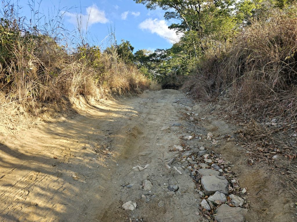
352. The climb up on the north side of Mufundeshi Stream was about 280 metres but although brutal was not as bad as yesterday’s climb.

353. At the top of the climb there was good views across the top of the Zambezi Escarpment to where the plateau started.

From here I was essentially at the top of the escarpment and about to reach the plateau above it. To the east the hills continued to rise and the land stretched away with wild forested ridge after the next where I should imagine humans rarely venture, even the hardiest prospector. Luckily I was going north where the landscape was more gentle and there were just a couple of smaller less steep climbs to reach the plateau and 3 hours after leaving Joe and his brother in the depths of the side valley I was finally on flatter ground and reaching villages and hamlets more continuously. This was the same type of farming I had seen around Zimba and Luyaba when I was last on the plateau before descending to the amethyst rich village of Mapatizya 10 days ago. The homesteads were now less traditional and in better shape than those down in the arid plains north of the Zambezi River. It was much more pleasant on the eye and most of the land was cultivated.

354. Just some 4-5 kilometres from the remote Mufundeshi Stream I started to reach the plateau and came across the first farms and a few abandoned exploratory mines. The road improved with every kilometre.

355. The top of the Zambezi Escarpment continued across wild remote hills to the east, but to the north it became gentler farmland.

I had about 5 kilometres of this on a much improved large gravel road until I reached a tarmac road. It was quiet and smooth and easy to cycle on. There were still some significant rolling ridges to climb but then there was often a wonderful run down the other side on the smooth tarmac without the bike rattling like hell over the stony gravel road. I was parched and stopped at a small shop for a drink and then learnt that it was just about 3 kilometres to the junction at Katoba beside Leopard Hill. I had already noticed there was accommodation here and after the difficult day yesterday and the hard morning decided I would throw in the towel here despite it just being midday. I cycled past a lovely simple thatched church and then up a slight hill to reach the junction and a sign for the Kankonongo Lodge.

356. Up on the plateau the farms looked less poor. Joe said it was because it rained more than the arid landscape I had been in for the last week.

357. The were all sorts of denominations in South Zambia, notably Pentecostal, Seventh Day Adventist and New Apostolic – which is pictured above.

The lady, who had hair extensions down to her knees, had a room. It was 300 Kwacha or £10 and it had a ramshackle bathroom but with hot water heated by solar pipes and a tank. These were the first I had seen in Zambia. The lodge also had a great view over Leopard Hill. There are 4 such rocky hills at Katoba and leopards used to have their lairs in them up to the 1960’s. However since then Zambia’s population has grown significantly and more and more land was taken up by agriculture around here and the leopards withdrew into the deeper forest and down to the Lower Zambezi National Park. I had a magnificent hot shower and washed all my stinking clothes, despite it just dribbling out of the roseless shower head. The lodge had no food so I went down to the row of shops at the junction and had chicken and nshima in a restaurant run by 3 characterful battleaxes. It was fun watching them chase a very drunk man out who had obviously come in because I was there. After that I went back to the lodge mid afternoon and wrote the blog for the last two days and then had a great sleep. Tomorrow I would cycle the 50-60 km to Chongwe where I would reach The Great Eastern Road, the T4, and follow it east for 2-3 days to the arterial Luangwa River and complete Section 05, South Zambia.

358. The view from my rustic lodge over to Leopard Hill. Leopards used to inhabit the hill until the 1960’s when the population significantly increased.

Day 065. 13 July. Chirundu to Mufundeshi on D481. 41 km. 8 Hours. 910m up. 610m down. The elephants did not come back in the night and I did not see any hippopotamus either when I heard a sound around 0400. The ladies made me a nice breakfast and even got bacon from the shop specially for me. I eventually left at 0900 and was sorry to leave this hidden gem. I cycled up the steep road, wary that I might encounter the elephants at the start near the forest beside the river. However there was none and after 20 minutes I made it to the main gravel road leading north. I looked for the house Harry and Hilary stayed in as directed by James to say goodbye but could not find it so headed north.

There were quite a few people on the road and many were well dressed. Then it dawned on me it was Sunday morning and many were off to church services. I passed a few and there were joyful gospel hymns coming out of the windows. There were many denominations here but Pentecostal, Seventh Day Adventist, Jehovah’s Witness, Catholic and New Apostilic were the most common. Not all were off to church though and at a few bottleshops/bars I saw younger men already with beer in hand at 1000 in the morning.

It was a bumpy dusty road for about 10 km passing hamlet after hamlet the whole way. It was almost a continuous homestead, cultivated land and occasional shops the whole way. The road was not busy but there were a few lorries taking villagers up to the flat agricultural lands between the Zambezi river and the start of the escarpment, but west of the Lower Zambezi National Park. This park blocked my way east and was a totally wild area full of animals. Just at the bridge over the Kafue River there was a rare section of smooth tarmac.

344. Some 10 km north of Chirundu I reached the Kafue River. It had a bream or tilapia farm on it near the bridge. I think it was Chinese owned.

The Kafue River is a major river in Zambia but it pales into insignificance next to the vast Zambezi just below the bridge, but out of sight round the corner. There was a large bream or tilapia fish farm here which seemed to be quite well organized. I think it was Chinese. On the other bank, the north bank there were also some ponds which had been dug, and water pumped up to them. I cycled on to the start of some vast irrigated crop circles again similar to the ones I saw in Sinazongwe, but I don’t know who operated these ones. If someone had said it was the Chinese I would not have been surprised. Interestingly there was also a Zambeef feedlot cattle farm here but I only saw the entrance. I turned off the larger gravel road to a minor one which went along the north side of the Kafue River to the village of Gota-Gota and beyond. Just here I got a puncture. The second on my new tyres since Livingstone 600 rough kilometres behind me.

345. The good people of Gota-Gota returning from church in their finest. I passed many churches this Sunday morning and most seemed to be singing gospel type hymns although I also passed a fire and brimstone sermon.

Gota-Gota was just 4 km up the road. When I got there people were just coming out of church. The Catholic one I think. People looked remarkably well dressed and tidy for a typical village with the women looking very smart and many of the men in suits with ties on. It was hot now and I needed a drink. I was sure it would be my last for a while so I found a small shop with a chest fridge full of them. Inevitably some young men came in and asked if I could buy them a drink. I again said I only give money to women as men just spend it on alcohol. This created raptures of laughter from the 3-4 women crowded into the shop and the men left almost as if admonished by the woman’s laughter.

At Gota-Gota I found the track I needed using the Tracks4Africa app, which is remarkably good for me on these smaller roads. It led north through the village and then down into rural hamlets near low lying stream beds. There must have been some irrigation holes dug here as there were green vegetable gardens occasionally. It was a fascinating area as between the stream beds was denser bush which was almost jungle-like. The only problem was the steam beds and the adjacent areas were very sandy and although I could still cycle it was hard work and difficult to keep the front wheel from skidding to one side. I was soon sweating a lot.

346. From Gota-Gota I headed north on a small, slow village road for about 20 km to meet the infamous D481 just before the start of the steep climb.

After a good 5 km of this, these rural hamlets stopped and the track, which was only used by infrequent motorbikes, rose up out of the sandy areas to a series of small ridges. It was steep down to one and then a hard climb up to the next. I was starting to question whether this short cut on the track was worth it, but it did save me about 30 kilometres going via Kiambi. I passed a sign for Headman Tigere and then the going got easier. It was now hard packed earth on a flatter surface and I could go from 5-6 km per hour to 8-10 km per hour and not work as hard doing so. This easier cycle continued for the second half of this track for about 10 km out of the total 20 km. There were two more larger hamlets to pass through until after about 3 hours on the track I reached the infamous D481 gravel road just as the flat lands met the foot of the escarpment and at the base of the climb.

347. The extremely steep 350 metre climb up the Zambezi Escarpment on the D481 was loose, rough and very taxing to push a 70 kg bike up for 2 hours

This climb was significant and I had been dreading it for a good week. It climbed steeply from here at about 550 metres altitude up the Zambezi Escarpment to about 1200 metres in the course of 20 kilometres. However there were two large climbs of 400 metres and 300 metres. My plan was to do the first today and camp, and then do the second tomorrow.

I set off up the very rough track on foot pushing the bike. There was no way I could cycle this, even in the lowest gear and not even if it was smooth tarmac let alone this rubble and bare rock. There were some extremely steep bits, perhaps 15 degrees occasionally, and I could just not get the purchase on my feet to heave the bike up. The bike itself was 20 kilos, with 40 kilos of baggage, with nearly another 10 kilos of water. So 70 kilos in all. At some sections I was straining with every sinew just to move it half a meter, then slam on the brakes to hold it while I took a step and repeated the process and thereby just make 100 horizontal metres in 15 minutes. Then there would be some respite where I could go at perhaps 2 km per hour before I was at another steep section heavy for all I could. It was very slow work and I was sweating profusely despite the fact it was overcast above the Escarpment. In all it took me well over 2 hours to do the 3 kilometres and climb the 400 metres by which time I was exhausted. It was probably the hardest I had worked all trip and on a par with the wrong turning I took a week ago. My arms were especially tired but my whole body had had a severe workout.

348. It was a joy to meet Blyth and John near the top of the climb when I was exhausted. They had set off from Chongwe at 0200 in the morning with a 50 kg sack of maize each and hoped to get to Chirundu. We applauded each other.

Just as I got to the top on this remote route I met Blythe and John. They were as surprised to see me as I was them. They both had 20 kilo bikes and each had a 50 kilo sack of maize kernel strapped to the back. They had just finished a climb as I had with a similar load. There was a fair bit of banter between us and we applauded each other. Then I learnt that they had actually started at 0200 in the morning from Chongwe and had been going for 14 hours already and still hoped to get to Chirundu that night. These were strong lads which any mother would be pleased if their daughter brought home, instead of the lacklustre dullards outside a bottleshop.

After a 10 minute chat we parted, with them trying to stop their bikes running away from them and me gingerly descending the rough track for 250 vertical metres. I stayed in the saddle most of the time but the brakes were constantly employed and must have gotten very hot. Frequently I had one leg out, off the pedal waiting for the inevitable skid and on the 5 odd occasions it came I was ready and just let the bike fall over once. I was descending into a side stream called the Mufundeshi, which drained this section of the Escarpment. Ahead of me on the other side of the valley I could see tomorrow’s climb up, which was only 300 metres and not 400 as today. It took the best part of an hour to make it down to the bottom bouncing slowly over the bare bedrock and the rubble. By the time I got to the bottom it was after 1700. I crossed the stream bed which was dry and went 200 metres further and saw some tents used by road gangs. There was a superb patch of bare earth to camp on here and no one was about except a small dog, so I started to put the tent up.

349. At the top of the climb there was a very steep 250 meter descent down to a side valley, with the Mufundeshi stream at the bottom. Tomorrow’s 280 metre climb up the other side can be seen ahead.

Just as I started, two men appeared after returning from a day in the fields. They said it was no problem to camp but insisted I come down to their tents. I did and they showed me a place between their 5 large tents and the granary, which was full of maize. They were two brothers of 38 and 50 and their wives. The elder brother was Joe and he spoke great English and was very intelligent and entrepreneurial. He had spent years working in a mine up in the copper belt north of Lusaka. They helped me put the tent up and then soon afterwards I said good night and went in. I was too shattered to chat with them under their thatched opensided cooking and chatting area. I had a cold dehydrated meal which was still a bit crunchy after 15 minutes and 3 litres of thick creamy powdered milk. I was too tired to even bother taking my clothes off let alone writing anything. It was a mistake as the sweaty cycling shorts meant my crotch area festered in a salty, moist environment all night and meant I got badly chaffed the next day.

Day 064. 12 July. Chirundu Rest Day. 0 km. 0 Hours. 0m up. 0m down. I was excited about seeing the hippopotamus grazing on the lawn last night. It was too dark to get a photo but I described it. James and the breakfast lady said it was very common and they came out most nights. After the cooked breakfast I went over to my chalet to write the blog and do some emails. There was a nice verandah with a table under it. It was perfect and I could look out across the parched lawn and see the Zambezi River gently flow past and even see Zimbabwe on the other side.

As soon as I started one of the gardeners/handymen came along and told me there were elephants just at the edge of the forest. I went down to have a look and there just 100 metres away were about 7 large elephants and no young. I asked where they came from and he said they had been in the forest here for a while but probably before that came from Zimbabwe. He said they would just wade across the river which was not that deep at just 1-2 meters. We stood looking at them for ages as they tentatively inched their way forwards reaching high up with their trunks to pull branches down and then stripping them of leaves, or breaking the small ones off and eating the whole lot. I was captivated by the spectacle and soon the other workers and Harry and Hilary and some of their grandchildren came to have a look. They seemed to think it happened every other day and that they would soon venture onto his lawn and start on some of the trees there.

338. In the morning a herd of 7 adult elephants emerged out of the forest along the riverbank next to Machembere Lodge.

There were plenty of branches with leaves hanging down for them to spend time where they were, but they kept looking in our direction, hesitant to come further. In the end the workers and Harry, Hilary and family eventually left as they had seen it all before and I slightly hid behind a tree. Sensing the humans had retreated, three of them started to wander into the trees at the edge of the lawn. One however was determined to get to a tree on the river bank at the edge of the lawn where I had seen the hippopotamus last night. I retreated back a bit and then went round to the bottom of the slope up to my chalet where there was a great escape up the slope and into the cabin. Another one joined it and they were now only 50 meters away. I watched them for a while but they were quite stationary.

339. The elephants stood on a clear bit of land on the border of Machembere Lodge before the ventured in.

So I went up the slope to the cabin and then went along it where I could see the other 5. One was a very large male. They carried on pulling tree branches down and devouring them but a couple seemed to have found some vegetation on the ground and were busy scooping that up with their trunks. They were only about 50 metres away and I was about 30 from the safety of my cabin, but there was a big slope they would have to climb up. I spent about half an hour watching them and noticed how trimmed the bottoms of the trees were becoming. I took loads of videos and photos as this was quite a bonus for a rest day to watch these magnificent beasts in such close quarters. I am sure they could see me and knew exactly what I was doing. The gardner did say that a couple of weeks ago an elephant had killed someone locally after she threw stones at it to try and chase it off her maize plantation. I could imagine a herd of 10 elephants could decimate a quarter hectare (half acre) of maize within half an hour.

340. Some of the 7 elephants started breaking palm fronds off on Machembere Lodge lawn and devoured them.

When I went back to the verandah the two by the riverbank had obviously spotted tastier trees on the lawn and one came up and was not about 40 metres away devouring the fronds from a palm. After it had eaten about 5, stripping all the leaves off the central stalk and cramming them into its mouth it started coming up towards me. I made sure the door of the chalet was open and watched it come to within 30 metres and then 25 metres until it got to the branches which drooped down. Up went its trunk and it brought the branch down and broke some off. It then started twisting bits of it and putting it on his pointed lower lip. before it disappeared between great sets of molars which reduced all the pulp – small branches and twigs along with the leaves.

341. One elephant came within 15 metres of where I sat on the verandah writing the blog as it pulled branches down right in front of me for half an hour.

As the canopy he was easting was devoured he had to move towards me, moving a metre with every step. I double checked the door was open and watched him until he was just 15 metres away. There was a significant slope still between us and he would not get up that in one bound. As he reached up, with one eye on me and the other on the next acacia branch he was intending to pull down, I could see right up into his mouth. We sat and watched each other for about 20 minutes until he left the acacia and moved on to a coconut tree which Harry had planted. He just broke one frond off that and started to devour it but then walked backwards leaving the frond hanging and half chewed and went round the side of another shrub. It is amazing how such a big animal could vanish behind a small shrub. When he reappeared he saw me again and this time was not happy. With ears flared he took a few steps towards me and stopped. I was already half way into the chalet but he stopped and turned and went quickly after the other 6 who had already left the lawn area and were heading away. And that was the end of quite an exciting and intense two hour encounter with this herd. It was perhaps the wildlife encounter of the trip so far, along with the surprise of seeing the lions feeding on the buffalo carcass in Chobe national park.

342. The verandah on my chalet where I was writing when the elephant came within 15 metres to eat the lighter green leaves hanging down.

By now it was midday and I still had all the blog and paperwork to do. So I sat on the verandah all afternoon typing away until 1700 when I managed to upload all the photos with the weak signal and then had just about finished typing when someone came over to the chalet and said have you seen the elephants. I said “Yes! I saw them this morning. Hopefully they will be back”.To which she replied “They are just over there now” and I looked where she was pointing and saw two large males. Then the whole show started again but this time all 7 elephants, all males, came onto the lawn. Everybody came to watch on my verandah as it was a safe spot. Harry and Hillary were there and a bit worried about their palms. 3 of them were attacking one of her cherished palms and another was sniffing around Harry’s coconut tree. They milled around just 30 metres away from us, but down on the lawn below us. One or two went along towards the swimming pool with the tan coloured Zambezi water where there were more acacia trees by the water and also more palms. We all left my verandah and went down to the pool area to monitor those down there. Harry was very philosophical about the potential carnage but Hilary was more concerned. “They were here before we were,” said Harry. It was getting dark now at 1800 and the carnage looked like it was in the early days and Harry thought they might settle here for the night. However I was not really comfortable going to my chalet and also did not want them on my door step all night. They might start on the roof. So I went back to my cabin the long way and went out with my powerful headtorch and airhorn. I let out a half second blast and they all turned to the forest and then let out another and they all walked quickly away. The security guard thought they might come back now they had seen the goodies on offer.

343. The inside of the chalet with the bathroom and storage room at the far end. It had a very high roof.

I then went in to finish off all the paperwork before returning to the bar area hoping to find Harry still there but he had gone. It had been a fascinating day, one of the most exciting days of the trip on what was essentially a rest day.

Day 063. 11 July. Changa to Chirundu. 67 km. 7 Hours. 430m up. 600m down. It was hot in the room in the early part of the night so I did not sleep well but eventually the cool of the night permeated through the corrugated roof and chilled the air. In the morning I was up early as I wanted to get to Chirundu early. I gave the sweet lady running the place a good tip and then left the dusty village and headed off on the tarmac road to the east. It was just 42 kilometres along the road to the T junction where this road, the D500, met the larger M15. Pretty much the whole time I cycled on this road there was a line of hills to the north. It was the Zambezi Escarpment, a ramp leading from the lower flat lands on each side of the Zambezi River up to the plateau. I am not sure if the escarpment was caused by the relentless erosive force of the Zambezi River over the last hundreds of millennia, or if it was a natural tectonic rift which the Zambezi River exploited on its course to the ocean. It was probably a mix of the two.

330. On the northside of the road after leaving Changa heading east I passed below the Zambezi Escarpment.

As usual there was a strong headwind and it was blowing dust up into the air and some of the shrubs were getting a little buffeted. The villages kept on coming and there were perhaps 5 of them in total between Changa and the T junction 42 km later at a place called Sikoongo. I had noticed in the last few days as I come further east a lot of the granaries now have the same structure as in they are elevated from the ground, are usually round and are constructed from sticks and then reeds. Not all seem to have a thatched grass roof any more. However the biggest change seemed to be that the walls were sealed with a layer of mud daubed on them. Rarely the mud was even painted. I could not work out the reason for this

331. Many of the graneries now seemed to be daubed with mud and some painted even. I could not work out whu this became more prevalent over the course of the last 10 days.

I had seen that more and more of the thatched houses now had a small overhang on them. It was perhaps too much to call it a verandah. I assumed this was to help keep the houses cool as the sun would shine less on the mud brick walls. There was no other shade to speak of really as this was back in charcoal production country and most things which could be made into charcoal had been chopped down. There were two sizes of sack now; the usual small one for 70 kwacha and then giant ones for 150. I think most of it was used, if not locally, certainly in the district as it seems everybody cooks on charcoal in the villages. Even at the guest room in Changa the lady cooked on charcoal on a small round stove about the size of a saucepan with holes in the side. As it was charcoal she could also cook inside with hardly any smoke being produced.

332. More and more of the houses had large overhangs on them and I assume it was to keep them cooler.

Occasionally, I would pass a cyclist on the road. Often a younger boy taking maize kernels to the flour mill. There were still no electricity poles beside the road so the kernels had to go to the electric blue shed flour mills, with the array of solar panels. I also saw a few men making charcoal and packing it into sacks and men driving the ox teams, pulling carts or logs. Perhaps it was the men who did the ploughing in a few months, before the planting started. However currently, these were the only men I ever saw working. While the women were constantly on the go. I frequently passed them on the way to or from the community borehole with buckets on their heads. The women were the only ones in the vegetable patches irrigating their tomatoes, they were the only ones at the market selling things, frequently they were the ones in the small shops. I am sure a lot of the agricultural work falls on their shoulders also. By far the majority of the work seems to fall to them. Perhaps I am just seeing a snapshot of the working year and that men in fact do the ploughing, tending, harvesting and transporting the produce home, and this takes up a lot of their time, and I am just seeing them during their annual break as it were.

333. The was plenty of charcoal production, on a cottage industry scale around Changa and further east, to the detriment of the scrub.

I am sure though I am being overly charitable towards them here because at the moment they seem to congregate around a couple of the small shops in every village and just hang out in their fashionably ripped jeans and cheap sunglasses. If they had the misfortune to have money in their pockets it is all spent on drink. I do not see anyone blind drunk and staggering as in a UK city during the weekend nights, but just enough to alleviate the boredom of hanging out. I am sure they are convinced they are as cool as one gets, and an indispensable mainstay of the community, but in reality they were a burden and a totally wasted resource. One of their highlights of the afternoon was probably spotting me cycling past, then waving in the hope I would join them and ply them with ethanol all afternoon. For them the loud music and alcohol was the opium of the bored. Although the women were always busy, they were always joking, chatting and laughing while the younger men are essentially predictable dullards. This dichotomy seems to become more pronounced the further east I travel since Livingstone.

334. Women seemed to do the lion’s share of the work in Tongo society, but were happier and more cheerful than the disenfranchised men.

There was not much wildlife around here, and what there was, was limited to birds. I think any larger animal would have been poached for the pot generations ago. Around the villages the goats and cattle would have foraged everything bare so there would be no food anyway. However, there were occasional doves and hornbills and a lot of smaller passerine type birds. I saw a flock of hornbills on one occasion but they all flew off bar one when I got the camera out.

335. Although there was little wildlife life on the ground birds seemed to survive. However eventually they has to be careful as there were always catapults about to help them into the cooking pot.

Eventually after about 3 hours battling into the decreasing wind I reached the village of Sikoongo and the T junction. I had 2 choices here: either go north to the large T2 main road, which would inevitably be full of trucks. Alternatively I could go south for a bit and then find the gravel road, R143, which would take me into Chirundu from the south. I chose the latter and was heading down towards it when people kept asking where I was going. I said “Chirundu” and they all seemed perplexed and tried to redirect me back north again onto the T2. Eventually I said “small roads” and then one knowledgeable older man on a bike said follow me and led me down a small track. After a few hundred metres he stopped at a junction and said “Follow that in a straight line all the way and you will reach Chirundu”. It was not quite as south as the gravel road I was wanting on the Tracks4Africa map but it looked like a short cut towards this gravel road.

As it turned out it was a path in itself and did not reach the road I wanted until just before Chirundu. However it took me through the most remarkable countryside and a couple of small villages where this was the only to reach them. The path generally went due east and was quite level and generally firm. It had been formed by generations of pedestrians and then later bicycles, so it was easy to follow. I could never go fast but then it was a great way to savour the landscape. In a little under an hour I reached a village which I think was called Matavista. It was an idyllic village with perhaps 50 homesteads all under thatched roofs. There was also a small row of solid mud built shops but they were all closed. In the middle of the village was a vast open area with a couple of large trees. All the homesteads were arranged around this bare open area, the size of two football fields. On the far side there was rhythmic music emanating from a house and drifting across the open area. It was more gentle than the high energy rap coming from the pubs where the disenfranchised youth gathered to drink. Under one of the large tree’s shade were about 20 women all gathered with their tiny market stalls, some with just 50 tomatoes. I asked them the way to Chirundu and then they all pointed in the same direction. One grandmother spotted a teenage boy and dispatched him to show me the way for a few kilometres. After weaving through the scattered bush and across large areas of sugar cane, which had all been harvested, for around 15 kilometres I came to the D road I wanted to be on. It was just a few kilometres south of Chirundu and I was there soon afterwards after following the vast Zambezi downstream. I had said to the guy 2 hours ago I wanted small roads and he certainly showed me them, but it was a delightful cycle.

336. The village of Matavista was only reachable by bicycle after a 6-7 kilometre journey on paths through fields.

Chirundu was large and busy and like nothing I had encountered since Livingstone. I found a shop with cold drinks and went in and sat in a chair in the shop. Here I spent half an hour on my phone searching for a place to stay. It seemed there were cheap perfunctory places to stay for visiting officials and Zambia travellers. Even cheaper places for truck drivers to overnight in as this was a major border point with a bridge over the Zambezi into Zimbabwe. Or finally very expensive safari lodges at $200 a night outside town on the banks of the Zambezi. Then at last I found Machembere Lodge which seemed like a high end tourist lodge without the superfluous luxuries and without the price. I cycled down the road north for 3 km to reach it passing a lot of elephant dung at the gate.

337. At the Machembere Lodge there was a great view across the 500 metre wide Zambezi to Zimbabwe. Apparently it was only a metre or two deep.

The lodge was very quiet but I met the characterful Harry who was the owner and James his softly spoken Zambian manager. They had a room and it was 850 kwacha or £25. It was an enormous chalet with a thatched roof looking across a shaded sparse lawn to the gently flowing Zambezi River just 50 metres away. The only problem was there was no power due to an outage. So it was dark inside and there was no hot water. There was also no wifi on the premises and the mobile signal was very poor. However the location and ambience were great. I spent the evening chatting to Harry and Hilary who owned the place. They had both grown up and gone to school in Southern Africa, mostly Rhodesia as it was then. The land was Harry’s old family land and he used to grow bananas on it until Hilary thought it possible to build a lodge here to cater for the aid workers, notably World Vision. However with covid and a change in NGO policy and internet conferences that market had diminished and this tranquil place was somewhat wasted. When the substation fault was rectified and the power came back on I could see how nice the chalet was and the water was soon hot for a shower. I slept well but woke at 0300 with a noise outside. Curious I went for a look and saw there was a large hippopotamus on the lawn just outside my thatched chalet.

Day 062. 10 July. Munyumbwe to Changa. 90 km. 8 Hours. 640m up. 730m down. I was ready to set off early when I noticed I had a puncture on the front wheel. After the amount of acacia thorns I had ridden through on the last day I was not at all surprised. I was grateful it did not happen on that day. After I changed that I went back to the bakery where I bought a loaf of bread and something like a cornish pastie. I had the latter for breakfast and kept the loaf for later. I said my goodbyes to the staff at the council guest house who were trying to look busy, like council workers all over the world. I set off on the tarmac road which people assured me would be quiet. At the eastern edge of the small town was a petrol station and just before it was a bed and breakfast behind big security gates.

323. These guys easily kept up with me for 2 km on their bike with no gears and no brakes. Zambians are strong and fit.

The road was surprisingly good and I was surprised it existed. In the course of the day perhaps 20 motorbikes, 10 cars and about 4 buses and 4 lorries passed me. So I could use the whole road and often needed to in the potholed sections. One thing I did notice on the first stretch to the village of Katete, after some 25 km, was how poor it was. There were no electricity poles and so no electricity anywhere. Also all the kids seemed to be barefoot. It seemed an odd juxtaposition to have this road and yet no electricity. The road was also full of ladies in groups going to or returning from the borehole pump with water for the household. There were plenty of pumps amongst the hamlets beside the road. I could have found plenty of water here and now cycle with all my water bottles empty, save for a litre. The landscape was very dry and quite rocky and not really great for agriculture. The only thing which thrived were the baobab trees.

324. None of the villages today had electricity and everyone had to fetch water from a borehole in this arid landscape.

After Katete the landscape became even more harsh and arid. it was almost sahel-like with nothing on the ground and just shrubs and trees growing from it. There were more and more cacti. I was still passing herds of goats and cows and I could just not see what the cattle could eat at the moment. Perhaps in the rainy season all this bursts into life, but there was just not the ground cover or the roots of grasses around to use any rain. I think this place is extremely vulnerable to climate change because if the rains don’t come it would easily become uninhabitable and all these thousands of people would be displaced.

325. There were a few irrigated experiment areas where an Irish charity was trying drought resistant maize.

In the last half of the day I did pass a few villages. They were the most traditional villages I had seen so far with about 50-100 households in small compounds, with virtually every house or hut under a thatched roof. However, I also noticed that the agriculture here was quite well organized as if it was a cooperative venture. The fields were large, perhaps too large for a single household to plough and harvest. There were also many small vegetable gardens beside the rivers where pools had been dug and the vegetables were then watered by bucket. An Irish charity had various projects in the valley growing drought resistant maize. But even drought resistant maize needs some rain.

326. Some of the villages today were exceptionally arid and almost Sahel-like. There was no ground cover whatsoever.

The kids here were the most excitable of the entire trip so far and spotted me a mile off and came running out of the compounds and often ran alongside the bike. Two young boys managed to keep up with me going very slightly uphill for a good kilometre running fast without becoming short of breath. The women here were also the most confident so far with all waving even single girls walking towards me, who are usually shy. If they were in groups they were shouting and waving. Most of the men were also friendly but on the two occasions I stopped I was plagued by middle aged men asking for money or to buy them a drink, meaning an alcoholic drink. I told the second lot I would only give money to women and never to men to buy drink with. I might make it sound worse than it is, as it was just a tiny fraction of men who are drink pests and the majority are upstanding and polite.

327. A large field of harvested sugar cane. I think this feild with its sentinel baobab trees was too big for one family to plough, sow, tend and harvest and must have been communal.

Towards the end of the day and in the last 15 kilometres I passed some small mines. There were no signs on the gates and this led me to believe they were Chinese operated. It seemed they were mining in an area with a lot of orange coloured rocks and much of what was produced seemed to be stored in the meter cube white industrial sacks waiting to be taken away by lorry to be processed. These mines, and there were about 6 of them, all seemed to be in the test or exploratory stage rather than full blown production.

328. There were many vegetable patches beside the dry stream beds where the vegetables were watered by bucket from holes dug in the sand. Note the animal exclusion fence.

As I neared Changa the landscape became even more arid and cactus was rife. There were not many trees save for the large baobab, as charcoal production was rife. I noticed large areas where anything bigger than an arm was cut down leaving a stump. I doubt this would have a benefit of clearing the land for agriculture. The prevailing crop now seemed to be sugarcane as a cash crop, with fields of maize also as the subsistence stable. A few kilometres before Changa I ran into a sports competition. There were perhaps 300 spectators and 200 competitors. It was mostly girls volleyball and boys football, someone told me there were scouts looking for talent to train professionally. I don’t think I saw one overweight person in the entire crowd of spectators or competitors. Indeed the only fat Africans I see are urban ones and there are usually merchants or those working for the government. I would have liked to have stayed and watched but it was just an hour before dusk. However, a few people said there were guest rooms in Changa and to ask at the market.

329. My room in Changa was perfectly adequate for what I wanted. The toilet was a long drop in a separate shed.

In 2 km I reached the market. It was basically 20 brightly dressed respectable ladies all sitting with stalls of vegetables and tomatoes. Some had sweet potatoes and a few had fish. I asked one about rooms and she beckoned a man over who led me to a building behind the stalls. He asked a gentle, older man in front of a longer concrete building. Yes they had a room and it was 100 kwacha (£3). Of course I took it as it was a great alternative to camping. The man’s daughters spoke good English and were very hospitable and welcoming. The room had just 4 bare walls and a double bed with sheets and blankets. I would use my sleeping bag again. For dinner a daughter gave me a litre of hot water for a dehydrated meal and I had the rest of the excellent bread from the morning. I wrote the blog as the sun set and rhythmic music drifted between the simple houses, most still thatched even in this village. About 1930 the sports competition spectators and competitors returned to the market and the whole place erupted into joyful singing. The massed voices of the girls and women easily drowning out the music from all the man caves.

Day 061. 09 July. Munyumbwe Rest Day. 0 km. 0 Hours. 0m up. 0m down. I was tired from the long day yesterday and I had work to do on the blog. These combined to make it sensible to take a day off. I could probably have cycled as I noticed how my legs can keep going all day now as long as the gears were low enough. Long distance hikers get something called “Hikers Legs” where they suddenly become fit enough they can hike all day, like a young spaniel dog, without feeling it too much. If there is a cycling equivalent then I must be on the threshold of it.

However the blog, that never ending deadline, needed a few hours of attention. If I did not do it today I would have to catch up sometime in the future and live under a black cloud until then. So it made sense to combine the two. I spent the entire morning doing it in the guesthouse’s perfunctory dining room and then returned to my room for a long siesta.

322. The Gwembe council guesthouse in Munyumbwe where I spent a rest day. It still worked but needed some maintenance.

In the late afternoon and early evening I returned to the dining room which was now full of Zambians cheering on their women’s football team in an African tournament. I went out to eat after dark to the simple bakery/restaurant across the street which did a take-it-or-leave-it sausage, greens and shima dish but could replace the nshima with macaroni. It was much nicer than last night’s and had a window. There were cheers outside from time to time as at least 20 people pressed their noses against the window of a pub which had a television showing the same Zambian ladies soccer team. They were passionate about football here. I had an early night and was in bed by 2000 after the lazy day.

Day 060. 08 July. River Njongola Estuary to Munyumbwe. 62 km. 10 Hours. 920m up. 770m down. I slept well in the yard beside the small mud brick house. If there were ticks on the ground they would have been short lived as there were chickens, guinea fowl and even doves patrolling the earth constantly scouring the ground. The doves lived in the rainy season kitchen which was shunned now in favour of a fire in the open. There were also three small pigs wandering about the yard who would head off soon into the bush to forage for the day. I took my own breakfast of granola over to the newly lit fire and ate it there. The day was well underway already at 0630 as the sun had already risen.

People were coming and going on the track and two younger men were already taking dried manure to the fields from Minister’s cattle corral where about 10 cattle spent the night. They were shovelling the pile into a large box sitting on a sled with wooden runners and then this sled was pulled by two oxen. I had seen more and more teams of oxen pulling carts, ploughs, trunks of trees and sledges, yesterday and this morning now I was in this relatively poor area without roads or electricity.

314. In the morning I managed to get a picture of my hosts. Minister is in the middle with the red and yellow shirt and his daughters to the right. The others were close neighbours.

I packed after my granola, with everyone turning to watch me, especially Minister. I was packed up quite quickly and by 0730 I was ready to go. I was not sure if Minister was the headman of this hamlet or not. He seemed to have a few daughters but no wife, and was 39 years old. I am guessing his wife had previously died. I thought if I gave him money he would use it wisely rather than drink it so I found a brand new 200 kwacha note and gave it to him. It was more than needed but his family had shown me kindness. He was delighted. It also meant I could get a photo of the whole homestead and the men who had come down to Minister’s morning fire before I finally set off.

315. The concrete causeway over the Njongola River was partially destroyed. It would have been unparalleled after a moderate amount of rain. The ox team were pulling a heavy log.

I cycled through the rest of the village passing fields with piles of manure and then reached the bridge. It was a concrete weir which had been laid across the river to allow traffic. However it was maybe 10-15 years old and without any maintenance, like the road through the village, it had fallen into disrepair and a few floods had washed sections away. As I cycled down to it a pair of oxen were pulling a couple of large logs up the hill. I had to push the bike over the river, which I guess would have been nearly impossible in the rainy season, especially when in spate. Once over I had to continue pushing the bike up a steeper hill for nearly half an hour as the road was essentially now just a footpath. I climbed some 100 metres, toiling hard pushing the bike, sometimes over very stony ground or bare rock. Eventually I reached the top and the footpath turned into a track again and levelled off passing through a small hamlet where children ran out to meet me.

316. The long steep footpath on the east side of the Njongola River. It was also impassable to 4X4 vehicles.

When I plan a route I usually do it on Strava, a mapping app, and confirm it with google maps. I then plot the route so it follows the way I want to go along the roads shown on Strava and Google maps, especially the satellite view, which shows the roads. I then create a GPX of the intended route and send it to my gadgets. When I am cycling I simply follow the gadget which indicates all the twists and turns of the route and also all the ups and downs. The route I was following now was created months ago in the comfort of my study. The trouble is sometimes the view of Google maps satellite view and the information on roads on Strava can be very out of date, rarely by as much as a decade, and often new roads are not shown. But this system has always worked well for me and I had no reason to suspect any difference now. I don’t even remember passing a junction about 4-5 km after the river crossing but there must have been one.

317. After the first hamlet on the north side of the Njongola River I should have gone down into the flat valley but by mistake did not see the junction and my preplanned route went to the right.

Instead I just followed the route on my gadgets and it directed me on the right fork of the unnoticed junction on a narrowing track which eventually became a footpath. However there were bike tracks here so all was well. As predicted by my gadgets the route now started to climb and I had to climb another 100 metres over a ridge in the Sikolqinzala Hills which is where I was cycling. The track however became worse and worse, and it was frequently steep, rocky and totally overgrown. The previous bike tracks had also completely disappeared. It was a bloodsome slog going up the hills and I was frequently getting scratched by the small acacia bushes. Occasionally I passed a section where I recognized a road had been and another where a culvert had been washed away leaving a couple of concrete pipes in the forest. I thought Googlemaps and Strava had just not updated for a decade when this road was abandoned and the village I passed through used the road to the south through Ministers hamlet to get to the rest of the world.

318. My preplanned route took me up through some horrendous, overgrown terrain where the old road was destroyed by torrents and abandoned. It took a while for me to work my mistake out.

At the top of the hill after the very taxing push which left me tired and scratched there was at last a nice run down the NE side. I thought I was free and it would now be a nice coast down the other side of the hill. But the relief was short lived as soon the track became very overgrown and destroyed by floods of water leaving rocks and bedrock. This just could not be right even through I was still on my pre planned GPX route. I had my drone so I launched it and flew down over the preplanned route but it just seemed to get worse and then dissapear. I then flew higher and panned around and I could see a large area of cultivated fields about 2 kilometres to the north around a village. The village lay in an open valley within the Sikolquinzala Hills. There seemed to be footpaths leading from my position through the bush to this village. I then remembered I had downloaded another map app called Tracks4Africa, which showed all the 4 wheel drive tracks in Southern Africa. I checked with this and saw I was on a small track which went nowhere and there was a track 5 km to the north which went from the broken concrete sill across the Njongola River I crossed previously to the road up to Munyumbwe. It was definately the road I wanted to be on. I must have been on it but at the junction I could not recognize or see I must have left it to follow this godforsaken dead end road by slavishly following the GPX route on my gadgets. This GPX route I created 3-4 months ago contained the error.

Now I knew my predicament I had two ways to solve it, either return the way I had come or go down through the bush for 2 km on one of the footpaths to the vicinity of the village and its fields. I chose the latter as I knew the way I came was hellish. The footpath was not really a path leading like a twig from the top of a tree down the small branches and then bigger branches to the trunk and then finally the bole of the tree, which is where the village was, but rather a criss-cross network of footpaths across the bush. The ones I took were always small and there were numerous junctions where I always had to pick the one I thought went to the village. Generally they were OK but I was getting scratched pushing through bushes. However, once I got to a steeper boulder field and had to negotiate the heavy bike through this which took half an hour for 200 metres and a lot of heaving.

319. After my descent through the bush I came across this gorgeous, traditional and remote hamlet with perhaps 10 households which was 4-5 km south of the gravel road on a footpath.

At last I came to a long since harvested maize field and I could now follow the access paths to the fields which were now like the branches of a tree leading to the trunk and bole of the village. Occasionally I caught sight of it. It was gorgeous with the pointed roofs of perhaps 25 small huts emerging from the the low scrub which surrounded it. I knew If I got to the village there would be an access path from the village to the gravel road I wanted to be on. Slowly I twisted my way down to the base of the village which was raised up on a shallow knoll. I did not go up to the village. I would certainly have been the first Musungo on a bicycle to arrive there, but found the access path below the knoll. It was at least a meter wide, well trodden and had numerous bike tracks on it. I started following it to the north crossing two deep sandy river beds. In the second one I came across a boy on a bike taking a sack of maize kernels to the mill. It was about 3-4 km along this path until at last I reached the gravel road just at the village of Siabbamba. This was the road I should have been on all along and should never have left for my inadvertent detour which cost me perhaps 3 hours in total and a lot of effort. It was already 1230 and I had been on the go for 5 hours. I still had a demanding 45 km to go to Munyumbwe.

320. The gravel road from Siabbamba village to the T junction with the bigger road was about 30 km and passed a few villages. It was quite hilly.

I started North East along the road which was quite stony as it did not get the traffic here to pack it down. I think the road was destroyed in places in the direction I was going and this cut these villages off. There was also no electricity anywhere here. Virtually all the buildings were the round mud huts under a straw roof and there were very few of the newer style mud brick buildings under a corrugated tin roof. These very traditional villagers had immense simplicity and charm, and the villagers all waved and then put their hands together in a single clapping motion indicating a respectful greeting. I cycled here for a couple of hours climbing steeply and dropping down into a dry stream bed only to climb again. Most of the track was firm but there were frequent shorter sandy bits in the dips. I passed a few motorbikes and cycles but no vehicles. I also passed an ox drawn cart with biscuits, drinks, provisions and some hardware for a shop in Siabbamba, which must have been up a lane in that village, as I heard it but did not see it.

Eventually I reached Sinayala. I was tired, thirsty and hot. Here there were two rustic shops, electricity and although I did not see any vehicles there were tyre tracks. I stopped here for biscuits and some sugar water and felt my energy surge. It needed to be as I still had a way to go. The next stretch was relatively short and it took me past arid homesteads with the new style mud brick 2 room houses and many baobab trees. I noticed a few had been cut down, and cut with an axe. I can only imagine this is for firewood, but I am sure it would be a huge effort for relatively little reward as the trees were massive and to get them into firewood would have taken considerable chopping. The road was now smoother, but still with its ups and downs and at 1600 I arrived at the T junction with the larger gravel road. There was still 15 km to go north on it to Munyumbwe.

321. As the road approached the larger gravel road it became very arid again with dusty bare hamlets and large baobab trees.

The last 15 km was hard. There were 3 sustained climbs, each of about 60 metres and quite steep. It does not sound much but with tired legs, and 60 kg of bike and baggage it was taxing. I thought I had good time to make it but suddenly I noticed the sun was dipping below the ridgeline illuminating the Sikolqinzala Hills with a warm orange glow. Since I left Namibia I have been in the same timezone although I have travelled some 1800 kilometres due east, so the sun sets much earlier here than Namibia and it takes me by surprise. By the same token it rises much earlier. I did not stop for photos now but just pressed on with set determination grinding up the hills in the lowest gear. At last with dusk approaching I reached the T junction in Munyumbwe.

Just to the east of the junction was a council run guesthouse I had hoped to stay at. They had room and even one with an attached bathroom. Everything was a bit ramshackle with broken tiles on the floor and the bathroom due to them being laid on an uneven floor. I was tired and would invariably spend tomorrow here recuperating but just took it for a night. It was dark now but I was hungry. The maintenance man at the guesthouse showed me where I could eat nshima and took me to the “restaurant” at the junction. It was pitch dark inside but with a torch I could see she had chicken pieces, greens, gravy and the maize meal or shima. I had a plate of it, bought some drinks in a shop and returned to the guesthouse room. I was tempted just to have a dirty dive and head to bed at once but forced myself to have a shower. I took 2 sets of dirty clothes into the bathroom with me with the intention of washing them one at a time until the water ran out but 40 minutes later it was all washed and rinsed and I was sparkling. I at last went to bed at 2100 and slept well. The blog would wait until tomorrow.

Day 059. 07 July. Sinazongwe to River Njongola Estuary. 61 km. 8 Hours. 450m up. 440m down. I was up for breakfast and was packed and away by 0830. Before I went I wrote a favourable review of the Lake View Lodge and especially the two ladies who worked there. I then cycled back up the rough track to a cluster of shops which might have even been the centre of Sinazongwe, but it was a very expansive village, if not town, and there could have been another centre. Just here I should have taken a road to the east but it was being dug up for the new road. I asked a grader driver who I thought would know the way but he directed me back the way I came and told me to go east. I did that but ended up on a cul de sac to a couple of other lodges. He must have misunderstood me. I asked someone with good English this time and he directed me back to the grader driver and beyond until I could go back onto the new road. As I passed the grader driver again he looked perplexed but I was on a sandy patch and did not wave or stop. I went round the detour and then back onto the road which was blocked off with tape but was hard packed earth beyond the tape. It was too good to resist so I went under the tape and cycled fast on the beautiful smooth earth for a few kilometres until the detour and the new road merged again.

304. Hollowing out a large log with an adze to make a dugout canoe to be used for fishing on Lake Kariba.

I was now joined by a young man who was going to the electric mill up the road to turn his sack of maize into flour. We chatted and he told me a bit about the huge irrigation circles which we were passing. He said it was a Chinese farm and they had 24 such circles and each one was at least a kilometer in diameter. The one we were passing was paprikas and it was all destined for the Chinese market and none was sold locally. The water for the irrigation was pumped from the lake. I saw workers in a field and they looked like they were harvesting a vegetable crop. The whole operation reminded me of East European workers on a giant vegetable farm in East Anglia. We got to his electric mill and we parted at a cluster of shops, which could also have been the centre of Sinazongwe. A bit further I reached the Zambian Cattle Company. It was a feed lot where cattle were raised in dry dusty pens and fed soya or perhaps even the waste from the vegetables. It was a vast site and there must have been about 40 pens each with about 50 cattle. I got the impression it was not Chinese owned as there were no signs, but it just seemed too much of a coincidence this industrial beef factory was right next to the Chinese vegetable fields. The whole place stunck of manure and I was glad to be past it.

305. The road to Sinamalima was generally quite good with a few sandy patches. There was fields on each side and these ones were cotton.

Just at my turn off to the east on a small D road I came across a man with a makeshift adze swinging it into a log. He was making a dugout canoe and the amount of work involved to hollow out the entire log was phenomenal. Just after him I turned off to the east and cycled along a rural road for almost 2 hours passing a few villages with markets and also the small row of dingy concrete shops. For much of the start of this rural D road I was passing along the north side of the vast irrigation circles which were on my south. However the land to the north was also partially irrigated and entrepreneurial local farmers were growing maize and other vegetables like squash and beans. The homesteads here looked better off with a solid 3 room house in every compound. Near Sikaputa I passed a small welding yard where a team of welders were fabricating pontoons and then joining 2 pontoons together to make a frame for a boat. I think they were houseboats, which are popular on the lake with tourists. I now turned northwest for about 5-7 km to head up to get the gravel D499 to the east. It was warm now as I cruised along on the stony road. Virtually the whole time since my turn off by the cattle lots I had been going through subsistence farming except for the huge irrigation circles at the start. There was also a large scale fish farm here, also Chinese owned, but it was down a road with no exit near the lake shore.

306. Where a dry river bed crossed the road holes were dug in the bed to for a pool of water which was pumped up to the adjacent field to irrigate.

Once I was on the D499 very little changed except it was now subsistence farming on both sides, and there seemed to be some small scale irrigation at the start from the Nangobe River, which although was dry had some deep machine dug pools in the middle and a petrol pump beside these pools to draw the water into the fields. I passed a few clusters of shops, one perhaps every 5 kilometres and there was plenty of scope for a snack. I was going to wait until the larger village of Sinamalima to stop for a drink, but passed a nice hamlet of shops and called in at one of these for some cold sugar soda. The kids all clustered round and were excitable so I took a photo of them all in their joyful mood.

307. Just before Sinamalima I came across a hamlet of shops where I stopped for a drink and was surrounded by excited children.

Sinamalima was quite a big village and definitely the biggest on this road. It had barbers and shoe shops along with the rows of dingy grocers. It also had its fair share of pubs who were already blasting out loud music for the benefit of a small handful of clients who were starting to drink. There was nothing of interest for me in this village at all except for the health clinic which was quite big and well maintained.There was also a Pilgrim Wesleyan church here as there had been in a number of smaller villages. They are certainly the most prolific missionaries in this area. As I cycled further west the road got more and more sandy but I could still skid through the worst bits. It also got a bit hillier in contrast to the very flat morning. To the south it was flat fields, some now with cotton bushes and then the plains leading down to the lake, while to the north were fields and then a line of forested hills which rose up at least 500 metres above me. The villages now started to get sparse and poorer again until I got to a fork in the now track near a pond.

308. After Sinamalima the homesteads became more traditional and slightly poorer as I headed east.

I did not know which way to take. The obvious way led down to a village and stopped, while the way on my map and GPS say the left fork was the road through to Munyunbwe but it had no tire tracks and was only used by cycles. I took the one to the left as my GPS indicated and soon realized it might once have been a road but was now destroyed by heavy rains which had rutted the track. It was also overgrown. I thought perhaps a new road was built and that was the right fork and it would eventually come round and meet the left fork. I persevered and found myself on a small twisting track, almost a footpath in places going through thicker jungle which was encroaching on the track in many places. I don’t know if a Toyota Landcruiser could have made it through this section. I think not. In the end I climbed over a ridge with the lake below me and no sign of a village below and then started the descent down the other side. The whole time I was on my preplanned route which was a comfort. As I descended down the other side I came across a young boy leading a young blind man.

309. As I neared the Njongola River the rough gravel road quickly deteriorated into a track and then a footpath where rainy season torrents had rendered parts impassable in a 4X4.

A bit further I came to a very small hamlet of just 2 homesteads. No one spoke English at the first homestead so I went to the second. There was a grandmother and about 5 young women there and again no-one spoke English. I asked about the way but got little response. I was going to ask if I could camp with them but decided to go on a bit as I understood they said there were more houses later. I cycled about 500 metres over a small hill and was coasting down the other side when someone shouted Hello as I went past. I glanced in that direction but only saw a bit of collapsed road where a small landslide had occurred. Then something caught my eye. It was a man with blood over his head. I stopped and realized that this man was also blind and had been walking along the road and had fallen off the edge. He could not get up as it was 3 metres down and steep on all sides. I stopped the bike and spoke to him. “Musungo” I said which meant white person. He put his arms out but I could not reach him. Then he extended his cane and I managed to heave him up on that until I could grab his arm. It was then easy to haul him out as he was a lot lighter than I thought. I gave him some water to drink and wash the blood off his head. I could not leave him as he was a bit shaken so I decided to walk him back to the homestead I had just left. The chances were he was related to the other blind person I had seen. I pushed the bike holding one end of the cane against the handle bars while he held the other. In 10 minutes we were at the homesteads and he indicated which one to go to and it was the one with the grandmother.

310. The treacherous eroded edge of the track the poor young blind man fell down 3 metres and hit his head on the concrete pipe. He could not climb back out so I helped him.

When we walked in there was a bit of indifference. Until I explained a tumbling motion and pointed to the gash on his head, now bloody again. They brought a chair for him and I think he told them what had happened. I thought this is great, I will now be their hero for rescuing him and can stay at this idyllic homestead after all. When I suggested it there was again indifference and puzzlement. Then one of the young girls managed to get enough English together to say in 10 minutes there is a better place. I did not feel unwelcome but I felt there was little gratitude. Perhaps it was a cultural misunderstanding.

I said goodbye and they all cheerily waved me off and I cycled past the landslip that claimed the blind man and went on another 10 minutes until the track climbed more steeply. En route I passed a couple of homesteads but they were empty. As I pushed up the hill and neared the top I passed another. They waved me over. I needed no further invitation and came into their compound with my bike and noticed a great place to put the tent.

311. My tent beside Minister’s house in his compound in the hamlet just before the Njongola River. I think Minister might have been the hamlet’s headman.

They were very welcoming. His name was Minister and his daughter brought me a cup of water. I suspected it was river water but drank it anyway from the dirty cup, trusting my cast iron constitution from 6 decades of travel in the tropics. He said I could stay and soon a few men arrived and the tent was up in a jiff. Then the women all went to get more water from the river in buckets and Minister brought me a big bucket of water and a cup. Then all the men left to bring in the animals leaving me on my own at the homestead. I used the cup to fill 2 containers of water and put some purification tablets in them and then photographed the place.

312. The three legged cooking pot on the three stone fireplace. It was around this everybody gathered and all the cooking was done.

When Minister returned he put a chair beside the fire and beckoned me over. His English was as bad as my Tongo, but other men came and went and spoke a smattering of English. His daughter gave me some hot water for a dehydrated meal and 2 packets of noodles and that was my supper. It got dark as I finished and before they had eaten. There were about 4 men, a daughter and 3 small kids around the fire. In the end I thought I was making them a bit uneasy as I think Minister was quite shy. So I thanked them and retreated to my tent to write the blog. They went to bed at 2030 just as I finished. It had been a very interesting day and I was delighted to at last have spent a night in a compound in Zambia and also to have helped the poor blind teenager. I don’t think a 4×4 could ever make it to this hamlet so it is still very traditional.

313. One of Minister’s neighbours had a charming son who was very interested in the phone and camera on it.

Day 058. 06 July. Sinazongwe Rest Day. 0 km. 0 Hours. 0m up. 0m down. It was nice not having to rush off from this beautiful spot in the morning now I decided to stay an extra day. After a surprisingly good breakfast I went out to a table on the verandah of the lodge’s dining and reception area. It was a cool shaded spot and I could see the lake through the trees. There was a troop of the small vervet monkeys which sauntered around the complex occasionally wandering along the tops of the railings. Had I been eating and left the table they would have cleared the plate in a flash. It was very peaceful sitting there looking over the water from time to time. It took me about 4 hours to collate everything but at last I was done by midday.

301. The reception and dining area of the Lake View Lodge where I sat on the verandah all morning and wrote the blog for the last few days.

Just as I finished a group of 5 Indians turned up to spend Sunday afternoon here. I chatted with them and learnt that they all worked in Maamba at the only coal fired power station in Zambia. They said most of the power went up to the Copper Belt via Lusaka. The power station was managed by an Indian Company and its Indian workers spent 5 months here and then 1 month in India. They told me the Chinese were constructing another two power stations in Maamba to use the coal they were mining. They also told me the road to Sinazongwe which I cycled on yesterday is being funded by the Zambian Government but it is Chinese engineers overseeing the construction. They had brought a picnic with them and gave me a large plate of food which their Indian chefs had prepared in the canteen at Maamba. It was delicious, very flavoursome and spicy.

302. There was a slight beach below the lodge amongst boulders. In areas with much more reeds than this the Bilharzia snail can be found around Lake Kariba.

In the afternoon I went for a small stroll down by the lake. There were a few small beaches but above them were boulders. The level goes up and down considerably depending on rainfall. In recent years the level has been low. So low Zambia had to have power shedding to distribute the power around, as a significant proportion of Zambia’s power came from this dam and power station. However after this recent very wet rainy season in the Zambezi’s catchment area the level has risen recently.

There are crocodiles, hippopotamus and bilharzia snails in the lake. They all like shallow reeded areas but can travel about. I think the crocodiles and snails also like the reeded areas around the estuaries which flow into the lake and the hippopotamus need grazing areas nearby and return to the water by morning to wallow in it and to protect their skin from the sun. There were some subsistence fishermen in dugouts and canoes on the lake but they would have local knowledge of where the crocodiles are and would avoid them. They might have even referred to them by name and discussed with themselves when one moved. I am sure they are hated and young ones are killed if caught, as in Indonesia.

303. Despite warnings of crocodiles there were a few small dugouts and canoes on the lake fishing with nets. The fishermen knew where the crocodiles were likely to be.

I returned just as the jolly Indians were leaving after their picnic and frolic in the small pool. They all shook my hand and wished me luck. That evening I was on my own again for dinner and then spent the evening clarifying my route Chirundu about 300 km to the east and the next big place. It seemed straightforward enough.

Day 057. 05 July. Siabaswi to Sinazongwe. 45 km. 6 Hours. 260m up. 260m down. I fell asleep before the music stopped and it did not disturb me. However given the simple room, the dining facilities and especially the toilet, it scored very low. But they did make a breakfast of raw shredded cabbage, sliced tomato, a fried egg and 8 pieces of white bread, and they spared me nshima and they served it with kindness. As I set off up the small lane I saw it was the welders quarter with about 3-4 workshops fabricating large round pipes to put under the road as culverts. The welders were very skillful and were doing it all squatting on the ground, welding rod in one hand and mask in the other.

290. The main cluster of shops beside the main road in Siabeswi. The lane with the welders quarter was on my right.

I was soon on the main street which was a collection of shops, mostly grocers and general merchants, all pretty much stocking the same stuff. I passed it quickly and then went onto a good gravel road which was flat and fast. I made good time passing villagers coming and going on the road with loads leaving to go to market, others heading home from the communal bore hole with buckets of water and a few driving small herds of animals up the road. It was already warm when I set off.

291. In the early morning people flocked onto the road to start the day some with enormous loads on their heads.

There were perhaps 2 or 3 large coal lorries who passed me in the 20 kilometres and 2 hours it took me to get to the main tarred road, the D775. However they were slow and I could hear them half a kilometer away. I noticed how much greener everything was here and I don’t know if that was because of the proximity to Lake Kariba or that it was near the ground water. The road was occasionally bumpy but nothing like it had been yesterday. After two hours I rode over a small ridge of hills and then descended down to the junction. To the left (west) about 5 km away was the town of Maamba and luckily I did not need to go there. I was going to the east and towards Sinazeze. There were a few shops at the junction and I stopped at the largest which called itself a “mall”. It was much larger than the dingy shops and sold a wide range of hardware and also food. There was a freezer with cool drinks and I had one on the bench outside while the owner came and chatted to me while his mother cooked a large pot of nshima beside us, throwing in handfuls of maize flour to thicken it up. The owner said there were nice lodges at Sinazongwe which is where I was heading in just 30 kilometres.

292. Where the gravel road from Siabaswi met the tarmac road near Maamba was a larger shop. Here the owner’s mother made up some nshima from maize flour on a charcoal stove.

293. The tarmac road out of Maamba was busy with people heading between hamlets. We all had ro dodge the occasional slow coal truck.

When I left the junction I felt elated, it was a great temperature, the road was tarmac and pretty empty and there were lots of cyclists and pedestrians on the road and they all greeted me as I went past. I was waving back so much I virtually had one hand on the handlebar. Although the tarmac road was more of an imposition through the landscape, as opposed to the dirt roads which probably followed ancient paths, it still felt rural. I passed a coal mine just after the junction but it was well hidden by trees despite its large piles of coal. I cycled along this vibrant road for about 15 kilometres in all until I got to two bridges over two rivers, they were still flowing and there were pools of water in them. I think the first river was the Kenzine River and the second larger one was the Zongwe River. They both merged just after the second one in a wide open sandy braided river bed. On each side of the river any flat land was green with maize and here with the help of irrigation they could get two crops a year. This green fertile valley was in complete contrast to the dry parched landscape elsewhere. There were many potholers on the road and this forced the cars and lorries to slow down often to a crawl. At these areas there was a thriving business of road side ladies selling fresh boiled maize to the slow traffic. I stopped and bought one, but it was full of starch and not that sweet. A little further I reached a junction where there were road works. The main branch went up to Sinazeze and the arterial T1 road at Batoka and the other went down to Sinazongwe where I wanted to go.

294. The Kenzinze and Zongwe Rivers met in a wide sandy valley. On each side water was used to irrigate a second harvest of corn.

295. Where the traffic had to slow down to negotiate the large pot holes younger women sold boiled maize to the almost stationary traffic and passers-by.

Curiously, they were building a new road to this small town and it was going to be a superb road for a relatively small community. It did not make sense and I thought there must be more to it; like a yet unpublished grand Chinese plan to transport minerals. At the junction was a small covered market with perhaps 30 women sitting at small stalls selling vegetables and lengths of sugar cane. I had noticed a few of these lately. I went over to them to confirm it was the way to Sinazongwe and they all pointed and confirmed in unison. I should imagine nothing happens in the community around here without these market trading ladies knowing about it first. As I set off down the road I was delighted to see it was hard packed earth which had been rollered so it was very smooth. I sped along at well over 30 km per hour, the fastest I had been for a week. However it was not to last as I soon met the construction team where the road deteriorated into piles of loose materials and I was diverted onto the old road which was narrow and sandy.

However the old road went through villages and it was full of interest. The houses here were much more substantial with many homesteads having a 2 room mud brick building and a couple of other brick buildings on the compound and most under a tin roof. The soil here did not look more fertile and it was still a parched landscape with many baobab trees, so I guessed the slight increase in wealth was due to cultural reasons where people were more industrious in the fallow dry season. It could also be that when the Tonga tribe which inhabited the area now underwater on the Zambian side of Lake Kariba and also the lands around Sinazongwe were given a lot of financial help and agricultural expertise 3 generations ago when they were displaced by the flooding of Lake Kariba and this has increased their productivity.

296. The avenue of baobab trees leading down to a cluster of shops and the load bottle store/pub near Sinazongwe.

I passed one village through an avenue of baobab trees leading to a neat row of shops and a junction. Across the road from the shops was a building with large portable solar panels strewn about but all connected to the building which had an enormous speaker pumping out very loud music. There were about 5-6 young men here already dancing and gesticulating, some with bottle in hand. It was only about 1300 in the day. The other shops across the road looked relatively clean and were recently whitewashed and were small grocers. I should imagine the shop keepers were quite conservative and upstanding and would have looked down on the bottleshop owner and wastrels whose music dominated the whole junction like Americans view crystal meth addicts.

297. On the sandy tracks through the dispersed village of Sinazongwe there were frequently cattle and goats on the road.

I continued down small roads for another 5 km through the spread out Sinazongwe passing many nurses in blue uniforms almost looking like nuns with their heads covered. There was a lot going on with cows and children all over the road. Although I did not go past a centre or market, there still seemed to be a lot going on. Curiously the roads here were also a bit wet. It was either water seeping out of the high ground water or it was a truck which had filled up from the lake and was spreading it on the sandy mud to keep the dust down. I passed the turn off to the Zambian Special Forces Marine Division, who must patrol Lake Kariba and its long border with Zimbabwe which ran down the middle of the lake for 200 km and then took a small rocky track to two lodges which were right on the edge of the lake. I had already noted the Lake View Lodge which was at the end of the stony track.

298. The tracks of Sinazongwe where also busy with people, from nurses returning from clinics and health posts to excited children.

The lodge was very quiet with two older ladies who ran the place sitting in the reception. There was no one else around. I think it had the main reception area and then 4 chalets under thatched roofs. 3 were large “executive” chalets and 1 “standard” The whole place was very photogenic and the chalets looked great but two of the “executive” chalets I could see were out of action due to maintained issues like a broken water heater and the other was occupied, So I got the standard. It was like a hobbit’s house but was much larger inside and with a functioning bathroom. It was a considerable step up from Enedge’s in Siabeswi last night.

299. My small chalet at Lake View Lodge. It was deceptively big with a attached bathroom at the back.

I went for a short stroll in the late afternoon along the shore of the lodge, which was a 2 star hotel. It was rocky with big boulders and the occasional pocket of sand and grassy area. I noticed the signs “Beware of Crocodiles” but there were a few fishermen in small craft cruising just off shore. The lake itself is huge, about 200 km long and 20-40 wide. It is the biggest man made lake in the world and was formed in the 1950’s when the Zambezi River was dammed at the Kariba Gorge. The ladies at the lodge said it was much lower a few months ago but has been rising since the heavy rainfall in this recent rainy season in its catchment area in the Angolan Highlands 4-5 months ago has swollen the river. It was the same river I was rafting on a week ago and the water on those waves and rapids would now be in the lake. The ladies made me a great dinner but there was no sign of anyone else at all here except for a team of gardeners who lived in two perfunctory bungalows and were perhaps part of the ladies families. I don’t know who owns the place but it seems like a wasted resource. I made a start on the blog but had already decided to spend a rest day here tomorrow so postponed the effort.

300. The view from Lake View Lodge looking across the lake which was about 20 km wide here to Zimbabwe on the other side.

Day 056. 04 July. Mapatizya to Siabaswi. 64 km. 8 Hours. 550m up. 1090m down. Again I slept long and well in the simple room. I got up at 0630 as the village was coming to life and the sun was about to rise. There was nothing to eat so early in town so I sat outside my room and had another large helping of granola and powdered milk. It was my staple at the moment. I was finished and packed by 0800 and set off after Corbett, a stone buyer, came for a chat. I met him yesterday and he showed me the restaurant. He was setting off round all the small artisanal mines, legal and illegal, to buy amethyst.

282. From Mapatizya the road deteriorated and descended quite steeply in places for a good 5-6 km to reach the village of Siwaza.

Once I left it did not take long to leave the village and descend into quite green bush. It did not last and soon it was brown and parched. The track climbed up past a mast and then descended steeply. Before me I could see the landscape stretching out to the south with ridges getting more hazy and blue as then went down to the vast Lake Kariba, which I could just see perhaps 30-40 kilometres away. The descent was very steep and my brakes were working hard on the very rough road. I could see it would be a real struggle for lorries to get up here to supply Mapatizya. It was not just down, there were some vindictive short steep climbs too. There was even poor quality amythyst lying on the road, used to fill in some of the potholes. It was too steep and I think too dry for any farming and there weren’t even goats on this stretch. In 5 km I dropped some 300 metres and then came across the first homesteads. One was particularly idyllic on a small saddle on a minor ridge. It looked like an extended family stayed there as there were a few huts on stilts packed with maize and about 5 round huts for sleeping in. I have noticed a lot of daily socialising seems to take place under the shade of the maize stores.

283. The idyllic homestead, probably for and extended family on the steep descent from Mapatizya to Siwaza.

After a few more homesteads I came to a junction near the village of Siwaza. There was an army checkpost here but the female soldier barely looked up as I cycled past. In complete contrast I also passed a gang working on the road. There were about 40 of them and most were women. There was lots of banter when I cycled past them with confident greetings and much gleeful shouting. I would have loved to have photographed them but am sure this would have spoiled the mood. They were filling in potholes and I am sure they were being paid by the Chinese as many further down the road near a Chinese coal mine were.

From Siwaza the road was a bit better but it was rough on the cycle with many stones and some severe washboarding. It continued to descend but more gently, however with the rough surface it was completely wasted and I could not release the brakes and let fly. It seemed a bit poorer down here than up on the plateau where I had been for the last couple of days on each side of Luyaba. However down here people seemed very cheerful and the women more confident. After a good 15 km from Mapatizya I came across the side road to the Chinese mine but there seemed little to indicate there was anything up the road, which looked small and rough. Somebody told me they had a few mines in the area and they were all coal mines and the lorries took the coal up to the copper belt north of Lusaka on the Congo border, where it was used to smelt the copper.

284. By the time I had descended even further to Siameja village the landscape had become very arid and baobab trees were becoming common.

I carried on along the bumpy road with its ups and mostly downs until I reached the market village of Siameja. By now the landscape was very arid and the baobab trees were abundant again. On the ground were parched shrubs and scant grasses. I did not see cattle in this area as it was mostly goats. However there were fields of maize which had long since been harvested and all the cobs stored in the granaries. I noticed Siameja had a Chinese funded milling shed. It was powered by a large array of solar panels and a battery bank. The bank then powered the 2 milling machines to make flour for nshima. A clever form of colonialism to win hearts and minds rather than the British “divide and conquer” or the Belgium brutal oppression. The mill was busy with women with bundles of kernels or flour in sacks.

285. Well after Siameja village and just before Muunku village I reached a large river bed which still had a few pools. I think it was called the Zhimu River.

After Siameja the road got a little easier to cycle on but I could still not go fast. It was getting very arid now and the farms looked even poorer. There were cactus all over the scrub floor and very little for even the goats to eat. The baobab trees grew well here. Someone once told me it looked like a tree which was planted upside down with the roots in the air and the crown buried in the ground. Now they had shed their leaves for the dry season I could easily see how that description came about. I passed a large dry river with a few pools of water in it and some thirsty cattle in the river bed. A few kilometres further I came to a small village called Muunka. I was tired, hot and thirsty as I had been in the saddle for about 6 hours non stop. I saw the only shop here and despite the music blaring outside it went in. It was both a grocers with biscuits, cold drinks and bike parts, but also a pub with about 4 younger men in it. I bought some biscuits and cold drinks and then retreated outside where some primary school children were playing draughts on a board made from cardboard and different coloured bottle tops as pieces. Two older men approached who had obviously been at a political rally as they both had T-shirts with a candidate on. They were quite charming and well spoken and said it was still 40 km to Maamba town and I would not make it before dark. It would be better to go 20 km to Siabaswi and ask for Enedge who had a lodge. It was a great plan and I set off eagerly. It was only 1400 so I had good time.

286. Between Muunka and Siabaswi the road became quite sandy as it went over a arid sand strewn shallow ridge for 20 km.

The road climbed slowly up a gentle hill for 10 km through dry scrub. There were some homesteads here but not many. It was just inhospitable and arid and the growing season must be very short for maize. The few small subsistence farms that were here probably relied on goats to provide a living. At the highest point the road got very sandy but still just manageable to cycle on. I noticed now there was nothing on the ground which was bare sand with scrub growing out of it. Anything a metre from the ground was eaten by goats so uniformly it almost had a manicured look. I struggled through the sand noticing the other cyclists kept veering off the road onto harder parts which they cruised along. I joined them and it was much easier on these bike paths. The Zambians of this area belonged to a certain tribe but I forgot the name and they spoke a Bantu language. They were very dark and seemed very strong and lean. They powered those heavy gearless steel bikes up hills with large loads with ease.

288. Enedge’s restaurant had just a single chicken drumstick sitting in the plastic container and some sweet buns when I arrived.

287. The meal at Enedge’s restaurant with drumstick, some cabbage and the ubiquitous nshima.

At last I reached a village. I thought it was Siabaswi but it was the one before. Luckily I wrote the name of Siabaswi village and Enedge, the lodge owner, down so I could ask later. I was directed down to a junction and then left to the north over a river, which was now a trickle. Here I asked a large group of women directions and they came over and teased me with good humour about me cycling. They pointed out where I should go. It was only 300 metres and then down a lane. Enedge was there when I arrived. He also had a restaurant. Unfortunately the only thing in it was a single chicken drumstick which had been sitting all day and was the only one left, and nshima. I took it and ate it at once. Enedge then took me down to show me a simple room with an outdoor toilet. It was only £5, or 150 kwacha, and it had power to recharge my batteries. Just beside the rooms was a bar which I went too to see around. It was empty but could seat perhaps 50 on a payday or weekend. I went to my room while Enedge got a bucket of cool water from me to have an invigorating bucket shower. I then wrote the blog listening to the array of Zambian music coming from the bar. Some was aggressive, like a type of rap, and others were melodic anthems. By 2000 I was done with the blog and ready for bed.

289. My room and the bathroom and toilets at Enedge’s Lodge in Siabeswi. I was grateful for the accommodation otherwise I would have been in a tent somewhere.

Day 055. 03 July. Luyaba to Mapatizya. 57 km. 7 Hours. 380m up. 670m down. I slept extremely well and got up at 0630. There was a lot going on and the morning fires were already lit in the compound next door and the cockerels were showing off as the sun came up. I had a breakfast of granola and powdered milk. I had a lot of it, perhaps 4 kilos of both together and needed to start getting through it to gain some place in the paniers. I set off at 0800 and cycled up through the market village of Luyaba. The title market village makes it sound more quaint than it was. On each side of the street were small solid shops with heavily locked doors. Inside the shops that were open was a dingy blackened interior with sacks of staples, hardware and groceries. The facade of the shops were a lot grander than what was inside. There were about 15 shops on each side and then the countryside slowly returned. Within a kilometer I was back between the fields and the homesteads.

274. Leaving Luyaba in the morning with the sun shining on the small collection of shops in the heart of the village.

Cattle and goats wandered across the road having just got released from their corrals of log posts or thicket piles stacked in a circle. There seemed to be more cattle here now and slightly less maize although it was still prevalent. I found out what the other mystery crop was and that was sunflowers. The heads must have been pressed for oil. It was a joyous easy cycle on a good firm road which was descending slightly. Occasionally there were some pot-holed areas but largely the road was great. What really made it great for me was the homesteads and especially the round granaries and the small round kitchen huts. Initially I thought they were dilapidated mud huts for sleeping in but I saw a few in use in the morning with a fire within and the smoke coming out of the roof. It meant the family could gather round in the rainy season while the fire was going. There were some larger oval ones where the extended family might gather and eat. Many had brick patterns to let the air in at the lower levels.

275. One of the graneries at a homestead which was packed full of maize from this year’s harvest. The 3 small shelters are for chickens to roost in.

After about 24 km I reached Kabanga which was similar to Luyaba. It was also a market village with a large secondary school. I cycled the last stretch to Kabanga with a retired policeman on an old bike. His English was good enough to tell me they were building an earth dam nearby so they could keep the cattle watered through the dry season. At Kabanga itself I had intended to stop and perhaps even eat at a local restaurant but there was nothing which I liked the look of. All the shops were small, dingy and unappealing and there were men hanging around most of them. I did not want to stop amongst them to find a drunk might come over and make life difficult so I cycled on through the large village knowing I would find a hamlet with a couple of shops soon. These hamlets with a few shops were every 10 km at the most.

276. One on the many covered outdoor kitchen designs were the morning and evening meals are prepared and the family gather.

About 10 km past Kabanga I came across some large buildings and a guarded compound with trucks. There was no sign to say what it was but I knew there was a small mine here. A bit later I came to a hamlet of shops and stopped at one to buy a drink and a packet of biscuits. The owner was Ibrahim and he was a lively character. He was fascinated by my journey but thought it was just a ruse and I was really here to buy minerals. He showed me some amethyst and said I could have it. I explained I did not want to take it to Dar es Salam. He then took me round the back of his house where his wife was winnowing her way through a large pile of gravel and was sifting the chunks of tungsten out. It transpired there was a lot of tungsten in the area and that is what the previous mine was recently built for. It was owned by a Chinese company. He said a lot of people in the area produced tungsten which was sold in Lusaka by the sack load to supplement the farming.

After leaving Ibrahim’s I continued south on a deteriorating road passing fewer and fewer homestrads and more bush. There were a lot of small short climbs and then gradual descents as I traveled over a series of gentle ridges. Occasionally there were far reaching views to the south. The short climbs were quite taxing and I had to creep up in the lowest gear. After two hours of this I reached a hamlet in the almost forest like bush. There has been no charcoal production since I left Zimba otherwise I suspect these trees would be gone. I passed one homestead right on the edge of a long descent where there were many people gathered, perhaps 40 and they were all in a good mood with everyone waving at me. Perhaps it was a wedding.

277. The steep section of road leading off the rolling plateau where Kabanga lay and heading down through the bush to Mapatitzya.

From here I started a long descent on a terrible road. I think the homestead with the party was the end of one road and where I was going in 25 km was the end of another road and the next 25 km was just a track to link them up. In my favour most of it was downhill and I think I dropped about 300 metres in this section, some quite steeply with the brakes working hard. There were some good views to the south but I could not see Lake Kariba in the distance. As I dropped down the rough road it got warmer and drier and there was no habitation or farming for about 15 km. It was a wild bush area too rough for farming and perhaps too dry also as all the rain would run off quickly. It was not all down and there were a few hard climbs where I often pushed. I saw no one on this track at all for nearly an hour until I saw the first of the homesteads which were creeping up the slope. Then I got to a hamlet where there was a school. Here I met a man who said there was a market village 10 km away and he was sure there was a lodge there. He himself worked in a nearby small mine owned by an Indian.

278. Mapatizya village with the traditional homesteads on the photo’s left and then the newer commercial street with shops.

The 10 kilometres to Mapatitzya were mostly down and I was back into the rural harming homesteads again with lots of interest for me. They were still all subsistence farms, but one or two had a small old tractor and I heard a generator at another. After a demanding undulating section I reached a busy and well maintained health care clinic on the edge of the village. Here someone confirmed there was a lodge which was great news. It’s not that I mind camping but a lodge means comfort and company. At the Catholic church I finally got a view of Mapatizya on the next ridge. It was a mix of the old mud huts and homestead type buildings next to the small, dingy shops. I pushed the bike up the hill into the large thriving village.

279. The simple accommodation at the Deep Purple Lodge was adequate and had a hot water bucket shower in the yellow bathroom. The name is from amythyst rather than Rock and Roll.

A few people offered me amethyst and took me for a mineral trader as I wandered up the main street past the shops. I then saw the sign for the Deep Purple Lodge and went down to it. It was nicer than last night in Luyaba but double the price at 300 kwacha (£9). I took it and after unpacking realised I had to eat. The lady directed me to a restaurant and I was surprised when I got there just how simple and dingy it was. There was a pot of meat, a pot of greens and a bucket of nshima. I ordered and then drank a litre as the food was brought over. The meat and vegetables were surprisingly good but the nshima was tasteless and dull. The meal was exactly what I needed and it broke my fear of going into the dark gloomy shops.

280. The restaurant in Mapatizya. The pot on the left contained chunks of beef in a gravy and the one next to it salty green vegetables. The nshima was in a bucket.

281. The very tasty meat and vegetables were needed to make the bland nshima tasty.

Back at the lodge I had a bucket shower, with a huge tub of hot water the host had prepared on the fire. It was ideal and I managed to wash my cycling clothes. As I wrote the blog 2 Zambians came over to chat. They also thought I was a mineral trader. They explained that there were lots of high quality amethyst in the area and they had come down to buy some. Good quality was £30 a kilo and ordinary was £2 a kilo. They said the village was flourishing because of the amethyst found in the vicinity and there were lots of illegal and also legal mines. The illegal mines were all on a small scale. Indeed I had noticed much talk in the village was about amethyst.

Day 054. 02 July. Zimba to Luyaba. 72 km. 7 Hours. 360m up. 290m down. After the poor, but well meaning, breakfast I learnt there was a bike shop right behind the lodge. I went round to it and was surprised how good it was. It was a bit ridiculous for me to carry 5 tires and 11 inner tubes so I asked him if he wanted some. Which he surely did. An assistant helped me change the old tubeless tire at the front to a new Schwalbe with a tube. So I now had the new tyres with tubes on both wheels. I gave the assistant both the old tyres and also about 4 inner tubes and the liquid latex to put in the tubeless set up should he wish. All in n all it was about 2 kg which I managed to shed and it went to a good home. I returned to the lodge and loaded up the bike and said my goodbyes to Diana and the staff, all of whom were very nice, despite the poor food.

I cycled up the busy side street to the main road and then turned north towards Lusaka, still about 350 km away. However I only had to follow this ghastly road for 2 km until I turned off. As I left the town I saw the Pilgrim Wesleyan Mission were responsible for some of the hospital and that they were also building a “university” next to it. So this Wesleyan mission is having quite an impact on the well-being of Zimba. It did not take long to get to the turn off for the road to Kasikilis. I crossed over the main T1 road and then heard the crunch of gravel as I started east on the newly graded dirt road.

266. It was a joy to be back on the gravel roads. This one was just outside Zimba heading towards the villages of Chuundwe, Mankubu and eventually Kasikilis

It was a relief to be able to cycle with abandon all over the road. It took about half an hour before a car overtook me and all day I only saw about 3 lorries crammed with people, 4-5 cars and about 25 motorbikes, but a few hundred cyclists. So it was an exceptionally quiet road. I could stop to take photos again and wave to people when they waved. Initially there was scrub on each side of the road but that soon changed and I was into cattle stations. There were two on each side of the road and it looked like they were run by Zambian workers who all lived in the same style of house with small vegetable plots beside them. later a cyclist returning from Zimba caught up with me and confirmed they were owned by white farmers who lived somewhere else, but he did not know where. At one station they had rounded up about 200 cattle to inoculate or mark them. The cyclist was returning from Zimba where he had sold some aqua stones he had mined. I assume he meant aquamarine stones. Just before the bridge over the Kalomo river he left me and cycled off on his simple bike which had no brakes. The bridge over the river was quite new, as was the road I think they were built in the last 5 years. There was still a trickle of water in the Kalomo River and this kept its pools topped up.

267. After about 25 kilometres i reached the River Kaloma which was still just running.

After the bridge the larger farms stopped and it seemed to be much more traditional African farming with subsistence homesteads. The actual homestead houses were small but there were a few to each compound. They all had a new small rectangular house under a corrugated tin roof. These were so alike I thought it must have been part of a government initiative. There were still quite a few round thatched mud huts in the compound also and also one or two storage huts in stilts and also under a thatched roof. The storage huts were essentially for the maize and I could see most were still packed with maize, still in its sheat, and waiting to be de-cobbed and then pounded into flour for the nshima staple.

268. There were plenty of homesteads each side of the road. They all had a new square brick house with a tin roof as it were a free government issue.

The homesteads were pretty much continuous for 50 kilometres all the way to Luyaba. Around the homesteads were large fields usually of maize but there was another crop, perhaps sorghum, which I could not identify. It looked like the fields had been ploughed with oxen as the rows were often uneven. However, occasionally it looked like a tractor had been used and I saw some small older ones parked near a few of the homesteads. There were also small herds of cattle and goats foraging in the parched undergrowth between the fields. It looked like a quiet time of year in the agricultural calendar as there was no one in the fields and there was no sign anything had been ploughed recently. Most fields still had the stalks of the crops standing after they were stripped for harvest. I am sure everything will have to be ploughed before the rains start in November. The road was generally good and it was a delight to cycle through this pastoral landscape which has probably not changed for hundreds of years.

269. Often the water source or hand pump wasn’t near the homesteads and it was common to see women carrying water in buckets on their heads or transporting drums on ox carts

Occasionally there were some villages and there were lots of schools. The three villages I remember were Chuundwe, Mankubu and Kasikilis but there were a few more. Each village had a rustic primary school and a Mankubu had a secondary school, the pupils of which waved and shouted as I went past. I think education is taken seriously here but then there will be times of the year when the pupils are helping in the fields, like at harvest time. At each village there are also a row of roadside shops stocking general groceries and some hardware. In this row there is also a bottleshop, or pub, where 5-10 men seem to hang out and chat or drink. They would always call me over but I would wave and carry on. If I needed to ask a question or buy something I would head for the grocers where there were women, especially schoolgirls, outside because they spoke the best English.

270. There were occasional hamlets of shops. Usually one would be a bottle store/pub with men sitting chatting. The other shops were ofter run by or had women at them but not the bottle shop.

272. On the last 20 kilometres before Kasikilis the road became narrow and much more potholed and washboarded., but it remained a firm surface.

Between Mankubu and Kasikilis the road got narrower and more uneven. It was still easy to cycle on but slower. The surface was a bit sandy but it was large grains of sand, like sand from granite, and it was easily packed and my wheels did not cut in. Just before Kasikilis I met another gravel road which came south from the town of Kaloma and I would follow for the next two days. There was no change in the land use beside the road with lots of homesteads still, but here and there I noticed some NGOs had been developing various projects with arid tolerant seeds for maize. I thought about asking one of the prettier homesteads if I could camp in their compound, especially as I had topped up my water bottles from a communal bore hole hand pump, but soon I was approaching Luyaba.

271. All the homesteads had somewhere to store maize so rodents didn’t eat it. There were usually round and on stilts like these two – which were full of maize.

It was a larger village and certainly something of a rural hub which had a goverment secondary school and a health clinic. It looked 3-5 times bigger than anything else I had cycled past today. The problem about coming into a busier place and asking about accomodation is it is easy to be overwhelmed by information and opinions. I had intended to head to the secondary school and see if I could ask someone there who might be connected with the school for permission. However just as I entered the village I saw a sign for a lodge. I suspected there might be one as there were visiting teachers, health workers and merchants who would need somewhere when visiting Luyaba I went down the lane and at the end of it was a simple lodge with about 12 rooms in many seperate buildings. Opposite them were toilets and a wash room in concrete shed. It was all very simple and rustic. She had a room free and it was just 150 Kwacha or £6. It was easier than the tent so I took it. I sorted my pictures for the day on the concrete verandah as the sun went down in its usual blaze of orange and then went inside to write and have a cold dinner of biltong and some cans I wanted to get rid of. I finished the blog by 2030 and then got into my sleeping bag and slept on the bed as I was not sure when the sheets were last changed.

273. At Luyaba I fully expected to camp somewhere but found this small basic lodge for 150 Kwacha (£6). It had toilets in a separate rustic shed

Day 053. 01 July. Zimba Rest Day. 0 km. 0 Hours. 0m up. 0m down. I was up for the breakfast at 0730 and then wrote the blog for the rest of the morning sitting in the small reception area. People came and went but generally it was very quiet as I typed away. I was finished by midday and thought it best go for a walk round town. I assumed it would take a few hours.

I left the guesthouse and walked up the rough track to one of the side streets. It was a dirt road, as all roads were in Zimba except for the T1 main road which went through the town. It was just a 2 block walk to the main road but there was not much of interest other than the small shops. There were 3 types, general grocers, butchers and material shops. All were small and the general grocers had very limited supplies of the same non-perishable items like biscuits or hermetic food in tins. There were a few stalls of vegetable sellers and most of them slowly sold tomatoes. The town was busy though with people everywhere.

On the main road it was pretty much the same but now there were many many small booths, only about a metre by a metre and 2 metres high and they were selling sim cards, telecom money services and top up charge cards. There must have been over 100 booths in the town in all but only a third were occupied. I could not understand how there was such a demand for them. There were also a few bottle shops which doubled as pubs and they looked small and unsavoury. I don’t suppose drunks are that discerning though.

There were a few local restaurants. It seems most cooked batches of their food in the morning and then it sat in metal trays with a lid. Customers were then served chicken, goat or fish from the tray. To this was added greens and nshima, a dish found all over Africa. Nshima is made from maize flour and is quite firm and filling although it lacks much nutrition. It is known as ugali in East Africa and fufu on West Africa. It was something I was going to get used to now as it is the main carbohydrate staple in rural areas. I went into a few restaurants but most had run out of food as it was 1400. However I found one with some and had a local sausage with greens and nshima.

There was not much else of interest so I walked past the Pilgrim Wesleyan Mission where I have seen the lorry with the young white people in the back of it. But there was not much going on in the compound. There was quite a large hospital, The Zimba Mission Hospital, with perhaps 100 beds and I think the Pilgrim Wesleyan Mission had a lot to do with the funding of it.

I was back at the guesthouse in an hour and there was little to do except have a long siesta. Diana offered a steak for dinner but then when it came it was the toughest 3 chunks of rib one could imagine, full of gristle and cartilage. The rice was nice though. She said it was all she could find in the market but after seeing all the butcher shops I could not believe here. The Floating Attic Executive Lodge had comfortable accommodation but the food was poor. By the end of the day I was eager to get onto the smaller roads through the rural villages from tomorrow for 10 days, where I am sure I will have greater affinity than this small commercial town.

Day 052. 30 June. Livingstone to Zimba. 77km. 8 Hours. 660m up. 350m down. I was up early but spent a far amount of time packing. I now had 6 tyres and 11 inner tubes in all. I had the tubeless set up still on the bike and was reluctant to change it. However when they failed I would change over to the new Schwalbe Mondial tyres. It was a luxurious abundance of tyres and inner tubes but I had to pay for it in weight. I put my spare tubeless aside to give away to a local cyclist I liked. I set off around 0930 and went to the ATM again just to get a final top up for the next month or so. Then I started up the hill. The bike was very heavy with perhaps 20 large servings of granola and milk, the extra tyres and all the ready meals. However, I just put it in a lower gear than usual and slowly ground away.

There was a reasonably wide road with a clear and bright yellow line down each side of it. Outside the yellow line on each side was a good meter and often a metre and a half of rougher tarmac which was for cyclists and pedestrians. I felt quite comfortable on it. The only problem was that it occasionally had scatterings of broken glass on it and they were often difficult to avoid. I passed one older cyclist who gave me a cheery wave so I stopped and gave the spare tyre to him. It was too big for his bike but he would be able to trade it. The road was quite busy with cyclists as in Zambia many people have bikes, usually old solid steel built Chinese built bikes. On the other side of the road there were a few of these going into Livingstone piled with sacks of charcoal. On one bike I counted 7 in all. The sacks of charcoal I later learnt sell for about 60-70 Zambiam Kwacha, or about £2 or US$ 2.5. I guess a large portion of the population, perhaps 5-10% of the rural population, is connected with producing and selling charcoal.

259. As I left Livingstone cycling up the road to the north there were a few cyclists heading down with bags of charcoal to sell in the town.

As I cycled up the hills there was a considerable headwind against me and my progress was painfully slow. Meanwhile the trucks continued to go past at about 15 an hour just 1.5 metres away from me. There were also some large buses and more frequent cars. Many were slow and overloaded but there were some newer Toyota pick ups and Landscruisers which went speeding past in a hissing blur. I would be glad to get off the tarmac roads soon. I had been on them virtually since entering Botswana, and though I was being spoiled for ease of cycling it was not the slow, easy-going, rural experience I was hoping for. Although on this particular road there was also a dirt track running about 30 metres to the west of it through the bush. It was mostly for villagers on foot, small herds of goats and cattle, and also the donkey or ox carts which were made from a car’s axle and wheels with a wooden frame on top. It would have been much slower to travel on though and I was already cutting it fine to reach Zimba in the daylight with this headwind.

260. The scrub extended each side of the road for an eternity but there were not many larger trees. Occasionally goats and cattle foraged on the parched floor.

There were charcoal stalls all along the road side. They mostly all waved but a few, mostly run by women, just stared even when I waved. I think I must have passed 100 stalls during the course of the day and maybe as many as 200. In places there were so many stalls small hamlets had formed, and there were even a couple of shacks at these hamlets selling biscuits and warm sodas. After 4 hours I stopped at one of them and had a packet of biscuits, but of all of them I picked I managed to find the most indifferent and everybody pretty much ignored me. While if I stopped at others I often got overwhelmed with excited boys and young men who wanted to know everything about my trip and swap Whatsapp numbers.

261. There were also quite a lot of charcoal sellers along the roadside in the 78 km today I guess there were more than 100. 1 bag was 60-70 Kwacha (£2).

As I was going down a rare hill there was suddenly a rhythmic hissing sound and after a while I realized it was me and not a passing truck. I looked down to see the back tyre was gushing out the white latex liquid I had put in at Nata some 10 days ago at Rupert’s Eselbe Backpackers. The tyre had a catastrophic gash in it which the tubeless liquid would not fix. It was about 5-8 mm long. There was no option other than to change tyres to the new Schwalbe Marathon’s with an inner tube, so I wheeled the bike right off the road and took the paniers off. Just then a local villager, Terrance, came past on his bike. He was off with his catapult hunting birds for dinner but stopped to help. If anyone is adept at changing tyres, fixing punctures and removing wheels it is a Zambian villager. We had the wheel off and old tubeless off in no time, and then put on the inner tube and new tyre in an instant. On my own it would have taken an hour but we did it in just half that time. He was easy going, calm and helpful the whole time so I gave him a good tip which he was clearly not expecting. At the end his wife and daughter came down the road looking to see how his dinner hunting with the catapult was going and were overjoyed to find him with some crisp green kwacha notes in his hand. It meant little to me but a lot to him and I felt his kindness should be rewarded. I waved good bye to his family and started up the road again and immediately noticed how much better the rolling resistance of the new tyre was and I was going some 10 % faster with the less knobbly tyre. I would probably give the old tyre away in Zimba, but in retrospect should have given it to Terrance but his bike had 26 inch tyres.

262. When I got a catastrophic puncture and had to change the tyre Terrance, who was cycling past stopped to help.

263. Many of the charcoal makers lived in traditional mud huts near the road. It was very much a cottage industry but a prevalent one.

As I neared Zimba the climbs levelled off and the head wind eased off too so I was suddenly up to 20 km per hour after a day of 10 km per hour. It was just as well dusk was only an hour away when I reached the town. It was busy even in the evening with the main road widening out to a broad tarmac area which was lined with small shops and stalls. There were a few rustic lodges here, a mission hospital and churches of many denominations. I saw a truck of young white youth in the back, sitting on the bed, going into one church, maybe returning after a day of construction at a small development project or joining in at one of the many schools. I cycled past the stalls and shops and then went down a side street which was also busy with stalls selling vegetables, rolls of materials and sim cards. It seemed Zimba was something of a market town for the surrounding rural villages in the countryside. I at last found the guesthouse which google maps had indicated was the best in Zimba. It was called the Floating Attic Executive Lodge. I was greeted by the friendly Diana who worked here. She led me up the steep ramp where I could hardly push the heavy bike. It was a small guest house with a nice entrance and sitting area and then a small inner courtyard with 6 rooms arranged round it. The courtyard had a deep, tiny, drained pool which was surrounded by tall plants which crammed the whole courtyard filling like a postage stamp size rain forest. It was as quirky as it was friendly. I settled into the room and Diana helped me carry the panniers and bike through the congested courtyard to the room by which time it was getting dark.

264. As the main road went through Zimba it widened out with market stalls and small shops lining each side of the road.

In the entrance area I spoke to one dapper man who had the fabulous name of Pass Well. It turned out Pass Well was the owner of the lodge. He knew the district around here well and all the roads. When I quizzed him on my route to Maamba he said I would best be going on up the big road to Choma, 100 km away. This was something I was very reluctant to do. I was done with big arterial roads for the time being. There was little interest, glass strewn verges, 38 ton lorries passing just a metre away occasionally and with little to commend it other than friendly local cyclists and my curiosity of the charcoal enterprises. When I showed him my route on the map I had, passing through the villages of Ruyala and Kabanga to reach Lake Kariba, he said that it was not only possible but a nice way to go and the dirt roads were firm with no sand. He said I would be able to sleep at the local schools. It was all music to my ears and exactly what I wanted to hear. I would have 2 more km on the main road and then turn off.

265. Even the side streets leading down to thr Floating Attic Guesthouse where busy with stalls. Zimba was a market town for the surrounding rural districts.

I was tired as I sat on my bed before the dinner and realised I would want a day off here tomorrow to catch up with the blog, look around the bustling town and rest my legs after the strenuous cycle today so arranged it with the competent young Diana who seemed to run the place. She cooked a dinner which was a little dubious with grilled chicken which had come out of the freezer and while the outside was well cooked the inside was not so well done so I only ate the outer bits. After that I slept well.

Day 051. 29 June. Livingstone Rest Day. 17km. 3 Hours. 200m up. 200m down. I was up at 0600 and the backpackers had breakfast ready soon after. However, it turned out I was getting picked up at 0830 not 0720 so I had plenty of time after all. When I was picked up I was driven to a large lodge right on the edge of the river called The Waterfront. I am sure the place could sleep 200 comfortably in the large complex. Here I met the rest of the team who were some 15 younger travellers on a group overland tour, with Con-Tiki. Most were from the US but there were a few Australians too. There were also about 10 Zambians who were either river guides, drivers or porters. The Zambians were a vibrant bunch, full of jokes, which they must have told every day.

It transpired that the river was too high after all to do some of the upper rapids and they were grade 6 at the moment. Number 9 Rapid down from the Bridge was especially dangerous at this water level, and even when the river was low it was portaged round by the commercial rafting companies. There were immensely strong eddies, boils and whirlpools on this upper stretch at the moment apparently, which would suck you down, even with our extra buoyant life jackets. So we would start at Rapid 14 and go down to Rapid 25, which were mostly grade 3 or 4.

The 15 Con-Tiki overland truck clients, the 10 rafting staff and myself then set off in a couple of converted lorries with seats in the back to Rapid Number 14. It was a fascinating journey as we passed a couple of interesting villages, one of which was from where our raft guide, Melvin, hailed from. After a good half hour we then had a long descent down concrete steps to the rivers edge where the 3 raft boats were already set up and waiting for us. The Zambezi River looked considerably smaller and less violent here than it did a couple of days ago at the Boiling Pot just under the Bridge. Perhaps it was just deeper here. We then had another safety brief, met the safety kayakers who would rescue anyone who took an inadvertent swim and launched our boats just below a big drop which was either Rapid 13 or the first half of Rapid 14.

The swirls and upwellings and the whirlpools at the edge of the eddies were considerable, and while the whirlpools would not suck the raft down they would hold it for a while, spinning us round until we drifted down out of the eddy line into more stable water. The rapids were mostly big wave trains. A curved tongue of smoother water led down in a V shape to a series of large waves, all with a white crest which curled over us like a Hokusai Wave until we crashed through it and climbed up the next. Each rapid had perhaps 10-15 large waves in it. The waves were generally quite predictable and straight forward and there were no stoppers, or holes to complicate things. A stopper or hole is where the water plunges over a lip into depression but which usually has water circulating back upstream on the surface just after this depression. If the raft went into one of these it would stop and possibly flip over. One of the other rafts went over a lip caused by a submerged boulder and did in fact flip over. We all saw it in slow motion and everybody got thrown out. Their boat guide, Choogmo, managed to right the boat eventually and all but one of the rafters who were holding onto the edge of it managed to get in. But one, Jess, went for a very long swim of about 5 minutes in which she was carried down over 2 rapids hanging onto the front of the safety paddlers kayak. She was eventually pulled into our raft and looked quite shaken.

258. On my day off in Livingstone i joined a raft crew for a 15 km trip down the Zambezi River past 12 named rapids, all about class 3.

As we went down the rapids we passed the corpse of a hippopotamus which had been washed up onto the rocks when the river was a bit higher 6 weeks ago. Melvin, our boat guide, thought it had probably had a fight with a larger male above the falls. It had lost and had either been killed or injured and had been washed over the Victoria Falls and then down about 20 rapids to end up here. Apparently there were crocodiles in the river too and we saw about 3 small ones, a metre long. They also get swept over the falls and the really small ones can survive the drop and then get washed down the river where they can survive. However as they grow there is not enough food to sustain them and they slowly migrate downstream to the end of the gorge and the Kariba dam area where they can thrive.

From about Rapid 20 all the rapids were grade 3 and it became quite tame, but there were still some violent eddies and boils and large waves trains. On one I thought we might flip over also as the raft could not climb up over the wave and was stuck there surfing with the bottom of the wave threatening to catch the lower edge and push it under while the breaking water at the top kept it in place, but it did just not happen and after a few seconds we were released. After Rapid 25 we pulled over to the side and then landed. There was a steep path with log ladders in a few places out of the deep Batoka Gorge and back onto the lip of the plain. It took a good 20 minutes to climb back out. At the top we had a packed lunch and then drove back to the Waterfront lodge past all the fascinating villages again.

I now had an hour to wait until the cruise on the Upper Zambezi with the same company, Safpar. This cruise was thrown in with the rafting. It was onboard a boat called the Makundi which had two decks. When I boarded I went upstairs and grabbed a table on the top deck with a large group of middle aged and elderly Germans. Pretty soon the Con Tiki crew arrived and most of them were still buzzing with the adrenaline of the rafting. There were about 20 of them and they flocked around the free bar like vultures on a carcass. The cruise went round the biggest island in the river which must have been about 3 kilometres long and 1 kilometer wide. En route we saw some elephants, hippopotamus and some smaller crocodiles. It was interesting but nothing like the cruise on Chobe which was rich in wildlife. As the evening progressed we were served some food and the Con Tiki party got rowdier and noisier with each drink. I think the Germans were fed up with them, but because I felt I knew some of them by now I was not so bothered. But I had sympathy for the Germans who were wanting a sedate, meditative, sunset experience. After the cruise I said my goodbyes to the mostly American and Australian Con Tiki crew and was driven back to Jollyboys Backpackers. My sojourn amongst the flesh pots of Livingstone was over and I was going to be back in the saddle tomorrow on my cycle journey.

Day 050. 28 June. Livingstone Rest Day. 0km. 0 Hours. 0m up. 0m down. Because of my early nights I am always awake by 0600 and up at 0700. And this was the case today despite its being a blank day. The only thing I had to do was extend my stay for 2 nights and book the rafting for tomorrow. I did them before breakfast.

I still had to stock up on cash for the next month as I guessed I would not pass a town like Livingstone again as I was avoiding Lusaka. I also went to the supermarket to stock up on granola and powdered milk. I aimed to have about 3 kilos of it and along with 8 dehydrated meals I had been carrying since Swakopmund they would be my main food as I navigated the smaller roads and villages on the north side of Lake Kariba from Zimba to Chirundu, via Maamba. It is only some 300 km on this deviation but I think it could take 7-9 days depending on the firmness of the dirt roads.

In the afternoon I went to the Livingstone Museum which was about 100 metres from Jollyboys. It had exhibitions on the cradle and spread of man, traditional ethnography of Zambia, the current transition from rural to urban, post independence politics and a section devoted to David Livingstone and his travels. I think the exhibitions were all put together by enthusiastic and knowledgeable students some 20 or 30 years ago and have not been updated since. All the notices and captions were on curled cardboard and the writings all very faded. Still I found the ethnography section and everything about David Livingstone quite fascinating and this alone was worth the modest entry fee. On returning to my room I had another snooze and then dinner before preparing for the rafting pickup tomorrow at 0720 in the morning.

Day 049. 27 June. Livingstone Rest Day. 0km. 0 Hours. 0m up. 0m down. Having been down at Victorian Falls yesterday and suffering a technical malfunction with my camera I came back to Livingstone disappointed. However I managed to fix it so returned after breakfast. I took a taxi down this time not wanting to have my bicycle to worry about. The taxi dropped me off at the entrance to the Avani Resort and then I walked to my chosen location. I spent the next hour taking photos and was very pleased with the results. Packing everything up I managed to flag down a taxi returning to town. The driver, Rainbow, was a Pentecostal Christian, and even by Zambia’s happy, friendly standards Rainbow stood out. In the 20 minutes he took to return he explained a lot about Zambian culture to me. Apparently there are 73 tribes in Zambia each with its own language, although many are similar. So it was decided to make English the National Language. Consequently both the younger and middle generations are not only linguistically adept at English but are also agile in puns, nuances and jokes. In fact I would say Zambians in Livingstone probably speak better English than the English. En route back to the hotel we ran into a traffic jam of cyclists. There were about 25 waiting on the road in each direction. The reason was there was a large herd of Elephants crossing from the riverside up to the bush on the east side. We drove through slowly and there were at least 20 on each side of the road. Those on the river side were tentatively still waiting in the scrub to cross.

257. The Victoria Falls are 1.7 km wide and fall into a 100m deep slot. This slot has a opening on the downstream side leading into a gorge. The falls thunder into this T shaped gash on the plain.

In the afternoon I sat at Jollyboys under the cooler verandah looking onto the pool and caught up with the last two days’ blog. I also had a few perfunctory things to do like get a haircut at a local barbers, have lunch in the local restaurant next to the barbers and take money out of the ATM. Zambia is developing fast and does not have enough electricity to go round so there are frequent power cuts, so less people here use cards for payment and ATMs are few and far between. Cash is king and in the rural areas I would soon be going cash would be the only option.

All in all I had a relaxing, if not lazy afternoon. It was the first time since Rupert’s Eselbe Backpackers in Nata that I had nothing to do and was quite happy to relax. I even had a snooze in the afternoon. One decision I had to make was whether to go rafting or not on the Middle Zambezi River. It is one of the classic rafting rivers of the world and it would be a shame to miss it and have regrets about not doing it, as I had about not cycling through Zimbabwe 2 days ago. So I made the decision to extend my stay here for 2 days and go rafting. The trouble was the river was so high that instead of putting the rafts in at the Boiling Pot below the bridge I think we have to drive down to Rapid Number 14 and put in the deep in the gorge. From rapid 14 I think we go down to number 25 or higher before we climb back out of the gorge for an evening cruise on the Upper Zambezi above the falls.

Day 048. 26 June. Livingstone Rest Day. 30km. 5.5 Hours. 340m up. 340m down. My main aim for today was to see the Victoria Falls, reputed to be the biggest waterfall in the world. After breakfast at Jollyboys I got on my bike and cycled down the road for about 10 kilometres to just before the bridge at the Victoria Falls. The road went through the Mosi-oa-Tunya National Park and there were many warnings about wild animals. I did not see any elephants although there were signs of them everywhere from footprints, trails, broken trees and piles of dung. However, I did come round a corner and was face to face with a large giraffe which would not move. In the end a pick-up came and shielded me as we went past it, but I am sure it could have almost stepped over the pick up truck. I bought my ticket for $20 US and then went into a complex of restaurants and gift shops. At the far end was the entrance to the Avani Resort with a security guard. I gave him a dollar to park my bike inside the resort grounds and next to his booth. I then went through another booth to visit the falls.

248. The large giraffe in the middle of the road would not move and I had to ask a pickup truck to shield me as we passed it.

I had heard there was a lot of spray and when I saw ponchos for hire I thought about it and then thought just how bad can the spray be to warrant a poncho. I was sure it was overkill but hired one anyway. I donned it and walked towards the falls. The falls themselves are 1.7 kilometres wide and in high water form a continuous veil of water crashing down a 100 metre drop into a slot. The slot is also 1.7 kilometres long and 100 metres deep, and is an average of 100 meters wide from the veil of water to the rock wall forming the far side of the slot. Obviously this slot would rapidly fill with water if there was not an exit, which there is, on the downstream side of the slot where the deep Batoka Gorge starts and leads downstream to the east. So viewed from space the waterfall and gorge would look like a T shaped gash on the flat plain. The Zambezi plunges over the top of the T into the slot and then drains down the stem of the T.

249. My first view of the Victoria Falls was the Eastern Cataract. It was quite awesome inspiring and moving to suddenly be face to face with it.

I had already seen some of the spray when cycling down the road and I could hear the falls from a kilometre away but as I followed the path in my poncho I rounded a corner and suddenly saw the eastern edge of them as they poured in a huge white veil into the slot at a place called the Eastern cataract. The water was completely white here, having already gone over small rapids just before this 100 metre drop. It was a phenomenal sight and very moving to see such a truly awe inspiring spectacle. The scale and power of the waterfall was bigger than anything I could have imagined and yet this was just the very eastern edge of it. It was simply enormous.

250. Another view of the Eastern Cataract as it plunged over the precipice for 100 metres into the slot.

In June the river was in its high flow so there was nearly the maximum amount of water cascading over the falls. While this meant the veil of water pouring over the falls was nearly continuous for the whole of the 1.7 kilometre width of the falls it meant there was a lot of spray and mist, and this swirled round the bottom of the slot and then rose up in a huge plume. It was so thick and dense in many places it obscured any view of the falling water just 100 metres away.

As I walked west along the rocky path to other viewpoints I soon came to the Knife Edge Bridge, a walkway across two rocky knolls on the downstream side of the slot. Here the spray and mist was obscuring the powerful section of the cascade on the falls. This mist was rising up into the air like a plume, condensing and then the huge drops were plummeting back to earth in large dense drops which was 2 or 3 times heavier than the heaviest monsoon rain I have ever experienced. Without the poncho I would have been soaked to my underpants in seconds. I kept somewhat dry but my feet and shoes were drenched. After this walkway the path continued westwards with some parts dry and sunny with a great view to the veil of water on the other side, and other parts with heavy mist which rapidly condensed into rain and came crashing down onto the path. Meanwhile unseen in the bottom of the slot was a chaos of spray and foaming water at the bottom of falls which must have been growing rapidly in size as I went west and more cascades joined it. After about 500 metres I got to the end of the path which was where the stem of the T joined the top of the T and could not go any further. Across the other side of the stem of the T the slot continued but I could not reach it from this side. It continued for perhaps another 900 metres and it was all on the Zimbabwe side of the falls. There was a good view of the Victoria Fall Bridge over the Batoka Gorge, just a few hundred metres down the stem of the T. I retraced my steps back past the visible cascades and the drenching showers and returned my essential poncho to the stall.

251. A statue of David Livingstone at the Victoria Falls. He was a much revered person in these parts.

I then went past a statue of David Livingstone, who seemed to be a revered person here in south Zambia, and went to the top of the falls just upstream of where the water crashed over. You could get a good impression of the scale from here too but only for 200 metres until the mist and spray obscured it.

252. Looking at the top of the falls by the Eastern Cataract as the Zambezi was just about to plunge over.

There was one last walk I wanted to do and that was down to the bottom of the Batoka Gorge, just under the bridge and below where the two currents from the top of the T shaped slot met. It was the first pool of the Middle Zambezi (as the river was now known below the falls). The 200 meter descent down to it on some 600 polished and wet stems was quite fascinating as it went through a troop of baboons. They were quite brazen and did not move off the path. I was warned if I had food on display they would accost me for it. Eventually I reached the bottom of the path in a dripping rain forest jungle where it was always wet. Here the trees finished at the waters edge and revealed the Boiling Pot, a huge turbulent cauldron of whirlpools and boils where the enormous Zambezi River flowed into a rockface and changed direction. The eddy it formed was probably the largest and most violent eddy I have ever seen and it was shocking to see the angry chaos of the turbulent water here. I returned past the gauntlet of baboons to the booth and then got my bike from the security guard.

253. One of the brazen baboons on the path who would accost tourists if it suspected the tourist was carrying food.

254. Looking across the Boiling Pot pool which was a violent eddy under the bridge.

I wanted to see if I could get to the Zimbabwe side of the falls and that meant going over the bridge. It was not far to cycle to the immigration who gave me a bridge pass when I said I was going to do a bungee jump. It was just an ink stamp on a scrap of paper. Armed with this I went to the adjacent border post who let me pass onto the bridge. It was 150 years old and built in the UK as part of Cecil Rhodes’ plan to build a railway from Capetown to Cairo. It was still used as a railway bridge and also as a single carriage way for cars and trucks going over one at a time. Occasionally a train went also, either a small freight train or the steam tourist train. I cycled over to the Zimbabwe side and on up the hill to the border post but there was no way I could see the falls from here without getting a $30 visa and paying a $50 entrance fee for their National Park. I returned via the pedestrian walkway on the bridge where half way across was the Bungee jump. I watched as someone hurled themselves off the 100 metre drop over the river and then bounced up and down until they were hauled back up.

255. On the bridge looking south and downstream over the Batoka Gorge where the middle Zambezi flowed in a series of some 30 named rapids

I had seen pretty much all I could but wanted to find somewhere to get some aerial shots. It had to be hidden and surreptitious. I found somewhere but would have to come back tomorrow due to technical problems. So I then returned to Livingstone up through the National Park keeping an eye out for wildlife going down to the river in the early evening. Back at Jollyboys I had a great meal, sorted out the technical problems and went to bed early as I always do now by 2100.

256. There are lots of cyclists in Zambia who use their bikes for work. Their loads made my paniers look paltry.

Day 047. 25 June. Kasane to Livingstone. 79km. 5 Hours. 400m up. 400m down. I was later for breakfast than I would have wanted. Partly my fault for sleeping in and partly the Thebe River Lodge for not being that organised even at 0800. However I ate as much as I could as I did not know when the next meal would be and then eventually set off at 0900. I agonised about which way to take as I had 2 choices both about 80 km with 400 metres of ascent. The first option was the route through Zimbabwe. It was much quieter and went through a National Park where animals, including lions, leopards and elephants could be a hazard. It also involved a border crossing into Zimbabwe which would cost $30 at the minimum and perhaps more if they dug into their barrel of reasons, like carrying pepper spray, a large knife or even a drone. It would be a much nicer way. The other route was through Zambia but it would involve much more traffic, especially trucks and was rumoured to be rather dull. After some 7 km when I reached Kazungula I had already made the decision and turned left instead of right and headed up the ramp towards the large new bridge over the Zambezi River and into Zambia. It felt like it was the weaker option but then in the very, very unlikely circumstances where I found myself surrounded by a pride of lions on the Zimbabwe road with traffic every 15 minutes I would have severely regretted not taking my chances with the trucks instead.

243. The new bridge over the Zambezi River just at the confluence of the Chobe and Zambezi Rivers and the meeting of Namibia, Botswana, Zimbabwe and Zambia.

244. Looking upstream from the bridge to the confluence of the Chobe on the left and the Zambezi on the right

The ramp up to the bridge was easy as there was a pavement at the side. At the top of the curved bridge I could look down and see the forlorn and rusting ferry moored up by the loading jetty. I doubt it would ever be used again now the bridge was here. On the bridge I could look upstream and see the confluence of the Chobe and the Zambezi Rivers. They were both absolutely enormous and virtually went from horizon to horizon. I guess each was 7-800 metres wide where they met. They were not sluggish either with plenty of gentle upwellings as their waters moved downstream under the bridge. On the downstream side of the bridge the combined river was perhaps a kilometre wide and it stretched down to the east until it disappeared beyond the curvature of the earth. This river was the 4th largest in Africa after the Nile, Congo and Niger and it rose in the highlands of Angola. In complete contrast to the scale of the river and the bridge there were a couple of small mokoro, or dugout canoes, fishing off a reed covered island on the Zambian side. About half way across the bridge was the meeting point of 4 countries; Namibia (by virtue of the Caprivi Strip), Botswana, Zambia and Zimbabwe.

245. Despite the modern construction of the bridge and surrounding area there were still some traditional fishermen by the bridge across the Zambezi

I freewheeled down the northside of the bridge and followed the road to a large, clean, well organized customs and immigration complex. It was like a small empty airport. On one side of the hall was the Botswana immigration where I got stamped out of Botswana and then I crossed the hall to the Zambian immigration who stamped me in. It was a quick and easy process, with no visa required and I was out of the hall and back on my bike in 10 minutes. I already noticed how genuinely friendly all the Zambians were here. I cycled north through the small town, also called Kazungula, and then met the larger road, the M10, which went east-west. Livingstone was about 65 km to the east.

It became rural very quickly with much simpler hamlets and compounds than I had seen in Namibia, and nearly all of Botswana. It was much more the Africa I imagined with simple round huts made of sticks and mud blocks and then daubed in mud all under a thatched roof. I don’t suppose the design of this home has changed much in many millennia. There were quite a few huts to one compound, and some smaller ones on posts which were used for food storage. The compounds were also much closer to the road than they had been in Botswana, as if this was a more ancient lane. Virtually every compound had a small stand beside the road where 2-4 sacks of charcoal were stacked up. The sacks were all the same size and were a simple used nylon thread sack with 6-7 sticks around the inside perimeter which extended well beyond the top of the sack. In the space inside the sticks were lumps of charcoal, each the side of a fist. The sacks were bulging with charcoal. Villagers were making more charcopal beside the road in a cottage industry type of way and I guess for many households this was their main form of income. The villagers looked poor and many shouted a greeting and then “give me food, we are hungry”. However, there were lots of waves and warm smiles.

246. The road between Kazungula and Livingstone was narrow as it went through hamlets which had used the adjacent scrun for charcoal. The water ahead is the Zambezi River.

Frequently the hamlets became more concentrated and there was a school. Each school was well advertised with a faded sign and had a school motto. The ideal of the motto was incongruous to the somewhat dilapidated building which formed the school, which looked like it had been built by a worthy NGO, Mission group, or even a Rotary or Lions club and then abandoned. In a few of them there were some children and one at Nakama looked busy and vibrant. The charcoal industry had extracted a heavy price on the forest and bush, and it looked like much of the bush had been cut down and the landscape was now parched and dusty. This might have been because it was the dry season but I think even in the wet season it would not have been lush.

The road was reasonably busy with trucks as it had been in Botswana, however the main carriage way was a bit narrower between the yellow lines and then outside the yellow lines was a narrow tarmac verge, less than a meter wide. Beyond this was a lip and weed covered gravel. It was not a nice road to cycle on and at times I thought I would have been better off taking my chances with the lions on the Zimbabwe side. The truck drivers, and the car drivers to a large extent, thought that they had sole right to the road between the yellow lines and the cyclists, of which there were many now, should stick to the verge. Many did not even bother to pull out and give some space even if there was nothing coming on the other side.

247. The Catholic church in Livingstone is one of many churches from a huge variety of denominations.

After a few ups and downs, one large village I eventually reached the outskirts of Livingstone. There were schools here but they were busy with children in tidy uniforms. There were also churches of every denomination, many with unique names like “The Tabernacle of the Savior Shepherd” After a few kilometres of it getting busier I reached a crossroads which I knew to be the centre of town. I turned right down the quieter road where I could look at my phone. It was quite a good location as I could buy an airtel sim card for my phone and get money out of an ATM. I then found a recommended hotel/hostel/camping place, called Jollyboys. It was just up the street and I was there in 5 minutes and checked in. It was quite a vibrant place and I think it was probably once a favoured overlander backpackers which had now gone slightly upmarket, (as overlanders have done) and morphed into a social meeting point. I met quite a few people that evening who lived and worked in Livingstone, especially in the tourist industry, like microlight pilots or people arranging Zambezi cruises, and they congregated here for a drink at the end of the day. It was interesting, comfortable, not too expensive and was right in the centre of town next to the things I needed like a barbers, the DHL office, an ATM and the David Livingstone Museum. I checked in for 3 nights.


Back
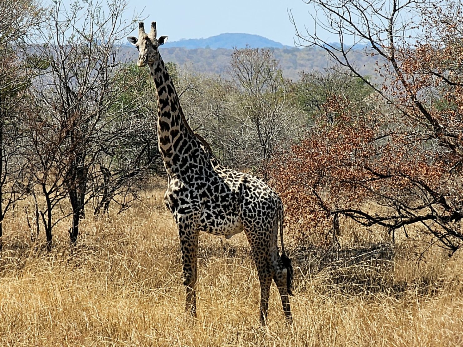
June 13, 2025

Day 046. 24 June. Kasane Rest Day. 0km. 0 Hours. 0m up. 0m down. I was up at 0500 to get picked up at 0545 for the Game Drive. The drive was arranged by the Thebe River Lodge so it was all easy and inhouse. Right on cue a specially adapted Toyota Land Cruiser arrived with seating for 9 on the back in three rows of tiered seats. We set off in the dark and I was hoping to see some animals at least. Before we got to the park entrance the driver took a turn down a sandy lane and drove fast across the sand. Someone in the back through we were heading off to see elephants. After a km of the sandy track the driver/guide, called OC, headed off into the bush for a little and wove between some shrubs and then manoeuvred the jeep so the lights shone upon something.

229. On the game drive in Chobe National Park the guide came across a very experienced pride of lions who had taken down a buffalo and feasted all night.

It took me a while to work out what it was, and it was only when OC and the others confirmed it, I knew I was not seeing things. There just 5 metres in front of us were perhaps 7 lionesses tucking into a  buffalo carcass. There was not much left on the bones and most were still knawing on the large ribcage. It was quite a sensational find. OC said he had heard about this kill yesterday and had it confirmed the lions were still here this morning. It was quite a sensational view. There was a lot of snorting, grunting and posturing as the lionesses jostled for position. When they walked about you could see they were full of meat. We had the view pretty much to ourselves for 5 minutes before the news spread to the other drivers and soon there were about 5-6 jeeps jostling for position around us. It took OC quite a while to extricate himself from the gridlock and continue to the park gate.

230. Not long after the lion’s we came across a small herd of giraffes who were grazing the treetops as the sun came up.

At the gate we registered and then got back into the jeep and continued on the main A33 road for perhaps 15 km until we turned off down a very sandy track to the north. OC had got confirmation of another sight. He drove very fast, but well, and the large vehicle almost glided over the sand. We stopped to look at a herd of some 6-7 giraffes who were browsing the tree tops just as the sun was coming up behind them. After watching them for a while we continued down to the shallow wide river valley. Ahead the air was dusty and I assumed it was some low fog from the river. However it was the dust kicked up from the hooves of about 500 buffalo who were walking and grazing as they headed east along the river bank. OC thought they were a breeding herd which might have come from Namibia. There was a total variety of animals from giant bulls slowly striding with their massive heads adorned with huge horns swinging from side to side to young calves tottering along awkwardly on legs which looked like they were made of wood. We parked and they flowed around us like a river and we were a boulder. Apparently this breeding herd would be really difficult for a lion to attack as the bulls would attack the lions and could do some real damage to them. Lions were apparently more likely to attack a bachelor group of bulls where it was more everyone for themselves, rather than all rallying round to protect the calves.

231. We came across a large breeding herd of buffalo which the guide thought had come across the river from Namibia.

As soon as we left the buffalo we ran into another pride of lions. This one had killed an eland a couple of days ago and had devoured most of it. This group was a lot less experienced than the pride that killed the buffalo and consisted of a lot of larger cubs and a few lionesses. The cubs spent a lot of the time wrestling with each other, while a lioness ate. On the surrounding tree there were about 50 vultures waiting for the lions to move off so they could pick over the remains. It was an amazing start to the drive and well beyond anything I expected.

232. We came across a second pride of lions who were feasting on an eland. This pride were not so experienced and contained many cubs, like these two playing.

For the next hour or so we then went down to the edge of the Chobe River and slowly worked our way back east. I did not realize it at the time but this was just a southerly side channel and the main channel was further to the north over a very flat green island called Sedudu Island which gets covered when the floods arrive after the rainy season in the catchment area upstream in Angola. Here, we apparently just missed the lions who had been feasting in the eland coming down to the water’s edge to drink. However we did see a small herd of elephants in the water both drinking and splashing themselves and then they came up the bank to where we were parked and filed by us slowly. There were a number of very small young with them. As we left we passed the buffalo again who were still creating a large dust cloud, and then passed many impala.

233. There were many small herds of elephants scattered in the bush or drinking from the river

234. Looking across the southern channel of the Chobe River to the flat flood prone island of Sedudu.

235. This ekephant was nonchalantly eating the shrub just a few metres from the jeep

Just as we were about to leave the park we came across another cluster of wildlife including waterbuck, greater Kudu, a few more giraffes and an elephant right beside the track who was demolishing a small tree. I noticed he was stripping all the leaves off the twig and discarding them and then just ate the twigs. It was well after 0900 when we reached the tarmac road again after our sandy loop. Once on the tarmac we went back out of the gate and returned to the Thebe River Lodge. The excursion had been beyond my expectations.

236. We saw plenty of more giraffes on the game drive in Chobe National Park.

237. As we were leaving the park we passed a large male Greater Kudu with its distinctive spiral horns .

Back at the lodge I had breakfast which was still being served to those who did the early morning Game Drive and then I returned to my room for a snooze. It turned into a sleep and I did not get up until 1330, just an hour before the next excursion. I did not have lunch as I was still full from breakfast.

The second excursion was called something like the Chobe Sunset Cruise. Again I was picked up at 1445 and then driven some 15 minutes to a jetty area. Initially I was on my own but then a group of 20 arrived from one of the Overland Buses. There were a mix of nationalities but all spoke English. The boat was wide and stable at about 15 metres long and 6 metres wide with a roof and two outboard engines. I guessed this second tour would be hard pushed to match the spectacular of the morning but it tried.

238. On the Chobe River cruise in the late afternoon there were many crocodiles along the banks. This one was 3 metres.

Firstly we went up stream to where the Chobe River was a single channel again after it split to go round Sedudu Island. Here the guide took the southern channel and slowly went up stopping at the various wildlife we encountered. The first was a crocodile, its tail swollen with stored fat. The crocodile was about 3 metres long and would have lived off fish but I am sure it could already take an impala if it came too close to the water’s edge.

As we went up the channel I saw something in a patch of aquatic weeds and thought it was resting hippopotamus. However as we drew nearer I realized it was a large mother elephant, a smaller female elephant and two small baby elephants. The mother was almost fully submerged, and I am not sure if her feet were on the riverbed or if she was floating. She was sweeping the weed with her trunk and bringing large bunches of it into her mouth. The other three elephants, especially the two youngsters, must have been swimming. They occasionally disappeared underwater with just their trunks breaking the surface like a periscope. They looked a little like they were struggling and occasionally tried to clamber onto the large elephants back, but then became confident again and tried to feed themselves and stay afloat.

239. We also passed by a few elephants in deeper water eating aquatic reeds. The two babies were excellent swimmers and were frequently submerged.

We continued up this south channel passing many more elephants, hippopotamus and buffalo and a lot of birds, especially storks and geese. The guide explained that the older buffalo liked it on the island as they were safe from the lions, which would not swim out. The buffalo looked to be mostly old battle scared males who had limps and scratches and had no doubt had their fair share of lion encounters over the years.

240. As the sun began to near the horizon the hippopotamus emerged from the river. Here is a large bull male.

Eventually we got to the west end of the island where the south channel and the main channel initially split. There were a lot of hippopotamus here and they were just beginning to come up onto the land. They would get to the firm bank and then go and forage in the bush for the night. Some might venture 7 kilometres from the river in search of grazing before returning in the morning. In the group we were watching the bull male emerged from the water and scattered his dung around the waters edge marking his territory. He was also battle scared and looked like he had to defend his position and females from time to time. He then plunged into the water again roaring and with his mouth open and the great teeth ready to do some serious damage.

241. There were quite a few older buffalo on Sedudu Island where they could graze without fear of attack by lions.

The sun was now low on the horizon and we started to return. We passed a herd of buffalo on the island as we now went back down the main channel to circumnavigate Sedudu Island. The buffalo here looked content in the evening sun chewing their cud either standing or sitting down. There were a few birds gathering on the backs of the buffalo to pick at any parasite, like ticks, or just peck off the dead skin. The sun set as usual at 1800 in a blaze of colour but once the sun had crossed the horizon it did not take long for darkness to set in and already by 1815 it was too dark to read a paper. At the jetty the others boarded their tour bus while I was driven back in the dark to the lodge just in time for dinner. It had been a sensational wildlife day and I had totally underestimated the quality of the trips and what I might see. It was a fitting end to the 04 Section, NE Botswana as tomorrow I will leave and cross over to Zambia.

242. As usual there sun went down quickly and in a blaze of colour with returning from the Chole River Cruise on the small boat.

Day 045. 23 June. Pandamatenga to Kasane. 102 km. 6.5 Hours. 240m up. 380m down. I was up early for a 0700 breakfast. It was a hearty breakfast and it would have to do me until I reached Kasane in 100 km as there was nothing en route. I left at 0800 but the tail wind of the last couple of days had disappeared. Almost immediately I was into farming country again with vast fields on each side of the road. To the east was wheat and to the west was sorghum. The wheat was being harvested by a couple of combine harvesters side by side such was the pairie-like scale of the farming operation here. After the farm though the there was a slight rise and then I was back into the wilderness with signs saying “Caution Wild Animals”

223. The pairie-like farming operations just to the north of Pandamatenga.

224. A field of sorghum just north of Pandamatenga was completely incongruous with the wild bush of the last few days.

I did not see many animals at all really. Initially there was a large Tawny Eagle. I think they are opportunistic hunters and will take anything small and even scavenge carrion or road kill. Perhaps that is why it was perched on a tree beside the road. The scrub was reasonably scattered here and it would be difficult for an elephant to hide near the road. I saw plenty of signs and there were tracks everywhere but I think most were in the bush now foraging and would not cross the road until dusk approached. A bit further along the road I saw a small herd of zebras who were about to cross and then saw me coming and retreated back into the bush. They ran along beside me, about 100 metres parallel to the road, for about a kilometre.

225. A large Tawny Eagle perched on a tree beside the road looking for an opportunity to hunt or scavenge.

226. These zebra were the only game I saw all day on this 100 km stretch of road which is renowned for its wildlife.

Then the trees suddenly vanished and I was onto an open savannah plain. At last I saw an elephant but it was at least half a kilometre from the road. It was wandering across the savannah and was not eating, but en route to the distant forest or a waterhole. It is not far from the Zimbabwe border here, perhaps just 10 kilometres and the elephants are free to wander across there, where there are reserves and national parks. This savannah plain lasted for about 15 kilometres and then I was back into the scattered bush.

227. In the distance i saw a lone elephant making its way across the savannah towards a waterhole or the scrub forest.

The road was fast to cycle on although it was reasonably busy. The trucks came in convoys with about 4-5 in each and they all gave me plenty of room and often gave a friendly toot on their horns or a flash of their indicators. The verge I was used to for the last couple of days was now very small and I had to be careful when there was traffic coming in the opposite direction and the trucks could not pull over to the other carriage way as much as they would otherwise. All in all though I would commend truck drivers for their thoughtfulness.

The last 30 kilometres were generally fast but as I approached the Zambezi valley there were some long descents but then some vindictive small climbs. They took my momentum away completely and left me struggling to climb them with my legs aching and full of lead. However soon I was on the final run down into the border town of Kazungula. It was a busy town with lots of petrol stations and supermarkets. This was the town where 4 countries; Namibia, Botswana, Zimbabwe and Zambia all met. At the bottom of the hill and down onto the plain beside the Zambezi River was a turnoff to Kasane. It was about 10 kilometres along the road to the west on the south bank of the Chobe River, a tributary of the Zambezi which it joined in Kazungula. Most of the traffic and all of the trucks continued north here into Zambia but I wanted to go to Kasane for a couple of nights to make a touristic foray into Chobe National Park. Kasane was the gateway to Chobe as Maun was to the Okavango Delta.

228. In Kasane there are warning signs for hippopotamus crossing the road as they make their way from the river to graze each night. They can go up to 7 km to graze before returning at dawn.

Initially I wanted to go to the Elephant Trail Backpackers but I think it was all full except for their dormitory beds. When I passed the road up to it I could see it was all uphill for nearly 2 km and I just could not be bothered to enquire so went for plan B which was suggested to me by Franz and Mandy this morning.

Plan B was Thelbe River Lodge and it was a bit further along the south bank of the Chobe River on the road busy with small cars and taxis. I passed some fruit farms and banana plantations and then a road sign warning about crossing hippopotamus to reach the lodge. It was a large lodge which seemed to cater for the overland trucks with 10-15 people in each truck. There were about 4 parked here and their clients were milling around the reception area. The lady at the desk was not unfriendly, but not pleasant, and gave me a room which was really poor value for money. However after 100 km I was tired and wanted a shower and was not going to cycle off and look for somewhere else. They also did the two tours I wanted to take tomorrow from here so that added to the convenience. It was certainly a tourist tour and I am sure it would be quite tame compared to a self drive into the heart of the National Park, but that was not feasible at the moment.

I did meet the owner of the lodge later and asked him a few questions about my route to the Victoria Falls which were about 80 km to the east. He recommended I take the Zambian option rather than the Zimbabwean option as the latter went through the Zambezi National Park where he suggested there would be lots of elephants and possibly lions and leopards. He said if I wanted to go the Zimbabwe way I should really have an escort vehicle. Plus it would mean I would not have to deal with the Zimbabwe customs which are renowned for being eager. I wrote the blog in the evening before supper and then prepared for the 0500 alarm clock as I would be picked up soon after for my game drive early in the day, while the animals were on the move at dawn.

Day 044. 22 June. Pandamatenga Rest Day. 0km. 0 Hours. 0m up. 0m down. I was tired in the morning as I did not sleep well due to inadvertently drinking the caffeine laden drinks last night. However it did not matter as breakfast was when I wanted it so I slept in until 0830. The breakfast was good and the hosts Mandy and Franz looked after me well.

For the rest of the morning I sat in the dining room/bar area under the large cool thatched roof and caught up with the blog. Mandy and Franz went into town leaving me, the cook, the maintenance man, and Zeus the massive Boerboel, to man the fort. Zeus lay out at my feet in a confident relaxed posture as I wrote.

221. During the daytime a herd of about 20 impala wandered out of the bush to the vicinity of the cabins but did not go to the waterhole.

Once I had finished I went for a short walk near the cabins and down to the waterhole to see if I could spot anything. Hidden behind a copse of scrub was a small herd of about 20 impala. luckily they moved slightly into the open to graze on the parched grass as I watched.

I spent most of the afternoon sleeping on the bed in my cabin. It was cool and relaxing and I lay there in a stupor half awake and half asleep until the afternoon was done. I was certainly well rested now. As I went over to the dining room for dinner at sunset Franz pointed out 6 large Roan Antelope who had just emerged from the bush to drink. He explained that after the Eland they were the second biggest antelope and some might be 300 kilos. They did not stay long and looked nervous. I had an opulent dinner and then retired early as I had a long day tomorrow all the way to Kasane which was around 100 kilometres.

222. In the evening, just at sunset, some 6 large Roan Antelope came to drink at the Touch of Africa lodge waterhole

Day 043. 21 June. Telecom mast 85 km North to Pandamatenga. 120km. 8 Hours. 250m up. 170m down. I slept surprisingly well and no wild dogs or lions squeezed under the gate. In my tent most predators would think I was a giant tortoise and not worth investigating, as long they could not see in and providing the the flysheet was on.  I slept right through from 2100 until 0600.  It was easy to get an early start while camping and by 0730 I had finished breakfast which was an entire 400 gram packet of granola and powdered milk. It was cold in the night and my lukewarm water the evening before was now chilled and palatable. I was finally packed and ready to go by 0800. Unlocking the gate and pushing my bike over the elephant protection I made it back to the main road inspecting the track carefully for the omnipresent devil’s thorn seeds,  which were a constant threat of puncture.

215. The elephants had previously pushed over some f the fence around the telecom mast compound, so now it was also protected by a ring of sharp rocks and spikes.

Back on the main road it was not as busy as I feared. The sound of the trucks could be heard a kilometre away and reality there was only one every 3-4 minutes. The road was wide with a good verge, and the trucks were relatively slow. The tarmac was smooth, my tyres were at 40 PSI still and firm and there was a tail wind. At last the planets were aligned so I would be able to average 20 km per hour. Within an hour I made it to the abandoned huts just on the west side of the road. They still looked in remarkable condition but I did not go the 100 metres to investigate for fear of rolling the wheels over thorns. On each side of the road was the endless bush and nothing else. The bush was a little parched and most of the watering holes were dry. There was lots of elephant dung but I did not see any all morning. I made great progress up the road climbing slightly and almost imperceptably until midday when I had already done some 64 km.

216. There were frequent elephant trails and tracks emerging out of the bush with fresh dung, but I did not see any all day.

217. A gentle reminder at all the parking lay byes on the road that wild animals were about. This sign looks like it was used by elephants as a scratching post.

I kept my eyes out for wildlife but saw nothing. The road went past two or three watering holes, one like a small lake, but there was nothing at these either. Although round the perimeter of them there was a lot of dung and footprints. I can only assume that the animals were either away from the road in the bush foraging and would return in the evening to quench their thirst or that there were other watering holes far in the bush and away from the road, which were more preferable.

218. I passed a few watering holes and even this small lake but did not see a single animal all day.

Soon I was approaching 100 km and it was only 1430 in the afternoon. However it was taking its toll. My arms were sore, especially the wrist joints and elbow joints. I think my handle bars could have been 5 cm higher. In theory I could have put the seat down a bit, but it was just right for peddling and I would rather have sore arms than risk injury to my knees. I was also getting chaffed in my groin area and with the sweat it was starting to sting. About 20 km before Pandamatenga the road reached a large cattle grid and I cycled over it into a totally different landscape. There was no more bush with the threat of wild animals about to leap out of it, but now I was into farming land with huge flat fields full of sorghum. The fields were vast and this was farming on an industrial scale which one might find in the mid west of the USA or Ukraine.

219. About 20 km south of Pandamatenga I passed a large cattle grid separating the wild bush from organized farming where these large fields of sorghum flourished.

I also reached the section where the road was being widened. The road rollers had packed an earth and aggregate track beside the current carriageway and it was firm and great for cycling on. Occasionally it was covered in a thin layer of bitumen with rocks on it to prevent traffic going on it but I could weave between the rocks. I passed by a large army barracks and then entered Pandamatenga. It was a spread out town but had a tangible centre which was dominated by huge grain silos. This was where all the sorghum ended up before being transported south on the many grain carrier trucks passing me. There was also a large parking area here for all the trucks where many probably spent the night. Currently there were over 100 parked up along the wide dusty verge, 3 or 4 deep. My main interest in Pandamatenga though was the supermarket. I was parched when I arrived although I still had a bottle of old warm water with unpalatable bits suspended in it. It was no match for some cold sodas and an icecream though.

220. The bar and dining area of A Touch of Africa Lodge was a relaxing place to have a day off physically recovering and catching up with the blog.

There were a surprising amount of white farmers in the carpark and I asked one of them about a place to stay. They recommended a Touch of Africa, a lodge which had camping spaces some 6 km further north. It was the one I had already bookmarked so it was good to have the confirmation. It was a quick half hour cycle to get there and I reached it in the heat of the afternoon. It was run by Franz, a retired Austrian hunter and his wife Mandy, a South African. They gave me a lovely thatched lodge overlooking a waterhole where game was rumoured to come. There was the main restaurant and bar area which was also thatched. The only issue I had initially was the dog. I was the largest and most ferocious looking dog I had ever seen. It was a 90 kg Boerboel, which was extremely muscular and with an enormous head. The dog would have eaten a couple of drug dealers XL Bullies for breakfast and perhaps a lion for dinner. However, the gargantuan canine had been well socialized, knew its subordinate position and was well behaved. I had a great shower and then one of the infamous burgers before deciding to have an extra day here. I was tired and needed to rest and I also needed to catch up a bit with the blog tomorrow. I did not sleep that well as I made the mistake of buying two energy drinks at the supermarket which were loaded with caffeine.

Day 042. 20 June. Nata to Telecom mast 85 km North. 85 km. 6 Hours. 190m up. 120m down. My tyres were still good in the morning so it looked like the problem was solved for the time being and I would be able to move on up to Kasane and Livingstone. Rubert made me the usual sumptuous full breakfast and by the time I had that and said my goodbyes to the team and other guests it was already 0930. I did not really have a plan but there were a few options every 15 to 20 kilometres as I headed north. The one thing I did need was one of these options. It would have been foolhardy to camp beside the road, a little in the bush as there were quite a few wild animals about on this next stretch. Most notably there were elephants and they were abundant over the next 300 km. After all, the road between Nata and Kasane was called the “Elephant Highway”. However there were also rumoured to be wild dogs and lions. So a secure camp was necessary.

209. The open savannah just north of Nata was initially open until the scrub started to appear.

Once on the main road north, The A33, I was delighted to see that there were road works to widen the road. I knew there was a little from my last foray up here until the punctures forced me back, but now I could follow them on one side or the other of the road for the best part of 20 km without going on the main carriage way. The packed earth which had been steamrolled was as good as smooth tarmac and I made good time. Even if I had not been on the newly constructed verges the road was not that busy with trucks and vehicles.

208. Some of the termite mounds on the flat open savannah with limited bush were 3 metres high.

Eventually the packed earth verges finished and I was forced back on the main carriageway, but there was a wide verge of nearly 2 metres width and this was separated from the main carriageway with a yellow line and a row of cat’s eyes. The trucks were not that plentiful and they were not going that fast either. Perhaps they were wary of the elephants. Each side of the road there was initially wild open savannah stretching to the horizon, golden and shimmering in the heat. However after some 30 km since leaving Nata the bush slowly started to appear and then it became quite dense. I knew there were some elephant watering holes near the road along here and kept my eyes peeled for them but I did not see any. There were plenty of signs though, most notable the large tracks across the road and into the bush on each side and elephant dung everywhere. After about 45 km I got to the turn off to Elephant Sands Lodge and Campsite. However, it was down a very sandy track for 2 km and it was likely I would have to push the bike the whole way there and out again tomorrow. Despite the likelihood of seeing elephants come to the watering hole at Elephant Sands I decided to skip it, especially as it was just after midday.

My next option was another 10 km and it was the Veterinary Fence to keep foot and mouth out of Central and southern Botswana. I reached it at the same time as a large convoy of trucks but then overtook them all as they waited. I was flagged through as there were not real controls going north; however there were coming south. Just after this control were a number of shacks selling cold sodas and biscuits. I stopped at one and had something but there were no cooked snacks. It was still just 1330 when I finished so I decided on the next option which was a Telecoms mast in another 30-35 km.

210. My lunch stop at one of the small shacks by the veterinary fence which sold non perishable items only.

211. Just north of the Veterinery fence I started to see more wildlife animals like these zebras.

It seemed a bit wilder now on the north side of the Veterinery fence and it did not take long before I saw a few zebras in the scrub, but still no elephants despite all the signs. Then in about a kilometre I saw the unmistakable sight of one beside the road. It was huge even from here. There was very little traffic and I covered the distance in a few minutes and was suddenly 200 metres from the elephant who continued to graze right beside the road. There was no way I could get past without risking a charge so I waited and waited. Eventually after 5 minutes a convoy of 4×4 came the other way heading south. They slowed for the elephant but continued and the elephant was unmoved. Usually they are afraid of traffic and run back to the bush, but not this one.

212. The first elephant of the day was grazing at the side of the road and was unperturbed by traffic. I had to have a 4×4 escort me past it.

At last a 4×4 came going my way and I flagged it down. The driver I think just wanted to blast past the elephant but agreed to drive between me and the beast. The road was quiet so we both crossed over to the other side. I could see the driver was nervous and had the elephant charged, I am sure he would have sped off leaving me in the lurch. It didn’t charge but there was a lot of ear waving. Soon we were both past. In the next 30 km I saw another two elephants attempting to cross the road but traffic came by just at the right time and they remained on the edge of the bush waiting for another chance, wary of the trucks. I don’t think they would have seen me as a threat but I was just 40 metres away as I passed.

213. The third elephant of the day was very wary of traffic and was about to cross in front of me when a 4×4 appeared and then it fled back into the bush.

The telecom tower I was aiming for soon appeared some 5 km away and it took no time to get there. The head wind of the last month was more of a neutral side wind now and the road surface was good and the tyres at 40 PSI rolled smoothly over it. It was just 1530 when I got there so I decided to check it out. I had heard the perimeter fence was damaged, according to my app called “ioverlander” I parked the bike at the edge of the road and walked the 100 metres up the sandy track checking for thorns as I went. The fence had been damaged but it was now repaired in a fashion. However, right round the perimeter of the compound was the most vicious elephant defence of concrete with sharp stone sticking out of it and also a grid work of iron with spikes in it. The latter was like an upside down agricultural harrow and it would not be possible for an elephant to cross it. I returned to my bike and wheeled it back to the compound. The only issue I noticed was there was a 50 cm gap under one of the gates which perhaps a predator might wiggle under, but it was unlikely I thought and they would still have to cross the harrow spikes.

214. My camp in the fenced compound 85 km north of Nata. The gate was open on arrival and I secured it with my bike lock once inside.

I had my tent up quite quickly and then ate cold dinner out of tins; pilchards, backed beans and fruit salad to be precise. I still had 3 litres of water for tomorrow which would hopefully take me the 115 km to the village of Pandamatenga where I hoped to stay.  If I had not stayed at this telecom mast the next option was a cluster of abandoned cabins a further 20 km. Apparently they were still clean and with roofs but only one had a door and that was last year’s report. After the hermetic dinner I wrote the blog and finished around 2000.

Day 041. 19 June. Nata Rest Day. 0 km. 0 hours. 0m up. 0m down. I had a great lie in as I knew I had nothing to do today. After the usual tasty full breakfast Rupert got a phone call to say the package had arrived and was ready to pick up. Half an hour later I had everything I needed to get back on the road.

I took the wheels off the bike and then the tyres of the rims and cleaned everything up. I had already cleaned them a week ago in Gweta so there was not much to do. Once clean I put the rims back on and had great difficulty in getting a seal to pump the tyre up. Eventually it started to inflate using my electronic pump and soon I had enough pressure in them so the tyres pressed against the rims and they were “seated”. I then removed the core of the valves and injected the latex liquid, about 130ml, into each tyre and blew them up again to 30 PSI. There were a few leaks but as I spun the tyre the latex liquid found the leaks and bubbled out. As it bubbled out it reacted with the air and solidified in the leak,  thereby sealing it. I let the tyres be all afternoon spinning them from time to time to distribute the latex liquid and was delighted to see they held their pressure. I then put them up to 40 PSI and they still held their pressure.

The punctures were solved for the short term and I should be able to get to Livingstone now. In the meantime Fiona had had great success at the main DHL Express depot on the outskirts of Edinburgh and the parcel with the new puncture resistant tyres was dispatched with all the customs forms in order and DHL promising to facilitate it through Zambian customs, which could still be a banana skin.

That evening more guests arrived and Rupert made another great meal. That he prepared this sensational rice and curried goat in a spinach sauce on a couple of gas rings is impressive. Two of the guests were Ricus and Pietro Delporte who were South Africans moving up to Malawi for 6 months until the weather at their other house in Knysna improved. They had worked and travelled all over Africa and were incredibly well informed and experienced. Ricus was articulate, assertive and knowledgeable but was not a know-all by any means and a joy to discuss things with and listen to. They were the most interesting people of many interesting people I met round Ruperts camp fire. They also invited me to stay in Malawi at their lodge, which I was planning to go past anyway. I had really enjoyed my stay at Eselbe Backpackers and was indebted to Rupert for his hospitality and help, but after 3 days here I was now ready to move on.

Day 040. 18 June. Nata 7 km up road and return. 14 km. 2 hours. 110m up. 110m down. After a very relaxing day at the bohemian and inspiring Eselbe Backpackers as the guest of Rupert I was ready to set off after a great breakfast which he made. I half cycled and half pushed the bike the half kilometre up the sandy lane from the rivers edge to the main road and then started the cycle up the road. The road was being widened and there was a long stretch of newly finished road with rocks on it to stop drivers going on it. However I could simply cycle between the rocks very easily,  and did so.

However I noticed that my tyres were deflating and eventually stopped. I had inner tubes in them but I think both had thorns in them. It took me well over an hour to change the tube at the back and patch the tube at the front and I was ready to set off again when I noticed the tyre at the front was still deflating. I must have had two punctures. I thought this is a hopeless situation and I cannot limp up the road repairing punctures every 10-15 kilometres. I knew I was vulnerable to punctures as the tyres I had did not have any embedded protection in them and were primarily designed to be tubeless. I decided it best to return to Eselbe Backpackers and sort something out. I pumped up the tyre again and it just got me back. Everyone was surprised to see me.

I made a few phone calls back to the UK just to make sure the new tyres I ordered were in hand and to find out about freight. In the meantime Rupert made a call to Cycle Base in Gaberone to see what they had. Rupert discovered they had the latex liquid to put in the tubeless tires I had on and also that they had inner tubes with valves with removable cores so I could also put the latex liquid in the inner tube if need be. We ordered some and were assured it would be sent when the money transfer was made.

Rupert then spent hours on the phone to his bank to try and make the transfer. He had a frustrating fruitless time of it and we eventually had to go into his bank to sort it out. However, the transfer was done and the goods were put on the night bus. I was very indebted to Rupert for all the hassle he had on my behalf.  Meanwhile back in Edinburgh Fiona had received all the new tyres and inner tubes to send and had researched the best way to get them to Zambia. There was not much more to do except wait.

207. The large communal dining table and fire pit beyond it were the social hub of Rupert’s backpackers.

As usual there was a great meal that night and then everyone sat round the fire discussing virtually every topic on Wikipedia. The ambience was superb. While Rupert’s Eselbe Backpackers is quite rustic and everything just about works, with his cooking and the evening’s conversation round the fire after the meal there is the potential for Eselbe Backpackers to become legendary.

Day 039. 17 June. Nata Rest Day. 0 km. 0 hours. 0m up. 0m down. I had a great lie in and got up when the sun had chased off the chilly morning. Rupert the host at Eselbe Backpackers made me a great breakfast with real coffee. Most of the guests were leaving including the very nice French couple. However I would probably see them again about Livingstone in a week’s time.

Once everyone had gone I went into the quiet bar area where there was a table and wrote for a couple of hours. It was very relaxing with virtually no disturbance or sounds save for the doves. By midday I was done so I then went for a snooze on the hammock. It was lovely to have nothing to do for the afternoon as previously virtually all my time was spent either cycling, camping or trying to keep up with the blog.

206. On my very relaxing day off at Eselbe Backpackers in went for a short paddle on the Nata River having been assured thw were no crocodiles in the remnant of the river which had no flow in this dry season.

Once I woke I went for a small paddle on the river in one of the old canoes Rupert had. This part of the Nata River still had about a kilometre of water in it and it was about 2 metres deep at the most. There was no inlet or outlet of this long channel at the moment but it would return in the rainy season when the river would form and flow south again. I was assured by Rupert there were no crocodiles in this long pond and he regularly paddled here.

In the evening he made another fine meal and there were only 5 of us at the meal. In the evening we sat round the fire again and chatted until it was quite late. Rupert had a wealth of knowledge about the area and the wild road north from here to Kasane so I picked his brains on it. I had really enjoyed the peace and quiet of his rustic lodge.

Day 038. 16 June. Zoronga to Nata. 45 km. 4 hours. 30m up. 40m down. I slept well and long, and was up at 0630, as the first glimmer of light was appearing in the east. The cockerels had long been awake but now the hens too started foraging nearby, clucking away as I packed. I was ready by 0730 and set off down a series of sandy tracks to the tarmac road which was the artery of the village. Many children were also emerging from the lanes and heading to school in the smart green uniforms. They were vibrant and lively in stark contrast to the younger women at the shop yesterday obsessing about their hair extensions. Once on the tarmac road in the village I cycled up past the shop and onto the main A3 road. It was just over 40 km to Nata now.

There was no breeze for a welcome change and I made quick time. It did not take long before I found a rhythm and was making good time on the empty road. I passed a sign saying “slow down severe potholes”. I thought nothing of it as I generally welcomed them as it slowed the vehicles to a crawl while I could weave in and out of them.

200. The road between Zoronga and Nata was usually fine but for 3-4 sections each of about kilometer the tarmac was destroyed and people preferred the verge

However in this case the entire road had disappeared. There were some thin strips of tarmac for a few tens of metres and then they ended in a lip before another strip started. Most drivers simply abandoned the road and moved onto the verge which was graded, but somewhat rutted. It was a difficult choice for me to either persevere on the destroyed tarmac road or risk the sometimes sandy ruts on the verge. The road was often the least of two evils. There were perhaps 4 sections of this destroyed road and each section was about a kilometre long. I think they were in the process of building a new road adjacent to this road I was on and they had pretty much given up with any maintenance of the original road, assuming the traffic would cope until the new road became operational in a year or five.

201. Near Zoronga the landscape was covered in a sparce forest with well cropped grass underneath. There were hamlets and homesteads hidden in these forests some 200 metres from the road.

Beside the road the landscape continued to vary with either sparse forest and exhausted grazing underneath and then homesteads just visible through the trees away from the road in the forest, or open savannah which stretched far into the distance beyond the curvature of the earth. There was some livestock grazing here but most I saw were clustered around a few water holes near the road. The livestock were again a mixture of cattle and horses with about half and half of each. At a few of these water holes there were flamingos, either resting on one leg or slowly wading through the shallow water while filtering with their beaks. I had heard from many people that the larger salt pans which were currently flooded were currently full of flamingos.

202. There were many salt pans which had dried out but a few still had water like this one with livestock and flamingos.

I stopped for a rest and to eat a snack of dried noodles and biltong. When I did this a 4×4 usually stopped to enquire if everything was OK. Before long one stopped with a charming young French couple. We chatted for about 10 minutes and they gave me a delicious packet of biscuits. We discovered we were both heading to the same backpackers in Nata. They told me they had just seen a large male lion crossing the road about 60 kilometers back towards Maun. It was exactly in the place where I had seen the large herds of unfenced livestock yesterday. They showed me a video and it was clear the lion had just fed as its stomach was full. I am sure this lion was living on borrowed time before the herding or grazing committee contracted a hunter to put it down as it would continue to kill livestock now.

203. Between the salt pans the landscape was open veldt with golden grasses flowing in the breezes

Once they left I had about another 20 kilometres to go to reach Nata and without the head wind it went quickly. As I entered the town I got to a T junction with a larger road which went up the east side of Botswana from south to north. It was the A33 and it was another route from Central Southern African countries like Zambia and Congo to the coast at Durban and Port Elizabeth. I would have to follow it for 300 km in the next week from Nata to Kasane up the so-called “Elephant Highway”. I followed the road for about 2 km to the north and then headed east down a sandy lane to Eselbe Backpackers.

204. The bar and dining area at Eselbe Backpackers was the meeting place for younger travellers on independent overland trips.

It was only about 400 metres down the lane but I had to push the bike half the distance due to the sand. When I reached the backpackers it was even more Bohemian and relaxed than I imagined. It was owned and run by Rupert, a Brit with a long family history in Botswana and Swaziland. There were perhaps 10 various buildings, all of wood and bamboo. Some were the bar and kitchen and others were the small huts which were bedrooms. There was a large outside table under a huge canvas awning. The French couple who gave me the wafers, Pauline and Damien, were already here and so were about another 8 overland travellers in their 20’s. It was outside of the cut and thrust of Nata but I suspect there was nothing to entice me into downtown Nata except the supermarket to stock up. Rupert showed me a bamboo hut with an attached bathroom and shower and I unpacked the bike. The room had everything I needed and outside there was plenty of chat with the relaxed group. Later in the afternoon Rupert ran Emelia, another French guest, and myself into the supermarket for some supplies. He also bought the ingredients for himself to make lasagne for us that evening.

205. One end of my room at Eselbe Backpackers in Nata with the semi outdoor bathroom.

The backpackers was right beside the Nata River which was still full of water but not really flowing anywhere. It was almost like a large long pool which still existed while the river had stopped flowing. Contrary to my intuition the river flowed from the north to the south through the town of Nata and onto the salt pans. There it spread out to form the seasonal lakes which then evaporated in the dry season.

In the evening Rupert made a large lasagne to feed about 6 people while a few of the others made their own dinner and we all sat around the large table and ate together. Once the meal was done the fire was lit and everybody gravitated towards it, sitting round it. Without the breeze the smoke went straight up so there was no one having to endure smoke in their eyes. I was a little distracted in the evening trying to get some replacement Schwalbe tyres with some puncture protection as the current tyres I have on the bike have none and I feel quite vulnerable especially when cycling near thorns or over broken glass.

Day 037. 15 June. Gweta to Zoronga. 64 km. 6 hours. 140m up. 150m down. In the morning the tyre was flat. The sealant had failed to seal the hole. I tried blowing it up again to no avail so decided to take it off and put a tube in the tyre. On inspection all the sealant was either dried up or had been expelled by various punctures. It did not take long to put the tube in as it was the front wheel and I pumped it up to 35 PSI and it was taut, but with enough flex to act as a shock absorber. I paid the bill and left at 0930. As I cycled through the village on this Sunday morning it seemed quite a few people were going to church. They were well dressed and seemed to be the friendliest in the community as all smiled and waved as I went past. I passed the giant baobab tree, which was perhaps 25-30 metres on second thoughts and then reached the main road by the petrol stations. I cycled along it for about 5 km until I reached the turn off for Planet Boabab, a 3 star lodge.

193. There were lots of large baobab trees around Gweta, especially near a lodge called Planet Baobab.

The lodge was a short kilometre down the track. Dotted amongst the savannah scrub here were more enormous Baobab trees. It was not so much their height which amazed me but their huge girth. However, at the lodge there were a few gigantic ones and one especially right at the lodge which must have been 7-8 metres in diameter. I guess this tree was at least 500 years old and probably a lot more. There were perhaps 20 giant trees here but this was the most impressive. The lodge had built a bar right under it thinking that would be cool, but I found it lacking taste and a bit disrespectful. I chatted with a very nice UK couple here before having a second look at the trees. If trees could talk they would have some story to tell. Possibly from a time when humans did not live in the area.

194. One of the largest was right beside the lodge and must have been 7 metres in diameter. It was a behemoth.

I did not return to the main road straight away but continued on a gravel road to the east for about 5 km. It was a lovely quiet cycle through scattered homesteads in the sparse forest. I have noticed that a lot of the homesteads are not beside the main road as one would expect but are perhaps 200-400 metres off the road and not visible from the road. Here surrounded by a perimeter fence of branches as posts and wire lies a large compound with maize growing in it and then the inner compound with 3 or 4 huts, often with thatched roofs and a corral where the livestock spend the night. On this small gravel road I was much closer to these homesteads and frequently passed people who were much more friendly than their counterparts in villages and frequently waved. It was not as quick as the tarmac road but much more interesting.

195. The were lots of subsistence homesteads beside the smaller road near Gweta. Many have maize fields.

Eventually the two roads merged and I was back on the tarmac but now I entered a region which was bereft of trees and was a vast area of savannah grass with extensive salt pans in between. These salt pans were quite natural and occurred because the rains of the last millennia collected in these barely discernible depressions on the landscape and then evaporated over the dry season leaving a mineral residue which has accumulated. They were bare areas of white deposits where nothing grew. I passed a few smaller ones of perhaps a square kilometre or two but I knew from the map there were much larger ones which were hundreds of square kilometres just beyond the horizon like the Ntwetwe Pan, The Nxai Pan and the Sowa Pan. My initial plan had been to cycle across one of these on 4×4 tracks, but because there was so much rain in the recent rainy season many of the pans were still covered in water or still marshy with a muddy clay like silt which would be a nightmare to push a bike through.

196. Half way between Gweta and Zoronga were huge salt pans which must now fill after a very wet rainy season. Perhaps once a decade in this climate era.

Between the small pans I passed beside the tarmac road were the extensive veldt-like grasslands with golden grasses. They were excellent grazing and there were large herds of cattle and horses scattered across them. There were no fences and the livestock were free to wander. I thought there can’t be lions here as they would have a field day with all this easy prey at their disposal.

197. Between the salt pans on each side of the road was savannah grasslands which was being grazed by large mixed herds of cattle and horse

As I cycled across this area of smaller salt pans and open savannah I realized I had little hope of reaching Nata that evening. It was mid afternoon and I still had 50 km to go, although the easterly headwind was diminishing as it did most afternoons. I had two options, one was a telecoms mast just before Zoronga and the other was Zoronga village itself just a bit further, leaving just 40 km to do the next day to reach Nata. I had enough water for the telecoms tower but they were quite soulless, perfunctory places to campsite so I decided to continue to the village where there was a small shop where I could buy something and ask about somewhere to pitch a tent as I have done in Phudukudu.

198. The neighbouring compound at Zoronga next to the absent policeman’s house where I was allowed to camp.

I reached the village and took the side road into it and soon found the shop. There were a few young women hanging around the shop and working in the shop and they all seemed totally disinterested, with a lot of shoulder shrugging to every question. Of the 5-6 of them, half were putting hair extensions in each other’s hair and they only said “give me money”. Eventually one woman said “try next door” but there was no next door. When I queried this she said “try the police at the end of the road”. So I set off into the spreadout heart of the village. Eventually after some 5 attempts and nearly at the point of giving up and returning to the tarmac road out of frustration, I found a grandmother who pointed me to a sandy track leading to a cluster of houses. There another grandmother found a neighbour of the policeman, who said he was away. However he made a call to the policeman who gave me permission to camp in his compound. It was perhaps 1700 now so I had the tent up beside his house and had eaten by nightfall. I went into the tent as all around me the evening fires in the compounds around me flickered and the evening air had the aroma of woodsmoke. I wrote a little but was asleep by 2000 and slept well.

199. My tent next to the policeman’s house in Zoronga. He was away but told a neighbour I could camp there.

Day 036. 14 June. Phuduhudu to Gweta. 81 km. 8 hours. 230m up. 230m down. I slept well on the verandah of the community hall and was content to be amongst the fire fighting crew who were all very helpful. After the indifference of the Botswanans I met on the first 3 days in the country I got a completely false impression of them and that has now completely changed. I now find them competent, helpful, good drivers and cheerful. I was up before anyone else and had a disgusting breakfast of corn beef out of a tin and some bread. I had forgotten just how putrid corned beef was as it was about 3 or 4 decades since I last had some. I was packed up and ready to go by 0800 as the others were rising. I went to see the foreman who sanctioned my stay yesterday and gave him 200 Pula, or about £10, to either buy the team some soft drinks that evening or give it to the Phuduhudu community as he felt fit. It was graciously received. They waved me off from the compound and I cycled through the empty lanes just coming to life and returned to the main road.

The headwind hit me with a vindictive force as soon as I was out of the shelter of the village trees. I guess it was a force 5 and right into my face. I was struggling to get much more than 10 km per hour and if I pushed harder I could feel my right knee ligaments straining. It was going to be a long day. After an hour or so I saw 4 zebras running down the road towards me. When they saw me they bolted into the bush. As I was looking for them I saw two giraffes some 200 metres away. They were both very alert and looking straight at me. Either they have very good senses and saw me on their own or were alerted by the zebra as I think the two animals have a symbiotic alert reciprocity.

187. I saw a couple of giraffes on the south side of the road about 10 east of Phuduhudu.

There was not much to say about the next hour as I ground into the wind. The grasses at the side of the road were being buffeted by it and I felt progress was slow and at a cost. About an hour later I passed a larger herd of zebras. They were grazing on the wide verge but when they saw me they became unnerved and started to run in the same direction I was going but just inside the edge of the bush. They ran for about a kilometer pausing just to let me catch up. I could hear their hoofs pounding the ground.

188. About 20 km east of Phuduhudu i came across another herd of zebra with About 50 animals in total.

Soon the vegetation changed and the taller scrub gave way to shorter scrub and then this too almost disappeared leaving just wide open grassland savannah. There was no hiding here and any zebras or giraffe would have been visible for a kilometre and an elephant 2 kilometres. But I could see nothing and all the animal tracks which came out of the bush on each side of the road disappeared. It was only after 20 km when the bush started to get a bit thicker again did I see a flock of about 40 ostriches, just before the end of the park. As I was watching them a police pick up appeared and wound down the window. “Do you remember me?” said the passenger with a bright smile and gleaming teeth. It was the police woman from 2 nights ago when I encountered the elephants. We chatted for 5 minutes before she headed off back to Maun.

189. As I cycled east further into the Makgadigadi National Park the bush almost dissapeared and there was just scattered scrub rising out of the endless savannah grasses.

?After the park I was suddenly back in cattle country and I was quite surprised to see them. There were rumoured to be lions in Makgadikgadi National Park and this did play on my mind a bit, but now there were cattle, goats and donkeys about I was off the menu. Their farms were small and almost subsistence level I think. The going was still slow despite the wind dropping as it often did in the afternoon. Then I noticed my front tire was very flat. I stopped to blow it up but it had a hole in it and the sealant was bubbling through and would not seal the gap. I pumped it to 35 PSI from the 10 it was at, and set off. I was going much faster now and perhaps I had been running this tire under pressure for a while and was blaming the laborious progress on the wind which had largely disappeared now, while it was actually the tire all along.

190. Just on the eastern edge of the Makgadikgadi National Park I saw a flock of about 40 ostriches.

My joy was short lived as I had to stop and blow the tire up again after 5 km. I could feel the air escaping as it blew onto my cheek as I operated the battery pump. I had to do this about 6-7 times in all and the hole was just simply not sealing. There was still sealant in the tire as it was bubbling out. I was starting to curse the idea of tubeless tires. When working they are great but in a crisis like this they are useless and inevitably I will have to put a tube in this front tire too. I will then have both front and back on tubes and only the outer tire to protect them from the thorns on the verge and the copious amount of broken glass along the road. A puncture resistant outer tire like a Schwalbe Marathon Plus would have been better as it had a 5mm thick strip of kevlar embedded in the tyre’s circumference. I limped down the road to the turn off to Gweta and then down the 2 km access road.

191. On the outskirts of the large village of Gweta i saw this enormous Boabab tree which was about 35 metres high and the biggest Boabab i have seen.

On the access road I passed a huge Boabab tree. Its swollen trunk must have had a diameter of 3-4 meters or so and the tree had a height of 35 metres. It was an enormous specimen and must have been very old and venerable. It has overseen many generations of humans. When I got into the larger village it was easy to find the lodge. They had space for me but were busy with a large group with about 20 Chinese. I got a small roundavel style round hut with a thatched roof. It was quite cramped inside but had all I needed. On the outside was an area enclosed with a 2.5 metre wall which was the bathroom, with toilet, sink and shower, and the trees above. I had a shower and washed my clothes and also washed the back tire I took off yesterday to get rid of all the water soluble latex on it. I did this as I would probably have to use it tomorrow morning if the front tyre did not seal overnight. After that I went over to the quite chaotic buffet which was dished out rather than self service. I had to be quite assertive to get a good portion and then get cutlery from the limited supply. The Gweta Lodge has potential to return to a former glory but at the moment most things were a bit haphazard or broken and it was almost the same price as the considerably better Maun Lodge. Still I was grateful for a bed after 2 nights camping.

192. The quirky but slightly chaotic and ramshackle Gweta lodge had a tiny rondavel type room for me with an outdoor bathroom behind the wall on the left.

Day 035. 13 June. Motopi Telecom Mast to Phuduhudu. 45 km. 5 hours. 110m up. 110m down. It rained a little in the night which was a surprise, however I slept well and woke early. In the morning the tyre was flat so I decided to change the tubeless to one with an inner tube. The whole procedure took about an hour. There was no liquid latex left in the tyre. It had all either leaked out or just dried up in the heat. It meant whenever I got a new puncture there was nothing to seal it. In retrospect I had no choice but to switch to an inner tube. In the next few days I will have to get a replacement organised. Elias left first heading towards Maun while I headed east into the land of the elephants and into the strong wind.

177. The large female was guarding the back left of the procession helping a matriarch bring up the rear.

Once I left the security compound and was back on the main road I was aghast at just how strong the wind was. Elias would have an easy day while I had to struggle at 10 km per hour. I retraced my route of last night past Leopard Plains Lodge and on to where the two elephants were last night. There were none now but I soon saw a single one in the bush on the south side.

A bit later I saw another, possibly a smaller female. Then behind here I saw a small procession of elephants heading east. There was a side road here up to a raised area and I took it to get a better view, I could now see there were at least 25 in the procession of all shapes and sizes. The smaller female was marking the back left of the procession while there was a large matriarch at the back. As the procession passed a dusty area they all stopped and flung an arc of dust over their backs. There must have also been a big matriarch at the front also but I did not see her. I watched for a good 20 minutes as the whole herd moved through the bush on the other side of the road. The younger female guarding the back nearest the road knew where I was and what cars were approaching the whole time. It was a tremendous privilege to watch them heading through the bush towards greener pastures.

178. I had already seen about 20 elephants that morning so expected to see even more now i was entering the National Park.

I left as the herd moved off and returned to the road. There were another two sightings of single elephants right on the verge. I think they were drinking from a leaking pipeline which went along the south side of the road. After these two I continued east for another couple of kilometres into the wind and then came across 4 large elephants near a leak in the water pipe. They were close to the road and had I cycled past they would have been just 30 metres away. Way too close to call. So I stopped some 100 metres away to wait for a vehicle. There were none for about 10 minutes. It was great watching these elephants as such close quarters for this time, completely alone with them. Then a 4×4 arrived and I flagged it down and explained to the Botswanian driver I needed him to drive slowly for 200 metres while I used his vehicle as a shield. He was very obliging. Once past he drove off and I observed the elephants for another few minutes. They were truly enormous.

179. I got to these 4 large elephants and thought it would be foolhardy to squeeze past so spent 10 minutes observing them until a car arrive to escort me past

180. Up close the 4 elephants were quite daunting and very large.

I was making heavy weather of the kilometres in this headwind and with the animal viewing breaks was doing less than 10 km per hour. I then decided to see if I could find somewhere in Phuduhudu village rather than go another 40 km after that to another telecoms mast. I did not want to get caught out in the dusk in elephant alley. I had heard that the area I was going into now, the Makgadikgadi National Park was full of zebras at this time of year and right on cue I ran into a herd of about 300 crossing the road. As I was watching them an elephant also crossed right in front of me. I think the elephants are generally quite passive, but if there are young, or a male is in musk then they can be unpredictable. I had to wait for about 10 minutes to allow for all the zebras to cross. I peddled on for another 10 minutes and then came across another large herd with 300 animals. They were unnerved by the bike and ran parallel to the road for a good kilometre with me cycling beside them.

182. Waiting for a large herd of about 300 zebra to cross the road. There was another herd of 300 just beyond

183. Some of the zebra. They were not wary of cars and lorries but very nervous of me and bolted soon afterwards.

Soon afterwards the road veered to the north near a telecoms mast and then reached the village of Phuduhudu. I knew there was a shop here but it was off the main road. I asked a few people and they directed me into a grid of wide dusty lanes. The houses here were well kept and there were some enormous parkland type trees dotted about. It had a nice ambience. The shop was closed for the afternoon but a team of kids soon discovered me and came over excitedly. They were easy and delightful and quite happy to practice English. There was a building next to the shop with perhaps 10 green tents outside it. I went over to ask if I could stay also. “Not a problem,” they said.

185. Some of the happy kids in the village of Phuduhudu. There welcome gave me the confidence to go and ask others if I could stay in the village.

184. One of the streets in Phuduhudu village with their big trees and well kept compounds with traditional buildings and huts

It was actually the village hall they were at and there was a building with a verandah. They said I should put the tent on the verandah. It was up and I was unpacked in half an hour. I was curious about the others here and asked them what they were doing. They were all firefighters from Maun and they were burning the verges so a fire could not jump the road. There were few females but they were mostly men. They had a lot of small equipment like leaf blowers to help drive the fire. They were a cheerful, generous and good natured lot. Once the shop opened I bought some supper and bread and then settled down to write the blog as the sun set in a blaze, as it was partially cloudy. It had been a really memorable day with the elephants and then the insight into the nice village and the travelling firefighters.

186. My tent on the verandah of the community hall, where the visiting fire fighters had said i could camp.

Day 034. 12 June. Maun to Motopi Telecom Mast. 96 km. 8 hours. 310m up. 310m down. I was slow in getting going and did not leave until nearly 1000. I was already on the SE side of town so I was soon on the main road, the A3, which led east to Nata nearly 300 km away. I passed a lot of the suburban warehouses one finds on the outskirts of town like builders merchants, petrol stations and workshops and also a few out of town tourist lodges, and then suddenly I was beyond the outskirts and in livestock country again. Sheep, goats, cattle and donkeys grazed the verges. There was very little change and if it kept up like this all day I would be struggling to find much to say. After 2 hours I passed the village of Chanoga where there were a couple of very basic roadside pit stops selling food from 3 or 4 large cauldrons. I am not sure if it would be freshly made or yesterday’s, but I am sure as I go deeper into Africa I will have to eat at these soon. Today I was still full from the large breakfast.

171. At many of the small villages along the road there were local cafes. It would nor be long before i was eating in them.

About an hour east of Chanoga I saw something unmistakable in the distance, namely bicycles with panniers. There were two of them so I crossed over the road to meet them. There were Marius and Simon from Germany and they looked cool and rough, cycling in sandals on bikes which looked like they had been well used. I was very enthusiastic to meet them. It was like a Man Friday moment. They were also eager to meet me. Very soon we realized we were both doing the exact opposite to each other. They had come from Dar-es Salam, about 3600 km away and were going to Swakopmund. with about another 1300 km to go. We chatted for nearly an hour beside the road exchanging tips and they added me to a Whatsapp group about cyclists in Africa. They said there were about 6-7 cyclists coming my way over the next week or so, including a Swiss guy not far behind them. It was a joyful chat, partly because of the coincidence, and partly because they were likable, happy, easy going people. One tip they gave me was that it was possible to sleep in the fenced off areas at the bottom of telecom masts as the gates were always open and it was then possible to close the gates and lock yourself in with the bike lock. They had used about 4 in the last week as it was out of the way of elephants. There were apparently many elephants in the next section to Kasane. After an hour we shook hands heartily again and then set off.

172. At last I saw some other cyclists after a month on the road. Marcus and Simon were doing the exact opposite to me and going from Dar es Salem to Swakopmund.

It did not take me long to get to a veterinary fence where I had to disinfect my shoes and ride through a puddle of disinfectant. Immediately after it was a selection of tuck shops and stalls and I bought 4 bananas at one stall for a late lunch. Once I set off I was in a totally different landscape. The verges were no longer dusty and covered with livestock, but were now tall, golden, flowing grasses, and they came right up to the road. I also noticed that there were no subsistence compounds here and the area was devoid of people. I think I had entered a Park but was not sure if it was National or Regional or even just a game reserve. The wind had died and I was making quite good time, but labouring a bit. Then I noticed my back tire was at a very low pressure.

174. After the veterinary fence I left the ranches of Ngamiland and entered a National Pak where there was no livestock and the grass could grow tall.

I stopped to blow the tyre up with a battery gadget and it was soon at 45 PSI again. However 5 km later I had to repeat the process as it fell to about 15 PSI again. I had to do this about 6-7 times and just managed 5 km before I had to top up the tyre pressure. It was not good as obviously I had a puncture which the latex goo inside the tube could not plug. I had inner tubes but once I switched from the tubeless system to the more standard inner tube I could not go back. The problem was there were so many thorns and glass fragments which the tubeless system had dealt with admirably so far, and had I used inner tubes instead I would constantly be stopping to repair punctures. I had a spare tyre and 3 inner tubes and I would need the former if I was to change over as the current tyre would have so many sharp protrusions embedded into it that it would puncture the inner tube immediately in multiple places. It was a quandar, but for now I would have to pump every 5 kilometres until I reached a destination.

175. As dusk fell the elephants came out of the bust to wander along the road.. I saw 6 in all lurking behind trees. Thw all fanned their ears when they saw me and watched me pass.

I did have my mind set on Leopard Plains but it was an expensive lodge. I had checked yesterday and it did have availability. It was still 20 km away, or 4 fills of the tyre. Suddenly something on my right caught my eye. It was a massive elephant some 40 metres away in the bush. It had large tusks so I assumed it was a bull. It did a quick U turn and went back into the bush before I could photograph it. Then half an hour later there was another but this time it just stood watching me flaring its ears. I was past it in a gif but then turned to get a photo, but the elephant was now partially obscured by trees. It was exciting. Not long after I passed the turn off to Motopi and the telecom mast at this T junction where Marius and Simon had spent the night locked in its compound. I cycled past it and on for another 5 km to reach Leopard Plains. Unfortunately the Lodge was now full and he was not going to open the gate for me.

I decided I would continue and find somewhere to camp nearby. It was already 1730 and dusk was imminent. I cycled for another 2-3 km but there were many elephants on the south side of the road on the edge of the bush waiting to come out as it got darker. They were like sheep in the Scottish highlands beside the road, except with considerably more menace. I got to one place where there were two drinking from a pond beside the road and it just seemed too close for comfort.

Fortuitously a police pickup came by and I cycled beside it keeping the pickup between me and gargantuan beasts. On the other side I had a discussion with the 3 policemen and they said I would be best going back as the next village was 40 km and the road was full of elephants now in the dusk and they would be wandering along paths on each side of the road where I intended to camp. They watched me cycle past the two elephants again and then continued east while I returned west. The police wanted me to go to Motopi but I knew I just wanted to go the 6-7 km back to the telecoms mast. It was an exciting cycle and a few times I passed an elephant lurking behind a tree just 30-40 metres away. I made it to the junction peddling with a sense of urgency and then headed up the sandy track for 200 metres to the tower. The gate was bound with cloth.

176. My camp under the telecom mast in the fenced compound with gates. We closed the gates to keep the elephants out.

Then Elias the Swiss cyclist appeared and opened the gate for me. He said “you’re leaving it late to finish” and I explained the previous 2 hours. He had been here since 1500. We chatted as I put up my tent right under the tower. By the time I had finished it was dark. I then had 2 cans of food for dinner, while talking more with Elias. He had cycled all the way from Switzerland to here. I noticed he did not have tubeless, but inner tubes, and the Swalbe puncture resistant tyres with a kevlar strip embedded in them. I pumped up my tyre before I ate in the hope it would reseal and hold its pressure overnight. If not I would have to put a new tyre and inner tube on tomorrow morning. After the meal we said good night and then I went into my tent to write the blog. I felt very secure locked into the compound with the locked gate. There was some distant lightning occasionally but too far away to hear the thunder.


Back

Day 033. 11 June. Maun Walking Safari Day. 12 km. 5 hours. 30m up. 30m down. I was up early at 0600 to have breakfast and pack before I got picked up at 0730. I left the bike in the courtyard at Golentle Homestay where the staff were working outside all day. The pickup was there 15 minutes early and just waited in Kays compound until I was ready. We set off at 0730 and I initially understood we were going to pick others up, but we we soon out of town and then we turned off on a sandy 4×4 track up towards Daunane Village. It was quite a drive and took over an hour bouncing along the narrow sandy track through savannah. I had no idea what to expect but thought the whole thing would be quite tame. At last we came to a very traditional village with about 40 compounds and a small shop. The houses were nearly all small round huts, and there were about 2-4 per compound. Just after the village we passed a sign saying Section NG32. I later learnt that this was a conservancy area owned by the Duanane village community. They policed it and also developed tourism in it. Just after the sign we suddenly arrived at the water’s edge where there were about 10 pickups, 50 people milling around and about 50 fibreglass dugout canoes. We had reached a lagoon on the edge of the Okavango Delta.

Soon Mantre arrived and said he was to be my guide for the day. His English was terrible (but better than my Tswana) and I could hardly understand a word he was saying and he smelt of alchohol. Looking at the tourists milling about, trying to decipher what Mantre was saying and generally looking at the scene I thought what type of circus have I signed up for today. Then Sofie, the other guide, arrived she was more credible but spoke no English. We started to load two boats with stuff from the minibus and then we set off with Sofie and all the equipment in one and Mantre, the driver and me in the other.

161. Sofie, one of my guides for the day launching here Mokoro at Daunane village into the lagoons while a herd of hippopotamus bask on the other shore

It was then I  noticed we were just punting past a group of some 30 hippopotamus who were wallowing at the far edge of the lagoon. I thought they were very dangerous, but Mantre was punting past them as if he was walking past a herd of sheep. I asked him about it and if I understood correctly he said they were all females and youngsters and quite placid. Indeed there were villagers fishing for Tilapia fish close to them. Suddenly the tour became a lot more exciting.

162. The height of the lagoons varies throughout the year so much of the plant life is adapted. These lilies float on the surface.

We went across the lagoon, past the hippopotamus and into long reeds. Mantre said the villagers use the stems of the reeds to make fences in their compounds. There was a channel in the reeds where water was gently flowing into the lagoon. This was the flood arriving and in the next month the Kvango river, swollen by rains 3 months ago in the Angolan Highlands, would surge onto the Okavango delta and into a huge patchwork of lagoons raising their level by a metre or two. If the flood was especially big it would then overspill to the 3 rivers and flow towards the 3 depressions and salt pans I mentioned earlier, but this only happens every 5-10 years.

Mantre expertly punted the dugout canoe, called a mokoro, up the channels against the gentle flow and en route we saw quite a lot of bird life, including rails, a small king fisher, storks and ibis. The detla was brimming with birds. The channels were sandy and only about half a metre deep. On each side of the channel tall reeds rose 2 metres above us and each had a large feathery seed head swaying in the breeze. I wondered what would happen if we met a lost hippopotamus coming towards us. It must have happened before. After a good hour passing from channel to small lagoon we emerged from the channel into a larger lagoon and landed. Sofie arrived right behind us. We then unloaded all the boxes and carried them up to the shade of a large tree and left them.

It was than explained we were going on a walk and would come back for lunch. The driver stayed behind and Mantre and Sofie said we were to walk in single file with me in the middle. He justified this by explaining there were lots of aardvark holes, often covered by sticks and I would probably not see them and stumble into one. Soon after we set off we did pass some and they were a trap for the novice after all. Mantre explained about some of the plants and their meedicinal properties but I think he sensed it was going in one ear and out of the other. It was, but to be fair to myself I only understood 10% of what he was saying.

163. On the walk we passed another lagoons with a herd of hippopotamus out of the water basking in the sun.

164. The herd of hippopotamus were content to stand on the shore with their short legs supporting their massive weight.

We walked on and soon enough came to another lagoon with about 30 hippopotamus standing on the muddy sand out of the water. It was a sensational scene and I was now starting to enjoy the walk. I took some photos and we walked on. At last Mantre and I found a way to communicate which was him leading the way along hippopotamus, elephant and game trails and me following. When he spotted something he would point it out to me and explain what it was. His eyesight and knowlege of the bush was shinning through, and he was a very skilled tracker. We saw zebra at a distance and lots of sign of elephant as we wandered across grassy areas which he said would be covered in water in a month. Indeed you could see a contour round the depressions where the grass stopped and the more permanent vegetation took over. Mantre then pointed to an elephant perhaps a kilometre away. It took me a while to find it.

165. On the walk of about 8 km across the savannah we saw about 10 small herds of zebra

For nearly the next 2 hours we then went on a wide loop through trees coppised by elephant, grasslands waiting to be flooded, and small scrub areas with huge termite towers. Mantre spied so much game and pointed it out to me. We saw quite a few herds of zebra with perhaps 20 in each herd. In one herd there was a small group of giraffe embedded in the herd. Mantre explained that zebra and giraffe are often found together and the zebra like to use the giraffe as an early warning mechanism as their eyesight is good. It was quite incredibe to be wandering across the savannah through herds of zebra and giraffe. We also saw a lot of warthog, red lechwe antelope and Impala. Towards the end Mantre also showed me a distant large male elephant heading from one copse to another. My initial sceptism with the trip and Mantre was completely unjustified and it was really educational and interesting now. After a good 2 hours we completed the walk and got back to the dugouts.

166. On one occasion we saw 4 giraffes scattered with a small herd of zebra.

167. Mantre, the guide, had such a keen eye and managed to spot so many animals, including this distant bull elephant, one of 2 we saw.

Here the driver had prepared lunch. The parcels we carried up were chairs and tables and these were now all laid out with food waiting to be served. It was a simple tasty meal of pasta, bolognaise with potato salad. We all ate well and then packed everything to return to the dugouts. It took an hour to return and now we were going with the flow a little and we quickly wove down the channels from lagoon to lagoon, which were all slowly filling up. When we reached the final lagoon the hippopotamus there were all basking on the bank. We went surprisingly close to them, perhaps just 40 metres. Despite their size they are very fast and would cover that distance in no time; both the bit on land and the bit in the lagoon. But again there were fishermen even closer and they did not seem to bother. Once we landed I was really quite overjoyed how the day had gone and gave both Mantre and Sofie a good tip before they went back to their village.

168. On the way back we went remarkably close to the herd of basking hippopotamus in the very vulnerable mokoro canoe. Mantre assured me it was safe and he spent his life amongst them.

169. My two guides for the day, Mantre and Sofie. They were both from the local village of Daunane and the lagoons were part of their community land.

I sat in the back of the pickup in specially adapted seats so I could get a good look at the village as we went through it. Daunane was still very traditional and cattle seemed to be the mainstay although I also saw a field of maize. I shouod imagine they woukd have to work hard to protect the maize from elephants and also the cattle from the odd roving lion. The compounds where the livestock spent the night were well barricaded, and as I said earlier within this compound was an inner sanctum fenced off with reeds where the family lived. It was fascinsting to see the village and I would have loved to have spent a couple of days here learning about their animal husbandry and economics, and how it all interlinked with the family and relationships between families. It was the classical Social Anthropology which I studied at university.

170. One of the compounds at Duanane village. I side the outer fence was two round huts and these had a reed fence around them incorporating them into an inner sanctum.

However we had to get back to Maun so after another bumpy hour on the sandy track and then 20 minutes of potholed tarmac I was finally back at Golentle Homestay. I met Kay and thanked her for arranging everything for me and then got on my bike for the short trip to Maun Lodge, my third hotel in Maun in 4 nights. It was a thriving hotel and full of people coming and going on safari. It was perhaps the place to be in Maun but it did not have the easy going personal cosiness of Golentle Homestay, but much more character than Cresta Rileys. I shopped at a nearby supermarket for a few staples I needed on the next 600 km stretch to Kasane and then had dinner. It had a great buffet and I tucked into that not knowing what the next 10 days would bring. In the evening I wrote the blog. By and large this third section was quite dull except for the first day from the border to the main road and then this last extra cirucular day in Maun in the mokoro in the lagoons and the walking safari.

Day 032. 10 June. Maun Rest Day. 0 km. 0 hours. 0m up. 0m down. After the great buffet breakfast I chatted with a couple of ladies who were just heading off on a 10 day luxury safari and then went to see an NGO which James Suzman,from a week ago, recommended. They were nice but could not help with a delta trip. So I went back to the hotel, packed my bike and then went to see Kay in the Golentle Homestay.

Kay still had rooms and yes she could arrange either the canoe trip or the game drive tomorrow. She suggested the canoe trip as the game drive was not that unique, while the canoe trip was. She also had a very reasonable room , but just for one night. Unfortunately, I was an hour too late otherwise I could have gone on the overnight trip she mentioned yesterday. By now I was eager to go on what I had previously dismissed as too mundane.

It was agreed I could leave the bike and all my stuff here tomorrow and then retrieve it and go to the Maun Lodge, just down the road which I had already checked out. They did a very reasonably priced thatched cottage. So I went to get money for Kay and the Canoe Tour and then went down to the Maun Lodge for a late lunch.

The food was good and the staff here seemed very friendly. While the Cresta Riley had an exclusive, and almost conference feel to it, there were very few travellers there. It was mostly Botswanan middle classes on a romantic break or on a business trip. While the Maun Lodge had a lot of safari adventurers either going to or coming back from various safaris. No doubt similar to the ones at the private lodges and tented camps in the delta which were over the top for me. Once I made my booking I returned to Kays and caught up with the blog. I had a great meal which they made for me. It would have been best if I had come straight here from Sehithwa 2 days ago, and I considered it, but I wanted to be in the relaxed coffee shop and backpacker vibe in the centre of town. As it transpired I don’t think there was one and it was just a diffused collection of hotels, malls, petrol stations, tyre repair shops with no tangible beating heart.

Day 031. 09 June. Maun Rest Day. 0 km. 0 hours. 0m up. 0m down. As I was in Maun it would be a great shame to miss the Okavango Delta. The town was the gateway to it. Today I just wanted to relax and find out about doing a tour into the delta tomorrow. However, I rather fatally went back to bed after the large buffet breakfast and snoozed on and off all morning, wasting a lot of time. When I eventually got my act together it was after midday. I could find out very little, except from the limited information the bored lady at the “Excursion Africa” in the hotel reception area reluctantly divulged. She had 2 options; a canoe ride in one of the delta channels interspersed with a short walk or a game drive. Both quite boring I thought. So I went off for a cycle around town.

Firstly I went to Golentle Homestay as it was highly recommended and I needed somewhere to stay on my third night in Maun as the Cresta Riley was full. It was an easy cycle without the panniers and I was there, across the river and up some sandy lanes, in 20 minutes. The owner, Kay, had the same trips for a slightly cheaper price and was also doing an overnight camp in Moreni tomorrow night. She also had rooms. I then went to the Maun Lodge which also had a lady from “Excursion Africa”. They also had nice rooms. However I wanted a bit more so armed with my phone I set off for the airport where all the safari companies were.

It was a relatively short 20 minute cycle and soon I was at the various offices. I went to Kwando Safaries and Wilderness Safaries. Both offered something completely different. They put luxury packages together where people went off to salubrious tented camps or lodges in the Okavango Delta for 7 -14 days. They usually flew into the camps and then spent 300-500 US Dollars a day at them. Almost like a rich man’s retreat. Not suitable for me at all. Running out of time as everything was closing at 1700 I went back to the “African Excursions” lady at the Cresta Riley hotel to sign up for one of the 2 packages which I had previously dismissed as tame or boring. However, she said that was great but there was a minimum of 4 people. I was disappointed as it meant another day tomorrow wasted trying to find something. After a good meal I went to bed early with a new plan.

Day 030. 08 June. Sehithwa to Maun. 100 km. 8 hours. 210m up. 210m down. I was up later than I hoped and had a large bowl of granola and powdered milk for breakfast. In the dilapidated bathroom the small ants, sugar ants I think, continued to pour out of a crevice behind the taps and swarm over the sink. I paid the indifferent manageress, who assumed I had already paid online, and then left. I cycled through the quiet dusty streets of Sehithwa and soon the sand became potholed tarmac and then smoother tarmac as I approached the main road. There was very little going on this Sunday morning and most of the activity was the permanently hungry dogs who were trotting about looking for an elusive morsel. At the petrol station I stopped to get some cold drinks and then headed north east up the quiet main road.

157. The spread out simple compounds and houses of Sehithwa covered a large area

The road was great to cycle on. It was smooth, flat and while the normal lanes were perhaps each 4 metres wide, one in each direction, there was then a yellow line marking the outer edge of the land and then another metre or tarmac after that which I could cycle on. There were not many cars and hardly any trucks and they all gave me plenty of room. I felt more comfortable riding here and I did in Namibia.

The cycle was quite laboured however. There was the usual easterly wind and I was going NE so it was effectively a headwind, and I did just not feel that strong. It was not an upset stomach due to food or water, but rather a poor diet of granola, noodles, biltong and sugar water sodas for the last week since leaving Tsumkwe. I was making heavy work of it and the kilometres were hardly going by at all. I kept looking to the east to see if there were any glimpses of Lake Ngami but there were none.

Someone had previously told me that the seasonal flood in the Kavango River which flows into the Okavango Delta would just be swamping the delta now and pretty soon the floodwaters would continue South and East beyond the delta flowing into channels which would converge into 3 rivers. The Taughe River to the south, the Thamalakane River to the SE and the Khwai River to the NE. All three of these flow into depressions, forming shallow lakes which eventually evaporate leaving stranded fish and salt pans. At the moment all three of these river beds were dry but I was told this is about the time when the delta is at its maximum and these riverbeds will soon be starting to run given the heavy rainfall in the recent wet season. However they would have to continue for another 100 km for their depression to start to fill, and Lake Ngami was the depression for the Taughe River. I was told it would have to start from scratch to fill it up as it had been dry for many years.

What I saw beside the road was a continuation of the cattle posts. They were frequent and generally seemed to be on quite a small scale with traditional huts in a compound where the cattle would spend the night. There were also a lot of herds of goats alongside the road and the occasional donkey or horse. All of this livestock was free to cross the road at any time and drivers were aware of this and moderated their speed.

158. The roadside cafe come bar in Toteng. It was the least rowdy of about 7 places in this mining village.

After some 30 km I reached the dried up riverbed of the Taughe River. There had been nothing flowing down here for a few years as the scrubland grass was across the sandy trench. This was the life line for Lake Ngami so no wonder it had disappeared. A little further I reached the roadside village of Toteng. Despite it not even being midday it was bustling with people. There were about 6-7 bars and many of them were already rowdy with loud music and gesticulating drinkers shouting above the rhythms. There were also a few shops. The whole verge of the village was alive with parked cars. I was feeling spent and stopped here at a more upmarket roadside cafe cum bar for a meal. It was then I noticed that there was a mine to the south of here, the Khoemacau copper mine. It was owned by the Chinese. The permanent employment at the mine allowed people to spend their wages in these bars in their off time. A day’s euphoria drinking beer seemed little reward for 6 days of toil in the heat to me. Remarkably no one came into the courtyard to the cafe when I was there, save 4 ladies who arrived to drink cocktails as I ate. Feeling recharged I set off again still with over 60 km to go and 6 hours of daylight left.

159. The road was flat and straight with a 1 metre wide tarmac verge and good for cycling. The grassy verges had a lot of foraging livestock on it.

However I felt much better now and the headwind had dropped a bit. It was warm in the afternoon but not unbearably so, like it had been in the Namib desert a month ago. It was like a hot summer day in the UK now. I made good time as the kilometers started to flow by much more quickly. Some of the cattle posts on each side of the road here looked a bit more commercial as if they were owned by a landlord or resident and had people working on them. Their gates and signs were getting more secure and elaborate, grand even, as opposed to the lorry tyre or chrome bumper with the faded name of the farm daubed on it as there had been in the morning. The traffic got busier and the only car that came to close was one in a convoy to 6 tourist 4×4 pick ups with tents on the roof. I sped through the village of Komana and then 2 hours later entered the southern outskirts of the town of Maun. My water was just about body temperature and it hardly quenched my thirst. My tongue felt glued to the top of my mouth. So when I passed a tuckshop I stopped for a cool soda drink, the bubbles ripping the paste from my throat.

160. One of the numerous smaller subsistence type farms with a simple 2 room house, a few round mud huts and a corral for the livestock at night.

The journey into Maun was not fraught but I had to keep my wits. The traffic was slow but it was suddenly busy both with cars, especially small taxis, and pedestrians. The verge I had enjoyed all day had gone and now it was replaced with street sellers and sand. There was sand everywhere and frequently it extended onto the road too. The most awkward traffic was at the crossroads where the rule seemed to be a very orderly and polite system where people waited their turn until they were next, with even the taxis complying. After a few kilometres I reached the centre of town and found the hotel I had already picked out. I knew they had availability from an app on my phone, and they did. It was called Cresta Riley’s which I think was one of the old historic hotels of Maun from the early tourist days in the 1960’s.

The cheerful staff welcomed me and gave me a nice room for half the price of the app on the phone. It was quite plush with many rooms in various buildings all under a characterful thatch. It was all set in a large garden with very large old trees and a pool. The room had a 6 foot bath which was just perfect for me to rest my weary legs in. Afterwards I went for a great meal in the almost empty restaurant and then went back to the room. I had intended to write but was really quite exhausted and went to bed well before 2100.

Day 029. 07 June. Sehithwa Rest Day. 0 km. 0 hours. 0m up. 0m down. Surprisingly I did not sleep well except in the morning. I eventually got up at 0930 and had a shower. There was no breakfast at the Guesthouse so I cycled off to the petrol station some 2 km away. There I killed 2 birds with one stone and managed to persuade the cashier to give me 1200 Botswana Rope, for the 2 nights lodgings and some spending money for the nonexistent cafe or restaurant. I also bought some drinks as that was all they had.

I cycled back slowly through town which was all single storey with small 3-4 room houses on plots. There was an open feel to the streets but it was monotone, dusty and dull. The trees which survived here were not by design but just the lucky ones which had been allowed to grow without being cut for roof joists or firewood. I guess Sehithwa had a population of at least 5000, but there was little interest.

However it was situated beside the fabled Lake Ngami which even Livingstone wrote about and praised its “shimmering waters”. However the lake is essentially an overflow of the Okavango Delta and when it has had a very wet season it spills over into the hollow where the lake is, and fills it. Over the last century these overspills have become less and less and the lake has not been here for the last 10 years. There was a track down to see it which I went along but I could not see it. I met a few people and they told me there was no water here. Perhaps I would see some of the lake as I went up to Maun tomorrow as it is beyond the northern edge of town despite the map saying it was beside the town.

I returned to the Guesthouse and wrote the blog for the next few hours. During this time the garden of the guesthouse was taken over by some 40 younger teenagers. I think it was something of a prom or birthday pasty as the girls were well dressed and the boys looked smart. It could even have been from a fee paying school here as the pupils seemed incongruous with the drab dust of the Sehithwa I had cycled through.

Day 028. 06 June. Bush Camp near Nokaneng to Sehithwa. 118 km. 9 hours. 100m up. 130m down. At 0630 just as the first signs of dawn the bush erupted into bird song. The doves and the hornbills, both with joyful tunes vying with each other to welcome the day. In my opinion the doves won the contest for volume and tune. I was physically tired so I wrote the blog in bed in the morning as the sun came up. It was cold outside but warm in the sleeping bag. Just as I had nearly finished it Bletchly came back en route to the cattle post where he worked. He was just interested in how I had been in the night. Once he had left I got up, packed the tent and was ready to go by 0930.

151. In the morning the cattle were released from the protective corrals and led into the bush to forage for the day.

It was warm now and the day was in full flow. As I cycled the 4 km into Nokaneng on the improved road the cattle were just emerging from the safety of their night time corrals and dispersing into the bush to forage for the day. A couple of herdmen on foot were escorting the 200 head of cattle out. It did not take long to reach the community of Nokaneng and the tarred road.

152. Much of Nokaneng was compound s with the traditional round huts and perhaps a newer 2 room square house.

I was expecting it to be quite busy but it was quiet. On one side of the road were a few small single story houses in dusty plots with a few larger trees and on the other side of the road were quite a few compounds with small round thatched huts in them. Here and there were a couple of corrugated roadside “tuck shops” and then there were two shops which were more concrete with a bottle store attached to each. I went into one and bought a coke. The shop keeper was not the happiest but then I still had my helmet and glasses on. Kids quickly gathered outside and peered in. I reckon there was actually more floor space in Nokaneng devoted to selling alcohol than food provisions but did not check out if it was beer or liquor. All in all Nokaneng was quite disappointing. I left the shop and bottlestore area and cycled through the rest of the large village where people were gathering at the side of the road hoping for a fare in a passing pickup.

Once I was out of the town I set my sights on Tsau some 60 km down the road in the hope I could get some food or overnight there. The road was superb to cycle on. It was smooth tarmac and virtually flat. There were no potholes and I was soon flying along. The head wind was slightly from the side and not as strong as in the previous days so I could average just under 20 km/p/h. There were not many cars and they were generally not going that fast and gave me a lot of room. I felt better cycling here than in Namibia. Perhaps some of the reasons the cars were slower were that many were old and rattled, there were cattle along the verge and the road was quite narrow with the verge full of acacia bushed with huge thorns. As I went past at a good speed I could imagine the damage it would do to both myself and my tires if I crashed into one of these.

153. Many of the cattle posts were quite subsistence based like this but others were larger.

There were cattle posts all the way along the road and on both sides of it. There was a cattle post perhaps every kilometre or so. Most looked quite small concerns, bordering on subsistence, while others had herdsmen on horseback. Cattle seemed to be the main economic livelihood here, and indeed all the older vehicles and trucks which passed me seemed to be involved in the cattle in some way, with a few taking 10 cattle down the road presumably to the tables in Gaberonne and Maun.

154. The 110 km from Nokaneng to Sehithwa was surprisingly good with big verges, some of which were being overrun with the huge thorned acacia scrub.

After I had been going for a good few hours I realized I had not eaten today and it was well after midday. I found a concrete bench underneath a large acacia tree which was full of weaver birds nests and had a bowl of cereal here. The birds above came and went and were quite vocal as they perched outside their untidy woven nests of hanging grasses. The second half of the journey to Tsau went quite quickly but I did not get there until a little after 1530. I was now very tired and thirsty and was hoping I could find somewhere in Tsau to spend the night.

155. In Tsau I stopped for a drink and saw one of the traditional donkey carts which were common here.

But if Nokaneng was a disappointment then Tsau was crushingly so. There were two shops but neither could take a card, which seems like it is going to be the norm. However as I was outside the shop a man overheard the shop keeper in her barricaded shop saying she could not accept my South African Rand. He said he would change them as he was Namibian and the two currencies are pinned together. He could use them when he got home. He gave me a fair rate so I gave him 200 Rand and got 160 Botswana Rope. So I got my sugar water drink after all. He offered me a place to camp in his compound but it was too close to the centre of the village where there was the usual bar and bottle shop. So I decided to make a dash to Sehithwa where I knew there was a guesthouse and perhaps a cashline or ATM.

156. A few of the cattle posts, or ranches, had men on horseback bring the cattle in as the day ended and dusk neared.

It was a mad dash really to do the 40 km before dusk which was surprisingly early at 1800. The road continued to be fast to cycle on with the occasional pothole sections which barely affected me. I had to push myself as the evening approached so I would not be caught on the road too long in the gloom as in Africa the dusk is quick. One minute you still have a shadow and half an hour later is pitch dark. I had to switch my back light only just 5 km from the town and then reached the T junction at the edge of the town when I could still just see.

I found the route to the Monlek Guest House. It was still 2 km away so I put my headtorch on, mostly to see the potholes, and cycled off through the streets. I passed a busy bar and disco and then turned south to reach the guest house with a couple of dogs barking at my heels. The manageress gave me an indifferent welcome, especially when I said I had no cash and she did not have any card facilities. Like many places in Africa they operated on money transmitted through mobile phones and had done so for well over a decade and far before it was common practice in the West. It was not something I was geared up for. She said I might be able to get cash from the petrol station, otherwise it was a bank transfer. She gave me a room which was beyond the end of day with many things broken. However the wifi, kettle and fridge worked and this made up for the missing toilet seat and ripped shower curtain. Soon I was ensconced with all my stuff in the room and could collapse. There was nothing to eat in town so I had a couple of packs of noodles and then fell asleep. It had been the longest cycle so far, but not the hardest.

Day 027. 05 June. Qangwa to Bush Camp near Nokaneng. 111 km. 9 hours. 190m up. 300m down. I slept with the flysheet on and it made a considerable difference to the temperature of the tent, perhaps as much as 5 degrees, so I was never cold in the night. I woke early, before anyone else was up, and started packing up. I was done by 0730 by which time the households were coming out to start the fires. It was of course mostly women up first. My host soon appeared and I gave him some South African Rand and thanked him and then filled my water bottles from one of the community standpipes. By now the village was busy and full of kids going to school in their purple uniform. I must have seen a 100 and that was just in one small part of the village. Perhaps the whole population of the village was 2,000-3,000 in all, but the young seemed to easily outnumber the old.

As I set off it was cold. My hands felt nippy for a good hour and the wind I created by cycling went through my top. Eventually as the sun rose above the scrub the chill started to vanish. The sun was directly in my eyes for the first half hour or so and it was difficult to see the road, even with sun glasses on. The condition of the road was quite good, nothing like Namibia, but tolerable with a few washboarded areas and the occasional stretch of sand and I was managing about 12 km per hour. I had 115 kilometres to do altogether today to reach Nokaneng on the main road so my mind was already actively calculating.

146. The track after setting off from Qangwa was packed hard and easy to ride on through the bush.

I passed quite a few cattle posts. They were ranches effectively with perhaps 100-400 cattle scattered across the bush. I am not sure how the structure worked but it looked like there was a bigger mud brick house with perhaps a manager and then 5 or so smaller compounds with small mud huts. I passed one guy, a cheerful Zimbabwean called Eric, who said he was working at a cattle post which was owned by a South African. So perhaps they were in a private ownership rather than a communal one.

While the road was OK for cycling on, the sandy stretches were becoming more and more prominent. When I hit one I had to keep the momentum going and stay in the slightly firmer track of the previous 4×4 and float over it. I think the early morning dew and cold helped a bit earlier on as it became more difficult later in the day. If I lost the 30 cm wide track then I was into the deeper loose sand and it was usually fatal. The bike would veer off to one side and then back again across the 4×4 track to the other side and grind to a halt in 5-10 cm of sand. Sometimes I was lucky and I managed to keep going, wrestling with the handlebars, but more often I came to a stop and was sometimes even flung to the ground. Invariably then I had to push the 50-100 meters to the end. It was an exhausting business.

147. The hornbills have been present every day since I started but have got more prolific in the scrub savannah.

After 4 hours I had done a little over 40 km and stopped for a meal – my first of the day. It was the usual granola, powdered milk and a packet of biltong, or dried meat strips. The hornbills were out in force again after a day of absence yesterday and at last I managed to photograph one who was more preoccupied in a courting song than fleeing from me. I also saw a very strange cameleon. It was bright green and moved very awkwardly with slow jittery movements. As it was crossing the track (as opposed to a road) it was very vulnerable to any vehicles so I photographed it and then picked it up with a stick and moved it into the bush. Its eyes swivelled right round so it was looking at me even when facing forwards and ahead of me. There was a bit of elephant dung on the road but most of the dung was cattle. The difference being one had small twigs in it while the other had small sticks in it. None of the dung was fresh and it was all being pecked at by birds.

148. The very clumsy chameleon moved with juddering motions and very slowly

The cattle posts continued with one every 5-10 km and I thought if I don’t make it to Nokaneng I could approach one and see if I could sleep in the vicinity. However these posts were probably manned by men, essentially cowboys and with dogs. They would not be a homely alternative and I am sure if there was any drink I would not be able, or allowed, to relax, so it was a last resort.

After about 70 km when I still had a chance to make Nakoneng I hit a very bad patch of track for about 5 km. Here the sand was deep and it frequently went right across the road. It was very slow going and I had to push frequently. Twice local 4×4, stopped to see if I needed help and would have probably offered me a lift. There were also a couple of smaller sedan cars coming towards me and I was amazed they managed to make it through. Although I did see that they had all got out to push twice. It took me a good hour to do this 5 km and it ruined any chance of me getting to Nokaneng by nightfall. The problem with the road was there was no maintenance on it. I could see it had once been graded by the ridges along the verges but these verges were now covered in 2 metre high thorn bushes so the grading must have been years ago. Also the grader had not formed a curved ridge, proud of the surrounding landscape, which would then be well drained and packed by the wheels of 4×4’s, but had instead formed a trench in the landscapes into which sand could drift. There was a fair bit of cursing as I toiled and negotiated my way through the sand.

149. This sandy stretch was about 40 km from Nokaneng and was nearly 5 km long. It tested my patience.

At last I got to the other side and the surface improved. There was now a lot of dung on the road and all of it was elephant and some was reasonably fresh and the birds had not made much impact in spreading it about. I also noticed there was no cow dung. As I cycled I saw signs of elephants everywhere, numerous paths off the track, trees broken, holes dug in sandbanks looking for minerals and footmarks all over the place. I was obviously in a corridor and alarmingly the cattle posts had disappeared. If this continued all the way to Nokaneng I might have to camp in the bush in the midst of this. With a renewed urgency I began to peddle harder and was up to 15-18 km per hour on the improved surface, but the maths of the distance left and daylight hours still left were not in my favour. It was 1700 and I still had 25 km to go. My legs were pounding away like the pistons of a Wartsilla ship’s engine.

I saw some large animals on the road as the sun set and thought they were elephants but as I approached they turned out to be cows. Soon all the signs of elephants started to disappear and there was more and more cattle dung and footprints. The track was also better now and I thought I could make Nokaneng after all but maybe the last 5 km would be in the near dark. Just then a car approached and stopped. It was the mother of the boy in whose compound I camped last night. We chatted for about 5 minutes and she said there was no hotel or cafe at Nokaneng.

After we parted I cycled a bit more with still 10 km to go and dusk approaching. Then a man came out of a sandy lane to the south on a small cart pulled by 2 donkeys. He was going to Nokaneng where he lived with his family and worked on the cattle post here. His name was Bletchly and we chatted as his donkeys tried to keep up. He confirmed there was nothing in Nokaneng. I thought, “What is the point of arriving in Nokaneng in the dark and then having to find somewhere to stay?” It would be far easier just to stay in the bush here. Bletchly confirmed there were no elephants here and certainly no lions. He then showed me a good place to camp as nightfall approached before he continued. I had the tent up and was in it within half an hour, with my pepper spray, airhorn and knife close at hand. I had a can of chakalaka and some biltong and fell asleep quickly. I was tired and slept well. Occasionally I heard the clunk of a goat bell or the braying of a donkey and thought if there are lions then they have an option and I would not be the first choice.

150. My campsites by Nokaneng was in this clearing behind the bushes out of sight from the track

Back

Day 026. 04 June. Tsumkwe to Qangwa. 78 km. 7 hours. 90m up. 180m down. Despite the lazy day yesterday I slept well. I had a good breakfast from the buffet as I did not know where my next meal was coming from. Then I paid the extremely helpful manager called Nelson and left around 1000. I did not know how far I would get today but wanted to get to the Border at Dobe anyway and perhaps beyond. I cycled back 2 km into town and the T junction at the petrol station. There was a small section of tarmac in the town, presumably to keep the dust down and it was now a novelty to cycle on it for the short kilometre. I passed the shop where I bought the noodles and the possible accommodation at the Y two K and then reached the gravel road and the edge of town. Before long I was in the bush again on the gravel road heading east.

I had gone about 5 km when a nice Dutch couple pulled up and chatted. They were returning to see a small bushman village they visited 30 years ago and were excited to rekindle acquaintances. We chatted for 10 minutes, exchanged details and then they headed off leaving me with the road to myself. The road itself was not too bad but I had to go from side to side to find the best bits. It was seldom sandy but quite washboarded in places. There was more and more elephant dung at the side of the road, but none of it was fresh.

140. A Damara man and his Bushman brother-in-law en route to Tsumkwe on broken bikes to sell some wooden carvings of pangolins to the tourists.

It was about 50km to the border and it took me the best part of 4 hours. The bush constantly changed from quite thick and starting almost at the edge of the verge to more open, but never the parkland of the Afrikarner farms. I noticed there were mounds and small ridges beside the road. It could not have been natural as this land is ancient and eroded flat into a plain. There were either quarries where the gravel was sifted from the sandy soil to make the gravel road or it was the work of farmers making ponds to hold water for the dry season. However there was little sign of organized farming and most of it looked subsistence herding and without the foresight to build the earthen banks.

141. I had been seeing more and more dung on the road in the last 10 km and this was proof they were about.

About 20 km from the border I reached a road sign alerting drivers to the presence of Elephants. As I cycled along here I was quite vigilant, but when the bush was thick any elephant would be virtually invisible even if it was 30 metres away. Most of the time though the bush was thin and the savannah stretched out for kilometres on each side and an elephant would have been quite visible. I was told the elephants try to avoid the roads during the day as they know there is traffic, but at dusk they move back towards the road and might cross it or walk along it in the dark. People advised me not to cycle in the dark along the next stretches. There were occasional cattle herders along this stretch but the villages were set back from the road and I did not see them.

142. The good road continued all the way to the border post at Dobe.

After 4 hours I reached the border. It was a metal fence with an open gate. I went through but no one was about. I shouted and eventually 2 ladies beckoned me over to a long building. Neither were officials but one went off to get someone from some barrack style buildings. Eventually an immigration officer shuffled up and asked me a few questions. More out of curiosity with the bike. She then stamped my passport and returned to the barracks while I filled my water bottles. I cycled some 200 metres and reached the Botswana border where the gate was quite ramshackle. I went through and reached some new empty buildings and a small shed with a person dozing outside it. He ushered me over and led me into the shed and gave me one of the smallest forms I have ever seen. He then went off to get a police officer from a dusty compound and when he arrived gave my passport a perfunctory glance and stamped it. He asked me where I was staying in Botswana so I just said Maun and that satisfied him. Both border posts took a little over half an hour. Leaving the Botswana border post I passed some construction of a large compound and more new buildings and then was in the bush again.

143. After the border post and on the Botswana side the road was rougher and the gravel verges had been entirely encroached upon by the bush.

The bush in Botswana seemed slightly more mature. The trees were bigger and there was lots of grass under it. The grass seemed slightly greener, or rather less parched. Interestingly there were the same earthworks beside the road in places. I cycled along the road which was not as bad as I feared, but quite potholed. The potholes were irrelevant for me but they did mean the very infrequent traffic went a bit slower and this meant the washboarding bumps were not so developed. There was definitely less maintenance here than on the Namibian side and the verges were virtually nonexistent. It meant that the elephants could now be 10 metres away rather than 30 as previously. There were a lot of cattle on the track returning back to their compounds after having spent a day foraging. The compounds were not farms but more like rustic homesteads with either round mud huts under thatch or corrugated shacks. They were all surrounded by a fence which was not substantial.

I cycled for about 2 hours and reached a village called Qangwa. I thought I could just camp in the grounds of the primary school but on reaching it I saw the area was quite busy. There could be no stealth camping here. I asked a couple of people about somewhere to stay and neither were helpful. In fact one, a plump lady, asked for sweets and the other, a lean teenage girl asked for money. On both occasions I apologised and cycled off. It was a cultural shift from Namibia. Alternatively, and possibly charitably, it might have just been the few words of English they knew and it was a way of making conversation. I cycled slowly through the village noticing all the compounds. Most had a simple stick fence round them, an earthen yard, a square earthen building with a corrugated roof and a couple of round or square huts with a thatched roof. All had outside fire areas, often with seating.

144. The compound I asked if I could sleep in at Qangwa. There were at least 100 such compounds in Qangwa.

On realizing I was leaving the village after cruising through it very slowly and see nothing I decided to be more assertive with myself. I did not want to camp beside the road if I didn’t have to. So when I passed one nice yard with a couple of well kept mud brick and plaster houses in it I decided to cycle up to it. The kids playing in the yard came to greet me and then a young man appeared. I asked him if I could camp there pointing to a sandy bit under a tree and he said sure. Then his father appeared and he spoke good English. His name was Sno and he had a warm face with entrenched smile lines and good teeth despite being in his late 40’s. He explained it was actually his sister’s place and she was away and his son was looking after it while he lived in the adjacent compound. His sister ran the bar I passed at the edge of the village and it looked inviting initially but then I considered drunks and what a persistent nuisance they can be.

145. My tent under a tree on the sandy soil in the compound at Qangwa.

They helped me put the tent up while the kids watched excitedly. I then chatted with Sno and his son. They were Tswana people as the whole village was. He explained it was still 120 km to Nakaneng but there were cattle herders every 10 or 20 kilometres and I could camp with them. He warned me that water could be an issue as the herders had very dubious water. Once the sun started to set I had my dinner of a tin of Chakalaka, 2 packets of biltong and a tin of peaches. It was perfectly adequate and little fuss. As I finished the kids were still playing around the yard and adjacent areas. The girls were all teaching each other different dance moves. As the sun set fires were lit in all the compounds for the evening meals. I was ready for my tent as darkness arrived and went in and wrote up the day’s blog. It had been a good day and I was especially pleased to have found a socially interesting place to camp – warm hearted, easy going and down to earth – African through and through. Around 2000 the compounds fell silent as everyone went indoors and there was just the gentle clunking of goats bells to lull me to sleep.

Day 025. 03 June. Tsumkwe Rest Day. 0 km. 0 hours. 0m up. 0m down. I still had a few very small chores to do which would take a couple of hours. They were mostly digital and admin tasks and in the end I completed them by midday. I then went to see James Suzman, the Anthropologist and Author, and have a coffee with him. However he was still battling with his stomach and despite having tried all the remedies it was not improving so he was setting off for Windhoek for some professional advice.

It meant I had plenty of time to kill, which has been a rare luxury in the last month. I cycled into town and it was a joy to cycle with an empty bike. There were 3 “supermarkets” in town. The first was closed but the other 2 were open. I went into both just out of curiosity. They were catering for the local family who wanted the basics in life and staples. There were large sacks of maize meal and maize porridge, large sacks of sugar, bags of salt, bottles of cooking oil and various soaps and detergents. Both shops were pretty much the same but one had noodles and the other did not. That was what I really wanted as I could eat them cold with biltong added to beef it up. I bought a couple of tins too for the evening meals over the next 3 days to Nokaneng in Botswana.

137. One of the 3 supermarkets in Tsumkwe. Most had large sacks of staples like maize porridge, rice, and
a small selection of tins and soaps. Nothing was perishable

I checked out the petrol station also. It was the hub of the town and there were benches there with people waiting for pick ups to stop and take them up and down the C44 road. The shop here was very empty and just had cold drinks and crisps for the drivers. There were a few 4×4 pickups and jeeps, filling up with kharki-clad white tourists drivers, before heading off into Khaudum Park or back to Grootfontein.

138. The hub of the small town was the petrol station. It was here local people gathered for lifts, pick ups filled up and bought drinks or crisps in the simple shop.

On the way back to the Tsumkwe Lodge I checked out the community guesthouse but it was closed, with the gate closed and the yard full of weeds. It was obviously redundant. There were also the magistrates courts, the police station and a very well kept house with a green lawn and big gates which stood out against the dusty backdrop.

139. The Tsumkwe Lodge was a tranquil place to spend an afternoon once i had all my chores done

I got back to the lodge at 1500 and could just relax with nothing to do. I had a siesta and then sat on the porch watching the cows come and go from the dried up waterhole. I felt ready to move on to Dobe tomorrow on what would be my last day in Namibia after nearly a month. I really enjoyed Namibia. It had been a fantastic country to cycle through and despite the huge landscapes and straight roads quite varied too. The next stretch is NW Botswana from the border tomorrow evening to the tourist town of Maun. On this section I am sure to run into some elephants which will spice the long flat sections up somewhat.

Day 024. 02 June. Tsumkwe Rest Day. 0 km. 0 hours. 0m up. 0m down. It was great to have a rest day here but I got up early to meet the Canadians before they left. After a good breakfast I washed my clothes, which was not a huge pile. I then wrote the blog which pretty much took the rest of the day. I had fallen behind for a few days since leaving Grootfontein and it took me the best part of 6-7 hours to catch up. I did not mind as it gave my legs a chance to rest.

135. The reception area and dining room of the Tsumkwe Lodge was characterful.

I was frustrated by my Whatsapp account which suddenly stopped working, saying it was blocking any more access to it as I was spamming too much. After I asked for a review, Whatsapp said that there had been a mistake. However, I could now not log back on with my UK number and had to give my Namibian number and it deleted me from all “group chats”. It has been about 28 days since my UK sim card was last used and I know some apps like Spotify log you out after 28 days without connection and you can’t use it until you have a connection again. A few of my South Pole compatriots found out last year with Spotify and a Garmin app. I also found out that the Tsumkwe Lodge’s wifi to be as bad as useless. It was not the staff’s fault who were very professional and competent. In the end I got there through the erratic mobile phone signal but it was a fraught experience. However all in all the lodge was a nice place to spend a day recuperating and getting up to date.

136. The rustic cabins which over looked the parched “waterhole” to the left had a few goats grazing in it.

After my meal in the thatched dining room in the evening I was walking back to my cabin when someone in the adjacent cabin called me over. He sounded like he was from the UK and he was. He wanted to meet the cyclist. It transpired he was called James also. As we chatted I asked him what he did. He was an Anthropologist and had been working in this neck of the woods for 30 years. That was a nice coincidence as I studied Anthropology at University also. I asked him where he studied and he said he did his PhD at Edinburgh in the mid 1990s. It was now a tremendous coincidence as I did a short-lived post graduate course at Edinburgh in the early 1990s. We were both taught by and greatly admired, Chuck Jedrej, who was both at Aberdeen University with me and then later moved to Edinburgh when I was there. We spoke of Chuck fondly and lamented he had died a decade later still relatively young. James assured me the road from the Botswana border at Dobe to the remnants of the tar road at Nokaneng, some 130 km, was not too bad for cycling and there were plenty of herding hamlets along the way. I might see elephants but there were no lions. At the same time I got a message from Steve, one of the Canadians and the cyclist amongst them, to say the same thing. It was music to my ears and could have been so much worse. Unfortunately James the Anthropologist was under the weather with a severe stomach infection so we did not chat long but we were both here tomorrow as I needed another rest day and he had a workshop here.

Day 023. 01 June. Luhebu to Tsumkwe. 89 km. 8.5 hours. 180m up. 240m down. I knew morning was coming when the stars started to disappear leaving just the brightest. Half an hour later there was a faint brightening in the east. It was cold though and the dew had even penetrated the mesh and condensed on the smoother surfaces inside the tent. I eventually got up at 0700 and quickly packed. My hands were cold but within half an hour the bike was loaded. No one was about so I just wheeled the bike out down the path and onto the road. I had already given Mrs Chakwanda $NAB 200 the evening before, knowing she would be the most responsible with the money. At the T junction by the shops there were already some men waiting for pick ups to travel somewhere or go to work. As I started down the road a donkey ran ahead of me continually stopping and then running off. Eventually it made it onto the verge after a kilometer and its fleeing was over.

128. The donkey being chased down the road on the morning as if would not go onto the verge

For the first 15 kilometers the road was terrible and it took me well over 2 hours to do just 20 km. The surface was washboarded and there was sand everywhere. It was a very trying 20 km and I was disheartened about trying to do 85 km in these conditions. It was bad enough for me to stop and jettison the 3 litres of water to make it less stressful on the bike. After 20 km I stopped for breakfast and had a panful of granola and dried milk. It filled me up and was at least 1000 calories. I also had the last few of the delicious boerwurst sausages which Gerrit had given me 3 days ago.

129. I usually cycle a bit and then have a simple breakfast of granola and powdered milk at 1000 one i have a few kilometres under my belt.

After this the road improved and I could get up to 12-13 km per hour but I still had to weave from one side to the other to find the best route. Generally it was on the verges where the graded had smoothed it but the 4X4 had not driven. There was a vehicle passing me every 15 minutes or so as I went down the straight flat road. I could see them coming 5 kilometres away in a cloud of dust and then the headlights appeared. All morning the wind was against me as it had been for virtually all of Namibia except for the first day. It was as if the east wind was the prevailing wind here at this time of the year. Today it was so strong it was lifting clouds of dust into the air. It knocked a good 25% off my speed and felt like I was peddling uphill.

131. The small shop at Perspeka almost halfway between Luhebu and Tsumkwe. I stopped here for curiosity and a chat.

After nearly another 2 hours I reached a small rustic settlement with a perfunctory strongroom type shop. There were a few people sitting outside and I cycled up to them and parked. It certainly was a novelty for them. I bought some biscuits and had half and shared the other half around, and then cycled off and had my coke on my own a kilometre down the road.

132. The were a few small hamlets hidden in the bush just off the road between Perspeka and Tsumkwe. Whenever I passed the villagers they waved.

The next 40 kilometres were on a surprisingly better road and the headwind had dropped slightly so I made better time. The scrub forest on each side was quite dull but the hornbills were still plentiful flying from tree top to treetop as I passed by. At one stage I saw some elephant dung and some large footsteps from the solitary animal as it went for a good kilometre along the road. I reckoned they were a week old.

130. Elephant dung from and elephant which had walked down the road for a kilometre in the past week.

I passed a few more villages set back in the bush from the road. The only way I knew they were there was because there were a few cattle on the road and occasionally people sitting under trees on the verge with bundles waiting for a lift somewhere. The bush looked dull and much of it looked like it had been burnt in a fire in the last 10 years but was now recovering. However, there were dense creeping vines over everything like camouflage netting in a battlezone and these vines seemed to have a suffocating effect on the regrowth of the scrub. I passed one large village called Apelpost where there was a primary school, and then an hour later was approaching Tsumkwe on the still not bad road.

133. The hamlet of Apelpost about 15 km west of Tsumkwe seemed to have about 15 households and on corral into which all the sleep, goats and cattle went

Tsumkwe was essentially a large village rather than a small town. It had a petrol station and a couple of souvenir shops for the infrequent passing tourists who went to Khaudum National Park. I am sure there are shops but certain there is no supermarket. There were no lorries or supply trucks which passed me in the last 4 days and just one petrol tanker on the way back to Grootfontein. There was a community hostel here which looked like it might be good for backpackers, but as I cycled past it I could not see it and indeed it might be redundant now. I had my sights set on the Tsumkwe Lodge, which touted itself as a 3 star hotel. It was 2 kilometres to the south of the T junction on a rougher road.

134. The straight roads sometimes went for 10 km through the flat level scrubland, and I felt insignificant.

The lodge had both individual huts and also a campsite for the 4X4 drivers on tour. I was given a hut overlooking a completely dried up watering hole, once designed to attract elephants but now just a barren area, which just the village goats occasionally frequented on their nomadic foraging. However the hut was nice and had a hot shower in it and two beds under a vast and decorative mosquito net which would have rivalled any exclusive Tatler or Conde Nast recommended safari camp. After a great shower I went to the thatched reception area for a meal. There I met 3 Canadians. who had been the only visitors to Khaudum that day. They were heading to Botswana on the road I hope to take after the border crossing, and we swapped Whatsapp’s numbers so they could give me a report on what was in store for me. I suspect it is not that pleasant for 130 km from the Border at Dobe to Nokaneng in Botswana. One of the Canadians was a hiker and a cyclist having done some great hikes in the US so I knew his info would be reliable. It was a shame I did not chat with them longer as they were great guys. I went to bed around 2030 and slept well at the end of my 300 km 4 day cycle from Grootfontein. I would have at least a day off in Tsumkwe, perhaps 2 to recover and prepare for the next stretch. Unfortunately the Nyae-Nyae lake which was still full of water after the last rainy season and was teeming with flamingos was just too far and rugged for me to visit as a day trip on the bike.

Day 022. 31 May. !Kung camp to Luhebu. 50 km. 5.5 hours. 200m up. 180m down. I had a great sleep on the sandy campsite but woke a few times with the cold penetrating my 2 season sleeping bag. It was perhaps 4-5 degrees outside but the sky was crystal clear and I could see it through the mesh of the inner tent as I was not using the flysheet. I got up at 0700 and packed up a bit. It was still cold and when Simson got up and made a fire for his family’s breakfast I went over to it and ate my granola. At breakfast Simson said he had a friend at Luhebu and I should stay there tonight. It was only 50 km away leaving me 90 to do the next day. His friend was not there but studying to be a nurse in Swahkopmund so he arranged it on the phone with his friend’s father, a man called Chakwanda, who was also a !Kung Bushman. I was worried about the lack of distance today but at the same time grateful for a place to camp. If it was anything like Simson’s quiet gentle place it would be a nice experience.

123. Ssimson making the family breakfast on the fire. I always see the kitchen outside rather than inside so far in Africa.

I set off at 0930 and returned to the main road. It was not in great condition with plenty of washboard bumps and the occasional sandy section. The road dropped into the Omatako valley twice and climbed up again, sometimes so steeply I had to walk as it was also sandy. On the second occasion there was a cross roads and the Omatako Rest Camp, which was my original place to stay the previous night. However the Omatako Rest Camp was busy with people looking for work and lifts and had I stayed here I would have been among some 50 people milling around waiting for pickups. I would have been the centre of attention. !Kung campsite was definitely the better option.

124. Looking back at the climb out of the Omatake dry river valley where I had o push up the sandy slope.

The next 45 km were quite ordinary really. There was bush on each side, but little in the way of farmland or even villages. The only thing that kept me company were the hornbills. There was also the occasional lilac breasted rollers with their striking blue iridescent plumage. Occasionally the road was good but by and large it was washboarded and sandy and often both. I was glad I was only doing 50 km of it as I could only do 10 km/p/h and even then I was feeling for my poor bike as it bounced over the ruts. After some 4 hours I passed a road going south which did a long 40 km loop to the south and back up via a hospital at Mangetti Dune to Luhebu. However, if I stayed on the bumpy C44 I would be there in 11 km so I knew I was closing in and to my joy the road improved a little. An hour later I reached Luhebu.

125. Mrs Chakwanda walking across her compound after pounding the maize for the evenings meal.

It was smaller than I thought and the two shops which Simson had described to me were just small concrete and stone houses with metal shutters and a door. I think they were more of a gathering and drinking house than a shop. I did not go in but asked one of the people outside where Chakwanda lived. He said he would take me there. It was 500 metres away on the loop road which went to Mangetti Dune and the hospital. En route we passed a few houses, mostly small round mud brick with thatched roofs and larger ones made of corrugated iron. We soon reached the turn off to Chakwanda’s, who I learnt was the pastor also. His compound was up 100 metres of sandy path.

The compound was 100 metres square with just two small square houses built of stick and mud, plastered between the sticks, both with a thatched roof. There was an outdoor place to pound maize into flour and a cooking place beside it. There was also a large trestle on which maize was piled high away from rodents and a new large plastic water tank fed from the village borehole. From the water tank a pipe led underground across the rest of the compound to a standpipe under a tree. It was a very simple set up but everything was there. As I arrived there was a discussion on the phone between Simson and Chakwanda’s wife. Both her and Chakwanda were in their 60s and spoke no English, but a son called Marten did and he was here. He said his brother and sister were both away working as nurses, but he lived nearby and did not work.

126. My tent in the shade of one of the distinctive square huts typical of the !Kung bushmen who migrated from strife in Angola in the Misty of history.

I was shown a place to pitch my tent in the shade of the other building, which I think was a store. The tent was up in a flash as the other helped me pitch it, understanding intuitively how it worked. Then Marten got two chairs and we sat in the shade and chatted while I drank the water from the standpipe which had cooled a bit as it travelled underground. We chatted for about 2-3 hours until the sun lowered and the temperature dropped.

Marten said his bushmen tribe had come down from Angola in the mists of history to join the other 4 Bushman tribes, due to unrest in Angola. They brought with them their house building style which was the square house we sat beside which was different to the other tribes in the area. We talked about their hunting and how they made poison from a caterpillar which they dipped their arrows into while other bushman tribes used a grub which was more lethal and quick bit meant some of the meat around the arrow entry wound had to be discarded. I was also fascinated by the snakes. He confirmed the one I saw crossing the road yesterday was a boomslang. He said the puff adders are very slow, but strike quickly. However when they bite it usually takes them 3-5 seconds to inject their venom and in that time you could pull them off. However he was fearful of black mambas and said when you see one “you move away very quickly”

127. Chatting to Marten as the sun goes down and the temperate drops rapidly.

It was great chatting to him while the rest of the family went about their late afternoon tasks. Mrs Chakwanda pounded maize and vegetable to make the evening dinner which was the white maize meal and a vegetable stew which gave the maize flavour. It looked like the staple and I am sure in time I would taste it. One brother went off to the shop come bar for the evening making his apologies. While his sister’s daughters played in the yard and field as they were about 10. Later on I heard some singing and it was them bringing the extended family’s donkeys back to the field having rounded them up. Their joy and happiness has been long forgotten but western 10 year olds, already absorbed by mindless tiktok videos. As the sun went down in its usual blaze of orange I went into the tent to write beside the small hut. It had been a fascinating day and enlightening to be with the gentle !Kung Bushman. This was the reason I came to Africa. I can return with a Landcruiser and stay in hotels when I am decrepit and dull.

Day 021. 30 May. Mooilaagte Farm to !Kung camp. 69 km. 8 hours. 290m up. 310m down. I was woken by the pit bull alarm clock. Some 4 or 5 dogs were near my tent barking at 0630. They were playful, having remembered me from the night before. I got up and dressed and started to pack up when Gerrit came over and offered me breakfast and coffee. I already had the breakfast I needed to eat later, but took the coffee and chatted with Gerrit and told him about some of my past adventures. I think he thought I was a kindred spirit as he was certainly adventurous in his hunting and business ventures. After the coffee Janneman gave me a huge bag of their homemade sausages, or boerwurst. We said our goodbyes and I headed off out of the gate onto the gravel road and headed east.

115. There was a large herd of springbok, perhaps 100 animals, which ran across the road a few times just ahead of me as i cycled along the D2844 shortly after setting off from Mooilaagte Farm.

117. There was a herd of wildebeest on the southside of the D2844 near Mooilaagte Farm.

For the next hour I rode across the rest of Gerrit’s farm and game reserve. It was the best hours cycle of the trip so far as I passed herd after herd of game. Initially there was a large herd of about 50 sprinkbok. Even at a few hundred metres away they were nervous and ran off in a big arch crossing the road some 200 metres in front of me. Frequently one just leapt in the air as if they were trying to dodge a predator snapping at their heels. Once across the road they regrouped and then did the same again crossing the road for a second time. A bit further on I saw a large herd of wildebeest with again about 50 animals, including some big males. They also ran ahead and crossed the road. There were also other antelopes and I think they were waterbuck. There were about 20 of them. Then to cap it off I saw a herd of about 7 zebras. All these animals were part of the game on Gerrit’s land where they lived off good grazing and were predator free. For the game animals it must have been a perfect existence until their final seconds. For me it was like riding through one of the great East African National Parks with every thing very close. It was quite an enthralling cycle until I reached the edge of his farm and the cattle grid.

116. I saw some zebra as i cycled through Mooilaagte Farm.

There was another 7-9 km to cycle on the good gravel road until I reached a crossroads. Most people had said don’t take the route to the north to the main gravel C44 road but continue straight ahead and then follow the D road round in about 17 km to continue north to meet the C44 there. I believed them but pretty soon found myself on sandy stretches – some a few hundred metres long. It was also quite hilly as the road kept dropping down to the dry Omatake river bed and then climbing over a spur to drop down again. This happened 3 times and often on the sandiest bits so I did wonder what the other road at the crossroads was like as this was hard work for 2 hours when I at last finished the 20 odd kilometres to the corner. There were a few Afrikarner looking farms along this stretch.

118. There were a few hills and some sandy terrain where the Gravel D2844 road neared the dried up Omatako River valley.

After the corner I veered north and the road was pristine. I was on the plain above the Omatake river valley and the surface was good. I was also perpendicular to the breeze so I coasted along at over 20 km/p/h. I saw a slender snake, light green with its head raised and about 1.5 metres long 20 metres ahead and veered across the road as I was sure it was a boomslang. I passed a couple more farms in the jungle-like bush at the side of the road and then reached the C44. It was not as bumpy as everyone made out and it took me just ½ an hour to reach the veterinary gate.

The veterinary gate crosses through a fixed barrier right across Northern Namibia. It was essentially a foot and mouth and other agricultural diseases barrier to protect the large organized cattle farms in the area I had been cycling for the last 3 weeks from the more local subsistence farming in the tribal areas where disease was more prevalent. It was allowed to take meat products through the fence the way I was going but not vice versa and it was all confiscated and burnt. It was a strict policy but Namibian beef is marketed as organic and foot and mouth free across the world and is a renowned quality product. I passed through the fence with some curiosity and interest.

119. The shop at Rooidag was just the othersde of the veterinary fence. To the east was Africa proper and Bushman Land.

On the other side of the fence I was suddenly in Africa proper. There were no white farmers, or towns hereafter. It was a sharp divide. I peddled for a few hundred metres to a rustic shop in bright colours and bought some cold water. I drank it on a rustic table among people cooking street food and thought about a place to stay. I thought about the road side, but this small village I was in called Rooidag, was busy with curious people. On the map I could see two places marked the !Kung bush camp in about 10 km and the Omatake Rest area in about 15 km and I set off towards them. The road was quite rough here with little maintenance, although I did see a grader parked at the gate. It had certainly not been here as the track was very bumpy and I felt for my bike. It took much longer than I hoped to cycle down the road and when I reached the simple sight for the !Kung bush camp I decided to check it out.

120. The !Kung Bushman campsite site 10 km east of Rooidag was relaxing simple and friendly.

It was up a sandy track for 200 metres with a simple wire gate to open. Just beyond was a clearing and a stone house and small round thatched verandah area. There was a man here and I cycled up to him and we shook hands. His name was Simson. He was a Bushman and characteristically cheerful, shy, gentle and kind. He said I could camp anywhere on the red sand so I chose a spot in the shade of the biggest tree. Simson helped me put the tent up and in no time I was organized. He brought a chair and table and we started to chat. He spoke good English but in a soft tone which my deaf ears struggled to hear. Simson was educated locally but then he went to study in Kenya also. Behind the shed and the verandah was a rustic cabin where Simpson’s father and his family stayed. There were a few kids all with the brightest teeth and clear eyes.

121. My host, Simson, at the !kung campsite which was a Bushman camp. It was very quiet and relaxing. It was 10 km east of Rooidag.

I really felt I had stumbled across something quite special and it was exactly what I was hoping for. I chatted to Simson and his family for a couple of hours and was quite warmed by their gentleness and wisdom. At dinner time I went through to their yard where they boiled me some water for my noodles. I added some biltong to the 3 packs and felt quite full afterwards. The family sat on rustic wood benches and everyone was calm and respectful, even the 4-5 healthy children. I eventually left when the sun went down in a blaze of orange as usual and wrote a bit in my tent before falling asleep with the stars all visible through the mesh of the inner tent. I had not used the outer. I was quite delighted to have found this place which was as authentic as they come. I was now in Bushmanland although the town of Rooidag was dominated by Osivambo and Kavango Africans who had come down from the north of Namibia and settled here. However their influence should diminish as I head away from the gate and further east. It had been an incredibly varied day.

122. My tent under the stars on the red sand of the !Kung campsite.

Day 020. 29 May. Grootfontein to Mooilaagte Farm. 87 km. 8 hours. 400m up. 720m down. Herman laid out a great buffet breakfast and I was finished by 0830. I then packed quite leisurely and eventually left at 0930. Quite late really because I only had a short way to go to Dornhugel. The first 16 km were on the M8 highway. It was not really too bad but there was a truck every 5 minutes or so, and cars more frequently. Some of the cars were going very fast. It was mostly downhill to the turn off with the D2844 gravel road and I was glad when I reached it well within the hour just after Kalkfontein. Initially this road was also tar for a few kilometres.

The tar road led to Berg Aukas which was a local village. There were signs here for youth employment and skills training but I did not see much sign of it. It was more a dusty village with perhaps 50 houses and many shacks. Nearly everyone I met on the road after Berg Aukas had a catapult but there were no birds left here. After Berg Aukas the road changed to gravel but it was quite smooth and easy to peddle along. The terrain was quite flat and it only took me 1 1?2 hours from Berg Aukas to reach Dornhugel where I hoped to stay. It was only 1230 but I could just sit around if I was too early. I pressed the gate button and cycled up the drive once it slid open. There was a family at the back but she went to get the manageress. Unfortunately they were closed as all the staff were on holiday today as it was also a national holiday. She filled my water bottles from the tap and then offered me a sandwich and coke to cushion the disappointment. It looked like a nice place and was owned by a couple in Germany. However the Afrikaner lady and her husband managed it year round and their kids lived here too. She suggested Fiume Bush Camp in another 30 km and then some 5 km off the main road up a track. I resigned to camp in about 4 hours around 1700.

111. Near Dornhugel farm i saw my first ostriches of the tour. They were grazing in a field.

As I headed east on the main road I saw some 5 ostriches in a field. I have never seen them before and did not realize how big they were. The cycle was quite fast and I was averaging 15 km/p/h on the flat road and smooth surface. There was a mix of Afrikarner farms and redistributed farms. The former were well maintained with fields of hay ready to harvest with parkland trees scattered in these fields. The farmhouses all looked idyllic surrounded by large trees and bougainvillea bushes. The latter looked very scruffy with bush running wild in the fields and the grass eaten down to the roots under this scrub. The houses were often shanties and their Brahman cattle looked thin. On a few of these redistributed farms there were some charcoal operations. Not quite industrial level but certainly more than a cottage industry. All the bush was cut down for this and anything bigger than an arm was transported back and fed into large ovens made of drums in which the wood was packed and sealed without oxygen and then charred by external flames. The kilometres flew by, but it was after 1700 when I reached a crossroads.

112. At one of the redistributed farms on the D 2844 there was a.charcoal operation which was almost industrial. All the surrounding trees had been cut down.

After the crossroads there were some large fields and hundreds of guinea fowl on the road. They flew off awkwardly as I approached. Then I came across a herd of sprinkbok in the field to the north of the road. The verges were wide and grassy here and good for camping on, so when I reached the Mooilaagte Farm I thought I would ask if I could camp. The request was relayed up from farm workers to domestic staff and then the lady of the house came out and said yes and pointed to a spot saying her husband would be back soon and would show me more. Pretty soon Gerrit Breedt arrived and came over. He was very welcoming and showed me a spot where I could camp. He said the house was full with American guests otherwise he would have given me the option of a room. I was a bit unnerved by the 6-7 dogs, many of which were pit bulls but Gerrit was a firm hand and they were soon in their place and tolerant of me. Gerrit said I should eat with them that night. I put the tent up and then went round to the braai and seating area.

113. As I passed the junction of the D2844 and D2845 i came across sprinkbok in the fields and huge flocks of guinea fowl on the road.

Gerrit soon appeared and took me to see his trophy room. It was incredible. It was like the display hall of African mammals at the British Museum. Previously Gerrit had been in the police but he had always been a passionate and professional hunter and the room was full of beautifully taxidermied game and predators. Perhaps 30 species in all, from a lifetime of hunting. We went back to the braai area as it was getting dark and then to my delight and astonishment we were gazing at some 50 eland, waterbuck, wildebeest and sprinkbok who had come to lick salt blocks just the other side of the fence. There was a subtle light to illuminate them. A bit later Gerrit’s three American guests arrived. They were all hunters and had been here a few times.

114. My campsite at Mooilaagte Farm. Just beyond the fence was a salt lick and a nightlight so I could watch Eland, wilderness and springbok come and fragrance in the early evening.

Gerrit told me a bit about his farm. While it had 500 head of cattle, and could have had more, he opted instead to have game also. He had some 500 head of game across most of the antelope type species and even some zebras. He said when he took the farm over from his grandparents there was no game and he slowly built the fences and introduced the animals. To make it pay its way he sold hunting packages to Europeans and Americans. The way he explained the operation and the ethics of it made perfect sense. He was essentially a conservationist and if he did not have hunting then these 500 game would simply not exist. He would have another few hundred cattle instead. The game lived a very good and pleasant life in this large protected, predator-free parkland with watering holes and saltlicks, which had some parasite medication in it. When guests came to hunt very few of the game would be culled in an humane manner. I can imagine it would be less traumatic than that of the cattle which had to be transported to an abattoir. All the meat from the hunted game would be eaten and the skin and horns set aside for the taxidermist.

The Americans who came wanted to take their trophies home and there was a long discussion about taxidermy. Apparently there are ready made forms in foam and polystyrene for all the game and other animals and the taxidermist orders the appropriate animal form and then pulls skin over it and attaches the top of the skull and horns through the skin. His skill is largely to give the animal character by adjusting the ears, eyes, lips and posture to make it look natural. Ideally all the animals eyes should be looking at you when you enter the trophy room, as all Gerrits were.

I was invited to the meal and it was the steaks of the last few days of hunting. It was all expertly cooked on the braai by Gerrit’s son Janneman. First there was Oryx steak. It was quite gamey, very lean and because of this a bit dry but delicious none the less and well seasoned with a mild blue cheese butter. Then came the Eland steak. It was slightly gamey but not quite as lean and a bit juicier. Its texture was more beef-like and more tender than the oryx. however the flavour of the eland was slightly stronger but still subtle and flavoursome. In the vote the eland won by 6 votes to 0.

The Americans asked about Gerrit’s family history. Like most Afrikaners you could write a chapter about their great grandparents arriving in South Africa then the treks from the port to their settled farming land, in a way similar to the pioneers of the west USA. However Gerrit’s family could warrant a whole book from the earliest colonials who then trekked up to Angola after a couple of generations only to withdraw from there after 50 years and head south to Namibia where they established themselves again. I was not only enthralled about the history and lifestyle of Gerrit but also embarrassed by his hospitality. I would have been quite happy to put my tent up on the verge and eat my camp meals but Gerrit would have none of it and insisted I eat with them. I can see why Afrikarner hospitality is renowned. It has perhaps a lot to do with the history of hardship and trekking with the ox wagons where the tradition of hospitality established itself. We all went to bed quite early as the Americans were heading off at 0630 in the morning to begin the long flight home and I was tired after the 88km. As I returned to my tent the eland, wildebeest and sprinkbok were still lingering around just 50 metres away. It had been a very good cycle and then a fascinating, insightful evening.

Day 019. 28 May. Grootfontein Rest Day. 0km. hours. 0m up. 0m down. I was tired in the morning when I got up at 0700. I knew I was going to have a rest day and was looking forward to it. Herman provided a great breakfast and I ate it with the very nice German and New Zealand couples. After we had said our goodbyes Herman and I went a couple of streets into town to do some shopping.

Unfortunately it was a new public holiday in Namibia. It was National Genocide Day to remember the ethnic massacre of some 70,000 Nama and Herero insurgents and collaborators some 120 years ago at the hands of the German occupiers. They essentially rounded up large parts of those populations and put them into Concentration Camps and either worked them to death or killed them. It was something they learnt from the British in South Africa after the Boer wars and a blueprint of what was to come 30 years later in Germany. A few shops were open but Herman was distraught the beer section was sealed off due to the licensing laws.

Herman also took me to visit his cousin’s son who had the only bike shop in town. It was closed but Robert was doing some bookkeeping at the shop and agreed to check my bike over. He was very thorough and checked all the spokes and bolts to make sure everything was still tight. He cleaned the chain and re-lubed it and said there was some stretch in it but I should not be alarmed yet but it would only get worse in 1000 km or so. I did have a spare chain so would be able to continue as long as the sprockets were not too bad.

After that I spent the afternoon relaxing at Herman’s who was the perfect host and made a great lunch. In the Afternoon another German couple arrived who were just finishing a world tour of a year’s travel and then two extended families from Windhoek, who were longstanding friends of Herman. In the evening after the delicious buffet supper the discussion got onto politics. I let it wash over me but the young progressive German couple stood up to narrative that Europe was going down the tubes due to political correctness and mass immigration. It all ended on a friendly note and Herman was also far too wise and busy have his say.

Back

Day 018. 27 May. Kombat to Grootfontein. 55 km. 4.5 hours. 240m up. 350m down. I had breakfast at 0700 and was off at 0800. Initially I had about 16 km of the main road to go along. The idea of it was worse than actually cycling it and there were lorries every 5 minutes and cars more frequently. However as traffic increases on this road over the next decade or two it will be a more difficult proposition unless the verge is widened. What really struck me when I left Kombat was just how green it was. There were some large fields with maize and a huge verdant lush pasture which could have been in Ireland. Everything was irrigated by a huge tracked machine which went round in a vast circle some 300 metres in diameter. The main farm here was Nehlen and I was curious where it got its water for irrigation. It either had a lucky aquifer from the surrounding hills or a bore hole.

105. The green irrigated fields of Nehlen farm by Kombat were used usual in Namibia.

After about 10 km I passed a couple of watering ponds on a farm. They were formed by making earthen banks across the valley floor so they acted as dams. The first had nothing but the second had a large group of baboons at it. As I passed it another group of baboons crossed the road. There always seemed to be a couple of guards on each side of the road who kept a look out while the others sauntered over without a care. As I approached the procession stopped and the guards withdrew into the bush on each side. When I passed there was a loud roar nearby which I can only imagine was a large male baboon warning me. I got to the top of the rise and then had a fast run down the east side to the turnoff I was to take on the smaller gravel road heading north on the D 2860.

106. One of the two earthen dams and watering holes on the east side of Kombat. The second had a large group of baboons.

As soon as I was on the gravel road I could drop my guard and relax. It climbed up through a shallow pass in the hills on each side into thicker bush. I saw a small terrapin on the road here about 15 cm long. Its plain shell was well scraped at the back possibility where predators had gnawed it trying to get in. I placed it in the bush as its shell would give little protection against the tyre of a Toyota hilux pickup. From the top of this pass, a chink in the ridge which went east-west, there was thick bush which covered the craggy hillside. There was a lot of green grass beside the road almost as if this higher area gets more rain than the lower lands. I stopped here for a while to listen to the bush which was alive with birdsong. I was starting to recognize some of the sounds, especially of the many dove species. There were also various hornbills and the lourie bird here. The road was firm and smooth with a dusting of loose gravel on top and it was very slightly downhill.

107. The small terrapin which usually lives in the muddy ponds in the wet season and hunkers down in holes in the dry season.

After 5 or so kilometres it passed a large maize field and veered east keeping above the valley to the north. I could look out over this wide extensive flat valley and see it was great farmland with huge fields of maize across the valley floor. This too seemed like a hidden fertile Shangri la. My route continued to follow this gravel road as it gently descended down to the valley. As I dropped down I found myself cycling along large fences beyond which were maize. If a herd of elephants came across this they would have a feast. One of the fields was being harvested as I went by. I could see no irrigation at all here so the maize must have thrived in the recently finished wet season and was now ripening in the sun. Again all the farms here had German or Afrikaans names and looking at the main farm houses you could see they had been thriving on this prime land for 3-5 generations.

108. The gravel road cut through a pass in the dense forest clad ridge. The forest was full of birdsong.

About half way down the D2860 gravel road I reached a turn off for the Hoba Meteorite. It was a large meteorite of some 30 tonnes, largely composed of iron, which had slammed into the earth some 80,000 years ago. It would have caused some local devastation. It was a 18 kilometre detour altogether and I decided to skip visiting it and continued down the flat gravel road I was on. The maize fields were more sporadic now and the bush and savannah was more dominant on each side of the road. Frequently there were clearer grass areas with grazing cattle. It was a flat easy cycle with just one sandy stretch and before I knew it I hit the B8 tarmac road which I had to follow for 5 km to reach Grootfontein. It was a quick cycle on the flat tarmac and 15 minutes later I was on the outskirts of the large town, which was something of a regional capital.

109. Looking across the large open fertile valley where the Hoba Meteorite was. The extensive fields were full of maize.

There were plenty of middle class houses on the way in with nicer gardens and children playing behind the gates. Everyone I saw here was black. After 5-6 blocks of this I reached the town centre and it seemed much scruffier. There were bottle shops, selling alcohol, and betting shops along here, amongst the more genteel furniture, hardware and clothing shops. I knew Namibia had a drink problem, especially amongst the local population but I had never seen such a plethora of betting shops in Namibia before. After a few blocks of cycling through the centre of town I took a street north for a few blocks to reach a guest house called HH 820. It was run by Herman in his family’s old home which was almost 100 years old. He opened the gates and I stepped into a haven of tranquility and a colourful garden. The house itself was lovely and full of a century’s worth of fine furniture and characterful artifacts. Herman had opened this guesthouse when he retired after nearly half a century of guiding tourists across Africa so I knew I was in the right place to pick his brains on my future plans. That evening all the guests, 5 of us in all, and Herman sat around the old table in the dining room and ate homemade Babootie. It was a delicious meal in great company. We chatted for a few hours with two of the guests, a New Zealand couple, also having worked in the safari business in many of the places Herman had worked also across Southern Africa and East Africa.

110. The iconic Umbrella thorn tree Acacia tortilla, was frequent in the fields, savannah and beside the road. It had terrible thorns.

Grootfontein was really the end of my first section which I called NW Namibia. It had been quite gentle and comfortable with frequent accommodation. In fact I had only used my tent twice in the entire 18 days. It was a gentle introduction to my cycle expedition across Africa. However the next section, NE Namibia and NW Botswana are likely to see me spend many more nights in the tent as they are more remote and sparsely populated. I am sure I will look back in a few months and see this was the easiest and most comfortable section. The one issue I have with this section was that virtually all my interactions were with the white population. Except for Udi at Kalkfeld, and my stay at Karibib and Kombat I was always in white society. I suppose I gravitated towards it as I was familiar with it but I had wanted to see more of Africa as experienced by the majority of the population, but I suppose that will come more in Zambia, Malawi and Tanzania.

Day 017. 26 May. Otavi to Kombat. 41 km. 4.5 hours. 250m up. 60m down. I was up at 0730 for a great breakfast at the Palmenecke. However, I could not wait to get out of Otavi. When I told the guesthouse owner my plans she came up with many more suggestions which, though helpful, were also confusing. I stuck to my original plan and headed out on the main road towards central Southern Africa, the B8. I was a little wary of it but it turned out to be similar to the road between Karibib and Kalkfeld with lorries every 5 minutes. I only had to do 7 km on the road before my turnoff onto the small gravel D2820 road. The 7 km went by in a flash and the main road was relatively quiet as I cycled towards a sharp ridge. At the west end of the ridge was my junction with the gravel road. The main road went on the north side of the ridge while I would go on the south side and after 35 km they both met again at Kombat.

095. The lovely cycle up the D2820 district road was through farmland and bush scrub.

On turning off at the junction I entered a whole new world, which was quiet and relaxed. I no longer had to look in my mirror and could cycle in the middle of the road. It was a great surface of packed gravel initially. I went past quite a few farms. Most had German names, both the farm and the current owner. One called Eisenbach on the northside of the road looked very professional and the farmhouse looked idyllic with plenty of bougainvillea trees. I saw a few warthog scurry into the undergrowth but was too slow to photograph them.

096. There were plenty of cattle grazing in the farms beside the road for the first 20 km of the cycle today.

The verges on each side of the road had been cut for grass, perhaps also as a fire barrier as the scrub and farmland on each side was about 100 metres apart now. There were still a few of the large iconic umbrella thorn trees on the verge and in the pastures beyond. As I cycled the ridge to the north became higher and sharper and there was a ridge forming to the south also. I was cycling into a valley, a beautiful hidden valley almost like a Shangri La. The road was quite level but the gravel soon gave way to packed red earth. It was also easy to cycle on and I was very content cruising along here looking at the thriving farms.

097. Half way along the road wasca watering hole where I saw a family of warthog

Before long I met an Afrikarner walking his two large Rottwieler dogs. I slowed down to chat and soon the dogs were lying at our feet while we discussed my trip. Arno was also in his 60s and was a retired guide from this area and towards the east. I picked his brains and he was extremely encouraging and informative about the route east to Tsumkwe and Botswana. He said it was no problem but I should carry 10 litres of water, which I had capacity for on the bike. He told me also that as I progressed along the road today I should see plenty of game.

Initially I did not see any game but the farms became more and more lush with large fields full of the golden brown ripened grass with their seed heads gently swaying in the breeze. There were a lot of cattle here grazing in the knee deep grass. However there were also a few fields which looked like they had been harvested for hay and new grass was coming through giving the fields a green hue – something I had not seen before in Namibia. A little further there were large fields of sunflowers on the northside of the road. The valley was really turning into the Garden of Eden. I am not sure if there was water in the hills on each side of the valley and this aquifer was keeping the land wetter so there was a greenish hue to it.

098. At the same watering hole as the warthog was a largevherd of Oryx or Gemsbok which i watched for a good half hour

After some very pleasant 15 kilometres on this delightful quiet road I reached a gate. I passed through and after a kilometre saw a watering hole on the valley floor some 500 metres away. I looked through my camera and could see there was a family of warthogs there and also a large herd of Oryx with perhaps 100 animals in it including many young. It far exceeded any game sighting I had seen so far this trip and I was enthralled by it. I stood here watching them for a good half hour taking pictures. As I cycled on I noticed a few more game in the extensive grassland between the road I was on and the valley floor.

099. One of the huge Brahman Bulls on Omatjete Farm which was both cattle ranch and game reserve

Some 3-4 kilometres after the gate I reached the farm of Omatjete, where they also did safaris. I think this farm was primarily a beef cattle enterprise as they had some 5-6 pedigree Brahman Bulls near the barn and large sheds full of hay. However, like Gert Coetzee on Uib farm a couple of days ago, the farm also had a lot of game and I am sure the Oryx I had just seen was part of this. Just beyond the farmhouse heading west I saw many more warthog on 4-5 occasions. I also saw a large Kudu near the road, its long horns spiralling up to make a formidable defence weapon. I also saw pairs of impalas on a couple of occasions, then a large herd of female impala with about 50 in the herd. Finally I saw baboons near this large herd of impala.

100. Just beyond the Omatjete farmhouse I saw an large Kudu sheltering under a tree.

By the time I had cycled the 15 odd kilometres of this game area, which I think comprised a few farms, I was totally elated. This had so far been the best day for wildlife spotting by far. The cattle, mostly Brahman, were also plentiful throughout the whole game area. As I cycled a couple of tractors came towards me with trailers of hay and I soon reached the fields from where they were being cut. Perhaps it was different farms but all controlled by the Eggerts family on Omarjete farm. Eventually I reached the gate at the far end and saw there was a sign that the area I had just passed through was Ngaragombe Conservancy. They seemed to have mixed farming and game conservancy really well.

101. There were plenty of impala in pairs along the road side

102. I also a large herd of at least 50 impala near a farm to the east of Omatjete farm. They were being watched by a group of baboons.

After the gate I passed a large area of maize which was grown in about 3 fields. It looked like a well organized commercial venture. However a bit further, just some 4 km from Kombat I passed a cluster of local farms. There were perhaps 10-15 homesteads all clustered together and families milling about the yards. The houses were quite ramshackle and were it not for the occasional cow amongst the houses it could have been a township. I don’t know if this was redistributed land or squatted land or perhaps a mix of the two. A little beyond I met the B8 tarmac road to central Southern Africa again and my beautiful jaunt along the D2820 gravel and red earth road was over.

103. The red road, the D2820, cut a swathe across the savannah between Otavi and Kombat and it was a joy to cycle.

The B8 was not as bad as I feared traffic wise and it was just a quick kilometre down it to a side road and then doubling back again to reach the Kombat Lodge Inn. It had seen its better days and was now under local ownership. The small pool was half empty and dirty and everything looked tired. However it had masses of charm still and I found the place very welcoming. The manageress, Raum, spoke some English and was very helpful and kind. There were two male maintenance workers and another girl working here and that was it. There were perhaps 6 bedrooms and a huge characterful bar with an enormous braai fireplace area. Everything was under a thatched roof with large rafters so it had the appearance of a medieval barn. The bedrooms were simple, good and cheap and there was plenty of hot water. It is a shame the complex is a bit wasted but it is a convoluted route to get here from the main road for passing traffic. Raum cooked me the only thing left on the menu which was steak, chips and veg. It was by far the toughest steak I have ever had and virtually inedible. I was the only guest and the whole place seemed wasted on me alone.

104. The huge empty bar and braai area under the thatched roof at the Kombat Lodge Inn. The rooms were similar style but much smaller.

Day 016. 25 May. Otavi Rest Day. 0km. hours. 0m up. 0m down. I was tired in the morning when I got up at 0700. I knew I was going to have a rest day. I needed it but did not really want to take one as I would be having at least one, maybe two, rest days in Grootfontein in a couple of days time. However I also needed to write and just have a bit of time to relax. I sat at the table on the porch of my little garden unit and typed away and looked at the map and books occasionally.

094. There only seemed to be one place to stay in Otavi and that was in a lush guesthouse in an otherwise dusty town.

It was a very peaceful day in the garden and I felt no compulsion to leave and go and investigate the town of Otavi. It was too big to be friendly and intimate, and too small to be interesting. So I stayed in the garden and only ventured out in the evening to go back to the Camel Inn and Pub where I ate last night, also this was the place which had great music.

090. The Lourie or Go-Away Bird frequented the trees at Uib farm in the morning to drink from the pond. It is known for its warning sounds which also alert game predators are about

Day 015. 24 May. Uib Farm to Otavi. 68 km. 6 hours. 170m up. 170m down. Gert made me a great breakfast with eggs and his own homemade boer sausages and also his own avocado from the trees outside. We then sat on the verandah in the cool of the early morning looking across the lawn, beyond which was the fence and then the grassland of the farm. He showed me his hunting room where the skins and trophies of three generations of living off the land were displayed. After the coffee Gert had to go and attend to a herd of Elephants that were on the neighbouring farm and were heading towards his farm having broken out of Ongave Private Game Reserve earlier in the week. While many people in Europe were starting their working day dealing with a council regulation or a clause in a contract Gert had to contend with wild elephants trampling his fences and destroying his water tanks. Yes Gert was not just like a character from a Hemingway novel but the role model on which he based his books. I eventually left at 0900 extremely grateful for the genuine Afrikarner hospitality he had shown me.

091. Uib farm has been in the Coetzee family for 4 generations and is an oasis in the arid savannah.

As I left the drive there were two impalas nearby, one with its longer spiral horns stuck in the fence. It soon broke free and ran off in great bounds. Although the gravel road was flat there was a strong headwind and it made me work. Even on the very gentle downhill section initially I had to pedal hard. My legs were tired from yesterday and I was wary about injury especially in my right knee where my ligaments seemed to be straining.

092. The gravel road from Uib farm to Otavi was exceptionally straight and flat. There were farms all the way here mostly run by relocated Damara and Ovambo and it seemed many struggled.

As I went further east the gravel road began to climb until it reached a short sharp pass making me go all the way down to first gear. On the other side however there was a fast descent as I freewheeled down for at least a kilometer until the road straightened up and levelled off. So much so I don’t think it turned a corner or varied more that 10 meters each side of 1400 metres altitude for 30 kilometres. The wind had dropped now so the going was easier. I could see the dust clouds from oncoming traffic some 10 minutes or 10 kilometres away and then the headlights 5 minutes away. The trees here were now getting bigger and more savannah like with their flat crowns. One I recognized was the Umbrella thorn tree. If I looked closely virtually every tree had vicious thorns. As I neared Otavi I saw another family of mongoose on the road. I took a photo of them from 200 metres away as I was sure they would flee if I got any closer. I have noticed animals are far more wary of a bicycle at 10 km per hour than a car at 120 km per hour.

093. I frequently saw families of mongoose along the road. Usually they fled into the bush before I could photograph them.

Half an hour after this I was approaching the outskirts of Otavi and a large industrial plant called Namib Mills, which manufactured foodstuffs. There was also a railway station here but it was seldom used and purely freight. I cycled on into the centre of town but never really met it. There was no charming main street like Usakos, Omaruru or Outjo with older houses, but rather a small grid of wide dusty streets with perfunctory buildings. However there was one corner I was looking for and that was the Palmenecke Guest House. I found it easily on account of the tall palms and leafy plot. It stood out like an oasis in the desert. I took a room for one night but then decided that I was quite tired, especially my legs and I had to catch up on the blog so opted for 2 nights. The garden was a peaceful haven full of plants, cactus, succulents and water features. It had the main house, which unusually was 2 stories and then some rooms in the garden. There was no dinner here but there was a pub nearby on the main road which served food. I went there for a meal while it filled with Namibian travellers. The music was typically Southern African, namely modest with subtle rhythms and confident.

Day 014. 23 May. Outjo to Uib Farm. 94km. 8 hours. 420m up. 300m down. After a great breakfast with the Australians I paid for my two nights and set off around 0800. I dropped into the garage where Pieter, the owner, gave me some information about the route and then set off out of Outjo. It was still surprisingly cold for the first half hour until the rising sun chased it away. The gravel road was wide, flat and easy, and a joy to cycle along and in no time I had done 10km.

085. The vast expanses of the countryside after leaving Outjo heading towards Otavi

There were farms beside the road every 5-10 km or so. There were essentially 2 types of farm; The colonial ones which had been in the same family, usually German or Afrikarner, for a few generations and the resettled farms. Resettled farms are where the original colonial farmer wants to sell. In this case the Namibian state has the first option to buy and usually does. It then portions the farm into 10 parcels or so, and allocates them to disadvantaged families based on certain criteria such as previous farming experience, age and gender, with women scoring higher. In general the reallocated farms are never that successful and what tends to happen is all the game is killed, (including birds), the trees are all made into charcoal, and the beef production is minimal and almost subsistence, as opposed to commercial. This is what I hear from the white locals so I guess it is biased, but there must be some truth in it.

086. Looking onto the endless savannah with its bigger trees and grassland.

As I cycled I saw a large family of mongoose on the road far ahead but I could not get a photo of them as they disappeared into the bush when I was 100 metres away. I also saw a pair of jackals in the grass of the verge ahead but they too disappeared when I neared. As I climbed up the barely noticeable gradient the bush got thinner and thinner until it was largely grassland only. I don’t think this was an ecological reason, but had more to do with land being stripped of trees or the result of a forest fire. The trees reappeared again 20 km later. Indeed the trees got bigger and bigger until many were 15 metres and when I stopped the bird song was rich. It was a vast landscape here with hills rising up from the endless plains.

087. The gravel road in this section between Outjo and Otavi sometimes did not turn a corner for 25 km

The gravel road was still in great condition and it went for kilometres in the same direction undulating slowly. I was making good time and my legs felt strong. It was the perfect road for cycling really. Hardly any cars, perhaps one every half hour, hard packed gravel surface, quite flat and plenty of interest along the verge. However by mid afternoon it was getting hot and the sun was beginning to take its toll. I needed to do at least 80 km today leaving 80 tomorrow. When I reached 80 kilometres I still felt good and it was only 1600 so I decided to carry on for another hour or so and camp as I was making good time. I passed a well kept farm with its bungalow surrounded by fruit trees which were being irrigated and another with a large maize field and continued until around 1700 when I got to a third farm which looked like it was Afrikaner run. There was plenty of camping at the road side here on the grassy verge but there was a large flock of sheep about and a few shepherds. I was going to ask a shepherd on the drive up to the bungalow but a pickup appeared with a cheerful lady, called Megan, and she said was going in to see the owner and I was just follow her in. Which I did into another world of bougainvillea and flame trees in flowers and a large bungalow with long verandahs in the shade of avocado trees. Megan introduced me to the owner of the farm called Gert, a man who looked like he always had his sleeves rolled up and ready for work.

088. In the afternoon it got very hot but the sun hoodie protected me from the hot sun and reflected a lot of the heat.

Gert was extremely hospitable when I told him what I was doing. Perhaps he recognized a kindred spirit. He gave me a coffee and then insisted I sleep in his son’s room, as he was away at University in South Africa. Within an hour of arriving I had showered, unpacked and started listening to his stories, told with great wit and leg pulling. I soon thought he was like a character out of a Hemingway novel. He was going to a braai with Megan and her husband that evening and suggested I come along as it was just on the neighbouring farm. He even took some beers for me and some lemons to give to Megan so I did not arrive empty handed.

089. Uib farm where I tentatively asked if I could camp nearby and was met by an avalanche of the most generous Afrikarneer hospitality.

At Megan’s the fire was already lit in the braai and it was forming a nice bed of embers. Megan and Torquil had another guest also. We sat and chatted until the embers were right and then two large hinged grids with cutlets, steaks and chicken, sandwiched in between were put over the embers and the men took turns in monitoring and turning it. After some 20 minutes it was all done and we went to the table to eat. There was a token salad but the serving dishes were full of meat, and all of it was delicious. Gert said usually they had about 360 Braais a year. “This is our culture,” he explained. I felt very humbled by their hospitality and a bit ashamed and apologetic I had contributed nothing. It was fascinating for me to see this genuine Afrikaner culture which was not only the meal, but where all the farming and social problems were discussed, like dealing with predators, poachers, water sources and all the other issues the farmers had to face and solve.

On the way back to Gerts we saw a couple of warthog and many scrub hares darting about on the track. Back on Uib Farm Gert turned on his television to show me some video camera he had set up on his property at some of the watering holes. At one of them was a group of Eland who had come to drink and lick a salt block. Although he had 500 head of cattle Gert said he could have many more but preferred to keep the density lower so there was also plenty of food for game, and he had lots of game on his properties. It had been a great day, The best yet with a long cycle and then a fascinating evening in great company.

Day 013. 22 May. Outjo rest day. 0km. 0 hours. 0m up. 0m down. I slept for 9 hours on the harder bed and woke refreshed well after the sun had risen. It did not matter at all as today was a rest day. I had two big days coming up and wanted my body to rest a bit before tackling them. It was still early days into this expedition and I did not want to injure myself early on. I eventually had breakfast in the garden as a surprisingly cold wind blew. By the time I was done it was midmorning.

I went for a half-hearted stroll around the centre of Outjo which was pretty much where I was staying. There were places offering information, but on going in they were just selling souvenirs. However there was also a spar supermarket, a garage and the German bakery. I had a few errands to do and one was to clean up the chain and sprockets on the bike a bit. The garage was owned by Peter who was fifth the generation running it. His great, great, grandfather was a blacksmith repairing carts and putting shoes on the oxen. Peter was a cyclist and knew what to do. He cleaned the chain off by brushing kerosene onto it and letting it drip off. It got rid of all the greasy, dusty paste and grass stalks. I then pressure washed the chain and tyre being careful not to let water near the seals of the hub. We then applied chain lube to the chain and it was good as new.

I returned the bike to the Farmhouse guesthouse and met a group of Australians staying there. They were my age and on a motorbike tour. I was hungry by now so I went to the German Bakery which did great food. While I was there I met Jaco from Usakos’s wife and then half an hour later the nice English/Belgium couple from Ghent who had just returned from Etosha National Park. I finished my lunch with them and then chatted over a coffee. Etosha was the highlight of their 2 week tour and they had a great meeting with a herd of elephants.

Outjo was quite a busy place with a mixed local and Afrikarneer and German population. It was also busy with tourists. After lunch I went to the supermarket which was very high quality, with lots of fresh produce. I needed some granola, powdered milk and biltong for the next two days. I found them all of course. There were lots of smart schoolkids in a brown uniform from a private fee paying school which is apparently the oldest in Namibia. It seemed it was mostly the children of the farmers and local businessmen who went here. It looked like this school also produced many of Namibia’s sports men and women as everyone was healthy and bright.

With all my chores done I returned to the guesthouse and started chatting to the Australians. There were 5 in all and they had known each other for decades and were close buddies. This was their 4th motorbike tour together having been to India, Mongolia and one another place. I had dinner with them also and there was all the leg-pulling and easy jovial humour one would expect from Australian pals. It was well after 2100 when we finished, which was after my recent bed times. I felt well rested but still not quite ready for two 8-9 hour days with 10 litres of water. It was another step up in the cycling regime.

Day 012. 21 May. Ekundi Farm to Outjo. 70km. 6 hours. 200m up. 320m down. Gunter arrived just before sundown. I could tell he was a busy, efficient man with a few enterprises, and the farm just being one. He also had a transport company and a gypsum mine. The farm was 8000 hectares and it was a working cattle farm. He had some large machines to cut hay and this year hoped to get 15,600 large round bales of grass for his cattle. After our brief chat the sun had gone down and I ate my simple meal and went to bed as it was getting cold. I did not sleep that well as I had minimal exercise, so occasionally I looked at the stars. It was a clear night and they were in full view, even the milky way was clear. I found the “pointers” for the Southern Cross and this led to the constellation itself, a little confused with the milky way behind it. As the night drew on it got a little cold and I slept in my duvet jacket also, thankful JC at Usakos talked me out of putting it in the return parcel.

077. African Sunrises and Sunsets are always glorious. This one soon banished the cold.

I woke quite early and got up a little before 0700 as the impending sun turned the eastern horizon orange. I had granola for breakfast in bed. When I went to fill the water bottle I was sure there was a smattering of frost on the cut grass. The farmworkers came over at 0800 and chatted briefly before starting their errands. It seemed both the men and women shared the physical tasks which this morning was axing up the wood and cutting more. I think Gunter liked to keep large areas of his pasture tree-free so he could operate his haymaking machines with prairie-like efficiency.

I left at 0830 after saying good bye to the cheerful workers on Ekundi. Back on the wide gravel road I felt elated. The bike was doing well, my legs felt good, the surface was a dream and it was very very slightly downhill. Just enough downhill to give me a boost and not so steep it was wasted over a short distance. So far all the slopes up and down have been very gentle across this ancient, well eroded landscape. I sped past large open expanses of grass on Ekundi farm which were largely cleared of trees and easy to mow and produce hay. I am sure a lot of hard work over 4-5 generations has gone into this and continues to this day. After some 10 km I reached some wind pumps and corrals where cattle could wander in from the parched fodder on the dry pastures to drink. The cattle seemed to be a mix but I was sure there was some Hereford amongst their genes. The genetic mix was surely something which evolved through time to give the best compromise of hardiness and quality. After a few more kilometres I reached the end of Ekundi farm and then went back into the more feral bush with the grasslands largely getting engulfed by the scrub.

078. Some of the cattle on Gunter Kahl’s farm. They were cross breed but with a strong strain of Hereford running through them.

I passed a couple of local farms, where the Namibian state had purchased them and redistributed the land to numerous smaller scale farmers, but they seemed to be struggling. The scrub which was erupting across these lands was all the same height and size as if they all were 10 or 15 years old and I am sure this would be the same time the land was redistributed.

079. The beautiful gravel road across the wide open expanses between Ekundi farm and Outjo town

The gravel road continued to be a dream cycle in the warming sun of the morning. It was fast and there was plenty to see and observe in the vast landscape. One thing I was curious about was the 1000’s of melon/squash fruits beside the road. I am not sure if these were natural or feral, or even planted to be harvested later. I suspected they were feral. On each side of the road were 30-40 metres of grassland and then the farm fences, beyond which were the pastures of the Ekundi or the returning scrub of redistributed land. I saw a few animals in this strip of grassland, notably the small Steenbok, a small deer. They ran from the bike and sometimes doubled back, sprinting at an extraordinary speed which even a cheetah would barely match.

080. The were a few antelope spieces beside the road. I think this was a steenbok. It was a very fast sprinter.

Occasionally I came across redistributed farms which were making more of a go of it. Their homesteads were more ramshackle and without the large machinery to gather hay and fodder. Consequently their choice of livestock was more for hardiness and they often had the Brahman breeds of cattle.

081. There were a few farms owner by ethnic Namibians along the road. Thir cattle were more the local breeds.

Well over half way I crossed the Erundu River. There was a very narrow strip on each side which was quite jungle-like. Breeds of Hornbill flew from one vine covered tree to the next. The river was dry now but it was easy to see there had been a torrent of water down here a few months ago at the most. Some of the sand was still damp but now it would see no water until the next rains in perhaps 6 months. It was frequently sandy in the bush and there were many birds,especially Sandgrouse. I passed one just sitting in the road hoping its camouflage would hide it from the approaching bike. The taller trees were also covered in the nests of weaver birds. I am sure there were multiple species building nests like this as they were a little different and so numerous.

082. The dried up Erundu River showed signs that a torrent had swept down here in the last months.

Around midday I had done 45 km. An easy 45 km and stopped for a rest and drink. Hereafter the road surface got a bit looser and there was a road grader working. The cars were still very infrequent and I could pretty much cycle where I wanted looking for the firmest strip. There was usually one to be found. Any car coming could be seen 2 km away. The savannah scrub on each side of the road started to be a bit less feral now and soon I passed a large farmhouse on the east of the road which had large fields of hay, denuded of trees. There was a large farmhouse, probably of a 4-5 generation colonial family, surrounded by trees and some 10 smaller brick buildings of the local farm workers. It seemed to be a similar setup to Ekundi.

083. There were many sandgrouse in the areas beside the road. The Double Banded Sandgrouse was sitting on the road.

From here I crossed another dry river bed and then started the climb to Outjo. It was getting hot now and I was tired and saddle sore. After a good 5 km and 100 metres climb I met the busier tarmac road and then had another 5 km and 100 metres climb to the busy town of Outjo. It was very much a Damara/Herero town with a colonial heritage and tourist business, probably largely based on its proximity to Etosha National Park. I cycled up the main street past supermarkets to the centre near a German Bakery. Here I asked someone about accommodation and they directed me to The Farmhouse. I rode the bike into its garden restaurant, weaving through tourists to the cafe where a very jolly waitress met me. Within 120 minutes I was unpacking into a room and eating a very late lunch. It was a busy place owned by Anastasia, a larger than life local business woman who had spent time in Switzerland and was fluent in German. Most of her clients were Germans, often in tour groups in safari buses. I decided to spend a rest day here as the next stretch to Otavi was 165 km which meant two long remote days taking all my water and I needed to be rested for this. The farmhouse was a good place to relax as the food was good and the staff friendly and happy.

084. I rodent my bike right into the cafe at the Farmhouse in Outjo to a warm welcome. They had a room so I checked in.

Day 011. 20 May. Kalkfeld to Ekundi Farm. 26km. 2 hours. 70m up. 200m down. I ate breakfast unnecessarily early at 0700. It was 100 km to Outjo and most of that was on a gravel road. I did not think I could make it in a day. When I asked Udi last night if there was anywhere between here and Outjo, and if not was there any water enroute he said no. It meant I had to camp and take all my water which was perhaps 7 litres. But by the morning Udi had hatched a plan for me. He had a friend, Gunter Kahl, who had a large farm, some 25 km from Kalkfeld. I could spend the night camping there and then the next day I could continue the 70 km from there to Outjo. Udi phoned Gunter and it was all arranged. It was perfect as it would also give me an insight into farming. The farm was only two hours away hence no need for the early breakfast.

071. My comfortable clean room at Udi’s had everything I needed.

Udi prepared me the breakfast of Kings, with toast, scrambled egg, two large smoked sausages and lots of coffee. I was done by 0800 but we started chatting. Udi was a great conversationalist and could discuss any topic. We charted for a good 3 hours; not only putting the world to rights but also telling stories from our past. The more we chatted there, the more surprised I was. He had studied hospitality management at university so I suppose I should not have been surprised when he told me he was the assistant manager at the prestigious 5 star Nelson Hotel in Cape Town. After many laughs and stories I felt I was impinging on his day and started to pack up. I eventually left at 1100. I had arrived as a coffee customer and left as a friend.

072. My extraordinary host, Udi ya-Nakamhela, once had his own current affairs show on national South African t television and was also a new anchor there.

I initially cycled through the small town of Kalkfeld. It had a population of 5000 but very little employment. It seemed it was typical for rural Namibia in that the place was largely populated by retired grandparents and their grandchildren who went to the local school while the parents were away working earning a wage. It was principally the grandmother who was the main carer. There were a few local businesses and a petrol station and post office. At one small mall a cool rhythm was blasting out one of the shops. However before I knew it I was through the town and heading north.

I had to cycle 14 km on the tarred road I was on yesterday, the C33, to the turnoff. It was largely a gentle downhill and it was fast to cycle. It only took me a little more than half an hour to reach the junction. I recognized some of the road repair crews from yesterday and we waved and shouted as I passed. There were perhaps 10 lorries which overtook me and I felt it best to veer off onto the verge as they thundered past.

073. A pair of Pale Chanting Goshawks in a tree beside the road. I quite a few of these birds today

After the turn off it was a different world. Suddenly there was no traffic and that traffic which was coming could be seen from 2 km away from a plume of dust. I could peddle where I wanted on the road as I did on the Henties Bay to Spitzkop road. However this road was consistently better and its condition filled me with joy. There was a very slight descent and I cruised along easily avoiding some minimal areas of washboarding. It seemed these C roads were well constructed on top of a slight ridge so all the water drained off easily in heavy wet weather and any sand or dust was blown off the surface rather than accumulating on it as earlier. The mechanical graders could easily maintain its shape. For cycle touring these were the roads to go on. In retrospect from Henties Bay I should have taken the C roads to Uis, then Khorixas and then Outjo.

074. Cycling along the M63 was a delight. There was hardly any traffic, it was well graded and the temperate was perfect. These C roads are the best for cyclists.

I cruised along optimistically with this C road discovery admiring the countryside as I cruised past. I only had some 12 km to cycle but it was lovely. I did not see much wildlife but felt it was just lurking there in the long grass. I did see many Goshawks though. The flat land was largely grass with just a few trees. Udi had told me some of the trees were invasive and these same invasive trees made excellent charcoal, which was exported via Walvis Bay to Europe. This maximized the grazing.

I passed a significant knoll and then reached the gates to Ekundi farm. I cycled in here as Gunter had said and met his foreman called Ferdinand, a lean local. He spoke no English but one of his relatives helped out, but she was very shy. There were perhaps 5 bungalows where the farm workers stayed in plots surrounded by vegetables and citrus trees. Young calves frolicked in an adjacent paddock and chickens pecked the dust in the yard. It was a vibrant rural scene. There was a new barn with a concrete mantle round it which was in the shade. It made a perfect spot to put my freestanding tent. Ferdinand then opened a door and showed me a great toilet and washroom complete with a shower. They then left me to my own devices while they went back to work.

075. My tent beside the barn at Ekungi Farm. There was a superb toilet block with a hot shower beside the barn

After I showered I sat beside my tent looking across the entrance to the farm and across the grassy plain towards a large knoll covered in thorny sparse scrub. I then wrote the blog in the shade while Gunter’s farm workers cut up an enormous pile of wood on a circular saw. It took them about 2 hours and there was much gentle banter and laughter amongst them. By 1700 I had finished and the saw fell silent. Gunter was due to return from Swakopmund in the evening and said he would come and see me.

076. The view across the farmland towards one of the knolls dotted about on the savannah here.

Day 010. 19 May. Omaruru to Kalkfeld. 66km. 5.5 hours. 620m up. 300m down. Breakfast was a 0700 and I was there for it as I potentially had a very long day. There was a group of German tourists and a cluster of Namibian professionals at the cheap hotel also. I chatted with the German’s guide a little bit while I packed and he said the route via Outjo I will take to Grootfontein was lovely. I left just after 0800, crossed the sandy Omaruru River bed which was very sandy but still had a tiny rivulet of water in it. Most remarkably there was a huge truck and trailer stuck in the sand, where the GPS must have advised the driver this was the route. There was a major operation going on to get it out with 2 large front loader tractor units. On the other side of the river was the main street of Omaruru.

It was remarkably tranquil and quite touristy with artisanal shops and German bakeries. It seemed a very mixed town with a local Namibian population, presumably Damera and Herero, and a lot of Africkaneers in pickups. I cycled slowly through it looking at the colonial heritage here. The road climbed steadily to the edge of town, turned north and then started to head across the open tree covered savannah. The climb was constant but it was never steep and I could just plod up in the middle gears between 10 and 15 km/p/h. The railway was occasionally beside the road so the gradient was fit for a train too.

065. A promising roadsign outside Omaruru. Although i looked i did not see any but did see a troup of baboons amble across the road

As the track climbed it passed between farms which looked like they had been converted to game reserves. There were occasional road signs warning about warthog and others about kudu. I kept my eyes peeled for them but didn’t see any. The only thing I did see was a group of baboons, some 15 strong, which crossed the road very casually. They ambled across it while a large male kept looking out. It all happened 2-300 metres ahead of me so I did not see it well and did not get any photos.

Like the last 4 or 5 days it was overcast with a thin patchy layer of cloud and this helped keep the temperatures from soaring. On and on I climbed with my legs starting to work quite well. The road was quieter than yesterday with fewer cars and the same amount of Zambian trucks carrying copper slabs. The trucks were about every 15 minutes and they were usually in two or three. If one broke down an armed guard was dispatched to guard over it such was the value of the 20 tonnes of copper it was carrying.

066. Looking west across the scrub forest across the well fenced private game farms

At one stage the road climbed a bridge to go over the railway line and I got a great view across the vast open expanses to the west. Small hills rose in the distance but generally it was very flat. The huge open space was horizon to horizon. This year’s grasses covered all of it and a selection of trees, some 10 metres high, were scattered across it. It was when I crested a rise and could see the road continue straight across for 5 to 10 kilometres until the next rise did I realize just how huge this landscape was.

067. In many places today the roads were as straight as a Roman road and visible for 5 -10 km until the next rise.

I made quite good time and suddenly I had done 50 km and done most of the climbing. I was tired but not as much as I would have been had the sun been out. I should easily make the Kalkfeld Coffee Stop by 1600. It seemed to be the only tourist facility in Kalkfeld. I had hoped the owner might allow me to camp. The final kilometres were easy and it was a very gentle run down the slope to the town. I passed a few herds of goats and then reached the first buildings. There was a guesthouse and then just after it the Coffee Stop. It had good reviews on google and I could always ask the owner about the adjacent guesthouse, so I cycled up the track to a bungalow.

068. There were enourmous expanses on the east side of the road too with the acacia scrub savannah seemingly endless

Udi came out to meet me, barefoot and relaxed. However Udi was hiding his talents well. I guessed by his extremely articulate and eloquent speech, better than most of my friends, he was well educated. He said the guesthouse next door was more of a bar really but they had 3 rooms. He then said he had some room also for £15. They were great and just what I needed. I had a coffee while Udi said he could prepare me a meal if I wanted. He showed me a small garden at the back of the bungalow, an oasis of cactus, where I could relax.

069. On the edge of Kalkfeld I came across 3-4 herds of goats. They grazed the road sides and returned to Kalkfeld in the evening.

Udi later told me he grew up in the Netherlands and Germany where his father was a Lutheran Pastor. When his father returned to Namibia in the 1980s he became very prominent in SWAPO and was part of the intellectual part of the independence struggle – similar to Desmond Tutu in South Africa. Udi’s father was Ngeno Nakamhela. Udi himself has semi-retired now but with his education and language skills was previously a news anchor on an independent TV broadcaster in South Africa, and then was the host for a current affairs program on the national South African Television channel. I could have chatted with him all afternoon. His insights and understanding of Southern Africa and Namibia were second to none and he explained them so carefully and with great articulation. It almost defied belief he should now be running this small coffee shop in Kalkfeld. However it was all part of a bigger community project and he also helped his father, who retired here.

070. The Kalkfeld Coffee Stop was marked on Google Maps. However it was much more. Owned by the highly articulate Udi, it also did simple accommodation and dinner. It was a great find.

I had a shower while Udi went to the shop to get food for my supper. It was a delicious risotto type dish with spinach and large dices of game meat which he thought was either Oryx or Kudu. It was delicious. I sat outside in the cactus garden while the goats congregated in the plot next door for the night. I really felt I was in Africa during my stay with Udi. We chatted more after dinner with me picking his brains on things in Namibia. He was not really political but more a commentator and observer on politics. With the meal over I went to write the blog while Udi returned to his adjacent cottage. It had been an easier than feared cycle, and a great and inspiring evening.

Day 009. 18 May. Karibib to Omaruru. 65km. 5hours. 220m up. 190m down. I slept well but was up at 0600 for my early breakfast which I ate as the sun came up. It was a standard cooked breakfast with the Boer sausage, scrambled eggs, bacon, tomatoes and toast, but today it had added cereal and yoghurt. The staff here were very gentle and looked after me well. I left at about 0730 as the sun was clear of the horizon, however it was overcast and that would hopefully help keep the heat down.

From the guesthouse I cycled down the slope for a couple of blocks to the main street which went through the town. It was still quite quiet and the stall holders were just setting up. All the other shops were closed, but probably on account of it being a Sunday which is a rest day in Namibia. At the far end of town the main street turned into the B2, the main road which went between Walvis Bay, Namibia’s main port, and Windhoek. This part of the road had been widened previously and there was a great lane for me to cycle along on the inside. However, it was all too short as after a couple of km I had to head north on the newly tarred C33. Unfortunately I could see the Zambian trucks going this way also and knew I would have them for the next couple of days and then again in a week’s time for a good few days after Grootfontein.

059. The egde of the township of Usab. Although not as prominent as the adjacent Karibib it has a bigger population.

As I started to cycle up the C33 I passed a large settlement of closely built shacks. I think this was a township called Usab which was as big as Karibib, and certainly more populated. I should imagine it serves as a workforce for Karibib. It seemed like there were quite a few shacks per plot so I can imagine an extended family staying on one plot in different shacks. It was certainly poor.

060. One of many tree festooned with the nests of various weaver birds. In the background is the Erongo Massif.

The road I was on now was a joy to cycle along. It was quite flat and had a smooth even surface. I could speed along on the yellow line at the edge of the road. When the occasional car and truck overtook me there was plenty of room for them to swing out onto the other side provided nothing was coming. There were more and more trees now and some were nearly 10 metres tall. Beneath them was a sea of silvery golden grass just starting to rustle in the early morning wind. I passed an airport which someone told me was the base for the Namibian Airforce and then continued north.

In less than two hours I reached the Khan River bed. It was totally dry but you could see signs of recent flooding just 2 months ago. The sand river bed was covered in footprints. Some seemed very large, possibly elephant, but there were numerous small ones. The trees in this dry river bed were large and green and had no doubt stored a lot of water after the exceptional rains. Many were over 20 metres high. The Khan River will not flow for another 8 months minimum until the rainy season starts again and even then it needs exceptional downpours to get it flowing.

061. The dried up sandy river bed of the Khan River. It would provide a migration route for animals.

After the Khan River the road climbed steadily but not steeply. I noticed now how leafy the landscape was becoming. It was still arid and dry and all the grass was dried silvery gold but there were definitely more trees than even yesterday. It was a huge change from the barren, sandy Namib Desert just 200 km to the west. I could hear birds and many of the trees were covered in woven basket type nests. It was the landscape and vegetation one thinks of in Southern or Eastern Africa. Across these grass covered plains, peppered with trees, rose the Erongo Massif. They looked like they would provide some very remote challenging hiking with steep faces and no water.

062. Looking across the grass plains with its smattering of trees towards the arid, craggy Erongo Massif.

About half way, when I was thinking about a break, I saw a waterhole on the other side of the large roadside fence. The fence even had 4 electric cables to keep what was inside from wandering on the road. I saw about 6-7 sprinkbok and 2 adult warthogs and a cluster of young on the far fringe of the water hole. However as soon as I left the road and approached they fled. I was pleased to see them as these were my first proper wildlife.

Unfortunately I think the sprinkbok and warthog were part of a private game reserve and there was one on the opposite side of the road too. Within 10 kilometres I passed the gates to these large farms, converted to a game reserve. They advertised safaris, hunting, and even hunting with bow and arrows. There are many such hunting farms or enterprises in Namibia and it is a component of the economy. There were a few of these “hunters” on the plane I took from Frankfurt. Many were German and from the old GDR while others were Slovak,Czech and Polish. They were all overweight, loud, poorly-educated, and when I spoke to a few, seemed to be as thick as mince. Personally I find this type of tourism as obnoxious as the SE Asian sex tourism industry, which is perpetrated by the same morons.

063. The exceptionally straight road across the undulating plains towards Omaruru. This might have been a legacy of colonial German engineering.

After another dry sandy river crossing on a bridge over the Etiro river the road, which had already been remarkably straight became exceptionally straight for about 15 kilometres without the slightest bend. It was like a Roman road and just undulated slightly to the next rise which blocked the view further. It was easy to cycle on this as the gradients were so shallow and I made good time. The day was warming up now but I was closing in on Omaruru quicker than expected peddling past grassland with taller trees and the red bare earth of termite towers, some of which were 2-3 metres high. There was then a nice long descent for the best part of 5 km into the Omaruru River valley, beside which was the town. The river, which incidentally reached the ocean at Henties Bay, was totally dry. In fact I think it only reaches the ocean once every 5-10 years after an exceptionally wet rainy season.

064. As I reached Omaruru the trees were quite large and there were many termite mounds.

Just before the river was a turnoff up a road on the south bank. It took me past a number of 2 or 3 star hotels. Just what I was after. I passed one called the Kashana, but I had already researched the one next to it called the Omaruru Guesthouse. They had a nice room for £25 but no food until breakfast. However they said I could go to the Kashana next door for dinner. I showered, washed my cycling clothes, which was just the padded shorts, the sun hoodie and a pair of socks. None of which got really dirty after a couple of days. I then wrote the blog and went for an early dinner as I had not had lunch. Tomorrow I will go the 66 km to Kalkfeld which just has a coffee shop and has been described as a ghost town. It had been a good day and the early start made all the difference, both to avoid the worst heat and to give me a long afternoon to relax.

Day 008. 17 May. Usakos to Karibib. 32km. 3.5hours. 370m up. 70m down. When I went for breakfast at 0730 Cornelius was already up holding court on the large table with his family. He waved me over and handed me the two packets of Rohloff oil which the courier dropped off last night. After breakfast I took the back wheel off and then took a C clip off to remove the sprocket. Once that was off I had a clear view of the “shell seal”. To my relief it was totally unblemished. The oil discharge must have been caused by the flight and the bike lying on its side with this seal lowermost. During this time the oil must have oozzed out a bit, and then in the heat after Henties Bay oozed out onto the sprocket. I used the kit I got to flush out the hub and then put more oil into the hub. I only put 12 ml in instead of the 25 ml as apparently the rest was superfluous and I could keep it for later. The ever practical JC helped put it all back together again and by 1030 I was good to go.

Jaco, JC, his girlfriend and the two staffies came to see me off. I had had a great stay here and was truly indebted to them for their knowledge and practical help over and above their fantastic hospitality. It was also fascinating to how this very successful family thrived off their wits, wisdom and hard work in what was still essentially a pioneer culture. There were no dull trappings of the establishment here, no silly etiquette or airs and graces. It was down to earth hard graft and the wisdom of how to apply it. I felt a small loss leaving them as I cycled off through the gate and onto the road leading to the busy highway B2.

Jaco had told me I should be able to make good use of the virtually finished lanes beside the existing highway. For the last few years they have been expanding the highway and it was nearly finished. The existing 2 lanes would virtually become 4. I thought of the 32 km I had to cycle today, perhaps a few could be away from the main traffic on the hard packed earth or packed metal chippings of the new lanes. But I was soon delighted to see that I could virtually follow the entire new and unused lanes and instead I was only on the original road for a few kilometres. On the newly constructed section which I cycled for perhaps 29 km, all traffic was forbidden so it was just the very infrequent construction traffic, mostly road rollers, and me on my bike, well away from the lorries and cars.

055. The mountain just south of Usakos which Cornelius and his descendents owned and mined

It was overcast when I left so I just went in my cycling shorts and with no long trousers. There was also a cooling breeze which unfortunately was a head wind, as I peddled up the gradual incline out of the Khan Valley for 15 km until the road reached more of a sloping veldt. For the first few kilometers I passed the small mountain which Cornelius and his family owned. It was once a farm but it was not really feasible to farm it now; however it was suitable for the artisanal, small-scale mining which they used it for.

Although it was an easy cycle it was quite dull. The constructed road was quite predictable and very gentle; which was a good thing after the sandy gravel of the Spitzkop area. But on one side of me was the current highway and on the south side was an access road, telegraph poles and a fence. It also had a building site feel to it and it was nothing like the wilderness of the Namib desert. I saw very little wildlife here but kept my eyes peeled for the giraffes which JC told me frequent the area. After some 3 hours cycling and many waves at the construction workers I eventually reached the slightly industrial west side of Karibib.

056. Jaco said it should be possible to cycle the 32 km to Karibib on the nearly constructed road and it was for virtually the whole way. By doing this I was totally unstressed by the traffic.

Soon afterwards the construction road finished but by now I was almost in town and there were two lanes anyway and some pavements here and there. I peddled up the main street passing a few older charming houses from the colonial heritage era but mostly perfunctory warehouses, small offices and garages until, still a little short of the centre, saw a turning for the Halfway Overnight Guesthouse. I took the side street up to it for a couple of blocks heading south until I reached its large metal gate.

057. Karibib was quite spread out and a bit more industrial that Usakos and did not have Usakos’s charm.

I banged on the gate and it slid open operated by remote and I cycled into the compound beyond. It was essentially a bungalow with a few garages around it and an annex attached to the bungalow. A very friendly Namibian lady came to greet me and then showed me to the annex where there were 3 rooms and a verandah. She showed me a room which was surprisingly large and comfortable with a huge bathroom and a fridge. It was self catering but there was no cooker, just a kettle and microwave. However, the room was great.

058. My lodgings in Karibib were the Halfway Overnight Guesthouse. The room was lovely and the courtyard cool and quiet.

I was parched so thought about going to the nearby supermarket and at the same time checking out a restaurant for the evening. However there were just stalls beside the road and the only interesting restaurant had just closed at 1600. So I decided to just buy cold food and yoghurts in the supermarket and eat it in my room. I returned to the room as the heat was leaving the day and had a wonderful shower before writing and snacking. Dinner was very much a bachelor’s fare – two tins of pilchards, a surprise tin with Chakalaka written on it which turned out to be very spicy vegetables and beans and the rest was yoghurts. It had been an easy day and I was relieved that the Rohloff Hub did not leak any oil since topping it up this morning.

Day 007. 16 May. Usakos Rest Day. 0km. hours. 0m up. 0m down. JC came over after breakfast and we took the bike to his workshop. I did not understand much about Rohloffs, and JC had never seen one. However he had an intuitive mechanical knowledge having learnt it for 25 years from Jaco. We both realized that the hub was empty of oil and both thought this was a bad thing. It needed a very light oil to replace the oil which had leaked out, and oil found readily in petrol stations would not do. It had to be more like sewing machine oil. JC pointed out the wrong oil might perish the rubber seals.

Meanwhile Jaco, who had mastered AI searches on his phone, found a wealth of information in a short time. He also located the 2 only vials of replacement oil in Namibia which were in Windhoek. They were quickly ordered and apparently would be delivered at midnight. I would then be able to fill the hub with oil tomorrow morning and continue. So we cleaned up the chain and returned to the hotel. There was nothing I could do except wait and pray the seals were still OK.

054. The Rohloff Hub contains 14 gears in a sealed chamber. Unfortunately the seal behind the sprocket leaked most of the oil out

I spent the rest of the day trying to contact Rohloff experts and reading forums about the gear hub. What I gleaned was that they do leak, especially if they have been placed on their sides or been in a plane. Mine had been both on its side and in a plane. What happens is the oil pools against the seal and then if the pressure difference is great seeps out. However, I also learnt it is not a big deal and that Rohloff hubs could go for 1000 km without oil. But this went against everything I knew about engine lubrication, and JC was also surprised they could work without oil for so long. But we heard it from the Rohloff technician in the UK.

Perhaps I was being a bit over cautious but I was glad the oil was enroute and the hub would be filled tomorrow. There were a couple of other guests at the hotel so I spent supper chatting with them and then crashed out quite early. It had been a lost day really as I had recovered physically and was well rested and had done everything else which needed doing. Had the hub not sprung a leak I would have already been in Karibib.

One good thing about my extended stay here was also finding out about the roads from Cornellius and his extended family. After Grootfontein I had intended to go east towards Khaudum National Park and then north. This raised eyebrows and I was told all these roads were extremely sandy and would be a nightmare on a bike. It seemed the only sensible option was the not too busy B8 highway from Grootfontein to Rundu. Also I was recommended to avoid some of the D roads I had planned on and instead take the slightly longer C roads passing through Outjo, which were still gravel but quiet, rural and well maintained and not frustratingly difficult on a bike.

Day 006. 15 May. Usakos Rest Day. 0km. hours. 0m up. 0m down. I was still tired but had a niggling worry with the bike. On the second day, coming up from Henties Bay I noticed a lot of oil on the chain and the sprocket side of the Rohloff hub. I put it down to the lube coming out of the chain and mixing with the dust. However in the back of my mind I suspected it could also be from the inside of the Rohloff hub, having squeezed past a seal and leaked out.

JC was a very practical guy and he had a workshop and agreed to help me investigate. I also needed to clean the chain and he had the chemicals to clean and re-lube it from his motor bike. However he had gone to Swakopmund for the day.

I also had to go through all my stuff and get rid of some weight so I turned my attention to that. I emptied out all my gear onto the tables in the lovely quiet courtyard and started going through it all. I was quite ruthless and even got rid of my stove and fuel which was slightly over 2 kg, 2 kg of clothes, a kg of medicine and creams, a kg from the maintenance kit and at least 2 kg from my gadgets, solar panels, extra battery packs etc. In the end I had sheared off nearly 10 kg. I got a box from the shop next door and Jaco helped me tape it up and get ready for shipping. Once that was done I had lunch and then spoke to Cornelius for the best part of 2 hours.

Cornellius was fascinating. He was in his early 80’s but was much younger than that in body and mind. His life story was quite incredible and like that of a 1849 gold rush miner in California or Alaska. It would be easy to romanticise it but there were lots of hardships and time spent in the desert as a conscientious objector when the Namibian SWAPO and South African army were at loggerheads. He had a lifetime’s worth of wildlife encounters, some wonderful and others too close for comfort. Through his well lived, unpampered life however he had always had a fascination for gemstones and this was his work with many highs and lows. Now after 80 years he had an intuitive self taught knowledge and wisdom about the business. He was still very involved in it and was not going to rest on his laurels. Like most interesting men he is going to die with his boots on. I could have listened to his stories all day but he had to go up and see what was happening with the mine.

I then spoke to Jaco who was married to Cornellius’s daughter. Jaco was just in his mid 50’s so still had the full vigour of life and was a very savvy business man and always on the ball at solving problems. He helped me enormously over the course of my stay, with couriers to get my unwanted items parcel home, and with helping to sort out the Rohloff gear hub on the bike.

As the Afternoon wore on it I realised I would need tomorrow morning with JC to sort out the chain and hub as he was switched on to it as he maintained his motorcycle. So when Jaco asked me if I wanted to see a blast at the mine in an hour’s time I jumped at the chance. We went up to the area where they were excavating.

050. The small mine with the Tourmaline bearing seam of Pegmatites (light beige) which, when molten, forced its way into the cracks of the granite rust brown) and cooled and solidified

There was a granitic outcrop at the surface, but Cornellius had worked out there were some Pegmatite seams in it. These Pegmatite seams had intruded into cracks in the granite when the Pegamatite was molten. By this I mean the molten Pegmatite, under enormous pressure, had been forced into the small cracks in the granite. As it entered these cracks it forced the granite apart so the cracks were now a metre or even many meters wide until the pressure diminished and the process stabilised. When the Pegmatite started to cool its chemical composition and rate of cooling meant certain minerals formed like Mica or Tourmaline. Very, very occasionally the Torrmaline formed crystals and if the molecules were arranged in certain planes or patterns these crystals would be gem stones and worth selling.

051. The Tourmaline bearing seam of Pegmatites below amd the granite above. The Tourmaline forms in rare pockets in the Pegmatite where the cooling speed and mineral composition allow crystals to form.

When we reached the mine the few workers were just finishing off packing some 150 holes with dynamite. As dusk approached it was ready to blast and everybody withdrew a ½ kilometre. There was a warning and then an almighty blast and flash, and a second later the shockwave rumbled through my chest. It was nearly dark now so we returned back to town. The blast should be quite small and should just loosen 20 square metres to a depth of a meter. Any bigger and it might destroy any eventual Tourmaline crystals embedded in the displaced rock. However there were seldom any worthwhile crystals uncovered from a single blast, which was about twice a week.

052. Looking north from the mine over the Khan River valley where Usakos lay and beyond towards the Erongo Plateau.

When we returned JC had returned from his errand but it was too late to do the bike and we all drifted off to bed. It had been a fascinating day for me, quite inspirational.

053. Looking north west from the mine over the Khan River valley towards the plateau on the other side where Spitzkop and the other granite outcrops rose steeply at sunset.

Day 005. 14 May. Usakos Rest Day. 0km. hours. 0m up. 0m down. After a great night’s rest at the cool rooms of the Bahnhof Hotel I settled down on a large table in the tranquil covered courtyard to write the blog. I had 3 days to do all together and it took the best part of the day, partly because I was quite inefficient about it.

There were essentially 3 generations at the hotel.The grandfather Cornelius, The father Jaco and the Son, JC, who ran the hotel. While I wrote they came and chatted with me sometimes for an hour at a time. It was a relaxing day and at last I managed to get the blog posted in the evening after a delicious King Klip fish dinner. I really needed this day as a rest day. The last 3 days, especially the last two, had taken it out and the sun, thirst and effort had all conspired to punish me.

Day 004. 13 May. Spitzkop to Usakos. 55km. 6 hours. 400m up. 580m down. I had a major think last night and again in the morning. After the optimism of the D (District) roads after leaving Henties Bay on the D1918, I realized with a blow that they could be fraught and untrustworthy especially in sandy areas. Much of the route I had planned was on D roads. The other thing was I had too much weight and I had to get rid of it. The next section I planned was on very small tracks through to more D roads which would lead to Omaruru. I realized that would be very difficult so I hatched a new plan and that was to go south to the main tar road then to the town of Usakos. There I could recoup, get my strength back, write the blog, post some gear home, check the bike and then continue to Omaruru on easier roads. So after breakfast at the cafe where I camped, I set off late, around 1030, on the road south to Usakos, having given most of my food away to the ladies who worked at the cafe. It was about 5 kg

044. Spitzkop in the midday haze rises steeply from the surrounding desert/savannah.

045. One of the local homesteads making a living by herding sheep or goats between Spitzkop and Usakos

I continued down the track from the reception to the D3716 gravel road and met it at a local village with perhaps 50 shacks, a shop and a school. It was covered in stalls selling crystal and trinkets to tourists visiting Spitzkop. Once on this D road it was a reasonably slow 10 km to the south. I felt much better and the bike was a bit lighter. I did not feel the uphill sections as much as yesterday, and there were many, as the road went across the east to west drainage systems. It meant a long descent to a sandy riverbed, dry of course and which I had to push across. Then a gradual climb up to the next shallow ridge where there was wonderful views over the expansive, open countryside, covered in grass and shorter trees. It looked very much like what the text books would describe as savannah. I had to repeat this up and down with the odd push about 5-6 times before I got to the junction with the D1918, the road I was on previously before I took the rougher road to Spitzkop yesterday. At the junction was a cluster of homesteads and a strong smell of sheep or goats. I could not see any but could see the area they spent the night in a fenced coral to protect them.

046. The must have attire for cycling across the Namib Desert. Sun gloves to protect the back of your hands. Long light coloured trousers, a sun hoodie, cap, sunglasses and 100% sunblock for lips and nose.

047. Pushing the bike across some of the sandier sections of road between Spitzkop and the tarmac B2 road i was heading for.

At the junction I turned east and took the flatter road across the top of the plateau at around 1200 metres. It was slightly easier but there were a couple of longer climbs, and one with a copious stretch of sand. A South African couple stopped to see if I wanted a lift which was kind but I declined and continued to push. It took the best part of another 2 hours of easier cycling, all be it with many washboard ruts, to reach the main road, the B2. Here a Dutch couple offered me a chilled coke. It was nectar and just what I wanted.

048. This section of track between Spitzkop and the tarmac B2 had recently been graded with a road grader, which smoothed the bumps but left the ground softer.

I now had the final section of the day, 24 kilometres on a busier main, tarmac road. The main port of Namibia is Walvis Bay and this was the road which connected it with Windhoek so all the imports came up this road as did the lorries carrying mining equipment to Namibia, and even Zambia. The road was not that busy but it was fast and narrow. There was not enough room for two lorries and a bicycle but there was a large gravel verge. I headed east with one eye on the road ahead and one on my mirror. In the end I got good at judging when to pull off onto the verge when a lorry approached from behind. Most of the cars pulled out to give me a wide berth but the truck drivers were not so compromising. For the first 12 km the road seemed busier and I had to pull off every other minute but on the second half only about every 5 minutes. I have never been so thankful for a mirror. The second half of this tarmac section was a 12 km descent down into the Khan River valley where I lost 400 metres. It was a magnificent section and I cruised along passing weaver birds nests in the taller trees doing well over 20 km/p/h. The breeze kept me cool.

Soon the town of Usakos appeared in the valley below, a strip of trees defined where the river bed went. As I crossed the Khan River on a bridge I could see it was totally dry and full of sand. After the bridge was a petrol station where I pulled in to look at the map for a hotel. It seemed there was a good one called the Bahnhof hotel and it was just a few blocks away, so I peddled up the wide street with two lanes each direction past the one story buildings to reach the hotel.

The front was quite unwelcoming with metal gates and the feel of a Wells Fargo stronghouse in the mid west 100 years ago. I went into the bar which was like walking into a saloon bar in the same era, however it had great character. I met the owner JC and he gave me a warm welcome and took me through to the back. Suddenly I was in an oasis of tranquility and peace. There was a large covered courtyard with some 15 spread out tables and outside the covered areas were pots of cactus, flower beds, Bougainvillea and a small swimming pool. The rooms were around the outer courtyard. I could easily spend a couple of days here writing the blog and sorting out the kit to send home.

049. The oasis of the Bahnhof hotel with its delightful courtyard, shade and pool where I spent 2 days writing the blog and shedding equipment.

JC and family were all quite local and knew the area well. There was JC, his father and his grandfather all living and running the hotel with a wealth of information. JC even had a workshop nearby and would help me with a few bike maintenance issues, mostly cleaning and tightening the chain. I felt I had landed on my feet here.I had a shower, washing off the dust and salt, put my dusty clothes in a washing basket, and I felt cool and clean. I had not eaten much over the last few days so I made amends for that and had a large rumpsteak and then went to bed in the cool evening at 2000.

Day 003. 12 May. Road D1918 to Spitzkop. 46km. 8 hours. 490m up. 120m down. I slept well and woke early at 0600. I was waiting for the cold desert air to come and chill me but it never arrived in the night and even in the morning it was just cool. I got up as the moon was setting where the sun had gone down 12 hours ago and the sky to the east was orange with the expected sun. I had the rest of the muesli and a litre of milk and felt refreshed. As soon as the sun burst over the horizon the cool was banished. It was a beautiful morning. I was packed and on the bike by 0800 and pushed it across the gravel beneath the wispy grass to the road, optimistic that I only had 40 km to go having done the lion’s share of the cycle yesterday.

038. One of millions of the Armoured Ground Crickets which started to litter the road and adjacent grassland as I approached Spitzkop.

However I quickly ran into real problems. The road was largely fine with a coating of loose gravel on a solid base, but occasionally it was sandy for 100 metres or more. I could not cycle across it but tried until the bike ground to a halt or the front wheel veered to one side – and twice it fell over. The only way forward was to get off and push. I must have had to have done that maybe 15 times by midday and it was hard work especially as the bike and panniers were around 75-80 kg and the wheels cut a deep rut in the dry sandy gravel. My joy and optimism of the same time yesterday had all vanished as even on the good sections I was doing less than 10 km/p/h, and then just half that when pushing. By midday day I had only done 20 km and all that had come at a high cost.

039. The long straight road from Henties Bay to Spitzkop was mostly graded gravel but towards the end had some frustrating sandy sections where I had to push.

As I struggled I had failed to notice that the landscape had changed slightly and now the looming granite outcrops were getting closer. There were frequent bushes about and the wispy grass of last night now covered the entire landscape. It was what one imagines a typical veldt landscape to be like. It was very gently rolling and a light beige to see, quite benign really were it not for the aridness and heat. I also noticed more wildlife. Firstly there were the Armoured Ground Cricket, a clumsy large beetle whose long legs moved in a similar fashion to the robotic dogs one sometimes sees on television. There were thousands of them and many on the road, squashed by the occasional 4×4’s. Many squashed ones were being devoured, cannibalistically, by their living kindred, who might soon suffer the same fate. These crickets were also on the tufts of grass and later when I saw fence posts had climbed up them. There were also birds now, most were small beige birds, like Larks, Chats or Cisticolas. Either they were fledglings or they were poor fliers and they hoovered over the road looking for insects. These small birds did not tackle the large ground crickets. The shrubs were also becoming more plentiful with some trees reaching 4 metres.

040. The Armoured Ground Crickets often spent the day on tussucks of grass. They were everywhere and it was difficult not to squash them on the road while cycling

Along this section I also came across poor rustic homestreads along the road. They were few and far between and were desperately poor. They were often some distance from the road, say 2-300 metres, but all had a very rustic, unmanned, stall at the road selling stones,crystals and minerals and sometimes firewood. As I approached them children came running from the shacks. I later found out many of the children here were being looked after by the grandparents in the shack, while the parents were away working in a town.

041. The granite batholith of Spitzkop the most spectacular granite outcrops in the area.

The wind was against me today and it was certainly helping slow me down but the main issue was the terrain and the occasional sandy stretches which although short were taxing. However after some 6 hours and 30km I eventually reached a turn off to Spitzkop from the D1918 district road. I was wary about taking it as it could be worse, but it would save me kilometres.

This small road was worse. It was very rutted and bumpy, with washboard type striations across it, I could weave from side to side to avoid the worst as it was deserted. After some 5 km I came down to the Spitzkop river where there were a few shacks and a gate across the road. Beyond the gate was a dust covered stall selling crystals with no one at it. At least tourists came this way then. As I was looking at the map, 3 children appeared. They looked very very poor and wretched. I was quite appalled but the only thing they asked for was food. I am ashamed to say I was about to go when they arrived and just continued my descent to the river bed with a pang of guilt. I had food and too much of it and should have given them some. If I ever come back that way later I will bring them something delicious for them.

The river bed was dry and sandy. The sand was deep. Perhaps 20 cm and it seemed as if some of the 4×4 which went this way struggled with it. It was quite a push to heave the bike across it. It was also in the prime heat of the early afternoon and I was overheating tremendously. After this main river there were many other small tributaries with similar pushes and longer cycling stretches between. Some 5 km Spitzkop I thought I really had to take a break as I was getting too hot for a 65 year old. At the end of one sandy section was a small tree beside the road which offered some shade and respite. I decided to sit a while in its shade. There were a few weaver birds nests in the tree so I checked it over for a sleeping Boomslang or Vine Snake and then laid down it the dirt under it. I was tired and snoozed lightly for 1½ hours until the heat of the day had passed at 1700. It was then a small cycle up the track, climbing steeply to reach the gate of the Spitzkop camping area, with the granite batholith looming high above me. It was called Namibia’s Matterhorn. It was impressive but even the most liberal licence would concede it was not on the same scale as the Matterhorn.

042. Approaching Spitzkop with tired legs in the early evening on a better section of the smaller road

I was shattered when I got to the gate, tired, out of fuel, and hot but was met with the worst news. The lodge was still another 15 minutes drive away and this meant perhaps 10 km. However the guard did have the heart not to charge a fee as I did not have a number plate. He suggested I go down to the reception area over the hill, most of which I had already climbed, and then descend where there was a restaurant which had everything. The lodge was too far I thought so it was a crushing blow.

I pushed up the sandy track to the top of the hill and then largely freewheeled down the other side for a good 20 minutes to reach the reception area at 1800 hrs. I found the restaurant. It was a cafe at best and it closed an hour ago. However it did have a deserted outdoor seating area with large cushions. I parked up the bike in this compound and then slumped on a cushioned seat. I cannot remember being so exhausted for a long time. If anyone asked me to move on I would have said no. As I looked around I realized it would be a great place to spend the night. I could sleep on one of the large cushions with my bike beside me, there were empty tables to cook at and I discovered there were showers here too. I had a shower which freshened me up and then made dinner from 4 packets of instant noodles. It was all I could be bothered to cook. It was around 2000 when I was fed and watered and then I crashed into my sleeping bag with a sigh of relief and slept like a dog again.

043. Sunset behind Spitzkop from my camp in the cafe courtyard.

Day 002. 11 May. Henties Bay to Road D1918. 61km. 8 hours. 660m up. 50m down. I was well rested at the charming Huis Klipdrift and returned to the Misty Bay cafe for breakfast and some of the best coffee in a long time. I set off towards 1000 am, conscious I had missed the cool of the morning as I navigated my way through the open dusty lanes of Henties Bay. Pretty much everything was a single story which made it feel spacious. Within 10 minutes I was on the outskirts of the small town and then I crossed the main C34 coastal road soon after which I went straight over to reach the D1918 gravel road. This was the road I had to follow for the next 100 km to reach Spitzkop.

032. Setting off on the good firm section of the D1918 from Henties Bay to Spitzkop

The D1918 was a dream road. While it was gravel, the gravel was packed hard hard, perhaps with salt and the surface was smooth and fast. I also had a slight breeze behind me. If it continued like this, and I optimistically thought there was no reason it shouldn’t, then the trip was going to be easy. There was a slight climb perhaps 10 meters in every kilometre and it was barely perceptible and perhaps annulled by the following breeze.

I was now cycling through the Dorob National Park, a long 30 kilometre wide strip which went along the entire Skeleton Coast. There was however nothing here at all. No vegetation, no rodent tracks and no sign of any life, It was just a sea of small gravel and sand which was peppered with the occasional larger stone.

033. Continuing east across the Namib desert on the road D1918 towards Spitzkop through the barren Dorop National Park

It was a featureless coastal mantle. It was in complete contrast to the adjacent ocean which was rich in life. Much of this was attributable to the Benguela current, a cold current which circulates off the Skeleton Coast and wells up from the depths of the Atlantic. It is rich in phytoplankton, or chlorophyll containing plant plankton. This in turn sustains a rich density of zooplankton which feeds on the phytoplankton. The Zooplankton in turn supports a vast fish and mammal diversity ranging from Sardines and up to whales, which gorge themselves on the zooplankton. Seals, sea birds, and great white sharks also thrive from the fish making this a vibrant ecosystem and rich fishing grounds.

However the Namib Desert had nothing except for a narrow coastal strip of prostrate shrubs which survived off the sea fog the cold Benguela Current produced. Where I was cycling now was beyond the strip and devoid of life as the moon was. Indeed it felt like a moonscape. As I headed east into the interior the hard packed salty road, with its polished surface seemed to slowly peter out and instead it was replaced by sections of gravel, which still mostly compact but there was the occasion stretch where it was looser and the front wheel skewed off to one side and I had to fight to get it back.

034. An immensely hardy Pencil Bush some how manages to survive in the arid Namib Desert extracting moisture from fog.

After midday it began to get very hot and the sun was at its highest now slightly to the north of me. There was no hiding from it and I noticed I was getting burnt. I had to stop to put on long trousers over my cycling shorts, change my shirt for my white reflective sun hoodie and put on my sun gloves to protect the back of my hands. The outfit made a huge difference and the gloves and sun hoodie were especially good. I had set off with 6 litres of water and was cautious about drinking too much at once as I had to ration it.

As the early afternoon merged into the late afternoon I continued to pedal under the hot sun. Unfortunately the road was getting worse with a centimetre of loose dry gravel on top of a firm base. However occasionally there were sections where the surface was a thicker sand gravel mix, maybe 5-10 centimetres thick and I had to weave from side to side to try and keep on firmer ground. The road was very quiet with a 4X4 vehicle every half hour or so and I could see them coming a kilometre away from the plumes of dust, so I could weave at will.

By the late afternoon the heat of the day was at last starting to diminish and the sun was lowering over my left shoulder. I started to see a few more insects here, especially beetles and the occasional butterfly. I also saw a small lizard. I wondered where they could derive any sustenance as it was still barren earth, but there was an occasional prostrate bush defiantly trying to survive here and there and the occasional tuft of wispy silver grey grass.

035. My beautiful first camp in the Namib Desert just as the grasses started to cover the bare gravel further west.

I knew how quickly the sun went down in the tropics. There was none of the long drawn out dusk and dawn of the temperate regions. So I was eager to get camped well before sun down. By 1730 I had cycled an extra 10 km to make tomorrow easier and had 60 km under my belt so I looked for a campsite. I was spoiled for choice as they were everywhere and by now the wispy grass was covering the flat landscape making it look like a veldt. I wheeled the bike across the hard gravel of the veldt some 100 metres from the road and put the tent up. I was tired and stiff and even this now was a strenuous job but it was done as the sky neared the NW horizon. It was going down in a blaze of colour and this reflected on the silvery grass so it looked like an ocean of water. Behind me the full moon was rising above from outcrops to the east which I thought would be the Spitzkop granitic outcrops. It was all very dramatic and very remote.

036. Sunset in Africa is short and sweet with a blaze of colour in the dry season, which is always is in the Namib Desert.

Inside the tent I could not be bothered to cook a meal. A salty, hot pot of carbohydrate was the last thing on my mind. Instead I had a bowl of refreshing muesli with dried milk and the rest of today’s ration of water. I was way too tired to write the blog so quickly fell asleep with my large hunting knife, pepper spray and air klaxon to hand. I don’t think an animal could live here but maybe some brown hyenas were passing between the coast and the interior. It had been a good day but I was dog tired.

037. Looking west from my first campsite with the moon rising over some outcrops on the D1918 road

Day 001. 10 May. Swakopmund to Henties Bay. 75km. 5 hours. 220 up. 210 down. I woke a few times in the night, both nervous and excited. I was worried about the weight on behalf of the bike in tolerating it and on me for having to pedal it. However it was too late now. After the early breakfast I finished packing the panniers and loaded them onto the bike and left at 0900 on a beautiful morning. Initially I went down to the old jetty where the Atlantic waves were crashing onto the beach. It was just to be sure I did start beside the ocean.

026. At the beach by the old jetty at 0900 in the morning. The bike was very heavy and loaded with 5 days of food and 2 days of water. In all the panniers were perhaps around 45 kg.

The run through Swakopmund was very pleasant and leafy. It led me into a false hope of greenery up the coast. At one stage I had to swerve for about 5 guinea fowl hens and 15 large chicks along the palm lined promenade. Swakopmund was much bigger than I thought with many newer houses being built northwards. However eventually the urban creep and the greenery petered out and the road led me into a barren arid landscape. I passed a large secondary school which looked like it was fee paying and then soon met the main C34 road north along the coast.

I was led to believe the road was a “salt road”. That is hard packed gravel topped with a film of salt crystals which blew in from the coast. I had already been on a few this morning on the way out of Swakopmund and they were remarkably smooth. However this road was tarmac and it was smooth, flat and a delight to cycle on. Despite the weight the bike felt good and once I had it up to speed it cruised along at 15-20 kmph with any effort.

027. On the northside of Swakopmund were large evaporation ponds where salt was produced and stored in huge piles.

As I headed north there were some large shallow lagoons between me and the sea some 2-3 km to the west. These were used as evaporating ponds to produce salt and in the distance, slightly obscured by the sea haze, was the main factory surrounded by huge piles of salt, which was no doubt waiting to be refined. Once past the salt factory the road veered nearer the sea and I could see breaking waves up the coast until the light blue/grey haze obscured them far to the north. The waves were not huge and quite random so I don’t think Swakopmund would be a surfers paradise, even if it was not frequented by Great White Sharks in search of the Cape Fur Seals.

For the next hour or so there was a lovely ride up with the desert on my east side. It was largely just bare gravels and earth with very little plant life. In the distance were the hazy hills some 20-50 kilometres away beyond this coastal mantle. While on the west was half a kilometer or so of sparsely vegetated sand and then the sea beyond the small coastal dunes. This vegetation was mostly Pencil Bush and Dollar Bush, both low shrubs with succulent leaves which somehow survive by harvesting the moisture in the coastal fog.

029. On the road north I had the Atlantic Ocean to the west. Here cold currents enabled it to be very productive. There were huge flocks of cormorants, Cape Cormorants I think, here with over 100,000 birds.

The road was quite busy with fishermen who I could also see driving along the coastal dunes from fishing spot to fishing spot. It seemed a very popular pastime and their beach casting rods were huge and stuck up above their 4 X 4 ‘s. Beside the tarmac road I was on, was a small track of packed gravel and embedded salt. I occasionally ventured onto it but the tarmac was significantly faster.

After a couple of hours I reached Woitzkasbaken. It was a spread out collection of some 50 small Bohemian cabins and shacks, all hunkered down in the bare salt encrusted gravel. It was very bleak and otherworldly but there were some small flower beds to soften the harsh surroundings. Whale bones were everywhere and some were used as fences and others arranged as decoration. This coast is called the Skeleton Coast on account of some many bones here, and a century ago was a major source of bonemeal fertilizer.

028. As I cycled north on a perfect road I have the desert to the east with distant hills simmering in the haze.

After a detour into this rustic hamlet I returned to the road and continued my leisurely journey north. I stopped at a signpost for the Dorob Nation Park to have a snack and read about the lichen which covers the landscape here. As I went north I noticed vast flocks of cormorants, which I think were Cape Cormorants. There must have been over 100,000 of them all the way along this coast. No doubt they thrive on the small fish which are rich in these cooler waters and gave rise to the sardine industry here. As I approached Henties Bay I detoured down the half km or so towards the sea to see the wreck of the Zelia. This coast line is littered with shipwreaks but most are soon smashed up by the waves, but the Zelia has withstood nearly 2 decades.

030. Just south of Henties Bay was one of the many ship wrecks along this Skeleton Coast. This particular ship, The Zelia, was wrecked in 2008 and is still intact despite the pounding Atlantic Ocean.

After a good 4 ½ hours I could start to see the Henties Bay telecom mast and half an hour later I was in the small town. I had always intended to stop here and was delighted I was here so early. I cycled down the side road into town and then checked out some B&B’s or self catering apartments under the shade of a rare tree. There were supermarkets and coffee shops here but no hotels. Just lots of self catering apartments. I eventually settled on one which was right in the centre and near some coffee shops. I found it in a quiet side street and it seemed lovely. It was an old Africaner style cottage and covered in bougainvillea. Past the security gate I met Val, the owner of Huis Klipdrift, and she showed me a practical small apartment in its own bungalow. I had the bike in the courtyard and unpacked it quickly and then straight into the shower to wash my clothes while the sun was still high. I then wrote the blog in the only room in the apartment while the sun went down and my stomach rumbled in anticipation of a small cafe. It was dark when I ventured out and returned to the sleepy main street. It was virtually deserted but a cafe I noticed on the way in, called Misty Bay, was still open.

There were very few in the cafe, just a couple of locals getting a carry out. It had a nice vibe to it. In fact Henties Bay had a nice vibe. It was never going to compete with Swakopmund for salubrious tourists but was more for fishermen and retirees. It had a population of about 3000. I ordered a beer and drank it while waiting on the fish. Like most places I had been in Namibia so far, which is very limited, the staff here were very happy and there was great banter amongst them. They seemed to have emerged from the dark days of colonial oppression 100 years ago and then more recently South African apartheid, with great contentment and confidence. When it came the fish was local hake and very good

It had been a great day. Much easier than feared and very different to anything I have seen before. I had agonised over many aspects of this trip but as I sat in the Misty Bay Cafe with the first day under my belt I felt quite vindicated.


Back