Section 09. Manaslu

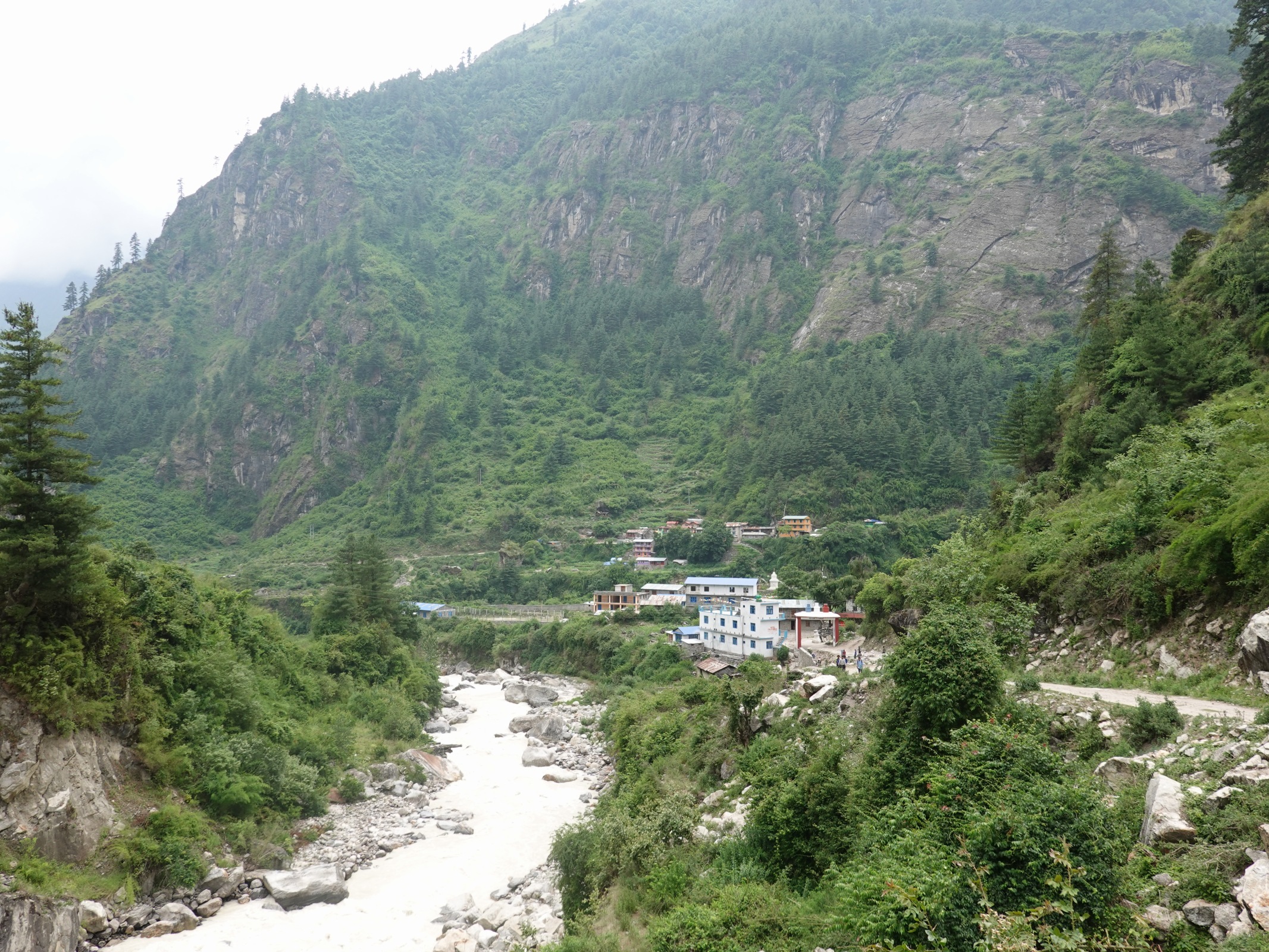
June 04. Khorlabeshi to Philim. 22 km. 8.5 hours. 1150m up. 530m down. We got a reasonably early start at 0730. It was easy to get up at 0600 as it was already bright. As we left the village we got mixed up in a few mule trains each with about ten animals carrying up to 100kg. Indeed many seemed to be carrying two bags of cement. We followed them along the track for an hour to Tatopani where the track ended. There were some hot springs here and they had been channelled into a few faucets which poured out of carved serpents’ heads. There was a pool nearby in which it had once been possible to bathe, but now it was empty and dirty. There would have been a constant procession of mule drivers and pedestrians right beside the pool anyway.
Just after Tatopani, which at a push could almost be described as quaint there was a major construction project under way and it would threaten the village’s future. The track we had been walking on, although closed to traffic because of a lack of bridges, was in fact part of a very ambitious project to build a road up the whole gorge and then up Tsum valley and into China. Indeed the Tsum Valley part of the road had already been built. Off course it would change the character of the whole valley forever and it would lose its innocence, especially the beautiful and remote Tsum Valley. However it would also mean that all the villages high up on the mountain sides would probably have tracks to them and they would be connected to the outside world. There would be jeep services, health clinics, schools, local shops selling nails, concrete, rice and cheap sugary calories. People might decry the building of roads but they will be tourists from countries covered in asphalt. The locals will not complain.
What I found horrifying and fascinating though was the construction process. I have never seen such a dangerous job. Just after Tatopani for example was a rock buttress. The engineers must have decided to cut a shelf into it for its entire length of perhaps 300m. To this end some five air compressors were positioned at the start and end of the buttress with ten hoses supplying compressed air to jack hammers. Ten teams were at each jack hammer breaking up the rock and drilling holes in it for future blasting while three or four other people shovelled the broken rock over the side. Slowly but surely these ten teams worked down from a line prising the rock off the cliff face onto the riverbank below. As they descended the shelf they stood on slowly got wider but in some places they would have to remove 50 metres of rock before the shelf was wide enough for a road. Stubborn bits of rock were blasted out with dynamite, and as the army is the only authority in Nepal with access to dynamite, they were occasionally on hand.
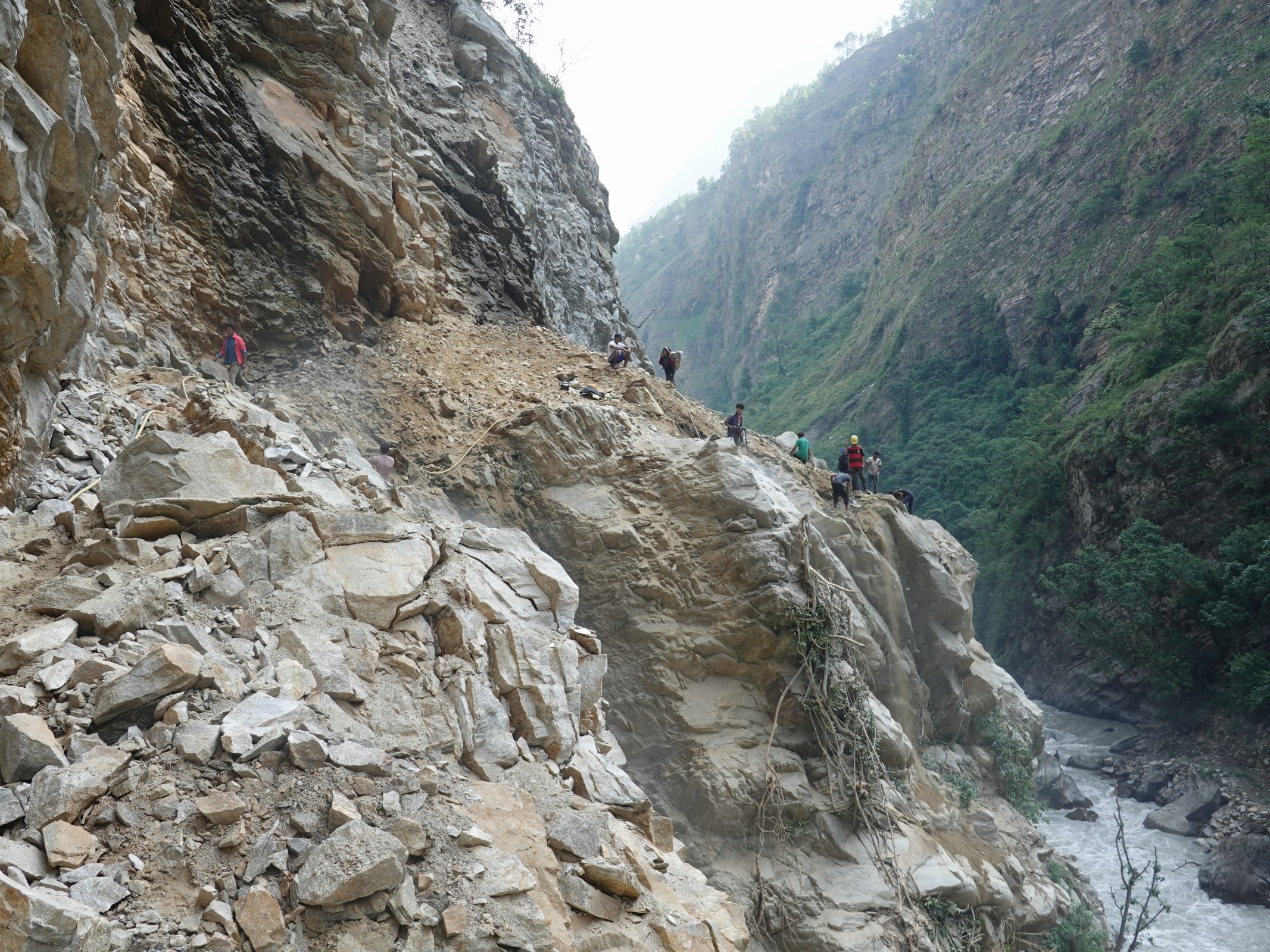
262. A road building team prising rock of a steep rock buttress and shovelling it into the river just north of Tatopani. Some of this team were in flip flops.
This probably sounds quite archaic but the real horror was the working conditions. Each team was about four or five people. None had harnesses, safety helmets, or even proper shoes – most being in flip-flops or sandals. There was often a woman in the team, shovelling the debris over the abyss. Rocks from higher up on the area already worked could easily detach from the shattered rockface and fall on the team, or the rocks they were standing on jackhammering could easily fall off, taking people with it. It would also have been very easy to slip and fall over the side.

263. Another two road building teams were working towards each other on this cliff face near Yaruphant. All each team was working with was jack hammers powered by compressed air. They crept along the shelf they had already excavated and would meet in a couple of weeks.
You hear of Nepalis working in horrendous conditions building the football stadiums in Qatar, something which Amnesty International has championed as a cause. Yet here it was happening in Nepal’s own backyard. As the day unfolded I saw perhaps 100 teams of five working on ten different cuttings on cliff faces. That is 500 people working in such conditions, and there must be at least one death a month, or perhaps a death per kilometre of completed road. Bharat said those on the jackhamers and drills were probably on 17 dollars a day and the debris shovellers on about 12.
After a couple of hours we passed through Dobhan but it was too early to stop so we pushed on to Yaruphant. The temperature in the bottom of the gorge was terrific it was still and windless. Even Ramesh had resorted to shorts. We were all dripping in sweat and my newly washed shirt was already wet. It was only when we crossed the river before Dobhan and then followed it on a sandbank that there was a cool breeze, caused by the rushing torrent of glacial water. We continued to overtake and undertake many mule trains that would walk just a bit quicker than us but then stop for a nibble of weeds beside the path. Just before we stopped at Yaruphant we passed Thulo Dunga where there were a couple of bhattis favoured by the mule drivers. They left their mules to graze the sparse vegetation here while they ate. There must have been 200 mules milling about and the smell was overpowering.
At Yaruphant we had lunch and then continued north. The river here brushed up against the bottom of the cliffs and a pathway was bolted onto the side of the cliff for about 400 metres. It was quite a feat and must have been strong, as there were up to 100 mules along its length at one stage. At the end of the walkway the path crossed the river again to the west side. At the bridge the army stopped us and told us to wait with the 100 mules. Then there were two huge explosions, and on the second one I saw rocks flying down a cliff face and into the river. We were then allowed to pass and had to clamber over the new debris from the blast between the bottom of the cliff and the raging torrent of the river. From here we soon reached the quaint and picturesque settlement of Jagat. It was nestled deep in the gorge beside a flood plain caused by the river further down near Yaruphant being clogged by huge boulders. Jagat was as far as the road teams had got and it was also the start of the Manaslu Conservation Area. As such it had both a police and Conservation Area checkpoint. Both were unmanned when we got there. Bharat told me to walk on while he hunted down the officials and got the permits stamped.
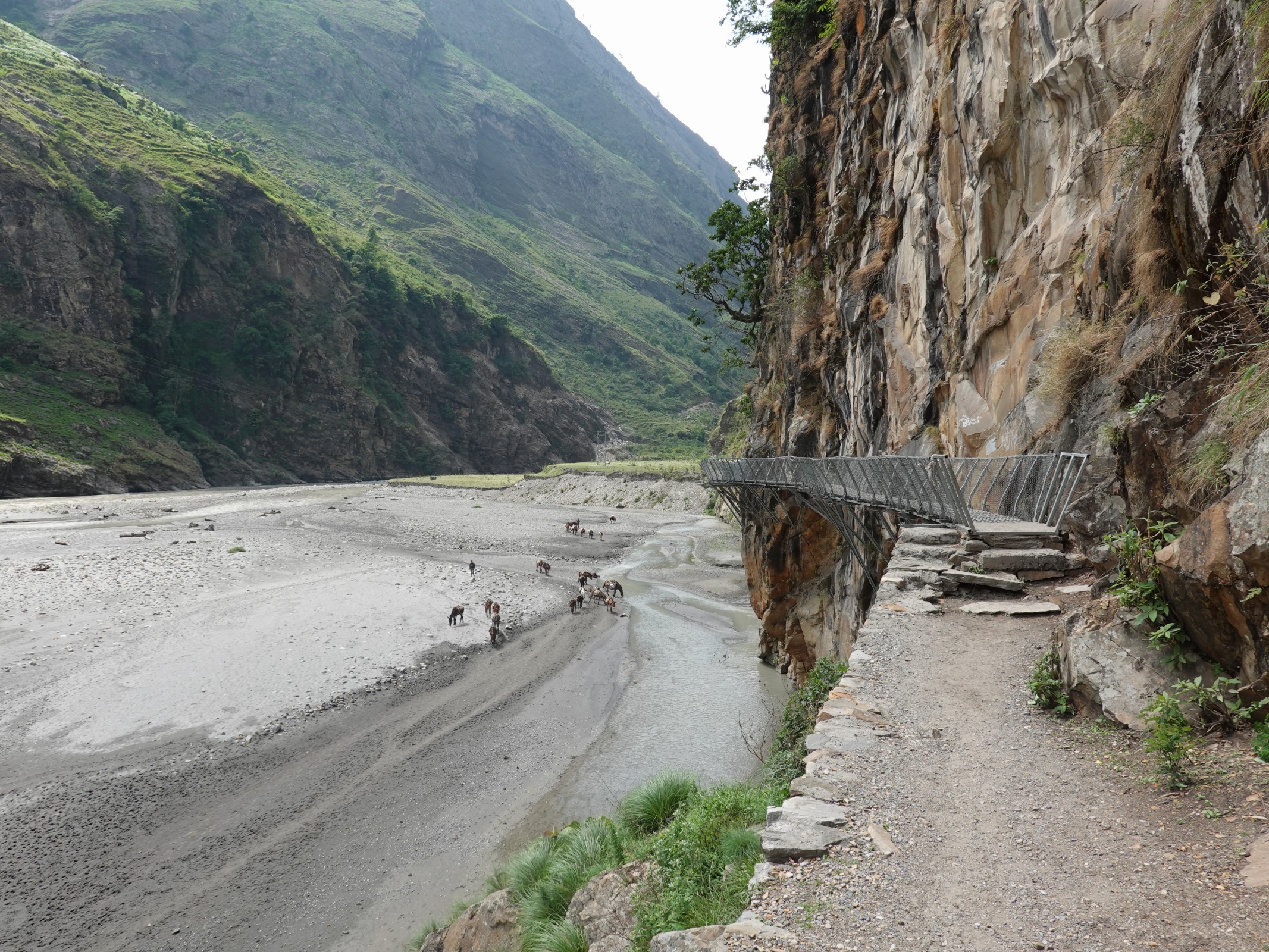
264. The walkway just after Yaruphant was bolted onto the rock and extended for a good few hundred metres above the river.
I kept on up the gorge passing a beautiful waterfall of crystal clear water which was soon to be wasted as it joined the muddy Budhi Gandaki. I passed through the hamlet of Salleri stopping at a tap to guzzle a litre. Here many of the mule trains caught me up and I was trapped in a long line of perhaps 100 beasts. It was easiest to step aside and let them past rather than rush with them breathing down your neck. Just before I reached the scruffy settlement of Sirdibas, with its hundreds of Muscovy Ducks wandering across the paths the others caught me up.
We now just had another huge suspension bridge to cross, which I reckoned to be 200m long over the Budhi Gandaki to the east side and then a sustained 150m climb up the hillside for half an hour to reach the large village of Phidim. I remembered it as an interesting place from my last visit, when we stopped for lunch here five years ago. It was a thriving place with mules wandering the streets, volleyball matches, a busy hotel with hot water and many officials gathering for a meeting tomorrow on Conservation Projects. All the discussions of the Conservationists would really be quite futile in light of the road which would change the conditions of the valley hugely. I settled in and had a really hot gas shower, my first warm shower in 80 days. There were no other tourists in the village as the spring trekking season seemed to be over as the monsoon approaches in three or four weeks.
June 05. Philim to Ghapsya. 22km. 8.5hours. 1250m up. 670m down. I managed to get my phone to connect to the hotels erratic WiFi over breakfast and managed to send off the previous Section; Ganesh Himal Foothills to Pete to upload onto the website and Facebook as there is no way I could do it locally. Pleased it worked, we set off at 0730 before the heat started to build. Indeed because of the deep gorge and the fact the path was on the east flank, we were in the shade for a good while. We already had some height above the river when we left Philim and we kept this height as the river emerged from a sheer gorge below us. Small wispy waterfalls plunged from the steep grassy slopes above the gorge over the lip. On the other side was the remote village of Bhangsing, perched on a shelf above the gorge on the west side. Since I was last here an enormous suspension foot bridge had been built well above the top of the gorge From Ekle Bhatti to just below Bhangsing. It must have been 300m above the river and 300m long and the biggest of its type I have ever seen. It was built by the Kadores; Ex UK army Ghurka Association, who do a lot of projects in Nepal. It certainly made life easier for the people of Bhangsing, and we could see groups of children coming across to go to school in Philim. This was now just a half hour walk instead of an hour and a half. After Ekle Bhatti we dropped into the gorge to the bridge over the river just below the confluence of the two main rivers, the muddy Budhi Gandaki emerging from the Nubri Valley and the clear Siyar Khola emerging from the Tsum Valley. Where the rivers met was a large forested area of Chir Pines which clung onto the steep grassy slopes which were now spring green with the recent rains.
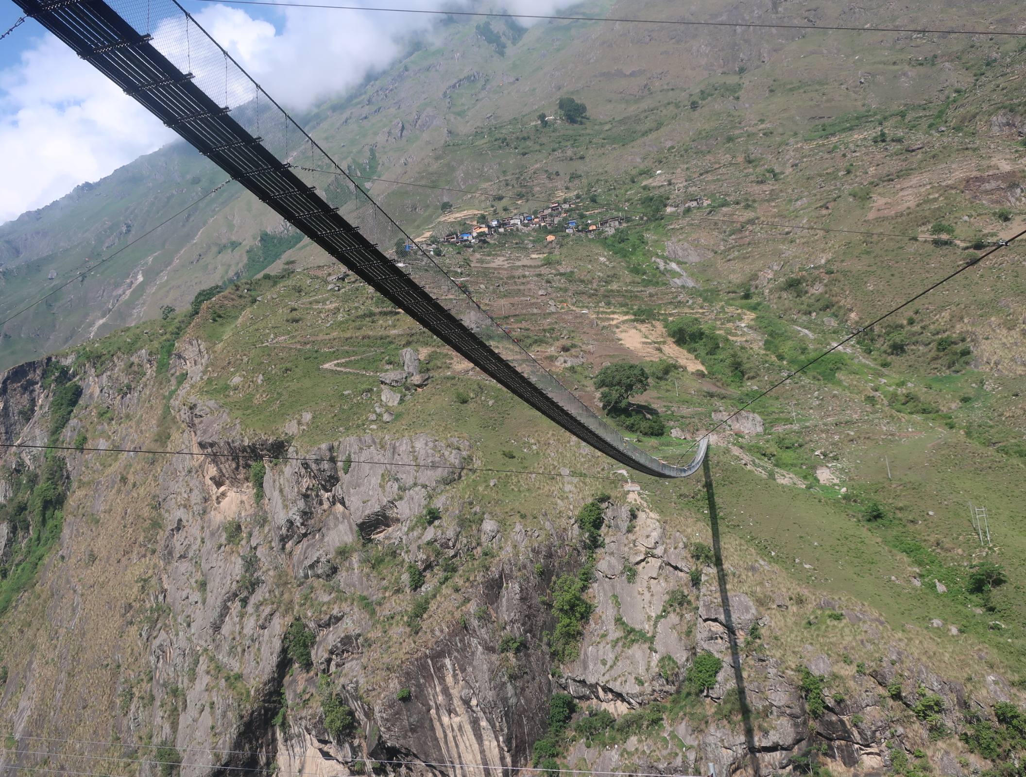
265. The huge 300 metre long and 300 metre high suspension bride linking the village of Bhangsing with the rest of the world. Previously the villagers had to descend a good hour to another village before reaching the path.
Just after the bridge was a motley gathering of bhattis for the mule drivers, and by one of them I met Margot, a French volunteer who was going up the Nubri Valley to identify needs for the locals her charity could provide. I suggested stove pipes and large heavy batteries for the plentiful Chinese solar chargers. We walked together for half an hour, crossing and recrossing the river in a sheer sided gorge until we reached Pewa. She was the first non Nepali I had seen for ten days and her English was flawless. Although shaded by jungle and the side of the gorge it was roasting in the bottom. We could barely hear each other due to the crashing torrent and the sounds of hundreds of crickets and cicadas. We stopped at Pewa, us for tea and her for lunch.
We left Margot in Pewa, a claustrophobic place hemmed in by rock, and continued another hour to Deng which was much nicer and more open, being sited where a side valley joined the main Nubri Valley. There was a teahouse here which was open and they cooked up a meal. Most of the tea houses had shut for the season. After Deng the path, which was still overrun with mules, crossed to the east side of the river on a wire footbridge and then undulated up a down the side of the valley for a good couple of hours passing through hamlets and villages. The gorge still continued below us with the ferocious river tumbling down over boulders carving an ever deeper slot, but we were on the steep often terraced or clad in pines above the gorge. It was overcast and windy which made it much easier to walk. The pines here were now the five needled Bhutan Pines with their delicate papery cones. The change from Chir to Bhutan Pine seemed to occur around 2000 metres.

266. The Budhi Gandaki gorge about its confluence with the Siyar Khola which flowed out of Tsum Valley. This was just downstream from Pewa.
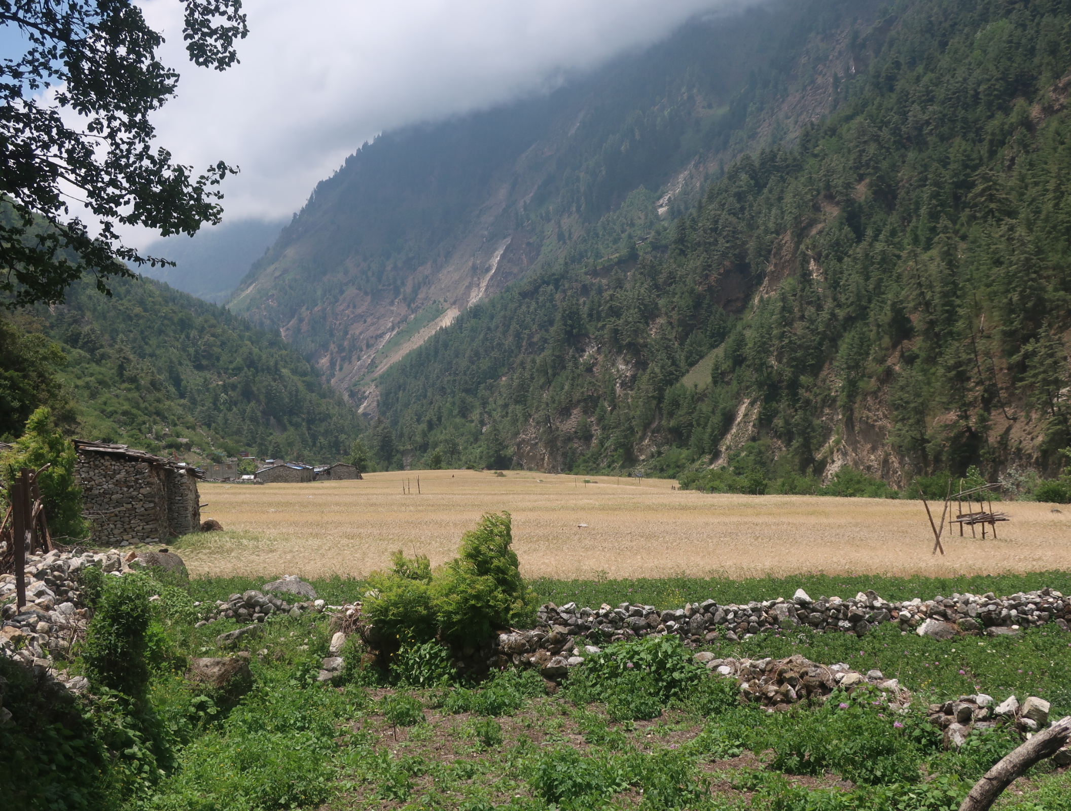
Eventually we reached the Serang Khola stream, crossed it on a wire bridge and then continued to traverse the steep valley side for half an hour until the valley really opened out. It reminded me of a Swiss Valley like Grindalwald. Waterfalls plunged down from the misty heights some two kilometres above us and then tumbled through the pines to reach the flat wide valley floor on which the nice village of Ghap sat. The last half hour into Ghap was easy as the path was flat and wide enough for us and the mules. However most of the lodges were shut and the one we liked was closed because the owners had gone to the meeting in Philim we left this morning. We had to carry on up the valley for another km to the hamlet of Ghapsya until we found a lodge. It was pretty rustic but at least it did not have strings of mules tethered outside it and the uncouth mule drivers inside. As the evening went on the lodge grew on me, especially when a wild looking ascetic monk arrived and everyone paid homage to him. Rather than the plump monastery monk this one looked like he had just emerged from five years meditation in a spartan cave.

267. The village of Ghap lay on a shelf in the valley between the gorge and the steep mountainside. It looked like somewhere out of the Alps. Ghapsya was beyond the far end of the shelf.
June 06. Ghapsya to Lho. 16 km. 6 hours. 1410m up. 490m down. I slept well at the hotel, which only in the morning I noticed was sited under a buttress of conglomerate rock. However it was plagued with flies and I had to eat my breakfast outside to avoid the worst of them. After we left we walked just 20 minutes through the forest on an easy path to reach Jungle Lodge, a much nicer place to stay than last nights’ emergency stop. It was sited just at the bridge where the path crossed from the south to the north side crossing a deep ravine where the muddy waters of the river crashed down through chutes. It was just here that I came across the first of the West Himalayan Spruces, Picea smithiania. They had large boles of around 1.5m and were tall at 40m with huge drooping branches almost covered in tassels of 3 cm long needles. It was the first dendrological sign we had made it to the west of Nepal. We crossed the bridge and continued up through thick jungle, the lower half of which was covered in white clematis in bloom. There were also the same white flowering trees as in my neighbours garden. It was a marvellously fertile good km or so until we reached another bridge to take us back over to the south bank again, about an hour after leaving Ghapsya.
The path now climbed and fell up the drier hillside, passing a few hamlets on each side of the river, which had they not had tin roofs could have been from a medieval era. All had stone walls with wooden layers between to hold it all together and then many had shingle plank roofs. The front of the houses were large, also wooden, with animals below and humans and storage above. The path went through them with more and more mani walls and small chortens appearing as we headed into more Buddhist areas of the Lama caste and left the Gurungs behind. There were wispy waterfalls on both sides of the valley some plummeting from huge heights from the tops of cloud enshrouded mountains in tiers of many hundreds of metres each.
We got to Namrung quite early after just 2.5 hours just after 10. I remembered it as a nice place but the lodge I previously stayed at was closed, as 90% of them were. However there was a nice new place, the first one we came to, which described itself as a resort and it was open. It was very fancy with some US$30 rooms, but the food prices were the same as all the other lodges in Namrung due to Manaslu Hotel Association rules. Despite the early hour we ate here and relaxed under the shady trees until midday when enough of a breeze started to make the afternoon walk more tolerable.
Indeed after Namrung the character of the valley changed and the gorge became smaller and less significant, and above it were large open shelves with extensive fields of barley ripening on them. In one of the medieval hamlets, Banjam, there was one huge field some 200m wide and 500-600m long. There was no division in it and it looked like it was owned by one family. It must have been the biggest field in Nepal’s Himal region. There was a large waterfall here which cascaded some 200-300 metres down a bare slab. As it came down it opened up into a wispy fan. Not long after the path descended into a smaller side valley and then climbed up to the very Buddhist village of Lihi around 3000m, with its new and old monasteries, kami gates, large chortens, mani walls and a large fluttering of prayer flags. The walking was some much easier here now also as the path contoured across the south side of the valley.
268. The large field at Banjam was about 300m times 700m and was remarkable in that it was so flat and uniform. It was the largest field I had seen in the Himal or Pahar regions of Nepal. It was full of ripening barley.
After Lihi the path descended into a side valley where the Hinang Khola tumbled down in a muddy torrent. It was the culprit which muddied all the waters downstream. It flowed out of the Hinang Glacier upstream which collected all the snows from the north side of the huge Himal Chulli mountain, a near 8000m mountain south of Manaslu. There must have been a moraine collapse to muddy the waters to this extent. It was a short climb out of this valley to the thriving village of Sho. It had the same medieval character and was very Bhuddist. Indeed as we went along its stone houses there was a puja ceremony in a tent with about 20 chanting worshipers and much drum beating. I wanted to stop and take a photo but it would have been rude. I remember the last time I came through Sho there was a large and lively wedding and on this occasion I did get a lot of photos.

269. The Kami gate or entrance/exit to the village at Lihi. Inside the roof is hollow and like most kami is was decorated with Buddhist murals on wooden panels.

270. Approaching the village of Sho. The path gently weaved through fields of ripening barley. Last time I came here there was a large and boisterous wedding at the houses in the distant right.

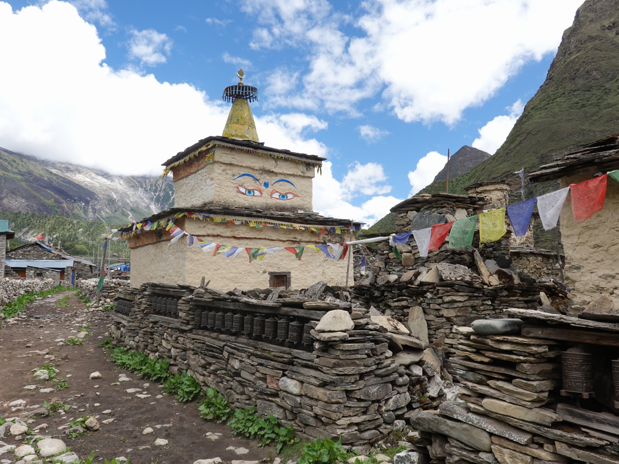
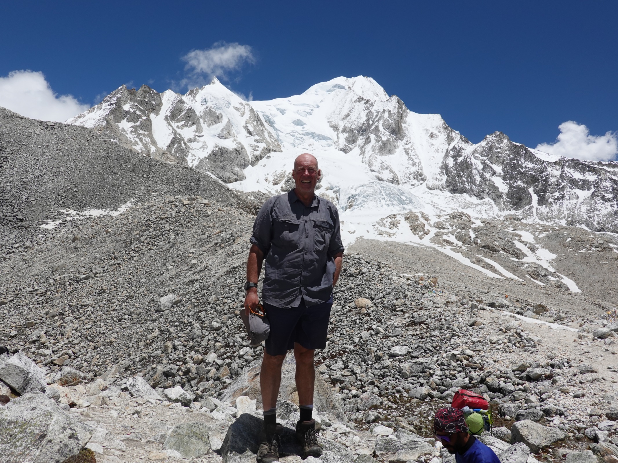
271. Approaching the village of Lho with its stone houses in the foreground. Beyond on the hill is the Ribung Monastery and beyond that the twin peaks of the 8000m high Manaslu.
After I left Sho I could see the Ribung Gompa on the hill in the middle of the valley some 2 km ahead. This was a large prestigious monastery, the main one in the Nubri Valley, and it sat on the hill above Lho overlooking it. Behind it was the magnificent Manaslu, but right now it was hidden by cloud and I would have to wait until tomorrow morning to catch it in its sunrise glory. The two km to Lho was relatively easy as I sauntered along the forested hillside to the edge of the village. There was a lot of building work going on, enlarging guest houses now it was low season. I remembered a large hotel with a single roof top room where I had the most stunning view of Manaslu from my bed. However it was closed so I settled for the one next door. There was a Dutch family here and a group of four Slovakians, who all lived in Bruntsfield in Edinburgh and studied at the university there. The Slovakians were very switched on and loved every bit of their first trip to Nepal and were lapping it up and doing lots of side trips. The Dutch were in the middle of a classic insurance fraud. Their guide had convinced the man he had altitude sickness, which at 3100, was a tall order. He said a helicopter evacuation was necessary and his insurance would cover it. The helicopter company would charge $6000-8000 instead of the normal $2500-3000 and the guide, the trekking company and the helicopter company would share the profit. It was becoming rife in Nepal, sometimes guides would even contaminate clients food to emulate food poisoning (for example with baking soda). The Dutch family’s guide had also persuaded them the pass was near impossible and to cancel the trip now was the best option, and they fell for it. It was shameful of the guide and weak of the Dutch. Some trekking companies even sell trips they cannot hope to make a profit on purely on the basis they can conjure up a problem which requires the clients insurance to pay for a helicopter rescue. Ironically the helicopter was postponed for a day as the weather in Kathmandu was poor and he was acclimatizing well!

272. The Ribung Monastery was once the seat of Buddhist learning in the Nubri Valley but has lost some of its prestige and population in the last years.
June 07. Lho to Samdo. 16km. 5.5 hour. 1190m up. 580m down. It was misty when I went to bed, but I was hopeful for a view in the morning and set my alarm for 0445. However that was dashed by torrential rain early in the morning which was soon accompanied by thunder and lightning. When the alarm went I just heard the rain pelting onto the corrugated tin roof and did not even get out of bed. However a breakfast around 0700 the rain eased and there was the increasing flash of blue sky. The helicopter to “rescue” the Dutch seemed not to have been approved by the authorities so they had a five day walk back to the bus. It was a shame as had they just taken three more days they could have had an easy three hour walk to Samagaon, the cultural jewel in the valley, and then another three hour walk the next day to Samdo, in spectacular mountain scenery. Their greedy guide had ruined this for them by putting the fear of God in them about difficult conditions in the hope he would get a cut of the helicopter fraud. I wanted to explain all this to the Dutch but they thought their guide was fantastic and it was not really my business.
I headed up the path towards the monastery with Manaslu behind it but the cloud quickly enveloped it. The facade of the monastery was impressive but that was all it was and there was little substance behind it. I went to the south of the monastery on a new path in the thick conifer woods of larch and silver fir before dropping down to a clear stream in the wooded valley. Here I met the other path which went round the north side of the monastery. The merged path now headed up a tranquil wooded valley, thick with conifers with the small clear stream tumbling down it. Occasionally part of the stream was diverted into a channel which went down a chute to turn a prayer wheel. It was a gentle scene. About half way up there was a sign to Hongsangbu monastery and as I climbed further towards Shyala I could see its red roofs appearing in the firs.
Shyala itself was a cluster of lodges laid out along one street. It had a big school at the west end which looked Buddhist inspired. It had a great view west towards the Manaslu Massif which was now lost in cloud but its near 8000m southern neighbour, Nadi Chuli, stood proud. I walked through the village and out through the kami gate on the west side and back into the conifers. There was a short drop now to a suspension footbridge over a small stream and then a climb up to another large bridge over the muddy Numla Khola torrent which emerged from the Punggen glacier. This glacier drained the SE quadrant of Mount Manaslu. At the end of this second bridge the valley opened up even more, and there were two large fertile plains each side of the main river. At the end of the plains, some 2 km away across flat grassy pasture was the large village of Samagaon. It was the main settlement in the valley, and its traditional stone slab and new blue tin roofs covered quite an area. Alter the far end of the village on a wooded ridge was a cluster of red roofs – these were the three monasteries. One was damaged by the earthquake, one burnt down a couple of years ago but the third was OK, but apparently it was locked. Santos had caught me up as we walked together across the flat grassy meadows with mules and dhzo grazing on them homing in on Samagaon.

273. Entering the village of Samagaon with its rustic, simple houses lining a couple of paved paths through the village.
Once we passed through the old three storey kami gate, with its Buddhist murals inside, we descended down to a huge pile of mani stones arranged behind a perimeter wall of small brass sheet prayer wheels. In the middle of this pile were two or three large chortens with the all-seeing eyes painted on them. It was quite an impressive sight and left one in no doubt Samagaon was a pious place. Passing this we followed the path past rows of poor medieval houses. Each had a compound in front which was generally paved with stone slabs, upon which firewood, piles of pine needles and piles of manure could be stacked. The simple wooden fronted houses had an opening off the yard to the lower floor and it looked like animals were kept in here, certainly in the drier brown months, if not all year. Above this were rustic balconies, and behind were the kitchen and living space of the family. The roofs were a mixture of stone slabs and tin, with the occasional shingle planks. Smoke leaked from the roof from the dingy interiors. It could have been like this 500 years ago. At the upper end of the village were a cluster of lodges and hotels. We dropped into Hotel Manaslu, where I stayed previously, for lunch which the battleaxe of a Gurung host cooked for us with good cheer. As we finished the Slovakians arrived at an adjacent hotel. Bharat had to go and get the permits checked by the police and Conservation Area officials.
274. At the southern entrance to Samagaon was a huge pile of carved mani stones overseen but a couple of large chortens with the all seeing eyes.

275. One of the typical simple, almost medieval, houses in Samagaon. It had a paved stone yard with piles of firewood. Below was a barn for the animals, certainly during the winter time. Above were the very simple living quarters of the family, All under a stone slate roof with a aperture for a chimney.

276. A devout older villager of Samagaon sitting in his yard with a prayer wheel. As we past he was muttering a prayer as he span the wheel, itself a prayer.
After lunch I headed off on my own up the U shaped wide open valley. It was covered in various types of berberis plants, most of which were in yellow or orange bloom. Between them were small juniper trees. Up the sides of the valley were Himalayan birch and in some place they went up to nearly 4000m. Above the birch were the mountains, many with glaciers and piles of moraine. As I went up I had to cross a crystal clear stream. It emerged from Birendra Tal lake just a bit higher up – this was essentially the base camp for Manaslu climbers. At the far end of the lake the vast Manaslu glacier ground to a halt on the slabs above the lake. Even in the four years since I was last here I could see the glacier had retreated. Previously the collapsing seracs tumbled down the slabs to the lake’s edge but now they did not even make the slabs.
It was a lovely easy walk up the gentle valley for two hours passing grazing animals and mani walls, one about 300m long. Women were returning from the birch woods with baskets heaped high with firewood. As I approached the traditional Himalayan cantilever bridge made from logs and rocks over the violent muddy waters of the youthful Budhi Gandaki I came across some 50 temporary shelters of rock walls covered with a tarpaulin. Initially I thought they were pastoralists as the area around the shelters seemed to be sparsely covered in grazing yak and mule. However it was only later when Bharat explained to me they were seasonal yarsagumba hunters. I crossed the bridge, climbed a steep moraine ridge and then arrived at the slightly scruffy hamlet of Samdo. There was only one hotel open and it was reasonably clean. I checked in here and the others arrived about half an hour later.

277. Two women returning to Samagaon with basket of firewood from the birch forest. They are walking beside the 300m long mani wall made from carved stone tablets of prayers.
Yarsagumba hunters are a phenomena all over Nepal’s Himal region in the spring. It is a major source of income for thousands of families who either live in the Himal or migrate from the Hill region, the Pahar, each spring to live in the simple shelters I had seen earlier. They spend their days high up from 4000-5000 metres in the high grasslands which are emerging from the snow on their hands and knees searching for yarsagumba. A yarsagumba is the pupae of a moth which overwinters just below the surface of the ground under a snowfield. Unfortunately for the pupae it is very susceptible to being infected by a fungus which grows a shoot some 5 cm out of the top of the pupae. As the pupae wriggles in its death throes the shoot moves and it is this that the yarsagumba hunters are looking for. They then dig it up and carefully bag the pupae and attached fungus shoot, the whole thing being about 10 cm. On a good day a yarsagumba hunter might find 20 specimens, as they might sell each one for US$5 this is a small fortune. It is not without its risks however, and each year some hunters die when avalanches hit them, others are killed in fights and many are conned out of their bounty by unscrupulous traders. You are probably wondering why a moth pupae infected with a fungus can be worth US$5? Somehow these infected moth pupae have become part of traditional Chinese medicine and they are used to promote virility, a kind of Himalayan viagra. The infected pupae can sell for up to US$100 to the businessmen of Beijing who feel they are lacking in the virility department.

278. Yarsagumba. These caterpillars of a moth live under the snow for the winter but get infected by a fungus which eventually kills them. As the snow clears around 4500m in the spring they are still just alive. They are collected by perhaps half a million Nepalis in the spring and can be worth US$2-5 each. They are sold as an aphrodisiac to the Chinese.
June 08. Samdo to Bimthang. 30 km.9 hours. 1460m up. 1710m down. We had a big day in front of us so we had breakfast at 0430 and left at 0520 after it had got light. We were all in good shape and up for the long day. None of us had any acclimatization issues at all and this was a relatively low pass at 5100m. My sinusitis had gone and I no longer had to take paracetamol for any headaches. We were all fighting fit as we powered up the path in the shade of the mountains behind us. We passed Larkya Bazar where there used to be an annual market, mostly of Tibetan/Chinese goods which came across the border just to the north. This border is now closed and the market defunct. As we climbed the sun lit up the tops of the peaks and then slowly worked its way down. The yarsagumba hunters would already have made it up to their picking grounds by now.
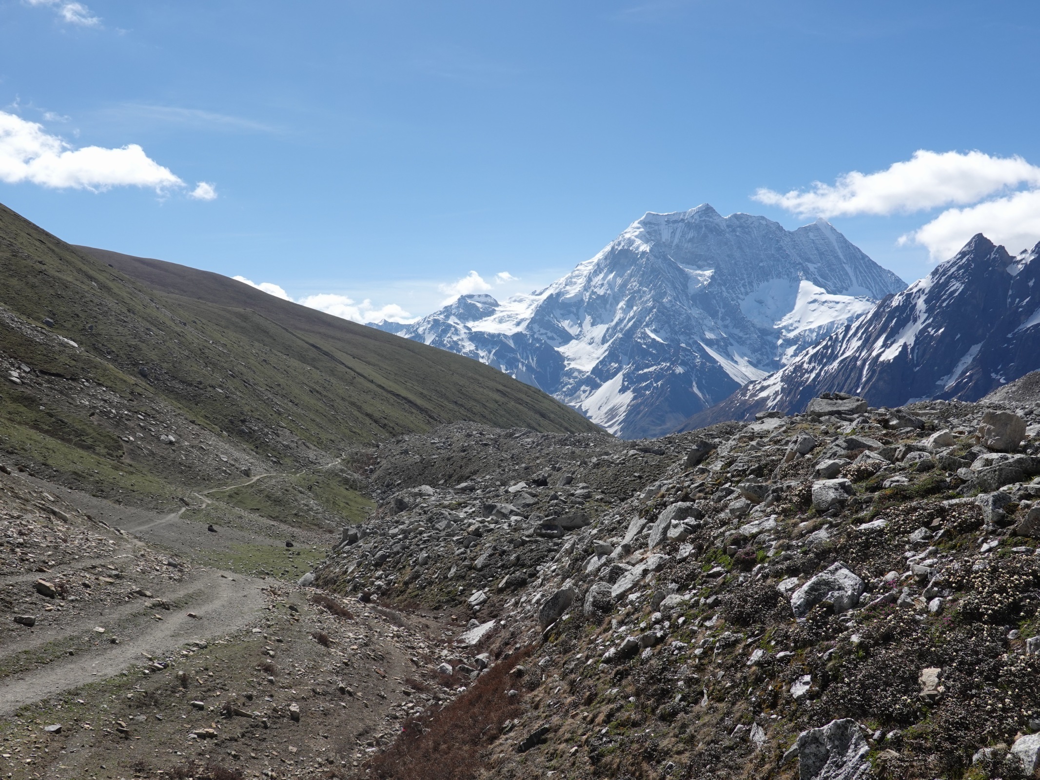
We hiked up the north side of the valley looking down on the infant Budhi Gandaki to our south and Syacha Glacier from which the muddy torrent emerged from the moraine covered ice. This glacier drained the north side of Manaslu. At a certain position on the path we could see right up the glacier to the base of Manaslu and then all the way up the north face to the north col and finally up the slopes to the summit with it’s twin peaks. The route did not look very difficult from our viewpoint but I am sure it is. Yaks grazed in the pastures around us, their black shapes always moving while they grazed.

279. Looking up the Syacha Glacier to the north side of Mount Manaslu from near Dharamsla. The twin peaks are clearly visible.
After the view of the north side of Manaslu the path reached Dharamsala where there was once a dirty, cold teahouse. However in the intervening four years since my last visit it had closed and two new ones had been built. They looked much more appealing to stay at for those who wanted a shorter day. They were both closed however as it was off-season now. Just beyond these lodges the path met the terminal moraine of the Larkya glacier. It did not go onto the moraine but followed the snout round to the north side and then followed the grassy hillside along the edge of the lateral moraine. There were plenty of marmots here. They seemed bigger than their European or North American cousins and unlike them did not post a sentry to sound a shrill whistle if danger appeared. As I approached they shuffled off to their burrows in the rocks under the grassy surface. There were many yaks grazing here but most seemed to be female, called a nyak. After the Thudam incident I still gave them a wide berth. Behind me the view down to Samdo village and the huge Samdo mountains, with its high cliffs and snow fields, was impressive, while ahead Larke Peak dominated the south side of the valley and blocked the views of Manaslu.

281. Dharamsala used to consist of a single filthy lodge, however in the last years two new lodges have appeared and the old lodge closed down, making it a much more appealing place to stay.

282. Going up the moraine on the north side of the Larkya Glacier past marmot burrows towards the Larkya La Pass. The beast is a female yak, called a nyak.
283. Looking down the moraine of the Larkya Glacier to the path I had just come up. In the distance is the mountain of Samdo which is beyond the village of Samdo we stayed at.
After 4 km from Dharamsala the path left the grassy mountainside and went onto the moraine of the glacier for another 4 km to the pass. The path on the moraine was marked by poles, well beaten and easy to follow. At a small snowfield I saw a fresh footprint and knowing the others were well behind had a Man-Friday moment as there was someone just half an hour ahead or so. I also saw lots of old mule or yak prints on the softer sections. The flowers here were in their prime and the yellow and the purple rhododendrons were in flower. The former was the one Dawa plucked a few leaves from to take home for incense. The latter were very small and prostrate but seemed to have more than 7 stamen in the flowers. Someone learned once told me that Rhododendron have 7 or more and azaleas 6 or less, but to the common man the purple plants looked like azaleas. As I approached the pass the terrain became a bit sandier, and there were silty streams and small turquoise tarns on the flat moraine.

280. The high altitude rhododendron shrub exits from 4500 to 5000 metres. It produces beautiful pompom like flowers and when burnt the leaves give off a much cherished incense smell.

284. A small rhododendron shrub at around 5000m on the Larkya La Pass. Apparently if there are 7 or more stamen in the flower it is a rhododendron and 6 or less it is an azalea. These flowers had more than 7.
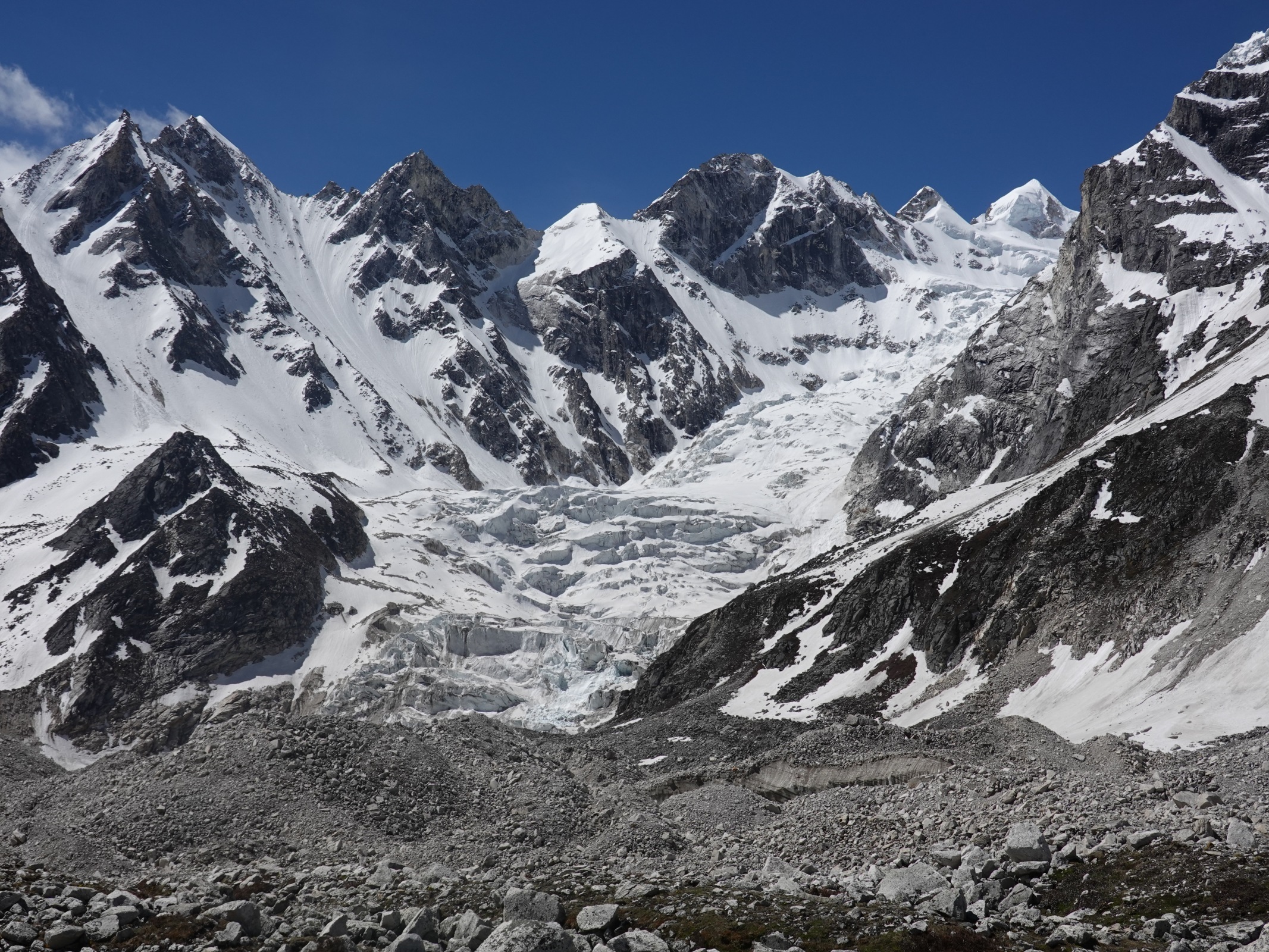
285. Just to the south of Larkya La Pass was the 6000m mountain of Larkya. Its north side was heavily glaciated.
286. Looking back down the Larkya Glacier from near the pass. In the foreground it the sandy moraine and a couple of shallow tarns and in the distance is Samdo Peak. We slept at the foot of Samdo Peak.

287. Bharat, Santos and Ramesh on Larkya la Pass. They had now got special T shirts made to celebrate our journey.
288. Me on Larkya la Pass with the mountains to the north on the Tibetan border in the background.
The pass was quite shallow and as usual marked by tangled strings of prayer flags. The others were well behind having stopped for a bite so I found a sheltered spot and lay down on the gravel for a snooze. I must have slept for half an hour and was woken by the sound of bells, the same bells as the mule trains use. I looked up and there were two mule trains approaching with about 20 unladen beasts. I thought the west side of the pass was far too steep for them but apparently not. Just after them Bharat, Santos and Ramesh arrived and we had the usual high fiving and photo session. I wanted to get on a get some photos of the impressive 7000m peaks and the glacial landscape on the west side of the pass before the rapidly building clouds obscured it.
As I set off a huge Lammergeyer vulture cruised past very close to me, unusually close, then I saw another and another on the ground. I went over to have a look and there was a dead mule lying in the rocks. It must have died yesterday. The vultures had just started pecking at it and had opened a few holes. However all four flew off when I approached, re-landed nearby to check me out and then flew off and spiralled up. They were huge birds with a graceful flight but all that was wasted because off their haggard, ugly faces. There was not the eagle like features or panache with these large birds with their turkey like faces.

289. One of the lammergeyer vultures who I disturbed feeding on the carcass of a dead mule almost at the pass. These ugly, turkey-headed birds looked graceful in flight with their near three metre wingspan.

290. A team of mule coming up the west side of Larkya La pass on the vastly improved track. It was a lot quicker to come this way to Samagaon than up the path we came in the Budhi Gandaki valley.

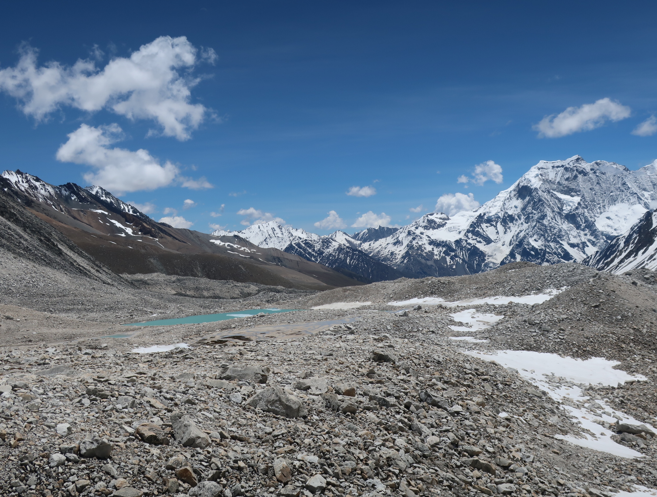
291. Looking down the west side of the Larkya La pass to the confluence of the three glaciers. Despite the upheaval the lateral moraines are well defined and even harbour a couple of lakes between their ridges.
Just beyond the dead mule I remembered the path descending steep loose ground for a good hour. However it seemed a new path had been made and it appeared to be very easy. Just to emphasise this I spotted about five mule trains coming up it. When they approached I saw they were all carrying two bags of cement. I asked the drivers where they were going and they all said Samagaon. It seemed it was at least a day shorter to come this way than up the way we came from the roadhead at Machhakhola. With this new path which zig-zagged all the way down to the valley below it meant this once tricky pass was now easy and even the most timid trekkers would find it possible. I thought of the Dutch and how well they would have managed, had they not been frightened by their guide who was purely after the insurance fraud money.
The views down the path were huge but quickly becoming obscured by cloud. There were huge glaciated 7000m peaks all around with flutes of snow clinging to their ridges. But between them were three large glaciers which flowed down from these peaks for 7-12km until they met just below me in a well-defined array of moraine ridges. Between four of these moraine ridges were two deep blue lakes of clean unsilty water. One of them, Ponkar Tal, even had a trekking path to it. I quickly descended down the path to the edge of the first moraine and then followed it down to a new bhatti to cater for the mule drivers. We stopped here for a cup of tea before following the valley between the moraine and hillside down to Bimtang, which took a good hour. The hillside was covered in Himalayan birch which went up a couple of hundred metres to the rocky crags where only shrubs could exist. Bimtang was a tranquil hamlet of lodges, most of which had a central dining room and kitchen and then a cluster of simple wooden cottages for the clients to sleep in. It was spread out across a large meadow between moraine and hillside and full of grazing mules. Most of the lodges seemed closed and were being renovated but we found one with four empty cottages and occupied two. It was a nice end to a long day which I expected to be longer and harder, but the new path had helped shave at least a tortuous hour off it. Indeed with this new path I would reckon the Manaslu Circuit with the Tsum valley side trip to now be the best teahouse trek (non camping) in Nepal taking 20-25 days in all.
June 09. Bimtang to Dharipani. 29km. 8hours. 320m up. 2100m down. As usual I went for breakfast at 0630 but there was no sign of life, neither from my team nor from the lodge. The dining room was locked. I looked at my watch again to confirm and yes it was 0630. I banged on the kitchen door and the bleary eyed hostess appeared. I thought by the time the stove gets going I will have to wait half an hour for a tea so I just asked for the bill and left before anyone appeared, taking my breakfast money with me. It was a beautiful morning but likely to cloud over fast and I wanted some photos.

292. The Silver Fir forests below Bimtang hosted some specimen trees some 45-50 metres high with 2 metre boles.
It was a beautiful pastoral valley for the first ten minutes or so until the path rounded a spur clad in Himalayan birch and a vast vista of long vanished glaciers and moraine ridges opened up to my east. Above them was the Manaslu massif with the summit visible. It was a much steeper proposition from the west side. I took quite a few photos and continued down the same moraine ridge which I followed yesterday until the path veered to the west, crested the moraine and crossed it. The ice had recently vanished from under the stones, which had now settled and allowed some colonizer shrubs to take hold. I crossed the silty glacial torrent on a traditional cantilever bridge of logs and stones and then climbed the steep west side lateral moraine. Given the harsh stony half kilometre of glacial debris I had just crossed I was surprised that at the moraine crest I entered a beautiful mature Silver fir forest, rich in resinous smells. The route descended a bit to the valley between moraine and mountain where some of the trees were specimen firs with 2 metre boles and dripping moss from their huge boughs.

293. The west side of Manaslu from the Dudh Khola valley near Yak Kharka. This side was much steeper and more imposing than the east side which is the usual climbers’ route.
Occasionally there were impressive views to Manaslu through the trees. One glacier descending from Manaslu had completely disappeared, and what had been moraine and glacier was now all covered in mature deciduous trees giving the whole landscape the feel that it had been draped in green velvet. As I followed the path down a large tumbling dirty khaki torrent emerged from the vast bowl to the west of Manaslu and started to flow beneath the path. It continued below the path for another few km until I reached Yak Kharka where there were two lodges sitting in a meadow surrounded by a fringe of lime green deciduous trees, beyond which were the dark silver firs. I had been walking for over two hours so was ready for breakfast, and chose the upper lodge where a lone lady was watering her young vegetables.

294. The lead mule of a mule train coming down through the silver fir forest just above Yak Kharka. The lead mules are often looked after better and decorated by their owners as they are a valuable asset and keep some stability in the team.
After my late breakfast I continued down through the woods. The firs had largely been replaced by hemlocks and something which looked like short squat hemlocks which I though must be a type of yew. After an easy shaded couple of km I came across another meadow, covered in white geraniums and other flowers and teeming with butterflies. By now the mountain views had largely been smothered by the clouds and obscured by the steep valley sides. At this point there was a seam of particularly resistant rock which had formed a buttress and forced the river to make a U bend round it. The path climbed the hump of the buttress which was covered in Hemlock and Bhutan pine. Occasionally I could see down the side of the buttress into a very deep gorge, so deep the river was lost in the slot. At the top of the buttress I could see the hamlet of Gho, with its blue tin roofs some half an hour below me. As I dropped down to Gho the woods became warm and deciduous and full of birdsong. These woods then gave way to small fields of wheat, corn and in a few places apple orchards, where the young trees were heavily barricaded against marauding herbivores like the mules. I stopped here for a few cups of tea in a lodge and realized I had stayed at it four years ago.

295. The meadow of white geraniums below Yak Kharka were full of butterflies on this warm day.
The path from here continued for just a few km through the woods until it met a track which had been bulldozed but never used other than by pedestrians and mules. It replaced the old track which I remember being hard work. This by contrast was a breeze and I could saunter along it easily. There were some large stacks of wood beside where axemen had made it their profession to cut and sell wood. Often you would see an empty mule train loading up with wood to deliver down the trail when they were returning to inevitably pick up more cement from the road head.
The track led me right through the village of Tilije which was full of guesthouses and lodges. It looked quite quaint but I wanted to get to Dharapani, which I remember as being far from quaint but convenient. After Tilije the track crossed the raging torrent on a ford which only a large excavator could manage. Pedestrians and mules used a suspension footbridge and picked up the track on the south side of the valley and followed it down through scrubbier hillside for a few km until it reached another footbridge over the torrent far below, back to the north side again. Here was the small village of Thoche with a few lodges. I walked through it as just beyond was the Marsyangdi Khola and the town of Dharapani. Crossing the bridge over the Marsyangdi Khola for me was effectively finishing the Manaslu section and starting the Annapurna section. Just on the west side of the bridge was a smart, tidy peaceful looking hotel. I checked in to it before I got to the road above. The others arrived a few hours later.
296. Approaching Dharapani at the end of another long day. Dharapani marked the end of the Manaslu circuit and the start of the Annapurna Circuit, the next Section.
The Manaslu Section had been one of the easiest. The first days up the Budhi Gandaki gorge were hot and humid but full of interest, not least the simple road building techniques. Past our night in Ghapsya though the local culture really started to shine through and by the time we reached Samagaon it was splendid. If this was not enough the mountain scenery also started to excel after Ghapsya and it never left us until the last few hours before Dharapani. The path over the pass was much easier than we feared as it had been upgraded for mules, and we were largely blessed with good weather. Furthermore I was over my sinusitis and certainly had my hiker legs on now and could walk all day. I am not looking forward to the next Section 10. Annapurna. Hugely, as I have done it before in 1992 and since then it has become much busier and there is a track up most of it, except the infamous Thorong La Pass, which I am looking forward to.
Section 09. Manaslu. 135km. 45,5hours. 6780m up. 6080m down.