Svalbard. Newtontoppen / Gallery
-
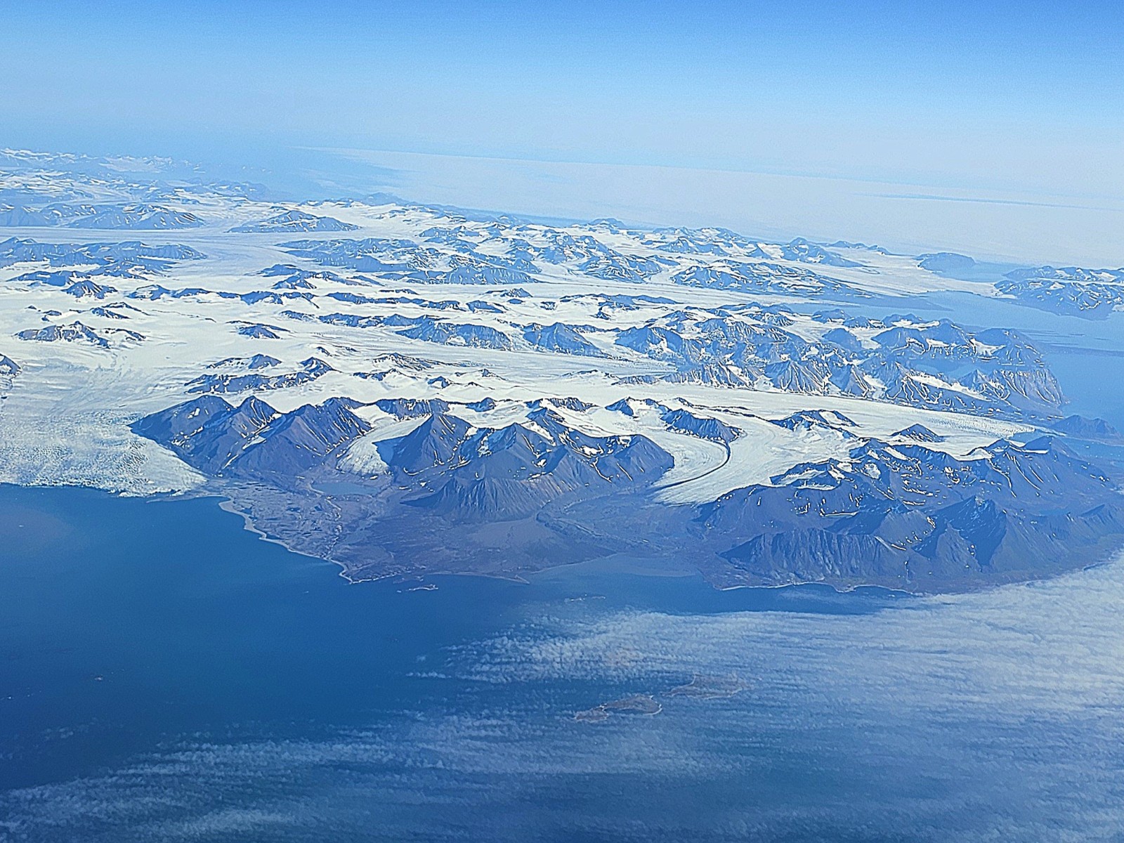
- 001. A view of Spitsbergen from the plane and we prepared to land at Longyearbyen.
-
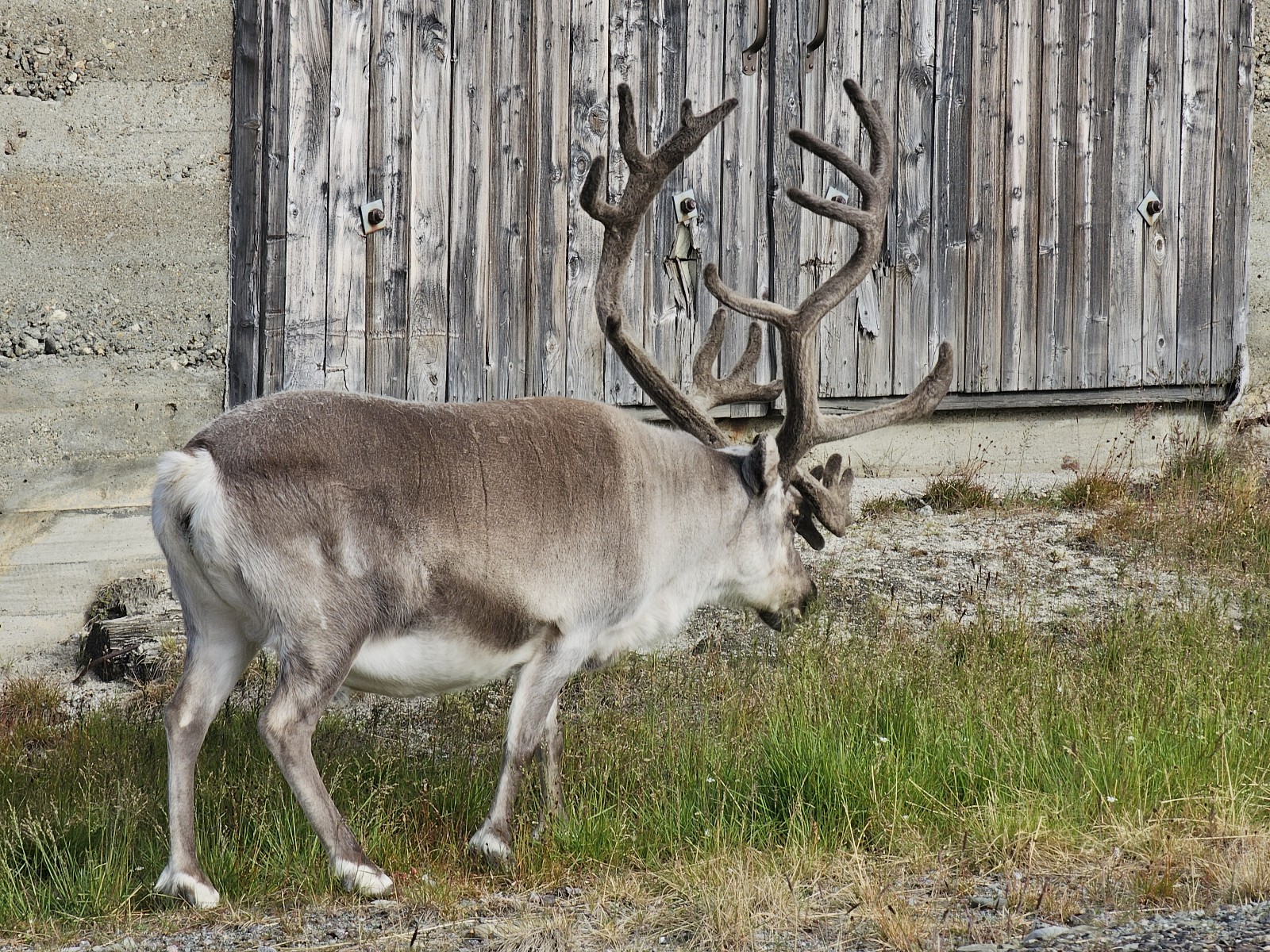
- 002. There were wild reindeer, barnacle geese and even Arctic foxes roaming the streets of Longyearbyen. Once or twice a year even a Polar bear appears but is chased off by the authorities.
-
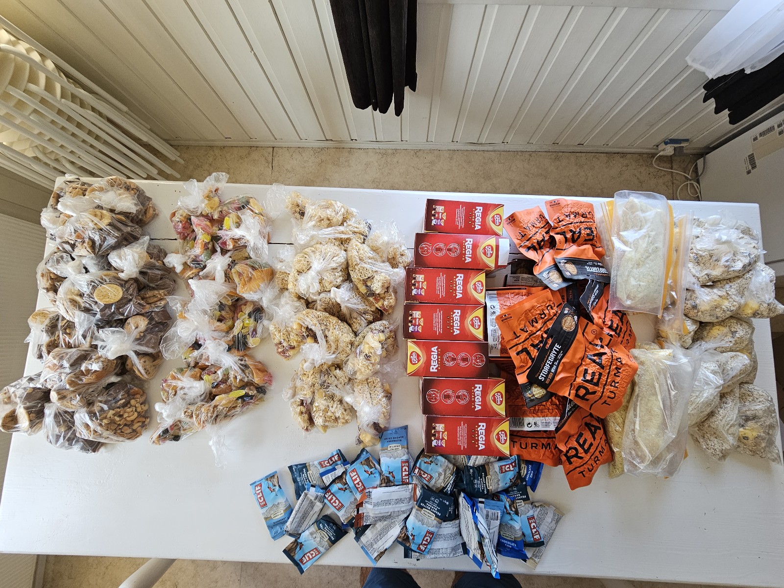
- 003. 15 days worth of food. The 3 piles to the left is snacks and lunch with breakfasts on the right.
-
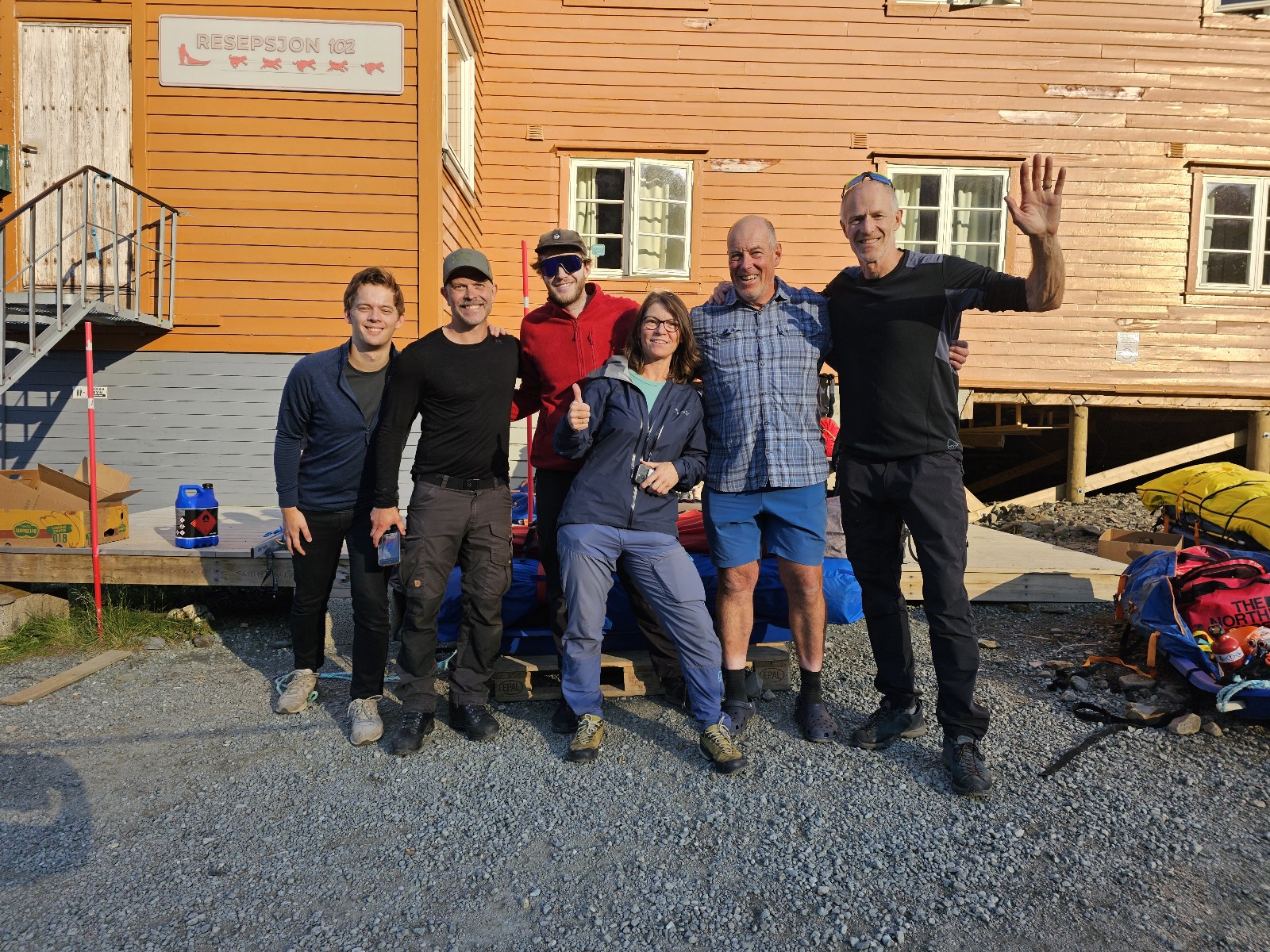
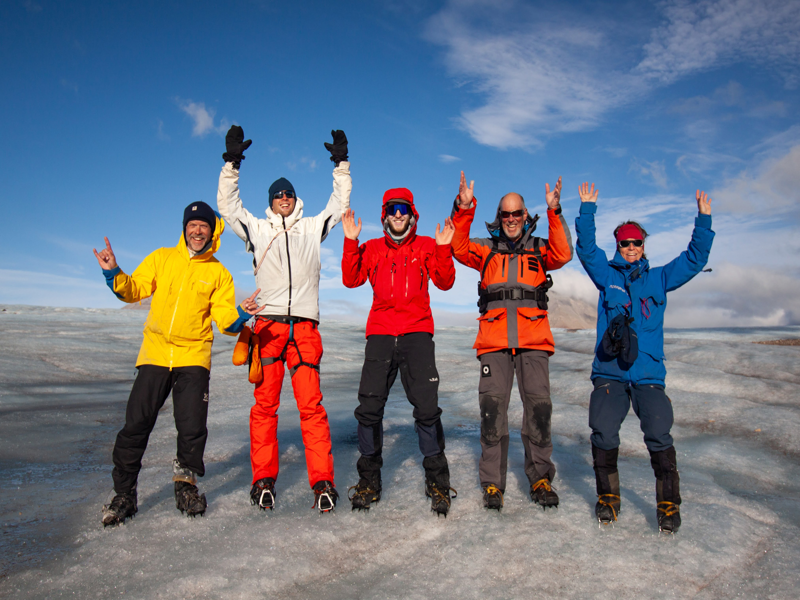
- 004. The entire team. From the left is Jan, Soren, Ross, the Ine Lill the guide slightly to the front, then me, and finally Borge Ousland, the boss, to the right.
-
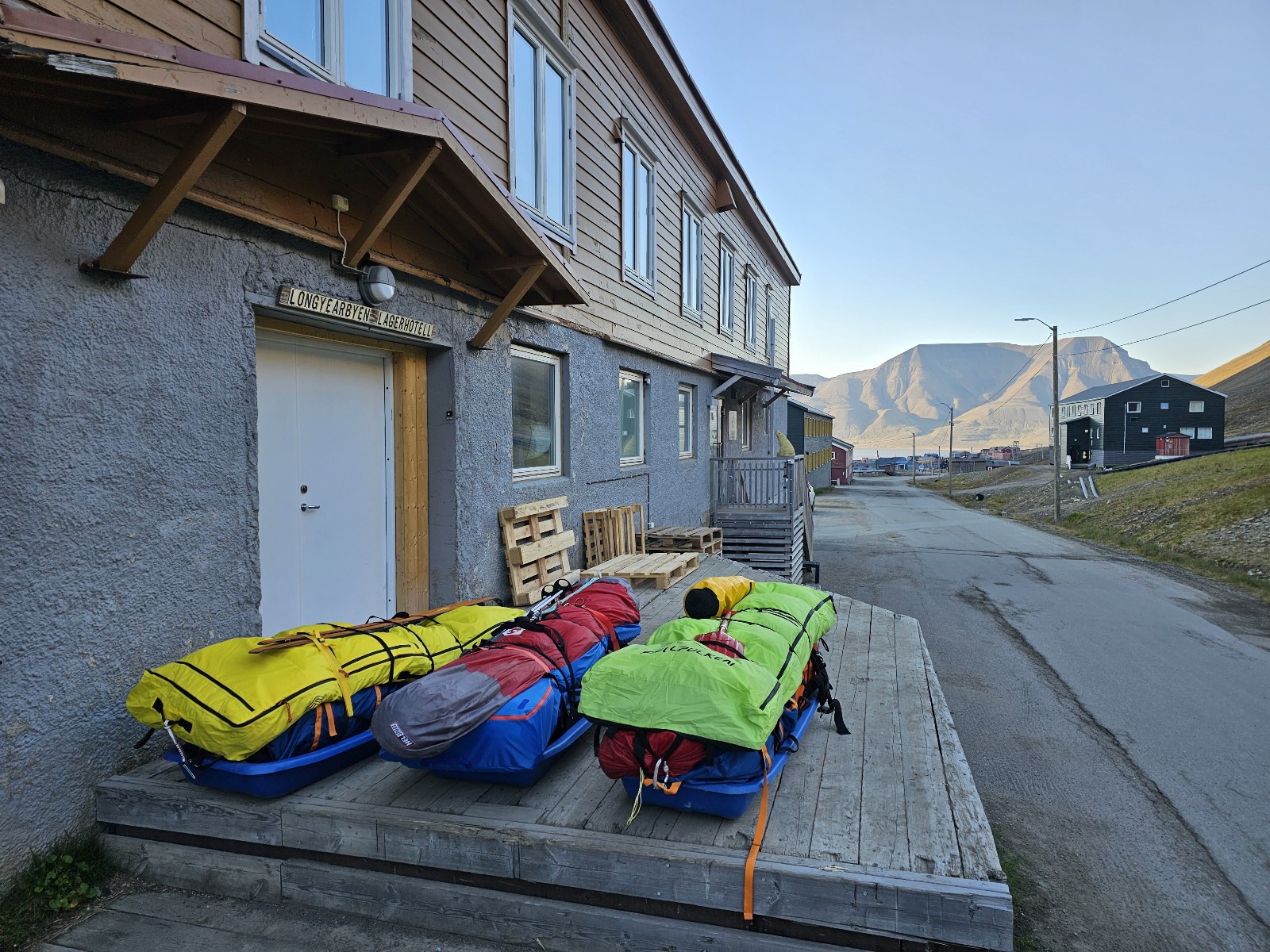
- 005. Three of the 5 loaded pulls outside the Lagerhotell warehouse ready to load onto the boat tomorrow to sail to the expedition’s start at Adolfbukta.
-
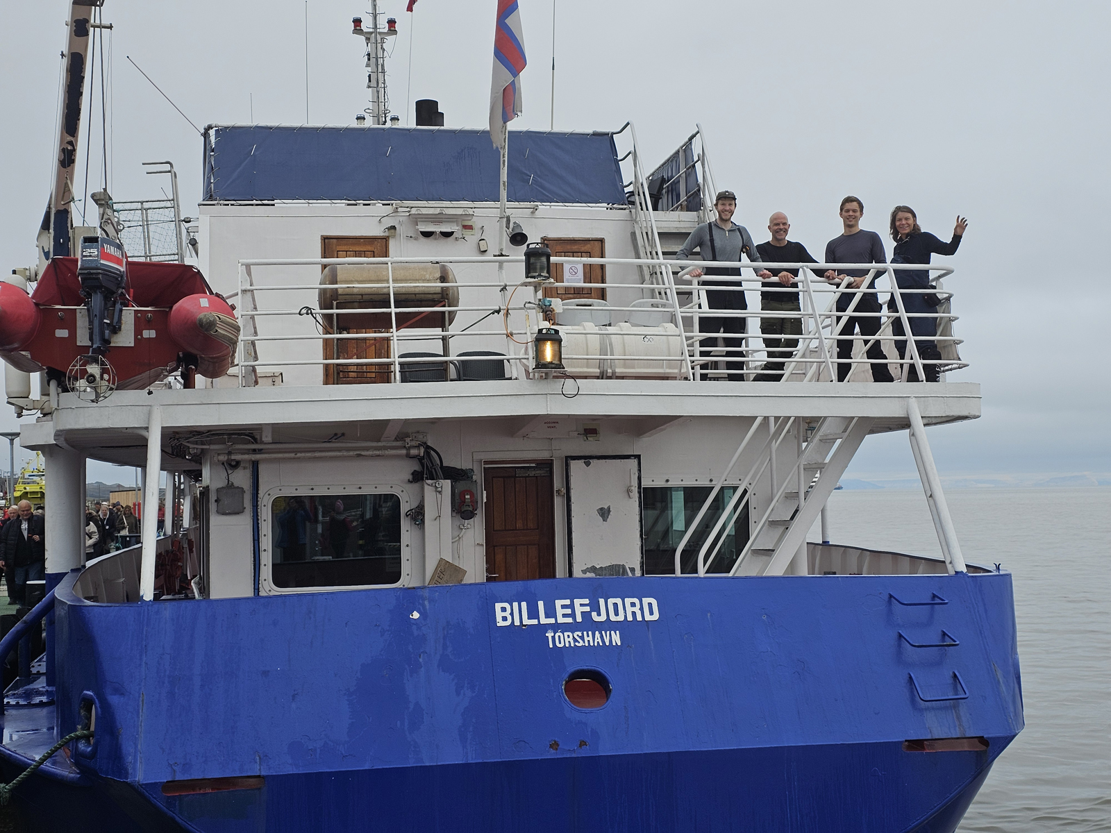
- 006. On the Billefjord boat which took us and all our gear from Longyearbyen to Adolfbukta, where the Nordenskioldbreen glacier entered the sea.
-
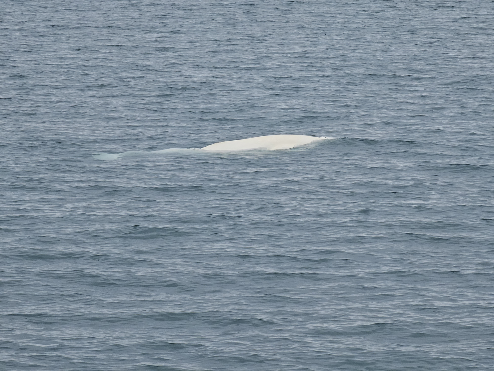
- 007. En route on the Billefjord boat we saw Beluga whales, whaluses and alot of seabirds. Here is a Beluga Whale which do not have dorsal fins so they can get up close under the ice to avoid predatory orcas
-
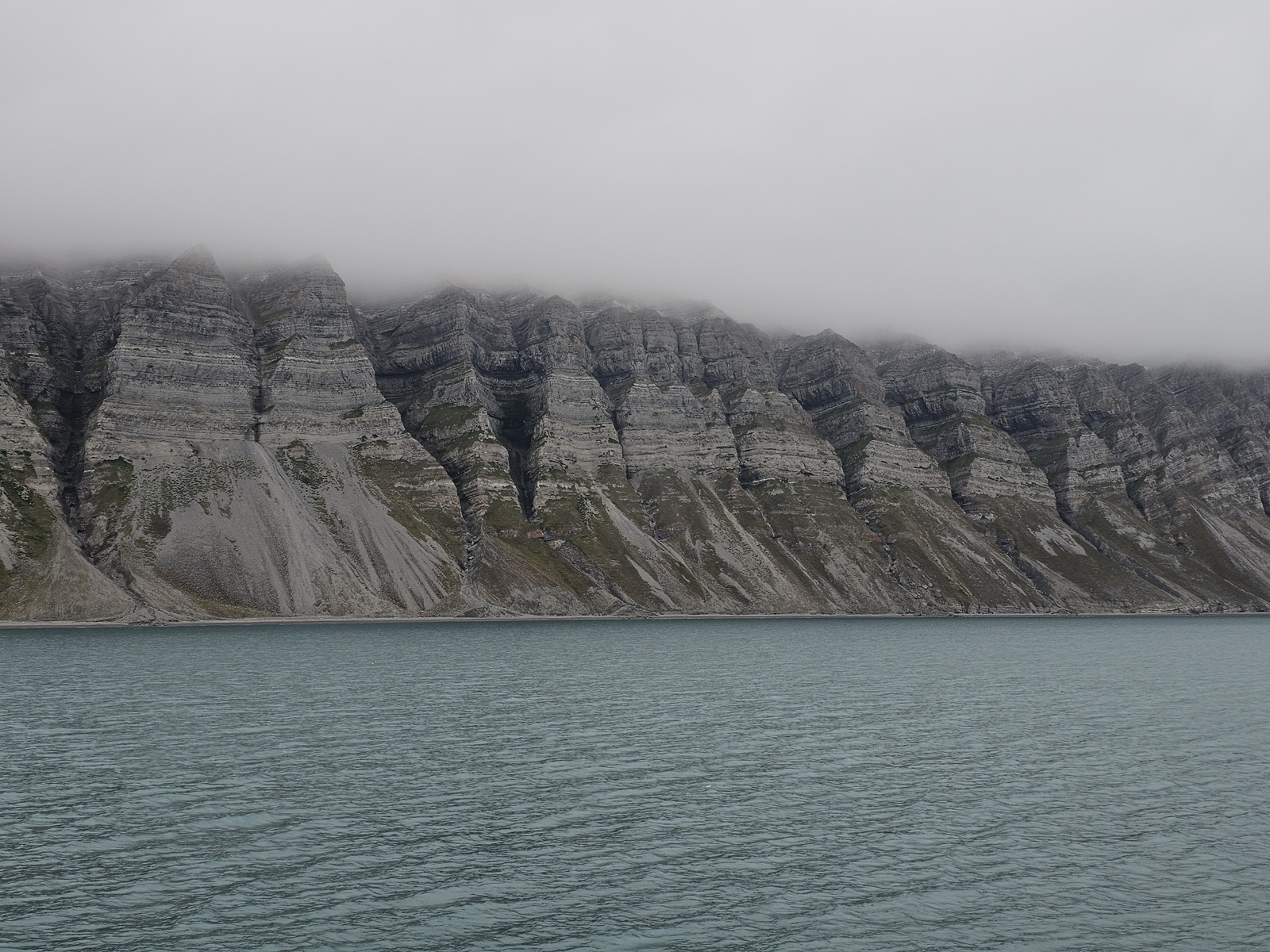
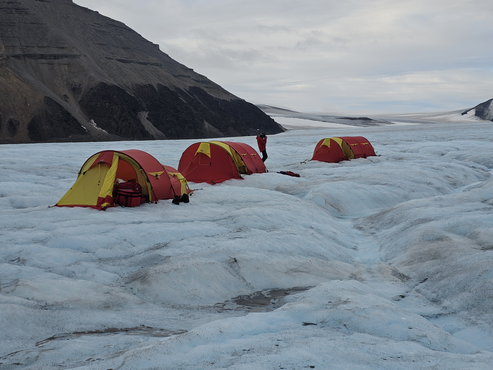
- 008. Because Svalbard is just emerging from the icesheet and has so little vegetation its geology is laid bare. Here are some sedimentary deposits east of Billefjord laid down in the Carboniferious period about 300 million years ago when Svalbard was on the equator
-
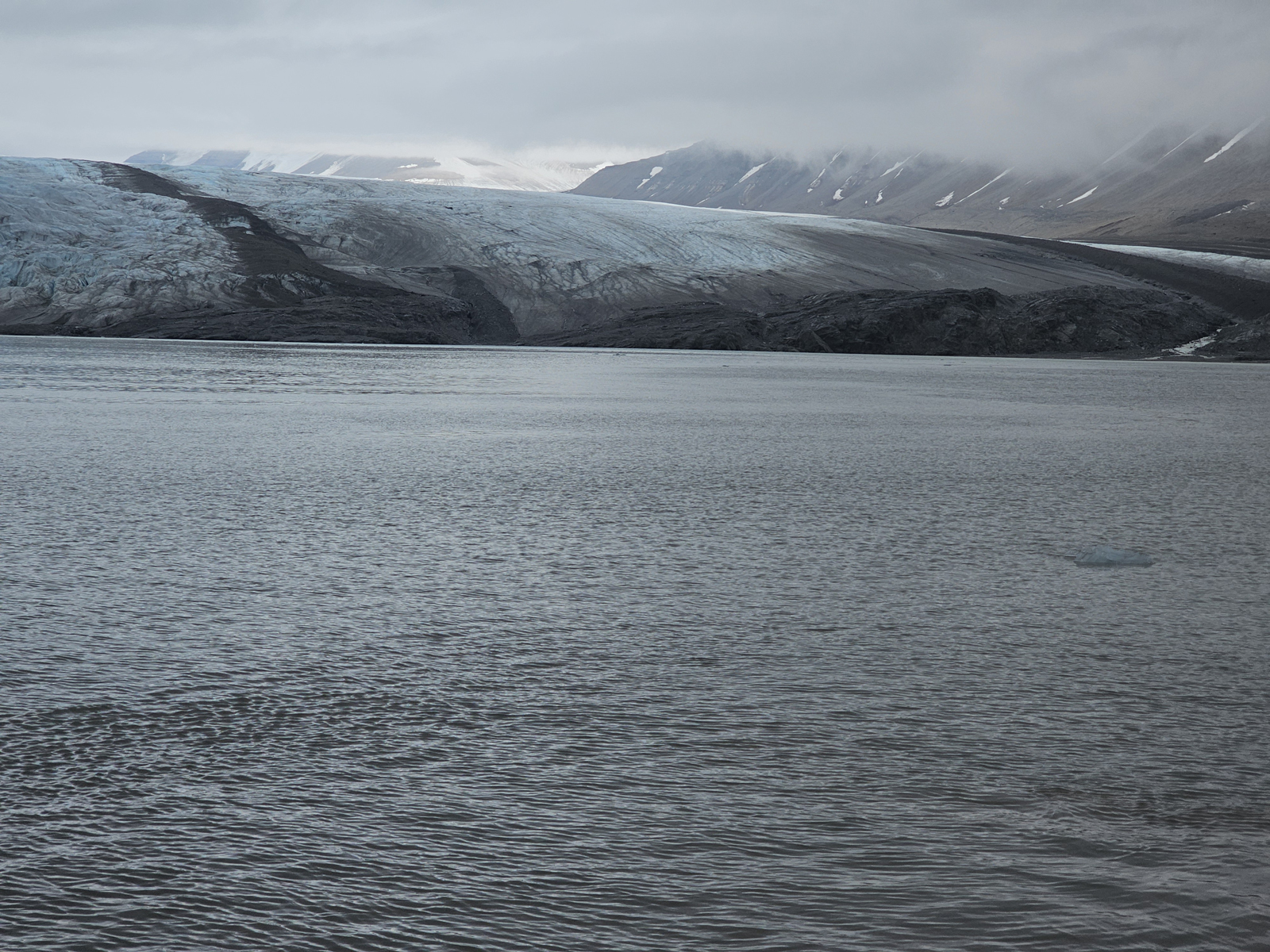
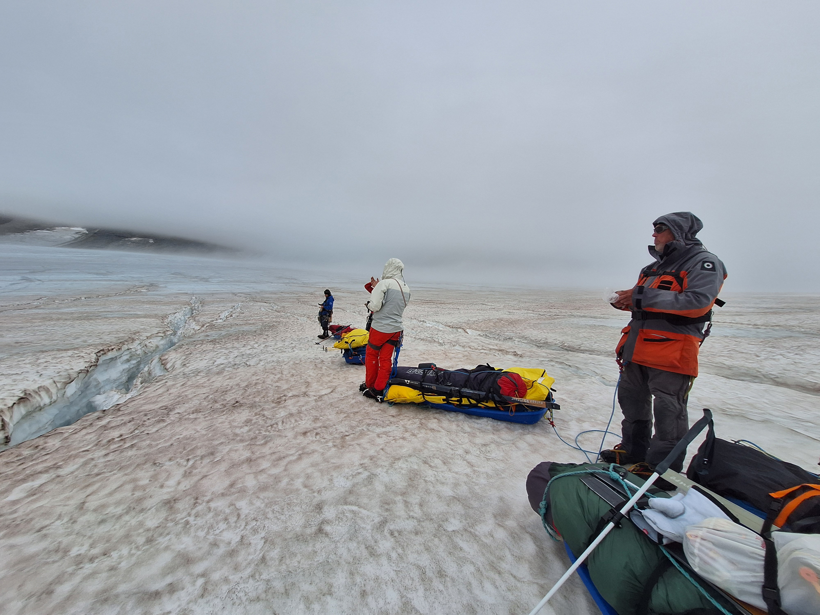
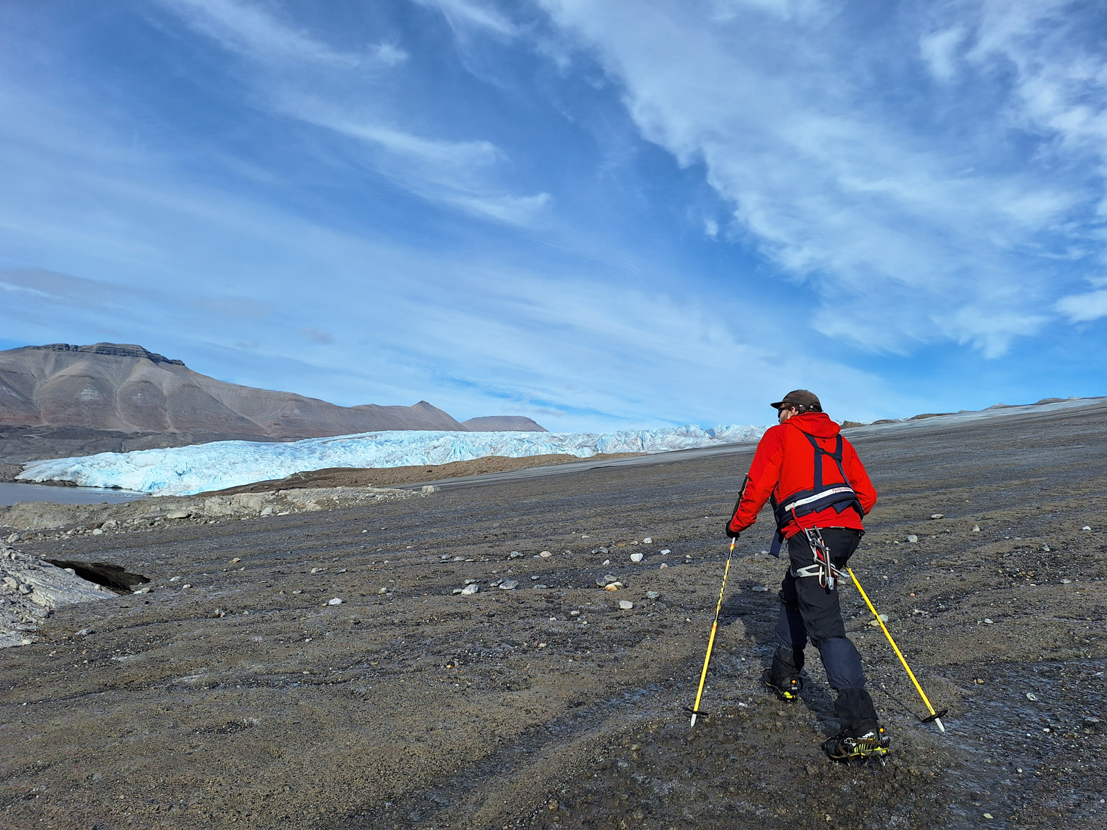
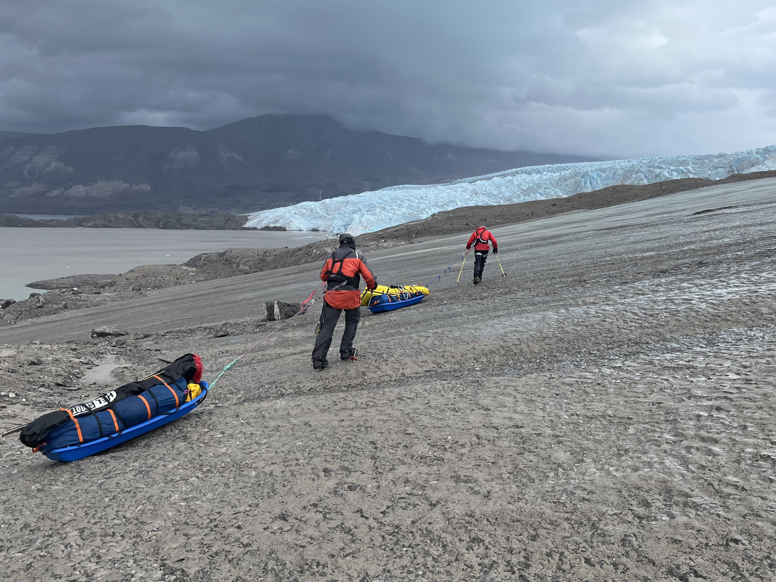
- 009. Approaching the vast Nordenskioldbreen Glacier which calver into the sea at Adolfbukta. We landed where the river came out on the extreme right of the photo
-
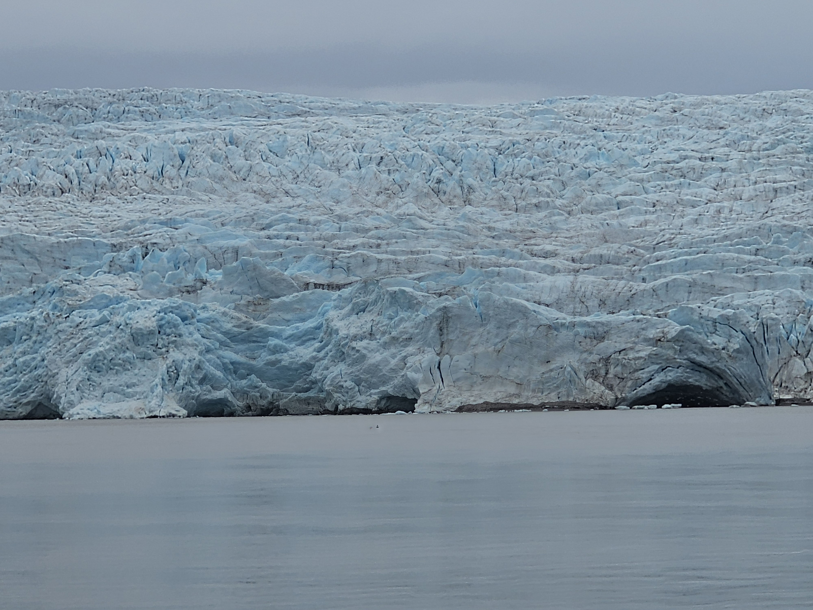
- 010. The main glacial front of the Nordenskioldbreen glacier stilled calved into the sea in Adolfbukta with our landing place to the very south.
-
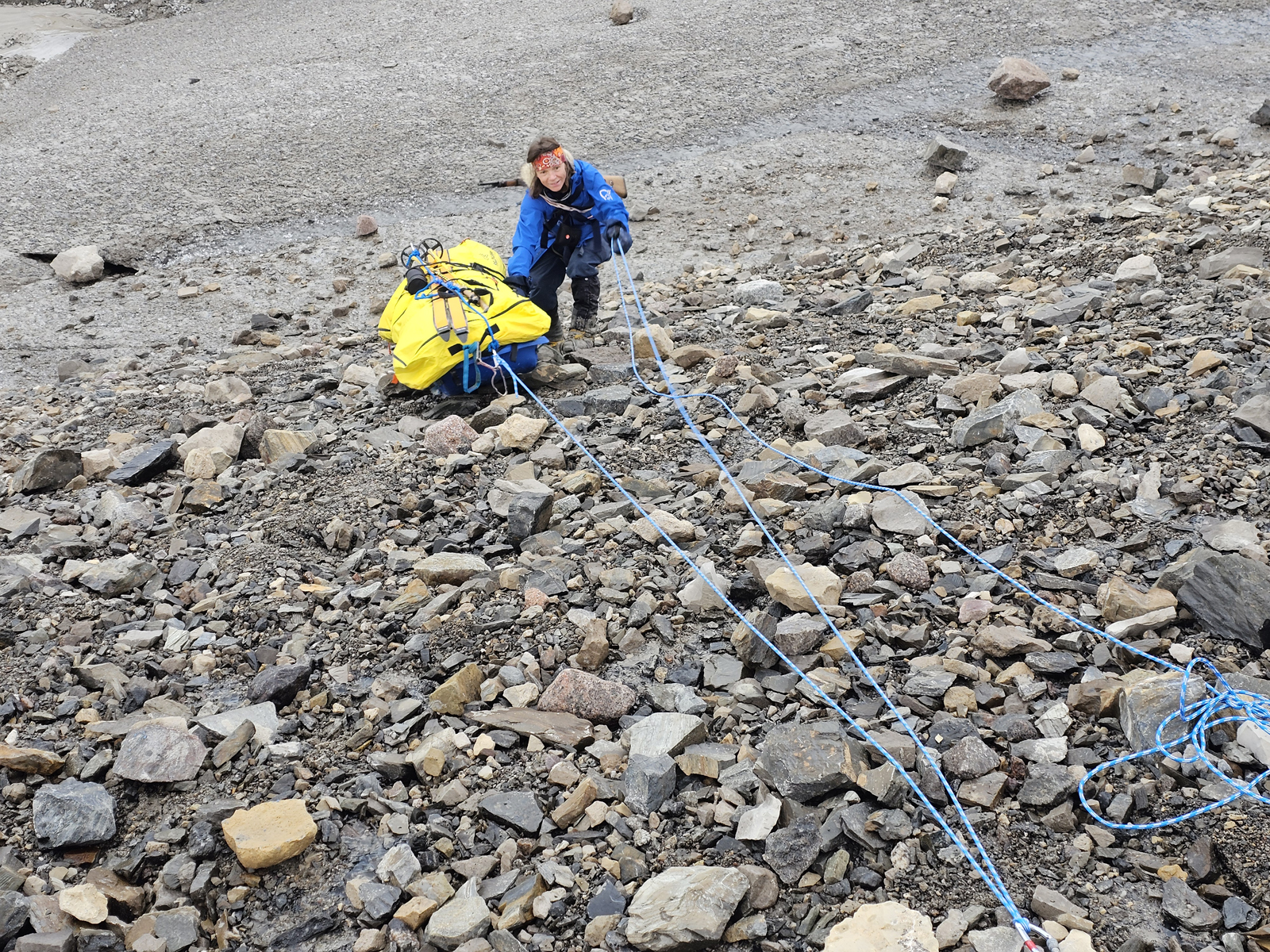
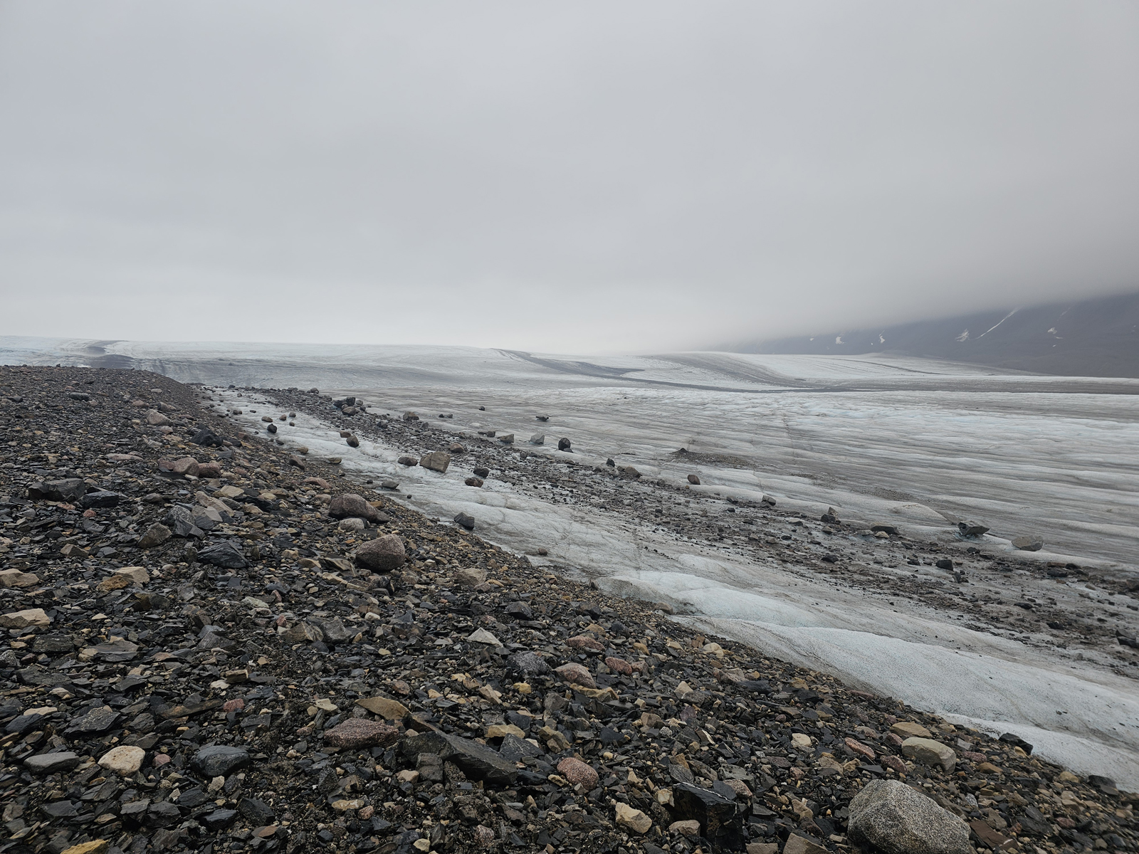
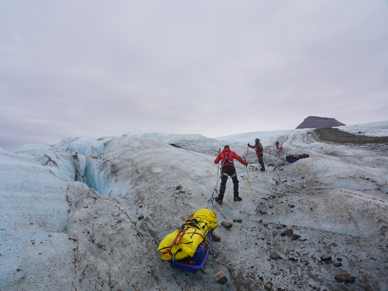
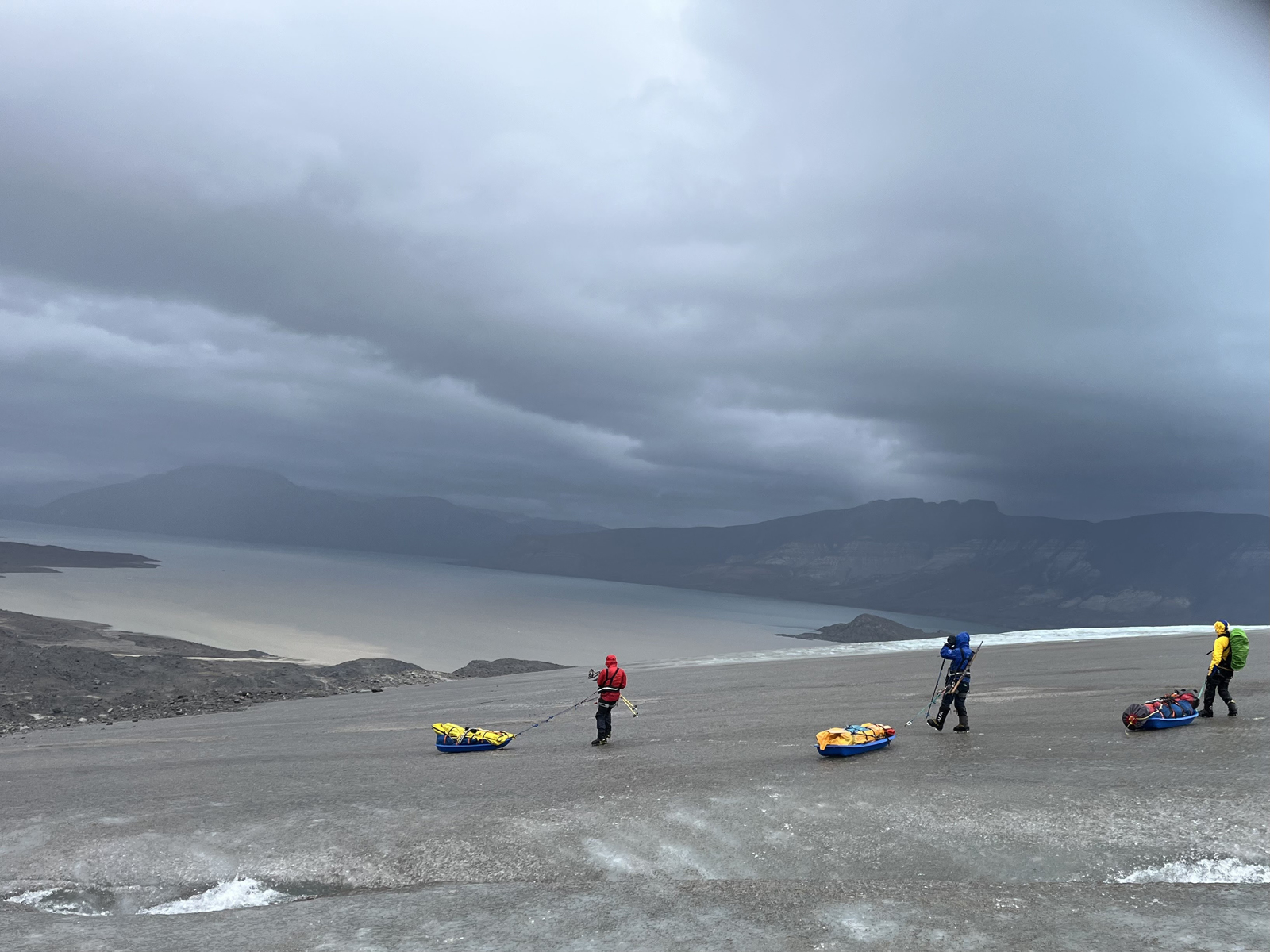
- 011. Once we landed on the beach beside the river on the south flank of the Nordenshiold glacier we had a very difficult 5 hours carrying the pulks up to the bare ice of the glacier across moraine strewn ground for a kilometre.
-
- 012. Camp 1 was just 1.5 kilometres from our landing place but it took 6 hours to get here due to carrying the pulks over the moraine rubble where the glacier had recently retreated.
-

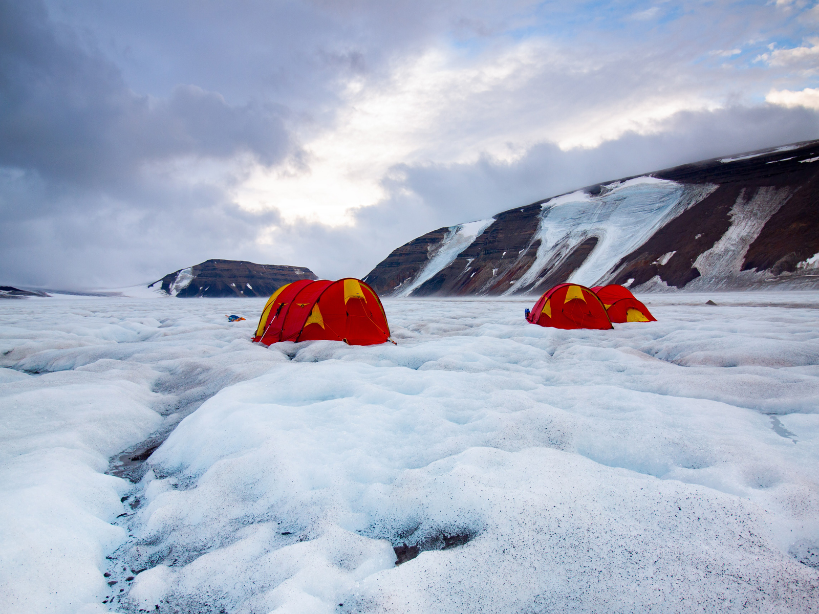
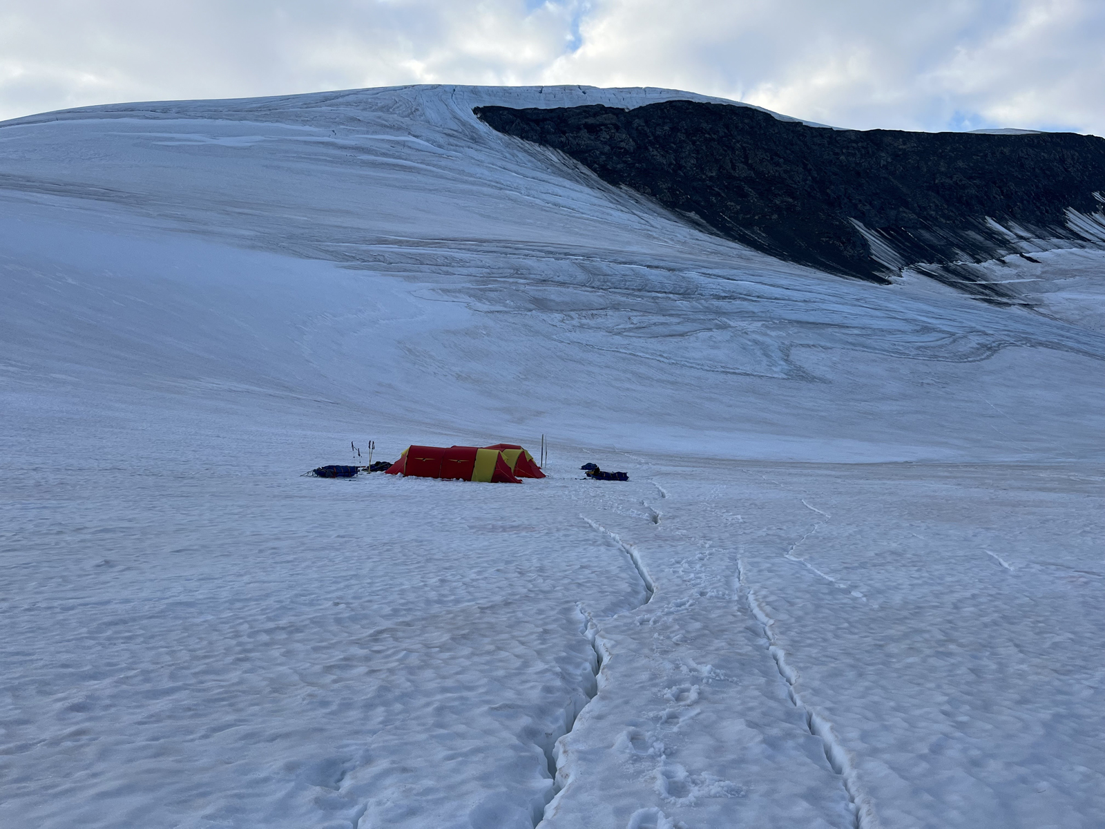
- 013. Collecting cooking and drinking water from the metlwater streams on top of the ice beside Camp 1.
-
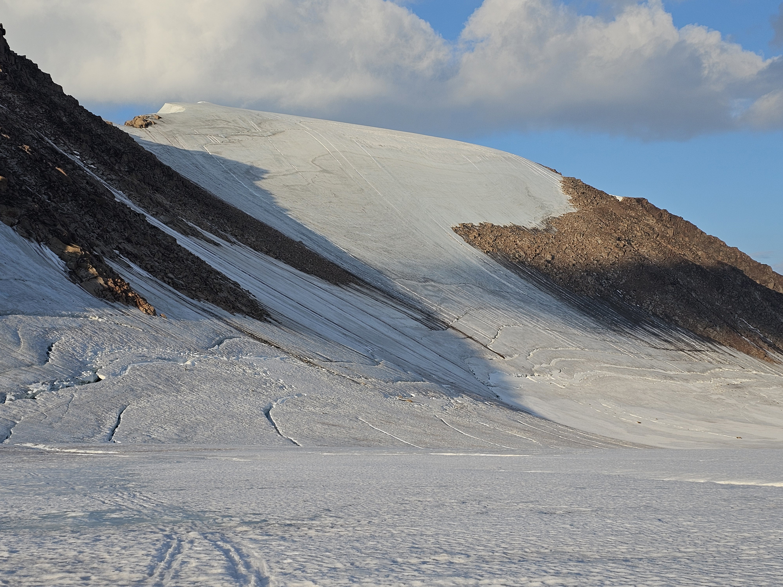
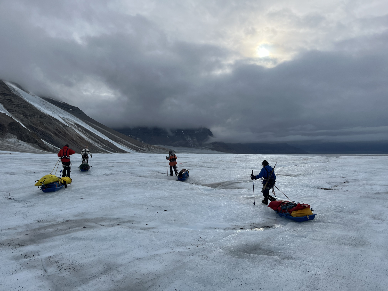
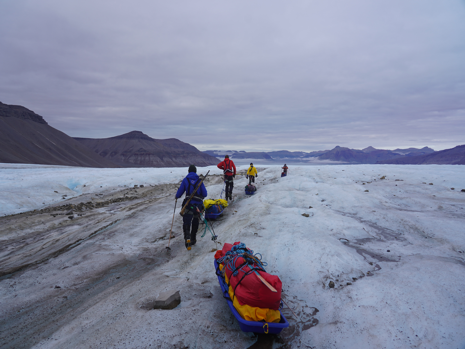
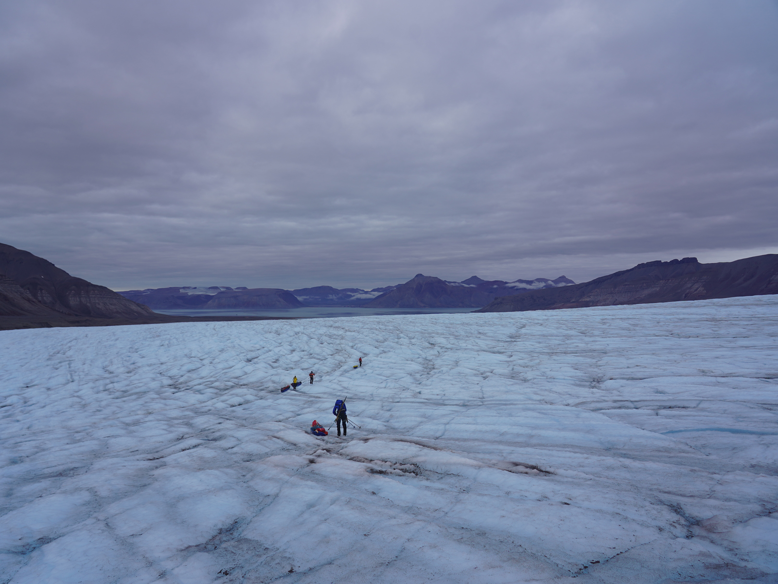
- 014. The Ferriermorenen was a medial moraine in the middle of the glacier, like a stripe. It was some 10 kilometrs long and 30-50 metres wide. This was us crossing it.
-
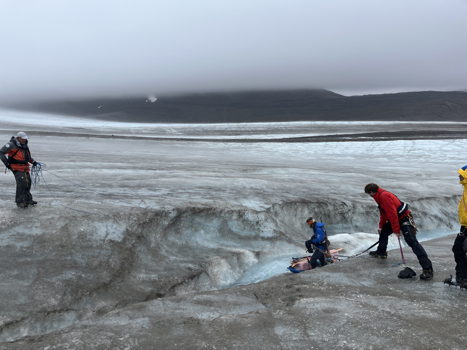
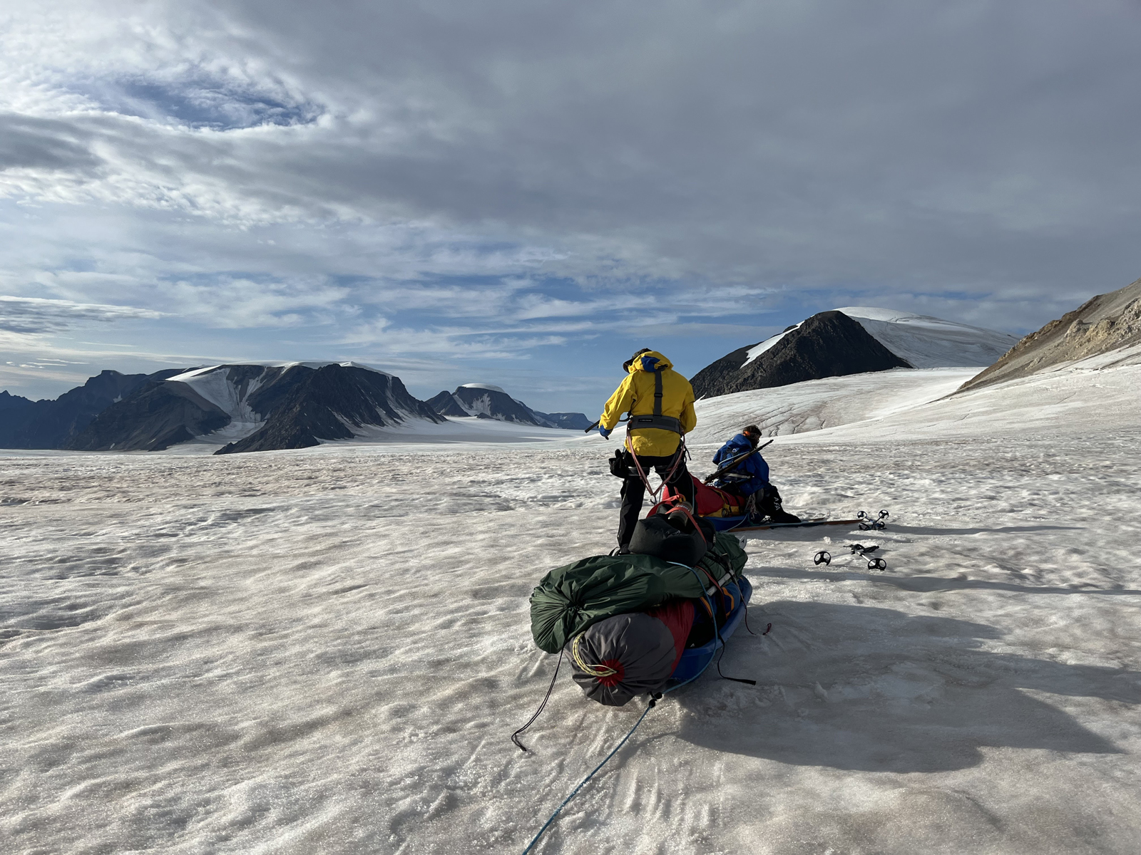
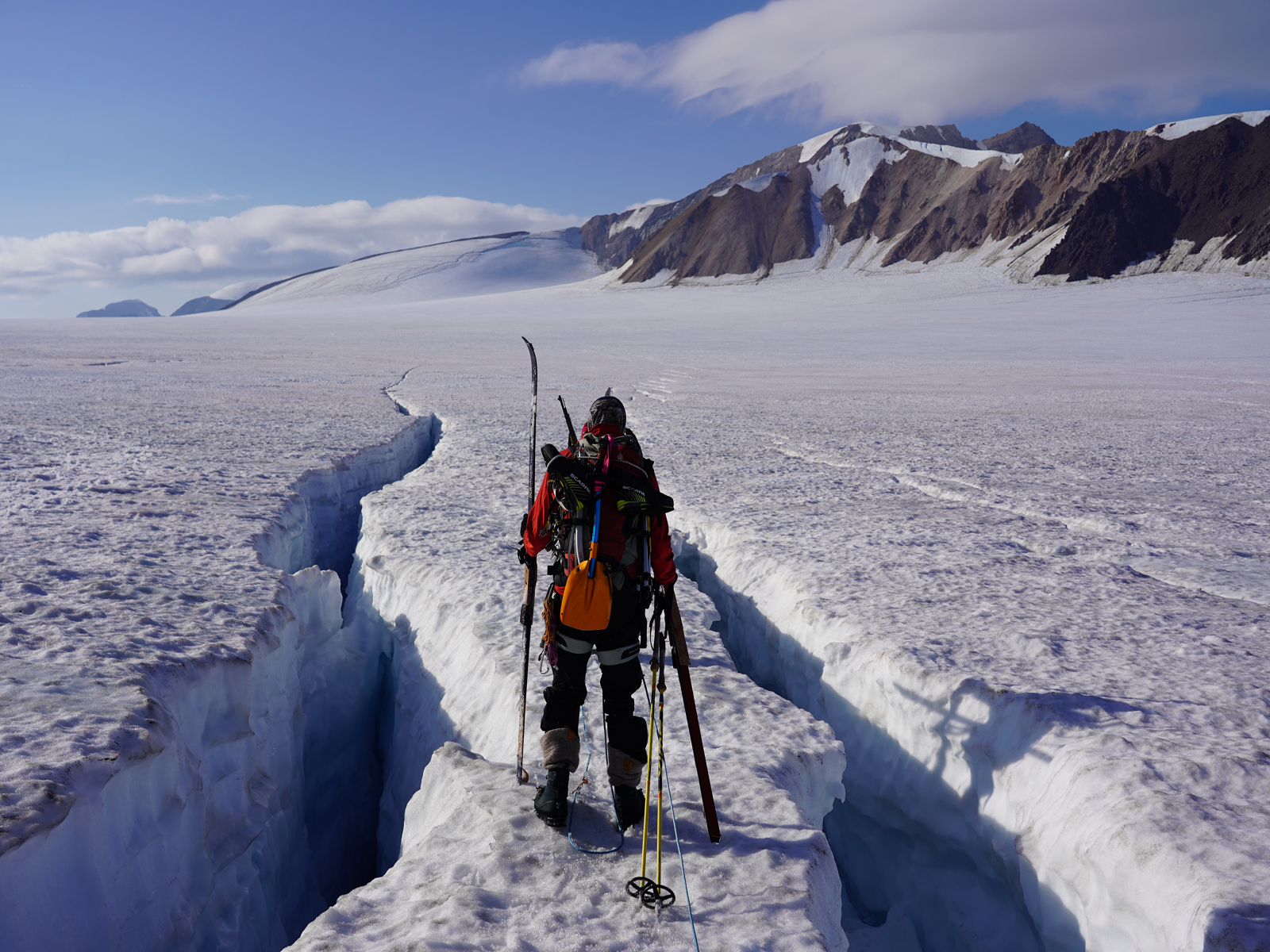
- 015. Not long after crossing the Ferriermorenen we came across this larger surface stream which had to be crossed. The surface streams usually dissapear down a moulin or well to the bottom of the glacier.
-
- 016. Camp 2 was still on the bare ice of the glacier and about 10 km from our landing place on the coast. The next day we would go up the snow covered glacier to the left.
-

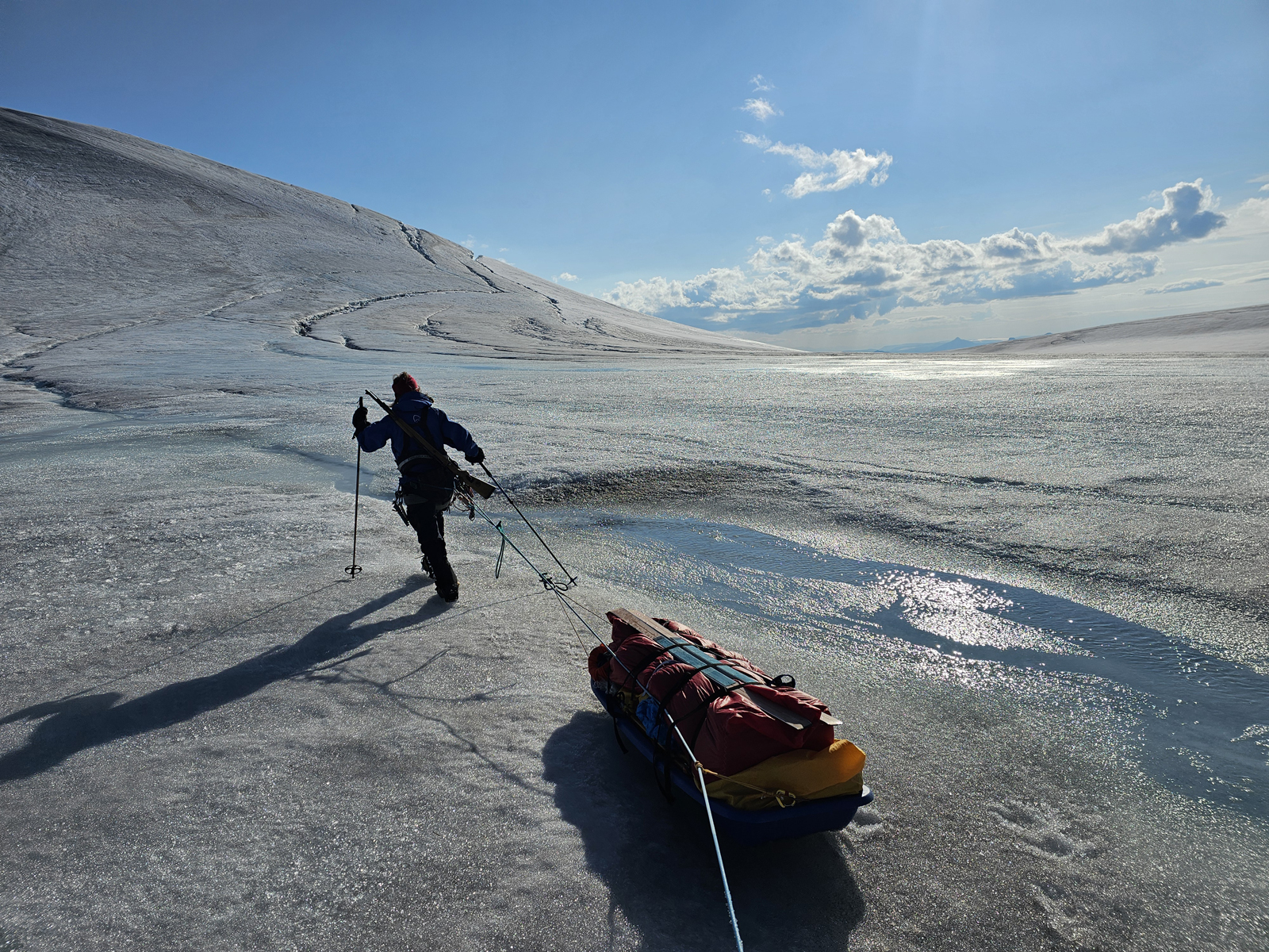
- 017. From Camp 2 we had a few more kilometres of rough bare ice to pull the pulks over until we made it to the first snow patches (on the left) on the glacier at about 700m altitude.
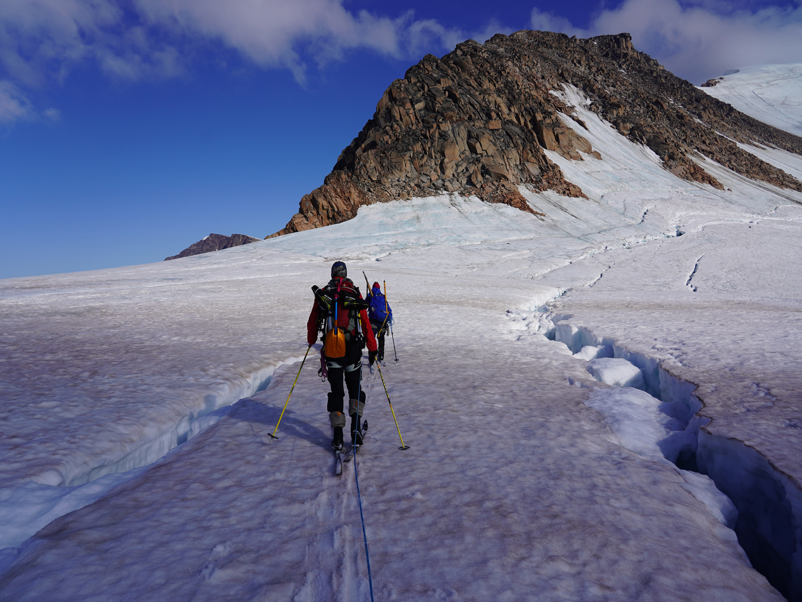
-

- 018. After two and a half days we made it to the first patches of snow at about 700 metres altitude. From here the going was easier but we had to be roped up due to the signigicant number of crevasses
-

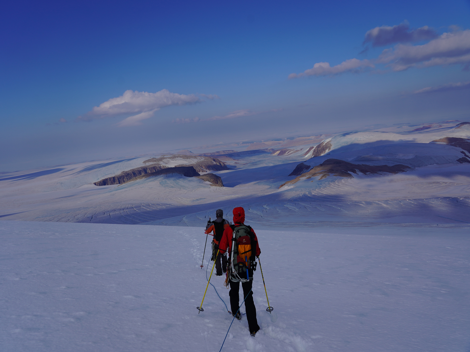
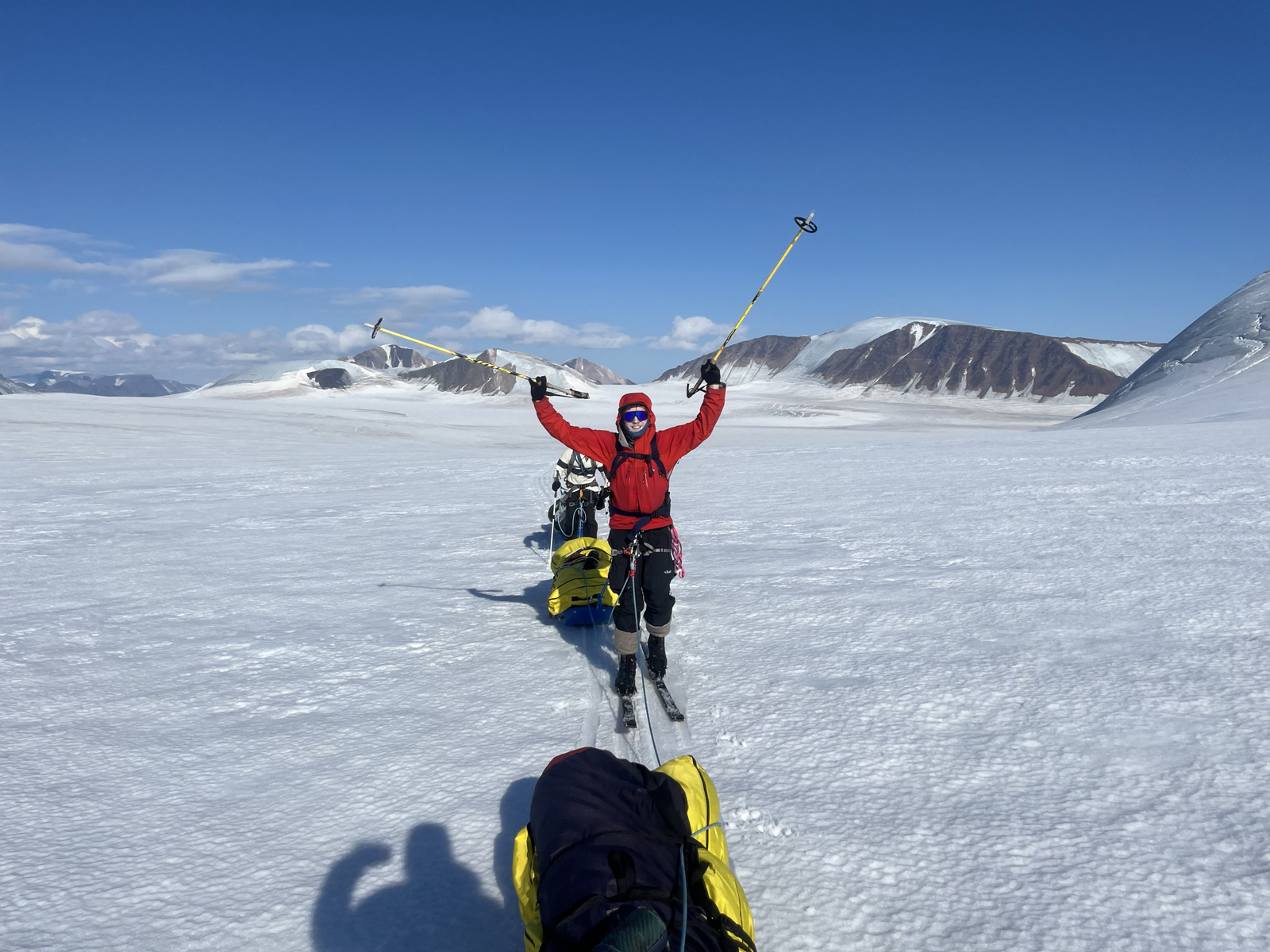
- 019. Looking back down the southern arm of the vast Nordenskioldbreen glacier to Adolfsbukta from about 850 metres altitude where the snow was more extensive. We were all roped now and would remain so for the next 8 days until we returned to this area.
-
- 020. After a hard three days the weather finally improved and we were reached the snow at about 900 metres altitude. This is near Camp 3 and looking south down Tunabreen.There is a small lake ontop of the glacier in the centre
-

- 021. Camp 3 at about 900 metres altitude was a delight. There was enough thermal gain in the tents to dry off most of the bedding and clothing which had become damp over the last days since the start.
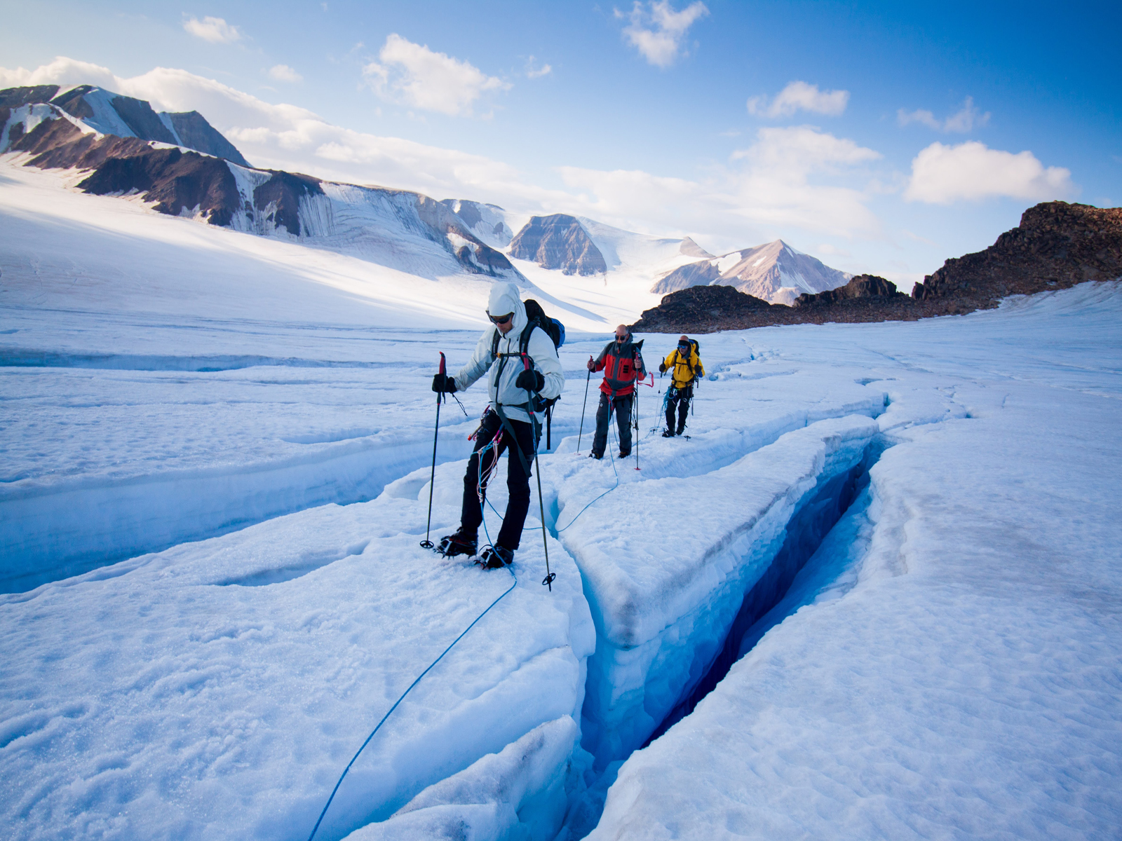
-

- 022. Sking up the slope from Camp 3 onto the the southern part of the the large Lomonosovfonna Icecap which we would follow north towards the the south part of the Atomfjellet Mountains. There were frequent crevasses here.
-

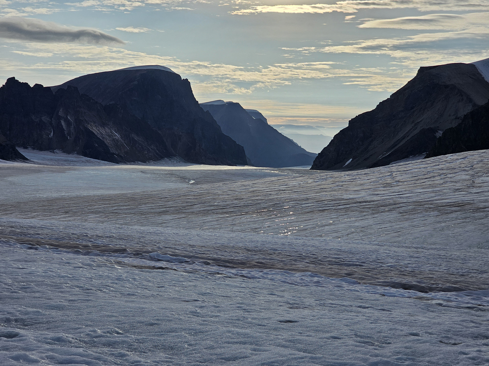
- 023. Looking back to Camp 3 and then beyond down the long Tunabreen Glacier which eventually reached the sea at Templefjorden
-

- 024. Repairing the first of Ross’s skis which were hired.The central part of the ski had rottened due to water ingress over the last years and well below standard.
-

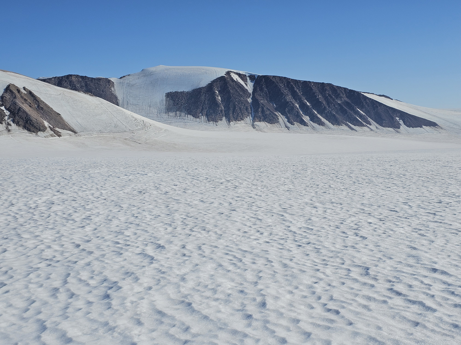
- 025. Looking down the northern arm of the Nordenskioldbreen glacier which joins with the central and southern arms and then flows on to the sea at Adolfbukta. The mountain is Robertfjellet, 1118m.
-

- 026. Camp 4 in the evening sun. The mountain in the background is Terrierfjellet, 1201m, not to be confused with Ferrierfjellet which is out of sight behind it to the south.
-

- 027. Camp 4 in the morning with the mist enveloping everything. Shortly after leaving camp we encountered some big crevasses which was not easy in the thick mist as crossing place options were not visible.
-

- 028. By midmorning most of the mist had burnt off and the sun was strong. We skiied on the west side of the crest of Lomonosovfonna icecap largely parallel to the crevasses.
-

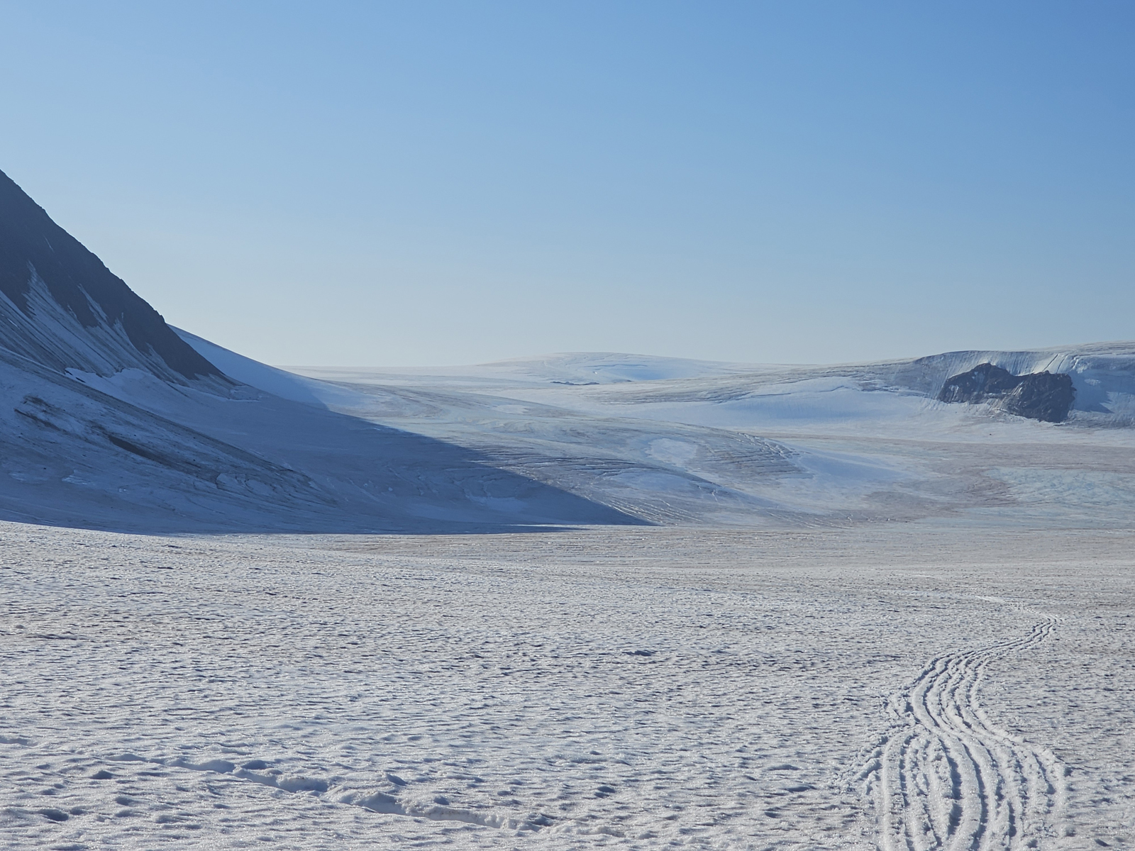
- 029. Skiing along the west flank og Lomonosovfonna icecap and looking west over the nearby Oberonhamaren nunatak, emerging from the ice, towards the ,ountains of Dickson Land on the west side of Austfjorden
-

- 030. Ine-Lill leading at the front and then Ross and Jan next with me at number 4 and Soren at the back skiing roped up across the the Lomonosovfonna Icecap heading north towards ther Atomfjellet mountains over the horizon.
-

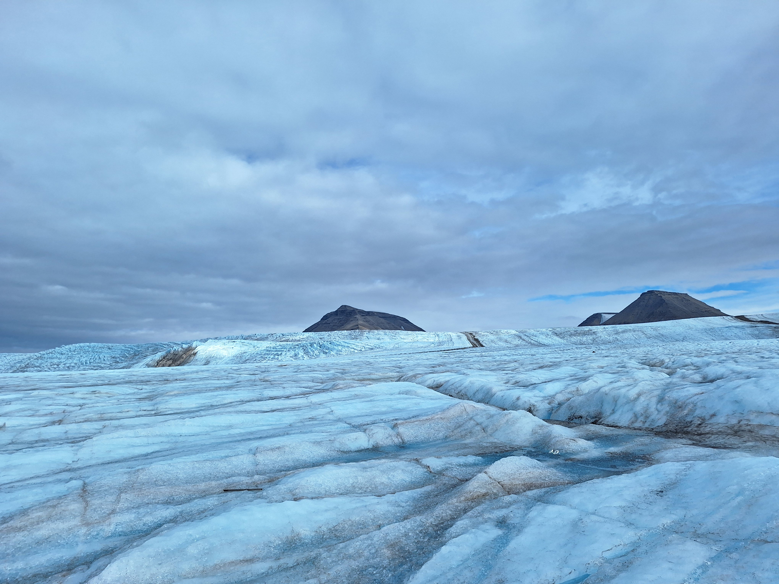
- 031. Lookinn north from the north end of the Lomonosovfonna icecap to the Atomfjellet mountains on the left. From the right is Saturfjellet, then Tethysfjellet and in the pictures middle Titanfjellet. Titanpasset is between Tethysfjellet and Titanfjellet heading right.
-

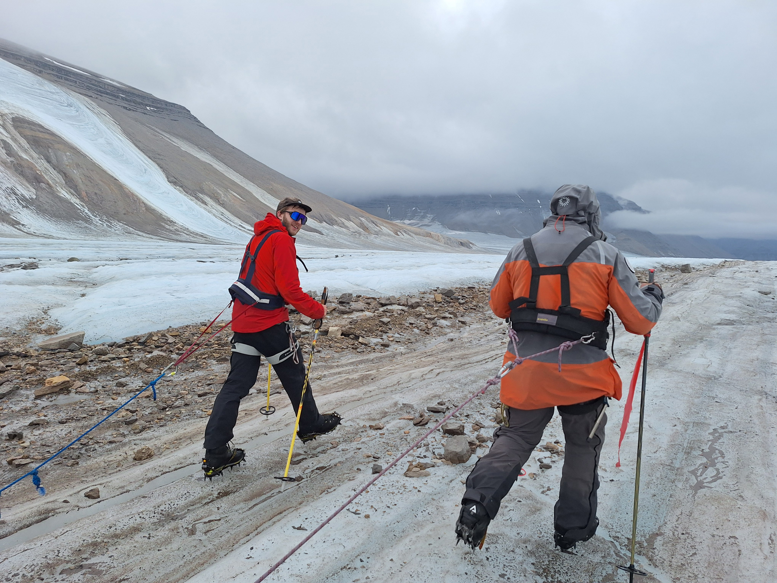
- 032. Heading north towards the Atomfjellet mountains. On the left the enourmous Harkerbreen Glacier heads west down to Austfjorden. On the centre right is Titanfjellet with the inviting Titanpasset heading up to the right before it.
-
- 033. About to descent into the bowls which fed the Harkerbreen Glacier which then headed odon to Austfjorden on the extreme left. We called these bowls “death valley” on account of the hundreds of crevasses here. On the middle right is Wainfletefjellet, 1464m.
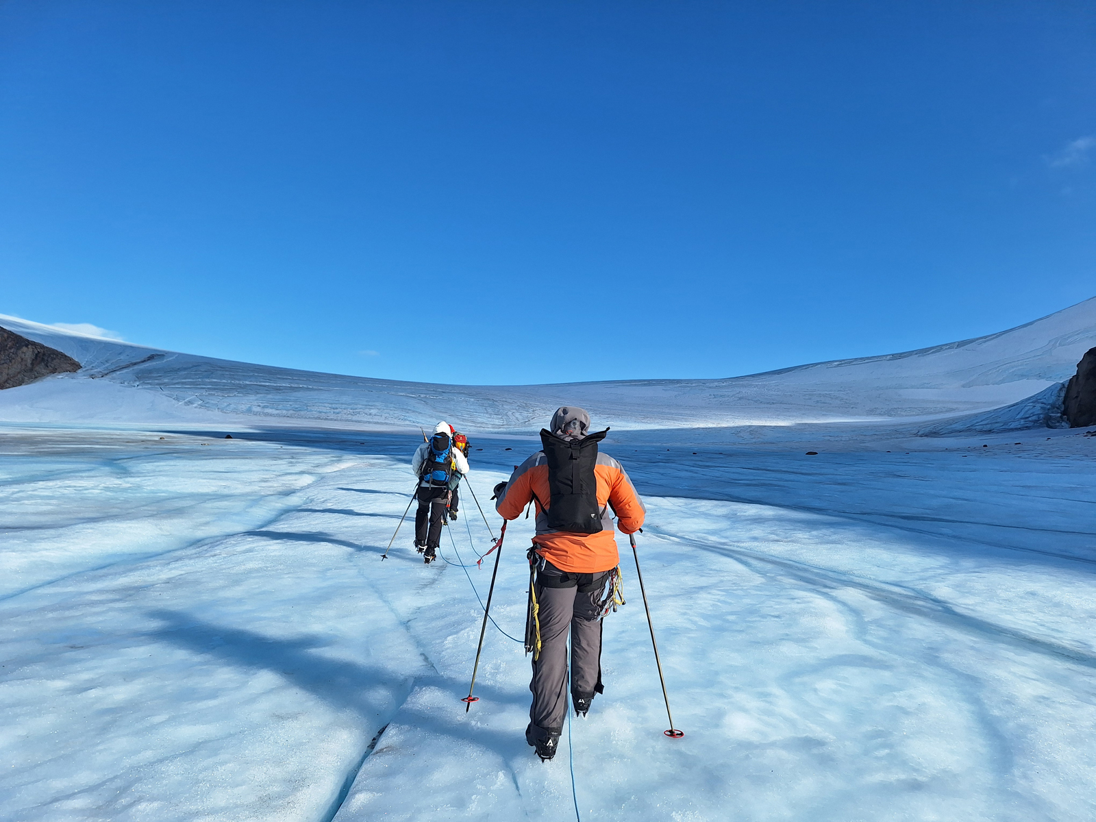
-
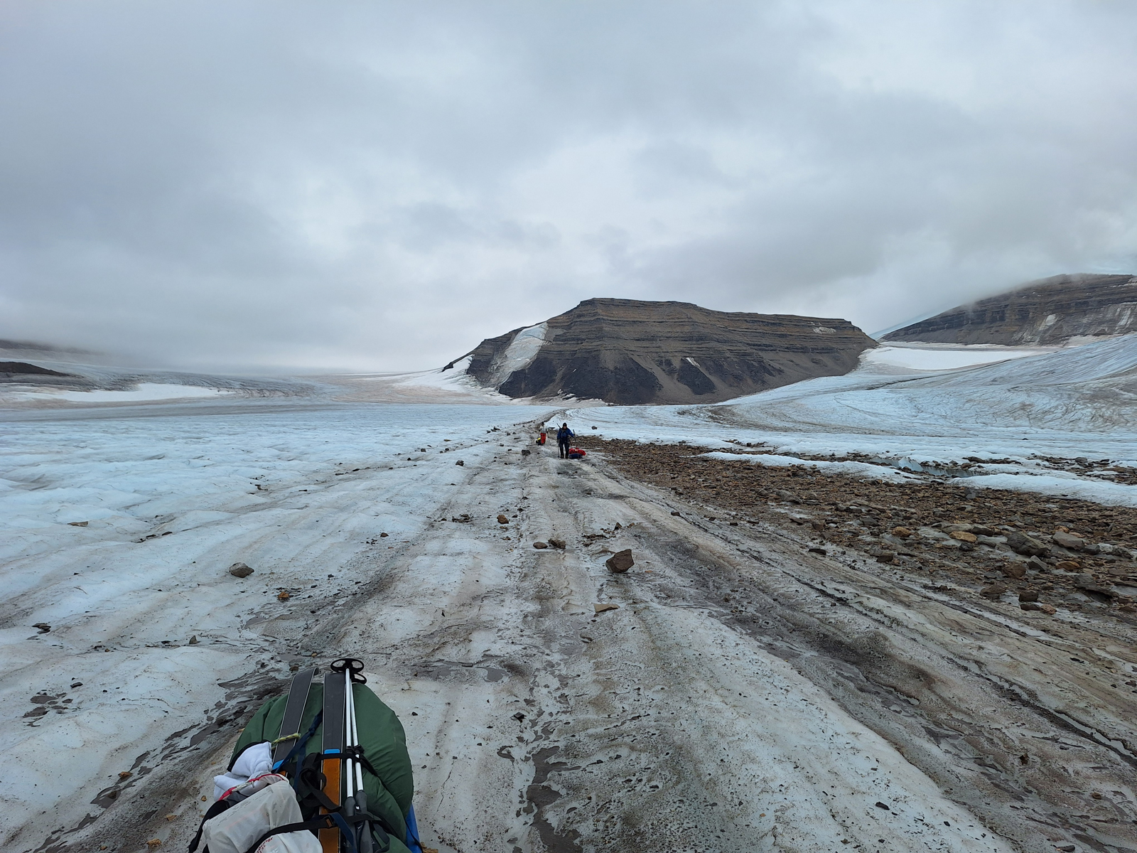
- 034. Looking down Harkerbreen Glacier as it flowed down its slot towards Austfjorden. The photo was taken in the evening as we crossed one of the crevassed bowls west of Wailfletfjellet.
-
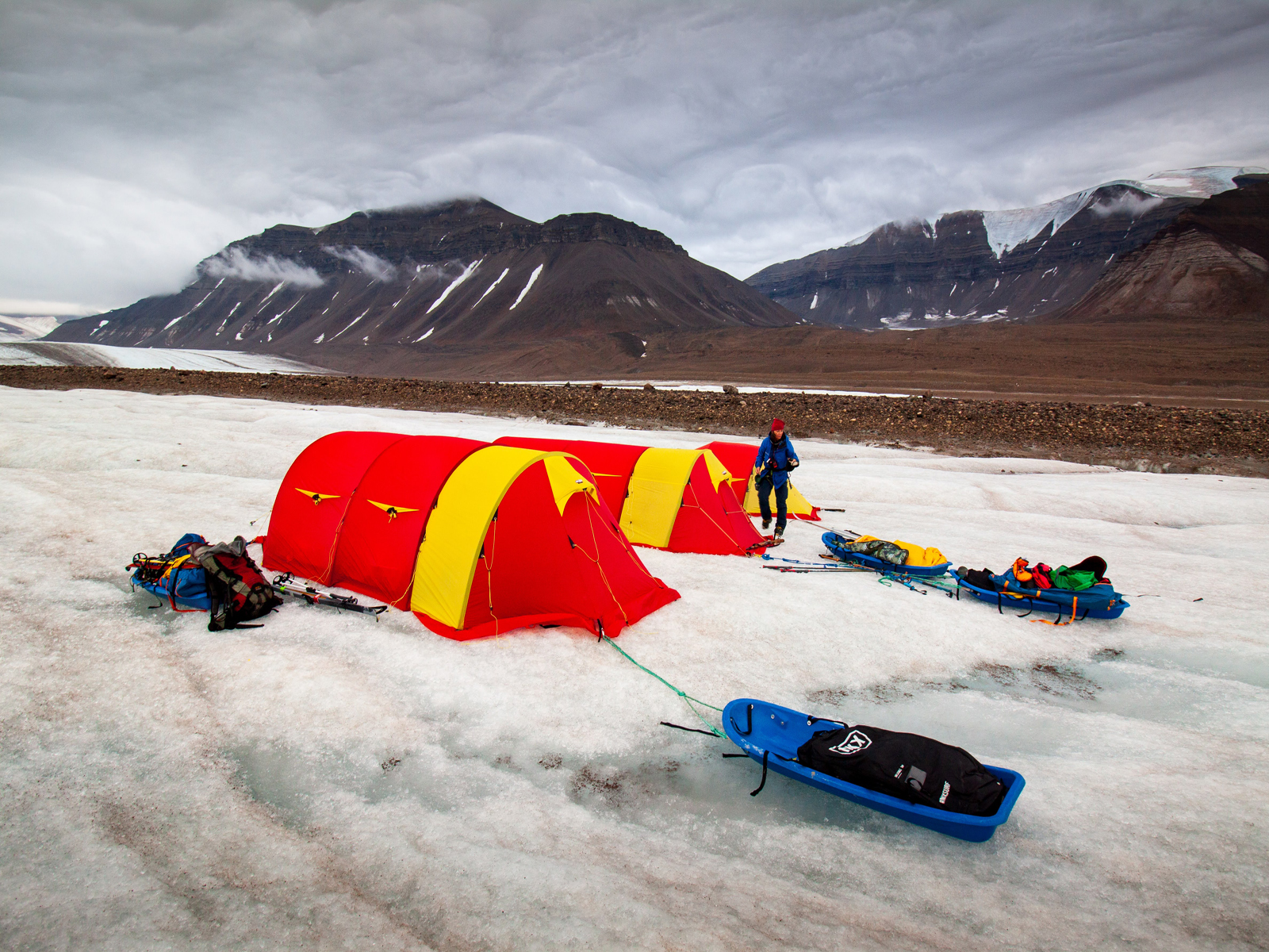
- 035. Negotiating one of the hundreds of the crevasses we passed in “death valley” on the west side of Wainfletefjellet. The mountain centre and left is Bleigen. 1504m.
-
- 036. Looking from Camp 5 towards Bliegen, 1504m. as we headed out of the crevasse zone in “death valley” and started to climb to Stuttbreen Glacier.
-
- 037. Our campsite, Camp 5, on the climb from “death valley” on the right (south) up to Stuttbreen Glacier on the left (north). The mountain in the background is the north end of Wainfletefjellet. There small crevasses came in handy for the toilet.
-
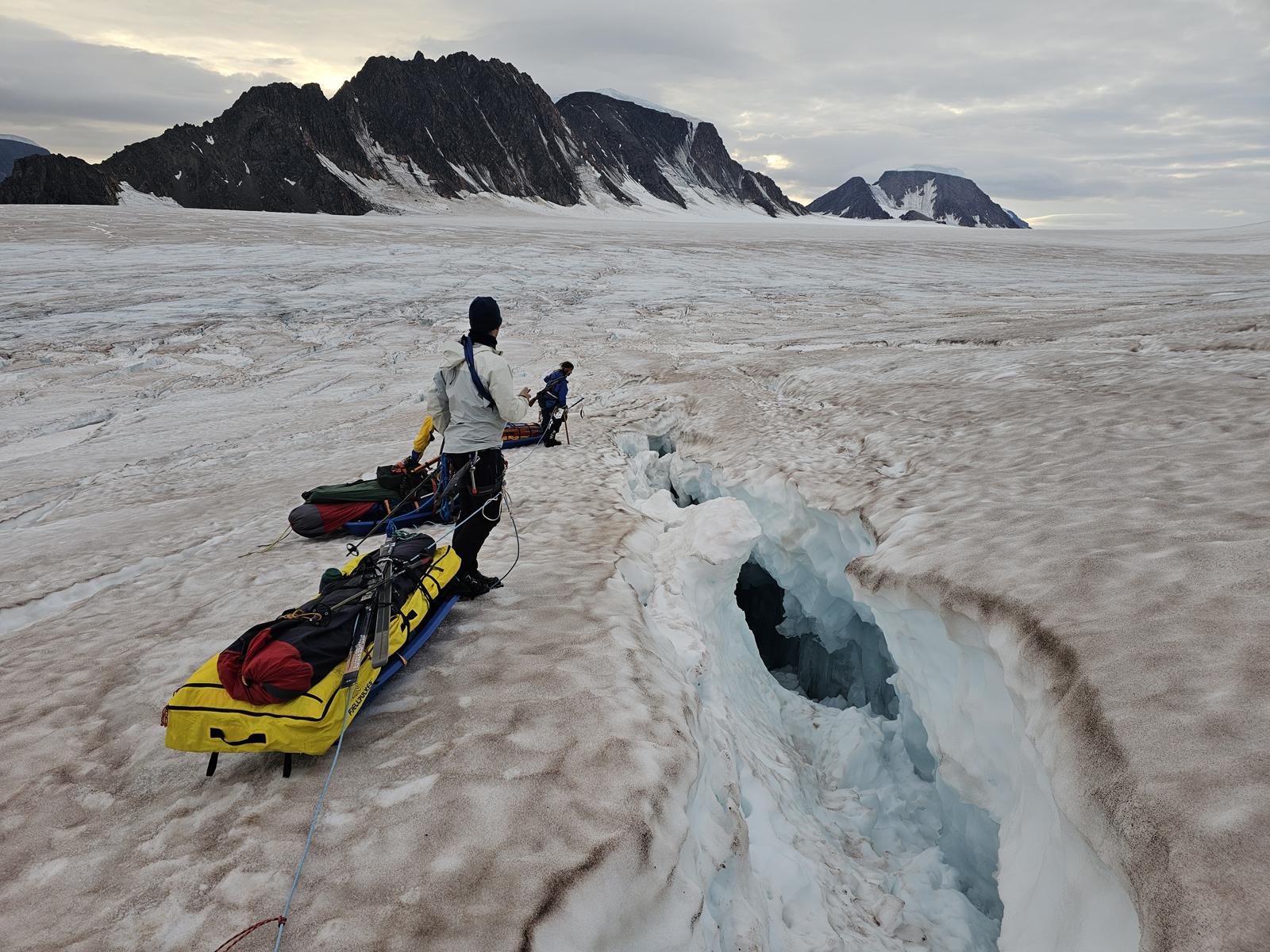
- 038. Loking back to our campsite, Camp 5, and the route we took last night down “death valley” on the west side of Wainfletefjellet. The crevassed bowl shown was the last and lowest of 3 icy bowls we had to negotiate
-
- 039. Having skied up the slopes of Stuttbreen to a pass on the south side of Dieierfjellet, 1456m, (left) we wewre face to face with Newtonyoppen, 1712m. Our Camp 6 was in the middle of the photo and from here we started the ascent up the mountain in the early afternoon
-
- 040. Having set up camp 6 at midday we had something to eat and then set off to climb Newtontoppen (pictured) in the early afternoon knowing the camp was already established for our return in the evening.
-
- 041. From our Camp 6 we had to climb up to a glaciated pass between Didierfjellet and Newtontoppen to get to the start of the ascent of the latter. The pass was quite heavily crevassed
-

- 042. It was sometimes best to take the skis off as the snow icy and the route through the crevasses was quite convoluted. We were heading into the bowl or cirque in the middle of the photo on the north side of the mountain.
-
- 043. Often when a crevasse opens there is a tear of ice from one side to the other. There is a tiny one to the left of Ross and a much bigger one across which we are walking.. This tear is not a bridge of snow but solid firm ice right to the bottom of the crevasse
-
- 044. Heading across the melt water at the bottom of the bowl or cirque on the north side of Newtontoppen. The meltwater had filled in all the crevasses here and often refrozen so it was very safe. Out route now went to the saddle above.
-
- 045. As we approached the saddle between Newtontoppen and Makarovtoppen on the northside of the massif the glacier was covered in crevasses and we had to weave back and forth to find crossing points
-

- 046, The crevasses on Newtontoppen continued nearly all the way to the top as the glacier which covered the mountain moved at different speeds down the slopes tearing and shearing slowly as it went
-
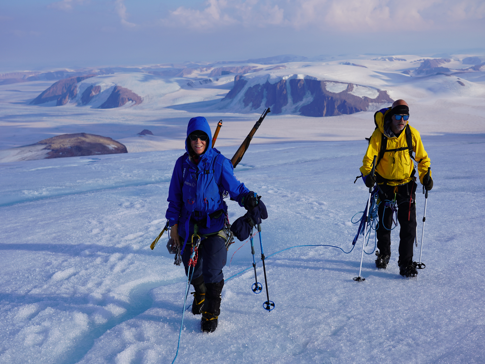
- 047. Looking SE down the east ridge of Newtontoppen towards the arterial Kvitbreen Glacier which drained the whole area. Between Ine-Lill and Soren is Hopfjellet. 1370m and to the very right is Keplerbreen glacier which we would ski up some of tomorrow.
-
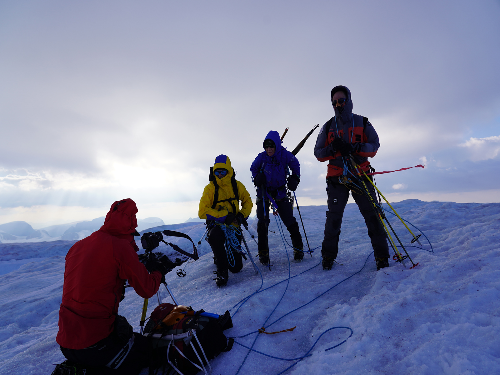
- 048. Ross struggling with his camera in the force 9 gale. We had to secure the tripod to the mountan with an icescrew to stop it getting blown over
-
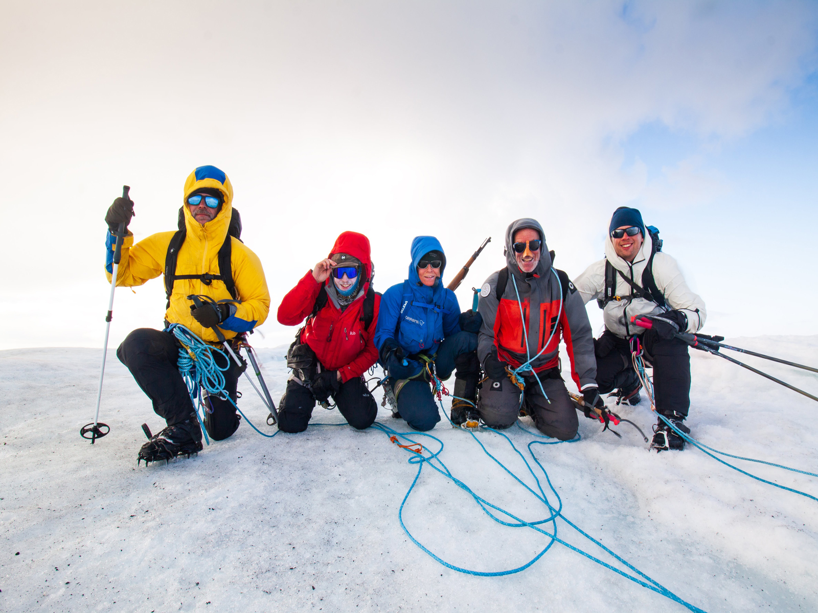
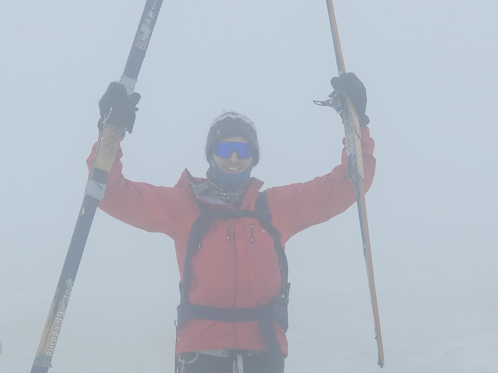
- 049. The full team on the summit of Newtontoppen, 1712m. From the left Soren Pedersen, Ross Beesley, Ine-Lill Gabrielsen, James Baxter and Jan Hoekman at about 2000 in the evening.
-
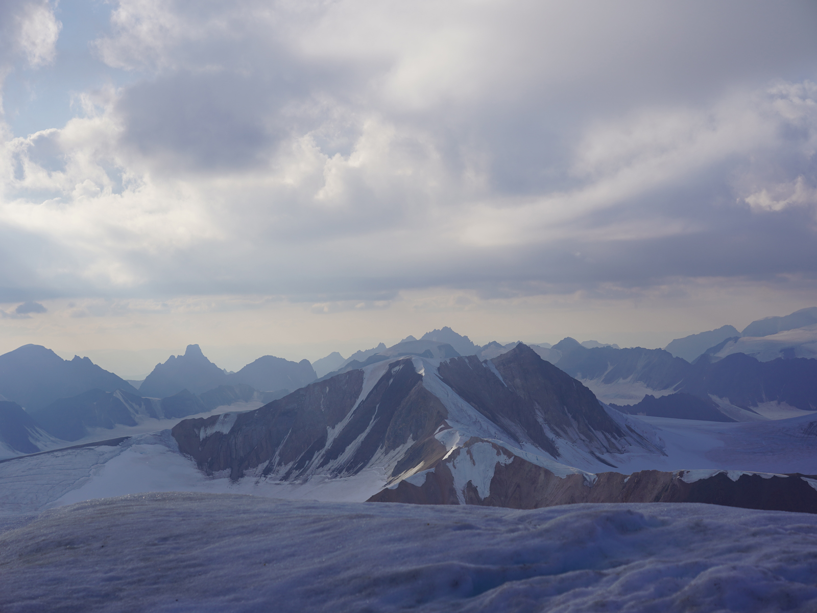
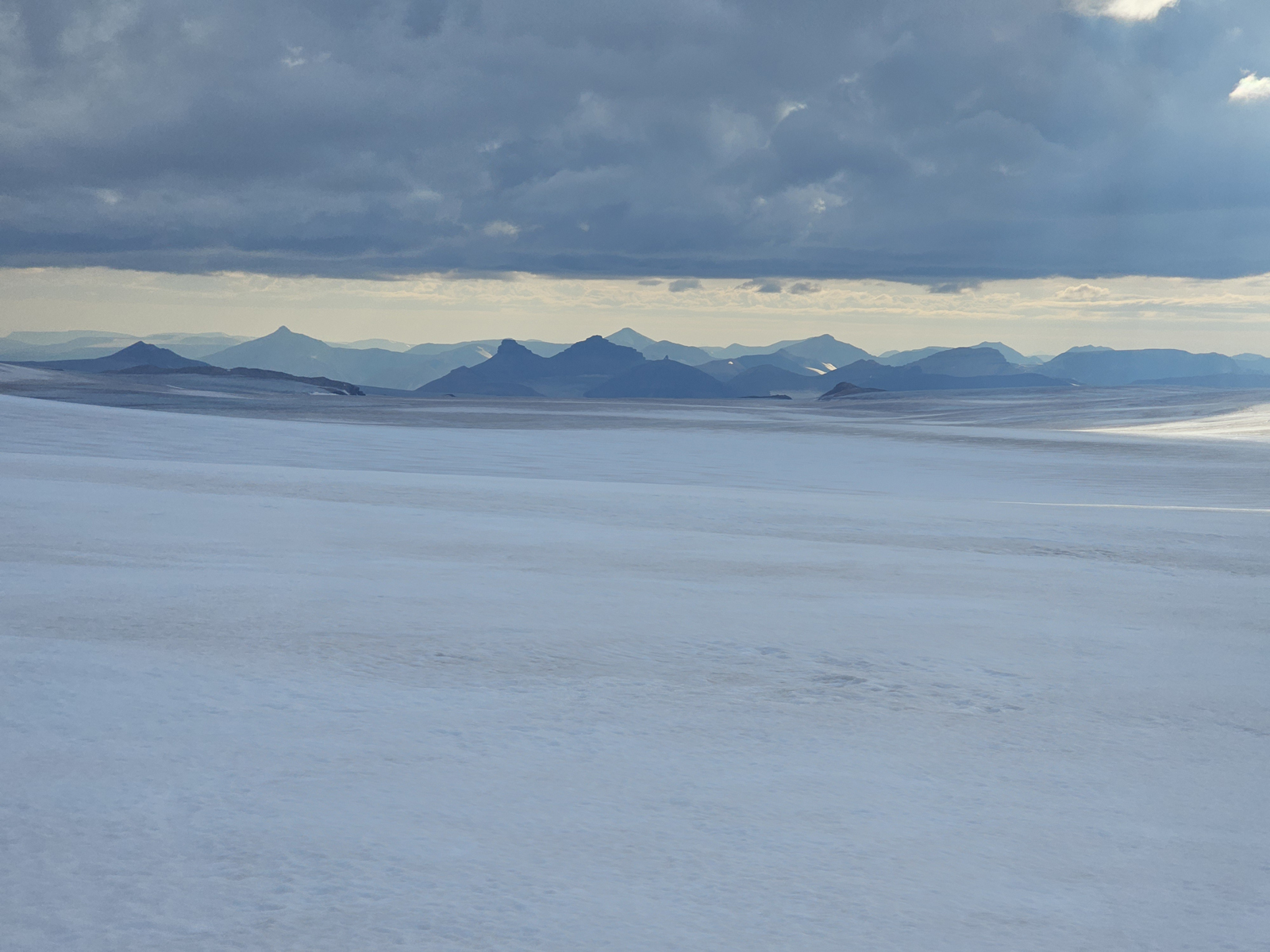
- 050. The view from the summit of Newtontoppen to the NW with the bare rock slopes of Galileotoppen, 1636m, in the middle distance and then the jagged skyline og the Atomfjella range in the distance.
-
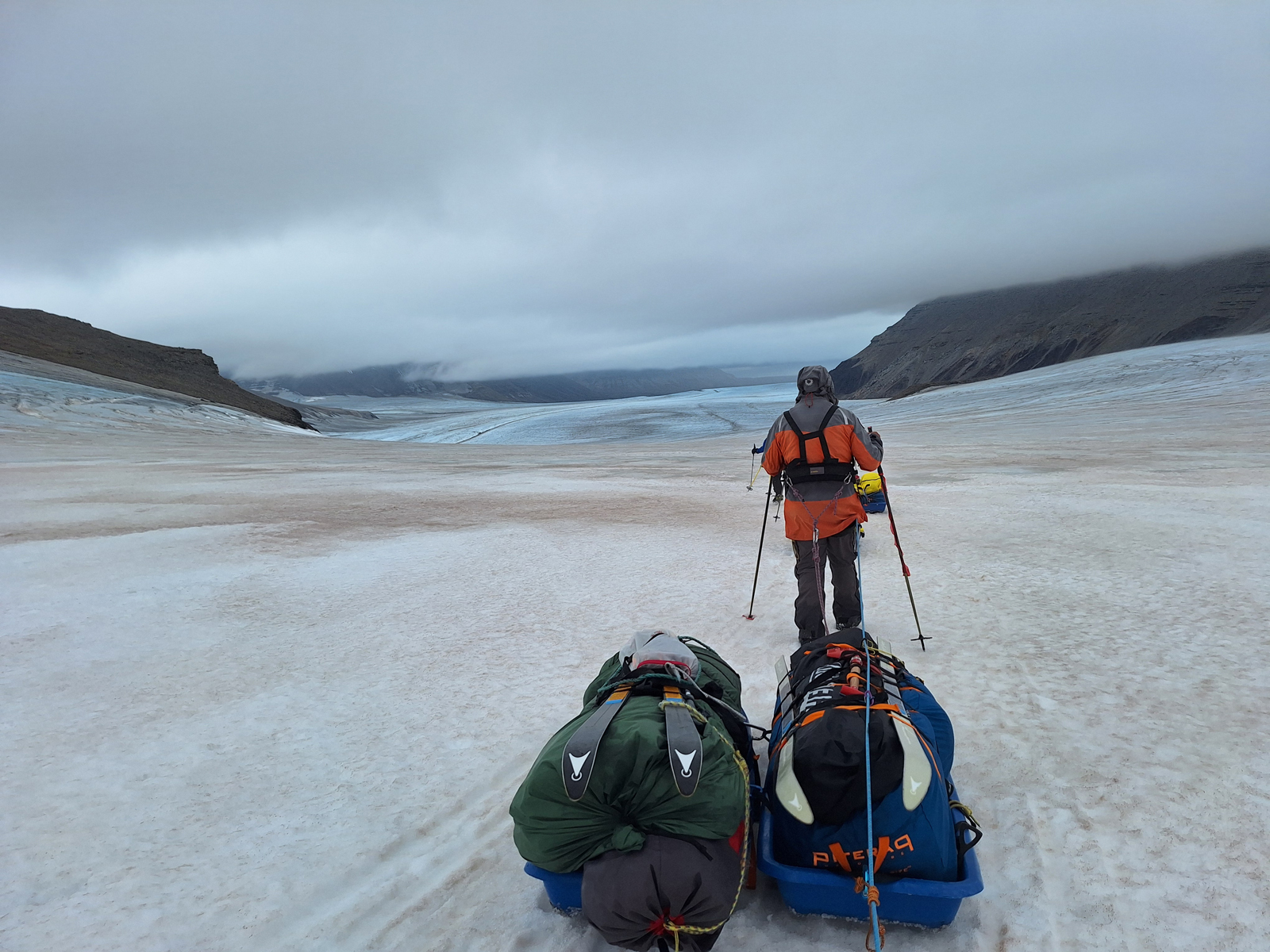
- 051. Heading backdown Newtontoppen after climbing it and looking east down the upper parts of the Oslobreen Glacier which eventually flows to0 the east coast of the island of Spitsbergen, the biggest island in the Svalbard archipelago.
-
- 052. Looking back up the steeper west face of Newtontoppen from the crevasse riddled pass between Newtontopen and Didierfjellet. With half and hour we would be back at the tents.
-
- 053. Camp 6 in the morning and looking SW towards Wainfletefjellet on the left and Bliegan centre right. The pervious day we came up over the pass abnove the right hand tent from Stuttbreen Glacier
-
- 054. Ine-Lill leading the way south over a glaciated pass between Astronomfjellet on the left and Jupiterfjellet on the right. On the other side of this pass was the upper part of the Keplerbreen Glacier
-
- 055. Looking back to Newtontoppen (to the right of Ross) as we make our way south over the pass to reach upper Keplerbreen glacier on the return leg
-

- 056. At the top of Titanpass. Here on the south side of the pass the crevasses were prohibitively wide but on the slightly lower north side they had filled with meltwater and refrozen. Titanfjellet is behind Ine-Lill
-
- 057. Crossing Titanpasset. On the south side all the crevasses were filled with meltwater and had refrozen so it was a relatively easy crossing.
-
- 058. Having crossed Titanpasset we now turned south again towards the north end of the Lomonosovfonna. Before reaching it we made Camp 7. Here is the view from Camp 7 looking west towards Austfjorden.
-
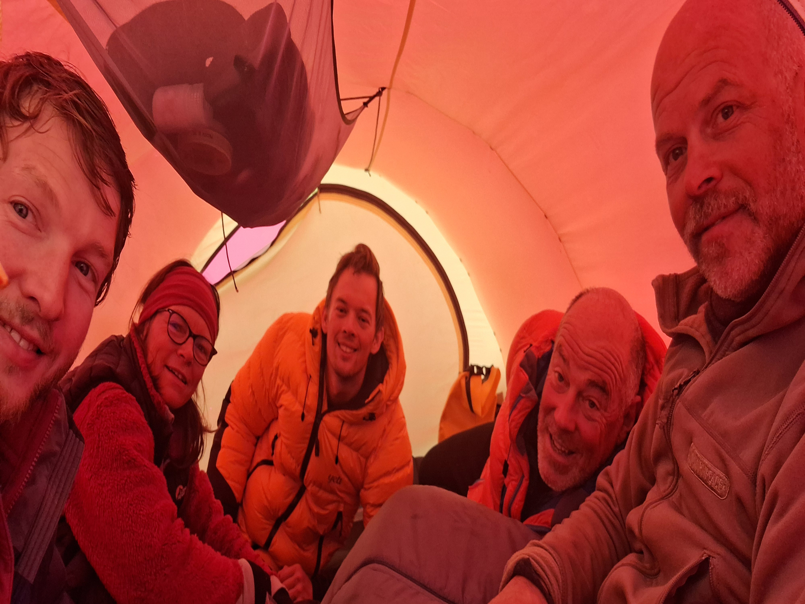
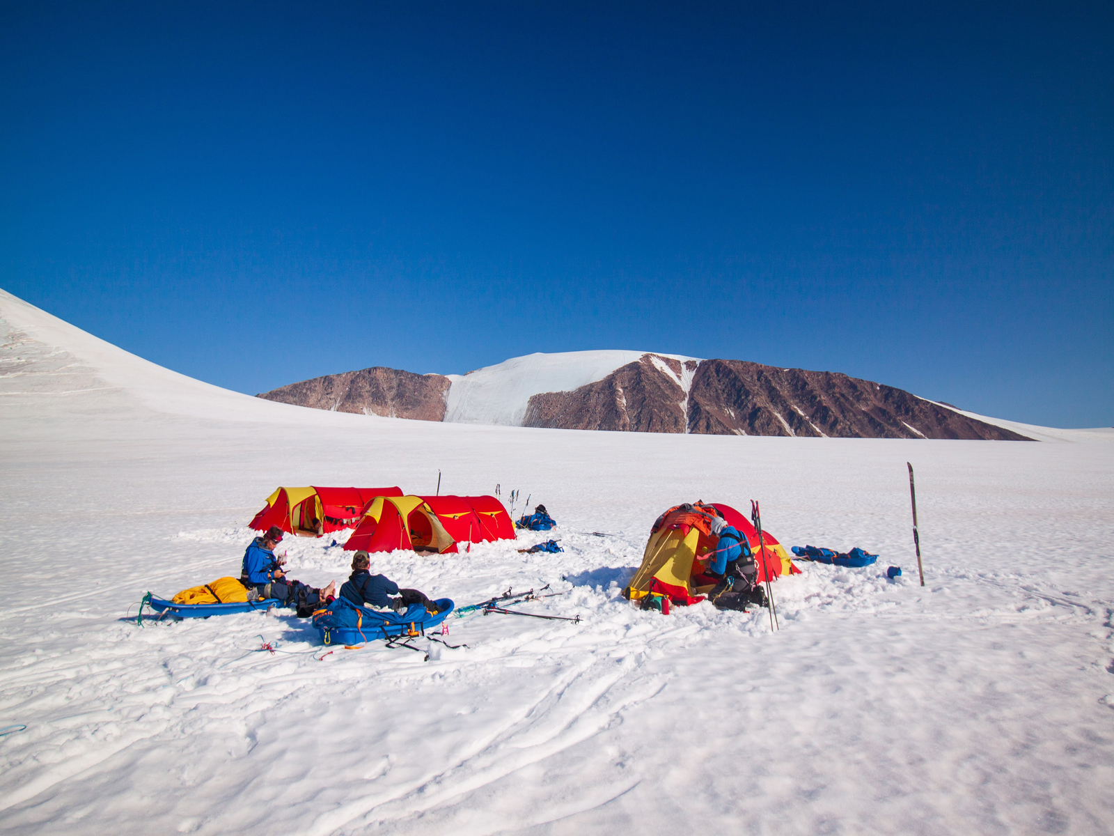
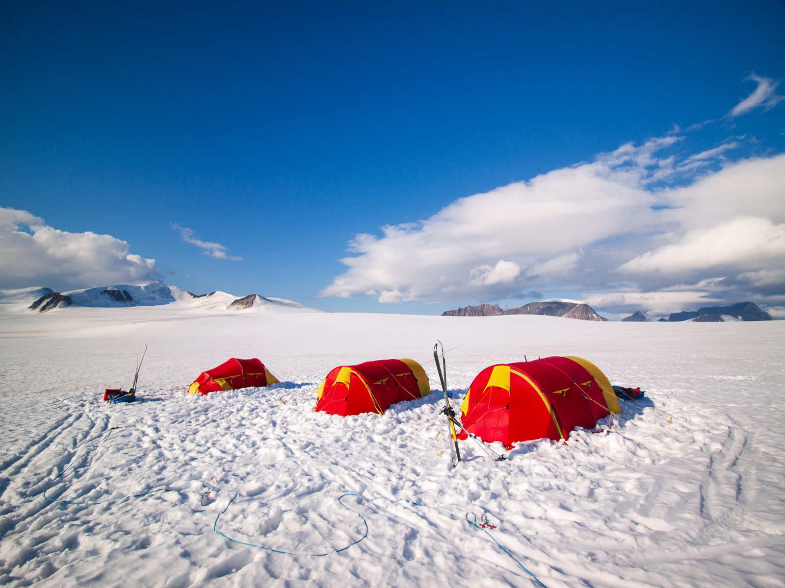
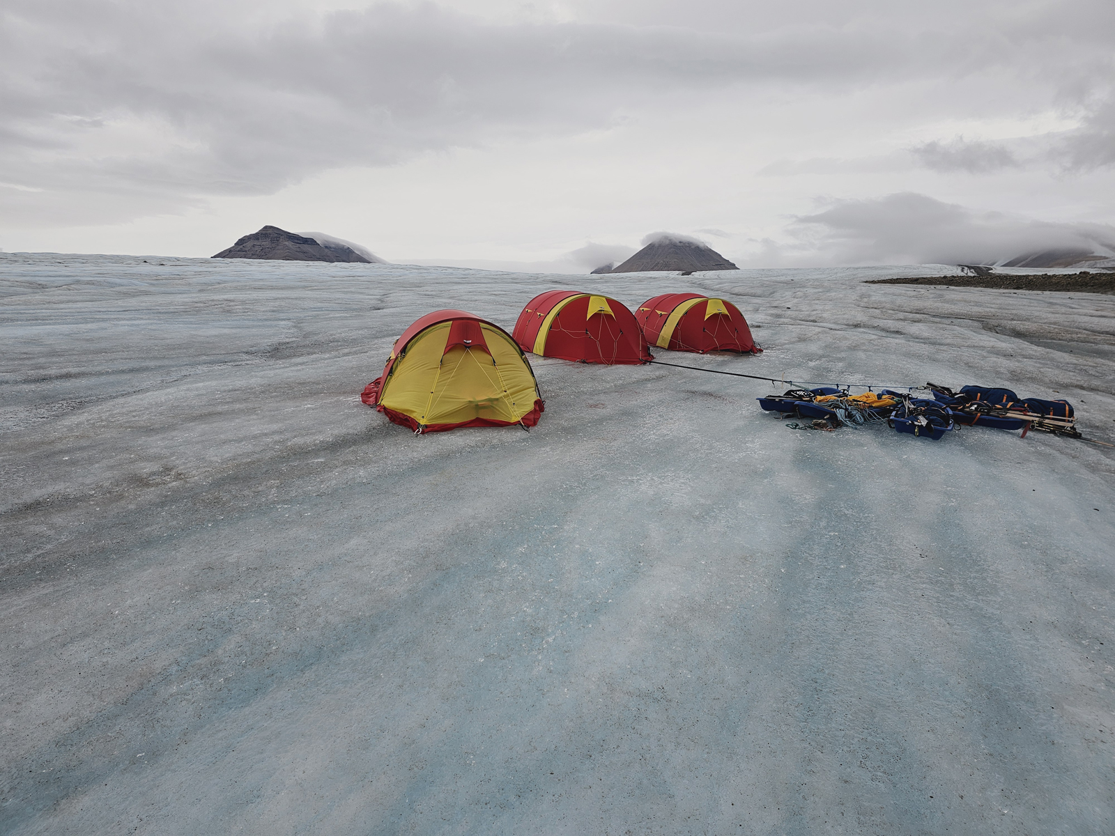
- 059. During the day off at Camp 7 we often congregated in the large Helsport Spitsbergen 4 tent which had a large capacity.
-
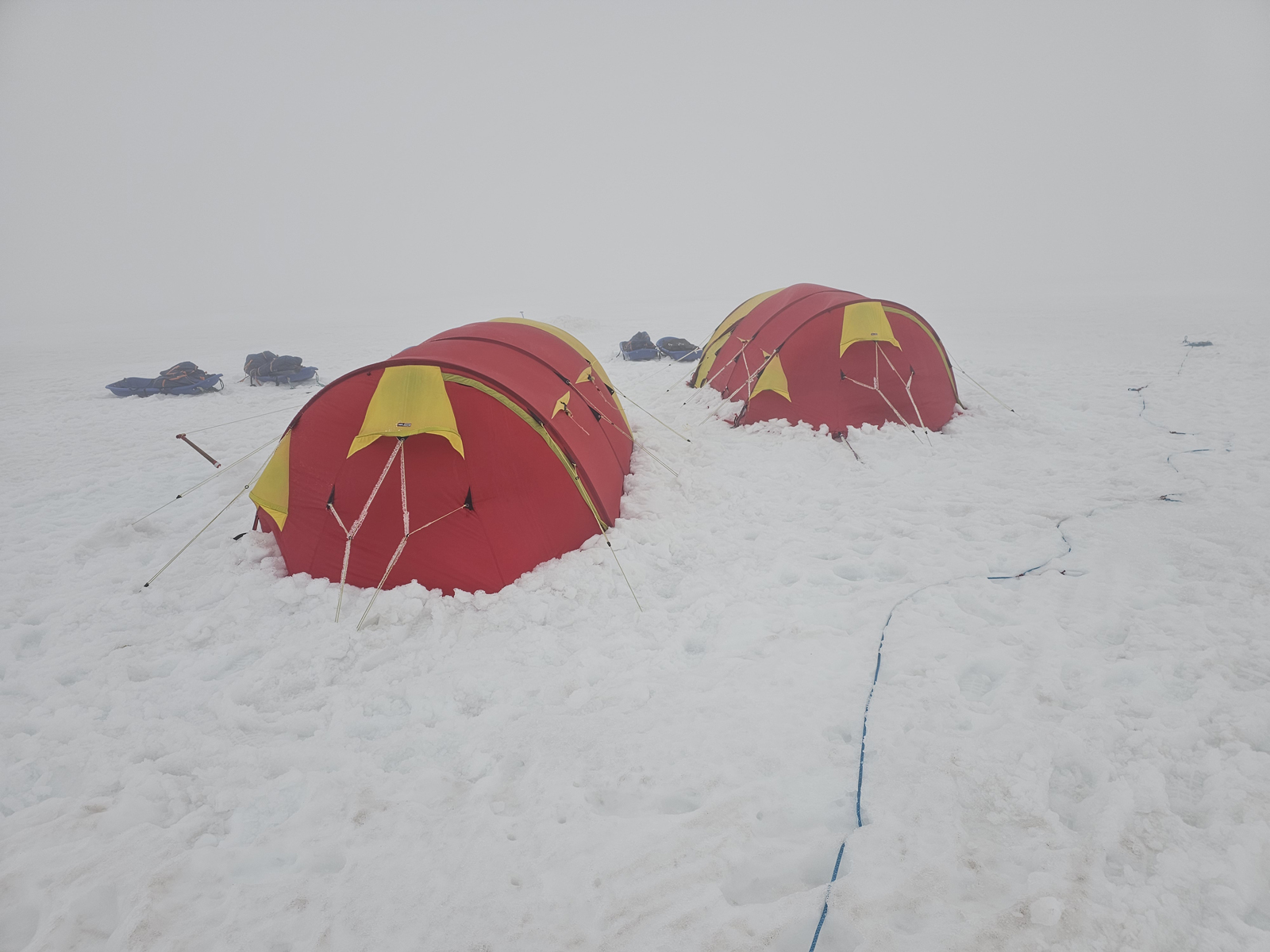
- 060. The weather deteriorated during the night at Camp 7 with force 6 winds and near freezing temperatures which cause rimefront on the guy lines. It meant we could have a much needed day off.
-

- 061. When we set off in the morning in the mist we veered to the west flank og Lomonosovfonna icecaps and strayed into a few big crevasse fields with many dubious snow bridges.
-

- 062. Camp 8 was the last camp on the snow on Lomonosovfonna icecap. In the background are the nunatak of Ekkoknausane emerging from the ice as its thickness diminishes
-
- 063. A break to have a snack andcheck the bearing as we skiied on the crevassed west side of Lomonosovfonna making a short cut round the east side of Ferrierfjellet.
-
- 064. After skiing for 6-7 days on broken skis we finally got to the point where the snow was too patchy to use them and put crampons on. Here is Ross triumphantly holding his engineered repairs aloft
-
- 065. Walking down the last snow to the bare ice. The “gravel road” is in the centre left. I had 2 pulks and Soren was at the back stopping them running into the back of my legs with a taut rope.
-
- 066. Even on the last snowfield there were large crevasses which we had to walk backwards and forwards along until we founs a place to cross. We were aware of these as we had come up this way also
-
- 067. After a week walking as a rope team we a last reached the uncrevassed slower moving bare ice and could unrope and and wander freestyle
-
- 068. The easiest and smoothest surface was what we called the “gravel road” a strip of medial moraine which had water or slus occasionally flowing down it, which refroze to keep the surface even.
-
- 069. Looking back up the “gravel road”. Just to the left of the mountain was the last snowfield which we came down an hour earlier.
-
- 070. Camp 9 was near the site of our Camp 2. It was near the “gravel road” and below the last snowfields we came down (right) The mountain on the left is the base of Ferrierfjellet
-

- 071. Camp 9 where there was no snow to get the pegs into so we had to use ice screws, and the drinking and cooking water was taken from the surface streams.
-
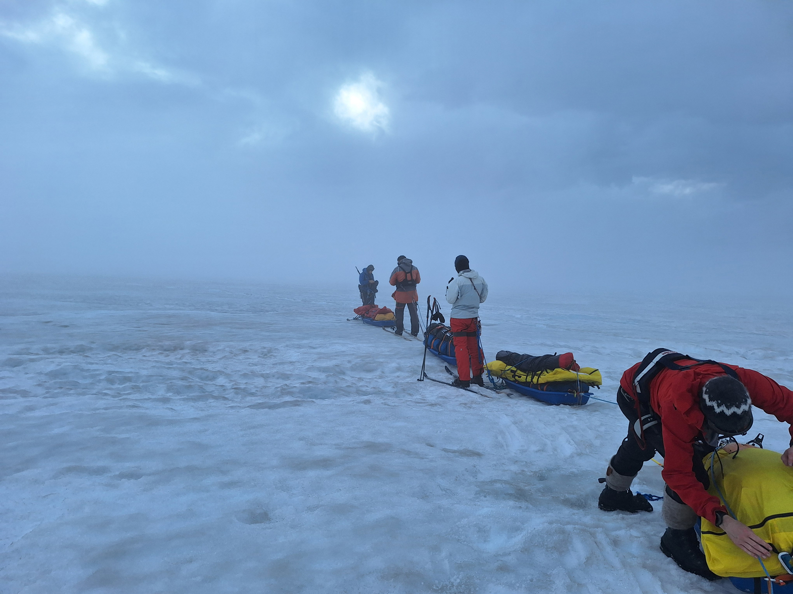
- 072. Back onto the “gravel road” for another few kilometres as we headed down to the vicinity of out Camp 1 near the coast, where we would do some reconnaissance to see if we could avoid carrying pulks over the moraine for a kilometre.
-
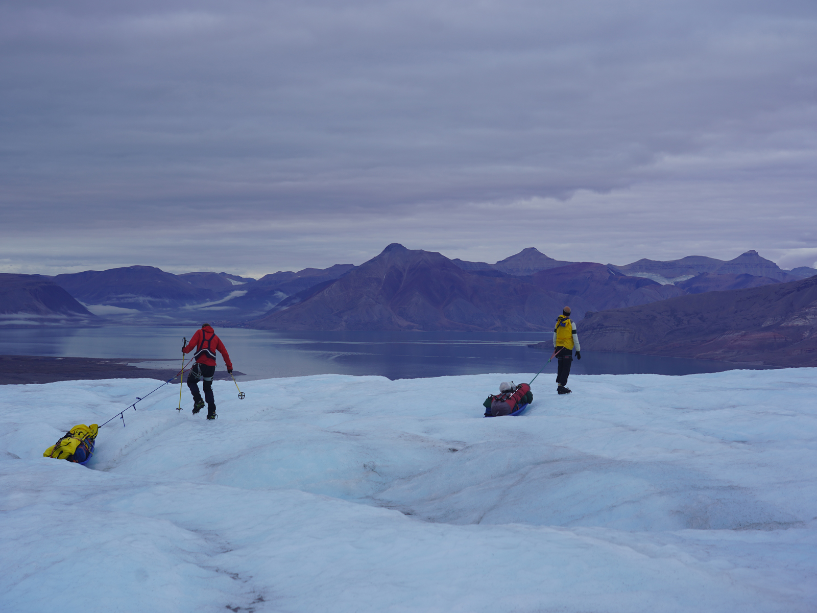
- 073. Eventually we had to leave the “gravel road” and veer slightly north across the glacier to reach a medial moraine called Ferriermorenen which we had to cross. The ice here was very lumpy
-
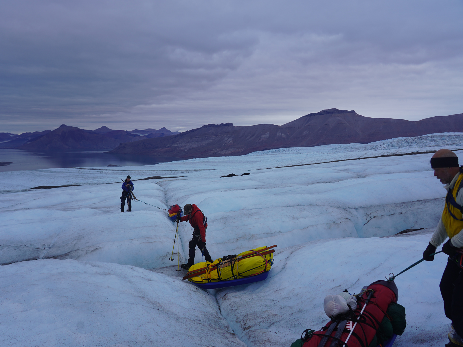
- 074. Approaching the medial Ferriermorenen moraine which isa the rocky strip in the middle distance. The ice here was at its most lumpy and the pulks often capsized
-

- 075. The Ferriermorenen was a medial moraine containing all the debris and rubble which had fallen down Ferrierfjellet onto the glacier as it slowly passed. We had to carriy the pulks some 30 metres over it.
-
- 076. Once over the Ferriermorenen we came to a huge crevasse and had to go back up the glacier a little to go round it. Here is us turning back up the glacier/
-
- 077. Having gone round the huge crevasse it was plain sailing down the lumpy glacier to the vicinity of Camp 1 where we hoped to camp. There were often channels between the lumps which we could link up.
-
- 078. Looking back up the glacier we had just come down. The Ferriermorenen is on the very right of the photo and we came down the right side of the photo.
-
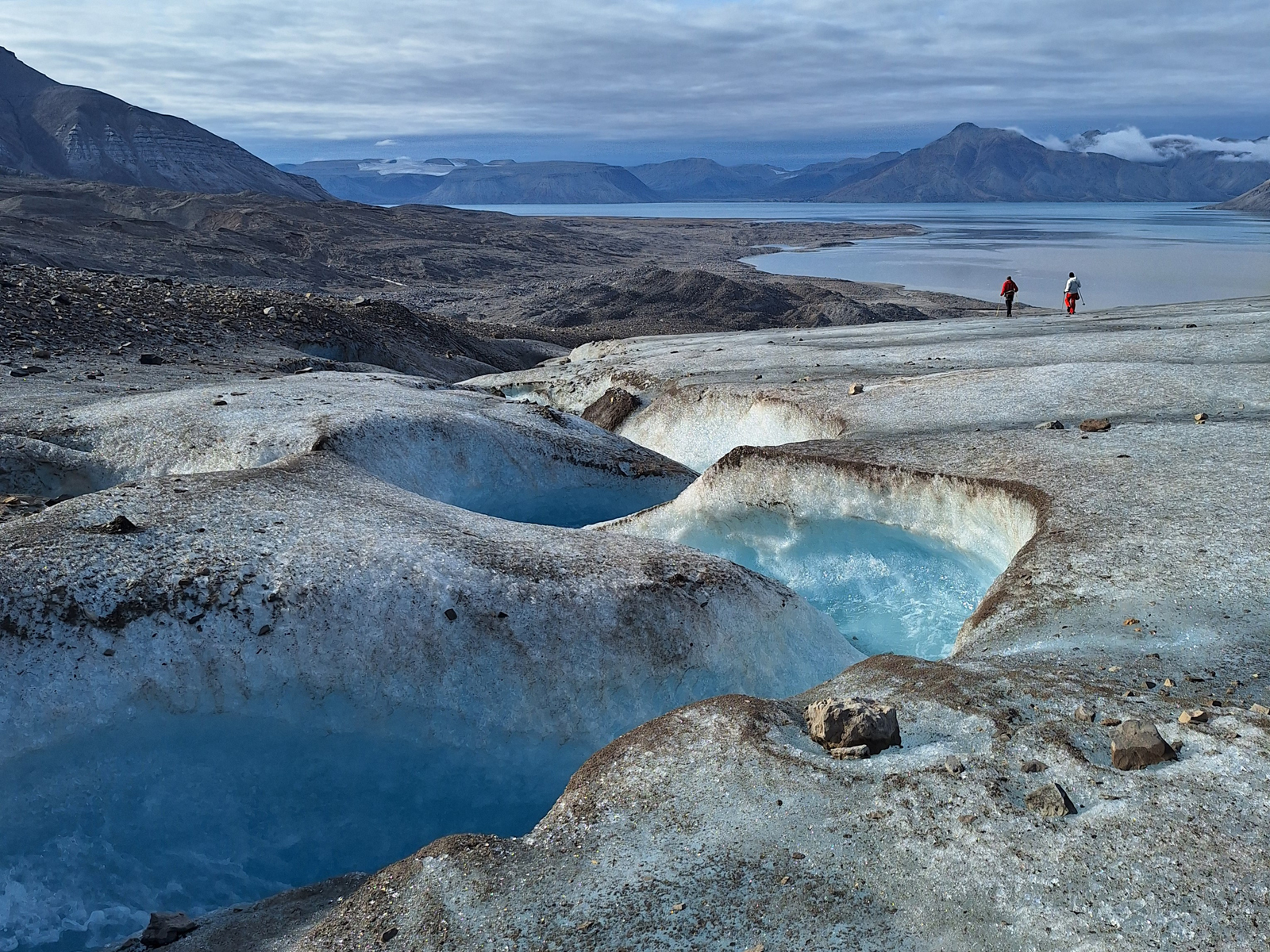
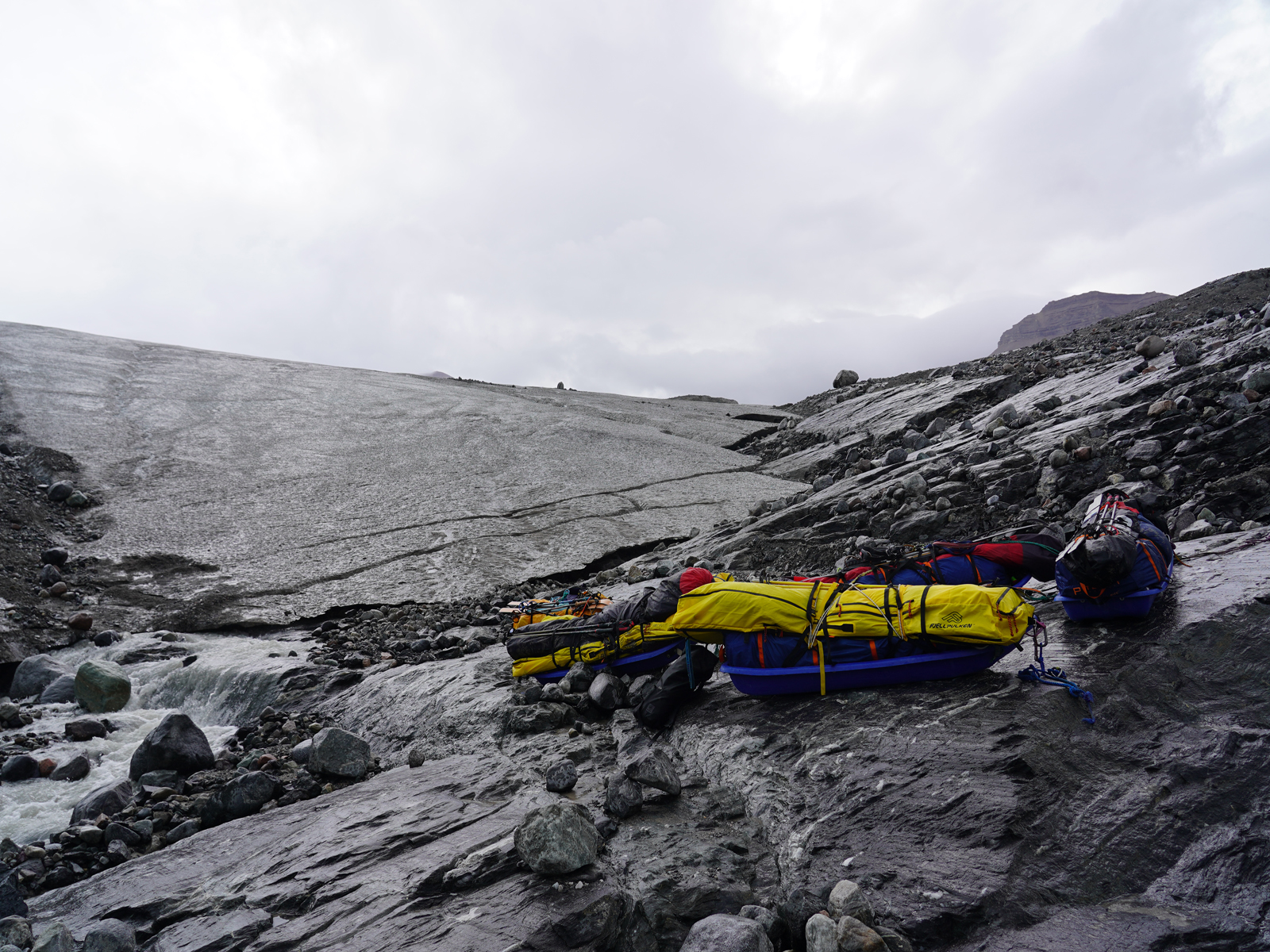
- 079. Having left the pulks at what would be Camp 10 we went down the stream to look at how the terrain had changed in the last 10 days and how it would be to carry the pulks over the kilometre of rubble below to the coast on Adolfbukta
-
- 080. Having seen varry would be even worse than on the way up, we went north along to foot of the glacier for 500m to find an ideal spot right beside the water where we could pull the pulks without carrying them.
-
- 081, Delighted with our reconnaissance to find the new place to get to the coast we returned to Camp 10 in good spirits and put the tents up. From the left Soren, Jan, Ross, James and Ine-Lill
-
- 082. Camp 9 in the evening. The tents were fastened with ice screws and as the wind got up to a force 8 the lack of guy ropes meant they were very flimsy in the gale,
-
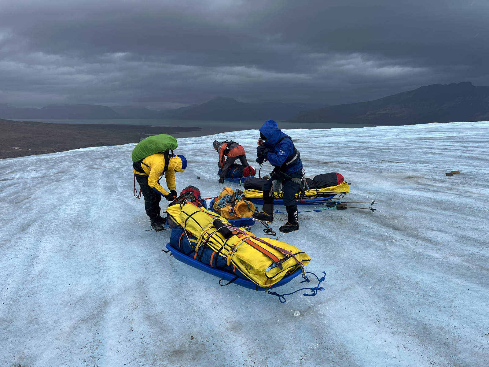
- 083. Packing up Camp 10 on the last moring in the gale. If anything was lost it would blow down the slope into the stream slot and be gone forever.
-
- 084. The descent to the bottom of the glacier to the rubble at the bottom was fast. The pulks went first and we stopped them sliding down to the bottom.
-
- 085. Once at the bottom of the glacier it was easy to pull the pulks across the ice above the stones to the small bay which is out of sight to the left just before the strip of rubble before the fractured glacier.
-
- 086. The ice went all the way to the bay where we had to wait two hours for the small boat to come and pick us up and take us back to the Billeford ship.
-

- 087. The small bay where we had to wait for two hours. This was polar bear terrain so we were on the lookout so we would not be surprised if one ambushed
-
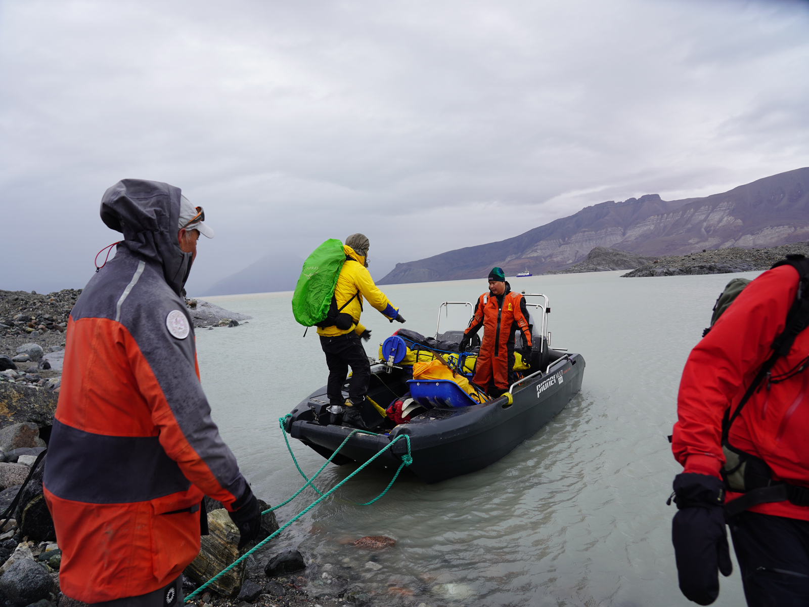
- 088. Loading the pulks onto the small boat which would take us back to civilization and the Billefjord ship which was a kilometre away (above the boat skipper)
-

- 089. All aboard and heading back to the Billefjorf ship. We came down the tongue of smooth glacier just above the skippers head. In a few years it will be 200 plus metres from the water’s edge
-
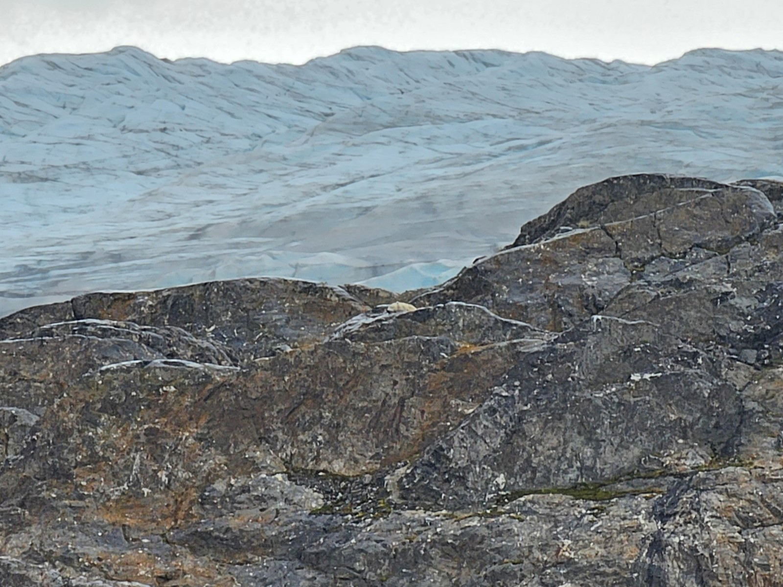
- 090. Once we got back to the Billefford we realized everyone was looking at a resting polar bear mother and its cub. Had the wind been 90 degrees different last night she would have smelt us a kilometre away
-
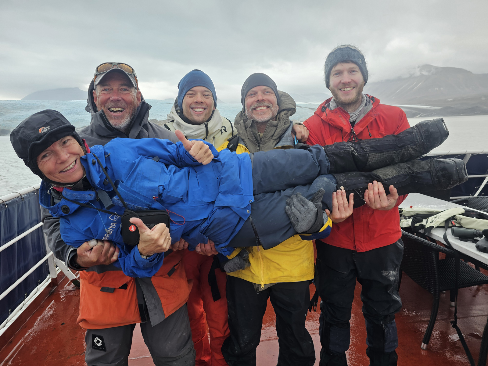
- 091 What better way to show you appreciation to the extraordinary guide Ine-Lill who led us through some difficult conditions without baulking.