Section 06. Hikertown to Kennedy Meadows. After a relaxing time in the eccentric and slightly bizzare shambles of Hikertown I had prepared myself for the difficult, arid route ahead. It seemed the only way to do the first stretch was at night. I was lucky as it was nearly a full moon.

01. Hikertown was like the stage set of a children’s pantomime

I set off at dusk, once the heat of the day had gone, and walked up to the South California  Aqueduct. It was open and I had not seen so much water since the sea at San Diego. I followed it for two miles as it flowed quietly, but with determination, along it’s concrete canal. After two miles I crossed it and headed up a large rivetted pipe carrying yet more water to supply urban Southern California, this one being the Los Angeles Aqueduct.


The moon rose at the top of this in where a small covered aquaduct fed it. It was so bright there was no need for the headtorch. I walked along this smaller aquaduct and the road beside for much night as my moon shadow moved from behind me, to beside me and fillnally in front of me as the moon passed through the night sky and set. I could not make out landscapes but marveled at the silhouettes of the plentiful Joshua Trees. There was a fragrance now and again but I could not place it.


After 17 miles there was a faucet in the covered aqueduct. I still had enough water to push on for the next in 7 miles to Tyler Horseshoe canyon. This walk was a different story. The moon had now set and it was completely dark. My headtorch cut a small beam on the narrow sandy path and the wind was gusting. To add to the other worldly theme the path went through a large windfarm. I could hear the turbines slicing through the air but could only see the flashing red hazard lights. The only thing which was natural were the jumping rodents, which were prolific and seemed to be oblivious to my light and often even ran towards it.


But the time the first glows to the east signalled dawn I cleared the windfarm and was now climbing up a barren hillside in a bit of a trance. In finally reached the creek an hour after sunrise at 7 and was tired. It was just warming up when i put up the tent under a large tree and fell asleep almost at once. I did not wake until mid afternoon.


Later that night I tried to repeat my 12 hour night hike herorics. It started well and I left at 1830 again. Shortly after i left I saw a deer, a mule deer i think on account of its ears. However I only got 8 miles and well before midnight found a place to camp beside a water cache a Trail Angel had kindly left. My overiding concern of water shortage was alleviated by this and other confirmed water caches later in this arId section so I would not have to carry 8 litres and hike at night to conserve it.


It was another short 8 mile morning past yet more wind turbines hissing in the wind as I went through a fire damaged area. I walked with Waves, a member of the Young Team and a teacher. The day was hot and we were soon parched. However as we descended to the Tehapachi Road we could see Coppertones camper. Coppertone is a Christian Trail Angel whole follows the herd spending a week in each spot. He offered us a root beer float on arrival. It was delicious end to 3 difficult and unmemorable days where wind turbines and a lack of water where the  main feature.


Everyone hitch hiked into Tehapachi to resupply but I had enough food to get the 150 miles to Kennedy Meadows still. As i was leaving a group of Faster hikers arrived from Tehapachi after a days sojurn, including Neil, the Aussie. I left first for another 8 mile windfarm section.


Just as I was about to start I noticed there was a road down the pastoral Cameron Valley. It was 2 miles shorter, did not go through the windfarm turbines and would give me a chance to see a cultural landscape. I took it and was rewarded with views of old homestead type farms, mostly unkempt, but with old machinery and cars from the 60 rusting in the yards. When I met the trail again It was a short walk to cross the busy Highway 58.

03. The cultural landscape of the Cameron Valley road bypassing the windfarms

I had intended to walk up the mountain north of Highway 58 with the fastgroup including Neil,  but as the sun went down and the moon rose my momentum vanished and I let the others pull away while i looked for the first place to camp. Now water did not seem such a issue as previously feared I had done with night hiking, there just is not any inspiration in it.


The next morning I woke early and leaving the windfarms, Mojave, and highway behind I climbed relentlessly  in the wind past Joshua Trees and scrub up endless zig-zags to the green topped summit. It seemed the promised land as I hauled my way up the windswept slopes. And indeed it was. As soon as I entered the first Pinyon Pines 3 hours later the day changed. The wind still hissed in the tree tops but it was calm on the path.


It was a joyful walk after the rigours of the last 3 days which were devoid of much interest and vandalised by windfarms. The pinyon pines offered great sanctuary and in the glades between flowers and sage bushes thrived.


Towards the end of this tranquil rigde, at Sweet Ridge a early generation windfarm reared its ugly head and the route went through it. However, it was soon back in the Pinyon pines again as it descended rockily to Golden Oak Spring. This spring was the end of the 43 mile waterless stretch which luckily for me was dotted with water caches left by Trail Angels. Just at the spring Top’O caught me up. We cowboy camped just above the spring and caught up on each others hikes.


After the night at Golden Oak Spring we set off the 19 miles to the next Spring which was Robin Spring. This was a stunning day with the last encroachments of the windfarm over first thing. The path now climbed up the gentle shallow south ridge of Piute Mountain for the rest of the day and would descend tomorrow down to Landers Camp and Meadow. It was to be the highlight of this section so far. There was a mix of trees with plently of Pinyon pines but also many Jeffery Pines and Oaks. Some of the Oaks were in undulating meadows of amber and maroon grasses which were flowing in the breeze. Hamp Williams Pass was especially beautiful. Just after the pass was the 600 mile marker and then Robin Spring just beyond.

05. Scrub oaks in the meadows

I like hiking on my own. I can go my own speed and can stop when I want. At Hamp Williams i had a small rest which turned into a siesta in the meadow grass. When I woke I noticed a pair of Californian Gnat Wrens were nesting in a hole at the top of a tall pine stump. It was a perfect spot. I moved closer to watch them. Each parent returned to the nest every minute with a gnat in its  beak. It looked around and then entered the nest. When it emerged a short time later the other parent entered also with a gnat. The emerging wren went straight to one of the many surrounding Black Oaks to find another plentiful gnat to feed the family. A few hikers passed me but most seemed oblivious and were keen to clock up the miles.


I liked to camp with other people though and there were plenty at Robin Spring including Top’O and about 20 others, many of whom I knew. Many were cowboy camping around this essential waterhole under pines and large scrub oaks. When we went to bed the huge moon and risen, but by 2200 it had disappeared behind the clouds. Suddenly i felt a drop on my face and then an other. The mist had come in and it was condensing on the trees and dripping on us. Suddenly the whole camp was awake with people hurriedly putting up tents in torchlight.


It was still dripping heavily in the morning and the ground was wet. It seemed the scrub oaks especially were adept at getting water this way as their shiny leaves were especially good at condensing. I packed up and left early keen to go the 20 miles to the next water at Willow Spring.


As soon as I crossed over the spine of the hill to the east side it was like entering a different world. The mist did not get this far and the sun was out. It was a beautiful undulating Lodgepole Pine forest with a sandy forest floor covered in pine needles. Large biege granite boulders were scattered in the forest. There were also some small streams here. It was a lovely place to camp and just 2 miles from the dripping misery on the other side everyone woke up to.

08. Pine forests on Piute Mountain

It was a lovely walk down through the lodgepoles in the forest besides Landers Creek to Landers Camp where there was water. The path now left the lovely Piute Mountain and turned east through a fireburn area for a few miles and the serenity of the day vanished. It was now searing hot as the heat reflected off the bleached granite dust. As i rounded a corner I saw what the afternoon might bring. Before me was a huge amphitheatre of brown arid ridges and peaks rising well above me. I knew I had to  climb into this high desert. The tops of the hills were all knobbly granite outcrops and the hillsides were largely bare, save clusters of Joshua Trees and a scattering of the hardiest Chaparral scrub.


Rumour had it there was a water cache on a gravel road some 4 miles before Willow Spring and another one 10 miles beyond. If so this meant it was not necessary to make the 2 mile detour down to Willow Spring.  It was with a little relief when I reached the track which crossed from the Kelso Valley to the Mojave and found 6 hikers there in the arid dust amidst a sea of 5 gallon water bottles. We all filled up with enough water to last the rest of the day and all tomorrow, about a gallon each.

09. A water cache on the Kelso Valley road made a huge difference to how much water one had to carry

The walk up to the pass which led down to Willow Spring was quite other worldly. The undulating hillsides were punctuated by granite outcrops whiose erosion covered the whole area in sand. Joshua Tree clumps covered all this. Some of the spikey eddifices  were 15 foot high and as broad, composing 10 trucks. Beneath them a few hardy shrubs eeeked out a living. Yet on the dry sandy soil there was an abundance of small delicate flowers; mauve, yellow and blue ones which defied all odds and were blossoming here.

10. Even in the most hostile desert environment delicate flowers managed to thrive

At the Pass the wind had increased to a gale. Top’O had gone on 3 miles to camp but I would call it a day here. I needed to find some shelter though and had to walk down a half mile eventually before I found a flat spot behind a Joshua Tree clump. The wind hissed through their tall spikes. If one blew over on the tent it would impale me so I chose my spot carefully.


In the morning the wind was perhaps stronger and certainly colder. My hands were cold paccking up. I returned against the gale to the pass and then continued north along the PCT. I passed 4 hikers all huddled under a Joshua Tree still in their sleeping bags. Top’O had already moved on from his planned campspot which was also windy.


The next two hours over the granite Tor of Wyley’s Knob was a fight against the wind in a deep granite sand. It was often 4 steps up and one back as I was buffeted in the loose soil. The the wind had a bitter bite to it. Yet I was in high desert and could see the furnace of the Mojave Desert spread out below me to the east. It was unfathomable to ponder on the days climate.


The second water cache was where the rumour said, and also a box of sweets. Everyone stocked up and left a donation in the tupperware box. This would fuel us up the near 2000 foot climb to Skinner’s Peak on whose craggy summt ridge I could see the sanctuary of a Pinyon Pine forest. It was a blustery climb and not the place on this steep hillside to be buffeted about. On one occasion  I was blown into a bush. At the top however I crossed into the lee of the mountain and the longed-for pines enveloped me, and even in the open spaces between them the sun warmed me.  This was the return of the PCT I was growing to love.


For the rest of the day the path kept high as it twisted in and out of shallow valleys and through the trees. Frequently it veered to the western edge where the wind was a strong as ever and still colder. Ominous clouds were building to the west covering the ridges there. But as often the path wove through pines and scrub oak with calm sunny glades. The last miles before McIvers Spring however were through a fireburn area atop the hill. Here there was no hiding from the bitter wind. I walked  briskly  passing the occasional isolated large Jeffery Pine which survived the fire but was now standing alone and straining in the gale, hissing as the wind twisted it’s branches.


Top’O greeted me as I reached the spring and cabin at McIvers. The cabin was rustic and crowded but there was a space on the floor which I took, mostly to escape the bitter wind. Once i had found a corner the floor was full and in all there were 12 people crammed it. It was dirty but it was warm. By the morning 2 more had squeezed in saying they had cowboy camped nearby but it started to snow at midnight.


I left with Top’O and we walked the 6 miles to Walker Pass together. We were quickly out of the barren fireburn area and the wind had all but ceased. It was an easy sauter through pines again as we slowly descended. The miles flew by in conversation and gossip. We rounded on ridge and there for the first time were the Sierra Nevada Mountains. Huge and foreboding they were still covered in their winter snows. It quickened the heart to see them as they were magnificent but there was also the realisation that they do exist. In a week’s time we will chest deep in icy torrents and crossing steep snowfields at dawn and the heat of the desert will long be forgiven.

The path twisted through the Pinyon Pines. The green cones we foming fast and the branches were heavy with them. Each one was coated in sticky droplets of resin and glistened in the sun like a jewel. Many littered the path having been blown off prematurely in the gale. We soon reached Walker Pass Campsite. It was open and the treeless. I had intended to spend a day here writing so was disappointed but there were picnic tables. Coppertone, the The Trail Angel, was also here in his camper with a selection of treats and his now infamous root beer floats.

11. Top’O walking through the Pinyon Pines approaching Walker Pass

I spent the rest of the day typing and chatting with hikers as they arrived. Most then hitched down to lthe town of Lake Isabella to get resupplied and a cooked meal. I still had enough food to get to Kennedy Meadows, just 50 miles away now.


It took three days to get from Walker Pass to Kennedy Meadows. The first miles were extremely arid and sandy as I climbed up into the hills on the edge of the Mojave Desert again. The recent 7 year drought had taken its toll and about half of the Pinyon Pines hare had died. They were now just crisp brown trees whose root ball was slowly diminishing until a gale toppled them.


I caught up with Harvest,  a bright Canadian girl, and we walked together for the rest of the afternoon. As we climbed and headed west of the Mojave the vegetation greened up and the hills became more spectacular. They were now composed of a hard, erosion resistant metamorphic rock and the path became lumpy. We went over a couple of small passes and then dropped down to a Joshua Tree Spring, where cool water emerged from a pipe in an algae filled concrete trough.


Harvest’s bubble of friends were already there. I knew most of them already. It was perhaps the nicest bubble on the hike. The Kiwis, Joe and Holly, Crimson, Widler, English Ed, and a few more. We had a campfire that night which we sat around as we ate. There was lots of sharp banter and leg pulling, and one of the best nights of the trip so far.

13. A campfire with the Kiwis; Holly and Joe, Wilder, Crimson, Matt, Harvest and a few otherss

The second day was quite rugged with a steep climb to a saddle where there was a a descent into the wild,  remote Spanish Needle Creek. It felt something of a lost world in here with and amphitheatre of craggy ridges and deep ravines filled with ribbons of deep vegetation where small creeks flowed. Unfortunately on the rocky hillsides at least half of the Pinyon Pines had perished in the drought.


There was yet another 2 more ridges to climb and wild amphitheatres to contour round before the final descent to the campsite. I hiked alone today and had a snooze just before the final descent to Chimney Meadow and Creek where there was a campsite. The meadows here were not grassy pastures but more flat areas covered in the fragrant Sage Bush shrub.


At Chimney Creek the was more trail magic. A hiker called Saunters had acquired an injury, heel spurs, and had to give up his hike. He had based himself here dispensing cold sodas and hotdogs to passing hikers. Saunters was a 40 mile a day man he repeatedly stressed to his visitors. There was none of Coppertones’s calm modesty here.


I slept in the deserted campground keen to get an early start tomorrow and push all the 22 miles to Kennedy Meadows. The alarm went at 4 and as I was cowboy camping I was soon away climbing up the 2500 foot hillside before the sun got fierce. The last portion and most of the descent were in a burnt area, but despite this there was a magnificent view from the top. 3 or 4 large snow capped ranges of the Sierras lay just to the north including Mt Whitney. From this distance they did not look as foreboding as peoples fear-mongering alluded to.

15. A first view of the Sierras from just north of Chimney Creek

At the bottom of the descent was the Rockhouse Basin. On the far side was a series of steep granite towers and spires whose smooth walls were exfoliating slabs. It looked like a mini Yosemite Valley. On the floor of this Basin was the Kern River, which was keeping a wide strip of willows thriving on each side in the otherwise aird valley floor. There was a creek nearby with some campspots, but a male Black Bear had been reportedly wandering through this camp a few times this year looking for hikers food.


The last 8 miles to Kennedy Meadows were hot but I wanted to get to the store before it closed so marched under the midday sun. It seemed to take a while but the Kern River swiftly flowing and the return of the pines after the burnt area soon alleviated it. I passed the 700 mile marker, which essentially marked the end of the Desert Section and the start of the Sierras.


Kennedy Meadows is a small community with 200 inhabitants and at this time of year 200 hikers. The hikers all congregate around the Genral Store, a small shop with everything a hiker needs, a place to recieve and store packages,  toilets and showers and a campsite. It also has a large sunny terrace and many hikers were here reminiscing over the just completed desert and sharing their worries about the Sierras. As hikers arrived at the store there were cheers and clapping from the tables and chairs, and applause rang out as I walked across the yard from the 100 or so hikers at the tables.


Kennedy Meadows was a place nearly every hiker had a day off, often two. It was a place to catch up, clean up, resupply and prepare for the next 300 miles of the High Sierras which this year would be extra challenging due to the heavy snowfalls. Mayo, the English Radiographer and Zman were here and it was great to see them. Top’O was a day or 2 behind.


There were also a few faces I just see at stops, but never on the trail. A group who are either injured and hoping to recover or groupies who just liked the scene and spent a lot of time smoking joints and making small talk. Neither lot would be going through the Sierras and they seem to be bottle-necking here.

Back

Agua Dulce was a nice rural small town and the Saufley’s were very hospitable but I found their ranch almost too crowded. There were a lot of nice hikers there but also a few who stayed up late chatting and smoking marijuana. It was not the scene I had in mind and I wanted to return to sleep under the starry Chaparral sky. So I said my goodbyes late afternoon and headed off to walk 5-10 miles.


I walked with an Aussie called Neil. He had the typical wry smile and glint in the eye of a rural Australian or Kiwi. He was doing about 25 miles a day. We both did about 5 miles and cowboy camped in a dry creek bed. It was very clear that night with all the constellations visible and not a hint of mist. Nevertheless when I woke to a still clear sky everything was covered in a thick layer of dew. My sleeping bag especially was soaked and the Manzanita bushes were dripping dew.

01. Cowboy camping on the night I woke up with the heavy dew soaking everything


Neil soon disappeared as we climbed the first hill. On this south facing slope everything was Chaparral shrub. There were a couple of grassy homestead farms each side of the ridge with grassy pastures on the valley floor with amber dew laden grass.

02. The beautiful trail from the ridge crest down the north slopes of the hill to Bear Spring. The drifts of flower were Farewell to Spring.

However, the north facing slope was a delight. Large Scrub Oaks were scattered thickly on the hillside with large glades of maroon headed grass between them. Amongst the grass were drifts of light purple flowers on tall stalks. The flowers were called Farewell to Spring. This continued for the half mile down to the lush Bear Spring, where fresh water flowed out of the ground and down a pipe.  There were about 10 hikers there in the end enjoying the lush shade. We were joined by a hummingbird who bathed in the trickle of water below the pipe and entertained us for a few minutes.

03. A hummingbird bathed in the trickle from Bear Spring

The path then dropped through more lush vegetation for another couple of miles into the valley before another climb. The midday to afternoon climbs on a south facing slope were guaranteed to be hot. How hot depended on the height of the vegetation. On this climb  it was reasonably high Chaparral of Manzanita and Chamise and there was a fair bit of shade. There were wild cucumbers growing everywhere on the scrub but most of it was withering now but the prickly fleshy fruit was ripening.


I saw a hornet at one stage on the sandy path which had obviously just killed a grasshopper. As I watched it quickly dug a hole in the sand, flew over to grasshopper, grabbed it and flew back to the hole, disappeared down it and covered it up. I assumed it would either eat it in privacy or will lay eggs in it so the larvae would had something feed on initially.


Again as soon as we were on the north side of the ridge the vegetation became much lusher again.  The route descended into Spunky Canyon where there were a few trickles of water from side canyons. However these were rapidly drying up. The path then contoured around the upper reaches of another canyon, at the bottom of which was the pastoral village of Green Valley, an oasis in the Chaparral scrub. Most people were going down to spend the night at “Trail Angles” down here, called the Andersons. I decided to skip it and have a quiet night at camped alone in the grounds of the Ranger and Fire Station.


Even before I woke people had already walked the 2 miles from the Andersons in Green Valley to the Fire Station, including Mishap, the only other Scot so far who was a lady from Dumfries. We climbed up to the Leona Divide ridge and then descended a burnt area to the Lake Hughes Road. There was some shade at the road but everyone could see what was coming and was anxious to continue before the heat  built. In the sandy dry creek bed were some prize specimens of the dreaded poodle dog bush looking very innocent with long green leaves and a thick crown of beautiful purple flowers


The climb up from Lake  Hughes Road was hot. It was midday and the area had suffered a recent fire. The sun beat down mercilessly and I had virtually no shadow as the sun was directly overhead. The fire had removed all the vegetation and exposed hillsides of white rock and gravel which reflected the heat back. When it climbed a ridge there was the faintest breeze or a thermal causing a stir but when the path went into a sheltered ravine it was like a furnace. After an hour I reached the main ridge and was rewarded with a constant  breeze and a great view.

06. The merciless hot midday climb up from the Lake Hughes Road. In the distance is Lake Hughes. The San Andreas fault runs down the floor of the valley and the lake sits astride it

To the north was the Mojave Desert, barren except for fields of solar farms which looked like square lakes. Between me and the Mojave was a ridge and between my ridge and this ridge marking the southern border of the Mojave was a pastoral valley. This valley was the San Andreas fault where two geological terranes slide against each other. Currently they are not sliding but are jammed together, waiting until the pressure builds enough and they judder sideways again in an earthquake.


The fire burn area continued along the crest of the ridge for a couple more miles until it reached a copse on the fires limit. Here there was a camped marked on the map. When it reached its shade i was delighted to see nearly everyone who had overtaken me so far today flaked out  under the shade of two benevolent Black Oaks.  Some 20 people were there. Most were snoozing and a few chatted quietly. We waited in their dappled shade for two hours until the worst of the day’s heat started to dissipate.


Most people had another 8 miles to Sawmill Camp but I decided to go to Shake Camp in just 3 miles. As I walked west the ridge I was on became more squeezed by the Mojave Desert. I could see I was walking towards the end of a wedge and would soon have to cross the desert. Luckily the fire burn area had finished and the woods here on the eastern slopes facing the Mojave were dominated by the large coned Coulter Pines. Huge cones littered the forest floor. Some were 3 kilos and 30 cm long. One of these on head would put you off the Trail for a while!.


Shake campground was a good 15 minutes and a long way below the trail. I was committed to go there as I was out of water. As I descended I thought it was a mistake and the increase in flies and bugs confirmed it. However, I had to get water which was even further down beyond  the camp. There was a lot of Poison Oak beside the path to the water. Along with Poodle dog bush it was another thing to watch out for as it could also give skin blisters. As I was having  my meal 3 hikers who I spent much of Section 02 with arrived in the dusk, Justine, Theo and Alex. There were a happy bubble and it was great to chat with them until the cooking was done.


Before the day started I had to hike the 20 minutes back to the PCT path. Once there it was an easy hike on the north side of the ridge for a good few hours in the cool forests. I was astonished to see Douglas Fir here on the slopes leading down to the Mojave. I always assumed Douglas Firs enjoyed the wet mossy climes much further north. I felt good as contoured around the hillside going in and out of side valleys. The only downside was the copious insects, small inoffensive flies mostly but the odd determined horse fly amongst them. I was constantly coughing up the smaller ones I inhaled to the extent I was nearly became a carnivore again. After Sawmill Camp,  which was yesterday’s alternative camp spot the path crossed to the south side.

07. Contouring around the north side of the ridge between Upper Shake and Sawmill camps through huge Douglas Firs, which surprisingly thrive here on the egde of the Mojave Desert.

This was a different story. No more lush conifers but hot Chaparral scrub. It was still and there was no cooling breeze to cool me or banish the bugs. Pretty soon I reached the 500 mile mark and thought of the Proclaimers. After the celebratory photo I started to climb. I was looking for a shady windy spot to relax  but there was none. I climbed and climbed in the heat of the day through scrub oak and Manzanita.  Both were heavily adorned with lush virile wild cucumber, unlike yesterday’s withered ones.


I past a couple of the Young Team. Afterburner who was wrapped in her tent while Aseagio just had a bug net on. They were surprised to see anyone hiking in the midday sun. Mad dogs and Englishman as Kipling would say! I went on and on for another 4 miles but could not find somewhere to relax.


At last I came to the Liebre Mountain Guzzler, a mostly buried fibreglass tank with a large corrugated iron roof which collected rainwater. It was full of clear cool water. Nearby was a copse of Black Oaks swaying in the wind and under them some tall green grass. It was a perfect spot to rest and I spent a bug free hour there rehydrating and snoozing.


As I walked back up the track to the PCT i came across a confident 4 foot Gopher Snake. It was not venomous and some people said they kill and eat rattlesnakes. I watched it for 5 minutes from a few metres away and it was fully aware of me.


Once back on the PCT the path now dropped down to the north side again. For 4 miles I had a wonderful saunter through large Scrub Oaks and Black oaks. It was like a parkland which had gone feral. There were many grassy glades and some flower meadows. It filled me with joy to walk through this tranquil warm yet shaded woodland.  Occasionally I would catch views of the San Andreas fault just below and the arid Mojave beyond just a few miles away.

10. The idyllic saunter down through the Black and Scrub Oaks was a 3 mile saunter through tranquil parkland.

This sensational 2 hour walk lead to Horse Canyon Camp where there were some 10 hikers including Justine,  Alex and Theo and also Blue who I not seen for a while. I also learned Top’O had just left. It seemed everyone else was going, most to Hikertown in 10 miles. However there was a campsite and water in 2 miles at the bottom of the slope and right on the San Andreas fault. We all headed down with Blue and myself last. We met Top’O at the bottom and chatted briefly before Blue headed on and I found a campsite.


The final 8 miles to Hikertown were easy. It was an undulating descent through the last of the Chaparral until finally just a few scrubby bushes remained. The vegetation now was just a sea of willowy amber grass with tall delicate heads. They stretched as far as the eye could see across the Mojave Desert before me with just a few green irrigated circles and solar farms.

12. The amber grasslands in the Mojave Desert covered everything like a golden velvet

Hikertown was an odd place. It looked like the stage set for a children’s version of a Western movie. They were all sorts of buildings and sheds, most with a Western theme. A saloon, a sheriff’s office, a jail, a hardware store, etc. Most provided some accommodation, but there were also old camper trailers and perfunctory sheds with beds in for the hikers, most were as dirty as the arriving hikers. I got a breezy camper trailer and was pleased with it.


The place was already busy when I arrived but soon more and more hikers poured in. The young team of Aseagio, Waves,  Clouds etc, Dirt and her bubble of hiker friends, the very fast Snake Eyes and Black Widow, Top’O, Fish and many more. It was quite a reunion. Dirt ran an errand for me to the shops and Top’O presented me with a cold beer on arrival


Over the course of the 500 miles so far i have had to contend with many ailments. Feet problems and butt chafe being the worst. The latter I soothe  with a cream. However no matter how hard I try to stay hydrated going to the toilet is hard work. Imagine a handful of Lego bricks shrink wrapped in coarse grade sandpaper. As a consequence piles seems to have reared its head and it takes discomfort to a whole new level from butt chafe.  


The next section from Hikertown to Kennedy Meadows is the driest section on the PCT. At times it is 40 miles between reliable water sources. As a consequence many hiker do large proportions of this a night and I will too. With a full moon due in a few days my timing is perfect. It should take 11-12 days to get to Kennedy Meadows so I should get there on 16-17 June, which is a few weeks too early for this winter’s near record snowfall to clear, but even now people are making it through a beating a path.  

Back

Cajon Pass is very hot and the climb out of it into the Angeles National Forest was some 7000 feet with no water for 23 miles. In the heat of the day these 23 miles would be very uncomfortable and thirsty work, so the conventional wisdom was to start early evening and hike as much as possible.

I hiked 3 hours in the dusk and dropped down to cross a high valley which was the San Andreas fault line. It looked pastoral and far from a geological hotspot. After this it got dark and i switched my torch on.


I did not really enjoy the night hiking. I was in bubble of light on a dark moonless night. Vegetation encroached the path and my down hill walking pole kept slicing through fresh air on the steep ground. After 3 hours I had had enough and as the path crossed a track I found a level spot to cowboy camp.


I woke in the morning to a different world.  I was camped high on a ridge surrounded by recovering fire damaged Chaparral. The Fault line was obvious below. So too was the Interstate and train lines of Cajon Pass.


I turned my back on them again and continued west walking into my shadow. Much of this ridge was scared by a recent fire and i could feel the heat building, but ahead I could see the promised land of mature conifers and knew this would bring shade, calmness and interest. I reached it after a couple of hours.


Pines and Firs replaced blackened scrub, birdsong appeared and chipmunks scurried across the forest floor,  their erect tails waving from side to side. This was the start of the Angeles National Forest. Indeed if it were not for the mist in the valleys to the west i would be looking down on Los Angeles just 30 miles away.


The path kept on the more clearly defined ridge, now called the Blue Ridge, as it skirted past the snowy slopes of 10,000 foot Mt Baldy. The pines and firs continued in abundance and there were plenty of flowery glades amongst them. I past a memorial to 2 hikers who died attempting a winter through hike and then came to a steep side trail  down to the small town of Wrightwood which I knew many hikers would take. A cheerful girl called Dirt arrived as i rested and we chatted before she headed down and I continued west along the ridge to find the trickle which was Guffy Spring to complete the 23 waterless miles and top up.

03. Walking along the conifer covered ridge above Wrightwood town.

I continued late that evening along Blue Ridge and then dropped down onto the road,  crossed it at Inspiration Point, where there was a great view, and then walked further to Grass Hollow campsite where there was a lovely  picnic area, water, a composting toilet, and a few PCT hikers already in bed. I was to be spoilt for the rest of this section with great campsites provided by the US forest service.


I awoke early the next day to try and get up Mount Baden Powell  before the sun got fierce. It was a 1000 foot descent and then a 3000 foot climb. I got into low ratio  4 wheel drive and slowly crawled my way up. The magnificent conifers providing some shade. I caught up with Top’O and someone he had been hiking with for a while, Dock, an ex army medic.


The climb went through all the pine trees i had seen to date. The huge coned Coulter Pines and the vanilla smelling Ponderosa down below, then the huge boled Silver firs, Jeffery Pines and the papery coned Sugar Pines. Finally at the top were the single needled Pinyon pines and a handfull of extremely gnarled and twisted Limber Pines, a close relative of the Bristlecone. Some of the gnarled Limber Pines were 1500 years old. It was a marvellous array of confers perfectly displayed.

07. Looking NE from Mount Baden Powell across the Mojave Desert, which we were having to detour round

There was a gathering of about 20 hikers on the mountain. It was good to see some old faces and meet new ones. The mountain afforded fantastic views in all directions but especially east to Mt Baldy. To the west was a smaller adjacent mountain called Mt Burnham. Burnham was Baden Powell, the scout masters right hand man. If fact Burngam was the master scout and was even offered a VC for his behind the scenes antics in the Boer war.  There was a 22 mile trail, the Silver Moccasin Trail which overlapped  the PCT here and it was something of a rite de passage for south Californian scouts.


Eventually people drifted off and headed down the rocky hot ridge. Patches of snow still lingered amongst the Pinyon and Limber pines here. The path went past Mount Burnham and a couple more peaks before it started the long descent to the next spring, Little Jimmy Spring, some 7 miles away. This spring emerging from a pipe driven into the rocks was reputed to be some of the best water on the PCT. I did not filter it and it tasted cool and fresh. The humidity of the soil here nourished two enormous incense  cedars, both 2 metres in diameter and nearly 50 high.


Just beyond the spring was the campsite hidden beneath large trees. There were a number of tables, an outhouse and a firepit where earlier arrivals has already established a fire. In all there were about 30 campers here, including Top’O, Mayo (an English Radiographer) and a young team of 5-6 with who I would hike with for the next few days. Little Jimmy Camp was a comfortable camp.


The next day involved a detour due to the trail being closed because of a rare frog. There were two options round the 4 mile closed section. One involved a 5 mile hike half on the road and half on a good trail, while the other involved a a

15 mile hike on a rough path with spectacular views especially over the Devil’s Punchbowl, a contorted geological area in the San Andreas fault.


I took the shorter one up and over the steep Mt Williamson before a very easy 3 miles on the quieter road to Burkhorn camping. Once at the camping it was a nice hike down a stream filled valley with massive  incense cedars to rejoin the PCT again.


From here I hiked with the young team for another 5 miles to Glen Camp. It was a scout hut and on the Silver Moccasin trail. I chatted with a few from the young team and the miles flew by and suddenly we were at the Camp. There was also a pickup here with music blaring and i feared the worst as it was the start of Memorial Weekend.


My fears were soon allayed when they said they were the custodians of the hut and there would be “Trail Magic”. Trail Magic can take various forms but usually it involves ex-hikers or outdoor people providing treats. In this case it was burgers. I said I was a vegetarian and she made up a huge coleslaw for me. The other hikers tucked into their surprise burgers and looked enviously at my kilo of fresh vegetables and mayonnaise.


After yet another night of cowboy camping beside the Glenn Camp scout hut I walked down into the Chaparral and the first stop of the day at Sulphur Springs accompanied by some of the young team. Just after the springs was another tent dispensing trail magic. This time it was an ex triple crown crown hiker called Barrel Roll who had set up a tent. There was a lot of trail magic at the moment because it was Memorial Weekend. I chatted with Barrel Roll about Norway and it transpired he had been and used my www.scandinavianmountains.com website. After some cool drinks and pancakes it was time to move on. A few hundred metres from his tent i saw my first adult rattlesnake. It was only 2 foot long and much smaller that i imagined. It slithered off under a bush and then curled up rattling its tail until i passed by a good distance  away.

11. Trail Magic at Sulphur Springs where a hiker call Barrel Roll set up a trail side Gazebo over Memorial Weekend to serve up treats to passing PCT hikers.

I walked nearly 20 miles that day to Mill Creek Fire Station which was something of a disappointment as it lay in the U bed of a minor road and under some powerlines. However it was the last water for 17 miles so i was forced to stay or carry water.  From Mill Creek Fire station I spent a day crossing a recent fire burn area. Not all the forest was burnt and there were pockets of conifers still standing but it was mostly razed. There was little of interest with no birdsong or even insects and critters like chipmunks. It was only when the path climbed up Mount Gleeson was there some sustained forests. They were lush with green swathes of grass between the trees and scrub oak. As one stage I had to walk through a cloud of ladybirds which were flowing down the mountain in a swarm. At one stage i had about 100 settled on me. From the top of the Gleeson i quickly descended to a copse where there was a camp at Messenger Flats


During these two days I saw the infamous poodle dog bush for the first time. Up to now I thought it was a mythical plant but in the sandy soils of the recovering fire burn areas it was prevalent. Even growing on the trail and certainly encroaching onto to it. It had a pungent smell like a marijuana bush. Apparently the leaves contained olls which caused the skin to itch and then blister. Apparently it had put people off the trail for a few days while they recovered. My attention which was solely occupied with rare rattlesnakes now had to include poodle dog bush.

12. The Poodle Dog Bush has oily leaves which transfer a residue if brushed against causing irritation and blisters if brushed against.

Had it not been for lack of water I would have camped here. But I needed to carry on for a further 6 miles down the arid undulating  ridge to North Fork Ranger Station where there was a water cache maintained by the rangers. The place was already busy with hikers cooking and before long Top’O and Dock arrived. There was a bit of a festive spirit as we cooked at the picnic tables.


There was a solid day left to get to Agua Dulce. However given the near record snowfalls in the Sierra Nevada in 250 miles there was no need to hurry so i decided to split it at a commercial campsite with a swimming pool and small shop. The plan spread and there was soon a posse who fantasized about spending the hot afternoon in a cool pool eating icecream.


It was a quick jaunt down to Acton Campground through a mixture of Chaparral scrub and burn. These burn areas were a result of the 7 years of drought which California suffered and which was just broken this winter. The hillsides to the north still looked parched through as much vegetation had died. There was a strip of green in the valley where a tiny stream nurtured a ribbon of cottonwoods. Amongst this was the oasis of a  campsite.


As we neared this promised land there was more trail magic. An ex thru hiker called Coppertone had parked his camper and was treating hikers to fruit and root beer floats under a shaded awning. There were up to 10 of us there chatting for half an hour before moving on.


At the camp Top’O, Dock and myself commandeered a large hexagonal pavilion and soon the young team arrived, as well as Fish and Snoopy. The latter had soldiered on with an infected blister for days which now burst so Dock arranged a hospital visit. As we all cowboy camped in the pavilion i got a bond of togetherness with the others. A relaxed easy going enlightened group of hikers all determined to get through the Sierras and reach Canada.


We all woke early at around 04,  keen to get to Agua Dulce before the sun was intense.. it was a quick climb up the hill for 5 miles and then down to the Vasquez Rocks, an outcropped area once the hideout of bandits  and more recently the backdrop to various films. The small stream through it allowed willows to grow and it was a peaceful canyon now

Soon after was the town of Agua Dulce. Here a couple, the Saufley’s, hosted all the hikers on their garden plot in a slick operation.  Some 50-60 people were camped here. Showers, portaloos, internet tents and even a sewing tent serviced all the hikers needs. It was a bit claustrophobic for me but it was good to see old faces from 3 and 4 weeks ago. There was a stench of marijuana in the air but by 2100 all the groups of quietly chatting people drifted to their tents and were soon asleep.


One got the impression the Saufley’s were pillars of the community in Agua Dulce and their altruistic benevolence was admired by their neighbours for the 2 months when PCT hikers passed through.
This Section 04 through the Angeles National Forest was a remarkably surprising section. Although never far from the urban Los Angeles to the south and the inhospitable Mojave Desert to the north it was a beautiful mountain ridge which apart from some unfortunate fires was still pristine conifer forest. The next section to Hikertown was only some 70 miles and i imagine it will be largely Chaparral.

Back

It was difficult to leave Idyllwild such was its charm and comforts. However I knew the day was full of promise as it went up into the forests of San Jacinto. I walked the two miles from the Inn past lane upon lane of cabins nestled in the woods until i reached Humbie Park. Here there was a good trail for another 2.5 miles up through fine forests on an easy trail called the Devils Slide to Saddle Junction on the ridge, where the PCT was. I reached it just a mile north of the extensive fire closure to the south.

I paused at the junction while some of my herd caught up.  I chatted with a few of them while I savoured the surroundings. There were huge trees here mostly pines. The large cedars of Idyllwild where now supplanted with White Firs. The air was thick with the smell of dry pine needles and pollen and the forest whistling with birdsong. It was a lovely scene and all I had hoped for when I signed up to do the PCT.

As I finished my break Top O’ arrived. He was 53 and we had seen each other virtually every day since the start. He was a popular hiker, a veteran of the Appalachian Trail, and full of advice and humour.  We decided to walk together. We walked a few miles up to the turnoff to San Jacinto summit which a few of the young bucks were doing. I had 9 days food in the pack and was reluctant to do this alternative route – as was Top O’.

The pines trees were remarkable. I think they were either Sugar, Ponderosa or Jeffrey Pines. They had a massive trunks which went straight up some 20-30 metres. Then suddenly this trunk erupted into a tangle of contorted boughs which almost looked like a root system.

As we walked through the woods we frequently crossed large drifts of snow which lay up to 4 foot thick beneath the trees. A month ago this would have all been snow and route finding difficult but a month of spring had made life easy for us.

We skirted round the south side of the main peak on a contouring path which offered a great view over peaceful Idyllwild nestled in the woods on a plateau far below. Sometimes the forest became meadow as we traversed across the south face but we returned to the woods at a ridge where another trail from Idyllwild came up, the Deer Park trail.

In just another 3 miles of more stunning woods we reached the returning path where the young bucks who went up San Jacinto came down from with tales of steep snow but great views. A bit further was the last water so we fill up and continued to a ridge where we found some camp spots. It was a little exposed but held the evening sun well.  Top O’ used his tent while I cowboy camped under a gnarly pine. It was a cold and windy evening and cowboy camping was a bad option but I was too lazy to get out of my bag and put the tent up.

03. Cowboy camping high on San Jacinto at about 8000 feet just before the start of the Fuller Ridge. It was a mistake and a tent would have been better

Then next morning the valley was full of mist, but it was clear and fresh where we were at around 0 centigrade and 9000 foot. We quickly packed and set off along the infamous Fuller Ridge. The path mostly went on the north side of this 3 mile 8000 foot ridge and there had been many tales of treacherous snow this winter. However when we went along it was very pleasant with easy snowfields in the huge pines trees. We passed many camps en route where members of our herd were still emerging from their tents.

At the end of Fuller Ridge, where we met Black Mountain road Top O’ strode off and I descended myself. The descent was huge with some 7000 feet in total. The nourishing pines and firs soon disappeared as I zig-zagged down the dry north face. Soon it was scrub and then cactus and massive orange granite boulders. I could seen the road rail and small hamlets east of Cabazon town far below.

The descent was somewhat frustrating. The trail zig-zagged back and forth across the mountainside for 16 miles, while the crow would only fly 4 miles. It seemed a needlessly shallow descent. When I eventually arrived at the bottom a little before sunset my feet were tired.  The only redeeming feature of the descent was with each mile the huge north face of San Jacinto looked more and more impressive.

04. Looking back to San Jacinto from half way along the Fuller Ridge.

There was about 20 of us there at the bottom I filled my water bottles from a faucet and found a dry sandy creek bed to lay out my bag. After my meal in the sunset I watched the last of the songbirds fly off to their roosting places and then the first of the bats took their place. I slept well but woke once to an unblemished night sky. The Plough and Cassiopeia were glaringly obvious and from them I could figure out the faint North Star around which all the constellations revolved.

The last two days had really lifted my spirits. The pines on the mountain, camping without a tent under a full sky, the fellowship of other hikers; it was all starting to come together. This was considered living where every action was deliberate and thoughtful.

After a good sleep I woke early to cross the desert valley before the heat arrived. Sandy soils made the going slow and the wind blew tumbleweed across the valley floor. After a few mile long trains, I passed under the Interstate 10 highway and made my way up a valley lined with wind turbines. Many seemed broken and twisted and only 10% were functioning. It was a bizarre sight. A stage set for a hitchcock film perhaps. After 3 miles of it I was free of them and in the unblemished Chaparral again.

09. A hiker dropping down into the wide alluvial Whitewater Creek Valley

Crossing a dry wild watershed I dropped down into the wide Whitewater valley where a small river twisted through braided alluvial rubble. The small river was warm and early hikers were already splashing in it. I hiked up 2 miles further and did not take the side trail for a mile to a ranger station, which everyone else did to camp among  shady trees. Instead I camped on the windswept alluvial valley floor. I did however find a lovely spot to myself right beside the river under the framework of a wigwam someone had abandoned.

10. My home for the night. A wigwag frame beside the Whitewater Creek

I bathed in the warm waters and washed all my clothes before crawling into my sleeping bag behind a makeshift windbreak I fashioned against the wigwam frame. The soothing splash of the river soon lulled me to sleep despite the wind.

The next day I woke at 0500 and walked over the ridge from the Whitewater Creek to Mission Creek as the sun rose and cast a glow over the San Gorgonio Wilderness culminating in the 11,503 foot white capped mountain. It was a joy to see the dawn unfold. By the time I dropped down into Mission Creek morning had arrived and the heat was building. A small creek ran across the alluvial debris of the valley floor and a green strip of Willows, Cottonwoods, and Californian Sycamores lined each side of it.

11. Sunrise looms on the ridges as I cross from Whitewater Creek to Mission Creek

It took the rest of the day to walk up the creek climbing some 5000 foot. Other hikers caught me up and we chatted for a while until they went on. The heat of the day was getting intense during the afternoon and I sought shade in the strip of forest a few times before I arrived at an obvious camp spot at mile 236 under the paternal shade of a vast Live Oak. However, it soon became apparent that a large herd of about 40 hikers who had been at the Whitewater Preserve previously were also heading here and it would be crowded. I ate a meal as the first of them arrived and jostled for tent sites. So I decided to move on.

The problem was the next 5 miles had suffered an intense fire a few years ago, and camping was not allowed again until Mission Creek campsite. It was a 2-3 hour commitment. Just as I was leaving Andrew from Melbourne arrived. I had met him in the San Diego hostel 2 weeks previously. We chatted a bit before I left.

The steep walk up to Mission Creek Camp was sombre. The earlier fire had destroyed everything except a few pockets of pristine conifer and oak tucked away in ravines or deep valleys. Everywhere else the fire, a crown fire, had destroyed everything. Just blackened trunks remained of once proud 300 year old pines, firs and cedars. In many places there were small craters where even the rootball had burn away  The entire understory of scrub oak, Manzanita and smaller bushes were also destroyed and the ground was loose and dusty and many rocks were shattered with the heat. It must have been a very intense fire. 500 years of a integrated forest system gone in flash.

As I reached the top of this wasteland the clouds rolled in from the west and a freezing drizzle arrived. Small speckles of snow started to drift past on the bitter wind. For the first time time this hike my hands were cold. I set up the tent a collapsed into my bag with duvet jacket on.

I waited until the sun was up and thawing out the forest before I emerged from the tent. By then some of the faster hikers were already arriving from the crowded camp below the fire. I set off and had breakfast on the trail greeting hikers as they passed me and the frost from the pines showered down in sparkling cascades.

Hiking on my own about half an hour later my eye suddenly caught a movement. It was a Bobcat, or Lynx. Quite small, yet too big to be this year’s kit and the ear tufts were well formed. We looked at each other for 15 seconds before it stealthly moved off without too much concern. Unfortunately I messed up the photo by zoomimg in and shooting the undergrowth above it. Nonetheless I was very pleased to have seen it.

Later that day Andrew caught up and we walked the rest of the day together. It was mostly through conifer forest as we descended down to the campsite as Arrastre Trail Camp. The miles flew past as we chatted. The only sight that left a bitter taste was a cluster of cages in the woods beside the trail where a lion, tiger and grizzly bear were stored ready to be used for movie scenes, where directors hired them from www.predatorsinaction.com . The conditions these animals were kept in were vastly inferior to any zoo.

The trail had been quite busy up to Arrastre but soon after the whole herd disappeared off to Big Bear Lake to resupply. I still had 5 days of food left and had always intended to skip Big Bear Lake and head straight to Cajon Pass. During the next days I only saw a hand full of hikers each day. I went from Arrastre to Caribou Creek camp that day as the route sometimes crossed over onto the north eastern slopes that flowed down to the light brown, parched hills and plains of the Mojave desert. On these slopes only the drought tolerant Pinyon Pines and Mojave Yucca’s thrived. The latter were huge castellated structures with ferocious spiked leaves.

I cowboy camped at Caribou Creek which allowed me to start early and climb up onto the ridge looking south over Big Bear Lake and then the long snowy ridge of San Gorgonio mountain beyond that. It was perhaps the most tranquil view of the trip so far. I relaxed in the early morning sun here and had breakfast before the trail started a 2 day jaunt down the deep Holcomb Creek Canyon which lead into the even deeper Deep Creek Canyon. It was a ribbon of green in an otherwise harsh semi desert landscape. Occasionally the bottom of the canyon opened out a bit and beavers had built a series of dams flooding the valley and allowing willows to flourish.

On the second day I walked with another Andrew from Melbourne, this one with the trail name Crash. He was an avid and well travelled hiker who had already done the PCT 2 years previously in just 99 days. He averaged 30 miles a day and I was honoured he sacrificed 10 miles that day to walk with me. I followed in his slipstream like a member of the pelathon in a bike race. In his haste Andrew nearly stepped on a rattlesnake which fled off the trail almost between his feet.

We walked together to the Deep Creek hot springs, a somewhat mythical spot which was to prove a disappointment. Some 50 years ago this must have been an idyllic spot, but easy access meant most people could access it now. There were a few drunks and men over 60 swinging their tackle. They were easy enough to avoid and the hikers congregated in the river occasionally dipping into the hot springs which were almost too hot, especially for sunburnt legs. I spent a few hours dipping here and then headed off down the valley alone, Andrew (Crash) having sped off earlier.

18. The Deep Creek at the hot springs. The swiming was nice but the place was marred a bit by degenerates

I made it down in the dusk to the West Fork of the Mojave Creek and cowboy camped on a sandbank beside the river. Unbeknown to me I passed a area rich in beavers in the willow thickets just before my sandbank and found out from other hikers there were very active all night. The walk from my sandbank to the Silverwood lake was quite uneventful other than the fact it was very hot. I fantasized about reaching the lake and going for a swim for the 10 baking miles it took to reach it.

When I eventually did I was distraught to see it was full of jet skis and powerboats going round and round. All the beaches were full of fisherman so I could not swim. I decided to push on to the Cleghorn day use picnic area. Apparently the rangers here cut the PCT hikers a bit of slack and let them camp the night while chasing everybody else off. The walk round the lake was very pleasant with rich scrub, one type of which looked like a rose tree with bright yellow flowers. At one stage bees were swarming beside the path. By the time I noticed I was already abreast of them and ran through unscathed.

20. The Bush Poppy, Dendromecon rigida, is prolific in the Chaparral around Silverwood Lake

Cleghorn was a hikers paradise. A faucet with running water, picnic tables in the shade, a toilet block and a nearby sand beach. A few hikers had already arrived. I joined them and then after emptying my pockets walked into the water. It was sheer bliss. I removed all my clothing in the lake, except underpants, and scrubbed them, before relaxing for 10 minutes. Only now I realized I had a stinging sweat burn today where my pants had chaffed.

One hiker,  Riley, organized pizza to be delivered to our campsite together with 2 beers each. As Riley was also vegetarian we shared the biggest one they did. Just as I was about to start my second beer Top O’ arrived. I had not seen him since we camped together on San Jacinto so sacrificed my second beer for him.

It was just a 14 mile day to finish this section and reach Cajon Pass. The Macdonalds there was the talk of the hikers who were craving calories. It was a dry and uninspiring walk to Cajon Pass but Top O’ and Blue caught me up and we hiked the last 5 miles together down the canyon and into the fast food cafe. I could not eat I was so thirsty and had 4 litres of coke and a litre of some sort of calorie rich melted chocolate ice cream; no wonder Americans are fat.

The others were going to hike out that evening to Guffy Spring, a drying oasis in 22 miles and up some 5000 feet. It was quite a stretch and I was not ready for it. I had already booked a room for 2 nights at the Best Western and was to zero there the next day. Guiltily I abandoned the other hikers while I took some time out from the trail. At the hotel I had a resupply box with all I needed to get to Agua Dulce in 6 days time. Two hikers from Georgia had managed to get some new insoles to me at the hotel.  However Cajon Pass was just a perfunctory collection of pitstops on the Interstate 15;- it was no quaint Idyllwild.   

24. The final run down to the collection of roadside pitstops beside the interstate 15. The mountains in the distance are the kernel of Section 04. Cajon Pass to Aqua Dulce

Back

To my astonishment my stay a Warner Springs was extended by a day due to wet weather. It rained for the entire day and no one seemed keen to continue. It was also considerably colder and there were reports there was snow lying on the trail just outside of Warner Springs. Had someone predicted this a few days earlier while I struggled  under the sun in the San Filipe Hills i would have thought they were in a fantasy.

When i left early the next day most of the days hikers were packing up. Initially my route took me across the dew laden grasslands of the valley floor for an hour before it got to the northern edge of the bowl. Here in the fertile soils carried down by creeks from the hills above were some huge Live Oaks, many were probably saplings before the Pilgrim Fathers.

It was now time to climb into the hills again and head north, initially up the Agua Caliente Creek and then  onto the shrubby hillside. The dominant shrubs again were the feather like Chamise, with its characteristic shedding reddish bark, the Eastwood Manzanita, with their small pink flowers which were covered in bees and the Scrub Oak with its small holly like leaves. These 3 bushes all grew to a maximum of 10 foot  and dominated the hillsides. High above on the ridges and hillsides were pines and on the glades between them recent dustings of snow still glistened in the bright sun.

As we climbed I chatted with other hikers which made the time pass quickly. Most seemed to be heading to “Mike’s Place” a so called Trail Angel who provided a campsite and some food for donations. It seemed most were keen to spend the night here and see how Mike lived. It was only 17 miles from Warner Springs and I needed a few more to get to Idyllwild in 3 days.

We reached Mike’s in the mid afternoon. I filled up my water containers, cooked my supper and hung around for a good hour. I could not see why Mike’s Place had become somewhat fabled. Old cars hid under sun-bleached  tarpaulins and the dusty yard and plywood house were as ordinary as the Scrub Oak which surrounded the place. Perhaps it was the promise of a giant BBQ of chicken to feed the herd  which clinched it.

I had been quite surprised so far by the lack of environmental awareness by many hikers. Sure everyone followed the Leave no Trace principles but a carnivorous orgy of 25 chicken was lost. As a  rare vegetarian in this age of extinction i had set myself apart. I ate my dehydrated Thai meal filled my water and headed off before the feasting started.

I walked another 5 miles that evening, over a pass and down the north side as the shadows lengthened and the greens became vibrant in the sunset. I was on a ridge here and hill upon hill  were stacked up to the horizon, ever bluer in the distance.  The moon was strong tonight and i had the chance to to further but came across some good campsites and took one before i got too ambitious.

04. Sunrise from my camp in the hills around the small scattered hamlets of Anza

In fact the next morning i discovered I had been over ambitious none the less despite the second wind at dusk and my legs were tired. So much so much of the herd who stayed at Mike’s Place caught me up by midday at the sulphurous Tule Spring, the main water source that day. That afternoon as we skirted round the rural hamlets of Anza the scrub became drier and Cactus became more prevalent. The usual Prickly Pear and Beavertail were everywhere and it was nice to see the characterful Barrel Cactus make an appearance again. I walked as a group of three that afternoon as the hot sun reappeared, but with animated conservation the miles flew by and soon our trio has arrived at small glass fronted bookshelf and water cache called Walden. It was a shrine to Henry David Thoreau from a previous thru-hiker who lived locally and maintained this leafy homage in the desert. Most of the herd stopped here but I still had another 8 miles to go.

I set off in the late afternoon, like the previous day, and got a second wind as the temperatures cooled. I enjoyed these late afternoon hikes the most and the distance flew by easily. I climbed a flat hill, descended into a ravine and zig-zagged up the north side to reach a plateau. The east side of this plateau fell away sharply in an ever eroding landslide 200 metres high. The trail followed the lip of this escarpment through tall Chamise bushes and large feathery spires of the Soaptree Yucca flowers.

Passing milestone 150 the path skirted a mountain in the last of the days warmer sun before descending to the pines forests along beside highway 74 as the shadows started to lengthen. A quick mile hike west parallel to the highway through the Ponderosa Pines led to the Paradise Valley Cafe. Although the cafe was closed the hiker friendly owner provided a water hose so hikers could camp nearby.

It seemed the majority of the herd would come here tomorrow and then hitch up to Idyllwild as the official PCT was closed for 10 miles here due to a forest fire some 5 years ago! That seemed a bit lax as there was a few alternatives which were good. My alternative was to hike the 8 miles to Lake Hemet and then a further 8 along the May Valley Road into Idyllwild.

The first 8 were generally on horse or bike trails beside the highway. Sometimes 400 metres to the west. Occasionally one had to walk on the verge of the quieter highway, perhaps for a quarter of it. For a big chunk in the middle it went on horse trails through a cultural landscape hidden amongst the pines. There were many small ranches, retired hobby ranches or homesteads where owners kept anything from  rustic solid ponies to thoroughbreds.

From Lake Hemet the rerouted trail climbed the May Valley Track round the edge of the fire damaged area before climbing into the pine and oak forests again. Here I saw a skunk in a glade. I watched fascinated as the beast scurried round in the grass after insects. It was a small animal but was perhaps a member of the Mustelid family like stoats and wolverine. It certainly had an air of confidence which Mustelids have. It was unperturbed by me although held its tail aloft ready to spray should i approach.

11. Near Idyllwild the path went through more pine forests. In one glade a skunk searched for ants and insects in the damp grass. It was aware of my presence but was not afraid

The final stretch to Idyllwild was a joy. I walked through more large pines, oaks and huge cedars along a track which soon became paved as i reached the edge of the town. Now a eclectic mix of cabins appeared as the track became a street. No two cabins were the same and all looked characterful. I wove through them for 2 miles until i reached the artisanal centre of Idyllwild. It had a  Bohemian Liberal feel to it and a confederate flag would look very out of place. Checking into the Idyllwild Inn I had noted the places I would visit the next day. I anticipated i would enjoy my day off in this quaint town. The room was sumptuous, decadent  even, with a double bed, a bath and  log fireplace. I would need my day off to rest my feet for the next 9 day, 170 mile, stretch to Cajon Pass, my next resupply box.

12. Idyllwild is a slighly Bohemian small town with some 1000 eclectic cabins in the $300,000 mark and a touristy artisanal centre. Here is one of the few hairdressers

Back

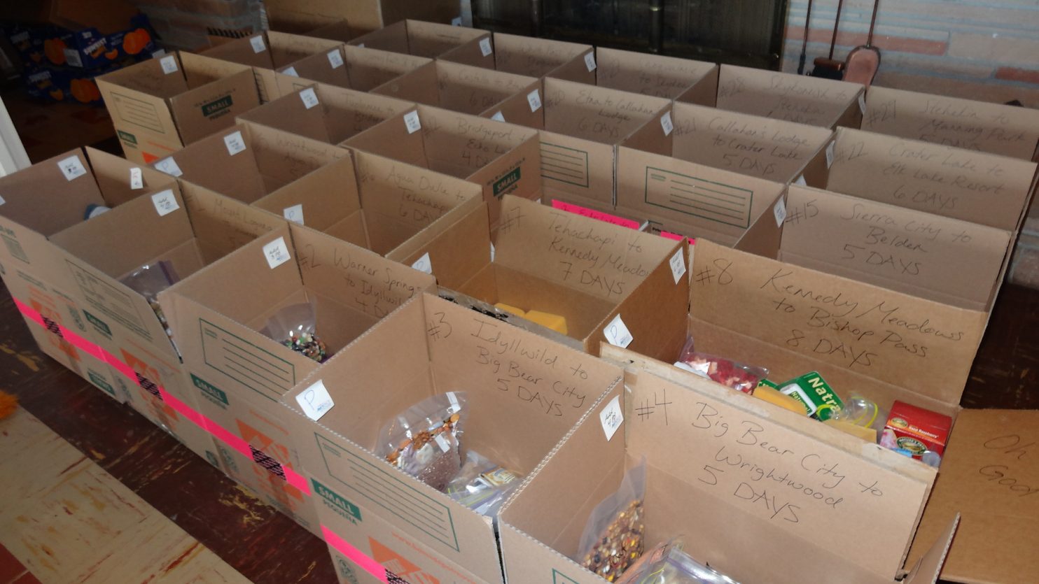
Having spent a frantic week in LA and Palmdale buying non perishable food and hiking equipment, packaging up 130 days of food and shipping them in 19 resupply packages up the PCT, and driving 1200 miles in the process, I was looking forward to the relief of starting the trail. The previous week had been devoid of anything interesting.

I got a lift to the Southern Terminus by the town of Campo on the Mexican Border where there was a rickety corrugated iron fence. There were a few other people being dropped off. Already it was hot and it was barely 1000. I turned north and took the first of many millions of steps towards Canada.

After a few miles the heat was already punishing. The trail wove between scrub. The bushes looked like small holly oak with jagged leaves,but the were a huge variety of different species.  Many of the scrub bushes were in flower and covered in foraging bees. Amongst the hostile shrubs were more delicate flowers also in bloom. Most impressive were the tall flower spikes of the Chaparral Yucca which sported a sometimes 10 foot high column of white or pink flowers. Occasionally ravens, the wiliest of birds, could be seen feasting on this seasonal bounty.

But the heat dominated despite the wonder at the new and unfamiliar surroundings. After 4 miles I got to an expected stream, filtered water, and drunk heavily. I encountered a few others, mostly stragglers as I started late and the day’s main herd of 40 starters were already on ahead. Everyone was feeling the heat. A few took shelter under shade during the worst of the day’s heat between 12 and 3.

However there was more to see than I first feared of this “Desert Section”.  Mostly flowers and lizards but also a few birds. The views were also calm and rolling a betrayed the inhospitable scrub if one were to venture off the trail.

I would only make the 15 miles Hawser Creek where the bulk of the day’s herd were camped beside a stream under oaks. I got in late and the heat had taken its toll. Just a quick bite and straight to sleep. A hikers midnight is 8 o’clock..

The next day was a early start helped by the movements of the rest of the herd and i was off by 0700 for the climb over the hill to Lake Morena. I got there as the heat hit by 1030 and found the store to have breakfast. A huge cheese omelette made up for yesterday’s lack of food, but all too soon it was time to sweat under the sun again. Many hikers had silver umbrellas they attached to their rucksacks to walk under.

I walked over a baking hill for two hours and then descended a rocky path to a creek lined with cottonwood trees. Under their shelter many hikers were hiding from the midday sun, mostly barefeet with their feet in the warm creek water. I joined them a chatted until we all thought it was time to continue another 6 miles in the still intense late afternoon heat to Yellow Rose Creek camp. This camp was also beside a creek under oaks. We had been very lucky this year as most of the creeks we encountered would have long dried up at this time of year but the exceptional rains meant they were still flowing.

On the third day the we hiked in groups or individually as we climbed up to Mt Laguna. The heat was intense again but i was driven on by the promise of pine forests and a shower. When the forests came it was like arriving home after a long journey. The dappled light which made it down to the floor was enough to support a sea of grass. It was not only pines but Oaks. Many of the oak’s leaves were still unfurling and were crimson in colour before maturing lime green. The oak copses were therefore pink. Beneath the oaks in the grasses were swarms of lady birds, many flying and others crawling on the grasses.

After 2 very hot arid days in the Chaparral the trail finally climbed up to Mount Laguna with its forests of 2 needled Ponderosa Pine and California Oak.

After 4 miles of this paradise i arrived at Mount Laguna. Here i camped with some 25 other hikers in a campsite and once showering and clothes washing had been done we could chat and relax for the evening until our midnight at 8 o’clock.

All too soon it was time to get up and force our muscles into gear again. I choose to hike alone today as we left the sanctuary of the cool pines and oaks of Mount Laguna and descended again into the scrub like Chaparral. It was a pleasant walk along the ridge for the whole day. To the east the landscape fell away steeply for 3000 feet to the arid desert in the rain shadow of the ridge I was on. It looked very inhospitable and I feared i would be down there before long. I camped high on this ridge watching the shadows lengthen on the desert floor and then night fall. The moon was clear and bright but when it set around midnight the stars were crystal clear with the Big Bear so obvious.

As i feared the trail now made a 2 day loop into the desert leaving the hot Chaparral behind and entering the furnace. I was blasé with water as there had been more than promised earlier. After a few hours I was down in the scorching plains with 2 litres of water. I could always fill up at Rodriguez. However I had read an old water report from a few weeks ago and Rodriguez had since dried up. So i had just a litre now to manage me across 10 miles of baking arid dusty hillside.  I was counting the miles to the water cache where everyone else had already headed. Just 7 to go, 5 to go. But each mile took an eternity. I paused frequently in the shade to cool off and had small sips of water to lubricate my throat. As one stage i foolishly tried to eat a “Cliff bar”, however it just turned to a bitumen like paste in my mouth which i could not get rid of it, and had to waste precious water rinsing. Eventually at nightfall I made it to the camp under the bridge and immediately drank 4 litres to rehydrate.  Although the water was warm it was lifegiving. The lack of water had taken it out of me and left me exhausted. I did not put the tent up but just cowboy camped under the bridge. The next day promised to be worse.

The heat of the desert was phenomenal compared to the higher Chaparral, which itself was hot. Here there was a serious scarcity of water

The herd camped at the bridge got up early to make it to Barrel Spring at mile 101 – some 24 miles away. I was too tired for that so opted  to go just 14 miles to the next water stash and camp there. With the early 0500 start I was halfway there before the heat hit. By then i had already climbed up into the San Filipe Hills. The path contoured up slowly going in and out of every ravine. The cactus here were extraordinary, especially the large Barrel Cactus, a foot in diameter and sometimes 3 high. This section had the richest variety of cactus so far. The views here were also good over the plain which i climbed from this morning and crossed yesterday. When the sun should have started to kick in on this dry hot stretch i was blessed with a veil of high cloud  which took the worst out of the sun. After a quick breakfast on the hoof at the halfway point i pushed on and by early afternoon had reached the cache of warm water. Others were chilling the shade waiting to push on the next 10 miles in the late afternoon but i was content to stay here and get up early. My heavy legs were tired, my body was tired – still a victim to yesterday’s partial dehydration and long day. I put my tent up in the shade and snoozed. By the time I awoke people were leaving for the afternoon march.  That night I camped  alone for the first time on the trip. Although i enjoyed the company of the others in  the herd, who I was now getting to know, it was great to be alone in the San Filipe Hills under a crystal clear night sky.

I woke a 0300 and forced myself up. I was well rested and it was cool- almost cold. I set off at 0400 in the dark. The air felt humid and my fingers cold. Almost unthinkable 12 hours previously. I walked well for an hour until dawn approached and i could see mists on the ridges. It was more reminiscent of Scotland weather and i was invigorated. I walked briskly for 4 hours non stop over the crest of the San Filipe hills and down to the grasslands off the plains below where the Barrel Spring was at mile 101 was. As I walked I met others coming out of their tents and caught some up. We chatted and then parted in the early morning. I was feeling a bond of togetherness with them now. A band of brothers and sisters on our march to Canada. The previous 2 days emotions were just perfunctory to survival.

Just before the spring was mile 100. It was a elation to see it etched in the path in pebbles. I paused for photos and took some of the few hikers who passed me before continuing to the spring.

The large concrete trough with clear water flowing into it was something of an oasis despite the nearby poison oak. People gathered here and chatted, snacking and telling of stories. A hiker then stormed in having hiked all 24 miles from the bridge through the night. His lack of modesty and bravado were unmatched and left the other 5 of us speechless.

Soon the band set off again as individuals. The path now crossed extensive  grassy plains. This was the scenery i remember from western movies where Herefords cattle roamed. The foot high grasses had bulbous  ripening seedheads which were flowing in unison with the gentle gusts. Occasionally a Live Oak would stand proud, perhaps a remnant from an ancient pre-settler forest. We passed a remarkable rock outcrop which naturally looked like a eagle and aptly named Eagle Rock. At last the grasslands were enveloped by the Live Oaks and a shallow valley formed which led us down to the sanctuary of Warner Springs. By now rain seemed probable.

At Warner Springs the small local community had turned the hall and playing field into a reception centre for PCT hikers. There was  place to camp, bucket showers, toilet facilities and even home homemade food and cookies in the hall for the 40 odd thru hikers staying  here. God bless the Good People of Warner Springs!. The desert dust was soon washed off our bodies and with more persistence our clothes before the rain set in.  I walked well today,  perhaps I was getting my “hiker legs”.

I slept well in the rain under a huge Live Oak pleased the single skin cuben fibre tent was as good as my others and grateful for the space. I will have a long lie and then a Zero Day at Warner Springs while the drizzle falls and my body recovers.

Back

Along the entire 2656 mile length of the Pacific Crest Trail it manages to avoid towns and indeed only passes through a handful of villages. This makes restocking food and equipment supplies problematic. Either one can mail resupply boxes to small village stores and fuel stations along the route or you can leave the trail hitch a ride into town resupply and hitch back to the trail.


Both have their disadvantages. The village stores and equipment supplies who hold packages might be closed when you arrive, packages can get lost or segments of the trail are closed due to fires or flooding. Conversely If one were to hitch into town the flow of the journey is broken and you might have to endure a night in a urban motel, to say nothing of the unknown time to hitch each way.


My Strategy is to avoid the urban fleshpots at all costs and to keep as true to to trail as possible. Surely this is the spirit of the trail. To this end I will be sending some 18 parcels out along the length of the trail before I start on the 1st May. In general they will include 5-9 daily food packs with 3000 calories each, the next sections printed maps, a few razors, A small toothpaste and soap. Occasionally I will include new underpants, socks, shirt,  and very occasionally new boots.


On one occasion, my resupply parcel to Kennedy Meadows at mile 700 will include gear needed for the High Sierras. This will include 14 daily food packs, ice axe, crampons, heavier boots and a larger strong rucksack to carry it all in. Once through the Sierras Nevada at Sierra City at mile 1200, I will pick up my lighter gear again and mail my heavier gear out.


My resupply locations are

Mile Location Address Days to Next ETA
0 Campo Start 6 1 May
110 Warner Springs WS Community Resource Center, 30950 Highway 79

Warner Springs, CA 92086.  Tel 760 782 0670. UPS

3 7May
180 Idyllwild Idyllwild Inn. 54300 Village Center Dr, Idyllwild, CA 92549.

Tel 888 659 2552. UPS

8 11 May
342 Cajon Pass Best Western Cajon Pass, 8317 US Highway 138’ Phelan, CA 9237

Tel 760 249 6777. UPS

5 21 May
454 Agua Dulce The Saufley’s, 11861 Darling Road. Agua Dulce, CA 91390

Tel :661.268.1235. UPS

3 27 May
518 Hikertown Hikertown, 26803 W. Ave. C-15, Lancaster, CA.93536

Tel  310 817 1595. UPS

8 1 June
702 Kennedy Meadows Kennedy Meadows General Store, 96740 Beach Meadows Rd

Inyokern, CA 93527. Tel 559 850 5647. UPS or USPS

14 10 June
877 Vermillion Valley Resort VVR c/o Rancheria Garage. 62311 Huntington Lake Road, Lakeshore,  CA  93634. Tel 559 259 4000. UPS 7 27 June
1017 Sonora Pass Sonora Pass Resupply, 3285 Grillo Drive, Coulterville, Ca. 95311.

Tel 209 852 9815. USPS Preferred

9 5 July
1195 Sierra City C/O Sierra Country Store, 213 Main Street, Sierra City, Ca 96125.

Tel  530  862 1560. UPS or USPS

4 14 July
1284 Beldon Belden Town Resort and Lodge, Ivan Coffman, 14785 Belden Town Road, Belden, CA, 95915. Tel  530 283 9662. UPS 5 20 July
1407 Burney Mountain Burney Mountain Guest Ranch, Inc, 22800 Guest Ranch Road

Cassel, Ca 96016. Tel  530 335 2544. UPS

4 26 July
1498 Castella Ammirati’s Market and Deli, 20107 Castle Creek Rd. 96017.

Tel 530 235 2676. UPS

7 1 August
1653 Seiad Valley c/o Mid River RV Park 44701 Highway 96 Seiad Valley, CA 96086.

Tel 530 496 3400. UPS

8 9 August
1820 Mazama Village C/O Xanterra Parks & Resorts, Mazana Village Store, 569 Mazana Village Drive, Crater Lake, Oregon 97604. Tel 541 594 2255. UPS 8 18 August
1992 Big Lake Camp C/O Big Lake Youth Camp,13100 Hwy 20,Sisters, OR 97759.

Tel 503 850 3563. UPS

7 27 August
2144 Cascade Locks c/o Cascades Locks Ale House, 500 Wanapa St, Cascade Locks,

OR 97014. Tel 541 374 9310. UPS

7 4 Sept
2292 White Pass c/o White Pass Rural Branch PO at the Kracker Barrel Store,

48851 US Highway 12, Naches, WA 98937. Tel  509 672 3105. USPS

5 13 Sept
2390 Snoqualmie Pass C/O Summit Inn hotel, 603 State Hwy 906, Snoqualmie Pass,

WA 98068. Tel 425 434 6300. UPS or USPS  

3 19 Sept
2461 Steven’s Pass C/O Stevens Pass, Through Hiker, 93001 NE Stevens Pass Hwy, US 2, Skykomish, WA 98288 Attn: Tye Creek Lodge Loading Dock.

Tel 206 812 4510. UPS only.

9 24 Sept
2656 Manning Park Finish                                        Total Food Packs 130 4 Oct


Back

The Pacific Crest Trail is the birthplace of Ultra Lightweight Hiking. The weather along the PCT is usually quite dry and benign, except for the last weeks in Washington State. Tents do not have to be double-walled, geodesic, 4 season structures. Sleeping bags to -5 Celcius are adequate and can be down filled without qualm at it is not that humid. Advances in technology means new materials like the ultra-strong and ultra-light cuben are becoming more affordable. If one is going to walk 2660 miles then the cost of investing in ultralightweight equipment is remarkably small per mile. It is probably a cost worth paying to get your base weight down to 10 kg as unnecessary kilos will wear down you joints and eat into your cartlidge. Light is Right.

The big 4 (rucksack, tent, sleeping bag, and sleeping mat) is where significant weight can be saved. My 4 pieces weight exactly 3000 gms are and:

  1. Rucksack and attachments; Z Packs Arc haul Zip Backpack – 920 gms
  2. Tent, Pegs and Tyvek; Z Packs Duplex and titanium pegs – 790 gms
  3. Sleeping Bag; Criterion Quantum 450 rated to -10 Celcius – 830 gms
  4. Sleeping Mat: Thermarest NeoAir Xlite Large size – 460 gms

In addition to this is another 6500 gms distributed among:

  1. Clothes carried –  2000 gms
  2. Waterproof Clothing – 800 gms
  3. Hygiene, First Aid and Repair – 600 gms
  4. Cooking and  Hydration – 1000 gms
  5. Gadgets, batteries, Maps – 2100 gms

This gives a total base weight of 9500 gms

This does not sound much but in addition to this up to 10 days worth of food at 850 gms a day and sometimes 4 litres of water have to be carried giving the maximum consumable weight 12500 gms

So the total maximum pack weight would be 22000 gms which would decrease to half that before restocking again.

For the 500 Miles of the Sierra Nevada however I will meet snow with the near record snowfalls of winter 2017 so I have to take heavier boots, crampons. Ice Axe and 16 days of food. All this will go into my old trusty xPod Rucksack as the Pack Weight will be a maximum 29000 gms which will reduce to a mere 13000 gms at the end of this 17 day section.

Extra Gear for the 500 Miles of the Sierra Nevada

Back

Friends once persuaded me to try a hike in California. Skeptically I agreed and found myself on the John Muir Trail. That hike took me completely by surprise and I was overwhelmed by it’s pristine beauty. It was a much cherished 3 weeks of Paradise which I have often reflected over.

A Shangri La on the John Muir Trail

Then a few years after that found myself in Norway on a long journey.  It was an awakening to get up each morning and travel through pristine nature for as long as it took to find a new place to rest. The hardships were soon forgotten as my pilgrimage unfolded. For 250 days I was completely immersed in the best nature Europe has to offer. When the end came I was distraught and soon bewildered as daily pragmatic trivia eroded my enthusiasm. Dew on my sleeping bag does more for my soul than a fancy dinner. This pilgrimage is here www.skipaddenorway.com

The 250 Day Norwegian Pilgrimage

I am now in the fortunate position to be able to withdraw for another 6 months and immerse myself into the pristine nature along the Pacific Crest Trail. A summer journey through Grizzly Adams Shangri La.  A few people ask me why I would want to such a thing. It would really be criminal of me to waste the opportunity.

Mount Ritter and Banner rise above 1000 Island Lake and my campsite on the John Muir Trail in 2006

Back

Day 01. Plaiul Foii to Rachitii Saddle (1484m). 9 km  5.5 hours 1030m up. 400m down. From Plaiul Foii, 850m, head SW on the pastoral track for just under 2 km. Just after a small bridge turn  right up a path and climb SW up a mixed forest path. After 2 hours approach the main ridge at the Curmatura Foii saddle, 1367m. Just before it bears right at a junction to shortcut onto the main ridge west of this saddle. Now follow the ridge NW for the rest of the day. The path is confusing and faint in places as it tries to follow the crest. However, the south side of the ridge has been felled and the path is frequently blocked with fallen trees. It takes a further hour up to Tamasul Mare peak, 1735m. There are superb views behind you towards the vertical wall of the castellated ridge of the Piatra Craiului mountains to the east. From Tamasul Mare continue NW through the pine and spruce forest, with occasional capercaillie sightings, for a good hour to the peak Tanjareanu, 1662m, where windthrown trees on the ridge are especially bad and it best avoided on the south. After this peak descend to Rachitii saddle, 1484m. Here there are camping spots. A few minutes walk down on the north side is a small trickle of water. There are great views to the huge forests south and the dammed Pecineagu lake.

02. Plaiul Foii lies at the end of the road from Brasov and Zarnesti and is the starting point for the Zagaras Traverse

03. The Piatra Craiului mountains are a 25 km limestone ridge with very steep sides rising some 800m metres from the surrounding plains and foothills. There is a challenging 2 day hike along the apex of the ridge. Here is the view of them from Varful Tamasu Mare to the west

04. A campsite on the Rachitii Daddle at 1484m at the end of the first day. There is a trickle of water just down the slopes on the north side of the main ridge.

Day 02. Rachitii Saddle(1484m) to Refugiul Bratilei. 21km. 10hours. 1190m up. 570m down. From the Rachitii saddle head west through felled areas and old spruce. The path is difficult to follow especially above the shepherds cabin on the spur west of Ciocanea,1628m for the traverse to the saddle 1407m. Now head through magnificent spruce to the Lerescului saddle 1396m. Just before it there is an easier path which ascends from the Rudarita lodge below which would be 4 hrs in total rather than the 8 so far to here. Much easier but not strictly the ridge. From the Lerescului saddle climb through felled areas for an hour until you reach the pastures and forest near the top of Lerescu, 1690m. Now climb above the treeline of 1750m to the grassy Comisu, 1880m, where there is an emergency shelter. The character of the walk changes now and the going is much easier as you head up Lutele for an hour. Now the walk heads west for about 8 km keeping around 2200m as you skirt to the south of Berevoescu, 2300m, and Popii, 2225m. There are dramatic views down to the north. Now descend easily for 3 km to the dramatic saddle at Bratilei, 2120m  hoping not to meet any shepherd dogs. There is an emergency shelter, a small lake and good campsites here.

05. The Shepherds houses to the west of Varfull Ciocanea, 1628m. These are used in the summer months. The sheep often spend the night near here and a guarded by fierce dogs.

06. Looking SE from Varful Lerecu, 1690m, towards Day 1 ridge walk with Varful Tamasu Mare being the dark triangular hill above the Pecineagu Dam and the Rachitti Saddle camp spot being on the very left of the photo. In the distance is the north half of the magnificent Piatra Craiului ridge

08. At Cumatura Bratalei (Bratalei Saddle) there is an old and broken mountain shed and camping is better. A small tarn at the saddle is popular with the herds of sheep which roam these mountains in the summer.

Day 3. Refugiul Bratilei to Refugiul Fereastra Mica a Sambetei. 16km. 7.5hours. 840m up. 790m down. Leave the Refugiul Bratilei and climb at once up the slope of Ludisoru passing just to the south then contour round to the south of Zarnel peak, 2223m, before making an easy descest to Zarna saddle, 1923m, The lowest in the Zagaras. There is a small refugiul and a sheepfold nearby, so shout if there are sheep about so the shepherd can control his dogs. This takes 2 hours from Bratilei. Now climb the steep rocky hill to the west of Zarna climbing sharply for 200m then more gently for 200m to traverse across pasture to the south of Leaota peak, 2312m, to start a long contour round the head of a pastoral valley dotted with alpine tarns. Contour round for an hour climbing slightly to a hill east of Dara, 2500m, where there are great views north into Urlea basin far below. The path now follows a narrower crest west for half an hour before it contours round the head of another pastoral valley with shepherds huts far below. After a good hour the path descends to Fereastra Mare i Sambetei, with great views to Moldoveanu, 2544m, ahead. At Fereastra Mica i Sambetei there is a dirty hut, camp spots and a spring. 

12. Looking west from near Varful Urlea along the main Zagaras mountain ridge. The distant mountain mid photo is Varful Moldoveanu, the highest in the range at 2544m.

14. Looking West from Varful Galasescu Mare, 2470, towards Varful Galbenele,2456m, (right) Hartopul Ursului, 2461m, (centre) and Varful Moldoveanu, 2455m, (distant in mist)

11. Lake Urlea see from near the top of Varful Hartopu. Lake Urlea is one of the dozens of alpine tarns found in the high corries on each side of the main ridge.

10. Varful Hartopu 2506m, on the right is the 10th highest peak in the Zagaras mountains as seen here from Varful Leonata, 2312m. It is at Varful Hartopu where the terrain changes to a far more alpine nature on the traverse.

Day 4.Refugiul Fereastra Mica a Sambetei to Lake Podu Giurgiului. 12km. 8hours. 980m  up. 920 down. Climb at once from Fereastra Mica a Sambetei up the steep slopes of Galasescu mica, 2433m, and then traverse across to Galasescu mare, 2470m, passing to the south of it. Now descend to a saddle with a great drop to the north before climbing the south of Galbenele, 2481m, getting a great view of Moldoveanu from its south ridge. Now descend to the Refugiul Vistei, 2305m. From here there is a steep climb up 200m to the summit of Vistea mare, 2527m. The main summit of Moldoveanu, 2544m, the highest mountain in the Zagaras Mountains lies just a quick half hour to the south over a jagged ridge. Leave the rucksack on Vistea mare and make the traverse to Moldoveanu having to make some easy scrambles in a few places on the well worn path and return to Vistea mare in an hour. Back on Vistea mare descend steeply west to a pass. There are impressive drops to the north down to the plain and a steep pastoral slope down to the wooded valleys south. For 3 hours ascend to the south ridges of the peaks, cross them, and then descend to the pass, about 5 times until you reach Podragu pass. Resist the temptation to descend to the fleshpot of Podragu lodge and continue over a final ridge to reach Lake Podu Giurgiului, 2264m, where you can camp beside the lake and ruins of the Refugiul.

16. Looking East back to Varful Galbenele, 2456m, (centre right) and Varful Galasescu Mare, 2470m from the vicinity of the small shed RefugiulVistei

18. Looking west to Refugiul Vistei shed with Varful Vistei, 2527m above the hut in the mist and Varful Moldoveanu, 2544m slightly highter to the south of it (left)

19.Looking south from Varful Vistei, 2527m, which lies on the main ridge to the summit of Varful Moldoveanu, 2544m,which is on a higher spur to the south.

20. Looking west from Varful Moldoveanu, 2544m, down the ridge of the Zagaras Mountains. The big mountain in the distant mist is Varful Negiou, 2535m, which is about 3 days walk away.

22. Looking west from Varful Vistei, 2527m to the path west down the main Zagaras ridge to Varful Ucisoara, 2418m (left) and Varful Ucea Mare, 2434m (centre right)

24. The small alpine lake Lacul Podul Giurgiului, 2140m, lies in a rocky bowl. There are some campsites in the vicinity on stony ground.

Day 5.Lake Podu Giurgiului to Lake Capra. 6 km. 5.5 hours. 580m up. 600m down. From the lake ascend steeply for nearly an hour as you climb 200m up Mircii and then traverse across the rocky ridge to Arnasu, 2468m. The is now a nice descent down a ridge separating two pastoral bowls on each side of the ridge. In the middle of this ridge is a narrow fin, which skirts on the north side before climbing up again above an idyllic pastoral lake on the south bowl. Above the lake we leave the separating ridge and drop into the north bowl. Climb out of this to the north west over a spur and descend slightly to a very crassy castellated section with chains for security. This 200m section is called “3 paces from death”. At the end of this you meet the easier path from Podragu and also a path descending to the Refugiul Fereastra and ultimately the valley and road. There is now a traverse down into a large south facing bowl covered in wildflowers where marmot alarm calls are frequent. Cross a few small cascades while looking down to a hairpin in the Transfagaran road. Finally there is an hour climb up the south ridge of Capra, 2494m.  Cross this ridge and skirt above the road to reach lovely Capra lake 2249 m, with great grassy campsites.

26. Looking back down to ake Lacul Podul Giurgiului, 2140m at the start of Day 5 the slopes leading up to Varful Arpasu Mare, 2468m.

27. One of the shepherds in the group of Shepherds who grazed their sheep in the lake Lacul Podul Giurgiului and lake Lacul Buda area.

28. Looking west from The saddle between Varful Arpasu Mare and Arpasu Mic towards Varful Buda, 2431m. Just out of the picture to the bottom left is lake Lacul Buda, 2055m. The path goes to the right of the picture

30. There is camping at Lacul Capra, 2249m. This serene camp about 2 hours after a more exposed section protected by cables called “Three steps from Death” (La Trei Pasi de Moarte)

Day 6. Lake Capra to Refugiul Caltun. 6km. 5.5 hours. 580m up. 650m down. Head round the lake and up to Capra pass. Don’t descend to Balea lake but head SW up the ridge of Lezerului topping out in under an hour. The path now heads west across an arete to Platinul, 2399m. En route you cross over the road tunnel far below. The south face of this arete is covered in verdant grass and wildflowers, probably because sheep don’t graze it. You can avoid this easy arete by descending to the business of Balea lake and climbing up Platinul from there. Descend the SW ridge of Platinul to a spring and continue past an easy scrambling section in a saddle to start a nice traverse across a grassy plateau which avoids the rocky summit of Laita bypassing it to the south. The traverse steepens as it leads up to the summit of Laitel, 2390m, where there are great views over to Negoiu, 2535m, tomorrow’s rugged highpoint. From Laitel descend it’s west ridge, loose in places, to a shallow saddle before the short climb up to the popular Refugiul Caltun, which is situated just above Lake Caltun, 2135m. The lake is surrounded by dramatic stony slopes with lead up to the steep walls of the encircling mountains. There is camping by the lake.

34. Caltun Lake with the rustic and old Caltun Refuge beside it. This is the campspot after Day 6.

Day 7. Refugiul Caltun to Refugiul Scara. 8km. 7 hours. 920m up. 940m down.Climb up the rocky slope west of the lake to gain a ridge after 20 min. Then traverse west across a rocky slope to the base of two chimneys, Dracului and Doamni. The former is shorter but has a rockfall danger and chains. The latter is easier and safer but longer. Take either chimney to gain the SE ridge of Negoiu and ascend it easily to the summit, 2535m, with great views over rugged alpine terrain, some 2 hours from Caltun. Now descend NW to Cleopatra pass where there is another choice. Either take the demanding scramble over the Custura Saratii for 2 hours to Serbota peak, 2331m, or avoid it by descending south for 350m to the Caldera Pietroasa basin and then climb out 350m to Serbota peak. Even the latter requires some scrambling but there are good campsites in Caldera Pietroasa, 2000m.The former  route over Custura Saratii is demanding with frequent chains and exposed sections and is not particularly safe in poor weather. Now, with the most difficult section of the entire traverse behind, descend west from Serbota to a pastoral saddle before a final and easy climb up Scarii, 2277m, and its NW ridge before descending to rustic Refugiul Scara where there campsites.

36. The route up Varful Negoiuj, 2535m, contours across the stones and then heads to the left up a chimney with cables called Strunga Doamnei to reach the ridgew and the pictured summit

38. Looking north from the summit of Varful Negoiu, 2535m, across the jagged Strunga Ciobanului saddle towards Varful La Podieu, 2408m.

43. Looking back from Varful Serbota 2331, towards Saua Cleopatrei, 2455m, along the arete with the Custura Saratii saddle between the two. Much of this route is protected by chains and cables

45. On of the protected sections on the route up Varful Serbota 2331m, on the airy arete up from the Custura Saratii saddle.

Day 8.Refugiul Scara to Turnu Rosu. 26km. 12hours. 690m up. 2370m down. From Refugiul Scara start the first of today’s 3 modest climbs up the east ridge of Scara, 2306m. Now make the descent to a pass with the gnarly Gabova in the saddle. Bypass it to the south and then descend sometimes steeply to beautiful Avrig lake, 2007m. Climb steeply up the west side of Avrig lake bowl to a pass and then walk across well grazed pasture for a couple of km to make a final climb up Budislavu, 2343m, the last mountain of the Fagaras Mts. Descend it’s NW slope and to a pass and contour around Suru to Suru Pass, 2113m. A path descends here but we continue west for 6 easy km across grassy hills like Tatarul and finally Chica Fedelessului, 1820m, before reaching Corbului pass, 1568m. We now leave the ridge trail as it peters out and follow the red crosses NW down into the spruce forest. This quickly gives way to beech trees and we are soon following a wide path along the wooded ridge down to a clearing called Lunca Plesii, about 1100m. Descend steep beech forest to the NE dropping 300m to reach the valley floor. Head down the asphalt track for 5 km past a monastery to Turnu Rosu, 500m, with its railway halt.

47. Looking east from the Portita Avrigului pass over the beautiful Lacul Avrig lake and on to Varful Scara, 2306m

48. One of trhe hardy shepherds in the Zagaras Mountains tending his large flock. These shepherds spend te whole summer in the mountains

52. As the path descends through the forest tyowards Turno Rosu the trees change from fir and spruce forests to beech woods.

54. The old Saxon town of Sibiu, once called Hermanstadt, was European city of culture in 2007. It is a great city to relax in after the 8 day Fagaras hike.

Start Finish Km hrs M up  M down
Day 1 Plaiul Foii Rachitii Saddle (1484m) 9 5.5 1030 400
Day 2 Rachitii Saddle  (1484m) Refugiul Bratilei 21 10 1190 570
Day 3 Refugiul Bratilei  Refugiul Sambetei 16 7.5 840 790
Day 4 Refugiul Sambetei Lake Podu Giurgiului 12 8 980 920
Day 5 Lake Podu Giurgiului Lake Capra 6 5.5 580 600
Day 6 Lake Capra Refugiul Caltun 6 5.5 580 650
Day 7 Refugiul Caltun Refugiul Scara 8 7 920 940
Day 8 Refugiul Scara Turnu Rosu 26 12 690 2370
Total 104 61 6810 7240

57. A more detailed map of the Zagaras Mountain hike with the overnight campspots and the 8 day stages

Back