Day 01. 04 July. 41 km. 8 hrs. 0m up. 0m down. We left Nanortalik at 0730 when the early morning sun had already been and disappeared behind clouds. With kayaks laden we weaved our way through icebergs, initially over cautious of them. We crossed the protected bay with a force 3 against us and reached the Tuapait headland.  Here we found a small beach covered in small icebergs and managed to find a way in, landing on the gravel to adjust a few things. From here we passed a small hut and entered the mouth of the 80 km Tasermiut Fjord.

02. Approaching Nanortalki town with a view north up to to Sarqa Fjord with Amitsoq Island distant centre, and Angmalortoq island distant centre left, and Sermersoq Island distant left.

03. The quiet town of Nanortalik has over 1000 inhabitants and most facilities including hotel, hostel, kayak hire, and 2 good shops.

04. Setting off from Nanortalik in the double kayak. Just 5.1 metres long it had very little storage for the potential 2 weeks, with all the food, fuel and climbing gear.

With the force 3 still against us we paddled over to the east side under a huge nose of a mountain. The wind had now swung in our favour and we made good time up to the crescent shaped peninsula. There were very few birds at all but there was a small colony of Black Guillemot here. Once round the peninsula a vast jagged landscape opened up with hundreds of sharp peaks in all directions especially up the fjord and Tasersuaq Lake were we were heading. We paddled quickly up the south coast of the fjord and after a couple of hours reached the entrance to the bay where the small hamlet of Tasiusaq was with its 15 houses. We landed here for a stretch and admired the stupendous view. The cold wind was still blowing from the south as we left the beach and we were soon across the bay being blown up the fjord with the iconic peaks of Kirkespiret, Ketil and many others all around, especially on the east side. At the end of the 10km peninsula fringed with a sandy beach covered in icebergs was a tiny hamlet with a smallholding where sheep were raised.

05. Paddling north past the entrance to Tasiusaq Bay. The small village of Tasiusaq with its 20 houses can be seen on the shore.

We rounded this and then made for the large river which poured out of Tasersuaq Lake. We were tired after the sustained 40 km paddling but were greeted by Stanley and Belinda and then Auke and John. After 2 carries the entire laden kayak has been portaged a km to the outflow of the river as it poured out of the 10 km long Tasersuaq L surrounded by awesome jagged peaks. The camp site looked across the lake at this jaw dropping view. After a chatty, mosquito-plagued supper, gathered with the others, the rain which had threatened all day finally fell, but by then we were in the tents.

06. After the portage we camped with the other 4 members having caught up with them. The campsite looked up the 10km lake we would paddle up tomorrow.

Day 02. 05 July. 34km. 13 hrs. 550 up. 550 down. We left at 0700 on an overcast morning with a tail wind blowing us up the 10 km Tasermiut Lake. Lofty mountains rose up on each side, their peaks lost in the mist above the small glaciers in steep bowls on their flanks. With the force 3 behind us we made good time under the rocky spurs of the north side past the entrance to Qinnguadalen which looked clogged with willow and birch scrub. Just a bit further was Quigeq kujalleq which we intended to walk up.

09. En route up Lake Tasersuag to the U shaped valley where we would leave the boats and fight our way through thick scrub to the watershed with Kangerluk Fjord.

We paddled a little up the river pulled up the kayaks and set off. It was soon obvious it was going to be bloodsome slog. The willow and birch scrub was thick, tangled and dripping wet. There was very little glade between the tangle and the going was slow as we fought up the south side of the river contouring higher and higher hoping to break above it. It was not to be and after 2 hours we finally made a small notch just 3 km from the boats. After the notch the going became much easier as we crossed a plain which was probably a silted up lake.

07. Looking back to Tasersuag lake with the 3 km of thicj scrub in between. The rest of the way to the watershed behind us was much easier to walk through

08. Standing on a boulder at the waterhed. Beyond the boulder the valley dropped to the base of the mountains ahead and through scrub to Kangerluk Fjord.

At last we could enjoy the huge granite walls and serrated ridges which we erupting out of the clearing cloud. Looking back Tasersuaq lake was turquoise in the sun. The plain was full of plants I was familiar with from Norway but there was a noticeable lack of birds to feast on the bountiful insects. After the plain there was a small climb of a few hundred metres up to the pass over to the valley which led down to Kangerluk Fjord. This pass at 400 m was our goal for the day. We could not see much down the other side but suspected it was moraine boulders and then tangled scrub beyond down to the fjord. Stanley went up a rocky knoll to get a better view and said it was more benign than we suspected. 

10. Paddling back across Taseruaq lake from the east end to our campsite at the west end against a force 4 headwind.

The return journey was much easier as we kept nearer the stream and almost managed to link up the glades between the scrub tangle. After a hard 7 hours we were glad to be back at the boats. However the wind had got up to a westerly force 4 and it was a hard slog down the slightly more sheltered south side of the lake to the camp. The south side was a continual tangle of thicket and would have been difficult to walk along. After 2 and a half hours paddling we finally got back to the tents at the outflow of the lake at 2000 after a long and exhausting day.

Day 03. 06 July. 18 km. 7 hrs. 580 up. 580 down. Still tired from yesterday, it was a relatively slow start and we did not set off on various trips down to the south side of the lake until mid morning.  Stanley and Belinda paddled a km down the lake to a sandy spit and then climbed Qaqqatsaig while Fiona and myself paddled to the south end of the lake. Here we split up with Fiona walking the 10 km track to Tasiusaq village past a couple of farms scratching a living farming sheep and trying to grow enough sillage to sustain them through the winter while I climbed Qaqqatsaig.

11.The view from our campsite at the west end of Tasersuaq lake. This was much better weather than we had for our trip to the distant mountains yesterday.

Its west flank was quite steep but a grassy ramp afforded a chink in the ramparts leading to the higher steep slopes. There was little of the difficult scrub here and it was easy to progress up a dry hillside covered in prostate birch and many wild flowers. Half way up I saw Stanley and Belinda descending a ridge to their kayaks. I continued up in the hot sun as the residual cloud of the morning lifted. The views were simply magnificent, especially up the lake to where we had been yesterday and up Qinnguadalen. Across the small southern arm of the lake the triple peaks Putooruttog, 1519m rose from the waters. Its south flank looked quite easy to walk up. At last I reached the top after a couple of hours of climbing. The panorama from this 530m peak was magnificent in all directions but the view down to the hourglass isthmus between fjord and lake where we portaged was the best. Reluctant to go back down the same way due to the steepness I decided to follow the south ridge.

12. The view down Tasersuaq lake from half way up Qaqqatsiaq, Our campsite was on the left just as the river flows out of the lake.

13. The view from the top of Qaqqatsiaq looking north. Tasermuit Fjord is on the left and Tasersuaq lake is on the right. The large kilometre long river is inbetween.

This delightful 3 km ridge undulated mildly across tundra vegetation. Occasionally I would pass a small group of an ancient breed of domesticated sheep which could sustain themselves from the meagre fodder. The ridge led very nicely to a saddle from which I could easily descend to the farm on the north side of Tasiusaq fjord. To the south east across this basin was another magnificent range with jagged sawtooth peaks. Once down on the track by the farm it was a quick 3 km along it past scruffy farm buildings and small patches of cultivated sillage grass to the kayak again.

14. Heading down the south ridge of Qaqqatsiaq with Tasiusaq bay on the left. The village is on the right behing the knoll where the bay and Tasermuit Fjord meet.

15. Fiona waiting at the kayak at the very SW tip of Tasersuaq Lake with the mountains around Quinndalen at the other end of the lake as a backdrop.

Fiona had been there half an hour already in the relatively mosquito free beach with the awesome mountains around Qinnguadalen as a backdrop. We quickly changed into our drysuits and cruised the 3 km up the east side of the lake passing an almost continual sandy shoreline to reach the camp again. Auke and John had had an easy day and were already starting to portage their kayaks in preparation for the paddle up the fjord tomorrow.  It developed into a calm sunny but mosquito free evening which was a rare treat.

Day 04. 07 July. 1 km. 1 hrs. 0m up. 0m down. Our plans to paddle up the Tasermiut fjord were in doubt when we woke at 0700 due to the strength of the east wind blasting down the Tasersuaq lake from the icy mountains which were now covered in cloud. After a bit of debate during which the weather went from a force 4 to 5 we abandoned our plans and went for the portage only. After carrying the kayak down Fiona and myself went back to pack the tent. By now the force 5 had turned into a 7 and there were large white caps all over the lake and spray exploding from the breakers on the beach below. We bundled everything up and hurried back to the fjord with 2 loads each in strong winds and lashing rain. It felt like a tempest was on the way. We carefully chose a protected campsite and set up the tents. With this done and no let up in conditions we secured the kayak and put rocks on the storm flaps of the tent. There was nothing else to do other than retire into the tent and have a long siesta with the wind flapping the ripstop and the rain lashing the taut fly. By early evening the rain had gone and the wind had moderated to a 4 again, indeed there were even large patches of bly sky. However there were big waves and white caps out in the fjord and it was no place to be. We had a sociable evening with Auke making pancakes for all as we gathered on the grass for a relatively mosquito free evening before an early bed at 2200.

Day 05. 08 July. 27 km. 5 hrs. 0m up. 0m down. The wind and rain of the night slowly relented in the morning but Belinda was poorly with a cold so we had a late start and did not set off until about 1400 by which time the wind had vanished. We passed a small plantation of spruce and pine as we cruised up to the first headland with the wind behind us. Even John and Auke were making good time under the slabby flanks of the lofty Qasigeerneq 1450m.

16. Leaving camp where the Tasersuaq River runs into Tasermuit Fjord. We camped in a gale for a day before heading up the fjord to the Sermeq glacier above.

17. Paddling past the small stream at the bottom of Suikkassuaq, 1524m. it was impressive, but there were more spectacular mountains just round the corner.

Across the fjord  on the west side were many dark ridges of craggy peaks covered in lighter gullies full of scree. Above all this rose the precipitous fin on Kirkespiret. After 4 km we rounded a headland and found to our delight that the breeze had swung behind us and was pushing us along at 7 kmph we made good time up past the very impressive Suikkassuag whose curved wall rose almost vertically from the jumble of craggy foothills. However, it was only when we passed this huge rock face did we realise that it was just a starter as the massive Ulamortorsuag 1843m, with its huge spire of hard granite. As we paddled towards it this vertical mountain grew more spectacular. The spire itself was 1100m of sheer granite and was one of the world’s most respected big walls. After 3 hours we had a quick stop at the first beach to the west of it. It was a great viewpoint to this massive tower but we were moving on all too fast for some. As we paddled up, John’s rudder wire frayed through unknown to us and he and Auke we delayed. Meanwhile Fiona Myself Stan and Belinda paddled up past the second beach as a white tailed eagle rose from the sea rushes.

18. Gazing up at Ulamortorsuag, 1829m. The granite spire rises out of the tundra along the side of the fjord for a good 1000 sheer metres.

At the outlet of the second valley from Ulamortorsuag Fiona and myself saw the camp of the Czech climbers we met earlier. We beached and let the others continue and went to meet Seer and Jan who we met in Nanortalik previously. We were greeted with open arms and met the other 6. 2 of them had just finished the 30 pitch climb up the tower we had just been marvelling. They had a great base camp and treated us to a beer and gave us food including a Czech wurst.

19. Brewers and Climbers from the Czech Republic. The Two Tales brewing company had sponsored the big wall climb. One of the Brewers, Jan, was a climber.

After our half hour visit we carried on further north with the increasing wind up to a 4 in places. It only took an hour to rush along the coast to Klosterdalen where we caught the other 4 up. There was some confusion with the landing and camping spot and Stanley and Belinda ended up on the south side of the large river and Auke, John, Fiona and Myself on the north side among the ruins of an old Norse Monastery. To our south rising straight above us was the massive wall of Ketil, a granite blade of rock rising over 2 km into the mists. It really was the king of Tasermiut fjord. From our campsite above the roaring waterfall where the river crashed into the sea was a wonderful view up the fjord to the glacier tumbling down from the ice sheet above. Previously our intention was to paddle further up the fjord to the glacier’s snout but with Stanley and Auke dangerously wet we called it a day here.

20. Kayaking beneath the falls as the river in Klosterdalen crashes into the fjord with the spire of Ketil, 2003m, above. The Norse ruins were just above the kayak.

Day 06. 09 July. 21 km. 4.5 hrs. 0m up. 0m down. We awoke in the ruins of the monastery with the cloud base just at the top of Ketil which loomed above us and whose north face of sheer granite erupted to 2003m. We left at 1000 with John still packing under leaden skies. After negotiating the sandy deposits below the waterfall where the silty river entered the fjord we headed north. There was a marginal tail wind and small following tide so we made good time passing a white tailed eagle at the first sandy headland. The cloud was slowly gathering as we paddled up passing the next valley at Tiningnartoog. Across the fjord we could see our campsite for the day at the alluvial valley of Itillersuaq. 

22. At the edge of the Tasermiut Fjord with the side glacier of Sermitsiaq in the distance and the icy lagoon just behind us. The next day we would paddle up here

21. A lone kayaker heads up Tasermuit Fjord with the melting Sermeq Glacial tumbling down the headwall.The Sermitsiaq Glacier is on the right out of the picture.

However we wanted to keep to the east side and passed under the massive cliffs of a prow whose exfoliating granite slabs rose out.of the fjord. Once round this  prow we reached what was at one time, some 100 years ago, the place where the Sermitsiaq glacier reached the sea. This had now retreated some 2 km and it now terminated on slabs just above a moraine dammed lagoon. The silty stream which flowed out of this lagoon and through the moraine would have been possible to paddle on a flooding tide only when the power of the glacial stream was diminished.  we pulled the boats up and had lunch here on the edge of the lagoon with the tongue of the glacier resting on the slabs just above the water.

23. Heading back down Tasermuit Fjord in the rain to our campsite at Itillersuaq, which is on the right. Klosterdalen would be one of the misty valleys on the left

24. Looking straight across Tasermuit Fjord from the alluvian campsite at Itillersuaq. Across the fjord is the lagoon and Sermitsiaq Glacier we visited earlier.

After lunch the other 4 paddled off to the campsite at Itillersuaq but Fiona and myself took advantage of the calm conditions to paddle right up to the end of the fjord where the Sermeq glacier rose from just above the end of the fjord in an enormous icefall some 1500 metres high. As we neared it the temperature dropped significantly as the cold air from the vast ice sheet above descended. This enormous icefall was full of seracs and crevasses and one had to consider if anything would break off and tumble or avalanche into the water creating a huge wave. We thought it safe enough to venture forth to where the stream emerged from under the ice and tumbled down a few slabs into the sea. Each side of the icefall were triangles of slabs but they looked too steep to walk up. Leaving the glacier behind we now paddled down the west side under a massive buttressed mountain, around whose highest crags mist swirled. About an hour later we reached the campsite of the Itillersuaq valley and pulled the kayaks up on a braided alluvial fan. Here there was a large flock of some 200 gulls which we had disturbed a few times after lunch. Such a flock would be unremarkable elsewhere but here they were unusual. The campsite itself was a short 300 metre carry and we had the tents up quickly. The rain came in showers for the rest of the afternoon and evening but it remained calm.

Day 07. 10 July. 18 km. 3.5 hrs. 90m up. 90m down. After a group discussion we set off again for the main icefall of the Sermeq glacier.  The mist and the drizzle of the night was slowly evaporating and more and more sun was starting to break through. By the time we paddled the 6 km to the glacier the day had all the promise of being a stunner. With the clarity came the views and what we saw in the mist yesterday was now in its full unobscured glory and against a largely blue sky. Stanley arrived first, beached his kayak and leapt up the quarter kilometre of gentle slab to the smeared snout of the glacier. We followed as we arrived.

25. Heading back up to the Sermeq Glacier from out camp at Itillersuaq at the start of a glourious day

27. We landed at an alluvial beach and walked up the the base of the Sermeq Glacier beneath a 1500 m icefall.

26. The whole team at the bottom of the Sermeq Glacier. From left Auke Raaff, John Sinclair, Stanley Mulvany, Belinda Mulvany, Fiona Burnet and James Baxter.

It was an awesome sight and great privilege to be standing on these recently uncovered granitic and smoothly polished slabs. The jumble of ice rose up a good 1400m above us in a 35 degree amphitheatre with few nunataks thrusting through high above. We were all awestruck by the spectacle and spent a good hour here. We then split into two groups with Stanley and John returning to camp in Itillersuaq while Belinda, Auke, Fiona and myself headed off to the glacial lagoon at the base of Sermitsiaq glacier. By now the day was superb and there was barely a cloud in the sky.

28. Heading from Sermeq Glacier to Sermitsiaq Glacier and just about to paddle furiously up the stream which left the lagoon below Sermitsiaq Glacier.

The giant of Ketil with its huge NW face dominated the view south but wherever you looked there were vast mountains, many of them probably unclimbed. At the lagoon the rising tide had not yet overpowered the silty glacial stream and we had to fight hard to enter it. Once in we paddled across the sand fringed lagoon to the base of the  slabs where the rooster tailed torrent crashed down the slabs into the lagoon from the glacier just above.

29. In the lagoon beneath the much retreated Sermitsiaq Glacier. It was possible to land and pull out on silt below the waterfall.

30. The spectacular waterfall had chuncks of ice and lumps of rock coming down the cascade as they broke of the glacier above.

We had lunch here watching the powerful waterfall. The lateral moraines on each side were loose and it would not have been long since the glacier retreated from here, perhaps 25 years. Conscious that the incoming tide had now filled the lagoon and wary of the combined ebb and stream out of the lagoon we left. However at the entrance we saw a powerful flooding stream completely overpowering the glacial stream with at about a 10 knot flow. We tried to paddle into the fjord but failed, and had to walk the boats round in drysuits. Once on the other side and in the fjord it was a lovely paddle across the 2 km fjord to Itillersuaq camp. There was now not a cloud in the still sky. It could not be better weather. The only flaw was Belinda dropping her very expensive camera in the shallow water while landing.

31. Heading from the waterfall to kayaks by the lagoon with a slither of the Tasermuit Fjord just visible beyond. Across the other side is our camp at Itillersuaq.

32. A view of the alluvial campsite at Itillersuaq with the mountain between Sermitsiag Glacier and Lagoon on the left and Klosterdalen on the right.

We returned to the tent to find everything which had been damp was now crispy dry. In the early evening Fiona and myself went for a short 2km walk up the valley which was  smooth with just ankle deep scrub. Stanley in the meantime had walked the 7-8 km up to the lake and had encountered bad scrub up there. He said the glacier north of the lake was steep and all the mountains need rock climbing skills. That evening the insects were bad and 2 Spanish pack rafters joined our camp.

Day 08. 11 July. 38 km. 7 hrs. 0m up. 0m down. It was a glorious but insect infested morning when we rose at 0700. It was impossible to do anything without headnets on. By 1000 we had packed the boats and set off down the fjord again. It was a stunner of a day again and everything was clear. After a final view at the two glaciers we pressed the right rudder pedal and veered south. There was virtually no wind as we paddled down the west side opposite at our previous campsite in Klosterdalen under the now crystal clear huge NW face of Ketil, 2003m. This face must have been some 1300-1500m of nearly sheer granite.

35. Paddling down the west side of the Tasermuit Fjord with the last look back to the fjord’s head. This photo was taken just opposite Klosterdalen and Ketil.

33.Paddling down the west side of the fjord with the massive granite tower of Ketil, 2003m, rising up from the edge of the fjord and Klosterdalen valley.

After 11 km we stopped on a sunny beach for a break and to wait for John. We unfairly seemed to leave as soon as he arrived which seemed unnecessary as it was clear, warm and still. However, over the next 6 km the southerly wind suddenly arrived and it rapidly increased from a force 1 to 3 and then 4. It made the going slow especially, for John. We tried to fish but just caught a stone and had to give up. As we came round a headland opposite the mighty spite of Ulamaratosuag the others had pulled up on a pebble beach and to our alarm seemed to be unpacking the boats. It was now a force 5 but it was just a temporary anabatic wind caused by the land and air above the ice cap heating up and pulling air up the fjord. It seemed clear it would diminish, and as we debated it went from a 5 to and 4 and then down to a 3. Fiona and myself wanted to continue and Auke chose to join us.

34. The alluvial beach where the relatively small Itillikasik river meets the Tasermuit Fjord. On the opposite side is the mountain of Ketil.

36. Kayaking in Tasermuit Fjord with the granite spires and faces of Ketil,2003m, (left) and Ulamortorsuaq,1829m, (right) rising from the shoreline.

We intended to paddle another 20 km to Nuua and camp and then climb a hill the next day from the same campsite.  There was a bit of angst about splitting the party but the weather was too good to camp. We set off at 1700 and paddled round the headland.  The wind was a force 3 against us but we easily overcame it and made relatively good time. It was a shame to be leaving Ulamaratosuag and Suikkassuag as the mountains further south were tamer; but still impressive.

37. Looking across the Tasermiut Fjord from Kiinaalik towards the might west face of Ulamortorsuaq, 1839m, one of the great big wall climbs in the world

38. Heading down the Tasermuit Fjord with a final look back to the giants of Ketil (left), Ulamortorsuaq (centre) and Suikkassuaq (very right)

There was virtually no tidal assistance as it was high tide. We paddled 8 km catching the occasional glimpse of Kirkespiret high on our west above the fjord sides. Soon we were passing our old campsite across the fjord at the portage up Tasersuaq lake. We flushed a sea eagle from its perch as we passed the islet at Nuua. Occasionally the wind was with us but generally it was mild and in out faces. After Nuua we paddled another 4 km down the coast to reach a nice campsite overlooking the iceberg-covered fjord, with Pyramiden on the other side. We found a nice place to camp above the coast on a draughty plateau covered in short moss and lichen. We set up the tents in the last of the daylight with glow on the mountains and a rainbow feature in the misty air, far to the south down the fjord. By the time dinner was over it was nearly 0100 in the morning.

39. The view SE from the campsite at Nuua to the jagged range between the Tasermuit Fjord system and the Prins Christian Fjord and Kap Farvel systems.

Day 09. 12 July. 12 km. 8 hrs. 1090m up. 1090m down. There was some drizzle in the morning so we lingered in the tent until suddenly there was a hello at the door at 0930. Belinda and Stanley had already paddled the 20 km from where we left them at Kinalik yesterday. While we got up and prepared to climb Aniggup qaqa, 1060m, Stanley and Belinda waited for John who left around 0600 also. Fiona, Auke and Myself left at 1030 with the overcast weather improving all the time so there was the odd flash of blue sky in the cloudbase which was at about 2000 m. We crossed the small river easily and started up across the lichen heathland threading a way through copses of willow and birch scrub. We managed to link enough of the glades together to walk unimpeded across the prostate birch which was only ankle deep. The bugs were incessant and we had to climb with headnets on as there was no breeze. There was a line of springs across the hill at about the 300m contour with forests of Angelica and carpets of moss around their small bowls.

40. The line of springs bursting forth above a layer of more impervious strata on the hillside were covered in moss and Angelica, an important food in Norse times.

41. Climbing up Aniggup qaqa and looking across Tasermuit Fjord to Tasersuaq Lake which we paddled up a week ago to have a walk in the distant mountains.

When we reached the ridge line at about 500 m the vegetation finally petered out and stones started to dominate.  Near the ridge they were firm and covered in lichen, but to the left where snow fields lingered they were bare and more unstable. We tried to keep to the crest of the ridge where the stable stones were covered in a crisp dry black lichen. There was a marginally steeper bit around 800m but it was still very easy. There was a subsidiary summit about 10 minutes before the slightly higher main summit. The final ridge up to the summit was a bit airy on the north side, but not exposed. Just before the summit Auke spotted an Arctic Hare. The 360 degree view from the top of Aniggup qaqa was truly remarkable.  To the south down the Tasermiut fjord was a shallow saddle and then an open fjord, one side of which was an archipelago. 

42. looking West from the summit of Aniggup qaqa, 1060m, to the mountains on islands, like Sersersoq and Amitsoq Islands, at the mouth of Sønde Sermilik Fjord.

44. Looking North from the summit of Aniggup qaqa to the big mountains on the east side of Tasermuit Fjord. Ketil is the highest and Ulamortorsuag on the right.

Beyond this was the open Kitsigsut Tunuat Sound clogged with enormous icebergs and beyond them the final frontier against the Atlantic, which was the Kitsigsut Archipelago. To the SE and East were the very impressive jagged towers and needles of the landscape around Prins Christiansund, sometimes described as the most impressive landscape in the world. To the NE and North was the Tasermiut fjord, dominated by the granite spires of Ulamartasuaq, Ketil and Kirkespiret and the glinting ice cap beyond. To the NW, West and SW were a jumble of 1250m mountains with steep dark black lichen covered ridges and lighter gullies full of loose stone around the south end of the Søndre Sermilik and Nanortalik town. It was a truly sumptuous view. We lingered for 15 minutes taking photos and then started down.

46. Heading back down the south slopes of Aniggup qaqa with Tasiussaq bay across the fjord and then the mountains before the Prince Christian Sund fjords

Rather than return to the east peak we cut off down the gravel and boulders on the  south side traversing down to some shallow snow patches. We followed the easy snow down the south face and rounded the shoulder to reach the SE ridge again. It was not long to return to the vegetation and the mossy angelica springs before a bit of scrub bashing to return to the tents after a very satisfying day. It was a relatively early night as it was quite cold and bug ridden in the still evening air.

Day 10. 13 July. 31 km. 5 hrs. 0m up. 0m down. John left at 0600, Stanley and Belinda and Auke left at 0800 and Fiona and myself left at 1000 from our campsite just south of Nuua.  The morning was overcast and the force 2-3 was from the south and against us, but we still had about 4 hours of the ebbing spring tide in our favour. It took just an hour down the west side of the fjord to Aniggoq where the whole fjord veered from south to west. We now headed into force 3 winds past a deep bay where we could easily look up and see the mountain, Aniggoq qaqa, which we climbed the previous day. We paddled down the steep shoreline here with the mountainside plunging into the sea for another 4-5 km to reach a bulging headland.

47. Paddling down the Tasermuit Fjord near Tasiussaq Bay with the whole of the fjord behind me.

We now had the choice of continuing along the north side or cutting diagonally across the fjord into the force 3 to the Naujat nuat peninsula. We opted for the latter hoping the ebbing spring would compensate for the wind. It just about did and we rounded this slabby headland at 7 kmph with a few large icebergs which had somehow managed to find their way into the fjord. We saw a  smaller seal here, perhaps 2 m long. It made no sense to stop here so we rode the tide a bit more and made for the southern tip of the peninsula, called Niaqornaq, on the west side, as the fjord now reorientated itself North-South again. We crossed a bay after the southern tip and pulled up on some rocks. It was just after 1300 and we had already done 22 km.

47. Paddling past Aniggoq bay with the mountain we climbed yesterday just to right of centre.

As we ate on the rocks under the grey skies and beneath the triangular bulk of Pusardluarnaq, the other 4 paddlers came round the headland. Somehow we had overtaken them. After a quick chat they carried on and we soon followed. Suddenly we both spotted a small Arctic Fox running up the slabs after we had disturbed it from seeking out and plundering bird nests along the steep shore. It did not take long to get to Nuk which was in effect the mouth of the fjord. We paddled along the north west jaw of the fjord which had many icebergs dotted along it. At the bay by the light beacon and a very rustic hut, all the icebergs on the beach where Fiona changed her spraydeck on Day 01 had now vanished. They were probably blown away in a northerly wind during a high tide. The bay here was peppered with icebergs and the usual coastal fog was returning making it very atmospheric. Occasionally  there would be an almighty crack and a piece of ice flow would break off.  Finally we rounded another headland and the town of Nanortalik appeared some 2 km away. The stretch to reach it was littered with icebergs, some of which were huge and clearly calved off glaciers from the east coast rather than unmelted sea ice.

49. Heading back round the headland at Tuapait where there were larger icebergs appearing which littered the remaining few km to Nanortalik.

They groaned readily as they put more weight on their submerged bases as they grounded at the low tide. We reached Niels`s cabin at about 1630 after just 5 hours easy paddling.  Luckily it was empty and we phoned him to open it up and let us stay. Rather surreally just after arriving John, Fiona and Myself went off to the hotel’s pub to watch the final of the football world cup, a global event, while the others did their washing.  

Day 11. 14 July. 0 km. 0 hrs. 0m up. 0m down. Today was a rest day back in Nanortalik. in the morning there was a lot of clothes washing to do and hang up on various ropes along the sunny shore with the sea breezes. It took a few hours until it was all done. Then we all headed off to the open air museum nearby. The happy curator,  David, showed us round 5 of the buildings and we helped ourselves to the other 5 buildings. There were great displays of Inuit here, many of whom had migrated from the Prins Christiansund area some 100 to 50 years ago.

51. Nanortalik was a great base in this small town,and useful to clean up after the Tasermuit Fjord expedition and prepare for the next.

50. Old Inuit kayaks in the museum. They were seal skin on driftwood frames. There were also white camouflage sails, hunting spears and bladders on display.

There were also good displays on kayaks and umiaks, seal hunting and even whaling. After this we all packed and prepared for the second half of out Greenland adventure which was exploring the islands to the NW of Nanortalik, such as Sermersog. It was all done by early evening just as the glorious day faded and sea fog returned.

Day 12. 15 July. 31 km. 5 hrs. 0m up. 0m down. We left Niel`s hostel in Nanortalik at 0900 and headed off into the fog without John, who was waiting for his fog-delayed helicopter. It was quite confusing to navigate in the fog through the icebergs that had run the gauntlet of skerries, islets and shoals and made it into the harbour area. We headed north into the northern basin and followed the misty coast of the islands as we headed north to the narrows at Erdlua where the ebbing tide was against us. There were some huge icebergs here which must have blown up the fjord between Nanortalik and Sermersog islands.

53. Auke paddling through the mass of icebergs just after Erdlua just a few km north of Nanortalik town.

We then cut inside Thomsens Øst island and were blown up in a force 3 through a rocky archipelago to the narrows at the north end. Here Stanley and Belinda and Auke went ashore to see an abandoned village while Fiona and myself continued for another half hour to the abandoned inuit fisherman’s cabin at Umiviarssuk. We waited here while the others caught up and then continued north. The wind was increasing the whole time and was almost a 4 as we were blown north. However with the wind came the waves and they started to swamp a few leaky spraydecks and soak the occupants, especially Stanley and Auke.  We rounded a proud headland about level with the bottom of the mountainous Amitsoq island where the waves were larger and then continued for another 3 km to a lovely, sheltered stream outlet where we pulled up in the sun and had lunch. It was just here a plan for the day was made and we decided to continue to Pisigsik and camp.

55. Paddling north up Sarqa Sound looking west over to the very rugged Sermersoq Island. There were some huge icebergs in this stretch of water.

Apparently there was an old goldmine there. It took another 2 hours of wind assisted but choppy paddling in a force 4 to do the 12 km to this bay, during which Stanley and Auke were soaked from the waist down. The goldmine turned out to be something to avoid rather than see. It was an industrial operation which was based on a large barge. A few lorries plied a dusty road bringing stones to the barge and building nearby for processing. As we pulled into the inner bay the shallow slope of the beach and low tide meant we could not land without a 500m carry so we went back a km to a beach and found some good spots, here but within earshot of the mining operation.  From our camp we could just look up the valley to see Aniggup qaqa which we climbed a few days ago.  In the evening the wind dropped but it was still cold.

Day 13. 16 July. 23  km. 4.5 hrs. 0m up. 0m down. We rose at 0600 to be on the water at 0800. While we were packing the wind increased from a force 2 to 3 and very nearly a 4 and it would be against us. We packed and set off to the north side with the small whitecaps breaking on the deck and sending water onto the leaky spraydecks which then dribbled through. Although it was overcast it was bitterly cold in the NW wind and I was getting splashed by Fiona’s paddle spray to the extent I had to put my poggies on. Once we were over the other side by the north jaw of the bay the wind had dropped a bit and we decided to cross the Sarqa fjord to Amitsoq island straight away. It was some 3 km and easy enough.

56. Paddling north up the spectacular cliffs on the east side of Amitsoq Island. These cliffs rose for some 600m straight out of the flord.

The paddle up the west side of Sarqa under Amitsoq was truly jaw dropping as huge slab cliffs and outcrops rose steeply from the water and soared into the mist at about 5-600 metres. It was a very still paddle up here with small groups of Black Guillemot gathering on the dark water. We also flushed a duck, probably an eider, who feigned injury for a good km to lead us away from her chicks. We chatted as we paddled north to our lunch break at Sermilik where we hoped to find a real or abandoned village, but there was none. After lunch we headed north round the tip of the island. However the tide had changed now and it was a fight against it to climb up into Søndre Sermilik fjord. We all made it and decided to cross the fjord to the NW side. We set our sights on the knoll at Niaqornarssugssuag and set off. It was soon clear it was a battle for some as the wind was almost a 5 and spray was flying everywhere.  We slowed right down to 4 kmph and kept together as a group. Slowly the knoll grew larger but so did the swell especially in places where the west wind was running into the easterly ebbing current. After an hour we finally reached the knoll. A few of us were cold and wet now and it seemed sensible to find the first beach and campsite. Less than a km from the knoll heading west we found one and camped with the tents up by 1430. The sun and mist danced across the higher peaks but the cold wind kept up all afternoon. 

Day 14. 17 July. 29 km. 5.5 hrs. 0m up. 0m down. The stronger wind of yesterday had disappeared but the mist was low and it looked like rain to the west where we were heading. We set off at 0800 again and made reasonable time down the misty coast unaware of the tremendous scenery on each side of us. After just 2 hours we passed the entrance to an inlet and then entered a large sheltered basin between the mainland and an island. Seals seemed to be herding a shoal of fish here and then lunged at them when  they had them corralled. When the seals came to the surface some 50 gulls dived down.

57. The hot driftwood fire on the beach in the large Ikerasarssuk lagoon. The blaze was so hot I had to move 5 metres away for fear of damaging my drysiuit

We stopped at a beach in the basin. Belinda made a small fire and we all added to it so it was a roaring blaze throwing out masses of heat which we enjoyed for an hour. We left the basin and sneaked round the north of another island which formed another basin with the abandoned village of Quvnernuit at the north end of it. When we exited we decided to cross Unartoq fjord straight away, before the wind returned, toTugtutuarssuk island. It was a few km but it went well and we landed at the abandoned village of Igdlorpait.

58. The abandoned village of Igdlorpait lay on fertile ground on the north point of Tugtutuarssuk Island. There was an abandoned schoolhouse and church here.

59. A lone kayaker paddles past the end of a huge iceberg in Unartoq Fjord en route to our campsite at Igpik

The village looked like it was an old fishing station and even had a church and school and some 10 houses. Everything was in ruins. As we explored the fog seemed to come and go and there were some great views of the mountains on Sermersog.  Finally there was a small 6-7 km paddle across a sound and up the sheltered and sunny east side of Unartoq island to the small hamlet of Igpik which seemed to be composed of one fishing homestead. I asked two kids who were outside where the hot springs were, but they did not speak Danish, so I asked at the homestead. Here a hard working Inuit told me it was a km away. So we returned to the kayaks on the beach and set up camp.

61. The campsite at Ipgik looking across Unartoq Fjord with the rugged island of Sermertoq rising up above the mist in the distance.

60. The hot springs at Igpik were clean, uncomercialized, and a delight to wallow in despite the near freezing air temperature.

Once this was done we all walked along the isthmus, past a small harbour and sandy beach with a few foreign yachts. The hot springs were a gravel pool through which warm water leaked. It was free and uncommercialized but not as warm as hoped. There were about 6 inuit kids already there. We stripped down to underwear and hopped in for half an hour summoning the courage to dash out in the cold wind to get dressed again. We returned to the tent and managed to get water from a hose by the fishermans homestead. That evening the coastal fog returned and the temperature plummeted.  

Day 15. 18 July. 52 km. 9 hrs. 0m up. 0m down. It was completely still when we left with the icebergs in the sound reflected perfectly on the mirror water. Stanley and Belinda went on ahead to weave in and out of an iceberg congestion. We crossed the fjord straight away and met the on the far side by Vagar bay.

62. Leaving the beach at Igpik we paddled across the mirroe calm fjord past large iceberg as we cross to the east side by Vagar.

63. Just before Vagat bay we caught Stanley and Belinda up. They had been weaving through large icebergs taking many photos.

We then confirmed we would split up with myself and Fiona heading up the length of Søndre Sermilik fjord while Stanley and Belinda and Auke would continue to explore the islands of Sermersog, Angmalortoq and Amitsoq, three jagged and impressive islands, but a bit in the fog zone. We said our goodbyes and headed off to the bonfire beach again passing more seals corralling fish and lunging at the greater density. While at the beach the others arrived and lit a fire. Auke even started to make and bake bread using it. We said goodbyes again and set off on still waters but with the tide against us to Niaqornarssugssuag where we camped the previous night.

64. Looking back down the Søndre Sermilik fjord with Angmalortoq island and it’s snow gully in the distance. Up this west side of the fjord there was no campsites.

It was completely quiet and uneventful but the islands to the south made up for this. At Niaqornarssugssuag we left the sound and entered Søndre Sermilik fjord and started up the west side. It was a near continual line of crags and cliffs rising up for a kilometre or so into the sky. From these descended steep snow filled gullies where waterfalls cascaded down. It was a foreboding coast and it continued for kilometre after kilometre without respite. Across the fjord was a gentler slope rising up to high mountains with remnants of glaciers on them. There was nowhere to camp at all on the west side but there looked like some possibilities on the east side. Even at Qarnermiut where there was a hut marked on the map there was nothing but foreboding alluvial fans and willow covered boulderfields.

65. Looking up the Søndre Sermilik Fjord. The campsite of Ipatit is in the alluvial valley to the right. If you follow this valley floor for 18km you get to Tasermuit Fjord.

We continued on to Ivigtut but still there was no campsite and looking up the shore to Ineq we could see little opportunity.  The southerly wind which had blown up up the fjord for the last 3 hours had now diminished so we decided to cross and camp at Ipatit. Crossing the still fjord was a joy and there were many great campsites here in this large alluvial plain where two rivers ran into the fjord. It was very buggy as we erected the tents and crawled inside for a well deserved rest. However on the positive side the scenery was spectacular and the temperature seemed a good 10 degrees warmer when compared to the coast, as Tasermiut fjord also was, due to the lack of fog. 

71. The campsite at Ipatit on an alluvial shelf. The tents were erected so the blue tent effectively became a porch and the green tent an insect-free inner sanctum.

Day 16. 19 July. 49 km. 9 hrs. 0m up. 0m down. It was an improving day when we set off at 0900 with a force 3 easterly wind coming out of the valley. We completely dismantled and packed our camping gear.  We avoided the sandbars, passed a derelict looking cabin and then reached the south end of the curious ridge, Alakarigsup qaqa, 800m, which almost formed a sharp island in the fjord. There seemed to be very little camping possibilities in the fjord apart from the one we had. The alluvial fan at the bottom of Inip qaqa seemed too steep to camp on and was largely composed of stones and even Ineq, a bit further along the fjord, had nothing obvious among its willow scrub.  However the mountains above these emergency campsites were supreme with serrated peaks rising up to around 2000 m.

66. Paddling up the fjord from Ipatit with the steepish Kugssuatsiaq valley in the centre and Ineq just round the corner on the right.

As we rounded the south end of Alakarigsup qaqa we left the east side and returned to the west side again just catching a glimpse of the icefall at the head of the fjord. Even from here it was obvious it had retreated significantly since my map was produced some 30 years ago. After Ineq the west side of the fjord steepened again with huge cliffs rising above the milky blue waters. We passed a headland where the glacier ended 30 years ago and could see the straight rising line of clean loose rock recently exposed with no vegetation or lichen on it. Indeed if one looked across the fjord to the east side there was an even more distinct line some 300 m above the fjord.  It was astounding to think that the glacier had retreated and vanished so much in such a short time.

67. Paddling to the end of the fjord in waters my 30 year old map showed were glacier. Note the clean moraine line where the glacier has recently retreated from.

On the east side a glacier descended from the icecap but its once bulging convex form was now just a concave smear and it now longer reached the fjord. .we continued north passing many small colonies of Black Guillemot until we rounded a headland and could see the glacier did in fact still discharge into the sea via an western tongue down an icefall from the ice cap. We paddled towards it but as we approached we could see our way was blocked by masses of small icebergs. The tide was ebbing and the wind was a mild northerly one so they were being carried away from the calving face. We tried to sneak through but it was getting more and more congested. Conscious that if the wind changed to a southerly direction it could trap us we abandoned our quest to reach the glacier some 2-3 kilometres from it. It was a fascinating area with thousands of small and tiny icebergs bobbing about and all were cracking and creaking as the small waves lapped at them.

68. As we paddled to the end of the fjord it became clogged with ice and we could not continue. If the had wind changed to a southerly it would have trapped us.

We wondered at the huge scale of everything here before turning round and heading to the previously mentioned  diminished glacier on the east side where the terminal moraine had formed a cobbly beach. It was some 4 km away and when we reached it we had been in the kayak for some 5 hours. It was interesting to see that even in this wasteland of glacial debris there were still some colonising plants about, mainly the willowherb, which is the national plant of Greenland. 

69. The glacier on the east side, south of Mountain 1930m, had retreated what had recently been ice was now being colonized by Broadleaved Willowherb.

After this break we headed back down the east side of the fjord passing moraine debris for a few kilometres until we reached the north end of the Alakarigsup ridge where we left the last of the small icebergs which were heading down the fjord with wind and tide. The paddle down the side of the 10 km Alakarigsup was long as we were both tired, but the mountains to the west, a jumble of lofty spires invigorated us again. Soon, with the wind having completely vanished, we rounded the south end of the ridge and saw our campsite.

70. Returning to the alluvial valley by Ipatit where we recamped. Straight down the scrub fill valley ahead was Tasermuit Fjord, some 18, quite flat, km away.

We had to set it up again from scratch as we did not want to be separated from our tents and sleeping bags in case the weather blew up and we could not return. We arrived at the beach, which seemed popular with all the glaucous gulls at 1900 with just enough breeze to keep the plentiful insects at bay. After supper it was an early night with a glorious sunset.

Day 17. 20 July. 35 km. 7 hrs. 0m up. 0m down. We were up at 0700 on a glorious morning with horizon to horizon sunshine. After a slow start we did not get on the water until 1000. Apart from the  plague of bugs we were sad to leave our alluvial flats home of two days and head off down the fjord to ultimately Nanortalik and the end of the trip. As we left on mirror seas we knew this sun would warm the mountains and glacier and draw a sea breeze in which by mid afternoon could be up to a force 5 headwind. Across the fjord were a string of 1200m to 1500m peaks with the remnants of small glaciers in their corries. It was pretty much the same on the east side which we were paddling down, but we could barely see them above the steep sides.

72. A last look up the Søndre Sermilik Fjord the mountaind before we headed south. The mountain of Kugssup qaqa, 2142m. dominated the skyline above Ineq.

After an hour against the small tide the first ripples indicated the start of the wind. It quickly built to a force 2, then 3 and after a further hour a 4. This made slow going and we crept up past alluvial fans and round steep rocky headlands. It took a good 4 hours, with a rest, to pull our way up the shoreline to the small peninsula which marked the end of the fjord. The wind seemed to be coming in pulses of an hour each with a bit of respite between them. It was just our good fortune that some respite arrived as we crossed the crossroads of waterways over to Amitsoq island.

73. The watery crossroads at the south end of Søndre Sermilik Fjord with the deep sound between Amitsoq (left) and Angmalortoq (right) Islands ahead

We now followed the deep slot between Amitsoq and Angmalortoq islands. We hoped the tide would be with us now but it was of no avail. Angmalortoq Island itself was very spectacular with very steep mountains rising up to a rampart of jagged spires and towers some 1000 m above the deep sound. We paddled down the sound into a force 4 for a good 6 kilometres making for the small islands and peninsula where we arranged to meet the others. When we arrived at the beach on the north side of the peninsula we expected to find them here as it was a great place to camp. However it was empty so we paddled south into the choppy sea to the south end. A cluster of large icebergs guarded the entrance to the inlet on the south side.

74. Near our camp at the sheltered inlet of Portussoq looking past icebergs at the entrance. The mountains on the distance are on the rugged Sermersoq Island

We passed the icebergs and spotted the tents high up on a shelf above the inlets entrance. We hollered and were greeted by Stanley, Belinda and Auke as we landed. We put our tent up next to theirs struggling to find a good pitch because of the depth of the prostate scrub and lichen. We chatted a bit but it was an early night for all and we were tired after our 140 kilometres in the last 3 days.

Day 18. 21 July. 21 km. 4 hrs. 0m up. 0m down. We left Portussoq at about 1000 and wove through the giant icebergs grounded at the entrance to the inlet, spending a while photographing them. They had changed a lot during the night and this explained the several large cracks and crashes we heard.

75. The icebergs at the entrance to Portussoq were all grounded and at low tide their enourmous weight caused them to crack and crash into the water.

Then we paddled round the promontory and down the west side of Amitsoq. The island of Sermersog was on our left and it was the largest and most impressive of these islands with a few spiky glaciated peaks rising steeply to 1200m. To our delight the south wind, which was almost assured given the splendid weather and warm sun, never materialised and instead we had a northerly breeze pushing us along. It did not take long to get to the southern tip of Amitsoq island. From there we crossed over the Sarqa fjord with the now familiar Kirkespiret topping the mountains to the north.

76. As we paddled round the south tip of Amitsoq Island and started to cross Sarqa Fjord the familiar Kirkespiret mountain, 1590m, reappeared.

We skirted around some huge icebergs and made for a beach on the east side where a small stream flowed down the gentle hillside from the more distant mountains.  It was actually hot in the sun on this virtually still day and one wondered if drysuits were necessary.  However one look at the fjord reminded you the water temperature was just above freezing and scattered with icebergs.  Most of these icebergs had been carried down the east coast by the East Greenland current and then carried west round Cape Farewell by wind and currents to end up along this coast and entering the fjord entrances. 

77. Looking west across Sarqa Fjord to a deep valley on the rugged island of Sermersoq where a glacier had sliced a U shaped slot

After lunch it was a slow hour’s paddle down a familiar coast to the north end of Thomsens Øst island. Here we agreed to meet the others for the last night at the semi-derelict summer plywood buildings of the abandoned Qeqertasugssuk hamlet. We got there in the early afternoon with plenty of time to enjoy the wonderful sunshine and have our last evening in the wilderness of Greenland. Tomorrow it would just be a short paddle to Nanortalik, and with the pressure building slowly good weather was expected.

78. We camped by Qeqertasugssuk hamlet on Thomsens Øst Island. This is looking north up Sarqu Fjord to Amitsoq Island from a knoll above the campsite.

Day 19. 22 July. 11 km. 2 hrs. 0m up. 0m down. We had to get up early as the sun hit the tent about 0500, and it started to warm up and cook us so by 0630 it was becoming intolerable. We set off at 0900 under a perfect blue sky but into a good force 3. We went down the east side of Thomsens Øst island for a few kilometres and then cut across to some islets to the south which looked like a perfect breeding area for gulls, as there was enough vegetation for the brown chicks to find shelter amongst. From here we crossed over to Erdlua on the NE tip of Nanortalik island. We had to pass through an iceberg park at the tip.

79. Many of the icebergs at the north end of Nanortalik Island were the same ones we had seen a week ago on the way north.

There was now a very easy paddle in the diminishing headwind down a large bay with Nanortalik at the head of it. However, we had to sneak through a chink in the east side of it to go round the peninsula with the heliport on it and then into the bay on the south side of the town. The waters here were full of large icebergs and it was noticeable how much colder the water was here. At the south end of town we passed the small marina and finally reached Niels small hostel which seemed like home and was our base. We unpacked everything here hauled the kayaks up and laid all the wet stuff out to dry in the sunny breeze. Then all the dirty clothes we peeled off and packed before a hot shower and a relaxing evening with cheery banter. 

80. The team at the back from left; James Baxter, Niels Tækker Jepsen, Fiona Burnet. At the front Stanley and Belinda Mulvany and Auke Raaff outside the hostel.

81. After returning to the hostel in Nanortalik a second time we had the opportunity to rinse all our clothes and dry out our equipment before packing it for the long journey home

SUMMARY OF THE DAYS

DAY DATE FROM TO KM HOURS Up Down
Fri 04 July Nanortalik Tasersuaq 41 8 0 0
Sat 05 July Tasersuaq Tasersuaq 34 13 550 550
Sun 06 July Tasersuaq Tasersuaq 18 7 590 590
Mon 07 July Tasersuaq Tasersuaq river 1 1 0 0
Tues 08 July Tasersuaq river Klosterdalen 27 5 0 0
Wed 09 July Klosterdalen Itillersuaq 21 4.5 0 0
Thurs 10 July Itillersuaq Itillersuaq 18 3.5 90 90
Fri 11 July Itillersuaq Nuua 38 7 0 0
Sat 12 July Nuua Nuua 12 8 1090 1090
Sun 13 July Nuuk Nanortalik 31 5 0 0
Mon 14 July Nanortalik Nanortalik 0 0 0 0
Tues 15 July Nanortalik Pisigsik 31 5 0 0
Wed 16 July Pisigsik Niaqornarssugssuag 23 4.5 0 0
Thurs 17 July Niaqornarssugssuag Igpik 29 5.5 0 0
Fri 18 July Igpik Ipatit 52 9 0 0
Sat 19 July Ipatit Ipatit 49 9 0 0
Sun 20 July Ipatit Portussoq 35 7 0 0
Mon 21 July Portussoq Qeqertasugssuk 21 4 0 0
Tues 22 July Qeqertasugssuk Nanortalik 11 2 0 0
TOTAL 492 108 2320 2320

Back

GENERAL INTRODUCTION

The following account is of a journey through South Fiordland in the extreme South West of the South Island of New Zealand.

This region is protected as a 1.2 million-hectare World Heritage Area. The majority of this vast wilderness is rarely visited. Only 2 roads and 5 walking tracks penetrate into it, while the fiords allow maritime visits. This still leaves 99 percent of the area beyond the realms of all but the most determined of adventurers and scientists.

In the West of Fiordland 14 huge ice-age glaciers have carved massive, deep and steep sided valleys as they scraped down the mountain ranges in the Central Divide. These glaciers have relatively recently disappeared, and much of their course has been flooded by the sea leaving 14 awesome fiords.

In the center, numerous steep alpine peaks, separated from their neighbours by deep heavily forested valleys characterize Fiordland. Alpine lakes and tarns lie scattered through this idyllic landscape.

In the East the numerous mountains of the central area descend down to large deep lakes which marks the eastern edge of the park. This eastern edge is much drier than the west, which boasts one of the highest rainfalls in the world.

The north of Fiordland is extremely rugged with many of the steep-walled valleys ending in precipitous ends. As one comes South the valleys sides become less vertical and the mountains summits drop from about 2500 meters to 1300 meters, and eventually taper in to sea. However, even in South Fiordland the landscape is still rugged.

NATURAL HISTORY

The substantial rainfall heavily influences the natural history of Fiordland, over 8 meters a year, in some places. In these wet environs the southern beeches, Nothofagus have prospered and dominate the vegetation below the treeline of 900 meters. Some Podocarp species, such as rimu and totara, also thrive in the wetter coastal areas. Beneath these canopy trees there is a dense bush of ferns, tree ferns and scrub, like pepperwood, thriving on the rich peaty soil of the forest floor.

As the treeline is reached the larger Nothofagus give way to the smaller mountain beech and under this canopy the bush changes into dense thickets of grass tree, leatherwood and mountain pine. This thick mat of sub-alpine scrub eventually gives way to the more scattered alpine scrub dominated by various Hebe species which cluster in the lower grasslands around 1000 meters.

These grasslands are predominantly the tough slippery snowgrass. Among this snow grass are numerous other alpine plants, like the spiky wild spaniards, the tufted mountain daisies, and alpine flowers.

Due to the massive rainfall almost every surface in the Nothofagus forests are covered in mosses. Even the trunks of the mature trees are covered in mosses and epiphytic ferns. With all this vegetative cover insects are not as abundant as slightly drier climes towards the east. There is still a significant amount of insects to support a varied bird life. Sandflies are very plentiful and will not be avoided.

In the Nothofagus forests there are numerous fantails, tomtits, rifleman and bellbbirds, which frequently approach hoping to catch disturbed insects. There are also many New Zealand pigeons. One may also hope to see the rarer yellowhead, kaka, New Zealand kingfisher, blueduck and morepork. Kiwis may also exist in a few regions but are very rarely seen.

In the alpine scrub and tussock grassland zones keas are quite common, along with rock wrens and some Canada geese.

This was the domain of the takehe and kakapo, but both species suffered terribly due to introduced mammals. While the former survives only in the Murchinson Mountains to the west of Lake Te Anau the latter is effectively extinct in Fiordland and survives only on the highly protected Codfish Island off Stewart Island.

All the mammals that have been introduced are essentially pests, and many thrive in the area. European red deer and North American elg (wapiti) are elusive but their tracks are abundant. Stoats and ferrets are also elusive but are widespread where they cause untold damage to the native bird populations who are largely naïve to their vicious tactics.  Wild pigs are also plentiful on the south coast.

Trout and eels are found in many of the larger watercourses and lakes.

ROUTE THROUGH SOUTH FIORDLAND

The route used to traverse Southern Fiordland consists of 3 sections. The first section is on the Dusky Track from West Arm of Lake Manapouri to Supper Cove on the Dusky Sound. This section takes 4 days unless there is a lot of rain and certain sections of the track become flooded and impassable.

The second, and by far the most demanding, section, was from Supper Cove down the Heath and Cameron Mountains, crossing some forested valleys, until the South Coast Track was reached at Waitutu. On this second section there is absolutely no track or 3 wire bridges. All rivers must be waded or swum over. If the weather is fine the high level route along ridges can be followed. If the weather is poorly then the valleys of Long Burn and Big River can be followed; but this involves a substantial amount of bushwhacking. Often the high level route and the route down the valleys have to be mixed and matched as the weather changes. Between 9 and 14 days should be allowed for this section.

The third section is along the South Coast Track from Waitutu to the finish at Bluecliffs. This follows an abandoned telegraph line, then follows an abandoned logging tramline and finally ends up on the beach. It is the easiest section and a pleasant finish to a very arduous trip.  This section takes 3 days and is largely unaffected by heavy rain. So between 16 and 22 days are needed for this traverse. My route is on the Map Page of this blog, which is also accessed here.

DAY 1. WEST ARM OF LAKE MANAPOURI TO UPPER SPEY HUT.  5 hours.

The weather had already been good for 4 days before I set off from the West Arm at 1100 hrs on Sunday 16 March 2003, after crossing Lake Manapouri.  The 45 minutes along the Doubtful Sound Track was easy and I was soon at the track turn off.

Due to the lack of recent rain the mud was not a problem at all and only occasionally came over the ankles. The main obstacle on the track was the inevitable tangle of tree roots. There were many fantails in this section through the beech forest. There were frequent views of the idyllic and crystal clear Spey River as it gently flowed to Lake Manapouri in the bright sun. The banks were lined with old beeches dripping in moss and epiphytes.  The atmosphere felt very warm and humid.  There were also occasional glimpses of the mountains through the trees.

01. Day 1. Heading up the Spey River

I only passed 5 people who I later found out were the Murray family from Auckland who were finishing the classic 8 day Dusky Track. One of them was 65. It was just in the last 10 minutes before the hut that that some of the famous Dusky mud appeared when the track crossed some swampy flats before the hut. There was only an American couple at the hut. This was their honeymoon! The sandflies outside the hut were the worst I have ever seen. Even the American couple who had recently experienced the Scottish midge agreed these sandflies took the trophy. The water barrel at the hut was nearly dry and there were some larvae in the dregs so I got water from a stream behind the hut. It was a great start to my Fiordland odyssey.

02. Day 1. Thick Mossy forest in the Upper Spey Valley

DAY 2.  UPPER SPEY HUT TO KINTAIL HUT.  6 hours.

On leaving the hut at Upper Spey more quality Dusky mud was encountered for the first ½ km. However, soon the track climbed steeply up the Warren Burn, then it leveled out for 2 km and climbed gently up to the treeline. When it emerged into a large bowl the pass could be seen. To get over Centre Pass involved another 200-meter climb. The view from the top down the west side is spectacular with Gair Loch nestling deep in the valley below and peaks stretching off to the west. I heard some keas on the way up, but did not see any.

04. Day 2. Looking west from Centre Pass

The descent down to Kintail was initially gentle and allowed me to enjoy the spectacular surroundings in great weather. Soon I reached the treeline and the track got steeper and yet steeper. Due to the dry weather the steepest bits were not too slippery. My left knee did feel the pressure partly due to the 25 kg rucksack I was carrying. In two places knotted ropes were placed which helped with these 3-meter sections.

05. Day 2 Looking Back up to Centre Pass form Kintail

Eventually this steep descent ceased when I reached a 3-wire bridge over a deep river ravine. In another ½ hour I came to another 3-wire bridge over the calm and brown Seaforth River. All the peat in the soil, which has leached into the water, causes this brown staining. The hut was just 5 minutes from this bridge. I was the only person at the hut.

DAY 3. KINTAIL HUT TO LOCH MAREE HUT.  6 hours.

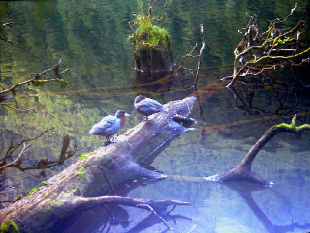
The weather was again superb. I set off quite late at 1100hrs assuming it would be a short day. However, it was very slow going round the north side of Gair Loch due to numerous windfalls and occasional mud. It was classic Dusky terrain. However as a consolation for the difficult terrain I saw numerous blue duck on Gair Loch, at least 4 pairs, and managed to get some photos of them.  Indeed the going was so slow it took me nearly 3 hours to get to Kenneth Burn. Part of the problem was my rucksack was so unwieldy it was difficult to get through some of the windfalls.

06. Day 3. Blue Duck on Gair Loch

After Kenneth Burn the going was much easier as it followed flats and the levees of the Seaforth River. This area flooded badly in heavy rain but there was no sign of that now.  After Deadwood Creek the river crossed some sandy/gravel areas and I left the track and followed these because the track undulated across spurs and was dense with tree roots. I made good time but had to wade across the river a couple of times.  Just before the hut I was wading up to my navel when the gravel turned to soft silt. Wary of getting stuck in the silt I had to backtrack 300m upstream and locate the track again.

On arriving at the hut I went immediately to the walk-wire over the river 5 minutes from the hut on the Lake Roe track and washed clothes and myself by swimming in my tramping clothes. The hut was full with 12 of us in it.

08. Day 3. Stumps in Loch Maree. The stump height is a good indication of the water levels to found in the Seaforth Valley and if they are barely showing it will be flooded


DAY 4. LOCH MAREE HUT TO SUPPER COVE HUT.  6 ½ hours.

I left Loch Maree hut at 0900hrs but after 20 minutes realised I had left my water bottle. It took only ½ that time to return.  The stumps in Loch Maree were 6 foot high so there would be no problems with flooded areas of the track lower down. The stumps can be used as a gauge of flooding in the lower Seaforth River. If they are covered flooding is likely. There looked very little chance of that changing today, as it was another fine day.  At the end of the Loch the track climbed steeply and descended steeply again to avoid a bluff, possibly caused by the slip, which dammed the river.

There are abandoned tools near this bluff left in 1903 when workers gave up trying to cut a track from Supper Cove to Manapouri. The track is still obvious from the end of this bluff to Supper Cove and still has a ditch beside it. It has been washed out in a few places. The track is largely level and after the last 3 days is a joy to walk on. I made good time and even missed the confluence of the Seaforth with Roa Stream, which I wanted to investigate, as I would be going up this stream tomorrow. I passed 4 Kiwi trampers returning from Supper Cove.

09. Day 4. The Seaforth River below Loch Maree

The flood plain beside the Seaforth River had some leviathan red beech growing on it. I saw one with a 3-meter diameter, but it was in decline. There were a lot of mosses and epiphytes in this area and an abundance of tree ferns in the undergrowth. There were many birds here especially the New Zealand Pigeon. There were also a few deep channels across the track and I was grateful these were not full of water, as they would be when the Seaforth was in flood, as the only way across was to swim.

Suddenly the forest cleared and there was a view across a lagoon at the head of Supper Cove. From here the going was much slower with many walk-wires and copious mud. The tide was going out so I left the track and cut across the sand flats at the end of the lagoon. I made good time but could not quite reach the hut due to a deep channel. Not wanting to swim I headed into the bush and picked up the track again for the last ½ km where the going was much slower due to steep undulations.

10. Day 4. Looking down the upper arm of Dusky Sound from Supper Cove

I was again the only person at the hut. I managed to find a hook and line in the hut and dressing in fleece, gloves, sunhat and head mesh, to combat sandflies, went down to the rocks below the hut to fish. I caught 2 spotties using mussels as bait. I nearly caught a large blue cod but it wriggled of as I was landing it. I fried the spotties in the hut. The protein will be needed over the next week.

DAY 5. SUPPER COVE HUT TO NORTH HEATH MOUNTAINS CAMP.  11 ½ hours.

I had to have an early start as I had noticed that low tide was at 0630 hrs. I left the hut at 0730 hrs with all the promise of it being yet another fine day. With the tide right out I managed to walk on sand or mud flats to almost the remains on the old hut.  I also made rapid progress along the floodplain past the huge red beeches up to the swamp on the north of the track near the Roa Stream confluence. I decided to carry on for another ½ km then crashed through some pepperwood thickets to reach the Seaforth, which was easily crossed here.

11. Day 5. Crossing Point of the Seaforth River to the north of Roa Steam to gain the south bank

From the river I climbed quite steeply through mixed beech and tree fern forest for 2½ hours to reach a plateau on the ridge. From here I thought I would follow the spur. However, animal tracks were very sparse and the bush got denser and was catching on everything. I had to haul my way over many impenetrable thickets. My progress was now down to 300m/hour. After a further 2½ hours I managed to get to a small knoll at 640m. I continued for another hour to reach a knoll at 712m just 400m away. All in all the last 6 hours had been gruelling. I had climbed only 700m and gone 2½ km.  It was a brutal introduction to the bush.

12. Day 5. Heading up the North Ridge of the Heath Mountains to the east of Roas Stream with the Seaforth Valley below

I avoided a steep section by sidling to the south of it initially through subalpine scrub but eventually managed to link up open patches. It was such a relief to be out of the bush. I continued up the ridge passing a stunning beautiful subalpine section with numerous small tarns dotted about in.  The ridge here got a bit steeper during the final hour as I made my way up, but now out of the bush progress was normal again. By 1900 hrs I arrived at a small plateau just to the west of peak 1185m, beside a tiny stream. The weather was very clear and still so I decided to risk camping up here.

13. Day 5. Looking Down to the Tarns between knolls 712 and 796 on the North Ridge of the Heath Mountains from Campsite

From my camp I would have easy access to the main ridge of the Heath Mountains. I found out though, that climbing 800m in bush is bloody hard work, which I had underestimated. It was good to finally lie down in the tent.

DAY 6. NORTH HEATH MOUNTAINS CAMP TO LAKE HAY CAMP.  10 ½ hours.

It was yet another clear morning with just a few clouds at the fiords’ entrances to the Tasman Sea. I left at 0830 hrs and sidled the mountain to gain a saddle on the main ridge. Walking along the ridge was very pleasant with stunning views and an easy terrain for 3 hours until I reached peak 1348m.

14. Day 6. Looking down the North Ridge of the Heath Mountains from top at 1348

From here there was a large saddle before Kathryn Peak, which looked steep but feasible. However, by the time I reached the saddle, Kathryn Peak had changed character and looked much steeper. My legs were also very tired so I decided to sidle the mountain on the west side. I continued up to the base of the peak itself then cut down a steep valley towards 2 small lakes. In retrospect I should have gone straight down to the 2 small lakes from the main saddle.

I had a good view across to the main saddle between Roa Stream and the Long Burn, which would have been yesterday’s destination if the weather had been bad. This broad saddle contained a large lake and a number of smaller tarns in a subalpine parkland setting. It was the most idyllic spot I had seen yet. I am sure though, the bush up Roa Stream would have been as challenging as that which I encountered yesterday.

18. Day 6. Treeline to the west of Kathryn Peak

I dropped down to just above the treeline on the west of Kathryn Peak. I thought is would be simple to sidle (traverse) the mountain at this level. However, I found that the streams had eroded about 5 deep gorges down the mountainside and these were awkward to cross. The gorges looked liked they petered out below the treeline but after yesterdays efforts I preferred ravines to subalpine scrub.  The last gorge, which descended down from the saddle between Sea View Peak and the knoll 1206m, was a bastard. I might have been able to cross it at 750-800 metres, but was not at the 900 meters I was at. I did not want to lose height so went up and it was not until I was almost at the saddle itself at 1150m that I was able to cross.

19. Day 6. The numerous steep erosion gullies on the west side of Seaview peak were difficult to cross

From the saddle it was an easy descent down into the valley to the west of Lake Hay. I did not go all the way down but stopped at the tree line. From here I could survey the south side of the valley and plan a route for tomorrow’s climb up to a pass marked 1010m on the map.

DAY 7. LAKE HAY CAMP TO NORTH CAMERON MOUNTAINS CAMP.  7 ½ hours.

I had a late start due to lethargy but eventually left the campsite at 0845. The weather was still fine but a bit overcast. I followed the stream down through some heavier thickets until it met the main river in the valley floor. On the way up the south side of the valley I should have followed a line 200-300 meters to the east of the stream coming down from the south to gain the flats and miss the steeper waterfall section. Instead I was too far east, headed south and was soon embroiled in dense bush. To get out I headed higher and soon had to force my way through thick subalpine scrub. It was slow hard work and 3 hours after leaving camp I eventually broke out and looked down onto the grassy flats at the top of the waterfall and open glades leading up to the pass.  I now had a ½ hour sidle above the scrubline to reach the pass. Had I followed my intended route I would have reached the pass from my camp in 2½ hours instead 3½.

20. Day 7. Looking back north to Seaview Peak and my camp Near Lake 842 from Pass 1010

From the pass at 1010m I had a great view down to the top of the Princess Burn and over to Cone Peak. I also saw a gentle sloping ledge leading up to the next pass at 1002m, 2 km to the south. It was a very pleasant walk to this pass involving a gentle descent and then an easy climb in very tranquil settings.  Once there I had another small climb to the southwest for a km to gain a saddle in the ridge at 1039m. By now the wind had increased significantly and the skies had darkened but there was still no rain.

At the pass, the valley I was to go down tomorrow stretched out before me. It was heavily forested. The descent down to the head of the valley was quite steep in places. I stopped to admire the view halfway down and a very brazen kea joined me. As I got to the valley floor some of the clearings in the subalpine forest looked very inviting campsites. I was quite tired after this mornings bushwhacking and the previous two days exertions, so despite the early hour of 1600 decided to camp in one of these clearings. The wind and grey skies receded in the evening and blue skies appeared again. As I lay in my sleeping bag I was apprehensive about the bushwhacking tomorrow and was dubious if I could get to Lake Kakapo.

DAY 8.  NORTH CAMERON MOUNTAINS CAMP TO LAKE KAKAPO CAMP.  9 ½ hours.

The skies were slightly overcast when I made my late start at 0930. It was difficult to find any consistent deer tracks and those that existed seemed to cross and re-cross the river regularly. I still had some good spells when a track existed for up to 200m. Eventually the valley sides levelled out and the riverbanks flattened out. It was much easier to walk in these conditions through the fern undergrowth. After a pleasant spell in the bush the river course itself became flat with gravel banks and it was very easy to follow. When I eventually arrived at the lake marked on the map I found that it had gone, and the river just disappeared into muddy holes between boulders. Obviously there was not enough volume in the river to sustain the level and it flowed into the boulder field quicker than flowing into the lake. It had taken 4 hours to cover the 4 km to the lake.

22. Day 7. View SW from pass 1039m down the valley with the dry lake to the jungle covered giant boulders at the valleys end

From this lake I headed south by southwest in the direction of another small lake 1 km away in the main valley. I was soon in a boulderfield but carried on. Eventually I was in horrendous terrain. Large boulders, bigger than houses, were jumbled haphazardly. There was enough matter on and between the boulders to support large trees, but not enough to fill up gaping chasms between the boulders some 15 to 20 feet deep. The whole area was then covered in thick moss and fallen trees, which were generally in the latter stages of rotting, but looked solid when covered in the moss. I don’t think it would have been possible to devise a more unpleasant place to traverse if one tried. It was also a dangerous place and I can only compare it to a green version of a heavily crevassed area on a glacier. There were no animal tracks here; no deer worth its salt would venture into such an area. In all it took 1½ hours to go 400m. I think it would have been better to go west by southwest in retrospect as these boulders probably came from a slip to the east from the mountain 991m. It took another relatively easy ½ hour to reach the other lake, which was also dry. The lazy river in the lakebed was richly populated with paradise ducks.

It was now 1530 and I had little hope of reaching Lake Kakapo by evening. I decided I would carry on and try to find a campsite in the forest. Initially I followed the river upstream wading where necessary. But soon found the terrace beside the river easy going with occasional good deer tracks. Within 2 hours I seemed to be at the highest point of the saddle. While crossing this flat broad saddle I found a reasonable deer trail for 1½ km on the north side of the valley floor – about 200 meters from the lowest point.

Once the descent started the deer trail seemed to move over to the south side of the valley. It soon became quite distinct and started to climb gently. I guessed that it was the deer forming a trail to bypass the waterfall, which I could now hear.  This deer trail then started to descend down to the river, which it reached below the waterfall. This was the first time that I found a deer trail and trusted it even when it started to go up, and I had been rewarded by avoiding the waterfall. When I reached the river it was almost dark but as luck would have it there was a suitable flat dry area to camp on. There was the odd spot of rain during the night but nothing to affect the very low river levels.

DAY 9.  LAKE KAKAPO CAMP TO KAKAPO-RICHARD SADDLE CAMP.  8½ hours.

I set off at 0915 under overcast skies. The bush was wet from overnight drizzle and my legs and feet were soaking by the time I reached the forks of the Kakapo Burn in an hour. I found a strong deer trail on the true left (north) of the river and leading away from it.  I guessed that this deer trail would lead me away from the boulderfield I had read about in Moirs Guide South.  It did lead me away – I would be spared the horrors of yesterday’s boulderfield. God bless the deer. The trail was about 200 to 300 meters to the north of the river. It crossed two small slips but was easy to pick up again on the other side. As the gradient slackened off and the boulderfield was left behind the trail fragmented and I was soon bushwhacking through easy ferns again.

The gradient soon levelled off and the river became lazy. The vegetation also changed from large beech and fern to dense thickets of pepperwood. The river was initially good to follow but soon the gravel banks were replaced by silt. I was entering a swamp. I tied to head towards the south side of the valley, where the slopes lead up to the Kakapo-Richard Saddle, in an attempt to find firmer ground. I found the side but it was bluffed in most places and covered in impenetrable vegetation elsewhere. There was no alternative to the swamp for this area. I dragged myself through the thickets frequently up to my waist in stinking silt. Progress was very slow and in one hour I only managed about 300m. However, I was now past the bluffs and decided to give the side another go. The side was now much easier but steep. I climbed 50 meters and soon was in easy beech forest with fern undergrowth. This was a much better alternative to the swamp so traversed the hillside until I got near the stream coming down from the south.

23. Day 9. Looking down on Lake Kakapo after climbing the dense ridge up to the crescent lake, 755m

I passed a small stream in which I washed myself fully clothed. The silt took some effort to remove but I was eventually cleanish again. As I approached the sound of the larger stream I started heading up to reach the spur on the west of the stream. Moirs Guide South mentioned a good deer trail but I could not find one, despite traversing the spur frequently. It would have been superfluous anyway, as the beech/fern combination was quite easy to get through. After 2 hours I had climbed 400 meters, but soon the vegetation began to get more scrub like and progress slowed considerably. I now had to force and heave my way through thick subalpine vegetation on steep terrain. In one hour I climbed just 100 meters over 300meters distance.  At last clumps of snowgrass started to appear on the forest floor and the first longed for clearing arrived. Soon I was able to link up clearings.

After 2 days bushwhacking the clearings were like a Shangri-La. It was a delight and relief to break free of the bush. The clearings became bigger and bigger and before long I was in an alpine idyll of grassy openings and mountain lakes. I wondered through these lakes looking for a campsite in the high parkland. I found one just below the outlet of the crescent shaped lake on the Kakapo-Richard Saddle in a large meadow. This campsite would give me easy access to a pass over to the Lake Mouat Valley. From this pass there was easy access to the main ridge of the Cameron Mountains, which I had intended to follow south.

24. Day 9. Looking south from the crescent shaped lake, 755 on the Richard-Kakapo saddle with Peak 1288 in the distance

DAY 10. KAKAPO-RICHARD SADDLE TO LAKE MONK-LAKE 611M SADDLE CAMP. 10½ hours.

25. Day 10. Looking Back to the Campsite at the end of the crescent-shaped lake (755m) from Height 1135

The weather had reverted back to the blue skies that I was beginning to take for granted. I was anxious that these next two days were good as there were some steep and challenging mountains to traverse and I needed the snowgrass to be dry. I made it to the pass on the Richard-Mouat Saddle with minimal bushwhacking across the parkland. From the pass I got a great view of my intended route down the Eastern Cameron Mountains to Solitary Mountain. This gentle peak rose above the forest-fringed Lake Mouat, which was, stretched out in the valley below. However, the mountain between Lakes Monk and Mouat looked like it might be problematic from this viewpoint, but that would be tomorrows issue.

26. Day 10. Looking south down the Mouat Valley from hill 956 at the north end of the Rugged Mount in the Cameron Mountains

At the pass a ridge rose to the southwest culminating in Peak 1299m. I climbed the ridge in awe of the surrounding scenery. To the north peaks stretched to the jagged horizon. To the west Lake Widgeon marked the end of the Long Burn and its meeting with the sea, with the Dark Cloud Range beyond. I got up to Peak 1288m quite easily along the ridge, but the Peak 1299m looked steep. I had read it was best to traverse it on the east side. Indeed the traverse proved to be quite easy. I kept high up where there was a meter wide terrace at the bottom of the cliffs and above the snow grass.

28. Day 10. Peak 1299 (left) and 1288 (Right) from the Mouat-Richard Saddle

I continued to the saddle 991m and decided to drop down to the alpine Lake 811m. Here I had a drink and pause in the sun. So far the day had been perfect. I felt liberated after being in the bush for the last 2 days.  After the rest stop I climbed a shallow saddle to the south and dropped down to Lake 611m. This was one of the most beautiful I had seen yet in a land of beautiful lakes. It was surrounded by meadows and parkland and had a grass avenue leading to its head. I managed to skirt its north side along the shoreline, only occasionally getting my boots wet. I think this was only possible because of the recent dry spell. The sandflies along the shore were out in force though. At the outflow I scoured a route to take me up to a plateau 100 meters above the lake where I intended to camp.

35. Day 10. Lake 661 from the saddle 890 between lakes 811 and 611m

The route up to this plateau was covered in thick subalpine scrub. Before entering the scrub I knew that it would be a problem and I was soon in the worst scrub I had come across yet. It was as dense as coastal wind-pruned scrub and I was often going over it rather than through it. I was doing about 3 horizontal meters a minute. Luckily it was a short distance and within ½ hour had broken out onto the grassy plateau, where I camped. It had been a marvellous day with an overdose of beauty.

36. Day 11. Looking North to my campsite at the Tarn (bottom left) and over Lake 611 with Rugged Mount on the left and the harp peak 1299 on the right.

DAY 11.  LAKE MONK-LAKE 611M SADDLE CAMP TO RIDGE ABOVE LAKE MOUAT CAMP.  6 hours.

Having seen this mountain the previous day and from the topographic map I knew that this mountain would be the crux of the whole trip. I needed good weather, – and it was. I started at 0900 and braced myself for the bushbash, but it was not as bad as I had feared. I kept well to the west of the scrub in the more mature beech and then sidled east to reach grassy slopes above the scrub. I was soon up at the saddle and then scrambled up to a subsidiary top. From this top the view was exciting. For the first time I saw Lake Hakapoua, a shiny grey reflection in the sun at the end of the lush Big River Valley. It was in the distance, but significant, because at the far end was the south coast and the end of this wilderness. I also saw the arete over to the highest peak of the mountain, Peak 1203m. It looked tricky.

37. Day 11. Looking south from Peak 1174 to peak 1203 on the right. Beyond is Big Valley, Lake Hakapoua, The South Coast and even Solander Island

I set off and found my apprehension was unjustified, as it was really quite straightforward. I made a small cairn at the top. The view from the top of 1203 north along my route was also stunning and it was all laid out before me.

39. Day 11. Looking North from Peak 1203 along the ridge to 1174. The pointed mountain centre right is Peak 1299 of yesterday

I continued south down an arete to another nearby and slightly lower top. I expected there to be difficulties after this top, and on peering over the edge realised that there was no way down from it. I had to backtrack and then drop down and sidle the mountain on the east side. The descent down the east side was steep and I was glad the snowgrass was dry. I carefully arrived at the small tear shaped tarn and found that I could indeed traverse the east side from here and get back onto the ridge again. The sidle up to the ridge was steep but without problems. Once I was on the ridge again I could look north to Peak 1203m and see that route I had taken down to the tear shaped tarn was the only option.

40. Day 11. Looking north to Peak 1203 whose south ridge was too steep to descent so I had to go to the right

It was a steep, and in some places an airy, scramble up to the final top on the ridge marked as 1098m. I had expected there to be more problems on the descent from here, and after 300m of easy descent thought that I was in the clear. However, suddenly there was a 30m drop. Beside this drop was a steep gully on the east side but it proved to be loose, muddy and slippery, so after just 10m descending I scrambled sideways out of it and back onto the ridge again. Here I down climbed the remaining, and easier, 20 meters on the arete itself. Again I was glad it was a dry day. It was then a very gentle descent down to grassy meadows, little tarns and scattered alpine scrub. From these meadows I looked down to Lake Mouat on the east side, while on the west a waterfall poured out of Lake Monk.

It was only 1500 hrs but I suddenly felt drained. My tank was empty and my legs felt like lead. It might just have been the release of worry about the traverse. I decided I would stay here, on this parched meadow with its mud-cracked dried-up tarns, for the night and appreciate the lofty perch above the 2 heavily forested, lake-filled valleys below.

42. Day 11. Looking NW from my campsite near knoll 911 across the Mouat valley to Peak 1266 on the other side near the head of Lake Mouat

DAY 12. RIDGE ABOVE LAKE MOUAT CAMP TO SOUTH OF PEAK 1121M CAMP.  8½ hours.

It drizzled during the night, but had cleared up by morning, although it was overcast. The vegetation was wet however, so I was soon drenched from my shorts down after descending the steep, wet, slippery grass slope to the saddle just south of the knoll 911m. From here the route followed the arete southwards. The climb up to knoll 916m was not too bad and I came across a deer track, which as expected, went right up the spur through older beech forest. After knoll 916m, however, the vegetation became more scrublike, the deer track disappeared and progress slowed down. I had to keep on the arete here as the sides were very steep. There is much more vegetation on this arete than indicated on the map. Indeed I found this to be the rule of thumb throughout the whole trip.

43. Day 12. Looking south past the saddle 785 and up the NW ridge of Solitary Peak in the mist. To the right is Big River and Lake Hakapoua

By midday I finished traversing the scrub covered arete and made the easy climb up to Solitary Peak, 1180m where I had another great view north of the mornings traverse I had just completed.

46. Day 12. Looking North from the north ridge of Solitary peak towards saddle 785 with peak 1203 unfortunately obscured by mist in the middle

Damp air had started to blow in from the south and the higher tops on my route began to acquire erratic mist patches. From Solitary Peak the going south was very easy indeed and I flew along the even ridge. As I approached Peak 1229m the mist got much more determined and I had to be careful that I descended down the right ridge from this peak. It was an easy drop down to a saddle and up to the next mountain, Peak 1144m. This was shrouded in thick mist. I was very tentative on the descent as it was steep and visibility was only 20 meters. Eventually, out of the gloom the small tarn appeared but it had taken 1 hour to make the descent down 150 meters. It was now drizzling also. I considered camping here but there was no suitable campsites and it looked very exposed and eerie.

At 1600 hrs I decided to carry on a find a camp spot after the next mountain, Peak 1121m. It was a quick simple climb up to the top and making good progress in the thick mist started down the ridge optimistically. After I had descended 150 vertical meters the ridge became very steep. I looked at the map realised that I was coming down the south east ridge rather than the south ridge. In my haste I had not checked the map and had assumed there was only one ridge. I decided to continue down and spotted some campsites in the meadows below as the mist thinned. I eventually had to swing into the bowl formed by the two mentioned ridges and continued down. As I arrived at the meadows the drizzle got heavier and the mist became very thick. It was quite fortunate it thinned for the ½ hour on my descent.  As I was looking for a campsite a yellowhead appeared and rattled out a song before vanishing into the still fog. I set up the tent by 1830 hrs and retired into the humid interior. I decided that if it were like this in the morning I would have a day off.

48. Day 13. Looking North from Peak 1076 towards Peak 1203. I came down the east ridge (right) and camped in the meadow below. The high mountain in the background is Peak 1229.


DAY 13.  SOUTH OF PEAK 1121M CAMP TO MOUNT AITKEN CAMP.  8½ hours.

I expected to open up the condensation-covered flysheet and see thick mist. I was surprised to see blue skies. It was a late start nonetheless; I didn’t get away until 0930 hrs. It only took an hour to get back onto the ridge and up to the first mountain, Peak 1076 m. Ahead of me however I had nearly a kilometre of scrub covered arete to negotiate to reach Peak 1032. It was steep on the north side and vertical on the south side. It wasn’t long before I reached it and was soon having to haul myself over the tangle of branches. It was very thick and almost impossible to negotiate so I dropped down on the north side and sidled a line about 30 meters below the crest. The scrub was not as dense here but it still took me 1½ hours to force myself along the arete. It was always such a relief and joy to get to the first clearings after a bushwhack.

49. Day 13. Looking SE towards 1032 from near 1076. At 1032 the route heads off to the south (right) down to Mt Aitkin

It didn’t take long to get up to Peak 1050m, and from here the terrain was great. The ridge was covered in short grass and the gradients were gentle. I made fast progress with delightful views down to meadows and parkland on each side of the ridge. It only took about 1½ hours before I was making my way up the slopes of Mt Aitken. I was keen to pass this milestone in my journey, as it was all downhill from here to the south coast. On my way up the mountain the mist started to come in again, so instead of summiting I traversed across the west side and found the southwest ridge without difficulty.

53. Day 13. A view of Mt Aitkin from 1135 some 2 km to the north of it.

The descent down the southwest ridge was very easy, and I eagerly made for a knoll where the forest started.  Sea haar was blowing up all the valleys from the sea to the south leaving just the ridges exposed. I didn’t take long to reach the treeline and I was delighted to find that there was no scrub at all, just very mature well spaced mountain beech growing out of a grassy floor. A short distance into the forest there was a small clearing which was an ideal campsite. Water was sparse and I had to take some from a stagnant tarn and boil it before using it. I still had a fair bit of gas in my second container. There was a stunning sunset that evening with the sea haar below and crimson clouds above.

54. Day 13. Looking SW from my ridgeline campsite south of Mount Aitkin over the cloud filled Lake Hakapoua valley

DAY 14. MOUNT AITKEN CAMP TO WAITUTU HUT.  11½ hours.

It started to drizzle in the night and by the morning it was quite windy also. The weather would be largely irrelevant today, as I would just be in the forest descending down to the South Coast Track. Once I reached this track I would follow it eastwards until I got to the Waitutu hut. I was quite excited about reaching this hut. I wondered if there would be anyone there. I hadn’t seen anyone since Day 3; – 11 days ago. Indeed since leaving Supper Cove I had not seen or heard anything that would convince me I was not the sole inhabitant of this planet. It would also be nice to dry boots and socks which had been wet for 2 weeks now.

Initially the descent down through the forest was marvellous with the mountain beech growing out of a beautiful lawn. I noticed the occasional small marker from the NZ Forest Service on some of the trees. This was obviously a rarely used route for fieldworkers. I started following these markers but soon realised that they were leading me down a spur to Lake Marshall. I did not want to go this way so cut back onto the main ridge which headed south. To my horror I found that this main ridge was losing the easy beech forest and becoming covered in scrub. Looking at the map I saw that this could persist for over one km. This could take up to 3 hours. I pondered the markers from the NZ Forest Service and thought they maybe know something I don’t. I would cost me at least ½ hour to retrace my steps and pick up these markers again but looking at the scrub ahead filled me with foreboding. Within ½ hour I was following the markers down the spur again. The ensuing descent was steep and unpleasant. There was one 40-meter section where it was very steep indeed, almost vertical. Eventually it levelled out and still following the stream arrived at the north end of Lake Innes after a further ½ hour.

55. Day 14. On the East shore of Lake Innes looking south to the outlet where the River Aan starts to flow.

It was not a good start to the day. I had dithered at the scrub and this had basically meant I ended up at the north end instead of south end of Lake Innes. I am that sure that if I had persisted I could have forced through the scrub and found the rest of the ridge easy enough down to the south end of Lake Innes. I now had to bushwhack down the east side of the Lake to reach the outlet. It was actually easier than I thought and I reached the end of the lake within 1½ hours.

Following the Aan River was also easier than I thought. There were a couple of waist deep swamps to wade through, and I had to cross, or wade down, the river many times but the forest floor vegetation was not too thick. The biggest obstacle to fluent progress was the large number of windfalls. Because of the convoluted meanders of the river course I did not follow it but was often following a compass bearing well away from the river. A compass was very necessary here, as the ground was flat and there were no landmarks to be seen. The continuing drizzle meant the sun could not be used as a navigation aid either.  The dominant beech forest, here mainly red beech, was now becoming interspersed with massive spiral rimu trees. New Zealand pigeons were abundant and there were many fantails, some of them were black, which I hadn’t seen before. Four hours after leaving Lake Innes I knew I was approaching the South Coast Track. My heart quickened with the excitement of seeing a beaten path and orange markers. When I finally got to the track I was delighted. I knew I would make it without having to switch on the Emergency Locator Beacon to get rescued, which would have been embarrassing.

I still had 8 km to go and only about 1½ hours of daylight left and an unsatisfactory LED headtorch. I charged off at pace to Grant Burn as I had been doing all day. It was so much quicker to walk on a track even if it was overgrow and seldom used. Most of the track to Grant Burn followed a long abandoned telegraph line and was through a manuka forest. There were a couple of smaller rivers to ford but this was no problem after some of the swamps I had waded through in the last 2 weeks.

After Grant Burn the daylight finally dwindled at 1930hrs.  I stumbled on for another 1½ hours in the dark to try and reach the Hut. I pulled a large muscle in my right thigh, which was painful, and lost my way 4 or 5 times. I could have put up the wet tent and got into my damp sleeping bag but I wanted to get to the hut. In one confused, undulating section I lost the track for 20 minutes. I nearly camped but estimated I was less than a km from the hut. After much peering I found the track again and eventually stumbled towards the hut at 2100 hrs. I was totally knackered, but felt elated. I had made it.

There was an older Dutch couple at the hut who were very surprised to see anyone, especially arriving 1½ hours after darkness. They had the stove on and made me a hot coffee. It was the first hot drink I had had for 2 weeks. I hung up all my damp and wet possessions to dry and then enjoyed the comfort of the fire, my pasta meal and conversation. I went to bed totally delighted. I am sure I had the glint of victory in my eyes. Tomorrow I would sort out some of my stuff and clean what I could.

DAY 15. WAITUTU HUT TO WAIRAURAHIRI HUT.  5½ hours.

I had a small lie in, but the bright sun invited me out of my slumbers and I began to clean clothes and equipment, and then hang them up in the hot sun. The stove was still going so I burnt any superfluous and damaged clothing, the sleeping mat, a tarpaulin, twine and gaiters and all the plastic food wrappings of the last 11 days. I reduced the weight of my rucksack by about 2 kg and greatly reduced the volume.

By 1200 hrs my clothes were dry and I had tidied up and was ready to move on to Wairaurahiri Hut. The muscle in my right thigh was better and I was feeling strong again. I bade farewell to the Dutch couple and set off.  The track initially crossed the large Waitutu River on a walkwire before entering the forest again. The track was quite uneventful passing through beech/rimu forests with fern undergrowth. The birds were out in force and there were many fantails, tomtits, and very melodic bellbirds.  The only thing that really divided up the track was the 2 walkwires over the Angus and Crombie Burns. There weren’t any views of the sea, which I had hoped for. It was a pleasant walk but nothing to set it on fire. It was a bit of an anticlimax I suppose when compared to the previous fortnight.

56. Day 15.The Waitutu River is a large river draining Lake Poteriteri. There is a wire footbridge across it and the Waitutu cabin is beside this bridge

It was good to get to the hut, as my legs were still tired from yesterday. There was no one else at this hut which was beautifully sited next to the large Wairaurahiri River.

57. Day 15. The Wairaurahiri Hut lies on the east side of the Wairaurahiri River on the South Coast Track

DAY 16.  WAIRAURAHIRI HUT TO PORT CRAIG HUT.  4½ hours.

I left the hut at 0900 hrs in patchy sunlight. The vegetation was wet though after the night’s drizzle. The track climbed up 2 terraces to get out of the river valley and into the regenerating forest. This forest was 100 years old, the original one having been logged. Indeed the track followed the old tramline used to extract the timber. The metal tracks had been removed but the original sleepers remained, sometimes under a couple of inches of mud. This abandoned tramline was fantastic to walk along and before I knew it I was at the historic viaduct over the Francis Burn. This viaduct was used by the tramline to span the deep ravine of the stream.

58. Day 16. The historic and preserved Percy Burn Viaduct lies half way between Wairaurahiri Hut and Port Craig Hut

In ½ hour I reached another viaduct and ½ hour later arrived at the Percy Burn viaduct, the biggest of the 4. It was very impressive. It was about 100m long and 35 m high. I stopped here to admire it and have lunch in the adjacent hut while a rain shower passed over. Once the rain stopped I carried on to Port Craig Hut. The track still followed the abandoned tramline and was very easy to walk along.

59. Day 16. For the last 2 days the South Coast track was easy to follow

About ½ hour before the Port Craig Hut I met Westie. It turned out that Westie was one of Southland’s outdoor characters. He knew the area I had walked through and indeed had spent 9 years living in a hut he made himself where Lake Hakapoua flows into the sea at Big River. During this time he lived on his outdoor wits and became something of a celebrity hunter and hermit. He now, at the age of 67, was a possum trapper selling the fur to mix to with merino wool for spinning into high quality wool products. He said he would return to the hut within hour after checking his traps.

The hut at Port Craig was an old schoolhouse. When the tramline existed large quantities of timber were brought to Port Craig for milling. Many people used to work here, and then suddenly in the late 1920s the whole place was abandoned and dismantled overnight. The forest has now claimed back this long gone village. All that remains is the old schoolhouse, which is now a hut.  Westie returned after I had unpacked and we chatted. On finding out I had just run out of food he made me a huge steak stew with boiled potatoes. In the evening we were joined by Kay, another character, who was the hut warden from the Humpridge track hut nearby.

DAY 17.  PORT CRAIG HUT TO BLUECLIFFS CAR PARK.  6 hours.

I left at 1000hrs under overcast skies and could not take the low tide route along the beach as high tide was approaching. This meant walking on a good track through mature beech forest for 2 hours. This track then cut down to join the low tide alternative and continued along the shore for 2 km, crossing two beautiful beaches. These beaches were stunning and made up for the dearth of seascapes over the previous 2 days. The white sand, covered in various shells, went right up to the fringe of the forest.

60. Day 17. About 5 kilometres from the end of my route the trail followed the beach for a few km on the sjhores of theTe Waewae Bay

After I left the second beach I caught up with 2 Americans. They were just finishing the moderately demanding 3-day Humpridge Track. We chatted and then carried on together in the now warm weather. We soon reached Track Burn where a gravel road started. We followed this for a further 2 km and then could go down to the long beach, as the tide was now receding. After an hour on the beach we sadly had to leave it and had to climb up steeply for 100 meters to get on top of the seacliffs. We followed the top of these cliffs along a good track through a warm humid mixed forest for a ½ hour when I suddenly realised we had reach the carpark and then end of the trail. I got a lift back to Tuatapere with Big El, a founder and the manager of the Humpridge Track.

This was the end. I had sweated up numerous passes, struggled through horrendous scrub, waded through stinking swamps up to my naval, been exasperated in a nightmare boulderfield, had wet feet and had hardly seen anyone for 2 weeks, and lived off a very Spartan diet; yet I was sad it was now finished but looked forward to a shower and a few beers.

61. Day 17. The Rarakua Carpark at Blue Cliffs was the the start of the South Coast Track and The Humpridge Track and my finishing point

EQUIPMENT

On a journey of this nature equipment must be robust, durable, and in good order.  It is likely to get tested to near destruction. The other over-riding concern is that of weight. Even with the barest of essentials it is likely your rucksack at the start will have 15 kg of food and 10 kg of equipment.  25 kg does not sound a lot on paper but on your back after 8 hours of uphill bushwhacking and you’ll be wondering why on earth you brought that 250 gram, all dancing, Leatherman multi-tool you never use.  For example in the hygiene department I only take ½ a toothbrush and ¼ of a tube of toothpaste. Soap should be left behind and if you are even considering taking a towel you have not grasped the importance of weight and should abandon the plans to do the traverse. Items of clothing will be in need of wash from time to time but crossing rivers does much for socks and longjohns!

The rucksack should have robust buckles and straps. These can take a tremendous strain when forcing through thickets and scrub. It should not be too big 75-85 litres should be suffice, but it will be necessary to put clothing, sleeping bag and tent in compression sacks before packing to ensure everything will fit in the rucksack.  It is essential to have a tough plastic rucksack liner both to keep the contents dry and light and to provide buoyancy when swimming across rivers or swamps.

A sleeping mat, preferably of cheap light foam, should be in a tough cover if it is strapped to the outside of a rucksack, otherwise the scrub will shred it and bits will be torn off and left in your wake. There are ample soft places to camp and a heavier self-inflating sleeping mat has no advantage.

While down sleeping bags have far superior warmth to weight ratio over synthetic qualofill sleeping bags when dry they are hopeless when wet. If the weather is poorly it can be a real struggle to keep a down sleeping bag dry day after day.  It might be better to consider a good qualofill bag that can tolerate –5 degrees Celsius comfortably. A qualofill bag would certainly render a bivvy bag superfluous.

The three qualities a tent should have is that it is lightweight (max 2.5kg), that it is robust and waterproof (including groundsheet}, and that it can take a reasonable wind if forced to camp above the treeline. Condensation will form in any tent if it is raining outside, and is a problem that just has to be lived with.

While multi-fuel stove are all the rage at the moment they can also be fickle to operate. Furthermore while you are on the camping section it may well be necessary to cook in the tent.  With a petrol/spirit stove this could both jeopardise the tent fabric and your respiration. A simple gas cylinder stove with 2 times a 250gram cartridge of 70% butane 30%propane mix should suffice for each person for the duration of 22 days. This should only be used to heat porridge in the morning and boil water for the evening meal. Tea and coffee are luxuries that cost too much weight. Two lightweight, non-stick pans (if one can be inverted and stored in the other to provide a protected case for the gas cylinder and burner so much the better) and a lid.

Clothing has to be kept to a minimum. Cotton should be totally avoided, as it will never dry. A polypropylene top for daily wear can be supplemented by a thin fleece top as medium layer and a thick fleece for foul conditions and to change into in the evenings. Polypropylene longjohns worn under nylon shorts will protect the legs against scrub while bushwhacking. A thin fleece pair of trousers is suffice for evening wear. In addition to this a waterproof jacket with a hood and waterproof trousers are essential. Gloves and hat are also essential.

Boots should be sturdy and offer support against twisting ankles. Fabric boots are not suitable and Gore-Tex liners should be avoided. Feet will get wet, probably on the first day, and there is little chance, or point, of drying the inside of the boots again.  2 thin smooth pairs of socks can alternate daily as the first layer and then a thicker pair of wool socks as the main cushioning and warmth layer. These woollen socks will always be wet and are not a joy to put on in the mornings but it is futile to dry them. A further pair of woollen socks should be taken and kept clean and dry for eveningwear.  As a luxury a lightweight pair of plastic sandals for the evening are worth the extra weight. Finally a pair of knee length gaiters will protect legs against scraps, keep the majority of water from wet vegetation, mud and twigs out of boots.

Other items to take include spare lighters, insect repellent, a lightweight sunhat with brim, insect proof head mesh to go over sun hat to thwart sandflies. For route finding essential items are a compass and waterproof map case, topographic maps 1:50,000 for entire route, emergency locator beacon, headtorch, photocopied route description i.e. this and relevant pages from Moirs Guide South are all essential items. Other items to strongly consider are a small penknife, minimal first aid kit, ½ litre water bottle with measures, waterproof camera or camera and waterproof case, annual hut pass and extra long boot laces that could have other uses also.

PROVISIONS

22 days provisions are needed to comfortably do the journey.  Assuming that you burn on average 5,000 calories a day while tramping that is a whooping 110,000 calories you need to take. Even if you took it in its most concentrated form as butter or olive oil exclusively you will need to take 13 kg. To take this food is not only impractical but also unpleasant. A simpler and feasible diet ingesting 2,500 calories a day will still mean a daily deficit of 2,500 calories a day. This mean that you body will have to supply the remaining 2,500 calories from stored resources.

In total 55,000 calories can be carried in the rucksack divided into 22 packages each of 2500 calories and weighing 700 grams. The remaining 55,000 calories will have to be extracted out of your body mass by a busy liver. Before you start the traverse you had better make sure you have these extra resources which are basically at least 6 kg of body fat.

Hot beverages are a luxury that squanders weight and gas and should be avoided. Water from any small stream coming into the main water course should be OK as long as it has been aerated by tumbling down slopes, and the larger tarns on the ridges should be fine to drink from. If in doubt about your constitution some water purifying tablets should be taken.


Back

September 1, 1987

In August 1987 I found myself in Cuzco. I had been travelling for a few months in North America and had flown to Bogata and worked my way down Columbia and Ecuador to Peru. Apart from a few short overnight hikes in the Rockies and Alaska I had been largely frustrated about getting into the wilderness. Once in Peru I managed a 3 day hike in the Cordillera Blanca from Olleros to Chauvin but it barely whetted the appetite. After this hike I parted ways with my travelling companion for the last 4 months and unburdened, planned some longer treks. The first was the 6 day hike from Mollepata to Machu Picchu trek over the Incachiriasca Pass on the Salkantay mountain and then continuing on the classic Inca Trail to Machu Picchu before the days of permits and guides. The second trek was a 8 day circuit around the relatively remote mountain of Auzangate in the Cordillera Vilcanota starting and finishing at Tinqui during which I saw no other hiker at all and was entirely self sufficient.

While I was doing these 2 solo treks I based myself at the enchanting city of Cuzco for about 6 weeks in all, and kept returning here. In my rest days I poured over the poor and inaccurate maps I found in the public buildings and gleaned what information I could from the government offices about the wild Manu National Park. After a few weeks an idea was evolving where I would take a lorry over the Cordillera Vilcanota again to Paucartambo and then on to the end of the road at the village of Shintuya. Shintuya was on the banks of the Alto Madre De Dios river. Here I would make a raft out of balsa wood trees and then float down the river for about 600 km until I got to the town of Puerto Maldonado where I would abandon the raft and return by lorry to Cuzco. I estimated the whole expedition would take me about 3-4 weeks.

From my dormitory room in the friendly Hostal Suecia in central Cuzco I had about a week to prepare. The biggest problem was getting an accurate map. All I had seen so far was a road map and it was perhaps 1;2,000,000, with very little information. At this time, for many of the  world’s more far flung, it was possible to get a map based around the US Air Force Aeronautical Charts from the 1940’s which were 1:1,000,000. However this area in Peru had not been done. So the best I could get was 1:750,000 and it was from the district planning department with little information other than how they envisaged a future road program and the course of rivers. They could only copy it for me on a grainy photocopier in black and white. I got a few copies in case any got waterlogged.

01.My faithful paraffin stove and machete on the only map I could find of the Madre de Dios region, which was very poor. The length of the machete blade represents about 400 km !!

The Tourist Information offices on the Plaza de Armas in Cuzco were very helpful and friendly, and had already helped me plan my treks to Salkantay and Auzangate but could not really provide any information on my jungle venture. However, they seemed enthusiastic about it and the small team working there thought there were no cataracts or waterfalls on the Alto Madre de Dios beyond the end of the road at Shintuya – but they were not sure. Very few people in Cuzco had been down to the jungle, or selva, and if any had they would go to Puerto Maldonado, which was a town. Nobody had been to Manu. However, they helped me find a lorry which went back and forth on the rough road.

I spent a week buying supplies and preparing during the day and dining, drinking and dancing in the peñas of Cuzco which were always brimming with atmosphere in the evenings. Most of the supplies came from the markets, large covered concrete plazas under corrugated iron roofs. One could buy everything in these markets from food to ironmongery, dried meats, household consumables, livestock and a vast array of vegetables. I could lose myself in them trying to find what I might need and resisting the urge to buy too much. When I needed a break there were stalls selling local foods, including roast guinea pig and many podiums with matriarchal Quechua women preparing fruit drinks in blenders. The markets were vibrant with colour, smell and sound. Occasionally I would bump into a fellow from the hostel as there were a few staying for months doing language courses or work placements.

My supplies mostly consisted of cans, especially tuna, and packets of rice and beans which I hoped would be enough to sustain me. I think I bought 40 cans of tuna, one for the morning meal and one for the evening meal each day. This was long before the days of freeze dried meals or even noodles. I got a cooking pot to boil the rice based gruel I would be cooking and plenty of plastic lighters. I bought some sweet powdered Tang drinks to make the river water more palatable, but did not bother with purification. I also got a large bag of coca leaves and a ball of ‘llipta’, a mortar of lime and the ash of burnt quinoa leaves, which broke down the alkaloids in the coca leaves as they were chewed. I had taken coca leaves on the last two treks and they staved off fatigue, altitude sickness and hunger and were a great currency in the high hamlets. They were legal above 2000 metres in Peru at the time. I also bought half a carton of cigarettes which would see me running out as I set off down the river and force me to abstain.

I already had a tent, a battered Peapod 2 tent from Ultimate Equipment, and a worn out Blacks of Greenock Icelandic sleeping bag. In those days of travel I slept on clothes rather than a sleeping mat which were big and bulky.  For cooking I travelled with my Optimus paraffin stove, a fickle brass cooker but remarkably reliable if I pampered it’s foibles.  I bought 5 litres of paraffin and a plastic container making an extra washer for the lid by screwing the lid on over sheets of plastic to hinder leaks. I bought a large plastic barrel to put anything fragile or perishable into and also a few nylon sacks so I could stuff the remaining gear into and secure them to the raft. Finally I bought a machete, an axe and 200 metres of hessian rope for building the raft, out of balsa wood trees which I hoped I could cut down. After a week of preparing I was finally able to have a small farewell evening with my fellow travellers in Hostal Suecia.

The next afternoon I had to carry my sacks of food and equipment to a dusty corner some 20 minutes walk from the Plaza de Armas. I had to be there for a mid afternoon departure and I got there with a good hour to spare. The lorry went every other day as the road was one way on Monday, Wednesday and Friday and the other One Tuesday, Thursday and Saturday as there was often not enough room for vehicles to pass on the narrow track.   However, like many local connections it took ages to load all the cargo and the 15 odd other people who would be making the journey and we did not set off until late afternoon. I felt very self conscious and my poor Spanish was largely useless with the predominantly Quechua speakers who were my fellow passengers. There were hundreds of wooden crates of Inca Cola, a yellow sugary drink, drums of oils and petrol, dirty cardboard boxes of food and many many sacks of household goods which were all stacked and secured against the front end of the cargo bed and against the sides leaving the back for the passengers to sit or stand in. I chose to stand as I could see over the sides. At last the tailgate was lifted up enclosing us in the back and with a belches of black diesel fumes the large 3 axle lorry lumbered forwards for its 24 hour journey down to Shintuya.

The journey started well as we rumbled out of Cuzco and along the tarmac road in the warm wind for nearly 2 hours. Occasionally we stopped when passengers flagged the lorry down allowing them to load their luggage and clamber aboard. But then we turned off the Cuzco to Puna highway and headed north on a rougher road, filled with potholes which the laden truck had to crawl around. The main cargo of the truck was at the front of the bed between the wheels but us passengers were at the back over the badly sprung back wheels. We were getting buffeted from side to side and occasionally launched a few inches into the air. I tried to look unperturbed like the others but the thought of another 24 hours of this was not appealing. In low ratio gear we started to grind our way up into the mountains, contouring into deep side valleys and then climbing over the ridges. The truck laboured, spewing black fumes, as it climbed from 3000 metres up to 4000 metres with the evening sun turning the steep puna grasslands and scattered mud and thatch homesteads orange. Looking over the left hand side of the truck down the steep slopes was not for the faint hearted and I had no option to put my trust in the driver.

As the sun set the temperature plummeted and I was ill prepared for it. My collection of sacks were buried under other people’s bags in the pile of cargo in the front. I hunkered down in the bed of the lorry along with everyone else and we seemed to group together. I brought out a bag of coca leaves and shared them around the 4-5 men around me. They were grateful and seemed to trade a corner of their blankets for the leaves until one of them gave me a spare blanket. It made a huge difference as I am sure the temperature was below zero once it was properly dark by 7 pm. The lorry lurched from rut to pothole and meant the flat cargo bed leapt violently as times. Eventually I joined the others in lying down on the bed of the lorry and we huddled together under a mass sharing of blankets. Had the lorry been standing still it would have been cosy but the truck jolted violently quite frequently and I remember being thrown in the air for a second before slamming back down onto the worn wooden boards. It was quite intolerable and it went on hour after hour as we crept along the dirt road crossing the Cordillera Vilcanota.

Occasionally the truck would come to a halt and someone would get off or on and then we would all settle down again to endure our own discomfort in silence. I was near the back of the truck near the tailgate, perhaps the bounciest area and the others knew this and had avoided it. At last the lorry started to descend, grumbling down the hill in low gear towards the small highland town of Paucartambo arriving at a cluttered yard in the middle of the town under a couple of street lights fed by a small generator. The tailgate went up and the driver told me we had an hour before we set off again. There was a stall selling local food in the yard and I went there for a meal, thankful to be on firm stable ground, and then snuck off into the shadows for a pee. Half the cargo was unloaded and many of the passengers left with their sacks of possessions. In the melee I managed to extract my sleeping bag from my baggage sacks. The passengers were replaced and after an hour I thought we were ready to go but we had to wait another hour until midnight for the road usage to switch direction. I was not really paying attention after the bruising and by the time I clambered aboard I realised the prime spaces had been taken and was relegated to the back corner by the tailgate again.

At midnight the truck rumbled out of town on the rough track which led down to the frontier villages being carved out of the jungle. I could not see anything in the dark night and I assumed the drivers could only see the narrow beam of light the headlights cast. I did not know it at the time but the road here was a narrow ledge cut into the steep hillside, a wheel over the edge would mean the truck would slip off and tumble down the hillside for hundreds of metres, scattering bottles of Inca Cola and humans as it went. The lorry crept forward at a snail’s pace, no doubt to avoid this fate and I was grateful for that and also because it mitigated the violent jolts at the back. I could feel the truck was climbing again up onto another ridge in the Cordillera Vilcanota and the temperature plummeted again. I was glad I could pull my sleeping bag over me as I lay down on a couple of sheets of old cardboard I had commandeered. For a couple of hours the journey became slightly less arduous but it was impossible to sleep given the violent jolts and the coca leaves I had chewed.

Deep in the night the truck stopped again under a bitterly cold, clear, Andean sky sparkling with stars. I heard some screaming from behind the truck and suddenly a large piglet was pushed over the tailgate and landed in our midst. Then another until there were 5 in all, looking scared and bewildered in the torchlight. They made a beeline for the corner, my corner, and they tried to evict me. Once their owners, a highland Quecha family with a few children and strong characterful mother, clambered over the tailgate and also settled near me the truck rumbled off and we all started to jostle and shake again. The piglets who were right beside and bigger than a large dog cowered and shuffled, occasionally stepping on me. I might have been able to endure this for the rest of the night had they not decided to defecate in their corner, my corner. I rescued my sleeping bag before it was soiled and lurched my way to the piles of cargo at the front and managed to perch awkwardly on uneven sacks. I was half in my sleeping bag, half out and with a buttock on a food box and the other over empty space. I propped myself up impatiently waiting for the first glow of dawn which I hoped would draw this nightmare to a close. It took a long time to arrive by which time the lorry had crept down a series of hairpin bends, with the growling engine acting at the brake and the temperature climbing above freezing.

When dawn did come it was near a viewpoint called Tres Cruces. A fellow passenger who got on at Paucartambo and spoke good Spanish told me it was a sacred place. I was thankful I had been spared the night but now just wanted to feel the warmth of the sun. As the dawn shed light I could see we had descended into shrubland and the bushes were covered in dripping moss. The lorry had reached the edge of the Altiplano and was now descending down through the Ceja de la Montaña or “eyebrow of the mountain” After crossing two mountain ridges in the night we were finally dropping down into the Amazon Basin. Mist hung atmospherically over the ridges as the lorry crept down and the temperatures rose again, until the cold was a memory, and the trees got bigger and bigger. I brought the coca leaves out again to share with those around me. It was like sharing cigarettes with other smokers, and they were less wary of me and a Spanish speaker started to ask me a few questions like what was I doing and where was I going. He was called Cesar.

Cesar had got on the lorry last night at Paucartambo and before the piglets had caused mayhem. He was travelling to Shintuya with 4 wooden crates of chicks to populate his small holding. They were cheeping in their slatted boxes and there must have been over 100 of them. I told him I wanted to make a “balsa” (a raft) and float down the river Madre de Dios from the road end to Puerto Maldonado. He told the others and this created a lot of animated discussion with glances in my direction. I understood nothing other than that it was about me, but tried to get involved by asking Cesar questions:  What does a balsa wood tree look like? Does the river have rapids? After a further half hour of bouncing down the road Cesar grabbed my arm and pointed to a tree with big leaves. “That is a balsa wood tree,” he said. As the truck crawled on, a few more appeared in the now warm humid forest. Soon last night’s biting cold was forgotten and it became muggy and was soon sweating in the heat. On and on the lorry ploughed the mountain track soon flattening off in the humid jungle and potholes and boulders being replaced with muddy ruts some filled with water. The hardy alpine shrubs of the dawn were now large trees dripping in moss and vines and alive with bird noise.

After a few hours chugging along the muddy track in the jungle we stopped at a small hamlet and the piglets and their owners got off. Suddenly the truck was less crowded but their corner was filthy and covered with manure. Cesar told me it was only an hour until we reached Shintuya – and it could not come quick enough. As we approached each hamlet I hoped it was it. At last in the early afternoon we reached the small village on the side of the river and it seemed all the inhabitants came to greet us. I hopped out of the open tailgate onto the red earth and made for the shade of a tree while I figured out what to do next. Soon Cesar approached and said if I paid for the fare for him to take a canoe some 5km down the river with his chickens, then I could stay with him and he would help me build the raft. It was an offer too good to refuse as the alternative meant staying at the rustic frontier jungle outpost of Shintuya, possibly in my tent, while I cut down 4 balsa wood trees here to build my raft.

We carried the wooden boxes of chickens to a patch of earth at the water’s edge where there were about 10 canoes, or peke-peke, tied up. A few were large and covered with perhaps 15 seats under a plywood cover, but most were small with a few seats which also helped bind the wooded sides of the dugout together. At the stern of each of them was a motor with a long shaft, perhaps 2 metres long, with a propeller at the end. I saw one set off and the shaft was just tilted down into the water so the propeller was barely covered. As the canoe got into the deeper water the shaft was lowered further. In this way the canoes could negotiate the shallows of the gravel beds. Cesar negotiated with a boat owner who said he could take us in half an hour. He made a coral of boxes and bags and then emptied the boxes of chickens into it so they could run around and drink water from a small tub he was carrying. Unfortunately in the excitement a local child stepped on a chicken and it went limp. Cesar tried to blow some air into it again but it was in vain. The peke-peke driver returned quite promptly and we boxed up the chickens again and loaded the boat with Cesar’s cargo and my sacks and set off downstream from the bank at Shintuya.

It only took a half hour to zip down the river. The boatman was constantly monitoring the depth of the propeller so it did not destroy it on the stonebanks. Cesar was at the front looking for hidden snags, because if the peke-peke hit one it could turn over. The river was very braided with a central channel and the boatman knew it like the back of his hand. We passed one other canoe which was on the way back up the river and other than that it was very deserted and slightly eerie. After half an hour we got to the young hamlet of Itahuania, a cluster of homesteads in the jungle on the right hand bank of the river (looking downstream). It was only betrayed by a pall of smoke sitting on top of the tree canopy, otherwise the jungle concealed it. Cesar said about 30 people lived there, mostly settlers from the mountains, as he was. The only way to reach it was by river canoe. However Cesar lived on the opposite bank in an even smaller cluster of 3 homesteads where he had cleared the jungle to plant bananas, tobacco, maize and pumpkins over the last 2 years. The canoe approached a gravel bank and Cesar rolled his trousers up and hopped out and dragged the canoe to the bank so the propeller was not in jeopardy. We then unloaded everything and I paid the canoe driver. Within a few minutes Cesar’s young children and his wife Viktoria came down from the homestead to meet us and carry some of the luggage back. By late afternoon, a full 24 hours of the most gruelling journey had come to an end and I was settled into a grass roofed hut on stilts with all my belongings. It was a delightful place and I was so pleased to be here.

02. Cesar, Viktoria and two of their children with some of the newly bought chickens at Itahuania.

I sat at the table in the hut surveying the yard, which I could see above the planks which made up a half height wall. I was sweaty and sticky after that journey in the filthy lorry so I went down to the river with a change of shirt and washed myself and then washed and wrung out the shirt in river water. After nearly 3 months in the Andes the tepid, clear, water was a delight, and it invited me in like a Siren’s lyre would. But I was cautious about going too far into the river for fear of something lurking there. so knelt on the stones in the shallows and splashed myself. Once back in the hut feeling refreshed Cesar joined me and we smoked a couple of cigarettes. Soon Viktoria appeared with a rice and bean stew. We were joined by Pedro who had the adjoining homestead in this tiny hamlet. I think Pedro and Viktoria were related but I never found out the exact connection. After the meal we smoked some  more of my cigarettes which were irreplaceable and disappearing at an alarming rate. Later in the evening after it got dark and the cicadas started their non stop shrill chorus Viktoria brought a bucket of chica.

I knew what was in it and I knew how it was made so I was reluctant to have some but it would have been offensive to refuse. The gloopy white liquid was strained through a cloth and poured into a tin cup for me. I took a small sip and the taste was not as bad as I feared. I lied and said it was delicious and then had to finish it and another 4-5 cups after it. Cicha is made from cassava, also called yuca or manioc, which is a woody fiberpous tuber full of starch. There is no sugar in it so the tuber has to be peeled and boiled for 15 minutes to soften it enough to mash it. Fermentation cannot begin with the starch so mouthfuls of the  mash had to be chewed for up to half an hour until the saliva broke down the starch into sugar. These saliva rich mouthfuls are then spat back into the bucket and stirred in, while another mouthful is prepared. Eventually after a few hours there is enough saliva in the mix to start the process of reducing the starch to sugars. Once the sugars have built up fermentation starts and the brew is left for 4-5 days until it is a nutritious, mildly alcoholic drink. like beer. Before it is drunk it has to be strained to take the woody fibres out leaving the liquid behind. I did not feel the slightest bit inebriated after 5 cups so perhaps it was drunk early in the fermentation before all the sugars were converted to alcohol. I thought there was plenty of scope of an upset stomach during the night but my guts survived unscathed.

The next morning after breakfast Cesar and I set off into the jungle to cut down 2 balsa wood trees. They were easy to find and quite plentiful. They grew straight and narrow. The two we found were about 30-40 centimetres across in diameter. He started cutting with an axe and I took over occasionally to give him a rest. Soon we had cut enough of a notch that the tree started to shake with each axe hit and we knew it would fall soon. I backed off while Cesar continued until with a crack and swishing of leaves it crashed to the ground. It was very heavy as the trunks were full of water and nothing like the polystyrene type wood I was used to in model planes. We cut the trunk into two sections, each about 4 metres long. Each one weighed perhaps 250kg and were impossible to lift. However the bark peeled off in long strips very easily, leaving a white shiny wood which was very slippery as it oozed sappy water. This made them easy to drag across the forest floor to the water’s edge about 100 metres away with a rope tied round one end. After lunch we felled another tree, with me doing most of the chopping this time, purely so I would not be an onlooker as Cesar was an expert with axe, and much better than me. We dragged them to the waters edge also and tomorrow we would start tying them together.

Later in the afternoon I helped Cesar turnover a patch of jungle he had previously cleared of trees and shrubs. He had a mattock with a wide blade and it sank into the soft ground, easily slicing through the smaller roots, so I could pull the detached sod of earth towards me. It was hot hard work, but very effective and after a couple of hours he had gained another patch of cultivated land with just a few tree stumps remaining. He said he was going to plant maize and banana here also. The more I looked around the homestead the more I saw, and in other areas were pineapples, small mango trees, and a spectrum of vegetables. Everything seemed to be growing well and Cesar was pleased with his lot after taking the decision to abandon his Andean birthright and become a frontiersman in the jungle. That evening I ate again with Cesar and Pedro and smoked more of my cigarettes and drank more of Viktoria’s chicha. It was becoming apparent to me it was a very one sided arrangement so far and the expense I had laid out initially in paying for the river canoe, or peke-peke, had long been used up and I would have to pay him something for his skills and hospitality also.

03. Cesar and Pedro, the owner of the neighbouring homestead in the jungle clearing.

It was relaxing in the jungle and I never had to worry about the bitter Andean cold during the nights. Indeed it was a perfect temperature but a bit humid and it was easy to break into a sweat even at night. It did rain frequently but I had not seen any since arriving in the jungle 2 days ago although there was the distant rumble of thunder during the nights far away in the mountains. We thought nothing of it. However, the next day when we went to the river bank I was alarmed to see the river had risen considerably,  perhaps by half a metre in height, and it had swelled onto the gravel banks. 3 of our lovely balsa logs had floated away and the water was lapping at the fourth. It was a bitter disappointment and Cesar was apologetic, wrongly assuming it was his fault. We should have known better and I suppose Cesar and myself  should have been more aware of the foibles of the river which could rise due to rains 150 km away in the Andean headwaters of the tributaries. We had no choice other than cut down another 2 balsa trees and fashion 3 more logs out of them. They were a bit further from the river and once we had felled the trees and cut them into logs, then peeled off strips of bark, Cesar went to get Pedro and the 3 of us heaved them to the river’s edge. We also dragged over some smaller sections to go across the raft to bind the ends together, make a luggage platform so my sacks would not be in the wash of waves in the smaller rapids and a seat for myself.

In the afternoon we went for a longer walk into the jungle with the machetes to find a different type of tree. I did not really understand what Cesar was looking for as we crept through the jungle which soon enveloped us. It was teeming with insects and noise and I am sure there were plenty of hostile beasts looking at us as we forced our way through. I realised quickly that if something went wrong with my raft there was little chance of finding a way through the jungle to make my way back to safety. Without a compass I would have totally disorientated very quickly.  I am sure danger lurked everywhere just beyond the green walls of the bubble I was wandering in. I followed Cesar closely as he weaved between trees and undergrowth slashing at branches and vines to cleave a path. Eventually after some 10 minutes he stopped and pointed to a small tree. He chopped a notch right round the 10 centimetre wide trunk of the tree which was very hard and dark, but eventually it toppled and we stripped the leaves and upper branches of it and I dragged it back to the homestead while Cesar cleared the path. Back at his packed earthen yard we cut the tree into 50 centimetre logs and then split the logs lengthwise, hammering the axe down so we eventually had about 20 spikes of dark hardwood.

It was late in the afternoon when we finished collecting everything we needed for the raft and this time we left it at the edge of the jungle and well above the river. It had almost been a day wasted recutting the logs we lost last night. I was still bright eyed and bushy tailed about being in the jungle. I recognized many of its characteristics from my childhood in Sri Lanka, which had since been overlaid with a good decade in the temperate north. I felt guilty I had distracted Cesar from his work on the homestead, so for the last 2 hours of the day I helped him cultivate the patch of land he was clearing. Cesar cleared the debris from the trees and shrubs he had previously felled, while I attacked the solid beneath them with the mattock again. It was hot work hacking into the small roots and then pulling a sod clear and leaving it upturned for the weeds to rot. Pedro came over and chatted with Cesar. He chopped up the smaller branches for firewood and piled the leafy twigs into piles for burning. I could see them looking at me, perhaps discussing a price for their raft building skills or my technique with the mattock, which was all power and no skill. Again that evening we ate the staple of rice and beans together in the small hut where I stayed and then drank some more chicha, which tasted wholesome as long as one could blot out the mouthfuls of saliva in it.

There was a heavy thunderstorm in the night and the rain was bouncing off the pools on the packed earth of the yard when I shone my torch on it.  I could hear drips coming through the palm frond roof. So it was with nervousness that I went down to the water’s edge at first light to see if the balsa wood logs were still there. They were and I was surprised to see the level of the river had actually gone down again, so the rain must have been very local. Cesar and myself finished the last of my cigarettes after breakfast and I whined to him about it. He disappeared into his house and returned with a bag of dried tobacco and banana leaves. He laid a strip of the dried tobacco in the still flexible banana leaf and rolled a large cigar. I took a puff and choked on it but soon got the hang of smoking it. Cesar gave me the bag and wad of banana leaves so rather than being forced to stop smoking I now had an unlimited supply of raw cigars for my trip. Later that day Viktoria harvested a large basket of tobacco leaves from the plot and laid them out on the earth of the yard to dry and cure to replenish their stock.

04. The main house at Cesar and Viktoria’s homestead. The yard in front was a busy place with drying crops.

Both Cesar and Pedro came down to the river to help me build the raft that morning. They chatted amongst themselves and worked out a plan. They had done it before and knew what they were doing so I let them carry on while I helped to heave the logs about. They cut a few saplings down, stripped them and cut them into lengths of about a metre and a half. Then we cut 3 notches in the top of the balsa wood logs at the front, middle and back. The saplings were laid into the notches, and perpendicular across the 4 logs, and we started binding the sapling trunks to the balsa wood logs. The hairy rope went round each log about 3-4  times and we frequently stopped to insert a lever between the rope coils and then twisted the lever so the rope also twisted and pulled the logs and saplings ever closer, with the rope jerking and squeaking as it tightened. It took a couple of hours to bind the 4 logs and 3 saplings together and by the time we were finished I had used about 75 metres. The raft however was very tight and stiff and completely inflexible.  Cesar then tried to hammer the 50cm spikes through the balsa wood logs intending to pin one to another, but we had a lot of trouble getting them in and were afraid it would split the logs. So after a couple of attempts we gave up. I was not concerned as the raft was so solid anyway. In the afternoon we fashioned a seat from a balsa log and lashed this across the stern and then built a platform with two smaller logs across the width of the raft, which we covered with lengths of bamboo. This platform was only raised above the raft by about 25 centimetres so water would still splash onto it, but all my gear and food was in waterproof sacks and barrels.

05. About to set off from Itahuania on the Alto Madre de Dios river on my raft after having spent 3 days building it


We then slid and heaved the raft to the water’s edge and launched it. Although it was made of balsa wood this wood was full of sap and it weighed a ton. Literally 1000kg. With the three of us heaving we slowly dragged it down the cobble sized stones to the water’s edge and then into the water. I floated well but when I got on it it tilted a lot to one side but it was never going to capsize with my weight even solely on the outermost log.  Cesar and Pedro said that once it had dried out it would float well, but that would be in months and not days. Still I was very pleased with it and was eager to set off that afternoon but I would not have got far before I had to stop and camp. It had been my intention just to drift down the river and I thought I would be able to punt the raft with a long bamboo pole if needed to. However, Cesar thought this was not good enough and sacrificed a precious plank he had. From the plank he cut a paddle with a wide awkward shaft, too long and flat to get my fingers and thumb round. I took it and it proved to be a godsend as the bamboo pole was hopeless.  We all went for a small paddle on the edge of the river and the raft floated well, but it was very cumbersome, heavy and not streamlined at all. It would take a supreme effort to paddle the raft at even a slow walking speed. I still had a good 100 metres of rope left so we heaved it back up the cobbles of the river bank and tied the raft to a tree, conscious it might float off if unsecured.

In the evening I paid Cesar and Pedro for their invaluable help. Indeed without them the raft building project would have been very hit and miss. Viktoria made more rice and beans for us and I added a couple of tins of tuna to the meal. By the time the evening came and the cicadas started their chorus we were smoking homemade cigars in the banana leaves and drinking chicha, which I think had a very low alcohol content. That evening as I lay in the smaller hut they used for dining I was nervous about leaving. Cesar, Pedro and Viktoria had filled my head with dangers. They were sure there were no waterfalls or large rapids but said there were plenty of smaller ones. But these were small enough for the peke-peke canoes to go up and down. The dangers were from animals especially anacondas and caiman in the water and jaguar on land. They advised me to camp on large gravel beaches where there were a lot of trees which had been washed down in the rainy season and left on these banks. They said I should make a huge fire every night.  The worst they said was the tigre, or jaguar, I would not see it and I would not hear it and the first I would know about it was when it smashed me to the ground with tremendous force and locked it canines, embedded in jaws of steel, round the back of my neck. Another ambush predator which  Cesar warned me about was the Black Caiman which could grow up to 4 metres or nearly as long as my raft. However he said he had not seen any and they were rare but there were plenty of smaller caiman. He also told me to stay away from lakes and slow moving backwaters where anaconda might be lurking hoping for prey to come into their ambush zone. He said they were bigger than one of the logs of the raft. They were very quick in the water and would strike me latching on with their teeth and then wrap their body round me to crush me. This was on top of all the other dangers in the forest which would not hunt me but would kill me if I encountered them like poisonous snakes including the lancehead viper, electric eels, various piranha fish species, and even the infamous travellers tale of the fish which swims up your urethra if you pee in the water. I lay there in the dark of the small wooden hut becoming worried that I was perhaps being a bit foolhardy. However my hosts knew the jungle and its dangers well and they did not try to talk me out of it and even encouraged me.

When the morning came the tense doubts of the night had vanished in the warm sun and I was eager to load the raft and set off. I packed everything vulnerable into the plastic barrels and my sleeping bag and tent into splash proof bags and then crammed everything into my 2 sacks which I lashed to the platform. I buried the head of the axe into a log on one side and the machete on the other side so I would have at least a weapon to hand. Cesar, Pedro and Viktoria and the children had come down to the river’s edge to see me off. I was quite emotional leaving the family who I had stayed with for 4 days now and had been indispensable for getting my raft ready, and had shown me great hospitality. I gave them a hug and then we all heaved the raft down the short slope of gravel and stones and into the water. The sun had been up for a few hours when I put my large brimmed sun hat on and leaving my boots and trousers on pushed the raft out a bit and stepped onto it leaving the cosy, safe, homestead behind and heading down into the exciting, but very insecure unknown. I positioned the raft in the main current of the river and it took me to the left heading down stream. I was perhaps going at walking speed as Alto Madre de Dios river carried me away from my waving hosts and round the corner where the jungle soon obscured any sign of them. I started using the pole to help keep me in the current. It was also a good tool to see how the water depth varied and generally the river was about a metre deep. However the raft was a heavy cumbersome beast and it was difficult to manoeuvre it in the flowing water.

06. Heading off from Cesar’s homestead near Itahuania on the Alto Madre de Dios on my balsa wood raft

I was on my own now. I thought my safety depended on my awareness of the dangers I might encounter, and how, by anticipating them I could avoid the peril by being one step ahead. It was like a game of chess and if I could foresee the risk I could manage it before it spiralled out of control. It was a confident, but naive, illusion and in retrospect I can see there were dangers I could never even imagine and could certainly never overcome them if they were suddenly sprung on me. So oblivious to many of the dangers I tried to keep the raft in the middle of the flow, peering eagerly round each bend. The river varied from 20 metres wide in places, where it rushed between gravel banks, to 100 metres wide where it sluggishly flowed over the gravel and cobbles.  I frequently thrust the bamboo pole onto the bottom to keep me out of the stagnant eddies and away from the shallows. Frequently I was too slow punting the raft way from the shallows and it grounded with a grinding of gravel. I had to jump off into the  shin deep, reasonably clear, water and drag the raft back into the main channel.  After a couple of hours I guessed I had gone at least 5 km but there was no way of telling. I tried to reconcile my progress with the map but it was hopeless.  I know I had gone round about 10 large bends in the river but on the map this was represented by 5mm of a straight line. I realised that I could know my position on the map when there was significant tributary joining or where the river split into two braids around a large island, of which there were many marked.

Along the side of the river beyond the gravel banks were piles of driftwood which had got swept down the river in the rainy season until they grounded on the gravel or got entangled on the root plate or branches of a huge tree which had toppled into the river. It would have been a different challenge to come down here in the rainy season of December, January, February and March when the river was a fury, swollen with rain from the Andean headwaters to the south and west. Beyond these tangles of dried trees, bough branches, bleached white by the sun was the green wall of the jungle, rising up 30 metres on each side and hemming the river and my world in the gap. It was teeming with noise and I could see birds everywhere. Macaws frequently flew in small groups crossing the river on a mission to go somewhere, while solitary toucans hopped along the canopies of the large trees. I could not see into the jungle as it was impenetrable and guarded by vines and thorny shrubs which grew on the floor. The jungle was no escape route if I had a mishap, and the river was the only possible means of travel.

07. Sitting on the raft looking down a quiet wide section of the river on Day 1.

The river alternated between faster sections and slower lazy meanders. The faster sections were heralded by a small roar as the water rushed down chutes between the gravel. I peered down stream trying to make out the best route as I approached it at walking speed. Then ripples appeared at the side and I was thrust down a smooth tongue of water as the line of ripples closed in on each side to meet in the middle where a series of small standing waves stood one after another down the rest of the chute. Usually the waves were not big, perhaps half a metre high at the most and the one ton raft ploughed them at jogging speed. I stood on the logs at the back at the mercy of where the current would take me, bending my legs to keep my balance until the chute spilled into gentler waters after a hundred meters or so and the river became sluggish again. As it flowed into deeper waters and the banks of red earth grew on each side, and the jungle with its tangled vines and high trees loomed above these banks. Often in these areas there were black sodden logs which lined the banks. As I approached them the river turtles  which were sunning themselves plopped into the water disturbing swarms of butterflies. They were very nervous and bobbed their craned necks as I appeared and then virtually every one had disappeared by the time I got within 20 metres. In the course of the day I must have caused more than 1000 to topple from their sunny logs into the water. I had my eye out for tapir and capybara which I thought might come down to the waters edge but I did not see any.

In the morning the sun was hot and quite fierce. In the middle of the river I could not escape it. The swarms of insects which appeared when the river slowed down meant I had to stay fully dressed; boots on, trousers tucked into my sodden socks, and shirt sleeves rolled down. This also helped protect me against the sun. Fortunately I also had the good fortune to bring a large sun hat which protected my head from the intense rays. However by late afternoon clouds quickly started to form and the sky darkened rapidly. Suddenly there was a flash and then a few seconds later a sudden bellow of thunder.  Then five minutes later another. I sat down on the log seat at the end of the raft and swapped the punting pole for the awkward paddle, wondering how vulnerable I was to a lightning strike on the water. I hoped the tall trees along the bank would be more attractive. Then the first of the very large, warm raindrops started to fall. Within a minute everything was wet and I was refreshed, but soon the heavens opened and the rain drops started to batter me. It was a violent shower and I was totally soaked instantly. I tilted my wide hat forwards and there was so much rain falling within its circumference that a small spout poured off the rim like a gargoyle’s mouth. The river’s surface vanished beneath the opaque spray caused by the millions of splashes as the drops splattered into it. I had never seen rain like it, not even in the worst of my childhood Sri Lankan monsoon’s. There were about another 10 bright flashes and thunderclaps, some alarmingly close with only a second between the two, when thankfully the whole onslaught suddenly ceased and I could come out from under my hat. Within minutes the sun had appeared and my dripping clothes were now merely damp. Along the bank steam wafted into the shadows where the rain evaporated off the warm earth. As the days passed this happened nearly every afternoon and I started to welcome it as a refreshing and cleansing shower.

As the sun headed down to the treetops it lost its ferocity and a calm descended on the usually raucous jungle. I realised I would soon have to find somewhere to camp. I was looking for a gravel bank which was quite high above the river’s water level and with copious amounts of driftwood. I imagined I would be safer on an island in the middle of the river but I am sure the predators I was wary off would be able to cross a braided channel quite easily.  Almost on cue the river split into two channels again, with one flowing quietly on and the other rushing down a chute of water with small waves and descending perhaps a metre in all. I chose the sedate channel and soon saw a sand and gravel mound with a tangled pile of driftwood along it. I beached the raft and hopped into the water with the long painter of hessian rope which was firmly attached to the front of the raft. After the fiasco with the logs getting washed away by a rising river I could take no chances and heaved the raft as far as I could on the gravel. It was so heavy I could only get half of it out of the water. I then tied the painter to a large trunk of driftwood which was embedded in the sand. I took a few wraps round the branch and then returned it to the raft to double secure it. If I lost my raft in the night I would be in serious trouble, marooned on this remote river in the desolate jungle. I cleared the cobble size stones from a sandy patch, leaving just the sand and put my tent up on it. The insects which had been plaguing me all day started to vanish as the sun dropped below the trees and a purple hue enveloped the forest. I then dragged as much driftwood out of the twisted pile and lit a fire with it. I heaved large branches onto it and soon the flames were 2 metres high. There was an unlimited pile of driftwood and  I wanted the fire to smoulder and deter through the night. I just had to be wary that the sparks did not rain down onto the tent. At sunset the sky went an unnatural shade of purple before darkness rapidly descended. I sat on a log beside the fire eating my rice and bean stew with a tin of tuna stirred through it and reflected on the first day. It had gone well and apart from the insects I had coped with everything. I checked the raft before I went into the tent and lay down on the soft sand, still warm from the day’s sun. In the tent I was under the illusion I was safe behind a thin veneer of nylon. However, it was crackling fire and the smoke which was my guardian for the night.

08. First nights camp while descending the Alto Madre de Dios was on a sandbank on an island in the middle of the river

I slept well and when dawn came I was eager to get up. I rose with the jungle, which slowly shook off the night mist and burst into a chorus of awakening fauna. I checked around the tent for tracks and prints of anything which might have been sniffing around but could see nothing. The fire was still smouldering with some wisps of smoke coming from some of the charred ends of the logs where they had burnt in half. Breakfast was the other half of the rice and bean stew with another tin of tuna stirred through it. This was all washed down with a vertigo inducing homemade cigar using Cesar’s dried tobacco leaves rolled up in a banana leaf. By the time I had packed the tent up and stuffed everything back into the plastic buckets and nylon sacks and then lashed it to the platform on the raft, the sun was strong and bright and the insects were swarming around me again. I untied the raft and walked it into deeper water, stepped aboard and then with the pole pushed it into the gentle flow.

Soon the raucous jungle was gliding past with groups of macaws flying across the canopy. There were many islands marked on the map I had, but they bore little resemblance to what I encountered. Some of the islands were perhaps 100 metres long with a defiant copse of trees rising from the gravel bank while others were a good kilometre.  Inevitably when one started the river split with one channel rushing down a slope while the other carried on level. It was just a matter of luck whether I took the longer or shorter and I had no way of knowing. When the the two channels merged again it usually involved the higher level channel rushing down a chute to meet the sedate channel which had already been down its chute of small rapids. I had no rule of thumb as to which channel I should take but generally tried to remain in the larger one. The island I had camped on was relatively small and within 5 minutes I was at the end of it peering down the chute of water I was about to be carried down. I did not go down the smooth tongue in the middle of the chute but kept to the side in the smaller waves. As the chute charged into the more placid waters of the lower channel it caused swirls and boils and when the raft went over them it lurched from side to side, accelerating and braking quickly for a few frightening seconds. Then I was spewed from this turbulent water into the wide sluggish river again which lazily meandered round the first of many bends today. The river was becoming too deep to use the punting pole and I tended to use the cumbersome paddle more and more. The main reason for me to paddle was just to manoeuvre the heavy cumbersome raft across to the left or right of the river so as to remain in the main flow.  For this I would sit on the seat at the back and occasionally paddle furiously to avoid obstacles or gently to remain in the flow. Occasionally I would roll a cigar and lie on the logs, my head propped on the seat like a pillow. There was no urgency until I could hear the roar of water again.

09. Sitting on the seat watching the jungle drift by on a gentle section of the river on Day 2.

About midday a muddy tributary entered from the left. I could not see it marked on the map at all so It did not help locate me But I estimated I had gone about 20 km now altogether. The tributary did not flow at all but gently oozed its muddy waters into the Alto Rio Madre de Dios, staining it downstream. The plethora of fresh water turtles continued to plop off the branches into the river as I appeared round each corner. Suddenly there was a loud splash and I stood up to see what it was. Some 10 caiman, some 2 metres in length, were slithering down the muddy bank and into the river. I assumed they were coming for me and leapt up grabbing my axe in one hand and machete in the other, poised to embed it into the skull of the first thing that appeared. I peered into the waters to see if I was being encircled in the eerie silence as I gently drifted downstream.  After 5 minutes the river speeded up a bit to walking pace and the waters became shallower.  With great relief I realised the caiman were more scared of me, that I was of them and they had rushed into the water to avoid me.  I swung the axe and machete back into the logs and planted their hard blades in the soft wood, with their handles sticking up should I need them again in a hurry. I could hear the roar of rushing water approaching and knew I had to concentrate on threading a path down the next gauntlet of small rapids.

One of the biggest dangers I faced on the river was the palisades. In the rainy season the river rose significantly and flooded into the jungle on either side. It also surged down the current course undercutting the banks and toppling huge trees into the water. Many of these would be carried downstream, some getting smashed into pieces of driftwood which piled up beside the river and on sandbanks while others remained intact.  These whole trees would drift down until they grounded on the shallows, usually with their root plate stopping first and then the trunk and branches swinging downstream anchored by the root. They would remain there, marooned, as the rainy season ended and the waters fell, sometimes high and dry and other times in a metre or two of water. Those that were entrenched in the river would slowly accumulate logs and branches in their tendrils until they formed a barrier which the river now only flowed around but also through the debris of wood. These palisades were generally found where the river was a bit shallower and faster. Sometimes there were 2 or 3 of them across a rapid and the roar of the water passing through the accumulated wood and marooned trees was louder than the rapids themselves. Whenever I hear a roar I leapt up and scouted the hazards ahead searching for the openings. Sometimes they were on the other side and I had to paddle hard to cross the flow while being carried downstream. I figured if I went into a palisade I would just add to its mass. The raft would probably turn sideways and be driven into the log jam or even under it by the force of the water. Tons of determined water would pin it there and no mortal would be able to pull it out. I would be shipwrecked in the middle of the current with all my belongings stuck on the raft pinned underwater in a dangerous current. While I might have been able to clamber onto the log jam and then make my way to one end of it and then the bank, the raft and everything I owned would be lost forever.

10. Looking at the bank where the sluggish tributary entered and the caiman rushed into the water on Day 2.

After the torrential onslaught of the late afternoon lightning, thunder and very heavy rain the skies cleared again and still settled over the forest as its creatures started to think about settling down. I too had to find a place to pull the raft up and camp. The river was very braided here and it was difficult to keep in the main channel which was frequently splitting into smaller channels and then reforming again. On one of them I made the wrong choice and started heading down a side arm. Luckily the river immediately spread out across a gravel bar which was only a few inches deep. The raft grounded on the cobbles and came to a halt. Quickly assessing the route down stream I could see it would get worse and there was no way through. I hopped off into the ankle deep water, grabbed the hessian painter and started to heave the raft back upstream with the rope over my shoulder. I strained against the current as the water rushed against the flat bow but slowly I inched upstream like a one man tug of war team until the water got a bit deeper and the current slowed, and I could overcome it and reach the junction with the other channel. Not far down it I saw a great campsite and landed here for my second night. Again I made a large fire and stacked piles of thick branches beside it to feed it in the night. I cleared rocks from a sandy area upwind of the fire, put the tent up and wriggled on the groundsheet to form a little trench in the warm sand for me to lie in. I got water from the river to boil for my rice and bean stew and again stirred a can of tuna through it. I ate it from the blacked pan, sitting on a log, with the sun dipping below the trees before the black, black night enveloped everything quite suddenly.  Before going to bed I stacked the fire so it was roaring and casting shadows across my campsite, checked the raft by torchlight, and then retreated into my tent pleased with another day.

After another comfortable night on the sandy gravel bank I woke just before dawn as the forest chorus was warming up. I think there were some howler monkeys in the canopy across the channel with their distinctive below like roars which reverberated across the jungle like a giant alarm. They stirred everyone else into action and soon the macaws and toucans were joining in hopping from tree to tree. The noise became a cacophony and it comforted me to know I was not completely alone. As I ate my bean stew breakfast a movement on the forest edge caught my eye. Soon a small group of capybara emerged from the jungle and started walking down the bank across the channel. There were about 12 of them with a large adult at the head of the procession and a collection of smaller ones and some young. They all looked around nervously with the leader stopping to sniff the air with their long swollen snouts. They are nervous for a good reason as they are the preferred prey of jaguars, black caiman and anacondas and they are also hunted by humans. I sat still and watched them for 5 minutes as they shuffled along the bottom of the steep bank looking for a route back into the jungle. If the capybara were about here it was likely that predators would be about also although the caiman and anaconda would more likely ambush them from still murky water, like that of oxbow lakes and stagnant weed filled channels in the river. They came within 40 metres of me but never noticed before they found a route up the bank and back into the tangled green wall of the forest.  I was enthralled by them and it lifted my soul to see them.

Once I had the raft launched again I hopped on board and started to drift downstream again heading for the faster current. Even on the water the plague of insects was intolerable and they swarmed around me.  However the roar of oncoming rapids always focused my mind and stood me up surveying any excitement which might unfold. That morning I passed about 4-5 small rapids, some were predictable chutes of water with just a few standing waves at the bottom of a smooth V shaped tongue of water, while others were a chicane of palisades which I had to weave my way down to avoid them. I was becoming confident of reading the river now and it seemed like the main thrust of the water wove down between the palisades anyway and would have carried me through them.

11. Heading into a palisade section on the wide river trying to figure out a passage through them on Day 3.

In the early afternoon the river split again and I took the upper left hand channel while the right channel went over a lip and then formed a large chute which spilled into a placid sluggish river after 30-40 metres. The upper channel was gentle with just a few lazy boils as the water oozed past the jungle and trees on the island. After half an hour I heard the roar of the river again, knew rapids were approaching and lept to my feet. The roar got louder heralding their approach. It seemed I was in the main channel and the one which went off to the right half an hour previously was just a quarter or fifth of the river. My channel now charged down a chute into some very large standing waves, their crests dancing like white gauntlets and claws. It was still a good 100 yards away but I did not like the look of them and in a frightened panic sat down and paddled furiously to the right hand side. The flow of the river carried me down to the edge of the top of the V shaped tongue of water and I was soon in the large ripples. With relief I could see I would miss the biggest waves of the roller coaster washboard, and before I knew it they were flying by a few metres away, their breaking crests of curling surf much higher than me. It was still wet and turbulent but the raft ploughed through bucking wildly. However at the bottom the main thrust of the rapid spilled into the calm waters of the lower channel and dissipated in boils and upwellings but at the sides was a violent eddy and I was heading straight for it with no hope of avoiding it. The log raft piled into it with the front submerging and stopping suddenly before it bobbed to the surface again. Now the back where I was sitting became submerged and the front rose up. Suddenly I was pointing upstream looking at the raised front of the raft. I heard a gurgling behind me and saw it was in a hole, a whirlpool. A dread washed over me as I paddled blind panic but there was no way I could paddle this raft up a slope of water. I must have gone round about 5 times spinning in the whirlpool with my back pressed against the seat. Slowly the depth of the hole I was in, and the chilling gurgling noise of the vortex, disappeared as the whirlpool was carried into the calm waters beyond and a new one formed where I had been 20 seconds earlier. A minute later the terror had receeded and I was in the middle of the calm river again, but my heart was pounding and a wave of fear swept over me. My mouth dried up as a pulse of adrenaline pulsed through my veins.

Shaken and stirred after wrestling with the whirlpool I was on tenterhooks as I drifted down stream, fearful of the roar of any more oncoming rapids. The confidence of the morning had been washed away and I was worried the river was becoming unmanageable as it swelled in size each day. Luckily all the remaining rapids of the day were quite small and gentle. It must just have been the topography of that particular rapid which allowed the whirlpool to form and my ill fortune that by attempting to avoid the worst of the standing waves I set myself up to be swallowed by them. I tried to guess where I was on the map and guessed I had gone about 75 km based on drifting down at walking speed for 8 hours a day for nearly 3 days now. I knew there was an indigineous village down here somewhere called Diamante and Cesar had told me about it and I started to peer round each corner in the hope it might unfold from the jungle. However as the sun started its final descent into the trees there was still no sign of it so I searched for a campsite. I needed a wide open gravel bank with piles of driftwood on it, and this needed to be on an island. As I drifted down I was spoilt for choice as the river was braided with silvery channels of water encircling islets. At last I saw  a perfect spot and paddled over, and then hopped into the water to heave the raft up onto the cobbles at the water’s edge. I was now well practised in building a huge fire and then pitching the tent upwind of it on some sandy hollow I had cleared. As I was getting the camp ready the sky was darkening heralding the onslaught of the late afternoon thunderstorm. I was just quick enough to get the tent up when the first lightning bolt flashed. Five minutes later the roar of large rain drops pelting the taught sheet of nylon was deafening. The rain was so heavy it was pooling even on the porous sand and it completely extinguished my burgeoning fire. Once the rain was over I squandered some paraffin to relight it and by the time darkness fell it had a heart of glowing embers. It had been an intense day and it showed me just how vulnerable I was. I was eager to reach Diamante, just to see a friendly human face in this hostile jungle. Hopefully tomorrow I will.

As always I slept well on the warm sand in the quiet of the night and was woken by the rising crescendo from the jungle which started in the dark just before dawn. I tossed a few more logs on the smouldering embers and checked the sand soil around the tent for footprints and tracks of any animal which may have visited in the night but there was still nothing. After the routine bean and rice stew, boiled in river water, and with the can of tuna stirred through it I was ready to pack up. I pushed the raft out and stepped aboard it a couple of hours after the sun had cleared the treetops and the insects became intolerable. I had hoped to see more animals on my journey than I had, especially the giant river otter, but I think the elusive creatures inhabit quieter, more placid waters and the Alto Madre de Dios which is too fast and open. Although there was plenty of their prey here with copious amounts of river turtles and small caiman which fled into the river as I rounded nearly every corner.  I was sure there were plenty of fish in the calmer areas but I did not see any. The sun was directly overhead when smelt smoke. A few bends of the river later I rounded a corner and saw some thatched shacks above the river bank which I assumed must be Diamante. Cesar said I would be able to meet people here and I had been looking forward to it. I paddled across the wide placid river to the bank below the houses where there were a few dugout canoes, hopped onto the sandy river bank and tied up to a pole embedded in the mud.

12. Approaching the hamlet of Diamante, hungry for human contact on Day 4.

I could see a few people gathered above looking down at me and was surprised they had not come down so I unpacked my wallet, a small bag of coca leaves, my plastic bag of tobacco and my very poor quality film camera, and went up to greet them. There were just 2 women and 5-6 children there when I reached the top. They were all barefoot with ragged shorts and tired dirty T shirts on. I went up to them and greeted them but got no response at all. Nothing whatsoever, not even a glimmer of a smile, not even from the children who rather sheltered behind the women. I said a few friendly things in Spanish but they continued to glare at me impassionately. After a couple of minutes I felt awkward and imposing so I withdrew along the edge of the bank and sat down. I did not know what to do next so I rolled a cigar and lit it while mostly gazing out across the river with the occasional glance in the direction of the women and children who were still staring at me but also chatting a bit amongst themselves. I tried to look unthreatening and casual,but was a bit confused.

After about 20 minutes some 3 men arrived. They were bold and came straight up to me talking loudly. I am not sure if they were asking me questions or chatting amongst themselves. There was a frostiness in their demeanour and I tried to introduce myself in Spanish but it seemed to fall on deaf ears. I very quickly concluded that they were not pioneers who had come down from the Andes to settle in the forest but indiginious forest dwellers who understood little or no Spanish. I offered them the bag of coca leaves which they opened and inspected and then kept.  It seemed to reduce the tension a bit. However soon after another 4 men arrived. They were all carrying bows and arrows and each had a piece of string on which 10-20 dead macaws were threaded onto. I thought they had just come back from a hunting trip and this was their bounty for the morning.  Like the women and children they were dressed in old shorts and scruffy T shirts, almost cast offs. I felt very out of place and quite uncomfortable until the one who I had given the coca leaves to showed it to the newly arrived hunters. They inspected the leaves and then looked to the raft moored up beside their dug out canoes below. I got the impression they did not know what the leaves were, which in the indiginious communities of Peru was quite extraordinary. One of the hunters dumped his string of dead macaws on the ground and unthreaded one and came forward offering it to me. I had no idea how to react and was slightly repulsed by the offer and did not make any attempt to accept it, smiling sheepishly instead and this prompted more chat amongst themselves. By now I was feeling very uncomfortable and I could not see any way of rescuing my predicament. I just wanted to get on my raft and let the river carry me away from this awkwardness. I pointed to the raft and then turned my back and started to make my way down the short path to the river’s edge. I looked round occasionally to smile and wave my hand but everybody just continued to look at me without waving back. I consoled myself that they did not seem to be angry or were preparing to raise their arrows and shoot me. I quickly untied the raft, pushed it out a bit and then stepped aboard and back paddled until I was away from the bank. The group of about 12 people were still looking at me. I gave a final wave but did not receive one in return before the current of the river picked up the raft and carried it away downstream. I was a bit shaken by the whole episode and wondered if I had done anything wrong or offensive.

I later found out Diamante was a Yine community. One of the many indigenous groups in this part of the Madre de Dios region. These groups were quite varied with some settling down to farm cassava and hunt and fish, like the Yine, while other groups remained isolated in the jungle and hostile to outsiders, like the Piro. Throughout the decades there had been bad blood between colonists and the indiginous communities of the Amazon basin, not least in the Manu region where Fitzcaraldo exploited the Piro, enslaving and slaughtering them until they fled. More recently oil exploration, logging and gold extraction have made further incursions into these native communities often riding roughshod over them. So it was quite reasonable that the villagers of Diamante viewed me with suspicion. None the less I was a little perturbed I had been made so unwelcome.

After a few more hours on the river I finally met the main tributary, the River Manu, I had been looking out for on my map for the last 2 days. It was as unmistakable as it was brown and muddy and it oozed slowly into the lively and relatively clear Alto Madre de Dios. My raft drifted near where the two rivers merged yet the two waters kept separate for a couple of kilometres before muddy River Manu started to stain the Madre de Dios river, as the combined rivers were now called. I wondered if I had passed the village of Boca Manu as my map showed it was before the confluence of the two rivers, but Cesar had told me it was just afterwards on the left hand side. I veered over onto the muddy side of the river when an island appeared and went to the left of it. I was swept round a bend and then I got a glimpse of more thatched roofs on a bank above the bend. There were quite a few dugouts and a couple of larger covered peke-peke canoes with outboard engines moored along the river bank. I landed as I had done at Diamante and tied up to a post embedded in the muddy bank. I then took my tobacco, another bag of coca leaves and my camera and went up the bank. I was ready for a frosty reception and disappointment. I was greeted by a small stout girl in shorts and a ripped T shirt with her plump breasts bursting out of it. I felt this had all the potential to become awkward again when her brother arrived and said “hello” in Spanish and smiled at me. Pretty soon a small crowd of about 10 had gathered and they were quite lively and buoyant with some of the older children pushing the younger ones towards me and then giggling at the younger ones’ embarrassment.  I could feel a wave of relief sweep over me. Their conversation was in a local language but the brother and one other spoke some Spanish, but it was as bad, if not worse, than mine.

After 15 minutes a man in a brown uniform arrived. He spoke fluent Spanish as if it was his mother tongue. He said he was a park warden based here at Boca Manu, which was the gateway to Manu National Park. He was very curious about my arrival on the raft which I pointed out to him on the bank below. He said tourists come here by peke-peke canoe up the Madre de Dios river from Puerto Maldonado 2 days away. I said I was going to Puerto Maldonaldo. He reckoned it would take me 2 weeks, which is what I thought. I asked if it were possible to stay here and he said the National Park had an information building and I could stay there. We walked over to it as it was just some 50 metres away. It was just a thatched shack on stilts really with a few painted sheets of plywood nailed to the wall. One sheet had a rough hand drawn map of Manu National Park, and a couple more had some badly painted animals which might be found in the park. I studied the painted map and was astounded at the size and the remoteness of the park. There was a “visitor centre” marked up the Manu River but if this visitor centre was anything to go by it would be a pretty rustic affair. The river seemed to meander a lot in the park and there were many oxbow lakes on the maps. I am sure this park was a tropical Eden and liked to think it was pristine. If Bocu Manu was the gateway to it it must be pristine, because Bocu Manu was itself a very modest backwater hidden in the jungle. As we chatted the skies darkened and afternoon showers looked like they were building. I would gladly have a roof over my head for the anticipated onslaught of rain drops. I returned to my raft and carried up all my belongings and secured the raft onto a large tree branch embedded in the river bank.

I just made it back before the first crack of lightning and then the heavens opened. There was a bench and rustic table and I set up around it and laid some sacks on the floor to lie on. The water poured off the roof and some of it came through the fronds and dripped on the table. It was no hardship after the deluges I had endured on the river. I swapped a small bag of coca leaves for a huge bunch of bananas with perhaps 25 fruits. I ate about 10 at once, and they were a welcome taste after the week of bean, rice and tuna stew. People came  and went to look at me, their torn clothes dripping into the rough hewn planks of the raised floor. I noticed that most had bad bites on their legs and thighs and I assumed these were insect bites which had become infected. One thing I had read about the thatched jungle houses was how they were a breeding ground for Chagas disease. I understand it is spread by a beetle about 2 cm long which lives in the thatch of shacks similar to the one I was in. During the night they drop from the thatch and make a beeline for humans where they pierce the skin and suck blood. As they suck they defecate and the human then scratches the itchy bite and smears the beetle faeces into the bite infecting it with a parasite which enters the body and starts to multiply causing Chagas disease. I resolved to put the tent up come nightfall and zip myself in rather than risk this terrible disease.

After the shower was over people left the shack leaving me alone until the ranger reappeared. I had heard much about Manu National Park but none of it was first hand. It seemed it had just been created but it was impossible to visit as a solo tourist. I would have to go as part of an approved group and then I would only be allowed to go in a very small portion of the enormous park. The rest of the park it seems is off limits to virtually everyone and is a truly wild and hostile place. The list of animals he mentioned for the parks were astonishing and I had no doubt that if I wandered there alone I would probably get eaten or poisoned within a short time. The ranger also mentioned uncontacted indigioious groups who live along the upper Manu River and that these groups were hostile and dangerous. I told him about my experience at Diamante and he laughed and said the villagers at Diamante were settled and civilised and nothing like the Indians of the deep forest. The more he told me about Manu National Park the more it seemed like an esoteric forbidden paradise, The Original Eden, where life on earth was as it was supposed to be, before the murmurings of settled agriculture, let alone the Industrial Revolution. He said it had the highest concentration of different species on earth. I was disappointed I could not experience it and yet pleased that it would be protected from oil exploration, logging, gold prospecting, and even tourism and its infrastructure.  As we spoke I boiled my beans on the rickety plank table on the paraffin stove and ate them later that evening. I put my tent up as it got dark, jamming the pegs into gaps in the floorboards.

13. Setting off down the river from Boca Manu on Day 5 after a night in Manu National Park’s rustic information centre.

The next morning I had the leftover bean and rice stew for breakfast. I swapped another small bag of coca leaves for a large bunch of bananas with the ranger. He warned me the river was much slower now, but there were no rapids. He also told me to keep to the main river and avoid the backwaters and sluggish meanders as there were anaconda and some larger black caiman in them. He also warned me there were various piranha species in the river and also electric eels and I should keep out of the water, which I had every intention to do anyway. I had enjoyed the human contact at Boca Manu, but in a way it distracted from the wild nature of the trip. It left me with the feeling the second half part of my journey might be a bit of an anticlimax as it was not as unknown as the first half. I stepped on the raft and pushed off mid morning and paddled out to the middle of the river, where the two channels on each side of the island merged.

The character of the river had changed after its confluence with the Manu River. It was much bigger and was now double in width, growing from 50 metres to 100 metre wide. It also seemed deeper and more sluggish. The surface was smooth and glassy with just some upwellings here and there, while on the Alto Madre de Dios it was nearly always lively with small ripples. The water now was also murky and I could only see half a metre into it, while previously I could see the stones drifting along the bottom, a metre or even two below me. The clear sun-bleached gravel banks with piles of crisp driftwood were now all covered in a patina of reddish mud, and beyond them the jungle was an impenetrable green wall of tall trees draped in vines. The fauna in the forest was as noisy as it was before with toucan and macaws moving across the treetops. On the muddy river banks flocks of cormorants perched on branches embedded in the mud, while turtles basked on the logs. As I approached the nervous turtles and small caiman all disappeared into the water, but the cormorants held their ground for much longer.  The bends in the river also seemed much bigger and more curved. While on the Alto (upper) Madre de Dios river before Boca Manu I careered round the corners, sometimes like a foolhardy motorcyclist, on the Madre de Dios I was more like an elderly Sunday Driver.  I spent so much of the morning sitting down I had to pad my bare seat with some cushioning. If I did stand up it was to scan the river for the section with the fastest water.

14. After Boca Manu I spent more time sitting on the raft paddling it with the awkward oar as drifting was so slow.

It was difficult to ascertain the direction I was going in were it not for the sun. The map showed the river was snaking down through the jungle in huge meanders but I realised that the river was far more convoluted than the map. Indeed I am sure some of the huge horse shoe shaped meanders had almost eroded the banks so much they had almost broken through the jungle covered neck creating a shortcut where the river would flow abandoning the horseshoe to become a oxbow lake. I guessed I was now going a lot slower than walking speed, and with the meanders I was probably no more than 5 kilometres as the crow flies from Boca Manu by the time I started to look around for somewhere to camp in the late afternoon, which for once did not threaten rain. I rounded a bend and came to a split in the river where it lazily flowed to each side of what I thought was an island. As the river split, logs and branches carried down in the rainy season had lodged themselves against the edge of the jungle and there was a great supply for me to pilfer for the night’s fire. I hauled the raft up as far as I could, made a fire, cooked my beans and rice in the river water and then put the tent up.

15. Near my camp spot at the end of Day 5 where I camped on an island in the large lazy river.

However when I woke in the morning I was curious to see that the river level had dropped considerably during the night, perhaps by half a metre. The implications of this did not hit me until I looked over to the raft. It was high and dry and about 30 metres from the edge of the river. I thought I would be able to drag it across the muddy bank but It was not going anywhere. I estimated the raft weighed a little under a ton and it was now glued to the soft mud. I had to move it as I simply could not wait for the river to rise as it might be weeks before the foibles of distant local rains in one of the tributaries headwaters made any difference. I went to get a branch. It was about 3 metres long and 5-10 centimetres in diameter. I shoved it under the side of the raft as far as possible and then lifted the free end hoping to lever the raft towards the river for half a metre. However the end of the branch simply dug into the soft mud as I raised the other end and it ploughed a furrow not moving the raft one iota. I tried it with two branches under the raft lifting them simultaneously, but now there were two furrows and the raft never flinched. In the end I had to jab a branch under one side of the raft and then put a branch down near the raft to use as a fulcrum to lift that side of the raft by 10 centimetres. It lifted from the mud with a slurping noise but when I stepped off the lever branch it fell back again. I had to get a heavy log to lay on the end of the lever branch to replicate my weight while I stepped off it and approached the raft to shove logs under it. This went on for a couple of hours and I broke a few branches in the process, until at last I had the whole raft sitting on logs proud of the mud. By this stage I was covered in mud myself, sweating in the hot humid air and being plagued by insects.

The next part was to lay a series of logs leading down to the water’s edge and this took a good hour also. Finally I wetted all the logs and went to the back of the raft where I used a branch and a block of wood to shimmy the raft down the series of logs. It was slow work and I could only move the raft about 10 centimetres with each lift of the lever branch and then had to spend a few minutes preparing for the next 10 centimetre slide and adjusting the rollers. By the time I reached the water the river had withdrawn another couple of metres which I also had to overcome. It was early afternoon before I finally had the raft afloat again. It was a hot, hard, muddy lesson and I vowed now to moor the raft onto a huge palisade or tree embedded in the river bed, so it remained afloat during the night. Before I stepped aboard I bathed myself, fully clothed, in the river to wash all the mud off.

I was tired from all the heaving so spent most of the afternoon sitting down drifting slowly and just paddling occasionally to keep myself in the main flow and out of the gentle eddies where I might languish in the calm water.  Once when I was quietly drifting in a daydream I saw some movements in the water just to the side of the raft. I sprung up alert and grabbed the machete in one hand and my knife in the other fearing it was a predator coming to attack me. The movements were quite slow and whatever was causing them was rounded and shiny. I feared it was an anaconda which was lurking below the surface. However it was too wide to be an anaconda, or caiman for that matter. I could feel the fear cursing through me and in the depth of my chest as I tried to work out what was happening. Then I saw some fins on a shiny dark back, perhaps half a metre wide, and I realised with some relief it was a giant catfish. In fact there were two of them almost basking on the surface. I could see their wide mouths and some tendrils around it. I looked at the two fish for about 15 seconds until I think they spotted me hovering above them on the raft and they slipped into the murky waters and out of view. I think each fish was as least as long as I was and perhaps half as long as the raft. No more than 2.5 metres but no less than 2 metres either.  I had toyed with the idea of bringing a hand held fishing line with me from Cuzco and I was glad I did not as one of these monsters would have sliced my hand open with a jerk of their heads had I hooked one. I wondered what these catfish ate and why they were not eaten by the piranha, which I had been told were abundant in the river and tributaries.

I had to find places to camp now which were not only on an island, but also had a sandy or gravel beach, piles of firewood and a large tree anchored on the river bed to tie the raft to for the night. Luckily they were quite abundant, especially the piles of firewood and it only took a bend or two until I saw somewhere suitable for a campsite to arrive. I unloaded and then waded out to tie the raft to the tree trunk stuck in the river. My boots and trousers were always wet from morning to evening as I was always in and out of the water and could not take them off as they were protection against the sun, insects, sharp objects in the river and also anything larger which might bite or sting me. It was a fair price to pay for waterlogged feet and wrinkled, white toes. I was lucky I did not get some form of infection like trench foot. Once the raft was anchored I went through the usual routine of lighting the fire, putting my beans on to cook and then putting up the tent. The evenings always had a rose hue before the night came quickly and the noise from the jungle subsided into an eerie quiet as blackness fell with just the flickering fire and my torch casting any light.

16. I had to start mooring my raft in the river after getting stuck in the mud on Day 6.

On Day 7 the wide sluggish river continued to drift down through wide lazy meanders hemmed in on each side by the tangle of the jungle. I was curious what eyes would be watching me from the bank and I am sure a jaguar or 3 must have seen me go past. Thankfully there were no large caiman to be seen on this stretch of the river, although there were plenty of smaller ones, which fled into the water with the turtles as I appeared. I wondered if there would be any human eyes watching me as I went past. The jungle was certainly inviting me to go in and have a look but I am sure it was full of danger so avoided it.  Later that morning I heard a whine from the river which got louder and louder and then a large peke-peke canoe appeared coming up stream, its outboard sending a roosters tail plume of foam into air behind the boat. It was wide enough to have two rows of seats beneath a plywood cover. I could see there were about 10 people on the canoe.  It veered off its course and came over to me and slowed down. As it approached I could see there was some cargo also with 5 oil drums lying on the floor in the back. One of the passengers was an American naturalist who was doing research in Manu National Park while the other were all villagers returning to Boca Manu. We moored up as I and the American chatted and he translated for the boatman. Both he and the boatman seemed incredulous that I had come down the Alto Madre de Dios and then Madre de Dios from Shintuya two weeks ago.  I could have talked to the American all day. He was a font of knowledge about the area and had an enthusiastic and witty manner. The peke-peke had come up the river from Puerto Maldonado where I was heading down to. It had taken them a day to come up to Boca Colorado where they spent last night in a hotel and then it would take them the rest of today to reach the end of their journey at Boca Manu. After about 10 minutes we parted company with them assuring me there were no rapids.

17. The lazy meanders on the calm river below Boca Manu on Day 7.

The huge lazy meanders continued all day with just the occasional section going faster than walking speed. The heat of the day melted me lower and lower into the raft until I spent much of the afternoon actually lying down with my head propped up on the seat and my legs stretched out across my baggage. The macaws and toucans kept me entertained as the afternoon unfolded and occasionally I would smoke a homemade cigar to pass the time. It was only in the mid afternoon when the skies darkened and the first crack of lightning flashed across the sky did I sit up and pay attention again.  A couple of close flashes sent some adrenaline coursing through my veins again but I hoped a tall tree in the jungle canopy would be a more attractive route for the lightning to travel than me hunkered down on my raft in a deluge. As usual the rain stopped as quickly as it started and steam and mist began to lift again from the jungle. As the evening wore on I was running out of daylight to find an island so in the end I had to cut my losses and camp on the “mainland” as it seemed.  I found a good place with plenty of firewood and somewhere to moor the raft but I was uncomfortable at being on the main bank. However in reality I am sure a worthy predator could easily have found their way over to the islands if they were not already there.

On the eighth day the river seemed to have speeded up a bit and there was less sluggishness to the flow. I was carried down with a spring in my step. The river was wide and I was far from the plague of insects so I took my trousers off to let my skin feel the sun and dry a bit and invariably rolled another cigar to pass the morning. There was less mud in this section almost as if the extra speed swept away the finer silt particles leaving just the sand, gravel and cobbles. The river seemed to meander less also. I did not notice a deeper channel forming on the south side of the river until gravel banks started to appear.  It was not unusual and I continued down the north side with water spilling over a shallow natural weir made from the gravel bank into the lower channel. The river was splitting into two again as it had done perhaps 100 times on my voyage so far. The slightly raised north channel continued for a few hundred metres and then veered right round a bend. As I completed the bend I heard a distant rumbling hiss. It usually meant rapids or palisades were approaching but because of my chat with the American yesterday I was assured there was nothing serious. I stood up and surveyed the impending obstacles which I was drifting down towards at a good walking pace. As the noise grew louder I could see it was water flowing through a log jam of palisades, so I paddled to the side to avoid being carried into it. But then I became slightly worried when I saw another one just after it and yet another one. It seemed there were log jams all the way across the channel with the current flowing between them.

18. Drifting down in the morning sun my tobacco is in the plastic bag above the paddle. Day 8.

I tried to back paddle furiously to help buy me some time to work out what to do next but I could not overcome the current so carried on heading down towards them with little way of escaping. I had been worried about such a predicament for the entire trip and thought I was past the worst of it but now I was being carried into one.  I missed one vast tree with a few other smaller trees tangled into it, but the current was taking me straight towards the root plate of another huge tree. And beyond it there seemed to be more downed trees embedded on the river. There was no way out as I could not paddle fast enough to go back upstream. The raft hit the root plate and stopped dead in its tracks with a thud. I jammed the paddle under the rope on the baggage and ran to the front to wrestle with the roots as the water started to swamp the seat at the back. I kept telling myself not to let the raft go sideways to the current as I pushed with my hands on the roots and feet on the raft. I had to twist my body with all my strength to  keep the raft perpendicular to the root and slowly moved it a metre to the side. Then once I thought I was close enough to the edge of the roots I had an enormous thrust and twisted the upstream end into the current which swung it to the side and spun it round the edge of the root plate.  I was free from the roots but now had the branches to contend with and the raft ran broadside into one with a loud thunk.  Water started to flow over the upstream side as I stood on the downstream side to balance it. But my weight was no match for the power of the current and the upstream side quickly disappeared into the water and then the whole raft turned over and was swept under the branch. I deftly stepped off the raft onto the branch and watched the whole raft disappear under the loose log jam. I did not have any time to think previously but it now dawned on me what an awful predicament I was in and for some 10 seconds a dread overcame me.

As I peered after the raft in the murky water wondering what on earth I was to do I realised I would have to clamber my way over the logjam to the nearest bank and then make my way to the main channel of the river in the hope I could shout down the peke-peke if it returned. However,  I had nothing except the clothes I was clinging to the branch with, not even matches. Then suddenly the raft reappeared on the other side of the tree. It must have been swept down under the rest of the tree and had now popped up on the other side. The chances of that happening without it getting snagged were very small. The trouble was it was now floating away from me. I had no time to think I clambered over the branches and logs, half in and half out of the water until I got to the top of the fallen tree, at its downstream end, and then slid into the water. The raft was perhaps 40 metres away already so there was no time to dither. I swam after it and after a good minute I was heaving myself onto it again. Unfortunately it was upside down and I could not turn it over. I went back into the river and fumbled around under the raft and with relief felt the paddle was still attached to the baggage. I extricated it from the ropes, climbed aboard again and paddled to the gravel bank on the north side where the baggage grounded 10 metres from the shore. I had to untie it in knee deep water and then carry everything to the shore, where I could sit down exhausted with the aftermath of fear and survey the scene. The only thing I lost was my tobacco bag, which was a small price to pay as it could have been my life, and the punting pole, which I never used anyway.

19. Looking down the river to a gauntlet of palisades similar to the ones which I hit and nearly ensnared me on Day 8.

Having already shifted the raft across mud a couple of days ago I had the technology and skill to find enough sticks and logs to slowly jack one side of the raft up, jamming wood and stones under it until after an hour it was on its side. I then made a triumphant heave and it toppled over, right side up into the shallows making a huge splash. Some 3 hours after hitting the palisade I was back on the water, my clothes drying on my back and my nerves jangling for the hit of nicotine which would never come.  I could not help thinking what good fortune I had been blessed with that the raft had gone under the whole tree without snagging on something or that the baggage had not got ripped off. The river channels merged again and the wide river slowed down to calmly ooze between the forest. I had no idea where I was on the map. It indicated there were two large tributaries joining on the south bank but I had not seen them. These tributaries unless they were very large would be easily missed as I could have mistaken them for a channel which had previously separated and was now rejoining the main flow again. The ranger at Boca Manu and the American on the peke-peke canoe both said there was no village before the small town of Boca Colorado, which was not even marked on my map. I had hoped I was approaching Boca Colorado and that it would be round the next bend but there was no sign of it.  As late afternoon came I saw a great place to camp on an island and paddled the raft over there to set up camp.  Water had seeped into the sack with my sleeping bag and it was damp but after a few hours in front of the fire it was dry enough to sleep in this warm climate.

20. Day 8. Camping beside the river after the traumatic encounter with the palisade which capsized the raft.

The river was very tranquil and quiet the next day. There were no obstacles or rapids at all and it flowed lazily between the thick jungle walls. The brown muddy deposits appeared on the bank again as slit was deposited. The heat of the morning made me lethargic and I was sitting down much of the morning as I slowly drifted down. I had to paddle occasionally to keep in the main current which was perhaps less than walking speed. Once I had rounded a bend in the river another one appeared and it took me a good half hour to reach it, only for the next one to appear. I kept hoping Boca Colorado would appear but there was no sign of it at all. In fact the jungle was getting thicker and thicker and more and more raucous. It was a wild world just beyond the edge of the river.

21. Day 9. One of the many slow, sluggish bends in the lazy river hemmed in by the thick tangled jungle.

By the afternoon I was listless with inactivity and the heat of the day. Instead of sitting on the raft, sporadically paddling it to stay in the main current, I slouched on the logs. I put my head on the seat and lay down with my feet on the baggage. The sun bore down and made me ever more drowsy until in the end I fell asleep.  I think I must have slept for half an hour as I did not recognize any of the landmark trees on the previous bend. After a brief paddle I was back slouching again and soon had another sleep. However this time when I woke up I was in pretty much the same place except I had drifted towards the bank and was stuck in a very slow eddy. In fact when I looked at the bank I noticed I was actually going upstream very slowly. It was not enough to let the raft drift under its own steam and I had to paddle it back out to the slow but determined current of the river and keep it there otherwise I could fester.  I think at the end of the ninth day I had done less than 10 km and I felt sure that Boca Colorado was just round the corner but it disappointingly did just not appear by the time I thought to camp again.

22. The thick impenetrable jungle along the river bank on Day 9 where the river barely flowed.

The sluggish river continued all the next morning. Bend after bend with no sign of humanity. I was still really enjoying the adventure of it and was fascinated by the jungle, its noises, the birds and the endless visits of various insects which would visit me. The most curious of the insects were the large thin spiders which had long legs. They would run across the water and spread their weight so much that they would not break the meniscus and stayed afloat. Some of them were nearly 10 cm in diameter. However I was also starting to get a bit bored with the monotony of the river, the hardship of being permanently uncomfortable and a craving for human contact. Apart from my stay at Boca Manu, and the American, I had not seen or spoken to anyone for nearly two weeks. I was therefore looking forward to the fleshpots of Boca Colorado and fantasising about food. Anything but boiled beans and rice or tuna. However, I went another whole day slumbering on the raft drifting slowly down bend after bend with no sign or sound I might be approaching anything. It was very easy for me to look at my near useless map and over estimate my progress, and I had almost certainly done that.

23. I spent my last days on the Madre de Dios river reclining on the raft, paddling occasionally to stay in the flow.

By late afternoon I was starting to get fidgety as I had a surplus of energy and  the lack of nicotine certainly helped this, but there was still no sign of Boca Colorado. I paddled for an hour until my wrists got tired because I had to hold the paddle in such an awkward way. Then I heard the faintest sign of an engine and thought it was another peke-peke coming up the river. I was expecting it to come round the corner but nothing appeared. It got a little louder as I slowly drifted down the river but still no canoe appeared. Then from behind some trees on the river bank I saw some thatched shacks. It must be the outskirts of Boca Colorado I thought optimistically. However, there was nothing else to be seen, and it was just a couple of shacks with the hum of an engine coming from them. I paddled over to the south side of the river so I would drift towards the shacks and could see movement from the river bank. I pulled up on the gravel strewn bank near the engine and moored the raft. The engine switched off and a few people came down towards me. They were young and spoke Spanish well. They were as pleased and excited to see me as I was them, and we immediately started chatting. They were 3 brothers from the Andes near where I had started and finished my trek around Auzangate a month earlier. The eldest brother was 20 and the others in their late teens. Their father had sent them down here a few months ago to search for gold. After their arrival at  BocaColorado they had chartered a peke-peke and brought their engine, fuel and equipment up the river from the town and set up camp here. They had built a few pole and thatch shacks, one of which housed 2 large pigs and another had a pen for chickens, and then started to extract gold. They insisted I stayed the night and I was delighted to do so. This would be a fascinating stay.

24. The three Quechua brothers upstream from Colorado who had set up camp to mine for gold where I spent night 10.

They explained to me that I would take a day to get to Boca Colorado as it was still 10 km away and that there were many more miners further down the river towards the town. I explained they were the first I had seen and that surprised them. I carried all my equipment up to their shacks and they showed me where I could sleep on a woven mat and then even had a net for me to sleep under. They said after Boca Colorado the Madre de Dios river was large, slow muddy and quite busy with boat traffic, and settlers and miners along the banks. I had been suspecting this for the last fortnight and was mulling over the idea of stopping my raft trip at Boca Colorado as the allure and magic of the pristine jungle journey might vanish. They said I would easily be able to get a peke-peke boat down the river to Puerto Maldonado and it would take a day. I still had about a week’s worth of food left, so I brought it out to share with them. I was sick of the bland taste of unsalted beans and rice and would gladly swap it all for some eggs. I also had 2 small bags of coca leaves left and as they made me wretch when I crammed them in my mouth to chew I no longer used them. I gave these to the boys and they were very grateful for them. It was an hour before sunset when I was settled and the boys had stopped work anyway for the day. The eldest started to bring bags of food down from pegs while the others got the cooking fire going. Their evening meal was delicious. It was composed of their fried vegetables and my tuna whisked into an omelette, made with about 15 eggs. The vegetables were fried and they sucked up the oil and they sprinkled handfuls of salt as they cooked. It was one of the most flavoursome meals I can remember and a welcome end to the puritan diet of bland boiled beans and rice.

After the meal I was curious about their gold mining. The eldest went out into the night to a shack and came back with a cloth, which he unwrapped. Inside was a small glass jar, and it was full of gold. I guessed there was 100 grams of gold in it. He explained it took about 2 weeks to fill the jar. I calculated, and they knew exactly, they would earn about US$500 a week for their mining operation. It was a small fortune and perhaps 10 times anything they could hope to get anywhere else. They said it was only possible because their father was helping them to get started, but they hoped to pay him back soon with their profits.

Then they show me how they got the gold and they did this every evening under the paraffin light and with torches. They poured a dollop of silvery liquid mercury into a pail with black sandy water and stirred it up. Then then poured the contents of the pail into a gold panning dish and swirled it around. The blobs of mercury in the bottom went round and round while the black sand spilled over the edge of the pan. This was repeated until all the mercury had collected into blobs at the bottom of the dish, and most of the the less weighty black sand had been washed over the side of the pan. The blobs of mercury were then pushed with a finger to the edge of the pan and plopped into a glass jar. When all the blobs of mercury were collected in the glass jar the black sand in the pan was discarded. Then the mercury in the jar was strained through a cloth and squeezed out by twisting it so the mercury seeped out of the cloth and into the jar again. Once it was all done there was a small ball of shiny metal left in the cloth about the size of a bean. They heated this bean in a little iron pot with a gas flame until the bean melted and smoked, with the mercury in the metal vapourizing leaving a pea sized ball of solid gold which cooled and solidified. Apparently it was worth US$50 and it was the result of a day’s work. It was many times more than what they could get in the Andes.

25. Filling the scoop with the river bank which would flow down the hessian covered chute where gold fleck would lodge

I was fascinated by the whole process of their artisanal mining operation and they showed me the physical side of it in the morning. They had a petrol engine pump above the river with a hose sucking the water out of it and pumping it up to the top of a large trestle which they had made out of poles and planks. The water discharged out of the end of the hose at the top of the trestle where there was a large scoop made of wood and metal which had a metal mesh, or sieve, forming the floor of it. The scoop was filled with wheelbarrows of stones, gravel and silt from the river bank. It looked like hard work filling the barrow and running it up a ramp to tip into the scoop. One of the brothers stood beside the scoop scraping the riverbank debris around the scoop, what did not go through the sieve was scraped over the side of the scoop. What went through the sieve in the bottom of the scoop fell onto the planks below and was carried down in the flow of water along a chute which was about 2 metres long before falling off the end of the chute in a growing pile of washed gravel. The magic happened on the chute with some hessian sacking. As the gravel and sand flowed and rolled down the chute it passed over a sheet of hessian sacking. The gravel and stones did not stop and fell off the end, while the heavier particles flowed down but eventually fell into the pores in the sack where they became lodged and remained as the flow of water continued to take the gravel and lighter sand down. I think the angle of the chute here was crucial. Too shallow and even the lightweight mineral sands would remain on the chute and too steep everything would flow off, including the heaviest minerals. The boys adjust the chute by feel each time they set it up in a new place. After some 10 wheelbarrows of river bank debris had been emptied into the scoop and then travelled down the chute they would lift the hessian and scrape up the sand which was mostly very dark. This was the sand which they would later pan with mercury as I had seen last night to consolidate the gold specks in it. They would move 100 wheelbarrows of stone and gravel a day down the chute to collect a bucket of black sand and heavy minerals from which they would get the pea sized lump of gold.

I admired the brothers’ entrepreneurial tenacity and good nature. From their hard toil under the sun they were extracting enough gold to hopefully return to the Andes as wealthy men. Whether it would take a few years or a decade I am sure they would eventually succeed. I looked forward to meeting the others down the river as I drifted along. Now I understood the mining process I could feel an affinity with the young risk takers I would meet later today. I shook the brothers hands and thanked them for the hospitality and they thanked me for the food before I  stepped aboard the raft again. The river continued its sluggish meander below the brothers mining operation for a good few hours round long slow bends. The sun knocked me down onto the deck again and I was soon reclining on the raft with my feet on the baggage as I drifted past the vibrant jungle. It took a few hours before I reached the next group of miners. This time they were on the north bank and had dug up a much larger area of the river bank and some of the surrounding forest. I waved and they waved back. It was a good hour of drift before I came across another group and then they rapidly became more and more frequent. There was occasionally a small dugout canoe moored on the river bank,  but soon I was passing motorised canoes every 10 minutes, some empty and some laden. During the middle of the afternoon I came to a confluence with another large river which joined from the south. It was not as large as the Madre de Dios, but was more muddy. It could only have been the Colorado River, its brown waters did not mix with the Madre de Dios. The brothers had told me the town was soon after the merging of these rivers on the south bank so I paddled into its murky discharge and followed it down in case I missed the town. There was no chance of that as the river was busy with traffic and there were aout 10 large peke-peke tied up along its banks. I found a spot to moor up alongside them and stepped off the raft.

26. Day 11. Heading down the river below the 3 brothers mine project I spent much of the time reclining.

There were people milling around and I went to speak to them. Spanish was the lingua franca here and I managed to find a peke-peke boat captain. He was returning down the river to Puerto Maldonaldo, as were a few other boats.  We negotiated a price for him to take me as a passenger for the 10 hour journey. It was more than I had bargained for but then I threw in the axe and the rope and he came down a bit. He told me the name of a hotel in the town where he was staying and said he would pick me up there tomorrow. I could smell the frying food and smoke from fires from the town above, but could not see it from the river bank. I returned to the raft and started untying the ropes which Cesar and Pedro had put together so well, nearly 2 weeks. It took a good hour to undo it and coil the rope. I then heaved the 4 logs which had looked after me so well into the river for them to start their long journey to the Atlantic. I looked on in sorrow as they drifted beyond the moored boats and out of sight. I gave the peke-peke captain 3-4 coils of rope and the axe and then went up the bank to find the hotel.

The town of Boca Colorado was an appalling place. I guess there were about 2-300 buildings there and I had to walk past most of them to get to the hotel. All the buildings were made of corrugated iron and many were blackened where smoke oozed from beneath the eaves or holes in the gables. The hotel was not much better and it was filthy but it was one of the few buildings which had a second floor and its walls were made of adobe earth bricks. It was only late afternoon but the town was full of drunks, many barely able to walk. Prostitutes strutted amongst them hoping for some easy pickings. Nobody was friendly and an air of menace permeated the entire place. I thought there might be 5,000 people here all together and I am sure there were daily knife fights and frequent murders. It must have been a bit like this in the California Gold Rush over 100 years ago despite the glamour the movies might depict. I think most of the drunks were miners who had come down the rivers and out of the bush to sell their extracted gold. Waiting for them the the unscrupulous gold traders, the inn owners who would ply them with cheap, strong spirit, the mercenry prostitutes, the merchants to sell them overpriced equipment, the stalls to churn out food which had been sitting in the sun for days and was fried to kill any pathogen and the thieves who must have been able to take easy advantage of the hapless miners asleep on the dusty lanes. My halcyon image of the noble miner pulling himself up by his bootstraps which the 3 brothers conjured up collapsed in this rat-eat-rat squalor. I carried everything up to my room in the hotel, locked the door and went down to the bar with my hunting knife tucked into my socks. I was not going out into the night in this dangerous town and would just put up with whatever the hotel served me. Ironically it was beans and rice again as I wanted to avoid any meat. I had a couple of beers as I wanted to keep my wits about me. There were more dangers in the town of Boca Colorado than camped in the wild remote Amazon jungle miles from anywhere. There were no fights in the bar, but a few of the conversations started to get very rowdy by the time I went upstairs for an early bed.

Early the next morning, well before the sun was up the boat captain roused me by banging on the door. We made our way down to the river through the quiet town, with just sorry dogs wandering the streets looking for a scrap of rubbish, as dawn broke. There were 8 of us going down the river to Puerto Maldonado that day and we sat on the wooden seats under the plywood canopy towards the front of the boat. My baggage, still in the barrels and sacks, went at the back with the other baggage and some hardware. The outboard spluttered into life and then roared as the captain tested it before we set off with the sun quickly climbing about the distant forest. The boat navigated to the middle of the river and then sped down the vast, wide, tranquil waterway. It was a joy to come round a bend and see the next far in the distance and yet within 5 minutes we were already round it and off to the next. Under the plywood roof I got some protection from the sun and the warm air of the river rushed past cooling me. I had my eye out for one of the logs from my raft which I would have greeted like an old friend but saw none. They would have been the proverbial needle in a haystack in this huge river. The edges of the river were peppered with small-scale mining operations but there were also long stretches of barren grasses and scrub where the forest had been logged in the previous decades. After 4 hours the boat pulled into the town of Laberinto for a rest. The passengers and I went up the bank to a stall for a snack while petrol was pumped on board from an oil drum. After an hour we continued on the vast and somewhat descrecrated river to Puerto Maldonado, passing bigger and bigger mining operations some of which looked almost industrial and a far cry from the 3 Brothers sustainable, artisanal operation. The peke-peke arrived at the bustling dock in Puerto Maldonado in the mid afternoon. I bade the boatman goodbye and thanked him for the relaxing journey,  shouldered my sacks and wandered up the bank and into the town.

27. Despite wearing trousers and a shirt for virtually the whole trip my body was covered in thousands of insect bites.

Puerto Maldonado was bigger and busier than I expected, It was a large bustling town. From the port to the centre of town was about 4 km so I took a collective mini bus, squashing inside with my baggage strapped to the battered roof rack. Half an hour later I was at the Plaza de Armas, a word that conjures up the image of grandeur. In Puerto Maldonado though it was a dusty square surrounded modern by single story buildings. However, nearby was a quiet, cheap hotel with a leafy yard so I could shelter from the sun tomorrow. It was easily clean enough for me and it had a dormitory room where I might meet other travellers as it was in the guide books. However, there were no other tourists here. In fact I saw no other tourists in Puerto Maldonado at all. After my first shower and soap for well over 2 weeks I went out to explore the town. There was very little going on and after a meal I returned to the hotel.

The next day I went to a travel agent to find out about a lorry or flight back to Cuzco. There were lorries plying the route quite regularly but it took three days. I should imagine it was three very gruelling days in the back of a lorry. Three times the discomfort and hardship I had already had on the Cuzco to Shintuya journey. I just could not face that, especially when there was nothing to learn or anything of interest, so opted for the expensive flight which took half an hour. There was a flight going tomorrow so I used the rest of my cash paying for it, hopefully leaving me just enough traveller’s cheques to get home to the UK.

The flight the next day to Cuzco was beautifully easy. I just turned up at the airport and an hour later I was in the large propellor engine plane waiting to take off. I was the only “gringo” aboard the plane which was at least half full with 100 passengers. It was a stunning flight and I spent the whole trip peering out of the window onto the jungle wondering what might be there beneath the endless canopy. Then the plane climbed to pass over the snowy peaks of the Cordillera Vilcanota and I could clearly see the white pyramid of Auzangate which at over 6,000 metres is the highest in the range. I could just work out the valleys I walked along when I went round the mountain a month earlier.  Two hours later I was hugging my friends who still remained at Hostal Suecia in Cuzco. There were still 5-6 of them there doing a Spanish language course or doing Medical electives. I was delighted to be back in their company and bored them with my tales. I had not  really spoken to anyone for 3 weeks other than perfunctory questions in broken Spanish, so now I could chat enthusiastically without having to plan my sentences. I probably spouted enough to talk a glass eye to sleep. After a few days in Cuzco I had to return to university. I was already 3 weeks late. I flew from Cuzco to Lima and then after a few days flew from Lima to London via Moscow on an entertaining Aeroflot flight.

Back

Scroll to the bottom for a downloadable PDF if prefered. This is an account of two summers I spent with semi-nomadic Kurdish pastoralists in the summer of 1985 and 1986. During each of the summers I spent about a month on Samdi Dag mountain in the Cilo-Sat range of mountains in Hakkari Province in the very south east corner of Turkey, in what was then it’s remote and anarchic borderlands with Iraq and Iran. The semi-nomads spent the winters in their village, called Ikiyaka, which was previously Sat koyu, on the southern flanks of Samdi Dag in a valley partly in Iraq. The village has ancient roots and there were many venerable walnut trees around the stone houses. It had previously been an Assyrian village and there were the ruins of a 12th Century church on its southern edge. During the warm spring the heavy winter snows, which buried the village, quickly melted and fed the surrounding pastures but by early summer these pastures were parched and only the irrigated terraced fields remained green. Then most of the families packed their black goat hair tents, cooking utensils and bed rolls and loaded them onto mules to make the journey up the steep, dry south flank of Samdi Dag to the main ridge crossing over to the northern flanks of the mountain, taking their herds of sheep and goats with them. The village would split into three groups or herding units each dispersing onto extensive pastures on the northern flanks of Samdi Dag where snowfields would persist late into the summer slowly melting and keeping the pastures green. As these snowfields retreated up the north side of Samdi Dag mountain, the semi-nomads would follow them, each herding unit moving camp, also called zozan, every few weeks so the herds would always graze green pastures. Towards the end of the summer in September the nomadic camps would be spread across the pastures at the top of the north side, often on large plateaus with glacial lakes beneath towering crags. I spent most of my time camping in the midst of one herding unit who finished the season at Sergera zozan , occasionally visiting another who ended the summer at Gaveruk zozan.

01. Ikiyaka village, formerly known as Sat koyu, is a small village of 80 houses in the wild borderlands of Turkey, Iraq and Iran deep in the northern Zagros Mountains. The village lies in Turkey but just a kilometre from the Iragi border.

Before going up to the mountains I had to spend a frustrating week in Yuksekova, a small town in the Province of Hakkari some 3 hours south east of the city of Van. It was on one of the transit roads used from Turkey into Iran so the road was paved between Van and Yuksekova. I found a basic room above a lokanta style restaurant at the main T junction in the dusty town. It was near the principal mosque and I could hear the slightly scratched gramophone recording coming from the loudspeakers on the minaret 5 times a day as the muezzin broadcast the call to prayer. I had been in Turkey long enough to find this important part of everyday life familiar, but still found different intonations and chants exotic and somewhat comforting in this seldom visited corner.  My main concern in Yuksekova was to get permission from the authorities to go up to the Cilo-Sat mountains. The Kurdistan Workers’ Party (PKK) had a paramilitary force based in Northern Iraq and SE Turkey and their army of outlawed insurgents were starting to attack Turkish government institutions. The Turkish military authorities were getting nervous about the border regions and were starting to limit access to them. Indeed a few remote border posts manned by Turkish conscripts and even some small garrisons had been attacked. At first I asked the Police but they were reluctant to help. “Yasak” they said. “It is forbidden”. Undeterred I walked to the Gendarmerie post which was like a small barracks. I was told to come back the next day to see the commander. Again he said “Yasak” but suggested I go see the Military at the barracks up the road. At the Military barracks I managed to get a meeting the next day with a senior officer. At the meeting he said that terrorist activity in the area was minimal at the moment and their intelligence did not see a threat but I would have to get permission from the Commando Unit officer stationed in Yuksekova and also the Gendarmerie officer again. With my foot in the door I went round to the Commando Unit and got the officers approval and a letter I could show to the Gendarmerie. After some 5-6 visits to the three security force barracks over as many days I finally had permission, albeit reluctantly given, to go up to the Sat Golu lakes, now called the Ikiyaka Golu,  but was told not to venture onto the south side of the mountain.

While I was seeking permission in Yuksekova I spent my spare time wandering about the town and searching out shops and markets where I might buy supplies. When I finally had approval it was easy to obtain dried and canned food, a conical tent much used by road workers in Turkey, a carpet to line the floor of the tent, local blankets, tobacco, a large paraffin stove and a 10 litre container of paraffin. I had hoped to spend about 2 weeks up in the mountains,  but knew very little about what I would find up there although I had been told there were nomads (göçebe) there, so I needed to be quite self-sufficient. Once I had everything I needed, I managed to get it all onto the old jeep style minibus which went to Oramar, now called Da?l?ca, every other day. It took 3 hours bumping along the rough track to the army post at Varegös. It was late afternoon when we got there and it was too late for me to go up to the mountains as the mules had already left in the early morning and some were just returning from the nomadic camps higher up.

The army post commander suggested I wait until the morning and hire a mule to take my stuff up. It was by far the most sensible thing to do but the army post commander was also reluctant for me to camp nearby. He suggested I continue in the jeep for another 2 km to the hamlet at Gürkavak and then get the jeep when it returned from Oramar the following morning. So I returned to the waiting jeep and carried on to Gürkavak where I was driven to an ordinary stone single storey village house and unloaded my stuff. It was an awkward evening as my Turkish was poor and my host English non-existent. A steady stream of men from other houses dropped in to see me like moths to a candle. My hosts fed me and I ate with the men of the household cross-legged on a carpet on the stone floor while the women served us. After the meal, I was shown a kapok mattress where I could sleep. To escape the limelight I went to bed early and wrapped up in my blankets. I had to endure the worst fleas and bed-bugs I had ever experienced that night. My hosts slept in the same room so I could not shine a torch or find somewhere else for fear of offending them. I could feel them crawling all over me, biting occasionally and had a restless night. I was glad to get up and escape in the morning when the jeep returned to take me back to Varegös.

02.Ikiyaka village lies on the south side of Samdi Dag, 3811m, one of the major massifs in the Cilo Sat range in Hakkari province in SE Turkey. Just to the south of the village is Iraq. On the north side of the mountain is the army post at Varegös on the track between Yuksekova and Oramar

There were a few muleteers at Varegös. They were largely from the village of Ikiyaka and spent the summer going backwards and forwards in 4 stages with each stage being about 3-4 hours. They left Ikiyaka village with fresh vegetables and firewood and climbed up the south flank of Samdi Dag to the pass by the pastures by Gaveruk, unloading their wares here. They then loaded their mules with a feta type cheese and some butter which was made at the pastures and headed down to Varegös, where these would be sold and taken to Yuksekova by tractor and trailer. The mules would then load up with flour and salt and return back up the mountain to the camps around the pastures and unload what was needed here before continuing on over the pass and down to the village of Ikiyaka. It was a tall order to do the whole journey in a day and the muleteers could easily do 2 or even 3 stages in a day. I found one who was heading back up to the pastures in the mountains and made it worth his while to take my baggage up rather than the load of flour. We loaded the mule, stuffing my baggage into hardwearing goat hair sacks, which were strapped each side of the saddle. It was hot down here in the deep valley and a relief to start walking south up the valley.
03. Half way along the road from Yuksekova to Oramar (Daglica) is the army post at Varegös. This was also where the semi-nomadic villagers of Ikiyaka traded their pastoral produce for flour. This is me and the mule I hired to take up everything I thought I needed for a month in the mountains.

A track went up the east side of the Rubarisin stream which tumbled down a rocky boulder bed. Even in midsummer it was quite powerful and full of snowmelt. It was clear and cold as it rushed down pouring over the boulders, but I noticed a dead mule in it curved round the upstream side of a boulder. After a short hour the valley reached a junction and the track headed up the east side for a short distance before it petered out into a path. It was up the west fork of the valley I wanted to eventually go but the path up there was steep, loose and not suitable for the mules. The muleteers led me and a few mules up the east fork to the track end and then beyond until the path forked with a branch going straight up the valley to pastures and encampments on the north side of Samdi Dag peak and another path going up over the ridge separating the two streams. We took the latter crossing the stream on boulders and then climbing quickly to the apex of the ridge with the mules straining. We stopped here and one of the mules carrying flour went amok and ran back down the slope with a frantic muleteer in hot pursuit. After our break we contoured around the ridge above the previously mentioned west fork, with its small steep rocky stream. Here the terrain became gentler and we could descend to the rocky stream and cross it in a rocky ravine and then follow the well worn path up steeper pastures into a hanging valley where there was a nomadic camp at the lip.

04. Leaving Varegös and heading up the Rubarisin stream into the Sat mountains. The path went to the left of the rocky ridge ahead and then crossed the stream and climbed up over the same ridge into the valley straight ahead before climbing out of the picture’s right and into the Hanging Valley.

My muleteer was a family member of one of these nomadic households so we stopped here and I introduced myself. Within minutes the whole camp had surrounded me There were perhaps 5 men, 10 women and 40 children, who were all jostling about excitedly at the front. I felt a bit overwhelmed by the attention. It was obvious to me there were very few visitors here. When I explained I was from the UK few had any idea where that was. Eventually one of the older men directed me to a large, black, goat hair tent which rose up from a circular rickle of stone a meter high, to which the fringe of the tent was draped over and tied down to. There was a gap in the stone enclosure about 3 meters long and a pair of wooden poles held the fringe of the tent aloft here forming a gaping mouth. I followed him in, took off my shoes and then sat cross legged on the carpet while a lady in a colourful Kurdish dress stoked the small open fire. It was not too dark in the tent and a relief to be out of the hot glare of the relentless early afternoon sun. There were a few more poles inside the tent holding the canopy aloft and carpets covered much of the floor with bedding rolls stacked up against the stones on the inside. It was smoky inside as the fire got going and the goat hair hessian hindered the smoke from rising. I made some small talk with the host as a drink of yoghurt and cold water (ayran) was prepared. My host’s name was Hussein and I guessed he was 45 years old, as was the lady preparing tea who was his wife and called Huri. Hussein seemed to be the senior man in the camp.
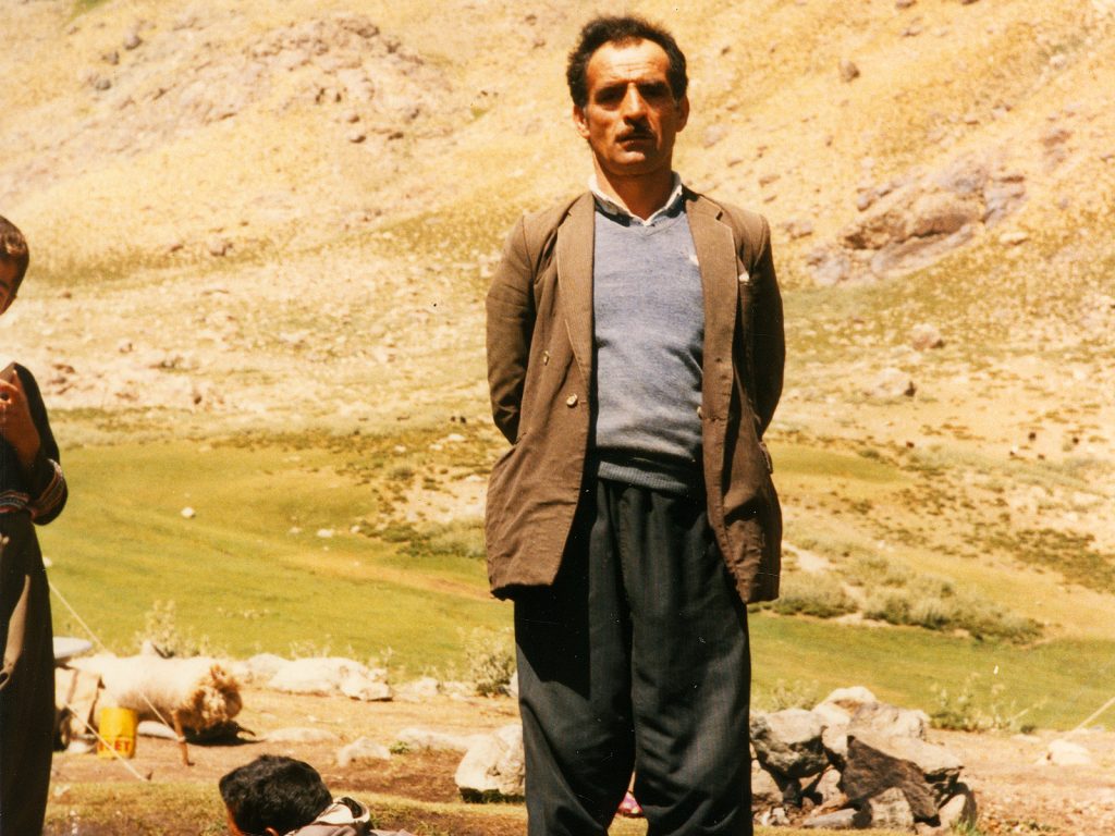
05. Hussein Donat was one of the first to greet me when I arrived at the Hanging Valley zozan. He had a large black woven goat hair tent here and invited me in for tea and to enquire what I wanted to do up in the mountains. He was to become one of my patrons.

Tea was served in small glasses on a large platter and there was a bowl with sugar lumps. A few more men joined us for tea and there was an endless stream of questions, of which I only understood a few. My Turkish was not up to replying to them so I had to get the small notebook out to illustrate my answers. I endured strained conservation for a good hour with Hussein’s wife often filling the tea glasses and me nervously rolling cigarettes and offering my tobacco around. Eventually I asked if I could stay in the camp and put my tent up nearby. Hussein muttered with the other men in Kurdish and then agreed I could. We went outside and he showed me where I could camp beside a few other tents near a small brook which meandered across the pasture after emerging from a nearby spring. As I put up my large conical tent, the whole camp appeared again and surrounded me. The 5 men and just one woman were the only ones who spoke Turkish and the rest could only speak Kurdish. The men had learnt it during their 3 years of military conscription, usually in the western or central areas of Turkey. The tent was a familiar one to the men, widely used all over Turkey. I was lent a central wooden pole about 2½ meters in height and then many hands helped bang in the 8 pegs into the earthy ground. I threw all my stuff inside, rolled out the cheap carpet to cover the grass and unpacked. In the tent, I got some privacy, but the kids were crowding around the door and frequently threatened to spill in. I set up a small kitchen with rocks to enclose the paraffin stove and balance my pans on. I put my blankets over the tent in the hope the sun might cause any parasites from last night to find somewhere else. As the shadows began to lengthen I was pleased I was ensconced in this idyllic setting with a fascinating and friendly group of nomads who I was in awe of already.

06. The zozan at the Hanging Valley zozan had 13 tents, or households, at it. Half were traditional woven goat hair tents, as pictured to the left, and the other half were more modern canvas ones., Ibrahim, on the mule, was taking dairy produce from his household down to Varegos to trade.

I cooked a meal in the tent as late afternoon merged into early evening. It was a  perfunctory dish of rice and lentils, memorable for its bland taste. All the time men dropped by the tent to peer inside at me and there was a constant stream of children milling around at the door. I would have to put up with being a curiosity and in the spotlight for a while until my novelty wore off. There was a spell of activity outside as the women returned with their pails full of sheep milk. The sheep were further up the valley with shepherds. Then a bit later, near dusk, the goats arrived and the women had to go out again into a rough stone corral where the goats were gathered and milk them too. I think there were about 400 goats in all and there were 13 tents, or households, in total so each household had an average of about 20 goats to milk. I looked on as the women chased their individual goats in the herd, subdued them and then started milking them into different pails. The whole process took a good half hour and there was plenty of yelling, shouting and pointing with the younger family members helping to round up the goats. I learnt the goats would usually spend the night in the zozan, or camp pasture, while the sheep would remain in the more distant pastures in corals with the shepherds. All the milk would be put into large pans for the evening. Later that evening 3 of the younger men came into my tent for a chat and I managed to make them tea, and share my sugar and tobacco. It was mentally exhausting to try and make conservation with them, but they were alert, enthusiastic young men and there were no awkward silences. I felt much easier in the company of men and was shy and wary of the women. One of the men who visited was Hussein’s eldest son, Abdul, (left below) who had arrived that afternoon from Ikiyaka village with vegetables and wood on a mule, and was heading down to Varegös tomorrow, and another was Sabri who was returning to the village on short leave from his 3 year conscription in the Turkish army (right below).  They left well after dark when everyone had returned to their tents and quiet settled over the camp. I rolled out a blanket as a mattress and crawled undo another two, pretty much fully clothed, for the night.
07. Abdul, another guest, and Sabri in my tent at the Hanging Valley zozan after I had just arrived in 1985. Abdul, on the left, was driving his household’s mules from Ikiyaya Village to Varegös taking pastoral products to trade and Sabri, on the right, was on leave from the Turkish military.

I woke at dawn and heard a rhythmic thudding sound from outside. There seemed to be few places where the sound was coming from. I was curious so poked my head outside and a few of the brightly dressed women were swinging a goat skin which was hanging from a tripod of 3 poles. The woman next to me was Guri, who was Hussein’s brother’s wife. She had one end of the skin and was swinging it backwards and forwards. She had two arms on a stick between its back legs and each time she swung the liquid in the skin sloshed backwards and forwards. I was more than curious and asked what was going on and learnt she was making butter (tereyagi). The milk which had been left in the large cauldrons overnight had partially divided with the cream coming to the top. This cream was scooped off and put into the goat skin, while the more watery milk remained in the cauldron. The neck of the skin was then sealed up with a wrap of rope so the skin was watertight. The goatskin was then swung backwards and forwards for about 20 minutes and it looked quite hard work. A pot was then put under the neck opening of the skin and the twist of rope was loosened off and opaque liquid started to pour out. When it was all out the neck was fully opened and a new pot, lined with a nylon sack, was put under the neck opening. Into it was scooped firm dollops of whitish fatty butter. Once the main blocks had been extracted a ladle was used to scrap the rest of the butter out. The sack was then tidied up and hung over the pot of opaque liquid to drip into it. This liquid was whey; which was milk with the fat extracted from it. The butter sack was then laid out on the grass beside the brook where it would dry off. The butter was essentially kept for frying food while the whey would be kept and mixed back into milk which was later destined for cheese and yoghurt.

08. Guri making butter in the goatskin in the early morning. The butter fat was naturally separated in the large cauldrons and then scooped off in the morning and put into the goatskins where it was churned until it formed butter and whey. In the foreground is the kapanak felt cloak I bought.

The goats which had been at the camp last night left as dawn broke and went back up the valley with some youths to look after them. I thought it would be interesting to go and see what they and the shepherds were up to. It would mean I could get away from the goldfish bowl of the camp where I was still the centre of attention. The floor of the U-shaped hanging valley I was in gently rose between sides topped with craggy ridges for a couple of km to reach a craggy head wall. I could see a path heading up through the outcrops of the headwall to what must be a basin beyond. The shepherds however were in the U shaped valley looking after some 400 sheep. Long before I approached 3 large kangal dogs came bounding towards me with intent. I reached for the large knife I had tucked into a sheath in my long socks and had it at the ready, but knew it would be ineffective against these three huge dogs, each a meter high and perhaps 60kg. The shepherds were shouting at them which took the wind out of their sails a bit and they surrounded me barking loudly, but not snarling and baring their fangs. I continued to walk towards the shepherds with the barking dogs escorting me. I returned my knife to its sheath as I approached the shepherds and the perceived danger from the dogs had diminished. These dogs were sheep dogs which spent their whole life among the sheep from an early age. They were there to protect the sheep from intruders, and also wolf, bear and even lynx which sometimes visit the area. The dogs walked me right up to the shepherds and delivered me to them making sure I did not stray towards the sheep grazing nearby. The three shepherds were very welcoming and had obviously already heard about me from the people who had passed through the camp and they started boiling up water for tea.

09.The shepherd Islam Dugran, Namen’s younger brother, and Aril Donat, Hussein’s son, watching the sheep in the hanging valley pasture. The automatic rifle Aziz is holding belongs to one of the village guards and is supplied by the Turkish Military to patrol the Turkey-Iraq border at the village.

I learnt a lot about the herding from them. Idris seemed to be the main shepherd and he was accompanied by Islam and Ismail. Idris was the younger brother of Hussein, who seemed to be the most senior man in the camp I was staying at. There were some 60 households in Ikiyaka village and virtually all of them had sheep or goats. Because the land became so parched in summertime in the area around the village once the winter snows had melted, they had to leave and come up to these lush, ample pastures on the north side of the mountain. The 60 households split into 3 different herding units with about 13-24 families in each unit. The other two units were on different parts of the mountain half a day’s walk away. In this herding unit there were 13 households and they all pooled their animals into 2 herds, one of sheep and one of goats with about 400 animals in each herd. These shepherds looked after the sheep, who were quite placid and naturally tended to stay in a herd and remain on the lush pastures on the valley floor. At night they huddled up together in a rough coral and the shepherds remained with them while the three enormous Kangal dogs kept an eye on everybody. The goats on the other hand were much harder work and tended to wander off in all directions and did not have an instinct to gather into a huddle at night. They had to be kept together as a group and forced back to the nomadic camp each evening to more secure corals where the goatherds had to keep an eye on them. As such the goatherds seemed to be young men who had to constantly run around the hillside and then take it in turns each evening to stay awake and make sure they did not disperse. It was almost a kind of apprenticeship into herding. The shepherds had a much easier job and could relax for much of the day drinking tea and entertaining passersby. As such the shepherds were more senior men who had been through the rigours of goat herding in their youth.

10. Me in my typical Kurdish jacket and shalwar trousers and a pushi or Kurdish headscarf with the shepherds. The rifle was an ancient hunting rifle which the shepherds always had handy in case they needed to defend the sheep.

Idris, the head shepherd, was a member of the Donat household, one of the largest in Ikiyaka and they had 200 sheep and 200 goats, with the other 12 households having just 200 of each between them.  As such the Donat family supplied a fulltime shepherd while the other families provided shepherds and goatherds on a rota, with a change over every week. Idris knew everything about the sheep. He not only knew who owned each of the 400 sheep but also knew each sheep’s family tree for a few generations. His decision on shepherding was final, so he would decide when the sheep needed to move to new pastures, which rams needed to be scarified at any festival to keep the breeding stock strong and he would deal with illnesses and infections by segregating some animals or even culling them. Islam was a member of the Dugran household and they had about 20 sheep and 20 goats. Idris also was responsible for the welfare of the goats but delegated to a rota of young goatherds. It is no problem for a household to have 100’s of sheep in the summer while everyone is at the summer pastures, but impossible for the smaller households to collect enough fodder for them to see them through the winter months when the snow covered the village to a depth of 2 meters. The Donat household had the manpower for 400 livestock but the Dugran family did not. It could only manage to collect enough for 40 animals.

11. Idris Donat was the head shepherd for this herding unit. His father owned half of the sheep and goats which were in the entire herd. He was always on shepherding duty, while the other households in the herding unit provided shepherds on a rota basis.

I chatted with the shepherds all morning until the women from the camp arrived. There were about 15 of them and they all came up the path in a lively noisy group chatting and laughing. They all carried a large aluminium pail and were coming up to milk the sheep and bring some lunch up to the shepherds. Guri, who was Idris’s wife, brought a sack of large nan breads and a small pail of stew. Guri, Hussein’s wife, Huri, and a few other young girls then started milking their 200 sheep while women from the other tents just had 10-20 sheep to milk. It was quite chaotic but everybody seemed to know what was happening. The women grabbed their sheep which they could recognize from the mass of the herd, squatted down beside them and quickly emptied their udders into their pails with a series of squirts. It took under a minute to do one. The sheep did not seem to mind and almost waited in line to get milked tending to cluster round their owners who would bride them with a bit of salt to lick. There were a few who were more reluctant, but they were quickly chased down by their dexterous owners who ran after them with a pail full of milk, skilfully catching them and subduing them. It was all over after 30 minutes and then the women all returned down the path with joyous fanfare and full pails, and calm descended over the pasture again as the shepherds boiled up water for another tea.
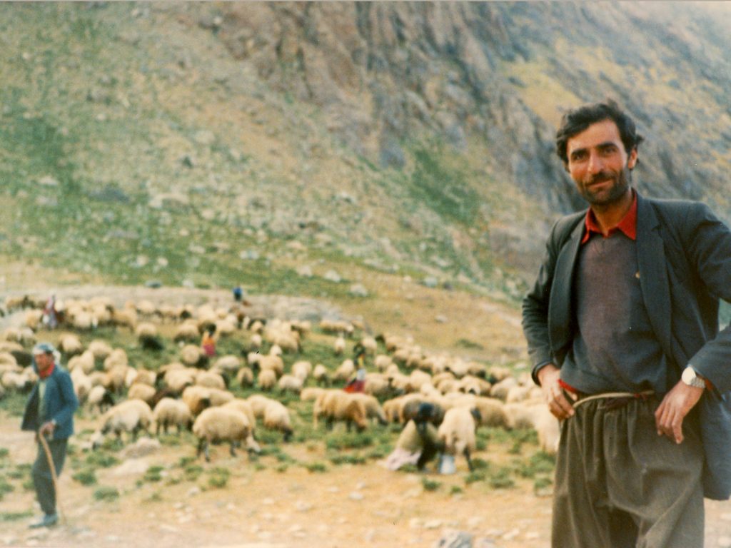
12. Idris Donat had been the main shepherd for the herding unit his household belonged to for a few years. He knew the family tree of all the 400 sheep in the herd, half owned by his household and half owned by the other 12 households.

After a good few hours with these 3 shepherds I saw the goats up on the hillside to the north of the valley. I left Idris, Islam and Ismail and headed up to the goatherds. As I left the kangal dogs started barking half heartedly and with just one command from Idris they stopped, circled the spot where they were lying, keeping an eye on the sheep, and lay down again. I went up the hillside towards the goats threading a route through the thorny scrub bushes which were scattered across the hillside. I climbed high above the valley floor up the side, and could see beyond the headwall at the end where there were some snow fields and a lake in a hidden basin. This area looked really inviting for tomorrow’s wanderings. As I approached the goatherds I had to go through the same fearful experience again as their three dogs embedded with the goats came bounding towards me. I did not pull my knife out this time but was still scared. The dogs were confident, just surrounding me and keeping a 5 meter distance, barking loudly to be certain the goatherds were alerted. They were bellowing at the dogs which seemed to appease them, and gave me some certainly to stride on confidently. Again there were 3 goatherds who were trying to stop the goats from scattering. One of the herders was up in the crags with a few of the goats who were in search of some lofty patches of grass among the small buttresses and gullies. The goats would have gone right up the crags and over the ridge line left to their own devices as they hopped and sprung nimbly up across the steep outcrops and the goat herd was throwing stones to divert them. I sat with the other two while the third got the more feral explorative goats under control and back down to the thorny scrub. We could never really stop and make tea or chat as the goats were always on the move, eager to find fodder and often passing by nourishing clumps just to keep moving.

One of the tricks the goatherds used to keep the herd from scattering was to roll rocks down the hillside, either behind them to hurry them along or more often in front of them to stop the leaders marching off. While I was there a goatherd rolled a grapefruit size rock to speed up the stragglers. The goats heard it coming and rushed forwards, but the youngest dog who was still a puppy really did not. Despite everyone shouting the young dog was oblivious to the missile and it glanced at his back leg. He let out a yelp and leapt forwards with a limp. I went down to see the dog which was lucky to escape with a small cut rather than a broken leg. Being of European disposition I felt sorry for the dog. I borrowed a rag from a goat head and wrapped it round the leg covering the gash. As I tied it up the dog turned and gently bit my forearm. It was not an aggressive bite, as even this young dog was a 30 kg mastiff and it could have done some serious damage to me. With the bandage in place we carried on with the afflicted dog limping gingerly behind. Eventually we got to camp in the late afternoon and the women emerged from the tents to milk their goats after they had gone into the coral. I returned to my tent and after a while Hussein came in. He obviously had heard about the dog incident and asked me about it. He said I had to go and wash in the stream as I was dirty. Apparently even touching the dogs was polluting, but to be covered in its saliva was disgusting beyond the pale. Perhaps these aversions are linked to their knowledge about rabies. Later that evening, after the women had milked the goats, emptied their pails into the large cauldrons, and then gone up to the shepherds to milk their sheep and returned with full pails again at nightfall, Hussein invited me into his tent for a meal. I had lots of tins of tuna so took a couple over to add to his food, which was nan bread and a thick gravy with lumps of meat.

13. Each herd of sheep and goats had a few large mastiff dogs embedded amongst the animals. The dogs would grow up with the herds and spend their entire time with them, always on the lookout. The fearless dogs would attack bear, wolf, lynx or human if they perceived a risk.

After being woken the next morning at daybreak by the rhythmic sloshing of the women making butter in the goatskins I set off to explore the lake I had seen yesterday. The goats had already left the camp with their herders and the dogs, including the injured one. I made my way up the valley to the shepherds. The dogs came bounding towards me barking loudly but as they approached they fell silent and escorted me up to the shepherds keeping an eye on me. I had tea and a chat with them before continuing up the valley to the headwall, where a path zigzagged up between the crags. At the top was a huge basin with a large, deep-turquoise, crescent-shaped lake across it’s floor. Surrounding the lake were some smooth bare crags and the greenest of pastures. Beyond them were high craggy ridges culminating in jagged peaks, many riven by deep gullies still full of snow, all rising up into a perfect azure sky. Large snow fields covered the mountainsides between the pastures and the peaks and from these small streams emerged and tumbled down the rocks sometimes in wispy waterfalls. It was the most unexpected paradise and I was astounded I had never heard of these mountains before in my now extensive travels around Turkey. I knew I had stumbled upon something really special here. I walked round the west side of the lake on the path and more and more peaks unfolded to the east. There was a brook which came down from a deep dark sunless basin to the south and flowed across the fan of a lush meadow which pushed into the lake. It was the lushest grass one might imagine and was full of the bright yellow globe flowers. I sat in the meadow and marvelled at the scene.
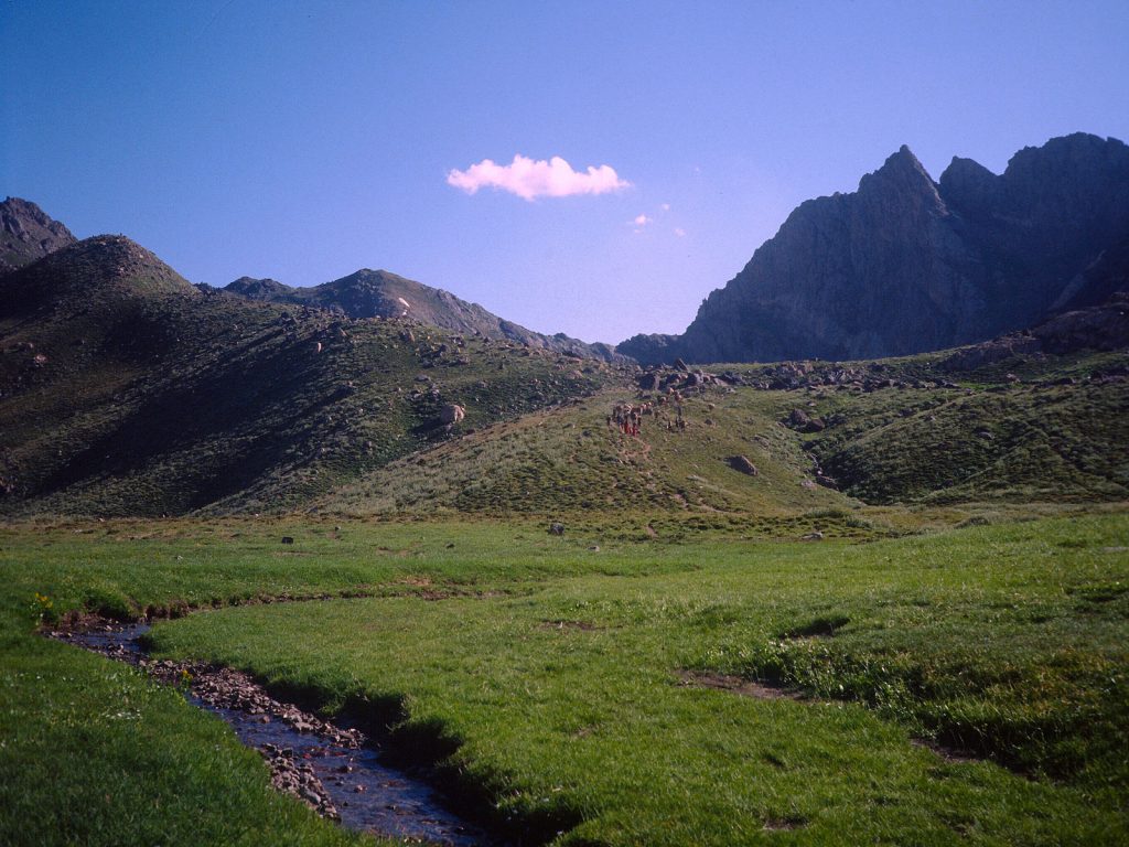
14. Above the Hanging Valley was a large basin, called the Sergera Basin, surrounded by jagged peaks, On the floor of the basin were some 5 lakes with Buyuk Golu being the largest. The path to Ikiyaka village went across the basin and up over the ridge under the cloud.

After a while I saw a mule train coming down the path from the skyline to the south. From what I had gathered this was the path over the mountain to Ikiyaka village which lay on the other side. As the mules approached I saw someone with a gun waving. It was Sabri who had been in my tent on the first night. He had been home and was now coming up to the pastures for a couple of days to fill his lungs. He was accompanied by his father Hajji, who was wearing a white turban. I knew straight away by his title and turban he had been on the once-in-a-lifetime pilgrimage to Mecca. This pilgrimage, which all Muslims are required to do, would have involved considerable expense and hardship for Hajji. It would have conferred respect from the other villagers as it shows he is both pious and wealthy.  I sat and chatted with Sabri and Hajji for a good hour until another figure approached from the direction of the camp. It was Idris the head shepherd and he soon joined us. He had come up to see what shape the pastures were in and whether it was feasible to move the sheep up from the current pastures in the hanging valley below. He thought it would be less than a week before the current pasture was tired and the sheep’s milk production fell. Currently they were producing about a litre a day. We sat in the sun while I listened to the men chatting. I understood virtually nothing they said but could tell they switched from Turkish to Kurdish at a whim. Only when they asked me a simple question in Turkish would I have a hope of understanding and even then they often had to repeat or even rephrase it. It was a timeless morning and I could have been in any century at that enchanted place.

15. Sabri and Idris, the shepherds, chatting to Sabri’s father, Hajji, who was going to Varegös from Ikiyaka village. We all sat on the lush grass beside the largest of the lakes in the Sergera basin. At the far end of the lake was the location for Gaveruk zozan which remained vacant until mid summer.

As we chatted a few mule trains went up and over the pass and down to the village of Ikiyaka.  The pass seemed just a short distance from the lake, perhaps just half an hour. I thought I would go up and have a look after I got tired from answering and asking questions, which was the only way I knew how to communicate, and it was mentally exhausting. After a couple of hours the party split up anyway with Idris returning to the sheep and Sabri and Hajji continuing down to the zozan where I had camped. There was a good path for me to follow up the gentle ridge to the pass. As I climbed up it more and more lakes appeared on the floor of this large alpine basin. To my west were two lakes, one of which was still covered in ice with snow fields covering the mountainside coming down all the way to the ice. These two lakes, and especially the upper one, were in a deep north facing corrie and were probably in the shade for much of the afternoon. To the east there were 2 more smaller lakes on the basin floor and they looked idyllic with large meadows surrounding them. As I neared the pass more and more of the mountains unfolded from behind the nearer peaks. This was going to be a fantastic area to explore.

It was an easy jaunt up the scrubby meadows of the hillside to reach the pass. The south side was much steeper, and much dryer and totally parched. I could see the path zigzagging down the initial few hundred meters until the slope eased off and then it wove down more gently across scree covered slopes and stony ridges until it met a dried up streambed, nearly 1000m below me. Beyond the dried streambed was the village of Ikiyaka. It was perhaps 2 km long from top to bottom and all the land on each side of the village houses, which were strung out along the valley floor, was irrigated. I had been told that the Iraqi border was just beyond the lower part of the village. Beyond it was just dry barren rocky ridge after ridge disappearing into the blue opaque haze of the obscured horizon. I am sure between these distant ridges there would have been some small streams, irrigated land and even small villages, but from up here it looked inhospitable and empty. Even the terraced fields of Ikiyaka looked dry and arid, but perhaps it was the ripening grain I was looking down on. It was too far to see the houses clearly but I could see a few beside the corridor of large trees which lined the streambed. The houses I could see were the typical single story flat roofed houses found throughout the region. Far below there was a mule train approaching the village and they were easy to see because of the wedge of dust the mules were producing.

16. From the pass to the south of the Sergera basin there was a long near 1000m descent down the south side of the mountain to Ikikaya village. A kilometre beyond the lower end of the village was the Iraqi border and most of the land above the centre line of the photo is in Iraq.

I returned down to the large lake where there was no one and just sat in the late afternoon sun enjoying the splendour of the area. I was enchanted not only with the landscape but also the culture of the nomads on the mountain here, which through my passing eyes looked idyllic, but I am sure was harsh. After a snooze on the flower filled meadow I headed down to where the shepherds were in the hanging valley beyond the end of the lake, which I realized had no visible outlet. A new shepherd, Namen, had joined the original 3. He was the elder brother of Islam who would be heading down to Ikiyaka tomorrow. I immediately liked Namen who had a gentleness to him which Hussein lacked. Namen was very forgiving of my fumblings in Turkish and kept suggesting words when I got stuck. As we were drinking tea I could hear the clamour of the women coming up the valley for the  late afternoon milking of the sheep. This time instead of chasing round after the sheep with pails sloshing the women formed two rows facing each other with 8 in each row. With some encouragement from Idris, the head shepherd, the sheep then just formed an orderly queue waiting to be milked. Idris sat on a stone in the middle of the two rows of women and as the sheep slowly filed towards him he distributed the sheep to their respective owners who then milked them in an orderly manner, chatting enthusiastically and laughing loudly. All 400 sheep passed through and Idris knew which household every one belonged to. Again it took about half an hour until the evening milking was done and then the colourful enthusiastic group of women all left and headed back to camp swinging their nearly full pails.

17. Milking the sheep near the Hanging Valley zozan. This was the orderly way of milking the sheep where they lined up and Idris, the head shepherd, passed each sheep to the individual owners who milked their own sheep. There was usually one lady, but sometimes 2 or 3, from each household.

The next day I decided to explore a bit further, so I went back up with the women when they went up to milk the sheep in the morning. By now the 3 huge mastiff dogs were used to me and just let out a few half hearted barks without even bothering to get up. After the milking was over I had tea with the shepherds and then set off up to the big lake, which was called Buyuk Golu. I went round the south side of the lake passing through the meadows we had been at yesterday. Just beyond was a tunnel which the entire lake drained into and then plunged into the heart of the mountain in a swirling cascade. At the east end of the larger lake was a smaller lake which seemed quite shallow, as I could see many boulders in its milky azul waters. Just beyond this was yet another small lake. At the stream between the smaller lakes where many rings of stone walls which I guessed  were the ruins of summer camps. I walked round the more gentle grassy south side of the lake and then climbed steeply up a headwall at the end which was still covered in large drifts of snow. Small wispy waterfalls cascaded down the headwall as I made my way up a natural ramp. At the top there was a great view across the basin to the west which I had just crossed. I however had just climbed into yet another higher basin and it had one shallow lake on its floor. To the east of this were stony slopes with a plethora of small animal paths formed by centuries, if not millennia, of grazing. I followed a series of them up to a high col on the skyline, where a magnificent view burst upon me. In the near distance, across a couple of spurs and gullies was the mountain of Samdi Dag. the biggest in the area and the second highest in the entire Cilo-Sat Range. It was nearly 4000m at 3811m. Its jagged ridges, still harbouring large snowfields, led up to a lofty pointed rocky summit. I could see a prominent path to the east, coming up the valley below me from Ikiyaka village, which then went over a col to the north side of this mountain. It must have been the path used by one of the other two herding units from Ikiyaka village to their summer pastures, or zozan, and then on to the rough road at Varegös.

18. The view from one of the easier peaks to the east of the Sergera basin looking east towards Samdi Dag, 3811m, the highest peak in the area. The path centre left is another way up from Ikiyaka village over the range at the visible pass and then down past zozans to Varegös

From the col I was on it seemed quite simple to climb up rocky slopes covered in tough, prostrate alpines to a broad peak. There was no path and I just clambered up the small stones and gentle outcrops in my sandals until I reached the top. From here I had a great view in all directions. Below me to the west were the lakes I had walked past a couple of hours ago and beyond them was a craggy ridge. The lower part of this ridge was where the goats had been grazing when the stone hit the dog. Beyond the ridge the landscape dropped away to the town of Oramar, or Daglica, deep in the Rubarisin stream valley before it flowed into Zap River. Finally beyond the valley was the massif of Cilo Dag, the highest peak in the entire range at 4100 metres. I was sure that on the north side of this mountain also there would also be groups of nomads taking advantage of the lush pastures afforded by the melting snowfields just as there were on Samdi Dag.

19. The view from one of the easier peaks to the east of the Sergera basin, below, looking west. The mountain in the far distance is Resko, the highest in the whole Cilo-Sat range at 4134m. Gaveruk zozan is between the lakes bottom right and Sergera zozan middle right near the barely visible lake.

By the time I got back to my tent via the shepherds for a glass of tea, it was late afternoon and the women were already heading off to milk the sheep. When they returned the goats were arriving for the night in the adjacent coral with the 3 goatherds and the dogs, one of which was still limping after the rockfall. One of these women, Fatima, was very confident and could speak some Turkish having been brought up on the plains around Yuksekova, before marrying someone from Ikiyaka. We had a few chats over the previous evenings. Her husband was down in Ikiyaka working in the fields and would be coming up in while to do his shepherding duties. In the meantime she was running her households tent up in the pastures and doing all the dairy tasks, and looking after her 3 children, one of which was only a year old. This evening just before milking the goats she came into the tent and put the baby down on my blankets. My tent was warm and she had her hands full. About an hour later she returned, sat down opposite me and pulled a plump breast out of her blouse. Then lifting the baby onto her lap started feeding it. I was wary and taken aback. In Kurdish society adultery is so frowned upon it is often punishable by death. If a married lady commits it then her original family will be so ashamed they will often murder her, with her brothers avenging the shame she has brought on them. Her husband’s family will also take revenge on the male perpetrator. So I felt quite uneasy and hoped nobody would come in and she would finish quickly. It was not to be as soon another woman arrived at the tent, and then a few children, and then Namen, the new shepherd came in. All the time Fatima kept breastfeeding without batting an eyelid. In fact nobody batted an eyelid except for me. I had a much more Western attitude to breastfeeding with breasts seen as sexual objects, than these Kurdish nomads who saw them as perfunctory appendages. In the following weeks while I stayed there, Fatima would often drop her baby off in the warmth of my tent while she milked the goats and cooked the evening meal for her household.

20. Some of the children and ladies from the Hanging Valley zozan. The ladies were the mainstay of the zozan and were responsible for all the dairy tasks. They also cooked and looked after the children. The lady on the right with the infant is Fatima.

As the time passed I slowly became less of a curiosity. I would still go and eat in Hussein’s tent every other night taking some of my supplies over to add to his food.  The two women in the tent, Hussein’s wife, Huri, and Idris the head shepherd’s wife, Guri, were always busy cooking food, making tea, doing their dairy chores, and going back and forth to milk the sheep and goats. Over time I slowly managed to communicate with them through drawings in my notebook, sign language and what Hussein translated for them. Hussein’s wife, Huri, had considerable sway in the camp being the eldest woman there and also as Hussein’s wife. She had 4 grown sons and this gave her more authority and respect. Idris’s wife, Guri, was certainly the junior and had to do the lion’s share of the more menial jobs, together with whichever of Huri and Hussein’s daughter-in-laws who were staying up at the zozan. It was a busy tent with people coming and going most of the day as they passed through the camp en route between Varegös and their village. Hussein’s sons, Abdul and Aril were frequent visitors as they took turns in taking Hussein’s mules back and forth.
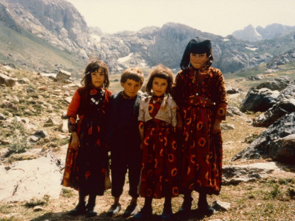
21.The path between the hanging Valley zozan and the Sergera basin was a few km. To leave the hanging valley the path climbed up the steep slopes to the right and over the lip of the basin. There were often children running errands who went between the camp and the sheep in the pasture.

The other tents were much quieter and I was seldom invited into them. It was largely because they were mostly occupied by women who had their family’s dairy tasks to do. Occasionally their husbands would appear either to do a stint of shepherding duty, or to take dairy produce down to Varegös and bring flour and supplies back up and over to the village. The children from these other tents formed a lively, wild, cluster who as a group were always excited and were often around me with each one trying to show off, often at my expense. There were about 20 of them in all and if they were out in force it was like an anarchistic mob. Occasionally I would walk with one or two up to the shepherds and then they were a delight, wanting to pose for photos, scribble in my books or show me things they found. On one occasion in the camp a group of younger children were crowding round the door to my tent when one of the elder boys pushed a few of them in. One of the girls fell on my stove and knocked the tepid water over. It was the last straw for him and I ran out of the tent, chased him across the marshier ground near the spring, and clipped him on the back of the head. He stumbled and fell face first into the soft mud, then got up and went off wailing. The women doing their dairy tasks had seen it all unfold and I was expecting some reprimand but instead there was laughter and approval. After that the rowdier children of the mob were more cautious and did not taunt me again and would sometimes come into my tent and quietly sat as I did my domestic chores.

22.The children in the camp at the zozan were quite an unruly mob. There were perhaps 30 of them and they got up to all sorts of games, but also mischief. I was occasionally the target of their mischief until I grabbed hold of the ringleaders here and reprimanded them.

There was always a strong smell of feta-style cheese around the camp. Once the milk had been collected the pails were emptied into large pans. Some would be destined for the butter churning in the goatskins every morning, some to make yoghurt which would be blended with water to make the ayran drink, but most would go into cheese production. In the evenings something was put into the cheese to make it curdle and in the morning it would have separated into curds and whey. The solid curds were scooped off, mixed with salt, and put into nylon sacks which were then tied up and left by the small brook emerging from the spring. They would lie in the warm sun with the curds draining until the feta style cheese was quite firm. Flies swarmed over sacks, sometimes they were so prolific the top side of the sacks were almost black. It would take the cheese in the sacks a good day to drain and form into feta. They were then taken down by mule to Varegös to be sold. The teenage boys who loaded the sacks and drove the mules stank of cheese, as when they manhandled the sacks they dribbled the rest of their watery whey onto their clothes, which were never taken off and washed. I frequently ate these cheeses as they were a staple dish with the meal every night, usually rolled up in a piece of nan bread. It was never my favourite especially when small gusts of wind swept through the camp and covered the dishes with a fine layer of dried dust, which was essentially powered goat droppings. Somehow in each of the months I was there for summer of 1985 and 1986 I never got ill.

23. One of Hussein’s younger sons was responsible for turning the feta cheese sacks as they dried in the grass beside the brook and also for loading them onto the mules. Whey dribbled out of them as they were man-handled and often onto the clothes of the young lads who stunk of feta.

During the day I spent more and more of the time with the shepherds, and often the goatherds also, although the latter was hard work as the goats were always on the move. In the evenings the goats returned to the camp while the sheep were collected into a coral and guarded by the 3 large dogs. The shepherds would have their evening meal brought to them by their wives when they came up to milk. They would eat their meal after the sheep had been milked and dusk fell, then build the fire for evening tea. When the sun dipped below the horizon the temperature plummeted. During the day it was perhaps 30 centigrade, but during the night it would be down to minus 5 and there was a frost on the ground every morning. The shepherds would huddle beside their fire in a small ring of stones beside the sheep coral drinking tea for a couple of hours until they went to bed. For bedding they just had a ‘kapanak’ which they withdrew into pulling it over themselves. A kapanak was a large cloak which was split down the front. It did not have arms but rested on the shoulders. They were quite heavy, about 4-5 kg, and entirely made of felt, perhaps a 4 square metres of it. The felt was made by collecting sheep’s wool and roughly twisting it together in small loose rectangular blocks. These blocks were then taken to the stream, soaked, and then beaten with a heavy stick to flatten the block into a sheet some 1-2 cm thick. It took a lot of beating to make one sheet with more wool being constantly added to the thinner bits. The sheets were then joined together with more loose wool packed around the periphery of each sheet which was again beaten until the sheets were one. When worn over the shoulders the kapanaks came down to above the ankles and were extremely warm, windproof, and I am sure waterproof. The shepherds slept in them by putting their head into one of the shoulders, then lay on the ground and pulled the upper side over them tucking it under their side which lay on the ground. Then by pulling bending their knees up the hem would enclose their feet enveloping themselves in a warm wrap of felt.

24.Two shepherds from Varegös in their felt cloaks. These felt cloaks were homemade from sheep and goats wool and were very warm. At night they tucked their head into one of the shoulders, lay on the floor and wrapped themselves in it. I bought one like this from Hussein.

Hussein had a spare kapanak and offered to sell it to me. It was much warmer than my blankets. It meant that after a week of being in the camp I could go and spend the night up with the shepherds. Idris was still the main shepherd and always was as his household had half of the animals in the entire herd. Islam was still there finishing his households duty rota, but Ismail had returned to the village, his households rota finished and he was replaced by Namen who was Islam’s older brother. Namen was very friendly and avuncular, not only to his brother, Islam, and Idris, but also me and indeed everyone including the rabble of children at the camp. While Hussein was always trying to maintain his authority in the camp and was constantly looking for opportunities, Namen was easy going, friendly and warm. They were delighted to see me pitch up with my kapanak at dusk. I had some food and we ate supper together and then huddled round the fire. Idris and Namen had a constant ear out for the mood of the sheep, while Islam made pots of tea. It was an evening filled with wonder and I felt like I was in a nativity play. The evening was like a scene from the Old Testament. A picture from a children’s edition which had come to life. Indeed this was a lifestyle which had probably not changed for the last 5000 years since man had domesticated sheep and goats. Humanity enjoyed this lifestyle for hundreds of generations until industrialization disenfranchised us from it. But here in a hidden corner of the globe was a pure relic of our past. For most of us this enchanting lifestyle is part of our cultural DNA shimmering just below the skin and it was easy for me to immerse myself into the time of the Prophets and pastoral parables. After a few hours when the sheep had settled, the dogs were alert, and the temperature dropped to zero under the crystal studded sky. I lay down on my new kapanak. I put my head in its pointed shoulder recess and pulled it over me. It was very warm and although I could feel the cold stinging my exposed nose the rest of me was snug in the cocoon of felt.
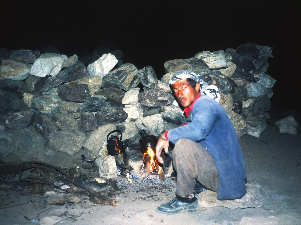
25. Islam Dugran was a regular shepherd and was often with the herd of sheep. He was one of the rota shepherds who helped Idris Donat. At night they slept near the sheep in a small coral of stones while the dogs watched the sheep. Before they went to sleep the shepherds always brewed tea

We all woke at dawn when the sheep were stirring. Idris went to check on them while Namen made a pot of tea. Down at the camp I imagined the rhythmic sloshing of the goat skins as the women churned their butter and the children were subdued and shuffling about rubbing their sleepy eyes. Perhaps most were still swaddled in scratchy blankets on a carpet on the floor of their black tents. I knew the women would arrive in a couple of hours with bread and food for the shepherds and a pail for the morning milking. As we were having morning tea in the bitter shade of dawn there was a discussion amongst the shepherds, then Namen told me Idris had decided to move the flock tomorrow up the mountain to the lush pastures at Sergera as the pastures here were getting exhausted. The animals each produced about a litre of milk a day and this would decrease if they continued to graze on these close cropped and browning pastures. The untouched pastures at Sergera were plentiful enough to see them out until the first of the winter storms arrived in October and sent both this herding unit and the other two on the mountain back to Ikiyaka for the winter. This was exciting news for me as I would witness the camp move and then set up again at Sergera. I did not know where Sergera was but knew it was up beyond the craggy headwall of this hanging valley and in the idyllic basin above with the lake surrounded by an amphitheatre of jagged towers. It meant a lot of the mules which were going backwards and forwards from Varegös to Ikiyaka would spend the night in the camp so they would be used to transport the tents the next day. After milking I returned with the women to the camp, as I too had to prepare to move my tent and belongings.

26. Islam Dugran with the sheep and his nephew, Namen’s eldest son. Islam had occasional epilepsy but I never saw it so he was seldom left alone and was unmarried. He was a gentle man and reminded me of a typical shepherd from an illustrated edition of the Old Testament.

When morning came the dairy chores were all done as usual with butter being churned and the cheese being prepared from the remainder of the milk. The tents were then quickly emptied and the possessions bundled up in old goat hair sacks or new nylon sacks. When everything was out the poles were taken down and tied up in a bundle and then the large black awning of goat hair matting which was the roof of the tent was folded into a long strip which was then folded up. It was remarkably big and bulky, but then it was perhaps 30 square metres. The 9-10 mules which were collected at the zozan for the move could not manage all in one go so had to make two journeys. Namen had arranged for a mule to take my tent and I managed to stuff the rest of my possessions into two large nylon sacks which I tied together and slung over my shoulders. I was my own mule. Half the camp went with the first load and half stayed behind and would come up with the next load in a couple of hours. There was excited chatter as we went up the hanging valley with everyone carrying something. Even the toddlers were playing their part and carrying empty milk pails or serving trays. We passed the pasture where the sheep had gathered each night and it was now empty, as the sheep had already moved off at dawn with the dogs and shepherds. We climbed the zig-zags at the valleys head wall and reached the basin. I knew the camp would be beside a lake but did not know which one and was surprised to see everybody heading to the smaller lake on the very east of the basin rather than the main lake, Buyuk Golu. We went to the far end of this lake just before the rise up to the lake which was still covered in ice. There were some stone circles here, upon which the black goat hair tents would soon be. pitched. Namen was already at the new camp called Sergera, beside the lake. He pointed to a nice flat grassy area near the stone circles where I could pitch my tent, but said it would be best to wait for Hussein.
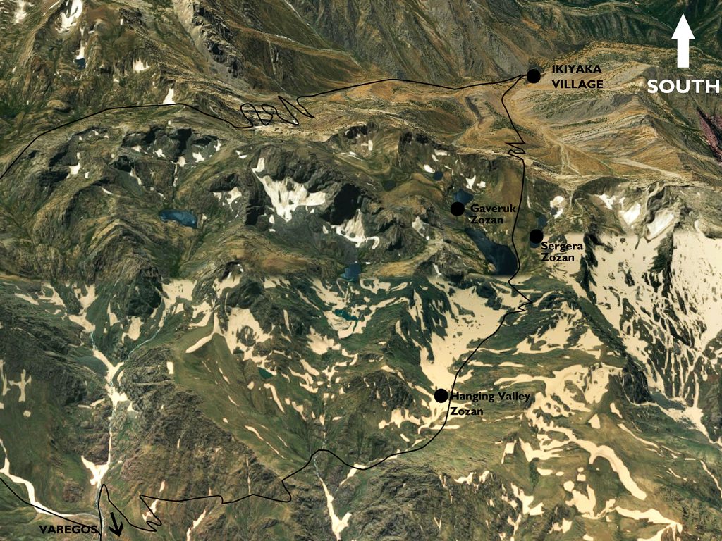
27. In the centre right of the picture is the Sergera basin with its 5 lakes and two zozan, Sergera and Gaveruk. The herding units who ended the summer here came from the Hanging Valley zozan and one in the valley to the east of it respectively. The black lines are the paths from Ikiyaka to Varegös..

We did not have to wait long before the mules, Hussein and some of the girls arrived and I could see a colourful string of the children coming along the lake. Hussein said I could camp in the spot Namen showed me. The mules were all unloaded and their saddle bags emptied before they all turned and went back to get the second load. It seemed everyone had their respective place, probably where they camped last year. In no time the tents were unrolled and the fringes of the black goat hair tents were placed on top of the rings of stone walls. Then rocks were tied to guy line ropes. The shorter poles were then put on each side of the entrance to the tent and fixed with guy lines, then the longer poles were put in the middle of the tent to keep the roof up. It only took an hour before all the tents were up, including mine. Then stones were rearranged on the earth floor of each tent to make a fireplace and before long smoke was leaking out of the tops of the tent and palling in the still air above the camp as tea was made. Soon afterwards the mules returned with the final load and the rest of the camp arrived in excited groups all burdened down with pots and sacks which the mules were not carrying.  Carpets and bedding were soon rolled across the floors of the tents and some 3-4 hours after the starting to dismantle the last camp in the Hanging Valley this new camp at Sergera was all set up and functioning. Most of the men were helping with chores to get settled in and were helping each other. Namen was busy helping everyone and I followed him around helping him. Fatima’s husband was still in the village and she had to do everything on her own, so Namen and myself helped put up her tent which was a modern metal pole and canvas one with many guy ropes and homemade wooden pegs. It was a jovial atmosphere and I am sure I heard some jokes with sexual innuendo from Fatima as the pegs were banged in, but I shyly ignored it while Namen laughed.

28. Namen Dugran and some of the children at Sergera zozan beside the higher lake. His herding unit of 13 tents moved here from the lower zozan in the Hanging Valley in August each year. One of the black tents behind them is the traditional woven goat hair tent of Hussein Donat.

By midday the whole camp was set up, food was being prepared by the women, and the men were discussing and smoking while sitting cross legged on the carpet in Hussein’s tent round a large tray full of tea glasses. I assumed an account of whose mule had carried whose possessions, and what the various mules would do now in the afternoon, either go down to Varegös or over the pass to Ikiyaka, were the topics. After lunch the women, who were always busy, headed off to the sheep, who were grazing nearby and had not been milked yet. Half an hour later they were back to pour their pails into the large pots to start the dairy process off again at the new location. With my tent set up I went for a walk to the Idris, Namen and a new shepherd who had replaced Islam. The sheep were grazing on the south side of the main lake enjoying the lush ungrazed grass while the shepherds were sitting on a boulder basking in the sun. It was a biblical scene again, but in this unrivalled setting. It was a paradise, with the bountiful flower-filled meadow full of green grass beside the shimmering lake, and all beneath a cirque of high peaks, each looking over their neighbour’s shoulder as if in frozen curiosity. This really was the land of milk and honey which I previously could only imagine. Here I was living in the midst of it with the most noble and  hospitable pastoralists, with a seemingly idyllic and sustainable lifestyle which was as old as the scriptures.

29.The sheep grazing the new pastures in August between Sergera lake and Buyuk Golu lake, seen in the picture. Another herding unit from Ikiyaka village arrived about the same time each year at their zozan at the east end of Buyuk Golu lake (far end) which was called Gaveruk zozan.

I went for a walk with Namen to the smaller lakes to the west of Buyuk Golu Lake. He explained to me that the stream which drained the lake and plunged into the steep, dark shaft heading towards the heart of the mountain later emerged again on the south side of the mountain just above the village of Ikiyaka and it was the lifeblood of the village and allowed them to irrigate their lands. Beside the other two smaller lakes, beneath a band of steep rock over which wispy waterfalls cascaded were the pastures I had seen a week ago when I went up the peak ahead. Namen showed me the stone circles in an idyllic spot between these lakes and explained that another of the herding units from the village would be moving here in the next week or so when their current pastures were exhausted. This zozan was called Gaveruk and the pastures around it were reserved for their herds. There seemed plenty of grazing up here for everyone.

When we returned to Idris and the other shepherds a small group had gathered. One had an old rifle with a worn and polished stock which had many ancient wounds in the wood. A small flock of ducks had landed in the middle of the lake some 200 metres away and they were preparing to have a shot at the peaceful raft of them. Sabri was amongst them and he took the first shot. The sights must have been previously knocked as the bullet splashed into the water some 10 metres to the side. The ducks remained blissfully unaware they were being shot at and continued to preen themselves. It took about another 10 shots, each one getting closer as the sights were adjusted, before one duck was flung into the air as it was hit by the rifle bullet and killed. Unfortunately, the other ducks still remained unaware of what was happening and continued to preen. After another 20 shots two more ducks were dead and the other dozen had at last flown off.  The trouble for the hunters was the ducks were still in the middle of the lake and there was no wind. Namen asked if I could swim and soon I was down to my underpants and knee deep in the freezing water plucking up the will to overcome the cold and swim out and retrieve the ducks. I don’t think they thought I would really swim out to get the duck as when I returned 10 minutes later they were incredulous. So incredulous they gave me one of the ducks. I returned to the zozan in triumph with it and Hussein arranged we would eat it that evening, giving to his wife, Huri, to pluck and prepare. Namen arrived an hour later and told the story how I swam out to retrieve the ducks to the camp. I felt like a schoolboy whose teacher had just sung his praises to his parents. About 6 of us shared the duck that evening which Huri had cut into small pieces and fried, almost beyond recognition. The new camp was in an idyllic location beside the small lake, but the very steep ridge to the south west plunged the camp into the shade in the late afternoon so the nights here were a bit colder.

30. Sergera zozan was the camp and herding unit I spent most of my time with. They moved here from the Hanging Valley each August and I moved with them. Just above Sergera was a lake which remained ice covered through the year. Beyond the far ridge is the steep descent to Ikiyaka village.

I spent about 2 weeks of my stay in 1985 camped beside the cluster of tents at Sergera. Much of the daytime I spent with the shepherds who were usually around the western half of the largest lake Buyuk Golu. It was a very sociable place as it was also on the path between Varegös and Ikiyaka near where it crossed the main ridge. The shepherds rotated a couple of times during these weeks but Idris always remained. One of the visitors was Yusuf. He was the elder brother of Hussein and Idris, and was eldest son of their father Haggi Donat, Haggi was reputedly 90, but I’m sure there was some licence in the figure and he was probably a little under 80. Haggi who I had not met apparently commanded considerable respect in Ikiyaka as he was formerly the village Agha, or headman, he had also been on the Hajj to Mecca, and he had 2 wives, 4 sons and 14 grandsons and many great grandchildren. Yusuf, I think, had just come up to have a couple of days in the zozan, which must have felt like a liberation after spending much of the summer in the parched heat of Ikiyaka village where he ran the household for his elderly father. In his earlier years Yusuf also spent much of the summer in the zozan and I am sure he missed it’s lifestyle
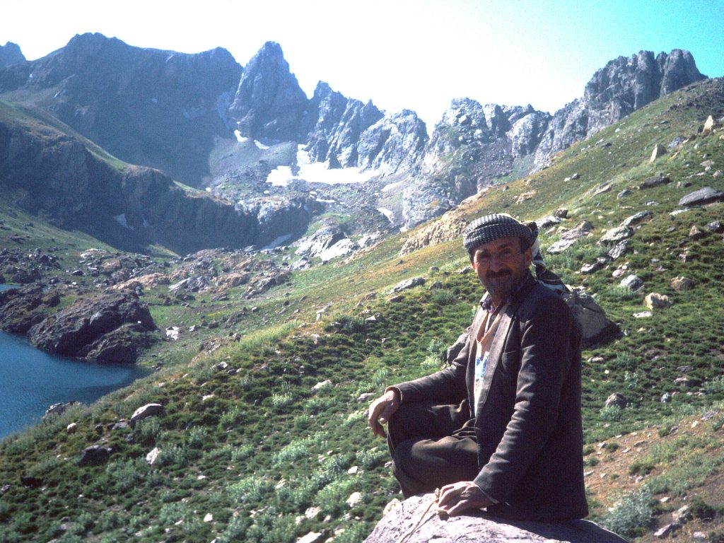
 

31. Yusuf Donat was an occasional visitor to the zozans but spent most of the time in the village with his elderly father. His brother Hussein Donat was the leader of the herding unit when they were in the mountains. In the near distance, just before the band of cliffs is Gaveruk zozan.

A few of the boys used to play in the water on the lake’s edge occasionally. After my now infamous swim Hussein asked me if I could teach some of them how to swim. The water was cold as it was largely snow melt.  Although the air was perhaps 30 Celsius during the day, it was often just below freezing at night to counteract this. Where the small brook entered on the west side the water was slightly warmer and there was a small alluvial fan to wade in across. Nobody could swim as there had never been the need, but the boys were eager to try. I spent an hour a day wading about the shallows trying to teach 6 boys. Despite the water temperature they threw themselves into the water and splashed around hopelessly keeping within their depth. It was a testament to their hardiness they braved the water for so long. After a week they had calmed down and were able to float and do a simple breast stroke. I never had to find them at the start of the swim session as they started badgering me for their lessons after their camp and dairy chores were finished. Virtually all the children had household chores to do and it was amazing to see how a five year old could separate the curds from the whey and put the curds into the sacks and carry them to the brooks edge to mature into cheese. The young girls were already helping to milk the sheep and goats at five years old. They were keen to please their mother or elder sister who was in charge of the household dairy. If they fooled around, spilt milk, or were difficult they were quickly reprimanded with a shout or slap on their hand. To me it was unfathomable that such young children could be eager and effective on tasks which needed some competence. It would be a rare sight to see a 6 year old girl wrestle a goat into position and then milk her in Europe
32. After I had swum in the lake to retrieve some ducks which were shot by the old shepherd’s rifle Hussein persuaded me to teach some of the boys how to swim. Despite the freezing temperatures they managed to stay afloat with a simple breaststroke after a week’s worth of lessons.

Most of my conversations were mundane and were often initiated by me asking a question about the dairy tasks, or sheep or who was related to who. Occasionally the topics were more worthy and there were discussions about religion, geography, or astronomy. The Kurds of Ikiyaka were all Muslims. Namen, along with many of the others prayed five times a day. If he did not have his small carpet to hand when shepherding he laid out his jacket and faced the south towards Mecca at the appointed hours. In fact Namen even kept his watch at Mecca time rather than Turkish time which was an hour behind. I always choose to say I was a Christian rather than an Atheist as this would have been unnecessarily insulting. We would discuss the Prophets, which both Christians and Muslims shared as indeed did Jews. Abraham was the first prophet in all three of these monotheistic religions but held a more prominent place amongst these Kurds that he did in Judaism and the Christianity I was familiar with. Perhaps it was the pastoral lifestyle which these Kurds shared with Abraham which made them so fond of him or perhaps it was because he was God’s first Prophet. Abraham’s willingness to sacrifice his son, Ismail, in obedience with God’s wishes, before God sees Abraham’s devoutness and provides a goat instead for him to sacrifice is the basis for an important festival, namely Eid al-Adha. In 1985 I was largely unaware of it until I noticed Idris, the head shepherd, separating off about 20 sheep and goats which were going to go down to Ikiyaka village the next day to be sacrificed a few days later in ritual commemoration of Abraham’s piousness.

Most of the other prophets of this Judeo-Christian-Islamic were also familiar to both these Kurds and me. The difference being my interpretation was that the prophets stopped with Jesus, the son of God, who they called Isa, while their interpretation was that Isa was just another prophet and not the son of God. Mohammed who lived 700 years after Isa (Jesus) was the final prophet and the Quran was revealed to him by God through the Angel Gabriel. In these discussions I did not argue any points, but rather acted as naive and wrote their interpretations in my notebook. Where I was slightly more convincing was my explanations of the mountains and lakes, why the sun and moon rose and fell and the shape of the earth. Again my notebook came out and I used drawings to illustrate how the glaciers had been much bigger once and had gouged out the landscape or how the limestone had eroded subterranean passages into which the stream from the lake followed or how the planets revolved around the sun and earth, which was round and not flat. Hussein had an enquiring mind and it was usually with him I would discuss things. He would then later relay them to others at the meal and I would have to rejustify my explanations as we sat on the floor eating dinner. It was usually met with scepticism as there was a thought that things had always been as they were since the Creation. These discussions always left me exhausted as my Turkish was just not good enough to discuss such lofty topics. However the use of the notebook to help communication was invaluable and I would have been lost without them. The discussions were always friendly as I was always aware that I was on thin ice and was never dogmatic.

33. Hussein with Hodgir. Hodgir was the village teacher and Iman and was quite political. His household had a tent in the herding unit where his wife and children spent the summer doing the dairy tasks. He always dressed in like a peshmerga.

There was a school in the village and the teacher was called Hodgir. He was one of the few political people had come across up here. I did not get into any meaningful conversation with him about the Kurdish situation but you could see he was a patriotic Kurd, much more so than the others. He dressed in the same style as a Peshmerga from the KDP (Kurdistan Democratic Party) which was a much more liberal independence movement compared to the PKK. If Kurdistan was mentioned in a discussion he would cross his clenched fist across his chest. His family was at the Sergera zozan and he came up frequently but I never saw him shepherding. Perhaps as the teacher he was excused from the shepherding rota, as say a Catholic priest might be. When he was at the camp he spent much of the time with Hussein. Both of them were quite serious characters which could have been due their responsibilities, or perhaps they choose responsible roles because of their seriousness. I also heard people refer to Hodgir as Imam as he was very familiar with the Koran and its Surahs. I did not discuss religion with him as I was on thin ice and he was authoritative and would have considered me ignorant at best, or a blasphemous infidel at the worse. It was necessary to remain on the right side of Hodgir. He had a young son with blonde hair and blue eyes, which was not unusual and many people had green or blue eyes, especially the women. Kurdistan had for millennium been a crossroads of peoples and gene pools so Hodgirs’s son was not unique.

34. Hodgir with his son at the Hanging Valley zozan. There were many people from Ikiyaka and in the surrounding villages with blue eyes or blonde hair and Hodgir’s son had both.

After about a month with the Kurds of Ikiyaka on the north slopes of Samdi Dag my supplies were running out and I had completely overstayed the permissions which the Military Gendarmerie and the Commando’s had given me. I felt I was still welcome at Sergera zozan with Hussein becoming a patron-like figure and Namen keeping me under his wing. In hindsight I learnt there was little trust between the Kurdish villagers of Ikiyaka and the various factions in the lawless lands of Northern Iraq just beyond the villages boundary. The most infamous faction was the PKK, a soon to be terrorist organization whose ultimate goal was to capture all the historic Kurdish lands in Turkey, Iran, Iraq and Syria and unite them into one country under a Marxist regime. Turkey, having the largest area of Kurdish lands and population, was the PKK’s primary target. But unfortunately for the PKK, Turkey was a well organized country with a massive well equipped army, including some 2 million conscripts. All the Kurdish men from SE Turkey were obliged to sign up for 3 years, as were all other Turkish citizens. The Kurds did so, some grudgingly and some willingly, and were often posted to Western Turkey. As a result they developed some patriotism and few had the stomach for a fight with Turkey. Most just wanted to get their service over and done with and return to their homelands. With increasing border raids by the PKK the Turkish Military recruited village guards for many of the villages along the Iraq border. These local Kurdish men were trained in the Turkish Army and then returned to their village with a salary and a supplied assault rifle. The village of Ikiyaka had a few village guards, who spent most of their time in the village as this was where any insurgency would first come from. Occasionally they would come up to the zozans on the north of the mountains just to see what was happening. I only met one of the village guards at Sergera zozan and he was called Sadi. He looked an extremely hardy and fearless character with his assault rifle over one shoulder and a bandolier over the other and in full Kurdish regalia. He was exactly the sort of man that the Turkish military would want to recruit and I should imagine the type of man the  PKK would also be interested in recruiting, but his allegiances were already spoken for.

35. Hodgir with Namen’s son. Beside them is one of the village guards, possibly Sadi Aykut, who was visiting Sergera. Sadi was associated with the largest herding unit along with the Muktah’s household beyond the ridge some 3-4 hours from here. I did not visit and knew little about them.

On the day I left I first packed up my tent and stove and a small sack of other clothes including my kapanak which was much warmer than my sleeping bag. Namen wanted to go down to Varegös and offered to accompany me down. He managed to find a passing mule with a light load and negotiated my bundle of possessions onto it. It was sad leaving Sergera zozan and saying goodbye to Idris, the shepherd, Hussein, Islam (Namen’s younger brother), Fatima, Huri, Guri and the rabble of kids but I knew I would be back next summer. It was the most extraordinary place I had ever visited, with the purest of people, and I really felt I had much more to discover. It took about 3 hours to walk down and then I had to wait a couple of hours for the afternoon jeep to take me along the bumpy dusty road for about 3 hours to the town of Yuksekova. Namen saw me get into the jeep and then he returned back to the zozan in the afternoon. He was an exceptionally kind and helpful man and everybody spoke highly of him, not only in his herding unit but also members of other herding units I occasionally came across. Yuksekova was a busy noisy town full of merchants and trade. It was a far cry from the simple idyllic lifestyle I had left behind up in the mountains which I was yearning for already. From Yuksekova I took the bus back to the once ancient, but now burgeoning city of Van, on the shore of Lake Van, where I spent a couple of days before taking the long bus journey from Van to Istanbul, which took 2 days. Back in the UK I realized how fortunate I had been to spend a month on the pastures of Samdi Dag with the Kurdish pastoralists from Ikiyaka village and longed to be back. It was clear to me that I would be returning the next summer.

And so it was some 11 months later I found myself back in Yuksekova having the same merry dance with the Gendarmerie, Military and the Commando units stationed there to try and get permission again. There had been no incidents in the last year with the PKK in this area and as I had a clean sheet from last year it only took me a couple of days to get permission and then a further few days to buy provisions and get some local clothes made for myself. I also printed a bundle of photos from last year so I could distribute them to their subjects in the zozan. I was keen to get out of the hustle and bustle of Yuksekova but desperate to avoid another night in the bed bug ridden house in the hamlet of Gürkavak where I slept last year so took the earliest jeep towards Oramar (Daglica). There was one which left at 0600 in the morning, well after the imam’s evocative first call to prayer. I bundled a month’s worth of supplies into it again with a new tent, paraffin stove and sacks of dried food. After a few hours on the dusty road the jeep finally reached Varegös. Despite my letter from the military authorities in Yuksekova the officer in charge of the heavily fortified army post at Varegös was not helpful. He demanded to know why I was going up there and why I was interested in what he called “the savages”. He was from Ankara and must have despised being here in the remote far south eastern corner of Turkey in the hostile borderlands. He even made a rudimentary check of all my baggage just to make sure I had nothing untoward. One thing I did have was a rare English-Kurmanji dictionary and I knew this was a contentious item as the centralized Turkish Government was cracking down on Kurdish language and culture and its use was frowned upon. Luckily he did not find the book. On my release I went up to the trading post where sacks of flour were stacked up waiting to be sold and taken up the mountain and over to Ikiyaka village by mules.

It was my great luck that Hussein’s eldest son Abdul was down to sell a few sacks of feta and buy flour with the proceeds. He would then take these up the mountain to the zozans and then over the ridge to the village of Ikiyaka. We recognized each other and he was keen to take my stuff. We walked up the dusty track beside the tumbling stream to the point where we had to cross the tumbling shallow water. There was a tent here with some nomads from a different area who had been displaced. Abdul beckoned me over to the tent and I was shocked to see a toddler who had been badly scalded by a pan of hot water which had burnt his leg. The worst of it was the toddler’s leg was bare and he was crawling about the ground in the dust which was a mixture of dusty loam and dried powdered goat droppings. After last year when I realized there was a woeful lack of medical supplies or knowledge I had come well stocked and spent a small fortune in Van on the way here buying medical supplies. The scalding incident was a few days ago and the toddler was over the pain but his wounds were open and seeping. I cleaned it up with cold water and then applied antiseptic cream and put on a loose bandage. It was all I could have done really. Unknown to me at the time it was Hodgir’s wife’s sister’s child. The rest of the walk up to the camp in the nomadic camp in the hanging valley was easy as it followed the same path as I took last year. Once I crossed the smaller steep ravine and started up the final slopes to the camp, word got out I was arriving. All the children, some 25 of them, came running down the pastures shouting my name. I was completely overwhelmed with a lump in my throat and it was difficult not to cry such was their enthusiasm. All wanted to hold me hand and we walked up to the camp in a huddle. Hussein was there to greet us and I was ushered into his tent where Huri made tea. As we sat on the floor of the tent on a carpet more and more over the men came in. Sabri was now at the camp, as his 3 years of military service finished. Fatima came over with her infant, now a year older and very healthy. Namen who was further up the valley helping Idris with the shepherding heard I had arrived and he soon came down to the camp. When he walked in I nearly burst out crying. I felt real affection for this kind, gentle man. I could see Namen was also moved as he probably thought I would never return when he walked down to Varegös with me last year. Everybody wanted to know what I had been doing, Had I married yet? Did I have any children in the last year?
36. Hussein with one of the other men, Mustafa, who was visiting his household’s tent at the zozan. Mustafa spent most of the time in the village while his wife and children stayed at the zozan. On this occasion Mustafa was going down to Varegös to negotiate trading his dairy produce for flour.

I put up my tent up in the same place as last year beside the small brook with the sacks of feta cheese draining beside it. There were many hands to help me and the children excitedly unpacked and handed me things. They were much more respectful it seemed this year. Once I had the tent up I unwrapped a bundle of photos I had taken the previous year and developed for them. It caused a frenzy with everyone pushing forwards. Namen and Hussein rescued me and directed me into Hussein’s tent, then kept the children and teenagers out. Hussein then went through them and took nearly half to distribute to his family, many of whom featured. The camp would apparently be moving up to their final pasture at Sergera in two days which was good news for me as it was so beautiful up beside the lakes. Hussein and Idris’s wives, Huri and Guri, made a large welcoming meal that evening to which I contributed a few tins of tuna and some other snacks from Yuksekova. The next day I went up to the shepherds, where Idris was still the main shepherd, the other shepherds were my friend Namen, and Sabri  It was great to be with the shepherds again. It was where I felt most comfortable socially and Idris and Namen went out of their way to be welcoming. Hanging out with them while they monitored the sheep, brewed tea and chatted with passer bys going over the mountain was what I had been day dreaming about for the last year. Even the dogs guarding the sheep partially recognised me as they barely barked when I approached. I spent my second night with the shepherds in a new kapanak which again I bought off Hussein. I think it was his own kapanak in case he needed to spend the night shepherding and by selling it to me he made sure he had a excuse
37. Namen and Ibrahim and some of the swarm of children at the zozan. Namen spent most of the time at the zozan, while Ibrahim was an occasional visitor either passing through to trade at Varegös or doing a stint of the shepherding rota which his household had to occasionally perform.

The only bad news from them was that one of the shepherds, Ismail, had been killed. Earlier in the year he had taken the goats over the ridge onto another village’s pastures. These pastures traditionally belonged to the village of Gürkavak where I spent a night last year in a bed bug infested house. Apparently Ismail was confronted by some angry villagers and an argument broke out, which led to a fight. During the course of the fight a gun was fired and Ismail was killed. I was shocked as I had spent about 15 nights sleeping with the shepherds last year and Ismail was there for a few of them. His death seemed so excessive for the infringement of going onto someone else’s pastures. I was sure there was more to it than what I was told and understood. I knew throughout Kurdistan there was blood feuding. This goes back to the Old Testament where it was an “Eye for an Eye and a Tooth for a Tooth”. It meant the household of the dead or injured person must compensate for their loss and defend their integrity. Ismail’s family must ask for compensation and if this is not forthcoming they must defend their honour and inflict a similar loss on the offending household. As Ismail was shepherding it also brings into question the honour of his herding unit, one of the three which Ikiyaka village split into. I was told that there were discussions between Ismail’s household and the pertinent household in Gurkavak whose member killed Ismail, to make up for their loss and should these break down Ismail’s brother was duty bound to carry out a retaliatory murder in due course. I did not know the history of this feud and maybe that the killing of Ismail was in itself a retaliatory murder for a previous incident as far back as a generation and the negotiations were just to settle the feud permanently.

38. Namen and Ismail at the Hanging Valley zozan in 1985 with my conical tent behind Namen. Ismail was killed in a grazing dispute when he took some sheep onto the pastures of a herding unit from another village called Gürkavak, which was another village of the Oraman Kurds.

After two nights the herding group of 13 households moved from their middle camp at the lip of the hanging valley up to Sergera. Like last year it was a slick operation and after two loads by the mules the whole camp had moved and re-established themselves within 4 hours. Hussein arranged a mule for my stuff, which was quite a lot as I had a month’s worth of supplies, and I went up in the second wave. The place where I camped last year was still free so I put my tent up here again. Once I had unpacked everything I went over to the shepherds who were beside the main lake in the large alluvial fan where the small brook meandered through the flower filled meadow. The sheep had just arrived and were lively in this new ungrazed pasture full of lush grass. This would boost their milk production again and they could now expect over a litre a day from each animal, nearly doubling what they got from the old close-cropped, well-grazed pasture in the hanging valley. Later in the afternoon I went up to the other lakes to the east of Buyuk Golu, (Big lake) where there were more meadows before the crags. I went to the south of the crags up a ramp where snowfields still persisted and continued past the small shallow lake which led up to the pass. To the north of the pass was the granite tower of Satbasi 3475m, which was the main peak in the cirque of mountains surrounding the basin of lakes. It was too steep for me to climb but I had frequently climbed the peak to the south of this pass where a steep gravel ramp full of alpines and cushion plants.  From this pass there was that exciting and inviting view of Samdi Dag, the main mountain in this massif at about 3800. I thought I might try and see how far I could get up it tomorrow, but it looked fiendishly difficult to me. When I mentioned the idea to Namen and Idris they were full of caution.

39. Namen brewing tea on a mule dung fire while looking after the goats. Namen had 2 young youth with him to run around the hillside and try and keep the goats together. Tea played a big part in the shepherd life and was drunk with sugar cubes, In fact the tea almost washed the sugar cubes down.

The next day I got up early and set off, even before the women had started churning their butter in the goat skins hanging from the tripod of poles. It was easy to go up to the pass I was at yesterday and it took an hour. However, from there I had a long descent down into a deep valley. As I descended into the valley, losing hundreds of metres in height, I could see a path coming up from Ikiyaka village. It zigzagged up the head of this valley to another pass and it was to this pass I was heading. It was used by another herding unit from Ikiyaka village to and from their summer pastures.  I could see mules, laden with white sacks of flour, heading down the path to the village. They must have spent the night at the zozan of the herding unit beyond this pass. I traversed across the hillside trying to contour across the hillside to the pass, but it was steep and craggy and I had to surrender much more height than I wanted. By the time I got to the path the mules were long gone and I could see a puff of dust where their hooves were kicking up the parched soil. It took me a while to get up the zigzags to the pass and by the time I reached it the mid morning sun was beating down mercilessly on me. I could not see the other herding units pastures from here but could see the path going down the mountainside and into the valley where it must lie. I, on the other hand, had to continue east. I traversed along a slope of scree for a good hour on the north side of the ridge, again trying to keep my height. There were plenty of craggy outcrops to weave a path between and mostly beneath, but I could see a high plateau beyond and if I could get onto it I would be near the base of the mountain. There was a short steep scrambling section to gain this plateau which I am sure the herders goats would manage but not the sheep. Once I was on the plateau it was an easy jaunt across the parched grassy surface strewn with rocks. It was a poor stony pasture, as if a glacier had just vanished and this moraine debris was just covered with a dusting of soil and gravel. However, it was rich with alpines and cushion plants. I walked east across it for an hour, slowly climbing up to a ridge where I hoped there would be an route to the base of the highest peaks. However, when I got there I could see the game was up. There was a canyon to the east of me which was nearly impassable and beyond that there were glaciers with open crevasses. The peaks rose very steeply out of the glaciers and there was no way I could hope to climb them alone and without equipment. They had no chink in their fortified ramparts. Furthermore it was now early afternoon and I would have to turn round now to get back to the camp before darkness fell. I admired this Valhalla of a mountain while I ate some nan bread and tuna in awe of my surroundings. I wondered how many tourists had been here before, I suspected just a handful as I had never heard of them before I came here last year. This mountain was an undiscovered treasure.

40. Samdi Dag, 3811m from the west at the point I turned around. There was no way I could cross the canyon at the bottom of the picture easily and make it to the final plateau before the glacier and return to the zozan before nightfall.

It only took me a few hours to return over the two passes and back down to the lakes. By now it was late afternoon and I was tired and thirsty. The shepherds were on the other side of the main lake so I went straight down the south side of it past the gaping hole into which the stream flowed and continued on to the camp. I was tired but Hussein saw me arriving and beckoned me into his tent. I took my shoes off and sat cross legged on the carpet as Guri got a tea going. One of my toes had burst through the end of my sock and Huri noticed it. She was sitting spinning thread from a bundle of sheep’s wool. She saw the hole in my sock and reached beside for a large needle. Sitting up again she broke a piece of tread off the spool she was spinning and threaded it through the needle. Then she leaned forwards grabbed my foot and without taking the sock off just pulled the tip away from my toes and sewed up the hole in about 10 stitches. She then put the needle away, joined the threads she broke by twisting them and carried on spinning. It was all over without a word in about a minute leaving me humbled.
41.Idris’s wife, Guri, (left) and Hussein’s wife, Huri (right) were always busy. Just after this photo Huri spotted a hole in my sock and without taking the sock off pulled it from my foot and sewed up the hole using the thread she was spinning here.

After I had been at Sergera camp for about a week another herding group arrived from further down the mountain. It had 21 households so was a bit bigger than the one I was with. I don’t know where their previous pastures had been but I knew it was in a valley to the east of the hanging valley. I recognized a few of the men as they had taken mules backwards and forwards over the mountain and had often stopped to chat to Hussein at the camp or stopped with the shepherds to chat with Idris and Namen. I was fascinated to see them arrive and went over immediately as the first mules pulled up on the meadow. It did not take long for the men to unload the mules and start to put up the tents. Most of the tents were the traditional back goat hair tents but a few were more modern ones with aluminium poles and canvas sides. A few were even the same single pole conical tent like mine. The shepherds were arriving with the sheep later, but the goats arrived mid morning with the younger goatherds while the first mules were unloading. In the space of a few hours the quiet tranquil, lakeside pasture, full of flowers and hovering insects became a pulsating village with 21 tents, 50 people and soon to be 1000 animals. The children had probably heard of me from the men who visited the camp I was staying at on their travels over the mountain but this was the first time we had met. It took no time for their shyness to disappear and soon they were surrounding me lining up to have their photo taken assuming I had an instant camera. I think the herding groups were loosely based around patrilineal connections where each household could claim some sort of descent from a common male ancestor.

42. A herding unit arriving at Gaveruk from their previous camp down the mountain, It only took a few hours to unload the mules and put the tents up. Here are the wooden poles to hold the black goat hair tents up. By midday the place had transformed from deserted pasture to bustling zozan.

I was excited about this new herding unit moving to Gaveruk. They were a larger unit than the one I was in and very friendly. They were just a short half hour walk from my camp and I could see myself visiting frequently. Their camp was clustered around the meadow between two smaller lakes beside a large pasture, which the goats would no doubt graze short in a few days. Beside the camp was a jumble of large boulders upon which their sacks of corn were piled up on, out of the way of nibbling rodents. Men and women from the group I was affiliated to frequently came over to chat with the members of this group. Although they were from different herding units on the mountain, for the remaining 7-8 months of the year they were neighbours in the village of Ikiyaka. Namen visited frequently and he seemed well liked by everyone from this unit also. I am sure many were relations and I remember Namen saying Aziz was a nephew, but that could be a nephew in a very loose sense.

43. By the afternoon the whole of the Gaveruk zozan was established beside the small stream between two smaller lakes and all the tents had been put up and the women had gone off to milk the sheep which were on their way to the zozan from the previous camp.

The women of this herding unit were always colourfully clad in the traditional Kurdish dress. It was a long flowing and baggy dress which went all the way to the neck and covered the shoulders and arms, leaving the forearms free. Long tails, a good metre long, dropped from each sleeve above the elbows and these would have trailed on the ground were they not knotted on a loose bow behind their backs it a distinctive Kurdish fashion. They often wore a long strip of material around their waists which was looped back on itself from a central position in the front of their stomachs in a similar fashion to the men. This looped cloth or belt was called a sal and was also very distinctively Kurdish. Over the top of the brightly covered dress they wore a bright blouse or waistcoat which always contrasted with the dress beautifully to make a striking outfit.
44.The colourful ladies at the Gaveruk zozan in their traditional costumes. The sleeves from the dresses were very long, at least a metre, and they were usually tied together behind their backs. On top of these flamboyant dresses they wore a bright blouse, which contrasted with their dress.

The men were not so flamboyant but also had a distinctive costume. Long baggy trousers, called shalwar, with tight ankle cuffs made out of a tough khaki or olive green material. On top they either work the traditional jacket which matched their trousers or they wore a more western style jacket. If they wore the traditional shalwar and jacket then they always wore a sal also. Those who dressed in the traditional way nearly always wore the headscarf, or pushi, which was normally worn in the Barzani style of Iraq. But usually the men wore the traditional Kurdish trousers, a jersey and jacket and then a flat cap. Hussein always wore a jacket and cap while Hodgir, the village teacher was always dressed in the style of Barzani. Hussein’s elder brother, Yusuf, who was a rare visitor to the camps, wore a mixture of the two styles with his traditional baggy shalwar trousers and a Barzarni style pushi, but he did not wear the sal cord or a traditional jacket and opted for a western jacket instead.

45.Yusuf Donat was Hussein’s elder brother and made the occasional visit to the zozans from the village. Beside him is Namen’s eldest son. They are both wearing the traditional Kurdish shalwar trousers which are loose and hard wearing.

On one occasion I was at the Gaveruk camp during the day a group of men from my camp at Sergera came over. I think it must have been a meeting because everyone was well dressed. They all disappeared into a tent and I was not invited. Suddenly all hell broke loose outside. One of the dogs from Sergera had followed the men over and the 4 dogs from Gaveruk suddenly attacked it thinking it was a predator. The dogs are very attached to their own sheep having grown up in the herd since they were a puppy and are very protective. All the men ran out of the tent towards the furious and frenzied dog fight. There were about 10 men all with sticks and they were raining blows down on the 4 attacking dogs who were oblivious to them. The attack lasted a good two minutes. After much shouting and beating the Gaveruk dogs eventually relented and released the Sergera dog whose legs were badly injured. Once the Gaveruk dogs had been chased away Namen, Hussein and Sabri had a look at their dog who was trying to stand but was too injured. It was too traumatic for me to watch and I disappeared over the other side of the small lake where the children were playing. After 10 minutes a shot rang out as the injured dog was dispatched with an old rifle. The ferocity of the attack is still clear in my mind today. I used to keep a large knife in a holster in my socks in case I ever got attacked, but on reflection it would have been little use as these dogs would have ripped my windpipe out even if they had stab wounds and punctured lungs. I think even the men were quite traumatized by the whole episode and I am sure the meeting was overshadowed by it.

46. Namen and Hussein, far right and Sabri, middle left and waving, from Sergera zozan visiting some of the men at Gaveruk zozan on the occasion one of the dogs followed from Sergera and was badly savaged by the dogs at Gaveruk.

I spent about two weeks going between the two camps. Most of the time I was at Sergera and I either slept in my tent here or slept where the shepherds of Sergera were. They  virtually returned to the camp every night as the pastures were quite close by. I spent a lot of the daytime at the pastures of Gaveruk which had a fabulous setting beside the smaller lakes. It was one of the most idyllic places I could ever imagine and certainly the most unspoiled and picturesque place I had ever been. This was largely due to the people here who were so honourable, hardworking, joyful and generous. I think their environment has lifted up their spirit and souls. Occasionally I would go for a walk up the steep hills around the pastures and look down on the tranquility below. I could always see Gaveruk camp and spot the sheep in the pastures nearby, or even trying to cool off on a snowfield. The goats would usually be further afield during the day being looked after by the older boys who were constantly on the alert to control them.  

47. Gaveruk zozan was beautifully placed beside the stream between two smaller lakes which then flowed into the larger Buyuk Golu lake. The pastures around the zozan were enough so the sheep could graze quite locally and the women did not have to travel far to milk them.

One of the happiest occasions at Gaveruk was milking the sheep. Like Sergera, there were two ways, the chaotic one where every woman would run around after her own sheep and direct her daughters to catch and milk others. I am sure pails got knocked over and milk split in this turmoil. The sheep tried to make it easy as they usually wanted to get milked and did not run away but the goats were much more difficult. Once the sheep were caught they were generally milked from the back rather than the side despite their large fat filled tails getting in the way.

48. Milking the sheep at Gaveruk zozan in the evening. Sometimes the sheep were not milked in an orderly manner and their owners had to chase round after them and grab them before they could milk them. Often the children were used to run after the sheep and grab them.

The other way of milking the sheep was for them to queue up along the edge of the lake with the men and the boys herding them into a line, which they tended to form of their own accord. The shepherd, who I assumed was like Idris and was the main permanent shepherd and knew all the animals and to whom they belonged, sat in the middle of the line of sheep. As the sheep came towards him he would distribute them to the owners to milk. He knew each of the 500 sheep in his flock. The women of each household would sit each side of the shepherd and only milk their own sheep. There was a lot of joking and laughter at this good natured time and frequently all the women would break into song. I started to recognize some after a week. They were always very eager I should take their photos despite not seeing the result. It was quite a privilege to sit under the warm sun and watch this tight knit group of pastoralists joyfully milk their sheep as their forefathers and indeed all of our forefathers had once done for millennia since before the days of the Old Testament. Most of the milk was made into a feta type cheese with some being churned into butter in the goat skins. A little was also made into yoghurt and drunk as ayran when watered down.

49. Usually the shepherds at Gaveruk herded the sheep into a line and the sheep queued up quietly passing through two rows of milkers with the main shepherd distributing the sheep to the various individual owners as they came past. Easy sheep would produce a litre of milk in the summer.

One of the nicest parts of Gaveruk was the meadow beside the lake. It was an ideal place to lounge around and watch the comings and goings of the herd and it was also the place where the children could run riot, being away from the tents. It is where I spent a few half days relaxing on a carpet while people came and went. The children were always wanting me to take photos of them and I had to be quite firm so as not to be too badgered. The small lake just below the camp, more of a tarn really, was shallow and although the water coming into, via the adjacent lake, was snowmelt, there was a small bay where the sun took the chill off the water. The kids often splashed about here in the knee deep water. I never washed here as there were too many women in the camp so went to a much colder bay on the larger Buyuk Golu lake. Namen visited frequently as he had relations in this herding unit also, and even Hussein sometimes visited.
50. Namen was popular at Gaveruk zozan also where he had some relations. Whenever he arrived here the children would rush to meet him. Aziz in the yellow and red striped jersey was his nephew but I could not work out the link.

It was a shame that Hodgir did not have lessons up in the zozan for the children. They had to help their parents regularly throughout the day, especially with the milking and dairy tasks, by when they were not working they ran around the meadow, splashed in the shallows, threw stones inaccurately at the dogs if they came with range, chased the goats, made small fires from grasses and ran circles around me. It would have been easy for Hodgir to have set up a canvas and aluminium tent at one of the two adjacent zozans at either Gaveruk or Sergera and have classes in it with the kids sitting on carpets. I think the value of education had not really filtered down to the villagers of Ikiyaka who were still living a very traditional life. People’s roles in life were already defined at birth; women would work, bear children and live in their husbands household, while men would help their parents, serve in the army, father children and then grow their herds as they endeavoured to become a patriarch. Education had little use in pastoral society unless it was to gain a better understanding of the Koran, so it was not considered important.

51. The children at Gaveruk zozan. They were like the children of Sergera in so much as they were an untamed feral gang but they did not get up to so much mischief with me and often played in the shallows of the small lake.

I had been up onto the pass and looked down on the village of Ikiyaka a few times on each of my visits here. For weeks I had seen people and mules come up from the village and then return over the ridge to the village. I had heard a lot about it from everybody who waxed lyrical about its setting and tranquillity. Looking down from the ridge it looked parched and barren, lost in a hidden valley on the edge of the world. For weeks last year and weeks this year I had wanted to go down to the valley to see their homes, however the military had said it was forbidden, (yasak) and unsafe. As my time on the north slopes of Samdi Dag unfolded I thought it would be perfectly safe and a few people were encouraging me to go, including Namen and Hussein. So after I had been there for a few weeks on my second visit I eventually resolved to go. I was just waiting for the opportunity. It came quite soon as Yusuf, Hussein’s elder brother had visited the zozan for a couple of days and was returning on foot the next day. Namen also wanted to take a break from shepherding and return to see how things were in the village with his family and they were both willing to escort me down.
52. Sergera zozan (middle left) seen from the path to Ikiyaka village near the pass over the main ridge. It was beside Sergera lake and a little below the ice covered lake just out of the picture to the right. The west end of Buyuk Golu lake can just be seen and the Hanging Valley is below it.

We set off early the next day and climbed up the ridge to the pass where one got great views back down to Sergera zozan beside its hourglass shaped lake. There was a frost as usual as we went up the path but as soon vanished as we got to the top and looked down the steep rocky slope on the south side. I could feel the warmth welling up from the south side, even at this early hour. The well constructed path zigzagged down for about 20 hairpin bends, each one resting on a foundation of stacked stones, until it got to the bottom of the rocky gully. The path then veered to the south west out of the gully and onto the steep hillside where it continued to descend through another series of zigzags which were much more gentle. The concave hillside soon became gentle enough for the path to pretty much head straight down a shallow ridge to the west of the developing valley floor. Both Namen and Hussein were older than me but they had a nimbleness to their stride which I lacked and frequently stepped on loose gravel, sliding a bit, or stubbing my foot on larger rocks. I was clumsy and they were graceful and sure footed by comparison. The streambed which was forming to our east as we descended was completely dry with a string of hardy weeds along the bottom of it. As we descended further another valley came down from the northeast descending from the pass I crossed when I went to explore Samdi Dag. It also had a path on it up to the other pass and I could see mules coming down towards the village. These two forks of the main valley met just above the village. Where they met a large spring which came welling up out of the ground and I assumed it was the subterranean stream which disappeared into the bowels of the mountain at the outflow of the main lake. The water emerging was crystal clear and icy cold and sweet to drink.

Just below this spring irrigation channels guided water off on each side of the stream and contoured across the sides of the valley floor. Immediately below them we reached the first of the terraced fields, banked up with rough tufa stones. They were verdant and lush with vegetables, especially greens which I think were spinach or some other brassica. There were many vegetables growing here too; tomatoes, aubergines, potatoes, lentils and tobacco, to name a few, and all this was made possible but the constant supply of irrigated water to keep the soil moist. There were women in a few of the fields with mattocks to weed between the rows and also to open up and close down the smallest irrigation channels in between the rows, which were the capillaries of nourishment. I asked Namen if they could grow vegetables in the winter also and he looked at me with astonishment. Apparently winter snows covered the whole area for a few months and they indicated it was 2-3 metres deep. Indeed they pointed to a slope further down the valley and said that there were avalanches down it each year. In this shimmering summer heat it was difficult to believe but I had seen pictures of Anatolia and the Zagros mountains in winter under a deep unifying smooth blanket of snow. Poplars and willows formed thickets around the water channels, their intertwined roots reinforcing the banks. Excess water drained out of some of the fields, heavy and muddy it flowed through the grass at the lower edge depositing silt and then trickled over the solid walls of the terrace. As we neared the village larger trees appeared, especially venerable walnuts with huge boughs big enough for children to sit on as they left the main bole and stretched out horizontally before curving upwards. I am no expert but I guessed some of these walnuts were perhaps 5 centuries old. They cast a cool shadow and it was under their welcome shade that people gathered. They looked at me as we arrived and there were lively greetings towards Namen and Hussein.

We walked down the beaten path between some of the simple flat roofed houses. The thick stone walls were covered in earth and they supported many rough log beams. Once inside a house you could see up between the beams to a solid mat of smaller branches laid tightly together parallel to each other so there was no or little gap. On top of these smaller branches were some 10-15 centimetres of kneaded mud which had been smeared across the whole roof and when it dried formed an impervious layer which rain or melting snow would not permeate. There were usually crops, vegetables, or tobacco drying somewhere on a roof and more stored here away from the ravenous appetites of livestock and rodents. Grass was also dried up on the roofs before being taken inside for winter storage. Some of the houses were small with rustic shutters and plastic sheets for windows, while some of the bigger ones had glass in regular square frames.

53. Salim was an Iranian Kurd who had been a refugee in Yuksekova and had somehow ended up marrying Namen’s sister, Kurdi. He was the only man I knew of in Ikiyaka who was staying with his wife’s family and they had 2 boys, who would eventually strengthen the weak Dugran family.

We stopped at Namen’s house and he beckoned me in. Hussein and him then had a discussion in Kurdish of which I sensed I was the topic but knew nothing else . After a few minutes they reverted back to Turkish and explained to me that I was to have tea with Namen and his family and then I was to come down to Hussein’s a few houses further down for the evening meal and to spend the night. I went into Namen’s house. It was one of the smaller ones in the village and perhaps had 3 rooms. We went into the main room which was dark and smoky. Namen’s father, Megid, greeted me and beckoned me to take a seat on a carpet. He was old before his time and was perhaps just 60 but seemed to be suffering from arthritis, crippled by a lifetime of toil which had broken his back. I knew Namen’s mother had died some 5 years previously, so Megid was on his own, the sole survivor of his generation in his household. Megid was fortunate to have two vigorous sons in his household, Namen and Islam, although Islam suffered from epilepsy occasionally and it was difficult to get medicine. Megid was perhaps unique in Ikiyaka in that his married daughter, Kurdi, also lived in her paternal household, as daughters always go to live with the husband’s paternal family at marriage leaving the household they grew up in. This was because Kurdi married an Iranian Kurd, called Salim, who was a refugee from Iran and migrated here some 15 years ago. Namen’s wife, Shemsa, who was 33, and Namen’s sister, Kurdi, ran the domestic side of the household. I had met them both before up at the zozan when they were doing the milking and dairy tasks for their household in their tent. It was usually Namen and Shemsa’s eldest daughter who ran the household tent, but Shemsa or Kurdi sometimes relieved them arriving with their younger children. The Dugran household was quite a small and relatively weak household in Ikiyaka and had to cooperate with other households frequently and maintain alliances. Namen was good at this and was a popular man at his zozan at Sergera, and also the one at Gaveruk.  After a good hour having tea at Megid’s, which was served by Shemsa, I was a little relieved to leave. Although Namen was around he was busy with his children and had a few tasks to do So I was mainly on my own with Megid and the conservation was often strained.

54.The Durgan family tree. Namen’s father Megid was the household head but his wife had died. Namen, his brother Islam, and their brother-in-law Salim also lived in the house with a small collection of Megid’s grandchildren.

Namen eventually rescued me and we left his house and walked down through more of the village. Some of the walnut trees we passed were enormous with huge boughs, and some children ran up some of the more accessible ones to wave at me. Through a gap in the trees Namen pointed to a hillside further down the valley where he said there was also a big avalanche there each year. After a couple of hundred metres and some 15 houses, all linked by a wide path like a track, we came to a large house within a small compound. It was the Donat house. Kids came out to greet Namen and to a lesser extent me. I felt a bit nervous being on show but Yusuf and Hussein came out to welcome me. Their house was virtually two stories as it had so many storage sheds on the roof. In the compound were two large low barns which was where the sheep and goats must have been crammed into for the winter. The Donat family had about 400 animals to house plus some 10 mules. On the roof of each barn was a large three sided shelter with a sloping log and mud roof and it was nearly full of sheafs of grass. These would sustain their flock through the winter when the whole village was snowbound. It was very intensive work to collect the winter fodder and grass from the surrounding area and many in this large family spent a few months filling the sheds. There was just enough grass to keep the animals alive rather than well nourished and the milk production virtually ceased during the winter apparently.

55. Aziz was Namens’s nephew, albeit once or twice removed, but his parents belonged to the other herding unit at Gaveruk rather than Namens herding unit at Sergera. Although only 6 he had some authority with the other children and I am sure would grow up to be a leader.

I followed Hussein into the house and down a dark corridor which led to a room lined with carpets and blankets. It was the main room of the house and it was where the men met, sat, ate and conversed. In the centre was an old wizened man, Haggi, whom I was told was 90, but he did not look so old sitting comfortably cross legged on a rich carpet with a couple of woven kilim bolsters nearby. He wore a white pushi, or headscarf to show he had been on the pilgrimage to Mecca and his title, Haggi, also indicated this and I never established his birth name. He clothing was the typically Kurdish earthy brown jacket and baggy shalwar trousers and a violet sal or long cloth belt woven around his waist a few times. Hussein, Yusuf and Namen all took their shoes off and sat on various rugs and then beckoned me to sit down also. Haggi’s first wife, Feda, was also in the room on a carpet covered bench by the window. She was 83 and was quite frail but having had three sons who in turn had 12 grandsons she was hugely respected in the household. Haggi’s second wife Gulistan was much younger, but also commanded a lot of respect especially over the younger women of the household who were often Feda’s grandsons wives, a few of whom I recognized from Sergera zozan. This was the pasture where the herding unit were currently at and where Gulistan’s son, Idris, was the head shepherd and who I was friendly with. It was a lot to take in and the atmosphere here was vibrant with people coming and going the whole time. There were people in other rooms, the hallway and in the compound outside preparing things. Everyone except the older gathered men and Feda were working doing something or on errands, with Gulistan managing the tide of people. It was in stark contrast to the more sombre Dugran household.

One of the brightly clad granddaughters-in-law brought in the tea and Hussein and Namen poured and distributed it, along with lumps of sugar. In Kurdish society, as all the pastoral patriarchal societies of the Middle East and Central Asia, when a daughter marries she always goes to live with her husband, and by extension her husband’s paternal family, usually joining as a very junior member and often bossed about. Son’s are always expected to stay in their father’s household while he is alive to help run the household’s affairs. An incoming daughter-in-law would remain a junior member of her husband’s family until she gave birth to children and then her status would climb, especially if she had a lucky bias for sons. As these sons grew and in turn got married she would then have daughter’s-in-law herself coming into the household and her status was assured. In the case of Feda, who had granddaughters-in-law who were themselves producing sons she had huge esteem with 24 male descendants.

Haggi was also the previous Agha, or headman, of the village of Ikiyaka, as was Haggi’s father. Ikiyaka village was one of nine villages which made up the tribal fiefdom of Oramar. The Oraman Kurds were previously presided over by a Tribal Agha who lived at Oramar who had great power. The Tribal Agha, who also had the title Shaik due to the religious leadership and duties bestowed on him, was a political leader too. He adjudicated in conflicts within his tribe and with other tribes.  He took tribal decisions on whether to go into conflict with other tribes or even the Ottoman, and latterly Turkish, authorities or not. The Tribal Agha was a title which was inherited patrilineally from father to son and even today we can see this with the Barzani clan even if the role of Tribal Agha is much reduced. The Tribal Agha expected loyalty from the village Aghas and if they were not loyal they were deposed. However, in the last half century the Turkish authorities based in Ankara have sought to reduce the power of these Tribal Aghas in Turkish Kurdistan and have replaced them with Ankara appointed Muktahs, both at a tribal level and village level. The newer Muktahs are all native to the villages to which they were appointed, but outside their own herding unit remain unpopular. So the social structure of the Oraman Kurds still remains hierarchical but the allegiance is shifting towards Ankara.  Haggi’s father was the previous village Agha in Ikiyaka and would have adjusted the zozan boundaries for summer grazing pastures, delegated land for houses and fields, arbitrated in disputes, especially with irrigation, and would have presided over the village guesthouse showing visitors hospitality with taxed produce. Haggi would have inherited this role had the Turkish authorities not gradually usurped his position and appointed a Muktah and some village guards loyal to this Muktah.

Despite having his role diminished by the Turkish authorities Haggi was still held in very high esteem in the village. He also derived respect from the fact he had been on the pilgrimage to Mecca, this not only shows a religious piousness but is also an indication of wealth as the pilgrimage involves considerable expense. In addition to this, his family was the biggest family in Ikiyaka village and with 16 adult males in his household, he wielded tremendous power. In a dispute or feud with other households in Ikiyaka the Donat household was a formidable foe to take on, as not only did they have many males but in Haggi, Yusuf and Hussein they also had males who were wise and looked up to throughout the community. I could see it was no accident that Namen and his relatively weak family had aligned themselves to Haggi, who he viewed as a patron. Even the Muktah and the village guards would have to tread carefully when it came to dealing with the Donat household. But by the same token I often saw Hussein entertain the village guards in his tent at the zozan so the Donat family were themselves cautious and wise in dealing with the Muktah.
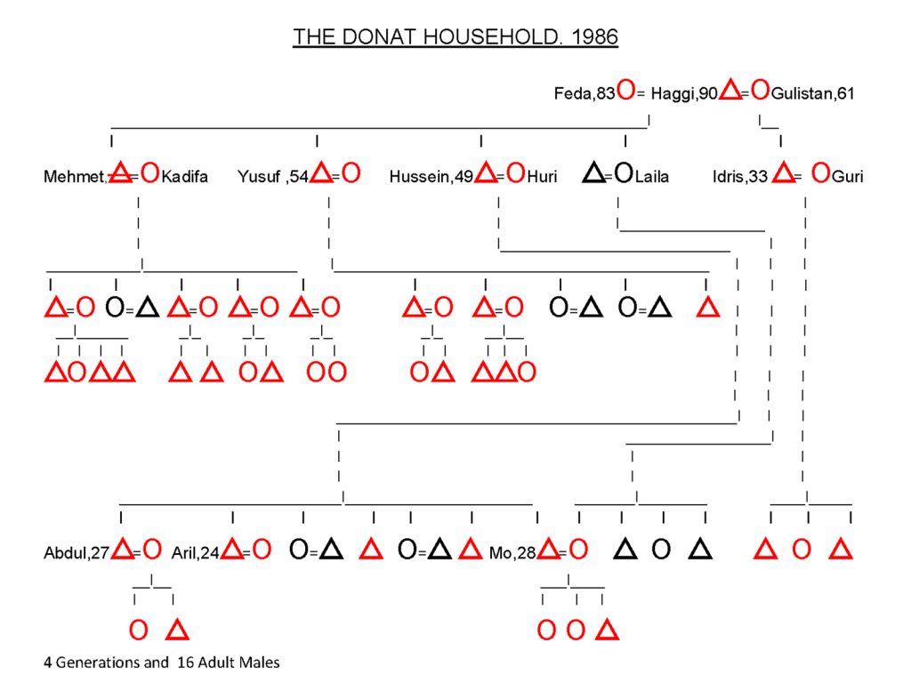
56.The large Donat family under the household head of Haggi. He had the descendants of 4 sons living in his household with numerous grandsons and a burgeoning collection of grandchildren. His daughter and most of his granddaughters had married and were living with their husbands family.

Haggi was also the wealthiest household head in Ikiyaka where wealth is measured by the size of your herd. Haggi had about 200 sheep and 200 goats. While it was no problem for Idris, Haggi’s son to look after perhaps 10 times as many sheep in the summer when the grass was lush it was the collection of winter fodder which limited the size of a household herd. From late November until late March the flocks were inside barns beside the owners house as deep snow lay outside in the village. During this time the flock was fed on fodder collected in the summer and autumn and stored above the barns. This was very intensive work and it would have been impossible for the workforce of 5-6 people in the Dugran family to collect enough fodder, and still do all their other jobs and duties, for 400 animals and this is why they only had 40 animals. Conversely the Donat household had a workforce of around 30 people and could therefore put considerable effort into collecting enough fodder during the summer and autumn;- and still perform all the other jobs like the dairy and shepherding duties in the zozan and all the work in the terraced fields. So they could collect enough fodder for 400 animals. It was this task of collecting the winter fodder which determined the number of animals a household could keep through the winter and therefore their wealth. If a household had a high proportion of sons then these sons would in turn bring daughters-in-law to the household virtually doubling the size of it in a generation. While if a household had a high proportion of daughters then these would all leave the household when they married and the workforce would shrink even further.

The ambition of any Ikiyaka, or indeed Kurdish, village man is to set up his own household, something common to the whole pastoral, patriarchal culture of the Central Asian or Mediterranean region. Conflicting this ambition is the duty to one’s father and agnates. So it is rarely viable for a young man with a father to set up his own household. Firstly he needs his share of his father’s wealth in land, livestock and money which he will only receive after his father’s death. Secondly should he rebel he will be shunned by other household heads and his new found status will be fragile economically and socially, leaving him small means to counteract the disadvantages which will face him. Upon his father’s death he will strive to establish his own independent household and separate from his brothers. If his father is wealthy it is likely he will have many brothers, as a man’s wealth and the number of sons he has are related, so his father’s wealth will be shared to a greater extent. The inheritance arithmetic of the Oraman Kurds means that each household of Ikiyaka begins with roughly the same potential. What will influence it afterwards is the household leader’s resourcefulness, work and his luck, often attributed as a divine blessing, for having sons.

No tourist had ventured down to Ikiyaka for decades apparently. Indeed I was told I was not to visit myself by the Turkish military authorities in Yuksekova which now seemed a long way away. However, I think my visit had been arranged by Hussein, his brother Yusuf and Haggi partly to entertain me and themselves and partly as a show of defiance to these authorities and the current village Muktar, who was supported by them. During the tea, later at the evening meal and that evening no mention was made of the Muktah and he made no appearance but he must have been aware of my presence. The swarthy village guard, Sadi, who visited Hussein in the zozan dropped in for some glasses of tea, propping his automatic rifle up inside the door of the room where he could see it, and he must have reported back to the Muktah. I was told there was an old Nestorian church at the bottom of the village which was centuries old but Haggi said I was not to visit as it was on the Iraqi border which was just a kilometre away. In fact I did not see that much of the village as I went straight to Megid’s house and then from here went straight to Haggi’s house which was perhaps in the middle of the village. What I did see though was the fabulously colourful and vibrant life in Haggi’s house. After an hour of tea the trays were cleared and Gulistan organized the meal. A large tray was brought in and a pile of still steaming nan breads was laid on it. Then some 15 bowls of food were brought out by the giggling daughter-in-laws in their colourful flowing dresses. There were bowls of beans, feta cheeses with herbs mixed through them, fried vegetables,  bowls of yoghurt, and various mutton dishes. I felt it was for me and was quite overwhelmed and embarrassed by the sumptuousness of it all. It must have taken a while to prepare and it had obviously been planned in advance I would eat here.

57. Abdul Donat was Hussein’s eldest son and around my age, so we became friends . He was the muleteer for the Donat household taking all the dairy produce down to Varegös to trade and then bringing up all the sacks of flour to sustain the household with nan flatbread through the winter.

There were about 10 of us at the meal. Haggi, Yusuf, Hussein, Namen, Myself, Hussein’s son Abdul and a few others of Haggi’s grandsons. I was sitting next to Abdul and Namen who were looking after me and occasionally chatting to me in Turkish. If it were not for them and their consideration I would have felt a bit spare. The rest of the party were discussing something in Kurdish and I could not even guess what the conservation was about. The dishes were delicious and I followed their lead of putting the nan bread on my knee and then breaking bits of it off. I loosely folded the piece squeezing it gently between my right hand fingers, then dipped the piece into a dish and pinched the flat nan bread grabbing a morsel, before putting all in my mouth. The fried vegetables and the mutton were especially good. After a good half hour we were all finished and the colourful granddaughters-in-law all swooped in again and cleared removed everything. They topped the bowls of food up, brought in more nan breads on a tray and set up a new spread on a carpet beside us. It was now the turn of the more senior women to eat including Feda, who shuffled over from her bench by the shuttered window and sat down. Haggi’s second wife, Gulistan, and Yusuf’s wife also joined the small circle along with a few of the elder granddaughters-in-law. Hussein’s wife, Huri and Idris’s wife, Guri, were still up at the zozan overseeing the household’s dairy tasks otherwise I am sure they would have been in this circle also. They were served but the same throng of girls who served us.The ladies ate in quiet conservation while the men I was sitting with continued to discuss. Eventually the dishes were taken away from the elder ladies and removed to the unseen kitchen and now the junior ladies and the children ate what was left. The whole meal had taken about 2 hours and when it was all done it was dark outside.

People now started getting ready for bed. The kerosene lamps from the main dining room were carried through to the various bedrooms and torches were flashing about in the corridor. I was shown a room next to the main dining room and Abdul pointed to the corner where I was to sleep. The room was covered in carpets and bedding rolls. Some of the carpets were homemade and others were the perfunctory carpets bought in the market at Yuksekova. Abdul laid a couple of carpets out for me and then a kapok bedding roll on top of them and I laid my sleeping bag on top of the kapok roll. It seemed Haggi, Yusuf, and Hussein all had their designated places, and Gulistan was watching some of the younger girls spread the carpets and blankets out along the wall of the room where they were to sleep. A few of Haggis’ grandsons slept next to me, both pinning me against the wall and putting themselves between me and any danger from the entrance. There were about 15 of us who were going to sleep in the room, including Feda and Gulistan. The others were spreading out in other rooms including the dining room and kitchen. Apparently a couple of Haggi’s grandsons usually slept in the courtyard to make sure nothing out of the ordinary happened. The vibrant household was turned into a small fortress for the night. By 2100 the whole household was quiet and everyone was asleep. I would have been asleep too, but after the lamps were blown I felt something on my neck and then soon after on my back. It was the bed bugs coming out of the kapok mattress and crawling up into my sleeping bag and onto me. It was difficult to ignore them,  even if I knew from experience they seldom bit me. I had to endure about two hours of it before I finally fell asleep.
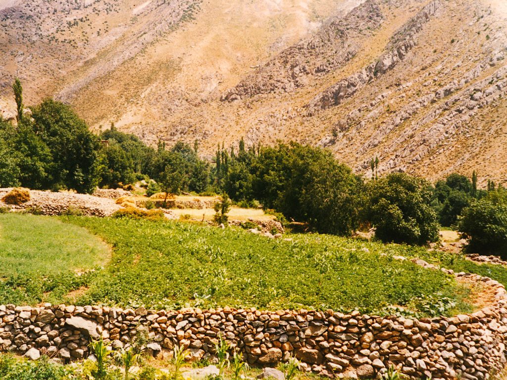
58. The terraced fields of Ikiyaka village were irrigated by a stream which came out of a cave in the mountain. It was largely vegetables which were grown in them with some cereals. Beyond are the large walnut trees of the village, under which the houses were built in their cool shade.

The household woke early the next morning and already by 0400, before there was even a glow through the open window,  people were starting to get up in the other rooms. By 0500 it was light outside but the sun had still not risen and everybody was up. Abdul was already getting the mules ready to go up to the zozan and then on to Varegös. He was encouraging me to have a quick breakfast and then accompany his caravan of mules. He said it was important to go before the sun got too strong as the near 1000 meter climb up the south facing side of the mountain became unbearably hot. Yusuf and Hussein were agreeing with him and I got the impression they wanted me to go as soon as possible. So after a quick tea and some nan bread with feta cheese I was ready. It was a great shame as I had wanted to spend more time in the village and look at a few things especially the fields and some other houses. I felt I had become a hot potato and there was a situation brewing which they wanted to defuse by getting rid of me. Perhaps the Muktah had had a word and made them feel uncomfortable for hosting me. Abdul meanwhile was loading his mules with firewood and some sacks of vegetables to take up to the zozan. As we were ready to leave Namen came down from his house and said it was good to go now also and I trusted Namen completely so around 0600 we set off.

It did not take long for the air temperature to heat up once the sun cleared the ridge to the east. I could feel the heat on the back of my neck as we climbed and it just kept getting stronger. After a couple of hours when we were approaching the zig-zag hairpin bends I could feel the heat reflecting off the light coloured rocks into my face. Perhaps I had misread the urgency to get away in the morning and it was due to the heat after all; which seemed very plausible now. It was a great relief to reach the top of the climb and have a last look down the parched, arid slope to the village far below before starting down the green pastures to Sergera zozan beside the lake. The melting snowfields feeding the green pastures soothed my soul and I was happy and relaxed again. It had been interesting in the village but it was stressful for me as I could not really communicate with anyone and never knew what was going on. We approached the camp and Abdul uploaded the supplies and turned the mules free to graze. I suspect they had not eaten since yesterday afternoon when they left here and descended to the village with sacks of flour. Hussein’s and Idris’s wives, Huri and Guri welcomed us with tea and started to quiz me on what I thought of the village.  As we chatted some of the young men were getting a few sacks of feta ready to load onto the mules so Abdul could take them down to Varegös and return to the zozan in the evening with more sacks of flour. Once he had gone I withdrew to my tent for a nap as I had not slept well and turned my sleeping bag inside out and left it in the sun to try and get rid of some of the parasites.

Namen and Hussein returned the next morning from the village and had some bad news for me. I had to leave. Apparently the Muktah was not happy about me being in the village at all and he had reported it to the Turkish Authorities sending one of the village guards up onto another pass which led to the third Ikiyaka village zozan and then on down to Varegös. From here the guard had radioed the small military garrison at Varegös who gave him instructions that I was to return and that my permission was only for a visit to lakes and mountains for a few days and I had now been there for almost a month. It was a blow but I knew it was a risk to test the authorities ire and go to the village. It was now the middle of September and the camps would be packing up in a few weeks anyway and the herding units would be moving back to the village with the shepherds leading their now well nourished flocks. Namen said he would take me down to Varegös with his mule in two days and Hussein agreed.  Later that day the swarthy village guard whom I had met a few times before and also at Haggi’s house came over to the zozan from the nearby Gaveruk zozan. He greeted me in a friendly way but I am sure he came over to confirm some arrangements had been made for me to return to Varegös and Yuksekova.

59. The women of Gaveruk zozan milking the sheep in the morning before they went off to graze on the pastures around the head of the basin. They would return in the evening for another milk. The goats would also be milked here twice a day, but not always in such an orderly fashion.

I spent the next two nights with the shepherds, Idris, Namen and Sabri who were grazing their sheep near the largest lake Buyuk Golu. It was quite a short distance for the milking ladies of each household to cover in the morning and evening to milk the sheep and return to the zozan with full pails. The sheep were now always milked in a more organized way with Idris sitting on a boulder while a line of sheep shuffled towards him. He would then distribute the sheep to the individual households to milk. Once the milking was over in the evening the shepherds would eat their meal and then light a small fire and boil a kettle for tea. Most of the time I could easily imagine I was from a scene in the Old Testament, but none more so that in the evenings when we drank glasses of tea beside a blackened wall and then huddled up in our thick felt cloaks called kapanaks as the temperatures fell.

On my last day I felt I had to climb up the peak above Gaveruk zozan again. I had been up about 10 times over the last 2 years and it was my special place. The walk up took me past the slightly larger Gaveruk zozan between the small lakes. Here all the kids swarmed out to meet me as usual when I went past and their colourful mothers in bright flowing robes shouted at their children and then giggled. The dogs at Gaveruk now ignored me unless I went near the sheep. I then started up the steep slope beneath the cliffs where there were still large patches of snow lingering. The tall summer plants had long since blossomed and were now wilting and withdrawing all their essential nutrients back into their rootstock again to overwinter under a new snowpack. At the top of the slope I turned and headed past the highest tarn in the bowl before climbing the stony slopes up to the pass again where I could look across the valley to the other path from Varegös to Ikiyaka where the village’s third and largest zozan was. It was the way I went when I tried to climb Samdi Dag. From the pass it was a short climb up across gravel slopes riddled with cushion plants and browning alpines to the summit of the easy peak. There were other peaks in the vicinity but they would have all required technical climbing to get up. At the top I could look down on the two zozans far below and spot the 2 flocks of sheep. Part of the Gaveruk flock often gathered together as a cluster on a patch of snow, either to cool down or escape the flies. All around me were craggy mountains of the Cilo-Sat range and across all these mountains I knew there were summer zozans leading a millennia old way of life. This was indeed a special place and I felt home here.
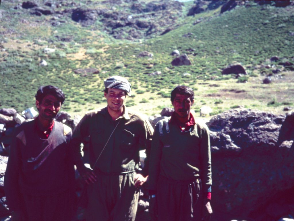
60. Idris, Myself and Isalm after a night spent looking after the sheep in a coral not far from Sergera zozan. I spent many nights sleeping with these shepherds beside the sheep curled up under my felt kapanak cloak which kept the near zero temperatures out better than my sleeping bag.

After the last night with the shepherds in my kapanak I returned with Namen to Sergera zozan. I had very little to pack really as I was leaving my tent, my kerosene stove, pots and pans and the rest of my fried food. I had no need for anything now except my sleeping bag, and I wanted to take my kapanak, or felt cloak, I had bought off Hussein. The rest of my possessions I gave away to Namen and Hussein. So it was a small sack which I loaded onto Namen’s mule for the 3 hour walk down to Varegös. It was sad saying goodbye to everyone and even Hussein grabbed my hand with both of his and wished me luck. I shook all the women’s hands which initially seemed too forward but they responded heartily. I wanted to give some, like Fatima, a hug but that would have been a step too far. Namen had put on his best clothes to walk me down with clean trousers and a new jersey and for the first time I saw him wearing a pushi, or headscarf.  We left the camp with the ladies waving and a swarm of kids following up for half a km to the lip of the hanging valley.  Here many grabbed my hands and arms saying “bye bye Cemis” I had a lump in my throat. On the way down we passed a few mule trains on the way up, often laden with bags of flour. The path soon climbed down from the mountain and met the track on the valley floor which we followed down for 4-5 km to reach the trading post at Varegös, with the military post nearby. I said goodbye to Namen here possibly with a tear in my eye and certainly with a lump in my throat. In both my summers up at the zozans on Samdi Dag, Namen had been my guardian angel and friend. This kind, generous, honourable, and simple man had made sure I had come to no harm and had always made me feel welcome. I did not know when I would see him again but I was sure it would be soon.

61. Leaving Sergera zozan for the last time with Namen, my patron and guardian, escorting me down to Varegös with his mule in tow. Behind Namen is Sergera lake and the tents and just beyond is the ice covered lake near the snow drift.

Namen returned back up the mountain with a sack of flour while I walked to the junction of the road to wait for the next jeep to Yuksekova. Unfortunately, the Captain of the army post spotted me and called me over. For the next half hour I was quizzed by him as my rucksack was searched. Luckily they missed my Kurdish-English dictionary again as it was a banned item in Turkey and would have no doubt caused some problems. I still remember the Captain saying to me “Why do you stay up there, they are just savages”. I did not feel confident enough to defend them. Luckily a jeep appeared and the Captain ordered it to stop and take me back to Yuksekova. It was a bumpy 3 hours to get there and when I arrived in this small bustling town I felt a bit bewildered. I spent a night here and then took the bus the next day to Van where I had a couple of days and met a few European backpackers. After slowly easing back into travelling mode I decided to take the train from Van to Istanbul which was an incredibly uncomfortable and slow 3 days. I was lean and agile so I managed to sleep in the luggage rack above the corridor, wrapped up in my kapanak which still smelt of the zozan.

Over the next two decades the political situation in Kurdistan became very turbulent. The Iran-Iraq war of the Early and Mid 1980’s had greatly distracted and weakened Saddam Hussein, the Arab leader of Iraq. The Kurds led by the KDP of Masoud Barzani and the PUK of Jalal Talabani saw their opportunity and both sided with the Iranians launched their own rebellions against Saddam Hussein and these were largely unsuccessful. Once the war was over Saddam Hussein turned his attention to the Kurdish north of Iraq and launched the terrible vengeance of the Al-Anfal campaign and genocide in the Late 1980s. During the Al-Anfal Saddam Hussein’s government killed possibly 200,000 Kurds in southern Kurdistan, often as massacres or with chemicals as in Halabja. The campaign also saw Kurdish towns and cities cleared and repopulated with Arabs from south Iraq.  This continual insurgency in Northern Iraq against Saddam Hussein lasted through the First Gulf War in 1991, where the US, under George Bush, encouraged the Kurds to rebel and then abandoned them to the Second Gulf War in 2003. After this a very fragile Kurdish autonomy was established in Northern Iraq which still clings on.

Concurrent with Kurdish uprisings in Iraq another rebel group, the PKK, was becoming established in the Kurdish areas of Turkey and in the lawless mountain areas of Northern Iraq. It advocated revolutionary socialism and Kurdish independence in reaction to the cultural and ethnic suppression of all things Kurdish in SE Turkey. The PKK operated in Turkish Kurdistan from the early 1980’s but was swiftly hounded by the Turkish military so it disappeared underground in Turkey and fled to Northern Iraq also where it established training bases. Turkey often invaded Northern Iraq to rout out these training bases with ground forces and air strikes. The PKK often launched attacks in Turkey from their hidden bases in Northern Iraq with the main targets being government and military posts in remote locations. The army post at Varegös was a typical target. This conflict between the PKK and Turkey continued on and off from 1980 until 2015 with tens of thousands of casualties. From 2015 the focus of the PKK was turned towards the Islamic State in Northern Iraq and Syria and the conflict with Turkey subsided but there is always the potential for it to flare up again especially after another US President, Donald Trump, again betrayed the Kurds, this time the Syrian Kurds and YPG in 2019.

Against this background the mountainous border regions between Turkey and Iraq were completely closed just after I left in 1986 and provinces like Hakkari were off limits to all visitors, as conflicts between the PKK and Turkish military escalated. The area was closed for 3 decades from 1987 until 2018 when the Turkish military wrestled back control of its borders and suppressed PKK activity in Northern Iraq with airstrikes and negotiation. It is a remote and mountainous area so a situation can flare up and the area could easily be closed again. During these 3 decades I had no information on how life in Ikiyaka was faring as they were in the heart of the conflict. I assumed that life was going on as normal and that in each spring Namen, Hussein, Idris and all the inhabitants would emerge from their snowbound houses in the village and graze their flocks on the nearby spring pastures and start cultivating their terraced fields before moving up and over to the zozans on Samdi Dag for the glorious summer. When I did get some information in 2019 it was very bad news indeed.

Sometime in late September 1989 some PKK militants crossed the border from Iraq and raided the village of Ikiyaka trying to steal some sheep. One of the village guards, Sadi Aykut, who was 45, collected a few other village guards together and he led a small group who pursued the PKK militants and shot 2 of them dead. The PKK had always hated the village of Ikiyaka which was pro Turkish and whose Kurdish village guards had been trained and retained after their 3 year conscription in the Turkish army. The PKK must have perceived these guards as traitors to their autonomous Marxist cause. The death of two of their militants at the hands of Sadi Aykut prompted them to plan a terrible vengeance. Two months later, on the 24th of November, 37 members of the PKK crossed the border again into Turkey to avenge the earlier skirmish. As they approached the village they captured 8 shepherds guarding 300 sheep. They were 1)Kemal Dogan, 2)Mehmet Resit Aykut, 3)Abdurrahman Gezginci, 4)Mehmet Kirbis 5)Nurettin Balci, 6)Cafer Boz, 7)Enver Babat and 8)Ikram Boz. They tied the shepherds’ feet and hands together. Then the PKK militia of 37 split into two, with a group under their commander called Hogir continuing up the valley to Ikiyaka village, and a group remaining with the captured shepherds and the 300 sheep.

Hogir led his men into the snow covered village under light of the half moon and went to the house of Sadi Aykut. They stormed into the house raking it with automatic rifle fire and a rocket launcher. They captured Sadi Aykut, his wife and some other relations, and then discovered 2 women and 5 children who were huddled terrified in a corner. They were all dragged outside, and all 14 of them were lined up in the snow and shot dead. They were Sadi Aykut (b.1944), Emine Aykut (b.1947) Zuleyha Aykut (b.1942), Cemil Aykut (b.1959), Mehmet Aykut (b.1978), Hazal Aykut (b.1931). Ismet Aykut (b.1982), Enver Aykut (b.1982), Burhan Aykut (b.1981), Namet Aykut (b.1982), Halime Aykut (b.1985), Rifat Aykut (b.1986), Mustafa Aykut (b.1987), Elife Aykut (b.1988).

Meanwhile another group of PKK attacked the house of Huseyin Boz. Here they discovered 7 people hiding, all belonging to the Boz family. Huseyin was not at home and survived the attack. The PKK strangled all the other members, most of whom were women and children and then set the house on fire. They were Nami Boz (b.1935), Esat Boz (b.1958), Cebal Boz (b.1965), Fatma Boz (b.1968), Selime Boz (b.1982),  Cebrail Boz (b.1985) and Muhammet Boz (b.1987).  After 15 minutes the attack on the two houses was over 21 people were murdered in the brutal massacre.  The PKK attack force retreated back to the defence force who were guarding the 8 shepherds. Hogir shouted at the shepherds saying they were all traitors and lined them up on the ground a metre apart and strangled them with their own headscarves or pushi. The 37 PKK then fled back into Iraq driving the 300 sheep before them and 29 villagers from Ikiyaka dead
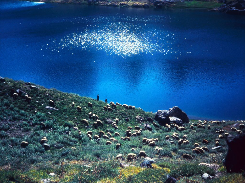
62. A shepherd’s life in the summer in the beautiful Cilo-Sat mountains was nearly idyllic. It was an eternal lifestyle which had not changed since Abraham of the Old Testament some 250 generations ago. It is our cultural DNA, which is just under the surface;- even in the most developed of cultures.

Due to the remoteness of the village the military authorities were not alerted until midday the next day when a village guard ran up to the snow covered pass and radioed down to the military outpost at Varegös. It was not until the next day again that a military unit was sent to the traumatized village to see what had happened. Graves were dug beneath the walnut trees for those who had been murdered by the PKK that evening but the village never really recovered and despite an increased Turkish military presence, the village was abandoned in 1992. Some of the inhabitants went to Northern Iraq, some including many of the village guards, went to a new village for displaced people called Üzümk?ran, near ?emdinli, and some went to Yuksekova. I have researched as to what might have happened to the Donat and Dugran families but have found no leads yet. However I was relieved to see that I recognized no one on the list of names of the people who were murdered that fateful night in 1989. I think the village guard who occasionally visited Hussein might have been Sadi Aykut as he fit the description and I know he was mostly involved with the third unit of Ikiyaka on the north side of Samdi Dag. The Muktah’s extended family was also in this herding unit and I suspect the Aykut and Boz families who were targeted belonged to this herding unit. Sometime in the near future I will have to go to Yuksekova to continue my research before the people who were so kind to me, notably Namen and the Donat family, get too old.

James Baxter.  2020.

To download a 70 page PDF of this document click the link : Kurdistan 1986 

There might be more pictures here in addition to the gallery:  Google Photos


Back