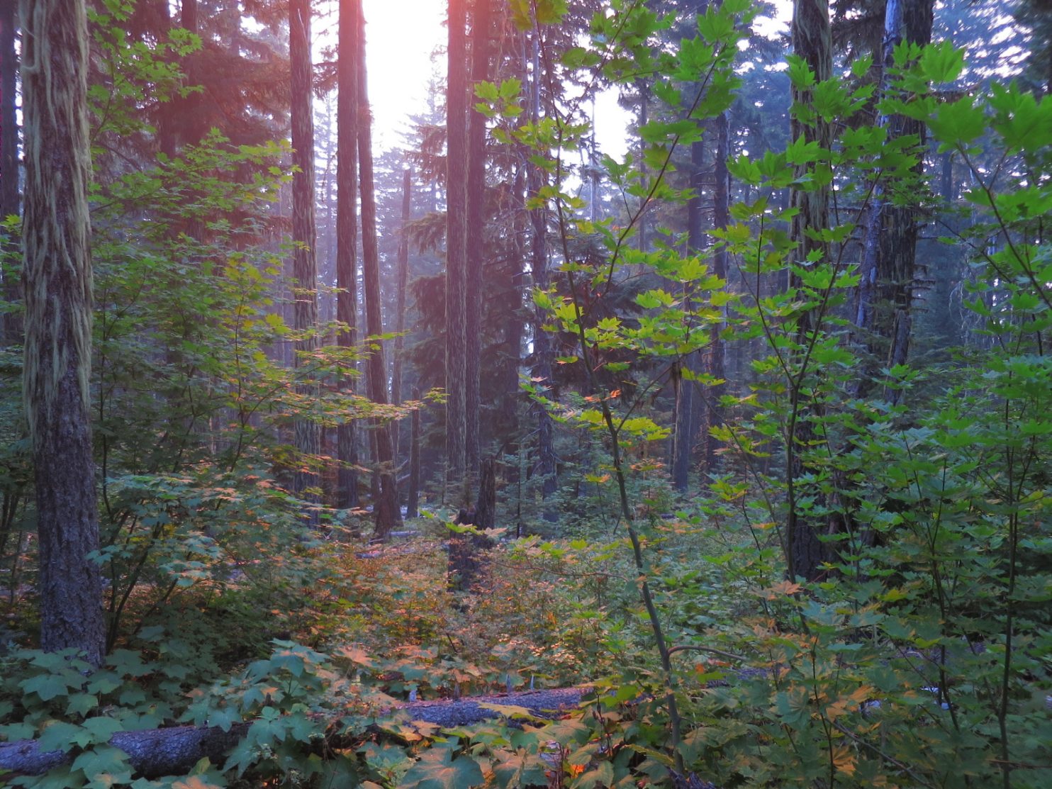
Section 16. Sisters to Hood River. 2-9 September.  Sisters was full of charm and it was nice to see deer and their well grown fawns wandering the streets and grazing on the irrigated lawns and parkland. I would have liked to linger and enjoy its Bohemian tourist vibe, but Canada was calling and I had to go north. I also had unique permission to through a small part of the Warm Springs Indian Reservation on certain conditions. One of which was I only camped in a certain place, so I had to make sure I was at the southern boundary tomorrow night to achieve this.

01. Deer and fawns in the streets of Sisters eating the urban vegetation.

There is a network of trails around Sisters, and I was going to use two of them to head north. One today and one tomorrow. So after my final meal I headed off to the ranger station to pick up the Sisters Tie Trail,  a 6 mile trail which delivered me to the Indian Ford Campground on the south side of Black Butte.

The well marked trail was pretty much flat the whole way as it followed a series of paths and very infrequently used and faint dirt roads. The trees along the trail were nearly all second growth ponderosa pines some 60-70 foot high with a undergrowth of patchy bitterbush growing in the sandy soil. It was very easy underfoot and gentle walking. it got dark before I reached the campground but when I did it was easy to find what was becoming my favoured campsite, a US Forest Service picnic table, on which I cowboy camped.

From the campsite it was easy to find the adjacent Metolius-Windigo Horse Trail, which was an extensive trail in Oregon. I followed this trail through ponderosa forest on the east side of the conical Black Butte mountain for about 6 miles. It crossed a few other trails but I looked for the yellow diamonds which seemed to mark the trail. When it reached the north side of Black Butte it descended gently to a parking area near the headwaters of Metolius River which I detoured to see.

Underground water channels took water from far away and brought it to here on the north side of Black Butte, where it emerged as a vast spring, which was the source of the Metolius River. More springs feed into it within the first mile and soon it was a river 10 yards wide and a foot deep. I followed it down and noticed how lush the banks were. There were many old bohemian cabins on each side of the river, and 2 miles from the source was the lovely village of Camp Sherman.

02. The cabins beside the upper Metolius River were a century old and many were heirlooms

Camp Sherman was obviously a tourist destination but it had huge charm. The cabins surrounding it were either old and traditional, or made to look so. There was a great store which was also a deli, fishing tackle shop, clothes store and meeting place. Next to it was a very traditional post office with old PO boxes lining the wall. The whole place had a very relaxed vibe. I took advantage of the deli and had a couple of bean burgers while the owners charged my phone battery.

From the relaxed, riparian, fly-fishing culture of Camp Sherman I continued down the Metolius River for another 8 miles. There were many fishermen fly fishing here, and it was the only type of fishing allowed. There was hatchery half way down which ensured the river was well stocked with about 4 different types of trout.  There was a path down each side of the river with huge ponderosa and Douglas Firs beside it. Near the path was a gravel road which allowed access to a few Forest Service campgrounds along its banks, which were quite busy. However there were also long stretches of wild river with ospreys nesting in the ponderosa pines. I was surprised how quickly the river grew and just 10 miles from it source it was 30 yards wide and 4 foot deep, with small rapids.

It was as good a walk down the river as I have had in Oregon, or indeed North California, and it was quite refreshing to know that the PCT was not the only beautiful path. Indeed it was exciting to go off piste and wander at will and come across such gems.

At the Lower Bridge Campground I left the beautiful Metolius River and headed west on a series of dirt roads for a few miles crossing Abbot and Candle Creek until I reached Jefferson Creek. It was the southern boundary of the Warm Springs Indian Reservation and I did not have a permit to enter it until tomorrow so I camped just before it.

One must have permission to enter the Reservation. It is almost the same legal entity as a separate country with its own laws and regulations. US federal authorities do not have jurisdiction here.  Entering without permission is trespassing and subject to the reservation administration laws. I was lucky to have obtained permission for 3 days but it was subject to certain conditions, two of which were I could only camp in one particular campsite at Trout Lake 30 miles to the north, and I had to stay on established roads and trails to get there. So I planned a very early start.

The alarm went at 03 and I walked across the bridge over Jefferson Creek, through the gate and onto the Indian Reservation at 0345. The moon was full but it was blocked by smoke. I trudged up the track for a good 2 hours until the first hint of daybreak appeared. The only incident of note was having a skunk run at me, tail up and eyes gleaming in the headtorch. I backed off a good 10 foot but it kept coming. Just as I thought I was going to get sprayed it turned and fled.

I think the SW portion of Whitewater is primarily used for timber. It was a mixed forest with Ponderosa and Douglas Firs being the larger trees. The harvesting timetable and the process of felling seemed to be well managed. On each side of the main arterial road I was on were many different smaller access roads, all well numbered and maintained. The harvested areas were scattered about with, 100 acres or so done at any time. So the forest was varied with some areas just harvested and others with 100 year old trees ripe for harvest. In the harvested areas there were plenty of seeding trees left with a mix of species, including Larch, Western White Pine, Sugar Pine, A true Fir and mostly Ponderosa and Douglas Firs reflecting their natural mix.

By 10am I had already done 16 miles and reached the White Water Creek. It was cloudy with glacial silt from Mount Jefferson to the west. At the creek a pickup stopped and questioned me. He was a forestry worked from Oregon contracted to work on the Reservation. I showed him my permit and he seemed skeptical. I mentioned that the forest seemed well managed. He scoffed at this and said they had a lot of fires. I thought that was ironic coming from a man whose whole State seemed to be on fire at the moment.

My encounter with him unnerved me a little. I had verbal permission to walk the roads and a fishing/camping permit for the day’s destination at Trout Lake. However, should the Tribal Police or a group of lads come by and arrest me or rough me up I would have no leg to stand on. I was on thin ice. So I decided to keep off the main roads and take the smaller tracks, even if it added 3 miles to my 25 mile dirt road walk. So just before the Whitewater Access Road met another arterial road I cut off and followed 2 small dirts roads doing 2 sides of a triangle.

The triangle was nice to walk. There had been smaller fires here over various decades and the forest was regrowing proportionally. It is said the Indian methods of fire management have much to commend them. Instead of total suppression the Indians let them burn. This is the only practical solution anyway as they don’t have the resources. The consequence is that the “fines” burn and what “ladder fuel” there is in the scrub and undergrowth burns taking only some crowns with it. But because fires are more regular the ladder fuel does not build up so much and most crowns are saved. That certainly seemed to be the case here and beneath the tall flourishing crowns, were blackened stumps of scrubs hidden amongst the newer colonizer shrubs like Manzanita.

After the triangle of roads I dropped down to the Shitike Creek. There were some specimen trees here especially the Douglas Firs which would thrive in this deeper sheltered valley with moister air. I crossed the bridge and found a lovely glade for rest. I had done 25 miles and it was just 2 o’clock. After this I followed the Harvey Lake Road for 3 miles. I knew Harvey Lake itself was sacred place and hoped there would not be elders returning from it, despite the fact it was a rough little used road.  There were lovely groves of smaller ponderosa pines growing here.

04. The Shitike Creek on the Warm Springs Indian Reservation was in a valley of huge trees. I think the barrel was for the harvesting of crayfish.

After 3 miles the road petered out  and I had to take a 4 mile path to Boulder Lake which was marked on my atlas. However the atlas was not that accurate and the path turned out to be hellish. The area had suffered from a fire and it was intense enough to become a crown fire, perhaps 10 years ago. The path had fallen into disuse and was overgrown with Manzanita. I had to use 40 years of hiking and route finding experience, and no small measure of tenacity, for forge along it.

After a couple of miles it went from bad to worse as the route was continually blocked with windfall, some of exceptionally large trunks. In the damper areas new growth was coming through and was already 6-10 foot high. Unfortunately the windfall lay perpendicular to my route and I took ages climbing over them. Between them brambles lassoed my legs and Manzanita scratched them. Often the trunks were overlapping 2 or 3 high and there was a real danger of falling off the uppermost ones, by as much as 8 foot and impaling something as I fell down on a jagged branch stump. For 2 miles my speed was perhaps half a mile an hour as I gingerly forced myself  through this carnage of logs and thicket.  Sometimes I would go 100 yards without touching the ground. By 6 o’clock I reached Boulder Lake.

There was no let up here either. I knew there was no path here and was prepared for a bushwhack, but not one of this intensity. I tried along the west shoreline, but that was a tangle of alder and willow. I tried to the west of the shoreline, but fire damage had caused a jumble of windfalls again and it was dangerous, slow and exhausting. In the end I opted for route nearer the lake. I passed a bush covered in white guano and looked up to see an osprey nest. On another occasion I passed a small promontory covered in crimson berry bushes with a serene view over the lake. There was a cairn of stones here and it looked a sacred place, so I withdrew and continued. This lake was very remote with impossible access so I am sure the ospreys had a monopoly on the fishing.

05. The serene promontory overlooking Boulder Lake was covered in huckleberry bushes and near an osprey nest.

At the north west corner of the lake I encountered the worst bushwhack off all, just a mile from my destination. Huge pines had blown down some 10 years ago in a damp area and impenetrable thickets of alder and willow 10 foot high had grown up amongst them. I was marooned in this prison for a good half hour struggling just to gain a few hundred yards. Thankfully it eased as I gained a small ridge and then at last saw Trout Lake. It was only half a mile away but it still took nearly an hour to get down. I reached the dirt road to it well into dusk and walked the few hundred yards up the road.

It had been a massive day. Perhaps 33 miles, but the last 5 miles were worth about 4-5 each. My legs were scratched by numerous brambles and cut with a few sharp branches. The bee sting I got was a mere bagatelle. Luckily I am now supremely fit otherwise i would never have managed the near-continuous 17 hours on the go. It shows just how necessary a path is; because without one it is a nightmare.

The campground at Trout Lake was set up by the Warm Springs Indian Administration. It was well organized and tidy. Though it catered for fishermen with fishing permits, it was far too big for that with about 30 tables. It was obviously primarily  a place for Native Americans to come and enjoy and fishermen just slotted in. The only thing which marred it was the rubbish disposal. 12 round galvanised bins were set up in a frame for rubbish disposal. They had all been full until very recently when a bear had rummaged through them scattering the contents. Bear proof bins are essential for campsites like this and this bear will get more brazen and more addicted to human food, before it develops an expectation of entitlement, like a spoilt Western teenager, and then has to be euthanised.

06. Trout Lake on Warm Springs Indian Reservation is where the proscribed campground is.

In the last light I collected water from the lake and set up to camp on  a picnic table. I hoped I would not be woken by the hot breath of the bear returning to show an interest in my food bag which I used as a pillow. As I fell asleep the full moon shone through the pines and firs. It was coloured deep orange by the smoky atmosphere so it looked like a ripe Himalayan apricot.

When a road is built to a place as quiet and serene as Trout Lake people inevitably follow. Still the Indian Administration had taken pains to ensure it would not get out of hand like some US counterparts. Cutting of firewood was not allowed and no motorised boats were allowed. I have seen many Indian Reservations where the territory was hopeless land nobody could do anything with. Rubbish land Indians were cajoled into accepting as part of a “treaty” and then dumped on it to eek out an impossible living. It seems the Warm Springs Indian Reservation is an exception, as the bits I walked through were bountiful.

No bear did appear in the night and I slept well. I could not get up early and left around 8 heading west. I followed a string of lakes for about 3 miles. The path was good which was a blessing as beside it there were extensive fire burn areas with a jumble of windblown trees covered by a tangle of new growth.  The next three lakes on the Indian side, namely Island Lake, Dark Lake and Lone Lake were marred by fireburn. What were once idyllic placid lakes lost in pristine forests were now exposed windswept lakes surrounded by dead white trunks and the charred remains of forests, which a new young forest was rising from.

Once I got to Lake Olallie I crossed back into the US administration. This area was not burnt and I enjoyed the green path through the pines. Each side of the path tall berry bushes were crimson, but there were very few berries on them, as per the Indian side, perhaps due to the dry summer. After a mile I reached Lake Olallie Resort, a small cosy store and some 12 cabins. Lake Olallie Resort was completely off grid with no electricity, but it did have a great view of Mount Jefferson. I ate here, learnt of yet more fire closures up ahead.

After a few hours at the small store and the centre of the cabins, which felt more like a rustic retreat rather than a resort I set off and found the PCT at the end of the driveway. I had enjoyed being off piste and having an adventure within and adventure, but now it was great to be back on the trail. My flirt with other trails over I strode out along an old friend. I had forgotten how easy it was with its gentle gradients, and prepared path which 1000’s of feet had pummelled into a soft, dusty layer.

The vegetation along the trail was also lush and lovely, tall conifers and an undergrowth of huckleberry bushes. It was all much softer and more pleasing to the eye than the harsh fire burns of the Indian Reservation or the managed ponderosa forests around Sisters. After 3 miles I reached the lovely tranquil Jude Lake,  the nicest I had seen since in the last 5 days. This lake was back on the Warm Springs Indian Reservation, as the PCT had an easement of about 23 miles which went through the very western edge of the reservation.

07. The early autumnal woods around Jude Lake where the PCT has an easement through the Warm Springs Indian Reservation.

From Jude Lake the path contoured around the forested hillside through idyllic forests of Hemlock, Douglas Firs and true firs (as opposed to Douglas Firs which are not true firs), with the odd larch. There was enough light getting down to the forest floor to allow a carpet of huckleberry bushes, which were all turning crimson now. It was a delightful section of trail and ironic that it was in the Reservation. Perhaps fire control was better at preventing wildfires here as this was still pristine forest.

The only issue I noticed was that there were  a large number of dead lodgepole pines. I think they had been weakened by drought and this allowed the bark beetles to overwhelm them, as they could not produce enough sap to repel them. After another 6 miles the path came to a spring, Trooper Spring, a deep pool full of cold but stagnant water, which seeped in from an underground source. It was nearly 7 and I deserved an early night after yesterday. Beside the spring was a meadow, and there was great camping nearby in a copse.

When I started around 7 I felt lethargic. The big day in the Indian Reservation was taking its toll now. I had wanted to get the lion’s share of the 42 miles to Timberline Lodge today but it was soon apparent I would be lucky with half. The 10 miles to the Warm Springs River took 4 hours and I had to push myself at that.

The PCT entered the Warm Springs Indian Reservation yesterday and it went through it for 23 miles altogether with an easement. The forest was varied with some areas of feeble lodgepole pines and other areas with magnificent Douglas Firs which were just morphing from tall trees to leviathans. As the path climbed the huckleberry bushes got thicker and as it descended rhododendron bushes became dominant on the forest floor, especially where the canopy was thick. I noticed that although each side of the PCT was not logged for about 100 yards, beyond that it was logged quite heavily in patches.

At Warm Springs River I had a longer break and afterwards felt much stronger. It was just a quick saunter up a hill and then a long descent to Timothy Lake. Before the PCT reached the lake it crossed out of the Indian Reservation and into the Mount Hood National Forest.  The forest changed, with it going from feeble lodgepoles and small hemlock to massive Douglas Firs and huge hemlocks. Previously today the hemlocks had mostly been Mountain, with the needles arranged like a bottle brush, but now they were Western with the needles more flattened on the branches. The douglas firs and hemlocks have small cones and seeds, and made for slim pickings for the squirrels and chipmunks, but luckily there were some true firs amongst them to give the critters something to eat.

At Timothy Lake the trail looked very well used and there were a lot of side trails and horse trails. Obviously this was usually a heavy day use area with punters parking their cars nearby and picnicking beside the lake. But with the smoke in the air and the views obscured there was no one about. Indeed I had not seen a person since I left Olallie Resort. It was as if there was a apocalypse somewhere and I knew nothing of it. The trail was abandoned. In fact I had not met a PCT hiker, north or southbound, since leaving Elk Lake nearly a week ago.

I walked round the east side of Timothy Lake for a few miles passing lovely beaches and empty picnic spots until I got to the meadow where a creek entered at the NE corner. Just beyond was a turn off to Little Crater Lake and Campground. I took it and reached the lake in no time. It was a geological spectacle. Underground water had welled up from a fault below and eroded a deep hole in the ground rock here. It was perhaps 30 yards in diameter and probably as deep. It was crystal clear with a blue tinge and one could see down the side of it to the submerged trees lying on the floor of the lake.

The campground was just beyond. It had a old fashioned hand operated water pump, probably connected to the same artesian water that welled up in Little Crater Lake. It was very cold. I found a good table to lay out on and had my chores done by 2030. I still managed 24 miles today despite the slow start leaving just 18 tomorrow, much of it uphill, to reach Timberline Lodge, where I could get fresh information on the newest fire closure.

I walked past Little Crater Lake on my way to the PCT from the campsite in the very early dawn. Even with low light the pool seemed to glow and it was possible to see the bottom. I finished crossing the meadow and then was back on the PCT.

09. Little Crater Lake was a 30 yard diameter and perhaps the same deep spring of crystal clear water with a blueish tinge

My route took me through more magnificent Douglas Firs and Western Hemlocks, the latter being the biggest I had seen. It was as if I was wandering through a sepia painting, a miniscule figure weaving through the trunks of leviathan trees with the odd shaft of light breaking through the canopy onto the rhododendrons. I noticed there were a few newts on the path, still slow and sluggish after a cold night, but now waiting for a shaft of light to warm them into activity.

08. The huge boles and trunks of some of the Douglas Firs and Hemlocks where I was a small figure wandering through the forest floor

The path climbed to a refreshing spring gushing out of the ground. It was ice cold and the last water for 12 miles according to reports so I drunk well and filled a litre. The path continued through large trees crossing a highway and climbing up to Barlow Pass, a historic pass in the 1850’s for the wagon trains coming west.

At one stop I paused at a Hemlock which had fallen across the path. It had been cut with a saw, a year or two earlier, and the exposed end was now dried and cracked, radiating from the middle. There was a lot of sawdust piled at the end of the log. Then I noticed an army of ants in the cracks. Each one had a small piece of sawdust in its jaws. When it reached the end it simply dumped the sawdust down the cracked face onto the growing pile. The ants were obviously hollowing out a nest in the log. I was not sure if these ants I saw were the ones excavating the nest or whether specialist ants with powerful jaws were biting bits off, and those I saw were the transport ants.

10. Ants had discovered this log and were busy hollowing out the insides. They were carrying small pieces of sawdust from the interior of the wood to the cut face and dumping it. If one lookes carefully at the right had crack one can see a few in action.

After Barlow Pass the path started to climb. The Douglas firs were replaced by true firs, and the western hemlock by mountain hemlock. It went up for a good two hours and the trees started to thin when suddenly I got a great view of a huge mountain, whose flanks I was on. It was the snow capped Mount Hood, a volcanic cone with glaciers and deeply eroded gullies down it.

The path went up a ridge between gullies and steepened. The surface was sandy and it made for hard work to ascend. Beside the path a few hardy conifers persisted and beneath them were shrubby mountain ash bushes, their heavy bunches of berries starting to turn orange.

At the top the path levelled off and contoured round a small part of the cone to reach Timberline Lodge, a historical edifice built during the Great Depression with the initiative from Roosevelt, an enlightened president. It had a breakfast buffet infamous with PCT hikers. I had already decided to stay here and dark skies and gusty winds confirmed that.

It was expensive but what the hell. I had been in a sleeping bag every night for the last 900 miles. I also needed a shower badly as my legs were dark brown with ingrained dust. I had a lot of cuts and scratches from my bushwhack on the Warm Springs Indian Reservation and needed to see how bad they were and stop them getting infected.

I also made a few calls. My next resupply box was at the town of Cascade Locks in 50 miles. However the PCT to it was closed by a serious fire, Cascade Locks itself was evacuated and in danger of going up in flames, and the crossing over the famous “Bridge of the Gods” was closed. It seems as soon as I have finished one problem another arises just when I think my path to Canada is clear. The easy solution of course would be to hitch hike round the problems, but that would be throwing the towel in on my purist hike. It seems I have to detour to Hood River and somehow cross the Columbia River there. No doubt that would be an adventure within the greater adventure, rather like the Warm Springs Indian Reservation detour, which had its own rewards.

After my breakfast buffet where I had a few enormous platefuls of food in the sumptuous surroundings of the main dining room with white table linen I reluctantly had to depart around 9. At last there was a blue sky, with just a bit of cloud lingering on the summit snowfields of Mt Hood. The valley below was full of cloud with forested ridges emerging from it.

Mt Hood was an impressive cone volcano some 12,000 feet high. It had masses of snow towards the summit and it seemed there were a few glaciers on it. I was seeing the SW side and I am sure that the NE side would be much more glaciated. There were a number of ski lifts going up from the vicinity of the lodge, and a hikers path to the summit. After weeks of smoke obscured woods it was nice to see a clear mountain.
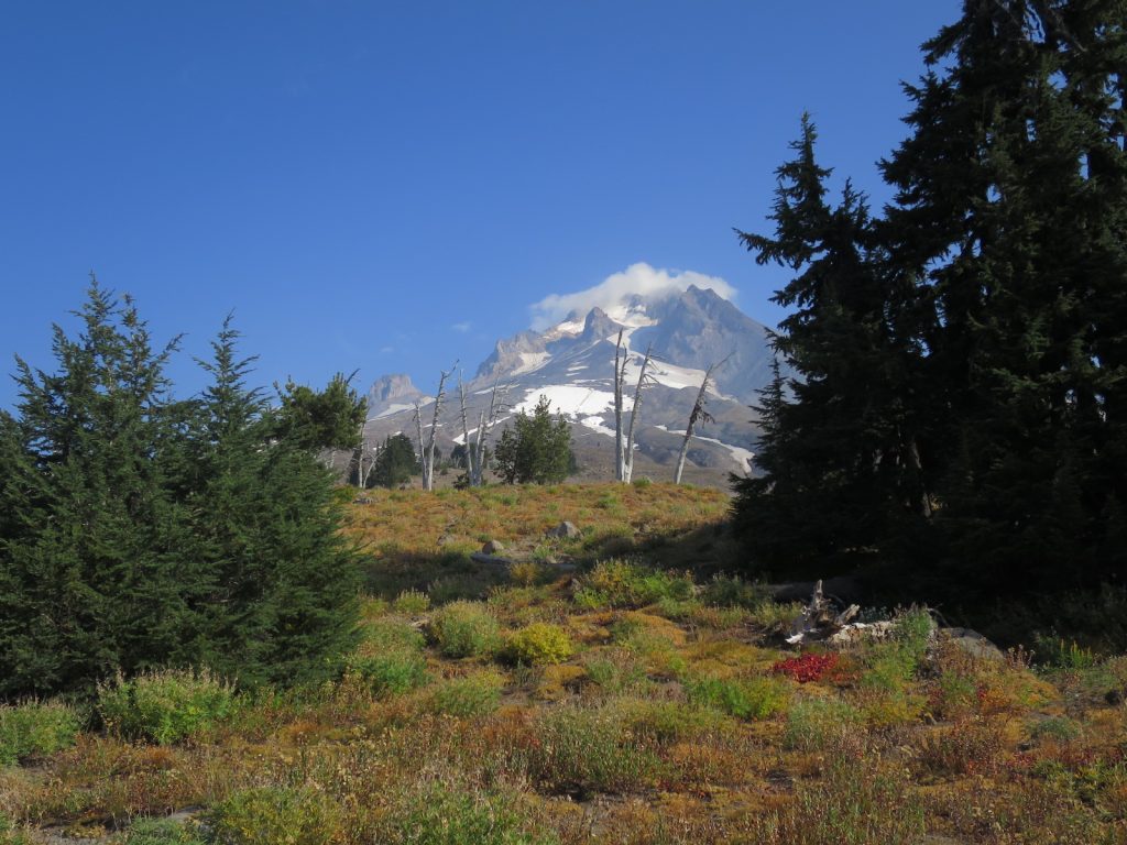
11. A view of Mount Hood from the Timberline Trail which circumnavigated the 12,000 foot conical mountain at the treeline.

There is a 4 day trail which circumnavigates Mt Hood called the Timberline Trail. It was quite demanding because of the ascent and descent in it, as it crossed over all the side ridges which came down from the summit cone. The PCT followed this Timberline Trail for a good few hours or 10 miles, at around 5-6000 feet.

It was nice walking through the top of the forest, mostly of Mountain Hemlocks and hardy true Firs. Mountain Ash scrub was scattered through the clearings and around the base of the trees. Every so often the path came to an abrupt halt and one looked down into a massive eroded ravine with white sides. I assumed this was where the ash, or pumice, which made up much of the volcano sides was eroded. The path either descended into it and climbed the far side or descended the forested ridge to find an easier way to cross the ravine and then climb up the far side. The ravines looked very inhospitable with the soil being too loose and steep for vegetation to take hold.

12. The 2100 mile mark on the slopes of Mount Hood

After a couple of hours the path finally dropped down a ridge to the mantle below and left the flanks of Mt Hood. I passed a few Timberline Trail hikers here. I had not seen a PCT hiker for a week now. At the bottom of the ridge was a side loop to the Ramona Falls, a beautiful wispy cascade of fine water which fanned out across a rock face. The waterfall was hidden in the Hemlock forest and was as high as the largest trees here at around 130 foot.

I followed the rest of the Ramona Loop down through a mossy glade to pick the PCT up again. I had hoped all the day’s climbing was done but when I looked at the map I could see I still had 2000 feet of ascent to do over Bald Mountain, a foothill of Mt Hood, before the descent down to Lola Pass where I intended to spend the night. On the descent a light coloured owl flew right past me and then perched on a branch and watched me.

13. The white owl which flew deftly through the trees and sat on a branch to watch me go by.

Lola Pass was the end of the PCT in Oregon. From here to Cascade Locks, which was only about 30 miles it was closed due to a terrible fire caused by arson. I would say goodbye to it and then make my own way off piste down the 30 miles to the town of Hood River tomorrow. It would be my last days hiking in Oregon.

I knew California would be a hard act to follow but Oregon has disappointed.  Unfortunately her best parts of The Three Sisters Wilderness, Mount Jefferson Wilderness and the Eagle Creek Trail, between Lola Pass and Cascade Locks were all closed, so it is unfair to dismiss her. But this year was an especially poor and frustrating year to be a hiker in Oregon with no views, endless and often mundane forests, and virtually no hikers as they all abandoned the State to skip up north to Washington. I must admit I will be glad to be out of Oregon as I found it quite boring.

I woke early at 0400 to an very unusual sound. Water was dripping off the trees I was camped under onto the tent. I had not seen rain for over 120 days and just took sunny weather for granted. It was just 0400 and I wanted to get going early, so I was soon wandering down the gravel road NE from Lola Pass with my rain jacket on and touch beam shining into the drizzle.

This weather was exactly what the 1000 or so firefighters working on the local fire Eagle Creek fire just over the ridge wanted. It had apparently already burnt 35,000 acres in the last week since a hoodlum started it by throwing a firecracker into the forest.

I walked for an hour and a half in the dark until I could turn my torch off. By then the drizzle had stopped. I was now in a heavily logged valley with mist hanging on the hillsides on each side and reddening maple leaves dripping water beside the road.

This road soon merged with the Lost Lake Road, a paved road with a yellow line down the middle. After a few miles a pickup came towards me a stopped. An extremely friendly avuncular man asked me a few questions about my detour and inquired if I needed snacks and told me he had seen many deer and bear migrating away from the fire over the last few days. He kindly gave me a handful of snacks. Only then did I notice the writing on the side of the truck. It said Hood River Sheriff. He was perhaps the friendliest policeman I have ever met.

I followed the Lost Lake Road for a good 10 miles to the fruit growing community of Dee. Suddenly the forest was replaced by orchards; pears, apples and huckleberry/blueberry were all growing well here under the imperial gaze of Mt Hood which dominated the skyline to the south. There were grander orchard houses where the owners or managers lived, and then shacks with older cars and small fields of maize where the probably Mexican workers stayed. It was an interesting cultural landscape.

At Dee the road got busier. I hated it. Beside the road was an old railway track which was probably just used to transport fruit. It was in poor shape, and the tracks were rusty and the sleepers wobbly.  If a train used them it would have to go very slowly, so I decided to walk on it as it paralleled the road for a few miles until it veered off and I returned to the highway 281.

I had done about 20 miles now and was getting thirsty, but the creeks were now muddy rivers and not inviting. I then saw some flags ahead and as I approached deciphered they said open. It was an antique shop but they also sold Ice Cream and sodas. I went in curious to see what Americans class as antiques. Once I entered I became the oldest thing in the shop, it was mostly bric a brac and collectibles from the 60’s and 70’s. However the Ice Cream from the Tillamook Dairy was the best I have tasted. It was a renowned brand.

The next 3-4 miles of road walking were unpleasant but eventually I got to the outskirts of Hood River and could escape the main road and follow leafy side streets in posh neighbourhoods. I phoned a bed and breakfast which had a bunk room and they had space, so I now had somewhere to aim for.

When I reached the bed and breakfast and went in I was overwhelmed. The couple who ran it, Pat and Anne, were part of the cool windsurfing and kitesurfing scene in Hood River which was on the world circuit. They had been doing bed and breakfast here for decades and the house was full of signed photos of the leaders of the sport who had stayed here. I am sure back in the old days it was a rougher, crash pad for the competitors, but today it was a sophisticated and chic with the friendliest hosts you could conjure up. They offered me craft IPA beers and invited me to join them for dinner with a few other guests. How my fortunes had changed from trudging down beside the highway to listening to tales of windsurfing antics and feats in a gorgeous house.

Meanwhile my packages were hopefully being transferred from Cascade Locks, which was still evacuated due to the very real fire danger, and Anne had contacted someone who could help me over the Columbia River. There was a bridge but it was prohibited to walk or cycle on it. One had to go in a car across the mile long bridge, and as a purist I could not do that. Anne’s friend had a kayak and that would do perfectly.

Back

Section 15. Manzama to Sisters. 26 August -1 Sept. There were perhaps 20 northbound PCT hikers at Manzama campground. I knew most of them. They had all arrived because they hitch-hiked the last 20 miles, forced off as I was by the fire closure, or 60 miles using the excuse of the fire closure to make up time. I had breakfast with a few of them and then went to find out more information on the fires to the north at Manzama, but the place was just geared up for hospitality.

I knew the PCT was closed a few miles ahead, but there was a great alternative which was more scenic, shorter and more popular than the PCT itself, namely the West Rim Trail of Crater Lake. I started off up the hill for 3 miles climbing some 1000 foot to Rim Village, a collection of grand traditional buildings with cafes, gift shops and accommodation. It was a steep walk but I could take it in my stride.

As I got to the rim the view burst upon me. The air was almost clear with little smoke haze and I could gaze down into the collapsed volcanic caldera which was about 5 miles across and filled with the most uniform perfect blue water. To one side of this circular lake was a conical ash cone surrounded by the blue water and it was called Wizard Island. The internal sides of the crater were steep and loose, while the outside of the crater was the gently sloping Manzama Mountain which was clad in hemlock trees.

I then saw someone waving. It was Sunshine and her sister, with her parents behind. They had come over from New York to visit and met her 100 miles further north and brought her south. We all had lunch together at the cafe, and it was a bright and lively chat on many topics.

After lunch I managed to get some headtorch batteries from a kind ranger, who gave me some from her car’s glove compartment as the shops had none, and found a bit out about the fires. I then set off round the West Rim which was only another 8 miles until it met the PCT again. The views were spectacular, but slowly smoke from the Blanket Creek to the south and Spruce Creek just to the west started to build and a haze formed, obscuring the view and soon the far side was lost in the white haze.

The walk was still spectacular and it was easy to see down the steep internal sides down to the lake. Here and there deep drifts of snow still lingered at the water’s edge. The island was clad in trees but the uppermost ones had died, probably as a result of the last 7 years drought. The path wove along the top of the rim and was shaded by a forest of hemlocks. It was a busy path with plenty of day trippers and I had many conversations with people en route.

To the west of the mountain were dry meadows and beyond that conifer forests. I could see smoke rising from them sometimes just a mile away. However the authorities must have thought the dry meadows would provide a buffer zone, so allowed the road and trail here to remain open. After a few hours I completed the West Rim Trail and dropped down the north side of the mountain to regain the PCT which was open for the next 100 miles or so northbound. As the two trails merged there was a road crossing where some benevolent trail angel had left a large cache of water, perhaps 100 gallons. It was otherwise a 30 mile dry stretch some it was highly appreciated by the PCT hikers. I filled up my bottles and camped nearby in a grove of hemlocks.

I managed another 4 am get up and was away by 5. By the time it got light I found myself in woods of small lodgepole pines. It was a cold morning perhaps just above freezing and it took ages for the sun to shine through the trees. I had already walked 8 miles by 9 when the day started to warm up. I soon reached another superb water cache with about 30 five gallon containers.

As I walked I noticed an fantastically steep spire of a mountain soaring above the lodgepoles, but with my limited maps I could not identify it.  It now seemed the path went directly towards it and concluded it must be Mount Thielsen, however the forest soon swallowed the view as the trees encroached and I was in a green tunnel. As I climbed lodgepoles petered out and mountain hemlock took over. The path continued to climb for a good 2 hours until it reached a ridge and intersected another path.

Here one of the most jagged mountains I have ever seen burst into view. There were a few people milling around at this path junction and I  learnt they had just come down from the summit. I was certain it would be an exposed rock climb but they said the path went round the back and it was just a scramble. One of these climbers was a geologist and he explained that the central spire of the summit was the shaft of a volcanic vent which remained full of lava and cooled to form a hard gabbro. He also showed us various sills and dykes of gabbro on the mountain which he assumed formed when the main vent was blocked by cool gabbro and the rising magma had nowhere to go but sideways. Glaciers had eroded the east and west side of the cone to form this narrow fin of a mountain.

02. Mount Thielsen from this angle looks steep but as I walked past its left (west) flank it became a fantastic spire

Just beyond the path up the mountain the PCT dropped down into large hemlocks and crossed a stream of clear cold water. It was the meltwater of the Lathrop Glacier on the north east side. The stream valley was green and lush and one almost forgot you were in the high dry desert of Oregon, and thought you were in the European Alps.

As I relaxed Bear Can arrived. Last time I saw him was 10 days ago in Seiad and he had foot problems. He had not skipped round the last fire south of Manzama like most people had and I applauded him. We set off together into the hemlocks again and walked 5 miles chatting where we left off a few weeks ago. At the top of the climb I decided to camp as I had enough water while he went on for another 5 miles.

That evening my early finish was wasted on worrying about the fires and how to get round them. I had a faint phone signal and poured over my Oregon road atlas while getting current fire closure maps from the Internet. I was a bit wiser went I fell asleep at midnight, but not by much.

03. My balcony-like campsite overlooking the volcanic cones north of Mount Thielsen

I could not get up early and left at 7. It was a lovely campsite I had with a balcony-like view over the forest and volcanic cones across the area. However I had to descend into this forest  now to the next water in 10 miles. The path was very easy as it undulated and wove through the large hemlocks nearly always heading down.

My mind kept on regurgitating the worries of last night and the fire closures ahead. Then it switched to a lifestyle/business plan I had been thinking about for a week. One’s mind does tend to dwell on the same topics over and over. Many of the under 30’s hike listen to podcasts of current affair topics. When I question them about it they always say it is more restful to listen to a podcast than churn the same thoughts over and over.

When I got to the water after the 10 miles it was midday. However the water was half a mile off the trail down a steep path. A few southbound hikers said it was a bit stagnant and not worth the detour. They said i would he better off hiking another 6 miles to a large cache. This is what I did with much of these 6 miles being down hill. There were a few views through the hemlocks but the haze of wildfire smoke obscured much.

I was thirsty at the cache and drunk half a gallon. It was another good deed by a trail angel that the 100 gallons or so were here otherwise I would have had to go another 3 miles to a shallow warm lake and filter that water. The PCT split here with the official trail continuing for 30 miles to Shelter Cove keeping high with better views, while the Oregon Skyline Trail went past shallow lakes for 20 miles to Shelter Cove. I though the views  of the PCT would be ruined by smoke haze and the extra 10 miles would not be worth it. So took the Oregon Skyline Trail (OST).

05. The 1900 mile mark just north of Shelter Cove on Odell Lake

It was only 10 miles down the OST to its halfway point and a free campground with taps and picnic tables. Again the path was very easy and soft underfoot as it went across a sandy surface. The trees were small lodgepoles, which had not been harvested recently but just reached a small maximum size before falling over. It was a very uninspiring wood but fast to walk through after 3 hours I had already reached the campground by Crescent Lake. There were some lakes in these woods but they were shallow and silty and not appealing, but Crescent Lake was magnificent. The campground was completely empty bar me and at dusk I prepared my bed one one picnic table while I cooked and wrote on the adjacent one.

I had a long lie on the picnic table and did not get up until 7. Before I left I went down to Crescent Lake to see the beach. It was indeed a beautiful sandy beach. It was only 11 miles to Shelter Cove on Odell lake. The path went gently up beside the Whitefish Creek, which was essentially dry, for 6 miles to a collection of lakes, with Diamond View Lake being by far the nicest. It had a splendid view over to the snowy Diamond Mountain. The rest of the lakes were a cluster of small ponds.

The whole shallow ascent up to the lakes and down the gentle other side were through uninspiring woods of small lodgepole pines. It was only towards the end when a large cold creek coming down from the plateau to the east of Diamond Mountain did the walk become more interesting. This creek, called Trapper Creek, flowed in a small lush valley with thick moss on the banks. The trees were now large Mountain Hemlock and many of them were dripping in grey old man’s beard moss. The OST was certainly easy and cut 10 miles off the PCT but I don’t think it matched the PCT for interest or scenery as the forest on the OST was dull and the lakes little more than shallow stagnant ponds. It only redeeming feature was it was 10 mes shorter and the views on the PCT would have been obscured.

The path delivered me to Shelter Cove on Lake Odell. It had a small store and a grill geared towards carnivores only. I had a cheese pizza, drinks from the store and used their WiFi for a few hours. I was trying to contact an Indian Reservation Administration but my email kept bouncing and there was no phone reception to phone. Nothing is simple when it comes to communicating in the USA, especially with my phone service provider of AT&T, perhaps Verizon are better. In the end I had to email 2 friends to see if they could help me get permission to enter an Indian Reservation in 4 days time to avoid a long detour due to fire closures.

There were a lot of other hikers here. Perhaps 20 in all who I had seen in Manzama. Many of them had caught me up previously by hitching 60 miles round the last fire closure. As I was leaving Bear Can arrived, he was one of the few purists left here and he had walked everything, including all the fire closure detours despite his injury. He was only 25 but I had a growing respect for him. I chatted briefly before I headed off again at 5.30.

It was an easy ascent through Hemlocks and Douglas Firs to the first of the Rosary Lakes. It was about 5 miles but I got there at the end of dusk. The moon was half full and a deep orange due to the smoke from fires. I got water from the lake and set up camp in the dark.

I got a comfortable start and was off by 6 barely using the headtorch before the dawn glow took over. I climbed the short distance to Middle and Upper Rosary Lakes, where other campers were just starting to get up. I continued up through the hemlocks for a good half hour to reach the lovely Maiden ski shelter which was a log cabin with a large stove. A group of 3 PCT hikers I knew were just packing up after having spent the night here. I dropped in for breakfast and to see the building.

06. The Maiden Ski Hut log cabin was a popular place for PCT hikers to stay

After breakfast I walked on my own down to Bobby Lake. I still had enough water from yesterday so carried on past the lake into duller lodgepole forest. This continued on and off for another 7 miles all the way to Charlton Lake. I was joined for the last 4 miles by Slim, a dapper bartender from Chicago. We chatted a lot and I picked his brains on his trade. As we approached Charlton Lake the lodgepoles were largely replaced by hemlocks.

The 3 from the ski hut were already at the lake when Slim and myself joined them. It was a gorgeous lake surrounded by mature Hemlock forest which was reflected in the still waters. I had a quick lunch and then headed off on my own. As I neared Charlton Butte and Lily Lake I entered a fire burn area from perhaps 5 years ago. It looked like a nuclear bomb had gone off here. The whitened trunks of trees still stood where they had burnt and all around were toppled trunks. It was only 3 miles of this apocalyptic scenery before I returned to older hemlock forest around Irish Lake.

I paused here and the other 4 overtook me. Irish Lake was a beautiful tranquil lake surrounded by forest. There were no wildfowl on it at all surprisingly. The path now climbed gently up past a series of lakes and ponds. Some of the lakes were very picturesque and calm while the ponds were covered in dust and surrounded by fallen trees. It was however an lovely gentle stroll with plenty to please the eye, which was sorely missed over the last couple of days.

07. Looking across a bay on Irish Lake at the start of the lovely passage through a series of lakes, tarns and ponds

I reached the highest lake, Stormy Lake, on the highpoint of the plateau and loved its setting. It was only 6.30 and I should have gone on another 3 miles but decided, as I already had 25 miles under my belt today, to have an early night and camp here. For the first night in ages I was asleep by 8.30 in the evening with all the chores done. The moon was more than half now, and with the smoke in the atmosphere it glowed a deep red through the hemlocks.

08. Brahma Lake in the late afternoon sun. I continued another 2 miles to camp at Stormy Lake

I managed a fantastically early start and left Stormy Lake well before 5. It was a shame to walk this area in the dark as it looked splendid from the map. When It did get light I found myself wandering past one idyllic lake after another. The was mist rising off them in this chilly morning and wildfowl lazily swam around. I could not identify them though.

After 5 miles I got to where three men I had been hiking on and off with for a week were camped and stopped for breakfast. It was only 7. After breakfast I walked with one of the 3, Tomas, a Czech. The miles flew by as we chatted and went past many more beautiful lakes. The forest was lush and green again and the floor was covered in blueberries and huckleberries. It was a charming landscape despite the smoky haze.

09. The mist rising off Mac Lake on a smoky morning. There were wildfowl on many of these lakes but I could not identify them

I stopping for another break at 9 when I had already done 10 miles and the Czech went on. I followed after a snack and was in a world of my own went suddenly Aladdin appeared. I thought he was off trail with a bad back so was surprised to see him. We walked together for the next 2 hours down to Elk Lake. The charming lakes continued for a while, but in trying to keep up with Aladdin they passed in an unappreciated blur. The smoke was thicker now and all the side trails were blocked with barrier tape. It was as if we were walking into Armageddon.

10. Trying to keep up with Aladdin as he storms across a meadow before Elk Lake.

At Elk Lake there were about 10 northbound hikers I knew. They were all skipping up to Timberline Lodge or Government Camp missing 160 miles. Many also skipped the 60 miles from Fish Lake to Manzama. I think many were using the fires as a lily-livered excuse. There were perfectly good ways round the fires which although not on the PCT still took one through cultural and natural landscapes. Not for me, I had decided to walk it all, and continue my Carless to Canada mission.

I spoke with some rangers having lunch at Elk Lake and they showed me a good route to Sisters through an area I had previously dismissed as closed. It would shave a day of my estimated time. Then I decided I would go through the territory of the Warm Springs Indian Reservation, preferably with permission for which I was willing to pay. However getting in touch with them was very difficult and I had to enlist the help of two American friends, Les and Sue, and Kev and Judi to help me.

With that in hand I set off to walk the 10 miles to Todd Lake campground down the highway to Bend. I find road walking humiliating and felt as stupid as Forest Gump. Nonetheless it was hopefully the only asphalt road I would walk in my fire closure detour when I am going off piste. There were some smoky sections of the road but I eventually reached the campsite as dusk fell and it started to get cold.

Again I slept well on the picnic table of the deserted campsite. The smoke cleared in the night and the stars were superb despite the large moon. I could see the snowfields on nearby Mt Bachelor lightup in the moonlight. I had a slow start before heading up to Lake Todd where I bumped into Brad, a craft ale salesman for Ballast Point brewery. We chatted for an hour as we climbed the dirt road. He then headed up Broken Mountain while I continued NE along the road.

This 14 mile walk from Todd Lake to Three Creek Lake was superb. As good as anything the PCT had offered since leaving California. The hemlocks were huge and spectacular, the meadows either lush and still in flower or plains of amber grasses, there were numerous creeks, but best of all were the views of the 3 Sister mountains, all around 10,000 feet and still boasting large snowfields. The dirt track I was on was rough enough to deter cars, and the road and path closures due to fires ensured the road was abandoned.

11. Broken Top Mountain on my off piste reroute was between Todd Lake and Three Creek Lake. Although not on the PCT it matched it’s views. On the other side (west) of Broken Top Mountain were the 3 volcanic cones of the Three Sisters which the whole area was named after

When I reached Three Creeks Lake the dirt road I was on turned into an asphalt road. However because of the smoke and fire closures nobody was visiting here except for fire fighters, either checking everything was OK or just having a scenic drive. It was 16 miles to the town of Sisters and it was virtually all downhill. Occasionally I stopped and spoke to fire crews who were standing by and they always offered me cold drinks and friendly conversation.

I had a few problems to sort out. Firstly my resupply box with all my food for the next section was marooned at Big Lake Youth Camp in between fire closures. However a trail angel called Ross who was driving hikers 160 miles around fire closures agreed to extract it for me and take it to Sisters. Secondly I wanted to cross some Territory of the Warm Springs Indian Federation and needed clarification on the legality of that and if permission was needed. My friend Les and Sue were working on that as my telephone signal was so erratic. Thirdly I needed somewhere to stay in Sisters and phoned the campground saying I would arrive at 9 after it was closed. I spoke to the manager and arranged access and let him know Ross would drop my resupply box there. It was all a lot of palaver with a poor phone signal but after 4 hours it was all done and I was approaching Sisters in the dusk.

I reached the campground in the dark and found Bob’s RV. He was the very friendly helpful host. He gave me my resupply box and another bag. Ross had not only delivered the box but had been so thoughtful and kind to buy me a couple of exclusive craft ales and some muscle soothing cream. I had done 60 miles in the last two days, but did not need the cream, but the beer was fantastic. I drunk both in lieu of dinner. I was surprised how easily it affected me, and before long I was tripping over my tent pegs.  The next morning I explored Sisters which was a charming small town and did a few chores before starting the final section in Oregon.

Back

Section 14. Seiad to Manzama. August 18-25. I stayed in Seiad for breakfast at the cafe, and then lingered a bit while I packed. I had a simple task for the day and that was to climb 5000 feet up the mountain to the north. I eventually left at 11 and walked a mile along the highway to where the path started.

It was not a pleasant walk. The forest floor was covered in poison oak, there had been fires through the area and many trees were dead and there was a strong haze in the air due to current fires in the area. The climb was not as bad as I feared and although the dead trees provided little shade, it was ironic that the current fires smoke blocked out the sun.

Fires start with lightning, carelessness around campfires and arson. Lightning is the most frequent cause. Because there was so much snow around this year the ground vegetation grew well. It was now dead, dry and crisp and made plentiful “fines”, the fireman’s term for ground fuel. This year’s abundance of fines spread fires easily and could quickly set light to “ladder fuel”, the fireman’s term for dry brush which would catch fire and spread the flames up to the canopy or crown. Ladder fuel was often plentiful in the forest, as previous fires were suppressed efficiently and the scrub built up. So when a fire happens now the ladder fuel ignites the crowns and the trees are destroyed. Fires are a natural occurrence here but previously the ladder fuel or scrub understorey was always thinner as it burnt more frequently, but recent fire fighting techniques prevented the scrub burning, so it built up to catastrophic levels and ignited the crowns, burning the trees and destroying the forest.

The path zig-zagged up through these burnt areas for a good few hours until it reached 3 peaks on the ridge called the Lower, Middle, and Upper Devils Peak. It skirted up these contouring around their flanks until it reached 6000 feet, above which the smoke did not go and the sky was blue.

I passed the day’s highpoint and skirted around a couple of cirques to the east of the craggy Kangaroo Mountain, the main peak in the area. These cirques were uncharacteristically lush and unscathed by previous fires. Each one had a small spring and a lily pond and the latter also had a sheltered campsite amongst large trees.

The westerly wind was getting up and there was a strong smell of smoke, as I put the tent up flecks of ash blew past. In the dusk I made a mental note of a lush meadow and also a scree field to evacuate to should a fire cross the already burnt ridge above, and then work its way down the hillside to the copse I was camped in.

There was still a lot of smoke in the morning when I set off and there was a lot of ash specks about. Indeed there were even charred fragments of bark on the path which must have been carried up in the flame thermals and then blown in the wind. At the first water some hikers caught me up and said they had seen the fire envelope large trees just a mile from there camp and two from mine. This fire had been going for 2 months, but was contained by previous fires and barren ridges, so the Forestry Service was concentrating on more urgent fires.

For the next few hours the smoke was almost thick enough to be a mist and visibility was down to a couple of hundred yards. However there was no acrid smell and breathing was unimpaired. A few southbound hikers said it was much clearer further north and indeed it was.

My legs were tired after yesterday’s 5000 foot climb with 8 days food and whenever the trail climbed today my legs felt it. Unfortunately there were frequent climbs as the path topped out at nearly 7000 feet before undulating for the rest of the day. There were some good views but much was obscured by smoke.

Giggles, Grandma Candy, Snowwhite, and Tom caught up and I walked with them much of the morning. Fireball also caught up. I last saw him at Vermillion Valley Resort almost 1000 miles ago. He hiked with Harvest for a month and they dropped back but now he was solo and doing 40 miles a day.

In the afternoon I went on alone and at last got some views of the surrounding hills. The path undulated along the ridge through firs, and in the more exposed parts hemlock. It was a lovely stroll through woods and across stoney meadows. There was plenty of water so I did not have carry any on my pack more. After a good afternoon alone I felt tired, and as if I needed an early night.

I picked an unambitious spot on the map and aimed to get there around 7. If I had pushed it I could have got to Oregon, but went for the early option. After a lovely descent down dry gravel covered meadows surrounded by grand firs I got to Beardog Spring. There was good water here and a nice campsite nearby under 3 giant Douglas Firs. I had the tent up by 8 and the blog done by 9 after a large supper.

01. One of the last meadows of North California

It was a short distance to Donomore Meadows, which were an extensive network of mature grasses with copses of mature firs scattered about them. The sun was just rising illuminating various patches and making the due sparkle. At the top of the meadow was a derelict cabin which had a bloody history. It was now being restored by the original owners descendants but it still looked like the setting for the Blair Witch Project film. The Gypsy Team, namely Giggles, Grandma Candy, Snowwhite, Tom and Pencil, had spent the night camped by it and where just packing up as I arrived.

I said morning to them and pushed on to the Oregon border just a half mile beyond. It was a solemn moment to reach it. I had been in California for 112 days and nearly 1700 miles, and had had an awesome time during my hike through it. It was marked with a old sign on the tree and a trail register, or book, which everyone signed. I looked through all the names I knew who had passed here in the last 2 weeks. As I contemplated completing California Team Gypsy arrived with much fanfare and high-fiving. We had a group photo and celebration.

02. The California/Oregon border after 112 days and nearly 1700 miles. With me are Team Gypsy

I left them and walked another half mile to see an ambulance and masses of people milling around a junction of forest tracks. I thought it was an event. Then someone asked me over and offered me food and coffee. It transpired they were fire fighters dealing with a fire just a mile away. It was one of the 32 fires started by a single lightening storm a few weeks ago. They had masses of food left over and were offering it to all the PCT hikers. It was a great welcome to Oregon.

The path now climbed up to a ridge and pretty much stayed there all morning. These mountains were called the Siskiyou Mountains and they seemed much more gentle than their Californian neighbours. While they were covered in Red and Douglas Firs there were also large swathes of meadow between the trees. The meadows were extensive. Some were lush but the majority were covered in a yellow flower and beds of gravel. At the top of one ridge a trail angel had left some magic, about 100 cans of soda in 2 coolboxes and some folding camp chairs. It was a lovely surprise and we fell on them and left a $20 donation.

05. The trail magic before Ashland. The coolers were full of soda and there were chairs to drink it in

I kept overtaking and been overtaken by Team Gypsy all day and occasionally we paused together. As the day unfolded I settled on a campsite and they decided on one a bit further. However it became apparent that many of the spots would be taken as a couple of million people headed to Oregon to watch the eclipse tomorrow. When I got to my campsite it was busy.  Pencil and Tom joined me as the 2 girls went on into the night in the hope of a better one nearer Ashland, which Team Gypsy was heading into to resupply. I still had enough food for a week.

Pencil, Tom and myself set off early to walk the 10 miles into Callahans, a lodge beside the Interstate 5. We would have breakfast, wash clothes and shower here, then I would continue while the other two went into Ashland to join the girls. It was a brisk walk and we charged along the path and got there at 10, just as the eclipse reached its maximum.

I just noticed it got a bit darker and noticeably cooler. However, the birds continued to sing and the chipmunks still scurried around the forest floor. It was not until a spectator at Callahans lent me his special glasses that I could see the full extent. Surprisingly nearly the whole sun was obscured by the moon with just a crescent showing; eight percent, according to the spectator. He also explained our eyes processed poor light with logarithmic returns, and a tenfold reduction of light only produced half the reduction our eyes could process. He said it with such conviction I believed him.

After the excellent breakfast, with the clothes washed, I eventually set off at 1300, clean, refreshed and full. Tom and Pencil disappeared into Ashland. I walked up the old highway for a mile to regain the PCT and then started a hot climb. I was sweating onto my nice clean clothes as I wove through oak and small conifers up the 2 hour climb. There were some meadows of brown dry grass, but it was mostly scrub and small trees I walked through to reach the base of the basalt volcanic plug of Pilot Rock, which dominated the vicinity.

I walked on another 6-7 miles in the late afternoon. The trees here were almost exclusively Douglas Firs. On private land they were quite small as if they had been harvested 20-30 years ago. Where the trail went through government land (BLM) the trees were twice the size with some gigantic specimens, and the occasional monster Jeffery Pine, as if logging occurred a good 100 years ago.

06. A view of one of the managed utilitarian forests of Douglas Fir. The wild forests were more chaotic with bigger trees

The path was not as flat as I had hoped and I had to work hard up some slopes. However the water springs were good. The meadows became quite extensive in places and were fringed by huge Douglas Firs. As the day drew to an end and dusk approached the sun turned a huge crimson colour, probably due to the smoke haze which was still lingering. It also gave it a misty feel and I was nearly lured into thinking it was autumnal.

As I neared my earmarked campsite by a spring, dusk approached. There was a dampness in the air, and with the haze from the smoke it lent an air of peace and tranquillity to the meadows I passed. Here and there I surprised a deer which ran for the cover of the huge firs which surrounded the meadows. It was nice to be hiking alone through this to appreciate the gracefulness of the rolling hills and atmospheric views. I knew I would soon be tucked up in my tent in a maternal copse of giant trees. Dusk was perhaps my favourite time of day;.a reward for having got up early and then walked through the heat of the afternoon.

I got up early with quite an ambitious destination in mind 33 miles away. It was almost an hour before the first light appeared and by the time the enormous, smoke-enhanced, orange ball of the sun appeared I had already done a few miles. It was fast walking through woods and before I knew it I had done 11 miles and not even had breakfast. I stopped at the dam of Little Hyatt Reservoir having crossed the golden grasses on the  small pairie of Hyatt Meadows.

After breakfast I gently climbed up to Hyatt Reservoir where there was a campground and water. I filled up before walking along the east side of the reservoir. The forest was mixed here with some true firs, Douglas Firs, pines and some large Incence Cedars. When it was last logged some of the older trees were perhaps left as seed trees and some of the Douglas Firs were colossal, the biggest trees of the trip, I reckoned some were 7-8 foot in diameter and nearly 200 foot high.

I continued east to another reservoir, namely Howard Prairie Lake. There was water here but I did not like the look of it and carried on for  another 4 miles to a beautiful spring of cold water. It was getting late now and I realised I would not do the 33 miles before nightfall so I took enough to camp and pushed on. Again I went through a forest dominated by Douglas Firs. There were some true firs and enormous sugar pines, but the Douglas Firs were kings. They grew tall and straight  until they reached the canopy and then they started to fill out. I think there is a maximum height beyond they cannot go as the water can’t get up. So when they reach 200 feet they start to fill out and become leviathans. Only the Sugar Pines could compete in size but there were a few of them.

After loading up with water I walked over a ridge and into the Rogue River forest where there were more spectacular Douglas Firs. A quick jaunt down the otherside of the ridge to me to a flatter area where I could camp. It was 8 now and I had done 30 miles and was happy with that. The tent went up quickly and I was in my bag as darkness fell. There were some thunderclaps in the distance and a very light rain fell for a few minutes but I missed the brunt of the weather.

I managed another 4 am alarm and was away by 5 with the headtorch on for a good half hour. It was an easy path to the South Brown Mountain Shelter which was on a side spur. The rain last night was perhaps heavier here as all the vegetation overhanging the path, like the berry bushes, were wet and my shoes were quickly soaked. By Browns Shelter there was more trail magic with water and sodas in a coolbox.

As I headed north to the lava fields of Browns Mountain I passed through another magnificent Douglas Fir forest. The trees here must have been nearly 200 foot and some had a 8-9 foot diameter. They seemed to morph from  tall elegant trees of 175 foot into massive,  brutish leviathans of 200 foot with thick, fissured, bark riddled with woodpecker holes. This change was like a delicate brown trout suddenly reaching a critical size, and then morphing into a much heavier ferrox trout.

I think the Douglas Fir cones are of little interest to squirrels or chipmunks as the seed is tiny. In pure forests of Douglas Firs I saw few critters. In this forest there were also some true firs, in the abies genus, and these produced bigger cones and seeds. I saw a squirrel skipping along the top of fallen logs with a true fir cone its its mouth. It had maybe climbed to the top of a true fir to get it. It was a prized find and the squirrel seemed to have the glint of victory in his eyes.

The trail then entered a lava field which must have formed when Mount Brown last reputed.  The path through the lava was superb and must have taken a lot of time to construct. This excellent path went round the west side of Mount Brown in and out of the forest. The forest was now mixed again with a species of true fir and the sugar pine, trying to hold their own against the adaptable Douglas Fir. The true firs branches ended in branchlets which looked like a diagram of a snowflake while the Douglas Firs branches ended in wispy tendrils of needles which were splayed.

08. The excellent path threaded a path through the impossibly rough lava boulders

The lava fields and mixed forest continued for 10 miles until the highway. The path though this area was superb,  which given the rough terrain was very easy. Mount McLoughlin, a volcanic pyramid rose to the north and was much higher than Mount Brown. At the end of the Lava I crossed a highway and started up the final 10 miles to Christi Spring, where I intended to camp.

07. A view of Mount McLoughlin from the lava fields of Mount Brown

After a mile I saw smoke just off the path and went to investigate. There were 4 firefighters here and they had everything under control. The fire was caused by the lightning I heard last night. It had caused 14 fires. A special plane with a heat sensitive camera picked up these fires. Then other planes dropped firefighters into each area. These 4 parachuted into a nearby meadow this morning with their equipment, then found the smouldering tree and were dealing with it before it spread. It was a very high tech proactive way of dealing with it. With all the fires further north, a few of which were across the trail, and had caused it to be closed it am sure there will be more fire topics in the next section’s blog.

09. The lightning induced fire attended to by the 4 firefighters who parachuted in to deal with it before it took hold

The final 10 miles of the day were easy and the path climbed or descended gently in easy terrain and softly underfoot. I noticed than now there trees were almost exclusively true firs, that is in the Abies genus. It seemed strange how they suddenly replaced the Douglas Firs.  It must be related to soil types or the aspect of the slope. As I climbed the odd hemlock appeared until they became prominent,  especially on the north facing slopes. I reached Christi  Spring at 7 and decided to throw the towel in early. I had to figure out how to get round or through a fire closure tomorrow in Crater Lake National Park, which had been burning for at least a month.

I managed another 5 am start as I had planned to walk 38 miles, the last 5 miles of which were closed off due to a fire. Most people had been walking through and said the fire was a mile away. I hoped if I did it under cover of darkness there would be no rangers around to reprimand me. I could switch my torch off at 6 am in the dark forest and made good time on the soft forest floor. At 7 the forest started to peter out and it became more rocky. I had already done 6 miles by 7 when I came across Airplane Mode, who was just getting up.

We chatted briefly and she said she would catch me up so I blasted on up the path on a scree covered slope with sporadic copses of hemlock interspersed amongst the rocks. When I reached the saddle over which the PCT passed I had done 10 miles and it was only 9. I stopped for breakfast, and had just started when Airplane Mode stormed up the trail.

Just then McGiver arrived with his dog. He was a Southbounder so I asked him about the fire closure. He had gone through it. McGiver was a risk taker and a man who threw caution to the wind. He was not a dogmatic offical, so I felt I could trust his opinion. He said “don’t do it” and showed me a video.  Apparently yesterday the Blanket Creek Fire had spread a mile east and had encroached onto the PCT. His video showed him dodging burning logs and cascades of water dropped from helicopters. He said the place would be full of firefighters who would at the least scold me and turn me back, wasting 8 miles each way. So I decided I would follow the recommended detour.

I walked with Airplane Mode for the next 10 miles. The trail climbed a bit more in rocky terrain past Lucifer and up to Devils Peak before it started a long descent. We intended to have lunch here but I put my backpack on a wasps nest and after one stung me we fled down the zig zags on the north side. Here nice green forests returned and we stopped at the first creek and had lunch. I think there would have been some great views today but unfortunately there was a think haze from fires which masked them.

After lunch we continued down into bigger forest for an hour until we reached Seven Mile Trail. It was 10 miles before the fire closure,  but it was the last chance to get off. We both did and walked the 2 miles to the trailhead at Sevenmile Marsh. Here Airplane Mode got picked up by a friend while I started a 20 mile track and road walk to Manzana.

10. The path up Lucifer and the Devils Peak in the Sky Lakes Wildernesses area. Unfortunately many of the views on this stretch were obscured by smoke

I followed the track for 4 miles and then went cross country for half a mile across the creek to pick up another track, saving myself 2 miles. I then followed this track and a few more until I eventually reached the Highway 62. Airplane Mode’s friend told me there was a good place to stay at the Snopark. As I walked along one of the dusty dirt roads I was following the footprints of 2 other hikers. At one stage either a large bobcat or mountain lion paw print’s appeared, and followed their footsteps for a mile before disappearing back into the forest again.

The Snopaark was a snow scooter facility, where drivers could rest. It had a large log cabin with 4 picnic tables in it, and it had power. I got there at 7.30 and was exhausted. I slept on a table and slept well with 30 odd miles under my belt.

I could not bring myself to start early. There was essentially no need. I just had to walk 10 miles along the Highway 62 to Manzana where I had a resupply package. The walk was humiliating; I always hate walking roads. This one was not that busy with a car a minute and there were some great Ponderosa pines on one side and Annie Creek Canyon on the other. However it was not the wilderness of the trail and I was glad to reach Manzana at midday.

I had hoped to find further information on fires and trail closures up ahead in the next section here, but nobody knew anything. I did manage to find an altas of Oregon with all the forest tracks in it. My dream of “continuous footsteps” hopefully lies within it.

Back

Section 13. Castella to Seiad. 11-17 August. I left Castella on a path called the Flume Track which headed west from Ammirati’s Market and then gently climbed the oak clad hillside until it reached the PCT after a couple of miles. En route I passed the 1500 mile mark. Once on the PCT the trail wove in and out of a couple of side valleys under jthe huge granite edifice of Castle Crag, a mountain which was protected as a State Park.

01. The 1500 mile mark. Not even the Proclaimers got this far!

Soon the path started to climb up the south facing hillside. Often it was strewn with granite rock debris or even bare granite and there were no trees shading the trail. It took about 3 hours to climb some 3000 feet up by which time the deciduous trees had long bee replaced by Douglas Firs, and Manzanita scrub on the more arid sections.

Towards the top of the climb were 2 springs. I stopped at the first for a long overdue drink. Beside the spring flowers were still blossoming and I spent half an hour watching a pair of hummingbirds go from Willowherb to Indian Paintbrush and back again, while bees foraged on the small yellow lupins,  which were now browning with age. I noticed the tall corn lilies were now going to seed also.

It was a mile to the next spring and en route through the forest I disturbed 2 rattlesnakewere just off to the side of the path in the sun and waiting to ambush a chipmunk or other small critter. The were so well camouflaged I was only alerted where they started to rattle their tail. Both slithered off while still coiled up and facing me in a manoeuvre which was like a moondance.

At the second spring I bumped into Can Can, the 57 year old Chinese lady from Hong Kong. I had last seen here at Mount Whitney 6 weeks ago. The next day she got swept down Wright Creek and said she nearly drowned. Battered and bruised she left the Sierra and headed up to Oregon and was now heading south. She said she was too traumatised to return to the Sierra. She maybe had a point as two PCT hikers died this year in the Sierra crossing creeks.

She went on and then a whole group of people I knew arrived. Firstly Aladdin and Flower who went on. Then the Norwegian girls, Giggles and Seabiscuit, and their friends Bear Can, the young Dutchmen,and a guy called White. Finally Sunshine also arrived after a quick turnaround in Mount Shasta. It was good to see all the faces again. Most of us had already decided to camp in  another 5 miles.

There was a marvellous campsite after just 2 miles, reputed to be the campsite with one of the best views on the PCT, but it was too early at 1730 to camp so I went on. I did see the view over the jagged Castle Crag mountain on the right and Mount Shasta on the left. The latter was slightly obsured by cumulus clouds though.

02. Castle Crag Mountain above Castella from the campsite with the fabled view.

I was with Sunshine for the last 3 miles and our conversation just continued where it left off yesterday and the 3 miles flew by. There were 6 of us at the campsite eventually and we all cowboy camped. It was good to be back at 6000 foot away from the bugs and heat and with gentle fresh breeze wafting gently through the pine trees.

I had a poor sleep as the large forest ants kept crawling over my head and there were a few bugs around. I was slow to get up and the others all left before I shouldered my pack at 6. It was a  beautiful morning from the ridge I was on and I watched as the sun slowly illuminated the sleepy valleys below quickly clearing the mist. Mount Shasta was clear and stood huge above everything.

My plan was to walk the 10 odd miles to Porcupine Lake and then have a wash and swim in the lake. I made good time along the connectiing ridges towards it. There were numerous small lakes and tarns down each side of the ridge and some lush meadows in the valleys. I got to Porcupine Lake mid morning and thought it better to push on another 6 miles to Deadfall Lake instead and then it would be nearer lunch.

The walk continued along the ridges with great views. It was remarkably drier here and the understorey in the forest vanished and the trees reverted to hardy pines, like the Jeffery Pine and the Western White Pine and a few gnarled firs. As usual the forested ridges of North California stretched as far as the eye could see.

Deadfall Lake when it came was perfect. Lying in a craggy cirque with forested sides the lake was warm and invigorating. I washed everything I was wearing and went for a swim, then lay  basking in the sun to dry off. My sweaty gritty shirt and shorts dried quickly and felt like fine cotton when I put them on. After a quick lunch I looked at the map and realised I still had another 8 to do to the next good campsite. This suited me perfectly as it was 3 when Ieft the lake.

04. The beautiful Deadfall Lake where I cleaned up after a week without a shower.

The path continued along the ridge contouring around the higher peaks. It did not go across the valley by circled around it. Then path was easy and flat as it went into each side valley of the High Camp Creek drainage basin. It was a huge bowl of red stone with grassy meadows scattered through it. The woods the path contoured through were lovely with many large Jeffery Pines, some in a parklike setting in the flat bottomed side valleys. I noticed, like the lodgepoles all the Jeffery Pines twisted anticlockwise as they aged, but the Western White Pine went  clockwise. These woods were full of chipmunks and squirrels, so there must have been a good supply of cones.

05. A Chipmunk feeding on ripening berries. This time of year must be bountiful for all the animals in these mountains.

This near circling of the bowl took me to a cliff of conglomerate rock before it left this high dry pine clad drainage basin and headed south through more pines to Chilcoot Creek. The water here was poor but it was a nice campsite. I filtered the water and had an early night after the last 2 poor night’s sleep, setting my tent up to keep the bugs at bay.

In the morning I continued through this red geology. The stones were red, hard and sometimes abrasive on the outside, but where they were recently broken they were grey. I thought they must be iron rich and the red colour was this iron content oxidising. The stones must have contained a wealth of minerals as the flowers were so lush.

I passed Bull Lake in its cirque of red stone and walked into thicker fir forest where there was a spring. There were many springs of cool clear water in this section and I seldom filtered them, especially if they were emerging from the ground.

06. The beauty of Bull Lake early in the morning after my night camping at Chilcoot Creek.

The path continued contouring across the wooded hillside crossing side ridges and traversing the occasional saddle for another 4-5 hours. WheneverI looked over my shoulder I could see Mount Shasta looming large. It seemed to attract clouds but the summit was clear.

Eventually I got to the small Highway 3, where there was a campsite. However the whole place was deserted so I crossed the road and continued west up the other side. The climb in the afternoon sun took me into the Trinity Alps Wilderness. All the southbound hikers had been complimentary about it.

After climbing up through incense cedars, Jeffery Pines and firs for a couple of hours the path reached a saddle seperating the beautiful collection of tarns called East Boulder Lakes on one side of the main ridge and the small Marshy Lakes on the west side. Beyond the Marshy Lakes, nestled in the woods below was a spectacular craggy mountain. With the yellowing grasses and red rocks it was a colourful view.

07. The fantastic lush valley of Marshy Lakes with a smaller range in the Trinity Alps as a background.

I thought the path descended from here and my tired legs had to dig deep to climb another 1500 foot while traversing up to meet the main ridge. As I climbed into exposed rocky terrain and new pine appeared at around 7000 foot. I think it was a rare Limber Pine, or it may be Bristlecone. Even the Jeffery and Western White Pine did not grow here

The new pine had short needles in bundles of five, they were arranged on the ends of the branches so they looked like bottle cleaners. This years 3 inch cones were still largely on the tree and covered in droplets of resin, maybe as a deterrent to squirrels and chipmunks. This tree twisted anticlockwise as it aged.

Below me in some of the meadows cattle grazed. They wore cow bells and as the meadows were surrounded by firs it was a scene which reminded me of the European Alps. The cows were extremely wary of me and the whole herd ran when I approached.

After 28 miles dusk arrived and i filled up at a spring and walked to a ridge top campsite. There was enough gravel around to deter ants and a slight breeze to keep the bugs at bay. So I cowboy camped as the sun went down in a blaze through the trees.

08. Sunset from my ridge top campsite after a long day. I cowboy camped here and later in the night a damp mist rolled in.

It was another unsuccessful cowboy camp as the mist drifted up the mountain in the morning and when I woke the outside of the sleeping bag was very damp, if not wet. I got up early and continued west through the Scott Mountains,  as this small delightful range chain was called.

I crossed some steep hillsides covered in firs predominantly with some lovely grassy meadows in the clearings. The path kept high along the ridges and through saddles occasionally dropping down to cross a deeper valley before climbing up another ridge. All the time there were small lakes scattered about in the cirques each side of the ridge. It was both idyllic and easy walking. I passed a Southbound couple, she being the aunt of Flowers, just half a day ahead, who were very informative about the trail having done it before, and we chatted for a good half hour.

After about 10 miles the geology changed. The red oxidised rough rock of the Scott Mountains gave way to granite. The mountain range here was now called the Salmon Mountains. It was equally rugged and still contained small lakes and tarns and was peppered with meadows. They were also quite lofty and the path kept high affording great views. Unfortunately fire had ravaged a good third of the mountainsides of this 10 mile walk and I cannot find anything positive to say about the fireburn areas.

I called it a day at the picturesque Paynes Lake. I took a siesta in the afternoon and it cost me a good 4 miles. So I reached Paynes Lake at sunset. It was a lovely lake surrounded by a rocky granite outcrop ridge and fir forests. I found an idyllic sheltered spot beside the lake and put up the tent. As I was settling in Bear Can, the Norwegian girl Giggles and Grandma Candy arrived. They had to camp further round the lake as there was little room at my spot.

I started early from Paynes Lake and walked the first mile in the dark then watched the sun rise beside Mount Shasta. The path was rugged as it skirted around the jagged mountains and then passed through a saddle to skirt another peak. Below the path were a few lakes and below them the side valleys flowed down the mountains to the larger valleys which stretched to the horizon, whirh each interlocking spur getting progressively fainter. A layer of mist or smoke hung over some of these valley.

09. Sunrise after leaving Paynes Lake with the endless forests of North California stretching to the horizon where Mount Shasta still stands proud.

After a couple of hours I reached the small paved road to Etna. I passed a Southbounder who said there was a fire ahead but it was under control. At the road there was a Forest Service noticeboard about the Marble Mountain Wilderness ahead. Some fires and trail closures were mentioned but not the PCT. I crossed the road climbed past the 1600 mile mark and headed into the rugged mountains again.

The path contoured north along ridges crossing from mature fir forest to stoney hillside. It was very varied. The meadows were now showing all the signs summer was on the wane with plants going to seed and leaves browning, and berries forming on many of the bushes.

I could see smoke rising from the valley to the west which had a thick pall of haze over it. Helicopters were busy in the air ahead. Then a couple of Forest Firefighters came down the track in working clothes. They enquired about me and told me the trail was closed due to the fire. I told them there was no signs previously posted and pled ignorance. They said the fire was under control and I could continue as long as I camped well north of here.

As I passed the smouldering fire in the North Fork of the Salmon River valley below, a fleet of adapted helicopters were busy overhead. They were hovering over Shelly Lake sucking up lake water through a hose and then flying a mile to the fire and dumping it. It was all being coordinated from a command camp in the valley. Apparently there were 100 firefighters in the vicinity.

I scurried past the fire hoping I would not get turned back and soon the rising smoke was behind me. A thick haze filled the air and these spectacular mountains were partially obscured. I pushed on north to the rugged ramparts and sharp peaks of Marble Mountain itself.

10. The 1600 mile mark at the start of the Marble Mountain Wilderness.

There were some small mountain tarns  before the stoney path zig-zagged into the heart of Marble Mountain and climbed over a saddle. There was still a few snowfields here feeding meadows where summer was very delayed, indeed some of the ferns were just starting to emerge and unfurl.

Passing more lakes the path climbed and descended frequently and was rough. It was very slow going. No bed of soft conifer needles but  ankle twisting rocks for mile after rugged mile. I saw a harmless Sierra Boa on the trail. It was a vulnerable 18 inch brown snake, similar to a slowworm. I moved it gently off the trail with my sticks as it would be easily harmed if a hiker stood on it. However with the fire closure there were  very few hikers about. It sluggishly disappeared between rocks.

The path went on another 3 miles past Summit Lake to a potential campsite with water. However the water was half a mile off the trail. The sun was low now and my dilemma was to push on into the night for yet another 3 miles, or waste a mile getting water. Just then Aladdin and Your Honour appeared having found out the fire closure was not official and walked through it also.

They were camping here and we all went down to the water half a mile away. It a small spring which barely oozed water into a sludgy pool, and one had to scoop it up. They filled some brown water into their bottles to filter and I decided to return to the path and continue another 3 miles despite the wasted mile to this almost stagnant spring.

With the torch on I walked briskly in a bubble of light for until after 10. Deer looked back at me from the dark depths of the forest, their eyes reflecting my torch. I homed in on the campsite slowly but surely and found a good stream of cold clear water here. They was a old shingle clad forest service cabin here which was as if out of a painting and I camped beside it.

I had done 30 miles today and up and down 6000 foot on a largely stoney path. 3 months ago half that would have exhausted me yet now I could have done more. I dont have to think about walking now, it happens almost automatically without effort.

I wrote the blog in bed in the morning as the sun  climbed well above the horizon and set off at 0930. I had not walked far from the lovely shingled cabin in its lush meadow when something caught my eye. It was a bear. It saw me before I saw it and it bounded off through the wood with surprising grace and stealth for such a large animal. It must have been rolling on the forest floor recently as with each stride the fur rippled and sheld a pall of dust from its shaggy back. Quicky the bear was gone leaving the dust hanging in the rays of sunlight which shone through the trees.

Not long after the bear the path climbed towards Black Marble Mountain, a craggy limestone peak with flecks of snowdrifts hanging onto high ridges and shelves. The meadows below the mountain were in full bloom and lush with virile flowers. The Indian Paintbrush seemed to have twice the density of flowerheads. I think this meadow was enhanced by the minerals in the limestone. The huge meadow was humming with the sound of insects stocking up to help survive the coming winter.

11. The lush meadows of the limestone areas in the Marble Mountain Wilderness. The red flower in the foreground is the Indian Paintbrush.

I traversed the meadow and climbed up to a fir clad ridge. I noticed that as usual al? the trees were covered in the fluorescent green lichen. However the first 7-8 foot of each tree was bare bark. I assume this is because the dedr graze on the lichen.

It was clearer today but still no use for landscape photos, which was a shame as the rugged mountains of the last few days continued. I was just enjoying Paradise Lake when another popular Northbound Thru Hiker arrived. She was called Airplane Mode and was an artist from New York. We walked together and started chatting.

The miles started to fly by but I had to make a conscious effort ot observe what I was passing through. We climbed north up a spur to gain a ridge and basically followed that ridge north for 5-6 miles. It was a beautiful forested ridge which undulated along the skyline. The views were lost in the haze but we chatted on.

After a couple of hours the ridge petered out and the path started a long 5000 descent. Much of the descent was fireburn but there were some intact areas of forest too. As we dropped the woods became more decidious.

It took a while to zig-zag down 4000 feet to Grider Creek, but with dusk approaching we finally got down. It was a deep valley with little camping opportunity so at the second crossing of Grider Creek we saw a couple of campsites beside the creek and took them. We had our tents up and creek water filtered by dusk. It had a slow lethargic start but Airplane Mode quickly arrived and enlivened the day with her ability to chat  on any subject. It had been a very quiet day with just a handful of true Southbound Thru Hikers, who all started at the Canadian border 4-5 weeks ago around Mid July.

The next morning we got up early and walked the remaining 12 miles down the Grider Creek to Seiad. It was a reasonably dull landscape down the floor of a valley which had been partially destroyed recently by fire. Blackened trunks stood erect on the bare slopes with various colonizer plants like willowherb repopulating the slopes. Occasionally a small conifer would have seeded and taken foot and within 20 years the forest would be reestablishing.

The last 6 miles were on a paved road, over a bridge before the final run along the highway to the tiny settlement of Seiad. It had a scruffy but friendly RV park, a cafe which was well past its sell by date and a small store which had all I needed. It was a friendly hamlet but poor and forgotten by the rest of California as it was north on the Oregon Border.

This section from Castella to Seiad had completely redeemed Northern California. The spectacular mountains with jagged peaks,  and the multitude of tranquil lakes shimmering in the forest were not in the league as the Sierra but they had a green gentleness and charm which made it stand out from the rest of Northern California. I was ready to leave California now in 40 miles after 1700 miles and over 100 days in the State, and was looking forward to the flatter forests of Oregon.

Back

Section 12. Burney to Castella. 7-10 August

After the most relaxing stay of the PCT yet at Burney Mountain Guest Ranch with just 15 hikers passing through the two nights I was there, I was now ready to move on. As I walked down the drive past and past the pylon I realized that what I originally thought was a stork family was in fact an osprey family. Obviously there was good fishing for them on Lakes Baum and Britton.

It was an uneventful but fast 9 miles through managed pine forest to Burney Falls State Park. The centrepiece of this park was a 130 foot waterfall into a leafy gorge. The most remarkable thing about the waterfall was the fact that the water cascading over it had travelled underground from the surrounding mountains. It permeated porous layers of rock and flowed down channels on top of an impermeable layer. Most then rose to the surface and formed a river which plunged down but some lept out of channels halfway up the waterfall cliff.

01. The Burney Falls where the water both flows over the falls and out of rock where the porous layer rests on top of the impermeable layer of rock.

There was a small store at the visitor centre so I bought lunch there, eating with Renee, who picked up her resupply package she previously mailed to the store. The  trail now passed along the south side of Lake Britton past a few more osprey nests and a large heronry. However, one only got glimpses of the lake through the trees, but it looked beautiful. The trail then crossed the dam forming Lake Britton and climbed up into the mixed forest.

There were a few springs for water enroute. P Step and Renee both caught me up at one and we had a brief chat before they both continued their separate ways. The forest was mixed with plenty of deciduous trees, mostly Black Oaks and Maples, and also a few conifers, mostly pines and Douglas firs. As the path climbed a few red firs also appeared.

02. The firs and meadows in areas which had been previously harvested and were now regenerating.

During the mid afternoon I was in the Fir forest when I heard thunder. Then the skies darkened, the birdsong stopped and the chipmunks their holes. It was like walking into a Grimm’s fairytale. However the rain never fell and the lightning and thunder remained distant.

Renee was at a spring around 6 when I arrived at it. She has other commitments and there is real pressure on her to speed up and finish at an untenably early date. The pressure is getting to her a bit. We walked a while but then she sped off through the forest of large Douglas Firs now with a lush understory of oak and maple scrub.I walked until 9 when it was getting dark. I found a nice campsite beside the cool clear waters of the Peavine Creek and called it a day with 23 miles notched up. I had to put the tent up in the dark as the forest was so dense the full moon did not brighten up the glade.

In the morning I heard a few fir cones ricochet down from the treetops. Then there was a very strange almost electronic sound. I looked round but could see nothing. Then I noticed a squirrel coming down the trunk advancing in jerks towards me while making the sound. Obviously it had chewed through the twig holding the fresh cones some 120 foot up and was now trying to get rid of me so it could search for and feast on the cones. I have noticed squirrels have a vocabulary of noise. Frequently I hear them imitating the staccato shrill of the Scrub Jay’s warning cry.

I left soon after and climbed up to the ridge. Here there was a faint view of Mount Shasta. It was an enormous volcanic mountain standing 14000 feet dominating Northern California. It towered above everything else. Unfortunately there was a haze in the air which greatly tempered its magnificence. This haze was from forest fires up the west coast from California to British Columbia in Canada.

For the rest of the day the trail pretty much kept high on ridges and through saddles. It was an area which was harvested periodically with the logging companies being quite sensitive. 20-50 acres were cut, almost clear cut, but enough seed trees were left. The seed trees reflected the natural composition of the forest with Incense Cedar, Douglas Firs, and Sugar Pines standing huge, in a renewing forest of saplings.

The recently harvested areas made up only 5 percent of the entire forest with about half regenerating, and half old established forest, which was no doubt having areas in it mapped out for harvesting. In the recently harvested areas there were many colonizer plants like willow herb, and a whole array of different plants producing berries. All the bear scat I came across now was full of berry stones.

There were frequent views from the ridge over the vast forests of North California. The undulating hillsides rolled into the distance for 20-30 miles on each side until the haze swallowed them up. This was a region traversed by forest tracks, but it was vast and remote and wildlife, like bear and mountain lion, could thrive here.

03. The extensive forests of North California stretched into the haze with ridge after ridge of conifers harvested in small patches.

In the afternoon Aladdin and Flower caught me up. They were hiking with Deb, my old hiking buddy from the windfarm areas in the Mojave and Mount Whitney to Forester Pass. I had not seen Deb for 6 weeks. However Deb was delayed in town so Aladdin and Flower continued, leaving her to catch up. I walked with Aladdin and Flower for the last 8 miles. We got to a camp by Alder Creek at 1830 and were all keen to stay rather than grab another 3 miles in the dusk. The next camp was rumoured to have a big bear sniffing around it. I was also keen for an early night and I slept well and woke replenished.

Flower and Aladdin overtook me soon in the morning as I stopped for my breakfast of granola on a log. Just as finished Sunshine came round the corner. She was one of the most popular and happiest hikers of the PCT this year, and was delayed a few days recently because she met friends. We often crossed paths in the desert and lastly at Mount Whitney nearly 6 weeks ago. She had made it through the Sierra unscathed also.

We started hiking and chatting, initially about the bear she had just seen a mile back on the track in front of her. The bear stood its ground initially and then turned and crashed through the bush fleeing in haste. We walked for about 3 hours then stopped for water and a snack and repeated this 2 more times while talking the whole time. We passed through Deer Creek drainage basin at a good pace and I only just had time to notice there were some magnificent Douglas Firs here with a bole of 6-7 foot and perhaps 160 feet high. I think Deer Creek was too deep to be logged profitably.

By lunch we reached the McCloud River. A fisherman here told us fishing was no good today as the dam release further upstream had stirred up too much sediment. However he told us that it was trout from this river which were taken to New Zealand to populate the rivers there as they did not run to the sea.

05. The McCloud River is usually clear, but occasionally a dam release puts some sediment into the water. The trout in this drainage area were the ones used to populate New Zealand’s rivers.

In the afternoon we marched through more magnificent Douglas Firs and grandiose Incense Cedars over a ridge and down to a campsite at Trough Creek. The miles flew by in easy conservation and by dusk when we reached camp I had done 27 and Sunshine a few more. It was a deep camp in the tall trees, well protected and insect free so we cowboy camped with the alarms set for 5 as we both wanted to do about 20 miles tomorrow.

We set off at dawn and did a brisk walk up the hill for a couple of hours. Suddenly in a clearing Mount Shasta burst upon us. It was an enormous mountain, a volcanic cone which completely dominated everything around it in Northern California. I had not really noticed it before because it was hidden by haze, but it was now clear and Mount Shasta revealed her full snow-clad glory.

06. Mount Shasta, the Queen of North California, stands over 14000 feet and dominates everything. It was the first time I had a clear view due to forest fires in Oregon.

After this revelation the path now descended in a series of twists down through conifers and then mixed woods to the deciduous trees lining the Sacramento River. Here Sunshine went north to the town of Mount Shasta to resupply, while I walked south for 2 miles to Castella where I had previously posted a resupply box to. Our early start paid off as we reached our destinations around 5.

This last section did not offer any great natural beauty as it threaded a path through the extensive forests of North California, but it was wild and remote. It also offered easy walking and we were able to do about 100 miles over 4 days. The last two days were greatly improved by Sunshine’s cheery company who had the wisdom of someone twice her age. The next section of 150 miles to Seiad, were through a region called the Trinity Alps and I had been told it was a beautiful area, North California certainly needed it.

07. The Sacremento River marked the end of the Burney to Castella section and the start of the Trinity Alps which lay to the west.

Back

Section 11. Belden to Burney. 1-5 August.

Having arrived around breakfast time in Belden just as a 3 day rave party ended i initially thought everyone was a bit bewildered. In the cafe/saloon there were a small group of hikers, Benny and Chill, Isko, Hunter, Bam Bam and Myself, and about 50 revellers. The music was loud and the revellers were still lively. It was soon I realised that it was actually the hikers who seemed bewildered. It was as if Henry Thoreau himself had wandered away from Walden Pond and ended up at Woodstock Music Festival.


Most of us ate and drank well and then decided to move on. We had a 5000 foot climb ahead of us over the next 12 miles. The PCT pretty much followed Chips Creek from Belden all the way to its source on Frog Mountain. I tried to upload pictures to the blog but was overwhelmed by the poor wifi so gave up and decided to leave also. Thoreau wanted to go back to Walden Pond.


The trouble was it was now midday and the heat was intense. Furthermore there was very little shade for the first 5 miles as the forest had been destroyed by fire, perhaps 5 years ago. I sweated buckets as I forced myself through the heat for 3 hours. By the time I got to the edge of the forest, my shirt and shorts were soaked.


Once in the forest I felt at home at last. Here were the familiar trees, sounds and smells which I felt comfortable with. A new pine cone shredded to the core by a squirrel feasting on the nuts it contained, made more sense to me than the hedonistic excess of Belden. The path still climbed up, frequently steeply, and 8 hours after leaving Belden I had climbed 4000 feet over 10 miles. I camped in a grassy meadow where the summer had already started to turn the sedge brown. The meadow, at around 5800 fòot, was surrounded by Douglas firs which made it feel very homely.

02. My meadow campsite a the head of Chips Creek was a return to the tranquillity of the trail after the disturbance of Belden

I left quite early and appreciated the meadow as I walked through it at sunrise. It was an easy climb for a good hour up from the meadow to Frog Mountain, the end of the climb up from Belden. The PCT now descended past a cool spring to an area of utilitarian forest. There were a lot of dirt roads and it seemed an unnatural amount of cut trees. During the forest I passed the 1300 mile mark. There were a few springs and meadows but summer now seemed to be almost over here. The meadows of Mules ear daisies of the Northern Sierras were here just dried leaves rattling in the wind.


After nearly 10 miles of this mostly fir forest the landscape changed as i reached the drainage basin of Butts Creek. The creek was sheltered in a large amphitheatre of hard volcanic rock which formed the watershed.  For the next 10 miles I followed this watershed in a big arc to the west then north and finally east. All the time Butts Creeks was down in the valley to my right. It was a dry ridge with no water unless one dropped down into a steep side valley.


At a gravel road I stopped for a siesta. I noticed a pair of secretive woodpeckers in a smaller fir nearby. He had a red head while she had a rufous head. They did not seem to have a nest here but were up to something. They had bored some 2-300 half inch holes in a densely branched bit. While one guarded the holes and was busy with them the other, usually the male, was away for 5 minutes and then he would return and was busy around the holes also. I wondered if they were farming grubs in the holes or whether they were milking sap from the trees. I had heard of birds called Sapsuckers, but never seen one.

06. A possible sap sucker guarding the holes she and her partner made on a young for tree. The tree produces sap to defend itself and the sap-suckers were.milking this sap.

Where it was really rocky and exposed some Jeffery Pines managed to survive, but where it was more sheltered with some depth of soil firs thrived. If I saw firs further down my path I knew it would be easy underfoot. With the sun now low in the  sky Bam Bam caught up and we both decided to head to Carter Creek and drop off the ridge to get water, for both this evening and for the first 10 miles tomorrow. There was a campsite beside the creek a half mile north of the PCT path, which did not descend much. The tents went up in the dusk as collecting water took longer than expected.


Because of the National Park regulations in Lassen I had to traverse the whole park in a day or have a bear canister. It was only 20 miles but that meant I needed to be at the southern boundary this evening. It was 28 miles away so I got up at 4 and was off by 5 with my headtorch on for the first mile.


As I approached the top of Butt Mountain the orange glow of the sun was just beginning to shine through the trees. However I could see today was going to be a hazy day again and there was a smell of smoke in the air. I assumed it was still from the Quincy fire I saw a few days ago. I did get some views to the north of Lassen Peak, A huge volcanic plug at nearly 10,500 feet  which still had extensive snowfields on it.


The descent from Butt Mountain down to the the valley and Highway 36 was a delightful saunter down through firs. It was easy underfoot and fast to walk on. Towards the bottom was the source of Soldier Creek, a refreshing rivulet of cold, crisp water.


Once down in the valley the landscape was tedious. It was a wide flat valley floor with Soldier Creek now flooding across the path. The woods were managed by Collins Pine ltd who to their credit harvested them by selecting individual trees rather than clear felling acres. Nonetheless it was a sterile forest with no chipmunks scurrying on the floor or birdsong in the trees.


In the middle of this managed forest was the road to Chester; namely Highway 36. I had heard much about Chester. It was the town many of the “Flippers” headed to 6 weeks ago to either continue north or to head south through the Sierras. It now seems some of the remaining “Thru Hikers” are losing their nerve on the coming snows in Washington and are flipping up to there to complete it first, and will return here in mid/late September to finish North California and Oregon.


After Highway 36 I continued through more managed forest to Stover Spring. Again this had beautiful cold water gushing out of the ground. It was delight to drink. I had taken water for granted throughout the Sierras and it was now getting scarce again. Stover Spring was an oasis.


From Stover the path went up and over a gentle mountain, now run by US National Forest again. It was a return to nature, with chipmunks and birdsong. The trees were huge. Ponderosa Pines with vanilla smelling bark and 3 inch cones, and Sugar Pines with their huge foot long cones towered some 150 feet. The White Fir also thrived here but was not as impressive as the Pines. There were also Incense Cedars growing here. Not the gnarly, wizened, venerable, version of the rocky dry areas in the Sierras but the grandiose stately version of better soils and less arid conditions, where they could grow to be parklike 140 foot giants. After a good few miles the path then dropped down to the North Fork of the Feather River, the same river I had crossed at Belden a few days ago, but much smaller now.

07. The lovely forest.on the.descent to tuw second ceossing of the.North Fork of the Feather River just south of Lassen National Park

I crossed the river on a footbridge and then sauntered across a mile or two of meadow before beginning a climb up to a ridge. It was now evening and much cooler and as usual I got a second wind. The path up the climb was gradual and inspiring, with the Cedars especially, and the pines also, glowing orange in the evening sun. Once up I followed the crest of the ridge round to Boundary Spring which lay at the southern entrance to the park. Conversely to the morning I now saw the orange sun disappear into the trees and had to walk the last half mile with the headtorch.  I reached the spring at 9 and was delighted to see there was camping nearby. It was a record day for me with 28 miles under my belt. Despite that I did not feel too tired as it was on easy paths.


When I left camp early in the morning I had only the intention to walk the 20 km through the park and a bit more to a campsite beyond. I had no ambition to go to Drakesbad at the southern end of the park. The idea formed in the first 3 miles and by the time I reach the sulphurous Boiling Springs Lake I was looking forward to a breakfast there. It was just a further mile to the meadow on the valley floor where Drakesbad basked in the early morning sun. There was dew on the meadow grasses and rising steam from thermal springs nearby.

09. Boiling Spring Lake was a sulphurous hot spring at the southern end of the volcanic region encapsulated by Lassen National Park

Within an hour of arriving I had washed my clothes, showered and was about to tuck into an enormous buffet breakfast. I was full after another hour and wrote the blog while drinking coffee. As I was about to go Isko and Sam arrived so I had another coffee and chatted with them. Then Marshmallow arrived, I had not seen him since Day 5 when I ran out of water at Scissors Crossing south of Warner Springs. He had taken 2 weeks off the trail.


When I did leave I bumped into Bam Bam looking up large pine. He explained there was the American equivalent of a Peregrine Falcon overseeing this year’s fledgling on its first flight. It seemed to be managing under the guidance instructions the parent was issuing. I tried to get a photo but they were too fast.


The path now climbed steeply to reach a ridge and then dropped down into a shallow valley where a stream flowed spilling out onto meadows occasionally. I followed the stream up to its source and over a small watershed. There were some huge trees here but there was also fire damage which had killed a few some 10 years ago. I paced one fallen giant out and it was nearly 60 paces or 180 feet.


At the watershed the path dropped down to Swan Lake, where there were in fact some Geese nesting, and then dropped again down to the Twin Lakes. This was the highlight of the walk today as the lakes were idyllic and still surrounded by intact forest. At the lower Twin Lake I spotted a sandy beach and went for a swim. The water was perfect and the setting very arboreal with a fringe of grassy patches round the lake. As I was leaving Isko Sam and Marshmallow appeared. I explained how beautiful the water, was but only  Marshmallow was persuaded.

11. Lower Twin Lake in Lassen National Park was an idyllic place and perfect.for a swim

The area around the Twin Lakes was the domain of a problem bear. He had be taking food, sometimes aggressively,  from hikers for a few years with the last incident being just 3 weeks ago. It was because of him a bear canister is required in Lassen if camping. After the last incident the rangers decided to induce a fear of humans again to this bear, which had been aggressive and confident. After this “re-education”  2 weeks ago the bear has kept his distance.

12. The 3 hikers I met on and off through Lassen and other places. From the left, Sam from San Francisco, Isko from Finland and Marshmallow from Chicago

The 4 of us walked north west now through the remaining 8 miles of the park to the northern boundary. It was a sad walk as most of it was devastated by fire some 5 years ago. It did mean we could see Mount Lassen which was still covered in snow despite being just 10,500 feet. It was a volcanic plug which last erupted 100 years ago.


It was a very easy path down to the boundary, and with our chatting the time passed quickly. However dusk was upon us when we reached the boundary. Isko and Sam continued into the night, while Marshmallow, who had already done 33 miles, and I, who had just done 20, camped. I was a bit disappointed in Lassen National Park. It was really the fires and the dull landscape of the northern half which failed to convince me. However, others assured me there were some spectacular features in other areas of the Park.


The next morning I hiked down to Old Station through a managed forest of smaller pines which were solely grown for harvest. They were cut long before they could reach a mediocre size. Again the forest was quite sterile with no critters or birdsong. On the other hand the path was easy and soft underfoot and the 8 miles was quick. When I reached Old Station I decided not to  stop here, as it was a RV park and the cafe had poor reviews, so I continued another easy 4 miles to the northern hamlet of Old Station where there was a cafe a little off trail with great reviews


I was not disappointed and had a great veggie burger and milkshake. I had hoped to update the blog on their wifi but there was, unsurprisingly, a technical hitch. Frustrated i decided not to dwell on it as I did not have time to waste. Just to the north of this cafe was a geological feature near the PCT. During recent eruptions and volcanic activity there was a river of subterranean lava nearby. When the flow stopped the molten river emptied without fresh ingress of lava and the tube it was flowing in was left empty. It was possible to descend into the lava field and walk along the half mile of this empty tube; which I did.


The trail then climbed up out of the Hat Creek Valley onto a high bench or escarpment to the east. It was about 600 foot higher than the valley floor and it ran north/south for about 20 miles. It was called Hat Creek Rim. I was easy enough to climb up, and once up it afforded great views over the Hat Creek Valley and back to Mt Lassen.


I had been warned that the rim was no place to be during a thunderstorm and I could see there had been loads of fires here. In one evening a few decades ago 47 fires were started by lightning strikes in one afternoon alone. However there were no cumulus on the horizon. I soared along the edge of the escarpment keeping an eye on the track because the soft pine needles had been replaced by jagged chunks of lava. There was also no water up here save for a couple of dams where cows drunk from, and they were filthy.


After a good few hours the path reached Lost  Creek. I had already decided to spend the night here as it was the only water for 30 miles. It would mean just 20 miles tomorrow to the next water. The trouble was it was down a side canyon for a good 30 minutes round trip. When I got to it the water was cold, fresh and beautifully clear as it welled up out of the ground nearby. It was worth the trip for water of this quality. I returned to the top and set up camp in the dusk.


The next day I started my walk along the remaining 15 miles or so along the edge of the rim with its great views down to the grasslands in the valley. It was easy walking notwithstanding the occasional lumps of lava. After a few miles an Alaskan hiker, P Step, caught me up. We started chatting and it was soon obvious P Step was well educated and articulate, as in fact most PCT hikers are.

14. P Step looking over the edge of the Hat Creek Rim escarpment onto a lava bench below. There was another escarpment beyond this bench down to the valley floor. We thought the escarpments were causeg by
Rifting rather than erosion

We walked together for a few miles chatting and I managed to keep up. Before long we had done 5 miles to where there is sometimes a water cache. However it was empty but luckily we both had enough water to walk the remaining 12 miles to the next water. We chatted the whole way along Hat Creek Rim pausing occasionally to look over the side. After a few hours we dropped down off the escarpment to Baum lake and a creek with water. It was mid afternoon and I had already done 23 miles! We had wanted to swim in Baum Lake but there was nowhere to get in easily and there were a lot of  Canada Geese swimming around which we would disturb. Instead we did there last 2 miles to Burney Mountain Guest Ranch, where I knew there was a pool.


Reaching Burney Mountain Guest Ranch was like walking into a eco-retreat. It was run by a Christian couple so there was no alcohol or drugs allowed. However there was an very hiker friendly shop run on an honesty basis. Simple, wholesome food, laundry showers and a pool. The whole place was perfect for PCT hikers. P Step camped in the grounds and I took a bed in the bunk room. I went to get my resupply box once I have settled in to find it covered in messages from other hikers who walked with me, but were now a few days ahead. Top’O even wrote a message saying he had already prepaid a soda for me, continuing our tradition.


I spent the whole of the next day relaxing, doing emails, ordering gear, relaxing in the pool, charging batteries, chatting with hikers and doing the website with the best wifi of the trip. Burney Mountain Guest Ranch was exactly as I hoped. It had been ostentatious to spend a whole day here (A zero day) but my next zero day would be in 700 miles at Cascade Locks on the Oregon/Washington border.


Back

Section 10. Sierra City to Belden. I had wanted an early start to put in some miles, but after a late breakfast I did not get out of River Haven House until 0830. Then I noticed the Red Moose Cafe was open so I went in. Honeybuns and his girlfriend had just arrived and were having breakfast. We greeted like long lost friends and I ordered a breakfast to keep them company. Then Isko, the Finn, arrived closely followed by Renee. It was 10 by the time I left but it was good to see some old faces.


I walked the mile up the road to the PCT and then started a huge series of switchbacks up the hillside below the Sierra Buttes, a craggy mountain. After nearly 2 hours the path levelled off and headed west above the valley where the small village of Sierra City lay. I could see its corrugated roofs far below. I stopped for water ar one small stream and while I relaxed and drunk a butterfly landed on the path. It was a large swallowtail with a slightly damaged wing and it spent a good 5 minutes proding its proboscis into the wet soil, probably extracting minerals.

02. At a rest stop a butterfly spent a good 5 minutes proding the damp earth with its proboscis trying to extract minerals

The path then went round the west of the Sierra Buttes and headed north along a ridge pretty much for the rest of the day. As it headed north I turned and saw the Sierras for the last time. I almost had a lump in my throat knowing they would soon be a distant memory, and not knowing if I would ever return to them.

03. A last mournful look behind me as the Sierras disappear from view as I head into Northern California

The path kept to the crest of the fir-clad ridge and offered good views down each side and back to the craggy Sierra Buttes. It held the only snow visible now save for the rare isolated drift in the fir forest.   


To the east of the ridge were a string of lakes down in forest, their azure blue contrasting nicely with the deep green of the firs. To the west were extensive valleys which twisted down until they were lost behind a ridge, and the ridges stacked up beyond each other, each one becoming progressively fainter.


I was walking well and the lakes passed quickly on the east side, Deer Lake, Salmon Lake, Gold Lake and a few more all came and went. It was peaceful, serene walking and easy underfoot also.

05. Deer Lake on the east side of the ridge was one of many picturesque lakes to the east

I passed a few hikers, namely Halfway and Sunkist, who had gone through the Sierras a few days behind me, and a Swiss girl called Caroline who overtook us all. She started on June 1 and had done all the 1200 miles in under two months.


We all camped at the same spot. I arrived just as the sun was disappearing behind the treetops on the ridge. Water was collected from a nearby stream and I was in bed by half past 8 with 20 miles under my belt. It was a good start to North California.


I wanted to increase my milage to 150 miles a week. 10 miles by 10 am was the key to this but it meant getting up at 4. I got up at half past 5 and was away by half past 6. Still quite respectable, but not enough. I walked up onto a ridge with views over the extensive forests on the undulating hills below. The trees were all fir but the shrubs varied. I saw the Manzanita of the desert, and also some escalonia. Occasionally there were some stunning lilies. In the meadows the flowers were already fading and the lupins had seed pods forming where the lowest flowers had been.


The path then dropped essily down to the West Branch of Nelson Creek. Here I saw a couple of deer. They were not the mule deer of the Sierras, with their big ears, but I think they were white tailed deer. They were quite relaxed about me, which was surprising as I am sure they are hunted here. After following this lush valley down for a while the path climbed.


It went up for a good hour in the heat of the day gaining some 2000 feet going into the midst of a craggy group of mountains dominated by Mount Stafford. At the top of the climb I was hot and had lunch and then a siesta, having given up on attempting a 30 mile day. However, after lunch the going was much easier and the path generally followed the undulating ridge for 10 miles. There were frequent views through the firs, and when crossing meadows in the forests, of the ranks of ridges stretching to the horizon. The views were nice but after the Sierras they were somewhat ordinary. Pleasant rather than awesome.


The trees were all Red Fir. There was the occasional Jeffery or Sugar Pine, and none of the Douglas Firs which briefly made an appearance before Sierra City. Californian Red Fir was king here. However many paid the ultimate price this winter with the heavy snow and snapped halfway up the trunk. The path was littered with broken trees.


I found a lovely place to camp amongst firs on a on a ridge  I reached camp just as the sun was disappearing into the trees, but before it dropped behind the ridge. When it did it lit up the forest in an orange alpenglow.


Later that night as I was falling asleep I am sure I heard a bear outside the tent. It would be a Black Bear as Grizzly Bears are extinct in California. I was camping on my own so I was quite vulnerable. It had obviously smelled my supper and came to investigate. Had it known it was a vegetarian curry I am sure the bear would not have bothered. I grabbed the small cooking pot and lid and banged them together creating a racket and heard something large run off. I then went out with my head torch, but could not see the reflection of any eyes looking back at me.

07. My campsite in the forest at sunset. Soon after this a bear came round to investigate the cooking smells

I set the alarm for 4 and left at 5. I was determined to do 10 by 10 today, and all these 10 were downhill to the Middle Fork of the Feather River. It was and easy saunter initially in the firs for the first few miles when I could enjoy the sunrise over the undulating hllls with drifts of mist in the valleys. I had to sort out an insole and rucksack problem but managed both.


Soon the firs were becoming scarce and they were replaced by pines of a few varieties, and then more and more decidious trees. The path twisted and turned but always kept going down. As it approached the river the valley became steep and the path clung to the side of it. It was frequently overgrown with new shoots on the smaller decidious shrubs. It became warm and then hot as I went from around 6000 feet to 3000 feet.


I could hear the river beginning to roar as it flowed through the canyon below. With a few final zig-zags I was crashing down the good path with the forest falling away steeply below me. Just before 10 I could see the river through the trees and at 10 I was crossing the pretty bridge over the larger than expected river and heading down to campsites and a swimming pool on the north side of the bridge. I had done my first 10 by 10, and now it was time for a second breakfast and a swim.

08. The Middle Fork of the Feather River was a perfect temperature for swimming and had a calm stretch up from the footbridge

Above the bridge the river was wide and lazy and about 4 foot deep and 40 across. I went for a swim here and washed clothes and relaxed in the sun for almost 2 hours before the pressure of continuing got to me. Refreshed and clean I started the climb. It was an exact reverse of the morning. I had to climb 4000 feet over 10 miles to reach the ridge. The north side of the valley was getting hot, but luckily there was good tree cover shading me most of the time.


The Californian Red Firs were not growing at all down here. Instead it was the Live Oaks, whose crispy leaves formed a thick mat on the forest floor. Then I noticed that the trees were Douglas Firs. It seems they replaced the Red Fir at lower altitudes. Some of them were massive with huge trunks which soared 160 feet into the sky. There were also some huge Sugar Pines with their upturned branches and huge papery cones, some a foot long.


The path went on and on up, and apart for the lovely side valey of Bear Creek, was quite dry. Bear Creek was a decidious leafy oasis, lush and bright green in the  in this dark forest of Douglas Firs. It was a relentless climb and it took about 6 hours to complete it. I surprised a rattlesnake on tbe path as I climbed and it shock its tail at me before retreating under a rotting log. I had forgotten all about them but they obviously thrive in the warmer climss of Northern California.


At last the path levelled out near Lookout Spring. I filled up with cool fresh water here and carried it another half mile to Lookout Rock where I camped. There were 3 other camping here, but I found a good spot. Across the valley to the east was a huge fire. Planes were dropping retardant on it to little avail. It was a good 15 miles away and downwind so I was not concerned other than for the horrendous destruction. As i got dark I could see whole trees light up as the crown burnt. It was a sad sight.


In the morning the fire seemed to be under control but there was still masses of smoke rising from the embers and the whole sky was hazy. I found out later in the day the fire was started by an arsonist who was now under arrest. It seemed such an appalling waste for one mans kicks, all the birds on their second brood, billions of insects and perhaps thousands of critters would have perished, and the forest razed to charred stumps. The expense would have run into millions also as I saw about 100 plane loads of retardant dispersed over the flames.

09. The large fire which was started by an arsonist burnt for a day then smoldered for a few more. Enormous resources went into controlling it

For the first 8 miles the walk was quite dull and the forest seemed almost utilitarian and managed. There was a network of gravel tracks and people seemed to use them to harvest timber on small scale for home use. There were signs posted restricting cutting to certain days.


Then I reached the Bucks Lake to Quincy Road. A number of hikers hitch hiked down to Quincy to eat and resupply rather than leave it to chance at Belden, whose store was known to have a poor selection. I was rather envious of them going down to have breakfast.


After this road I walked with Bam Bam, a New Yorker who started life as a Geordie. The was a trail register here and I was intrigued to see when everyone passed through. The Cream of America group passed here about a week ago, Top’O about 4 days ago, Baby Carrot 3 days ago. People were really beginning to stride out to Canada.


The path climbed for 4 miles up to Spanish Peak. This was a return to old forest and there were lovely glades of meadow, where the bountiful flowers were sometimes chest high, especially the corn lilies which were in full bloom. There were occasional deer nonchalantly grazing as we walked past. I also spotted a chipmunk in a bush eating winged seeds. Usually they like pine cones but this time of year must provide a multitude of foods. Some of the glades were like parkland with huge trees dotted about the meadow. We were now up at nearly 7000 feet and the Californian Red Firs were dominant and thrived in this environment.

11. On the way up to Spanish Peak there were fantastic meadows in full summer bloom with parkland firs surrounding them

After Spanish Peak the path followed the forested crest of rounded ridge. Sometimes there were views but generally it was in the mature fir forest with some gigantic trees. We passed a couple of very small springs where we filled out bottles and continued west along the ridge until the trees petered out and shrubs took over.


There were a number of campsites at the very end of the ridge high above the valleys. Isko the Finn was already at one. I the orange light of the setting sun I set up my tent as the shadows got long and the green Manzanita bush glowed in the sunset. From here the path descended some 4000 feet down endless zig-zags to Belden just 5 miles.

13. An evening view from the campsite down to the deep valley where Belden was situated

Belden had a reputation as a place that held raves beside the “Resort” which organized them. Judging by the music that wafted up on the wind all night, until after sunrise it seemed there was a rave on this weekend. I feared the worst when I got down, which was my resupply box was lost in the chaos.


The descent was a continuous series of easy switchbacks on a soft path. Initially it was through shrubs and then it then the first trees appeared which were hardy patches of red fir. Soon however Douglas Firs became dominant with some pines and then deciduous trees like the Californian sycamore appeared as the path crashed down to the North Fork of the Feather River, and spilled out of the greenery onto railway tracks.


I crossed the tracks and walked down a lane past hundreds of tents and party goers who had been up all night. It looked like the aftermath of a music festival with hundreds of bewildered people in flamboyant clothing and a few stalls selling trinkets. It seemed quite well organised as there were rows of portable toilets around. I found the lodge, store and bar and to my relief they had my resupply box. I had 2 breakfasts in the bar while the revellers milled around. There were just a few hikers here, but we were vastly outnumbered by the revellers. The other hikers beat an early retreat and started the brutal 5000 foot climb while I did the blog for a few hours. Belden itself was not worth the descent and ascent to get to it. I had high hopes for Burney Mountain Guest Ranch, which was my next stop, but that was in 120 miles.

Back

Section 09. The Northern Sierras. Sonora Pass to Sierra City. Despite the 9 days food in my rucksack and the morning’s climb I had a spring in my step as I climbed up the path heading north from Sonora Pass. The new boots were fantastic and my feet felt liberated having gone from the heavy, often sodden, cumbersome, leather boots to light, airy, trail shoes. It was like going from lead diving boots to bedroom slippers. I was also full of sugar from the snacks I had been given and felt boundless energy.


The terrain continued in the same vein of geology as the morning with the brittle rock shattered into scree or talus. There were a few steeper snowfields which made me question discarding my crampons and ice axe. The path climbed steeply and I sped up it climbing from about 9500 feet at Sonora Pass to nearly 11000 where it was near continual snowfield again. There were recent footprints and i followed these across the snow. I thought I was finished with the snow so this was a surprise. However I think this it also the highest point of Section 09 and after this it drops to 8000-9000 feet with occasional snow.


Full of momentum I stormed on past the small frozen Wolf Creek Lake and over a watershed into the East Carson River valley. Here I was delighted to see the terrain changed back to the character of the previous two Sierra sections. The lodgepoles were back, the granite returned and familiar birdsong filled the dusk.


In my new shoes I sped down the snowy slopes into the forest and could see I was catching up with a group. It was not usual for me to catch up. I eventually caught them as they found a campsite and was delighted to see it was Bliss and his group, Happy Feet, Airplane Mode and 2 others. It was a good reunion. I found a campsite by them and soon were we all sitting round a fire will a small creek, still largely covered snow bridges tumbled beside us. We chatted for an hour beyond dusk amongst the snowdrifts beside the fire. I was relieved to be back in the nature of the Sierras, with the familiar sounds, smells and sights, after the almost desert like scree and picnicking traffic of Sonora Pass.


I had a bit of blog to write so when I got a phone signal again I could upload it there and then. So I decided I would stay at this camp at the head of East Carson River and finish it. I worked until 11 and then again in the morning from 0630 Bliss and his group left. I then had an hours snooze listening to the small tumbling creek and a very joyful bird. I eventually left at 1030.


Unfortunately the camp was at about 9500 feet and still in the snow as it was a forested north facing slope so I had trouble keeping to the path and lost it a few times. As I got below 9000 feet the drifts became less and then all but vanished at 8500 feet. It was a pleasant valley with some spectacular granite outcrops and ridges on the east side. There were a few creeks to cross and I waded them in my new boots. The water poured into them and then it flowed out again and after 5 minutes my socks were just damp. It was a far better solution than the large leather boots.


After a good 4 miles the path climbed up the west side of the valley and where it crossed  a small creek I stopped for lunch. Half way through the Japanese hiker, Masaru, arrived. I had not seen him since Vermillion Valley Resort 2 weeks ago after he emerged from the Sierras having had a hard time of it. He lost his sunglasses in a creek helping another hiker who was struggling and in trouble. As a consequence he got snow blindness and had to walk dawn and dusk only. It was good to see Masaru again and we chatted for half an hour.


Masaru went on and I continued up the slope to reach the flat ridge above the river. Here massive firs and some huge hemlocks dominated the forest. It was a very easy walk as the path generally kept level contouring around the hillside for about 4 miles. I got the occasional view back up the valley I had come down with yesterday evening’s snowy pass at the head it. It was fast walking up on this shelf as there was no snow and the path was flat.  I heard a voice behind me and turned to see Mouch. He was a very young but strong hiker who had worked for 2 years as a waiter to save the money to do this trip.

02. Looking back up to the pass and basin at the headwaters of the East Carson River

I left Mouch and started a longer climb again. It topped out well above 9000 feet and inevitably there were many snow drifts across the path. It was often obscured and I lost it on a few occasions.  It was time consuming following the path in a snowy forest of lodgepoles. However this snow was nothing compared to the higher Sierras further south.


There were a lot of higher altitude meadows up here. They were generally clear of snow, as there were no trees shading the sun. There were also some small lakes up here and many still had ice on much of them. Around these lakes and meadows which had flooded were hundreds of croaking bullfrogs. They were obviously cold tolerant and had managed to find somewhere to hibernate for the winter.


The final miles were again in the snowy forests and as usual I lost the path and had to make my own. After half a mile or so I usually found it again. I decided to camp just over a side ridge and just caught the last of the sun as I reached the crest of this ridge. Suddenly the mountains were bathed in an orange glow from the setting sun and they looked splendid. These mountains were not a high as the High Sierras but they still had all the beauty and character. I found somewhere to camp just the other side of the ridge in a forest of lodgepoles at just over 9000 feet, so there were many snowfields and drifts about. I was disappointed I only did about 13 miles today.


I got up early wanting to be at Ebbetts Pass in good time in case there was some trail magic there, which I was half expecting. Initially the path was mostly covered in snow, this was always time consuming as a lot of time was spent looking for it as it emerged from then drifts. I think the first mile took nearly an hour as it fluctuated between snowdrift, forest, and scrub.  Eventually the path dropped below 9000 feet and was less north facing so the drifts disappeared beside another great basalt tower, which looked like it was a volcanic plug.


The path then dropped into a rocky canyon before climbing up through firs to Wolf Creek Pass, a shallow saddle with the start of a splendid view. After skirting round the very idyllic Asa Lake nestled in a deep hollow surrounded by massive firs, it then climbed again, this time up to a proper, but unnamed pass.


The views the climb up to this pass afforded were both spectacular and idyllic. The snow on the north facing slopes of the mountains accentuated their character and beauty, and there was the deep blue Boulder Lake on a plateau between two such peaks. It was a stunning vista and only one a hiker could see. I felt privileged to be able to take it all in. This was nature at her prettiest.

04. The Northern Sierras were a mass of smaller mountains and highland lakes. Only the highest peaks clung onto snowfields. Here is Boulder Lake nestled between peaks on the way up to an unnamed pass

Just then a new face appeared, Muffin Man, a data technician from Seattle. I had not seen him before as he started on May 21. He had made good time and told me of a couple of groups just a day or two behind. There was Sunshine, Fire and the Australian girls in one and the Slowbos including Harvest and Deb in another. We left the pass together but Muffin Man soon pulled away.


The path went down to Noble Lake where the geology changed for a couple of miles to a hard igneous type of rock which I think is associated with volcanic activity. It was much drier here as this rock formed scree or talus readily and the water disappeared into it. The only trees which thrived were the gnarly squat incense cedars. Soon the path passed through this geology and returned to the granite. At once the character of the Sierras returned, with pines, firs and hemlocks familiar birdsong and what Americans call critters, namely chipmunks and squirrels. I was starting to fantasize about the trail magic and was hoping they would have sodas.


The final miles to Ebbetts Pass were lovely, with large trees and frequent rivulets. I met a couple coming towards me and they said there was trail magic. Pizzas, burgers and drinks were all mentioned on a notice they had just seen. I was hungry so started salivating now like a Pavlovian Dog at the thought of it.


When I got to Ebbetts Pass however I could seen no notice so hunted around and found one face down with a couple of water bottles on top to stop it blowing away. Surely not, surely I could not have missed it. There must be a mistake. I walked the third of a mile down to the trailhead where the trail magic was supposed to be happening to find the parking place empty. I was crushed. The sign even said “eat all you can”. I do not go into towns so i had not had a soda or veggie burger for 2 weeks now. I would have to continue with my meagre rations to Sierra City some 150 miles away before I could taste anything nice now.


There was nothing to do except continue north. I was disappointed. I started to blame it on AT&T, my mobile phone network provider. They have proved woefully inadequate service and in the last 400 miles I have only had good reception twice. I could not communicate with anyone nor upload the blog without huge difficulty. It was causing me major stress. Only those with Verizon Network seemed to get something more than a dreadful service.


I stomped up the hill and didn’t stop for 5 miles. I think they were the quickest 5 miles of the trip so far. I passed a few nice lakes and through some nice conifer forests but just kept going. Bloody AT&T network. It was only when I passed some PCT flip hikers who were heading south did I slow down.


I suddenly noticed the landscape had changed again. The granite, forested hillsides, and multitude of creeks had gone. It now looked upon a very craggy, frost shattered ridgelines and dry landscape which would be more akin to South Utah than the lush Sierras, it was perhaps another geological seam similar to Sonora Pass.


I strode into it and found it to be steep and inhospitable. It was getting late now and I needed a campsite and water. I passed 2 creeks without camping possibilities near them as the one spot at Pennsylvania Creek was taken by 2 people on a short hike. At the third creek I filled up my bottles and carried them up the path to a ridge where I found a lovely spot to camp amongst some gnarly lodgepoles. At 23 miles it was one of my longest days which was pleasing.


I was initially going to cowboy camp in the forest, but I was glad I put the tent up as the wind increased a lot in the night. It started in gusts, which I could hear coming as they hissed through the tree tops, but in the end it was constant. So in the morning when I set off and saw a haze over the landscape I assumed it was dust from the desert which had been whipped up. However it became obvious soon that it was smoke from a forest fire somewhere. It completely obscured what should have been a superlative view to the north.


I dropped down into the canyon below the ridge passing through fir and the mystery 5 needle pine which I now know is Western White Pine. I had breakfast at the canyon and while eating Bear Can showed up. His nickname derived from the fact he started on the Mexican border with  bear canister and carried one needlessly for 700 miles. He was a young Dutchmen, and like most Dutch easy to get on with. We walked together for a few hours chatting, pausing for a break at a small lake in a stretch of various lakes. For the first time for 350 miles I filtered water as I took it from the lake. It was not the beautiful, sweet, clear cold water of the Sierras but the warmer water of a pond.


After this break the young Bear Can strode off while I slowly started to climb from a granite area into a more volcanic area. Immediately the character of the terrain, soil and vegetation changed to change as the talus or scree absorbed all the snowmelt water rather than let it spill down creeks into green meadows. It was a long climb up to a mountain called the Nipple in an increasingly strong wind which buffeted me around. However 2 hours later i was at the calm sunshine beside Lost Lakes having lunch. I also noticed the haze of the day, which was so intense it was not worth taking landscape photos, was starting to dissipate.


As I left Mouch arrived, the young man from Arkansas,  who worked as waiter to save money for this trip. I chatted briefly knowing he would soon catch up and walked through a mile of traditional Sierra scenery before I was back into the volcanic rock again, which I did not really enjoy, so continued to a brief respite of granite, where everything was lush and exploding into summer.  At a drink pause Mouch and Bear Can caught up, saying Field Trip and Grandmacandy were just behind but we never did see them that afternoon.


I struggled to keep up with the two fit lads and their lightweight rucksacks but they wanted to hear some tales from me so slowed down to hear them. We crossed a couple of steep snowfields on the north face of a lava mountain called Elephants Back.  At the top they were hungry so stopped for that PCT staple; spoonfuls of peanut butter straight from the jar.  While they ate I carried on past Frog Lake to the road at Carson Pass where there was a small, but closed, visitor centre, pit toilets and garbage cans.


I dumped my garbage and continued on as the sun set for another mile. I had intended to walk to the meadow around Miess Cabin but it was still 2 miles away when dusk started. I luckily happened across a campsite beside a small creek and knew it would be foolish to push on to a bare hillside where the wind might return. So in the twilight I put up the tent in a copse of maternal lodgepoles.


I had discovered while looking at the map yesterday that the was  small store 14 miles ahead. I was keen to get there and gorge myself on whatever they had. It would fortify me for the remaining 100 miles to Sierra City, where I would zero (have a zero miles day) and reorganise my equipment.


There was a slight frost in the morning, but it was not too cold. In fact it was just right to walk up to the small pass where there was a pond. Surrounding the pond were delicate irises with hues of yellow and blue  I walked down the north side of the pass into the lush bowl where the Upper Truckee River started. This river formed quickly and was soon meandering all over the meadows on the valley floor.


I passed the locked Miess Cabin, which was historic, and passed more meadows before the path started to climb through firs to the lovely Showers Lake. I  crossed the outflow and was climbing up when I heard a hello. It was Baby Carrot catching me up. He had done 36  miles yesterday and was going strong today. We walked and chatted for a hour before he charged on. During that hour the trail went easily across an undulating, rounded, ridge covered in lodgepoles. It should have been easy, but frequent snowdrifts obscured the path and we briefly got lost.

06. Showers Lake was 5 miles south of Echo Summit. It was a popular day hike location but this year there were still a lot of snowdrifts in the forest obscuring the path

After Baby Carrot went on the path started a long descent down the steep rocky headwaters of a creek. It was almost a ravine yet despite the rocky nature there were some magnificent trees, the firs, western white pines and hemlocks were all huge. The uncomfortable rocky path twisted and turned down through them and one had to be careful not to roll an ankle. It soon reached a bridge across the creek and then the valley floor.


I was resting here when along came Mouch, Bear Can, Field Trip and Grandma Candy travelling as a bubble. They were all going to hitchhike into South Lake Tahoe for a day’s rest and resupply so I would no doubt see them in 4-5 days when they caught me up again.


It was a short walk to highway 50, which was much busier than I expected. I crossed the road and then walked the remaining 2 miles to Echo Lake. These two miles were through an exclusively fir forest. Huge trees reached for the sky with a small path passing their massive trunks. Many of the trees were well over 160 foot. However this dash to grow tall quickly so as not to get crowded out by others came at a price. Trees which had fallen across the path were cut with chainsaws and it was easy to see the rings as they were far apart. Even the oldest was only 2-300 years old. These were not venerable trees like the Foxtails, but fragile giants growing too quickly. The forest floor here was a sombre place; it was dark and lifeless with very little birdsong.  The only colour was from the almost luminous bright yellow moss adorning the lower branches and trunks.

07. Between Echo Summit and Echo Lake were 2 miles of the most enormous Californian Red Firs. In this crowded forest the trees lept up 175 foot to compete for light

After this foreboding forest I reached the busy bustling Echo Lake Chalet. It served as a hub for the cabins around the lake, catered for some tourists and fishermen and and also for day hikers a d PCT hikers. In the past PCT hikers had taken advantage of the location and sometimes swamped it so the Chalet had withdrawn services to keep them at bay.


However the Chalet had a store and deli. I gorged myself there in the mid afternoon finishing off with a huge milkshake. I had been looking forward to a proper feed for ages and now felt satiated.


The next job was to upload the overdue blog. There was no phone signal at the Chalet but just above was an overview over Lake Tahoe where there was an erratic signal. I could not see the town or lake as there was a large forest fire some 100 miles to the south and the air was very hazy. I put up the tent in a sheltered spot.


I spent the next 8 hours wrestling with the erratic phone signal. It was desperately frustrating to do something that would normally take a couple of hours, but at midnight I was finally finished. I usually go to bed at 8 so I was exhausted and my phone batteries were nearly spent.


The next morning I returned the quarter mile to the Chalet where I had another large meal, bought some extra snacks and managed to charge the phone batteries while eating. The lady running the store was extremely helpful.I eventually left at 10.


I walked back to my campsite and then down the north side of the 2 Echo Lakes. Some 100 years ago the Forest Service had leased land to people to build cabins. Today there are some 200 cabins around the lake, which can only be reached by boat,  and they were usually heirlooms passed down families. When they down come onto the market they are well over a million dollars. The Forest Service now regrets the cabins and is making life difficult for the current owners by tightening up on and vastly reducing the duration of the current leases when they expire.

08. The cabins around Echo Lake were an eclectic mix of traditional design and some were decades old and family heirlooms

As I passed the eclectic mix of old cabins, all different yet inviting, i passed quite a few day hikers. I also started to pass a few PCT hikers who had “flipped” up to Ashland in Oregon because of the heavy snowfall in the Sierras and had now hiked the 500 miles south. They said there were about 150 “Thru Hikers” who had been through the Sierras ahead of me and I estimated there were perhaps 100 behind.


I walked with some academic day hikers who taught at Davis University and whose families owned cabins on Lake Echo. They told me so much about the local area and were passionate about it. Our ways parted at Lake Aloha, a fascinating dammed lake, which was studded with hundreds of small granite outcrop islands. The lake was surrounded by several granite mountains, the most famous of which was Pyramid Peak. All the mountainsides were scraped bare by the glaciers but some hardy lodgepoles, scrubby white barked pines, and incense cedars had managed to colonize some areas.


I walked round the north side of the lake which was still frozen in places noticing more and more of the islands. Two PCT hikers from the Cream of America group I travelled with for a couple of days in the Sierras, Villa and Boathouse, told me how as 15 year old high school kids they spent a day here swimming from one island to another giving them a taste for adventure, and a life long friendship, which took them to the PCT 10 years later.   

09. The island studded Lake Aloha was regulated by a dam. Sometimes the islands were islets like now and at other times they took up much of the lake

From Lake Aloha the path descended into a lake studded bowl to the north. The rock also changed to a brittle red rock which was slow and uncomfortable to walk on. I passed the 1100 mile mark as I hobbled along this path down to lakes.Heather and Susie. Then the path began the long climb past Lake Gilmore to Dick’s Pass. Unfortunately there was still a haze in the air from the Mariposa fire so the views were obscured.


On the way up to Dick’s Pass two very modest but competent girls, Storyteller and Cannonball caught up. They worked a outdoor teachers with school children in Estes Park in Colorado. I had seen them once a week for the last month. I walked with them for a few miles until they soon burnt me out. They could do 30+ miles a day if they wanted.


The climb up to Dick’s Pass offered some great views, the best in the Northern Sierras so far. Lakes stretched out below me to the north and the north faces of the mountains here still held their snow, even in the forests.

11. The climb up to Dicks Pass passed rugged landscape and lakes like Susie and Half moon Lakes. The haze is from a large fire near Mariposa 100 miles away

At the top I was surprised to see Dick’s Lake in a cirque on the north of the pass was still frozen, and bright in the late afternoon sun. The descent was also still covered in snow. All the trees here were small hemlocks, their dark green tapering shapes stood out against the snowfields. Every so often I passed a large sapling which suddenly sprung up into the air. A few hemlocks did this here. The winter’s snows had flattened them and buried them, but now the snow had melted sufficiently some were only held down by a few twigs. In the hot afternoon sun the softened snow finally released these last twigs and the sapling was freed from its 6 month ordeal.

12. The top of Dick’s Pass was the last extensive snow on the PCT heading north. On 20th July it extended 2 miles down the north slope through the hemlock trees to the outlet of Dick Lake

The snow on the north side of Dicks Pass was rumoured to be the last significant snow on the PCT. A group of 5 caught me up at the pass and we slithered down the snowfields on our shoes for a good half hour until the hemlocks were replaced by pines and the snowfields petered out.


We all camped beside Fontanillis Lake in a congested spot as the other campsites were still snow covered. The original occupiers of the campsite were a very nice South African/English family on a 5 day trip must have felt a bit overwhelmed as tents started to go up beside them in the dusk. Just before nightfall the Jew Crew also arrived.

13. Dick’s Lake with Dick’s Pass in the background. The lake was still largely frozen

After a great nights sleep we all left around 7 and dropped down the valley past the Velma Lakes into a primordial forest. It was dark, damp, congested and plagued by mosquitoes. I walked with the Jew Crew of 2 Israelis and we chatted for a couple of hours as.we smeared mosquitoes off our bare legs and faces. I got the impression we were walking through the swampy forests of the Carboniferous era when dinosaurs ruled the world.


At a creek I stopped for a drink while the Jew Crew continued. The forest was dark and foreboding all morning with no views really until it got to Richardson Lake. This was a lovely oasis of a tranquil large pond surrounded by blossoming summer. I had lunch here and then had an hours sleep as the breeze kept me cool and the mosquitoes at bay.

14. Richardson Lake well below Dick’s Lake was basking in full summer with blossoming Corn Lilies abd water warm enough to swim in

In the afternoon the walk continued through the forest with a mix of large conifers. It was much more open and in the glades, plants were unfolding their final flourishes to display a myriad of flowers. There were some small creeks and meadows also which were as easy on the eye, as the soft path was on the feet. There are lots of birds who forage on the forest floor. Many are small but the distinctive American Robin is about 6 inches high and 9 long with a orange chest. It seeks out insects with ease and spends most of its time making short flights beneath the branches. It seems to be as alert as the European Blackbird.


At the last meadow before meeting a forest road at Barker Pass I hear a greeting and turn to see Baby Carrot again. He has spent a day relaxing in South Lake Tahoe and has already caught me up again. We walked together for a mile to the pass. It is two miles short of my intended campsite but there is a picnic table and campsite here. I decide to stay and make use of the table to catch up with the blog and cook with ease, while Baby Carrot continued his determined march to Canada.


One other hiker arrived that evening. A Southbound Flipper who had come down from the Oregon/California border. He reckoned he only passed 150 Northbound Thru Hikers also who had done the Sierras. Together with the 100 behind me that is only 250 out of l the original 3000 who started. The purists were down to about 8 percent!.


I had a late start in the morning and did not get going before 8. It was a short climb up from Barkers Pass through mainly Red Fir and some other mixed conifers to a ridge. Between the conifers were glades full of flowers, especially the yellow large daisy like flower of the Mule Ear plant and the blue lupins. Both were just coming up to peak bloom so these meadows were bright with colour.

15. A PCT hiker heading up through the fir forest across a meadow of the Yellow mule’s ear daisies enroute to the arid lofty ridge above Alpine Meadows ski resort

It was just here I saw the distance azure of Lake Tahoe. It was perhaps 10 miles away and i could not see any pleasure boats on it but I am sure there were many. The path climbed a little higher to gain a rocky.ridge which it followed for 5 miles. All the time I had the view of Lake Tahoe to the east and the rough forested valleys of the Granite Chief Wilderness to the west. It was a tremendous lofty ridge walk soaring along its spine. I passed a few hikers here but mostly I was alone to enjoy it undisturbed.


About half way along the ridge I passed a ski resort called Alpine Meadows. A lot of people had mentioned there would be skiing here and Squaw Valley throughout the year. However it was just July and there was very little snow on the pistes. Certainly not enough to ski on and this resort was completed closed until the winter snows arrive.


Having been so used to finding water everywhere in the Sierras I have not carried or filtered water since Kennedy Meadows some more 400 miles south. So on this ridge I got thirsty for the first time as there was nothing. The small snow patches generally disappeared into the rocky landscape and only a few white barked pine trees thrived up here. I had to wait to the end of the ridge before the path dropped down to the lush 5 lakes area before I could find a creek and have a late lunch. There were a couple of Irish section hikers here and we chatted for an hour. It is alway an uplifting experience chatting with Irish.


After lunch the path climbed for a good few hours. First through mixed conifers with huge meadows of the yellow mule ear flowers and then through lodgepole and white pines with more sweeping meadows until it reached a saddle just to the east of the Granite Chief mountain. This was the mountain around which the Squaw Valley Ski resort was built. Again all the ski runs were bare except a few patches and the place had closed long ago


Unfortunately many of these snow patches were on the PCT and many were very steep. I would have had my ice axe out had I not already shipped it out. I picked my way gingerly down the snow and the rock and forest beside it for a good half hour before I got to a pond where the bullfrogs were making a tremendous racket. However as soon as I approached they all fell silent. I hiked another mile and suddenly came across a nice place to camp amongst hemlocks with a nearby snowdrift providing enough meltwater.


I had seen on the map it was only 12 miles to Donner Pass where there was a restaurant which was not only hiker friendly but gave PCT hikers a free beer on arrival. The only thing I wanted to do was get there for a late lunch, and set off on this mission by 7. As the day warmed and the path climbed my resolve slowly ebbed and I soon started to take breaks.


The climb up the forested slopes, then the meadows of lupin and mules ear, and finally the bare rocky slopes full of alpine flowers of a mountain called Tinder Knob took its toll and I was soon hot and thirsty. Like yesterday though I was committed to a dry rocky ridge without water for 5 miles. It was not serious though as I could always descend 10 minutes to find water. But that was half an hour round trip in all so I pushed on for the restaurant. It was like yesterday another lofty pleasant ridge walk with great views, east down to the Truckee Valley and west over more wilderness. There were quite a few hikers passing me, many whom I had not seen before but started before me. There was also a lot of day hikers and a few southbound flippers.


I came across a stream just before Donner Pass and drunk fully from it before starting the descent to the restaurant. I was briefly distracted by a plaque commemorating the wagon trains which came over here in the 1850’s. They seemed to have all had ordeals and very difficult terrain. At one stage the wagons were emptied and 12 ox pulled the empty wagon up a near vertical 60 foot cliff with chains and rollers. It was the Roller Pass section of Donner Pass. There were also tales of horror which befell the Donner Party when they got stuck here for a winter with many dying.


The restaurant was busy. There was an off road event nearby and some 10 hikers were there. I joined their table. I had 2 large veggie burgers, fruit pie and a gallon of soda. By the time I was finished I had to go and find a quiet corner to digest it all, like a python which had eaten a deer. I slept for an hour while the others chatted  and 4 drunk jugs of beer. I wanted to walk more so stayed well clear of the beer.


Everybody left around 5. I walked with Bear Can, the young Dutchmen and Pitch, a girl from Oregon for 5 miles. They went on another 3 miles to a cabin while I opted for a Interstate rest area with picnic tables and flushing toilets. It was a luxurious place relative to wild camping or staying in the crowded hut, and I knew the beer drinkers had a bottle of whiskey and wanted to stay at the hut.  


There was another hiker at the Interstate rest area, a hiker called Steel. He had walked the whole way from Mexico and through the Sierras with a Shiba Inu, a small Japanese breed of dog, called Cory. To get round the National Park restrictions he put a “Service Dog” neckerchief round the dog’s neck and told the rangers,  when challenged, that he was not legally obliged to disclose his disability. The dog seemed to have enjoyed it all and was quite agile on the snow.


As I settled down for the night a couple from the Bay area showered me with nice food and drinks in unprecedented generosity. It was wonderful to be able to snack at will as I sat at the picnic table and wrote that evening.


The next day i had an easy climb up through forest to the meadows around the Peter Grubb Hut. It was a characterful stone and wooden property built and maintained by the Sierra Club. Inside was a wood stove, 2 massive tables and sleeping platforms in the loft. It was primarily intended for backcountry skiers in the winter time but as it was right on the PCT it lent itself to hikers also in the summer.

17. The Peter Grubb Hut was owned and maintained by the Sierra Club, primarily for the benefit of backcountry skiers in the winter, but it was also open for PCT hikers.

The trail then climbed up through meadows filled with the yellow mule’s ear daisies round the west side of Basin Peak before dropping down to Paradise Valley. There were a many snow drifts hidden in the shaded forest on the descent, but each day the drifts were getting less and less.


The creeks now were also tame. They were no longer the crashing, turbulent, cascades with rainbows forming in the spray of the High or Central Sierras, but lazy, thick, waters which oozed a meandering path through willow thickets. Paradise Valley Creek was one such tired and lethargic creek. I had not filtered water since Kennedy Meadows South nearly 500 miles away but began to think I would have to start soon.


From Paradise Valley the path climbed again up to the meadows. Here the Yellow Mule Ear Daisies were also joined by swathes of Mountain Monardella (Coyote Mint). This white flower was in bloom and hundreds of thousands of Painted Lady butterflies were drifting down from the higher slopes and feeding on the small round flowerheads. Apparently the pupae of butterflies can survive in the harsh winter conditions here so maybe these butterflies had recently emerged up the hillsides and were now swarming down to feed.


As I dropped down to next lazy creek for water, I was joined by Ted, a strong hiker from San Diego. I had met him before in the Sierras but he had a beard. Now without a beard he looked like Andy Murray. What he lacked in a backhand smash he made up for in stride, pummelling the rocky path into dust with great steps. We walked together for a good hour along a ridge with great views. We kept on the open hillsides covered in summer flowers and looked down into the forested valleys and lush meadows.  At Lacey Creek Ted took off. He had walked the PCT before but was thwarted in getting to Canada by unseasonably early snow in the Washington’s Cascades and was weary about it, something which was beginning to occupy my thoughts.


As I walked another 5 miles along a beautiful ridge in the cool evening I met  Karma. I had last seen him in the Desert where he was a fast walker. He had flipped up to Oregon to avoid the Sierras. But then he had flipped a few more times to cherry pick the PCT in North California and Oregon. He had been all over the place and seemed to have lost the plot, which I think is the danger with flipping.


The evening walk along the ridge was sublime. It was cool, I had great views in evening light and I always got a second wind, perhaps helped by the fact I had get to a campsite before nightfall. I cruised along this ridge with ease enjoying the calmness and colour of the alpenglow the setting sun brought. There were very few snowfields left now on the surrounding hills and the landscape was mostly that of undulating forest. Dusk was arriving when I descended the ridge at 2030 down to Mule Ears Creek where there was water and a slightly sloping campsite.


I set the alarm and started early the next morning as I wanted to get to Sierra City in time to enjoy the day. It was still a good 18 miles away but it was virtually all downhill and in the forest. Indeed it was so forested I barely saw the large Jackson Meadows Reservoir as I went past it. I was trying to do 10 by 10 (10 miles by 10 am), something serious hikers do but I had not managed yet. I came close today and did 9 by 10 which took me to the top of the long, rocky, zig-zag, descent down to Milton Creek. Ted overtook me on the descent as I cautiously picked my way down the rocks, while he stomped on them with his size 13 shoes in a desperate hurry to get to the post office to get a box before it closed.

19. The final section of the Northern Sierras before the descent to Sierra City took one past the Jackson Meadows Reservoir. For me Sierra City marked the end of the simpy stunning Sierras and the start of Northern California

Once down at Milton Creek I noticed the trees were changing. The tall dominant Red Firs which usually bullied other trees by outgrowing them, now had a rival which threatened them, namely the Douglas Fir. There were also some very large Incense Cedars, a tree I could never fully understand as sometimes they were gnarled twisted venerable edifices growing in inhospitable rocky slopes and other times they were towering giants of specimen trees in a mixed forest. It hardly seemed credible they were the same tree. As I walked the final miles into Sierra City the woods became quite deciduous with lots of oak.


For the last two hours the path followed Milton Creek down past Plum Tree Campsite and into the sleepy small-town-America village of Sierra City with its population of 275. It was a old town of wooden houses of which nearly all had painted corrugated iron roofs. Popular in the summer and probably nearly deserted in the winter. I had a room at a bed and breakfast called River Haven, a peaceful sanctuary in a tranquil village. Nearby was Sierra Country Store, a complete antidote to Wallmart, with painted wooden shelves, a communal table in the middle and an excellent homemade sandwich counter. The Store also received hiker packages. I had 3 boxes here, 1 food resupply, 1 lightweight equipment I shipped from Kennedy Meadows South and 1 box I shipped from Sonora Pass with my heavy boots, bear canister and winter gear.

20. Sierra City was a village with 275 inhabitants at 4000 feet. Its main street and collection of houses have not looked like they have changed since the 1950’s

I would resort my equipment and take only the lightest combination for the next 900 miles to the Columbia River on the Oregon/Washington border at Cascade Locks. I had to cover these 900 miles in about 6 weeks and get to Cascade Locks around the 7 September.


I had now reached the end of the Sierras. Undoubtedly they would be the highlight of the trip. I would miss the sound of roaring creeks and the plentiful fresh cool water to drink. I would miss their birdsong and nonchalant grazing deer. I would miss their meadows and wild flowers. But most of all I would miss their forgiving weather and warmth despite the freezing creeks and snowfields. They must surely be the most beautiful mountains in North America.


Back

Section 08. Vermillion Valley Resort to Sonora Pass. Initially I was enamoured with VVR but soon cracks appeared behind the rustic veneer. It was expensive, while the carnivores were well fed on huge steaks of soya and growth hormone raised beef the vegetarians sufficed with small bowls of spaghetti under a canned red sauce. But worst the resupply boxes which were not collected by the relevant hiker were opened at the end of the season and the contents were put onto the shops shelves at exorbitant prices.


Nonetheless it was a great meeting place and the first place of rest hikers found after coming through the High Sierras.  In my three days there I was delighted to see so many groups had made it through. The Cream of America group left soon after I arrived heading for Mammoth. Then came Bliss and his team came for a day and left. Even Blue, the PCT’s party piece, strolled in complete with ukulele which surprised me. In all about 50 people came through in the 3 days I was there and many also bypassed VVR and went directly to Mammoth. Just before I left Deb and Harvest arrived with a big group including Aladdin, Fireball, Renee, Baby Carrot,  and Left and Right who took on the Sierras after all and succeeded. I had to go though as I had finished finished the very laborious process of uploading the blog and other emails, for which I had to walk a mile each way to the dam to get a tenuous phone signal 2 days in a row.


My plan was to get back to the PCT via Goodale Pass which meant I would not have to do the mundane walk round the lake and then up and over Silver Pass. Goodale Pass joined the PCT just after or north of Silver Pass. So I set off set off up the north shore of Lake Edison for a mile where the Goodale Pass Trail split off from it and headed north. I followed it north up past a meadow covered in purple Shooting Star flowers and then through huge Jeffrey Pines to the south end of Graveyard Meadow, where the trail crossed to the swollen Gold Creek on a jam of logs.

01. Shooting Star flowers in a meadow between Vermillion Valley Resort and Graveyard Meadow

I remembered someone recommending this route and describing how they saw a bear cub frolicking in meadow last year.  I could not really see the meadow from the trail so cut through the woods towards it. It was large meadow and was covered in yellow flowers. The slow flowing and deep Gold Creek meandered across it, flooding onto the meadow frequently. This encouraged swarms of mosquitoes which attacked me with a frenzy.


Suddenly some 400 metres away I saw a small bear. It must have been the cub the person saw last year. It was nose down feeding on grass or roots in the open. decided to stalk it. I put a copse between me and the bear and ignoring the consequences of wet boots waded thigh deep across the creek. I got to within 100 metres and took a photo and continued to approach. However the mosquitoes were so think I could not avoid inhaling a few. Some got stuck in my throat and despite efforts to control it had to cough. The bear heard, turned round and had a look at me and then bounded off at  terrific speed across the meadow and into the woods. I was excited but disappointed I could not get closer to get a good photo.

02. A year old bear digging for roots in the mosquito infested Graveyard Meadow

I turned and headed north through the rest of the beautiful but mosquito infested meadow. Just as I got to the north end I surprised another bear. This time it was only 20 metres away and looked like a small adult. Perhaps it was the mother. It bounded off away from me at once so all I really saw was the rear end. It all happened so quickly I could not get to my camera in time.


Buoyed by the Black bear encounters I continued north through lodgepole pines and increasing snowdrifts on the east side of Gold Creek for another few hours. It became increasingly arduous as the path vanished beneath the snow. I slowly picked my way north and climbed up to about 10,000 feet where the trees disappeared and snowfields took over. I found a lucky knoll where the wind had kept an area of gravel clear and camped there. It was a stunning place right at the head of the remote and wild valley. I was also right under Goodale Pass which I could easily climb tomorrow.


The next morning I made an early start and after putting my sodden socks and boots on headed up the snowfield to the crags above. It only took an hour to tread a route through the crags and snowfields to reach the gentle saddle between two rugged peaks.

03. View from near the top of Goodale Pass down to my previous campsite and further down the valley to Graveyard Meadow and eventually Vermillion Valley Resort.

This remote saddle was Goodale Pass and it was basking in the morning light. The view from here over this wild landscape was huge with seldom visited mountains and plateaus everywhere. Especially spectacular was the vista to the west where the jagged Silver Divide range formed a jagged barrier with hidden alpine lakes in every cirque.


I had to head north down a steep slope to Papoose Lake and Lake of the Lone Indian, a name which evoked a sad regret of a bygone and harmonious past. From these lakes it was a short hard sun cupped slog up to the PCT again, which I reached just after Silver Pass. It was now a simple descent down more snow slopes to reach Squaw Lake where the snow stopped and the path emerged from under it.


There path quickly descended through the side valley for a couple of hours to the main Cascade Valley where the large and turbulent Fish Creek tumbled down a ravine. Luckily there was a footbridge across Fish Creek which I then followed upstream for a good mile until it open out into a meadow called Tully Hole. I optimistically looked for bears in this meadow after yesterday’s encounter but it was too close to the main trail here.


Just at McGee Pass Trailhead, a route up to a mountainous and remote area of snowy jagged peaks the path split with the main PCT climbing a bare slope up to Lake Virginia. I passed a few southbound hikers here on the JMT trail heading to Mount Whitney and they all quizzed me on  conditions in the High Sierras. At the top were contorted twisted lodgepole pines of a veneration and and ancientness which I thought lodgepoles could never achieve.


Lake Virginia was still largely frozen, but I could not risk a short cut over the ice and had to walk a mile extra round the tarns at the north end. As I did so the skies darkened and there were tremendous thunderclaps on the surrounding peaks but no rain fell.


The walk from here to Purple Lake was short and I was getting tired. The morning’s work over Goodale had taken it out of me, especially my feet which were still in damp heavy boots. I was going to camp here but decided to continue to Duck Lake to make tomorrow’s journey to Red’s Meadow shorter. As I rested Blue arrived. He never ceases to amaze and surprise me. This must have been the 20th time on the trip he has overtaken me only to get delayed in town a bit later. His ukelele still stuck out of his lightweight rucksack at a jaunty angle.


Blue went on and I walked the path to Duck Lake alone as I had been all day. It was a beautiful stretch with stunning views south across the Cascade Valley to the vast snowy barrier of jagged peaks and deep saddles which made up the 20 me long Silver Divide. To the east end I could easily make out Goodale and Silver Passes where I was this morning. It had been a great day but I was tired when I put up the tent and my feet were in trouble.


There were conflicting reports on the openness of Reds Meadow. One fact was the forestry road between Mammoth and Reds was damaged by the winter and transit was very restricted. It was essentially closed, bar once a day for the pickup to keep Reds Meadow supplied. I decided to stay here if I could and order new boots and trekking poles. I had new boots in Sierra City but it was 300 miles away. I could not endure my heavy leather boots that long.


The walk to Reds Meadow  was only 10 miles that day but seemed longer. Apart from a few lovely meadows and a magnificent forest of Red Firs the route was quite uneventful and I was counting down the miles. When I eventually got there I was surprised to see so many hikers. Most were on the John Muir Trail  (JMT) heading south to Mt Whitney from where I had come. However lying on a picnic table was my old buddy Top’O. He was walking with DG the the moment and had just returned to the Trail after a zero day at Mammoth where they resupplied. it was hearty, jokey reunion with a lot of tales about the Sierras.


I had to leave him to get a cabin and make some phone calls before the shops closed. I had to replace my hard uncompromising boots ASAP. After a frustrating hours phone call, where the signal was so bad we could hardly understand each other for minutes at a time, I finally arranged to have some shipped to Sonora Pass in 100 miles. I would shed all my unnecessary winter gear here and travel lightweight the 200 further miles to Sierra City. Once at Sierra City it would shed even more and travel ultra lightweight for the next 900 miles through Northern California and Oregon until I reached Washington


Once this frustrating phone call was over I checked into a cute cabin, showered, washed clothes and gorged myself on two veggie burgers. Reds Meadow was as good as it remembered it from 2006. It was simple yet easy, with great historical connections and photos of many film stars who made films here like John Wayne and Ronald Reagan. It was much better than VVR and I would have sent a package here but this year’s record snow made that too risky. I really enjoyed my stay and the fact the road was closed meant it was only hikers here.


After 2 breakfasts I wrote the blog and then set off around midday. I went past the vast White and Red Firs in the courtyard and could hardly see a difference. Apparently the white fir has branches which stick straight out while the red firs branches droop and then flatten out like a ski jump.


I walked the mile to the Devils Postpile; a small outcrop of hexagonal basalt which was once probably a volcanic vent. Beneath the columns of the outcrop were a jumble of long hexagonal blocks which, with a bit of imagination,looked like a pile of wooden posts. It was not Giant’s Causeway or Fingal’s Cave though.


The path then crossed a bridge over the Middle Fork of the Joachim River and followed it west to the foot of the Minaret Falls which were spectacular and huge. The stream at the bottom was also fast and turbulent but I was determined not to get my dry boots wet. My feet were to fragile for another 24 hours in damp conditions. Eventually I found a few logs to cross and added one to bridge a gap. It was clear and 10 foot deep where I crossed but the water was moving slowly.


Triumphant with my dry feet I carried on up the Joachim River in a steepening valley full of magnificent firs, possibly both red and white.  The path then crossed to the north side over another bridge and climbed up to Agnew Meadow. This was a lovely green oasis on a mountain shelf and the streams and rivulets were keeping it green and lush. Flowers were growing rapidly across it.


Beyond the meadow was the closed road to Reds Meadow and Mammoth. There were no cars or many other hikers and the Forest Service campsite here was deserted. I left the campsite and then climbed some zig-zags up a dense forest with some gigantic firs. Some were qui5e awe inspiring in their stature. The Zig-zags took me through this forest onto open hillside with great views south across the Joachim River to the snow covered mountains on the south side of the valley.


For the next 2 hours I followed the path as it contoured across the sunny south facing slope climbing slightly. I crossed the odd small creek as the path went from copse to copse of lodgepole pines, but generally remained on clear hillside covered in small scrub. I could easily see over this scrub to a stunning view on the south side with Shadow Lake nestled in a deep rocky bowl. Above this bowl rose a wall of jagged peaks and buttresses including Garnet Peak and Mount Ritter.


The sun was setting on this range when I found a spot to camp. My tent looked, tucked away in a grove of gnarly lodgepole pines which glowed orange in the sunset, looked out over this fabulous vista across the valley.  As the sun set a huge moon, orange and full, rose out of the east. It would mask most of the night sky and only the strongest stars would shine through.


The next morning continued to contour along the hillside for a further 2 miles with beautiful views across the valley to the south west. It was remarkable to see how quickly summer was unfolding here, especially beside the creeks and rivulets. Vegetation was unfurling almost visibly even here at around 10,000 feet. The plentiful lilies and angelica were already 2 foot tall and the flower heads were forming. There was also an abundance of other flowers, including a very flamboyant lily with orange flowers.

08. Summer was unfolding quickly especially on the south facing slopes kept lush by melting snow. Here is a lily beside a creek

The path now skirted round the head of the valley passing a large lush meadow, cluster of small lakes called Badger Lakes, some of which were like ponds, before climbing through lodgepoles to 1000 Island Lake. The lake a couple of miles long and 1 wide but it had a scattering of small bare islands which just rose above the surface. Some of the islets had small bonsai trees growing on them. At the west end of the lake the steep craggy and very imposing Mount Ritter filled the sky. When i viewed the lake today most of it was still frozen and the islets covered in snow.

09. Thousand Island Lake with Mount Ritter at the far end. It was difficult to see the islands as the lake was largely still covered in ice

The path now veered west up through gnarly lodgepoles and across small snowfields to Island Pass. It was barely noticeable and very easy despite larger snowfields at the top. The descent was also easy and took me down into the woods around Rush Creek. The crystal clear creek could be crossed on logs despite being swollen and overflowing.


Then began the long climb up to Donahue Pass. The southbound JMT walkers had warned me it was snowy, and it was for about 3 miles of the gentle climb. The snow was deeply sun cupped but enough hikers had stomped a path through. It went through a desolate upper valley with lots of small tarns and grassy pastures which were all just starting to emerge from the snowfields. It was not a difficult pass but it took time and effort to reach the top.


I had seen only 2 PCT hikers all day. There were plenty of JMT hikers heading south passing me. They all smelt of soap or deodorant, had huge backpacks, were white and pasty,  and often plump. I tried to allay their fears about their trail further to the south as the JMT and PCT share the same path to Mount Whitney.


The descent down Donahue Pass was swift and easy. Most of it was soft snow and the heels of my heavy boots crashed into it forming nice steps. Occasionally I could even glissade on my boots. I came down to the small lake at the foot of the pass in no time and found a place to camp in the woods. Nearby were the PCT couple, both of whom were outdoor instructors, he Australian and she from Colorado.


It was a lovely campsite at the head of Lyell Canyon, a flat valley with a meandering river flowing gently through meadows all the way to Toulumne Meadows some 11 miles downstream which I would saunter to tomorrow. That evening after supper for the first time on this trip I had my permit and bear canister checked by a park  ranger. Obviously this is a busy hiking area.


The next morning the day started around 7 and I hiked with Jay, the Aussie, and Tania, from Colorado for a bit but they were too fast for me as the plummeted down through the lodgepoles beside the tumbling Lyell Fork Creek. By the time we reached the valley floor I let them go and slowed down, as this was a place to savour.


The tumbling creek now slowed into a wide lazy meandering river as it spilled onto the first meadow. The transparent waters had a green hue to them but despite being 6-10 foot deep the bottom was crystal clear. Occasionally I could spot a trout or three. The path skirted along the edge of these meadows where the lush grass and the lodgepoles met. Sometimes the lazy river would be near the path and at other times on the other side of the flat valley. It  was perhaps the most lovely meadow on the trip so far.

10. Looking down Lyell Canyon with the meadows sometimes flooded by the swollen creeks

As i walked down one meadow disappeared into the forest but then another would open up soon  afterwards so the whole valley floor was essentially a series of beautiful meadows with small copses or strips of lodgepoles between them. If one remembered to look behind the snowy mountains of Donahue Pass filled the head of the valley and these mountains were reflected in the river. With the sun warming the day and chipmunks scurrying around and the rare deer grazing it felt like I was in the Garden of Eden.

12. Lyell Canyon was something of a Garden of Eden with its crystal clear waters and lush meadows surrounded by snowy mountains. Donahue Pass is at the head of the valley in the centre of the photo

There were occasional marmots here also but what was common were Belding’s Ground Squirrel. These animals were like small marmots and also lived in burrows and posted a sentry so others could forage. I watched one 0for a while as he wandered among the sedge selecting the developing flower heads. Standing erect it would hold the clump in his front paws and swiftly  eat the flowers before moving on to the next.

11. There are many Belding’s Ground Squirrels living in burrows on the floor of Lyell Canyon. They favour sedge grass, especially the flower heads

After 4 hours of this quite stunning walk the path then crossed the river and entered Tuolumne Meadows. This area was busy with visitors and had parking lots, a ranger station and some short trails. However this winter’s record snows had crushed the roof of the store and many of the sheds around the ranger station. It had also flooded the whole septic tank system of the village so all facilities remained closed. It was not a place to linger so i quickly walked through it and past the bare granite hill which was Lambert’s Dome.


Once through the day visitor areas I found myself on the north side of the river which was not swelled with tributaries and changed it name to the Tuolumne River. It was now still flowing lazily across the meadows but was huge and spilling onto the meadows frequently. I followed its course for 4 miles as it forged through the meadows. In the backdrop to the south were some sharp granite spires and domes, like Cathedral Peak. Of course Yosemite Valley was just  beyond these but out of sight from my viewpoint on the north of the river

14. Looking across meadows near Toulumne Meadows to the granite spires of Cathedral Peak and others near Yosemite Valley

Then the path crossed the river to the south bank over a wooden bridge which had been damaged by trees ramming into it during the spring melt just 4 weeks ago. After the bridge the river reawakened from its slumber and briskly started flowed down a series of wild rapids. It was mesmerising watching this powerful river crash down. Just as I thought it had reached its dramatic zenith the whole river then plunged over two waterfalls. There was spray everywhere and double rainbows shone in the evening light.

15. After a fantastic days hiking down the Lyell Canyon, across Toulumne Meadows and then down Toulumne River, the rivulet, then creek, then river I had been following had grown massively and plunged over a few waterfalls before I left it.

At the bottom the path recrossed to the north of the river over a high steel bridge below  the turbulent plunge pool of the lower waterfall. I was then supposed to cross a tributary, Conness Creek, on the north bank to reach the prescribed campsite called Glen Aulin, However the large wooden bridge to Glen Aulin was a twisted heap entangled in trees beside the creek having being swept off its foundations in the recent spring melt.


I did not have to cross this creek other than to camp so decided to camp on the west side. The was another PCT hiker here, a girl called Reroute wbo started 2 weeks after me. I have seen remarkably few PCT hikers since leaving Reds Meadow. Only 5 in 3 days. I think many went to Mammoth after the Sierras, to recoup and are spending a few days there.  The tent went up easily beneath the lodgepoles and I retired into it to reflect on an astonishing and beautiful day, one of the top 5 says so far.


From Glen Aulin the PCT goes up Cold Canyon for nearly 5 miles until it vanishes on a plateau. The walk goes through lodgepoles initially for a couple of miles until it reaches a beautiful tranquil meadow with the small creek meandering across it. It was only a mile long but it was one of the nicest meadows yet. At the far end the lodgepoles were ousted by huge firs which were well over 100 foot high and dominated the forest.


There were just glimpses of views through the trees to the large granite mountainsides which still had some snowfields on them. But everything was melting quickly. The path plunged quickly through these firs to the confluence of two creeks McCabe Creek and Return Canyon Creek. Both were large and I decided to keep my boots on and try and dry them on the rocks over lunch. The fords were just thigh deep and no problem.


Reroute was already on the other side sitting on rock slabs when I arrived. She had just finished eating and after a quick chat she headed on. I laid out my boots and socks on the hot sunny slabs, had lunch and then an hours siesta while everything dried off. Damp socks would damage my feet  and I could not afford more feet problems.


After my sleep it was a quick jaunt round the spur of the ridge to Spiller Creek. It was flowing quickly down across slabs. The official crossing point was stoney but just thigh deep. However I wanted to get across with dry boots. I searched up for a log but there were none. I did see that the creek had been very much higher perhaps just 2-3 weeks ago at peak melt and this would have washed many logs away. I did however find easy slabs I could cross barefoot with the water just up to my knee.


There was now a short steep climb up to Miller Lake. It was still surrounded by snow patches but the meadows around it were turning green after months under the snow. It was a beautiful and serene lake surrounded by rocky outcrops covered in gnarled lodgepole pines. I am al2ays surprised there are no wildfowl at these mountain lakes. Perhaps they are too high.

16. Miller Lake was one of many beautiful lakes in the wild Central Sierras.

There was now a quick, sometimes snowy, descent to Matterhorn Creek. I could see it was going g to be difficult to get across with dry feet. Just as I was contemplating what to do the two Israelis i met 3 weeks ago on Mount Whitney showed up. They called themselves the Jew Crew. They forced my hand a bit by plunging straight in and wading over. I removed my socks but put my boots back on.  It was only a thigh deep wade but my boots were soaking again.


I chatted with the Jew Crew as I put my socks on and squeezed.my boots but they were eager to go another 4 miles to camp while I only had 1 to go. They left and I sautered down the flooded meadow. Where it was dry deer were grazing,  flicking there big ears and tails in a hopeless effort to keep the mosquitoes at bay. They just watched me walk by without to much concern. Pretty soo  I reached Wilson Creek and camped beside it, pleased to see it it was not that big as I had to cross it three times tomorrow.


As I was packing up camp in the morning and fawn wandered in. It started looking at me and I it for a good half minute. The the mother arrived, saw me and bolted. Only then did the fawn become afraid and ran after the mother.


The morning’s climb up beside Wilson Creek was quite easy. I had spotted a pine over the last days and I did not know what it was. Papery cones about 4 inches long, 5 needled and a rough reddish bark. It was very similar to the Foxtail Pine but i knew the did not grow here. It must be the northern cousin like the Bristlecone was the eastern cousin.


After the climb I found myself in a hanging valley. It was a secret enchanting world of a mix of conifer trees on the valley floor hemmed in by steep mountainsides.  There were many such lost valleys in this part of Yosemite where people seldom venture.


After a few miles in Wilsons  Creek Valley the path cross to the west side and started to climb steeply until there were many snow drifts still here. Then suddenly the snow became more or less continuous for a mile. I realized I was going up Bensons Pass and before long I was approaching the apex. It was a gentle easy pass at 10,000 feet and nothing like the passes of the High Sierras 2 weeks ago.

17. The final climb up to Benson Pass was easy. The sun cups were red with algae. Thw passes in the Central Sierras were 1000-2000 foot lower than in the High Sierras to 5he south

The descent down the west side had patchy snow cover but before long I had reached the slushy meadow under the granite tower of Volunteer Peak. This meadow led down to the picturesque Smedberg lake which was surrounded by pines. The lake was still half covered in ice but i could see large brown trout, some over a foot long cruising around the rocky shore. It amazes me people can fish in National Parks. Surely the fish are part of the ecosystem and a plentiful supply of large fish would encourage ospreys.


After this lovely lake the PCT had to make a tough detour up into a high cirque to the west of Volunteer Peak. This was because the granite slabs below Smedberg Lake were too steep. This detour was taxing as it climbed about 500 feet on steep snow. When the path was visible it was sketchy. The descent down the other side of the cirque was equally steep and covered in steep snowfields. Sometimes I questioned whether I was on the PCT or a minor,  rarely used sidetrail.


On plus point of this detour was the Hemlock trees. I had been noticing them for the last week, but they must have been at the edge of their range as they were small. Now they were growing well and some were 100 foot with their floppy tip drooping over, allegedly in the direction of the rising sun, but not in every case with these trees. Sometimes I noticed that they grew in compact groups or circles, but the specimen examples grew alone.


The descent was quick but the detour had taken it out of me. I had to cross the outlet creek of Smedberg Lake 3 times. The first time I found a solid snow bridge created from an avalanche just below the official crossing point and the other two further down had logs across the tumbling creek. I was lucky to have dry feet when I reached Piute Creek and I wanted to keep them so.


Benson Lake appeared briefly as I descended but the trees quickly obscured the view. When I reached the valley floor I was greeted by some gigantic firs. Some were over 150 feet high and 8 in diameter. I felt humbled by them. Even the lodgepoles were completely dwarfed.


Piute Creek was easy. I waded the first braid barefoot and the slow current and sandy riverbed were kind. The main braid however was 5 foot deep, but still sandy and relatively slow. Just as I was about to plunge up to my armpits I noticed a log jam 100 yards further down. I crossed easily on this. After a few hundred yards of primeval swamp the other side I began the day’s final climb.


It was only 1500 feet but the two previous climbs had tired me. I was thriving on just 3000 calories a day and the tank was empty. I had my last snack and set off. Within an hour I had gone from warm moist valley floor, through pines where the sun heated the resin and needles so they smelt oily to finally reach the snow drifts hidden in the cool sunless forests.  At the top of the climb were some steep zig-zags which delivered me to a charming hidden lake. It was fringed by snow but was ice free. It was probably too small for larger trout. When I reach it the sun was shining on it illuminating against the dark forest. It was a serene sight. I circled round it and climbed a bit more to near Seavey Pass. However between the tranquil lake and the pass i came upon a small sandy flat campsite. It was only 6 but it was too good an opportunity to pass.

19. The lake I camped beside near Seavey Pass was gorgeous in the evening light.

With the sun still shining on the tent and hiking clothes drying on tree I went to get water. En route I disturbed what looked like a large female  grouse or capercaillie. I observed it for a minute before it moved off slowly into the lodgepoles. It was a great end to a tiring but  very rewarding day, a day where I saw no one else and was completed alone to savour this landscape.


Today it was the turn of a Marmot to watch me as I emerged and took down my tent. He was just 10 foot away but too greedily involved in gnawing a root to scamper off. Once the tent was away and the sun was warming my lovely campsite I headed off to Seavey Pass just half a mile away.


I passed a couple of tarns amongst the granite outcrops and hemlock trees before a short very steep snowy descent into the depths of the Kerrick Canyon. The path was covered in snow and mostly obscured so I had to pick my own way down.


The canyon was a disappointment.  I had hope for an easy few miles down a forested valley floor. Instead I got no path, steep snowfields and a tangle  of trees for the first two miles, which took about 2 hours of hard work. Eventually the snow petered out and I found the path which was now easy to follow.


I could see Rancheria Creek in the floor of the canyon would be difficult to cross as I followed it down. When the time came I stripped off and set off barefoot. After a few i realised it was a bad idea so returned to the bank and put my boots on. It was now tolerable but it was navel deep and moving fast and nearly swept me away. However I made the north bank.


Just then another hiker arrived. The first I had seen for a day and a half. He was called Houdini. He shouted over the was a log crossing a few hundred yards upstream. I usually check but in this case thought this spring melt would have swept all away.


I continued up and over the ridge with great views of the granite landscape with a few trees on the barren mountainsides and down to another creek. The valley this creek flowed in was wide and fertile and there were more gigantic firs growing on the floor.


However this valley also contained a large creek. It was sandy bottomed but looked chest deep and 10 yards wide, yet it was sluggish. There were no signs of logs, despite the near 150 foot high trees here. It decided to keep everything on this time and dry out as I had lunch on the north side. It was an easy ford and just chest deep.


As I relaxed in the sun Houdini arrived and crossed with ease and so did another hiker called Pat. On the north side I saw perhaps the largest fir so far. It must have been 175 feet with massive branches high up. It must have tolerated a terrific amount of snow this winter.


I looked at the map. It was 5.miles to Wilma Lake where there was another ford, however this looked quite small given the topography of the catchment area. I was sure it would be easy so set off up another dry ridge with scant trees, bare a few incense cedars and pines.


There was a great view from the top looking across a granite landscape which was heavily gouged out by glaciation. On the ascent both Houdini and Pat overtook me. The descent was easy but and view was obscured by the trees but I had glimpses of Wilma Lake far below. It looked idyllic  Eventually the descent spilled out onto the Tilden Canyon Creek valley in a thicket of small lodgepoles. I was a bit concerned about this creek crossing but managed to find a log.


Just a short descent remained to Wilma lake, but as as the recent trend it was much more difficult than the map indicated. There were deep drifts of snow which obscured the path and i continually had to search for it. This was time consuming and hard as the drifts in the thick forest were sometimes steep.


As compensation though I passed a couple of small lovely lakes nestled in the forest with the sun shining on them illuminating the greens of the trees. Then more arduous descent and I finally reached Wilma Lake. The path went along the shore but it was frequently flooded for much of the half mile to the outlet.


Here I got a shock. The water was flowing into the lake here from the nearby creek marked on the map. However the creek was a massive river which was so flooded it was higher than the lake hence the water flowed in not out. I had misjudged this “creek” from the map it was 30 yards wide and 6 feet deep and I knew I had to cross it, and it worried me. There was no mention of the size this river on any of the maps, apps or word of mouth, yet it was by far the biggest yet.


I waded the outlet of Wilma Lake, which the river was overpowering and filling the lake up and walked through a few hundred yards of sombre forest preparing to swing and wondering what Houdini and Pat had done. At the official crossing point the river was 40 yards wide and perhaps 5 foot deep. It would be lower by the morning but I want to cross tonight and dry out. Then I saw Pat coming to the water’s edge. He had crossed and indicated it was chest high.


I waterproofed my camera and plunged in. It was cold but the adrenalin was pumping. I was soon waist deep and then chest deep. My feet were slipping on the gravel and I was being carried downstream but it was a safe area with plenty of leeway. Slowly the far bank approached and I could get a grip on the gravel again after drifting 10 yards  downstream.  Finally I made the west bank and walked out dripping wet to be congratulated by Pat. Houdini had also made it and was already camped.


I setup my tent, got into dry clothes and watched two other come over. Soulful crossed in a different place and while the first half was easy he had to swim the second half, which was clumsy with a rucksack. The Mika arrived. Mika made it look very easy but then he was a strong, lean, 6 foot 3 inch man who had just left the US Marines.  We all camped here as it was a fitting end to the day.

20. Mika crossing the deep waters of Wide Creek, which was 5 foot deep in the middle. Mika had just left the US Marines and made it look easy

We all left around 7 except Soulful who was still trying to dry some of his stuff out after last night’s icy swim. Mika, Pat and Houdini soon pulled away and I ambled on at a leisurely pace  beside the turbulent Falls Creek, which incidentally had fallen a foot in the night due to the lower snowmelt. The was frequently buried by large snowdrifts which were protected from the melting sun by the lodgepole canopy. This made progress very slow and sometimes it was just a mile an hour.


Eventually the valley opened up into a beautiful narrow lake and then Grace Meadow. Here the snowdrifts had been melted by sun long ago but the was water everywhere. Every small stream has burst on the grassland each side of it. Every footstep was squelchy, but the day was hot. These are very forgiving mountains, and the sun is nearly ways out to warm you up.


It was a long meadow, about 3 miles in all. The granite mountainsides on each side were initially covered in forest but were bare higher up. The waterlogged grasslands each side of the now greatly reduced Falls Creek never ceased and there was a huge amount of water stored here waiting to swell the ford lower down for today’s  batch of PCT hikers.


When the path returned to the forest it was again covered it snowdrifts and difficult to follow. I frequently got lost and had to backtrack to the last sighting, which was very time consuming. As the path climbed so the snowdrifts increased but then previous hikers footprints were easier to follow. At last the path burst out of the forest to reach Dorothy Lake. Despite  being mid July it was still mostly covered in ice and surrounded by snowfields. Just beyond the lake was Dorothy Lake Pass, the crossing from one watershed into another. It was also the source of Falls Creek a tiny trickle of melting snow here yet a huge river we waded just 8 miles downstream showing how quickly the creeks form.

21. Dorothy Lake was still frozen when I passed it in mid July. This was the source of Wide Creek which grew quickly in the 8 miles to the point we waded it

The descent was drier than I thought and I quickly reached Harriet Lake. The path crossed Cascade Creek, the outflow of Harriet twice but already this creek was a wade so I went off piste for a mile to avoid crossing and recrossing later and luckily did not get tangled in willow thickets of meet a steep rock band.


On the way down to a campsite I passed the 1000 mile mark since leaving the Mexican Border. I was about a week behind schedule mostly due to the snowy state of the Sierras and had only managed an average of 10 mil3s per day instead of around 15. I hope I would make this up in North California and Oregon where I would expect to average 20 miles per day. Still 1000 miles was a pleasing achievement and all the more satisfying for have done it as continual footsteps rather than have it broken with hitch hiking into towns.


The path became quite dry and the snow drifts disappeared as I descended Walken Meadow where I would camp. There was even a bridge of Walken Creek. As I walked slowly in my heavy cumbersome boots a couple, Field Trip and Grandma Candy caught up they were going on another 6 miles so they could easily get to Sonora Pass tomorrow and have time to go to town to resupply. We chatted a bit and then they went on.


However when I reached Walken Meadow it was overrun with mosquitoes. I fled through it at speed and headed another mile to a creek side campsite. As I walked through the lodgepoles I heard the now familiar and distinctive dusk call of a bird It was one of the familiar sounds of the Sierras but i did not know the bird  When I got to the creek Field Trip and Grandma Candy were already setting up camp having called it a day 2 miles short. I camped nearby and we cooked together and chatted while the mosquitoes plagued us. They were a very easy going pair. We all decided to set the alarm for 4 to get an early start.


During the night the mosquitoes disappear so in the morning chill there were none to bother me as I packed up in the dawn. The path started to climb slowly up through Kennedy Canyon. Here it was increasingly difficult to follow as the snowdrifts in the forest became dense and I often lost it. It was slow going until I finally broke free at the bottom of the climb up to the last mountains before Sonora Pass. The sun was rising fast now and once out of this forest it quickly warmed me up.


The Zig-zags up the mountainside where still covered by large snowfields so PCT hikers made their own path traversing across the snow. I followed the footsteps of one of these paths as it made a huge arc up across mile long snowfield. The heat built quickly and it became terrifically hot it this south facing bowl. This softened the snow so I could kick good steps but it was still steep enough to warrant me getting my ice axe out.


At the top the mountains changed. It was no longer granite but a different type of rock which broke up readily into scree. So the mountainsides were dry and arid. The peaks seemed to sharp buttes similar to the sedimentary rocks in Arizona. Was this the end of the Sierras or just a geological band through the granite. I looked back south from where I had come. There were ridge upon ridge disappearing into the distance all with their snowy north sides facing me. This array of peaks really was a magnificent mountain range and I would miss then if this was the northern end.

23. At the top of the final climb in the Central Sierras looking south to what I had come through over the last 10 day since leaving Vermillion Valley Resort.

I turned south and followed the arid ridge south for 5-6 miles as it threaded a lofty path through the dry buttes and peaks and crossed frequent snowfields. The melting snow here disappeared into the scree or talus and there were no rivulets at the bottom. For the first time in a month I got thirsty and could not see water at hand to drink. Somehow plants managed to survive here, notably pine shrub bushes with massive twisted trunks which must store water and masses of delicate alpine flowers which were in full bloom at the moment. This was also the realm of the butterfly and there were hundreds of them of many different species feeding on the alpine flowers, all undisturbed by the relative lack of predatory birds.

25. Despite the arid alpine conditions delicate perennials managed to thrive providing nectar for hundreds of butterflies.

Briefly I got a very rare phone signal and was able to confirm my food resupply box and some equipment were waiting for me at Sonora Pass just a few miles away. The outfitter Sonorapassresupply.com had come up trumps against the odds. I sent stuff to them and then they brought it to Sonora Pass meaning I did not have to go to town. A few hikers used this service but not enough I fear to make it profitable.


The final descent from this dry ridge down to the Sonora Pass was magnificent. It was a steep 1000 foot snowfield. Many hikers had slid down on their bums with ice axe braking their speed. Fearful of ruining my trousers I tried to glissade down on my feet. It worked most of the time but I had a couple of slips and sped off down the slope on my back until I manage to get the pick of the ice axe in. At the bottom there was a short walk to the Forestry Service carpark where I could see Sonora Pass Resupply truck and the friendly Casey coming to greet me.


Within three  hours I had managed to empty my rucksack and put my heavy boots, bear canister, ice axe and crampons and extra clothing into a box to post to Sierra City further north and also repack my rucksack with the 9 days of food I would need to walk the 180 miles to Sierra City. The new boots felt great and gave me a spring in my step. A few other visitors to the carpark who were picnicking at other tables chatted and gave me food and soda and I soon felt full of sugar and energy. I had wanted to camp here the  night and upload the blog but there was no phone signal as usual so I set off at 5 pm to start Section 09. The Northern Sierras. Sonora Pass to Sierra City.

Back

Section 07. Kennedy Meadows to Vermillion Valley Resort. I would have loved to stay at Kennedy Meadows longer and hang out at the easy going General Store and watch the world go by but i was also eager to start the Sierras. The Desert Section was the Hoevres d’oeuf, but the Sierras were most certainly the Main Course.


I said my goodbyes to 3 or 4 different tables of hiking chums and headed off to the trail around 1800. I had 17 days of food and had changed my backpack for these next sections to a 90 litre one. It weighed in at 55 lbs. I persuaded Tom to allow me to send a blog text update on his closely guarded and inaccessible wifi. I then made the uneventful 3 mile walk to a campground beside the Kern River. When I got there I met Josh and Gill, Birddog, Mishap and that bubble round a table. They beckoned me over. Birddogs very nice parents were visiting from San Francisco and were splashing a treat. The fillet steaks were huge but I unfortunately had to decline. It was a nice evening with bright people.


I got to my tent early and was up at 5 and away by 6. It was rumoured to be hot day ahead. The backpack was massive and I vowed to do just 12-14 miles a day initially to avoid injury. Almost at once I felt a new chapter had started. The massive pines dominated the forest and a river tumbled down washed boulders beside me. It was the Sierras at last.


I walked a good 3 miles through this magnificent landscape of large Jeffery Pines and some incense cedars. Hikerpedia caught me up and we chatted for a couple of miles to a spring. It was great to be able to ignore the PCT Water Report, a continually updated online document, which was essential for the previous sections. We now turned west and climbed up through 3 miles of fireburn which as always was sad and arduous. Hikerpedia quickly pulled away as I laboured under my pack.


I climbed to Hawaa Pass where the fireburn ceased. Down the other side was a gorgeous forest and then the most perfect meadow. It was called Beck’s Meadow. It was a few miles long and a half mile wide and surrounded by pristine pine forest. Well beyond the far end was a snow covered range of the Sierras. The flat meadow was mostly small sage bush but there were large areas of green grasses, which I think were sedge. It was almost an epiphany type moment and it filled me with euphoria that such places exist.


The path skirted round the edge of this lush green velvet plain, crossing a few springs whose clear waters flowed down to the meadow, and then climbed over a ridge with s9me very old gnarly incense cedars, whose venerable trunk were heavily twisted for additional strength, and then it dropped down to the Kern River by a footbridge. The river here was lazy and meandering as it ambled across the meadow. Large sandbanks were frequent along its sides.


There were about 20 hikers already here relaxing under trees along the banks. I knew about half. I really wanted a swim however so stripped down to my boxers and walked upstream along the soft bank for 300 yards before leaping in. It was a perfect temperature. I just spent 5 minutes drifting along the sandy riverbed until I was back.


Megaphone was just arriving and I persuaded him to try it. We drifted down again in raptures about the magnificence of it. A couple more joined us for the next drift while Megaphone used his air mattress as a raft. Soon everyone was down to their underwear either walking up the bank or drifting down the 3 foot deep 20 foot wide river. There was much laughter and happiness. We had slogged through my 700 miles of desert for this small piece of heaven.

01. Swimming in the Kern River by Swallow Bridge

Everyone else went on for another few miles in the early evening but I wanted to stay. The bridge was heavily used as a nesting site for swallows and there must have been 300 nests here. They were teeming across the river plucking insects from the air. I could also see a few golden trout from the bridge. In the evening some ducks emerged from the sedges along the banks. It was a pastoral sight which  fully justified me being here. It was all I had hoped for when I signed up for the hike.


The swallows  were up long before me swooping out of their nests and into the mist which was gently wafting up from the Kern River. I crossed the bridge as sun burst across the meadow and then sta4ted to head up  Cow Creek. It was a lovely walk up through huge Jeffrey Pines, some must have been specimen examples some 40 metres high with huge boles covered in thick bark which smelt of vanilla. I walked up the tumbling creek for a good 4 miles before it opened up a bit. Each side of the creek lush vegetation was unfurling and about to erupt into tall plants as the spring here was turning into summer. One plant which caught my attention was what looked like a GIant Yellow Gentian of the European Alps from which they make Angostura Bitters.


As the valley opened up I heard the shrill cry of a Marmot. I turned to see the plump hairy sentry perched on a sunny rock. The sentry keeps an eye out for predators and alerts the rest of the colony with the shrill cry. This ones cry was quite half-hearted and they were obviously used to hikers.  A bit further on I saw another marmot almost sunbathing on a  rock. She saw me but did not cry out. As I watched 3 small marmot kittens, each no bigger than a chipmunk, joined her on the rock.


I climbed on across this meadow and came across a new pine I did not recognise from about 9000 feet up. It had needles in 2 bundles about and inch long and tiny cones also an inch long and the bark was relatively smooth and brown. I was sure they were Lodgepole Pines but was shocked to see them up here in this rugged environment. A little into this Lodgepole pine wood some snow patches appeared but the snow was firm and easy to walk on.


I got some wonderful views down to the meadows below. The recent thaw took a lot of the granite sand down and deposited beside the creeks far below. While further to the north more and more ranges of the Sierras appeared. They were not as snow covered as I feared and it seems Spring had arrived many weeks ago.


As I climbed to 10, 000 feet and the soil changed to granite debris I was delighted to see the Lodgepole Pines gave way to one of my favourite trees; The Foxtail Pine. This rare and elusive tree only grow in some areas of California. They have inch long needles in bundles of five and their cones are about 3 inches long. They are phenomenally hardy like their cousin the Bristlecone Pine. Foxtail Pines can be up to 3000 years old. As they age they twist so the trunk is incredibly strong. They may grow to 25 metres with a 1.5 metre diameter bole. I have been told that even when they die the skeleton trunk with stand for many decades, perhaps even 10,  before it topples. Occasionally one had fallen across the path and it had to be chainsawed up. Here one cod see the rings which were so tightly packed together the6 were impossible to count. Suffice to say a few I passed  predated the Roman Empire!


At the highpoint on the west side of Olancha Peak the trail reached 10,500 feet. Here through the Foxtails a view of the Sierras burst upon me. I could at last see Mt Whitney and many of the peaks I would hike past in a week. The south faces I could see where covered in snowfields but at least half of each mountain was also bare. See this I felt confident I could get through.


The descent was easy and despite the soil of granite sand and boulders there were springs and small creeks throughout the forest. These were being fed by the small snowfields which were scattered through the forest. The Foxtails gave way to the Lodgepole Pines and then at 9000 feet  more and more Jeffrey Pines, Silver Firs and gnarled Incense Cedars appeared. The descent was really more of a sauter as the gradient was easy, it was not too hot and I could see I was heading down to meadows.  


The meadows here were  smaller but almost perfect in their serenity. The lush green grasses and sedges were soft and moist as small rivulets meandered across nourishing them. Around the periphery were small pines and then large ones beyond these. There were occasional riots of colour where flowers were erupting into blossom in what 2as now early summer. The trail occasionally crossed a meadow, like the idyllic Gomez Meadow, but most of the time if skirted round them. I saw  few deer and a stag in one copse waiting for dusk so they could venture onto the meadow to feast.


Beside one meadow was a field of very small yellow and red flowers in full bloom. Their nectar was being harvested by a squadron of small bee type insects I had recently become aware off. They were smaller than bees but had a long proboscis to insert into flowers. They were remarkable in that they could hover and then revolve around on the spot, almost like a mini drone. I could now see why this feature was useful as they withdrew from one flower and then simple spun round to face another flower with no forward motion.


I reached my goal for the day which was Death  Canyon Creek. There were about 15 people here who had passed the afternoon in the shade and were just preparing to go. Many were from the floating session in the River Kern yesterday. I chatted before they went and then put up my tent under the Lodgepole Pines as the mosquitoes were out. I was fed and watered and asleep before the sun went down at 2000 hrs after another wonderful day in the Sierras.


The climb up from Death Canyon Creek at Sunrise illuminated the hillside of Incense Cedars with a orange glow. Some of these trees would have been very old. As I climbed under the weight of the rucksack I came to a notch where there was a huge view down to the Mojave and Owens valley below. There was a tenuous phone signal here and about 10 people were using it.. the snow patches became more frequent as 8 climbed especially in thicker trees. By now the Lodgepoles had given way to the Foxtail Pines and it was to remain like that for the rest of the day.


A few people caught up with me as we wandered through the forests. There were some views to the meadows below and occasionally to the snowy Sierras we were entering. At last I got to Diaz Meadow and Creek where I intended to camp. However it was not as idyllic as I hoped and as I pondered moving on to the water in 5 miles thought  that this would fit my plan of climbing Mt Whitney better. After a long siesta under the Lodgepoles at the edge of the meadow I wearily set off around 5. I was wary of pushing myself too much and getting an injury.


Those miles were long and it was with great relief I reached the mosquito infested campsite by Poison Spring Meadow. As I was putting up the tent under the trees  in the mixed Lodgepole and Foxtail forest thunderclaps echoed across the meadow. However the rain did not arrive and I was soon tucked up.


The camp was quite high at around 11000 feet, with a lot of drifts around, but it was warm. There was not much climbing to be down to reach Cottonwood Pass. It was not really a pass but more of a notch between hills and the PCT did not go through the notch but across a meadow to the west of the notch. It was beautiful meadow with small becks running across it feeding the pastures. Marmots scurried from grassy tufts to the entrance to their burrows as i approached. The burrows must have been wet as much of the meadow was sodden with the melting of the surrounding snowfields.


A bit beyond, near the treeline of 11500 feet where the Foxtails petered out was a small lake, Chicken Spring Lake. It still was mostly covered in ice despite the warm weather. The Taylor Swiss bubble arrived as I enjoyed some shade. They were lively lads, Taylor from LA and the 4 swiss from Zurich. I had last seen them a week ago. The trail was quiet not as many people had left for Lone Pine via Horseshoe Meadow and most would probably skip the Sierras. So I was heartened to see others were game to tackling them.


After this break I had a wonderful walk in the upper trees with great views. At one stage just after entering the Sequoia National Park i rounded a corner and the whole of the Siberian Outpost Meadow lay below me. It was a mile wide and 3 long and it was perched on a shelf on the mountainside with a layer of moraine forming the outer edge of the shelf. What was most remarkable was the whole plateau was still covered in snow except where the creeks had melted it.

03. The Siberian Outpost plateau still covered in snow

The trail dropped down to the north side of this plateau and followed the broad shallow ridge which seperated it from the valley where the Rock Creek was. The ridge was sublime walking among giant Foxtails and gnarled Lodgepoles with frequent glimpses of the snowy Siberian Outpost Meadow and larger mountains beyond.


I noticed that while the Foxtails generally grew straight the Lodgepoles seem to get to a certain size or age, say a couple of hundred years and then started to twist. This twist was always anticlockwise. I then noticed the roots of the Foxtails and Lodgepoles were also twisted in an anticlockwise direction. I wonder if this is common across all pines or indeed conifers.


As I was descending to Rock Creek a ranger caught up. He was Mike Rodman and his patch in the Western Sierras was still covered in snow. He was visiting his fellow ranger based at Rock Creek. We had a great chat for the 3 miles and I gleaned masses from his vast knowledge of the Sierras. He left as we reached Rock Creek which I had heard roaring in the valley for a while. It was in full spate.


I noticed at the meadow it was not too deep as it was heavily braided but continued to the recognised crossing point half a mile down stream* where there was also a bear proof locker to store food in. However the creek here was a pulsating torrent and it looked impassable. Taylor and Swiss were camped on the other side and had a large fire. They shouted they had cross at the meadow.


In the morning I packed up left my trousers and socks off and tried to wade. It was just too powerful and just before i got swept off my feet retreated and returned to the meadow upstream. Here i easily waded over the 3 or 4 braids and the many sodden rivulets in the meadow. My feet were freezing before I reached dry land on the other edge of the meadow. The sun  was out and already warming so I warmed up and got dressed with its help. As I did a number of deer calmly wandered on the meadow. As this place has been a National Park for so long it was almost that there intuitive DNA did not see humans as a threat anymore.

04. Foxtail Pines near Rock Creek

There was a long climb 0up to Guyot Creek and Pass beyond that. The mountains were getting large now and soared above the lovely forest of Foxtail pines. It was another wonderful section and I was so delighted to be in the Sierras again.  There seem to be a near permanent sun blessing this wonderful range. I saw only one other hiker that day and that was Giggles who was trying to catch up with his group of Megaphone, Mr Tidy and Curry etc who were at the bottom of Forester Pass. The Sierras are sorting the Sheep from the Goats and most of the sheep headed down to Lone Pine a few days ago, many will not return.


The descent from the pass to me to Crabtree Meadow. I wanted to stay here and get up early to climb Whitney. When I arrived at the camp I was delighted to see the Kiwis Joe and Holly, English Ed and Matt, and a few more who had just returned from Whitney. They stki? had the glint of victory in their eyes. I put up my tent and prepared for an early start. Later there was a commotion in the campsite and some 20 hikers arrived. There was a lot of reunions. Deb came to my tent for a chat through the mosquito netting and camped nearby and then Top’O arrived in cavalier fashion having just walked 20 miles, but still looking dapper. Everyone was asleep by 9 with alarms set. Mine was for 2 am.


Deb got up and was away by midnight to catch the sunrise. I set off at half past two. it was difficult navigating in the dark on a myriad of flooded trails. I recognised the shore of timberline lake as I walked past but was totally disorientated when the snow started around Guitar Lake and just had to hope the footsteps i was following were going in the right direction and I saw a few headtorches ahead on this virtually moonless night.


It started to get light as I started the switchbacks up the west side. The original path builders were clever to pick areas which did not hold the snow and even in this exceptional year the path was generally clear.


By the time I reached the main ridge the sun had already cast a warm alpenglow on the many snow clad mountains just before it rose over the horizon. It was still a good hour along the main ridge to the summit and it by now the air was starting to warm, although even on the summit of Whitney it had not been below freezing for a week or so.

05. Sunrise over the mountains adjacent to Mount Whitney.

Deb was already there chatting with hikers who climbed up from Whitney Portal from the east. It was windstill and warm and easy to relax. Some PCT hikers had camped the night up here, but the shelter was full of snow as the door had blown away.


The first thing was the huge view, especially to the north. The massive mountain range stretched into the haze north of Whitney with a myriad of peaks, snow filled cirques and a jumble of saw toothed jagged ridges. We tried to make out Forester Pass and a few other landmarks we would pass in the next 2 weeks.


What really caught my attention was the way this massive range of jumbled peaks came  of an abrupt line on the eastern flank and then plunged some 10 000 vertical feet at nearly 45 degrees straight down into the flat, arid,  parched Owens Valley which was totally in the rain shadow of the magnificent Sierras.  

06. Looking north fron the Sunmit of Mount Whitney along rhe spine of the High Sierras. The deep dry Owens Valley is on the right

I lazed round for a couple of hours before leaving mid morning with Deb. On the way down we passed masses of day hikers coming from the east and PCT hikers from the west. Top’O, Birddog, Harvest to name a few. The route down was surprisingly long and it took ages  to reach the snowfields around Guitar Lake.


Here we were accosted by Marmots. Obviously many people camp here when the snows have gone and the resident marmots, who have just spent 7 months hibernating, have learned to extort food from campers and have lost their fear of humans.


Back at Crabtree camp there was nothing else to so except  snooze under the large twisted lodgepole pine, trying to avoid the sap covered cones. Soon another group of hikers arrived, Sunshine, Alex, Isco and with the return of Top’O and Harvest there was soon 15 under the gnarled Lodgepole.


Initially the PCT hikers were a mixed group of mountaineers, ultra runners, hardy hikers, not committed hikers, walking wounded, and hangers on. However the Sierras was separating the Sheep from the Goats. This campsite was essentially full of Goats only who at the least would hike 3 hard days over Kersage Pass to resupply again. There was a feeling of comradeship in the Camp which I had not experienced before. It was almost the people at the campsite were a congregation of a church and the structure of the church were the trees and canopy of the Foxtail and Lodgepole pines we were camped amongst.Top’O, Harvest, Deb and myself decided to hike together for the next two days. It was to be a very happy bubble in the herd 20 or so hikers who left the next morning to start the challenges of the Sierras.


We set off as the sun was rising. There was another team of Baby Carrot, DG, Left and Right plus another 7 or 8 and then yet another team of Pony, Aladdin and 6 or 7 others so we would not be alone. We wandered up through Foxtails for a few miles to our first challenge, the wading of Wallace Creek. I went first, the water was freezing and flowing fast but it was only up to my thighs in the middle of the 20 foot wide torrent. I dumped my rucksack and went back to help Harvest, who did not really need the help, while Deb and Top’O  managed fine. We crossed at the same time as Pony and her group.


However the bigger group with Baby Carrot and DG had some excitement as Left and Right got swept downstream. Slightly battered they managed to self rescue and crossed to join the assembled mass in the meadow beyond all sprawled out on the grass enjoying the sun while a deer watched from a distance.


Shortly afterwards we got to Wrights Creek and everybody in all three groups got over safely as the freezing water swirled around our thighs. Again we all assembled on the far side to  empty our boots and wring out out socks.  The last  Creek of the day to wade was Tyndall Creek. When we got to it it was roaring with no chance to cross. However just a  mile upstream two large tributaries joined it in a flatter area. The 4 of us headed up and could see Pony, Aladdin and their team already kn the other side.


Top’O and Myself crossed but it was a bit of a struggle. I was not sure if I would have been able to help Harvest and maintain my own balance in the surging torrent of snowmelt. So she and Deb continued up the snowfield on the south side while I continued up the north side for another half mile until Tyndall Creek braided and it was easy to cross. By now my feet were freezing.  


On returning to the previous crossing place, the large team of Baby Carrot, DG, Left and Right  were preparing to cross. I felt some of them would be better crossing at Harvest’s point further up so crossed again to tell them. However they were adamant that they would all get over here if they worked as a team. So I re crossed Tyndall Creek for the firth time to empty my boots, wring my socks and enjoy the rest of the spectators. To their credit the big team did a great job, it was a textbook crossing with a line of people all facing up stream with linked arms and the strongest at each end and interspersed. There was a loud cheer when the  group arrived safely on the north side. Everyone now relaxed in the sun.

09. A textbook creek crossing over Tyndall Creek. This group have enough big blokes in it to help the smaller folk

From this crossing the teams split up. Top’O, Deb, Harvest and Myself decided to walk the remaining 4 miles to the foot of Forester Pass, where Harvest had some info on a good campsite. The other 2 groups camped much earlier. It was a long trudge through the snow up the valley beneath Diamond Mesa. The going was tough because the snow had melted into little ridges and deep dimples, which are called snow cups. It was humiliating to walk on the. As one slithered and slipped with the occasional fall.


After a couple of hours we passed the two larger lakes which were still frozen over, but could not find a camp spot..so we continued to the very base of the pass where there was a small lake beside which the map indicated a campsite. I hoped for some bare windswept gravel at the least. However i was horrified to see 8t was just a white undulating expanse of snow on which we would have to camp at about 12,000 feet.  Harvest’s tent was totally unsuitable for snow so with the sun setting and cold creeping into wet boots I told her she should sleep in my tent. The 3 tents were just set up as the temperatures fell below freezing and we quickly withdrew into our sleeping bags to cook. For Harvest’s benefit I overlooked the Chickpea Curry and went for the Macaroni Cheese.

11. My excellent Z Packs Duplex tent on the snow at the foot of Forester Pass. The pass is the notch on the ridge

Just  before sleeping I put my wet socks into a ziplock bag and then into my sleeping bag so they would not freeze for the morning.  However I did not sleep well as nerves in the soles of my feet kept firing as if someone was sticking pins in my feet.


In the morning it was well below freezing and we all decided to stay in bed until the sun hit the tents around 0730. The other two groups must have started around 5 as when they passed we were still in bed contemplating putting on frozen shoes. “Are you guys having a zero day” Fireball joked.  


When we did set off it was a short 300 foot climb up a 35 degree snow slope to reach the rock path which had been hacked into the mountain side in the 1930’s.  Since this whole bowl faced south much of the snow had gone from the upper reaches and before we knew it we had reached Forester Pass at 13,000 feet. Naturally the views were superb. To the south were the frozen lakes below our camp spot and to the north was ridge after ridge with jagged crests, snow filled bowls, and frozen lakes with azure patches where water gathered on top of the snow covered ice.  We savoured the view and got an Alaskan hiker to take a group photo.

12. Our small happy group on Forester Pass. From left; Deb, Top’O, James and Harvest

The descent was easy but long. We followed the trail down the snow covered ridge to the NNW. Then descended east into a huge snowy bowl where the other 2 groups were. The heat was phenomenal as it was reflecting off the snow and my thirst was intense. We headed down to where a clear rivulet was gushing over rocks for lunch under the clear blue skies one takes for granted in the Sierras.


After lunch we carried on down into the  trees. Initially stunted White Barked Pine and then Lodgepoles and Foxtails. The girls took every opportunity to slide down on their bums, sometimes on their Tyvek ground sheets. With my heavy leather boots I could virtually run down.


Between the treeline and Vidette Meadows there were a couple of bigger creek crossings again. There was a narrow log over the first torrent. The bigger group with Baby Carrot, Fireball, DG, Left and Right were already over and tried to coordinate us. DG was especially pumped up and excitable when we arrived, but we managed slowly and calmly. Only afterwards we learned Left had fallen off the log and a well placed Baby Carrot had managed to grab a rucksack strap as she bobbed past downstream.


The second crossing also involved a log which stopped short of the far bank and ihen involved a 6 foot leap to a overhanging snow bank where waiting hands were ready to grab you. I did not like the look of the slippery log, nor trying to set a personal best in long jump from it. Harvest was equally horrified. The athletic Deb just made the leap, while the tall Top’O managed with aplomb. Meanwhile Harvest and Myself found a nearly waist deep opportunity a little upstream.


At Vidette meadows we decided to continue for another mile to where our paths would split tomorrow.  We climbed steeply to the Bullfrog Lake trailhead. However we climbed 1000 feet from the delightful lush Vidette meadow to a forest covered in snow drifts at 10,500. However we managed somehow to find a spot to cram our 4 tents in.


It was a symbolic tight camp spot which reflected our lovely group. Top’O was now becoming my most regular and favoured chums on the hike so far and we liked each others company. Deb was intelligent, witty and very easy to get on with and Harvest was simply the most upbeat person on the hike and always turned every situation into a positive one. They would hike east tomorrow over the Kersage Pass to Bishop where they would hopefully resupply, while I would continue to haul my massive rucksack south through the rest of the Sierras over another 5 passes. I would be sad to see them go.


We parted early in the morning after the tents were down. There was a slight frost on the ground and the snow patches were crunchy as I made my way through the remnant snow drifts and diminishing pine trees as I headed north above the still ice covered Charlotte Lake. It was crystal clear as usual and the sun was sparkling off the snow.


I gently climbed across snowfields between the jaws of a valley until I entered a cirque with a couple of lakes. There was some surface water on top of the ice covered lakes which made them turquoise. The heat was starting to build and I could feel the sun reflecting off the snow into my face burning it.


As ai climbed higher into the cirque the pass appeared. There were already tracks to it and they seemed straightforward with a single steeper section towards the top. As I neared it I put my crampons on and got my ice axe out but they were barely necessary as it was easy to kick steps in the softening snow. The view down into the cirque was very wintery and completely at odds with the fierce sun and heat.

15. After saying goodbye to the others I continued south up Glen Pass. It was easy but the snow was firm in the early morning

At the top the view down was dominated by the traverse I had t9 make before descending. It was not too steep or exposed but I was glad I had an ice axe. Beyond that snowy expanse I had to cross far down in the valley were the Rae Lakes, famous for their beauty but now covered in ice, snow and avalanche debris.


I carefully traversed across the quarter mile slope the top of a stoney ridge where the path zig-zagged up and took my crampons off. Then descended the path and large soft snowfields which still buried it. Before long I was into smaller trees which I had not seen before, named white barked pines, a shrubby 5 needle pine. Then I reached the place to cross the outlet of the upper Rae Lake. A winter avalanche had removed any log bridge meaning I had to wade it. As I assessed the deep but easy wade I noticed many trout at the outlet, hungry now the first of the ice was melting. I stripped off and put my boots back on and the strode into the water. It was 4 foot deep and 50 foot wide and crystal clear. However it was cold with chunks of ice floating by.


The forgiving nature of the Sierras however meant the sun was powerful so when i reached the other side I laid on warm rocks and it was not long before I was dry and warm again. There were another two miles of difficult snow to walk on through shrubby pine woods to Arrowhead Lake. The snow was difficult because it was so furrowed and snowcupped into small deep depressions. It is something I rarely come across i  other areas of the world but in the Sierras it is rife and the norm. It must be something to do with the intensity of prolonged sunlight.


At Arrowhead Lake outlet the crossing was more challenging. I crossed downstream a bit where two submerged logs reduced the depth to 3 foot. However the current was strong. Had I lost my footing I would have just got swept into a large pool where I could have swum further. As I readied my rucksack a marmot watched all from a rock nearby.


This time I crossed President Putin style in boots, green trousers and bare topped. I kept my feet braced on the logs as I leaned upstream and 30 foot later I was safely on the other side. The marmot was still watching. I climbed a rock outcrop, stripped off, wrung my clothes out and sunbathed for a good half hour. I had really  enjoyed my day so far. The pass and 2 river crossings had excited me and I felt at last I was in my element. I also loved the fact I was on my own.


Suddenly there were voices. I put on my pants and stood up. 5 people were on the rock and snow on the other side. They shouted questions and I returned answers and the marmot reappeared. They were 5 strong men and crossing should be easy. The first crossed easily and came up to join me. I had heard of him. He was a Polish Canadian called So Crépe, and a middleweight boxer. The other crossed quickly and they continued north leaving me.

17. Another group arrived at the creek crossing below Arrowhead Lake while I sunbathed after my cold crossing. The first to cross was the Canadian boxer So Crépe

I dressed and continued north. After a good hour I caught up with So Crépe and his team at  Baxter Creek. It was a steep creek tumbling through willows which it had overwhelmed. I went first with murky waters swirling mid thigh and made it without much to spare. So Crépe came next and at the crux got into a spar with a thrashing willow thicket which put him in the water. Luckily he held onto the willows and regained his feet and someone his phone survived in his shirt pocket. They camped soon after while I carried on down the trail for another hour towards Woods Creek. I had heard this bridge might have been damaged and if so it would have been a major problem.


The bridge however was not.only untarnished but a beautiful construction with oiled cedar supports over which suspension wires were drapped. The walkway hanging from the suspension wires was also made of cedar planks. The bridge was essential as woods creek was raging and would have certainly swept a horse away and possibly an elephant. I camped just before the creek amongst large pines and huge red firs. Despite being 200 metres from the torrent I could hear large boulders getting swept down in the current.


As I was packing up the next morning 4 hikers appeared. One was  Tofu who I knew from before. Tough as beautiful she was a strong hiker. i had not met the other 3, two were very close high school chums, Vice and Boas, and also Trail Name.


We walked together for a few miles with two memorable creek crossings of tributaries into the pulsating Woods Creek. Then they stopped to eat and I carried on to a sunny spot to dry out boots and socks. My leather boot system was not working and my boots were simply not draining the water as they should.


Soon the the hikers appeared, but it was not Tofu and crew but others of which I recognised a few but knew none until Neil, the wry Aussie with a glint in his eye and a leg pulling grin. I had not seen him for a few weeks. We chatted and caught up with his group. Tofu was travelling with them also.


This group of about 12 were the nicest group I had come across yet. Witty, competent and helpful I was to call them the Cream of America group. I was to hike with them for the next 3 days and they were a bunch of fun.


Initially I was slower than them as we left the roar of Woods Creek behind and meandered into the sun cupped snowfields leading up to Pinchot Pass. As usual it was desperately hot across the snowfields. The Cream of America liked to have good breaks and at one of them I overtook them and continued up to the easy Pinchot Pass, arriving at the top as they appeared over the previous ridge.


The descent  was quick down across dimpled snowfields past lake Marjorie and a few other small lakes where White Barked Pines poked through the snow. Occasionally a shrub would suddenly spring up as the record winter’s snow finally released it grip on a branch as it melted in the afternoon sun.


There was an easy creek over the outlet of Marjorie Lake, where I fould a solid snow bridge still intact. Then followed a sustained and difficult descent down through steep lodgepole woods. Nearly the entire descent was covered with thick snow drifts decked in a carpet of pine needles. It was hopeless trying to follow the path so I made a beeline for the bottom where there was a campsite. Luckily my heavy leather boots could smash a hell placement in the steep snow and I descended quickly. Trail shoes would have been very slippery here.


I reached the campsite to find So Crépe and his group there already camped. They had scouted the river cross ahead over the South Fork Kings River and found a place 200 yards downstream. I did not l8ke the look of it at all. By the time I put my tent up and cooked the Cream of America had arrived. I did not join them as my feet were freezing and just warming up in my sleeping bag.


I looked at the map that evening and it seemed obvious we did not have to cross the river the next morning. We could just bushwhack up the east side for three miles until the whole river petered out in a mass of tributaries probably all covered in snowfields. I mentioned this to Neal the next morning and he said he had similar thoughts and put it to the group. Not long after the idea of crossing the South Fork of the Kings River was all but abandoned and we were threading our way up hard crunchy snowfields on the east side with the rising sun sparkling on the frost.


We made our way up to the Upper Basin which as suspected was completely covered in snow with vicious sun cups.We stumbled.  slipped, slithered and occasionally fell, as we carefully picked our way across 2 miles of this humiliating terrain to the foot of Mather Pass.


Mather Pass was the steepest yet. We surveyed the route and climbed up to an outcrop to start a traverse. When I reached the outcrop everyone was a bit nervous. Colten had already begun the traverse over a steeper section and the others did not like the look of the 300 metre incline, the worst section of which was hidden from view.


Most others had little or no steep snow experience so I volunteered to try a different route. After a short distance I could see the slope and realised Colten had taken the best route. I returned and explained this to apprehensive faces and then followed Colten’s footprints. After 5 minutes I reached his stance on the other side and we continued up to the top of the pass. As we reached it a spread out line of the other 10 started to gingerly follow our footprints.

21. The Cream of America traversing across the snowfield to the top of Mather Pass

I had never noticed Colten before in this group. He was quiet spoken and modest. However I was now glaringly obvious he was the leader of the group and all the others respected him. He was a Canyoneering guide in Zion National Park. Over the next days I saw him carefully consider everyones wishes and even if it meant sacrificing something be wanted to do for the benefit of others in the group. He was the type of man a parent would be delighted with if their daughter brought him home.


Soon everyone had reached the Pass and there was relief and joy. We all gathered on the rock slabs nearby to enjoy the sun and snack. The snacks were opulent, oreo biscuits dipped in Nutella, chocolate bar with peanut butter spooned onto them. Others just ate spoonfuls of chocolate spread straight from the jar. A PCT hiker could use 7000-8000 calories a day.


I left first as I needed water and headed to the north side to the Pallisade Lakes. Half way down, among the first of the shrub pines I fould a small stream and shade from the furnace of the snowfield for my more spartan lunch. The others arrived after while and we then continued to the lakes whose east sides were covered in large slabs of bare rock. We basked in the sun here until Colten announced he lost his phone in the snow, but probably knew where. Such was the luck of this fortuitous day that he returned half an hour later with his phone.


Again as the slowest I left first to head down the valley. After a mile I got to the edge of a lip where there valley plunged down to forested meadows far below. It was a breathtaking view and I stood transfixed for a good minute marvelling at it while a cool wind refreshed me. The valley floor below was a strip of meadows and forests. From these the mountainsides rose up on each side and at the far end to high peaks whose glistening snowfields sparkled in the sun. It was as if this ring of lofty jagged peaks guarded this secret promised land. I think everybody was greatly moved by the view.

23. The euphoric, mesmerising view down the Palisade Valley from the lip of the lakes. It was God’s own country

To get to the meadows below I followed a series of switchbacks and snowfields of avalanche debris down to the first of the Lodgepole pines where the valley floor flattened out. The meadows were hidden in glades in the forest and in nearly everyone deer grazed of the lush spring grass. Shooting Star flowers were beginning to blossom at the edge of the bubbling brooks.


After a few meadows we reached one, Deer Meadow, where there was a great campsite for all beside the main river. We all pitched our tents and gathered round a fire area with a quadrangle of log benches round it. The post mortem of the day just dwelled on how it had been one of the best mountain days anyone of us had experienced.


I was tired the next morning. I left Kennedy Meadows with 17 days of food. Each of these days was just 3000 calories and I was using 6000-8000 per day. The weight was falling off me and I no longer had a verandah on my toolshed, but this morning I felt I hit a brick wall. I walked with Madison and Jackpot, the sweetest couple on the PCT, while the rest of Cream of America forged ahead. We went the rest of the beautiful Palisade Creek valley with it’s lodgepole pine forest and frequent  windfall trees to the confluence with Middle Fork Kings River. Here in the fertile soil and sheltered valley were some truly enormous Jeffrey Pines, prize specimens really.


The route now turned north for the long climb up to Muir Pass, which we intended to do tomorrow. It was a long slow struggle for me to keep up with even the slowest of the Cream. We passed beautiful small lakes and meadows like Grouse Meadow, Little Pete’s meadow and then Big Pete’s Meadow where we stopped for lunch. As I had already eaten up all my allocated lunch in a gluttonous frenzy earlier I decided after a short stop to carry on to the campsite at La Conte a few miles ahead. It was a steep climb across avalanche debris to the small lake which looked idyllic on the map.


However the campsite was at 10,500 feet which was just above the snowline. There were a few soggy campsites on the banks of the creek as it flowed through the snow covered meadow and there were a few sites on a knoll poking out of the snow. Neal the Aussie and Myself opted for the fringe between creek and snow while the others mostly cowboy camped on the know. My tent had a splendid view looking straight up the creek. Luckily the river did not rise at all other Neal and Myself would have had to move in the dark.


We rose early keen to get up to and over Muir Pass before the snow got slushy and difficult to walk on. Tofu, Vice and Boas set the pace and stormed off across the firm frozen snow, first trough the forest and then up the treeless valley around Helen Lake.


En route we passed a group coming towards us. I quizzed them about the trail ahead especially the Evolution Creek and Bear Creek crossings which had become notorious. They said both were easy and nothing to worry about, much as I suspected. It seemed peak melt had passed.


Indeed I missed out on the town of Lone Pine and Later Bishop where most hikers who will still hiking were bottlenecking, especially Bishop. Everyone told me there was a atmosphere of fear there with hikers worried about snowy passes and creek crossings.  Many hikers planned to skip the Sierras and were trying to convince others to justify their own decision. It seemed hikers were leaving tbe trail in droves driven by each other whipping up a frenzy of fear. Most were flipping up to Oregon to do easy sections in the hope they would come back to more gentle Sierras in the Autumn. The truth was the Sierras were already calming down are were in their prime.


I spent much of the final 2 miles hiking across the snowfield up to the pass chatting with Nacho. One of the wittiest of the Cream of America group with a gentle yet poignant humour. As we approached the summit we reached the octagonal stone built John Muir Hut. It had a stone roof similar to a beehive shelter of Christian ascetics on the Atlantic seaboard or an Andy Goldsworthy sculpture, with ever decreasing rings as the roof rose. Nacho went in first and got a huge cheer a d a snowball with a candle embedded in it. Unknown to me it was his 26th birthday.


After a good hour of banter in the Hut where we all sat in a stone bench round the inner perimeter we set off down the Evolution Basin to Evolution Lake. It was all on badly sun-cupped snow and was intensely hot. The group set fast pace and i soon lagged behind. I decided I would only go as far as Evolution meadow and the creek crossing that day and let the rest go on. As we reached the end of Evolution Lake there was a wide outflow to cross but it was only thigh deep. After the outflow the river plunged down a huge 800 foot rock slab in a huge fan of water to Evolution Valley below. This like Palisade Valley yesterday was a spot of fabled beauty with a sting a meadows along the fertile valley floor. I caught up with the others as they lunched before the zigzag path.

27. Evolution Meadow from the lip of the lake above. This valley is also of fabled beauty

Once down in the valley we passed meadow after meadow as we headed west. I walked with Jackpot and Madison. He was a biologist and knew much about this ecosystem.  All the time Evolution Creek was to our south and it was looking like large river swollen with meltwater and spilling onto all the meadows turning them into lakes. We had to cross it had become a notorious crossing this year with tales of  people swimming icy waters.


When we reached the crossing point we were all excited. However it was something of an anticlimax. The green hued river meandered across Evolution meadow in slow lazy bends spilling only shin height height onto the adjacent pasture. We walked across this and then plunged just navel deep into the crystal clear lazy current which was perhaps only 40 foot wide. It was not freezing but invigorating. Everybody crossed easily and then remarked how pleasant it was as the sun warmed us again.

28. The gentle-humoured, but very witty Nacho, crossing Evolution Creek. A few weeks earlier this creek was much deeper during the peak melt period

Just below the meadow there was a nice campsite. Here Neal and Colten stopped and waited for me as they knew I was camping here. We had a heartfelt farewell and a group photo before they left me to continue another 4 miles. I explained to them I felt like a diesel tractor trying to keep up with high octane sports cars. They were a tremendous group and I was sad to see them go but was sure I would meet them again. In the quiet after they went I put up my tent.

29. The exceptional Cream of America group who I travelled with from 3 days at our departure in Evolution Meadow They continued for another 4 miles while I camped

I got up later than usual at 7 repaired a few things and then set off down the swollen which drained the Evolution watershed. It was roaring down rapids and cascades as it hurtled in a violence of foaming whitewater and rainbows towards a lower valley where it would slow down and morph into the South Fork of the San Joachim River. The were deer in all the grassy meadows on the way down while in the woods chipmunks scurried from log to tree looking for cones.


One the trail reached the bottom it changed character. It crossed to the north side over an essential steel footbridge and then clung to the side of a deep rock canyon with the scarse tree growing out of crevices or where some gravelly soil gathered. It continued like this for a few inhospitable miles until it reached the Piute Creek, an torrent equal to the San Joachim, which it would imminently join. Luckily there was a steel bridge here also as it was a huge torrent. I stopped here for a snack and more importantly a drink.


I was just about to pack up when Wilder and Crimson came stomping over the bridge. I had not seem them for about 10 days.  With them was Dennis, the only other person I knew who walked from Kennedy Meadows to Vermillion Valley Resort in one go. We had a good chat but they were lunching another 2 miles down the canyon at the Muir Trail Ranch Trailhead. I said I would meet them there later.


I really enjoyed the walk down to this trailhead. The rock canyon was replaced with a wider valley floor which supported a rich soil. Out of this grew magnificent Jeffrey Pines. The path wove through these like an avenue in parkland. Their large cones littered the forest floor and path.


At the the trailhead I joined the lads for a second break. They were heading over Selden Pass today and there was no way I could match their pace. After lunch I let them go as I slowly started the long ascent. I intended to camp at The Sallie Keyes Lakes, which I remember from the John Muir Trail walk I did 12 years ago as an especially idyllic place.


I felt lethargic on the climb but now realized i had 2 days of food to spare, so raided tomorrow’s snacks and almost immediately felt empowered. I stormed up the path climbing well above the valley to get great views both up to the Evolution area and down to Muir Trail Ranch and the Lake Florence area on the edge of this Sierra wilderness. The trees on the way up changed the whole time and from Jeffrey Pines to very  gnarled, twisted incense cedars to finally forests of ubiquitous  Lodgepole pines which seemed to adapt to a variety of climates. There were frequent groves of Aspens also their leaves now fully developed and fluttering in the slightest breeze.


I passed one Aspen and heard a great deal 9f chirping. Obviously a birds nest. On inspection I find a hole just 6 foot above the ground.  It was a woodpecker’s nest with 3 or 4 chicks inside. As I approached it the chirping became a frenzy as each chick was hoping for a morsel. However then soon realized i was not a parent and no morsel was coming and they became very silent, even when I peered in.

At one large Jeffrey Pine I heard a booming sound. Wilder had already explained it was a type of grouse who could expand its jowls and emit this sound as a mating call. I had only beard it a few times but could never see the bird in the tangled foliage. Coincidentally I saw a female grouse just 10 minutes later. She had a few fist sized chicks who could just fly. The mother feigned injury along the trail to distract me from her vulnerable chicks while they fluttered off and hid

I crossed Senger Creek and a flooded meadow on logs avoiding getting my feet wet and then arrived at the outlet to Sallie Keyes Lakes, which I also managed to cross on logs and stones. There was a great campsite just north of the outlet. Unfortunately the lake was largely still frozen over so I could not spot the flamboyant Golden Trout which i remembered from my last visit. I put up my tent and fell asleep listening to the chorus of bullfrogs croaking in the flooded meadow.

30. One of the twin Sallie Keyes lakes beside which I camped. I remember them full of Golden Trout from a previous visit


Looking at the map I realized I could get to Vermillion Valley Resort in a day if I left early. It was not far up the scattered snowfields to Selden Pass. This pass was not in the same league as the other 5 It had been over in the last 10 days and the shrub pines continued all the way to the top and down the other side to Marie Lake. There were some snowfields on the north side with frozen snowcups but it was nothing like the other passes and I was soon in tall Lodgepoles again.


I my eye caught a movement. It was a hiker called Matt who usually walked with the Kiwis Joe and Holly. He was powerful 6 foot 4 inch man with thunder thighs and a huge stride and seemed relieved to be stepping out on his own now. He tempered his speed to chat to me for an hour so we could cross Bear Creek together. Bear Creek was rumoured to be impassable 2 weeks ago and it previously inspired fear, but we had been told it was passable now if one went upstream just  half a mile and crossed all three forks individually.


When we got to it we found we could cross at will wherever we wanted. We headed downstream 200 metres from the official summer crossing and found a braided river with the main channel bridged by a newly fallen huge lodgepole. We easily crossed the 2 smaller braided channels and then crossed on the downstream side of the fallen lodgepole while holding onto its still green branches. It was barely thigh deep and very easy. We warmed up on rocks on the east side and then Matt headed off to Mammoth to spend 4th July on skis.

32. Matt crossing Bear Creek. Previously Bear Creek was considered impassable but now peak melt was over and with the aid of an uprooted tree it was easy

I continued down Bear Creek, crossing a few challenging tributaries, like Hilgard Creek, for a few miles. The walk was lovely and Bear Creek quickly matured into a big river with all these tributaries, carving a roaring white foaming path through the extensive forest. The path then climbed gently up to Bear Ridge where there was a junction; straight on to continue on the PCT down to Mono Creek and the ferry to Vermillion Valley Resort  (VVR) or west down the crest of Bear Ridge for 7 miles to VVR.  I was to take the latter.


It was a quick 7 miles as I crashed down through the woods. The lodgepoles were large and congested but as I descended I noticed a Red Pine or two. Soon the Red Firs dominated towering above and stealing most of the light from the lodgepoles. Some of these Red Firs must have been over 200 foot with a 8 foot diameter bole. They were gigantic trees. However were they had fallen and blocked the track they were cut and it was easy to count the rings. These were fast growing trees of softer wood, perhaps only reaching 300 years before succumbing to lightning, wind or heavy snowfall. Beetles and woodpeckers could easily thrive on them unlike the rock hard Foxtails of 10 days ago.


I wanted to stop and admire them but the mosquitoes were intense and ferocious. They forced me to rush down the ridge and.to the dam of Lake Edison. I ignored the Road Closed sign and crossed the half mile dam and then walked a further m8le along the dirt road to VVR. I got there at 7 and most of the 20 hikers there were sitting round an outside fire. I got a cheer a d clap from them as I wearily roll in. I knew most of them. They had all just hiked through the High Sierras also and knew what it meant. We were the survivors of the Thru Hikers, at least 75% of the original starters had either quit or flipped up to Oregon.


It had taken me 15 days to do the last 200 miles but they were the best of the PCT by far. I had loved the challenges they had presented, which were not as bad as I originally feared, and I loved the comradeship of those dedicated hikers who chose to hike through them, especially the Cream of America group.


VVR was a friendly small resort. It had large tents already erected on wooden platforms. All were taken, but there was one which was a “hiker hostel” with 7 beds in it. Only one was taken, coincidentally by Ranger, the Alaskan who took the photo of us at Forester Pass 10 days ago. Most hikers left the next morning to go to Mammoth Lakes 2 days away to celebrate 4th July but I wanted to stay here and relax at this easy going rustic resort, catch up on digital duties and let my body recover before the next 7-8 day leg to Sonora Pass.

Back