28 April – 4 May

The train arrived at Fort William in the afternoon after it’s spectacular journey from Glasgow. The weather was good but the tops of the mountains were slowly vanishing in the developing cloud. I found the pier where the small passenger ferry crosses Loch Linnhe about 8 times a day to the west side on the peninsula of Ardgour. It took 10 minutes to cross and arrive at the start of the Cape Wrath Trail. I was the only passenger and once I disembarked the ferry headed back in a shaft of light in a darkening sky.

01. The Highland Ferry Leaving Camusnagaul having dropped me off on Ardgour. Across Loch Linnhe is the town of Fort William with Ben Nevis rising above it.

I started down the quiet road which I had to follow for 10 km. The cloud now obscured the summits on the east side of Loch Linnhe, but some higher snowfields shone through the mist. There were a few small hamlets along the road but it was largely deserted. Moss covered everything. Most of the trees were deciduous and only the sycamore, eager to grow fast, had some small lime green leaves unfurling. The oak and birch were barely in bud.


After 10km the road passed Cona Glen house, a magnificent highland lairds house which must date back a few centuries. It was surrounded by an oasis of green pine forest which stood out against the dull brown of early spring. The house was rich in features, but looked cold.


It was here I left the road and followed a track west up Cona Glen. The rain which had long threatened finally arrived. I past some estate houses of the Conaglen estate and a cluster of magnificent sequoias which had withstood a good century of storms. The estate looked well run and was having a purge on its feral and rampant rhododendron groves.


I followed the track up in the drizzle for a couple of km until night started to fall. I found a nice campsite on a mossy bank beside a tumbling stream. It was cold and miserable setting up the tent but I was soon in my bag listening to the large drops dripping off the boughs of the bare oak tree I was camped under. It was a short day of 3 hours and just 13 km but I felt quietly tired.


The rain continued until I slept, but the morning was full of promise. I left my mossy grove beside the waterfall and headed up Cona Glen. The Glen was a delight with a gentle track heading up the north side of the river. In the lower half there were frequent pine forests and grassy glades. Highland cattle grazed  beside the track. Most had new calves beside them so I was wary of them and their sharp horns.

05. Highland Cows are placid beasts but are very defensive of their calves. Their horns take no prisoners if they are angry

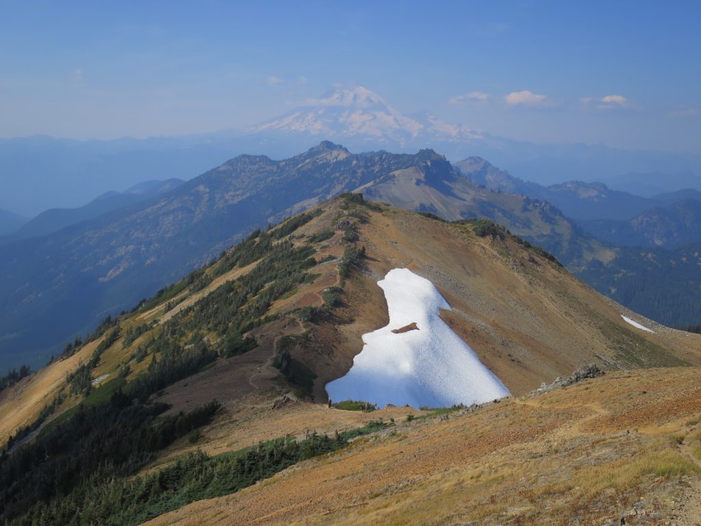
As I continued up the glen the hills on each side became more craggy. Even in the sun the drab browns and yellows of early spring failed to inspire me to the same extent as the vibrant greens of the pines and meadows. About halfway I can across the old blackhouse of Corrlarach, which had been restored. There was a good drying breeze so i paused here and put the damp tent out.


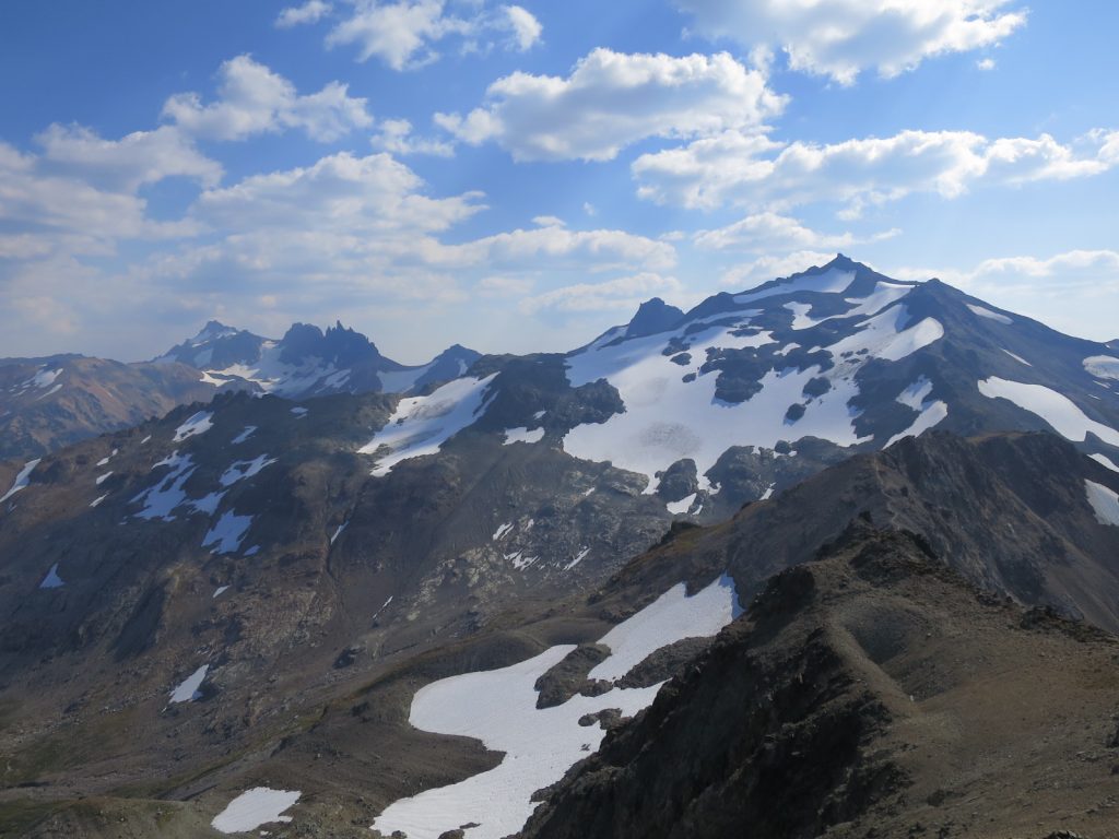
The top half of the glen was largely treeless, but the drab colours were more than compensated by the craggy gnarly mountains, often, and unjustly, overlooked by hillwalkers as they dont reach Monro status (3000 ft). Many of these ancient mountains still had snow in their folds.


Near the head of the glen the grassy track veered up the hill to the NW to cross a pass. I followed it up until it disappeared into a wet path. Water oozed into my shoes as I had deliberately chosen to do the hike in trail shoes. At the pass the path dropped down to the large open Callop valley. I followed it past Callop farm and then just before the main road took a track on the south side of the river hoping for a bridge at Glenfinnan.


Luckily there was a bridge and it took me over the deep dark sluggish river to Glenfinnan Monument. This is a tribute to the Highlanders who followed Bonnie Prince Charlie nearly 300 years ago, most of whom died. There is a cafe here which I could not pass before the final 4 km up to Corryhully bothy.


These final 4 km started by passing under the renowned Glenfinnan railway aqueduct. It then carried on up up the glen on a tiny tarmac road which wove between groves on the grassy valley floor. There were deer grazing around Corryhully bothy when I arrived at 6 after a 9-hour 24 km day. There were already 3 in bothy and before long there was some lively chat. The bothy was very rustic but it had electricity and the gamekeeper, Alistair Gibson, had just dropped off a bag of dry wood.

09. Corryhully bothy is a shelter provided by the Glen Finnan estate. It is free for a nominal donation and even has electricity


I slept very well on the floor and woke to a beautiful day. I left before the others and headed up the glen with the sun melting the nights frost and warming my shoulders. The skies were blue and it was completely windstill. The walk up the glen to a pass was gradual. Large gnarly mountains rose steeply on all sides. To the north was a huge horseshoe with 2 munros and to east was the long ridge of Streap.


After the pass any remnant of the path disappeared and i had to find my own route down the valley for 2 hours until I got to Glen Pean near the west end of Loch Arkaig. There was a tremendous view up Glen Pean to the sharp mountains around Loch Morar.


Although the day was still and warm the cloud was building and I wanted to get to the bothy at A’Chuil without lingering in the sun. I picked up the track in the forest just after the River Pean and followed it round into Glen Dessarry. The forest was short and uninteresting, but it soon brought me to A’Chuil bothy.


Ian and Tom from Corryhully turned up soon after, and we sat in the sun and chatted the afternoon away. After a few hours another 4 middle aged men turned up. The 7 of us gathered round the fire after supper and chatted. Initially the conversation was muted but it soon became rowdy.


Our room rose at 6 and I was dragged out of bed by their enthusiasm. There was talk of heavy rain coming in mid afternoon and I wanted to be in Sourlies Bothy by then. We left at 8 with Tom and Ian, who slept in the other room, just getting up.


It was cold and there had been a mild frost but the skies were turning opaque with high mist. I followed my 4 middle aged roommates along the road into the forest but we soon parted. Beyond the forest the mountains rose steeply on each side of the valley especially to the north. These were the “rough bounds” of Knoydart with steep rocky hillsides full of outcrops and sharp peaks. In the valley the stream curved up rocky grasslands to the pass.


I was excited about dropping down the other side. I had never been to the head of Loch Nevis or visited Sourlies bothy before. Just a short distance down the valley were two small lochans. Sandpipers darted away from the patches sandy shore,chatting excitedly, as I approached.


Beyond the lochans the rough path crossed to the north side of the valley. Luckily I saw it’s feint route up over a rocky shoulder otherwise I would have descended a steep deer track down a ravine. The path I took climbed slightly and then made a series of zig-zags down to Loch Nevis.

14. Looking from the pass Between Glen Dessarry and Loch Nevis. At the head of Loch Nevis is Sourlies bothy

There were some grassy pastures between the swamps and rocky outcrops. Beside these pastures were some ruins of long forgotten croft houses and some lazy beds. The descendants of those who toiled here once, now probably live in New Zealand or Canada.


One of these ruins, a barn of a croft house, lay in a green pasture beside the loch. It had been restored with a new roof and a sleeping platform for 4. As I arrived at 1130 it started to rain. The bothy was cosy and I was glad to call it a day and looked forward to a lazy afternoon listening to the rain pelting the roof.  Before long Tom, Ian and the 4 lads from Wigan turned up and the lively conversation and banter started off where we left it at A’Chuil bothy. The rain got heavy in the evening and kept up until we fell asleep.


In the morning there was some lingering mist but there was the promise of blue sky out to the west. Everyone was going different direction so I headed off to the Carnach valley. My route took me along the shoreline but the tide was too high to follow it so I climbed over some small buttresses. The bridge over the river was gone so I had to wade it through slightly swollen waters after yesterday’s rain.


The Carnach valley was dominated by Ben Aiden, a heavily buttressed and steep mountain covered in outcrops. There were a few chinks in its ramparts but not many and it looked a difficult and imposing hill to climb.

18. The fortress of Ben Aidin at the head of the Carnach Valley. Its craggy ramparts make it difficult to climb from any side

I sloshed up the soggy path to the west side of Ben Aiden and then started to ascend a deep rocky gorge with budding alder and birch. There was a lot of birdsong and two cuckoos were also singing. As the gorge rounded the bottom of the west ridge it opened up a bit.


I now chose to go straight up the steep craggy hillside which was the west ridge of Luinne Bheinn rather  than do two side of a triangle. The hillside was covered in brown grass and crags. I wove a route up until I met the well made and probably ancient stalkers path. I followed its easy incline to the saddle. I had been lucky with the weather and there were large patches of sun and blue sky.


I was in awe of these mountains. While Ben Aiden was perhaps the craggiest they were all very gnarly and challenging. I thought about going up Luinne Bheinn but saw grey weather coming in and left it for a future project.


The descent was all on a good stalkers path and I made good time down past some pine tree copses and fenced areas which were regenerating without the ravenous winter appetite of deer. I had already passed 10 corpses of deer today who had succumbed to starvation due to lack of grass and the hard winter.


As the path descended a beautiful view over the grassy bay and turquoise seas of Barrisdale bay unfolded. One of the buildings I could see was a simple bothy, provided by the estate, and I was going to make it my home for the night. Showery weather was developing out west and I rushed to get there before it rained.


The bothy was simple with 3 rooms and as I remembered it from 25 years ago. I was alone. It was a bit of a mess but the lochside setting with the magnificent craggy, outcropped, mountains of Knoydart surrounded it on 3 sides, with the fjord-like Loch Hourn on the forth. As I settled in a downpour arrived. Like yesterday it was another short day of 5 hours and just 14 km as I wanted to savour this area rather than blast through looking at my feet.

21. Looking up Glen Barrisdale to Sgurr Airigh na Beinne, at just 776 metres it is an impressive mountain

It was raining most of the night and all morning. I only had 12 km to walk today which I guessed would take no more than 4 hours so I waited until midday when it seemed to become more sporadic. The mist lingered however and the views were more atmospheric than spectacular.


The tide was out as I walked past the modest Barrisdale House to the jetty. Plovers and curlews were foraging on the exposed sands and flew off with loud alarm calls as I approached. Out to the west towards the mouth was the Isle of Skye, framed by the steep sides of the loch. The track ended here and a path continued along the south side of Loch Hourn to the end some 10 km to the east.


The track climbed over spurs as it made its way from one bay to the next. There were scattered pines and the birch and rowan were now bursting into leaf. In one bay I saw two cuckoos chasing each other. After a couple of km the loch narrowed and there was a strong current flowing out of the upper basin. On the far side was a lonely house, perhaps an old croft house which had now been restored.


The drizzle rarely returned but the atmospheric mists lingered and obscured the mountains. The streams were swollen and a couple of the the larger burns would have been difficult were it not for wooden footbridges. In most bays there were old ruins but at Runival and Skiary the old crofts were still intact. Indeed Skiary was a rustic guesthouse with access down a 3 km path or a short boat ride.


Soon the path rounded a corner and the hamlet of Kinloch Hourn appeared. A short push through dripping rhododendrons brought me to the end of the tiny road which connected Kinloch Hourn to the rest of the world. There was a tearoom here which also did very reasonable bed and breakfast. With the threat of rain very real it was an easy choice and I was soon under a shower with my clothes on a drying rack. It was a sociable evening at the B and B with 2 other CWT hikers, Craig and Bernard, and a Belgium family.


The last day of Section 1 was from Kinloch Hourn to Shiel Bridge and it went past the bottom of the Forcan Ridge. Unfortunately it was drizzling and the mist swallowed everything above 300 metres. I walked past the tired looking Kinloch Hourn Lodge and through the woods around it. These woods were largely mixed conifers with an unhealthy amount of eucalyptus, which seemed to be taking over.


Out of the woods I followed the track under the powerline for the Isle of Skye over a saddle and down into a hanging valley with a great view down Loch Hourn to the west. Here I left the powerlines and followed a track across the boggy hillside, wading a burn, until I reached the Mhalagain burn, which I also had to wade over.

24. Looking down Loch Hourn from the up on the hill at the head of it. The misty drizzle made for an atmospheric rather than spectacular view.


I followed this burn up towards the mist. Here I caught up with Craig and Bernard and we continued up as 3 into the mist and on up to the Bealach Mhalagain pass at about 700m. The weather was now awful with driving rain, mist and a gusty wind. Bernard, who was from Mediterranean France, looked miserable  in his minimalist lightweight gear. Craig, being a Scot at least knew what to expect. I left the others at the top and traversed across the soggy mountainside to a saddle. From there the renowned Forcan Ridge headed up to The Saddle mountain. Just the lower ramparts of the ridge were visible and it looked interesting.

25. Craig and Bernard plowing through the drizzle and wind as the foot of the Forcan Ridge ( behind) on the high point of the route between Kinloch Hourn and Shiel Bridge.


As I photographed the others caught up and we descended together keeping to the north of the stream to avoid a buttress of crags. Our lightweight shoes were no match for the hillside which was awash with water. How I longed for my boots with the hard heel to plant in the wet grass. We all slid at least twice on the descent to the valley floor.


Once down we had to wade a small river which was not quite in spate, but powerful nonetheless. On the other side was a rough track down to Shiel Bridge. The rain eased and I noticed there were tadpoles in the puddles. Cuckoos sounded in the strip of deciduous woods along the tumbling river. The birch were now almost in leaf,and the larch almost a luminous green, but the alders were still just in bud.


Before long we reached Shiel Bridge and the rain stopped and the mist cleared. The topography prevented up seeing back up to the Forcan Ridge and The Saddle but on the other side of the valley the Five Sisters of Kintail soared high, their summits still clad in snow fields.


The others camped here while I continued another km to the Kintail Lodge Hotel where I had a room booked and a resupply box waiting.

Back

I had breakfast with Laila as the sun was beating down on the lake outside. Already the lake was full of skiers heading up the icecap of Hardangerjøkul and kiters eeking out the breeze on the lake. The promised high pressure was arriving. I left late at 11 and joined a procession of skiers heading south, most of whom were day trippers with small sacks. The lonely hillsides of Reinheimen and Breheimen 2 weeks ago, or indeed exactly here 6 weeks ago, were a far cry from this.

It was very easy skiing up in well formed tracks on a gentle slope for about 6 km. The sun was out and I was now fit enough to maintain a good pace. Indeed, I caught a lot of people up including the musical entourage of Daniel Kvammen who had stayed and performed at the large DNT lodge at Finse. Henrik was amongst them and I chatted with him for half an hour as we skied along in the sun in the most perfect weather.

37. Looking back north as I head up to Helevetesnutane from Midnutevatnet lake. In the distance and beyond Finse, are the steep ramparts of Hallingskarvet

After the top, just beyond Brattefonnvatnet lake, I decided the weather and conditions were good enough to go a different way to Kjeldebu cabin. It was shorter and offered better skiing. I had only been this way once before and remembered it being spectacular. While the other skied down to Midnutevatnet lake I veered off to the south across virgin slopes, unblemished by other tracks or twig markers, and traversed up to the frozen tarns between Helvetesnutane and Helveteshorga.

was a lovely ski up and I got a great view over the huge empty flat expanse of Hardangervidda to the south of me. The descent down the other side was wonderful as I headed south west across the undisturbed hillside making my own tracks. I continued south west and went to the north and west of Lassheldrenuten, and then across Lassheldretjørna lake (1227m).

38. The descent down the south side of the Helvetesnutane towards the plateau of Lassheldreslaet is not too difficult but seldom used

Looking to the west the entire landscape was dominated by the huge Hardangerjøkul ice cap and the rampart of cliffs which supported it. These ramparts were only broken in a few places where glaciers tumbled down from the ice cap onto the mantle at the bottom of the cliffs.  I met a couple of guys coming up across this lake and explained the route I had taken to them, as they were going to Finse. .

I followed their tracks down, traversing under a large snowdrift which I would not have a picnic under and continued down to nearly the south end of Lake 1154m on the valley floor. Here I met the marked ski route which had taken a big detour to the east. It was now a pleasant ski down good tracks with the sun in my face for a couple of km across Langavatnet lake.

At the south end of this lake the ski route climbed 100m comfortably up slopes for about 2 km to cross a shallow ridge on a tundra like landscape. At the top I started a wonderful descent for just 2 km down to Kjeldebu cabin. I glided practically the whole way down and it was over in 10 minutes.

039. Kjeldevu cabin is a self service cabin with firewood,provisions and gas.

Kjeldebu was a large self-service hut with 2 separate cabins. However there was a warden here at peak periods, but due to the Norovirus scare there were only some 20 people while usually there should have been 100 during this Easter holiday. I took the same room I had 6 weeks previously when I was the only one at the cabin. There were a few interesting people here one was Kjell Aage Oprann who is about my age and I was to spend the next 3 days skiing with.

Kjell Aage and myself decided to ski all the way to Sandhaug the next day. It seemed a lot at 30 km, but the route was easy, and virtually flat except for the first few km. It was bitterly cold when we set off at around -30°C but as the sun started to rise it warmed up. We skied separately for the 7km to Dyranut lodge as Kjell had problems with the waxing on his skis, and was slower on the steeper climbs, but we met up in the lodge there for a second breakfast.

After Dyranut we skied together south across the lake, which was again busy with kiters as this was another popular spot for them, and then down the wonderful slope into Bjoreidalen. This gentle downhill run allowed us to virtually stand still while we glided down the 3 km into the shallow valley. It was almost free 3 km.

There was now a gentle climb up and and another easy descent for 10km to get to the east end of Langavatnet. The terrain was so flat here it was difficult to distinguish the uniform frozen expanse of the lake from the near level undulating tundra on this vast “peneplain” It was an easy ski and we had covered it in well under 3 hours so paused for a snack.

After lunch Kjell Aage powered up the next gentle slope and left me behind. He now had a great glide on his skis while mine were slippery. Often when I kicked forward on one ski, hoping for a glide on the other, all I got was the ski I kicked on slipped back and I lost momentum. I stopped to apply just a bit (some 30 cm) of Swix Blue Extra, just about the only wax I now use, and the difference was so tangible, as the skis did not slide back anymore.

After a few km of beautiful easy skiing in perfect conditions I caught up with Kjell Aage and we skied together chatting for an hour or so. However Kjell Aage was developing a pain in his groin/hip area and it was getting a bit painful for him to take large strides. I left him to continue at his own pace for the last 3 km which were largely downhill anyway.

40. Sandhaug lodge lies in the middle of the vast Hardangervidda plateau. It is open for a few weeks around easter but when it is closed a self-service cabin is made available

I had been to Sandhaug before some 4-5 times but had always stayed in the self-service cabin as the main lodge was not open. I was curious to see what was in the large building which I had only seen with dark windows and covered in huge snow drifts. There were only some 20 skis outside which was a good sign. Without the norovirus scare there would have been 100. There was a man with a sledge just unpacking. I said something to him about his ski boots.

Despite the fact I had my balaclava pulled down like a bank robber he recognized my accent (the English seldom get rid of their accent while speaking Norwegian).  He said “I know you”. It was Martin Madshus Sandbakken who I skied with for a day a few years ago near Finse. He and his girlfriend Tera Lyons were skiing across Hardangervidda now in the same direction as me.

I went in and got a bed in a dormitory as all the rooms were full. There were 30 beds in the dormitory but only 5 were used that night. Kjell Aage arrived soon and got one nearby. It was a great evening in the lodge. I had plenty of great folk to chat to, there was a great traditional living room and dining room, the food was delicious and plentiful, and the host entertained us with amusing stories.There were only 35 people there while there should have been nearly 200 according to the host..

Kjell Aage and myself set off after a later breakfast, while Martin and Tera got away early with their large sledges. We headed west across Nordmannlågan lake and started climbing up beside the Besso stream bed on the other side when we came across a huge swathe of reindeer tracks. There must have been over a thousand animals in this herd, and it had just passed in the last few hours.

The marked route took me an odd way from Bessevatnet lake to Bismamarvatnet lake by going a tortuous route via Øvre Bessevatnet lake and lake 1330m and height 1415m. This seemed very long winded to the usual route I go, which is through Dimmedalen. By the time I realized I had already followed the twigs of the marked route so I was committed to it. I caught up with Martin and Tera just after Engelstjørn lake and we had lunch here. The sun was warming but there was a bitterly cold breeze which chilled my bare hands quickly.

I continued on my own after lunch up the slope towards the top of which was a great view north to Hårteigen, a prominent nunatak rising steeply from the peneplain of Hardangervidda. At the the top of the slope I passed between two knolls and then started a fantastic descent. The wind had gone and the sun warmed the air as I sped down a rounded stream bed which curved from left to right like a bobsleigh track. I zoomed down going up each side turning at the high point before heading down to the stream bed again and heading up the other side. After 10 minutes of this fun I was spilled onto Ambjørgsvatnet lake.

41. Skiing between Sandhaug and Litlos in perfect conditions on Hardangervidda

It was so warm crossing this lake and skiing up the slope by Holken hill on the far side I was sweating even though I was just in a thin shirt. My glasses were steaming up and I had to stop frequently to clear them. So I was ready for the luxurious, cool, breeze created with my final gliding descent down to Litlos lodge. Again I had stayed at the self service here some 5 times, but never seen inside the lodge.

The lodge was cosy and smaller than I thought. I got a bed in a small dormitory upstairs and soon Kjell Aage joined me, his groin strain causing him problems. Martin and Tera had everything they needed in their sledge so carried on to try and put a few more km in before they would set up their tent to camp. It was forecast to be -30°C so there was little envy from Kjell Aage and myself.

As we were sitting in the living room after the excellent dinner an arctic fox sauntered along the valley. The staff said it was a frequent visitor. It was indeed a bitterly cold night and I had to wander out to the toilet block a couple of time after the sun went down. The large moon and clear skies made a head torch unnecessary.

42. Litlos lodge in a near full moon. When the lodge is closed there is a self service cabin which is made available

The next morning was stunning with bright sunshine and the Norwegian pennant flag was hanging limp from the flagpole. Kjell Aage, myself and another guy, Gaute Aas, skied across the lake as a trio chatting and relaxed in the perfect conditions. After possibly the most pleasant 5km of the trip we got to the south end og Kvennsjøen lake. Here Martin and Tera were just finishing packing up.

43. Tera Lyons andMartin Madshus Sandbakken with their pulks on Kvennsjøen lake just before the climb up to the Tuevotni lakes en route from Litlos to Hellevassbu

I let the other go on while I chatted with Martin and Tera, accompanying them up the slope a bit while the others went on. Their sledges, almost unnoticeable on the flat lake suddenly became a burden as they heaved them up the steep slope. Half way up I said my goodbyes and headed on up to the shelf where the Tuevatni lakes lay. Once up it was a glorious ski and and am sure Martin and Tera would be looking forward to it.

By the second lake I came across Kjell Aage and Gaute Aas.  They were the epitome of Norwegians in the Easter mountains. The had inherited a snow bench facing the sun built by previous skiers. Having laid out their foam mattresses they were shooting the breeze and lapping up the sun while they ate their packed lunch.

44. Gaute and Kjell-Aage doing what Norwegians do best when the Easter Sun is out in the mountains between Litlos and Hjellevassbu

I stopped and chatted  with them for 10 minutes before carrying on over the pass at Tueslaet. It was almost too early for lunch and I wanted to get over this easy pass and head down to Bjørnabotn before I stopped. Once over the pass it was a wonderful gentle glide down the other side for 2 km to the shallow valley floor. I also inherited a snow bench at the bottom in a real sun trap. As I ate my lunch Martin and Tera gracefully glided past with their sledges chasing them down the hill. Kjell Aage and Gaute Aas soon arrived and we sat there chatting, drinking coffee and enjoying the weather for a good hour, as there was no hurry.

In the early afternoon we cruised us the gentle slope to the south for the final run down to Hjellevassbu cabin. The climb was hot and again I was sweating at the top. The route down the other side was an exciting 2 km. I pretty much let my skis go into a fast glide. Occasionally the thought crossed my mind “if I crash now it is going to hurt” as the trail was a bit icy due to the amount of skiers snow plowing down here over the last 2-3 days.

Luckily I made it to Hjellevassbu cabin unscathed. It was also a self service cabin but the DNT had a warden present for this busy period. I managed to get a 2 man room for myself and Kjell Aage much to the wardens displeasure. He was a grumpy Dane who had been volunteering for this role year after year. The more he bossed people around the more they cold-shouldered him.

We all sat outside against the south facing wall for a couple of hours until the power of the sun diminished and the shadows grew. On the north side of the hut where the thermometer was in the shade it was already -25°C and dropping. I intended to get up very early the next morning at around 0330 and ski to Haukeliseter to catch the only bus so went to bed early, which was part of my rationale for getting the 2 man room.

45. A Blue Moon (second full moon of the calendar month) over Hjellevassbu cabin. This is a self service cabin. It got down to minus 38 celcius a few hours after this photo

When I woke it was naturally dark but there was a full moon, the second in the month so it was a blue moon. I quietly packed up and set off at 0400. It was bitterly cold and the thermometer said -38°C, the coldest temperature on the trip so far. Hjellevassbu lies in a cold hollow and with the clear skies and very high pressure it was hardly surprising, even if it was nearly April.

I skied up in the moonlight without my head torch, and noticed there was a good shadow of myself across the snow from the moon. The 2 km climb up was slow as I did not want to breathe too heavily and inhale the bitterly cold air. Once at the top it was magical. It was still just 0500 but already the sky was beginning to lighten and this, with the moonlight, caused the mountains to glow as if they were luminous. 

46. The first hints of a daylight on a bitterly cold morning between Hjellevassbu and Haukeliseter

When the sun eventually appeared an hour later it was about 0630. It was still bitterly cold and I kept my balaclava on all the way to the bottom of the valley and across to the small hut at the south end of Åmotsvatni lake. I stopped here to eat a snack and put my skins on for the final climb of the trip.

47. It was minus 38 when I started at 0400 hrs but now a few hours later it had warmed up to minus 30. By the time I got to Haukeliseter is was warm in the sun

By now I was fit enough to saunter up the 300m climb. The ascent soon started to warm me up but the low sun had done little to raise the temperature and it was still perhaps -25°C. I passed a few tents by Mannevatn lake and thought one might be Martin and Tera’s, but I later learnt they had gone all the way to Haukeliseter last night and taken the night bus;- which was impressive!

Half an hour later I was at the top of the saddle at around 1350m, to the west of Vesle Nup. There was a great view here to northern reaches of Setesdalsheiane, the most southern mountain area in Norway.. I was not going into them but just skiing down to the road between them and me where my tour would end.

48. Looking south to the northernmost hills in Setesdalsheiane from Nupsskaret saddle. From here it was all downhill to the end of the tour at Haukeliseter

I looked round mournfully at Hardangervidda which was now bathed in bright sunlight, It would be my last look for a while.  I reflected on my remarkable tour of 19 days where the weather was so kind to me not only did I not have to have a weather day but I never even used my wind trousers and jacket. It was unheard of to have such a long period of stable weather. With some sadness I turned to start the final descent.

Without skins my skis were very fast and I had to snowplough down the steep slopes for the first kilometre. The freeze thaw cycles of the last 5 days had made the surface of the snow both icy and unpredictable and I kept to where many other skiers had roughed up a path. The long snow plough was exhausting on my legs and I was thankful when I reached the bottom.

With very slippery skis I struggled across the undulating ground for another 3 km. It would have definitely been worth my while putting wax or skins in retrospect but I kept thinking the downhill would start soon. When I did reach the last steep downhill I was slightly anxious the snow conditions might be difficult. I started off and managed a few zig-zags in the hard, polished snow which was very uneven and realized it was going be a nightmare.

It was not a difficult decision to take of my skis and walk down. Plenty of other people had done it and there were good steps. Had I skied I would have had multiple crashes and done some damage, to either myself or my equipment on the hard snow. It just took 5 minutes to reach Haukeliseter lodge. This mix of traditional and modern buildings lay beside the main road between Oslo and Haugesund, and was a major thoroughfare through the mountains.

I took my skis off and clipped them together with rubber straps, plunged them into the snow and went into the lodge. I booked a ticket on the only bus that day, which was due in 2 hours time. As I ate a snack in the restaurant I bumped into Bjørn who I had a meal with just 6 weeks ago when I gave my talk at Finse. He had just led a group over Hardangervidda, and it was their tents I passed 3 hours earlier.

49. Haukeliseter lies at the southern edge of Hardangervidda. It was an favoured training ground for polar explorers and this building is called the Nansenstua (Nansen’s living room), It was the end of my 450 km Langfjellene Tour

The bus stop was just outside the Nansen cabin, one of the oldest and most traditional buildings at Haukeliseter. It was of course named after the explorer who stayed here while training for his polar expeditions. The bus was punctual and it whisked me away from the mountains and down to the snowy forests of Telemark and delivered me to Oslo 6 hours later. It had been one of my best ski trips.

50. The completed route from Bjorli in Reinheimen to Haukeliseter in Hardandervidda

Back

Mads and Natacha wanted to go to Slettningsbu and then Sulebu as they were following the “Massiv Ski Route”. I could go directly and Ola explained a route to me, and said most of it would be marked. Even if it was not the weather was starting to clear and after 3 day of misty conditions there were views again.

I went south along Tyin Lake for 3 km then cut up across the road and up the slope to Galdstjernet lake. I was was back into the mist now, but the route was marked with wooden twigs as it veered west and undulated across the tundra like landscape. As the marked route started to descend into the big bowl with Bjødalstjernet Lake in the bottom of it, I left it and slowly traversed round the hillside keeping height.

This meant I had less to climb on the south side of the bowl to reach the lip where Slettningen Lake lay. The sky was clearing now and the views were opening up lifting my spirits. In fact the ski along the south shore of Slettningen Lake was a delight. Just beyond the end of it I veered south and prepared for a steep descent. I remembered coming up here once and it was difficult as it was wet snow..

29. The descent from the route between Tyinstølen to Kyrkjestølen marks the end of Jotunheimen. The mountain in the distance is Suletinden in Skarvheimen

However, this time the snow was perfect. It was a foot deep, light, dry and consistent and I had a great ski down the valley for a good km linking turns in the virgin bowl with no other tracks. After this it got much steeper so I just traversed the slope weaving between the trees. Where I did not have the confidence of managing a turn I stopped and did a step-turn before traversing another 200 metres again in a series of long zig-zags.

Near the bottom I looked up to see Mads coming down. He was a great skier and made it look easy, Natascha was far behind him and she was following in my zig-zags. At the bottom of the slope we reached Kyrkjastølane, which was an old collection of summer farm buildings and a chapel, whose idyllic past was now compromised by being beside the main E16 road between Oslo and Bergen. Adjacent to one of the cabins here we found a warm sheltered terrace with a bench and had lunch in this sun trap.

After lunch we crossed the road and climbed up onto Filefjell. I knew the way so lead off with Mads and Natascha following. I made good time up the hill as my ski fitness was starting to return. We chatted as we climbed up onto the plateau of Filefjell. I was soon out of breath trying to keep up with these two, who were both police officers and triathletes, so at the top of the hill I took my foot off the gas and let them ski off.

30. On the Filefjell plateau between Kyrkjestølen and Sulebu cabin

It was about 5 km across the high plateau of Filefjell to reach Sulebu hut. The sun was warm and I was skiing just in my shirt as I glided over the undulating plateau. I arrived at the huts at about 5 pm, but the hut which Mads and Natacha had chosen was quite full with a large mixed nationality group, so I when into the other hut.

There was only Kaja and her friend Morten, who was joining her from here to Haukeliseter. This cabin had provisions, wood and long rows of beds so there was plenty of room. I chatted with Kaja but Morten was a man of few words. Before bed I went through to the other cabin to make a plan with Mads and Natascha about skiing all the way to Bjordalsbu tomorrow which was 30 km away.  

It was a cold morning when I went over to the other hut. Natascha and Mads were ready and we set off. Initially we skied across the flat but then we had a steep climb up to the saddle, called Sulesharet, between Suletind and Sulefjell. My lungs were hurting in the cold morning air as I breathed heavily to keep up with the young triathletes. It was a dull day with low cloud and the fantastic view to the mountains between Bygdin and Gjende lakes in Jotunheimen were obscured.

Mads and Natascha skied off down the other side, but I wanted to avoid this rapid descent and lose my height gradually, so I traversed down the slope for almost 2 km and caught up with them. It was to be the only time I got the better of them. We skied then as a team chatting to each other for another hour by which time we had done another 5 km to reach Masseringstjøni lake. Here we had previously discussed leaving the normal marked route, and taking a easier short cut I did a few years ago, but in the other direction.

Instead of veering west, climbing a 100m ridge and then having a steep and difficult 400m descent to Breistølen followed by a 400m climb to Starsjøen, we continued south from Masseringstjøni lake down the open wide valley with easy skiing to Eldrevatnet lake. Mads and Natascha shot off and flew down the 4 km in a flash but I was tired and zig-zagged from side to side in the poor light. One one misty sections I was disorientated, like scuba diving in milk, and hit a small snow ridge which sent me tumbling.

At Eldrevatnet we regrouped and had a snack before crossing the road and heading up Øljusjødalen to our south. It was quite a steep valley but we kept to the east of the frozen stream ravine, and crossed it some 2 km after crossing the main road. The weather was clearing now and there were large patches of blue sky letting the bright sun through.  We now headed west to Nordre Halsatjøni lake and climbed in a gentle arc up to Starsjøen.

31. Hurrungane from the south as seen crossing Starjøen lake near Bjordalsbu cabin

Before Starsjøen the weather had cleared sufficiently to give us a wonderful view north to the southern side of Hurrungane, the massif which I cherish so much. The wind was starting to pick up though and there was a river of spindrift flowing across the bright snows surface. With the sun on it every small undulation and ripple was crystal clear, while it had been lost in the mist an hour ago.

We skied across Starsjøen lake and picked up the official ski route, marked with twigs on the other side. We had saved ourselves some 200 metres of ascent and descent and a couple of km coming this way, and had easier skiing to boot. Now my route finding was over I did not have the energy to keep up with the other two who were as fit as professional athletes.. While I put skins on for the upcoming climb and had another snack, they continued and were soon two dots near the top of the slope.

32. Natascha Vingereid and Mads Skipanes crossing Starsjøen lake en route from Sulebu to Bjordalsbu

The last 4 km were into a near gale, however, the sun was out and I did not need to put my gore-tex jacket on. It was a long climb at the end of a long day and I found these last 4 km quite taxing. Virtually the whole way I could smell wood smoke from Bjordalsbu cabins, which gave me false hope it was just round the corner. However, I just took my time at a more sustained pace and was not exhausted when I got there.

The hut was busy with about 10 people already there and I could see another 10 coming up the slope behind me.  It is a self service hut but the I managed to find a 2 bed room for myself, laid my stuff out and then I got my provisions and settled down. There was a great atmosphere in the hut with plenty of chat and laughter across the candle lit tables with a large stove burnt in the corner drying everyone’s clothes to a crisp. I found the hut book with my first entry in 20/03/1984 from my first ever ski trip in Norway from Tyin to Finse.  

I had a lazy start. I knew the route today and looked forward to it. It was still respectable at 17 km but it was perhaps the easiest 17km of the trip. The wind was still a good force 4 from the south but the visibility was good. There was a small gentle 100m climb across a series of lakes to the high point. Patches of mist and shafts of sunlight were making it very atmospheric.

After the high point there was another series of lakes with the gentle slopes between them just enough to glide down. It was the most relaxing of skiing. However it was soon to get even easier with some fun sections as I started down a near continuous 10km slope and the wind disappeared

The sun came out and I could feel it’s warmth, despite the cold air rushing past my face as I sped down. Quite a few times the marked trail dropped quite steeply and then crossed a flat section but I avoided this combination by veering to the east side of the valley and slowly traversing down until I was level with the end of the flat section, and ready to start the whole traverse detour again at the top of the next steeper section.The consistent firmness of the snowpack, and new snow covering it, made perfect conditions, what Norwegian call “silkeføre” or silky conditions.

As I reached the bottom at Djupvatnet lake I noticed the the sun was bright and the wind had completely vanished. I stopped for as snack on a mound of snow and could feel the heat on my face. I put cream on my chapped lips, nose and ears to save them from more sun. There was a family of Norwegians sunbathing in a snowy hollow basking in the sun’s reflected rays.

33. Approaching Lungsdalshytta lodge with Lungsdalen valley in the background, which is the way up to Kongshelleren Cabin

From here is was a short relaxing kick and glide across the lake for an hour to Lungdalshytta lodge. The last 200 metres were up a steeper slope and my skis were slippery. I was too lazy to stop and put the skins on so I had to work my arms hard to stop myself sliding back. It had been such a short easy day I could almost treat it as a rest day.

The lodge was not too busy. Mads and Natascha were already here and during the afternoon about 20 people arrived. I got my own 2 man room again and had a great shower and clothes wash. The lodge was very traditional and had a cosy living room to read and relax in with many groups gathered and chatting while waiting for the meal. The meal when it came was superb with local dishes from the produce of the summer farms like Rømmegrot and smoked trout. I had a vegetarian dish which was delicious and enough for 3. If was the best food of the trip so far.

34. Inside the stue, or living room, of Lungdalshytta lodge. This lodge has its own summer farm and much of the produce is served to the guests.

After yesterday’s easy day I was ready for the 28 km to Geiterygghytta. The route took me up Lungsdalen for a solid climb of 600 metres over 8 km. The sunshine of yesterday had gone and now It was a gentle wind and light snow, but the visibility was not too bad as I slowly climbed past Eivindbotn. It was here an outlaw, Eivind Fredlaus, used to hide when during a 20 year period in the 1700’s when  the authorities were after him. It must have been bitter in winter when he fled to his stone hut here.

35. Heading up Lungsdalen to start the climb up to Kongshelleren cabin some 15 km away

At the top of the climb I reached a plateau with the two Volavatnet Lakes on it. As I was skiing across these lake to Kongshelleren hut there was a party of 8 coming towards me. They are formed 4 pairs and had got their windshelters out and threaded their ski skicks through the loops on each side. Each person then grabbed their skicks and stretched the sail between them. With the force 4 behind them each pair was wizzing across the flat lake with the nylon sheel billowing in front on them. I had done this on my own sometimes but the pain in ones arms was too much to bear after 5 minutes of fast excitement.

Kongshelleren hut was a smaller self-service cabin. Apparently it had been very busy the previous night with many people sleeping on the floor. This is often the problem with the self service cabins around the Easter week, –  which was still a few days away. I just had my lunch here as a group of 15 arrived from Geiterygghytta. They said it was busy there last night also and likely to be tonight as there was a well known musician on a ski tour there with his entourage.

It was another 12 miles to Geiterygghytta, and I remembered it being mostly down with a couple of kilometres of a taxing uphill. The downhill bit was most of the first half but the gradient was not enough to give me a free ride except down into a valley at the end of it. The uphill bit was strenuous and seemed to go on more that I expected. Just when I thought I was at the top it veered of in an unexpected direction and climbed even more, mostly unnecessarily I grumbled to myself.

However the last 3 km from the top of the climb to Geiterygghytta lodge were a fantastic downhill glide, with the occasional exciting steeper bit where I had to leave the established track and make my own way, traversing across the hillside. It was a fun descent, but I was glad to arrive at the lodge as my legs were burning with effort.

I was distraught to see so many pairs of skis outside, perhaps a hundred pairs. The lodge was going to be busy. When I went in the couple running the place where a little stressed sorting visitors out with sleeping arrangements. The lodge is quite near the road and easy to get to so there would be many skiers here due to that, add to this the proximity of the Easter holiday and the 30-40 music fans and entourage of Daniel Kvammen and it was overfilled. I along with 50 others would have to sleep on mattresses on the floor in the living room once Daniel’s concert was over.

The lady barked at a few people who complained, and also me when I asked where I could put my rucksack, so I felt a bit put out and considered continuing to Finse another 6 hours away. However, just that moment she had a cancellation and sought me out to offer me a bunk bed in the annex, which I took at once and forgave her stern tone earlier.

The food was good and the concert was busy. In fact there was no room to watch it, so I sat in the parlour and chatted to other guests. One was Henrik who I met a month earlier when I went to Finse Hotel to give a talk on my www.skipaddlenorway.com trip and he had been in the audience. As it happened Henrik was a friend of the Daniel, the young musician, so he came and chatted to us when he paused for a break.

I was looking forward to ski to Finse Hotel, where I knew a few people who worked at the hotel. Daniel and his musical entourage were also going to Finse but they would be staying in the DNT hut which would no doubt be chaotic. I set off quite early after a great DNT buffet breakfast into the dull overcast day with low cloud. I started with Mads and Natascha but they were on a mission to catch a train back to Oslo so we said our goodbyes.

It was getting significantly fitter now and it did not take long to head up the valley to Omnsvatnet, as the tracks made by many skiers had not been driven over by snow scooter. I had a good glide and my skis slid nicely in the slots left by the skiers of yesterday and already this morning. I ignored the marked route which seemed to take a unnecessary deviation to the north halfway along the lake over some large knolls and continued to the west end of the lake, where I met the marked route again.

From here is was a long sustained 200m climb up the slope to the south for about 2 km by which time I reached the barely discernable remnants of the Omsbreen glacier, which were now just patches of smooth “firn” snow. It was windstill at the top and a bit misty, with large snowflakes slowly drifting down out of the sky. It was quite busy and I I must have passed 10 skiers coming down just on this descent.

From the top I readied myself for the long run down to Finse. It was steep enough to get a good glide, but not so steep so that I had to work hard to control the direction of my skis. My rucksack was lighter now and I was fitter, so I could be more adventurous on my turns. It was 6km all the way to Finse and I loved every minute of it. My legs were burning when I finally got to the bottom but I was exhilarated.

Finse was busy. It was quite a shock to see so much going on and a train was just digorging its contents as I arrived. I skied across the train tracks once it had gone and made for the Hotel. I have known the manager, Laila, for some 18 years having first met here when she was working at Turtagrø in Hurrungane. She was a friend rather than an acquaintance, and I was greeted with a big hug.

I had been to Finse some 6 week previously to give a talk at the Expedition Festival when I skied across Hardangervidda in early February from Haukeliseter and had not seen anyone for 5 days. I was vague on my expenses for this previous trip, and the hotel felt they still owed me so I got a very big discount. After I showered I went upstairs and kept bumping into people I knew so it was a very sociable afternoon..

In the evening I dined alone in the large dining room until I was joined by Laila and her Canadian boyfriend, who was a Richard Gere lookalike to a T. He was a enthusiastic kiter and Finse was a mecca of snow kiting. Indeed he had come all the way up from Ljosland in the previous week. We had a few beers together in the evening before I went to bed.

36. Finse is on the railway line and an easy destination to get to so is popular with wintersports enthusiasts. Snow kiting is especially popular here

Finse and the area was very busy. There was a lake in front of it which was teeming with kiters and looked like a wintery Bruegel painting with hundreds of people enjoying themselves on the snowy surface. Easter had just started and Norwegians flock to the mountains like the proverbial lemmings for the Easter week. For the visitor it is a time to avoid as the huts are all very busy and usually I would have expected to sleep on the floor in at in least 3 of the next 5 lodges and huts.

However I had a stroke of luck as Laila explained to me people were avoiding Hardangervidda and indeed Finse. The had been an outbreak of Norovirus in one of the huts and this had spread to all the huts on Hardangervidda. The press had got hold of this story and blown it up out of all proportion so it became a National story. I was also in luck with the weather. The  forecast for my next and final leg across Hardangervidda was absolutely stunning with 5 days of horizon to horizon sunshine and no wind as a heavy high pressure dominated Southern Norway.

Back

The girls Kaja and Kari-Anne headed off early, but Chris Christine and Myself had a slow start, as the weather was not good enough to go over the Smørstabb glacier to Leirvassbu. So the alternative was a relative easy day down to Skogadalbøen and we waited for the snow flurries and mist to clear as per forecast.

The first 6 km were quite uneventful as we undulated across the gentle slopes of Rundhaugan in generally poor visibility. It was good to have the twigs to follow on this stretch as it was quite featureless and the tracks the girls made an hour or two before us were already obscured. It was a shame not to see the spectacular mountain scenery around us.

24. Looking down the upper reaches of Utledalen on the descent from Sognefjellshytte Lodge to Skogadalsbøen Lodge

The weather then started to relent a bit as we reached the lip of a steeper bowl. The ski route goes this way to avoid an avalanche prone area in Vetle Utledalen just to the west..The slope was too steep for me to ski straight down even with the near foot of new snow, so I traversed down the slope with a energetic turn at each end of the zig-zags. I was careful not to go too far towards the west flanks of Hillerhø as I thought this might be avalanche prone.

Once the steep section was out of the way and we had dropped a few hundred metres the slope eased off and there was some great downhill skiing for a few km down to the treeline. We all enjoyed finding out own route down through the small knolls and undulations in the easy-to-turn-in, soft, luxurious, snow and were elated when we reached the first of the birch.

26. Looking down Utledalen valley on the last few km towards Skogadalsbøen lodge

We had a break here in the sun as the the patches of blue sky grew larger and the wind died off. We were at a junction of a few valleys, with the could-obscured giants of Hurrungane to our west and the 2000 metre mountains up Rauddalen to our east.  It was an easy and delightful 4km ski from here down through the forest on quite a uneven ski track to Skogadalsbøen lodge. The track was as narrow as a a snow scooter with deep snow each side and it was quite exciting in the short steeper sections.

27. Christine Teller and Chris Stockbridge approaching Skogadalsbøen lodge in Utledalen valley

The girls were already here, relaxing in front of the fire. Kaja had found one of my books and was reading it. The hosts fired up the stove in the drying room also and soon the accomodation was comfortable. We spent the evening dining together and chatting around the fire with the hosts, as the 5 of us were the only guests in this lovely traditional lodge.

We all set off together in the morning on the long ski to Fondsbu lodge. It was overcast and there were a few snow flurries. None of the mountains were visible. I knew the first 2 kilometres today were taxing as it was a steep climb up through birch woods. A few scooters had been this way in the last weeks and had compacted a furrow of snow and we had to follow it until we escaped from the trees and into the mouth of Uradalen where winds had slightly compacted the snow. It took a good hour and plenty of effort to slog through the forest.

Once in Uradalen the going was easy with a firm base and some gentle descents and rises for the next 4 km. It was a shame there was not more of a view, but that is a risk of skiing in a mountainous area. After these 4 km the climb steepened and there was a sustained but quite easy further 4 km climb up to Uradalsbandet, the high point of the day.

28. Climbing up the last of Uradalen valley to the Uradalsbandet saddle unter the steep slopes west of Uranostind

I was ahead of the others and did not wait at the windy pass with its snow showers so skied down the south side of the pass to Uradalsvatnet lake and had a snack while the others arrived,  The descent was quite steep, but the flat light and difficult visibility made it hard work and a bit nerve-wracking as it was difficult to read the slope. The others came down equally gingerly some even walking the odd section, except Kari-Anne. She came down with the intuitive skill of a Norwegian who had grown up on skis and put us the rest of us to shame.

It was now a long 10 ski across a few lakes and high snow covered moraine mounds to Sløtafjell. We split up in the snowy weather; all just keeping our heads down and ploughing into the flurries. There was nothing to see really except for the next 200 metres. It took surprisingly long to reach Sløtafjell, as things always do when there is no view to encourage you along.

I knew there was a long descent coming up which in good conditions is fun but in this flat obscured light with inconsistent snow firmness was probably going to be hardwork involving a lot of zig-zaging. There were two ways down; either clockwise or anti clockwise from Sløtatjernet lake and both looked the same. I chose the latter as I knew it having been down some 5-odd times before. Better the devil you know.

It was indeed taxing as I could just not make out the contours and undulations in the snowfields and crashed twice before I got down to the cabins at the west end of Bygdin Lake. From here it was a short ski to Fondsbu lodge. The others were well behind me up on the mountain, but all decided to go anticlockwise round the mountain. They arrived at the same time and said it was easy so I will remember this for next time.

I went in and met Solbjørg. She had been the host here for 20 years and was well known, not only locally but in Norway among outdoor folk. I had known her for about 18 years and always got a warm welcome. Fondsbu lodge was nearly always busy as it was an easy ski from the road and it was also served by a fleet of 50 year old Bombardier Weasels, which were like minibuses on belt tracks. I got my usual room and washed my clothes in the shower before the dinner where there were about 30 guests.

The next day the weather was again dull. However it did not really matter as I was just going across Tyin Lake to Tyinstølen where there was some accomodation. I said goodbye to Chris and Christine, and also Kari-Anne who were all stopping here.  As I skied up the shallow incline of the road between Fondsbu and Tyinholmen Solbøurg caught up on a scooter. We chatted for a good 10 minutes before she blasted off down to her hometown to get some rest before the Easter chaos started in a week’s time.

From Tyinholmen there were tracks across Tyin lake for 12 km all the way to Tyinstølen. There was no one else on the lake and I just went over in one go, skiing for about 2 and a half hours in the good conditions. It was only in the last km that I could make out the main road and the cluster of houses I was heading for such was the mist.

I climbed up the slope on the edge of the lake and found the lodge. I was not what I was expecting at all and was quite scruffy. However Ola who ran the place was very accomodating  and the prices were cheap. I realized I had met Ola before when he showed me his self service cabin here some 5 years ago, which I did not realize was adjacent to this place as I arrived off the bus in the dark then..

Initially I thought Ola, who owned the place, was a bit of a bungler. The place was spartan and lacked a woman’s touch, and my room in the cellar was totally soulless. However the more I chatted with Ola the more I realized he was quite a character. He was a local but had spent a few decades working in refugee camps in East Africa. There were just 2 other guests here Mads Skipanes and Natascha Vingereid who were also amused by Ola’s style. They were planning on going the same way as me for the next 5 days.

This was the end of my third section, Jotunheimen. It should have been the highlight, but It had been a disappointment. The dull and misty conditions meant I had to settle for 3 rather tame days rather than the spectacular possibilities which good weather would have allowed, like going over Smorstabbbreen or Memuribreen glaciers – which I had done before.

Back

Breheimen is a  mountainous and glaciated national park between Reinheimen and Jotunheimen. It has a good handful of mountains over 2000 metres, most of which have large glaciers on their flanks. I intended to ski for 3 days through it from Pollfoss in the NE to Sognefjellshytte in the SE.

I left Pollfoss in bright sunshine and skied up the cleared road to Framrusti 6-7 km away. I assumed this road was cleared because maintenance snow scooters occasionally needed to access a hydroelectric dam further up the valley. It was bitterly cold in the shade of the hillside and forest, perhaps minus 25 °C.

At Framrusti I had to leave the sanctuary of this snow scooter track and head SE up a km long summer path in the forest to a saddle, called Bråtååsen.As I suspected it was still deep, virgin, forest, snow which dismayed and worried me. The snow was just so deep and loose this year it was easy to get bogged down. I had a hunch though that the 2 km descent down to Bråtådalen valley on the other side was clear.

It seemed that this track was used as a thoroughfare for some foxes and they had slightly compacted some snow which had subsequently frozen, so by following their tracks I only waded through 25 cm of snow rather than 75cm. I was very grateful to our canine friends  As I climbed out of the shade in the valley the temperature warmed and the forest branches, thick with snow, sparkled. I was lucky with the fox tracks as they took me all the way to the saddle where a great view quickly unfolded down to the valley and I was ecstatic to see the snow was compacted by some scooters and occasional skiers.

10. Having left Pollfoss and crossed the ridge at Bråtååsen to Mork there is a great view of the rest of the day up Bråtådalen to Sota Seter lodge

It was a fantastic run down to the old wooden farms around Mork in Bråtådalen valley. Their century old wooden walls darkened by decades of sun almost smelt charred in the bright sunlight reflecting off the snowy fields. All the animals on these farms were inside for the winter months. There was a another farm nearby with the abandoned long sheds of fur farming, once prevalent in Norway but now frowned on.

The main road in the valley at Mork was cleared of snow and mostly asphalt and icy gravel so I walked the 300 metres to the boom. Here the road continued but as a private road and it was not cleared so often or throughly, so it was covered in hard packed snow, almost ice, but there was a ridge in the middle where the vehicle tyres had not been and it afforded good and fast skiing. The road was virtually abandoned with just a car an hour, so I could ski down the middle of this snowy furrow for a quick 5 km

I passed a few clusters of old summer farms at Dyringen, their turf roofs were groaning under the weight of the heavy snowfall and the picket fences were all but buried.Soon after Dyringen I reached the north end of Liavatnet Lake. I thought there might be snow scooter or ski tracks along it, but there were none.

11. Skiing down Liavatnet lake towards Sota Seter. The mountain in the background is Tverrådalskyrkja

None the less I headed down through the thick snow to the frozen lake to ski across it. There was a magnificent view of Tverrådalskjrkja at the far end of it. However, after a km I realized it was a mistake trying to ski across the lake and headed back through the birch trees to the snowy track. Climbing up through just 100 metres of deep soft forest snow to gain the track again took me nearly half an hour as I floundered about in the waist deep loose snow.

Once on the track again I sped off on its gentle undulating curves through the mixed birch and pine forest for about another 6 km to reach the summer farms around Sota Seter which was almost like a living museum. People had been coming here every summer with their sheep and cattle to live in these gorgeous wooden cabins and barns, taking advantage of the lush mountain meadows, for centuries.

15. An old summer farm at Sota Seter. Some of these buildings are hundreds of years old and were just used in the summer when the animals came up to the mountain pastures

One collection of these timber buildings had been converted into Sota Seter lodge by the Norwegian Tourist Association (DNT) and catered for skiers in the Spring and walkers in the Summer. Sota Seter is the epitome of Idyllic Norwegian mountain scenery and culture. It is a staffed lodge only, and there are no self-service facilities when it is closed.

Chris and Christine, ruddy after a days skiing in the sun, were relaxing in the traditional lounge and gave me a warm welcome. As did the host, who was from Lom and knew a few people I did. We were the only guests on this first day of it opening for this Spring on 16 March. The food served in the evening was mostly local as the DNT try and promote this in their staffed lodges. Later John also arrived, he was an Irishman living in Switzerland who had just discovered the delight of Norwegian ski touring, and also planned to ski south to Hardangervidda. By bedtime the temperature dropped to -26°C

14. The stue, or living room, of Sota Seter lodge. The lodge is composed of a number of summer farm buildings which have been adapted to cater for people yet still retains its charm

The next morning the temperature was down to -32°C and it stung my face and nose so I had to pull my balaclava down as I set forth through the idyllic scattering of summer farms in the bright sun. I was wary about the route as on two previous years I missed it and had to wallow in deep forest snow to get up to the treeline. That was no option this year with its huge accumulations with there was no hope of wading through steep, virgin, forest, snow.

16. Climbing up the slope towards Tverrådalen with the view up Mysubyttdalen where the cabin at Slæom lies some 10 km away

I found the route and could see why I went wrong previously as it went in the wrong direction to my intuition for almost 2 km, traversing up through the birch trees eastwards before turning south to climb past the treeline and into Tverrådalen, a high hanging valley where the ski trail was marked with twigs. There were fantastic views west up Mysubyttdalen towards glaciers and north down the white expanse of Liavatnet lake of yesterday.

17. Looking north as I climb up the slope towards Tverrådalen with the view down to Sota Seter at the near end of Liavatnet lake

I was the last one and I could see the others climbing up the moraine mounds at the bottom of Fortundalsbreen glacier at the foot of the magnificent Tverrådalskyrkja mountain. I had climbed this mountain in what seem like another lifetime 16 years ago on my mission to climb all the 2000 metre mountains in Scandinavia (see www.scandinavianmountains.com)

I followed the twigs onto the glacier and up to the saddle. To the east of me is a renowned wind carved bowl with 50 metre cliffs.It is called Heksegryte, or the Witches Cauldron, and is dangerous in poor weather, as it is easy to ski off the cliffs if one navigation is suspect. Some 4 hours after leaving Sota Seter I eventually got to the watershed on the glacier where Chris and Christine were relaxing in the sun having lunch; and what a spot they picked!

It was spectacular enough behind me with Tverrådalskyrkja rising steeply up out of the glacier, but the real view was to the south. The whole of the Hurrungane massif rose unimpeded some 25km to the south.I was a breathtaking sight of what was my playground for a whole summer in 2002. Just a couple of peaks to the south of the massif were hidden behind their taller siblings in front. Each peak to me conjured up a happy memory. This was a cherished and meaningful view to me.

20. The view south from the top of Fortundalsbreen glacier towards Hurrungane. On the left is the Styggedals-Skagastøls ridge in the middle is Dyrhaugstind and on the right is Austanbotntind.

Just to the east of this angular alpine massif was the Smørstabb Massif with its large graceful glaciers carving away at narrow ridges. Again each of these peaks had memories, all of them good and I remembered warm summer days with Arne Instebø and Tone Søvdsnes 16-18 years ago. We spent days climbing and wandering amongst small brooks tumbling across high mossfields, and meadows of glacier buttercups watered by alpine snowfields on the way up to the summits. I lingered at this memorable spot cherishing the memories while Chris and Christine headed down after John.

I eventually left elated and almost euphoric with the memories and landscape and headed down the south side of Fortundalsbreen Glacier. I made wide swings as I found the snow too erratic to telemark. Although I have skied some 10,000 km in the mountains of Scandinavia my skiing is not technically that strong and I have to have perfect conditions to enjoy an downhill ski. What I lack in skill however I make up for in strength and tenacity.

After an hour I caught up with Chris and Christine and then overtook them as I blasted on down the ski track to Nørstedalen and the hydroelectric dammed lake. The track was generally wide enough to ski down but occasionally if it got to steep i traversed across the hillside in zig zags. The dammed lake was short but due to the danger of falling between ice blocks the route marked with twigs followed a tortuous path along its eastern shore.

From the dam it was a fast and exciting 3 km down the rest of the valley until it merged with a bigger valley by the DNT lodge at Nørstedalseter, a very cosy atmospheric tradition lodge with perhaps 50 beds at a squeeze. When the lodge is closed there is a 4-bed self-service cabin where I had previously stayed.

John was already here and so where a group of 4 girls from Stavanger including Kaja and Kari-Anne. It was quite early in the season so when Chris and Christine arrived the 8 of us made up the full complement of guests; while 3 week later at Easter it would be jammed with guests with many sleeping on mattresses on the floor.

It was again cold in the night and about -25°C when we set off. Although Sognefjellshytta was not open the girls had already arranged to stay they, but cater for themselves so it was easy for Chris Christine and Myself to ask the owner for the same arrangements. The alternative would have been the old cabin at the nearly Krossbu which is the worst DNT cabin I have had the misfortune to use.

It is a surprisingly long route to Sognefjellshytte/Krossbu with a lot of accent and descent and the forecast was for snow showers in the afternoon and night so I left early. I was the first and forged a route up the slopes of Vetledalen to the east. It was a sustained climb for about 700 metres. There was a bit of respite when I crossed the shelf where the Grønevatnet lakes lie and another across Liabrevatnet Lake, but this was offset by a couple of very steep sections which were taxing and I had to zig-zag.

23. Christine Teller and Chris Stockbridge climbing up the slopes on the ski route between Nørstedalseter cabin and Sygnefjellshytte lodge

The two girls caught me up at the top but I remembered there was an easier way than the marked route slightly to the east, and took this avoiding a climb up and over a knoll. By now the blue skies of the last 5 days had vanished and snow-laden clouds had covered the sun sending the first of the big flakes down in the still air.

I sneaked round the hill and started the long descent to Storevatnet lake. Initially the going was easy, but the final descent to the lake was steep and the visibility had deteriorated so much it was difficult to make out the contours of the slope. I just managed to get to the bottom without crashing, but my legs were like jelly as I spilled onto the lake. I looked up to see the others coming but only Kari-Anne was skiing down, the rest were walking.

There was no reason to stop as the weather was misty with some snow flurries. I skied across the lake to the small dam in the south and then started the final 6 km section. It was tiring as there was quite a bit of uphill and my skis were slippery. After a while I stopped to put my skins on and save energy. I also had a snack and waited for the others to join me. The final kilometres seemed to take forever, and there was little to see as the weather was now closing in.

We all got to Sognefjellshytte at the same time after a 10 hour day. Krossbu was another half hour so we were glad to see to see lights on and a snow plough clearing huge drifts of snow from the entrance to the building, and some people shovelling it off the roof.

Raymond, the owner, arrived just after us and let us in to the west entrance of the annex. we followed him down the corridors with drained fire hoses laid in the corridors so they would not freeze towards the original timber lodge. The gap between the annexe and the lodge was now connected with a huge and very modern atrium, like a giant geodesic greenhouse. It was an impressive space, and although 15 metres high the snow drifts were up to the roof on the lee side.

Although Raymond was not open he looked after us well and provided showers, 2 man rooms with bedding, boiling water and even a free beer each. We rehydrated our meals in the old dining room looking out of the window to see it was snowing heavily and spindrift was blowing around in the force 6 wind. From here we would leave Breheimen and ski into Jotunheimen. I had wanted to go over Smørstabbbreen Glacier to Leirvassbu and from there to Fondsbu, a spectacular route. But in poor visibility it would be pointless and wiser to go to Fondsbu via Skogadalsbøen lodge with the other 4, who were becoming my ski-trip family.

Back

The Reinheimen is a new National Park largely of high undulating moorland cut by a few large gentle valleys. It is a wild and somewhat unglamourous region but has great reindeer pastures. In the west of Reinheimen this alpine moorland becomes much more dramatic as it becomes riven with the much deeper valleys and the fjords of the Tafjord Mountains. My plan was to ski south for 3 days between this undulating moorland and the Tafjord Mountains from Bjorli in Romsdalen to Pollfoss in Ottadalen.

I took the train straight from Oslo Airport up to Bjorli in Romadalen and got there in the evening, having already decided to spend the night in the cheaper hotel. It was cold and clear and there was masses of loose powdery.The weather forecast was fantastic for the next days and I went to bed optimistic after a long day’s travel.  

I woke early and had breakfast with the construction workers who also staying in the hotel. I found some local maps of the ski touring routes around Bjorli and skied off down the frozen pavement to the train station a km away to find them. I could ski on tracks round the north side Rånåkollen for a few km and then drop down to Brøstdalen by a bridge. I could see that bottom of Brøstdalen valley was a ravine and impossible to cross without going over the bridge at Ulvåbrua. However there was nearly a  km of virgin, loose, deep, forest snow to ski through to join up the Rånåkollen track to the Ulvåbrua track and this made me wary even if it was downhill as the snow was bottomless.


02. Looking down the upper reaches of Romsdalen before heading west into Brøstdalen

The ski round the north side of Rånåkollen was fantastic. There were groomed tracks covered in a dusting of new snow and frost. The pines twinkled in the sunlight and the heavy snow bent the birches saplings double. I made good time in the bright morning light and within an hour after leaving the hotel was at the point where I thought I should descend through the forest to the Ulvåbrua track. I was a bit worried as I might be bogged down in the snow up to my armpits. However I found an old snow scooter furrow, some 3 foot deep, and thought it would be wise to follow it.It was steep and I crashed twice into the banks. I was virtually submerged in snow. I put my arm out to push myself up and it dropped down into a feathery void. I had to take my rucksack and skis off and virtually had to wade and climb back to the snow scooter track. With some relief I made it through this white quagmire of quicksand-like snow and made it to the Ulvåbrua track. I could see the area had an old working mill which was a summertime museum.

There was now a long gentle climb up a cleared road which served the farms up in Brøstdalen. There was easily enough snow to ski up the road where I could look down into the impossible ravine which I deliberately avoided. After an hour the trees thinned and I reached Fremmer-BrøstetFarm, it’s old sun-burned wooden buildings sitting dark against the gleaming fields. The pines were thinner now and the dominant tree was birch.

I skied down to the frozen Ulvåa river and had a snack in the bright sun under blue skies. From there I followed snow scooter tracks up the shallow valley to the summer farms at Horgheimsætra and then Kabben and finally Tunga some 3 hours later. Here the landscape split with a valley heading NW up to Vakkerstølen hut and a valley continuing SE to Pyttbua hut. I took the latter and climbed gently into Puttbudalen where the last of the birch continued in copses. Where the wind had been blowing the snow was firmer, as the windblown snow crystals had broken and compacted.

03. heading up Brøstdalen

As the trees finally disappeared I had a small rise to ski up to reach an open junction of two valleys. Between these valleys was the Queen of Tafjordfellene, namely Puttegga, which just misses out being a 2000 metre top by some 60 cm. It steep ridges were fringed by a large overhanging cornice, which would come crashing down in the spring. Pyttbua hut lay just at the bottom of the east ridge It had 2 separate accommodation huts and the toilet/utility block. There was a young German couple there already who had come to this area a few times in the summer and this was their first winter trip. They already had the fire going and had melted a few buckets of water.  The larder was well stocked and I quickly found and prepared my favourite items after a long first day of some 30 km.

I rose early and set off before the Germans were up. It was another glorious day with horizon to horizon blue sky and no wind. In the shade of the mountains it was cold at below -20 Centigrade . The route was marked by birch twigs stuck into the ground. I climbed gently to the south up a shallow slope into a white sunny bowl to the north of the crags on Karihøa. I crossed a few frozen tarns and was looking to see where the route went, assuming it was to the east

However to my surprise it went up a very steep snow drift to the south of this sunny bowl. The snow drift had formed a ramp which I had to traverse up for about 50 metres. It was marked with the twigs but it looked quite steep and in avalanche conditions I would not think it save, and would have found a longer route to the east. My short skins would not let me climb the ramp in anything but a long series of side steps.

04. The route from Pyttbua to Tordsbu on Day 2 goes up into the snowy bowl NE of Karihøa and then steeply up a drift to Radiovatnet lake. The drift can be avoided by detouring a km to the east over height 1539m

At the top of the ramp there was a lovely still small valley with Radiovatnet lake across it and then a wonderful descent down to the vast flat expanse of Tordsvatnet l;ake. I kept as much height above the west side of the Tordsvatnet which left me only about 5 km to ski across the lake to Torsbu hut. It was a very easy pleasant day. Almost a rest day as it was over in about 4 hours.

05. Looking south from Radiovatnet lake across the frozen expanse of Tordsvatnet lake. At the far end of this lake is Torsbu cabin

This hut also has two cabins. I could see there were already two people in one of the huts, and looking at the gear and literature they had assumed them to be British. I lit the stove and was just getting the last bucket full of snow to melt when an large man with a beaming smile slid to a halt speaking Norwegian with the unmistakable British accent.

We introduced ourselves. He was Chris Stockbridge who had previously work in Stavanger as a oil field geologist. He guessed my name and said he had read my book and had followed my www.skipaddlenorway.com journey 9 years ago as I skied up Norway. Pretty soon his wife Christine arrived and we went into the hut. Both Chris and Christine were bright, good humoured and gregarious and we chatted easily. It transpired we both intended skiing the same route for the next week or so. The more we chatted the more we discovered mutual friends and interests. This was the Norwegian hut system at it’s best.

The next day we were to part ways for a bit as I was skiing to Pollfoss where I had already arranged to spent the night and then Sota Seter tomorrow. Chris and Christine were going half way to Pollfoss and then taking a taxi to Sota Seter, where they would spend 2 nights; so we would meet again tomorrow. I set off first and started the long descent to Billingen.

Initially the route was virtually flat but it soon started a long easy descent traversing down the slopes of Tverrådalen valley. Towards the end it got steeper and I had to make large shallow swings as the snow was too inconsistent to telemark straight down. Even then I fell once as the harder firm snow changed to soft deep snow when I was not expecting it.  The slope ended as my legs were burning with effort and it spilled me into Torddalen. I looked up and saw Chris and Christine starting down in the same cautious manner I did.

It was surprisingly long to ski the 6km along Torddalen to the area where it narrowed and climbed over a spur to begin the final descent. My skis were slippery as I did not wax them, as I constantly hoped for gentle downhill sections, and this cost me a lot of energy on the shallow inclines and flat sections. I passed the tracks of a wolverine which as always looked like they were on a mission with very little deviation, even in gnarly terrain.

08. Looking back up Torddalen on the easy descent from Torsbu cabin to Billingen

The final descent to Billingen was quite steep in inconsistent snow with very fast skis. Again I fell twice as my legs just disappeared into deep loose snow and my torso and rucksack carried on. It was only when I reached the first of the summer farms the terrain became easier as there were some snow scooter tracks which other skiers had followed.

09. The old summer farms at Billingen now lie beside the road from Otta to Stryn

Again with burning leg muscles I skied down through the last of the sun burnt cabins and barns of these ancient summer farms which had stood for centuries, to the road at Billingen. The farms where covered in dollops of thick snow which were glistening in the sun making every glance look like it was from a postcard. At Billingen I crossed the main Riksvei 15 road with my skis still on and skied down a short snowy track to a bridge over the Otta river and to the hamlet of Åsen.  The frozen Otta river was buried under huge mounds of snow, twinkling in the sun and just disturbed by a few fox tracks.

From Åsen I was lucky that my hunch of a cleared track came to be. It was not only cleared but it was a prepared cross country ski track. It was about 6 km to Pollfoss but it went past in a flash as most of the track was either level of down hill. Once at the bottom of a steeper fast section the track veered off to the right so unexpectedly it took me unawares and I could not make the turn. I ploughed of into the deep loose forest snow in a cloud of spindrift. Once I came to a stop i was partially submerged with snow up my nostrils and behind my glasses.

Pollfoss is an old historic hotel now owned by a Dutch couple. There are open during the spring by arrangement only and they were expecting me. It was a very characterful place and a nice stop to reorganize after 3 days skiing. I had now finished the Reinheimen Section of my Langfellene Trip and I had been blessed with great weather, nice scenery and company at Torsbu cabin.         

Back

Section 20. Stevens Pass to Manning Park. 26 September – 5 October.  The Mountaineers Lodge at Stevens Pass reminded me of a slightly shabby Alpine hut in the French or Italian Alps, but without their excellent food. There was some food here it was a bit haphazard so I left early to go down to one of the 3 lodges at Stevens Pass where there was a simple cafe. I bought more snacks for the next section, ate ice cream had a coffee and set off at 1030 as the mist disappeared and the skies turned blue.

Initially for the first 5 miles there was a level path and then a slight climb up to Lake Valhalla. A picturesque lake set under the steep crags of Lichtenberg Mountain. The entire north side of the cirque the lake was nestled in was ablaze with crimson huckleberry bushes. I paused here for a break in a meadow. As I ate I noticed large spiders webs were being carried up in the gentle breeze or thermals and just hovered over the meadow before drifting into a tree. I then continued another few miles to a cold, clear creek just before Lake Janus. As I was sitting on a mossy rock beside the creek a Canadian girl called Jen appeared. She had also done continious footsteps but had been in cars to resupply.

I walked with Jen for a few miles past the beautiful Janus Lake and up the hillside towards Grizzly Peak. About half way I had to stop and Jen charged on. I was rushing to get to Grizzly Peak as I could see there would be a nice sunset. However I was astounded with the evening colours both on this mountain and the others. Especially stunning was the view north to Glacier Peak, a glaciated cone of a mountain soaring 20 miles to the north. In the hour the sun set the colours were just incredible and the views in all directions were stunning. It was one of the most memorable hours of hillwalking I have ever had. The camera photos did not do it justice.

01.The imposing Glacier Peak dominated the views to the north for the first 2 days after leaving Stevens Pass. After reaching it the next 2 days were spent skirting round its west and north flanks.

In the dusk I had to push on to Pear Lake as that was the next water. I managed 2 miles in the last of the dusk and two miles with a headtorch. As I descended I disturbed birds who were roosting in the lower branches of the hemlocks. They flew off with great alarm, especially the blackbirds. The next two days were supposed to have great weather and then it would snow again.  I wanted to push past the high exposed sides of Glacier Peak before the rain or snow returned in a few days. I heard Glacier Peak was no place to be in bad weather. I found a campsite in the dark beside the lake and got water from it. I had enjoyed today with the clear weather and crisp views but had 10 days of food in my rucksack slowing me down. I put the tent up in the dark and crawled into my cosy sleeping bag as the temperatures fell to near freezing.

Despite the late finish I managed an early start and was off just before 7, but well into the dawn. I left the pretty Pear Lake, seeing it for the first time, and started up through the hemlocks for a couple of miles to gain a ridge. Here I glanced over my shoulder and got a fantastic view of Mount Rainier in the morning sun. It must have been 70 miles away!.

It was rugged terrain and my legs were pumping hard with yesterday’s efforts and with now 9 days of food. The uphills were taxing me. A hiker from Minnisoata caught up, and we chatted a while. He was trying to do a calendar Triple Crown but still had the north half of the CDT to do, and with winter approaching I did not fancy his chances.

I stopped at a creek for a pause while he carried on. I felt tired today and the uphill bits were taking it out of me. Nonetheless I had to do them and it was up again after the break. Eventually the climb eased and I was at the treeline again and walking through alpine meadows. When the sun hits the berry bushes at a certain angle it makes them iridescent. The huckleberry bushes were taller and the berries had no flower remnants beneath them, while the blueberry bushes were more prostrate and the berries had shrivelled flowes beneath them. The blueberries were ripe now but the huckleberries were already shriveling. To my mind the huckleberries were sweeter.

03. Huckleberry bushes are taller than blueberry bushes and generally found at lower altitudes. There are often the shrivelled remnants of the flowers on the blueberries.

There were birds feasting on the berries, especially the blackbirds. However they were vulnerable here from predators like hawks. I passed a few mountain ash and noticed something had been eating the pips inside but leaving the fleshy skin, which is bitter. I think it was chipmunks and they migh be storing them. In a meadow I saw a kestrel riding a breeze to soar backwards and forwards looking for critters to no avail. I think the Pika’s squeak would have alerted them.

I had another break at Lake Sally Ann, with its crystal clear waters. It was an idyllic spot and basking in the sun. There were small trout rising occasionally in the sun to grab flies. After Lake Sally Ann the hillsides became even brighter with iridescent leaves. The were whole hillsides ablaze in autumnal berry colours,  and mountain  ranges in every direction,  but to the north was Glacier Peak, at nearly 10,000 feer it dominated these Cascade Ranges. I was running out of superlatives to describe the simply awesome views and crimson hillsides. I think this was one of the top 3 days on the hike so far, and rivalled the best of the Sierra.

11. More of the gorgeous hillsides covered on berry bushes which are lit up buy the sun to form a kaleidoscope of colour. The trees here would be either sub alpine firs or mountain hemlock

I noticed a family of 4 falcons playing. I wondered if it was mum or dad and 3 adolescents. They were just playing, but the speed of their dives was terrific. Suddenly they were joined 4 ravens, who were the same size. Now ravens are master acrobats but the falcons were out mastering them with tight turns and quicker reflexes. It looked like the ravens were playing a dangerous game as a falcon could easily have hit a raven.

After more climbs and descents I came to a picturesque pond, Reflection Pond, in a meadow with a great view. It was only 1730 and I had just done 18 miles today so far but I was shattered. There had been 10,000 feet of ascent and descent in the last 36 hours. With campsites and water trickey for the next 4 miles I threw in the towel early. I also wanted to savour the day. It had been one of the best and I did not want to spoil it with another march into the night. I had supper before the sun set behind an array of jagged peaks.

The early finish did me a lot of good and I felt stronger in the morning and managed a 7 o’clock start. It was windy but it was another fantastic day with blue skies and clear air. The path climbed up the hillside to White Pass where a kestrel was hovering over the mountain ash  shrubs hoping to catch a critter eating the bright, red berries.

08. One of a large brood of Ptarmigan who nonchalantly wandered down the track in front of me. I am not sure of the spieces yet or if it changes plumage colours

From here the path made a long traverse on a steep grassy hillside with a couple of small streams and a marvellous view to a glaciated massif just across the valley the south west. Along this traverse I passed the 2500 mile mark. I was  astonished how far I had walked. This 2 mile traverse ended at Red Pass which again had fantastic views both north, and especially south. Near the pass I came across a party of about 10 ptarmigan, which were still in their summer camouflage. They were not easily scared and clucked happily beside the path, before stepping onto it near me.

06.Looking down across alpine meadows in to a valley heading west with perfectly formed interlocking spurs.

Initially from Red Pass northbound I could have been in Scotland on a fine autumn day down a remote glen until I went round a corner and the massive snow covered cone of Glacier Peak appeared. The more I descended down the valley, the more of it appeared until I went into the hemlock forest which swallowed up the view.

The path dropped steeply into the forest  which was initially nice with a mixture of copse and glade, but soon it was all trees. Down and down it went into the depth of the White Chuck Valley until the floor of the valley flattened out. There was a mile of dank overgrown forest with brown stagnant water and thick willow scrub near Chetwood Creek. This was the day’s low point and it was now a massive climb.

The climb was tedious as it was all in the forest with plenty of windblown trees across the trail. It went up Kennedy Creek, crossed it and then climbed up Kennedy Ridge, where the forest thinned out and the views reappeared. A little further it arrived at Pumice Creek,  a crystal clear small creek with mossy banks and sunny meadows nearby. I had my last  break here lying on the warm  grass in a sunny hollow beside the creek. At one stage a dipper appeared and started searching the moss for larvae.

I had a final ridge to get over before my planned campsite at Mica Lake. Once the climb was over it was a lovely walk at the treeline. There were occasional views of Glacier Peak which was right beside me, and it glaciers just a mile from where I was walking. At the crest of the ridge looking north yet another range appeared with its 8000 foot peaks white and glaciated.

I could not linger as the sun just set and I would have half an hour  before I put my headtorch on. The descent to Mica Lake was steep and rocky. I could see why people warned me not to venture here in bad weather. Down and down the path went, going from scree to heather and then to forest by the fantastically beautiful Mica Lake. It was fabled for it clear turquoise water but it was dark when I arrived. This was  very rugged hiking and in the last 3 days I had done 15,000 feet of ascent since Stevens Pass, initially with 10 days of food.

The weather today was supposed to deteriorate culminating in rain, however when  I woke in the morning it was superb.  The forecast, from Norway’s Weather Service, was 4 days old now so  hopefully it would remain nice. I admired the saphire blue colour of Mica Lake before beginning the long 3000 foot descent down to Milk Creek which drained the Ptarmigan Glacier on Glacier Peak.

The descent was full of zig-zags as it plummeted  into the depths of the valley. There were some grand old hemlocks here and one was  the biggest I had seen with a bole 8-9 foot in diameter. As I neared the bottom I noticed the sky had clouded over. The scrub maples were on fire in the valley with oranges and reds on all the bushes. Just as the forecast said it started to drizzle at 1100 and it got heavy enough to put a jacket on. The Norwegian forecast  www.yr.no never fails me.

14. Looking up the valley to the north side of Glacier Peak where the Ptarmigan Glacier terminates in the mist. The yellows are a willow in autumnal splendour

From Milk Creek I started up the 3000 foot ascent which I had already mentally prepared for. My rucksack now only had 7 days food, as opposed to the 10 days at Stevens Pass and it was much more acceptable. Up  and up the zig zags went with the rain soaking the leaves of the vegetation overhanging the trail. In no time my feet were wet from water running down my legs after being dislodged off the leaves  and twigs.

At the top of the climb were acres of blueberry bushes. Their fruit was plump and  the bushes were laden. Suddenly a bear stood up in the berry bushes nearby. I could see his face and the fur each side of his mouth was sodden with berry juice. I think he was putting a branch in his rmouth and then running it through his lips. The bear scat I have seen waa full of huckleberry leaves. After a few seconds it turned and bolted down hill. In a flash it had gone.

I stopped at the top for a break as the rain eased but the mist swirled around the cirque and drifted in the valley. It was atmospheric indeed. I wonder were the other hikers were. Jen I think passed me when I had the early night and Dixie was supposedly a few hours behind. But I had not seen anyone for a day. I was beginning to feel alone which was nice but I could also have chatted with another Thru Hiker; even a  flipper,  skipper or section hiker would do.

From this cold windy cirque with the spirals of mist in the rotors off the ridges I started down to Vista Creek and Suiattle River. It was a steep descent across open mountainside then the Mountain Hemlocks and then into the larger Western Hemlocks. Down and down the path Zig-zagged the steep hillside until at last it reached the milky Vista  Creek 3000 foot below. The rain came and went but the bushes were dripping wet and my legs never got a chance to dry.

At last the path levelled off and followed Vista Creek. There were some grand  trees here. Initially  some old growth Hemlock, but as I reached the fertile silty land each side of Vista Creek the odd  Douglas Fir appeared. By the time I reached the Suiattle River the trees were impressive. However, as I walked beside the river I came across some gigantic trees, especially Douglas Firs but also Western Red Cedars.

Indeed they were the most impressive trees of the trip so  far. One Western Red Cedar put all  the Douglas firs to shame with a bole about 12 foot in diameter. It was the tree of the day. I passed through this avenue of giants and quickly reached the new bridge over the Suiattle River which was large and unfordable.

It was still drizzling a bit but I found a campsite on the northside under trees. It was, I found out later, plagued by the pesky Washington mice and one even got into my tent by chewing a hole in the mesh. I had seen no one today for only the  second time in the entire trip. More bears than humans today!

The day started badly. First big drops on tent indicated it was raining still and dripping off the trees and this cost me a good half hour as I mustered the willl to get up. Secondly a mouse had enlarged the hole in the tent mesh, come in and had chewed through my waterproof cuben food bag and then another bag inside this to get at some granola, while I slept with my head  beside it. It had also had also left a few faeces and urinated on it to rub it in. It took some 15 minutes to clean up, so I did not leave until well after 8.

Initially the path went up the north side of the Suiattle River for a few miles to Miners Creek. It was not that inspiring a forest as I think there had been a fire some 20-30 years ago as all the trees were the same size. Around Miners Creek there were a few venerable survivors but nothing like on the otherside of the river. The path then started a long climb up Miners Creek, crossing it o  a bridge and then climbing more steeply through forest and dripping vegetation to Suiattle Pass at 6000 feet.

It had drizzled or rained lightly the whole way while I climbed these 4000 feet except near the top where the rain turned to sleet. My feet were soaked from the overhanging vegetation brushing against my legs and running down. As I neared the top the hemlocks got smaller and more scattered and I could see peaks around me in the mist and there was snow from 7000 up. Still the colours of the mountain ash, the berry bushes,  and a willow like shrub were all making a riot of colour agaibst the backdrop of the green conifers and the grey mist.

13. Mountain hemlocks and sub alpine firs in a huckleberry field on the way up to Suiattle Pass with the first of the snow showers rolling in

I was feeling miserable with cold feet and a clamy shirt under my waterproof top. My legs were still bare with the shorts on. Still I was walking well and could now just spot light at the end of the tunnel 100 miles away.  However the descent brought more misery as the temperatures fell and the sleet turned to wet snowflakes. This ran down my legs with abundance and soaked into my shoes chilling my toes. The descent was long a took a good few hours during which the snow turned to sleet, then to cold rain, chilling me further.

The colours were magnificent on the way down also despite the grey weather. The shrubs almost conspired to form sunshine on their own. I also noticed a new tree which I had seen more and more of and initially though it was a true fir. Now I could see this tree’s needles were turning bright yellow or even brown and it dawned on me that these must me tamaracks. Some had a bole of 4 foor, but not as big as the Western Hemlocks which were the dominant tree at thas altitude. I later discovered that these were not tamaracks at all but a true fir which had been stressed  by the dry summer

As I descended I decided on an early campsite and got to it at 1800 after wading the icy waters of the Agnes Creek. I had done 20 miles which was a good days walking in these wet conditions and just wanted to get into my tent. As I was setting it up 3 Thru Hikers appeared. They were also going north.  They had heard of me from Dixie who was apparently a few hours back but I had not heard of them, which is very unusual at this stage in the hike. It was good to chat to them but they were more cold and wet than I was and were eager to get into warm clothes. We were  all in our tents by 1930. From the occasional screams from both the other tents it seemed they were under attack from the mice also, sharing what would have been my burden alone, for which I was grateful.

The drips off the hemlock I was camped under continued all night and it was a struggle to start getting up in the morning, but the other 3 were packing up and it forced me to confront my cold wet socks. I eventually left camp around 0830.  It was a pleasant walk down the east bank of the Agnes Creek, which I had to follow for 11-12 miles.

The tamaracks I noticed yesterday were absent here, perhaps they preferred the higher elevations.  The main trees here on this walk were the ubiquitous Western Hemlock, some large Douglas Firs and some enormous Western Red Cedars. Where the latter were growing near a creek or moist ground they reached colossal proportions and out muscled even the Douglas Firs. As I walked through this forest the drizzle came and went and occasionally I could see the mountains were snowy from 6000 feet upwards.

About half way down this hike I met a Southbound Hiker who had flipped. He wore no socks, his trousers were rolled up the knee, he was bare topped save for a blanket wrapped round his shoulders and kept in place with the smallest rucksack on the trail. With his longish curly hair and head band he looked like his trail name which was Savage. Indeed I can picture a ink drawing of him on the cover of Jean Jacques Rousseau’s 16 century masterpiece.  He was in his early 20’s and new to hiking, he had a down bag but also a hammock! He was heading to Stevens Pass over Glacier Peak and I hoped he would not get any poor weather.  He was very affable and we chatted for 15 minutes.

As I reached High Bridge ranger station I passed over high bridge and looked down into the pool below the bridge. There were hundreds of fish in it. Each one about 2-3 pounds. I thought they were salmon but a passer by said they were neither salmon or trout, but Kokanee.

I had now entered The North Cascades National Park and there were special rules on camping in it and a permit system was in operation. However to get one I would have to go to Stehekin 11 miles away. I was sorry not to be going to Stehekin as I heard it was a special place with access only by boat, sea-plane, or foot and bus. But I was not going to ruin my carless to Canada record and take the bus. Besides the Ranger Station at High Bridge was closed and it was now October and I doubt there would be anyone else camping at their designated campsites.

As I was packing up Dixie appeared. She had been hiking with Percolator who had a Rasputin type beard. She was 2-4 hours behind me apparently for the last 4 days. She camped in 6 inches of snow at the top Suiattle Pass last night. She had taken loads of video footage with her drone for her Youtube channel. She was heading down to Stehekin on the last bus to dry off and resupply so we said our goodbyes as I would be half a day ahead of her again.

There were a few people milling around and everyone was of the opinion that the weather forecast was saying it would clear up and get cold. This was music to my ears as I had just 4 days left to Canada! Hopefully the snow falling on the mountains yesterday and this morning would not thaw and freeze to much, as I had no microspikes.

I was told there was a great campsite just 5 miles up the trail at Bridge Creek with picnic tables, bear locker and a lean-to. I bounded up the flattish trail towards it and got there at dusk. The lean-to was perfect and looked like the sort of thing a scout group would build over a weekend. It was covered in wooden shingles and had a picnic table inside it. There was also a sleeping platform so I would not have to put the tent up.

15. The lean-to at Bridge Creek Campground was a simple affair but made life much easier as my tent was still damp from the previous night

Furthermore the bear boxes for food were also mice proof so I could put all my food in one and forget about the mice chewing through things. As the evening drew on though I could feel the temperature plummet to around freezing and I was just at 2000 feet, the next nights I would be camping around 6000 feet!

I got an early start and was away by 0700 as it was getting light. The sunrises were really starting to eat into ones day now. I left the camp and followed the Bridge Creek up in a north east direction.it was a fine morning but it was overcast with just the odd glimmer of blue sky. Down at this altitude of 2000 feet there were virtually no autumn colours yet, just the maple vines which were reddening and the sycamores which were yellowing. It was only a few miles up to the next camp at North Fork and in that small climb of around 500 feet the colours were equally mute.

The  patches of blue sky grew larger and larger until the whole sky was blue save a fifth of it which were isolated clouds blowing in from the north east. It was decidedly colder but the air was clear. It looked like a high pressure system was just rolling in from the north. In the sun it was almost hot and after 6 miles I stopped for a break and dress down. I also hung up my tent, sleeping bag and down jacket to dry a bit. The tent was wet but the footbox of the the sleeping bag was quite sodden. I took my shoes and socks off and put them on bushes in the sun too. While I snacked my items dried and after an hour I was ready to move on.

Pretty soon I ran into Chris; a fly fishing expert. I quizzed him a bit about the nature and fishing in particular. He was very knowledgeable about the salmoniod genus and was going to the Stehekin River to make a video. He said the salmon I saw yesterday in the Stehekin River were Kokanee, probably originally a Sockeye who path to the sea had beeen blocked and they now remained in the Stehekin River and Lake Chelan further down. I asked him about the weather and his reply was music to my ears. It was to remain dry and clear for the rest of the week but it would get cold. I had just 4 days left to Canada and it seemed I would do it in a bit of an Indian Summer rather than in the rain, or worse still deep snow.

I left Chris in a buoyant mood,almost euphoric with the weather news he had given me. It was another couple of hours up to the highway at Rainy Pass. I just walked through hemlocks and a true fir spieces and some Douglas Firs most of the time. The mountains on each side of Bridge Creek were about 6000 feet and were rugged. Snow lay just on their upper slopes.

At Rainy Pass I lingered in the parking lot ar the trail head. A few people came over to chat to me. Washington has more than its fair share of friendly people; hikers, foresters, firefighters, and the genreal public have been more friendly here than anywhere else on the trail. One man Iwas chatting with had a PHD in forestry from Harvard so I quized him about a few things. It aeems what I thought were tamaracks 2 day ago were sub alpine firs yellowing due to a dry summer. He pointed some tamaracks out to me and they were the highest trees on the mountainside and made the treeline. Tamaracks were in the larch genus.

I also chatted sith another couple who  were going to the same campsite as me this evening. As they packed we chatted and they gave me a few snacks. It was only 4 miles to this camp but the path continued to climb through the fir and hemlock trees. As I approached the 6000 foot mark snow which had fallen over the last couple of days was starting to accrue on the ground. The trees were now the thin pointed Subalpine firs near the campsite were the unmistakable tamaracks.

17. As I neared my campsite just before Cutthroat Pass the setting sun lit up the underside of the clouds in a manner I have not seen before

But the camp I turned to see the most sensational sunset of the trip. The bottoms of all the clouds were crimson and the snowy mountains below them looked very dramatic, especially when seen through gaps in the snow-clad pointed firs. It was both colour and drama. The couple  who gave me the snacks were already at the camp. But I could not find a flat spot near them, but found one just above, and it was covered in an inch of snow. I had the tent up in the late dusk as the temperatures plummeted to below freezing – but it was dry. All my equipment was also dry which was a godsend. I had just 67 miles to go now and with this forecast hoped I could do it in 3 days, which is also when my food would run out.

It was a bitterly cold night which had all the signs a high pressure weather system was arriving; crystal clear, no wind and a massive drop in night time temperatures. I would say it got down to -10 centigrade. Even with all my clothes on I could feel the cold and the tent was soon covered  in frost.

However a 0530 I suddenly realised I had to go to the toilet  at once. I scrabbled around and found the torch and then my shoes. They were partially frozen. I slipped them on and without doing the laces dashed up the trail in the dark clutching my water bottle. Once far enough away from camp I charged into the bushes like a fleeing bear, and got just a few yards in. There was no time to dig a hole, this was blind panic, and I made it just i time. I then discovered at least half the water in the bottle was frozen. They say you are not a  true Thru Hiker until you have shat yourself. I haven’t so far, and that was as close as I would would like to come.

I did not go back to bed but packed up and set off at 0630 in the early dawn. There was a sprinkling of snow on the mountains from 3 days ago and even before the sun came up the colours of the fading larch and the deep nracing green of the sub alpine firs stood out against the pale mountainside. I got to the top of the first pass, Cutthroat Pass as the first rays were hitting the peaks and then spreading down their alpine sides.

19. Tamaracks and blueberry bushes in the morning sun on Cutthroat Pass

The views were tremendous and by the time I reached the second pass, Granite Pass,  most of the mountains were lit up and also some of the valley sides. It seemed whenever I went over a pass an even more  spectacular scene would suddenly unfold of jagged peaks and forested U-shaped valleys. From Granite Pass the path contoured round the south side of a valley near the treeline of 6500 feet to Melthew Pass. The trees here were small, struggling in the alpine conditions.They were mainly the now golden Tamaracks, the tough Subalpine Fir, the Mountain Hemlock and occasionally a 5 needle pine – white barked pine I think.

21. Looking west down Swamp Creek from Granite Pass towads Mount Goode and Storm King, two 8000 foot mountains in the North Cascades National Park

From Melthew Pass the path cut over the ridge through a notch and then entered the Melthew Valley at its head. It descended speeply in zig-zags down into this cold valley which was still in the shade. The zig-zags took me past the 2600 mile mark and down into a valley full of hemlocks and firs. They were all the same size and about 30 years old so I imagine a fire destroyed the old growth forest here.

I followed the valley for 5 miles through the cold forest passing the occasional glade of mountain ash in its bright autumnal colours. At one I stopped for lunch and hung up the tent and groundsheet, which were even now covered in ice. They dried quickly and I moved on to Bush Creek where I would climb again. Just at the junction of the 2 valleys I met Mayor. He was the only person I saw all day.

Mayor was doing the CDT southbound and had got as far as central Colorado when early snows had blocked his path, probably permanently for the season. So he came over to the PCT to surprise his girlfriend Dixie who was just half a day behind.  Dixie had already told me a lot about Mayor and I felt I half knew him so I stopped for half an hours chat. He was very affable and knowledgeable and it was a pleasant break. We then parted, me north to Harts Pass where Mayor had come from and him south up the Melthew valley to meet Dixie, and walk with her to the finish.

The trail up Bush Creek was like all the trails so far in Washington, well made and well maintained. It climbed to Glacier Pass and then climbed again up the east flank of the pass ascending 3000 feet in total from valley forest to just above the treeline dominated by the yellowing tamaracks. It look a couple of hours to reach the top and I was in the shade just below a shadow line,  which rose just faster than me as the sun was settiing.

Mayor told me the weather was to be superb for the next two days so I took my foot off the accelerator and opted to camp in a south facing cirque rather than walk through darkness for 3 hours to Harts Pass. The campsite was nearby and I got there in the dusk as the temperatures plummeted again. The near full moon shone through the tamaracks as I put up the tent, hopefully for the penultimate time. It was  a nice campspot and I was soon cosy in my bag, outside the snow on the ground started to sparkle as frost settled on it, and the stars shone brightly through the very pointed firs and tamarack trees. I had the end in sight with just 45 miles to go.

I woke late and when I looked out of the tent the sun was just starting to make the larches in the cirque I was camped in glow. Behind them the snowy mountainside highlighted their delicate colour. I packed up and wrapped up the frozen tent with my fingers burning in the cold. I finally shouldered my pack at 0730 and set off to Harts Pass.

24. The very first ray of morning sun hitting the tamaracks by my campsite on the south side of Tatie Peak sone 5 miles south of Harts Pass

The path builders in Washington, probably during the Roosevelt era after the great depression, did a fantastic job here. The paths contoured round the hillsides keeping level on ridges for miles before they had to cross from one ridge system to another. The route to Harts Pass was one of these trails contouring the mountainside, in this case for about 5 miles. En route there were some tremendous views to the south from the area I had just walked through.

25. Looking back south to the mountains I came through yesterday just before I descend down to Harts Pass

Harts Pass was served by a dirt road from Manzama and there is an old guard station and trail register here. It had a Forestry Service campground nearby but there was no water. I spent ages looking through all the names in the register of hikers I knew who had passed through en routd to Canada just 35 miles away now.

The trail north climbed a gentle hill where I saw 2 adult bald eagles keeping an eye on this years juvenile as it learnt how to soar in themals. I could see the yellow beak and white tail quite clearly. Once the trail reached the ridge it wove along other ridges for nearly 10 miles keeping around 6000 feet. It cut from one side to another through notches between knolls and small mountains.  Each of these notches had names and in order they were Buffalo Pass, Windy Pass, Foggy Pass and Jim Pass. It was a lovely  beautiful walk with stunning views to distant glaciated peaks vibrant under a blue sky, and neaby meadows with the golden Tamaracks scattered about them. I passed a few groups of day hikers and they all congratulated me and shook hands.

They path then took a dive into the woods as it descended down to Holman Pass deep in the forests of the valley. It was dark and lonely down here with no sun and a cold chill in the air. The trail was crossing from one ridge system to another. The climb up the far side was quite easy but dusk was falling fast. A mile before my chosen campsite was a clear creek where I filled my water bottles  before carrying on in the dark for another mile to a campsite. I wanted to get here as it made it much more plausible to get to Manning Park tomorrow with just 23 miles left. The temperatures plummeted again and i expect it was around – 10 centigrade again, but that was a small price to pay for the beautiful weather.

I set the alarm for 0530 as I wanted to do the 24 miles to Manning Park by dusk. Camping under the trees sheltered me from the freezing dew and my tent was not so wet. I had the headtorch on for just 15 minutes before I could see the rest of the route up to Rock Pass. It was going to be a glourious day with no clouds again. It was going to be a glourious day to finish my hike.

The path traversed up the east side of a cirque with extensive grassy slopes encircling a meadow. After a short hour I reached Rock Pass as the sun was starting to brighten up the peaks. From Rock Pass the trail dropped down a huge scree slope, crossed it at the bottom and then climbed back up the north side to Woody Pass. As I neared the top  of Woody Pass I came across a confident Pika. It let out a squeak to warn others and then stood its ground watching me.

27. The confident Pika watches me as I approach. He had already made the warning squeak to alert the others who scurried for their holes with mouthfuls of leaves. This one is for you Oscar and Felix

Once up on Woody Pass the trail had regained the 6-7000 ridgeline again and contoured north across the mountainside. There were great views to the west across the valley and to ridge after ridge beyond each one getting progressively higher until they culminated in a rampart of glaciated peaks which were perhaps the watershed of the Northern Cascades. As the trail contoured it inevitably went across some north facing slopes. Some of these were steep and covered in snow, having never seen the sun for the last month.

The trail got to a small saddle and then climbed gently up to a small knoll, which was 7200 feet and the highest point on this stretch. It had  a fantastic view on all sides and was now basking in the sun. I lay on the grass here and had a snack and a study of the map. This was the last high point and from now it was virtually all downhill to the end. I rolled over to look south and gaze back over the peaks and ridges of the Cascades which I had just come over. Then I realised it was perhaps the last look and what had been home for the last 5 months. Content with my extraordinary summer I left myself have a snooze for half an hour in the warm sun. I was woken by the Canadian medic and his dog, a very alert Border Collie, who I in turn disturbed when I arrived at his campsite late last night.

28. Hopkins Lake from the last highpoint. From here it was all down hill to the notder with Canada in about 5 miles

We chatted and set off together but I soon got distracted by the fantastic view down to Hopkins Lake, a clear lake with a greenish hue in a deep cirque. We zig-zagged down to Hopkins Pass and then I turned north for the final descent down to Canada. The sub alpine firs and tamaracks were soon replaced by hemlocks and true firs and the understorey got richer with berry bushes, vine maples and mountain ash.

There was a brief  lull in the descent as I passed Castle Pass where the Pacific Northwest Trail, an epic route which runs parallel to the Canadian Border from Montana  to Washington’s coast. After Castle Pass the trail continued down through the warming forest to a couple of small switchbacks. My feelings were mixed as I knew these switchbacks heralded the Northern Terminus of the PCT.  And then there it was. The monument and just me in the forest.

I stood looking at it and then had a snack on a log. I then dragged a log and stood it upright so I could get some photos. I wanted one in the same pose as I had from the Southern Terminus 5 months ago. The selfie shots were just completed when the Medic and his collie arrived and there were handshakes and high fives. He also took a few more photos of me on the monument.

30. ‘Look Mum No Cars’. On top of the Northern Terminus after 2650 miles since the Southern Terminus – with No Planes, Trains, or Automobiles!

One reason my joy was a bit muted was that although this was the official end of the PCT there was still another 9  miles to go before the end of the trail. Initially the path for these 9 miles was rough and slow, but as it rose and then fell over a ridge it gradually improved until it was virtually a dirt road. It took longer than I expected but as it was getting dark I reached Manning Park and it’s lodge.

I went into the foyer and let out a bellow of fist clenched joy, like Andy Dufresne emerging from the pipe into the rainstorm after escaping from Shawshank. Now it felt like the end, 2670 miles, 490,000 feet of ascent and descent over 159 days, 9 of which were zero, or rest, days. I got a nice twin bedded room and went over to resturant and had 2 meals. I had been chronically hungry over the last 10 days and this gluttony was a treat. I then went back and washed myself and boots in the bath. It felt luxurious crawling into the Egyptian cotton sheets but I did not sleep well as it was to stuffy. The comfort was quite wasted on me.

31. Manning Park Lodge; the real end of the PCT is 9 miles north of the Northern Terminus and 9 miles into Canada. This is where readjustment back to the real world begins after 5 months of hiking heaven

The next morning I washed my clothes and then looked at flights. There was one that evening with good timings for 400 Canadian Dollars, but then as it was Canadian Thanksgiving the price went up to 1200 for the next 4 days. The trouble was I could not get to the airport in time. Unless, yes unless I took a taxi. It was 400 Canadian Dollars but it made sense so I ordered one. It delivered me to the airport with hours to spare.  Less than 24 hours after finishing the PCT I was airborne. It might seem a shame not to linger a bit, at least meet some of today’s finishers like Dixie, but I had done what I wanted.

It had been a tremendous summer, of my 58  so far this would be in the top 3, together with the one on my 8 month www.SkiPaddleNorway.com trip. The PCT hike was certainly much easier. It was a delight really to be able to wander through fantastic scenery and nature with just fellow hikers, chipmunks and conifers as my companions. I did it vehicle-less not to make it more difficult,  but just to avoid the banal trivia of urban encounters to muddle my quest. My Campo to Canada Carless bid became a bit dogmatic round the fire closures, and it would have been so easy to skip these sections. I am glad I didn’t both for the satisfaction of continuity and the fact that they had their own rewards, like seeing the Metolius River at Camp Sherman, and meeting the characterful firefighting foresters at Bumping Lake. Above all the PCT rekindled my passion for nature and my  understanding of the connectedness of everything in nature; and what it can teach us is boundless.

Back

Section 19. Snoqualmie Pass to Stevens Pass. 22-25 September. I left late at around 9 lingering in the comfort of probably the last hotel on the trail. After a short walk on the verge the trail started to climb up the east side of Snoqualmie Pass, zigzagging up through large conifers and perhaps the biggest hemlocks of the trail so far. The path was quite busy with day trippers even though it was Friday. I chatted with many of them, as it seemed hikers in Washington were the friendliest and also the most dedicated hikers on the trail so far.

The trail climbed relentlessly for a good 2 hours slowly gaining on the peaks I could occasionally see through the trees until it go to a saddle. The saddle was sensational as the path along it was blasted out of a rock slab, with a huge fall down the west side. Once I was over the traverse I looked around and saw steep mountains covered in dusting of snow in every direction. It was a fantastic view despite the low clouds and occasional mists. Washington was living up to expectations.

01. My first view of the North Cascades at the top of the climb up from Snoqualmie Pass.

The path then went across steep hillsides with mountain hemlock clinging to their flanks for a good 8 miles to reach Chikamin Saddle. These 8 miles were superb with high alpine lakes nestled into high rocky cirques. There were plenty of scree slopes and on them Pika scurried around with mouthfuls of grass to take into their rocky burrows to help them feed through the winter. There were also some marmot and and they were a different species to the Yellow Bellied Marmots of the Sierra. These were Hoary Marmots. From here I hiked with a lovely group of 3 for a couple of miles. One of the ladies, Tannie, had also written a couple of guidebooks on this area and knew all the flora and fauna.  We chatted a lot but they went on when I stopped to put on waterproofs.

03. The Hoary Marmot occupied the scree fields, sharing them with the Pika. Marmots hibernate while Pika survive off stored fodder.

The path was quite arduous with frequent climbs and descents across rocky terrain on steep hillsides but the dramatic alpine views were wonderful. There was up to 6 inches of snow of some sections of the path and one had to be careful not to slip as it was steep. The colours of the shrubs and berry bushes were orange and red and it looked like parts of the hillside were ablaze, especially beside the snow or green hemlocks.

As I approached the Chikamin Pass it started to rain and the swirling mists thickened. The next 2 hours were a bit miserable but the drama and atmospheric views continued over the pass and down the twin Park Lakes. It was getting cold and miserable now and with dusk approaching I decided to camp her. Just then the cheerful Dixie appeared. She was a well known character on the PCT and I had met her twice before in the desert and Sierra. She was renowned for two things, firstly having a YouTube channel about her hikes with over 60,000 followers and secondly for having walked 62 miles in 24 hours. We found a spot for 2 tents beneath some hemlock near a pond and put up the tents in the drizzle and dusk fell.

I got up and was away by 8, while Dixie was packing up and having her coffee. It was a much nicer day but still a bit overcast with the sharp peaks in the mist. Just beyond the ponds in the Park Lakes vicinity the path started a long descent to Spectacle Lake, with its multiple promontories and bays, and then continued past a lovely waterfall and on down many zig-zags into the Lemah Valley. It was a drop of 2000 feet all together.

By now the weather had cleared up and the peaks were unveiled from the mists. They were very impressive and I was surrounded by them on all sides. However to the west they were the most alpine with small glaciers and sharp summits covered in a dusting of newer snow. The North Cascades were a truly alpine range. Below the peaks were ridges and cirques of hemlock and fir and then glades of orange and red maple scrub.

04. Alaska Lake with some typical North Cascades peaks in the background.

I now had a long near 3000 foot climb north out of the valley. I felt good and powered up the whole thing without stopping in about 2 hours. My legs of steel working automatically and without much effort. As I climbed more and more peaks appeared revealing a true grand and dramatic landscape.

05. Crossing the ridge on Alaska Mountain with Joe Lake nestled in its deep forest clad cirque.

As the top was a small lake where I rested in a heather and berry glade. The sun warmed me as I lay on the heather eating lunch. Chipmunks scurried around eating cranberries which were abundant. They would pluck one and then stand on their hind legs while nibbling on the berry which they held in their front paws. I am not sure if chipmunks hibernate or survive in the subnival layer between the snow and heather. There would be plenty of berries buried in the snow for them to eke out the winter.

07. Looking down onto Spectacle Lake with some peaks in the Alpine Lakes Wilderness of the North Cascades.

After my leisurely lunch I started the long descent to the Waptus Valley with its relatively large lake. Soon I was into the hemlocks again which steadily got bigger. I saw a hare on the path as I went down it, and also a lot of grouse, but I was not sure what species but got some photos. The maple scrub was turning into rich colours but were still not full orange. It was not prime time for leaf watchers just yet.

08. The rich shades of the shrub maple were getting more spectacular every day as autumn progressed.

Just as I reached the Waptus Creek Dixie appeared. We both agreed it had been a fabulous day with great scenery. A day like this can almost leave you euphoric. It was a great privilege to be fit enough to walk in this mountain range and appreciate it.

10. The small lake were I could relax and enjoy a lunch in the warm sun before the descent to Waptus Lake.

Dixie and myself agreed on a campsite in 3 miles and we set off for it chatting about the glorious area. We crossed the Waptus Creek and the  headed east through the forest on the north shore of Waptus Lake. Half way along the head torches came out as it was dark in the forest now by 1930. When we got to the campsite there were already 2 other tents there, but were managed to squeeze another two in. By the time the tent was up I noticed that the place was home to about 5 brazen mice who were not afraid of humans. There scurried all over the place and even up and down the mesh of the tent door.

In the morning the brazen mice were the talk of the camp. Dixie had managed to get some great videos of them hopping onto her cooking pot lid while she was cooking. I left about 8 and started up the gentle Spinola Creek Valley to the north. It climbed gently through the hemlocks for 4 miles to reach Deep Lake. It was a beautiful day with blue skies but there was little view through the thick forest. However there were some beautiful glades where a shafts of light illuminated the yellow, orange, and crimson leaves of the understorey.

I stopped for breakfast at Deep Lake. It was a calm lake surrounded by high jagged peaks many with snow on the upper slopes from the cold front nearly a week ago. Around the shore of the shoreline of the lake were grassy meadows, golden in their autumnal colours, and drifts of huckleberry bushes bright red in the sun. It was a picture postcard setting. As I ate Dixie appeared and crossed on the stepping stones across the lake’s outlet. I had just seen a chipmunk do the same but it had to leap from stone to stone.

11. Dixie crossing the stepping stones at the outlet of Deep Lake.

After breakfast I continued up the path which climbed in zig-zags up the east side of Deep Lake to the rocky spire of Cathedral Rock. As i climbed the views got better and better. The North Cascades were much more rugged than I thought and there were ridge upon ridge of sharp glaciated mountains in every direction. The Cascades were full of grandeur and at this time of year colour also. The trees were still mainly hemlock but there were firs and the graceful western red cedar with its drooping branches.

12. A sample of the vibrant autumn colours by the outlet of Deep Lake. The crimson is largely the huckleberry bushes.

From the top of the climb by Cathedral Rock the path now descended for 5 miles keeping high above the Hyas Lakes, which were seldom visible due to the trees. It then started yet another sustained climb for a 5 miles up to Piper Pass. Once out of the hemlocks mountain views opened opened up again with new glaciated peaks appearing. Half way up the climb I passed the beautiful Deception Lakes before the final ascent. As I climbed there were more and more boulder fields and scree slopes and these were rife with Pika. Their amusing squeaks warning others I was about. They were like small marmots but much cuter on account of their big ears.

13. Looking back down to Deep Lake from the pass to the east of it by Cathedral Rock.

From Piper Pass there was a short steep rocky descent down the path covered in snow to Glacier Lake. Dusk was approaching and the comfortable warm temperature of the day was vanishing and I could feel my hands getting cold out of the sun. At the bottom of the descent I reached a small stream and a camp spot and called it a day. Everyone else had gone on so I had it to myself. I had really enjoyed myself today walking through this fantastic scenery with the vibrant autumn colours. It had been a joy from dawn to dusk.

There was some light drizzle when I woke which surprised me as I was not expecting any. I got up and packed my stuff under the dripping trees and headed off by 7.30. It was more of a mist than drizzle and it soon cleared leaving overcast skies. I expected to see Dixie at the campsite on the first pass as she was a slow starter but she was already away and I had little chance of catching her with my careful deliberate pace. The descent down the north side of the pass to Trap Lake was gorgeous with grand views down the autumnal valley to distant ranges.

14. Looking down onto Trap Lake with the mist clearing from the pass with a superb campsite.

The path now remained quite level as it traversed across the hillside over a spur and down to two stunning lakes surrounded by crimson berry bushes and yellow grasses. These vibrant colours were highlighted by the dark green backdrop of the hemlocks and firs. I paused at both lakes as the thin mist came and went and trout snatched flies from the surface. Both Hope and Mig Lakes were a perfect poetry of nature with their evocative atmosphere.

15. The serene, idyllic Mig Lake with its water lillies and fringe of Huckleberry bushes.

I continued north over a couple of smaller passes and past a few more lakes as the mist returned. This time it was heavier and I had to stop to put waterproofs on me and the rucksack when it turned into a drizzle. Even with the poor weather there was plenty to inspire me; pikas running around with mouthfuls of grass and leaves stocking there subterranean larder before the winter, grouse which sat on the trail looking at me in a bemused manner, and the stunning colours of the mountain ash and huckleberry leaves.

16. Plump, sweet huckleberries undiscovered by bear, chipmunks or birds so far. Yours for the picking!

As I neared Stevens Pass I went under some pylons and past by some ski lifts before the final descent to the ski lodges. One of them Tye Creek Lodge, had my last resupply package with all the food for the final 200 miles which would hopefully take 10 days weather permitting.

I had also learnt, to my unrestrained joy, there was the Mountaineers Lodge which was open for about 6 weeks in the autumn to cater for the steady trickle of PCT hikers. It was an old building with rustic toilets on the ground floor, a wooden lined lounge with bench tables, a kitchen and a roaring fire on the first floor, and 2 large dormitories on the second floor in the attic space. There was just myself and 3 other hikers, here plus the volunteer hosts. After my shower it gave me great pleasure to sit beside the fire and watch the rain fall outside. This warm cosy shelter was a great surprise.

Back

Section 18. White Pass to Snoqualmie Pass. 17-20 September. I had a coffee in the shop and tried to glean more information about the fire closure but there was nothing new. However the general consensus was that it would start raining in the afternoon and continue for about 4 days on and off. I walked the half mile back to the PCT and turned north.


The PCT was open to Chinook Pass in 20 miles, I was just going 13 to the path junction to Bumping Lake. These 13 miles were a delight as I cruised along the flattish path in the hemlock  and fir forest. There were many small lakes and ponds each side of the path, surrounded by conifers. Occasionally there were some ducks on lakes. The huckleberries were still ripe in places and I ate a few handfuls.  The path was quite busy with day trippers, but the further I got from White Pass the less there were. There were also some bow hunters in their tight fitting camouflage, usually with a gut.


Just before I reached the junction to Bumping Lake the weather arrived. First it was drizzle but then it got stronger. I put my jacket and rain poncho on and also the rucksack cover. Just my legs were exposed to the rain. The poncho kept the warm air underneath it.

03. The mossy stream that is some typical of the lush temperate Washington forest. This stream was to become the Bumping Creek

Near the junction was a creek. It was thick with moss on each side and the rocks were covered in moss  also.  It was the typical image one conjures up of Washington. Later this creek became the Bumping Creek and it was quite wide. Luckily there was a large hemlock across it. The trail down to Bumping Lake was much more rustic with dripping vegetation overhanging the path and soaking my shoes.


As this rough path dropped through the forest I came across many Elk deer. There were large with powerful antlers. It was the mating season and the males were bellowing to attract the females. I saw most of them in the meadows each side of the creek. There was also a mother and calf which was just about half an adult size. My camera was tucked away and I could only get a few poor photos in the rain.

04. An Elk deer and her calf in a rainy meadow beside Bumping Creek on the way down to my campsite near Bumping Lake

The rain was persistent now and puddles were appearing on the rustic trail. My fingers were getting cold, but the poncho helped. The path went on for longer than I thought with very little camping opportunities. It was only towards dusk when I found a flatter dry site. It was raining quite heavily now and it was a joy to get the tent up and get into my sleeping bag. I was almost at the lake and tomorrow I could reach a campsite at the bottom of the Manastash ridge.
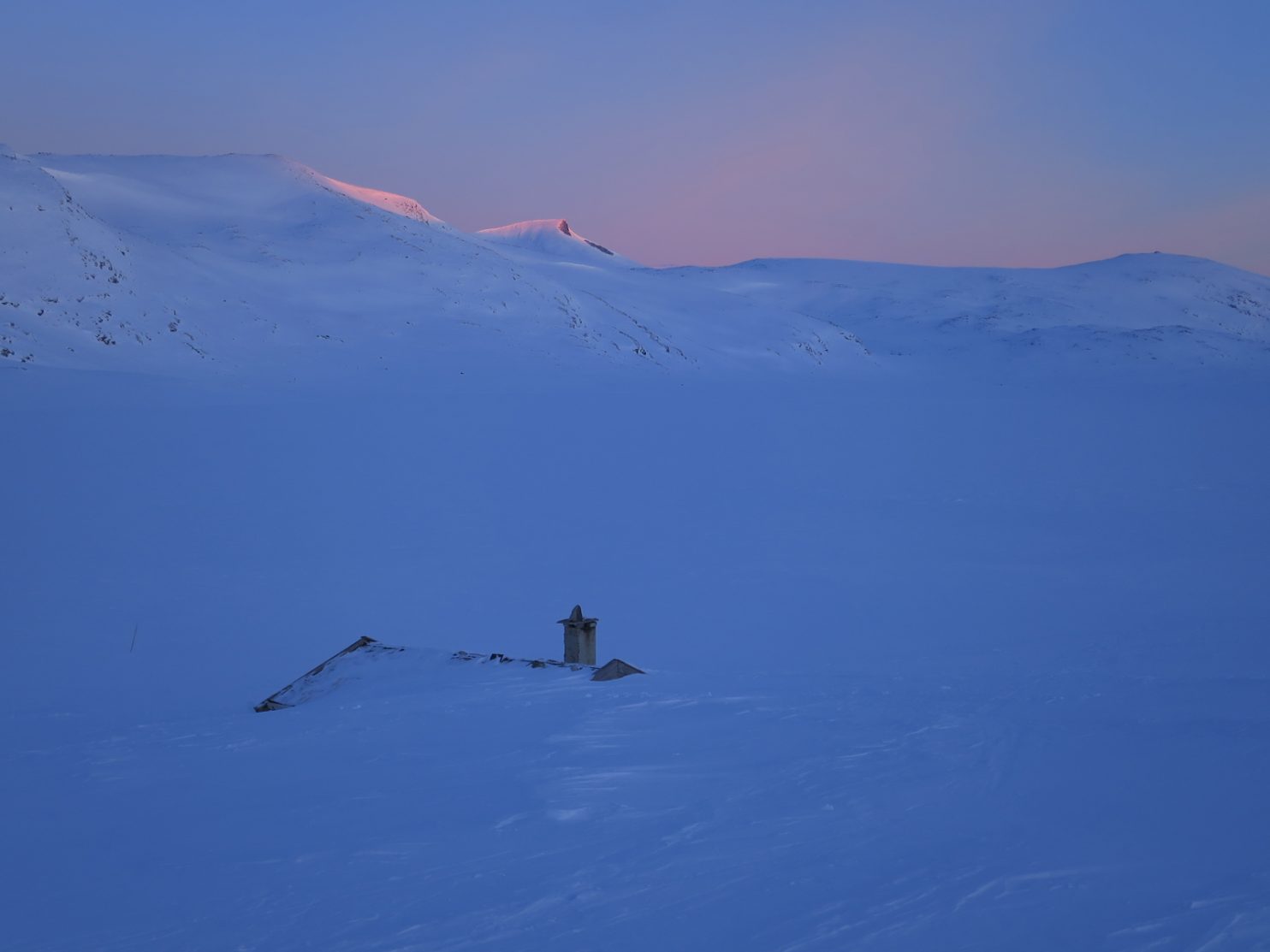
 

The rain continued all night, at times belting off the tent loudly, but by the morning it had returned to a drizzle. One of the hardest things to do on this trip, physically and especially mentally,  is to get up is bad weather. I had not done it yet, but today was perhaps the first of many in Washington. I put on cold damp socks and then packed everything into bags, trying but failing to avoid the wet tent fabric. I had to keep my feather sleeping bag and down jacket dry at all costs or they would get soggy. Once it was all in waterproof bags I got out and stuffed it all into my rucksack, put on all the waterproofs and poncho and headed off down the Swamp Lake path.


After a half mile it came to the wide shallow Bumping River which I had to wade. It was only ankle deep and my wet socks had barely warmed up eo getting wet feet was no great hardship. The path continued on the east side of the river for another half mile to reach the trailhead at the end of the dirt road. All I had to do now was follow it down for about 15 miles until it hit the highway 410.


I had only walked a few hundred yards when I saw a Cascade Red Fox cross the track. It was very furry and perhaps had its winter coat already. It vanished into the forest in a flash. After a few miles the rough track turned into a dirt road and then after a few more miles it reached Bumping Lake Campground. There were lots of fire fighters and wood cutters here clearing ladder fuel beside the road to try and make a barrier should the fire reach here. I understood it was not a closed area so greeted them and carried on.


I had gone a mile along the now paved road through big conifers and just crossed the Bumping River on a bridge when a pickup stopped and two military police got out and told me they had been instructed to escort me out of the area. I protested my innocence and explained, quite strongly, why I was here, my ambition to get to Canada without getting in a car and the fact I had not crossed any signs. After 5 minutes of stalemate when I explained I would not get in their truck they decided to phone their supervisor, called Columbo, who had initially instructed them to escort me off. Columbo said he was nearby and would soon arrive to talk to me.


When Columbo arrived he said the whole road was shut as 700 firemen, foresters and the National Guard were doing timber operations along it. There were roadblocks manned by military police but as I had come in the back entrance I had eluded them. He said I had to be escorted out in the back of the police vehicle for my own safety due to the ongoing timber operations.


I could see my carless to Canada going down the tubes and protested again, pleaded and suggested I take an open track to the south of the Bumping River where there were no timber operations. He as safety officer had quite a firm line, but had the compassion to refer it to his boss,  Dan, who was summoned and arrived within 10 minutes.


Dan was a forester in his 50’s who had seen it all in his time. He was also the type of man you could easily have a beer with. I explained my situation again explaining I was here in good faith after talking to the Forestry Service and that I had even kayaked over the Columbia River in my carless to Canada bid.


He said if I walk down the road I should be fine. He stood the police down, having given me clearance. Columbo returned to his duties of overseeing the felling of dangerous trees before the foresters went in to tidy up the brush beneath. Dan and myself chatted for half an hour and then he said he would inform others I had been given clearance. I breathed a huge sigh of relief and shook hands heartily with Dan when he went.


As I continued down the road I passed more crews who gave me the thumbs up and shouted good luck, then medics beside an ambulance did the same and shouted hope you reach Canada. Then a white pickup stopped and a forester got out and introduced himself as Brad and shook my hand and asked me questions on the trip so far. Then another 5 pickups in all stopped and heaped snacks into my pockets. I don’t know what Dan said on the radio but suddenly I felt like a mini-celebrity with everyone stopping to talk to the Scottish PCT hiker. The police came back and stopped, got out shock my hand and said “so glad you got clearance”. Columbo the same when he passed by.


I sauntered past Goose Prairie, a charming hamlet of log cabins and scout camps, which had been evacuated except 4 who refused to leave. In the next 7 miles to highway 410 at least another 5 pickups stopped to chat and heap more snacks into my bulging pockets. Tough working men in pickups appreciating a stubborn dogmatic Scottish hiking purist.


Near highway 410 Columbo reappeared. His men were just ahead felling problematic trees. He would drive beside me for a mile as they did their work. I walked in the middle of the road and chatted with him the whole way, and was fascinated by the complexity of this fire fighting operation. We paused occasionally while his men felled the marked trees before moving on. I got even more snacks from Columbo as he went.


When I got to the highway 410 there was a military roadblock, but the portion I wanted to walk now was open. It was 5 pm and there was a stream of fire fighters and foresters leaving the Bumping River Road and also the closed section of the 410 highway. As I walked away nearly 200 firefighting/ forestry vehicles went past with many double beeping their horns as they went past, including the ambulance. What a friendly sociable group they were.


I walked another 3  miles to cross the Little Naches River on a bridge and reached the Little Naches Campground. The rain of the morning had turned into sporadic showers and it was dry at the moment. I decided to camp here as I had already done about 20 miles. I could also use the damp picnic table to write the blog and plan my route tomorrow over the Manastash Ridge. My vote for fire fighting hero of the day must go to Dan who conjured me from felon to mini-celebrity.


I was away by 0700 and started up the road to Kaner Flats Campground 3 miles up the Little Naches River where there was another roadblock manned by military police. I would essentially have to leave the road here and head NE away from the fire closure area.


A few pickups went by, and a few tooted and waved, and then Dan pulled up. We chatted a bit about my route and then he gave me an invaluable copy of map of the Manastash Ridge. Looking at the map we could instantly see I would be better for me to continue 5 miles past the next military roadblock, to Four Way Meadow and take a path from there up Mount Clifty. He said it should be OK given the weather and today’s  forecast,  which had completely subdued the fire. He went off to clear it with the military police at the roadblock.

05. The second road block manned by the military police stopping the public going up Little Naches Road.

When I arrived at the roadblock the two police knew exactly who I was and started asking me questions about my Norway trip. Obviously Dan had briefed them. They were both very chatty and I was there for about half an hour. During this time a few deer and elk hunters wanted to drive through but they were all refused, which pleased me and no doubt the deer and elk. Then after a round of selfie photos and handshakes I was on my way up the closed road.


It was a pleasant and quiet walk beside the river. There was a beaver dam on it but no lodge. There was a bit of fire and wood clearing traffic but it was generally quiet. 3 or 4 pickups stopped for a chat and to refill my pockets with snacks. Two of them were Jonathan and Alex from yesterday.


At Four Way Meadow I left the road and starting following path 947. I thought it was a hiking path, but it was for motocross bikes. There were no bikes about on a cold misty Tuesday in September and I had it all to myself. It was just like a hikers trail really and I could easily imagine I was on the PCT. The path climbed quite steeply at times as it headed up past Douglas Firs, pines and a relatively newcomer to the trail; Englemann Spruce, all rising from a autumnal carpet of reddening berry bushes.

06. Atmospheric scenery when the mist lifted for an while on my way up Mount Clifty while crossing the Manastash Ridge

After a couple of hours it started to drizzle. I feared it was the cold front the foresters and firefighters had been talking about. It was not heavy but as I  climbed further it got misty and colder. Then i came across a log covered in snow and pretty soon there was snow lying on everything. There were plenty of grouse about in these woods and I saw a few deer.


The path twisted up the mountain until the snow was settling on the tree branches almost an inch thick. There were a few trail junctions but with Dan’s map I knew which path to take. As the path reached the top of Mount Clifty the snow was dry and powdery, but the mist was thick and there was no view.


I took the trail down the north ridge of Mount Clifty. The snow stopped for a while and the mist cleared and I got a great view over the gentler mountains of the Manastash Ridge. There were grouse everywhere up here and I was flushing out a group every 10 minutes.

07. The arrival of the cold front with a gale and frequent snow showers at about 6000 foot on Mount Clifty

As I started the descent the snow returned, and with a wind. This must be the start of the cold front. Soon it was a heavy snow shower and the wind was near gale. It was as good as a blizzard and it lasted for an hour. In the trees there was some shelter but on the treeless ridge it was dramatic. Only when I dropped from 6000 to 5000 feet did it soften. I was on the lee side of the Cascades so further to the west it must have been very wet.

08. It did not take long for the snow to start to accumulate on the branches of the hemlocks and firs on the North Ridge of Mount Clifty

The North Ridge of Mount Clifty was a sharp ridge and quite rocky. Between the snow showers there were some dramatic views. It undulated badly and the motocross bike trail I was following went up and down all the undulations.  I just had to walk them.


After 5 hours of descent the trail finally reached a road. There were some camping areas near and I had just filled my water bottles at the only water since leaving Little Naches Valley. Luckily the wet cold weather did not linger and the snow turned to rain and then the rain stopped. I put up the tent and was inside just as another rain shower arrived, but I was protected now.


It had been a great day. The scenery was dramatic and ever changing especially in the wind snowy conditions on the exposed ridge. But I enjoyed that weather, as it was out of the ordinary for the PCT. The campsite was great and I had almost completed the Manastash Ridge crossing. There was just a short section left but that was an old footpath, and I was worried it might disappear and this was steep terrain and would be difficult to bushwhack.


The rain pretty much petered out in the night but everything was damp the next morning. I started on what I thought was the trail down but after 100 yards realised it was a animal or hunters trail and it would take me into a nightmare of a rocky overgrown gorge, so backtracked. In another half mile I found another trail down. It was even signposted “1341 Big Creek Trail Junction”. I followed it down steep zig-zags into Big Creek Gorge. It was a built trail but had not been maintained for 5 years or so, and there were a few windfalls across the path, but without this trail the terrain would have been near impossible to negotiate. Once I reached Big Creek the trail almost vanished, swallowed up by the tireless temperate jungle. I just managed to follow faint signs and judgement as to where the path might go. Frequently I had to wade across Big Creek to avoid areas where the creek had eroded a earth bank. I knew it was only for a mile but was worried I might get ensnared or the creek might go over a waterfall and I could not climb down. It was an inhospitable, dank, gorge full of thick wet dripping vegetation.

10. In the depths of Big Creek Gorge with an intact section of the path. Frequently it dissappeared and I had to cross the creek pr walk down the middle of it.

Eventually the gorge sides opened out and the path became more pronounced before it spilled out of the dripping jungle onto a track under power lines. I followed this track for 2 miles north while being prevented from getting to an old railroad trail by a deep and sinister canal. After the 2 miles I reached a bridge and crossed it to reach the civilized homesteads around the small town of   Easton. These homesteads were probably all retiree owned and were mostly hobby ranches. Many had horses but there were also a few with llamas.


Reaching Easton was like reaching the promised land. The old railway line from Chicago to Seattle went this way. It was now abandoned but the route had been turned into a hiking/cycling trail in the summer and ski-touring/dog-sledding route in the winter. All I had to do was follow its benign gradient up to Snoqualmie 20 miles away. The trail was called the John Wayne Pioneer Trail after the actor. It was an easy route slicing a path through the mixed forest with the dark green conifers slightly overhanging the trail, and glades of acer shrubs turning into their bright autumn red colours.

11. A view down the John Wayne Pioneer Trail which was.on the bed of the old Chicago to Seattle railway. I followed this trail for and easy 20 miles between Easton and Snoqualmie Pass.

I made good time and only stopped once to eat some snacks. The drizzle came and went but when it was falling it was so light I did not need to put a jacket on. As the afternoon unfolded and I walked along the west shoreline of Keechelus Lake I realised I could easily reach Snoqualmie Pass an hour after nightfall, where there was a hotel used by PCT hikers and where I had my next resupply box. At dusk the the drizzle returned with a vengeance and I had to don my poncho, but it mattered not as I would surely be in bath in under 2 hours. The hotel was a typical Best Western type and I got a  room with twin queen beds and bathroom. I did not bother with dinner but just bathed and went to bed.
This 100-mile Section 17 was almost entirely off the PCT trail. The route I took when I started it was perhaps the shortest possible reroute and one I thought was perfectly legal and open. However it was not, and it was by sheer good fortune that someone like Dan was working as a senior forester in the fire Norse Peak/American Ridge fire closure area that I managed to get through. The Manastash Ridge was perhaps the highlight, and the wild weather of the cold front with heavy snow showers made it all the more interesting. It was again a revelation that going off piste and making up your own reroute was more exciting than following the tyranny of the trail. The PCT Association suggested that there were no reroute options other than to hitchhike the entire 100 miles. Initially I thought this was lily-livered, but there was no way it could suggest anything like my route, or even the Manastash Ridge crossing, or it would be considered irresponsible.

Back

Section 17. Hood River to White Pass. September 11-16. I had a very pleasant zero day in Hood River at the Gorge View Bed and Breakfast, with the cool and helpful hosts of Pat and Ann, and a few of the guests who were here to enjoy the wind, either on a kitesurf board or windsurf board. Gorge View was no ordinary Bed and Breakfast but a home from home for the windsurfing fraternity. During the afternoon a trail angle from Cascade Locks delivered all my parcels which was a huge relief and then a friend of a friend, Oriol, lived across the Columbia River in White Salmon arrived

The last time I saw Oriol was in 1992 at Mount Cook village in New Zealand, and he had his leg in plaster after a climbing accident on Mount Tasman. We took a walking tour of Hood River and checked out the kayak I was to use tomorrow at the Gorge Paddling Center run by a whitewater paddler called Todd. We then went for a simple meal where Oriol remarked I ate like a winter mountaineer. It was good to have some non-PCT social life with Oriol’s intellectual chat and the sophisticated vibe at the Gorge View B&B.

In the morning I packed a box with everything to return to Scotland and took it to the Post Office and then bought some outdoor nick nacks. I was now ready to continue north. I walked down to the Gorge Paddling Center with a paddle and found a suitable sit on top to use from where Todd had previously shown me. The rucksack slotted into a space at the back and I launched in my full hiking gear. Initially I paddled across the Marina and then out into the Columbia River just downstream of a huge sand bar and below the ‘no-pedestrians’ bridge. Once in the river I felt the water. It was very pleasant and there was virtually no current. It would have been easy to swim across from the end of the sandbar and only ½ a mile at the most.

01. Looking down the Columbia River on my kayak crossing with Oregon on the left and Washington on the right. The Columbia River is about a mile wide.

The river was calm and relaxing with virtually no other boat traffic. There was a bit of a haze in the air but I could still see some 20 miles each way. There was little sign of the fire raging downstream and it was hopefully under control now. In no time I was approaching the other side with a small bow wave radiating behind me on the glassy water. I went to the railway bridge where the White Salmon River empties into the Columbia River. The White Salmon was significantly colder and must have come from the snowfields on Mount Adams, a bit to the north.

02. Arriving in Washington with Oregon in the background. The kayak was lent to me by Todd of The Gorge Paddling Center, who was in turn friends of Pat and Ann who had the superb Gorge View B&B in Hood River.

Here Pat and Ann met me and we carried the kayak up and put it on their pick-up so they could take it back to Todd on the other side. I was very fortunate to have come across their webpage for the B&B; not only were they extremely helpful, but they also knew who to contact and how to help. After I Said goodbye to them I sat and studied the map. I would after all be better off going up the road to Trout Lake rather than try and follow small forestry roads which wiggled through the valleys and over ridges. It meant a 21 mile road walk however, which I could split into 2 days.

I set off up the road beside the river. It was not as busy as I feared with a car a minute on average.nonetheless it felt humiliating. Three times cars pulled over to ask me if I wanted a lift which did much to raise my spirits on this trudge. I walked about 8 miles to the hamlet of Husum. There were a few orchards and homesteads to see en route but it was not the wilderness I had become used to. Husum was a hamlet which had become something of a whitewater mecca. There were two rafting companies here and loads of whitewater kayakers, all of which came to play on the river’s rapids. One of the rafting companies had a riverside picnic area and I sneaked  in there at dusk a found a picnic table for the night.

I left early in the morning hoping to beat the traffic. But it was already busy by 0600, presumably with cars going in to Portland for work. Still the road was not that bad and I could easily keep to the side and even leave the road verge if I saw a lorry coming. There was the odd section where there was a good verge to walk on but these roads  are not built with pedestrians in mind. By 8 I got to BZ Corner. There was a Chinese shop here which opened at 0600!. The shop sold everything from Oreo biscuits to anchor chain and coffee to taxidermied moose heads. I had coffee and some snacks and then carried on for the next 10 miles to Trout Lake.

This road continued much the same. There were a few sections I could parallel the road but most of the time I was on it. The traffic  was much quieter now the “rush hour” was over. There were the odd old barn, a garage with antique cars, and many retiree-owned small ranches. It was pleasant for a road walk but I would not choose to do it on its own. One redeeming feature was the ever increasing dominance of Mount Adams with its snowfields which filled every view. Just before Trout Lake a local joined me and we chatted for 2 miles as we walked in.

03. On a road walk there are sights and smells totally different to the subalpine environment of the PCT. However they are seldom fun and these cars sum up how I felt.

Trout Lake itself is really a village, but with a high school. It also had a post office, charming store and a cafe beside the garage. There was also a few bed and breakfasts and a Buddhist abbey  it was a lovely place and a favourite with hikers who hitched down from the PCT to resupply. The shop had a register and I recognised 20 names of people who had been in over the last 3-4 days. I had not seen a PCT hiker for about 10 days now so was keen to bump into one, but there were none about. I went to the cafe and had lunch there before the final push.

04. Some views on road walks are also good. Here is Mount Adams from a little north of Trout Lake.

It was up 14 miles of very quiet road. I planned to do half today and half  tomorrow. The road was paved but there was about 4 cars an hour. The ranches  and homesteads soon disappeared as the forest returned. The road climbed steadily for a few hours until it reached my goal at a stream.  However the stream was dry so I had to continue through the forest for another 3 miles to another. This took me well into dusk and it was almost dark when I arrived. I collected water and just spread my protective sheet on the ground and cowboy camped on it in the forest, beside the large side stream of ice cold clear water as it made its last few independent tumbles before flowing into the White Salmon River.

I had a slow start and then finished the walk up the road for another 5 miles to reach the PCT again. I had not been on it for 5 days now and it was good to return to it. There were no more route choices or cars to worry about. I just had to get in the track and follow it north. I stopped at the first water and had my breakfast granola.

05. The 2200 mile mark as I rejoined the PCT near Mount Adams.

After that I started up the path through the hemlocks to Mount Adams. Initially it was nice but then I entered a longer fire burn area. It meant more light on the forest floor and the huckleberry bushes were laden with fruit here. I paused and picked a few handfuls and they were delicious. There were also better views in the fire burn areas if one looked beyond the charred remains of forests. Mount Adams was very close but I could also see the massive glaciated cone of Mount Rainier some 50 miles to the north and Mount St Helens some 25 miles to the west.

Finally I met another PCT hiker. He was called Zoro from Israel. He had skipped most of Oregon  and then had a break from the trail and had now just rejoined by getting a lift up from the Columbia River. He was also planning on skipping the fire closure in 3 days time, so there seemed little point in getting to know him. He went on as i picked more huckleberries.

When the fire burn area finished the character of the mountain changed completely. It was stunning with meadows and small lava fields between some large Mountain Hemlocks. There were plenty of streams tumbling down from the snowfields and glaciers on Mount Adams. The going was slow because of the terrain but at last I felt I was back where I should be. At every corner there were great views and sights. I was back in the mountains again and could see I would be for a while.

The path went around the west side of Mount Adams into glades, through meadows and across ridges for about 3-4 hours until it got to Killen Creek. Here a clear creek tumbled down a cascade into a lovely meadow. There was also a spectacular view up the glacier on the north side of Mount Adams from the meadow. It was only 1830 with still another hour’s daylight but it just seemed too good an opportunity to pass. I put the tent up and felt the temperatures plummet. By the time I got into my sleeping bag it was below zero and still falling. I think cold air was descending from the glacier above, and the meadow after all was at 6000 feet.
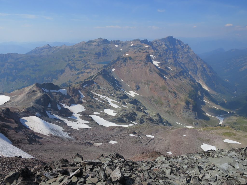
07. The northern slopes of Mount Adams in the evening sun rising above the meadow of Killen where I camped.

The cold air had gone by the morning and it was easy to get up at 06 in the lovely meadow I was camped in. It was a bit overcast as I set off which nulled the sunrise on Mount Adams and it looked quite plain compared to last night. The first 5 miles were easy and I cruised along through forest and meadow. The trees were packed enough that I could not see any of the other mountains.

I reached a spring where intended to have a break. Zoro was here and just getting up. As I as  breakfast a small Pika appeared from beneath the lava rocks and started eating a mushroom growing at the side of the spring. Pikas do not hibernate but collect grass in the autumn and store it in their rocky burrows as their winter fodder.

08. A Pika eating a mushroom beside a spring. Pikas do not hibernate but store fodder in their burrows to last the long winter months.

After breakfast Zoro disappeared into the distance and I plodded along the track. It was remarkable how much understorey was here and it was largely huckleberries. They were starting to turn autumnal crimson and the berries were beginning to shrivel. There were still some plump ones which I occasionally stopped to gather.

There was a lovely series of ponds or small lakes in the middle of the day. They were a bit muddy for swimming but they looked calm and tranquil. None of them had and wildfowl. The path was beautiful throughout this stretch, as it was to remain all day as it wove through the hemlocks and firs beside carpets of crimson huckleberry bushes.

Towards the end of the day I decided to push on up to Snow Lake. I could see glimpses of the Goat Rocks ahead and was eager to get within striking range. They formed a spectacular ridge and everybody was raving about them. The path up to Snow Lake was lovely going through extensive forests of a true fir; Noble Fir I think. What was remarkable were the meadows between the trees which were still lush and green, although the flowers were spent. These lush glades were everywhere.

I got to Snow Lake at dusk. There was already a group camped here but they were on a short trip and smelt of soap and deodorant. I put the tent up then collected water from the lake in near darkness and retired into my sleeping bag. It was cold but well above freezing. My spirits had certainly lifted after the last two days hiking. It was not only spectacular, but also very beautiful  with lush scenery and forests.

I was excited when I woke as nearly everyone had said this is where Washington proper starts and it will match the Sierra, which set a very high benchmark. I left the campsite around 7 as all the day trippers were getting up, and set off up through the hemlocks and firs. The meadows here were lush and there was still the occasional flower in the swathes of plants. The path climbed steadily past two rounded towers on a ridge and into a new valley system, the Klickitat Valley. To my east now were high craggy mountains with extensive snowfields called the Goat Rocks. I could see from the map there were glaciers just the other side of them on their north east faces.

09. Approaching the Cispis Pass with the Klickitat Valley on the right and the Goat Rocks Range beyond.

I skirted up the east side of grassy Klickitat Valley to a pass at its head called the Cispus Pass. Here I met two local  hikers who gave me great information about getting round the impending fire closure. From Cispus Pass i contoured round a great bowl which was forested below and covered in meadows and copses of conifers higher up before the scree led up to the high rocky peaks.  Waterfalls cascaded down the meadows into the forest below where there merged to form the Cispus River. It was a noble and huge vista and exactly what I had been hoping for.

10. The Cispis Valley with its lush meadows, copses of subalpine firs and hemlock, splashing cascades and craggy backdrop was a mountain paradise.

From the valley round the headwaters of the Cispus River I climbed again. Initially through meadows of spent lupins and many other flowers with small alpine firs and hemlocks dotted about in copses. Small streams were abundant, their cool waters keeping the meadows lush. Blue gentians were perhaps the only flower still blooming. As I neared the top of the meadows at the start of the scree I passed a family of marmots. They were unfazed by me and were gorging themselves on lupin leaves trying to lay down as much fat as possible for the start of their 7 month hibernation.  They seemed lighter in colour than the Sierra marmots.

13. A fat marmot, stuffed with lupin leaves from the meadow, is almost ready to face 7 months hibernating in its burrow. These seem a different sub-species to the Yellow Bellied Marmots of the Sierra.

The path continued to climb across some snowfields to rocky pass where the most amazing view burst upon me to the north. Just across the valley were more craggy mountains with huge rock faces and beyond that rose the conical Mount Rainier, with its sides covered in huge glaciers. In the haze I could just make out Mount Adams and Mount St  Helens behind me. This was the Land of Volcanoes.

The path split here with an alternative going up the north flank of Old Snowy Mountain. It was supposed to have superlative views and was a sharp ridge, almost an arete. I took it as it was short and was not disappointed as it gave me some of the most lofty walking since the Sierra. There were quite a few day hikers up here and I chatted with a few of them. I had already abandoned my goal of getting to White Pass, as today was not a day to rush.

14. Looking north from Old Snowy Mountain where the PCT reaches its highest in Washington.

On the descent the one thing i was desperate to see appeared. There were about 10 white mountain goats some 500  feet below me. To far to photograph well but a joy to watch as they effortlessly bounded from rock to grass patch and onwards. I stopped and had lunch while they slowly made their way across the cirque floor. It was one of the wildlife highlights of the trip so far. They were bigger and more noble than the domesticated varieties. They were protected here in this area but in other areas they were hunted, completely needlessly and probably by morons which the world could do without.

15. A herd of 8 wild Mountain Goats grazing in one of the high alpine meadows kept moist by the melting snowfields. These magnificent animals are protected here.

The path continued along a sharp ridge for another mile before starting a long descent past glaciers and snowfields. Eventually I dropped down to McCall Basin, there was a meadow here and I had a pause in it. I lay on the grass surrounded by purple flowers and admired the views and then had a small siesta. This was the most perfect days walking really since the High Sierra and among the top 5 days of the whole trip.

I dragged myself up and made a long easy descent down past more meadows and eventually into the hemlock and fir forests, the trees soon swallowing up my view of Mount Rainier. Once in the forest I walked a couple of miles to a small campsite near a rivulet of water. It was just 1900 and I had only done 15 miles but decided to call it a day as it just left me 10 to White  Pass tomorrow where I would spend the night anyway. As I put the tent up I noticed how cheerful and buoyant I was and this must be attributed to a sensational days walking.

11. A meadow of spent flowers with the Goat Rocks Range in the background.

I got up at 0600. It was dark now at 6 with the autumn equinox approaching. By 7 I was on the trail and made the climb up to Shoe Lake where I had breakfast. There was a cold wind but out of it, sheltering among the sub alpine firs, the early sun warmed. There were great views back to the Goat Rocks Range from here and a fantastic view north west to Mount Rainier, however the latter was slightly obscured by smoke from the Norse fire.

16. Looking back south to the Goat Rocks Range and seeing the glaciated north east faces. Old Snowy Mountain is the last big mountain on the left.

From this small pass on the ridge above Shoe Lake it was a near continuous 6 mile descent. First across barren north facing scree slopes which took me into the subalpine firs again. Then down into the mountain hemlocks which grew in size as I descended. Finally I was passing the odd Douglas Fir even as I approached the highway 12. There were a lot of day trippers all of whom wanted to talk to me once they knew I was on the PCT. It cost me 5 minutes each group and in the end I charged past the rest with my stomach rumbling, eager for the treats at the shop at the highway, where I had a resupply box, and then wanted to spend the night at the motel.

17. Looking north down the last ridge of the Goat Rocks Range on the long 20 mile descent down to White Pass. In the distance one can see the vast cone of Mount Rainier rising above all.

The shop was adequate but the attached deli looked foul, even to me. I got my box and then checked into the nearby motel which matched the deli for quality. The real reason for me stopping here was to package up and send the blog, to figure out what the hell to do next regarding the Norse fire, and have the weekly clean up.

The Norse Fire was between White Pass and Snoqualmie Pass and a 30 mile section of the PCT was closed in this 90 mile stretch. There was a lot of misinformation about it and the PCT Association were quite adamant that there was no way round other than by car for the entire 90 miles. Most people opted for this, but there were also many hikers with “continual footsteps” and they did not want the lily-livered advice of the PCT Association and were making up their own reroutes. A lot of my purist friends had gone west and picked up the Wonderland Trail on Mount Rainier but then had to go 60 miles north to avoid 2 drinking water catchment areas before heading back east on a trail to pick up the PCT again. This detour was about 150 miles with perhaps 40 miles on a highway.

However a change in the fire closure meant I could go east to Bumping Lake and Goose Prairie and then try and find a trail over the Manastash Ridge descending to Easton where I could pick up the John Wayne Trail to Snoqualmie Pass. It would be shorter, at perhaps 110 miles,  hopefully not as miserable in the wet weather forecast than the west alternative, and it would mostly be on trails. I spoke a ranger in the Forest Service and he confirmed my route was OK and outwith the ever changing  fire closure legislation. I think the rain next week will kill the fires anyway. My one concern was finding a route over the Manastash Ridge from the Naches River to the Interstate 90, only 10 miles as the crow flies.

Back