13 July. Rest Day in Simikot. 0 km. 0 hours. 0m up. 0m down. I spent the whole day in the hotel doing digital duties on my fiddly little smart phone. I was frustrated by the wifi which was very erratic due to the wet weather and mist. The large communication dish which connected Simikot to the rest of the world did not function well in this damp atmosphere. Sending 90 photos in 10 emails proved very time consuming and frustrating and took about 12 hours. 


The others relaxed and washed clothes except Ramesh who went into town to rent a kerosene stove and buy provisions for the next 4-5 days. It took him all afternoon, but by evening he was packed and we were ready to go. We had separated all the stuff we did not need as we would be returning to Simikot after a 10-day anticlockwise circuit via Limi Valley to Hilsa and then back to Simikot. Hilsa was the end of the GHT but there was no way out other than a US$1500 helicopter or a 3-4 day walk back to Simikot via Muchu


14 July. Simikot to Lek Dinga. 17 km. 6,5 hours. 1280m up. 770m down. It was overcast with many mist patches when we left at 0800, and you felt rain was never far away. We walked up the road towards the west as it climbed up to a small pass. A Nepali with a rucksack caught us up. I recognized him. He was the cook from the World Expeditions group and they were a day early. I asked about their client, Brian, who had also walked the whole way from Taplejung in the east. He was just a few minutes ahead, so I sped up to catch him. 


He had gone from Phoksundo Lake, where I last saw him to Jumla over Kagmara La Pass, then north to Lake Rara and then up the usual way to Simikot. He had been ill on route and blamed it on an apricot; the same as Santos. As we chatted we entered the mist and a few minutes later our paths split. He headed down to Darapor in the Karnali Valley while I continued along the road which would take us to Yakba. It was a shame I did not get a chance to chat for longer.

 
We walked along the track and I recognized many of the simple hamlets we passed when I walked along the path here 11 years ago. The track was built over the previous path. The track was generally firm but when it went through a hamlet it became muddy again. After a good hour the track started a series of zig-zags down to the valley via the Hepka Khola side valley. There was a path which shortcut all the zig-zags down a bridge over this large side stream. Here we left the road, which apparently continued to Hilsa and headed up to Yakba. As we started down the shortcuts I met a French anthropologist, Tara, returning from Limi. She had been studying pastoralism there. I could have chatted in depth with here about the topic as I researched pastoralism with Kurdish transhumants for my anthropology degree. Unfortunately she was just leaving Limi after 3 months there. 


In Yakba I asked for the local shop, a posal. However everyone I asked said there was none. I was starving and I am sure the others were. I waited for Bharat who can always sort something out. He asked and got an affirmative reply. There was a posal but it was in someones house and it was very low key. We went along the muddy lane in the busy congested village iuntil we found the house then Bharat returned to find the others while I was ushered up to the rooftop. There were about 10 beehives up here and I noticed a few on the other roofs. However there was nowhere to sit and rain looked imminent so I went back down the log ladder to the first floor and went into the kitchen.

463. The village of Yakba (Hepka) had about 100 houses. the livestock stayed downstairs and the living quarters were above

The others arrived soon afterwards and we all piled in. It was a Lama household but apparently the population of Yakba was very mixed, with a few castes. The kitchen was quite large, but dark with a stove in the middle. Santos cooked us noodles and spinach while the others chatted to the hosts. After the noodles we made milk and sugar tea, while the hosts made Tibetan tea in the large wooden tulum, a wooden tube and agitator. However when it was served they had our tea and we had their salty tea with butter. “Cultural Exchange” joked Bharat. We paid for the noodles and spinach and then headed off as the rain stopped.

 
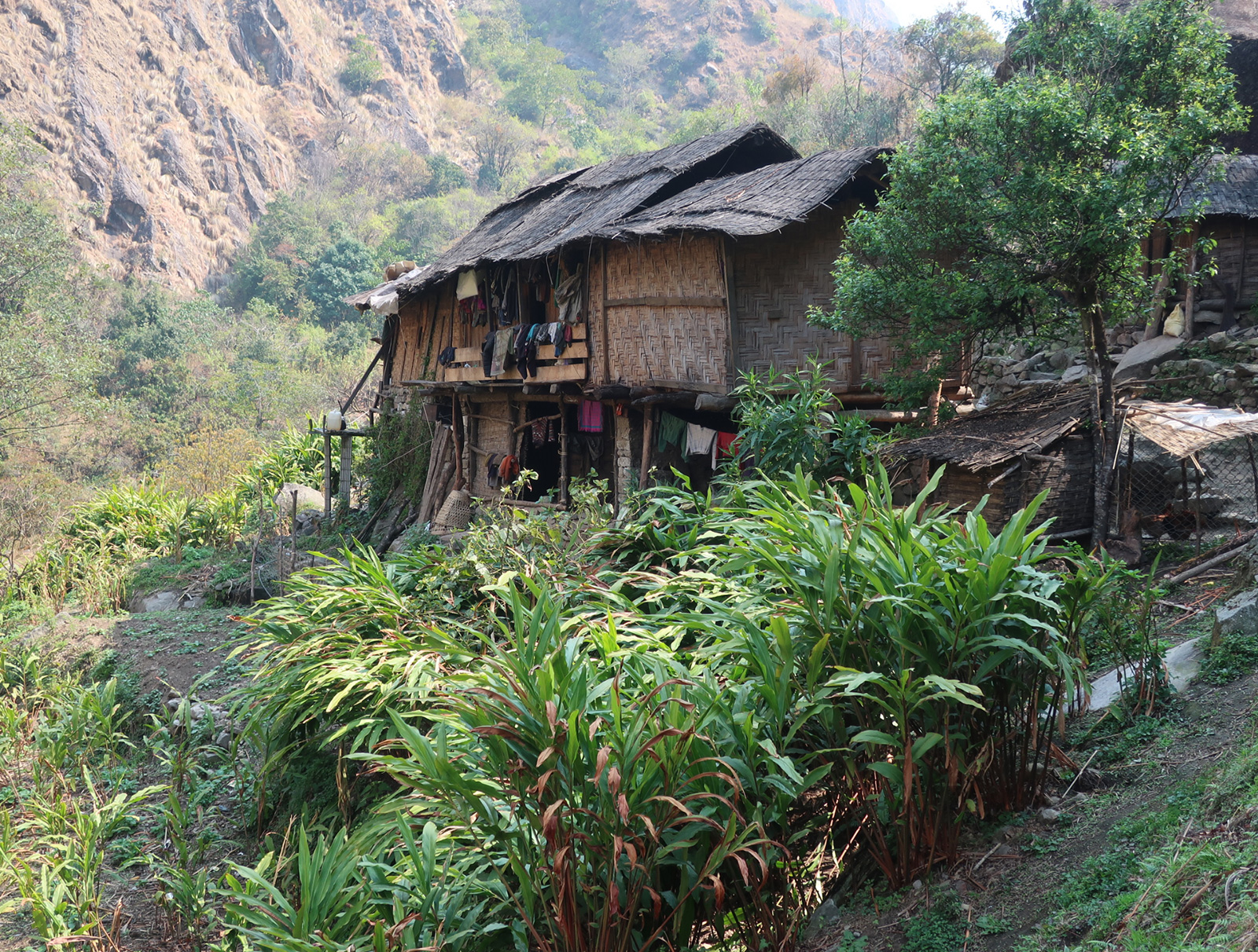
We now had a steep 600 metre climb up the west flank of the valley. Initially it was scrub but soon we were passing some huge spruce. These trees were the dominant conifer of the day. The rain started again as we climbed. I noticed a couple of woodpeckers working a nearby spruce as I went past and managed to get a poor photo. The mist came and went as we slowly climbed through the atmospheric forest. Soon we got to a bowl which was full of terraces with crops growing. It was about 90 minutes walk up from Yakba. There were a lot of smaller stone houses in a cluster here and from the map I could see it was called Lek Hepka. There were about 20 houses here all stone built and all smaller versions of the ones down in Yakba. A few had blue tin roofs. All had a ground floor with a small door for the animals to go in. It was just big enough for the small cattle here. In the yard were piles of Bhutan pine needles for the animals bedding.  Upstairs would be the living quarters and above that more storage rooms on the flat roof. Each floor was connected by an external log ladder. I assumed this village was where the people of Yakba come at a certain time of year to graze their animals and cultivate the fields.

 
The mist came and went as I continued to climb. I knew there were grassy areas above but I was not too sure of the route. Not wanting a repeat of the long walk into the dusk on empty stomachs I was worried I might have missed the grassy area. However then another hamlet appeared it was Lek Dinga. Beyond it I could see flat grass. Lek Dinga was also a seasonal hamlet and was currently empty. The houses here all had stone with flat roofs. There was no tin roofs. Like Lek Hepka the ground floor was for animals and the first for living. The passages and spaces between the houses were covered in dock leaves, which seem to thrive where animals might gather. A lot of the lower doors to the animal quarters were open but the living quarters were locked. I thought about camping here so Ramesh could use the animal quarters as a kitchen but thought better of it.

464. The hamlet of Lek Dinga is a seasonal community. People move up here from lower villages to cultivate the fields and to let their animals graze the lush pastures in the winter and spring

Instead I carried on to the top of the hamlet and found a large meadow full of wild flowers with great campsites. There was water nearby in the form of a hose which went to a standpipe in the hamlet. We put the tent up and explored the area. There was a small lake nearby but the water here was too dirty to drink. When i got back Ramesh was ensconced in his kitchen beside a large stone. We fixed up a tarpaulin in case it rained; and that looked likely. The last forecast I saw predicted 50mm tomorrow for Simikot. As I wrote the blog in the tent I gazed out frequently to look as the mass of wild flowers outside in the verdant green meadow.


15 July. Lek Dinga to Dakyob Khola. 25km. 8 hours. 1410m up. 1060m down. It was very misty when we woke. All the wild flowers were covered in dew which was dripping off them. Dawa made breakfast for a change, but it was quite cumbersome and mine was not Santos’s usual standard. We set off up the path we saw yesterday evening and gained the track which looked newly made. The track slowly rose up to a gentle pass called Chhubang Lagna at around 4100m. There was little to see except the immediate vicinity, but it was a high grassy plateau. Occasionally I could hear the whistle of a Golden Plover type upland bird. Once we started the descent to Thangur Khola stream the visibility improved a bit and one could make out closer ridges covered in the tall slender firs. Occasionally we got a glimpse right down the valley towards the forests on the north side of the Karnali. We followed the track most of the time with the short cuts being full of rubble from the track. At the stream there was the small watermill which I remembered, but it was now dilapidated and the roof had collapsed.


The climb from the stream to Sechi La Pass, 4530m, was about 1000 metres. Initially through large firs and then smaller juniper trees and finally juniper scrub. The track was carved into the hillside up this once remote side valley and it made a scar. Hopefully with time the track will green over as I cannot see many vehicles using it. It was probably a project which had been allocated money in the local budget and the construction team and excavator were part of a company which the official who sanctioned the project owned. As I climbed I began to feel unwell. I was burping the whole time and was full of gas. Eventually half way up the pass Dawa’s breakfast came up and I felt a bit better for a while.


We each made our own way up the track shortcutting at will and randomly. Across the valley I could see three herders shelters and I remember spending the night in one of them with Bharat, Rasu, the young host who was a teeneager and his younger brother. Also inside, in a small pen, were three calves. It was a shame I was not on the other side, where there was a path also, otherwise we could have dropped in. The last few hundred metres to the pass were hard and I now had to dash into the dock leaves and squat as my stomach continued to rumble. I was watched by 150 curious goats who were marching up the hill devouring all before them, but still going faster than me. The track went to the top of the pass where the philistine of an excavator driver carved the road right through a previously pristine small pond and totally destroyed it.

 
The descent down to the Sechi Khola stream was short and steep. The scars the excavator had made here would take a decade to start to heal and the whole hillside, which was a sandy rubble was on the move down due to erosion now. At the bottom Sechi Khola flowed out of a magnificent and large pasture which was totally flat with the braided stream meandering across it. The pasture was about 3-4 km long. It was being grazed by about 20 horses who must have belonged to the 4-5 herder camps on grassy plateaus and knolls on the north side of the Sechi Khola valley where their animals had easy access to the higher pastures. We passed a few herders and all seemed to be from the village of Kermi. They all asked where I was going and then the next question was could I give them rupees, at which I walked off.

 
The track now went down the north side of the Sechi Khola and this was perhaps the only place where the track would last, and even here there was the odd landslide. The valley here above the treeline was full of Chauri cattle grazed by the herders. Higher up on the high misty pastures I could make out flocks of sheep and goats. There was a phalanx at the head of the flock and the rest followed in their wake. Soon the track entered the birch woods and then half an hour later the fir forests as the stream and the valley tumbled down to meet the larger valley with the Salli Khola stream. Here the track split with a fork used by a tractor to bring diesel to the excavator going down to Kermi, and an unused fork apparently heading for Limi. As we rested the tractor appeared and drove across the Salli Khola. Had the stream been 30 cm higher it would have been very exciting as it might have been washed away.

 
We were now to head up the Salli Khola for 5-6 km. It was a spectacular valley with huge rock faces on each side going up perhaps 1000 metres. Unfortunately the mist and drizzle which had been intermittent all day returned and these high faces were largely obscured. At one point I saw a waterfall, albeit, wispy and small, which must have plunged down some 500m in one drop. A dhzo driver, with two huge bulls lumbering along under their 70 kg loads, passed us. They are a male outcome of a cross between a cow and yak, while Chauri are the female outcome.


Now my energy was sapped and the tank was empty. For the next hour and a half I endured a personal hell as I slogged up the track towards the Dakyob Khola stream. The track was initially easy and then became very easy as it levelled out, but I was making hard work of it. The others were waiting for me at this large meadow with about 10 herding units. We were shown a place to camp near some stone and tarpaulin shelters. Then the owner of the tents said 350 rupees to camp, and if we wanted a further 550 to use a shelter for cooking. The shelter seemed OK but to camp in this open pasture for a fee seemed extortionate and I told the tent owner it was “lobi” (greedy). However I was too tired to move on and with the rain on and off it would be nice for Ramesh to have somewhere comfortable to cook in. We put the tent up and I went in and fell asleep quickly. It was the nice dreamy slumber of an afternoon nap. When I eventually woke to start writing it was getting dark. I went out to locate my emergency toilet in the meadow should I need it. I did manage a small dal bhat which Ramesh served together with a mug of hot Chauri milk. It was truly delicious and what my body craved. I think I was just run down and tired and it was nothing to do with Dawa’s breakfast. I think the stress and effort of trying to send the 95 pictures on the frustrating wifi in Simikot was a major contributing factor. 

465. In the summer months the monsoon rains turns the arid pastures green and lush and people move up with their sheep and goats, and Chauri cattle. This pasture is a Salli Khola just south of the Nyalu La Pass.

16 July. Dakyob Khola to Dzang. 28km. 9,5 hours. 1290m up. 1380 m down. While I slept the others were in the tent owners other tent drinking. I had previously agreed to let Dawa come on this Limi leg as a favour on condition he and Bharat did not encourage each other to drink. They came to bed about midnight and then Bharat snored enough to keep me awake; as I had slept much of the afternoon. In the morning as the alarms went at 0530 I woke Bharat up. This time I did not read the riot act but gave him both barrels for about 5 minutes in front of the others. I then had a word with Dawa saying I was disappointed in him. Then I caught Santos and Ramesh in the kitchen tent and said I had no issues with them at all. I also told all 4 of them I was going to Dzang on my own and that they were to go to Tholing, a good 90 minutes from Dzang, camp the night there and then meet me in Dzang the next day at midday when we would all go to Halji. I felt a special connection to Dzang and did not was my space cluttered by them. Everyone was very sheepish when I left at 0645 with the words “see you tomorrow”.


The track was very misty, so misty I could not even see the zig-zag above to short cut. The track was a nice gradient and within 30 minutes I had already climbed 200 metres. Now and again the mist allowed me a view down to the kharkas where we camped and I could see the tent still there. They were probably still having breakfast, a bit shell-shocked about my outburst.  After an hour I got to a beautiful lake about half a km long. The other side was just visible, but the far end was obscured by mist. As I reached the pastures at the far end the mist cleared to reveal some 5 herders tents. Men were herding their Chauri cattle down and the women were milking them. The Chauri seemed to enjoy being milked and many were making their own way down.

 
From here the track zig-zagged up the hill for almost 2 hours until at last I saw the prayer flags. I pretty much just followed the track as it was gentle and easy. On the west side however the track was covered by snow. It looked like it would take a month to melt. Indeed at the top the drizzle was actually snow. The old path was still there and it went into a stony bowl, and then down a loose rocky spur until it hit the track much further down. There was now the easiest descent possible for the next 8 km as the track slowly traversed down the even hillside for 4 km until it met the valley floor, which it followed for 4 km. It was raining but the wind was at my back from the south so I hardly noticed it. I could stroll along hands in pockets, looking at the vast pasture below me. There were perhaps 25 herders shelters over the entire 8 km. Last time I came here there were perhaps just 6. Most of the herders did not look Tibetan but were probably from the Karnali valley to the south or from Yakba. The last part of the descent down the valley was a sandy floodplain, full of flowers and grazing calves. The river cut a lazy meandering path through it.

466. The large pastures in the Talun Khola Valley are a Shangri-La. Many herders from other parts of Humla district come here for the summer with their omnivores to graze.

I had a choice now either go the longer way and ford the Ning Khola or a shorter way and ford the merged Talun and Ning Kholas and then the Traktse Khola at their confluence where the valley was wide and shallow. I chose the shorter way and followed the track across the river. It was not deep but surprisingly strong and my walking poles were quivering in the current. On the other side of Talun Khola the track continued past another two clusters of herders camps and then down the west side of the lake. As it went north it climbed and I got a great view of the lake and some geese which were dabbling on it. One seemed to be nesting on and island. The path continued to climb and I could look down to the Ning Khola coming out of a valley to the east across the lake. As it entered the lake it made a huge alluvial fan which was eating up the lake. Just to the north was the remarkable white sand dunes on which some black bushes were growing making a striking contrast. Below all that was the pasture of Traktse. However on the track I would be missing all of that, as I went round the west side and then dropped down to the stream again. which I had previously crossed, but now it was also joined by the Ning Khola which came into the lake.

468. A prime example of a rare poppy, namely Meconopsis simikotensis, growing south of the large Traktse meadow and the abandoned government school

As I headed for the crossing point I noticed some buildings on the other side. This was the badly planned government school which had been built at a ridiculous place at the confluence of two rivers without a bridge over either, and in the middle of nowhere. It would also be impossible to get teachers to stay at this bleak place a good 2 hours walk from anywhere. The locals shunned it because of the proximity to the river and the dangers that might pose to the children, so the whole thing was built and then put into mothballs at once. It was an ill-conceived idea and the current force leading the NGO section of teaching in Limi, Michael Duabe, was furious about the waste of resources. Michael Daube, in effect took over from Deanna Campbell for whom I raised money in 2009.

467. The government built secondary boarding school in Limi was sited in a ridiculous place at the confluence of two large rivers. It was never opened as locals thought the site was remote and dangerous.

As I reached the confluence of the rivers I planned my route. The first crossing was the merged Talun and Ning Kholas, the second was the Traktse coming down from the north. The track forded both here, but that was just in the drier season. Right now the rivers were big. I took off my shirt and was just in my shoes and shorts. Steam emerged from the river bank beside me as hot springs well out of the ground, but that did little to warm the first crossing. I was up to my waist in cold water as it lazily flowed across a sandy bottom. The crossing was easy and I was now beside the mothballed government school. The second crossing was faster and rockier but the Traktse Khola was braided and I wove a route between islands with the water never above my thighs. On the north side I picked up the track again which headed for Dzang.

469. The meadow at Gumbayok just downstream from Tholing. While I was here many of the yak had foot and mouth and those infected were isolated in a building in Tholing

The weather was more settled here in Limi now as I had crossed the pass and all the Himal ranges to the south. Limi was essentially a part of Tibet, both culturally and geographically, which by historical quirk was part of Nepal and therefore never got annexed by China in the 1950’s. It was a beautiful valley for the two hours down to Dzang. The river was mostly lazy, but being swollen gave it some urgency. On each side of the river, especially the north side were great pastures. I passed the tiny hamlet of Thorling, but kept going until eventually I rounded a corner and there was Dzang. I spent a few days at Dzang 11 years ago and loved the place. It was at the same time H.H. Chetsang Rinpoche visited and the valley was in fervour with his visit. With him came Khenpo Tashi, his right hand man, and Deanna Campbell. The pair of them had formed a society to raise money for schools here, called Antakharana. Based on what I saw, essentially all in Dzang, it seemed a very worthwhile project and I did an 8 month trip in Norway (www.skipaddlenorway.com) and raised US$13,000 for their project. It paid for teachers salaries for 2 years. When Antahkarana faded in 2011-12, Michael Daube of CITTA, took over and is still going strong today. So Dzang has a special place in my heart.

474. The village of Dzang. The monastery is the white building above the village

I walked down the main lane of Dzang passed the house I previously stayed at and to wider bit where there was a cluster of buildings. Someone beckoned me over and he spoke good English. Fortuitously, he was the teacher so I showed him the pictures and told him I had raised money for Antakharana. He was lively, bright but smelt of raksi. He said he would arrange a homestay and we went back to the same house where I stayed before. He explained all to the host and his daughter-in-law. The teacher was very close to this family and came and went regularly and had even painted murals on their kitchen. The host was a dear old man in the robes of a Buddhist Lama, and indeed he was the Lama for Dzang. He was 76 but looked a good 10 years younger. He could not speak English, but his smile said it all. His daughter-in-law spoke good English having been educated at a boarding school at the Dalai Lama’s school in north India but her tone was quick, sharp and very to the point.


I chatted with the teacher Dhendup, while the Lama and his daughter-in-law made up a bed for me in the large prayer room, which looked like the prayer room of a monastery. It was a simple carpet on the floor with some blankets. I managed to lock myself into the prayer room by fiddling with a large wooden lock with some pegs in it and had to be rescued by someone who knew how to operate the lock. The prayer room was large, perhaps 5 by 5 metres. It had a long alter with tablet books and pictures of Rinpoches including H.H. Chetsang Rinpoche. There was the Lama’s drum and seat for puja. There was a bed for him and masses of rich decoration. The struts and beams in the room all had come from Salli khola by yak generations ago. Around the 3 walls of the prayer room which were not the altar were large chests.

 
The house was open and roomy with large rooms. Downstairs it was dark with cellars for the animals in winter time, but upstairs it was light with at least 4 big rooms. They mostly had flagstone floors which must have been very heavy and were resting on the struts below. In the midst of the rooms upstairs was a courtyard open to the elements above. It got wet but there was a drain. In the courtyard was a log ladder to the flat mud roof. Here there were two very large three sided shelters which were used to store grass for the yaks and other animals in wintertime. They were empty at the moment and still waiting to be filled.

 
The daughter-in-law made a dalbhat for me for supper using peas instead of dal. It was a novelty but not so tasty. After that I went into the prayer room to write and sleep. The lama came in an hour later. Before he went to bed he had a long ceremony. There was a lot of chanting from a tablet book in a repetitive almost meditative manner. It was broken by the ringing of a couple of bells he was holding and some banging on the table. He then made some full bows to the altar and went into his box bed. I tried not to look but it was interesting. I had a great day in all with a long brisk walk and then a warm welcome in Dzang and a cultural feast in the evening at the Lama’s house. It was nice being free of the others for a while who after last night were like worrisome children. It was all I wanted from a day.

472. The prayer room in the Lama’s house in Dzang. I slept in here on the left hand side while the Lama slept in the right hand bed.

July 17. Dzang to Halji. 9km. 2,5 hours. 120m down. 330m up. In the morning the Lama again had a small puja after getting up with plenty of full bows. It must have kept him supple. Then, just before my breakfast of tsampa and buttery salt tea Bharat and the others turned up. I told them to meet me here at midday not 0730! I could not be bothered with them at the moment so sent them on their way to Halji, the next village where I would go later, some 3 hours away, and went back up for breakfast. After a chat with the teacher I went along with him to the school. There were 8-9 pupils altogether in a new schoolhouse. The government one that was here in 2008 had been destroyed by heavy snowfall. This new one had been built my Michael Daube’s CITTA. It too had been hit by a small snow slide which had broken all the windows and scattered books in the snow. Dhendup, the teacher, said he was picking books out of the snow for weeks as it melted. The schoolhouse had desks and chairs and was a vast improvement from the previous time in 2008, when the pupils were sitting on sacks on the damp floor!


470. Dhondup was the teacher at Dzang school. He was employed by CITTA and Michael Daube. He was originally from Til in Limi Valley but moved to Dzang to teach. He was adored by the people of Dzang.

I had a brief look at the school and met the shy pupils and then went off to look at the monastery. It was a large rambling building in need of some maintenance. It was centuries old but looked tired. Last time I was here at the visit on H.H. Chetsang Rinpoche it was vibrant and newly painted. It was the last time he visited and it looked like nothing had been done since then. The door to the courtyard was not locked but closed so I went in. It looked like it had been abandoned with sheep wool blankets lying around in piles and windows tied shut because the latches had broken. I wandered around the courtyard and then went upstairs to the upper courtyard and explored there too. Someone was drying vegetables in one of the rooms. There were a few locked rooms to the main gomba, where the tablet books, altar, drums and other pieces of prayer were, some no doubt very valuable, but in general it seemed this monastery had seen better days. Of the 3 villages in the valley Til has 25 houses, Dzang 35 and Halji 85, so Halji has always been the main monastery and it is some 850 years old.

471. The courtyard of the Monastery at Dzang. The monastery looked tired and unused . Last time I was here His Holiness Chetsang Rinpoche was visiting and the place was sumptuous

I went back to the homestay for lunch of chapati and mashed potato, more buttery tea and some sema, a delicious mix of mashed rice, butter and sugar. As I wrote the blog the Lama sat nearby in his robes making momos filled with minced dried yak meat for the schoolchildren who were coming here for lunch. I would also meet the teacher, Dhendup, for future contacts in Halji and Til, his home village, before I headed to Halji in the afternoon. He gave me names of people in both Halji and Til. In Til it was his sister. I said goodbye to the gentle Lama and is forthright daughter-in-law, who like many Tibetan women of Nepal would always come out on top in an argument with any husband. Dhendup walked with me to the new kami gate, built of concrete and quite lacking in charm. We said goodbye and he was quite moved. He was a very gentle, kind, genuine person. I was sad to leave Dzang.

473. The Lama of Dzang was well respected for his teachings and wisdom. He was 76 years old.

After the kami gate the track seemed to continue. I followed it down past a large piece of grass on the riverside where the Limi Youth Club put on a show with much fanfare and horsemanship for H.H. Chetsang Rinpoche when he visited in 2008. I remember one rider picking up a handkerchief at full gallop. After that the track was quite barren for 4-5 km as it followed the north side of the river. There were some remarkable wild flowers and the wild roses were heavy with light mauve and purple blossom. I reached a flatter area at Sunkarni, which would have made a nice meadow were it not so arid. There was a single new house here which looked totally out of place. I later found out it was the police station with about 10 policemen stationed here. I passed one and his rifle looked like it was one stage up the munitions evolution ladder after the blunderbuss. If the government was going to build a school somewhere this would have been a better place rather than the remote, bleak place at the confluence of the rivers which they did.

475. The kami gate at Halji on the path to Dzangt. The kami gates are in most Buddhist villages and are elaborate structures with paintings inside the portal 

The track in fact continued all the way to Halji. It slowly descended with the river at the bottom of the V shaped rocky ochre valley. There were very few side streams on either side as I descended the rocky track. Some 3-4 km after the police station I saw a large kami gate at the bottom of a ridge and knew that just after it was Halji, which lay on a large alluvial fan on the north side. I walked through the kami gate and at once saw the green fields and then a bit later the 85 houses clustered together where the stream entered the oasis. I walked along the path now as the road made a detour round the spur and then rejoined the road at the village. There were two solid Chinese lorries parked here, there wheels covered in cloth and yak skins to prevent the UV destroying the tyres, so they were obviously used very rarely and only when the pass was open.


I went straight to the monastery as I remember the entrance to it was a gathering place for people to sit. Again by chance I met 2 of the 3 teachers from the school. Their English was great and they helped me find somewhere to stay as the names Dhendup had given me were away. The person I was to stay with was in fact the third teacher called Nima. His English was OK but at once I could see he was an up and coming pillar of Halji society. We went to his house where he had one of the wooden block locks and he explained its workings to me. It was quit ingenious how it functioned and was reasonably simple. His house was old and solid built well over 100 years ago. On the ground floor it was dark as there were many rooms in the depths of the rocky foundations. Some rooms had great boulders in them, too difficult to break up, and the cellars had been built around them. These 2-3 rooms were for the animals in the winter when the snow was a metre deep outside. Nima had a few horses and these would stay here along with the yaks. The second floor was all storage with much of it being set aside for grass as the fodder. There was also a toilet here which dropped onto the ground floor where it would mix with the animal dung and go out to the fields in the spring. The third floor was all living space arranged around a courtyard open to the elements. It had a kitchen, couple of 3 sided rooms and a large all purpose room with horse bridles, and a puja room off it with a small altar and pictures of the Dalai Lama and H.H. Chetsang Rinpoche. I was to sleep in the all purpose room, but was warned there would be puja at 0500 tomorrow morning. 

476. A lock and key. The square box is the the moving part of the lock. it slides into a square hole in the door frame. two pegs drop down from the frame into the slots in the lock. the key is used to push the pegs up so the lock can slide out.

I then went for a walk around the village and the 850 year old monastery, one of the most important in the area. The monastery was guarded by a Tibetan temple dog on a lead. It was a yapper and I am sure it would bite so one of the other teachers pacified it and we went past. There was single monk here and he unlocked the main and the secondary prayers rooms for me. They were surprisingly modest for such and important monastery. They had all the usual tools of worship like an altar with butter lamps, the drum, the tablets of books and pictures. There were some old tablet books found nearby in a cave on high quality paper and they were given to the Songsten Library in India established by H.H. Chetsang Rinpoche. These are thought to be over 1000 years old. Someone I know, Astrid, is working on the photocopy replacements translating them and filling in the missing pages. I went up onto the roof and had a look in a few of the other rooms. Last time I was here it was heavily decorated for H.H. Chetsang Rinpoche’s visit and now it looked much more bland.

477. The monastery at Halji looked more cared for and more vibrant that the one in Dzang. in winter up to 15 monks come and study here while the snow is a metre deep outside. It was supposed to be 1000 years old

I had a wander through the streets and down by the river which flooded occasionally due to an ice dam in a lake far above. Last time it destroyed two houses and the monastery is not entirely safe from it in this time of climate change. The lanes between the houses were a good metre wide and wove through between them. Boulders had just been incorporated into the walls. There were frequent tunnels and arches were houses had been built over the passages. The houses were all massive with tapered walls. I noticed all the doors had the large wooden peg locks and wooden keys. I met Bharat and Ramesh and they said they were staying in a Limi Youth Club building by the health clinic. They were happy there and had a kitchen and enough food. I had to pay 1200 rupees for this but was glad of the mental space and freedom it allowed me not to worry about them. In the morning I told them I would visit the school at 0900 and then we could all leave tomorrow for Til at 0930. I warned them it would probably be the same arrangement with me staying in a homestay and them fending for themselves.

478. A view across the roof tops of Halji from the roof of Nima where I spent the night

I returned to Nimas house before dusk. A friend of his, Dawa, dropped in. He was the translator for Astrid translating the old scripts. He was very knowledgeable about the area and in fact most things. He was tired having walked from Hilsa but stayed and chatted for nearly 2 hours. Nima’s wife in the meantime made me vegetable momos for supper. I paid 1200 for the other 4 to stay in the kitchen and another 1000 for Nima. The Limi Youth Club run a rotation on homestays and I had upset the rotation by staying with Nima but apparently it will be adjusted. The flat rate was 1000 rupees per person per day. I could have stayed with the others and saved money but there was no cultural experience in that any more.


18 July. Halji to Til. 10 km. 3 hours. 530m up. 300m down. At last night’s supper I was sure the momos, which should just have contained spinach also had yak lard in them. However, I convinced myself it was butter which I had also seen about in the cooking area. It tasted slightly rancid and left a coating on the roof of my mouth like I remember cold mutton chops did. I dare not say anything though as Nima had started the cooking and I explained to him I was vegetarian, but then his wife arrived and took over and I assumed the vegetarian message had been passed on. I lay in bed with a greasy ball in my stomach and I was just waiting for an eruption at either end as it had been about 5 years since I had last eaten meat. However none came, so perhaps it was butter after all!


In the morning the puja started at 0500. The monk from the monastery came and they went through my room to the prayer room, separated by a thin partition with a door in it. Soon I heard the repetitive drum beat start. It was like the metronome timer for a piano. Then soon after the rhythmic chanting which must take a lot of practice, especially with the breathing. I think the chanting was both on the inhaling and the exhaling breath and it had a bouncing beat to it, almost like a basketball player bouncing a ball. I assumed as the monk chanted he was turning the pages to a tablet book. When the book, or chapter of it, was finished there would be a flourish of cymbals or small bells. Each chant was about 3-4 minutes. The chanting was soothing for me to listen to and it lulled me to sleep but the crash of cymbals woke me up again two minutes later. And so it continued for an hour. For the monk the whole puja must have been quite meditative or even trance-like. By 0600 all was quiet again and I snoozed to 0700 with a delightful smell of incense filling the room.

 
For breakfast, I played it safe and had my new favourite, tsampa. Every house had a bucket of it handy on a shelf, sometimes without a lid it was used so frequently. It was a finely ground cereal, in this case oats. I had a bowl of dry powder into which I poured Tibetan butter tea and sugar and then mixed it into paste. It was simple, filling and tasty, almost like eating horlicks powder out of the jar. I then packed, paid for Bharat and the others who used the kitchen, paid for myself and made a small 800 rupee donation to the school. Nima was over the moon with the 800 rupees, but when I told him I made an earlier donation of nearly 1.5 million rupees it did not sink in. It was enough for 5 teacher’s salary for a year. I enjoyed my stay at Nima’s, who was a decent honourable kind man, in a lively household with 4 kids, two of his own and two of his brothers. 


I went up to the school with 3 of the kids from Nima’s household. Kids were emerging from every house and streaming onto the path and then up the steep hill to the school. In all some 30 kids had assembled by 0900. Two cooks had also brought up enormous blackened pots in baskets. They were going to make lunch. By 0900 no teachers had turned up and the kids were milling around and showing me the classrooms. They even unlocked the school office so I could have a look. The school was built some 6 years ago by CITTA and Michael Daube, who took over from Antakharana and Deanna Campbell for whom I fundraised. The school had 5 classrooms, an office and a kitchen with a large stove. CITTA provided the school buildings and three teachers salaries. The Nepal government provided to fourth teacher but he was absent. The often are.


Then at 0900 something extraordinary happened. A couple of the 10-11 olds made all the others form two lines a metre apart, 15 to a line. Once done, they all started singing morning prayers. Even the 5 year olds where singing like larks. They sang 3-4 prayers for about 15 minutes, during which time the three teachers, including Nima turned up. There was then an orderly roll call organized by, Nyendrak, the curly haired 26 year old teacher, then the kids marched round the yard and into their respective classrooms. It was amazing to see such enthusiastic and voluntary discipline and it would be difficult to imagine it in Europe today. I popped my head into each classroom and said goodbye and started down the steep path. En route I noticed a small meditation place in an old building high up in the rocks above the village.

479. A meditation cave in the cliffs above Halji. Occasionally a monk will come here to do some undisturbed puja

I went past the monastery and started towards Til. I crossed the bridge and lost the path almost at once, ending up in barley fields. The path soon vanished and not wanting to turn back I found myself in boggy ground following a line of springs beside the Halji Khola as it neared the large Limi Khola. The wildflowers here were amazing especially the columbines, but the price I had to pay was wet feet as I sunk in and water poured into my porous shoes, which had only just dried out. I reached the small bridge over the Halji Khola and with it the path to Til. It followed the north side of the river for a good km and then crossed to the south side over a log and stone cantilever bridge. It was dry and arid here, and for the first time in a week it was sunny with just a few clouds. I had my hands in my pockets as I sauntered along the path with willows and smaller Bhutan pines on each side. It was a very easy stroll down the riverside. The valley was deep now with very ochre rocks on each side. It was almost a canyon, but gorge was perhaps a better terms as the rocks were not sedimentary. After an easy two hours the path reached another cantilever bridge and recrossed to the northside where the Til Khola came down from glaciated peaks to the north. It formed an opening in the valley with a verdant alluvial fan covered in willows. This flat area was called Tiljung. The path forked here with a branch going to Hilsa and another up beside the Til Khola to Til. I took the latter.

481. A cantilever bridge over the Limi Khola at Tiljung. Logs are placed on each riverbank and are weighted down by rocks. once they are stable a span is placed across the top of the two cantilevers

480. The valley between Halji and Til is deep and rocky. The Limi Khola river is now an impassable raging torrent, especially in the monsoon.

It was a hard climb for me as I slogged up some 300m on a relatively easy path. I was tired. At a couple of chortens the path levelled off and I could look up and see the fantastically evocative Til monastery on the hillside above. Soon after I saw the lowest of the terraced fields, a few going yellow with mustard greens. Then the solid grey houses of Til came into view a good km away. It took a while to reach them as I lacked energy and stopped frequently. The two bowls of tsampa had worn off. Just as I reached Til and was about to cross the stream to the village I came across Bharat and the others. They had sent a scout team of Dawa and Santos across the bridge into Til and they had just returned. It seemed the village was abandoned except for the elderly and frail, and infants. All the others had gone to China to work for about a month. Those left could not speak Nepali and their dialect of Tibetan was incomprehensible to Dawa, who being Sherpa had some smattering of it. But apparently there was no local shop. Because there was no shop in Halji either we had run out of food. The political committee who ran Halji decided not to allow a local shop in an attempt to keep alcohol and cigarettes, and indeed sweets, out of the village and it was working. As we were pondering what to do I brought out my notebook and found Sangyal Lhama’s name. She was Dhondup’s (the teacher in Dzang) sister and he wrote the name in the book and told me I could stay there. He also showed me a picture of her.

482. The village of Til is the the smallest of the three Limi villages. It only has about 25 houses. When we stayed all the adults had left the village for seasonal work, leaving the elders and infants behind.

At that moment a young lady came down to throw some rubbish into the river. Ramesh went down and was chatting to her for a few minutes. Then he disappeared and reappeared 10 minutes later. There was a lot of toing and froing, and other people became involved, all elderly from what we could see. Then Ramesh and the young lady came up to us and said we could stay. I said you look like Sangyal and she was surprised. I told her I had stayed with her brother 2 days ago and showed her a picture. She spoke English, Tibetan and Hindi having been educated at a Dalai Lama school in India. Her Tibetan was modern and Dawa could understand her. We went to her house and it was lovely. As usual downstairs was for animals in the winter. The middle floor was storage and grass for winter fodder and the top floor was the kitchen and main living room with a large opening in the roof. I was bright and fresh and there were plenty of plants growing in buckets under the open area. Dawa and Santos soon worked their charm and took over from where Ramesh had left off and she was pleased to have us. She was well educated but had some health problems and had to return to the village, and the money for her education ran out. She was the only young adult left in the village and was a bit stuck here and quite bored so we were a welcome relief. Her mother was away in China for the month, and her dad was estranged from the family and in China.

 
After tea she decided to accompany us to the monastery. It was a lively excursion and Bharat and the others in good form. My outburst and their drinking under the bridge now. The monastery was also very old. Like Halji said the Lama who was busy cementing the floor slabs. It had two prayer rooms. A small one for local occasions and a large one for the winter when 4-6 visiting monks came for the duration and stayed. They were very different in character with the smaller one looking more Bonpo with many masks of demons and some of animals. While the larger one was more orthodox with statues of Buddha, Guru Rinpoche and pictures of important Rinpoches like the Dalai Lama, H.H.Chetsang Rinpoche and others. I asked if I could take pictures and he politely said “not inside, but most welcome outside”. I had already taken some 11 years ago of the larger prayer room. We chatted outside for a good half hour with the Lama and he gave us sweets and I gave him a small donation.

483. The monastery at Til was located just outside the village. It was supposed to be around 800 years old.

We all returned and I went via the school. CITTA and Michael had built this also and it had 4 rooms. However, there was not the children in Til to fill even one class, and certainly not the 10 Michael needed to employ a teacher. The people of Til were also a bit reluctant to send their children to school here, and hoped instead for an overseas sponsor to send their children to a Buddhist school in India. So the school remained shut. I then wandered the lanes and passages of Til photographing all the features. It was the smallest of the 3 Limi villages with about 25 houses, but it was full of character. One feature here were the large metal framed windows which made the living space so much nicer. I returned to Sangyal’s house where Ramesh was making tea. Sangyal was getting on well with the others who were being helpful and sociable. She was loving their company, especially Dawa’s who was on top form. I wrote the blog. In the evening we all slept on the floor of the living room. The glow of mobile phones attracting the moths until we all had out digital fix. Tomorrow would be an early start.

484. Looking across to the neighbouring house in Til. Most houses had 3 stories with the ground floor being mostly given over to livestock, especially in the winter.

19 July. Til to Hilsa. 21 km. 8,5 hours. 1250m up. 1540m down. Sangyal was up very early getting the stove going and cleaning. We got up at 0500 and I noticed how dark it was now just a month after the solstice. Breakfast was tsampa. I ate two bowls of it, carefully mixing the oat powder to a paste in the small bowl. I tried to pay a generous fee but Sangyal wanted the bare minimum. It was not the usual argument about payment. We left her the pressure cooker, spare kerosene and a few other things I though we did not need. We left well before 0700 on a morning with pretty good weather with just 50% cloud cover and little threat of rain. We were almost north of the Himalayas in a rain shadow now. We walked through the deserted village, save for the elderly and Sangyal, crossed the small bridge, walked past the mothballed primary school and walked into the birch wood nourished by seepage from the irrigation ditch for the verdant terraced fields below. For the next km we walked through rampant vegetation with wildflowers up to our waists. It was wet with dew so before long my cherished dry feet were soaking again. At a fork we took the branch and climbed away from the oasis of Til and up onto the arid scrub covered hillside. The next stop was Hilsa, about 8 hours walk away. It was our final destination and the end of the GHT. 

486. Looking back up Limi valley from a spur on the valley side just before the Limi Khola river met the Karnali River.

We climbed up to a chorten on a spur with a good view back up the Limi valley. Far below was the faint hiss of the Limi Khola, its roar muted by our elevation. We climbed up still further gently traversing up the hillside sparsely covered in juniper, wild roses and smaller flowering shrubs until we got to junction where the path split. Each branch continued west to the craggy spur ahead, with  strings of prayer flags marking the crossing. One branch went up and one down with recent footsteps on both. Frequently a path splits like this if the shorter route is unsuitable for beasts of burden, and mule or yak dung on one trail but not the other is a clue. We took the lower trail without dung, and reached the spur in 5 minutes.

 
There was a sensational view here. The Limi Khola heading west met the mighty Karnali heading east at the bottom of a gorge perhaps a kilometre deep. The river then turned south and continued down the gorge. The sides of the gorge were immense, very steep, and perhaps 1000m high. Rivulets and gullies had riven the cliffs so they were eroded into monstrous towers and pinnacles, where snow still lingered in their depths. The Karnali formed two sides of an inaccessible triangle with the mountains forming the third side. No human or domesticated animal could get here with great hardship. The small paths on the other side of the Karnali must be formed by blue sheep. This was their domain and nothing could disturb them, except maybe snow leopard and there must be one or two in a lair here high on the cliffs.

 
From the prayer flags the path descended down into this gorge for a short distance. Even on the north side, the topography was chaotic with ochre rock spires and ravines. It zig-zagged down for 100 metres into this steep jagged landscape and then began a sensational traverse on a wide rock ledge for a good km. The ledge wove in and out of ravines where the harder base protruded from the softer top as it contoured around the buttresses. It was like being in the Dolomites, except for the fact that half way round there was a large overhang in the upper top layer with a couple of caves and even a tiny spring. It was all that was needed for ascetic Buddhist monks to establish a meditation place here. There were perhaps 15 caves and simple stone shelters where monks would come. Except for a few they were all in disrepair now, and the few which looked recently used were most likely from people travelling to and from Limi Valley. There were many faded Buddhist paintings and murals on the exposed walls and prayers carved into the rock walls of the caves, confirming it was an abandoned retreat.

487. Where the Limi Khola met the Karnali River there was a huge gorge or canyon. on the north side was a shallow cave which looked like it was a meditation retreat for hardy monks. it looked like it was used up to 30 years ago 

We left the rock ledge and continued west along the steep valley side until we met the path coming down from the higher path used by the beasts of burden. The merged path then continued to another spur, overlooking the Karnali gorge. On the opposite side the rock strata rose a good kilometre from the river which had exposed millions of years of geological time when the sediments built up, perhaps in a similar fashion to how the sediments are building up in the Bay of Bengal today. From the spur west the north side of the gorge relented and became a huge grassy slope, albeit very steep. The path contoured along it for a few km crossing the odd spring or rivulet to reach Manepeme. There was some camping here where patches between the boulders had been levelled with earth and a small spring nearby to the west. However the area was strewn with litter, and I am sure glass, all of it with Chinese labelling. It was not a pleasant campsite especially as it was perhaps just another 3 hours at the most to the fleshpots of Hilsa. For these 3 hours the path climbed over the top of a couple of massive landslides and then traversed the hillside until the path became a track. It continued west over a few spurs until at last there were signs of civilization. Meanwhile on the south side of the Karnail the gorge had surrendered to a barren arid hillside which swept up from the river to the Yari Pass. We would be climbing this tomorrow. There was a track which came over this pass from Simikot, which then descended the 1000m rapidly in a series of hairpins and sweeping descents round side valleys.

488. Looking down to the Karnali river as it flows into the gorge. In the middle of the picture is the Yari La Pass, 4560m, halfway between Hilsa and Dhumbu on the route back to Simikot

The civilization we saw at the spur was of marked contrast. On the south side of the Karnali was the dusty town of Hilsa. It was trying to pull itself out of the 15 century with its stone and earth houses and oasis of barley fields and become the hub of the Mount Kailash tourist industry. There were many new blue tin roofed hotels going up for the Indian tourists who were flocking to the town after an arduous, but modern, travel involving a few internal flights, a helicopter ride, masses of permits and paperwork and erratic delays due to weather. Some of these would conspire to thwart their pilgrimage. On the north side of the Karnali was a modern village of white concrete houses surrounded by the greenest of perfectly formed irrigated terraces. Below them was a huge immigration gate and buildings of the Chinese state with a well made tarmac road leading off to the plains around Purang and Mount Kailash. There was a stream of pilgrims going from the helipad, through Hilsa, across the suspension footbridge to a fleet of smart Chinese coaches, or vice versa.

489. The small town of Hilsa (centre left) is a transit town for Indian tourists going to Mount Kailash and the end of the GHT. The green fields across the river are the green irrigated fields of China 

We descended the track, steeply shortcutting the zig-zags, to the north end of the footbridge, just metres from the Chinese border. Then crossed the bridge to enter Hilsa. There were a few policeman here and they seemed much more professional than the bored unfortunates in remote postings with their blunderbusses. We asked a couple of them to take group photos of us as this was essentially the end of the GHT. We had made it right to the end unscathed and intact after 126 days of continual walking with no breaks of blemishes. It was the purest of hikes. There was no real emotion or outpouring of emotions and it was as if it was just another day had ended and now we would find a hotel and celebrate with dozens of cans of cheap Lhasa beer.

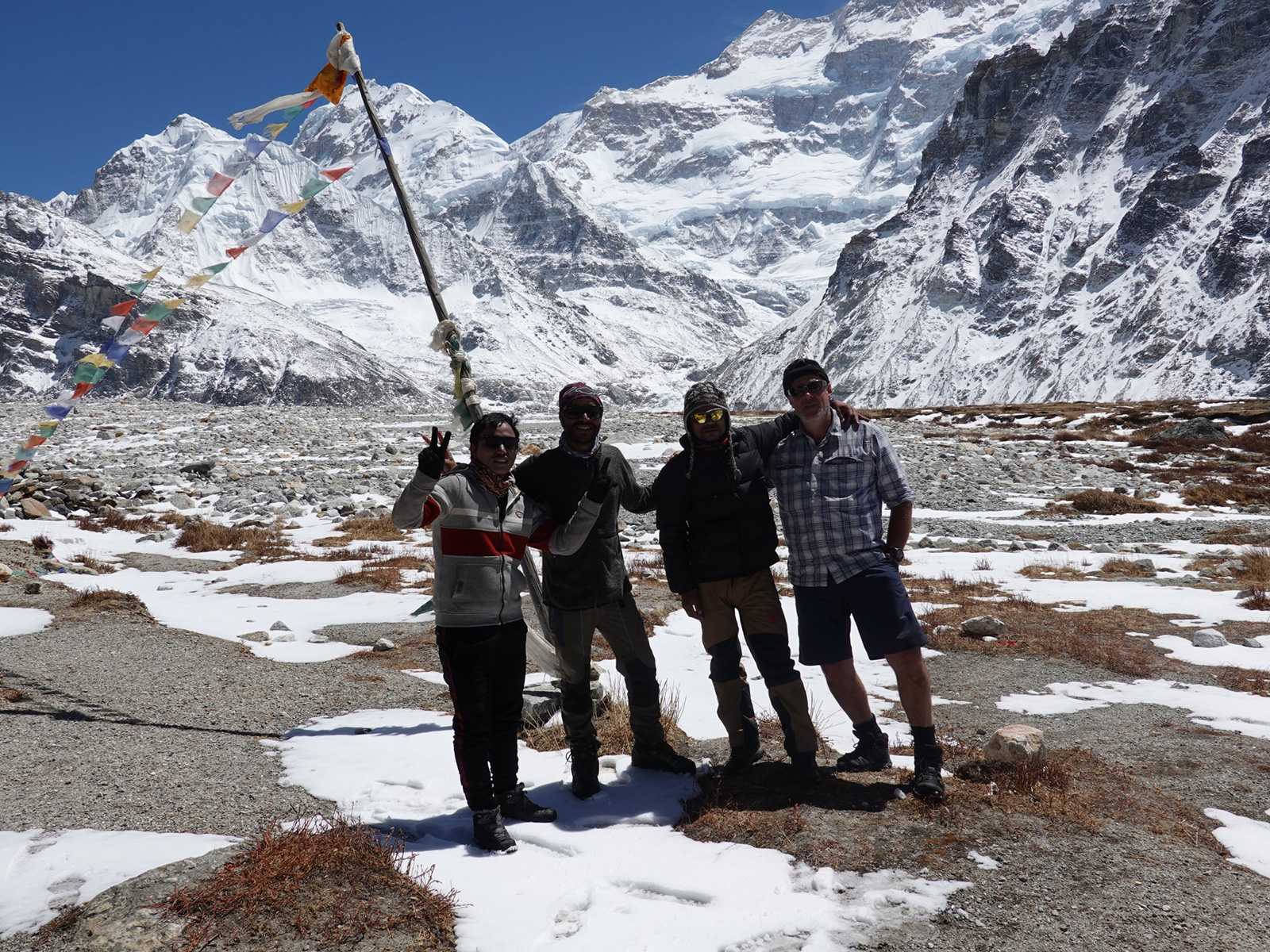
490. After 126 days we have cross the bridge over the Karnali River to reach our final destination. to the left is Bharat, then |Santos, then me, then Ramesh and finally Dawa on the right. A great team!

All day however we had seen helicopters ferrying the Indian tourists from Simikot to Hilsa and vice versa. I had previously spoken to Alex, a Brazillian helicopter pilot from Mountain Flights and he said his company could ferry us back from Hilsa on a return flight for US$1000. I calculated this would save me US$600 on wages and food and lodging over the three days it would take us to walk back, so the helicopter would only be US$400. I had already done that walk 11 years ago before the road was built, so was not too keen to repeat it. I said to the others “right let’s go and get a helicopter to Simikot”. I think they thought I was joking. We walked up to the helipad, I told the ground crews the price I had been offered and they wanted proof. At that moment Alex appeared on the horizon, so I told them to radio him. It was agreed but I had to pay now. I turned round and Santos and Dawa were missing. Ramesh was dispatched to run and find them and their loads and return all at a run. The others soon arrived, the helicopter landed and discharged its 5 passengers, I handed over 110,000 rupees cash and we piled in and took off.


It took just 20 minutes to fly up and over the Yari Pass, then down over the villages of Yari to meet the Karnarli as it emerged from its gorge. We then followed it down over a very wooded landscape passing the valleys of the Salli Khola and Hepka Khola where we previously walked. The helicopter then climbed up over a spur on the south side to gain height, crossed the valley and landed at the tiny Simikot airport. Three days walking in 20 minutes. In another 20 minutes we had walked up to the hotel, checked in and I was in the shower. It was less than an hour from out finishing photo session at the bridge in Hilsa and it was quite surreal. The GHT was over. 

Section 14. Limi. 110 Km. 38 Hours. 5880m up, 5380m down. 

Complete GHT Totals.  1787 km. 743 hours. 99370m up. 99510m down

Back

5 July. Mugugoan to Takya Khola Lake. 18 km. 7.5 hours. 1070m up. 170m down. The horseman we hired was supposed to show at the very lax hour of 0800. I was not comfortable with that as it was a long day and I was getting frustrated by frequent stops. In the end the horseman arrived at 0830, with not one but three horses. Two looked old and a bit skinny and the third was a foal of one of the skinny ones. It seemed the horseman was using this opportunity to take all up to the lush high pastures of Takya Khola and leave them there for the summer. He was using his thin foam mattress and his sleeping bag as padding for the horse. I did not care for him. He looked a rough diamond with broken teeth and the shiny inflated nose of a heavy drinker, and he smoked, and he had a stone in his hand to lob at the horses to hurry them along. There was none of the gentleness and panache which Khonjok had.

427. Heading up the grassy pastures north of Mugugaon with the two horses and a foal at the start of the day

I took a few photos of the village as we headed out and it seemed many of the older houses were destined to collapse sideways soon like a pack of cards. Outside the village were wandered across close cropped and green pastures passing many chortens and a few mani walls. There were chortens everywhere around this village. Then we passed into the lush wide U shaped valley where there were pastures and sections of forest. It was mostly spruce along here initially’ but as we ascended they gave way to other trees. I reached the old village of Mugu, Purano Mugu, after about an hour and a half. Here the torrent split and it was easy to bridge with two old log cantilever bridges. It was drizzling a bit so I stopped under some birch and ate my snacks.

I was ahead of the others who seemed to be dithering a bit of late and waited for them. I saw the horses and foals I passed in the meadow before the bridge running, and then I saw the horseman chasing them. He even ran across the smaller of the two channels of the Mugu Karnali when the horses and foals crossed it. He was up to his thighs in his futile chase. The others appeared first and then the horseman. Bharat had been chatting with him and apparently he had 15 horses and many had foals. When he appeared he had only succeeded in getting a stallion, and an additional horse and it’s foal. As we when up the valley I came across horses everywhere, but there were no yak as there was last time. It took me a good two hours to walk up the valley past two or three large pastures, which had a tent bhatti as each one. At the penultimate I noticed a raksi still beside the tent and hoped no one would be tempted. I stopped at the last bhatti for the others to catch up but after half an hour there was no sign so I continued up the valley to its confluence with the torrent of the Takya Khola. I crossed this foaming torrent on a two log bridge and found a sheltered grassy spot to snooze on while the others arrived. I was thankful there were no leeches as I feared there would be.

After an hour, at 1400, Santos arrived, but there were no signs of the others. Santos headed up the track to Tibet insisting it was the way as the bhatti owner had told him. I doubted myself and followed him for 10 minutes until it was clear this was not the way up the spur on the north side of the Takya Khola I went up 11 years ago. I returned annoyed I had wasted energy following the impulsive Santos to find the others arriving. They seemed to be looking for a campsite. I was angry now and charged down to them asking Bharat what on earth was going on. I told them they were slow and we still had 4 hours left and it was time to get a move on.

Unknown to me the horseman had switched the load from the skinny horse mother to the stockier horse mother. While the stallion had disappeared from the group. As they were crossing the two log bridge over the torrent of the Takya Khola one of the foals had accidently knocked the other off the logs into the edge of the torrent. The mother, who was now carrying the load was fretting at the side of the torrent. Bharat and Dawa jumped into the water and rescued the foal and guided it, and the mother, across the bridge and were just taking stock when angry me arrived. Bharat said he had not seen the horseman since the last bhatti. I suspected he was in there for a drink, so insisted we carry on up the path I knew and not waste more time

It was a steep climb for about 300-350 metres which took a good hour. After that it traversed the steep hillside for another hour to eventually reach the upper part of the Takya Khola, which was essentially a hanging valley. I was worried about the foals on some of the sections as the path seemed very small and unused. To my dismay I saw a good path on the west side of the torrent and this came up diagonally from the last bhatti. It must have been new and the path I was on abandoned one. In the distance I could hear Dawa and Santos whooping and hollering to encourage the horse and foals up. The faint path, after it had finished climbing and traversing the hill, now descended slightly to the bottom of the boulder strewn valley to meet the foaming torrent again. I waited here for them and they arrived after 15 minutes.

What surprised me was that Santos was leading the load carrier with its foal following. Then Dawa and Bharat were shouting at the other two horses and foal. The foals seemed to manage very well through the boulders. When they stopped where I was the horses gorged themselves on the grass, while the foals started to suckle. I told them it was just an hour to the lake and set off. They followed driving and pulling the horses up. There was no sign of the horseman. Either he assumed we took the new path and was looking for us on that, or he was still in the bhatti drinking raksi. The others had to lead the horses across meadows and through occasional boulder fields. It was quite slow for them. I waited here and there and noticed some new wild flowers, white primroses and two varieties of the small fritillary, one purple and one yellow.

428. Santos leading the pack horse and its foal with the original two horses and a foal being pushed along by Dawa. this was the end of the day before all the horses and foals bolted across the river along with our baggage

I got to a tricky boulder field, where a large rock jutted out into the river, and wondered how the horses would manage. It was raining now and the boulder fields were slippery and the grassy areas wet. Across the river on the west side was a large yarsagumba encampment with 25 conical tents. I carried on in the drizzle and wind towards the lake. Just before it I found a good place to camp and waited for the others. They arrived after 15 minutes, but without the horses or the baggage on the horse. Apparently at the tricky bit 10 minutes back the load carrying horse had wrenched the rope out of Dawa’s hand and had crossed the torrent at a wide shallow point. Its foal and the other two horses, and second foal followed suit. They felt they could not cross their so ascended looking for a crossing point to go back and retrieve the baggage, which is where they met me at the campsite. Across the river from me was another yarsagumba camp with about 25 conical tents.

Dawa and Santos crossed the river thigh deep and returned on the west bank to the lower yarsagumba camp. There they luckily managed to catch the horse and untie the luggage. They just left the 3 horses and 2 foals there as they were now more trouble than they were worth. They left the horseman’s sleeping bag and mattress on the horse as these were now soaking. They tied the rope up and left them content in the wet grassy meadow for the owner to find. I suspect he either had bad news and had to return to Mugugoan or was getting drunk in the bhatti. Dawa and Santos returned upstream with the baggage and then waded the freezing torrent again in thigh deep water. We set up camp at once as we were all miserable and wet, and dusk was arriving. As usual Ramesh had to brave the elements to cook us a meal while I typed and Santos slept. It was quite a day and I am not really sure what to make of the situation with the horseman and his horses. I guess we will leave here tomorrow and it is up to him to find us if he want paid for one of the two days we employed him for. Eventually we got cosy in our sleeping bags in the tent while the rain battered the ripstop nylon flysheet.

6 July. Takya Khola Lake to Takekharka. 21 km. 7 hours. 650m up. 900m down. It was drizzling in the morning but we managed to persuade Santos to get up at 0530 for the teas. We packed the soaking tent and set off in out waterproofs at 0700. My feet were soaked within minutes due to the water on the grass and shrubs so it made very little difference if I waded streams later in the day. We got to the north end of the lake, but going up the east side across wet grass and going through boulder fields was not quick and we all looked at the path on the other side. The boulders were covered in lichen, especially the yellow “geographical” lichen and were slippery. At the far end of the lake the pathless route climbed more grassy slopes and boulder fields to gain a long flat meadow some 3 km long, which must have been a lake now filled with silt. It would have been delightful walking usually but for now it was flooded in places and we had to pick out way round the east side and up and over a couple of spurs. The last time I came here we just walked straight over the meadow which was lush with wild flowers and full of grazing horses. Talking of horses there was no sign of the horseman and he never got reimbursed  for yesterday.

430. Looking down across the last meadow in the Takya Khola valley with the lazy stream meandering across the flooded grassland

The meadow pretty much ended at the foot of the pass. We paused here for a snack before the climb. The sun was making a valiant effort to break up the mist but the latter was stubborn. As we climbed it slowly cleared and there were even patches of blue sky. It took just over an hour from the valley to reach the top. The route we chose went straight up the slope where the grass was short and there were gravel deposits, then we traversed eastwards climbing above some crags to reach the modest pass at about 5020m. There were few chortens, and no prayer flags, but there was a great view down the meadow we walked up, with its lazy river meandering slowly across the wet pasture. There was also a good view north east to a high pass over to Tibet, just 2 km away. We relaxed at the top for half an hour and then started the descent.

429. Heading up the final pasture of the Takya Khola valley before Takya Lek Pass, 5020m. The pass is the obvious dip in the ridge ahead centre photo.

431. Santos coming down the slope on the north side of Takya Lek Pass sitting on the baggage. He shot past me as if he was on a snow scooter

There was still a lot of snow on the north side of the pass, but for once the gradient was gentle. Shallow enough for me to sit on a sheet of plastic and slide down for a few minutes. However Santos, always ready to try something, put his whole baggage on a sheet of plastic, then sat astride it and set off, whooping as he hurtled down the slope. He went past me looking like he was on a snow scoter with a huge grin. At the bottom of the excitement the slope eased off even more and we had to descend on foot. We headed west the whole time as we descended to try and keep to grassy slopes and avoid a boulder field below the pass which would inevitably had been slippery. I found a nice grassy spur to head down all the way to the valley floor where the infant Take Khola was already a big stream. We just managed to hop across stones without getting our feet wetter to reach the north side. The promise of fine weather however was disappearing again and the blue patches of sky had vanished and the mist was descending.

432. After the Takya lek pass we dropped down to the infant Take Khola stream and could hop over it across stones to the north side before it quickly grew to a raging torrent

I seemed to remember there was a path on the north side but it must have been lower down as the was none here. Instead we had a line of springs which made the north side quite boggy. I just sloshed through but the others went higher to avoid the soggy ground. The valley was shallow and open, wide and U-shaped. It was generally grassy but there was the odd boulder field. Wild flowers were thriving with many varieties, but it was the yellow and purple snake head fritillaries which excited me as I had not seen them in the wild before. The Take Khola stream slowly descended passing from sluggish sandy bits to a more lively shallow descent over small stones. It was a lovely valley and it was a shame the weather was not kind to us. Towards the end of the section before the Paththarchhage Khola side stream there was a lovely km across a shallow grassy slope to reach the tributary. I was worried about its size but it was easy to wade. It drained a largish area to the north up a remote valley full of jagged peaks in the Khangla Himal on the Tibet border. I am sure many of the peaks are unclimbed. To the south was a turquoise lake at the mouth of a valley which led up to a possible pass over to the large flooded meadow in Takya Khola were we were this morning.

Below Paththarchhage Khola the path quickly developed and we passed a herd of 10 horses who must have helped create it. The Take Khola also grew very quickly, and as the valley narrowed and the stream went into a slot it looked impassable. The path now started to descent more quickly but the valley remained verdant. I rounded one spur and suddenly came across a herd of Chauri cattle. As the path continued down I saw about 100 of them.  I can’t remember Chauri before just lots of sheep and goats. The Chauri were grazing right up the hillside on the rockier slopes as well as the meadows above the stream. We passed a very small lake of clear water and then I spied the Takechaur pastures down below where we were heading. It still looked as idyllic as I remembered. 10 minutes later we were arriving but there was a huge flock of sheep and goats on our previous campsite.

I suggested to Bharat we go and introduce ourselves and tell them we camped here 11 years ago. They were enthusiastic and said it was no problem to camp where we wanted. There were about 6 herding units here and another 2 up the side valley to the north. They did not have tents or tarpaulins, but their shelters were a wall of stones and the roof were birch branches covered with slabs of birch bark. The bark is waterproof and easily peeled from the nearby trees in 2 foot by 2 foot sheets and laid on the branches. It was a simple home for the summer months. All the camps were from the village of Nepka some 10 hours walk down the valley. As we put the tent up people came from all the stone and birch shelters to look what we were doing and to chat to us.

435. One of the herders shelters. The walls were made of stone. The roof was made of birch beanches covered in slabs of birch bark which was waterproof and acted like wooden shingles. They would spend the whole summer in these shelters.

433. The first herders camp we came to was at Takechaur. Here some 6 herding families tended 1500 sheep and goats and about 100 Chauri cattle. The families, all from Nepka, stayed in stone shelters with bark roofs

When I was in Nepka 11 years ago I took a group picture of some 20 children who had gathered to see me. I had this picture on my phone and showed it now to those who gathered to see me. The picture caused much excitement and everyone was pointing to people saying “that’s my brother” or “look at Rasu”. Then everybody wanted their picture taken in case I came back in another 11 years. Everyone over the age of 50 seemed to be smoking a chillum local tobacco and wanted to pose with it.

434. Nearly everyone at Takechaur smoked a chillum. Inside was homegrown tobacco which they grew in small plots down the valley near their village of Nepka.

436. The women also smoked chillums full of tobacco. They all wanted their photos taken with the chillum.

Bharat and the others bought a goat for 6000 rupees from one of the 6 herders and it was soon dispatched beside the river and cleaned down there ready for the pot. The herder who sold it had 500 animals all together, and it seemed the other herders had about 200 each so there were about 1500 animals gathered here each night, some were in the birch woods across the river and others sheltered in the boulders above the 6 shelters.

435. One of the herders shelters. The walls were made of stone. The roof was made of birch beanches covered in slabs of birch bark which was waterproof and acted like wooden shingles. They would spend the whole summer in these shelters.

I was so glad that everything was as I remembered it here. There were no yarsagumba collectors and their accompanying bhattis. Even the shelters with their birch bark roofs remained the same. The only addition seemed to be the Chauri cattle. These herders were following a transhumance pattern which nearly all our forefathers, for hundreds of generations did, until perhaps 5-10 generations ago. It is in our cultural DNA to do so. While we have become disenfranchised from the land and these annual migrations the old ways remain just below the surface and the industrial and commercial eras have not erased them so far. It is heartening to know some people still practice this simple, nourishing lifestyle. It was a joy to be with them for the evening seeing their daily tasks and activities like spinning wool and collecting their animals into the vicinity of the shelters before nightfall. I also heard from some of them that the route I wanted to take up the Musyang Khola stream, over the Okhale Lek pass and down the Lurupya Khola river to Simikot was feasible and people from Nepka sometimes walk it.

437. Both men and women spun wool into thread on these small hand spinners. they were constantly doing it even as they walked and by the end of a day would have a full spindle of tread to weave into cloth and warm waterproof garments.

7 July. Takekharka to Musyang. 32km. 10.5 hour. 310m up. 1770m down. We set off quite late as we lingered in the charka, chatting with the shepherds and paid for the goat, when we eventually went it was nearly 0800, which agitated me a bit as I knew we had a long way to go. We set off down the slope past “whatisthis” the nickname we gave to the Kieth Richards of the charka, a wizened, hunched old man with a wry smile and constantly puffing on his chillum. We made our way down to Jhulenchaur, the first meadow which was quite flooded with the excess water this year. The river meandered slowly across the flat pasture and we frequently had to avoid small ponds and channels. At the end of this meadow the now river started to plunge down a slope so that it was essentially a white frothing torrent. By now the birch trees were firmly established on the south side and probably would be on the north side too had they not been felled to provide pasture, but many copses remained.

438. Looking down the Take Khola from just below Takechaur meadow. Below the low cloud is is the lovely meadow of Bholbihanchaur. the village of Nepka is much further down beyond the snowy peaks.

It took surprisingly long to go down past a couple of charka, still milling with sheep and goats even at this time of day, to reach the loveliest meadow of them all at Bholbihanchaur, perhaps 3 hours from Takechaur. The path was quite rocky and covered in tree roots as we had entered the Silver Fir forest. The smell of resin was reassuring and being back in the thick forest again was like being back in the safety of the womb. This meadow had large glades and copses of fir. The tributary was large and there was an old cantilever log and stone bridge across it, which might have been the same structure as 11 years ago. When the others arrived they showed me the kerosene stove. It was broken beyond repair as a weld had broken and punctured the fuel container which needs to be pressurized. It was discarded under some boulders to rust away. We would now have to cook on firewood until Simikot and this would slow us down.

439. Some of the Himalayan Silver Firs surround Bholbihanchaur meadow. On each side of the tributary there were large flower-filled meadows between the copses of fir.

From Bholbihanchaur meadow the path dropped down past another couple of meadows, full of knee high wild flowers, to enter an huge gorge. We met a man on the way up with a mule and he said it was 4 hours to our destination but I knew it was about 6. Nepalis always underestimate time and exaggerate their own speed. Once in the gorge the path undulated up and mostly down as it had to cross spurs. Looking up I could see the walls rising high above me, often with high overhangs where chunks of rocks had peeled off long ago. The walls of the gorge in some places are nearly 1000 metres high. Down in the bottom of it the raging river tumbled down a continual set of rapids which on each side different forests exist. On the north side south-facing slopes the firs give was to a mixed forest with a lot of oak while on the south side north-facing slopes firs persisted.

440. Below Bholbihanchaur meadow the valley became much more V shaped as the tall sides of the gorge closed in. The vegetation became much more varied with many deciduous trees among the conifers.

At Kachyapu people were getting quite tired. I told them it was 4 km, about an hour and a half, to the next big tributary, the Niliga Khola, and set off to reach it myself. It was a long way as the path was slow and it took nearly 2 hours. But on reaching it the valley widened out and there were some nice meadows again. The others arrived soon afterwards and were tired. I explained to them that we could walk a km to the next meadow at Lepchachaur and see how that looked, if it was nice we could camp there, if not we would have to carry on the Galagnachaur, our original destination. We set of and immediately passed through some lovely campsites, with long ungrazed grass and flowers to reach Lepchachaur. There was a herders shelter hare but it was surrounded by goat droppings and the rest of the meadow was sloping and stony. Not really ideal for camping. Across the river through were some great spots but they were inaccessible.

441. We hoped to camp at the pictured Lepchachaur meadow, but the terrain was unsuitable as there were many stones between the tall lush vegetation. It looked great on the south side of the torrent but there was an untrustworthy bridge to get there. We walked beyond dusk on this day.

So we headed off to Galagnachaur about an hour away. The porters were tired but were quite stoic, and refused to complain. After 10 minutes we came to a newish bridge across the huge torrent to the south side and great campsites. I was very tempted as we had water, firewood from the pine trees and a grassy underfloor. However the bridge looked rickety and if it collapsed whoever was on it would be washed down the torrent to their death. Also if the river rose and swept it way we would be stuck and probably need to be rescued, so we continued.

Galagnachaur arrived much quicker that I imagined. Bharat said “nothing changed”. It was a sloping meadow which had been terraced and was now either growing buckwheat, or was a riot of weeds and cannabis. There were some shelters but they were rather dirty with animal dung. The one we staying in 11 years ago had collapsed. Ramesh found a mediocre campsite near a shelter he could cook in but I did not care for it. I liked the look of one at the bottom of the meadow on a spur above the torrent. Dawa wanted to carry on. I said there should be something in half and hour’ not looking at my previous notes from 11 years ago

The half hour option was terrible. I apologized to the others and said we would probably now have to carry on to Musyang, the other side of a huge buttress. I said, and hoped, it would take an hour as it was already 1800. I set off first at a pace hoping to find something soon but wanting to get to Musyang in the light. As it happened there was nothing at all as the boiling river entered another gorge around the rock prow. The path was also difficult with plenty of ups and downs. The river was a white slot in an otherwise green, lush, forested gorge. I walked fast but the light was fading and I was feeling more and more guilty. At last in the last light around 2000, some two hours after I left the others I came to a damp flat area beside the raging river. It was covered in dock leaves but it would do. Just then it started to drizzle which quickly turned to heavy rain. I sheltered under a tree in the wet dark hoping to see head torches.

It took half n hour for the first lights to appear and then out of the rain 4 bedraggled figures appeared. We put the tent up in a muted silence and I could feel I was not popular. We all piled in and it was obvious that a wood fire was impossible. We ate a snack and then everyone went into their sleeping bags. The rain was very heavy and it almost felt tempestuous. I was a little worried about the river level as we were just 1.5 metres above it and it was a violent torrent of foaming water 30 metres wide. We all feel asleep quite quickly as the rain really battered the flysheet, and inside everything was quickly becoming clammy. Morale was low. About an hour later Dawa was sitting up shouting “Pani, pani” (water, water). I was frightened as I thought the river was coming up and into the tent. However it was just a nightmare and it lightened the mood. It would go down along with Santos’s “Baloo, baloo” (bear, bear) nightmare. Just after there was a tremendous thunderclap and I thought it was a landslide, but it was not. It was a wild night and I was glad went I woke and it was just a drizzle with larger drops off the overhanging trees

8 July. Musyang to Nepka. 12 km. 5 hours. 470m up. 740m down. Ramesh was up early but returned to the tent saying it was impossible to start a fire. I said we should head down to Musyang where there were agricultural shelters and a large stream, and we should find wood there. So we packed up under the dripping trees and headed downriver. I thought we were a good half hour away, but after a few minutes we arrived. There was indeed wood in one of the shelters and we got a fire going on the banks of the Musyang Khola tributary. Ramesh cooked a dhalbat while I looked for a path up the Musyang khola, which I had read was a route, and wanted a more exciting finish to the GHT than a gentle walk up the Humla Karnali which I had done 11 years before.

I found the path on the west side of the stream. It was very faint initially as it went through small fields of buckwheat and tobacco with rustic grass roofed shelters among them, but as it went up the hillside it was more obvious but overgrown with vicious nettles and angelica. I returned with the news which was received with complete apathy. Perhaps they were hoping I would not find it and they could have an easier walk to Nepka or even Piplan. I felt vindicated however as a few locals had said there was no path.

Santos served the meal while Ramesh rested. Santos then started to cooked the meat from the goat which was left over. Indeed there was quite a pile of it left and they were hoping for some last night but I scuppered that with my extra long day in search for a campsite. The sun was out and most of the sky was blue so we put out wet clothing, mostly socks out to dry. By 1000 all the meals were eaten and the washing up done and we were ready to set off. The mood was still muted. We went up to the shelters found the path and set off. In the glades it was overgrown but in the woods it was wide and well constructed. Ha! I felt, do you believe me now doubters. We climbed past some huge firs and deciduous trees and then back into glades. The nettles even stung me through my trousers which I had on specifically for them. We passed a collection of small shelters used for herding and the path got a bit smaller. The porters were having to push through the odd overhanging branches. Then we passed another collection of shelters by a kharka and the path got even smaller. It crossed a old landslide area in which it vanished but appeared again on the other side. As we continued my heart sank. We had not even climbed from 2600 to 2900 when the path became difficult to follow. I reckoned we would have to climb to about 3500 to be out of the thicker vegetation and into the fir and birch woods. We got to an area where someone was making shingles for roofing and the path reappeared again but soon it was back to landslides and windfalls making out progress very difficult. Before long all trace of any path had long vanished and we were in thick scrubby jungle. I had to heave and push to get through the branches, but the porters were finding it impossible. Still on thin ice after yesterday’s route march into the dark I had to admit defeat and agree to return. The mood lightened.

442. The people of Nepka village were very resourceful and exploited everything in the long valley throughout the year. I passed perhaps 100 beehives altogether. They were hollowed out from blocks of wood, or made from rustic planks and sealed with mud. They were usually hung under overhands and covered with birch bark.

The descent took an hour. Together with the ascent it was 3-4 hours wasted on a side trip. We would go to Nepka and try another route. The route locals had said was the one they used. The descent to Nepka was easy and took just 90 minutes from Musyang. The trees on the north very largely deciduous now but on the southside there were conifers galore. The firs were now the Western variety of the Silver Fir, taller and more slender sometimes reaching 60 metres. There were also many Spruce, all with drooping branches and branchlets so had they been dogs they would have been Afghans.

433. The fields about a hour upstream from Nepka village all had grass-roofed shelters nearby, so people could keep a few livestock here in some seasons, and also store implements and produce from these fields. The cannabis plants in the foreground were not harvested and considered a rampant weed.

Further down we came across scattered fields of millet beside the path, protected from domestic herbivores with loose rock walls or branches. These fields got more and more plentiful until we reached a bowl by the Nepka Khola which was covered in them. There were about 20 shelters here, all two storey with animals or storage below, and their fodder or bedding stored above under the apex of the grass roof. The route from manure to field was an easy one. Around all the shelters and each side of the path were tall and bushy cannabis plants, just producing their seeds, smelling pungent and oozing oil. It would have been easy to make hash from them by rolling the ends of the branches in the palm of ones hands some 10-20 times and then by vigorously rubbing ones palms together until a matchstick size of residue forms. All the plants growing here were weeds and clumps of them were pulled up where obstructing doors of lanes between the shelters. Just beyond the shelters I saw a snake in the sun but it quickly disappeared between the stones of a terraced field as I approached. Then suddenly I was walking into Nepka, a village with about 60-70 houses.

I have been to Nepka 11 years ago when walking down the Take Khola previously. Then I took a photo of some 20 children on a rooftop. As I approached some people I brought the phone out and showed it to them. Immediately there was a crowd and much excitement. When It got large I saw someone beckoning me up to a rooftop op a very high log ladder. I went up and he spread a carpet our for me. Some from the persistent crowd followed but most stayed below. One man from the school association wanted it transferred to his phone which I did. It proved useful as he later gave us permission to camp at the school for a fee.

When the others arrived we headed off there and found a nice pergola under which we could just pitch the tent. Ramesh was feeling grim so he went straight in to the damp inner and climbed into his damp sleeping bag. Having the tent under the pergola meant things could dry out at last. Soon the kids started to arrive to see us and before long there was 40 of them. Once the novelty had wore off they started playing in the yard. Occasionally they would climb onto the Pergola but Santos would bark at them and they would flee back to the yard. All in all they were a really well behaved, curious bunch who wanted to practice their English on me. They were all about 5-8. Then some teenagers arrived but they were hardly interested. Instead they commandeered the yard and put up a volley ball net and 8 of them started playing what must be Nepal’s national sport. I discovered a classroom which was open and had a bench and long desk. It was perfect for doing the blog. The younger kids tried to come in but I blocked the door with a desk and growled at anyone who came past it and they respectfully retreated.

As I finished it started to pour, battering of the corrugated roof. Tomorrow we will try a second route over to Lurupya Khola which will take two days. It goes up from here to some summer pastures and kharkas and then over a pass before the descent. The pass has a junction of paths and we will hopefully take a guide from the kharka to make sure we get the right descent. It will be exciting for Bharat and myself as it is the only part of the last 2 sections we have not done yet.

9 July. Nepka to Rakalchaur. 12km. 6,5 hours. 1690m up. 190m down. It was grey and drizzling when we woke but thanks to the pergola the tent was dry. Santos was up to make a fire under the eaves of the school for tea and breakfast. I discovered there was still a plastic bag of goat meat in a sack which had been leaking. It stank so I made Ramesh put it at the bottom of his basket so it would not sully a holdall. We set off through the village. It had no toilets and the fields and side of the path seemed to substitute. In the village itself the lanes were ankle deep in mud and animal dung which had been shovelled out from the lowest floor of the houses where some of the animals overnighted. The wet climate of Humla during the monsoon season does not help but the village was very dirty. It was better than 11 years ago before a layer of cobbles had been added to the lane. That time it was twice as deep. At the far end of Nepka was a stream which seemed to double as a toilet. There was a path beside it down under many apricot trees to a bridge. Here I met the man from the school association and gave him the 2000 rupees for camping in the school. He also gave us instructions on how to find the route to the kharka before the pass over to Lurupya Khola.

444. Dawa coming through the muddy streets of Nepka, which had 60-70 houses. On the lower floor cattle and horses spent the night and some of their dung oozed out onto the street which mixed with the monsoon mud.

We set off and went a good km to the split in the path, the lower one going to Piplan and the smaller upper one to the kharka. However after walking this path for a good km it ended up at some fields and a house. I returned to the junction and Bharat followed. I could see this was going to be a difficult day and with the slower start and the false path we had already wasted 3 hours. So I sent Bharat back to Nepka to ask the helpful man on the school association for a local guide. A good hour later he returned with the helpful man and also a young lad who had been playing volley ball at the school last night. The young lad would accompany us to the kharka and show us the way.

When I showed my picture of the kids at Takechaur a few day ago one of the people pointed to a teenage girl and said she had just fallen into the river a few days ago and died. She was now 25 and I thought what a shame. It now transpired she was the wife of the nice man on the school association and a mother of 3. He was very stoic about it said he was really thankful for the old photo. I  got his Facebook name and promised to send him more if I had them. Previously he had been a commander in Nepal’s Maoist army over a decade ago and had taken severance pay from it.

445. As we climbed some 1500m up to Rakalchaur Kharka pastures there were some atmospheric monsoon views back up the Take Khola valley towards Nepka and beyond.

The path it turned out forked off the one to the single house but nobody saw it. So we returned up to the house but turned off half way there. It was already midday and the promise of nice weather had disappeared. I set off at a good pace and was soon ahead. However there was a wealth of new plants to see and photo, including two stunning lilies. The path was quite steep as it went up a rib on the hillside. After a good hour it came to a few shelters and some terraces of corn, which was just ripening. The trees up to here were quite sparse and just consisted of Bhutan pines and some oak. It was mainly grass and wild flowers. The weather limited the views down the valley, but I  could occasionally see to Piplan and it looked like there was a road up that valley, which was 10 km away. Looking up Take Khola valley you could see the deep U shaped valley which must have had some glaciation long ago. Now it was green and lush and the swollen Take Khola River was a wide silver ribbon on the valley floor.

446. There were many extraordinary plants and flowers in the grasslands and meadows as we climber up to Rakalchaur kharka meadows high above the Take Khola valley

447. Although the monsoon is wet, especially in Mugu and Humla, there are a wealth of wild flowers which make up for the mists and the drizzle.

From the shelters by the corn field the path continued to climb relentlessly. It followed the same spur but this was now covered in oaks. Their leaf litter covered the track. There was another set of plants i had not seen before so I was busy with the camera. The others were far back and the speedy Santos seemed to be struggling. On and on the path climbed for a second 500 metres until it reached the top of the oak forest and all I could see ahead was bare grassland. A few grouse type birds broke cover above me a glided down into the mists and I heard a cuckoo close by, and then saw it fly off looking like a small hawk. The local guide, Suprendra, caught up with me at the top edge of the forest, as he was possibly frustrated but the others speed. It was good having him along as he was carrying the tent and he gave me confidence we were on the right path.

The last 500m took us across grassland with many plantain type plants like the dockweed. There seemed to thrive where goats gather. The path crossed the rib into a new gully and then went up another rib to reach a collection of herders huts. They were all small and compact with stone walls and large shingle planks for the roof. They had an area set aside for living with a fireplace on the floor and a small area for calves to shelter in overnight to encourage their Chauri mothers to produce milk. The path detoured through these 5-6 shelters and then went back into the gully between the ribs to climb into the mist where I could see horses, Chauri cattle and goats. There were yet more wildflowers here, thriving in the monsoon. Soon I smelt smoke and then saw people on the hill above looking down at me.

448. A typical house in the summer pastures or kharka. This one at Rakalchaur kharka has stone walls and fir shingles on the roof. others have stone slabs on the roof. inside there is a fire pit, a sleeping area and dairy implements. the shelter nearest us id for the Chauri cattle calves.

I went up to the hill and met about 10 of the herders. There were a friendly bunch from the village of Pali near Piplan. I could not tell their caste at all but guessed Tamang or Chettri. One of the  ladies offered me a cup of Moi. It was whey which was being made into yoghurt. It was refreshing. I held my own in Nepali for about 10 minutes before I had used up all my words and the awkward silence set in. Just then the others appeared out of the mist and took over. They all looked tired and Santos was ill with an upset stomach. I had already been shown a hillock which was good for camping but it was now obscured by mist. I led the way to it and we out up the tent. Santos and I went in, me to write and Santos to sleep. The other 4 went back to the herders huts as it was raining and they were offered the chance to cook in them and buy some expensive firewood. The weather was miserable as nightfall came with heavy rain. I expected the last of the goat was being cooked and hoped someone would bring me my meal when they returned around 2100. I asked Bharat to see if he could get a guide for 0700 from the herders as the next section could be tricky in the mist.

10 July. Rakalchaur to Cave 2km south of Lurupya Khola. 13 km. 6,5 hours. 630m up. 940m down. The mist had cleared in the morning but it was damp and overcast. We packed up the tent by seven and went down to one of the herders shelters where Ramesh was making us tea using the expensive firewood. The shelter was made entirely of stone, with boulders for the walls and slabs for the roof, except for the roof beams. The entrance was tiny and I had to crawl to get in. Once inside it was cramped but cosy. There was a fire in the centre with a three legged pot stand and rugs and skins on the floor. There was enough room for about 8 to sit or 4 to sleep on the floor. Our host, a 50 something man, was also to be our guide for the day. After tea and tsampa we set off around 0800 just as the mist was returning.

449. Two men from Rakalchaur kharka in man on the rights shelter. They were both Brahmins from the village of Pali and spent about 5 months a year up here. The man on the right was to be our guide the next day leading us to the pass over to Lurupya Khola valley.

This pass, which has no single name is used by a few people in Nepka to go to Simikot, however it is notoriously misty and the route is faint and convoluted. We were advised a local guide is essential and someone from the kharka is the best bet as few people from Nepka are familiar with it. we started around 4100 metres and followed the grassy hillsides for a good hour. En route we passed the guide’s sheep and he made some great whistles to round them up from a distance. To the east was the Nepka Khola stream which tumbled down to Nepka but it was too steep to come up hence the route via the kharka.

After an hour our guide plucked a few tufts of grass and picked up a flat stone the size of an outstretched hand. I did not see what he did with the grass but he put the stone on the nape of his neck almost in the hood of his jacket. We then crested a small rise and there was a magnificent small lake clear in colour with a sapphire tint. It was surrounded by grassy slopes and snow fields and then by misty rock faces leading up to unseen peaks. Our guide then approached a cairn on the waters edge, took off his shoes and respectfully walked towards the cairn. He took the stone from the nape of his neck and laid it at the foot of the cairn. He then walked backwards for the 10 metres to his shoes, put them on and continued to walk backwards, again plucking some grass. I asked about the cairn and it was in fact a shrine to Shiva. I assumed the whole puja was thanking Shiva for the bountiful grass this year and asking for good grass in the future.

450. Our Brahman guide at the holy lake with the shrine to Shiva. Here he is approaching the shrine, with great deference and shoes removed, to place the stone in the nape of his neck on the ground at the foot of the structure

After the lake the route became more faint and erratic and there were frequent boulder fields. I made heavy work of these and the others overtook me. The mist was thick enough now to be drizzle. I had a slight orientation as to where I was just due to the small roar of the Nepka Khola stream, otherwise I would have been lost. A local guide here really was essential. The boulder fields were soon interspersed with snow fields, all of which were at quite a manageable gradient even with soft shoes. Santos was still feeling weak and had diarrhoea, probably after an apricot someone gave him yesterday which could have been picked up from the dirty river bank in Nepka. Dawa somehow managed to take his load also leaving him with the bare minimum. Only an athlete of Dawa’s fortitude could have managed what I estimated to be a 40 kg load. Ramesh, as usual also helped, leaving Santos with about 5 kg.

452. As we neared the pass between the Take and Lurupya Khola valleys we came across the occasional small snowfield. They were not steep and easy to cross.

After about 3 hours we seemed to circle round the fan which was the headwaters of the Nepka Khola stream crossing snowfields and slippery boulder fields. Then we made a short traversing climb until we reached the pass at about 4650m. There were no cairns, chortens, prayer flags or any other fanfare. Through the mist I could see the way down and it looked steep and snowy. At first instance I was worried but then I could see a route until the mist obscured it. I paid the guide for the wood and use of the kitchen in his shelter 1700 rupees and another 2000 rupees for the guiding. He said he was hoping for more. Bharat said he though another 1000 was due and I did not quibble. He had provided a great service and I thought the going rate was 1500 rupees for the day. We shook hands and he watched us as we descended into the mist.

453. There was the very occasional steeper bit of rock to clamber up as we made our way in the mist to the pass between the Take and Lurupya Khola valleys. The main problem was not the terrain, which was mostly easy, but the route finding which is why we took the local guide.

It was just a steep descent down a rib for 30 metres to reach a steep snow field. However the snow was soft and easy to smash ones heels into to make a step. Then I saw the snowfield was in fact concave and descended some 200 metres into a bowl. I started going faster and was almost jogging down the slope until I slipped. I slid, almost on my bare bum as my loose shorts rode up for some 40 metres until the slope eased and I could stop. There after I could resume my speedy descent down another 100m to the bottom of the bowl. The others were following but Santos and Dawa had slippery shoes and were cautious. We had reached the bottom of a bowl with a jagged cirque of rocky peaks around it. The only chink in the cirque was the pass we came through. On the map it was called Chhetuma Lek, but no one local recognized the name. There was a tongue of snow which continued down for about another 100 vertical metres and it was great to follow it to its end in a collection of small flat meadows, which briefly had a rare patch of sun of them.

454. After the pass between the Take and Lurupya Khola valleys (which is one of the notches centre right) we could easily descend the snow in a large cirque surrounded by jagged peaks.

From here it was a good hour down beside a growing stream which crashed down slopes of rocky grassland. We could see a flock of sheep much further down and a couple of people. We continued our rough descent down the uneven hillside, careful not to slip on the stones. I though I was going fast but looked round once to see all 4 following closely behind me, very much at home on the boulders. Further down the valley I could see the main valley we were heading for in which the Lurupya Khola flowed. We were eager to get to it, cross the log bridge to the north side to gain the path and then blast down it for 10 km to reach the fleshpots of Dojan. As we neared the herd of sheep we realized it was a kharka so we went to ask directions. 4 shepherds came out to greet us, 3 spinning wool and one smoking tobacco in a chillum.

455. A unique flower in the meadows as we descended down towards Lurupya Khola valley.

The news we got was not good. The bridge spanning the Lurupya Khola had been washed away and there was no way across the stream. In fact it was not a stream but a “Karnali”, a large river really. The only option for us was to force out way through the jungle of birch trees growing out of boulders fields on the steep south side of the river for some 7 km until we got to the next bridge. I knew this would take all day and we would be lucky to make a km an hour. Furthermore there was no more camping until this bridge at the collection of shelters, also called Lurupya. It seems the information we received, both from Nepka and the kharka was wrong and outdated. Indeed the 4 shepherds said no one had come over the pass this year so far. We were stuck really. Either 7 km of difficult jungle or return the way we came! The shepherds said our best option was to continue for another half hour to a large cave and spend the night there and then make an early start to fight our way through the jungle of birch tomorrow.

Despondently we went on down the valley in the drizzle and found the cave camp at the bottom of a buttress. There was wood and water nearby but the cave was much smaller that we thought. It was more of a slight, but very high overhang extending some 10 metres. If there was any southerly wind it would blown the rain onto the two platforms which could really only sleep 3-4 people each. The upper one was a bit smaller but had a good seat to write at. The others gave me the option and I took the upper while they took the lower, which had a nice fireplace come cooking area but the sleeping area was more exposed to the elements and half of it was already damp from drips. They explained they could use the two small tarpaulins we had, in a typically stoic Nepali way. In the upper platform I also saw a small stash on a rock which included a tarpaulin and an old blanket covered in sheep’s wools, which I could use in an emergency. It belonged to the shepherds. They arrived well before dusk and went to the lower platform to chat to the others. We were probably the first people they had seen this summer after coming over another pass from their village of Rodikot. As the others cooked and chatted I did the “office” while mist slowly drifted up the valley.

456. We spent the night in a 2 tiered cave, which was more of a large overhang. I had the upper tier which had a great seat to write the blog on.

11 July. Cave 2km south Lurupya Khola to Kumlit Jula. 23 km. 10.5 hours. 540m up. 2070m down. The smoke from the fire below drifted up and at 0500 and I knew breakfast was under way. I had a remarkably good night in the cave despite the fact it drizzled all night. The others in the cave below had to cover the bottoms of their sleeping bags with a tarpaulin to prevent the drizzle soaking them. The two shepherds sleeping above me got up first and went down to the fire, then I went down. There was a  lot of chatting and I was a bit frustrated but we were still ready to go at 0700. Bharat approached sheepishly and I knew I had been asked to contribute to the firewood used. It was 600 rupees but then there was a kitchen charge also which was 400 rupees for essentially the side of the cave wall which they claimed ownership. Still the information they had given up was invaluable.

We started heading down the small path which pretty much went on top of the boulders for a half a km and then it entered the first of the birch trees. As it did it became more defined. It fell quickly through the trees heading down to the to the Lurupya Khola river. As it descended the vegetation became thicker and thicker but it was still manageable. I thought the very rough path would go straight down to this river where the bridge had been washed away but it tended to the west for a good km or two before it reached the river. All the time the drizzle continued to fall and the vegetation was soaking us. My shoes were wet in no time and my hands were earthy with all the mossy trees and branches I was grabbing to save myself slipping down the often muddy slope. When we got to the place where the remains of the log and stone cantilever bridge was I expected the path to stop, but it continued albeit in a much fainter version.

457. The bridge over the Lurupya Khola to the path on the north bank had been washed away so we had to push through dripping wet jungle on the south side for 7 km until we came to another bridge over to the north side.

We took it in turns to route find with Bharat and myself usually at the front, the others having their big loads usually followed letting the leaders make the mistakes and walk back. Bharat had an special talent for spotting where the very faint path went, even when I thought it had vanished. A cut branch here or a pile of ruffled leaves was all he had to go by and it was lucky there had been some one here this season. Our progress was very slow, at perhaps a km an hour. From the map I could work out which ridge descending down to the main valley we had to reach before we got to the bridge. After a couple of hours of slogging through the wet dripping jungle it seemed we seemed to be no nearer. I was now soaking wet and covered in mud and leaves. Bharat joked with the others it was like commando training and that was probably not far from the truth. Some of the slopes were very steep and I often looked over at the tip of a fir just 10 metres away and then realized it was a 50 metre tree.

458. The Lurupya Khola river was swollen raging torrent which had carved a deep gorge between towering mountains. Waterfalls cascaded down on both sides of this gorge.

We got to an boulder which had a large overhang under which people had been camping recently. The others thought they were wild garlic collectors. We lit a small fire in their fire pit and ate our lunch snacks. It was so still the smoke hung in the air over the river like a ball of thick fog. The drizzle still continued after lunch. I took up the lead now for a good hour and was often ahead of the others who could easily follow my clumsy trail, “Like a buffalo” said Ramesh. We all slipped and fell. I had a lucky escape with a rock, my shoulder taking the impact rather than my head, and Ramesh crashed down on his ribs and was winded for a good few minutes. Santos still had his diarrhoea so we were a sorry bunch when we reached a small powerful stream we had to wade across. Even Bharat kept his boots on. Some of the route finding was very difficult and I thought I had lost the path numerous times.

459. The jungle on the south side of the Lurupya Khola varied with some dense patches, some easier sections as above. The terrain also varied with both flat and steep sections. It took us about 6-7 hours to do the 6-7 kilometers.

Once, when I could see no sign of the path I looked down at the river and thought I could see some logs across to a large boulder in the middle of the torrent. I back tracked and could see that people had walked from the path towards the logs spanning half the river. When the others arrived we went to investigate. It was indeed a bridge, or two bridges to be precise. One from the south bank to a massive boulder and the other from the boulder to the north bank. They were both rickety, especially the first which was broken and just consisted of three logs. A fall would have been fatal. Eventually we were all across and up on the main path on the north side. We were saved after slogging through the jungle for over 5 hours.

460. We were told the next bridge down over the Lurupya Khola was substantial. When we got there we found there were two parts to the bridge with a giant boulder (pictured) in the middle of the torrent. The southern part was not substantial but on its last legs.

461. The northern half of the bridge over the Lurupya Khola was more intact but it was narrow, rickety and slippery and one mishap would have spilled you into the fatal torrent.

It still took us 3 hours to walk down the muddy path to the confluence with the Chuwa Khola, and even bigger torrent. The 7-8 km took us through mixed forest with 3 of Nepal’s 5 main conifers, namely Fir, Spruce and Pine, only Hemlock and Deodar were missing. We passed some shepherds with a large flock of goats. They were also used for transport and the kharka had lots of small saddle bags stacked up which the goats carried. As the path descended to the confluence the trees on the north side virtually vanished, probably cut or burnt over the decades by shepherds wanting to improve the grazing. In the south side though across the inaccessible torrent the conifers flourished.

We questioned the shepherds about a local shop in Dojam or even a hotel. All our stuff was wet or at the minimum claggy. A night in the tent was feasible but would have been miserable and any firewood we found wet. They said Dojam just had a little shop but 40 minutes downstream at Kumlit Jula was a hotel. They advised us to take the path on the south side of the river, crossing at Syala at the confluence of the two violent rivers. We did this on another log bridge. As usual the 40 minutes turned out to be nearly two hours and we climbed and descended the very undulating path. We also failed to take a small fork down to the right and climbed for another 20 minutes before we realized our mistake. In the meantime it was just a short climb to Dojan where we would have met a well constructed path which slowly descended all the way to the hotel. It was bad information these shepherds gave us and the north route would have been far simpler and easier.

The hotel was quite rustic but the Lama host and his wife were very friendly and welcoming. We all enjoyed hanging up out wet clothes in the dusk and then went into the warm kitchen for a huge dalbhat and omelette. It was luxury to have the warmth of the kitchen and the ability to spread out. Our little adventure off piste was over and now it was just an easy well used path to Simikot some 4 hours away.

12 July. Kumlit Jula to Simikot. 13km. 5 hours. 1010m up. 430m down. It was nice to sleep indoors after a week in the tent. Even in the rustic room I could hear the rain when I woke smashing onto the tin roof. It was also nice not to wander off in the morning to find a secluded boulder, as there was the luxury of a squat toilet downstairs in a cramped small damp room. After breakfast the host, who suggested we go via Baragaon rather than Karpunath, showed us the path to take after walking us to the edge of the hamlet past a few watermills. By now the weather was misty but at least the rain had stopped.

We set off up the track to Baragaon and passed many groups of women, over 60 women in all and  few men on the way down. I assumed they were going to the fields around Kumlit Jula each side of the river. These fields looked fertile and were green and lush with millet and corn. It would explain why there were so many water mills in Kumlit Jula, which must be a satellite of Baragaon. It took an hour to reach Baragaon up the well-made and busy path. Unfortunately the whole village was in mist which was a shame as it was a very large traditional village full of character and would have been a photo bonanza. Even in the mist is was full of intrigue.

The first thing one noticed was the mud. Or rather mud come animal dung. It was up to 10 centimetres in the lanes. Under the mud was a layer of cobble sized stones otherwise I dare say it would be shin deep if not more. The mud came from the earth trampled by thousands of feet and hooves in the midst of the monsoon rains. The dung came from the ground floor of the houses where the animals spent the night in a dark, dingy, cellar type room whose floor was lined with leaves. I think most of this was taken out to the fields as manure. Inevitably some would be shovelled out or overflowed into the lane. In addition when the small cattle and goats were taken out to graze each day they would lay a pat or two in the lanes. There was also a fair amount of mule traffic, bringing goods to the small shops and they would also add to the dung in the lanes. I was stepping carefully in my boots, but Santos whose boots had finally fallen to pieces had borrowed Dawa’s sandals. Santos and Ramesh were convinced the population of Baragaon also used their lanes as a toilet, and I saw some evidence too, and this further added to Santos’s anguish.

462. Santos trying to navigate through the ooze of mud and animal dung which are the streets of Baragaon in a pair of sandals. A task doomed to failure.

I became confused quarter way through the village as to the path, and a teacher on his way to school directed me up some steps to a roof top. The path then went along the roofs of about 20 houses and past a Hindu Temple sited on one roof. Where there was a gap between houses it was bridged with rough planks. Below I could see the ooze in the lane. It seemed the rooftops was the social area and there were meeting everywhere. Men smoked tobacco in chillums and looked at me as I gingerly walked past. Women were generally busy but a few also smoked chillums. On one rooftop a lady had set up a seamstress business with sewing machine. I had to look where I was going because there were so many pipes poking out through the roof from stoves below. When the rooftops finished I was directed towards a log ladder and climbed it to start another series of rooftops and then again up another ladder and more roof tops until I descended to the muddy lanes again to find a way out of the west side of the village on the path to Simikot.

As we left the village we passed lots of the small cattle which were heading out of town to graze on weeds and bushes also the paths edge and on land too steep or poor to cultivate. They were a feeble and timid looking variety of cattle, with many of the adults being barely a metre high. Even the bulls looked like they might fall over if you gave them a good shove. The path climbed up to a ridge where there were great views in most directions across and up the valleys. Small medieval hamlets, surrounded by bright green terraces, clung to hillsides all around and were only revealed when the mist cleared. Down in the valleys the two major rivers of the area, the Humla Karnali and the Kharpu Karnali, which we had partly followed, met at the important Kharpunath Hindu temple far below.

The path now descended through the mist into the small side valley with the hamlet of Hildum. It passed above this huddle of 10 houses and then started a long 500 metre climb up the west side of the valley. I was now dog tired and had to pace myself up the hill. The others were far behind and I could see them coming down the path to Hildum. We were all tired, wet and fed up with the weather. At the top of the climb was another smaller but disheartening climb until I reached the edge of Simikot and a large sign saying it was a “Open Defaecation Free Zone” and something in Nepali presumably saying Open Defecators will be fined. The wide lane here was muddy even though there were few animals. I walked through the main street with the rain starting again. It was much busier now than 11 years ago with double the number of houses and shops, even the runway was now covered in tarmac.

I spied a cluster of new hotels at the far end of town and headed for them. The Bijay looked nice but was expensive. As I left it I bumped into an American and Brazilian staying there for the summer while they flew Indians on helicopters between Simikot and Hilsa en route to Mount Kailash. They convinced me it was the best and most reasonable in town so I humbly returned and checked it. I got two rooms on the roof for us with great views and drying options if the rain stopped. There were some Indians staying here, stranded by the weather, hoping to fly to Hilsa soon. I ate a delicious set meal with them and then spoke to Fiona after a month of silence. There was no hot water due to the sun’s absence so I had a bucket shower and managed to shave. For the second time this trip it was a month between washes. As I went downstairs the head of the Army in Humla District dropped in. He had done his officer training at Sandhurst and spoke excellent English. We chatted for about 10 minutes. He had an unpronounceable name but said just call me Nish. Later in the evening we saw the news and it seemed the whole of Nepal was getting battered by monsoon rains with severe problems elsewhere and massive flooding, so with out constant drizzle and mists we have got off quite lightly.  The hotel was comfortable and it would be a great place for us all to recover before we start the final Section 14. Limi. Which should take 10 days.

Section 13. Mugu to Humla Off Piste had been a hard section. The official GHT goes down to Mugu Karnali River from Shilenchaura Kharka for 3 days to Gamghadi and then spends about 5 days heading north, eventually up the Humla Karnali to Simikot. I have walked all of it before and it is a beautiful area but it is really in the hill region, or Pahar, rather than the mountain region, or Himal. The area is developing quite quickly and roads are branching out from Gamghadi and Humla. I had walked the most of my alternative from Mugugaon over the Takya Lek pass and then down the Take Khola to Nepka and indeed on to Piplan, which is all in the true spirit of the GHT to go as high as possible. I wanted to further enhance this by heading over from the Take Khola to the Lurupya Khola over one of the near 5000m passes. However the information was sketchy and it seemed the only route available was the one we took and the Musyang Khola one was a false lead.  Even the one we took was full of false information. The route up was fine, the route finding to the pass was very difficult and a local guide from the kharka was also essential. The descent to the cave was reasonably easy but the section from the cave to the rickety bridge over the Lurupya Khola, although only about 7-8 km is very difficult and will test even the most patient porter. Unless the bridge further up the Lurupya Khola is rebuilt I could not really recommend this route to anyone but the hardiest,  most adventurous trekking groups, especially in the monsoon season. The descent from Nepka to Piplan and then up to Simikot is the best. In retrospect though it had been fun and the 5 of us are already reminiscing.

Section 13. Mugu to Humla Off Piste. 8 Days. 144 Km. 58,5 Hours. 6370m up. 7210m down.

Back

16 March. Suketar to Simbu. 12 km. 4.5 hours. 300m up. 990m down. The two porters, Ramesh and Santos took the night bus from Kathmandu to Bertimod with all our baggage while Bharat and I flew to Biratnagar and took a taxi to Birtimod where we would meet around 10 and then charter a jeep for the four of us and all the baggage to take us up to Taplejung some seven hours drive away. Unfortunately a bearing broke on the overnight bus wheel and they were eight hours late. We left in our jeep as it got dark and had a hard drive for three hours past 1am to a dull pretentious hotel. The next morning the four of us got back into the jeep with the driver and drove another 4-5 hours to Taplejung and on to the nearly mothballed airport at Suketar where the road ended. We had a daltbat here to fortify us for the walk.

By the time the food was cooked at the bhatti we had packed the porters’ baskets and we ready to take our first of many million steps. After a group photo we raised out loads and headed east up the dusty track with the occasion rustic 4 wheel drive jeep, loaded to the gunwales, labouring past and blowing up dust. It was a short hike up to Deurali, which was a busy hamlet catering for pilgrims to the important Phathibhara Temple, but is now by passed by a dusty track where jeeps ferry the devout. We stopped for water here and then headed down the other side of the pass. It was largely forest on this side with some clearings far below. The road was carved into the hillside, sometimes precariously, and it made frequent hairpins. Where possible people have stamped a shortcut between the bends.

The forest was warm and humid but the haze in the air smothered the distant views beyond the next valley. It was largely dust and smoke in the air which is only in the early morning and dusk. Amongst the large tree were Rhododendrons vibrant with red flowers. However it was the grand magnolia trees which stole the show with the bright bulbous branches thick in white flowers. Much of the route was down on the track passing some homesteads until we got to the hamlet of Lalikharka. It was mooted as a place to stay but it was just 3pm and we had only walked two hours so I suggested we walk on Simbu in an hour and a half.

011. The magnificent magnolia trees stood out majestically in the forest

We went into the kitchen for a tea. I was overwhelmed with nostalgia inside. It was the genuine rural idyll inside with a neat earth stove and shelves of tin and copper utensils. Some dry meat was hanging from the rafters preserving itself in the smoke. How far removed is this from the noisy chaos of Kathmandu. it was the first time I had relaxed with the porters in a relaxed setting and I knew I would get on with both of them. Bharat has chosen well.

After the tea we continued down through clusters of homesteads circling above the pastoral village of Tembewa as we contoured across the hillside peppered with the bright red Rhododendron flowers. We then crossed a ridge and started a long descent on a rocky path. As we descended we reached homesteads in small fields now given over to cardamom, it being the new gold fever crop of the region.

With tired legs we reached the main cluster of Simbu where I found the rustic hotel I had been told about. They had a very simple room for me and space for Bharat, Santos and Ramesh on the floor. However they had a cosy kitchen and pressure cookers hissing with cooking rice and dahl. I retired to my room to write while the others hung about until it got dark and then moved into the kitchen. I could hear the buoyant barrel-chested Santos holding court. It was quite a short day but we were all glad it was over and I was delighted to be back in rural Nepal.

012. A typical homestead on the way down to Simbu. These homesteads are surrounded by cardamom plantations.

17 March. Simbu to Phumphe Danda. 18 km. 8 hours. 1160m up. 990m down. We all slept well in the cosy tea house and left after a quick breakfast at 0800. We could and should have left much earlier as it was daylight by 0600 and by 0800 it was already getting warm. We descended for almost an hour through small terraced fields and then into the humid warm jungle at the deep valley floor. We now faced the daunting prospect of a gruelling 700m climb in the hot sun. Santos and Ramesh paused frequently and Bharat stayed with them so I decided I would do the whole climb at my slow pace but without stopping before Kande Bhanjyang Pass.

013. Another homestead on the way up to Kande Bhanjyang in the middle of a hot 800m climb.

I trudged up the steps occasionally coming to a track which zig-zagged up the hillside carving a ruthless path through what was once peaceful terraced fields. The path generally short cut the zig-zags passing some homesteads and chautera which are resting places under the shade of a peepal tree. After a good hour I passed a rural village, called Hinchhebun, with a school and a few local shops. I stopped to chat in very broken Nepali to occasion people, usually men, working at their homesteads usually opening my conversation by asking directions. My smattering of 3-400 Nepali words slowly returning to me. After about three hours I finally reached the pass and found a clean local shop fun by a Gurung. I asked him to start cooking four dalbhat for me and the other three who I hoped would not stop to eat before at the usual time of 1000.

As always the meal took about 40 minutes to cook and was ready just as the others came into the hamlet. We fell upon the piles of rice, dahl and curried vegetables and cleaned out plates and then washed the meal down with tea and buffalo milk. We then relaxed and chatted with the Gurung owner for another half hour before it was time to set off again around 1300. I again went on ahead descending into a huge crescent formed by two ridges.

I descended into the bowl past homesteads sitting amongst terraced fields until the path entered jungle. The path was easier to follow here as it was less confused. It contoured across the hillside in the jungle and then climbed steep ground up to the other ridge of the bowl where there was a small temple and a chautera. I had a drink of water here waiting for the others but after 20 minutes there was no sign, so I continued through the small hamlet of Phungphung Danda contouring across the steep hillside to the village of Yanpang. Ahead of me far up the valley I could see the high peaks of the Kanchenjunga massif. At the far end of Yanpang was a small bhatti and I was making a beeline for it hoping for more buffalo milk tea to sooth my dusty throat. It was a lovely saunter through the cottages of Yanpang but the bhatti just had black tea. I waited half an hour for the other to catch up and hey looked as tired as I felt.

From the bhatti there was just an hours’ more walking slowly climbing up a ridge, initially gently and then steeply to crest another ridge. It was the final effort of a long day. From the top of the climb it was a delightful walk in the cooler late afternoon sun along a level path high above the valley floor for half an hour to the village of Phumphe Danda. Right at the start was a rustic hotel which seemed neat and tidy. There was also another English speaking group staying here so I was delighted I would have someone else to chat to that evening. Our group split that evening with the Nepalis getting together for a raucous evening in the hotel kitchen while me and the four English speakers gathered in a dining alcove for a quiet meal. I was tired but Ramesh and Santos recovered quickly – Santos so much so he chased a chicken across the hotel yard which ended up in their pot.

I chatted with the expats who were living in Thailand and I was glad of their easy company and gentle witty banter. Bharat came through with a tumble of raksi, told some stories and then disappeared. I hobbled up to bed quite early and slept quickly in the tiny room with the phone charging off a 12v battery system.

18 March. Phumphe Danda to Sherpagoan. 12 km. 6 hours. 990m up. 790m down. The morning did not start well. I was up and packed by seven, but the others had been up until late drinking and dancing. Once they were up I had some gentle words and would leave reading the riot act until later.

Again the day started with a 300 metre descent followed by a quick steep climb up to the village of Manankhe, a small Limbu village with clusters of cottages and a museum of cultural life but it was closed. I was walking with the expats and Santos now.

After leaving Mananhke we all noticed how dark the skies were becoming. This was not good news as any rain here, though unpleasant, would fall as snow higher up, and make life very difficult over any passes. Despite my 16 kg rucksack I felt quite buoyant and relieved to be out of the oppressive heat of the last 2 days. I left the others behind and walked across the steep hillside contouring in and out of steep ravines. Although I say contouring nothing in Nepal is flat and there were many short up and downs.

After in about three hours in all it was about 1100, well after Dalhbhat time and I knew Santos would be getting hungry, as were the other group with the expats so I stopped at a bhatti. The expat’s guide said it was the only place. He soon arrived and we ordered ten, six for them and four for us. It arrived an hour later and was a disappointment as the dahl was barely yellow water.

The small path continued its steep undulations until it descended to the river in the valley below by a swing bridge. We did not cross the bridge but wove through cardamom plantations on the valley floor for a glorious flat km. The sinister sky now broke with large droplets of water crashing into the dust on the path like little meteors. Just as the climb started the lightening and thunder also started which hastened my pace and I soon left the other behind. I powered up the smooth dusty boulders of the path but it became inevitable I would have to stop and cover up for the rain.

The path climbed rapidly up to Yampudin on a ridge. Below it on the valley floor in was a larger village with a big police post. Whether I needed to go there or not I don’t know but I could see the expats and their guide also bypassed it. It was now getting miserable and cold but tomorrow was a big day and it was necessary to continue up the hill for another hour to a delightful village called Sherpagoan. There were three rustic hotels here. I took shelter in one to see where the expats went.  They went to the other – it was the nicest place on the trail so far. The rain continued all evening and at the cloud level I could see the forest turning white with snowfall. It did not bode well.

19 March. Sherpagoan to Torantang. 22 km. 8.5hours. 1680m up. 810m down. The hotel was quite noisy and I woke a few times with people crashing about and when my alarm went at 0530 I dis not feel so well rested. To my dismay I heard one of the expats, Oliver shout that he needed a rest day to get over his cough. It was probably a good idea as there was 1400m of ascent in total up to the Lasiya Bhanjyang, 3310m, and it looked like the top half was covered in last nights snow.

Initially the path wove through the forest above Sherpagoan, climbing mostly, and passing a couple of herders with their tiny cattle and a few sheep. Eventually we go to a stream where two streams joined where there was a small bridge which looked like it was from a Japanese garden. This was the last water, and from here the path ascended steeply up the ridge between the streams for a relentless steep zigzagging 3-400 metres. I left the other behind here as they took frequent pauses and I trudged slowly but surely.

015. At the saddle after the huge 1000m plus climb from Yamfudin or Sherpagoan is a small cabin or bhatti which serves food.

There were glimpses through the dense dark forest but I was mostly looking at the hillside. There were bamboos about on the forest floor and I optimistically kept my eye out for a Red Panda as they had been spotted here. After a hard hour I broke out of the jungle onto a more open ridge covered in Rhododendron, many just about to flower and festooned with plump buds. The path continued to climb weaving a route through the trees and across pasture. It was a delight to walk up it. The very fragrant lokti (Bhunia daphne) were just about in full flower and the rhododendrons were just starting. I saw the most florescent bird eating the flowers or the nectar but it was too active to photo. There were great views each side of the ridge from this high pasture.

The pasture did not last and soon the path veered to the east of the ridge and climbed up the flank of a steep knoll. The forest here was largely Rhododendron but of a larger variety with some very venerable trees. They were all covered in mosses and epiphytes and the forest floor was scattered with many clumps of Himalayan primrose. When I finally broke back onto the ridge again I found myself in the Himalayan Silver Fir woods. There was a lot of tree debris on the path which must have been a recent heavy snowfall. The final km up to the pass was very snowy but at last after an ascent of some 1400 metres I reached the small bhatti. There was no sign of the others but I knew they would be labouring and very hungry so I ordered four Dahlbhats.  Bharat and Ramesh arrived after an hour and I ate with them others minus Santos. After the meal the loyal, hard-working Ramesh went back to help Santos. He arrived back just as I was leaving with the huge red bag. I have seldom seen such a kind generous act.

Unfortunately there was a sting in the tail, as some 10 years ago a huge landslide had taken out about a km of the path. The landslide, even by Nepali standards was immense, and it was like a open would which would never heal as there was constant rock fall in it and no vegetation could establish itself. The new path went round the lip of this chasm and climbed another 200 metres before coming down the eastern edge of the vast scar. It was quite precarious, as there was about six inches of snow lying on this north facing slope. It took a good hour to gingerly shuffle down the path until the snow became sporadic. I did see the recent tracks from a pair of Red Pandas which had wandered up here within the last six hours.

016. The landslide at the saddle is steep and constantly loosing more rocks. It needs another 200m detour round the top of it to bypass it.

The path now descended much more gently as it fell diagonally through the large mature Silver Firs. In one clump of bamboo I saw a striking red Blood Pheasant. As I reached the valley floor the mist closed in and gave the forest a mysterious ambience. In all it took about three hours to reach the valley floor from the snowy bhatti at the pass, and I did not see a soul as I wandered through this ancient forest. Once on the forest floor the drizzle turned to sleet and I quickly walked up beside the river for a couple of km to reach the tiny hamlet of Tortong by a bridge. It had a couple of simple lodges and in the cold sleet I chose the first. The others arrived about an hour later. We all piled into the cosy kitchen to warm up. The high cheek-boned owner of the lodge at Cheram arrived joined in. Despite the huge day the porters had both Ramesh and Santos were in great form.

20 March. Torantang to Chesam.12 km. 4.5 hours. 900m up. 50m down. The miserable weather continued through the night and I was getting concerned as the cold sleet down here would be deep snow on the Mirgin La pass we hoped to go over tomorrow. We left at 0800 on this shortish day to up Cheram and were walking across a few inches of snow at once. The sun was melting it on the rhododendron leaves and it occasionally cascaded onto us. There were extensive patches of blue sky but these were short lived and soon grey patches of mist blocked them out.

018. Walking up from Torantang to Chesam after the snowfall made everything look like a Chinese watercolour.

We wandered up on the north side of the river climbing slowly and overtaking each other. The vigours of yesterday were taking their toll. The forest was lush and dripping in mosses, every stone on the floor was covered in moss, and then with a cap of snow on that. On each side the valley floor rose steeply. It was clad in large silver firs whose crowns were stacked with new snow. They were arranged up the ridges such that the snowy crowns stood out from the dark forest behind as if one were walking through a monochrome Chinese watercolour. Before long the dripping from the branches stopped as the temperature dropped with altitude and the sun was obscured.

017. A pair of Red Pandas had recently gone up the trail I was coming down. They love the conifer forests with a bamboo undergrowth.

It was a very beautiful walk up the snow clad valley but the snow was now 10-15 cm deep. I was ahead of the others and following the footsteps of the Cheram lodge owner and his porter. It was quite a winter wonderland and easy walking but the whole time I was worried about the accumulations on the pass. Suddenly there was a huddle of blood pheasants in the undergrowth of berberis in a forest opening. I was slow to get my camera out but they were magnificent against the snow.

I passed the uninviting campsite in a snow covered pasture at Anda Phedi and was heading down to the river again when a guide and tourist approached. They were coming down from Oktang where they were with a group who were preparing to film two Russians who were attempting to climb the SE face of Jannu later in the spring. We got chatting and discovered we were both from Scotland. Then I put two and two together and guessed his name as Keith Partridge. He was gobsmacked. We had a few mutual friends in common. He was going down to meet the Russians. He said their satellite phone forecast was not good with more snow due.

From here it was only a couple of km up to Chesam. My mind was churning with options. We had to give the pass a go perhaps with an extra porter from Chesam to share the porters’ load, who at 28 kg were at their limit. Bharat would also have to start earning his keep by forging a path for the rest of us to follow. The hotel owner as Chesam also said he would help and he was a big strong Sherpa. Alternatively we would have to return down the valley to Hellok and then go up to Ghunsa from there which would be four days instead of one or two most likely with the snow.

019. The porters Ramesh and Santos going up the snowy path from Torantang to Chesam.

I arrived at the two lodges at Chesam, which was all Chesam was, and was beckoned over by the strong Sherpa. The other lodge was apparently run by his sister. He made me the most delicious milk tea with chopped fresh ginger and then showed me to a surprisingly spacious room. The others arrived over the next half hour with Santos the last announcing his arrival with whoops and bombast. The strong Sherpa, called Dawa Chirri Sherpa, made a great noodle and fresh veg dish as he had been a cook for a trekking outfit called Summit Expeditions for 15 years before setting up himself. After lunch I had a long snooze. As dusk closed in it looked miserable outside with cold grey mist enveloping everything, and icicles forming on the rough hand hewn shingles which made up the roof. We were nearly at 3900 metres now. In the evening it cascaded with snow and a good 15 cm fell in a few hours – dry polystyrene balls which stuck to nothing.

21 March. Chesam to Torantang. 20 km. 7.5 hours. 570m up. 1430m down. That night I did not sleep well and the options were running through my head. I got up around two and went outside and was amazed to see clear skies and a full moon. Perhaps we were destined to make it over the passes after all. I determined to talk to Dawa at first light. I would pay him well to ferry us over and if this big strong Sherpa could not no-one could. I heard him up at 0530 and went to chat to him. Yes he would do it and was delighted with my offer. We would leave ASAP and he would take us over three passes including Mirgin La, at 4836m. He warned it would be difficult. He would leave us at Mirgin La pass and return to Cheram, and we would make our own way down to Selele Camp in a saddle at 4200, where we could camp in the snow before going over the final Selele La pass (about 4500) tomorrow. We bought kerosene from him for the camp and set off at 0800.

It was a winter wonderland heading up through the large juniper trees on the steep slope. It was difficult to keep up with Dawa even though he was carrying 15kg of our stuff. He pointed out red fox tracks and places where he had seen snow leopards. He had 160 yak and each year he lost some 20 calves to snow leopards. He was however involved in the collaring programs and helped scientists locate them. After an hour the steep juniper forest finished and we continued to ascend steep scrub and boulders, all under 20 cm of snow. It was a glorious day with great views to the gargantuan mountains up the vast Yalong Glacier beneath us, essentially Kabru and Kanchenjunga.

As we reached the top of the scrub we began to tread across older snow and Dawa was starting to post hole, sometimes two feet deep. It looked exhausting and I volunteered a shot at the front. After 200 metres we reached a small frozen lake beyond a lip. Soon we were having to wade through the old snow and it was very slow going. I could tell by Dawa’s demeanour he thought further progress was hopeless as we were still a good way from the first pass. We had a little meeting when Bharat and Ramesh arrived and as the sky was also closing in thought it best to abandon the crossing. We had a small photoshoot at 4400m and then headed back down. Throughout this whole climb I was amazed as Ramesh. He admirably carried half his own weight in a basket up this immense terrain with a constant smile.

020. Ramesh in the juniper tree forest on our way to try and cross Mitgin La pass to reach Ghunsa.

We quickly descended to Cheram again. Dawa was very apologetic and refused any money but I insisted and gave a fifth of what was agreed. He was delighted. Dawa and Ramesh are two outstanding humans. Back at Cheram we had a quick lunch and then bowed to the inevitable and started heading down some 2300 metres along the Tamur Nadi river down the valley. Once there we would have to head north and climb up to Ghunsa over three days. The excursion up to Cheram and Kanchenjunga south would cost us three days in all and it was a mistake to think this difficult series of passes around Mirgin La would be a pushover, especially in March.

022. Above Chesam after a near 500m climb when we got bogged down in the snow. Mirgin La is three consecutive passes and this was the first. We had to give up.

It should have been an easy three hours back down to Torantang, but we were all tired. I had not slept well and the ascent and then the postholing in the snow had been taxing. I passed all the expats on the way down. Peter was alarmed to see me because they were hoping to go over the passes in a couple of days. His girlfriend had seen a Red Panda on the way up and still buzzing about that. Oliver was labouring at the back without his rucksack, still weak with his chest infection. It was good to see them again, and I hope our paths cross around Ghunsa in a week.

This time at Torungtan we chose the other teahouse, more of a bhatti really but the guys liked it and were soon chatting round the fire. Ramesh, eager to display his cooking skills, demanded to make the team supper on the wood stove while the owner looked on. Indeed the whole atmosphere in the old teahouse with its rough-hewn wooden shingle roof and wooden walls was very cosy. Santos as usual was holding court with five to seven people gathered around the other stove. It was perhaps the nearest Nepal gets to a country pub. After Ramesh commandeered the kitchen he produced the tastiest Dalhbhat. It seems both him and the bhatti owners’ son both worked in Malaysia. Many Nepalis do a 2-4 year stint somewhere, often a Muslim country, for a manpower agency. That night some musicians also arrived late in the evening and I could hear singing and dancing until late.

023. The roof shingles on the tea house at Torantang. The whole building was about 50 years old.

22 March. Torantang to Japantar. 19 km. 9 hours. 540m up. 1870m down. It was a clear day and I set off at 0800 with Santos in tow. I thought the path would be easy and it was down to the junction with the path up to Sherpagoan and even the bottom of the vast landslip I negotiated a few days ago. At that it crossed the river on a temporary bridge, with a new one under construction, to the north side of the valley. From here it began a torturous route up and down very steep spurs on small steps. Sometimes there would be very precipitous drops and a slip would be very serious. The path climbed and descended almost at random however, you then passed a buttress or climbed up over a landslip and you realized it was necessary.

it was a wild valley and thickly clad in bamboos and larger trees, many dripping in moss and broadleaved epiphytes. It was the ideal place to see a Red Panda and I kept my eyes peeled when the path allowed. Across the valley was a vast forest of Silver Fir and Hemlock. It was hardly surprising this path was not marked on the tourist maps. About three and a half hours after leaving Torungtang, Ramesh caught me up and suggested we stop. I hiked on to the next rivulet cascading down the hillside and we stopped here. At this point it seemed there was a mule track being built up the valley from Hellok where we were going. It soon transpired that the new track just followed the torturous undulating route of the old track with its steep ups and precipitous downs, it was just that it was now on steps of newly hewn stone. It took another two and a half hours to get to the first houses of upper Hellok, perhaps the hamlet of Sigodanda. They were mostly seasonal bamboo shelters of herders and goats were tethered in small shelters and brought leaves.

The descent into Hellok took forever, but at least the path was mostly down and there was plenty of cultural interest. The houses became more like simple one storey cottages with bamboo and occasionally blue tin roofs. After a good hour I finally reached the established homesteads in Hellok sitting proudly among their terraced fields which seemed to have mostly potatoes or maize growing in them. I was not sure of my way among a myriad of paths but could see the bridge over the Simbuwa Khola and knew I had to cross it. I was also wary of losing too much height ending up on a dead end path on the cardamom plantations below and having to climb up. I could not see the others so just followed my instinct and asked whenever I saw a mature person.

Eventually the path descended to a new track below Hellok and I turned and followed it north over a rickety bridge below the wire bridge I was originally aiming for. I then crossed the large Tamor Nadi twice to end up in a small teahouse at Sukethum. I had been going for about eight hours and was drained. I had a sweet black tea to get me along the last 20 minutes to a small collection of rustic tea houses at Japantar. I thought the others would already be here as I assumed they overtook me in the maze of paths in Hellok but it seems they were also confused. My clothes were in need of a wash now and Ramesh offered to do them. I had to tip him for that job.

024. A poor homestead made out of bamboo surrounded by cardamom plants. This was just after Japantar and before the climb to Amjilosa.

23 March. Japantar to Thayam. 15 km. 7 hours. 1270m up. 470m down. We were all quite tired, especially me, so we dithered a bit and we did not get going until 0830. The sun was already warming the gorge. We crossed to the shaded south side at once and followed a twisting path beside the river through scant and poor cardamom fields. After a km the path crossed back to the south side and we were at the mercy of the sun again. I chatted easily with Bharat – he’s an extremely likable, jocular, sociable person.

As we continued along the bottom of the extremely deep gorge, perhaps 2 km deep, the path clinging to the edges just above the water. In many places it had to be hewn out of the sheer rock and in others a rustic concrete walkway clung to the edge. One was very vulnerable down here and you had the feeling a rock could land somewhere anytime having fallen from high above. Again we crossed from the north to the shadier south side when a vast buttress blocked any route for the path. While on the south side I heard a loud jingling of bells. Before I realized what it was a vast dhzo,, in full regalia was bearing down on me, sharp horns stick out from his headdress. A dhzo is a yak-cow cross and supposed to be slightly more even tempered than a yak. This one was the lead in a caravan and there were about ten behind him. He was not stopping for me and I had to climb boulders at the path side to let them past.

We the crossed to the north side again and began the climb up to Amjilosa. It was only some 3-400 metres but in the hots sun it was hard work climbing out of the depths of the gorge to a broad shelf on the valley side. The redeeming factor of this climb was we seemed to be entering a band of rhododendrons again and most were in a magnificent red bloom. Small colourful birds, perhaps a sunbird species, swarmed around these trees. I was the last to reach Amjilosa and Bharat had already organized things. There were about ten houses in this hamlet and three of them were tourist tea houses. We stopped at one for the morning Dhalbhat. After we had had our fill I could see everyone getting sleepy so we lazed around for half an hour.

Once we left we still had a good 200 metres to climb to the spur of a large ridge where the deep gorge far below turned north. Apparently this was a known quirk where there was mobile phone reception, and Bharat kindly lent me his phone to phone Fiona in Scotland for five minutes. The next opportunity might be in a month. As we turned north off the parched spur we started a taxing undulation through forest where the trees were once again covered in moss. Every short climb was felt in our legs. At last we then started the descent proper and crashed down some 300 metres through a forest of larger trees and an underfloor of bamboo. It was perfect red panda country again but this was not a remote track. Finally we reached the tiny very rustic local hotel at Thayam. I stayed here three years ago and got ill, so I was wary of it. There was a new water supply now apparently according to the old owner who was hand spinning wool when we arrived. I showed his some photos from my last visit and he was delighted. It would have been too far to push on and climb for three hours to Gyabla. I got a filthy bed in the back of the storeroom and the others got something worse. This place catered for the mule and dhzo caravan drivers, not genteel tourists.

24 March. Thayam to Ghunsa. 15 km. 7 hours. 1300m up. 290m down. I managed to get out of Thayam without food poisoning this time. I think they had changed their water source from the muddy spring the animals also drank out of. In fact, I felt good as I stormed up the path on this chilly morning in my shorts and shirt-sleeves. The path followed a gentle course along the west bank of the river for a few km before it started to climb through the oaks and bamboos. I remember seeing a fresh bear dropping here three years ago as it was foraging for acorns. By the time I started the steep climb up to Gyabla the others had caught me up and soon overtook me. I was sluggish now and they had a spring in their step.

The slope got steeper towards the top but I could see strings of prayer flags fluttering above me and knew the grassy plateau Gyabla sat onb was close. Soon I was on the closely grazed plateau and looking down onto the high waterfall, perhaps 100 metres high, over which the river plunged up ahead and beyond that the high snowy mountains of the Kanchenjunga massif. I sauntered up the grassy path for a few minutes to the heart of the hamlet. There was one enormous 26 room hotel which was nearing the completion of its construction. It looked very out of place and looked like it was from the Everest region. It dwarfed the sympathetic wooden lodges it was competing against, and dominated the hamlet.

After a very slow Dahlbhat we set off again at 1100 and hiked into the heat of the day. The porters were feeling it but I was keeping cool especially when the path entered the Hemlock and Fir forests. They were covered in moss but it was dry and dusty moss. It was a very pleasant walk for a short three hours as we slow climbed up the valley, often leapfrogging each other. Ramesh was on fine form but Santos was struggling with the heat and exertion. We brought up the rear.

At last there was the steep climb up to Lower Phale. Here again there was an extensive grassy plateau which was closely grazed by yak and dhzo, many being calves. However all the rustic wooden cabins here were empty. Lower Phale is where the people of Ghunsa come for December, January and February to escape the cold and snow in Ghunsa just up the valley. I had hoped for a tea here as I had had three years before, when I met Nima Chettin Sherpa who opened up his houses up to Lhonak for us that bitterly cold January. However Lower Phale was abandoned for the season and Nima had even moved up to Lhonak.

We carried on up to the adjacent Upper Phale where there was a thriving community of Tibetan refugees who had arrived and settled in the 1960’s. They had built two Gompas and had a number of tea houses. All the homesteads here were busy planting potatoes. We stopped at a tea house here in the mid afternoon for a well deserved rest. Inside was a brilliant Sherpa kitchen with many polished utensils shining in the semi darkness.

A tall dapper man arrived, and I assumed he was a second generation Tibetian Refugee. As it happens he was a son of the owner at Thanyam and also the younger brother of Nima Chettin Sherpa. When he realized I was here three years ago he immediately said how Nima had told his family about the large tip he got from me and how pleased he was. I told him it was no less than Nima deserved for his huge effort of four days. I am looking forward to see Nima in Lhonak in a few days but I doubt he will recognize me.

The final short two hours to Ghunsa were just about flat, which is a rare treat in Nepal. It passed through forests of large junipers which was until quite recently distilled into an oil in Ghunsa. Nima gave me a plastic coke bottle of it and I still have it in Scotland for aches and pains. We crossed the bridge over the Yangma Samba Khola river which we would go up in about 5-6 days. I noted with alarm the path up it to the Nango La Pass, 4778m, looked tiny and barely used. The heavily forested sides of the valley now opened out, and on a large alluvial plateau sat the large village of Ghunsa. We had at last arrived after our four day detour instead of two days over the blocked Mirgin La pass

Ghunsa is the main settlement of the area with, I guess, 50 houses, mostly two storey and made of wood with the animals on the lower floor. The people here were Sherpa through and through and made money from trading, yaks, and seasonal agriculture. Recently tourism has become important and there are about ten prominent guest houses.

Last time we stayed at Nima’s house but as he was away we went to the Selele Lodge – a new wooden building with power to recharge gadgets. There were another three guests, all middle aged Australian men, so I was delighted to have some English speaking company again. The lodge had a simple dining room for the tourists, which was kept warm by a well fed stove. It was roasting. The Nepalis congregated in the typically tidy Sherpa kitchen, while the Australians and I gathered round the stove. Occasionally a guide or porter would come in. Their guide was a dapper distinguished looking Brahmin, but he did not look at home in the mountains.

25 March. Ghunsa to Khambachen. 12 km. 5 hours. 800m up. 150m down. It was a crisp morning with frost on the ground and a clear view to the lofty peaks. Smoke hung in the air over the 40 houses of Ghunsa, all of which were adorned in prayer flags, limp in the still air. I took some photos, had breakfast and then separated my stuff to the bare minimum I needed. Ramesh and Santos had whittled the gear down to the bare minimum also and were looking forward to four easy days. They deserved a holiday after the last nine taxing days. I paid the bill then the lodge owner told me the Sherpa who had looked after Bharat and myself three years ago was in Ghunsa.

We dropped in to see him on the way out of town and were immediately invited in for a cup of tea. He had just come down from Lhonak for a community chore and was now packing supplies to go back up. He was going to Khambachen first and before I knew what was happening it seemed we agreed to stay. Ramesh and Santos were also commandeered to carry some supplies up. I don’t know who suggested it but I would have vetoed it. One of the items was a plastic bag full of eggs.

It was a delightful walk out of Ghunsa heading north with the sun melting the frost on the yak pastures. In the shadow of the junipers trees the frosty outline of the tree lingered. The frequent deep chimes of the yak bells sounded as they grazed. There were now pure yaks and much heavier and furrier that the hybrid Dhzo. The have a grumpy temperament and I gave them as wide berth if needed. After these valley floor pastures the path climber slightly and entered mixed juniper and Sikkim Larch forest. The larches were still bare. The path kept to the east side of the river and undulated through the forest crossing the occasional bouldery ravine.

I caught another group up an Australian couple form Darwin, and their guide and porter. Their guide was quite cocky when I said he would have difficulties crossing Mirgin La Pass in four to five days and implied it would be no problem for him as he was Nepali. Walking with them was Tenzing, co-owner of the White House lodge at Khambuchen. His English was superb and we left the others and chatted for an hour as we reached a small hut where the bridge was. The other three Australians from Perth and their entourage were here. We all chatted in the sun and soon the Darwin Australians and my group with Nima Chettin arrived. About 20 tourists, guides, porters and lodge owners were gathered here.

The lodge owners, Nima Chettin and Tenzin, dashed off. There was no catching them, while the tourists lumbered into gear. I had expected to cross the river here as I did three years ago. However it seems the route has changed and the path now continues up the east side of the river. It was quite icy initially in the shade of the junipers but as we broke out of the forest and started climbing up a huge moraine mound in the valley. Previously the path crossed the river and then crossed a very loose landslip area and as we headed up the moraine there was a rockfall right across the old path with some 20 small boulders tumbling down in a plume of dust. Not that the moraine on the east side was much safer and we had a few landslip areas to cross before the valley opened out into a beautiful high altitude pasture.

To the east, and it is difficult to exaggerate, was the truly awesome peak of Januu, a near 8,000 metre peak which rose steeply above its neighbours. Huge flutes of snow somehow clung to its very very steep sides. It is one of the giants of the Himalayas, and a prized summit. It was this mountain which two Russians were going to climb by the near impossible SE face and Keith Partridge, who I met a few days earlier, was going to film.

025. The magnificent peak of Januu dominates the southern part on the Kanchenjunga massif. It is a very difficult mountain to climb.

Once off the moraine and into the pastures at Khambuchan it was an easy walk to the hamlet. Initially it was a collection of simple yak herding shelters used seasonally in the summer with about 20 shelters each one belonging to a Ghunsa house. However now it had developed three tourist lodges for the trek to Kanchenjunga Base Camp. One of these rustic shelters belonged to Nima Chettin and I could see him dragging stuff out to air in the sun. However I decided I did not want to stay and listen to him chatting to Bharat, Ramesh and Santos all night in the cold so opted for the Kanchenjunga White House Lodge which was owned by Tenzin who I was chatting with on the way up and her brother. It seemed the three Australians from Perth were staying there also.

A welcome tea and a look in there sunny, warm, dining room convinced me. However there was an issue – apparently the Australian couple’s and my guides and porters were all from Solu-Khumbu and they did not care for the three Perth Australians’ guide and porter who were from Dahding. So much so they went to a different and inferior guesthouse. Bharat and my porters decided to spend then the night with Nima Chettin thereby avoiding the issue. The Australian couple however had to suffer a cold and draughty night as their guide refused to stay with the Dahding guide. It was a great teahouse but the prices were certainly starting to increase. That evening the snow returned and between dusk and the time we went to bed some 10 cm had fallen.

26 March.Khambachen to Lhonak. 8 km. 4 hours. 710m up. 40m down. It was a very clear night but by early morning the clouds had returned and before long there was the odd flake of snow. By 0800 it was apparent that a snow shower was coming in and everybody was reluctant to move up to Lhonak, especially the guides, who had no trouble persuading their clients. After breakfast I curled up under some blankets in the tea house dining room and snoozed. I was still snowing by 11 but it seemed to be clearing up.

As the snow cleared and patches of blue sky grew it seemed a bit lazy to squander the opportunity. When a party of 15 arrived from Lhonak having blazed a trail in the snow I knew we should go, and we set off at 1230. The trail was easy to follow initially as it climbed up on to a level lateral moraine beside the now retreated glacier and wove between juniper bushes on pastureland. I was ahead and the others followed all the way to Ramtang which would be a summer pasture camp.

After Ramtang the cloud closed in a bit and the odd speck of snow started to fall. It also got noticeably colder and was now well below freezing. The path was still quite discernible when Ramesh and Santos caught me up. The three of us walked together for about two hours through boulder fields and across ridges of moraine. It was a great shame the weather was poor as this was a spectacular landscape we were missing. After three hours I ran out of steam and the others went on. Soon Nima caught me up and this spurred me on and we walked the last half hour together.

I remembered from my last visit in January how impervious Nima was to the cold his bare hands unnoticing the wind and snow. At last we reached the sandy valley floor at the bottom of the Lhonak Glacier and from here it was just a long km across snow covered gravel to reach the very rustic shelters of Lhonak. Nima showed me a place to sleep and then went into the kitchen to make tea. I was whacked and put on my down jacket and then went into the kitchen and laid down on the dirty cushions. Nima heaped some old blankets of yak hair on me and with five minutes I could feel warmth returning. I could not stay awake and as the juniper and yak dung fire cooked water I feel asleep in the corner.

031. Nima Chettin from Ghunsa who runs a rustic teahouse at Lhonak. Nima is a remarkable and kind gentleman who has hosted me twice.

When I woke Bharat was presenting me with a plate of hot fried noodles and cabbage. I thanked him ate it and fell asleep again. I woke around seven and went through to my place to sleep which was draughty, cold and damp. With a few minutes I was in my sleeping bag and warming up again. I don’t know why I felt so weak once I arrived, perhaps it was the altitude, as we were around 4800m now or perhaps it was the vegetarian diet and the cold. I slept very well.

27 March. Lhonak Rest Day. 0 km. 0 hours. 0m up. 0m down. In the morning it was cold and clear but there was a brisk northerly wind. The mountains were all visible and were covered in new snow. However there was about 20cm of new snow in the yard between the buildings. It was obvious that a visit to Kanchenjunga base camp was off the cards, and Nima confirmed it. Better to wait until tomorrow when some had melted, the other groups had caught up and we could go together, and hopefully the poor spell of weather had passed. Ramesh was already up but I took Santos and Bharat a tea to have in their sleeping bags.

It was a long day. About midday another teahouse owner arrived to say all in Khambuchen were on their way up and he was opening up also. About three hours later they all arrived but went to the newly unlocked lodge. It seemed very unfair on Nima that all of the three groups went there and none to his but he did well to hide his disappointment. One of the guides and porters came over to chat to our group and I went over to their to chat to the two groups of Aussies. It seemed that they all wanted to make the 9-10 hour round trip to Base Camp tomorrow weather permitting. We would either go with them of follow them.

032. The mountains to the south of the Kumbhakarna Glacier to the east of the hamlet of Kambachen. Further to the left and out of picture is the even more spectacular Januu

28 March, Lhonak to Pang Pema and return. 16km. 8 hours. 670m up. 670m down. I did not sleep well, and had to get up a few times to let excessive cups of tea out. Each time it was a perfect night with a sky full of stars and even the milky way was crisp and distinct. By dawn a perfect day was breaking without a cloud in the sky and a temperature of minus 10. My altimeter watch suggested high pressure was arriving. The three Australian lads and their guide set off around seven and we hoped they would break a trail in the 20cm of snow. However we set off a good half later and soon caught them as they floundered in the snow looking for the trail. Bharat had been here about five times before so he took over breaking the trail. As we climbed up the vast terrace between the Kanchenjunga Glacier and the 6000m mountains to the north the depth of snow reduced until the path was obvious.

021. The south side of the Kanchenjunga massif is detained by the massive Yalong Glacier.

We were in very spectacular scenery and to the south, well below the lip of the terrace was the enormous Kanchenjunga Glacier. It was about 30km long and largely a jumble of blue ice with very little stone or boulders covering the surface. Across the other side of this trench of geological proportions rose the precipitous ramparts of the Chang Himal which soared some 2000 metres above the glacier. These peaks were heavily fluted with snow ridges and even some small glaciers managed to cling to the extremely steep north faces. We expected to see an avalanche down these sides but were disappointed.

The problem with the glacier is that it has lost a lot of its mass. Perhaps as little as 100 years ago it would have been up to the level of the terrace we were walking on, but now it was some 200 metres below the terrace. This meant that the terrace was no longer supported by the glaciers bulk and as a consequence it had slipped in a few places. On one occasion we had to climb down steeply to lower collapsed level and then scramble up loose rock again to regain the old path. On another occasion a recent downpour, probably of Biblical proportions,  had scoured out a huge ravine some 40 metres deep in this level lateral moraine, and this chasm cut through the terrace and plunged down to the glacier far below. It was not possible to cross it, and we had to climb to the top of it to get across. I can’t remember either of these obstacles when I was here three years ago.  The extremely agile and fit Ramesh found a way through these obstacles and we followed but they put off all the Australian lads bar one who followed us.

Once past the obstacles it was an easy stroll along the top of the terrace. There was still a bit of snow and we imagined we frequently saw snow leopard tracks. Certainly there were frequent tracks of Blue Sheep and occasionally you could see they were running in small herds. The sun had now melted any sharp definition of the predator prints. Nima Chetten used to keep yak at Lhonak but now he says it is just not worth it. There are some 12 snow leopard in the area and they take most of the young calves. In addition there are roving wolves in the area and these can migrate to Tibet or Sikkim nearby and apparently the wolves can take a fully grown yak down. Nima cannot hunt the snow leopard or wolves due to their protected status and receives no compensation for his loses so he claims it is just not worth persevering with yak. He also says the blue sheep population in the region is crashing due to predation.

027. The team at the start of the GHT (Great Himalaya Trail) which is Kanchenjunga North Base Camp. However we had been trekking for 2 weeks just to get to the start.

Around 5000 metres I was gasping for breath on occasion and felt a bit light headed so I was glad when after four and a half hours we reached Pang Pema, also known as Kanchenjunga Base Camp. There is a rustic stone shed here which might be a simple very rustic lodge during the main season. Just across the glacier rose the immense Kanchenjunga at 8586m, the third highest mountain in the world. Its lofty summit is perched on top of series of icefalls and glaciers. From here climbing parties set off across the glacier to reach the foot of the north face of Kanchenjunga and climb it. Once of my best friends, Stuart, did exactly this in 2002 with his good pal and climbing partner, Chris. They both successfully climbed Kanchenjunga alpine style but just half an hour into the descent Chris fell. I was moved to see his memorial plaque still held pride of place on a large stone adorned with prayer flags and facing Kanchenjunga. Most people are content to watch movies and dream, while a few others are the heroes of these movies.

029. The memorial stone at Kanchenjunga Base Camp facing the north face of the third highest mountain on earth beyond.

The return was by the same route past the tortious ravine and then the landslip. By now much of the snow had melted or turned to slush in the hot sun in a perfect blue sky. The scale of the glacier seemed even more dramatic on the way down, with Lhonak spread out on an alluvial plain. When we arrived Nima had a cup of tea waiting for us. He seemed pleased to hear Chris’s memorial was unmoved, as a small landslide had affected others. He opened his rustic lodge in 2002 and Stuart and Chris were his first customers, he remembers them still. He also had two pots of Sherpa stew for us, one vegetarian for me and one with a chopped up piece of freeze-dried yak thigh for the others. Mine was very filling with about ten different ingredients. Before bed I went over to the rival teahouse to chat with the Aussie lads.

29 March. Lhonak to Ghunsa.  22km. 7.5 hours. 210m up. 1460m down. It was another stunning morning with a hard frost. I woke to the smell of juniper twigs being burnt in Nima’s stove. We intended to walk all the way back to Ghunsa. Nima Chetten made us a good breakfast and we all lingered around with tea outside in the yard. After a photo session Nima appeared with a couple of “safe travel” scarves and hung them round Bharat and my necks. I don’t know if it was leaving the very special place of Lhonak or saying goodbye to Nima but I was quite overwhelmed. Nima had twice looked after Bharat and myself and done it with such grace and friendliness. Here up at nearly 5000m in a bleak stone strewn valley in the Himalayas was a perfect gentleman, whose hard work had enabled him to bring up 4 sons and a daughter.

I was a delightful walk down to Khambuchen. It took me about three hours and the weather was perfect for the whole way. I passed Ramtang which was full of yakdung and stone buildings without roofs where seasonal herders set up tarpaulins to shelter under in the summer months. Perhaps they concentrated their herds and watchful eyes here so that the snow leopards and wolves were reluctant to seek prey here. From Ramtang there was a great view east up another glacier to Kanchenjunga again.

030. A view of the enormous Kanchenjunga Glacier from near North Base Camp as it makes it way down to Lhonak. you can see how much the glacier has sunk back into its trench causing the lateral moraines to collapse.

There was still quite a bit of snow in Khambachen when we got there. We all had dalbhat at the teahouse the Aussie Lads were staying at with the fantastic view of Januu, one of the most spectacular mountains of the Himalayas. As we ate outside in the hot sun some clouds started to roll up the valley and form round some of the peaks. It was a quick descent past down across the river flowing out of the Kanchenjunga Glacier and then up the moraine on the east side of the valley. We had to traverse along the moraine under some very loose looking boulders embedded in the crumbling sand. One would bolt along a stretch with the others kept watch for falling rocks for about five 50 metre sections. It was preferable to the old path on the west side where there was a significant rockfall area for 200 metres and even as we watched some small rocks hurtled down across the old route.

At last we got to the huge cave formed by a boulder at the top of the treeline and I encouraged the others to go on, as we were at the top of the forest and I wanted to saunter down through it. As the first juniper trees enveloped me I felt secured again in the mossy forest. The trees were only ten metres high but were ancient and venerable. Occasionally a rhododendron struggled for light on the forest floor but they never thrived. The air smelt of dry juniper. After an hour or so Sikkim Larch seemed to proliferate. They were still not in needle but the forest floor was covered in last years shed brown needles. The river was growing bigger with every tributary and waterfall and it crashed down over boulders to my west. After two hours the Larch were replaced by Silver Firs. They reached 30 metres and soon replaced all the other trees, The forest floor was still very mossy and the trees dripping in old mans beard. Here and there a tree had been cut but by and large it was a pristine forest of large specimens. I could see these magnificent trees continue up the steep valley sides on each side of the valley. Just before reaching Ghunsa there were forest clearings with yaks grazing and then the northern entrance main wall heralded the northern entrance.

Ghunsa’s 40 or so houses remain remarkably traditional with rustic plank walls and shingle roof planks weighted down by boulders. I ambled through taking photos of the traditional houses before I arrived at Selele Lodge. Within minutes I was under a canvas bag full of warm water and was washing off the grime of the last fortnight. Ramesh meanwhile was washing my clothes in the freezing river. Towards the evening the clouds drifted up the valley and I feared the worst which would be more snow, but thankfully it did not happen.

30 March. Ghunsa to Yak Kharka  7 km. 3 hours. 810m up. 90m down. The owner of Selele Guest house gave Bharat and the others of info about crossing the Nanga La pass, 4778m. He thought it was best we climb up to a pasture called Yak Charka at about 4160m and then spend the night there, then the next day leave early in the morning and finish the rest of the climb while the snow on the upper part of the pass is still firm. This meant we did not have to leave that early as it was only a three hour climb. We hung around the guest house slowly getting the extra stuff ready.

034. A team of women sowing the potatoes in the trench the pair of Dhzo have just created.

In the fields beside the guest house a lot of manure had been spread over the ground. I then noticed two dhzo getting harnessed up into a double yoke to pull a wooden plough. Once they were harnessed and the plough attached a young man led them by a nose ring up and down the field creating a furrow and turning the manure into the ground. Following them was a team of girls with baskets of seed potatoes, most of which were halved and many quartered. Then followed some older ladies with mattocks to bury the potatoes. Within the time of an hour the whole field had been sown. It was a colourful and happy occasion. In the guest house kitchen a vast pot of Sherpa stew was cooking for the planting squad for their break.

033. Leading the two dhzo (half yak-half cow) by nose rings as they plough a furrow in a Ghunsa field turning in manure and creating a trench for potatoes to be sown in.

As I was finishing packing there was a knock and there was Peter from the expats who we met on the south side a week ago. We gave each other a hug. One of them, Oliver, was ill with some pneumonia/bronchitis and had to be evacuated by a very fortuitous helicopter which happened to be at Cheram dropping of stuff for an Indian expedition to climb Kanchenjunga. The rest of them had followed our footsteps up to Selele La Pass where they also got bogged down in snow. They then went the long way round down the tortuous path to Hellok. They were now heading up to North Base Camp and had time to spare.

After our Dalbhat we set off at 1100. Ramesh and Santos were loaded to the gunwales and each had about 35 kg. We had previously had a talk about not buying more food until we had eaten some of the 10kg we had been carrying from the start. That seems to have fallen on deaf ears as part of the food purchased here was 4kg of potatoes. I am sure they bought them for me and appreciate their willingness but I would rather have had rice than the extra weight.

It was a short walk to the start of out small track up the Yangma Samba Khola stream valley. It branched off from the memorial to the WWF party who died in a helicopter crash. The path we took was small and steep as it climbed steeply on the north east side of the tumbling stream. I plodded up steadily leaving the others with their loads behind. There were lots of bulbs and shoots appearing and it seemed that spring was in the air. Primroses were blossoming everywhere. Slowly but surely I clawed my way up they track in the forest of fir and juniper. As I climbed the fir gave way to the juniper entirely with an increasing understorey of rhododendron. At about 3900m I finally broke out of the forest onto the bare misty hillside. I could only see some 50 metres across the erosion channels which the path wove up. I climbed some 200 metres in this mist until I finally came to the meadows we were heading for at 4100. I could see in the mist they were covered in snow. I search for a flat snow free place to camp but found none.

I decided then to leave my stuff and go down and help lighten the porters’ loads. But they were just five minutes away. Together were scoured the pasture and found one small place to put up the large tent. It was a Helsport Spitsbergen Xtrem four man tent. Someone remarked it could sleep 12 Nepalis. There was easily room for the four of us. I sat down to write while Bharat and Ramesh dashed up the hill to the pass to see if there were any snow problems ahead. They returned two hours later with mixed news and handfuls of juniper scrub for a fire.

Just as they had finished cooking the meal there was thunder and it started to pour with snow. All the stuff was rapidly brought in and we settled inside while the juniper brush fire was swamped. The tent stood up well to the snow which was piling up on the roof. I stupidly lost two hours’ writing so had to start the whole process again while the other fell asleep. As I finished the snow stopped but it had already dumped 5cm.

035. Our camp up the Yangma Samba Khola valley between snowfalls. The Nanga La Pass is in the distance to the right of the peak.

March 31. Yak Charka Weather Day. 0km. 0 hours. 0 m up. 0 m down. The snow did not let up in the night at all. There was thunder and lightening accompanying it and frequently you could not even get a cigarette paper between the two. I frequently whacked the top of the tent and sent slabs of snow sliding off the roof. Santos and myself were sleeping at the edge of the tent and soon the sides started creeping in and almost enveloping us. What separated us from a two foot pile of snow was two thin layers of nylon. Our sleeping bags were wet with condensation but I had brought synthetic ones so I was not too worried. Bharat and Ramesh in the middle got off more lightly. By first light we were all worried about the tent and the huge amounts of snow piled up on it. All three leapt out of their sleeping bags grabbed a metal dinner plate and set about removing snow from the tent sides to restore its shape. It took about half an hour. About a foot of snow had fallen.

There was no question about going over the pass today. In addition to the old snow higher up this new snow would have made us wade through the stuff. I was beginning to hate the snow. It was remarkably unseasonal to have so much in March. We had been hampered three times so far because of it. I calculated each time it snowed so far it had cost me well over $500 in extra days. I made a tea and we had a meeting in our sleeping bags. We would stay here another day to see what would transpire. If the afternoon looked better we would leave the camp and wade up to the pass empty shouldered and make a route for tomorrow.

We spent much of the day lazing around. The sun tried to come out and when it did it caused the snow to melt quickly. On each side of the valley were frequent small wet snow avalanches. After lunch when we thought about beating our trail the weather closed in again and the mist returned from up the main valley to the south. This was not a good sign and I feared snow would return in the evening, so we abandoned the track making plans and had a siesta in the warm tent.

By the time it was getting dark the first flakes arrived. Then it poured down again, there was the crack of thunder, and it looked like we were in for a repeat performance of last night. Eastern Nepal gets much of its weather from the Bay of Bengal and perhaps due to global warming the sea temperature has risen a bit and is sending more moisture into the air which is the condensing on us as snow at these altitudes. I vainly hold out hope that perhaps tomorrow will bring some sun and respite as the snow seems to arrive in two day cycles with most falling in the evening. This is our second evening so hopefully the morning will bring sun and my barometer is rising. If not we might have to retreat to Ghunsa and wait for a more settled spell. On the positive side Bharat, Ramesh and Santos have been great and witty company and morale is high.

April 1. Yak Charka Weather Day. 7 km. 4.5 hours. 620 m up. 620 m down. I woke in the night to go for a pee at about 0400 and noticed how cold and clear it was. At last the weather was breaking at this half moon. In the morning the sun rose and unfolded speedily across the valley floor dispensing with the freezing dawn. As soon as the sun hit the tent the frost vanished and the temperature inside soared. Any damp on the sleeping bags was soon evaporated. We cooked tea in bed and discussed a plan. We would leave all the kit here and walk up to the pass in the sun. Hopefully our footprints would freeze overnight and then tomorrow we could leave early and follow them with all the gear on frozen ground.

We lazed around in the morning and had a very early lunch and set of at 1030. We were all alarmed however at the speed the blue skies were being snuffed out by cloud and mist, and indeed by the time we set off it was all gone and there were even a few flakes of the cursed snow. During the first half of the climb to the pass we were mostly on the new snows of the last two nights. The tops of juniper shrubs were just poking out and the tops of boulders had a 20cm hat.  The walking was arduous but manageable and Bharat and Ramesh took turns picking a route up the stony channels.

However after a good hour the ground was covered in vast snowfields of old snow. In they middle of these we were frequently sinking to our knees and it was hard work but at the edge of these fields where the snow was resting on boulders we were often up to our thighs. It was hard with no baggage, but it would have been impossible with the loads. Out only hope was this was to freeze tonight, which seemed very likely, and there was to be no more snow, which no seemed very unlikely. After three hours of hard graft we eventually made the pass adorned with prayer flags buried in thick snow drifts. All the snow here was old snow and we were up to our knees most steps, and taking turns to lead.  With loads this would have been impossible. We got a great view down the other side of the pass and this seemed to have less snow and we were looking forward to it tomorrow.

036. Santos struggling with his large load in waist deep snow coming down the north side of the Nanga La. We were far too late in the day to get hard snow and paid a heavy price.

The return to the tent was quite quick and we followed out footsteps. However just as we got to the tent it started to snow more furiously. We had a siesta, and by the time it was over some 15cm had already fallen and it was barely 5pm. All our hard work today could be in vain. Around 6pm Santos went for water and said the path we made had gone. And it still continued to snow, indeed as we cooked supper the first of the thunderclaps arrived and the snowfall increased. It would be very unlikely we would be up at 3am to follow out frozen footsteps. I am a purist for keeping to the trail without skipping or flipping but it seems we will have to abandon this pass to Olanchun Gola and take a slightly lower one through the forest or we may be here for a week.

April 2. Yak Charka to Langjong Charka. 10 km. 6 hours. 620m up. 590m down. The snow continued much of the early night and the boys had to go out twice to clear the snow around the tent with the dinner plates. However by morning it seemed only some 20cm had fallen and it was a beautiful day. We had intended to go to Gyabla due to the snow but to my delight all three said they were up for the pass. I told them it would be gruelling but they wanted the adventure. I was indebted to their decision. We were a bit slow in packing up and did not get going until 1000, where 0800 would have been ideal.

Bharat led the entire way to the pass. I tried to go second putting some 120 kg into each footstep for Ramesh and Santos to have something firm. However it was difficult to say ahead of Ramesh who was carrying more than half his body weight. Generally we had the sun the whole way and occasionally I could see our footsteps from yesterday ahead of Bharat. It was a long haul up to Nanga La Pass at 4778m but having walked the route yesterday made it easier, psychologically anyway. The prayer flags at the top were a very welcome sight. I was exhausted at the top and Santos looked tired but Bharat and Ramesh seemed fine.

The descent down the other side should have been a doddle from what we had seen yesterday. But we were too late in the day. The first hundred metres of descent was fine. Then Bharat went west onto a slope which had had the morning sun and he was up to his armpits. Ramesh who followed him had no choice but to take his basket off and drag it. I was behind and saw it unfold, so veered east and had a lucky run down to the bottom of the slope for another 100m of descent. I flew down to the bottom and felt quite smug. Bharat and Ramesh somehow managed to fight back to my tracks and followed. There was the odd section which was steep but it ran convex into a U on the valley floor.

I got to the bottom and watched the others coming down. Ramesh was frequently thigh deep at the bottom. We then all waited to see if Santos would follow my footsteps which he did. But with the softening snow, his 30 kg load and size 40 feet he frequently postholed. It looked hard work for him. On one occasion he cartwheeled twice down the slope into deep snow and had to wade back to the track. Ramesh and Bharat were remarkably unsympathetic but my heart bled for him. As he approached he frequently post holed up to his thigh but remarkably hr remained in good humour and joked at us. It was one of the most remarkable displays of human spirit I have ever seen.

From here things got worse as we picked our way down trying to keep of the snowfields. For two hours Bharat led, I seconded, Ramesh came third and Santos was at the back. We were often up to our thighs in deep wet sugar snow. There was nothing else for it but to plough on down through it. It was completely exhausting and the porters must have been straining like horses to keep going. At last we reached a ruined shed where a glacier came in from the N and at last we seemed to be off the metre deep old snow and onto the 20cm deep new snow.

We now had an area of enormous slippery boulders to negotiate for some half hour which was full of potential to hurt oneself in a slip, before I suddenly noticed we were on a path. A snow shower passed and by the time it had gone we found ourselves on snow covered pastureland with plenty of yak droppings. We decided we had had enough and despite it being only four, decided to camp. We found a nice spot although it was covered in snow which we mostly cleared with the dinner plate. By the time the tent was up Santos arrived. The other three found wood and made a campfire to dry their socks, warm their hands and cook dinner while I retreated inside the tent to warm up and write. Occasionally when I emerged from the tent I could see in the evening light that it was the most spectacular place we were camped, with enormous mountains towering some 2000 metres above us on all sides. Despite their most exhausting day the porters bounced back and I could hear raucous laughter from the campfire. They really showed their mettle today and if they were my sons I would be extremely proud of them. I am indebted they chose to go over the pass and cannot be amazed enough by their fortitude. It seems we are close to the snowline so hopefully I will be a nice run down to Olanchun Gola tomorrow. We deserved it as it had been our hardest day yet.

037. Santos and Ramesh cooking supper at the end of the hugely taxing day over the Nanga La Pass. How they showed such cheer after this day is admirable.

April 3. Langjong Charka to Olangchun Gola. 22km. 8 hours. 650m up 1580m down. We slept well in the Kharha in the tent but it was cold at about minus five and the tent had a layer of frost on the inside. I thought it was Langjong Kharka but after we had descended through stunted rhododendron and entered the upper reaches of the taller junipers and the first of the firs we came across Langjong Kharka an hour into our descent. It was a fantastic place with a simple shelter and a good hectare of places to camp on yak dung covered pasture surrounded by mature forest. Had we known we could have descended last night but none of us had been here before.

038. Langjong Kharka on the way down the north side of Nanga La pass. It would have made a beautiful place to camp but we camped an hour before.

From Langjong Kharka, at about 3700, we continued our descent into the forest. The smell of resin from the firs was strong, especially in the warm pockets of air. The small purple primroses were everywhere. It was a delight to be back in the forest again after four days of snowy mountain. There was a shortcut we could take to the Yangma Khola but when we reached the junction it looked like the main path was in fact closed as it was deliberately blocked by branches. So we took the shortcut. To my alarm it descended to the crystal clear stream in the valley crossed it and then entered a long snowy area on the north facing slopes sheltered from the sun by firs and rhododendrons. We were on the cusp of postholing through the snow but luckily it was still quite frozen.

039. Looking through the Silver Firs from near Langjong Kharka back up to the mountains on the north side of Nanga La Pass.

The other went on ahead as I was feeling drained. They said they would go down and cook lunch. I lingered behind as I felt weak and tired. The forest was quite steep with large leafed Rhododendron and fir. It was full of birdsong. Suddenly there was a chirping beside me and i looked up to see a Himalayan Monal, also known in Nepal as a Daphane, the national bird of Nepal. It was a splendid and graceful bird which reminded me of a peacock. I was slow on the draw with my camera and it sneaked into the undergrowth before I had time to focus. Buoyed by my sighting I continued my descent down to the Yangma Khola passing some specimen Silver firs, often with a bole diameter of at least two metres. Down and down I plunged with the roar of the main river getting louder until I saw Ramesh far below already cooking on a fire by a large traditional log and stone cantilever bridge at a place I think was called Kugama. I was tired having descended the 1000 metres already today on a cup of tea and small bowl of porridge. A litre of a sugary drink and two bowls of spaghetti and I felt restored.

040. The Himalayan Primrose (I think) was all over the forest floor en route to the Yangma Khola river as we descended from Langjong Kharka.

After crossing the bridge over the Yangma Khola to the west side the path now continued down a dangerous area with fresh landslides towering above us. This section lasted about 2km and I constantly had to keep my head turned to make no rocks were tumbling down. In the monsoon rains this would be a treacherous area. At last it finished and I could relax and the other overtook me. A bit later at a bridge we saw a disturbing sight, the tail of a red Panda. Obviously someone had been hunting and killed it and taken it to the side stream to clean it and had forgotten or discarded the tail. Bharat said that panda parts are desirable as traded items for Chinese medicine and there was and active trade of all items between the Sherpa of Olangchun Gola and the Chinese over passes up the valley. Some Chinese trader had created a market for red Panda parts and persuaded some locals to hunt hem illegally.  It was disturbing this could happen in a National Park.

The path continued to contour along the hillside with the Yangma Khola falling away. The hillside was very steep in places and a slip off the track would have a fatal tumble. However the path was good and there were yak wandering freely on it going from pasture to pasture. One such pasture was Chyame where there were lots of stone shelters. I kept hoping for the ridge to be the last before I turned NW up the Tamor Nadi river but there was false hope – ridge after ridge with frequent ups and downs. At last I saw the bridge at Ramite and knew this would be the last ridge, and soon the path plunged through the bamboos to near the confluence of the Yangma and Tamor rivers.  There was a small shortcut here which I took not knowing the others were waiting for me on the real route. They waited a good hour for me until they double backed and saw my footprints. As a consolation for them they saw a red panda beside the track and it was apparently a metre from Ramesh.

I plodded on up the Tamor Nadi river for a couple of km on a good track until I came to a waterfall where the river plunged some 20 metres. Just here was the start of a long climb up a series of switch backs on an old landslide area. The path perhaps climbed 200 metres in all. I passed some 20 porters with huge loads of bundles of plants. They were carrying these medicinal herbs up from Suketum. I later learnt that some of these loads were 70 kg. I overtook them and then made the final climb up to Olangchun Gola. It was not what I was expecting. It was much bigger and more tightly packed than Ghunsa and sat on the edge of a terrace over the river into which it might one day disappear. The houses were huge and rickety with many lopsided walls. Prayer flags and smoke hung over them and yak grazed on the small grassy parts in between. It was much busier than Ghunsa. I asked for the Hotel Lumba Sumba as this was run by Nima Chettin’s sister. I eventually found the hotel which was unsigned and simple.

I got a room and a huge flask of ginger tea and waited for the others whom I assumed had got lost. As I relaxed the porters with the medicinal plants arrived. It was called Chiraito in Nepali and was apparently made into mild painkillers like Paracetamol. All their loads were weighed. Some were 45kg and a couple were 70kg. I was astounded anyone could carry so much. The others arrived quite soon and got a great room. Ramesh in particular would enjoy not sleeping between Bhart and myself, two snorers, in the tent. I went through to the kitchen afterwards. It was a superb Sherpa kitchen with a stove in the middle and a pipe to remove the smoke. Some 15 people were sitting there including the medicinal plan porters, Bharat, Ramesh and Santos and a few others. The porters looked absolutely exhauster and sat zombiefied in front of their tombas of fermenting millet and hot water. They had no smiles at all and looked subservient and down trodden. Theirs was perhaps the misfortune to be born into a porter caste. Most were in their 20’s but hobbled as if they had sore hips. A porter in his late 30’s fainted on his bench and caused some concern. Their lot in life seem to be a miserable one. I wrote the blog in the kitchen before and after my meal.

April 04. Olangchun Gola to Mati Langmale Charka. 8 km. 4 hours. 750m up. 90m down. There was no great hurry this morning as we had to prepare for the next pass called Lumba Sumba which was higher at 5159m. We had to buy provisions, kerosene, service the stoves, get a temporary porter to the top of the pass and generally relax. We could only feasibly walk some 15km and gain 1200m in the next two days to set us up for crossing the pass on the third day. Ramesh bought provisions, including 7kg rice! Bharat had spoken to out host, Dalek, and had got a porter called Dale and Santos and myself did the stoves. Once all was done the five of us now had a large Dalbhat each before we set off around 1100. Bharat had to go to the police station to check in and while the three porters headed up the valley I took a detour to see the large old monastery atop the hill.

A squad of local villagers were building a concrete staircase up the hillside to the monastery which stood some 50 metres above the village. It was a great view from the top down onto the large rickety houses with their plank shingle roofs held down by stones. Their must have been 50 houses in Olangchun Gola in all. The monastery was nearly 500 years old and of a massive construction with huge thick walls. It was now covered in a tin roof which was probably a good thing as it looked unused and poorly maintained. I walked around it a couple of times taking photos. It seemed the village committee was making plans to conserve it. I left via the western path down the hill through a herd of yak calves who looked like they were kept indoors for the vulnerable night and let out to local pasture during the day.

041. Steep hillsides the path has to traverse high above the Yangma Khola en route to the village of Olangchun Gola.

To my surprise there was a road leading north from the village. It had been built south from the Chinese border some 25km to the north. Of course it was blocked with frequent landslides and would probably never see a vehicle except an excavator, but it did make a great path for the yak trains who would ply this route in the summer once the 5000m pass to China was open. We sped up here for a couple of hours on the north side of the now youthful Tamor Nadi river. I was alarmed to see how much snow was on the south side of the river on the north facing slopes hidden in the rhododendron and fir forest. Even at 3400m the cover was virtually continual. Still on the north side it was clear. After about 5km we came to a confluence of two rivers and left the track which headed north. We now headed west up a valley on the north side of a busy stream. There were frequent snow patches in the forest but luckily we did not pothole through that much. We followed the path up for about 2km until we got to a snow covered dirty, muddy pasture called Tallo (lower) Langmale Charka. It offered no nice camping so Dale suggested we go on half an hour to Mati (upper) Langmale Charka but said it would be full of snow. He must have been having the fly swig of cheap Chinese liqour as he was reeking of booze. I told Bharat to keep an eye on it as perhaps he just needed some Dutch courage being outside the main team.

As we approached Mati Langmale Charka which is incidentally different to the map which shows it much higher up, we saw day or two old bear prints. I looked like a large brown bear. The bear had been to Mati Langmale Charka and had found a families supply of yak herding stores and equipment under a tarpaulin tent. It had completely ransacked the place scattering sacks of corn and rice, scattering all the yak bells, ropes and saddles and a lot of personal belongings were ripped apart and left lying in the snow. The bear no doubt was just out of hibernation and very hungry but you can also understand the anger of the local family when they come up to graze their yak in a month or so.

042. A bear print after leaving Olangchun Gola. This bear destroyed a yak herders’ camp causing US$1000 of damage to his stored possessions.

There was no where really to camp here except on a large snowfield. We fashioned some tent pegs out of out staffs and sticks and set up the tent after stamping down the snow. We could carry rocks to attach other guys to and to put round the mantle of a storm flap. Despite the snow the tent got quite cosy until the mist drifted up the valley and chilled everything. We were camped at 3850m and tomorrow would make the short journey up to Pass Camp at 4460m in readiness for an early start over the pass on the third day. Once the tent was established everyone went off to find wood for a campfire on which to cook the evening dalbhat. Dale seemed to be fitting in with the guys well. In the evening all 5 squeezed into the tent.

April 05. Mati Langmale Kharka to Thandri Kharka. 13 km. 7 hours. 620m up. 90m down. We got up at 0530 to try and get the hard snow but the problem was there had not been a frost so the snow was wet, soft and unfrozen. It was going to make for difficult day. Dale led the way through juniper trees on the NE side of the river for a good couple of km until we got to a natural bridge to the SW side. The path now apparently went up this side of the river. But it was covered in Rhododendron and under a metre of soft wet snow. I immediately said it was a bad idea but Dale said the other side was just a yak path so I followed with growing concern. It seemed a hopeless task and I voiced my objections a few times. The poor porters were struggling as they constantly sunk in and got tangled in the submerged branches. I found myself in the lead a few times and I was just not making progress. In the end I crossed the river and was back on the NE bank on a small animal path but it was snow free. Everyone else followed.

043. From the front Santos, Dale and Ramesh carrying their loads up difficult ground on the way to out camp at Thandri Kharka while on the 3 day climb up to Lumba Sumba Pass.

The reason Dale followed the path, albeit the summer path, was because the NE side ran into a 2km stretch of huge boulders which had fallen down from the mountain above. Determined to show it was preferable to being waist deep in snow and tangled in rhododendron I took the lead and climbed up into the boulders. Most were car sized as opposed to house sized but it was possible to find a route through them and they were largely snow free. Where there was snow it was dangerous as it was possible to fall between them into a hidden chasm. The others were soon far behind making their own route through this jumble of stone, except Ramesh, whenever I looked round he was following. After a good hour of difficult hour of route finding I eventually broke out onto a steep hillside covered in juniper and thorn. It was solid though. I angled down to the river which was smaller now and could follow it up to a confluence of two streams in the valley at the bottom of a large snow free slope between them. At the bottom of this slope was a area where there had once been a fire and there was lots of dead dry juniper boughs. It was snow free and in the sun and I knew everyone would want a dalbhat here. I stopped and took of my soaked shoes and socks which were drenched by the snow getting in through the gaiters.  Ramesh arrived first and set about building a fire to cook on. The others were some 20 minutes behind. The meal took an hour to cook so I had a snooze in the sun.

After lunch we set off up the snow free mound climbing up to about 4200 metres without encountering any more snow. However there it changed and the whole hillside was white. Luckily it was more frozen here and I managed to stay on top nine steps out of ten before I crashed through to my waist again. The other four were holding back hoping I would call it a day and camp or they were showing me they wanted to stop. I don’t think it was the porters! I ploughed on up the increasing white slope and then entered a completely snow covered small valley where the mist came and went. I looked round and some 300 meters away was Ramesh following in my footsteps. I decide to wait for him and explain I was now looking for a campsite. By the time he arrived the others were in sight also so we regrouped and I explained my plans. They seemed to like the idea.

I picked my way across deep snowdrifts towards a large rock and the others followed. When J got to the rock I saw I was at the east end of a large flat area, which must have originally been a lake and now filled in with alluvial deposits. The whole area was covered in deep snow with a stream running under the snow. Occasionally the stream had caused the snow above it to collapse into it and the icicle clad snow banks were a metre high. It was a cold and bleak place but there was no other option.

We put the tent up on the snow using only the end guys as I did not expect wind and did not want to dig frozen stakes out of the frozen ground. The tent went up easily. I am most impressed with the tent and the quality of manufacture. It sleeps the five of us easily. Ramesh cooked another meal on the primus and Santos kept the ensemble entertained with his good humour. These two guys had a very hard day yet here they were at the end of it still full energy and humour.  I am full of admiration for them. They also cooked the breakfast ready for the early start tomorrow. We were all in out sleeping bags like piglets in a row by 1900.

044. Looking down at Thandri Kharka where we camped at the far end of this snow covered meadow on the second of out 3 nights climbing up to Lumba Sumba Pass.

April 06. Thandri Kharka to East Pass Lumba Sumba. 6 km, 6 hours, 620m up, 30m down. It was a beautiful starlit night when the alarm went at 0300. True to form it was Ramesh who set the alarm and he sprang up to lit the primus to re heat the Sherpa stew he made the night before. It took a couple of hours for us to eat, wash up, pack up and set off all in about minus five. We set off as the first light was appearing and the stars were losing their sparkle. The first km was easy as it was just across the km long meadow which was covered in snow. I was alarmed at how sugary the snow was and despite the frost we were sinking in 10cm. At the far end of the meadow was a steep climb for 100m but we could pick our way up through scrub and stones covered in new snow and avoid the old sugar snow.

From the top of this climb there was a small descent into a wonderful valley where the snow was a hard as concrete and you could saunter up it without a care. I was well ahead and enjoyed the still in the blue morning light. There were a few tracks – possibly hare – who somehow inhabit this bleak inhospitable landscape, albeit spectacular. As I approached a ridge of lateral moraine I knew that the route had to climb to the west and I did not like what I saw especially as the sun was now on it. I let the others catch up and confirmed with Dale this was the route. I set up a 100 m high snow field with the first steps being firm. But I soon began to sink in first to my shins and then to my knees. I was determined to keep ahead and plough a path but after some 20 minutes I was exhausted and sinking at least up to my knees every step as I tried to zig-zag up the slope. I could not continue and asked Bharat to take over, with half the age and combined body plus rucksack weight he made easy work of it. I followed but it was still absolutely exhausting. Ramesh as always was managing fine, but Santos with his huge load and small shoe size was struggling. Eventually we all made the crest of the moraine ridge but I was spent.

We now followed the moraine ridge up for a good half km to where our route up to the pass veered off at right angles up a steep slope which I was dreading. There were many small red sparrows in the crest of the ridge which was bare earth in places. Looking at the fiendish slope, the incoming snow showers, my drenched feet due to cheap Chinese copy gaiters I was ready to call it a day and camp. Bharat said we should give it a go and Ramesh seconded that and my lazy thoughts were made to feel guilty. We all watched Bharat as he gallantly tried one bit of the slope. He was up to his chest in places and just moved sideways for 10 minutes. In the end he gave up and tried another aspect of the slope which was more east facing. To my surprise he breezed up only sinking in up to his ankles.  We were obliged to follow and we did. I had great difficulties as I frequently sunk in up to my knees and each time I did it was a monster effort to heave myself out of the post hole. Santos was suffering the same fate but kept his cheery smile.

045. The usual poor conditions on day 3 of our climb up to Lumba Sumba Pass. Just after this photo we decided to camp.

Eventually the slope eased and the snow became firmer and we made good progress following Bharat’s footsteps. However the snow was getting quite intense now and the mist cut visibility to some 100-200 metres. My watch told me we were around 5000m altitude. Our local porter from Olangchun Gola, Dale, was also looking tired and cold and my feet were freezing. Dale had been here a couple of times before, but it was in the summer and he was taking yaks over the pass to sell them. He was now understandably a little confused in the misty snow shower. We had all put in a good day and thought it best to camp at what we thought was the lower easternmost of the two Lumba Sumba passes and hope the wind did not get up.

046. On the fourth day we woke to great conditions and hoped to cross both East and West Passes of Lumba Sumba Pass but the conditions deteriorated rapidly and we only managed East Pass.

We put the large tent up and within half an hour we had all piled in, changed our socks, spread out the mattresses and sleeping bags, zipped up the doors and hunkered down. Dale and myself had a snooze and when I woke Bharat, Ramesh and Santos were wrapped up in their sleeping bags playing cards and joking. The inside of the tent was a sea of orange synthetic sleeping bag, down jackets and foam mattresses. It was very cosy and looked like a Hindu temple stall selling marigolds, orange tikkas and powders outside Pashupati temple in Kathmandu. The snow and mist continued through the afternoon. Ramesh and Santos bravely went outside to set up a kitchen using two porter baskets and a sheet of plastic under which they operated the kerosene stove to make dalbhat for the rest of us who remained cosy in the tent.

047. Tent life while heavy snow falls outside at 5000m. From the left Bharat, Santos, Dale and Ramesh while I took the photo. All 5 of us could easily fit in the large tunnel tent.

Hopefully we would get over the pass tomorrow or the day after and Dale could return to Olangchun Gola and this would be the end of the first section. Section 01. Kanchenjunga. It had been quite a hard start to the trip. Mainly due to four unseasonably heavy snowfalls which probably made what should have been a two week section into a three week section. However it tested us as a team and we survived. It also tested most of our equipment and that seemed to hold up. The huge Helsport Spitsbergen Xtrem four man tent is superb, and the clothing and sleeping bags all seem great. The next section Section 02. Arun is much easier and seldom goes above 4000m so that should go according to plan before the crux section – Section 03. Makalu with its 6000m passes.

Section 01. Kanchenjunga. 277km 125hours 15790m up 13100m down

Back


There are 2 Great Himalaya Trails across Nepal. The Lower or Cultural Route which runs through the hill region, or Pahad, and the High Route which run through the mountains, or Himalaya. The route I intend to take is a slightly embellished version of the High Route. A map of the intended route and some information about the fundraising I hope to achieve are found under “About the Trip”

Going over the Baga La Pass between Phoksumdo to Tarap in Dolpo from a trip in 2008

The Lower route takes about 100 days and it is nearly possible to do all of it staying in villages, hamlets and occasionally herding camps in the summer. If one can speak a bit of Nepali it is possible to do it alone seeking and paying for hospitality as you go, but you have to go south of the restricted area of Lower Dolpo. I did this route in three sections in 2012, 2013 and 2014, some alone and some with my usual guide Bharat KC. These 3 sections are written up as PDF’s on this website and accessed from the Home Page.

The High Route is much more demanding, not only physically but also  bureaucratically and financially. Most of the areas it goes through are restricted areas. These areas are restricted because they are both politically sensitive regions close to the Tibetan border, and because the terrain is challenging with many high remote passes which the authorities don’t want people wandering through haphazardly.

Over the the last 10 years I have done some more remote trekking in Nepal often in restricted areas.Whenever the regulations demanded it took a guide and this guide was usually Bharat KC,  an easy-going, good-humoured reliable guide. I am fortunate and he has agreed to do the whole of the High Great Himalaya Trail with me including some embellished route alternatives which we did before in the Mid West and Far West Regions of Nepal.

As there are long distances of 2 weeks between supplies sometimes with little accommodation on the route we have to be entirely self sufficient for long periods. We have to take enough food, essentially rice and lentils, kerosene for cooking, a pressure cooker, tents sleeping bags, batteries, first aid kit and much more. Possibly up to 80-100 kg each time we leave a supply point. For this we have to take at least 2 porter. Food, sleeping bag jackets for the porters will account for some of the 80-100 kg when we set off from each supply point.

008. Just some of the gear for our team of 4, Bharat, Santos, Ramesh and Myself. 2 tents, 4 sleeping bags, 4 thermal liners, 4 mattresses, kerosene stove, pressure cooker, down jackets, rain jackets, eating utensils, first aid kit, repair kit and thats just the camping gear.

It is my responsibility to make sure the porters have the right equipment, clothing and nutrition to carry their 25-30 kg over 5000 meter passes. To that end I have spent some $US 4,000 getting equipment for the trip which I will take out including 2 tents, 4 synthetic sleeping bags to -16 Centigrade, 4 Duvet jackets, 4 rain jackets for the start of the monsoon in June,  for myself, Bharat and 2 Porters.

007. Some of the climbing gear Dawa and his 2 porters will bring to Makalu base camp after 3 weeks for the high passes. 200m 10mm rope, 3 crampons and 4 microspikes, 25 krabs, 12 snow anchors, 3 sleeping bags for the climbing porters, 7 helmets, pair of ice tools, 3 harnesses and more for the 2 weeks of 6000 metre passes.

After about 5 weeks on the trail we get to the Makalu Section. This involves crossing 3 passes around 6,000 meters with some glacier crossings. Our team of 4 will be joined at this stage by Dawa, a climbing sherpa, and 2 more porters as the porter loads reduce to 20-22kg. Dawa and his porters will bring extra equipment for Bharat KC, the original 2 Porters and myself, like warm boots and crampons, some of which I have bought and some which can be hired in Kathmandu. The High Altitude Sherpa guides  will take us over these passes to the relative luxury of the Everest region and then again over a high near 6000 m pass to Rolwaling. Thereafter they will return to Kathmandu leaving the original team of 4 to continue west.

The bureaucratic side is a challenge also. Just extending my 90 vias to 150 days took 2 visits, some tenacious explaining and a fistful of dollars at the Immigration department. Nepalis are tough and capable, but not infallible, so I also have provide injury or death insurance and helicopter evacuation insurance. This is in addition to my own insurance. I also have to configure communications channels with my emergency transponder device so the right people get any messages and can act on them by sending a helicopter if needed, Finally there are the restricted area permits. In the beginning Kanchenjunga, Rolwaling and Manaslu sections all require one and all the sections in the second half after require one.

004. The old palace on the Durbar Square in Patan near Kathmandu

To obtain the permit to pass through these restricted areas one has to pay a fee varying from $10 a week to $500 a week, One must have a government registered guide and be in a party of at least 2, For solo trekkers agencies often use details of a “ghost” trekker to make up a party, but this doubles the fees. If there were no regulations for the restricted areas strong, well-organized hikers, who could carry 10 days food at a time, might be able to manage most of the Upper Great Himalaya Trail alone. Solo hikers can in theory do this do this on the much easier 100-day Lower Great Himalaya Trail.

002. Newari men passing the late afternoon sitting in one of the many alcoves enjoying the sun and conservation

Wheels generally move very slowly in Kathmandu so I allowed a good week to get everything in place. it takes many meetings with the trekking agents before all the pieces of the jigsaw fall into place and only then one can start to think about buying kitchen utensils, like a pressure cooker, and food. While Kathmandu itself is a busy city without much to redeem it there are some great places nearby to explore while the plans fall into place; Bhaktapur, Patan, Boudhanath, Pashupatinath and Swayambhunath are a few of the highlights.

005. The ghats at Pashupatinath are an auspicious place for devote Hindus to be cremated

Bhaktapur is arguably the best of all with it’s fantastic largely unscathed temples, gatherings of its Newari folk sitting on shaded alcoves and vibrant market stalls in the squares and narrow lanes. Were it not necessary to oil the wheels in Kathmandu its genuine,  tranquil lanes would be a much better place to be than the contrived, self-important, bustle of Thamel in Kathmandu.

Patan is much closer to Thamel and shares much of Bhaktapur’s ambience, but the chaos of Kathmandu is slowly enveloping this ancient Newari kingdom as it becomes a suburb. The temples in its Durbar Square, like Kathmandu, were badly rattled in the 2015 earthquake and are being restored under huge scaffoldings.

006. The enormous main Stupa at Bhoudhanath is the spiritual centre of Buddhism in Nepal and a focal point for the ethnically Tibetan peoples of Nepal

During my week of preparation I have also set aside time to visit 3 large religious complexes in the Kathmandu Valley. The first is Pashupatinath, the most important Hindu Temple in Nepal. It is vibrant, intense and full of local worshippers and and pilgrims from both Nepal’s Hill County, Pahad, and the Lowlands, Terai. Kathmandu’s main Ghats are located here also on the banks of the holy Bagmati River.  The other two, Swayambhunath and Boudhanath are both ancient Buddhist centres. Swayambhunath (Monkey Temple) is within walking distance of Thamel on a hilltop and is revered by Hindus also. While Boudhanath is wholly Buddhist and has become the spiritual centre for the Tibetan populations in Nepal, both refugees and those who have always lived in the Mountains, Himalaya.

Back

Day 1. 12 Nov 18. Rifugio Las Torres to Seron. 16 km  438 up.  412 down. 5 hours.

After passing through Laguna Amarga entrance and again at Las Torres the trek can start. Initially climb north up the track for a good km until you pass the geodesic camping pods where the track peters out and a path through the scrub starts. There are some tantalizing views to the west towards the glaciated Almirante Neito and snippets of the Torres, before the ridge to the west of the path rises to obscure them.

01. Day 1. Right at the start by Torres Central. Cloud is covering the Torres del Paine Towers in the background

After a couple of km where the path climbs through scrub you reach the first of the nothofagus beech forest where large lenga trees dominate the forest and dappled light filters through to the grassy floor. The path now contours across the hillside for 3-4 km across easy terrain with increasing views to the NE down across the Rio Paine valley and Laguna Azul beyond. The path then descends down to the river and you have to wade a small stream where the path eventually meets the valley floor. From here there is an easy delightful 5 km walk north up the valley floor on the west side of the huge Rio Paine.

02. Day 1. Walking round the east side of the massif en route to the campsite at Seron

The going is very easy and the scenery is pleasant with modest hills to the North and East across the river and larger hills directly to the west. This pleasant saunter through scrub and open pasture leads to Seron, where there are both self-camping, and also serviced camping facilities with tents, sleeping bags and meals provided.

Day 2. 13 Nov 2018. Seron to Dickson. 20 Km. 597m up. 520m down. 7 hrs. 

From Seron the path heads down to the river, where there is rich birdlife in the pastures and scrub. It follows the river for a very pleasant couple of km as it heads north with modest mountains on each side. The path then climbs over a small spur as it veers west and then descends to a clear crescent shaped lake rich with wildfowl.

05. Day 2. Between Camp Seron and Rifugio Dickson there were some lakes which had many Flying Steamer Ducks breeding on them

Further west of this lake the path now starts a more sustained climb up a dry stony ridge covered in mounds of cushion plants climbing a couple of hundred metres to gain a fantastic view to the west. Below lies Paine Lake, coloured light green with glacial silt. The lake fills the valley and beyond the delta at the far end is the wide open Paine Valley with the large silty river meandering down it. At the far end of the valley are the jagged peaks on the east fringe of the Southern Patagonian Ice Cap. These peaks hold the ice back like a giant dam. The path now makes an easy descent down to the west end of the lake near the delta and then it leaves the scrub and cushion plants and heads back into the nothofagus forest with its mostly Antarctic Beech with a few larger Lenga’s here and there. Not far into the forest is the Coiron Ranger Station where your reservations to Dickson and Perros are checked and if not in order you are ordered to return. It is easy to bypass the rangers by going through the forest. After Coiron the route now goes west along the River Paine flood plain for about 8 km through scrub and across grassland with a steadily improving view. To the south is a modest rocky ridge some 1000 metres above the Paine Valley with an illegal off piste route over the Oggioni Pass from Valle del Silencio which I sneaked over in the early 1990’s the previous time I did this circuit. To the north and west the mountains get ever more impressive and a chink in the rampart of peaks appears allowing a glacier to push through and head down to the north end of the still unseen Dickson Lake. The scenic saunter across the valley floor is easy and the 8 km pass quickly. For the last 2 km the path climbs up over a spur at the top of which a fantastic view bursts upon you over Dickson Lake.

06. Day 2. Rifugio Dickson on a spur of land at the end of the glacial Lago Dickson

The dull green/grey lake stretches north to the foot of the glacier draining the icecap. Icebergs line the shore of the lake where they have  been blown from the calving area at the north end. It is a steep descent down the spur to the shore of the lake where Rifugio Dickson sits on a flat pasture. Here there are facilities for independent campers, and also for those wanting rooms or already set up tents for lodging and a set menu.

Day 3. Dickson to Los Perros. 14 Nov. 13.5 Km. 544m up. 218m down. 4.5 hours.

From the beautiful open setting of Dickson head SW back into the nothofagus forest and start the gentle climb. The path weaves through the large lenga trees, high above the Rio Los Perros, for a good 90 minutes until you reach a spur with a clear view down to Dickson Lake and further up the main valley towards the John Garner Pass. Descend the spur into the side valley where the clear Rio Cabeza de Indio tumbles down a side valley to the south. Cross it on a bridge and then veer west up the silty Rio Los Perros. The small path again winds through the lenga trees for another 2 hours. The continual forest here boast some magnificent clusters of Lengas which dominate. Beneath the. The forest floor is rich with a prostrate understory and ferns. Certainly the terrain is becoming wetter than the last 2 days. The path crosses the larger and silty Rio Los Perros twice before it starts a rocky climb up the old moraine of the Glacier Perros. The forest now becomes sparse shrub as the path climbs the stony moraine until a great view over a glacial lake, clogged with ice, and the glacier just beyond it. From this view point the path weaves through moraine mounds for a rocky km to reach a small sheltered copse of larger lenga trees. The Los Perros camp is in the middle of this copse. There are set up tents and sleeping bags for rent or you can set you own up here, both with prior booking.

10. Day 3. Camp Perros was sited in a Nothofagus forest and was sheltered from the wind. Here is one of the already set up tents for hire with sleeping bags provided.

The food provided by the camp as rustic army catering supplies which self cook. From here it is 6 hours through the treeline over the rocky pass and down the other side so it makes a good place to camp.

Day 4. Los Perros to Grey. 15 Nov. 20km 1215m up. 1720m down. 9.5 hours.

An early start is needed at Los Perros, 580m, for this long day which starts with a slow climb through difficult terrain with wet areas covered in tree routes and windfall. This awkward terrain lasts for about 2 km, but none of it is steep. Eventually you emerge from the gnarly forest onto the open slopes where there are just clusters of beech scrub. Ahead lies the pass in the southernmost of two gentle dips in the undulating ridge. The mountains on each side of the pass are anything but undulating with jagged peaks and snowfields between high glaciers.

12. Day 4. The final stages of the climb up to John Garner Pass from Camp Perros

The path, marked by red stakes, slowly climbs on the south side of the river into the drainage fan high up on the stony slopes towards the pass. It takes about 2.5-3 hours to reach the pass at 1200m from Los Perros, which can be seen from the saddle. The other side of the pass is dominated by the massive Grey Glacier which drains south from the Southern Patagonian Icecap, visible at the head of the glacier. Its fissured, rutted surface stretches 5 km from one side to the other, making it almost impossible to cross.

13. Day 4. Heading down the west side of the John Garner Pass towards Lago Grey and the enormous Grey Glacier which calves into the lake

The path initially zig zags gently down the easy stone path for the first km but after it reaches the forest it plunges steeply down, initially through scrub and then past ever increasing lenga trees, some almost a metre in girth and 30 high. All the time the enormous Grey Glacier can be seen through the forest canopy as you descend. Occasional flocks of parakeets can been seen in this canopy with the glacier beyond. The path drops some 800 metres from the pass to eventually reach Passo after 2.5 hours of descent. There is a ranger station and uninviting campspot here at about 400m, but most people elect to continue to Grey. The walk to Grey is only some 8 km but the first half is slow with frequent climbs and descents through the beautiful lenga trees whose roots are strewn across the path. After an hour you cross a deep torrent-carved ravine on a 100 long airy suspension footbridge with excellent views. The path now returns to the forest for another half hour of slightly easier walking through the lenga forest to a second and even more airy suspension bridge over a deep gorge. The bottom of the gorge spills into the lake near where the glacier carves icebergs into the lake.

14. Day 4. Just before Rifugio Grey there is a large suspension bridge over a deep gorge. The glacier front in the background is where the Grey Glacier calves icebergs into Lago Grey. Sometimes is is possible to see parakeets in the forest

From here the path is much easier with infrequent climbs as it gently descends another half hour to a third suspension bridge. The last hour is a delight as the path descends on an easy flat path through the forest to reach Grey, 65m,  where there is a tented city and a large refugio offering a variety of food and lodging which all needs to be prebooked.

Day 5. 16 Nov. Grey to Paine Grande. 11.5km. 451m up. 473m down. 3.5 hours.

From Rifugio Grey the path gently undulates along the slopes above the lake for a few km generally keeping a few hundred metres from the shore. A few icebergs are scattered along here. Unfortunately this area suffered a large forest fire in 2011, which burnt 15,000 hectares of prime nothofagus forest. As a consequence there are views down to the lake, over to the glacier and up the flanks of Paine Grande mountain, but the barren hillside is littered in blackened stumps with a few colonizing plants establishing themselves. The path climbs steadily up over a spur for a few km to reach its crest some 5-6 km after leaving Grey. There are great  views back to Grey Glacier and up the steep flanks of Paine Grande. The descent down to the SE is a pleasant saunter with the azure blue waters of Lago Pehoe beckoning in the distance, making a fine contrast with the dull brown of Lago Grey. After a few km the path passes the picturesque Laguna Patos tarn before it drops into a ravine. The ravine twists and turns a few times before it spills out onto a grassy meadow beside Lago Pehoe.

15. Day 5. A male Upland Goose on the Lago Pehoe lake near Refugio Paine Grand

This meadow has been taken over by Rifugio Paine Grande and the multitude of fixed tents beside it. One can rent a tent and sleeping bag or opt for more luxury in the refugio, all with prior booking. To the north of the refugio rises the steep craggy mountain of Paine Grande. This massive block is the highest in the park at 3012m.

Day 6. Paine Grande to Camp Francais. 17 Nov. 24km. 1069m up.  913m down. 9.5 hours.

Head NE from Paine Grande over gently undulating ground for a couple of km to reach Lago Skottsberg, which is an oasis in a sea of barren fireburn. Follow the west shore of the lake for another couple of km towards the gapping French Valley which is a deep trench between the craggy serrated ridges of Paine Grande and the distinctive ochre coloured towers of the Cuernos del Paine with their black caps. It is just a couple more km through the fireburn area until the ancient forest is reached again  near the tumbling stream which drains the French Valley. Cross a bridge to reach the so called Italian Camp, where you can leave much of your hiking gear for the return journey up this magnificent valley. It takes about an hour to walk up through mixed Nothofagus forest to the French viewpoint. This stunning vista looks over the heavily glaciated east face of Paine Grande. As you watch huge seracs should break off and tumble down the cliffs showering the large glacier below with smashed blocks of ice, which reconstitute to form a new glacier. High above are the peaks of Paine Grande with its mushroom like snow structures near the summit.

21. Day 6. Looking up Paine Grande and its eastern glaciers from the viewpoint at the bottom of Valle Francés (French Valley)

For many this mountain vista is enough but the path continues for another 2 hours up past the east ridge of Paine Grande to the rustic tree branch and plastic shelter of Camp Britanico. The way is generally easy as it slowly ascends through the forest with many stunning views in all directions. Once you pass the east ridge of Paine Grande you enter a hidden cirque of mountains which is truly breathtaking. Towers, serrated ridges, and small glaciated cirques almost envelope you. Apart from the forested French Valley there are very few chinks in the armour of this precipitous world. From the ruined Camp Britanico it is a half hour climb up to a viewpoint on a knoll at the treeline.

18. Day 6. The view west from Camp Britanico the Valle Francés (French Valley), a side valley into the heard of the massif

There is no access beyond this now but previously I went on for another 1.5 hours to a col to the south of Pic Fortaleza. From this now forbidden spot there is a rare and magnificent view to the west side of the Torres del Paine and over the sheer lip of the col down the Valle del Silencia. 3 rapells are needed for this route. From the viewpoint above Britanico Camp it is about 3 hours back to Italian Camp at the valley entrance. On the descent you are blessed with great views of the Cuernos and down onto the islands in the turquoise Lago Nordernskjold.

22. Day 6. Looking down onto Lago Nordenskjold from the lower end of the Valle Francés (French Valley)

Once back in Italian Camp retrieve your stuff and continue east. The route goes across some meadows where Coigue nothofagus dominate and then over a spur to reach the flanks of the Cuernos where Camp Francais lies in the forest between mountain and lake. It takes about half an hour to cover the 2 km between Camps Italian and Francais. Italian is camping and self catering only while Francais has board and lodging, and camping, all with prior booking.

Day 7. Francais to Torres Central via Torres Lookout. 18 Nov. 36 Km. 2529m up. 2482m down. 13 hours.

This day is an amalgamation of the normal last 2 days if the weather forecast dictates it by being good on Day 7 and poor on Day 8, as it was for us. Leave early with a packed breakfast and lunch and certainly by 0630. It takes an hour to walk the undulating track through nothofagus and firebush forests keeping above the turquoise lake to reach Rifugio Cuernos. Pass through and continue east undulating across open hillside under the huge ochre coloured towers of the Cuernos, with gaping chasms between them. Below Lago Nordernskjold reaches east to its inflow delta where the Rio Paine enters. Its waters are often ruffled with downdrafts from the mountains. Some 4 hours after leaving Francais you reach a junction with one fork continuing to Refugio Torres Central and the other heading up to Camp Chileno.

23. Day 7. Looking west down Lago Nordenskjold from its north shore just before the path junction up to the Torres del Paine viewpoint.

Take the latter and climb steadily for a long hour across beautiful open country with few walkers and a beautiful lake as you skirt round the lofty flanks of Almirante Nieto. This route climbs above the Ascension Valley and eventually meets the path coming up from Refugio Torres Central, where you meet hordes in tour groups. The path now skirts the gravel covered west side of the Ascension Valley for a short hour and it undulates down to Camp Chileno. If the wind is blowing there are a couple of spurs on this section where violent gusts may strike. Just before Camp Chileno the path crosses the river on a bridge. Camp Chileno exists to cater for day hikers, with fast food and music and is an intrusion. From Chileno the path, which closes at 1500 hrs,  up the Ascension Valley can get very busy with up to 1000 people a day passing up it. It follows the river for a bit, then crosses it and undulates through an ancient beech forest with huge lenga trees. After a short 2 hours the path reaches the Torres Ranger Station and the end of the forest. There is a magnificent view up the rest of the Ascencion valley here to the now restricted Japanese Camp and the to the east of Oggioni Hill is Papa Glacier which I sneaked up and over to Rifugio Dickson some 25 years ago, when the Park was not so regulated and much less visited.

26. Looking up the Ascensio Valley from near the viewpoint over to the Torres del Paine. You need special permission to go up here but in 1992 the rules were relaxed and I wandered up and over the glacier in the middle to descent to Rifugio Dickson

From the ranger station the path, which closes at 1600 hrs here, now climbs west steeply up wooded moraine for a short hour. The views do not improve rapidly with height until the last few metres when one traverses across the moraine and nips through a slot when the 3 Torres del Paine burst into view. They themselves are extremely impressive, but this is enhanced further by the plinth they sit on which rises vertically from a jade coloured lake in a massive rocky amphitheater. It is no surprise this is often voted as one of the great views of the world.

25. Day 7. Another look at the Torres del Paine towers after a long climb up from Camping Francés and now a long descent to the finish at Rifugion Torre Central. About a 12 hour day in all which is usually split into 2 days

It takes a good 8 hours to get here from Camp Francais. In good weather one needs a good hour up here to soak up the vista, which is the jewel in the crown for the Torres del Paine Circuit trek. The return to Chileno is quite quick and it takes some 2 hours to reach the rope barrier to stop people ascending after 1500 hrs. It is further hour from the garish Chileno Camp and back across the gravel flank of the valley to the junction of the paths. The left fork is the one to take as the right fork is the one ascended earlier in the day from Camp Francais.  The left fork heads down the large braided path on top of the spur above the deep Ascencio Valley with its exposed striated rock and within an hour the valley floor is reached. Turn east here and saunter past the large expensive hotel to Rifugio Torres Central. There is camping, already set up tents for rent and lodging here, in addition to food. This is the end of the circuit and it will probably necessary to spend the night here before taking the bus back to Puerto Natales the next day.


Back

Day 1.

The Alta Via 3 starts in the charming town of Villabassa, 1150m, in the Pusteria valley. From its main square I  headed SE through quiet streets for less than a km until I reached the railway line and the start of the track. I Zig-zagged under the railway line and over the main road in the valley to reach a grassy field.

Soon even the quiet streets of Villabassa seemed  far away as I climbed up this alp until I was looking down on the spire of the impressive church. When the track got to a small parking place I crossed a bridge and then started climbing up a sustained track to the east of the river. This track climbed in the dark fir and spruce for a couple of hours until I burst out of the forest and emerged at a small alp pasture and dairy, called Magla Pozza-Putzalm, which now serves food and drink in the hiking season.

01. The small town of Villabassa in the Pusteria Valley is the starting point for the Alta Via 3.

After this alp the route left the track and followed a steeper path climbing to the east through more fir forest until it gave way to larch and the light started to reach the forest floor. The route veered south again after half an hour, but it continued to climb up the north side of the craggy Sarlkofel mountain,  often steeply.

I kept climbing past the tree line and into the pine shrub and slogged up the final slopes to reach Sarl Sattel pass, 2229m, at the end of a near continuous 1100 metre climb which took me well over 3 hours.  There was a bench here and I made a beeline for it and plonked myself down, the back of my shirts a sweaty mess. it was only when I recovered a bit I noticed it was a fantastic view. Soon afterwards the German man who I chatted with a bit on the way up arrived and we had lunch here,

There were  tremendous views down the hill we had just come up to the green fields of the Pusteria Valley and also awesome views south to some of the precipitous craggy massifs of the Dolomites with their sawtooth ridges of spires. My route over the grassy alps to the base of Picco di Vallandro was clear.

I parted company with the German here as he was climbing the nearby Sarlkofel mountain and headed south for a magnificent couple of kilometres. The route which was relatively small went across a alp past a sunburnt log cabin with cowbells gently ringing across the meadows. All around there were immense mountains all of which were very steep. This euphoric walk quickly displaced my unpleasant slog up the slope and reminded me what I loved about the Dolomites.

03 Heading across the high alp from Sarlsattel saddle to Picco di Vallandro, which rises steeply to the south of the meadow.

At the far end of the meadow the path climbed towards Picco di Vallandro to a junction by the Flodige Sattel, 2099m, The main path seemed to go down to the east to the large valley while the small path I wanted went west round Picco di Vallandro. I was surprised just how small and faint it was, this was obviously not a well used route.

Pretty soon the path crossed a wide scree field. In two places dry river beds cut into the scree. there must have been some tremendous rains in the last year or two as these river beds had seen violent torrents flowing down them carrying boulders the size of cars. They had completely destroyed the track across the scree and it was now a precarious scramble over the stream beds, as they were a ravine of stones. It was slow precarious work.

Eventually I got across the scree and then climbed up zig-zags in the large and dwarf pine to yet another pass, this one called the Kirchler Scarte, 2280m. I had another break here as I was some 6 hours into my hike now, A few cloughs circled overhead waiting for a scrap I might leave on this sunny flower-filled grassy pass. The view to the west over the red Croda Rossa showed where a huge rockfall had occurred a few years ago and to the south it was to the very jagged towers of Monte Cristallo, which still had snow on it from last weeks unusual snowfall.

I set off down the steep path to the south of the ridge back into the larch trees again and losing some 200 metres until I was at the bottom of the precipitous west ridge of Picco di Vallandro. Here there must have been a tricky via ferrata section but it was now made much easier by wooden steps. There were cables to secure yourself to from a harness but it was not necessary to dig the harness out, although a fall off the steps would have been fatal.

There was now an even bigger scree slope to cross. Where the path existed it was easy but in 3 places the violent torrents had washed a 20-30 metre section away and descending down into and climbing out of the ravine was difficult. It would be dangerous in rain. As I sweated up out of the last one a chamois leapt nimbly across the scree slopes higher up. After the scree there was a very nice small forest path to weave along for a km and this took me gently up to a gate I had seen for the whole traverse.

I walked through the gate into a different world. Suddenly there were expanses of gentle green grass flowing gently down the mountainside in a secret valley. It was a Shangri La and just what I hoped for. There was even a clear cool stream to drink from. It did not take long, even in my weary state, to skip across this meadow listening to the cow bells getting ever louder for a few km until I reached the delightful Magla Prato Piazza alp and dairy. I could see two large hotels to my west. I was tempted but they looked far too expensive for walkers to stay at.

05. After skirting round the west side of Picco di Vallandro of loose scree, stony paths and some easy via ferrata is was a relief to get to the grassy Prota Piazzo meadows just before the Rifugio Vallandro

Besides it was just another 2 km down an easy path across the meadow, which was full of healthy looking cows, to Rifugio Vallandro, which is more of a walker/mountaineers lodge. they had no rooms left so I got the top buunk in a nearly full 10 bed dorm. I was not as tired as I feared I might be after a sedentary month at home. A quick shower, and a rather boring polenta meal afterwards restored my composure. It was not a particularly nice Rifugio, quite perfunctory really, but it would do me. It was a long 9 hour day with 1500 km up and 620 down with over 17 km so I knew I would sleep well but I was not totally knackered.

Day 2.

I did not get too many disapproving looks at breakfast from my 8 other roommates so they must have all had earplugs. The beautiful weather outside would also dispel any of their any resentment with a disturbed sleep. Monte Cristallo was looking especially sharp in the crisp morning light.

I managed to get away at 0800 made good time up to the Strudel Sattel pass,  which was just a half hours climb from the Rifugio. There was a couple with me but they headed up to Mont Specie, nothing more than a small knoll on the south ridge of the Vallandro massif, but no doubt with a great view this morning. I had a long day so did not want to deviate and pushed on down the valley.

Initially the route went to the north and quickly descended to the larch and then firs as it descended into the slot of Val Chiara. After a good half hour it crossed the stream by some old fortifications and then climbed up the south side of the valley. It was a sensational traverse as it crept along natural ledges and some formed paths for a good half km until it climbed over a spur with more fortifications and a tunnel. Some of this section had via ferrata protection,  but it was hardly essential.

07. Heading down the steep Chiara Valley towards the Tre Cime Hotel in the Landro Valley. The mountain ahead is Monte Piana and the steep Sentiero dei Pionieri (Pioneers Path) is up the side facing us.

From the tunnel through the spur the path now dropped in a more determined fashion to the valley floor. Huge mountains rose precipitously on the far side of the deep Landro valley I was heading into, and to the north I could see the town of Dobbiaco in the main Pusteria valley.

After some two and a half hours of descent I finally reached the valley floor which was busy with people parking up to start their outdoor day on foot or cycle. I went into the Tre Cime Hotel by the road to have a radler and cake and prepare myself for the climb. As I relaxed the Russian couple from St Petersburg also arrived as did the couple who went up Mont Specie. They were all going to the Tre Cime area.

I found the various accounts of the official route of the Alta Via 3 a bit confusing. Some descriptions say it should go down the valley towards Misurina, others even said take a bus to Misurina or even Tre Croci Pass before continuing to Rifugio Vandelli. These all seemed a bit messy and certainly not within the spirit of the route which the creators envisaged. There was another variation which went up a near 1000 metre climb to Mont Piano and then to Refugio Boci before descending further to Misurina. This seemed to be the most authentic option and I am sure the one the originators chose, but their choice is buried under newer and more lily-livered options. As the weather was still good, although the cloud was rolling in, I opted for this high level variation, even if it did add a day to the whole route.

So I said my goodbyes and headed across the grassy fields to the start of the climb, which looked foreboding from here. The path I was going up was called the Sentiero del Pionien (The Pioneers Path). As is often the case the path is not nearly as precipitous as it looked and the first half was just a series of switchbacks up the steep hillside covered in dwarf pine shrub.

There were some trickier sections in the upper half as it wove between crags with a few sections with cables but I did not find it necessary to use them. I only passed one person coming down on the whole climb and saw no one going up. Near the top of the climb the path headed off along a ledge for a few hundred metres with huge cliffs above and below. Surprisingly this exciting section was not protected with cables.  Once the ledge was over it was a short jaunt to rounded grassy top of Mont Piano, by now my legs were tired and I was delighted to see much of the rest of the day was almost level.

09. Some parts of the Sentiero dei Pionieri are steep and a few places have cables for security, especially towards the top

The euphoria of reaching the top and the stunning view in every direction was tempered by the fact that the whole plateau of this mountain and the adjoining Mont Piana where carved up into trenches, tunnels, bunkers and gun emplacements. it covered an area a kilometre long and half wide. There were also tangles of barbed wire and notices explaining what all the defences were, and which unit built them. It was a first world war open museum. I assumed these defences were all Italian against the Austrians, as this was where the front line went.  Off course after the was the Austrians were punished by having South Tyrol taken from their control and handed to the Italians.

There were dozens of people, perhaps a 100 in all, looking at these fortifications. These all meant nothing to me and it was sad to see a great mountain vandalized like this. However, I suppose for them their Great Grandfather’s blood was in these rocks and tales of heroic events had passed down the generations to these spectators.

I had a good look around the massifs here which to the east were the massifs of the Sexton Dolomites. The most striking of these was the Tre Cime and they were right in front of me rising from the grassy plateaus and boulder fields which surround them. No less impressive was the very jagged Cadini di Misurina to the south of the Tre Cimes. I could easily see the rifugios I stayed on on the Alta Via 4 amongst them including the wonderful Fondo Savio.

10. The Sentiero dei Pionieri path takes one to the top of Monte Piano where the is an open World War One museum of fortifications. There are also some great views. Here is the view SE towards the Cadini di Misurina massif

It was just a short 2 km walk across this mountain top plateau of stone debris and some meadows of alpine flowers to the long awaited Rifugio Boci. The road to it is not open except for a fleet of shuttle landrovers which bring the hordes up from Lake Misurina at 1750m to here at 2205metres so I was hopeful for a bed when I went in. However even the dormitories were fully booked. I was gutted and perplexed how this could be in September. The host explained there was another Rifugio an hour away so I reluctantly had to carry on to Rifugio Lago de Antomo.

It was a steep descent down the track for half an hour and then another half hour through forest. it was an easy descent but I was tired and could not enjoy the surroundings. The path disgorged me out of the forest and right beside a lovely lake with lots of Grebes floating on it. The Rifugio was beside it, but even before I went in I was pessimistic. It was right beside the road up to the Tre Cime plateau and there were car tourists everywhere. Indeed it was also full. I was now annoyed at my predicament. I would have to go on down to Lake Misurina.

It was only a km away but I was sure the hotels here would be full and expensive. The first one I tried was the one I was recommended at Rifugio Lago de Antomo. It looked tired and a bit run down and there were few cars outside. I went in and asked, afraid of the answer. But no! they had a room so I took it. I did not fancy camping here or continuing on to find a more rural camp spot. The room was grim and but otherwise Hotel Miralago lived up to its two stars. I was dog tired now having been on the go for 17 km over 9 hours with few breaks. I had climbed 1165 metres and come down 1445 metres. Still it meant I had eaten into tomorrow’s schedule.

Day 3

My night at the hotel was not as bad as I feared and the breakfast redeemed any misgivings I had about Hotel Miralago. I set off around 9 and headed along the west side of the lake for nearly a km. There were many wildfowl, but my eyesight was not enough to see what they were. There also seemed to be fish rising.

Soon this lakeside road met the main road at an enourmous, alpine-looking hotel. Beneath the hotel was a Spar shop. I had forgotten many of the huts did not take cards and accepted cash only and I was desperate for some. The Spar here at Misurina offered a cash withdrawal service for a small fee so I took out 100 euros to cover me to San Vito in a few days. It was a great relief to get some as I was sure Rifugio Vandelli would only  deal in cash and given the forecast I might be there two days.

11. Misurina lake with the The Pio XII Institute for asthma. This building was formerly the Grand Hotel Savoy. In the background is the Sorapiss Massif

I walked past a row of gift shops and resturants towards the south of the lake and just before getting there found the path up to Forcella de Popena a good hour away. The path soon took me past the round dairy buildings of Malga Misurina and then into the mixed conifer woods whose grassy floor was heavily grazed by the cattle of the dairy. The path zig-zagged up for a good half hour until it split with one path going over the ridge into the high Popena Valley, with the other fork keeping to the east of the ridge. The two paths eventually met again.

I took the latter, easier path and was soon cruising at the treeline slowly climbing up into the dwarf pine and across stoney slopes. The weather was forecast to close in and I could see atmospheric mist forming in the valley and climbing up the mountainsides. To the north the Tre Cime dominated while just across the valley rose the jagged Cadini group. Away to the south was the Marmarole massif and much closer to me was the Sorapiss massif which would dominate my route for the next day. Right above me was Monte Cristallo, but unfortunately its spires were already lost in the mist.

The easy path continued gently up for a good 2 km until it was directly beneath a notch in the ridge called Forcella Popena, where the other path at the previous fork returned to the east of the ridge. Just at this high point the drizzle which had threatened started to fall, and it was soon rain, so I had to don a jacket and cover my pack. This rain only lasted for 30 minutes.

I went down a series of switchbacks down a grassy slope, the overhanging grass wetting my legs until I reached the forest again. It was a very pleasant descent through the forest with frequent grassy glades and meadows between the large larches. As I approached the road the firs took over and the forest floor was not so lush. I reached the road by a large bridge some 1.5km east of Passo Tre Croce. The only way to get there was along the road, and that was my plan.

However, after a few hundred metres along the busy road I had to change my plan. I find road walking humiliating and degrading, and avoid it when I can. I saw on the map I could avoid it. I would miss the cafe at the pass which I had earmarked for lunch, but consoled myself it was just another alpine pass with hordes of motorbikers in their leathers and shops of alpine trinkets.

So some 300 metres after the bridge I left the road and dived down into the forest. I followed the track down for about 10 minutes when I got to a crossroads of sorts. The track coming down from my left came from the bridge so next time I would not even have to walk the 300 metres along the squalor of the road. I turned right here down a very grassy track which was seldom maintained as there was a years worth of windfall saplings across it. After another 10 minutes I came to two solid bridges across two streams.

From the bridges the grassy track now climbed quite steeply up through the forest. It was never used for vehicles, and only occasionally by walkers or deer, as the grass was barely worn. It took a pleasant half hour to climb up the verdant zig-zags of the track and cut through 100 metres of easy level forest to reach the Tre Croce-Vandelli path. I was quite pleased my short cut had paid off, and not only had I avoided the road walk and the chaos of Tre Croce, but it was probably half and hour quicker.

The Tre Croce to Vandelli path was very easy initially. It was level, wide, and well graded. I soon discovered it was also busy as it was a good day trip to go and see the fabled lake at Vandelli. With this popularity came the disadvantages of toilet paper and even wet wipes, lying beside trail. Why wet wipes are not banned vexes me.

After an easy half hour the trail started to get a bit more gnarly and the drizzle returned. There were a few via ferrata sections, but nobody else had a harness on and even families sauntered along the precipitious paths just using the cable bolted into the rock as a handrail. Perhaps the most dangerous thing was the slippery rock and roots all polished by thousands of feet every year, and now all covered in greasy mud.

12. A steeper section on the path to Rifugio Vandelli. Beside the rifugio is a turquoise glacial lake and it had become a very popular day hike from Tre Croci

As I neared Rifugio Vandelli the mists cleared and Monte Cristallo looked especially clear with sun shining on it’s towers. The Vandelli Via Ferrata I went up two years ago looked very imposing, perhaps 500 metres of sheer rock from here.

I reached the hut after a 5 hour walk without stopping and had covered 11 km. I had just climbed a modest 780m and descended 590m. However much of it was relatively easy by Dolomite standards. When I went into the hut I was apprehensive about getting a bed. However not only did I get a bed but I could get a 4 man room to myself. Then the host said he remembered me from a couple of years ago.

I spent the afternoon in the dining room chatting with folk and then with a group of 3 American brothers over the excellant dinner. They were apprehensive about doing the Vandellii Via Ferrata tomorrow given the weather. I knew I needed good weather so would no go unless it was near perfect. I could do with a day off anyway, and there was no better place to spend it than in the cosy hospitable Rifugio Vandelli

The Americans went after the early breakfast to climb the Vandelli Via Ferrata but it was overcast and rain was in the air, so I decided to give the Berti Via Ferrata a miss and returned to bed to rest my weary legs. I woke at 10 with rain battering of the velux window above me, and with great satisfaction rolled over and pulled my down bag over me again. I spent much of the day snoozing as the rain or drizzle fell, and felt completely vindicated. The hut host lent me a nice coffee table book on the Cortina Dolomites, which kept me occupied for a few hours.

Each time I went down to the dining room during the middle of the day it was full of day trippers from Tre Croce having lunch, so I retreated back upstairs to my bed. Finally at 1500 the day trippers started to leave and there were about 8 people left who had arrived recently and planned to continue on a Via Ferrata tomorrow. The sheep and goats had separated. I gravitated towards those remaining and we spent the rest of the afternoon and evening chatting. I managed to get a snippet of phone connection, enough to download the weather forecast, which was pleasing as it was good for the next week.

Day 4.

Despite sleeping all morning and also having a certain amount of angst about tomorrow I slept well and woke at 5. I packed up and went downstairs for the 0600 breakfast. There were already a few folk there and soon my dinner companions from last night arrived also. I said my goodbyes and set of at 0730.

13. Lake Sorapiss lake near Rifugio Vandelli in the middle of the Sorapiss massif has become a popular day hike. The route of the Alta Via 3 goes along the shore of this small lake.

it was a perfect morning and the milky turquoise of the lake against the backdrop of huge cliffs and towers, some with the first rays of light on them, was just magical and encouraged me. After the lake the path went up into the moraine debris of the remnant Occidentale Glacier. Above me loomed the huge Dito di Dio (finger of God) tower. Soon the last of the Swiss Pines and the the Larch vanished and only the dwarf scrub remained.

14. Looking back down to Sorapiss Lake and the Rifugio Vandelli. Just beyond the rfugio is the start of the Vandelli Via Ferrata which goes up to the notch on the ridge line

The path continued up and gave me a short view of the glacier before it went over a rise and dropped down slightly into the wild and remote valley east of the sawtooth crescent of a ridge which was Tonde de Sorapiss. It was not a big valley but I think seldom visited as the only way out was either by Via Ferrata or back the same way. I dropped gently down into the gentle valley floor. The stones here were more stable and in areas it was almost grassy, but generally there were only hardy alpines hunkered down in the gravelly soil.

The path climbed slightly again to meet a very rugged Via Ferrata route coming of the Tonde De Sorapiss. The path junction was just before the Forcella Cengin del Banco pass (which is impassable on the west side). Here I veered SE across scree climbing quite steeply to reach the bottom of some crags just some 15 minutes after the junction. This was start of the adventure so I unpacked my helmet and harness and donned them and looked at the the route up.

It climbed 100 vertical metres just to the north of a gully in the buttress. It was never very steep at just 45 degrees, but it was not protected with cables at all. Towards the top the route crossed the gully and emerged onto a ledge on top of the buttress. I followed this ledge for a hundred metres hoping it would become less precarious to a small ridge.

I rounded the ridge to see a sensational and worrying view. The ledge continued for a good half km. Above it was vast cliffs some 3-400 metres high and below the ledge were another rampart of cliffs some 3-400 metres high. The ledge itself was 3-15 metres wide and full of scree at a precarious angle of about 40 degrees. In the middle of this narrow band of scree was a path which ibex, chamois and climbers had trodden into a narrow path. Any stone dislodged from it would roll down the slope and plummet off the cliff, and I assumed I would do the same.

15. The very exposed ledge system on the west side of Croda Marcora runs for about a km. There are no protection cables here until you get to the start of the Berti Via Feratta round the corner

I gingerly edged my way along taking small steps and hunched like a gorilla so my hands were near the ground. There was the occasional section which needed extreme care for 5-10 metres and I had to scramble round small buttresses or climb up or down from one shelf to another. About half way along it was a torrent which I am sure would be a nightmare to cross in wet weather and impossible in heavy rain. I think it was being fed by the remnant glacier by Foppa de Matia. Looking back the way I came it looked like a classic photo of climbing in the Dolomites as the route traversed across the side of Croda Macora mountain.  

16. Looking back at some of the ledges which the Alta Via 3 route follows on the west side of Croda Marcora before you reach the security of the cables on the Via Feratta Berti

When I reached and rounded the ridge I was making for I saw there was another 500 meter section.  This second section did not seem so bad. The ledge seemed wider and a bit more forgiving and I was getting more numbed to the terrific exposure. Far down in the valley I could see the town of San Vito di Cadore when I would eventually pass. Probably an hour and a half after putting my harness on I finally reached a junction of paths, except the path heading down had been destroyed and I was told on no account to use it as a bail out. The 100 metre height I had gained on the ascent up the buttress to gain this shelf system had been lost as the shelf was descending to the south as I went, and at the lunch stop it was 2437m.

I had a sandwich and drink here as I thought the Via Ferrata would start soon. I was looking forward to the security of the wire cables and was very surprised some of the previous sections I had done were not protected. It took about another 15 minutes for the shelf to peter out and the the cables begin. By now the mist was appearing and although the view was vanishing so was the exposure. The cables started with a bang and I had to lean back over a vast drop while I shuffled my feet along  tiny ledge. Soon the ledge widened out to a metre or so and I could almost saunter along using the cable as a handrail. I didn’t though as I felt alone and exposed so I clipped in with both the carabiners on the cows tails which were attached to my harness. This comfortable progress soon came to an abrupt halt about half an hour after my lunch stop.

18. The start of the Via Feratta Berti. The Alta Via 3 goes left to right along the obvious ledge and then down a series of cables and ladders for 30-40 metres into the loose scree of the gully

I now had to climb down a series of ladders for about 30-40 metres losing all the height gained from lunch. I was a difficult descent and I used the cabled to hold onto while I found placement on the damp greasy rock for my feet. The 2 ladder sections were almost a break, physically and mentally. At the bottom of the ladders the route now found itself in a large gully although with the mist I could not see much beyond 200 metres.

The route now climbed up the gully across stones and boulders. It was only perhaps 40 degrees and there were no cables. It took a long time to climb the 100 vertical metres to the start of the final and longest Via Ferrata section. Normally 100 vertical metres would take me 15 minutes but this time it was nearly half an hour as I panted and clambered up the boulders.

This brought me to the bottom of the final section. It was very steep and I frequently had to use the cables to haul myself up. After some 40 vertical metres of this I reached 3 ladder sections with a bit of cable between them. I gained some good height here and soon had climbed another 60 metres.

The gradient eased a bit now and the route veered right along a narrow ledge climbing slowly. I slid the crabiners along the cable unclipping one and then the other when I got to a anchor point. Out of the mist I saw the reddish sloping shelf appear. I recognized it from the terrifying picture in the Rifugio Vandelli.

19. The final section of Via Feratta Berti goes up along this reddish shelf to a pass called Forcella di Bivacco, which marks the end of the Via Feratta.

The first metres  were the most difficult bit as again I had to lean back over the misty abyss while I shuffled my feet along a narrow ledge. My rucksack was pulling me back as I shuffled up. Soon however the ledge widened out to nearly a metre and it was a stroll up it.  It went on for about 200 metres climbing slowly into the mist. By my barometric calculations I still had 70-80 metres to reach the pass and the top of the climb. So imagine my delight when the reddish shelf suddenly led me to a rocky saddle when the mist vanished. I was at the top.  Even better I could see the Slapater Bivouac just 500 metres away down an easy path across stones and rock slabs. It had taken me over an hour and a half from lunch and perhaps three and a half hours from putting my harness on to complete the Berti Via Ferrata, which is only a bit slower than normal.

It was a nice jaunt down to the Bivouac and it took just 10-15 minutes. Just after the start of this descent I had to jump over a near bottomless, metre wide crack, which was about 300 metres long. With a few more decades of a freeze thaw cycle of the snow in the crack, this whole section of mountain is going to be prised off, taking the sloping red ledge I just came up with it.

The Bivouac was a small metal red shed bolted and wired down to the rock. It was only 2 metres by 3 metres. There were 3 beds towards the roof and seating under them. I dare say another 4 could sleep in the seating area. I lunched here and then thought I might as well write up the climb while it was still fresh, so I spent about 2 hours at the cosy Bivouac before continuing down.

20. Looking east from the Forcella di Bivacco at the end of the Via Feratta Berti towards Slataper bivouac, which is a red shed of iron sheets bolted to the rock

As I set off from the Bivouac I saw two others returning from the summit of Sorapiss. They were the first people I had seen all day. I felt refreshed after my at least 2 hour break and sped down the steep gravel path for a good 20 minutes when suddenly I found myself near a herd of Ibex. Two male adolescents were fighting while the rest of the herd of about 10 beasts where sitting chewing cud. I could get with 5 metres of them before they stood up. One very large one made a snort and I backed off. He must have been at least 100 kg and with a fearsome set of horns. it would be ironic to do the Berti Via Ferrata unscathed and then be gored by a Ibex.

23, Some of the male Alpine Ibex, Capra ibex, can weight up to 120 kg with horns nearly a metre long.

The rest of the journey down was quite uneventful, I continued down more gravel slopes until it approached the bottom of the valley. There was a herd of domestic sheep grazing here with about 50 animals. There was no shepherd or dog, so I assume there are no wolves here. An hour after leaving the Bivouac I was at Forella Grande enjoying a tremendous view.

From here it was an unpleasant and steep descent down to Rifugio San Marco. At times the path was quite steep and loose especially just before the rifugio. It was completely full again being the weekend, but the owner again recognized me from 2 years ago and he said I could camp on the lawn. That was perfect for me as I could still eat my dinner and breakfast in the rifugio. I put the tent up then went inside to enjoy a great supper. Everybody else staying in the Rifugio, some 40 of them, were from a alpine club from Venice. They all ate in the dining room and I ate in the bar area on my own, which given the excited self-important din from the Venice Alpine Club suited me just fine. It was a calm still night when I went back to my tent at 2030 by which time it was already completely dark. Today was only 11 km with 940 up and 1150 metres down but they were hard earnt. It had taken me 8 hours.

25 The quaint Rifugio San Marco is one of the nicest lodges in the Dolomites. It is about a 2-3 hour walk above San Vito di Cadore

Day 5.

I did not sleep that well in the tent, which was also covered with condensation. I left it up while I had breakfast but the massive bulk of Antelao was between my wet tent and the rising sun on what promised to be a perfect day. I chatted a lot with the hosts, who were an extremely helpful couple. Indeed Rifugio San Marco had a very good vibe to it. I lingered a bit in the hope my tent would dry, meanwhile the members of the Venice Apline Club, had put on their barely used expensive boots, had their last ciggrettes and set off down the path with their shiny helmets swaying from their rucksacks to advertize their mountain prowess.

A fit woman suddenly bounced up onto the terrace where the refugio sat, her pony tail swinging. She went inside and came out with a coffee and started talking to the host. Her Italian was fluent but it just seemed a bit to clipped to be native. After her coffee she said goodbye to the host and sprung over to me as the host told her I was Scottish and she was indeed English. We introduced ourselves, She was called Tania and a mountain guide. Suddenly it dawned on me she was Taina Noakes. I told her I was James Baxter and there was a moment of incomprehension at first and astonishment second. We were both amazed to meet here at Rifugio San Marco.

Tania had just finished skiing the length of Norway and I had followed her amazing progress on social media when she did the whole trip in 75 days as opposed to my 120. Indeed we had just missed each other by a day when we both skied across Hardangervidda in January this year. Tania said she referred to my book the whole time on her journey and said she felt she knew me. It was a small world. We chatted for about half and hour, but it could have been all day. Tania had already come up from San Vito, some 700m below, and was now blasting up to the top of Sorapiss, perhaps another 1500m, and then back down to San Vito again. So after more hugs she dashed off almost like a fellrunner. Tania was everything the Venice Apline Club members hoped to be.

26. Heading down from Rifugio San Marco to San Vito di Cadore with the huge block of Monte Pelmo in the background.

By the time Tania left my tent was dry and I packed it up and set off around 10. It was a quick half hour down through the woods and under the Refugio’s suppy cable to the road. There was another refuge here called Scoteri at the bottom of a vast scree field. Scoteri almost lay in a suntrap between Sorapiss and the vast Antalao, the second hightest mountain in the Dolomites. From Scoteri I followed the road down, initially through dwarf pine which quickly became conifer forest. It was not a pleasant descent but it was quick and suddenly I was on the outskirts of San Vito di Cadore, a small bustling town on a busy road. Here I went to a ATM and stocked up on enough Euros to finish, and then found a cafe.

27. Looking up to Croda Marcora where the Via Feratta Berti runs along the ledges just about photo’s centerline before it emerges at the right ridge line well below the summit

I left around 1330 and headed down to the Serdes bridge and then climbed up through beech woods for short distance to Serdes. It was a small village full of charm, and character with many old sunburnt wooden houses and large rickerty barns. Window boxes of red geraniums were everywhere, much as they are in San Vito or Cortina, but they looked genuine here and not just an adornement to lure tourists in. After Serdes the route continued up the road, crossed a stream and then climbed to a shortcut path. The path was cool and decidious and the hot sun barely made it through the mosiac of broadleaves. It led to the Grotto of the Madonna, which was a shallow cave whose entrance had been built up. Beyond the locked gate was a statue.

From the grotto the path continued up for another 10 minuters or so until it reached a gravel road and parking place. At the parking place road forked and the route to Refugio Venezia took the left hand fork. I started this sustained climb which after a few km became quite relentless. The forest was cool but it offered no views save the occasional one to the huge tower of Mount Pelmo which I was heading towards. After a couple of hours from the parking place the gravel road slowly eased as it turned more due south. Here at last were views and more open vegetation. The mountain ash trees were heavy with berries and their branches drooping and twisted, and the silvery underside of the leaves forced upwards.

There was a huge scree slope down on the west side of Pelmo and the road skirted it. I had to crane my neck to look up at it’s towers. This was a very lofty mountain and it stood on it’s own making it more imposing. Behind me I could see my exposed route across the shelve systems of Croda Marcora which the Bert Via Feratta followed. The last few km of the road before Venezia were across sparse larch and pine forest interspersed with meadow. I could hear cow bells cluncking in the woods. At last the road turned a corner and I could see the refuge sitting on a knoll just above me and beyond that rose the dramatic tower of Pelmo, who summit was lost in the cloud.

I went in and apprehensively asked if there was any room, although the place looked empty. Yes she said. Last night there was 70 here and the place was crowded but tonight you will be the only one. What a difference a weekend makes. I had been here before some 4-5 years ago when I did the Alta Via 1, and now it was all coming back to me. I got a room to myself and had a huge meal which I simple could not finish. Today had really been a link day moving from one chain of large mountains to the north and across this side of the Boite Valley. From now I would be in smaller but rugged and wild mountains which are well off the beaten track. In all today I climbed 1010m and descended 890m over 15 km. It had taken me 6 hours excluding my stop in San Vito.  

Day 6.

Being the only guest at Rifugio Venezia was great. I chatted with the very knowledgeable young guardian who was from San Vito and gave me lots of local information. His English was great and he was a nice guy. I eventually left at 0930 on an absolutely perfect morning. The mountain of Pelmo looked fantastic, its huge towers a mustard colour against the perfect blue sky.  I set off in a buoyant mood as today was relatively easy, the weather was great, and much of my route initially was across alps and meadows.

29. Looking up at Monte Pelmo form the meadows near Rifugio Venezia

After a km I came across a particularly nice meadow with the clunking of cow bells in the trees surrounding it. In the meadow itself were about 20 solid stocky horses. The looked very similar to the Norwegian Fjordinger horse with a light brown body and a very pale mane. There were many more horses in a meadow below. In every direction there were tremendous mountains but Pelmo behind me, and Antelao across the Boite Valley dominated,  but many other massifs like Civetta were visible.

I walked through a very gentle, pastoral landscape with larch and mountain ash copses between the meadows in superlative surroundings. The sun was warming and I was going slightly downhill. It was as pleasant as walking gets. After half an hour I was worried I had missed the path I had to turn off from, and after checking the map realized I had not gone that far. indeed it took nearly an hour of sauntering through this paradise landscape to reach the fork, which was much longer than I expected.

30. En route from Rifugio Venezia to Rifugio Talamini with the serrated Bosconero massif in the background

I now left the path number 475 and followed a very small and unnumbered path to the south towards Forcella Cianpestrin, 1856m, also marked as Forcella Colonel de la Stanga on my map. The path was so faint it was difficult to follow and I had to look for markers across the other side of the boggy meadows it crossed.  Even in the forest it was difficult to follow the trail. Cattle had trodden the entire area and every hoof print was full of water. There was no way I could keep my feet dry in my non goretex lightweight boots, which the sole was starting to come off on, so by the time I reached the pass I had wet feet.

The descent down the other side from this forested pass was much drier. I now followed the path number 493 and it took me past some sunny meadows  full of pink crocuses to Cason de Serla, 1721m, a lovely alp. At the top of the alp was an old log cabin under an old corrugated roof. The logs were old and suburnt and the grain on them rough to touch and smelt of hot charcoal. They were probably over 100 years old. Below this georgeous cabin was the meadow and then another half km or so past a small pond to the gravel road.

31. Half way between Rifugio Venezia and Rifugio Talamini the route follows some very faint paths but it also goes past the lovely alp at Cason de Serla with its old cabin

I turned east here and followed the road past a few small alp barns and through spruce woods for a couple of km to reach Rifugio Talamini. I had hoped to stop here for lunch but it was closed so I sat and rested. After a few minutes a landrover pulled up and 3 middle aged ladies got out and opened the place up. What luck! I had a cheese and tomato roll, while the ladies sat outside and had tumbler after tumbler of red wine.

I left them still sober, and now started the longer 600 metre climb up to Mount Rite. Again the path was faint in sections and I had to pay attention and frequently check my map to make sure I had not taken a wrong turning. it was quite decidious when I started but as I neared the top the spruce took over and the forest floor was covered in cones. I heard the clunking of cow bells as I neared the top and then was surprised to see they were not cows but Dhzo’s, a cross between a yak and a cow which Reinhold Messner had imported to graze around his hilltop Mountain Museum here. Right beside the Museum was the Rifugio Dolomities, 2160m. It was an ugly building, perhaps a converted concrete fortress from the First World War. However the young host at Rifugio Venezia had reccomended I stay here, rather than continue to Rifugio Remauro below me now and beside the road.

What Rifugio lacked in charm it made up for in views and the towers of the Bosconero Dolomites, through which I will hike for the next 2-3 days were laid out before me. Again I was to be the only guest and was shown a bunk room to sleep in. There was hot water and I had a shower and washed my hiking clothes. I had not even paid lip service to hygiene since Misurina some 5 days ago so it was badly needed. The evening meal was excellent and as I ate it the herd of 50 or so Dhzo wandered past. I would have to wait until 0930 for breakfast tomorrow, so it would give me a chance to visit Messner’s museum and enjoy the view. Today was short at just 14 km with 730 up and 530 down. It had taken a little over 7 hours.

32. The view from Rifugio Dolomites on top of Monte Rite looking south towards the Bosconero massif. In the center is Sasso di Bosconero,2,468m, behind it to the middle right is Sasso di Toanella, 2430m, and on the far right is Rocchetta, 2412m

Day 7.

The long awaited breakfast at 0900 was quite extraordinary. I had hoped for a large cheese and tomato roll and coffee. Instead I got a vast slice of chocolate cake layered with apricot jam and coffee. The Italians seemed to have a very sweet tooth for breakfast. After the rather sickly meal I went up to the Messner Mountain Museum. It was built and restored in the same style as the refugio by either Messner or Belluno council. I could now see the rifugio was the barracks and the museum the gun emplacements.

It was supposed to open at 1000 but there was no-one there so I wandered about and looked through the windows. It seemed to be mainly a collection of paintings and featured specific Tyrolean and Italian climbers. I did not see any mention of Walter Bonatti. Perhaps the most interesting feature was the roof. There were 5 massive gun emplacements and 3 of these had been covered with arty, architectural, angular glasswork, with the concrete for the gun fastnings still in place. It afforded a perfect view down the Boite Valley and the guns were well placed to halt the Austrain advance that never came. There were also great views to many of the massifs.

34. Looking north from the roof of the Messner Mountain Museum on Monte Rita into the Boite Valley. On the very right is Monte Antelao and in the middle is the Sorapiss massif

I returned to the rifugio where the museum warden had now driven up and was having his morning coffee oblivious to the fact he should have opened 20  minutes ago. I should imagine he worked for the council rather than Messner. From what I had seen it was not worth waiting for him to finish, so I set off on another perfect day. I walked down the road for about a km to Forcella Deona and then left it to follow a path.

The path zig-zagged steeply down through the woods. I passed quite a few people slogging up through the woods. They all asked me how much further it was, and I could see my reply was a dissapointment to all except the more elderly. The trees changed from larch to spruce as one would expect as I descended and reached the tarmac road by the col where the Rifugio Remauro was. As the host at Rifugio Venezia said it was busy with traffic tourists. Many were parking to take the shuttle bus up the road to the Museum where hopefully the warden had finished his coffee, and the rest were motocyclists of all shapes and sizes. Half were eating a large lunch, while the other half were purring over their comrades machines with curiosity and envy. I had my large, longed for cheese and tomato roll, and shandy and set off again.

The climb up was very pleasant. The path wove up past quaint farm buildings and then slowly climbed for just an hour to the alp Pain de Angais, which was also pass at 1870m. It was a gentle pastoral area surrounded by larch. There was an older Italian man here who was surprised to see any one else. He had a heathy basket of mushrooms and we chatted a bit at this path crossroads.

I had seen a few notices on the way up advising hikers to avoid the Forcella Ciavazole, 1994m, route to Rifugio Bosconero and to take the Le Calades, 1859m, way instead. I could not understand the notices but I think the descent from the Forcella Ciavazole had been badly eroded by a rain storm and the ensuing torrent had washed away the path leaving steep unstable gravel and rocks. So I sauntered off to Le Calades just a km or so to the SW through a beautiful flat landscape of alpine meadow and larch copse. Beneath many of the larches were apline rhododendrums, some still with the last of the year’s flowers blooming.

35. Looking south from the Le Calades pass. On the centre left is Sasso di Bosconero and Rocchetta is on the centre right. In a clearing on a shelf in the bottom right is the lovely Rifugio Bosconero. The next day I had to go up the scree filled gully in the centre between the two mountains

From Le Calades I got a superlative view down to the Zolda Valley and the serated mountains beyond. However what really dominated the view was the two huge blocks of mountains called Sasso di Bosconero and Rocchetta, the latter being especially impregnable. Beneath Rocchetta I could see a small clearing on a shelf with a few buildings on it, and this was the dramatic setting for Rifugio Bosconero, my home for the night.

To get there I followed a small path, initally through the dwarf pine bushes as it veered into a broad gully. However the path soon crossed the gully and started descending the ridge to the east of it. It became quite steep and stony as the crest of the ridge sharpened. I felt like I had crossed into a drier climatic zone and the heat, vegetation and arid landscape reminded me of the last days on the Alta Via 1 and 2 as I approached the Venetian Plain.

Down and down the path went, twisting and turning with the crest of the ridge. There were steep drops on each side and it would not take much to make the path exposed. After well over half an hour of descent the path dived off to the east and went down the short flank to a open wide valley of stones. It was roasting hot down here in this still air with the pale rock walls reflecting the heat. This high stony valley had suffered the same as others in the catastropic rains a couple of years ago and the torrents had ripped ravines in the scree, but as the valley floor was quite shallow it mattered not.

On the other side of this stony valley was the sacntuary of a beech forest. I entered into its dappled shade and it was like stepping out of a furnace. There was just the slightest breeze in the beech forest, enough to gently wobble the leaves and cool me. The path had to climb quite steeply to get over a buttress of rock and this took a good 20 minutes. At last the path flattened out as it traversed across the shaded hillside, rich in fungi, for another 20 minutes to emerge at the very pretty Rifugio Bosconero, 1457m.

36. The lovely Rifugio Bosconero, with the dining room in the main building and the dormitory in the log cabin on the left

I drank first and then settled into the large dormitory with 24 bunk beds. I was the only one again. It was just 1600 so I went in, changed my clothes, and then went and laid down on the lawn outside for a sleep; as the two hosts were doing. It was a very nice end to the hot day. I had seen the route for tomorrow and was keen to get an early start to climb what looked like steep relentless scree for about 600m. Later in the evening party of 8 showed up as it was getting dark and would be in the same dormitiory as me. Today had been short at just 10 km with 510m up and 1215m down. It had taken 5 hours.

Day 8.

It turned out that the 10 people who arrived late last night had just come up for a meal and they must have left after I went to bed at 2100. The road was only an hour away. Breakfast was sweet as usual but it was a good portion. As I chatted with the host over coffee he said he had a shop in the valley below, but had taken over the place for this summer because of a tragedy. His sister had been running the place for 35 years since it was restored, and had built up it’s reputation. However, his sister had just died of cancer and he felt he had to continue. He showed me pictures of her and I noticed he also inherited her dog, a collie, who was curled up under the table. She was his only sibling and I could see he was upset.

I left feeling rather sombre by his tale and these thoughts followed me for the first km or so as I trudged up through the beech and pine forest. There were mushroom everywhere but I think most were in the Lactarius family and probably not good eating. Eventually I broke out of the trees and onto the bottom of an enourmous scree field which curved up to the SE. I had seen it yeasterday and it looked like hard work. I saw two chamois above me and they had long since spotted me. They started to run with ease up the scree then crossed it and started coming down the rocks the other side of a boulder ravine towards me. I watched in awe as they ran down these rocks which were nearly vertical. I managed a few photos, but they were soon gone.

37. On the way up the scree-filled gully between the towers of Sasso di Bosconero and Sasso di Toanella I flushed out two chamois who sprinted down the cliffs taking huge leaps from ledge to ledge

On and on I plodded up the narrowing gully of scree to the west of Sasso de Bosconero and east of Sasso de Toanella. It was perhaps 35-40 degrees and just on the cusp of sliding down. The path was quite eroded and it was 5 steps up and 2 back down. I came across a few alpines struggling to get a foothold and dug them up to transplant. A bit unenvironmental but nothing compared to the torrents which ripped down here taking hundreds of tons of scree with it, burying hectares of dwarf pine and leaving treacherous ravines. After some two hours since leaving the rifugio I reached the top of the gully at Forcella Toanella, 2150m, and the first sun I had seen that day burst on me and I stepped into a different world.

The views south were dramatic with the high valley I was at the top of flowing down in a funnel of scree to the dwarf pines below. Then the valley turned to the east and filled with conifer forest, with alps dotted about on ridges. This valley then dissapeared down into the main Boite Valley which was out of sight in the bottom of a deep canyon. Beyond were the ubiquitious jagged ridges getting more and more hazy as they dissapeared. I did not go into this valley but followed the main ridge south keeping just to the east of the crest on a faint path through the pine shrub. This path continued for a good 2 km along the bottom of the crags which formed the crest. It was slow walking due to the terrain.Eventually I got to the pass called Forcella del Viaz de la Ponte, 1909m.

38. From the top of the scree filled gully was the Forcella Toanella Pass, this is the view looking south down the rest of the Bosconero massif ridge. The Bivouac Tovanella lies beyond the peak in the middle of the photo. The route goes down to the saddle before the near peak and then crosses over to the other side (west) before continuing down the crest of the ridge

It had taken 3 hours to get here so I had a break in the shade on the west of the crest. The route now descended the west side and went down 100m very steeply. All of it was loose and I thoght quite treacherous. If I dislodged a stone it was off. I gingerly made my way down half the gully when some cables and chains appeared. I down climbed 30-40 metres using these and then gingerly shuffled down the last 20 metres when the path left the gully and headed into the dwarf pines again. It was not an exciting or spectacular gully, but just a struggle in unpleasant steep terain and I was glad to be out of it.

The path now continued south, but this time on the west side of the crest. It was getting very hot and I was starting to sweat and I clambered along between the bottom of the cliffs and the top of the dwarf pine. It would had been exposed were it not for these solid stocky bushes. After a km the path reached a small via feratta section as it negotiated a rocky gully. I stopped to put my harness and gear on. The start of the 30 metre section forced me to crawl on my hands and knees under an overhang. The sharp dolomite gravel nearly pierced my bare knees. After another half km there was another via feratta section which was much easier, but as I still had my harness on I clipped in.

39. Looking back to a small section of Via Feratta just to the north of Pic Madonna. At the start of this section the only way along the ledge was to crawl on hand and knees.

Sweating in the hot sun and trussed up with my harness and rucksack on I followed the faint path as it climbed past a buttress called the Madonna and entered the top of a large and not too steep bowl of scree about a kilometre and a half long. At the bottom of the scree was a large flat forest area. This ended as it plunged over the side of the mountain. It was a hidden valleyand I am sure chamois were grazing in the woods of the secret plateau as there prints were everywhere. Eventually I could bear the heat no longer and found an overhang to take of my helmet and harness and let the wind cool me. Half an hour later I set off for the final traverse across the top of the shallow scree to Porta de la Serra, 2050m, which pretty much heralded the end of the ridge.

41. Looking south from La Porta de la Sera pass. The Bivouac Tovanella lies down in the larch trees in a meadow on the bottom right

Just after this narrow pass, and with the canyons of the Boite and Zoldo valleys out of sight below me I passed two bronzes on the rock wall of Brovelli and Tolot,  who devised the Alta Via 3 in 1966. From the bronzes the path continued south, sometimes very steeply, for a cautious hour as it threaded it’s way through the dwarf pines. It was hot and dry work as the path eventually came to a junction by an empty cistern and a ramshackle shelter cobbled together from old ruined pastoral buildings. However,  I was now back in my favourite elevation of the larch trees again. The path continued to drop steeply on a constructed, but long overgrown mule track, before it crossed a dry grassy and traversed across some meadows to Bivioac Tovanella, 1688m.

43. The rustic Bivouac Tovanelli lies in a high pasture some 4 hours from the end at Langarone. It has no bedding or gas stove and the water comes from a cistern

I passed ruined cattle sheds as I crossed the meadow and approached the 2 storey building. The solid wooden door opened easily and I went in to a rustic room. There were some beds upstairs but it was not inviting at all. If I could could find water I would stay downstairs. It was not unlike a Scottish bothy. There was a cistern and it looked well sealed. There was a black hose leading from it to a concrete trough which had a puddle of flithy water in it. I turned the tap on the hose and hot water gushed out. However this soon slowed to a trickle and stopped. Bugger! the cistern must be empty. Then I noticed another tap hidden in the grass and to my delight cold water gushed from it. I filled my bottles and returned to the Biviouac Tovanella to settle in. I had no way to treat the water except boil it and I was very thirsty so I took a chance with my constitution.

It was only 4 hours from here to the end of the Alta Via 3 in Langarone. It would have been a shame to hurry down to it’s fleshpots and try and find somewhere to stay in a town I heard was not particularly charming after it was destroyed by landslide in 1963. So I took a chair and sat in the shade outside in the meadow. It was mostly beech tree here, many of which were turning, but I also noticed a whitebeam, an unusual tree now heavy with it’s small clusters of red berries. I am not sure if it is natural, or was planted to keep a benevolent eye over the dairy and pastures. I had not seen a soul all day and knew I would be alone at the Tovanella to watch the sun go down over the craggy massifs to the west and contemplate the magnificence of the Dolomites. It was just 8 km with 1010 up and 770 down, taking 6 hours.

Day 9.

I woke quite early but did not really get going until after 8, Stiff from yesterday and the hard bed, but thankful the untreated water did not affect me. It was another beautiful day as I left the meadow, and the sun which had been slowly creeping down the hill just arrived. It was too late to dry the dew off the long grasses and water was running down my legs and onto my shoes which were soon wet. I followed the overgrown mule track round the curve of the valley to the south side and then started climbing the gently traversing track up the hillside climbing some 150m to reach the ridge at Costa Del Dou, 1840m. This was the end of the climbs, from here I had a 1400m descent down to Longarone, which I could just make out in the valley far below.  

45. Looking SE from the Costa del Dou ridge down towards the town of Longarone, which is largely hidden in the valley some 1400 metres below

I noticed an enormous Parasol mushroom, Macrolepiota procera, on the south side of this pass. Then another just down the slope, and a cluster just beyond. Then when I looked over this very large sunny meadow I noticed there were hundreds of them. You could have filled 10’s of wheelbarrows with this gastronomic gem. The path continued on the grassy mule track and traversed down the large meadow, past the junction to Igne, and then down into a dry streambed with wildly folded rock strata. Just beyond were the beech, remarkably high up, but surviving due to their south facing aspect. Stepping into the beech was like stepping into a cool, dim tunnel. The beech leaves and mast had formed a soft layer on the often stoney path and made it easy under foot.

The path slowly descended this constructed mule track, following the hills contours into side streams and round ridges. It was a very easy descent. Occasionally on the ridges it would burst out into an apl or meadow and have me reaching for my sunglasses. A lot of the meadows were covered in a carpet of crocuses, especially at Col de Luni, 1383m. Down and down the path meandered, passing a shrine and then entering stretch with larger beech trees. Here and there cyclamen started appearing on the forest floor, they were in leaf, but only one or two still displaying their deep purple flowers. I could hear traffic now and knew my trip would soon be over. For the last 2 km before the road the mule track became very well constructed with stone slabs on the downhill side and a terraces on the uphill side. It was a joy to walk down.

47. The dappled light in the beech forest on the good mule path as I walked the final kilometers down to Langarone

Suddenly I came to a road with a few small agricultural sheds. Below these stone sheds were orchards, the fruit plump on the trees. All manner of water collection methods from the shed roofs were used to irrigate the orchards. I passed the first person I had seen since the host at Rifugio Bosconero with his sad tale.  The roads quickly zig-zagged down to a junction by a chapel which was the turn off to Podonzoi. This chapel was called the Vittime del Vajont, and must have been erected to remember the major disaster in the valley, when a landslide in a side valley on the other side, the Vajont Valley, tumbled down into the reservoir causing a large wave to top the dam and come crashing down through the town of Longarone, destroying much of it.

48. The town of Longarone is the end of the Alta Via 3. This is the town above the Vajont Valley. In 1963 a landslide into a damned reservoir caused a wall of water to sweep down the Vajont Valley (just out of the picture to the right) destroying much of the town and killing over 1800 people.

From the chapel I followed the zig-zags of the road down for about another hour until I was in Longarone itself. It was not only charmless, due to the fact much was rebuilt since 1963, but also very industrial. I had made the right choice in staying at Bivouac Tovanella. It was 10 km from Tovanella, with just 180m up but 1400m down, which had taken 4 hours. I had a meal and ice cream, for which the town is famous,  and then plotted my escape to Venice. It took a bus and two trains and a few hours but at last I pulled in to Venice Santa Lucia at 1700. I was still in my sweaty hiking clothes but decided to take a vaporetto down the Grand Canal to sightsee, and then change for another one to go out to the quieter island of Murano. After the peace and quiet of the Dolomites downtown Venice would be too much to bear. The Vaporetto boat bus got in to Murano Navagio at 2030 by which time it was dark. I checked into a small guest house overlooking the sea, a real gem of a place. The next day I took 2 boats from the guesthouse to the airport.

49. Despite waking up in the remote Bivouac Tovanelli in the remote Bosconero range where I did dot see anyone for a day and half there was still time to get to venice and take a vaporetto down the Grand Canal and under the Rialto Bridge

I had now done the Alta Via 1, 2, 3 & 4. There was little to choose from in quality, but if you include Mount Piano and the Via Ferrata Berti the 3 is one of the harder. In all my version was 114 km, with 7825m up and 8610m down, and it took 61 hours over 9 days. The next will be the Alta Via 5, which is supposed to be the wildest and goes through the remote Sesto Dolomites.  

Back

Having checked into the Chalmersquoy bunkhouse in Pierowall on Westray we had a good chance to research the weather forecasts. It did not look promising for days and there was no chance of going down the Western Seaboard without a good forecast. I became a bit despondent. My original plan if bad weather came in was just to hunker down and lay siege to it, staring it in the face until either I or the weather blinked first, and I had both time and provisions to do this. However, after David had joined me on Stronsay half a week ago I had to temper my stubbornness with the weather to take his opinions into account also.

After a few days there was a bit of a discussion about abandoning the the exposed route down the Western Seaboard and instead head down the less challenging inside route, but then the weather blinked first and the forecast indicated that we had another 3-4 days of gales, and then a high pressure and it’s associated stable weather would arrive and allow us down the west. As it transpired we were marooned for 7 days Westray with a series of gales altogether, but Westray was the perfect place to be.

01. We were marooned on Westray for a week with gales. Here are the birds cliffs of Noup Head in one such gale

Michael and Teenie at Chalmersquoy upgraded us from their nice bunkhouse to luxurious   self-catering. There were neolithic and medieval ruins to explore on the island, There were the truly fantastic bird cliffs at Noup Head with its populations of Gannets, Auk-type birds and tumultuous seas.There were very good local exhibitions, craft shops, galleries and cafes. There was also the pub and a Baptist inspired concert. By the time we left we were starting to recognise faces. Westray had an inspired sense of community and belonging, which for me was reminiscent of some coastal communities in Norway. It was also quite an opulence to have no pressing agendas and enough time to read novels. When the weather finally abated we were ready to move on, but I had thoroughly appreciated my week on Westray.

03. Gannets were also nesting on Noup Head on ledges. They required slightly deeper ledges. They just appeared at this bird colony at the turn of the century but are now firmly established

04. The puffins at Noup Head nest in narrow crevices as there are no good burrows. to make these crevices suitable they line them with grass and seaweed which they collect.

Before we could head down the Western Seaboard of the Orkney Islands we had to go round Papa Westray, a small island to the NE of Westray. Here is the world’s shortest scheduled flight connecting the two islands which typically takes just 90 seconds; but we had to paddle the 10 km across the Papa Sound and up the east side of the island to the sheltered sandy harbour between Papa Westray and the Holm of Papa, where there was a pier.

We had a quick trip across the sound with a force 5 wind behind us and  arrived early in the afternoon. We planned to relax at this pier and wait for the tide to change and explore the pier area. There was the restored Kelp Store building here which was now home to a great Craft & Heritage Centre with informative exhibitions, including one on the Knap of Howar, a 5000 year old neolithic farmstead and probably Northern Europe’s oldest stone building.

05. The Knap of Howar on the small island of Papa Westray is a neolithic farmstead inhabited some 5000 years ago. the families which lived here were mostly hunter gatherers. This house it thought to be the oldest in Northern Europs

There was a bit of unspoken tension in the air as both David and myself realized the time to depart neared and the wind was not decreasing as forecast. However, we could wait no longer if we wanted to go round the northern point on Papa Westray, called Mull Head, were there was the infamous tidal banana skins of “The Bore” and “The Roost”. We aimed to pass through these tidal streams around slack water.

We left the turquoise sanctuary of the sandy harbour, crossed some reefs where the large leaves of oarweed, Laminaria digitata, were exposed and gently swaying in the small swell, and paddled north. We went beneath small cliffs where tystie and fulmar nested and passed beneath Fowl Craig. I could see the memorial to the last Great Auk of the UK which was shot for a collector in 1813. It was a sad reminder that this was one of the first senseless acts which heralded this “Age of Extinction” in which we now preside over.

The swell grew quickly as we neared Mull Head but mercifully the wind had dropped to a force 4. The Bore itself was quite benign as we caught it just at the end of the ebb. We had both been worked up by tales of The Bore from local fisherman who had all had nasty experiences in it and were warned to avoid the ebb tide. However we were spared and it carried us gently west round into The Roost. Here the swell was rebounding off the cliffs, causing clapotis, which was in turn further exaggerated by the northbound current caused by the ebbing tide creating a anti-clockwise eddy. The sea was big and bouncy but slowly we pulled across the Papa Sound towards Bow Head on Westray.

Here the swell built again and we had to keep well out from the spectacular coastline with its cliffs, caves and arches to avoid the surf. The incoming eastbound flood tide was against us here and it took ages to creep round the cliffs and get into the shelter of Rackwick Bay. The surf did not make it into the bay and we landed on a beach festooned in piles of seaweed which looked liked it had been ripped off the seabed and dumped here by “Storm Hector” 10 days ago. There was some relief that The Bore and The Roost had passed so easily and this tempered my concerns for Noup head in a few hours.

It was a gentle and easy paddle down to Noup Head and we flew down the coast towards the lighthouse in what must have been a large back eddy. The Admiralty tidal atlas, the local fisherman and even David seemed quite relaxed about Noup Head but I had worries. It was a very exposed point in a large swell and we were in the middle third of a near spring tide on the flood. We had to go round the skerries at the tip, as there was no way through the surf in the channel the fisherman suggested. Once round the skerries we turned south and paddled back to the lighthouse and the cliffs.

07. David Musk just about to paddle into the mayhem of Noup Head in a big swell and tide. We had to paddle for a good hour before the conditions eased again.

It did not take long for the sea to build. The background swell was perhaps 2 metres, but this was exaggerated by refraction round the headland into 3 metres. Then this swell was smashing into the base of the huge cliffs unabated and bouncing back. Where the arriving swell piled into the swell bouncing back off the base of the cliffs some huge clapotis was created. Frothing claws of surf leapt erratically into the air on one side and deep holes suddenly appeared on the other, and some of our paddle strokes just swept through the air where there should have been water. The kayaks were tossed about like a cork, lurching from side to side and being trust up and down.

We kept a good 300-400 metres out from the base of the cliffs to minimise the effects of this clapotis but it was still intimidating. In addition we were in a tidal stream against us and it was running at about 4 kmph so our progress was worryingly slow. Even if the tide had been neutral it was difficult to paddle fast in these conditions as the boat’s momentum was constantly halted by another climb up a eruption of water. We endured this near-survival paddling for a good hour until at last we made the 2 km to the headland of Russa Taing where the base of the cliffs absorbed some power of the incoming swell on slabs and skerries, which were exploding in huge surf.

I was very relieved when the conditions eased and the tidal current diminished. Noup Head was an imposing and frightening headland in these conditions. I was lucky I was with David Musk and could think of very few others who I could have paddled this section with. David gave me reassurance knowing there was someone else with me, and I had confidence he was at least as able, and probably more so, in handling these conditions. He also confided it had been an intimidating place and a long hour getting through it.

The remaining 10 km of the west coast of Westray saw the conditions gradually ease as the wind dropped right down to a force 2 and the swell returned to 2 metres. We still kept out some 300 metres as it was not so rough here. It was a great shame we had difficult conditions as it would have been fantastic to keep close to the bottom of the cliffs at Noup Head and further down as the coastal architecture was immense, with huge cave and arches, and all covered in a vast bird colony.

When we arrived at the south end of this bit of coast we decided not to cross over to Rousay despite the tidal current being right. It was 2200 hrs and with 42 km under our belts we had had enough. So we rounded Bakie Skerry and cruised up across calm waters for a km in the sunset to Mae Sand. Here there was was a great campsite above the arc of white sand. I was delighted to see that the wind had dropped to virtually nothing and the wind turbines stood still.

The next morning we left around 0900, a good hour or so before slack water and the start of the west going ebb across the Westray Firth to Rousay. I was keen to get across to Rousay and then across the mouth of the Eynhallow Sound before the the full power of the ebb started. It was windstill, but overcast, and the weather forecast was great for the next two days. As soon as we left the protection of Westray and were into the Westray Sound I noticed how much the swell had gone down since last night.

The crossing was quick and smooth. The minimal current did not swing us off course at all and after an hour and a half we had made the 10 km crossing to Rousay quite easily. There was nowhere to land and anyway I was eager to paddle on down the west coast of Rousay and cross the Eynhallow Sound. There was still a 1.5 metre swell and the discharging tide would be ploughing into it no doubt creating some standing waves. Of course further up the channel were two notorious tidal currents each side of Eynhallow Island, the Burger Roost on the south side and the Eynhallow Roost on the north side, but we would only be in the discharges from these.

We cruised down the NW coast of Rousay, David blaise and hugging the coast, and me anxious about the possible tiderace in the crossing, looking for white caps in the eventual standing waves each time the swell lifted me up. I think David thought I was fretting unnecessarily, complaining we were going from headland to headland. As we started across the Sound I saw nothing at first but then I thought I saw a few whitecaps.

Soon enough we were on the edge of a river of tide blasting out to sea. It must have been flowing at around 8 kmph and just short of forming breaking standing waves in the incoming swell. Nonetheless the waves which were being formed were a good 3 metres and quite steep. It was nothing compared to yesterday’s excitement round Noup Head but it was enough to have me bolt upright and alert. The tidal stream was about 1 km wide and it took just 10 minutes to cross it until suddenly we reached the southern edge of it and calm water returned. I think David was surprised just how large it was so far out to sea.

I was expecting another, even bigger, tidal current from the Burger Roost discharge on the south side of Eynhallow Island, and was nervously looking out for it, but it did not materialize. Before long we were approaching the shore of Orkney Mainland just of the east of a huge rampart of cliffs culminating in the 150 metre buttress of Costa Head. Here we managed to find a sheltered rocky bay where we could land and stretch our legs after nearly 4 hours paddling.

08. David Musk about to paddle beneath the magnificent coastline from Costa Head to the Brough of Birsay on Orkney’s Mainland

The next 10 km of paddling were perhaps the most spectacular of the trip so far and the sea had calmed down considerably, allowing us to go quite close to the base of the cliffs. They were huge and loomed up over us with their northern faces dark and damp. Here and there were a clusters of ledges dripping guano were groups of seabirds were nesting. The calm ocean was full of rafts of Guillemots and Razorbills. The cliffs built in stature culminating in Costa Head. There was an array of caves and chambers along here but the swell was surging into them so we could not enter any.

Before long we got to an enormous citadel of a sea stack called The Standard, which was covered in birds. It was nearly as high as the cliffs but separated from them by a 40 metre channel which was a bit rough when the bigger sets of waves arrived, but we waited until a calmer period and blasted through into the sanctuary on the other side. From here the impressive cliffs slowly tapered off until we got to the end of this coastline at the Brough of Birsay, a tidal island.

09. The sea stack called The Standard lies beneath the cliffs near Costa Head. It was festooned with sea-birds. The 40 metre channel between it and the mainland was calm enough to paddle through on this day

We had to go round the Brough of Birsay as the causeway was exposed. I expected it to be choppy with swell and clapotis, and disturbed by the tidal current. However it was benign and we could go round side by side having a conservation while all the daytrippers pointed at us and took photos. Just after the Brough was a deep bay with sandy area beneath a ruined palace. A bevy of swans took flight as we arrived on the sand, their laboured wingbeat eventually lifting them.

It was now time to commit to the West Coast of the mainland; some 20 km without the possibility of landing. However the swell was continuing to fall and was now perhaps just over metre, although the waves were still powerful as the period remained long, at 10 seconds, and the wind had effectively vanished. It is rare to get such easy conditions on the west coast.

After we set off the cliffs started to grow culminating immediately in Marwick Head, a 90 odd metre cliff topped by a large memorial to Lord Kitchener whose ship struck a landmine nearby. Below the crenelated memorial seabirds huddled by their thousands upon ledges in the sandstone cliffs. There is concern that this well studied population of seabirds on Marwick Head has seen a large collapse in numbers over the last 30 years.

11. The magnificent coastline on the west coast of Mainland Orkney around Marwick Head. it is rare to be able to paddle this exposed committing coast in these conditions

The remaining 15 km of coast down to Hoy Sound was full of pleasant surprises. Apart from the Bay of Skaill it was virtually one continuous rampart of imposing cliff. The base of these cliffs was riddled with caves and arches and narrow slots, which Orcadians call Geo’s. One could have spent all day cruising down here were it not for the pressure of time to reach the Hoy Sound by nightfall and the occasional larger swell which would surprise you. Here the whole geology of Orkney was laid bare and one could see level upon level of sandstone strata which had been washed onto the lake bed of the vast Lake Ocadie some 380 million years ago.

With 50 km  under our belts we paddled round Brock Ness and the beach at Warbeth came into sight. We had been told the landing was usually OK and it was a nice place to camp. The landing was indeed easier than expected but there  was so much seaweed in the surf my kayak looked like a Highland cow with dreadlocks once I was out of it. We had the tents up in time to enjoy a magnificent sunset over the bay with the glow of the setting sun illuminating magnificent and huge cliffs on the north end of Hoy.

13. Our campspot in the evening at Warbeth Beach overlooking the Sound of Hoy. The headland in the distance are the 340 metre vertical cliffs of St John’s Head

When we woke it was magnificent day with no wind and horizon to horizon blue sky. We decided to wait for slack water to cross the Hoy Sound. It allowed us to linger a bit on Warbeth Beach and we did not want to get to the Brims on the southern tip of Hoy and in the Pentland Firth too early, as we would have to wait for the ebb to finish down there anyway in 7 hours time. So we pulled off the seaweed covered beach at about 1030 and set off for the huge cliffs of Muckle Head on what promised to be an superlative day’s paddling.  

We were a couple of km into the crossing when I turned round to see the MV Hamnavoe ferry leaving Stromness. Within the space of 5 minutes it was bearing down on us its bulbous bow heaving an arc of water into the air. We stopped paddling to let it go some 200 metres to the south of us and I could see passengers looking and waving at us from the sunny deck.

14. Crossing the Sound of Hoy towards St John’s Head, which is just round the corner to the right

On reaching Muckle Head at the northern tip of Hoy, we were delighted to see the swell less than a metre and we could nearly hug the base of the huge cliffs, The next 2 hours paddling were some of the best I have ever had, anywhere, and certainly the highlight of this trip. In places the red sandstone cliffs soared 300 metres above us culminating in St John Head which at 350 metres are the highest vertical cliff in the British Isles, although St Kilda, Foula and Slieve League cliffs are slightly higher – but not vertical.

15. David Musk cruising beneath the cliffs near St John’s Head on Hoy on a superlative morning

Between these towering headlands the cliffs continued unabated with just the occasional high grassy slopes. They were speckled white with breeding fulmars who had imprenatable nests. I could see birds swirling round constantly far above. Lower down were ledges with the auk-type birds. It was an awesome bit of coastline and one felt miniscule beneath it. Just as I thought it could not get better I rounded another buttress and there was Britain’s most famous sea stack. The Old Man of Hoy,  a 137 metre high needle of Old Red Sandstone.

16. The Old Man of Hoy. This is perhaps Britians most famous and spectacular sea stacks and it stands a 137 metres

David was already at the base of it, craning his neck to get a full view. It was a teetering column of red sandstone strata placed on top of each other. It did not look stable and I had heard it was just 250 years old, when previously a huge arch on the original headland collapsed leaving the Old Man isolated. Even 150 years ago a large slice peeled off it’s side and its total collapse is predicted with 100 years. We lingered in the calm sea beneath its splendour before continuing a couple of km down the coast to the cave-ridden headland at Rora Head and then on to a surf landing, small by it’s standards, at Rackwick Bay.

There were a few sunbathers on Rackwick Beach and it was only when we landed did we realize what a sun trap it was. There was mediterranean atmosphere to the beach, but it was virtually deserted.  We still had 3-4 hours before the tide turned and the flood started at the Brims 15 km to the south so we lingered over lunch, before setting off. This section of coastline was nearly equal to that which we had paddled in the morning. The cliffs were not nearly as high but there were a vast amount of caves, arches and geos along this stretch of interesting architecture. We had plenty of time to lap it before we reached Tor Ness.

17. The coastline south of Rackwick Bay was almost not as high as earlier in the morning around St John’s Head but it was as impressive and riddled with caves, arches and geos.

I expected there to be a little tide against us here but there was nothing discernable. I was sure then it would be possible to paddle against the end off the ebbing tide at Brims Ness. So I was quite shocked when we got there in another 20 minutes to see the flood was well underway and there was quite a bumpy tiderace to surging east. Luckily it was in our favour and it was already going at 6 kmph.

We had both independently calculated the tide would not turn for another hour, but here we were and it looked as if had turned an hour previous; 2 hours earlier than the Admiralty predicted. Indeed I had noticed that it often turned up to an hour earlier than predicted but Brims Ness was exceptionally early. My conclusion for paddling in Orkney regarding this was one should always be an hour earlier that the predictions-and then perhaps another half hour before this adjusted.time. If it was too early the worst you had to do was wait an hour, but if you were late you would be punished and might have to wait 5 or even 11 hours.

We now flew down the coast of South Walls and covered the 6 km in about 40 minutes to reach Cantick Head. We had intended to go round the lighthouse here and into Kirk Bay where there was a poignant memorial to the 8 lifeboat men of the Longhope Lifeboat who died while on service attempting to rescue the shipwrecked SS Irene in March 1969. However, we found a camp spot near the lighthouse and walked up to the memorial later to pay our respects.

02. A Memorial to the lifeboat men of Longhope

I was apprehensive about the weather, as the last time I saw a forecast 3 days ago the weather for tomorrow did not look good. Now we had a phone signal I was delighted to see that the forecast was perfect. We would be able to hop over the Pentland Firth via the Islands of Swona and Stroma. We calculated our times and estimated we had to leave at 0600, some 6.5 hours before high tide Dover, for the 6 km crossing to Swona.

As promised the weather the next morning was superb, however just over the Cantick peninsula we could hear the roar of the ebbing tide which was a bit disconcerting. As we packed up the roar slowly diminished and and by the time we set off our nerves were more settled. We paddled round the beacon at 0600 and were quickly carried out into the Pentland Firth by the tide flowing south out of Scapa Flow through the Cantick Sound; which should have been flowing north against us!.

20. Crossing the North Channel of the Pentland Firth from Cantick to Swona. This was about half way across the 6 km in ridiculously good conditions

Once in the Pentland Firth the tide seemed to be in slack water so we set a transit line with the north tip of Swona and the southern tip of South Ronaldsay. We kept a good speed as if there was some tidal assistance and kept a pretty straight line and within the hour we were approaching Swona. There was a stronger current flowing north up the west side of Swona due to the flood splitting around Swona, and it became quite turbulent towards the tip. However the eddy on the north east corner had not formed yet and we easily broke out into the calm, flat, sunny east coast and cruised a few hundred metres down to The Haven, a natural harbour were we easily landed. One banana skin down two to go.

21. The Haven on Swona is a deep inlet on the NE side which the islands once used as their harbour before the island was abandoned

We fine-tuned out departure calculations. I was keen to get the last of the flood tide as I remembered how much the last of the ebb tide helped me north 2 weeks ago and was hoping for the same, but this time the southerly component. We calculated it for 1130, an hour before high water Dover, but I was keen to increase this to one and a half hours and leave at 1100.  It meant we had 4 hours to explore the Island.

Swona was abandoned a decade or so after it’s neighbour Stroma further south. However there was just one family living here and the abandoned houses seemed to be in a worse state on the path to ruin than those on Stroma, and there was no animal husbandry here as there was on Stroma with its sheep.. Old farm implements lay outside the tumble down byres and most of the houses had their roofs collapsing. Those which were open were full of cow dung, in some places up to the window sills. It was a sad scene and I could imagine the community here on a day like this 100 years ago where there would be laughter and fun, all of which was now in ruins.

The last family to leave was the Rosie’s; a sister and 2 brothers, who left for South Ronaldsay in 1974. We found their house and went in. The floor was full of mud but there were letters and receipts in tins, and even a christmas card on  the table. The large stones slabs on the roof where falling off and no doubt soon the weather would ruin all in here. When the Rosies left they turned their herd of Shorthorn-Aberdeen Angus cross of 8 cows and a bull loose. As we wondered about the ruins I saw two skeletons from the herd, but no live ones. We had been warned to stay well clear of them as they are now feral with no human contact.

28. The herd of feral cattle on the Island of Swona. They were turned loose some 45 years ago when the last inhabitants left and are not used to any human contact.

We walked to the south end of the island where there was a small lochan and a large colony of terns. Wildflowers grew everywhere especially orchids and ragged robins. The island looked peaceful and serene in the sun, especially down this end way from the recent house ruins. There were also ruins down this end but they looked older black houses or livestock corrals. In the middle of the island we spotted the feral cattle. I counted 17 of them including 3 calves.

Beyond the south end of island was a skerry called the Tail of the Tarf. The tide was ripping past here creating large overfalls and waves and a huge eddy to the SW of the island. Beyond the overfalls was the Middle Sound of the Pentland Firth and it was a smooth river of unstopable water flooding eastwards. 6 km to the south was the Island of Stroma out next step. The water in the Middle Sound was not moving with the same speed as I remember from 2 weeks ago and although both were near spring tides this one had a smaller coefficient (tidal range).

24. Looking from the Tails of the Tarf on the south tip of Swona across the Middle Sound of the Pentland Firth to the island of Stroma some 6 km away. The broken water is just the eddy line between the eddy on the SE side of Swona and the flood tide

The was a small colony of puffins on a steep hillside by the South Clett, a stack I remembered from my journey north 2 weeks ago. It was easy to sit above them and watch them come and go, many with mouthfulls of sandeels. In the channel between us and the South Clett stack there were seals swimming and hunting for fish in the south going current caused by the massive eddy. Indeed in the half hour we were here the current increased significantly.

27. Puffins on the steep grassy cliffs between Swona and the South Clett stack. The puffins were living in burrows nearby

We went round past the cattle again and headed north passing a “gloup” – a sea cave in which the inner portion of the roof had collapsed leaving an arch and a hole and returned to the boats. We did not launch until 1115 and I felt we were already late, but David thought we had good time. When we got to the South Clett I was horrified to see the current had reversed and it was now flowing strongly against us. I powered up it concerned the main ebb had started already. If we had missed the last of the ebb we would be resigned to spending another 5 hours here.

I needed to get a bigger picture so landed and ran up along the edge the tern colony getting pooped on and dived bombed frequently. At the top of the slope I looked out across the Middle Sound to Stroma and could see the flow had nearly slowed to a halt. We were later than I had hoped, for but I thought it was still manageable. We set off at once.

My fears were slightly unfounded as there was still a bit of an westward going flood. It took us south at a fair speed and were were both doing 8-9 kmph. We let the flood take us slightly to the east as I did not want to get caught up in the imminent ebb which would sweep us past the north of Stroma and into the Swelkies which formed there. After some 40 minutes we were level with the lighthouse on the north end of Stroma and then veered towards the most easterly point of the island. By the time we got there the tide was ebbing, but it took now us in the right direction down the east coast.

30. Back at Huna harbour after two and a half weeks around the Orkney Islands

We rode it into the Inner Sound and decided to skip Stroma and its southern harbour altogether, and cross the infant current to Huna. it was remarkably easy and we hardly had to ferry glide across any of it. This sound was just 2 km wide and we were across before we knew it. Indeed it had just been and hour and a half since leaving the tern colony on the south end of Swona. I pulled into the small harbour at Huna and powered up the sandy beach coming to a halt. It was the end of a great trip. I had my car nearby at a garage and the owner was relieved to see me, as he was considering calling the police. Within a couple of hours the car was loaded and David and myself started the huge drive to Edinburgh, via a few stops, arriving well after midnight and 22 hours after we started our day on South Walls.

31. The completed route around the Islands of Orkney

Back

I had not slept well having had been worried of what might go wrong but looking 3 km across the Inner Sound to the Island of Stroma my worries evaporated.  A vast determined river of water flowed steadily past with no whitecaps, standing waves or boiling eddies. Perhaps the sirens were luring me in and once I had been seduced I would be cast to the Swelkie whirlpools on the north side, but from where I stood it looked fine once the 10kmph river had eased towards the end of the flood tide. I left Huna 0940, which was high tide at Dover, on a still morning under a mackerel sky. The paddle across was totally benign with just a hint of a current as I reached the SE corner and made my way up the east coast for 2 km to the jetty at Nethertown, where I pulled the kayak up the seaweed covered ramp.

I now had nearly 5 hours to explore the Island of Stroma before my next leg across the Middle Sound. I took off my drysuit, grabbed my camera and had a quick look around the abandoned houses by the jetty. Solidly built of stone walls with large stone slabs on the roof most were still standing but the vicious winter storms had lashed rain against them and water had now rotted many of the roof timbers and most roofs were collapsing. Around the houses, in the old gardens, was a riot of nettles where birds were nesting. Beyond the houses were lush well-ordered green fields, luminous with yellow flowers where timid sheep and wary geese grazed.

01. The green fields on the abandoned Island of Stroma with a few of the houses on the main road falling into disrepair

I walked up to the “main” road, a track which went north-south down the spine of the island. Once there I followed it south past all the abandoned croft houses to the war memorial and church. 7 people from this island died in each of the great wars and I could not help but feel what a waste to be wrenched away from this caring self-sufficient community to be blown up in unknown parts of Europe. The houses themselves too oozed sadness, even on this sunny day. Most doors had disappeared and now the sheep sought refuge in them during storms. There were even fulmars nesting in some. The church was now a barn full of fencing materials and lambing pens. The attached manse was locked but in reasonable repair. I looked through the kitchen window to see the tools of lambing on the table. Powdered milk cans, bottles of veterinary medicines, an empty bottle of a perfunctory whiskey and beer cans.

Over 1000 people had lived on this island in the middle of the fiendishly strong currents which swirled past until 50 years ago when it was abandoned. Where there had once been laughter, singing, hard toil and endless crafts, were now just crumbling houses and semi-feral sheep. Those from this land were now scattered across the globe but with many probably remaining in Caithness on the mainland across the currents.

O2. Nesting Fulmars on the Island of Stroma. If you get too close they will project a foul mix of bile and fish oil at you

The people’s loss was the birds gain. On the moorland and in the longer grasses were snipe and I could hear them drumming everywhere. Flocks of geese grazed in the fields between sheep and lapwings thrived on the meadows. I walked over to the west coast from the ill-repaired church to where I knew there to be sea cliffs and bird colonies. Great Skuas watched me and wafts of guano smell drifted up from the bird colonies. When I reach Red Head I could see 100’s of fulmars nesting on the very steep grassy slopes and 1000’s of guillemots nesting on ledges on the eroded sandstone terraces below. The thuggish skuas started to dive bomb me as went and I called their bluff by crouching down as they started their approach and then leaping into the air at the last minute. Despite their size they were agile and acrobatic birds and they pulled up flaring their wings, and veered off in fright. I walked up the length of the west side on top of the cliffs, sometimes crimson with drifts of sea pinks, looking down on the bird colonies and out to sea where the ebbing  currents rushed past at 15kmph.

At the north end of Stroma is a lighthouse at Swilkie point. Here the current was racing past at perhaps 25kmph. It was a ferocious sight with much white water and confused seas. There was a strong eddy below downstream of the point and this had formed a whirlpool. Apparently there is an even bigger one on the other side in a flood tide. Swilkie is probably from the Norse word Svelge, meaning Swallow. It was no place for a kayak, or any other boat really. Beyond the lighthouse and the roaring tidal rapids was the 6 km of Middle Sound between me and my next landfall on the Island of Swona. It was now flowing west on the ebb tide at 15kmph, but again without standing waves or white caps, which was reassuring.

05. The swirling waters of the Swelkies off the north tip on Stroma. The island in the dostance some 6 km away is Swona; my next destination when the tide eases

I returned to the jetty and had a few catnaps of sleep on the concrete pier in a sun trap. Terns screeched overhead each time each time I got up to check the flow which was slowing with each half hourly viewing. I should have left at 1540, 6 hours after high water Dover, but went half an hour earlier in a bid to avoid the east going floodtide on Swona which might sweep me past the Pentland Skerries and out into the  North Sea. It paid off and I went shooting up NNE on the last of the ebb. My GPS was showing a steady 10kmph and I was going where I wanted. Within 20 minutes I was over halfway and it took just another half hour before I was fighting the last of the west going ebb tide to keep east of The Tails of the Tarf, the south end of Swoma. The sea was a bit lumpy here but I was expecting much worse.

I paddled up the east coast below cliffs teeming with nesting fulmars and puffins in the grassy slopes above. There was an impressive stack, Sooth Clett, I could sneak on the inside of disturbing some sunbathing grey seals as I headed up to The Haven where I intended to land and explore Swoma for 5 hours until the tide was ready to allow me the final leg to Burwick on South Ronaldsay.   

However half way up I noticed there was still some ebbing current so I got greedy and decided to skip The Haven and head over to Burwick at once. I made good progress towards the cliffs south of Barth Head and was halfway across before I knew it. I then eased the angle of attack and started heading west hoping the infant flood would carry me south and the two forces, mine and the floods, would bring me to The Wing, the entrance to Burwick harbour. Well beyond that I could see the distant beacon marking the Lowther Rocks Shoal off Brough Ness. I was in cruise mode daydreaming of a nice campsite in Burwick with a crossing of the Pentland Firth in near spring tides behind me.

08. Heading east from Swona over to South Ronaldsay without a care and oblivious to the strong tidal stream I was nearly caught in and swept past my destination of Burwick

However suddenly the Beacon on the Lowther Rocks seemed to be appearing at an alarming rate and The Wing was fast approaching. I had been caught out and was being swept SE on the flood tide and was still half a km offshore. With a dry mouth I sat bolt upright and started to paddle flat out. I had to otherwise I would have got swept between the Lowther Rocks and Brough Ness  in a tide race where small standing waves were already forming. A fishing boat was coming north through this gap and I could see it struggling. It took 15 minutes of a bicep pumping fury to get out of the grip of the 10kmph conveyor belt of water and into the stiller waters of Burwick Bay. I got there at same time as the fishing boat whose two crew members were watching me and could have had a wager on whether I would make it or not.

After landing I went over and chatted with them as they put rubber bands on the claws of a vast tub of Lobsters, well over 100 of them. “This fella here is probably as old as you” said the more burly fisherman holding up a huge lobster. We had a banter for 20 minutes and some tidal advice about the next 5 km. “You had best leave at low water Dover” (they all used Dover times here), which I already suspected. It was hardly worth putting the tent up as I would be off again in 9 hours. It was to be a dry, still night so I just cowboy camped, like a salty hobo, behind a wall near the passenger ferry terminal. I slept like a log with the recent lack of sleep and the lifting of anxiety, with the alarm set for 0300.

When it went off I was out for the count but the urgency of catching the tide spurred me into action. I slid the loaded kayak down the rocky foreshore on empty fish boxes and was off by 0415, 6 hours before high tide Dover. An otter saw me out of the harbour and into the infant east-going tidal flood stream. I shot through the ripples, where standing waves stood last night between Lowther Rocks and Brough Ness, and flew past the bottom of South Ronaldsay,  disturbing a few seal herds basking on rocks. I was chuffed my timing was impeccable. I rounded the SE corner at Old Head in benign water and started up the east side towards the looming Halcro head. To my left was a deep bay called Ham Geo with a pebble beach at the end where the burly fisherman last night said I could see shelter if needed.

09. The great cliffs and bird colonies of Halcro Head on the SE side of South Ronaldsay and out of the main tides of the Pentland Firth

However it was a beautiful morning and a beautiful sea and I really enjoyed my cruise up the next 8 km. Initially it took me past steep striated sandstone cliffs with eroded ledges perfect for Guillemots and Razorbills to nest on. Around Halco Head and Mouster Head it was a kayaker’s dream landscape. Dramatic cliffs and stacks, riddled with clefts and caves rose up from the calm sea. Seabirds jostled noisily on the ledges dripping with guano while many of their brethren formed large rafts of birds on the smooth sea and I had to carve a path between them. It was just perfect, and I was now away from the terror of the tides. I pulled into the white sands lining Pool of Cletts Bay after this awe inspiring coastline at 0615 with 12 km already under my belt.  

The next 14 km of coastline to the sandy isthmus between Orkney Mainland and the Deerness Peninsula were quite unremarkable. I headed from headland to headland in a light northerly wind while inland the causeways of the 4 Churchhill barriers connected the string of islands, and blocked any access into the huge harbour of Scapa Flow from the eastern side. My lack of sleep was catching up now and I struggled to keep my eyes open, getting the nods a few times.

I stopped at the Deerness Isthmus where a oystercatcher chick was struggling to get over boulders towards grassy cover, while it’s noisy parents harassed any blackback or herring gull which flew nearby. I sat at one end of the delightful sunny beach and watched a mixed raft of blackback and eiders pecking the shoreline seaweed gently lapping in the tiny waves.

11. The beautiful quiet waters of Taracliff Bay on the Isthmus of the Deerness Peninsular were is stark contrast to the ferocity of the Pentland Firth. It was a delight to relax and watch the small black headed gulls and eider ducks forage in the floating seaweed

The journey up to Mull Head was a slow return to striated sandstone cliffs again, but the the increasing northerly wind slowed my progress as I ploughed through what felt like treacle. The spectacular average of 9 kmph this morning was now down to 3.5 kmph. There was some respite from the slog at Tammy Tiffy with it’s cliffs and The Gloup, a sea arch and vent before I approached Mull Head. Here I realized the tide was ebbing north with increasing determination and the NW wind was now a force 4 and these two would meet at the point and this alerted me to sit upright again.

However Mull head was not as dramatic as I feared but I could not enjoy the seabird colony as I raced past. My plan had been to ride the tide to Shapinsay Island but the wind against tide was kicking up many slow steep white capped waves I shunned the 7 km crossing and went for the timid option of heading over to Rerwick head on Tankerness Peninsula first. Even these 5 km were a very wet ride with plenty of salt spray lashing my face at every slap of the kayak’s bow as it tipped off the wave. It was long grind over the outer jaws of Deer Sound and these hard fought 5 km took nearly two hours. I found a cleft, or Geo as they say in Orkney, to land in  at Orwick and stretched my stiff legs. It had been a long day and it was only 1500hrs. As I lingered here and looked at the charts the wind eased and the tide slowed. I sat on a sunny rock slab under the perplexed gaze of nest fulmars just above and was tempted to sleep, but at the appropriate tidal time around 1630 I had to leave again for the final leg of the day which was just a short hop over Shapinsay Sound.

The weather and tide were now so diminished the crossing was easy and by 1730 I had arrived at the white sheltered sands in the Bay of Sandgarth. I was dog tired after my 13 hour 52 km day  but still had to wrestle my kayak up the beach and then boulders above the sands to clear the highwater mark. I made a runway of wet seaweed up the beach and found an old tire to slide the kayak over on the boulders which saved me emptying and carrying it. Once the tent was up and I had eaten I looked at the charts and saw to my disappointment I would have to set the alarm for 0300 again, in just 6 hours time.

Again I was in a deep slumber when I alarm woke me. I had to get up to make the tide again. By 0430 I was afloat on another beautiful still morning. I still had an hour of ebbing tide to slingshot me over the Stronsay Firth and felt relaxed about it given the weather and my timing. I passed the skerries on the SE corner of the Island and set my sights on a wind turbine above Rothiesholm head some 10 km away across the firth. I past The Foot on Shapinsay where there was a natural arch curving up out of the sea right at the headland.

I looked down at my GPS and to my astonishment and delight I was doing 10-11 kmph as the end of the ebb carried me up the Firth. I was not too worried about over shooting Rothiesholm as I knew the tide was due to turn soon and it would carry me south again. Before long I could see the blades revolving on the turbine and make out clefts on the red cliffs on Rothiesholm Head. I was still flying along at 8-9 kmph now and still on a direct course. It was more that I could have ever hoped for. It was only when I was about 2 km from the headland did I slow down to my normal speed and then to my delight the tide caught me and started carrying me west towards Tor Ness at 10kmph again. This was not planning, one cannot be so accurate with the tidal stream predictions, this was good luck. Before long I was round Tor Ness and heading over to the greenest fields, even by Orkney’s verdant standards, I have ever seen on Holland Farm where there was a beach.

I tried to take credit for my swift crossing, but knew I had just put myself in roughly the position I wanted and luck did the rest. It was only 0700 and I was already on Stronsay where I intended to spend the night. I now harboured greedy thoughts again and considered pushing on to Kettletoft on Sanday Island where I could hunker down for 2 nights before the expected gale due to arrive in the early afternoon, as there was no sign of it yet.

12. A large grey seal colony taking to the water after I surprised them at Lamb Head on the SE of Stronsay Island

I past many more seal colonies as I reached Whale Geo on Lamb Head on the very SE corner. I later found out a cave goes right through this headland to the Hell’s Mouth cave on the north side. As I rounded the headland the great vista from Lamb Bay to Burgh Head quickly unfolded before me. There was negligible tide, a calm sea and a rampart of high cliffs, in many places white with guano, before me. I could see I was going to enjoy this 2 km section.

I skipped across Lamb Bay looking into the arches which supported the 3 different entrances into a dark chamber beyond which was Hell’s Mouth, but unfortunately did not make the detour to venture in. One of the joys of sea kayaking is going into caves, but it is very time consuming and in Orkney I have already passed 100’s. Instead I chose to cruise up beneath the cliffs. I passed 2 Skua pecking at the chest of a Guillemot they had just killed. These thuggish birds have gathered here to prey on the eggs and chicks of other seabirds, and until they are abundant have to ambush the adults to survive. They are quite wasteful and often just eat the liver of the adults leaving the rest for gulls.

13. A curious raft of Guillemots come over to inspect my kayak off Burgh Head on the steep east coast of Stronsay

Vast rafts of Razorbills and Guillemots were already on the water ahead. Perhaps they knew the Skuas were not hungry anymore as they seemed relaxed when I approached. Indeed in the middle of one raft I stopped paddling and kept still and they started to gather round. Once I lifted my paddle again those nearby took off  and induced a panic throughout the whole raft so a few thousand birds suddenly took off in a crescendo of splashing and flapping.

14. The cliffs at Burgh Head were riddles with caves, caverns, pillars and arches and were the most spectacular I had seen on Orkney so far. There was also a large bird colony here of the ubiquitous Guillemot and also nests of a large colony of the noisy Kittiwakes

Burgh Head was perhaps the most spectacular of the headlands I had passed so far on this trip. A small stack lay at the foot of the cliffs and I could paddle between. The cliffs themselves were riddled with chambers, pillars, arches and caves. The winter storm waves would slam into these and exert tremendous forces on this open structure and one would imagine it is only a  matter of time before a crucial pillar breaks and the whole edifice comes tumbling down. Within the structure there were numerous nesting sites honking with noise and guano. I sat at the foot of the edifice in calmish waters photographing and looking at the birds.

When I moved on I pretty much cut over Odin Bay to Odness Point. This was a great shame as I read afterwards I missed the Vat of Kirbuster, reputedly Orkney’s finest Gloup, which is a cave where the inner roof had collapsed leaving a hole. It was a good reason to revisit. The cliffs petered out as I past the greenest of fields to reach the rocky slabs at Odness.

I now just had Mill Bay to paddle across to reach one of the best harbours in Orkney at Whitehall. The bay was very shallow and was until a hundred year ago a forest. The trees trapped  drifting sands and the kept the soil together. When the trees were cut down the unprotected sands and soil were washed away and the sea claimed the bay.

On the north side of the east harbour entrance was the Island of Papa Stronsay, home to the Transalpine Redemptionists, an old order of the Roman Catholic Church. Their monastic pebble-dashed cabins were arranged in an ugly grid in the south field. Further in were the remains of the old lifeboat station ramp. Further i  again the bay opened out and on the south shore was the village of Whitehall. There were 2 jetties, one for the ro-ro ferry and one for the fishing boats, with their jaws to the outer harbour only open to the north. The bases of the jetties were 300 metres apart and along this was a sea wall tope with the “main” road and beyond the road was a row of about 25 houses. One was the hotel. It was still early at 1100 but the southerly wind was increasing steadily.

15. The village of Whitehall on Stronsay had a wonderful community bunkhouse which was my shelter from “Storm Hector” for two nights. Although storm Hector was just a good gale despite Met Office hype.

On landing I was accosted by a slightly unhinged English lady who did not have a good word to say about anything. She did however make me aware of a hostel and cafe opposite the dull looking hotel. I asked at the cafe and the extremely helpful lady showed me round. It was wonderful. I still had the chance to continue to Kettletoft on Sanday before “Storm Hector” arrived but this was too nice a place to pass by and a great place to hunker down for 2 nights.

Within an hour the kayak was secured beside the community owned hostel/cafe, what I needed was in my en suite bunkroom, my clothes were in the washing machine, I had showered and was eating a the cafe. I then had a small wander in the village and had a 5 hour siesta under soft cotton while the rain lashed the window.

When I woke in the evening I dashed over to the empty hotel. In contrast to the modern, spacious, bright hostel it was dark and tired. The owners who had it for 5 years had moved up from Kent and were clearly sick of the place now and the hotel was for sale. There was not one vegetarian thing on the menu, but the lady made something up for me. I returned to the hostel and made myself at home as I was the only guest. The wifi worked flawlessly and I managed to call David Musk who I suspected might be joining me on some of this kayak trip. He had just finished going round Islay. He was already in Kirkwall with his wife Hazel in their campervan and was intending on coming out to Stronsay tomorrow.

The next day I woke with “Storm Hector” just arriving. It was glorious to sit in the warmth at a table and watch the rain lash down and spray being whipped off the whitecaps in the harbour through the window. I would be going nowhere today. The weather was so poor the ferry bringing David and Hazel over in their camper van was cancelled.

David and Hazel did manage to get their campervan and David’s kayak on the ferry early the next morning and they arrived for breakfast. The wind had dropped down to a force 4 now. We spent all morning chatting, looking at charts, drinking coffee in the cafe and packing boats and eventually left at midday. By now the wind, which was forecast to drop had increased again to a force 5, and there were small whitecaps all over the harbour. We decided to head off nonetheless.

Once outside the natural outer harbour of Papa Sound it was a good force 5. We opted to keep further west than initially intended and cross from the Holm of Hulp island across the Spurness Sound to Hacks Ness on Sanday.

The crossing was quite exciting with a steep spray-filled chop which frequently soaked us. The small west-going ebbing tide (by Orkney standards) counteracted the east-going wind and waves and we kept a straight line towards Quoy Ness, when we turned and headed west. The conditions were at the upper limit of comfortable and it would have only needed the wind or tidal current to increase a bit to tip it over into survival paddling.  

Once we turned and started running with the waves and surf north of the main tidal current we shot off. The growing swell was moving quite fast but on occasions one of our kayaks was fast enough to stay on a wave’s face and we accelerated off with the nose skimming across the surface for an exhilarating 100 metres of so, until the wave overtook us or it petered out and we came off the plane and the boat sunk down to the plimsoll line again.

It was a quick 10 km as we shot past Elsness and Tresness peninsulas and snuck into to a sheltered cove, called The Crook, at the very west end of the long, bright white sands of Newark Bay.  Behind the shelter of a dune it was warm in the sun where we had a snack and pumped some water out of the boat’s cockpits which had sneaked through the spraydeck seals. Sanday was an island of beaches and this was perhaps the biggest with the far end disappearing into the haze some 8 km away. Beyond the end of the beach one could just make out Start Point lighthouse.

16. Pumping out excess water after a very bumpy crossing from Stronsay to Sanday

We followed the curve of the bay down past Newark keeping far enough out to avoid any surprise surf from a rogue wave. With the wind behind us we were carried down across the next bay past Lopness point and along the skerries towards the fast approaching lighthouse with it’s unique vertical back stripes. I glanced at the GPS and we must have been in a good current as we were doing well over 10 kmph and being carried towards the headland, were we both expected some turbulent waters.

Soon we could see the large curling dark waves of the tide race but there were remarkably few white caps on them, meaning they could not be that steep. We also noticed there was a calmer area between the tide race and the land and we both shot into that and before long were paddling north past the lighthouse into Scuthvie Bay.

Our plan was to paddle up to Toftsness and have a pause before crossing the banana skin of the North Ronaldsay Firth at slack water. However, we must have been caught in an eddy because it was a slow laborious slog across the bay to the point, meaning we we so delayed we had to skip the pause and head north before reaching Toftsness.

It was pretty much slackwater in the firth as we set off but the eddy still held us back for a while. Only when we were north of Toftsness did it release us and and allow us to reach our cruising speed of 6 kmph.

The wind had dropped and with the slack water it was quite a benign crossing but the land still took a while to approach. We reached Point of Burrian and then headed east round the South Tiang skerries, which were full of seals who crashed into the water on our approach. Just beyond was a beach with a sheltered corner to the south. We landed here both pleased to be on North Ronaldsay.

Previously North Ronaldsay had over 1000 inhabitants and good agricultural land was scarce. Now it has less than 50. Due to the previous scarcity a 14 km wall was built around the entire island to exclude the unique North Ronaldsay sheep from the cultivated land. The sheep are able to live off seaweed alone and indeed too much good grass can induce copper poisoning in them. The ancient wall is still in reasonable repair and is a Class 1 listed heritage structure, and as such is preserved. We camped on top of it. Two locals cycled over to chat to us in the evening and were astounded we had kayaked over. Before bed in the glorious sunset I looked back at the sound were had paddled over and it looked nasty.  The vast body of east going tidal water was smashing into the southerly swell and the sea was jumping with erratic surf. White claws suddenly erupted out of this mayhem, grabbing at the grey sky. It was lucky we were not 2 hours delayed. After looking at tidal atlases and tide tables and the maps we did not get to bed until near midnight but the alarms were set for 0545.

17. The campsite on North Ronaldsay looking north to the lighthouses to the tip of the island

We were on the water for 0845 (6 hours before high water Dover) to catch the diminishing tide round the top. It was a beautiful day as we set off across Linklet Bay bright eyed and bushy tailed towards Dennis Head, where there was an old lighthouse.  

We rounded this keeping out a bit to avoid crashing surf on the skerries and pulled up to north to the iconic lighthouse on the Northern tip of North Ronaldsay and indeed the Orkney Islands. There was a tremendous surf pounding Seal Skerry to the north, with huge waves, but luckily this attracted the swell and allowed a calm passage in the channel between Seal Skerry and the lighthouse, which we paddled through easily; but I noticed the tide was already against us! It must have turned early.

18. David Musk paddling round the North Ronaldsay lighthouse in surprisingly good conditions. There was a skerry further north which the lage swell was spent on

We paddled quickly over to Green Skerry, giving a wide berth to the massive breaking swell. Then on to the NW corner where there was skerry called the Altars of Linnay. It seemed to attract the swell, which was coming from the NW, and refract and exaggerate it as it wrapped round the skerry to produce truly huge waves.  We paddled towards them, watching in awe, as the benign 3 metre swell was concentrated into 6 metres which in turn, rose up into an even higher pyramid of light green water and spewed forth a crest of water over a tube before the whole edifice came crashing forwards in a biblical eruption of surf. It would have rolled any trawler or lifeboat over and dashed them against the rocks. Even a freighter would have been wrecked. After 6 or so of these reverberating explosions there was a set of 3 or so even bigger ones. We were paying attention!

We gave them a wide berth and headed about half a km out to sea to round the point until we could see down the tempestuous west coast of North Ronaldsay. After much adrenaline inspired paddling however we ground to a halt and were going nowhere. The strong tide was against us. It would have been futile and foolish to continue so after a quick and unanimous consultation we decided to beat a hasty retreat to a beach between the Green Skerry and the lighthouse.

Half an hour later the boats were on a sandy beach, we were out of our drysuits, clambering over the sheep wall, and heading to the cafe at the lighthouse to consult the charts again and see why we were a good hour too late for the tide.

19. After pausing our attempt to go round the NW corner of North Ronaldsay we wenr for a walk until the tidal stream changed.

The cafe was by a display of weaving and lighthouse history. It was run by an vegan lady whose entrepreneurial ideas were slightly thwarted by her employers, The North Ronaldsay Community Trust. We sat and watched the tide race around the Seal Skerries, but could just not figure out why we were an hour late for the tide.

20. The 5 metre swell on the NW corner of North Ronaldsay was producing some hugw waves when they crashed on the skerries. Here is David Musk negotiating one set

We returned to the kayaks in good time, launched, and skirted round the huge surf on the Green Skerry and gave the Altars of Linnay another go. The waves were just as big and frightening as before but we gave them a wide berth again and the infant ebbing tide carried us round and south down the west coast. There would have been no chance of landing anywhere here at all. At the SE corner the swell started to build again from the usual 3 to 5 metres and then tower up and crash on The Lum skerries.

We gave them a wide berth again and then paddled east fighting against the building west going tide to reach the turquoise sandy calm of South Bay.  We had to wait a good few hours for the tide in the North Ronaldsay Firth to build and then diminish before we could cross this Firth so we went up to the Bird Observatory. Here the lady of the couple we spoke to last night came out to greet us with great warmth and admiration. The Bird Observatory is a wonderful refuge with its warm sunny rooms and would have been a great place to stay, were we not obliged to take the window of opportunity at the next tide change.

Wary of what we had seen with the east going tide last night we left in good time but with the risk of getting swept north. We were perhaps two hours early.  We initially ferry-glided south to Toftsness on Sanday and then relaxed when the northerly component of the tide was crossed and let the end of the east going tide carry us to The Riv, a line of skerries protruding out from the north of Sanday. We arrived on schedule pleased with our calculations and course. To add icing to this congratulatory cake there was an easy passage through a calm channel at the base of The Riv, meaning we did not have to go round it and endure the surf and tide.

There was just one more bay to cross, another channel, The Inner Sound, to sneak through at the base of the next peninsula, called the Holms of the Chapel, before we could home in on our campsite. However when we arrived at the Inner Sound the tide was out and the waves on the far side looked prohibitive anyway. So we decided to head north to the Outer Sound and try that. It was the same story. So we decided to go round the north of the last island.

Within the space of a few hundred metres the sea swell went from a metre to 3 metres again and it continued to grow. What we hoped would be a simple rounding of a calm headland turned out to be a bad as the Altars of Linney on NW North Ronaldsay. There were deep troughs in the swell, which were valleys of full of dark ripples. We were usually out of sight of each other save when we were both on the crest of this mountainous swell. Just a few hundred metres south of us the green mountains reared up, to perhaps nearly 8 metres, and spray peeled of the crest of them as they ended their ocean journey from a far of gale in a crescendo of violence. Beyond them was a poignant reminder in the form of a twisted and battered freighter whose bent wreckage was lying draped over the rocks.

There was a tide against us to fight here and we made slow progress round this headland, aptly called The Lotheran. Slowly we pulled our way south with tired biceps until level with the island and then past it to the Outer Sound and a bit later the Inner Sound. It had taken well over an hour to get back to the Inner Sound and now were were on the west side of it. The irony of it was had we waited perhaps just 20-30 minutes and had a snack we could have let the tide flood it, the small surf here diminish accordingly, and we could have paddled through without a care and avoided the risky rounding of The Lotheran.

It was a simple paddle now down the rest of the peninsula across North Bay and into a very sheltered beach in the Bay of Brough. We got there around 2300, well after the glorious sunset, at the end of an epic day. The tide was high so we could pull the boats up piles of rotting seaweed onto a flat grassy area between the sea and some small freshwater ponds. These ponds were a perfect nursery for a large raft of Shelduck ducklings and Eider ducklings looked after by a collective of adult females who rotated their maternal watch eye on them. There was also a excited tern colony nearby. It was after 0100 before we got to bed but it was still light enough to read.

21. A female shelduck with a raft of 16 ducklings. In many duck spieces ducklings are pooled so females can rotate there parenting duties with foraging for food for themselves

A herd of cattle visited us in the night and I woke with their coarse tongues rasping the salty kayaks adjacent to the tents. I leapt up afraid for the more delicate equipment and chased them away. David was so tired he slept through the whole encounter! A few hours later when I woke again it was as forecast, a beautiful still morning.

22. Heading over from Sanday to Eday with the Grey Head on the Calf of Eday and the Red Head of Eday slightly beyond. The Grey Head was a large bird colony with my guesstimate of 5000 birds nesting.

We set off west straight across the funnel of the Lashy Sound, wary of the tide sucking us south into it. Ahead across the 6 km sound two large cliff faces rose from the sea where the north end of the Island of Eday and the smaller adjacent Calf of Eday plunged into the sea. One was grey and called the Grey Head and one ochre and called Red Head. The crossing to the first, Grey Head, was a doddle and we approached the base of the cliffs on a near calm sea with a gentle swell. The eroded striations on Grey Head formed big deep ledges and were perfect for sea birds to next. Guillemots and Razorbills crowded together on the ledges, their conical eggs rolling in small circles if nudged, rather than roll off the ledge.  Noisy excitable kittiwakes took over smaller nooks and crannies and fashioned a bowl shaped nest of twigs and wattle to lay their elliptical eggs. On steep grassy slopes, inaccessible from above, white speckles amongst the tall lush vegetation growing in centuries of guano deposits gave the nesting fulmars away. There must have easily been more than 5000 birds in this colony. We spent a good half hour watching them.

There was a cleft though the headland and a gauntlet was thrown down to paddle through. It was benign for 6-7 waves of the smaller swells which lasted for 40-50 seconds. Then it erupted into a fury with a charging wall of surf in it for 2-3 waves of the larger sets which lasted for 15-20 seconds. Wisely neither of us had to prove our bravado and the gauntlet was ignored.

24. Sea kayakers are often lured into caves and arches, but always watch them for a while to see how they behave when a big set of waves arrive. Here is the arch on the Grey Head erupting as a big set crashed through.

The next stage was to paddle over to calm Sound of Faray and make our way up the cliffs on the east side of Westray to the hoped-for calm sanctuary of Pack Wick bay. En route we passed many small rafts of puffins, who all started bobbing their heads nervously into the water as we approached prior to them diving or flying off. As we rounded the headland on the north of Rapness we passed a natural bastille called the Castle of Burrian. You could see the well-nourished vegetation and bright clusters of sea pinks on top and puffins coming and going from their burrows. Pack Wick bay was indeed calm and there were large rafts of puffins here. We landed easily and had a break.

An undiscussed issue had been looming my head and David had also been vexed with it. What to do with Papa Westray? We had both seen the forecast and knew our plan to paddle round the outside of Orkney was in jeopardy. This was the last good day on the week long forecast with force 5-7 dominating the future. The banana skins of Mull Head on Papa Westray, Noup Head on Westray and the West Coast of the Mainland and Hoy were no place for kayaks in these conditions unless you really were an elite and gun-ho paddler. We would have to rethink our plans or wait along time. More immediately though were the first of these banana skins, namely Mull Head. We would have to go past at 2100 for slack water and then paddle south down the Papa Sound into Pierowall; about 25 km in all. We would have to paddle through The Bore. When either the east going or west going tide is running across the imposing Mull Head then The Bore forms. It is a fast current of water which causes a strong eddy on each side,  similar to the Swelkies on Stroma, I had seen on Day 1. Where this eddy returns and collides into the mainstream the sea becomes quite violent. In addition if the mainstream runs into a large swell a huge rotating standing wave is formed, like a giant stopper on a river. Given the size of the swell at the headlands yesterday, the still large tides just after springs, and it being late in the evening at the end of a long day it had all the potential to be a crisis if our timings were out of kilter with the admiralty charts again. With great disappointment David and Myself both independently realized it was risky proposition.

The alternative was to cruise 8 km up the coast with a strengthening wind behind us to the fleshpots of Pierowall, check into the Chalmersquoy bunkhouse for a few days and catch up on sleep as another gale passed through. Within 2 hours we were checking in and enjoying home comforts. We had already met a few locals and the hostel owner while unloading and securing the boats. Orkney is an exceptionally friendly, warm-hearted place  and I am sure our stay here will be a great one until we see which way the weather goes and can decide further. 

Back

May 11-May 17

Geoff and Russell, who also stayed at the Bunkhouse left first, then Patrick, a second Frenchman, and I finally left at 0830. My route took me south for 5 minutes through the forest walk to the bridge at Auchindrean. I turned north after the bridge and returned up the lane for nearly 4 km to where i descended yesterday. It was a lovely amble through the lush green fields of the very well managed Inverbroom estate. On the way I met the tenant farmer who I stayed with as a B and B guest some 7 years ago at Clachan. He must have had a good relationship with the owner of the estate as he had about 2000 mostly suffolk sheep and 100 Luing cattle in these fertile fields.

I went through the old farm buildings of Inverbroom house and passed by the main lodge of the estate. Both were in impeccable condition. I then recrossed the river on the main bridge over it and had to follow the main A835 road to Ullapool for a km. It was a fast road and I kept well to the verge, passing a tribute to a killed motorcyclist, which was also there 7 years ago.


At Inverlael I left the noisy road and headed east into the forest. It was a relief to be back on the trail again after the long diversion to the bunkhouse. This forest was mature, but was being harvested and was not that scenic. I ignored the official trail and made my own way up to Glensguaib, a ruin where there was a bridge. I crossed the bridge and headed north up steeper tracks which by chance I managed to easily negotiate a way to the official track again.  En route I passed the largest bunches of yellow wild primroses I have ever seen, each a 50 cm diameter mound full of flowers.

45. One of the huge bunches of primroses in Inverlael Forest


Here I met Bob Shorter who was out to climb a Graham (over 2000 ft). He went to Norway occasionally and had read my scandinavianmountains.com website We walked together for an hour chatting until put paths diverged. I carried on NE up the track which rapidly disappeared into a wet grassy route.


It was a dull trudge over the shoulder of Beinn Bhreac. However, over my shoulder I had the Beinn Dearg, Fannich, Fisherfield and An Teallach ranges spread out in a large arc under the grey sky. Once I was over the top this all vanished from view and before me was a featureless upland valley with little interest except the Munro of Seana Bhraigh to the east.


I followed the small stream down into the valley, called Glen Douchary. It was not as  bad as I expected and there were some ruins of old shielings here amongst the grassy river banks. The crofters of 150 years ago would had brought there cattle up here in the summer while their potatoes grew in lazy beds beside their croft houses on the shores of Loch Broom.

46. Looking south up the desolate Glen Douchary towards the remote mountains of Seaba Bhraigh and Beinn Dreag


As I approached the head of Glen Achall I could look down this more interesting valley to forest, lodges and pastures which nearly stretched to Ullapool. I was going east and remembered to stay high on the east of the River Douchary to avoid the worst of gorge-like landscape where the rivers and side streams had carved steep deep slots in the the loose moraine. I still had to negotiate a few which were full of large mature birch trees. The deer would have sought shelter here in snowstorms and I passed many dead ones today who succumbed to the hard winter just past.


Soon I reached the west end of Liloch ab Diamb. I noticed Fritz and his collie dog were camped nearby but I did not disturb them. Instead I followed the shoreline of the Loch along an easy gravel riparian track. It was a wild empty lake with strong gusts of wind blowing across it. Sandpipers saw me coming and flew low out across the water.


At the end of the Loch was the Knockdamph Bothy. It looked like an old shepherds house and there were the broken walls of an old sheep fank nearby. I had planned to go further but Geoff and Russell were here and looked comfortable. I joined them for the evening during which Russell, a paramedic from Greenock, held court with his easy west coast  banter and tales from the ambulance service.


We all rose early and I set off first down the featureless valley. For once the sun was out and it surprising how content it made me feel. The track gently followed the valley down into the birch trees and, just as another valley merged with it, the Old Schoolhouse at Duag Bridge.


The Old Schoolhouse was now a bothy and had been restored. A couple of old desks and wall charts remained. The fireplace however was bricked up. This was just as well as the track from Oykel Bridge was open and people were driving up. Indeed there was a couple in the bothy who would not be there unless it was drivable. Badly equipped, overweight, covered in homemade tattoos, and smoking inside, it was not probably not the type of overnighter the MBA envisaged when it restored the building.


The next 7 km down to Oykel Bridge were also unremarkable except that the birch trees were lush in the sun and the thick woods were full of birdsong. Occasionally I caught sight of the river and it looked very low as it flowed slowly from one ledge to the next. The track reached the valley and headed north path the now two Oykel Bridges to reach the hotel.


Geoff and Russell were already there having overtaken while I relaxed at the Old Schoolhouse. I also ordered food. When the chef arrived with it I recognised her as an old friend from Aberdeen University who I had not seen since 1987. There had been a lot of water under the bridge since then and we spent 10 minutes catching up.


I left the hotel, crossed the older bridge and headed up the east side of the River Oykel. After a few km I caught the others up and we walked 3 abreast up the new track. Russell had an unlimited supply of ambulance stories from 35 years service and he told these with panache.


It was very much a fisherman’s river and there were loads of huts along the beat. Indeed Allison told me the hotel was owned by a syndicate of fisherman. We stopped occasionally to pause on a sunny bench and watch the trout rise in the placid pools. After about 10 km the easy riverside track petered out and we had to negotiate the lumpy riverbank for another 3 km until we reached Loch Ailsh.

48. Russell and Geoff having a break at a fishing pool on the Oykel River between Oykel Bridge and Ben More Lodge


Here the dull surroundings were suddenly replaced by the splendid view of Ben More Assynt and Conival rising well beyond the end of the Loch. I felt that I was getting back to the spirit of the trail again after a couple of days detour. Ben More Lodge also sat beneath this backdrop overlooking the loch from a small knoll. It was a solid building but architecturally spartan.


We walked round the loch, past the grand austere lodge and up the track for 2 km until we got to a junction of paths and rivers. There was a grassy path at the fork with enough space for 3 tents. In fact it was quite idyllic.


We had the tents up quickly and then lay down in them to sort everything out. It was a gorgeous windstill sunny evening and the tent was beautifully hot. I cooked in the tent and ate beside the river with the others, watching small trout treading water waiting for a morsel to come downstream. I went to bed at 2000 and wrote while the stream gurgled beside me. We were all tired after the 31 km and the sun. Our paths would split first thing in the morning with me going east round Ben More Assynt and them to the west. But we calculated we should met again after a few days.


After the beautiful evening I was a little surprised and disappointed when I woke at 0500 to find mist hanging over everything. It was a dark mist too and rain seemed in the air. I got up quickly to try and take the tent down and pack up before it started. Besides I had a long day ahead. By 0600 I said my goodbyes to Geoff and Russell who were just getting up and left just as the drizzle started.


The next 5 hours were pure misery. I saw nothing, I heard nothing save the patter of rain on my jacket hood and the squelching footsteps, and I smelt nothing. My hand were cold enough to be clumsy at opening zippers or connecting buckles. I stopped once to each a morsel and despite the rain dripping of my nose it was the only joy in those five hours.


Slowly however the rain reverted back to drizzle and the mist lifted. Then by 11 the rain all but stopped. The saying “Rain at 7 finished by 11” seemed to be true today. Soon the mist was retreating up the slopes of Conical and Ben More Assynt. By the time I got to the SE end of the string of lochs in shallow valley below me the mist had risen right up to the snowfields exposing a wild corrie. An eagle flew along the ridge. It was completely still and there were no thermals so it had to beat it wings with a slow laboured beat. I am sure it was a Golden Eagle as its large wingspan was relatively slender.

50. After a miserable 5 hours on the soggy parh round the east side of Ben More Assynt the rain stopped and the mist lifted to reveal some high ridges


The track had all but disappeared now and I was having to pick my way through difficult slow terrain and I dropped down to Gorm Loch Mor. There were a few small islands in this loch as there were on all the lochs in this shallow valley. I thought this looks a good site for divers. When I reached the loch it was windstill and the surface was glassy. I was tired. I had done about 20 km today already so found a soft damp pile of moss to sit on to lunch at. There were fish rising all over the loch.


Suddenly as if on demand I spotted two divers. They were so far away I did not have the optics (my eyes or camera) to identify them. However as I ate they slowly drifted towards me. I assumed they were Red-Throated but even with my camera zoom could not definitely see the upturned beak, a distinguishing feature. I watched them for a good half hour but they did not come closer or go to their nest which I assumed would be on one of the islands. They dived occasionally but with this lake so close to the sea I think they would rather fly the few km down to the sea at Loch Glencoul. As I left they both called in unison for about 30 seconds and then I was sure they were Red Throated Divers.


The route here continued across rough ground past some small lochans over a small pass to enter the start of a new valley. This was more like the Assynt I was expecting; “Cnoc and Lochan” country of rocky outcrops and small lochans. I passed a bigger lochan wedged between to outcrops and then started the long descent to Glen Coul. The going was very tough with no path and plenty of rocks and bogs. The map marked the Cape Wrath Trail as climbing and then descending but I could see so point in this so followed the difficult terrain down the river.


The river and valley plunged down to a flat area before the sea water loch of Loch Glencoul and as it did the valley sides steepened. To the south a small stream tumbled down 200 meter high slabs. This was the Eas a’Chual Aluinn, and it was reputedly Britain’s highest waterfall. However I did not think it was a patch on the Falls of Glomach, and that after a mornings rain. In dry weather it will just be a smear of water down steep slabs.

52. Heading down the steepening valley to Loch Glencoul and the bothy. Out of site on the left is the Eas a’Chual Aluinn waterfall


The last 2 km seemed to take a while and I was tired. The path followed the north side of Loch Beag, an inner sanctum off the end of Loch Glencoul. There were some pastures where sheep and cattle would once have grazed watch over by the shepherd in the bothy I was going to. When the bothy did arrive it was great. It was on a pasture beside the sea and it seemed to be attached to a larger house which was now in disrepair. The bothy was in good condition however.


I went in it had two room, one with a fire and one with sleeping platforms. Beside the fire was some wood and there was some timbers from the attached house. I sawed up a pile and made a fire. That evening I sat in front of the fire with my boots and socks drying. I was the only one in the bothy. The sun shone on the pastures and cuckoos called. It was a great end to a day which started with hardship. When all my chores were done I snoozed in the chair in front of the fire, till well after sunset, before going to bed in the dusk.

54. The evening sun on the pastures around Glencoul bothy at the end of the loch


The sun was lighting up the fields outside when I woke with just a few cumulus dotted about the sky.  I went for a small wander of the area before I left and took the grassy track SW from the bothy down to the shore. Here the tide was going out exposing  beds of mussels. I noticed a curious thing that still has me puzzled. There were about 20 patches of rising bubbles below the high tide mark in line 50 metres long. I went to get my lighter to see if they were inflammable, but I lingered at the bothy and by the time I returned the tide had  dropped and the rising gas was indiscernible. I wondered if it was natural gas rising from the edge of an impervious band of rock below. This was a geologically rich area, so one could expect anything.


I left and followed the steep track which climbed above a newly fenced off area to allow natural regeneration of trees. The climb took me up the hillside to some magnificent views over Loch Glencoul to Kylesku and out to see beyond, and south across the loch to the Queen of Assynt, namely the three peaked mountain of Quinag. This mountain was also noteworthy for it geology

56. Looking to the head of Loch Glencoul where the bothy lies in the pastures. On the left is the steep Stack of Glencoul and in the distance is the Eas a’Chual Aluinn waterfall


Quinag was largely composed of Torridonian sandstone in horizontal layers. However the  south peak was covered in quartzite layers at an angle of 30 degrees. How can this be? Well the 800 million year old Torridonian sandstone was formed to a great depth of accumulation and then submerged into the earth’s crust and tilted 30 degrees. It was then exposed again at the surface where sand was deposited on top of it ( and also Ben More Assynt and Conival across the valley). This finer sandstone was also submerged into the earth’s crust and the whole area was tilted back the 30 degrees so the Torridonian sandstone layers were level again. A few 10’s of millions years of erosion and ice ages exposed this unconformity to what we see today.

On the way up the path I heard a couple of red throated divers calling in unison on the loch below. But I could not see them. Soon the track levelled off and I crossed over the flat crest of the ridge between Lochs Glencoul and Lochdhu. Behind me loomed the stack of Glencoul above the valley I came down yesterday with Britain’s highest waterfall. The valley looked very dramatic especially with the snowy summits of Conival and Ben More Assynt rising above.


On the crest of the ridge the rocks became reddish and gently inclined sheets of rock were exposed. I was walking on top of a thrust sheet of rock. While above me was the great buttress, like the bow of a ship which was the exposed slab of another thrust sheet. These thrust sheets made up what is part of the Moine Thrust in which huge slabs of rock were shunted westwards in the Caledonian Orogeny when Scandinavia bumped into Greenland (of which NW Scotland was part of) 420 million years ago. The rock slabs where stacked as if playing cards laid flat on a table were pushed together. It is a very significant geological display.


It was a  easy walk down to Lochdhu on a faint path with the last section going through birch woods, now in full leaf. Cuckoos sounded everywhere. At the loch the tide was out exposing tidal grasses which small flocks of Greylag geese came to graze.


I stopped at the very nice bothy of Glendu which had two nice sleeping rooms upstairs above the room with the fireplaces. The track from here was a very good access track. It was too small for a 4 by 4 but large enough for an argocat. It went through woods around buttresses on the hillside with a steep shoreline. A parapet gave the illusion of safety before the steep drop down the wood to the shore. Occasionally the track crossed flatter areas of alivian fans between the buttresses and here gorse thrived, its bright flowers smelling like coconut oil.

57. The lane with parapet heading west down the north side of Lochdhu between the Lochdu Bothy and the micro hydro powerstation.


Halfway down the loch I came to a waterfall tumbling down a gorge. Here two small hydro power stations which were being built during my West Scotland walk in 2011 were now finished and generating power. The construction was returning to its heather and grass clad state and unless one knew it was difficult to see where the pipeline went. As far as intrusion into the landscape these micro hydro power systems were vastly preferable to the violent wind farm projects.


My legs felt leaden as I reached the loch at the top of the waterfalls.  I rested at a fisherman’s hut and decided to take the longer but more interesting way in a few km when I approached Ben Stack. I had already been been down the track to Achfary and on to Lone bothy.


When the turn off came by a stone ruin just before the descent to Achfary, I turned and headed west up the slopes of Ben Dreavie. As hoped, I got some great views especially at the top when I could look over the northern part of the Minch. It looked like vast sheet of grey velvet. Below me the Islands of Badcall Bay sat on it like lumps of coal, further off dark fingers extended into it at Stoer Point and Reiff and just visible in the overcast skies was the northern part of the Isle of Lewis. I could see the inlets of Loch Laxford and Loch Inchard, where I was going tomorrow.

58. Looking west from the top of Ben Dreavie out over Badcall Bay to the Stoer Peninsula with the Minch beyond. In the very faint distance is the northern end of the ikamd of Lewis


The top of this hill was covered in pebbles. These smooth round pebbles were embedded in the Torridonian sandstone here. The sand had been eroded and washed away leaving a sea of pebbles. I noticed the same on Ben More Coigach a few years earlier.


With tired legs I descended the pathless west ridge. However eager to get to the bottom I was tempted off the ridge too early and ended up going down the steep north flank between crags and into boggy ground. Eventually I picked up the track heading north round the west side of the very craggy Ben Stack. It was a welcome relief and easy walking.


I passes some lochans with Islets and looked for divers but saw none. Perhaps the lochans were too small. On a beach by the last loch before the descent I passed some campers, the first people I had seen all day. It was 2000 hrs now and I felt like a long distance hiker now, eager to get a few extra evening hours in while the sun was returning, and strategically planning for the future days.


On the descent I spotted the lovely Loch Stack Lodge on the edge of Loch Stack. It was surrounded by tempting lawns. I decided if it were unoccupied I would camp on this smooth sheltered green carpet.


I reached the turn off where there was a post drop box for the lodge. There were two letters with the postmark in April, 3 weeks ago. It was decided. I filled my water from the river and noticed the first biting female midges of the year. They swarmed me as I filled the bottles. I then made for the copse on the lawn. It was a beautifully protected spot just 30 metres from the front door of the lodge, which I guessed was owned by the Duke of Westminster, as he owns everything in this area on his 90,000 acres of adjoining.estates. I slept like a log.


When I woke there were patches of blue sky but the clouds were returning. There was a bench at the front door of the lodge and I wandered over to have my granola there. Halfway way through a van approached, past me and someone went into the back door of the lodge. I finished my breakfast, half expecting a reprimand but it never came.


I packed and headed NE to reach a string of Lochs which must have run along a fault line from the south of Ben Arkle down to Loch Inchard, past Kinlochbervie and out to sea. As I started down the first Loch the track petered out and I was left to follow deer tracks along the edge. By the time I got to the ruined boathouse on the second loch it had reappeared again.


Just here I saw to hikers coming towards me with a strange gait. I knew they were German because they started in Cape Wrath (to avoid uncertainty with the ferry and military operations) and they had enormous rucksacks. We chatted and they were charming and well informed and had been to Scotland a few times hiking.


After we parted the rain started. Initially a drizzle but as I walked down the last part of the Rhiconich River it got heavier. I was going to drop in here for lunch but it was closed and opened in 2 hours at 1500. It also looked very scruffy and haphazard with piles of junk stacked against many of the windows. I had to walk on 7 km to Kinlochbervie.


I never like roadwalks and this one in the rain was no exception. The saving grace was Loch Inchard on my left with the ordered crofts on the south side of the Loch. All their croft land was divided on an egalitarian basis with their 5 acres or so all starting at the shore and then heading up through rush covered pastures to the community road,  along which the houses stood each 150 metres from the next. Above the houses the crofts continued in strips with pasture giving way to heather. Above this was the head wall where all the crofts ended and beyond which was common grazing for the whole community of 25 crofts. Of course all this is probably owned by the Duke of Westminster and 150 years ago he could have, and others did, clear the crofters and export them to the colonies so he could put sheep on the land and reap more profit than the peppercorn rents the crofters paid. Now off course the law has changed and the crofters can buy their landlord out for a small sum, but by doing so would lose many economic subsidies.


Cars passed me and I was pleased that nearly all of the 100 or so which did gave me a wide berth and waved. The pace of life is different here to our urban suburbs. Most houses were quaint with well tended gardens but one or two seemed to be scrap merchants, collecting old cars and lorries just in case a part might be needed.


As I neared Kinlochbervie the rain intensified and the wind increased. I ploughed on with the end in sight. My goal was the tranquil and comfortable sanctuary of the Kinlochbervie Hotel. Dripping wet I arrived,  received my final resupply box, and was being ushered into a very good value for money room with bath and a view out to sea. The rain continued but it mattered not, as I was in a bath washing clothes. In the evening the sun returned and according to the forecast will remain until then the end of the trip in 3 days.


I slept well and had a good breakfast, but could not but help notice the current owners were running the place into the ground with very little maintenance. The weather was great with horizon to horizon sunshine. I set off up the road to Oldshoremore which was much quieter than road to Kinlochbervie yesterday. There were great views to the south over the occasional beach and across the sea to Handa Island.

60. A Highland Cow in the fields at Olshoremore. In the distance you can see the cliffs on the sea bird colony of Handa Island.


After 5 km I reached Blairmore where I left the tarmac road for the 7 km track to Sandwood Bay with its renowned beach. I had been a few times before and had the place to myself but now with the North Coast 500 route and a general rise in Scottish tourism there was trickle of people heading up the track. I past a couple of freshwater lochs, both fringed by a peach coloured beach. The colour of the beach was due to the colour of the sand in the Torridonian sandstone.


I chatted with a few folk who overtook me as I photographed or observed the lochs, but generally I walked alone until suddenly i rounded a rise and the whole beach unfolded before me. The waves were not huge, but were breaking once, reforming and breaking again so there was ranks of white surf along the length of the beach. There were huge sand dunes, mostly covered in marram grass but other areas were bare and free to drift in the wind.


I walked down across the dunes to the beach. Huge tendrils of marram grass roots were being exposed where the drifts were eroding. Down near the beach the roar of surf drowned out all other sounds. I walked up the peach coloured sands to the north end passing a couple of outcrops protruding through the beach sand. It was a good km long, perhaps even 2 end to end. At the south end was Am Buachaille ( The Shepherd) a tiered pillar of sandstone reaching 60 – 80 metres. This famous sea stack was once a favourite for climbers and claimed the life of Scotland’s leading climber in the 1960’s.


At the north end of the beach I headed up some crags onto machair, a sandy grassland rich in flowers and good grazing. Rabbits burrowed here and the pastures were covered in the white 8 petalled Mountain Avens flowers. Amongst them a pair of Golden Plover nervously scampered waiting to distract me away from their “scrape” nest should i approach. I saw my first Great Skua overhead- a thug of a bird.


It was a short 2 km across the top of the machair and then moorland, much of it soggy, to reach Strathchailleach bothy. I had been before and remembered the roaring peat fire. It was still the same but the fireplace was rebuilt and smaller but there was much dry peat in the shed still. I took the wheelbarrow and went to get more where the river had undercut a peat bank some 400 metres away. It was already dry and just needed to be transported  back to the shed. As I finished Geoff and Russell arrived and they got another barrowfull.

63. The simple Strathcailleach bothy lies beside a peat bank which the stream has undercut meaning there is dry peat available to burn.


It was good to see them again.  We compared notes over the last 3 days over tea with Russell’s easy banter enlivening the chat. I laboriously got the fire going with peat which took a good hour of nursing. After that it was a roaring blaze pumping out heat so our bare flesh felt hot and our trousers became crisp. It was a cracking fire and we kept it roaring until 2200 when we went to bed.

64. The well stacked peat fire at Strathcailleach bothy with Russell and Geoff enjoying the warmth.

Strathchailleach bothy has an interesting history with James MacRory-Smith, aka Sandy. A recluse who lived here for 32 years until 1996, when he became too old. While some newspapers dubbed him “Britain’s Toughest Pensioner” and others poked fun at his simple and basic lifestyle, but it was great personal tragedy which drove Sandy here. Once here, he discovered the peat bank of dry peat and this kept him warm through the lonely bleak winters.  A book on Sandy’s life has been written by James Carron and is called “A ceiling of Stars”.


I started off before Geoff and Russell, crossed the river, and headed north for 2 km to Loch a’Gheodha Ruaidh. Here I saw a couple of Red-Throated Divers. There were on the other side and  barely discernible. I waited in vain to see if they might approach. Then I remembered I had their call on my phone. I played it a couple of times and to my astonishment they started to approach. I kept playing it and they came from 500 metres to 30 metres. I kept playing and could see their curiosity. It was a marvelous photo opportunity even for my modest 3 times zoom. I photographed and watched them for a good hour at close quarters.

65. The pair of Red Throated Divers on Loch a’Gheodha Ruaidh. They were on the other side but responded to a recorded sound of a their calls and came close to investigate


When I left I saw Brian, the fireman, from a week ago walk past with his wife. He was doing Scotland’s National Trail, a 6-week,470-mile walk from one end of Scotland to the other. He had the finishing line in sight. We walked together for an hour then I went ahead to allow him and his wife to enjoy the last miles together.


I veered towards the coast to see some of the architecture here. This area north of Loch Inchard and west of the Kyle of Durness is a peninsula called The Parph. It is also made up of Torridonian sandstone with some harder erosion resistant intrusions. About 300 deer live on its meagre sustenance.


I skirted along the tops of the cliffs for while after the Bay of Kesgaig watching the surf explode on the base of the cliffs below. I was now in the military firing range area but there was to be no more activity this summer.


After the clifftop excursion I had to go inland on pathless terrain to avoid a ravine and at the end of it reached the rough tarmac lane to Cape Wrath. I then turned NW and followed the lane across moorland to reach the gleaming white lighthouse and the end of the journey.

67. The lighthouse at Cape Wrath, built of course by the Stevenson family. It marks the end of a few walking trails. It is connected to a ferry by a minibus service


Neither Geoff and Russell or Brain and his wife were here so I wandered round the outside of the enclosure. To the west I saw  sea eagle sitting on a cliff watching the tide ebb south. On the northside was a ridge of three storm lashed towers, one with an arch which was the edge of the peninsula. Gannets flew low over the water here on a mission to fish or return home to some far flung rocky outpost in the Atlantic. To the east was a great view down the coast to Durness village.  This coast boasted the supremely dramatic Kearvaig bay with its beach and sea stacks and just beyond Clo Mor- the highest sea cliffs on mainland Britain at 200 metres. I had kayaked all this a few years ago on an epic day from Durness to Kinlochbervie.

68. The last bastion of land before the Atlantic Ocean. This erosion resistant rock must weather huge storms.


By the time I returned to the lighthouse cafe the others had arrived. There was much handshaking and congratulations. Initially I had wanted to go to Kearvaig bothy with Geoff and Russell but now decided to get to Durness and take the early bus to Edinburgh tomorrow.


So reluctantly I stepped into the minibus to begin the home leg. The carefree existence had come to its conclusion again and the real world waited. After the slow 15 km journey to the ferry back to civilization. The tide was very low and the boatman was worried we would get stuck on the sand bar,  bur we cleared it.

69. The 15 km minibus ride between the lighthouse and the ferry ends at the pier. From here the small passenger boat takes you over the Kyle of Durness to civilization and the flestpots of Durness


I got a lift with people who had been in the minibus to Rhiconich where I stayed at the scruffy hotel. Everything else was full. It was convenient for the bus tomorrow at 0900 to the nearest train station at Lairg.

Back

April 25, 2018

5-10 May 2018

I left the Kintail Lodge Hotel and walked east along the road pavement for a km and then took the road to Morvich. The rain at breakfast had subsided and there was even a hint of  blue sky. Morvich was a small village, which since the building of the causeway time had forgotten. I walked through it for a km and then crossed an old stone bridge over the river before turning east.


The patches of blue skies grew ever larger as I walked up Strath Croe looking down onto wonderful green fields full of sheep and lambs and surrounded by parkland deciduous trees. I could look right up to the north side of the angular Five Sisters ridge which still had a lot of snowfields on it. Across the valley was Ben Fada with its steep corrugated flanks rising up to a jagged ridgeline. The patches of sun grew as I walked up the glen into the forestry plantation for 2 km.


I popped out of the forestry and started to climb a steep hillside to the east. The slope eased before the pass at the Bealach na Sroine. By now the sky was predominantly blue and I could feel it burning my legs and scalp slightly. There were grand views here over a vast and very empty country. Just below me to the east was a large burn in a hanging valley. The stream plunged of the edge of this hanging valley to form the biggest waterfall in Britain; The Falls of Glomach.


I hurried to the valley floor where the water rushed off an edge and into an abyss. It was so far down I could not see the bottom. As I admired the falls Lucy arrived, she was doing  Scotland’s National Trail, a convoluted 6 week hike through Scotland. She had already walked round Britain’s Coastline over 13 months. We went down to a view point and I realised what I initially saw was just the top fall. The main falls were  below this in a deep, deep chasm. In all they must have been 100 metres of near vertical fall.

27. Looking down the spout of the Falls of Glomach. These falls tumble a good 100 metres and are Britian’s highest falls.

Lucy and I climbed back up to the main path and then descended to the floor of Glen Elchaig, a large beautiful valley with some fields and forests on the floor where a lazy river meandered deep bends. We found a place out of the wind and had lunch beside the river.


It was a short walk up the beautiful pastoral valley past Canach farm and on to Iron Lodge. We spotted a cuckoo flying between copses looking like a sparrowhawk. At Iron Lodge the path headed north up a large side valley. The climb was sustained for nearly an hour until it reached a pass between two large Corbetts, mountains over 2500 feet. The sky had now clouded over and rain looked likely.

29. Maol Bhuidhe Bothy with a stomy evening about to arrive

We hurried down the north side of the pass towards Maol Bhuidhe bothy and only just beat the rain. I had walked for 8-9 hours and 23 km but was not that tired. There was already 5 people in the bothy including Craig and Bernard. The conversation did not flow as well tonight as other bothy nights. As we settled down the wind got up to near gale force and the rain was being driven in sheets. It was a miserable night outside and very cosy in a warm sleeping bag listening to it batter off the tin roof when the wind roared.  Long after I settled and as it was getting dark 4 others arrived from Shiel Bridge and squeezed onto the floor.


Apparently they settled in Bernards and Craigs room, the only wood with a fireplace, and lit a fire with the coal they brought. They then started drinking whiskey and talking loudly until 0130, when the girl amongst them threw up. I slept through it all but when the gentle Craig told me in the morning I reprimanded them throwing in the odd expletive for effect.


I left around 8. Bernard had long gone having had a poor night’s sleep. Lucy and Craig were heading north to Gerry’s Bunkhouse at Craig. My route would take me to Strathcarron and a bothy 8 km north of it. I said goodbye and headed round the east side of Beinn Dronaig as I knew the route and south side was likely to be boggy. It was not quite drizzling but it was damp and the mist hung atmospherically in the valley.


Once I rounded the shoulder I saw Loch Calavie it was completely still and without ripple save for the occasional rings of fish rising. It was a very peaceful walk round the lake. It was completely silent save for the gurgling of a few small streams. Just a few sandpipers flying from point to point disturbed the scene. The low cloud hung over the loch in patches and it was a magical setting.

30. The mists slowly lifting on the silence of Loch Calavie on the north side of Ben Dronaig mountain

By the time I reached the end of the Loch and had dropped down to the bothy at Ben Dronaig Lodge the cloud was lifting and shafts of sun were breaking through. There was a couple at the bothy and I chatted with them while I ate my Bombay mix.


By midday I was of again for the quite dull walk to Strathcarron. The sky was definitely clearing now and at the highpoint I could see the snow covered Black Cuillin ridge on Skye some 40 km to the west. On the final section to Strathcarron I crossed a stile over a deer fence and entered an area of natural regeneration. The saplings here were unfolding their summer foliage and the area was full of birdsong. In a few weeks these saplings would host millions of insects and the birds would be able to feast and perhaps raise 2 broods.


I stopped at the hotel for tea and cake as the opportunity seldoms presents itself so easily. After that I walked over the bridge spanning the River Carron and followed it’s curves up for a couple of km through the well tended fields of New Kelso farm. The fields were lush and green and full of sheep which were lambing. A diligent shepherd was walking amongst them looking for sheep with lambing problems.


This riparian path led me to the main road which I had to walk along for a km to Coulags. Here a path headed north for 3-4 km up a narrowing valley as the high mountains of south Torridon encroached on it.  The valley continued but i had reached the bothy a Coire Fionnaraich, my goal for the day after nearly 30 km and 11 hours. It was a very picturesque bothy with two full floors and a chocolate-box facade.

32. Coire Fionnaraich Bothy on the sunny morning of the night i stayed. It is perhaps one of the nicest bothies

I went in to find Bernard. He was the only other occupant. We dined together and then took a room each upstairs hoping no one else would arrive in the evening as they did yesterday. For the second day in a row once I was ensconced in the bothy the wind and rain started to lash down. I peered out of the window with the rain flowing down the panes and felt lucky to be inside.  


I slept well and woke briefly to hear Bernard leave at 0600. Then slept again until 0900. The weather was a misty and damp but not quite raining. I lingered in the hope it would improve and left at 1100. By now the mist was only covering the highest tops.


I bounded up the trail to Loch Coire Fionnaraich under the sandstone tower of Maol Chean Dearg mountain. Here the trail climbed to a saddle and split, with the NW branch going over a pass and down to Torridon village and the NE branch traversing gently up to another pass. I took the latter, crossed the pass and then descended a boggy pathless tract for a few km until I picked up a new parh down to the Ling Hut in Glen Torridon. On the descent I got some birds eye views out to sea and the isle-studded Loch Torridon


On my route down I was in awe of 2 of the 3 giants of Torridon,  namely Liathach (pro: Liatach) and Beinn Eighe (pro: Ben A). Liathach is a very impressive mountain rising 1000 metres in a series of ramparts to a castellated ridge. Beinn Eighe is as big, but not as foreboding from this angle.


They like most of the mountains on the west coast north of here are composed of Torridonian Sandstone. It was laid down in a layer a few kilometres thick on top of the ancient bedrock of Lewisian Gneiss. The Torridonian sandstone was laid on top of the gneiss 800 million ago when this area was delta of a major river system, like the current Mackenzie river of today. Indeed this part of Scotland was part of North America then. Since then most has been eroded leaving these monoliths.


As I approached the Ling Hut in Glen Torridon the path weaved its was through a puckered landscape of moraine debris. There were humps and divots everywhere left by the retreating glaciers 10,000 years ago.


I crossed the road in Glen Torridon as the long threatened rain finally arrived. The mists which had been enveloping the hills all day consumed them,  and heavy drizzle started to fall.


It was wet all the way up the valley between Liathach and Beinn Eighe, past the stepping stones over the burn and to the path divide. However, somewhat miraculously as I came round to the north side of Beinn Eighe it stopped raining and even cleared when I got to my destination at the fabled Coire Mhic Fhearchair, home of the Triple Buttress crags and one of Scotland’s top climbing venues.

35. The triple buttress in Coire Mhic Fearchair on Ben Eighe. I camped near here.

I went up to the loch to find somewhere to camp but it was too gusty for my lightweight tent and there were no good pitches. So I lingered enjoying the view and then retreated back down the path beside the waterfall and found a good spot to camp. There were some dramatic views over the flat landscape, strewn with small lochans glowing in the light with the steep, dark monoliths of sandstone rising from them.


The wind did get up in the night and the tent flapped and woke me up frequently despite my 8 hour walk.  Luckily it didn’t rain- that was forecast for tomorrow mid-morning so I rose at 6 to get packed and under way before it arrived.


There was no path and I had to gingerly traverse down the steep mountainside. It was steep unstable ground with sandstone boulders and tall heather. Easy to twist an ankle or plunge a leg into a stone hole and fall. After an hour I was down and found some faint deer tracks south of the valley floor.


I followed these east along the north side of Beinn Eighe for an hour past 2 deep wild corries. This was wild country and i did not expect to see anyone else here. On one stretch I followed the crystal clear river up past meanders cut into sandy banks. This Torridonian sandstone weathered readily producing redish sands along river courses and around lochans.


As I started the gentle climb up the head of the valley the terrain changed from sandstone to quartz. This was due to a later geological event, long after the Torridonian was laid down. Here I noticed the ground was covered in dwarf juniper which had been nibbled by starving deer. The prostrated juniper shoots were easy to mistake for club moss.


At the top of this shallow pass the rain arrived in ernest. It was coming in sheets being driven by the wind like a giant net curtain being pulled. It was to my back so I carried on down the slope keeping to the south of a ravine which was forming. It was slippery on the grass in my lightweight boots and i fell a couple of times. A path soon appeared from the north side crossed the ravine and came up to where I was.


I picked it up, crossed a deer fence and had a lovely descent down to Kinlochewe in an area of regenerating mixed forest with some grand old venerable pines, which were established before deer rampant 100 years ago. At Kinlochewe I found a cheap room at the hotel and  before long was soaking in a bath while scrubbing my clothes. It seems the others, Craig, Bernard and Lucy might have already passed through Kinlochewe while I did my Torridon diversion.


After a very relaxing stay the Hotel i was eager to continue. However the forecast was for drizzle all day, which was a great shame as I was going to walk through another stunning area. Last time i did this walk I went up the postal route along Loch Maree to the south side of Slioch and then cut over to Loch Fada, so this time i wanted to go the south route by the Heights of Kinlochewe.

38. Leaving Kinlochewe with the eastern end of Beinn Eighe in the background

I followed a few lanes to the start of the large new track. It seemed there had been a few micro hydro schemes built up this valley and this was the construction road. It was large and a bit violent for this gentle valley.


However the hydro schemes seemed to be greening over and within time they might be unnoticed. It was good to see however how the whole valley had been fenced to keep the deer out, and seeded some 10 years ago and it was now full of vigorous saplings.


The track continued nearly all the way to Loch Fada and surprisingly the weather stayed dry. Even the visibility was not to bad and most summits were visible. At Loch Fada the trail stopped and I headed north up the barren hillside.


There was a line of crags and last time I went to the east of them and ended up in a maze of peat hags. This time I went to the west of them which involved more climbing but I avoided the difficult boggy terrain.


It drizzled a bit, but the summit but the views remained tolerable. Munros (3000ft) and Corbetts (2500ft) rose all around me with the silvery slot of Loch Fada between. The descent down to the pass was slippery due to the drizzle and my inadequate footwear.


I got down to the pass and then followed the stream keeping to the west of it. Loch Bhraoin ahead offers an easy escaped to the road, but I headed north to Loch Nid and on down to Auchnagatt.


It was a lovely easy fast descent and I felt good. There were some hugh bare slabs on the slopes of the mountains to the west which were smooth and bare for 500 metres. At the bottom of the valley by Auchnagatt there was a lovely forest of alder beside the river.  Beneath the trees was smooth short cropped grass, ideal for camping with the iconic mountain of An Teallach watching over.


Here I met Brian, who was doing the 6 week Scotland’s National Trail.  He was with 2 friends and they were all heading to Shenavall bothy like me. There were all from the fire brigade in Stirling and also in the Ochils Mountain Rescue Team. We had mutual friends.


By now the rain was on but the visibility remained. I walked the last couple of km quickly and got a nice place to sleep upstairs. The firemen had brought in wood and soon had a fire going. They were the life and soul of the evenings banter with the young French and Germans a bit bewildered. Outside the weather was much improved with the sun setting around 9. Deer grazed in the pastures around the bothy while the peat smoke hung in the air

40. Brian and the firefighters from Stirling outside Shenavall bothy. In the distance is Carn Dearg Mor mountain

It was a glorious morning but with lots of blue sky, but I could see a shower had just passed and the window panes were wet. The hinds still grazed on the pasture outside the bothy. Beinn Dearg Mor was looking magnificent with its very steep gullies still full of snow. I ate breakfast with Brian and the other two fireman and set off up the initially steep path at 9.


Soon the path eased and it  became boggy for a few km until I got to the track. A rain shower approached quickly from the SW obliterating all before it. When it enveloped me I realized it was largely hail and I rushed to cover my rucksack and put my jacket on. The hailstones were stinging the backs of my calves as I had shorts on. Luckily it passed as quickly as it arrived and I was soon bounding down the track into the budding birch forests in sunshine with birdsong ringing out. Surprisingly there is never a great view of An Teallach from this track.


I reached Corrie Hallie to find the 3 firemen having lunch. Brian was continuing but the other two were heading back to Stirling. I walked down to the chocolate box bridge over Dundonnell River and paused for lunch in the sun. As soon as I finished another shower rushed in from the SW. Initially the route  went up an old stalkers path which was now grassed over. As I left the treeline of vibrant green birch I looked over my shoulder to a wonderful view of the whole An Teallach massif. An Teallach is rightly one of Scotland’s most iconic mountains and this must be one of the best viewpoints of this jagged crenellated ridge.

41. The mountain of An Teallach from the ridge between Little Loch Broom and Loch Broom

The path headed up a side valley and then headed over the apex of a ridge by a small loch where I saw a couple of Plovers. There were a few cyclists coming down this way as this was part of the NW550 cycle cross route which is becoming very popular. From the loch the descent to Loch Broom began.


The  Loch cut its way inland from Ullapool between rounded hills. It stopped below me the head of the loch fringed with yellow gorse. Inland from the gorse were lush green fields across the valley floor. As I chatted with another cyclist, Fritz the Dutchman with a collie caught up. I had chatted with him briefly yesterday and we continued as we went down the path to the fields.


At the bottom Fritz headed to the bridge over the River Broom while I headed south along a lane through the Inverbroom Estate. It seemed very well managed and had had a lot of money spent on it. The fields were perfect and surrounded by parkland trees. Every field was full of sheep with lambs, usually twins.

43. Sheep in the lush fields of Inverbroom with the Fannich range of mountains in the distance

I followed this lane for 3 km until I reached Auchindrean. There was a small bridge here over the large River Broom which I crossed to reach to the main road. Luckily there was a forest walk on the east side of the road which I followed for half a km to reach the Forest Way Bunkhouse at Inverlael. There was no one around but I had been told earlier just to go in and make myself at home. On the table was my resupply box with food for the next 5 day to Kinlochbervie. That evening I was joined by 3 other hikers. Section 2 which had been a lot wetter than I wanted was at an end.

Back