Day 00. Sept 02. Thurs. Sappada to Rifugio Sorgenti dei Piave.  3.5 hrs. 11 km. 700m up. 110m down. This day is not part of the Alta Via 6, also known as The Alta Via dei Silenzi, but it was the day getting to the start of the walk. There are a few ways to reach the start at the Rifugio Sorgenti dei Piave or the Refuge Source of the Piave (River).  1. Walk from Austria over the main ridge of the Carnic Alps, and the mountain of Peralba in particular, which is what you would do if combining the Alta Via 6 with the 10 day Austrian Hochenweg from Glockner to Sappada. 2. Walk up from Sappada on an easy path and minor road, which take about four hours. Or finally 3 which is to take a bus or taxi from Sappada up the minor road, The taxi is expensive and the bus infrequent and it does not seem sportif to come up this way, so I walked as I had an afternoon to spare.

I left Treviso early in the morning and got a fluent train and bus combination from Treviso station to Calalzo which took 2 hours. Then after a short wait the bus from Calalzo to Sappada came along on schedule and by midday I was in Cima Sappada where I intended to start the walk. However I had made the mistake of assuming the Rifugio would take card payments but then realized they would not. So I had to walk the 3 km back to Sappada for a bank automat. It was not a hardship as I had good time and Sappada was a beautiful town. With my now laden wallet I cut up onto the minor road through the town just to the north of the main road. It was now 1400. 

The lower main road of Sappada was picturesque and quite charming despite the traffic, but it was no match for the delight of the enchanting upper road just 100 metres to the north. It ran parallel to the main road for two idyllic kilometres. There were many old farms here converted into holiday accomodation or small hotels, but they kept their rustic charm of sun blackened logs walls and bright window boxes, the richness of which I have not seen before. between the farms were fields of hay which were all in the process of being cut. The flatter fields were mown by small, old, red tractors while the smaller or steep fields by a petrol driven sycthe. The sun was bright and hot and it reflected off the walls of about 10 small chapels which lined the lane.  Many of the log stacks had artistic features which I had also not seen before. South Tyrol is culturally Austrian and they speak German here, not Italian, which was imposed upon them after the treaty of Saint Germain in 1919, as a punishment for Austria’s role in WW1. The South Tyrolese perhaps enchance their order and idyllic beauty to distinguish themselves from more chaotic Italy and it seems the righteous people of Sappada have taken this to a new level.

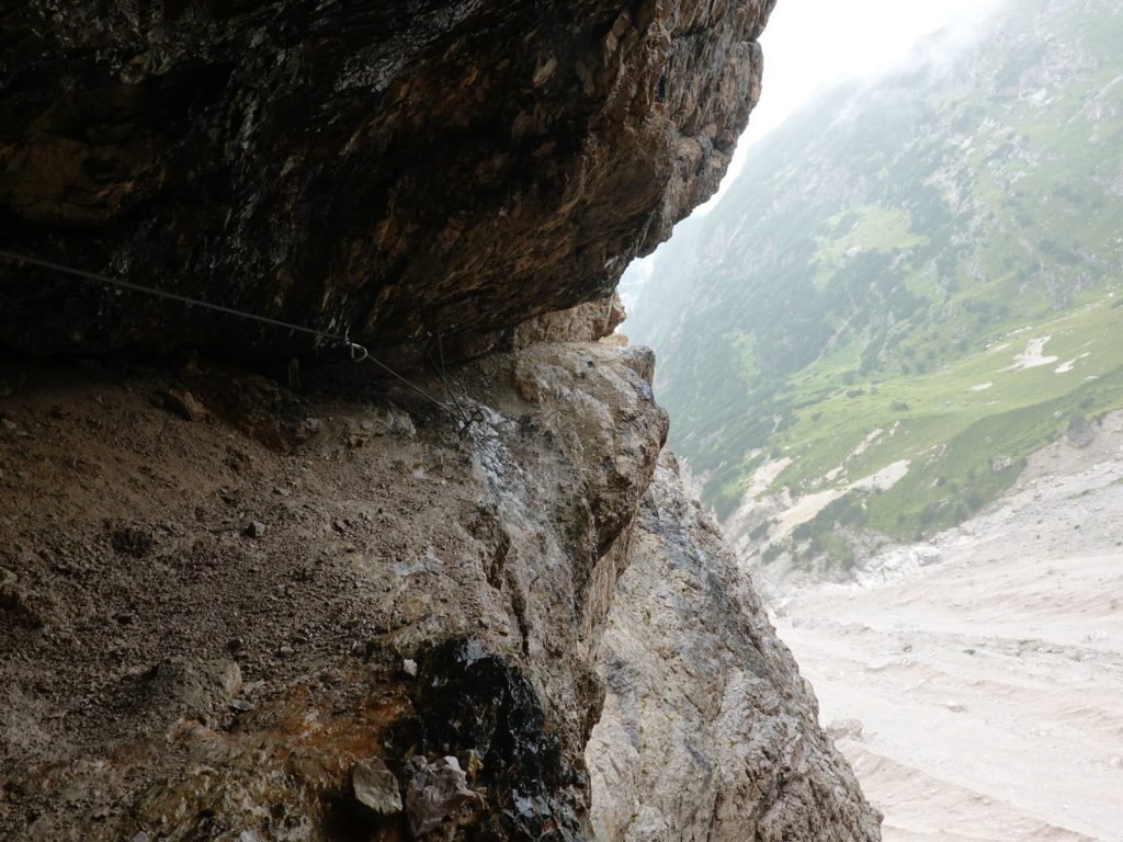
01. Just after the small hamlet of Puiche, the smallest of the cluster of Sapadda villages, the path left the hayfields and barns and went up into the conifer forest.

After these two delightful, cultural and uplifting km the lane ended in the hamlet of Puiche, which was a rural gem in itself. From here the path crossed some uncut meadows passing small hay barns, made from sun blackened logs, and then climbed into the spruce forest. I saw a deer and fawn at the forest edge and they barely moved as I sauntered past. It was as if they did not see humans as a threat. The sun was warm and the glades in the forest were hot and covered in the brown grass of late summer. The large blue willow gentians were prolific here and seemed to be in their prime, with a few yet to flower. Bees swarmed them and they had to go right into the depth of saphire trumpets to reach their nectar.  After a good kilometre of forest path I came to a track. I followed the track as it contoured the conifer clad hillside with the minor road on the valley floor coming up to meet the track. All around were the light grey towering mountains supported by jagged buttresses so characteristic of the Dolomites and other ranges in the Southern Alps. 

I met the minor road at Rifugio Piani del Cristo, which was really a rustic tourist cafe rather than a proper mountain refuge. I stopped here for a cheese and tomato panini before continueing up the road for a good 3 km. It climbed gently and steadily and there were few cars on it to disturb my thoughts. Occasionally there was path beside the road which meandered into the forest for a few hundred metres of shade and spruce tree but it always came back to the road. Eventually this pleasant, but pufunctory, stretch reached a hairpin bend at 1670m elevation and the path now left the road for good and headed west into the forest climbing gently through the trees for an good half hour to reach the Passo del Riccolo in a pastoral clearing. Cowbells broke the silence beneath the towering mountains, especially Peralba which rose nearly 1000 sheer metres to my north. 

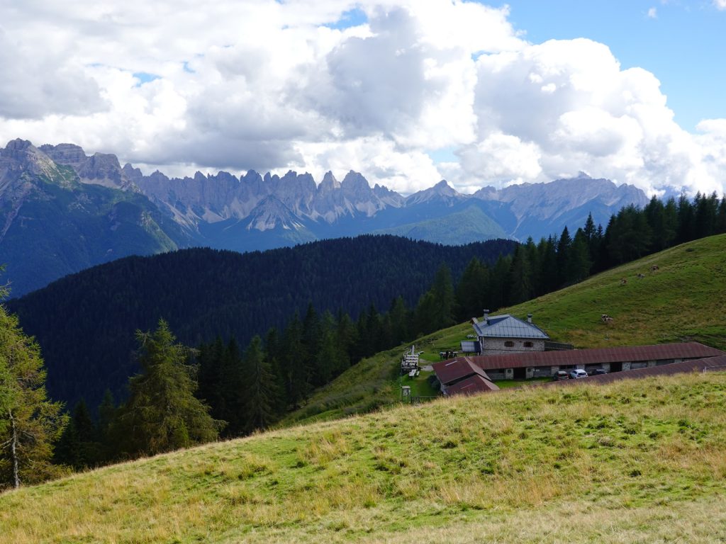
From here it was an easy saunter north through the forest and pasture for a delightful half hour to reach the picturesque Rifugio Sorenti dei Piave. The minor road also went to the refuge where it terminated in a car park for day trippers. The car park was nearly empty and the refuge was enjoying a quiet moment when I arrived. It had some 30 beds but I was the only guest in these strange covid times. I had a 8 bed bunk room to myself and quickly put my sweaty cloths in the sun on the balcony and then had a wonderful shower. Before supper I went to see the spring where the River Piave was born right beside the hut. It was slightly manicured into a stone circle where the pure and crystal water gently bubbled up out of the pasture and flowed down a stone channel to start its long descent to the Adriatic

Dinner was huge, even by Austrian standards, It was simple and delicious honest mountain fare without any hint of pretense or fussy presentation. It took me an hour to eat it all and wash it down with a litre of Radler, a lemonade shandy. Although it was just the Prelude Day to the AV6, it felt like I had already started it with the ambience in the refuge, the mountain vistas and the flowers which I am now familiar with. I am delighted I am at the start of the main walk in my favourite time of year in the Dolomites. 

Day 01. Sept 03. Rifugio Sorgenti dei Piave to Rifugio Gasperi. 23 km. 9 hours. 1610m up. down1680m .  I was ambitious and decided to combine the first two days of the Alta Via 6 into one long day. It seemed a good idea when I planned it looking at the two short 4 hour days. I had a large early breakfast and left well before 0800 retracing yesterday’s steps for the first half hour until I got to Passo dei Rococolo. When I got there the mist which had been flowing up the valley engulfed me and the sun vanished, along with the promise of a nice day. I followed the path 136 which climbed out of the firs and into the scattered larch and dwarf pine woods. There were plenty of flowers on the rocky hillside, some dripping with dew. The rocky path was covered in black salamanders. They were slow and clumsy in the morning cold and had not yet warmed up enough to move off the path. I passed about 30 of them and I had to keep looking at the track to make sure I did not step on any. After a good hour the path started to climb steeply up a gully and I obediently followed it up to a small col called Sella Franza, where there was a junction of paths. 

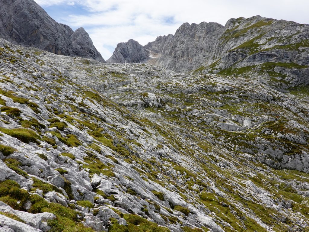
Just at the col I climbed out of the mist into the bright sunlight. Looking back across the valley which I had just been in was a sea of mist, and beyond it rose the south face of Peralba, its light grey cliffs gleaming brightly in the sun. To my south was the steep hillside I had to walk up to get to the Passo del Mulo, 2356m, which was the chink in the barrier of mountains which blocked my path to the south. I now took path number 135 which left the grassy sunny col and climbed up the rocky pasture. I passed a few marmots whose piercing shill alerted other marmots danger was present. It was a sustained climb and it took me over half an hour to eventually reach the pass, where there were expansive views to the north past Peralba mountain and on to the Carnic Alps beyond. However at the pass the mist filled the bowl to the south and I could see nothing. 

02. Looking north from the Passo del Mulo, 2356m, across the valley I had just walked across which is under the mist and on to the great south face of Peralba, 2694m. Just beyond Peralba is the Austrian border.

I set off and descended into the mist leaving the warmth of the ridge behind. I was familiar with the change of the vegetation on different aspects of a mountain and these south facing slopes were covered in the small field gentians and harebells which thrive in more arid conditions. I zig zagged down the path for a short half hour with the sound of cow bells getting louder as I approached the Laghi di Olbi lakes which were obscured by the mist. There was a track going up the mountain here. I suspect it was an old WW1 track, to man defences on the pass I had just come over, when Italy and Austria fought a fierce war throughout the Dolomites. After the lake the path dropped steeply for another half hour during which the mist cleared. I  entered the forest again, first of larch and then fir and spruce as I dropped down to Rifugio Grosso. 

03. Coming down to Sappada from the Val d’Olbe valley to the north of the town. From here the Alta Via 6 crosses the main road and then goes up the Val Enghe valley to the centre right

From here the path 135 continued south descending into a deep valley, Val d’Olbe, with a ski piste zigzagging down it in on a narrow shelf between the cliffs and the river. The piste had been turned into a summer track for All Terrain Vehicles to supply the Rifugio up here and maintain the ski lifts. It was quite steep and relentless but I dropped height quickly passing many day trippers slogging up. Most were going to the lakes and others up Mont Lastroni where there was a path right to the top of this airy peak. I could see the green fields below Sappada approaching quickly as I descended and it was only when I bust out of the forest did the town suddenly unfold with a row of hayfields and pasture, some with sheep. Below them the strip of the picturesque town stretched in both directions along the valley with hundreds of pretty houses all heavily adorned with overflowing window boxes. I followed the upper lane to the west this time, keeping above the bustling main street with it’s numerous sports and local artisanal shops until I reached the large church in the town centre. I stopped here in a cafe for a simple lunch of 3 cheese and tomato rolls.  

04. One of the many old farm houses in Sappada. All the houses were well maintained and cared for in this picturesque town

It was about 1300 before I set off again to do the other half of this double day. I walked down to the valley floor where I met the Piave river again. It had grown considerably since I left its source just 5 hours earlier and was now a small river. I crossed it on a bridge by a local sawmill and then headed into the forest up the Enghe valley. It was dry and dusty and the air was full of the smell of hot pine. The path I was on, the 314, went up the west side of the river on a forest track. The trees had been selectively thinned here by harvesters so the sparse forest offered little shade for a couple of km. It was only when the valley narrowed that the forest old growth reappeared. The conifers were mixed with beech now which dappled the light and kept it delightfully cool. After a good hour the track vanished and forked into two routes, one continuing up the valley up to the Oberenghe Pass and the other, Path 315,  climbing a steep side wall to the hanging valley above and on to the Elbel Pass. I had to take the latter. 

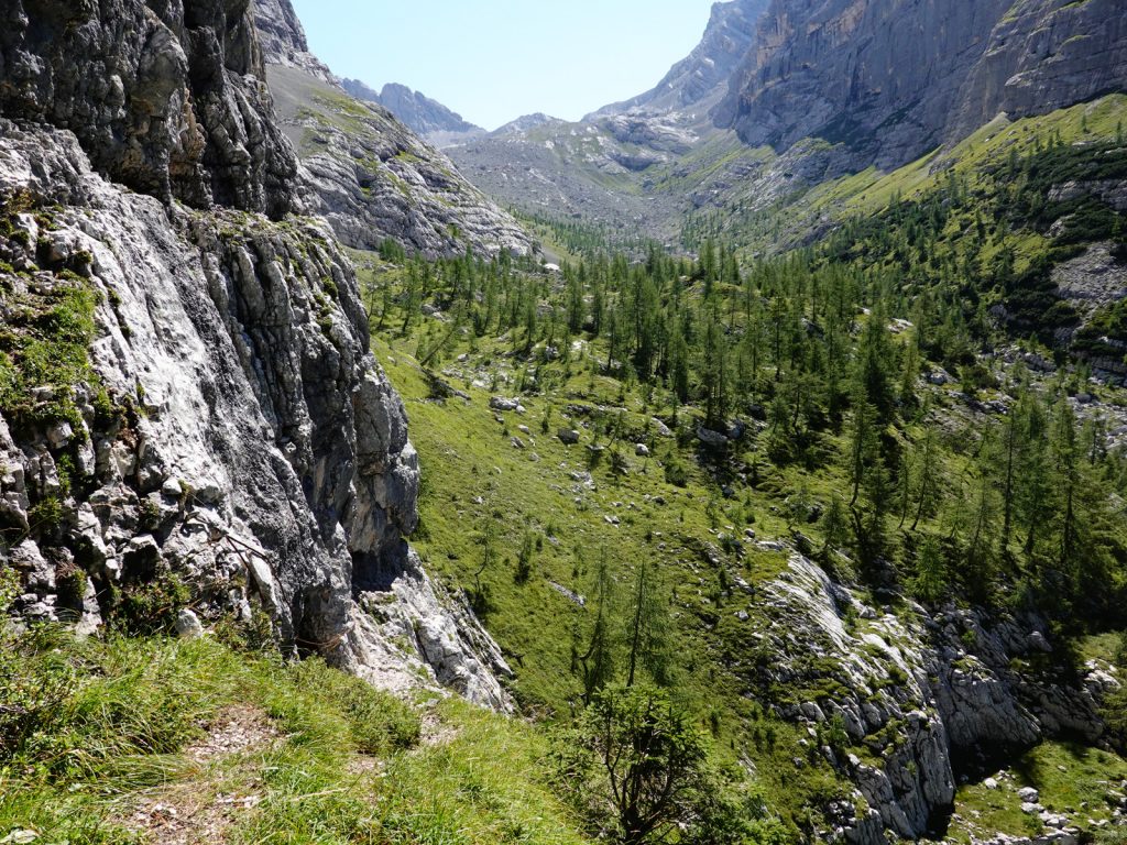
I stopped for a pause at the bottom where there was a cool rivulet and prepared myself for the 500m climb. It was up a small path which was always obvious in the long lush vegetation on each side of it. It wove its way up the steep hillside going between the trees and shrubs. Near the bottom it passed a shower of a waterfall pouring off an overhang into a clear pool. On and on it climbed and with each 100 metres the vegetation changed from spruce to fir and eventually larch. The views north down the valley I had just come up and on to Mont Righile and its massif, which I had come over earlier this morning were tremendous. At last the gradient eased as I finished climbing the main valley wall and entered the lost world of the hanging valley. This was a Shangri La of scattered larch and lush pasture, with many plants still in full flower with an abundance of speices. I ambled up the path which wove through this karst landscape beneath towers of limestone peaks as I gently closed in on Passo Elbel, 1963m. At the pass I now looked over into the forested upper reaches of Val Pesarina far below in the District of Fruli. 

05. Looking north back down the fertile hanging valley from the Passo Elbel pass, 1963m. The valley below is the Val de Enghe and the mountains in the background are the ones between the tart of the AV6 at Rifugio Sorgenti del Piave and Sappada town, which I came over in the morning.

With weary legs I started down the other side which was initially steep as it made its way to a junction beneath a huge rock buttress in the upper firs. From here the path traversed east across the hillside alternating between fir forest and grassland. Sometimes the route was broken by a deep ravine, where heavy rains had produced a torrent which ripped a furrow in the hillside. Often these ravines are difficult to cross, especially if recent. I have noticed over the last 20 years they are getting more severe as global warming produces heavier rains. In a grassy glade by an old ruined shepherds house, path 315 came to an end as it met path 201, which came from the valley floor up to my goal for the day, namely Rifugio Gasperi. I had hoped it would be an easy saunter up through the forest but previous rains had obliterated the old path and a diversion had to be made which dropped 100 metres before crossing the stream and climbing back 100 metres. I was getting tired now, but someone had made a series of wood carvings of comical people and they were placed at nearly every bend. There were about 10 in all. The quality of the carving were not great but the representations of each were provocative and thoughtful; almost like a Banksy artwork. 

The path eventually reached a crest and I could spy the white wall and red shutters of the Rifugio Gasperi through the trees on the other side just a few minutes away. There were only 2 other couples there, both very friendly and the hosts Simone and Rebecca. Simone was a creative intellect and I suspect he made the carvings and he also was involved in a schools project in Nepal. Rebecca was beautiful and spoke great English. The were both local Fruilians and made me feel very welcome. That evening they made me Frico, a local dish of fried potato and fried cheese. I tried to write but was too tired so listened to the hosts and other two couples chat, trying but failing, to join the pieces of the conversation together in the strong Friulian dialect. Just as I was going to bed another couple arrived. They were from San Marino. They still had their Via Ferrata harnesses on having come over the path 316 from Sappada, during which darkness had overtaken them. I was astounded to hear they had come from Rigugio Sorgenti dei Piave also and were indeed doing the Alta Via 6.. They had also done a double day, but said it was too much. I agreed it was, and inwardly decided to cancel my double day tomorrow and just go the Rifugio Fabbro instead and Rifugio Giaf the next day. 

06. The friendly Rifugio Gasperi at the end of the second day. It was owned by the CAI and run but Simone and Rebecca.

Day 02. 04 Sept. Rifugio Gasperi to Rifugio Fabbro. 12 km. 4 Hours. 590m up. 580m down. I did not need to get up early but dragged my tired limbs out of bed at 0700. No one else was up so I sat in the empty dining room looking out of the window down to Val Pesarina far below and browsing books. Simone came through at 0730 and made me coffee and a breakfast of cheese and bread. He then phoned Rifugio Fabbro and arranged a place for me. I eventually left at 0900 by which time the perfect blue skies of the day were now perforated by cloud. I left the friendly Rifugio, walked over the rise and then started the descent down the new path, enlivened by the carved wooden statues, until it crossed the stream and reached the clearing with the ruined shepherds house where yesterday’s the path junction was. 

I now took path 203 across the hillside heading west through forest which had been greatly affected by a storm some 10 years ago causing many windblown trees. Pretty soon I came to a great grassy clearing where brown grass grew tall in the hot summer, ungrazed by cattle or sheep. It was an old pasture belonging to the Casera Mimoias, which now lay in near ruins at the west end of the pasture. I went into the shepherds house which was still just habitable with an intact roof but all the dairy building’s roofs had fallen in leaving just the walls, which would soon crumble. It was a lifestyle of yesteryear when these dairies were the lifeblood of the region producing their artisanal cheeses. 

After the dairy the path 203 joined a forest road which had recently been rebuilt and enlarged to allow for the harvesting of the forest. I followed it down as it gently traversed the valley side and then climbed it gradually as it rose up to the gentle saddle of Forcella Larvardet. It was not an inspiring walk as the pilfering of the forest was wholesale in places, resulting in areas of near clear fell. It was not the usual practice in perhaps Scandinavia or other places I have seen in the Alps where 50 per cent of the trees are taken allowing the remainder to nurture the area and allow some natural reseeding. Even where the trees had been cut 10 years ago I could see no seedlings coming through the debris of smashed branches and smaller trees which were left behind in the pillage. Luckily only a third of the forest had been felled and two thirds remained.  

At the Forcella Lavardet the untarnished forest returned and I had a gentle shaded saunter down to the Storta valley some 2 km away. Here there was an old dairy, Casera Campo, whose pastures had been given over to a small herd of donkeys and Shetland ponies, who sheltered in the shade under a copse of fir. The main house of the dairy was being restored and the dairy buildings were still intact and under a good roof. It was easy to imagine the pastoral lifestyle here which perhaps left only 30 years ago.  To the north of the Casera Campo dairy were steep massifs each side of the Val Frison which flowed to the north draining all these lands west of Forcella Lavardet down to the Piave river. I could see a large Rifugio further down the valley which was the club hut of the Feltre Alpine group.

I continued west of this tranquil oasis glade and reentered the forest for the final leg of the day. It was a long climb up a newly improved forestry track which climbed through a series of hairpins in the forest for a good hour to reach Rifugo Fabbro. The forest here was also being harvested although not in the same wholescale manner as previously and in the areas which had been felled some 20% of the trees were left standing. These would be vulnerable to storms and could well become windblown later. This again was not a particularly interesting walk due to the track and the forest felling, but there were some views and interesting plants and flowers. 

I reached Rifugio Fabbro at about 1300. It was on a minor road which linked the district of Fruili and Belluno. Being a Saturday it was busy with sports cyclists clad in lycra with massive thighs, padded bottoms and bulging crotches, motorcyclists clad in leathers with skinny legs and great bellies and gentile couples out for a short drive and walk combo. All were eating here as I arrived and the place was busy and staff barely coping. I found a quiet corner and ordered 3 rolls of cheese and tomato and a litre of water. I then wrote for the next 3 hours. During this time a group of hunters arrived. however from what I gathered they had given up the thrill of the kill and now were just content to find their quarry, which was blackcock. a bird in the grouse family. There were about 20 hunters in all and perhaps 20 setter dogs which lived in specially adapted vans. The hunters were great characters, loud and macho and dressed to the nines in camoflage. They could not find anywhere to sit so they just sat amongst the lyca clad cyclists and started to smoke and shout to each other. They soon had a few tables to themselves. The average age was about 60 but there were some youngers ones amongst them. One had the whole array of a male blackcock tail feathers sewn in his Friluian felt hat. Although they were characters they was not an intellect amongst them. The very also spending the night at the refugio. 

I had just finished writing at 1700 when the couple from San Marino arrived. I had to share a room with some 20 beds in it but there was only the San Marino couple and myself in it, and at opposite ends. The hunters took the rooms on the floor beneath but they were quiet after dinner and went to bed early  The Rifugio had free hot water showers so I washed my clothes and started to charge all my batteries. The only thing dissaponting was the dinner. When I mentioned I was vegetarian they lazily produced a large slice of fried cheese and a dollop of polenta. While the carnivores got 2 large courses, one of which was vegetarian anyway. I badgered the for more food which I grudgingly got, but it would be enough to sleep on. I will get my revenge at breakfast and gorge myself if there is a self service.

Day 04. Sept 05. Rifugio Fabbro to Rifugio Giaf. 20 km. 7 hours. 890m up. 1250m down. We all had a 0700 breakfast which was a lively affair with the 20 odd hunters. They had already been up for a while preparing their beloved setters for the days tracking. I ate with the San Marino couple and then left soon afterwards at 0730. I went past the vans with the setters who were beside themselves with excitement at the anticipated scent and track, and walked to the Sella Ciampigotto pass. The original route of the AV6 now went down the road for 3 km past a series of hairpins. Perhaps when the route was conceived 50 years ago this road was a track. There was an alternative which headed down the small valley to the south on path 337, but it was not marked on my map and I missed the start of it. It would be a far better alternative now than the 3 km on the road which was partially redeemed by being quiet in the morning and through forest. 

When the road got to the side valley of Val Larga a forest track forked off to the south. I took it and almost immediately met the bottom end of the previously mentioned path 337 which came down from the pass and looked well used. The track now crossed the stream on the valley floor and started a sustained hours climb up through the firs with the occasional zig-zag. It helped warm me up on this cold morning, as despite it being clear blue skies the firs were tall and it was dark on the forest floor. The track reached a large clearing with cow bells telling me I was approaching the dairy Casera Doana. I passed over the electric fence and went into a huge pasture. There were perhaps 100 cows there altogether grazing peacefully on the lush, emerald green grass in the morning sun. The pastures were dotted with a few large trees. At the north end of the pasture was the dairy itself with a splendid and well kept shepherds house and two rows of barns, which were in great order. It was a joy to see this honourable lifestyle still persisting against all the odds. It made me euphoric to see that this ancient culture was still thriving.  I spent a while at the dairy, taking photos and exploring the buildings. There was no one about but it was obvious there were people in the large solid two storey house.

07. The working dairy of Casera Doana. There were perhaps 200 cows here and their milk would have been tirned into an artisanal cheese. Most of these dairies were built 100 years ago but many are now abandoned.

From the dairy the AV6 now followed the path 336 on a grassy level track which contoured across the hillside through the larches. It was a delightful km and the views to the west were stupendous. I could see north to the Sexten Dolomites and the mountains I passed through last year on the AV5, and I could see the mighty massifs of Marmarole and Antelao which I also went through last year on the AV5. It was a sublime hike despite it being a bit muddy due to the cows hooves churning it up. Towards the end of this stretch the path 336 dropped down through firs to the saddle of Passo dei Landro. I looked forward now to the descent down the spine of a ridge into the valley far below. However it was not to be. The path almost vanished and it was steep, uncomfortable underfoot and frequently blocked by windfall trees. It was a knee jarring 45 minutes down the ridge where I lost the path a few times where fallen trees created diversions. The juniper and stunted firs gave way to larger firs and eventually beech as I carefully picked my way down. It was with some relief when I at last reached the prominent track 207 which contoured round the ridge. 

08. The remote Casera de le Fede dairy is now abandoned as a dairy and its pastures used by Casera Doana. In the background is the peak Monte Pupera Valgrande, 2513m.

It followed track 207 for a very easy saunter through the beech forest for 2 km which was a delight after the descent down the ridge. The cool air and dappled light of the beech forest and the gentle path was over almost too quickly when the path morphed into a track at a cluster of cabins, mostly made from converted haylofts. The track now veered south and morphed into a small road which was lined with these cabins. At one cluster there was a small chapel which I think the Pope visited some 20 years ago. I could soon hear the roar of motorbikes and cars as the minor forest road approached Passo Della Mauria. There was an abandoned Rifugio here which looked like it had been boarded up for 20 years and a small cafe which was closed and perhaps only open on busy holidays. I had the feeling that the hamlet of Passo della Mauria’s best days were behind it, and it did not invite me to linger. 

I still had another 5-6 km to go and thought it would take me two hours so pushed on rather than rest. Initially the path was on a beautiful grassy track through firs but it petered out at the first of the great stone chutes coming down from the jagged peaks of Mont Cridola far above. These stone chutes were perhaps 200 metres wides and in heavy rains would start to flow down taking all before it depositing another 1000 or so tonnes on the main valley floor below. I crossed this chute and then contoured the hillsde for half an hour to reach ther next gouge in the mountain which was filled with stones. Crossing this I started on the final stretch round another ridge. The path, number 341, climbed steeply up through a beautiful beech forest with a grassy floor for a good half hour. I noticed a few cyclamen coming through the mast on the forest floor. In some places the corms were on the surface. This last climb was taxing though and it was with great relief that I saw on the map the path now contoured round the hillside to arrive at the Refugio Giaf. 

The first thing I noticed about the Refugio was it young cosmopolitan and extremely friendly staff. About 10 twenty somethings worked here, mostly serving the days trippers and climbers during the afternoon rush. The staff seemed interested in Scotland and everyone spoke great English, even one guy from Rome who parents were originally from Sri Lanka. I got a small room to mtself, had my usual lunch of 3 cheese rolls and a bottle of water. I then wrote in the afternoon and chatted to a few of the staff before the San Marino couple, called Elena and Nicolo arrived. We ate our supper together and agreed it was a great days hike but the descent from Pssso dei Landro was testing, especially for them without a map or GPS gadgets. Luckily the weather remained great all day as coming down that ridge after Passo dei Landro would have been slippery in the wet.

Day 05. Sept 06. Rifugio Giaf to Rifugio Tita Barba. 11 km 5.5 hours. 1320m up. 910m down. There were only 5 hikers staying at Rifugio Giaf and we all had breakfast at 0700 but then we all had a leisurely start. I was the last to leave at 0900. It was a a beautiful morning and it had rained in the night yet again. The jagged towers to the west of the rifugio were clear but mist was already starting to swirl around some of them. The path today was initially a simple one up the valley floor for 600 metres to a pass and then down a valley on the other side for 700 metres. The climb up from the refuge was not steep but it was sustained with no let up. It was just vegetation which changed as I slowly climbed. Initially the path went through thick tall firs which got smaller and then changed imperceptibly to spruce and then from the half way point onwards larch and then dwarf pinus mugu. It was only when I got to the sparse larch and small pine did the views open up of the huge slot I was in. On each side the walls rose verticall for many hundreds of metres to row upon row of jagged spires. There were new plants I had not seen before like a ragged flowered diantus scattered in the gravel of the valley floor near the top. 

As I approached the top of the pass, called  Forcella Scodavacca at 2043m, it was just a sea of boulders and small stones which filled the valley floor. The pass itself was quite gentle compared to the huge walls on each side which hemmed this sea of stones in. There was a path junction at the top with one route going up steeply to a saddle on the lofty Mont Cridola to the north and the other a continuation of the path 346 down the other side. I took the latter and pretty soon I reached the first of the larches and then into the firs soon after. It was a mixed descent with some steeper parts but all in all it was quite pleasant. On the other side of the valley I was descending down into rose a forested hillside with a clearing at the top. This was the dairy at Casera Vedorcia and I knew that just above it was the tiny refuge of Tita Barba. The path went down and down until it reached the beach forest where it became much nicer and easier underfoot, as the beech mast covered the limestone tufa chunks found amongst the conifers. This lovely beech forest continued for a couple of km until I was spilled out onto the idyllic grassy meadow by the dairy of Casera Pra de Toro where there was a dairy.

09. The idyllic Rifugio Padova is a great lunch break on Day 4 from Rifugio Giaf to Rifugio Titi Barba. The pass centre right is the Forcella Scodavacca, 2156m, with Mont Cridola, 2581m, to the left of the pass.

At the bottom of the meadow was the charming Rifugio Padova. This was supposed to be a overnight stop on the AV6, but it took just 3 hours to get here and it was not yet midday. I stopped here for lunch and had cheese and lettuce rolls sitting on the balcony of the picturesque rifugio. I sat behind a pillar and enjoyed the shade from the sun. As I sat a relaxed I suddenly noticed the enormous mountain massif which had unfolded on my descent. It was a wall of some 30 peaks which stretch about 5km from end to end. This massif was called the Spalti di Toro, the Wall of  Thor. I had noticed it last year when I traversed the Marmarole Massif on the AV5 and it looked impressive from there but it was mesmerising from here, with awe inspiring peaks all strung out in a row. A traverse along the ridge line would take weeks going up and down the numerous and very sharp peaks. Just as I finished lunch Nicolo and Elena arrived. We chatted a bit before I started off on the second half of the day.

The path now went up the west side of the meadow to trees where all the cows were sheltering from the heat of the midday sun. It then started a easy climb up and over a large knoll covered in beech trees. The route was peppered with wooden carvings, some were of a very proficient craftsmanship but they did not have the mischievous artistic flair of the ones below Rifugio Gasperi. At the top of the large knoll was a sweet log cabin with red shutters. The descent down the other side in the beech wood was warm and humid but within 20 minutes I had reached the river where there was a log bridge and a glade called Valle with yet another delightful log cabin. 

10. The working dairy of Casera Vedorcia is one of the nicest in the Dolomites with small haylofts and cabins dotted about this pasture. The wall of peaks to the east are the Spalti di Toro (The Bastion of Thor), with the highest peak being 2548m

From here the route of the AV6 went steeply up the wooded hillside for nearly 500 metres. Despite it being in the forest the heat of the day had even penetrated here and it was hot labourious work as I plodded up for well over and hour. The forest remained spruce and fir for the whole climb. Eventually I broke through into a glade and a bit later then onto the edge of a large pasture dotted with picture perfect log cabins all with window boxes. At the bottom of tis pasture was the functioning dairy with it main shepherds house and 2 rows of barns. About 40 cows all sat in the shade of one of the barns, their black noses shiny and wet, and chewed their cud as I went past. It was really something from a postcard especially with the backdrop of the Spalti di Toro range across the valley. At one of the cabins in Vedoricia there were about 20 men all sat at a large table. They all had full moustaches and Fruilian hats of felt and many also had felt breeches on. It looked like an annual gathering of the local worthies. I asked one where the Rifugio Tita Barba was as I suspected this was it and it allowed me a closer look at the gathering but it was up the hill about 15 minutes away. 

The Rifugio Tita Barba was a private refuge and it was not run by the CAI mountaineering club of Italy which most are. It was small but perfect. I sat almost ontop of the ridge with the most perfect view to the Spalti di Toro. I have heard it said it offers the best sunset views in the whole of the Dolomites when these mountains get an orange hue in the Alpenglow. The Rifugio itself was perhaps the most charming I have ever stayed at. It was two storeys of wooden logs which glowed brown with decades of sun. The stairs were external in covered balconies adorned with red geraniums. I would not be surprised if it featured in many calendars. The older couple who ran it exuded warmth and were very helpful. I managed to get a small phone signal buy wandering through the woods to the ridge but it was not enough for data. However, the spot had a great view to the west over the Cadore valley with the river Piave far below, and then across to some giants of the Dolomites on the other side including Pelmo, Antelao and Marmorole all of which I have trekked around. The views from this charming delightful Refugio were really second to none. 

11. The fabulous Rifugio Tita Barba which has been privately run in the same family for 90 years. The current custodians Daniele and Anita are the third generation. It has some fabled views over the Spalti di Toro to the east and to the west are a few giants of the Dolomites, namely Pelmo, Antelao and Marmarole, just across the Cadore Valley.

The food at Rigugio Tita Barba was fantastic, with large helpings. Nicolo and Elena had meat and it they got 3 different cuts each, a steak, a pork cutlet, and a sausage. I had a huge helping of barbequed courgette, fried cheese and polenta as well as a rich bean soup. We chatted in the evening with Piero, who both worked at the Rifugio and was a professional commercial product photographer. However he also did landscapes in his spare time and published a coffee table book on the Spalti di Toro range and this refugio. There was vast array of grappa and I had the one infused with the pine cones of the dwarf pine, Pinus mugo.    

Day 06. 07 Sept. Refugio Tita Barba to Casera Laghet de Sora. 8 km. 4 hours. 700m up. 670m down. Daniele, the host, told us of a different way to get to Casera Laghet de Sora which was slightly longer than the traditional route but much more varied and with great views so the 3 of us decided to take it. We left the peaceful glade where the cabin sat and headed south contouring along the ridge. There were fantastic views east across the valley to the wall of about 30 peaks which made up the Spalti di Toro. It was idyllic hiking and the mixed spruce and larch forest was easy underfoot. At one point I saw a cabin perched on a side ridge overlooking everything and it must have had a wonderful view. After about 2 km the path forked with the official route going towards the perched cabin and on to Forcella Spe, while our route, the path 355, continued south up a small pass lined with dwarf pine called Forcella Pian del Laris. 

13. On top of the Forcella per Vedorcia, 2234m, looking NE. Rifugio Tita Barba is over the shrub covered ridge and to the left while the mountains to the right are the Spalti di Toro range seen end on from the SW.

From the top of this pass there was a great view south across a bowl of scree and grass surrounded by smaller peaks and sloping gently to the west where it drained down to the Piave in the Cadore Valley. Across on the far side of the gentle bowl we could see the path contouring across the hillside before climbing more steeply to Forcella Vedorica. It was the lowpoint on a ridge which was full of gullies of crumbling friable rock. It took a little less than an hour to reach the pass with the last section up quite steeply on loose gravel and rock. The view from the top was more gentle than what I was expecting and there were very few Dolomite towers. The concentration of them around Spalti di Toro was now out of view. Of course in the distance there were massif upon massif across the Cadore valley and even up to Cima Toni at the start of the AV5. To the immediate south was a large scree and grass filled bowl and I could see two herds of sheep grazing in the middle of it. Down in the depths of the bowl a stream sparkled in the sunlight and there was a small stone shepherds cabin. It was only a 200m descent down to the cabin past one of the herds of sheep and we got there in 20 minutes. A small herd of donkeys grazed in the meadows around the cabin and they came over to greet us and were keen for attention. They had no fear of humans despite being up here alone as the shepherds cabin was locked. This large deep bowl was called Casera de Cavalet and it was quite idyllic. It was a bit of a Shangri La and quite remote. Each of the 3 paths to the valley had to come over a pass to reach it. 

14. Coming down from Forcella per Vedorcia towards the pastures around the bowl of Casera Cavelet. Here sheep are left to graze the mountain slopes for the summer months.


There was a path to the SE of the bowl over Forcella Val dei Frate. It was only a 200 metre climb so it looked more daunting than it was. We found the marked path and started heading up. After a little bit, just before the small rock filled valley we were walking up got pinched by a buttress, where stopped for lunch. The walls of Cima Sella mountain rose steeply to our north right beside the path and I was looking for my favourite flower, Campanula morettiana, on its cliffs but I could not see any of the flashes of purple which gave it away. Suddenly a chamois bounded down the rocks and onto the gravel. It looked at us briefly before continuing to bound effortlessly down to the bottom of the valley, up a grassy gully and then up between the outcrops on the other side. It made it look so easy. Soon after we reached the pass and could see down to the deep bowl on the other side where the small cabin Laghet de Sora was. 

15. The grassy bowl of Casera Cavalet where there is a small shepherds stone cabin for summer use. In addition to sheep on the pastures there were also about 15 donkies. The pass, Forcelle del Frate, over to the Laghet de Sora cabin is in the middle of the picture behind the shrub covered knoll.

The descent was steep and across loose gravel. The path, which was not well used, zig-zagged down it but occasionally a torrent had washed it away which made it tricky. As we descended we did not take our eyes off the path as every step had to be sure, but occasionally when we did glance up there was a tremendous view to the east across the Friluian Dolomites on the other side of the enormous Cimoliana Valley, which cut a bottomless gash in the landscape just beyond the cabin. It was only a 300 metre descent from the pass to the cabin but it felt much longer. I was glad it was dry as I think walking this in pouring rain would have been slippery. We passed a stream just as the gravel ended and we veered to the south over steep grassland, where the path was surprisingly small and hidden under the 30 cm high grass. We passed a small patch of snow in a north facing gully and then reached the cabin in the bowl.

It was quite idyllic and simple and was made of stone and lined with old browned wood panelling on the inside. It was the old shepherds house from when this pasture in the bowl was grazed. It was now run by the CAI mountaineering club of Italy who also maintained it. At one end of the cabin were two rows of 4 mattresses, one above the other, and at the other end a table and window. The bowl we were in was really a hanging valley and the cabin was almost on the lip of it as it descended steeply just after the cabin down to the Cimoliana Valley. After relaxing in the afternoon sun on the grass outside I went in and wrote at the table, While Nicolo and Elena went off to get water. Once finished I went up the unmarked and abandoned path to the south towards the Forcella Val del Drap pass to see its condition, as I had heard much about it and none of it was good. By the time I got back two Italians had arrived. They were both scout leaders on an exercise. We all ate together but the conversation was largely in Italian with Elena translating the odd bit for me. I was tired after dinner and went to bed early as I wanted to to the Val Drap pass tomorrow.

16. Looking east from the Laghet de Sora cabin early in the morning. Across the unseen canyon of Val Cimoliana are the peaks of Turlon, 2270m, (centre), and Cima dei Vieres, 2310m, (right) in the seldom visited Clautane Dolomites

Day 07. Sept 08. Laghet de Sora to Casera Lodina. 16 km. 9 hours. 1280m up. 1570m down. A scout masters alarm went as 0600 so I hopped out of bed and stated boiling water for my freeze dried breakfast. I was packed and ready to go by 0640. I said good bye to the San Marino couple Nicolo and Elena and we hugged each other. We had eaten together and chatted in the same Rifugio now for 6 days and had become friends. I will miss their easy warm company. It was a clear morning but as I walked through the grass wet with dew, mist started to form. I walked up the outcrop behind the cosy house on the unnumbered and unmaintained path, which was sometimes barely visible in the long grass. After climbing for 20 minutes the path reached a grassy bowl called Pala Anziana. The towering mountain of Cima Laste whose top was lost in the mist rose from the upper edge of this bowl, and grassy outcrops descended steeply into the valley from the lower edge making the Pala Anziana a grassy shelf. 

17. Crossing the Pala Anziana in the early morning while hiking from Casera Laghet de Sora to Forcella Val del Drap. In the misty background is the Spalti di Toro ridge

As I walked across it I disturbed a large herd of perhaps 30 ibex. They were very confident and only moved out of the way slowly. I also disturbed 3 chamois and they ran off with exceptional speed taking huge strides across the grass bowl to the lower edge. They then leapt through a boulder field and sprinted down a steep outcrop. I was amazed at there agility and hope they did not injure themselves. At the end of this grassy bowl was the boulder field and then bare rock. There was a deep ravine across the mountain side here and I had to climb up to find a way round it. After the ravine the faint path descended to a stone chute which came down from the pass. I gingerly picked my way down the steep grass and boulders until I reached the stones. I noticed a few ibex had gone another way and were already on the stones and looked at me with contempt as I cautiously descended. Once on the stone chute I had to cross it towards the pinnacle which formed the other side of the stone chute.The way directly up to the pass was blocked by slabs so the faintly marked path had to climb, quite steeply in places, and I had to scramble up using hands, for 10 metres to reach another stone chute which led to the pass. The mist had risen enough now I could look south and see the passes of Forcella Caciatori and Forcella Compol. Both looked prohibitively steep, loose and dangerous and I could see why the AV6 no longer goes this way officially. Indeed people told me the path was “cancelled” and abandoned. 

18. A female Alpine ibex (Capra ibex) on the rocky bowl just north of the steep scramble up to the Forcella Val del Drap pass, 2290m.

My mind had already been made up but this confirmed it. The hardest and most dangerous part of this section between me on Val der Drap pass and Bivacco Gresselin was unseen on the south side of Forcella Campol. Instead I decided to go down some 1300 metres into the Cimolais Valley, walk down the road in the valley and then climb some 1200 metres to Bivacco Greselin where the AV6 resumed.  Since the AV6 was contrived 50 years ago there have been some morphological changes to the mountains here which has essentially rendered this section impossible to mere mortals, and the official way goes from Laghet de Sora down the Val de Frassin on path 390 to the main Cimolais valley and then up to Bivacco Gresselin. Rather than go back I knew there was a route down the steep wild valley on the south side of the Forcella Val de Drap pass. Initially it was a slope of grass and stones between cliff and a large snowfield which was the remnants of a once proud glacier. The path was steep but not steep enough to slide if you lost your footing. It descended 300 metres to the bottom of the snowfield and then crossed the rocks at its snoot. This was where the route up Forcella Cacciatori went and it looked fiendish and out of the question. 

19. The last scramble up Forcella Val de Drap, 2290m. From here the route goes across the stone filled couloir to a diagonal gully with a patch of grass on top. It then clambers up the ridge to get to the pass. The south side is not so steep.

From the snout of the snowfield the feint path continued down steeply no back on the north side of the stream. In places it was very steep and I had to downclimb, but there were many dwarf pine branches to hold onto, and they are immensely strong. A couple of times I thought the path was blocked when I approached the edge of an outcrop but there was always a route down. It took perhaps just half an hour to do the first part of the descent beside the snowfield but this second part took a good hour and much caution. At last I got to a huge fan of stones at the bottom of a debris chute from the mountain above and the path slowly curved round the edge of it so half an hour before depositing me in the dwarf pine forest While the faint path treaded a route through these shrubs it was slow work and I often had to force myself past busy green foliage and the end of strong boughs. At last the faint path merged with the official route the others had taken and it was now an easy saunter down through beech on a track for half an hour to leap across the river in the main valley and reach Pian Fortuna and the road end where there was a parking place. I was glad I had given it my best to go the old way of the AV6 but it was now obvious to me why the official way had been rerouted.. 

The Val Cimoliana valley is really a huge canyon some 1000 metres deep with a heavily braided river flowing across the flat bottom through channels in the sea of white stones which it had carried here. I started down the road at the bottom of this canyon and marched down it for 5 km. There were very few cars so I did not feel too humiliated walking down the road. The landscape was quite awe inspiring with huge walls rising up each side. Occasionally a side stream would cascade down a steep valley and join the crystal clear torrent. Down and down the valley road I strode hoping to get this section over with when I reached the Punta Compol bridge. I was told there was a Ranger Station, there but it was just a small ticket booth in a small cabin and it was closed. It was a shame as I wanted to ask the rangers about the state of the path up to Bivacco Gresselin and also the path I would take tomorrow round the side of Mont Duranno, as I had heard a path in the Mont Duranno vicinity was now also impassable. However, with no one about I optimistically assumed it was another path which was damaged and turned west to start the 1200 metre climb up to Bivacco Gresselin. 

As soon as the slope started I could feel my legs grumble and the in the heat of the day I could feel a sweat building. Despite going through beech woods it was warm and humid. I climbed a couple of hundred metres and then stopped for lunch on the empty track. After lunch and by good fortune I met an experienced mountain walker who was coming down from Bivacco Gresselin having spent the night there. He spoke great English and said I was fortunate not to have tried the two difficult passes of Cacciatori and Compol as they were impossible now. He raved about Bivacco Gresselin, and the ibex there, and the mountain views but warned me the path between the Bivacco Gresselin hut and Forcello Duranno Pass had been badly damaged by this years heavy snowmelt and rain. All the stones had been swept off some steeper slabs leaving just bare rock covered in a scattering of gravel. He said it was possible to traverse the slabs carefully, but that if I slipped and fell I would not be able to stop and would go over cliffs. It was not what I wanted to hear. He suggested I go up to the old shepherding house of Casera Lodina for the night and then go to Forcello Durano tomorrow to join the AV6 after the damaged part. After we parted company i walked for another half hour and got to the junction for  Bivacco Gresselin or Casera Lodina. On the sign post was a notice saying the path 358 was “dismisso” or cancelled due to the damage between Greselin and Forcello Duranno, which confirmed what the man said. 

I did not want to get into a pickle in a remote location or even get stuck on some difficult ground so convinced myself that as the path was closed then the official route of the AV6 had also changed and the path to Lodina and Forcello Duranno to pick it up again was the new official route. Plus it was 450 metres less I had to climb today and my legs were already tired. So I took the path to Casera Lodina to spend the night in it. The path up to it climbed for about an hour through a beech forest. The trees were tall and thin and it did hot feel as homely as other beech forests but it provided shade. Eventually it brought me to the edge of a large pasture with tall ungrazed grass. At the bottom of the pasture was a trough and a pipe rammed into the hillside where a spring was. A cool trickle spilled off the pipe into the trough. I was thirsty and drank 2 litres at the trough and then filled my 3 litre pouch. It was a stroke of luck as often shelters here have no water in the vicinity in the early autumn. The Caseras Lodina, which was an old shepherds house when this pasture was used, was just 10 minutes up the hill. 

20. Looking down into the Cimoliana Valley from the stone cabin of Casera Lodina which is some 800m above the valley. In the distance is Monte Pramaggiore, 2478m.

It was a bigger building than Laghet de Sora and had a large main room and a small bedroom with 6 beds on 2 sleeping platforms. I had the whole place to myself. Once I upacked I went out to see the remarkable view. The Cimolais Valley I had just walked up from was some 800 metres below. Across the other side of this valley were very craggy and inaccessible mountains with no chink in their ramparts. However what really interested me was how near the most difficult side of Forcella Compol was and I could see the grassy bowl in with Bivacco Gresselin sat. I could also clearly see the route from Bivacco Gresselin to the Forcello Duranno pass. From my viewpoint both, especially the former looked impossible and I am grad I am here and not at Gresselin with the broken dangerous path to do tomorrow. I wrote in the evening as it got dark and could feel the cold envelop everything. However in my duvet jacket and sleeping bag I was warm. It had been a long day physically and also mentally on some of the passages around Forcella Van del Drap. It had also been a long day philosophically with I struggled to justify not doing the original path and reconciling that with the practical and dangerous hazards which have developed since the AV6 was first construed. However the new official route of the AV6 around Cima Del Preti and Mont Duranno is much more feasible and after seeing the hazards of the original route in these parts I can accept it. 

21. Looking east from the pasture above Casera Lodina to the cabin at the foot of the meadow. Beyond the Cimoliana Valley below are the rarely visited Clautane Dolomites capped by Cima dei Vieres, 2310m

Day 08. 09 Sept. Casera Lodina to Erto. 16km. 7 hours. 740m up. 1510m down. I slept very well on the bare foam mattress on the wooden platform upstairs in the total dark with the shutters closed. So well I did not hear the mice downstairs who knocked my water bottle off the table and gnawed through the top and also made a feast from the rubber coating of the GPS antenna. There was nothing but plastic in their meal as I had hung the food somewhere inaccessible. Perhaps this was their revenge. When I woke at 0700 and went downstairs it was a beautiful day. The sun was just coming up and there was an alpenglow on Mont Duranno which was pink. In the meadows, which would soon sparkle with dew drops three deer were grazing about 200 metres away. They knew I was here but seemed unperturbed by me. I boiled water for a freeze dried breakfast and then set off at 0800, by which time the sun was not only drying the dew in the meadow but starting to illuminate Cima del Preti and the impossibly steep descent the AV6 used to take.

23. Cima dei Preti, 2707 from the ridge above Casera Lodina cabin. The old route of the AV6 came over Forcella Compol, 2438m (centre right) and then down the steep slabs in the couloir below it. The Bivacco Gresselin is on the grassy shelf to the left

The path was quite faint as it zigzagged up the meadow towards the ridge line. It was a clear morning with not hint of mist forming on the peaks as had been the case for the last few days. It took a good hour for me to force my tired legs up past a few ruined shepherds houses in this extensive meadow and on to the pass at the top called Forcella Lodina at a little under 1900m. The day was warm, the terrain was gentle and interesting and all around me huge mountains were clear in the early sun. It was perfect hiking conditions. At the Forcella Lodina the path forked with a branch called 374a heading down to the SW and eventually ending up in Erto in perhaps 3 hours and a branch to the north, called 374, which I took. My path would climb to Forcello Duranno and meet the AV6 again after all the difficulties of the damaged 358 path after Bivacco Gresselin. It promised to be a pleasant climb. 

22. A young Salsify, Tragopogon porrifolius, in the karst landscape on the ridge above Casera Lodina on route to Monte Duranno.

Although the path markings were feint and the path was seldom used it was quite intuitive where it went and I never lost it once. It went across rich grassland and limestone outcrops. The whole ridge was covered in small sinkholes where potential streams disappeared into holes in the karst landscape. There would be no water here as any trace of water would immediately vanish underground. It was obvious where the holes were and I never worried about them, although if I slipped into one I would cause damage to a limb or two and struggle to get out. As with most limestone areas the vegetation was verdant and rich. There were many flowers although most were past their best. I saw on purple star shaped flower, almost like a pink edelweis but much more delicate, which I had never seen before. 

24. Three Chamois, Rupicapra rupicapra, on the southern ridge of Mont Duranno. These Chamoise are incredibily agile and can sprint down rocky outcrops taking huge leaps.

Well after the last of the scattered larch I entered the realm of the marmot and there was a large colony above the 2000m mark. their shrill cries pieced the calm morning air as the sentry spotted me and warned the others. They also alerted 3 chamois which leapt up the hill with some effort. I noticed they were quite plump and had obviously fattened up on the summer grass ready for the forthcoming lean winter. The chamois made it to the top of a crag and then perched there and watched me go by. The path now made a rising traverse to the east as it went round a side ridge and climbed slightly. By the time it came back I noticed I was on the backside of the knoll the chamois were on and I surprised them. They took off down the hill with great leaps moving incredibly fast as the sprinted down steep grass and outcrop. I saw the path ahead near the top and then continue round to the Forcella Duranno pass the other side of series of small peaks called Cime Centenere. It looked easy until I reached the first peak.

25. Mont Duranno, 2668m, from the south above Casera Lodina cabin. On the right out of the picture is Cima dei Preti and Bivacco Gresselin. The small trail I am following goes actoss the middle of the photo to reach the grassy shelf where the Ibex were on Forcella Duranno.

The path which had been on the east side of the ridge went round the first peak on the west side. The path had here had been damaged by torents which had swept much of it away leaving bare rock covered in thin gravel in places, and all on a steep slope. It lasted about 100 metres but I had to scramble along some sections moving very carefully. Once round this most southerly of the peaks the path returned to the east side and contoured easily again without difficulty. It went past a deep cave where there was lots of animal droppings. A bit further I saw a person which surprised me. He was a ranger and was looking at me with binoculars. He was a surprised as I was. However, there reason he was here was to observe a herd of about 30 ibex. It must have been them who used the cave. 

26. One of the big buck Ibex on the grassy shelf just to the south of Forcello Duranno pass, 2217m. These are very powerful animals weighing perhaps 250 kg with horns which are almost a metre long.

We spent the next hour pretty much at Forcella Duranno observing them. They were very confident and barely moved unless we got closer than 3-4 metres. One of the large males never once stood up for the whole hour despite us being with 5 metres. There were about 5-6 bucks gathered here grazing peacefully. A couple of the males were immense and the ranger said they were about 400 kg which I could scarcely believe. I thought 200 kg, perhaps 250 at a push and with huge curved horns which must have been a metre long. Certainly if one charged and caught you with its horns it would break a limb and sent you flying. I always tried to have a boulder between myself and the bucks although they would no doubt leap the boulder with aplomb. It was not doubt my best Ibex experience to date and quite a privilege to be so close to these magnificent animals. After an hour here myself and the Ranger, who was about my age and spoke no English, went on the short distance to the pass itself. Here there were a group of perhaps 10 females and their kids from this year. They were a bit more wary and the kids soon disappeared onto exposed ledges and looked at us from their perch. We lingered here for about 10 minutes also. 

27. The Ibex at Forcello Duranno pass were very confident and were barely disturbed by my presence. In the background is Mont Duranno

28. A few of this years Ibex kids which are already 6 months old and very sure footed on the steep cliffs around the Forcello Duranno.

I quizzed the ranger about the path over Forcella Compol and also the other path from Bivacco Gresselin to where we stood but he could not enlighten me much or even point out which of two possibilities was Forcella Compol pass. It mattered not both options looked very steep and exposed. As for the path from Gresselin to where we stood it seemed to have vanished and I could not make out a feasible route. It also looked hard and dangerous, so I felt justified I had made the right call and I am sure the official AV6 route will never return to these two sections. Where the female and kid ibex were was where I rejoined the AV6 on top of Forcella Duranno, Far below I could see Rifugio Maniago and I craved a cold drink there. I went down first and I was surprised at how steep it was for the first 200 metres. It was virtually a scramble down a gully for 20 minutes, indeed when we were further down at the bottom I looked up and wondered how we managed that. It was certainly psychologically easier with two. At the bottom of this steep scramble the path zig-zagged for another 500 metres down a good path soon reaching the dwarf pine and then the larch and firs where the rifugio sat. The whole descent took a bit more than an hour. 

The Rifugio was a disappointment, not the building which was picturesque and in spectacular surroundings, but the couple who ran it were unfriendly and apathetic. He looked like a dirty wizened biker and sat outside with a glass of wine and a cigarette at every opportunity while she hobbled about with stiff hips dishing out the food he had cooked, The food was awful and the prices were very high. I felt I had eaten half a loaf of fried bread by the time I left. As I finished the ranger arrived and he sat at another table and the host went over to him with his wine glass and cigarette as the two knew each other. Before I left I said good by to the ranger and ignored the grizzly, grumpy host. 

From the Rifugio Maniago it was a easy descent to the small town of Erto. Initially the path went through the beech woods, bisecting a rough track until it reached the floor of the Zemolda Valley at a flood plain covered in white rock debris from the mountains above. It followed this plain of stones for about a km before the path left the track in the valley and climbed slightly to reach another track. It passed a couple of picturesque old shepherd’s casera which were now restored. Soon afterwards it rejoined the lower track which had continued beside the river and reached the parking place at Rifugio Casera Mela. It was perhaps 90 minutes from Rifugio Maniago and I am sure would have been worth holding out for for lunch here. 

I now followed the tarmac, concrete and dirt road for an hour from Rifugio Mela as it descended to Erto. There were a few hairpin bends initially before the road followed a sensational ledge cut into the cliff face for a good 2 km, high above the valley floor. If a car plunged of this it would have freefallen for 100’s of metres before smashing into the rocks below. A few cars passed me and they were driving very gingerly. Finally the road descended into Erto on a series of hairpins. I followed them down path the newer residential path of the town to the new hub with its few shops and a pizzeria. I checked my phone and saw I had a message from Luca Volata who stayed here. He was climber and alpine guide I had contacted earlier about the possibility of him guiding me over the dangerous Forcella Compol and Mont Duranno sections but he was busy at the time. However, he was in Erto now in the lower old town and said he would meet me there. 

Luca was the epitimy of a young alpine guide. immensely strong for his size with a unique power to weight ratio. He was cool and savvy and would have been trustworthy in the mountains. He had climbed in Scotland and the Himalayas and knew a friend of a friend in Scotland. He explained he could not help me earlier as he was on a rescue which had taken nearly 24 hours for someone stuck in a canyon. We chatted for about half an hour while his friend, Valintina, made up an apartment she rented out a few doors away in the old town. It was perfect. I said goodbye to Luca and Valentina, went into the apartment and put on my gadgets to charge. Then I went to the small supermarket and got food for the first 24 hours of the next stretch and loads of yoghurts and milky drinks. Back at the apartment I peeled off my stinking cloths and washed them and then had a shower, the first for 5 days. I spent then evening writing and just popped out for a pizza in the upper town before returning. The lower older town where i was staying was very quaint but many of the houses were in poor repair, while others had been done up. 

Before he left I spoke to Luca about tomorrows route. The official route goes beside or actually on a main road. I am sure when the AV6 was contrived 50 years ago this was a rural track but it is not now. The official policy is to take a bus, but that distracts from the fluency of a journey of foot. It pollutes it. I had seen on the map there was an alternative from Erto on the hiking path 903 up and over Cornetto mountain to Casera Feron, a private and locked shepherds house. From there it would be a steep 500 metre climb over 3 km on an unmarked local path through woods to Casera Frugna, an open cabin, where I could spend the night, or continue down to the AV6 and meet it as it came up the Cialedina Valley. Luca confirmed all the paths were OK and visible and agreed it would be a much nicer route. 

Day 09. Sept 10. Erto to Casera Frugna. 16 km. 9.5 hours. 1860m up. 1110m down. Because I stayed up until 0130 writing and publishing to the web  I was tired in the morning when I woke at 0700. Nonetheless I got up and had a huge breakfast from everything I bought from the shop yesterday and then made up 4 large rolls which would do me for two lunches over the next two days. My clothes had pretty much all dried on the balcony and so by 0900 I was good to go. 

I wanted to avoid walking on the road so initially I found the path at the bottom of the old part of the village which led down to the vast stony river plain below. It was a small path, overgrown with nettles and easy to miss. It only took 10 minutes to arrive at the sea of white stone. I then had to hop across the Zemola stream, which would not have been easy after heavy rain. I searched for the path up to the hamlet of San Martino but could not find it so decided to continue up the Vajont valley for a km, cross the Vajont stream which was the same size as the Zemola and find a track up the other side to the very small road. It was a fascinating walk up the stones on the Vajont valley floor looking at the product of so much erosion and rainfall which had carried all these stones from the mountain tops down to here. Just down the valley was a lake and I am sure it will be gone in 100 years, filled with stones. 

There was a much bigger lake, built up behind a very large and tall dam to provide power to the industrial area of Longarone in the Piave Valley below. However one fateful night some 50 years ago after heavy rains a large section of the mountainside slid into the lake. Something the hydro engineers had been warned about. It caused a tsunami in the lake which spilled over the dam wall and rushed down the steep valley towards sleeping Longarone. It caused  biblical devastation and killed over 2000 people. Today this dam still stands but it does not hold any water back.

29. On the floor of the Vajont Valley below the small town of Erto. The ridge in the middle is the route up Cornetto to the stone cabin of Casera Cornet near the summit.

Once I made it onto this minor road I followed it east, passed through a couple of tunnels and over a high bridge over the stream coming out of the Vajont gorge and found myself at the foot of the climb up path 903 to Casera Cornet and then down to Casera Feron. It had taken me an hour to get here but I had avoided walking on the main road.  A sign said 6 hours to Casera Feron which was a bit worrying as it was just half way today. The climb was quite relentless and almost 1000 metres up the ridge of Cornetto mountain, which is a fin-shaped mountain between two deep valleys. The path went up the spine of this fin. The main redeeming feature of the climb was the forest. Somehow a beech forest clung on to the sides of and crest of this mountain and it was soft and gentle in its shade. Occasionally the conditions were too rugged for the beech as it was too dry and rocky, and then pine and shrub took over before the beech returned. In one of these dry sunny arid sections I saw a small adder, quite light in colour with a black diamond pattern down its back. It was only 20cm long and had warmed up enough in the sun to wriggle off quickly.

After about 3 hours climbing the spine of Cornetto eventually leveled off and broadened out a bit and I came to a large grassy meadow with the odd scattered larch tree on it. There was a ruined dairy, Casera Cornet, here which had been built in 1923 as a “social cooperation” project. The shepherds house was restored and had been turned into a mountain shelter with beds. I went in and saw it was the same as Lodina. I think many of these dairies I have been seeing were built 100 years ago as part of a national project to increase food production. Now nearly all are in ruins. There was a picnic table here with the most marvellous view so I sat in the sun and ate my lunch. To the north across the deep valley rose Mont Duranno and Cima del Preti, the two high steep mountains which had caused me and the AV6 to divert from the original route. It was quite idyllic sitting there in the warm sun with the breeze gently waving the long grass but I had to move on eventually. 

30. The old dairy on top on Cornetto. Many of these dairy were built 100 years ago to produce cheese. In most the barns (left) have been abandoned and collapsed but the shepherds house (right) remains

The path now became much more indistinct as it headed south along the level spine of the ridge which was broad here with extensive pastures separated by copses of larch. In the next pasture was a fountain of water which poured into a trough. It was almost at the ridge line so it must have come from aquifers in the knolls on each side. After this meadow the path started its long descent. Initially it was on a small constructed drove road, perhaps built in the same social project to get the animals up in spring, but it had fallen into disrepair now and in many places the tufa blocks shoring it up to make a level path had collapsed. There was just a small tricky meadow in a saddle which the path climbed up to slightly where I got confused. The forest and shrubs were reclaiming the pasture and the path was lost, but I could see it went to the saddle so I made my way there wading through long grass. It then went along the ridge a bit passing to the west of a craggy summit called Gialinut before it started the descent down the south side of the ridge. 

This descent was steep for virtually all of it 600 metres. It plunged down the spine in a beech forest of tall thin straight trees, all racing for the sun. The descent was relentless and at least as steep as the ascent. The path was difficult to follow and it was only the occasional red paint flash on a tree which showed me the way. It switched between small zig-zags on top of a steep buttress to zig-zags in a gully with the occasional bit of steep grass. The path especially in the gullies was lost under a deep layer of beech mast, sometimes 30 cm deep, so coming down it was almost like skiing in deep powder snow. Saplings were sprouting everywhere but I am sure very few would make the canopy. Down and down the path went with my legs getting weary of the strain until at last I spotted through the dappled light of the beech a grassy meadow below, which was Casera Feron. I took the brakes off and jogged onto it, arriving just beside the old shepherds house, now restored and converted into a locked house, and the pouring spring which ran into a trough. It was warm here on the edge of the forest in the still air, but the spring water was beautifully cold.

It was 1600 when I left here with just 4 hours daylight left to climb up to the tiny cabin at Casera Frugna. The map showed there was an indistinct, unmarked path so I knew it would be a challenge despite what Luca said. However, I soon saw a sign which said “Casera Frugna. Path 902. 1 hour 40 min”. I could not believe my luck. But it was pointing into a thicket of intertwined scrub. I went round the scrub but could find no sign of the path at all on the other side. I had the route on my GPS but when I followed the GPS I could see no path on the ground, nor flashes on the trees. I pushed on nonetheless and realised there was no path in reality so just continued following the GPS . After half an hour it took me towards the Frugna stream. Then the route crossed a very steep landslide areas to get down to the stream bed. There seem to be tracks here and there leading me down but I think they were deer tracks as I don’t believe many humans go here, perhaps a few each year and they would be hunters. Once in the stream bed the route went south up the rocks for a good 300 metres. I was assured here with the occasional red spot on some of the bigger boulders that there probably was a path here once, now long abandoned. The GPS now showed a climb up a very steep narrow gully from the streambed to the forest on the west side of the Frugna stream and I was delighted to see a few red paint spots here also on the rocks. It took 10 minutes to struggle up this short steep loose gully to reach the beech forest. 

31. Looking south from Cornetto towards Col Nudo, 2471m. In the near pass on the centre left is Casera Frugna. The route to it goes up the valley on the left and then up through the beech forest. There is no path for this section but the beech forest is easy to push through.

Now in the beech forest again the route became easier save for the windblown beach to go round. Then all of a sudden I found myself on a path marked with frequent paint marks on the trees. Now we are cooking on gas I thought, as I followed the constructed path for perhaps half a km until it just vanished. I searched for it but it just stopped and I was now back with just the GPS indication on my device which led me up the hillside into a bowl ringed with towering cliffs. This cannot be right I thought and I searched the area for about half an hour for a route onwards. The GPS route and the landscape did just not agree. With time moving on I had to find another way. I still had over 400 metres to climb and it would be getting dark in one and a half hours.

I gave up on the GPS route and tried a different tack. I followed a deer path back to the east side of the Frugna stream and then climbed up the steep bank into the beech woods again. For nearly an hour I clambered and heaved my way up through the beech woods climbing rapidly. I could see I was along way off the GPS route, but prayed I would not meet a line of crags blocking my current freestyle route. There nearly were some impenetrable cliffs but there was always a way through them up some steep bank between outcrops. After a good hour I eventually intercepted where the GPS route should have been and followed it. Apart from a couple of sporadic paint marks on old trees there was not any indication I was on a path again and it was the same as the freestyle route. In a clearing near the cabin I surprised a fox who dashed off with just the white tip of its tail rising above the tall grass. As I homed in on the cabin I left the GPS route again and trusted my instincts and got there just a light was beginning to fade.

The cabin was awesome. It was just a 4 metre by 4 metre log cabin constructed from heavy logs and timbers so it could be submerged under heavy snow in the winter. I went in and it had 6 bunks, a small table and a stove. But there was no water in the vicinity and no indication in the cabin as to where there might be some. I looked for 10 minutes but realised it was to be a dry night. I returned to the cabin and lit the fire and had a roll and chocolate bar. I tried to write but was too tired so went to bed at 2100. I hung all my food up as Luca had told me it was a mouse year and they were prolific in the forest, just as there are lemming years in Scandinavia. However, I left my slippers on the ground and when I woke in the morning I noticed mice must have entered the cabin and taken chunks out of them. 

32. The tiny cabin at Casera Frugna is about 4m times 4m and has 6 bunk beds and a stove. However there is no water nearby, especially in the autumn.

Day 10. Sept 11. Casera Frugna to San Martino. 13 km. 8 hours. 1190m up. 1870m down. I woke at 0700 is the tiny cabin in the quiet woods at 1538 metres altitude. Without water all I could have for breakfast was another roll, which were going stale anyway. I was away by 0900 and headed south for a few hundred metres on the path 902 over the Forcella Frugna and then down into the mixed deciduous forest. The path was quite steep but nothing like yesterday’s descent down Cornetto, and it was obvious where it went, unlike the 902 on the northside of the pass which was lost. I noticed the forest here had a lot of sycamore in it also and in places they dominated. The east face of Col Nudo, grey and vertical towered above me to the west as I descended and I looked ominously at it knowing I had to go virtually all the way up there. The path zig zagged down for about 500 metres altogether which took a good hour. Occasionally I could see clear cold water tumbling down a gully under Col Nudo’s cliffs but it was too difficult to get there. I hoped the rivulet did not vanish underground into a sinkhole or under thousands of tons of boulders. I was in luck because as I neared the bottom the rivulet appeared again to flow over bare rock just where the path crossed it.

I went up to find a small cascade and drunk heavily sitting under the shade of a willow. As I relaxed and drunk more water I noticed a small caterpillar was descending from the willow above on a tiny tread it was producing as it went. I wondered what was the purpose of its descent as it looked deliberate and it was constantly looking about with its head. The forest floor was no place for a caterpillar and I had seen a large plump green caterpillar writhing on the pine needles as it was being bitten by hundreds of forest ants each a hundredth of its size. It would soon be killed by the injections of prussic acid and then carried off to the nest. However this smaller caterpillar never got to the forest floor as it stopped its abseil short and just hung there swinging in the breeze. Then a strong breeze blew it onto the branch of a neighbouring willow of a different speices with larger more succulent leaves. This small caterpillar then detached itself from it thread and moved off towards a leaf. I wondered if the whole operation was deliberate or just a fortunate mistake.

At the bottom of the descent at about 1000m altitude was a very rough shelter, called Casera Gravuzza which would perhaps allow 4-5 to cram in and sit. It was not waterproof or clean enough for an overnight stop, although it must have been nice in its heyday as it had a now rusted stove and stolp pipe. It was beside a track which 4×4 cars could drive to. I now joined path 965 which came up this track and over the Passo del Valbona pass on Col Nudo. The path went straight up the valley through the willow and sycamore shrubs while the track went up in zig-zags. After the path crossed the track about 5 times the track stopped and the path carried on up a moraine ridge covered in dwarf vegetation and wild flowers. To the south of this lateral moraine was a large snowfield in the shade of the Mont Teverone. Ahead of me at the end of the moraine were some crags with a cave in them and then a very steep grassy couloir which went all the way to the summit ridge very steeply. It looked difficult and exposed but I hoped the path was good. However, at about 1400 metres the path left the moraine ridge and headed north up the steep side of the valley. 

33. The very steep path up the south side of Col Nudo. At this point the path leaves the moraine and goes to the right, clambering up the crags and through the dwarf pine bushes to the notch on the centre right.

Initially the climb was up through steep vegetation, but here the path was obvious and well marked. However at about 1500 metres it came to a series of rock outcrops overlooking the main valley floor. They were not that exposed due to the dwarf pine growing between the path and the precipice but they were steep and in 3 places there were cables to help you scramble up. This steep section lasted for about 200 metres before the path then traversed NW up across the valley side through more dwarf pine. Below the pine I assumed there was a line of cliffs. The path through the pine scrub soon took me to a steep grassy slope and the now barely visible path went straight up it for 200 metres. To my east were huge bare limestone slabs, steep enough so if you fell and tumbled on them you would not stop, so I kept to the grassy slope which was equally steep. At last at about 1900 metres the grassy slope eased as the path reached the lip of a large bowl. I though this looks a good place for ibex and right on que spotted a herd of 10, all females and young. It was a beautiful saunter up across this relatively shallow grassy bowl, still full of flowers to the Passo del Valbona pass at 2130m. Ahead of me up the ridge on the north side of the pass was Col Nudo itself rising another 300 metres. It looked reasonably easy to climb it from the pass up a shallow slope of grass and outcrop and then bare rock, none of it steep or exposed. 

I knew there was cave just after the pass which had been adapted as a shelter with a wooden sleeping platform and the roof was lined with wooden planks. There was even fresh water at the back of the cave. I had expected to spend the night here at 2100 metres. However, the cave was not as romantic as it sounded. Water had been dripping on the sleeping platform for the last 20 years since it was built and large parts of it were damp and rotten. The water supply was a very infrequent drip into a stainless steel washing up bowl and the whole place had a musty damp smell. I lingered here for about half an hour and drank some water but as it was just 1630 decided to go down the other side of the pass and camp somewhere. I started down and got to a junction in 15 minutes where the alpine AV7 crosses the more gentle AV6. The AV6 now carried on down the valley across stony grass slopes for an hour until it got to Scalet Alta, on the edge of the treeline, I think there was once a casera dairy once sited here but could see no sign of it now. 

From Scalet Alta the path plummeted into the beech forest. As I entered it it was a bit like coming home for I knew in the forest I was safe. However the path was steep and slippery in places and I slid a couple of times. I descended quickly for 400 metres, passing a tiny fountain and wooden trough before I eventually reached a grassy track. There was a curious ruin here with a stone floor inside a circle of large stones. there was a portal formed by two larger upright pillar shaped stones and opposite it across the circle was a crucifix and alter. I assumed it was a seasonal place of worship for when the dairies were at full use 100 years ago. Just beyond this makeshift church perhaps half a km down the grassy track was Casera Vernal, an abandoned dairy whose house and barns were still intact and under a roof but on the road to ruin. 

I now realized I could reach the hamlet of San Martino before nightfall, and I might find a spring or fountain in the hamlet and some flat grass to camp. So I followed a series of forest tracks and then a tarmac road for an hour initially through the forest and then across some alps which were being used for hay. Occasionally I passed a barn and the smell of manure filled the air. This was very much a working cultural landscape now. It was on a large plateau called Alpago, squeezed between the Col Nudo ranges to the NE and the lake Lago de Santa Cruce to the SW. There were a string of hamlets across this picturesque idyllic landscape. I passed a couple and told them I might camp if there was not accomodation in San Martino and they warned me there were wolves in the area. As the light was fading I wondered into the hamlet of San Martino and filled my bottles from a fountain. Many of the houses were empty, some were old farms, now in mothballs and others were clearly restored as holiday homes. There were plenty of places to hide a tent. However I spotted a balcony of umbrellas which was clearly a cafe so went to ask if they were serving. 

What I found was a complete surprise. Despite two old men drinking on the balcony giving the impression it was a local cafe it was in fact an upmarket restaurant. Yes they could feed me and yes they had rooms upstairs, but they were expensive. She showed me the room and I realized why they were expensive at 90 suros. They had just been built to a very high standard. One bedroom had a sauna in it as part of the en suites. I took a room and was soon washing my clothes under a hot shower with expensive soap. It was a beautiful room indeed. I then went down to the restaurant which looked like it was full of rich urban folk who had come up here for the weekend. Indeed I think this is the market which the hotel and restaurant were going for. It was perhaps only 90 minutes from Venice, Verona, Udine and Vicenza to come here to the quiet, cool, rural charm of this idyllic landscape. I think many of the houses here might be bought by such urban folk. Dinner bed and breakfast came to 120 euros which was twice a mountain Rifugio, but there quality warranted it. Besides I had been in 3 free stone houses or log cabins in the last 5 days. I slept very well on the soft clean mattress without fear of mice eating my belongings. 

Day 11. Sept 12. San Martino to Rifugio Semenza. 14 km. 5.5 hours. 1280m up. 130m down. The hotel, Locando San Martino, gave me a large breakfast and I ate it all. Upstairs my clothes were drying in the morning sun which was flooding onto the balcony. After breakfast I went upstairs to write in the sumptuous room with ample power points. By 1100 I was done and said my goodbyes to the helpful owners and staff. They had invested a lot of money in the building and I hope it pays off for them, as I am sure a lot would be borrowed money.I stepped into the sun and wandered down the street with my camera to hand. The church lay on a knoll and was surrounded by a field with a few cows, their heavy bells gently knocking in a rhythm as they plucked the lush grass with their mouths. The lower part of San Martino was newer and more affluent than the traditional quarter above the hotel.

I walked down the minor road with virtually no cars and within 15 minutes I had reached the village of Funes. It was very similar to San Martino but I did not see a shop, cafe or any accomodation. in another 15 minutes I reached Irrighe which was a carbon copy of Funes. I was just taking a picture of the church when a small angry dog rushed at me from a courtyard. I was just about to defend myself with a hiking boot when the rope went taut and the dogs head stopped but its body kept moving. It was a scene from a children’s comic. Even more amusing was that the rope knocked over about 4-5 pots of geraniums which tumbled down the steps and smashed. When the owner dashed out I think she was about to blame me for the carnage but I just walked off with “ganasher” still agitated and straining at the rope. 

Once I had passed these three villages the road contoured around the hillside passing a few more hamlets. They all looked down to the Lago de Santa Croce and the fertile plains around it from their tranquil elevated perch. There were some larger villages on the next tier of settlements a bit further down the hill like Chies de Alpago and Tambre but they were not nestled in the forest and hayfields with their backs to the mountain of Col Nudo, which dominated this whole amphitheater. Some of the houses were for sale while others had been done up as holiday homes with stylish architectural features like panoramic windows. These latter houses all had substantial fences defining their plots, which the original rural houses did not. It was a nice walk as I sauntered through this landscape with a rich rural heritage. It was not hard to imagine what it would have been like 50 years ago when all the grass fields were cut but hand and the dried hay stored for the winter. The road was not busy except for fiat pandas doing 30 kmph and older couples on electric bicycles. 

34. The villages of San Martino (distant), Funes (middle) and Irrighe (nearest) are all high up on the Alpago, a rural plateau between the lake Lago di Santa Croce and the mountain ridge of Col Nudo

As I homed in on Agriturism Malga Pal, marked on the map as Agriturism Malga Cale, I passed a small restaurant selling local produce at Casera Cale. There was a track on the map here which ran parallel to the road so I took it for a kilometre. I passed a field with 3 dhzo (half yak-half cow) in it, all hiding from the sun in the shade of a large spruce. They must have come from Nepal or the Messner Mountain Museum near Longarone. It was an idyllic track and despite being shaded was warm. Blackbirds foraged in the wild raspberries as their fruit was ripe. The path eventually reached Agriturism Malga Pal and met the minor road again.

Initially the Malga Pal seemed hectic and I thought of forgoing lunch and moving on. All those Fiat panda cars had been coming here and the place was full of Sunday lunchers. Many seem to do a small perfunctory walk to work up a appetite and justify the visit to the restaurant. All the tables were full and the staff seemed stressed. I noticed a table inside and took it. I had no need to sit outdoors under an umbrella. I was outside all day. Eventually the owner came and took my vegetarian order. I could see the stressed chef, already at breaking point, throwing his hand up in exasperation as she took it through. It was just latin drama as she prepared the meal herself in a few minutes and appeared with beans, cheese and tomatos and slices of bread. She kept out of the way of the main bustle and we chatted. She said there was 2 metres of snow here in the winter and 6 metres just a few km from here, where I was walking up to next. They had 4 bedrooms and were open all year apparently. As I left she insisted I have a large glass of grappa made with her own honey. It was like a spirit version of mead and quite sweet.

After lunch I had to climb 1000 metres, firstly up the Val Salatis valley until it petered out into a large bowl on the north side of Monte Cavallo and then up the end of the bowl to a pass near the summit ridge. The route up the valley was on a pleasant track with a path frequently cutting from one hairpin bend to the next. It was a mixed forest and easy walking. After a good hour the track reached a dormant dairy at Campitello, which was built in 1929, probably as part of the social project I saw with other dairies. A little later it reached Pian de la Stele where the snow reached 6 metres. There was a small stone house here which would have been fine in an emergency as it had a fire place and lots of wood nearby. There was also a table and a sleeping platform upstairs. The valley up to here had been a delight but although it was just 1400 metres the vegetation and landscape looked more like 1800 with plenty of larch and willow scrub. 

After the stone house the path climbed into the largely conifer forest and rose quite quickly. I though the 3 hours on the sign to Rifugio Semenza would easily be enough. However at about 1600 metres the path started to undulate terribly and never made any upward progress for a couple of kilometres until it reached the bowl at the head of the Salatis valley called Valle Sperlon. It started to rain now so I stopped to put my jacket on for the first time this trip. At the entrance to the bowl shaped Valle Sperlon were a herd of female Ibex, perhaps 20 in all. They were quite nervous and jogged up the hillside. I now started climbing the long path out of the bowl to the pass at the top. It was a climb of about 300 metres and there was an abundance of flowers each side of the path as I climbed. However what I really found fascinating were the black salamanders. They had come out now the rain was on and I must have passed at least 100. They were slow and clumsy and no doubt easy prey, but I think they secrete a poison through their skin to deter predators. They kept me amused all the way to the pass. I wondered what they did in the winter when the ground froze hard under the snow. Surely they too would freeze into a kind of hibernating semi frozen torpur kept alive by some natural antifreeze. The salamanders were prolific all the way to the top of the pass at 2030 metres. When I got there the rain ceased and the sun returned. 

Just beyond the pass was the Rifugio Semenza. It was quite an alpine refuge with perhaps 30 beds in two dormitories. There were only 2 people there, the 60 year old host, Nadia,  who was once married to Franco Perlotto, a legendary Italian climber who now manages a Rifugio in the Grande Jorasse by Courmeyeur, and I, who had a whole dormitory for myself. The host hardly spoke any English, nor me Italian but she made a great meal for me and then sat and read a book in front of the stove while I wrote, eventually getting to bed at 2130.         

Day 12. 13 Sept. Rigugio Semenza to Vittorio Veneto. 32 Km. 11 hours. 780m up. 2650m down. I managed to get Nadia to give me breakfast at 0700 as I had a huge day in front of me. It is something of a challenge to finish the last day of the AV6 in one day rather than split it into two. Nadia pointed out where I was going and I could see the Pian Del Cansiglio, a natural agricultural hollow still sleeping under a blanket of mist, while everything else around it was bathed in the early morning sun. On the other side of this shallow hollow, perhaps 3 km across, was the gentle ridge of Pizzoc, the half way point. I said goodbye at 0730 and set off down the stoney alpine path which clung to a self on the west ridge of Mont Cavallo for half an hour before descending down onto valley floor covered in gravel and alpines, with a few scrub. The path then crossed the valley floor and climbed gently up the SSW ridge of Mont Cavallo to reach a small notch in the ridge called Col del Cuc. The path crossed this ridge here and then dropped down through shrub and larch to reach the ruined Casera Palantina, which was once a small dairy, but was now collapsing. There was a major intersection of paths here, with the AV7 intersecting here amongst others. There were still a few salamanders about, enticed by the morning dew. 

At Casera Palantina it was time to say goodbye to the mountains as the path now descended into the large spruce trees on a small path which made a comfortable descent down the shallow ridge for about 2 hours as it descended from Casera Palantina at 1500 metres to the small hamlet of Canaie at 1100 metres. As the path descended it grew in size and the spruce was replaced by beech. It was a gentle soft path and I made great time storming down enjoying the soft embrace of the beech woods, with a bit of fungi and wild flowers to keep my interest on the forest floor. Some 3 hours after leaving Rifugio Semenza I was already in the hayfields around the 3 houses of Canaie. 

35. The Forest of Cansiglio covers much of the Alpago plateau. It is a ancient forest with some old stands of trees. Different species cover different areas depending on aspect, soil and altitude. Here is a stand of spruce

I passed a young man cutting the winter’s firewood and we got talking. He pointed out the the next bit of the path was closed and pointed to the sign “Senterio Chisiu”.  He reiterasted “Disaster” “Catastrophe” explaining there had been a landslide due to heavy rain and the path was blocked with rock, soil and fallen trees. he said don’t take path 922 for more than half a km and then keep straight ahead on a tractor road in the forest and it would take me to a minor road, marked as D on the map, which would lead me to Campon. I looked at the map and what he said all made perfect sense, and it was perhaps a bit shorter. I thanked him and set off across the hayfield and into the spruce and fir forest. I found his tractor track easily and followed it for another half km through a forest. This spruce forest could have been the stage for a Grimms fairytale, such was the stillness of the forest and the venerability of the trees. Once I reached the road I saw it was little more than a forest track and closed to cars. I only saw 2 people in the whole hour it took me to get to Campon and they were two very elderly mushroom gatherers with old wicker baskets. Campon was a small hamlet, of perhaps 6 houses lost in the forest and trying to survive by selling forest products like carvings or local produce. The cafe here had closed long ago and its sign faded. 

36. Willow gentians, Gentiana asclepiadea, thrive on the forest floor and at the edge pf glades. It flowersa relatively late in the season so bees are attracted to them in the autumn.

The dark forest of silent spruce and fir trees continued for another hour on the next stretch of road from Campon to Mezzomiglio. It was all part of the Forest of Cansiglio and much of it was protected with enclaves of Natural Reserves. Once all of Europe would have been covered in this type of forest but now just fragments remain and this was one of them. It was special to wander through it, as this type of landscape is in our cultural DNA just under the skin and it where our forefathers gathered nuts and firewood, but it was also heartbreaking to realize that even this remnant was under constant threat. Again without a car passing me I wandered for an hour through this fairytale forest until I emerged onto a bright pasture and fumbled for my sunglasses. All around me in the NW were sharp mountains where the AV 1,  3, 4 and 5 all finish in the Belluno Dolomites. While behind me, to the NE was the huge natural amphitheatre of the Alpago with its gleaming villages in green pasture or forest. All set against the backdrop of the vast Col Nudo to Mont Cavallo ridge, a jagged wall of perhaps 25 km in length and all of it around 2000 metres high. A few hundred metres into the meadow was the Agriturismo Malga Mezzomiglio. 

I stopped here for a bread and cheese sandwich and some sparkling water. It was their own cheese and very strong and salty. I am not sure if they would have accommodated walkers, but I think they would have. I had been going for 5 ½ hours now and thought I was making good time, but when I opened the cumbersome map up fully on the flat table I realized I was just half way. If I was to break the journey, this friendly place would have been the place to do it. I ate my meal with a sense of urgency and then rushed on. This hurry soon vanished into the sand as I started the next stretch which took me south across browning grazed meadows where the Malga’s dairy cows grazed in pastures surrounded by trees. It was an idyllic setting and it reminded me of Mid West American ranches. There were even strong horses here, chest deep in a pond grazing the reeds. After half an hour I had passed through this meadow and a gate which took me into another natural Reserve. It took me two hours to wander through this jewel of a beech forest. The trees were just starting to develop their autumnal colours and in the glades I could see a few leaves fluttering to the ground in the breeze. The trees were tall and erect and the canopy was high above me, perhaps 30 metres above. Under this canopy was a cool, soft, gentle world where I felt at home, much more so than in the spruce and fir forest of the previous section. At 1600, 2 hours after leaving the dairy of Malga Mezzomiglio I reluctantly left the beech woods and was thrust into the high grasslands of the Pizzoc area. 

37. A horse in a pond at Malga Mezzomiglio eating the reeds. The dairy here has about 200 cows and their milk is made into an artisanal cheese for sale in the shop or resturant

There were quite a few small stone cabins here, perhaps remnants of pastoral days. But they had all been modestly restored so they maintained their charm. A bit further was a new, small Agriturismo business selling local produce and catering to walkers, and to the east of the AV6 path was the Rifugio Citta di Vittorio Veneto. I am sure I could have got board and lodging at one of these two, but now I had the bit between my mouth and was steeled for the near 1500 metre descent to the Venetian Plain and the end of the AV6. I passed a curious area just after the new Agriturismo business where the hillside was covered in netting to catch and ring passerines. There seemed to be some signs proclaiming a scientific nature to this project, with a picture of a wren, and a small modest stone cabin nearby for project volunteers to stay in. I hoped it was all well meaning. A few metres further and the descent started. 

39. The town of Vittorio Veneto on the Venetian Plain is a great place to finish as the mountains also finish here. There are plently of B&Bs or small hotels in the town. Venice is 2 hours away on the train or bus.

Initially the track went down a grassy meadow on a track of loose gravel and stones. I twice fell on my bum as my feet skidded from under me on the unstable ground. After 500 metres of descent it went into a forest where the path underfoot was not so dry or loose due to leaves and twigs which had mixed with the gravel. The path continued to fall for another couple of hundred metres where cyclamen were rife. I stopped to collect a few corms and also some hazelnut seeds, to add to my alpine plant foraging of the day. I was making good progress and could sense I was closing in, but then the path levelled off and even climbed in many places as it undulated along the Serravalle ridge. It was obvious from the map it would do this but I never paid it any attention until now when my descent was stalled. At last I started the final descent to the town which I could see far below. It took a while to get there and it seemed the sun was going down quicker than I was. With tired legs I eventually came to the Sant’ Augusta church on the hillside 200 metres above the town and overlooking it. There was a rough cobbled road now that descended in zig-zags down the ridge. At each hairpin there was a small chapel built, 6 in all. After the last chapel the steep cobbled road made a series of small neat switchbacks which spilled me into a small square beside a large church. It was the end of the AV6, all 190 km of it was behind me now. It was almost 2000 hrs and getting dark and I had been walking for 11 hours and was tired. 

39. The town of Vittorio Veneto on the Venetian Plain is a great place to finish as the mountains also finish here. There are plently of B&Bs or small hotels in the town. Venice is 2 hours away on the train or bus.

There was no question of doing anything else other than finding a bed and a pizza that evening. I looked at my phone and saw there was a medium range hotel some 500 metres away. it was called La Residence da Caterina. I had a fumbling italian conversation with the hostess who said there was a room and set off. Eventually I found it and she showed me to a small bungalow in a garden. It was a super room, with a fridge and cooking facilities, and only 40 Euro. She explained to me where the pizzeria was just round the corner. I had a fungi pizza and a couple of beers and headed back to the hotel where the sweet old hostess met me with a can of beer as a celebration. I drank it and then was too tired to anything, even shower, so I had a dirty dive. 

40. Venice is a ideal place to explore after 2 weeks in the Dolomites for a couple of days. There is the main island with 5-6 other interesting islands around it.

In the morning I made some superb coffee in the hexagonal steam expresso maker in the kitchen and wandered round her beautiful garden. I then walked to the train station where a bus took me to Conegliano. Here I got the train to Venice Santa Lucia  during which time I arranged 3 nights in my favourite bed and breakfast beside the lagoon in Murano away from the bustle of Venice but a short boat ride from it. At Sant Lucia I got a 3 day water bus ticket and hopped on the number 3 vaporetto boatbus and was at the B&B, Casa Sulla Laguna, half an hour later digging out my dirty clothes for the hostess to put in the machine. 

42. Some 5 km north of Venice is the island of Burano which is famous for its lace and colourful houses. It is about a hours boat ride north of Venice or half an hour from Murano

The AV6 had been a great journey. However there was no via ferrata passages on it and compared to the AV5 which I did last year it was quite pedestrian. Had the two half days each side of Bivacco Gresselin been feasible it would have definitely put a different flavour on it. The unofficial variation to avoid the main road from Erto to Cellina by going up and over the beautiful Cornetto mountain to Casera Feron and then off piste to Casera Frugna definitely improved the route, but cost me a lot of energy. It was longer than the other Alta Via routes I have done with even more elevation gain than the Alta Via 2. I am now primed to do the short but very alpine Alta Via 7 in a coupe of years time. 

The final statistics for the Alta Via 6 including the extra day at the beginning walking from Sappada to the Sorgenti di Piave is:

12 Days in total with 83 hours walking. 192km. 12940 metres up. 14040 metres down.
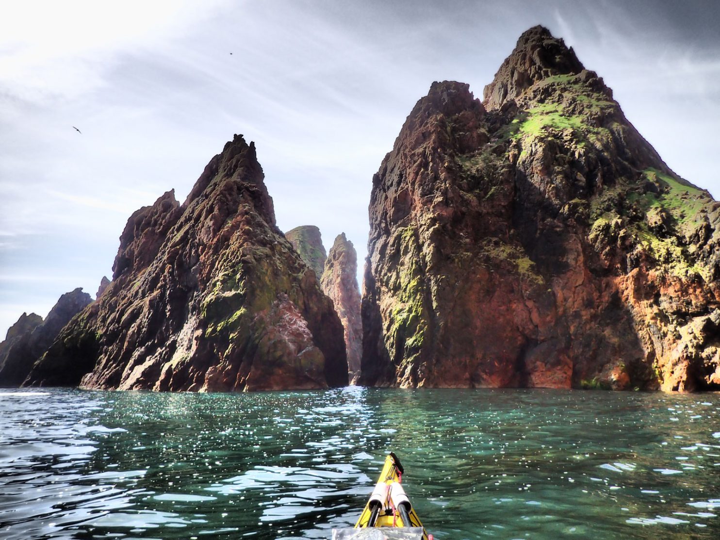
Back


Day 1. 5 June. Eastshore to Maywick. 33km. 7 hours. Once disembarked the ferry I went up to the Coastguard office arriving about 0800. They were open off course so I told the officer my plans who wrote it all down in a book. Then I had a quick shop for lunch before heading down to Sumburgh to find somewhere to launch and park the car. I wanted to go round Sumburgh Head now rather than leave it to the end when the weather might not be so favourable, I found a small marina just north of the airport which had a slip and parking. It was ideal. 

I took a good 2 hours to try and get everything in the kayak and make my final checks before i set off a midday. By this time a haar or sea fog had blanketed the marina and indeed the whole of Sumburgh Head. As I pulled out into the North Sea a easterly force 3 was sending small waves across the southerly swell, which was small. i saw very little of the cliffs which were shrouded in mist. On the water rafts of auks gathered in the bays. They nervously dipped their heads a few times as I approached before finally diving or laboriously taking off skimming the water. All the familiar birds were here; fulmar, kittiwake, puffin, gullimot and razorbill together with a few tiest. On the rocky shore at the base of the cliffs shags tried to dry their wings in the fog, 

There was a slight tide running south which increased as I approached the head. As the swell and  clapotis were quite small I could keep close to the base of the cliffs and away from the unseen perils which might lurk in the faster offshore tidal stream, like the Sumburgh Roost, a notourious rough patch of sea south of Sumburgh head and extending out some 10 km. Due to the mist rounding the head was something of an anticlimax. The mist lasted round the next headland of Hog of Ness and all the way to Lady’s Holm when the sun broke through the thin veil. Ahead of me know I could see the looming cliffs of Fiful Head. It was perhaps more daunting than Sumburgh even. 

01. Approaching Fitful Head and the start of the West coast Swell

As I approached the swell started to rise concentrating around the promnontories. It crashed onto the base of the cliffs and the stacks with huge green rollers and the plumes of spray. The wave then rebounded back creating a confused sea of clapotis. I kept a few hundred metres offshore to avoid it and also any dormant submerged skerry which would only erupt when a large swell went over it. The head itself was a kilometre of huge coastal architecture formed by the brunt of the Atlantic on the hard rock over millinium. I could see fantastic stacks and ghoulish day inlets or Geo’s but could not explore them. After the head there was an equally impressive buttress off cliffs for 3 km where there was no respite from the huge sea. This was the site of the Brear shipwreck some 30 years ago and I must have paddled over her submerged and smashed carcass. It was only when I rounded The Nev that I could relax my tight grasp on the paddle, but even here in the shallow bay of the Wick of Shunni there was no place to rest beneath the huge cliffs riddled with birds nests, mostly fulmar I think on the grassy precipices. 

02. The Nev is the headland marking the Northen tip of Fitful head. It, and the adjacent steep grassy slopes, were covered in Fulmar nests

It was another 3 km before I reached the end of this dramatic coastline and could veer east into Muckle Sound, between the looming stacks and Colsay Island, and could start to leave the constant roar of the surf behind. I paddled a little out of my way into the Bay of Scousburgh and found an idyllic white sandy beach, gently lapped by small waves. There were a few local families gather for a BBQ here enjoying the sun. After nearly 5 hours I was very stiff and struggled to get out of the kayak. I had a glorious lunch and chatted with the locals for nearly 2 hours before it was time to continue north out of the bay and on to St Ninians Isle. 

03. Approaching the sheltered beach in Scousbrough Bay after rounding Fitful Head and the exposed coast up to Fora Ness

I  tried to weave between the stacks and holms to the south of St Ninians Isle, (which is not an isle but joined to the mainland by a remarkable white sandy tombola). However the swell was a bit unpredictable and I did not want to get caught out by a large one so erred on the side of caution and went round the outside of most. I did go inside Hich Holm as it had a wide deep channel. Although grassy and pastoral on top St Ninians was vicious and dramatic from the sea and very unforgiving. After the final stack of St Ninians I still had another 4 km of huge coastline with no respite. I notice my speed was down to about 4km. I assumed it was a slight tide against me but it could have been tiredness and the general confused sea state which slowed me down. 

I was about 2000 hrs now as I approached the Tiang of Maywick headland behind which was a sheltered beach. I decided to throw the towel in here rather than carry on up to the Burras as was my plan. Besides the wind gusting force 5 in places where it barreled down the cliffs and slopes to the east and whipped up the sea. Thankfully the surf was not too big on the beach with half-metre high waves and I was soon ashore. I loaded my kayak onto my new trolley and heaved it up into the softer sand and unpacked it. 

There was no camping on the exposed beach but I found a spot just over the fence in a crofters yard which was full of junk and sea debris. There was a flat grassy area overlooking the sea and I pitched on it. The nearby stream looked possible for water but perhaps it had farmyard ooze leaking into it but on inspection I found a tap. I was not pitched until well after 2100 and was dog tired. I just ate my dehydrated meal and fell asleep without writing or getting the tent in order. I had only paddle about 5 days or 100km since my trip round Orkney 3 years ago and today had taken its toll.

Day 2. 6 June.  Maywick to Oxna. 17 km. 3.5 hours. The wind calmed down in the night but there was still a catabatic wind of cold mist streaming down the hillsides in ribbons and spilling onto the waters of the bay like liquid smoke. The swell also seemed to diminish. However I did not sleep well and woke frequently when a hip or shoulder I was lying on started to grumble. When morning came it had all the promise of a beautiful day and when the sun arrived it warmed everything and my claggy equipment was soon crispy dry. I lingered in the sun,  wrote the blog and was ready to start packing the kayak by 0900. However it took 2 hours to get it all down and into the boat. 

By the time I launched the sea haar had returned and enveloped everything in a cold mist. I was a bit disorientated by it as all the landmarks were obscured and there was no wind. I had to navigate by compass with only sea birds bobbing on the still waters breaking the grey hue.. My initial plan was to go up east side of East Burra. But i considered this and thought it would be more sportif to go on the west side of West Burra where the full force of the Atlantic spent its fury. As I navigated to Kettle Ness on the south end of it I did not pay attention to my navigation and at one point was going completely 180 degrees in the wrong direction so disorientating was the mist. But eventually when I reached Kettle Ness it cleared and I had a wonderful view up the spectacular coastline.  

I had to keep out due to the feroucious swell and it thundered into and then rebounded off the bottom of the cliffs and stacks. the swell was not as big as yesterday and was perhaps just 2 metres but occasionally a 4 metre set of a few swells would come through and the coastline would erupt into a crescendo of surf and roar. it continued like this for 6 kilometres with only two small sheltered bays for respite. It was a very spectacular stretch of coast with arches, stacks and caves, none of which I dared go near. It is however quite stressful paddling in big seas and I constantly have to be on the lookout for submerged skerries ahead which might surprise me when a monster swell reared up and broke over them. 

After these cliffs the weather stated to clear up and even the elusive, pelagic, Foula Island appeared far out to the west. I decided not to go into Hamnavoe as there was nothing there for me and man-handling my kayak in a marina in a rising tide would be more trouble than the cake and coffee. So I decided to head on to invitingly named Sand Voe on the island of Oxna. It was only another half hour north from the fleshpots of Hamnavoe. My hunch paid off as it was a lovely sheltered sandy bay on the lee side of Oxna. I landed at the beach and coaxed my legs back into life so I could get out of the kayak and stand on them. My hamstrings and knee tendons sieze up and are sore after a long spell in the kayak. As I ate I looked at the frustrating weather forecast which was once full of promise and now is disappointing. I could see from the map there would be no rest now until Walls in about 20 km. Not wanting to give myself an injury I decided to just have a half a day and go to Walls tomorrow. 

05. My campsite in Sand Voe on the Island of Oxna on Day 2. Oxna lay just off the coast from the village of Hamnavoe on West Burra.

Once the decision was made it was easy to stay. A few common seal pups came into the bay to frolick and play and this vindicated my decision. After the tent was up I wandered around the island which had many sheep and lambs. There was a fank and a shepherds cottage also which was in good condition so the island is actively farmed. There were about 3-4 freshwater lochans on the island and I set off to collect water from one. The whole interior was grazing for sheep but there were also healthy gull populations with a few greater black back also. The hillsides were covered in a small star shaped mauve flower that looked like a miniature alpine gentian. Large bumble bee were busy foraging amongst them and I had seen a few flying over the water from the mainland. The island had a cnoc and lochan feel of the Leweisian gneiss areas of NW Scotland although the rock was more granitic. I had a relaxing evening and enjoyed the peace and kind weather. I did feel a bit guilty about wasting it by not paddling on but I would not have arrived until very late and would have risked injury and another chaotic camp.  

04. The delightful Island of Oxna was covered in the small purple Spring Squill flowers and bees were flying to the island to feed on their nectar.

Day 3. 7 June. Oxna to Burrastow. 21 km. 4.5 hours. It was an idyllic stay on the sunny pasture beside the old shepherds house on Oxna. Irises were starting to erupt out of a large patch and the lambs were leaping between them. I peered through the window of the shepherds house. It was tidy and well kept and looked from a bygone era inside;  but very cosy. It did not take so long to pack up camp but it was still a struggle to get everything into the kayak. I set off about 0900 in strong sun across the still waters of the tranquil bay. As I left the inlet I surprised a mother eider duck and 4 chicks who were still vulnerable to gulls. 

06. the Island of Oxna was a paradise in good weather with plently of wildlife and pasture. Here are 4 small Eider Ducklings in the shallows of the sheltered Sandvoe bay

I paddled up towards the neighbouring pastoral island of Hildasay and then veered west out of the serinity and into the Atlantic swell. It was a 5 km crossing over to the headland at Skelda Ness. As I crossed this sound called The Deeps I saw numerous parasitic Great Skuas plunder Gannets returning with gullets full of fish. The Skuas are thugs and would lie in wait for them and when they recognised a rewarding vulnerable gannet they would attack and latch onto the gannets wing or tail. The entangled pair would then plummet to the sea. The gannet knew if it did not disgorge it’s gullet of fish the two birds would end up in the sea where the skua would have the upper hand and would continue the attack. I saw 4 attacks one of which ended in the sea with the reluctant gannet eventually disgorging and flying off after being released. After the skua had fed and flown off fulmars descended on the spot to mop up the fragments of fish scattered in the area, while the gannet returned home empty. 

After crossing The Deeps I negotiated the rough headland where surf was exploding onto the base of the cliffs and then headed north into Silwick Bay where thigs started to calm down again.  I was very excited about the next stretch and hoped the sea would be calm here so I could explore a bit. I dont think it is a exaggeration to say the 2 km of coastline between Silwick and the Stack of Glitarump is the most spectacular 2 km of coastline anywhere in the British Isles. As I neared Silwick I passed a steep red stack, rising out of the ocean covered in shags drying their wings. It attracted the swell which spent its fury on the skerries around it and protected the inner sanctum of Silwick Bay beyond. 

07. The Stacks at Silwick are perhaps part of the most spectacular section of coastline in the British Isles and continued like this for 3-4 km

As I approached Silwick I was delighted to see that the sea was calm at at the base of the cluster of stacks and I would be able to explore between them. There are about 5-6 fins of red rock which soared out of the waters of the bay into giant stacks, each one looming over the shoulder of another peering in curiosity at the lone paddler below who had the temerity to explore them. I wove in and out of them enchanted, at their astounding architecture and grace. This was a really special cluster of rock stacks. The channels between them were narrow and deep and while the sea surged a bit there was no white water and it was easy to weave in and out of them. I could have landed on the beach just beyond them it was so calm. After good half hour exploring here I rounded the largest stack, Erne’s Stack, and headed west across the bay and round the headland where the crashing surf reappeared.

09. West of Silwick towers the swell penetrated through the defence of skerries, islets and stacks in places but it the inner coastline was partially protected from the full force of the Atlantic

After rounding the headland I thern went into the next bay, Wester Wick, which had a buttress of a stack, Grossa Stack,  in the middle of it and plently of smaller stacks around its wine-glassed shaped perimeter. Again I think it would have been possible to land at the small beach at the head of the bay. I was in awe again at the dramatic seascape of the red cliffs and the stacks. I knew there were some pull outs for seals on the calmer skerries protecting the beachbut I did not venture far enough in to see or disturb them. 

To the west of Westerwick the drama continued as I paddled down an avenue with huge cliffs, riddled with caves and geos on the right and a row of sea stacks on the left which rose vertically from the sea. Gulls perched on the grassy plateau of their inaccessible summits, which would have been a great place to nest. The stacks towards the sea took the brunt of the swell and so it was quite sheltered in the avenue but I still had to have my wits about me in case of unseen dormant skerries. at the end of this avenue was a deep inlet or geo of red rocky cliffs which cleved a gash into the pastoral turf above. I noticed a green ring on the hillside about 10 meters in diameter where I had seen a ring of field mushrooms in the previous autumn. 

10. Continueing west from Silwick and past Westerwick the protective outer stacks appeared again making a spectacular channel to paddle up towards the massive stack of Giltaramp ahead.

At the end of the avenue was the citadel of Giltarump standing defiant against the Atlantic. I had hoped there was a navigable passage between this monsterous fortress and The Nev which is what the headland was called. And indeed there was. It was about 30 metres wide and quite confused but navigable as the surf was spent on two other gaps further out towards the base of Giltrump which exhausted its fury. I snuck through and noticed even more caves to my right under The Nev.  There was still one more stack, Groni Stack, to negotiate before I was out into the open ocean again. The stack was covered in fulmar ledges and topped with sea pinks. I soon burst through the gap, surging on a swell and entered the wide Culswick Bay. 

I cut straight over the bay towards the next headland, also called The Nev, and the Burga Stacks at it’s foot. As I left the cliffs behind the sea became calmer until it was just the rolling swell again with 10 seconds between the gentle rounded crests. Burga Stacks were also magnificent but after Silwick and Westerwick i was spoilt. However thay were spectacular and aweinspiting enough that I forgot to look out for the 3000 year old Broch of Culswick, which is supposed to be one of the best. I paddled now for another 2 km with the sea becoming calmer and calmer as I headed into Easter Sound between the mainland and Viala Island. 

I had been going for 4 hours now and needed to stop and stretch. Soon a calm bay with a gentle gravel beach appeared and I could easily run my kayak aground and step out. I found a natural bench in the sun beside a tiny waterfall and spent a good hour and a half here in the tranquil warm sheltered cove. I decided I would continue the 3 km to Burrastow where I knew there was accommodation for me and power for the gadgets. I was a very pleasant run down the Viala Sound to the west end where the Burrastow Hotel stood on a promnontory on the shore. I pulled up on a small beach by a fish farm office and was warmly greeted and directed up to Bo’s Bed and Breakfast just above the beach. He was full which was a shame as it looked very inspiring and erudite within. So I tried the Hotel. Pierre greeted me warmly and gave me a reasonable price for a room which I took in the imposing building. I brough my kayak round to the hotels pier and Pierre helped me pull it up. I only took what I needed and went up to my room. 

I was bowled over by the room, It was the family suite and it was dominated by a huge 4 poster bed and the largest grandest Victorian wardrobe I have ever seen. The “childrens” room was also very grand and the en suite bathroom was more than I hoped for. I was soon washing my clothes in the bath with all my gadjets charging. It was a perfect end to a special day. 

Day 4. 8 June. 35 km. 7 hours. I agonised for a couple of hours about whether to go to Foula or not. It was to be the last good day and then the winds would return and I would be stuck on Foula. Also forecast was fir it to be foggy for most of the day so I would be paddling blind and just relying on 2 GPS devices. If they packed in I would be lost as navigating the old fashioned way and factoring vectors in for wind and tide would be hopeless. I mulled it over during an excellent breakfast considering the options, as it seemed likely I would get weather bound in a couple of days whatever happenedd. In the end I reluctantly decided to skip Foula and perhaps come back to it at the end of the trip if the weather was kind. 

With all the deliberating I did not set off until 1100. I said goodbye to the great hosts, Pierre and Han, who owned the old hotel and paddled off into the mist. I could only see 2-300 hundred metres but as I approached the end of the Wester Sound and entered the ocean the roar of the hidden surf resonated and the waters got choppier. I paddled past the Rusna Stacks and entered another world. This world only existed 2-300 metres in each direction and there was just me, the kayak, the roar of the surf and the looming headlands and stacks I paddled past, giving them all a wide berth. It was lonely, eerie world of primeval danger and I felt very much alone. 

Occasionally the mist would start to lift and the sea birds would fly past to inspect me and then the world would close in and become grey and opaque once more. It was a shame as I am sure this was a magnificent bit of coastline. On and on I paddled for a couple of hours past a few turbulent headlands until at last the fog thinned and some ghoulish giants appeared in the sea ahead. They were a magnificent collection of stacks at Weinnia Ness. The surf churned between them and there was no way I could get close so I admired them from a distance. Soon the mist returned and it stayed with me all the way to the headland and the start of the Sound of Papa. 

11. North of Burrastow the coast line all the way to Papa Stour was wild and rugged. These are the stacks at Wienna Ness just north of the relativerly sheltered Voe of Dale bay.

The sun broke through more and more,  and suddenly there was blue sky ahead. It seemed the whole world had been in sun while I slogged alone up the eerie coast. Sea birds came to investigate with the fulmars making their effortless, graceful glides across the tops of the swell and skuas circled to see if I was edible. Across the sound Papa Stour was still covered in mist. I paddled up the sound where the swell was huge and had to make a long detour to avoid dangerous skerries which would only erupt in great pyramid turbulent waves every 20th wave or so. 

I pulled in on the delightful beach at Melby and had lunch sitting in the grass with the sun warming me. Ringed plovers chased insects in the piles of washed up kelp while some large blackback gulls just sat on the still waters without a care in the world. It was an idyllic scene and far removed to the one I was in just an hour ago. 2 solid three story stone houses, almost Lairds Houses, overlooked the small stone pier. I lingered over lunch hoping for the mist to clear on Papa Stour before I paddled over. 

I set off about 1600. I was surprised how much tide was running in the Sound and it swept me to the east. I let it and then made up the ground in the lee of a holm. As I paddled west into the waiting mist I saw another Great Northern Diver. it was unmistakably large. As I entered the mist at the southern point of Papa Stour I had to make another large detour out to sea to avoid a reef where huge waves occasionally formed and crashed down, their crests shedding plumes of spray. 

The whole west coast of Papa Stour had the biggest swell of the trip so far with some waves 5 meters high perhaps. They were gentle rollers from a distant gale. However as they approached land they reared up and crashed down on the skerries with extreme violence and then rebounded back making very choppy water. My kayak was being tossed about in this confused water so I paddled further out, perhaps 200 metres from the turbulent cliffs, to avoid it. I could have got into a lot of difficulty going inside Swarta Skerry as the swell refracted round each side and collided together in the strait. After that I became more wary and went outside everything. This was no place to throw caution to the wind. 

It was a great shame it was so rough and misty as this is a famously spectacular bit of coastline and I was missing it all. I could occasionally see into the deep clefts, called geos here and Orkney, and the odd arch or cave but most were wasted. However at the north end two very dramatic islands of square rock rose from the sea, each a few hundred metes in length and with vertical sides. Even in the mist these were impressive and certainly eerie. I went close to the inner one and could see it was riddled with caves. It had a pillar of rock at each side which rose some 40 meters straight out of the deep water. I think one is called Da Snolda. I was fortunate the sea was not too rough here so could admire them a take a photo.

12. The “Railroad Tunnel” cave on the block of a stack called Lyre Skerry off the west coast of Papa Stour. This solid stacks was in fact riddled with tunnels and the tide flows strongly through them.

From here it was a lumpy paddle for another good kilometre under red cliffs to the NW headland. Only when I rounded it and went into the bay on the east side was there some respite. The mist was absent from here also. The bay was a amphitheater of huge red cliffs. there were numerous sea caves here and one apparently goes all they way through to the other side where I had just been. It is about 350 meters long and reputedly the longest sea cave in Britain. It would be impossible to paddle it in these conditions. 

13. Just after the NW point of Papa Stour is a large bay ringed by red cliffs. The base of the cliffs is riddle with caves one of which goes right through the headland to the otherside and at nearly 350 metres isd the longest sea cave in the UK.

It was a relief to paddle the north coast of Papa Stour. The big violent swell had gone replaced by smaller waves which lapped the skerries and cliffs and the even sun was out. I cruised along in the calm evening enjoying the coast rather than being terrified of it. I explored a few stacks, covered in shag nests and even a gloup, or cave where the inside had collapsed leaving a hole with a beach at the bottom. After a leisurely hour I turned the corner and was coming into Papa Stour ferry pier.

15. On the NE corner of Papa Stour is gloup. A gloup is a sea cave where the inner roof has collapsed so one has to go under an arch to get to the inner portion open to the sky.

There was a ramp here so I assembled the trolley and heaved the full kayak up the ramp and 200 metres along the road to a small ferry terminal building which I knew was open. It was a delightful cabin with a toilet, heater, microwave, kettle and even some books and items for sale via an honesty box. As I unpacked two burly men came up from a yacht. They were from Lossiemouth and on a lads sailing tour. They had just come from Foula and said it was unfriendly. After they had gone I made myself at home in the cabin and settled in for the night sleeping on the floor. 

Day 5. 9 June. 0 km. 0 hrs. I was again in a quandary as to what I should do. I had perhaps 2 hard days paddling after the Eshaness Peninsula to get to the north end of the Mainland and that was still a day away. However there would be 2 days of a force 5 before a steady force 6 arrived and pinned me down. I did not want to be hunckered down for 3 days under the flapping ripstop of the tent on a remote exposed beach in the deserted NW mainland of Shetland, so it would be best to wait somewhere comfortable until this gale had passed, hopefully in 5 days time. 

It seemed my two choices where to stay here on Papa Stour. I had heard there was lodging across the bay in the Blue House or I could go on to Hillswick and hunker down there. I said goodbye to the 2 burly sailors from Lossiemouth who were heading north and then down the east side for shelter, and headed over to the Blue House via the hamlet of houses. Only 8 people lived on Papa Stour. At the Blue House the owners were away but Jane, an friend and confident of theirs invited me in and gave me a cuppa. Jane was a fascinating local who was a retired supply teacher in the Shetlands and had also crofted on Papa Stour until recently. She was a wealth of knowledge about the Shetland Islands. She suggested I stayed here for a day and then go to Brae to hunker down instead. I had not considered it as it was out of the way but it would take me along a gentle route which I could do tomorrow in the anticipated force 5. 

I could either spend another night in the cabin or speak to the owners, Andy and Sabina, when they returned on the ferry and see if I could stay at the Blue House. Reluctantly I left Jane as she had to get on with the day and returned to the cabin as the rain came on. On the way back I met a harbour employee who also confirmed Brae was a better place to hole up rather than at Hillswick. So When I returned to the cabin I booked a single room there for 3 nights starting tomorrow night. 

Jane reappeared to clean the cabin and then take the ferry back to the Mainland as Andy and Sabina arrived back. They said they could put me up so i walked over later. They were a couple of ex hippies who came here some 48 years ago to take over an abandoned croft. Slowly they built up the croft and became somewhat self sufficient and brought up a family here. When the family flew the nest they converted their accommodation to a rehabilitation centre for alcohol and drug users, mostly from Shetland, and this was very successful. They provided the crofting routing and hands on purposeful duties in a Christian community to the lost souls of Lerwick who lived a chaotic life, often generations deep. Andy and Sabina oozed warmth and compassion. They had another couple of guests, a young couple from Glasgow who were hoping to buy a croft somewhere. We all ate together before everyone scattered to various bits of the buildings complex and left me alone in an enormous room with television, hundreds of books, games tables and a drumkit. I can imagine it was a gathering hall for services and events. I wrote and planned my route tomorrow to explore the shehelterd coves of Vementary Island before heading north to Brae. 

Day 6. Papa Stour to Brae. 25 km. 5 hours. By the time I walked back from Andy and Sabina’s the wind had picked up from a force 3 to 5. I looked through my binoculars out to the Papa Sound where it looked mayhem, with wind and swell against the tide. There were large whitecaps everywhere. I was not going out into that especially as the forecast said the wind would drop back to a 3 and the tide would also ease mid afternoon. So I waited at the cabin for 3 hours before launching  at 1400.

It was choppy in the bay but calmed down when I got to the southern jaw of the inlet, where there were numerous stacs. It now became very calm. I found a cave with light at the far end of it,  so I paddled into its calm waters follow the sides as they bent to the left narrowed. After some 30 metres the sea passage emerged into the sun again were the roof of the cave had collapsed. Beyond this bright pool of light the cave returned briefly as it went under a broad arch, emerging on the edge of the papa Sound. It was an exhilarating passage. At the exit I looked round for the fingerlike Maiden Stack but could not see it amongst the stockier, massive stacks.

I now veerred SE and started to paddle across thhe Papa Sound towards the Brough Skerries on the Mainland. There was a good force 4 pushing on my starbord (right) side and the ebbing tidal stream on my port side. The two vectors just about balanced themselves out and the two land features I choose as transit markers on the south side stayed true for most of the crossing. I passed to the north of the near island of Snarra Ness and then paddled over the deep inlet of West Burra Firth where the Papa Stour ferry was based.

I could now turn NE and put the wind behind me. I immeadiately gained 2 km per hour, from 5 to 7 kmph. I went inside the very green islands of The Heag and West Burrafirth. The vibrant green of the islands was in stark contrast to the dull green just 100 meters across the channel. A few hundred Shags and Cormorants were gathered on a grassy slope on the islets. I was surprised to see them shunning the rocky cliff tops for the verdant slope of the island. I cruised up the coast passing through the jagged Tianga Skerries where the small swell just gently gurgled as it lapped their base. 

Just before I got to the steep lush headland I passed through the long skerries where common seals were high above the tide on rocks, a few crashed into the water as I surprised them but most just watched me pass on to the grassy cliffs ahead. These cliff were covered in nesting fulmars with nest stacked upon nest in a large colony. The Island of Vementry was now on my left and I wanted to explore the passage between it and the mainland which looked like a setting for Swallows and Amazons. The landscape here reminded me of the cnoc and lochan of NW Scotland. 

As I paddled into this sound I saw the unmistakable flash of a kayak paddle beside Linga Island in the middle of the sound. Soon afterwards I could make out about 8 kayaks. I paddled towards them like Crusoe towards Man Friday. They were a group of friends from Cumbria and Northumberland who were in Shetland for 2 weeks. As we chatted one of them, Simon Milligan, realized he had met me when I gave a talk to the Kendal Mountain Festival in 2010. He was on the door to the lecture hall. It was a small world. I left them after 10 minutes of enthusiastic chat and carried on down Linga Island. It was also very green and a farmer had put about 15 black Soay-type sheep on the island for the summer. 

What I hoped would be unblemished channels and coves filled with wildfowl and divers was scarred by an enormous mussel farm which had grids of long lines in every opening. Vementry was only just an island with a channel about 15 metres wide. It looked like livestock was taken across this strait as there was a sheep fank and shepherding huts on the Vementry side. After passing though the basin on the north side of the strait I rounded the corner and was just south of the red cliffs of Muckle Roe.  

I paddled straight over to Muckle Roe island intending to follow its gentle eastern shoreline up to Brae in about 7km. With the following breeze I sauntered up the small cliffs exploring the occasion small geo and stac, mostly at the headlands, while between them were boulder beaches. As I pased the bridge over to Muckle Roe island I entered a bay with the large village of Brae at te head. I passed another Great Northern Diver as I approached an old stone jetty. 

I ignored the advice to land at the marina and chose this jetty instead as it saved a good kilometre walk. It was below a large old house which was once a trading building which now looked liked it was in preserved but empty. I am sure the jetty was private but I pulled the kayak up so it was behind a wall and above the high tide mark. I then unpacked just what I needed and walked up to the Brae Hotel where I had booked in. There was just time for a shower before dinner. I had booked into the hotel as there were predicted force 6 winds for the next 3 days and I could not get round NW Shetland in those so would hunker down in comfort. 

Day 7. June 11. 0 Km. 0 Hours. I had a very sedentary day leaving the hotel just once to go to the Co-op to get lunch. I took the time to write and look at the maps and charts for later in the trip. The weather forecast was not good for ther next 5-6 days really but there was some light at the end of the tunnel as it seemed another high pressure would start to establish itself in a week or so and this should allow me enough time to get round the top and some way down the east side. But a weather forcast that far ahead can easily disappoint at the one a week ago has done.

Day 8. June 12. 27 Km. 7 hours. 1030m up. 1030m down. Looking out of the window I could see the bay was full of white caps as a force 5-6 swept across it. I had always wanted to walk round Muckle Roe and this was the perfect chance. Many Shetlanders say the walk from the road end to the Hams of Roe and is their favourite. The manager of the hotel kindly lent me a rucksack and I set off around 1030 stopping at the Co-op to get lunch. I walked the 4 km to the small bridge over the narrow strait to Muckle Roe and then walked for about 5 km down the road to the end. There was a modest house here which had a splendid garden and sold some plants via an honesty box. I went in to have a look and was soon joined by the delightful older lady whose garden it was.

I walked on down the path to a beach with small breaking surf on it but across the sound there was a large swell crashing on the rocky coast of Papa Little island. I followed a small path for a couple of kilometres to reach the automatic lighthouse which marked the start of the west coast of Muckle Roe. To the south across the sound, which was full of larger white caps, the NW coast of Vementry was fringed with surf. It was a far cry from the tranquility of the protected south and east shorelines which I paddled a couple of days ago. 

16. Murbie Stack on the west coast of Muckle Roe just north of tyhe light during a gale. This was a hiking day

From here Muckle Roe had the most magnificent coastline for the next 6-7 kilometres to its northernmost point at Lothan Ness. Huge red cliffs of ryolite rock rose from the churning sea to the grassy plateau some 50-100 meters above the sea. There were numerous stacs and geos between the headlands. Sheep grazed on the plateau oblivious to the drama below them and I followed the paths they had made over the centuries. About half way up the west coast I reached the Hams of Roe which consisted of South Ham and North Ham. They were two deep bays with a couple of beaches in each. There was very little swell which reached the beaches of South Ham and the surf was small and it would be easy to land a kayak here. Around the Hams were grassy pastures where sheep grazed and there were 4 or 5 ruined croft houses from a bygone era. I explored many of the fingers of land which extended defiantly into the Atlantic and saw many hidden beaches between them. As I sat and had lunch in the sun on the peninsula of Strom Ness I watched a pair of Great Northern Divers work the bay. The dived in tandem and seemed to be able to spend a minute under water. 

17 The Hams of Roe on the NW corner of Muckle Roe. The Hams are two bays with relatively sheltered beaches. Many Shetlanders consider the Hams of Roe their favourite place on Shetland. This was a hiking day.

The magic continued after the Hams of Roe with the coastal architecture getting ever more impressive with stacs, arches and caves separated by deep inlets where i could hear the sea churning in the clefts. Although it was still a force 6 the showers had passed and the sun was out which made the walk even better. There were no paths after the Hams but the hillside was easy to traverse. Just before the spectacular coast ended at Lothan Ness was the enormous Roda Geo which was surrounded by red cliffs, but had a beach at the head. Far to the NW I could see the Drongs of Hillswick where I would hopefully be in a couple of days. After Lothan Ness the sheep tracks appeared again and I followed them down to Otter Ayre beach where a rough track appeared again. 

18. Looking back down to the Hams of Roe from the hill to the east. The North Ham is visible but the South Ham is hidden in the background behind the prominent headland which is riddled with caves, arches and tunnels. This was a hiking day

I followed this track and it quickly became a narrow road which connected a string of crofts on the north shore of Muckle Roe overlooking the sheltered inlet which separated it from the mainland. The crofts were a mixed bag with some being very well kept, while others were a riot of abandoned machinery and scruffy buildings. After 2 km this lane reached the bridge where I had crossed some 5 hours previously. I headed back over to the mainland and then sauntered into Brae passing the marina and then the village centre. It had been a magnificent walk and looking at the sea from the top of the cliffs on the west side vindicated my decision not to paddle and wait it out in the hotel until this queue of low pressures has passed.

Day 9. June 13. Brae. 0km. 0 hours. When I looked out of the window in the morning the bay was full of whitecaps, whipped up for the force 6-7 wind, and the rain was battering against the window. It kept this up all day and I did not venture out. I had one of the laziest days I have had for years. I was grateful I had the foresight to hunker down in the friendly Brae Hotel rather than be lying in a sleeping bag in a flapping, claggy tent on a remote gravel beach.  

Day 10. June 14. Brae. 10km. 3 hours. The force 7 wind persisted through the night and continued all day today also. However it was dry and I resolved to go for a walk. There were some Neolithic chambered cairns in the vicinity of Mavis Grind, just 2 km up the road, and I set off to explore them. 

Mavis Grind is the text book isthmus and it connects the peninsula of North Mavine to the Mainland. On one side of the isthmus is the Atlantic and on the other the North Sea and they say you can throw a stone between the two. Certainly in the past fisherman and travellers used to drag their boats over the 60 meter neck. 

On the Atlantic side was a perfect bay with a narrow mouth. The large Atlantic swell spent itself on the jaws of the bay and inside the the bay it was quite sheltered, almost like an inland loch a km long. There was a small island in the middle of the bay fringed with seaweed. I could see this would have been a  good place for prehistoric hunter gatherers to establish themselves for a season. 

The chambered cairn was only recognisable as I knew it was there. To a casual passing eye it would have just been a rickle of stones. Nearby was the remains of a homestead but I am not sure what era it would have been from but guess it was continiously used for a couple of thousand years, albeit seasonally probably. It consisted of the remains of a square building and beyond it was a wall some 70 metres in diameter within which I guess the animals were kept overnight. As humans we lived in this type of settlement for 1000’s of generations before we abandoned it in favour of towns and cities just some 10 generations ago. Beneath the veneer of urban, chic, sophistication is our cultural DNA of a simple, egalitarian, existance in harmony with the seasons. We are now totally disenfranchised from these halcyon days,  but it lurks there under the Italian Suits. 

I admired the spot and then retraced my steps to the isthmus and now walked round the south side of the bay. Sheep and lambs grazed along the path and fled as I arrived. Outside the jaws of the bay the Atlantic surf pounded the coast. At the widest point of the bay I headed south across country on sheep tracks for half a km to a small loch called Bays Water. A Diver,which was resting on the shoreline, took off and flew across to the other side. I could not see what it was but I think it was a red throated. 

I sauntered up the loch looking for another chambered cairn but I could not discern which pile of stones it was, as there were some croft house ruins here too. At the end of the loch it was each to beat a path across the short windblown heather towards the Busta House Hotel where I picked up the minor road which connected Muckle Roe Island with the village of Brae. I followed the road north for 3 km to reach the sanctuary of the Brae hotel. At last the forecast was promising so I planned to leave early the next morning in the half day weather window and paddle to Hillswick where I would wait until the last low pressure had passed and the predicted settled weather arrives in 3 days time.

Day 11. June 15. Brae to Hillswick. 19 km. 4.5 hours. The alarm went off at 0430 as I needed to catch the calm forecast of the morning before the gale returned mid afternoon. It was low tide when I launched at 0700. The wind was just a force 4 but it had a bitter edge to it in the early morning. It was due to drop further later in the morning. I paddled across to the west side of the bay to get some shelter from the land and then paddled south towards Busta Hotel and the Muckle Roe bridge. I saw an otter here, I think it was the first I had seen this trip. I had to keep 100 metres from the shore as the long strands of the spaghetti seaweed was snaring my paddle like an aquatic triffid. 

There was a stronger breeze coming down the channel between Muckle Roe and the Mainland, especially under the bridge so I kept to the north side. It seemed much shorter to paddle than walk as I did a few days ago, and before I knew it I was paddling out in St Magnus Bay. The swell built quickly and it was soon 3 metres but there were no white caps. I had a camera malfunction so veered inside a cluster of islands where I discovered a beach on Egilsay. It was a beautiful bay. As I approached I could see geese on the grassy hillside muster their goslings and march them over the crest to the otherside. Geese are very cautious birds and often take to the air even when I approach an island. The beach I was heading for was full of both common and grey seals and they slid into the water as I neared the beach and then swam towards me to investigate. Seals are much more confident in the water than on land. I also noticed many eider ducks gathered on the grassy fringe above the beach and they slowly waddled to the water and swam off. Many ducks had young. It was an idyllic seascape, Egilsay was split from its neighbour by a deep craggy slot but the cobble beach linked the two islands. 

I then went round the north of Egilsay and headed over to Lang Head which I could see was anything but tranquil. The swell grew rapidly and some of the larger sets were perhaps 5 metres from trough to crest with the crests some 10-12  seconds apart. It was a gigantic sea. The swell in itself did not matter so much but when it hit land or a skerry it erupted into a fury and pounded the rock sending plumes skyward. This swell would then rebound and head back out with its power only halved. The rebounding wave crashed into the raw incoming swell to create a sea full of holes and spikes. One minute I was on a pinnacle of water with my paddle swiping through thin air and the next I was in a deep hole. It was textbook clapotis. To avoid the worst of it I veered out and went up the coast 3-400 metres from the violent surf at the foot of the cliffs. But even out here it was mayhem. 

I slowly bounced my way up the coast making poor time as paddling in large confused seas is always slow until I approached the Isle of Nibon. There was a channel here which I hoped would lead me to quieter waters. However this channel must have been deep as the swell seemed to magnify as it rushed into it. In addition it was full of the rebounding swell from each side of the channel opening. I had a manic 500 metre paddle into the sound hoping a large set would not come in and overwhelm me. It was definitely the most exciting paddle of the trip so far. I surfed a couple of swells which broke on the skerries each side of the channel and was disgorged into calm waters. 

There were a few houses in this sheltered inlet protected from the violence of the Atlantic by the islands. As I approached the northern end of the channel I could see the surf building again. The North Channel was not as bad as the South Channel but on each side of the opening were skerries where the huge swell reared up and crashed down  The one on the north side was especially spectacular with the water drawing back off the skerry in the trough before the steppening crest approached until it rose into a 4 metre wall of water which shot forwards creating a tube. I gave them both a wide berth as I entered Ura Firth in the middle of the channel. 

I set a course for the west side of this firth hoping the headland opposite would act as a breakwater. As I left the channel and shoreline behind the clapotis slowly diminished and by the time I was halfway over it there was just a large gentle rolling swell. By the time I got into the lee of the headland the swell was just a metre high and the sun was out. I could relax and just cruise up the coast towards Hillswick. It was an interesting shoreline with plenty of caves, arches, and gloups but not on the grand scale of Silwick or Papa Stour. 

As I turned west into Hillswick bay the swell vanished entirely and the still waters of the bay were almost a luminous racing green. I counted 5 red throated divers in the bay but they kept their distance from me. I landed on the pebble beach and extricated my stiff legs from the cockpit. I made the trolley, put the kayak on and hauled it up the beach and into a parking place beside a camper van with a couple of grown up NDK kayaks on the roof. 

It took a while to sort everything out in the sun and then once it was secure in the kayak I took what I needed up to the hotel some 200 metres away. It was a bit more expensive than the friendly Brae Hotel but was no better. In fact the wifi and TV were worse. After a shower I went to the shop where I met the owner of the campervan with the kayaks. Barry recognized me from a talk I did at Boat of Garten 18 months ago. I went back to the camper with him and met his wife Wendy. I had a few cuppas with them and chatted for a couple of hours and we could have chatted longer, They were a great couple and we had a few friends in common.  By the time I got back to the hotel the television had been fixed. I had a good supper, wrote the blog and then an early night. The weather tomorrow was to be a good force 4 and this swell is likely to be big as the predicted gale and rain arrived in the late afternoon to whip the seas up again.

Day 12. June 16. Hillwick. 8km. 3 hours. The forecast today was for a steady force 5 all day and the swell was to decrease from yesterday’s 3 metres to 2 metres.  However when I cast my gaze over the bay it looked benign and there were patches of sun. I was in a quandary as to whether I should make a dash for it. I went down to the kayak where Barry and Wendy were parked and chatted with them. He had a look at his forecasts and they concurred it would be a force 5. They were going to drive over to Ronas Voe later to paddle there tomorrow.  They pointed out the obvious that we were in the shelter of the bay and it would be more exposed on the south side. It was enough to convince me to stay. I did not want to go round Eshaness in a sea state a step up from yesterday, which was already beyond my comfort zone. 

We stood outside chatting for ages and discovered more mutual friends. I could have chatted for ages. They are in Shetland for another 6 weeks and hopefully we will meet up later for a paddle, either as part of my circumnavigation or a seperate day trip. It seemed the most obvious thing to do was a walk round the Hillswick Peninsula. I set off at 1100 loaded with cameras and binoculars. My first mission was to try and spot the numerous Red Throated Divers which were in the bay yesterday, but I saw none. 

The walk down the east side of the peninsula was warm, gentle and verdant.  En route I could see the gloups, arches and small sea stacks which I paddled amongst yesterday. I noticed the swell was a lot less than I remembered from yesterday at these coastal features. It took an hour to saunter out to the automatic light beacon with the cliffs getting steadily bigger. On many of the north-facing slopes fulmars nested on grassy ledges. I don’t know if they chose the shaded side to avoid the driving weather in gales or to avoid the sun, as they were nearly always in the shade. 

19. The Drongs of Hillswick from the Ness of Hillswick. The Drongs are pillars of rock which have withstood the fury of thre Atlantic. This was a hiking day.

After the light beacon I started to walk back up the west coast. The character of the sea scape changed as soon as I started. The coast twas full of stacks and skerries at the bottom of steep cliffs. The swell was crashing in down below fringing the coastline in surf. I was pleased to see there were some white caps in the sea which vindicated my decision to stay,  but in reality it was no worse than yesterday and by now the sky was blue and the sun warming. It was a fantastic coastline with a couple of spectacular stacks, not least the 50m high, narrow fin of Geordi Stack. However the seascape was dominated by the Drongs. a collection of 3-4 pillars rising vertically from the sea to a height of perhaps 40 metres. Although they were a kilometre offshore they were the star of the show. Hopefully tomorrow I would be able to paddle beneath them. Sheep and their plump lambs grazed on the lush grass on the plateau at the top of the cliffs. Many had not been sheared and were shedding their fleece. I wandered along the sheep paths weaving in and out of the geos and peninsulas until I got to the isthmus at Hillswick again. There was a beach on the west side also but it had a small surf on it. 

20. A close up of the Drongs of Hillswick from the Ness of Hillswick. This was a hiking day

By the time I crossed this isthmus got back to Hillswick Barry and Wendy had gone. I sat on a picnic bench by the beach and searched again for divers,  but saw none. It was mid afternoon before I returned to the hotel. I spent the afternoon chatting with the owner, Paul. He was an extraordinarily bright eccentric. After spending his youth on trawlers he became a naval architect and then eventually had his own business designing modifications and repairs to small ships and boats. His forte was fire-proofing. He had carried this passion up to Shetland and the hotel had the most sophisticated fireproofing and sprinkler system of perhaps any hotel in Scotland. It was a exemplary example and way beyond current regulations. Paul was very versed in most topics and held a wise opinion on everything we touched on. It was a joy to converse with him. After supper I had the usual routine of going through all the weather forecasts to try and decipher what might happen. It looks like it could be OK tomorrow in a force 4 and definately for the two days after that, which should see me rund Muckle Fluggga before the next gale arrives in 4 days time.  

Day 13. June 17. Hillwick. 26 km. 9 hours. The best laid plans were dashed by the morning’s weather forecast. While the wind was to remain at a steady 5 all day now the swell from a distant gale in the Atlantic had arrived and it was huge. I looked back to the coastline I had paddled up 2 days ago and it was frightening. The coast was white with crashing surf erupting 20 metres up the rocks and the sea in the Urafirth was white with foam heaving in the swell. I dreaded to think what it would be like as Eshaness. The swell was forecast to only diminish slightly through the day combined with the force 5 wind was prohibitive for paddling so I checked into the hotel for another night. As I had all day I decided I would walk to Eshaness, go round the peninsula,  and walk back. 

I borrowed a rucksack from helpful Paul and set off north through fields and down to the northern beach of Sandwick Bay. I met a local retired fisherman en route and he gave me some insight into the coast here, reiterating it was tricky around the Isle of Stenness. I crossed the beach, passing the skeleton of a small whale, and weaving through terns who objected to being disturbed even though it was not a nesting colony and climbed up to the road.  I then had the humiliation of walking along the road for 3 km however the views seaward were spectacular on this bright sunny day. The sea around The Drongs was heaving and even far out to sea I could spot numerous flashes of white caps. I was glad I had postponed my paddle for the day. 

I left the road and crossed a few fields down to the gravel bar on Braewick Beach. There was a heavy dumping surf here and it was no place to land a kayak. More terns were resting in the stones of the bar up by the freshwater loch which the dam of the bar created. At the far end of the beach I went cross country across moorland covered in prostrate heather and where crofters have been collecting peat. There were a lot of ground nesting birds here; Curlew, the excitable Oyster catcher, Golden and ringed plover. I knew there were chicks nearby as a few of the birds tried to lure me away by feigning a broken wing so I would pursue them. 

21. A small raft of Eider Duck and young in the sheltered Tangwick Bay on the Eshaness peninsula. This was a hiking day

The walk from Tangwick to Stenness was a delight. It was warm in the sun and the wind was deceptively quiet. I could have easily landed a kayak in any of the bays, which were full of seals and eider duck, with rafts of 10 ducklings. The delicate Shetland sheep and their lambs watched me pass. Out to sea was the spectacular Dora Holm with its huge arch through which one could take a fishing boat. This island is also called horse or elephant island on account of the silhouette of the arch. However I could see there was no way any boat would go through the arch today on account of the foaming swell. After another bay with some small stacks I crossed a pastoral headland and entered Stenness Wick, the bay inside the Stenness islands. 

22. The massive stack of Dora Holm, is said to resemble a horse. It has a huge arch and is riddled with caves. This was a hiking day.

Here the sea ramped up a notch. The skerries on the south end of the two islands attracted the swell which spent itself on them so the south entrance was reasonably straight forward but the north entrance was violent. Huge waves smashed into the northern tip of the island rebounding into the channel, while on the north side the Bruddans Skerries were taking a pounding. There was a way through and hopefully the sea will be smaller when I come to paddle this section. From here the route climbed up to the lighthouse where the full glory of the Eshaness coastline burst upon me. I admired it for a few minutes and turned to go just as Barry and Wendy arrived in their camper. 

23. The west side of the Eshaness peninsula is exposed to the full force of the Atlantic swell. On this day it was 5 metres with a force 5 wind also so it was a hiking day.

It was good to see them again and we decided we would join each other for a walk north along the clifftop. These two kilometres must be a strong contender for the UK’s best bit of coastline, which has some extraordinary features all on a huge scale. First up was Calders Geo, a deep narrow slot almost half a km, slicing deep into the volcanic rock. The sea churned and frothed in the depths below which could only been seen by leaning over the edge and again at the end. Next there was a huge cave, Britian’s biggest apparently. Wendy and Barry had been in it and had paddled all this coast in exceptional benign conditions. Today there was no chance of coming within 300 metres of the coast due to the surf and clapotis. Next was the solid Moo Stack, the most prominent of all Eshaness stacks. After this was the most remarkable feature of all, The Hole of Scraada. It was a large hole in the ground some 200 metres inland from the cliffs. Yet in the bottom of it was a beach onto which frothy white wave were surging. There was a subterranean passage connecting the hole with the sea. Wendy said she had padded through it and they had lunch on the beach !. We admired this mesmerizing feature and watching the surf surge through the cave and onto the beach before moving on north. Here the headland slanted down to sea level with plenty of steep promononteries, often with an arch between each one, until we got to the Head of Stanshi which was besieged with offshore skerries which the swell was battering furiously. We saw a pair of Arctic Skuas here, a sleeker more acrobatic version of their thuggish cousin,  but no less vicious, especially for terns.

24. Another view of the west coast of Eshaness from near the lighthouse. This coast is riddled with caves, tunnels, stacks and arches and is immensely spectacular. This was a hiking day.

I said goodbye to my new best friends here as they headed back up the coastline to the lighthouse while I continued east round the headland. It was surprising how quickly it became placid again with small surf gently lapping in the bays. I headed up to the hamlet of Ure and picked up the road. Just before Braewick cafe I passed a small loch with a few islets covered on long grass. I tho6ugh this looks perfect for Red Throated Divers and then I spotted one with its head sticking out of the grass and its partner nearby on the loch. I am sure the young would have hatched by now and the parents would be busy fishing in the nearby sea bays and bringing the sprats back for the young. At the  Braewick cafe I hoped I could get some lunch as I had eaten nothing since breakfast. However it was 1730 and it was closed.

I walked back along the road for an hour before cutting off down across the beach with the whale carcass and then returning to Hillwick across the fields. That evening the weather forcast changed again but it seemed that by midday tomorrow I would have a weather window of 48-60 hours which I would endeavour to get round the top. But on past performance this might not be set in tablets of stone as the small low pressures and minor high pressures of the NE Atlantic jostled for position and depending where they brushed against each other, the local weather was determined. There were no significant low or high pressure systems which would dominate the weather. 

Day 14. June 18. Hillwick to Hamnavoe. 20 km. 4 hours.  Paul and Andrea of the St Magnus Bay Hotel looked after me very well and capped it all by allowing me to stay in my room until late afternoon as it was blowing a force 5 all morning, however the swell was going down. Barry and Wendy arrived at the hotel as Paul was responsible for dispensing Shetland’s LPG fuel which they needed for their campervan. However there was a problem with the calibration of the machine so none was available but the ever knowledgeable Paul suggested a work around. I eventually launched at 1700 hrs just as the predicted calm weather arrived.

It was a perfect late afternoon as I paddled out of the sunny bay and along the east side of Hillswick peninsular. The swell was negiable here, but I could see it was perhaps 2 metres on the other side by Nibon Island and this it what I could expect as the minimum later. I could have gone into every cave and between stacks here, but wanted to push on. As I rounded the southern tip, beneath the huge grey cliffs with the light perched on top, The Drongs came into view a couple of km to the NW. 

I paddled past the incredible spire of Gordi Stack and was spoilt for choice as to which route to paddle, given the number of interesting islets and stacks I could have weaved my way through. This was an incredibly rich coastline with The Drongs the jewel in the crown. In the end I veered straight for The Drongs some 20 minutes away. There were skerries around them but the swell was now not so terrifying and I could paddle up to their feet, where there was sheltered water.  The Drongs were pillars of rock, probably volcanic and I guess a magma vent of hard rock. Incrediblably everything else around them had been eroded away leaving this collection of 4-5 pillars rising some 30-40 metres straight out of the sea. They must show incredible defiance against storms which must pulverize them without mercy. I circled round them for a good 20 minutes before setting course for Tangwick. 

25. The Drongs of Hillswick on a relatively calm day. These pillars of very hard rock are perhaps 30 metres high.

As I paddled west there were incredible colours on the red cliffs and red stacks along the Heads of Grocken coastline. They almost glowed iridescent red in the evening sun. As I neared Tangwick I decided to skip it and head on to the infamous Dora Holm instead just some 20 minutes away. It was a squat block of an island with no vegetation as I am sure winter storms would wash over it 36 meter summit. As I approached the swell increased to 2.5 metres, exponentially more powerful than 2 metres, and it crashed against the base. I could see it was riddled with caves and on a calm day it would be possible to paddle under the main block. However, the star of the show was a enormous arch on the SW side, which was almost the full height of the island with just a narrow roof. It was shaped like an elephant or horse silhouette with the roof being the neck and the pillar the head. I looked at the swell surging under the arch and contemplated going under it but every so often a big set would go through and my caution prevailed. 

26. Dora Holm from the south side . The arch is nearly 30 metres high and was just a bit too lively to paddle under today. The stack is riddled with caves and tunnels

I now paddled NW for a km to the Isle of Stenness for a moment of calm, steeling myself for the commiting 4 km paddle up the exposed west side of Eshaness. I landed on a tranquil beach on the east of the island which was full of a mix of Grey and Common seals. about 40 of them avalanched into the sea, a mass of heaving blubber. Once I was on the beach the seals surrounded me in the water, curious as to who disturbed them. I noticed some of the pups of the common seal were riding piggy back on their mothers back clinging on with their flippers in a tenious grasp. Eider ducks with rafts of ducklings cruised in among the rocks and along the shoreline. There was gathering of terns here but I don’t think it was a nesting colony as when I approached their arial attacks were very half-hearted. 

It was approaching 2100 when I left the sanctuary of the bay and set off into the Atlantic. By now the wind had dropped completely. I noticed it was now possible to paddle in the channel between Stenness Island and Stenness Skerry. It was certainly not possible yesterday and this was a good omen. However the crashing surf on the outlying Bruddans skerries heralding the start of the Eshaness west coast was still violent and I gave it a big detour going out into the Atlantic for perhaps half a kilometre. The swell ramped up another notch and was now perhaps 3 metres but there seemed to be the SW swell and also a NW swell, remnants from 2 far flung distance gales. and this confused the sea and I was heaving. In addition there was a tremendous clapotis from the rebounding swell off the cliffs, which really added to the liveliness of the sea. I was bouncing about all over the place and my progress was very slow at 3-4 km p h as I was tossed from peak to trough. The cliffs were sheer with very few skerries as the bottom to absorb the swell so the rebound was almost as big as the original wave. I had to keep at least half a kilometre out to avoid the worst of it. I passed the lighthouse perched on a prow on top of the black cliffs and then could see into the gigantic cleft of Calders Geo. Just to the north of it was the entrance to the huge cave which is reputed to be the biggest in Britian, but I could do no more than gaze in awe from a distance.  All the other features of the Eshaness coast passed slowly by, Moo Stack, the cave entrance to the Hole of Scraada and numerous arches to the north but I could not go anywhere near any of them which was a great sham as this is one of the top paddles in the UK on a clement day. At the north west tip of the peninsula it had to make a big detour out to sea to give the skerries and shelves here a wide berth, They were a potential banana skin if there ever was one, as suddenly the sea would erupt out of nowwhere as an once in a 100 swell of 4 meters surged over them.

27. the west side of Eshaness peninsula with the lighthouse on top of the cliffs. The swell here was now about 3 metres with lots of clapotis. The photo was taken about 2200 in the long June evening

As I paddled along the north coast towards the safe refuge of Hamnavoe I had to detour out for another cluster of skerries called the Targies. The surf was crashing on them but with every minute I paddled east the swell started to deminish until I could relax my grip on the paddle and lean back in the seat. To my left I could see the cliffs to the north where the surf was 1aincreasing again but it was tomorrow’s problem. Soon I was cruising between the welcoming, benevolent arms of Hamnavoe into a mirror calm sanctuary of peace. I paddled to the far end where there was a jetty and boat moored. I put the trolley together and heaved the kayak up and found a place to sleep. I just had to find water now. There were a few houses but none had lights and looked abandoned. The jetty was a mess of fishing paraphenlia but the hoped for water hose was not there. All the rivulets were dry. In the end I had to take water from a bucket someone had put out for the ponies trusting my constitution for that part of it I drunk without boiling.  I just slept al fresco, cowboy style, on my sleeping mat. as I did not want to go through the palaver of taking the tent up and down as I needed a quick get away in some 4 hours. I fell asleep near midnight with a magnificent fed glow in the sky just west of north with just a smattering of midges to bother me.

Day 15. June 19. Hamnavoe to Cultivoe. 50 km.12.5 hours. I woke at 0400 and noticed the midges now. They had homed on on the CO2 I was emitting and gathered outside the sleeping bag for a dawn raid. The sun was already up and not that far from where t had gone down a few hours previously. With the midges pestering me I quickly packed and was on the water for 0500 paddling away from the shore to put my spraydeck on I paddled out of the bay and was immeadiately onto the impressive coastline. The sea swell had diminished in the night but there was still enough there to surge onto the skerries at the bottom of the 50 metre high cliffs which grew and grew until I got to the impressive Ockran head and then the majestic prow of Clew head which rose 100 metres straight out of the sea. There were not many features to this line of cliffs composed of hard black rock with few weaknesses the sea could exploit and shape into stacks and caves. The most notable feature was the uniformness of the vertical cliffs rising from the sea. A few km to the west were the Ossa stacks which stood resolute in the Atlantic despite the sea’s unremitting onslaught. I still had to keep offshore as the rebounding swell created a lot of clapotis which slowed me down. This section of the coast came to a head with The Faither, a sharp sloping fin of black rock just after Clew Head. The Faither had an high arch through the middle of it and I sat watching the sea in it. I contemplated going through it’s usually benign waters, but occasionally a pourover would spill from a side entrance and it would erupt into a white chaos, so went outside. Just after The Faither was a stack and it seemed possible to go round it. I was just setting off when a huge swell reared up in front on me and surged forwards. I paddled like fury to the side as I knew there would be another coming in 8-9 seconds and just got out of the way in time before it exploded where I had been sitting. It frightened me and I headed out into deeper water to start the crossing to the red landscape across the bay.

This red landscape was determined by the red rock which dominated everything in front and down to my right, where the fjord-like Ronas Voe, where the Atlantic stretched an finger of ocean deep inland, filling a slot that a glacier had carved out in a series of ice ages. I dont think the rock was the red granite of Muckle Roe as it was too soft and fragmentable. Indeed the whole bare hillside seemed to be crumbling with the 250 meter high face covered in loose rock and debris. At the bottom was the 2 km long beach of Lang Ayre, which was composed of red sand. I could see through the binoculars that it was no place to land, as the swell was dumping heavily on the beach, which must have been quite steep. So instead I paddled past Turls head and onto a collection of red stacks dominated by Gruna Stack. 

Gruna stack was fantastic. Perhaps the best of the trip so far. Above its vertical ramparts were lush  green slopes that lead up to its castellated crest. The green slopes were full of puffin burrows and through the binoculars I could see their while chests standing beside their entrances. Fulmars nested on the steeper slopes and cliffs. The red ramparts at the base of the island had vertical striations of rock layers and the sea had worked at these and had managed to punch a hole right though the stack from one side to another no less that 4 times so there were 4 tunnels under the stack. On the north east side, in the lee of the swell and basking in the sun was a large raft of puffins bobbing about in the ripples,  jostling into each other like Brownian Motion. I paddle towards them and then took my paddle in and drifted into the middle of the raft. They slowly swan out of the way as I passed through. The more nervous ones would bob their heads repeatedly as I approached and then dive, while the more relaxed one watch me glide through. At the end of the raft was a gullimot with a fish in its beak the size of a small mackrell. I was astounded it had caught the fish and it was now trying to position it head first so it could swallow it. It eventually succeeded and I was surprised it managed to get it into its gullet.

Heading north,  Turls head and Grunna stack, split the coastline into two. One the south side was the red Lang Ayre and on the north side was the ochre Valla Kaimes beach and above it ochre cliffs which were even more loose and crumbling than the red ones.  It looked like there could be rockfall at any time and in one area a huge block had fallen off the mountain and into the sea, no doubt creating a tsunami. This continued all the way to Hevadale head when the harder grey rock returned. I paddled past a low headland called Fugla Ness which I expected to be covered in birds, as the name suggests, but there were none, They have obviously abondoned the colony since the Norse named it 1000 years ago, Just beyond Fugla Ness was Burrier Wick, a deep bay between Fugla ness and the island of Uyea.

At the head of the bay I had read there was a short portage between 2 sandy beaches across a narrow isthmus or tombola. However as I paddled towards it I could see nothing other than a beach surround by cliffs to the north of the supposed isthmus,  and ranks of stacks, many with flashes of white surf at their bases where the isthmus was supposedtobe. I was preparing myself for the dissapointment of having to paddle round the outside. Even when I got to within a few hundred metres I could see nothing which would indicate a way through. Then the colour of the sea changed from a grey blue to a dull green and I knew I must be over sand. As I paddled further I could see there was a route weaving between the pyramidal stacks. I entered the narrows between the first two stacks just as a tricky wave broke with me and surged me forwards into clearer water with a green hue and more stacks. I had just paddled into a utopia. All around were small stacks rising out of beaches and crystal clear sandy channels. It was completely wind still in here and the sun beat down. I saw a family of eiders guiding their ducklings away from the passage I was in towards another behind the adjacent stack. I paddled up the channel in the stunning coastscape with the water progressively shallower as it twisted and turned between beach and stack. Suddenly I saw two people who came to take a photo of me. I pulled up on the beach at the side of the channel beside them to stretch my legs and have lunch. As coincidence would have it I had met them previously on Papa Stour while I sheltered at the ferry terminal. We chatted a bit before they left. I needed to get some blood into my legs so followed them up a steep path with a loose rope to haul yourself up as a safety measure, to gain the plateau of North Roe some 40 metres above the isthmus. From here thare was a stunning view across the maze of stacks, beaches and channels to the small Island of Uyea on the other side. To the east I could look out to Fethaland, the northern tip of the mainland and off this peninsula the Ramna Stacks and the rocky island of Gruney. Far beyond them in the blueish haze was my next destintation today the island of Yell and beyond that, in the opaque haze, was the island of Unst. I returned down the rope to the nirvana where my kayak was, which was the most remarkable spot on the trip so far and pulled my kayak up the very shallow channel to the east side where I launched.

28. The enchanting sandy isthmus between the mainland and the island of Uyea on a calm day. It was possible to drag the kayak up the channel over the isthmus at this relatively low tide

Although Fethaland was a draw due to its “Haaf “fishing history where teams of 6 used to go off in small fishing boats for 30 miles or so into the ocean in the 1800’s it was in competition with Gruney Island a km to the north of it. I had heard it was home to a Leach’s Petrel colony and I had never seen these tiny sea birds. So I set a course for them and the Ramna stacks to rectify this. It was 9 km of open water to get there with a small tide against me towards the end so took nearly 2 hours. While the island and the neighbouring stacks were spectacular in themselves I was disappointed not to see one Petrel. I turned and headed ENE towards Yell. 

The crossing to Yell was hard work. it was about 12 km and it took 3 hours. There was nothing pleasant about it as I plodded into the force 3-4 headwind at 4 km p h. Much too slowly the land drew close but it was almost imperceptible from half hour to half hour. It was only when I could see the white flashes of surf at the base of the grey cliffs that I knew my eye level had overcome the curvature of the earth enough to manage it. As far a crossings go this was the dullest I can remember for a long time. My legs, and especially hamstings, were cramping up and were extremely uncomfortable. I headed for a barely discernable headland, which I eventually calculated was Head of Bratta,  as it seemed to be in the right direction. I knew there was a large inlet called Whale Firth roughly on the same latitude as me but I could not work out where it was in the line of uniform grey cliffs, with an undulating grey green plateau of moorland above it. It was a desolate coast which I pulled towards and was glad when I eventually arrived. The cliffs were much bigger than I anticipated and up to 100 metres high. There was a bit of a swell and some clapotis but nothing to make me uncomfortable. What I could really have done without was the headwind which to be fair was diminishing, but its had already cost me dear. As I expected there was absolutely nowhere to land on this bleak unforgiving coast and I still had to paddle for another 1.5 hours past headland after headland until at last I reached Begi Stack and the clifftop light beacon which marked the north end of the west coast of Yell. 

There were many stacks around Begi Stack and I am sure there would have been an inside passage in clement weather. However, I was now just wanting to land on a beach and stretch my legs. I went through the channel between the headland and the wonderful looking island of Gloup Holm. It was covered in pasture on the plateau supported by it’s grey ramparts and I am sure it must have been great for birds. Slowly I paddled east along the north coast hoping there would be no surf on the Wick of Whallens beach as the swell of a a metre was now coming from the north. Soon enough I could turn into Gloup Voe and see to my delight the beach I was heading for was calm and sandy. It was fringed by pasture, where a group of black shetland ponies were grazing. They watched me arrive and slowly approached as I struggled to get my dead legs out of the kayak after nearly 7 hours. It was a wonderful beach and I could easily have stayed here but wanted one last bite today. I lingered in the sun for a good hour stretching my legs and enjoying the stable grassy shelf I sat on.    

When I left the beach in the early evening I still did not have a destination. It was either Westing on Unst or Cultivoe on the NE corner of Yell. I figured it would sort itself out en route as I pondered safe landings and water sources. By now the wind had dropped entirely and it was a gentle paddle in the evening sun. I paddled past the headland of Gloup Ness and then past a big sandy beach to Ousta Ness. I could see Westing in the sun ahead of me in bay on Unst across the tidal Blue Mull sound. However I could not see any obvious water source so opted for the Bay of Brough on the Yell side of Blue Mull sound. There was a freshwater loch on the map and Cultivoe looked a better place to get stuck in if the weather changed. 

I entered the large sandy wine-glass shaped bay and a couple of red throated divers welcomed me. There were some house about but they were up on the hill away from the bay. Just above the sand and cobble beach I found a nice grassy spot to camp. I then went off in search of water but could find no piped supply and it was after 2200 so too late to bang on peoples door. I was resigned to go and get some from the stream which fed Papil Loch, which I would definately have to boil. Back in the tent I was still heaving from the clapotis and my legs were knackered. Even as I ate my meal I could see the grass in the porch moving in the same patterns of the the waves. When I tried to look at the map and tidal charts to plan tomorrow I had to put it to one side. I could not even be bothered to charge the batteries for the gadgets but lay down in the clothes I had on all day and pulled my sleeping bag over me.

Day 16. June 20. Cultivoe to Baltasound. 39 km. 7.5 hours.  I woke at 0400, still drained but with enough strength to look at the Admiralty Tidal Charts. It seemed the best time to go round Muckle Flugga was 5-4 hours before high water Dover (or Lerwick as it was nearly the same) and that would be at 1500-1600 this afternoon. Assuming it would take me 4 hours to get there I would not have to leave before 1100. Deep joy washed over me when I realized I did not have to get up until about 0800 and I rolled over and went back to sleep. 

In the morning I lazed around and wrote a bit when Helen arrived. She was a very friendly crofter who owned the adjacent field. She was also the local English teacher. She had a wealth of knowledge about Yell, and Unst having lived there previously. We chatted for half and hour and I then went up to the house to get some tap water and meet her husband where we chatted more, and she gave me a beautifully packaged bundle of date flapjacks. By ther time I got back to the tent it was nearing 1100 and a sense of urgency took hold. I packed up with determination but it was still 1230 before I pulled out of the delightful bay.  

There was a bit of a lift from the northgoing ebb tide exiting Blue Mull sound and that sped me up the coast as I paddled towards Unst reaching it at the South Holms. The mirror calm of the morning had gone and there was now a force 3 against me as I headed north. It was all I needed as the time was now nearly 1400 and I still had a long way to go. I was going to be cutting it fine. Luckily the wind diminished as I paddled between the South Holms which were riddled with caves and on to North Holm and then Brough Head where a north going tide gave me a slight lift, possibily from a back eddy in the bay as it soon dissapeared, and even hindered me, when I got round the corner and started heading towards the great headland of Tanga. More and more birds, especially gannets, started circling above me. By the time I passed the stack at the bottom of Tanga headland they was a vast throng of thosands of birds and they all seemed to be circling above my kayak. 

The sea was calm, the sun was out and it was just 1430 so I was more relaxed about the time especially as the jagged skerries of Muckle Flugga had just come into view some 4 km away and everything looked benign. As I approached Neap Head I saw thousands of gannets nesting on its steep rock faces and thousand of fulmars on the steep grassy slopes on the north facing side of the bay. The throng above me was now vast and looking up it felt like was looking up the eye of a tornado with debris swirling above me. The noise was intense with thousnds of birds honking randomly. Gannets are a very successful sea bird and one of the few where numbers in Scotland are actually increasing. This is probably due to the shifts in the warm and cold currents in the Atlantic meaning the herring and mackerel and other nomadic pelagic fish have changed their migrtion patterns accordingly, and are abandoning their traditional routes and are now coming closer to Scotland. The established colonies like here, Noup Head in Westray and even the Bass Rock in the Forth are flourishing.

The gannets can travel far to their fishing grounds, up to 200 km, and then return with a gullet full of fish to feed their young. One can often see them returning flying in lines with 5-20 in a group. However waiting for them to arrive are not only their hungry chicks but Great Skuas, the merciless, greedy, thugs that prey on the eggs and chicks of other birds, and by mugging gannets of their food. I first became aware of the battles around Tanga Head but as I approached Hermaness they became more and more frequent with hundreds of skuas joining the throng of thousands of gannets. I dont know why the gannets were circling above me but perhaps it was to confuse the skuas and provide some camoflage for the gannets which were returning with a heavy load. 

The skuas would sense a gannet with fish in its gullet and immeadiately attack. Once one had started the attack others quickly left the circling throng and joined in. The leading skua would try and latch on to the gannets wing, tail or even underbelly and the pair would spiral down with the gannet twisting to get away. Eventually the gannet would end up in the sea and try and take off, but it would being a big, heavy, cumbersome bird with a full gullet and would make heavy weather of it. By now the skua realized their target was laden with fish and would attack on mass pouncing on the gannet and forcing it into the sea again and even underwater if need be. There would be about 20 skuas in on attack. The gannet had to disgorge some of its gullet to escape and the skuas would fight over it. Fulmars would then arrive to mop up the remains while the gannet escaped with a light load. I must have seen over 100 muggings in the couse of an hour as I paddled round Hermaness and Muckle Flugga, some right in front of me. The skuas, with their panache for merciless violence, were extremely good at getting a free meal at the gannets expense. 

29. There are about 7 stacks on the west tip of Hermaness peninsula at the north of Unst. Most are covered in gannet nests and are stained whiye with guano.

Leaving Neap Head behind I paddled towards the stacks of Hermaness. They were jumbled at the foot of the very steep hill. many were covered in gannets and gleaming white with guano so they looked like giant teeth. One of these teeth, Flodda Stack had a cavity right through it, which it was almost possble to paddle through. After another 500 metres of fantastic stacks they came to an abrupt halt and there was just an 500 metre channel before the jagged stacks of Muckle Flugga, which looked even more like a set of gleaming white, giant teeth, due to the nesting gannets. 

30 Approaching Muckle Flugga with a flooding tide. It is a collection of 4-5 stacks covered in gannet nests and a Stevenson built lighthouse. It is the northernmost outpost of the British Isles

I knew the tide would rip me east so I ferry glided across the channel pointing west to go round the eastern end of the stacks. The tide was not as strong as I thought, perhaps 3-4 km per hour. Once I had passed the SW skerry I relaxed and drifted north along the west side of the line of skerries taking photos of the gannets and the lighthouse, built of course by the Stevensons. Ariel battles continued to be waged as I sped along at 6 km p hour towards the northern end where the light house was. Out Stack, the most northerly part of the British Isles, was just beyond and I wanted to go round it to.

In fact it looked like I did not have a choice. It was only 1530 and still 4.5 hours before High Water Dover and the charts said it sould be reasonably benign now, but that was not the case. I was speeding uncontrollably to the NE much faster than I could paddle. I saw some white flashes ahead and assumed they would be skerries around Out Stack but soon realized with a dread they were the crests of large waves. I was in a tide race would have to see it through. I pointed my kayak down stream, switched on the head mounted gopro and started the roller coaster of waves. At the top of each I cranned my neck to see if I was on a conveyor belt to disaster. The waves were perhaps 2.5 metres, some even 3 metres. After 5 minutes I realized very few were breaking. The odd flash of surf was enough to sow terror. I was carried a good kilometre in about 5 minutes with the GPS reading 10-12 km p before the waves eased a bit and I could veer to the south and find the southern boundary of the race in the lee of Out Stack. 

31. Looking bacl to Hermaness on the left, Muckle Flugga in the middle and Out Stack, the most northerly on the right where there was a strong and bumpy tiderace.

The water became remarkable calm here but then I had to go through it all again as I paddled across the other tiderace which came up the inside of Muckle Flugga and Out Stack. This one was only 2-300 metres wide and the waves were not as high with very few breaking. Suddenly I was out of it into calm waters again and heading towards the headland on the east side of Burra Firth called Noup Head which had the early warning defence system giant golf ball on it. I wondered if they were looking down on my plight.  There was very little tide of current here now. It was now just 1600 and still 4 hours before High Water Dover so I could not understand how the strong tide race appeared so early. As I learnt in Orkney ofter the Admiralty Charts state movements which are later than reality and it is best to be an hour early. I cannot imagine what this tiderace would be like in a full spring tide with a 10 metre NE swell smashing into it. Even the giant Shetland trawlers would avoid it I imagine. 

It was an easy paddle across the bays of the NE coast of Unst as I paddled towards the Holm of Skaw. I knew there was a route through the inside of the Holm, but as I approached it seemed blocked by a few rocks. I though I could either wait for the tide to rise 15-20 cm or portage but as I paddled a bit further a channel appeared on the left. It was more of a ravine 5 metres wide and quite deep and perhaps 100 metres long. The water was flowing down it like a river and I could see the drop was about a metre between me and Skew Wick beyond. I shot down it doing 15 km p h and was spilled into the calm bay beyond. There was a beach here and the waves were small so I went in. 

32. Safely round Muckle Flugga and celebrating in Skaw Wick bay with a piece of date flap jack the Yell school teacher had given me that morning. Now it is just the less exposed Eastern Seaboard of the North Sea.

After landing I met John from Fife. He was camped right at the end of the road with his bike. The end of the road here was also the very end of National Cycle Route 1. We chatted for a good hour until the rain came and he fled back into his tent. I set off again eager to get to Baltasound. I passed Lambs Ness where there can be a tremendous tiderace at pretty much slack water and then crossed Nor Wick bay heading for the next big headland with the Horns of Hegemark, two rock pillars, on top of the 160 metre cliffs. There was a gentle NE swell perhsps a metre high and it did not have the menace of the Atlantic swell which I have seen the last off now. This peninsula was much more rugged than I remembered when I walked it, and there were numerous stacks. The cliffs here looked like they were in occasinal rockfall or landslide and I wondered if some of the stcks were in fact giant boulders which had slid into the sea. 

At the southern tip of this rough headland I crossed Harolds Wick bay heading  towards the northern opening of Baltasound beyond which was a large well protected natural harbour. I was undecided what to do; either camp on the island by the entrance and push on to Fetlar tomorrow, or try and find some accomodation in Baltasound village. I passed through the jaws of the natural harbour to see there was a large fish farm in from of the beach I hoped to camp on. It was still possible but it was no longer an idylic spot. I took my phone out and looked at the weather forecast. It was not ideal to paddle round the east coast of Fetlar tomorrow so I phoned for accomodation. I had a bizzare conversation with the owner of the Baltasound Hotel who hung up on me after I was sarcastic with him. I then phoned Winwick B and B who had a room and was right at the end of the sound beside the shop and near a beach. It seemed ideal. And it was. within an hour I had the kayak stored, had unpacked what I needed and was in the shower with a comfortable bed awaiting. I was tired and sore. I had paddled nearly 120 km in the last 48 hours to get round the top of Shetland while the weather window permitted. At the very least I deserved a table to write at tomorrow.

To continue the Journey go to the next Section. Shetland Kayak Eastern Seaboard

Back

This Section follows on from the previous Section, namely; Shetland Kayak Western Seaboard.

Day 17. June 21. Baltasound. 0 km. 0 hours.  I had a lot of writing to do today and just wanted to relax and charge my body battery and gadget batteries. After Willy served a large hearty breakfast I started to write. Soon after Willy put his overalls on and went to help a friend with a job, leaving me alone in the house. I looked at the charts to see where i had gone wrong yesterday in the tiderace but it seemed I read the m correctly. I then wrote all morning.  The nearby shop sold sandwiches so I went over for some. It was a large well stocked shop with a couple of jolly ladies running it. Apparently Helen who had given me the delicious date flapjacks in Yell had lived next to the shop before she moved. I wrote more in the afternoon and evening and watched some television in the room. Tomorrow is not a good day to paddle to Fetlar so I asked Willy if I could stay another night and will probably go for a local walk.  

Day 18. June 22. Baltasound Hike. 28 km. 9 hours. The weather was probably good enough to go to Fetlar but the forecast was good for the coming weekend so there was no need to push it. I also wanted to walk up to Hermaness and have a look at that extraordinary place again. I left after another of Willy’s hearty breakfasts, which included fried bread. 

I walked through the spread out village passing another shop, the Junior Secondary School on the island and the typically well catered Leisure Centre, of which Shetland abounds. Then out on the road to the south end of Loch of the Cliffs. It was a glorious calm sunny day as I walked up the track towards the east of the Loch onto the remote moorland. There were quite a few Golden Plovers here which seemed to hop across the heather keeping an eye on me as I climbed up. 

Once I got to the rounded top of Houlina Gruna I was up on the ridge and followed it north. I could barely see the Atlantic and the Loch of the Cliffs was now out of sight in its deep slot under the convex hillside. It was isolated and barren up here, and quite remote. There seemed to be a lot of Great Skua and they were watching me, occasionally swooping low to warn me. I sauntered along in the sun and suddenly saw a movement on the ground just before I stepped on it. It was a very young Skua chick. No wonder the Skuas were so aggressive; I was wandering through their nesting grounds. 

34. Even at a few days old the Great Skua chick has attitude and confidence. Its parents were dive bombing me intensely while I took the photo. It was a hiking day.

I lay down beside the chick to get a few photos. I held an arm aloft so the adults might clip that rather than my bald pate. The chick was quite helpless, perhaps a day ot two old. When I put my finger near the chick it opened its beak as if to receive food. Meanwhile the adults continued to swoop over me but never came closer that a metre. They were not as defensive as terns which would have made contact. As I continued north I came across 3 more Skua nests, which were little more than scrapes in the heather. In one a chick had recently hatched,  while the other was just starting to emerge from the egg. Another just had 2 eggs and no chicks. It seemed very late for the chicks to be hatching. 

There were other birds up here too trying to breed, like snipe and pipit which seemed quite foolhardy given the number of Skuas was about 2-300, and they would have a pipit chick as a snack. A bit further on I came across a small pond with a red throated diver. It was not breeding here, it was too small a pond and there was no islet. It was just here to preen itself and wash in fresh water. I watched it for 15 minutes before moving on north to Tonga headland where more Skuas had gathered.

35. A red diver at a small lochan on the Hermaness peninsula. The diver was just preening here and not breeding here. This was a hiking day.

I was now approaching the gannet colonies and got my first whiff of guano as it wafted up the cliffs. More and more feathers appeared on the moreland and the fringe of the plateau above the cliffs became verdant and grassy. The small delicate Shetland sheep grazed here on the close cropped, well fertilized pasture. As I approached the Neap the glistening white gannet colony came into view. There were thousands and thousands of birds breeding here on the steep slopes and ledges. The rock was not sedimentary with nice ledges, but sloping so the gannets had to build up a wedge shaped nest. I spent half an hour watching them circle round in a throg and occasionally landing to bicker with the neighbours before settling down. The throng did not seem as big as it did over me in the kayak, and I am sure it was a magnet for them. 

From the Neap I walked on into the heartland of the spectacular scenery around Hermaness. The stacks here were covered in gannets and the air was full of them as they circled round. I could not see any young through my camera lens but it was quite confusing to see much on the steep rocky slopes. There were about 5-6 stacks altogether and they were perhaps more visible from here on the hillside above them,  than the kayak. I walked on, almost to the end of the peninsula where the path went down to a grassy prow.

36. Looking over to the rocky islands of Muckle Flugga from Hermaness. Out Stack, the most northerly point of the British Isles, is just out of the picture to the right. This was a hiking day

As I neared the prow I noticed a few puffins flying around but it was only when I got to the end I could see the grassy slopes below were teeming with them. I came across Rob and his wife who were lying in a sunny hollow watching them. They were enchanted with the birds here and had spent all day for several days now at this very spot watching them. I asked them if they had seen a kayak pass by 2 days ago and they said “yes, I fact I have some photos of the kayak with a huge mass of gannets out there at Muckle Flugga” I explained it was me and he promised to send me the photos after he got home in 2 weeks.I chatted to Rob for half an hour smitten by his enthusiasm at watching the birds and his thoughts on their behavior. 

I returned along the cliff top path past many more puffins burrows, with nervous puffins standing sentry outside the entrance. I did not see one with sandeels and nor had Rob so obviously the eggs had not hatched yet which again seemed very late. I retraced my step back past the gleaming stacks of giant teeth, sharp and glistening in gannet, and up to the Neap again. From here I went down the duckboard walk for a couple of kilometres to reach the parking place for the usual walk to Hermaness. It was located in the deep Burra Firth, a fjord like inlet, with a great sweeping sand beach at its head. 

37. Many puffins nest in burrows along the turf fringes ontop of the cliffs at Hermaness. This was a hiking day

At the sandy beach, there was a kilometre wide bar which damned Loch of the Cliffs and separated that freshwater loch from the salty Burra Firth, otherwise I am sure the firth would have extended right up the loch. Hundreds, perhaps 500, Skua had gathered here to preen themselves in the freshwater at the north end of the loch. 

From Burra Firth I walked the 4 km through a cultural landscape of scattered crofts to Harolds Wick. Here there was a replica Viking Longhouse and a Viking boat, both about 25 metres long. The boat sailed from Scandinavia a decade ago en route to North America ro replicate a voyage but only got as far a Shetland before the project ran out of steam.  I now had another 4 km walk over the Keen of Hamar hillside where I heard snipe drumming and saw many curlew. I knew I was nearing Baltasound where I reach the infamous “Bobby Bus Shelter”; an ordinary bus shelter which Bobby had done up with table and chairs, a small library, a clock and even a television. I walked into Baltasound past the scruffy hotel, of which many locals were disappointed in it’s demise and I had been told to avoid. It was nice to get back to Willy’s B&B in the early evening and put my feet up. I was now ready to move on to Fetlar and the weather looked ripe tomorrow.

39. Near Haroldswick is a replica of the Gokstad ship. It was built in Sweden in 2000 and destined for North America to emulate Lief Erikson’s discovery of the continent some 500 years before Columbus. The ship made it to Unst and the project was abandoned. This was a hiking day.

Day 19. June 23. Baltasound to Houbie. 35 km. 7 hours. There was no hurry today as it was an improving forecast from the morning force 4 to the predicted winfstill evening. I signed the Winwick B&B visitor book, got lunch from the shop and eventually set off at 1100 and was gently blown down the sound by the westerly wind. Passing mussel farms I rounded the corner and came across two delightful white sandy beaches. Just after the first I saw only my second otter of the trip. I stopped paddling and it swam towards me and got with a few feet before it gently dived. II think it was oblivious to the fact I was a human and though I was marine bouy. I had the headcam on for the whole encounter. 

The small southern island guarding the entrance to Baltasound haven was almost connected to the mainland by a white sand tombola. If the sea level was to fall perhaps just a metre I would wager that at low tide it would be dry. A bright finger of sand stretched out from both island and Unst towards each other, like the Creation of Adam painting by Miichaelangelo. A little south of the tombola I saw another otter, but this one saw me dived and the swan underwater to the shore and scurried up between the rocks. 

The wind had dropped to a force 2 now and it was a pleasant paddle down very jagged rocks along the coast. Just above the rocks was pasture where sheep grazed. I passed two cleared or abandoned townships, Colvadale and Framgord, each with about 10 crumbling stone croft houses surrounded by grey stone dykes,  which apportioned the grazings and potato fields. On a summer’s day 200 years ago these townships would have been full of laughter and the incense of peat smoke. Now they stood forlorn and forgotten. The descendants of the inhabitants now baristas in Auckland or graphic designers in Toronto unaware of their roots 10 generations ago. It was sad to reflect on those halcyon days but in reality life would have been hard and the Auckland barista will live twice as long as his crofting ancestor. 

I hugged the coast on the way down until I got to Sand Wick bay. It is often a mistake to paddle from headland to headland as it is often only 10-20% longer to follow the coast. The foreshortened viewers the cockpit of a kayak make it look a much bigger detour to follow the coast than the map shows. It is an optical illusion as it is usually not much shorter and there is nothing to see. No otters, birds or seals venture far from land. My rewards for hugging the coast was a couple of Great Northern Divers between the jaws of Sand Wick – which I did cut across having said all that about detours. 

After leaving the bright sands of Sand Wick behind me I paddled round Muness. I could see the ruined castle on the knoll in the middle of the peninsula surrounded by modern croft houses, standing white and proud against the verdant pastures. It had a very easy coastline today and i could explore and weave between the skerries as I went down. At the southern end of the peninsula I decided to paddle across the strait to Haaf Gruney island and have lunch. The swell was perhaps 30cm and there were no waves or tides so I could pretty much land at will anywhere. 

As I approached the island hundred of geese which were grazing on the pastures here, along side sheep, took off in a tornado of flapping and honking. This frightened the sheep who all ran down the island, not realizing that the geese are always far too nervous. I saw a sheep fank and remains of a stone shed on the western edge of the island and guessed it would be a good place to land. I was a calm rocky inlet full of the large oarweed stalks which much have got ripped off in a winter storm, but had yet to rot. They cushioned my landing and I could get out and stretch. 

After lunch I headed directly south to what looked like an interesting coast at Birrier Head. The cliffs here looked white as if they hosted an auk colony. It was an easy 3 km with the wind behind me. While there were no birds and the white was the recently exposed rocks after a landslide the coastline was teeming with grand architecture. There were an few impressive stacks, many caves and geos and even a long arch. I weaved through them in the virtually still sea following passages which always lead through to the next feature. There was just one cul-de-sac.  This lasted for a good kilometre before I cut across Wick of Grunting bay to Hesta Ness a couple of km away. 

Hesta Ness heralded the start of a magnificent piece of coastline. The rock here was conglomerate of small boulders cemented together by a igneous or metamorphic mortar. I was surprised it was hard-wearing enough to withstand erosion,  and even form a headland. For the next two kilometres I followed a series of channels beneath stacks and wove between slots. At one stage I saw a tunnel through a stack, Inner Brough, and decided to go through it. There was a bird here at the entrance to the tunnel pecking the exposed seaweed and I could not work out what it was. It was small and delicate like a sandpiper but more elegant and rufus. Then I realized it was a red-necked Phalarope, one of Britain’s rarest birds, just 6 foot from the end of my kayak, and the head cam was filming. 

Elated by this I then paddled on to the tip of Strandburgh Ness round the corner where there was another stack;  Outer Brough. I could see from the map there was a iron age fort here and now in reality I could see why. It was a impregnable citadel of vertical rock rising out of the ocean on all sides. It was separated from Fetlar by a slot some 10-15 metres wide and 200 metres long. I paddled into the dark slot with the sides rising vertically on each side of me for 30 metres until it opened up again on the east side. I presume when the Brough was a fortress homestead there was a driftwood and woven grass bridge over the slot from Fetlar. 

41. Off the northern tip og Strandburgh Ness on Fetlar a narrow channel some 200 metres long separates Fetlar Island from a stack called Outer Brough. There was once a monastic Norse settlement here on the stack and the adjacent Strandburgh Ness peninsula

The east side of Fetlar was perhaps 6 km. It could have taken me an hour, but it took over 2. It was a world class paddling trip in benign conditions. The first section to Head of Housta was probably the best. Here the rock reverted back to uniform grey rock from the conglomerate of the headland. Within this bay of grey rock were many arches, caves and stacks. Scambro Stacks at the southern end of the cliff ringed bay were a collection of 3-4 stacks with channels between most of them. 

42. The east side of Fetlar is rich in coastal features with many stacks, caves and arches. It is possible to weave around the base of the Stacks of Scrambo between channels

As I paddled south I disturbed many groups of seals dozing on the rocks and skerries. Sometimes I was upon them so quickly there was no time for them to shuffle into the water and they just looked at me hoping I was not a predator, while I could smell their breath and see their bristly whiskers. There were no stacks here but there were plenty of small sharp skerries to weave amongst. High on the cliffs above were occasional fulmars and in the water, the solitary Black Gullimots, or Tiest, sheltered in the deep lagoon caused by the skerries. I saw a couple  of tiest with brown wriggling butterfish in their beaks. 

43. On the east side of Fetlar there are many skerries which are used by seals as pull outs between the tides. Most of thre seals are Grey Seals here.

I crossed Funzie Bay and headed to the south side where there was another fantastic collection of stacks. After one dead end on what I thought was an island,  but was just not, I managed to tread a way through. Shags dived into the water from ledges above as I paddled by, while fulmars looked on from their nests above. I saw the odd puffin here but could not see any colonies, but the tops of these stacks looked perfect habitats for them. The coastline continued to be spectacular all the way down to The Snap, the southern headland of east Fetlar. Across the ocean I could see the shallow grey silhouettes of the Out Skerries and Whalsey Island, both about 15 km away across the open North Sea.

There was a slight headwind as I pulled up the south coast towards the village of Houbie in the large Wick of Tresta bay. The coast line here was still impressive with quite a few caves and bays,  one with white stacks, They were specially plentiful around the Wick of Airth bay which seemed to have a huge arch and caves on each side. However I was now wanting to reach Houbie so did not go right in to investigate. After one more small headland, Airth Ness, I saw the pier. There was a smaller slipway beside it which I landed at, put the trolley together and heaved everything up onto the grassy fringe between beach and road. 

I had made arrangements, with Lucy who ran the shop with her sister, to camp in her field near the village hall. I phoned here as agreed and she came to meet me and showed me where to camp. The village hall had toilets and water so I was made. She also ran the islands B&B together with her sister but unfortunately it was fully booked as the forecast tomorrow was not good. However she said I could use the residents lounge in the B&B to relax and write in. It was beside the shop and cafe so I would invariably take her up on her offer. After Lucy had gone I pitched my tent. A neighbour,  Kenny, came over and chatted. He owned the Old Manse beside the village hall. He was from Edinburgh so we hit it off and he quickly filled me in oon the politics of the island which had about 60 residents. He ran the history museum by the pier so I knew I would see him again. 

Day 20. June 24. Houbie weather day. 0 km. 0 hours. When I woke in the morning after a good nights sleep there was a warm glow in the yellow/red tent. It was a very strong Helsport Patagonia and was rock solid with its double set of poles so I felt cosy in my sleeping bag. There was the sound of drizzle on the flysheet but I ignored it. When I eventually went out at 1000 it was a foul day with a force 5 wind and sheets of rain. After a few minutes I was drenched and fled back inside. 

There was nothing else to do today than flee to the shop/cafe with the adjacent B&B’s residents lounge and write. As the day progessed the weather got worse with the wind increasing to a force 6 and the rain becoming very heavy. I was confident my tent was OK, out of sight by the hall, with what the weather was throwing at it. I had two stints in the cafe which was largely occupied with wildlife tours. They seem to be very common in Shetland and are usually made up of very well spoken people, but I did notice a lot of one-up-manship among the group members about far flung places they had travelled to with celebrity naturalists. In the B&B the clients were all local Shetlanders who were shot blasting the ferry pier. In a previous incarnation I was a blaster/sprayer so had a great affinity with them. They had me down as a twitcher with my accent, so were surprised and enthusiastic when I showed them my scars from the hogger (blast hose). 

By early evening I had finished writing and returned across the sodden landscape to my tent. The rain had now ceased but the air was damp and the north wind was cold. It will be an early night. Tomorrow promises to be a dry day but it will be too windy to paddle the 16km to the Out Skerries.       

Day 21. June 25. Houbie weather day. 15 km. 4.5 hours. There was still the occasional shower in the morning so I stayed in bed until 0900. Kenny had invited me over for morning coffee so I went there at 1000. He had moved up from Edinburgh 40 years to Fetlar where his wife was from. He worked for the council while his wife ran a guesthouse at the East Manse. However some 30 years ago she had fall down a rocky grass bank and was lucky to survive but had to give up taking guests. Kenny pretty much ran the croft on his own managing his 120 sheep. The conversation moved on to the Bellis family. Everyone on the island had an opinion on them.

I could not complain as Lucy had allowed me to camp in her field and her sister, Juliet, allowed me to sit in the cafe and resident’s lounge of the B&B during yesterdays downpour. However it seemed few of the locals were enamoured with them. Some 15 years ago they ran business worth £400 million. But all that went belly up in 2007 leaving a lot of investors out of pocket. Iain Bellis was struck off as as QC and his wife Juliet as a solictor. From what I could garner on the internet they managed to squirrel enough money away despite the liquidation of their firms to leave Sussex and head up to Fetlar in 2016 to start a new life. According to all the locals they had not changed their spots and were now using their fortune to slowly acquire the island, piece by piece as they came up for sale, out bidding the locals by paying over the odds from their bulging coffers. 

Before I went for my walk I went into the Heritge Centre. Fetlar had been a well populated island with well over 1000 inhabitants 200 years ago. The Sir Arthur Nicholson started to aquire it and eventually had enough to be the dominant landlord. He then proceeded to clear the island of its tenants, whom he considered troublesome and not profitable. Starting with Gruting he cleared some 10 townships along the north coast of Fetlar. He made his tenants destitute by removing and destroying the roofs of their croff houses. They had to make their own way to Mainland Scotland or pay for passage on a ship to New Zealand, Australia or Canada. He became a hated figure 

Another historical figure of Fetlar was Willian Watson Cheyne, who grew up at the West Manse. Already middle class he went to Edinburgh University to study medcine and became Lister’s right hand man in Antiseptic research. He went on to become chairman of the Royal College of Surgeons and a weathly man. He adored Fetlar and retired there building beautiful and modest Leagarth House in Houbie. The Cheyne family still own the house 100 years later and a fair chunk of the island. He is a greatly admired figure. 

After lunch in the cafe, where I read all about Judith’s business shenanigans on the internet as she served me, I went for a long walk. Intially I went down to Tresta Beach. It was a vast crescent of golden sand and near the West Manse, Church and Graveyard. Inland from the beach was a grassy meadow of machair. This meadow formed a dam containing Papil water, a freshwater loch. I looked for birds here but only saw 100 skua who were preening themselves in the freshwater. I did flush a snipe who was hiding in the long grass and it flew off darting and weaving very acrobatiically for a bird with such a bulbous head and cumbersome beak.  I continued to the south of the grassy links meadow between salty beach and freshwater loch and then climbed up onto Lamb Hoga, the great peninsuula of SW Fetlar. There was an old track here which had been used for centuries to bring peat back from the cuttings on Lamb Hoga to the village. The track climbed for 2 km until it petered out in the peat beds. There were hundreds of Skua gathering here and it must have been a major breeding site. 

I wanted to walk round the perimeter of the peninsula so left the track as it faded and slogged across heather over the highest point, Gillis Field, and then down steeper grassy slopes which lead to the top of the coastal cliffs, which were about 100 metres high in places. I could look down the slopes to the calm sea below and see some small stacks and scattered colonies of fulmars tucked away in lofty nests, usually in natural pockets and often surrounded by prolific growths of rose root. Even in the near gale these nests looked very sheltered. After I passed Big Holm the peninsula became a verdant grassy plateau suurrounded by 50 metre cliffs. It was prime pasture for the hardy semi feral sheep which grazed here. Unusually the sheep were very nervous of me and ran off at 200 metres distance. I wondered along this lost world of velvet close cropped grass for a kilometre to the very tip. Here unbeknown to me I had driven some 10 geese and 20 goslings to the very tip. Some of the geese leaped off the cliffs but the goslings could not fly and darted about looking for an escape. I backed off before the Skuas discovered them and picked a couple of the defenceless youngsters off. 

44. Lamb Hoga is a peninsula on the south side of Feltar. The are Phalrope, Skua, Geese, Fulmars and Auks breeding on it. This was a hiking day.

The south tip of the peninsula was a wild place. the sheep here seemed to have their lambs very late and a few looked newly born. They all fled as I approached.  I got to a stone dyke and came across a sheep which had just given birth, but the lamb seemed stillborn and the sheep was lying beside it. It seemed a ram had got to these ewes around end end of January which must have been unintentional. Skuas were already starting to gather. 

From the map I could see there was a small lochan nearby. I went to investigate and saw it was fringed with small rushes and had a couple of small islands on it. Perfect Red Throated Diver habitat; but there were none. Instead I saw a Red Necked Phalarope in the rushes darting about, then another, and another 4. There were 3 breeding pairs here in all. They were not too perturbed by me and I sat for almost an hour watching them. I got some photos with my compact but cursed the fact I had left me zoom camera in the tent. The 6 Phalaropes where zigzagging through the rushes searching for insects and larvae. Occasionally they would head off to an islet and go into a a thicket of marsh marigold which is where I assumed the nests were. It was quite a privilege to watch these busy, delicate birds, sometimes just 2 metres away, go about their business. There were also a couple of pairs of Dunlin foraging around the edge of the lochan, their chests an unnatural black as if they had bathed in tar. 

45. A cluster of Red Necked Phalarope on a lochan on Lamb Hoga. The Phalarope breed all over Fetlar. This was a hiking day.

I continued round the edge of the peninsuula poast a couple of small arches and then headed across north across the spoungy heather and moss to the faint track I left 3 hours ago. The route took me through a large skua nesting site and they dived bombed me frequently as I approached their nests. I only saw one and it had 2 eggs in it. Like typical bullies the Skuas were also cowards and I never felt uncomfortable as I knew they would pull of of their dive a good few metres from me. I crossed a few old peat cutting areas and then found the track. I followed it in the breezy afternoon sun back to Tresta Beach and then on to the cafe which was closed. 

I heard a motorbike approach and knew it would be Pete, the ferry skipper. I had met him previously in Shetland and we had a mutual friend. He invited me back to his for a cuppa which turned into dinner. Pete was a high performing outdoors man and a champion kayak surfer. He had a living room wall display of all his greenland paddles, all of which he had made including the hollow carbon fibre ones, which is tremendously skillful. His girlfriend Julie was also an acomplished climber and outdoors women. I would not have expected a house on Fetlar to be so full of ice tools, climbing racks and ropes.  Pete and Julie were kindred spirits and I felt very much at home chatting to them. The confirmed what I had already garnered from other locals and the internet that the newly arrived Bellis family were not popular and not straightforward. It was after 2200 when I finally left and walked back to my tent by the village hall. A quick look at the tide charts and weather forecast showed I had to be quite sharp tomorrow, so I set the alarm for 0500. 

Day 22. June 26. Houbie to Out Skerries. 24 km. 4.5 hours. I managed to pack up early and saw Kenny as he walked his dog. The wind was from the NW and was a force 3 or 4. The sea looked calm but one should always be aware of a offshore breeze as one cannot see or judge the waves. I knew far out to sea, beyond my vision there would be a big NE swell once I left the lee of Fetlar. I could see my destination, Out Skerries, distant and grey-blue on the horizon, with no features visible other than their shallow silhouette. I hoped their would be a small current in my favour as it would soon be flooding southwards. I eventually left at 0800 and paddled over to Head of Lambhoga on the peninsular where I had been yesterday, and where I trapped the goslings on the cliff edge. It was a gentle 3 km paddle. 

After that I was into the raw North Sea for the 16 km open crossing. I set my bearing on the lighthouse which I could just see at the easty end of the Out Skerries. The wind was westerly now and I had lost its advantage so I factored in a vector for this and another for the south going tide I eventually hoped to meet. The crossing took about 3 hours altogether and there was very little influence from the force 3-4 starbord side west wind and even less from the tide. Byy the time I got a quarter of the way across the full NE swell generated over the last couple of days started to charge of the North Sea. It was a lazy undulating swell with a 10 second period and occasional peaks which might have been 3 metres. It never really got that steep and I was relaxed paddling across it. 

The crossing took longer that I expected and it was all of two hours before I overcame the curvature of the earth enough to see the surf crashing on the northern shoreline of the Out Skerries islands. When I could see it clearly I knew I was about 5 km away. By this time the tedium of the crossing had taxed my patience as I imperceptably saw my destination darken and spread out across more of the horizon. It all happened at a snails pace but I was thankful for reasonable conditions. A few kilometres out I could make out the the two inlets to the safe harbour beyond, the North Mouth and the North East Mouth, seperated from each other by the island of Bruray. To the east of them was a large skerry with a lighthouse. I wanted to go on the outside of the lighthouse so veered east. 

47. Out Skerries are a cluster of 3 larger Islands separated by channals and a lagoon. To the east of the Out Skerries is a rocky islet with a lighthouse

It was only when I was about a km from the Out Skerries did the tidal current appear. It woyuld be parting with a stream going each side of the island cluster. I was very wary of it after the Muckle Flugga fright and especially with this 3 metre swell so I scanned the distance for anything untoward. My pace picked up and I was soon doing 10 km p h as I sped towards the lighthouse. There was alot of turbulence nearer land, especially at Flat Lamba Stack, but a km out there was no clapotis or white water.   The tide swept me to the lighthouse quite quickly and I was quite close to land when I passed it. The swell was steeper but it was not breaking. 

However, once I passed the estern tip there must have been a powerful eddy current flowing north from Horn Skerry and it was slamming into the residual swell which had made it through the primary tidal flow and it was very choppy for a few hundred metre with many small white crests. I had to paddle hard here to overcome the flow in the eddy. I passed a couple more smaller skerries with the tide flowing out of the gaps between them like a river as it flooded south until I reached the relative calm on the south side of Grunay Island in the lee of the swell and much of the wind.

The Out Skerries are made out of 3 principle islands, Housay, Bruray and Grunay. Bewteen the islands are the channels which lead into a sheltered lagoon flanked by all the three islands. It is a superb natural harbour. I entered this lagoon by the South Mouth. I had to ferry glide across the tidal river which was flowing into the sheltered lagoon by the 2 northern entrances  and exiting out of the south against me, but it was a calm, waveless stream. After some stronger paddling I had gained the calm of the lagoon and it was another world. A few rafts of eider duck and ducklings swam along the gentle edges and in the bays off the lagoon the water was mirror calm and crystal clear. It was a sanctuary from the turbulent sea just beyond the protective embrace of the islands. 

Two of the islands were inhabited and they were connected by a bridge. On Bruray I could see the pier and school. It looked slightly more the working side while Housay looked slightly more residential.  There was no one about so I paddled up to the bridge and under it into another bay where there was an abandoned fish farm and a small marina. I met Ethan at the marina, his hand covered in black oil as he tinkered with an engine,  and asked him about accomodation. He suggested his Grandmother and pointed out a large house beyond the marina. I landed and went up to it and was greeted by Alice. Immeadiately I could see she was a strong and warm character. She invited me in for lunch. At the table were Alice’s mother and mother-in-law, both of whom were born here 85 years ago,  and soon we wewre joined by Ethan and Alice’s husband. They were a very warm and jolly but I struggled with their strong Shetland accent. 

After lunch Alice explained that 2 of her children and a few grandchildren were coming on the boat for the weekend and the house would be chaotic. She suggested I would be better off in a self catering cottage she had, called Hillside. It was on the other island. We went over to it and it was perfect. A washing machine, shower, kitchen, comfortable lounge and well equipped kitchen. There  was a large glass porch with a dining table overlooking the lagoon where I could write. It was near the Bruray shop (which appently is better than the Housay shop). I had really landed on my feet here after cmping in the field on Fetlar. Alice and her husband even lent me a car so I could drive the 1 km of road on the two islands, 500 metres on each. They did they utmost to make me feel at home and comfortable. I am going to enjoy my time on the exceptionally friendly Out Skerries. 

I washed clothes, showered, enjoyed the peace of the comfortable house and wrote for the rest of the afternoon. About 5 years ago Out Skerries had a population of 60, mostly employed in fishing from the superb harbour or on the fish farm. It even had a small cinema. However the fish farm closed and is lying abandoned and with its demise many men who worked on it left the island to find jobs on the mainland. They took their wives and kids and suddenly the school had no pupils and had to close and the po[pulation dropped to 24. It also had an incomer landlord who bought the unpopulated Grunay a decade ago and later bought the other two islands. I have not found out yet if he is liked or not.

Day 23. June 27. Out Skerries Weather Day. 10 km. 3.5 hours. I woke in the comfortable bed, delighted I had a windy weather rest day. It was dry forecast, but the winds were due to be force 5-6. It gave me a great opportunity to continue my current pattern of a paddling to a new destination and then a day exploring it on foot.  Out Skerries with its two smaller connected islands will be a joy to walk round. I lounged around the house, luxuriating in the space and comfort and then set off after lunch. 

I walked round the perimeter of Bruray first, starting at the main pier, where the ferry came in. There was a smaller scallop dredger moored up. It is a frowned upon form of fishing as the metal cages literally plough up the sea bed scooping up everything and destroying the sea floor. The sea bed takes a few years to recover however the sandy bottom is usually repopulated by king scallops quite quickly so is regularly trawled allowing the sea bed no time to recover its ecosystem.  There was a shipping container size ferry terminal which was open and had a microwave and kettle. It would have done nicely in an emergency. 

I then walked up the NE Mouth of the lagoon to a bay with a stony beach. Rabbits were everywhere and scurried for their burrow complexes as I approached. There was a great view of the lighthouse on the skerry just to the east. I was shocked just how benigh the sea was now. The 3 metre swell of yesterday had completely vanished and the sea was gentle. The turmultous seas yesterday around Flat Lamb Stack and it’s neighbouring stack were almost mirror calm now. There were lots of shorebirds here especially the ringed plover and oyster catchers. The plovers must have had young in hiding in the grassy and sea pink meadows as many of them were feigning a broken wing to lure me away.  I carried on round the north coast to the North Mouth, a narrowing channel between the two main islands which funnelled down to the connecting bridge. Just before the bridge I noticed a course of half glazed pipes traversing the hillside I followed their course down to a dam and realized they were to collect rain water for the islands water supply. 

At the bridge I crossed to Housay, the biggest of the Out Skerry islands. I walked round it clockwise going along the south coast first. It was a rugged coastline with 15-20 metre cliffs, full of geos, small stacks and jagged skerries. I did not see many seals here in the bays as I would have expected. The tops of the cliffs were rocky as if the sea spray from winter storms washed it frequently eroding any soil which might gather. Where the soil clung on it was covered by carpets of sea pink in full blossom. Terns gathered in groups on the rocky crest of the cliffs but they were not breeding here and flew down the coast for 100 metres each time I approached them. 

As I approached the end of the island I came across a deep gash which cut across the whole peninsula and blocked my path. There were ropes down into the bottom of the slot and back up the other side but they looked a bit suspect and not worth the risk to reach the end. In a storm I am sure the sea would have swept through this deep gash from one side to another. On the far side of the gash fulmars snuggled into their nests some 10 metres away on the other side 

I turned and walked back along the NW coast, passing the cable where the electricity came ashore at Cobbi Ness and then reached a deep bay, called West Voe. The entrance was just 20-30 metres wide but it opened up into a sheltered inlet 300 metres wide and a kilometre long. There was an abandoned fish farm here also with 6 cages left in situ. Parts of it had washed ashore as the rest of it would in the next decade. The barges supporting the feeding containers and another with the washing equipment were rusting hulks, just fit for scarp if that. I have heard it said that fishing gear accounts for 50% of marine pollution. Not here on the Out Skerries where I think it was closer to 99% with fish farming cages, tubes and bouys accounting for nearly all of it. It was quite shocking to see the extent of it and Shetland Council have to really take some responsibility to remove this one and the one by the bridge. The Out Skerries community cannot remove it alone as it seems to be on its knees financially. 

After the abandoned rusting debris of the fish farm I met the road and followed it up the short hill to the saddle where the houses started. There were perhaps 20 in a loose cluster on this island, including Alice’s where I was yesterday. I crossed the bridge and returned to Bruray Island. I dropped in to the Rocklea Guesthouse, but it seemed to be dormant. Then the grumpy English incomer who owned the place told me it was closed, which is not what his flowery and embellished website said.

I really liked the Out Skerries, it reminded me of a Norwegian “Fiskevaer”. Both thrived in in the 1800’s as a place where folk moved to to fish more distant, deeper waters, and then they boomed in the herring fishing era. However with the invention of the engine it was not so necessary to live on the edge of the ocean, and with the demise of the herring fisheries these places were slowly abandoned. As with the Norwegian “fiskevaer” I think the writing is on the wall for the Out Skerries unless it can attract another marine industry. Despite the similarities the Norwegians would never have just left the two abandoned fish farms in situ to rust and wash ashore in storms to degenerate and would have kept the place clean and tidy.

Day 24. June 28. Out Skerries to Symbister on Whalsay. 21 km. 4.5 hours. I cleaned up Hillside house as much as possible and went to the post office which was from a bygone era to get some cash out. The tide was out when I dumped my stuff beside the kayak and went up to Alice’s. Her mother and mother-in-law were there and the three of them went on a mission to find me somewhere to stay in Symbister in Whalsay. The mother-in-law who lived on Whalsay eventually managed to get hold of a friend who rented out a small chalet and it was free that evening. I was quite content to camp but having a shower and table to write at is always a joy. I had a coffee with them while the squad of great-grandchildren ran amok outside.  I found out a bit more about the owner of the 3 skerries islands. He was Richard Briggs and ran a company called Skydock. I looked him up later. He seemed to be an arms dealer and possibly trained insurgents in Lancashire, almost with the approval and certainly with a blind eye of the MOD. What is it about small vulnerable Shetland islands which attracts such suspect characters. Perhaps Richard will use Out Skerries to train insurgents and militia when enough of the population leave. 

I launched at 1100 and paddled out with the current under the bridge, across the lagoon and out of the south entrance. It was much windier in the North Sea than predicted and I thought it was almost a force 5 ;-and it was directly into my face. I hugged the coast I had walked down yesterday to try and get some lee from the wind. It was much quicker paddling than walking and in no time I was at the chasm which separated the most western kilometre of Housay from the rest of it. To my south were the green Benelip islands, which although small, had great pastures. As I left the shelter of the Housay the wind was a good 4 again. It was certainly going to slow me down today. Also at the west tip of Housay I paddled into the south going tide and the sea became quite choppy as this tide hit the small east going waves. The tide carried me a little to the south before the strongest stream nearest Housay started to fade away. 

It was only some 8km to Skaw point on the very east of Whalsay. However it took over two hours to paddle it. The oncoming waves often sprayed into my face as the kayak slapped into them. Skaw Point did not seem to be getting any closer and looking at my GPS was disheartening as I only seemed to be doing about 4 km p h. On and on I plodded into the oncoming waves with very little changing. Looking at my track I was herding too far to the south and this must have been due to the flooding tide heading south and my current trajectory would have taken me well to the south of Skaw Point. So I pointed the boat to the NW and plodded on. My speed dropped to 3.5 km p h. I was bursting for the toilet but dare not take my hands of the paddle in this choppy sea so paddled furiously to speed my arrival until the urge had passed. Eventually after a two hour crossing I was finally approaching land. My original plan was to go down the south side of Whalsay, but after looking at the small white surf down the coast and the SW direction of the wind I opted for the easier north coast. 

As I approached Whalsey I saw a ride-on lawn mower cutting grass and then a golf green and pin flags. I had not expected that but I had heard Whalsay was a well heeled island with many fishing millionaires. It was certainly a far cry from Out Skerries. As I crossed the bay on the north of the golf course towards Inner Holm of Skaw the wind stopped and the sun came out. It was quite a relief. There was a river of current flooding south against me and I had to paddle hard to burst through the narrows formed by Inner Holm to gain the north coast of Whalsay. However to my dismay the westerly force 4 wind had returned and it looked like it would be with me for the rest of the day. I think the south side would have been worse though. I plugged on into the wind hoping for some tidal lift as the current would go north along Whalsay before going south into Linga Sound but there was nothing discernable. I eventually gained the Chalister Ness headland  and the next heat land Kirk Ness appeared in the distance. It was a grassy island really connected to Whalsay by a narrow isthmus or tombola of gravel. Sitiing in the middle of the flat green island was the solid stone church. It took nearly an hour at 3 km p h to reach it. One thing I did notice about Whalsay was how well kept it was. All the fields round the houses were rich pasture and the land here was productive. I was also quite surprised how large many of the houses were. There were no abandoned derelict ones and the old ones were still maintained, even if a bigger, more modern one was built beside it. 

At last I picked up a kilometre of tide as I entered Linga Sound. I was almost in Symbister now. The Out Skerries ferry went past and I could see the skipper waving from the bridge. I paddled past a dormant fish farm and got to North Voe. I could have gone in here as it was closer to the Jean Mary’s Chalet but I needed the shop and was interested to see Symbister. Wearily I paddled through the breakwater just in front of the car ferry to enter a sheltered port. I heard there were some very large trawlers based here but they must have been out at sea. The port was full of wharfs and marinas and I paddled into the inner sanctum and found a nice concrete ramp neat the sailing dinghy club. I puled up here and extracted myself from the kayak. I must have trapped a nerve in my front left hip and I was stuck standing beside the kayak for nearly 10 minutes until the painful spasm receded. I then pulled the boat up and was changing when the skipper of the Out skerries ferry, which was moored here for the night, came and chatted to me. 

I could see Whalsay was affluent. Even the dozen sailing dinghies looked very technical and they were well anchored down with new cargo straps to metal bolts. The marina was full of leisure craft, some quite fancy. I took just what I needed and walked round to the Aladins cave of a shop. It was huge with many different departments and sold everything from anchor chain to brie cheese. I got enough food for the next 24 hours and then struggled up the hill to an old church. The gardens here were also well kept, with lots of shelter trees to protect them. I got to the chalet with Jean Mary waiting for me. She showed me in. I was a far cry from Hillside on Out Skerries but had everything I needed. I was only 1730 but I was surprisingly tired but managed to cook, shower and write. The headwind had taken its toll.

Day 25. June 29. Symbister to Noss. 33 km. 6 hours. it was easy to get up early, but it still seemed to take about 3 hours from getting out of bed to launch, but today was even longer as I had a breakfast to cook. I eventually set off at 1030 on a calm morning with a slight northerly wind. I filled up the water bottles from the ferry terminal and chatted to a couple of people at the sailing dinghy club who were working on their skiffs, which were all a local design. Whalsay had a population of 1100  but it seemed more as there was a lot of activity in the village and in the harbour. 

After leaving the breakwaters I realised I would have the gentle breeze and the tide with me for most of the morning. Without much effort I was doing over 8 km p h. It was a far cry from yesterday and I sped down the remaining coast of Whalsay and then crossed over a large bay, Dury Voe,  to Neap on the North Nesting headland. Before I knew it I was approaching the two sandy beaches at Wick of Neap. The map showed there was probably an island here but I could not see it. I trusted the map anyway and at the last minute a gap opened up between the Neap headland and Hog Island. Waves which had built up in the fetch across the mouth of Dury Voe vanished and I picked up speed again in the ripples. The problem with a following sea is my chunky barge of a kayak tends to wallow in the waves, surfing a bit and then sliding down the back of the wave as it passes underneath so I don’t get a constant speed unless I paddle furiously and keep abreast of the waves, but that is exhausting after a few minutes. 

I repeated a similar crossing across South Nesting Bay to the Eswick peninsula 4-5 kilometres away and got there in just over half an hour. It was the perfect wind direction and strength for me. There were a couple of small stacks here which I could go inside as I paddled down the peninsula until the headland ended. I now had to make the longer 9 km open crossing to the northern tip of Bressay Island. It was a joy to paddle in these perfect conditions and I sped south passing Hoo stack. I saw a couple of porpoise here, their small fins breaking the water in an arch before they dived again. These were the only cretenans I had seen all trip so far. There were more and more sea birds appearing as I crossed the bay; both gannets and the auk type birds. It took a good hour before I was approaching Score Headland.

There were two possible islands here according to the map and if I could go inside them it would save a bit of doubling back. They were called Inner Score and Outer Score respectively. I hedged my bets and tried to go between the two but the channel which was marked on the map was a deep slot and it was blocked so I had to paddle round Outer Score. At the end of it about 100 geese took to the water. I must have chased them up to the headland. I looked back on land and there must have been at least 100 goslings looking lost and frightened,  not knowing whether to follow their parents or flee from me. Once I rounded it a beautiful beach appeared on the south side of Inner Score. I needed a break so I paddled towards it. As I approached the beach in the sheltered bay a couple of Great Northern Divers flew off, their wings surprisingly far back on their fuselage, like Concorde. As I landed I noticed a gap between Bressay Island and Inner Score which a kayak could have got through, certainly above mean tide. It would have saved me 20 minutes had I gone for this channel rather than the other. It was a peaceful serene beach, windstill and with no surf, Even the sun tried to break through. I had lunch and lingered on it. 

After lunch I paddled down the craggy coast with cliffs dotted with fulmar nests until I got to a deep bay and then cut over its mouth to the headland, Loder Head, on the other side. The Isle of Noss now filled the horizon. It sloped up in an even grassy slope from west to culminate in the 180 metre cliffs of the east. It had the profile of a nose and I am sure the name would have come from the Norse for nose. As I paddled across the sound to Noss I passed just half a km where I eventually intended to camp in a bay on the south of Noss. 

49. The east coast of the Island of Noss risises up to the 180 metre high cliffs of the Noup. It is home to a huge gannet colony.

The sea was a bit rough paddling along the north coast of Noss due to the clapotis caused by the rebounding waves from the small vertical cliffs. However it was nothing to that of Eshaness or Papa Stour. More and more seabirds appeared and I heard the honk of gannets frequently now as they tried to evade and warn the attacking skuas, often to no avail. After a couple of km the coast became more jagged as I reached the NE corner and turned south. Suddenly it became very dramatic very quickly but the sea was calm and gentle so I could explore. 

50. Thousands of Gulklimots breed on the sandstone ledges of Noss below the gannet colonies. They lay conical eggsa on the shelves so they dont roll off. If Shuas attack they all defend with a mass of spiky beaks presended like lances

The cliffs got bigger and bigger with each buttress I passed, first 40 metres, then 80, then 120 and 150.metres. between each was a quiet pool full of auk type birds, mostly Gullimots, with many being of the bridal variety. The cliffs were composed of striations of sedimentary rock and they were eroded into shelves. The auks filled some of the lower shelves with perhaps 1000 to a 50 metre long ledge. This offers them protection against skuas as an attacking skua will meet with a defence of spikes as all the bills point towards it. The auks will lay their conical eggs on the shelves so they do not roll off. Surrounding ther Auks were 1000’s of gannets, some on ledges, some in pockets and some on the open face where they had built a nest. Despite all the birds on nests or ledges I could not see any chicks. Gannets swirled in a throng above me and skuas picked out individuals in the throng and attacked it. The were usually only 2-3 skuas involved in an attack and often the gannets managed to evade them. It was not like Hermaness where 20 skuas forced a gannet into the water and threatened to drown it unless it disgorged its crop. 

51. The main gannet colony of Noss contains many thousands of birds whjo nesy on the cliffs above the caves. They travel far each day for food but are attacked by skuas on their return and forced to disgorge they catch.

While the sea birds here were a huge spectacle the landscape almost outshone them. The cliffs culminated in a 180 metre prow which I am sure was slightly overhanging. It soared into the sky beside me and I almost got vertigo looking up it. There was a U shaped cave with two entrances which I went through and many other caves, To the south of this high coast was a vast vertical stack and it was just possible to paddle the kayak up the narrow deep slot which separated it from Noss. At low tide I don’t think it would be possible. In the caverns on each side of this dark slot shags were nesting and they honked and hissed as I went past. They were perched in nests of seaweed stalk and nylon rope fragments. This stack marked the end of this magnificent east side of Noss and I felt privileged to have seen it so close in such calm conditions, 

52. On the SE corner of the Isle of Noss is a great stack seperated from the Isle by a narrowe channel up which it was possioble to paddle at all but low tide.

There were a few more seabirds on the south coast but the cliffs diminished quite quickly. There was a skua pecking the chest cavity of a dead gannet floating on the water. I don’t think the skua had killed the gannet, although they are capable of drowning them. Perhaps the gannet was vulnerable because of a broken wing or other injury. Two kilometres up the south coast of Noss was a deep bay with a sandy beach and the visitor centre for day trippers arriving by boat. The bay had many rafts of eider duck and young which moved to the sides as I paddled on to the golden sand. Above the beach was a grassy meadow teeming with rabbits. I found a nice place to camp here and had the tent up before the wardens came to greet me. I was ready to stand my pitch but they were very welcoming and said there would be no punters on the island tomorrow. As I retreated into the tent to write and cook I noticed the rabbits come out of their burrows in the early evening. There were literally hundreds of them and the meadow was swarming with them as they ate and frolicked. This is what it must have been like before miximatosis struck.

Day 26. June 30. Noss to Mousa. 20 km. 3.5 hours. I could hear the wind rustling the tent and when I put my head out I could see the red flag put out by the wardens to show the island was “closed” was taut. The south bay looked fine,  but to the north there were plenty of white horses in the force 5 northerly. It was not what I wanted but it was sunny. Rabbits continued to swarm over the ground by my campsite. There must have been hundreds in this complex of warrens. 

Before I left Noss I wanted to walk round the perimeter and knew that would take a few hours. There was also a small visitor centre where I went first to glean some knowledge about the place. The information boards were aimed at children but there were some good facts there. I started the circuit at 1000  and went anti-clockwise along the pastures of the south coast. They were being grazed by the delicate Shetland sheep, most with a plump lamb. There were many wheatear here, and oystercatchers were chasing each other. In the centre of the island was a sensitive area of ground nesting birds. Tern and Arctic Skua apparently, which seemed incongruous as the two are mortal enemies. It did not take long to reach the SE tip along the undulating path. 

53. The great Syack on the SE corner of Noss as seen from the land. The watery channel is in the chasm. The surface of the stack was a breeding ground for gulls.

At the SE corner I reached the great stack. It’s surface was a grassy plateau at the same level as adjacent pasture on Noss. As there were no sheep here the vegetation was higher and I could see it was a breeding colony for Black Backed Gulls with at least 50 looking alert on it. There was a deep gash separating it from Noss, through which I had paddled yesterday. I could see now the channel I went through was dry.

54. The Noup of Noss from the cliffs beside it. The Noup rises some 180 metres out of the North Sea. There are about 25,000 gannets nesting in this bouyant colony. A hiking morning

From the stack the path climbed up to The Noup, a great prow 180 metres high. Occasionally the path afforded a view down the vast cliffs and I could see thousands of gannets. I watched some and saw there were indeed chicks. I photographed one couple feeding their fluffy grek chick for 20 minutes. The returning gannet was disgorging fish into the mouth of the chick, and it seemed its partner also. I looked down to where I paddled yesterday and it was a different sea down there today with near 3 metre swells crashing onto the rocks. The gannets dominated the cliffs here, but I also saw a few puffins and many fulmar. There were off course plenty of Great Skua also and I saw one Arctic Skua fly off into the swirling throng of gannets. 

55. A pair of gannets feeding their chick. The gannets fish far at sea and when the return they have to run a gauntlet of waiting Great Skuas who force them to disgorge food intented for the chicks.

After the Noup the east coast cliffs now ramped down for a good kilometre until they were just 20 metres. On the cliffs here the Auks dominated, with a few deep ledges with hundreds on. I came across a small loch and went to see if Phalarope were there but it was a Great Skuas preening and rinsing pond so nothing else was there. 

56. The Noup on Noss from the cliffs to the south near the Great Stack. There is a large cave at the base of these cliffs.

The north coast was pretty much devoid of birdlife except for nesting waders and oyster catchers. In the middle of the island I could see hundreds of Great Skua nesting in the marshy interior of the island and a few flew low over me to investigate. I returned to my pile of luggage in the midst of the rabbit warrens and carried it down to the sea in the sun. By now the wind had dropped to a force 4 but in the lee of the sunny south facing bay it seemed calm. The walk round the island was about 8km and took 3 hours, but it was thoroughly worthwhile. 

57. A fulmar nesting on the turf just at the top of the cliffs. They and their helpless chicks would be vulnerable to Skua predation were it not for the oily vomit they discharge which matts predators feathers or fur.


58. A Great Skua. A agile and fearless predatory bird which survives by plundering gannets and eating the eggs and chicks of any bird.

I did not launch until 1400 and quickly paddled out of the bay and into the Noss Sound with the wind behind me, and a small south going tide. I paddled over to the impressive east coast of Bressay. About a third of the way down was a bay called Grut Wick. In 1995 I worked offshore with a group of 19 men for 3 weeks. We had a helicopter for the work to ferry us backwards and forwards to Teeside each day. The helicopter pilot was Johnny and the winchman was Bill. A few years later a ship, called the Green Lily, floundered in this bay having lost power in a SE force 11 with monsterous seas. The crew of 10 were all rescued, 5 by lifeboat and 5 by Bill and the helicopter. However, after the last two crew had been winched up Bill remained onboard for the winch to be lowered but a large set of waves came through and a 15 metre wave broke over the boat and swept Bill away to his death. For his heroics Bill was awarded the George Medal. So it was quite poignant for me to paddle across the bay, which was now almost benign. 

59. One of the passages through the stack of Stoura Clett which is just to the south of Green Head on Bressay. The stack was riddled with passages and caves.

Just after Grut Wick was Green Head, a steep grassy headland covered in fulmar nests. At the foot of the cliffs was a large stack covered in green weed and algae. I could paddle between the stack and Bressay, in the calm green water with the honk of seabirds echoing in the air. Half way through I noticed a cave with light at the end, but as I paddled into it I realized it was an arch with plenty of room to go through. I went in and half way through another passage appeared to the south so I took it. It seemed much of this stack was riddled with caves and passages. There were a few more caves on the series of impressive headlands as I paddled down to Bard Head. Here the NE swell in the North Sea was coming round the side of the Isle of Noss and it was sometimes 2 metres. This was confused by the south going tide so the last kilometre before the head was quite lumpy. It was a relief to get from the point and into the calmer waters on the west of Bard Head. I could see a couple of impressive caves here but I was now on a mission to get across the next bit so skipped the cave, called Bard’s Cave, which I soon regretted as it was easy to paddle and calm by its entrance. 

60. The SE corner of Bressay was a row of high headlands with vertical cliffs punctuated by a few caves. There was nowhere to land until you were round the corner at Bard Head in the distance

I now started the crux of the day, the large bay between Bard’s Head on the south end of Bressay and Helli Ness on the Mainland. It was a 9 km crossing and with the NE swell, which I would soon meet, and the N force 4 wind it was likely to be an exciting 1.5-2 hour crossing. After a quarter of the total distance the swell appeared and it was consistently 2 metres and the wind was blowing quite a few of the crests over. My kayak was surfing a bit, but spent most of the time wallowing at 5 km p h. I was listening for surf behind me but it alway just missed me to one side or the other. It took a long time until the land finally drew close as Helliness approached. However there was one more trick to perform before I found sanctuary and that was rounding the skerries off the Ness. If I went too close the breaking waves would catch me and if I went too far out the waves would be meeting the tide and they were very steep with a series of 2-3 standing waves. I managed to find the sweet spot and surged through into the calm. 

There was nowhere to land however so I decided I would just go on to West Ham on Mousa Island. It was only 4 km away, but 3 of them would be in the NE swell and northerly wind. However, it was not as bad as I feared and after half an hour I was heading down the west side of Mousa Island and every paddle stroke was taking me into calmer waters. Finally the boulder beach appeared and it was a delightful cruise up the length of the bay with the warm sun behind me. Eiders moved to the side as I approached. It was a stone beach of green slippery cobble sized rounded rocks. I landed carefully and then heaved the kayak up the green rocks, on which it slid perfectly. 

61. West Ham on Mousa island was relatively sheltered compared to East Ham on the other side of this isthmus. The bothy here was “soft locked” so I slept inside it but cooked and ate in the glourious evening sun outside

West Ham was very sheltered but I could hear East Ham across the narrow isthmus roaring away as the surf crashed into it. Just above the beach was a small stone bothy with a stone tile roof. It was basking in the evening sun and the bench in front of it was sheltered and warm, if not hot. It was locked but I found the key and went in. It was a working shed and belonged to the laird, apparently, but there was a lot of RSPB stuff in there too like fence posts and pamphlets. There was a bunk bed and grubby mattress, a table and some chairs; and it was warm. It would do perfectly but I locked it up again and waited until after my walk round Mousa before I took up residence.  

62. The broch on Mousa is Iron Age and 2000 years old. There were brochs like this all over Scotland but Mousa is the best preserved and nearly full height at 13 metres.

I left almost immediately for the walk as I wanted to see it in the sun. It was a short walk up the rise, crossing the 60 degree parallel of latitude comerated by a bench to the top. There Mousa Broch burst into view. It was much bigger and more complete than I anticipated. Having seen perhaps 20 stumps of Brochs I was quite elated to see this almost complete Broch which was some 2000 years old. I walked across the walkway past the roped off boulder beach to the base of it. It was in fine condition despite its age, but I heard there were a lot of repairs done in the 1960’s. It was covered in strands of grey lichen. 

63. Mousa Broch has two circular walls joined together with spiral staircase. It would have been 3-4 stories high and was they home once of a Pictish chieftan 2000 years ago.

The gate into the broach was unlocked so I went in. Apart from this gate the broch was impregnable. I was astounded how thick the walls at the base were, perhaps 4 metres in all. The entrance tunnel led into the circular interior where there was a well on the floor with a pool of water in it. The walls rose vertically up for about 8-9 metres. A series of openings or vents or chimneys went up from the floor to the top above the door and in 3-4 other places. They could also have been where floor joists were inserted into make a two, three or even a four story building. Exploring the base I could see that there were two parallel circular walls, one internal and one external and they were joined by flagstones and stone staircase treads the whole way up. At the base before the two parallel walls became distinct it was more of a solid 3-4 metre thick wall with 5 chambers. These chambers were like monastic beehive cells on the inside, 3 metres high and perhaps 2 wide. I thought they must be for storage of crops or shelter for animals. I circumnavigated a covid barricade to the stairway and went between the walls above the beehive cells and then went up the very well made stair which tied the two walls together. There was an opening for a floor which had long since rotted as it was wood. before the stair continued to the top floor which had also vanished. The stair continued up to what must have been the ramparts and a course of flagstones which tied the two walls together here and formed a flat circular passage. Above this, parts of the broch were missing, but one quarter seemed intact. The walls of the passage were about 1.5 metres high and they were capped by sloping flagstones which must have been the perimeter of the roof. 

64. Inside the broch there was a well on the floor level. Chambers for storage were built into the walls which were perhaps 3-4 metres thick at the base before the two concentric walls rose from them.

I was overwhelmed and quite emotional to be in the broch and see it in its nearly complete glory. It is interesting that this Broch is so similar to the ones in Lewis or Sutherland or Glenelg or Orkney despite the distance between these places 2000 years ago. It was as if there was a building blueprint and craftsmen followed its plan, like today’s builder would an architect’s drawing. After a good hour exploring the broch I had to leave to continue the tour. 

I went past a ruin where the last inhabitant of Mousa lived and farmed up to 1840, when she died. The stone of her old laird’s house looked similar to the broch and it looked like it was quarried from the hard sedimentary stone of the bedrock by the shore. The southern hill of the island was mostly grassy pasture with little feature, but I heard many snipe drumming and it seemed great skuas nested here. 

As I carried on round to the SE corner I came across two remarkable Pools, West Pool was the bigger and East Pool the deeper. They were large inlets with a mantle of beach and marsh around them. At high tide they were connected to the sea while at low tide they were separated. The larger West Pool was perhaps 250 metres wide and 500 metres long. Between the pools and on each side were grassy peninsulas and I could see geese fleeing me even though they were 500 metres away. One can see why they make good guard animals with their sensitivity. There was also a tern colony here in the stony edge of a peninsula with perhaps 1-2000 birds. They were busy attacking any intruder and even the Great Skuas got chased out by 10-20 fearless terns. 

The two pools were a haven for wildlife and in the larger West Pool common seals have their pups in June and then rear them in the sheltered protected waters. But I could not see any.  There were many eiders here with rafts of young. The geese which were here had all fled to the other side and over the peninsula. Sheep also gathered on the sandy waters edge to eat seaweed. In the smaller East Pool seals come ashore to molt in July but I did not see any here either. There were a couple of red throated divers here and they came quite close. The divers would not be breeding on the island though.    

66. Red Throated divers feed in the sea but nest on fresh water lochans with small islets of vegetation. Here are a pair on the East Pool of Mousa , a sea inlet.


I returned to the bothy past East Ham beach where the surf was crashing, but there was an inner sanctuary to the bay where it was calm. The West Ham was the better harbour in any east wind direction. The coast here was full of Oyster catcher and plover. When I got back to the bothy after the 2 hour, 5 km walk I was hungry. It was already 2130 yet the sun was still up and warm. I brought my stuff up and left it outside and I cooked outside making sure it looked like I would be staying out. Then I opened the bothy and set up the table and chair in front of the door to write with an eye on the sea in case I needed to make a quick exit in case a warden came. 

I wrote for a good hour enjoying the comfort and ambience of the evening and was in a world of my own when suddenly the Mousa Boat appeared. Panic spurred me into action and within a minute I had vacated the bothy, locked it, and was sitting on the bench writing when the boat pulled up and started to unload some 40 punters. They gathered around me and the place stunk of soap, perfume and eau de cologne. It was an awkward stand-off as I think they looked to me for advice, while I ignored them, their inane jokes about “rowing over”, and their fine smells. It turned out there was no warden with them, just the boat skipper and his crewman who had charged them to transport them over to see the Storm Petrels. After they had secured the boat they came up and the skipper cajoled his flock into a circle to explain safety concerns and then led the sheep towards the broch. I chatted with the crewman and said I would follow him over in half an hour. It was quiet when they had gone but I felt the serenity of the island had been violated. 

It was 2300 when I got to the broch and heard the skipper read out his fact sheet on Storm Petrels without any wit or flair. Apparently they can live for 25 years and pair for life, returning to the same nest in a rocky crevice every year. Mousa has about 10,000 pairs with 500 on the broch alone and another 1500 between the boulders of the roped off beach. They lay eggs in June, chicks appear in July and the young fledge in August and then they all migrate to African or Indian Ocean waters in Late September. Once the eggs are laid they take it in turns, with one parent at sea for 3-5 days and one on the nest in the stones. The changeover is a vulnerable time for them so they do it at midnight. 

As it approached midnight the skipper noticed a few but said it would be late due to the bright evening. We could hear them calling their partners from the crevices but none were coming. Apparently they would be in rafts, just offshore out of predators’ reach, waiting for darkness. The chirping from within the broch walls got louder and then suddenly I noticed one. It could have been mistaken for a bat such was its speed and darting flight. It went to a hole, paused for a few seconds and then went in. 

By 0100 in the morning the punters all left and walked back to the boat while I could stay alone. By 0130 it was as dark as it was going to get and the changeover started in earnest. I could not see what was happening on the beach but around the broch it was swarming with Storm Petrels. They were swirling round and round looking for their partner and the right hole to go into. Once they were sure they would land on the lichen and then flutter up to the crevice entrance and quickly disappear inside. Eventually its mate would come out and dart out to sea. By 0200 I had seen enough and was tired after my long day so headed back to the bothy and prepared it for the night. I slept on the slightly grubby mattress in the still warm bothy and fell asleep at once. It had been a long but fascinating day. Perhaps the best all round day of the trip so far with 2 walks, a demanding paddle and the broch with its history and petrels to top it all off.

Day 27. July 01. Mousa to Eastshore.17 km. 3.5 hours. I knew the Mousa boat would not be back until 1100 in the morning so there was no hurry to pack up and go. There was very little to pack as I slept in the bothy. I had a calm breakfast sitting on the bench outside in the sun. Then I manoeuvred the kayak down some planks to the waters edge at this low tide. A seal sauntered into the bay hoping to pull out but saw me and moved on. I eventually set off at 1000 and paddled out of the West Ham bay and down the coast to the massive, solid broch again. It stood proud and defiant on top of the small grassy mound above the coastal outcrop as it had stood for 2000 years. 

Beyond the broch the a hard finger of the Mainland, called No Ness, which jutted out into the North Sea. I could see breaking surf washing at its base, sometimes with large explosions of spray.  The NE swell of yesterday had obviously not diminished in the night. There was no reason it should have done as the wind was still a good force 5. The further I paddled away from the lee of Mousa island the more I realized I was going to have a bumpy ride today down the coast. More and more white caps were appearing and soon they were everywhere. As long as it stayed like this it should be OK, but if the wind ramped up a notch it would start to get increasingly uncomfortable. At the headland itself, at the base of the cliffs the sea became very choppy. It was obviously to do with the tide and I guessed it would be going south as it ebbed, but it was going north. As the tide piled into the swell it steepened the swell causing them to slow down and topple over. It was only a 100 meter section but it was an exciting patch. The waves had slowed down enough so I could surf them and I surged round the tip, struggling to keep the kayak pointing in the right direction as it constantly wanted to broach. 

With a little relief I surged into the lee behind No Ness. There was nowhere to pull in here as it was all cliff so I crossed the bay over to the next headland. Again I was initially in the lee of No Ness peninsula but soon I was out in the North Sea again with the swell piling out of the NE behind me. I eventually reached the Shetland Mainland at the rocky headland of Troswick Ness. Here I had to repeat the wind against tide rollercoaster for a few hundred metres. I had to be careful here as I could see many darker patches in the turquoise sea. These were shallow reefs and shelves, and occasionally a larger swell would erupt over them. Sitting upright I threaded a path through them and then surged in on the surf in the calmer waters south of the headland supported by its ring of cliffs. 

There was a small detour here to a bay, Tros Wick, which was sheltered from the wind and swell. I had not been paddling long but was already half way on this short day so decided to pull in. The large leaves of the brown oarweed were glistening in the sun, still wet from where the low tide had recently exposed them. I paddled through the floppy strands to find a rocky shelf on which to land and stretch my stiff legs. I realized it was the first time I had been on the Mainland since the beautiful sandy isthmus at Uyea some 2 weeks ago. Since then I had just been on the islands. 

67. The cliffs from Troswick south to Voe were impressive with arches, small caves and stacks. These continued down the coast to a lesser extent from Voe to Sumburgh

After the break it was back onto the exposed coast. A near continuous line of cliff extended south for nearly 2 km, some overhanging and with a smattering of arches and caves to enrich their grandeur. Again it was a bumpy section and it was only when I got to the large opening of Voe did I get some shelter. It was short-lived and I was soon on the final stretch, a 3 km section of cliffs and jagged headlands. These were also lively and I had to keep a little out to avoid the submerged skerries and clapotis rebound of the cliffs. It would have been an interesting paddle in calm conditions as the coast was full of natural features. 

After half an hour the cliffs, which had been gradually diminishing, disappeared and I got to a shallow headland with an inlet beyond. There was a roaring in the sky and a plane suddenly appeared on the rocks in the middle of the inlet. It was the reclaimed runway of Sumburgh Airport which extended into the inlet to allow larger planes to use the airport. I headed west up the inlet between runway and pastoral fields for 10 minutes until the breakwaters of the protected marina appeared. I paddled between their embracing comfort and up beside the small fishing boats to the slip to complete my circumnavigation of Shetland after 410 km. I landed on the slip and pulled my kayak up the weed covered concrete until it was dry. Then put the trolley together and heaved the laden kayak up to flat ground and rummaged around for my car keys. Luckily the abandoned car, which had been standing for a month, started. It took nearly two hours to sort everything out, load the car and find my clean clothes.

68. The marina at East Shore by Sumburgh where I started and finished the tour 410 km later. The “mast” on the kayak is actually an airtight drain pipe for a camera mount.

I then looked at the weather forecast. I needed a 3 day spell of exceptional weather to tie up the loose end of paddling out to Foula, which I had to skip previously as the weather was not good enough. However there was no weather window coming up to do this, so I threw in the towel and  phoned Northlink about the possibility of a ferry that evening. There was one but I would have to go on the passenger ferry, while my car would have to go on the freight ferry. They were both leaving in about 3 hours and would both arrive in Aberdeen the next morning at about 0700. There was no space on the ferries for the next 2 days.  It seemed too good an opportunity to miss. 3 hours later I was washing half a week’s worth of salt off in the cabin shower.

As with many trips the much anticipated end was a bit of an anticlimax. The marina at Eastshore was deserted when I pulled in so the first person I spoke to was the ferry check in officer in Lerwick and I never mentioned I had been kayaking to him. It would have been nice to go and see Malcolm and Val at the Brae hotel or Paul at Hillswick hotel, both of whom looked after me so well, or explore North Roe and meet up with Wendy and Barry who I met nearly 3 weeks ago but there was no time for that now. However, I had really enjoyed the spectacular grandeur and menace of the Shetland coast. Combined with the many walks I had done on the windy weather days I had seen many aspects of Shetland, it’s coastscape, wildlife and even some of its history, and sure I will cherish them in the future as precious memories.

Back

Alta Via 5. Day One. Pian de Fiscalina to Bivacco Toni. 12 Km  5 Hrs. 1200m Up  250m Down. I managed to fluently link up the 3 buses from Venice to Cortina D’Ampezzo, then Dobbiaco and finally Pian de Fiscalina, just after Sesto. It took me just 5 hours from 0800 until 1300 to reach the start of the Alta Via Five (AV5). The start was at the end of the valley road by a huge parking place, half full of campervans and sensible cars. There was a restaurant here but it was busy with day trippers and I was keen to get started and see if there were any problems with my rucksack, packing or even me, and knew there was another restaurant 2 km up the trail. The first meters were as always a delight in the Dolomites, the heavy weekend rains had passed and the sun was out and the sharp peaks beckoned, drawing me up the white gravel path between the pines. The trail was busy with families, older couples, cyclists and groups and there seemed no hint of any covid crisis. After half an hour I reached the Rifugio Fondovalle and everything felt great. I stopped here for bread and cheese. However what was once a simple refugio had now become much more sophisticated and I had to have a couple of fancy open sandwiches and side salad. The other diners were enjoying fine meals and for the most of them it was the reason for the walk from the car park just down the valley. There were very few rucksacks here.

After lunch I set off up the trail into the higher valley, leaving the day trippers behind. Almost at once the trail became quiet with just groups returning from higher up with rugged boots and small rucksacks. Everybody now greeted me with the “Guss Got” is they were Germanic or “Bueno Sera” if Italian, for the South Tyrol is a bilingual area. I felt very fit and powered up the trail climbing quickly towards the Rifugio Comici. I climbed the 700 metres in 90 minutes without really breaking sweat. The promise of the high valleys surrounded by impossible dolomite towers and spires spurred me on and I was soon welcomed into a high stoney valley above the tree line dominated by the looming tower of Croda dei Toni.

When I reached Rifugio Comici I had a choice of 3 routes. A each jaunt over the pass to Refugio Carducci in perhaps an hour. A demanding route round Croda dei Toni which would take 6 hours with a night in a small metal shed called Bivacco de Toni and some Via Ferrata the next day. Finally there was the 2 day hike up and over Croda Rossa with a night at Refugio Berti and some Via Ferrata on both days. The first was too easy and the second too time consuming so I chose the option to Bivacco Toni.

01. Looking back on the climb up to Passo Fiscalino with Rifugio Comici out of sight just beyond the grassy slopes and Monte Popera across the valley

It was still 4 hours away and I needed to get there tonight so I did not stop at Rifugio Comici but continued on up for another 300 metres to Passo Fiscalino. It was delightful walking across green pastures full of wild flowers and outcrops. There were fantastic views in all directions but especially to the south and east where enormous spires dominated. At the top of the pass a tremendous vista to the west burst upon me. Beyond the steep green alpine valleys, some with lakes, rose The Tre Cimes de Levaredo, perhaps the most iconic mountain of the Dolomites. I was just seeing them end-on along this jagged ridge, so I could only see one of the spires and not all three. In the distance was the Sorapiss Massif, perhaps my favourite mountain in the Dolomites and beside it was the entire North side of the remote Marmarole massif where I would be spending at least half my 6-7 days on the AV5.

02. Looking west from near Passo Fiscalino over Lago de Cengia and on towards the Tre Cimes de Lavaredo which is seen end on and not in its full glory

There was a rough steep short cut west of the Passo Fiscalino down to the path which I would follow for the rest of the day. I took it to avoid the short detour up to Refugio Pian di Cengia, where I could also have spent the night. Once on the main path, number 107, it was a pleasant 2 hour jaunt on the west side of Croda dei Toni beneath its massive west face which loomed up above me. The path was as level as you get in the Dolomites, but still involved some difficulties. However the glow of the evening sun and the tenacious alpines, especially the harebells, and numerous saxifrage species more than compensated.

Just some 2 km before the Forcella (pass) de L’Agnel and the Bivacco Toni was a tricky section with metal cables and loose stone. My climbing equipment was buried in the rucksack so I decided to push on without it but it was a tad risky. One 5 metre section was very steep and awkward to downclimb. To make it worse there was a steep snowfield at the bottom with hard packed snow so I had to kick steps for 5 minutes to cross it. The final slopes up to the pass were steep and loose and sapped my remaining strength which had been greatly diminished by the sort via ferrata section.

03. The small red shed is the Bivacco Toni which sits at nearly 2600m in a saddle on the south side of the Croda dei Toni massif.

At the top of the pass I could look down the V shaped slot of Val Gravasecca between the mountains of Cima d’ Auronzo and Punta de l’Agnel. It looked impassable and foreboding it was so deep and inhospitable. Instead I would have to traverse round the south flank of Cima d’ Auronzo on the infamous Via Ferrata San Casara. However, just below the pass was the stark Bivacco Toni, a small red metal shed into which 9 beds were crammed in 3 layers of sardine-like bunks. I opened the stable door and closed the lower half and folded the top 6 bunks towards the sides to give more space and then unpacked. What a view there was through the top half of the door down the chasm of Val Gravasecco and mountains beyond. There was a dribble of water nearby but this would certainly be dry after a few days of clement weather.  I had just settled in when a young Slovenian couple arrived. We reconfigured the bunks so they could slot in also. Thankfully no one else showed up that evening otherwise it would be cramped.

04. The view from the door of Bivacco Toni at looking down the impassable and hostile valley Val Gravasecca. The route from here goes across the cliffs to the left on the Via Feratta San Casara skirting the south face of Croda dei Toni

Alta Via 5. Day Two. Bivacco Toni to Ligonto. 14 Km. 6.5 hrs. 180m up. 1990m down.  It snowed in the night and the Slovenian couple who wanted to leave at 0400 left at 0700 by which time it was clearing up. The whole mountain looked very dramatic with mist behind each peak silhouetting it and the valley below full of cloud. I left later at 0900 after a nice slumber. As I ate breakfast I could just make out the Slovenians on an exposed ridge far down the mountain. Initially the rough path went down the north side of the great stone chute until it reached a horizontal ledge on the south east face of Cima d’ Auronzo where the Via Ferrata San Casara started. I was delighted to see it had newly been refurbished with new anchor points and a shiny new cable which was taut. I clipped onto the cable and started along the ledge with one hand to steady myself on the cable. It was not a particularly difficult via ferrata and being quite dry allowed my boots to feel solid on the sharp jagged dolomite rock. There was the odd section where I had to lean back over an abyss with my hands on the cable keeping me from falling backwards. At each anchor point I would move the carabines attached to my harness by slings past the anchor, one at a time, so I was always attached. After an hour I heard voices and met 4 Germans coming up a steep section. I waited for them so as not to dislodge small stones onto them.

05. The rock face on the south of Croda dei Toni massif where the Via Feratta San Casara goes. Just above the mist in the centre of the photo is a rare section of path with two tiny climbers on it.

The Germans had come from Refugio Carducci and said they had taken 2 hours. I was pleasantly surprised as I thought the whole journey time was 4 hours. After the long steep descent after meeting the Germans the mists returned and enveloped everything so my limited view was now hidden. Perhaps it was a good thing as the tremendous exposure, often 100 metres or more vertically down from the narrow ledges I was on, was obscured.  A little later the mountain was riven by a vast chasm of Biblical proportions, but just 10 metres wide. Thankfully there was a wire bridge here to spam the chasm otherwise the detour would have been fearsome. From the middle of the bridge I could see the sides of the cleft disappear down into the mist 200 metres below and counting.

06. The most difficult section of the Via Feratta San Casara where the roof over the ledge protrudes forcing one out over the void below

After the bridge it started to rain. Often the path was tucked away on a ledge underneath an overhang and I could see water cascading down the face of the mountain, off the overhang like a veiled curtain and then on down but occasionally I had to go into it. There was a very tricky section near the east end of the via ferrata where the ledge got very narrow and shallow and it had to shuffle on my bare knees with my rucksack often jammed against the roof, forcing me out over the abyss. It lasted for 10 metres and was the hardest of the entire traverse. After this the via ferrata continued for another half hour with mostly easy sections where the cables were almost superfluous, until there was another small wire bridge just before the end at Forcella Maria. During this section I was delighted to find small clusters of Campanula morettiana growing in the most inhospitable crevices. Their deep, almost fluorescent, purple flowers cheering up the misty damp. In the pouring rain I now headed north descending slightly across grassy slopes and outcrops to Refugio Carducci. I went into this cosy mountain hut for a cheese sandwich beside the stove.

07. Even in the most inhospitable crevices on the vertical dolomite rock faces the delightful Bellflower, called Campanula morettiana, manages to find a niche

After lunch the rain continued as I started a 1500m descent down the Giralba Valley. On top of the 500m descent of the morning it was hard on the knees as I was cautious on the greasy damp rocks. It took a good half hour down the stone and grass slopes before I reached the first of the dwarf pines at the tree line around 2000 metres. The mists on the higher slopes were clearing and some of the great spires on the ridges of the high mountains were appearing. The journey down into the larch and then spruce was welcoming as not only had the rain stopped by there were flashes of blue sky.

Down and down the route went zig-zagging on the comfortable path beneath the conifers on the steep slope. The forest understory was now green with small berry bushes, mostly blueberry and cranberry, but also many heaths. A good two hours after leaving Refugio Carducci at about 1300m altitude I quickly entered the deciduous forest, mostly of beech. The green canopy contrasted brightly with the reddish brown forest floor of leaves. Cyclamen with their purple propellor shaped flowers were bursting through the dead leaves.

09. On the long descent from Rifugio Carducci down the steep valley of Val Giralba the conifers give way to the beech woods at around 1300 meters

At Pian de la Salere two valleys met in a mass of white stone debris like two glaciers meeting. Here there was a bridge over the main stream to the east side before the last final 500m descent through mixed forest to finally reach the floor of the Val D’Anseil at the small hamlet of Giralba. Although it was dry now I had decided to call it a day hoping there would be an Albergo in the hamlet. There was none but just a 20 minute walk down the road brought me to the village of Ligonto. Here there was a great simple hotel called Albergo Cacciatori. It was perfect. I went in and got a room and hung all my wet and damp gear on the balcony before having a shower and washing my clothes. The Albergo also had a great restaurant for my evening meal, mostly of local cheeses.

10. The Albergo Cacciatori at Ligonto in the main valley of Val D’Ansiei is near the Ponte da Rin bridge and is well placed and good value for money

Alta Via 5. Day Three. Ligonto to Rifugio Chiggiato. 18km. 7 hours. 1610m up. 530m down. After a magnificent stay at the Albergo Cacciatori I found that I was just a few hundred metres from the Pont da Rin bridge. There were lots of variations to the AV5 here to avoid the 3 km of road walk up the Val da Rin valley, some even involving a chairlift. However they all seemed pointless and the original route up the quiet road would be over in a hour anyway so I chose to take it. I noticed there was another hotel in Ligonta right opposite the bridge. Once I crossed the bridge of the Ansiel River I started up the road between tall spruce. It took less than an hour to reach the quaint and surprisingly small Primula restaurant. During the entire 3 km only about 10 cars passed me and all were going slowly on this small dark road winding along the valley floor beneath large spruce. After the Primula the tarmac road ended in a gravel track which forded the river. It was tricky to find a place to cross without getting wet feet. A few hundred meters further on beside two small summer farms in grassy meadows the trail left the track and started to climb.

12. The climb up out of the Val da Rin valley towards the Rifugio Ciareido was initially easy through the beech woods but became steeper towards the rocky top

The climb was quite relentless for 1000 steep metres. I put myself into 4 Wheel Drive Low Ratio and slowly ground up the ever changing hillside. Initially the trail was wet and went through spruce forest but then it climbed into my favourite beeches, where cyclamen covered the ground. After a good hours climb it crossed the deep and rock covered streambed and then continued up gravel for another good hour. The vegetation changed from beech to fir, and then larch, and finally dwarf pine, as the path veered to the east and climbed more steeply between crags. There were occasional wire cables, but they were more as an aid to scrabbling up than safety. After a good half hour of this the route finally reached the top at about 2000 metres. After looking at the map I could see that was the climbing done for the day. There was a tremendous view from here eastwards over a high wooded plateau dotted with alps and malga, or dairies, and north to the area I had just left. The Popera and Toni massifs were clear and I could even make out the route of yesterday’s via ferrata. While everything to the southwest was the Marmarole massif where I would spend the next 3 days.

13. Looking back north from the top to the climb up from Val da Rin towards the Toni and Popera massif I was in for the last two days. Bivacco Toni is hidden in the saddle tp the left of the highest peak which is Croda die Toni

I stared down the narrow path between the stout dwarf pines which would occasionally try and overbalance me if I pushed into them. There was one tricky area of loose rock where there had been a recent landslide and it was still a weeping wound in the landscape. After delicately skipping round it I just had an easy 15 minute jaunt through the sturdy pines to reach the Rifugio Ciareido sited on a knoll. It commanded a superb view over the dairies and pastures of this high plateau to the east and on to the really impressive towers, spires and peaks of the large Spalti di Toro massif of the Dolomites on the other side of the vast Cadore Valley. I went into the cosy refuge for my lunch of 4 small cheese and tomato rolls washed down with sparkling water. It would have been a nice refuge to spend the night at but I still had 3 hours to walk to Rifugio Baion and the Rifugio Chiggiato. This walk would contour around the south side of the east end of the enormous Marmarole Massif.

For the next 3 hours the path, which was often small, gave me some of the best hiking in the Dolomites to date. It was relatively easy for the first hour to Rifugio Baion through larch and fir woods with patches of meadow here and there. The meadows were still full of flowers and long grasses, and even in the woods there were plenty of flowers. Cranberries were forming, crimson red, on the small prostate bushes. The path dropped a 100 metres or so to reach Baion, which was previously a dairy. The dairy buildings were still intact and well kept and formed a triangular enclosure with stable doors leading onto the enclosed courtyard. The refuge itself was the old barn or hayloft and still had the ramp for the horse drawn cart to pull the cut grass up. In the pasture around Baion the heavy rhythmic clunk of cow bells rang out as some 30 cows grazed the pastures. It was an idyllic scene from a bygone era now too rarely seen.

14. Rifugio Baion is an old Malga, or alpine dairy, where the hayloft has been converted to simple mountain lodging. The enclosed buildings still serve as a stable for cows. In the distance is the Spalti di Toro massif.

After Rifugio Baion, which looked the nicest refuge I had seen and I was sorry not to be staying, the path continued to contour round the hillside just at the top of the treeline for another 2 hours as it circled round a large forested natural bowl to the southeast. While on the northwest side the jagged ridge of the Marmarole massif started to get more and more impressive. After half an hour there was a path to the north up and over this ridge to the small red Bivacco Fenton just on the other side of the ridge. It was another official variation of the AV5, but it seemed a bit pointless. The path continued to contour round for the next hour. Occasionally there were short stretches of wire cables over outcrops but these were largely superfluous but comforting to hold onto. At last the trail reached Forcella Sacu, a pass clad in large firs. There was a T junction here with a branch going up and over the Marmarole to Bivacco Tizian, Bivacco Musatti and Bivacco Voltolina, all on the north side of the Marmarole. I would take this difficult, wild and remote path tomorrow and stay in at least one of the Bivacco, if not two. There was plenty of via ferrata section along this branch of the path and good weather for 2 or 3 days was imperative.

But now I would take the other trail for 10 minutes to the Rifugio Chiggiato. It was a superb easy walk along the side of a side ridge comprising a few grassy knolls to reach the quaint refuge. There would only be 5-6 of us staying and I got my own small room with a great view. It was also an old dairy building which had been converted long ago into a refuge. it was rustic but full of charm with tremendous views. Perhaps the most impressive view was southwest across the valley to the massive steep lump of Antelao, the King of the Dolomites, and the second highest mountain in the range after Marmolada, the queen of the Dolomites. I was still carrying 3 days of food with me so I decided to eat one of the days to reduce a kg of weight and give myself more room in the rucksack for the next few demanding days until I reached the cosy San Marco hut. If I was unfortunate enough to arrive in this area as bad weather hit I could skip the big loop over the Marmarole and round it’s west end and go straight to Rifugio Galassi via the valley, but that would not be in the spirit of an Alta Via 5. I wrote early and then enjoyed the clearing evening sitting outside as the sun set and cast an alpenglow over these unique mountains.

15. Rifugio Chiggiato is a converted summer dairy farm which has a great location on a alpine knoll overlooking the Oten Valley. In the background is a side ridge of the Marmorole massif.

Alta Via 5. Day Four. Rifugio Chiggiato to Bivacco Musatti. 11km. 8.5 hours. 1240m up. 1060m down. From the superbly appointed Rifugio Chiggiato on its alpine knoll in the midst of dramatic scenery it was an easy saunter back to the main Alta Via 5 trail again where I was last night and the path forked into 2 branches. I took the rugged fork to the northwest which now contoured the mountainside on a small path which was quite rough with plenty of small ups and downs. A couple of these were reasonably difficult and one gully in particular had, and needed, cables up it. Below me to the south was the large Val D’Oten full of eroded white stones which filled the valley floor. It rose up to the Rifugio Galassi where I would be in a couple of days. Although the Marmarole on which I was hiking was impressive with its spires just the other side of the valley rose Antelao, its huge pyramid shape dominating the skyline.

16. The view from near Rifugio Chiggiato across the Val d’Oten valley towards Monte Antelao, the second highest mountain in the Dolomites.

After a couple of hours of this small path it headed into a side valley and reached a buttress which was the start of the via ferrata section. The via ferrata itself was not that difficult as the angle of the buttress was less than 45 degrees. At the steeper bits there were old ladders, many contorted by previous rockfall, to make the ascent easy. The exposure was never that great and it was a comfortable climb to take a beginner on. The entire ascent lasted for about an hour and a half. There were many flowers, some still in bloom to give added interest to the climb. Eventually I mounted a crest and could see the pass just a few hundred metres away. This last part was the most difficult and the most exposed and there was a lack of cables where I thought they would be useful.

17. At the top of the scramble up to the pass of Forcella Giau de la Tana. The last bit from here to the pass was the most exposed and lacked wire cables.

At the Pass of Forcella Giau de la Tana, at about 2650m, the climb ended and a wonderful view burst open to the north with jagged massif after jagged massif all the way to the Austrian Alps. Perhaps the most impressive mountains are the neighbours of Cadini di Misurina, the Tre Cimes and the Toni/Popera Massif, where I was just 2 days ago. To the east just above me was Cimon del Froppa, the highest peak in the enormous Marmarole Massif.  I had a lunch of snacks here overlooking the high valley into which I was just about to descend and admiring the peaks beyond many of which I had trekked around on previous Alta Via routes I had done before.

18. Looking back down the I just scrambled up to get to the pass Forcella Giau de la Tana. The valley far below id Val dOten with the Spalti di Toro massif in the background

The descent was easy into a high valley which still held a few large snow fields on the north facing slopes. The loose small scree fields made for long quick footsteps without much thought until I reached the boulders at the bottom. There was now much more need for caution. It seemed all the snow melt just disappeared into the ground and there was no water available so I was looking forward to getting to the Bivacco Tiziano, where surely there would be water. The day was warming up considerably and I was parched. About half an hour before the Bivacco I came across a herd of some 15 Ibex. The magnificent horns on the bucks looked formidable. If one had charged me it would have knocked me for a six. The final km before the small red hut went across a karst type landscape with deep slots and jagged surface. Plants in some of the slots probably never saw the sun. At the well appointed Bivacco Tiziano there was a great view down the valley but I would have swapped this for water of which there was none. There was a vague reference in the hut book to a dripping cave a km to the south but that was it. After an exploration of the hut and the restored, but locked, historic stone refuge beside it I decided to head off to Musatti and hopefully find this dripping cave.

19. An Alpine Ibex, Capra ibex, on the karst type terrain near the Bivacco Tiziano hut. The larger males can reach a metre high at the shoulders and weight 100kg and they are extremely sure footed and nimble

I looked at all the potential dripping caves on the northside of Pic Monticello which surrounded a large grassy meadow full of marmot. One kept guard shrieking loudly to warn the others to take cover in their burrows. I wasted a good hour looking at all the wet patches on the rocks and expended considerable effort but all to no avail, so I eventually decided to cut my losses and head off to Bivacco Musatti where I knew there was water half an hour down from the shelter. It was a long 500 meter climb from Tiziano hut up to the large side spur off the main Marmarole ridge. This side spur was topped by Tacco del Todesco, 2644m, and the climb went nearly to the top. The grassy slopes were steep and rocky but full of flowers and alpines, which eased the dry slog.

21. The unuque karst type landscape in the area around Bivacco Tizian and the high valley of Val Longa. The route after the Bivacco Tizian shelter goes up the ridge on the right to the centre peaks.

The descent looked to be difficult but as so often in the Dolomites there was always a hidden option that was easy. This one dropped down into the massive scree filled bowl which had a few snow fields. The scree was small and the gradient was gentle so it was easy to run down. Soon the red Bivacco Musatti hut appeared on the grassy slopes at the lip of the bowl. I was hoping for water but just by looking at the karst geology knew it would have all disappeared into the ground.

23. The view from the Bivacco Musetti shelter north across the arterial valley of Val D’Ansiei. The left and centre left mountains are the Cadini di Misurina, the centre right are the Tre Cimes de Lavaredo and far right Monte Paterno

There were already two Italian climbers at the hut. They had come to climb Campanile San Marco, a formidable 15 pitch tower just to the south of the hut. They were very welcoming and made space for me but I decided to sleep outside on the ground as it was a wonderful evening and the weather was fine. There was no water here and the Italians were also short so I volunteered to go down 250 metres where there was reputed to be a spring gushing cold mineral water. It took me just 15 minutes to reach it with an empty rucksack and it was worth it. It was the best water I have tasted for a long time at the spring at 1820 metres. I quickly climbed back to the hut with my bounty and we had a great evening. One of the Italians was a trauma doctor at Verona Hospital so the issue of coronavirus came up but we quickly moved on. I eventually got to bed at 2130 after quite a long day but was pleased to be sleeping outside.

Alta Via 5. Day Five. Bivacco Musatti to Rifugio San Marco. 12km. 10.5 hours. 1040m up. 1230m down It was a superb night under the stars and I could easily make out the Big Bear and Cassiopia, both of which helped me find the north star around which every other star revolved, anticlockwise I noticed. I soon fell asleep but woke with a mouse trying to gnaw through my cuben fibre food bag. By now the moon had risen and it was bright enough to read and all but the most tenacious stars had vanished. I was surprised how little dew there was in the morning when I woke. The climbers, Michael and Ekarem , were already up. We breakfasted together in the hut, then they prepared all their  climbing gear for the ascent of Campanile San Marco. The used two ropes both 50m long and 8.5 girth as it would help with the multiple pitch abseils they had to do. We all set off about 0800, me with 3 litres of water after yesterday’s parched lesson.

24. The climb up to the pass of Forcella de Mescol from Bivacco Musatti is up across steep grass.

The path headed south into the valley for a bit passing through meadows of flowers, especially sow thistles and a pale yellow wolfsbane around which the bees were buzzing. I could see the climbers at the foot to the vast tower they were going to climb. My faint path went up to the east, initially on steep grassy slopes to the foot of some cliffs. It then hugged the base of cliffs and climbed steeper. In the wet this would have been quite dangerous as it was slippery and about 40 degrees. It then got to the base of a gully in the cliff, but I was more reassured as there was a cable to secure to. At the top of the gully there were more unsecured steep grass slopes which soon led to the narrow pass called Forcella del Mesco, about 2400m and up 300 from the Bivacco Musatti. I could now see the route ahead and realized that this steep ridge I had scrambled up was just the warm up and the next ridge was much more foreboding.

25. Looking back down to the small red shelter of Bivacco Musatti (photo centre) from the climb up to Forcella de Mescol which is just behind me.

The descent to the west was down steep grassy slopes which again would have been dangerous in the wet. The faint path then veered to the right and descended down a crag on fixed ropes to reach the screes of the vast basin called Meduce de Inze. I was comfortable on the screes as it was a concave slope and if I slipped there would be no consequence. At the bottom of the screes in the basin were some huge boulders and a mass of hardy alpines with many saxifrage varieties. I noticed there were also some small larch trees trying their luck at this altitude of about 2150m. Although I had just been going for 2 hours I paused as I wanted to get rid of some weight and drink water.

26. The series of 6 broken and twisted ladders up the gully en route to the exposed saddle of Forcella Croda Rotta. Note the large stones wedged between the ladders and the rockface.

The climb up to the next ridge was much bigger. After a bit of scree it was largely up a grassy slope peppered with small outcrops. This led to a gully, almost a chimney which had a series of twisted ladders up it, perhaps 6 altogether and a cable for security beside them. In a storm I should imagine this gully is a torrent with water cascading down and sweeping stones with it to further bash the ladders. At the top of the ladders the gradient eased as I followed the scree at the base of the cliffs and then easily ascended up shallow broken rock and boulders. Rather surprisingly the route now veered to the right rather than straight ahead and slowly ascended gently sloping slabs with no hint of exposure despite the slabs being on top on the crags below. I was pleasantly surprised how easy it was to walk up these to the very airy pass called Forcella di Croda Rotta at 2569m. Below me to the west a long long way down was Val Del Fuogo. The trouble was there looked no easy way down through the jumble of crags, spires, side valleys and vast cliffs. In fact I could not see the path until I noticed it climbed still further across steep exposed slabs with no cable protection for 50 metres to a crest and then once I got there another 50 metres unfolded which took me to the top of a long gully full of scree. I was very surprised none of this was protected as one slip and it was a long way down. I very cautiously made my way along these slabs to the top of the scree filled gully.

27. The view west from the top of the exposed saddle of Forcella Crodo Rotta. In the distance is the high mountain of Sorapiss. In the centre is the huge buttress of Corno del Doge with the via ferrata route traversing the ledge in the shade.

The scree filled gully itself was far from safety until I was a good 200 metres down it when it spilled out onto a fan of scree. I could now breath easy again as I stomped down the scree without a thought to where I was placing my feet. I descended diagonally on a used path across this field of scree until it reached the bottom of a spire. I thought, and hoped, I would continue down but that was not the case. Instead I had to climb up the scree on the other side of the tower for a good 100 metres. Obviously the path builders of old knew there was no way down the obvious way and hence the need for the detour further south. At the top of this scree I got a great view to the south down Val Vanedel which eventually flowed into the vast Val D’Oten. I was on the crest of the main Marmorole ridge! From here it was a long cautious descent on steep gravel and then a short section of vertical crags with cables to reach the Pass of Forcella Vanedel. Here I could peer down the vertigo inducing gully on the south side as it plummeted 4-500 metres. This essentially marked the end of the second ridge or section of the day but I still had two more to go!

29. The descent down the Cresta Vanedel weaves it way down this face to reach the crags at the bottom. Here wire cables aid the way to the slot like pass of Forcello Vanedel

The third section was around the huge buttress on the north ridge of Croda De Marchi between Val Del Fuogo and Val di Mezzo. There was a short climb from the pass up ladders and cables to terraces of rock on the bare mountain. I had expected to follow a terrace contouring round into Val di Mezzo so was surprised when the route descended from terrace to terrace as it went round the buttress. Occasionally there were cables between the terraces but the terrain was not that steep and the rock was very abrasive and sticky on my boots. It took nearly 2 hours to go round this buttress, descending a couple of hundred metres in the process to reach the spur on the buttress enclosing a high hanging valley with a green meadow and scattered larch trees. It was a lost Shangri La on this day of brutal rock and scree. As the path reached the end of this descending traverse of the buttress there was a short exposed via ferrata section which was sensational. As I shimmied round I could look across a couple of meters of air to the tops of the 30 metre larches growing on the valley floor. I had to walk up this valley, Val di Mezzo for a good km to reach a junction of paths. It was a very green pastoral valley, too wild and remote for domestic animals but perfect for Chamois, Ibex and Marmot. It’s lush welcoming greenery was further enhanced by wispy larches. High up the valley I could see the red barrel shaped Bivacco Voltolina where I could have stayed in the 9 bunk shed.

31. The short via feratta section across the cliffs here leads one into the pastoral Val de Mezzo in which the Bivacco Voltolina shelter is found at the treeline ahead.


30. The huge buttress of Corno del Doge is nearly 1000 metres high. The Via Feratta Cengia del Doge cuts across it on the obvious ledge from the left to centre right of the photo.

However I wanted to continue round the infamous Cengia del Doge path which I had first seen 5 years ago when I did the Alta Via 4. It was the fourth and final section of the day.. The very airy path followed a natural ledge around the north face of Corno del Doge, which I guessed was about 600 metres of sheer rock with this ledge across the middle of it. As I set off on the small path through the larches towards the looming tower the path became more and more squeezed between the rock face above and the cliffs below.  After some 20 minutes from the dry stream bed and junction of paths in Val di Mezzo the path started its exposed traverse. The ledge was perhaps 5 metres wide and often covered in stout dwarf pine which protected me from the exposed north side. Occasionally the dwarf pine vanished and then the full horror of the path was laid bare. In a few areas where there was some sloping scree there were some cables. I did not look down into the abyss far below but kept plodding on doggedly. There was one small buttress within this giant buttress and this marked the corner where the path veered south to finish the traverse high above the Val de San Vido valley. The traverse of this small buttress was protected by cables. As the route now veered south there were a few more cabled areas before the cliffs below the ledge vanished to be replaced with crags and scree and then long slopes of scree all the way to the wooded valley floor. The path traversed these easy screes and soon I was on the valley floor in the larches.

33. The sensational ledge across the huge buttress of Corno del Doge. The ledge is nearly a kilometre long and 2-5 metres wide with a nearly vertical 400 metre drop on the north side.

I stopped here to take the harness and carabiners off and finish my water. I knew the way from here and it was quite easy. I had finished all the demanding bits of this long day. Just 20 metres after my stop to finish my warm water I came across a large spring gushing cold clear water. It was unfortunate as I could not stop again. Indeed the path crossed a few more springs before it met a larger path coming up from Palus San Marco to the north. I followed it up the thinning larch forest between the massifs of Marmarole to the east and Sorapiss to the west. Ahead of me was the last most westerly bastion of the Marmarole massif which was the singular tower of Sabbioni, standing proud and alone like a giant chess piece. It was a climbers mecca. Before long I reached the pass of Forcella Grande between the two massifs of Marmarole and Sorapiss, It was a pleasant pasture of undulating meadows and small rocky outcrops. From the pass at 2255m it was a steep 400m descent on a good path to the lovely Rifugio San Marco. It was quite busy as it was Saturday but they found me a bed. Then to my joy they said they remembered me from a few years ago when I passed through here on the Alta Via 3. The host remembered taking a photo of me and the British alpine guide Tania Noakes who had done the Norge Pa Langs ski trip using my book. I had a nice 3 course meal and wrote the blog with my forehead feeling it had caught the sun. I was lucky with the weather for the last 2 days. I don’t think they would be easy in anything other than the perfect weather I had.

34. After the exposed ledge has rounded the Corno del Doge buttress the route descends across screes into the forested Val de San Vido valley where the difficulties for the day are over.

Alta Via 5. Day Six. Rifugio San Marco to Rifugio Antelao. 13km. 6.5 hours. 1130m up. 1170m down. I slept well at the delightful, friendly rifugio and headed off about 0830. There was a bit of urgency today as forecast said the weather was going to break in the afternoon with heavy rain showers. I wanted to be up and over the Via Ferrata Ghiacciaio before the rain came, especially if it was accompanied by thunder and lightning. So after my goodbyes I stormed off up the track towards Forcella Picola and the Rifugio Galassi. It was an easy path contouring round a large south facing bowl. On each side of the path dwarf pine thrived. just towards the end it climbed slightly and dropped a little towards the Refugio Galassi. To my right was the enormous and foreboding bulk of Antelao. It was already shrouded in mist but I could see the via ferrata was still clear.

I did not stop at Refugio Galassi as I had just been going for an hour. I chatted briefly with a young german couple and 3 Italians who were also at Refugio San Marco and also wanted to do the same via ferrata to Rifugio Antelao. The Italians did not have my sense of urgency and went in for a coffee. I powered up the hill behind the rifugio climbing the 400m in under an hour to reach the bottom of the 200m high slab where the cables were. At the top of the rocky screes were a small herd of ibex grazing beside the path. The mountain of Antelao was lost in the mists swirling above me but I could see the ridges leading up to it as they emerged from the mantle of glaciers surrounding the peak. It was very atmospheric but I could see no sign of rain and knew in a hour I would be over the worst of it.

35. The Via Feratta Forcella del Ghiacciaio goes up the middle of the rock face above climbing some 300 metres to the crest. It looks challenging from this forshortened view but it is only 45 degrees

I put on my harness and helmet, clipped into the cables and started to climb. My boots were quite pliable and the soles gripped the 45 degree slab perfectly and this gave me confidence just to haul myself up the cables. At every anchor point I had to unclip one carabine and move it past before repeating it with the second carabine. The anchor points were about 5 metres apart so this slowed me down a bit. I made good progress and it only took me about an hour to climb the entire slab. Just as I neared the top I could see the 3 Italians and 2 Germans arrive at the base of the climb. Then for some reason the 3 Italians turned back. The cables ended on the sharp crest. between two glaciers, and this is the pass Forcella del Ghiacciaio This crest must have been covered in ice 50 years ago but now it was laid bare as the glaciers retreated. I went east along this crest for a good 100 metres towards the mountain where there was a way down off the south side onto the moraine at the end of the glacier. I could see Ibex far below me on the south side also as the foraged among the moraine for plants.

36. At the top of the Via Ferrata Forcella del Ghiacciaio there is a small crest to follow westwards towards the glaciers and cliffs on the looming bulk of Monte Antelao for 200 metres.

Turning east I now had a long descent down the moraine debris, much of it still recently deposited and unstable. I continued cautiously for half a km past the Ibex to reach a short sharp descent. Since I was last here 5 years ago the route down slabs I descended previously has been abandoned and a new shiny section of cables had been installed on the left side (looking down) of the step. I went down the cables gripping them tightly with my gloved hands and not putting my harness on for the 50 metre 45 degree drop. This deposited me at the top of a vast scree filled valley which was safe but slippery to walk down. Rain torrents had carved hard channels in the stony debris which had loose gravel on top. I was thankful for my walking poles which I could jab into the surface to increase my grip. This unpleasant terrain lasted for about half an hour and only ended when the path veered to the left off the moraine and onto the grassy meadows at the side.

The grassy meadows were a delight as they were full of the purple alpine gentians. It was also a mental relief as I knew now if the heavens opened with the forecast rain I was out of the difficult and dangerous terrain. As I descended the dwarf pine soon appeared and then the larch trees started to pepper the meadows and shrub pines. When I reached the bottom of the slope on the valley floor by a path junction a cool clear spring erupted out of the ground. There were flat rocks to sit on and a fleeting patch of sun so I had a stop here. It was a beautiful spot at the head of a Shangri La of green pastures across the valley floor called Pain de L’Antelao. I could hear the clunking of cow bells from the larch woods where the livestock must have been grazing.

37. After the meadows of Ciampestrin the path climbs to the pastoral saddle of Forcella Piria and then contours to the south of Crode de San Piero seen here.

There was just one final climb from this pastoral idyll up through the larch woods to another meadow called Ciampestrin. On the way up I felt a few raindrops and began to prepare for the deluge, but it never came. Still with some urgency I continued to climb up the side of the valley above the meadow through thinning larches to Forcella Piria, 2100m. I had expected to see rain sweeping up from the south as I crested the path as certainly the skies looked very dark, but instead I had the reassuring sight of just a heavily overcast day with only the tops of the immediate mountains in the clouds. Just 2 km away to the east I could see the saddle where the charming Rifugio Antelao lay at a height of about 1800m. It was in a grassy alp surrounded by firs. I was sure I would get there in about half an hour and dry. The path was a grassy strip between the dwarf pine which covered the hillside on the south side of the hill, Crode de San Pietro. It contoured around this hill climbing every so slightly before it got to a saddle on the east side of it and then started the final descent on a soft path through the fir forest to reach the Rifugio Antelao. It was as charming as I remembered it from 5 years ago when I did the Alta Via 4, which also comes this way.

38. Harebells, Campanula rotundifolia, beside the path in the woods between Crode de San Piero and Rifugio Antelao. Even in September they are spectacular.

It was only 1430 and I could have descended down to the end of the trek at Pieve de Cadore, some 2-3 hours away. However a night at this simple lodge to enjoy the beauty of the Dolomites was not to be squandered for a comfortable hotel in the suburban fleshpot of Pieve de Cadore. Furthermore the promised rain seemed imminent now and I would be soaked. I got a warm welcome and shown a 12 bed bunk room which I would probably have to myself. I knew the young German couple would show up later and they were just finishing the Alta Via 4 so we could dine together and have a few celebratory beers before tomorrow’s descent into Urban bustle. As I wrote the blog I noticed it was pouring outside. I sat near the huge stove sipping my radler feeling quite smug. The Germans turned up about 1600 dripping wet but with a glint of victory in their eyes having done the last stage of the Alta Via 4 which they had nearly completed. They also stayed the night. That evening the cook made a huge meal for us. I was given a hearty bean soup, fried cheese and polenta for the main, and a large dish of pannacotta for dessert. Rifugio Antelao had come up trumps again with the evening meal. I was in a room with 12 beds but being quite late in the season and with the poor weather forecast and the covid 19 restrictions I had the room to myself.

39. Rifugio Antelao is a delightful place even in the drizzle. From here it is just 2.5 hours to the end of the AV5 walk at Pieve di Cadore

Alta Via 5. Day 6. Rifugio Antelao to Pieve di Cadore. 8 km. 2.5 hours. 20m up. 970m down. I knew it was an easy day down to Pieve di Cadore so I started leisurely at 0830. It had rained hard in the night and everything was wet with pools of water lying on the ground and even a film of it across the outside tables. The morning drizzle was still splashing ripples across the wet surfaces. The young Germans had already left half an hour before I set off.  Mists came and went as I sauntered down  the autumnal track for a kilometer passing rowan trees heavy with red berries and whose leaves were just starting to turn. I knew from previous times there were great views from the ridge here north towards the Marmorole massif but there were none to be enjoyed today. After some 20 minutes I reached a small alp with a couple of log cabins at the gentle pass of Forcella Antracisa. Here I left the official Alta Via 5, which went down the hairpins of the track, and found a small path, numbered 253, which went down to Pozzale. I had taken it before and it was more rustic and also shorter.

The path dropped down to the south east through the conifers descending gently as it traversed the slope. After a km it got to a bowl of scree but continued to descend across it to reach a wooded ridge. The path followed the gentle arboreal ridge down with the forest floor covered in mushrooms and cyclamen. However after a further km the forest was devastated by near enough clear felling which continued all the way down to beyond the alpine huts and meadows around Costede. The path I remembered from 5 years ago was now strewn with smashed branches and broken trees. There was a route of sorts through it where the 6 wheel drive extractor tractors had forced themselves, crushing everything in their way, which was tolerable to follow. But the idyllic forest was gone.  When it did reappear there was a hardcore lorry road through it where timber lorries removed the logs for industry. Towards the bottom of the debris I caught up with the two Germans who were appalled at the clear-felling, “It would never happen in Germany” they said but it does happen there too.

Just before we reached the hillside hamlet of Pozzale we saw a striking Salamander cross the  gravel track. I saw a similar one in Corsica once, also in the rain.  This one was a fire salamander and it looked very vulnerable. However fire salamanders secrete a toxin called Samandarin, which is very toxic, and even potentially fatal to humans, so they are left alone in the wild and can live for many decades.

40. The Fire Salamander, Salamandra salamandra, can live for a few decades and protects itself from predation by secreting toxins. I spotted this one just above Pozzale in conifer woods.

As we entered Pozzale the track became tarmac and we followed it through the village which looked very quiet and traditional. The road now dropped down for some 2 km to reach Pieve di Cadore, which was the end of the Alta Via 5 for me and the Alta Via 4 for the young Germans. We did not follow the road but found a small track just to the north of it where the locals walked. It took us down into the centre of Pieve di Cadore near the typically Italian main square with its church, council offices and town hall. There was a market in the square but it looked subdued due to the drizzle. The Germans stopped here to have a coffee but I continued on for another good km to the next town which was Tai di Cadore. It was on the main road from Cortina to Venice and it was necessary to walk down to it to get the bus. It duly arrived around 1100 and took a couple of hours to get to Venice Mestre.

41. The market aquare in the center of the small town of Pieve di Cadore is the end of the AV4 and the AV5. From here is is necessary to continue a km to Tai di Cadore to get a bus.

Whenever I do one of the Alta Via walks I always leave a couple of days spare in case of bad weather which could delay the walk, especially if there is thunder and lightning forecast on the via ferrata sections. I seldom use up these days so it usually means I have a couple of days to spare at the end exploring Venice. It is my fifth visit to the city now and I am getting to know it quite well. I took a water bus straight to the quieter, more discerning island just to the north of Venice and once there booked a room for 2 nights as a base camp.

42. Once of the canals in through the island of Murano just to the north of the island of Venice


43. One of the canals in the colourful island of Burano half an hours boat bus journey from the Island of Venice

Over the next few days I visited all the islands which surrounded Venice; like Murano, Burano, Torcello and Giudecca. I walked about them all for half a day or so and spent the other half in the cut and thrust of Venice before fleeing back to my refuge in Murano. On the last day when I was tired of pounding the streets I went to the seldom visited Island of Sant Erasmus, the vegetable garden of Venice, and hired a bike from the hotel there.  Sant Erasmus turned out to be one of the highlights of my metropolitan foray. It took a water bus to the airport on the evening of the last day for a very late flight home to bring the magical trip to a close. Is there anywhere better to be in early September that doing a Alta Via in the Dolomites followed by a few days exploring Venice? There are 10 Alta Via’s all together and luckily I still have five left to do. Five more early Septembers to look forward to.

47. The Rialto Bridge is the oldest and most important of the 4 bridges spanning the Grand Canal in the heart of Venice. It is nearly 450 years old now and replaced an earlier bridge.

Alta Via 5.  Alta via di Tiziano. Sesto to Pieve di Cadore. 88 km. 7 days (48 hours).. 6420m up 7200m down


Back

Day 1. 05 March. Abisko to Abiskojaure. 14km. 4 hours. 260m up. 120m down. It was overcast, but still, when I had my breakfast at Abiskofjallstation. It was a buffet breakfast and I ate like a condemmed man. I was surprised by how many genteel tourists there were staying here to see the northern lights and tick ther Arctic, especially Chinese and American, and the Svenska Turist Foreningen (STF) were selling their soul and had pimped themselves out to cater for them. Outdoor folk were few and far between now at Abisko Fjallstation. I had left my pulk (sledge) out all night, so just had to pack my rucksack and and put on my new skis. After a decade of using the BC bindings which clipped into a bar on the boot, I was going back to the old-fashioned, but more rugged, 75 mm bindings with the extended toe. The latter were not as comfortable but offered better control. It was about -10 when I set off at 1000am. I just used my new mohair short skins for traction and did not bother with any wax.  

I skied down the lane near the Turiststation, taking care to avoid any gravel ripping my new skins, and went through the underpass under the road and railway and into the birch forest. Just a few minutes from Abisko Fjallstation I was away from the banal chat of tourists and into silent still bare trees, who silvery boughs grew out of the thick smooth blanket of snow. The ski path was well marked with the red crosses of the Swedish Tourist Association and it would have been very difficult to have got lost. The ski path was also well beaten by snowscooters and previous skiers and was sometimes nearly 2 metres wide.  Beside this beaten firm path the birch woods looked inviting but they were a white quagmire of soft snow and I would have sunk in beyond my knees and my skis become enmeshed in a tangle of buried undergrowth and branches. As I skied through the bare birch woods i occasionally got glimpses of Lapporten, a chink in the the mountain range to the south with two distinctive flanks on each side of it. It was a delight to be skiing up here again after a gap of about 10 years. I had previously skied south from Abisko about 10 times over the last 40 years and this always remained one of my favourite areas and always filled me with a sense of awe and wonder. 

01. Lapporten from near Abisko. The Northern gateway to the outdoors in Swedish Lappland

I made good time across along the path which rose and fell, quite sharply in places, as it undulated through the forest. The sledge would push me down some slopes, and would jar as I started up the next slope and it wanted to stay in the hollow. It is a fallacy that if you are taking a sledge you can take what you want as it makes its presence felt even on the gentlest of climbs and up anything steep one must really strain to pull the sledge up. But I had some 40kg in it and that much would have been too much to bare in a rucksack fot my shoulders. The track undulated for 10 km through these birch trees, many twisted and gnarled and stunted and bearing no relation to their venerable age. Occasionlly there was a copse of pine trees, mostly on small hillocks. To the west and north of me was the Abiskojakka river, some 50 metres wide between the gravel banks on each side. It was completely covered in ice and snow so one could not make out what was river and what was gravel banks. Only occasionlly was there a bare patch where a faster flowing section had prevented ice forming, and here open water gushed over stones. There were elg which had been wondering through the woods, their long legs sinking in a good metre in places, as they searched for trees shoots to sustain them. Their large individual droppings, like a giant rabbits, were laid in small piles. 

02. A typical Sami Kåta, or a typical Lapp turf and log cabin. This one is at the east end of Abiskojaure Lake near the outflow.

After some 3 hours and 10km the track eventually arrived at Abiskojaure lake. Just on the shore were a collection of simple cabins. Among them were some old traditional Lapp kota, a pyramid type of cabin made of branches in a cone shape which were then covered in turf. These cabins had stoves in them and would have been very warm but small. They woulld have been used seasonally by the once semi nomadic Sami (Lapps) as they followed their reindeer through the seasons or foraged for berries. As I set off across the lake the bright vibrant Arctic light, almost a luminoius white, became dull as a scattered snow showers drifted in and obscured the sun. By now I was on the lake and the craggy mountains rose up on each side as I followed their shallow slot for 4 km to the west end of the frozen lake where Abiskojaure cabin stood beside the river which flowed into the lake. I was first here nearly 40 years ago and although the collections of cabins have been modernized, the cabins are basically the same. The tourism found down at Abisko Fjallstation has not made it here. 

03. Skiing down Abiskojaure Lake to the STF cabin at the far (west) end in a light snow shower.

There was a group of 10 Dutch in one of the 4 rooms, but they were out on their snow shoes for a day trip. I took a different room and got a fire going in the stove and then bought some food in the simple shop run by the hut warden. During the course of the next 3 hours about 10 more skiers arrived and moved into my half of the hut but all took the other room when I told them about my snoring. We all ate inn the same dining room and there was lots of banter between us with a German talking abouty geology and the Swedes talking about their previous times in these mountains. It was really quite a homogenous group of people all with shared interests. It had been a great first day and very easy. I was especially pleased with the mohair skins. The only negative was my new boots which developed a fold right across the base of my small toes, one of which I had broken a couple of months previously. However the boots were leather and I am sure they will yield after a couple of days. It was a delight to get into my lower bunk in the simple room with a stove flickering and warming the room while it was minus 15 outside.  

Day 2, March 06. Abiskojaure to Allesjaure. 24 km. 6 Hours. 520m up. 220m down, I slept well in the simple room and in the morning watched large snowflakes drift straight down from my bed. I was up by 0700 made breakfast, chatted with the other guests and the large group of Dutch about their snow shoes. I did not set off until 0900. Jean, the French guy and the German/Swedish couple set off at the same time. By now there was a slight wind and the light snowflakes were drifting past and settling in the woods and on the track. The first 3 km we just followed the track up along the frozen river skiing across its surface and then through brich woods on the valley floor until we got to the edge of the valley where our climb started up the shallow side valley. We were spread out now, and I was last having spent some time faffing with gadgets. 

04. Climbing up from Abiskojaure cabin, by the lake below, to the shallow pass leading to a string of lakes and Allesjaure cabin.

The climb was reasonably steep and I was eager too see how my skins would manage. I opted to leave the short mohair skins on as their glide was superb. I had some full length skins in the sledge for more serious climbs but did not think this climb warranted them. The short mohair was just on the cusp of slipping back most of the time, but just managed. Occasionally at a steeper bit I opted to herringbone up which was as alsways quite exhausting. I took a good hour to ascend the steeper bit and reach the longer gentler climp up to the top of the very shallow pass. By now the wind had increased and the snow was driving into my face. I caught Jean up who had his full length skins deployed and while this gave him great traction it also slowed him up now, At the top there was unfortunately no view over to the jagged massif towards Sulitemja some 40 km to the SW in Norway. There was a limited view to the south along a string of wide lakes in a flat valley and the mountains to the east of the valley but it was not spectacular in this dull grey light. 

I then caught up with the German/Swedish couple, Ed and Marie, and we skiied down the very shallow slopes and through a gap in the reindeer herder’s fence until we eventually reach the string of lakes. The terrain between land and lake was almost indistinguishable the valley was so flat. There was the long line of red crosses belonging to the Swedish Turist Association stretching out along the valley marking the trail. A group came towards us, probably German as they all had inappropiate Randonee skis on and looked clumsy. I did not stop to chat as the wind was now fresh and bitterly cold, but it was bringing more and more blue patches of sky. We powered on through it towards a triangular hut which I knew was a shelter. I should have put on more gloves and a hat but I could see the shelter approaching so endured the cold for half a hour rather than pause. 

The hut was 16 km from Abiskojaure and it had taken us 4 hours to get here in the opposing fresh wind which was about a force 4. Spindrift flowed across the surface as we reached the shelter but it never rose more that 10 cm of the ground, as it might in a storm. The shelter was warm and cosy and there were still embers in the stove, probably from the clumsy Germans we passed earlier. As we snacked Jean arrived. He was both tired and ecstatic having seen a elg and calf on the way up the steeper bit which everyone else missed. By the time we finished and were ready to move on the sky had brightened up but the wind was still a force 4 and it was noticably colder. I put my outer gloves and hat on at once to save me chilling down too much as I headed off into the wind again. 

05. Skiing south along Allesjaure lake towards the cabins at the far end. In the distance are two small skiers, Ed and Marie, ahead of me.

The German/Swedish couple had a second wind and pulled away leaving me alone. I could see Allesjaure Huts in the distance some 8 km away but knew from experience it would take along time to reach them . I followed old scotter tracks across the lakes enjoying the vast solitude. Even with my skins on and dragging the pulk I managed to get a small glide on the skis. Within an hour I was skiing past some 30 Sami huts in a cluster near Alesjaure. They were used by the Sami collective in this area in the summer and autumn for reindeer herding. However they were often stocked with wood and provisions in the winter by snow scotters dragging sledges although I saw none today. About 2 km from Alesjaure cabins a snow shower painted across the view and obscured it with the cabins vanishing. I did my hood up and twisted my head down and pushed on. It was gone in 10 minutes drifting over the cluster of Sami huts and Alesjaure cabin now appeared just above me. I knew the direct route was too steep for me pulling the sledge so i made a slow ascent arcing round to the west climbing gently. 

At the cabin there was a comercial group of dog sledgers led by a Swiss musher who lived in Kiruna. He had 6 clients with him, mostly from Switzerland. There were also a few Germans with enourmous pulks and inappropiate skis, the Swedish/German couple and a wiley old German lady who was well experieced and had been here about 10 times on her own. Jean soon arrived and he looked tired. I went over to the simple shop run by the warden and got some food for the evening and for tomorrows breakfast and then joined the German speaking throng, mostly the German/Swedish couple who spoke English to each other, the older German lady and the Swiss musher from Kiruna. The hut warden and his wife came over later for a chat. Most of the hut wardens in the Swedish mountains are retired folk from Central or South Sweden who volunteer for a season. The hut became hot with the stoves going and everybody cooking but then settled down as everyone chatted by candlelight while drink hot chocolate before retiring around 2100.  

Day 03. 07 March. Allesjaure to Tjaktja. 13km. 4 hours. 370m up. 160m down. I did not have to get out of bed to know it was going to be a difficult day as the wind was whistling down the stove pipe. When I looked outside I could see the spindrift flowing across the hilltop Allesjaure sat on and the Swedish pernnant flag was solid with just its tail flickering wildly. It was not quite a gale and I was sure the wind was exaggerated here as it stood atop a knoll. The others in the huts were all getting ready while I had breaskfast. The nice Swedish/German couple, who I now knew were Ed and Marie, were even contemplating going to Nallo. Just the wiley old German lady was a bit reluctant, but she had nothing to prove having done worse and the thought of sitting beside a stove reading a book appealed to her. I had decided to go as to stay would have been lazy.  Previously some 30 odd years ago I had twice taken a route to Nallo over Vest Bossus Glacier and steeply down to Nallojarvi Lake and then Nallo Cabin, but I had no hope of doing it now with my heavy pulk even in perfect weather. The Germans with the massive pulk and inappropiate skis set off first sitting on their sledges as they tobogganed down the steep slope. Then Jean, Marie and Ed set off and walked down the slope. I did not want to ski down as a crash may have broken some equipment or even a limb so I opted to ski down the south side of the knoll and encircle it. On the way down the pulk turned over and I had to detach from it and right it again. 

Once down the wind was indeed a lot less it was now a force 4, from a 6 onto of the knoll. The dog sled teams had gone the same way so I followed their trail until I met the ski trail on the north side of the knoll. The trail was very gentle and despite going into the breeze I could still get a glide on the flat valley floor. Ther snow showers came and went but they were not heavy and the breeze did not drive it into my face so I could plod on up the valley quite happily. I could see the other 5 far ahead and they were making good time. Their tracks which I was following had blown full of spindrift in the half hour since I passed annuling any advantage of following them. Even the snow scooter tracks they were following had blown in. None the less the going was still quite easy and I relished the mohair skins and their silky glide. 

After a good hour snow scooter tracks left the route of marked crosses and headed over a knoll. Some of the skiers ahead went with the scooter tracks and some followed the ski trail. I opted for the scooter tracks which climbed over the gentle shallow ridge, shortcutting the curve of the ski trail in the flat valley. A snow shower came and went with a gusty squall and I did my hood up and withdrew under it and plodded on. Soon the sun was out and it was becoming more frequent. I caught up with Ed and Marie who were having a snack in the lee of a reindeer herders hut. They were going to Nallo from here over a pass so we said our goodbyes. I could see Jean ahead, but the two Germans with enourmous slegdes had taken the longer way and were down in the valley and slightly behind now. Ahead I could see Tjaktja Cabin but it was up a long slope which I was just about to start up. 

I tried to keep up with Jean some 300m ahead but he was making good time and soon I was struggling. The weight of the sledge, perhaps 45kg was really dragging me back and I had to strain as I pulled it up a few centimetres elevation with each step. My skins were on the cusp of giving up traction and this made me nervous and use my arms more. I was soon puffing and panting as I pulled the sledge up the 2 km slope which took over an hour. Jean pulled further ahead with his lighter load and full skins and I could see him far ahead, also straining. The Gemans with their enourmous sledges would have their work cut out on this climb. I had to stop occasionally to catch my breath and rest but slowly I inched closer to the cabins, almost quivering with exhertion. Any thought of going over the pass to Nallo cabin was quickly expelled and I settled for a night a Tjaktka Cabin. From the top of a steep section I paused and watched Jean arrive and knew I would be there within 20 minutes. As I herringboned up the final steep slope the hut warden, a young bearded man from Stockholm, came to greet me. We saw Ed and Marie head up the slope towards the narrow slot in the side valley which was the pass over to Nallo. 

I went in and got a bed in a small room and made myself at home. Jean was already ensconsed and we chatted a bit about the last slope but his English was limited. The Germans with the enourmous pulks arrived after half an hour and looked remarkably fresh and chatty despite hauling their heavy sledge. As we relaxed I saw Ed and Marie sking back down to us in the hut, the wind was increasing and there were occasional snow showers and they obviously thought it would not be worth continuing. The wiley older German lady arrived soon after and it was as last night again. However as it was getting dark a group of 8 manly Belgiums arrived and pretty much took over half the hut, stomping about, slaming doors and laughing loudly. I chatted with them briefly but then went back to the easy going Ed and Marie. There waas no food at this hut so I had to break into a days rations. I was carrying 2 in the sledge and had another 8 waiting for me at Ritsem in a few days time. By 2100 the hut had calmed down and there were just a few Belgiums up rerading books and looking at the map by candle light with the wind was howling in the stove pipe. 

The only down side to the day was I realized my expensive Berghaus goretex gaiters were only 40 percent goretex and the entire area around the boot and lower calf was plastic. This mean a lot on condenstation around my boot area and my socks and boots were damp. It was OK here with a drying room every evening but in Sarek where I had to camp for a week the books will become wet and freeze every night. Luckily I had a spare pair of gaiters which I knew to be gore tex throughout but they were in their twilight. I felt conned by Berghaus and their shoddy use of cheap material on their flagship Extreme Yeti gaiters. 

Day 04. March 08. Tjaktja to Salka. 13km. 3.5 hours. 240m up. 530m down. It was clear in the morning but there was a bitter wind coming down from Tjaktja Pass. I was in two minds whether to go to Nallo or not but it seemed the weather was going to cloud over with frequent snow showers and more wind in the afternoon. Furthermore tomorrow I would not be able to do anything spectacular, like the Unna Raitas-Reaiddags Glacier circuit, as I had done a few times before, as the weather forecast was poor. So  decided to cut my losses and go directly to Salka and then give up on the Kebnekaise area and head SW for 3 days to Ritsem via Hukejaure and Sitajaure. The noisy Belgiums, however, were going to Nallo and it looked tempting. The others all left around 0830 but I did not get going until 0900, with the wiley old German lady, Birgit, leaving just behind me. 

06. Looking back down Allesvagge from above Tjaktja cabin en route up to the Tjaktja pass.

I made good time up to Tjaktja Pass, the highest point on the famous Kungsleden trail at about 1150m. The wind was about a force 5, but it was cold at around -12 and my face and fingers would cool off rapidly if I stopped to take a photo. I soon caught up with the Germans and their enourmous sledges and reached the windshelter at the pass at the same time as they did. Brigit was just behind me her, ability and experience more than compensating her age which I reckoned was nearly 65. We all stopped for a quick rest in the shelter before the descent which I remembered was quite steep. The blue sky was long gone now and the force 5 wind was bringing in constant clouds and showers. It also got quite misty.

07. Birgit following me up the valley towards Tjaktja pass from Tjaktja cabin.

The others started their descent first as I faffed to take my rucksack off the pulk to make it less top heavy and likely to topple if I travered the slope. By the time I went the light was completely flat and it was very difficult to make out any defination in the snowfields. I was lucky in that the others had gone first and made some tracks which I could use to give some dimension to the descent. I went well for about 5 minutes putting in a few cautious simple snowplough turns and got some confidence. The sledge was constantly pushing me down and the snow ploughs were exhausting so I traversed the slope in a wide arc. On one occasion I did not see a small ridge of snow until it was too late and my skis piled into it and slowed while the pulk heaved me forwards. I went flying headfirst into the soft snow with the pulk driving me forwards for a few metres to add to my humiliation. I was in a tangle of skis, sticks, my sledge poles and my rucksack. It was impossible to extract myself without taking my rucksack, sledge harness and one ski off before I could rise covered in snow. Luckily I was spared an audience. It took me 10 minutes from crash to getting going again and by now the others were far ahead into the white misty valley. 

The rest of the descent was fantastic and the snow was uniform and some 10 cm deep to slow my progress. It took me a good half hour to reach the bottom of the slope from the shelter excluding the crash time. Once down the wind had virtually ceased and the snow was falling gently. However the mist was still obscuring the mountains on each side which was a great shame as I knew them to be spectacular. The ski trail now undulated along the floor of the valley and I caught the enourmous pulks and overtook them, but Brigit kept up a good pace ahead. The ski trail followed a straight line needlessly going over small ridges, but Brigit seemed to know it was better to go to the west of it along the flat valley floor where there was a gentle descent along the gentle stream bed on the valley floor. I followed a few hundred metres behind her and we wove down the frozen stream under a blanket of snow. The snow now was a few centimetres deep on a firm base and it was a joy to ski on as the glide was so smooth and the pulk was virtually unnoticable. Suddenly I rounded a corner and there was Salka just a few hundred metres in from of me. Its proximity had already been betrayed by the smell of wood smoke drifting up the valley. 

08. Salka cabin is one of the main cabins on the popular Kungsleden trail. There was a mix of skiers, dog-sledgers and snow-shoers staying here.

There were quite a few people already here, perhaps 8, and another 8 arrived as the afternoon unfolded. There were Ed and Marie, Birgit, soon the enourmous pulks, a German couple on snow shoes and 3 adventerous French who had just returned from an ambitious day trip. It was quite a lively collection as we all got to know each other. The Enourmous Pulks gained some respect from me as they decided to camp. They had the best of everything, tent, sleeping bags, matresses, stoves; there was no expense spared. As we settled in the 8 noisy Belgiums also arrived having been turned back at the pass over to Nallo due to virtually no visibility. They got a seperate cabin to stomp around in. As dusk approached the mist cleared, but the high clouds remained and the moon rose giving a luminous glow to the mountains against the grey sky. I was first in the cabin in 1983 and have been here perhaps 10 times since and little had changed to the general ambience and cosy atmosphere. It was a nice evening with plenty of chat and I was also pleased with the way the Noronna gaiters performed and my feet felt much less humid. Tomorrow was going to be a hard day though and this played on my mind.

09. Looking east from Salka cabins towards Kaskasavagge valley and the foothills of the Kebnekaise massif.

10. Looking NE from Salka cabins up Stiur Reaiddavagge valley where Nallo cabin nestles in a deep U-shaped slot

Day 05. March 09. Salka to Hukejaure. 19 km.  6.5 hours. 460m up. 420m down. As was becoming usual with the weather forecast provided by the STF hut wardens the actual weather had little resemblance to what was previously forecast. It should have been windy with snow showers, but it was cold and crisp and getting clearer with large patches of blue ski, although the cloud was lingering on the tops. Although to be fair to the forecast it was not due to get really windy until the afternoon. I had my mind set on Hukejaure now and was up quite early to make sure I had enough time. I said goodbye to Ed and Marie and also Birgit who I had spent the last 4 days skiing with and enjoyed their company. I put my skis on at 0800 and set off on the beautiful track made by the Belgiums an hour earlier. I quickly caught up with the enormous pulks pulled by the rich German couple on their splitboard skis. His sledge was over 80 kg apparently.

11. Pulling the pulk down the valley from Salka cabins towards my turn off to the west up the small Cuhcavagge valley

Birgit had warned me not to head across to the side valley on the west which lead up to Hukejaure too early as there was a canyon to negotiate that way, so I kept on the ski trail south to Singi for about 3 km until I got to the reindeer fence which cut right across the valley. There was a moderate climb up to the fence and I wondered if it was really necessary but persisted. My reward was a beautiful descent on soft conditions across virgin snow as I descended from the Kungsleden ski trail off into the unknown to the west. It was about a 2 km descent down to the confluence of the main valley and the side valley, Cuhcavagge, which I was to ascend. 

Birgit was right, there was a canyon here and many steep ridges and cornices and I had been lucky to come far enough south to avoid them. I could also now see there was a marked ski trail going up the side valley which must have originated at Singi cabin, although there were no scooter or ski tracks to follow. The trail looked quite steep, not for a skier with a rucksack but certainly for a pulk so I fortified my soul for the effort. Not only was it steep but it went up the south side of the side valley and that was on a slant. 

12. Looking back down the smaller Cuhcavagge valley I was going up towards Singi cabins in the brief moment of clearer weather that morning.

It took all my power to haul the pulk up the first small slope. It would have perhaps been easier if I had put my full length skins on,  but it hardly seemed worth the faff for the 20 minutes of strain. As the top of the rise I was horrified to see the path drop steeply down into the valley wasting 10 minutes of previous effort so I contoured round the side of the valley as the floor came up to meet me. This was on a steepish slant and my pulk toppled over once meaning more effort to de-harness and right it. Eventually I was on the valley floor and skiing across a small frozen Lake at 818m. 

It felt the air was warming and I was sweating with the effort of hauling the pulk up a mere 40 metres. It did not bode well for Sarek when I would have added another 12 kg to the existing 45 kg. The ski along the lake was easy but another long climb loomed ahead of me and it involved 70 metres of ascent. I had to zig zag up the slope, which is not easy with a sledge. At the top I was again working hard and sweating as I reached the bigger Lake at 889m. There was plenty of blue sky around now and I could look back down the valley I had just come up to Kebnekaise and the large Rabots Glacier beneath it. The top was still covered in cloud, as were the summit ridges and aretes. 

As I skied across the lake I noticed the surface snow was getting a bit wet and it was balling up under my skins. It seems the temperature had risen to just above zero. I was getting no glide on the lake and had to plod on with wedges of wet snow under the skis making every step arduous. Even as I plodded to the end of the lake and then up the shallow valley for another 4 km until I nearly reached 1000m altitude the snow remained wet. At 1000 metres in the Arctic in early March it would have never have crossed my mind the temperature could exceed zero. Surely this was climate change. 

As I continued I could feel the temperature drop a bit and at last the skis began to glide again. For the next 6 km the going was undulating but with the glide life was easier again. The skies were completely overcast again and starting to darken and the forecast wind seemed to be arriving. After a gnarly area with a lot of small drifts and little cornices I climbed a crest and looked down on Hukejare cabin in a white wilderness, a desert of snow with a few black rocks peppering the landscape. As I arrived at the hut the snow and wind increased and the visibility was very poor so I cautiously inched forward down the slope hoping not to hit a drift or cornice. I was tired when I arrived at the welcoming hut which had a friendly local host called Ragnild, and also a German couple who had camped last night. I looked in the hut visitors book but there was no mention of Ben Bardsley, a Brit who was doing Norge Paa Langs and had been in touch with me about it a few times. I was hoping our paths might cross. 

I had a snooze in the late afternoon and got up as it was getting dark around 1800. The Germans were cooking and the hut warden was holding court as if she had cabin fever. It was unpleasant outside now with a small gale and plenty of spindrift blowing about.  After it was dark the German lady suddenly spotted a flash of light from the south. It was there for a minute and then disappeared. The hut warden said if it was a snow scooter it would be here in 5 minutes. But we saw no more of it. Then an hour later it reappeared just near the hut. It must be a skier and as it approached I saw it was. I went outside to see a spindrift cover yeti take his skis off. It said “Are you James”. It was Indeed Ben. 

He had just skied the whole distance from Lindesnes in Norway, some 1600km away and was en route to the Nordkapp, perhaps another 800km. He had been on the go for about 11 weeks. 

I put the kettle on and we started to chat. He was a kindred spirit and a wealth of outdoor wisdom and banter. We chatted for hours about his journey and compared it to my previous one 11 years ago. He had been using my book and Tania Noakes’s blog to guide him. it sounded like he had really pulled the short straw with weather. It had just not been cold enough for many lakes to freeze over and he had endured a fair bit of miserable weather and heavy snowfalls to slog through. Still he seemed in great spirits and had a modest glint of victory in his eyes at having overcome so many hardships. I am sure he will find the going much easier now for the next month. He too had been inundated with kindness and hospitality especially from Roros northwards. I was sad to hear many of the people who had helped me with warmth and kindness 11 years ago had since died, not least Steiner Gaundal. Ben was using my book exactly as I had intended others to do. We could have sat for days discussing cabins, hospitality, hardships, types of snow, and equipment but after 4 hours it was approaching midnight and well past our bedtimes. After decades in Scandinavian mountain cabins this was the single most memorable night’s conservation. There was no polite small talk, it was straight into the joyous nitty gritty of a shared expedition. I felt like I had know Ben for years.  

13. At Hukejaure cabin with Ben Bardsley who against all the odd in this difficult year was skiing the length of Norway. He had been going for about 75 days and still had 25 to go.

Day 06. March 10.Hukejaure to Sitasjaure. 19 km. 4.5 hours. 260m up. 520m down. Everyone in the hut rose about 0630. The weather had completely calmed down and it was about minus 7 outside. The wet snow of yesterday had firmed up and there was a sprinkling of new powder on top. It looked like it would be excellent conditions. As we made breakfast we chatted more and I could see the Germans listening in with awe at the Norge Paa Langs tales. We then had a photo photo session and a video chat for Ben’s blog and discussed more of up coming plans. Bens’s on a continued ski mountaineering traverse of the entire alps over 10 skiing seasons with a group of his friends, and my traverse of the entire alps on foot in this summer and autumn with Fiona. Ben was also a vet by trade and it seemed like the coincidences never stopped coming. Eventually by 0930 our ways separated, Ben heading north to Allesjaure and me south towards Sarek. I watched him head across the lake getting ever smaller as I hitched up to my pulk. 

The two Germans also left at the same time and we zoomed down the gentle slope to the south with our pulks bouncing behind us like an old cart pulled by a thoroughbred on a rough track. Soon the slope ended and we crossed the flat lake. My skis were perfect with the mohair skins just getting enough traction but providing an excellent smooth glide at the same time. After the lake there was a long gentle climb up a completely white bowl for a good half hour. Last night’s snow had covered every protruding rock so the slope was a perfect white. The sun was coming and going as the cold north east wind blew clouds across the white expanse and their shadows and effects looked like an old monochrome film. The Germans were relaxed on the climb as they were just going half the distance and were going to camp so we said goodbye and I powered up the slope with none of the feebleness of yesterday. 

At the small col a vast smooth expanse of white, much of it lumious in the sun, spread out before me. It was gently sloping down in the direction I was going, with a fast fading line of red crosses disappearing into the distance. From the map I could work out the next 6 km and it looked either down or flat with a minimal climb at the end. I started down and with these perfect conditions I got up to about 10 km per hour and stayed there for some 15 minutes as I gently glided down towards the flat. Even on the flat section I made great speed as the skis performed perfectly. The climb was not taxing and I never felt my skis were going to lose traction so could relax more. 

The top of the gentle climb was a long rounded ridge with a reindeer fence running along it. At the bottom of the fence, beside a small frozen lake was a “Sameby”; a collection of some 20 Sami huts and houses and fenced corals. It was used by the Sami to herd their reindeer. The corals would be used for the annual tasks of ear-clipping, inoculations and medicines,  and also to separate some reindeer for the slaughter in the autumn. The Sameby were organized along cooperative principles with each reindeer individually owned. There are perhaps 20 of these cooperatives in Swedish “Lapland” and their lands extend NW to SW in strips, sometimes hundreds of km long and maybe 25 km wide. These strips often follow the rivers which run the same way down to the Gulf of Bothnia. This means that each cooperative can move their reindeer to different grazing areas as the seasons wax and wane, from high mountain to the vast lowland forests. 

After the Sameby the ski trail continued another easy descent. I passed a group of 5 Germans, all friends but 3 on skis and 2 on shoe shoes. Interestingly the 2 on shoe shoes were ahead and looked dapper while the 3 skiers were a bit clumsy. Another flat section across this white expanse brought me to the final gentle descent to Sitasjaure Lake where I could just make out the Swedish Turist Forening (STF) cabin which would be my home for the night. On the descent I occasionally caught a glimpse of the Akka massif at the northern edge of Sarek where I would be heading to in a few days. The final km took longer than I expected but the conditions were still perfect and I had had a relatively easy day. 

I was the only one in the cabin. The warden, Haakon, came up from his cabin to welcome me. He was instantly likable, an ex soldier who had served in Kosovo under the UN. We chatted for a good hour and joked frequently as comes naturally to a soldier. He then left me and I started two fires in the kitchen oven and bedroom stove,  then turned the vents down so they burnt slowly. After supper Haakon returned for another hours chat and he brought up some cake he had made. He had volunteered in many of the cabins around here and knew Sarek well. After he left at about 0800 I gathered the candles onto one table and sat down to write two days worth of blog for a good two hours. Outside the wind was starting to howl and I could see the spindrift swirling when I shone my torch out of the window. It made it all the cosier inside with the gentle candlelight, simmering stove, and hot drinks in perfect peace. 

14. At Sitasjaure cabin with the stove going and candles for light. The warden, Håkon, brought me up some great cake he baken in his wood fired oven

Day 07. March 11. Sitasjaure to Ritsem. 21km. 5 hours. 410m up. 560m down. It was windy in the night and I was glad I was in the cabin listening to the wind rattling the cladding. I got up and cut some wood before breakfast. As I ate, Haakon arrived for another chat. I don’t think Sitasjaure gets many visitors in the winter and he was keen for company and hoping the Germans who were camping would show up today. I set off quite late, procrastinating about going out into the bitter near gale. It was minus 7 outside but it felt much colder in the wind. Climate change was having a holiday today. Haakon said the best thing to do today was to follow the scooter trail which went along the road and it was completely covered by snow and drifts all the way. 

I put my outer garments and proper mitts on for the first time on this trip and set off at 1000. The wind bit into my exposed cheeks but my legs and arms were warm under multiple layers. The ski trail headed down the road, often covered in huge drifts to Autajaure lake where I came across the first trees in nearly a week. They were gnarly small birches which grew around the fringe of the lake. Elg had been around nibbling their softer branches and gnawing bark from the stems. It must be desperate times for the elg each March before the buds come out,  but there were plenty of piles of large droppings from them. There were also lots of tracks of reindeer but I did not see any of them either. The ski trail cut a swathe through the woods and the snow had piled up on the track. The wind was easterly and it was screaming across the lake and straight into the woods. Where there was no protection from the trees it was very cold.

15. Skiing from Sitasjaure cabin to Ritsem I passed the west end of Autajaure lake. Here is the view looking SE across the lake towards the Kallatjokka massif

At the end of the lake the sun was starting to come out and I noticed the wind eased. There was a small collection of Sami houses at the edge of the lake which were probably used for fishing in the summer or even netting in the winter. The Sami are adept at putting up nets under the ice on two pulleys which they operate from two holes in the ice. After the small summer hamlet the road gently climbed for about 4 km to the day’s high point where there was a small lake and more reindeer corals and fences for the autumn round up. From here I could get a great view across the lake to the mountain complex of Akka on the south side of the large Akkajaure Lake. Akka mountain was revered by the Sami and it is easy to see why, its multiple tops forming a compact high massif. 

After the high point the road gently started to descent for about 5 km. I still had to ski as the gradient was generally shallow but the going was easy. After 3 km the road reached a hydroelectric power station which got its water from Sitasjaure. From here the road was cleared but it was still covered in a hard layer of snow. It was a quicker descent now but I was always comfortable on the gradient. I was wary for gravel embedded in bare ice as it could damage my skis or skins, but there was a good covering of spindrift on the ice packed surface. Just before Ritsem I passed the ugliest caravan park where folk from Gallivare had their caravans and would come to fish in the summer and go on snow scooters in the winter. Being a week day it was quite empty but I am sure at the weekends it is a throng of rednecks. 

Ritsem Fjallstation was quite easy to find but it was an ugly single story building. It looked like it was the left over from workers accommodation when the power station was built. The staff however were very friendly and Gergor Mellbert, the manager, gave me a warm welcome and my food parcels which I had previously posted to him. He gave me a room overlooking the lake and the Akka Massif and showed me the drying room and showers and washing machine. There was no cafe here but the shop had a few frozen meals or pizzas which I could cook in the kitchen. I tidied up my pulk in the drying room, put on a washing, had a shower and then ate. Somewhere along the trip so far I had left a bag with socks and underwear. This was a concern as if my socks got wet I would not have a spare pair unless I could buy or find something tomorrow. I also had to stretch out a single pair of pants for 10 days.

Ritsem was the end of the first section and was really just a warm up for the main event which started tomorrow, when I crossed the lake and entered Sarek. By and large Kebnekaise had been a bit disappointing as the weather was so insipid with very little sun, but also no storm. It meant I just had to follow the valleys and could not do any of the side trips I wanted. The pulk would have made any side trip prohibitive while en route but I could have based myself at a cabin for a day or two and done something more interesting. Indeed the highlight of the entire section was not the skiing or the views, which I knew to be there, but it was meeting Ben. As a result I had arrived at Ritsem 2 days early, but I am sure I will be thankful for those later. The long term forecast for the next 10 days in Sarek is for more ambivalent non-weather, with no sunny days but at the same time no high winds or storm predicted.      


Back

Day 08. 12 March. Ritsem to Akka. 13km. 3.5 hours.30m up.100m down. I had a lazy morning at Ritsem Fjallstuga where the very friendly manager, Gregor, let me use the drying room to repack my pulk as I had 8 more days of food in it and another 3 litres of fuel making 4 litres all together. It was snowing heavily outside but there was no wind so the flakes were drifting straight down. The view from my room extended just about quarter of the way across the lake and there was no sign of the Akka massif to the south. By midday I was packed, cleaned and ready to embark on the next section. Gregor kindly sold me a pair of his own wool socks so I would at least have a spare pair. 

The track I had come down yesterday which was icy with gravel lurking here and there embedded in the ice was now completely covered in 10 cm of new snow with just the occasional car or snow scooter had driven on so it was a delight to ski down and within 10minuters I had covered the km to the edge of the Akkajaure Lake. This huge lakes outflow used to cascade over a large waterfall called Stora Sjofjallet and a national park was made to protect it about 100 years ago. However, soon after the waterfall, which was considered to be Europe’s Niagara  was removed from the national park and the lake was dammed so a large hydroelectric powerstation could be built at Suorva. As a consequence the level of the lake fluctuates between 453 when full in the spring after the snow melt, and 423 now when all the water has been drained out for winte power. The water level generally falls after the ice had formed in November and December so as the water level drops huge slabs of ice are left stranded on the shore or on islands. I skied down this ice slab on the scooter path to the snow covered ice on the current water level. 

There were scooter routes across the ice which had been marked for snow scooters to use and the thickness of the ice here was tested regularly by the authorities and passed the test of being over 50cm. The route led pretty much straight over the lake for 10 km to Anonjalmme on the other side. I just followed the even well groomed path between the stakes. The snow showers came and went, and in the midst of the showers I could only see a km in front or behind me. The pulk just followed me with little resistance and it was perhaps the main time when a pulk easily outshone a rucksack. The ski route took me close to a few rocky outcrops, once no doubt tree clad islands, but now submerged much of the year. Ice slabs a meter thick were perched at grotesque angles on them. I was thankful for the marked route as outside the trail the snow was uneven with some sastrugi formations which had been blown into anvil shapes by the wind. 

16. The ice on Akkavare lake froms in early winter when the huge reservoir is full. As the water level falls during winter the ice descends coming to rest on what were previously islands.

Soon out of the white haze houses appeared at the bottom of a large craggy mountain. It was the hamlet of Anonjalmme, which was probably a collection of Sami summer houses used for fishing and hunting, and now recreation also. The trail went to the side of it, where a boat wharf was high above the frozen surface of the lowered lake and then continued into the bay along the shore line for another couple of km. Cabins nestled amongst the bare birch trees, their roofs under a metre of snow. At the far end of the hamlet was Akkastugorna, a collection of STF cabins. I could smell woodsmoke coming from the stove pipes as I approached. It was perhaps the 10th time I had visited this cabin, nearly all of them in the winter. On my last visit in 2008 I met Ole Bjorasen, a Norwegian who inspired me to ski Norge Paa Langs. On another visit when I was guiding here I remembered a Belgium client weilding an axe in the wood shed which eventually cut his leg open. 

17. Akka cabin is a STF cabin. The layout of 20 beds is on a traditional 50 year old design by the climber Tove Abrahamson. Many of the STF cabins are of this design.

The warden came out to greet me and directed me to the usual cabin. I took my skis off and went to cut wood for the stove before settling in. There was already an old German here with a great sense of humour and a chuckle. We joked about the abundance of alcohol hand wash and toilet paper here in this remote hut while Europe had run out after the panic buying due to Corona Virus. As I wrote the blog the same Swiss dog musher from a week ago arrived with a new group of clients he was taking down the Padjelanta trail to Kvikkjokk. They were staying in the other hut with the warden.  I was secretly jealous of them as the weather in Sarek did not look that good and I would probably have a miserable time in my tent. The wind was whipping up the spindrift outside where it was a mild minus 3, but I was cosy inside with the stove and candles.

Day. 08. March 13. Akka to Kutjaure. 17km. 5.5 hours. 280m up. 220m down. The small happy German left at 0900 and I wandered about the hut for the next hour deliberating about the weather and my plans for Sarek. It seemed that today and tomorrow would be OK, and then a short storm would arrive tomorrow night when I would be camping. Then after the storm there would be more non-weather to the end of the 10 day forecast with no clear days but no further storms. It left me in a quandary asI really wanted to go through Sarek. It was the reason for this whole trip and it was perhaps my last chance. But what was the point if I was to see nothing and could not do any day trips. In addition I would have to endure all the hardships of winter camping down to minus 20 with no chance to dry anything out for a week. Mt feet and fingers would often be numb with cold and my down sleeping bag would gradually become damper and damper. 

The alternative was to abandon the idea of going through Sarek altogether and just head down the string of huts and cabins, many very simple without a wood stove but perhaps with gas, which made up the Padjelanta trail down the west side of Sarek to Kvikkjokk It would take a bit over a week. After much deliberation I came to the conclusion I was not as tough as I had hoped and just did not think the hardship was worth it to go through Sarek, which I had done some 5 times before, so opted for the Padjelanta trail, which I had not done before. Once I made the decision a weight was lifted from my mind as I knew I would not have to suffer much discomfort and could enjoy the few STF cabins and some of the Sami huts which were spaced out along the trail. I went to chat with the warden who had just put up the forecast and it now said the wind tomorrow night would be 23 mps, or Force 10, which helped ease the guilt of chickening out.

I left at 1030 and within a few minutes I was engulfed in a heavy snowfall on a bitter NW wind. Visibility was down to 100 metres and the birch trees were like ghosts in the grey gloom, gently swaying in the breeze. Pretty soon the pulk was completely covered by a layer of snow and it was even settling on my arms and piling up on my boots. It only lasted for a short hour but there were times I thought about turning back with the warm stove in the cabin still a recent memory. It was gone as quickly as it arrived and then a patch of blue sky appeared to the west and got ever bigger until it filled half the sky. It was a deep azure blue and even more striking against the white hillsides which now had real definition in the sun. The cloud and mist still lingered around the top of Akka but you could just make out the tops. It rose steeply from flat lands around it like a giant molar tooth, it roots buried deep in the tundra. 

The ski trail largely followed the valley side to the west of the very large Vuojatadno River which I never really caught sight of but people had told me it was more open than in other years and difficult to find a place to cross. The ski trail, which was marked, then started to climb over a spur which came down from Gasskattjahkka mountain. It was not a steep climb for a skier with a rucksack but it was right on the limit for one with a heavy pulk, and I think mine was 50-55kg now. I had to herringbone bone up some of the slopes which in the deep loose snow was exhausting. In all the climb was about half an hour long. From the top there was a view across the valley to where Kisuris hut lay a top a series of embankments. These would have been very taxing to ascend with a pulk as they were perhaps 30-35 degrees. However one could avoid them by making a long loop to the south of the hut. Kisuris hut was run by Sami and it had gas heating only,  which currently did not work according to the chuckling German at Akka cabin. 

At the highpoint of the spur the weather was momentarily perfect and I could feel the sun warming my hands and face. I stopped here for a snack and noticed how much the sun changed my vision of the snow. it was not longer a dull homogenous white but was now full of ridges and ripples and shadows from the birch trees. It was the single best half hour of weather on the whole trip so far. There was now an easy descent down to bare hillside just before I reached Kutjaure lake. On the lake I turned west making my final decision to go to Padjelanta rather than SE to go to Kisuris and Sarek. The next 4 km across the lake were slower than I hoped as the snow was about 15 km deep. The dogs of the Swiss musher had been this way and they had made a rough furrow which helped slightly but it was more of a plod than a glide. Snow showers came and went in the breeze but generally the weather remained clear until I reached the cluster of Sami cabins at the west end of the lake. 

The ski trail started again on the shore and the dogs had taken it making it easy to follow. There was a sign here which said Kutjaure 1.8 km, and I measured it and it was spot on. However most of these 1.8 km were up a long sustained climb in the birch trees. The dogs had beaten a furrow but often I have to leave the furrow to herringbone up a steeper section. After half an hour the trail eased and there was a lovely flat ridge top before Kutjaure cabin came into view just below me. It was a short easy descent to it. Just before I got there I passed the 40 odd dogs all tied to chains laid out between trees. They were all curled up on their own patch of snow, but as they saw me they started howling, hoping I was bringing food. Just beyond was the single cabin with a wood shed beside it. The warden was in the middle room so I knocked on the door. 

The door opened and the warden had a good look at me and then said we are Facebook friends. It was Lars Munter whom I met up here in 2008 in Nallo cabin. We had befriended each other on Facebook and had kept abreast of each other lives through it. What a coincidence. We were both surprised. I took the unoccupied third of the cabin which was freezing cold and just plus 2 inside. However I got a fire going and then went to the woodshed to cut and axe logs. By the time I got back it was up to plus 4. Lars came in and we chatted for a good hour. He lived in Stockholm but his love of the mountains made him volunteer to be an STF warden every spring and some summer months as he was now semi-retired. He had had a personal tragedy a few years ago and this had sapped much of his joy and energy. It still pained him and he was quite candid about it and shared some of his grief with me. After a good hour’s chat where we moved on to other things, Lars left to go and chat with the Swiss musher and his German clients in the other half of the hut. By now my half was up to 12 degrees. I then wrote the blog beside the stove and had my dehydrated dinner, by which time my half of the hut finally reached a tolerable 20 degrees and was rising.

Day 10. March 14. Kutjaure to Låddjåkkå. 19 km. 6.5 hours. 220m up. 220m down. It was a nice morning when I woke around 0600. The sun was about to rise and it was calm with a crisp temperature of minus 13, which would probably mean firm snow. The Swiss musher, who was called Moui, was already up preparing food for the dogs. I was sure the weather was going to deteriorate badly today so I aimed to get an early start to hopefully reach Låddjåkkå cabin before the wind arrived. As I was having breakfast Lars came through with the weather forecast. It was to remain nice in the morning and then in the afternoon the wind would increase to 25 mps, of Force 10, in the night. This forecast coincided with what I had obtained from www.yr.no when I had internet at Akka. 

18. The sunrise from the STF cabin at Kutjaure (also a Tove Abrahamson design) on a beautiful morning before the gale arrived.

I chatted a bit more with Lars. He was typical of the older Central Sweden wardens who almost treated his spell in the mountains as a spiritual retreat and enjoyed the peace and quiet. I suppose a bit like a Hindu Sanyasin who opts for a simple and pious life in nature, rather than a pursuit of more worldly goods and wealth. When I was ready to go Lars came out to see me and the dog teams off. We had been his third visit in a couple of weeks and it was likely no one else would visit for perhaps a week. 

I skied to the dogs who were being unclipped from their chains and harnessed up to the sledges, which were also being packed. Then I found a shallow route down to the frozen stream and across it to the south side. From here there was a glorious gentle climb over a very shallow ridge. I gradually climbed for about 2 km and then gently descended for 3 km towards the large Sallohaure Lake. The snow was firm and fast except for in the woods by the cabin where it was deep. On the bare hillside the snowpack is generally made of windblown ice crystals, which were once snowflakes but have been driven by the wind and fragmented, and as such they pack together better and are firm underfoot. In the woods however the snowflakes fall and lie undisturbed like down feathers. For the skier, or indeed the dogs, the loose forest snow is best avoided as you might be up to your thighs in it. 

19. Waving goodbye to Lars, the warden at Kutjaure cabin. In the foreground is the waterhole to extract fresh water from under the streams ice.

The morning was the single best half day’s weather of the entire trip so far with near complete blue skies, great views except for the summits of the mountains, which were still cloud covered, and there was no wind. Indeed I had to slow down to stop getting a sweat, which would make my clothes, especially gloves and socks, damp and the cold. I skied past the Sami summer camp at Sallojaure, a collection of some 40 Sami cabins probably used for fishing and recreation. As I passed them the dogs caught me up and overtook me. I had made a trail for them for 6 km so they must have had  a late start. Moui was just taking his clients on a day trip to the south to give them a flavour of Padjelanta before he returned to Akka cabin in the woods. He did not want to leave the dogs chained up on the open mountain in a storm. He went as far as Vasterjaure and then turned round. We had a quick chat and he asked about my book before we parted. He advised me to cross the large Vuojatadno river before Vasterjaure as it was open at the outflow. 

20. The Swiss musher, Muie, overtaking me having followed by tracks for 5 km.

So I crossed about 2km downstream of the outflow where the river seemed to flow through a series of lakes on a flat plain. I stopped for a snack afterwards as it was still sunny but I could see clouds arriving. After lunch I followed the south bank of the river up to a Sami summer camp on an island at the outflow of the lake. In places the river was open and the outflow had a meandering streak of open water where the current left the lake. Luckily I was on the right side thanks to Moui’s advice. It was easy now just to follow the shoreline round the east end of Vasterjaure Lake for a few km before I got to another Sami summer camp, also called Vasterjaure. There were about 40 buildings ranging from rickerty bleached boatsheds to comfortable cabins. I saw a few traditional turf kota here also. By now the sky was completely overcast and a bit misty. The wind was still mild and it was like the calm before the storm. 

21. Looking back north over Sallojaure sameby summer hamlet with Akka mountain in the background

At Vasterjaure Sameby cabins there was a reindeer fence which was used for herding in the summer. This area was prime reindeer country and the heart of a huge area called Laponia, a UNESCO region with Sami culture and reindeer herding at the heart of it. I knew all I had to do now was follow the fence for about 5 km and it would take me to Låddjåkkå cabin, which was run by the Sami, not the STF. The first 4 km were quite straight forward and it was easy to follow the fence but the last km was awkward as the fence went into a gnarly area of knolls and small valleys, probably moraine piles left over from a glacier. I would have been better off in the valley then cut up to the cabin. By now the wind was increasing and some spindrift was beginning to fly around but I was almost there. After a slog through a large copse of birch I reached the collection of cabins. Most were used for the summer hiking season and were all locked except the westernmost one which was open throughout the winter. 

22. A typical log and Turf Sami kata, or seasonal cabin at Vastejaure summer Sameby. These cabins have been superseded with modern timber one now

With the wind increasing, and spindrift really flying around I went to the cabin and found I had to dig about 20 wheelbarrows of snow from the door where it had drifted. There was a good spade beside the door for this. After 10 minutes I was inside. There was no stove and it was minus 10 inside. However there was a gas oven and gas cooking. I found the main supply outside and turned it on at the bottles and went in to see if it was flowing. It was, which was a relief as sometimes these Sami cabins run out. I unscrewed the vent from both stoves and managed to light them both which was also relief as they can be fickle. Soon I had 2 buckets of compressed snow melting on the gas cooker and I could withdraw inside. By now the wind had stepped up to gale force and there was spindrift flying around everywhere outside. I unpacked, settled in and after two hours the cabin was up to 12 degrees. The gas ovens just did not have the output of a wood stove. Had there been a stove in the cabin it would have been 30 degrees by now as it was small, cosy and well insulated. It had 6 bunks and a small kitchen area and tables and chairs. I sat and wrote the blog in the last hour of daylight, during which the wind seemed to ratchet up again. The birch trees were bucking wildly and the spindrift was whirling around everywhere like an Anatolian dervish. Had I gone out I would have been white in less than a minute.  The evening was quite cosy and I was thankful I was in this cabin rather than in a howling, freezing, cold tent in my sleeping bag hoping the ripstop nylon would hold. Even though it was wild outside I don’t think the wind had reached the predicted Storm force but it was certainly a Strong Gale with winds of 45 knots. 

23. My small cabin at Låddjåkkå during the evening gale. I just made it before the wind picked up

Day 11. 15 March. Låddjåkkå Weather and Rest Day. 0 km. 0 hours. The wind did not reach a crescendo during the night and it was strongest during the early evening. By the morning it had almost completely died off but it was snowing heavily. I went to open the outside door which opened outwards and it was nearly blocked with a metre of new spindrift. I managed to heave it open enough to sneak outside through a small gap and then set about shovelling it away from the door. Had there been more snow, and the door was blocked, I would have had the option of going out one of two windows. The visibility was poor in this snow and I decided to go back to bed for a lie-in, and see what mid morning brought. However, by 10 it was still snowing and I could not even see the bottom of the slope I was to go up and over to Arasluokta cabin, which was only some 12 km away. I then decided that I would take a day off. I had been going 10 days, although, some were quite easy. As I was no longer going through Sarek I still had 6 day’s food left and would be able to buy more in 5 days.

24. Inside my cabin at Låddjåkkå with the gale raging outside. Inside it soon warmed up with the gas stove and kerosene lamps

It had taken a while for the cabin to get up to 20 degrees, but it was now there and I turned the gas heater down as I thought it might be giving me a headache. There was a notice to say the stoves had been checked recently. It was warmer outside now anyway at minus 5 and without the wind the triple glazed log cabin maintained its heat well. There was little to do and the scant reading material was all in Swedish,  which I could just understand. As I was reading I suddenly noticed a ptarmigan (fjallrypa) right outside the window. It stayed still long enough for me to get a photo. It had come down from the nearby trees, where there were about 20 were roosting, to nibble on shoots at a bare patch outside the window where the wind had cleared the snow. The ptarmigan often either roost in trees, where there is a danger from hawks, or make a hollow in the snow and hope their camouflage outwits the foxes.

25. A ptarmigan (fjällrypa) just outside the window at Låddjåkkå cabin. It had come down to graze a wind blown bare patch nearby

The two bits of reading I enjoyed most were a pamphlet and a small book, both on Laponia. Laponia is a large amalgamation of some 10 adjacent national parks or reserves. Of the 3 main national parks Sarek was the jewel in the crown, and Padjelanta and Stora Sjofallet were still very protected. For instance there are no snow scooters or trail markings allowed in either, but there are huts, whereas Sarek had none. The huts in Padjelanta were run by the Sami. The whole of Laponia, as mentioned, was a UNESCO heritage site, largely due to the centuries of rich Sami culture here and the way it interacts with nature. The whole of Laponia is nearly 10,000 square kilometres and some 6 Sameby, or Sami cooperatives operate in the area with their pastures running NW to SE, pretty much in the direction of the rivers and lakes. The largest of these Sameby was called Sirges and I was in its territory, which went from the Norwegian border to the west of the lakes I had been skiing across in the last few days, SE across the flat high plain of the Padjelanta. Then further SE to encompass the majority of Sarek and then further SE into the huge pine forests towards Jokkmokk. The Sameby to the south of this, whose territory I would be entering tomorrow, were called Jåhkå-gasska, and it was arranged along similar ecological zones. 

These Sameby territories were ancient and were established when the Sami started following the wild reindeer in the stone age, hunting and trapping them, and then at least 1000 years ago when the Sami first started to capture and domesticate them. The reindeer follow an annual pattern from winter in the lower pine forests where they break into smaller herds to forage for lichen; and nowadays are also fed by the herders. Then in March the herds head NW into the lower mountains eating lichen on the trees and foraging on the bare windswept pastures as they appear from under the snow. By May the herds will have reached their calving areas on the south facing slopes of the lower mountains where larger patches of pasture are springing forth. This is a dangerous time for the herds as predators like Wolverine, lynx, bear and fox pursue the herds,  and they are defended by the Sami herders, frequently illegally. In the summer the herds go progressively higher up the mountains and further NW with their calves to escape being plagued by insects. It is during this time the Sami now move to the mountains themselves with their families as the calves must be marked, fish caught in the lakes and streams, and soon berries picked. They would previously have stayed in tents, then turf shelters, and now cabins such as the clusters of which I have been passing. As autumn arrives the reindeer who have been freely roaming the mountains and high plateaus start to head SE down to the lower mountains and try to put on weight for the forthcoming winter by grazing in the lush upper birch woods. During mid autumn the reindeer are at their best and are ready to breed. This is also the time when the Sami harvest the redundant stags and older deer in the annual slaughter. In the late autumn the reindeer return to the lowland forests to eke out the winter foraging on the forest floor in the pines and the Sami return to their winter villages. 

This pattern the reindeer follow is thousands of years old, and they followed a similar pattern on the plains of Germany during the ice age and then moved north as the ice melted. The Sami lifestyle has adapted itself to fit in with these annual patterns of the reindeer, and it is the reindeer which once gave them nearly everything, food, clothing, shelter and a rich culture. They supplemented the reindeer with fishing and hunting and gathering and were thereby able to exploit an abundant summer to cope with a harsh and resourseless winter. Despite attempts by both the Swedish and Norwegian governments to suppress this culture for the last 250 years it has remained,  and now with persecution turning to reverence the Sami identity is resurgent and confident. Indeed, it is in Europe one of the few cultures which still stands out against a homogenous stampede towards commercial Nivana, completely disenfranchised from the land and seasons, and for that it is to be applauded. Whenever I visit Northern Scandinavia and Swedish Lappland in particular I always vow to come and spend a summer and autumn with the Sami, preferably from the Sirges Sameby to combine it with trips to Sarek. 

While I was cosy in the cabin all day it had continued to snow. Sometimes it was a frozen drizzle and other times large plump flakes. It was nice to sit at the desk and watch it fall. However, with the lack of wind it would still be loose on the ground and it would be hard work pulling the pulk tomorrow in what might be 25 km of new snow.  

Day 12. 16 March. Låddjåkkå to Arasluokta. 15 km. 6.5 hours. 310m up. 330m down. It was beautiful when I woke at 0530 but I did not get up until 0700 as it was a short day and hopefully the weather would improve. However by 0700 it had clouded over a bit,  but it was still a nice, clear, calm day and the sun was making patterns on the slope I had to go up, which did not look too steep after all. I packed up everything in the hut, tidied up my home of two days and then dragged the pulk out of the door. I left at 0830 and skied past the rest of the cabins which were just opened up for the summer hiking season. It was too steep to go down to the valley from the hut and it would have been a nightmare to come up this way,  and in retrospect maybe the fence was best. As I continued west up the fence the snowpack compressed under me in loud thuds and if I was on steeper ground this would have been an avalanche risk. There was a good place to cross the river valley just above the summer bridge.

26. After 2 nights at Låddjåkkå cabin I left on a beautiful morning. Just 3 hours later the weather was ferocious

Once in the valley I started on the long climb up to the saddle on the south side. I noticed the odd snowflake and the skies were now overcast but I thought nothing of it. In a few hours I would be at the next hut some 12 km in total. The snow pack was not as deep as I thought and I could easily zig-zag up the slope. After an hour the wind had started to pick up and it was starting to snow more heavily. Just a freak passing shower I thought and I continued up in my thin hiking trousers and thin jacket. When I got to the reindeer coral and the huts beside it things started to get a lot more serious. I plodded on optimistically hoping the visibility would improve and the wind would diminish but about a km after the coral it started to get really ferocious. I thought about turning back but then thought I was nearly at the top (which I was not). Then I thought about seeking shelter in the reindeer herders cabin which would probably be open but cold. In the end I thought it best to stop and put on my salopettes and goretex jacket, something I rarely do, while I still could, as the wind was up to a force 7, or 16 metres per second, and with no sign it was going to stop. I was quite alarmed at how quickly everything had deteriorated. Once I was fully dressed and windproof I felt warm but clumsy and under my balaclava and two other hoods my glasses were steaming up.

27. Starting the climb from Låddjåkkå cabin up to the featureless pass en route to Arasluokta. Just 2 hours after this photo a gale arrived and,a white terror enveloped me


The weather soon ratcheted up another notch and the wind increased to 20mps, or a force 9, but it started to snow very heavily. I was skiing south and the wind was from the SSW so there was no hiding and the flakes were smashing into me. Spindrift was flying everywhere and was well above my head height and the visibility reduced to zero.  The terrain was virtually flat and there were no features showing at all, not a rock or a bare patch. For the next hour and a half I shuffled forwards going entirely by compass. Once I had established the wind direction it was pretty easy to keep at One o’clock to me as it was such a faff to get the map out with mittens on. I was in a bubble of white, I could not tell if I was going up or down or where any horizon was. The only thing I could see were my ski tips a metre in front of me ploughing through the snow. I was just hoping there were no cornices I was going to ski off,  but felt confident there would be none in this terrain, but the thought always lurked. I was in a maelstrom of white terror. Not really knowing if I was going in the right direction or not I suddenly came across a single rock. It was the only tangible thing I had seen for an hour and a half. I then realized it was the 2 metre high pillar of chalk I had seen in a picture in one of the books yesterday. By checking my altimeter I could see I had reached the highest point and was now starting the descent. Still I skied blindly hoping for anything to give me some idea of terrain as I gingerly shuffled forwards. At one point I thought I was skiing slowly down and thought it time to turn,  and then realized I had been standing still, just under the impression I was moving. This traumatic white terror lasted for another half hour before I at last saw some rocks in front of me. 

They were infrequent and when I saw on I headed over to the tangibleness of it. Often I saw a huge rock 100 metres in front, just to ski for 5 metres to see it was a small cobble at my feet. The white terror was completely disorientating. Still the wind stopped rising and maintained a force 9 and I was slowly shuffling on. At last I saw a small birch tree and then another and soon there were stunted birches and willows spread out before me. I had come down 200 metres also, so knew I was approaching the Mielladno valley. As I descended further the snow shower eased and the visibility improved and at last I could see perhaps 100 metres. It was a great relief to know I was down after what had been 2 hours of some of the most extreme conditions I had ever skied in. I crossed the indiscernable river and stopped to check the map again. Stupidly I took my inner glove off and held it clumsily with the other mitten as I fiddled with the zip. I did not have a good grasp on it and suddenly it was gone,  flying across the tundra at 60km per hour. There was no way I was going to catch, it but luckily I had spares for later days.

29. The seasonal herding hamlet of Arasluokta was comprised of about 40 cabins. In the middle you can see the small Sami stabbur (food store) which is a tiny log hut on a pole to deter scavengers.

The last section of the day was much easier as I crossed a small ridge in improving visibility and less wind. There was a gentle 2 km climb and then an easy descent through sparse trees to reach the first of the Sami cabins at Arasluokta. I could see from the map the tourist cabin lay at the far end of the cluster of Sami cabins. The wind had dropped to a stiff breeze now and the snow showers had finished so it was a joy to ski the last 2 km through the hamlet. There were a lot of traditional turf shelters and beside them newer cabins built in the last 40 years. Beside each summer homestead was traditional Sami stabbur, or food store. Essentially it was a tiny log cabin sitting on top of a pole, perhaps 2-3 metres high. Any animal would be unable to climb the pole and then get past the bottom of the flat base of the cabin, even the cunning wolverine. These stabbur were accessed by a log ladder which was taken down after each visit. I skied past the chapel with it’s very Samisk clock tower and then made it onto the cabins and found the winter one quite easily. I opened up the vents and turned the gas on then went in.

28. The Sami chapel and the clock tower in the summer hamlet of Arasluokta

I was tired. I had been on the go for 6.5 hours without stopping or eating. There was simply not the opportunity. I ate all my lunch bars and drank a litre of hot chocolate and was about to start melting water when two others arrived. They were a young German couple, Sebastian and Merline. They had come from Tuottar cabin some 20 km away and were equally shell shocked at the ferocity of the weather. They were going all the way from Kvikkjokk to Abiskio. It was Merline’s first time on skis. What they lacked in experience they made up for in spirit and after a snack they were revived and in good humour. On their ski today they, in the last kilometers when the visibility had improved for them, they saw 3 large elg and also a lynx. I had never heard of another skier seeing the rare and elusive lynx and this was a rare treat for them. The cabin quickly warmed up and we settled in for a cosy kerosene lamp and candle lit evening as we ate our freeze dried meals just a few hours after the trauma of the white hells we had both endured. 

Day 13. March 17. Arasluokta to Tuottar. 19km. 7.5 hours. 490m down. 150m up. When I woke in the morning I could hear the wind rushing around the cabin and rattling something loose. I looked out of the door and could see it was a near gale with spindrift flying around everywhere. However, it was reasonably clear, but that could change anytime. Most worryingly the wind was coming from the SSE exactly the direction I was going. Also according to Merline and Sebastian it was quite gnarly terrain with a few cornices and large snowdrifts with 5-10 metre drops formed by the wind.  Which if it was like yesterday I just would not see. The other two had a shorter and easier day and with the wind at their backs, which made me envious. 

30. Sebastian and Merline setting off from Arasluokta to ski over the hill to Låddjåkkå in a small gale. As they day unfolded the wind eased and I made it to Tuottar cabin also.

None the less we all had breakfast while peering out of the window frequently in the hope it was diminishing. But it was not. However, it was also not getting worse either. We lingered without packing and had more cups of tea but there seemed little change so eventually around 0930 we all made the descision to go. Having already had a day off in a replica cabin recently I would have been very bored here for a day, especially on my own. But 1000 we had said our goodbyes, closed up the cabin, switched of the gas and were off. I was fully dressed with my salopettes and goretex jacket as I knew I would need them. As always once away from the cabin and into the gale it did not seem as bad as I thought. I was being buffeted about and the spindrift was stinging my nose and lining the inside of my mittens if I took them off to adjust something, but I could at least see. 

My route took me SE up along the reindeer fence for about 4 km, keeping north of the Arasjokkho stream which I could see had carved a slot in the terrain which would be difficult to cross. Once the terrain opened out into a shallow bowl I veered south and skied up the very shallow slope to a gentle col between Stour Dijdder and Unna Liemak. I could see at least a kilometre ahead of me so could plan a route between the hummocks and the windswept barer patches where the snow was thin and icy and it was difficult to get traction. Nonetheless I still managed to traverse a steeper side slope and the pulk rolled over twice meaning I had to stop and deharness. In fact my progress was very slow as I was often checking the map in this somewhat featureless terrain. At  last I made it to the shallow col, where a couple of frozen lakes were barely perceptible as everything was so flat, and started to traverse down the south west side of Unna Liemak. The wind was still strong but I think it had dropped from a force 8 to 6 and the spindrift was now just in the first metre above ground. 

A huge shallow valley with lots of moraine and esker (piles of gravel) was spread out to the south. This was the area the others had seen the lynx and the elg. I decided not to lose the height and go down into it, but to continue traversing the southside of Unna Liemak and then Stour Liemak. It was perhaps a mistake as I still climbed and undulated over the uneven terrain on this flank of the valley, and had to stop again and right the sledge when it rolled on a small drift. Ahead I could see the steep crags on the north side of Junjatjohkka mountain, which stood huge against the valley. It looked intuitive to follow the valley up beneath this rampart which was almost 10 kilometres long, but looking on the map I had to take a much more insignificant valley to the north of it and to the north of a hill called Leltivarre, which was dwarfed by its huge neighbouring mountain. By now the wind had diminished again, perhaps to a force 4 and through the clouds I could sometimes catch the glow of the sun. It looked like the weather was heading in the right direction. 

The shallow valley I had to go up was full of firm snow and although it was slightly uphill I made good time as I hauled the pulk behind me. Patches of sun were soon flickering across the snowfields and soon these overpowered the shadows as  the sun finally broke through and blue sky started to dominate. Indeed the weather was so benign I could stop for a break and eat my snacks and drink cocoa in relative calm and with my mittens off and dangling from my wrists. It was luxurious to be here at last in this weather surrounded by a white empty space with a rampart of impressive mountains to the south. Had it not been for the freak meeting with the young German couple I would have been completely alone for days now. Meeting other people in the Padjelanta in March is the exception rather than the rule. 

I continued up the valley crossing more lakes until I got to a very confusing area with many knolls, side valleys and frozen tarns. I needed good visibility for this area as there was plenty of drifts and cornices around here. Even in good visibility I had to go by map and compass, and even use the GPS to find out my coordinates. The Swedish maps are just 1:100,000 and are not a patch on their Norwegian counterparts. Indeed the Swedish mapping department just a few years ago had to revise a mountain from 1997 metres to 2004 metres and it is surprising in this age of satellites and precision such a mistake could linger,  and the maps remain quite vague with 20 metre contour lines. At the top of this gnarly area I climbed a small gentle ramp and briefly caught a glimpse of the giants of Sarek, which were basking in the sun against a dark background sky. These mountains were all about 1900 metres and their sharp aretes and soaring tops were all supported by buttresses of steep ridges on each side propping them up. I waited to take a photo but then they were gone as I dropped down to another lake.

31. Arriving at Tuottar cabin after a longer day in a snowy wilderness was a welcome sight.

Rounding a corner the huts appeared at the far side of yet another lake. I slid down an unseen drift at the edge of the lake as a small snow shower arrived and obscured my vision slightly and yet again my pulk turned over needing another 5 minutes of deharnessing and harnessing.  But before long I was approaching the collection of huts. I headed towards the one with the arial as I was sure this was the winter hut which was open and then did the now familiar tasks of clearing the door with a spade, filling up the stainless buckets with clean snow, removing the vents from the gas stove outlets and switching on the gas. Inside I could only light one stove as the one in the small drying room was broken, but this was no hardship. It took an hour before the temperature reached 10 degrees and I could start to take some of my outdoor clothes off. It had been a long day and I was physically tired, but not shell shocked as I was yesterday. Had I had the white terror today on this more difficult terrain I would probably have had to have stopped and put the tent up. 

Day 14, March 18th. Tuottar to Tarraluoppal. 13 Km. 3.5 hours. 80m up. 320m down. It was a glorious morning and quite unexpected when I woke. The air was calm and there was a hue of saffron across the snow in the early morning sun which then became more golden. Unfortunately I had to do yesterday’s blog before I left so I sat at the table and typed for an hour while sipping hot chocolate. The good weather seemed quite settled but there was the odd gust which started the spindrift dancing across the snowpack outside. By the time I had finished, had breakfast and packed up it was 1000 and the clouds were starting to stick to some of the tops and there was a darker bank of cloud, which almost looked like a front, far to the south. I had a short day and was quite relaxed about my late start. 

After looking at the map I decided I would not go SSE across what looked like garnly ground with lots of knolls and small lakes, followed by a steeper descent, but would instead go south across a string of larger lakes to the bottom of the ramparts of Jungatjohkko and then head down the stream which emerged from the last lake, called Festajaure, which on paper looked a lovely descent. The string of lakes were a delight to follow and it was difficult to see what was snow covered ice and what was snow covered isthmus because everything was so flat. The sun was on my face and I was just in my normal clothes but was still warm, and soon had to stop to take my hat and mittens off. The air was still about minus 5 but there was some heat in the sun which was also reflecting off the snow to give me a double dose of comfort. 

32. Heading south from Tuottar cabin across the lakes to the start of the surprising descent down to Tarraluoppal cabin. Most of today was in good weather

At the end of the last lake there was a beautiful descent down the open valley to frozen marsh and small lake at Riggoajveluoppal. I held my height making a traversing glide down and got right past the flat marsh and onto the lake before I had to start taking steps again. This high basin was about 2 km long and it was a joy to ski along it as the weather was just holding, and after I turned a wide bend in the valley some of the giants of Sarek, namely the nearly 2000m Ryggåsberget massif came into view. I had wandered about this massif, but not up it, some 13 years ago. It’s tops occasionally pierced the cloud surrounding the summits and it’s ridges were bathed in atmospheric sun. From the end of this flat marshy area there was another wonderful descent to a further marshy area, frozen and hidden under deep snowfields where the stream meandered through an ox bow lake. The gradient of the descent was just enough for me to stand there and whizz down at 15 kmph on soft silky snow. Where the gradient threatened to get a bit seep I simply put in a few turns or found a traverse. 

33. A break on the short day from Tuottar cabin to Tarraluoppal cabin. In the distance is the near 2000m Ryggåsberget massif

After skiing across this second marshy area I got to the edge of it and then saw the huts about 2 km ahead down in the valley. I was all set for another soothing smooth descent but soon came to a precipice. It seemed the stream had carved a huge U shaped cauldron some 40 metres deep and there was no way down it or round its sheer jaws which were a few hundred metres long and heavily corniced. After this deep cauldron the stream continued down in a ravine and going anywhere near it was dangerous. Indeed in a whiteout,  the likes of what I had endured the other day it might have been possible to shuffle over the edge of a cornice here and plunge some 40 metres into the rocky depths of the cauldron sailing through the air with the 50 kg pulk still firmly attached round one’s waist. On the map I had there was no indication of it, not even a narrowing of the 20m contour lines and at least 2 of them should have been touching each other here. 

34. The unexpected cauldron on the descent from Tuottar to Tarraluoppal cabins. It was at least 40 metres deep and not marked on the map. It was possible to go round on the north (left) side

Luckily there was a way round to the north side and I had to climb a small ridge to gain an open slope above the cauldron which led gently down to the collection of huts. Just at the top of the slope I could look SSE down Tarradalen and the thick birch and pine forests which lined it and led to Kvikkjokk. Tarradalen is one of the richest places to see wildlife in Scandinavian outside Sarek and there are a number of bears and lynx which live in the valley. Unfortunately it is not a restricted area and there is a snow scooter trail which goes up it shattering the pristine environment especially at the weekends. I would essentially be skiing down Tarradalen valley for the next 3 days to reach my goal in Kvikkjokk, but did not want to go too fast as there was no bus out until Monday morning and it was just Wednesday now. 

35. Looking SE down the Tarradalen valley from above Tarraluoppal cabin. I would spend the next 3 days skiing down this lovely valley to Kvikkjokk.

The run down from north lip of the cauldron to the huts was perhaps 2 km and it was the best descent of the whole trip so far. It was not too steep, the snow was consistent and the sun shone on the slope to highlight all its nuances and foibles which otherwise might have caught me off guard especially with the pulk. I glided down putting in a few turns using the hardy birch trees growing up here as slalom poles, though never going very fast. In a glorious 10 minutes I had made it down to the bottom of Tarradalen and the cabins stood just above me.

There was a snow scooter and laden sledge outside one and I thought it would be a Sami stocking it for the summer or maintaining it.  But it was a Swede who came to the door. I recognized him and his wife as they were here last time I came 12 years ago. Then, I had just spent 5 nights camping in Sarek, the last night being in Sarvesvagge and decided to bail out to here. When I arrived these two Swedes were also at the hut. I remembered him because he was a dentist who had worked in Greenland. They were frequent visitors to the huts here apparently and had some sort of authority with the Sami management. He showed me where the winter hut was and I went up to it and quickly completed my routines to collect snow in the buckets for melting and getting the gas stove going. The weather which had been threatening to break for the last 2 hours finally conceded and it started to snow, sometimes quite heavily, and the wind started to pick up. But I cared not a jot as I was ensconced inside my cabin which was heating up and getting cosy and before long I had a bucket of water. For once I had luck with the weather.  

Once I had settled in and written the blog the dentist came up to have a chat and invited me down to their cabin. He was called Anders and his wife was Marianne. They gave me coffee and cake and I showed them a slide show of Norge Paa Langs and also Nepal. About half way through 2 scooters arrived and Anders went out to talk to them. They were two Sami who were taking summer supplies up to Staloluokta and had about 400 kg in each sledge trailer. As it was late and it was getting dark they decided to stop here for the night and would be sharing the cabin I was in. After another hour’s chat with Anders and Marianne,, when I also paid them for the 4 Sami cabins I had used from Låddjåkkå southwards, I returned to the cabin to meet the other two. 

I had expected them to be dull,  pragmatic and having a sense of ownership over the cabin. However they were far from It. Only one was Sami and the other was Swedish and they both spoke superb English and were around 30. Unfortunately I did not get their names so will just call them Sami and Swed. Sami was a very cool dude who had everything going for him. He had looks and charisma and was a reindeer herder throughout the year. He was taking fuel and provisions up to his familiy’s cabin in Staloluokta while there was good snow. He would then return to monitor the start of his Samebys (the one below Sirkas) reindeer migration from the winter forests to the low mountains, which had just started. He had all the paraphernalia of a herder with a large belt onto which there were attachment points for his knife sheaths and other tools. He hung the whole belt up with everything still attached. He also had two dogs, both mixed breed but one based on a New Zealand herder which had a short coat and the other based on a Swedish Lapphound with a thichk pile of soft fur; “like expensive gloves” Sami said. The two dogs adored him and he was kind to them. I said to him he must be very proud and purposeful still be practicing the traditional herding of his forefathers while his Swedish counterparts were getting lost in a homogenous monoculture without any connection to the country. Sami said “yes it feels like two parallel universes”. He told me a a lot about his life while we pampered the dogs. 

Meanwhile Swed was a trained nurse and emergency response paramedic with 4 years training. He had been a member of the Gallivare helicopter ambulance team until he resigned due to a new and unsavoury boss, who got rid of half the team in Gallivare. He was now setting himself up a documentary maker and had a lot of fancy camera equipment and gimbals. He had funding to make what he called a Poetry Motion Movie about Sami, Sami’s girlfriend and their lives as herders today in this time of climate change. It was also fascinating to listen to him and see how he interacted with Sami. The two were obviously good friends and respected each others skills. Swed had come along on this trip to film Sami as he made his delivery. It was all going towards a 5 minute movie and all the filming on this entire trip would only account for some 20 seconds in the whole film.We chatted until about 2200 and they also gave me the latest on the Corona virus and how much things had developed since I last heard about it over a week ago at Ritsem. It now seemed it would be difficult for me to get home to the UK, but there was no need to worry about that yet as I still had 3 days to get out of the mountains and reach Kvikkjokk. 

Day 14. March 19. Tarraluoppal to Såmmerlappa. 15km. 4.5 hours. 130m up. 290m down. It was very stuffy and hot inside the cabin and I had to open the door to the outer hall in the middle of the night. When dawn broke and I went outside for a look it was a miserable scene with snow showers and a near gale, a force 6 or 7. There was nothing to get up for yet so I went back to bed and we all slept until 0800 when there was little change in the weather. On the plus side the wind for me was NW so at least it would be behind me. Sami and Swed gave me some breakfast goodies like fresh bread, butter and brie and a delicious cloudberry yoghurt.  They were a tasty supplement to my freeze dried fare. We chatted for a couple of hours while we watched the weather. Eventually at 1000 I thought it had eased enough for me to be able to have a reasonable day and set off soon after. It had been a very interesting interlude to my Padjelanta sojourn. 

I harnessed up my pulk and then skied down to the cabin where Anders and Marianne stayed. They saw me coming and came out to say Bon voyage and then I was off across the huge white expanse to the south of Tarraluoppal, which was a frozen marsh and lake, both indistinguishable from each other. The sun was quite bright and the visibility was great but the force 5 wind behind me was blowing a lace curtain of spindrift across the snowfield in a constant fluttering flow of millions of tiny snowy particles in search of some lee to settle in. After 2 km at the end of the flat area the valley sides came together and pinched the floor into a narrower U shape but it was still easy to pick any route down the very gentle incline into a scattering of bare skeletal birch trees. The buds on these trees were just about to start forming but it would still be another 10 weeks before the first leaves emerge. 

36. Skiing down the top of the Tarradalen valley above the woods with surtains of spindrift flowing across the snowpack and launching off the ridges

It was difficult to see any scooter tracks as they had all been blown away so I just made up my own route. With the pulk I had to avoid knolly areas and keep to the open valley floor in a constant game of chess with the landscape. I had to think a few moves ahead to avoid being lulled into a cul-de-sac of deep snow drifts and cornices, even if I had to sacrifice a small climb here and there to stay out of trouble. I just managed to do it and seemed to keep to the west side of the valley as the east side was far more wooded and lumpy. The spindrift kept flowing past me like a river of surf. All the small lumps I would kick up when skiing would be blown ahead quickly becoming a round disc which would cart wheel off, before getting ever smaller as the edges wore away until there was nothing left. Up on the mountainsides to my west the wind was much stronger and huge plumes of spindrift were flowing across the bowls and then launching huge plumes as the flowed skywards of the ridges.   

After a few hours I came to the edge of the Padjelanta National Park and a forlorn sign in the snow and another nearby,  randomly appearing in the snowfield saying snow scooters were not allowed in the area from where I had just emerged. I expected to find recent snow scooter tracks from here on down to Såmmerlappa but there were none, just the faint, blown over, tracks of Sami and Swed from yesterday. The snow was not as firm as I would have liked all morning and now I left the park it got slightly deeper at around 15cm. Each step was a plod rather than a glide however,  I could see a descent coming up soon. When It arrived it was wonderful. It was reasonably steep but but now in the lee much of the spindrift had found somewhere to settle and the snow was a good 20cm deep. This depth of snow on my skis and the pulk was just enough to stop me cascading down the slope in chaos and instead I glided down as if floating and if I ever felt I was picking up too much speed it was easy to take a turn round a tree and slow down a bit. The descent lasted for a good 10 minutes by which time I had gone nearly 2 km and lost 100m altitude. It was warm and calm now and the skies were the azure blue of a wonderful spring day. 

It was still a good 3 km to the cabin and there was no obvious way to go now and the snow scooter tracks had vanished under last night’s snow and the spindrift which had got blown down here earlier. I had to make my own way and it was slow and hard work as the snow was still 20cm deep. I plodded on for a good hour crossing the river a few times. I was surprised and somewhat alarmed to see so many open patches of water. It should have been completely frozen already in December. It made me consider what my journey down Rapadelen and the much larger river there would have been like,  and I suspect very taxing. There was always a bit of trepidation when I crossed the river which I must have done 3 times in all in these birch woods. After a good hour’s slog I saw the cabins on the other side of the river again about ½ a km away and skied across the open frozen marsh towards it. Just at the cabin I crossed the river for a final time and my skis got wet with water lying on top of the ice. The balled up immediately as the water froze in the air and snow stuck to it but I only had 100m to plod with great clumps of snow on each ski. 

37. Såmmerlappa cabin where Ingrid was the warden was in the upper Tarradalen just below the treeline.

At the hut I met Ingrid Svernell, the warden, who had been here for about 3 weeks. It had been busy with up to 15 ptarmigan hunters on snow scooters for the first 2 weeks but the season had just ended on the 15th March and they had all gone home and I was the first visitor since. She was a very liberal and an experienced hut warden who was a retired nurse. Again we talked about the unfathomable panic of the Corona virus and Scandinavia’s draconian reaction to it. Niether of us wanted to dwell on the topic so we moved on to life at Såmmerlappa. I soon had a fire going in my cosy back room and spread out on a table in the main room. Ingrid was an avid reader and left me after supper which meant I had peace to relax and write surrounded by the gentle light of candles. Outside the temperature was plummeting and would reach minus 20 but inside it was plus 23. I was looking forward to my final two days which were all in the shelter of the birch woods of Tarredalen.

Day 16. March 20. Såmmerlappa to Tarrekaise. 13 km. 3 hours. 20m up. 80m down. One minute the sun was out and the next it was snowing heavily as I ate my breakfast. As I was listening to Ingrid telling me about the 15 ptarmigan hunters who had been here for 2 weeks I noticed all the bird boxes outside for the summer passerines, many were rotting or broken. The hunters who came, all on snowscooters, brought with them slabs of beer, bottles of spirit, even a ghetto blaster, and essentially took over the hut for those two weeks. They had all booked online and it had earnt the STF some 72,000 Kroner or £6000 GBP for the 180 individual nights booked. It had caused Ingrid some stress as an unpaid volunteer cabin warden. It seemed to me the STF had sold their principles and prostituted out their cabins so their Central Office could get some hard cash. To me it seemed totally wrong and mercenary that the STF had done this and surely against their founding principles, which is to encourage people to go out into, and explore, the natural world. Allowing the hunters to stay in the cabin and party was akin to the Youth Hostel Association allowing their youth hostels to be used stage bare knuckle boxing contests. Perfectly legal but wholly inappropriate. The fat lazy hunters would never have had made it here without snow scooters as it was a 2 day or 40km ski from Kvikkjokk and they could only do this because snow scooters are allowed here. In Norway they are not and abuse of the equivalent mountain cabins in Norway is rare, certainly on a sanctioned scale. I was fortunate I missed it by half a week but would have been furious to have shared a hut with them. Unfortunately the snow scooter genie is out of the bottle in Sweden and it is impossible to put it back in but let it be a lesson to Norway who continues to resist unfettered access. 

As we spoke 3 scooters turned up outside. They all had big laden trailers. The riders dismounted and came inside. They were all Sami and were all taking building materials from Kvikkjokk to Arasluokta. They had just dropped in to drink their thermos of coffee and have a snack before continuing en route. They were all older serious reindeer herders and not younger cowboys. After 15 minutes they were off again towing their trailers of timber up to their cabins in Arasluokta for the summer herding season. For them the snow scooter was an essential tool of their trade. As they left a very heavy snow shower came in but I continued to get ready as the 3 Sami had said the weather would come and go all day with bright spells and showers. Some half hour later I was setting off into the same snow shower, blizzard almost, but with the wind behind me. However, after a mere 5 minutes it had passed and the sun was breaking through. 

I followed the Sami scooter trail which went right down the frozen Tarraätno river. It followed every turn and meander and took me right under the steep boulder field below Såmmartjåhkkå where I knew a family of lynx once lived in a lair beneath the giant jumble of rocks. Soon the wind died off as the birch trees hemmed in on the river banks and after 2 km it was warm enough to take my jacket off. It was easy idyllic skiing on the firm tracks on the flat riverbed in the sunshine. There were fox tracks all over the place, crossing and recrossing the river on scent of anything. Here and there were some trails from ptarmigan as they waddled about in the snow, but I did not see any. There was the odd small cluster of spruce trees growing on the north side of the valley, the first I had seen this trip. For a good hour I skied down the track making fast time on the packed snow. I was surprised how open the river was and in a couple of places where I would have expected it to be thick ice, there was flowing water and along large stretches of bank there was no snow of ice on the water, as it under cut the drifts. On one rise I saw a single reindeer, it was quite small and did not look like a pregnant female. I remember Sami telling me how reindeer also fall prey to eagles who swoop down on their backs and puncture the reindeer lungs with their talons. This lone reindeer seemed very vulnerable and I was surprised it had not fallen prey to a predator. 

38. Heading down from Såmmerlappa cabin towards Tarrekaise cabin in Tarradelen valley. The impressive Tarrekaise mountain (circa 1800m) dominates the valley here.

To the east of the valley was Tarrekaise mountain, and its steep ramparts dominated everything. Huge plumes of spindrift were blowing off the high ridges,  and its summits looked very inhospitable especially compared to the calm bright valley. However, the wind was now cold enough for me to warrant putting my jacket back on, but it was still warm enough to stop for a snack. I ventured off the scooter trail just after to get a photo and my skis once again dropped through the firm snow onto wet slush that was on top of the ice. They froze almost at once and I had to go back to firmed snow and scrape the newly formed ice off. Ther tracks continued down the river and under a summer footbridge and I knew soon I would reach Tarrajaure lake. There was a long frozen marsh to ski across first and as I crossed it the sun disappeared and a snow shower arrived and by the time I got to the Tarrekaise cabin on the shore of the lake it was snowing heavily. 

There were two scooters outside and my heart sank however they belonged to a nice family who were just leaving and had left the room in the cabin warm for me. I went to see the cabin warden who were an older couple. I explained I had no money or food now and hoped they could put it on a credit card,  but they could not. Instead it would have to be a faktura which I could pay tomorrow at Kvikkjokk STF. So I selected a few things from the tiny shop, which was just a cupboard and settled down to have some noodles. By now the snow was falling very heavily and the spindrift was flying around making it unpleasant outside with a jacket. I settled in, stoked the fire up and unpacked a very few things from the pulk. I could have gone on another 7 km to Nunjes cabin but it had a mobile phone signal and I did not want to squander my peace looking at depressing news on the internet about Corona virus and international and regional border closures, so decided to stay put and in ignorant oblivion for another day. I would ski the 24 km to Kvikkjokk tomorrow where my tour would end, and then there would be plenty of time for the internet and working out how to get home. Two snow scooters arrived and they went into the other room at the hut warden’s request leaving me the skier in peace. They came through to say “Hi” after dinner and they were in their 60’s also, both with booming laughs. One was a retired colonel in the Swedish army. 

Just as I was brushing my teeth the hut warden came in to say the Northern Lights were out. I had not seen them this trip so went outside to see them and fiddle around with the camera in the minus 12. The lights were mostly to the NW and there were about 3-4 clusters of them. They were doing a slow dance with each other as they changed shape and took on hues of green and dull yellow.  It was cold for me to fiddle with the camera in the slight breeze and cold but I eventually found an open aperture, with an ISO of 2000 and 10 second exposure on autotimer worked well, with the camera balanced on a chair jammed in the snow as a tripod. The pictures were very grainy and poorly focused compared to many of the others I had seen, but they gave a general impression.

39. While at Tarrekaise cabin the northern lights (aurora borealis) appeared for the first time on this trip. They are a phenomena caused by charged particles in a solar wind crashing into the earth’s magnetic field high in the atmnosphere

Day 17. 21 March. Tarrekaise to Kvikkjokk. 24 km. 5 hours. 80m up. 270m down. It was a cold, clear, crisp start to the day and I was up quite early to ski the 24 km to Kvikkjokk, which from memory and the map looked easy. I said goodbye to the lively colonel and his brother, then put my skis on and shot down the dark 300 metre avenue of birch trees on the scooter trail and onto the blindingly bright frozen surface of the lake in full sunlight. I turned to the east and headed off down the edge of the lake. There was a wide trail formed by many snow scooters across the ice which followed a line of branches indicating a safe route across the ice. After a couple of fast kilometres I was approaching the end of the lake, a small breeze behind me helping slightly. 

40. The outflow at Tarrajaure lake was surprisingly open. At this time of year everything should be frozen. In the background is the near 1800m Staika mountain

At the end of the lake I climbed a very small rise and then started an almost flat descent down along the wide open valley with the river to my south. I was shocked to see how much of it was open below the lakes outflow. After a couple of km of this varied easy terrain the valley made a steeper descent and I stood on the lip of it and looked down to the spruce and fir trees below which covered the valley floor some 50m below. The descent was not so steep and it was easy enough to snowplough down the snow scooter track with the pulk heaving me onwards and after a few exciting minutes, over a series of small bumps, like a mini roller coaster, at the bottom and I spilled out into the conifers on the valley floor below. It was still down here in the trees and I was soon hot. The trail then left the forest again as it crossed a heathery rocky mound, devoid of trees, and then traversed the hillside to the south of Njunjes cabin. I had already done 7km in less than 90 minutes. 

41. Looking down into lower Tarradalen valley from the lip just above Njunjes cabin. In the lower valley the trees were predominantly conifers

As I passed just above Njunjes cabin I heard the shrill hum of snow scooters. Soon there were about 15 coming towards me spread out across the hillside widening the already wide trail.  They all slowed down and nodded when they passed me and I begrudgingly nodded back. Some were dressed in perfunctory thermal coveralls but most were in bright racing coveralls which often matched the colours of the scooter. I suppose it was a sunny Saturday and people were out on a joy ride with the pretence of fishing, but I deeply resented it. During the course of the next hour and a half a further 5 or 6 big groups passed me and many individuals, perhaps 100 scooters in all. At times the smell of exhaust lingered in the air. I felt my right to enjoy the peaceful abundant oasis of Tarradalen was being violated. Most riders were responsible but there were a few cowboys, charging off into the forest over saplings and drifts. By the time I reached the old farm at Backen the flow of them had stopped and peace returned. I guess they were all up “fishing”,  and they would all start to return in the middle afternoon when hopefully I would already be in Kvikkjokk. In fact, and remarkably, not one other scooter passed me again in the day. 

42. Backen Farm was an old homestead which was perhaps 150 years old. It was once a farm and was not a liesure cottage.

Backen farm was an old farm, now long abandoned as a farm but still in good shape as a holiday cabin, was a lovely old building perhaps 60-80 years old surrounded by a few small barns and outhouses which were much older, perhaps 120 years, and whose log walls had been darkened by a century of scorching sun and occasional applications of oil or tar. It was surrounded by trees, mostly birch and alder, with a pasture in front of it. In summer it would be full of flowers. After Backen the scooter trail I was following descended slightly and went into predominantly conifer forest. It was warm and still and I had to take my jacket off. I noticed some ski tracks on the trail in front of me and they seemed to be pulling a pulk. Around one corner I caught up with the Belgium couple who had made them. They were a bit younger than me, perhaps 50 and seemed very experienced and knowledgable. We got talking and then decided to take lunch, I only had a chocolate bar but they shared their biscuits and vintage Gouda.iIt was a rare treat. They had been all over Sarek in the last 15 years and knew it well. He ran the Belgium Alpine Club and as a couple they had also walked most of the Via Alpina Red Route which I intended to do this summer. It was a very sociable lunch. Their names were Geoffroy and Anne. They were also heading for Kvikkjokk Fjallstation so we parted saying see you later. 

43. Looking back up Tarradalen from near Kvikkjokk with Tarrekaise dominating the north side of the valley

Pretty soon the scooter trail left the forest and went onto the Tarraätno River. The scooters had made an even piste at least 10 metres wide and it was easy and fast to ski down the very slight decline for 3 km. The woods on each side of the river were dense conifer and not even the scooters dared ventured in, so deep was the snow. The river ice seemed OK, but at the edges flowing water had occasionally melted the ice. Once or twice a cowboy on a scooter had gone off piste and broken through, but the water in these gravel banks was not deep. I passed to the north side of Nammasj, a curious wedge shaped knoll once in the middle of the flow of ice. On the north side of Nammasj there was once a lake but it had now filled in with sediment carried down by the Tarraätno river which had settled in the lake forming at delta land. The lake was still being filled in and the slope of the sediment was 33 degrees. I did not venture onto the lake but kept on the channels in the delta until I reached the first houses of Kvikkjokk. I could see an old homestead on the west side of the other river which tumbled down some frozen rapids into the same delta land. I knew it belonged to Bjorn and Helene who used it as an art studio. I skied into the village passing some lovely old houses and then skied up the snow covered pavement to the Fjallstation but which time my discontent with the scooters earlier in the day had faded. In the evening I ate with Geoffroy and Ann with Bjorn sitting in. Geoffroy and Ann were fascinating and a kindred spirit and I am sure we will keep in touch. 

44. The old farms of Kvikkjokk from 150 years ago are still used but there are a lot of newer houses especially in the last 40 years.

It was the end of the trip. The weather had not been kind except for a few days and this was disappointing. I had not seen the dramatic mountains of the area as I skied amongst them,  and I did not really have any good photos. Still I had enjoyed the tour, especially the Padjelanta section, which had stood in as a quick replacement when I did not think it worthwhile to go through Sarek. It made a change from skiing in the Langfjellene of Norway but I don’t think it matched the Langfjellene. 

The main issue for me now was how to get home. For the last 10 days I had been blissfully ignorant of worldwide developments with the spread of Covid 19 and the fact that something like 90% of flights were cancelled and many European countries had closed their borders. My original plan of going to Oslo and flying home from there was out of the question. I now had to just get to Stockholm airport and take a flight to London. I have two options to get to Stockholm’s Arlanda Airport; take a series of buses to Luleå Airport and fly down, or take a series of buses to Murjek or Boden and get the night train to Arlanda. Once in the UK it would be easiest to fly to Edinburgh from Heathrow as I have the 40kg sledge and the ski bag and taking this across London to get a train does not appeal. But it seems my problems are minimal compared to many who already have contracted the disease.

Back

Pennine Way Day 01. 12 Nov. Edale to Torside. 27km. 7,5 hours, 980m up. 980m down. The forecast offered me some hope as I looked out of the window at a foul day with near gales, heavy rain cascading down in opaque curtains and from what I could see through the mist some snow lying on the higher slopes. I did not have the luxury of waiting as there was 8 hours walking ahead of me and it would get dark in 8 hours time so I put on my rain gear and gaiters and set off just after 8. 

The village of Edale was awash with water. It was cascading down the road some 4 inches deep and welling up through drains. In 10 minutes I reached the Old Nags Head Hotel and a cluster of houses at the top of the small, quaint, Idyllic-looking village. Here was the start of the Pennine Way and it went up past the flooded beck and into fields. Thankfully the route across the field was paved with flagstones as the soil was sodden, so sodden an abundance of earthworms had come up to the surface. 

01. The Nags Head Inn in Edale is the start of the Pennine Way

Despite the driving rain and wind I was warm, dry and comfortable in my rain gear and it was easy to luxuriate in the cultural landscape of stone build farms under slate roofs. About 2 or 3 green fields abreast lined each side of the valley before the stone wall divided these lush sodden pastures from the brown of the hillsides which were largely covered in autumnal braken. The path went across fields and through small gates for nearly 4 km passing trees whose golden leaves were being stripped and scattered by the wind. Only the alders leaves had not turned but their trees were nearly bare save some green remnants. 

After a good hour I reached the bottom of Jacobs Ladder, where the path left the comfort of the rural valley and started to climb onto the exposed moorland. Beside the path the dark brown torrent of the stream in spate cascaded down. Froth and scum collected in eddies and sat on the dark peaty water like a pint of porter. The rain soon turned to sleet and everything was obscured save the flooded path in front of me. I climbed steadily for another hour until the climb eased off at a large cairn which I assumed was Kinder Low, 633m.

02. Climbing up from Edale to Kinder Scout in the rain a few kilometres after the satrt on Day 1.

Continuing north I noticed that the sleet had abated and the rushing mist was starting to have clearer patches. Suddenly the mist cleared and a view burst forth to the west down to Kinder Reservoir and the green fields surrounding it, some of which were vibrant with patches of sun. These sudden revelations are like an epiphany after the oppression of the sleet, mist and wind. I now followed the western escarpment of the large plateau which was Kinder Scout, grey with a scant covering of lying sleet and snow. There were many grouse up here which flew off at the last minute when I approached, circling down to below the crags of the escarpment. 

There was a large stream to cross, The River Kinder, which was in spate. I hopped across a few submerged boulders amazed no water found it way into my boots. Just below the torrent went over a waterfall and there was huge spray which was being blown back up by the wind to recycle into the torrent and over the falls again. The path continued across the lip of the escarpment until it reached a promontory in the plateau and descended steeply to the vast Ashop Moor.

The moor was dull. A vast open windswept expanse of peat and heather which was completely saturated. Thankfully the path across the 4 km of this moor was covered in flagstones. The flagstones looked like they had been recycled as most had chisel marks or holes where wooden dowels once were embedded. The flagstones were a complete godsend as the moor was deep and hungry. Often the flagstones themselves were under 1-2 inches of pooled water. Ashop Moor finished at the Transpennine A57 road which crossed the spine along which I was walking. 

After the A57 I found a peat bank to sit on and have a quick lunch before continuing north across another equally dull moor, Hope Woodlands Moor. Both this and Ashop Moor were managed by the National Trust. Initially the path was good but it soon vanished under a swollen beck which I had to walk up and cross frequently, only falling in it once. I felt I was in a Tough Mudder competition. Eventually as the beck neared the top of Bleaklow Head it scattered into a plethora of rivulets emerging from the black peat hags. Again there were lots of grouse here which were the only thing to keep me company. 

From the top of Bleaklow Head there was an easy but often boggy path down the NW side of it. The rivulets emerging from the sodden hags soon joined forces and a torrent was born. The path kept to the north of it on the lip of the ravine until it dropped down to cross it. By now the stream was big and powerful and I had to muster all my limited athleticism to jump it. Once over I spent nearly an hour on a rocky path which kept to the lip of the deep valley containing the swollen stream, The Torside Clough, which cascaded down it. I was high above the stream now flushing grouse frequently as the Torside Reservoir came into view a few km ahead. it was my destination for the day. 

The path dropped down steeply towards it until it got to Reaps farmhouse. It was nearly 4 o’ clock now and the skies were beginning to darken as dusk neared. I was back in the bosom of the valley again and the hostile windswept moorland was over for the day. It was just a quick saunter down the track to a B road and then a rush down half a km of that to The Old House, a farm which did B&B, where i was booked. I got there at 4 and they were waiting for me with a cuppa. It was a delight and the room and bathroom was superb and much cheaper than the shoddy Ramblers Inn I had stayed in last night at Edale. My hosts were sheep farmers and unusually for this area kept Cheviot sheep, rather than the ubiquitous Swale sheep of the Dales.  

Pennine Way Day 02. Nov 13. Torside to Diggle. 23.5km. 6,5 hours. 860m up. 870m down. The stay at the Old House was excellent and the breakfast was hearty, but the weather was poor with rain and mist, but at least it was still. The forecast said it would improve so I left feeling hopeful. I was tired and sore after yesterday’s severe baptism but I soon loosened up. I went through the fields to reach and old railway track, but passed under it through a cattle passage to the north side. Here there was a short track to the dam which was easy to cross. Around the reservoir above the dam the large trees, largely beech were in their autumn glory. 

On the other side of the dam the path followed the waters edge through beech forest for a km before crossing the busy Transpennine A628 road. On the north side of the road the route continued east along a lane through pastures where the Swaledale sheep were grazing. Most had a yellow rump where the dye container on the ram’s stomach had rubbed as he was servicing them. Just before Crowden the route veered north up the west side of the valley and stream.

Before long the gentle rural landscape was left behind as the rough path started to climb up steeper ground, crossing a couple of becks to reach the lip of the escarpment. The mist was coming and going but the rain had stopped. The Crowden stream was now far below in its canyon between the two escarpments. As I went north the valley rose and the escarpments came together. By now the mist had cleared completely and I could see the moorland ahead.

This moorland was dull. Luckily the path was laid with recycled flagstones again otherwise it would have been a peaty slog through hags and across bog. There was little of interest as I slowly climbed up to the top of the unloved Black Hill. It is is not difficult to see why people scorn it, but it reputation as a barren, eroded quagmire of slimy peat is now unjustified as it has been replanted and the flagstone path prevents further erosion. 

From the top of Black Hill there was a great view to the NE towards the “Last of the Summer Wine” town of Holmfirth and the green pastures around it. The Pennine Way however did not go this way but dropped north down to Dean Clough stream, a dark brown beck flowing over the shelves of gritstone in a ravine. The sun was out at last and I sat beside the water and ate my lunch in the shelter of the slot. 

After my lunch stop crouched beside the stream, there was another small climb up barren moorland teeming with grouse to a saddle where the A635 crossed the Pennines. The descent on the other side was far more pleasant as it took me past the two Wessenden Reservoirs on a gently descending track. They were built in 1800 by a group of mill owners in Marsden to secure their water supply to drive the machinery. I walked this stretch with a retired civil servant who knew the area well. The distance was eaten up in conversation.

I had to leave the track however, dip down to the stream linking the Reservoirs and then climb up and over Wessenden Moor. It was a stiff climb but it was bathed in the evening sun which made the golden sedges and grasses glow. The path took me up past two small reservoirs on the top of the moor before it descended down the west side of the plateau to reach Brun Clough Reservoir. It was now warm and the sun was bright in my eyes. Here I had to leave the Pennine Way for the day to find accommodation in Diggle.

The final section of the day was an easy descent on a different path, called the Oldham Way. it descended some 2 km down a track with piles of rubble. I think much of the rubble had come from the Standedge Tunnels underneath the path where the railway line and Hudderfield Canal went. It was a delightful walk in the early dusk past scattered houses and fields full of the delicate looking Swaledale sheep. 

The path spilled me into the village of Diggle where I had pre booked a hotel. The hotel was simple and in need of some upgrading but the pub downstairs was an authentic local bar with a fire and large portions of honest food. There was a pub quiz which I joined in and enjoyed a rowdy evening before an early bed. My body was tired and tomorrow was another long day. 

Pennine Way Day 03. 14 Nov. Diggle to Hebden Bridge. 29 km. 7,5 hours. 780m up. 870m down. The hotel kindly served me an early breakfast at 0700 so I was away early, but still long after dawn. I retraced my steps for half an hour back up the rural lane and track to Bran Clough Reservoir. Back down in the valley Diggle was coming to life and shaking off the grey light. I had to stop at the reservoir and put on my jacket and gaiters as the east wind was a near gale and bitterly cold. Still the visibility was good and it was dry.  

I set off north along Stanedge. To the west were distant sprawls of towns, all with pale retail parks nearby. Oldham, Rochdale and even Manchester all shimmered in the gale. There looked little pleasant down there in one of the heartlands of the Industrial Revolution. Indeed there was little pleasant ahead either as I clawed my way across the featureless, barren moor for 3 hours. it was so dull that the highlight was crossing the very busy M62 motorway on a footbridge. The roar of the traffic could be heard above the wind which had increased to a gale.

As I neared the A58 the path dropped down from the moorland and followed an arc above the town of Littleborough. At the road itself was the White House, a lonely inn beside a reservoir. The lights were on and smoke was getting whipped out of a chimney. I decided to go in for a soup and some respite from the gale but it was closed until 1200. I looked at my watch and that was in 5 minutes. I ate my packed lunch in the shelter of the porch and then went in for soup and a rest. It pertained to a gastropub with fine wines but this was lost on me as I had to set of agiain at 1230. 

The next 5 Km would have been very easy were it not for the strong gale. The route followed a level track which linked up 4 reservoirs. All built over 200 years ago, initially to supply water for the Rochdale canal and now used as a water supply for the urban sprawl below  The wind was buffeting me all over the place and my face and bare knees felt weatherbeaten. I reached the last one, Warland Reservoir, and now veered east as the green Calder Valley slowly unfolded below me.

It looked welcoming in the valley and I knew I would soon be down there. First I had to walk along the edge of the escarpment above the peaceful rural valley for 3-4 km to Stoodley Pike where an enormous memorial stood marking the defeat of Napoleon. It was perhaps 50 metres high and was constructed from massive blocks, but there was little charm to it. One could go up some dark stairs but my torch was packed and rain threatened so I strode past. 

03. Some of the pastoral fields separated by dry stone walls on the way down to Hebden Bridge

The final 5 km were by far the most pleasant of the day. As I descended from the bleak moor and memorial the wind eased. I soon found myself in typical Pennine farmland where fields were separated by stone walls and the scattered farmhouses almost blended into the hillsides with their stone walls and roofs. A small variety of sheep grazed the field and ate the hay the farmers had put out. 

After a few km of this easy, calm walk a path called the “Hebden Loop”, headed off to the east leaving the Pennine Way which descended to Callis Bridge, where there was no accommodation. There was plenty in Hebden however. The path descended into a dell where the turning beech trees were still glowing in their autumn colours. it crossed a stone footbridge and then headed down the east lip of the dell between steep beech wood and the green fields surrounded by stone walls. It was a delight to be walking here after the battle on the moorland through most of the day.

04. Autumnal landscape on the small “Hebden Loop” path through the beech woods beside the Beaumont Clough stream on the way down to Hebden Bridge

The path soon met a cobbled lane which descended steeply into the charming town of Hebden Bridge. It had the look of an early industrial town but was also quite Bohemian with an array of cafes and bookshops. The guest house I was heading for, The Angeldale, was through the town on the north side. It was a Presbyterian Victorian villa, but with a cosy lounge, hot shower and well travelled compassionate host.  I had to go out in the evening to buy tomorrow’s lunch and have dinner.    

The forecast rain was now falling heavily but it did little to dent my first impression of Hebden Bridge. It was a funky cosmopolitan cosy town full of charm and character. I found a pub, The Old Cafe, sat beside the open fire and had my veggie burger and Czech pint while the rain continued. It more than made up for the windy trudge across the moorland. 

Pennine Way Day 04. 15 Nov. Hebden Bridge to Cowling. 27 km. 7,5 hours. 1080m up, 930m down. It poured with rain all night but my luck was in as it was exhausted by my 0700 breakfast. I left at 0800, full to the brim, and started up the steep lane past small houses. I was soon looking down on the tall terraced houses of Hebden. At the top of the climb was a short section of quiet road which took me took the small village of Heptonstall. It was a delightful village of old stone houses and a cobbled main street. I turned north at the quaint inn and picked up a series of paths on the north side of the deciduous dale, passing the hamlet of Slack, until I picked up the Pennine Way again near Colden.

Just before reaching the Pennine Way I glanced over a wall to my right and saw a sheep in distress. It was hanging by one of its front legs from the side of a circular hay feeder. it was nearly motionless as it hung front legs akimbo and its rump on the ground in a pool of water. I went over and saw its leg was trapped in the gap where the rwo halves of the feeded bolted together. It’s shin fitted in the slot but its hoof did not. it must have been on top of the feeder or put its front legs up and one slipped into the slot and there was no way it could get it out. It was a bit like looking at an animal in a gin trap. I had to lift the whole sheep up to get the leg out of the slot. Unfortunately it was completely broken a few inches above the hoof. I carried the sheep out of the water and put it on the grass where it bleated helplessly. There was nothing more I could do other than bash it on the head with a rock. Which I thought was step too far. Instead I left it in the hope that the farmer might find it soon or that it would eke out the rest of its not miserable life on 3 legs until it was time to head to the abattoir.

With the plight of the sheep on my mind I continued past a farmhouse but there was no one in to alert them. A bit beyond I picked up the Pennine Way again and walked up onto Heptonstall Moor. it was as bleak as ever but there were patches of sun breaking through. Indeed for the first time this walk I took my jacket off. I then dropped down into the higher reaches of Hebdon Dale where there were a string on reservoirs to follow for a good hour. The lower ones had patches of forest arouund them but as I climbed it got more windswept and bleak. There were a few lonely farms up this remote valley which must have wrestled a living from hill sheep farming. About half way along Middle Walshaw Reservoir I stopped for my first lunch as I had  been walking for well over 3 hours. After lunch I left the valley and climbed up the dull, sodden moorland slope of brown grass for an hour to reach Withins Height.

05. Looking north from Heptonstall Moor across the Hebden Beck valley to Wadsworth Moor in the distance

On the descent I soon came to a derelict farm, there was a notice saying it was probably Heathcliff’s home from the Bronte novels. There were some ladies looking about the ruins and I got chatting to them. They were 5 jolly and bright ladies all from a book club in Cambridgeshire and this year their annual outing was to Bronte Country, which I was just coming into. We walked for 2 km together and they were a delight to chat to. They could see I was not a literary man so filled me in on some of the details of the Bronte family which seemed beset by misfortune and early deaths. I had to leave them before they returned to Haworth, the Bronte Village, as the Pennine Way did not descent that far but veered NW down to Ponden Reservoir. As I descended I noticed a few of the footpath signs were in Chinese as Bronte Country is popular with them.

06. A Herdwick sheep in a field near Ponden Reservoir in the heart of Bronte Country near the town of Haworth

Ponden Reservoir and the scattered farms around it were idyllic. Some were traditional farms with Swaledale sheep grazing in the soggy, lush fields and other were homesteads with more exotic livestock like rescue ponies, herdwick sheep and platoons of hens. The route went to the south of the reservoir then crossed the stream and headed up fields and through the woods on the northside of the valley climbing up to the third and final bleak moorland of the day. Just before the moor I had my second lunch.

07. Ponden Reservoir is about 3 kilometres upstream from Haworth

This last moor was as bleak and dull as the others and too make it more inhospitable there was no path save for a boggy trench, often 3-4 inches deep. I had to pick my way between clumps of rushes to save the water coming over my boots. It also started to rain as I squelched across the soggy plateau. I could look ahead to the first half of tomorrow’s route, and it looked pastoral which cheered me. The descent down the north side of the moor went quickly. I had noticed how quickly landmarks and cairns approached on the moors. What initially loked like a good half hour to reach was there in just 10 minutes. On the way down I passed a lot of huts which looked like leisure huts. All have stove pipes. I thought they might belong to city dwellers trying to rekindle a connection to the land after their forefathers had been disenfranchised from it after settling in mill towns. 

The final easy slopes down to Cowling were across gentle fields which spilt me onto the busy A6068 road. I turned right here and walked down the village pavement for 200m to reach the Winterhouse, a B&B where I had booked. The hosts had been doing B&B for 50 years since the inception of the Pennine Way and had slowly developed their business. It was a lovely place and my room was in the converted barn. They did not do an evening meal but said they could make me soup to save me walking down the road to a cafe. That was great by me and I had two soups and a scone. The host were genuinely kind and warm and my stay in Cowling was perhaps the most delightful so far.

Pennine Way Day 05. !6 Nov. Cowling to Malham. 30km. 8,5 hours. 930m up. 860m down. My hosts thoughtfully served me a great breakfast at 0700, and made me a packed lunch so I was ready to go before 0800. It was drizzling as I set off through the hamlet of Ickornshaw but the forecast was for an improving day. The route took me through small fields and clusters of houses for an hour to reach the pictureaque village of Lothersdale, where there was an inn amongst the houses. it was too early to stop so I carried on up the slope to the north and onto a small section of moorland which was shrouded in thick mist. There were many early dog walkers up on this moorland section. 

The moor was over in a flash and I soon descended out of the mist into a wide pastoral valley. The fields were sodden and had been trampled by cattle so the going was tough and I was frequently up to my ankles in mud especially around Brown House Farm. The farmer here was spreading effluent across his field not using a trailer but by dragging a hose which another tractor was pumping the effluent into. The hose must have been nearly a km long. The air was rich with manure. 

Just after the farm the route went into the quiet hamlet of Thornton-in-Craven. There was a small bench here so I ate the packed lunch. I had been walking for nearly 4 hours and though I was doing well but I was not even half way. The soggy fields and the numerous gates and stiles meant I could not stride out. After lunch I crossed a beautiful, almost hidden, dale with a small stream before climbing up to what I though was an old railway. So I was surprised and delighted to see it was in fact a canal; the Liverpool to Leeds Canal. 

I followed the canal north past the lovely old East Marton church across the water, and then came to the unique double arched bridge supporting the A59. The canal opened up beyond this bridge into a basin with a string of long boats moored up along the bank. By another bridge there was a large and active livery with lots of horses being trained on a circular carousel to which they were harnessed. Unfortunately the route now left the easy and interesting canal towpath where horses once dragged the longboats, and climbed over a small rise to a further series of fields. 

08. The unique double arched bridge at East Marton on the Leeds and Liverpool Canal on Day 5

In one of the fields there was a pheasant shoot. Beaters were driving the hapless birds hoping they would take to the air and fly off into the guns. It is bad sport to shoot the birds on the ground. I think many of the clients now are nouveau riche urban folk who want to emulate the upper class and think blasting, slow, cumbersome birds who have been breed to purely shoot will cut the mustard. I have heard after such a shoot all the birds are usually flung in a mass grave because nobody wants to eat them.

There was now a very muddy 3-4 km to wade through sodden grassy fields until I got to a firmer track which descended to the large village of Gargrave. Time was getting on and I still had 11 km to go but I wanted to stop here. there was an old hotel with barfood opposite the parish church, but I wanted something quick and easy. A bit further on was a very chintzy tea room ful of delicate decorations. I went in with my muddy boots (after getting clearence) and had a soup and a roll in fron of the fire. I left after half past one and was delighted to see the sun was trying to come out. I crossed the canal again by some old wooden lock gates and then started the last third of the day. 

Initially there was a small lane but it vanished and I had to go into the soggy fields again and squelch across the muddy surface. It was exhausting work, especially going up hill. Thankfully this only lasted for a short hour and then I dropped down to the Aire Valley. The next 5 km were the most pleasant of the day as the path followed the small river through riparian fields which were dotted with specimen deciduous trees. I flushed a couple of herons and numeros ducks from the clear river as I sauntered across the fields. There were frequent stiles and gates and by the end of the day I think I must have crossed over 200 of them today. I passed a large old mill which had been converted into nice flats at Airton and then a lovely manor house at Harlith.

There were a lot of dog walkers about and families returning from jaunts as I closed in on Malham in the dusk. I got there at 1630, long before I needed to get the headtorch out. It had been a long day and I was tired. I found the Miresfield Farm B&B where I was staying. The lounge was cosy with a roaring coal fire. My room was perfunctory and dated but it had a shower, and was all I needed. There were no meals here so I had to go out in the evening to the Lister Arms for dinner which was more of a gastro pub rather than a local. 

Pennine Way Day 06. Malham to Horton. 25 km. 7 hours. 1040m up. 1080m down. I managed to get an earlier breakfast and was ready to go at 0830. It was drizzling heavily outside and everything was drab. None more so than the owner’s son who was making the breakfast. He was so outspoken about doing the Pennine Way in November and the conditions en route he would have made Geoffrey Boycott look timid. I told him I had done worse.

09. Malham Cove is a huge natural amphitheater of Limestone rock. The River Aire flows straight out of the bottom of the cliffs having traveled underground through natural caves and tunnels

I left the popular village and headed up the road, and then path to Malham Cove, the famous limestone amphitheater with the River Aire emerging from under the rocks. Hawthorn trees lined the riverbank and they were heavy with crimson berries. From the floor of the amphitheater I climbed up the west shoulder to the limestone pavement on the top. The stones up here were fiendishly greasy and slippery, being, wet, polished limestone and Geoffrey Boycott’s breakfast rant now seemed pertinent. 

10. Looking south from the top of the amphitheater at Malham Cove over the village of Malham in the Aire Valley

Naturally there was a great view over the lip of the cove down to Malham in the gentle valley below, its grey stone houses clustered together in a sea of green fields. I now walked north up the dry ravine with crags on each side. The river which once flowed here was underground in limestone tunnels and caverns. At the top of the valley I crested a rise and could see Malham Lake spread out on a large shallow shelf covered in green fields. Beyond them the land rose to the moors which were obscured by mist. 

I walked anticlockwise round half the lake passing the Malham Lodge in its shelter belt of woods. It was now a National Trust building, as was the surrounding estate. After Malham Lodge the route went through exposed fields passing a few barns until it got to the small tarmac road.

The gentle, interesting pastoral culturescape stopped here and I now had to climb onto the bleak dull moors again as I crossed over Fountain Fell. While the views were not obscured by mist they were lost in the poor light and everything merged into a featureless photo. There were plently of grouse up here again. At the top of the hill there were open mineshafts. Some were unfenced with vegetation overhanging the lip. I peered into one and it dissapeared into the black like a deep well. It was very dangerous for humans and I am sure there are a few sheep down them.

The descent down to the tarmac road was easy and on a good path. To the west Pen-y-ghent loomed large, its ramparts of sandstone interspersed with shelves on its south ridge. It was my next challenge. When I god down to the valley I had virtually been on the go for 5 hours without stopping so found a sheltered spot for lunch. Geoffrery Boycott’s packed lunch was superb and very tasty and his pessimism was soon forgiven. 

As I climbed up the south ridge of Pen-y-ghent the rain returned and mist shrouded the top. I did not find the limestone slabs as slippery when they were drenched in water as when they were just damp and greasy. There were two bands of sandstone to climb through on natural steep steps to reach the summit plateau. It was a quick saunter along recycled flagstones to the summit which was think with mist.

I did not wait but set off down the superb path on the west side, initially down flagstone steps and then a wide gravel footpath. The views opened up and I could see Horton in the valley below. It was a joyful end to the day which was perhaps the easiest of the trip so far. I met a father and two enthusiastic children on the way down and we chatted for half an hour for the final 2 km to the village.

I was booked into Broad Croft B&B. It was expensive and I was expecting luxury. It was superb. Most things like a dressing gown were wasted on me but a fridge full of food I could just help myself to was a rare treat. The room was comfortable but the shower was fantastic. In the evening the hosts offered to make me a meal so I did not have to go to the local inn as it was still drizzling.

Pennine Way Day 07. 18 Nov. Horton to Hawes. 23 km. 6 hous. 650m up. 620m down.  At last it was a glourious day with a heavy frost on the ground and horizon to horizon clear skies. It was also a relatively short day, not quite short enough to be considered a rest day but near enough. I still managed to leave around 0830 thanks to the hosts giving me an early breakfast.

The pavements of Horton were slippery with frost as I wondered through the small village with its pubs and hotels. A train passed on the hillside to the west which surprised me. At the north end of the village I left the road and headed north up a track. It was gentle, frozen-firm and grassy under foot so it was easy to stride out. Soon I was up above the Ribblesdale valley and had large sweeping views. Across the valley to the west were the other two of the Three Peaks, Ingleborough and Whernside, with Pen-y-ghent to my east. They were very modest hills really, but Yorkshire folk were proud of them. 

11. Pen-y-ghent on a clear frosty morning from near Horton in Ribblesdale

What I found more rewarding was the cultural landscape I was walking through. Green fields, nourished by the limestone soils, were vibrant in the morning sun. These fields were surrounded by neat stone walls, all about 4-5 foot high with a cope of vertical stones. Stone barns with flagstone roofs were scattered here and there for the sheep to shelter in during bad weather. 

The track slowly climbed to a shallow shoulder and then descended to a remote sheep farm. It would be lonely here in the mid winter. Beyond the farm was a small limestone gorge called Ling Gill. It was protected as a small nature reserve. The track now climbed again for almost 2 hours up the moorland flank of the upper reaches of Langstrothdale. The track was part of the Cam High Road, an old drove road. There were some old stone barns and stone sheep fanks in the valley for the hill farmers but it was too remote for farms which were further east down the valley.

The track contined up the flank of the valley on the Cam High Road until it reached a saddle with the adjacent Widdale to the north. I stopped here for my lunch, perched on a stone, and could see across the moors to the distant peaks of the Lake District, some of which were covered in snow. The track continue to contour NE along the hill side on the Cam High Road high above a small deep valley beside Widdale. 

Eventually the Cam High Road dropped down the hillside while the Pennine Way continued to contour round the hillside on a small grassy track which was often boggy. I oftened check to see if this was in fact the right route. It was despite the Cam High Road being the obvious route. At Ten End, a collection of small tarns and even boggier terrain, the route reach a shoulder and the large Wensleydale appeared below me, wide, gentle and green. I could easily see the small town of Hawes at its head where a few smaller valleys met. 

The descent to Hawes was lovely. There was a series of small paths through fields. At each wall was a small stile or gate. The pastoral landscape was very gentle and soft and there were farms scattered across it. Stone walls dissected it into small parcels of lush pastures all with flocks of sheep grazing. The late afternoon light made the landscape vibrant and rich in features. After an hours descent I was on the outskirts of Hawes. 

12. A typical Cow House (Cow’us) in the fields on the way down to Hawes. Previously a farmers few cows would have spent a comfortable winter in such barns.

I wandered through houses and lanes passing many stiles which just consisted of a narrow slit between to large stones. My legs just fitted but a sheep or larger dog would not. I passed the old parish church and then went through an arch and suddenly found myself on the high street of this bustling town. I did not have any accommodation and after turning down a couple of hotels due to their late breakfast found a great B&B with a lively host who could do breakfast at 0700.  Before going out for dinner in one of the pubs nearby, I went to the shop to get a packed lunch for the next two days. I really liked Hawes, it reminded me of Hebden Bridge in its friendliness and quaintness.

Pennine Way Day 08. 19 Nov. Hawes to Tan Hill. 28 km. 8 hours. 1140m up. 730m down.  I left Hawes at 0730 after a great breakfast cooked by my gracious host at Daleshouse B&B. It was a cold morning and it felt about -5. However it was totally windstill and the newly lit fires in the stone houses sent their plumes straight up. I walked through the town on frosty pavements until I headed north on a tarmac road with previously rich green fields now pastel with frost. The road followed the mature River Ure past a couple of meanders and then headed off through fields to the west where sheep slowly moved out of my way. 

13. Leaving Hawes on a frosty morning with the River Ure flowing across the pastoral floodplain.

The series of pastoral paths led me to the charming hamlet of Hardraw It had an inn and a church and I walked and chatted with the warden as she returned home after opening the church. It was idyllic in Hardraw. The path now left the hamlet and started on a long track up the hill. It took well over 2 hours to ascend the track to the gentle hump which was the top of Great Shunner Fell, 716m. The walk up was easy and the views back down to Wensleydale and the town of Hawes in the middle were some of the most picturesque on the walk. 

14. Looking south from the climb up to Great Shunner Fell. In the valley below (which is Wensleydale) is the village of Hawdraw and the town of Hawes beyond which smoke hanging over the River Ure

About half way up a grouse came over to investigate, possibly attracted by red jacket. It made some clucking sounds and I returned them which heightened its curiosity so much that it came ever closer. We toyed with each other for 10 minutes by which time it was just 2 metres away. I got some good photos of it.

15. A Red Grouse (Lagopus lagopus) which came right up to me when I tried to imitate its call

To the north of Great Shunner Fell the dull moorland stretched out into the distance, with just a few snowy peaks in the distance to relieve the tedium. I started down it on a path of flag stones and frozen bog. On one flagstone I misjudged the ice and slipped crashing to the ground and bashing my knee. It hurt for a good 5 minutes but I thought it best to walk on. My knees are still a strong point in my 60 plus years and I guard them well, but this was a chink in their defence and I was relatively lucky. 

As I descended suddenly a fantastic vista opened up as the tranquil valley of Swaledale wove gently up between the dull moorland to just beneath me. I knew from the map it was there but only once I saw it could I see how lovely it was. It was the stuff of coffee table books or photography courses. I walked down the gentle track, wary of the ice, towards this panorama of green fields and stone walls gently curving up from the wooded river on the valley floor. Farms were scattered and in most fields there was a small barn. 

My descent took me down to Twaite, a small village in the upper reaches of Swaledale and arguably the prettiest village on the walk so far. It had a small inn, a few farms and many holiday homes which had been tastefully restored from older houses, and even the village chapel. The inn was closed so I continued through the village, across the fields, over the river on a bridge and then started up the slope which would take me onto the higher hill once again.

I wondered why the Pennine Way went round the three sides of Kisdon Hill rather than just head up the west side to Keld. Well, I soon found that this longer route had some sensational views over the Swaledale valley as it went up the hidden east side of Kisdon Hill. It was wild here and there was no road, just the large mature river in the valley floor and some small barns. The path kept above the valley floor which almost went into a gorge before arriving at the village of Keld. 

There was a 5 minute diversion into Keld village where there were signs for a self-service tea room. It too was a delightful village but more austere than Hardraw or Twaite. Its tea room was in the community hall. I went in and there was no one else there but the kettle was still warm. I looked round to see a coal stove warming the room, a great table in the middle with lots of well thumbed coffee table books, a table with used novels for sale and a whole worktop of tupperware boxes filled with cakes. I had three including a Yorkshire Brank. I sat at the table and leafed through pamphlets eating the cake. There was an honesty box to pay for them with the proceeds going towards the upkeep of the hall. What a community spirit Keld had. 

16. Looking down on the small village of Keld in Swaledale. The two famous walks of Northern England, The Pennine Way and the Coast to Coast, cross here.

One of the leaflets explained the small barns. There were cow’us (cow house) and it showed how the beasts spent the winter in relative luxury with stalls and bedding at one end and the stored hay at the other. I had passed perhaps 50 of these cow’us in Swaledale today and there was more to come. I returned to the path, dropped steeply down to the river and then climbed up through fields and more cow’us to reach the moorland again. 

The final section of the day was a shallow climb up the moorland for about 5 km. It was getting on and dusk was coming but I managed to cross the moorland on the relatively soggy path, still frozen in places to reach Tan Hill Inn. It was supposed to be the highest pub in Britain and looking at its lonely setting in the middle of the moor beside a minor road one would hardly doubt it, especially in the dusk at 1630. However inside it was full of character and warmth with a lively bar full of artifacts and beer pumps. I had already booked a room and was pleased it was so tidy and clean with a hot shower. The exterior certainly disguised the bar and room.

Pennine Way Day 09. 20 Nov. Tan Hill to Middleton. 28km. 7.5 hours. 700m up. 970m down. Breakfast in the characterful inn was not until 0800 so I did not get away until 0830. I left the lonely hotel on the bleak moor and headed NE across the bog. The first 5 km were pretty grim as the small narrow path sloshed across the top of the bog. I was frequently up to my ankles and my gaiters did an admirable job keeping the water lying on the sphagnum moss and the black slimy peat out. Not only was the path wet and slow underfoot the scenery was featureless and tedious. 

After these dull first 5 km the soggy path crossed the forming stream and met a gravel track. The going was not much easier and I made up for lost time as I blasted down the gentle track for a few km to the first farms surrounded by their green fields. Here the track left the track and went down the same stream as earlier in the day.  It followed it for a pleasant km then crossed over to more boggy ground between it and the River Gretna to the north. The route crossed the Gretna on a natural bridge of sandstone. It was big enough for a small tractor. The bridge was aptly named Gods Bridge. 

Just after the bridge the route went under the busy A66 and climbed up onto more soggy moorland where it stayed for another 5-6 km. Again there was nothing uplifting or enlightening about it other than it was ful of grouse. I seemed to flush some every few hundred metres. This was private land so I am sure these grouse were farmed to provide shooting. Half way across the moor it dropped down to a shallow dale where there was an estate hut in which shooting clients could dine. A portion of it was an open shelter for walkers so I went in and had lunch here out of the wind. 

It was only after this moor, some 18km into the day, that the landscape became more interesting. The route dropped down to Blackton where there were some farms, lush green landscapes and a reservoir. There were some kayakers having lunch under the bridge and surprisingly they had sea kayaks. Despite the my poor time I stopped and chatted with them. They were from Cumbria and were very accomplished. We swapped stories of Scotland’s West Coast and I told them about Norway. 

The Pennine Way now left this valley, the floor of which was covered in a string of reservoirs, and climbed up through Hannah’s Meadow. Hannah was a groundbreaking organic farmer on her traditional farm here in the 1970’s and donated her farm as a nature reserve when she retired. 

There was another short stretch of moorland after Hannah’s Meadow before the route descended again to another valley, again with a string of reservoirs along it. On each side of the valley floor were green fields and farms with small barns. This cultural landscape inspired me as much as the moor bored me. I crossed the top of Grassholme Reservoir on a bridge and was delighted to see there were perhaps 500 ducks gathered on its waters and a small nature reserve on its south side. 

I was getting tired now as the path had been demanding underfoot. However I still had 5 km to go and this involved yet another small climb up onto the moor before the descent to Middleton in Teesdale. It was quite a taxing climb up due to soggy ground but the descent was just what I needed. It was a gently sloping hillside of firm closed cropped grass for 2 km which took me down to the valley.

In the valley I met a road just as dusk fell. I had a km to walk along the pavement which was lit up with street lights. I passed the large sheds of the Middleton livestock market, crossed the River Tees and then entered the town. I had pre booked the Teesdale Hotel in the middle of the town. It was a traditional simple quiet hotel and very reasonable for dinner, bed and breakfast. It was a quite tired and dated inside but my single room was perfunctory and there was a wood fire in the bar come dining room. I was tired due to the day’s terrain but the landscape was a disappointment.

Pennine Way Day 10. Nov 21. Middleton to Dufton. 34km. 9 hours. 750m up. 710m down. The Teesdale Hotel was very good about an early self service breakfast in their kitchen. I got up at 0600, had breakfast and was off by 0700 with the faintest tint of frost and a dull glow to the SE where the unrisen sun was approaching. Middleton was a another nice town, like Hebden Bridge or Hawes, but I did not get a chance to see it in the daylight. I was out of town on the south side of the River Tees before day broke.

The walk for the next 2 hours was absolutely stunning as I sauntered up the river bank. It was quite a large river and there were many pools and small rapids. The pools were full of mallard ducks which swarmed from the river bank as I approached. I frequently wondered through fields of sheep who looked at me hoping I was the farmer bringing them treat. The was a small waterfall called Low Force where the whole river plunged over a 3-4 metre waterfall and then a few km later I came to High Force where the river plunged 20 metres in a spectacular waterfall. I had no idea such a spectacle existed here so was quite astonished to see it. 

17. High Force waterfall on the River Tees is just west (upstream) from the charming town of Middleton in Teesdale. The total drop is 20 metres

For the next three hours the walk continued to follow the River Tees as I walked west up to its headwaters. The vegetation went from mixed deciduous forest with some native oaks, then birch and alders woods amd finally an area of junipers before the moorland began. There was a strong wind but it was helping me along as it was an easterly. I went past the last of the farms and then entered a wide gorge with a flood plain and the river meandering along the bottom. There was a shed here and I found some lee to have my lunch. The river cascaded down a further waterfall in a series of flumes just before I reached the dam of the Cow Green Reservoir. Here I left the River Tees and continued west. It had been a marvellous morning. 

The next 2 hour section was back to the moorland. It went past a high sheep barn and then followed a track west past another sheep farm at Birkdale. It was a remote house but there was smoke coming out of the chimney so a shepherd must stay here all year. The track then veered north and the Pennine Way had to leave it and continue west down across a soggy slope to the Maize Beck valley, a tributary of the River Tees. I crossed the Beck and then started up a easy grassy slope towards a high flat area called High Cup Plain. I was lucky it was still dry and clear but it was completely overcast and somewhat hazy. 

Suddenly the High Cup Plain ended abruptly in a very spectacular gash into the Pennines called High Cup. It was as if a giant horseshoe shaped scoop had carved out a vast U-shaped valley. At the top of the valley were the two jaws which enclosed it, both 2-3 km long. Both jaws on the north and the south side had a rampart of hard sedimentary cliffs which encircled the valley below. Again I had no idea anything like this existed here and was I was astonished as it was one of the most spectacular landscapes I have seen in the UK. On this hazy day one could easily imagine it was like a lost world in Venezuela. I tried to photograph it but could not do it justice and I needed a wider angle lens. 

18 The remarkable High Cup is a deep valley gouged into the Pennines. The unseen cliffs in the immeadiate foreground form the bottom of a giant horseshoe of crags

I had to walk round the lip at the top of the northern ramparts for an hour and got some great views down to the valley from the cliff tops. The wind was almost a gale and it was rushing along the cliff top and I had to take care not to get blown over. Once I reached the west end of the north jaw of High Cup the day was almost done. I still had a good hour of descent on a path, then track and finally road to reach the small pastoral village of Dufton.

There was an inn here but it was just serving food and all the other accommodations were holiday cottages, except for one B&B just before the village called Brow Farm, where I had pre booked. There was no one there but a note to me saying just go in and make myself at home. It was just getting dark as I pushed the door open and sat down. I was knackered after a 4 hour morning and 5 hour afternoon stretch, albeit in a spectacular landscape with gentle gradients. The host, Wendy, arrived after I was showered and to save myself walking the near km to the Stag Inn for a meal I asked here if she could put 2 cans of baked beans on 4 bits of toast which she did. She also said a 0615 breakfast tomorrow was OK which delighted me as it was the hardest day on the whole Pennine Way and I needed another early start for it.

Pennine Way Day 11. 22 Nov. Dufton to Alston. 33km. 10 hours. 1160m up. 1050m down. Thanks to Wendy’s early breakfast I was away before 0700 and stumbled down the lane into Dufton in the dark. At the centre of the hamlet I turned north along a lane, and soon after a track. There was just enough light now to fumble my way up the muddy track and onto the open hillside above fields full of sheep. It was an overcast, grey day when it arrived and the tops were all covered in mist. 

I soon had to leave the track and follow the soggy path up the open moorland as it climbed steadily on the north side of a ravine eroded by a small stream. As the path climbed the close-cropped grassy pasture slowly gave way to squelchy moorland. I climbed into the damp mist and could quickly see condensation forming on my jacket. The wind also increased and it became cold. Less than 3 hours from leaving I made it up to the top of Green Fell which was just shy of 800m. There were patches of snow around, many firm enough to walk on. I was cold in my shorts now so dug out the overtrousers and battled to put them on in the near gale. 

The path now headed north again towards Great Dun Fell. There were sporadic areas of recycled flagstones, but many were covered in wet ice and slippery, so after my slip 3 days ago I was wary and preferred the bog, which was often frozen firm. After half an hour I came across a tarmac road, complete with snow pole markers. I couldn’t believe it. After a few hundred metres the path left the easy road for a km to climb up to Great Dun Fell on snowfields and moorland for a km. As I approached the top in the mist I saw two posts. As I neared the posts they morphed into two large telecom towers, then a warehouse type building appeared and finally a large spherical communications listening “golfball” It must have been an MOD building and hence the road I crossed earlier. There was no sigh of life here which I could make out in the thick mist. 

I dropped down off Greaat Dun Fell on the flagstone path and crossed over the bump of Little Dun Fell en route to Crossfell when I came across another hiker. I could tell he was not a rambler by his fell running attire and shoes. We chatted a bit, both surprised to see each other. He was practicing for the gruelling Spine Race; the entire Pennine way in the middle of January. He told me about a bothy in about an hour called Greg’s Hut, which I had previously earmarked for lunch. After a few minutes we parted, each our way, and the mist and near gale quickly took us back to solitude. 

The final climb up Cross Fell was up a shallow easy gradient across larger snowfields. Indeed it was just about total snow cover and bright, almost a white out. The wind was strong and the mist heavy, but it was still just above zero as the mist was cold drizzle rather than snow. I passed a couple of huge, tall narrow cairns, perhaps 3 metres high and then reached the summit. The cairn which marked the summit looked like it had been sculptured by Andy Goldsworthy, with a central dome and 4 cardinal walls emanating from it in a flawless artwork. 

The descent started quickly from this rounded summit down the north side until it met a very rough track, which the Fell was reclaiming. I followed this track down to the stone bothy which was called Greg’s Hut. it was maintained by the MBA and I was immediately familiar with its perfunctory plastic chairs, sleeping platform and shelf of unwanted food. I had been on the go for over 5 hours so the shelter from the misty, near gale was a godsend. 

After the bothy the track became slightly less rough for 3 km as it veered east and then excellent for the next 7 km as it contoured the hill and then descended to Garrigill. It must have been private land as there were many notices. A lot the notices were about moorland management and the necessity of predator traps to help protect the Lapwing and Curlew and other ground nesting birds. Nonsense! these were just a marketable and coincidental benefit from grouse farming. There were a lot of grouse here, and rather than flushing pairs I was flushing squadrons.

Garrigill was a small village in the south Tyne Valley. The day was drawing to a close and everyone was going back into theiir houses. the smell of woodsmoke was filling the air. It looked like it would be a sleepy place even in the height of summer, but now heading towards hibernation is was nearly dormant.

The route followed the road through and beyond the village for a km and then headed off down the side of the South Tyne. It was a marvellous walk and a fine end to the day. Rabbits which had ventured out too early before dusk to gnaw on the lush fields bolted for cover as I approached in the dusk. After a few km I crossed a footbridge across the river to the east bank and went through a series of fields and past a few farms.

I managed to hold off with my headlight until 1630 when the light faded and the path became complicated with numerous stone stiles. I am sure some of this pastoral landscape was very pretty, especially the last km when I could see by torchlight I was walking down a path beneath an avenue of mature beech trees until I got to the Youth Hostel. 

The hostel, as I knew, was closed for the season so I marched on into town and followed a small set of footpaths and lanes to Ryder House, where I was booked for the night. I got there just after 1700. I was met by a very friendly couple who run the place and also manage the cafe downstairs. They showed me the room and were curious about my trip being walkers themselves. In the room I sat down on the comfy bed and was pleased the Pennine Way’s toughest day was over. I had some niggles in my ankles, knees and hips and the seed of a day off was sown. When I saw the weather forecast it quickly germinated and grew. That evening I went to the nearby Victoria Inn for a curry. If I spend another evening here I will not be going back. 

23 Nov. Alston. Weather and Rest Day. The forecast was for heavy rain, even a flood warning. So I decided to have a day off confident I would be able to rearrange the next two bookings during mid week in November. So I had a lazy 0830 breakfast in the cafe downstairs smugly watching the rain pour down outside. After breakfast I went up to my room, lay on the bed and snoozed until lunch. I then rearranged my next two stays and, based on the forecast, built in a day off in Greenhead and then a day off in Bellingham. By the time I got to Byrness after them a settled spell should have arrived to allow me to cross the Cheviot Hills into Scotland. 

In the afternoon I had a small wonder around Alston in the drizzle. I was astounded to see this pretty market town sat at an elevation of over 300m, It was both a market town and important mining town, with many old lead and zinc mines in the area. However once the price of the metals dropped 100 years ago this petered out. There is still a working coalmine here extracting high quality anthracite. In the evening I went to the Cumberland Inn for a meal.

Pennine Way Day 12. 24 Nov. Alston Greenhead. 29 km. 8 hours. 800m up. 1030m down.  After a great pause at Alston I had breakfast at 0730, said my goodbyes to the warm hosts, Gina and Rees, and set off at 0800. I was a bit fearful for the day as everybody, not least the guide book, had slated it and warned me how wet it was underfoot. I wondered back through Alston to the bridge over the South Tyne and then found the Pennine Way footpath again. 

It was a great path through interesting pastoral countryside with fields full of sheep. Indeed the fields along the South Tyne had the most sheep I had seen all trip. I think the ewe were all concentrated in these fields so the tups (rams) could service them easily. Most ewes had the tell tale dye on their rumps, but the tups were still actively chasing them. As I entered the field the ewes often ran away, while the tups usually approached, either to see If I had food or more likely to assert their authority. Some were huge, well over 100kg, and I was wary not to turn my back on them in case they charged.

After a few km I crossed the road and headed up to Whitney Castle, which was not a castle but an old Roman fort called Epiacum. Below it was the old Roman road called the Maiden Way which I would follow on occasion through the day. Epiacum must have been an important garrison in the first century and lying just to the south of Hadrian’s Wall it was probably used to supply a rotation of troops to guard it. 

After Epiacum I descended to the road passing a farm with at least 100 cattle in a hard-based, but muddy, courtyard full of hay feeders. The farmer had no option as the pastures were so soggy and saturated  the cows would have completely destroyed a field in just a morning, pummelling it into a quagmire. Below the road I was back into the fields of ewes and the South Tyneside Railway line. It had previously been closed down but a short section of it now was reopened as a tourist line. I reached the caravan park then hamlet of Slaggyford, crossed the road again to the west side.

After more viaducts for the old railway line to cross streams the path left the fields and went up onto the moor. It was dull as ever, wet underfoot and covered in rushes. Thankfully it was just two small 2-3 km sections with a wooded stream between them. On the first section a tall strapping woman caught me up and we walked together for a few hundred metres. Again from her attire I knew she was training for The Spine Race. It had taken her 2 ½ days to come up from Horton, while it had taken me 5 ½ days to do the same! She soon marched off with metre long strides up a drier bit of the moorland track which was on the Roman Maiden Way.

The path now dropped down to a very pleasant 4 km section of fields and stream valleys. The fields here were again full of ewes which had obviously been brought down from the moorland so they could be serviced by the tups who paraded around the fields, about 50 ewes in each, with a packet of dye strapped to their chests. One of the most beautiful sections was the Hartley Burn valley where the alder and beech lined stream wove among green fields full of sheep. I noticed all the streams on the map were “burns” rather than “becks” now. 

From the pretty Hartley Burn valley I noow just had one final section of Moorland to go over. It was called Blenkinsopp Common. It was only 3-4 km but felt longer. I was obviously what gave this day its bad name as there was nothing to commend Blenkinnsopp. It was very wet and soggy and I frequently had to jump from bulrush tussock to bulrush tussock across a mire of waterlogged sphagnum moss. The gradients were shallow, which meant the water did not drain away, and the unduations did little to inspire. As dusk approached, I reached the crest of this trudge and started down the other side quickly reaching fields again. 

I now to a convoluted tour to the east before reaching the busy A69 road. In this late dusk all the vehicles had their lights on and I could not make out their colours anymore. There was a lucky break in the traffic which allowed me to run across. On the north side I ignored the official Pennine Way and went down a muddy lane peppered with farm gates to reach a half km of the old abandoned A69 which took me to the Greenhead Hotel at nearly 1700. I was booked into the bunkhouse but the hotel upgraded me to a room in the hotel at little extra cost. It was very friendly and full of Geordie accents. I was quite tired but not enough to warrant a day off tomorrow which I had already arranged. Rather than mess with my future booking again I just decided to have a rest day here ad take the expected boredom on the chin. 

25 Nov. Greenhead Rest Day. The weather was not as bad as the forecast said and it now seemed the good weather of tomorrow would not materialize and instead I would get the remnants of a tropical storm. I felt guilty sitting in the hotel writing and reading while it was just grey, but clement weather outside. However logistically I had to have today off and another at Bellingham. This would have the the partially intended benefit of me crossing in the Cheviot Hills into Scotland in a cold but clear forecast towards the end of the week.

Pennine Way Day 13. Nov 26. Greenhead to Bellingham. 38 km. 11 Hours. 1240m up. 1260m down. The helpful Greenhead Hotel made me a packed breakfast and a packed lunch too, so I could leave at 0700. It was dark once I left the hamlet and wandered up the lane to the historic ruins of Thirlwall Castle. In the early dawn it had a sinister Transylvanian atmosphere. With my torch still on I stumbled up some short slopes until I reached Hadrian’s Wall.

For the next 13-14 km the route followed Hadrian’s Wall. It was a magnificent section of the walk. The Pennine Way seemed to run along the crest of a natural fault with a steep drop down to the north side and easy grassy slopes down the south side of the crest. It was easy to see why the Romans thought this would be the best place to build a wall. The wall itself was once 4-5 metres high with frequent milecastles, or small fortified towers. However, now it was just a metre high at the most as stones had fallen away or been taken for building projects. The stump of the wall was about a metre wide. In many places it had been repaired with lime mortar, but there were places in the centre of the wall where it looked like the original Roman lime mortar was still in place.

19. Hadrian’s Wall is built on top of a natural ridge. Here is one of the ruins of a typical Milecastle fort which are frequent along the wall’s length

The path went along the crest of this natural ridge as it undulated from peak to saddle. In some of the saddle there were small roads to cross and in another was the famous and much photographed Sycamore Gap, where the single tree grew right beside the metre high wall. There were frequent natural lakes at the base of the natural ridge. It was too far to see what types but there was plenty of wildfowl on these lakes. Time flew by and after so 4 hours of walking, I reached the point where I would leave the wall and turn north, but it had not felt like 4 hours as there was some interest over every peak.

20. The famous Sycamore tree in the saddle called Sycamore Gap. The wall on each side of the tree are the ruins of Hardian’s Wall.

So just before Housesteads Fort, the best preserved Roman Fort on the entire wall I bade goodbye to it and started across the soggy fields which were so covered in rushes it felt I was on the moorland. It was drizzling now and I past a herd of hardy cattle eeking some sustenance from this bleak land. I passed a lonely farm on the edge of the moor and then went into the forest where I hoped to find somewhere to eat my lunch. The luxury forestry track I was on veered to the NW but I had to go to the NE on a dreadful footpath. It was a narrow soggy slot between trees which had been pummeled by walkers so that in many places it was knee deep bog. It was very slow going to pick a route avoiding the deeper bogs. 

I found some shelter from the rain under trees in the spruce forest to pause. I have been going for 6 hours non stop and was surprised at how untired I was. After lunch the horrific path continued as I hopped from tuft to tuft, occasionally dragging myself through black slime which stuck to my shoes and gaiters like tar. It took an hour before I was back on a hard surface again following a series of forestry tracks, some grassing over, but all firm underfoot. After a good hour of them I got to Ladyhill which was a remote a house as one gets and it seemed to be a falconry centre. 

The path soon left the confines on the spruce forest and crossed wet moorland going over a shallow ridge and descending down to the delightful Warks Burn which was a large stream lined with deciduous trees like beech and alder. It climbed again past Ash Farm and then dropped down to a lonely cluster of a few houses at Low Stead. Dusk was well underway now and I would have put my torch on were it not I had to follow an asphalt lane for 2 km which went east and then north. After 2 km the Pennine Way continued north while the lane veered NE. It was dark now at 1630 and I had to get the torch out. I looked at the map and saw I had a dilemma. I could either follow the Pennine Way in the dark and see nothing as I crossed fields and moorland in difficult conditions or follow the lane for perhaps just an extra km and have it easy underfoot. Being the purist, I followed the Pennine Way. 

I went down across the field to the Houxty Burn which was 40 cm deep and 5 metres across. I could not see a bridge and the path seemed to ford the river. I scoured the burn upstream and downstream. My feet were already wet and still covered in boggy slime so I waded the burn, thereby washing most of it off. I climbed up a soggy path to a muddy farmhouse where the lights were on. From the map I could see it was aptly named Shitlington Hall. 

For the next hour I was in a small bubble of light with illuminated raindrops falling in front of it. I followed the preset route on my GPS watch never really knowing where I was, or even the landscape I was passing through as I climbed up a series of fields to a mast and then sloshed down the saturated Ealinghamrigg moorland on the north side until I got to the B6320 road. I was almost there. All I had to do was follow the road north for half an hour until I crossed the bridge over the North Tyne River. There were a few cars and I was wary of them spotting me so retreated well onto the grassy verge as they approached, but I was pleased to see than even in the heavy rain they spotted my reflective items and head torch. 

After crossing the bridge, I turned west and after 200 metres came to the Riverdale Hotel. I had been on the go for 11 hours but could have done more. The hotel was sedate with perhaps 10 guests and I was easily the youngest. They show me a large comfortable room, cheap in this midweek offseason and I settled it. Then the tiredness hit my and my legs especially which felt wooden. The only hitch was that there was no heating or hot water as the fickle wood pellet boiler had automatically switched off and no one had noticed. I could not have a shower. The apologies were half hearted so I went into the formal dining room with linen tablecloths in my muddy boots, shorts and stinking trekking vest and shirt. The boiler was fixed later but the water did not heat up so I had a dirty dive. 

Nov 27. Bellingham Weather and Rest Day. In the morning the water was piping hot so I showered and washed a few clothes. I was still tired from yesterday so after a splendid breakfast went back to my room overlooking the cricket ground and the North Tyne river and had a snooze until midday.

In the afternoon I wandered the half km into the town. It was a small rural town with a few hotels around the square. There was a small co-op, some other shops, garages and a town hall with a lovely clock tower. There were also 2 churches. It was perhaps closer to a village than a town. In the summer tourists must fill the hotels but now in November the main street was full of the mud splattered pickups and landrovers of farmers. Indeed while I had a sandwich at the cafe I overheard two conversations about sheep. I bought some sandwiches for tomorrow and returned to the hotel as the forecast rain started.

Pennine Way Day 14. Nov 28. Bellingham to Byrness. 26 km. 7 hours. 680m up. 650m down. As the accommodating hotel allowed me an early breakfast I was way by 0745. It was supposed to be raining heavily in the morning but there was none, not even drizzle, and a patchy atmospheric mist hing over sections of the river. I walked up to the town where some 50 teenagers in uniform were gathering for the bus to arrive to whisk them off to school, probably in Hexham. I left the square, dropped down a minor road to the east, crossed a small stream on a old stone bridge and then walked up the road for nearly a km to the farm track I would eventually take. 2 people stopped and chatted with me and many more said good morning with an contagious smile. I left Bellingham with some affection due to the friendliness of the place. 

Once off the minor road I followed a farm track for another km to Blakelaw farm and then climbed onto the soggy moorland. It had obviously rained a lot as the rivulets were full and the surface of the moorland awash. I headed north for a good 3 km across this dull, and now familiar, undulating landscape towards the green fields around the grey Hareshaw House farm buildings nestled among a windbreak of conifers. I was not sure if the house was lived in or not but it was maintained. In the fields were flocks of sheep and a collection of 5 horses, all of different size and pedigree. 

After Hareshaw Farm the route crossed a few more fields to reach the minor B6320 road before it gently climbed back onto the moors again. This moorland, Troughend Common was largely heather clad and slightly drier than its rush covered relative earlier in the day. There were many grouse and I also flushed out a few snipe as I walked across it on a narrow path with the overhanging heather scraping my gaiters. I was surprised to see so many spruce saplings which must have self seeded from the enormous Kielder Forest to the north and west. The path was small and slow underfoot as it crossed this moor, dropped down into a small damp valley and then climbed up into the Kielder Forest. As I crossed the moor showers of cold rain, almost sleet, swept in from the east like a lace curtain in a breeze. I could notice the temperature was dropping. However there were also some bright patches and snippets of blue sky. The forecast stable weather was perhaps just starting to make inroads. 

Once in the forest I continued NW along wide, hard forestry tracks with spruce and larch plantations on each side. It was easy to stride out in the forest, covering distance twice as quickly as sloshing across the soggy moorland. Occasionally there was some birdsong but it was very difficult to see where it was coming from. There was about 6-7 km of this easy walking along the tracks in the woods before a gradual descent brought me down to the Rede Valley. The River Rede was swollen and in spate from last night’s rain. It was not only rushing down the riverbed but through the boles of the alders and willows which lined the river bank. There was a lovely easy path up beside the river for 2 km which crossed and recrossed on bridges until I got to a small church, a single story chapel really, beside the A68.

I crossed the road and went up to The Byrness where I had pre booked. It was once a small hotel, but now was just doing bed and breakfast. Catherine let me in to the solid Victorian villa and showed me a room upstairs. I then had a coffee in the kitchen with her and we chatted for a good hour. After my shower we chatted again in the kitchen while she made a great jackfruit curry. She was a well read and practical lady who had raised a family here and conservation was easy. After my meal I wrote and then watched some television. The forecast cold, clear, crisp weather was arriving outside so for the next two days the Cheviots await and I will have to find somewhere to camp among them. I had previously posted all my camping gear and 2 days food to Bellingham. 

Pennine Way Day 15. Nov 29. Byrness to Windy Gyle Camp. 21 km. 7 hours. 900m up. 600m down. Catherine at Bryness kindly made an early breakfast for me so I could get away by 0730. It was cold outside, perhaps -5 or -6, but it was completely still and clear, with just the brightest stars still visible in the unfolding dawn. My first task was to climb Byrness Hill, up a slippery gap between the trees. The route was very churned up and it looked like a few feral scrambler bikes had contributed to this. It took half an hour to emerge from the trees and gain the bare rocky summit to watch the orange hue of sunrise unfold over the hills, which were covered in frost. 

From this top I turned north and followed the whale back of a gentle undulating ridge for some 5-6 km. At last I had a view and could look down to the spruce forests surrounding the Catcleugh Reservoir on my west side, and the lonely Cottonshope Valley on the east side. Along the crest of the shallow ridge plenty of self-seeded spruce were growing giving the landscape a “big country” feel. Most of the boggy sections here were quite hard with ice and I could walk with ease across the landscape, only occasionally sinking in. I could feel water leaking into my boots however which did not bode well for tonight.

At the source of the River Coquet the in a saddle called Coquet Heat the path turned east and went towards Chew Green. Here ridges in the close cropped pasture were tell-tale signs of what was once an old Roman Fort. Even the entrance and some of the internal structures were evident. I was surprised that the Romans would have built a fort in such an inhospitable, place but it did allow easy access to the flatter Border lands of today. 

From Chew Green the path veered north again, crossed Dere Street, the ancient Roman Road between York and Scotland, as it wove along the crest of the ridge for another 5km. The walking was tedious underfoot and would have been very wet if not partially frozen but the views to the north across the plains and ridges of the Scottish Borders were sensational. In this light the low lying land was opaque or even misty while row upon row of small ridges were dark against the hazy valleys. The Eildon Hills in particular stood tall and proud. I came across a small herd of feral goats here with some of the venerable males goat having nearly 50 cm horns and shaggy beards. 

Just after the goats I came to the emergency refuge at Yearning Saddle. I went it and was surprised how warm it was inside. There were benches around the perimeter and enough space on the floor for 3-4 people to sleep. I had only been going for about 4 hours and had wanted to get much further, so I just stopped here for lunch before moving on towards Windy Gyle or even beyond. 

21. On the Border Ridge to the north of Byreness. The large wallowing hill in the center left is The Cheviot and the hill in the right is Windy Gyle

As I walked though I realized I wanted to set up the tent and collect water before darkness fell. So after crossing Beefstand Hill and casting my gaze up Windy Gyle in front of me it seemed prudent to camp somewhere in the saddle between the two. On the south side of the saddle a small ridge formed between two ravines, which I was sure would each have water. I walked down to the saddle and then some 5 minutes down the ridge to find a flat grassy shoulder where I could put up the tent. It was soon up, so I went down to the ravine and got 2 litres of water and crawled into the tent at 1630 as it was getting dark. 

The temperature was plummeting as I put all my clothes on, 5 layers on top alone, changed into dry socks and crawled into my barely adequate sleeping bag. My hands were cold so the blog would get postponed. If fact it got so cold in the tent I did not even bother having my freeze dried dinner but opted for some cereal bars instead. I retreated into my sleeping bag fully by 1730 to try and preserve the heat and intended to fall asleep but dozed for the next 5 hours until I finally fell asleep for the night. The cold was stinging my face and I could feel it creeping through the sleeping bag. I reckoned it was at least minus 5 outside. 

Pennine Way Day 16. Nov 30. Windy Gyle Camp to Kirk Yetholm. 22 km. 7 hours. 840m up. 1190m down.  I woke early at about 0600. The tent was covered in frost, inside and out. Even my thin liner socks which were  just a trifle damp last night were completely stiff and my boots were solid. I put them in a plastic bag and brought them into the sleeping bag to try and thaw them out. It felt as cold as anything I had camped in earlier this year in Nepal. I decided I would not get up until the sun hit the tent in a couple of hours by which time my boots might have thawed a bit. Eventually I got up at 0900, put on my still frozen boots, shook as much frost off the tent as possible and set off at 1000. My water container, a 2 litre platypus was just about frozen solid which was irritating as I would have to carry nearly 2 extra kg today.  In retrospect I would have been far better staying in the Yearning Refuge Hut as it was just 1½-2 hours behind me and I could have got an earlier start from the comfort of the hut.

22. A very cold camp just to the west of Windy Gyle which is in the distance. I had to wait for the sun to hit the tent before I got up.

There was a large herd of feral goats grazing on the frost covered grass on the slopes up to Windy Gyle with about 100 animals. Most had wandered up the slope to catch the early morning sun but a few still grazed in the shade. I passed close enough to smell their pungent,rancid feta odour before starting up the gentle slope to Windy Gyle. On the summit was a large cairn where I stopped to shed some clothing as I still had my trousers and 5 layers on top on. 

Again there were some great views to the NW  into the Scottish Borders and SE down across the rolling hilltops and valleys in Northumberland. It took a couple of hours to walk across this glorious ridge in the windstill sunny midday and then climb up to the shoulder on the west side of the Cheviot. Here, there was the option to climb up the wallowing whale back of a gentle lump to the summit of the Cheviot, which was not part of the Pennine Way as it was a couple of km off the Border ridge on the English side. It would take at least an hour and the view was said to be poor due to the flat plateau, so as it was nearly 1400 and I still had 13-14 km to go I decided to skip it. 

23. Looking NW from the top of Auchope Cairn down into the Scottish Borders. The 3 distant dark lumps center left are the Eildon Hills by Melrose

I turned NW and sauntered along the very frosty ridge towards Auchope Cairn and then descended more steeply above the deep corrie to the north call Hen Hole, a steep west facing glacial gouge in the ancient volcanic rock which was the head of the College Valley. At the bottom of the descent I reached Auchope Refuge Hut which was very similar to yesterday’s at Yearning Saddle. I Stopped here to have a late lunch which was just a packet of peanuts. The platypus container was still frozen with over a litre of ice. 

From the hut I started on the final section up a larger knoll which stood proud on the ridge called The Schil. It was an easy climb up the line of the border fence to the summit. By the time I got there an orange hue was starting to cover the landscape as the sun neared the horizon. Just down the slopes to the NW of The Schil the Pennine Way split into two, with a high route and a low route. As it would be getting dark soon I decided on the low route into the Halterburn Valley. I contoured round the side of Black Hag to a saddle and then dropped into the head of the Halterburn Valley. I could see someone running behind me. He soon caught me up and we chatted a bit about the Spine Race he was training for, before he sped off hoping to beat the dusk.

24. The sun setting on the final descent of the Pennine Way as I make my way down to Halter Burn which leads to Kirk Yetholm

I gently lumbered on down the head of the valley as the sun was setting both on the day and my Pennine Way. It did not take long to get to the isolated green fields at Old Halterburn where I met a track. From there I fumbled on without a torch with icy patches on the track reflecting in the moonlight. I had to detour around a farm on a path where I finally got my head torch out before reaching the tarmac lane. I had just started down the lane when an otter ran across the road bridge in front of me. I was surprised to see it so close in the torch light. It dived back into the small burn on the other side of the bridge. It must have lived off frogs as surely there were no fish in this small burn. 

From the otter I walked the rest of the remaining 3 km to Kirk Yetholm in the dark down the lane. I passed one small hamlet where a few lights were on but generally I was in a deserted dark solitude in a bubble of light from my torch. There were patches of ice on the road and I took a few slides but never fell. It would be ironic to fall in the last metres and I was wary, especially on the descent to Kirk Yetholm. I walked into the street light of the village green and there on the far side were the welcoming lights of The Border Hotel. It was now early evening and I went in to enquire about a room. Within 15 minutes I was soaking my weary bones in a hot bath and then went down for dinner. I was tired after last night but went over and chatted to Raymond, who had run past me a couple of hours ago,  and his wife, who were also staying. 

25. The end of the Pennine Way is The Border Hotel in Kirk Yetholm. Thereis a pile of trashed walking boots under the sign.

The Pennine Way had been a good walk, not a classic in my opinion as the landscape was quite similar from day to day and the moors were really quite tedious. It was the the pastoral cultural landscape which I found most interesting and there was plenty of that to offset the moors. It was a harder walk than I imagined and I think much of that was the pressure to get away early and try and get to the next B&B before dusk. I am sure it would be much more pleasant in June, but I needed a walk in November and this seemed suitable, which it was. If I had to camp rather than use the often quaint B&Bs it would have been a real challenge.

Back

21 Sept. Florence to San Casciano Val di Pesa. 20km. 5,5 hours. 900m up. 630m down. We left Florence via the San Miniato gate around mid morning and at once went up a small deserted traffic free lane which was grassed over. It raised our expectations as to what was to come as we climbed. Behind us views of Florence unfolded like a ruckled red table cloth. There were a couple more lanes before we reached a road after about 2 km.

01. The Ponte Vecchio Bridge is in the centre of Florence and near the start of the Via Sanese Walk

02. Leaving the centre of Florence on the hidden Erta Canina lane on the south side of the bridge near the San Miniato gate.

I was glad of the GPS as the maps alone (and we had 2 at 1:50,000) would have been quite confusing. We walked along the road past some very salubrious villas and more quiet country lanes to the east end of the village of Galluzzo. The country side we passed through was typical of what we expected with small lanes, large hilltop villas  surrounded by the tall pencil like Italian Cypress trees, Cupressus sempervirens. Grape vines and olive groves were on each side of the small roads.

03. On the outskirts of Florence where the plush villas quickly give way to a manicured landscape of olive groves just some 2 km from the start

At Galluzzo we decided not to stop for lunch as we had only walked 90 minutes, but to continue under the midday sun for another 90 minutes to Tavermuzze. The series of lanes and roads continued through rolling Tuscan countryside. The route was surprisingly hilly with lots of ups and downs. It was a tranquil peaceful walk through idyllic country side. The heat of the day was intense and we were ready for a break when we reached the small cafe at the start of Tavamuzze for our lunch. A few cold drinks, some filled rolls and a ice cream later we were ready for the second half.

05 The cafe in Tavarmuzze where we stopped for lunch on the first day

It went through the small market town, sleepy in the heat of the afternoon, climbing all the time. We then crossed a bridge over a large road and started up another lane. However it was more of a country road than a lane and quite busy, especially on the Saturday afternoon. Who thought it would be acceptable to direct the Via Sanese route along this road I don’t know, but it was disappointing to walk along it, even if it was an old pilgrimage route. There was at least car or motorbike a minute. It seemed from the map there were good alternatives to the SE via the Florence American Cemetery.

We followed the road for some 5 km, first up through dark deciduous forest before bursting out of it into the rural agricultural vineyards and olives. We could occasionally walk in these fields to get off the road. After a good hour on the road we passed Machiavelli’s Villa near the hamlet of Sant’Andrea in Percussina. There was a restaurant and accommodation cashing in on his popularity nearby. A little after the country road merged with another and became even busier but there were now pavements and fields at the side to avoid the traffic. We passed through a series of small villages and hamlets, including Spedaletto, and then arrived in the larger market town of San Casciano Val di Pesa. It was a delightful town with a quiet main street full of small cafes, artisanal shops and restaurants. We had to walk right through the town to reach our hotel on the south side called Il Ferdino, a Medici era villa some 600 years old. It was better than I expected. San Casciano made up for the 5-6 km walk along the country road. In the evening we went back to the bustling main street for an exceptional dinner at Cafe Nello, which also had great vegetarian food and cheap Chianti Classico wine.

Sept 22. San Casciano Val di Pesa to Villa La Borghetto. 9km.  2,5 hours.260m up. 270m down. The forecast was for a very wet afternoon so despite the fact we only had 9 km to walk we left around 0930. We walked back to the centre of town then along a couple of roads which were closed due to a large and ongoing cycle race. About a km out of town on the east side of it, we veered to the south and followed a delightful series of lanes heading south. It was the highlight of the walk so far as the lanes were rough and stony. Wild blackberries overhung the lanes from the hedgerows each side and clumps of clay, from the damp earth, formed on our boots as we sauntered down. Beyond the hedgerows were vines and olives, less manicured and in fields full of weeds than those nearer Florence in the fields of the large expensive villas. We passed a few more rustic farms and then the lane reached the valley floor at Calzaiolo, a slightly perfunctory village with a large wine factory in an industrial building. There was a simple hotel and trattoria here also.

07. On Day 2 on the small lanes after leaving San Casciano and befire the route descends down to the larger village of Calzaiola

Unfortunately we were back on a country road for a good km again with the hiss of cars passing by every minute at least. It was not for long though, and we soon found our turning and started up the lane to the imposing hilltop Villa Bibbione, we saw earlier in the day from the rough earthy lane. There were grapes beside the lane and as it was deserted we felt empowered enough to pluck a few. They were delicious. After the very grand Villa Bibbione the lane veered SE and passed through olive trees past a few very small hamlets towards Montefiridolfi. About half way along the ridge top we came to Villa Il Borghetto where we had booked in for the night. It was a very short day but the skies were already saturated with rain and a deluge looked imminent.

The trouble was it was just after 1200 and the villa was closed until 1500. So we went to have a look at the Etruscan Tomb nearby. When we returned at 1300 after this side trip with more grapes plucked, we decided to sit on the stone bench of the ancient La Collina church and read our books for one and a half hours. At 1430 their phone answered and we were heartily invited to walk back to the villa and were warmly greeted by Christina. Despite their website information they did not have a restaurant – and we had no car! However Christina made us a simple lunch and promised to make us a simple supper of pasta. The room was a beautiful cottage in the villa’s grounds surrounded by the gardens, a vineyard and olive groves. It was very nice but the lack of food was a surprise. We had just settled in about 1600 when the heavens opened and the forecast rain started to pour which was supposed to last all night.

Sept 23. Villa La Borghetto to San Donato in Poggio. 20 km. 5,5 hours. 700m up. 650m down.  We both slept well and long and were ready for the later breakfast of 0830 when the time came. It was a superb breakfast which we ate inside as there was thunder, lightening and heavy rain.  We did not set off until 1030 due to the rain and a chat with the hosts. By this time the rain had subsided and the sun was trying to break through. We walked SE along the quiet road for a couple of km past splendid villas to Montefiridolfi where there was a small shop in the beautiful village square, which even under dark skies looked homely. After this village the route continued SE on the very quiet road for another couple of km to a junction after which it took the smallest option which was a gravel track. It passed a couple of very nice villas, one of which was busy with picking grapes with small tractors and cars lined up to transport the harvest up to its adjacent winery. The landscape was still Tuscan but the fields were large and very neatly laid out in multiple rows.

08. Typical Tuscan landscape to the south of Montefiridolphi

The large vineyards on the steeper hills soon came to a halt as we reached San Maria a Macerata, a small hamlet with a beautiful church. After this the landscape was mostly through oak woods, still on the gravel road. As we walked along here the rain returned and we had to don our jackets and cover the rucksacks for the final km to the hamlet of Badia a Passignano where there was an large ancient monastery which dominated the village. A luxury Unimog truck charged past us with “Chainti Food and Wine Safaris” We hoped to get lunch here as our previous host had said there was a restaurant and a few cafes here. However, the restaurant was very expensive and high quality and the cafes were really ordinary restaurants. We found one which would just serve us a cheese and tomato panini. Meanwhile the rain poured down.

We were told that the best way to go now was the alternative route through more woods on quiet roads, and the official way via the town of Sambuca was not that great, so we heeded the advice. We dropped into the oak woods again and then climbed up towards Poggio al Vento, but did not go there and passed to the east of this hamlet. It was really pouring rain now with waves washing down the road. Luckily it only lasted for half an hour. The route now veered south along a gravel track past some very nice farms and guesthouses as it reached Rignana. The sun started to fight though in places and suddenly parts of distant hills burst into golden light surrounded by dull grey. Soon the golden light was in the fields and woods around us with smelt of drying humid earth. Quickly the grey was banished and we were in near constant sun. We could see San Donato, some 5 km away, across the valley now.

09. On Day 3 by Rignana and after the rain had passed

We dropped down the hillside into the Pesa Valley with the track getting rougher and rougher and also smaller until it was only passable with a small tractor. The were a couple of farms down here but they looked semi derelict and the fields were overgrown. The stream at the bottom was very small but it was in lush beech woods. From the map it looked like there was a short cut to San Donato and we took it.  However, it was a false path, now completely overgrown, and possibly across private land, so we had to retrace our steps with half an hour wasted. Back at the bridge again we started the long climb up from the valley floor. Again there was a lot of abandoned land and a few derelict houses here which seemed surprising given the close proximity to the next estate called Montecchio on the edge of San Donato, which was in immaculate condition. We reached San Donato around 1730  and met the agent of the apartment we had hired for the night. It was very chintzy and a bit fuzzy for our wet clothing and muddy boots. A hour later we were clean, clothes washed and off to eat in the large village. There was an old quarter with small streets and a rich square with a large town hall, and there was a great pizzeria in front of it. The forecast for the next days was more settled so hopefully that was the end of the rain.

10. The splendid Villa Montecchio on the edge of the small medieval town of San Donato in Poggia

Sept 24. San Donato in Poggia to Castellina in Chianti. 17km. 5 hours. 900m up. 720m down. We had breakfast in a greengrocers which doubled as a cafe in the high street. It was superb and they made us a roll for a packed lunch also. The weather was good at last as we made our way through the village and onto the country road going south. It was not too busy but it was still a bit stressful and humiliating to follow it for the two km to out turn off. I am sure there were alternatives to this road walk on the west side. The two km took us past vineyards and wine tasting villas reeking of middle class.

After the turn off the character of the walk changed entirely. We followed a series of small roads, which were often bullied by encroaching hedgerows, for about 3 hours. It took us past a few farms, too rustic to be villas really, which were almost hidden in the forest. There were no vineyards here in the oak woods and the land looked too rocky and untamed for them. What little agriculture there was seemed to be small holdings of lavender terraces. Some were newly wrenched from the forest and in other places and some were abandoned, with the forest reclaiming them. The farms and houses here were few and far between, perhaps one a km. Occasionally we got some views across the treetops and over the valleys surrounding the hill to distant hilltop villages each with its tower. Towards the end of the forest walk the path became very small and convoluted and we often wondered if we had lost it, especially around some derelict farms. We frequently saw deer on the tracks and lanes and from the signs I was sure we were walking through a protected area. At the end of this section we walked up a long track past the near deserted Cerchiaio farmhouse to a country road. From here there was very difficult section through woods and it seemed the path had vanished just below Pietrafitta. It was largely a holiday home complex and an old church. I suspect the owners of the holiday complex might have destroyed the path to frustrate walkers.

11. Heading into the oak woods after leaving San Donato on Day 4.

There was a small restaurant nearby and we stopped for a drink and ice cream in the hot afternoon sun. It was the hottest spell of the walk and it made us work. After cooling off we walked along a 2-3 km track in the forest beside the road with occasional great views. We made the mistake of making a shortcut across one side of a square and found ourselves on the road again and it was a bushwhack to get back onto the route again. It then went through a very small hamlet called Casa Landi before crossing a lane on a grassed-over track to reach the north end of Castellina in Chianti. It was perhaps the most charming and interesting of all the towns we had passed through but also the most touristy, and certainly more so than San Casciano, our other favourite. We checked into a prebooked hotel in the town centre and went through the usual chores of washing clothes and doing the blog before going out for the evening.

13. The main street of Castellina in Chianti was medieval in appearance with passages and lanes coming off it

Sept 25. Castellina in Chianti to Siena. 27km. 7,5 hours. 960m up. 1260m down. We left Castellina after a visit to the COOP to buy bread, cheese and tomatoes for lunch, as there did not appear to be any cafes en route. We finally made it out of the charming town by 0930 for our long final day. The route went to the SW of town on a very convoluted series of paths. However it kept us off the larger country road above and showed us some countryside. After a good half hour the path seemed to go into an overgrown bramble-covered thicket, so we abandoned it and headed up to the road anyway, having saved a km walk on it.

14. The Cinta Senese pigs are a heritage breed of pig unique to Tuscany and we passed some enclosures with them in just south of Castellina

Soon afterwards we headed up to the east on a track. There were lots of “private property”, “keep out” and “no entry due to foot and mouth” notices about and I doubted the route, but we continued as both maps and the GPS track from the official body directed us along this track to Fonteruli and there seemed to be little alternative. Some ½ km up the 3 km track we passed a field full of large Cinta Senese pigs. They looked like saddle backs. They were semi free range with perhaps 50 in a large stony muddy field, a few with limps. As we were watching them an old BMW came up the track with a lady returning from her morning shop and returning to Casamonti. She stopped and told us it was private property and there was no way through and that the council had made a mistake routing this ancient path through here. I suspected she did not want walkers there and in a “Get off my Land” way had taken the council notices down herself. I was not going to be deterred by her bluster so said we would continue and she drove off after a polite chat. The track continued past her land with many other pig enclosures, but this time in the oak woods, until it got to another xenophobic villa called Tarmonti, who again had “no entry” signs up, but we ignored it and went over the cattle grid. Immediately afterwards we turned off the larger track and followed a rough small track through the oak woods for a few km. There were fences everywhere and no signs of the Via Sanese route which had obviously been removed. At last we got to the larger country road near Forterutoli and could relax more.

15. Between the village of Fonterutoli and Villa Casafrassi we passed through some oak woods and then burst into this grove of Italian Cyprus; Cupressus sempervirens

The route crossed the road and went through a small wood, crossed the road again and then descended to Fonterutoli. It was a very picturesque place. The was a large house here  and I expect the village was built up around it and to serve it and the estate. The village was quaint and beautifully preserved. We passed through and crossed the road again and climbed once more into the oak woods which were much more welcoming. From the top we started a long descent down a rough lane lined with Italian Cypresses. The day was warming up now as we passed a large villa, Villa Casafrassi, which was converted into holiday homes and a guesthouse. The dapper owner was very welcoming as we walked down his drive to a wall under the shade of some olive trees, with a great view over the woods of the open valley. We sat here and had lunch as it was about 3 hours from Castellina.

16. A small rural olive grove on a small holding near Villa Casafrassi

After lunch we continued out descent down a grassy track in the forest and into a larger vineyard on the north side of Quercegrossa. Again this vineyard seemed welcoming and the Via Sanese signs were obvious and went along the access tracks for the fields. The fields were in the middle of a harvest and there were trailers laden with grapes being pulled up to the winery.

18. The grapes of the Casalino Frattoria, just north of Quercegrossa where ripe and were being harvested as we passed by

We did not go into Quercegrossa but skirted round the NW and then west side of it climbing up to a ridge. Here the land was much more open and it looked like it was kept for crops or hay. For the first time we saw a large flock of sheep grazing in one of the fields. It was a lovely ridgetop walk for a good hour. The route then descended to stables at La Staggia, and then climbed to an imposing hilltop fortified church at Basciono. It looked like the structure had been turned into private residences now.

20. For those who posing is not enough Lamborghini also make tractors, as this one near La Staggia stables

After Basciono the path dropped down a lane, passed under a large road and railway line and then passed up a gentle valley before climbing more steeply to the suburb of Uopini. We had been walking for 3 hours again so we had our second lunch here in a small park. It was recommenced to take a bus from here to Siena centre but that would have spoiled the walk. It was only some 5 km to the centre and walking it seemed very reasonable. Except for the first km all was on a pavement. Siena does not really seem to have an ugly industrial belt around it so much of the walk was through an interesting urbanscape.

21. Inside the city gates of the medieval city of Siena and heading down the old streets to the main square, the Piazza del Campo.

With about 2 km to go we passed through a large gate in the ancient city walls and then followed a street which became more and more enchanting as we closed in on the city square. At last after some 27 km we walked down a side passage and into the clam-shell shaped square forming a natural amphitheatre with the town hall and it’s impressive tower centre stage. We sat in one of the cafes around the periphery of the square and had a celebratory drink and ice cream before heading to the nearby apartment we had rented for the night. Siena was a beautiful city, perhaps better preserved and less ostentatious that Florence. It was also a bit quieter and although quiet touristic not as vulgarly so as Florence had become.

22. The end of the 5 day trek is Siena’s magnificent Piazza del Campo square. It over 800 years old and hosts the Palio di Siena twice each summer which is a 90 second horse race with 10 locals from different city wards competing.

The Via Sanese from Florence to Siena started quite poorly and the first day from Florence to San Casciano was disappointing with virtually all of it on tarmac. It am sure there could be an alternative to the second half, which was on a larger country road. Our second day was short and I know we would have been better off continuing to the small, but charming, village of Montefiridolfi rather than being marooned at an outlying villa. However, the last three days redeemed the first two and were much more rural and mostly on small lanes and farm tracks. The three towns we stayed in, San Casciano, San Donato and Castellino were all charming and had we stayed at Montefiridolfi instead of the outlying villa I am sure it would have been equally charming. While It was not a tour for mountain aficionados it had its charms and was a good way to see Tuscany at a slow pace.  It is a short and easy cultural walk which can probably be done through much of the autumn, winter and spring months.

Back

13 Sept. Borovets to Hizha Ledenoto Ezero. 12 km. 4.5hours. 1440m up. 30m down. We went to the salubrious Rila Hotel for their 8 euro breakfast buffet and gorged ourselves, then managed to persuade the reception to keep a bag for us for 5 days. Our route today was from the ski resort of Borovets up through the forests to a cabin before the summit of Mt Musala. However there was little information on our options. We could have gone to Yastrebets. It was not a hikers hut and a gondola went up the mountain to it, but it could have been an option to take an early lift and then walk from there to Granchar hut. This was not in the spirit of our hike. The other options were Musala Hut or Ledenoto Ezero Hut, neither of which were contactable and we could not find anyone who could give us information. From what we had gleaned Musula Hut was closed and Ledenoto Ezero should be open but did not serve food. So we bought bread, cheese and chocolate for 4 meals (2 lunches, a breakfast and dinner) and set off at 0930.

01. Setting off up the Musala Pathway in the conifer forests above Borovet for the 1400m climb up to the Ledenote Ezero hut.

We walked up the road through the village on the tarmac road and went under the gondola and then got to a junction called the Musala Pathway. We decided to go up it rather than the fussy and overcomplicated route suggested by the Cicerone book. The Musala Pathway was largely a rough track which went up the valley of the stream between the mountains of Yastrebets and Graba. It was an easy walk up the gentle track with great forest on each side. Initially the forest was dark and dense with thick spruce, but as we climbed it thinned a bit and some pines and then even larch appeared. We crossed back and forth over the stream a few times and a good two hours after leaving Borovets we came a sharp hairpin in the track at the bottom station of a chairlift. After the hairpin the track went in completely the wrong direction and up to Yastrebets gondola top station, so we left it and continued up the valley.

02. There were many lakes above the treeline in the granite landscape between the Musala hut and the Ledenote Ezero hut.

The route was now on a path through the dwarf pine. It was occasionally boggy but easy to follow. We passed the bottom station of another much smaller T-bar ski lift. We had been walking just shy of 3 hours now so stopped for bread and cheese in the sun on a rustic bench on the edge of the dwarf pine forest. The willow herb and blueberry bushes were turning red and where there sun shone through them they were bright. The path from the last lift to Musala hut was less than an hour and was a joy. The trees were small enough to look over and the mountains to the south were starting to look craggy and imposing. The path still had the odd boggy area but it was easy to avoid weaving through the bushes. Sooner than expected we reached the Musala Hut. It was one of 3 Musala huts actually. One was a huge concrete carbuncle dominating the edge of the lake. It looked like it was previously abandoned, perhaps when the Yastrebets gondola was built, but was now being restored very slowly. One was a stone building which was closed and had rusty scaffolding round it as if its restoration had ground to a halt, and the third was a rustic 2 storey log cabin which had smoke coming from the chimney. We went to it.

03. A young chamois on the steep rocky slopes near the summit of Mount Musala. On these slopes it is easy to for the chamois to escape to the crags if danger lurks.

Inside it was a bit scruffy with seating for 30 on wooden tables. Behind a gloomy hatch a old man was cooking in the dark depths of a chaotic kitchen. He was tall, thin, unshaven and with blackened hands and I assumed his food was unappetizing at the best, even if it was the bean soup which he said was the only thing to eat. He showed us some rooms upstairs which were not too bad. He said he did not know the status of the next hut, Ledenote ezero, and I suspected he was hoping we would stay. However people outside returning from climbing from Mount Musala said the next hut was open, so we took our chance and continued to it.

The next hour was a delightful walk as we climbed up past a series of small tarns in glacial bowls carved by glaciers into the granite ridges and buttresses. The tarns were shallow and then sun was shining into their turquoise and green waters. A few hardy dwarf pines persisted as we climbed up the rocky path beside a derelict line of electricity poles, each one now decorated with a small Bulgarian flag. Scores of people were descending having climbed Mount Musala and were now heading down to Musala Hut for a drink before walking down a near ridge-top track to Yastrebets Hut and the upper station to get whisked down to the hibernating fleshpots of Borovets for the night. It was not far to Ledenote ezero hut from Musala hut but there was a 400m climb to the Ice lake right under Mount Musala where the hut lay in its spectacular position.

04. On the ridge south of Mount Musala there were a few wild cirques on the remoter east side with high lakes.

The hut was open and had lentil soup on the menu. It was great as it would supplement our bread and cheese. It was cold in the dinning hall/sitting room which could seat 30. Upstairs was a a single triangular room with about 30 beds. There was no one else here so we had our pick. We took two beds at the far end and then had a lentil soup. After the soup we explored the lake and then when the sun disappeared the temperature plummeted down to low single figures so we went inside. By now a Czech, a Frenchman and a Bulgarian had joined us for the evening in the dormitory. There was no toilet here though and the boulders around the hut were supposed to suffice. Perhaps Musala hut was more comfortable, and even cleaner, but this one had a much more dramatic location. We learnt it was closing in a week around the 20th Sept.

Sept 14. Ledenote Ezero to Granchar Ezero. 10 km. 4 hours. 610m up. 1160m down.  It was cold in the night and there was a small frost especially on the woodwork. Howerver, once the orange glow of the sun on the high flanks on Mount Musala had worked its way down to the hut it almost vanished at once. We had another bowl of lentil soup and bread for breakfast and then set off at around nine. It was a relief to get away from the squalor of the toilet-less hut. The path up the last 250m to Mount Musala summit was well constructed and easy to follow as the electricity poles still marked the way. After 45 minutes we approached the summit ridge and could see the large Beli Iskar valley to the west, which cleft the Rila Mountain massif in two. Beyond the valley were the rolling granite hills and cirques, a few with lakes, of the mountains around Malyovista. The mountains were not dramatic, with spires towers and crenelated ridges, but like the eons old granite mountains of Scotland. Just before the top we saw a mother and kid chamois.

The top itself was ruined with 2 ugly buildings which were a research station. They were completely out of place, especially the newer one clad in the blue sheeting of an industrial estate. They looked like they were scientific, especially weather, stations.  The older one looked like it was put up in the communist era and was as much as a scientific station as a symbol of mans conquest of the inhospitable environment. There was a bitterly cold wild blowing so we did not linger at this uninviting place and instead descended to the south down a steeper ridge. Almost at once human influence dropped off and the mountains took on a wilder, peaceful and more natural persona.

05. After the dilapidated Granchar Hut the route veered west into a softer landscape but there were still some high alpine lakes in the gentle cirques.

We dropped down to the saddle and saw a couple of fantastic glacial lakes with deep hues of turquoise and green in the U shaped valley to the east. It could have been a pastoral paradise but I had not seen any evidence of livestock or transhumance here in Bulgaria so far. It might be that in the comunist era it was discouraged and all meat and dairy production was switched to collective barns in the lowlands. At the top of the Bliznak mountains the wind dropped off more and the sun was warm.

We stopped for a snack of bread and cheese at the next bigger saddle after the Bliznaks. A few other trekkers passed us heading north and we made some necessary small chat before carriying on along the craggy ridge with impressive slopes on each side. To the west we could see the Beli Iskar dam and reservoir and then the mountains to the west of it. In the distance to the south were the Pirin mountains, which did not look too craggy or interesting. After a good hour on the craggy ridge for the enjoyable lofty walk we reached a rise were the Granchar Valley came into view. We could even see the Granchar hut were we would spent the night on the edge of a lake.

The way down was easy as the path treaded a course through the islands of the dwarf pine. Soon the islands merged into one and the path almost tunnelled through their 3 meter high branches. After half an hour of descent we reached an open saddle where a track crossed the path. We followed this track and a shorcut path for 15 minutes down to Granchar hut. As we approached it looked less idyllic and more of a collection of miners shanties. We reached the lake, crossed the small dam and arrived at the hut.

It was a major disappointment as the hut was more of an abandoned barracks which which had been converted into tourist accommodation. There was the choice of a large empty dorm with some 10 metal bunks and very old mattresses in one room or one of the squalid cabins, half of which had already fallen down with the same old dirty mattresses. We took the latter as at least there would be no others. It seems Bulgaria just has not got it’s hiker infrastructure in order yet and everything is a working ruin from the Communist era 30 years ago. It was good a toilet block existed here, as opposed to the previous night, but it was almost a ruin and so dirty I would go al fresco here also. The one redeeming factor here was the simple food which was simple and hearty.

Sept 15. Granchar Ezero to Rila Monastery. 35km. 10hours. 890m up. 2000m down. We left 0730 after a great breakfast. The hosts of Granchar, Angel and Maria, had grown on us a lot and their hospitality and humour, though not exceptional, was but far the warmest we had had in Bulgaria so far. The full moon had just dipped below the ridge line to the west and the sun was just coming up behind us to the east as we crossed the lakes dam and followed the path up between the impenetrable clumps of dwarf pine. It did not take long to climb to the saddle again and start up the gentle, but sustained, slope towards Kovach which was pretty much the highest point of the day. We did not go to the summit but skirted round the west side and then dropped down to a saddle on the SW side of it which had a few dried up ponds. To the north we could look down the cleft of the Beli Iskar valley which divided these mountains in two. As this valley rose it veered west to end in a high bowl and it was to the west end of this high bowl we now walked.

The path was easy underfoot as we rose up over a rounded hill and then dropped down the other side to another shallow saddle, Gorni Kuli. We had almost been going 3 hours now so stopped for lunch on the ridge and snacked in the sun. There were a few valleys to the south which dropped down to the forests surrounding the Rila Mountains. From this saddle there was a small rise up the grassy ridge top to Vapa, where there was a great view down to some lakes in a bowl at the top of a pastoral valley. But still we had seen no livestock in what was great grazing. The path continued west from Vapa round the lip of the large Beli Iskar valley towards the pointed peak of Kanarata. Here it climbed the mountains shoulder on grassy slopes to a saddle before descending a rough path through granite boulders on the east flank of the mountain. The going was slow here until we passed the boulders and reached the saddle at the head of the Beli Ishak valley. The flowers were still in their prime here especially the small purple Bulgarian gentians. It was a short steep descent on the west side of the pass down through pine bushes to the upper of the Ribni lakes. The views on the descent over the lakes, the mountain hut and the Malyovitsa range to the NW were sensational from here.

06. The deep Tiha Rila valley between Ribni Hut and Kirilova Polyana was in a deep granite slot with mixed forest.

We heard cowbells as we descended towards the large well appointed hut but they belonged to a lone horse who must have been a beast of burden to supply the hut. As with the Granchar hut the nearer we got the less idyllic it became and the more semi derelict. As opposed from the Granchar hut were got a totally indifferent welcome from the apathetic lady who had the concession on this Bulgarian Hiking Association hut. It was as if we were just a nuisance. The dilapidated entrance was blocked by some 6 heavily smoking swarthy middle aged fisherman who were all drinking spirit. We ordered bean soup and a demand for payment was almost issued before I had finished ordering. We sat out side and ate the soup as the men packed up and smoked more and the host smoked and chatted with them. It was disappointing that such a beautiful location had been spoilt by this near ruin of a dirty hut run by such inhospitable people. Better to blow the whole thing up and restore the nature.

We left The Ribni hut walked passed the lower lake and started the long descent down the Tiha Rila valley. The valley was stunning and approaching the full blaze of autumn. It was a good 10 km down it, initially on a path through the pines and then on a track through mixed conifers with a lot of birch. The blueberry bushes where heavy with fruit and their leaves were a bright crimson, the grasses were yellow and some of the leaves were turning golden. It was as if the forest was nearly ablaze. High above them on both side, especially the north were steep granite crags and cliffs where I am sure chamois thrived. It was quiet and easy 10km as it was all downhill and it took about 3 hours with a good pause on a sunny bench. As we descended down the rough track a few cars passed us but generally it was quiet until we got to Kirilova Polyana, a small tourist complex with some cabins, a guesthouse and a couple of restaurants, all of which looking more welcoming than Ribni Lakes hut.

From here the road was asphalt and we followed it down for a half km until there was a great short cut through the woods which were now dominated by beech with some huge specimen trees. The track we were on crossed and re-crossed the road keeping us in the quiet dappled shade of the beech for a couple of km until the bottom of the road’s hairpin bends. Here the path merged with the road and there was no option but to follow the road. On the south side were a series of large picnic places but it would be difficult to link them up. However on the north was a path, perhaps an old pilgrimage path, which we only discovered towards the end of it. It had notices of various saints along the path and I am sure we could have discovered it when the other path ran out at the bottom of the hairpin bends on the road. We followed it for another km past haystacks and scythed fields until it descended down to the asphalt road again.

07. The Rila monastery was a near hexagonal 3-4 storey complex enclosing a huge courtyard with church and clock tower.

Here we should have crossed a bridge to the south side and followed a quiet track down the riverbank for a km to cross a bridge with a paved lane to reach the hotel. However unsure if we could get back across the stream we continued down the road on the north side of the stream which was a mistake partly caused by our fatigue and a better the devil you know caution. The hotel was the first building we came to and the monastery was just beyond. The hotel looked nice but the receptionist was the most inhospitable woman we have met so far in Bulgaria, and she has had some stiff competition. There was no restaurant here but apparently one a 5 minute walk away which closes at 2200 and this is where we should have breakfast also it was explained. The room was not too bad, but a bit over designed,  however there was copious hot water to soothe our tired feet and wash our clothes. We got to the restaurant at 2000 to find it shutting and I had to explain out predicament to the host who ungraciously allowed us to eat. The food was poor but we were hungry and ate it all and washed it down with Czech beer, which was the only treat. I managed to bash out the blog in the evening before crashing out at 2300.

Sept 16. Rila Monastery to Ivan Vasov. 15km. 6 hours. 1310m down. 320m up. We slept well in the comfortable bed after the 10 hours walk yesterday and did not get up until after 0800. We wandered along to the restaurant from last night and passed through it hoping to find something else, but there was none so we were resigned to the restaurant of last night. In the meantime we decided to look round the monastery first. It was an astonishing building. Almost hexagonal in shape and 4 stories high it enclosed a huge courtyard. The courtyard was large, about the size of a football pitch, large enough to house a large church and separate clock tower. The monastery itself was a beautiful building with 3 or 4 stories all with a arched walkway in front of the rooms overlooking the courtyard like a giant veranda on each floor. The arches and pillars of the veranda were black and white and looked like the Moorish pillars of the Islamic grand mosques and palaces of Andalusia. The whole building was in very good order with huge copper gutters and drainpipes. There was money here to spend, unlike the mountain huts. I went into the church and was surprised by the opulence. I always assumed Orthodox was more restrained than Catholic, but not so here. The gold in the alcoves and altar area was lavish. As we walked round the deserted courtyard the sun appeared on some of the east facing upper stories and illuminated them brightly. Photography was impossible with the contrasts. It was a very beautiful building.

08. The church at Rila Monastery was within the courtyard and was heavily decorated.

09. The altar in the church at Rila Monastery was Orthodox but as lavish as any Catholic church.

After an hour at the monastery we went to the cafe for breakfast, which was surprisingly good. We ordered a second one of a cheesy bread to have as lunch. We went back to to hotel packed and paid the ungracious receptionist and set off about 1100 from the monastery which was now busy with bussed up tourists. We found he path easily and started up passing the grave of James Bouchier, an English Times correspondent who championed Bulgaria a century ago. The walk up initially was through beech woods with dappled light on the forest floor. It continued like this for an hour until the path reached a spur and made a sharp hairpin. In the beech forest before the hairpin there were quite a few windfalls, some 3-5 years old, which had still not been cleared.

After the hairpin the path went up more steeply climbing through mixed woods. Some of the stretches were very beautiful and we mananged to get some views through the tree. As we climbed the mixed conifers, birch, maple and oak, the forest thinned and there were frequent glades covered in high brown grass as high as us. The area had obviously not been grazed at all. We climbed this for another 2 hours until the forest becamer spares and the grassland dominant. We went from glades to copses. Under one 5 needle pine copse we found a shaded place to have our cheesy bread from breakfast. It was cool under the tree but hot outside it’s shade in the hot afternoon sun.

After the late lunch we carried on up past a  flange of spruce which was a cool respite from the sun and then emerged at a saddle where there was a small shelter and a corral for sheep. It looked like the sheep had been here recently but the water supply to the area had dried up and the pastoralists had moved on. It was nice to see signs of this pastoralism, and it was the first on the Rila trek we had seen any. The path now climbed up past the dried up water source and then up the west side of the Cherni Rid ridge climbing steadily until it got to about 2450m, when it reached a saddle on a rocky ridge. We were spared going up the ridge to the NW of the saddle to the larger hill called Varla and instead just crossed the saddle to the east side into a new green valley with two herds od cattle grazing verdant pastures watered by small springs.

We continued north from the saddle contouring round the east flank of Varla until the pastoral valley came up to meet us. From here the walk was a delight and very easy as it was virtually flat. The prostrate Bulgarian gentian were everywhere, even in the earth rut of the path. There were also many other alpines which were just in flower. Herds of horses grazed the higher slopes on each side of the plateau while small springs oozed water down the shallow hillsides creating long wedges of greener grass in the brown hillsides. We crossed a small pass and then started down the very gentle slope on the other side. Half way down the 4 km to the hut I saw a large herd od sheep, perhaps 300 animals in all, come over a ridge. I knew they would be shepherded by a man and perhaps 4-5 dogs as this was wolf country. The herd came straight for us and I was hoping the shepherd could control his dogs. If we ended up in the middle of the flock without a shepherd to assure them with a whistle the dogs would attack. Luckily this shepherd saw us and directed all away from the path. The dogs nevertheless barked with a deep powerful throaty sound.

After the sheep the hut came into view. It was in a huge pasture full of cows and horses. At last I felt that transhumance was alive in Bulgaria and the previous regimes had not eradicated it. It was reassuring and comforting to the soul to see so many animals in there high pastures. The Ivan Vasov hut was large and deserted when we got there. We were offered a private shed but it would be cold at night, so we went for a dormitory in the hope it would not fill up. The hut warden was a pretentious spiritual man with dreadlocks in his beard. However his family and him gave us a warm welcome. The food was great and ambience of the hut became warm and chatty as the evening unfolded. Even the toilets here were acceptable. It was easily the best hut we had stayed in so far on this trip.

10. A large flock of sheep near Ivan Vasov hut. These sheep were guarded by 4-5 large dogs and a shepherd.

11. Climbing up to the ridge on Day 4 with Ivan Vasov hut in the valley below the horses.

17 Sept. Ivan Vasov to Malyovitsa Complex. 20km. 7.5 hours. 940m up. 1690m down. We were the first up in the dormitory of 6. Fiona had not slept well, mostly due to dogs barking outside in the meadow, but some due to the huffs and puffs of being in a dorm. The host made us a great breakfast of French toast and an cheese omelette. He then explained a good route to us so we could see the 7 lakes from the ridgetop. He also said we could get a bus from Malyovitsa to Samakov, and then up to Borovets which would spare us the 10km walk from Malyovitsa to Govedatsi which I thought was inevitable. The host owned this hut and had put a lot of work and his soul into rebuilding it into something like a Central European Refugio. He said the Bulgarian Trekking Association huts were still maintained and managed as if in the communist era and the owners and wardens had little interest. He was an outspoken man with strong opinions. One of which was he though Ivan Vasov, after which his hut was named, was a distasteful Nationalist and he wanted to change the name of the Hut.

12. Looking north from the ridge above Ivan Vasov hut to the plains around Sofia with the Balkan Ridge in the far distance.

We left at 0800 with the host’s dog in tow. It looked like he was latching onto us for a mornings walk, something I have often experienced. It was yet another glorious day with clear skies which still had a tinge of early morning yellow before the light, and eventually sapphire, blue revealed itself. We headed up the path behind the hut for a good half hour until we reahed the ridge. A herd of horses grazed here, their coats shiny with the good pastures. The dog was wary of them and the horses seemed unfazed by his presence. We made the ridge and could see down to the north side of it. There was a lake in a cirque, but it was still dark in the shadow of the ridges. Beyond the cirque the valley flowed down to the low lying light mist in the plains to towards Sofia.

We turned east now and continued out climb up to Otovishki Vrah, a high point on the ridge. From this rocky summit the views to the north burst upon us. We could see all the 7 lakes laid out in various hues of azure and green, the sun illuminating them all and even the turquoise depths and the dappled mantle of submerged boulders around their fringe. It was an astonishing sight to see the network of them laid in the valley like a string of sapphire stones on ruckled cloth of green velvet. Beyond the bowls where each lake lay a valley formed and it led down to the forests of the lower slopes, which spilled onto the plains to the north. The plains themselves were still full of morning mist save for low ridge upon upon ridge aligned east to west with the crest of each ridge higher than the previous and rising above the translucent plains. The most distant ridge was the Balkan Range stretching right across Bulgaria.

13. Looking down on the 7 lakes from the ridge above Ivan Vasov hut.

To the south was the high pastoral valley which we walked down yesterday towards the now small cluster of buildings which Ivan Vasov hut, and the home of the gentle dog, a Munsterlander,  who was still following us. We could make out the cows grazing far below in the gentle U of the valley and a few larger herds of horses on the slope above. In the distance were the Pirin Mountains, the neighbouring range of the Rila. We followed the ridge east for a few km with the 7 lakes ever chanhing hue to the south and the pastoral valley to the south narrowing. In the distance ahead was the craggy Malyovitsa massif and it was here we were heading. This ridge walk was virtually flat and easy underfoot. It was perhaps the nicest few km of the entire Rila Traverse trek and the rich light of the early morning enhanced it. A pair of goshawks circled up effortlessly in the morning updrafts. After a lovely hour we reached the gentle Radzela saddle, a major path junction in the western Rila. It was marked by a 10 foot high iron sculpture with bells which chimed when the wind was gusty. We could have walked from Ivan Vasov hut to Radzela saddle in an hour but would have missed the sensational ridge walk which only cost us another hour. The dog was still with us often leading the way which he must have known well.

14. Looking east from near Radzela saddle towards Malyovitsa and the lakes in the high Urdln Circus cirque.

We now veered south and then south east over grassy slopes right above the shallow valley and pass we came over yesterday. To the east was a huge cirque, on the map called Urdln Circus. There was another sensational view here over the stacked lakes of the cirque towards a very craggy ridge with a few peaks on it including Malyovitsa, 2729m, where we would be going. The cirque almost looked like it had been formed by a giant landslip rather than as a result of glacial erosion. The lakes were quite small and were perched on shelves in the cirque. We veered east and started the long slow gentle climb up the grassy ramp leading to the summit of Dodov Vrah. En route we passed another herd of hoses with about 50 animals in all, their healthy coats shiny in the sun. We had now passed perhaps 200 horses so far today and seen many more further afield. These horses were probably destined for the dinner table.

15. A herd of horses on the way up to Dodov Vrah. There were many such herds in the area.

We stopped at the top here as it was 3 hours since leaving Ivan Vazov and started our last loaf and some cheese. The dog was still with us and lay down in the sun while we ate. I tossed him some lumps of cheese as we had bonded a bit with him. I also threw some stale bread down the crag for the ravens who were putting on an acrobatic show for us, playing in the thermals. After lunch we told the dog to return, which he did, while we started down the craggy east ridge. A kestrel hovered making frequent dives into the grass obviously missing his prey each time. At the bottom of the craggy east ridge we got a great view down to the Rila Monastery on the south side of the ridge. There was a knee thumper of a path down to it for nearly 1500m.

16. Looking SW down to Rila Monastery from the col between Dodov Vrah and Malyovitsa.

At this saddle we started our last climb of the trek up the grassy west flank of Malyovitsa to a flat summit ridge which we followed for 5 minutes to reach the top. The were great views again to the north down the precipitous slopes to Malyovitsa Hut, and then a few km further down the small ski centre and trail head. They seemed deceptively close. The descent down the east ridge of Malyovitsa to the saddle, and then down the steep  slopes to the valley were the hut lay was loose gravel and boulders all covered in dust and sand from the eroded path. We had to go slowly as it would have been easy to slip and slide a few grazing metres. It took much longer than we expected. The only respite for the 7-800 metre descent was a small lake, Golyamo Elenino. There were many small fish in its warm shallows where the path passed. They seemed to know walkers meant food and we obliged with the last slices of stale bread which they attacked like piranhas in ferocious shoals. At last the valley floor flattened out, while the sides curved up giving the whole slot a U shape. Flowers were prolific here and the dwarf pine flourished. After a couple of km weaving through them on the rocky, hard underfoot, path we reached the larger Malyovitsa hut. It looked like it was also owned by the Bulgarian Trekking Association and had a apathetic warden, but the hut itself was in reasonable repair. We stopped here for a drink, grudgingly served, before the last stretch.

17. Looking east from Malyovitsa summit to the descent route and the Golyamo Elenino lake.

18. Half way down the long descent to Malyovitsa hut and overlooking the Golyamo Elenino lake.

Below the hut was a very rough track. Too rough and narrow for a 4×4 but perhaps tolerable for a quad bike and certainly for pack horses. The track plunged into spruce trees below the hut and it was a pleasant shaded walk through them. After an hour we arrived at the dormant Malyovitsa Complex which was a small ski lift, 2 dormant hotels, a small functioning cafe and an empty carpark. It was all waiting for the winter snows to come alive. There should have been a bus to Samekov at 1700 but the service was apparently erratic, so when 1710 came we assumed it was not coming and ordered a taxi. Some 10 minutes later the bus ambled up but the taxi was already en route. When it arrived it whisked us down the 10 km road to Govedatsi where we initially intended to spend the night, and then up to the comforts of the dormant Borovets where we finished.

19. The steep descent eventually spilled into the wide U shaped valley just above Malyovitsa hut.

20. Malyovitsa hut near the end of the trek. The Malyovitsa complex and trailhead is a further hour down the valley beyond the hut.

Back

Peaks of the Balkans.

31 Aug. Theth to Valbone. 19km. 6.5 hours. 1080m up. 1020m down. After a huge breakfast to rival their enormous supper we left guest house Polia at 0800 with out pack lunched made. We past the century old well maintained village church beside the guest house and started the walk north through the scattered village for about 2 km. The small scale guest houses were very much family affairs and the food served in them seemed local with very little coming over the rough road to the west over the high pass to the town of Shkoder. Once this road is upgraded to tarmac the character of Theth will change as tourism booms and fancy fleshpots are forced onto the tranquil rural landscape. Towards the top end of the village we left the river bed of white limestone and the crystal clear stream and started up the valley side to the east.

01. The century old church was beside the Butjina Polia guesthouse

We climbed up a very rough track zig-zagging to a small hamlet and then left the track and entered the lime green and shaded beech woods. It was a soft forest with enough light to allow some ferns and gentians to grown on the mottled sun of the forest floor. The path climbed up quite gently but with intent, passing many younger beeches and some venerable old specimens for a good two hours climbing high above the valley. When we were level with the pass the 4 wheel drive road came over yesterday we caught up with the larger Swedish group. Their guide said there was the most exotic cafe in Albania 10 minutes ahead.

The cafe was superbly located with a great view and a small breeze. Cold spring water emerging from deep under the limestone was fed into a wooden trough to keep canned drinks cold. The Swedes had a wonderful meal prepared for them with cheeses, polenta and soup. We had out packed lunches with local bread, cream cheese and plump beef tomatos, which we intended to have at the pass. After the exotic cafe we continued up for another hour to the pass. The beech now had given way to small pine trees and scrub, I think Pinus negra and Pinus mugu. With the scrubbier pines we could see the views better now and on all side where high limestone peaks, their bare rock faces dropped down into screes and then the shrub vegetation. None were high with 2500 being the most but they were very craggy and sharp, their bleached flanks contrasting against the sapphire blue skies.

The pass was busy with groups of day trippers doing the popular loop from Shkoder town up the Komani Lake on a boat and then bus to Valbone. Then they would walk from Valbone over to Theth where we met them and on the third day then would return to Shkoder by jeep over the road we came on. We lingered at the pass enjoying the views down to the Theth Valley behind us and the equally impressive Valbone valley to the east. In both valleys floods had scarred the valley floors and scattered the

02. The south side of the Valbone valley qas a wall of limestone crags.

After lunch we carried on down the steeper, parched, bleached slope through the small pines until we crossed a dry riverbed, with huge boulders strewn across the meadows beside it, and entered the beech forest again around 1500m, which seems to be the deciduous treeline. In the woods the path carried on down steeply until it reached Cafe Simona, another contender for the most exotic cafe in Albania. We stopped here and had a bowl of sheep’s yoghurt with and generous ladle of local honey. It was absolutely delicious and the honey had the mild, fresh, citrus flavour of elderflower which was growing everywhere, and were now heavy with dark berries. We passed many Albanian men either trekking or in the cafes and their friendliness was striking. They were largely men’s men with warm smiles, some backslapping and booming laughs.

03. Sheep’s yoghurt and local honey as served by rge rustic Cafe Simona.

After cafe Simona the path continued down to the valley floor, we passed a few homesteads with jars of honey at their gates and an honesty box nearby. Then the path left the forest and spilled onto the white limestone rubble on the floodplain. It was as bright as snow. The next 4 km were not that pleasant as we followed the 4 wheel drive track down across these stones. Jeeps passed us infrequently but it was rough underfoot with the tufa chuncks, the size of cobbles, lying haphazardly across the surface. We could not look at the view for fear of misplacing a foot. But after a good hour we reached a tarmac road and could follow it down the valley gazing at the jagged peaks far above us. Alpine cows sauntered along the road beside us heading back to the small farms to get milked.

We found the Kol gjoni guesthouse following the GPS track we had been given. It was a lovely traditional farmhouse in a hamlet of old farmhouses. It looked promising but the main old house was full so we were put into a new perfunctory annexe, but with a good shower to wash off the day’s salt and limestone dust. It had been quite a hard start to the trek with over 1000m up and down in the hot sun but the scenery, beech woods, wild flowers, hospitality and copious piles of food was all We had hoped for.

Sept 01. Valbone to Cerem. 19km. 7.5hours. 1275m up. 1150m down. From the Kol gjoni guesthouse, whose food was a lot less impressive that Polio in Theth, we returned to the road and walked down it for a couple of km past the burgeoning tourist village of Valbone. Just beyond it we left the tarmac road and crossed the small clear stream on an old bridge to the north side. Immediately we were plunged into the tranquil shade of the beech forest and very quickly the valley vanished. We climbed up past a new telecoms mast, just 10 minutes from the stream and then started the sustained ascent.

It was a reasonably steep climb for nearly 2 hours through beech forest with the occasional small meadow. It was quite loose underfoot but this mattered not on the slow ascent. There were great views down to the valley from the rare break in the beech woods. Above us to the north east towered the precipitious slopes of Kolata whose ramparts were layers of limestone from a long gone ocean floor before geological forces rammed the sediment layers high above any ocean. We stopped for a snack at the top of the beech forest in some relative shade as beyond were rocky hillsides and dry meadows in the full sun.

We started up these around 1100 and went from false pass to false pass as we slowly climbed to the NW of Kolata. The limestone path was often bare rock which was eroded into small sharp ridges. Here and there were meadows. We passed a “stan” or a summer farm where the cattle and sheep & goats were brought up to graze. It looked like they were kept behind stone enclosures in the night to protect them from the very rare wolves found in the area. As we continued from one rocky lip to the next, assuming each one was the pass, a pair of kestrels played in the valley using the updrafts near the buttresses to gain height. At last we got to the Prosllopit Pass, 2039m, and caught up with a group of 10 walkers who were on a guided tour. Remarkably they were all from Edinburgh. The pass was the border between Albania and Montenegro.

04. Climb up to the Prosllopit Pass from Valbone

We did not stop here for lunch but continued into the grassy karst valley for a good km until we got to the lip of a large sinkhole. Like the walk up, the meadows were heaving with butterflies searching out the last of the summer flowers. It was mostly the small mauve gentians and the larger saphire blue gentians which were left. We ate our goat cheese rolls with huge rich tasting beef tomatos. After lunch we carried on down past a cave which an icy breeze was coming out of and then clambered down a series of small steps to gain the valley full of browning grass below. We turned east now and sauntered up the grassland towards the very shallow Borit Pass and crossed back into Albania.

There was a great view from the pass down to Cerem valley and we could just make out the homesteads some 6 km away. The first km was easy as we passed a few small streams and drunk our fill before skirting a forest near another “stan” which looked liked it served cold drinks. I wanted to avoid it but one of the Edinburgh group approached to say if any of us had medical experience our help was needed. The teenager at the summer farm and burnt himself with petrol on the stove an hour ago. Fiona went over and had his dry bandages off and was running cold water over his burns which did not look to serious with only one small blister. After half an hour the family took over while a horse was dispatched from the valley to take him down to a local hospital to have more treatment.

05. Beehives above Cerem. They are plentiful throughout the Accursed Mountains.

We all left together, but our route took us down into the valley, while they contoured the hillside, so we parted company with the Edinburgers and entered a wonderful beech wood. The soft path wove down through the trees on easy terrain for about 4 km. Occasionally the forest cleared for a meadow where there were great views of the surrounding crags before the dappled lime green of the forest swallowed us up again. Down and down we went until we met a track which in a short distance discharged us on the main gravel road at Cerem.

Our guest house, The Kujtim Gocaj, was an old farm run by 3 generations of the same family. It was quiet and traditional with no wifi and just solar panels for the lights. It had a gas shower and I washed my clothes again and then retired to the small enclosed pergola to write and for dinner. Went it arrived at 1900 it was very impressive; huge and delicious with vast servings of very local food they had grown themselves. It fully restored the reputation of Albanian hospitality which suffered a dent at the Valbone guest house. Out hosts said the Cerem is abandoned in the Autumn when all the inhabitants descend to Tirana or even abroad as in the winter there is 2 metres of snow here. None of the young want to stay here and there is a constant migration of people away from the village. Perhaps the imminent tourist trade will change that.

Sept 02. Cerem to Doberdol. 18 km. 6.5hrs.1160m up. 700m down. After a great stay at the Kujtim Gocaj guesthouse, who helped us with a large and early breakfast we set off at 0730 after a hearty goodbye to the welcoming family. The first stage of the day was a walk up the rough track which zigzagged up through the village past homesteads. At one, a family were milking their 100-odd sheep in a small field. The forest was largely beech but as we climbed more conifers appeared. After an hour we got to a small cafe which we resisted and continued up along the track. There were great views at the frequent meadows back to the limestone faces of the towering Kolata which dominated the landscape to the east, and also down to the valley to the south where there were many homesteads. The trees were all conifer now with a 5 needled pine, spruce and some firs.

06. Looking across a meadow above Cerem towards Kolata mountain in the distance.

Some two hours after leaving Cerem the track reached a saddle at the top of the ridge. It continued east, while our route headed north from Albania into the lush north facing slopes on the ridge in Montenegro. The grass was less parched here and there were many beech among the conifers. We followed a small path through the forest whose floor was covered in two varieties of the large sapphire blue gentian. We met some shepherds on the path with a few cows and a dozen sheep who greeted us with warm smiles. We walked for a good hour in Montenegro slowly climbing through the thick forest and crossing meadows until we reached another notch in the ridge which was the border with Albania and our high point of the day, called Qafa e Aljucit, 1920m. There was a small cafe in a wooden shack here but we skipped it and sat on boulders gazing across the valley to the south and east which was full of summer farms.

07. Shepherds bringing cattle and sheep down through forest from the high pastures.

The descent from the pass was ideal through pine forest on a gentle path for half an hour until we reached a hamlet, called Balqin, of old summer farms, each one perched on a ledge in the steep meadow. There were perhaps 8 farms here in all and at least 4 had people at them. It was the first time I noticed poverty as middle aged ladies rushed out of each farm to sell us cold soda as we passed. Apparently one of the houses also served local food. There was plenty of pastoral activity at each farm, but the animals, except for about 10 horses, were all away at the pastures in the forest glades or on the ridges. The houses and barns of these small summer farms all had very steep roofs made from long wooden shingles, presumably pine, so the heavy snowfall did not crush the buildings.

Below this hamlet the path continued its gentle descent for almost 2 hours initially through conifer and then beech. We passed two more summer farms, one with a herd of healthy cattle gorging on the plentiful fodder. All the time we could see the summer farms of Doberdol scattered across the large meadow in the bowl which formed the head of the valley. It was a surprisingly long but easy pastoral descent in soft woods. Towards the end of the descent the path dropped more steeply to cross a side valley and then climbed up quite steeply to reach the lip of the large bowl in which Doberdol nestled. On the climb up we could hear the constant hiss of the stream in the valley as it tumbled over boulders.

We reached the lip and there before us was a vast meadow with about 10 summer farms. It seemed busy and it was easy to see herds of sheep grazing on the sides of the bowl and others returning in a group to the farm to be milked. There were horses and cattle everywhere on the valley floor grazing the grass which was not close cropped at all and had many seed heads bending in the small breeze. Our prebooked guesthouse was Leonardi, the first one we came to. We were greeted by a 7 year old girls who was the daughter of the enormous man who owned the place, although it was his wife who ran it. There were a few rustic rooms, but then we were offered a small newly built rustic cabin which was clean and cosy. There was a fantastic shower with water heated in a log fired boiler.

We had an early dinner at 1800. When the salad came with all its portions like pickled green tomatoes and homemade cream cheese and a roasted pepper we knew we were in for a treat. Bean and vegetable soup followed. Then came spaghetti with a garlic butter sauce and a savoury pancake. With large chunks of the sweetest watermelon to finish. It was a healthy feast and they had obviously gone to a lot of trouble to prepare it. Albanian hospitality seems second to none. We retired early to the cabin as darkness fell and a distant thunder rumbled, perhaps heralding the end of the fantastic weather we have enjoyed since starting.

08. Fiona about to tuck into the great spread of traditional dishes at Doberdol.

Sept 03. Doberdol to Milishevc. 18km. 6.5hours. 1010m up. 1210m down. After an uncomfortable night on the old lumpy mattress Leonardi guesthouse was redeemed by its great breakfast with much bread, homemade fig jam and sheep’s yoghurt. We managed to get away before 0730 on a cooler and slightly overcast morning. We walked up through the rest of Doberdol passing 2 other guesthouses and half a dozen farms whose sheep were just milling around and about to leave for the pastures. Perhaps 200 cows, healthy and bright-eyed were grazing and hardly batted an eyelid when we passed nearby.

There was no path in the meadow so we just climbed the steepening grassy slope until a path materialized. It zig-zagged up the hill for nearly an hour until we reached the ridge. There were 3 people ahead of us, two in white jackets, who were waving. At the ridge there were three Germans camping in a secluded hollow. We however headed up the steep ridge just before them skirting the odd buttress to gain a steep grassy slope which led up to Tromeda, 2366m. We wove our way up the buttresses on a small path to reach the summit. Here we met the two men in white jackets who were officials and the third man who was out host at Cerem. It turned out he was also the village policeman and had to escort the officials up here to do some triangulation. It was an important summit as the borders of Albania, Kosovo and Montenegro all met here. We discovered we had come up the hard way and there was an easy way down the north ridge which took us down to the walking path again.

09. Looking NW from Tromedja (Three Border Peak) in Montenegro.

We now headed along the ridge with our left leg in Montenegro and our right in Kosovo leaving Albania behind. On each side the bare grassy slope dropped off down to forested valleys with the one on the Montenegro side to the west looking particularly idyllic with a string of homesteads surrounded by bright green fields on the valley floor and spruce forests surrounding them. We continued north for a good 2 hours along the gentle undulating ridge passing a few saddles until we climbed up to the last pass of the day at Roshkodol, 2258m. We had been going for 4 hours now and it was midday so we had a picnic here in a meadow full of gentians and surveyed the route ahead.

It seemed there were two possibilities; the map, the GPS route a local company had given me, and the 3 Germans following their Rother guidebook all indicated the valley was the way to go. However the Cicerone guidebook we were using said it was the old way and instructed us to go further along the undulating ridge and seemed to have a grudge with the valley route. As we were going to be walking that same ridge in 4 days we took the much shorter valley route which turned out to be very rewarding and much shorter.

The path went down into the bowl where there was a signpost to Roskodol summer village. We took it and headed down passing a few springs which eventually formed a small beck. We stayed on the south side of the beck sauntering down through small pines and tall grass. Slowly we descended to the spruce forest which was riddled with pastures. Large brown and white cattle grazed them under the sun, ripping out the tall grass with a twist of the tongue. Towards the bottom of the pasture we came across a small viper sunning itself on the grass. Fiona did not like that at all. The path crossed and re-crossed the beck which was now a small clear stream and descended quickly to reach an opening on the valley floor and the summer village of Roskodol.

Roskodol was a cluster of perhaps 30 households. Many would have been summer farms once but were now converted into weekend and summer homes by the descendants of the original farmers. There were a few old retired people here repairing their cabins and we spoke to one who had spent 30 years in Switzerland and spoke fluent French. Roskodol looked too big now and some of the converted farms almost looked out of place and took away from the idyllic pastoral heritage. Beyond Roskodol we followed the track for 4 km down the valley a bit and then up the side of the valley on the heavily forested north side. Just after Roskodol we saw another small viper across the track and this caused much concern.

A couple of km before the track reached Milishevc we reached guesthouse Lozja where we were booked to stay. It was idyllic. It was a log cabin which sat in the middle of a small meadow with a great view of the forested valley. The owner, Zeki, came out to meet us and showed us into the cabin. It had 3 bedrooms and a very cosy living room. Rich smells came from the kitchen. Zeki was very welcoming and gave us a beer each and joined us for a chat. Then he made us a huge sandwich. It turned out Zeki was a paraglider also. After a shower heated by firewood I sat on the verandah of the cabin overlooking the valley and wrote the blog, while Fiona sat inside the cosy living room in front of the stove chatting to Zeki while he cooked the dinner. WWhen it came it was excellant and the best so far and that includes the stiff competition from Butjina Polia in Theth.

10. Zeki’s delightful Guesthouse Lozja. It was probably the best stay along with Triagle Woodhouse on Day 7.

Sept 04. Milishevc to Reke e Allages. 19km. 7hours. 930m up. 1400m down. Apparently it was a short day today so I was persuaded to have breakfast at 0700. It rained a bit in the night and it was misty outside so the cabin was lost in the fairy tale woods of Hansel and Gretel. We ate inside due to the mist and Zeki excelled himself again with a large omelette each and much more. We set off just before 0800 and headed up the track to Milishevc some 2 km away to the west. Initially we passed through the working summer hamlet of Zllonopojes which had at least 4 sheep farms. Massive dogs strained at their chains, barking furiously, as we went past. They would go up with the sheep during the day to guard them as wolves and bear exist here but are rare. The summer farms here were very traditional log cabins and a pall of smoke hung over each one in the clearing mist.

11. Thistle flowers between Milishevc and the Rugova Valley were much sought after by bees.

We climbed through the spruce woods to the high point on the road. This was the west end of the large Milishevc pasture and village. We should have headed up the hillside from here but instead followed the track down to the characterless Chalet Rusta at the west end of the hamlet of Miilishevc. After consulting the opposing map, guidebook and GPS track we had be given it seemed best to start the climb up the northern side of the valley from Chalet Rusta. We passed the 3 Germans again who were camped at the bottom of the slope and carried on up the grassy hillside peppered with clumps of juniper scrub. There was no path and we were not following the GPS now so we just made our own route up for almost an hour until we intercepted the GPS track which did 2 sides of a triangle. Once on this GPS track we veered north again and climbed up a grassy path to an unnamed pass. Wild boar had been turning over ground here and some of the boulders they rolled with their snouts, in search of worms, must have been well over 100kg.

At the top of the pass the weather was clearing significantly and large patches of blue sky were appearing as the sun burnt off the mist. This meant we could walk across the high grassy valley which flowed down from the southern flank of the highest mountain in the area called Guri i Kuq, 2522m. We crossed the open grassy valley like a prairie in the High Rockies and then climbed slightly to to another shallow ridge. Here we could look north and see the mountains to the north of the Rugova Valley where we were heading. There was another gentle grass covered high valley to cross first, this one had a small lake, called Pusi i Magareve, across the shallow valley floor. We skirted the lake which had some wildfowl on it but I could not make out what type. At the small ridge on the north side of the lake we reached the highest point of the day and stopped for lunch as it was nearly 3 hours since leaving Zeki at Guesthouse Lojza. There was now a grand view to the north down to the Rugova Valley and beyond.

The desecent to the Rugova valley was relentless and we dropped about 1200 metres in one go. Initially it was across grassy pasture which was lush. Then after 20 minutes we met the first small pines and the path entered a shallow gully which descended quite steeply. It was OK now but in the wet it would be slippery. The flowers were still in their glory on this high north facing slope, especially the larger gentians. As we descended the trees grew in statue, the flowers were spent and it became warmer. There was a huge cliff to the west which rose up from the shallow gully we were descending. Further down the path became a logging extraction route, but it was far to steep for tractors. It was a small forestry enterprise using horses who dragged the logs down for a good km until it reached a track. Here the forester had stored up about 100 logs, mostly spruce but also a few beech.

12. The foresters cabin above the Rogova Valley. He used horses to drag the logs down the higher hillsides.

The track continued down and came to the foresters cabin. It was idyllic and naturally made out of logs. On the side were 4 yokes for horses to drag the logs. He had a small yard with some hens and about 20 sheep. Beside the house was a small shelter which was the outside kitchen. I suspect there would be 2 metres of snow here in the winter and it was just a summer enterprise. As we passed we met the forester who was brown as a nut with a rugged mop of curly hair. Just below the foresters cabin the GPS route and the guide book route diverged again. We did not want to go down to Rugova Camp on the steep path and then walk up nearly 2 km of busy road to our turn off to Reke e Allages so instead we opted for the guidebook route. It took us along the 4 wheel drive track for a couple of level km in beech woods before it descended in a series of zigzags to the main road at the bottom of the Rugova Valley just opposite the turn off up the small road to Reke e Allages. We crossed the main road and a bridge over the clear stream and started up the minor road.

It was 5 km up to Reke e Allages, most of it on a tarmac road. However the road was very quiet and we could walk up the middle of it chatting. Although it was a climb it was quite easy underfoot on the smooth tarmac which wove up beside the stream in woods with smaller deciduous trees like hazel and alder. As we climbed the spruce returned and soon dominated and gave us shade. There was a small hamlet after about 3 km which seemed to cater for tourists with a tranquil boutique guesthouse and some cabins. Just after this hamlet a rough track left the tarmac road and headed up through the spruce making a short cut to the village of Reke e Allages. It was a good km on the track until we reached the first houses of the village. The village was a rich cultural landscape but it was deserted in the winter from November to April when 1-2 metres of snow lay on the ground. We walked past log cabins in homesteads surrounded by fruit trees and log barns. The grass in the fields was grazed but not close cropped. Altogether there were perhaps 30 houses or homesteads, each surrounded by a small field. The trees, especially the damsons, were very heavy with fruit which was so plentiful no one picked it off the ground.

13. Plum trees heavy with fruit in Reke i Allages village.

14. Looking down the Rugova Valley towards Peja from above Reke i Allages. All in Kosovo

We found Guesthouse Ariu easily at the west end of the village. We had a room with 6 bunk beds but we would have the room to ourselves. There were a couple of middle-aged German ladies in the other room and we were the only guests as the season was tailing off. After a great shower and clothes wash I sat in the dining room while the host served me a fortifying Turkish style coffee. There was both wifi and electricity at the guesthouse but I made sure I did the blog before connecting to the wifi. Through the window cow bells rung out from the fields around the houses where large cattle grazed. When the meal came it was sumptious feast of local dishes served with great pride. Roast peppers simmered in milk and layered roasted pancakes and a salad of sweet tomatoes. It was all washed down with a litre of easy-to-drink local red wine.

Sept 05. Reke i Allages to Guri i Kuq. 23km. 8hours. 1080m up. 1030m down. After a large breakfast with heavy bread rolls, clotted cream and jam, and feta cheese we were off at 0730 under blue skies and cool morning sunshine. We walked up the steep field at the back of Ariu Guesthouse past a small log barn full of cattle chewing cud and building up the need to step out into the field. We hoped the gradient would ease off but it did not for a good hour and a half as we climbed on a plethora of small forest paths and tracks in the predominantly pine woods. The description in the Cicerone guide book and the information on the GIZ map were totally useless in this terrain, but luckily we had the GPS route and could follow it on our gadgets with remarkable accuracy. Despite  the relentless climb the woods were pleasant with plenty of flowers and blueberry bushes, now in fruit. At last the gradient eased and we emerged blinking into the bright meadow below the steep and somewhat craggy flanks of Ahmica mountain straight ahead. Just 10 minutes up cross the meadow was a rough track which was our high point for the day at around 1800m.

We now followed the track down its gentle slope to the SW passing a spring before descending round a spur on the south side of Ahmica to reach the open sleepy hamlet of Pepaj with its 20 houses, a few of which kept sheep. A flock passed us heading up to the pastures with a shepherd as we entered the hamlet. The book and map now showed a small track heading off into the woods and down to the valley half way to Dungaive. While the GPS track we had been given suggested a much longer way via the hamlet of Drelaj. We dithered a bit about going off piste and heading off into the forest armed with poor information, or following the GPS and its tortuous extended route. The book and map also instructed us to go on this extended route via Drelaj. Perhaps the background for this is that the guide book and most guided trips go to Drelag and then skip a section of the Peaks of the Balkans by taking a taxi from Drelaj to Guri i Kuq. Lily-livered and a spoiler for slow continuous footsteps journey and unacceptable for a purist. So with optimism and considered judgement we plunged down the track in the woods from the knoll to the west of Prelaj.

The track was infact a forestry road and it had recently been widened into a gravel road I think in preparation for tarmac surfacing. It was easy to follow and led us down through the mixed conifers into the valley to the west of Prelaj, where a stream descended from the southern slopes of Halja, 2403m, the highest mountain in the region. I was reassured to see many trees had the red and white markings of the Peaks of the Balkans trail, so once this must have been the route before the Drelaj taxi option became popular. After a short hour on this trail we eventually emerged from the forest track and met the quiet tarmac road from Drelaj to Koshutan. We walked down it for a km until a track on the west led up to Dungaive.

The track was just for 4 wheel drive vehicles and was deserted. This road was also being upgraded in time as blasting holes had been drilled in all outcrops beside the road. However for now it was a peaceful forest track and we covered the 4 km quite quickly as we chatted in the warm sun. Just before Dungaive we met an American walking group on a day tour. Dungaive itself seemed deserted. It was sited on a large meadow full of crocuses and surrounded by conifers. I think there were two types of spruce and fir in these woods as well as a smaller 2 needled pine and a larger 5 needled one. What we saw of Dungaive was a sleepy almost deserted hamlet with a mix of old summer farms and some grand new prestigious houses. It seemed the prestigious houses were perhaps built by emigrants who had worked abroad and saved money, returning to Kosovo and building a large house on the old family farm.

From Dungaive the GPS took us down a steep track through mixed woods for almost an hour to the valley village of Kucishte. The guidebook was lazy about this section and dismissed the whole second half of the day and this section especially describing it as “not clear”. The frequent markers and obvious path down through the conifers and then beech, with an understory of blueberry bushes were easy to follow however. Kucishte was an busy village with quite a few chalets and holiday lets in the Rugova Valley where two streams met, and the main road crossed from Kosovo to Montenegro. It would not have been pleasant to walk along this road from Drelaj,  but the route we took was through forest, with rural Dugaive en route was a great alternative. In Kucishte we met a charming Kosovar family who lived in London and were here on their holidays. We chatted with them for 20 minutes, bracing ourselves for the final stage.

There was no avoiding a quieter tarmac road now which went up a side valley for a km before climbing steeply up the hillside in a series of hairpin bends for a further 3 km. It was our third climb of the day and it taxed our tired legs. There were more frequent cars now, perhaps one every 5 minutes, passing us, many with Central European number plates, as we slogged up through the coniferns which closed in on both sides. After a good hour we finally reached the last bend and reached Guri i Kuq restaurant. It was one of two here the other being Le Liqenat.

Guri i Kuq was originally a quaint log cabin, which had a monstrous concrete structure, looking like a 2 story council carpark, attached to it. It was half finished but the lower carpark deck imitation was full of tables and afforded great views over the Rugova Valley we had descended into and then walked up. We sat at a table and had a well earned drink and snack and then were shown to our rickety charmless cabin. Fiona managed a shower but the neighbouring cabin finished all the hot water before I got my chance. We returned to the restaurant in the concrete framework for supper which redeemed the place. We both had a traditional meal with 6 traditional dishes. It was quite superb, especially the pickled pepper stuffed with garlic cream, the multi-layered butter pancake called fli, roasted peppers in hot cream and sheep’s yoghurt.  They were very apologetic about the hot water and allowed me to use the shower in another much grander cabin, which was empty. It was not the best hiking day of the tour as it linked the south side with the north side but it certainly was good enough not to warrant a taxi.

Sept 06. Guri i Kuq to Babino Polje. 18km. 7.5hours. 1140m up. 1170m down. After a cosy night in the small cabin we went down for breakfast at the earliest time of 0720. As is normal in hotels there was no sign of staff and it took a while for them to get going. Andy, a bright well educated young German joined us at a table as we waited. When the breakfast did arrive it was easily the best yet, generous portions of omelette, fried eggs, boiled egg, 3 cheeses, copious meats, and toast topping and great Italian style coffee instead of the usual Turkish stuff with sludge at the bottom. But we left late at 0900 which was not ideal for a long day.

We headed up the track from the hotel passing a few working summer farms with small barns full of sheep even midmorning. There was also lots of cattle on the forest edges in the small meadows beside the tracks. Up and up we climbed until the houses thinned and the forests closed in. We climbed a shallow gully with a steep crag on the west side. The forest was of mixed conifers with a lively undergrowth of blueberry bushes. After a good hour we reached the first of the lakes, called Liqeni Kucishtes. It was shallow with the bottom covered in limestone blocks and dust. As such it reflected the light in hues of turquoise and green especially when the rare sunlight hit it. We walked round the south side of it and then into the forest again for a short sharp descent through large conifers and full blueberry bushes which overhung the path

At the bottom of the slope was a small climb up to the second lake, Liqeni Madhe, which was completely dried up like an African waterhole in a drought. We again passed to the south side of it and started climbing up the valley to the east of it. The forest disappeared now and the rocky landscape was covered in pine scrub and large patches of the big leafed geraniums. As we climbed Andy caught us up. We chatted a bit and then he stormed off to the pass where we agreed to meet for lunch. There was an easy to miss south fork as we climbed and we took it past the last of the scrub to reach the grassy pass called Qafa e Jelenkut at 2272m. It was the end of the uphill section of the day and it took us 3.5 hours to climb the near 1000m to get here. The views were unfortunately obscured by haze and large patches of mist. The sky was completely overcast now, and rain threatened.

We left the pass and headed south across the hillside to the west of Guri i Kuq mountain for a good km until we got to the ridge line which descended to the south of it. It was drizzling now and the mist enveloped us as we descended slightly into the pine and spruce woods with huge clumps of willow herb rampant in the glades. Fiona was constantly stopping to collect and nibble on the  bountiful blueberries. The forest was lovely and easy to walk along and it was surprising that this ridge top was so fecund. We met an English couple doing the walk who were 3 days behind us and chatted for a while. When we left them the rain started with intent and there was no question about putting on waterproof jackets and rucksack covers. There were flashes of lightening and loud thunder claps over the higher jagged massifs on the Albania/Montenegro border 20 km to the SW and these were slowly coming closer.

We continued along the ridge which would have been a great walk were it not for the rain and the mist obscuring the views. To our left was Kosovo and the valley we walked down to Roskodol hamlet 3 days ago and to our right were the forested valleys of Montenegro. We walked along the undulating ridge until the rain turned to hail and the lightning was nearly overhead. The occasional salamander marched down the path with intent as water started to pool in the ruts. The ridge top then became bare grass as we went to the east of Ravno brdo to the Zavoj saddle where the rain and hail was now pelting down, despite some clearing skies. At the saddle we could look down to the Temnjacka valley on the west side with its homesteads and green fields some 700m below.

The route down to the valley floor took a good hour and a half. The first half hour was across open grassland on an obvious path which took us into a small stream bed which was easy to cross. The next half hour was more taxing as it was steeper and there were multiple paths. We just followed the obvious ones checking the GPS frequently to make sure we did not stray too much until we got to a dilapidated log cabin which will not see many more winters. From here the path veered to the south and descended even more steeply on a mix of cattle path and walking trail until it reached a cluster of cabins on the edge of a field where the descent essentially finished.

We were just about open a gate when someone from a cabin nearby shouted at us with a haunting wail. As far as I could make out he beckoned us over so we went. When we got to his cabin I could see he was an old man of perhaps 80.  He wailed more and shouted at us and was quite irrational and totally unintelligible. I thought he was either mad or senile so we walked away climbed a fence, and walked across a field with him hobbling along behind us on two sticks still wailing. Perhaps he was lonely and wanted us to drink with him, or perhaps he was angry with people crossing his land but encountering the mad dotard was not a pleasant experience. We walked down the track which led from his cabin to the main valley road and turned NW and followed the road down for 2 km to reach the Triangle Wood House were we were booked to stay.

The owner, Armend, was a large man who had worked in Germany. He showed us to a great room which was comfortable and cosy. The trouble was there was a group of 13 English staying and also the two middle aged German women and Andy. 18 in all and the main room was crowded and full of loaded drying racks. The hot water was exhausted and it seemed futile to wait for more from the electric boiler so we abandoned the idea of a shower and just got into our evening clothes. I wrote in our room before supper which was at 1900. When it came all 18 of us were seated at a big table while Armend made a speech presenting the meal we would serve composed of 6 courses. The first was soup and the last watermelon but the intervening four were all traditional dishes. One particularly tasty one was called Pita, which was a pie of filo pastry filled with both creamy spinach and potato gratin. Amend made a few speeches as the  3 hour feast unfolded and I made one on behalf of the recipients thanking him and his family for going to such effort.

Sept 07. Babino Polje to Plav. 21km. 7hours. 780m up. 1350m down. Armend made up a fantastic breakfast and presented it with modest fanfare and showmanship, constantly making small speeches about us eating our fill and encouraging us to take large packed lunches. He was from the area but during the winter months worked in Bavaria helping his brother in a restaurant the brother owned. After some photos I asked him if he felt more akin to the tri-state Accursed Mountains or Montenegro and he said the former. There was a shortcut from the Triangle Woodhouse through the thick spruce woods on a track cvered in autumnal mushrooms. After a km the path emerged from the woods at a charming summer hamlet with cabins, small barns, haystacks and a small guesthouse called Samels. It was a charming community just an hour from the Triangle Woodhouse and with a marvellous view. A little further we reached the hamlet of Katum Bajrovic which looked very quaint, if not a bit tired, and it did not have the view of Samels 10 minutes earlier.

16. Samel’s guesthouse had a great view over the lush valleys of Montenegro.

After this bleached summer hamlet, which looked empty, the path entered the mixed conifer forest with an almost total cover of blueberry bushes on the forest floor. It climbed steadily for a good hour to reach Hridsko jezero lake. As we approached the lake the soft path, cushioned by needles, became stonier and the spruce were largely replaced entirely by 5 needle pines. We found some logs which made a good seat on the waters edge and ate the first of our rolls. The wind gently rustled through the pines while a salamander slowly crawled across the shallows of the lake just in front of us. It must have both lungs and gills as it never surfaced for half an hour while we watched it. Andy and the Middle Aged German ladies soon arrived and joined us.

17. Lake Jezero (Hridsko jezero) was surrounded by pines. It was near the highest point between Babino Polje and Plav.

When we left the skies were beginning to darken and rain seemed certain but it did not materialize and after an hour the sky went grey, and then blue patches appeared, and soon took over, sparing us a deluge. The route took us round the south side of the lake on large boulders and then climbed a ridge to the high point of the day at Veliki Hrid, 2062m. There were great mountain views here to the small craggy peaks which rose from the bowl where the lake lay. Here we left the path and met a track near an unlocked stone cabin with a shingle plank roof. Inside were benches and sleeping platforms. There was a bench outside with a sweeping view to the west over the soft pastoral and forested landscape to Plav.

We followed the track for a good km until it veered down the hill by another small unlocked mountain shelter. Here there was a path which branched off above the track and we followed it as it slowly climbed to a gentle undulating ridge which ended in a steep descent through a fantastic pine forest with some grand specimen trees. This path was quite steep in places and we plummeted down a few hundred metres in no time until we spilled out of the forest onto the uppermost of the pastoral fields. There were more great views of the tranquil summer pastures peppered with small log cabins and barns. We passed another guesthouse and then continued the descent down perhaps another 4-500 metres through fields and rough pasture where cattle grazed as if winter was approaching. A few shepherds herded cows and sheep from one pasture to another and watched over them.

15. A verdant pastoral scene in Montenegro en route from Babino Polje to Plav.

18. Summer farms on the descent to Plav. The buildings were composed of cabins and barns.

19. The grass in the meadows was either grazed by livestock or cut by scythe and piled into haystacks.

At the bottom of this track the route crossed a small stream and then headed up a much smaller muddy track which was overgrown, into a dark green tunnel of deciduous trees especially alder and hazel. At the end of it the trees thinned and we wandered through more fields of grass. In one a tall strong man was scything the long grass with huge sweeps. After it dried it would be piled into another of the many haystacks in these pastures. People waved at us as they worked in the fields and we passed by,  reminiscing a time long gone in Northern Europe.  As we continued west the landscape became much drier and the hedgerows much thornier, although the hazels proliferated here with their clusters of nuts maturing. Along this track we came across a slowworm and an adder but Fiona seemed less panic struck than 4 days ago when the 2 vipers caused terror.

20. The town of Plav seen from the east. It was the only large settlement on the entire 10 day walk.

At last we were on the final ridge above the old, possibly medieval town of Plav with the gorgeous lake beyond surrounded by lofty sharp mountains. We could see the minarets of at least 4 mosques towards the town centre among the brown tiled rooftops of the old town. Plav town was surrounded by a 2 km mantle of pastoral houses with large gardens. Flowers were in full bloom and the orchard trees heavy with fruit now. In some of the gardens and orchards cows were tethered to keep the grass down. The gardens got smaller as we entered the heart of the town. The hotel we were booked into was in the east side of Plav and we reached it very soon. There were cafes full of men drinking coffee and many small shops, especially grocers with huge displays of peppers and melons. The hotel, Apartmenti Ambient, was great and we were shown a huge room. After dumping the rucksacks we went into town to get Fiona some insoles and snacks.  The bathroom was great and here was plenty of hot water to wash our dusty clothes in the shower The meal in the hotel was poor and we would have been better off walking about the area to find a local restaurant, as the Middle Aged German ladies did.

Sept 08. Plav to Vusanje. 24km. 8 hours. 1250m up. 1200m down. We had a great stay at Apartment Ambiente despite the small dinner, which they redeemed with the large breakfast and huge packed lunch. The friendly staff at the hotel, as most locals in Plav, were tall and lean and most made me look like a plump dwarf. We set off at at 0800 and went through a couple of blocks of the town centre and then headed out on a small lane skirting the heart of the old town, which was a shame but it took us through more areas with houses surrounded by larger gardens full of fruit trees and large vegetable beds. The GPS route we followed slowly climbed up the lane for a few km to a saddle in what was once a moraine ridge called Vardiste. Here we met the official Peaks of the Balkans route which came up on the other, that is NW, side of the moraine ridge. Frome here our GPS route followed the offical way for the rest of the day.

After gently ascending perhaps a km on the deserted tarmac road the route branched off to the east and started to climb up a forest track. Near the start of it we entered the Prokletije Natonal Park and there was a bored official from the Park office who must have been dispatched in the morning to collect 1 Euro off the very few hikers who passed this way into the park. We paid our dues and then carried on up the track. It soon started a long series of hairpins climbing 3-400 metres over the space of an hour. The track was quite rough and just suitable for a 4X4 or tractor. On each side were large spruces, some 40 metres high with boles of a metre. The trees totally hemmed one in and there were no views as we zig zagged up this green tunnel, chatting in the cool of the shade.

Some 2 hours after leaving Plav the well marked route left the track and continued to climb up a small forest path in the woods which were now largely beech. The GIZ paper map we had was full of mistakes for this section and I was glad of the GPS route we had been given. We knew we would emerge from the beech woods to reach a meadow at around 1660m, at Ferotovica Katum, but it seemed longer than we anticipated. At last at about 1750m were emerged from the forest into the meadow but there was no view as described in the Cicerone book. Then we realized that the path we followed was not the same as the book description which was now out of date. We had lunch here eating the enourmous sandwich among the rampant willow herb. Andy arrived and we chatted a bit before he carried on. After our feast we carried on up to a saddle and then spotted Ferotovica Katum on the other side of the ridge some 200m below us with the great view down to Plav and Mount Visitor. From this saddle it was a short steep section straight up the ridge covered in small pine to the summit of Bajrak, 2072m. The cloud which had threatened earlier where now vanishing and the sun was out. However it was hazy and the high mountains some 20km away, where soft in the opaque hue.

The graft of the day was now over and we had climbed some 1100m in 4 hours. It was now time to reap the reward and walk along the undulating ridge to the south on a gentle ridge sparsely covered in small pine. We walked towards a high craggy mountain across the valley and then realized it was Kolata from a week ago. It was only some 4-5 km away but even it looked hazy. To the east we tried to work out the route we had taken through the jumble of peaks and where the various pastures and cabins were where we slept. To the west were the most impressive peaks in the Accuresd Mountains around the Grbage Valley in Montenegro which we would unfortunately be missing. The ridge we walked along was about 2-3 km and took and easy leisurely hour. It was perhaps the easiers hour of the trip so far as the views dragged us along freewheeling in a slipstream. The ridge eventually ended at the highest of the knolls along it called Vrh Bora, 2106m.

21. The high peaks around the Grbage Valley was perhaps the most spectacular massif in the Accursed Mountains by unfortunately the trek did not go through them.

We stopped here for out second lunch lying in the tall brown grass of late summer. Ravens, the most acrobatic of birds, played in the updrafts from the windward slopes. They seemed to be playing, diving and twisting in the wind by just adjusting the angle of there wings and tails, and never beat their wings. It was now past 1500 and we still had 8 km to go so we set off down the ridge towards where we crossed the Borit Pass a week ago when we came across the boy with the burns.

After 10 minutes we came across 2 herds of sheep and two shepherds. The first here was guared by a large Sarplaninac guard dog and another dog looking like a giant retriever. The giant retriever had a bad limp. The shepherd was in the herd and pacified the dogs to allow us past. A few of the sheep were also limping. Right after them we came to the second herd with another two large Sarplaninac dogs who immeadiately ran off to place themselves between us and the sheep as the shepherd was with his friend and the other flock. There were some small tarns here each side of the ridge, just before the path veered to the west and dropped down into the valley. The terrain now was difficult and the path covered in tufa blocks. We descended past large cattle peacefully grazing and then passed a few springs to re enter the woods, this time beech.

With a good hour to go we passed a sign for “beer, pivo, coffee 200m”. I was sure it would be closed but when we go there Andi and a couple of large Poles were there. I ordered the sheeps yoghurt and honey but it came from a dirty pail and I was not too convinced about the hygiene, but ate it anyway as did Fiona. We then heard it was their family’s sheep we had just passed. The man said the sheep were corralled here last night but about 10 wolves had attacked and killed one of the sheep and dragged it away. The dogs had defended the sheep but they were no match for 10 wolves and one was injured and it was the giant retriver we had seen earlier. As we ate and chatted they got a phone call to say the wolves had just been spotted near the sheep again. All the able bodied men in the household went to a knoll with binoculars to see if they could spot them. In the morning they had also seen a mother bear with two cubs in the beech woods so they must have felt under seige.

22. The flock of sheep above Vusanje which were attacked by a pack of 10 wolves the previous evening killing one and injuring a guard dog.

Fiona and myself left the others and headed down the pastoral path into the soft beech woods with dappled sunlight on the leaf litter on the forest floor. The path fell gently and the terrain was easy underfoot and we made good time soon reaching a track which lead us down to the pastures surrounding Vusanje. We had a clear view of the village now and it was a Shangri-la loosely huddled together on the green floor of the Ropojana Valley. There was a mosque among the 30 odd buildings which had a carved wooden minaret. After a few sections of tarmac road we reached the lovely Vucetaj Guesthouse. It was an old farmhouse with a garden full of flowers and a small adjacent field. In the field were some 4-5 cabins, some quite large. We got one with 3 bedrooms and a very clean bathroom to ourselves and Andy got a smaller one nearby. They had a great view up the valley. It was cooling down when we arrived at 1800 so we went inside and enjoyed the views from the cabin up the valley. Tomorrow we would walk up it to the pass and then cross over into Albania again before descending to Theth and completing the loop. Looking up the valley with its towering limestone buttresses, crags and mountains we knew it would be a long but spectacular day.

23. The minaret on the mosque of Vusanje was made of wood. Beyond it is the Ropojana Valley flanked by inpressive mountains.

Sept 09. Vusanje  to Theth. 24km. 7,5hours. 920m up. 1280m down. We had a great breakfast at the Vucetaj Guesthouse to compliment out large comfortable cabin. Except for the parsimony of the guesthouse in Valbone everything else had been fantastic. As we ate breakfast we noticed the mist rolling in and obscuring the mountains on each side of the Ropojana Valley where we would be heading. In fact it even looked like rain in places among the high jagged peaks.
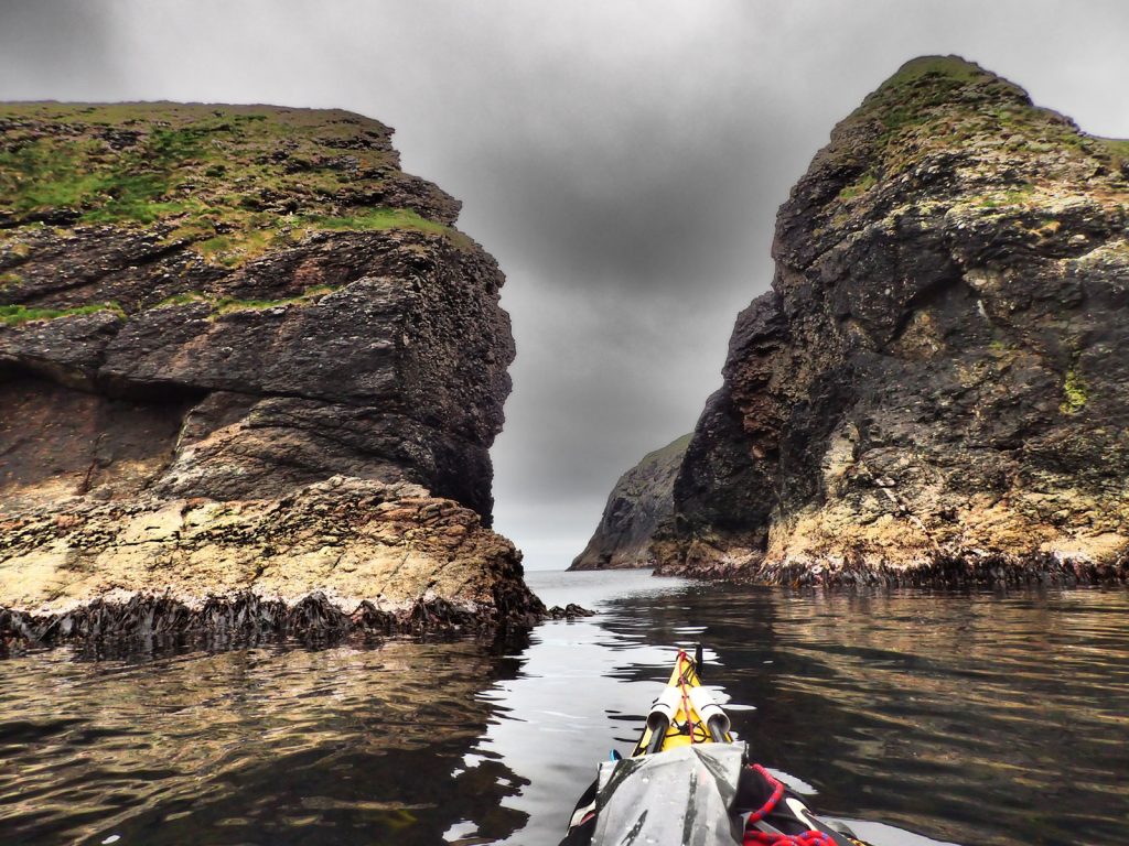
We left and headed SW past the rest of the homesteads in Vusanje and then continued up a forestry track back into the Proletije National Park where we were nabbed again for another Euro each by a young lad as an entrance fee. The track continued up the valley floor but the weather deteriorated to a light drizzle, or heavy mist, and we even had to put on our rain jackets. We trudged up the track hands in pockets for a good hour. Occasionally the mist cleared from one of the looming spires which seem to hang threatingly over us. Between the spires were steep gullies and stone chutes where debris would ricochet down from the spires in the thaw of spring and land on the alluvial fans on the valley floor.

After about 2 hours a path left the track and headed up into the deciduous woods on the right. It climbed to a pass and for one moment I though it was the watershed as we were on the valley floor. The path then descended down the other side to a very green pasture which was fantastic grazing. I then remembered we were in limestone country and this was infact a great depression and in most other rock types, more impervious that this, it have been a lake, but here drained away underneath the rise we just came over. The dried up lake bed was about a km long and flat. We sauntered across the lake bed between the tall grasses as the weather started to clear.  There were spires towering above us on each side, each one peering over the shoulder of the next in frozen curiosity, the mist making their appearance all the more more dramatic.

At the south end of the lake bed we crossed into Albania and climbed through beech forest on a path which zigzagged up to another plateau on the valley floor. This one was a pasture called Fuca e Ruinices, and there was a large herd of sheep grazing here on the cropped grass between the small pines and exposed outcrops of limestone. We passed a few shepherds shelters but they were just a framework of branches and twigs covered in sheets of plastic. They looked makeshift and perfunctory and one wondered if they were just here for a week or fortnight. From here the path climbed again past a couple of small derelict concrete bunkers which would have defended the valley some 60 years ago in the time of Hoxha, who built some 500,000 such bunkers.

After the bunkers the mist enveloped us again as we continued to climb on a rough path full of tufa blocks, skirting the hill side until we got to the rim of a deep depression with a shallow tarn in the depths of it. It must have been a large underground cavern which had collapsed millennia ago. The roof of the cavern was now a series of jumbled blocks lying round the tarn. We stopped for our second lunch here before climbing up to the rim on the other side of the crater and the highpoint of the day at Qafa e Pejes, 1707m, at the end of a long but mostly gentle climb. Here a scrambling route headed  up 500metres the sharks fin mountain of Maja e Harapit. At this pass the mist cleared and the south side of it was clear but overcast. Far below down in the valley we could see the hamlet of Okoli, the uppermost hamlet in the Theth Valley.
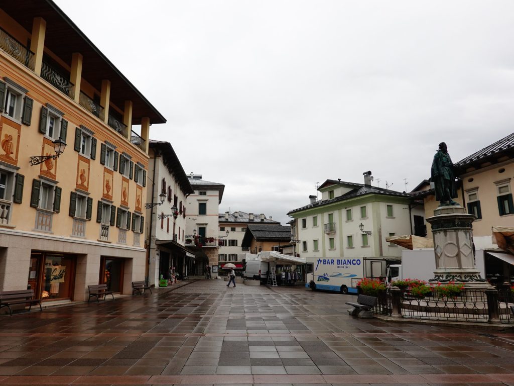
24. Coming down the Qafa i Pejes pass into the Theth Valley at the end of Day 10 was very steep but there was a good mule path carved into the rock.

The route down to Okoli was very, very steep but the path was a well constructed mule path which zig-zagged down the precipitous slope at a easy angle. In fact we passed one old shepherd riding up on his mule to the pastures above. On the west side of the path was a huge cliff which dropped down to the valley floor, while on the east side of the path huge crags, often overhanging and ochre, towered above up, so we were essentially on a large ledge which ramped down to the Theth valley. As we descended the dry rocky path among the pines, many of which looked like giant bonsai they were so contorted, we noticed the path was full of small reddish toads. There were so many we had to be alert not to step on them. The south face of Maja e Harapit unfolded as we approached the bottom of the slope. This face was 8-900 metres of vertical limestone and was the highest cliff in the Accursed Mountains. One day it will be a popular big wall climb. At the bottom of the slope we entered the mixed forest which grew out of the limestone screes and then arrived at an oasis of a cafe on the valley floor where we stopped.

25. The south face of Maja e Harapit was a 8-900 sheer wall of limestone. It was the highest cliff in the Accursed Mountains.

It was still 5 km from the cafe to the the Butjina Polia Guesthouse where were were staying beside the church in Theth. The route was easy as we followed a series of 4WD tracks down through a mix of small copses and homesteads. It was a soft and easy cultural landscape and each field or farm had some interest. After 3 km we reached the place were we headed off up the hill to Valbone 10 days ago and we thereby completed the loop. A bit beyond was a busy cluster of larger guesthouses, small hotels and an a cafe with an extensive and lively terrace. We still had 2 km to go to the church, which we could clearly see now. We stopped for a photo at the church before arriving as Butjina Polia. Here they remembered us and greeted us with warm handshakes and backslapping. We got a great room with a balcony and just had time for a shower and clothes wash before the huge supper was served in the busy dining room. The next day we would have a slow start before taking a jeep over the rough road to Shkoder and down to Tirana airport some 4-5 hours away.

Back