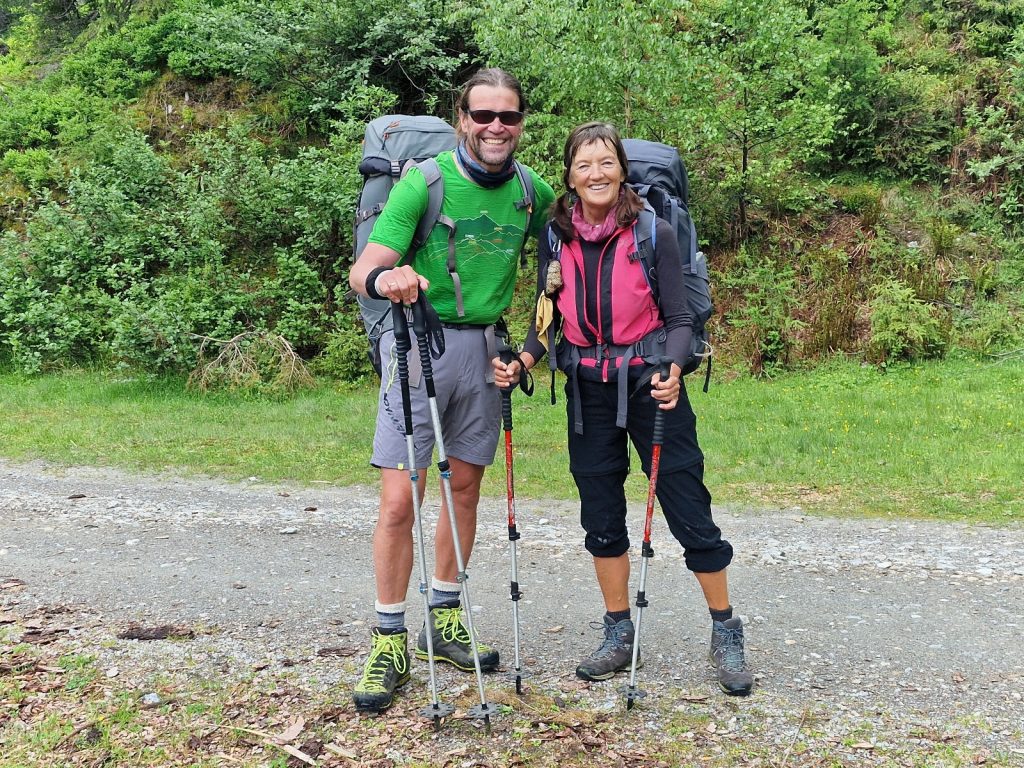
February 9, 2022

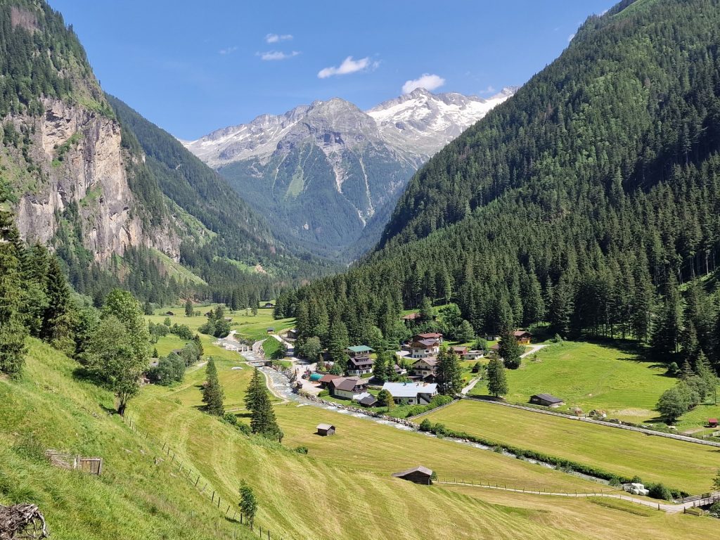
Day 038. Steinhaus to Kasseler Hutte. 12 Km. 8 Hrs. 1780 m up. 650m down. It was dark outside when the alarm went off at 0400. I had decided to have an early start because the forecast said it would cloud over by midday and also today was a bit of an unknown quantity when it came to how long it would take. By the time I packed, made up all the 7 rolls with butter, cheese and tomato and then had my breakfast of 3 of these rolls and a half litre of yoghurt it was already 0530 and completely light outside. The sky was totally clear and developing a blue hue from the grey of the dawn. 

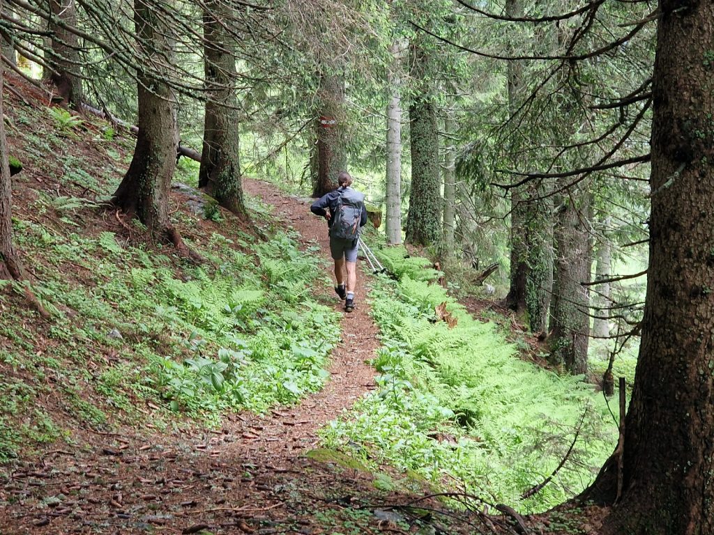
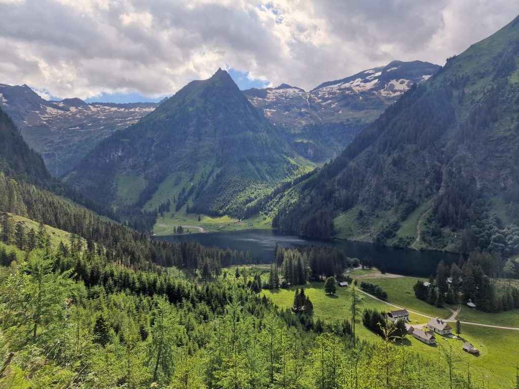
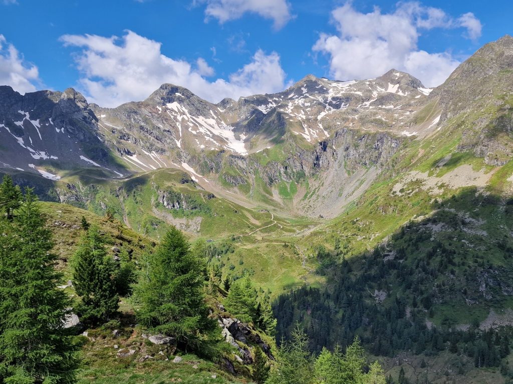
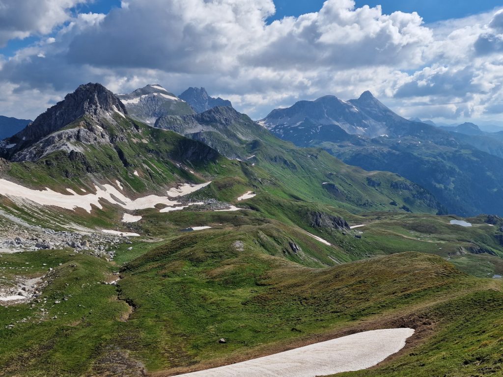
257. Looking down on a sleeping Steinhaus at 0600 in the morning on the path up to Keilbachjoch pass, 1800 meters above me.

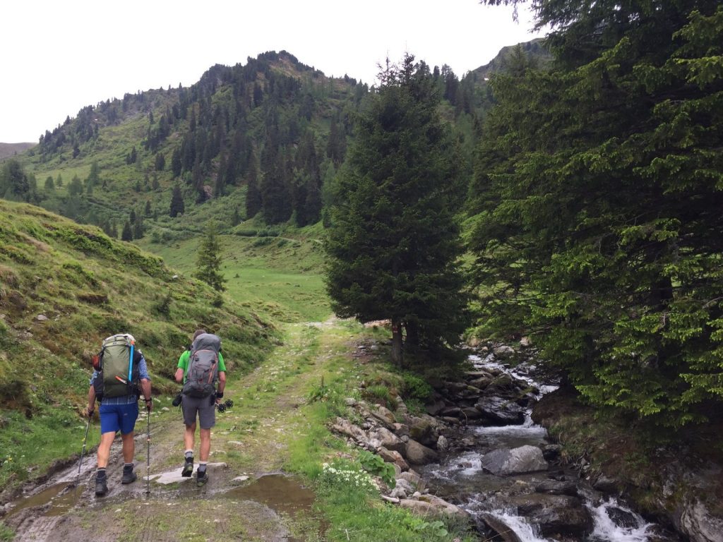
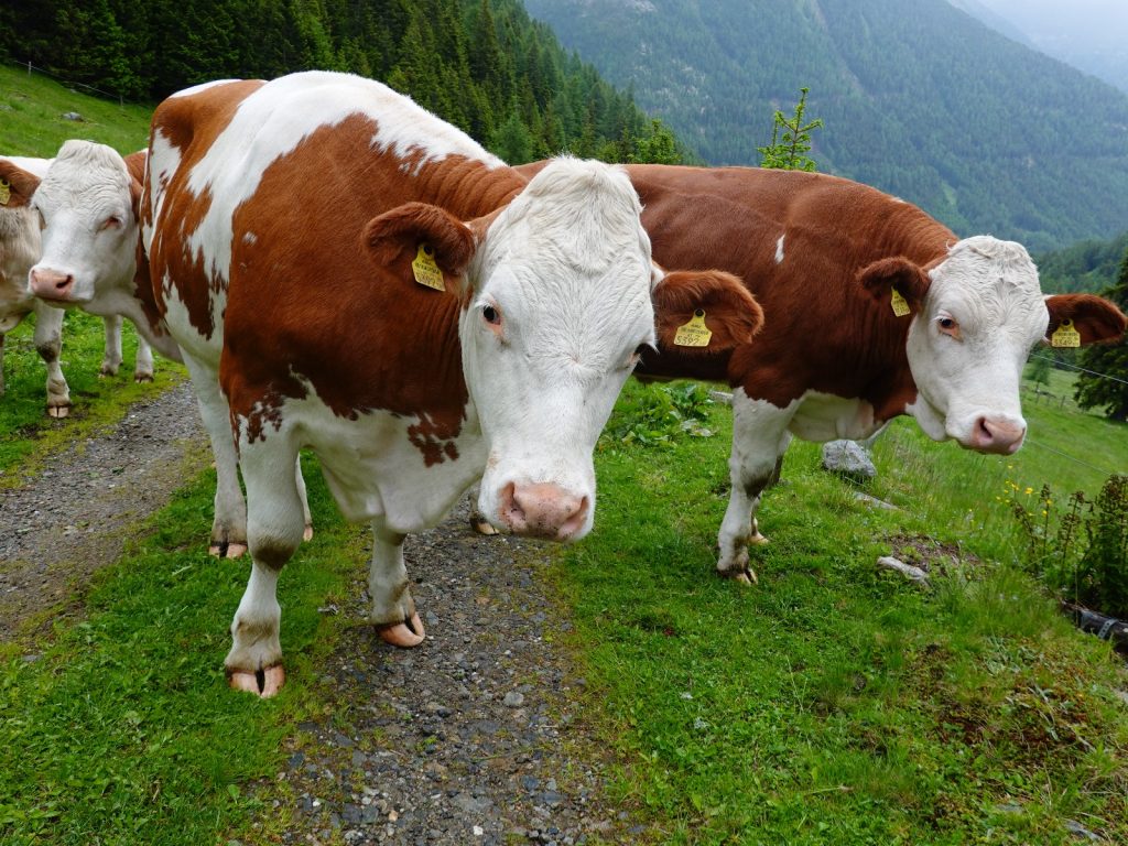
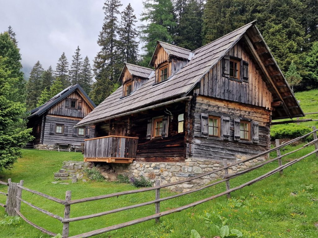
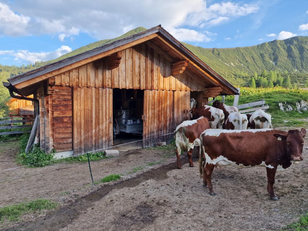
I quickly found the route out of town up an asphalt road which zig-zagged up for 10 minutes to a lovely old farm. The farmer was of course already up and he was going into his barn to milk his cows. We greeted each other before he disappeared inside the large wooden barn which was sitting on a huge fortress-like foundation of stones. I left the asphalt road which went to more farms on the side of this side valley and continued up on a forest track for nearly half an hour to a cluster of 3 farms quite high up in the small Keilbachtal valley which I was heading up. Only one looked like it was still operating and was very pretty, while the other two were in good condition structurally but the curtains were all drawn and the paint on the windows was peeling. I am sure the owners of the two dormant farms are working elsewhere and perhaps lease or gift the hay in their meadows to the remaining farmer. 

The route now left the track and went up through the fir forest on a tiny seldom used path until it reached a serene meadow on the small valley floor. There were 3 haylofts here and someone had recently mown and gathered the first cut. I assumed it was stored in these haylofts. I picked up the track again which I am sure I would have been better off following, thus avoiding the faint forest path, and walked up it through the rest of the serene meadow and a section of forest above it. Beside the track in the forest there were thousands of the large spotted orchid, with at least 50 to a square metre in places. 

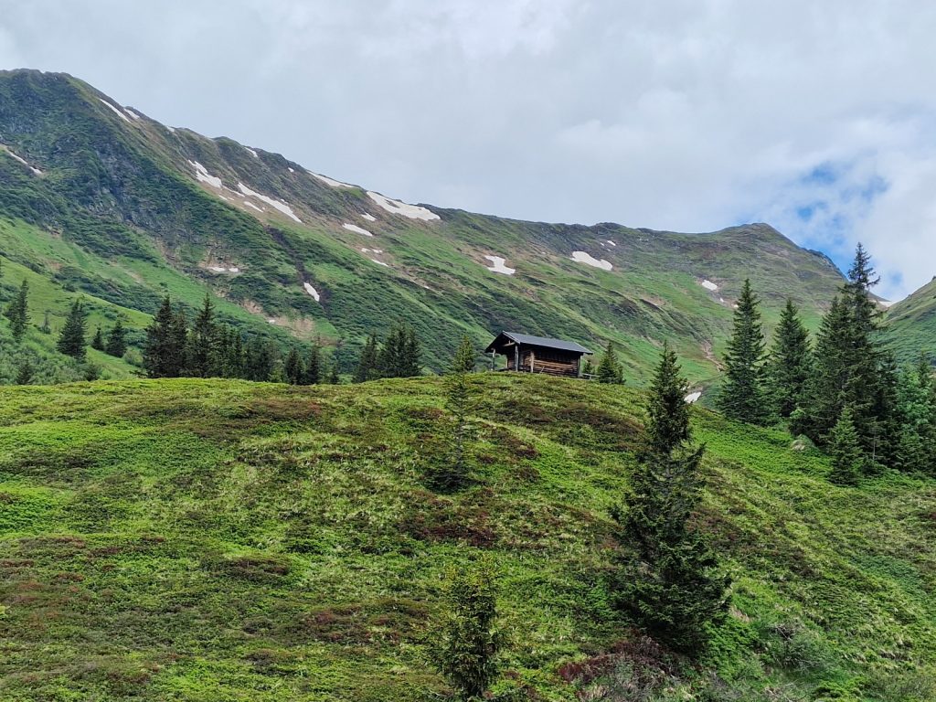
Unfortunately this lovely track came to an end and I was on a tiny footpath again. It climbed steeply beside the Keilbach stream which was cascading down a long slab of steep rock from far above. It was not a powerful torrent but it spread out across the slabs and was visible through the trees. It took a good half hour to climb up beside it reaching a very rickety bridge which was covered in gravel presumably from yesterday’s deluge. Wires anchored it to both banks otherwise I am sure it would have got swept down the slabs. There was an alm here and someone was living in the cabin, which was far from pretty. They were keeping goats as there were signs everywhere to keep dogs on a lead with pictures of goats. 

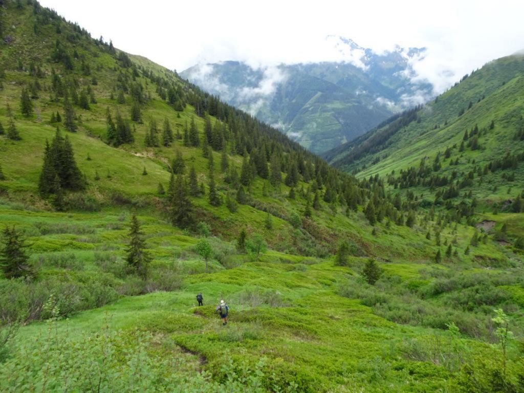
The tiny path now went up the west side of the stream which was much more sedate as it flowed down the more gentle valley floor which was covered in Dwarf Pine bushes. There were signs of goats everywhere including the pungent smell but I did not see any. Behind me there was a great view across the main Ahrntal valley with the the clear morning sun illuminating the  mountains on the other side. I could see south from here and there was a range of mountains in the distance which I think were the Dolomites, and I recognized the great whale back of Marmolada with its north facing glaciers. There were just a few distant clouds in the sky, but otherwise it was a lovely day with clear morning air. 

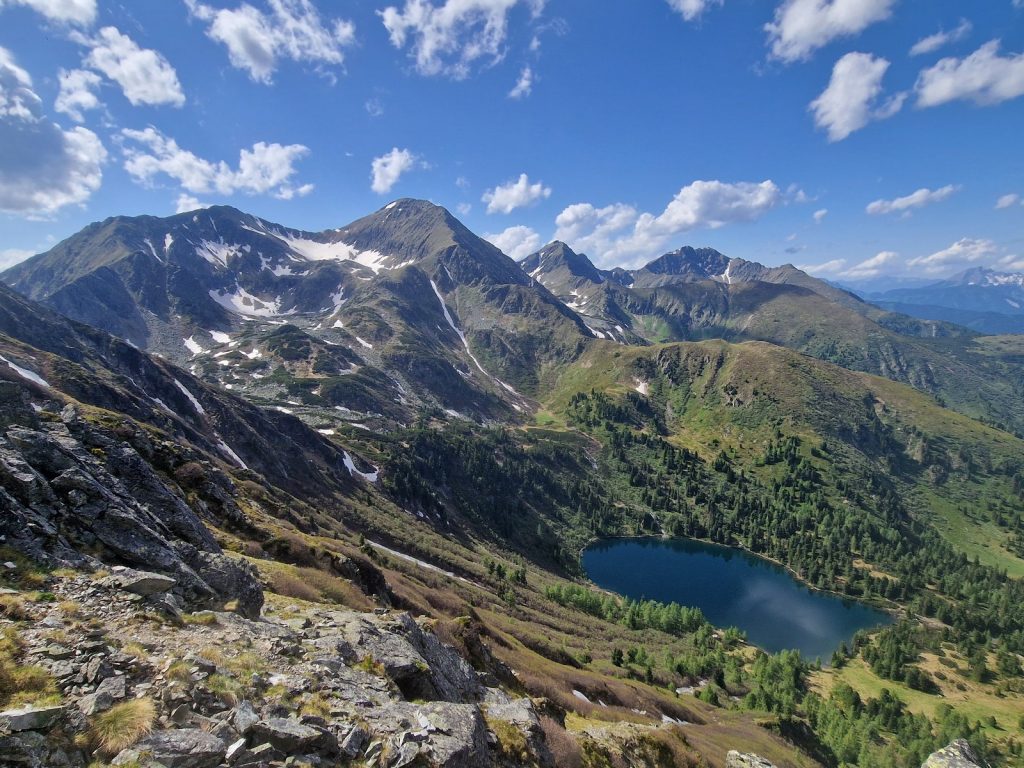
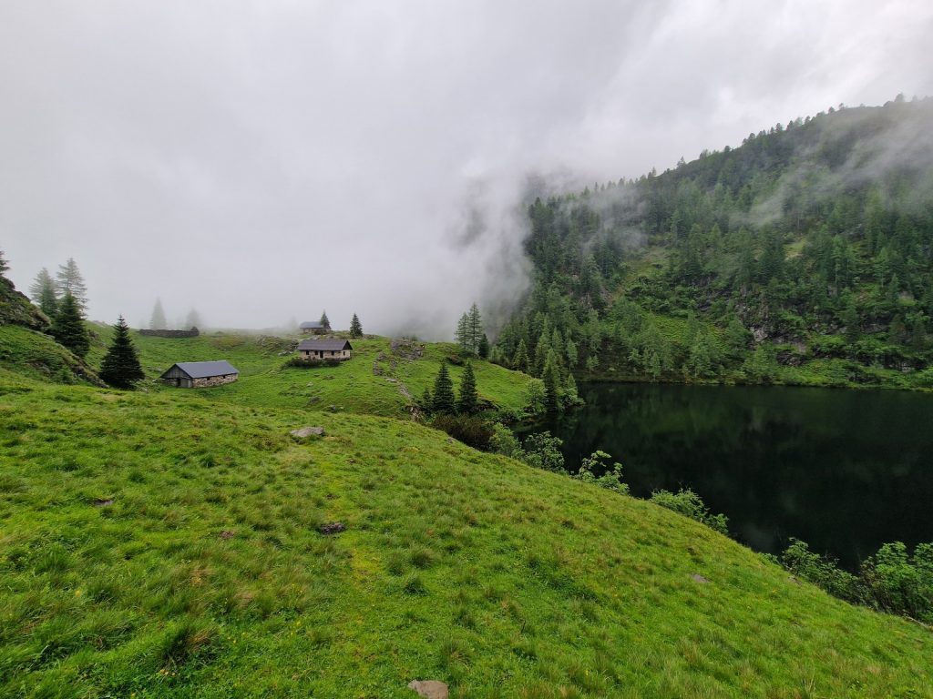
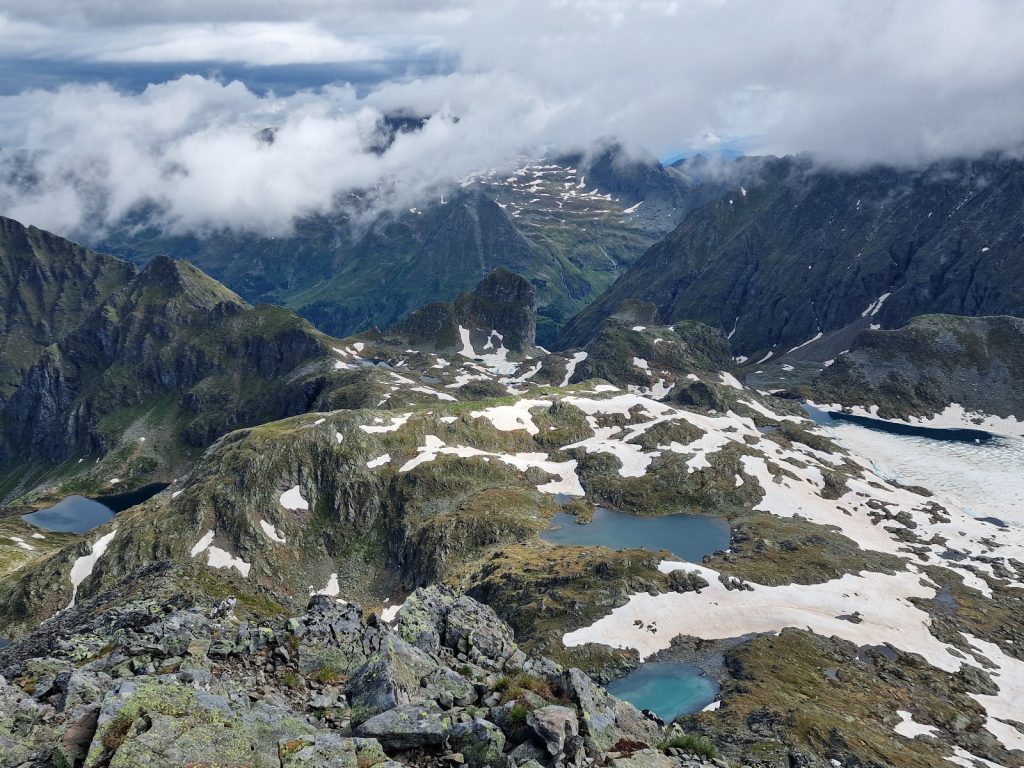
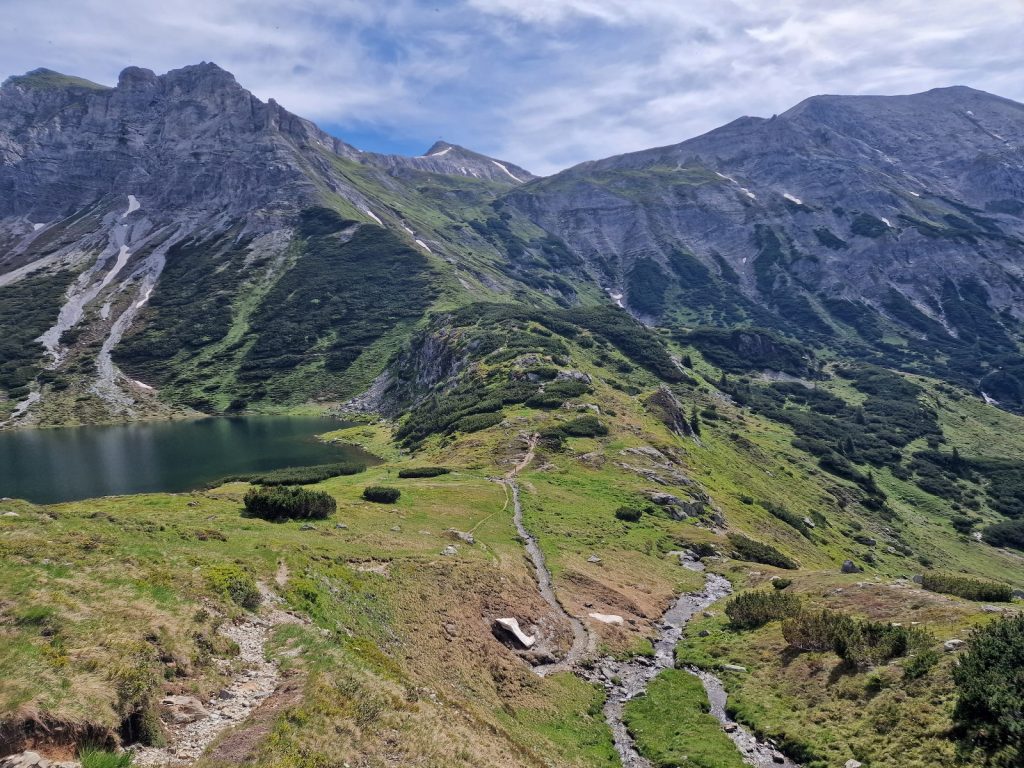
258. The serene meadow at Keilbachmoos in the early morning sun. This meadow lies in a bowl surrounded by cliffs with a ring of craggy mountains rising above the cliffs. The pass is out of sight in the middle of the photo

After a two and a half hour climb the path reached Keilbachmoos, a meadow of renowned beauty in a steep sided cirque with some glaciers on the ring of peaks surrounding it. I am sure the meadow was once a lake, now filled with boulders, gravel and sediment. It was covered in a smooth green drift of grasses which were so uniform in colour it could have been green velvet from a snooker table. Across this meandered the small crystal clear stream. A ring of cliffs encircled the meadow down which a few plumes of water cascaded. At the top of the cliffs were open grass and boulder slopes which extended up to the bare rocky grey mountains and their snow fields and glaciers. I can see why on a day like this it has a fabled reputation. The view down the valley was also stunning with the stream disappearing down through the dwarf pine to begin its adventurous journey to the Adriatic through the ridges of peaks to the south. 

259. Looking south from Keilbachmoos meadow with the stream emerging from it about to begin its 900m cascade down to Steinhaus in the valley below

It was only 0800 so I lingered here a bit enjoying the calm and warmth of the fabled meadow. There was no chink in the ramparts which formed the cliffs around the meadow so the route went up the the slopes to the east side before the cliffs started. The path was non-existent but there were painted markings on the stones. I think very few people come this way, perhaps 25 each year. The path was strewn with boulders often with turf between, and this was covered in wildflowers. The route climbed well above the top of the ring of cliffs on the steep slopes until it got to the base of the rocky mountains. It then headed north keeping well above the cliffs below as it hugged the base of the mountains. It took nearly an hour to finally climb out of this giant funnel and reach the higher valley beyond it which was filled with moraine. The whole time I was climbing round the top of the cliffs the meadow below was vibrant in the morning sun and beyond it rose the magnificent Kielbachspitze, 3034m which looked much bigger than its 3034 metres due to the small glaciers and snowfields on its steep grey rocky flanks.

260. Looking from the slopes above the cliffs surrounding Keilbachmoos to the meadow at Keilbachmoos and the mountains on the south side of Ahrntal. In the middle right distance is Marmolada in the Dolomites

For the next hour and a half the well marked route for the non-existent path threaded a careful route up ridges and gullies in the moraine left by the long vanished glacier. It was a carefully planned route as it avoided the direct line which would have gone through large boulders and instead kept to areas where a lot of smaller stones, cobbles even, and gravel was deposited. The walking was much easier in this terrain. Occasionally there was no option and the marked route had to cross areas with vast boulders to link up easier sections. The boulders were large and I spent my whole time on the top ridges and spines of them hoping from one spike to another. A misjudged step would have meant at least a metre tumble into the gaps between them which would have at least done some minor damage. I was lucky it was dry and the soles of my boots were sticky. I moved at less than a kilometre an hour. 

261. Looking SW from near Keilbachjoch pass to the small glaciers and the summit of Keilbachspitze, 3034m, which had dominated the second half of the 1800m ascent

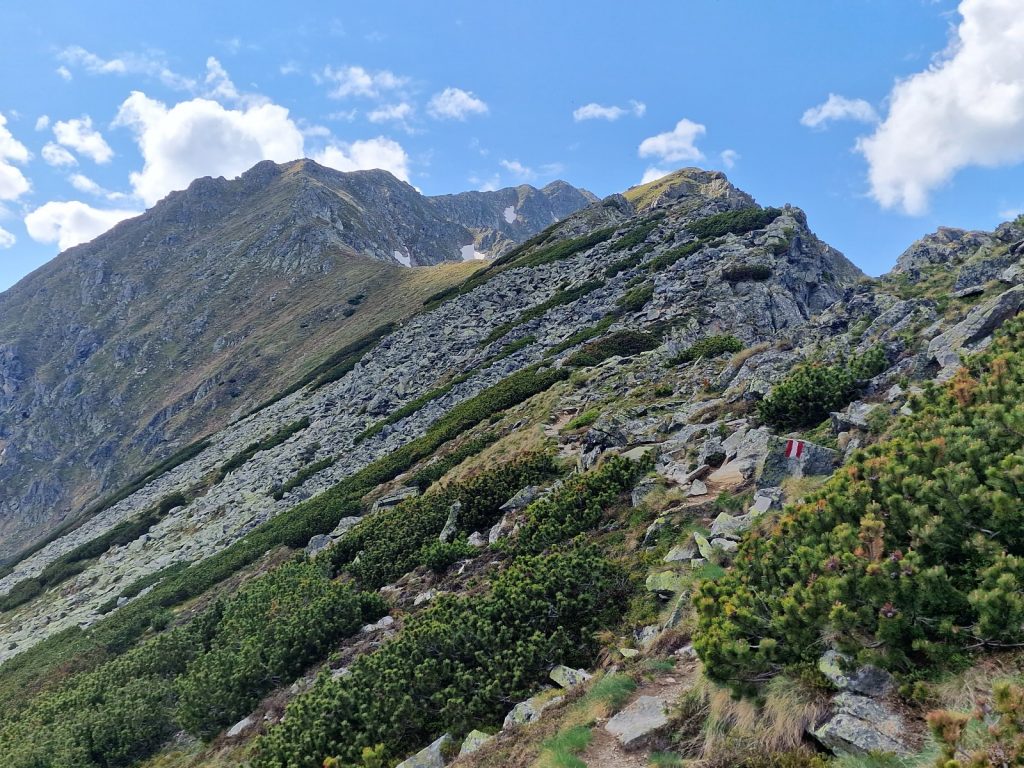
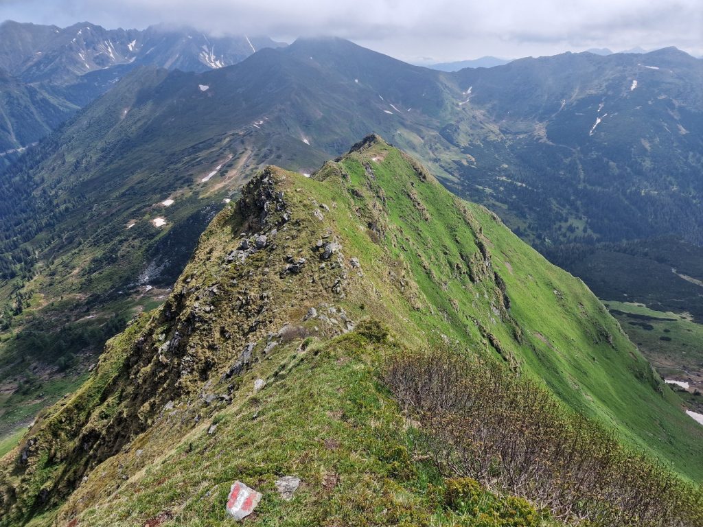
The boulders got worse as I neared the pass at the crest of the main Zillertal ridge. Some of the boulders were new having peeled off from the crest and tumbled down the slabs of the arete I was going up. I had to tread very carefully here. Soon I reached the final shallow slopes up abrasive bare rock and clambered up to the ridge where the view down into the cirque on the other side appeared at once. I had to go along the crest of the ridge a bit and noticed how it was peeling apart as the winter ice forced the stacked fissured rock apart until some would spill down on one or other side. After 200-300 metres it was easier to go down newly shed rock slabs for 5 minutes to reach the first snowfield. 

262. Looking north from Keilbachjoch pass down in to one of the cirques which make up the head of the Stillupgrund valley. On the right of this valley is one of the 6-7 side ridges emanating from the main Zillertal ridge (which I am standing on)

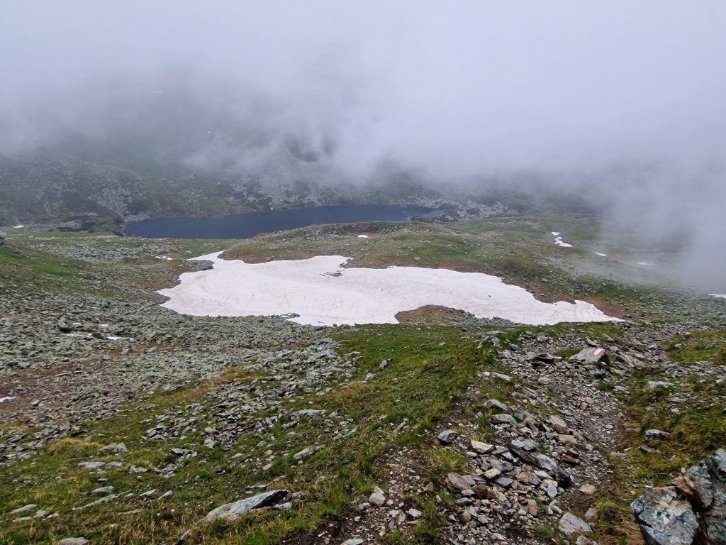
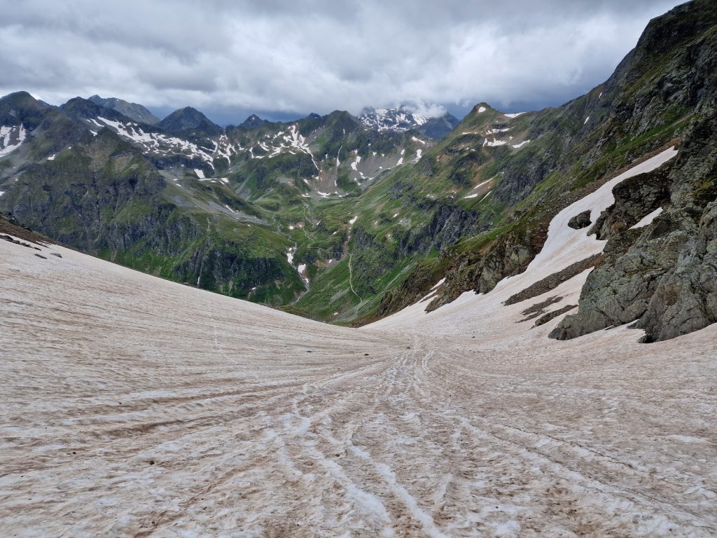
The marked route seemed to shun the snowfields but I liked to keep to them. I put on my gaiters and then started going down the shallow snow trying to link the fields up. Between the fields was smooth bare rock which was dry and grippy so I just sauntered down it to get to the next snowfield. At the bottom they got a bit steeper but it was a concave slope so I would come to no harm if I slipped other than wet legs and shorts before I came to a natural stop. After 20 minutes of this fun I finally linked up with the sensible marked route. I followed this route down to the shallow lakes in the bottom of the cirque in an unnecessarily convoluted way. To my east was Wollbachspitze, 3209m. Its shattered ridges looked steep and fragile and I am glad I was not going near it. It had the sad remnants of what once must have been a magnificent glacier which ended in the lake I was going to. Now it ended 500 metres from the lake high up on rock slabs where it would wither and die. 

263. Heading down the snowfields on the north side of Keilbachjoch pass into a cirque which eventually leads to Kasseler Hutte. The mountains to the right are part of one of the 6-7 side ridges emanating from the main Zillertal ridge.

From the silty lake the marked route now became much more visible underfoot as some of the path was roughly constructed. It also kept to the gravel and cobbles areas and avoided the large boulders. It zig-zagged down from the lake for perhaps half an hour across rocky areas full of marmots. However it kept to the easier terrain so the going was much faster with at least two kilometres per hour. Kasseler Hutte was sited under a prow which protected it from any avalanche and I did not really see it until I was 50 metres away. The Zillertal is a huge massif with a high ridge in the south and the deep Zillertal valley in the north. However some 6-7 massive ridges with jagged peaks stretch north from the main ridge towards the main valley where they abruptly descend. Between these 6-7 main ridges are 6-7 valleys and Kasseler Hutte lies at the end of one of these, called Stillupgrund. On the other side of this side valley was a jagged ridge with the pass over to the next cabin, Greizer Hutte,  and at the head of the valley was the heavily glaciated Grosser Lother. Kasselerhutte had a great view of this mountain. 

264. Looking across the head of the large Stillupgrund valley from near the Kasseler Hutte to Grosser Loffler, 3378m, on the main Zillertal ridge. To the right of it is another of the 6-7 side ridges emanating from the main Zillertal ridge.

The hut was built some 120 years ago by an alpine “Section” in Germany. Back then Germany and Austria were made up of individual provinces and cities and each area had an outdoor or alpine club called a Section. These Sections raised money to build local clubs and also a hut in the alps where the eager could go and pit their skills in the high mountains. The huts are still supported by these cities and the umbrella organisation of the DAV. Nearly all still bear their name which is why there are so many Austrian huts named after German cities. Kasseler Hutte is still the hut of the city of Kassel for its Section members to use. The Sections rent their huts out to caterers in the tourist months and the leaseholder pays a rent and passes on the bed fees, but keeps the money for the food and drink. Often the German huts are rented out to Germans who are the caterers, as was the case here and they employed further Germans and a Nepali.

The hut was quite busy so I went onto the terrace. The hut warden pounced on me for a drink sale, so I ordered a skiwasser, a blackcurrant cordial in soda water. Then his girlfriend and business partner arrived to check me in. I was informed of the rules and then dispatched to bed 14 in dormitory 1. A lot of people in the hut were doing the Zillertal Hohenweg. A good  week’s circular walking tour from Mayrhofen which goes over 3 or 4 of the gigantic side ridges which emanate from the main Zillertal ridge. I would be doing the lion’s share of it over the next 4 days going clockwise. That evening I sat at a table with 5 Germans who were just finishing the anticlockwise version of it. They all went on an annual lads walking holiday each year with challenging hikes each day washed down with barrel of beer between them. They were a friendly, bright bunch and in high spirits as tomorrow they had an easy day to complete the tour.

Day 039. Kasseler Hutte to Greizer Hutte. 10 Km. 4.5 Hrs. 830 m up. 760m down. It was not a great night due to doors slamming in the wind all night but I managed 4 or 5 sleep periods. Breakfast was a perfunctory buffet, laid out with essentials only and all decanted out of catering packs onto serving trays like a scout camp canteen. The weather forecast said it would be good until midday and then it would rain. So I set off soon after 0700 hoping to do the expected 5 hours before the rain came. I was not too bothered about getting wet, but I was wary of thunder and lightning (Donner und Blitzen) and I wanted some visibility to take photos. 

264. Contouring round the head of the Stillupgrund valley and looking down its U shaped length enroute from the Kasseler Hutte (out of view on the right) and the Lapenscharte pass (out of view on the left)

The route today was quite simple, contour round the head of the valley to the opposite side, then climb 600 metres over a ridge and descend 600 metres on the farside to Greizlerhutte. The contour around the head of the Stillupgrund valley was great. The mist lingered in the valley just below the contour height of about 2200 metres. Above me were the small glaciers on the northside of Keilbachspitze and then the large glacier of Gross Loffler which disappeared up into the high cloud. The sun however broke through frequently and it was warm and pleasant. The were quite a few streams to cross and only one had a bridge. All the streams were small enough at the moment to cross hoping from boulder to boulder, but it would not take much for them to become impassable and getting swept downstream cascading across steep slabs or ravines would be fatal. In one crossing the swollen stream had recently ripped a steep sided cleft in the moraine debris and it was difficult to find a route in the newly exposed rubble but enough people had been over since the damage to mark a faint route. 

266. Contouring round the head of the Stillupgrund valley to get to the west side to start the climb up to Lapenscharte pass which is just out of the picture on the right side.

Towards the end of this section and after the streams from the glaciers the mountainside became very steep and it descended slightly to cross some steep slabs. Here the path looked like it had been hacked into the rock. This was probably done by members of the Kasseler Section 100 years ago. There were cables for a good 150 or 200 metres here. At the most exposed section there were even iron posts drilled into the rock on the outside of the path and then these were linked by cables to form a bannister. By now the mist had burnt off from the valley to reveal a classic U shaped valley formed by a huge long-vanished glacier. It was straight from a geography textbook.

After the cables the climb started and this was perhaps the nicest part of the day. It was pretty much 600 metres up a mixed hillside of small boulder and turf. The turf was covered in wildflowers, especially the bright all yellow daisies which I think is Arnica, and also extensive drifts of the pale blue alpine forget me not. There were a few marmots about to enliven the climb. My legs feel quite tireless now as long as I don’t go too quickly and I sauntered up the entire slope in one go pausing just for photos. Towards the top there was a large snowfield which I opted to go on instead as I could see 2 young Belgiums struggling through a gnarly area of huge boulders where the path went. The pass, called Lapenscharte at 2701m, was a cleft really in the ridgeline and when I reached it the wind nearly took my hat off. 

267. Looking east from the Lapenscharte pass back down to the Stillupgrund valley. Kasseler Hutte would be under the mist patch in the centre right of the photo.

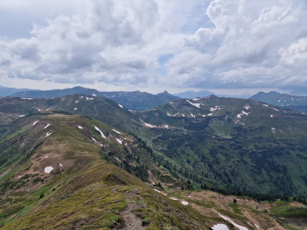
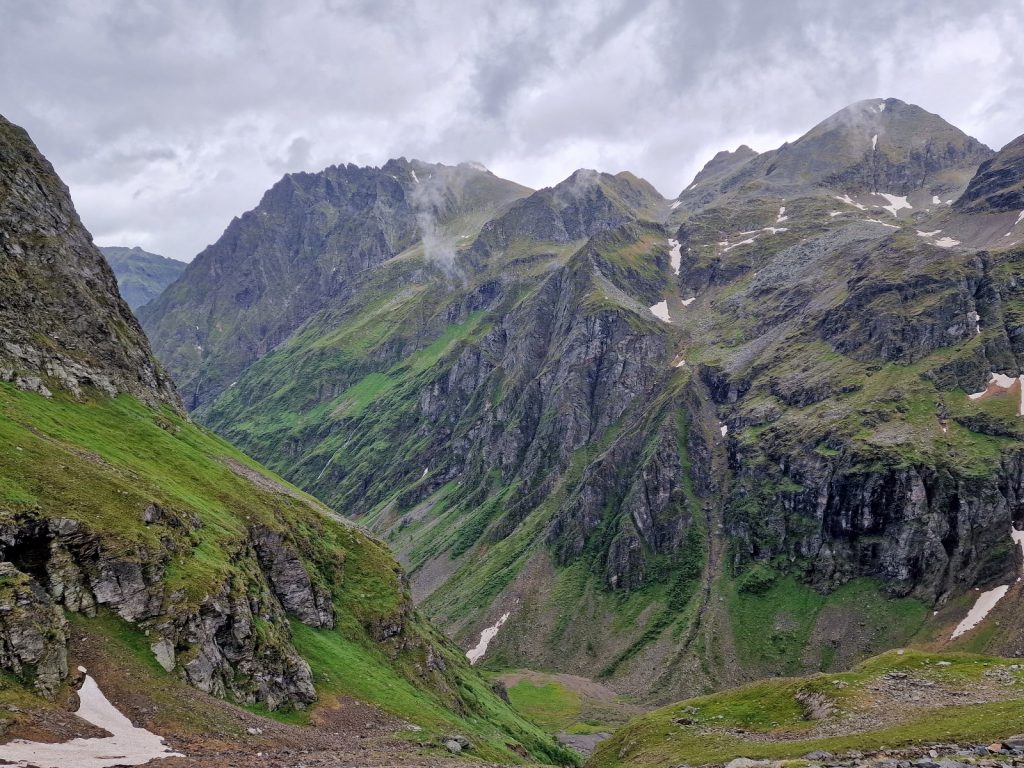
The view on the other side was even better than it had been at Kasseler Hutte. I now peered down into another of the great U shaped Zillertal side valleys. This one was called Floitengrund and it too had the high peaks of the main Zillertal ridge at its head. Most impressive were the unseen peaks of Floitenspitze and Schwarzenstein, both 3200m ish mountains, whose summits were in the cloud. There was still a large, crevassed and active glacier coming down Schwarzenstein and crossing this alone would have been very foolhardy. I could see tomorrow’s climb up over the Morchnerscarte across the valley and it looked more demanding than today’s pleasant climb. 

268. Looking west from Lapenscharte with Schwarzenstein, 3335m on the left with the big glacier and one of the 6-7 side ridges emanating from the main Zillertal ridge centre and right. The small notch centre right is Morchnerscharte which is tomorrows pass. The valley between is Floitengrund and the Greizer Hutte is down the slopes left of the grassy patches

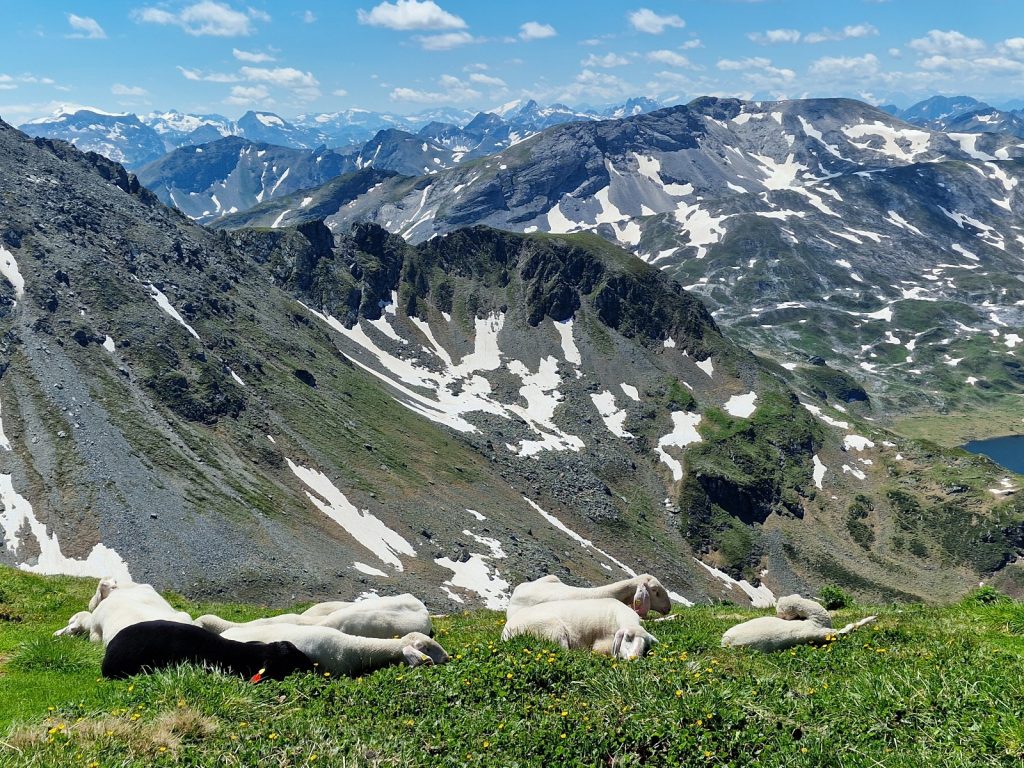
269. Just to the west of Lapenscharte was a large boulder where two female Ibex were relaxing. They were the first Ibex I had seen this hike.

I descended 20 metres to get out of the wind and found a flat sunny stone to have my bread and cheese rolls on which I still had from Steinhaus. As I ate them I noticed 2 female Ibex on top of a vast boulder. They were grazing the grass on it about 150 metres away. Then they both sat down and enjoyed the sun on top of their citadel. I took photos but they were too far away to get anything good. The descent down from Lapenscarte was about 500 metres but it was reasonably easy and the views were invigorating. The path zig-zagged down a steep grassy slope and had embedded itself into the turf forming a bit of a trough. I went past the Ibex and continued down for perhaps 20 minutes until I saw Greizlerhutte perched on a slope with the backdrop of glaciers behind it. The sky was totally covered in clouds now and much of it was dark and mist was welling up the valley. The fine weather was about to break. The final kilometre was a slow traverse across a boulder field. However there was an impressive rough pavement laid between the boulders which must have taken some effort to complete, manoeuvring huge slabs into place. Just before I reached the hut the rising mist from the valley enveloped me. I passed a small shed just before the Greizerhutte and it looked like goats were kept here. 50 metres later I reached the hut. 

270. Looking from near the end of the descent from Lapenscharte to Schwarzenstein, 3335m, on the main Zillertal ridge. Beneath it on the distant grassy patch and just proud of the mountainside and with the mist behind it is Greizer Hutte

There were about 10 beautiful brown goats milling about the hut with a few people sitting stroking them. Judging from the boots and ice axes they were mountaineers doing one of the bigger peaks or crossing glaciers. The hut warden was local from Mayrhofen and he owned the goats. He and his wife ran the hut and straight away I could see it was much more relaxed. He told me to take a bed in dormitory 17. I was the first so I bagged the mattress next to the window so I could keep it open tonight. A bit later Tim arrived. He lived in Munich and I had noticed him slowly catching me up all day. We went down and ordered some snacks. Tim it transpired was a vegan which was music to my ears as my vegetarian demands would pale into the background. Soon everybody who was at Kasselerhutte last night arrived and us 15 odd hikers mingled with the climbers in the dining room. I sat and wrote the blog until 1600 hoping for a good ambience come the evening. By now the rain had arrived and it was miserable outside with some hailstones mixed in with the rain. 

271. Looking across the Floitengrund valley from Greizer Hutte to the Morchnerscharte pass on one of the 6-7 side ridges emanating from the main Zillertal ridge. The Morchnerscharte pass is just to the right of the small black triangle above the mist in the photo centre

Slowly the dining room filled up with groups doing the Zillertal High Route and groups hoping to go up Gross Loffler tomorrow, with about 20 of each. Tim joined me and then two other Germans, Bernard and Christian, joined Tim. All three were instantly likeable and spoke great English, which they kindly did. We ate together and then had a few drinks together afterwards. The atmosphere in the hut was becoming a bit like an rural British pub mid evening with conservations getting louder and more raucous as they competed with laughter from neighbouring tables. The ambience was fantastic. The hut warden’s wife was plying everybody with drink and swooped on a table as soon as the glasses were near empty. She was carrying 4 pints in each hand sometimes to the bigger, thirstier tables while the warden was pouring them. For them it must have been a great night because the markup on drinks in the huts is about 300%.  At 2000 the rain seemed to stop and the mist broke up. Everybody piled outside to see the evening light on the surrounding peaks after the poor weather of the afternoon. The late sun and lingering mist made for some very atmospheric views.  The whole hut suddenly seemed to call it a day around 2100 and prepared for bed.

272. My evening companions on much of the Zillertal Section in Greizer Hutte. From the left Christian, Bernard centre and Tim on the right.

Day 40. Greizer Hutte to Berlinerhutte. 10 Km. 5.5 Hrs. 1060 m up. 1210m down. There were only 6 of us in the dormitory of 14 mattresses and I was right beside the window, which gave me some control over it. I made sure it stayed wide open all night. It was also a quiet collection of men and there was no snoring. At breakfast everybody remarked what a good night’s sleep they had. Breakfast was poor and given the amount of drink the warden had sold the night before to the 8 to 10 groups of hikers and climbers, probably well over 250 half-litres. It irked me a bit that breakfast was so mean.  However one look outside and all that was soon forgotten. 

273. A sea of mist fills the entire Floitengrund valley in the early morning. Todays walk had to drop into it, cross the valley floor and emerge on the other side

It was very still without a breath of wind and the valley was filled with a smooth layer of undisturbed mist just below us. Above this mist it was crystal clear without a single cloud. Far above a jet passed and there was no condensation trail at all, always a sign of stable weather. I was the first to set off and headed down the trail under the hoist wires to the valley floor. I passed the goats en route just as I dropped into the mist. It was like slipping down into a bath full of foam and soon my world was a bubble 100 metres wide. It was a damp descent with dew drops on the grass and flowers. Down and down the path went, every step down a wasted effort as it all had to be regained imminently. As I neared the bottom the stream of the valley floor gleamed white through the mist which seemed to be thinning. Indeed soon I felt the warmth of the sun as it tried to break through.

274. The mist cleared from Floitengrund valley just as I was about to start the climb to Morschnersharte. The route goes up the barely visible ladder on the crags centre left then veers to the right

By the time I got to the stream it was almost clear and I could see the mountains on three sides all around me like a giant amphitheatre. I crossed the larger clear stream on wooden beams and it was probably too wide to hop over without getting wet feet. Not far beyond it was a smaller stream which came down from the gully I would be going up. There had been a violent event in this gully with a surge of water, snow and boulders cascading down and ripping a deep trench in the moraine. It is alarming that these episodes are getting more common as global warming means the warmer air can hold more moisture, which means heavier rain. Some deluges are so heavy they create a torrent which carries all before it including 20 ton boulders. In the last 2-3 years such an event had happened here and the resulting trench was deep and steep sided and would have been difficult to cross were it not for previous hikers’ footsteps. 

Once across this loose ravine the 1000 metre climb started, and it looked like it would be without letup. Initially the path zig-zagged up for 15 minutes to the bottom of a ladder. It was just an aluminium ladder one could buy in a hardware store which was bolted and tied onto the bottom of a craggy outcrop. It was perhaps 5 metres high and steep but not vertical. It led up onto the side of a steep buttress. Here a footpath had been hacked into the side of the buttress. It was very well protected with cables with some of the more exposed sections even having wire handrails on the outside of the path too, attached to iron posts. Despite being steep this south facing slope was covered in flowers and with a huge variety of species. When I looked back down the slope it was a smooth slope of green vegetation with a sharp edge where the torrent had ripped away at previously stable rock and carried it down to the valley floor. The heavily cabled path then doubled back on itself and traversed up onto the crest of the buttress, again on a steep rocky cable-protected path, occasionally hacked into the rock face. It took half an hour from the valley floor to get onto the crest of the buttress. 

275. The ladder to get up the crags was just an ordinary aluminium ladder from a DIY store which was bolted and tied to the rock with steel cables

Once on the buttress the main task of the day lay before me as it soared up to a narrow distant cleft on the massive side ridge. Behind me I could see Greizler Hutte, slightly higher than me across the valley, which was clear of mist now. Above Griezler Hutte rose Gross Loffler mountain which I had virtually encircled over the last 2 days. Its flanks were covered in gleaming white snowfields which were slowly melting revealing the dark blue fissured glaciers underneath. These glaciers were still heavily crevassed and the few groups which set out from Greizlerhutte the same time to climb Gross Loffler were all carrying rope.

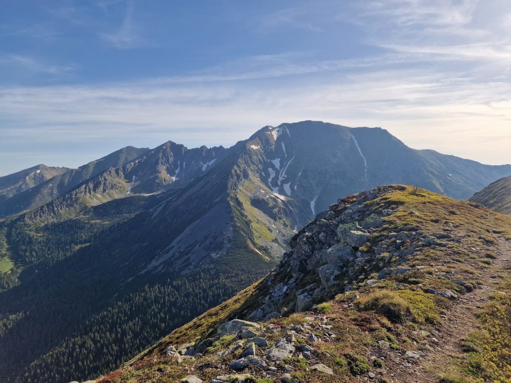
The climb up the buttress was sustained. The path zig-zagged hundreds of times with each one gaining just a few metres before switching back. It was not particularly steep, and as long as I took it at a steady pace it was not really that taxing. I just plodded up taking small steps for a couple of hours, frequently turning to take photographs of the scenes behind me under the perfect blue skies. As I climbed the flowers got shorter until the grasses started to peter out and the bare rocky earth started, which is where the more prostate alpines took over. Further down the buttress I could see Bernard and Christian slowly catching me and then Tim further down catching them. I reached the pass, Morchnerscharte, about 2800m, at the same time as a group of 3 came up from the other side and we chatted a bit each enjoying the new view which suddenly burst upon each of us.

276. Nearing the top of Morschnerscharte after the 1000m climb and looking back over the cleared Floitengrund valley with Greizer Hutte in the distant centre left on the other side and Grosser Loffler rising behind it

The view I had all morning to the east was stunning, but the view I now had to the east was possibly even better. Way down in the valley, Zemmgrund, I could see the Berliner Hutte at the confluence of 3 higher glaciated valleys which fanned out to the south at the top of Zemmgrund. These three glaciated valleys all lead up to glaciers on the north side of the main Zillertal ridge. The glaciers spread out so much as they approached the ridge they just about merged with each other at the apex. If this was not enough there was another of the enormous crenellated side ridges on the opposite side of the Zemmgrund valley and it too was covered in glaciers. It looked very similar to the one I was standing on. I could just figure out the chink in its ramparts where I would climb over it tomorrow. And all this under a perfect blue sky with just the odd cloud now. I must say the Zillertal range is delivering well above expectations. 

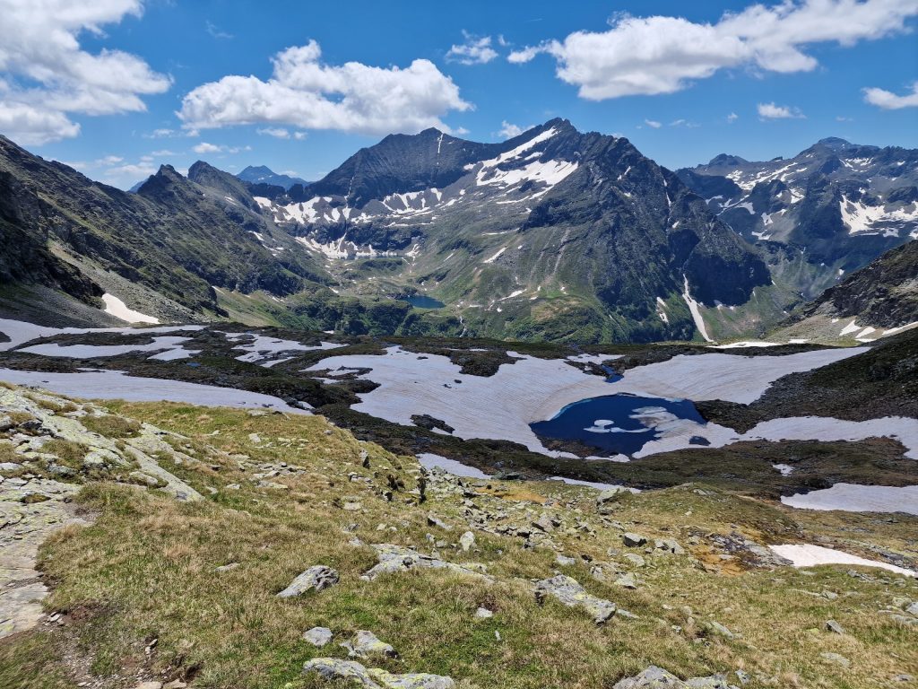
277. Looking west down into Zemmgrund valley from Morschnerscharte pass with the Berliner Hutte just visible lower center right. The biggest hill is Grosser Moseler, 3480m, in the centre with another of the 6-7 side ridges of the Zillertal range emanating from it

The descent was nice. There was a small steeper section near the top which has some superfluous cables beside it. It led down to a large shallow bowl which was full of smaller boulders, however the path through these boulders was easy and it was shallow as it followed easy sweeping curves down past very small tarns and rivulets. The landscape was quite barren here and were it not for the trickles from the snowfields one might think it arid. However, the further I descended the more grassy it got. The trickles merged into small streams which spread out and flowed across the mountainside in wide shallow flows across small stones. At the side of the streams were moses and the white flashes of clumps of glacier buttercup. Still further down there was the clink of sheep bells, much higher pitch than their bovine counterparts, as a small herds of them grazed the hillside.

The path then got to a line of crags, like an escarpment at the bottom of which was Schwarzenzee, a deep blue grey lake with a fringe of light brown sandy shallows. I could see people sunbathing on one of the beaches but no one swimming. The path descended steeply to the lake and then followed its southern shore over moraine knolls. I was not tempted to stop and swim, as I had the bit between my teeth and could imagine the comforts which would be laid out before me soon. The excellent easy path continued down into the easternmost of the three glaciated valleys which met at the Berlinerhutte. A huge fan of bare light grey rock rose up from the green valley floor where I could see horses grazing. Above this band of smooth bare rock was the crescent of glacier descending from the peaks. Some 20 minutes later I was arriving at the very large and grand Berliner Hutte which was built by the Berlin Section of outdoor enthusiasts in 1888. Being the capital of Germany at the time, one would expect this Hutte to be the grandest. 

278. The large Berliner Hutte is over 120 years old and sits at the confluence of 3 glaciated valleys. The mountain above it is Grosser Moseler, 3480m, and centre right is the mountain of Schonbichler, 3134m which is the route over the side ridge to the next valley for tomorrow

I went in the front door and was astounded by the reception area. A huge wooden staircase rose up two stories with the plush grandeur of an aristocratic palace. There was no about so I went into the dining room. It was magnificent and huge. 15 metres wide and maybe 40 long with a row of tall windows on the south side. Apart from the windows it was completely panelled in a pine with a beautiful golden hew. It was also very high, perhaps 6 metres and the panels went all the way up. To cap it all 4 large chandeliers hung from the ceiling. It could have been from a Hapsburg palace or the foyer of the grand opera hall in Vienna. It was empty as everyone was sitting in the sun outside. I had had enough sun so I sat alone in this huge sumptuous dining room and had a lunch of 3 different flavoured dumplings. 

279. The grand dining room in the Berliner Hutte was quite breath taking with its 6 meter high ceilings, chandeliers and tall south facing windows looking towards the glaciers of Zillertals main ridge.

After lunch I checked in at the reception in the grand entrance hall. The lady offered me a dormitory room for 20 euros or a single bed room for 25. I took the latter and found it in the extension, which I think was also 100 years old, up on the top floor. It was a compact bijou room with a single pine bed, a wooden washstand which could double as a desk and a wooden chair. The room was completely lined with rich golden pine which gave it a comforting wooden smell. It also had a powerpoint to charge gadgets. It also pleased me that I had a small south facing window to dry clothes by but when I looked through the window I was delighted to see it looked right up the glacier to the peaks on the main Zillertal ridge. Some would find it frugal but it was perfect for me. I went to the men’s washroom and discovered there was hot water so I washed as much as I could over the sink without getting naked and then washed my hiking clothes and hung them in my window.

By mid afternoon I was done so I went into the sumptuous dining room and started to write the blog. It was a superb setting and I felt quite privileged just to sit in a corner and type away. It remained quiet as it was still lovely weather outside and most people sat on the terrace. Bernard and Christian came down and we chatted a bit before they went out to sit in the sun. They were a witty pair and I enjoyed their easy company. Tim came along later and we discussed the fabulous day. We both ordered drinks and he settled down at the table and read while I typed. It was great having Tim there to explain that I was vegetarian and advise me on the menu. It seems most of the huts now would do 8 dishes with 4 meat, 3 vegetarian and vegan. Tim ordered the lentil stew which was vegan and it sounded good so I followed. It was good, as was the salad buffet with which I loaded my plate so much I was trying to hide it from the staff. After the meal Tim and I went out to join Christian and Bernard who were chatting with the hostess of the hut, a young German girl. We chatted until the higher peaks glowed slightly orange with a soft alpenglow and the temperature dropped. The Zillertal and the weather were combining to make this a great section, but having the company of Tim and the Christian/Bernard team doing the same stages was the icing on the cake for me. Especially as they sacrificed their own easy going conservation in German to switch to English when I was around.

Day 41. Berlinerhütte to Furtschaglhaus. 8 Km. 5.5 Hrs. 1090 m up. 890m down. I slept very well in the cosy room in my old cot style pine bed. When I got down for breakfast at about 0700 I was delighted to see it was a buffet. There were huge bowls of oaty cereals, yoghurts and fruit salad to layer up in my pudding bowl, and then nutty homemade bread with butter from a local alm, cheeses and jams, and good coffee. Tim joined me soon afterwards and then Bernard and Christian joined us, with Christian already in fine form with his jokes and perceptions. Even though it was just 0700 and we were over 2000 metres there were many people having breakfast outside on the terrace, which was just being blessed with the first sun. We chose the magnificent dining room. 

After breakfast it was time to part company. Bernard and Christian were heading down to Mayrhofen and the end of their hike while Tim and Myself would continue on to Furtschaglhaus over another one of Zillertals side ridges, where there was a weak spot in the otherwise inaccessible ramparts. It was sad to see Bernard and Christian go. I think I could have hiked to Monaco with them. As I left a couple of farmers were herding up a flock of sheep so they could graze the high alpine pastures. One was sick and a farmer was carrying it up over his shoulders. 

280. Looking back to the Berliner Hutte having crossed all 3 of the glacial streams which meet in the valley and just about to start the climb to Schonbichlersharte pass over the side ridge. In the top right is yesterday’s Morschnerscharte pass above 2 snow patches

I crossed the bridge over one of the 3 glacial streams which met here and ran straight into 3 piglets who were marauding through the boulders and shrubs. They made a beeline for me and one was trying to eat a walking pole. Distracted by the piglets I missed the turning and by the time I realised I had to cut across 200 metres of shrubby boulder-strewn moraine to get to the right path and a bridge over the second of the 3 glacial streams. The marked path now contoured around the boulder-strewn hillside where small willows and dwarf alders were thriving, to reach the third bridge. All 3 bridges were two wooden beams bolted together, with one end tethered with wire to the rock so in a violent torrent they would swing parallel to the flow and could hopefully be manhandled into place again by 5 men. 

281. Looking up the slabs below the Waxeggkees glacier with Grosser Moseler, 3480m, centre right. About 200 years ago the glacier would have entirely cover these slabs and perhaps extended to where I am standing

Once over the third bridge the path traversed up the end of the lateral moraine to gain its crest, which the path followed up. On one side was a small valley between the moraine ridge and the mountainside. On large glaciers, especially in the Himalayas, this valley can be a magical place with a narrow grassy meadow. On the otherside was a gaping hole left by the retreated glacier, which would have filled this void perhaps as little as 200 years ago. On the far side of this void across the boulder strewn depression was the other lateral moraine. The sides of the moraine facing each other are usually steep inhospitable places full of boulders embedded in gravel which tumble out sometimes in heavy rains.

282. Looking NE from the top of the lateral moraine across the void left by the retreated glacier to the opposing lateral morain in the other side. The Berliner Hutte is just visible centre left.

After half an hour the crest of the lateral moraine came to an end in crags and the path climbed up onto the mountainside of pleasant turf and boulders and covered in flowers. It was a lovely climb up reasonably gentle zig-zags for a hour. The latter part of the climb was beneath a face of steep cliffs which formed part of the east ridge of Schonbichler Horn, 3134m, the mountain the path was aiming for. As I climbed under this face an eagle soared over the top of the cliffs and then found a thermal and started to circle in it climbing steeply with the skill which would make most paragliders envious. It rose so steeply it quickly reached cloudbase, which was at the highest peaks of 3400m and then used the height to soar off to the west and out of sight.

285. A Golden Eagle, Aquila chrysaetos, climbing in a thermal and gaining height near the summit of Schonblicher Horn

283. Walking up the grassy slopes under the cliff just before the path doubles back to climb up a sloping shelf to reach the top of the cliffs. Just to the right of the glacier is Schonbichler Horn

Just when I was expecting to continue up the grassy slopes beneath the cliffs the path doubled back and went up a rake, or sloping shelf, along a fault line to the top of the cliffs. It was between a metre and 3 metres wide as it steeply sloped up and after 10 minutes had reached the flatter crest of the ridge. This climb up the rake was protected by cables. Once on the crest of the main ridge it was an easy walk all the way up across boulders which had been manhandled into a path. To my south were the pretty much a continuous series of glaciers which started at the main Zillertal ridge and then flowed down for at least a kilometre, with many areas of large crevasses, and even small icefalls until then thinned out into snouts of grey ice, smeared over the smooth rock plates far below me. The glacier adjacent to the ridge I was going up was called Waxeggkies. It was very impressive especially with the backdrop of the 3400m peaks behind it which were clear again. The path continued up the ridge all the way to the bottom of a shattered arete, which was reasonably steep but quite wide. 

284. Looking over to Grosser Moseler, 2480m, across the Waxeggkees glacier from the top of the cliffs on the east ridge of Schonblicher

I could see people coming down the arete using the cables. It was much easier going up facing the mountain and I seldom used the cables to haul myself up. The way the mountain had exfoliated the slabs on its surface here meant there were many metre high pillars of rock fragments sticking out from the ridge. It was if I was a small beetle crawling up the back of a hedgehog and if you slipped it would not be for long. It only took 15 odd minutes to climb this arete and reach the pass, called Schonblichersharte, at about 3100m. The view here was stunning but I knew it was only a few minutes to Schonblicher Horn summit, 3134m where the view would be even better. I clambered up quickly and met a couple having their picnic on top.

286. A party coming down the east side of Schonblicher just below the summit. The rock here was shattered so large pillars protruded from the surface giving it a spiky surface.

The view was indeed spectacular with a number of dark threatening peaks to the south with the glaciated peak of Grosser Moseler over topping them all. Behind me was the Berliner Hutte in the valley of Zemmgrund and in front of me was the Furtschaglhaus cabin in the valley of Schlegeisgrund. Beyond this valley was yet another side ridge descending from the main Zillertal ridge which at that point was crowned by Hochfeiler, 3509m, and the highest point in the whole area. There was a crescent of large glaciers between me and Hochfeiler some 5 kilometres away. The other two went and I lingered here for another 15 minutes enthralled by the alpine setting. 

287. On the summit of Schonblicher, 3134m, with Grosser Moseler in the background on the right. Waxeggkees Glacier is the nearest glacier and beyond the line of cliffs on the left is Hornkees Glacier

288. A close-up of Grosser Moseler from the summit of Schonblicher. The dark bare mountains in the foreground are the start one of the 5-7 side ridges emanating from the main Zillertal ridge with the rest of the side ridge continueing behind me.

289. Looking west from Schonblicher Horn towards Furtschaglhaus cabin which is at the confluence of 2 glacial valleys and at the head of the larger Schlegeisgrund valley. The mountain in the back is Hochfeiler, the highest and most westerly of Zillertal’s big mountains.

Eventually it was time to bide goodbye and start the long descent to the cabin. The descent was steep for perhaps 10 minutes down a gully of fractured stone embedded in soil and small shards of rock. It was easy to walk down unaided but there were cables here too, which would be essential if icy or maybe even wet and slippery. It soon led to a boulderfield where a path had been created by moving and aligning boulders. It was an easy walk initially and then it zig-zagged down a well worn grove on steeped ridges before more level sections. Although half the sky was covered in clouds it was warm and even hot where the sun shone through a gap. I passed a herd of brown sheep who were flaked out panting on a rock slab. They were so drowsy they just watched me saunter by 5 paces away, and just continued to pant.  In another half hour, and well over an hour from the pass, I was approaching the hut which lay near enough at the confluence of two glaciated valleys, each draining a fan of glaciers above them. It was as spectacular a location as the memorable Berliner Hutte. 

290. Looking back up to Schonblicher Horn (centre) and the Schonblicherscharte pass (centre right) from the west side half way down to Furtschaglshaus cabin.

291. Half way down from Schonblicher Horn to Furtschaglshaus cabin there is a great view of the Grosser Moseler and the glaciers on it’s west flank. The route to the summit goes up the ridge centre right emerging from the glacier

The hut was quite quiet and I was welcomed by a crew of young girls all of whom spoke good English. They had space in an 8 person room with 4 bunk beds. I was first so I took the lower one beside the window. I then had a cheese gnocchi dish and chatted to a German couple who had just been up Grosser Moseler and were now enjoying their victory beer. I then wrote for a couple of hours while the hut filled up and became very busy. 3 Americans took the other 3 lower beds in my room. They were going to spend the next 3 days walking the same path I had to Kasselerhutte, but in the other direction. In the course of the afternoon a few more climbers came down from the peaks, and many hikers and a few climbers came up from the valley. I was glad I already had an assured bed space by the window. 

292. Looking down onto Furtschaglshaus cabin with the highest mountain in the Zillertal range, Hochfeiler 3509m, rising behind it. Furtschaglshaus cabin is at the head of the Schlegeisgrund valley descending on the right.

I had spoken to 3 German women on the way up and they now arrived and joined me and then Tim arrived after enjoying pauses on the way up and down. One of the German ladies worked in Brussels for the European Union as an advisor from the Green party on food politics. When the meal came she was the only one who had meat, with the other four of us having the vegan lentil and rice curry. They were also a very well educated and bright bunch and easy to talk to as they made great effort to speak in English for me. After supper I went over to the Americans as I was sure it would be interesting to chat to them. After a few minutes I wished I was back with the bright Germans, as the Americans started to mumble about their previous jobs and life in Utah. At one stage they spent about 20 minutes trying to convince me why the “fifth wheel” was preferable to the “bumper hook” for towing RV trailers. I was saved by the weather forecast which said there would be rain and lightning from midday onwards tomorrow. This sent the Americans scrambling for an early night to get an dawn start tomorrow so they were not hanging onto the steel cables when the lightning arrived. The rest of the post dinner hikes and climbers followed soon afterwards.

Day 42. Furtschaglhaus to Olpererhutte. 10 Km. 3.5 Hrs. 620 m up. 560m down. It was a quiet night until 0200 when I was woken by a tremendous flash and then a crack of thunder which came straight through the open window. For the next half hour there was a lively thunderstorm with a flash of lightning at least every minute. Then I heard heavy rain blasting down outside but before long I went back to sleep. I heard the alarm clock of one of the Americans at 0500 but nothing more and I was surprised how quiet, organised and considerate they were. When I got up at 0700 it was overcast with plenty of blue sky. The Americans were hoping to get up and over the pass I came over yesterday by midday when more thunderstorms were predicted. Tim and I were the last down for breakfast. It was an OK breakfast but being a buffet made up for the small choice. I was packed and ready to go by 0800 so went off to find Tim, who was relaxing on the terrace with a coffee savouring the grandeur. He would be heading back to Munich this afternoon so it was his last breath of mountain air. It had been great travelling with him for the last 4 days. He was calm, kind and compassionate and very easy going company and being a vegan I felt we were part of the same church. I hope our paths cross again. 

293. Leaving Furtschaglhaus and heading down the slope into Schlegeisgrund valley with Hochfeiler, the highest mountain in the Zillertal range watching over me.

The descent down from the hut was on an easy paved path where many of the stones had been laid to form rustic steps. Here and there iron rods were drilled through the stones to keep them in place and sometimes these had worked loose and protruded 10-15 cm. It would have been easy to trip on one or worse still get a lace loop over one. As I descended towards the valley floor the skies started to cloud over a bit more but surprisingly Hochfeiler, the highest point in the Zillertal, remained under blue sky. After a short hour I finally reached the valley floor where there was a track and after 4 days a mobile phone signal which inundated my email with spam to delete. 

294. Heading down Schlegeisgrund valley towards Schlegeisspeicher lake with Olperer, 3475m, the highest mountain in the Tuxer Alps to the left. Olperer Hutte is below the saddle ahead just above the treeline.

The walk down the damned Schlegeisspeicher lake was perhaps 5 km and it was a very easy saunter. The lake was low so there was a contour mark of bare washed boulders, some 15 metres high, right round the lake which made it look very unnatural despite the small trees which surrounded it at the top end, as it was just at the treeline. The further down the lake I walked the bigger the trees got despite being the same height and this was just due to being further from the glacier and its chilling effects. At the end of the lake just before the large crescent shaped dam was a huge parking place and a couple of closed cafes. At one there were tables and benches so I spread the map out to look at the options, conscious of the mist forming in the valley and the totally overcast skies now. Rain was forecast for midday, in an hour and a half’s time, and it looked prompt. I decided against going to Geraer Hutte which would take another 4-5 hours and inevitably mean a soaking and probable lightening at the 3000m pass, which was 1200 metres above me. So instead I opted for the 600 metre climb to Olpererhutte which I could make before the weather broke. 

I was surprised at how busy it was here on this Monday morning with a poor forecast. There seemed to be a lot of Czech’s about so perhaps there was a holiday there. The climb up started from just after the parking place, but before the dam. There were many people coming down with small day packs and all were again Czech. Beside the path various tall plants with a similar inflorescence were thriving, including the Alpine blue-sow-thistle,Cicerbita alpina, and what the Germans call Grauer Alpendost, Adenostyles alliariae, for which I can’t find an English name. I saw a bullfinch in the bushes and I am sure it was hunting for insects as it was in alder and darting about. It surprised me as I thought they were seed eaters exclusively. Soon I caught some people going slowly up to the hut labouring under big rucksacks. I was conscious of the imminent rain and overtook them with huge strides unburdened with my 8-9 kg rucksack. The path went up the west side of a stream, and on the other side I could see a large copse of Arolla Pine going up the mountainside to about 2100m when the altitude got the better of them and they started to peter out.  Once I got to the top of the treeline sporadic raindrops started to fall, spreading out on the porous stone. I quickened my pace rather than put a jacket on. I overtook more and more people all of who seemed to be heading to Olpererhutte. Alarmingly there was also a string of people in front of me heading up. Soon the hut appeared perched on a prow in a shallow bowl of turf and boulders. Beyond it was the high mountain of Olperer, 3476m, the highest point in the Tuxer Alps. It was, however, lost in the cloud but I had seen it this morning. The rain drops continued to be light enough so my shirt did not get wet and for the last 10 minutes I surged up the track with my legs pumping and chest heaving. I just made it before the heavens opened at exactly midday. 

The only trouble was the hut was completely full. I was not going back and I was not going on so I dumped my stuff in the drying room and then went into the main dining hall of the relatively new and charmless hut. The staff said they should know by 1800 if there were any cancellations or not and if there were they could assign me a bed then. In the dining room I sat at a table which by coincidence had 3 Americans at it. I ate a dumpling dish then chatted with them as the dining room emptied and many day trippers headed out into the downpour to go back to their cars. The 3 Americans then all went off for a siesta so I got my keyboard out and started typing, swatting off the staff who occasionally pestered me to have a drink. The two young Belgium brothers with the huge rucksacks arrived as I typed. They were wet but still full of energy. They were brothers with one 19 and the other 16. They had been doing the same route as me in the Zillertal over the high passes, but camped every night. I have to applaud them for their tenacity.  After a few hours the rain stopped and the mountains of the Zillertal range to the south started to emerge from the mist. 

The 3 Americans also emerged again from their siesta and joined me at a table with a great view overlooking Grosser Moseler and Hochfeiler and the west end of the impressive Zillertal range. The 3 of them were doing the 7-8 day Zillertal Runde anti clockwise. I soon realised I was in the company of some rather special Americans. All three were professors in the social sciences, but were well versed on any topic from Alpine flowers to property development. It was a joy to listen to their eloquent and articulate thoughts all punctuated with lovely metaphors and witticisms. They more than made up for the pragmatic, but ultimately dull, Americans last night. I learnt more from them about the impasse and stalemate of American politics in two hours, than I could have done from reading considered and thoughtful newspaper articles for a month. It was a stream of high IQ consciousness, humour and intellectual fun. I could have listened to them all night but after the meal everybody seemed to go to bed early at about 2030. As I had no booking I was eventually shown a bed in the winter room. There were 4 free top bunks in a room of 8, with 4 Czechs already on the bottom. I noticed there was a small secluded dining area with a large table in another part of the cabin so I dragged a mattress out and put it on the table. The table top had an unblemished view across the valley to the Zillertal range. 

295. The view from my tabletop bed looking straight up Schlegeisgrund valley from Olperer Hutte. The two distant mountins are Grosser Moseler on the left and Hochfeiler on the right.

Day 43. Olperer Hutte to Steinach. 28 Km. 9 Hrs. 980 m up. 2300m down. I had a great sleep on the table with the most amazing view as soon as I opened my eyes through the window to the main Zillertal ridge in the clear morning light. I was the first at breakfast at 0630 and the 3 witty, eloquent professors joined soon afterwards. We were all aware of the weather forecast and wanted to be at our destination or indoors when heavy rain was expected at midday. I was disappointed to see the Americans go but not so much to see the back of Olperer Hutte. It was modern and quite charmless, busy with people just coming up for the night, and a large, but well behaved, school group which made the whole place feel like a youth hostel rather than an alpine hut. Perhaps the defining disappointment was the hut warden who seemed to be here just to run a business and maximise the profit, and her team of girls who were like surly teenagers with a shoulder shrug and “I dunno” to every question. They were all the same early 20’s age as the staff from Berliner and Furtschaglshaus, who were by contrast very welcoming and enthusiastic. 

Today’s route was over a pass and then down a valley to the Brenner Pass, a major and historic thoroughfare through the Alps and the geographical dividing line between the Eastern and Central Alps. Already an hour after getting up in perfect weather some low cloud was starting to form over the main 3000+ metre tops and the odd bubble of mist was starting to billow up in the valley below. I set off and contoured south around the bowl in which the Olperer Hutte was sited on a good path through boulders and turf. Small clear streams came splashing down the hillside from Schrammerkopf, a prow on the south ridge of Olperer, 3478m, the highest point in the Tuxer Alps. The path continued south over a small ridge and then veered west dropping down a good 100 metres to reach a wild bowl called Unterschrammerkar, which was blessed with a couple of small tarns. Here the small path I was to take over Alpinscharte left the main path, which continued to the popular Pfitscherjoch, a pass over to Italy.  

296. Looking down into the wild cirque of Unterschrammachkar with the Alpeiner Scharte pass, 2959m, just appearing on the central skyline between the mist

By now the low cloud had obscured all the tops and the mist coming up the valley was enveloping everything below me. I fully expected the two to meet soon and plunge me into a bubble of grey dull light. The path was small and faint but it was well marked with red paint marks on boulders. I had to climb about 700 metres in all from the bottom of the bowl to the Alpinerscharte, so I measured my pace. There was quite a steep gully filled with snow which extended right down the mountain but the snow was soft and there was not enough incline to slip uncontrollably down it so I gingerly walked over it without getting my ice axe out. About half way up the path had to cross another ravine but this one had had a recent flooding event which had washed all the stone from it leaving fractured bare rock to negotiate for 15 metres. Someone had protected it with climbing rope anchored at each end with belay fixings drilled into the rock. It was not necessary now but in icy conditions or when the rivulet was a torrent it would have been essential. Once over this hazard the path veered to the west again and climbed the rocks and boulders in comfortable zig-zags all the way to the pass. The mist had completely enveloped me now and I was in a world of my own thinking this must be a seldom used path when a couple appeared like two yetis from the mist. I chatted with them and they said how nice Geraerhutte where they stayed was. Some 15 minutes later I was lost in my thoughts again when another couple appeared out of the mist like an apparition and I stopped again for a chat. As I neared the top the light got brighter and I hoped that it was just here, where the moist air was rising in the easterly breeze, which was misty. Right enough when I reached the Alpinerscharte, 2959m, 30 seconds later there was a clear view all the way down to the Valsertal valley on the west side and the Geraer Hutte was clearly visible just down the slope, some 500 metres below me.

The descent to the cabin was initially a bit steep and the path hugged the boulders, gravel and mud at the bottom to the cliffs on the north side of the couloir. There were some cables here and there but again they were unnecessary in these clement conditions. After half an hour I got to some old mine workings. The buildings had all been removed but the rusting twisted cable way was still there, visually polluting the cirque. On the south side of this cirque were the formidable walls and peaks above a nearly vanished glacier which led up to the mountain of Schrammer, 3410m. I could see the air to the west above the upper Valsertal valley become opaque and knew it was the expected rain. I rushed down the path with large strides in my shorts and shirt and just made it to the front door of the hut before the heavens opened. By the time I had removed my rucksack and gone into the dining room it was pouring. 

The hut was indeed lovely inside. It was very cosy with the various nooks and crannies of the dining room reminding me of atmospheric snugs in a rural Irish pub. There was lots of historic paraphernalia adorning the old cabinets and sideboards and a selection of schnapps and grappas in old decanters left trustingly on one sideboard. Had the weather been good yesterday afternoon it would have been an obvious choice to come to this homely lodge instead of cutting the day short at the greedy and grumpy Olperer Hutte. The middle aged couple running the place were local and very helpful with advice of where to stay in St Judok saying there were only private options and that the shop had burnt down. I would be better going another 4 km to Steinach, a small town. I had soup, looked at some books and then realised that the rain was less intense and soon a light drizzle so prepared to set off again after 2 hours.

The journey down to the valley was relatively easy on the zig-zags of the good path. I met a few Dutch groups coming up all of who were independently doing the Peter Habeler Round hike of 4-6 days. The vegetation was dripping wet after the rain and the tall grasses and flowers beside the track were brushing my legs and soaking them. I passed a high alm with the smell of cattle, but none in sight and then plunged into the forest for the second half of the descent which delivered me to the valley floor, which was choked by boulders and gravel brought down by the stream. Once on the valley floor, in the improving weather with many patches of sun, it was a very easy stroll down an excellent track for 3 kilometres past cows, old wooden summer barns and meadows to reach the Touristenrast hutte at the end of the tarmac road. I stopped here for another soup to see me through the next 12km. It was all along good tracks and paths with little uphill so I knew it would only be 3 hours at the most. 

297. The summer farms and haylofts at the end of the road by Fibneralm in the Valsertal valley. It was just below these lovely old wooden buildings that Touristenrast Hutte lies.

The sun was back out when I set off again strolling with long easy strides down the very quiet road. Each side of the flat lush valley was full of meadows and small barns. Occasionally there would be a farm or two and then more meadows. The going was so easy and quick I missed the turnoff after 2km to a track on the south side of the stream and had to continue down the empty tarmac road for another km until there was another foot bridge over the growing stream, which would be impossible to cross otherwise. Once on the south side of the stream it was a delight to walk along the forest track. Cows grazed each side of the track in the meadows and neat stacks of firewood were piled up in the forest sections. Occasionally there was an isolated farm and even a small hamlet on this side of the valley but on the other side were the larger hamlets and small village of Vals. The farms here were all house and barn under one enormous roof with a manure heap at the cattle end and balconies dripping with geraniums at the house end. It seemed like nearly every old farm, and certainly every hamlet had its own very small miniature chapel. Occasionally the path vanished across a meadow but it was easy to see where it appeared again a few hundred metres further on and make for it. After 5 km of this easy cultural track the path unexpectedly reached a busy railway line with large lorries on wagons being pulled up and down the Brenner Pass. I went through an underpass and reached the small town of St Judok. 

298. One of the hamlets on the northside of Valsertal valley showing the barn and house under one roof surrounded by pastures. This is the hamlet of Franzeler.

I dare say I could have found accommodation here but there was no shop and little else. I was 4 days ahead of schedule and my booked accommodation and needed to take a couple of days off so Steinach seemed the better option. Hence I continued through St Judok to pass under the railway line again, which had made a big loop around the town. I now found the track to the east of the railway line and followed it for 2-3 km through forest and meadow to reach the southernmost houses of Steinach. For much of this walk I passed above some very ugly heavy industry factories far below on the valley floor, notably a heavy steel works and a cement plant which looked very out of place. I don’t know how they can compete with similar plants on the industrial plains below, but perhaps they are subsidised to keep some employment at Steinach. Just before reaching Steinach I passed a young Czech walking in sandals at tremendous pace. We stopped and chatted for a few minutes. He was walking to Rome on what he called the Via Roma for 2 months. 

Steinach was a bit of a dissapointment really. There were lots of newer blocks of housing 3-4 stories high which looked quite perfunctory and perhaps housed the families who worked at the industrial plants I had seen. As I approached the drawn out centre of the town there seemed to be very little charm and I only found two hotels and neither of these were quaint or cheap. I took the cheaper, the Wildermann, as it had a worn out room but at least with a balcony. It was after 2000 by the time I went down for a bowl of garlic spaghetti and a topfenstrudel and when I returned to my room I was just ready to sleep. 

Steinach. 2 Rest Days. 0 Km. 0 Hrs. 0m up. 0m down. I was well behind with both the blog and other office paperwork. I was also 4 days ahead of my schedule and the various hut bookings I had made. In the mountain cabins it did not matter too much, but as I leave Austria for Italy it will matter a bit more, and then it will matter significantly when I get into Switzerland during the height of the holiday period in late July. So it seemed a no-brainer to spend a couple of days in Steinach catching up with digital duties and reducing my spare days from 4 to 2. 

Having checked into the Wildermann Hotel the previous evening and gone straight to bed after dinner I still had to do all my office chores and other jobs. The first thing was to have a good scrub in the shower and wash my growing bag of laundry. It all took an hour before I was transformed from a stinking feral to a pampered metrosexual smelling of soap. All my washing was hanging up on the balcony in the warm breeze, leaving me with very little to wear other than my waterproofs, until it dried.

299. The hotel Wildermann was my home for 3 nights while staying in Steinach. Despite its grand appearence it was surprisingly modest inside and a bit worn out or end of day.

I then sat at the desk in the room occasionally distracted to see how the clothes were drying for the next 6 hours. By that time my eyes were tired and red as if I had myxomatosis. However, I had broken the back of the list of things I needed to do so went for a wander in town. I realised that I had been a bit harsh in my initial assessment of Steinach. While it did lack the cuckoo clock charm of a touristy Alpine Resort it did have some honesty. Yes there were some dainty cafes and a bakery, but there was also a hardware store, a tobacconist, an old folks home, a few shops selling cheap clothing from China, and a busy astro turf football field. The industries in the Wipptal valley here kept people down to earth, and there were folk chatting on all street corners as they bumped into each other. It was a friendly town. 

I wandered up the main street on the west of the river and then looped back down the quiet road on the east of the river where there was the small train and bus station. There was a small supermarket at the north end of the town and another at the south end. Here and there were large farms which the town had encroached onto and they still smell of manure, holding out against the urban spread. On the way back I went into the large church with its twin towers. I think the church could have sat at least 400 people on its pews. I returned to the hotel two hours later with my eyes rested and did a bit more work before supper and an early bed. 

The second day off was pretty much a repeat of the first except I finished everything I needed to do by early afternoon. I then treated myself to a siesta as the rain had come on outside. By mid afternoon it had cleared up so I sauntered round town with a relaxed swagger knowing there was nothing I had to do. I was completely free of obligation. I could not spend another day here without a purpose, otherwise I would get bored, but I relished the opportunity to relax on this lazy afternoon. 

My next section would be a 4-5 day hike through the Stubai Alps. I had been hiking here before, but my route now was slightly different and involved crossing a glacier and dropping down the south side of it into Italy which I was looking forward to. I had really enjoyed my 6 day hike through the Zillertal. It was exactly the alpine tonic I was looking for after the tame bypass of the Hohe Tauern. During my hike through the Zillertal I was blessed with mostly good weather, full-hearted walks in fantastic scenery and with good company in Tim, Christian and Bernard, and not least the 3 American professors.  


Section 05.  78 km. 36 Hours. 6360m up. 6370m down.

Section 05.  Zillertal. 30 June to 07 July 2022.

Back

February 9, 2022

Day 029. Bad Gastein to Naturfreude Neubau. 17 Km. 7 Hrs. 1400m up. 310m down.  It seems I might have wandered through the old salubrious part of Bad Gastien which was becoming rather faded to the worst bit of it around the railway station. However, should I have walked on for another 10 minutes  yesterday,  I would have been on the southern outskirts on the flat pastoral valley floor which was much nicer and I am sure I could have found somewhere to stay here. I followed the gravel track on the west side of the large stream up the valley floor heading SW for nearly an hour until I got to Bockstein. This looked like a very nice place with lots of historical connections. Given the elaborate nature of some of the buildings and the round church on a knoll I would guess this is where the Hapsburgs would have based themselves. 

202. Looking down into the bowl around which Bad Gastein is build with its large condominium style hotels with alpine style

203. The walk up beside the large stream between Bad Gastein and Bockstein was surprisingly rural given its proximity to Bad Gastein

As I walked up the track beyond Bockstein I chatted with an older Austrian couple. It seems a lot of people come to Bad Gastein to cure their range of ailments with Radontherapie. I had seen signs for places offering Radontherapie everywhere including the infirmary masquerading as a hotel where I stayed last night. Even here in the forest there were adverts with healthy couples in white robes reclining on slatted boards in cave where natural radon radiation occurred. There was a whole industry here based on well marketed conjecture to naive people who would grasp at anything to help with their ailments. 

After passing an outdoor resturant at Astenalmen, which you could park near once you had finished your hard mornings Radontherapie,  the route continued into a gorge where the large stream flowed. The gorge was warm but as I slogged up the track it seemed to become very hot with the sun beating down onto the pale grey rockwalls and reflecting down to the bottom. It was an easy route apart from the warmth and there were plently of mountain bikers cautiously coming down its sometimes steep gravel surface. About half way up I passed a good waterfall in the gorge by a bridge built by Russian POW’s in the First World War. It took another hot hour from the bridge to climb out the top end of the gorge just above the wispy white mares tail of the Schelerfall waterfall. 

204. From the parking place at the end of the in Sportgastein the route went up the Siglitztal valley and then up the steep headwall beside the cascade

The gorge opened up into a wide stretch in the valley floor with a huge carpark, a restaurant called Valeriehaus, and a dormant ski lift, all in an area called Sportgastein. I was parched so had a drink at Valeriehaus which was rammed full of Sunday drivers and then escaped to the west up a small valley with a waterfall at the end of it. The clouds had begun to gather now so it was a bit cooler but the afternoon’s work lay before me with a view up the steep headwall of the valley and just to the side of the magnificent cascading waterfall. The path zig-zagged up here for well over an hour, often steeply and frequently with cables or even hand rails for protection. It led me to lovely grassy slopes, interspersed with bowls full of melting snowfields, which fed the cascade. These grassy slopes were a very pleasant interlude after furnace of the gorge and the steep climb up the headwall of the valley below. The slopes led up to the ridge where the Niedersachenhaus cabin sat right on the apex. It was closed as I knew it would be.

205. The final grassy slopes up to the ridge on which the Neidensachsenhaus cabin was sited

I could now see the days’s destination below at Naturfreunde Neubau, a cabin which lay some 300 metres lower than me. There was a small path which sidled across the hillside descending slightly for 2 km. There were some slightly exposed buttresses to clamber over and 5 reasonably steep, 30 degree snowfields to cross over with gullys full of a strip of snow which descended in a broken streak a few hundred meters down the mountain. A slip here would not have been fatal but probably very sore, so I got my ice axe out to cross them. As I approached the hut I thought it was closed but luckily the door was not locked and I was soon inside. 

There were 2 Belgiums and a Dane already there. They were doing the walk from Salzburg to Trieste crossing over the alps for about month. I then learnt than one of the young Belgiums was actually walking on of the E routes from Belgium all the way to Greece for 8 months. After Trieste he would head down the Via Dinarica of the West Balkans to Albania. I had heard much good of the Via Dinarica, a 1500 odd km hiking route down the length of the limestone rich Dinaric Alps. I chatted with them all evening as we moved from the bar to the dining table. They were a very easy bunch to chat to and very bright, alert and easy going. I did not bother with the blog as I knew tomorrow would be a short day and could do 2 days worth then.

Day 030. Naturfreude Neubau to Zittelhaus. 4 Km. 3 Hrs. 890m up. 20m down. The forecast said rain and possible thunder in the early afternoon so the 4 of us had an early breakfast. It was a parsimonious breakfast with a small basket of bread, cheese and jams. It cant cost much for a mountain lodge to go a bit further and provide more, rather than saving a few cents and leaving the customers feeling short changed. The miserly theme was continued when I paid. I had already made a deposit of 10 Euro each for 2 of us. However because Fiona was ‘kranken’ and could not come 10 Euro was forfeited. “Your vife did not come so 10 Euros is for me” Technically I suppose she was right but in the 5 other huts where this had happened they reduced the bill by 20, and not 10. I looked her in the eye and smiled. Then I said goodbye to the Belgiums and the Dane switched on my tracker and headed up to Zittelhaus cabin which I could see on top of the Hoher Sonnblick mountain nearly 1000 meters above me.

206. Leaving Naturfruende Neubau cabin and heading up the grass and boulder slopes towards the main ridge line of the Hohe Tauren

The first quarter of the climb was a delight as the path wove up between boulder fields on grassy patches. The view to the north down the Raurisertal valley was long as it almost disappeared into the haze. However far to the north I could see clouds forming where I was sure there were none before. To the south however it was a spectacular alpine view with many glaciated cirques below the jagged skyline of the east Hohe Tauern. It was only just after mid June and I was shocked to see so many patches of blue ice on the glaciers. I think the lack of snow, Foehn wind and warm weather meant the snowfields were perhaps 6 weeks ahead in the melting process than usual. 

207. Climbing up the boulderfields and looking across to the Goldbergkees glacier and the mountain of Schareck, 3123m, in the distance

The next quarter went into one of these bowls where 100 years ago there would have been a glacier, but now it was just a snow filled valley. For the first time I had the sense to put my gaiters on so I would not fill the rim of my boots with snow when I post holed. The snowfields alternated with rocky sections and where the two met I sometimes went through, and was thankful for the gaithers. I climbed up level with the bottom of the Goldbergkees glacier when I noticed a small cabin on the ridge above me. It was the Rojacherhutte and I had forgotten about it. I clambered up the boulders to get to it and then realized how tiny it was. It measured 6 by 4 metres. Downstairs the kitchen and dining room and bar was crammed into the only space while above in the attic there were 10 mattresses on two benches. There was a young hut warden who was still at university and was doing this as a summer job. I stopped and chatted with him for half an hour with him speaking fluent English. 

208. Clambering up the boulders to reach the tiny, but over 120 year old, cabin of Rojacherhutte

The next quarter was quite steep with the well marked route going up the ridge which quickly went from being a broad shoulder to a narrow arete with the steep, rocky north side of the mountain dropping off immeadiately while on the south side the increasingly steep remnants of the Goldbergkees glacier descended down to the main mass of the glacier. A lake was forming as the ice withdrew exposing the depression. Soon the arete  became steep and I had to clamber up the odd outcrop some of which were protected with cables. By now the sun had completely gone except towards the south and all the peaks had a layer of mist on them which was descending fast. 

209. Above the Rojacherhutte cabin the ridge up to Hohen Sonblick started to become much steeper

The final quarter was all in the mist so I could not tell if they were exposed sections or not. I suspect there were, but I could only see 10-15 meters. The route went up frequent areas where iron bars or steps had been drilled into the rock to aid on scramble up the steepest bits. The arete was now very narrow and I was alarmed at how fragile it was. It would not take much to step carelessly on a boulder and tip it so it descended down the northside or rolled onto the snowfield to the south and out of sight. At one place there were steps on a large boulder which had detached itself after the steps were installed, crushing the steps. For the last half km I must have reached the top of the steep narrow spur and the path seemed to level off and the ridge became at least 10 meters wide. It was an easy saunter until the Zittelhaus cabin and the weather station suddenly appeared out of the fog just 15-20 metres in front of me. 

211. High up on the east ridge of Hohen Sonnblick with the steep snow fields one side of the arete and the north wall of the mountain on the other

There was a nice Austrian couple already there and the manager and a Nepali waiter. The manager seemed a bit rough and I suppose many cabin managers go a bit feral in the summer season without social norms constraining them. I chatted with the Austrian couple until they left and then I wrote all afternoon. 3 other people turned up later, a pair of Austrian friends and a lone German who arrived after a 10 hour walk along the main Hohe Tauern ridge from Wallackhaus to the west. The Zittelhaus cabin was 100 years old and it was probably built initially to house the meteorologists who worked at the weather station next door which was also built 100 years ago. 

The Hoher Sonnblick weather station was built against all odds on top of the 3100 mountain. It must have been quite a feat to build the cable way to get everything up here. It then became an important observatory measuring climate, pollution, radiation and many other natural patterns. It has become nationally very important and is often quoted on the national weather forecasts. The wealth of data it has collected over the last 100 years now forms an important part of the scientific theory about climate change.  This mist did clear momentarily in the afternoon for 10 minutes to reveal a spectacular landscape before it enveloped us again and then the forecast drizzle arrived and kept up for the latter part of the afternoon.  

Before dinner one of the meteorologists came through from the Sonnblick Observatory next door and offered the 4 of us staying in the hut a guided tour. I understood very little of what he said but what I assumed earlier about it being a weather station totally undervalued it. It was a cutting edge, world leading, scientific monitoring station. It was built in 1886 and has contantly been up developed. In the last 25 years instruments have been placed all over the vicinity to measure anything and everything to do with climate. Monitors of the roof pick up everything else. All this data goes into banks of computers and onto display screens. Sonnblick is one of the 30 something networked weather stations around the world which mointor aerosols, radiation from power plants, airborne insecticide particles etc. It is instrumental in providing data to politicians to address Ozone layer issues, or levels of radiation from Fukishima. It was a fascinating tour.

Day 031. Zittelhaus to Heiligenblut. 13 Km. 5 Hrs. 60m up. 1840m down. It was a beautiful day when we woke at for the 0600 breakfast for the 3 of us. The hut warden provided an truely excellent breakfast for 3, each one laid out on our own table with everything we could have wanted. The other two were going east and I was going west. However the German guy had come from the west yesterday, from Wallackhaus, along the main ridge for 10 hours and he was singing its praises and relative ease and was suggesting I try it, or at least do half of it and bail out to the south and Heiligenblut. It was very tempting and Hocharn, 3254m, looked magnificent in the morning sun. However rain was forecast for midday in 5 hours time and it would have been demanding with my 12-13 kg rucksack, so I dismissed the thought and opted for the original plan. 

213. Looking east along the main ride of the Hohe Tauern past Goldbergkees glacier on the right and the mountain of Schareck, 3123m, highest on the left

We all left just after 0700 and I lingered at the Zittelhaus cabin beside the Sonnblick Observatory and took many photos before I headed down to the remnants of the glacier which were still covered in deep snowfields. The hut warden had pretty much said “follow the tracks”, but there were no visible tracks. The route was quite obvious though and once I was on the snowfield I kept high up towards the bottom of the buttress on which the hut and observatory sat, and then along the rocks at the bottom of the arete. Sometimes when a glacier pulls away from a steep rockface it leaves a gap called a bergschrund. But in this case the bottom of the rockface was not steep and much of the glacier sitting on top of it were static, isolated smears of ice which were slowly disappearing over the decades, and I could see boulder fields appearing between them. In a century perhaps marmots will live among these same boulders. 

212. Looking west across the Kleinfleisskess glacier from Hoher Sonnblick, 3105m. The route across it goes into the V shape of sun and then to the left over the bulge

About ½ a km from the cabin these snowfields on the ice patches reached a buttress and on the other side of the buttress the arete formed a razor thin saddle called Pilatusscharte, 2905m. Its south face plunged steeply into the ice which was much thicker. I was sure there would be a bergschrund here and veered out onto the glacier where there was also a post to mark a route. Just before I ventured onto the glacier proper I stopped to put my soft shell jacket and gore-tex waterproofs on and got my ice axe out, just incase there was an incident. 

I could just see another large pole a good half kilometre away so roughly headed towards that. There were perhaps 20 narrow crevasses to cross which were 20-30 cm wide and full of snow. They were more the crevasses you get when static ice settles and cracks, rather than when different parts of the glacier move at different speeds and a faster lower portion pulls away from a slower upper portion. The latter crevasses can be a few meters wide and about 30 meters deep. These large crevasses are dangerous, especially at this time of year when they could be invisible and covered by a thin snow bridge. The bridge could collapse as you go over it, leaving you wedged in a narrowing icey slot 25 meters down 3 seconds later. Although I was confident in the route and the nature of the crevasses I tip-toed over the cracks quickly and was thankful the snow was firm after a near frost last night.

214. Looking east back up the Kleinfleisskees glacier to Hoher Sonnblick on top of the pyramid in the center. There are crevasses in the glacier but on the usual route down they are very narrow.

It took about half an hour to cross the glacier and reach the newly exposed bare beige-coloured rock at the bottom. I was well to the east of the marked route but this left the glacier in a area of patchy snowfields and boulders where post holing in the snow was inevitable. Once on the path I followed down the old lateral moraine ridge which was deposited perhaps 250-150 years ago in the mini ice age when glaciers surged for 100 years before withdrawing again.

Pretty soon I noticed the first of the yellow patches of the Map Lichen, Rhizocarpon geographicum. This lichen grows very slowly at a rate of about 0.5mm a year. Knowing this and the time it takes for the lichen patch to initially colonize a surface after exposure, then glaciologists can determine how long it has been since the glacier retreated and exposed the rock.

The path continued down the moraine ridge for a good half hour before it came to a track. Before me I could see far down into the valley where Heiligenblut lay. I looked at the track zig-zagging backwards and forwards as it climbed up the valley with perhaps 30 hairpin bends. Then I looked at the map and saw there was path which cut across all of them and thought it was the quicker option. However it was steep and loose and zig-zagged a lot itself so after a careful half hour I abandoned it and followed the track which I could stride out down without considering where to delicately place my feet. I should have taken the track as soon as I came across it higher up.

215. Looking west down the side valley from the end of the Kleinfleisskees glacier to the main valley of Molltal where Heiligenblut lies at the bottom with Grossglockner centre right looming over it.

The track zig-zagged down to the first of the larches and then entered the firs where there was a converted alm at Alter Pocher. It was now a  guesthouse with a large gold mining exhibition with a few working water wheels driving rock crushing hammers. There were perhaps 10 small cabins all with a theme on gold mining. At the bottom, below the water wheels, was a modest visitor centre and perhaps 20 children all panning crushed rock from the water wheel hammer. I walked through this 200 metre long exhibition and gleaned that the quartz-rich mountains around here had been mined for centuries and there was a rich mining history, in a more plucky pioneer artisanal way rather than modern industrial methods.

From here the track became a road and dropped quite steeply for a few hundred meters through the firs. I plodded down it with my walking pole tips sinking into the sun warmed soft bitumen where the road cracks had been repaired. A few cars passed in the half hour it took to reach the a T junction with the first of the old valley farms in a lovely hamlet called Wolkersdorf, which was slightly ruined by a bigger road passing through it. 

From Wolkersdorf the route followed a series of paths through old farm buildings for a good half hour. It was a fascinating walk looking at how all the ancient barns were being repaired and how old farming implements were used as decoration under the massive eaves. There was a lot of farming culture here and the locals were proud of it. Half way along this series of paths Grossglocker appeared and from this angle it looked like a slightly milder version of the Matterhorn as it towered above every thing and was covered in glaciers. Eventually I reached Heiligenblut and the guesthouse, The Trojerhof, I was booked into in two days time. There was no one about so I sat outside for 10 minutes while the very tall church tower clock rang out midday. 

216. Approaching the small town rural alpine town of Heiligenblut with its scatter of old farms on the valley sides under the gaze of Grossglockner, 3796m, the highest mountain in Austria

Eventually I heard some sounds and went in. The young owner had just arrived from a mother and child event and greeted me in a dirndl. There was absolutely the minimum fuss about checking in at midday and I was given a large room with a balcony facing Grossglockner. Just then the forecast drizzle started and the mountains vanished under mist. An hour later I was washed, shaved and had all my washed clothes out on the large balcony with its line of geranium boxes. The balcony was sheltered by a huge eave, some 2 stories above me, which protruded 2 meters over the whole front facade of the building. 

Later I went into the small town centre just a few hundred metres away and had a few salads and a plate of cheesy dumplings for my lunch/supper. It was small and historic enough, and in magnificent surroundings, to maintain its charm.  However there was a mountain pass nearby over the Tauern Range at 2500 meters and the road up to it went up numerous hairpins on each side. So the town also had its fair share of lardarse middle aged bikers, mostly men with bellies or women with hefty bosoms. Both the bellies and the bosoms would have given the eaves on my Pension Trojerhof some competition. I was two days ahead of schedule and had been walking  every day for nearly 2 weeks now waiting for wet day to have a break. It is forecast to rain tomorrow and this would be the perfect place to watch it fall, either from my balcony or from under the awning of a coffee shop.

Heiligenblut Rest Day. 0 Km. 0 Hrs. 0m up. 0m down. Breakfast was at 0800 and I tried to have a long lie but still woke at 0530 with the daylight flooding into the room. After the great breakfast the Trojerhof provided I went upstairs again to write. However the early awakening and the large breakfast made me drowsy and I lay on the bed and suddenly it was midday. 

The forecast rain never materialized until mid afternoon and even then it was light drizzle. I had hoped for a real downpour to justify my day off and not feel too guilty. I walked into town and had a look around and had a snack and a coffee and then went back to the Trojerhof to finish all my digital duties. I also had to rearrange the next 3 places of accommodation, bringing them forward by a day and letting them know it was just one coming and not two. It was fairly straightforward with a few emails and an awkward phone call. By 1700 it was all done. 

217. The tall elegant church in Heiligenblut is about 700 years old. It lords over the valley from the prow on which it was built

I could not remain in the hotel room much longer with boredom starting to drag me down so I went for an hour and a half circular walk around the few hamlets which make up Heiligenblut (The Holy Blood). There were some farms but the vast majority of the scattered buildings seemed to either be private residences or tourist facilities, with a 50/50 split. Wherever I was the church was in view sitting proud on a spur looking over the valley in a protective paternal way. I returned via another cafe having a small snack in keeping with my lazy day. I had not really enjoyed my day off that much. It was a bit of a forced stop and I was bored quite quickly.

Day 032. Heiligenblut to Lucknerhaus. 19 Km. 7 Hrs. 1490m up. 830m down. The Trojerhof laid out a superb buffet breakfast as one would expect from a good guesthouse. However, it did not start until 0800 so after having my fill I did not set off until 0900 by which time the sun in Austria, being so far east for its time zone, was well up. I wandered back through the town and then down to the bridge over the Moll river at the town’s NW corner. It was a a nice town but I had seen it reasonably empty. I am sure the when it is busy it is a bit more chaotic with campervans, coach parties and motorcyclists, all milling around the main square looking for something to do, which would inevitably involve eating and looking at the church. Unfortunately the view up the valley was clear but Grossglockner itself was covered in cloud and I could just guess at it’s spectacular shape from here.  

From the bridge the road went up the west side of the river for a kilometer, in a very rural setting with meadows and farms between the forest of tall firs. Then it left the road and started to climb up a track. It was already 1000 now and the day was warm and I could feel myself starting to perspire in my newly laundered shirt. I passed a lovely waterfall, Gossnitzfall, which cascaded down the side of the valley for 20-30 metres into a clear plunge pool. The track now started to zig-zag up through the firs, climbing for a couple of hundred meters. I caught up with an older Austrian couple and passed much of the ascent chatting with them until our ways parted and I continued on through more sparse trees now, which were largely larch, to reach the meadows of Trogalm. There were cows here, lying in the grass chewing cud and endlessly swishing their tails to deter the flies to no avail. The cabin at the alm was however closed. Just beyond it was a bridge over a small stream which emerged from a deep valley called Leitertal.

218. Looking back down to Molltal valley where Heiligenblut lies from near Trogaalm. In the distance is the Kleinfleisskees glacier I cam down from Hoher Sonnblick a couple of days ago

I crossed the bridge and started to follow the stream on a meter wide path which I thought was a drove road to the pastures further up the Leirtal valley. It turned out it was both this and a path to a small dam and hydro intake. The path was occasionally hacked into the side of the mountain and there was a steep drop down to the river which a human, cow or sheep would tumble helplessly, which a goat would manage and a chamois would relish. There small fence posts with electric fence tape just to deter the animals going too close to the edge. The slope on which the path was hacked into was south facing and quite dry and houseleeks, saxifrage and other more unusual plants thrived here and made the walk interesting. Once I passed the small dam, which must have had an underground tunnel to funnel the water down to a turbine, the valley opened up. 

219. The small steep drove road hacked into the side of the ravine at the entrance into Leitertal valley

220. Saxifrage growing on the dry south facing rocky ground in the alpine Leitertal valley

The first feature of this higher more open valley was the old summer farm at Leiteralm. It was mostly constructed from stone which formed the walls and a log roof which was covered in long wooden shingles. I think now it would be damp and inhospitable inside now. The flowers continued to flourish as I went up the valley with masses of veitches, both red and yellow, and thousands of buttercup species. In the stonier patches there were also a lot of Mountain Avens, Dryas octopetala. These Mountain Avens are a arctic and alpine plant which thrives in harsh conditions and even has a geological timeframe named after it, The Younger Dryas. The Younger Dryas occurred roughly 13,000 at the end of the Pleistocene epoch (multiple Ice Ages) to 11,500 years ago at the start of the Holocene (current warmer epoch). It was a reversal in the gradual warming of the earth due to a shift in ocean currents and it plunged the earth, especially the Northern Hemisphere, into a new mini ice age which allowed these plants to thrive for 1500 years. Hence this timeframe is named after them. 

221. Mountaain Avens, Dryas octopetala, thrive in colder alpine and arctic climes and has a geological timeframe named after them corresponding to a mini ice age of 1500 years.

As I continued up the valley huge grass covered slopes soared up each side until bare rocky mountains took over. On the north side of the valley they culminated in Schwerteck and Schwertkopf, two 3000m+ peaks which would have been significant mountains were they not the foothills of Grossglockner. From these steep mountains or the slightly lesser ones on the south side there had been some enourmous avalanches over winter and the stream ravine was still full of snow under which the stream flowed. Further up I reached two cabins,verdant pastures and plenty of cows at Ochsnerhutte. There must have been at least 100 cows here. Many were sitting on top of breezy knolls chewing cud with the wind keeping the flies at bay. This area was also teeming with marmots who had great pastures and soft earth to dig their burrows. The burrow entrances probably led down through the earth to the boulders underneath where the marmot’s chambers would be located. 

222. Ther upper Leitertsl valley was a hidden Shangri-la with 2 cow pastures and cabins. It was teeming with marmots

Just above Ochsnerhutte the path split with one branch continuing up this valley to Salmhutte and the other going up a side valley to the SW and on to Glorerhutte cabin. I had to take the later and it led me into a alpine Shangri-La which a beautiful open valley floor covered in short flowers and wetter areas and surrounded by high peaks. I saw a hiker coming towards me here and we stopped to chat. He was perhaps 65 and Austrian, called Frank. He was just finishing a 10 day hike called “Hoch und Heilig” (High and Holy) which started in the south and looped up to the Hohe Tauern before finishing at Heiligenblut. His English was understandable and he was very enthusiastic about his hike. Half an hour later I finished my near 1500 meter climb at the Glorer Hutte. 

223. Frank, another longer distance hiker who was juust finishing the “Hoch und Heilig” trip which last about 10 days.

The Glorer Hutte was on a saddle, almost on the divide between the Austrian regions of Karnten and Osttirol. The view down the other side was a bit obscured by the dull light in which everything was in the shade and a couple of lower ridges which blocked my view to the higher glaciated mountains beyond. I had been on the go for a good 5 hours so stopped here for a beetroot and horseradish dumpling and a cheese dumpling. Both were delicious but I am looking forward to a brief interlude into Italy in a few days time where I hope they have something else. 

The descent was unmemorable as the path went down some 400 meters across open grasses until it met a track which it followed down past numerous zig-zags and a couple of small alm cabins and cows for another 300 metres. At the bottom of this perhap 90-minute descent the larch trees appeared as I dropped into Kodnitztal valley. It was very deep with a huge rock face on the west side and I am sure one on the unseen east side too. The valley headed to Grossglockner and it seemed to be the main way up. When I neared the floor of the valley I could see a huge parking place and also the large Lucknerhaus, a alpine lodge and a bit more upmarket than a mountain hut, where I was booked in. 

224. Descending the 700 meters from Glorer hutte to Lucknerhaus lodge. In the middle of the picture much firther down is the town of Kals

Lucknerhaus was more of a hotel although there seemed to be a lot of people here celebrating an ascent of Grossglockner. It also had sunny terraces and parasol awnings for those who just wanted to park and eat. It did not feel anything like as authentic as Glorer Hutte and had I known it was this shallow and upmarket I would have spent the night up there. However it did have masses of hot water for a clothes wash and good wifi to post the blog, and I have saved myself a 90 minute 700 meter descent tomorrow. The meal was quite ordinary but the carnivores around me in the large busy dining room were wolfing down their schnitzels with gusto.

Day 033. Lucknerhaus to Matrei. 21 Km. 8 Hrs. 1080m up. 2000m down. When I woke at 0500 the sky was clear and there was a great view through my small bedroom window up the valley to Grossglockner. I will photograph that later I thought and went back to bed. When I got up for breakfast mist had descended over the entire valley and everything had vanished and there was to be no photo. It was a buffet breakfast and so I helped myself with some measure of revenge for the poor dinner and pocketed a couple of apples for lunch.

There were two ways to get to Kals. One is down the valley along a path and track beside the road which was certainly quicker but not as scenic and the other was over the southern spur of Figerhorn and involves an extra 300m up and down and is maybe an hour longer but with better views. I had already planned to do the latter and hoped the mist would clear and I would be rewarded with great views for my extra effort. 

I had just gone up the small footpath for 10-15 minutes when I came across some thistles which were starting to form flowerheads. The thistles were Great Marsh Thistle, Carduus personata and they were already a meter tall. When I looked closely I could see the stem just under the developing thistle heads were covered in plump black aphids. There were perhaps 300 on this stem alone. Then I noticed the usual forest ants which I see thousands of every day were crawling around on top of the aphids. I thought they might be killing them and taking them back to the nest of pine needles, but they were drumming on the aphids with their front legs. It then occurred to me that the ants were milking the aphids – which I had heard about. After some later research I found out that the ants were indeed farming the aphids for a sweet secretion  they produce called honeydew. They would tickle the ants in order for them to release a secretion of honeydew which the ants would lap up. In return the ants would patrol the aphids and ward off the aphid’s predators, like ladybirds or certain beetles. It was almost the same as a shepherd milking his goats and also protecting them from predators like wolves. It was a wonder to watch this symbiosis in action. 

225. This Great Marsh Thistle,
Carduus personata, was remarkable in that black aphids were being protected by ants who were milking the honeydew they produced. The ants were farming the aphids.

As I continued up through the thinning larch trees the mist cleared in occasionally. I was lucky that in one small glade a few hundred meters away I spotted a roe deer. It watched me intensely and then turned momentarily to do something before watching me again. It did this 4-5 times so I was sure it was warning a fawn. Sure enough a fawn soon stood up, barely taller than the grass and the two of them looked at me before the doe led the fawn off into a small copse nearby. Doe will often deposit their fawns, hidden in the grass, while they go off and forage. There are lots of notices informing hikers not to disturb a resting and hidden fawn if you stumble across one. Dogs seem to be much more controlled in Austria than in the UK and frequently there is a duty to put the dog on a lead. One can see how it is necessary in such circumstances. 

226. The European Roe Deer, Capreolus capreolus, with a fawn in the long grass where the fawn was hiding

The mist returned as I neared the top of the 300 meter climb to the treeless meadows at Griebichi, 2247m. Here I came across a field of Spotted Gentians, Gentiana punctata They were about 30cm high with 2, or sometimes 3, tiers of very pale yellow flowers with flecks of red on them. They were a small version of their large cousins the Yellow Gentian which can be 3 or 4 times the size but I haven’t seen any of them yet. It is from the root of the latter that they make Angostura bitters. 

227. The.Spotted Gentian, Gentiana punctata, was becoming more and more prominent as the summer unfolds. Here the wasa field of them at Greibichi between Luckerhaus and Kals

The descent down the other side soon took me into the larch trees again. Because the larch trees are deciduous and their summer foliage of needles is not so dense it means plenty of light gets to the forest floor and there is always lush grass in their forests. The plentiful light, the green grass and the rich almost luminous green needles of the trees give a very comforting green hue to the woods and they are exceptionally pleasant places to wander through. Eventually as you descend the firs, Picea abies, start to appear until about 1700 meters they take over. The forest floor in the fir forests are much more barren as the firs take a lot of light but I was noticing now how a large leaved Aster, Adenostyles alliariae, were beginning to dominate the fir forest floor, covering vast areas and sending up their purple inflorescence. 

Occasionally I got a glimpse through the trees of the valley heading north, called Dorfertal, it headed straight into the Grossglockner massif draining some of the glaciers on the west side of it. However there were no views of the mountains today but some atmospheric glimpses of the foothills which tickled the imagination as to what lay further. Soon the foot path became a track as it neared the valley floor. Beside the track were thousands of the purple spotted orchids. Indeed even higher up the mountains different species of orchid were flourishing too. This seemed to be the prime time for them. 

228. Coming down out of the mist from Greibichi there was an atmospheric view up Dorfertal where the big mountains of the Glockner massif remained hidden in the mist

There was a strong smell of slurry in the air as I neared the valley floor. I had been smelling it the whole way down. It meant the farmers of Kals were keeping their cows in barns at the moment (unless they had stored the slurry for 2-3 months to use now), and were practising a more intensive type of farming. This avarice paled into insignificance when I saw the development on the other side of the valley. There was a vast hotel complex called the Gradonna Mountain Resort. It had perhaps 150-200 modern chalets and a blackened glass tower block about 10 stories in the middle of these modern chalets. It put me off Kals for life.

I imagine that Kals always played second fiddle to Matrei, its bigger brother up the adjacent valley. In an attempt to catch up or even surpass Matrei the people and committees of Kals seem to have prostituted their beautiful tradition valley to resort developers. They cut much of the forest down on the west side of the valley and built a number of pistes, chairlifts and this huge resort. The chalets were cubic and made of timber, and with a nod to blending in even had sedum roofs. I am sure the architects thought and persuaded the local worthies that they were creating something really special rather than the eyesore it is. However there was no such excuse for the tower block in the middle which looked like it could house an oil industry service company in Houston. This was a disgrace and the people of Kals let their greed blind their decision. I hope they don’t think selling their heritage has brought them some parity with Matrei.

For the next half hour I had to cross the valley floor and weave through the hotel complex until I got to the bottom of the pistes. I then spent a good hour and a half climbing up a narrow forest path which kept to a strip of forest which had not been felled. It was quite a steep climb and I could not help thinking the pistes were very steep and certainly not for beginners. I should imagine they have giant slalom competitions here every winter. At the top of the climb was the Glocknerblick (Glocknerview) restaurant but it looked very quiet as the ski lifts were not running and it would take a special effort to get the motorists out of their cars and up here for a schnitzel. 

Beyond the deserted restaurant the path climbed a bit more up the piste and then escaped the desecrated mountain as it made a high traverse across beautiful steep grasslands at the top of the treeline towards a saddle called Kal-Materier-Torl. This traverse was lovely as the weather was fantastic and there was a cooling breeze after the sweaty climb up beside the pistes. The bowl it contoured round was slightly south facing so it was full of flowers, especially orchids and there were perhaps 6 different varieties thriving up here. Far down below me in the valley I could see the small town of Kals which was not desecrated to the same degree as the hamlet of Burg, just upstream, which was sacrificed to the developers. There was a  very friendly cabin on the pass with a few working men inside drinking beer and even smoking at the bar. The jolly macho innkeeper revelled in the mischievousness of his clients who were not from the hiking fraternity at all but farmers, foresters and construction workers. 

229. A selection of orchids which were plentiful on todays walk. Each different orchid thrived under different conditions with many overlapping each others prefered domain

I now started the 1200 descent down to Matrei which I could see in the valley far below me. Beyond it was the Virgental valley with the town of Pragraten in the distance. It would be the walk for the day after tomorrow, after a rest day in Matrei. The clouds were hanging about the mountains around Pragraten which was a shame as they were all the 3000 plus meter peaks of the Venediger massif, which I will be among in 3 days.  The larch forest started just about straight away after the pass and I enjoyed my saunter through its calm light. Then the firs started and the terrain got a bit steeper. For the next hour I cautiously picked my way down the path which was a bit damp and the roots and stones were greasy. There were huge patches of the asters here also in the damp. As I descended rain approached and eventually just before the mountainside farm of Presslab I had to stop to put on my rain jacket as my shirt was getting soaked.

230. Heading down from the Kals-Matreier-Torl towards Matrei in the valley far below. In the distance is the Virgental valley and the clould covered peaks of the Gross Venediger massif

Presslab was an interesting farm and it looked like it had no road to it until very recently. Everything seemed to come up on an ariel tramway. It was full of old traditional buildings but the owner was building a new concrete house here too. He came to greet me and he was the biggest man I have seen for a while, perhaps 2 meters high with an enormous belly, like a South African second row rugby player gone to seed. He was wearing nothing other than a ripped T shirt, a loose pair of boxer shorts, hardly containing his tackle swinging about like a breeding bull, and a pair of wellingtons. Either he had just got out of overalls or he had gone feral in a way which Lennie from Mice and Men might do if he moved to Georgia’s Deliverance. He kept Highland cows and when he heard I was from Scotland became very passionate about them and their taste. “Beautiful flesh” he said. I would think he could eat two in a sitting. 

231. The farm at Presslab is one of many high up on the hillside above Matrei.

Below Presslab farm the route became much steeper for half an hour across the fields where the Highland cows were being fattened up and then through the fir forest which was slippery after the rain. At last I reached the stream on the valley floor and crossed it on a log bridge to reach a track. I followed this track down into the deciduous woods for less than an hour and it led me right into Matrei. The stream all the way down was regularly dammed with huge walls which held back a lake of boulders and silt on which the stream flowed to pour over the stone wall. I think this construction was to try and hold back the torrent if there was a biblical deluge which might spill into the town below.

232. The Gasthaus Obwexer is a very friendly family run guesthouse in the heart of the pretty town of Matrei

Matrei was a beautiful, calm, colourful town and I was seeing it at its best. The sun was out when I walked beneath hundreds of window boxes full of geraniums and petunias on sun darkened wooden balconies. There were many hotels and guesthouses here and I can it is a popular destination with hikers and cyclists and it success would have made the Kals council committee jealous. My lodgings were on the main square and it was a family guest house called the Obwexer and run by the Carrer family. They had been very helpful and received a supply package for me and agreed to send a package further on Monday as the post office was closed until then. They made me feel very welcome and gave me a lovely room with a south facing balcony and west facing windows also. Beneath the balcony was the stream now between two huge walls to channel any torrent down and massive floodgates to prevent it entering town. I found a cafe which did great Italian food with a wood fired pizza oven so was spared dumplings. I was going to enjoy Matrei.

Matrei Rest Day. 0 Km. 0 Hrs. 0m up. 0m down. I had a few things to do in Matrei other than saunter around the town, drink coffee and enjoy some local snacks. The first thing was to recycle the box I received my supplies in, and send stuff to my friend Magali in the south of France where I would collect it in 3 months. I had been going 33 days now, a third of the whole trip and I have never used my down jacket once. I had only used my pot and stove once while camping and I could now eat my dehydrated food cold if need be. I did not intend to use my tiny thermarest mattress again and a host of other small items like hat and gloves. My repair and first aid kit had also not been used at all. I had not even undone the zip on it since Vienna so I went through it and took out a few things and packaged the rest to return. In the end I packed about 3 kilos into the box of stuff I would probably never use. I will keep my tent and sleeping bag as together they are just over a kilo but their continued journey with me is on thin ice. They might well get shipped out at my next resupply in 20 days along with my crampons and ice axe which I will ship out after the Stubai massif. 

233. The church in Matrei was solid with a modest tower but had a lavishly decorated interior and fabulous organ

I packaged everything I was shipping out now into the box, taped it up, put on the address label I had in the supply box and walked a kilometer with it to the post office. It was closed on Saturdays. So I walked all the way back with it. Mrs Carrer at the Gasthaus Obwexer saved the day when she suggested I give her the postage costs and she will deal with it on Monday when the post office reopens. I was eternally grateful for her proactive help. 

There was a hairdresser nearby so I had a set of clippers run over my scalp to take off the unruly 5 cm long hair which was growing at every angle. Then I went for a small lunch in the main square. After lunch I went up to the hotel room to write, but here I was overcome with tiredness and had to have a siesta. I then managed to write for a couple of hours and get completely up to date with my blog and other emails. 

234. One of the many pretty houses in Matrei. There seemed to be a local pride in keeping the town beautiful.

Once they were done I went for a walk around the town. The solid church was open so I went in. Someone good was playing the organ, which had a very powerful sound and filled the church. I think it was slightly amplified also as it would have drowned out even 100 singers at that wholesome volume. In the vicinity of the church were many residential houses all with pretty balconies and colourful gardens. There was nothing flash in Matrei but it was a very classy town. Two teenagers walked past me, one with a cello and one with a woodwind instrument and this underlined the confident culture of the town. I had not delved into it as much as I wanted but I was glad I spent the day here even if I had squandered perfect weather. In the evening I went back to the pizza restaurant for a repeat of last night.

Day 034. Matrei to Pragraten. 17 Km. 6 Hrs. 710m up. 350m down. Gasthaus Obwexer farmed out its breakfast to either a bakery if you wanted a very early breakfast or Hotel Hinteregger after 0700. Hotel Hinteregger was just across the square and it was a 4 star hotel with a breakfast to match. As usual I ate for the day and had a good 2000 calories before returning to the homely Obwexer to gather my stuff and thank Maria Carrer for the stay. I was in two minds as to which way I should go to Pragraten but Maria said the Iselweg was the best as it followed the Isel River but that I should not miss the Obermauern church if I wanted to make a small detour. 

235. Some of the farmhouses with the adjacent barns on the valley floor below Matrei at the confluence of the Isel and Tauernbach rivers

After listening to Maria’s recommendation, and looking at the map, and the route I had already planned I decided on a mix of the riverside path for the first half the day as far as Virgen, and then a walk through a cultural landscape for the second half from Virgen onwards. It was a stunning day when I left and headed west down the road crossing first the Tauernbach river which drained the Tauerntal valley to the north and then the Isel River which drained out of the Virgental valley to the west, passing just north of their confluence. There were some lovely old farms here with the huge barns adjacent to the large, chalet-type wooden houses, both with big eaves. Once on the south side of the Isel I found the Iselweg and followed up up the south side of the river on the very quiet asphalt road. It took me through the hamlet of Ganz and past more beautiful big old farms which have probably been farmed by the same family since the Black Death, with each generation modifying it a bit. 

A little after Ganz the asphalt road finished and a forest track continued as the fields and pastures stopped and the fir forest took over. It was cool and shaded in the forest on what was already a warm morning. The track contoured across the hillside keeping well above the river. Between the track and the river were a few hay meadows, all with an old log hayloft located somewhere on them. I could frequently see across the river to the other side of the valley. The section opposite Ganz did not look interesting but as I went up further I could see rows of very old haylofts and barns which formed an interesting looking hamlet at Zedlach, high above the valley. The track contoured in and out of every gully where small becks trickled down to water the meadows below and then join the roaring Isel River. Beside the path I noticed many thistle type plants all of which were preparing to bloom and I inspected a many for aphid colonies which ants farmed. There were quite a few with differing aphids and ants on different stems. 

The track then went down to the river just below the hamlet of Mitteldorf on the north side and there were signs for the Iselweg to cross the river here, which I did over to the north side. For the next half hour I followed a footpath beside the roaring river through a deciduous jungle which was erupting into summer. Especially prolific were the elders, some of which were still in full flower but most had past that stage and the withered flowers were giving rise to tiny berries. The roaring river was very powerful and certainly a human could not have crossed it. It reminded me of the rivers you find everywhere in the Hill Region of Nepal with slightly white silty water crashing down over boulders. 

After a kilometer on this riverside track I had to make the decision to continue beside the river or head up to Virgen. I chose the latter and it was a short climb up pastures and a track on a route called Weg de Sinne, to reach the large old wooden farms on the periphery of Virgen below the main valley road. Virgen itself was a stunning town, full of charm, character and oozing rural culture. As I headed up past the church I saw many women in their finest dirndls and men in traditional brown leather shorts and green jackets and I assumed they were going to church. It seemed someone was blaring traditional Austrian music out of a guesthouse which I though seemed inappropriate on a Sunday morning in a god fearing town. However as I passed the church the town square appeared and there seemed to be a festival. All the townsfolk were here in their finest and many people in official clothing like the mayor in a very Hapsburg uniform and also the volunteer firefighters in their dress regalia. There was a small stage and about 10 musicians were playing and filling the square with foot tapping sound. It seemed like a very jolly occasion and I watched it for about 10 minutes. I would have liked to have joined in but I would just be an awkward social misfit in this company. However the joy and energy of the occasion inspired me. I loved the town of Virgen and this festival added icing on the cake. 

236. The central square of the lovely small town of Virgen where there was a local festival and band

I left full of joy and found the small lane which would take me up to Obermauern, a short half hour away. It was a delightful rural walk past meadows and haylofts with a few scattered smaller farms festooned with gerainiums. I had expected Obermauern to be a small pretty hamlet. It was much more than that, and nearer a living museum. The houses in the hamlet were fantastic, old wooden houses, dyed golden by the sun and perhaps some preserving oil or resin. They were quite modest, chocolate box houses but were covered in window boxes which lined every balcony. There must have been thousands of plants adorning the hamlet. The church was also modest and solid from the outside but inside it was beautiful decorated and painted with perhaps 50 murals from biblical scenes. There was the smell of hot wood and cut meadow grass which permeated the hamlet. Obermauern was a very special place and I would have loved to have explored more of this cultural masterpiece. 

237. A few of the older houses and the church in the gorgeous hamlet of Obermauern, which was like a living museum

From Obermauern I followed the track west between the mountain and a large knoll called Burg, where farmers were turning grass in the meadows with old red tractors. When the track petered out I found myself on a marked footpath which contoured round the side of the steep mountain high above the river which was still roaring some 200 meters below me in the bottom of a gorge. It was a lush wooded and dry hillside and I saw a lot of juniper bushes between the firs and deciduous trees. Quite soon I turned a corner and I could look straight up the upper part of the Virgental valley to the hamlet of Bobojach and the the small town to Pragraten beyond on the wide green valley floor some 3 km away. Beyond Pragraten was a ring of jagged mountains, some with glaciers on. It was a Shangri-La, a hidden mystical heavenly valley which stretched out before me.

238. Looking up the upper part of the Virgental valley towards the town of Pragraten spreadout on the valley floor beneath glaciated peaks

I tried to keep above the main valley road on a series of footpaths which were often faint and seldom used and occasionally difficult with windfall trees to squeeze under. I would probably have been better on the valley road with the cars, but I insisted I kept above it. In the end my tenacity paid off and I was on a rural track through farms where the whole families were out turning the cut grass in the meadows with pitchforks and rakes. This track led right into the quiet town of Pragraten. It too was a delightful place full of charm and character but there seemed to be a lot of new holiday type chalets on the south side of the town. It was a heartwarming meander through the lanes past large farms and chalets to reach Feriehaus Enzian pretty much in the middle. It was run by an extremely thoughtful and calm young Dutch couple who moved here for the lifestyle. I can easily see the appeal. It was only 1500 but I was soon on a sunny balcony watching the swallows come and go from their nests under the eaves just above.

239. One of the old farms in Pragraten. The farm in the valley here were often one huge building with the house at the front and the barn at the back, all under one roof.

After I wrote I went out to find somewhere to eat. There were only two places, Pedro Pizza and the Gasthaus Grossvenediger. I went to the first as it was the closest. However, it was quite rowdy and the owner was joining in with a table awash with beer bottles and overflowing ashtrays. I did not go in as I did not want anything uncouth tainting my otherwise perfect day. Instead I wandered back through some lanes in town to the 100 year old Gasthaus Grossvenediger and had a simple healthy salad and pasta. It seemed to be the place where the more gentle folk ate. On the way home I noticed a lot of people in traditional dress with the men all sporting Tyrolean hats with 2 white feathers. I followed them to the town square where there was an orchestra with about 40 musicians. They were just about to give a concert. I stayed and watched for half an hour but the music was more classical than the foot tapping brass band of Virgen this afternoon. It was a fitting end to a cultural day. 

240. In the evening there was a local band playing in the town square of Pragraten also. Many people donned traditional clothes to come out and enjoy the entertainment which was more classical than footstomping.

Day 035. Pragraten to Clarahutte. 13 Km. 4 Hrs. 850m up. 110m down. After a great sleep I had a fabulous breakfast on the terrace with the sun already warming the day,  which was a perfect temperature. I chatted a lot with Joeren, the owner of the Gasthaus Enzian over breakfast and tried to learn things about the valley. He really enjoyed living here and I could see it suited him with his young active family perfectly. Joeren explained to me that it was the farmers who had the political voice in the valley and they were traditional and conservative. They had been talk of various developments, including a large ski development, but the farmers would not allow it. The farmers of Virgental were not going to sell their valley to developers like the people of Kals, and for that they have to be applauded. They did have a ski lift here, but of the small local recreational type, like a local swimming pool, which pulled families up over a couple of snow covered winter meadows beside the town. 

I left about 0900 after getting some advice about the best way to go. It seemed the nicest way was to go back down to the river and follow the Iselweg again. As I walked through the town it was in full swing with farmers driving old red tractors and one family guiding a herd of some 20 milk cows through town from one pasture to another. The farms and the chalets for holiday accomodation were interspersed in this town, which added to its charm. I walked past the pizza place looking very quiet compared to last night when it was full of exuberant locals and then managed to overtake the herd of milk cows and get to the river. 

241. As I walked through Pragraten I met a herd of milk cows going from one pasture to another.

The milky white waters were still crashing down but the river seemed smaller. Often they are at their smallest in the morning and biggest in the evening when the day’s maximum melting has had time to flow down. The Iselweg was easy to find and it initially went up the north side on a track before it crossed to a track on the south side. It was a beautiful walk on this sunny morning and there was enough shade from the trees to keep cool. Across the river there were some fantastic old farms, with a barn and house under the same roof. The house end with two or three storeys of balconies dripping in begonias and petunias and usually facing south. In these hamlets there were often very small chapels to serve the farmers. The hamlet of Hinterbichl was especially nice, but it also had a motorhome campsite and the 50 or so camper vans parked up in the field, many with awnings out, diminished the rural scene a bit. 

242. One of the gorgeous farms of the upper Virgental valley near Hinterbichl

Well after Hinterbichl the track crossed to the north side of the valley on a footbridge as it started to form a gorge. Just below this footbridge was the parking place at the end of the public road on the northside. The sides of the valley became much steeper and rockier now and the river had carved a deep ravine. There were a few places where one could look down into the chuning foam as it thundered down the valley. Soon the track levelled off and reached Islitzeralm. It was the requisite 20 minute walk from the parking place to make it a motorists perfect rustic, rural restaurant. Along this track I noticed a few plants I had not seen yet on this trip and one was a beautiful alpine lily. I saw small clusters of this plant about 10 times today. At Islitzeralm, near the restaurant, there was a bridge over the Isel to the south side of the river.

244. The Martagon Lily, Lilium martagon, was growing in clusters beside the track in the upper VVirgental valley


The track now climbed much more steeply as it went up the side of the ravine. There were frequent detours to platforms to view the various waterfalls as the Isel crashed down the bottom of the gorge. Although it was an arid day there was a slight mist of spray hanging about the bottom of the gorge with so much white water tumbling down. The vegetation was typical for a moist  place with plenty of ferns.The most spectacular of all the falls was the Umbalfalle which was more of a series of large steps rather than a single fall. There were lots of hikers here and I noticed that many were over 60. In fact there were probably more hikers over 70 than under 30, but it was not holiday season yet. 

243. The Umbalfalle waterfall on the Isel is the biggest in a series of impressive waterfalls in upper Virgental valley

At the top of the series of falls the valley remained a deep V shaped slot but was much more level now. The track crossed to the northside and dissaperared into a footpath. It was an easy hike along the footpath but it was warm on the still sunny day. The flowers were thriving along here and in the drier sections there were drifts of the Lifelong Saxifrage, Saxifraga paniculata, with its elegant stalk of delicate flowers coming out from a small rosette of leathery leaves. The Isel River was getting murkier and murkier as the tributaries of clear streams diluted it less and less, leaving the original flow a muddy brown torrent of grinding paste which eroded ever deeper. 

245. The loft glaciated peak of Rodspitze, 3496m, dominated the valley on the walk up to Clarahutte cabin.

After a couple of kilometres there was a great view of the towering Rodspitze mountain, 3496m, and its high cirques filled with glaciers, many of which were showing large patches of bare ice under the melting snow. I had seen the mountain grow in stature all day but now it stood before me with untainted magnificence, rising straight up from the valley floor. I would be going over a high pass to the north of it tomorrow and it was still hidden from view. At the last minute Clarahutte appeared some 300 metres away. The first thing I noticed was the large water wheel which produced enough energy to power the hut, up to 15 Kwh apparently. The next unusual thing was that half the hut was buried on the uphill side and under a grass roof.  This was so the winter snows or avalanches did not collapse the roof. It was certainly an unusual hut. 

246. The wonderful Clarahutte had a waterwheel just out of the picture to the left to power it. The bedrooms were all on the right under the grass bank

However it was staffed by the most friendly and happy Slovakian crew of Jurai and Karin who were a young couple. They paid rent to the Alpenvereining for the building. Karin was exceptionally welcoming and friendly and had a fantastic joie de vivre . She went round joking and chatting with all the customers in perfect German or English. She also spoke fluent Slovak/Czech, French and Russian. Together with a Slovak friend of theirs they did a great job running the cabin and it was very atmospheric and cosy inside  with good food. It was supplied by helicopter at the beginning of the season with the main non perishable supplies, but then the crew would walk down to below the Umbalfalle waterfall, a good hour and a half away, 3 times a week to get fresh vegetables and carry them up in their backpacks. As the afternoon unfolded and the clouds slowly covered the sky more people arrived. There was a couple from California and they were bright, well informed, West Coast Americans  who are always a pleasure to chat with. I ate with them outside on the terrace and then we talked until it got dark. Karin, the hut host, came out to join us for half an hour as the other 10 guests had gone to bed.  

Day 036. Clarahutte to Prettau. 18 Km. 7.5 Hrs. 960 m up. 1580m down. Breakfast was quite early at 0700. Considering everything fresh had to be carried up I was amazed at the real milk, yoghurt and fruit salad. It was a much better breakfast than I had hoped for given the access, and better than most huts which had a road them. Half way through Karin took the guitar off the wall and played about 10 songs. Her voice was very clear and pure, and I am sure if she ever needed another job she could find a career as a singer/songwriter. We were all impressed and the Americans were blown away. 

I said goodbye to virtually everyone at the hut. It had been a cosy socialable stay and much of that was due to the way the hut was run and the ambience in it.  I set off well before 0800 and headed up the east side of the river. There was cloud stubbornly hanging around the tops and the morning breeze was bringing moist air up the valley which was cooling as it rose, filling much of the upper valley with mist. I hoped and expected it to burn off as the morning unfolded revealling yet unseen lofty peaks clad in sparkling glaciers. The valley above the hut was very lush and small streams poured down from the peaks above watering the valley sides and the V shaped valley floor. I could see springs gush out of the steep rockfaces where water permeated down in the mountain and hit some impermeable strata. The valley opened out a bit as it reached a bridge over the silty torrent. 

247. On the way up the valley above Clarahutte there were many spieces of saxifrage, such as this Lifelong Saxifrage, Saxifraga paniculata

I crossed the bridge and almost immeadiaty the path started to climb slowly up the west side of the valley. The flowers here were rich, especially the saxifrages and I think at least 10 varieties were prolific. As I climbed the mist lifted slightly but then dropped again and the clouds on the peaks lingered. Occasionally I got a glimpse to the snout of the Umbalkees glacier where the murky Isel River rushed out of. Well below the snout noticed a large plain of flat silt with the braided river running across it until it got to a narrowing between boulders and then it poured down a small fall. I suspect previously this plain would have been a lake when the glacier retreated revealing it, but it quickly filled up with glacial sediment. In 50 years when the glacier has gone this silty plain will be a fertile meadow. As I climbed towards the Kliner Phippip Rueter Hutte the mist partially cleared so I got a glimpse across the valley to the rocky peaks but not up the valley to the glaciated peaks.

248. From near the Kliner Philipp Rueter Hutte I got some tantalizing view across the valley to some of the lower mountains in the Grossvenediger massif

There were marmots all around the stone cabin when I arrived and they all dissapeared underneath its foundations. It was a tiny cabin, a bivouac really with cramped sleeping for 8 and an old enamelled Neff log burner which doubled as a cooker. However there was no wood. What it lacked in comfort I would say it would have certainly made up for in views, but with the mist obscuring the mountains I could not vouch for that. There were a few ruined stone cabins nearby and a large flock of sheep so I think these must have been old shepherds cabins. They were built on a slight prow and had natural protection against avalanches in the winter. 

249. Heading up to the pass out of the Virgental and into the Ahrntal valleys. The pass was called Vordere Umbaltorl at 2926m.

The final climb from the stone cabin to the pass at Vorderes Umbaltorl, 2926m, was not really a path at all. There was a painted route through boulders, many unstable and newly fallen from the gneiss crags above. There were also some shallow snowfields, which were easier to go up than the boulders. As I neared the top the mist cleared and I got a great view up to the pass. However across the valley I just got some tantalizing glimpses of the summits of the glaciated peaks but nothing else. The final 50 metres up to the pass were quite steep and a bit muddy and I am sure a tad slippery in the wet. Once my head had cleared the final boulder I got a great view to the huge ridge on the other side of the Ahrntal valley below which made up the main crest of the Zillertal Alps. It would be my next section. 

250 Looking west at the Vordere Umbaltorl Pass. 2926m, down to Lenkjochhutte, (slightly centre left) and upper Ahrntal valley beyond on the rghht and the Zillertal ridge far right.

I had expected the path on the other side to be much steeper, covered in steep snowfields and with even more unstable boulders than the climb up. However, I had just entered Italy and the Italian Alpine Club had made a superb path down from the pass. It traversed across the boulder field under the west face of the small Ahmerkopf 3051m to a ridge and then descended the ridge. The traverse and the descent were on newly positioned boulders and rocks which formed a very rough but stable pavement and then rough steps.  It was very easy on the legs to descend and I made it to the small glacial tarn in the bottom of the cirque in less than half the time I predicted. The tarn was almost already silted up and the glacier above it was just clinging on to life. It was brown and dirty and covered in rockfall. I dont think it will be moving anymore and will just shrink until the stones cover it. I had to cross two isolated remnants of it near the tarn and I could see the bare blue ice below the heaps of boulders covering it. Both these will be totally gone in 10 years and then the stones will finally settle and get covered in gravel, earth and turf. Once the turf forms marmots will colonize the area and make burrows between these very boulders which once embedded in ice. 

251. Looking up to the greatly diminished Rotkees glacier which I had to pass under as I crossed the cirque to reach Lenkjochhutte

The excellant path traversed round the bottom of the cirque quite easily and then climbed a short slope to reach the ridge on the south side, which separated it from the adjacent cirque with its retreating glacier. On this ridge was a saddle, with the cluster of peaks I had just been on culminating in Rodspitze on the east side, and the isolated Rainhartspiitz on the west side. Right in the middle of the saddle was the grey Lenkjochhutte lodge which was not one of the prettiest in the Alps had a great view up the glaciers to Rodspitze from its terrace. I stopped here for cheese and bread and a drink and also chatted with a young, lively charismatic guy who I assumed was the warden. His English was good and he had been to Edinburgh which he loved. I picked his brains on the best descent for I could either go down the cirque I had just dropped into and traversed across, or go to the one to my south. He said there was little to choose timewise but the southern route was nicer and it would take me to Prettau without having to go on the road at all. He said I should stop there. But I explained I wanted to go to Steinhaus. He said it was a long way and rain was coming. I said I am from Scotland so am used to rain and he laughed. 

252. Just before Lenchjochhutte I manage to photograph a White Winged Snow Finch, Montifringilla nivalis, who work in groups to snatch insects from the higher alpine plants.

The route in the southern cirque was a delight. It was a very short easy descent to get down into it where there was a larger shallow tarn which was also filling with silt from another glacier coming down the flanks of Rodspitze. I could see rings on the tarn where rain drops were landing on it. When the rain did arrive I did not even put my jacket on. I had noticed the rain in the forecast was often exaggerated.

253. After leaving Lenkjochhutte I went down the lovely Rodtal valley, which is a hanging valley above Ahrntal. This is the view from the valley over the glacial tarn to Rodspitze, 3496m.

For the next hour I slowly descended a series of meadows with the stream beside me growing quickly as foaming rivulets tumbled down the rocky hillsides from snowfields and dissapearing glaciers far above.  The flowers were abunbant and the grass was lush and green. Eventually the valley veered enough to the west so I could see down to a huge meadow with the stream meandering through it. At the end of this meadow was Rotalm, a 2 storey barn, dairy and summer farm under one roof. This meadow was surely once a lake also which had filled in, like the one this morning, but perhaps 50 years earlier and its surface was now covered in grasses and flowers. I had a look in the barn and there were stalls for 10 cows in here- but no sign of any here recently. However, above each stall someone had lovingly written the name of each cow which occupied the stall. It reminded me of the lovely Zauneralm some 3 weeks ago where Franz cherished his milk cows.

254. The beautiful Rotalm was at the end of a meadow with the clear stream meandering through it. In the background is Rodspitze mountain.

Below Rotalm the path dropped down into the larches. There was another shower of rain and some distant thunder. As I descended the thunder grew more frequent. The whole of the Zillertal ridge in front of me was soon enveloped in clouds which became quite dark in places. Then I saw an isolated flash of lightning high above one of its obscured peaks. But I was soon preoccupied with some old mine workings. It seems there was a vertical seam of copper ore here which was discovered in the 16 Century. Initially it was mined here where the seam appeared at the surface. However as the mine developed tunnels were cut from the path I was descending to access the seam. Initially they were just 50 or 100 metres long in the 17 century but then they were 500 metres and even a kilometre in the 18 Century and 2 Kilometers long, right from the Ahrntal valley floor at Kasen in the 19 Century, before it was all abandoned when easier places were discovered. 

As I descended down through the evolution of the mine over time the larches got bigger and bigger but I could still see through them to the Zillertal ridge where it now seemed a full scale electrical storm was developing. There were flashes of lightening every 30 seconds and then thunder 10 seconds after each one. Then there was one behind me probably on Rodspitze where I had been 2 hours ago. As I entered the more protective firs there was another bright flash and I started to count. I would not even have got to half when there was a deafening clap right above me. I was glad I was in the forest and assured when I passed a herd of cows just after who were still sitting in the long grass chewing cud. 

Prettau appeared in the valley below about half an hour away and the rain returned so out came the jacket again. I just got to the edge of the pretty town when the half hearted rain got a bit heavier. As I walked through the upper eastern half of the town the rain got heavier and heavier until all the gutters were overflowing. My shorts were soaked and water was running down my legs into my boots. It was getting almost Biblical and soon there were sheets of water flowing down the road and waves in the drains sweeping all the spring debris before them. I saw a shop with a foyer, so I went in looking like a sewer rat. The first person I saw was the hut warden from Lenkjochhutte, who had come down the other path on a scrambler motorbike. I sheepishly told him we don’t have rain like this in Scotland. He said it would probably be like this all afternoon. I decided to bail out and asked him if there was a guesthouse nearby and he pointed up hill and said they was the Pension Knappenhof just 2 minutes away. 5 minutes later I was in a lovely room with a balcony throwing my sodden clothes into the shower cubicle ready to wash while the deluge continued.

I was the only guest at the Pension Knappenhof, and I suspect she was probably closed but took pity on me standing in the rain. She said she could do an evening meal which meant I did not have to venture out again. I spent the rest of the day writing with 2 hours off for the simple delicious 3 course meal. The rain came and went through the rest of the afternoon and early evening and by late evening it had stopped and static patches of mist appeared hanging over the washed valley, which was quiet and still, with everyone indoors. 

Day 037. Prettau to Steinhaus. 14 Km. 3.5 Hrs. 250 m up. 700m down. When I woke I could hear the occasional clap of thunder, even though it was still dark. It did not bode well. Throughout breakfast I could see the rain pouring down outside. I had little choice but to don my waterproofs and set off. It was the first time I had used my waterproof trousers in 6 weeks. I only had to walk the reasonably flat 14 km to Steinhaus, which I had intended to do yesterday, but cut the day short due to the Biblical rain. Right beside the very nice and exceptionally cheap guesthouse was the small Prettau church with its distinctive steep pointed spire covered in red tiles. 

255. The stricking church at Prettau was similar in size and architecture to the ones in St Peter, St Jakob and also Steinhaus. They were nothing like other churches I have seen in Tyrol and unique to the valley.

Initially I walked down the quiet road in the rain for a couple of km. It followed the river which was a furious trashing of water, erupting in roosters tails and deep eddies as it hurled down the valley. There would be no escape in one fell in it as it was going at running speed and very powerful. Well after the end of Prettau, perhaps 2 km into the walk, the road went into 2 consecutive tunnels, but the old road continued between the tunnel and the river for a km. It was a deserted lane with no traffic at all. But then I was back on the road again for another half km until it entered another tunnel. This time there was no bypass lane and there was no pavement either. It would have been dangerous to go in and certainly more dangerous than crossing a small static glacier. However there was a footpath at the side of the road which climbed up the hillside above the tunnel and it was the only option. 

The footpath was infact a godsend as it slowly climbed above the road which descended into a gorge and I could see from the map it went into a series of tunnels. It would have been very unpleasant. The footpath in contrast countoured across the hillside through very green fields for half an hour to reach a lane and the hamlet of St Peter on the northern slopes of the valley. It also had a church very similar to the one at Prettau with its steep red tiled spire. At the small hamlet there was a large chalet being built and the massive concrete foundations and ground floor were completed. One of the visiting workers vans had got stuck on the verge with a tyre bogged down in the mud. It would have taken 3 men to push it out, but it had turned into a melodrama with perhaps 10 men, 4 tractors and a lorry with a Hiab crane all jostling for their opinion. Even a local council, following its own pedantic protocols, would have done better. 

The lane descended slightly towards farms for half a km and then my route turned uphill on another lane towards a beautiful old farm with a waterwheel. Just above the farm was a path called the Arhntaler Sonnenwege (Arhntal’s sunny path) as it was on the north side of the valley facing south. I knew this path would take me contouring along the north side of the valley for about 3 km through meadows and forest. It also took me through a few farms high up on the valley side. Even if it was pouring rain it was still a enjoyable walk peering into the open barns as I went past or admiring their huge stockpiles of neatly cut wood, which would surely see the farmers through many winters. After a good hour the path descended a steeper section in the firs and then entered the hamlet of St Jakob. It too had the typical Ahrntal church with a sharp spire covered in red tiles. 

256. On the Ahrntaler Sonnenwege between St Peter and St Jakob as it passed through meadows, fir forest and beautiful old farms

Just below St Jakob in the hamlet of Woolbachgisse there was a wooden bridge over the raging Arhntal river again to the south side where there was a walking and mountain bike track beside the river. I followed this for about 2 km and it led me through dripping decidious woods and some farms and then to the easternmost houses of Steinhaus. I crossed another wooden bridge over the torrent and was pretty much in the centre of Steinhaus. I noted a couple of pensions as I walked through town but did not see anything else open until I got to a 5 star health resort on the westside with people in white dressing gowns on their balconies. It was not for me so I turned back and went to the Neuwirt Hotel which was still 3 star, a star to much for me. However he gave me a one star price for the room of 25 euros without breakfast. It was a great room with a south facing balcony overlooking the torrent. 

It was only 1300 so I showered and washed everything as usual and then went to the shop to buy tomorrow’s breakfast and lunch as I will have an early start for the big 2000 metre plus climb over the main Zillertal range to Kasseler Hutte. This pretty much brought an end to Section 04, The Hohe Tauern, which I had been walking through for the last 10 days since Bad Gastein. It had been a great cultural experience, especially the fantastic Virgental valley, which must be one of the nicest in the entire Alps. However from a hiking perspective it was a bit tame except for the journey up and down to Hohen Sonnblick.  Were I to plan this tour again I would have added a couple of days to this section and gone a slightly more demanding route taking me closer to Grossglockner and Grossvenediger, neither of which I really felt I had touched on or even seen close up due to the misty days when I was in their vicinity. I hope the Zilltertal with restore the mountain perspective. 

Section 04. 136 km. 51 Hours. 7690m up.  7740m down.

Section 04. Hohe Tauern. 19 June to 29 June 2022. 

Back

February 9, 2022

Day 016. Trieben to Perwurzpolster. 16 Km. 8.5 Hrs. 1720m up. 720m down.  Given the good weather forecast for the next couple of days and the bad forecast for a couple of days after that it made sense for me not to take a day off in Trieben as planned and push on for the next couple of days which had some tricky sections. Klaus, who ran the Triebnerhof waived the second night at the Guesthouse and also help me with printing labels to ship two packages. After the very large breakfast, I headed off into town to dispatch the parcels and buy some snacks for the next two days. Before I could even have an ice cream on this warm morning I was already heading out of town on the road leading south by 1000, knowing my legs were about to have an ordeal with about 4000 metres of ascent and descent over the next 2 days. 

The lanes on the southside of the town eventually led me to the leafy track which went up the west side of the Triebnerbach stream and adjacent to the country road heading south from the town. The stream had been subdued by concrete barricades to help slow the torrent in heavy rains and a small hydro plant, and the road had frequent grumblings of cars and motorbikes. Hence the walk was not serene for a couple of km until it turned off to the west after an hour. 

It now climbed pleasantly on a forest track beside the Sunkbach stream for a good hour to reach the edge of the meadows around Hohentauern. It was a nice climb through conifer forest with willow groves scattered along the wetter parts of the valley floor. Willow catkins were streaming across the valley floor in the gentle breeze like snow and were settling on the forest and numerous ponds, where they would drift to the windward side and form fluffy rafts. Some of the ponds up here seemed man made for various small hydroplants and others were natural. There were liesure cabins beside a few ponds, some with big fences to keep their ponds, which were full of farmed trout, from being harvested. 

Many cyclists passed me along here as it seemed to be an off road cycling track. All the cyclists were dressed in athletic lycra attire which had the advantage of expanding to fit most girths, but  gave completely the false impression that they were engaged in a sporting activity. All the bikes were electric and the passive riders just sat there, even on the uphill sections, without peddling at all, while the jelly, barely contained within the lycra, wobbled profusely as the wheels went over every pebble and pothole. They probably all thought they were working up an appetite, so they could eat at one of those easily accessible alpine restaurants, under the black and white glare of their hardy forefathers in their tackety boots, which were hanging from the timber walls. It is not a far fetched thought that affluent mankind is eating itself to a standstill. 

The route now veered away from the ponds and headed up through the larger firs with an forest floor of blueberry bushes almost lumnescent in the bright sun. As I climbed I heard the most unusual bellowing. In the end I thought it must have been a deer in distress, either chasing off a dog from its fawn or searching in panic for a missing fawn. I have noticed in Austria the rules regarding dogs in the forest are very strict and there are many “Hund Verboten” notices. A good hour after leaving the ponds I reached a large carpark, where those who were not kidding themselves with an electric bike, could drive too and walk the 300 metres to Edelrautehutte. 

When I got there it was busy, with perhaps 100 people sitting outside eating alpine fare and drinking beer. There was a lot of outdoor brands on display here, much of it pristine, as the outdoor fashion world has become mainstream, and style has triumphed over function. My own Rohan shirt, full of wicking technology and anti odour silver enhancements was a sweat-drenched, stinking rag which bore little resemblance to the salesman’s pitch. I ordered a litre bottle of water, ate a couple of snacks I bought in Trieben prepared to head up out of the forest for the second climb of the day and away from the rustic-gourmet diners. 

Within minutes I was looking down on the carpark and the busy Edelrautehutte cabin and returning to a world which was rapidly becoming what I considered normal. The larch trees were making a last stand for the forest as I climbed beyond 1800 metres but soon they got smaller and smaller until they eventually dwindled. The hardy forest ants who made their nest up here had to use larch needles and their mounts of nests looked much more silky and luxurious compared to the coarse fir and pine needles of the montane forest ants below. 

108. Climbing the ridge to Kliener Bosenstein with Grosser Bosenstein next to it and Scheibelsee in the bottom of the bowl.

As I climbed, sometimes quite steeply, a wonderful view started to unfold. Just beyond Edelraute Hutte, to the west, were two alpine lakes, Grosser and Kleiner Scheibelsee, appeared in a large forest fill basin below. The lakes were absolutely pristine on this warm calm day and I could see ripples from someone swimming in the larger. Beyond them a valley led up, hemmed in by two alpine ridges, where there were many snowfields and higher alpine, some still partially covered in ice. The ridges on each side led up to the Grosser Bosenstein, 2448m, and Kleiner Bosenstein, 2395m, mountains which were joined by a narrow arete at the head of the valley. I was going up the southern ridge of this large basin to the slightly shorter of the two mountains. 

The climb was about 700m in all, which was on top of the 1000 odd metres I had already climbed in the morning, but the breeze stopped me from become a sweaty mess again. The alpine flowers which I had become familiar with over the last 2 weeks started to appear again, especially numerous was the Alpine anemone, Pulsatilla alpina. There were also many of the larger sapphire trumpets of the Stemmless Gentian, Gentiana acaulis. They were too deep for a bumble bee to enter and extract the nectar and I had heard they chew a hole at the base of the flower to extract nectar. I saw one doing exactly this. Eventually the narrow path reached a crest on the ridge, Grosser Hengst where the steeper climbing stopped and the route levelled off. 

109.Looking up the dry rocky east ridge of Kliener Bosenstein.

The next 2 km were a absolutely magnificent walk along the rocky apex of the sharp ridge which rose and fell slightly. The views to my right on the north were over the beautiful Scheibel valley with its alpine forest, two lakes and rim of alpine ridges. While to my left on the south side were my route along the Wolzer Tauern mountains for the next 2 days. There were small dwarf alpine shrubs, occasional Pinus mugo and rocks along the crest. The rocks here were no longer limestone but seemed to be a far more granular igneous type which my boots adhered to very well and confidently.

As I neared the top at about 2300 metres of this rocky, sparsely vegetated terrain I was very surprised to see an adder sunning itself on the trail. It was a good 40 cm long and quite sandy coloured with the black pattern down the spine. I stamped my feet, but it was not moving, so eventually I stepped back and prodded it gingerly with my walking pole. It turned and squared up to the pole. I jiggled the pole and the adder bit it. I goaded it so much with the pole that after biting it several times it turned and retreated away from me slinking off into the dwarf pine and allowed me safe passage. I was very surprised to see one so high and wondered if they migrate up here for the summer from their dens in the montane forest in the winter. 

110. A European viper which was sunning itself on the rocks just shy of the summit of Kliener Bosenstein

As I reached the top I could not help think that the better way to have come would have been up the more gradual path on the other side of the valley to Grosser Bosenstein and then across on the broad easy arete to where I was on Kleiner Bosenstein. My attention now turned to the west where there was a magnificent display of ridge after ridge disappearing off into the grey blue horizon. This was the Niedere Tauern range and it would be my home for the next 2 weeks. Right at the end of it, just where the opaque atmospheric haze engulfed everything,  perhaps 150km to the west rose the unmistakable giants of the Hohe Tauern, like Gross Glockner and Gross Venediger where I would be in 3 weeks. 

111. Looking down the south ridge of Kleiner Bosenstein to the Perwurzpolster saddle and the small tarn in the sun beside which I camped

It was now about 1800 and I spied some 600m below me a small tarn surround by a sunny grass lawn and thought that would be a good place to camp. It was at the bottom of the south ridge which descended from the mountain I was on, at a saddle called the Perwurzpolster. The route down was quite steep and the rough rocky path could not stick to the apex of the arete all the time and frequently went onto the west side. Here is wove its way through outcrops and everntually reached the dwarf pine. I could see an alp on the west side of the saddle with a small cottagge and barn, but my heart was set on the grassy lawn beside the tarn. After a good hour of descent I eventually reached the saddle and then bashed a route down through scattered dwarf pine clumps to reach the lake. 

The campsite was a bit of a dissapointment and I think I might have been better going of the west side to the alp. The sunny lawn beside the lake was now in the shadow and it was a spread of huge, damp tussocks which were growing well in the moist soil. I manage to find a spot to put the tent up which was lumpy but all that was available and then fetched some clear crisp water from the bubbling stream which fed the tarn. I watched the water boatman beetles on the surface of the lake as I ate my supper out of the bag. They only seemed to have 4 legs all of which bend out to provide the maximum length so as not to break the capillary surface on which they walked. I expected to see 6 legs. I was asleep by 2030 as large drops of a half hearted and short lived rain shower slammed onto the cuben fibre of the tent.

112. My camouflaged cube fibre tent is always useful for discreet camping. Here at Perwurzpolster saddle.

Day 017. Perwurzpolster to Planneralm. 22 Km. 11.5 Hrs. 2130m up. 2280m down.  I woke early and was not well rested and slightly uncomfortable on the lumpy ground. I needed an early start so got up at 0600 on the clear morning. There was some dew about and the tent was covered in condensation as one would expect. I was slightly trepidation about today. From what I had read it was very long, remote, at times exposed with a huge amount of ascent and descent. So I was a bit anxious at I made my way round the tarn and threaded a path through the shrubs on lumpy tussock ground to gain the Perwurzpolster saddle again. 

Once on the saddle the route was easier as there was faint path, but it was well marked with painted stones. Enough people had used the path that a rustic set of steps had begun to form and the distance was just right for my gait. About half way up what was to be the first of many mountains today I saw a red deer jog over the ridge. It stopped and gazed at me and then continued again. It was slightly more petite and graceful compared to a Scottish red deer. I assume these deer spent much time in the forest and glades and less time on the open hill. After one and a half hours climbing I finally stepped onto the summit of Zinkenkogel, 2233m, having climbed nearly 500 metres from the camp. It was a beautiful day and I was wise to do this stretch early in good weather. Just at the summit an adder popped its head out of a hole in the turf between stones. It swivelled its head and 10 cm of body like a submarines periscope and then saw me. I think it would have liked to have reversed back in again but didn’t. Instead it emerged fully and wriggled its sandy-coloured body off to another hole and dived in head first disappearing quickly. 

113. Looking back to Kleiner Bosenstein from near the summit of ZInkenkogel as the morning sun comes up.

As I walked SW along the ridge descending Zinkenkogel I saw a large group of about 20 chamois about 500 metres away. I noticed that some were grazing with their heads down while others were rushing about. Then I realized it was mothers and kids group. The kids, nourished by mothers milk had boundless energy and were just running for fun. I looked at them through the camera lens at 10 magnification at the very enchanting scene. They were reminescent of spring lambs in their energy but seemed to be even more mischievious and full of fun. Occasionally two would leap in the air collide in a haphazard fashion and tumble to the ground, only to get up and do it another 10 times before sprinting off and joining in others frolics or returning to mum to nuzzle her udder to get another burst of energy. It was quite a joy to watch them.

114. A mother and kids chamois group with the kids having a heap of fun leaping about in the morning sun

116. On the ridge down from ZInkenkogel the prostrate plants like this Moss campion hugged the hillside. Many were in flower and attracted butterflies like this tortoiseshell

Along this part of the ridge, exposed to the weather and wind, it was mostly ground hugging plants which thrived. Moss campion and the tiniest Trailing Azalea, Kalmia procumbens, brightened up large patches as they were just coming into flower. Bees, hoverflies and butterflies, especially tortoiseshells were all darting from one small flower to another. The walking was very easy as it gently headed down. I saw group of 3 deer cross the ridge all showing some alarm, but no panic, with me walking towards them. The path continued down to another saddle on the ridge where the crux of the day was the climb up Hochschwung, 2196m.

117. Just before the climb up Grosser Gieterkogel a small herd of red deer crossed the ridge in front of me

115. Looking forwards to the steep NE arete of Grosser Gieterkogel which has a fearful reputation

This ridge was supposed to be very steep and exposed, and it certainly looked that as I approached it. I knew I was seeing a foreshortened view as it was directly ahead and hoped it would not be a bad in reality. After the small hill of Kliener Gieterkogel, a knoll really the next was Grosser Gieterkogel. When I reached its base it was indeed steep and daunting. There was cable here which reinforced the seriousness of it. The cable was just attached at the top and hung down with rubberized lumps every half metre. It was designed to hold onto while you hauled yourself up. I was wary of the top fixing  some 10 metres above me which I could not see so did not use it. However, unlike some Via Ferrata in the remoter regions of the Dolomites where the Latin fixings are suspect and some of the anchor points are detached and swing freely these Austrian anchor points are Teutonic and bombproof. There were another 6 or 7 ten meter cable lengths hanging down up the ridge and all were absolutely solid and faultless. You could have hung a large tractor on any of them. The climb was perhaps 150 metres in all and it was essentially an easy scramble and it was a little exposed. Had you slipped at any point and lost your footing I don’t think there was enough gradient to tumble. Once you started tumbling with a bit of momentum I dont think you would stop either.  Half way up I came across a striking flower I had not see before called Creeping avens, Geum reptans, with its striking yellow flowers. 

118. The view up on of the cable section on the NE ridge of Grosser Gieterkogel. The cables were well anchored.

However the weather was now started to close in and patches of mist were appearing on all the summits around me and the patches of blue sky disappearing fast. I had a bail out option if it all went belly up and that was to rush down to Schwarberghutte and seek shelter there but that was still in a good few hours.  By the time I finished the scrambling section and was onto top of Hochschwung I was in the mist and when I got an occasional glimpse then I could see upwind of me to the south the skies looked very dark. I feared the worse and was worried about potential lightening. 

119. Looking back down the ridge to the prow of Grosser Gieterkogel below which the steep cabled arete falls away

However, it came to nothing and the weather slowly cleared again and blue sky took up half the sky again. I saw another group of chamois with kids, but they were perhaps a kilometre away. The kids had all ventured onto a snow patch and were doing acrobatic leaps and even tumbles on it, just for the joy of it. I could now relax a bit and ease the pace as I climbed over another 3 mountains on the ridge each about 200metres up and 200 down again over the next 3 hours by which time I had reached the saddle of Grosser Windlucken, 1857m. It was the path to my bail out option, Schwarberghutte, a high alpine summer farm which I didn’t know was open or not, headed down to the south. It was just 1430 so I decided to push on. However, the tank was empty and my breakfast was long spent. I was running on fumes and needed a refill. I saw a small tarn with what I thought was a trickle into it but by the time I got there the rivulet  was dry and the tarn stagnant. However it was clean enough so I boiled a half litre for a dehydrated meal. As I ate it on a rock the blue patches started to vanish again. 

120. The mountain of Seitnerzinken, 2164m, was one of 10 I had to climb today. It was about halfway

Reenergised, but nowhere like those frisky chamois kids earlier in the day I started the second part of the day. It inevitably involved another climb, this time up Kreuzkogel, 2109m. The skies were dark now and the mist frequent, and worst of all there was the near continual rumble of thunder far to the south, where the wind was coming from, at a force 6. Kruezkogel has a large iron cross on top of it so I gave it a wide berth as if lightning was to strike them the cross would be the place. The faint but well marked path now went on to Brieteckkuppe, which at 2144m was the highest point in the second half of the day and a bit of a mental milestone. 

121. Looking NW from Breiteckkuppe, 2144m, to the 3 remaining mountains I had to climb as thunder approached

The thunder continued to rumble and it seemed to be getting closer and almost coming round the back of me. The mist was not too bad and I could see heavy squalls perhaps 20 km to the SE which should pass behind me. However, there were still another 3 hills to go up and down each with 100 metres of ascent and descent. I saw a few ptarmigan on the next mountain, Kruezberg. I was tempted to cut across the side on a chamois path but then saw it went into thick steep scrub just before reaching my destination at the saddle and knew from experience what hell that could be at 100 metres per hour. 

At last I stood atop, Grosser Rotbuhel and my uphill for the day was done. I had been over 10 mountains today and a few knolls enroute and I was tired. The saving grace of the day was that the drop and climb between them got progressively less as the day went on starting at 400 metres and ending up at 100 metres. The much anticipated rain started just at the summit and I quickly put my jacket on and bagged my gadgets. A bit further and I could look down the piste and see the ski resort of Plannerheim. I knew the German couple, Peter and Maria, who I met 2 weeks ago and were also doing a length of the alps walk this summer were down there, as we had been in contact. I got a text saying they were an hour ahead of me and already at the Jufa Hotel. I could see it just below me so I strode down the soft piste for 30 minutes until I walked into the Jufa and greeted Peter who was waiting for me at the bar. It was 1930

There were high fives all round, even from the staff as Peter and myself congratulated each other with a glint of victory in our eyes. He had sorted a room for me and arranged supper at 2030 after we had showered. We were both tired after our long day as Peter and Maria had camped just a couple of hours ahead of me last night. I threw my wet clothes on the bathroom floor to deal with another time and had a great shower. The pressure in the jets ripped the dirt from my back. Downstairs Maria was already at the table refreshed and bright, but tired. We were all very tired and my knees were aching. The meal was Quality and Quantity and I barely finished the huge jam filled dumpling which was the desert. By 2200 I was in bed, there would be no writing today. I was now 2 days ahead of schedule and almost certain to take a day off or two soon when the poorer weather arrives.  

Planneralm Rest Day. 0 Km. 0 Hrs. 0m up. 0m down. It was a nice morning when I woke at 0730. Through the open window I could see blue sky and dozens of swallows darting about. They seemed to be nesting under the eaves of the hotel’s roof.  Breakfast was huge and I made the most of it. Peter put up some competition to see who could eat most but Maria took the title by using the breakfast buffet to make her packed lunches. Something I have always been tempted to do, but never had the brass neck to carry it out. They considered the weather forecast and decided that despite their weary legs they would continue the 4 hours to Donnerswald today. While I decided to have the day off to catch up and would risk walking in the rain tomorrow. I did not want to push injury, especially to my knees. 

I spent much of the moring sorting through photos and writing the blog in the very friendly hotel. It seemed the staff here were enjoying the peace and quiet before the season kicked off in a few weeks. Today they had one guest, namely me, and yet in a month they would be fully booked with 170.

122. The alpine resort of Planneralm seen on a sunny morning from one of the pistes above it.

In the afternoon I went for a wander around the resort. I suppose layers of crystal white snow covers blemishes like a sun tan does, and at the moment Planneralm was blotchy and laid bare. Some ski resorts have to aestivate during the summer as being dormant is the only option, while Planneralm had just about enough going for it to bring in summer hikers and school groups. It was clinging on to some vestiges of a middle class resort due to the older type buildings, walking trails and the clonking of cow bells from the animals which grazed the piste. 

However the Ewis Hutte was doing its best to undermine this by creating an appalling “Robin Hood Trail”  They had littered the forest with about 30 large rubber animals and built duckboards between them. On each rubber animal, all of which look like they had been imported from the US as there were Dall sheep and Bighorn sheep amongst them, had targets moulded on them. The idea was to go round the trail with an air rifle and accrue a score. It was the type of thing you would expect at a Chav’s stag party, a while before the haggard stripper comes on in a policewoman’s uniform, and well before the fighting starts. I made a detour to Ewis Hutte on the way back and they were proudly advertising this “mustn’t miss” attraction.

123. Part of the laughable Robin Hood Trail in Planneralm which was run by the classless Ewis Hutte. It compromised 30 rubber animals to shoot at with air rifles

I did see a plant which I never even knew existed and had to look it up. It looked like a fern with a salvia top. Back in the sanctuary of the Jufa hotel I discovered and it was a Beakless Red Lousewort, Pedicularis recutita. 

124. The very unusual Red beakless lousewort, Pedicularis recutitam, which I found growing between pistes above Planneralm.

I was the only guest at supper and they made me another great meal. The very good Slovak chef kept things simple, but tasty, and it was all beautifully presented. 

I got a message from Peter and Maria in the late afternoon saying they had really enjoyed their recreational walk and would probably stay put in Donnaswald for a couple of days while the wet weather, which is expected from tomorrow morning onwards passes through, so I will hopefully see them there tomorrow.  

Day 018. Planneralm to Donnerwald. 14 Km. 5.5 Hrs. 550m up. 1160m down. The forecast bad weather seemed to have already arrived when I woke at 0630. There was a very thick mist and the ground was wet but it was not raining.I don’t think the swallows nesting under the eaves could have flown in this as you could only see 10 metres. The staff at the Jufa hotel put on a truly magnificent breakfast for me and I sat alone in the dining room and ate for half an hour but by which time I was full and had enough fuel in me for the day.  I paid and said goodbye to the very friendly staff, nearly all of whom were Slovak. It is a tragedy of Brexit that Europeans of this calibre are no longer allowed to work in the UK, especially for the hospitality industry who now, exasperatingly, have to rely on entitled British youth to plug the gap.

I set off at 0800 and walked up through the cluster of dormant lodges and ski lifts until I found the path that went up through the forest beside the pistes. I had to pass a few more of the rubber animals on the Robin Hood Trail. Many of the rubber animals, especially the deer, had big eyes like Bambi and were made to look cute. It was almost as if they were saying “Shoot me! It will be such fun for both of us and I don’t mind” and so the myth perpetuates and imbues itself into another generation of detached youngsters.

The ground was sodden and squenchly with perhaps last night’s rain and still a couple of melting snowfields. Beside the track the firs quickly gave way to the dwarf pines which lent over the track heavy with dew. I was still just in a shirt so I had to shake a few before I brushed past them to avoid a soaking. Spiders webs were now clearly visible as they were covered in dew. As I climbed up the easy 400 meters or so to the pass I disturbed a couple of blackcock hens who were sitting in a fir and they launched and flew off down hill with their chuckling alarm sound. 

The mist remained all the way up the path to the Goldbachscharte at about 2000m, although it thinned a bit as I climbed. When I turned west and started heading up the easy west ridge of Karlspitze, 2097m, it cleared for a bit and I could see perhaps 500m up the ridge to the cross on top. However, it was completely still and it was dry and I was still in a shirt only.  It had been a very pedestrian ascent and my legs barely felt it. 

125. Towards the top of karlspitze, 2097m, the mist cleared for the first time of the day to reveal a soft alpine landscape

The descent started in the mist again as the path gently dropped down the north ridge to Karlscharte for 10 minutes and then left the ridge and doubled back on itself and started to head south into a big bowl, which I could not see. Out of the mist loomed a few pines. They looked very ancient and I was surprised to see them here, even above the larch. They were 5 needle pines with each one being 8 cm long. I think they were the very slow growing Swiss or Arolla Pine, Pinus cembra. A bit below these gnarled old venerable pines were the scattered larch trees of the expected treeline and then suddenly out of the mist some buildings appeared. 

It was Michelirlingalm, at about 1700m and it lay right on the treeline. First a barn loomed out of the grey mist and then 3 very sweet small alpine log cabins. I could imagine how cosy it would be inside such a cabin with a stove burning. It took me back to dull autumn days in the Norwegian mountains. As I walked past these evocative cabins the mist cleared slightly and I could see the few hundred meters to the bottom of the meadow where the talls firs started. And just like that I went from the mist ensgrounded hilltop where I was walking in a small bubble to suddenly being in a secure safe forest with the tall trees protecting me. 

126. The romantic cosy cabins at Michelirlingalm looked very inviting on this misty day. They were in pastures just above the forest

The mist stayed away for the rest of the long descent from Michelirlingalm all the way down to the main valley floor. The route alternated between forest track and the old drove road where the animals would have come up in the olden days. The old drove road cut across the hairpins of the newer forest track and was much more pleasant. Beside the drove road the forest floor was vibrant with blueberry bushes for much of its descent. I passed 2 more alps, both looking quite humble with old wooden building in disrepair and with muddy cattle hoof marks around the barns. Both alps were being used but there were only about 10 cows at each. 

127. The old drove road up to the alps was in a stony rut in the forest where centuries of cattle and other animals had gone up and down each year

A long hour after leaving Michelirlingalm and the treeline I finally reached the valley floor with its huge lush meadows full of long grasses and wildflowers. Scattered along the valley were larger farms, virtually all with big log barns, perhaps an old old house and a new chalet type log house. This was a rich cultural landscape and I bet some of these farmers have been working in their barns and in the old houses for perhaps 10 generations or more. Each farm would probably have had a large old Bible with a family tree on the first pages which went back into the mists of history. The current custodians of the farms would have a tremendous sense of belonging, knowing their forefathers had worked on the same land and in the same barn. 

128. The valley of Donnersbach was lined with luxurient meadows and farms which were centuries old. The village of Donnersbachwald was at the end of the public road about 2 km from here

I followed the tarmac road south for about 3 km. It ended in the large village of Donnerswald so it was not busy and there was plenty to see in the farmyards. Donnerswald itself was something of a winter resort also but it had the resident population who farmed the land so there was a school here, a church and playing fields. There were also many chalets and guest houses but as I had already booked into the Jufa hotel, albeit for tomorrow, I headed there. Peter and Maria were in another and we arranged to meet later. The Jufa had a large school group at it but they were well behaved. The staff here were mostly Hungarian but had the same welcoming professional manner the Slovaks did in Planneralm. The Jufa chain of hotels are for youth and families and the staff they recruit seemed perfect for this younger clientele. 

In the evening Peter and Maria came over from their guesthouse to have dinner in  the Jufa hotel as it was perhaps the only place open in Donnersbachwald. It was a buffet dinner and I loaded up my plate. It was great taking time out from either walking, writing or washing clothes, the 3 W’s which dominate my life at the moment and that order. The food here was not at the same level as at the Jufa in Planneralm. Peter and Maria were also going to Sankt Nikolai tomorrow so we agreed to meet up at 0830 for the climb over the hill to the next valley where it lay. 

129. From Donnersbackwald to St Nikolai I walked with Peter and Maria who were walking from Vienna to Nice and I had the fortune to cross paths with a few times

Day 019. Donnerbachwald to St Nikolai. 16 Km. 6 Hrs. 1050m up. 900m down. The Jufa Hotel in Donnersbachwald felt obliged to give me a packed lunch, on top of the one I surreptitiously made from the breakfast buffet, which was kind of them. I had arranged to meet Peter and Maria in the centre of the village at 0830 and we would walk together today over the ridge and down to St Nikolai. It was overcast when we set off up the track past the small hydro plant. The track was lined with tall firs which went up each side of the steep side valley, called Morsbach, to the misty ridges above. Usually I would be monitoring my progress and keeping a careful, if not neurotic, oversight of my location. But today I was lost in enthusiastic conservation and after a good hour we suddenly, and unexpectedly, reached Morsbackwirt. It was an alm which had been converted into an alpine resturant. To get customers up from Donnersbachwald village the owner had made a trailer similar to the ones you find on small trains at tourist attactions, which he hitched onto the back of his tractor. He seemed quite a character and Peter chatted with him briefly as he headed down to get his first batch with his tractor and train carriage. 

130. The working alp of Morsbachalm was a good hours walk above the village of Donnersbachwald

Just above Morsbachwirt the the alp continued up the hill to Obere Morsbbachalm, which was a working alm or alp. Thickset, brown, alpine cows with huge udders grazed the lush damp meadows while an older man was doing some carpentry on the log cabin. Apart from the food this must have been the main attraction the punters in the train carriage were getting pulled up for, to see how their forefathers spent romantic summers at the alp, without a care in the world for the commuters traffic jams. 

131. Deep iin conversation with Peter as we headed up the track beyond Morsbachalm and about to turn up the small path to Gstemmerscharte

After this alm the track continued to climb up the floor of the pastoral valley for another km, veering further to the south, until we reached a small footpath which climbed more steeply to the west towards Gstemmerscharte pass. The path was quite narrow and sometimes faint but there were plenty of painted red and white flash marks on the rock and boulders to guide us. We walked more in silence here as the path was too narrow to walk abreast. I noticed how the Alpenrose, Rhododendron ferrugineum, were just about to bloom and within a few days would be in their prime. Already there was a mauve glow to the hillside where the flowers where just about to open. Especially lower down where the bushes where perhaps as much as a week ahead of their brethren 400 metres higher. The Alpenrose gave way to alder shrubs whose long springy boughs, ideal for being flattened under the snow pack, where full of leaf buds and catkins.  On an adjacent ridge a small stand of Swiss Pine, Pinus cembra, extended up the hill. They seemed more hardy that the larch which previously I noticed always defined the treeline. As we neared the pass the mists on the higher ridges and peaks cleared slightly.

132. The Alpenrose, Rhododendron ferrugineum, were about to burst into flower across the Alps. These were above the alp of Morsbachalm

We pooled my packed lunch from the hotel and our plunderings from the breakfast buffets and had a rest at the pass as it was about midday and we had finished the near 1000m climb. Blue patches of sky appeared quickly and any threat of rain rapidly vanished. We could see the descent before us, down 900m to pastures of the Solktal Valley far below. 

133. Heading down the west side of Gstemmerscharte towards the Solktal valley in the forest far below

The first third of the descent was across open grassy hillside which was surprisingly wet and boggy. It was more a soggy autumnal Scottish hillside rather than a spring alpine hillside. As we descended into the small alpine side valley which was forming, squelching with most footsteps, we reached a small very pretty alpine cottage in the high alm. Beyond it was a bowl hemmed in by high peaks and jagged ridges. In this bowl there were perhaps 100 sheep or goats who seemed to be fending for themselves for the summer, as the alm house was empty. 

134. Looking up into the bowl below Gstemmerscharte pass to the pretty alpine cottage and the beyond to where the sheep or goats grazed

The remaining two thirds of the descent was down through the fir forest on a steep path, beside the Mossnakarbach stream which drained the bowls and hillside above the pretty cottage. It was often wet too, and was also strewn with the roots and cones of the firs, so it was a slow considered descent and just this part took an hour. At last we tumbled out of the forest path and came to rest on a forest track which zig-zagged down the hillside more gently until we reached the meadows and centuries old sun-blackened farms of Mossna. 

135. Heading down through the large firs on the steep path towards the Solktal Valley

We were not done yet as there were still a good 2 km to go to reach St Nikolai. Unfortunately they were all up beside the road, which was not that busy, but busy enough so as not to be able to walk side by side. There was regular traffic coming and going along this country road to the 1800m Solk Pass at the head of the valley. The farms beside the road gave a great inside into the cultural history and livelihood of the valley, which was entirely pastoral, with no arable land. After a long half hour in the warm afternoon we reached the small road which led down to St Nicolai and took it for 500 metres to reach the historic village with a few old farms, a beautiful church with its onion topped tower and the large squat block of the Gamsjager guesthouse, which apparently dated back to the 13th Century. 

136. The massive squat chalet type guesthouse of Gamsjager in St Nikolai was centuries old

The guesthouse let us in. I was already booked for 2 nights while Peter and Maria took a night. A group of 5 Dutch who I met in Donnersbachwald would also be joining us that evening and a couple more Austrian hikers too. St Nikolai seemed to be a bit of a hiking mecca with a few trails crossing here, and plenty of day hikes also in the stunning Solktal valley. The Gamsjager Guesthouse was perhaps 30 metres by 30 metres square and 3 stories high with another in the attic. Perhaps 25 large bedrooms in all. On the ground and first floor the rooms and hallway were vaulted like a monastery. I showered, washed clothes and had a small walk. When I returned the chatty Dutch had arrived and I spoke to them for an hour. I joined Peter and Maria for supper. The menu was great for a carnivore but offer little to vegetarians so my meal was a disspointment. The owner was too professional to scoff aloud when I told him I was vegetarian, but I could sense he thought it. He was a big burly Austrian with an enourmous belly and a heavy smoker to boot. He wont be long for this world unless he discovers restraint and broccoli.

St Nikolai Rest Day. 0 Km. 0 Hrs. 0m up. 0m down. Breakfast was not huge, but to be fair we asked for more bread and it was given. The Dutch decided to head on but rather than hike in the forecast rain to the Rudolf Schoder Hutte they would take a taxi further. This lodge was likely to not accept them as it was closed for repair for another week. They decided to go to Preintaler Hutte lodge where I hoped to be in 3 days. Peter and Maria had no worries and headed up to Rudolf Schober Hutte in the hope something would sort itself out and if it did not then they always had their tent. Our routes would digress after that until the Majola Pass in about 6 weeks when they briefly overlap again so I hoped to see them then. 

137. Peter and Maria continuing westwards before the rain started for the day, while I had a rest day

I went up to my room as the drizzle started and wrote the blog for a few hours and then had a siesta. It wasn’t raining when I woke and I was a bit worried I might have made the wrong decision and squandered a day. However by midday the drizzle started again and it continued all afternoon occasionally becoming rain before settling back to drizzle again. By mid afternoon I needed some air so went for a small walk exploring the village on a 3 km track I found called the St Nikolai Rundweg. It took me on a circuit around the hamlet, which was really dominated by the Gasthus Gamsjager and the church although there were some 30 other houses, many of them old and characterful, in the hamlet.  the inside of the church was much more lavish than I expected. I suspect that the Gasthus Gamsjager was once the rural landlord’s house in centuries past and it was also part barn, dairy and storerooms for the local community too and the church was connected to this landowning lower aristocrat. 

138. The small church in St Nikolai with its onion shaped roof on the tower which was clad in wooden shingles

139. Inside the church at St Nikolai. The decor was surprisingly opulent for a church in such a small village.

In the evening I got a message from Peter and Maria saying it had been a difficult day with stormy conditions on the pass over to Rodulf Schober lodge, which was indeed closed with only an old caretaker there, and he sent them on their way down to Landhaus Etrasee. Which is where I will probably end up tomorrow. It justified my day off when I heard it was so stormy on the pass, especially as I was a day ahead of schedule.

Day 020. St Nikolai to Etrachsee. 17 Km. 7 Hrs. 1250m up. 990m down. There was a disappointing mist hanging over the hamlet when I woke. Worse still it was dripping off the eaves into the gutters below on the old building outside my window and higher up the mist was being driven by a fresh breeze. The forecast said it would stay like this until mid afternoon and then clear up. I had already decided to go, come what may, so after the perfunctory breakfast I was given I set off a bit after 0900. It was just a drizzle really so I decided not to don my waterproofs, but just walk in shorts and my softshell jacket. 

I headed out past the church and then took the track which went up the Braualmbach valley beside the stream. About 15 cows were sheltering under trees and when they saw me they all came towards me at a brisk pace. I had to shout and wave my arms and sticks to get them to stop. I think they assumed I was bringing them salt or something. It was a beautiful calm valley on this misty morning and I followed the track through the meadows with the large stream meandering along the valley floor. 

A good half hour after leaving I passed the Braualm alp with its 2 or 3 houses and some 100 cows and a few horses scattered about in the surrounding meadows. Many of the cattle were sheltering under isolated giant firs which had been spared the axe. It was a very peaceful place and I felt I was wandering through a romantic era painting of a misty pastoral scene, which it was. The valley extended up for about 3 km from St Nikolai with flat meadows on the valley floor and then steeper meadows extending up either side where the forest had been fairly recently removed as the rotting stumps still littered the meadow. 

140. Heading up the pastoral Braualmbach valley with the Braualm behind the cows

After 3 km the valley came to a headwall with about 5 streams tumbling down it from various high hanging valleys and alpine bowls high above and lost in the mist. All of these streams were tumbling down the steep headwall in white torrents and one cascaded down steep rock slabs in a waterfall, called the Durmoos waterfall. The path now had to go up this headwall in a series of zig-zags through a harvested area of forest for perhaps half an hour. It then eased off and went into the tall firs on a metre wide drove road which would be used to drive the cattle up and down. An hour after leaving the main valley the forest thinned and I was crossing a sodden alp when 2 houses and a barn appeared out of the mist and I realized I must have reached Hohenseealm. As I passed the buildings the mist cleared momentarily and revealed the lake, Hohensee. There were some small fish rising near the shoreline, probably trout, and there was an upturned dinghy beside the barn, obviously used for fishing by the alp owner. 

141. After climbing for well over an houur from the Braualmbach valley I reached Hohenseealm beside the deep lake

For the next hour the path climbed, sometimes quite steeply through the larches with alpenrose as ground cover. The flowers were almost out now. Here and there I noticed an Arolla pine. It was slow going because the path was small and greasy, with a mix of bare rock and wet turfy soil. I had to place each foot carefully as I climbed. On one section there were 3 small ladders of 6-8 rungs each but they were not at all exposed and it was more of an aid to get up a steep 45 degree slab. Occasionally the mist cleared enough for me to see the Hohensee lake below but usually I was just plodding up, disorientated by the mist. 

The small, well marked path crossed a ridge and then dropped down into an small alpine valley containing another of the streams which tumbled down the headwall. I crossed the stream and then slithered up on muddy boulders in the scrub alder until I got to a very small lake at about 1900 metres. Virtually all the larch and scrub willow had vanished now and I was onto the bare hillside covered in alpines. Many of the alpine flowers have the ability to close up and hunker down in poor weather and most had done so. As I climbed further the larger Schimpelsee appeared just below me, but I was going up away from it on the final slopes which led up to the Schimpelscharte pass at 2276m. There was the odd snowfield to cross on this north facing slope before the final rocky 25 metres. Occasionally I got a glimpse back of some of the route I had come up when the stiff breeze cleared the mist for a while. I did not linger as I was still in my shorts and softshell jacket and the northerly wind was chilling my hands. 

142. Looking back down the north side of the Schimpelscharte pass to the Schimplesee lake

The top was misty but just 10 metres on the other side there were cleared pockets and the wind had completely ceased as I was in the lee of the ridge. As I descended a further 30-40 meters I was in another world looking down the Grafen Valley which was initially a large boulder strewn bowl beyond which was the upper sparse tree clad slopes,  and then the fir forest with meadows dotted about them. It was dry here and this was probably a combination of the vanishing drizzle as per forecast and the lack of mist which coated everything in a veneer of water. I could start to trust my boots again on the rock, which I think was gneiss. After a good half hour I made it through the boulderfield unscathed and was approaching the treeline. 

143. Looking down the south side of the Schimplescharte towards the Rudolf Schoder Hutte and Etrachsee

There were some magnificent old Arolla pine in the upper forest, even above the larch and at the same altitude as the highest Pinus mugo pine shrub. As I descended these Arolla pine trees became more plentiful. I noticed that only the large ones had cones beneath them as the medium or small trees have not reached the requisite 40 odd years of age when they started to produce cones. These cones have become very fashionable to flavour schnapps or grappa with but are hard to come by. After another 100 metres of descent I entered the denser firs forest and followed it down to the Rudolf Schoder Hutte cabin. It was closed as Peter and Maria warned. The opening times of this particular hut seem very erratic year to year. I had already decided to continue to Etrachsee lake anyway.  

144. A small copse of the Arolla Pines which were growing at abouut 1900m, even higher than the larch

I dropped onto the track and followed it down to the main stream in the valley which it crossed and the track then turned to parallel the stream south. It reached Grafenalm within a few minutes and perhaps 10 from Rudolf Schoder Hutte. Grafenalm was a mix of beautiful old log alm houses, blackened by the sun and smelling slightly bitter and a few newer alm houses with solar panels. There seemed to be signs of cattle about but it also looked like a few houses were leisure only. 

145. The delightful cabins of the alm on the northside of Etrachsee lake, which is hidden in the trees beyond

A good half hour after Grafenalm I reached the lovely alm with its pretty cottage and barn on the northside of Etrachsee. This was very much a working alm and there were many cows with bulging, taut, udders full of milk and looking awkward to walk with. There was a large bull here too who looked peaceful enough but I gave it a wide berth. The track came down the east side of the very idyllic looking tree fringed Etrachsee Lake which was about half a km in diameter. At the south end of it was a cluster of very old looking log cabins, most were 2 storey and this was Landhaus Etrachsee, one of the nicest places I should imagine I will stay on this entire trip. 

146. Landhaus Etrachsee is a guesthouse in the old cabin, barn and boathouse of the original alm. This is the boathouse of the wonderful homestead

Landhaus Etrachsee was owned and run by Christine whose father bought this place some 55 years ago. Christine was kind, helpful, arty, well-educated and slightly bohemian or eccentric. The two larger 2 storey cabins were part of the bed and breakfast accommodation, and the third cabin of the old homestead was a very characterful cosy fish restaurant, with trout and char from the lake. I should imagine it was very much on the driving/electric bike foodies tour. Christine had no food except breakfast and this is where her guests ate dinner and snacks. She leased it out to a chef who ran the place leaving Christine free to socialize. I ate a very filling dish of cheese filled dumplings here. 

I was sleeping in the annexe which was probably once the barn and boatshed. I was right beside the water and looked onto the lake. The accommodation was old and quirky,  but full of character. However the main old house was brimming with history with books, hunting trophies, wooden skis and all sorts of old dairy implements on the walls. I sat in this main room and wrote while Christine chatted with a few of her local friends on this Friday evening. It was a delightful place, a hidden alpine treasure just rustic enough to keep the pampered out. 

Day 021. Etrachsee to Zauneralm. 21 Km. 9 Hrs. 1120m up. 1420m down. I had an early breakfast as today was a bit of an unknown day. The promised good weather did just not arrive and there was cloud on the mountains and a threat of rain from the dark skies. I chatted with Christine over the excellent breakfast she served. She told me she was 72 but it did not show. She had built a 500kwh hydrostation just below the cabin and it provided all her power and she was now starting to get a good price selling it also, repaying the million euro plus investment.

I set off at 0800 and this time went round the west side of the lake on a small path. Fish were rising everywhere, with some leaping out of the water. There were plenty of mayflies on the path and many ventured out over the water where they were snatched by the 15-25cm trout. There were so many trout rising I wondered if it was stocked. Christine had a few casts of historic trout hanging in the dining room and they were 2-3 kg and one was 6 kg and it had morphed into a ferox. I would never have imagined there were ferox trout in this small lake. 

147. The cows at Obere Trattenbaueralm were hoping for some salt or another treat and crowded round me.

The path soon reached the delightful alm at the north end of the lake to meet the track I was on yesterday. Soon after I turned off and followed another track to the NW as it climbed up through the firs passing a couple of pretty alms hidden in the forest and only revealled by the clonking of cow bells. Again, as I walked through one, the cows ran towards me in the hope of some snack. They were big powerful cows and it would be dangerous to come here with a dog who goaded them to stampede. Before the forest ended then mist turned to drizzle. I walked on until I got to a small cottage, possibily for hunters, and I took off my soft shell and put on my rain jacket as who knows what awaited me up the mountain now covered in mist. 

148. The beautiful cabins at Obere Trattenbaueralm were some of the nicest I had seen so far.

From the hunters cabin I plodded on up to the top of a pass called Hubenbauertorl at 2051m. I had no orientation at all and just followed the markings on the rocks and my GPS as I undulated for the next hour. Occasionally I could tell I was on an exposed ledge and other times I was crossing snowfields, but other than that I was in a small bubble of visibility which was about 25 metres. I am sure there would have been some great views and it felt a shame to miss them. At one stage it got very bright and I was sure the sun would break through. 

And then suddenly the mist pulled away and I was in the midst of impressive peaks, before the white veil covered everything again. But then the mist started to clear more frequently, and for longer periods and I could work out the lie of the land. I was crossing a north facing bowl between 2 peaks. I had to cross a ridge from one of the jagged peaks to enter another bowl and there was the odd steep bit but nothing exposed. Then I came to a larger snowfield which was reasonably steep at about 35 degrees, with boulders at the bottom. Had I slipped there would have been no stopping me until I hit the boulders at 15-20 km per hour. So for the first time this trip I got my ice axe out to stop a fall. The snow was surprisingly hard and only once in the 100 metre cross did one foot slide a bit. I could have avoided the snowfield by going round below it but this would have taken half an hour on the greasy lichen clad boulders.

149. Crossing the high north facing bowl between Hubenbauertorl pass and Hinterkarscharte pass when the mist cleared to reveal an alpine landscape

After the snowfield it was an easy walk up the steep stoney path to reach the second pass, Hinterkarscharte, 2274m. The weather was improving rapidly all the time and I could see down both sides of the pass now to the grasses below the stones, and boulders, and then the trees, and finally the deep valleys below. With patches of blue sky getting bigger all the time I went steeply down the west side of the pass into a large bowl called Rantenalm. There were a number of lakes on its various levels but I only went to the first lake, and not the lower one where there was a grassed over track. The route followed a small path contouring across the steep hillside from the upper lake to the day’s third pass, which was called Rantentorl at 2166m. I flushed a number of ptarmigan on this traverse who flew off and landed further down the path just to be frightened off again. 

150. Loooking back to the Hinterkarscharte from Rantentorl pass across the Rantenalm alpine meadows

Rantentorl was quite a narrow ridge where a glacier had been working away on the valley on each side creating a steep headwall. I had to go down the one on the northside. I was surprised it contained no snowfields as it faced north. It was a simple 100 metre descent on a stoney zig-zag path to the bowl below where there was a shallow lake and loads of springs welling up. There merged to form a stream which dropped out of this bowl into the upper forest of larch. The path followed the stream steeply down for the first bit until it slackened off where the larch gave gave to the firs. 

151. Looking up at the steep valley side of the valley where the Innere and Vordere Neualm meadows were

The descent down the fir filled valley was easy as it went from alm to alm. On the first was a small rustic unlocked cabin where the hardy could easily have spent then night. The next two were Innere Neualm, which had no buildings, and Vordere Neualm which had a gorgeous house, smaller cabin and barn. Between the two Neualm I came across another herd of Highland cattle who were sitting under the trees in the shade chewing cud. The rocks were quite greasy on the descent and on one occasion I slipped and broke the lower segment of a walking pole. It looked easily fixed with a hacksaw though. Soon the path reached a track and I followed ity down into the valley with the scenic darkwaters of Schwarzensee across the valley floor and high jagged mountains all around it. Beside Schwarzenzee was an old hunting lodge and a few alms. The alms had all become small resturants catering for day trippers. I had my mind set on going to Jageralm and eating, and then see if I could find a campsite or even a shed to sleep in. 

152. Coming down into the Kleiner Solkerobertal and looking over the dark waters of Schwarzensee

I had a necessary meal at Jageralm as I had been on the go for 8 hours straight. Then I tentatively asked about somewhere to stay and suggested some alms or the Brietlahn hutte. They either did not do overnight accomodation and just catered for the motorist/electic bike foodie or the were closed. Then the cook came through and suggested Zauneralm, over the river on the quiet side of the valley from the closed Brietlahn Hutte. It sounded perfect but like all these things something might have got lost in translation and the whole thing could be a dissapointing red herring. 

I set off down the valley on the track and passed Hamaralm quite quickly. It sold cheese and had a waterwheel and it might have been a slightly more authentic place to eat. About half an hour later I passed Grafenalm. It was empty but the main house had a large veranda I could have slept under and table to write the blog on. But I decided to give the information I had on Zauneralm the benefit of the doubt. It was another half hour until the Brietlahn Hutte appeared by the large carpark where everyone parked to walk to the alm resturants by Schwarzsee. Breitlahn hutte was the usual choice for people walking the Zentralalpenweg as it was an Alpenverein cabin. However there was now new host and it was not opening for another month. It looked lovely but with its proximity to the carpark it would really be a day trippers resturant rather than a hikers watering hole. 

153. The absolutely beautiful Zauneralm was cluster of 8-9 cabins and barns, some 200 years old

I followed the track to Zauneralm over the bridge and came to a cluster of beautiful sun bronzed cabins, many adorned with window boxes brimming with geraniums. There were people about so I went through a gate onto a beautiful lawn in the midst of the cabins and spoke to a lady who was called Matilda. Her husband Franz, was dressed in a grey dairy coat looking like a large apron. He was leading a cow out of one of the cabins just the other side of the fence. There was another couple talking to Matilda seated at an old table under a balcony. Matilda, who was about my age, and spoke less English than my poor German, but she said she had a room. She led me up a narrow wooden staircase through a trapdoor to the balcony above and then opened one of the door off it. It was a sweet, simple room with two pine beds and red checked bedding. A chocolate box bedroom. There was a shower and toilet nearby. I unpacked and changed and went downstairs and was ushered into the main room of the cabin which was the dining room, with a big table. 

156. Matilda on the lawn in from of alm’s cabin. The kitchen is in the middle and the bedrooms are up the small external stairs behind her..

It was a lovely room with a rich ambience and history. An old but clean and shiny metal oven warmed the place, beside it was the old clay oven and on top of it were some 10 large Styrian Cheeses sitting on round boards. It was the typican and unique Styrian crumbly cheese. Matilda gave me a radler and a styrian bread, like a fried chapati, with some of the crumbly cheese dropped on it, before it was all wrapped up like a pancake. There was nothing shy about this crumbly cheese and it was no passive Emmental. I find it delicious. I then wrote the blog for an hour when Franz appeared at the door with my broken walking pole. We hacksawed the kinked broken end off and inserted the rest into the middle section and it worked perfectly. 

154. Inside Matilda’s kiitchen at Zauneralm with the gleaming polished range and a batch of the most recent Styrian crumbly cheese just drying off before it starts to mature in the store room.

Matilda kept coming through to the kitchen next door to get treats for her friends outside, including a bottle of Scotch Whiskey. There was lots of laughter as Franz joined them also. Eventually at 2030 they went, Franz I think went to bed and Matilda came through to join me. I put the blog away unfinished and chatted to her for almost an hour, gleaning what I could of their life. Her and Franz were grandparents and his family, and I think hers also, were farmers. They lived in Ennstal, 15 km down the track in the main valley in a typical large chalet, perhaps 4 stories high, with multiple balconies under the eaves and plently of window boxes of flowers. It was a large and solid house and looked gorgeous.

155. Two of the 11 milk cows coming out of the milking parlour after they have been milked

However, for the last 20 years and perhaps longer for Franz they left in mid May and came up to the family alp of Zauernalm for 4 months. There were 7 farmers who had cabins here, but they were the only ones who had animals. Many of the bronzed cabins were 200 years old. Then in Mid September, they walked back down the track to their main valley farm. The beloved and precious milk cows, of which there were only 11, led the procession of other cattle, namely calves and bullocks of which there were about 100. She showed me photos of the milk cows returning down the road with their horns adorned with ribbons and decoration. Many of the other cattle were scattered around the pastures on the valley floor and the bullocks were up at Lassachalm, a short hour up a side valley where Franz’s sister and husband looked after them. Matilda loved it up here and relished the lack of television or mobile signal. They lived for the whole summer in bliss with nothing more than the romantic, idealized dairy tasks to perform in this idyllic spot. Matlida asked what time I wanted breakfast. Anytime from 0400 onwards made me realize I was on a farm and not at a guesthouse or mountain hut where I had to stuggle to get breakfast at 0700. I settled for breakfast at 0600 and went up to the cosy room, of which I think there were 3, all with 2 beds. It was a fascinating end to a great day. 

Day 022. Zauneralm to Preintalerhutte. 10 Km. 7 Hrs. 1420m up. 820m down. I went down from my large homely breakfast at 0600. The sun was already lighting up the higher west facing slopes above the valley. Matilda kept looking out of the window waiting for the milk cows and at the end of breakfast at 0630 all 11 arrived, walking down the track with their taut udders bulging with veins, and Franz following them trying, to seperate a non milking hiefer from them, who was wanting to gatecrash the milking and the special fodder. Matilda jumped up and went to prepare for her tasks. I came out 5 minutes later to see what was happening. 

157. Franz in the milking parlour with the milk cows who were happy eating fodder while being milked. Franz was attentive to his cows

All 11 milk cows were in the milking shed with suction cups attached to their udders. The extracted milk went up to a pipe at the ceiling and through into another room. The cows were all eating a special fodder which they loved and it must have enticed them out of the meadow and down to the alm track in the morning. They were very content and Franz was going along checking the cows and making sure they were well, feeling and patting them. He was proud of his milk cows and obviously loved them.

In the other room the milk dribbled into a machine which separated the cream from the rest of the milk. The cream poured into a stainless steel pail, and then when it was full it was emptied into a butter churner. Matilda made 8 kg of high quality butter every day, which she patted into shape, wrapped in grease proof paper and froze. The milk was then turned into cheese by adding rennet and letting it curdle. It was then heated, she used the term “cooked” by I dont think it was boiled. The small globules of cheese were then put into 3 moulds and pressed so all the whey was squeezed out. The round cheeses in these 3 moulds were then taken into the kitchen for about 4 days to start to mature, and then were taken into the cheese store room. Once there they would remain at 14 degrees for the rest of the summer and stay there all winter until they were ready in the spring. I guess each cheese weighed 5 kg so at the end of summer they would have about 1500 kg of cheese and 1000 kg of butter, all of it handmade, organic and high quality. 

158. The dairy at Zauneralm. On the right cheese milk and butter cream are separated. Left is is butter churner. On the far wall is the cheese cooker and and presses

It was a fascinating insight into their lives and I was very grateful they showed it to me. This was probably a centuries, if not millenia, old practice and it occured all of the the Northern Hemisphere of the Old World in many variations. Social scientists call it Transhumance, but to those involved it is an unquestioned tradition where the rich, snow-watered pastures of the summer mountains are best used without squandering the grasses and hay in the valley which is used for autumn and winter respectively. Perhaps the Siberian reindeer herders or Tajikistan nomads or Kurdish pastoralists of Asia would do it slightly differently to the Romanian shepherds or the Alpine pastoralists of Europe, but these differences would be neglible compared to the similarities. And just below our urban veneer of coffee shops, fine dining and German cars,  it is still lurking in the cultural DNA of every one of us. 

159. A last mornful look back to the idyllic Zauneralm as I headed up the mountain again

I left the idyllic alp at 0700 when it seemed Franz and Matilda’s day was half done and walked up the track having a mournful, sorry look back at the departing cabins. I could see the milk cows leaving the milking parlouur and returning down the lane. However, I was also full of joy knowing this still goes on and euphoric at having seen it. The clearing skies helped with my mood and I sauntered up through the forest feeling very comfortable until an hour later when I walked over the lip of a hanging valley into an alpine Shangri-la with a hidden valley ringing with clonking cow bells as the bullocks ate the lush grasses in the meadows surrounded by fir forest and very high, jagged, angular peaks full of snow fields. In the midst of this sat Lassachalm with its very pretty barn and absolutely idyllic cabin, with smoke slowly rising from the chimney. It was where Franz’s sister and her husband spent the summer. Just next to the barn and cabin was a hunting cabin probably used by different people in the autumn when the farmers and their animals had gone home. 

160. Franz’s sister and brother in law ran Lassachalm where the non milking cows and bullocks grazed in the higher side valley

161. Some of the non milking cows in Lassachalm just before the climb up to Trattenscharte started in earnest

The track ended at the alm and now I was just following a well marked but barely used path as it went up the hillside on the northern flank of this side valley. It crossed a few rocky areas where houseleeks were flourishing in the stony soil, free from competition. With each hundred metres I climbed, the skies cleared even more until at least half was blue. The larch trees dominated all the way up the side of the valley, probably because it was quite dry and south facing so a bit arid. The alpenroses were still holding out from opening their flowers fully, perhaps a bit unsure of ther weather as it had not been great the last week. After a further hour’s climbing I reached the treeline beyond which not even the larch or Arrola pines would go and eached another small hut. Again it was probably a hunters cabin for the autumn hunting season for chamois, deer and possibily even Ibex. 

162.. The curious Houseleek is a type of sedum which thives on dry stoney ground where other plants cannot compete

163. Looking back down to the hunters cabin and the valley below where Lassachalm sat in the meadow surrounded by firs

From the cabin the path took on more of an alpine character for the next few hours. It climbed easily to the top of the ridge on the north side of the valley, where there was a big cave with firewood stacked in it, but I should imagine questionable in a electrical storm. From the top of this ridge I could see down to Stummeralm far down on the floor of this side valley whch was also hanging above the main Klienersolker Obertal valley where I spent the night. However at the head of this valley was a jumble of high peaks and snowfields where I had to follow the faint path. It looked spectacular and alpine. 

164. On the ridge between the hanging valleys were Lassachalm and Sturmmeralm were respectively located

From the ridge the path dropped slightly into a tarn strewn bowl where I had a good drink before starting up steep grassy slopes, small rocky outcrops and crossing occaional shallow snowfields for a good hour. The path treaded an ancient route through all the obstacles, perfected by centuries of knowledge gleaned from hunters and farmers. It avoided the steeper snowfields and outcrops and was very managable. After two hours it reached a very snowy plateau with some still snow covered lakes on it. My map and GPS indicated there was a route to the pass on the west called Trattenscharte, 2408m. However, I could only see very steep snowfields leading up here so was getting a bit worried. 

165. A herd of sheep surprised me on the snowy plateau just I was about to cross the snowy Trattenscharte Pass in the middle of the picture

Suddenly out of the blue in this most isolated and snowy place a herd of sheep came bounding towards me. I was initially enchanted until about 15 of them surrounded me and started to acost me. They were mostly rams and they were large, perhaps 100 kg each. They were licking my hands with coarse tounges and I could feel their hard noses nudging my hips begging for morsels or salt. Had anyone of them got frustrated and butted me they would had floored me. I shouted, swung my arms and backed off, then swung my sticks to deter their advance. It seemed to work and I could retreat towards the steep snowfield I had to climb.

166. Loooking back to the snowy plateau where the sheep ambushed me from the final meters up to Trattenscharte pass.

I had been looking at the snowfields to the pass from a forshortened view. That and the streaks down them from melting surface water made them look much steeper than they actually were. It took me little effort to climb the soft surface, kicking shallow steps where necessary until I reached the top half an hour later. In fact the snow covered all the boulders with a smooth even firm surface and I made good progress. I post holed a couple of times when I strayed to close to rocks which were sticking through and had allowed the thinner snow around them to melt more and become soft. 

167. At the top of the Trattenscharte pass looking at the route south towards the lakes and eventually Prientalerhutte

At the pass at great view opened up to the SW over the ridges of the Niedre Tauern each increasing in height slightly. They looked a gnarly range with steep sides, deep valleys and many small lakes in alpine bowls. This part of the Niedere Tauern range is called the Schladminger Tauern and I will be following its serrated spine for about the next 4 days. Especially striking were the two high, very deep blue, alpine lakes to my south across the valley under the spire of Waldhorn, 2702m, one of the biggest of the many lofty peaks in the area. 

168. The small tarn of Trattensee was still largely covered in snow and ice. It was just before the descent started in earnest.

The descent down the SW side of the pass was glorious. High snowfields covered the boulders and I could contour round the bowl on snowfields until it was time to descent one of them down for 100 metres. I managed to link a few up and before I knew it I had dropped a couple of hundred metres to the partially uncovered Trattensee, a small alpine tarn, with a turquoise snowdrift submerged across one side. From Trattensee the path started to traverse down the hillside into the deep valley which I could not see into, but knew was there. Eventually the Preintaler Hutte appeared at the bottom of the valley surrounded by peaks on all sides except for the way down the valley below it. It took almost an hour to reach the Hutte down the small rocky path where I alway had to watch my step. Soon I was in the larch trees covering the steep hillside. Here the alpenrose were much more advanced and a few bushes were in their full glory with other soon to follow. Perhaps the near perfect blue sky was encouraging them. Bees were hovering over them with 2 or 3 to a bush. 

169. The start of the descent down to Prientalerhutte. In the middle distance is the climb up to Klafferkessel plateau for tomorrow.

I crossed a log bridge over the stream which originated in the bowl with the two dark blue alpine lakes,  and also from the bowl I had descended, and reached the large hut. It was Sunday and the tables outside were busy with day trippers. Many smelt of perfume and had brightly coloured new shoes. The hosts, a bright, efficient, couple who worked well as a team where serving the day trippers but still had time to show me to my room. It was perfect with a single bed, hard mattress and single charging point. I went out to eat and order a macaroni cheese dish using the same traditional crumble Styrian cheese Matilda and Franz made back at their lovely alm. Later in the afternoon I escaped the sun and went inside to write in the large dinning room which could seat perhaps 80 guests. In the course of the afternoon many day trippers arrived and a few hikers arrived from the higher peaks and paths but only 10 spent the night.  

Day 023. Preintalerhutte to Landawirseehutte. 13 Km. 8 Hrs. 1830m up. 1510m down. Wolfgang and Marit who ran Preintalerhuttte did superb job. I noticed the previous evening how Wolfgang circulated round all his guests and go to know them. When he came to me I told him what I was doing and he said about every 5 years someone comes through the Niedere Tauern enroute to Monaco. Most people he said avoid it and go south. He said in a normal year I would find it difficult with extensive snowfields, but this year there was little snow so I would find the going much faster. Wolfgang should know as he was 50 years old and had been here virtually every summer all his life as his father was the hut warden before he took over. When I came to pay I noticed it was extremely cheap and pointed out he had forgotten the accomodation. He said he hadn’t forgotten but to consider it a gift to help me finish my journey. Yet another plus point for his hut was that he and Marit offered a buffet breakfast from 0600 onwards. I took advantage of this and was saying goodbye at 0645 for an early start on what promised to be a long day with over 1800 metres of ascent. 

The weather was not good though and the skies were grey and the clouds moving west to east. There was no blue sky at all and infact there was a real threat of rain. I headed up the to the south towards Klafferscharte and had barely gone a kilometre when the first rain fell. At least the mountains remained clear of mist and I could see them which was the main thing. I could put up with a bit of rain as long as the views remained. The route left the valley floor and started to climb up the hillside to the west towards the Klafferscharte pass. I could see 2 couples ahead of me who also took advantage of the early breakfast. One pair were very fast like fell runners. 

As I reached the Klafferscharte the mist which had been threating for the whole hours climb quickly enveloped the summits and then came down and enveloped everything. There was nothing to see and I was just about to walk across the Klafferkessel, a unique plateau with numerous tarns and a place of renouned beauty. I felt cheated,  but had to plug on anyway in the mist. Occasionally it would thin and I could see perhaps 200 metres but then the thick mist would return and I could only see 20. It was dissapointing.

However suddenly the mist cleared and I could see small lakes and tarns all around me and then the high jagged mountains beyond them. It was a spectacular landscape and quite a wet one as there were many snowfields feeding rivulets which flowed over the damp ground to soon find a tarn. Up ahead I could see one of the couples going up the rocky slope to Greifenbergscharte and within 20 minutes I was there too. It was a notch in an alpine ridge below the steep bulk of Greifenberg mountain itself. There was a steep marked descent on the otherside of this saddle but my route was to continue up to the summit of Greifenberg itself at 2618m, which was the highest I had been all trip.

The route to the top ascended perhaps 150 metres, some of which were marginally exposed and protected by good wire cables for 20-30 metres. At the summit there was a metal cross and a great view however the mist lingered on some of the tops including the massive steep bulk of Hochgolling, 2862m, which I was heading towards. I could see the Trattenscharte pass I had come over yesterday below me to the north but not the summits around it. It was a great view all in all but the overcast skies and high mist took the edge of it. I suppose it could have been much worse. 

170. Looking down on the Klafferkessel plateau from the summit of Greifenberg.

The descent was also 1000 metres and was quite relentless. The small well marked path dropped down in a series of zig-zags with some quite steep short sections. The rain returned and then it cleared only to return again and my jacket was on and off frequuently. When it rained the path was a bit trickier especially the steeper sections. Wispy waterfalls cascaded down the crags beside the path as I entered the upper larches. Soon Gollinghutte appeared on the valley floor in the larch forest. As I neared it the rain became intense for 5 minutes but then it cleared and they was blue sky again. The final run down to the lodge was through Alpenrose which were almost all out and tainting the hillside crimson with their bright flowers.

At the lodge I had a quick meal as it was midday now and then prepared to head off on the second half of my day. It involved another large climb but this one was only 700 metres. I left the hut and went up the valley into what looked like a dead end with huge, near 1000 metre, rock faces encircling the valley floor. However, there was one way out up a steep stony couloir. At the bottom of the couloir and under the north face of the imposing Hochgolling was a meadow which was yellow with buttercups. It brightened up this otherwise grey day. On the meadow were 4 horses and 4 foals. The foals were very young and were running around playing with each other like spring lambs, despite the rain showers. It was a  joy to watch them with their unbounded energy. 

171. Some of the 4 foals in the buttercup filled meadow just above Gollinghutte and before the climb up to Gollingscharte

The climb up the couloir took nearly 2 hours. The path was often submerged by a snowfield and I had to work hard to slither up it. Once higher the path appeared and it was easy to follow. As I neared the top the mist cleared from most of the tops briefly but not Hochgolling which loomed dark and hidden above me. The bright yellow flowers were all over the hillside and where they formed clumps they were almost luminious on this dull day. I reached the top of the pass, Gollingscharte, 2326m, at the same time as two ladies who came up from the other side. We congratuated each other and had a 10 minute chat. We both had a downhill run to our various huts. 

172. The view back down to the meadow with the foals below which is the Gollinghutte, from the steep climb up to Gollingscharte

I could see mine across on the otherside of the valley. First I had to come down a long snowfield. I was tentative at first but soon realized it was perfect and I almost ran down descending some 200 metres in 10 minutes. The remaining 400 metres to the valley floor were a bit more laboured as it was down a steeper hillside of turf and gravel with the occasional rocky outcrop. I eventually reached the track on the valley floor. I could see Landawirseehutte at the end of the track on the far side of the valley in a high alpine bowl at about 2000 metres. It was only a kilometre up the track but it poured the whole way. For the first time this trip my shorts and underpants were soaked and I should have put my overtrousers on but didn’t. 

173. The view down the snowfield on the west side of Gollingscharte was an easy descent to the valley below where Landawirseehutte lies

Landawirsee hutte was small cosy hut with a roaring fire inside a huge ceramic stove. It was pumping out heat into dining room. The young, easing going staff made me feel welcome and then showed me my tiny simple room. Once I got out of my wet clothes I went down to the cosy dining room and wrote the blog for a couple of hours before supper. There was no internet here either so I was oblivious to what had happened in the world for the last 3-4 days and I had no idea anymore of what the weather bring.

Just as I finished two other younger guests arrived. They were given a room and then came down and were talking a lot to the staff. There was lots of laughter and animated converstion. After my supper of spinach dumplings in a sea of metled butter I tentatively introducted myself to the other guests, who were Leon and Sarah. Leon replied in fluent English with an Australian accent, and it tuurned out he was half Australian. He worked in a hut in Upper Austria in the limestone region near the Czech border. The laughter with the staff at Landawirseehutte before supper was the comparing problems and clients they both had to put up with. Leon was bright and well read so was very easy to talk to and we chatted for a good two hours before the shadows of the surrounding mountains consumed the last flashes on sunlight on the hills. It was perhaps the first time on this trip I was able to have a fluent chat in English, and also about topics which were not just practical or about the weather. With the big clay oven pumping out warmth into the characterful room with its log walls it was exactly the sort of evening one hopes for in a mountain hut.

174. Landawirseehutte is a cosy huutte run by a cool crew in alpiine meadows at nearly 2000m

Day 024. Landawirseehutte to Giglachseehutte. 12 Km. 6.5 Hrs. 960m up. 1040m down. It was a typical hut breakfast with muesli and milk, dark homemade bread and slices of cheese, and strong coffee, all at the usual time of 0700. It was a great morning with just a bit of retreating mist of the huge massive bulk of Hochgolling. Leon and Sarah were heading off in that direction to see if they wanted to give Hochgolling a go while I was going in the other direction. I said goodbye to the very friendly staff at the hut, swapped emails with Leon and set off at 0830, a bit later than I would have wanted, but I was assured it was a short day. Blue sky and high cloud were about 50/50. 

My first project was to climb the 200m high ridge to the north of the hut. This took me back over the Main Alpine Divide again to the northside. The view from the pass was good but not as alpine as I anticipated. Instead I was looking down a large valley to the north which headed down to the enourmous Ennstal valley below it. Ennstal valley drained the entire north side of the Niedere Tauren and was one of the giant valleys that dissected the mountan massifs of Austria. Beyond Ennstal valley I could see the light grey south face of a the lofty Dachstein Massif, with its near 3000m peaks. Behind me Hochgolling was now clear and slowly lightening up as more and more of the sun illuminated its west facing slope, previously in the shadow. 

175. The view west from the Trockenbrotscharte pass between Landawirseehutte and Keinprechthutte towards the latter

It was a pleasant, easy hike down the otherside into the upper reaches of Obertal valley. As I descended the the path veered west and it took me into a much more impressive landscape which had previously eluded me. Obertal ended in a cirque of jagged peaks, where there were a couple of alms and the lodge of Kienprechthutte. Far below me a large herd of golden brown cows milled around on a large pasture which was now basking in the sun. I kept my height and contoured round high above them until I reached the track which led me to the hutte. It was only 1100 but I went in for some cheese and bread and a large glass of sparkling water.

The hutte was quite quaint with the usual terrace of orange stained and heavily varnished tables and benches on it south facing side. I prefered the shade so went it. There was a middle aged Austrian owner, a sheepish woman scurring around and not looking up, who could easily have been his subserviant wife and a young Nepali waiter. The owner was small in stature with a large belly. He had a hawkish features with lively eyes but his skin was swarthy and pockmarked and he looked as unwashed as his jeans. Here was Napoleon gone to seed. He was hovering over the Nepali waiter who looked like he was expecting another row. I ordered my bread, cheese and water in Nepali which confused Napoleon but delighted the waiter.

It seemed there were two ways to Giglachsee from here. However the one I had preplanned to do was seldom done, difficult and still covered in steep snowfiields. Whereas the other way over Rotmandisp was the normal way and Napoleon said it was the only option at the moment, so around midday I headed down for 5 minutes to the small tarn to start the climb up the south facing slope. The route zig-zagged up for about half an hour in the glorious sunshine. About half way up my footsteps disturbed another sandy coloured adder, about 60 cm long, who slithered off into the grass as I approached. As I climbed the view got more and more spectacular especially behind me to Hochgolling and the peaks all around it and eventually the large snowfield I came down yesterday. 

As I climbed higher I entered a sunny high bowl, strewn with rocks but also with alpine grasses and small rivulets of meltwater. I passed a small herd of 4 goats here. Two venerable elders, with beards like a Chinese sage, sat impassively looking at me chewing cud, while the two younger ones were pawing on their elders backs to goad them into some sort of defence plan. The sages had seen hikers before and carried on chewing cud. Just before   Krukekscharte there was a narrow 100m ledge to walk along which broke the monotony of the climb with a bit of adrenaline. 

176. The final metres up to Rotmandisp on the pass between Keinprechthutte and Giglachseehutte. The biggest mountain is Hochgolling to the east and to the left of it is the snowfield down from yesterdays pass

Krukenscharte was a false top and from here the real top of Rotmandisp revealled itself. There was a large north facing bowl to cross to get to it, and it was largely covered in snow. There were many footprints across it and it was never steep. It took about half an hour to cross it and gain the orange rocks and gravel which made up this ridge. It was the highpoint of the day both literally and figuratively as by now the weather was perfect with not a cloud in the otherwise blue sky and just the slightest breeze. On the other side of the pass to the west lay a large alpine plateau with the two Giglachsee lakes on it. Beyond this plateau was a ridge of smaller mountains of bare grey rock. I was just about to head down when I saw a herd of about 25 sheep flaked out and spreadeagled on a grassy patch. They looked listless and drowsey from sunbathing. I gave them a berth to avoid disturbing them too much. 

177. The view west from Rotmandisp looking down to the two Giglachsee lakes

178. On the grassy summit of Rotmandisp I came across a herd of sunbathing sheep who were spreadeagled and drowsy

The descent down the west side of Rotmandisp was easy on a wide zig-zagged path for nearly half an hour until I got to the plateau. Wide small streams welled up from springs and flowed across small stones and glacier buttercups were starting to grow along these very shallow watercourses. Soon their white blooms would be stream down the hillsides. I passed another flock of sheep. This time they were all huddled together as if trying to find shade in each other. Many were sitting with their heads on the ground like a sleeping dog. Before long I reached the larger of the two lakes. The route should have gone on the north side of them passing the modest Ignaz Mattis Hutte but I decided to follow the more level track on the south side of the lakes. There were many fish, I presumed trout, in the shallows, their shadows on the bottom paralleling their every move. Between the  lakes I continued on the track to the north side of the upper one and reached the Giglachseehutte at the end of it. 

It was a very lovely hut with a fantastic atmospheric dining room and a friendly young owner who also ran a hotel in the valley called the Hinkerhof. He had a good team here with a super manager and two sherpas from Namche Bazaar in Nepal. I felt very welcomed and was show the room straight away so I could change. There was hot water in the sink so I washed my clothes, armpits and feet, none of which had seen any hygiene since Etrachsee 5 days ago. I was the only guest so it was easy for me to write and then chat to the owner, his manager and the two Sherpas. The owner told me that this year the snow was exceptionally little for two reasons. Firstly it had been a warm winter with little snowfall and secondly there had been two Fohn winds from the Sahara which were not only warm, but carried a lot of brown sand dust which fell on the snow making it more susceptible to melting when the suns rays warmed it. He said in the 31 years since the hut was opened there have only been 4 such years, and usually he had to dig the hut entrance out on the 1st June when the plateau was still covered in deep snow and the lakes remained frozen well into June. The Sherpas spoke no German so they relished chatting with me. They did speak Sherpa, Nepali and English through. 

Day 025. Giglachseehutte to Sudwienerhutte. 20 Km. 7 Hrs. 890m up. 1060m down. I had a good nights sleep in my sleeping bag with the window wide open, so the light was pouring into the room when I woke at 0600. It had the promise of a beautiful day. The hut manager, Petzer, made me a fantastic breakfast. He was an exceptional manager and the owner, Gerhardt, was lucky to have such an able enthusiastic and hardworking guy to run his hut when he was in the valley.  

179. A cushion pf Moss Campion, Silene aculis, growing on a limestone rich boulder up to Akarscharte pass

I set off at 0730 as everyone said it was a long day to Sudwienerhutte, although the statistics did not indicate it. The first task was to climb some 400 metres up to a pass, Akarscharte, 2315, which lay between the two locally well know peaks of Lungauer Kalkspitze and Steirische Kalkspitze, both about 2560m. The climb up to the pass was a delight. The view got better and better with each step as I climbed up above the lakes with the infant sun, still low in the horizon, just taking the chill off. The path went south initially to the Main Alpine Divide and then doubled back and went up a open valley to the pass. This open valley had all the features of a karst landscape with deep sinkholes, fissures and holes. There was a lot of snow in the small valley but I tried to keep to the path rather than go freestyle as some of the fissures were covered in snow and I could have fallen through like a rocky crevasse. 

180. Looking east back down to the Giiglachsee lakes and Hutte and then beyond to the Schladminger Tauern where I had spent the last week hiking

When I got to the pass wth the easy Kalkspitze peaks on each side I was rewarded with perhaps the best view of the the trip so far. Behind me to the east was the beautiful plateau with the two lakes and then row upon row of jagged mountains I had wandered through for the last week. Ahead of me lay next weeks work with ridge after ridge until they rose up to the glaciated massifs of the Hohe Tauern, Zillertal and even Stubai in the distance. And all this under a faultless blue sky. On top of Petzer’s superb breakfast and strong coffee I was full of joy and energy. There were a few sheep at the pass also with whom I could share my euphoria.

181. Looking west from the Akarscharte pass towards the Hohe Tauern in the very far distance which I will be skirting around the south side of in a week.

The journey down the west side of the pass was quite easy but there was the odd section of steep gravel to negotiate, but some 2 hours after leaving Giglachseehutte I was going down through the dwarf pine to reach a lake on the saddle. On the far side of the lake was the Oberhutte lodge. At this saddle on the Alpine Divide a spring which gushed out of the ground and should have gone south, but was diverted so it flowed into the lake and then went north. It meant there was aerated water entering the lake and there were many fish rising in it. 

182. Looking back to the Akarscharte with the Steirsche Kalkspitze on the left and the Lungauer Kalkspitze on the right. In the foreground is the spring diverted into Oberhuttensee

I had one more saddle to go over to get to the town of Obertauern where I planned to eat something. This saddle was quite shallow with just a 200m climb over nearly 3 km to Seekarscharte. It was really a high plateau with a few tarns and grassy areas. There were a few other hikers here, mostly day trippers as they all had big cameras or baby carriers. At the indiscernable pass I got a view down the various pistes of this winter resort to the town of Obertauern, beyond which the mountains started again with the high alpine triangular shaped Zehnerkarspitze. My preplanned route took me one way but I decided to go another looking at the lie of the land. 

I went far too far to the SE and ended up walking down pistes and then a tarmac road into the highest part of Obertauern right at the pass. Instead I should have headed SW and walked along a more gravelled section of road to enter Obertaurern much further down the road on the north side. It was not a big deal as it meant I had to walk perhaps an extra km. What it did mean through was I had to walk an extra km in Obertauern. There was nothing nice about Obertauern. It was a 2 km long strip of closed hotels each side of a road which would otherwise have been quite scenic. The hotels were all closed and there were vans outside each on with “…..technik” written on them. They were plumbers, sheetmetal workers, roofers, carpenters, beavering away in most of them. Most were modest with a slight nod towards Austrian or Alpine architecture but one, the Romanerhof, seemed to borrow some of its design features from Las Vagas. I walked past 30-40 hotels and large apartment complexes and not one was open, and there were no shops either. Obertauern was culturally bankrupt and existed solely for the ski season, when would spring into life with middleclass Europeans in headbands fawning over gluwein after a hard day on the piste. To add to the mediocrity of the eyesore the road was full of large, portly men, slightly beyond the last flushes of midlife, on motorbikes crossing the pass. I resented Obertauern for intruding into my idyllic Alpine sojourn and bringing out the cynic in me. After a kilometre of walking down the pavement I at last managed to escape on a track to the south and suddenly found myself in a meadow with cows. 

183. The meadow at the bottom of Obertauern where tranquility returned after the dormant ski resort

I followed the track through sparse larches with an abundance of wild flowers beneath then on the sunny forest floor. But Obertauern was not done yet and I soon came to Tauernhof, a large perfunctory hotel looking complex which was youth camp. Some 30 older teenage men, all of whom looked like they had been cloned from the cover of the Boys Own Manual – Aryan Edition, were either playing football, sand volley ball or setting up a slackline over a shallow swimming pool. They all had blond hair, cut short at the back and sides, but with a healthy quiff which bounced about as they lept. I hurried through and was soon back in the larch forest. 

The final 4 km were a delight. The track quickly became a footpath after another youth training camp which was dormant. The path contoured the hillside which must have had some limestone in it as the forest floor was teeming with flowers, especially the bright blue small gentians and geraniums. The larch continued all the way with the odd Arolla Pine or fir scattered here or there. There was the occasional narrow ledge which was protected with cables but this was overly cautious and probably installed for the benefit of the youth camps. Generally though the path seemed to follow a wide shelf and at the end even a small valley between the hillside and an old lateral morraine. I sauntered along here passing resting cattle chewing cud in the shade of the larch. To the north was a gentle view north down the Taurachtal valley with its tranquil pastures which the old,  portly men on motorbikes where trying their best to disrupt. 

As I neared the gentle pastoral saddle where I presumed the Sudwienerhutte was I saw many roofs through the trees. The smell of cattle, the pockmarked footpath, which their hooves had pummeled, and the deep clonk of cow bells also told me I was near an alm. A hundred meters further all was revealed with the lovely old Sudwienerhutte just across the saddle from 4-5 wooden buildings from an alm. There were perhaps 20 milk cows with full udders milling about them waiting to be milked. I later learnt that there were 25 milking cows and 180 nonmilking cows. They belonged to 8 different farmers with one doing the milking. He did not make cheese through but took the milk down to the valley to see each day. 

184. Sudwiener hutte is an Alpenverien lodge which is well over 100 years old.

The hut was very lovely but I did not warm to the older Austrian/German couple running it. The first thing they said was what do you want to drink hoping for a profit of 4 euros on a 5 euro beer. I said I wanted to change first and settle down before anything. I made up for it later and ate and drank plently of profit into their large innkeepers wallet. I have noticed all the huts have a hard sell policy, especially with the hugely profitable drinks and it irks me. There were 2 Nepalis working in this lodge too, from Salleri in Solu-Khumbu, where a lot of people I know hail from. I was the only guest and the Nepalis made me Dahl-Bhat for my evening meal which was a nice change from the heavy dumpling meals.  

Day 026. Sudwienerhutte to Franz Fischer Hutte. 15 Km. 5.5 Hrs. 1100m up. 870m down.  I managed to get an early breakfast at 0600, which caused a bit of a stir with the hut warden. When one of the other guests heard, he also changed to 0600. We were both walking to the same place, Tappenkarseehutte, and it was about 8 hours away and thunderstorms were forecast for the early afternoon. There was absolutely no sign of anything untoward at 0600 and they sky was completely clear with the morning sun brightening up the east facing faces. Breakfast was a small buffet and was very good really. I paid, and was off by 0630 with the other hiker who spoke no English and did not understand my bad German about 10 minutes behind me. 

The farmer with 25 milk cows was already milking them in the barn. It was a different system to the beautiful Zauneralm, where Franz had them all 11 of his hooked up at the same time. Here the cows had to line up, and wait their turn. They went single file into slot in the side of the lovely new log barn where there were two milking apparatus. The farmer, who was quite young, hooked up 2 cows to the suction cups and then switched it on. The cows contently ate their special fooder as they were milked. The milk passed into tubes and then into a large stainless container which sat in a large car trailer. Beside the stainless steel container, which might also have had an motor to provide the suction  were 6-7 traditional large milk churns. I assumed once the milking was over the farmer would hitch up the trailer and take everything down to sell as milk. 

185. The alm near Sudwiener Hutte has 25 milk cows who go into the barn in single file and milk goes into containers on the trailer beyond the door

I watched for a bit and then headed off south up through the larch forest in the warm still air. The forest had a beautiful green vibrant hue to it as the sun shone at a low angle through the trees. It took a good half hour to walk up through the forest to the treeline, and it was a gentle saunter throught this lime rich landscape with lush meadows. It was a lovely start to the day. Far behind me I could see the older Austrian hiker well below me and thought he will never catch me.

186. Looking back down to meadows around the alm and Sudweinerhutte from the path heading south

At the top of the forest I walked onto the bare hillside. Unfortunately it was ruined by a line of pylons which also went up the same high valley and over the same pass, Tafelscharte, 2236m, where my route was going. It was not a particularly scenic valley to start with but this tipped it into a necessary walk to link better sections. Far down in the valley on the north side I could also see a motorway which went through a tunnel under the Tauern range right were I was walking. After a good hour in this valley I reached the pass and was rewarded with a much nicer view. The whole way up here I suspected the older Austrian was gaining on me and now I was sure of it. 

187. Looking west from Taferlscharte pass across the huge alpine bowl between this pass and the Mosermandl mountain in the distance

The next part of the day’s walk dropped down into the head of a large wide bowl. Perhaps 2-3 km across. There were the odd steep bits on loose gravel initially but after that the small rough path contoured round the head of the bowl. To the north was a ring of grey limestone rich cliffs with a jagged crest, and between the path and the base of the cliffs were huge screefields, which the jagged mountains were very slowly crumbling into with a geological speed. It was a very nice alpine section with great flowers and grassy knolls. It led me down to 3 large ugly concrete structures which were the ventilation shafts for the motorway deep in the mountain below me. Just as I left the bowl on its west side I passed through a wood of exceptionally old, wise Arolla Pines, some of which were centuries old. 

188. Looking back to Taferlscharte Pass in the far distance over a beautiful copse of Arolla pines

189. On the path towards the dormant alp of Jakobsalm with the impressive Weisseck mountain in the distance

The path now contoured along the alpine hillside high above the upper reaches of the Zederhaustal valley. It was a beautiful walk across bare grassy hillside and the occasional larch copse which extended up to this altitude of about 1900m. The sun was cooler now as the sky was half full of cloud. Across the valley rose the very spectacular jagged grey block of Wiesseck, 2711m, The highest mountain in the area. It rose from a turquoise lake in the valley far below. Half way along this section I reached Jakobalm, which I had bookmarked for a pause, but it was closed and looked much more agricultural than touristic with its rickerty wooden thunderbox outside toilet. The small footpath now climbed, a bit vindictively I thought, through dwarf pines and grassy passages between them which were filled with flowers of all colours. The skies were getting dark enough now so the large trumpet gentians and many of the bright small saphire ones were starting to close up. High above me was Mosermandl, 2680m. I would not have wanted to be on its craggy bare ridges at the moment as the skies continued to darken. The older Austrian must have stopped for a pause and was a good 15 minutes behind me now. I passed two alpine tarns under the ramparts of Mosermandl and then saw the Franz Fischer Hutte. I thought I would go in here for a drink and cake before continueing for 2 hours to Tappenkarsee. 

190. The large barn at Jakobsalm is sometimes open catering for tourists and and other years it remains closed.

191. The flowers in the limestone rich landscape between Jakobsalm and Franz Fisher Hutte were full of flowers

As I reached the front door the very enthusiastic warden came bounding out. His English was perfect and he was immeadiately very likable and genuine. We chatted as we went in. He was a long distance hiker also and had done roughly the same trip as I was doing. He had also hiked in Nepal and a few other place I had. We had a lot in common. He introduced me to his wife who was also instantly likable. We had chatted for about 10 minutes when the older Austrian hiker arrived and as the hut warden was welcoming him the heavens opened and it started to rain violently with many flashes of lightning and thunderclaps. We had just made it and our 0600 breakfast was not in vain. 

The hut warden was called Tom and his wife Evelyn. With the rain pouring and their exceptional welcome and the likelihood of a great evenings conversation it was easy for them to persuade me to stay, and not continue the 2 hours to Tappenkarseehutte. Evelyn had ski-toured a lot in Norway and Tom had hiked a 6000 metre pass in Nepal and out came the phones to compare photos. They wanted to do the Great Himalaya Trail and were quizzing me about that. The staff at this hut were very cool also and quite multilingual. It was a no brainer I should stay here. The older Austrian it transpired was also on a long walk from his home in Graz to his sister’s in Bavaria, about a 6 week hike. Once the thunder and rain had passed, after an hour, the sky turned blue again he said he was continuing on, so we shock hands with a mutual understanding and bravado of the slightly competitive mornings hike, which given he was continuing I would say he won. 

To the west of the hut and outside the main windows were the beginings of the Hohe Tauern. You could see some of the heavily glaciated peaks on the Ankogel Group and then further to the west the Glockner Group. Tom showed me books from the hut library of the routes through it but they were essentially mountaineering routes and not wise for the solo hiker. I was essentially skirtly the southern flanks of this massif, barely flirting with its snowfields. 

192. On the ridge just befor Franz Fischer Hutte there is a view west ti some of the highest mountains in Austria in the Hohe Tauern range

I was already feeling very content with my descision to stay when Tom said he and Evelyn had just written a book. I expected it to be about Thru hiking,  or Wiet Wandertage in German, but no it was a vegan cookbook. In the 6 years Evelyn had been running the hut she had developed a vegan and vegetarian cuisine and the Franz Fischer Hutte was now entirely vegetarian. It was the first and only hut in Austria to be so and it was now becoming very popular with young hikers who would come just for the cuisine. I had really landed on my feet here. The thoughtfullness of the hosts, Tom and Evelyn, their cool crew and the vibrance from the gentle young hikers who were staying here put it ahead of any other hut I have stayed in. The very nice Petzel at Giglachseehutte, The kind hosts of Zauneralm, Matilda and Franz, and the intelligent and artistic Christine of Etrachsee all came in a close second but I felt I was with my kin at Franz Fischer Hutte.

I had my meal with a friendly young couple from Bavaria and Salzburg. We chatted while we waited for the meal and when it came it was well worth waiting for. I had vegetable curry with spelt rice and a nettle and spinach strudel. Desert was vanilla ice cream with pumpkin seed oil. The food was not just good, it was high quality restaurant food. Avant garde cuisine for which you would pay a fortune in a trendy city. Just a quick glance at the hut dining room would tell you it was special. Usually there are me and a couple of others at a mountain hut but this one was rammed full with young hikers.  

Day 027. Franz Fischer Hutte to Huttschlag. 18 Km. 6.5 Hrs. 830m up. 1820m down. Being an outdoorsman Tom and Evelyn started breakfast early at 0630. It was a superb buffet of carefully selected ingredients from the local area. I had had the last of the excellent coffee by 0700 and was ready to go. Saying goodbye to everyone took a while. Tom and Evelyn said they wanted to visit Scotland so hopefully we will keep in contact. It was a beautiful day when I set off in my shorts and sleeves rolled up as usual. 

193. Looking back to the lovely Franz Fischer Hutte with the backdrop of the craggy Mosermandl in the background

Initially I went down to the alpine tarn just below the hut, which streams of scree tumbled into from the imposing heights of Rothorn. I then headed generally SW over a series of very shallow ridges until about half an hour later I reached another tarn called Ligsee. It still had large snow drifts along its south shore which overhung the water.  About 20 minutes later by a couple of small ponds the path divided. I did not notice it and was not paying attention to my GPS so carried on for another 20 minutes following the wrong track. By the time I noticed it was too late to turn back so I just headed up the ridge of steep grass reaching it a far bit to the south of Weissgrubenscharte. I had to work hard to get up some of the grassy slopes and I was tense like a coiled spring to stop myself slipping, which cost a lot of energy. Once on the ridge it was easy to follow it north for half a km to the pass I should have gone to initially. The whole time I had Mosermandl and the impressive peaks round it to the east and some of the glaciated giants of the Hohe Tauern to the west beyond the immediate valley. In this valley I could see the Tappenkarsee Hutte where I had a booking for the coming evening. 

194. Looking east from Weissgrubenscharte to the mountains around Franz Fischer Hutte

It was an easy 400m descent to the hut which was beautifully sited at the end of a lake in a pastoral valley where horses and cattle grazed. I crossed the river at the bottom and went up to the hut to cancel my booking and squander the 20 Euro deposit I had made to alleviate my guilt at cancelling so late. The lady who was serving was fine about it, but I would have been pushing my luck to ask for the deposit back. 

195. Tappenkarseehutte sits in a pastoral valley with lush meadows beside the high lake of Tappenkarsee

From Tappenkarsee Hutte there are two ways over the ridge to the west and down to Huttschlag. The southern one looked slightly shorter so I took it, climbing up some 300 metres to reach the grassy Karteistorl. The view to the west and the Hohe Tauern was not much better here than it had been previously but I could look down the grassy slopes to the larch forest of the valley I had to go down next. There was a steady stream of people coming up the grassy slope, either to climb one of the easier peaks each side of Karteistorl pass or go over to Tappenkarsee Hutte. These were no day tripping motorists out for a country meal, but hard working hikers climbing 1000 metres under the sun. 

It did not take long until I was in the upper larch. They quickly grew in size as I descended and soon I could smell cattle and hear the clonk of the cow bells. There were luminous green fields of blueberry bushes amongst the larch which were going to produce an enormous crop in a few months. Down and down the path went until I was in the firs. It was the first time I had been in them since the lovely Zauneralm a week ago as the path through the Niedere Tauern stayed above 1800m all that time. After dropping some 500m I reached Karteisalm. It had a lovely old barn and cabin but both were in need of urgent rescue, otherwise they would be lost soon.There was also a cable tramway here but it looked old and in need of maintenance also.  

196. Heading down past Karteisalm on the way from Tappenkarseehutte and the large valley were Huttschlag lies

The footpath soon turned into a very rough steep track as it crashed down through the firs. I met someone here labouring up like an old misfiring tractor. He quizzed me about the alm and if it was busy and what the food was like. I thought he meant Tappenkarsee Hutte so I told him yes, but it was 3-4 hours away, but he meant Draugsteinalm. I pointed it out to him on the other side of the valley. He had just got out of his car and started walking in search of a schnitzel without any clue where he was going, like a lemming setting out across a glacier. 

When the rough track became a good forest track it did a large hairpin which I made a shortcut across. It was probably not worth it as it was a jungle lined, wet cow path. The last part of it involved climbing a barbed wire fence to cross a very steep meadow which somehow someone had managed to cut, despite it being nearly 45 degrees. It took a lot of effort to stop myself slipping down. As I reached the good forest track at the next bend it changed into a tarmac road with haylofts and farms beside it. The land was still very steep and it was all freshly cut for hay. 

I followed the tarmac road down past 5-6 bends, too wary about cutting corners on the steep land wondering how someone had cut it. I assumed it was with a hand scythe. Then I came across a fit young farmer cutting a meadow with a motorised scythe with wide wheels with spikes on. He was following it wearing a hefty pair of climbing boots which he was almost stamping into the hillside as if he were crossing a steep snowfield. I watched for a bit fascinated that he could control this machine on the steep ground but he seemed a master at it. 

197. Cutting the steep meadows with the motorized scythes with spiked wheels. Some of the meadows were much steeper than this

Once down on the valley floor I had to find somewhere to stay. I had already cancelled the place I previously booked. However there was nothing in the first two hamlets of Karteis and Wolfau so I carried on to Huttschlag to try at the guesthouse I cancelled. The walk was never on the main valley road but followed a grassy track and then a side road on the south side of the valley. On the floor were beautiful meadows all with 2 or 3 old log haylofts in them. Old tractors were in the fields turning the grass over with mechanical rakes. On the north side of the valley was a huge vertical wall of rock perhaps 250 metres high and very threatening. I would not want to live under it, as some did. 

At last I came to the small, charming hamlet of Huttschlag, built on the south slope of the valley between the meadows on the valley floor and a knoll on which its white church proudly sat. Huttschlag was a cluster of some 40-50 buildings, farmhouses, chalets and a couple of guesthouses. I went to the one I originally booked and cancelled and incognito got a room there at half the original price. It was very nice and had a south facing balcony. I spent the rest of the afternoon washing my slightly revolting walking clothes and doing digital tasks like the blog.

Day 028. Huttschlag to Bad Gastein. 19 Km. 7 Hrs. 1270m up. 1170m down. I was woken at 0600 by a chorus of bells from the church’s belltower. It was the sensible time to rise in these summer months but it was almost done with the same vigour as a zealous iman would from a minaret. The Huettenwirt provided a great breakfast to round off their comfortable room and sunny balcony. I had warmed to the Toferer family who ran the historic guesthouse in the old building dating from 1520. It must have been the local landlords house as it was the oldest in the valley and had its own chapel.

I said goodbye at 0900 and stepped out into the almost blinding sun of a perfect day. I wondered through the small village of Huttschlag which seemed to have a few other guesthouses and host of wealthy chalet type villas. At the west end were two exceptional chalets which looked like they were once the holiday villas of royalty or aristocrats. High on the steep meadows above me local farmers were turning the hay on what was forecast to be a perfect drying day. It was a small village but it oozed charm and punched well above its weight in character. 

198. The village of Huttschlag was full of charm and had some refined historic villas and houses

The route soon left the lane above the 2 salubrious villas and headed up across more steep meadows, whose grasses were in their prime for cutting. As I climbed I could see more and more of the Grossarltal valley stretching down to the north. The valley floor was filled with meadows and old farms which crept up the steep sides until the forests started. Soon I had climbed into these same fir forests, which were still cool. 

After nearly two hours I passed a small beautiful log chapel which had pews for about 12 people. It was in the forest beside the track and just before the gate to the extensive pastures around Harbachalm. There were a lot of cows at the lower end of the meadow, perhaps 50 in all. Many were sitting in the sun chewing cud. However there was constant movement from the cows with their tails swishing flies away and all their ears were constantly flapping. The flies must have been intense after this spell of warm weather. The alm looked like it had some milking equipment and I noticed quite a few of the cows had udders which were already filling after the morning’s milking. 

It was an easy hike up the rest of the 500 metres through the remainder of the firs and then through a band of larch before the open hillside took over. A lot of the areas where the larch petered out were covered in alpen rose which were now in full bloom. The bushes were just a bit sparse to give the hillside a magenta tint. There was a path at the Tafernscharte, 2091m, which went up Gamskarkogel, 2467m, where there was an Alpenverein Huette run by two women, who were friends of Tom and Evelyns. 

199. Looking NE from the Tofernscharte back down the side valley I hiked up which descends down to the Grossarltal valley in which Huttschlag lies

While the view back down the side valley to Huttschlag was good the view on the south side of the pass was sensational. At the bottom of the 1000m high slope of grass and then forest lay the town of Bad Gastein, which I was told was initially developed as a tourist resort in the times of the Habsburg monarchy, for them. It looked surprisingly big. However the main show was beyond where the slopes of the mountains rose up and up, well above me to the main jagged ridge of the Hohe Tauern. Glaciers filled many of the north facing cirques all the way from Hochalmspitze in the east to the GrossGlockner, the highest mountain in Austria, in the west. I was now entering the proper alpine mountains where everything was above 3000 metres as opposed to 2500 in the Niedere Tauern and 2000 in Sections One and Two. And this view was under a faultless blue sky.

200. Looking SW from the Tofernscharte to the resort of Bad Gastein in the middle left and then the Hohe Tauern range beyond it with its high heavily glaciated mountains.

The descent was long and quite hot. Once in the trees the path seemed to plateau out and it was a lovely saunter, but it was hardly losing any height. The path crossed meadows with great views to the Hohe Tauern mountains and then alternated back into the very large firs again. By the time I reached the pretty Poseralm I was parched so stopped for some water. Then the descent started in earnest as the path zig-zagged, often in small sections down the steep rocky hillside. There were many cables and iron posts but they were all unnecessary really as it was never that steep and exposed. I dont think many people would have bothered to use them. At last the path went into a meadow rising up from the floor of the gorgeous Kotschachtal valley and this led me down to the road. 

201.The final descent down to the Bad Gastein goes steeply down into the spectacular Kotschachtal valley. Bad Gastein lies where this valley and the main valley meet and to the right out of the picture

I did not have any booking but wanted to go on for another couple of km to Bad Gastein. It was just as well as there were many guesthouses here but they all looked like they had been abandoned at least 10 years ago. It was a shame as some were magnificent chalets. I took the high road for a good km and then a series of paths for another km until I approached the northern part of the town. There was much more below me down in the valley but I did not want to go down there just to climb back up again. The footpath signs seemed to indicate it was leading to the “Zentrum” of the town. A good half hour after arriving in the valley I was looking down into the town. 

There was the lower bit of chalets and even farms and this slowly rose up to a large bowl with a waterfall cascading down the middle of it. The town was mainly built around this bowl. The buildings mostly consisted of 5-8 storeys of large grand salubrious hotels. There were at least 20 of them. Some were very opulent like Hotel Europa and others were just condominiums with an alpine influence. I went past the quite modest church for such a town and then went onto the main street. I had expected it to be full of the big names in French and Italian fashion like some ritzy alpine towns. However, it was not and many of the shops were boarded up. Bad Gastein it seemed had lagged behind its peers like St Moritz and since the Hapsburgs and rather than go upmarket had slowly gone down market. It was still clinging on to some level of sophistication but I could see the class was ebbing out of the town. 

I walked through the centre and then climbed up the very steep streets which formed the sides of the bowl to reach the upper valley above the bowl. It did not improve especially around the train station where the souvenir shop was just full of tacky junk. I was tired and hot and looked for a family run guest house. I found one but there was no one about inside so I went to the next place. It was called the Barenhof and it had sunny balconies. Inside everybody was wearing covid masks and I should have twigged. I was given one which I put on so as not to rock the boat. The room price was more than I budgeted for but I now wanted a shower and to get cracking on the blog before the afternoon ebbed away. Once I had checked in I realized it was a hotel for the injured, infirm or otherwise unwell who sought the healing powers of the spring water. There were wheelchairs dotted about everywhere and all sorts of lifts to help the bariatric into the swimming pool. By the time I got to my room it was too late to escape.

I showered and then sat on the terrace with the smokers who were here for hotels’ Wellness Centre, and gazed down on Bad Gastein below me. I sat too long and missed the restaurant which closed at 1900 so I went down for 5 minutes to find a restaurant. It was not great and the outside seating was full of smokers. There was a heavily tattooed older man with a scruffy beard and drunks nose, flattened at the bridge due to a fight. He had been shopping in town and had bought a Burberry baseball hat. There was no way back for Bad Gastein once I spotted that. After a small serving I stole a spoon and went to the adjacent petrol station and got a few pots of yoghurt and returned to the infirmary. I had planned to spend a rest day here but there is nothing to tempt me so will push on first thing now, two days ahead of schedule. 

This brought my trip through the Niedere Tauern to a close. It had been a fantastic section, especially the more mountainous part from Etrachsee to Huttschlag. Those 7 days had been the best of the whole walk so far and that was despite the misty weather on at least 3 days. It was nice to immerse myself into a mountain environment and stay in the mountain lodges rather than have it compromised too much by places like Obertauern, and especially Bad Gastein. For the next week I will be skirting to the south of the glaciated mountains of the Hohe Tauern and only occasionally flirting with their snowfields.  


Section 03. 213 km. 95 Hours. 16110m up.  15760m down.


04 June to 18 June 2022.


Back

Day 009. Neuberg to Graf Meran Haus.  18 Km. 6.5 Hrs. 1690m up. 580m down. After another truly great breakfast I set off at 0830. The weather did not look promising and the ground was wet from recent rain. I headed south over the bridge across the clear river near the redundant railway station and then turned left immediately behind a small house. After a couple of zig-zags the path reached a small octagonal lookout which had a great view over the Munster, the monastery and the Schneealpe mountain beyond.

061. Neuberg Munster and Stift from the octagonal lookout on the path up the hill to the south

For the next two hours the path pretty much climbed up the wooded hillside on the crest of the ridge, although in the forest it was difficult to know it was the crest given the trees. The path crossed some forestry tracks and ran parallel to others but by and large it continued up between the spruce and fir trees. At one point on the edge of a clearing I came across about 10 huge ants nests all clustered together. Some of them must have been a metre high and 2 across. I should imagine that one was the original stock and the others were all colonies of it. There must have been optimum conditions for them with the shelter of the trees and the warmth from the unimpeded sun on the north edge of the clearing. On and on the path climbed until it reached the wooded knoll of Veitschbachtorl, 1406m.

062. The sustained path in the pleasant forest was a 2 hour climb to Veitschbachtorl, 1406m. where the route levelled off for a while

From here the path undulated gently for the next two hours as it loosely followed the crest of a rounded ridge for about 5-6 km. Some of the route followed a path which wove a narrow trail between half meter high blueberry bushes where my feet got soaked with the wet leaves. Then on other occasions it followed forestry tracks, some pleasant and grassed over, while others were new and carved a brutal ochre coloured trail right through the tall spruce trees, who must fear their execution approaches as such a road is for timber extraction. At last this rather dull section neared an end and the path climbed more steeply to the gorgeous cluster of alpine huts at Veitschalm. The was a small hut here serving tourists in season but it was closed now. 

064. Looking back from the ridge up to Hohe Veitsch towards the summer farms at Veitschalm and then beyond that to Veitschbachtorl, 1406m, in the middle distance and the Wien Hauseberge in the far distance

I lingered in Veitschalm taking photos before continuing up the track across the more open hillside. The route left the track after a km and now went across sparse meadows where dwarf pine bushes and rocks encroached. The flowers here were plentiful probably due to the rocky calciferous ground whose minerals would have nourished the meadows. As I climbed a bit more the huge whale back of the Veitsch mountain appeared to the west. It was covered in smaller snowfields, many dirty with blown dust from the surrounding hillside. It was an easy gentle walk for about 2 hours as I gradually climbed up the alp with the steep craggy wall to the south never too far away. 

063. Looking up across the alps to Hohe Veitsch from Veitschalm. Graf Meran cabin lay just to the south of the summit.

The lush meadows at the start of this section after Veitschalm and the idyllic Ebenhutte slowly petered out into a more alpine vegetation of hardy grasses and dwarf pine. Although the flowers remained prolific, especially the small pink primroses which covered vast swathes of the hillside. The snow fields became more prolific as I climbed above 1750 metres and I had to cross a few. The wind was cold and almost gale force and I had to stop to put on my softshell jacket over my thin shirt.  As the path levelled off on the plateau of Veitsch mountain more and more large sinkholes appeared where underground caverns in the limestone had collapsed over the millenium. Just off the path to my NW was the rock and grass slope which led up to the summit of Hohe Veitsch, 1981m, The highest point in the broad mountain. I skirted round the slopes leading up to this summit and descended slightly into the dwarf pine before Graf Meran Haus, 1836m, appeared a few hundred metres ahead of me. It was a very ordinary, almost ugly, hut from the outside. 

065. Graf Meran Haus was an old traditional mountain cabin with an old characterful wooden dining rooms and bedrooms. It was at 1836m.

Inside it was mixture of traditional old characterful wood in the main lounge/dining room and the bedrooms upstairs.  While an extension housed the modern washroom and toilets which where all cream tiles and gleaming white sanitary ware. It was surprisingly busy inside and I felt all eyes staring at me as everyone looked up as I entered. I also felt a bit bewildered having been buffeted by the wind for the last 2 hours. One fat,  scruffy, guy, who looked like a heavy metal fan, got up and said he was the hut warden. I was surprised as he looked like he should be working in a motorbike cafe or running a small, nerdish computer gaming convention. He spoke no English and my German deserted me with his strong dialect. Another guest intervened to translate. He showed me a small cosy room with two beds then disappeared to let me get out of my wet boots. He seemed to have very little for vegetarians except delicious emmental type cheese on dark Germanic bread. 

Once I had finished the blog the fat hut warden had retreated into the kitchen and it seemed his mother was now front of house. The son, who must have been on the spectrum, was now sweating over fleshpots, and probably dripping into them too, which was unfortunate as he undoubtedly didn’t have a weekly wash. The mother seemed a bit better at coping with people who were arriving thick and fast at the moment. She was really out of place here and should have been running a cafe for lorry drivers doing strictly non-organic fry ups. The time dinner came at 1830 and there were about 15 of us. Everyone else was Austrian and they were all in their own groups chatting excitedly. I was sat at a table with two burly middle aged Austrian men. They spoke a little English but it was quite hard work so I let them chat with each other while I felt a little bit of a lemon and stared at my phone. My supper was just a dumpling and a very large ladle full of sauerkraut. Everyone else had the same but with a slice of meat in gravy. After the meal I was a bit tired so went up to my small room at 1930 and was asleep soon after.

Day 010. Graf Meran Haus to Seewiesen. 15 Km. 4.5 Hrs. 370m up. 1260m down.  It was noticably cooler in the morning but it was still dry albeit totally overcast. Everyone in the hut was gathered at the locked door by 0645 for the 0700 breakfast but she was not going to let in early as she hurried around setting the tables. When she did let us in it was a bit chaotic still and was rushing about so quickly she did not have time to heave her jeans up so soon a  great white moon was appearing on each side of her pants. The men sniggered, not finding the sight the least bit alluring. I had my 4 pieces of bread and jam, a mug of coffee and then was ready to head of a 0730. As I left a couple of chamois strolled across the hillside just below the hut. It is almost a daily occurance to set these animals at the moment. 

066. Looking west from the lip of the plateau near Graf Meran Haus across the valley to Hochschwab in the distance

I headed across the remainder of the plateau to the lip on the west side and then looked over the edge to the forests and alps far below. The path followed a rocky course down between dwarf pines as it dropped about 300 meters. Across the large valley to the west into which I was heading rose the next mountain I had to traverse. It was called Hochschwab and it was slightly higher than the previous mountains in the Wien Hausberge. It would be tomorrows challenge and I am glad it was not todays as snow was forecast up there from midday onwards. Towards the bottom of the descent the greadient eased slightly and I headed into the uppermost firs.

Shortly afterwards the forest cleared and there was a small shine. It was the first of many alms today. An Alm or Alp being summer pastures in the mountains where there are usually are a few cabins and summer dairies. This alm was called Rotsohlalm and there were already large healthy grey brown cows here all sitting in the long grass and watching go past as they chewed their cud. Even on a drab day like this the alm was a peaceful and serene place. 

067. The hectares and hectares of blueberry bushes all with a huge developing crop in the fir forest between Rotsohlalm and Turnaueralm

The route now headed down old grassy forest tracks and footpaths in the fir forest. The blueberry bushes here were prolific and laden with fruit, in a few months there will be tons of fruit here to pick. The path was easy as it descended gradually and after a good half hour the forest opened out again and meadows spread into it with stands of giant firs reaching into the meadow. Soon it was all meadow with the occasional copse of fir. I rounded a small hillock and there was Turnaueralm spread out before me. It was quite a big alm with perhaps 10 summer farms, one of which was a smaller tourist hut, open at weekends. There were many clusters of cow here milling around. I am not sure if they were a fragmented part of a collective herd or the herds of individual families who cows tended to stick together as thay had been in a barn all winter and were most comfortable with their herd only. It was a lovely working alm, perhaps not in the same level as Hinteralm a few days earlier but it felt more genuine as Hinteralm now not only milked cows but hikers also.

068. The open meadows of the lovely Turnaueralm with its 10 summer farms and dairies was perhaps the prettiest of the day.

I briefly caught up with a hiking couple who had also been at Graf Meran and we chatted slightly before they headed on while I took photos. It was then back into forest tracks and small footpaths again for another good half hour until the forest cleared again to reveal the lovely Goriacheralm, sited on a grassy saddle between two knolls.  It was certainly smaller than Turnaueralm and only had about 6-7 summer farms. 

069. The relatively small Goriacheralm on a saddle was the third of 4 alpine pastures and summer farms today

The route now pretty much headed exclusively on a forest track as it descended more steeply down a open grassy valley with the forests on each side. It was essentially a long pasture and it eventually spilled out into the wider meadows of Seebergalm, which with its 20 odd houses was the largest of them all today. Seebergalm being close to the main road was also a bit of a holiday destination I think and a few of the log cabins were rented out. There was also a small ski lift here for the winter season. 

070. The last of the summer farms and meadows today was Seebergalm where there were about 20 houses. As it was near the road it was more developed and even had electricity

From the charming Seebergalm the route made one last climb up a gentle track to a meadow full of cows before it started a steep 250 metre descent through mixed conifers to reach Seewiesen. It was a bit more that drizzle now as per forecast so I dident linger until I saw the village church and stopped for a photo. I bumped into the other hiking couple again and thought they might be staying at my Gasthaus also, The Seeberghof. But they were carrying on for 3 hours in the rain to make tomorrow shorter. We would both be going to the distant Sonnschienhutte over Hochschwab mountain so would see each other tomorrow night. 

The Seeberghof Gasthaus would not open until 1500 so that meant I had a 2.5 hour wait. However there was a sheltered seat where I could do some digital work. After an hour Regina, the host must have seen me sitting outside and bade me in early, just I was beginning to get cold. She gave me a large welcome brandy.  Pretty soon I was washing my clothes under a hot shower and then devouring a large terrine of consume soup with semolina dumplings in it looking out of the window at the continuing rain. The Gasthaus was large but very quiet and it was nice to recharge my batteries in the calm and Regina fed me well. 

Day 011. Seewiesen to Sonnschienhutte. 25 Km. 9 Hrs. 1750m up. 1140m down. I got an early start after a big breakfast and was away by 0730 as it was going to be a long day. I left the village, which could have been an alm as it was at 950 metres and surrounded by pastures. It was probably the through road which allowed the village to grow. Initially the route went up the large deep Voisthaler Valley to the west. Meadows covered the floor, many with cows grazing on them before the fir clad sides rose up until it was just the huge grey rock wall which disappeared into the mist. The route followed a track up the valley floor which was good as the grass was long and wet and would have soaked my feet in no time. A lot of the ash trees in the valley seemed to be affected by ash dieback, and they were in their last years.   

It was a lovely easy start to the day and as I walked the mist started to rise and soon high towers of rock were starting to appear from the clouds. Flashes of sun appeared on the valley floor, illuminating the vibrant spring green foliage as the sky opened up bit by bit to reveal everchanging blue patches. If I did not know where I was I would have guessed the Dolomites such were the spectacular rock faces, huge screes of white stone and the lively green vegetation. After a short 2 hours the valley had climbed to reach the Florlhutte, which itself looked well cared for but around it the furniture and outhouses were falling apart. 

071. Looking down Voisthaler Valley from near Florlhutte. The green meadows in the distance are around Seewiesen

The path climbed more steeply now and I was amazed at the flowers which were everywhere. There was the odd snow patch and it seemed the flowers were coming up a day or two after they were exposed, especially the fleshy Black Hellebore, Helleborus niger, whose hand shaped leaves were already there as the snow melted uncovering them. Also champing at the bit as the snows uncovered them where the Alpine Butterburs, Petasites paradoxus, whose flower spikes were leaping up. There was also a wealth of primula, and I counted at least 4 prolific types. I was also interested to see Daphne Mezereum, something similar has a wonderful fragrance in Nepal, called Lokti. 

073. Four types of primroses found in Voisthaler Valley below the hut. Clockwise from top left: True Oxlip (Primula elatior). Mountain Cowslip or Bear’s Ear (Primula auricula). European Alpine Primrose (Primula clusiana). Alpine Snowbell (Soldanella alpina).

072. Looking up to Voisthalerhutte from the depression below which was rich in flowers and in any other geology would have been a lake

The plants I saw made light of the effort and I was soon climbing the final slopes up to the very modern looking Voisthalerhutte. Below the hut the valley was almost damned with a big alluvial fan but there was no water in this depression as the porous limestone filtered it away through tunnels and caverns before a lake could form.  Just below the hut I saw a chamois gently grazing between trees. It looked old and stiff and I suppose it was lucky to have survived the winter. 

074. An older stiff and ungainly chamois grazing among the trees below Voisthalerhutte.

I did not stop at the hut as I had only been going 3 hours and the weather was rapidly improving and just the odd mist patch or cloud lingered now and the day was full of promise. I went on up into the inner valley which curved round to the north slightly and revealed the steep south face of Hochschwab. The snow patches were large here on the valley floor and there was perhaps more snow than rock showing. I saw a few ring ouzels darting after insects in the grasses around the dwarf pines and also a young marmot who had not really developed an adult sense of caution yet. 

075. A young and surprisingly calm marmot. They spend some 6 months hibernating in their burrows under the snow pack

076. In Voisthaler Valley looking west up to the summit of Hochschwab. The route up goes up the right of the photo

On and on the path went until it almost levelled off in the bottom of a huge amphitheater. I knew there was a way out and it soon revealed itself on the north side climbing steeply for a good 5-600 hundred metres. There were a few false summits as I climbed hoping that the Schiesthaus hutte would be just over the next knoll but my optimism was a good hour ahead of reality. Still it was now a beautiful day with virtually no cloud of mist and certainly none around Hochschwab. There were many snowfields to trudge up but other people had been here earlier today. Eventually the path reached the main ridge and there were tremendous views along its crest to the east. I was surprised how much snow there was still up here.

Eventually the hut appeared just below the summit really. It was very modern and looked quite out of place. I went in expecting to find a perfunctory interior with an apathetic crew. However it was very well laid out with huge south facing panorama windows which warmed everything. The staff were very savvy. I think 2 brothers had the lease. They were tall, lanky and very athletic, perfect rock climbers build. They were very well travelled and educated and spoke fluent English. Helping them were a couple of very sporty, bright switched on 30 year old girls, who I assumed were the savvy brothers respective girlfriends. I think most of the dishes on the menu were vegan or of indian origin with a couple of token Austrian meat plates thrown in for hikers who would not see beyond a fleshpot. I had a lentil and dumpling stew with fresh vegetables. In contrast to the grunters running Graf Meran Haus the crew here were the epitome of sophistication. Organic and considered is more expensive though. 

Feeling well nourished I headed on up to the top which only took half an hour. The skies had begun to cloud over now but the views were still there, just not as photogenic as the landscape was dull where the clouds were. I lingered at the top enjoying the great day I was having. It was without doubt the best of the trip so far. By early afternoon I had begun the descent down the west ridge. Initially there were long snow slopes to glissade and run down to reach a small metal emergency bivouac shelter perhaps half a km, if not less, west of the top on an open windswept saddle.

077. Looking east from the summit of Hochschwab down Voisthaler Valley below with all the snow lying in it

From here the route followed the path along the ridge for what felt like nearly 2 hours. I was surprised it went on and on before it finally headed down to the south side. As I went along the easy creat I came across a ptarmigan, Lagopus muta, feigning injury to distract me away from its well camouflaged chicks hiding in the short rock strew grass. I also scattered a small herd of 5 chamois who walked down the grassy slope but ran across any snowfields they crossed before dropping back to a saunter for the grassy slopes. 

078. A rock ptarmigan, Lagopus muta, high on the west ridge of Hochschwab. It was feigning injury to distract me.

I was surprised at how big some of the depressions were. Some must have been 2-300 metres across and perhaps 50 meters deep. They were prolific along the ridge which was maybe a kilometre wide plateau. These depressions or sinkholes had huge snowfields in them. They would melt and the water would go straight down into the bowels of the mountain to emerge cold and clear in a gushing spring in the valley. It was little wonder there was a water issue in the mountains here.

079. Coming offvthe west end of Hochschwab and about to head down through the dwarf pine to Hausalm and Sackwiesenalm

At last after perhaps 5 km of the gently descending ridge with a good path on the short grassy vegetation the path started to head down. It took another good half hour across snowfield and rocky patches to reach the dwarf pines and then another good half hour of a rocky path between the pines to reach the alpine meadow of Hausalm. There was an alpine house here which had been expanded into a larger rustic mountain restaurant but it was only open on the weekends. A grassy track connected this alp to Sackwiesenalm just a bit further down the hill on the edge of a flat grassy meadow. I could not see any cows here but I could smell them. 

080. Looking back down to Sackwiesenalm from the path to the west. This alm sold alpine dairy products in the summer when it

I was getting a bit tired now having been on the go for 8 hours but I still had another hour of walking through patchy undulating fir forest with glades and snow fields between the grand trees. Halfway along here there was a rare alpine lake. It was difficult to get a view of it from the track so I detoured down through the firs. It was boggy round the perimeter with huge patches of march marigolds but beyond that the lake was serene and calm with a couple of male tufted ducks in the middle. Beyond the lake was the tremendous backdrop of the steep wall of the south face of the ridge I had been on. It was a living postcard. 

081. The beautiful Sackwiesensee is a rare lake in this limestone landscape lies between Sackwiesenalm and Sonns

About half an hour after the lake I reached Sonnschienalm which had about 10 traditional small summer farms on it. In the middle tucked away between tree clad knolls was Sonnschienalmhuutte. It looked very traditional and quite large but was unnder a new sensible plate roof. I went in and met the Austrian couple who I had seen a couple of times yesterday. They were walking the width of Austria from North to South. The couple running the hut were just what you would hope to find and were easy going and warm with welcoming smiles. I had a small snack and then went up and changed. As I changed the weather which had been threatening to break for the last hour finally let go and hail started pummeling the plate roof and the trees outside. I was now very cosy and settled for the evening and this downpour enhanced that feeling of wellbeing. It had been a great day. The size of the  meal was a bit of a let down but it was healthy and with a bit of salt quite tasty. 

082. The friendly welcoming Sonnschienhutte at its best on a quiet beautiful early summer morning

Day 012. Sonnschienhutte to Eisenerz. 21 Km. 6.5 Hrs. 490m up. 1300m down. I slept well and was ready for breakfast at 0700. There was already a warm friendly banter in the dining room with the hosts and the two Austrian couples, and it was for an atmosphere like this that one stays in these mountain cabins. I wolfed down the breakfast in no time and set off at 0800 after chatting to the others. It was a beautiful sunny day as I strode off across the meadow of the alm which were covered in the large sapphire blue trumpet gentians. A couple of Ring Ouzel birds were hopping about the grass snatching insects with great agility. It was a perfect start to the day. 

083. A Ring Ouzel, which is part of the thrush genus, hunting for insects in Sonnschienalm.

084. Looking down onto the serene Senkbodenalm from the edge of Sonnschienalm.

At the rim of the meadow there was a wonderful view down to the adjacent Senkbodenalm and then across the valley with some early morning mist still clearing to a 2000m mountain on the other side. In fact wherever I looked there were idyllic views and I knew I was in for a memorable day. For the next two hours the path undulated through a fairytale landscape of tall grand silver firs, many open glades covered in flowers, and some with melting snowfields. Birdsong rang out across the glades in the warm morning sun. I passed the picture postcard summer farm in the meadows of Androthalm. The house and barn were closed but there were tables outside for hikers, probably on the weekends. What a wonderful place this would have been to enjoy authentic alpine fare on a warm summer’s day such as this. 

085. Looking back to the beautiful undulating landscape I had crossed between Sonnschienhutte and Forbistorl saddle

After 2 hours walking I came to Forbistorl, which was something of a saddle in this undulating landscape. To the north were the great limestone walls of the 2000m Brandstein, but here in the mixed forest and glades below them it was much flatter. I descended on the other side and in the glades the fleshy Black Hellebores were everywhere and were the predominant flower. Just to the south of the track I heard water and went to have a look and found a cool clear spring welling up out of the ground, obviously where the upper limestone strata was sitting on a more impermeable one. The small stream which gushed forth now followed the route of the path and it was refreshing to hear the gurgling of water, which had been a rare thing so far this trip.  After half an hour the path reached the fabulous Forbisalm with a small barn uppermost and a building which was just a pile of rotting logs further down, which were so far gone they looked like a couple of old trees decaying rather than the ruins of a house. In the middle of this alm was a large rock and beside it a crystal clear pond. 

086. Looking down Forbisalm from the upper barn to the grassy meadow and pond beside the huge boulder

For the next hour the route was perhaps one of the nicest descents I have ever walked. The grassy, unused track which served the alm gently followed the stream as the two slowly wove down the open valley between fir forest and open flower filled glade. The flowers in the glades were just starting to bloom prolifically and they were providing a feast for the bees and butterflies. Small orange tip butterflies were hopping from flower to flower too quickly for me to photo them and occasionally a swallowtail butterfly would dart past. Due to the grassy track the going was soft underfoot and I could enjoy the beauty of the valley rather than concentrate on trip hazards. It was warm too now, if not hot, but the trees protected me from the sun. Had it continued like this all the way to Eisenerz I would have been lucky but it was not to be as after a few perfect kilometres the track got much steeper as the valley descended into a gorge. 

087. The easy delightful descent beside the bubbling brook below Forbisalm

The track now was steep and rocky, too steep and rough even to get a tractor up and I think and it was perhaps the reason Forbisalm was abandoned decades ago as a dairy. The track plunged down clinging to the side of the steep valley side for an hour. At 1000m the first of the deciduous trees appeared on the steep hillsides and they accompanied me all the way down to the floor of the Hinterseeaugraben. On the valley floor spruce took over as the main trees but I could see deciduous going up the sides of the valley until the great walls which hemmed everything in rose up many hundreds of metres. 

088. Looking down into the Hinterseeaugraben gorge from the end of the delightful section

The rough track had now changed into a useful sensible one as the stream beside it had grown from wild tumbling youth into a larger more sedentary middle-aged series of ripples. I was happy to follow it in the hot valley for an hour until just before Leopoldstienersee lake. Here I discovered I could take a shortcut to a saddle and my legs felt up for it so I headed up the wide, well made forestry track climbing diagonally some 200 metres over 2 km. I saw a slow worm here, a legless lizard, which shuffled off slowly looking very vulnerable to prey. 

At the top of the climb I came to a small shrine at Urlaubskreuz and then started the easy descent to the town of Eisenerz down a track and then road. On the road just before I entered town a black adder was across the track. I thought it was run over initially as it was so fat and the head so small, but it shuffled off into the grass when I stamped my foot. Eisenerz was an industrial town which had fallen on hard times and the huge empty Pilkington Glass factory and empty block of flats testified to that. 

089. In the foreground is my Guesthouse with the start of the old town beyond. Looming over all is the towering mine going up the mountain

Eisenerz is a mining town and the iron mine dominates the skyline to the south where half a mountain has been removed. Once 15,000 of men worked here hacking into the mountain and filling iron ore railway wagons. But now it is all automated with huge dump trucks shifting vast quantities of ore single handedly and the workforce has dwindled to 5,000. As I wandered up the streets it was like a ghost town with many empty apartments and in fact very few people. After some 20 minutes wandering up the old main road I came to the centre and my Guesthouse. It would not open until 1630 and it was only 1500 so I went for a wander in the more charming but still empty older town. There were nicer buildings here but they still looked a bit tired. 

090. Out with the old and in with the new. The comfy Salomons cannot cope with the rocky terrain and the sole is ripping off from the upper with poor glue.

I found a sports shop and went in. I was going to have to nurse my old salomon shoes for another 3 days to Trieben where I had a pair of Lowa Renegades being delivered. However they had them for sale here in this surprisingly well stocked shop. I agonised about buying them,  so I went to a cafe for a snack and coffee. In the end I thought better a bird in the hand and if Amazon make another mistake I will curse my lack of foresight. So I bought them and will either return the next pair or ship them further down the trail. The salomon boots were comfortable but the glue was no match for these rocky trails and the sole was detaching rapidly.  The guesthouse was nicer than the reviews said and I was soon washing my clothes under a hot shower before my meal and blog writing. The last two days were really a traverse of Hochschwab and they had been the best of the trip. I think this traverse is something of an Austrian classic for a long weekend and it would make a great trip on its own.  

Day 013. Eisenerz to Radmer. 20 Km. 6 Hrs. 780m up. 770m down. Everybody kept say what a short day I had in front of me today but the estimates from various apps did not concur with them, so I prepared according to the apps. After a slow start and big breakfast I set off at 0830 full of trepidation for the new boots. I went under an arch in the old main street, crossed to the west side of the river and then started to climb up the hillside on the west to one of the many old gothic-style towers which overlooked Eiserzner.

091. Looking down on the staid, lacklustre town of Eisenerz from one of the gothic churches to the west of it

From up here the town looked pleasant but if I just swung my gaze to the south slightly the grotesque plundered iron ore mountain dominated everything. Huge trucks slowly growled up and down the roads between the 30 odd mining terraces taking ore down to the railway loading yards. There was a dull roar coming from the whole mountain as the combined noise of the machines drowned out everything else. It was difficult to believe looking at it but I reckon if humanity had been hit by a more serious pandemic which returned the survivors to the stone age then I think that within 500 years nature would have recolonized the terraces, railways and crushing plants with trees and order would be restored again.

My boots felt surprisingly good with just small niggles in the sole of the left. As I climbed the track to the SW of the town I was suddenly in the countryside, but the terraced hillside still loomed large to the south. The grumbling of the complex generally grew less until the birdsong started to overwhelm it. The track went past a number of very old farms. The last 4 or 5 generations of these farming families had a grandstand view of the landscape being slowly pillaged just across the small valley. They would have seen the town swell in size to 15,000 just a generation ago before it collapsed back to 5,000 now while being slightly aloof to it as they tended to the land. 

092. Looking from the old rural farms to the SW of Eisenerz across the valley to the grotesque edifice of the open mine

The track then carried on up the hill but I had to come off on a footpath and drop down into the valley to the west of the mine. It was a different world in this valley. Although there was a tarmac road it was quite rural with a scattering of houses all with hobby farming like keeping goats or chickens. There were a few cottage industry firewood cutting enterprises here too. The road, lined with meadows on each side, went up for a good 5 km passing many rural houses with enviable wood stacks and 2 hotels. There was the occasional car on the road but not enough to make me feel humiliated, as a busy road would. Many people greeted me from their gardens and one lady stopped me for a 15 minute chat. I get the impression that Styrians, as these folk are, are a friendly people. Eventually the road came to a winter sports complex with a ski shooting range, numerous ski trails in the winter and a ski jumping arena with a range of 4 jump sizes. I think much of this would have come from the tax or sponsorship of the mine.

093. The winter sports complex in the Ramsau Valley to the west of Eisenerz included a range of ski jumps

For the next 4 km the route continued up a track where the road left, keeping to the valley floor where the series of hobby homesteads continued. It was not really a cultural landscape, although there were many older buildings. Once the homesteads ended the track entered the forest and started to climb through the firs up to Radmerhals, 1305m, a saddle between two valleys just south of the looming peaks of Kaiserschild, a 2000m mountain just to the north. Kaiserschild looked impenetrable but my map told me there were steep routes to the top, one involving ladders. 

094. At the end of the Ramsau valley looking up to the lofty peak of Kaiserschild. The Radmerhals pass is just to the left of the picture

There was a shrine and bench at the saddle. The bench was in the cool of the fir trees and as I had been going nearly 4 hours I sat on it and watched a few cyclists going past for 20 minutes. Those on electric bikes arrived at the saddle fresh, with those on traditional bikes looked like they had had some exercise.

095. Looking down east into the Ramsau Valley I had jus walked up,
viewed from the Radmerhals pass

The descent down the otherside was easy as it continued on the good forestry track. I suddenly realized that my feet were giving me no trouble at all and in fact each step felt a bit more supported and secure than yesterday, while at the same time they were comfortable. I was lucky it could have gone horribly wrong. I could not really recommend the Lowa renegades for mountaineering but for bashing along forestry tracks and smaller paths they are superb.

Down and down the track went through the firs. There were a few hairpins and I thought about making a shortcut between bends, but one look at the steep, scrubby terrain was enough to make me return to my senses and plod on down the comfortable track. It took two hours to finally make it down to Radmer an der Stube. En route I passed a small alm with a house straight out of a Hansel and Gretel script in a small clearing. There were about 10 highland cows here, all with huge pointed horns. All but one were sheltering from the midday sun in the dark shaded woods. 

As I approached Radmer an der Stube I spied its magnificent twin towered church. Each tower was topped with a copper clad onion shaped roof. It seemed an extraordinary church for such a small alpine community, but judging by a few signs I think Radmer had some connection to the Hapsburgs, the royal of house of Austria, and indeed much of Europe, until the not too distant past. I walked into the drawn out town which was a series of houses along the valley floor at about 700m rather than a cluster.  All the houses had vast and well organized wood stacks with most of it in stacked metre long lengths still seasoning under a simple cover. 

096. The grand twin towered church in Radmer an der Stube looked out of proportion to the small town.

The guesthouse I was staying at was at the top of the village. I arrived just before 1500 and was pleased to be taken in and shown my simple room at once. It had a shared shower and toilet. By 1600 I had showered, washed and hung all my clothes and charged various batteries and went down to the typical stube, or bar, to write the blog and have a snack. I was done by 1800 which left the evening free. The hostess, Dora Heiml, was middle aged and adept at providing for workers who dropped in forca beer on the way home and families out for a meal. 

Day 014. Radmer to Hesshutte. 17 Km. 8 Hrs. 1780m up. 810m down. Dora Heiml who owned the Gasthof Heiml or Gasthof zum Erzberg, it seemed to have two names, gave me a great breakfast. What I tend to do now is gorge myself at breakfast and then walk all day without stopping until I reach my destination. That would be about 8 hours today so I ate everything she put in front of me, and shouldered my pack a litte before 0800. The weather was clearing a bit but the road was damp, the vegetation still dripping and mist clung to the hills. I walked back down to the centre of the village and gleaned that this was once a copper mining area. At the T junction I veered north under the very impressive church and then went up a lane. On my right I passed a large 3 storey villa. It looked at least 100 years old and probably had aristocratic heritage. Perhaps this was the Hapsberg connection and they liked to come here to hunt. There were signs everywhere saying “Hapsberg Miele”.

097. The almost aristocratic villa in the village of Radmer was set in a parkland. I am sure it had Hapsburg connections.

Near this villa in its parkland meadow with venerable decidious trees scattered across it, the path left the track and started to go through forest glades. It was a tiny overgrown path and I had to check a few times I was on the right one. The vegetation was knee high and dripping on my boots as I shuffled through. My bare legs were stinging from the young potent nettles and my boots were covered in water, however my feet stayed dry which was praise indeed for the new boots.

The route went up this tiny track for a good hour and a half. Sometimes I had to clamber over fallen trees and other times haul myself up slippery banks. Not many people came this way at all and yet it was the correct path for the Route 01 – Nord Aplenweg. Some 2 hours after finishing the last of Dora’s breafast I had climbed some 600 metres and reached the small Riintzmoos alm on a saddle between rocky peaks. It had an idyllic little “chocolate box” log cottage in it and was clad in wooden shingles. The cottage was the stage set for fairy tales. 

The route now continued up the small, overgrown, barely used footpath for another hour. However as I was gaining height all the time the lush vegetation was now becoming more montane and less dense. Blueberry bushes took over from the grasses and umbilifers and they were much drier. After an hour the firs started to peter out and larch took over and they afforded me more of a view. I was heading up the side of a deep valley with steep rock faces on each side. As the trees thinned I could see there was a way out at the top of the valley where it rose into a rocky bowl up to reach the north ridge of the very craggy Lugauer mountain, 2206m. 

098. Almost at the end of the long 1100m climb from Radmer to the north ridge of Lugauer

However to get up this rocky bowl was quite hard slow work. The path climbed steeply on the rocks and stones. The tiny Rhodothamnus chamaecistus I had seen in craggy sections of this trip was rife here and in full bloom. However the rough rocky path went up under the crags on the north face of Lugauer which rose steeply into the mists. I had to cross a few small snowfields and was alarmed at how many stones were on the surface of the snow. This was no place to linger as there was obviously some stone fall here from the vast vertical cliff above. With thighs pumping and my lungs gasping I speed past this section and made it to the ridge and the end of the rocky bowl.  It had taken some 3 hours to climb up here from the aristocratic villa ascending some 1100 metres in all. 

It was a different world on the ridge and the otherside. The alpine, rocky, harsh terrain and plants to suit it had vanished and I was now in a fir forest with lush glades of meadow between. I descended a little and came across a fenced alp where cattle would graze later in the summer. If I peered to the east of the ridge over the drier rocky alpine slopes I could look down to see the fairy tale cottage in Rintzmoos yet on the west side it was damp meadows full of marsh marigolds and tall firs. I crashed down through these damp meadows for a good hour until the faint path finally reached the valley floor on the west side of Lugauer, where there was a forest track. It felt as if my day should be done but I knew I was just half way with another big climb looming. I walked down the track for half an hour to a T junction. 

I turned off here heading up into the small Sulzkar valley, hemmed in between steep rocky mountain walls. It was a beautiful valley which climbed gently through the denser firs until it reached very rough pasture. The dense forest must have spread up here once but many of the trees had been removed over the centuries and the remaining trees were scattered in small copse or strips and pasture flourished underneath. The pasture was lush, but rocky, and the minerals from these rocks leached into the soil and supported a wealth of flowers. After an hours climbing I reached the very pretty Sulzkaralm with a sweet cabin and small barn, both made of logs. Both buildings were in need of a little care or else they would eventually reach the point of no return.

099. Looking up to the end of the valley and the pass over to Hesshutte from Sulzkaralm. The grassy headwall was covered in grazing Chamois


I could see path zig-zagging up the grassy headwall in the valley to a saddle. It was the last effort of my day. The skies darkened considerably now and I could feel rain was imminent. Soon afterwards I could see the first heavy drops spreading out on the rock, darkening it slightly. However, to my delight it came to nothing and soon there was a small patch of blue sky above the pass. On the way up I saw a few marmots, their mouths full of bunches of dried grass. It would have had little nutritious value compared to the plentiful lush green grass so I assumed it was for bedding and it was a collective project to renew the burrow and clear out the soiled and infested old bedding. I managed to get quite close to one of them. 

100. An adult marmot which was clearing out the old grass and relining the burrow with new grass. It let me get surprisingly close as I slowly stalked it

As I climbed further I came across a scattered herd of 20 chamois, who were all over the grassy slopes of the headwall. I was climbing slowly now, in 4WD Low Ratio setting. The chamois slowly moved to the sides with just a few breaking into a run as I approached. With tired legs I climbed the last remaining old steps,  which had now fallen into disrepair and reached the small crucifix on the saddle. Lookiing back I could see the sweet cabin and barn was bathed in sunlight beside the small lake next to them. Ahead of me on the west side the path descended into the larch on the upper valley floor and beyond it rose the rocky massive of Hochtor, 2369m, the highest mountain in this range called Gesause, which was also the name of the small National Park. 

101. Looking back down to Sulzkar alp from the pass to the west of it. The small cottage and barn beside the small lake are bathed in sunlight.

I dropped down into the larches and then spied the Hesshutte glinting through the sparse trees just 15 minutes away on a saddle beneath Hochtor. It was a lovely path up to the large hut. The host was very welcoming and relaxed. He soon gave me the key to a small room with a bunk bed. After I came through half an hour later to relax and write I noticed there was a Nepali on the terrace. He was workiing here and we got chatting. He was from Phoksumdo in Dolpo, a village of fabled beauty. He knew the couple I stayed with for a week when I first went there in 1992. What a small world it is although there are many Nepalis workiing in thse mountaiin huts where their multiple skills of guiding, cooking, repairing and building, and washing up mean they are sought after.  The food at Hesshutte was also excellant and it had a nice atmosphere throughout. After dinner I went and chatted with a very bright Hungarian mother and daughter team. The mother, who I initially though was French due to her understated but stylish Cote D’Azure attire had just retired and this hike with her daughter was to celebrate it. Later Norbu from Phoksumdo joined us. He too was very bright and quick of thought. There were also two Dutch lads who I chatted with. The host Leopold attended to us and also large party of 12 Czechs joining in the banter, if not creating it. He mentioned the two previous hut wardens with pride. They were two ladies who served 40 years and 20 years respectively. Leopold’s friendly manner will eventually mean he will be able to easily follow in their footsteps.  

102. Hesshutte lies on a saddle under the gaze of the huge mountain of Hochtor. It is run by the very welcoming and friendly Leopold

Day 015. Hesshutte to Trieben. 30Km. 9.5 Hrs. 1200m up.  2190m down.  Leopold had prepared a buffet breakfast for the 20 odd guests and allowed me to go in a bit earlier so I could get an early start, as I had a long day. However working my way through the cereals and breads, all with his mothers homemade jams, and then saying good by to everyone still took an hour and I did not get going until just before 0800. My stay at Hesshutte left a good taste. 

The path was rocky and the rocks were still a bit wet and greasy, so it was quite slow progress down through the larches and then the firs, passing small alps with tiny cottages on them. All the while the towering mass of Hochtor looked over everything, too looming to be a benevolent mentor, more a stern calvinist,  teacher. The path crossed limestone areas mostly but here and there were small ponds from recent rains and melt water but I dare say these would all dry up in the summer. There was hoofmarks all over the marshy meadows but I didn’t see any animals or recent droppings so perhaps they were still last years. 

103. a small cottage in a alp under the looking tower of Hochtor, the highest mountain in the area.

After an hour and a half the rocky path spilled out of the forest onto the ungrazed meadows of the farms of Johnsbach which looked like they operated all year here at the end of the public road. The large barns housed cows and these were grazing in the fields near the barns. I descended a little firther through these meadows to reach the road itself where there was a large farm building which had been converted into a rural guesthouse. It was a very rural scene, with rich rural smells like cut hay or manure and a buzz of small farm machinery and hand operated scythes. A chunky middle aged man was operating one scythe bare chested in the mid morning sun. 

104. At the end of the public road in the Johnsbach valley were a few large farms whose cows wwere in the fields nearest the farms and the more distant meadows used for grass

The route left the road quite quickly and crossed a bridge over the clear stream to the south side of the valley where it followed a mixture of woodland footpath, rights of way through meadows and forestry tracks. It was a lovely walk and quite shaded in what was becoming a hot day. In the shade of the forest and beside the small springs which fed into the main stream, Water Avens, Geum nivale, where thriving and dense, and most still had their drooping orange purple flowers. Across the valley on the sunny side where the farms were, tractors were spinning the newly cut meadows to dry the grasses. 

105. Beside the springs and wetter areas on the floor of the Johnsbach valley there were huge cluster of Water Avens, Geum navalis.

Eventually this lovely saunter came to an end as I knew it would and the track started to climb up through the firs. The climb at nearly 800m was the main climb of the day. It went up from meadow to meadow through the trees. Some meadows had very nice houses, one surprisingly large at Rotleiten alm, while other were small cosy cabins, many of which seemed to be in need of care. The route left the track and went up through the damp forest which were shaded, but I was still sweating as I worked hard in midday warmth. The climb took a good couple of hours but at last, some 5 hours after leaving Hesshutte I was walking through open fir forest with a ground cover of blueberry bushes as I homed in on Modlinger Hutte. 

It was a beautiful old wooden lodge, perhaps 3 stories. People were sitting outside in the sun but I wanted the shade inside so went into the very characterful dining room with its old furniture, huge beams and small windows. The windows offed me a great view NE to the massive towering hulk of Hochtor mountain, still looking stern, beyond the Johnsbach valley below. I could even see where Hesshutte was and the saddle I came over yesterday with the 20 off chamois grazing on it. Modlinger

Hutte is definately a mountain hut I would have like to have stayed at to soak up the history in those old wooden beams. I had a litre of water and 4 slices of bread with cheese and tomato and was ready for the second half of the day.

106. The very characterful Modlingerhutte is a large woodn lodge with a century of history

Modlinghutte was on a ridge so I dropped down its west side into the Fitzen valley, mostly on a small path which cut down through the trees, occasionally intersecting, and very rarely following, a forest track. In one section I saw a chamois in the woods gazing among blueberry bushes, and I thought it looked out of place. Just before the bottom of the valley the route headed north on a forestry track which petered out onto a footpath. There were some stream beds to cross here which showed signs of a voilent rain storm as there was recent rock debris everywhere as it got swept down from the very high Admonter Reichenstein mountain. During such a storm these streams, now a trickle or even dry, would have been impossible to cross.    

There was a long, but easy, 400m climb for a good hour now as I sweated up the footpath and then grassy track through felled area and forest to reach Kalbinggateri saddle. And that was the days climbing done. I still had some 10km to go but it was mostly flat of downhill. First came the Klinke Hutte with its easy access, large parking area and practical but ugly tile floors. It was not a cosy lodge and I would not want to spend more that the time it took me to drink a radler here. The route now followed a footpath and then road until it got to a small wintersports and ski area which was all meadow now save the grey galvanized structures. There was a resturant here besiide a large stately looking farm called Kaiserau. It looked like it had aristocratic heritage but now the council had taken it over and was struggling to keep it preserved on an ever diminishing budget. The track went right past it and down a long straight to some ponds and yet another parking place. 

I was now looking forward to finish but still had one last 6 km section. It went into the forest by the ponds and made a small rise to an imperceptable saddle before the cool descent to Trieben. The sun had vanished now under a veil of high cloud and there was even some mist on the tops on the Rottenmanner mountains where I hoped to go tomorrow. The route was a mixed course along gently descending and grassed over tracks, with occasional steep footpath sections in deep conifer forest linking the grassy tracks up, until it emptied me into the rural hamlet of Dietmannsdorf. The hamlet was mostly hobby farmers and middle class families but there were a couple of farms with a strong smell of manure. It had a proud little church in the centre of the hamlet. 

107. Coming down the hillside into the town of Trieben which is the end of Section 02. North Styrian Alps.

I could now see Trieben clearly below and it was an industrial town with a tall chimney and large lactories. I had to cross a motorway and railway lines over bridges and then followed roads to the centre of town and the Triebnerhof guesthouse where I had a couple of packages the owner Klaus had received for me. It was a lovely large old solid stone and plaster clad building, but inside was very welcoming. It took me ages to shower and wash clothes and then I went downstairs for a meal in the busy dining room.  I had planned on a day off here but cancelled that to push on through the difficult next two days for which the weather forecast is good. 

This brought me to the end of North Styria and next section, The Niedere Tauern, starts here where the mountains scale up a bit from the last weeks. However I had really enjoyed last week especially the 2 day traverse of Hochschwab mountain which was the highlight of the tour so far.   


Section 02. 146 km. 50 Hours. 8060 up.  8050m down. 

May 27 to June 03 2022.


Back

Day 000. Vienna. 0 Km. 0 Hrs. 0m up. 0m down. I had allowed myself a couple of days in Vienna before I set off. I knew from bitter experience that things always take longer than planned and simply I had to get my packages ready and sent before I set off on the walk. That included buying the smallest gas 100 gram gas cylinders for the occasional camp. I arrived on a Sunday and everything was closed so I passed the time with a 3 hour stroll around the Innere Stadt, which was deemed to be the most historic, administrative and touristic. Vienna could certainly boast some very impressive buildings indeed and my curiosity pulled me the sumptuous streets and through the manicured and well kept gardens.

001. The sumptuous buildings of Vienna are on every corner reflecting is deep history as the capital of an Empire.

The next day I set off to get the gas cylinders from an outdoor shop. It took me nearly 4 hours to walk what would have usually been a 2 hour walk due to gaping at the magnificent classical architecture. It was on a scale I had seldom seen in Europe with the average height of the stately buildings about 6 stories rather than 4. Perhaps only Paris, Madrid and London could match it. On the way back to my hired apartment I stopped at the Hotel Sacher for one of their infamous “sachertorte”. I thought the hype outdid the taste which was quite ordinary. 

002. The infamous Sachertorte is necessary to build up some surplus for a long hike.

I spent the afternoon dividing all the consumables, medicines and the of bit of clothing into the 6 boxes and then folded then down to their minimum size before taping them up and fixing on the prepared addresses. It was a hot haul getting them to the nearby post office in the afternoon sun but by late afternoon they were all on their way and I was free of any pressing burden. 

003. 6 packages of food, clothing, boots, maps and hygiene supplies were sent along the Alps so I would get them at 20 day intervals

I went for a longer walk that evening setting out to cross the main Danube and see the place I had intended to start my walk at Kopa Beach. It took longer than I thought to get to this mighty river and cross it. I walked downstream on the NE side bewtwwn the bridges where hundreds of middle eastern families were having picnics and BBQs in the evening. The aroma from the many large water pipes with the families gathered round was lost among the burning flesh and woodsmoke. Kopa beach was exactly as I wanted. The river was still and slow here and many people were swimming. There were pontoons with stainless steps going into the water. I recrossed and continued my walk back to my apartment with tired legs having pounded some 20km of hard city street. 

I still had a day left and wanted to spend it easily an as a tourist so went to the Schonbrunn castle. the seat of the Hapsburgs and centre of the Austra-Hungarian Empire. I spent all day here happy to explore every part of the huge garden which must have been a good square kilometre of hedges and avenues. The castle itself was impressive, with the private residences adorned with rich furnishings, priceless made wall papers, and treasures from around the world. It was the nerve centre of the Hapsburgs which ruled the Austra-Hungarian Empire for centuries until it all came crashing down for them in 1918 when the state took over its upkeep. The garden upkeep alone must employ hundreds of men and women today and so I did not grudge my expensive ticket to marvel at these spectacles. The top half of the gardens were forests where perhaps deer once roamed. There were some venerable trees here which would have watched the Hapsburgs come and then go and are still here to witness a century of the Austrian Republic.     

Day 001. Kopa Beach to Perchtoldsdorf.  25 Km. 6 Hrs. 280m up. 180m down. I set the alarm for 6 and after breakfast took the underground to the Donau Isel station on a large long island in the middle of the main Danube river. From here it was just a short walk to Kopa Beach which was completely abandoned, much to the relief of my self conscious. It was a beautiful day and I managed to rope in a Venezulean who was putting out chairs to take some photos of me as I went for a swim and emerged from the Danube. I was how I always planned to start emerging from the river.  I dried off and put my shorts over my wet underpants, shouldered my rucksack and took the first of many millions of steps on my path to Menton near Monaco which I hope to reach on the 20 September. 

004. Emerging from the Danube at Kopa Beach in Vienna where I started the Main Alpine Divide walk

I crossed the river to the island on the floating bridge and then walked on the walkway beneath a combined train and road bridge. Within half an hour I was in the bustling centre of Vienna and manage to tread a pre planned route to the Donaukanal which is a large waterway splitting off from the much bigger main river above Vienna and returns to it below Vienna.  There was a quiet path beside the canal which went past a bohemian quarter with an eclectic sculpture park and this took me right into the heart of the Innere Stadt shopping area.  I scurried through this makinf a determined dash for Stephansdom cathedral. 

005. Stephans Dom, the main Cathedral of Vienna and once the beating heart of the Holy Roman Empire

The Cathedral was a mighty construction and although it did not have the flying buttresses of the medieval giants which sprung up across Europe in the 12-14 centuries it was still massive with thick walls and an sky piercing steeply which was jaw droppingly high. On the main roof panel slates were used to depict the Austrian Eagle. After the cathedral I carried on past the big names of the fashion and luxury world with their flagship stores until I reached the place I ate my overrated cake 2 days ago at Hotel Sacher.  Beside it was the Opera House and I had gleaned that virtually every classic composer had spent some time here, especially Mozart, Beethoven and the Strauss’s. 

006. Vienna Opera House. A lot of ther big hitters of classical music cut their teeth here.

I crossed the inner ring road near the Hofburg castle and administrative centres and then started a long a varied walk up beside the Wien River which is now trapped in a deep stone and concrete chasm so it can do no harm in flash floods. The chasm cut a swath through the city which was lined with enormous and very grand town houses of perhaps merchants or institutions of the 19th Century. However the ribbon of land between these opulent houses, through which the Wien River once flowed before it was incarcerated in its chasm is now home to a kilometre long section of food and cafes, then a kilometre of markets and parking, and then further upstream it is dominated by underground lines and trains and is totally charmless. There were frequent cycle ways through this urban landscape and it was an easy and perfunctory route to the gates of the Schonbrunn castle. Here the noise of the city fell away and it did not reappear. 

The Schonbrunn castle is a bench mark for superlatives and undoubtedly the highlight of the day. After some 3.5 hours and 14 km of fascinating, vulgar, noisy and stressful urban hiking, walking through the Schonbrunn gates is like passing into Nirvana. I knew these grounds well from my explorations here yesterday some went round the front of the palace and then round the west end into the rose gardens before heading south up to the huge Neptune water sculptures with their cascading waterfalls. From here there is an easy high up to the Gloriette, a very elaborate building on the skyline overlooking the palace. I lingered here taking in the views of the palace,  its grounds and across Vienna towards the distant skyscrapers around Donau City near where I was swimming this morning at Kopa Beach. 

007. The crowning glory of the Haspsburg dynasty was the Schonbrunn Palace set in a vast area of formal gardens and arboreutums.

I now left this world of bygone royalty behind and headed south into suburbia, through the regal parks SW gate which closes near sunset. After an hour I realized I had been walking for 5 hours straight and without eating so when I passed a cafe I went in for soup and a snack.I carried on through modern suburbia for another half hour at least until the route I had previously chosen entered much older leafy streets where the houses were perhaps 100 years old. This was much more middle class and the gardens reflected this with middle class plants like weigela, forsythia and clematis, and the air was full of the sound of petrol lawnmowers. I followed bicycle path beside a small stream which wove its way across the shallow valley floor. Some of the older houses here were probably once homesteads which got engulfed by middle class expansion 100-150 years ago.

My feet were weary from pounding tarmac for the last 3 days with over 60 km in Vienna now and it was with a bit of relief when I walked into Perchtoldsdorf. It was a very quaint town with many older 2 story buildings and quirky shops many with “attelier” written above the doors. It had a peaceful, relaxed air on this warm summers afternoon. In the main square wasa market with artisanal foods, none of which were cheap. What dominated the whole town was the church and the tower which I think was a medieval town hall. It was very imposing and characterful. There was a whiff of money here too. Many of the shops sold specialty wines and the street was lined with urban SUV’s. There are a few hiking opportunities here and I thin the town benefits from the wealthy of Vienna coming here for a small hike, some fine dining and some culinary souveniers. 

008. The main square of Perchtoldsdorf was both Bohemian and historic. This lively town on the edge of Vienna was the end of the first day

I found the hotel I had booked months ago and managed to negotiated the rate from double occupancy to single occupancy however it was still expensive for what it was. I decided to buy my food at the local Spar and eat in my room to save the hassle of trying to find somewhere to eat, which always takes ages and being vegetarian often means a dissapointment. There were plenty of places for fine dining and wine tasting, but they would not only be wasted on me but I would find them irritatingly pretentious. So it was a baguette and cheese in the hotel room was down with a litre of delicious yoghurt before writing the blog and doing the photos.

Day 002. Perchtoldsdorf to Weissenbach an der Triesting.  32 Km. 9 Hrs. 1200m up. 1080m down. It had all the promise of another beautiful day when I pulled the curtains at 0600 with a warm glow cast across the buildings and distant forest. After a large and varied breakfast I set off at 0730 conscious it would be a long day. I fell in with the schoolkids heading up past the imposing tower and grand Gothic church and continued up the path through some meadows near the school and then into the forest on marked trails. It was a mixed forest which eventually became almost exclusively beech. The light flickered across the forest floor as shafts of light descended through the leafy canopy unimpeded. Not much made it and the undergrowth was sparse, emerging from an ocean of last year’s leaves and twig debris. 

009. The lime green beech woods allowed enough dappled light to reach the forest floor for a sea of wild garlic to thrive

The path climbed without letting up for an hour to reach Kammerstein, a traditional large cabin. It catered to tourists but its opening hours were quite erratic and currently it served food 3 days a week. Like many of these cabins in the forest there is an influx of tourists at the weekends and holidays and the rest of the time it is not worth opening. I am not sure if it had rooms when it was open. 

The path now dropped off the crest of the knoll and went down again into the beech woods. There was a lot of birdsong at last, especially from the abundance of thrushes. There was some birdsong in the leafy suburbs yesterday around Perchtoldsdorf but it was on another level here. In the woods I came across an information board which told me of a path called the Wiener Wallfahrerweg from Perchtoldsdorf to Mariazell. It was about 100km and followed old pilgrims’ ways. It seemed for the entire 32 km of my day today I would be on this path.

The path was largely forest track with the occasional bit of footpath. Although the tracks were largely through forest they occasionally spilled out onto open meadows, which were warming in the morning sun. They were already full of tall grasses and full of flowers especially the taller buttercup varieties and umbellifers. Beyond the open glades of grass the forest continues covering much of these rolling hills. The path continued keeping quite level as it past a couple more hibernating forest cabins waiting for the busy summer weekends to spring into life like a May Fly before wilting back into dormancy again. 

010. The rolling hills of the Wien Wald (Vienna Woods) were covered in deciduous trees and lush meadows

I passed a few homesteads in their glades in the forest. Their meadows were encircled by electric fences to contain the lethargic cows which were all sitting in the deep grass, which almost hid them, as they soaked up the sun and chewed their cud. Having spent the winter inside the release into the pasture must have been a blessing. The tracks and roads now started a more determined descent down into the valley and passed a large medieval castle called Schloss Wildegg. It rose some 4-5 stories from the grassy pastures surrounding it. Horses grazed in these pastures. Indeed on the final descent to Sittendorf there were many large equestrian barns and training paddocks, and the pastures were full of horses.

011. Near the charming village of Sittendorf, in the heart of horse country, was a field of sheep grazing beneath apple trees.

Sittendorf itself was quite a charming village with older characterful houses and a nice church. It was perhaps ruined a little by the road junction whose tendrils dissected the village. I took the southern branch and climbed past the church and up a bridal way towards the hamlet of Fullenberg. Just before Fullenberg I came across a herd of heritage sheep in an orchard. The sheep looked like they would shed their own fleece but few had done so, and they looked very hot. A bit further I entered the horse kingdom of Fullerberg. There were perhaps 5 large ranches here all involved in training or the livery business and at least 100 horses in the paddocks surrounding each barn and circular training coral. Lively thoroughbred horses were being tamed in a couple of the corals by young men. From this horse mecca the path now descended across fields and crossed under the motorway to reach Heiligenkreuz. 

012. My preferred lunch. Simple, Quick, and Tasty. Frugal enough to have at Heiligenkreuz Monastery cafe.

I had been on the go for nearly 5 hours now so it was with great joy when I saw an outdoor restaurant at the monastery entrance in Heiligenkreuz. I was just half way through today so I ordered 2 cheese rolls with fresh tomatoes. Everybody else seemed to be eating asparagus which must have been in season.  It was nice sitting in the shade as the day was getting increasingly warm. After my meal I went into the monastery courtyard and then the very old church which someone told me was from the 1100’s and was Gothic. It was simple in its furnishings and without the usual Catholic opulence. 

013. The courtyard of Heiligkreuz Monastery. Unseen to the left was the medieval gothic church

The second half of the day started with a climb over a hill between Heiligenkreuz and Mayerling. It took an hour and was quite ordinary really especially as the path was never far from the road. However at one stage in a pine forest I saw something move on the track. I could not work out what it was until it saw me and leapt into the undergrowth. It was a hare and far too big to be a rabbit. I passed the relatively modest Hapsburg’s hunting lodge as I reached Mayerling and then carried on down to the crossroads. Again it could have been a quaint village if it were not for the road. 

I followed the one to the south for a km and then turned off on a smaller road linking two farming hamlets. The first was Untermeierhof and it had about 3 farms and 15 houses. The farmers were busy taking in the silage from the first cut of hay and the lanes were busy with tractors. One was never far from the smell of manure. A little further was Maria Raisenmarkt which had a maypole erected on the edge of the village. It too was full of older houses whose timbers had been blackened by centuries of the sun. Both villages and the lanes between them were a mature cultural landscape and there was much to see here for a curious mind. 

From this second village the path now left the lane and climbed up the west side of a ridge, sometimes quite steeply in the beech forest. It climbed some 400 metres past some ancient ruins to eventually gain the crest of the ridge which now leveled off. There was now a glorious walk through the beech woods with the occasional breeze to cool one down. The wild garlic re-appeared and it covered the entire forest floor all the way to the summit of Peilstein, 716m. At the summit was a larger cabin, The Peilsteinhaus and it was open and seemed to be developing as a rock climbing and bouldering centre. 

014. The massive fortress church in the beautiful village of Neuhaus was tucked away in a small side valley in the gentle arboreal rolling countryside.

The descent to Neuhaus took a good hour and it was quite easy despite the 300 metres elevation loss. The path crashed down on forest tracks and smaller trails, alternating between forest and pasture until it spilled onto the tarmac road at Neuhaus. Here I made a small mistake and went through the village, which although nice was probably not a patch on the large fortress church which overlooked the village. Had I gone to the church I could have then shaved off a half kilometre and seen the church also. At the village itself the planned route met a road and followed it for 2 km to Wiessenbach. 

It was not a pleasant walk as the road was quite fast and the traffic was noisy, however there was no avoiding at least a kilometre of it. The road reached Wiessenbach at a junction and near a railway line and regional station. The buildings here were all small scale industries and with the road and rail I could find no redeeming features for Wiessenbach, which was an perfunctory communications hub with a small industrial estate. The route I needed followed a side road for a couple of kilometres to the south of the town to the Gasthaus Zum Bruthenne where I had booked to stay. It was not that nice but a head and shoulder above everything else in Weissenbach. Unknown to me the kitchen closed at 1900 so they reluctantly made me a plate of potato and asparagus which did not fill me up by any means. It was a disappointing end to an otherwise great day. 

Day 003. Weissenbach an der Triesting to Pernitz.  14 Km. 4.5 Hrs. 710m up. 650m down. I got my own back for the extremely parsimonious dinner and laid waste to the breakfast buffet with the finesse of a labrador dog. By 0800 I was ready to set off under another blue sky. I said my goodbyes to 4 Austrian hikers I met yesterday and headed into the sunlight of the open valley reaching the woods on the south side and climbing into their cool shade. It was a gentle climb but there was no let up as the path, slightly damp from the morning dew on this north facing slope, climbed up through the beech forests. The freshness of the green cool light and nurturing trees in a beech forest never cease to make me feel welcome and it was with a light heart I climbed for a good 90 minutes. As I climbed I past nearly a kilometre of cut and split logs, each about a metre long. They were stacked like a stone wall a metre high and a metre thick beside the road in a continuous strip while time seasoned them. They would eventually be taken down by tractor and once cut into 3 or 4 pieces each would be ready to stack and burn. 

015. Climbing up through the beech forest on the only climb of the day up to Auf de Wurzen, 692m

Eventually the path levelled out and the trees shifted from Beech to Black Pine, the 2-needled stalwart of south eastern Europe.  I noticed many of the pines had previously been stripped of bark on one side to a height of 5 metres and then V shaped notches had been cut in the exposed xylem. I presumed this was to harvest the resin, which I had seen in some place like Nepal distilled into turpentine. The markings were old, perhaps 10-15 years old, and it seemed the practice had stopped now. I was surprised there were no blueberry bushes beneath the pines as the two seem to go hand in hand. 

After 2 hours I passed another large meadow. It had a table and rustic shelter in a copse in the middle of it and an encased shrine with a crucified Christ at the edge of the meadow. All the meadow had their names on the map and each seemed to have its own identity, and possibly its own spirituality and patron saint watching over it. These meadows were magical openings in the woods, full of wild flowers and tall grass which were swaying gently in the breezes. This meadow was called Rotes Kreuz and then one half an hour later Hohenwarth. The shallow ridge between the two was just high enough to support some spruce trees. 

016. Every meadow had a name, some buildings and a shrine, perhaps even their own spirituality. This meadow was called Rotes Kreuz, at about 750m.

At Hohenwarth meadow there was a large farm which was encircled by a tall fence. The owners did not want people to wander through. Indeed large parts of the meadows and woodland adjacent woodland had the same fences. I suspect this farm was the hobby of a Vienna businessman who had brought his xenophobic ways from the city. The official path I was following, The Nordalpenweg, made an unnecessary detour up a hill here, probably to avoid the businessman’s fiefdom, but I cut across the meadow on a track for a kilometre, rejoining the Nordalpenweg at a pass on an alpine road. The type of pass cyclists like to test their mettle on. I crossed straight over this road and was soon back in the forest again. 

017. The small path along the crest of the Spatzenwalderkogel, 750m was a delight as is wove through the Black Pines, before the descent to Pernitz

I followed the forest track SE for about a km and then came to a T junction. I turned south and followed the forest track beside a row of simple leisure cabins before the track petered out onto a footpath. This footpath twisted its way through the spruce trees until it reached the crest of the Spatzenwaldkogel ridge where the pines took over again. For the next 2-3 kilometres there was a magnificent saunter along this undulating ridge going over 5-7 small knolls where there were occasional views. Although it was a small and seldom used path it was well marked with paint on trees and numerous stone marker posts half buried in the forest floor. After an hour I reached the last knoll and then began the steep descent down the end of the ridge until the footpath met forest tracks which like tributaries of s stream eventually merged and morphed into a tarmac road which quickly took me into the centre of Pernitz. 

Pernitz was a small town laid out along the main road. I had a room booked above the bakery and eventually I found someone to let me in. It was still early afternoon so I went for a wander in town, partly to look for some glue to address a developing problem with the soles of both boots. I had trashed these boots in the Dolomites some 7 months ago and washed them at 40 degrees and this must have compromised the original glue. I found some in a hardware store but was sceptical so ordered another pair on Amazon to get delivered at Neuberg Monastery where I will be in 6 days. I did not see anywhere I would like to eat so I bought some bread, nice cheese, eggs, tomatos and some yoghurt drinks for supper back at the room above the bakery which had a communal kitchen available. There was no one else staying here so I wrote the blog undisturbed and got an early night. Being a bakery breakfast is available from 0400 tomorrow!

Day 004. Pernitz to Edelweisshutte.  24 Km. 8.5 Hrs. 1600m up. 800m down. Despite the offer of a 0400 breakfast at the bakery I did not get up until 0700. Breakfast was sumptuous with a choice of about 20 different breads, rolls and cakes, all fresh that morning. I ate well and set off about 0830 under overcast skies. It had rained in the night and the streets and fields were damp. Pernitz was bigger than I suspected and I passed many more shops and businesses on the way out. 

The first part of my day was to climb over the shallow saddle between here and Waldmannsfeld to the south. It was only 4 km and it barely rose 100 meters before dropping down the other side. Most of the route was on a minor road which went through very green lush fields full of ripening grass, sporting every type of seed head I have seen on grasses. It was ready for the first cut of the year. 

018. One of the old sun blackened old farms on the edge of the pretty village of Waldmannsfeld

Waldmannsfeld was a delightful village with plenty of older houses. It looked like the type of village where well off couples gravitate towards to retire. From here the route started a long near 800 metre climb up the NE ridge of a long sharp mountain called the Durrewand, with a steep bare rock wall for much of its north side. The climb was quite relentless and I had to slow my pace. Occasionally I got views down each side of the ridge, where the slightly gnarly trees struggled to survive. On one occasion I saw 3 chamois, or gams, withdraw from the forest as I approached and they disappeared over the ridge and onto the rocky north wall. I looked for them on the precipitous crags but they had already vanished. 

019. Looking from the crest of the Durrewand ridge down to the farms and fields lost in the forest below.

Although the path was steep in places it was cool in the forest. There were a mixture of trees with spruce, beech and pine being the most common. After a good two hours of climbing, gaining some 700 metres, I reached the small Gauenmannhutte at 1150m. It was cooler up here, and there was refreshing wind. I had intended to stop but the hut was teeming with walkers all clamouring to get served. I had my own food of bread, cheese and tomato and decided to carry on to find a quiet log to sit on hopefully with a view down to the valley on either side. As I sauntered along the flatter path, which switched between woodland and meadow I had to thread between trees. Here in the sheltered spots and out of the wind were swarms of small white flies. They were quite harmless but showed summer was now in full swing, and they would have made a welcome feast for fledgling birds. 

Not finding the perfect log to sit on I settled for a smaller half rotten one with no view and in the shade. Once I was seated I noticed my boots were covered in cream coloured pollen, whether it was from the grass in the meadows or pine pollen from the forest floor I don’t know but I was thankful I did not suffer hayfever. I finished my loaf, cheese, tomatoes and 2 apples and shouldered my considerably lighter backpack and carried on for another hour. I sauntered along the crest of the ridge through a pleasing landscape with more woodland of stunted hardy trees, and meadow. The path was easy and there were frequent views of farms far below on each side. Eventually I reached Ohlerkreuzhaus, a large hut catering for hikers who were mostly drinking under large parasols. I had no time to squander here so walked straight through.

Just after the path split. The route I planned, and hence my Garmin watch, said continue on the crest over two larger knolls, called Ohler and Scchober. But the signs said take a much easier looking path to the south. I ditched the purism of the ridge, which seemed much easier on the map at home than now in reality, and took the easier path. This skirted to the south of the knolls, contouring across the hillside beneath huge crags descending from the knolls. It was quick walking on a track through the spruce towards a meadow caller Schoberalm. It was the prettiest meadow I had come across yet and had its own small chapel. There was a farm and a larger house in the meadow and around them some 100 very healthy cows, heads down with their tongues twisting round large succulent tussocks of tall young grass. The meadow was full of flowers and was peppered with tall stately fir trees, mostly of the solitary but some forming small copses. Half way across the meadow I came across the path I should have been on as it descended steeply from Schober, and looking at it I was glad I took the alternative route. A few kestrels were working the meadow hoping to spot small rodents in the long grasses. 

020. The idyllic meadows of Shoberalm alp were full of lush grass and spring flowers

From the idyllic Schoberalm I crossed a small wooded saddle and then descended to another idyllic alm called Mamauwiese, where I think there was a small tourist hut. This meadow was dominated by the imposing snow streaked bulk of Scheeberg, which rose to the west of it rising up some 1000 metres above it and reaching 2078m. It was the first proper mountain of the trip and only 4 days after leaving the plains around the Danube. My spirits had been high for the whole trip so far but this raised them another notch. 

I crossed Mamauwiese alm meadow and then started the final climb of the day. My mind knew it was coming and was prepared for it, but my thighs were taken by surprise and grumbled for an hour as I slogged up the rocky path in the forest. The ridge could have been an old moraine pile, and was called Durreleiten. At last it reached the final meadow, Putzwiese, and across on the other side of it I could see a few buildings one of which was the Edelweiss Hutte where I would spend 2 nights. This meadow was also lovely, with a herd of curious cows who came over to investigate me. The wind which had been increasing all day blasted out of the west with considerable force flattening all the flowers in the meadow especially at the saddle. I did notice some gentians already in flower as I walked across the grass.

021. Arriving at Putzwiese alm and being greeted by a herd of young cows. Edelweisshutte is in the distance under the bulk of Scheeberg mountain 2078m.

Edelweiss Hutte, 1235m, was the highest I had been on the trip so far and a bit cooler. It was a lovely old wooden cabin, perhaps 100 years old, under a zinc plate roof. To the front was a large terrace with picnic benches and seating for at least 100. Inside it was quite small and cosy with a bar/breakfast, area a larger dining room/lounge while upstairs there were perhaps 6-7 rooms with everything from a crammed double to a room with 8 bunks. It could sleep 40 maybe but tonight there were only 3 of us and the hosts.  

022. At Edelweisshutte I met Peter and Maria who were also on day 4 of their walk from Vienna to Nice. We were kindred spirits.

The other guests were a couple called Maria and Peter from Germany. We quickly established we were doing variations of the same route and they would finish in Nice in late September also. I spent the rest of the evening talking with Maria and Peter about our various plans pouring over maps and comparing our routes. It was their 4th day also but they would continue tomorrow while I would relax here. It was quite likely our paths would cross again in the next 3 weeks as we would both be taking the same route to St Nikolai. With a day off tomorrow I did not do the blog and opted for an early bed in my sleeping bag instead. 

Edelweisshutte Rest Day.  0 Km. 0Hrs. 0m up. 0m down. I had prearranged a day off at Edelwiesshutte. Perhaps it was a bit unnecessary as I still felt intact with few aches and pains, but it was part of my schedule and it would do no harm to rest a day and explore the meadow. I had breakfast with Peter and Maria at 0700 and saw them off then I wrote up the blog for a few hours as the shadows shortened and the day got warmer. With erratic phone connections I managed to load the pictures and then lay down for a small snooze. Whe I woke it was early afternoon and the tranquil hut was overrun by day trippers who were queuing for refreshments. 

023. The Edelweiss Hutte could sleep about 40 in various rooms and dormitories with bunk beds. It had large portions of simple honest food

I escaped and went for a small jaunt around the meadow. In the near gale yesterday I had seen a few flowers so went back to investigate in the warm, still afternoon sun. The curious cows were still there but were less keen on seeing if I had any salt to lick and left me in peace today. 

Near the cows were the globe flowers, Trollius europaeus, I had been looking for. Most of them were not quite out yet but it was only May and I was impressed there were any at all. Summer come very early to these meadows once the winter snows have gone and the sun warms them. 

024. The European Globe flower was plentiful on the meadow by Edelweiss Hutte


There were also quite a few orchids I think they were fragrant orchids of the Gymnadenia genus, but I could not tell what species they were as it is such a varied and widespread flower.

025. There were many scattered Fragrant Orchids scattered about the meadow already in late May


People were walking up and down the track across the meadow having come up for the day and I could see far down to the valley and the town of Putzberg where many must have come from on this glorious Sunday. Most had come up by the cablecar. Other hikers were going up the mountain. The meadow was teeming with people, however away from the paths and track it was quiet.

026. The Horseshoe Vetch in the meadow was providing good sustanence to the bees who were swarming all over them.

I found some yellow flowers, Horseshoe Vetch, Hippocrepis comosa, on drier rocky ground under the larches which had bees all over them, pollinating them and extracting the nectar. Wherever I looked there were flowers and plants coming up. On this chalky lush soil there were masses of the large False Helleborine, Veratrum album, coming up and they would eventually send their spike of cream coloured flowers a meter high. They were poisonous, especially their roots and even their aroma was toxic so the cows left them alone and they spread to dominate large areas. 

027. After a days rest at Edelweiss Hutte I was ready to continue and the fist task was to climb the near 900 metres up Scheeberg to the SW of the mountain cabin

After a couple of hours I had made a loop of the meadow and was ready to head back to Edelweiss Hutte to have supper and see who else had arrived. after the day here I was certainly restored and ready to head up the mountain and above the patches of snow I had seen tomorrow,  

Day 005. Edelweisshutte to Weichtalhaus.  11 Km. 5 Hrs. 880m up. 1540m down. I was awake at 0500 and the sun was shining through the window but frustratingly breakfast was not until 0700.  When 0700 arrived a high clould was moving in from the west but Edelweiss Hutte was still in the sun. After breakfast I said goodbye to the host and a group of 6 Austrian ladies and started up the north shoulder of Hochschneeberg, the most easterly of the Weiner Hausberg. The other two being Raxalpe and Schneealpe which I would traverse over tomorrow and the next day respectively. The path was steep as it wove and twisted its way up through the conifers. The rocks, worn smooth by thousands of boots, were a little greasy in the morning dew and I had to consider my steps. After half an hour the forest thinned and then dissapeared as the dwarf pine Pinus mugo covered the hillside from here up. The route was still steep and slightly slippery as it continued up relentlesly, crossing the occasion scree chute. Occasionally there were cables bolted into the rocks beside the track but they were unnecessary now, but no douth they were a godsend 6 weeks ago when the snow fields still covered parts of the route. There were masses of primroses beside the track, yellow, cream and pink ones, and there were many smaller plants coming into flower which looked like saxifrage varieties. The dwarf pine continued each side of the steep track for a good half hour until the mountainside reached a lip. There was a great view from here back down to the 3 meadows I had revelled in for the last 2 days and then the Durre Wand beyond that before it dropped down to the foothills and the Danube. 

028. Climbing up the north shoulder of Hochschneeberg looking back to the meadows of the last 2 days.

Above the lip the landscape changed completely and it became much flatter and easier to walk. It was perhaps 1750 metres here now and this seemed to be the treeline, even for the Pinus mugo. From here the grassy hillside was bare save for tufts of primroses and violas which flashed colour across the otherwise brown grass. Last years blades were dry, dead and crispy and had served their use in covering the more tender heart of the tufts from 5 months of winter snow. Now the snow pack had gone the new green shoots were just starting to push through the brown blades of last year. There was perhaps another hours walk up across this gentle plateau to the Fischerhutte near the top. It was already open for the season. Unfortunately just as I got there so did the mist and a very light drizzle which I had seen moving over from Raxalpe to the west. It was short lived but it did spoil any photo panorama. I did not go into to the Fischerhutte but continued across the plateau to the top of the Hochschneeberg, 2076m, which had a large telecoms building on top and was obviously a nerve centre for relaying our millions of messages and calls. 

029. There were masses of violas of the way up Hochschneeberg which were in full flower already

030. On top of Hochschneeberg, 2076m, looking across the alpine plateau to Fischerhutte cabin

As I started down the mist cleared and the sunny weather which I have rather taken for granted returned. The descent was quite sustained as it plunged down the brown grass of the hillside for a couple of hundred meters until it reached the dwarf pine. There was the odd snow patch but they were metling fast and the flowers were springing up just a few days after they were uncovered. Below the dwarf pine at the main treeline around 1700 metres were the first spruce and they continued down all the way to Kientalerhutte. On this steepning descent where the path had to negotiate a route between outcrop and gully the path occasionally broke into small glades in the spruce woods. In one glade I was delighted to see 6 chamois, or gams, just 15 metres away. They were not afraid of me initially and I managed to photo a few of them.

031. I came across a group of 5 chamois grazing in the forest near some outcrops

Kientalerhutte was a lovely old logs cabin but it was only open at the weekends, when it served hikers. However the 6 Austrian ladies were already there having come round the side of the mountain rather than over it. We chatted a bit and then I decided to push on down to Weichtalshaus, which was only some 6 km away but with 800metres of descent. However, the root and stone path above the hut was initially replaced by a man made path with a graded surface and log steps. It plunged into almost luminescent lime green beech forests with large tall erect trees supporting a leafy canopy bathed in sun. The path made good progress down numerous zig zags for half an hour until it came to a forest track. Here I could really stride out not worrying if I would slip on a root or trip on a boulder but I knew it was too good to last. After a kilometre it was back into the steep beech forest again. 

032. The welcoming beech woods on the path down below Kientalerhutte en route to Weichtalhaus

As I plunged down the steep woods on the now less manicured path I did indeed stumble and came crashing down, luckily mostly onto a bed of beech mast so nothing was hurt except my panache. From here on I was much more cautious. Down and down the path went across calciferous rocks, roots and leaf mould, sometimes 25 cm deep. Between gaps in the trees I could see I was heading down into the bottom of a deep valley and on the other side was tommorrows climb up the Raxalpe. At last, nearly 2 hours after leaving the Austrian ladies at Kientalerhutte I saw the roof of the Weichtalshaus were I was spending the night deep in the valley. 

Weichtalshaus was relatively modern but still had the rustic cusine and bunk beds of a mountain hut. It was extremely welcoming and I was shown a bed in an 8 bed bunk room, However, I knew I would probably be the only guest in it. I ordered a lentil and dumpling and was told it came in a normal helping or a “bergstiger” helping. I went for the latter and was not dissapointed. I thought I should have got a prize for finishing it and it was thick and flavoursome. After a shower and a small cloths wash I wrote the blog in the afternoon and then found a German book on alpine flowers which had latin names. There was no internet here so in the evening I chatted with the friendly hosts and the 6 Austrian ladies. 

Day 006. Weichtalhaus to Karl Ludwig Haus.  13 Km. 7 Hrs. 1600m up. 350m down. Again I woke early but breakfast was not until 0700. I ate well as I knew I had a big climb and there was probably nothing else until dinner. The 6 Austrian ladies were going up to Otto Haus in the same direction as me and they suggested I went a different way with a bit more challenge. It was the same way I had planned to go anyway from the comfort of my study while looking at maps and the internet 3 months ago. I said goodbye to Manu, the manageress of Weichtalhaus, and whose warmth and cooking made the place so welcoming and set off crossing th crystal clear river which was apparently half of Vienna’s drinking supply. I then followed the road north for a few hundred metres to the tunnel, when the path branched off up the hill. 

033. Crossing the crystal clear Scharwsa river near Weichtalhaus in the main Hollental valley

I followed it until it quickly came to a junction. The official Nord Alpenweg went straight up the hill and I could see the Austrian ladies 20-30 minutes above me. My plans, and their suggestion, were for me to continue north west above the road and go up the Grosses Hollental valley where I could apparently easily clamber up the east side of the valley to gain the path they were on. The first thing I came across was a long set of steep metal steps with perhaps 200 treads. There was a cable handrail beside the steps as slip down the rocky ravine would not have been good. Thereafter the path levelled out as it contoured the rocky buttress and went into the valley.

As they valley unfolded I could see it was a horseshoe shaped amphitheatre with steep bare walls of a calciferous rock type going up hundreds of metres. After half an hour I reached the spot where I should start to ascend, up a route called Akademiweg. It zigzagged up the steep scree on a very small and faint path for a good half hour until it reached the foot of some cliffs. It seemed to carry on up the cliffs where the way was marked with red paint and stainless anchor bolts for belay points but there were no cables. There must be some mistake surely. I had chosen this route as it was popular for walkers but there was no way a walker was going up that. I started up a bit of it and then came to my senses and realized I would have to abandon my preplanned route and try another way. So I almost ran down the loose scree for 10 minutes to get back to the main path and followed it up the valley. As I went up the valley I looked back but I could not see how a route was possible for an ordinary mortal up my intended way. 

034. The popular path I had intended to take was fictitious and went right up the middle of this wall. It was a climbing route called Akademiweg!

It was an easy walk up the valley, almost a canyon really so imposing were the walls. I had another two options initially the Teulelbadstubeweg and the AV-Steig however they both looked monumentally difficult and exposed and I realized these 3 routes must be climbing routes. There was only one option left and that was right at the head of the valley, and it must have been the one the Austrian ladies were referring to. It was called the Gaislochsteig. If it was not possible I would have to go back losing about 3 hours progress. As I climbed up the screes to the base of it I flushed a chamois who was grazing on some exposed patches. There were also lots of giant snails and black salamanders on the track as it zig-zagged up the spares spruce forest to the foot of the steep section where there was a cave. 

035. There were a few Salamanders on the path. Perhaps they sensed it was going to rain soon

To my relief I saw there were cables and the climb was not that difficult or exposed. However it was on a sloping shelf under a slight overhang so it was dripping wet and a bit muddy. I used the strong well anchored cabled to haul myself up for 5 minutes to reach the top of the undercut section. The route now went over an exposed spur and then immediately up a series of 3 exposed ladders to reach some respite on a shelf. After the shelf there were a few more cables up a steep section for another few minutes to reach the lip at the top, beyond which was open flat forest.

036. The Gaislochsteig climbing route went up under the overhang to the lower trees and then up exposed ladders to the lip of the climb in the top trees

The whole climbing section had taken perhaps 10-15 minutes and although it was well protected with cables it was exposed and a slip would have been fatal. I can in retrospect say this is not the way anyone else should come and the route up the Wachthuttkamin steig to Otto Haus is the one people should take. 

037. Looking back down the Grosses Hollental canyon like valley from the top of the Gaislochsteig climb

038. Looking back down the small path above the Gaislochsteig climb en route to the Wolfgang Dimbacher Hutte

From the top lip of the Gaislochsteig climb the small path sneaked through the spruce trees for almost an hour crossing small glades, many with patches of snow lying across them. The snow was hard and easy to walk on and I did not posthole into it. Suddenly the forest opened up into a glade where there was a very small architect designed shelter called the Wolfgang Dimbacher Hutte. It would have a been a fine place for 3 people to squeeze into for the night although there was no water nearby except the rapidly melting snow patches. The flowers on this section and around the small modern cabin were terrific, especially the deep blue gentians which were prolific.

039. There were carpets of blue gentians in the small meadow around Wolfgang Dimbacher Hutte.

After this cabin I had a choice of routes to take but a small one seemed to be the most direct and the larger one very much a detour. The small one was called the Ho Chi Ming Pfad. It continued in the same vein across snow patches in the dark spruce forest with a Grimms fairy-tale menace about it. Occasionally in a glade where the snow had just vanished a warren of small rodent tunnels and passages between snowpack and tufted earth were exposed. These warrens were extensive and an entire population of mice or voles could spend the winter here relatively protected under the snow with grasses to gnaw on. I say relatively protected because weasels are evolved to burrow down the snow into these warrens and then and follow them towards their easy prey.

040. The rodents winter tunnels under the snow can be clearly seen now the snow has melted.


As the path climbed the spruce vanished and were replaced by dwarf pine. The seldom used path wove a route between them and they often formed an arch 1.5-2 metres above the ground so it was like a human size version of the rodents’ winter tunnels. I don’t know if the nomenclature of the path was with reference to the Viet-cong tunnels but on occasion it was quite claustrophobic on the path. On each side of the path was an impenetrable tangle of boughs. Someone had been here in the last 10 years clearing the path but I still needed to fight my way through sections. After a good hour this tunnel like path at last met the main path at Neue Seehutte which I thought would be closed. However as the drizzle was turning into rain and there was a smell of wood smoke I decided to go down and check it out.

041. The cosy diningroom of the Neue Seehutte where I had some cheese sandwiches waiting for the rain to ease.

Neue Seehutte was indeed open with just the two guys running it there. I asked for a coffee and cheese sandwich which I ate while it poured down outside in a deluge. It was a very cosy old cabin and the guest dining room was very atmospheric and characterful. After half an hour the deluge had stopped and I set of again. I was told not to take the Bismarksteigen but go over Trinksteinsattel as it was easier in wet wether as the former route involved some easy scrambling. It was a easy climb up to the Trinksteinsattel saddle as all the pine bushes had been cut back and the path was wide. With half an hour I was at the top. 

Unfortunately the mist appeared half way up the climb and put paid to any views for the last 3 km from the saddle to the Karl Ludwigs Haus. However at the top I did see another chamois and the mist briefly cleared by a chapel at the top wich was surrounded by a sea of small pink primroses. It was an easy final section to Karl Ludwigs Haus with plenty of open hillside, numerous snow patches and large clumps of dwarf pine. However the path was easy underfoot and level, and I made good time. I did not see Karl Ludwigs Haus which is an enormous mountain cabin until I was about 30 metres from it. I went in and within minutes the heavens opened again. This time with an almost violent intensity. There were great claps of thunder and flashes of lightning and the rain and hail was so heavy it overwhelmed the gutters and turned the hillside white with hail. I was lucky to have made it.  The biblical deluge only lasted half an hour and then the mist returned. 

I was greeted by the stern German host. There was none of Manu of Weichtalhaus warmth here. The list of regulations he barked out were so plentiful they started to go in one ear and out the other. Certain things were understandable like the shower were out of commision because the waste water tanks were still frozen, but not unlocking the bedrooms until 1700 seemed overly teutonic. The food however was excellent and it made up for the host’s total lack of charm. I managed to write and upload the blog using the mobile signal as there was no wifi for guests. 

Day 007. Karl Ludwig Haus to Schneealpenhaus. 13 Km. 5.5 Hrs. 820m up. 910m down. As usual I had breakfast as early as possible which was 0700. It was a buffet breakfast so I had my fill and then left at 0830 with the sun having just broken through the mist. Because I arrived in the mist yesterday I did not have my bearings and it took a while to figure out the lie of the land this morning. Eventually the unmistakable route up Heukuppe, the highest top in the Raxalpe plateau became obvious and I set off up the wide easy path between the dwarf pine. There was a lot of hail still amongst these shrubs, sometimes 5 cm deep, after yesterday’s downpour. This southern side of the plateau was clear of mist and I got some great views down to the large cabin and the edge of the plateau beyond it. 

042. Looking back at Karl Ludwigs Haus as I head up the easy slopes to Heukuppe

However as I approached Heukuppe, 2007m, the mist returned and I could not see much beyond the next stake, a line of which marked the way. Soon out of the mist loomed the solid square stone monument which marked the top. I now veered slightly to the NW as I descended the grassy hillside to a junction, all a good hour from Karl Ludwigs Haus. At the junction my route was marked with the sign “Gamsecksteig. Only for experts” and I knew it meant there would be some clambouring!

045. The easy set of ladders on the last of the more tricky bits of the Gamsecksteig descent

Within 5 minutes the difficulties started. Initially there was a 15 minute descent down a rocky hillside which was perhaps 45 degrees. A slip would have probably meant a cartwheeling tumble down the rocks for 50 odd metres. However, the whole route down was well protected with a continuous well anchored cable and it made the descent very easy. It was not particularly exposed either – especially in the mist. At the bottom the route followed a good path along shelves with dwarf pine bushes covering the slopes below until it doubled back and started the second section of cabled descent which was not so long at about 40 metres and involved 2 ladders. Again there was not so much exposure although the mist had cleared by now. For the next half hour the route alternated between a easy narrow path on ledges and small sections of cables which were barely necessary until perhaps an hour after it started the difficult section was over and I had descended some 150 metres down it.  Far down in the side valley below was the Shangri-la of Altenberg surrounded by meadows and forests which rose up the mountains on each side. As I went down the easier lower sections a chamois came up, bounding from outcrop to boulder on the steep slopes. Just before the end I came across some of the smallest rhododendrons, Rhodothamnus chamaecistus to be precise, I have seen and they were perhaps just 3-4 cm high with delicate pink flowers. 

046. As I was going down the Gamsecksteig descent a Gams (Chamois) was going up and making it look easy.

044. The small delicate Rhodothamnus chamaecistus was growing in crevices in the calciferous rock on Gamsecksteig descent.

O43. Looking down into the Shangri-la valley from the clambouring descent down Gamsecksteig

The clambouring section came to an end in a great stone slope which I easily descended as the loose stones were deep and small and my feet sunk into them. It was so easy I almost missed the path as it exited the stone slope over a small buttress to the north. There were perhaps 10 metres of cables to hold onto to climb the buttress and enter the spruce forest on the other side. From here it was a very pleasant walk down through the forest to a small meadow at a saddle and then back into the forest again following the small trickle of water which oozed out of the hillside from just below the saddle. The dark spruce forest was brightened by a near continual river of bright yellow marsh marigolds which thrived on the wet forest floor where the trickle oozed. I followed it for a half hour until it suddenly open up into a clearing where there was a 2 storey log cabin. The cabins logs were dark with age and the whole structure looked like it was settling into old age and slouching slightly. I can imagine that this cabin is in the process of being disowned and abandoned and it will one day be engulfed by the woods. 

048. The old Gamseck hutte is slowly starting to age as the forest closes in on it in a bid to reclaim it

A bit below the cabin, called Gamseckhutte, I reached the main saddle of the day which lay between the Shangri La valley to the south and another to the north. There was a forest track connecting the two over this wooded saddle. From here I could look up and see the long hillside I had to climb to get onto the third of the Wiener Hausberg mountains called Schneealpe, another large plateau the hightest point of which was only 1903 metres high. The climb up was sustained and got steeper and steeper as I neared the lip. I could now look back and see the impossible looking face I had come down earlier this morning. There seemed to be a cookoo which followed me the whole way from the saddle up the steepening slope for nearly an hour. In the end I felt it was pestering me deliberately. At last the path stopped climbing so steeply as it neared the lip of the plateau. Here I heard and then saw a blackcock as it launched itself from a spruce tree with its distinctive fan shaped tail. 

049. Climbing up onto the east shoulder of the Schneealpe mountain from the saddle with the Raxalpe mountain

Once I was on the plateau the mist reappeared and I just blindly followed the path, large snow fields loomed in the distance and turned out to be small patches when I reached them 30 seconds later. There were sign that this area was used as a cow pasture as there were old cow pats and hoof marks by the trail. I calculated I was near Lurgbauerhutte when the drizzle turned slightly heavier. I quicked my pace in the hope I could reach shelter before the rain hit. I was just about to give up and put my jacket on when the large hut loomed out of the mist 30 metres in front of me. With rain now falling heavily I ran the last bit and burst through the door. I was immediately into a very smart and large dining room of the hutte with heavy wooden furniture, polished varnished to a golden hue. It was very pleasant and not what I expected at all. I looked out of the triple glazed panorama windows to see the rain was lashing down into puddles and the mist swirling,  and settled down. I ordered a lage lentil stew with a dumpling in the middle of it and a quark cheesecake and enjoyed an hour in the comfort and warmth. 

Looking at the forescast I could see it was going to get worse rather than better so I reluctantly put on my jacket, packed away all electronics and lept out the door. It was worse than I thought and as the wind was almost a gale now. I was still in my shorts and they were instantly soaked and I could fell the water running down my legs and into my boots. However the route was now a soft flat gravel road and I could stride out. It was 4 km to Schneealpenhaus and I made it in well under an hour. The weather eased slightly but it was no fun and there was little to see. 

As expected I did not see the Schneealpenhaus hut until I was almost there. It was an old traditional cabin of 3 storeys. It was warm and welcoming inside with a slightly haphazard multigeneration host family from patriarch to crying babies. The made me very welcome and showed me a large dormitory with 8 beds. I would be the only one in the room apparently. I got out of my wet clothes, which were not that plentiful, and put them around the wood stove downstairs. One other walker arrived, an Austrian from Vienna called Manfred. He was very experienced and knew the Austrian Mountains like the back of his hand so I questioned him endlessly on them. We ate our bean stew together and then had a beer as the weather at last cleared outside to reveal a splendid view down the valley to the wooded hill of Lower Austria in the distance.  Manfred was a intellect with strong opinions but he was also a conspiracy theorist, which made the conversation less free flowing than it might have been with a happy go lucky outdoorsman.

Day 008. Schneealpenhaus to Neuberg. 27 Km. 8.5 Hrs. 690m up. 1710m down. I had a choice of a few routes today. I could either go straight down to Neuberg which would take perhaps 3 hours – and this would have been the wet weather option. Alternatively I could make one of two detours to the west and back east down to Neuuberg. These two detours would take me across a beautiful alpine terrain and a rich cultural landscape of summer farms. As the weather was good and I had a rest day planned for tomorrow I chose the longer of these two alternatives – which is also where the Nord Alpenweg route went which is the one I was following for the first 4 weeks of this hike. 

050. Leaving Schneealpenhaus in the morning and crossing the lush plateau to where the cheese dairies are.

After the usual 0700 breakfast, this time with sceptical Manfred, I set off around 0800 and headed NW across the flat grassy alp for a Km to the collection of summer farms where a few alpine dairies made cheese. Manfred had told me the big problem for the mountain huts and alpine dairies in the mountains now was lack of water in the summer, as the rainfall patterns had altered with climate change. It was calciferous geology here and much of the water disappeared underground so the huts and dairies were having to invest in large storage tanks. I walked through the middle of the cluster of summer farms and could peer into the barns where people in overalls were busy gearing up to receive the animals. 

After the farms the route climbed up Windberg, 1903m, the highest of point in the collection of tops which made up the Schneealpe mountain. It was an easy half hour to the summit were there were great views to the east over the two other mountains of the Wien Hausberg where I had been in the previous 2 days, and also to the west where I would be for the next week. I turned west from the top and headed along a high alpine ridge towards the distant great grey rocky peak and precipitous wall of Donnerwand some 4 km away. 

051. High up on the highest top of Schneealpe mountain, Windberg, 1903m, I came across a herd of 5 chamois. As I approached they retreated onto the steep outcrops of the north side.

As I walked along the ridge I disturbed 5 chamois. They ambled from their grazings to the crags on the north side of the ridge, and then when they realized I was coming their way continued down onto the safety of the crags and outcrops which made up this slope. I could not see down to where they were hiding. I was still surprised by the nonchalance of the chamois here as it was not a national park and there was a hunting season for them, albeit short. Whereas in the Dolomites when I have seen them in National parks where there is a hunting ban they are much more nervous. 

052. One of the chamois (German “Gams”) on the high ridge on the west side of Windberg, the hightest top in the Schneealpe

The ridge continued down veering to the NW and where there was a large snowfield to cross and an enormous sinkhole similar to the ones found in a karst landscape. The route then dropped down to the utterly idyllic Grossbodenalm. It was a summer farm which was currently shut, but the log house and barn looked in good condition under the well maintained wood shingle roof. Grasses and flowers were erupting out of the meadows which surrounded it, watered by the recently melted snowfields. Spruce and fir lined the hillsides above the meadow and these trees got progressively smaller up the hillside until they petered out and the dwarf pine took over for a while before the crags started. 

053. Coming off the west side of the Schneealpe mountain towards the lovely alp called Grossbodenalm

I followed the tractor track down which was grassed over and a delight to walk on for a couple of km until the track became gravel and there were some timber extraction as I approached Bodenalm alp. I am not sure if the timber extraction was to cash in on the trees or to clear more land for pastures and artisanal alpine cheese. At Bodenalm I could have cut across the large alpine basin and saved myself 5-6 km and a few hours but everybody told me that the route up to Waxeneggalm and then along the ridge to Hinteralm was not to be missed. I had the time and energy to spare so went for this convoluted option. 

054. Going up to the lovely Waxenegg hutte through a series of meadows in a rich cultural landscape

It was perhaps the highlight of the day. The walk up to Waxeneggalm was through a lush south facing meadow where stands of enormous Silver fir were left in scattered copses. Waxeneggalm itself was a very cosy looking small cabin which had just opened for tourists that season. The friendly middle aged host came out to met me and he spoke great English. He even offered me a Austrian brandy for the road but as it was just midday so I declined. I should have eaten here but decided to carry on to Hinteralm. For at least the next hour the small path nearly followed the skyline through the upper reaches of the fir and spruce. The ground was covered in alpine flowers from houseleeks to bright pink moss campions, plus all the usuals like primroses and gentians. The path was small and the going slow as the bare rocks, which looked very much like limestone, protruded through the grassy covering frequently. It was a calm, warm, lighthearted and interesting walk all the way to Hinteralm.

055. Looking across the large pastoral basin to the west of Schneealpe mountain from Waxenegg hutte where there were many alms.

056. The idyllic alp of Hinteralm was made up of some 10 summer dairy farms producing artisanal cheese. Many farms here catered for toutists now also.

Hinteralm revealed itself through the firs as I dropped down the gentle slope to it. It was a collection of perhaps 10 summer farms in a large meadow with a gravel track up to it. I did not see any animals but imagine they would be brought up from the valley soon and would roam this pasture and all the other pastures hidden in the forests around it. The houses at Hinteralm were all relatively big and I think many might have been embellished from the original summer dairy into larger huts to cater for hikers. However they had all be done in a sympathetic style to preserve the character of the summer hamlet which was almost like a living museum. However none of the huts which catered for tourists were open yet and there was just one middle aged lady in one of the farms preparing to open next weekend at Pentecost, which is the traditional opening times in this area. I had a good look around the old log buildings, with at least a century of character, before I continued onwards on the long descent to Kampen. 

057. One of the old summer farms houses at Hinteralm which was probably a good 100 years old. In the summer it also catered for tourists

Initially I walked to the edge of the lip over the large meadow and woods below in a pastoral basin which I had walked round for the last 2 hours as if walking round the rim of a amphitheatre. There was a large bench here and if I had any lunch this would have been the place to eat it. I then descended down the side into the basin on a good gravel road into the basin itself, which was perhaps 3 km across. Once in the basin I could see very little beyond the large fir trees but I knew there were meadows and marshes scattered about it. Beneath the firs the ground was covered in blueberry bushes with the young pink fruits starting to form. Between the trees were flower filled glades, one was bright yellow with marsh marigolds. I was alerted by a shadow passing overhead and looked up expecting to see a buzzard, but hoping for an eagle, so was very surprised to see a stork circling around me. The track went to the southern lip of the basin and then started down the steep forested hillside to Kampen. 

058. Below Hinteralm in the large pastoral basin wasa damp meadow full of Marsh Marigolds which seem to be at their best now in late May.

It was a long but easy descent for nearly two hours following the road which had been cut into the steep forested hillside. down and down it went with the massive fortress of Schneealpe mountain growing every bigger as I plummeted into the deep valley. It was not a light hearted descent and I just plodded away until at last the first houses of the small village of Kampen arrived. Looking the map I could see that if I followed the main road a km I could then follow a series of footpaths and quiet lanes to reach Neuberg. I did exactly this and entered the lovely small town to Neuberg on a lane full of older houses with well kept gardens. 

Neuberg itself was dominated by an old monastery and a huge church, a cathedral really. I was staying in a room in part of the monastery which had been converted into a hotel. The room was an enormous vaulted space on the first floor off a sunny courtyard with archways off to other courtyards. In one of these wasa cafe where I had a very late lunch at 1700. Being Ascension Day all the shops and businesses were closed so I ate in an nearby Gasthaus that evening, my legs a bit weary and thankful for the day off tomorrow when I hoped to explore the town. 

Neuberg Rest Day.  0 Km. 0Hrs. 0m up. 0m down. I was persuaded to take a later breakfast by Isabella the manager of the monastery hotel. There was little to do today anyway other than relax and explore the small town, especially it’s cathedral. So I had a grand breakfast with beautiful blue almost willow pattern crockery and even matching cutlery with ceramic inlays sitting in a bay window overlooking genteel houses. After breakfast I had a couple of hours of digital duties including writing the blog, uploading photos and  returning a pair of hiking boots Amazon had sent me via Isabella which were the wrong size.

Once I had returned from the post office I set for a walk round the town. I wanted to get a picture of the Munster (Cathedral) at its finest. I had to walk around the whole building going down roads in the east end of town until I came back and discovered a hill with a fantastic viewpoint overlooking both the Munster and all the monastic buildings and courtyards.  This whole religious complex had its origins in the middle ages and grew to be one of the most important religious centres in Austria. 

059. The great Neuberg Muster cathedral and the courtyards of Old monastic buildings dominates Neuberg

After getting my photos I continued my wanderings through meadows on the outskirts of the town to the western half. It was a warm day and the meadows were high with uncut grass and teeming with insects. Small birds were darting in and out of the grasses catching insects to feed their fledglings. I walked back on the south side of the town and crossed the river where a small dam provided hydro power via a turbine. Here I came across an old railway station and tracks which had been turned into a cycleway, much as they have across Europe. When I returned in the hot afternoon I went into the cool of the Munster to read about its spectacular roof frame and marvel at the small model depicting the myriad of huge timbers. These timbers were all unseen above the vaulted ceiling of the nave but apparently there were over 1000 cubic metres of larch beams making up the frame of the roof.

060. The wall and pillars holding up huge wooden framed roof with 1100 Cubic metres of larch timbers made it the biggest wooden framed roof in the German speaking world.

I decided not to eat out again here so I went to the town shop and got some groceries in for a late lunch and for the evening meal and spent the rest of the time in my room ordering new boots to get delivered to Trieben in a week, catching up with friends online and generally relaxing. My next leg will take me through North Styria for a week and bring me to the start of the first of the higher mountains, namely the Niedere Tauern range, where hopefully the snow would be melting quickly. I had really enjoyed the very picturesque first section with its forests and meadows and it had been a great and varied introduction to the walk. I should really rename it from Section 01. Lower Austria to Section 01. Wienerwald and Hausberg. 

Section 01. 157 km. 54 Hours. 7830m up.  7229m down.   

18 May to 26 May 2022   


Back