The idea of going to the South Pole had always been at the back of my mind ever since I gave a talk at Finse, Norway, in 2018 and met many polar explorers, not least Borge Ousland, arguably the greatest of them all. I became Facebook friends with many of them and for the last 5 years have read their posts with a mixture of admiration and envy. I found their endeavours very inspiring and the polar community as a whole very hospitable and convivial, and I wanted to be part of it. Despite having plenty of experience skiing in Scandinavian, including the trip I gave the talk about at Finse, I did not consider myself in the Polar Explorer echelon. I almost felt a fraud rubbing shoulders with seasoned polar explorers like Bengt Rotmo. 

As I saw posts on Facebook, the seed germinated and took root and in the last few years had grown into a sapling. However I still felt I needed more experience with winter camping so I did a couple of trips this winter to Scandinavia to test my equipment and familiarise myself again with temperatures of -30 C. The first trip across Hardangervidda was not a great success as I succumbed to a cabin during a small storm. However towards the end of it I met the very experienced Louis Rudd and Wendy Searle who were contagiously enthusiastic. On the  second, more demanding, trip to Sarek had no get out clauses to seductive cabins and I was able to test everything over 14 days. It was a great trip and it filled me with confidence. The next stage was to find out about the Antarctic. 

I contacted a friend of mine Denise Martin who is a very experienced polar veteran and she thought with my previous experience I would be able to make a solo journey without a guide with ALE (Antarctic Logistics and Exploration) handling the logistics. She put me in touch with Devon McDairmaid and eventually Steve Jones who is the Expeditions Manager for ALE. I put together an expedition CV, which was basically a link to my website, for him to peruse and see if it was indeed viable for me to make a solo expedition. I had asked him to suggest a route which showcased the splendour of Antarctica and was also something of a “classic”. Without hesitation he suggested the Hercules Inlet to the South Pole route. It was not the shortest at 1200 km but it was the most viable for me.  After a month of positive feedback I finally got the final seal of approval from the board of ALE in late May 2023. It was on and I had some 5 months to prepare and assemble everything I needed. 

003. From the comfort of my room I spent the summer preparing for the expedition assembling all my equiment and adapting it. It will all have to fit in the pulk (sledge) along with 56 days worth of food and fuel.

There are two parts to the preparation which I had to get into gear. The equipment and food I would need for the trip and my physical fitness. The equipment had to be the most reliable I could get. There were many items which are critical, ski’s, tent, stove, boots, gloves, goggles and if any of them were to fail then the whole expedition would fail. I would have to have spares of a lot of them. I would need to put everything in a pulk (sledge) as the weight of all the equipment and food would be terrific, well over 100kg I estimated. I already had a couple of pulks but I would have to graduate to a larger one. There seemed to be only one clear choice for me and that was the Acapulka 210. I could not justify spending £6000 on the Kevlar model so opted for the standard fibreglass model at £1500 which was only 4 kilograms heavier. Something I am sure I will regret as I haul the pulk up the slope from Hercules inlet into the Patriot Hills at the start. The summer and early autumn were spent gathering together everything I needed in my study and adapting it if necessary. To make it easier for my mind to cope with everything I needed I made a spreadsheet with all items and their weights. It is quite unwieldy and changes by the day but a link to it is HERE

The next thing to consider would be the food. I estimate it would take 56 days to do the entire 1200 km trip. It is a little more than average but I did not want to run out and if I did make good time I could always gorge myself in the final 3 weeks. Having done longer trips before I know I can run on a deficit of calories for a while as I burn up my own resources. People have said that I would need 7500 calories a day, but using that amount of calories a day can only be done for a few days as the effort would be so strenuous the body would not cope day after day. Perhaps an average of about 5500 calories a day would be more viable on a consistent basis. I therefore opted to pack 5000 a day and run a small deficit. While the food would mostly be for calories I also needed some protein to repair and maintain my muscles. Much of the food would be carbohydrate rather than the classic fatty fare of pemmican and lard of the Heroic age of exploration and most of the daily dose of protein would come from whey. Four litres of drinking chocolate each day would keep me hydrated and are also high in calories. 

Along with the 4 litres of drinking chocolate I would need another 2 litres of water for my dehydrated meals and back up during the day. To melt these 6 litres from the snow in the porch of the tent I have allowed for 250 millilitres of fuel a day or just under 2 litres a week. So for the 8 weeks I will need 15 litres of fuel altogether. Luckily the fuel I will be using, which is Coleman’s Fuel, has a low density and the 15 litres only weighs 12 kg. To keep juggling food with weight to get the best balance I made a spreadsheet with all the consumable items, their weights and calorific values. I have also included the fuel in this. A link to it is HERE. As the expedition unfolds the total weight of the consumables should reduce by nearly 9 kilos a week. 

011. Nearly 300,000 calories which I only have 56 days to eat. It all get divided up into daily portion bags and pack into in weekly sack. The 8 sacks will line the bottom of the sledge (pulk)

Before I was to pack the food into 56 daily ration packs in the comfort of my kitchen I realised that Chile had a very protective agricultural policy, which is very understandable for such a food producing nation. All “animal products and their derivatives” were not allowed in and this included milk and its products like yoghurt and cheese. Dry, powdered milk which had been heat treated was a grey area so I decided to leave it all in their original unopened packages, declare it at the Agricultural Customs and hope a charm offensive would prevent confiscation. If some foods were confiscated I could replace them in Punta Arenas. Whatever the outcome I would have to spend a few days in my hotel room there filling ziploc bags with dry and powdered foods. 

010. The daily walk up and over Blackford and Braid Hills in Edinburgh. 9km with 400 metres up and down with a 30kg rucksack is all part of the training

The other aspect of preparation was training. I try to keep a daily high base level of fitness but I know I have to prepare for some pretty arduous days. I am too old for records and they are not part of my journey at all, which is born more out of curiosity. However, if I succeed then at 64 years old I will inadvertently be the oldest person to have skied to the south pole without support. My biggest concern will be wear and tear injuries or even something more terminal like getting a hernia. To reduce the chances of this I have been doing my daily walk of about 10 km every day. It involves some 400 metres of ascent and descent. To make it more realistic I do it with a 30 kg rucksack full of sacks of bird seed. The walk strengthens my legs muscles and I am now not totally exhausted at the end of it. I am blessed to have Blackford and Braid Hill in Edinburgh on my doorstep, so I can do the walk every day without travelling. In addition to this I have a couple of tyres I can throw in the boot of the car and go down to Portobello Beach, also in Edinburgh. The tyres quickly fill with wet sand if I go near the surf and the friction is terrific. A walk up and down the beach is about 5 km and takes a good 2 hours and it whips me into shape. The only problem with the tyre pulling is that it eats into my day to drive nearly an hour to the beach and another back again. I also feel much more self conscious on the beach dragging a tyre than on the hills with a rucksack full of bird seed. 

009. Pulling a lorry tyre on Portobello Beach. Once the tyre is full of wet sand it clings to the beach like a limpet

I depart for Chile on the 27th October on two flights with a 20 hour layover in Barcelona. I built this into the timetable to allow any of my 5 checked bags to catch up with me in case they get lost. I arrive in Barcelona on the 28th October and then will book the flight from Santiago to Punta Arenas once I have my 5 bags through the Agricultural customs. I should get to Punta Arenas on the last days of October and then spend 10 days there packing food and doing the final preparations in ALE’s warehouse before their flight to Union Glacier in Antarctica, when there is a good weather window and the icy runway is smooth around the 10-12th November. I will probably then spend 2-4 days at ALE’s base at Union Glacier before taking the short flight to the drop off point at Hercules Inlet with my pulk. The pilot will help me out of the plane and return, leaving me alone to begin my 56 day journey south over Antarctica’s ice covered expanses for 1200 km.                               

A quick summary of the expedition is given on the blue “About the Trip” tab which has a map of the route and a timetable. 

During the final preparations I had an interview with BBC Radio Scotland on the 20 October with just a week to go before departure.  A recording of the interview is below, just click the arrow on the right to hear the 8 minute recording


012. The surfboard bag, the pulk and the protective insert of hard insulation to protect the pulk.

013. The hard insulation insert on the top of the pulk to prevent it getting crushed sideways.

014. The pulk in its surf board bag for the long flight south to the White Continent 4 flights away.

Packing was no small task. I had to make sure the pulk, which was checked as a surfboard, got to its destination unscathed. I fashioned a protective cover for it to make sure the sides and top could not get compressed and crack, out of hard insulation sheets glued together and then put the whole thing, with my skis inside, into the protective bag. It was now ready to go. The food went into another 3 large bags and the equipment into a further 3. My precious gadgets and the most valuable items went as cabin baggage. Check in went smoothly and suddenly I was relieved of the two trolleys worth of bags. In Barcelona I booked into an airport hotel and then spent the afternoon wandering about the Sagrada Familia Cathedral and later downtown. The next day was the long flight direct flight to Santiago and I was relieved to see all my bags getting loaded onto the plane as I boarded. 

015. 181 kg of Expedition food, equipment, clothing, gadgets and packaging at Santiago Airport between flights.

I was a bit worried about how I might fare at Santiago customs, particularly the Agricutural Officers (SAG), with my milk powders still in their sealed containers. The customs officers could not have been more helpful and even pushed my second trolley to the exit. Once out I went up stairs and bought a ticket for the 0400 flight to Punta Arenas in 6 hours time. The LATAM ticket salesman gave me a cheap price and even pushed a trolley from one terminal the other. After the taxi from Punta Arenas airport to the ALE office and warehouse I could finally leave my bags and find a hotel. The Endurance Apart Hotel was highly recommended so I went there. It was perfect with a kitchenette and a table in the room. 

017. The endless task of weighing different ingredients to make up meals and drinks took 3 painstakingly days.

I returned to ALE and got all my food into bags and and they drove it to the Endurance. I then bought some digital kitchen scales and spent the next 3 days packaging the food. I had 230 drinks packets to prepare from powdered milk, whey and hot chocolate. Each one had to be measured precisely and put into a ziploc bag. Then the 56 breakfasts and the 56 lunches and 56 dinners. Just by transferring the lunches and dinners from their foil packets into ziploc bags I managed to save 2 kg in weight. If I had been slapdash in weighting the drinks and put an extra 10 grams of milk powder in each one it would have cost me an extra 2.5 kg over all.

018. A days withstood of food. From top. Lunch of 1000 calories of Mac and Cheese. Dinner of 1200 calories of Fish and Potato. 1000 calories of snacks of 2 clif bars and 3 litrs of chocolate/milk drink. 1200 calorie breakfast of Whey/milk drink and granola. Finally a packet of vitamins, minerals and cod liver oil. 5000 calories in all and 1.130 kg.

Once I had all my ziploc packets made up I put them into daily ration packs, with some minerals and vitamins. Each daily ration weighed 1.130 kg. I then crammed 7 daily rations, 7 wet wipes, a mini toothpaste, a pair of underpants and 2 liner socks into each weekly pack. In all I had 8 weekly packs with enough supplies for 56 days. These 8 packs would line the floor of the pulk as they were the heaviest and densest items and they would help with the stability of the sledge. In all the 8 food packs came to 68 kg. I would pick up a further 12 kg of fuel (15 litres) from the Union Glacier base in Antarctica giving me 80 Kg of consumables in all which would reduce by 1.4 kg a day, leaving me with just a few kg of ziploc bags at the end. It was a significant carrot to take it easy at the beginning and then speed up towards the end when the pulk was vastly reduced. 

016. Sacks of food already bagged into ziploc bags waiting to be put into the 1 day ration pack

019. After 3 days for measuring and putting food into ziploc bags I finally had all 56 days bagged into day rations and in turn 7 of these into a weeks supply- which is a red bag.

While the first 3 days in Punta Arenas were largely stuck in the room bagging powders I did meet Sam Cox from Devon and Patrick from Canada. They were also both doing solo expeditions and theirs were significantly longer than mine as they were both starting at Berkner Island on the outer edge of the Ronne Ice shelf at the open water of Southern Ocean. Sam’s trip was especially long at 2200 km. They were down here already as they were starting as early as possible in the season. I was down here early as I did not want to be rushed when buying food in case my milk products got confiscated at Santiago airport (which did not happen). We ate dinner together occasionally but we were all busy preparing our food. With my food preparation going so smoothly I had over a week to spare. I did not want to hang around Punta Arenas so looked for a break. I had also been sedentary for the best part of 3 weeks now and needed a walk. 

020. On the rustic 30 hour ferry from Punta Arenas South to Puerto Williams I met a few interesting people, not least Hector and Julia who where going to the yacht having berthed it in Puerto Williams as they sailed round the world.

I looked at 2 options. One was going round the O circuit of Torres del Paine for 7 days, which I had already done twice and loved. The other was heading south to Puerto Williams on Isla Navarino where there was a 4 day hike. Booking the huts on the Torres del Paine O circuit was fraught with complications and expense so I decided on the latter option. There was a 30 hour ferry leaving that evening and I was soon booked on it. I had to buy some new boots, gas stove and pots, in town and then went out to Sanchez y Sanchez, a cheap department store and got a tent, sleeping bag, rucksack, walking poles and rain jacket of very dubious quality but all for under $100. I did not want to use my Antatrctica gear for this trip. 

021. The spectacular scenery of the Darwin Cordillera from the relatively sheltered Beagle Channel more than made up for the perfunctory comfort of the ferry.

The ferry was very rustic with reclining seats and prison food. However the crew were great and the other 20 passengers all very interesting. Among them were Hector and Julia, an Chilean/Australian and American couple who had sailed to Puerto Williams over the last 5 years from France and were going back to their boat to continue north into the Pacific. The scenery was also very spectacular as the ferry went down the Beagle Channel to the south of the heavily glaciated and inhospitable Cordillera Darwin. A few of the glaciers actually made it down to the sea in walls of tumbling blue ice. The ferry got in at 0200 in the morning. 

022. The first day of the Dientes de Navarino circuit. Below is Lago Salto lake where I previously harboured thoughts of having a swim as I camped in the meadows beside it.

The next morning I prepared to set off on the 4 day circuit called the Dientes the Navarino – The Teeth of Navarino.  I would camp beside alpine lakes in the upper southern beech (Nothofagus) forests. I set off up Cerro Bandera in the drizzle but as I left the forest at 500m altitude it has turned to snow. It was a hard walk for the next 4 hours crossing steep snowfields high above Lago Robalo. Eventually the faint path descended to Lago Salto where I hoped to camp and bathe in its clear mountain waters. However I was alarmed to see it was completely frozen and covered in snow so I dropped down to the next lake which was frozen but had woods around it. I camped in the trees here. 

023. On the second day of the 4 day circuit I wallowed through deep snow and realized I misjudjed the severity of the hike in November and had to turn round at the first pass.

The next day I went back up to Lago Salto and then steeply up the snow beyond to a high valley covered in deep snow. I waded up it for 2 hours to the Passo Australia on the spine of the island. I would now have a treeless, snow-covered series of passes and valleys in terrain fully exposed to the variables of the Southern Ocean for the next 48 hours. Fearful I might get stuck in deep snow or my $30 tent get shredded, I decided I had totally underestimated the trek and it was best to turn around. It took the rest of the day to go down the valley, into the beautiful Nothofagus forest, past Lake Robalo and back to Puerto Williams. There was space at the hostel so I booked in and enjoyed the next 2 days. On the second of these days I went up the near 1000 meter  Cerro Carancho with Sonja, a bright, German guest at the hostel. We left in sun, got to the top in a blizzard and as we returned the sun came out again. 

024. On my last day in Puerto Williams I went up Cerro Carancho with Sonja. it was bad weather at the top. I was now eager to get to Antarctica.

I returned to Punta Arenas on the 8th November after a 40 minute flight over the incredible Cordillera Darwin. On returning to the Endurance Apart Hotel I met Sam Cox. He was still hare and very frustrated as his flight to Antarctica with ALE had now been delayed for almost a week and he was eating into valuable time to do his 2200 km trip before the polar summer ended. However we were all told that the flight was now going on the 11th and I was on it. I had 2 days to do the final packing and get everything in order before I went off grid for 2 months. The main thing I had to do was to get all my food and equipment into bags weighing 25 kg. 

However the weather in Antarctica has not been following the usual pattern this spring and the extraordinary sea temperature meant there was not so much seasonal ice in the Weddell sea. As a result low pressures have been developing there and swirling round clockwise to bring inclement weather to the Ronne Ice Shelf and Union Glacier where ALE’s base and the runway is. This has been compounded by a blocking high pressure over the Southern Ocean and Queen Maud Land to the east preventing the natural easterly progression of these lows. It meant I was delayed by a further week.

The delay did not really make too much difference to me. I had really come down to Chile about 10 days too early anyway and perhaps my optimum start date from Hercules Inlet would be around 22 November and I am still well within that weather window. The delays would make a big difference to Sam and Patrick who had much longer trips. The inclement weather was also having an adverse effect on ALE who could not get their staff over to Antarctica to set up their camps for the season. As a consequence there were perhaps as many as 200 staff hanging about in Punta Arenas. As I wandered the streets doing small errands I kept bumping into them. They were an extraordinary group – almost an extended family. They had all been working together down here for many years on a seasonal basis and then dispersed to the other 6 continents for the rest of the year. They were all outdoorsmen and most very very accomplished, yet modest. There was a real sense of comradeship and bonhomie in this jovial, competent group. They all looked forward to meeting up with their friends in November to spend another 3 month season on Antarctica. Whenever I went to a coffee shop there was a crowd of them there and they welcomed me warmly. 

025. At the start of the hike up Monte Tarn the trail passes through rich Nothofagus (Southern Beech) forest. Darwin climbed this hill on the Second Voyage of the Beagle.

However I could not wander around the streets of Punta Arenas all the time so I looked for options. Some at ALE suggested I go and climb Monte Tarn while I waited for the weather to improve. I learnt that Darwin climbed it when he visited nearly 200 years ago. I had to rent a car and drive down past Fuerte Bulnes and San Juan to the end of the road some 70 km south of Punta Arenas. From here there was a beautiful climb up through the Lenga (Nothofagus) forest for a couple of hours until it reached a shoulder on the mountain. Here the terrain leveled out a bit, but it was soggy with plenty of small melting snowfields in the knee high scrub. The final part was up the shoulder to larger snowfields and gravel fields, where cushion plants were trying to establish themselves. The top was more craggy and gave a great view over to Dawson Island and even beyond to the distant glaciated Cordillera Darwin. It was spectacular and inhospitable terrain on these coasts and a marvel that indigenous people managed to hunt and gather here up till 100 years ago. The descent took a couple of hours as I came down the same way without the caution to keep my feet dry. All in all it was a great day. 

026. The summit of Monte Tarn is about 850m. In the mid spring it still had large snowfields on it.

I also spent a few days in the Reserva Nacional Magallanes just to the west of Punta Arenas. There were dull rolling hills here but they were clad in Lenga trees. One of the walks I did was the “Circuito de Lenga”, a 10 km loop in the forest with a couple of lookouts. There were a few hawks and hares up in these forests which were just a 15 minute, $5, taxi ride from downtown Punta Arenas. It gave me some exercise and clean fresh air. Indeed the air was so clean in the forests the trees were covered in lichen, especially the old man’s beard which dripped off their branches. 

027. A short ride to the west of Punta Arenas was the Magellen National Reserve with its Nothofagus forests and hiking trails which I explored every other day.

Every evening I met with a few of the other solo skiers who were doing expeditions in the Antarctic and like me were waiting for the weather to allow the flight. There was Sam Cox, a Brit from Devon, who was doing a very long trip from Berkner Island on the Outer Coast to the South Pole and then down a glacier to the inner coast on the Ross Ice Shelf. It was over 2000 km and he would need 80 days for it.  Then there was Patrick, a Canadian who was skiing some 1400 km from Berkner Island to the South Pole and was banking on about 65 days. There was also Jacob who was doing the same as me, namely Hercules Inlet to the South Pole, but aimed to do it in 45 days as opposed to my more sluggish 56 I was planning. We were often joined by others or merged onto a lively table of ALE employers. 

028. There are about 8 solo expeditions from either the Inner or Outer Coasts of Antarctica to the South Pole. Here are 4 of them from left James Baxter 1150 km from Hercules Inlet, Sam Cox 2000 Km from Berkner Island, Jacob Myers 1150 km from Hercules Inlet, and Patrick Bernier 1400 km from Berkner Island. We ate together most evenings.

ALE were conscious of some grumblings in the ranks with the delays so they had a briefing on the 14th November just to explain to everyone why the delays were unavoidable due to the weather. Their in house metrologist explained what had been happening with the weather and showed us forecast charts over the next few days. It seemed there would be a good chance to go on the 17th November. On the 15th there was a huge check in at their office. Many ALE staff arrived with their waterproof duffel bags to get weighted in and receive their boarding pass. Before long there was a mountain of bags piled up and waiting to go on the first flight. Sam, Patrick and myself also checked in with our pulks and 4-5 bags each which I was glad to see all had a fragile label put on them and were placed in a much smaller pile. We received our boarding passes and were told that we might fly as quickly as the next day but we all had our doubts given what the metrologist had said. ALE had done their best but the weather was just not usual. For ALE itself it was also a major headache as very few of their staff were in place to receive the imminent tourists they had on their various programs. 

029. At last the boarding pass was issued for the first flight to Antarctica for the ALE crew and the expedition members after a lengthy delay of a week or so caused by inclement weather.

Nearly 3 weeks after arriving in South Chile the flight to Antarctica was eventually called on the 17 November as the inclement weather eased. A bus chartered by ALE went round all the hotels and hostels in Punta Arenas collecting some 60 ALE staff and the 4 “expeditioners” as we were now known. Mid-afternoon we were all aboard the plane and hurtling down the runway. Soon Punta Arenas disappeared behind us, and we were heading south over the Magallan Straits, then over Dawson Island, the glaciated Darwin Cordillera before heading out over the Drake Passage. 10 kilometres below I could see the breaking surf of giant waves in this notorious passage. The large plane was only quarter full, so everybody got a window seat. It took less than 2 hours to cross until the northernmost tip of the Antarctic Peninsula appeared far to the east. It was a large mountainous promonontary which jutted out defiantly into the Southern Ocean. These mountains were often lashed by snow and gales and were plastered in snow and glaciers calving into the sea.

More and more large icebergs appeared below us, often fringed with turquoise where they sloped into the sea. Not long after there were small flatter floes of seasonal ice and soon, they merged so virtually the whole sea was covered in them. After an hour or so of cruising over this seasonal ice with the frequent large iceberg embedded amongst them, we reached the main coast of Antarctica on the west side of the Antarctic Peninsula.

We now flew over tremendous icefields with just the odd nunatak protruding through the huge expanses of smooth undulating icesheet. Occasionally the plane flew over a vast icestream which drained the plateaus.  Towards the end of the flight, we flew over a very prominent one which drained the NE side of the Vinson Massif, the highest ranges in Antarctica. this icestream carved a slot in the icesheet and was marked by heavily crevassed areas on each side. South of the huge Vinson Massif was the Heritage Range. Together the two formed the Ellsworth Mountains. The Heritage Range was not as high but their jagged ridges, riven by glaciers in cirques full of ice were very impressive in the bright crystal-clear sunlight. Soon everyone was putting on warm clothes as the plane came down to land. We flew between high peaks over glaciers until the place eventually landed at Union Glacier on an icy runway which had been cleared and compacted by piste bully’s.  We disembarked into the very bright sunlight and walked over to some snow vehicles. It was quite amazing to be walking across this glacier in Antarctica. In the vehicle we drove for about 10 km from the airfield to ALE’s main base at Union Glacier.

030. Flying over the Heritage Range with the Vinson Massif in the Sentinel Range in the distance. The 2 ranges make up the Ellsworth Mountains.

031. The 757 which ALE charter from Icelandair on the Blue Ice Runway on Union Glacier emptying its load of 60 staff and 4 Expeditioners after the 4-hour flight from Punta Arenas.

Union Glacier is a huge seasonal camp with a few large tents containing the kitchen, dining rooms and stores and also some 25 large metal containers to store equipment over the winter like the large tents, toilets, medical cabin, comms cabin and many more. There was also a huge, tented grid where all the staff slept in individual tents. It was quite an operation and the skeleton crew who had been here for three weeks setting up the place were about to get reinforced by the 60 new staff who would spring the camp into action. We were shown a place to camp near the guest toilets and after a great meal in the mess hall all our bags and pulks showed up. The 4 of us pitched our tents and then sorted out some of our equipment. As we were in the Chilean Sector of Antarctica the time everyone operated on was Chilean Time. Most of the staff and us stayed up until well past midnight working away to establish camp. The sun swung a shallow arc towards the mountains but did not reach them before it started to rise again. Even at its most shallow angle of perhaps 15 degrees it was bright but not that warm at about -10 C. Eventually I had all my packed in the pulk, my tent was up, and my sleeping system was ready, and I went into my tent lay down on the glacier, pulled my eye mask down and fell asleep. It had been quite an amazing and surreal day.

032. The grid of staff tents at the Union Glacier Camp. Some 100 staff work here including Doctors, Pilots, Chefs, Polar Guides, Comms operators, Handymen etc. They look after 5-600 guests annually.

I slept well and woke at 0800. It was nearly 0 degrees in the tent as the sun warmed it. The sun had not disappeared all night but merely revolved a third of the way round the compass and risen slightly. Outside it was still about -10 but beautiful and windstill. After breakfast the full complement of staff swept into action and there were tents and seasonal buildings going up everywhere.  The expeditioners still had a lot to get ready and gadgets to check and various meeting to go to with the medical, communications and safety teams. We also had to pick up fuel and decant the white gas into our own bottles. I had 15 litres, while Sam and Patrick needed slightly more. As we tinkered in the sun the staff continued to build around us and there was the constant rumble of heavy machinery bulldozing snow or emptying the shipping containers from their contents of tents, bedding and implements. In all ALE has about 500 guests here each year with about half hoping to climb Mount Vinson, the highest on the continent and a must tick box for the Seven Summits. More also came to go to the penguin camps or ski the guided route across the last degree (110 km) to the South Pole. The expeditions, solo or teams, made up a very small percentage of the overall guests – but we were the first here.

033. The heated dining tent at Union Glacier camp. There are 2 such tents one for the staff and one for the guests.

After lunch I checked a few more gadgets and prepared all my equipment and tested the stove. The doctors gave me a few more medicines for my medical kit. I still had to meet the comms and safety team but would do that tomorrow. Tim the operations manager down here and in charge of everything told me I would probably not go until the 22nd as there was foggy weather due and flights would be difficult. Tim was a large, well presented, easy-going Alaskan with experienced and quietly authoritative manner. The partners who owned ALE were lucky to have such a competent man running the show. The team he had of the 100 odd staff were also quite an amazing and accomplished crew.

After dinner I took the opportunity to write more of the blog over that last 2 day’s events and then chatted with some of the staff and with Patrick and Sam. They had a weather window 3 days before mine and it would probably leave for their starting place on the 19th. It was at the north end of Berkner Island some 800 km away. Over the next two days I finished getting everything ready and testing some of my equipment. There were a few meetings I had to have with ALE, and they turned out to be quite comprehensive.

The first was a run through of my medical kit. The 3 doctors who were down here at the moment were all British, Paddy, Isla and Martin. They suggested a few things I might need extra to what I already had and explained to me that there would be a medical phone call every Monday. Medical Monday. It would be more of a chat but if I had any concerns, I could ring them anytime. If I needed to self-administer any medication they would be able to advise me and knew the arsenal of my medical kit. They were a superb bunch and I felt I would be very well looked after if need be.

The second meeting I had was with the safety team. Again, it was very comprehensive and they explained the route to me and the areas where there were crevasse fields some 10 kilometres sometimes to the west and sometimes to the east of the route. However, the route itself was crevasse free. They made sure the route was properly entered into my 2 GPX gadgets and all the waypoints has been entered. I had already done this, but it was good to know they checked and made sure I had the latest information. They constantly monitored all the routes with their team of guides, glaciologists and satellite surveys

The third meeting was with the comms team. They tested my iridium phone devices, and I made phone calls to them they wanted to make sure I knew the protocol. They also set a time for me to make my daily call which in my case was 2100hrs. I had two phone lines I could call in case one was not picked up. After these three meeting I also met with Tim the operations manager. He explained to me the importance of being diligent with my daily check in call. He said if I missed one then alarm bells would start to ring and he would have to start to divert resources to enable a rescue. If I missed two in a row, then he would have to launch a rescue which would be mean a plane and a team. If all this happened because I was slapdash or slightly rebellious then it would probably be a trip ending event and cause lots of angst. If it was genuine and I was in a pickle and helpless I should imagine it would be a welcome sight to see a plane arrive. Once I had all these meetings, I was really ready to go in principle. I just had to wait for a weather window which I assumed was in 2 days.

034. Some of the smaller planes are stationed at the camp like the Twin Otters and the Basras (DC3). The ferry guests about to various camps to start their climbs or expeditions.

Sam and Patrick had already been told their weather window was happening and were preparing to load their pulks onto the Basra plane which would fly them up to Goulds Bay on Berkner Island. We had an early supper together and then said goodbye. It was great to see them off and they were champing at the bit. It left just me and Omar in camp and he was doing a bicycle expedition. Our Isolation did not last long as soon the arrivals from the 757 arrived. There were all the Expeditioners on it, perhaps 12 people in all. There were also many from the British Antarctic Survey to do some scientific work and many more staff. I knew all the Expeditioners from Punta Arenas and it was a festive occasion to meet them all again, especially the always chirpy Jacob. At the same time someone from Operation came up to me and said there might actually be a weather window for the plane to land tomorrow and I should prepare to leave for 0900. They would let me know tomorrow morning. I went out to the tent to prepare the last of my stuff, write the final bit of the “Preparation” part of the blog and pack the stuff I want to leave here. I fully expect to fly on the morning on the 20th to Hercules Inlet to begin my trip. It is a short 20-minute flight to do the 80 km and I will be flying in the Twin Otter fitted with skis.

Back

March 20, 2023

Sarek Ski Expedition. Day 01. 24 March. Ritsem to Akkastugorna. 12 km. 3.5 hours. 80 m up. 110 m down. I woke up in Luleå with the alarm going at 0430. It took me a while to realise where I was and also why the alarm went. Then it dawned on me I had to get all my stuff down to the station and take a train at 0600 to Gallivare. I had a shower, my last for a while, ate my breakfast I bought in the supermarket last night, loaded up the trolley and was at the station in good time. The train was already there waiting for the first passengers to arrive. I soon loaded everything and then we set off on schedule at 0609. It took a little less than 3 hours to make the journey to Gallivare. Between snoozes I saw it was cold and overcast outside with a recent fall of snow. It looked like a dull christmas card as the landscape was flat and plain.

At Gallivare there was a bus waiting for the train. It was a large minibus with a huge trailer. There were about 15 of us ready to board. After we filled the trailer and closed the lid we set off at 0900. One of the groups on the bus were 9 young lads from Lund. They all had media jobs and were combining a tour down the Padjelanta Trail for about 10 days where they intended to camp. They were a lively bunch and I am sure there would be some great tales at the end of their tour. The bus drove quite quickly given the conditions and it took about 4 hours to reach Ritsem, including a long break at Stora Sjofallet where there was a nice cafe. The final 45 km were along the north shore of the huge Akkajaure lake with which I was quite familiar. By now the skies were a perfect blue and I could see south across the lake and make out some of the ranges of Sareks National Park where I hoped to ski through for the next 10 days. I could see Sarektjahkka, 2089m, which I hoped to climb and also the large graceful massif of Ahkka, 2011m, which I had also already climbed and was probably too difficult for winter conditions alone.

Eventually the minibus arrived at Ritsem Fjallstation where everyone got out. It was the end of the road anyway. Here I went in to get the primus powerfuel which I had already ordered and they had the 5 litres I wanted. The warden, Greger, was not there but his assistant was and she was extremely helpful and organised a parcel of bags, clean clothes and my trolley to get shipped to Kvikkjokk. It cost me about £50 but it was 15 kg and it was great not to have it in the pulk. The large team from Lund almost faffed around as much as I did but they were off after a good hour while it took me 2 hours to get ready. Eventually I left at 1530 under beautiful skies and with a wonderful forecast.

01. Heading south across Akkajaure Lake from Ritsem to Akkastugorna with the pulk loaded with its 60 kg including 12 days of food.

I think my pulk was about 60 kg with 12 days of food and 5 litres of fuel plus all the non-consumables – which were about 45 kg on their own. It was a steep descent from Ritsem Fjallstation to Akkajaure lake although the trail was wide and smoothed by many snow scooters. A crash here would have meant a long slide with the sledge pushing me down so I walked. Within 10 minutes I was on the lake and putting my skis on in glorious sunshine on a wind still day. Although the pulk wss 60 kg it was a dream to pull on the lake and I barely noticed it as I followed the tracks of the large team from Lund. The lake was largely ice frozen to a depth of at least half a metre and covered in snow. There were some hydropower currents at the start where there was open water but the route was well marked. The ice largely formed in the lake in early and mid winter but then the water level dropped by 10 metres leaving large plates of ice perched in shallow rocks around the edge and near the many islands

For the next 2.5 hours I had an easy and quite fantastic ski across the flat lake towards the large bay on the south side. I was skiing towards the massif of Ahkka the whole time and it initially clouded over but then later cleared to reveal multiple peaks. It was a magnificent mountain and was called the Queen of Lapland. As the afternoon wore on and dusk approached Ahkka took on the golden hues of the sunset and then the rose pink of the alpenglow. It was the perfect antidote to 30 hours of travel and made it worthwhile. I really enjoyed the ski and the small skins were perfect for the surface of the lake and gave me a great glide and some traction when needed.

02. The beautiful and graceful Ahkka massif is on the south side of Akkajaure lake and near the Akkastugorna cabin. Here it is in the late afternoon sun.

As I got to the south side of the hamlet of cabins, called Anonjalmme, I caught the big team from Lund up. There were of varying abilities and some were walking. I chatted briefly with them and then rushed on to get to the cabin at Akkastugorna before dusk. The Lund team were now looking for somewhere to camp in what was already about minus 15 and dropping rapidly. I went over a small ridge where the pulk soon reminded me of what a chore it would be to pull up a slope later on the tour and then curved round to the west into a bay within the bay where the cabins were. I got there at dusk as the light was fading and the temperature was now minus 20. The warden showed me a rustic room in the cabin which was already warm as 3 Swedes were in it. I made some conservation with them while I ate my freeze dried meal and then typed up the day while the Northern Lights flickered green just about the horizon. It was a nice display but I hope to see better later. It was about the 10th time I had stayed in this cabin over the last 40 years and it still has all its rustic charm and cosiness. It was a great end to the first day.

03. The Northern Lights between the birch trees above Akkastugorna cabin on a very cold night of minus 25 C

Sarek Ski Expedition. Day 02. 25 March. Akkastugorna to Camp near Kisuriskåten. 22 km. 9 hours. 360 m up. 110 m down. It was a nice evening in the cabin with the older 3 Swedes and I had a small cubicle to myself. It allowed me to sort everything out in the morning in the comfort of the warm hut and I put my “Arctic Bedding” together there. Eventually I was all done and had a last decision to make on which route to take to the start of Rouhtesvagge. I could either go the shorter way of about 15 Km between the large Ahkka massif and the lower hill of Sjnjuvtjudis, which would mean going through woods and the occasional climb up a steeper gravel bank. I had been this way before, twice in fact, but can hardly remember it as one was 40 years ago. The other alternative would be to go to the west of Sjnjuvtjudis on good tracks until I got to Kutjaure lake then pass the hidden, cold and private Kisuris cabin and head up the Sjnjuvtjudisjahka stream. I was less likely to get into a pickle but it was 25 km. In the end caution got the better of me and I opted for the more straightforward route which was 10 km longer. 

04. Day 02. Leaving Akkastugorna with the short cut to Ruohtesvagge through Sjnjuvtjudisjavrasj looking tempting as it was 10 km shorter than the detour via Kutjaure lake and Kisuris. However there were steep banks to negotiate with the pulk.

It was stunning when I set off at 0930 in minus 18. However the sun was warming and it was windstill. I passed a few campers near the cabin including some of the team from Lund and then followed easy firm scooter tracks over a gentle ridge and down to the large Vuojatadno river, which was mostly frozen over. Ahkka towered above me to the east and I could look up its glaciers to the peaks in the heart of the massif. It took a good 3 hours of very pleasant easy skiing to reach Kutjaure lake. Much of it was on snow scooter tracks for Sami who owned fishing or reindeer herding cabins in the Padjelanta area. 

05. Day 02. Looking SE across the open outflow of Kutjaure lake down towards Nijak and the start of Ruohtesvagge where I would camp.

I left the tracks at the lake and had to head across virgin snowfields and ice giving the outflow of the lake a wide berth as I could see there was open water here where the Vuojatadno river started its journey. On the south side of the lake I crossed some frozen marshes and entered the woods. It was firm and the weight distributed between my skis and the pulk meant I did not sink much. Kisuris cabin was hidden in a hollow in these woods up a steep gravel bank. I did not feel like looking for it as I heard there was no gas there and it was only 1300. As I went through these woods I disturbed a hare. It was completely white save for its dark eyes. It looked at me for a good minute during which I managed to extract the camera and take 10 good shots. It was a magnificent encounter with a truly unique animal. I was surprised it did not run away at once, and it probably realised I was not a fox or lynx and wanted to save energy. 

06. Day 02. A mountain hare (Lepus timidus) in the birch woods near the cabin near Kisuris cabin.

Elated by this meeting I started to ski up the Sjnjuvtjudisjahka stream. There were some old tracks of skiers and I suspect the 3 older Swedes in the cabin last night were among them. The streambed was quite wide and it was easy to cut up through the steep moraine banks on each side this way. The stream was completely frozen over and there was no open water at all. The tracks meandered up the shallow streambed in the bright still sun. It was very quiet and still and the quality of the light was only something I have seen in the Arctic, such was its luminosity.

07. Day 02. Heading up the frozen Sjnjuvtjudisjåhkå streambed near the treeline at 700m between Kisuris and the mountain of Nijak

I skied up the stream bed for a good 2 hours stopping for lunch half way until the birches thinned and the bare mountain started. It was a gentle gradient and the pulk was not making me work hard. I had the big skins on the bottom of the skis now so every step had great traction and I felt I could pull a railway carriage up here and not lose grip. As the route got higher the previous winters winds had blown the snow about and some parts were nearly bare and other parts icy. However there was enough  neve-type snow to find a route up the valley which had opened out. 

08. Day 02. The steep north buttress of Nijak, 1922m, marks the NW point of the near 25km long Sarek massif. Ruohtesvagge goes up to the right of the photo.

I was skiing with the craggy mountain of Kisuris on my south and the graceful Ahkka massif on my north. Ahead was the characteristic buttress of Njiak which split the valley in two. It was the northmost mountain in the large 25 km long massif which culminated in Sarektjåhkkå,a good days ski to the south. The weather was still great as I skied towards Nijak and I intended to camp at the foot of it. However the wind got up slightly and I thought better of pushing on into dusk so at about 1730, still a few km to the west of Nijak I found an unsheltered place to camp. The tent was quickly up and I was soon in my sleeping bags as dusk fell. It was cold perhaps minus 25 and I could not write but fell asleep after I had eaten. I woke a few times with the northern lights illuminating the tent, sometimes so brightly one could read even though the moon was barely an eight. During the night the wind got up quite a bit but I felt secure in the tent which at 6 kg and double-poled was the strongest on the market. I felt I could survive a storm in the Helsport Patagonia 3. 

09. Day 03. Early morning at my camp near Nijak after a cold night. Ruohtesvagge valley goes up to the right.

Sarek Ski Expedition. Day 03. 26 March. Camp near Kisuriskåten to Renvaktstugu Rouhtesvagge. 10 km. 3.5 hours. 240 m up. 60 m down. I woke early as I think the clocks had changed to summer time, although there was little evidence of summer here as it was minus 10 in the tent. After the usual breakfast and water melting for the days drinks in the thermos and insulated bottle I eventually emerged from my sleeping bags at about 0830 and was completely packed an hour later, with the tent in the long bag which allowed the poles to stay in their sleeves ready for a quick set up at the end of the day.

10. Day 03. Looking north to Ahkka Stortoppen, 2015m, from the northern end of Ruohtesvagge valley. The top is to the left of a small notch which has a small narrow very exposed apex of rock to straddle for 5 metres if coming from the right (east)

The wind of the night had blown a fair bit of snow around my tent and equipment but it was now almost still again. The sun was out and it was already above Nijak which looked magnificent in its coating of snow. Ahkka across the valley even more so and even the steep south facing crags, the first place snow disappeared from, were plastered in white. I set my skis SW and climbed gently up into Rouhtesvagge keeping Nijak on my left. The sun was blindingly bright and without sunglasses I would have got snow blindness in these conditions. 

11. Day 03. Heading up Ruohtesvagge valley looking south to Boajsatjåhkkå. It is a great side trip up and over the saddle to the right of the mountain with great views to the right ( south) up the glacier into the heart of the Ruohtes massif.

The open wide valley floor was gentle and undulating but occasionally covered in moraine mounds or drumlins where gravel was deposited by the retreating glacier. Most had been smoothed off in the millennia since the ice age finished. It was easy to weave a route through them climbing slightly. When I was about level with Nijak I reached a small crest and the whole of Ruohtesvagge valley opened up in front of me. To the east was the gnarly Sarek massif and to my west the smaller Ruohtes massif. Everything was plastered in white snow and the valley itself was full of deep snow. There must have been a heavy snowfall this winter. 

I had about 30 kilometres to ski over the next 2 days to reach Mikkastugan, a small shed with a solar powered emergency phone, the only piece of civilization in Sarek. I could do it in a long push but I heard that the Renvaktstuga in Ruohtesvagge was still standing and open although there was a lot of snow in it. I had stayed here before 40 and 30 years ago when it was almost pleasant, but cold. It made sense to stay here this time too. It was just 10 km up the valley on a knoll. Pretty soon I could make it out and after a lovely 3 hours of skiing it stood before me. From the outside it looked fine. 

12. Day 03. The snowy bitterly cold inside of the abandoned reindeer herders hut in Ruohtesvagge where I spent a night. Except for the fact I could sit and write I would have been warmer in the tent.

Once I opened the door though it was dire. The outer door was gone and the porch was full of snow and the inner door was rotting and did not close properly. The sleeping benches were covered in ice as was the floor. It was very cold inside, much colder than the sunny outside. I was in a real dilemma to stay here or push on. The only thing in its favour was that there was a table and a sleeping bench nearby where I could write the blog and cook. It was also windproof should the wind get up. I tidied it up a bit and shovelled some snow from the furniture and it looked plausible to stay in. I daresay the tent would have been warmer though. 

I had lunch and was just spreading out the bedding when another skier showed up. He was Finnish and had started from Ritsem just a few hours after me and we camped in the same area last night. He was about 35 and was an old hand with winter expeditions and had been here a few times. We chatted for a good half hour in the still sun outside, comparing equipment, swapping tales before he continued up the valley towards Mikkastugan. He hoped to camp somewhere en route. It is unusual to meet others in Sarek. 

13. Day 03. The single Finn I met in Ruohtesvagge heading south to Mikkastugan with Mihkatjåhkkå, 1735m, in the background.

In the afternoon I put my boots and mitts on the peeling bitumen of the roof so they might dry a bit. They had both gotten a little damp from sweat and this would freeze. I then had a snooze before writing the blog which took 3 hours. I was trussed up in a sleeping bag with my duvet jacket on but still my fingers were cold despite the merino fingerless mitts. I was glad when it was done and I could cook and go to sleep. I noticed the clocks had definitely changed as it was now dusk at 1930. In a week’s time it would be 2030 such is the speed of change here in the Arctic.

Sarek Ski Expedition. Day 04. 27 March. Renvaktstugu Rouhtesvagge to Mikkastugan. 13 km. 4.5 hours. 60 m up. 160 m down. It might have been warmer in the tent than the semi-derelict shed but at least I could move about in the shed and write while in the tent everything must be done lying down. I usually spend my time in a tent scrabbling about like a rodent and writing is difficult. However I slept well and woke early. When I went outside i was blinded by a blaze of white light. It was yet another beautiful day and there was not a breath of wind. Being in the shed made morning tasks and packing the pulk easier but I was still not ready to go before 0930. 

14. Day 04. Leaving the abandoned reindeer herders cabin in Ruohtesvagge after a bitterly cold night around minus 30 spent inside.

I clicked my skis in, still deciding to keep the full ski skins on and turned into the sun. My toes and fingers especially were very cold but it did not take long to warm up and soon I was having to stop to take my duvet jacket off and half an hour later again for a peeling off of another layer and even gloves. I also smeared my lips and nose in zinc sunblock. As I skied south east in perfect conditions I could see up the Rouhtesjiegna glacier into the heart of this massif. I once skied partially up it and then cut over a small saddle to the south where there was a frozen lake before coming back down a lovely slope to the main Ruohtesvagge valley. Essentially it was going round the smaller mountain of Boajsatjahkka, 1746m and it afforded great views to the north over the long Sarek Massif. I would be too much to do this now with a heavy pulk so I went to the north of Boajsatjahkka keeping in the valley which was essentially level 

15. Day 04. Looking SW into the heart of the modest Ruohtes massif from Ruohtesvagge valley.

As I skied SE I passed the magnificent mountain of Gavabakte, 1910m. It was one of 3 similar height mountains in a huge cirque the top of which was the main ridge of the Sarek massif. The mountains were lathered in snow and all their crags were white. Beneath the cirque were the remains of a once large glacier which had now all but gone leaving the prominent lateral moraine ridges. I continued down the valley in the glorious weather without a jacket and just fingerless gloves on. It was a rare treat to be warm but I could not afford to sweat into my clothes or they would freeze solid later. 

16. Day 04. Heading SE down the large arterial Ruohtesvagge valley towards Mikkastugan with Mihkatjåhkkå on the left.

I was now about 6 km from Mikkastugan, to my mind the heart of Sarek. It was here 3 large valleys came together namely Ruothesvagge, Guohpervagge and Alggavagge to form the main artery of Sarek which drained to the SE down the enormous and deep Rapadalen. Rapadalen was famous for its U shaped valley floor covered in shallow lakes and deltas and much vaunted for its wildlife, including Scandinavians 4 predators and some giant elg. I could see the massifs further to the SE which formed the edges of Rapadalen. If all went to plan I would not be going straight there but would end up there in a week or so via Alggavagge and Sarvesvagge. 

17. Day 04. Looking NW back up the arterial Ruohtesvagge valley from near Mikkastugan with the pointed Gavabakte, 1906m, dominating the Sarek massif on the right (north)

I followed the Finns tracks down the valley which fell almost imperceptibly towards Mikkastugan and the meeting of the valleys. Across the confluence the large Massif of Ålkatj started to unfold. It had some impressive summits but all in the 1800 metre region among its large glaciers. The last time I was here in 2008 I cut right through it on two connecting glaciers, the Ahkajiegna Glaciers,  and ended up in Sarvesvagge which was a spectacular route. Soon I rounded the spur which came down from Mikkatjahkka and then I could see up the large Mikkajiegna glacier to first Sareks south top, 2049m and then Sareks stortop, 2089m. It was at the heart of this massif and it was very alpine up here, even in the summer. I had been up Sareks stortop on a poor day in the autumn some 20 years ago with my friend Stuart and to the top of the glacier beneath it in 2008 in stunning weather but without crampons and ice axe which I deemed necessary. 

19. Day 04. Sarektjåhkkå Stortoppen, 2089m, in the evening sun from Mikkastugan. I hoped to go up the west ridge ( left) the next day from the unseen glaciated saddle.

20. Day 04. Mikkastugan is a small uninsulated shed in the middle of Sarek National Park. It is just big enough to sleep in and has a table and emergency phone. It was to be my basecamp for 2 nights.

There were quite a few ski tracks about now, not just the Finnish guy, but many were quite old blown over. I expected someone to be at the emergency shed or camping there but could see no life as I approached. 40 years ago when I first visited there was a small unheated but comfortable hut here but it was burnt down shortly afterwards. In its place there is an emergency shed with a telephone. The shed is just 2 metres by 4 metres and is now looking the worse for wear but is still weather proof. I went in and there was a bit of snow on the floor and leaks in the ceiling but it had a table, benches and a single platform for 1 to sleep on. I moved in and made myself at home in the mid afternoon. It would be a great base camp for me to explore the surrounding area tomorrow if the weather forecast I saw 4 days ago holds true.  By 1700 I had written the blog with my petrol burner staving off the deep chill which I knew was coming in the evening. As long as no one else turns up and stays the place would be great for 1.  

21. Day 04. Inside Mikkastugan shed with the emergency phone in red by the door and my stove making a futile effort to stave off the minus 33 that night.

Sarek Ski Expedition. Day 05. 28 March. Mikkastugan to Sarektjahkka and return. 16 km. 8.5 hours. 1260 m up. 1260 m down. It was very cold in the night and I measured it as -33 outside and -26 in the shed. I could just start to feel the cold seep through my sleep system but it would have another – 10 C to go before it became uncomfortable. As a consequence I was a little slow to get going and eventually left at 0900. Two more Finns had turned up last night and were camping. I went over a chatted to them. Like many Finns they looked like they were prepared for cold weather with felt trousers and a fox fur cap. I chatted with them briefly and would have loved to have picked their brains on cold weather camping because they looked at home in it.

22. Day 05. Heading up the Mihkajiegna glacier on old tracks to the saddle ahead where the climbing starts.

I left the, crossed the huge snowbank which had completely filled in the gorge and set my sights on Mikkajiegna glacier and Sarektjåhkkå beyond. From here the skyline did not look so daunting but it had turned me back on an equally perfect day in 2008 when I thought better of it. I tried again in 2020 but the weather forecast was dreadful so I skipped Sarek and went the Padjelanta Way and emerged in a Covid locked down Europe. This time I had my ice axe and crampons. It was a gentle way up above a deeply corniced ravine which led me after an easy couple of kilometres to the snout of the glacier. As I skied up the moraine valley where the snout had retreated I spotted a few rocks with paint daubs on them making the date the glacier was there. Even since 1996 it has retreated about 500 metres. There had been other skiers on the glacier and it looked like they were going to the same saddle. This was a good thing as although the glacier is covered in deep snow there are still crevasses on it and when I went up in 2003 with my friend Stuart to climb Sarektjåhkkå in dreadful autumn weather we saw a few. But I saw none in 2008. Their tracks gave me a bit more confidence today. By now the cold of the night and morning was completely banished and I had to take off my duvet jacket and a set of gloves. I did not want my clothes getting damp with sweat. 

40. Day 05. Descending the Mihkajiegna glacier towards Mikkastugan and looking up a accumulation bowl to the east beneath the impressive peak of Svarta Spetsen, 1842m. Note the wind formed “vindgryte” with the huge snow cliffs.

Once on the glacier I was in a dream world of vast snowy bowls which flowed down from the jagged and corniced mountains far above. The bowl to the east was especially dramatic with the peaks of Svartspitsen and Buchttoppen forming a fantastic ring of black cliffs with the glacier emerging from the base of them. On one part of the glacier there was an enormous “vindgryte” where the wind had carried snow drifts to form a large cliff some 50-100 metres high. It would not do to ski over this in a whiteout! I followed the other skiers’ tracks up across the rolling icefield passing a few more ice-filled accumulation bowls coming down from Mikkatjåhkkå and Vargtoppen. However it was the one on the east side which caught my attention as it was the one which came down from the two main peaks of Sarek, namely Stortoppen and Sydtoppen. In the summer this was an ascent route. After a good hour slowly climbing the glacier it reached a steeper bit between two nunataks which protruded through the ice, their dark buttresses squeezing the flow of ice like boulders in a stream. Here the other skiers tracks seemed to zig-zag up and I remember doing this 14 years ago. Above me the crags on the west ridge of Sarek Stortoppen loomed menacingly. I can’t remember them being quite so threatening, and it was a little alarming as I had to climb them. 

23. Day 05. On the saddle between to glaciers looming up at the west ridge of Sarektjåhkkå Stortoppen. The route goes up the steeper ridge initially then eases off for the final section to the summit.

Soon the tracks and I reached the watershed, or iceshed really as there was a large glacier on the other side. I had looked down on it from Sarek Nordtop and it was fissured with crevasses in the late summer but they would all be filled in and covered over now. It would be possible to make a tour up the Mikkajiegna glacier and then down this Sarekjiegna glacier and then on to Akkajaure Lake in civilization over a couple of days. For me though the route was to the east edge of this saddle where the west ridge of Sarek came down and I could step onto it. It looked worryingly steep again and it was plain to see why I turned round 14 years ago. This time I had come prepared and it also seemed that two skiers whose trail I had been following also went this way. 

25. Day 05. Looking back down the steeper lower section of the west ridge of Sarektjåhkkå Stortoppen to the glaciated saddle below and my just visible tracks.

26. Day 05. The final steeper part of the lower section of the west ridge of Sarektjåhkkå Stortoppen before the gradient eased.

I put my crampons on at the foot of the ridge and packed my skis on my rucksack in case I descended a different way. I secured the lease of my ice axe round a wrist and used the ski poles in the other hand and set off up the hard neve snow. For the next hour it was a full on mountaineering experience. Without crampons and an ice axe I would have slipped and probably slid to my death or at least a few broken limbs. I was thankful for the route which the other two had made and it gave me confidence to carry on knowing others had been – although the other two seemed very experienced mountain men. It was never that steep and was just 45 degrees at the worst parts but combined with the exposure it was a memorable ascent. At last the crags finished and icy slopes between them merged into a single ridge. 

27. Day 05. The final shallower summit ridge of Sarektjåhkkå Stortoppen took half and hour of lofty hiking to the small conical summit, 2089m.

This ridge was much more exposed but the angle now was just 30 degrees at the most, and often less. The ridge was covered in large icy formations and small snow patches with a cornice on the southern side. I clambered up each of these icy formations with my crampons biting well into the neve snow, which was hard and squeaked. It was quite an exhilarating experience climbing up the ridge, but I was a bit daunted by it and worried about the last section which seemed to be a knobbly icy cone. The faint footsteps of the previous two climbers helped my confidence and it showed me the obvious path. As I climbed the view was simply breathtaking and there were mountains with huge cirques filled with glaciers in every direction. Sarek National park really was a wild and rugged place, perhaps the wildest in Scandinavia. It was similar in scale to Jotunheimen in Norway but the Jotunheimen was full of people, lodges, marked trails and footbridges, and access roads, yet Sarek was completely devoid of these. It is perhaps the last raw wilderness in Europe. While I was marvelling at the view I had suddenly gained the foot of the final cone. It was not as bad as I feared and soon I stood on the summit. I had been here before but then I could see 20 metres this time I could see at least 100 kilometres. 

30. Day 05. Looking NW from Sarektjåhkkå over the Mihkajiegna glacier I came up to Vargtoppen, 1807m, Gassatjåhkkå, 1912m, and the rest of the Sarek massif.

31. Day 05. Looking south from Sarektjåhkkå Stortoppen to Sarektjåhkkå Sydtoppen, 2023m, just 500 metres away along the arete. In the distance are the Bielloriehppe (left) and Pårte (right) massifs.

There was ridge upon ridge in every direction. Especially the South and West. I could see north to Kebnekaise and also some big mountains in Norway which I think was the Okstind massif. It was the best view I had had from any of the 137 two thousand metre mountains in Scandinavia, and I had been up all of them. Sarektjåhkkå was also the most inaccessible of them all needing at least half a week to climb it. Only Balkatt in the southern ranges of Sarek National Park was comparable in remoteness and I could just make Balkatt and Pårte out, some 30 km away on the other side of the deep and arterial Sarvesvagge valley. I lingered here in the relative warmth with just my fingerless gloves on in the still sunny day. I was a lucky man to encounter this and I soaked it up. As long as I could get down without incident this would probably be my best mountain or outdoor day ever in 45 years of exploring. I took a few videos and many stills and then turned my attention to the descent.

29. Day 05. Looking SSE from the summit of Sarektjåhkkå towards Buchttoppen, 2010m, and the Skårki massif in the distance.

37. Day 05. Looking NE along the sensational arete between Sarektjåhkkå Stortoppen and Nordtoppen from the former. The 600m passage involves some exposed scrambling or easy climbing in the summer.

The footsteps of the two I followed went south off the main ridge into a large couloir filled with snow. It was quite steep but it was not exposed and had I slipped I would have slid down the concave slope for hundreds of metres until I came to a natural stop. I then noticed that the two mountaineers I had followed had gone this same way but after a short distance they had put skis on and skied down the couloir. They must have been supreme athletes as this was extreme skiing and even with the right equipment takes some mastery. I faced the slope and front pointed to where they put skis on and then continued to front point descenting another 100 metres. With burning calves I then started to walk down the slope and was delighted at how well the crampons suited the boots. Soon the snow became softer and the gradient eased. I began to consider putting skis on myself. I still had the full skins on and they greatly reduced the glide but inhibited any easy turns. So I descended quite steeply down the bottom of the couloir which merged into the glacier doing cowardly step turns at the end of each zig-zag. After 5-6 zig-zags I was down on the main glacier. Here I could pretty much glide down the ski tracks I made in the morning and so perhaps 90 minutes after leaving the summit I was skiing off the glacier onto the  snow covered moraine at the bottom; I had made it. 

32. Day 05. Looking SW from Sarektjåhkkå Stortoppen down the couloir which leads to Mihkajiegna glacier. It was the way I descended.

I now just had an easy 2-3 kilometres to ski down my tracks to reach the shed at Mikkastugan which I considered my basecamp. The sun was out and it was warm and the weather was still. It was a fantastic end to a spectacular and memorable day which I will cherish for the rest of my life. Whatever else happens on this trip it will be a success because of today as it was an unfulfilled ambition to climb Sarektjåhkkå in the winter on such a day. An ambition I have harboured for nearly 40 years. As I cruised down to the hut on the clear spring day I was surprised to see noone else. It also suited me as I could retire to the hut and have a late lunch and write the blog. It took a while to write and I was finally done by 2030 by which time it was dark outside and the temperature was falling dramatically and would be minus 30 again I am sure. Today was the last of the good weather according to the forecast I saw 5 days ago, but I am sure that might have changed but there is no way to know. Sarek is off grid in every sense. I had a tasty freeze dried meal and got into my sleeping bags at 2100 very satisfied with my day. 

Sarek Ski Expedition. Day 06. 29 March. Mikkastugan to Alkavare Kapell. 22 km. 8.5 hours. 280 m up. 250 m down. It was very cold in the morning at minus 26 which was quite surprising as it was a bit overcast and this would block the coldest atmospheric air descending. However as far as the weather went it was great, just not perfect. I  eventually left the small shed where I have stayed a few times now at 10 and headed west up And headed up the large arterial valley of Guohpervagge for 4 km. This valley headed west for about 20 to spill out of the Sarek Mountains on the high plateau of Padjelanta.  I followed the track of the single Finn, who stayed quite high on the north side, until I needed to veer off down to confluence with Alggavagge. Alggavagge was another arterial valley which also gently descended down to Padjelanta, but to the SW. Splitting these large valleys in two was the large mountain of Harrabakte, 1711m, almost a massif in itself.

41. Day 06. Leaving Mikkastugan and heading west up Guohpervagge to its confluence with Alggavagge. The two valleys are separated by the long ridge of Harrabakte, 1704m ( centre).

Sarek and its twin Kebnekaise to the north were two ancient geological nappes some 420 million years old. There is a line of the nappes all the way down Scandinavia and geologists refer to them as the Scandinavian Mountains. When Pre-Northern Europe, then called Baltica, collided into Greenland, then called Laurentia, massive mountains were created similar to today’s Himalayas. The hard gabbro rock of the sea bed of the vanishing ocean was squashed and folded like a tablecloth on top of the old basement of the continents, to enormous proportions. Later when the two continents separated 65 million years ago and the Atlantic appeared and widened, these hard oceanic deposits still lay on the edge of the continental basement as they do today although they are greatly diminished from 8000m to 2000m by erosion, especially of multiple ice ages. These oceanic deposits are called nappes and they make up the Scandinavian Mountains and their counterparts in Greenland. Padjelanta was not a nappe but part of the even older continental basement. 

At the confluence of the two valleys I climbed bed up to a small hut. It was a Sami herding hut and covered in snow and I am sure it is locked, although it looked unmaintained. This was the border between two Sami herding groups. Cirges group was one of them and they had a very big area running from the pine forests on the Baltic plains to the SE, through the central portion of Sarek and on to the lakes of Padjelanta. The reindeer were now in the forests to the SE but already would be making way up to these mountain valleys in their annual migration to their calving grounds in these valleys and then the pastures of Padjelanta. They would then return in the autumn. They had been doing this since the ice age vanished here 10,000 years ago. The Sami (Lapps) and their predecessors have been following the reindeer for millennia and their whole culture and livelihood is based around it. During the winter they supplement fodder in the forest, during summer the herding groups round up animals in huge corals and mark family ownership and in winter they round them up again for the yearly cull. They also protect the animals from predators, especially wolverines and eagles whose talons can puncture a reindeer’s lung. Wolverine are especially good predators and rely on reindeer to survive. From the mists of history  there has been a triangle of hate and fear between Reindeer, Wolverine and Sami. I am sure it is in the Sami DNA to persecute and kill them and conversely the Wolverine has evolved great cunning to elude and circumvent the Sami. It is strictly forbidden to kill wolverines now and is a prisonable offence but I am sure it happens and they are quietly buried. 

42. Day 06. The small reindeer herders cabin in Guohpervagge at the confluence with Alggavagge ( on the left). These sparse cabins are used during the summer months by the Sami during various herding tasks, such as marking and culling.

Sarek has been a bastion National Park for over 100 years and is surrounded by other important National Parks which act like a buffer zone. Sarek is the largest, wildest and most remote wilderness area in Europe. There are no paths, cabins, bridges or amenities for hikers or skiers at all save a single emergency rescue phone at Mikkastugan and a bridge over the gorge there as there were many deaths from people desperate to cross the flooded river. But although Sarek is 100 years old the Sami have been here much, much longer and they have certain rights in the park, solely to do with reindeer herding. Therefore there are about 10 herding cabins owned by the various herding groups and a few fences to corral the animals or keep them seperate, and the Sami are allowed snow scooters to maintain them. However the use of scooters by the Sami is strictly logged and monitored. 

43. Day 06. A last look back to the Sarek massif (distant left) from the watershed in Alggavagge valley as I start the imperceptible descent to Alggajavrre Lake and Alkavare Kapell.

From the herders cabin at the confluence of the valleys I easily made it some 3 km to the watershed of Alggavagge. Interestingly here I saw some single reindeer tracks of a large lone animal and wolverine tracks following it. At the watershed ? could see up a side valley into the heart of the Ålkatj Massif. Here there are two glaciers connected by a watershed. The glaciers are called the Nuortap Ahkajiegna and Oarjep Ahkajiegna and it is possible to go up one and down the other to Sarvesvagge. I did it some 14 years ago on skis but had a heavy rucksack and I think it would be prohibitive with a pulk as there are some slopes to traverse. It was spectacular, I remember. 

I now had one last look at Sarek, topped with a bit of cloud. This was my seventh winter trip through Sarek including 1985, 1986, 1989, 2003, 2006, 2008 and 2023 and I had intended it to be my fanfare so it was a poignant last look. I then set my sights down the valley and towards the blue skies over Padjelanta. Harrabakte dominated the descent on the north side with its dark craggy ramparts. The descent was very shallow and my glide was zero due to the big skins. I had calculated to leave them on until tomorrow to climb over the watershed in Sarvesvagge and did not want to jeopardise the adhesion. There were a few willow scrub poking up from the shallow braided stream now long buried under snow and ice. This was a calving area and I once walked here in summer and saw plenty of newborn. I passed a small valley, called Neidariehpvagge, which cut through to Sarvesvagge. I walked it once in the summer but thought it was too steep for the pulk. I calculated it was easier to do the extra 8 to 10 km down to Alggavare lake and round Sarvestjahkka. 

44. Day 06. Alkavare Kapell is a very remote chapel used by the the now Christian Sami reindeer herders who come here in the summer. It was recently restored and with the roof in good shape I had high hopes to spend the night inside.

As I reached the lake I now harboured thoughts about staying at Alkavare Kapell as I did before in 1985. It was fine then and I remembered sleeping on a pew. However maybe it had blown away or rotten since then. It was a slight  detour across the lake and up a tall knoll to the Kapell which I saw was stone. When I reached it I was delighted to see it was refurbished and the plank roof was covered in thick Stockholm tar and huge irons held the new timbers place. In the last few hundred years there was considerable missionary effort to convert the Sami from their renowned Shamanistic beliefs to Christianity. Incidentally our whole Christmas traditions are lifted from the Shaman Sami ones. Along with this missionary work was exploitation and soon prospectors arrived to mine silver on Padjelanta and forced some Sami to work for them. Those who refused were held under icy  water. Excitedly I opened the unlocked door. It was full of snow which had blown through gaps in the stone wall during the winter storms. Everything was 30-50 centimetres deep in it including the refurbished altar and even the candle chandelier was covered in it. There was no way I could stay in it and I was disappointed. The Lord giveth and the Lord taketh away. I quickly set up the tent nearby in the last of the sun’s rays. It got cold quickly once the sun disappeared behind a gentle hill on the Padjelanta so I brought the stove into the inner tent, which I am usually reluctant to do without my small fire blanket which I had left behind. It became very warm in there, if not hot and toasty in there, and soon everything which was a bit damp was crisp and dry. There was also the danger of falling asleep and not waking up due to monoxide fumes poisoning. It should still take me 3 or 4 days up Sarvesvagge and then down Rapadalen to the fabled homestead at Aktse now a simple STF cabin but with a stove. 

45. Day 06. The interior of Alkavare Kapell was completely full of snow which had blown through the stone wall as spindrift during the winter storms. “The Lord giveth and the Lord taketh away”

46. Day 06. I camped beside the Alkavare Kapell in great weather as the chapel itself was full of snow.

Sarek Ski Expedition. Day 07. 30 March. Alkavare Kapell to Sarvesvagge west of watershed. 13 km. 6 hours. 200 m up. 160 m down. When I woke in the morning it seemed to be warmer. When I opened the inner door I could see why. It was snowing. I opened the fly and saw large perfectly formed flakes of snow gently drifting straight down in the still air. They were like eider duck down. The visibility I noticed was not that good however. I melted snow, cooked and ate breakfast all from the comfort of my multiple sleeping bags and then got up and packed. It was minus 10 and that made a huge difference to my hands and I could perform all my tasks with just fingerless gloves on which speeded everything up as I was more dexterous. I eventually set off at 0930. 

The descent to the lake was fraught as I could just not make out the ridges in the snow or even some of the slopes. The odd rock or willow shrub poking out of the snow gave me some perspective but it was difficult to judge. 

48. Day 07. As the day progressed I headed south and then east into appalling visibility and an increasing wind, and at time could see nothing except whiteness – like scuba diving in milk.

Once on the lake I could see nothing. It was like scuba diving in milk. As it was flat I just had to take a bearing and follow it to where the Sarvesjahka stream entered the Alggajaure lake. Soon I could see some willow branches on the other side. Here I knew there was a difficult landscape of drumlins and moraine debris and the river picked a path through them. I had intended to follow the river but was a bit alarmed at how open it was. I could see it was quite shallow though but there were deep holes in the snowpack covering it. I decided to pick a way through the drumlins. 

It was a mistake and I was totally disoriented immediately. The boulders which were 100 metres away turned out to be stones just a few metres away. I could not see what was up and what was down. At one point I was heading to a boulder and the slope quickly steepened. I had to descend it as the pulk wanted to go that way and at the bottom with the pulk tugging me down I was on the river again. It seemed easiest to follow it after all. However it soon went into a narrow ravine. To climb out with the pulk would have been difficult, if not impossible and I thought I would have to retrace my steps. However by good fortune there was a bank of level snow on one side above open water which then crossed to the other side, also above open water. After some 100 metres of angst the river rose above the rocky sides onto a flatter area. 

For the next 2 hours I plodded, frequently having to correct my course across a network of lakes, marshes and stream channels although I could see none of it as it was all a frozen white desert obscured by a white fog and white snow. Here and there I saw willow branches or boulders and veered to them as if they were friends. I was lonely out here in the white emptiness. At last I spotted some rocks higher up and knew I was going round Sarvestjahkka, which marked the northern jaw to Sarvesvagge which I intended to follow for 2 days at least. I kept these higher rocks and the ridges of gravel banks on each side of the small stream descending the mountain on my left and plodded on in the white featureless world for at least another hour.

Judging by my GPS location and other navigational aids I soon reckoned I had crossed the last of the marshes and was now starting to head into the valley itself. This was soon confirmed when I saw the landscape on the south side rising steeply also. The wind was now getting up a bit but it was at my back and the snow was flying past unnoticed. It was probably at a depth of about 10 cm now and the going slowed down. 

49. Day 07. After a trying 13 km I finally threw in the towel and camped some 4 km to the west of the watershed in Sarvesvagge, which it had been my intention to go over.

I thought about calling it a day a few times but wanted to put a proper shift in first. I decided to head up the valley until I had done 6 hours. It was too miserable to stop and have lunch so I plodded on up the obscured gentle slope with a mouse gnawing my stomach. After a good hour with little achieved except a couple more unseen and unenjoyed kilometres I found a very small cone of moraine and thought I would camp in the lee on it on its west side. Not that it would afford any shelter should a storm brew up. Within half an hour the tent was up, the stove was on and my meal was hydrating from thermos water. It felt secure in the tent. After an hour I was in my dry sleeping bags lovely and warm as the primus roared away in the inner tent so much so my gloves hanging from the apex were hot. It must have been 40 degrees up there. I put my thermarest into sitting position with a couple of daily food rations as a lumber support and felt very very cosy. I turned the stove off after an hour and then had a small siesta in the crispy dry tent while the snow continued to fall. When I woke I wrote the blog slightly alarmed at some of the gusts which rattled the tent. I was done by 2000 as dusk was falling and then melted more water. I noticed the temperature falling again and thought the snowy weather might be coming to an end. It was a very remote and lonely spot I chose to camp and although the tent is stormproof I had not put a full complement of snow pegs in, relying on skis, poles and ice axe and just 2 on the 18 pegs. 

Sarek Ski Expedition. Day 08. 31 March. Sarvesvagge west of watershed bad weather day. 0 km. 0 hours. 0 m up. 0 m down. The wind did increase quite a bit in the night. I was not going outside to have a look but I think it was a good Force 8. It was also snowing all night I think. When I woke and undid the outer fly door a little I could see it was a blizzard. Visibility was appalling and there was spindrift everywhere. I melted water for breakfast and the day to put into a thermos and insulated Nalgene bottle for lunch in the hope it would blow over. It was a warm wind from the WNW. The temperature was only minus 5 and even fingerless gloves were unnecessary. Which was just as well as the stove had been playing up a bit and I thought the fuel was not getting warm enough to turn it full into gas and it would splutter and flare. I had to do quite a bit of maintenance and it was only when I changed the nozzle to a spare one did things improve again. I am very careful about using clean fuel and putting it into clean bottles and now am using Primus Powerfuel. This was learnt the hard way after years struggling with dirty paraffin in Nepal. After the stove was done I packed the bedding, kitchen and put my boots on to start packing the pulk. However the wind might have eased to a force 5, lulling me into a false sense of good weather but I could not see anything. It was a flat valley with some moraine piles and hummocks behind which could be lurking small steep drifts or cornices and I would not be able to see them until I was over them and tumbling down. I could not make snowballs all day. 

50. Day 08. I was stormbound in the tent all day as a blizzard raged outside. I was fortunate to have such a solid tent; a Helsport Patagonia 3. My pulk is just visible to the left of the tent.

So I decided to stay put. I had to dig the pulk out from a drift and found the snow pegs. I then dug down to solid snow and put in 8 snow pegs and stamped them in. The tent was rock solid now. I then went back inside unpacked everything and got into my sleeping bags again. It was so warm in the tent (and outside) much of the frost in the tent was melting. It must be a warm front passing through or the recent high pressure had shifted east and it was dragging warm spring air up from Europe. I made a note to look at the historic synoptic weather charts when I got home. 

51. Day 08. Although there was a small storm outside the tent held up well and I managed to keep quite cosy in my sleeping bags and caught up with the office work ofcthe blog from my chaise longue thermarest.

After my lunch I had a siesta while the blizzard continued outside. I woke mid afternoon and put my thermarest into sitting up mode, pulled my sleeping bags around my shoulders and started to do some blog work and process some of the photos ready to post. My office was very cosy and it was remarkable to think there were only two thin layers of ripstop nylon between my calm office and the stage set to Ice Station Zebra raging outside. My sleeping system consisted of a large waterproof lime green bag. Into that goes all my bedding. First a 12mm foam mattress then a 50 mm large thermarest in a sleeve so I can lift an end 90 degrees to form a “chaise longue”. On that I have my sleeping bags. From the inside I have a vapour barrier sheet to stop moisture permeating into the next layer which is a minus 30 rating down bag. Then over this I have a minus 18 rated large synthetic bag. It gets slightly damp but mostly from my breath. Then over the synthetic bag I have an ex army supposedly goretex bivvy bag. It takes me a good 5 minutes to truss myself up in the bags but the system seems to work and the down bag is still totally dry after a good week. So my basic needs of warmth and a dry shelter are met. 

When people hear I am skiing in Sweden though they probably think gluhwein, apres ski and crayfish seasoned with dill. It could not be further from the truth. It is so time consuming extracting myself from my sleeping bags I just pull the top half down, pee in a Nalgene bottle and empty it in an ever deepening hole in the snow in the tent porch. I eat the same dehydrated meals each day, propped on an elbow, and dribbling the overflow from the long titanium spoon onto my jacket or sleeping bag. All this in a small tent in a blizzard in the middle of the most remote wilderness in Europe. Dancing Queen or crayfish tails in dill for me. No Sir! 

By evening the temperature had fallen again to what one would expect, as the warm front seemed to have passed and normal Arctic service was resumed. I was fascinated and a little alarmed at how high a drift had grown on one side of the tent. The pegs I put in this morning were under a metre of snow now and the pulk also. Hopefully it will stop growing as I can see a fair bit of digging tomorrow to extricate everything. It is the foibles of drifting snow and aerodynamics which if I was a seasoned polar explorer would be second nature. 

I reckoned I still have 3 full days to go to reach the homestead at Aktse but it might be longer as the snow will be deep and uncompacted by the wind in the woods off Rapadalen. 

Sarek Ski Expedition. Day 09. 01 April. Sarvesvagge west of watershed to Rovdjurstorget. 22 km. 9.5 hours. 260 m up. 530 m down. I woke at 0600 and started to melt the day’s water at once. I needed about 2.5 litres in all but I already had a litre of quite hot water in the thermos to get the snow melting started. The half litre was for the dehydrated oats breakfast. All that and eating breakfast took an hour. It did not take me long to pack and pop my head out of the tent again. I could hear it was a still day and I had decided I was going whatever the visibility. It turned out to be poor, but not appalling. 

52. Day 09. I had to dig the tent out of a drift in the morning after the storm when it was windstill. The pulk was buried under a metre of snow. The visibility was poor but not appalling so I decided to make a break from the watershed in Sarvesvagge.

However the big issue now was the tent and pulk. I had to dig about a metre of snow away from each of the 8 snow pegs and almost the same for the pulk. The tent was in a hollow now with just the top half showing. It could have withstood a hurricane like that. I had to dig about 50 cm of snow from the storm flaps around the perimeter of the flysheet, which also secured it down. Pulling the tents flaps from the frozen snow took a fair bit of careful tugging but after half an hour it was free and on the pulk. 

I set off up the valley with just the odd small gust of wind. I could see the rocky features on the mountains on each side of the valley as I headed east to the watershed. I reckoned it was about 4 km away. However soon the gusts got stronger and more frequent and the visibility in them became appalling. I had the wind in my back which was a godsend as to go into it would have been cold on the face. As I reached the top some of the gusts were easily force 9. It was remarkable how quickly the weather deteriorated. Once over the watershed I hoped it would ease off, but it got worse. I hoped that I was not about to be hit by a Polar low, similar to an Atlantic low but smaller and more intense. After 2 km of descent and just 2 hours after setting off the winds were storm force. I doubt I could have set the tent up in this without it getting ripped from my hands. During the worst gusts the visibility vanished and I had to wait 15 seconds for it to abate enough so I could see rocks again which showed me the lie of the land a little. It stayed like this for a good hour but at least it was not getting worse. I think part of the problem was the small Neidariehpvagge valley merged here and it was nearly aligned west east so the wind from both valleys were merging between ever tighter mountainsides. 

53. Day 09. Within an hour of setting off the wind had increased from Force 1 to Force 10 and as I crossed the watershed the visibility was appalling, especially in the gusts, one of which had the pulk airborne and me yanked round onto the deck, breaking a drag stay for the pulk.

I hoped the wind would ease as I descended but it remained ferocious. At one stage a gust hit so strongly it lifted the 45 kg sledge and spun it round, yanking me off balance. I fell and the sledge rolled a few times so the dragging poles twisted and one broke. Me, the pulk and the harness were in a tangle and I had to unattach myself and undo it. Luckily the dragging poles have a wire core so the kinked poles were a nuisance but not critical. This violent gust, hurricane force and full of heavy spindrift seemed to be the crescendo and over the next hour the winds and associated visibility returned to gale force and then diminished again. I was saved as had they gone up a notch again, I would just have to have sought some shelter behind a boulder, if I could have found one. 

Half an hour later I saw a patch of blue sky and the wind reduced again to a force 5 or 4. I reached a small reindeer herder’s cabin and it was locked as expected. A bit beyond my eye caught some orange fluorescent material flapping in the wind. Then I saw skis and ski sticks. I went over and saw a tent in a hollow surrounded by walls of cut snow blocks. I shouted “good afternoon”. “Good afternoon, do you want some dried apple? ” came the retort with a German dialect. They were two young German brothers and they looked to be in their very early 20’s. Yet these were the two whose footsteps I followed up the very exposed ridge to Sarektjåhkkå and who were such excellent skiers.  Initially I thought they would be some expert French guides experienced in all manner of cutting edge mountaineering and I was quite astounded how these two young boys could be so competent at such an early age. It was too windy for them to come out and I did not want to linger in the gale so when we worked out we should see each other in Kvikkjokk in a week or so we parted company. They told me the weather was now improving and hope to go and play in the Parte massif for a few days. 

For the next hour I skied down the valley until the visibility improved so much I could see the adjacent mountain tops and the birches further down the valley. Indeed it became so benign I could stop and have lunch. As I ate the sunny patches grew and blue sky almost filled half the sky. It was a relief. 

54. Day 09. The further east I got down Sarvesvagge the better the weather got so after midday it was increasingly pleasant.

At lunch I took off the big skins and out on my small mohair kicker skins. The glide was now superb after a week of the full length skins. I skied down the stream bed but it was in a small trough and was full of loose snow,  so I kept on the rounded bank where the wind had rolled the snow flakes, breaking their arms off and packing them more tightly and firmer for me. For the next  hour I had a lovely tranquil ski down the valley to the start of the birch woods passing the end of the glacier route I came over from Alggavagge 14 years ago. My mood lightened hugely as the snow was not too deep and the weather was continuing to improve and the barometer was rising. 

55. Day 09. As I approached Rovdjurstorget (predators meeting place) where Sarvesvagge met Rapadalen the wind ceased, the sun came out and the barometer shot up.

Once in the woods the Arctic charm started. Firstly the light is so special everything is illuminated and even the dullest of dead tree trunks stand out against the gleaming snow. Secondly I came across areas where flocks of ptarmigan had hunkered down in the snow, almost buried in a deep divot. They would emerge to waddle to the sapling birch growing through the snow and eat the infant buds. Thirdly, it was so calm and peaceful in the woods. They were a magical place. I saw some flocks of ptarmigan but they spotted me from 100 metres and 20 or so took off. I wandered through the trees past an area known as Rovdjurstorget or “Predators Meeting Place”. Here there were known to be Bear, Lynx, Wolverine and Wolf. However I knew I would not see any and probably not even their tracks. I didn’t, but I did see plenty of fox prints as they stalked the flocks of ptarmigan. 

56. Day 09. Looking back up Sarvesvagge valley from the junction with Rapadalen. The watershed, where I had taken such a battering, was 17-18 km behind me now.

With the sun now strong in the afternoon it was pleasant and warm and I continued through the woods until the Sarvesjahka stream met the Rapatno river at the confluence of the two valleys under the huge face of the very impressive Beilloriehppe. I was now in Rapadalen and this is where I intended to camp. I crossed the Rapatno river and was delighted to come across old ski tracks. They would make my next two days to Aktse easy as it is heavy work ploughing a furrow for oneself. I pitched the tent in the late afternoon sun beside some ancient venerable birch. The ice lining the tent from this morning soon melted and I was soon inside with the stove going. I had an abundance of fuel so heated the tent for a good hour over and above the 2.5 litres of snow melting needed for supper. I could make it to Aktse in a long day from here with the tracks to follow but had already decided to savour Rapadalen and its magic especially as the good weather seems to be restored. It had certainly been a mixed day today. 

57. Day 09. My tranquil campsite beside the open, braided river valley near Rovdjurstorget in the upper part of the delta and lagoon area of Rapaselet.

Sarek Ski Expedition. Day 10. 02 April. Rovdjurstorget camp to Nammasj camp. 23 km. 8 hours. 60 m up. 160 m down. I slept well and woke late about the time the sun cleared the low ridges down the valley and lit up the porch. I guess it was about 0800. I popped my head out of the porch and it was a stunning sunny wind free day. The sharp fluted spurs on the upper flanks of the towering Bielloreihpe were just catching the sun which made them look even more dramatic. I lingered over breakfast and packing and did not get going until 1030. The day was warming up nicely at minus 5 but it was minus 26 in the night. Soon I was sweating and had to stop to take my jacket off. The tracks I was following soon veered into the woods and quickly became covered in 10 cm of new snow. If I stayed on the track it was easy going but frequently I stepped off the hardened track underneath and then I was into 25 cm of snow until I stepped back on the submerged track again.

58. Day 10. Skiing across the Bielloriehppjavrre lagoon in Upper Rapaselet looking NE to the Skårki massif.

After stepping off the track about 40 times in the space of half a kilometre it did not make the effort of following them worthwhile so I left them and veered onto the large frozen braided delta of Rapsalet. There were many lagoons here and I had sometimes seen large elg in the summer standing chest deep and dropping their heads into the waters to graze on the aquatic weeds. One of the biggest lagoons was called Bielloriehppe Javre and it was about a kilometre across. Occasionally I could see the wind had blown all the snow off the lagoon in patches revealing the ice. I was often clear with bubbles and I could see them 50 cm below the surface. One could have driven a tank over the ice. After this lagoon I carried on down the flat of the valley across, lagoons and braided channels and large gravel banks. It was difficult to see what was what but occasionally twigs sticking through the surface showed me that I was on a gravel bank. Rapasalet was essentially a glacial lake which had been completely filled in with alluvial sediments swept down the river. These sediments still flowed down and the braided paths they took down Rapsalet would change over the course of a century. The only problem skiing here is that there had been some strong winds in the winter and they had sculpted the snow into small ridges and formations known as sastrugi. It was just small sastrugi compared to the large anvil shapes one might get in the polar areas but it still slowed me down and the pulk was bucking and twisting over each one also pulling and pushing me like a banshee. Rapsalet was about 10 kilometres altogether and it took a good three hours to ski down it. It was windstill under a perfectly blue sky. Indeed the weather could not have been better and it was a joy to travel down the valley between the massive mountains on each side. 

59. Day 10. Looking back up Rapaselet with the Bielloriehppe massif on the left and Skårki massif on the right. The winters wind had stripped the snow off some of the ice in the delta land.

As I reached the bottom of Rapaselet the valley veered more to the south as it ran into two hard knolls on the valley floor called Alep and Lulep Spadnek. The valley also narrowed here and while it was still U shaped it was a narrower U verging on a V. Here I verged to the north side of the river and skied along the edge of the woods. From time to time I came across the ski tracks and they were much easier to follow now as they were more prominent. It was an absolute delight to ski here occasionally through the woods looking to see what the ptarmigan had been doing, looking at the way the fox tracks darted about the ptarmigan hollows in the snow where they might be hiding. I saw just one wolverine track here but it would not bother with the ptarmigan as it probably had a small moose or reindeer cached under a stone in a drift which it lived off during the winter.  The other delight with the woods was the light, the luminous bright white of the Arctic which illuminated everything and showed up every fissure in the tree or nuance in the surface of the snow. 

61. Day 10. Heading down Rapadalen towards Alep and Lulep Spadnek (centre). I stopped for lunch here on a levee formed by the River Rapatno.

I stopped for lunch on a natural levee the Rapatno river had formed along its bank between the river and the marshes. There was no wind at all and the sun was hot. I could feel my face starting to burn and my lips crack.The was no need for any gloves at all. After lunch I had gone about 300 metres when suddenly I saw 6 people coming towards me. They were not fluent skiers. Then I recognized the leader, Geoffroy. He was a Belgian who ran small bespoke camping trips for fellow Belgiums. Last time I was up here in 2020 we had bumped into each other up Tarradalen and then again at Kvikkjokk where we both wondered how we would get home after Europe had locked down for covid while we were in the wilderness. I mentioned the Old Amsterdamer cheese he gave me then and immediately his face lit up he went to his pulk, dug out some Old Amsterdamer cheese and gave me a huge chunk saying “There it is a tradition now”. It was very touching. We must have chatted and reminisced for a good half hour, his clients fascinated by our acquaintance. 

62. Day 10. A chance meeting with Geoffroy (left) and his team from Belgium. I had met Geoffroy 3 years ago and he gave me some Old Amsterdam cheese which he did again now to create a tradition.

After this joyful encounter in the middle of the remote Rapadalen I carried on downstream towards the two rocky Spadnek knolls. The river now started to flow in more of a single channel and there was a noticeable descent to it; perhaps half a metre every 100 metres. There was the occasional open section here but there were a number of tracks to follow. At one stage the river was too difficult to follow just where the large tributary called the Gadok joined it from the SW. Here Geoffry and his team had detoured into the woods on the south side over a spur, and I followed their tracks through the deep snow in the bright still of the mid afternoon. I could see the river nearby and it was open in many places and I saw a pair of dippers flying from one opening to another in search of any larvae which might be forming on the submerged boulders. Not long afterwards once past Lulep Spadnek the river flattened out again and the tracks returned to the river. The skiing now became very easy as the winter winds had not blown the surface into uneven structures and the firm snow surface had small channels to follow from Geoffroy’s team. I had a good time as I sped down the flat surface now intent on getting to Nammasj to camp.

63. Day 10. Near the 2 hard Rock knolls of Alep and Lulep Spadnek the Rapatno river fell more rapidly and I had to divert into the woods on the south side to avoid obstacles. Luckily I could follow Geoffroy’s tracks.

Suddenly a snow scooter came from the corner and stopped by me. We started chatting and it turned out the driver worked for the Swedish Wildlife Service and was going up to their hut near Rovdjurstorget to continue his surveys, especially on Gry Falcons. I told him I had once seen a pair on the southern slopes leading down from Luohttolahko some 15 years ago. He said they were still there. What he did not know about Sarek was not worth knowing. He had been studying here for 20 years and knew every ravine. I would have loved to have chatted longer but after half an hour we had to part. Him to his hut at Dielma and me down to Nammasj. 

64. Day 10. Approaching Nammasj, a Nunatak in the middle of the Rapadalen valley. After Nammasj the Rapatno river entered a 7 km long detla, hemmed in by Skierffe (left) and Tjahkelij (out of pic on right) to spill into Laitaure lake.

It was a great ski and I was astounded at how long it stayed light for now.. It was nearly 1800 and the sun was still up and shining on the south facing slopes. On and on I skied with Nammasj getting ever closer. It was a fortress like nunatak, or tower of rock in a glacial flow, which now stood proud of the valley, it was flanked further down the valley but the near vertical walls of Skierffe on the north and Tjahkelij on the south with the nearly full moon rising above all. It was quite a sight. 

65. Day 11. My campsite beneath Nammasj was blessed by the morning sun which soon banished the minus 20 chill of the night. The craggy hill in the background is Ridok.

At the base of Nammasj the snow was very firm and it was easy to find a comfortable place to camp on this still evening and with the temperatures about to drop to minus 20 at least I found a nice spot on a snow covered levee. I had the tent up, sleeping bag deployed inside and stove on in 14 minutes. The tent soon warmed up with the stove going in the porch. Once the water melting duties were done and supper was rehydrating in the bag I brought the stove inside to heat up the inner. It did not take long before it was full of hot dry air inside and my gloves were crispy. I had an abundance of fuel left, over a litre, so could be liberal with it. I fired the stove inside for a good hour, opening the door to the porch occasionally to let in more oxygen. It finally got dark at about 2100 now and after writing a bit in the heat I fell asleep for the last time in the tent this trip. Aktse was 10 km or 3 hours away and I would be staying there tomorrow. It was a simple hut but had the comfort of a wood burning stove, gas rings, stools, tables and mattresses on bunk beds. These were the comforts I had been dreaming of for days. 

Sarek Ski Expedition. Day 11. 03 April. Nammasj camp to Aktse. 11 km. 3 hours. 80 m up. 30 m down. I was woken at 0630 with a ptarmigan chuckling right outside the tent. It was signalling to others as a cockerel might. It was a cold night and I measured minus 22 in the tent’s porch. However the barometer was now at 1035 and still rising so it was hardly surprising it would be cold. I had pitched the tent so the morning sun would not be blocked by the gabbro block of Nammasj and at about 0730 the first rays hit the tent. I opened the fly sheet door and could feel the heat of the sun at once. I cooked only enough water for breakfast and ate it with the burner in the inner tent. The night’s frozen condensation was soon evaporated from the inner nylon and it was dry. I soon stuffed the sleeping bags into the Arctic bedding roll and the tent into the long sack both designed to save time and effort and had the sledge packed by 0900. 

66. Day 11. A last look up Rapadalen to the large convoluted Bielloriehppe massif bathed in the morning sun.

Initially the skiing was in a similar easy fashion to last night with good tracks on a firm surface. As soon as I passed Nammasj though I entered the delta of the Rapatno river and more and more ice appeared on the surface of the river. It was not the smooth sheets of water ice but knobbly rough ice where the water had seeped up from the river and wetted the snow which then refroze. It was slow and difficult to ski on and the tracks seemed to follow the edges of the channels. 

67. Day 11. The south face of Skierffe, 1183m, towered above the delta landscape of the Rapatno river as it entered Laitaure lake at 497 metres. The 300-350 metre cliffs were vertical.

After a while the tracks veered off form the channels altogether and headed into the woods. I followed them but became alarmed when they seemed to head north into dense birch woods. However I was committed now and followed them for a good kilometre on what seemed a wild goose chase. To go off them through the woods on my own would have been foolhardy. Just as I was about to turn around I saw a traditional Sami Kåta, a small pyramid hut made from logs and covered in turf. This one had a stove pipe coming out of the roof. In the old days of herding and hunter gathering the sami would use these hut a certain times each year for fishing, or berry collecting, or hunting ptarmigan and then the rest of the time they would be closed up a left. This one had not been used all winter and was covered in a huge cone of snow. 

68. Day 11. Beneath Skierffe, on the shore of the Sajvva lagoon I came across this Sami Kåta. They are traditional turf shelters use for brief periods during the year for a few weeks at a time. This one like most had a stove.

After this the tracks veered east again and Nammasj was behind me again. I headed down a small channel towards the very foot of the 500 metre south wall of Skierffe where there was a lagoon called Sajvva, about a kilometre across. At the far end were two huge boulders and I think one of which was an ancient place of worship for the Sami and to leave offerings for their deities. 

From here I thought I could almost see the snow clad roofs of the homestead and cabins at Aktse. I followed a set of tracks down the hard neve snow on top of the ice on the northern channel. A snow scooter had been this way too and helped flatten the undulations. Skierffe towered above me, its top 700 metres higher mostly up a sheer cliff. It was perfect for BASE jumpers. After an hour of following this channel I finally got to the Laitaure lake. The lake was very slowly being displaced by the delta which must grow a few centimetres a year. 

I was spoilt for tracks to follow on the lake itself, both skiers and snow scooter tracks but took one which went to the boat shed for the summer crossing of the lake. Here there was a small jetty and I knew there was a gentle but sustained climb up through the mixed birch and spruce woods to reach Aktse. Luckily the climb was well used by skiers and snow scooters so it was wide and firm. I had to herring bone up a few steeper sections but generally the short skins coped well. The ascent was only 15 minutes anyway before the fabled homestead at Aktse appeared. It was owned by the Lanta family who well over 100 years ago gave up their reindeer to build and run a homestead here. It was very fertile and the farm prospered. Some 40 years ago I once bought a book by the Journalist, photographer and naturalist Edvin Neilson who spent a number of summers here with the Lanta family. The STF (Swedish Tourist Association) had a cabin here also and it had been hankering for its luxuries for a few days now. I hauled the pulk up the last 100 metres like Julius Caesar returning to Rome with the spoils of another conquest. 

69. Day 11. The fabled homestead at Aktse belongs to the Lanta family. They are Sami who gave up their reindeer over 100 years ago to farm on the fertile ground.

The Warden was about and showed me a lovely room with 10 beds, 5 in two cubicles off the main room with stove, cooking area and tables. It was the classic STF cabin design and was both cosy and conducive to good conversation in the evenings. The hut warden, Erik, was quite local and very familiar with Sarek and Norbottenslan in general. He was 67 and still very fit. He knew Bjorn Sarstad, who I also knew in Kvikkjokk well having known him all his life. We chatted for half an hour before I went to my cabin and unpacked. I spent the rest of the afternoon washing myself, the clothes I had been wearing for the last 11 days and had to peel off, and also drying out all my equipment. I smell like a delicatessen. It took a good few hours in the empty hut with the stove on and the sun pouring through the window. I was just left with a clean dry pair of underpants by the time 5 Finns arrived, but they went into the other mirror image room of the same cabin I was in as I rushed to put my goretex jacket on to cover up. An hour later I was joined by 3 Italians and a Czech called Jerome, who was skiing the whole Kungsleden from Abisko in the North to Hemevan in the South. He seemed to know what he was doing but the Italians were not so prepared to cross Sarek, which was their intention. Jerome shared the small 5 bed cubicle I was in while the Italians had the other. By the time the dusk fell we had had a chatty evening round the stove, my clothes were dry and I was looking forward to a night under a duvet in a comfortable warm bed and not being trussed up in 4 sleeping bags. It was utter luxury.

70. Day 11. The STF huts are largely built on a design by Abrahamson. There are 2 such room which Mitton image each other. Each room has a stove, cooking facilities and two 5 bed cubicles for sleeping. This 50 plus year old design is great for getting the occupants to chat and work together until the candles get blown out around 2100.

Sarek Ski Expedition. Day 12. 04 April. Aktse Rest Day. 0 km. 0 hours. 0 m up. 0 m down. I pretty much got up when Jerome, the Czech, rose. He wanted to ski the entire 40 km to Kvikkjokk and set off at about 0800. I had no doubt this careful, experienced, considered man would not do it. The Italians, a bit more haphazard, set off an hour later to head up Rapadalen.  That just left me on my own. I returned to bed for a very early siesta and then did some typing. About midday I went out onto the balcony and noticed a very small gathering on the terrace of the warden’s cabin and thought nothing of it. Half an hour later the door of my half of the cabin burst open and someone said “James it is so nice to see you” It was Bjorn from Kvikkjokk whom I had known for over 25 years. He had been on the terrace but I had not seen him and the warden must have told him I was staying. I stayed with Bjorn and his partner Helene quite a few times in Kvikkjokk some 20 years ago. I went down to join the gathering and catch up with Bjorn. He had brought a woman up on his snow scooter as she was doing a snowshoe tour and was hurting her knee. I chatted with Bjorn for a good hour and told him I would be in Kvikkjokk in 48 hours and would seek him and Helena out. He then had to return to Kvikkjokk. 

71. Day 12. I had a day off at Aktse washing my clothes and myself during the day before the next intake of skiers and dog sledders arrived. That evening was exceptionally sociable with 3 great teams of other people and me.

Later in the afternoon two witty Swedish ladies, Karin and Mathilda arrived from the cabin to the north and they were assigned to my half of the cabin in the other 5 bed cubicle. They were an Engineer and Firefighter respectively and good company. They spent much of the afternoon on the cabin’s balcony drinking tea in the sun. Then later Olav, a Dutch musher arrived with 18 dogs and two clients. Each sledge had 6 dogs and he was very thoughtful about their welfare. The clients it turned out were two Brits, Yvonne from Wiltshire and Neil from Berwick on Tweed. This trio had been on a few trips together and their jokes and banter were from weeks for familiarity under some hardship. Olav the Dutchman had lived in Sweden for a couple of decades running a successful outfit with 36 Alaskan huskies in all. He was the type of Dutchman I really admire, quick of thought, independent, witty, multilingual and a great conversationalist. He not only looked after his dogs well but also his clients. They went into the other half of the hut and took a cubicle and I went in there to chat with them. 

I thought that was it but around dinner time 3 Swedes arrived. They were weather beaten, rugged and smelled like I had yesterday. It turned out they had just emerged from Sarek where they two had been camping for a week. They were also quite relieved to be in the warmth, sitting on a chair with the prospect of a real bed. They were great company and we exchanged tales for a good hour as they relaxed and unpacked into my cubicle which was now stinking and full of damp gear. As bed time approached I decided to beat a tactical retreat from my cubicle and go into the spare one in the dog friendly section where Olav and his team were. Between these three groups of people I had an excellent evening in the hut with plenty of banter and tales.  It had been a very sociable day off. 

Sarek Ski Expedition. Day 13. 05 April. Aktse to Pårte. 25 km. 6.5 hours. 160 m up. 220 m down. It was slightly cloudy in the morning but completely windstill and mild at around minus 5. The 3 Swedes who came in from Sarek last night were going to have an easy day cleaning up and enjoying their oranges once they had thawed out. They were a great bunch and I really warmed to them. As I did with the two young Swedish girls and the dog-sledding team of the Dutch boss, called Olav and his two English clients Yvonne and Neil. It was perhaps some of the nicest company I have had in a cabin. So it was with a tinge of sadness I packed my pulk, now with the arctic bedding system and tent dried off and dismantled into their component bags. The pulk looked a lot smaller now. The Swedish girls left for Parte about 8 but I was a good hour behind them and headed off down the slope at 0900 almost running down a very organised team of German snowshoe hikers who had assembled outside the lower hut. 

72. Day 13. Crossing Laitaure lake en route between Aktse and Pårte cabins and looking NW towards Rapadalen with Tjahkelij on the left, Nammasj in the middle and Skierffe on the right.

The first kilometre was a delight as I sped down between the spruce trees to the lake. The spruce were very thin and pointed, typical of the taiga type forests, so they shed snow more readily and did not store it in their upper boughs so a storm might snap the top off. The ski path was like a gentle version of the Cresta Run. It was a slot in the forest snow almost 2 metres wide and a metre deep. It was wide enough so I could control my speed with a snow plough as I never knew what was round the corner. Down I went for a good 5 minutes with the pulk heaving and tugging as I went over the bumps, and they were virtually continuous. After an exhilarating kilometre the track spilled me out onto the bright surface of Laitaure lake. 

There was a line of sticks across the lake marking the snow scooter trail to the south and I followed these across the lake. I guess about 20 snow scooters a day came this way so the trail across the lake was smooth and easy to ski. The pulk was almost forgotten as I skied with gliding strides and made great time for nearly 3 km to reach the other side. It was a lovely ski and for once I felt like an oiled machine rather than a collection of badly fitting parts. I could see up the lake to Nammasj at the far end of the delta land and the two defining edges of it in the tall cliffs of Skierffe and Tjahkelij. Rapadalen beyond them was a bit ill defined in the flat light. By the time I reached the other side I was hot and had to strip off gloves, hat and jacket. 

The trail now climbed slightly for 2 kilometres through the lovely narrow spruce again with a scattering of birch lower down. I was on the scooter track as there was no option. If I went off into the forest freestyle I would have been thigh deep in loose snow and so would the pulk have been. I would be lucky to make 500 metres an hour through the unblemished virgin forest snow. Occasionally the climb was too steep for the kicker skins on the skis so I had to herring bone up the compacted wide trough of snow. At the very shallow apex of the broad saddle I had another exhilarating ski down a “Cresta Run” again until I reached Tjakjajavrre Lake, which again was blindingly bright after the shaded stillness of the sprucer forest. 

Tjaktjajavrre Lake is a large dammed lake used for hydro power. Its surface can rise and fall some 40 metres. It was created over 70 years ago by building a large dam and flooding the Tjaktja valley. This open valley was fabled for its beauty as there was a string of lakes along its floor all surrounded by mixed woods of pine, spruce and birch. When the reservoir is empty, as it was today you can still see the original small lakes on the floor as they are unblemished flat snow covered ice. But the rest of the reservoir is a grotesque jumble of sheets of ice formed during the early winter to a depth of about 50 cm. However as the stored power is used up the level falls and the ice sheets come to rest on the old valley floor, with boulders beneath the ice protruding through and propping the ice up at angles. The winter snows had covered these ice sheets and smoothed them off a bit. The snow scooter path went through the middle of them and it was easy to follow across to the south side some 3 km away, gently dropping to the old riverbed and then climbing up easily on the other side. 

I had been going for 3 hours now and had done some 13 km already so stopped for lunch. As I ate 4 Finns came the other way and we chatted in Swedish. Many Finns speak Swedish and some even have Swedish as their mother tongue. After lunch I started the most delightful 3 hour, 12 km ski, which lasted the rest of the day. Initially it was along the southern shore of Tjaktjajavrre lake for a short hour. While there were the ice sheets of remnants of the reservoir on the north side on the south side there were patches of mixed woods, including some pine trees. The trail was easy and virtually flat save for the odd short climb. However once the trail got to the end of Tjaktjajavrre lake it climbed a short shallow ridge covered in pines and then reached a lake called Rittak. Rittak lake was one of the original lakes of the fabled valley and it had not been affected by the rise and fall of the reservoir of the hydro scheme and was still pristine. 

73. Day 13. Skiing through the beautiful warm mixed spruce and pine woods in the vicinity of Lake Rittak near the delightful Pårte cabin.

I skied over Rittak lake in perfect sunshine feeling the heat in my face after the warm day. beside the snow scooter tracks unblemished snow stretched across the surface to the spruce and pine trees around the shore. It was a picture postcard scene and it brought back memories of similar skis along here. Once, perhaps a bit later in the season, I remember some swans on a small open patch of water on the lake having migrated from the south to breed up here. At the west end of Rittak lake there were a few smaller lakes and frozen marshes all separated by the comforting and nurturing pine trees, which made me feel I was in a safe maternal embrace again. Here and there were some small patches of water opening up where the stream which threaded the lake together flowed out of one. After a meditative hours in this sunny winter wonderland I came across Lars Thulin. He was doing the whole of the Kungsleden south to north and lived near the end of it. It was literally skiing home. He was a photographer and outdoorsman and we had a lot of interests in common. We chatted for an hour in the sun while his Finnish Lapp dog, a herding type dog, lay on the  snow and listened. We had a few mutual friends, it turned out. Lars was in no hurry and had everything he needed on his large stable pulk, made by Hilleberg the tentmaker. After Lars and myself parted I just had a couple more kilometres to ski in the pristine winterscape to reach one of the most charming and idyllic of the STF cabins at Parte. 

74. Day 13. Me standing in from of Pårte cabin, also an 50 years old plus Abrahamson design cabin within touching distance of a razor at Kvikkjokk tomorrow. This photo re enacts one I took in 1986!

It was a small cabin of the familiar Abrahamson design and it was arranged like a small homestead on a wooded promontory overlooking the small Sjábttjakjávrre lake. The warden small cabin, and the woodshed formed the other two sides of the compound. I noticed a flock of Siberian Jays hovering in the trees nearby. The warden came out to meet me. I recognized Håkon at once as he was the warden at Sitajaure where I stayed 3 years ago. He was an ex soldier who had spent time in the Swedish peacekeeping contingents in the Balkans 30 years. We chatted for a good half hour before I went in. The Swedish girls, Karin and Mathilda, were in one half with a grumpy mother and daughter team from Belgium. They had a cubicle each, so I took a cubicle in the empty mirror image of the other half of the hut and soon warmed the place with the stove. Håkon appeared with a cake he made, for which he is legendary, and I went through to the Swedish girls and chatted with them and ate my portion. As the full moon came out over the bare snowy ridge of Kabla to the south I went into my half, lit the candles and had a quiet supper, reflected on what a great trip it had been and wrote the blog until it was dark outside. 

Sarek Ski Expedition. Day 14. 06 April. Pårte to Kvikkjokk. 17 km. 3.5 hours. 80 m up. 230 m down. I heard Karin and Mathilda get up early and leave at 0700 in the next door room. However as it was a short day I lingered in bed in the quiet, peaceful cabin. I had breakfast with the Belgian mother and daughter team who were much more gentle this morning. Håkon came over to say goodbye to us later on and I eventually left around 0930 with a slight haze in the upper atmosphere giving an almost overcast feel. The pesky Siberian Jays were out in force to see me off hoping I would leave something. I had already seen them tugging at the zip on my pulk trying to open it. 

Initially I skied west across Sjábttjakjávrre lake which Pårte cabin sat on the edge of. It was a lovely ski for a couple of kilometres and the skis glided across the snow beautifully and the pulk followed behind gliding silently on the snow with virtually no friction. I almost forgot about it. As I skied the high haze burnt off and the sun began to break through. I could feel my already weather-beaten face start to heat up in the sun. Along the shores of the lake, on the flat valley floor, the narrow taiga-like spruce trees filled the immediate horizon and pierced up into the white flanks of the mountains beyond the stakes. 

75. Day 14. Skiing across Stour Dahta lake between Pårte cabin and Kvikkjokk with the sharp spires of the taiga like spruce lining the shore and the large Pårte massif, which has two 2000m mountains in in a a host of glaciers.

At the end of this lake there was a gentle passage along the virtually flat valley floor skiing between scattered spruce and pine trees. It was getting quite warm now and I could see small birds, mostly tits, starting to chase each other from tree to tree as the spring courtships got underway. This led to another lake, Stuor Dáhtá. It was also aligned east-west for about 4 km. Again it was a beautiful easy ski along the lake. There were more and more snow scooters here and they followed the same line of stick markers I was and had created a very firm layer of smooth snow with a loose topping a centimetre of two deep. It was perfect to ski along. To the north above the green spires of the shoreline rose the Pårte massif, whose 2000 metre top is the easiest of the 4 2000 metre tops in Sarek but still takes 3-4 days from a roadend. 

At the end of Stuor Dáhtá lake and arm headed south over more undulating terrain in the forest for 4 km. There were some nice, gentle downhill sections but also some smaller climbs which were hot in the midday sun in the breathless wind of the still forest. The trail dipped to a stream bed and then gently climbed again. I knew there was a good downhill section coming but the start of it seemed further away than I thought. Up and down the trail went for nearly an hour in the spruce forest crossing the occasional open patch of frozen marshland. There were a few scooters here and most seemed quite respectful and pulled over to the side or even stopped for a chat when I went by. 

76. Day 14. The last few kilometres to Kvikkjokk are an absolute delight as the mixed ski and snow scooter trail zips down through the mixed spruce and fir forest with some exciting sections.

At last there was a longer section of downhill and I could see down to the Gamajahka valley now where the village of Kvikkjokk lay. I knew this heralded the last 3 kilometres and it was occasionally quite fast and intense. The ski and scooter trail here was wide and it was easy to snow plough down some of the steeper sections. I took up the whole trail in places and it was lucky there were no scooters coming up. They could stop but I would need 20 metres with the pulk pushing me onwards. There were some quite exhilarating sections where I almost lost it. If I crashed here I would have slid 30-40 metres down the track with the pulk’s momentum. The last kilometre was much more gentle as it was down a snow covered track and I glided down here between an avenue of trees until I passed a large parking place and the signpost for Kvikkjokk Fjallstation just beyond. I intended to stay here so I took the small track up, when under the arch of the old building and then skied to the front door. 

77. Day 14. After 14 days and over 200 km of a magnificent ski trip, more of an expedition really, I finally glided under the archway of Kvikkjokk Fjallstation to some culinary treats and a fist shower since leaving Ritsem.

They had a bed in a shared room for me for a couple of days and had also received my package of clean clothes and bags I had posted from Ritsem. I had lunch, chatted with Karin and Matilda before they headed off in a taxi and then had a shower. I washed a few extra clothes to last me the next 3 days and then started to pack. It took a couple of hours but at last everything was in the pulk or the large ski bag. I attached my kayak trolley to the bottom of the pulk so I could move it about easily between here and Luleå airport where I had to be in 3 days time.  I had allowed a bit too much time at the end of this trip in case of bad weather of which there was less than I anticipated. The trouble was there were no buses to Jokkmokk for the next 5 days so I would somehow have to get a lift or if there was no one get a taxi to Jokkmokk and then take a bus from there. I was determined not to rush my departure and spend 3 days in Luleå which would have rather tainted an otherwise perfect ski trip. I would rather relax in Kvikkjokk instead where I would meet fellow skiers and spend some time with Bjorn and Helena whom I had known for 25 years. This particular ski strip through Sarek had been my 7th and it had probably been the best. If I never have the opportunity to go through Sarek again in the winter I will be leaving on a good note with memories to cherish. 

Sarek Ski Expedition. 24 March – 6 April 2023. 14 Days. 207 Kilometres. 74 hours. 3120 metres up. 3280 metres down.  

There is an hour long video, filmed on my phone, with some great views and also a lot of narration. It is not the most exciting or professional but you can skip to the more interesting parts which as a rule are in the middle.  The link is HERE 


Back

Hardangervidda Ski 2023. Day 00. 07 March 2023. 0 km. 0 Hours. 0 m up. 0 m down. After getting everything I needed together at my friend Hartmuts’s house in the Oslo area I spent a day fine tuning everything and checking the sledge and stove again. I was then ready for Hartmut to drive me to the bus stop in Asker where I got the Haukeliekspressen Bus at 1100. It went from Oslo to Haugesund over the mountains passing Haukeliseter. As the bus headed west and climbed slowly my fears about the lack of snow were soon allayed. Some 5 hours later when the bus reached Haukeliseter at roughly 1000m altitude there was heaps of snow and every lake and river was frozen and covered in deep drifts. It was a beautiful day without a single cloud in the pale azure sky. 

01. Haukeliseter Fjellstue lies at the southern edge of Hardangervidda at an altitude of 1000m.

The bus stopped right outside Haukeliseter Fjellstue, a cross between a mountain hut and a simple hotel. It had a cafe. I got off with a large group of students who were studying at Bo college and doing a degree in Outdoor Education. There was about 10 of them and they were heading off straight away to make a basecamp at Mannevatnet lake where I would pass tomorrow. I needed time to repack my pulk (sledge) and prepare more. I had planned to spend the night at Haukeliseter Fjellstue rather than ski for a couple of hours and camp. It was just -5 C degrees but it was forecast to get down to -25 C degrees in the night and would remain very cold for much of the next week. However, on the plus side there were no storms forecast. 

02. Looking south across the winterscape from Haukeliseter Fjellstue. This desolate plateau extends for a 100 km to the north

I got a simple small 2 bed room with a electric cooker and a shared shower and bathroom in the corridor. Room 105. It was perfect for my needs and it meant I could prepare everything in the warmth. I decided to save a dehydrated meal and eat in the cafe that evening. However I could use the cooker in the room for an early breakfast and boil water for the day in my room to take with me.  I had 7 days worth of food and 4 litres of fuel for the whole trip. I intended to avoid the 4-5 cabins en route but they are always there as a safety net in case I need them. These cabins are roughly 20-24 km apart. As the sun set around 1730 the temperatures outside fell away very steeply and by twilight at 1900 it was already -15 C. 

03. Skiing NW from Haukeliseter across Stavatn Lake towards the cluster of cabins at Uleva

Hardangervidda Ski 2023. Day 01. 08 March 2023. Haukeliseter to Simletindvatnet Camp. 20 km. 8.5 Hours. 580 m up. 320 m down. It was bitterly cold in the night, perhaps – 25 C. However the morning was glorious and the skies were clear blue. The Norwegian pendant was hanging limply from the flagpole. It took me a bit of time to get all the equipment into the pulk and I did not get going until 0930. I decided to go a new way as the usual steep slog up the hill would have been hard with the 45-50 kg pulk. It was the way the receptionist at Haukeliseter also suggested. It involved going NW up Stavatn lake for a few km to Uleva. It was an easy ski and it seemed the group of students also took this way last night. After 3 km I had to cross the road but as luck would have it there was a bridge here and I could sneak through on the frozen ice which was covered in drifts to the north side and into the bay, where the cluster of cabins at Uleva where grouped together. 

04. Looking east back down the frozen Stavatn lake towards Haukelisetrer from where I had come. The Polar Bedding containter sits on the pulk

I now had to climb and it was no mean feat with the pulk. My small kicker skins were struggling to get traction so I stopped after 15 minutes of struggle and put on the full length ski skins. They made a big difference and I could now haul without fear of losing grip. It was a heavy pull up the slope and it took me a good hour just to climb the 200 metres up to a knoll marked 1204m. However this was not the top and I still had another 150m to climb up to the saddle to the west of Vesle Nup. By the time I got there I was tired, having strained and struggled the whole way up. It is definitely easier with a 15 kg rucksack, however the route I took today was much better than anything else I have tried here. 

The sky had clouded over by the time I got to the saddle and views were disappearing quickly, obscured by a thin veil of fog. However, I could still see a good couple of kilometres but the warmth and the generosity of the sun was gone. The descent to Mannevatn and then down to Bordalen was quite fraught. The light was quite flat and I could not see the surface of the snow well. Also it was a bit steep to go straight down. However when I traversed, as I would with a rucksack only, the sledge kept tipping over and it was an awful nuisance to right it as I had to take the harness off. In the end I discovered it was easiest to take my skis off a walk down with the sledge pushing hard. 

05. The small cabin in Bordalen. Often when I pass this cabin just the chimney isd showing and the rest of the cabin is buried under deep snowdrifts

Once down in Bordalen the going got easy again. I just followed the gentle valley floor to a small cabin, which I usually just see the chimney of, but this year a whole wall was visible. At this cabin the track split and I took the NE fork up to Åmotsvatnet lake a kilometre away. There is a Statkraft cabin at the lake but it is well locked. I had been going for 5 hours now and had a mouse gnawing my stomach. So I skied past the cabin and stopped on the lake. I poured some hot water from the Thermos flask into a dehydrated meal and impatiently ate it while it was still crunchy. The hot chocolate was now lukewarm, which given the paltry insulation and -15 C temperatures was not too bad. 

06. The 150 cm pulk was easily big enough for my baggage especially with all the bedding in the green bag on top ready to be deployed into the tent

I was now refreshed and had a spring in my step again. However, it was already 1500 and I intended to stop and camp at 1700. The freezing fog returned and a wind appeared and it was very cold. The valley was gentle and it was easy to make good time. I crossed a few small tarns and lakes, almost indistinguishable in the landscape. The valley gently climbed and I could see Simletind at the far end where the was a saddle before the descent to Hellvassbu Cabin. I could not reach the saddle so decided to camp just after a tiny cabin called Knutsbu. It was on the edge of Simletindvatnet lake but I could not see the lake. I camped among a cluster of rocks in the false hope they would offer shelter should the wind get up. 

07. The first nights camp was near Simletindvatn. The snow here was loose and sugary as and it was a poor choice of campsite. TRhe temperature dipped to about minus 25 C in the night

It was a terrible place to camp as the snow was dry and sugary. The pegs could just not hold. I supplemented them with skis and ski sticks. It took an hour to get the tent up and bundle everything in. It was bitterly cold perhaps – 20 and I soon got the petrol stove going to melt snow and make the drinks and dinner. It was a dehydrated meal again and very tasty. I eventually got into my sleeping bags at 1930 and ate supper within them. I could feel the warmth returning to my chilled knees soon afterwards. I made a valiant effort to write the blog while a gentle breeze buffeted the tent and was done by 2130. My hands were cold and I could not wait to finish and snuggle into my sleeping bags. It was -25 outside I guessed as the digital thermometer ceased to work. It had been a slow day, but apart from the poor camp spot, it was successful. With a rucksack only I would easily have made it to the cabin in Hellevassbu, but it was not that type of light and fast trip. 

Hardangervidda Ski 2023. Day 02. Simletindvatnet Camp to Camp near Litlos. 09 March 2023. 20 km. 8.5 Hours. 470 m up. 530 m down. It snowed on and off all night and the breeze flapped the ripstop of the tent. I had not pitched it in a good location and it was difficult to find a level bed in the night so I slid off the Thermarest mattress a few times. It was perhaps minus 25 outside and there was a steady light shower of frozen condensed steam and breath falling on my bivvy bag all night. It was quite a miserable night really made worse by the fact I had to half extricate myself from my multiple sleeping bags to pee into a bottle. The amount surprised me;  about 10 times with 3-400 ml each go. At least 3 litres in all. I wondered if the impermeable vapour barrier I was sleeping in somehow forced the would-be perspiration through my kidneys instead. The vapour barrier was essentially a plastic bag inside my down sleeping bag to prevent perspiration moisture entering it and freezing. Outside the down sleeping bag I had a synthetic bag and then outside that I had a goretex bivy bag to stop falling condensation. These four layers were very warm and cosy but they were a kerfuffle to get in and out of. The tent was also very good and I felt secure in it whatever the weather.

I woke for the last time a 0600 and noticed it was light and the sky was clear. I lay in my sleeping bag and got the stove lit to melt the nearly 3 litres of snow I needed. As I finished the sun burst over a mountain and hit the tent at about 0800. I could soon feel the temperature inside rise to about minus 10. I eventually got up after breakfast by 0900 and started to pack up. The sleep system was great as once I had extricated myself from the sleeping bags I could just zip the whole thing including the mattress into a square waterproof bag which sat on top on the sledge. However taking the tent down was fraught as I had used most of the guys as the snow was so sugar-like and coiling the guy ropes up and storing them was fiendishly cold on the hands. Once down the poles could be parted in half and then the whole tent wrapped up with the poles still halfway in the sleeves and the whole tent could be bundled into a long bag to go on the bedding bag. I eventually was completely packed up by 1030, which was very late really, and my hands had been painfully cold doing fiddly tasks for a good hour.

08. The first nights campsite the following morning with great weather. The sun warmed the tent from about minus 25 C to minus 10 C but it was still bitterly cold packing the tent.

I continued to ski up the valley to the west of the craggy Simletind which rose steeply above me. The valley was broad and flat bottomed and the snow on the floor of it was firm and easy. It took about an hour to reach the gentle saddle by which time the sky had completely clouded over and the odd snowflake fell. I knew there was a steeper descent down to Hellevassbu cabin and was a little excited as to how the pulk would fare. It was difficult but I managed to ski all the way down. The pulk was on the cusp of tipping over as I traversed across the slope, but as soon as I started to make the turn the drag wire pulled the top edge and it would turn over then, but as I completed the swing it would right itself and the momentum would tip it the other way and I would have to manoeuvre down slope to right it again. I made 3 turns and it happened each time until the slope eased and I could go straight down to the valley floor. I went to the east of the cabin as I knew temptation lay within and I wanted to avoid that.

 From the valley floor there was quite a steep climb up the north side but I had the full skins on and that gave me great traction. None the less I was straining considerably at times up some of the steeper bits with the 50 kg sledge. It was unnecessarily heavy but I wanted to test everything for Sarek in 3 weeks. It took me a good hour to climb the slope to the saddle between the smaller hills of Buanuten and Sandvikenuten. At the top the smattering of snow, almost a frozen drizzle, became a bit more consistent and it started to build on my jacket. Just on the other side I saw a lone skier come up the slope towards me. We met on the frozen lake on the north side and chatted for a good 15 minutes. He had come from Finse and been out for 4 nights so far one of which had been minus 35 C. He had a huge 170 cm Acapulka sledge and the top of the range Helsport sleeping bag. He had also done Norge På Langs and we could have chatted for hours had we been in a cabin together but it was a bit miserable here in the snow so we parted. I carried on down the hill to the bottom by the west end of the large Øvsta Bjørnavatnet lake by which time the sun had returned and it was clearing up again. I had to have a toilet break here and had forgotten paper and had to use snow which although it had warmed to perhaps – 15 was very cold on the hands and ringpiece as I made some 10 snowballs. I was going to have lunch here but my hands were simply too cold so I continued up the hill towards the third saddle of the day, called Tueslaet.

09. On the third and final climb of Day 02 up to Tueslaet saddle with the sun and the cold clear weather returning after the mornings snow. The saddle is on the very right

It involved another 120 metre climb. With a 15 kg rucksack this would have been small fry but with the 50 kg sledge it was a haul. About half way up I met yet another skier who had come down on his own from Finse and camped. We chatted for a good 5 minutes in the sun. When he left I stopped for lunch. It was a freeze  dried meal into which I put some hot water from the thermos and a litre of lukewarm chocolate. It gave me the strength to power on up to the saddle.  

From the saddle I started a beautiful ski in the late afternoon sun, which now had an orange hue to it. I crossed the two Tuevatni lakes and then started to ski a high balcony. I had skied it a few times and always remember it being fantastic. On my right and to the north was the great snowscape of Kvennsjøen lake. It was frozen solid and covered in so much snow it was difficult to see where the edge of the lake was. On my left hand side to the south was a line of small mountains all covered in huge drifts and cornices and the lower slopes were plastered in deep snow. As I skied west I had the sun in my face and for the first time in the trip I was hot with beads of perspiration starting to form. To the west were some clouds but they merely enhanced the dramatic mountains and where the sun shone through them there were tinged with orange. I enjoyed this ski for a good hour before the inevitable descent started. Initially it was a delightful slope and the pulk pushed my skis enough to overcome the friction of the full ski skins, however the last section was much steeper. With a rucksack I could have traversed down the slope turning occasionally but with the pulk it would have tipped over. I therefore thought it best to take my skis off and walk down for 15 minutes. It probably saved either me or some equipment from getting damaged.

10. A beautiful late afternoons ski on the balcony above Kvennsjoen lake to the north. In the distant right is Litlos lodge and I camped just before it.

I had intended to camp when I got to the bottom of the slope on the surface of Kvennsjøen. However I could not find anywhere sheltered, although it was a still and calm evening. It was only 1700 so I decided to ski across the lake towards Litlos cabin. It took an easy hour in the tranquil evening to reach the northside and there I found a nice spot. I whipped the tent out of the bag and quickly put it together using my skis as the anchor at one end and pegs for the other. Now the sun had gone it did not take long for the temperatures to drop away from the minus 5-10 they had been all afternoon and by the time I wriggled into my sleeping bags it was minus 20 and still falling. My sleeping bags were warm but I was too tired and it was too cold to write. I was asleep by 2100. When I woke up for a pee it was bitterly cold, perhaps minus 30 and I could feel the cold burning my nose and cheeks. I wrote the blog the next morning from 0600 while waiting for the sun to hit the tent, and staving off the bitter cold with the petrol stove. 

11. The camp kitchen in the porch of the tent. There was just enough heat from thge stove to warm the tent despite it being nearly minus 30 C that night

Hardangervidda Ski 2023. Day 03.10 March 2023. Camp near Litlos to Sandhaug. 26 km. 8.5 Hours. 410 m up. 330 m down. It was another bitterly cold night. My body was warm but where my face was exposed I could feel the sting of the cold and the rims of my nostrils froze with each inhalation. As a consequence I inadvertently snuggled down into the warmth of my sleeping bag which meant a lot of condensation. At one point the edge of the bivvy bag had frozen onto the sleeping bag. In the morning I got the stove going about 0730 and melted 2.5 litres of snow for breakfast and the drinks for the day which went into the thermos flask and the insulated Nalgene container. The steam produced by the melting was phenomenal and some condensed on the tent. After everything was boiled I brought the primus into the inner tent and it quickly warmed it up but I was worried about carbon monoxide fumes. Eventually it was time to zip up the sleeping bag into the “polar bedding” pack, throw the stove into the large soft cool box and break the tent poles in half and roll the tent around them and bundle it all into the tube bag. It did not take long to pack all up, perhaps half an hour, but my fingers always got very sore in the cold. It was however a beautiful morning again with no wind and a warming sun. Eventually I set off at 1000. 

12. Skiingtowards Litlos lodge in the morning sun after the bitter cold. It was near here I met the team from Ousland Explorers who were also crossing Hardangervidda – but from North to South

I skied north to Litlos, about 3 km away. As I approached it in the sun I saw a group of skiers coming towards me. I knew they were a group from Ousland Explorers who were crossing Hardangervidda and camping. Ousland Explorers is run by Borge Ousland, arguably the world’s greatest living explorer with some jaw dropping trips under his belt including the first solo unsupported crossing of Antarctica. He had collected a team of some of the best guides in the world and now runs expeditions to Spitsbergen, across Greenland and to the North and South Poles. I chatted with the guide, Katinka Gyllenheimen, for 5 minutes. She oozed competence and Polar experience. I left them and skied past Litlos hut and then on up the hill over the saddle on the south side of the rocky knoll called Holken. It was quite a haul up to the pass but the weather was great and I had the tracks of the others to follow, and well within the hour I was there. 

13.Heading east from Litlos on as good ski track as I climbed to the saddle to the east of Holken

Here at last I had finished with the majority of the steeper uphill hauls which I had had a series of since leaving Haulekiseter and I now felt I could dispense with the full skins. They gave excellent grip on the climbs and I had great traction with them and it saved energy on the climbs but on the flat they made every step count. I took them off and put on my short mohair kicker skins which allowed an excellent glide. I skied down the other side of the pass with a smooth glide and got to Ambjørgsvatnet where the other 6 had camped the previous night in 3 tents. There were views to the north here and to Hårteigen, a distinctive nunatak on Hardangervidda. 

14. The shallow open ravine on the south side of Flautenuten had good tracks to follow but occasionally there was the unavoidable steeper section.

After crossing the frozen lake I had another climb up an open valley ravine. On the north bank were huge snow drifts and the ski route, which the others had also taken, went slightly to the south of the buried stream. There was the occasional steeper climb where I had to herring bone due to the lack of traction on the skins but after a good hour’s climb I made it up to the watershed just to the south of the knoll of Flautenuten. Thereafter I had a beautiful descent in the sun for a km where I stopped for lunch. On a previous trip here, some 10 years ago, I had seen a herd of about 300 reindeer here. But I think this same herd got struck by a unique bolt of lightning 5 years ago which killed 175 of them. 

After lunch at 1400 the route continued NE past Engelstjørn tarn and then climbed a small saddle before descending to Bismarkvatnet. It would have been preferable to go directly onto the Bismarkvatnet without the saddle, as I usually do but there were great tracks over the saddle and this made the climb worthwhile. About half way down the lake the tracks left the lake and went north  following a lovely series of open valleys and small frozen tarns until it reached Bessevatnet. It was a fast ski here on the gradual descent on good tracks and I almost forgot I had the sledge. Any small climb quickly reminded me though. 

15. As I descended down to the large frozen shallow Nordmannslågen I got a view across the plateau to the distant Hardangerjøkulen Icecap

It was now about 1700 and I just had a long very gentle descent to Nordmannslågen, a large lake with a few shallow islands, which were barely discernible in the snow. As I started the shallow descent I saw the familiar Hardangerjøkulen Icecap. It was bright in the evening sun, especially as it rose above the darker cloud covered hill below it. Once on the lake I began to harbour thoughts about getting to Sandhaug and camping nearby. It was still nearly 5 km away, but it was flat and I had great tracks to follow. I saw a fox in the distance here, it was running from me, ever wary of humans. On the lake it took well over an hour to ski the remaining 4 km in the late evening. There was a glorious sunset with a rose tint to the sky and snowfields. I got to Sandhaug well before 1900 in the middle of the twilight. 

16. Crossing Nordmannslågen and heading towards Sandhaug in the last of the sun with very long shadows on the frozen surface of the lake

Here I made a terrible error. I was seduced by the thought of the warm cabin which beckoned me like a siren. It stood before me just 500 metres away. In it was a stove, a comfortable bed, a gas kitchen, soft chairs and above all a small pantry. My choice was that, or setting up the tent and battling with freezing fingers until I got the petrol stove going when I could crawl into my damp sleeping bags. Then endure an uncomfortable night pissing into a bottle until the freezing dawn where I would have to extract myself from the warm damp cocoon and endure stinging fingers again until I was packed up. Despite the promise of a calm night in bitter, but clement, weather the choice of the cabin overwhelmed me and I was soon in front of a roaring stove. 

17. Sandhaug cabin is a 16 bed self service hut which is owned by the DNT. Beside it is an large lodge which is open for 15 weeks a year during the busy Easter and Summer seasons.

There was more to the decision than where to spend the night. The cabin represented failure and defeat. My aim had been to ski across Hardangervidda camping all the way to see if I could make a tour through Sarek in a few weeks time for 12-14 days camping all the way. Pulling a sledge and camping in the winterscape down to -30 was now almost beyond me. It was like a realisation that I would soon have to retire from my office job and prune roses for the rest of my life. Of course pruning roses in my case meant doing ski tours exclusively based in cabins and huts where I could still travel for weeks at a time but with a light backpack and a good book to sit in front of a fire if there was bad weather. My winter expedition days were almost over and it was with sadness and relief I realised  this when the temptation of Sandhaug cabin overwhelmed me. My reward was a marvellously warm and comfortable night at Sandhaug. 

Hardangervidda Ski 2023. Day 04. Sandhaug Rest Day. 11 March 2023. 0 km. 0 Hours. 0 m up. 0 m down. After a lovely night in the warm cabin where I slept like a log I was still tired in the morning, with my body aching. I looked out of the window and there was a good breeze whipping up the spindrift and the odd flurry of snow from the overcast sky. I just did not feel ready to leave my cosy place beside the stove and venture out into the bitter cold again. Now my purist dream had been shattered by succumbing to the temptation of the cabin I had no virtue to maintain, so I went back to bed for another hour. When I woke the spindrift was still flying off the tops of the small drifts outside. I put more wood on the stove, made myself a coffee and started to write with the sun coming through the window. 

I felt pangs of guilt occasionally as I looked outside and whatever pessimistic slant I tried to put on it was a perfectly good skiing day and I should have been heading north. However I was physically tired and I was not looking forward to a night in the tent. I wrote for a few hours and had a siesta. By the time I woke it was early afternoon and I looked out of the window again at the patchy sky and breeze still lifting snow off the drifts.

All of a sudden I saw 3 huge sails in the sky coming down the lake. I later found out they were 15 square metres each. Under each sail was a small kiter being dragged along at about 15-20 km per hour. They were dragging small sleds behind them. They neared the hut and started zig-zagging back and forth across the frozen lake, manoeuvring their kites expertly to keep the lines from the kite to them taut. Sometimes I could see they were leaning right over to save themselves being pulled over. After a while they stopped outside the hut, laid down their sails and came in. They were all from Bergen and perhaps 45-50 years old. They had all been kiting for 20 years. I immediately warmed to them and they spoke great English, as they were all professional IT managers, and I struggle with the Bergen dialect. They were called Rune, Terje and Gunnar. Gunnar seemed to be the most experienced and an outgoing and cheerful character with the most confident English. They took a room and then went out to play without their sledges. Now they were jumping off the ground and flying for 10 seconds in the air before landing again. 

18. Sandhaug cabin had a stove, gas cooker, pantry and 16 beds in 4 different bedrooms. This time I shared it with the 3 kiters from Bergen and the 2 nurses from Oslo

As I watched them two skiers also arrived, both with sledges. They came in. They were both senior nurses in their 30’s and they had been camping for 2 nights also. They were called Kristina and Sarah and they had also been seduced by the thought of a night in a warm hut after the bitter cold of the last two nights. 

We all settled down at about 1700 in front of the stove. I could just keep up with the conservation with the two Oslo ladies and chatted mostly with them but struggled with the Bergen men. However it was a great evening which so often gels in these self service cabins where outdoor people gather. They were Norwegians of the highest calibre and it was great to be in their subtle, cheerful and thoughtful company. We chatted about jobs, outdoor trips, families all interspersed with kind jokes until it was completely dark outside.

By now the easy weather of the day had withdrawn enough to let a gale pass through and it was foul outside. I went out to get some snow in the big pan to melt water and came back 2 minutes later white with spindrift. It was like the stage set to Ice Station Zebra outside. However it made the warmth of the cabin and the joy of the collected group even kinder. We carried on chatting for another couple of hours until the candles burnt down to the holders by which time it was around 2200 and we all went to our various 4-bed rooms to sleep. 

Hardangervidda Ski 2023. Day 05. 12 March 2023. Sandhaug to Halne. 34 km. 11.5 Hours. 450 m up. 550 m down. All 6 of us left the cabin, each group heading in a different direction. There was no wind so the 3 kiters from Bergen had to set off on their heavy randonee skis, however they felt sure the wind would arrive in the morning and they did not need much. The two ladies headed off to Litlos and I think I took the wrong track and started heading NNE as I usually do towards Langavatnet lake. I must have missed the sign at the cabin to Stigstu, which must have gone NEE. With a good surface to ski on and visible tracks underneath I thought little of it. In fact the snow was excellent and what a Norwegian would describe as “silkeføre”, with hard, neve snow underneath and a dusting of new powder on top. I made good time and I hardly noticed the pulk of the very gently undulating terrain. 

19. The two hardy nurses from Oslo, Sarah abnd Kristina, preparing to leave for the days’ ski towards Litlos where they would camp

I remembered there should be a junction somewhere to veer more NE but it never appeared and as I veered instead more to the north I started to get worried. By the time I got to Langavatnet after 9 km I realised I had missed the route, which everyone I met said was marked. It must have started right at the Sandhaug cabin and I missed it due to being fixed on my usual rabbit run. I could see I needed to head east across a series of frozen swamps and lakes to pick it up. It was still a good morning with blue skies and no wind and the skiing was easy, especially on the flat. I made light of the 4 kilometres until I reached a red tent I had seen from perhaps 2 km away. I made for it, curious as to who it was as it must be either a longer distance skier/camper or someone from Finse doing polar training. There was a chance I might know them or have heard of them. As I got to the tent, I saw the line of twigs marking the track I should have been on but missed and the tent was near them. 

20. Hardangervidda is a vast plateau with gentle undulating slopes especially on its Eastern side. Here is the area around Langavatnet lake

The tent belonged to Lars Christian Iversen. I did not know him as he was a young lad on his first longer winter tour. He had all the right equipment and looked very competent. We chatted and he told me he was from Harstad and was a final year medical student. He was everything I admire about a Norwegian: Friendly, good at everything he turned his hand to, hard working, not interested in material things, and above all modest. He had seen a large herd of wild reindeer pass nearby yesterday. I had lunch while I chatted with him and then I set off along the line of twigs, which were placed each year to mark the skitrail. It was pretty flat all the way to Stigstu about 6 km away. Stigstu was a very lonely single lodge in the middle of this frozen wilderness. It was quite small with a tired red paintwork covering the wooden cladding and flaking white windows with drips of brown rust where the hinges were. It was completely locked up and there was no sign of any snow clearing for an imminent opening at Easter, but I heard it was open at Easter. 

21. The isolated Stigstu lodge was still closed for the winter but it was due to open for the Easter season in the next 2 weeks

I had been going 19 km already but thought it was too early to camp at about 1530 so decided to push on for another few hours. The weather had closed in a bit now and it was completely clouded over with the odd flake about. From Stigstu the ski route, marked with the twigs, climbed considerably for a good hour. It was perhaps not that considerable for those with a rucksack, but with a pulk/sledge it was a relentless haul. As I climbed the snow got slightly heavier and the wind started to pick up spindrift. Camping here would not have been fun, but the 6 kg tent could have easily tolerated this. 

After the long climb there was a flatter undulating plateau and then a long descent. The visibility was dropping now to a few hundred metres and I could not make out the lie of the land ahead. On and on I plodded with an occasional descent. One was so steep I tried to traverse but the pulk tipped so I walked the steepest bit. The pulk certainly had its limitations and I think this model had a design flaw in that the runners were just two close together. I was starting to loathe it. I came over another small rise with thoughts in my head about camping and suddenly spotted the distinctive red and yellow of a Helsport Extreme tent, much loved by Norwegian outdoor enthusiasts. I went up to them and chatted for a good 10 minutes. 

They said the forecast was poor with much snow over the next 36 hours and a good breeze. It meant a misery of a camp. However they said that Halne Fjellstugu was open and it was perhaps 5 km away. They also thought much of this 5 km was down hill which the map also showed. It was already 1800 so I knew I would not make it in the light and dug my 3 head touches out. There were some lovely long descents and I had both the luxury of their pulk tracks and the twigs to guide me. However at the end of a long descent I had to switch on the touches. 

It was just then I realised how heavy the snow was as it swirled around in the beam of light. The wind picked up considerably now and I still had a good hour to ski. For the next kilometres I just followed the track the two campers pulks had left. It was initially a small trench 50 cm wide and 10 cm deep but it was filled in with spindrift now. This gave me and my pulk a beautiful glide. It was difficult to tell if I was going up or down as my world became a bubble of illuminated spindrift and snow rushing from right to left. It brought back memories of skiing Norge På Langs when I was always slower than the early dusks during the January months. There is something very calming about skiing in the dark in the snow, a bit like swimming in a wild lake, and you can be quite sure no one else is doing it. 

After an hour of darkness I started to see the lights of cars on the snowy road. The skiing couple I had met earlier told me the best thing to do was to follow their tracks, now almost vanished, along the south side of the road and then cross to Halne Fjellstugu directly at it. If I did anything else I would likely end up in a deep snowy slot where the road was, and be unable to climb the side of this slot when the snow plough came along, and the driver would be unlikely to see me in the mild blizzard. It was good advice and I followed it and was soon dragging my snow covered sledge into the foyer of the hotel  with the Serbian manageress saying “no problem”. I was too late for dinner and was dead tired so I just had a dehydrated meal in my small room, filling the bag with hot tap water. After my first shower for a week I slept like a tired dog as the snow swirled in the lights outside. After breaking my purists pledge at Sandhaug of crossing Hardangervidda solely camping I no longer felt guilty about the warm room. 

Hardangervidda Ski 2023. Day 06. 13 March 2023. Halne to Krækkja. 5 km. 2.5 Hours. 160 m up. 130 m down. After a large typical Norwegian buffet breakfast with fresh warm bread and a large selection of toppings I packed my pulk in the foyer and then dragged it out into the mild blizzard which was raging outside and had been all night. It was forecast to continue all day. However the forecast for tomorrow was much better with sunny periods, and I imagined everything would be glistening bright white under a blue sky. So I decided to do the 5 km to Krækkja today in the poor weather and then hoped I could plough a lonely furrow in the new snow to reach Finse tomorrow, knowing that there would probably be good tracks for the last half anyway. I eventually left at 1030 and following the Serbian manageress’s advice went up the hill behind the lodge to get to the ski route. 

It was a bloodsome error and I got into a total pickle on the steeper hillside. The sledge tipped about 4 times before I got to the bottom of an unnecessarily steep section over a small ridge. It was too steep to ski up so I had to drag the loathsome pulk directly up the slope for a good 10 minutes, sinking up to my knees in new loose snow with every step. I was cursing and furious with my predicament. I would have been better off going west on the north side of the road for 500 metres and then turning north when I picked up the line of twigs. I had saved 2 sides of a triangle of perhaps 300 metres but it had cost me nearly 500 calories and a good hour of struggle. 

22. When a snow shower arrives the visibility is greatly reduced and sometimes it is difficult to anything. This is where the twigs to mark the trail become very useful

Once on the ski path marked with twigs the going became much easier. There was no benefit from previous skiers as all the tracks had been obliterated by the mild blizzard, however I knew that there would be a firm base under the 15 cm of new snow either to the immediate east or west of the line of twigs, if not both. I just had to find it and then follow it. The twigs were about 30 metres apart and I could see about 3 or 4 of them before they vanished into the white. The twigs were put up along all the popular ski paths, connecting mountain huts each year in Early to Mid March all over Norway. They were cut branches from saplings which were stuck into the snow. There must be at least 2000 km of marked ski routes in the mountains and I dare say over the years they have saved 100’s of lives of people who would have otherwise got hopelessly lost in a snowstorm. 

I followed the twigs up the hill in a whiteness only broken by the occasional boulder which protruded from the snowfield. Where there were no boulders there was nothing to distinguish the land from the land from the sky and were it not for the twigs giving some reference it would have been like scuba diving in milk. I seemed to generally climb for a good hour only aware I was climbing because the sledge became heavier. At last I reached some sort of crest and started the gradual descent. Again the twigs here were invaluable because it showed me the lie of the land and the gradient of the slope. Without them I would have been afraid of going over a drift or even cornice which I could not decipher from the landscape. 

The descent was in fact absolutely lovely with just enough snow to stop me careering off down the slope. My skis were largely continually buried in the 15 cm of new snow and just occasionally did the surface ruckle when the ski tip passed underneath it. I glided smoothly down for a good 20 minutes until I could start to see more features as the snow and mist thinned. Suddenly the long grey shape of the large Krækkja lodge appeared out of the white some 500 metres away. IInitially it was easy to mistake it for a rock perhaps 20 metres away as the veil of white distorted perceptions. The last bit was across a lake and it was easy with the lodge now giving perspective of scale. 

23. The large, comfortable and very welcoming Kraekkja lodge probably had 100 beds in small rooms. There is no self service cabin nearby for when the main lodge is closed

The lodge was open and the host was welcoming when I stepped in covered in spindrift. He gave me a small room with a bunk bed and a lukewarm heater. It was perfect to drape the soggy tent over as I decided to pack up the tent and the arctic bedding as I hopefully would not be needing them tomorrow. It should lower the centre of gravity in the sledge and make it more stable for the final day to Finse tomorrow. I knew from previous trips there were some steeper climbs here. 

After sorting myself out I went down to the cosy small lounge which has a stove and a small library where I intended to write. I was initially the only guest and riffled through the book case where I was delighted to see my book on Hurrungane, which was well thumbed. As I started to write the lodge warden came in to lit the stove and I mentioned my book to him. He said he had been looking at it just yesterday. I spent the next 3 hours relaxing and writing in the warmth with the stove quietly heating the room and the blizzard, outside slowly diminishing. 

My peace was broken around 1700 when 12 Icelandic skiers arrived from Finse and took over the lounge. They were middle aged and noisy. The Icelandic group turned out to be very easy going after all and there was a group of 4 Germans also. We ate together at a big table and there was a large amount of good food. The Chef, Hugo, used to work for a friend of mine at Finse Hotel.

Hardangervidda Ski 2023. Day 07. 14 March 2023.Krækkja to Finse. 23 km. 9.5 Hours. 540 m up. 490 m down. After a great breakfast I was keen to get going early and packed the pulk up in the sunny wind. There was a fair bit of spindrift about and any tracks would be filled in quickly. I said goodbye to the very nice host, Per Martin, and set off about 0830 knowing there was a train from Finse at 1800 and another at 0200 in the morning. I wanted to catch the former. 

24. Kraekkja lodge after a snow shower. The lodge lies a day’s ski or walk from Finse

Initially the route was a bloodsome slog in deep snow. I struggled up the first small hill with my arms straining in the ski poles to get traction on the small ski skins. This hill was a minor one and it did not bode well for later in the day. After a short descent I was onto the frozen Drageidfjorden lake. Its surface covered in small ridges and pockets of snow. It was not quite full sastrugi but was slow and laboured to ski across and the force 4 wind was directly into my face. At the end of the lake I took one look at the slope coming up and decided to change skins to the full length ones which I would need soon anyway after Finnsbergvatnet. They made an enormous difference and I could now climb without the physical and nervous tension worrying I might slip back. It was a gradual climb into the wind for nearly an hour until I reached the gentle crest. The descent down the other side was steep but with the sledge packed up and the centre of gravity lower I tried to traverse a bit, making a circling descent down to the surface of the Fiinnsbergvatnet. There was an archeological site on this lake as the early Norsemen of the iron age used to drive reindeer across the narrows here and then ambush them as they swam across the strait, spearing them from small boats. 

25. Crossing Drageidfjorden enroute from Kraekkja lake to Finnsbergvatnet. Here I had the the increasing wind in my face and the good tracks from the day before yesterday had been obliterated by the mild blizzard

There was a group of 6 on the lake with very large 170cm acapulka sledges, one size bigger than mine but twice the volume. The group were all well dressed in matching jackets and on the side of each pulk “Shackleton” was emblazoned. I thought there would be two Facebook acquaintances amongst them and there was, namely Louis Rudd and Wendy Searle who owned and managed the adventure firm. Both were accomplished polar explorers especially Louis Rudd who had crossed Antartica twice. They were both at my talk in Finse in 2018. There were also some other polar explorers and climbers in their group, one of whom had climbed Mt Vinson 19 times and Everest 7. I could have chatted for hours, but they had to push on with their enormous sledges up the slope and I had a train to catch so we parted after 15 minutes. 

26. On Finnsbergvatnet lake I bumped into Louis Rudd and Wendy Searle who own and run Shackleton, a company which specializes in Polar travel especially the South Pole.

After the jolly chat with Louis and his team I crossed the rest of Finnsbergvatnet to reach the bottom of the climb which I had steeled myself for. The slope was not nearly as steep as I remembered and with the full skins on I made short work of the initial part of the ascent, climbing 100 metres to some tarns buried and indiscernible under huge snow drifts. I was warm after the climb and stopped here for lunch in the bright sun. However as I ate a wind from the north arrived and the skies clouded over. Soon the odd snowflake sped past. The small hills of Midnuten vanished next and were soon gone from view just half an hour before they were basking under a bright blue sky. It was forecast to change but much later in the day and I had hoped to get to Finse before it arrived.   

27. Just two hours after meeting Louis Rudd and Wendy Searle under calm blue skies the weather closed in and there was a mild blizzard on the eastern edge of the Hardangerjøkulen Icecap.

By the time I had the pulk harness on and was ready to set off again there was a mild blizzard. The tracks of the previous skiers were fast disappearing and I was soon having to stride through small drifts of snow where nice tracks had been just an hour previously. I did not dare to take my full skins off until I had crossed Midtnutvatnet lake and Brattfonnvatnet lake as I knew there were some small rises on this stretch and it would have been hard work climbing them with the stiff breeze against me in short skins. At last I reached the highest point and knew there was pretty much a very gentle descent all the way now for the next 6 km to Finsevatnet Lake. 

I changed skins here to try and get some glide on the descent. It was cold on my hands changing over as I did not want to get threads from gloves on the skins glue. When I set off there was not quite enough incline to overcome the stiff breeze and the very gradual slope, but I could still take long gliding strides. My face was getting blasted by the wind and I had to cover my nose up to save it from getting nipped by the icy blast. After a good hour I approached Finsevatnet lake and passed a group of 4 heading out. They were going to Haukeliseter and by the look of the weather forecast were going to have a rough time of it. They were already thinking about camping tonight. I looked at my watch and realised I would not make the 1800 train so would have to take the night train at 0200 or spend the night. 

I decided on the latter and crossed the lake and went straight to the Finse Hotel where I had stayed before. I expected it to be busy and welcoming but it was deserted and unfriendly. I enquired about a room but it was eye-wateringly expensive and the meals were the same. I dug my headtorch out and skied the 500 metres to the DNT lodge on a frozen promontory. With the wind behind me I made quick time. The place was heaving and the welcome warm, and they offered me the only bed in a 12 bed dormitory. It was exactly what I wanted. I had a dehydrated meal for dinner, filled with warm tap water and sat in the large cosy living room to eat it before crashing out without a shower. 

28. Approaching Finse where there is a Hotel, DNTlodge and a train station. When I approached in the dusk there was a mild blizzard

The next morning I skied over to the train station by the hotel which was stunning in the bright sunny weather. Yesterday’s snow still covered everything. Here I dismantled the pulk’s drag in the warm station waiting room and chatted with a few Germans who were all doing the same. They had a range of wheels and trolleys which they were bolting onto the bottom of their sledges to ease their train connections between here and Germany. I gleaned some good information from their homemade engineering as moving a 40-45 kg sledge across platforms is the stuff of nightmares, especially if there are no station trolleys. The train was punctual and 4 hours later I was in Sandvika where my friend Hartmut was picking me up. 

29. The expensive Finse Hotel from the railway station on the day after my tour ended. It was covered in yesterdays snow and glistening in the sun.

I had not enjoyed the tour as much as I hoped. It had started off well as a purist endeavour to cross Hardangervidda camping every night. However I was seduced by Sandhaug cabin and after that the purist challenge ran into the sand and the tour became much softer and more comfortable. However I still had the pulk to drag behind me with all the camping equipment and this greatly slowed me down and restricted my choice of routes. I had gleaned enough from the cold nights camping to allow me to modify a few things for my next trip to Sarek which I now resolved to do – starting in a week’s time. 

Hardangervidda Ski 2023. Haukeliseter to Finse. 8-14 March. 7 Days.  128 Km. 49 Hours. 2610 metres up. 2350 metres down. 


Back

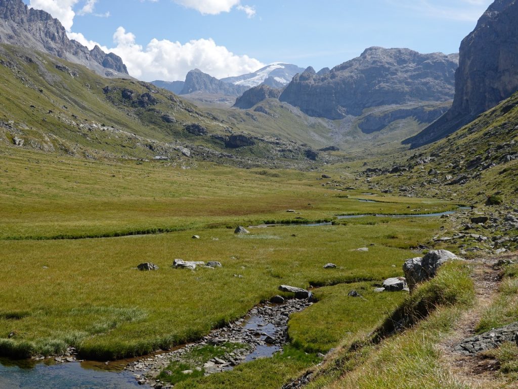
Day 01. 12 Nov. Dhap to Jhapre. 11 Km. 3 hours. 390m up. 440m down. I arrived in Kathmandu and Bharat met me at the airport. We took his car into town and he showed me the current hotel he uses, called the Thamel Park. It was an incongruous edifice some 10 stories high and it stood out even with some of the more modern additions to Thamel. It was only for a night so I stayed. I then got a local sim card and arranged a jeep to take me on the road to Salleri tomorrow. The jeep was expensive at $200 dollars but it meant I could avoid the local bus which took an uncomfortable 12 -13 hours. Using the jeep We could leave at 0400 and get to Dhap at around midday which would give me enough time to do the first day’s walk. It all went according to plan and I was glad I avoided the local bus as the road was really very poor, even by Nepali standards. 

It was dark until we reached Dhulikel a few hours from Kathmandu. The road then climbed and dropped over a couple of ridges before reaching the arterial valley with the huge Sun Kosi river flowing in it. We followed it downstream, passing many rapids until we got to Gurmi Bazaar. Many sections of the road here were rough and destroyed by floods and landslides. At Gurmi Bazaar there was a steel bridge over the river which we took and then climbed and followed the ridges on the foothills for 3 hours on a much better road. I slept for much of the last section with the jet lag and lack of sleep overwhelming me. We got to Dhap at 1300. Initially I had intended to stay here assuming the bus would pull in at 1900 in the evening dark to spill me out. 

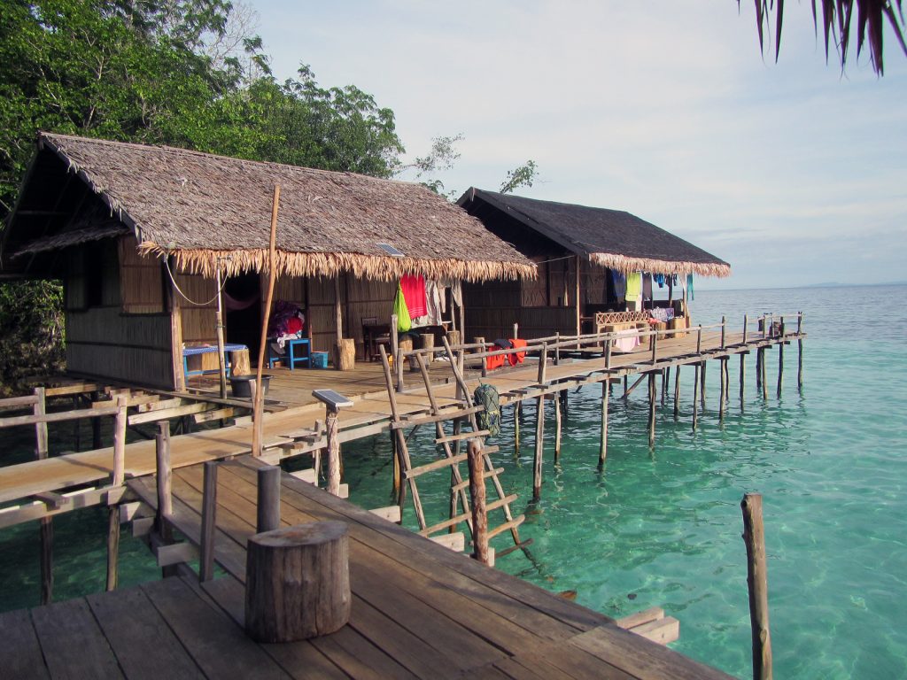
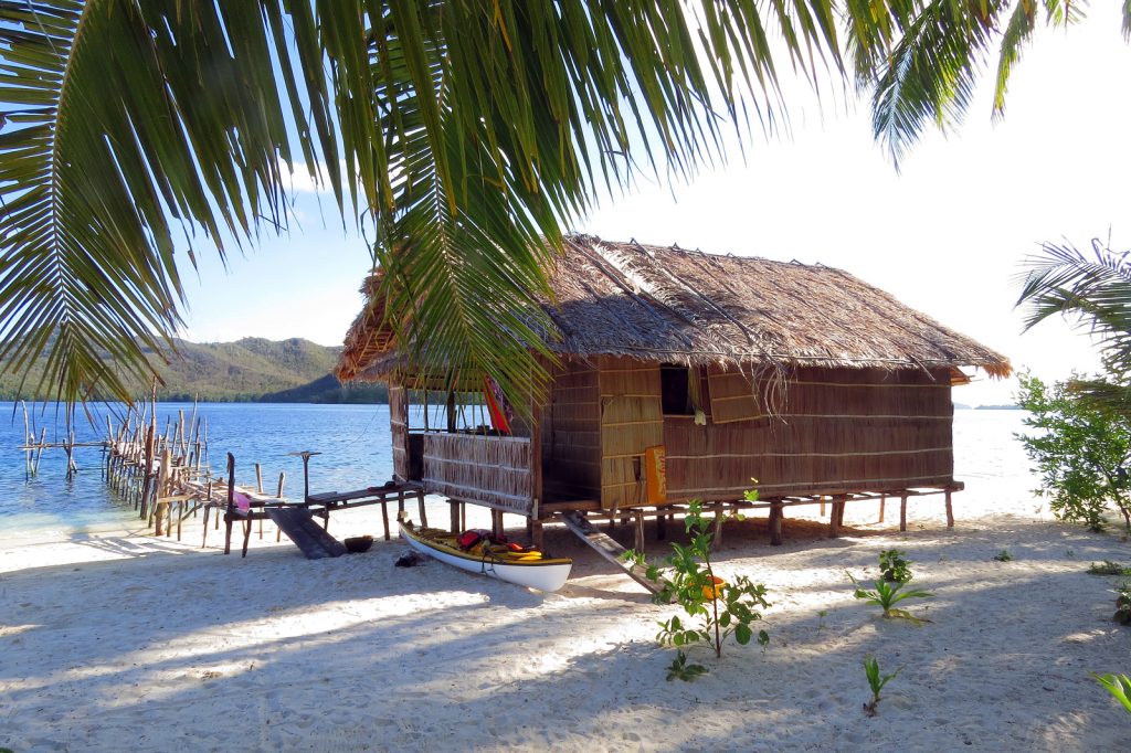
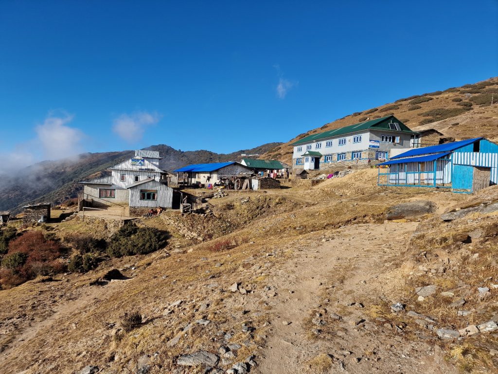
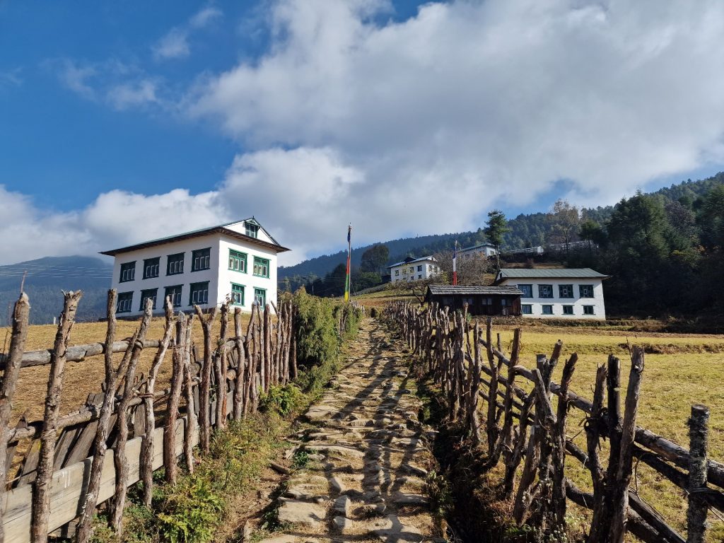
001. The Hotel Magar at Dhap at the start of the trek, This is where the jeep passes on the road to Salleri. Jhapre is 3 easy hours from here and is better if daylight allows

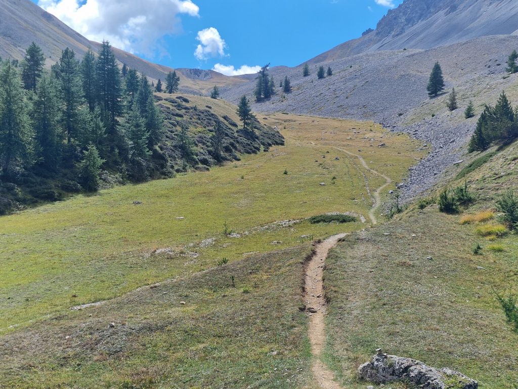
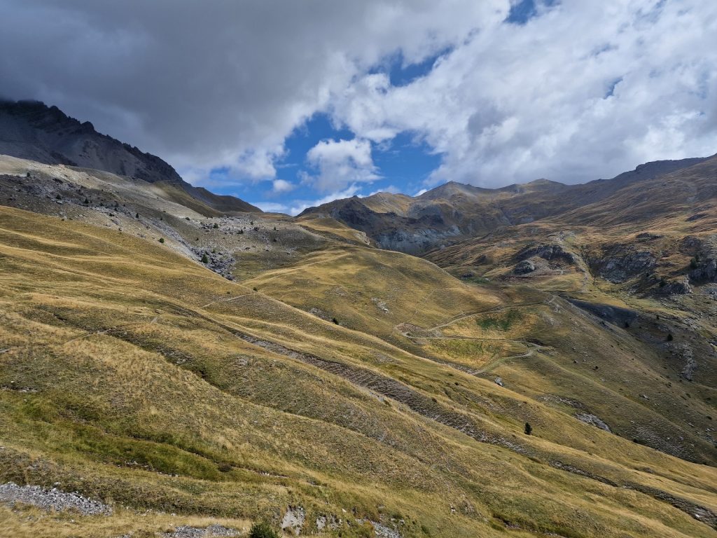
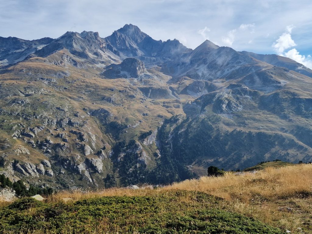
It was apparently just a few hours walk to a good teahouse at Jhapre. A sherpa beside the road in Dhap told me it was much nicer than the one we stood beside, called the Magar Hotel. On his recommendation I set off, still in shorts and shirt sleeves despite the altitude of 3000m. However there was a cold wind and I soon had to put a jacket on. Unfortunately it was a bit cloudy with a thick haze lower down so the high snow capped mountains to the north only made brief appearances. It was an easy route to follow as it was the rough track which was formed by laying millions of stones on their sides to form a cobbled surface. There were the odd lorry or tractor and the track was strong enough for them. I saw all the familiar trees and shrubs again; the Chir pines, Himalayan Hemlock, the large holly trees and a mass of rhododendrons. After a good hour mostly following the crest of the ridge,  a poor 1:125,000 map  and my intuition I came to the tiny hamlet of Sigane. Here it seemed the entire male population of the hamlet, which was about 6,  were hand loading timber logs, ready for the sawmill, into one of the lorries. 

002. The tiny Sherpa hamlet of Sigane is a good hours walk from Dhap and has a simple teahouse lodge

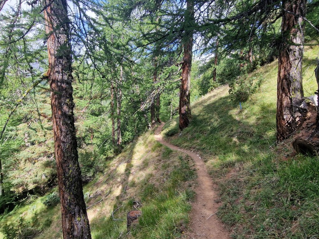
The second half of the walk was on a much more rustic road with no base except for some heavily eroded mud trenches which were dry. It was a further 6 km from Sigane to Jhapre and it took me nearly 2 hours. It should have been a lovely walk but the mist had thickened so I walked along the lonely road on top of the twisting rounded ridge called the Pokle Danda. The almost deserted road undulated at around 2800 metres as it threaded a path through the trees and shrubs. Occasionally I got hazy views down the sides of the ridge to villages scattered about on each side. Jhapre seemed to be a Sherpa village and there were many prayer flags and small chortens at the entrance to the village. There were about 5 teahouse lodges but I was advised to take the last, the Lama Himalayan Hotel. I passed more gompas and possibly even a gompa in the village before I reached the lodge. 

003. Approaching Jhapre with the mist starting to form in the Fir forests at about 3000m.

The lodge was great with a big light dining room with a large stove in it. The rustic rooms were in an annex. There was even a shower, but no wifi. I changed my clothing as a guide and an Austrian girl arrived. By the time I went back to the lounge the fire was lit and it was getting warm. I struggled to stay awake long enough to write the blog and then snoozed in front of the fire until my Dhal-Baat arrived. The guide for the Austrian girl also said it was one of the best views in Nepal with seven 8000 mountains visible. After the large traditional supper I crashed without really chatting as I was nodding off. Unfortunately I did not sleep and woke up after a couple of hours. I think it was the altitude. My blood was full of haemoglobin after the summer where I spent a lot of time at 2000m but I had now squandered them after 6 weeks at sea level and would have to build them up again. My thoughts were also angst ridden which tends to happen to me if I am not acclimated properly. 

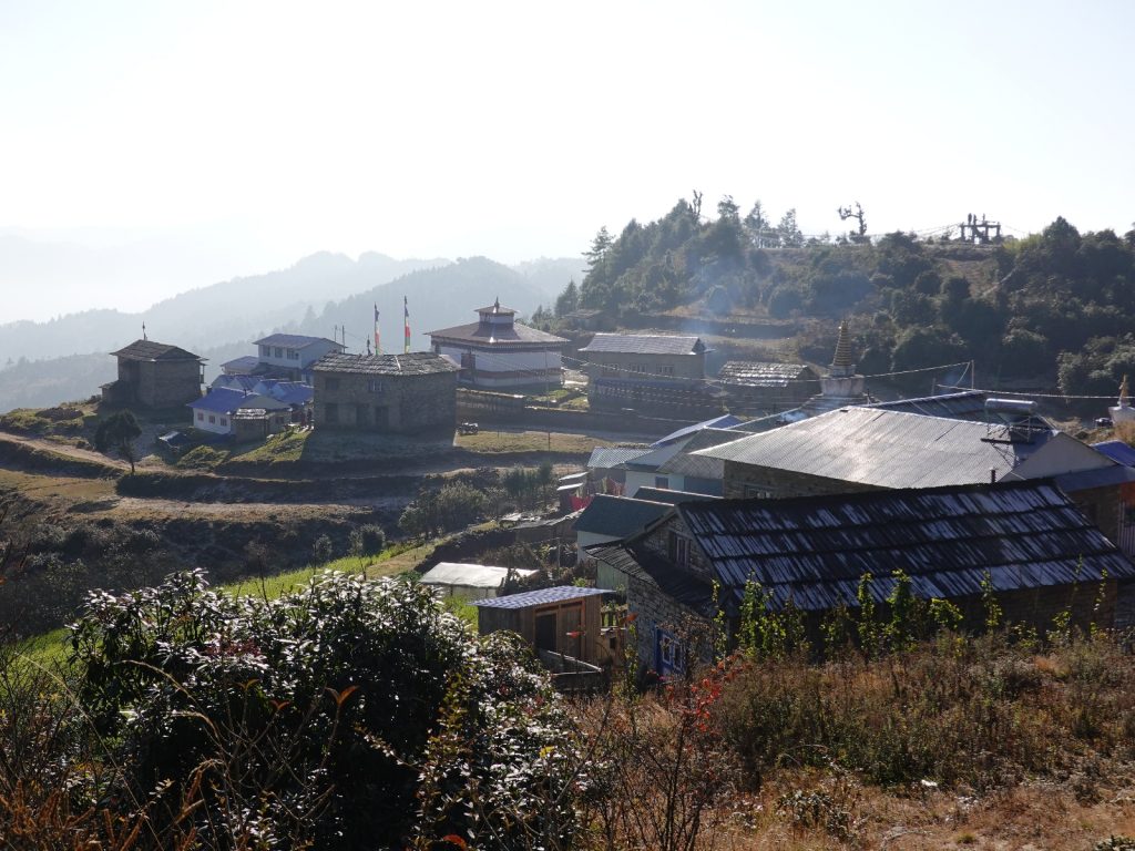
004. The small Sherpa village of Jhapre has a monastery (Gompa) and a few lodges. It make a good overnight stop.

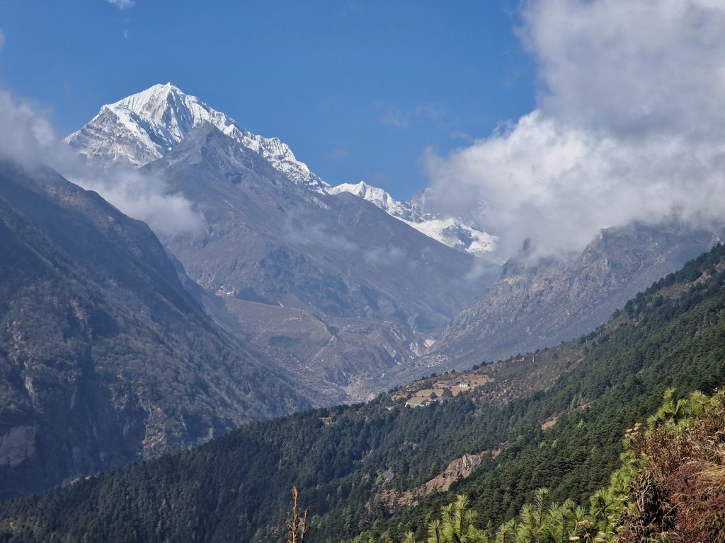
Day 02. 13 Nov. Jhapre to Pikey Peak B.C. 15 Km. 5 hours. 950m up. 180m down. It was a beautiful morning when I got up at 0630. the sun was streaming into my east facing window having just risen. While I was disappointed to arrive in the mist last night and now see anything I was now overwhelmed with the view. From the bedroom and the dining hall I could see across the forested valleys to a jagged white horizon with some of the highest mountains in the world including Everest and Makalu. It was a stunning surprise. I thought I would have to wait until Pikey Peak in a few days to see it. I had breakfast with the Austrian girl and the Dutch/Uganda couple and then set off around 0800. It was still clear but there was some cloud building in the valley. I remembered it was par for the course that the best clearest views untainted by haze are earliest in the day.

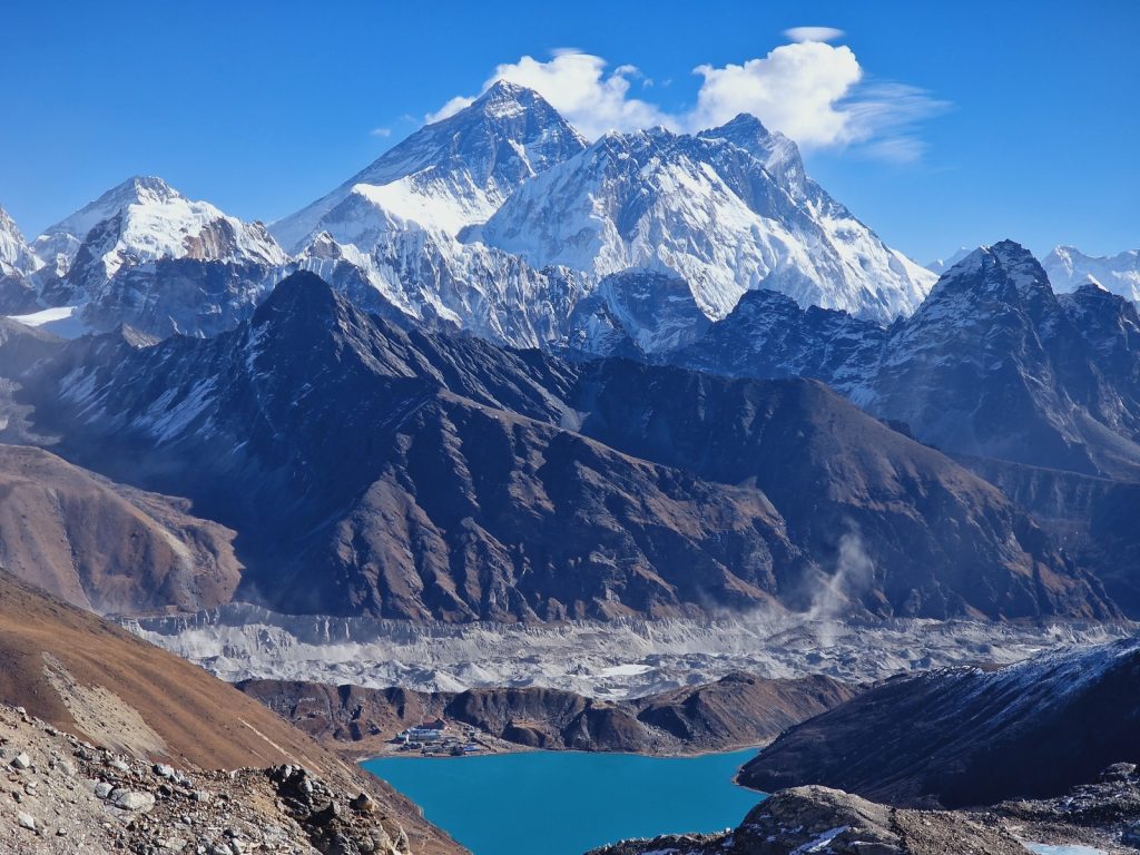
005. The Himalayas from Jhapre. The mountain on the left is the Numbur Himal while in the distance is Everest in the distance.

006. Mount Everest (left of centre) from Jhapre.

I walked up through the forest to the north of the village, climbing through the magnificent firs.some of which were a good metre across at the bole. There was an understory of Rhododendron with some trees 15 metres high but still dwarfed by the firs which could reach 45 metres. The path followed a very rough track, unfortunately used for logging, and where it went up hairpins there was a path shortcutting them. After a short hour the path climbed out of the forest and went up an open ridge with absolutely magnificent views on each side. To the east was the aforementioned Everest Makalu complex towering above a nearer snow-clad ridge of about 6500 metres. While on the west there was a rampart of snow covered 7000 and 8000 metre mountains as far as the eye could see. I think I even spotted Annapurna and Dhaulagiri which was quite extraordinary as it was perhaps 300 kilometres away. The route went up to a small pass called Pokhare Danda where the valleys went down into the forests and rural villages far below. Not far from pass the ridge rose again up towards a small teahouse at Bhulbhule. There were masses of light blue gentians in the short cropped brown grass here. It was very rustic but I was already hungry so I stopped for an early lunch. 

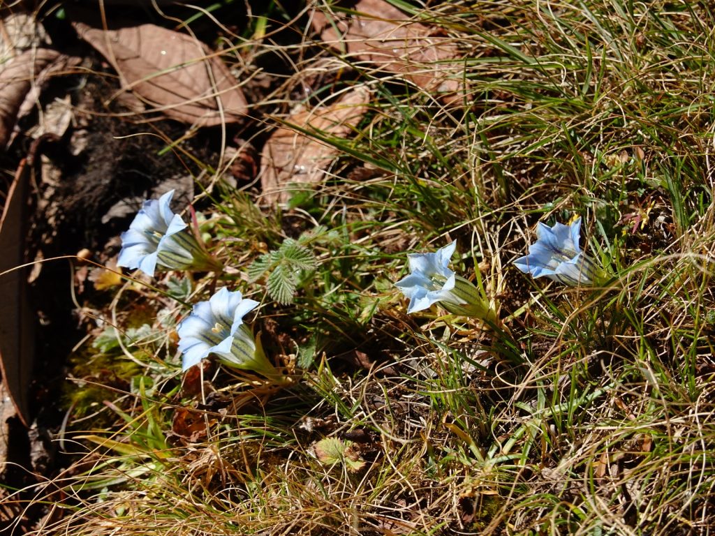
007. There were many gentians open in the November sunlight.They grew in the sunny glades between the rhododendrons

After lunch I continued north to the small rounded hillside which would have been a mountain anywhere else but here was just an insignificant foothill. About half an hour after Bhulbhule I came to another teahouse beside a gleaming white stupa at Lhamuje. I chatted with the owner and he pointed out where I might have been able to see Khanchenjunga were it not for the distant cloud. At this teahouse there were perhaps 20 Dhzo (A yak cow cross) grazing. I definitely felt I was in the Himalayas now. From the teahouse the path contoured round the south side of the brown foothill in a magnificent fir forest.There were some venerable old trees here which were perhaps 200 years old. After  an hour this easy forest traverse came to two small very rustic and seasonal homesteads and a pass. There was a small stupa here, earthen and crumbling. 

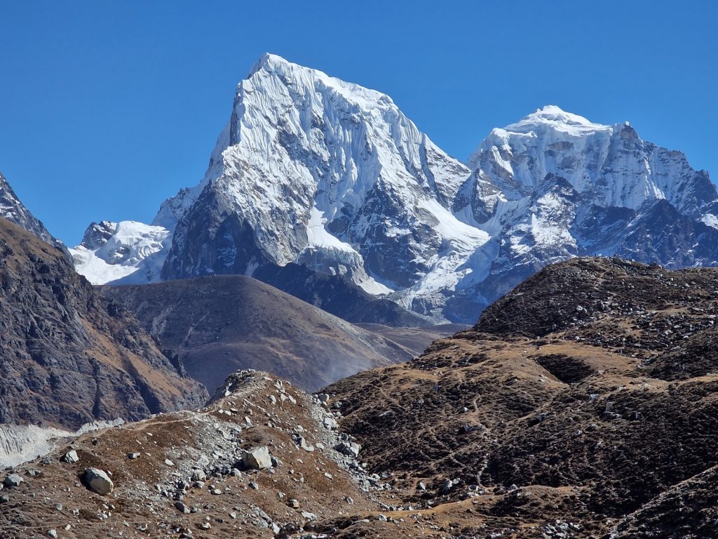
008. Looking NE from Lhamjue towards the Makulu Barun mountains. Chamlang, 7321m, is centre right and Makaku is behind it in the picture centre.

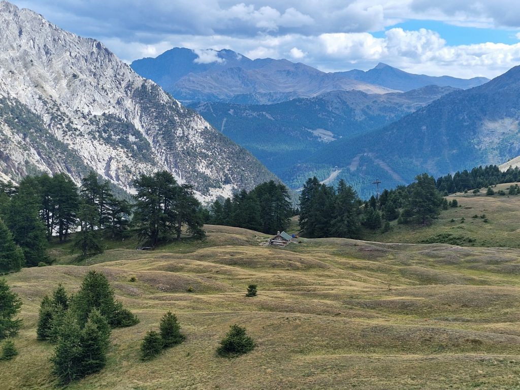
The views to the 8000 metre mountains were now obscured by the immediate foothills but the sharp spire of Gurishankar loomed to the north on the Tibetan border. The path now climbed the SW shoulder of Pikey Peak which I hoped to go up for sunrise tomorrow. Half way up at 3700m, and well above the treeline was a collection of 4 lodges in a cluster called Pikey Peak Base Camp, which sounded very grand for the foothill it served. It took about an hour to climb up to them and it was the main effort of the otherwise easy day. My chest was heaving with the lack of oxygen. I passed a large Swedish group coming down who had a long way still to go today just before the teahouses. I was told the first one on the right was the best so went to it and found the Dutch/Uganda couple already there tucking into a late lunch. It has a nice atmosphere and I got a room which was very warm with the afternoon sun. I spent much of the afternoon catching up with paperwork which was a bit tedious but accomplished it all before my Dhal-Bhat supper which filled me up with healthy calories. I arranged to get up at 0400 so I could make the hours hike up to Pikey Peak for the sunrise at about 0600. It had been a fantastic day and it was great to be back trekking here with the chaos of Kathmandu and the rigours of travel now distant memories. 

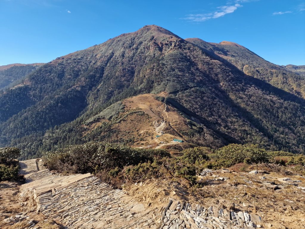
009. The lodges at Pikey Peak Base camp are at 3700m an allow an early start to see the sunrise at Pikey Peak, 4068m. 

Day 03. 14 Nov. Pikey Peak B.C. to Ringmu 27 Km. 10.5 hours. 1350m up. 2290m down. The alarm went at 0340 and I was packed and down for breakfast at 0400. The Dutch/Uganda couple joined me half an hour later and we all set off at about 0500 in the pitch dark. I went first and had difficulty finding the path so just trudged up the hillside. I could see their touches well below me. Eventually I came across thhe path and it was easy to follow. I was striding out up the steps hoping not to be late for the sunset and my lungs were heaving and my heart thumping in the cold morning. After half an hour there was enough light to turn the torch off without stumbling. The sky to the east was glowing a deep orange. Soon there was enough light to see down on the frosty patches on the ridges below. I reached the first peak, Pikey 2, 4065m, after an hour and the sunrise was nearing with the dark orange brightening into a light amber and the higher skies turning light blue. I could see all the mountain ridges except Kanchengunga to the east. It was blocked by the adjacent and marginally higher Pikey 1, 4068m. I decided to hike across the saddle to Pikey 1 and get the full view from there but I would miss the sunrise as it would come up while I was en route. When I got to Pikey 1 the view was quite unbeleivable. I could see everything from Kanchengunja some 200 km to the east to Dhaulagari some 300 km to the west. Between the two was a rampart of mountains all around 7000 to 8000 metres including Everest. Indeed there were seven 8000 metre mountains on display. It was the most impressive mountain vista I had ever seen. Nearer to Pikey peak were Gurishankar, Numbur Himal and the Barun range and they dominated the middle ground. 

010. The sun about to rise over Pikey Peak at 0600 in the morning. Kanchenjunga is just visible 200 km away and the mountains to the left are south of Makalu

011. The view NE from Pikey Peak towards Everest, (in the cloud centre left) and Makalu ( distant right).

As I gazed at this vista I was suddenly joined by an Australian who had come up from Jase Bhanjyang, where there was a tea house. We chatted and admired the view but I was being battered by the very cold wind and got cold quickly as it was about minus 5 and with the wind chill perhaps minus 20. After 30 minutes we fled the top and walked down to the saddle where his teahouse and my route was. About half way down I had to stop as now it was roasting hot in the sun and out of the wind. Back in my shorts and shirt I felt much more comfortable. It had been a hich octane morning so far with the early start, the extraordinary views and the cold. At the pass I said goobye and carried on.

013. The view to the west of Pikey Peak. In the very far distance perhaps 300km away is Dhalaugiri (left), Annapurna ( centre left) and Manaslu (centre). All over 8000m.

014. The view down to Jase Bhanjyang pass from Pikey Peak. Beyond is the plateau of Pabu Danda whicj I had to go over to get to Jumbesi

My route went to the north up the otherside of the pass on a newly and beautifully constructed path whiich must have been sponsered by the local governnment. It took me up a few hundred metres to a plateau called Pabu Danda at about 3800 metres. From here there were more magnificent views north. The new path continued across the plateau and then dropped down into the forest on the north side. It dropped some 1000 metres into a large bowl to the east of Lamjura La pass on the Jiri to Everest trail. The descent continued on the new path through a magnificent forest of fir. There were thriving on this north facing slope and there were some giants with boles of 1.5 metre diametre. I could see sunlight through the canopy high above but otherwise I was in a sheltered forest with 45 metre trees towering above. The trees were dripping in huge clumps of moss growing from their bark and the forest smelt of resin. I noticed how quiet it was there was no sound at all, not even birds. 

015. The viiew north from Pabu Danda into the vast bowl to the east of the Lamjura la Pass ( left). Jumbesi is out of the picture down to the right.

After a good hour the path finally reached the valley floor where the infant Taktor Khola stream was forming. It passed through some grazing land and a few isolated homesteads before reaching the road which was never used as a road and there were no tire marks at all. I followed the road down past a few more homesteads to reach the large hamlet of Taktor. It was spread out across the terraced hillside and families were unloading baskets of manure onto these terraces. The manure was from the small cattle sheds beside each house and mixed with leaves. It was a very peaceful pastoral scene. I carried on through the hamlet on the road and then took the old path round a spur to reach the huge monastery above Jumbesi. The old path now descended to this large village where there were perhaps 15 lodges and tea houses here and also a number of shops. It was a very Bhuddist community and there were stupas and chortens everywhere. I stopped at a lodge just before the lower covered entrance and had a great meal and rest with a very friendly family. I had been going for 7 hours without a pause really so was quite glad of the meal. 

016. Looking down on Jumbesi from the path just beneath the monastery. The path to Ringmu heads off to the east (right)

I could easily have stayed here but thought it better to press on to Ringmu some 3-4 hours away as it was only 1330. The weather was getting hazy and the mist was descending down the mountains so photography was now limited. I went through the entrance gate, lined with prayer wheels on each side, skirted clockwise round the stupa and descended to the bridge over the clear Jumbesi Khola river. There was a new road on the otherside coming up from Salleri but I just crossed it and then entered the forest. For the next three hours the path climbed gently as it traversed up the hillside. I quickly walked into another magnificent forest. This time on the drier south faciing slope the trees were pine (I think Chir Pine). They were not as large as the mornings firs but some were 40 metres with a metre wide bole. The gently breeze swished through their needles rising and falling in crescendo.

017. The stupa by the east gate into the large village of Jumbesi.

The gentle path climbed some 400 metres over the course of 4 kilometres passing the occasional homestead and old trekking lodge, all of which looked borded up and in hibernation. As I climbed up this easy path the mist came down more and threatened to engulf the forest but it just stopped short.  It took under two hours to finally reach the spur at the hamlet of Phurteng. There was supposedly a view to Everest from here and the names of the lodges all reflected that. It was probable the reason the 2-3 lodges existed. However they looked quiet and a bit scruffy now and had probably seen their hayday. The easy path was almost level and soft underfoot as it now descended gently to the NE into the Dudh Kunda Khola valley. I had been walking for many hours now but this path was exactly what I needed and was a delight. I passed the hamlet of Salung. It had some pretty houses surrounded by productive vegetable patches and a nice looking lodge adorned with marigolds growing in tins. Salung also had a view to Everest, but it was not evident on this very overcast afternoon. The entire descent took well over an hour but it was not taxing until the last kilometre when it dropped more steeply on the remnants of a tractor track to the Dudh Kunda river in the slot of the valley bottom.

I crossed the suspension foot bridge and then climbed up stone steps through the forest to reach a cluster of large lodges at the lower end of the Ringmu village. There were perhaps 5 lodges here and they all looked good. I was spoilt for choice. I settled for one and discovered there was a large school group camping beside it. Howver the guides seemed friendly. Inside I got a large thermos of tea and then settled in. One of the guides from the school group came in. He was a Nepal affectionado and a teacher from California called Vincent. We chatted for a good hour about hiking and Nepal and I learnt much from him. He was a kindered spirit.  When my Dhal-Bhat came it was one of the best I have ever had. I continued to chat to Vincent who eventually had to go out to make sure the 15 odd pupils in a least 10 tents were OK. I then wrote the blog and eventaually went to bed at 2200 after a long but magnificent day. 

018. The path up through the village of Ringmu, with a couple of the traditional buildings typical of the area.

Day 04. 15 Nov. Ringmu to Kharikhola. 16 Km. 7 hours. 870m up. 1570m down. I had an extraordinarily good 10 hour sleep. It was perhaps the lower altitude and the long day yesterday. Breakfast was very slow as the teahouse owner dithered but, when it came it was very good. Vincent came in to say goodbye before he led his group down to Phaplu. I did not get going until 0900, by which time half the morning was over. The day started with a short climb through the rest of the pretty village and then through the forest for an hour to the Taksindu La pass,  3070m, just a mere 300 above the guesthouse. At the pass there was a guesthouse with a very charming French couple who I chatted with for about 10 minutes before beginning the long descent to the Dudh Kosi river 1500 metres below. 

019. The magnificent stupa at the top of the Taksindu La pass, 3070m.

020. The exterior of the Gompa (monastary) at Taksindu

021. The magnificently decorated gompa at Taksindu monastary. It is here the monks and Rinpoche have prayers reading from the old books on the walls.

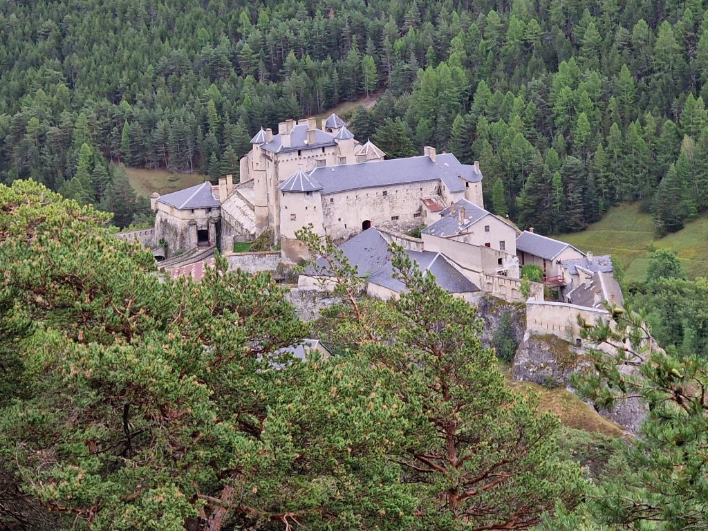
Initially the path took me down to the Taksindu Monastery which looked a lot bigger than I remembered. I could see it below and there was quite a crowd gathered and much drum beating. When I got to it there were two large juniper bush fires by the stupas. I went into the compound and up to the monastery. The doors were open but the place was empty so I went to the entrance and took some photos. As I came out I noticed there was a commotion further down and a procession was just leaving. It was perhaps led by the Rinpoche but there were 40 monks in the large curved red hats playing their clarinet type instruments, and others banging drums. There was also a monk with a ghastly mask on of a large wizened man. At the back was a Westener and his two daughters. It was quite a privilege to witness this procession from close range. I think the westerner was a donor and they were holding a puja to honour him. There were plenty of locals also, all in their finest sherpa clothing. Once they had all gone into the gompa I carried on down, feeling my spirits lifted by the half hour I had spent here.

022. The procession of about 40 Red hatted monks going round one of the stupas and juniper fires en route to the gompa for prayers

023. Looking east down the valley from near Taksindu gompa to the large village of Nunthala (centre right) and the Dudh Kosi river far below.

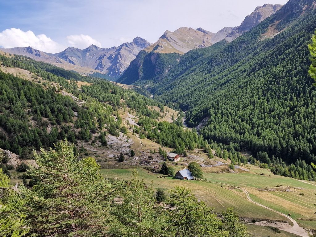
The path now went round the side of the big bowl to the east of the pass and descended through forest with many small clear streams cascading down mossy ravines. It took a good hour to reach the larger village of Nunthala. It was beautifully laid out on a shelf on the mountainside with a wide main street and some 10 three storey buildings on each side behind a marigold filled front garden. The whole town was very quaint and it would have been a great place to spend the night. I still had another 700 metres to descend through. It took me down through the occasional hamlet and terraced fields, many ripe with millet. The hamlets were adorned with marigolds and the large tree dahlias which somehow made it here from Central America. Between the hamlets and fields were forests of broadleaves. They were harvested for firewood and fodder for the tethered cows and buffalo in the hamlets. A Swiss couple arrived and I chatted briefly with them and then their guide said “are you James?” I said “Yes”. He replied that Ramesh was waiting for me at the bridge over the Dudh Kosi river half an hour below. 

025. Ramesh lived close to Kharikhola and came up to visit me. He was one half of the driving force on my 4 month GHT trip in 2019.

Ramesh had been the cook/porter on the Great Himalaya Trail I did 3 years ago. Together with the other porter, Santos, they were the engine of the whole trip and without them it would have failed. They were also really nice guys and I was looking forward to meeting him again after 3 years. He lived a two hour walk from the bridge and we had arranged to meet there. He had been there for a few hours already when I arrived. He was in good spirits, but had not had much trekking work and had resorted to cooking in a hotel. He was now setting himself up as a farmer and had built a house on his homestead. I am sure that whatever Ramesh turned his hand to he would excel at as he was the hardest working person I had ever come across. We walked up to a nearby teahouse and went in. Ramesh knew the owner and we had tea and chapatis while Ramesh produced some of his hard boiled hens eggs and a jar of buffalo butter he had hand made that morning from his buffalo using a hand driven paddle to beat it with. We had a great two hour chat before we had to part ways again. He went home to his family and farm and me up to Kharikhola. He surprised me to say he was a qualified guide now. This was music to my ears because if I ever go into restricted areas again I would need a guide to get a permit and there would be no one better than Ramesh. 

026. A family harvesting millet (kodo) in their terraced field beside their homestead in Jubhing.

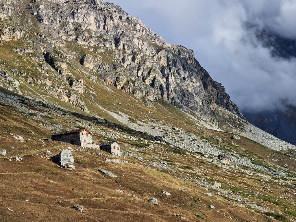
We had perhaps left it a little late for me to get to Kharikhola before nightfall but I set off anyway. The day had completely clouded over how and the hazy mist was descending. I set off up the track and soon reached Jubhing which had a very nice looking guesthouse with a large rustic glass window dining room and surrounded by bright marigolds. A little further I passed a hamlet of homesteads with one family harvesting their millet on the terrace. I could see the slope I had to climb. It was perhaps 300 metres and it would take an hour. Kharikhola was perhaps half an hour beyond the top. I set off, powered by the spread of Ramesh’s homemade buffalo butter on the 2 chapatis I had. It was largely a climb in the forest which was constantly being harvested for firewood and fodder, so it was not old growth – but still pleasant. At the top of the climb there was a large stupa in a monastic compound. I could see Kharikhola now spread out beside the path which contoured across the hillside to the east, its lights already twinkling. 

027. The Hill Top guesthouse to the west of Kharikhola. Beside in on the knoll above was a monastary

However there was also a very nice guesthouse beside the stupa and as dusk was well under way I went in to enquire. They were very friendly and had everything I needed so I took a room, as usual it was $4. I changed and went downstairs to meet a young Australian couple who were resting here. They sounded suspiciously like they had covid. I sat with them for a meal which was excellent Dhal-Bhat. After that they went to bed while I wrote until 2100. As this guesthouse is only about 2000 metres I know I will sleep without any acclimatisation issues. 

Day 05. 16 Nov. Kharikhola to Chhaubas. 14 Km. 6.5 hours. 1210m up. 520m down. I had a very slow start indeed. I could not bring myself to hurry and left well after 0900. The Australians were spending another day here recovering before heading up. Initially I walked down the gentle path past homesteads towards the cluster of houses which made up the heart of Kharikhola. The homesteads were busy with the produce of late autumn and nearly all had their front yards full of harvested millet heads which were drying in the sun. The maize was already stacked on a trestle and covered in grass to shield the cobs from rain. Each district has its distinctive method of creating and stacking trestles and these ones were quite small and uncharacterful. There were beans drying on woven mats and cucumbers drying beside all homesteads. The chickens were kept under baskets to stop them marauding the produce and the buffalo and cows were tethered. It was a very calm rural scene.

028. Heading east down into Kharikhola with one of the clusters of houses and guesthouses below, between the homesteads.

The houses of Kharikhola were arranged in about 4 clusters along the path with the homesteads between. In the clusters were a few guesthouses. One was called the Namaste and I had eaten here before. It was run by a Shepa family in the mixed village where most people were in the Magar caste, or ethnic group. Both Sherpa and Magar are Bhuddist so there were stupas and prayer flags everywhere. It was a very enjoyable half hour saunter but before I knew it I was at the bridge and ready to climb 1000m.

029. A squirrel emerging from the forest to feast on some spilt kernels of maize

The climb was long as it initially climbed through more homesteads where oxen were busy ploughing the small terraces fields. However I was soon into the scruffy forest and climbing steeply on a stepped path. There was a new dirt road which also climbed the hillside in zig-zags here and the steeper path cut across them. Someone had split a handful of maize beside the path and squirrels had come out of the surrounding forest to nibble on the kernels. After an hour of this climb the path reached the spur where there was a cosy cluster of trekkers teahouses, perhaps 6 in all, at a hamlet called Bupsa. Some looked very nice. However I had only been going for an hour and a half so passed through. 

The next part of the climb was more relentless and without any charm. The path climbed from Bupsa to Thamdanda high on the spur. There were a few scruffy teahouses here but the main eyesore was the dirt road. It seemed the excavators had tried a few routes up and abandoned all but one as a result there were a few scars on the hillside. The successful track was often on the path of the old footpath. High up on the spur by Thamdanda the road came to a halt in a large scruffy parking place with a cluster of tin sheds and very rough and rustic porter lodges. It was here that occasional jeeps brought up goods and gas cylinders which were emptied into the tin sheds. From here these goods would continue their journey north on mules, yaks and porters. This is where the modern world met the traditional world. 

030. From Thandanda onwards I came across frequent mule and yak caravans. I gave the yaks a wide berth.

There was an excavator extending the road and it was rolling rocks down onto the old footpath which was now rerouted above this scar and over the spur to reach the porters lodge at Thamdanda. The trail was now busy with mule trains coming to the roadhead. I could push past most mules, but there was the occasional yak train and I stood well to the side and away from their horns when they came past. From Thamdanda the path was now on the north side of the spur. It got little sunlight and was constantly being covered in mule and yak dung and urine so it was damp, greasy and slippery. To make it worse the strata of the rock meant the path was very rough and uneven. It took nearly two hours to get to the bridge over the tumbling Paiya Khola stream at the east end of Paiya village. There were a few exposed sections on the slippery part but the laden mules and yaks managed them without issue. About half way along there was a very rough path going up the forested hillside to Panggom which I should be taking in 2 weeks. The second half of the path from Thamdanda to Paiya was beautifully paved and was easy to follow through the large fir trees. There were a lot of porters here, slowly struggling under their enormous loads, well over 50 kg. 

031. One of the exposed sections on the trail between Thandanda and Paiya. The trail was OK for loaded yak caravans so I guessed it would be OK for me.

032. Approaching the bridge over the Paiya Khola stream along a superb trail through the forest. Porters laboured up with their huge loads.

I thought about staying in Paiya but thought the village was a bit charmless and it was still just 1500 so pushed on to the next hamlet in an hour called Chhaubas, where I had a recommendation. It was an easy level path at around 2800 metres for nearly 3 kilometres as it contoured the hillside. Although the hillside was south facing there was little agriculture and it seemed most of the houses and shacks here catered for the passing mule and yak drivers and the porters, with a few lodges for trekkers. There were no trekkers about now. I had walked this way 15 years ago and can’t remember any houses here and it seems most have sprung up recently. Although the mules and porters always came this way even 50 years ago. When I reached Chhaubas I came across the Shrestha Guest House. It was run by a Newar man and Magar wife and they had two sons. It looked nice but I am sure I would be the only one here tonight. I got a room for $1.5 and had a bowl of noodles. They soon lit the fire and the dining room got very cosy. It soon filled up with some Nepali travellers who knew the owner. They were initially very loud but soon settled down. I had a Dhal Bhat which was great and put some of Ramesh’s buffalo butter on the rice. I had good reception so did well with the blog but am having trouble with the tracker which is barely sending any track point or messages at all. I don’t know if it is a malfunction or the deep valleys and lack of sight to satellites. 

Day 6. 17 Nov. Chhaubas to Monjo. 21 Km. 7 hours. 1080m up. 940m down. I had an old photo of Chhaubas village from when I passed through in 2007 and I showed it to the host. He was surprised there were so many trees then, mostly broadleaved, which had all vanished now. He remembered the hamlet back then when there were vastly fewer houses than there were now. I think most of the developments were due to the trade getting goods up to the burgeoning tourism further up. I eventually left at about 0800. 

033. Lookiing down on Surke from the spur between the Paiya and Dudh Kosi valleys.

Initially the level path went west round the edge of the spur which formed the north jaw of the Paiya valley. After rounding the spur I was back in the main Dudh Kosi Valley which I would now follow north for 2 days to Namche Bazaar. From the sput the path descended for a good hour down a shaded and dark path on rough rocks. It was not a pleasant journey and I had to push past many mules and a few yak caravans which were coming up, either empty or with empty gas bottles. The Dudh Kosi river was far below in a deep slot at the bottom of the steep slope. It was virtually a gorge. Surke was largely a porter or muleteer stop now with perhaps one tourist lodge. I am glad I stayed in Chhaubas rather than here.

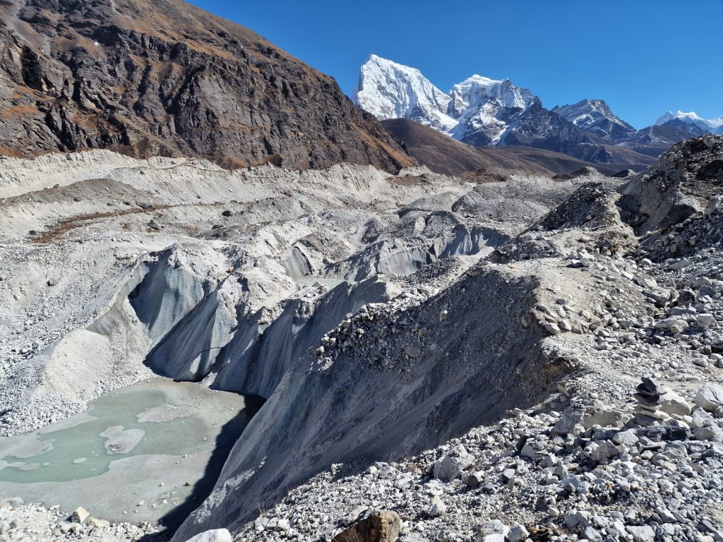
034. Looking down the deep Dudh Kosi valley from above Surke. There was no path, farming or houses in the steep sided gorge like slot


I now had to climb back up the 400 metres which I had lost. However the path was much easier and was well constructed as it climbed through the forest. There were still many mule caravans coming down and quite a few porters going up. After an hour’s climb I started to reach the first homesteads of Chaurikharka. It was very rural except for the constant hum of planes coming and going from Lukla airport on the plateau just above me. There were also a few helicopters taking off from Lukla and heading up the valley to do Everest scenic flights, which should really never be allowed. 

035. A yak caravan coming down Chaurikharki village between houses and Buddhist stupas

The walk through Chaurikharka was wonderful. It was abour 2 kilometres of tidy rural homesteads and Bhuddist stupas, mani walls and prayer wheels. For much of the walk it was level on wide path with large paving stones. It was still busy with mules and yaks but the path was so wide it was easy to avoid them. There were a lot of guesthouses here for trekkers which was surprising as it was not yet on the main route from Lukla airport to Everest Base camp. When Chaurikharka ended there was a small climb up some steps to reach the town of Chheplung. The path I was on went round a corner and met a much larger path. It was the main trekking path and it was suddenly like a promenade. 

036. A team of two oxen ploughing a field with a wooden plough in the beautiful village of Chaurikharka

There were groups coming down, all clustered together, with their porters carrying their large waterproof holdalls, and the guides strolling along with their hands folded waiting patiently for there charges. There were porters slowly struggling with huge loads. There were yaks and muule caravans with their young, loud and aggressive muleteers and then there were a few solo hikers like me who were the only one greeting each other. I went through another trekkers villagge with German bakeries and trekking lodges covered in flowers. As I left it I bumped into two Irish trekkers, Brian and Claire. They were adventure racers and extremely fit. We chatted as I struuggle to keep up with them as they sauntered along despite just having got out of the plane. We chatted all the way to Phakding and then stopped there for a small snack. Brian was a keen sea kayaker and knew many of the people I had heard of. Like most Irish they were great conservationists. We continued to walk together for another half hour and it seemed there were doing the same route as me clockwise round the Three Passes. We parted at Toktok deep in the valley where there wasa permit check post. They already had theirs but I had to buy mine and have it processes and it took 15 minutes so they went on. 

037. looking upstream from the bridge over the tumultous Dudh Kosi river from the suspension footbridge over it neat Phakding

The last hour was quite easy along the floor of the valley past the hamlet of Bengkar where their were some scruffy teahouses but lots of small fields with rural interest. However it was only another hour to Monjo which was my original goal so i pushed on across across a bridge back to the east side of the Dudh Kosi river again. I caught up with a porter who I had spoken to a few times during the day. He was carrying a stove and 4 metres of stolp pipe. He reckoned it was 65 kilograms. I practiced my dire Nepali on him as we walked together for a few hundred metres. Despite his lot in life he was very cheerful and friendly. 

At Monjo I was spoilt for choice for lodges. I was hoping I would bump into the Irish but instead I went into a lodge with 30 Australians who were going down. I made a comment and fled and found another just below it. There were two friendly Germans lads in one team and an English and Romanian team, both with friendly guides. The stove was already lit and the dining room was hot but the bedrooms were simple and freezing. I felt at home in it at once so spend the night. It was a chatty evening but I did not get the blog done until the others went to bed. Although I was in the cut and thrust now of the Everest Region tourist route it was a nice change from the rustic backpacker treeking of the last week, which was by no means uncomfortable. 

Day 7. 18 Nov. Monjo to Thame. 16 Km. 6.5 hours. 1370m up. 390m down. I had a great sleep, the best yet and woke naturally at 0700. I had breakfast with the English/Romanian team and their guide. We pretty much all left at 0800 but by the time I got to the Conservation area ticket office at the northern end of the village to get my 3000 rupee entry permit they had gone on. The path descended steeply after Monjo and crossed the river at the hamlet of Jorsalle. Already I noticed how the forest looked healthier in the Conservation Area. Perhaps it was restrictions on harvesting the wood. Not long after there was a bridge back over to the east side of the Dudh Kosi river. There were streams of trekking groups and porters coming down with their guides and the occasional mule or yak train. Once back on the east side and in the pine forest the valley reached a confluence of the Dudh Kosi river and the Bhote Kosi which came down from the west. Here I caught the girls, Kelly and Liliana, up and we climbed slowly together, chatting, until we got to the third bridge over the river, this time from east to west.

038. Looking downstream from the bridge over the Dudh Kosi from the bridge before the climb to Namche Bazaar

039. On the 400 metre climb up to Namche Bazaar through the pine trees with a yak caravan coming down.

This bridge was at the bottom of the 400 metre climb up to Namche Bazaar which was all in the pine forest. I left the girls here and latched onto an Australian couple who were trekking guides in Tasmania. Chatting with them eased the slog of the climb and before we knew it we had side stepped a couple of yak caravans and reached the lower part of Namche. It had changed since I was here 15 years ago and was more of a town now with a central promenade of steps beside 5 enormous water powered prayer wheels which were spinning quickly. At the top was the heart of the town with its ATM points, bakeries, coffees shops and dozens of shops selling everything Chinese made souvenirs to top of the range 8000 metre climbing boots. The town was full of people having an acclimatisation day before they continued up. I left the Australian couple at a cafe they went into and went to an ATM to stock up on cash for the Three Passes. I was keen to pass through Namche Bazaar without getting sucked into the fleshpots and bakeries. I had already acclimatised and during the last weeks trekking so was ready to push on to Thame at once. I wandered up round the south facing bowl Namche Bazaar was built around and got to the heli pad on the edge of the bowl.

040. Looking over the town of Namche Bazaar from the west lip of the bowl it sits in. The mountain in the background is Thamserku, 6608m.

As soon as I crossed the spur at the edge of the bowl I entered a different world. The path was a delight as it contoured across the warm south facing hillside. It was covered in fir and juniper. The fir was nearing the top of its range here at 3500 metres. The path was deserted and smelt of the fir resin and junipers. I passed a Swiss nun, head shaved and in purple robes, who was on the way down from a monastery where she was in residence and we chatted for 10 minutes. I continued though the delightful forest for a good hour and hardly passed anyone now I was off the thoroughfare. At last I could notice things like the birds and flora again. At one stage a stoat rushed across the path in front, quick as a flash. I could also take time to appreciate the mountains again. Behind me, dominating everything was the soaring peak of Thamserku, 6608m, its steep upper ramparts covered in fluted snow slopes which led up to razor sharp aretes and ridges. While in front of me was Kongde Ri. It was part of the Numbur Himal, which had dominated the first few days of the trek when I was on the south side of it, but now I was on the north.

041. Looking west up the Bhote Kosi Valley to the west of Namche Bazaar towards the village of Thame. The mountain is the north side of Kongde Ri, 6696m.

042. The stupa in the small hamlet of Samsing on the path between Namche Bazaar and Thame

After an hour of walking I got to Phurte and noticed I was hungry. I had been going for nearly 4 hours so stopped at a guesthouse called Green View just under a large gleaming white stupa. I was the only one there and the charming old host made me a great noodle lunch and taught me some Nepali. He said it was 2 hours to Thame but I knew this meant 3. After lunch I carried on west on the path high above the Bhote Kosi river. While the path was not flat iit was as good as it gets in Nepal and the locals would wryly call it “Nepali Flat”. The path went over frequent spurs and a string of hamlets and a village. They all had an entrance gate which was a stupa with a passageway through it. Inside the passage there would be prayer wheels, many paintings or thanka. Their entrance gates were called Kami. around all the villages were ploughed terraced fields, probably readied for potato planting in the next month. I went through the hamlets of Samsing and Therso and then the village of Thamo which had a monastery above it. The path then descended into the valley where there was an old bridge over the torrent in the bottom of a gorge where the Bhote Kosi crashed down in an eroded slot. They were building a new suspension bridge here spanning the gorge.

043. From Thame it is possible to see the sharp peak of Malangphulang, 6573m, which sits to the east of Thamserku

The final task of the day was perhaps a 200 metre ascent up the south side of the valley to Thame village. The path climbed gently on an easy step up to the kami gate. To the east the low sun was shining brightly on Thamserku mountain and a very sharp one behind it called Mallangphulang, 6573m, which looked impossibly steep to climb. After the Kami gate I reached the plateau where most of Thame was laid out. There were perhaps 20 lodges here and I was spoiled for choice. I eventually went for the Sunshine Lodge. It had a very friendly host family and they gave me a nice room facing Thamserku. Dinner was Dhal bhat as usual served in the warm dining room. There was a good stove which was necessary as it was cold outside now I was at 3800 metres. There was just a timid German here and he asked the host if he could meet a climbing Sherpa who lived in Thame and had summited Everest 18 times. He arrived later and chatted with the assembled crowd. He was incredibly modest. I showed him a picture of an acquaintance I knew in Rolwaling called Dawa Chiiri Sherpa and his face lit up. I wrote the blog in the evening and was surprised how well acclimated I was, probably due to Pikey Peak.

Day 8. 19 Nov. Thame to Lumde. 13 Km. 5.5 hours. 890m up. 320m down. I slept well again but it was cold in the room with frost on the inside of the windows. I had two quilts so it was very warm. I had an unhurried breakfast of chow mein and half a large thermos of tea. I would leave the other half after the visit to Thame Monastery. The monastery was perhaps half an hour up the hillside above Thame village. I knew the way so headed up a small slope to the north of the village to gain the top of a long sloping lateral moraine. There was a corresponding one on the south side of the valley and Thame sat on the flat plain in between. Once on the moraine I followed it SW along its apex. The views were stunning, especially up the valley to the east and across to the other side where Kongde Ri and Paniyo dominated. It was about a kilometre up the ridge past a series of chortens and a kami gate to reach the base of the monastery.

044. Heading up the moraine ridge to Thame Monastary with the mountain of Paniyo behind.


047. The monastary at Thame is set in a superb location at the bottom of a south facing cliff.

It was built on a shelf beneath a south facing cliff face and lapped up the sun. On this still winters day it was warm. There were a few buildings below the monastery which I weaved my way through to get to the main gompa, and the monks’ kitchen and dormitory beside it. These two buildings made up two sides of a courtyard with the entrance being on the third and and the fourth side was open to let the sun into the paved courtyard. It was a very serene place, not as impressive as the Tiger’s Nest in Bhutan, but much more accessible. The main gompa was locked and I dare say that for a donation I could have got a monk to unlock it and show me round. However, unless I wanted to make a detailed study of this particular Monastery, its Bhuddist tradition or school, and its practices, much of what the monk would have said would have been for laymen and I had heard much of it before. So I just enjoyed the ambience of the setting and the ancient buildings. I left the courtyard and wandered through a few more buildings and then entered the pine, juniper and berberis woods looking for a vantage point to get a photo. As I pushed through the scrub I flushed a covey of blood pheasants with their red tails. There was about 6 of them. I took my photos and then sauntered back down the ridge. Below me in the valley where Thame was were dozens and dozens of small fields which had been ploughed. I guess they were all for potatoes. I was back at the lodge in no time, finished the other half of my thermos of tea and set off at 1100.

046. The monastary at Thame on the mountainside above the village. To the left is the gompa and the monks quarters are to the right


045. Looking down on the village of Thame with it patchwork of potato fields.

It was a glorious day still as I set off up the moraine again to reach its crest. There was also a great view down the valley I came up yesterday all the way down to Namche Bazaar. I however was going north up the Bhote Kosi river valley. The floor of this valley was much more open and flat now than the gorge it went through yesterday. The river flowed in a wide trench of gravel, boulders and moraine debris, but on each side were alluvial terraces which the river had not eroded and these were cultivated with small potato fields and a couple of hamlets, one on each side of the torrent.

048. The huge stupa at Thametheng on the other side of the moraine ridge from Thame

The path went up the west side and passed through the hamlet of Thametheng. There was an enormous stupa here on the dry brown earth of the valley floor and masses of mani stone prayer walls. Across the other side of the river, on the east side, was a flat plain and the small hamlet of Hilajun which was connected with a new suspension bridge. I sauntered up the easy flat path heading north passing more clusters of houses and apparently the Kyaro Monastery, which I did not see. There was a large team of yak, carrying white packages on each side, coming up and they were slowly catching me. Previously the yak caravans were not real yaks but a cow/yak cross called a dhzo. But now at these higher altitudes they were pure yaks and much bigger and fiercer looking.

049. The Bhote Kosi river valley north of Thame was gentle and covered in yak pastures.

I soon got to a suspension bridge over a large side stream coming down from the high snowy peaks to the west. There was a yak caravan coming down with 20 large yak with long pointed horns. I had to wait for them as there was no room for me on the narrow bridge. It looked like the yak were carrying bags of potatoes from higher up in the valley. There were a few more tiny hamlets all of which looked like they were just used seasonally to grow potatoes. The brown fields were all bare now and some had been ploughed while others were just full of dead stubble. All the fields had stone walls round them to both get rid of the stones and stop the marauding yaks. All the seasonal houses were boarded up save for one rustic lodge hoping for a passing tourist.

050.Looking north up the Bhote Kosi Valley towards the Nangpa La Pass some 25 km away on the Tibetan border

It was a delight to be walking here away from the promenade of trekkers on the Everest trail. It was perhaps one reason for doing the 3 passes clockwise otherwise I would have to endure it for another 3 days, while on the way down I could blast these 3 days in one. While Kungde Ri was diminishing behind me, more and more was unfolding in front and there were plenty of 6000-7000 metre peaks ahead on the border with Tibet, although culturally I felt I was already there. It was further up this valley across moraine and then a stone covered glacier for about another 25 kilometres to get to the high Nangpa La Pass, 5716m.

I soon reached the larger hamlet of Marulung at about 4125m. It was also a seasonal potato growing hamlet and looked shut up for the winter. Again there was a teahouse here but the custom must have been sparse now in this quiet season. There were a few trekkers coming towards me and we stopped and chatted for a few minutes each time. From Marulung and its dormant potato enclosures the path now climbed for another 250 metres over a couple of kilometres through areas where large yak were grazing. There were probably snow leopards or wolves in this area and the large yaks could fend for themselves while the calves were vulnerable and were kept near the houses and brought in at night. With a final push up the gentle slope I came to Lumde. It was just a collection of 6-8 lodges. It took the second called the Three Passes Lodge as it had a few Americans at it whom I could chat to once I had finished the blog. It was the starting point for the climb over the Renjo La Pass, which at 5360m was a full 1000 metre climb from Lumde at about 4360m. The climb usually involved an early start with head torches in the bitter cold to get a good view at the top. This view, if it is clear, is second to none. I had Dahl bhat again for supper with some of Ramesh’s buffalo butter on the rice. In all there were 9 tourists staying in this lodge. 5 backpacker types and 3 on a pampered tour with Adventure Consultants who even had a porter carrying an oxygen cylinder!

Day 9. 20 Nov. Lumde to Gokyo. 12 Km. 6 hours. 1160m up. 740m down. I did not sleep that well and was surprised by the alarm clock which went off at 0430. There was ice in the toilet when I went in there. I had chow mein for breakfast at 0445 and set off half an hour later as the backpacker Americans were coming in. It was completely dark with a very narrow crescent for the moon and I needed my torch. I got a little confused in the hamlet and ended up in a warren of potato fields surrounded by fragile stone walls I should not climb. I eventually found my way out and noticed other torches up the hillside. I trudged up for about 20 minutes in a small bubble of light until I noticed a green/purple glow down the valley. Soon the mountains appeared and took on the same hue in a type of alpenglow. Before long I had caught the others up just as we all switched off our torches around 0600. They were a Czech/Portuguese team with porter and guide. They were all as dressed as I was with duvets jackets, gloves, and hats on against the morning cold, which I reckoned was perhaps minus 10.

051. Looking down to Lumde and beyond to Kungde Ri mountain in the early morning on the climb up to Renjo La Pass

The climb was really in three parts. The first part from Lumde was up about 400 metres and while the first half was in the dark and dawn the latter half was in the early sun. The path was quite steep as it zig-zagged up gravel and earthy turf. A good hour after setting off I finally reached the lip of this slope. Across the valley with the Bhote Kosi river a ridge of very impressive peaks were basking in the early sun, their summits glowing white against the blue sky. I knew where I was going I would be in the shade for another few hours.

052. Looking up the beautiful sandy valley on the climb up to Renjo La Pass, which is behind the spur on the right.

The next part of the climb was superb. It was the only nice section and although it just climbed a further 200 metres it did this over perhaps 3 kilometres of virtually level valley floor with a small stream, frozen white, meandering across it. There were two shallow lakes here in the sandy soil of the valley. I was completely on my own now as the others were plodding up slowly and out of sight, I revelled in the grandeur and remoteness of the surroundings. At one stage I came across a covey of 20 Tibetan snowcocks just 10 metres away. As I was about to press the shutter they flew off across the sandy valley. After going round the north side of the second lake I reached the end of this delightful valley and was now looking at an amphitheater of peaks where there was just one chink, the pass of Renjo La, 5360m.

The third part of the climb was another 400 metres up to this chink. The path veered to the right and passed another lake. It was much more alpine and looked deep and dark and its surface was frozen. The path went round the south side of it and then started to climb up steps. I remember the steps being very good but some rock fall and perhaps horses hooves had damaged the path and it was now quite rough, but still perfectly manageable. The path zig-zagged up going up across buttresses to then climb up diagonally above another slowly gaining height. I could see the bundles of prayer flags waving in the wind at the pass. Soon the wind hit me and it was bitter. I am glad I resisted the temptation to take my duvet jacket off on the flat sandy section. At last after nearly 4 hours I finally plodded up the last metres, stopping occasionally to gasp for breath in the thin air.

053. The splendid view to Everest from Renjo La Pass. It is about 15 kilometres away and 3500 metres higher.

The last steps were full of trepidation, not for any danger, but as to whether there would be any cloud on the view I knew would burst upon me. I did not anticipate any as the sky was perfect. 30 seconds later I popped my head above the pass and although I knew what was coming it still took my breath away. There just across the valley was the truly massive hulk of Everest. Each side of it were other huge mountains like Lhotse and Pumori and then behind it was Makalu. There were dozens of high mountains all around, their sharp peaks and ridges covered in fluted snowfields which dropped down to the glaciers far below. I was lucky in that it was all clear with just some lenticular clouds above Everest and Lhotse. I took photos and lapped up the grandeur all on my own. There was no one coming up the path from either side. I must have lingered here for a good half hour before the cold wind drove me on. My next destination was the shockingly blue turquoise lake far below just under the bulk of Everest. It was Gokyo Lake, formed by the huge lateral moraine of the massive Ngozumba glacier. Just beyond the lake on the moraine was the village of Goyko with its 20 something lodges.

054. Another view to Everest from Renjo La Pass with the turquoise Gokyo lake under it.

I set off down and as soon as I was off the pass and into the shelter of the east facing cirque the wind died and the sun warmed me. The more I descended the more my lungs filled with oxygen and I felt a surge of energy. So much so I almost jogged down the path. It took a while before I met the first groups coming up. There were a few small teams with a guide and 2 larger groups walking in file with a guide at each end, like a locomotive at each end of a freight train to keep it moving. I continued to jog down the path, euphoric of my fitness. As I reached the more level section I had to stop and strip off my layers of clothing until I was just in long trousers and shirt sleeves.

055. Looking across Gokyo lake to the impressive Arakam Tse mountain. 6423m.

The descent then levelled off for an easy kilometre of sandy turf which was easy underfoot, before I reached the lip of a new steeper and somewhat unpleasant descent. It took me down a steep moraine ridge. There was a good path and it was loose and sandy so I made good time. To my south the small stream was frozen in bulbous chunks of ice. At the bottom of the moraine ridge I reached the hillside which descended into the lake. There was an easy path here which traversed the hillside slowly descending to the east end of the lake where a small stream entered. From both my previous visits here I remembered there were some Brahmin Duck at the inflow and to my delight they were two here.

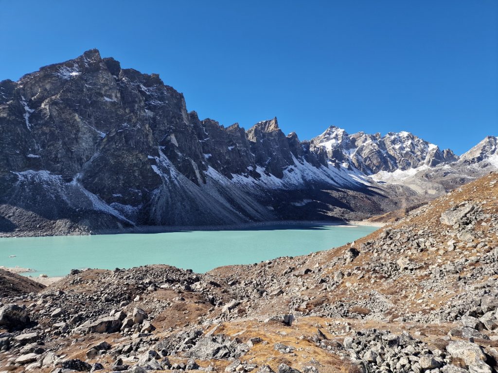
056. Looking west across Gokyo lake, 4734m, from the village of guesthouses to Renjo la Pass. Note the Brahmin duck bottom right

Even in the last 3 years Gokyo had changed. The guesthouse I had stayed at previously had been flattened and it was replaced by the modern edifice of the Gokyo Resort. I tried a few teahouses and nearly went for the Namaste lodge which looked ramshackle and rustic and where the backpacker trekkers, with whom I had an affinity, would stay. But it was heaving with 3 or 4 large groups of Koreans so in the end went for the Gokyo resort which was the same price for much better facilities. The dining room was warm in the sun and it was full of more elderly, wealthier trekkers, all with guides, many of whom I noted were quite plump. I got a room here, met a crazy and hardcore French hiker who was walking across the eastern half of Nepal and camping en route in the bitter night cold. I wrote in the afternoon and was done by dinner when the early morning started to catch up with me.

Day 10. 21 Nov. Gokyo to Ngozumpa Tse return. 16 Km. 7 hours. 1050m up. 1050m down. After a slower start I did not get going until about 0900. The large team of 10 New Zealanders and their gentle but energetic guide, Dawa Lama Tamang, were all going the same way up the west side of the Ngozumpa glacier to a series of lakes which had been formed when the truly huge glacier shoved a wall of moraine across the mouths of all the side valleys which acted as a dam. There were 6 lakes in this series with Gokyo Lake, where we were all staying, being the third. Most people took a day off at the extraordinary Gokyo and went up to the Fifth lake, and some more intrepid trekkers went up to the Sixth lake. About a 7-8 hour round trip from Gokyo. I had intended to go to the Sixth. I had been before and still remember the grand view to Cho Oyu south face. 

057. Leaving Gokyo to head up the peaceful valley to the west of the huge Ngozumba glacier to the fourth and fifth lakes. The mountain in the distance is Cho Oyu, 8188m.

As I set of in the pastoral Shangri-La between the lateral moraine of the vast glacier and the mountainside I came across a herd of 15 yak. They were spreadeagled across the pasture in the sun like sleeping dogs sunbathing. Only one seemed to be sitting up. I skirted round them knowing how fast they could be if irritated and continued up. I caught up with the Kiwis and chatted a bit with Dawa. I told him I was going to the Sixth lake. He had been there before and told me I would be better off going up Ngozumpa Tse, which had a great viewpoint. He pointed it out to me but it looked quite ambitious with a steep south ridge and a craggy top covered in boulders. I initially dismissed it. 

058. Looking west across the fourth lake from the small valley between the lateral moraine of the vast Ngozumba glacier and the mountainside

We soon passed the Fourth Lake which had a fringe of bare yellowish rocks around it. Obviously the rainfall of late had not been sufficient to maintain its fullest level. It was still large. The side valley it sat in disappeared to the west and went up to a difficult and seldom trekked pass called Sundar La, which would involve camping for at least one night. It took about an hour to get here. I soon left the Kiwis and carried on for another hour to the Fifth Lake. The weather was excellent but the strong wind was lifting clouds of dust from the glacial moraine and sent it 1000 metres into the air. I felt good and as I went I pondered more and more Dawa’s suggestion about going up the peak. It would involve a 500 metre climb but I thought I could manage it and could see a possible route. The Fifth Lake when I got to it was virtually frozen over but its strong turquoise shone through the ice. Around it was the same mantle of yellow exposed rocks. The side valley this lake was in was also quite gentle compared to the surrounding mountains. 

059. Looking SW across the fifth lake from the start of the climb up to Ngozumba Tse, 5553m.

As I reached the north end of the lake I thought I saw a rough path up the spur which I now intended to climb and there was a lone hiker just starting up it. This convinced me and I set off after him. He was only 5 minutes ahead. When I got to the base of the south spur I saw the path was actually very obvious and it climbed steeply in small zig-zags. As soon as I started my legs felt great but my chest was a size too small. I began gasping in the thin air. The trekker ahead was keeping a very steady pace and not stopping at all. He was very disciplined. After a good half hour where I had to stop to put on my jacket I finally caught him up. We greeted each other and he said he was Canadian. 

060. Looking east from the start of the climb up Ngozumba Tse to the 3 mountains on the south side of the tributaty glacier called Gaunora glacier. All 3 mountains, Cholo, Kangchung and Nirekha are just over 6000m.

For the next half hour I continued up the gravel and turf zig-gags, my lungs gasping for air but my heart rate a steady 110. The views were getting more and more spectacular especially down the valley which was a vast trench of moraine and ice. It was also very spectacular to the east where 3 Matterhorn type mountains sat in front of the 3 vast 8000m mountains of Everest, Lhotse and Makalu. The Canadian continued to follow me with his disciplined pace and was never more than 100 metres behind. 

061. The south face of Gyachung Khang, 7952m, is one of the most impressive mountains in the basin at the head of the Ngozumba glacier.

As we approached the top the small path veered to the left and started up the boulders. The going went from hard to strenuous as I clambered over the boulders for a good half hour with gusts of wind buffeting me. Frequently I had to use my hands to clamber up the boulders. However they were very stable and very rough and my boots stuck to them superbly and I was confident in them. Still gasping and panting I reached a very small saddle and could see the peak  beyond. I decided to wait for the Canadian here and we could do the last 2 minutes together. He reached me in no time and we clambered up the last section to the higher of two small peaks. There was another higher peak further on but it made no sense to go here and it would have been another half hour and the view would not have been as good. 

062. Cho Oyu seen from the top of Ngozumba Tse lies to its north. Cho Oyu at 8188m is some 2500 metres above this marvellous viewpoint

063. On top of Ngozumba Tse, 5553m in a bitter wind looking east towards Everest, Lhotse and Makalu (all to photos right)

The view where we were was absolutely unbelievable. I have never seen a view like it. There was a completely 360 panorama of huge mountains on every side with the vast glacier slicing a trench through it. It was absolutely sensational. From the north was the 8000 metre peak of Cho Oyu and then the vast wall of Gyachung Khang covered in flutes of snow. To the east were the giants of Everest, Lhotse and Makalu. The whole vista to the south was a jumble of 6000 metre peaks as far as the eye could see with the glacier cleaving a trench through them. To the west were the ranges I had just trekked beside with the higher peaks like Gurishankar in the Rolwaling beyond, and then back to Cho Oyu. The wind up here was quite strong and cold and photography was hard and my hands cold. I revelled in the view and chatted with the Canadian hiker. 

064. Looking south down the vast Ngozumba Glacier from the peak. Below is the fifth lake, the forth lake is largely hidden in the shade and the Third Lake, also Gokyo Lake, is visible in the distance

His name was Sorin and he was initially from Brasov in Romania but had emigrated to Canada with his family 30 years ago. He had never seen anything like this before either. We were both in awe of the mountainscape we were in. We stayed here for a good half hour lapping it up and taking multiple videos, photos and selfies of each other, which was necessary otherwise the wind would have blown the camera over or even away. I think sharing a view like this would almost bond us for life. I will never think of the view without thinking of Sorin. With our cameras full we headed down together. Sorin was nimble on the boulders and went ahead but met Dawa on the way up. He had sent his Kiwi charges back down with a porter and came up on his own. He went on to the highest peak of this mountain and said it involved some scrambling. After that Sorin and myself descended together not really chatting as the wind was strong on the spur we went down and ripped our words away. We stopped at the bottom to take jackets off and have some chapattis. 

065. Looking east from Ngozumba Tse peak to Everest (left) Lhotse (centre) and Makalu (distant right). All well over 8000 metres.

We still had a near 2 hour walk down past the Fourth Lake to reach Goyko. We told each other our life histories and his seemed like an extraordinary 35 year journey from Brasov in Romania to a key member of a software company in Toronto where he and his family were now well established. As we approached Gokyo dusk was still a while away but the sun of the glorious day was fading. I went to his simple lodge by the lake side and had a cup of tea with him and swapped social media contacts. I then went up to the large Goyko Resort where I was staying and chatted with the owner’s son and the Kiwis. I ordered Dahl-Bhhat and tried to write but was totally beaten. I went to bed just after my meal and fell asleep at once but woke up after a few hours and struggled to get back to sleep. I had intended to go to Dzongla the next day over the middle of the Three Passes, Cho La, but now decided to write the blog in the morning and then make the short trek to Thanak at the foot of this pass and do it the next day.    

066. On the way back down the small valey to the west of the Ngozumba glacier and looking back at Ngozumba Tse peak, 5553m, (centre) dwarfed under the huge bullk of Cho Oyu 8188m behind it.

Day 11. 22 Nov. Gokyo to Thagnak. 4 Km. 1.5 hours. 250m up. 250m down. I was dog tired last night and went to bed early. Today I had intended to get up early and go all the way to Dzongla over the Cho La pass. But I did not have the energy so instead decided to write in the morning and then make the short hike to Thagnak in the afternoon which would put me in prime position to do the Cho La Pass the next day.  Today would be as good as a rest day. I got up at 0730 and wrote until 1100 and then paid my bill and left about midday.

It had been very windy when I was writing but it seemed to have settled down now. A strong wind on the glacier would be unpleasant as there would be plenty of dust or even sand whirlwinds lashing me. I climbed up to the top of the moraine and then looked across the vast expanse of rubble which I would have to cross. On the other side of this rubble rose the magnificent mountain of Arakam Tse, 6423m, which its sharp arete covered in fluted snow fields plunging into the high turf covered plateau. 

067. the incredible mountain of Arakram tse, 6423m, view from the NW near Gokyo

I don’t know how deep the glacier was but it was at least a kilometre wide. I guess it was 100-200 metres deep but it had been deeper and the static ice had melted by 50 metres leaving the rubble in a trench on each side of the 50 metre high moraine walls. The first hurdle was to get down this moraine wall onto the rubble-clad glacier. There was a steep and loose path otherwise it would have been very difficult and dangerous climbing down as the steep moraine face was loose. Once at the bottom of the wall of lateral moraine I could begin my journey across to the moraine wall on the east side which I would have to climb up. 

It was a complete moonscape of rubble with funnels, small lakes, ice ridges and occasional cracks or crevasses which were full of stones. The path meandered through this marked by cairns. Occasionally the path just disappeared and where it was previously was 10 metre ice slope down to a frozen pond. The path was marked by cairns but as the glacier slowly heaved and settled over the years the cairns would topple and new ones would be built to reflect a new route.

The rubble on the glacier had all been carried down from the mountains where it had broken off and been carried down embedded in the ice. Now the surface was melting, these stones were coming to the surface. At one point I could see round the rim of an icy cone with a pond in the bottom of it the rubble was 2 metres thick. I guess that the ice underneath the rubble will continue to melt for the next 5-15 decades until it is all gone and the settlement will stop and the landscape become stable. In 200 years there might even be potato fields here. 

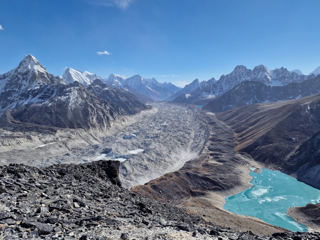
068. Crossing the huge Ngozumba glacier from Goyko to Thagnak. It was only a few kilometres but the route was quite convoluuted

I felt like an ant in a quarry as I shuffled along. In places where the path was 5 years old it was easy to see and quite sandy but in other places where it was only a year old it was covered in new gravel. As the surface of the ice melted some of the water found its way down through cracks and holes (called Moulins) to deeper subterranean parts of the glacier or even the bare bedrock on the valley floor. In other places though there was no crack or exit and the meltwater pooled on the surface in a pond. Most of the ponds were at the bottom of cones, like a volcano crater, surrounded by steep icy slopes. As the heat of the day melted the ice so stones and rubble would fall from the surface into ponds. If a human fell down into such a pond it would be virtually impossible to get out again unless there was a ramp of rubble in the cone. Most of the ponds were frozen over with a thick layer of ice. After an hour of wandering round the craters and the piles of rubble I eventually got to the east side. 

There was an established path here up the side of the moraine to reach its crest. On the other side was a beautiful small valley a few hundred metres wide between this moraine and the mountainside. This small valley had a clear stream on its floor and its sides were covered in dwarf rhododendron, whose dried flowers still produced a scent. It was a very easy and pleasant walk down here in the afternoon sun. The slopes of the lower mountains blocked any view to the fluted snow slopes and sharp ridges of Arakam Tse and Cholatse but mountains appeared on the west side now. 

069. Wandering down the east side of the Ngozumba glacier towards Thagnak in the valley between the glacier’s lateral moraine (right) and the mountainside (left)

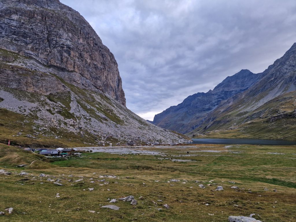
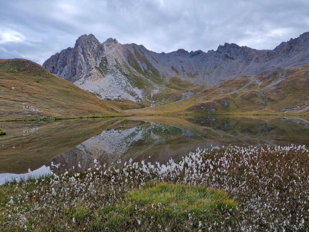
At the bottom of a steep sided valley was the hamlet of Thagnak. It was made up of some 10 trekkers lodges and nothing else. IIt was quite bleak and inhospitable and I wondered if 50 years ago there was anything here at all, even a yak herder’s hut. I went to the upper lodge and had a flask of tea. I was the only one there for a while and thought about moving to another when a few people arrived from the Cho La Pass. There was a nice young Dutch couple and a talkative Swiss couple. They both told me there was a Scottish 78 years old coming down. He arrived just before dusk but went on down to the lowest lodge. I gave him time to change and went down to meet him but he was zonked out in his room. His name was John Porter.  I met his tour leader though who was a lady called Kim Bannister. I knew friends who knew her and we chatted for an hour and a half. She lived in Kathmandu and ran her own tour company called Kamzang Journeys, specialising in Northern India and Nepal. She was a well known and respected figure in the Nepali trekking fraternity. It was a shame I had to return to my lodge for dinner at 1830 otherwise I could have chatted to Kiim for ages. After dinner I chatted with a few other guests and then went to bed at 2000 for an early start.

Day 12. 23 Nov. Thagnak to Lobouche. 15 Km. 7 hours. 1040m up. 790m down. I did not sleep well and when the alarm went off at 0445 I was drowsy. I could hear the cold wind howling outside but it seemed to be in gusts. I had the usual chow mein for breakfast and then a litre of tea and set off at 0545. By now the wind had gone and it did not take long before I could switch the torch off at about 0600. I plodded up a steep side valley with a stream covered in ice. Behind me the mountains were slowly illuminating in the dull light of dawn. I had walked for a good half hour when I heard some soft clucking noises. I knew it was Kongma or Tibetian Snowcock but could not see them. They are about the size of a football. Suddenly I was almost upon them but they continued to peck and forage. There were about 15 of them and they just shuffled out of the way to let me pass. I spent a good 15 minutes observing them and taking photos.

070. leaving Thagnak in the morning and wandering up the frozen stream bed to the plateau to the east of it. This view is looking back down with the plateau behind me

071. as the top of the side stream and before I got to the plateau I came across a large group of Tibetan Snowcock, or Kongma, who did not fly off

The Kongma were right on the edge of the plateau and I soon climbed onto it where I got a view to the Cho la Pass and also the magnificent Kangchung Peak to the north. It was the middle of the three Matterhorns I saw when I was up Ngozumba Tse two days ago. The south face looked magnificent with high ridges covered with flutes of snow. There were a couple of high passes between these peaks and even one over to Khumbu glacier which was slightly technical. It was called Changri La and was 5802m. I sauntered across this plateau descending slightly as I went towards the foot of Cho La Pass. It was a lovely stroll and I dare say in an hour when the sun was blessing it then it would have been perfect.

072. Looking north up across the plateau above Thagnak towards Kangchung Peak, 6063m. It is the middle of the 3 Matterhorn like peaks mentioned 2 days ago.

073.The final climb up to Cho La Pass, 5420m, involved a 300 metre ascent up rough steps with a steel cable as an aid

It was still cold in the shade and I had my duvet jacket on still as I started up the boulders at the foot of the pass. The path meandered a little as I climbed slowly gaining on a vast slab of rock. I remember it being much more rocky previously. As the path reached the foot of the slab I saw that there was a new cable here, and posts, some 5-10 metres apart almost like balustrades. Beside them was a rough step path which had been constructed and then fallen into disrepair. While I scoffed at the balustrades and the cable, and they were certainly superfluous in these conditions, they would have been useful a month ago when there was a unseasonal dump of snow here which would have then frozen into a hard slippery snow called neve. The climb up these rough steps was a bit of a slog and took the best part of an hour but I had been expecting it and that eased it slightly.

075. Looking West from Cho La pass towards the plateau behind the prayer flags and then the mountains on the west side of the Ngozumba glacier and even towards Rolwaling

Like Renjo La a few days ago I poked my head above the pass and into the mass of prayer flags and the sunlight. There was a great view behind me to the west, with ridge upon ridge of ever increasing mountains until they reached the giants of nearly 7000 metres by the Rolwaling Glacier. To the east was the blindingly bright glacier which filled the entire cirque. however I remember being here in 2007 and I stepped from the pass directly onto the glacier. Now I had to climb down 20 vertical metres to reach its surface. I guess in another 30 years it will be gone and the rocks left will start to settle and accrue dust and soil and lichens and coloniser plants will spring forth. I took a lot of photos and enjoyed the view in the sun before I noticed the first of the people trudging up the glacier from Dzongla.

074. The east side of Cho La pass is glaciated. In the path 15 years since I first crossed it the glacier has retreated hugely and lowered by about 20 metres from it previous height.

I skipped down the newly exposed path and got onto the glacier. Where people had been walking there was a slippery polished trench in the ice, but just to the side the snow was rough and abrasive. I could almost jog down the shallow incline. I passed two groups on the glacier all with guides and microspikes. I namasted each as I rushed past. It took about 20 minutes to saunter down the kilometre stretch of ice to the snout which was very steep. However, there was an exit to the north onto moraine which was easy and it took me down to the wet gravel plain just below the snout where the meltwater oozed out.

076. Looking west back up the glacier towards Cho La Pass. I remember just 15 years ago the glacier went all the way to the pass and was level with it.

From here it was a lovely descent down to the lodges at Dzongla. The first half was a bit more involved as it went down steeper hillsides and rock slabs which the retreating glacier had exposed say 100 years ago. However the second half was an absolute joy as the flatter valley gently descended through meadows and dwarf rhododendron. There was a small climb at the end round a knoll to reach the lodges. I went to the Green Valley and showed him photos from 15 and 3 years ago when I stayed. The owner was fascinated and gave me a huge portion of chow mein and extra milk in the thermos of tea. It had taken me 4.5 hours to get here but I was thankful for the break.

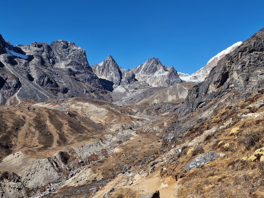
077. Looking west back up to the Cho La Pass (centre right) with the lodges of Dzongla just visibe on the plateau (centre left with blue roofs) Behind me is the huge Khumbu valley.

I still had a while to go and set off down the valley. I now noticed some of the magnificent peaks around me. To the south was the vast north wall of Cholatse while to the north was the twin Lobuche peaks, However the valley I was in was soon coming to an end as it entered the vast Khumbu valley which drained the mountains in the Everest basin. Across the Khumbu valley was the huge pyramid of Ama Dablam, one of the most iconic mountains in the world. As the valleys merged I rounded the spur and then headed north up the Khumbu. The good path slowly dropped down to the floor of the Khumbu Valley which in turn came up to meet it. I could see the promenade path to Everest Base Camp (EBC) in the valley and it was teeming with yak caravans, trekkers, porters and guides. Soon my small quaint path had merged into it like a beck into a major river.

078. Looking south down the Khumbu Valley and the village of Periche. The huge mountain to the left is the iconic Ama Dablam, 6856m, while on the right is Thamserku, 6608m. Everest is up the Khumbu valley behind me.

I followed the large path north for about a kilometre until the lateral moraine walls of the Khumbu glacier rose up into great ridges hemming the glacier in its trough. The path kept between the mountainside and lateral moraine for another kilometre until it came to Lobuche, a cluster of perhaps 20 lodges. I had stayed here twice before and always had sleepless nights due to the altitude. I was recommended a lodge called Oxygen and found it easily and checked in. It had great wifi but dull bedrooms and difficult toilets with Western WC’s replacing the traditional squat toilet. The room was sunny and I basked on the bed for an hour and then started to write. My usual supper of Dahl Bhat interrupted the blog but I sat at the same table as a cultured Australian and we chatted for an hour. I was tired but forced myself to finish the blog before going to bed. Tomorrow I will stay here again and make a day trip to the famous Everest viewpoint of Kala Pattar, 5550m.

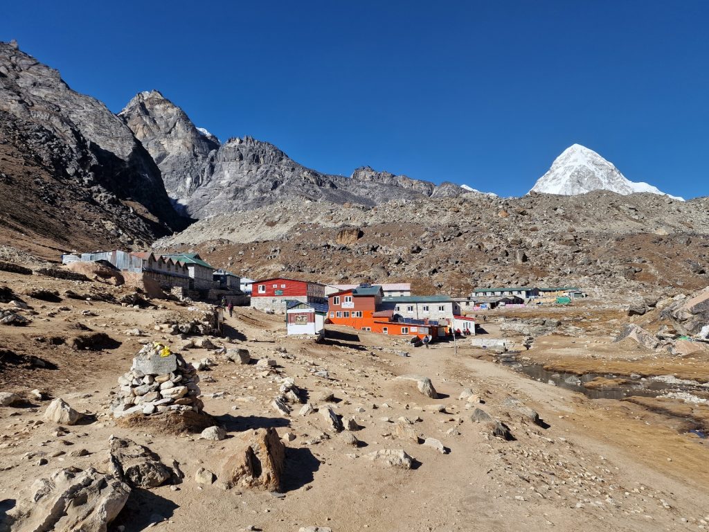
079. The windswept dusty village of trekkers lodges called Lobuche. From here is is easy to make a day trip to Everest Base Camp and Kala Pattar. Lobuche is just under 5000m. The mountain in the back is Pumori, 7165m.

Day 13. 24 Nov. Lobuche to Kala Pattar Return. 13 Km. 5.5 hours. 1080m up. 1080m down. I did not sleep well and woke up a few times gasping for air. I always remember this from Lobuche, As I laid awake at night my thoughts were never pleasant but always angst ridden. I put it down to the altitude of about 5000, I did eventually fall asleep again and woke at 0730. I had a lazy breakfast and did not get going until 0900. Outside there was quite a cold wind coming down from the high peaks to the north. It was strong enough to whip up dust.

I left the hamlet of lodges and headed north into the wind. There seemed to be 3-4 tour groups heading up and I soon caught and overtook them in the stony valley between the lateral moraine of the Khumbu glacier and the hillside. Everybody else was completely dressed up with only the tip of their noses showing. It took a good hour to plod up the valley climbing a couple of steep rises to reach a large side glacier coming in from the west called the Changri Glacier. The path went across its width just as it joined the vast Khumbu glacier. The wind was strong here and I could feel sand particles being blasted into my face. After a few tortuous up and downs across boulders the path finally climbed the moraine and descended to Gorak Shep, 5140m. it was a desolate hamlet of lodges in the sandy plain where the two glaciers met. a yak caravan full of empty gas bottles was just leaving when I arrived. It was the third time I had been here and I never felt tempted to stay.

080. Approaching Groak Shep with a yak caravan just leaving the hamlet oflodges. The main mountain is Pumori

I did not stop but carried on across the plain to where all the lodges collected their water from in large canisters. It was here the path started its 400 metre climb up to Kala Pattar, a promontory in the midst of the Khumbu basin and surrounded by mountains. I had been walking towards the tall dome of Pumori all morning with the steep sided Nuptse dominating the right. Its flanks were covered in fluted snow ridges. However now I could also see Everest and as I started the climb more and more of it unveiled itself. The climb was initially quite easy and I could plod up the sandy path for about 40 minutes. Pumori loomed large ahead of me and the twin mountains of Everest and Nuptse grew hugely in stature and started to separate from each other with a tumbling ice fall between them. The second half of the 400 metre climb also took about 40 minutes but it was much more laborious as it went up across boulders to the small summit on the ridge which was covered in prayer flags. mercifully the wind was not that severe up here.

081. Standing on Kala Pattar, 5550m, looking towards Everest, 8848m (left) and Nuptse, 7864m (right)

The view from Kala Pattar was superb and it was completely clear without even the smallest cloud. There was only an Austrian man up here and he was getting ready to go so we did each other the favour of taking photos of each other. Each time I had been here I stood on the same rock and gazed at Everest and Nuptse, hand in pockets and I reenacted that pose again. I had about half an hour at the top. Half the time I was taking photos and panoramic videos and the other half I was sitting in a sheltered alcove with the sun blasting down and warming me as I gazed at Everest. It must be the natural throne with the best view in the world. Far below was the Khumbu Glacier and along its sides were spreads of moraine and debris which is where base camp was in the climbing season of spring and autumn. I did not get a good view of the Khumbu IceFall as the west ridge of Nuptse blocked it. I took a photo of Pumori from here for a friend who climbed it some 25 years ago and set off down.

082. Looking from Kala Pattar to Everest and Nuptse. Everest Base camp is currently to the left beyond the black ridge. The bottom of the Khumbu Icefall is above base camp

083. A close up of the summit of Everest, 8848m, from Kala Pattar. The South Col is down the risge to the left.

It did not take long, perhaps a short hour to reach the sandy, windswept dust bowl of Gorak Shep again. I had not stopped all morning so went in for a thermos of milk tea. I saw a table of english and joined them. They were a very bright bunch and I ended up chatting to them for an hour and a half. They had also just come up from Lobuche but were staying here. I left at 1500 and skipped down the track back to Lobuche with the wind in my back and the sun in my face. It did not take long and I was soon back at the Oxygen lodge and well before dusk started. It had been a very good day apart from the wind but the views were the clearest of my three visits. At the lodge in Lobuche I learned that a friend from Scotland was working on a project at Dingboche and it was exactly where I aimed to be tomorrow. I had the usual supper of Dal-Bhat and then wrote the blog swaddled in quilts. The lodge was quieter tonight and it was much colder and the water in the toilet was already freezing over at 2000. I went to bed at 2100 ready for the last of the 5000+ metre passes tomorrow.

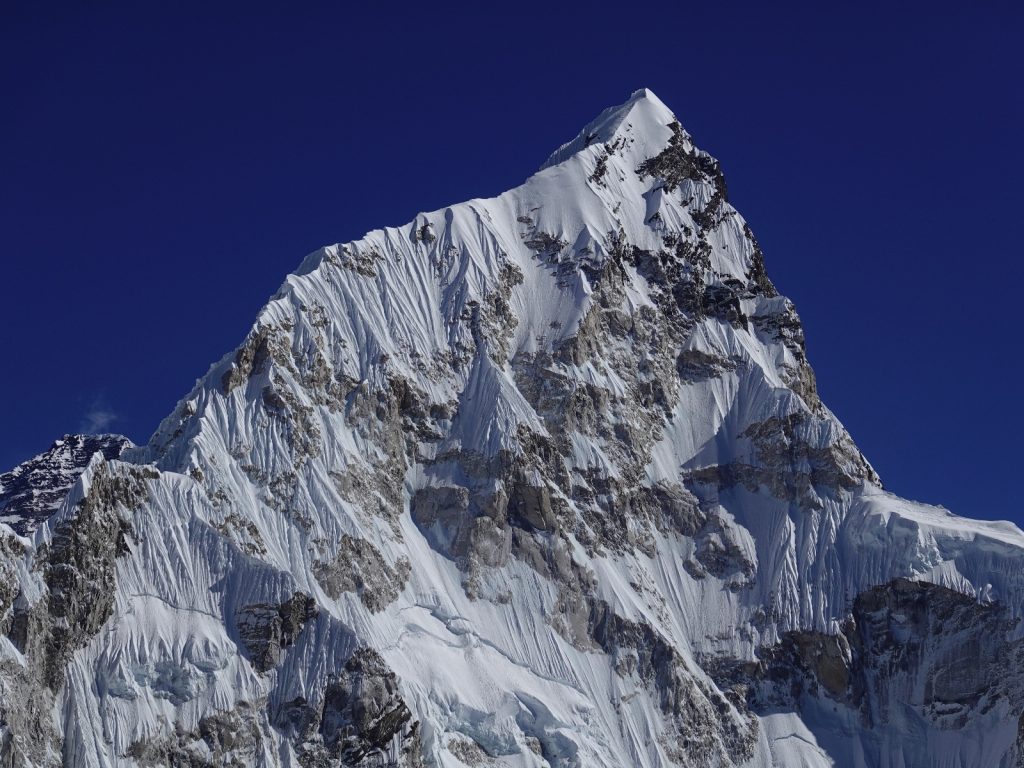
084. Nuptse, 7864m, from Kala Pattar.
Just visible behind the left shoulder is Lhotse, 8516m.

Day 14. 25 Nov.  Lobuche to Dingboche. 13 Km. 6.5 hours. 750m up. 1370m down. I did not sleep that well again, but better than previously. It was very cold in the night and there was jack frost all over the window. I had arranged breakfast at 0600 but when I went through the watch was asleep behind the counter and no one else was about. I had to shout a few times to wake him up and then he got everybody else up and I had me breakfast 20 minutes later.The other guests, about 10 in all, had got up by now and they were saying their water bottles were almost frozen solid despite being in the room. I eventually left at 0700 but by that time there was already sun on the east side of the peaks. 

085. Looking up the moraine strewn Khumbu Glacier while crossing it. The mountain in the distance is Pumori

Firstly I had to cross the vast Khumbu Glacier. It was perhaps not as big as the Ngozumba glacier by Gokyo but it seemed more active. The path changed more frequently depending on what was melting and what was stable. The stone cairns marked the route but they occasionally toppled as the glacier shifted. The first (west) half was quite straightforward but the east half had a number of new routes as old ones vanished. At one stage there were huge boulders across a stream which connected two lakes of silty brown meltwater. It was easy to hop over the boulders. The climb up the moraine on the other side was steep and the path quite loose, but it was well trodden. It took me to the top of the high moraine ridge and then into the calm valley. There was a side valley which came down here and it was up this side valley which the steep path went to the Kongma La Pass, 5535m

086. Looking west back down from near the top on the Kongma la Pass to the Khumbu glacier and the cluster of lodges at Lobuche with Lobuche Mountain just beyond

The climb up to the pass was about 600 metres in all. Initially it was in the shade and still quite cold. It climbed, not too steeply, up across turf and boulders. There were dwarf shrubs covering the hillside, mostly the small rhododendron bushes. Half an hour into the climb I caught up with the chatty guide and quiet German from Thagnak. A Dutchman and his guide caught me up.  I did not feel as fit as I did on previous climbs. Soon the gradient increased and the terrain became more bouldery. I struggled to keep up with the Dutchman and was overheating in my jacket so stopped to strip down for the sun. The rough path now climbed steeply to the north (left) across boulders under the large cliffs. Once it gained the top of this bouldery mound it traversed up it under the cliffs above for 20 minutes or so to reach the prayer flags on the pass. To the south of the pass rose Pokalde, although it was very craggy with steep ridges it was not 6000m so was largely ignored by peak baggers who went for Island Peak further up the valley instead. 

087. Looking south from the prayer flags on the Kongma La pass to the modest peak of Pokalde which is a little under 6000m

Kongma La Pass was 5535m and the highest of the three passes. The view to the west down the boulder strewn side valley with some large ice patches was relatively dull. This slope went down to the rubble covered Khumbu Glacier and on the other side of it I could see the green and blue corrugated roofs of the lodges at Lobuche. beyond this was the modest mountain of Lobuche. However the view to the east was stupendous and included the vast south face of Lhotse, 8516m, which plunged down steeply for a good 3000 metres and was a feared climbing route. Further to the east along a line of peaks was the high triangle of Makalu, 8463m, which rose above everything. Under it, and quite insignificant was Island Peak, 6189m. It sat in the middle of this vast amphitheatre and must have had a marvellous 360 degree view. To the south of it was Baruntse and the Amphu Labsta pass which I came over 3 years ago.

088. Looking east from Kongma la pass across the plateau with the lakes and onto to Makalu, 8463m, in the distance. UUnder its summit is a black ridge which leads up to the trekking peak of Island Peak, 6189m.

One of the nicest things with the view east from the pass was immediately below the pass where there was a large turfy plateau with a few shallow lakes dotted about it. All the lakes were completely frozen except the largest which had a patch of open water. Despite reaching the pass I felt quite tired. Perhaps my small breakfast had been spent already or the last days were catching up. I went with the Dutch down to the lake after we chatted and took photos at the top for a half an hour. At the lakes I let them carry on while I took more photos. At the edge of the plateau with the lakes I came across 10 Tibetan Snowcock foraging in the turf. They were unperturbed by me and I got some photos. In Nepali they are called Kongma, the same as this pass, and they are revered. 

089. A zoomed photo of the immense Makalu, 8463m. it is perhaps 15 kilometres to the east

090. The immense south face of Lhotse, 8516m. This wall is about 3000 metres high

The path now descended quite steeply and I felt a bit wobbly going down the 300m to a lovely south facing sheltered cirque. At the bottom of it was a level pass which curved round the eastern side of the spur which formed the valley. Once I had gone round enough I could see the sea of moraine debris which the glaciers from this vast basin carried down. Amongst it was Imja Tsho, 5010m, it was a lake which had been formed when the glacier melted. The dam holding this lake in was essentially the terminal and lateral moraine and in places they were quite thin. It is thought that the lake might burst one day releasing a fatal flood down the valley below. 

091. Three Kongma, or Tibetian Snowcock, Tetraogallus tibetanus, pecking the turf hillside on the east side of Kongma La Pass, 5535m.

Below the lake and on the edge of the turf just below the moraine was the lodge hamlet of Chhukhung with its cluster of 10 lodges. I had intended to go there but got word a friend of mine was at Dingboche some 8 kilometres below Chhuckung. The path I was on went to Chhuckung so I followed it as it slowly descended across the hillside. However I wanted to go the other way so at the first opportunity when gentle pastures replaced the boulder strewn slopes I cut down the close cropped turf towards a yak herders hut in a large compound. The compound was now full of drying yak dung and would be used to heat the lodges. With tired legs I took small controlled steps down the smooth slope to the herder’s hut and then down onto the valley floor beneath the huge north face of the iconic Ama Dablam mountain, 6814m. 

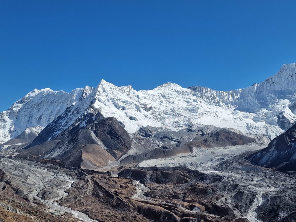
092. The Chhukhung Glacier and icefallcoming down the angular ridge to the north of Ama Dablam mountain. Behind this ridge is the alpine Amphu Labsta Pass, 5839m. The lodges at Chhuckhing hamlet are just vissible bottom left.

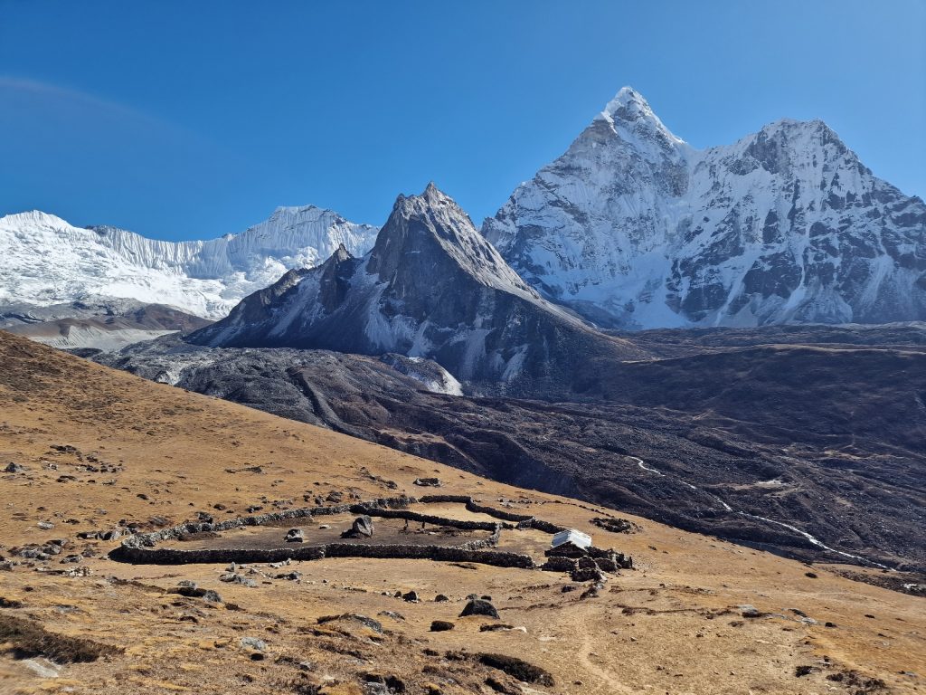
093. Coming down the open hillside towards the yak herding cabin half way between the hamlet of Chhukhing and the village of Dingboche which is downstream to the right. Ama Dablam is in the background

On the valley floor I now shuffled along dragging my legs for a few kilometres to reach the large village of Dingboche. It was on the main tourist trail to Everest Base Camp so had 15 odd lodges, but it also had potato fields and a yak herding culture so there was some culture in the town. I entered the east end and started to look for small cabins my friend Colin was building in a Scandinavian style. I eventually found them in the upper part of the village and went down to them. Colin had spent months here and had built two so far, They were quite small and very very cosy. They were undoubtedly the best insulated buildings in Nepal. Colin and his son Rory, downed tools for a cuppa when I arrived and we chatted for about an hour. However he wanted to press on with a larger, two storey cabin, also in a Scandinavian style. It was a very innovative and ambitious project and Colin seems to be succeeding against all the odds. Whether this style of building, complete with a turf roof will catch on here remains to be seen. It was right on the main trekking path so every porter and guide will see it in time. 

093a. The two cosy cabins Colin had already built in the last 6 months in Dingboche with the third one on the way to the left. They are possibly the best insulated and warmest buildings in Nepal.

I went up to the Paradise Lodge just above Colin’s two cabins while he finished off work and prepared for tomorrow with Matt, an Australian carpenter who joined the building project after seeing it on the way up and decided to stop and help on the way down from Everest Base Camp a month ago. My lodge was quite cosy with about 10 other backpacker type guests. I wrote for a couple of hours until Colin, Rory and Matt joined me for dinner at the Paradise Lodge. It was a great evening and we chatted for a few hours. I know I will sleep well now as Dingboche was some 600 metres below Lobuche so the air would be relatively enriched with oxygen and it would be warmer.  

Day 15. 26 Nov. Dingboche to Namche Bazaar. 22 Km. 7 hours. 710m up. 1510m down. I did sleep well. I got up at 0700 and went down for breakfast and Colin joined me soon afterwards. He was staying in one of the two finished cabins; the one with the grass roof. After I had eaten and packed I went down to see more of Colins project. He was building a third slightly larger, and two storey, cabin now with huge insulation and lots of features to enhance the thermal gain from the sun through windows onto slate floors. He was doing it all in conjunction and partnership with a local Sherpa who he had known for years.

094. Looking up the Imja Khola valley towards Dingboche in the mid morning with Lhotse in the background

After viewing the project we walked down through the village to a cafe. En route we passed some shops and cafes in this quiet creative Sherpa community. People greeted Colin warmly as we went down and he bantered with them trying out his 500 words of Sherpa. It was nice to see he was held with some sort of regard by the locals. We got to the Cafe 4410 which seemed to be Colins local. All staff greeted him warmly and we had a couple of delicious lattes with Nepali coffee grown near Bung. It was now about 1030 and I had a long day ahead so reluctantly had to leave. It was a beautiful day as I set off down the large wide path ast some stupas and a field of yak.

095. Looking up thr Imja Khola valley past a small season stone hut eith used as a herders cabin or a potato farmers cabin. Lhotse in the background

I made quick time as it was slightly downhill and easy underfoot. I was in a buoyant mood. Whether it was the coffee, the oxygen, the warmth or meeting Colin I don’t know. It was perhaps a combination of all, but I was absolutely inspired by Colin and his project, which was completely outside the realms of ordinary mortals. Not only was he succeeding, against the odds, but he was doing it with such good grace and panache. It was nice to know there are people like Colin in the world and I felt privileged to have known him for nearly 40 years.

096. Looking down the Imja Khola valley from Orsho towards the SW and towards the town of Namche Bazaar and the very top of the Numbur Himal, 6958m, in the far distance.

Before long I got to Orsho where there was a single, and closed guesthouse, built in the yak pastures overlooking the river below which was in a deep slot. The slot was lined with shrubs and the Himalayan Silver birch. It was the limit of the upper treeline and I knew the conifers would be just a little further. To the south across the river rose the very steep, dark and foreboding north side of Ama Dablam. The path continued down through the trekking lodge hamlet of Somare and then on down to Pengboche. It was still surprisingly busy with tour groups labouring up and I must have passed at least 10 today. All the guesthouses in these two settlements had put tables together outside in their courtyards to seat groups of 16 in the hope a lucrative, glutinous meat-eating tour group might stop and make their week.

097. The classic image of Ama Dablam, 6814m, from near the monastery at Tengboche

Just below Pengboche was an army checkpoint and they aggressively stopped me and wanted to look at permits. I asked him where he was from and he said Surket. I told him in Nepali I had spent a few days in Surket and that it was a beautiful place. That pacified him and we joked thereafter, mostly in English, and then parted as friends. The very well constructed path now went down to the tumbling Imja Khola torrent and crossed it on a high suspension bridge. After that it entered dense rhododendron and fir forests. It was so nice to be back in their maternal protective forests again and to smell their resins which were being released in the sun. It was only when I was back in the comfort of the warm forest did I feel the hardships of the 5000 plus metre passes were over. It was a lovely walk through the trees, climbing gently to reach Tengboche. Here there was a well known monastery which was one of the most important in the whole Khumbu region. It was a well known landscape on the Everest Base Camp trail and I would think virtually every one who has made the walk remembers it with fondness. I had visited before in 2007 and stayed the night in one of the lodges so did not go in as I was also on a mission to get to Namche Bazaar.

098. The entrance gate to Tengboche monastary. The monastery is on of the most important schools of learning in the Khumbu region.

One of the reasons many of the Everest Camp Trekkers remember it fondly is because it is at the top of a long climb for them which is arduous to those still acclimatising. As I started down this slope I passed many coming up, slowly plodding behind their guides who were patiently walking with arms folded, while the porter with the unnecessarily huge holdalls was miles ahead. Many tourists were really struggling up this slope and I did not fancy their chances above Dingboche. The descent seemed to go on for much longer than I remembered and I think I dropped some 600 metres in all to the bridge over the Imja Khola by Phunke Tenga. I had been going for about 5 hours now without a break and decided to stop here for a chow mein and a few cups of sweet milky tea beside the roar of the river below.

After my very late lunch I had to climb up the other side of the river gorge through fir forests. There were frequent yak caravans coming up and the docile dhzo would often be two or even three abreast and force me into the embankment. I knew never to go on the outside of them where they might inadvertently barge me off the path and down the hillside. I climbed for a good 500 metres until the firs gave way to juniper scrub at around 3800 metres. There were plenty of green jay type birds feeding on the yak, and especially mule, dung looking for undigested seeds or perhaps parasites. On one occasion I saw a female Daphne, Nepal’s national bird, but it flew off before I could photograph it. At Sanasa there was a collection of nicer lodges and I passed the Marine I met at Gorak She a few days ago and we chatted. I had the bit between my teeth now and marched on the Namche Bazaar just an hour away along a flat wide contouring path.

099. Looking up at Thamserku, 6618m, mountain with the late afternoon sun on it from the good path between Sanasa and Namche Bazaar.

As I was nearing Namche Bazaar, Thamserku loomed above with the glow of the late afternoon sun on it. Below me I could look down the valley of the Dudh Kosi river, which formed at the confluence of the Imja Khola and Bhote Kosi below Namche Bazaar. It was starting to glow in the early dusk. I came round a corner and met three cheerful porters and we got chatting. One insisted I try his load. It was 70 kilos. I asked him what it was and he said “Glass” I said “For Dingboche” and he said “Yes” I had a look at the writing and saw it was for Colin who was waiting for some for the third house he was building. The porters were full of banter and it was a fun and joyous exchange in a day full of joy. Soon after I reached a small saddle and went through it to see Namche Bazaar curled around its south facing bowl with layers of hotels, cafes and shops descending on terraces. I made straight for the Khumbu Lodge, where Jimmy Carter once stayed and it was the only one I knew, and dusk was well under way.

100. On the path between Sanasa and Namche Bazaar I came across 3 porters resting, each with 70 kilos of glass bound for Colin in Dingboche

I got a great room with mobile reception, a bathroom with hot water coming out of the taps and twin beds each with clean sheets and an electric blanket all for $25. To make things even better Brian and Sarah were also staying here. They were outdoor instructors from Ireland whom I had met some 10 days ago. They had been a day ahead of me ever since and by coincidence had bumped into Colin who exchanged our contacts. I showered and then went up to have dinner with them. For once I did not have Dal-Bhat, but fried momos. Like all Irish they were superb conversationalists but I was quite tired and struggled to hear the soft Irish accent. When I went to bed I was pleasantly surprised to find the electric blanket worked and the frozen memories of Lobuche were soon forgotten in a warm glow. It had been a great day and it marked the end of the high mountain section. To make matters even better I had a day off here tomorrow.

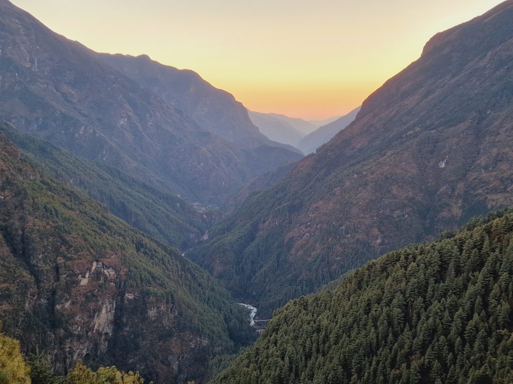
101. Looking down the Dudh Kosi valley from just above Namche Bazaar in the early dusk. The confluence of streams is at the bottom of the photo.

Day 16. 27 Nov. Namche Bazaar Rest Day. 0 Km. 0 hours. 0m up. 0m down. I slept extraordinarily well in the comfortable warm bed and got up at 0700 for another shower and shave. I had a more traditional western breakfast, for which Brian and Sarah joined me. We chatted for a good hour afterwards before they realised they better make a move. They were so well informed and such easygoing company I could have travelled a few days with them. After they went I actually went back to bed for a few hours and got up again at midday.

102. Namche Bazaar from the west looking into bowl where hotels, cafes, resturants and businesses are built on terraced walkways. Khumbu Lodge hotel is out of the picture on the left. In the distance is Thamserku mountain, 6618m.

I had a few things to buy like AAA batteries but they were easy to find in Namche Bazaar. You could buy everything here to climb a 8000 metre peak. With my shopping done I went for a veggie burger in one of the many places which claimed it was German Bakery. Most Teutons would be quite surprised at the wares on display in them though. In the afternoon my washing was dry and I was clean and organised again so I wrote the blog and caught up with everything I needed to do in the lodge’s bright, friendly dining room. I paused for supper and then finished at 2030. I had an early start but had another shower, my third since arriving, before the warm bed.

Day 17. 28 Nov. Namche Bazaar to Surke. 21 Km. 7 hours. 540m up. 1630m down. I had a superb sleep and when I woke at 0630 I had a shower. It would certainly be my last for a week as there are very few facilities on the route to Tumlingtar. I chatted with the dull Australian couple who were still trying to impress me with their helicopter journey to Kala Pattar, which I thought of with disdain. We all left about 0830 but I soon left them as they had not actually walked anywhere in Nepal yet. Initially my route was down the 400 metre descent to the confluence of the two large streams which met to form the Dudh Kosi.There was still a few groups coming up to do the Everest Base Camp trail and a hand full of independent trekkers, many of who might be doing the 3 passes. There were many dhzo and mule trains coming up and at least half the beasts of burden were carrying 2 small gas cylinders, each probably 30-40 kilos. There were the small green yellow jay-type birds all over the track ripping their piles of dung apart looking for food. Some were quite brazen and I could easily photograph them.

103. The Black-faced Laughingthrush, Trochalopteron affine, are common along the trails where pack animals carry goods. The thrushes search through the dung for partially digested seeds or parasites.

After the bridge at the confluence of the streams I left the world of high mountains and entered the pine forests and the string of lodges along the valley floor. There was little agriculture here as it was much easier to farm tourists rather than crops. The path crossed to the west side of the river and then back to the east to get to the first larger villages called Monjo. After climbing the steps to it I had to pass the police checkpoint and dig out my passport and National Park entry permit -even though I was leaving. I was felling quite heavy and sluggish and not at all the sprightly lamb I thought I might. I think much of it was due to the path which was hard and stony underfoot. I twisted my ankle once and fell heavily on rough cobbles. I passed a few other hamlets but decided to make for Phakding, where I had stopped before with Brian and Sarah on the way up. By the time I got there I was feeling quite weak. Perhaps it was dehydration as I did not have my usual thermos of tea in the morning, but just a diuretic coffee. I ordered chow mein and a flask of tea and felt much better. 

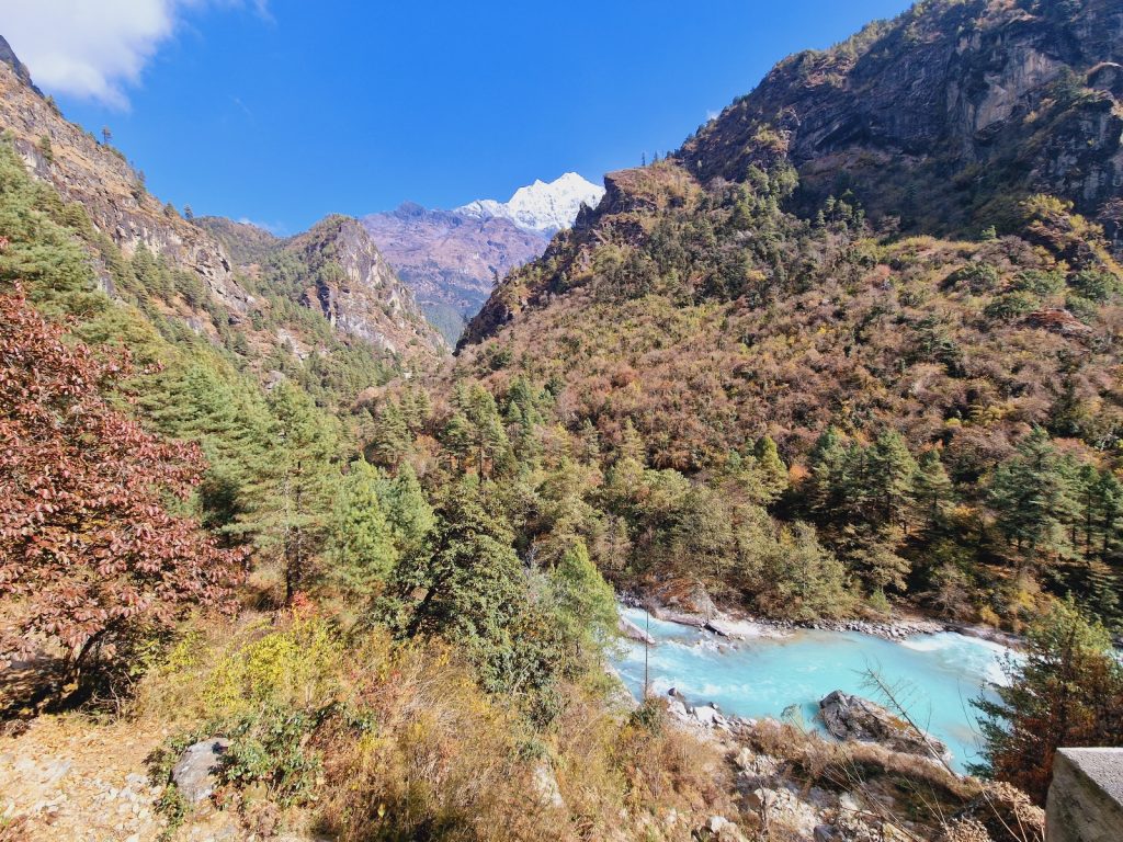
104. Looking north up the Dudh Kosi River from near Toktok towards the mountain of Tobouche, 6495m, which rises steeply from the village of Phortse in the Khumbu region

As I ate my meal in a dining room beside the path I saw many familiar faces from the last fortnight go past. One really surprised me and that was a guide called Dinesh Sapkota. I had last met him in Sonnenblikk mountain refuge in Austria 6 months ago where he was working and I was on my Alpine Traverse walk. He was with two large Teutonic couples so I knew I would catch him after my meal. A tall Belgium man also walked past. Refreshed I set off again and soon caught up with the Belgium who was called Sten. He looked very athletic and was a climber. However he had eaten a dodgy egg, probably with Salmonella, and that had weakened him and allowed a chest infection to take hold and get established. He had to leave his friends, who were climbing Ama Dablam, and start an antibiotic course and rest up in Namche Bazaar for 5 days. This was his first venture out after recuperating. We were going the same speed so we walked together for nearly two hours chatting away. The trail passed quickly with someone interesting to talk to and we went past a few hamlets of tea houses and lodges, frequently standing aside for the mule trains to pass us. Eventually we got to Chheplung where I caught Dinesh and his 4 Germans up. He recognized me and we chatted for about 5 minutes, but his hungry clients wanted to order so we let him be, and carried on. Shortly afterwards in the middle of Chheplung Sten and I parted, with him taking the main route up to Lukla, and I the trail down to Surke. 

105. The main stupa and mani walls in the charming agricultural village of Chaurikharka which lies just off the main Everest Base Camp Trail under Lukla

Within 30 seconds I entered a different world. People were busy tending to their fields rather than looking at their phones hoping for a customer to stop. The houses were now agricultural rather than catering and the farmers were much more friendly. I walked on through the rest of Chheplung, chatting with a few people as I passed and then entered the farming community of Chaurikharka which had many stupas, mani walls and prayer wheels along the wide paved path which threaded the homesteads together. There were a couple of tourist lodges here and they looked like they would be nice to stay in. At the bottom of the village I merged with a middle aged Rai man from Bung. Rai are one of the 40 odd ethnic castes which make up Nepal. He was a chef in one of the lodges in Gokyo and was now going home as the season was over. 

I chatted with him for the next hour and a half as we walked along a precipitous path high above the Dudh Kosi river, which was now in a deep gorge below us. On a few occasions we had to stop and let mules pass, as the path was too narrow. We had virtually finished all our conversation after half an hour and then struggled to find topics to talk about. His English was marginally better than my Nepali so he managed to find topics to keep the conversation going. The path was quite rocky and without an easy level section at all, but to my relief we at last reached Surke. I knew he was going on and I wanted to stop here so we parted with a hearty hand shake. 

106. Looking south down the Dudh Kosi river valley from below Chaurikharka. The red buuilding on the knoll is the small Surke Gompa

The lodge I chose was a Sherpa one and it was on the south side of the bridge beneath an enormous slope. I hoped nothing would roll down it in the night and obliterate the lodge. I was the only guest and I suspect that I would be the only guest for a week. It was only at 2400 metres so it would be warm and full of oxygen. The owner, called a sausi, showed me a simple clean wooden room with two beds covered in Chinese blankets. I would sleep on them under the two synthetic duvets he provided. It was about 1630 when I settled in and it would be dark in an hour so I would not have made the next stop anyway. I wrote the blog but there was no reception to publish it. After Dahl-bhat at 1900 I went to bed soon after, surprisingly tired for a relatively easy day. I think the candy houses and soft western food had in Namche pampered my system slightly and perhaps a simple Dahl-Bhat and tea diet might reset it.  

Day 18. 29 Nov. Surke to Panggom. 18 Km. 8.5 hours. 1490m up. 870m down. Just as I went to bed 4 urban Nepali tourists and 2 Czech tourists arrived. They had already eaten so the innkeeper lost out on the evening meal for them. The evening meal and breakfast subsidise the very cheap room charge so when the Nepalis left without breakfast either he felt he had been taken for a fool. He complained to me about them. I left at 0800 before the Czechs were even up. Surke was still in the shade when I started up the hill for the rocky 400 metre climb to Chheubas. I was joined by a local dog, a bitch I think, who was very sweet and subordinate. We climbed together out of the stream bed Surke was in and then up the side of the valley. The path was steep and rocky and there were quite a few mule trains comming down. I had to stand aside frequently and let them past with the bitch at my heel. We passed a couple of local teahouses where porters might stay but they would be quite dirty and with blankets which were never washed. Behind me the deep gorge of the Dubh Kosi river was more and more pronounced, and at the end of it were a few 6000m mountains. It would really be my last view of them. After nearly 2 hours I got to the top of the climb and the shoulder where the main Dubh Kosi valley met the Paiya Khola side valley.

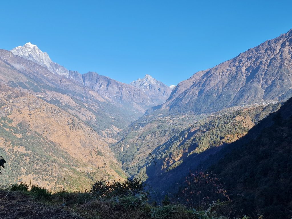
107. Looking north up the Dudh Kosi valley from the Chutok la Pass, 2945m. On the right hand side is t5he village and airstrip at Lukla. Surke is unseen in the side valley to the right under Lukla and still in the shade.

At the spur I met an elderly German and I asked him if he could take the bitch back to Surke. He had half a pancake in his rucksack as a bribe and the bitch diligently followed him back down the rocky path. At the spur there was a dhzo caravan and these animals were going down to collect wares across the side valley at the end of the road by tham Danda. It was possibily the lowest level they operate at. It would not be possible to bring a pure blooded yak so low as they dont tolerate low altitudes and would die. Just beyond the spur and into the Paiya Khola side valley was the hamlet of Chheubas where I spent the night. There was noone at the lodge so I walked on into the side valley. The path went up and down into all the ravines. When I came down here 15 years ago there was a make shift slaughter house here administered by a family of the Magar caste. However, it had gone now and the slaughter house was much further down. There were a few porters stuggling under heavy baskets with shoulders and other cuts in them. The meat was wrapped in plastic sacking and it smelt ripe even here, so when It got to Lobuche in 5 days it would be unpleasant at least. By the time I got to Paiya village I was starting to get hungry but my host suggested I ate at the Kari La Pass, 3045m, where there were two bhattis, or local cafes, and it made sense as it was half way. So I went on past two tourist lodges, one called the Beehive which looked nice.

108. A caravan of dhzo, (half yak and half cow) resting at Chutok La Pass by Chheubas. These dhzo are going down to the trackhead by Kharte to pick up more goods

I crossed the bridge at Paiya and then walked up a nice section of constructed track for about a kilometre. The track then reverted to a rocky, narrow, track which was frequently steep and slippery with the dung of hundreds of mules. It was slow going here and again I had to stand aside and let a few mule trains through. However less than an hour after leaving Paiya I finally reached the small turn off for Kari la Pass. It was up a very small path, initially in an eroded ravine, but soon on a new set of steps. I climbed steeply in shrubs and bamboos for a good half hour climbing 200 metres and then came to a track under construction. I think it was a section of the new road from Bokse to Paiya which is being constructed at the moment. Currently this section is abandoned but as other sections get linked up it will become live in a year or two. I walked up the road followed by a couple of large dhzo type yaks who were grazing in the forest. Soon I had to turn off the road and climb through more bamboo forest for 10 minutes to reach the pass. Unfortunately the teahouse here was closed. I had been going for nearly 5 hours but had to continue.

109. There is nearly always activity in the small terraced fields which are intensiverly cultvated. On this terrace, shortly after the barley harvest, dung and leaves from the animals are spread out to fertilize the soil

The south side of Kari La was different. The path was dry and easy undeerfoot and the forest was healthier with some large sal trees. It was a joy to walk along the path which descended slowly. I could see the jeep station at Tham Danda at the end of the current road and the entire path and road I walked up from Kharikhola some 2 weeks ago below me. I would walk above it all as I slowly traversed across the hillside over it. After half an hour I came to a small tidy house with a tin roof and stone walls. It was surrounded by terraces of rip oats which were being harvested by a middle aged man. I remembered him from 15 years ago when he was just settling here and lived in a bamboo shelter and was constructing the terraces. After his house I went back into the forest descending slightly as I went and going into all the stream beds which plunged down the mountainside. The trees here were driping with moss so I think it was often in the mist. It was like a cloud forest. I suddenly became fearful I would meet a bear on this small unused path where leaves covered the surface. Luckily I did not and after a good hour I came down to a most unexpected tea house. I stoppped here for some chow mein, which was just spagetti with some gloopy sauce. It was awful but I washed it down with tea and felt empowered.

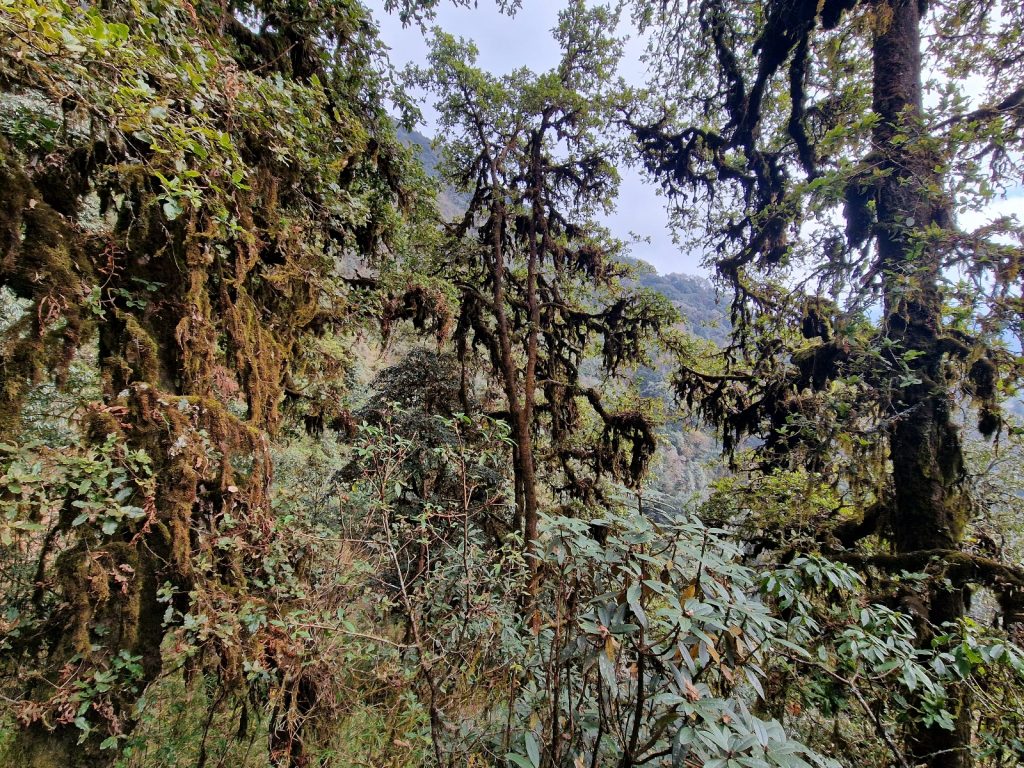
110. After the Kari La Pass, 3045m, between |Paiya and Panggom the route passed through clould frorest whose large oak tree were dripping in mosses

I still had a good climb ahead of me and it was already 1500 so I set off at a brisk pace. The path dropped slightly into more stream beds hidden in the forested mountainside. The water in them was crystal clear. Eventually I started to climb up the hillside through the jungle. I got to one spot where there was a small hamlet of 5 homesteads and a rustic lodge. The hamlet was surrounded by steep terraces with ripe oats growing on them. It was a very peaceful rural scene high up on the mountainside. On some of the harvested terraces were bamboo shelters where the small cattle who had been grazing in the forest all day were returning to spend the night. There was a stillness in the air, and the mist was coming in along with the dusk. I think this hamlet was called Chalukhop.

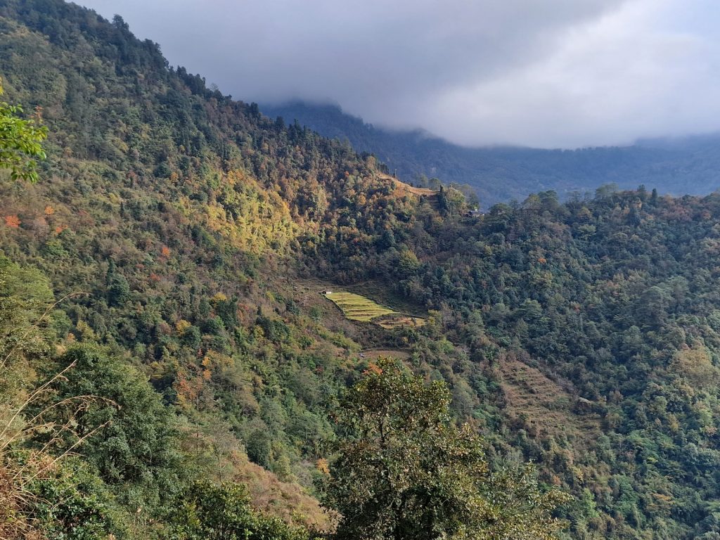
111. On the climb up to Panggom from Kari La Pass the route passed through mixed forest and bamboo. There were a few small hamlets of small holdings on the way.

After the hamlet it was back into the forest, which was largely rhododendron now, and on up the steeper path. I climbed in the mist now and lept up across the steps with the vigour that comes with the onset of dusk. After half an hour I started to reach the rows of mani stones, or prayer stones, which had been made into neat walls. This heralded the lower end of Panggom. I passed about 10 of them and then reached the lip of a plateau where the houses stood. There were about 6 lodges here, but only two had a light on. I went to one and they off course had a room. But the time I changed my shirt and came into the dinning room it was completely dark outside. I was the only guest in the whole hamlet I think. I wrote the blog and then had Dahl-Bhat. There was not enough mobile cover to upload any photos and I think this will be my last bit of mobile reception for a while as I head into a forest landscape with sporadic villages and hamlets for the next 6 days until I get to the town of Tumlingtar.

112. The small rural hamlet of homesteads at Bhalukhop was half way between the Kari La Pass and Panggom. There was a rustic lodge here.

Day 19. 30 Nov. Panggom to Nagingdingma. 9 Km. 5.5 hours. 950m up. 1160m down. I made a mistake last night with the Panggom Inn guesthouse. As soon as I walked in there was a smell of raksi, a liquor which renders many Nepalis helpless. I should have gone to the Himalayan Lodge across the path where I usually stay, but it looked cold and quiet. The innkeeper at the Panggom Inn did not put the main light on in the dining room as it was too expensive and said there was not enough electricity to charge my phone but when his drinking colleagues left he came through to the dining room and started watching staged WWF wrestling, which was really quite laughable. Then in the morning he forgot what I ordered. Having said that, it was the best sleep I had in Nepal so far on this trip. 

113. Panggom Monastery (right) lies on the hillside just abaove the village of Panggom. In the distance are the peaks that make up the long Kongde Ri ridge, 6187m, to the west of Namche Bazaar.

I eventually left at 0830 when Panggom had just been blessed with its first sunlight. The frost was being chased away from everywhere which was not in the shade. Because Panggom was in a west facing scoop high up on the mountainside it got its first morning sun late while across the valley, Taksindu and Nunthala were bathed in sun for a good hour and a half earlier. I left the Inn and headed up the path, keeping to the right of the mani stones. I passed a few more lodges, but they were quite rustic. High on the hillside to my left was the large and picturesque Panggom monastery, its red square block rising high above the rhododendrons. As I climbed more and more of the prayer flags appeared around it, and then it was silhouetted against the mountains on the west side of the Dudh Kosi valley. It commanded an idyllic spot. I could also see down to the Kari La pass I came over yesterday and down the valley to Kharikhola village and beyond. 

114. Looking east from Panggom La Pass, 3180m, over the deep Inku Khola river valley (about 1900m at the bottom) towards the hamlet Nagingdingma on the other side in a small clearing centre right beneath the Surke La Pass beyond, 3085m,

There was the occasional bit of road to cross but the path crossed it twice and then disappeared into the forest to climb up some 200 metres to reach the Panggom La Pass, 3180, which had a squat chorten in the saddle and the whole area was adorned with colourful prayer flags. On the south-east side I could see ridge after ridge disappearing into the steel blue-grey haze as they diminished in size down to the Terai or low plains, out of sight towards the Indian Border. However, I was going east and I could see across the vast chasm, some 1000m deep, of the Inku Khola river to the opposite side where there was a clearing in the forest were the hamlet of Najingdingma lay on a shelf beneath the modest Surke La Pass, 3085m. Althouugh Najingdingma looked quite close I knew there was a lot of footwork to get there in descent and ascent. 

115. Looking NE from Panggom La Pass across the deep Inku Khola valley towards the 5700 metre peaks of Ratapkhu Peak (left) and Khapdulu Peak (right).

So I set off down the path which was dry and dusty in this south facing bowl. I soon passed two homesteads high up on the mountainside. Each catered for tourists and porters but they also had their small terraced fields of oats and a few small cows which foraged in the forest during the day and returned to the simple bamboo shelter each night. I passed them and continued round the forested bowl until I got to a ridge. There was a village, called Sibuje, spread out down this ridge extending for 400 vertical metres. It was a Sherpa village. The homesteads were perched right on the steep ridge in a descending line and there were steep terraces on each side where they grew crops. On the north side of the ridge there was one place where there was a bit of a shelf and there were more houses, the village school and the Monastery. Near the top of the ridge was the Namaste Lodge. I stopped here for a tea once before and it had the largest collection of large copper cauldrons I had seen. I dropped in to see the host, who was also the big sister of the host I intended to stay with in Najingdingma tonight. She had extended her lodge and the pots were now in the puja room rather than the new dining room. However, she told me her sister and brother had left Najingdingma and were now living in Kathmandu. Their rustic guesthouse was leased out to a Rai family from Chheskam near Bung. It was a disappointment as I stayed with them both 15 and 10 years ago and remember them being fun with great English.

116. Heading down for 1000 metres through the hot dry forest into the furnace at the bottom of the Inku Khola valley before the climb up to Nagingdingma

Sibuje especially, and to a lesser extent Najingdingma, were both on the trekking route to Mera Peak, 6476m, an non technical trekking peak which offered great views. It loomed above me now further up the Inku Khola valley which it dominated. Its lofty summits were covered in glaciers and it is certainly the last glaciated summit I will pass by.  After my tea I continued down the spine of the village for nearly half an hour and then dropped down even more steeply into the jungle. From the last house in Sibuje I had to plunge down a further 500 metres in the jungle. The steep path descended in a huge series of zig-zags through the larger trees which were covered in moss and epiphytes. The moss was dripping from the branches but in this season it was all dry and light. Occasionally I caught glimpses down to the depths where I was going and where the river Inku Khola flowed in a deep gorge. Down and down the stony path went into the furnace at the bottom. Luckily there was a slight breeze to keep things cool. At the bottom there were a few shacks but I did not stop at them. Indeed one looked closed. Just below them was the suspension bridge spanning the gorge below with the river still carving deeper, perhaps 100 metres below me. 

117. The Inku Khola flows at the bottom of a deep gorge which is spanned by a suspension footbridge some 100 metres above the bottom of the slot.

The climb up the otherside was quite steep and without letting up. I had hoped to see monkeys down in the gorge here at just 2000  metres altitude but didn’t on this occasion. The ascent was really in 3 parts. The first 200 metres ascent was largely in the shaded jungle and was relatively cool due to the shade of the trees. The next 200 metres ascent was through a hamlet which almost looked like it was abandoned. The terraces were overgrown and the houses were all shut up and locked. There was just a single house with anyone in and it was a shop with a solar radio blaring outside it. In my whole descent from Sibuje to the bridge and then the ascent to Najingdingma I passed no one, not even a local porter so I think the shop might close soon. The final 300 metres were through the forest again. The path was small and covered in leaves which were fluttering down from the scattered deciduous trees. It was shaded and quiet here,  with a few small streams across the forest floor. At last with tired legs I burst out of the forest onto the cleared shelf where Najingdingma lay. 

118. Looking west from the scruffy hamlet below Najingdingma towards Silbuje on the on the sharp ridge in the upper middle. In the upper left of the photo is the Panggom La Pass, 3180m.

I went past the first lodge and the older Sherpa lady beckoned me in. It was relatively new and I don’t remember it. I then went past the Namaste where I stayed before and it was much larger and less of a bhatti, or local porter lodge, and had a large sunroom. I greeted the Rai lodge keeper and went on to a couple of scruffy lodges beyond in cold dark houses which I rejected out of hand. I returned to the Namaste run by the Rai and ordered a meal. It was good but there was a television blaring out children’s programs, which was on a par with the wrestling. It also looked like it could get noisy with locals and his children, so I declined the free bed, paid for the meal and went down to the lower lodge. It was run by the elderly Sherpa lady and her humble hard working son. The rooms were simple and linen not perfectly clean, but it was quiet and peaceful with a warm sun room so I took it. I wrote the blog and then had fried momos for dinner before an early bed. 

119. Looking west from the lowest lodge in Najingdingma across the owners potato fields to Silbuje hamlet on the spine of the ridge opposite and the Panggom La pass in the upper left.

Day 20. 01 Dec. Nagingdingma to Gudel. 15 Km. 7.5 hours. 1070m up. 1760m down. Despite going to bed early at about 2030 I managed to sleep right through to about 0600. The two quilts kept me very warm despite the single sheet of corrugated iron separating me from the frost. I asked for fried noodles for breakfast but it got lost in translation and I got an insipid bowl of soup with noodles in it. It had been lost in translation. When I came to pay my bill I realised that the humble host could neither read nor write and I had to write everything down and add it up. Although he was a simple hardworking man he had great devotion to his mother, who also stayed in the guesthouse and was perhaps 70. In the room beneath the dining room lived the schoolteacher for the government school in the hamlet.

120. The hamlet of Najingdingma in the morning with the two main lodges at the far end. The hamlet was once all Sherpa caste but more and more Rai caste are settling here now.

I left at 0800 and walked through the rest of the hamlet where the frost was lying waiting for the sun in half an hour or so to clear it. After the hamlet the path descended ever so slightly to a stream and then started climbing steeply up the west wall of the bowl. It zig-zagged in small sections up through the bamboo and other small shrubs. It was all in the shade and where there was a bit of water on the path it was frozen solid. About half way up I could see the sun hitting Nagingdingma and turning it from a dull frosty grey to a glowing golden meadow. There was a great view west to Sibuje across the valley and the Panggom La pass beyond that. At the top of the pass I could even see snowy peaks well beyond Panggom. 

When I reached the top of the Surke La Pass, 3085m after some 400m of climbing I burst into the sun and instantly had to stop to take off my duvet jacket and revert to my shirt sleeves. I could see ridges disappearing into the distance then a higher one to the east. It must be Salpa La Pass. In the haze of the morning I could just make out Bung and Gudel, two well known and large Rai villages. I hoped to spend the night in Bung.I descended quickly and reached a small hamlet of 5 houses which I cannot remember being there before. I am sure it was not and the houses looked quite new. It was called Chharakhar. There were a few terraces around the houses and two families had large plastic greenhouses up. I chatted with a lad here and he said there was just one small house here 10 years ago. 

121. Descending down the east side of the Surke La Pass through the seasonal pastures, or Kharka, above the village of Khiraule near Bung.

Below Chharakhar the path entered the rhododendron forest. The trees here had a reddish bark and grew quite densely reaching a height of 20 metres. The path went gently down through these and then crossed some parched meadows with bamboo huts on them. There was no one here now but in the monsoon herders would bring cattle up here for 4 to 5 months to graze the green grass. I passed about 5 such herding places before I got to a large chorten surrounded by prayer walls which I remember well. A scruffy non-Buddhist family had set up a dirty bhatti right under the chorten which I thought a bit sacrilegious as the place was covered in plastic wrappers. Below the large chorten the path descended more steeply across parched meadow to the Boskom Gompa surrounded by a ring of huge juniper trees. There was a tea house beside it where I twice stayed. 

At the teahouse the Sherpa host explained that the monastery had been levelled and a new one was being built. It had nothing to do with earthquake damage. I went to have a look and it seemed the whole circular enclosure was going to be filled with a huge monastery compared to the simple, modest one which stood here earlier and was now demolished. There were some 20 large holes in the ground, dug by excavator, filled with heavily reinforced concrete blocks, with the rods for the eventual pillars in place. In a small shack beside this building site was a temporary gompa and accommodation. The large old prayer wheel was on its side under a tin roof in an open shed. It was a shame the old monastery had to go to give way to this new edifice. I had a fried noodle lunch at the tea house which the Sherpa owner overcharged me for. To add insult as I was leaving he showed me two pictures of his other teahouse at Columhkarka. The first was in 2019 and the other was in 2020 after it was burnt down. He claimed someone burnt it down and ruined him and he was looking for donations to start again. I gave him £1 and left. It was probably burnt by someone who he did not pay as I got the impression he was greedy. 

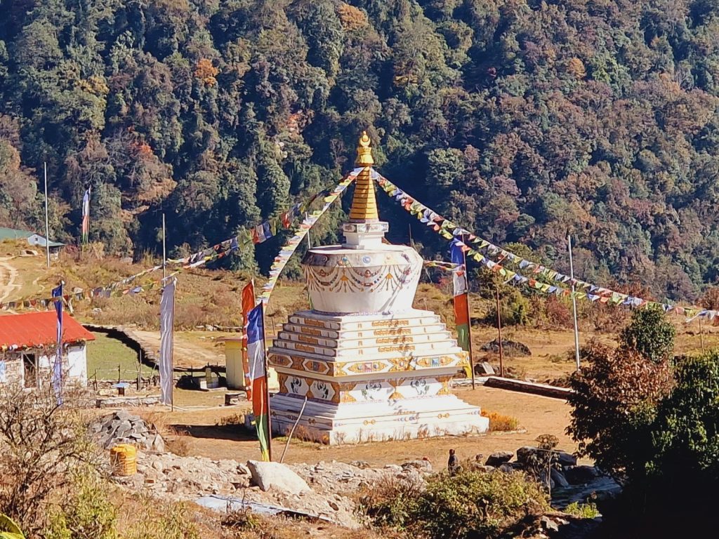
122. The huge stupa at Khiraule is beside the school and a little below the monastery which had been levelled and is being rebuilt

I headed down from the lodge and monastery, down across terraced fields, across a bridge above a large stupa where there was more building going on, and past the Khiraule School, which I think is sponsored by a Scottish organisation. From here the original walking path seems to have been submerged under the new and barely used track. I followed the track for perhaps 2 kilometres past homesteads and terraces until it got to a hairpin bend. Here the path reemerged and headed down to Bung for another 2 kilometres. It threaded its way across terraces which were just getting ploughed by teams of oxen, and between homesteads which had tarpaulins of millet drying in the sun. Many of the homesteads also had distinctive racks of maize hanging from high trestles and covered by bamboo mats to keep the rain off. Each district in Nepal has its own unique way of storing maize. 

123. Ploughing the small terraced fields with wooden plough dragged bu two powerful oxen in a homestead above Bung.

After descending quickly the path finally reached the upper part of Bung village. Here there was a road which connected the very large village with the rest of the world. There were a few jeeps and even an ambulance at the road head. However it was an awful place and nothing like the homesteads and small shops which were here before. Now there was a corrugated iron cluster of some 30 merchants, garages, gas bottle storage and other ugly soulless enterprises. Just beside this corrugated horror was the long path which connected Bung like the trunk of a tree. At the top of this path were some local hotels but they all looked small and pokey. I decided to skip them all and go to the Sagamartha right at the bottom. I slowly descended the enormous set of rough steps passing terraced fields full of all manner of produce from watermelon to buffalo shelters. It was a fascinating 400 metre drop which took well over half an hour. However, the Sagamartha had ceased trading and the old hosts told me I would be best going on to Gudel. It was a blow because I like the local ambience of their hotel, which was in essence a local house, and because it was a 100 descent and then a 600 metre climb and I only had two hours before dusk. I had a biscuit at their shop and then set off

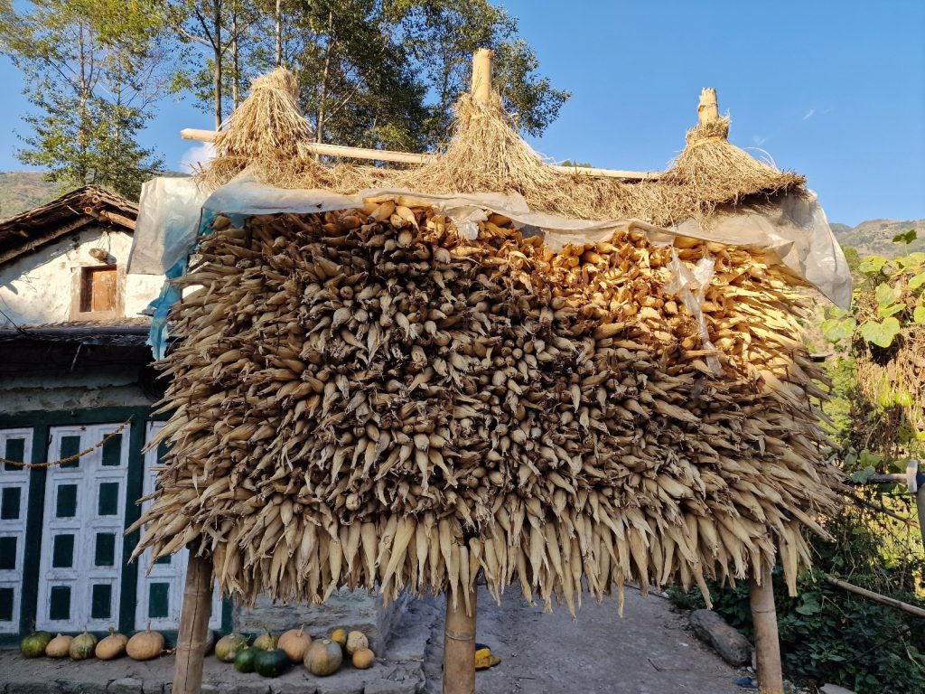
126. Every district of Nepal has its own distinctive way to store harvested maize so rodents or the weather does not ruin the harvest. In Bung and Gudel the maize was place on a rack and covered in a grass thatch


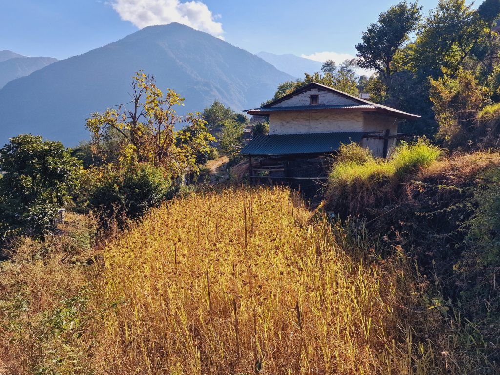
124. A small terraced field of ripe millet which is now rerady to be harvested and dried in the sun in a homestead in upper Bung

It was a quick descent down to the bridge through terraces and groves of huge bamboos, some 25 cm in circumference. The climb up the other side started at once. I felt a surge of energy and I powered my way up the 600 metres in about an hour climbing without respite except for a few photos of the extensive cardamom covered terraces. The whole climb was in the late afternoon sun but it was shaded by the trees which also had to provide shade to the cardamom bushes. There were some small homestead-like buildings around some of the terraces which would be where the valuable small pods which grow at ground level under the stalks with long leaves are processed and stored. There was a boom time for Cardamom in Eastern Nepal some 10 years ago but I think everybody is growing it now so the price must have dropped. About half was up a stream appeared beside the path and it continued all the way up to Gudel. Although I did not see much of Gudel it seemed less destroyed by a road. There was a road here too but perhaps it was not as much as a trading post as the roadhead at Bung. Some might lament the arrival of roads in these otherwise pristine villages and may consider that the road destroys the original wholesomeness and spirituality of the village, which undoubtedly it does. But then it also brings economic and health benefits and who are Westerners to complain who have covered their entire countries in tarmac. 

125. On many of the harvested terraced fields cows and buffalo were tethered to prevent them wandering onto neighbours unharvested terraces. Thet were fed with fodder which was carried to them from fields or from the forest.


127. On the climb up to Gudel from the Hongu Khola river the steep slopes were covered in Cardomom plants. 10 years ago the cultivation of this spice was like a gold rush but I think the price has dropped now.

I found a very simple guesthouse which was essentially a simple shop with a few very rustic bedrooms above. The rooms were small, pokey, dusty, well-used and seldom cleaned. However, I have slept in worse and it was getting dark. They were only £1 for a room. I had a meal in the dingy dining room which doubled as the sack store for the shop and wrote the blog here until 2000. I was half a day ahead now as I intended to stay at Bung, a good 2 hours back. Tomorrow I will try and do a big day over the Salpa La Pass as the original destination to Sanam is now too short.

 Day 21. 02 Dec. Gudel to Salpa Pass. 15 Km. 7 hours. 1580m up. 210m down. I did not enjoy the Namaste guesthouse at all. The husband was a meek man but the lady was a battleaxe. In the morning after I left I walked down to check out the Sunrise Guesthouse just below the Namaste. It looked very nice with a garden of marigolds and a large balcony adorned with plants and wreaths of maize. The terrace around it looked full of interesting produce. On the way out of the large village I also passed another but although it was nicer than the Namaste it was still perfunctory. It didn’t take long to climb out of the last houses and find the path on the south hand side of the ridge which rose steeply to the east of Gudel. 

128. The village of Chere Tui had a couple of lodges and lay a few hours east of Gudel and just before Sanam, whose lodges looked closed

The path sidled round the hillside contouring high above another village which I can’t remember from 10 years ago either, just the layer upon layer of terrace descending steeply down into the valley. There was a road above me but everybody said it was never used and did not go anywhere. As I walked up the path here above 10 forty year old Rai women came down carrying huge baskets of leaves. There would be put out as bedding for the buffalo and cows who at the moment were tethered on the terraces living under small woven bamboo mat shelters as there were still crops to be harvested. This leaf bedding was then put out onto the terraced fields as manure once it was soiled.

129. Looking back to the village of Chere Tui from near Sanam on the way up to Salpa Pass. The mountains in the background are the distant Numbur Himal, 6959m on the other side of the large Dudh Kosi river valley

Pretty soon I went into the forest. This was also harvested as fodder for the tethered animal and the trees were in a perpetual state of coppice. As I gently climbed further east the forest became larger as human harvesting diminished until the trees began to get quite large. More and more moss was appearing as I walked into the valley where the rising air cooled into mist and formed a cloud forest in many of the seasons. At one corner in this forest I suddenly met Curtis, a young Canadian who had walked all the way from the Nepali border with Sikkim perhaps 20 days away. It was a similar trip to one I did 10 years ago from Taplejung to Jiri. I recognised myself in him and it was a shame we did end up in the same lodge or bhatti as I would have gravitated towards him rather than a guided punter. After a couple of hours I got to the first of three hamlets. I did not get the name of the first but the second was Share Tui and the third was Sonam. The first had a shop and a possible guest house and was very picturesque with a sunny aspect and a great view over the valley below. At Share Tui I mistakenly took a shortcut which went slightly above the hamlet and I missed it although I was told there was a guesthouse here and I should stop and eat at it. However I missed it. At Sonan there was a large house nearly finished and I guessed it would be a nice guesthouse. It was surrounded by a potato field. However the windows were still without glass and there was just one old lady outside weaving a basket on the ground. It went on to the two stupas where I had stayed before but there was just one old man about and he was struggling with life now. Everything else was closed or abandoned. I had been told earlier to east at Share Tui as there were just very old people left at Sonam. It was a great shame as it was once a vibrant place. I wonder if the unfinished guesthouse will restore its fortunes. 

130. The near abandoned village of Sanam which as recently as 10 years ago was thriving is now only lived in by older people and the lodges are in hibernation

Unfed I had to carry on. The path dipped slightly and went into the forest. Here some of the trees were huge. I think they were largely oaks and their huge boughs were dripping in moss. It was dry now and wafting in the slight breeze but usually it would have been wet with rain or mist. The path contoured round the hillside descending slightly as the stream bed came up to meet it. The forest here was wonderful and I think quite pristine. It took a short hour to amble through it on the easy path until I saw some small shacks ahead where the path met the stream. It was a tiny hamlet called Whakkar. There was some smoke coming from a bhatti. I popped my head inside but there was no one so I went in and through to the back. There was a man chopping up a vegetable and a very bright young sherpa washing clothes who was his daughter. She said she could make me a noodle snack and a cup of  black tea. I settled in the kitchen while she cooked and chatted with her in good English. She said Jau Bari where I was heading was too far and I should just go up to Salpa pass where her mother had a bhatti, or local teahouse. After a great meal and friendly chat I left and went up the small stream to the end of the clearing. 

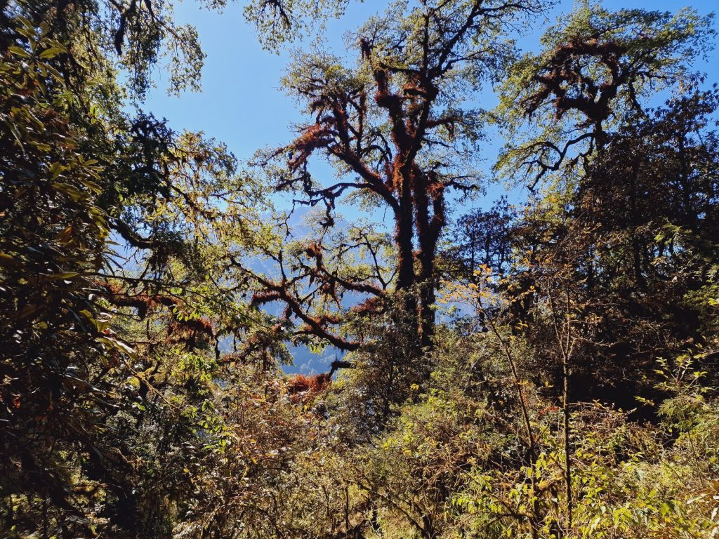
131. On the path between Sanam and Salpa Pass the route passes through a magnificent forest of old growth of Brown Oak, Quercus semecarpifolia, locally known as Kharsru. These tall trees thive around 2750m and have stunted branches, probably to reduce snow or epiphyte loading.


132. More of the forest heading up to Salpa Pass, about 3350m. Lower down the Brown Oaks, Quercus semecarpifolia, dominate but they give rise to the Himalayan Hemlock, Tsuga dumosa, which in turn gives rise to the East Himalayan fir, Abies spectabilis which thrives higher up.

The path now crossed the stream and went into a magnificent forest of Himalayan cedar, or Deodar. Some of the trees were perhaps 40 to 4 50 metres high with boles of well over a metre. They thrived mainly on the valley side with just a few venerable individuals beside the stream. I suspect most of the one by the stream were cut down long ago to build the houses at Sonam or even Gudel. There looked like there was no recent logging. As I climbed the Deodar became mixed with the firs. The needles on some of these firs were two inches long. I think they were the Hiumalayan Silver fir. The path now seemed to get narrow and veer to the east and then it started to climb more steeply. I had some 400 metres to climb up this narrow valley which was not quite a ravine. Tere were the first purple primroses out already bursting through the frost covered forest floor. I think the sun never shone here in the winter months. It took a good hour to climb the 400 metres and at the top the firs were dominant with a thick rhododendron understory. 

133. The Bhatti is a local hotel for porters and local travellers. They are quite rustic. This was the kitchen of the one at Whakkar where I had a lunch of fried noodles and vegetables

I reached the pass and came across a few bhattis. Only one was open. On the other side the valley I was to descend into was full of mist. The bhatti owner also said that it was 3 hours to Jau Bari, the next place which was open. Although it was all downhill I would not make it in daylight so decided to stay at this simple bhatti in this bleak cold spot. There was a very rustic room for me. I then went into the cold kitchen to write which the host wandered about outside. As darkness fell a porter dropped by and then carried on. A little later the host’s daughter and son came in. The daughter cooked for me down at Whakkar earlier. The brother opened a quarter bottle of khukuri rum and had half himself and poured the other half for his mum. I just finished the blog at that time while the daughter cooked again. I suspect after the meal I will go to bed as it was cold and the stink of rum permeated the air. 

134. Bamboos grow well in the montane forests and are harvested for making panels and impliments such as baskets. Once harvested they have to be dragged back to the villages and soaked in water to make them pliable enough to work with.


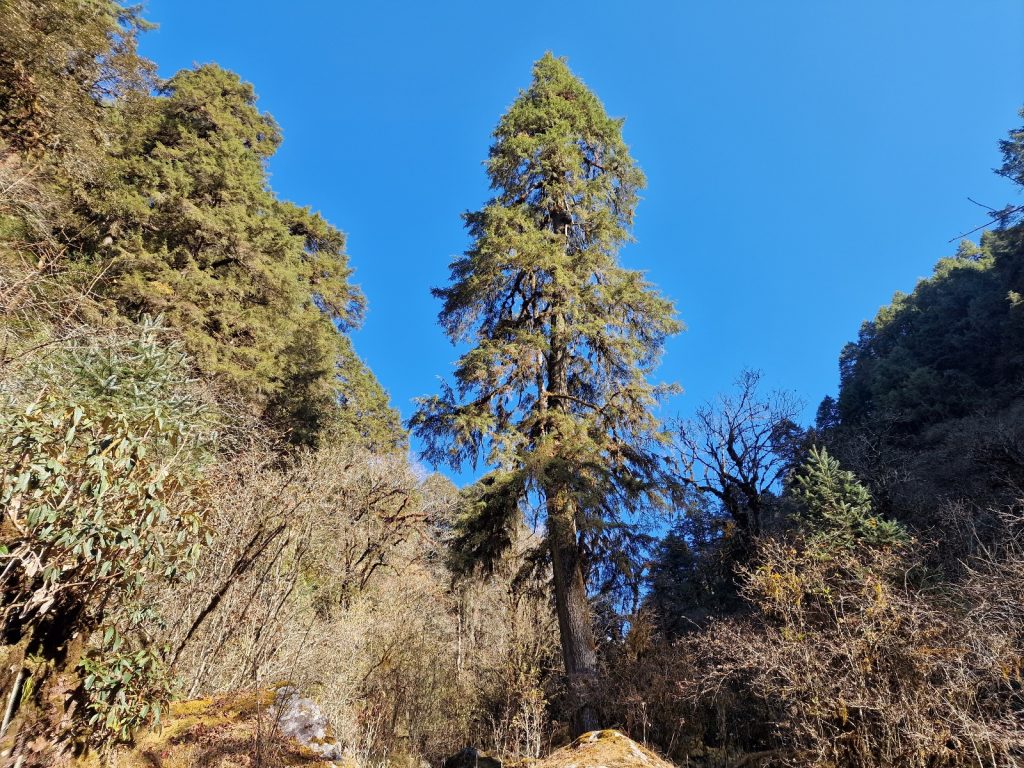
135. A magnificent Himalayan Hemlock. Tsuga dumosa, on the valley floor around the seasonal hamlet of Whakkar. The bole of this huge tree was 190 cm in diametre a metre above the ground

Day 22. 03 Dec. Salpa Pass to Gote Bazaar. 22 Km. 8.5 hours. 230m up. 2820m down. I did not sleep well. The bed was uncomfortable and my stomach was a bit unsettled. I woke at about 0400 and felt I needed a fart but something warned me not to try but make haste to the toilet ASAP. It was round the back. When I got to it I saw it was a square pit full of shit and water with just some planks and a hole above. I checked my pockets before squatting. It would not do to lose a phone or camera down there. As I thought, my stomach was upset. I got back to sleep and the alarm went off at 0615. I was up and packed 5 minutes later. There was a superb sunrise to the east with the sun rising about the low cloud. It illuminated the journey I would have to take down to Jau Bari. However to the west the sunrise was perhaps even better with I think some of the peaks of the Numbur Himal glowing red.

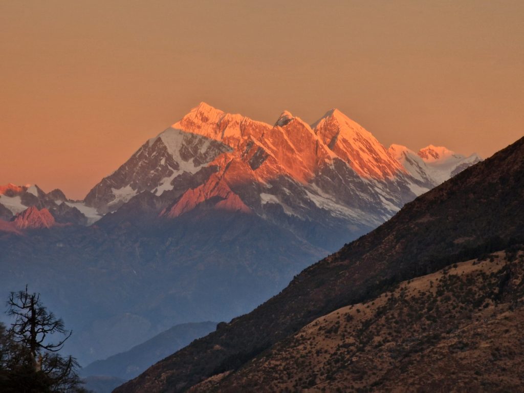
136. A last look at the mountains of Solu-Khumbu at the sunrise from Salpa Pass, 3350m. This is the view to the NW towards Numbur Himal, 6959m, which is 50 kilometres away as the crow flies

There was no sign of the hosts at all. The son was fast asleep in a bed outside my door and mother and daughter in another room. I had expected the very bright chirpy daughter to be up. She was completely wasted cooking for largely Nepali tourists in this bleak outpost. I gave it 10 minutes and then went into the kitchen with a small stone and left 1000 rupees on the table under the stone. It was probably less than a western tourist was due but a bit more than a local tourist. I had a long day and could not waste time on others not getting up. I would walk to Jau Bari and and get a snack there in 3 hours.

137. Looking SE from Salpa Pass. 3350m, at sunrise down to the frosty Kharka, or seasonal meadow, to the 3 humps on the spine of the ridge (centre left) before the steep descent to Jau Bari and Phedi starts

So at 0630 I set off down the path, still in my duvet jacket despite the infant sun. I soon plunged into the rhododendrons and in the glades amongst them there was a thick frost. I quickly dropped down and passed Gurase which was locked and almost abandoned. A bit later I came to what the map said was “Sherpa Lodge ”. It was completely abandoned and the rooms had been taken over by goats. Just beyond i came to a Kharka or summer grazing area with a few shacks and many bamboo shelters. They are used in the summer to make use of the lush grazing up here. There was no grazing now and the Kharkas were empty for the winter.

After the Kharka the path went along the spine of the ridge which was pronounced and sharp here. On one side it was very steep grazing suitable only for goats and on the other it was covered in huge holly oaks with enormous boles and dripping in moss. It was classic cloud forest conditions again. The path went along some precarious contours with the occasional exposed drop for a good half hour before it got to the east end and started the long long drop to Phedi. It was a relentless descent down steep and poorly constructed steps. There was no let up for about 1500 metres. Initially it was across alpine scrub but quickly signs of agriculture appeared. It seemed that most of the small fields here were essentially summer grazing with bamboo shelters, however as I descended further some cows and even buffalo appeared on the rough terrace. At last I could see the small monastery roof at Jau Bari (barely field)a few hundred metres below. I carefully picked my way down the steps feeling quite weak. The fields and houses were now much more established with tin roofs and the fields were already ploughed.

138. A small terraced field of Oil seed Mustard, Brassica juncea, locally called Tori, growing just below Jau Bari on the long descent to Phedi.

There were two tea houses at Jau Bari and I had twice stayed here before but it had changed slightly for the better. Not wanting to upset my fragile stomach I just had 2 packets of biscuits and 2 sweet cups of tea. It did indeed take 3 hours to get here as everybody said. With a bit of sugar in the blood I continued down for another hour and a half passing many more scruffy homesteads on the apex of the ridge. There seemed to be just one main water pipe the whole way down for 1500 metres and everybody tapped into it. The culture changed as I plummeted from Sherpa higher up. To mainly Sherpa with a few Rai at Jau Bari to pure Rai at Phedi, at the bottom of the ridge at about 1650m. The crops also changed from potatoes and barley to millet and maize at the bottom.

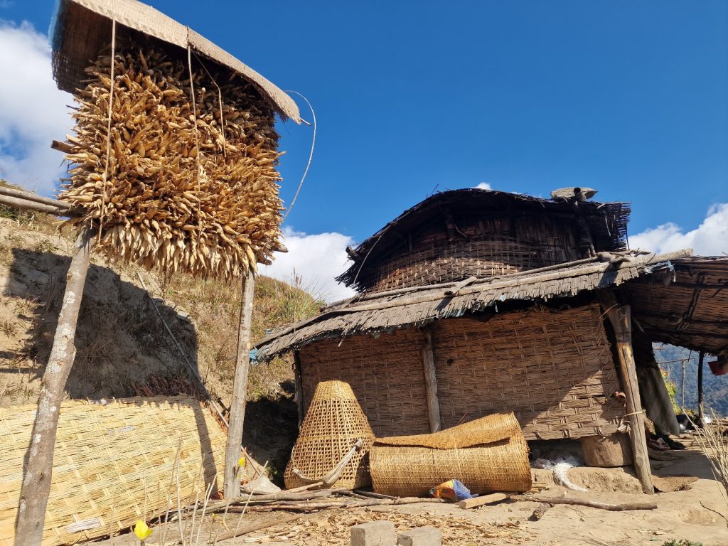
139. A rack of maize stored at a very simple homestead below Jau Bari which is lasrgely made from bamboo matting. A few sheets of the matting is becessary to make the roof waterptoof.

With tired legs after the 1500m descent I had intended to stop at Phedi to eat but I walked right through it before I realised I had passed everything and was below it. I was not going back up the 50 metres or so and headed for the bridge and the track. The track as far as I could gather was pretty much built on top of the path.The track was very quiet with no traffic and hardly any walkers, although the few walkers had obliterated most of the tire tracks. It made complete sense to walk down the road rather than try and find the sections of the old path. Very occasionally it was obvious to take the old path and this was largely where the track crossed the Irkhuwa Khola river over a ford and there was the old suspension footbridge nearby. I could make good pace on the track and strode out passing the hamlet of Tendo. I was getting weak again and needed to stop and eat but there was nothing in Tendo.

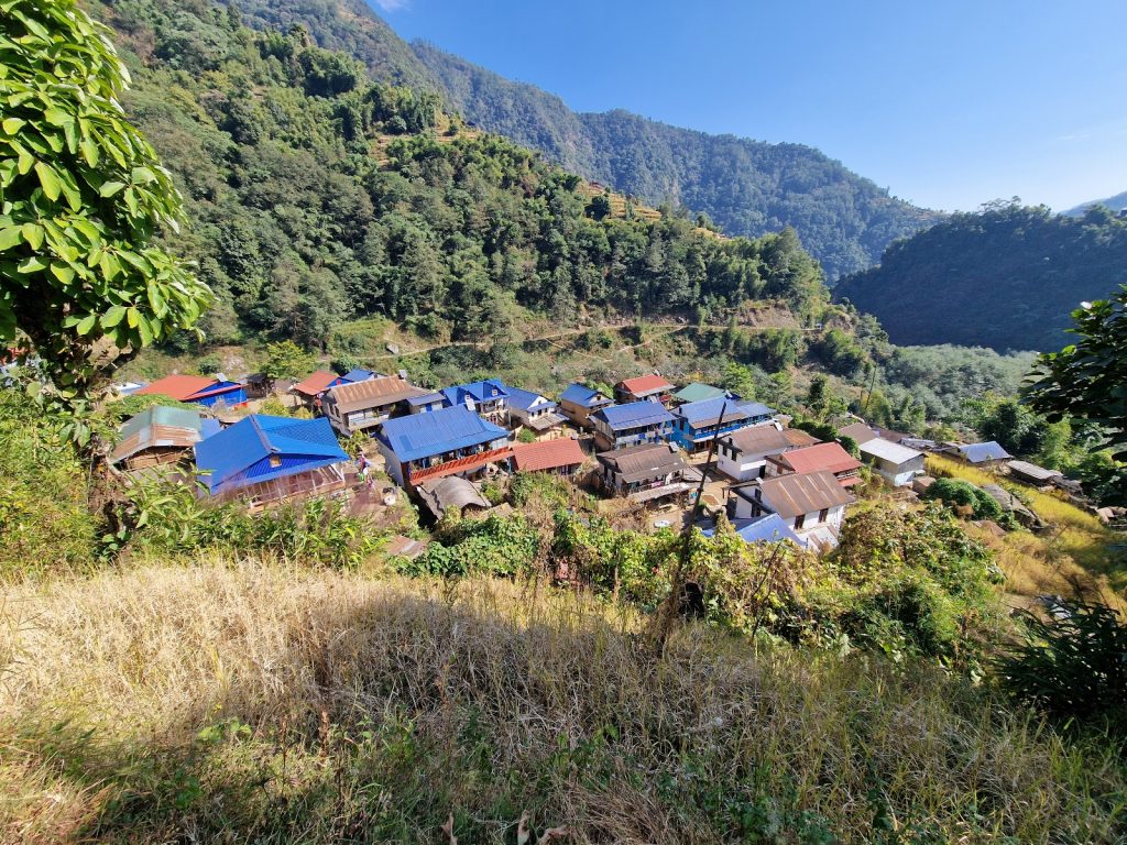
140. After a near 2000 metre descent from the Salpa Pass, 3350m, the roofs of Phedi, 1450m, herald the flatter valley floor where the Irkuwa Khola river flows.

About an hour after Tendo, when I had been going for 6 hours with very little sustenance I went to a local trackside cafe. I thought I would risk some fried noodles again and asked for them to be mild and unspicy on account of my sunburnt lips. The Rai lady cooking them was on the ball but then a meddlesome helper came along and put some chilli sauce on them and they stung my lips like salt in a wound. I had to have some mango fruit juices to wash it down. However after the meal I felt empowered again. I walked quickly down the track which went through forest and cardamom plantations to the village Dobhane. I remember this place being quite vibrant with some shops with sewing machines whirling outside as tailors pumped their legs but now it seemed quite quiet and the shops were closed. Probably on account they were well below the road. At Dobhane there was another large stream to cross on a suspension bridge and this swelled the flow in the Irkhuwa Khola.

141. There is a very seldom used tractor track along the valley floor of the Irkuwa Khola valley. In 4 hours only 3 tractors amd 4 motorbikes passed me. The tractors were all hauling pipes for a small hydroelectric plant to be built at Phedi

Just after the suspension bridge I saw my first vehicles on the road. There were 3 tractors pulling a trailer each piled high with 30cm bore pipes for a micro hydro electric system at Phedi which had no lights at all. All the tractors were flying union jack flags as a badge of pride. As I carried on down I soon came across rice paddies. The small terraces were dry now and the rice had just been harvested. For the last 5 kilometres there were young energetic men thrashing bound sheafs of rice against a board on a tarpaulin. Their mothers or wives sat nearby scooping up the rice and putting it in on bamboo trays to winnow out the impurities. The threshed sheafs were piled into large stacks and these would be used for fodder and occasionally roofing, although tin seems to have made this redundant.

142. On the floor of the Irkuwa Khola valley the terraced fields were all devoted to rice and the harvest, drying and threshing was in full swing in early Descember.

It was fascinating to see this centuries old harvest and processing. Once the paddies were cleared, buffalo and the small cows were tethered onto them to eat the stuble and fodder brought to them. With tired legs I finally homed in Gote Bazaar. I was hoping for orange sellers who lined the path here selling the most delicious small oranges whose skin just fell off but there were none. Perhaps it was late in the day as I could see trees heavy with oranges. I did not recognize anything in Gote Bazaar when I arrived. The track seemed to have changed the houses and perhaps a few were even demolished. Certainly the guest house was and it was replaced by a new one just on the east side of the suspension bridge with the same owners. I was dog tired and got a room and changed into shorts and then went down for my meal. II decided I had been having too many noodles so went for Dhal Bhat Tarkari with an omelette. I needed the protein. It is always a sensible although sometimes boring choice. I am sure it will restore my strength. I had one day left but it was a big one all the way to Tumlingtar Airport. I wrote the blog while waiting for the meal to cook and Dhal Bhat always takes at least an hour. I was done by 2000 and went straight to bed. It had been a hard day and with nearly 3000 metres of descent.

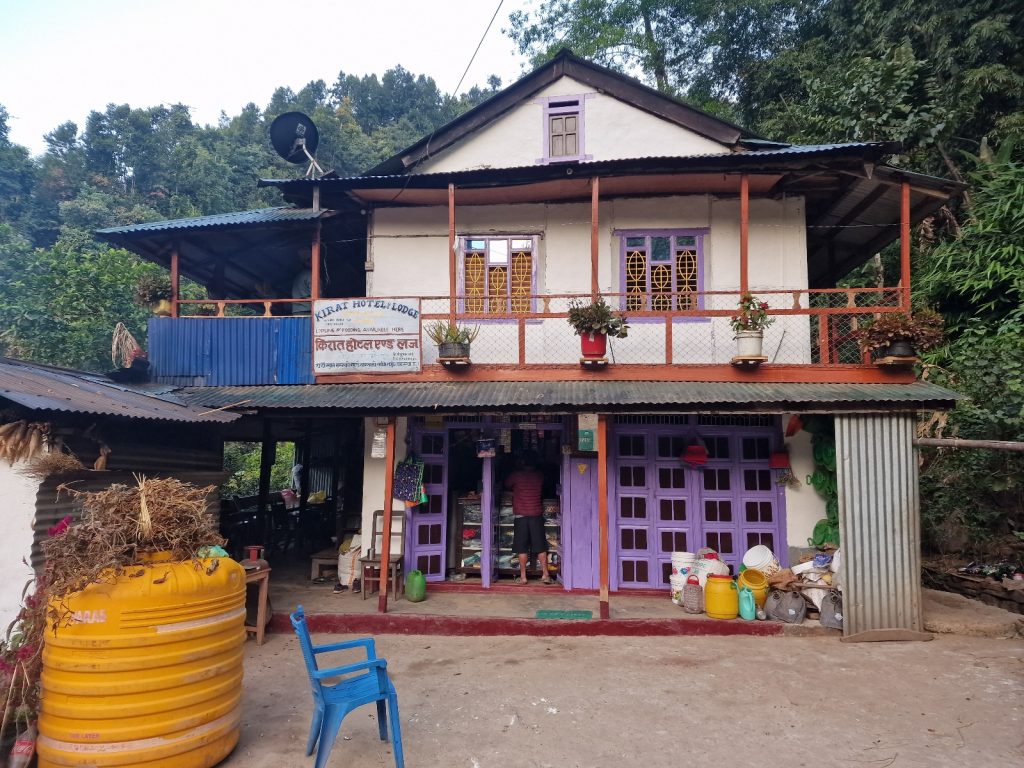
143. The simple lodge at Gote Bazaar had electricity and a simple wholesome fare of dhal-bhat. But the sheets were not changed very regularly.

Day 23. 04 Dec. Gote Bazaar to Tumlingtar. 25 Km. 8 hours. 600m up. 930m down. I slept very well in the small, dark , very simple room. Indeed the whole house was constructed with bamboo which had then been daubed with mud so the walls were just a couple of inches thick. Bits of the mud were crumbling onto the floor and two makeshift beds. However there was a charging point and a light in the room which was what I really needed.

After a good breakfast I questioned the host about someone I had seen here 15 and 10 years ago. She was a girl with paralysis and I stayed in the same house as the people who were caring for her 15 years ago. Then 10 years ago I walked through the village and stayed at the previous incarnation of this rustic lodge and as I went past the house I stayed before I noticed her outside in a basket under a net to keep the flies off. But this time I was not sure if her house was still there. I asked my host now, and 10 years ago, and they said she was still there but were very reticent with their answers. I suspected that was because they were now looking after her. I inadvertently went into a room downstairs off the dining verandah and there was a grunt from inside and a waft of urine flowed out as if it was from soiled bedding. The plight of that paralysed girl must have been quite awful but hopefully she is taken out in her basket daily to view the world beyond her prison.

I left at 0700 after a good breakfast of omelette and chapatis. And headed up from the bridge past simple pretty houses to the track just above. I followed it through the rest of the rural village but soon left it to go down to a bridge over the Irkhuwa Khola to the much more forested north facing slopes on the south side, which were covered in jungle. There was a tractor track here but it looked seldom used and it was too rough for anything else. I followed it downstream as it soon climbed away from the river up the steep jungle clad hillside. The cicadas were creating a din and there were curious bird sounds everywhere. I followed the track for a good hour as it climbed without passing any houses. The hillside here was damp with frequent small streams and this kept the road damp and impassable. As the track approached a ridge I saw a large Chautera tree with seating areas around it. These are typically resting places for travellers and it must have been on the old path beneath the track. On the other side of the Irkhuwa valley were some small hamlets surrounded by terraces.

144. The rice harvest at Majhuwaga was a week behind that of the valley floor as it was a bit higher in altitude. Here the cut rice is drying on the terraces for some days to make the threshing of it easier.

After the Chautera tree, a species of fig, the track entered a cultivated bowl, with rice terraces dropping away down the valley. The terraces were recently harvested but stacks and heads were laid out to dry in the sun in neat patterns all over the terraces. They would dry out first before their rice heads were loosened slightly and detached themselves with vigorous hand threshing. The track curved round the top of the bowl and terraces and underneath the jungle to a settlement. I asked the name and was told it was Majhuwa. I also asked the caste as I suspected the people here were Bahaun, from their looks and confidence. They said they were Thapa Chhetri. I circled round the idyllic bowl and was moved by the beautiful pastoral nature of the place. Buffalo were sitting under bamboo shelters chewing large bundles of forest foliage which had been brought down for them. The terraces would soon be open for them to graze once the rice was dried and threshed. The homesteads were loosely huddled together where they would get maximum sun. The houses were all surrounded but compounds with fruit trees and cucumbers and lots of bright marigolds. Just after I passed the village at the apex of the ridge I got a great view down to the mighty Arun River in the valley below. It started its journey long to the north on the Tibetan plateau. If I looked upstream I could see snow-clad mountains of the ranges around Makalu.

145. One of the idylic homesteads at Majhuwaga village. The rice has been harvested, threshed and stored already and the field in front of the house is laid out with drying millet heads

At the lofty viewpoint beside Maduwa the road was much improved and passable to most vehicles. However it was now just used by the small scooters and motorbikes which proliferate lower Nepal. As I walked down this road high above the Arun River, but descending towards it and the hamlet of Baluwabesi, only one tractor and 3-4 motorbikes passed me all the way down. It was a lovely descent with great views down to the Arun as I passed through more scrubby drier jungle and more homesteads surrounded by taller trees for shade. After an hour of descent I reached Baluwabesi, but it had gone. Perhaps the road had made it redundant as it was now longer on the path. It was a shame as 10 years ago I met Jalanath Kanal in the simple bhatti or local cafe there and chatted to him for half an hour over tea and noodles. He went on to be prime minister of Nepal for a short period thereafter.

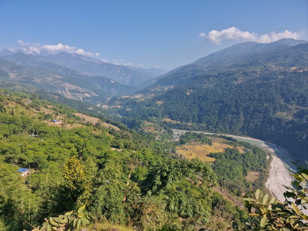
146. A view north up the large Arun River which starts it journey on the Tibetan Plateau. It drains the entire Makalu massif and much more

Just 2 kilometres down the road and now beside the Arun River it got to the village of Kattike. It was tidy and neat with a concrete road between two rows of houses, one on each side. However a madman accosted me and started asking for chocolate so I hurried on rather than shove him out of the way or throw him to the ground. At the east end of the village were more vibrant cafes but they were full of idle local youth mulling around. Apart from those two negatives Kittake looked nice with plenty of neat shops, tailors and bhattis. There was a bridge here across the Arun to the east side and I had to take it. It was quite a thrill to be above this huge river looking down on its unstoppable azure waters making their way down to the Ganges.

147. The tidy village of Kattike lies on the south side of the Kattike suspension footbridge which has been an important pedestrisn crossing over the Arun Nadi river for decades

On the east side there was a very rough and little used track which went along the sandy banks of the river for about 2-3 kilometres to the hamlet of Chewabesi. It was a nice walk with a slight breeze coming up the valley to keep me cool. There was no traffic on this track at all as it only went as far as the footbridge I just crossed. Chewabesi was not glamorous at all and quite rough and ready but there was a friendly bhatti owner who offered to make me fried noodles and his kitchen stall did not look too dirty. So I stopped here for a good half hour, in the heat of the day and watched the world go by as he cooked.

148. Looking upriver from the Kattike suspension bridge while crossing the large Arun Nadi river. The idyllic village of Majhuwaga is on the ridge upper centre left of photo.

This was essentially the end of the track which linked Chewabesi with Tumlingtar, notwithstanding the very rough section to Kittake Bridge. From here down there were a few motorbikes negotiating the rocky road, often with 3 people on board. The road was still very very rural and there were lots of rice paddies being harvested and millet which was above to be harvested on each side. Hens, ducks and children emerged from the homesteads and littered the track. After a couple of kilometres with this cultural landscape the road veered up the hill and I left it and followed a small path beside the river.

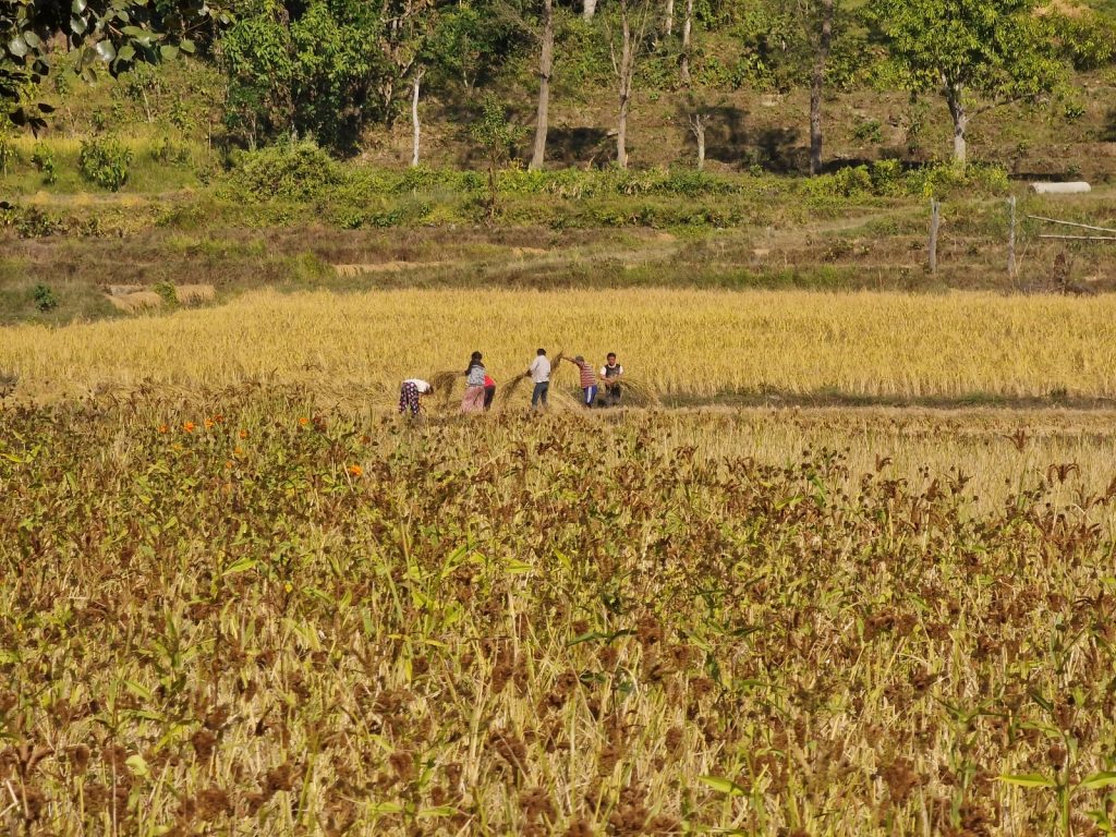
149. Despite walking on a very quiet track going through the village od Chewabesi there was a rich cultural landscape. Here beyond a field of rippening millet a family’s rice harvest is in full swing

It was perhaps the highlight of the day. I walked down the sandy banks with the huge Arun pulsing slowly beside me. There were occasional fishermen with hand cast nets and some very nervous brahmin ducks but apart from that it was a wild and empty canyon the river surged down with forest on each bank. Frequently the river bank became rocky and the path had to divert into the jungle and this was slow going. As the river veered right round a long sweeping bend I could see habitation and a road appear. There was also a long suspension bridge over the Arun and I could see the odd motorbike on it. It was the start of the final section.

150. Below Chewabesi the Arun Nadi river goes into a forested gorge where there is no track but just a small footpath. It is easy to walk along the sandy bank for 2 hours before the small climb up to the town of Tumlingtar

When I reached it I saw a large local resort on the west side and even a very dilapidated car ferry on cables crossing the river with 3 cars on it. I think this ferry will end up getting swept down the river sometime in the next decade. On the west side a family had just lit a large funeral pye with a huge stack of wood. The soul of the departed was wafting up back into the ether from whence it came. I had to climb some 100 metres up an embankment to reach the large plateau where Tumlingtar lay. In Nepali a “tar” is a flat area and Tumlingtar was an unusually large one and big enough for an airport with a large runway. From the top of the embankment it walked 2 kilometres down a hard road into the ever hectic town, which had no redeeming features and smelt of burning plastic. Dogs with huge swinging udders dogged the motorbikes and scooters. I walked to the airport area where there were some hotels and got some information on my flight tomorrow. It was 1030 and I could buy the ticket on the day as I was paying double the local price and paying in dollars. Not finishing a nice hotel I walked back 500 metres to the Makalu Resort. It was. Very tired and rundown place which still had delusions of grandeur. It had a peaceful courtyard and unlimited hot water though so I stayed. I had a beer in the courtyard which was a disappointment and left me a little dull. I then had a fantastic shower and a limited clothes wash so I had something for the plane. I thought I better eat something and went for the safe and healthy choice of a dhal-bhat, which although never exciting is the absolute staple of Nepal. I slept very well now in the warmth at just 400 metres.

151. The Arun Nadi river is quite remote along the bottom of the shallow gorge between Chewabesi and Tumlingtar asnd there is just the occasional fisherman with a hand cast net to be seen.

05-09 Dec. Kathmandu.  I slept very well in the tired Makalu Resort which once promised grandeur but was now becoming somewhat ramshackle. However it was quiet and peaceful. I did not have breakfast here as I thought it would just be too slow so packed and left. I wandered down to the airport and passed a few small kitchens. I stopped at one for some fried vegetables and noodles. Next door was the Buddha Air office so I went in to get a ticket for the 1030 flight in 2 hours. It was 160 US dollars which is the set price for tourists. It was double the local rate and had to be paid in dollars only, however it meant the seat could be bought at short notice and was guaranteed 

152. Tumlingtar has a large runway and there are twice daily flights with Airbus ATR’s linking the small town with Kathmandu.

After breakfast I went to the airport and heard that the flight had left Kathmandu and that there should be no problems. Half an hour later an old ATR aircraft arrived and we went through a needlessly strict security and boarded. Tumlingtar had a large runway and this ATR made light work of getting airborne with its 80 odd passengers. The flight afforded some great views over the mountains and I could see the Makalu and Everest Ranges where I walked dominating the horizon to the north. Below me in the Nepali foothills, also called the Pahar, I could see some small towns but many villages on the ridge tops and other safer areas while the hillsides were covered in terraces of small fields. There was also a lot of jungle. At one place the plane flew over Dhap where I started the hike and I could look down to see the first two days’ walk and the smaller mountain of Pikey Peak. It was quite dwarfed by the Numbur Himal just beyond. The flight took an hour before landing in Kathmandu. 

154. On the flight from Tumlingtar to Kathmandu the flight passes many parts of the recent hike. Upper centre left is the twin peaks of the brown Pikey Peak from Day 03. Beyond it is the nearly 7000m Numbur Himal. Everest and Lhotse are upper right.

I did not want to go to Thamel initially with its relatively shallow culture which was all based on tourism. So instead I decided to go to the historic old town of Bhaktapur which the urban sprawl of Kathmandu has now swallowed. However there was the old city and it was something of a sanctuary. It took half an hour in a small taxi to get there and then I paid my entrance fee of 1500 rupees and walked through the gate into the quiet grandeur of Bhaktapur Durbar Square. I sauntered through the town I knew quite well taking a circuitous route to a small quirky hotel, The Peacock Guesthouse, in a typical old Newari house. The guesthouse was on Dattatreya Square right beside some temples. The rooms were full of character but the building was quite small and a little claustrophobic, but that was normal in these buildings. The owner was a bright young avant garde Nepali and the food was excellent. I based myself her for a night and spent the next 24 hours exploring more of Bhaktapur. It was certainly my favourite place in the entire Kathmandu Valley. Previously there were no cars and very few scooters in Bhaktapur but I noticed they were becoming prolific even here now.

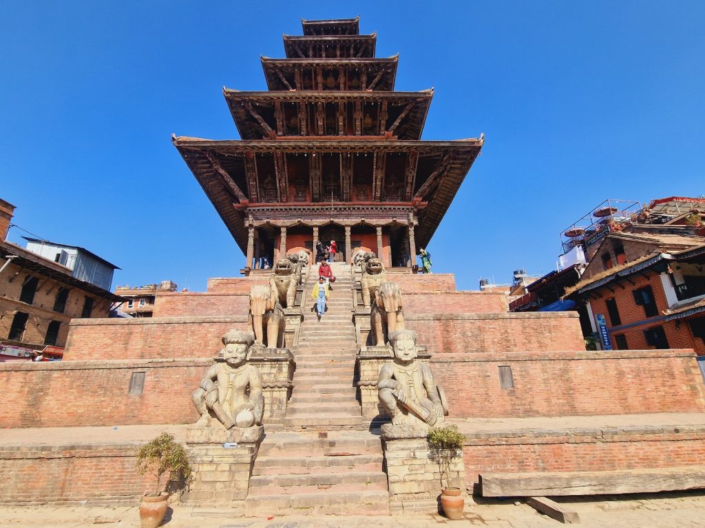
155. In the charming Kathmandu Valley town of Bhaktapur there are numerous examples of Newari architecture such as the 5 storey pagoda style Nyatapola temple which is 300 years old

On my second day I packed my bags and went to Patan. It was another old Newari city and its Durbar Square was the seat of Malla kings for a couple of centuries. I found a 2 star hotel, The Pahan Chhen, just off the Durbar Square and used it as a base for the next 24 hours to explore Patan. That evening I spent a lot of the time around the main square. It was very busy with locals who just went there to pass the evening as one might on a promenade in the south of France.There were some traditional dance troupes who went there to perform on one of the temple platforms. MHowever much of the square was dug up as there was a new drainage and sewer system going in and what was once tranquil terracotta bricks to pace across was now a building site of rubble. After the night in the hotel I went for a walk to the west of the square in the morning. In particular I went to the beautiful Pimbahal Pokari pond with its pavilion, The Buddhist Hiranya Varna Mahavihar temple also known as the Golden Temple on account of the sumptuous roof and finally the Baglamukhi Temple with its 5 story pagoda style main building. At about midday I returned to the hotel and took a taxi to Boudhanath. 

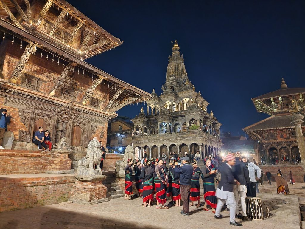
156. In another part of Kathmandu is the Patan Durbur square, a UNESCO World Heritage Site which is full of old temples all with royal connections to the Nepali Malla dynasty

For my third day I spent much of the time at Boudhanath, the huge stupa which is the spiritual home for all Buddhists in Nepal and Pashupatinath, the large temple complex which is the spiritual home for all Hindus in Nepal. I checked into the Padma Hotel which is right beside the stupa and then went out into the bright sunlight to do a few koras or circumambulation of the stupa, all clockwise of course. It was busy with people from all over the Nepali Himalaya who were also doing koras. As the shadows lengthened I took the short taxi ride to Pashupatinath. It was a major Hindu temple complex and also was the site of the main cremation place in Kathmandu. When I arrived I had to buy a ticket and then I crossed the river to explore the shrines and temples on the east side of the river. They were swarming with monkeys which thrived in the nearby park and survived off food left at the temples and what the mainly Nepali tourists gave them. 

157. Boudhanath stupa is one of the biggest stupas in Nepal and is the spirtual centre of all the various Buddhist populations in Nepal. It lies in the NE suberbs of Kathmandu

There were about 6 cremations underway when I arrived and there were a few ambulances delivering more souls. A few of the deceased were laid out under saffron robes on the banks of the Bagmati waiting their turn. One must have been a wealthy man as his funeral pyre was being lavishly prepared and decorated with strings of cremations. On the side I was on there was an evening Aarti, or ceremony, where lights soaked in ghee are lit and offered to the deities accompanied by singing and classical instruments. The Aarti ceremony lasted an hour and it was very powerful with the loud rhythmic music and the dazzling display of the ghee lamps. There were perhaps 500 people watching it. Meanwhile across the river at the ghats the departing souls rose into the air with the wood smoke into the ether from whence they came. I was told that these ghats by the temple were expensive and of the two one was once reserved for the royal family. After the rousing Aarti ceremony I returned to Boudhanath and returned to my hotel which was called The Padma.

158. Pashupatinath Temple is the spiritual centre of all Hindus in Nepal. It is a large complex with many buildings and cremation ghats on the banks of the holy Bagmati River. Non-Hindus are not allowed into the main temple but are allowed in other areas and the ghats.


159. The Ghats of Pashupatinath are an auspicious place to get cremated and the funeral pyres are going throughout the day and evening carrying the souls of the recently departed back into the ethers from whence they came

On my fourth day in Kathmandu I met a friend, Kim who runs a very highly thought of trekking agency called Kamzang Journeys and she also runs a very thoughtful cafe beside the Boudhanath stupa. We walked around the stupa about 20 times chatting about Nepal, which took about 2 hours. After that we went to her Cafe Caravan which was adorned with paintings from a Dolpo artist for a coffee. After that I left and went to Thamel, the main tourist area in Kathmandu. Thamel was once a gentle relaxed area but now all the 2 storey buildings are getting knocked down to be replaced with characterless edifices of up to 10 storeys. The stress and noise of Thamel now makes it quite an unpleasant place and I am sure the bubble will burst here leaving it devoid of anything worthwhile and just an empty shopping area. I knew of a quiet hotel in the Newari architectural style which had a nice garden. It was called the International Guesthouse and I checked in here for the night. I then spent the rest of the day and all of the next day meeting old friends and buying the odd map for future travels. The only place I had missed was Swayambhunath, also called the Monkey Temple, which I could have visited when in Thamel but could not find the time.  After 24 hours in Thamel I had done everything I needed to and was ready to go to the airport. The whole trip had gone exactly as I hoped.

Back

Raja Ampat Kayak. Day 01. 10 Feb 2016.  Seporkreng  to Feey yef. 20 km. 5 hours. Sony and I left Mandos homestay, where the kayak rental is currently based and headed west to Seporkreng village, a typical West Papuan fishing village. Just beyond we said farewell to the Dampier Strait and headed up a channel between Waigeo Island and Gam Island, the end of which is marked by 3 forested islands. After passing through the islands and entering the large sheltered Kabui Bay, where we will spend the next 2 days.

02. The small Mandos Homestay was built on stilts over the sea. There were 4 rooms and a dining area. The kayaks belonging to RARCC organization Kayak4Conservation were stored near here and I was lucky to be able to rent one

As we paddled into this forested wonderland the beaches soon made way for karst. It is only visible along the shore as everything else is covered in thick jungle with some tall trees and palms. Every bit of karst shoreline is undercut by at least one metre and occasionally 10 metres. They are impenetrable from the sea for their entire length. We paddled north up this east shore line passing occasional mangroves in clogged bays and also some alluvial plains where coconuts grow or have been cultivated. There are some sparse shacks from time to time on this stretch. We landed at one and the grove owner, a relative of Sony’s, cut down 7 coconuts. I drank the milk from three and scooped the jelly-like flesh forming in them. It was 1300 now and we were tired after the early start and many tweaking problems, so we had a 2 hour siesta under various canopies.

03. The kayak I rented was made in Raja Ampat by RARCC. It was very robust. As part of the rental package I had to take a guide who I later had to dispense with. My guide was called Sony and he wasa local from near Saporkreng village

We set off again at 1530 and continued north though the increasingly bizarre karst landscape, which was becoming more rugged with every km. Soon the coast was part of a limestone spur which descended into Kabui Bay. The remnants of the spine forming citadels in the sea like giant chessmen. It was like nothing I had seen before. Sony continued to cut under all the overhanging limestone but I was more wary of their jagged undersides despite the tiny swell. At the North West end of the bay we cut through the perforated spur and crossed the mouth of a large side bay. The NE wind whistled out of this bay ahead of a squall. We crossed to a large convoluted karst island across much of the mouth of this side bay. One reaching the island it proved to be more of the towering chessmen we just left. There were perhaps 20 of them rising from deep undercuts. We threaded through these also until we passed into the north entrance to the side bay.

05. Approaching the North East corner of Kabui Bay where there was a cluster of islands and karst towers which spanned the mouth of a side bay where the village of Waroffa (Wawiyai) lay.

Here a large village with some 50 houses and a school appeared. It was the village of Waroffa. We did not go there but headed west for half a km to more karst towers. Here between 2 shorter towers was a RARCC sponsored guest house. It was deserted when we arrived but Sony went off to tell the hosts in Waroffa while I pulled myself and kayak onto the stilt platform. The hosts arrived an hour later with a full meal and lights powered by motorbike battery. It was a simple guesthouse but perfectly suited. It was dark by the time the meal arrived.

06. The simple unstaffed guesthouse at Feey Yef where we spent the first night. The food was brought by the care taker who lived in Waroffa who cooked it there and brought it to us

Raja Ampat Kayak. Day 02. 11 Feb 2016.  Feey yef  to Warikaf by Passage. 22 kilometres. 4.5 hours. We left Feey yef cove and turned right (west) to go immediately into the rows of giant limestone chessmen. Those to the south are obviously smaller and more eroded than those further north against the ridges which first spawned them. After a few kilometres we reached a small and easily missed beach. At this beach there is a long log ladder which leads up past the ramparts of a karst chessman and onto the vegetation above. It is not that high but if you brave the ladder the view must be worth the 30 metre climb. We did not do the climb but instead continued to paddle west across the bay for a few kilometres along the coastline which was lined with mangroves. It was prime crocodile habitat and Sony indicated some were as big as the kayak, so we stayed half a kilometre off shore and did not linger. Sony told me Kali Raja is an ancient temple up the river here in the middle of the mangroves.

07. Heading west from Feey yef homestay across the northern shore of Karoei bay. Just after these karst towers is a river estuary covered in mangroves where there were some large crocodiles apparently

On the west side of these mangroves was another concentration of karst chessmen. There were a myriad of channels through them and some of the towers even had small tunnels. We followed these channels wary about going too far in and being trapped in a cul de sac. After a good hour with a following breeze we reached the end of this magical maze and the karst chessmen vanished leaving a stretch of open water for a good kilometre to reach a headland.  After passing this forested promontory the karst chessmen reappeared as we started to head down the funnel of the V shaped entrance to the Passage. We kept to the north side and passed through some more magical passages between squat karst towers. Often the water between adjacent towers was quite shallow and where it was it was covered in coral structures and reef fish. At other times it descended into the darkness down steep plinths the karst towers sat on. After a couple of kilometres of this we crossed the narrowing neck of the funnel to the Warikaf homestay which is located on the south side near the Passage entrance.

08. Warikaf homestay was in a small bay off the main Karoei Bay. It was near a tidal stream called Passage where the water flowed in and out with the tide.

There was a local boat taking an eccentric American called, Bob Ostertag, to float snorkel down the passage on the flooding tide. On his return he said it was full on and like class 2 white water and he was out of control. I went for a more sedate snorkel round the side bay the homestead was in. That evening there was a nice meal at the homestay and I chatted with Bob and 3 Austrians I met in Mandos homestay at the start. The heat of the day was tempered by an overcast sky today, but it was the main factor for feeling tired. I slept above the water with the lapping just below the floor at one stage.

09. There were some small coral beds around Warikaf homestay some right under the houses on stilts and there was some good snorkeling around here.

Raja Ampat kayak. Day 03. 12 Feb 2016. Warikaf to Selabalam Lapo Homestay by Sarpele. 49 kilometres. 9 hours. The day started easily with an easy drift down the ebbing tide where we were carried down the 3 kilometres of the Passage and into the open sea. It was like a grade one river with a few eddies to contend with as you were swept over the corals. It would have been a marvellous drift dive at this flow. Once in the open sea we decided to go straight to a coral surrounded island where there was a homestay called Paniki. It was north of Pef and about 15 kilometres NWW of the passage outlet. There was nothing in between as we slowly closed the gap. We had to make a detour to the north of Paniki to avoid corals. The homestay was on the adjacent islet but it was deserted which was a shame as the setting was idyllic and snorkelling looked great.

10. About to head down the Passage which connects Warikaf homestay in Karoei Bay to the open sea. It was about 3 kilometres long and had a rich marine fauna.

We decided to head off to another homestay some 15 kilometres to the NWW by the village of Waisilip. There were huge coral fields to detour around en route at the midway island of Palau Gof Besar. Sony stood up in his kayak and paddled for about a kilometre to find a way through them and I was amazed at his nimbleness and skill. These corals here would have been superb to snorkel off but we pushed on. As we approached Waisilip, just to the east of two southerly peninsulas I was perturbed by the fact we did not go into the village and homestay but seemed to carry on. When I mentioned it to Sony it seemed I had inadvertently said I wanted to carry on to the next one by now and it was too late to return the 3 kilometres to Waisilip.

11. The small island of Paniki was a tropical paradise with a simple homestay which unfortunately was closed

I did not know where the next homestay was and Sony clammed up a bit when questioned. We rounded the twin peninsulas and then hugged the coast up a large sweeping shallow bay. It was slow progress into the headwind but slowly the rich green forest passed. Each time I thought we might reach the homestay, each time I was disappointed and it was round the next headland.  After some 15 kilometres of this and with dusk approaching we pulled into a beach with a homestay but it was deserted. Sony decided we should paddle on another for another kilometre where there was another homestay called Selabalam lapo. However it too was deserted but decided to stay. Sony opened a coconut for me and I drank the juice and spooned out the flesh. Then we had one of my dehydrated meals each before crashing out. It was just shy of a 50 kilometre day. In retrospect we should have lingered at coral islands of Paniki and then headed to the homestay near Waisilip.

13. Some of the coral atolls and reefs which surrounded the east side of Pulau Gof Besar. Just beyond is the main Island of Waigeo and the unseen fishing hamlet of Waisilip

Raja Ampat kayak. Day 04. 13 Feb 2016.  Selabalam lapo by Sarpele to Prajas by Salio. 18 km. 5 hours. After yesterday’s heroics we had a lazy start and we did not get going until 0900 hrs. We carried on along the south coast of this larger peninsula passing the odd homestead until after an hour we rounded the tip and reached the village of Sarpele. Here we landed as I had to buy a ticket for Wayag. It was an expensive 1 million rupiah. This seemed to be the standard boat price and a kayak paid the same as a liveaboard dive boat. I grumpily paid and wondered if Sony was on the fiddle as we could have passed by and ignored the extortionate fee. I then visited the shop for some carbonated drinks.

14. Heading west from Selabalam lapo homestay and just about to go round the end of the peninsula at the western tip of Waigeo Island to reach Sarpele village

We then set a course for the gap in the islands to the north of the Sarpele peninsula. It was a slow pull into the wind but the arrival was made exciting with a strong current flooding north through the passage to the north. Once past this junction it was a gentle cruise up 3 kilometres of calm channel with the forest covering the undercut karst. At the end of the channel we headed north up the coast to the NE tip of this island some 2 kilometres away. There was a homestay here but I did not care too much for the cigarette and beetle nut macho atmosphere. It was called Talaip and had great snorkeling options.

15. The fishing and administritive village of Sarpele where I had to buy a very expensive and unnecessary boat entry permit to visit Wajag island in a weeks time.

Sony wanted to stay but I insisted we continue to Salio so we set off heading north. We went to the west of the sandy beaches on the first island giving the corals there a wide berth and then cut across the north of it to cross the channel and enter a NW facing bay on the NW tip of Waigeo Island. Here there was a great village called Salio and across the bay on the west side was a homestay called Prajas. They were not expecting us but went on to prepare a magnificent fish grill and cool showers. I ate well and caught up with the digital duties.

Raja Ampat kayak. Day 05. 14 Feb 2016. Prajas by Salio to Prajas by Salio. 17 km. 3.5 hours. We set off in stable weather for Uranie some 25 kilometres to the north. The barometer was a constant 1010mb. We left the bay at 0830 and passed the village with some bells chiming. As we approached the headland the swell started to increase and by the time we had drawn level with the twin islets guarding the middle of the north entrance to the bay the swell was up to a good metre. We pushed on in the relative calm with just a slight wind against up. Palau Uranie looked a long way off; about 21 km to be precise. The two small islets I had identified on the map as a half way emergency stop were unsuitable. They were karst chessmen likely to be surrounded by a raging sea. We carried on with the odd whitecap appearing. Sony started to lag here and I noticed he did not have a spraydeck to hand when I asked him which alarmed me.

16. Just about to set off from the Prajas homestay to go out into the open Pacific Ocean for the 30 kilometre crossing to Uranie Island. Sony is on the left and the homestay owner in the middle

Somewhere here I saw two huge creatures in the swell with the surf lapping them. I drew closer and noticed a board back on them and a small dorsal fin. I reckoned they were a good 5m long. One slowly swam towards me with its mouth wide open. In Scotland I would have guessed a basking shark as opposed to minke whale so perhaps they were whale sharks surface feeding in the upwelling currents. Sony was still lagging so I went over to him. He did not like the current moving us out to sea where were in between Waigeo and Kave. This current was into breeze and swell direction but it was not causing anything but the smallest whitecaps. But Sony was not happy at all so I suggested going to an island on the equator off the NE tip of Kave. It is called Manamono Island. After a couple of kilometers heading towards Manamono Sony was lagging again. I returned to him to find him slumped in the cockpit complaining about a headache. The amount of super strength cigarettes and beetlenut he had been consuming I thought this likely. It seemed there was no option but to return to Prajas by Salio. I was frustrated.

17. Heading out into the Pacific Ocean from Salio en route to Uranie Island some 25 kilometres to the north. Sony was a good paddler in the sheltered waters but the exposure and swell unnervered him and we had to return to Salio where I had to get rid of him.

All is all Sony had been nothing but a nuisance. If he had been free he would not have been worth it. On the way in I decided, and I think he had already decided, it best he returned to Seporkreng. There was a good flow south of the islets guarding the bay. I paddled across the bay to reach the homestay with Sony a good 10 min behind me. I tried to phone Tertius at Kayak4 Conservation who rented me the kayak and provided me with Sony. There was no answer so I had a long rest while I worked out what to do next. Sony was back with his chums smoking and chewing beetlenut in no time. He was worse than useless and I did not want to pay for him at the homestay. Eventually Tertius phoned and spoke to Sony, me and the homestay owner. I would just pay for myself and Sony would leave on his own tomorrow while I could carry on unburdened. The rest of the afternoon was spent getting all the stuff I needed from Sony’s kayak and finding out where the water on Kave Island was, which I would need in a week.

Raja Ampat kayak. Day 06. 14 Feb 2016 Prajas by Salio to Palau Uranie West Bay. 36 km. 10 hours. I set off from Prajas at 0830 on an overcast day. I was glad to be rid of Sony as I paddled out to the citadels marking the north end of the bay. There was a current ebbing north here between them and the swell which was getting through had some confused whitecaps. As I was on my own I decided not to head straight across but to head NW for 10km to the islet on the east of Kave. There were apparently some dangerous overfalls in the flood between it and Kave Island. From this islet I would then head north to the island Sony called Manamono, which was right on the equator to the NE of Kave. If needed, I could land and camp here, or push on to Palau Uranie if I felt up for it.

The swell was the same as yesterday outside the islands with perhaps the odd one at 2m but the crests were a good 10 seconds apart. It took a while to close on the island with the dangerous overfalls and I felt little benefit of the ebbing tide. An occasional force 3 squall would come through but otherwise the weather was benign. After 2 hours I had made the vicinity of this island but could see no sign of the 2 metre standing waves which occurred on the flood tide. It was still an ebb tide I think. I turned now to Manamono, dark and jagged in the overcast sky. The journey here took longer than I thought and perhaps the flood was against me now. Certainly the was a force 3 breeze dead against me coming from the N. Slowly I pulled level with it doing just a average of 3.5 kmph. As I neared I decided to go for Palau Uranie and passed some 3 km to the east of Manamono.

18. Crossing the equator some 3 kilometres to the west of the small island Sony called Manomono. This island was just off the NE corner of the large Kave Island

Soon there was some excitement as I looked to my GPS which was telling me I was approaching the equator. When the time came it went from S to N readings. I stopped to take a photo and was shocked how quickly I drifted south again. Indeed I was now only doing 2 kmph north. The flood tide must have kicked it and I was in the middle of it. The next 4 hours were a bloodsome slog north where I only did some 10 km. The tide and the force 3 wind conspired against me. I contemplated returning to Manamono but had put too much effort in by now and the day was still young and I felt strong. Very slowly Palau Uranie got closer but I could not make our individual trees. It was a 4 hour fight from the equator north until I could make out the trees. Then suddenly conditions eased and I was up to 4 kmph again. What a relief. The island slowly appeared and after some 9 hours of paddling I was approaching a landable beach on the south side.

19. My idyllic campsite in the West Bay of Uranie Island. This whole island conjured up images of what Robinson Crusoe’s island must have been like

It looked nice but the satellite image printout showed a bay on the west which looked better still. I set off knowing I could return. The swell returned along the SW coast and the jagged karst was heavily undercut and impossible to escape up. There was big clapotis at the SW corner to negotiate but then I was nosing into a bay with swell breaking on the coral in each side. Suddenly the depths of the bay unfolded and it was gorgeous. A few beaches tucked away right at the end with no surf. The beaches were protected by some 10 heavily undercut karst chessmen which where ringed by corals. The beach I opted for was 10m of white sand ringed by dense green jungle. I was 300m long. I pulled up and it was an effort to extract myself from the kayak after 10 hours. I set up the tent and pretty much crashed out straight away without supper. It was a well deserved rest.

20. Looking south down the beach I was camped on in the West Bay of Uranie Island from the north end of the beach. My campsite and tent is just visible on the left and the baus entrance is on the right of the photo.

Raja Ampat kayak. Day 07. 16 Feb 2016. Uranie West Bay to Uranie West Bay.11 km. 2.5 hours. I had a nice lie in until 0800 and then rose to survey the gorgeous bay. Firstly I wrote yesterday’s blog in the shade of the trees which lined the beach. Secondly I forced myself to eat two freeze dried meals. It was now 1030 so I went for a snorkel. Straight away there was life in the corals and many fish. I also saw many seahorses as they grazed on algae. I swam round the large stack near the beach. By midday I just lounged around in the sea as it was the most comfortable place to be. I was feeling quite as home on my beach and was naked most of the time. By early afternoon I thought it would be good to paddle round the island. I was curious what was on the other side. I paddled west with an empty kayak to the north arm of the West Bay. Towards the tip the current seemed to be heading south, i.e. flooding. It made no sense as the tide was beyond high on the beach. The clapotis and chop should have made me wary but I had the bit in my teeth.

21. A sea horse feeding on the plankton and algae on the coral beds around the base of the karst citadels in the West bay on Uranie Island where I camped for 2 nights

Soon I was into full paddling mode with huge clapotis extending at least a km off shore. In addition to this a tidal current was definitely stirring things up more at I was doing a good 7 kmph most of the time. The clapotis was huge because on my left was the open Pacific and out of it was tearing a good 2.5m swell. This swell was smashing straight into the undercut karst edge of Uranie and often exploding with great violence. Any ship would have been matchwood here left alone a kayak. The jagged rocks and the undercut shoreline with frequent explosions would have afforded no second chance. What swell was not dissipated in these violent and continual explosions was reflected back to create this massive clapotis. Frequently the entire bow or stern was out of the water and then I would plunge into a hole. I had to brace many times in these over exciting 5 kilometres. The need to roll was just half a second away. Repeated failure to roll would have been a fatal smash as one would be dashed against the sharp rocks just half a kilometre shoreward. I was at my limit and very uncomfortable but my mouth was not dry with adrenaline as I have noticed before when frightened. It took a good hour being tossed around by the sea full of white claws of surf for the east end of the island to come into sight. The South African Kaskazi kayak felt remarkably good in these conditions and I had all the confidence in it to look after me if I did my bit. However I could feel the stability diminish as the leaky spraydeck allowed a good 10 cm of water in which sloshed about a lot. This was the Achilles heel and I could not take either hand off the paddle to pump in out as I needed both for bracing. Photos were also out of the question. As the east tip I finally saw water which was not covered in whitecaps and to my relief was soon in it.

22. Looking back from calm waters after paddling 5 kilometres along the north side of Uranie Island in an extremely lumpy sea with the threat of a undercut. razor-sharp, limestone coast to get dashed against it anything went wrong.

The tide seemed to be flooding now and I was carried between the east tip and a rocky islet beyond at 8 kmph, surfing the swell into the calmer waters. Suddenly it was all over. It was not an experience I would like to repeat in a hurry and it was definitely one of the most full on hours paddling I have ever had, and with such a violent shore and outcome just half a km away. The Southside was a breeze and I saw two fish eagles circling near the beach I paddled to yesterday. It was still landable. Just after the reef by this beach here I got two hard strikes on the rudder. The first shook the rudder pedals. Then 10 seconds later was another strike which again shook the rudder system and the stern even. It must have been a small reef shark. I paddled towards the rocks and it stopped. When I returned to my tent in the tranquil bay I noticed the rudder was slightly bent but there were no teeth marks. The final kilometre to the southern arm of the bay and then the km into the bay was uneventful. It was nice to be back at MY beach. No one else would visit here and I knew I had this Robinson Crusoe idyll to myself. I swam naked again just to cool off before the calm insect-free evening closed in at 1900. I just had the swallows for company as the rest of the birds and butterflies had vanished before dusk.

23. Back in the tranquility of the West Bay on Uranie Island afte having gone round it with the dangerous north coast and possibily the angry shark ramming on the south coast.

Raja Ampat Kayak. Day 08. 17 Feb 2016. Uranie West Bay to Palau Quoy south beach.18 km. 3.5 hours. I woke late and did not rise until 0800. I was a bit apprehensive about paddling to Palau Quoy after the shark strike yesterday. As a consequence I lingered with breakfast and the packing and then had a lazy wallow in the sea under the shade of a huge tree. Elsewhere it was hot. Eventually at 1130 I launched and set of out of this gorgeous bay which I hope I revisit one day.

24. Aproaching Palau Coquille Island where there was a large swell on the exposed and north and east side (in the pioctures middle) onm the south side, beyond the tower to the left it was calm with a beautiful beach.

It was a short, perhaps a long kilometre, crossing over to Palau Coquille. I choose to go on the inside after yesterday’s epic. I passed a couple of karst citadels and then was into the peace and quiet of the sheltered side which essentially was one sheltered beach with no big surf visible. The beach was a couple of kilometres long before reaching an undercut buttress. On the far side of this was another bay, largely facing west and protected from the northerly swells. It also looked very landable. This was the launch point for a 10 kilometre crossing. The wind was a force 3 from the NW and the sea state was with just a smattering of white horses. The tide should be flooding south but I could see no evidence of this. It was a law unto itself. I took a deep breath and set my sights on Palau Quoy 10 kilometres across the strait. Even from here I could see explosions of surf on the rocky karst islets to the south of it.

25. Threading a route through the islets on the south side of Palau Quoy island as I make my way to the beach under the steep peak to the photos left. This beach on Palau Quoy was still 3 kilometres away

I made good time and initially the kilometres ticked away at 6 kmph. However about half way something happened with the tide and it seemed to be ebbing. – against my intuition. I decided not to head for Palau Quoy anymore, but to the islands to the south where the spray was exploding. I was down to 3.5 kmph now but the islets were slowly closing in and soon individual trees were visible. After quite a lumpy half hour I was in amongst them. The tide here was definitely flooding and I had to paddle hard up the channels between the islets to reach calmer water on the north side. There were beaches on some of these larger islands which looked very landable.

26. On the beach on the south of Palau Quoy island looking south over the small breakers on the reef and beyond to the cluster of islets I had passed through en route from Palau Uranie island earlier in the day

I now just had an easy 2 kilometre paddle north to the huge limestone cliffs of Quoy. They were perhaps 300m sheer in places. Beneath them was a near 2 km unbroken white beach. There was a reef outside the beach and a max 0.5 swell was breaking erratically on them. If one timed the smaller sets on could cruise over it into a lagoon on the beach side. As I entered a turtle or flatfish was alarmed and scooted off. I landed easily and hauled the kayak up under a large overhanging shady tree. I was learning to avoid the sun. The tide was still coming in so I hauled the kayak into the crinkly leaves of the cycad and palm forest and decided to set up the hammock. With the tide peaking at about 1500 I decided to go for a swim at 1700. I stayed in the shallow lagoon inside the reef where it was just 2-3 foot deep but there was still plenty to see on the coral bastions. It was a glorious sunset over Wayag where I hoped to be heading tomorrow.

27. Sunset on the beach on the south side of Palau Quoy where I spent the night camping in the hammock slung between trees hoping it would be cooler.

Raja Ampat Kayak. Day 09. 18 Feb 2016. Palau Quoy to Wayag and East Lagoon Tour. 23km. 5 hours. I woke late again at 0800 after a disturbed night in the hammock. It did not suit me. After breakfast I noticed I was camped near one of the “evil giant” spiders and got some photos keeping a healthy distance. I left around 1030 and made straight for the north side of Palau Stephanie. It was only 5 kilometres and after the last few days a mere jaunt. I noticed that there was an empty homestay complex at the west end of the beach on Palau Quoy, which would be more handy than camping. The journey over to Palau Stephanie had its moments especially for the last kilometre where the swell was crashing into the first of the karst citadels. I passed a couple of beaches on the north side of Stephanie but they had a good 2 metres of green water pounding them or the reefs just off them. Once I had gone past these citadels I found myself on the north west side and somewhat protected from the heaviest of the swells by the east end of Wayag itself. Indeed soon I paddled into a sheltered bay with a beach on the west side on an island to the north of Palau Stephanie.

29. About to head off west from Palau Quoy in the excellent Kaskazi kayak which was produced locally. The voluminious hatches were vital as I had to take 40 litre bottles of fresh water with me, enough for about 12 days.

I continued to the beach on Wayag but skirted it and continued round the small headland to what I thought was another beach. It was but it had a jetty also. I paddled over and saw movement. It was the park headquarters. I paddled over and was greeted by a Papuan his mouth red with beetle juice. I looked around and saw toilets, information panels, a dormitory and a few shelters, one of which I earmarked for my tent. Soon another 8 people appeared. I introduced myself, said I paddled from Salio to Palau Uranie and then here and showed them my 1,000,000 rupiah visit fee for “kayak”. They seemed impressed so I set up in the small shelter to an approval of thumbs up.

30. I had assumed I would be able to get a wide brimmed hat in Sorong before I left but the few shops only had hats which ladies could buy to go to church in. This kayak trip was one of the very few times I ever used sun cream such was the intensity.

I then went for a snorkel at the jetty where were five 1.5m black tipped reef sharks were cruising between reef and shore. They were harmless, apparently, so I snorkeled after them and got some photos. Apparently they were always here as they were fed. It was cool to be swimming amongst them. In the late afternoon I thought I better take an exploratory tour in Wayag lagoon. It was just a couple of kilometres to the entrance. I decided to explore the east half and see if I could get round. It certainly was impressive with many karst citadels but I could see from the photo copied aerial images I was on the edge of it.

31. Arriving at the Ranger Station on Wayag Island where I was to spend the next two nights. There were about 10 rangers here who worked on weekly rotas


34B. The narrow passage throughj the island of Wayag from the lagoon to the north side was blocked by a wall of 2 metre breaking waves

I paddled north up the side of Wayag itself hoping to punch through the incoming tide see if there was a way round the north side. The sandy channel, full of corals, was crystal clear but it was a good 5 kmph southerly flood tide to battle with. I managed and then went into a side arm to the east. There was no current flowing in to it, so I suspected it was a cul de sac. It was but only by perhaps 20 metres or so but these were impassable with steep rock. I paddled out to the fast tidal stream again and then headed north to huge breakers crashing onto a reef. There was no way out through these 2.5 metre monsters and then it would be onto the exposed north coast anyway and I had had enough of that on Uranie. I took some photos of the violent surf and then returned down the fast flowing tidal stream over the crystal clear waters again. It was like a drift dive over the coral and I could see the reef fish scatter as my shadow appeared.

35. Having failed to paddle through to the passage on the north side of the archilelago I returned to the main lagoon and headed west into the heart of the dramatic scenery. Here I paddled over a shoal of fish.

I soon reached the entrance to the sea again, turned left and was back at the park office having a cold shower with half an hour. I was well set up in my little shelter and cooked noodles before crashing at 2100. The generator kept going until that time at least meaning I had enough light from the bulb above the tent. By and large everyone ignored me in the evening which was perfect.

Raja Ampat kayak. Day 10. 19 Feb 2016.  Wayag 25 km. 6 hours. I slept well on my small covered platform with the breeze keeping me cool. When I got up at 0700 it was a great day and I was ready to go off and explore the lagoon and hopefully find the tracks. It was difficult to get any information on them as no one could read a map to point out where there were. All I knew is that there were 2 paths up two different towers. I set off eager to explore and with a light kayak. I initially crossed the two bays and then turned north into the lagoon. I headed straight up to a big mangrove fringed beach beneath a tall limestone spire. The tide was flooding and the water above the shallow sand was hot. I was looking for a place to climb but there was no sign.

Heading north in the huge convuluted lagoon of Wayag exploring the various passages between the towers and ridges. Here I was trying to find the routh out to the north

I decided to go anti clockwise round the perimeter of the lagoon. The walls to the north were quite narrow as I could hear the swell pounding the cliffs and corals on the other (north) side. About  half way along I got distracted by an impressive set of spires and citadels rising straight out of the lagoon. I abandoned my circumnavigation of the perimeter and headed straight south over to them. They were some 100 m high and virtually sheer. There were about 20 of them all heavily undercut and totally impregnable. I paddled around their bases in awe, while at the same time looking for paths. A good hour later I was cruising the south side of them but still could not see any path despite covering every channel. I then end I ended up heading back to the large beach in front of the mangroves. I landed here to explore the sandy shore but there was no sign of a path. I now re-embarked on my anticlockwise circuit of the perimeter. It was impressive here too but my eye was drawn to the karst towers which previously distracted me. I continued round going into most nooks and crannies over the clear water with sands or corals below and steep bush clad karst above. I reached the west bay and then headed south and exited the lagoon into an outer lagoon.

36. On the second day I returned to the lagoon to paddle amongst the towers and search for an elusive route up one of the towers which was I knew existed but could not get information on its whereabouts

I saw a boat anchored up at a beach in the distance to the SW of this exit from the inner lagoon. After a kilometre I reached the boat. It was a bunch of Jakarta holidaymakers with 3 of the guides from the Rangers office where I was staying. The Indonesians said a path started right here and showed me the route. No one could help me out on the whereabouts of the second path though despite the Indonesians translating what the Papuans said. They Indonesians had already done the hike and were now just snorkeling and getting ready to pack up. I hauled my kayak up.

37. After many hours exploring I found by chance the route up a tower from the beach below. I was very steep with the occasional rope to haul up on. Here is the view looking west

I changed into my hiking boots and headed up. It was initially quite steep and then became very steep, almost scrambling really but there were excellent holds and trees to hold onto. After roughly 20 minutes I had climbed 100m and reached the top. What a view burst forth over the outer lagoons and the inner lagoon with the karst spires where I had previously circumnavigated the perimeter. It was a photo fest with inner and outer lagoons in all directions and from these rose karst ridges, pinnacles and towers from the blue green turquoise waters, depending if it was sand, coral or deeper water. I must have take 100 photos from this one spot. It was without question one of the top 5 views of my life. After enjoying the cooling breeze and taking in the beauty for a good half hour it was time to return. From this perch the route was clear. I should go west slightly to enter the outer lagoon on the south and then follow this back through towers and across coral and sand. In a few kilometres I should then reach my usual entry/exit point into the lagoon and then it was just the two bays back to the park office and my camp. I returned gingerly down the steep slope. A slip of this jagged karst would be a festering wound until treated and the salt water would make sure the pain was prolonged.

38. Here is the view from the tower looking east over the archipelago and Wayag Island beyond. One of the most incredible places I have ever been.


40. A giant clam just by the jetty at the Wayag Ranger Station. This one was about a metre long and filtered water through it body inhaling in in the shown intake valve and expelling it in an unseen valve to the left

Back at the kayak I did as planned and went via the outer south lagoon. I felt I had a good explore over the last two days here but I was still at a loss as to where the other path was, despite an extensive search. I was back at the park office some 7 hours after I left and there was still just time to swim with the Black Tipped Sharks. I noticed many of the 1.5-2 metre adults had a single small fish under them. I don’t know if this was a baby or a parasite fish. I think it was the latter. There were other fish in the corals here and also a few large clams I got some photos but the light was poor and the sand stirred up. A couple of the Papuans borrowed my kayak for a short spin in the bay while I got some fresh water and coffee in return from them. One of the Papuans now also explained to me roughly where the second path was a said it was impossible in a kayak as the overhangs would defeat me. I needed a large boat to step onto the top lip of the overhang. He said both paths were the same in magnificence. I crashed at 2100 with great memories of the day and also a tad of sun burn.

41. One of the Black Tipped Reef Sharks which was swimming in the bay off the Wayag Ranger Station. The sharks were apparently harmless despite being nearly 2 metres long

Raja Ampat Kayak. Day 11. 20 Feb 2016.   Wayag to Palau Kave South Bay. 34 km. 6.5 hours. I woke up with a tour group of Jakarta professionals posing beside the kayak for selfies. They seemed amazed that I had paddled it here. They were off to Wayag lagoon. I decided to miss my second day at the lagoon as I had done all of it except the second trek. And this seemed too difficult to find and execute. There seemed to be a shift change at the park office with one crew returning with bundles of wood they cut to take back to Sarpele, while another 5-8 arrived, some from Salio. I packed up under the watchful eye of many of the new Papuans on shift and then set off at 1000.

33. The kayak on the beach by the ranger station at Wayag where I made base camp to explore the archipelago over the next 2 days

It was a glorious day as I paddled off over the black tipped reef sharks heading for the west corner of Palau Stephanie just a couple of km away. It was a beautiful island and the sheltered west and south sides were fringed with landable and camping beaches. Once past Palau Stephanie I made for a single islet in the middle of the Strait. I had hoped for wind and tide assistance but there seemed to be little tide and it was a calm still day. Frigate birds circled and then swooped en masse to where schools of aggressive tuna were chasing the smaller fish to the surface. It took just 2 hours to reach the islet, which was landable in these gentler seas.

However, just half an hour later I was approaching the beach on the NW side of Palau Kave, where there was a bit of surf. I continued south past the headland and into the Southern Hemisphere again. I was looking for a freshwater place Sony showed me on the map. I thought his directions were suspect but I could find no more information. Once past the headland I was into a huge bay. I had to paddle hard to get into the bay as the tide, against all my intuition, was ebbing north. Or was it perhaps flooding north from the Indian Ocean and this was causing my confusion. I crossed the bay with two beaches and went round another headland. Palau Kave was not limestone and as a consequence it was different with no undercutting. Apparently there was an abandoned nickel mine here and there were plenty of red scars on the hillside in this first large bay. I went round the second headland and into a deep bay.

There was plenty of green vegetation so perhaps there was a stream after all. I fantasised about wallowing in a cool freshwater pool. However when I landed at the beach I could see no sign of it. There was a stagnant mostly fresh pool beyond the beach but no freshwater. I went for a walk to explore. It was a godforsaken scene. The brackish pool was muddy and mud fish thrive around its periphery, jumping across the water when I approached. Further inland mangroves clogged the pool and pandanus palms with serrated edges lined the water and forest. I went some 300m into this primordial Jurassic scene but the water was foul. On my return I inadvertently knocked a rotten tree from which some 50 bees/wasps emerged. One stung me as I fled ready even to hurl myself into the foul water. I escaped though and after an intrepid hour was back at the kayak. I was not staying here nor drinking the water. If there ever was a perfect breeding ground for mosquitoes and the malaria they carry this was it.

I continued south into the next bay. It had the bamboo left from Papuan tarp shelters so I thought this must be the freshwater. But although it was freshwater it was muddy and covered by mangroves, I would not bath in it let alone drink it. So I carried on south. Round each headland the corals were stunning and the water so clear. I could see reef fish 10 m below me. I passed the penultimate beach on the west side and thought about going in but it looked like a sandy beach with malarial ponds, clogged with mangroves just behind the beach. There were no empty homestays anyway. After the final headland of crystal clear water and corals again I entered the southern bay on Palau Kave. It was a km deep so I paddled to the sunny beach at the end of the bay. The beach however was composed of broken bits of staghorn coral with no sand. It was also covered in jetsam of plastic and most uninviting. There was a creek beside it with the tide slowly entering it. I went up into another mangrove covered lagoon. The water tasted slightly brackish, if not sweet, but it was most unappealing.

42. The beach in the south bay on Kave Island had no fresh water for bathing, which I craved.

I returned down the west side of this southern bay where I noticed some horizontal bamboo for a Papuan camp. It was much nicer but had a stagnant lagoon behind it. I thought I could easily camp here. I am not surprised Palau Kave has no settlements as the lagoons must be infested with mosquito larvae. After setting up the tent and eating I watched an army of hermit crabs emerge from the sea and clamber over everything. Within an hour there were 10 on the stove alone. It was a peaceful night but I was well covered in insect repellent. I crashed at 2030 looking forward to a kiosk on Manyaifun tomorrow. My daily diet of freeze dried soya packets for breakfast and noodles for tea, all washed down with water, was Spartan. 

Raja Ampat Kayak. Day 12. 21 Feb 2016. Palau Kave South Bay to Manyaifun. 32 km. 5.5 hours. I had a better night on Palau Kave than I anticipated and even woke up slightly cold at one point which was a luxury. I got up at 0800, had the usual dehydrated soya mince cottage pie for breakfast plus a litre of water and was packed and ready to go by 0930. The tide was still going out and not far from the lowest. I left the bay with herons scooping up the jumping sprats which the tuna were sending into a frenzy about like piranha fish. It was a very still day and I would not get the anticipated assisting breeze. However I was doing 5 plus kmph and that was ok.

It took a good 1.5 hours to get to the 2 small and one tiny islet. Here there was a stronger current but I think it was against me. Just beyond it was in my favour and the breeze kicked in also. I was doing up to 8 kmph and was flying along. Palau Bantanpele was still a long way off though, perhaps 20 kilometres. To keep myself amused I began playing games with the GPS and my average speed. I got it up to an average of 6 kmph and kept it there. It was quite easy with the following breeze and current which must have been in my favour. I was crossing the Selat Bouganville, the Bougainville Strait. I passed a log with about 6 sandwich terns sitting on it and also passed a couple of marlin leaping high into the air for 4 or 5 leaps at a time. I now reckon it was a marlin which hit my rudder on Palau Uranie a week ago. Where the current met still water or where there was an upwelling, tuna seemed to thrash about feeding on fry. The tuna would often leap into the air too. They were about 30 cm long.

Eventually after 4 hours and 24 km I finally pulled level with the island, called Palau Kodor, to the west of Palau Bantanpele. I followed its north coast over crystal clear waters perfect for snorkelling off the pristine beaches. At the end of this island I crossed the sound between Palau Bantanpele and the island to the south, called Pulau Manyaifun. The village of Manyaifun came into view and so did a couple of shacks, which looked like homestays. As I neared one I saw a red towel drying. It was on the inside of a small island with a graveyard on it. As I approached I saw a tourist and then another. I pulled onto the beach pleased with my efforts after 5 hours and 31 km.

43. The longboat at Sea Fans Homestay on Manyaifun Island where I stayed with 3 French, a Serb and a Russian for a night

There were 3 French tourists here, one of whom I had met before at Mandos homestay when I was ill with a cough. The homestay had a room free in one of the two shacks, the other guests liked it and they said the food was good. Great! How easy was this?. I carried the kayak up beside the lodge which overlooked the beach and rustic jetty and unpacked. I was in the other shack sharing it with two men, a Serb and a Russian, both of whom spoke English apparently, but were away at the moment with the homestay owner in a longboat snorkelling.  Then I had a fresh water bucket shower and loved the luxury of soap lather. I washed some clothes and got into fresh ones.

44. The relative luxury of the shack which I shared with Sasha and Sergey. Here I ate fresh food and had a sweetwater shower

I went with the French into the village. I needed a sweet sugar drink and some spare batteries for the GPS, which I loved for the data it gave me about currents and speed.  The half km walk to the village was half submerged by the tide. The village was a main concrete lane with perhaps 50 houses on each side. Most were concrete on the landward side and looked bare inside. On the sea side of the lane were mostly wooden shacks, many of which were fishermen’s enterprises with wooden longboats and empty stalls to sell wares. I walked back conscious of the fact that it hurt between my toes. Perhaps the sand rubbing has caused an infection.

I returned the half km to the bamboo shack on stilts over the water which was my luxury home for the night complete with mattress. I wrote the log as I watched the sun go down as I waited for supper which the French promised would be sumptuous. The Serb, Sasha, and Russian, Sergey, had now returned from their snorkelling trip and had swum with manta rays and dugongs. Sergey had two Gopro cameras, mounted to film in 3D and had some magnificent footage he showed us that evening. 

Raja Ampat kayak. Day 13. 22 Feb 1016. Manyaifun to Yefnabi Kesil.14 km. 2.5 hours. The 3 French at the Sea Fans homestay by Manyaifun had arranged to spend the night on a small island south of the heavily coral fringed islands of Mangara and Miosarar, both of which had small villages with kiosks but no homestay. They said I was sure to see manta rays and invited me to camp there that night also. I eagerly accepted their invitation. I left Sea Fans homestay at 0900, paddled past the village (kampong) of Manyaifun, which seemed to be half Christian and half Muslim. I went round the small bump at the end of the island and then turned my back on Batang Pele island and headed south east.

45. A fisherman on a longboat beside Miosarar Island which I passed en route from Manyaifun to Yefnabi Kesil islands

I had aimed to poke my nose into a horseshoe shaped island with a coral lagoon in the middle of it called Palau Islap,  en route to Yefnabi Kesil. I saw the islands as I turned southeast some 6-7 km away. I set my sights just west of the island with this lagoon but unfortunately ended up one to the west and ended up paddling down to Miosarar instead. I had already virtually passed the new Christian village on the Miosarar before I realised my mistake. The tide was very low and I had to make big detours for the coral reefs. I doubt I would have got into the lagoon on the island of Palau Islap further to the east. I had a good breeze and current and was blasting along at 7.5 kmph so decided to continue for another 5 km to Yefnabi Kesil. When I got there I noticed that Sasha and Sergey were already there. I chatted with them before I noticed a manta on the east side of this tiny island, not to be confused with the larger Yefnabi Besar which had a resort on it. We went into the water and I caught a fleeting view of it 10 m below the surface after Sasha pointed it out. I then swam round the entire island with Sergey who was filming much of it. They then left with their longboat and I had the island to myself. I swam round it again, quite leisurely, which took a good hour. The corals, especially the fans, were fantastic and so were the myriad of reef fish many of which I recognized from other parts of the world. I saw no mantas though.

49. Swimming with Sergey, the Russian photographer, around Yefnabi Kesil island we passed over a paradise of corals and fish

47. The sea around Yefnabi Island was teeming with corals and shoals of fish

After my swim I was tired and had a snooze in the shade on the beach. I woke at 1600 to the sound of an outboard with 2 Papuans and the 3 French. We greeted and then the Papuans showed me the best place to put up my tent, which I had already discovered. The others were keen to snorkel and by 1500 we were in the water with the longboat in attendance. Initially we were slow to see anything but then Andreas, a Papuan, started spotting manta rays and guided us over to them. Suddenly we were in the thick of them. I saw about 6 gliding past. They were huge and very graceful and about 3 metres across. We followed them and then other groups when Andreas, who was on the boat pointed to the direction they were in for them for a good hour until it dusk arrived. I was at a distinct disadvantage with no fins and a poor mask and baggy shirt to keep the sun off. That hour of swimming with them was one of the highlights of the trip so far.

52, A near three metre manta ray gliding past me as I snorkelled amongst them. They were graceful filter feeders and completely harmless

 In the evening I was tired after all the swimming and had to lie down on a bamboo mat by the fire while the 2 Papuans prepared a fish barbecue and fish. We had 4 large fish between the 6 0f us yet we only managed to eat one and I had half of that. It was a full moon over our islet with a nice sea breeze to keep us cool. We chatted for an hour until 2130 then we all crashed out. I liked the 3 French, who were all from outside France. Patrice and Mariepiere were from Reunion and Natalie was a Quebecoise. I would have slept well but was sunburnt on my legs and the sea breeze all but died so it was hot. 

51. Andreas, who acted as lookout on the boat to spot the manta rays, preparing a meal for us in the evening on the small island of Yefnabi Kesil where I camped with the 3 French.

Raja Ampat kayak. Day 14. 23 Feb 2016. YefnabI Kesil to Piaynemo. 21 km. 4 hours. We woke early eager to get into the water and swim with the mantas. So much so that breakfast was forgotten. I initially thought the others went to the wrong spot to see the mantas, namely the NW coral and sand spur which headed off from the islet. I instead went in from the shore on the west hoping to get to the SW corner where we saw them yesterday. Unfortunately I had some 200 metres of shallow hot sandy coral to get over before I was in and 5 metres above the glorious sea fans and the kaleidoscope of fish. Unknown to me Natalie was shouting at me to come over as they had up to 6 mantas swimming around them for 20 minutes. By the time I got there they had gone.

48. There were perhaps a hundred different spieces of fish swimming in the corals around Yefnabi Island, some in very large shoals with thousands of individuals

I decided to stick with Andreas, the Papuan, and Natalie as they seemed to know what they were doing. Again, I was at a disadvantage with no fins and the poor mask especially with these two natural divers who could free dive 15 metres without any problem at all. We saw a few but I would struggle to keep up. Eventually Natalie took my camera and took some footage of 3-4 mantas and an eagle ray. We even saw sharks. Andreas suddenly alerted me to a manta which swam towards me and turned just a few metres away. It was the encounter I had been hoping for. Unfortunately Natalie had the camera. After 1.5 hours swimming and 5-6 manta encounters for me I headed back in. By now Sasha and Sergey had arrived and were already snorkelling somewhere. The French wanted to get going to another place so we said our goodbyes and I started to pack.

54. An eagle ray which Natalie, one of the free diving Fench, took when I lent her my camera. It was about 15 metres deep and too much for me to dive down to.

I left at 1000 and at the first stroke realised how hungry I was. I thought I could manage a few hours. I left and went anticlockwise round the island to where the mantas were yesterday on about SW of the island. As I approached I saw the calm sea was alive with mantas. There were at least 20 of them, wingtips breaking the surface and their massive bodies causing bow waves. I paddled into the midst of them and they seemed largely unperturbed. I noticed Sasha was snorkelling in the thick of them and he must have had some 20 circling, diving and surfacing around him. He was in the dream position. I stayed still while they circled around me, also putting my camera in the water as they almost brushed the kayak and entirely filled the photo. Eventually I drifted over to Sacha and we shared our wonderment before saying goodbye for the third time.

53. The near metre wide mouth of a manta ray swimming towards me as I snorkelled in a pod of about 6 of them. They gracefully veered to the side to avoid a collision with me

I then turned SW and aimed for the north tip of Fam Besar some 15 km away. They crossing was easy, but not a good one. It was hot, I was tired and my shoulder was sore. In addition the rudder was not working well. Just short of 3 hours I made landfall on a sheltered beach on the north of Fam Besar. There was a group of Muslim Papuans here. The men were prizing clams from the sea with a screwdriver while the women, who were large and in burkas, all greeted me with the red lips and gums of beetle nut chewers. They were a formidable sight. I left after 10 minutes and headed south down the east of the rocky island for a few kilometres before I got to the entrance of Piaynemo lagoon. I paddled into to this mini version of Wayag.

55. The homestead at Piaynemo on the island of Fam Besir where I stayed for 2 nights was in a very spectacular archipelago

At the end of the lagoon was Piaynemo homestay. It looked like I was the only guest. I was greeted with such apathy it was obvious they had no concept of hospitality. Everything was a problem and they had no food.  Eventually I got a room and hauled the kayak up and unpacked. I was then given a coffee. Things improved quickly and I had a cooling shower and then sat down to write. Half way through at 1700 I was given my supper of rice and a tuna omelette. Everyone seemed to be shuffling around in a dream. One older guy was ambling about with no particular aim. He came and spoke to me in perfect English. He was the owner and had been a foreman for Conoco for 30 years constructing oil rigs. The other two people loafing around were his son in law and nephew. At least I knew who to go to get things done.  He was 65 but did not look it. A few dinghies came and went taking punters around the lagoon and up to viewpoints in the dusk but I was beaten by the sun and swimming to have any energy left over for anything other than an early night. Besides, I had a free day here tomorrow. 

Raja Ampat Kayak. Day 15. 24 Feb 2016. Piaynemo to Piaynemo. 14 km. 3 hours. I had a great sleep in the breezy room and was up at 0700. However, I felt lazy and my plans to paddle round Fam and the islands to the south were soon shelved in favour of a more local day. First I had a couple of coffees sweetened with condensed milk. The breakfast I was served by the owner’s son was five fistfuls of dough fried in oil. I took a bite of one ball and put it aside. I then prepared some instant noodles in my pot and asked them for some boiled water. He seemed upset at this but, it did the trick and from now on food was great.

After the noodles I chatted to the owner, Airlie, for a good hour. He was a wise man and I liked him a lot. His son and nephew fished for sardines in the mangroves below foul hooking one every cast after a few seconds. Once he caught a black tipped reef shark and put it back. Airlie had been a construction manager and understudy to an American who he viewed as a brother. Airlie talked to me about the imperialist ambitions of Indonesia and were it not for Australia administrating PNG then Indonesia would have probably overrun this country also. A few speedboats with Indonesians came to the pier, looked around and then went off to the 5 sided lagoon. I had a snooze and at 1300 was woken to be served 2 large fish and rice. I had no idea it was coming.  I could only manage the smaller fish. Then 2 more boats with divers came in to use the place for lunch and as a toilet stop. They were mixed groups with some Europeans.

I decided I would paddle around the lagoon and then the south half of the island. I launched off the jetty steps and then explored a couple of nooks and crannies hidden by small passages. The rock here was karst and heinously sharp. I looked at the one walk you could see from homestay but it was low tide and the landing was too difficult. So I carried on round to the walk with the 300 odd wooden steps. The landing here was easy but there were some 5 boats already there, most of them dive boats. I tied up to the outer one and clambered over 2 to get to the jetty. It was clogged with Papuans selling souvenirs and drinks, coconuts and even crabs. There must have been at least 10 stalls, probably all from the village in the Fam archipelago, just south of Piaynemo. The walk up was easy and the steps barely 15cm so it was just a 50m climb. The view was well worth it. I have heard it described as mini Wayag and it was a bit like that. However, with the business and the small hut built in the middle of the view to collect ticket money it did not have the wow factor Wayag had.

56. The Piaynemo archipelago on the island of Palau Penem in the Fam islands. It was like a small version of Wayag

I was back in the kayak in a jiff and then started my trip round the south half of the island of Piaynemo. Much of the east side was bounded by a coral reef and I chose to go inside the coral in the lagoon, being careful not to hit anything. There were a few bays with what looked like abandoned homestays. At one it seemed the beaches on each side of the island met, creating an isthmus similar to the one Piaynemo homestay. In fact the island was about 4 humps connected by 3 isthmuses. There was a good northerly force 4 pushing me to the south tip of the island which seemed to go on longer than I thought. There were also a couple of nice beaches on the south side which was longer than I expected. Up the west side I had to paddle hard into the wind and perhaps the incoming tide to make good progress to reach the first isthmus. Here I found shelter up the coast to go round a bumpy headland to reach the bay of the second isthmus where my homestay was.

As I pulled into the beach the chef came to greet me. I did an Eskimo roll for him when he asked what I would do if I capsized. I landed at the toilets and we carried the empty kayak some 50 metres to the east side jetty to complete the loop of the southern half. After a brackish shower I wrote the blog while sipping fizzy drinks Airlie had got from a kiosk. I listened to the waves of airborne sardine shoals splashing back into the water as they were being chased and hunted but the 0.5m black tipped reef sharks. Herons perched on the roots of mangroves hoping to snatch a fish as they panicked with some leaping into the air.

Raja Ampat Kayak. Day 16. 25 Feb 2016. Piaynemo to Arborek. 29 km. 5.5 hours. This was to be my last biggish crossing of the trip. It was some 28 km directly to Arborek, a bit longer if I detoured via Palau Janggelo on the west tip of Palau Gam. The winds had been up for the last few days so I was anxious for an early start. I was up at 0630 and packed by 0700. Then after an early breakfast I said goodbye to my host Airlie and left by 0730. It was a short paddle out of the lagoon, across the gap to a small archipelago east of the lagoon and out into the Dampier Strait. The wind must have almost been a force 4 from the north. I set my sight on the distant Palau Janggelo some 20 km to the east in the blue haze.

After a couple of km the wind eased to a low force 3 and I cruised along at nearly 6 kmph. The falling tide did not seem to produce an easterly current as Airlie had said it would. It took a while to get anywhere near half way and Janggelo seemed to keep its distance. There was nothing for it but to keep plugging on km after km.  Again I played games with the GPS regarding my times and averages. Occasionally a marlin would do multiple leaps in the distance creating splashes. They must have been well over 100 kg, perhaps even 200kg. At one stage I saw a fin nearby. I then realised it was the sail of the dorsal fin of a marlin some 40 metres away. It was just swimming about the surface. Then it was back to the relentless pull towards Janggelo.

About 3 km before Janggelo I decided to head straight to Arborek. I had been paddling for 3 hours and had done 17 km. I reckoned Arborek was another 10 km or 2 hours. However the tide was not helping at all and a squall got up with heavy showers on Gam and then Mansuar islands. Even the flat Arborek just about vanished from view and my speed was down to 4 kmph. It did take the other 2 hours plus more to reach this tiny island. I did not know what to expect at all other than it had some 5 homestays. The water was low with large reefs exposed on the SW and NW sides. I paddled round to a busy jetty with a few small dive boats tied up and a few liveaboards in the bay to the north of the jetty. I then noticed many local longboats on the beaches above the exposed coral fringe. I paddled under the jetty and landed at a small beach and went up.

57. One of the homestays on the island of Arborek. The island was quite busy with a handful of homestays, a small shop and a few diving businesses

It seemed Arborek was actually a largish village with some 50 houses. I wondered about and found a few homestays but only one, Lalosi, which I liked the look of. The tide was still too low to paddle round to this side so I took what I needed from the kayak and walked across the small island. It was about 1400 hrs now and it was the heat of the day so I went for a tour round the rest of the island which was just 500m long and 250 metres wide. There were men cutting up large barracuda with machetes. Presumably for the homestays, although 3 seemed empty, and to feed the dive liveaboards.

I had a load of emails to attend to and then wrote the blog until the sun went down. I phoned Tertius in the afternoon and he said Sandy Robson and Justine Curgenven would be at Mandos homestay in a couple of day’s time when I planned to finish. They were two of the world’s top expedition paddlers and it would have been an honour to meet them. Sandy had actually paddled here to Indonesia from Germany and was en route to Australia!

Raja Ampat Kayak. Day 17. 26 Feb 2016. Arborek rest day. 0 km. 0 hours. I felt lazy when I woke up and I only had some 25 km to go and 3 days to do it in. I thought I might have a rest day and do some snorkelling. First off, after the dire breakfast which earned the homestay owner a complaint was to find out about diving. Some French were going and it was about £30 for a mornings hours dive. Trouble is I did not like the sound of the dive site as it was sandy rather than corals. But this was good for mantas, it was explained. I decided to give it a miss.

Instead I bought 15 poor quality razors and started to get rid of my beard. I did not stop there and soon started on my scalp also. Unfortunately I could not see what I was doing and made a mess of it and by now had clogged all the razors up. I had to abandon it and get the teenage boy from the homestay to get scissors and dry shave me to finish the job. In all the whole shaving operation took 2 hours. By this time it was too late to launch the kayak as the reef had appeared and it was a bit too hot to snorkel. Instead I lazed around in the shade drinking coffee. By mid afternoon I was ready for a snooze and slept on a bamboo bed in the shade. I was woken by heavy rain but as I had nothing in my pockets just stayed put and enjoyed the cooling refreshing water. The rain finished and the water evaporated quickly.

I then got a phone call from Tertius to say that Sandy Robson and Justine Curgenven were arriving on Arborek sometime in the afternoon and were staying at Indip homestay. I went round to meet them but they were not there at 1500. I went back at 1700 and they had just arrived. I helped them up with their kayaks and then said I would return at 1900 when they had showered and sorted themselves out. I returned to my homestay, wrote up the blog and told the German couple also staying there that I would be back at 2100 and keep food for me. When I went back to Sandy and Justine they were tired, especially Justine who was floored by today’s sun. However, they soon started chatting.

Sandy was soon holding court being prompted by questions from me. In short she was following the 7 year kayak odyssey of Oskar Speck who started from Ulm in Bavaria in 1932 and arrived in Australia in 1939 just in time to be interred for the duration of the Second World War. Sandy had likewise started in Ulm, gone down the Danube into the Aegean and to Lebanon via the Turkish coast. Oskar Speck then went through Syria and down the Euphrates and Shat al Arab waterway to the Iranian and Pakistani coasts. Sandy could not do this safely as a woman on her own. She almost had permission for the Iranian coast, but it was then withdrawn so she went from Lebanon to India. There she paddled down to Sri Lanka, and went round Sri Lanka to boot. She was the first person to do so in a kayak. Thereafter up to the Myanmar border. Her permission was denied except for the Myeik archipelago in the south where she resumed. Since there she paddled everything to West Papua bar the odd 100 km Indonesian island crossing where she took 3 ferries. She had a multitude of stories to tell like having Indian Special Forces leap from a helicopter into water beside her and having a white lipped viper in her cockpit in the morning.

I could see Justine struggling to keep awake and she looked beat by the sun. She complained about the stuffiness of her tent so I offered to lend her mine. It was easy to warm to Justine and be amazed by Sandy’s stories and feats. Although Justine certainly had a few epics in her time. These two were probably in the top 5 sea kayakers in the world. I returned to my homestay at 2130, and the meal was still there.

Raja Ampat Kayak. Day 18. 27 Feb 2016. Arborek to Yendebabo Beach. 31 km. 5.5 hours. After breakfast Justine came round and we put the tent up. She was feeling a lot better and we chatted enthusiastically. She liked the airiness of my tent and we agreed to swap in Seporkreng tomorrow. We chatted for a good hour before Justine thought she better return. I packed up, said my goodbyes to the Lalosi homestay staff and then launched at 0930. My route took me back north across the strait to the entrance to Besir Bay. It was 8 km.

I had to pass over an enormous coral reef, some 4 km long and 2 wide. The falling tide was swirling round it causing some currents. By and large I could paddle over it and look down at the platform of corals perhaps a metre below me. A lot of it was dead and bleached and it would soon be exposed to the bare sun once the tide fell further. However, around the edges and in lagoons inside this plateau were rich coral areas which remained submerged and here you could see large sea fans and plenty of fish. I dare say these would be excellent spots for diving and snorkelling, notwithstanding the tidal currents. Past this coral it was another few kilometres to the east lip of Besir Bay. As I went in I passed a cluster of karst islands with beaches between. There seemed to be a homestay here. I went in to check it out and noticed the Germans were here. It looked nice. I wanted to go and paddle in the SE part of Besir bay so I ordered lunch in 1.5 hours time and headed off. It was a very convoluted coastline with plenty of karst islands. However after Kali Raja in Kabui bay it was not that spectacular. I returned to the homestay for lunch with the Germans and then said goodbyes again.

58. Going up the channel by the eastern entrance to Beser Bay to the homestay where I pre-ordered lunch. Afterwards I went into the Jellyfush Lagoon to explore its warm waters surrounded by mangroves.

Initially I went into a kilometre long lagoon called Jellyfish Lagoon. It was shallow, ringed by mangroves and was warm. It thought it was the perfect breeding ground for dangerous jellyfish and crocodiles and wondered what I was doing in here. There was a longboat of tourists who were covered in suits and were snorkelling in one netted off area. I had to retrace my steps to  the homestay and then go round the long way to get into the Dampier Strait again as all exits from the lagoon were blocked by corals at the low tide. Once in the Dampier Strait I headed south past a village with a huge jetty and then turned east. There was another village here with an even bigger jetty which a few tourist boats were tied up too. It seemed as if it were a day trip mecca and the houses on the jetty were selling souvenirs. I paddled past at 7 kmph with the wind in my back. I paddled past another smaller village and then a posh resort called Papuan Explorers which seemed mostly geared towards divers.

61. Another one of the rustic homestays on Yendebabo beach. This one was called Kordiris Homestay and was quite simple with a few sleeping shacks on the beach and a lodge built on stilts over the water for dining in.

The wind was still in my back but surprisingly I noticed there was a current with me too. Perhaps the tide was flooding again. If I went a few hundred metres offshore I was getting up to 9 kmph paddling  normally.  I rushed past a headland, past the southern entrance to the Bluewater Mangroves and then reached Yendebabo beach guarded by its 5 islets. The homestay I was looking for was Tauyado and it was towards the east end of the beach. The homestay was simple but the host made a real effort with soap in the shower and apples in the fruit  bowl. There was a South African couple here also who had rented kayaks and were doing a smaller trip. They were good company. I got a message from Justine saying Sandy’s wrist was sore and she wanted a rest day so we would not meet up tomorrow after all. I made an arrangement to leave my tent at Mandos homestay for her. I wrote most of the blog and then had a great sleep.

Raja Ampat Kayak. Day 19. 28 Feb 2016. Yendebabo Beach to Seporkreng. 16 km. 3.5 hours. I had a slower start and then went snorkelling after breakfast. I just went straight out from the homestay across the sea grass then the fragments of tidally exposed corals until I reached the fringe of the reef which gently sloped down in an abundance of colourful corals teeming with fish. I snorkelled for about an hour before returning to the homestay and getting into my kayak.

59. Sorkelling off the beach by the Tau Yado Homestay on Yendrbabo Beach was a magnificent and easy site with a rich variety of corals and large shoals of tropical fish

I initially retraced my steps for a good km to reach the south entrance to the Bluewater Mangrove lagoon. The water was ebbing out of it so all I had to do was paddle against a small current to find the way through the network of mangrove lined channels. The water was about a metre deep and crystal clear. After 2 km the channels led into a large lagoon some 3 km long and a km wide. The water was more of a murky green here and I could not see the bottom. I paddled to the far end, the east end, where I found the channel which led for a kilometre to the sea again. Again here the water was crystal clear and the bottom was covered in coral. As the flow was ebbing it did not take long to reach the sea.

60. A typical longboat which is used all over Raja Ampat as the main means of travel. Ths one was at Tau Yado Homestay

Once I flowed into the sea I found myself near the Island of Friwen, which was quite small, very tropical looking, and had a couple of homestays or small resorts on it. I paddled up the coast towards it and past a lovely looking village called Yenbeser. Here I paddled up the shore looking at the fishing boats and village activity keeping inside the reef and current until I noticed 4 dolphins feeding the other side of the reef. By the time I got to them they disappeared.  I then only had another km of kayaking before crossing the mouth of Kabui Bay to reach Seporkreng. In fact I could see Mandos homestay. The crossing was about 5 kilometres but with the following wind it was quite quick and before I knew it I had approached the karst islet at the west end of the beach. I cruised down along the village towards Mandos and landed at the freshwater spring here.

62. Passing the peaceful village of Yenbeser on my way back to Mandos Homestay at Saporkreng on my final day.

Tertius came to meet me and we soon emptied the kayak, flushed out the sand and then stored the kayak on the rack. It was some 430 km and 19 days since I removed the kayak from the rack. I spent the next few hours chatting with Tertius, rinsing gear under the shower on the jetty walkway and just spent time standing under it enjoying the cool fresh water cascading over me. Once this was done I spent the rest of the evening and dinner chatting with Tertius. We chatted about the kayaks, the guides and the whole project, which essentially was a development project and was non-profit. It was all very commendable. The whole thing was essentially the brainchild of Max Ammer. A Seventh Day Adventist who introduced tourism to Raja Ampat. He set up Papuan Divers on Kri Island and Kayak4conservation, both to be run sustainably using the local population. Tertius now runs the kayak project. Tertius had really been extremely helpful in organising my paddle here and without him I doubt all the pieces to make it successful would have come together. The three week trip was exactly as I had hoped it would be if not better. 

63, Returning to the homely Mandos Homestay at Saporkreng after 3 weeks with 430 kilometres paddlinmg behind me since I left it. Here I met the very helpful Tertius again who was based here for the season managing Kayak4Conservation

After a day relaxing at Mandos I took the ferry from Waisai on Waigeo Island back to Sorong on the Papua mainland. I had to spend the night here before beginning the series of 5 flights to get home.  On the way home I had the absolutely shocking news that Sergey the Russian who I had shared the shack with at Sea Fans Homestay and gone snorkelling with on the small island of Yefnabi Kesil had been killed. He had gone on his own to snorkel and film among the mangroves on the south side of Manyaifun Island in a seldom visited bay and had been attacked and mauled by a large 4 metre saltwater crocodile. It was thought the crocodile was defending its territory and viewed Sergey as a threat. 


Back

February 9, 2022

Day 97. Larche to Refuge des Lacs de Vens. 23 Km. 9 Hrs. 1550m up. 880m down.  After two nights and a day off at the peaceful and quiet gite in Larche we were recharged. Our batteries were full, our legs rested and we had relaxed in the sleepy village which was already starting to hibernate. We were now ready to move on to the next section. It was called the Mercantour, or Maritime Alps, and it was the last section and 10 days long with a rest day in the middle. Remy was a day ahead on a slightly different route, Richard and David had vanished, and we were now going a little off piste. There were some other English staying at the gite also but we did not really bond with them. After a good breakfast we got our heavy pack lunches, said goodbye to the two young hosts and set off at 0830. For the second day in a row there was frost on the grass outside the gite but the sky was a perfect blue and the forecast was great for the next few days. The contrails of the higher jets were very short and disappeared quickly so the air at the higher elevations was dry. 

We followed the small road SE up the valley. There was traffic on the bigger road, which went up and over the Col de Larche and down to Italy, but on the small road there was about a car every 10 minutes at the most. It was cold in the forest where the sun did not filter through, but in the glades the sun instantly warmed us. It took us nearly one and a half hours to walk the 5 km to the parking place at the end of the road. The Ubayette stream flowed beside us the whole way, just to the north of the small road and it went to the car park, and then up the valley we were going to follow to the south. 

649.Heading up the Ubayette valley towards the Lac du Lauzanier and the Pas de la Cavale.

We reached the car park, which was virtually empty and started up the valley so the south where the stream came down. After a few minutes Fiona saw a bearded vulture high up on the hillside to the west. Then I saw another two beside it and soon we were looking at 5 of these huge birds soaring above us. They seldom beat their enormous wings and when they did it was a very slow flap. Their flight looked almost effortless and they circled high looking for carion. One of them crossed the valley heading east and slightly into the wind, but the vulture tucked its wings slightly and sped across the sky sacrificing just a little height. I knew these vultures were rare in the Alps and I had just seen two all trip and here there were five in one place. I think the Mercantour is renowned for its Bearded Vultures but this was exceptional

Just a kilometre from the parking place we came across two shepherds chatting beside the small cabin one of them spent the summer in. They were both rugged swarthy older men with a mass of matted hair and crimped beards. They did not look nearly as bright as Seb. I showed them a picture of Seb by way of conversation and they said they did not know him. Just beyond the cabin was a flock of sheep still in their nighttime compound. They were a slightly different breed with brown faces typical of the Mediterranean area. There were 3 large Pyrenean Mountain dogs embedded with them and they were lying on the ground partially asleep. As we continued up the valley there were a few fishermen in the stream fly fishing despite the fact it was in the Mercantour National Park. At the parking place just below where the park started there was a “No Kill” notice for the fisherman but I am sure it was hard to police. 

650. looking south across the lacde Lauzanier up the highest parthg of the Ubayette valley with the Pas de la Cavale out of sight just to the right of the small puff of cloud

After an hour we climbed a small rise and reached the stunning Lac de Lauzanier at about 2300m, and just above the treeline. It was a beautiful lake against a backdrop of bare rocky peaks which were reflected on its slightly rippled surface. We had been going for about 3 hours now so found a small rock to sit on slightly above the lake and had half our picnic lunch here. The lake was perhaps half a kilometre long and 200 metres high and there were about 20 people lying in the grass around it, most I am sure had walked up from the parking place. There were a few fishermen too, casting spinners into the lake from a rocky prominence and I wondered why on earth the park authorities did not ban the habit. After a warm half hour, with the cold of the morning now a distant memory, we continued up. 

651. Some Red Deer, Cervus elaphus, which had been wallowing in the stream just above Lac du Lauzanier.

Our path went up the valley, passing a few springs which flowed from the ground and were ice cold after months percolating through the mountain. At one point I saw 5  red deer in the valley wallowing in the deeper parts of the main valley stream far below. They had seen us 300 metres away but were quite confident. I think their fear of man passed down through the generations was beginning to fade now they were not prosecuted in the National Park. We passed another lake, Lac de Derriere la Croix, at about 2400m, which had dried out considerably in this drought and had shrunk to half its size. Just after this lake the path started to climb in earnest up some grassy slopes covered in marmot burrows to reach some screes on the east side of the bowl. The path traversed up these screes on a stoney platform about a metre wide, and was easy to follow until it got to the Pas de la Cavale, about 2700m, our first pass of the day. There was an open view to the south from here over the vast grassy bowl below the pass on the southside, with some small lakes and a couple of shepherds cabins far below. Beyond this bowl was the Tinee Valley and the massif of Mont Mounier, where the GR5 went. However we would leave the GR5 very shortly and go off piste for a few days through the mountains on the border of France and Italy and on the main watershed.

652. Looking SE from the Pas de la Cavale, 2700m, SE towards the Pas de Morgon, 2714m, which is right under the cloud upper centre. Out route went down to the round turquoise Lac d’Agnel, across the Salsa Moreno valley, up to the plateau with the largest Lac de Morgon (just above centre right)) to the Pas de Morgon

The descent down the pass was initially steep as the path made a traverse down a ledge and then double backed on itself to go down under the ledge on steeper ground. It was always safe, especially in the dry, but it was a little loose and covered in gravel and Fiona felt a tad uncomfortable for these 10 minutes. After that the gradient eased and the path dropped down across more scree and then across the upper grass slopes to the small Lacs d’Agnel at about 2350m. These lakes were really depressions in the moraine formed where the glacier of ice and rock melted, dumping the stones in circles as they emerged from the ice. Then the ice left a depression when the it finally melted, which later filled with water. We left the GR5 at these lakes and had our second lunch here after we had been going for well over 5 hours. 

653. Looking NW from the Vallon de la Cabane across the braided Salso Moreno valley to the Pas de la Cavale, 2700m. The path came down the steep sedimentary terraces under the saddle

From the small Lac d’Agnel we headed SE down the cropped smooth grassland for a kilometre at least as we descended into the rocky streambed in the Salso Moreno, which was dry. There was a large flock of sheep below us but were largely stationary and would not reach us. We crossed the dry streambed which was full of rubble from the moraines and bare rocky mountainside above and then climbed the easy grassy slopes of the small side valley called the Vallon de la Cabane. It was a delightful climb up a grassy ramp with serrated mountains on all sides. I thought the faint path would continue west up the grassy slope in the valley to the moraine above, and then ascend this veering to the SE to Pas de Morgon, 2714m, but it did not. Instead it climbed up a small gully to the south to a grassy plateau with the lowest of the Lacs de Morgon. 

654. Looking across one of the 5-7 Lac de Morgon towards the Pas de la Cavale, which is the saddle in the middle. The cliffs we came down look vertical buut this is a foreshortened view and they were not that exposed

For the next hour we had some of the best walking on this trip. The faint path, marked only by cairns, weaved up between small bare outcrops on a rocky turf path. The gong was never difficult and the route finding was easy with the numerous small stone cairns. However what made this ascent really special were the numerous tarns and ponds nestled in the outcrops. There must have been about 6 tarns and 10 ponds in all and they all had a great view across them to the NW and the Pas de la Cavale and the steep descent from it we made just 2-3 hours earlier. Each tarn had its own character but all were very tranquil in the still warm day. They looked very tempting for a swim but I was worried about the time it would take. Each was a deep blue, almost a navy blue, which was probably partially due to a reflection from the perfect skies of the afternoon. Beside one tarn I spotted a larch growing at 2500m which was a record for me on this trip for a conifer. Beside the tarns the blueberry bushes were becoming very autumnal and they glowed crimson if the sun shone on them at a certain angle. After a lovely hour where we climbed some 250 metres we passed the last tarn and then gained the moraine at the top. We followed the moraine up for half an hour climbing another 150 metres to reach the Pas de Morgon 2714m, the highest point of the day. 

655. Looking across the upper 3 Lacs du Morgon at about 2450m with the Pas de la Cavale in the distant right. The lone larch tree is at abouut 2500m

I was a bit worried about what would happen next on the descent down the other side, however it was much easier than I imagined. The faint path veered slightly SE until it got to a prominent ridge which was the Italian/French border. It then followed this ridge for over a kilometre to reach Col du Fer, 2564m. This kilometre was quite slow going as the ground was rocky in places although the rocks were stable and abrasive so our boots stuck to them. Col du Fer I think is a hikers and shepherds thoroughfare as there was a good path coming up from each side. On the French side it was from a stunning high valley, Vallon Tortisse, with a magnificent pasture and a couple of old cabins which were still under a wooden slab roof. On the Italian side the valley leading up to the col looked dry and arid. In the distance we could see the triangular tower of Mont Viso rising above everything as it was the most southerly and isolated 4000m mountain. From Col du Fer the path was virtually level for a kilometre to a small pass called Collet de Tortisse between two modest hills. Here we started the final descent to the Lac de Vens. 

656. Heading along the ridgetop on the France/Italy border between Pas de Morgon, 2714m and the Col du Fer, 2564m unseen just beyond Fiona. Centre left is the Collet de Tortisse pass between two smaller hills.

The descent was not that steep due to an old constructed path which I think might have been some near 100 year old military path. It went down in easy zig-zags, which were so easy we cut across one. There was a unique arch in the beige rock here which looked like it should be in Arizona. Near this arch the view to the south, which was already good, became the double spread of a coffee table book or poster. It  was absolutely stunning as the Lac de Vens appeared below us in a deep bowl at the top of the tree line. The three Vens lakes were laid out in a row at the bottom hemmed in by steep mountains. The colours of the beige rocky mountains covered in crimson blueberry bushes, the dark blue azure waters and the limegreen of the upper larches all under a perfect blue sky were quite mesmerising. It was one of the top three locations of the entire trip. The cabin we were staying at Refuge de Vens was at the head of the largest and uppermost lake on a small knoll with a small stream on each side. It was a perfect and idyllic location. 

657.Descending the easy path from Collet de Tortisse towards the Lac Vens and the Refuge de Vens situated at the hed of the largest of the Lac Vens lakes in prime position.

We reached the cabin at about 1730 and found the host. He looked exhausted after catering for a full house of 40 last night and a weekend of day trippers who had come up for lunch from both Italy and France. However, they had all gone now and there were only 8 of us staying. We had to share a dormitory but it was big and all four couples found a little niche to sleep in. Dinner was large and everyone was full after a couscous terrine and stew and I had a vegetable fry on my couscous. The host was very easy going and aimed to please. Of the 4 couples 2 were German and one of them, Manu and Christof, were very chatty and friendly. We were seated next to them and spent the whole meal chatting enthusiastically. By coincidence all 4 couples were also going to Refuge de Rabuons tomorrow and it was supposed to be stunning also. After dinner I wrote but I had to go well past the 2200 curfew to finish but the host just showed me how to switch off the lights.

Day 98. Refuge des Lacs de Vens to Refuge des Rabuons. 14 Km. 6 Hrs. 620m up. 500m down.  I did not sleep too well in the dormitory despite the fact I was tired and the window was wide open. Fiona for once slept well however. The alarm went off at 0630 for the breakfast at 0700. It was a stunning morning again with just the slightest frost and a near full moon hanging over the lake in the purple glow of the dawn. Breakfast was nothing special but it was large enough for the reasonably short day we were to have. The picnic bags were heavy, always a good sign, and when we inspected them before packing they looked great. I had goodbye to the host, Anton, who was a very competent cook and an all round easy going nice guy. We left just before 0800.

658. Looking down the largest of the Lac Vens lakes from the terrace of the Refuge de Vens with the moon hanging over the lake just after dawn

Initially we went down to the first lake, crossing one of the small streams which cascaded down each side of the cabin. The first lake still had the moon hanging over it as we skirted its northern shore through scattered small larches and blueberry bushes. It was still in the shade. To the south of us and also in the shade were craggy mountains covered in scree and looking very inhospitable. The lake however was very hospitable and gorgeous, and a delightful start to the day. We wandered along its entire shore, occasionally climbing over rounded slabs which sloped down into the lake. Generally the path kept on the turf. As we got to the outflow of the uppermost lake another small one appeared at the end of it, and then after a short steam another larger one appeared again. It was as stunning as the first. At the end of it there was a small cascade where the outflow splashed over a slab and fell into yet another lake. This one was small but there were rings where trout were rising. The path then crossed the outflow to this fourth lake to the south side of the stream, passed yet another tarn and reached the bottom of the first climb of the day. This hour’s riparian wandering was the perfect start to the day. 

659. Looking east up the largest of Lac Vens with the Refuge de Vens sitting on a rocky knoll at the far end between two waterfalls.

The climb was initially steep as it zig-zagged up the hillside glowing in blueberry bushes in the early sun. It had just risen over the rampart of mountains to the east of up which formed the main watershed of the Alps, and the border. The climb was however quite short, just some 250 metres in all and it was over in well under an hour. Near the top was yet another lake, Lac de Babarottes at about 2430m. There were some hardy young larches growing here, well above anything I had seen before and some must have made it to 2500m. This lake was also gorgeous and the sun was shining on its clear waters illuminating a few large trout, perhaps 30cm long, which were cruising along the surface looking for flies. The descent down the other side of this col was initially quite steep and the path was covered in a gravel from the granite type rock, but it was always safe. There was a view down the side valley past a shepherds hut and a compound full of sheep to the Tinee valley. It was around 1000 now and the sheep were still in their compound with the dogs sleeping amongst them. The dogs were easily distinguishable because they were white compared to the brown sheep. The shepherd’s cabin was still in the shade and it might have been the reason he was so late in getting his sheep out to pasture. We descended about 250 metres to an area strewn with moraine above the sheep and then picked up a path we could see contouring across the hillside. 

660. Looking SW from the col after Lac des Barborettes over the shepherds hut in the shade and the night compound for the sheep across the large Tinee valley to the massif between the Tinee and Var rivers

Across the large Tinee valley below was the massif with Mont Mounier where the GR5 went. I could see the small village of Saint Dalmas le Savage on the other side. It was not to be confused with Saint Dalmas, perhaps 40 km further down the valley, where the GR52 split off from the GR5 and headed up into the Mercantour. We would meet the GR52 in 4 days. 

661. Walking south along the sensational Sentier de l’Electric built some 80 years ago to build two small hydroelectic plants under Lac Robuons and Lac Vens. The latter was neverbuilt but the path remains

The path we arrived at which contoured around the mountianside was called the Sentier de l’Electrique. It was the most amazing path as it was well constructed some 70-90 years ago probably by an electricity company. It was completely flat which in this very rugged terrain was quite a feat. We followed it for the best part of 4 kilometres as it contoured around the spurs and veered into the gullies. It was absolutely flat and easy underfoot so we could stride out along it, often two abreast. Occasionally the path narrower to a less than a metre but usually it was well over a metre. Where there were cliffs and buttresses to negotiate the path was supported on stone terraces or hacked into the cliff. It even went through two small tunnels to maintain its level route. Larch trees clung to the steep mountainsides above and below the path which mellowed its appearance. At one stage as we cross the rocky spur, called Crete de Ballai, we could look down into the Tinee valley far below and see the very small town of Saint Etienne de Tinee. After this spur there were the remnants of an aerial tramway with the rusting ruins of a small metal wagon. The metal wagon must have ferried goods between the tramway and the barrack buildings in the next valley we went into a kilometre further on. The barracks were still standing and it seemed some workmen were living in one building as there was a large generator outside. 

Just beyond the barracks were signs saying the Chemin de l’Electric was closed for a section, for everyone’s safety. The signs were dated 2014. It was due to a small tunnel on the pathway which had collapsed and there was no way round. We were spoiled by its lovely flat surface and now looked at the diversion. It climbed 250 steep metres over a spur and then descended to the flat track again just a kilometre from the barracks. It took a good hour to climb and descend the 250 metres over the spur. The tunnel collapse had forced the authorities to make the diversion and there were 4 workmen constructing the diversion. They had already constructed the route up over the spur and were now constructing the route down the other side. We had lunch just after the old barracks built by the electricity company some 80 years ago before the climb. 

662. The very pretty Lac Fer was at the high point of the diversion from the Sentier de l’Electric. It lies in a south facing cirque under Mont Tenibre, 3031m, in the miiddle of the photo.

After lunch we went up the steep hillside on the new well constructed path which zig-zagged up the slope in easy hairpins. It took a very short hour to get to the top and then walk across a high plateau to reach the absolutely stunning Lac Fer. It was nestled in a cirque surrounded by jagged mountains culminating in Mont Tenibre, 3031m. The sun was shining on its surface illuminating it and it was easy to see the large trout swimming on its surface and even a metre down. Around the edge of the lake was a fringe of yellow shallows before it got deeper and its colours changed to mixtures of green and blue. We marvelled at the lake for 10 minutes contemplating a swim but then decided to push on to the Refuge de Rabuons. We descended down the other side of the spur on the path the workmen were still constructing and reached the wide level track made by the electricity company 80 years ago just above the small lake called Lac Petrus. 

663. After the diversion over the srur with Lac Fer on top the route returned to the Sentier de l’Electric path for another 4-5 km passing through a couple of tunnels to reach Refuge de Rabuons

Now we were back on the easy spectacular wide and level path again having bypassed the tunnel collapse. We still had about 5 km to walk and it took us about an hour and a half – partly because we took so many photographs. This second section of the Sentier de l’Electrique was even more spectacular than the first and the challenges of construction even greater. The mountainside was very steep and in places the wide path was hacked into the cliffs and on other occasions it was built up on high terraces. On two more occasions the path could not go round a buttress so it tunnelled through it. The whole time the path felt very safe as it was built to take heavy machinery on metal carts to the small hydroelectric powerstation. Halfway along we came out of a tunnel, rounded a spur and caught sight of the night’s refuge on a rocky ridge which was the natural barrier to create the Lac Rabuons. As we approached it we came to the small power station which had just been modernised. It took water from the lake just the other side of the natural granite barrier via a small tunnel and then put it through a turbine before releasing it back onto the hillside. The electricity company which built the track here from the workers barracks also built the one we walked on before lunch to take water out of the bottom of Lac Vens but never got around to it before the National Park was created. From the small powerstation to the Refuge de Rabuons the wide easy constructed path ceased and it was replaced by a more traditional rocky footpath for the 10 minute walk. Just before the cabin the view over Lac Rabuons appeared. Unfortunately the lake was hydro regulated and the level was low so it lay at the bottom of an ugly bare ring of rock which despite the dramatic mountains as a backdrop made it unsightly. It was just outside the National Park. 

The cabin was quiet when we arrived and the host, Charlie, greeted us and showed us the dormitory and told us to take any bed. There were two others already there so we took beds near the end wall hoping Manu and Christof would take the beds near the door and keep it open. However as the afternoon wore on, more and more people arrived including a large bunch of teenages on an outdoor education trip. By the time supper arrived it was crammed and it would be a noisy night. I wrote the blog before supper as everyone was arriving, while Fiona had a shower in an outdoor cubicle where a long black hose snaking across the hillside for a few hundred metres supplied warm water on this hot sunny day. The host, Charlie, came over and explained the options for tomorrow. The path I originally intended was no problem, he said but it was long. He suggested an alternative with a 200 metre scrambling section on the ascent over the pass to the west of Lac Colle Longue. He said the descent on the east side was easy but I thought Fiona would be uncomfortable on the scrambling ascent so we would revert back to our original route which was 3 hours and perhaps 600 metres of ascent longer. Charlie said he could give us an early breakfast at 0530 and I snapped at the chance. I had finished writing an hour before dinner at 1900.

Day 99. Refuge des Rabuons to Sanctuary di Saint Anna. 29 Km. 10.5 Hrs. 1640m up. 2110m down. I did not sleep that well again. I made sure the window was open when I went to bed, but someone must have closed it in the night and the temperature in the dormitory just got hotter and hotter. When the alarm went off at 0530 I did not feel that refreshed.  We took everything downstairs to pack into our rustly bags and then had breakfast. It was a poor breakfast of pale light breads and weak coffee. The only redeeming ingredient was catering muesli and powdered milk which we heaped into our bowls like a condemned man. By 0615 we were ready to go but it was not quite light enough and we had to wait another 10 minutes before we set off for fear of tripping over a boulder.

664. Lac Rabuons in the the very early morning from the ascent to the south up over the west spur of Tete de Jassine.

I had been a bit worried about the path we were to take as it was not marked on any map I had seen. However, it was marked on various online charts and the host, Charlie, had explained it was recently improved. When we started I was astounded that it was so good. It was negligent of the map makers to leave it off both the official ING map and the Didier Richard Edition map I had, which was not really worth the paper it was printed on. We skirted the south side of Lac Rabuons and then started to climb up the path which had been cleared in the scree on the west ridge of the rocky triangle of Tete de Jassine, 2914m, mountain. As we climbed the sun came up on the peaks across the Tinee Valley below and the brightest stars in the sky started to fade. It looked like it was going to be a beautiful day as per the forecast. We flushed a covey of some 5 ptarmigan whose wings were already turning white. They flew down the path and we passed them again some 10 metres away. They were just too well camouflaged to photograph in the late dawn light. Some 20 minutes later we saw a large male European Mouflon, Ovis aries musimon. The Mouflon is the feral descendant of a primitive sheep which was reintroduced to the Alps. It was the first and only one I had seen on the whole trip. It was very wary of us and took off across the scree long before we got close with an intuitive fear of humans which Ibex do not seem to have. There was a short steeper section just to get up onto the main ridge. 

665. A European Mouflon, Ovis aries musimon, running down the scree on the west spur coming down from Tete de Jassine. it was 200 metres away

Once on the ridge we could see the path descend gently into the wild cirque with Lac Clapiere, a small alpine tarn, nestled in the scree fields just below the head of the valley. The descent down into the valley was easy on a gentle path which was occasionally strewn with boulders but previously someone had removed the most awkward ones and tried to level the route off. The path went along the floor of the valley contouring out again to the spur on the south side. As we walked along I saw three Bearded Vultures come over the ridge by Tete de Jassine, glide over our valley and disappear over the spur where we were going. The vultures seemed to be on a mission rather than aimlessly soaring. 

666. The sun just about to rise over the Main Alpine Divide to the east of Lac Clapiere, which can just be seen above the path mid photo.

We crossed another high valley descending slightly as the good path continued to contour round from the two spurs which enclosed it. There was a small clear stream tumbling down it and this enabled a flock of sheep to thrive in the bowl. As we circled round above them they were still in their night time enclosure. When we rounded the spur on the south of this second high side valley yet another one appeared. It also looked quite pastoral but we could not see any sheep in it. On the farside was a gentle rounded ridge with a small knoll peppered with small hardy larches at the upper limit of the tree line. The knoll was called Tete Gorpa. When we got to it an hour later after another easy descending traverse across the bowl of the day’s third side valley, it revealed a small tarn in a tiny hidden shangri-la covered in grasses with a few protective copses of larch trees. It would have been a great place to camp.

667. Heading south round the middle of the three side valleys which the path virtually contoured round between the west spur of Tete de Jassine and the knoll of Tete Gerpa. Amazingly this path was not marked on the official maps

After Tete Gerpa the path now climbed for a good hour and a half. Initially it was easy across the grassy hillside covered in brown grasses but as we ascended it went into a small steep sided bowl with a steep exit on a looser path where small floods had brought gravel and stones down in heavy rainstorms. In one place it washed the path away but it was still easy to cross the tiny ravine. Once we climbed up out of the bowl we sauntered across the scree covered hillside on what looked like a constructed rough track. The track was probably a very old military track linking all sorts of ruined stone houses. The track delivered us to Col de Colle Longue, the end of our second climb for the day at 2533m. There were some views here over to the Mont Mounier massif across the large Tinee valley to the SW and we had had these views all morning. However we could now see north over the col down the deep steep sided valley to the north and to the village of San Bernolfo. To our east was the very craggy mountain of Tete de l’Autaret with a path going up it. Just below the col on the north side was the Lac de Colle Longue and we dropped down the very stone rough track to it. 

At this circular lake we had a choice of routes. The first route, very adventurous in its nature, headed off to the east over 4 passes to the Sanctuary at Saint Anna. It was about 10 km and involved some 600 metres of ascent. The last two passes were not really passes at such as the path traversed the hillside from one saddle to the next. However the first two were more challenging with the second, Passo del Bue, 2603m, being of an alpine nature with an exposed section. It was likely that this route was also across rocky ground of boulders and scree which would have been slow. It was all a bit of an unknown route on which I could find little information. The other option was perhaps 16 kilometres with over a 1100m of ascent, so much longer. However this second route choice was on easier and well frequented paths which would have been faster to walk on. It was less adventurous but at least it was assured we would not have to turn back if the going got too difficult, as might be the case with the first option. Fiona was keen to do the easier longer option so reluctantly I agreed. 

We set off down the valley towards the small Lago di San Bernolfo which we could see at the bottom. The route down followed a rough military track which had been carved through the scree fields. It was quite easy underfoot and just a quick glance to the side at the scree showed us how difficult it might have been in the large boulders without this track. As the track descended the terrain became more hospitable and soon there was turf beside the track meaning we could cut across the dozens of hairpin bends the track took. On each side the valley walls became very steep and rocky. Looking up the side valleys I could imagine the scree fields we might have encountered had we gone the other way over Passo di Bue. Soon the valley became very pastoral and we came to the meadows around the Lago di San Bernolfo where there were cows of a very light, almost white breed, grazing. Just after the lake we went over a very small saddle, passed the closed Rifugio de Alexandris Foches, and entered the forest. It took a good half hour zig-zagging down the track in the forest to reach the small village of San Bernolfo, just on the other side of the bridge. We had been going for 6 and a half hours now and heard there was a small cafe here so made the slight detour to visit it. 

668. Looking SW back up to Col the Colle Longue after the long descent on the old military track which took us down to Lago di San Bernolfo in Italy

The cafe was actually a refuge called Rifugio Dahu de Sabarnui and it was a delightful place in an enchanting old wooden building with a worldly well travelled crew running the place. Inside it was decorated with lots of historic or quirky items which made it look like a rednecks hang out in the rural MidWest of America, but it was anything but and was quite Bohemian and artistic. We had a cake each to make up for the poor picnic which Charlie at Refuge de Rabuons provided, and were ready to do the last half of today at 1400 hrs. We wandered back through the pretty village in the middle of its steep harvested hay meadows, recrossed the bridge over the small stream in a deep slot and entered the fir forests again. 

669. Approaching Passo Sometta, 2209m, at the head of the smaller Vallon della Sauma, whhere we met a herd of Piiedmontese cattle

The route now went up the Vallone della Sauma. The track initially went up through the firs on zig-zags until it quickly became impassable for vehicles and reverted to a path. The firs were large and the forest floor was covered in blueberry bushes and mushrooms. The mushrooms were largely of the Amanita genus and were either inedible or poisonous. They were not glutinous at all but very dry and shrivelling and cracking on the stalk in this drought. After a good hour the forest started to thin and by now it was largely larches. There was a path up the rocky valley side which led up to the Laguna della Sauma but we needed the path which went straight on up this now pastoral valley to Passo Sometta, 2209m. As we approached the path I came across a small herd of the white cows again which I now had discovered were of the Piedmontese breed. 

670.Looking south from Passo Somatta towards the Main alpine Divide and the border. The mountain is Roche du Saboule. The path from Passo del Bue to Passo Tesina goes along the bottom of the scree slopes about the sparsely forested outcrop.

At the Passo Sometta we could look over the small alpine valley to the south to the main alpine watershed and the mountains on the French Italian border just a kilometre south. I could see a small path traversing across the scree between saddles. The path came from the Passo del Bue to the west and the descent looked easy from there. This would have been the route we would have taken earlier had the ascent to the Passo del Bue not been so exposed. We had had to drop down the 100 or so metres into this small alpine valley into the upper larches again and follow its crystal clear small stream down for an easy half kilometre to its junction with the Vallon di Tesina valley. It was a remote and wild spot and there were plenty of marmot at the junction of the small high valleys. I drank from the stream and the water was immensely refreshing.

671. Looking from the small hidden Shhangri la at the head of the Vallon di Tesina to the Passo Tesina 2400m in the middle of the ridge. The path goes up from the left under Cima di Tesina, 2460m, which is the rocky summit.

We were getting tired now but there was still another 400 metres to climb up to the Passo Tesina, 2400m. As we climbed through the larches again I could look back down the Vallon di Tesina and see that just below the point where we joined it was a shepherd’s hut and a large area of dark bare earth where the flock spent the night. It must have been a big herd of 2000 animals. The path to the Passo Tesina climbed up a shallow escarpment to a higher valley of pastures and small ponds. It was quite idyllic and a bit of a hidden paradise up here. However the whole time we could see the final ascent up the pass and it looked quite long. It was not as bad as it looked in reality and the crimson blueberry bushes, spectacular views and the occasional stand of very old Arolla pine eased the slog.

672. The final 200 metres or so up to Passo Tesina was on a soliid path with autumnal blueberry bushes and scattered Arollo pines beside the path.

With tired legs we found the descent was on an old military track and the gradients were quite gentle. It was just what we needed and we followed the track down, losing a couple of hundred metres until half an hour later we reached a small tarn in the grassy plateau just before reaching Lago di Saint-Anna. On looking at the map I saw the Sanctuary di Saint Anna was just below us and we could cut across the grassland, off piste, and get there in 500 metres, rather than follow the path for a couple of kilometres. We headed off cross country and followed the water supply down. It was perhaps not the easiest route as there was a screefied to cross with large stones and then rocky turf, some of it quite steep and wearing on our tired legs. However soon the roofs of the Sanctuary appeared just below us and 5 minutes later we had gone through another herd of Piedmontese cattle and were in the upper car park at our destination. 

673. On the ill advised, off piste, rocky descent which was a short cut from Lago di Saint Anna to the Scantuary di Saint Anna, whose roofs can been seen below

The Sanctuary di Saint Anna was a high monastery, the highest in Europe, at 2030m. It had a large Refugio attached to it with comfortable rooms and a number of more monastic buildings with simple rooms for the more pious. There was a large chapel, the beating heart of the whole complex and a cafe and small gift shop. We had booked into the Rifugio Alpino Casa San Gioachino and were shown a room on the first floor with an attached bathroom. There was an extended clothes washing session in the shower before dinner at 1930. Dinner was simple and a bit disappointing with small portions. Probably a great size for worship and prayer but way too small for a hard hike. We were sat next to two people doing the Via Alpina. She was a Swiss 40 year old and he was a German 50 year old. They were both doing the trip independently but had met up and hiked together. They were the type of hikers all other hikers tend to avoid as they were so competitive and factual. I felt they were hiking the Via Alpina for all the wrong reasons. We mentioned nothing of our trip and they continued to become unbearably superior. He said he was going to hike the 500km Kungsleden next and did I know anything about it. I told him to google my books on Amazon which surprisingly he did. He was a bit quieter afterwards but the Swiss Miss carried on lecturing us about her brilliant tent choice and how our tent was flawed. We could not get away quickly enough. It was an early night and we slept like logs in the dark, quiet room with no disturbance.  


Day 100. Sanctuary di Saint Anna to Rifugio Emilio Questo. 20 Km. 7 Hrs. 1180m up. 830m down. We had a day’s rest at Saint Anna. I had put it aside to write the blog and explore the chapel and its environs. It was a coincidence that our rest day was one of the wettest days of the entire trip. We felt quite smug to be sitting in the large warm building with the rain pouring down outside. We only went out once and that was to the cafe at midday. They did great panini, mozzarella and tomato sandwiches and we had 2 each. They were so good we ordered another 12 to have as our three meals when we were at Refugio Emilio Questo tomorrow. That refuge was closed but we could use the winter room as shelter but there would be no food hence the 6 large paninis each. Fiona went to have a look at the chapel and we managed to buy some batteries and soap in the gift shop. which mostly sold religious icons. I managed to catch up with the blog before dinner by which time the rain was just petering out. Dinner again was a disappointment. The main course for vegetarians was just a few slabs of cheese. I made my feelings known to the waiter and told her it was just lazy.  During the night the rain returned and there was a tremendous thunderstorm with lightning very close by. I was pleased to hear it as it would bring an end to the constant rain and drizzle and clear the skies.

674. Looking back to Saint Anna Sanctuary. The Passo Tesina, 2400m which we came over to get to the Sanctuary is just out of the picture on the left

I got my revenge for the poor supper at breakfast and was quite brazen in helping myself to three times my entitlement. I was like a hungry dog. We got our picnic from the sanctuary, paid our very reasonable bill, said our goodbyes and went down to the cafe beside the large chapel. The guy at the cafe we chatted to yesterday had our 12 panini sandwiches ready and packed, which was great. We paid for them and managed to stuff them into the tops of our rucksacks without too much crushing. We finally left the whole Saint Anna complex at about 0900 under a beautiful clear sky. 

675. Heading SE down the gente Crete de la Lausetta at around 2300 metres rowards the Col de la Lombarde, which can just be seen slightly right of centre

Our route climbed immediately, firstly up the road heading south for half kilometre or so until it petered out. We then continued south up a track for another half kilometre until it changed into a path. The path continued to climb, sometimes quite steeply up the northern ridge of the shallow Cima Moravachere, 2383m. Once we gained its rounded summit the path headed south west for the next 4 km along the crest of the rounded ridge, called Crete de la Lausetta, leading to the Col de la Lombarde. It was a gentle walk through the uppermost scattered larches across the hillside covered in autumnal blueberry bushes, juniper scrub and small willows. On our east side was the Vallon di Sant Anna with the road in it winding up to the Col de La Lombarde and on the west side far below was the Vallon de Chastillon valley in France where the road which went over the col headed down again. It took a couple of hours to reach the Col de La Lombarde, 2351m, from Saint Anna and it was quite busy when we got there with a mix of old men on motorbikes, couples in campervans and sports car drivers. One thing they all had in common was to photograph their various vehicles at the pass. There was also a contingent of road cyclists who were doing this famous col, which was occasionally on the Tour de France or Giro d’Italia itineraries. There was a small kiosk in a van here and he was selling large sandwiches. We had one each as an early lunch.

After the Col de la Lombarde our route went down the road into France for a few hundred metres until it reached a path which veered off to the east across the lower flanks of Cime de la Lombarde mountain. The roughly constructed path went through some tedious scree fields. It was slow going but without the path it would have been very arduous. The path also went through some easier slopes covered in larch woods before alternating back to the angular scree fields. It dropped the whole time as it went round the spur and into the upper Vallon de Chastillon valley. Suddenly there was a modern ski village below us, called Isola 2000. It was a blot on the otherwise wild landscape, but nowhere near in the same category of eyesore as Tignes some two weeks ago. We wandered under ski lifts and walked down pistes and up access roads for nearly an hour until we reached a large artificial pond, called Prise d’Eau, which was used to store water for the snow maker nozzles in the winter. Across the valley to the south there were many pistes which had been cleared in the forest and moraines which had been bulldozed smooth for this industrial tourist complex. However at the round storage pond we could turn our back on it all and head into the craggy mountains again up the small side valley called Vallon de Terre Rouge. 

676. Looking east across the Lac de Terre Rouge, 2452m towards the Baisse du Druos pass 2628m, which is seen in the middle of the skyline. It is the current border wityh Italy although this border has changed over the centuries.

The path up this side valley went first east up through the larches on rocky ground with frequent scree fields and outcrops. The path through them was well constructed and I guess as it was near the border it was done by the military some 100 years ago. A half hour after leaving the artificial pond the path reached a junction under the looming rocky peak of Cima de Tavels. One path went south to Col Merciere while our path went north to the Lacs de Terre Rouge. It only took half an hour to weave up through the outcrops to reach the magnificent and wild cirque with a handful of lakes nestled in it. All around us steep craggy mountains rose up to form a jagged arc some 500m above the lakes. There was a small chink in the ramparts which surrounded the lakes and that was on the border at a pass called Baisse de Drous, 2628m. On the north side of this cirque the rocks and the screes below them were a red colour and it was this which gave the cirque its name of Terre Rouge. The route from the lakes went up across this scree on a small constructed path. It traversed up high above the largest lake which changed colours as the sun and shadows flashed across it. Well above the lake it made a switchback and traversed up to the very jagged rocks of the pass. The path up to the pass was hacked out of the cliffs in some places and built on terraces in others, again probably 100 years ago by the military. At the top there was a great view down the matching cirque on the Italian side which was even wilder than its French counterpart. 

677. The beautiful Lago di Valscura, 2274m is on the east side of the Baisse du Druos pass and in Italy. At the far end of the lake there was a shepherds house and a recently departed flock of sheep who had been here for the summer.

The descent was again on a military track which had fallen into disrepair but was still good for hiking. It descended a couple of hundred metres to a large old barracks which were now derelict and about to collapse. They belonged to the Ist Regiment Alpini of the Italian Army and were from the First World War. The tracks from this conflict have been very useful to us over the last 4 days. From the barracks we descended another couple of hundred metres to the very beautiful Lago di Valscura, 2272m. It was again on the old track which had been destroyed in a few places by small flooding streams. All around this remote Italian cirque were small buildings high up on the mountain sides, where soldiers must have kept watch in cold miserable conditions. When we reached the Lago di Valscura the sun was out and we sat on a terrace and ate our second lunch. This lake also changed its colour frequently with just subtle changes in the sun’s rays. It was very clear and there was a cluster of boulders in the middle which almost formed an island. As we ate we saw crows harry two large birds of prey circling around the cliffs above us. I think they were too small to be a pair of eagles but perhaps they were hawks. The walk to the end of the lake passed more ruined barracks and at the outflow of the lake was a beautiful small meadow. A shepherd had been here with his flock recently and had spent some of the summer in an old building with a new tin roof. He was probably returning to the plains of Piedmont now. 

678. Looking west from the outflow of Lago di Valscura, 2274m towards the pass of Baisse du Druos, 2628m, which is on the jagged skyline in the centre of the photo

It was only 3 km to the Refugio Emilio Questa from this lake but it was the most remarkable and wildest of the day. The route was a mixture of rocky path and an incredible pavement some 3 metres wide through the most inhospitable and challenging boulderfields. It must have also been a military road and I spared a thought for the hundreds of wretched Italian soldiers who must have laboured in harsh conditions to build it. In stretches it was still good and it wove and twisted through huge boulders. Its wide surface was made with the flat edges of thousands of large stones fitted together. It led us up to a remote lake, Lago del Claus, 2344m, in a very deep cirque surrounded by a ring of extremely jagged peaks. The track, something like a rugged version of the yellow brick road from the Wizard of Oz, ended here and a path continued for another half hour to take us to the Rifugio Questa on the edge of the Lago delle Portette, 2361m. The mountains around this refuge really looked as rugged as the Dolomites and although they were under 3000 metres they were incredibly spectacular and jagged with serrated ridges buttressing them up. 

679. A section of the old paved military road between the lakes of Lago di Valscura and Lago del Claus. This road was perhaps 100 years old and built by soldiers. Refugio Emilio Questa is in the cirque just after the dark knoll in the centre right

The Refugio Emilio Questa was also an old barracks of the First Regiment Alpini from the First World War. It was closed and the host, Marco, had emailed me a few months ago to tell me he was closing early as he had run out of water in this prolonged drought. However there was a winter room with no facilities other than a roof, tables, mattresses and blankets and we were welcome to use it without charge. It was quite an ugly stone building and the lake it was beside had shrunk considerably into a steep sided cone and was now 100 metres from the shelter. When we went in we found a middle aged French couple were there. There was space enough for 10 people though. We went to collect some water in the deep, almost unnatural looking depression and then came back to settle in. The French couple were very nice and quite experienced in the mountains here and we could glean some information from them. After our dinner of 2 paninis each and a bar of chocolate for dessert I wrote until 2130 when it was time for bed. I hung the food as I am sure the place would have mice and went up the steep ladder to the mattresses in the attic space where we slept.

680. Passing Lago del Claus, 2433m, en route to Rifugio Emilio Questa which is about half an hour way in the next cirque south

Day 101. Rifugio Emilio Questo to Refuge Cougourde. 19 Km. 9.5 Hrs. 1440m up. 1660m down. During the dark night I could see towns twinkling on the plains. It was difficult to imagine that there were large cities down there where humanity thrived after so long in the mountains. One of the cities was probably Cuneo. When light came we could see down the valley which led to this plain and far below us was the Rifugio Valasco which was once a royal hunting lodge for Vittorio Emanuele II, initially King of Sardinia-Piedmont and who later unified Italy into a Kingdom. It was in this era and the later border conflicts with France when many of the military roads we had been walking on in the last couple of days were built. We had a relaxed breakfast of another of the two baguettes each, which were starting to get a bit soggy after 24 hours.

681. Heading up a section of paved track in Valle Morta towards Colletta del Valesco, 2430m, and the the Fremamorta lakes beyond this col

We eventually left at 0830 which was probably a bit too carefree as today was certainly an unknown quantity with very small poorly marked paths. Initially we went down a rocky track with much of it in the shade. Near the cabin we saw two female chamois, each with one of this year’s kids. The kids were still frolicking even at 5-6 months old. The rough path circled round the head of the valley across scree chutes, dropping into the upper larch forest with big trees. After an hour of this path it reached a side valley which headed up to the SE. There was a path here which came up from Refugio Valesco here and we joined it. It was also a constructed path which in places was quite wide and well made to the extent is was paved with flat stones and 2 metres wide in places. We climbed it as it went up this side valley, called Val Morta, climbing out of the last of the grandee larches onto rocky valley floor. Within an hour we had reached the Colletto del Valesco pass, 2430m, where there was a great view down to the lowest of the 3 Fremamorta lakes, 2359m, and the rugged mountains beyond which were as wild as anything I had seen on the entire trip in this remote corner of the Alps. Beside the middle of the Fremamorta lakes was a small red bivouac hut of the type I have stayed in in the Dolomites with 9 beds. It was called Bivacco Guiglia, 2437m. Looking from the saddle we were on the route down to the first lake, surrounded by a large boulder field, looked like it was the Great Wall of China. We got to the first lake within a few minutes and could see large trout swimming on the surface of its deep azure waters. We had to walk up the well constructed track between the lower and middle Fremamorta Lakes where we found the path which descended some 600m all the way down to the remote Gesso Valley. 

682. The lowest Fremamorta lake, 2359m from the Colletta de Valesco. The track which looks like the great wall of china leads up to the small red Bivacco Jacques Guiglia, on the knoll centre right. Our route went down into the valley on the left  

The descent down to the Gesso Valley was slow as it was very stony and crossed a few boulderfields. Nearly every step had to be considered and we were thankful it was a dry day and the soles of our boots gripped the rocks. There were a few sections of zig-zags between the boulders where the path descended on gravel and steep turf before veering south to cross another strip of rocks. About half way down just at the treeline there was a short cut. We took it and within a few minutes I was hoping we had not made a mistake as it became very rough and steep with the occasional exposed section. However as we went down it the larches got larger and more dense and this made it feel more secure as it traversed the steep hillside in an eroded groove. After half an hour we reached the main path again and continued the descent down to the valley floor. The clunk of cow bells from a herd of some 40 cows echoed up the valley side and it gave the impression that this area was pastoral but it was really far too rugged for cattle except on the valley floor where there were some pastures at Piano della Casa del Re. The high jagged mountains completely surrounded the head of the Gesso valley and there were high grey jagged peaks on all sides, except for the narrow entrance to the north where the track came up. Just before we got to the valley floor there was an exceptionally rocky path, marked only by small cairns across boulders to the base of a spur where there was the small Refugio Regina Elena stone cabin, 1850m. It was newly restored and maintained by the Sezione di Genova Alpine Club. However it had closed after the summer and all its metal shutters were firmly closed. We had lunch in the shade beside it as we had been going for 4 hours now and finished off the last of our now soggy baguettes from the Sant Anna cafe. Although we had been going for 4 hours we had very little to show for it as the terrain forced us to be slow and cautious. 

683. Looking down from the Fremamorta lakes into the Gessa Valley and the meadow of Pian della Casa dei Re, centre right. The gorge and valley of Balle di Balma Guilie goes straight up from this meadow directly away from us to the col with a small peak in the middle of it.

After lunch we started the main climb of the day, which was a 900 metre ascent to the Main Alpine Divide and the French border. Our route initially took us up one of the fan of 4 side valleys which came down to Rifugio Regina Elena at the head of the Gesso Valley.  This side valley was called Vallone Assedras. The climb up it was quite sustained but not too steep as it zig-zagged up through the thinning larch forest to the north of a small clear stream cascading down the V shaped valley. It was an easy half hour climb during which the Refugio Remondino appeared above us, perched on an outcrop. With its tall facade and red shutters it looked like a Tibetan Monastery. However, well before we reached it the path crossed the stream and forked and we had to take the small branch which I was pleased to see was marked by old faint paint marks. 

684. Climbing up the steep gully from Vallone Assedras to gain the top of the buttress which we had to traverse across the top of to reach the Vallone di Balma Ghilié. The main valley below is the Gesso valley and the Colletta de Valesco pass and Fremamorta lakes are at the upper left of the photo.

685. Going south across the top of the buttress between the Vallone Assedras and the Vallone di Balma Ghilié. The Vallone di Balma Ghilie is straigh ahead and the gorge is down the valley to the right

The small path we took climbed up very steep small zig-zags in a narrow gully between two crags. Essentially we had to go up this gully to climb up beside, and then over, the buttress separating the Vallone Assedras side valley we had been climbing and the Vallone di Balma Ghilié side valley which we were now trying to reach. We could not go up the latter valley from the head of the Gesso valley as the route was impassable lower down due to it being in a gorge. Once we had climbed the zig-zags to reach the top of the buttress I expected up to make a steep exposed traverse across the side of the valley to reach its floor above the gorge, However it was a very pleasant easy walk along a balcony path beneath large rock faces and above outcrops which dropped of into the gorge below.  Small streams came cascading down the rock faces and crossed the grassy slope where the path went before plummeting over the crags into the gorge. There were a few outcrops but the faint path threaded a pleasant route through them traversing the valley side and delivered us into the upper V shaped valley above the gorge. The floor of this valley was covered in boulders but there were some grassy slopes which the path tended to follow. It took a good hour to climb up this remote rocky path to reach the saddle on the main ridge which seemed to have 2 names, namely Col du Guilié and Colle est del Mercantour, 2639m. The view south from the pass looking into France was spectacular, but the view to the north down the side valley we had just come up and beyond into Italy was very wild and rugged. We rested in the remote grandeur for a minute or two to get our bearings and work out the next section. It felt like we should be at the highest point of the day but there was still more to go and we could see it looming in front of us 

686. Climbing up the Vallone di Balma Ghilié above the gorge which is unseen below. The buttress we had to traverse over the top of is in the cetre right. The main valley below is the Gesso valley and the Colletta de Valesco pass and Fremamorta lakes are at the upper centre left of the photo.

687. Looking SE from the Col du Guilié / Colle est del Mercantour, 2639m towards the pass of Baisse de Baissette, 2645m, which is seen directly above Fiona. The route up to this pass went up the grass and slab slopes just to the right of the scree. The ascent was not as steep as the photo suggests.

We had to descend for 150 metres on the faint path south into France and then leave the path and follow a non-existant path, marked only by cairns. This non-existent path would take us up rocky slopes climbing another 250 metres to reach the day’s high point of Baisse de Baissette, 2645m. From where we stood it looked quite daunting but as we set off and started the descent and the climb we saw it was not that bad as the initial foreshortened view made us think it was. However it still took well over an hour as the terrain was quite taxing which meant we were slow. At this final pass there were two small tarns, the Lacs du Baissette which were very calm in the windstill late afternoon. Fiona was walking just in front of me at the lake and had her head down as she went round an outcrop so she did not see the enormous ibex until she was just 3 metres from it. It was the largest ibex I had seen and we estimated it was nearly 200kg and with huge curved horns. It was completely debonair and just stared for about a minute as we fumbled for cameras. It then sauntered off without being the least bit concerned. A bit further we met another younger one who was not quite so carefree and snorted when Fiona got too close. It was the closest we had got to ibex on the trip and it lifted our spirits on what had so far been a demanding and arduous day. 

688. The enormous male ibex which Fiona nearly walked into on the Baisse de Baissette, 2645m, pass. We estimated that this ibex was a little under 200 kg and perhaps 14-15 years old.

689. Another ibex on the Baisse de Baissette pass. This ibex was only 7-8 years old and perhaps just over 100 kg. It let out a snort when Fionsa got too close

Just after the ibex and the tarns on the col we reached a lip and beyond it was a steep descent. There was still no path and just a few sporadic cairns here and there to follow, but it was largely off-piste. We were lucky that the descent was not a bit steeper as we could just thread our way down across rough gneiss slabs and grassy slopes between outcrops. I was constantly scouting the route on the way down as it would have been easy to end up in an area which was too steep and we would have to back track. The slope was largely convex so it was difficult to see what was ahead but I did have a GPS route downloaded and followed it as much as I could. As we descended the slope 3 lakes appeared below us in the cirque. The lakes were called the Lacs Bessons. Initially they looked large on the still evening but as we approached them we realised we were quite close to them and the light was playing tricks with our perceptions. The lakes were on the floor of a cirque which was almost bare slab with very little grassy patches between them. Beyond the cirque was the towering gneiss mountain of Caire de l’Agnel, 2937m, one of a handful of lofty mountains on the main alpine watershed and border. As we descended the light changed to a more rosy hue and the rocks in the cirque took on this colour too. We eventually picked our way down to the largest and lowest of the lakes and saw they were just separated by small waterfalls over the bare rock. It was an otherworldly and unique landscape with the bare rocks slabs going straight into the mirror calm surface of the lakes. We crossed the outflow of the main lake, 2541m, and then looked at the map. 

690. The stunningly beautiful Lacs Bessons lakes. These 3 lakes lay in a cirque of bare gniess with the mountain of Caire de l’Agnel, 2937m as a backdrop.

My original plan had been to go over a slight rise and then straight down the steep unseen hillside to the Refuge de Cougourde, 2100m. However our legs were tired and I was worried that the path, which would be poorly marked and invisible to the eye, would be difficult in this rocky terrain and we might get into trouble. With less than 2 hours daylight left I decided to take the more secure path down the Vallon des Lac Bessons valley and then the Vallon Sangue valley. My map was useless but I had some digital apps on my phone and they indicated there was a shortcut path from the Vallon Sangue to the Refuge Cougourde. So confident there was a good path we set off down the first valley which was quite steep and loose, but there was a beaten path from people coming up to view the lakes. At the bottom of this first valley it joined another valley and the terrain eased off and it became quite grassy. As we descended we came across many chamois and a few more ibex. These ibex were again very confident and barely moved as we approached. I got a bit close to one and it snorted and swung its head in my direction as if to warm me. The chamois were a bit more nervous but we could still get within 20 metres of them. As we went down the valley we passed about 20 of them in all, mostly in small groups or individuals. After an hour’s descent, with an hour of daylight remaining, we reached the turnoff where the shortcut should be but there was none to be seen – not even a stone cairn. It was much less than a level kilometre to the refuge across the hillside but perhaps 3 kilometres, and with a lot of elevation, if we stayed on the path down the valley and up another. We decided to go cross country across the hillside.  

691. In the Vallon Sangue below the 3 Lacs Bessons there were many chamois. The chamois were a bit more nervous than the confident ibex.

692. There were also many ibex in the Vallon Sangue below the 3 Lacs Bessons. This ibex was about 20-22 years old and must have weighed over 150kg. It was very confident, but let out a snort and swung its formidable horns when we about 2 metres away.      

This short kilometre took us nearly an hour to traverse. It was largely scrub willow and some areas of large boulders. We slowly picked our way across them trying to link up the grassy areas. It was never steep but the terrain was very difficult and it was slow to walk across. There were a few more chamois here and they wandered about the terrain easily. After half an hour we reached the path coming down from the lakes which I initially planned to take and it was as difficult as the path we were on. Had we come the original way it would have been quicker but not by much, perhaps an hour at the most. Once on this original path we continued to clamber down on the boulders and scrub but with the occasional cairn to give us some assurance. It took another half hour to descend the final half kilometre and reach the refuge by which time the light was beginning to fade at around 1930 hrs. We had been on the go for nearly 11 hours.  

693. On the off piste route across the boulder and scrub covered mountain side between the Vallon Sangue and the Refuge de Cougourde in the last light of the day with the gneiss monolith of Caires de Cougourde, 2921m, on the left of the picture

The hosts were very welcoming and interested in the route we took. It was very seldom anybody walked here from Refugio Emilio Questo. There were just 10 of us staying at the hut and 6 of them had already eaten. We shared a table with the other two who had not eaten and by luck they were vegetarian also. It seemed we were the only hikers here and all the others were climbers who were going to climb Cima Cougourde tomorrow. There were ropes, helmets and climbing racks all over the dining room as the others prepared for their climb. The meal was excellent and there was a lot of it. After nearly 36 hours of soggy baguettes most things would have tasted good, but this meal was a cut above the usual. After dinner the host showed us a room. It was a dormitory with 8 beds in it but we had the whole room to ourselves. Fiona went to bed pretty much immediately but I stayed up to write some notes for the blog and eventually went to bed at 2200. It was a very spectacular day in remote wild mountains with some great wildlife and the stunning Lacs Bessons lakes but the terrain was very difficult and slow. However we had made it and from now we would be on the well marked and used GR52 path for the remaining 4 days to the Mediterranean Sea. 

Day 102. Refuge Cougourde to Refuge de Nice. 11 Km. 6.5 Hrs. 980m up. 910m down. After the long hike yesterday we were both remarkably well refreshed in the morning and got up for the 0700 breakfast. It was large and generous with plenty of heavy brown bread and jam. We set off at 0800 on what we hoped was a reasonably short day as it was only 10-11 km. However as yesterday showed the distance was reasonably meaningless compared to the terrain. There was quite a strong and cold wind. It did not bode well for the 8 climbers who were also staying at the refuge and wanted to climb the stout steep sided gneiss monolith of Cima Cougourde today. We had not walked far from the cabin when I had to stop and dig out my soft shell jacket to put over my shirt and Fiona had to put gloves on. 

694. One of the many chamois we saw in the walk up to Pas des Ladres, 2432m. Thus one was near the side of te beautiful Lac de Trecolpas, 2150m.

695. Looking west back to the Lac de Trecolpas, 2150m, with the Mont Pelago, 2768m, in the background with the sun of it. Refuge de Cougourde is in the valley to the right

The path contoured round the valley side for a little under a kilometre on a good path which linked the refuge to the GR52 a little to the south. It was a lovely start to the day through some old growth larch woods with some very old twisted and contorted large trees, which were much more venerable than most humans. There was a lot of chamois in these woods grazing on the grassy glades amongst the trees. Perhaps the cold wind had driven them down from the higher treeless slopes above. Looking back to the refuge I could see that the route we had originally planned to come down yesterday to the refuge before we changed our plans did not not look difficult at all and in retrospect we should have taken it.  After a short half hour we joined the main GR52 and climbed slightly up the lip of a large open cirque, surrounded by rocky mountains covered in boulder fields. The floor of the cirque had a scattering of larches and a beautiful lake called Lac de Trecolpas, 2150m. There were signs here saying no camping but there were two tents up ignoring the diktat and risking a fine by the park authorities. Neither set of campers looked very experienced with cheap, heavy equipment. There were chamois here also scattered near the lake and in the larch copses. There was a lovely island at the far end of the lake which was connected to the shore by a natural causeway which was exposed in this dry summer and it looked quite idyllic. The whole of this part of the cirque was still in the shade and the bitter wind was cutting through my jacket and as we set off up the slope it seemed to get colder still. It was not until we had climbed up through the boulders on the path to reach the pass some 45 minutes later that the sun reached the lake. However, just on the east side of the Pas des Ladres, 2432m, the sun had been out for a couple of hours and had started to heat the slopes and just out of the wind it was warm again. 

696. Our sunny lunch spot on the shortcut across the pastoral bowl beside the Vesubie stream. After lunch the GR52 path traversed up the scree slopes in the shade to the side high valley and then on to the Pas du Mont Colomb, 2548m, in the photos centre

At the pass there was a fork with one path heading NE across the slope toward Col de Fenestre on the border and alpine watershed. The convoluted Via Alpina long distance walking route came over this pass. However we wanted the other path which went south down the grassy slopes strewn with rocks and boulders for a kilometre to the Refuge la Madone de Fenestre. It was an easy saunter down this path with 2 groups of chamois grazing quietly beside the track in the warm sun. We did not go all the way to the refuge but took a very easy short cut across the grassy valley floor for a few hundred metres to a lush pasture beside the Vesubie stream. The was a small south facing bank of earth here covered in marmot burrows and it was sheltered from the wind. We had lunch here with the marmots continually poking their heads up to see if the coast was clear and they could come out again. These marmots would soon be hibernating. They would retreat into a burrow and form a ball with perhaps as many as 20 marmots cuddled together with the smallest in the middle and the large grandees on the outside. Their body temperature would lower to about 6 degrees only and they would spend about 6 months in this state until the spring snows started to clear and they could emerge next summer. So for their imminent hibernation they needed to put on as much weight as possible to see them through. We only kept them waiting for half an hour before crossing the stream on stepping stones to gain the main GR52 path again, which was just on the other side, to start our second climb of the day. 

697. Half way up the shaded scree slopes was a small crag to scramble up for a few metres. It was not steep but one needed hands to help get get some of the steps.

698. The final slopes up to Pas du Mont Colomb, 2548m, were in a side valley which became clogged with large stones.

This climb went up a vast sloping ramp covered in scree on the north side of the steep mountains of Caire de la Madone and Caire Barel. They rose so steeply from the scree that they blocked the sun and virtually the whole climb was in the shade. The wind had never really eased today and it was back with a cold bite to it as we slowly plodded up across the large stonefields gaining height as we went. There was a small buttress in the middle of the stones which we had to clamber up but it was neither high or exposed. After a cold hour we reached the top of this stony ramp and passed the two mountains which blocked the sun to enter a high side valley. This was also strewn with boulders and stones from a small glacier which had left them here as it melted. However there was a rough path through them and it climbed steeply, sometimes in zig-zags, to the notch in the jagged ridge called Pas du Mont Colomb, 2548m. The pass was quite alpine in nature, especially on the east side which we had to descend. Initially it was very steep for 10-15 metres and we had to clamber down using our hands also. It soon eased off but the terrain was very difficult, with the whole cirque we had to go down covered in stones and boulders. They were stable, having settled over the last 200 years or so since the glacier left them but there was plenty of scope to put a foot wrong and stumble. The descent was only 400 metres in all but it took the best part of an hour to work our way down. Every step had to be considered and carefully placed. There was no worn path here but there were painted marks on the boulders showing the best way to thread a route through them. The valley floor was green, grassy and looked very inviting and it slowly approached as we went down, but just before we reached its sanctuary the route we had to take to Refuge de Nice veered north and we headed away from these meadows.

699. The first 10-15 metres down the east side of Pas du Mont Colomb, 2548m, were very steep and again you needed your hands to clamber down the narrow rocky slot behind Fiona

700. Reaching the bottom of the cautious 400 metre descent down the east side of Pas du Mont Colomb and nearing the inviting meadows at the bottom. Unfortunately the route did not reach them but headed north before we reached them up the valley to the right

Instead we went north up the valley for 5 minutes until we came to a dam. I was surprised to see a reasonably modern concrete dam here as it was clearly inside the Mercantour National Park which I thought would have existed before the dam. But I found out at the refuge that the dam was here before the Park was created in 1979, having been built in 1969. Once we were past the dam and its eyesore was forgotten we entered a very beautiful cirque with dammed Lac de la Fous on the floor of it. This was relatively busy with a few dozen fishermen round the shore. This was in contrast to the corresponding National Park on the Italian side where fishing in the lakes was not allowed. We went round the west side of the lake with the larger refuge sitting on a knoll at the far end. It was a beautiful situation in this wild mountainous bowl where only the lower slopes had any grass at all, and the higher slopes were slabs or bare rock supporting angular peaks. 

701. Looking across Lac de la Fous to Refuge de Nice. In the background are the 3000metre mountains which for the border and the main alpine watershed

I had expected the refuge to be quiet but it was full and all 52 beds were taken. We got 2 beds in a dormitory with 6 beds but this was in an alcove off another dormitory with 16 beds. We spread out our sleeping bags to claim our beds and then went down. It was quiet but in the next 3 hours it filled up and the dining room was rammed. I met the two wardens from Larche gite where we stayed over a week ago who had now finished for the season and were hiking. I also chatted with 4 French Canadians who we had met at Saint Anna 5 days ago. There was a group of Swedish ladies who we chatted to for a while also but the dining room was getting busier and busier especially when 3 families with 6 parents and about 10 kids arrived. Unfortunately they were in our dormitory so I feared for the night. At the meal we were seated next to the four French Canadians. They turned out to be some of the most educated people I had met on the entire trip and they were all scientists. One was a senior microbiologist and another was a climate scientist. The climate scientist was fascinating and very informative and witty. He said you had to remain an optimist in his field to survive as the situation was so serious. He explained that while carbon release was a big problem he said the real issue was the melting permafrost in Canada and Siberia which would release millions of tons of methane which was currently locked up in it. Methane was apparently 25-30 times more harmful than Carbon when it came to a greenhouse effect. We all went to bed early and I must say the 10 kids in our room went to sleep at 2130 and stayed quiet until the morning so my fears were completely unfounded.

Day 103. Refuge de Nice to Refuge de Merveilles. 10 Km. 5.5 Hrs. 610m up. 710m down. I had to get up in the night and open both the windows, one at each end as the temperature in the dormitory was so hot. There was now a cool draft, but no one complained in the morning. Breakfast was very poor and small but the table next to us were all men and they were drinking heavily last night so we suspected they would not be up for a while and their table was still empty. So we raided their bread and butter. They could always ask for more when they surfaced. We continued our enthusiastic chat with the French Canadians over breakfast. One of them, Don, had a nasty cut on his knee after a stubble, so Fiona checked his dressing and resealed it. It was the worst place for a deep gash; horizontal and right in the middle of the kneecap so it opened with each step. We left at 0800 on a frosty but clear morning and yesterday’s wind had moved on so it was calm.

702. The cold Lac Nire, 2350m, with the Pas du Nire on the skyline behind it to the south. Vallon du Mont Chamineye went off to the left out of the picture.

After 5 minutes we came to a small grassy area above the refuge. It was covered in about 15 tents. Some campers were up but I suspect most were waiting for it to warm up a bit before they got out of their cocoons. I reckoned it was still below freezing at -2 to -5 degrees and it would remain in the shade for an hour or so before the sun rose over the high ridge on the east side of the cirque we were about to walk up into. As we walked up the path we saw a few chamois grazing near the path and others sitting on top of small outcrops chewing cud looking at the sparse string of hikers which Refuge de Nice had just discharged. After half an hour we reached the beautiful Lake Lac Nire, 2350m. It was still largely in the shade and quite cold but there was a strip of sun along the north shore and it created some great green and blues shades. The large steep mountains to the south of it probably kept this lake in the shade most of the time, especially in the winter months when it would be frozen over. After the lake the valley, Vallon du Mont Chamineye, levelled off a bit and although it remained predominantly rocky, as was the norm with everywhere in the Mercantour, there was the occasional grassy strip and a few small tarns on the valley floor. An hour after leaving the refuge however this saunter came to the headwall of the valley and we had to climb it for a good hour to reach the pass, Baisse du Basto,2693m. Most of the climb was in the shade and it was cold enough for Fiona to put gloves on.  The last half hour of the climb was across large boulders marked with small paint marks. We once lost the path and by the time we realised we were 100 metres from it. Rather than return to the supposed path as the crow flies we tried to take a cross country route to reach it further up the slope, but the boulders were so large and awkward it was very time consuming and perhaps a little dangerous so we went directly towards it losing height and time. As we reached the Baisse du Basto we burst out of the cold, drab, shade into the bright sun and the whole day became much more pleasant. The French Canadians were already here basking on rocks and having some of their picnics, which the Refuge de Nice had provided.

703. Looking SE from the Baisse du Basto, 2693m, pass across the upper Basto valley to the Baisse de Valmasque, 2549m pass in the middle. The distant mountain is Mont Bego 2876m.

From the pass it was easy to see the next part of the day and it looked lovely with a long descent down a gentle valley with a good smattering of grass and turf among the boulder fields and outcrops and then a short easy climb to a smaller pass called Baisse de Valmasque, 2549m, less than 2 hours away. Beyond this small pass was the fabled Vallee des Merveilles. After a short chat with the others we set off down the fantastic valley. Almost immediately we came to 4 large ibex and a bewildered young chamois amongst them. The chamois looked lost and was running around bleating for its mother who was on a crag on the other side of the path. The chamois kid ran round in a large arc skipping from boulder to boulder with great ease and agility until it got to the bottom of a steep gully which it just bounded up to be reunited. After half an hour and about half way between the pass and the large Lac du Basto below us we came across a beautiful tarn set in a craggy hollow in the mountains. It had no name but was at 2550m. Ibex and chamois were all over the patches of grass here or sitting on the rocks in the sun. There must have been 10 of each species. It was remarkable how they had lost their fear of humans after perhaps just 10 generations of not being hunted. The chamois were a bit more nervous but the ibex were very confident. It was one of the most idyllic scenes in the entire Mercantour section. After this utopian tarn the path continued down the valley. Long stretches of the path here were being constructed or repaired and it was an easy descent to the junction below, which was well to the south of the Lac du Basto. Between the our junction and the lake was perhaps half a kilometre of alpine meadow sloping gently down to the lake and I thought I saw many chamois grazing on its verdant patches. We were not to go down that way though, which went to the Refuge de Valmasque down another valley also renowned for its beauty. Our route went to the south up to the pass Baisse de Valmasque, 2549m, just a short half hour up an easy zig-zag path. 

704. The beautiful utopian tarn, 2550m, in the upper Basto valley. On the turf and crags surrounding the tarn were numerous ibex and chamois.

We had decided to have lunch at this pass and it was a great place to stop. Below us to the south was the Vallée des Merveilles, with a couple of small tarns and a lake on the U shaped floor of the pastoral valley. On each side of the valley were rocky mountains with huge slabs, especially on the west side which had many plateaus of bare rock and a few alpine tarns scattered across it. As we ate lunch a park ranger appeared and explained some of the treasures in the valley below. The most remarkable thing about this valley was that it had been a hunters and pastoralists crossroads for millenia going back 6000 years at least, and the evidence for this was engraved in the orange shale slabs which were everywhere in the valley. These shale slabs had been laid bare by the glaciers which flowed down the valley and probably disappeared 12,000 years ago. The striations the glaciers left on the slabs as the rocks embedded in the ice scraped them were out of a geography textbook. However the real treasure had been created after the glaciers and from 6000 years ago to 4000 years ago tens of thousands of carvings had been etched on the surface of these shale rocks. The etchings were formed by hitting the surface of the stone either with other stones or implements. The etchings depicted horned animals, daggers, human forms and even geometric shapes. After our lunch and before we set off the ranger asked us if we could cover the tips of our walking poles or put them away to save damaging the Petroglyphs. 

705. Looking south from the pass of Baisse de Valmasque, 2549m over the shangri la of the Vallée des Merveilles. The west edge Lac des Merveilles, 2294m, can just be see below the 2 tarns on the valley floor.

706. Looking south across the Lac des Merveilles, 2294m. The causeway of stones can be seen below the slab at the edge of the lake. This was the area there were the most petroglyphs but they were off the path and we needed to go with a guide to view them.

We easily descended the zigzags down to the floor of the Merveilles valley and got to the paradise after half an hour. The tarns were quite shallow and looked very inviting for a swim but we did not go in. There were a few signs for the petroglyph drawings but we did not see any from the path. There were many in the area but we would have needed a guide to go off the track. A little below the tarns down the shangri-la was the Lac des Merveilles, 2294m. It was a deep azure colour in the sun. There were many signs for carvings here but we were not allowed to go to them. We went round the east side of the lake on a stone causeway along the water’s edge and then walked past more sites we could not visit. Soon the path went under an enormous boulder balanced on two others. There was a sign here for “Le Chef de Tribu”, a well known petroglyph but for some reason we did not consider visiting it until it was too late. I think we thought there was more to come. There were only 2 other places. One was a large slightly overhanging slab, called the Vitrified Wall, but it had been defaced by hunters and traders 200-100 years ago when they carved their names all over it and the other was the Roche Vandalisse. This rock had split in two along a striation and there were carvings on both faces of it with a few horned animals.  After these two places the valley opened out onto a beautiful plain with a few lakes on it and a scattering of the upper larches. We walked round the west and south sides of the first lake called Lac Longs, 2111m. There were a few old houses about which looked like they belonged to seasonal shepherds, a newer house which was probably for the rangers and scientists, and then there was the Refuge des Merveilles which we got to at about 1430.

707. The petroglyph carvings on the Roche Vandalisse were from the bronze age and were typical of the carving in the area which where chipped into the rocj some 2-5 mm deep. Some wewre nearly 6000 years old. In all there were some 40,000 carvings in the entire area.

708. The lake of Lac Longs, 2111m, just below the the Vallee des Merveilles. Just right of centre photo is the Refuge des Merveilles which could sleep about 60 in 2 dormitories

When we got to the refuge it was quite busy. There was a road just 7 km down the valley and a track led up from it to the Refuge des Merveilles. As it was one of the last sundays of the summer and the weather was good there were lots of day trippers coming up here. As such the staff at the hut kept the dormitories closed until 1600. We sat with the day trippers at the tables outside in the warm sun and had a large omelette each. At 1530 Remy appeared having walked all the way from Refuge la Madone de Fenestre, where he had camped in the cold night with frost there also. We chatted until we were shown our dormitory beds. The staff gave Fiona and myself a great spot at the far end of one dormitory where we would not get disturbed. There would be about 20 in our dormitory but about 40 in the dormitory Remy was allocated. After claiming our beds by putting our sleeping bags out we went down and chatted with Remy until supper and exchanged tales of our differing routes. He too seemed to have encountered his fair share of stone and boulder fields. When supper came we were seated at the same table as a French/English couple and a young French couple who were still in their early 20’s but very gifted. He had already written 4 novels and she had just graduated in Law from the Sorbonne and had a job in Paris to take up at the end of the year. They were great company. After the large meal everyone went to bed at about 2100 but I stayed up to make some notes for the blog. I sneaked into the dormitory at 2200 and it was sound asleep, dark and quiet. I set the alarm for 0530 to have an early breakfast and go at first light.

Day 104. Refuge des Merveilles to Sospel. 30 Km. 10 Hrs. 820m up. 2590m down. The alarm went off at 0530. I silenced it before it even sounded for fear of waking any of the other 20 odd people in the dormitory. We already had our rucksacks downstairs partially packed so took our sleeping bags down to stuff them into the rustlely bags without disturbing anyone. It was not completely dark outside with a halfmoon in a clear sky but there was no sign of dawn yet. Breakfast was the bare minimum the hut staff could get away with, and it was a disappointment but we had two pack lunches for the long day. By the time we finished breakfast at 0615 people were already coming down hoping for an early breakfast but the door to the dining room was locked until 0700. Remy was amongst them and we chatted with him briefly before we left at first light which was now 0630. He would no doubt catch us up later today as we were both going to Sospel. 

709. Dawn approaching fast over Lac Longs, 2111m and the Refuge des Merveilles. In the background are the eastern ridges of the Ligurian Alps

There was a strong glow to the east where the sun was rising unseen towards the horizon and would soon appear above it with the promise of yet another perfect day. We climbed easily to the small barrage holding the waters of Lac Fourca, 2165m, back and went round its east side climbing slightly as the glow in the east got brighter. An early morning Alpenglow formed across the peaks to our west as the sun’s rays, which were still below the horizon, were reflected off the atmosphere and indirectly lit up the mountains. Soon afterwards the first orange rays of the sun hit the peak to the west of us, Cime des Lacs. Initially it was a thin orange band but it grew quickly as the sun rose and soon the whole mountain was glowing. We went up the open valley passing a couple of tarns and the larger Lac de la Muta which was also formed by a small, modest dam. As the sun rose more the intensity of the orange hue decreased and the mountainside became much clearer. Within an hour we had passed the small Lacs du Diable, which nestled in a flattish cirque under the highest mountain in the area, Cime du Diable, 2685m. Here the path veered south and climbed gently to Pas du Diable, 2340m, which we reached in a bit over an hour from the refuge.

710. One of the tarns just below Lac de la Muta in the first light of dawn with the mountain of Cime des Lacs, 2510m, in the background.

The view from the pass was a bit confusing initially as there were no mountains to speak of to the south. There were just grassy hillsides which led down to a splay of wooded ridges which got lower and lower as they faded into the greyish haze. Once we had adjusted to this surprise we focused on the distant view and it dawned on us there was the Mediterranean Sea.  From our maps and phones we worked out we were looking at the city of Nice and beyond that the town of Antibes some 40-50 kilometres away. It was an emotional sight and I felt a surge of excitement seeing it after 4 months of walking towards it. All being well we should be swimming in it in less that 36 hours. There was still a lot to do today though, and we could see much of it before us and imagined which was the final highpoint of the day before the long descent to Sospel this evening. We set off to the next milestone, the sharp ridge of Crete de l’Ortiguier, just beyond the next saddle at Baisse de St Veran, 1836m. We had only gone a hundred metres or so when we came across a scattered herd of about 10 chamois. Some were grazing quite nonchalantly on the grassy slopes far from the safety of outcrops they could seek shelter on. We spent a few minutes admiring them as they would probably be the last we would see. Further down the open pastoral valley was a shepherd’s hut and a large flock of sheep was just emerging from their nighttime compound and onto the open hill. We could hear the excited herding dogs barking as they tried to keep the herd together. Despite it being south facing there were some lusher areas of grass in this pastoral bowl so there must have been a spring still flowing there. Our path went down through this pastoral bowl keeping above the flock of sheep traversing down the hillside to a small saddle, Baisse Cavaline, 2107m, which we sauntered over. It took us into the shade again as the sun had not risen high enough to reach the west side of the small knoll of Cime de Raus. It was a cool respite for an easy kilometre until we reached the sun again at Col de Raus saddle.  From this saddle we descended another kilometre in the sun high above grassy slopes with a small dormant dairy at the treeline below to reach Baisse de St Veran. We had been going over three hours now and the paltry breakfast was long spent so we stopped here for lunch near an old fort from the Alpine Line, the southern extension of the Maginot Line from the 1930’s and now in ruins. As we ate lunch Remy appeared. We chatted briefly before he went on to have his lunch later. 

711. The Crete de l’Ortiguier as seen from the Pas du Diable, 2340m, which was just an hour from the refuge. Just out of the picture to the right was a view down to the Mediterranean Sea

712. Looking east down the Vallon de Cairos from Col de Raus, 1999m. The mountains in the distance are the Ligurian Alps in Italy

After lunch we traversed along the Crete de l’Ortiguier ridge. It looked exposed from a distance but like so many places in the Mercantour there was an old military road along the west face and this was easy to follow. These military roads were constructed by soldiers over the last 150 years to allow troops to access the defensive forts on both the Italian and French sides in various conflicts, some before Italy even existed and the Kingdom of Savoy ruled. At the south end of the ridge was another fort, a solid squat 3 storey edifice called La Redoute which just 80 years ago would have housed cannons and soldiers. We walked down a path above the road which came up to the fort from the other side and joined this road at a large dairy called Vacherie de l’Authion, 1842m. The dairy was just at the treeline and it looked quite parched but there was some greener grass in the vicinity of the stone barns which some 40 cows had gathered on. We caught Remy up after he had paused and we walked together for the next hour and a half. It was a stunning walk along the ridge top alternating between path and forest track and keeping just at the treeline on the crest of the ridge. Occasionally we climbed as the ridge rose above the trees and then dropped back into them as it undulated down again. Often the path went either slightly to the west or east of the ridge and where the slopes were grassy and pastoral there were tremendous views down to the valley on each side. On the west was the Bevera Valley with the town of  Moulinet, and on the east side was the La Roya Valley and the town of Briel-sur-Roya. The upper trees were just starting to turn, especially the deciduous ones, and these gave a flash of colour to the views. After a glorious 3 hours on the crest passing over the high points of Mont Giagiabella, 1911m, and Ventebren, 1976m the path finally reached the third hill called Mangiabo,1821m. It marked the end of the beautiful 10-11 km ridge walk from the La Redoute fortress. Remy stopped here for lunch but we continued to break up the huge 1500m descent which was about to start. 

713. Looking south over the dairy of Vacherie de l’Authion,1842m to Pointe de Ventebren, 1976m, which was on the ridge south towards Mangiabo,1821m, and then down to the town of Sospel, 320m.

714. Looking east down the side valley of the Vallon de Fontanas from the climb up to Mont Giagiabella, 1911m, with the first of the autumn colours on the decidious trees. The valley in the middle distance is La Roya.

715. Looking west from Mangiabo,1821m down the side valley of Vallon de Bouissiera towards the large village of Moulinet in the main La Bevera valley. This point on the ridge is where the 1500m descent to Sospel starts.

The descent was really not as bad as we feared. From the summit of Mangiabo it veered to the west side of the ridge and fell way across grassland which it traversed across in a long zig-zag dropping a couple of hundred metres until it reached the mixed conifer woods. We followed the path down as it traversed the main ridge descending from Mangiabo through the woods until we got to a glade with an abandoned Italian WW1 cannon in it from 1916. We sat on the barrel of the cannon and had lunch on its cool metal. The wheels had disappeared leaving just the 150mm bore barrel which was 5 metres long. Remy passed us for the final time as he was now on a mission to get to Sospel and sort out accommodation for himself. After lunch we continued our descent having made just a small dent in it so far. We still had another 1200 metres to go. The route veered east back onto the dry crest of the south ridge from Mangiabo and it pretty much followed it all the way down to the valley where Sospel lay. Because it was south facing the terrain was dry and stony with no soft leafy earth underfoot. Often it was gravel on a packed surface and one had to take care our boots did not slip on the small stones which we like ball bearings. Fiona had one bad slip and landed on a sharper rock which will certainly be the cause of a large bruise. The vegetation also changed and the soft larches and firs with their forest floor covered in needles was replaced by oak scrub and pine which were harsh and dusty to walk through with no soothing moments at all. It took about 3 hours from our second lunch to descend the 1200 metres to the outskirts of Sospel which was slow considering it was only 10 km, but the terrain demanded some caution. 

716. Some of the mixed decidious woods on the descent to Sospel. Many of trees on this descend were oak and pine which could tolerate the arid south facing slope.

717. Approaching the town of Sospel, 320m, in the La Bevera valley after the long descent. The landscape and vegetation here was totally different to the start of the day at Reguge des Marveilles.

Sospel was a beautiful town. It was an ancient town some 1500 years old and a staging post on the Nice to Turin road with a population of about 5000. It had been restored but still kept much of its ancient character. There was a main street on the south side of the Bevera river which was no more than a trickle now in this drought. The main street had a few shops and restaurants and we wandered up it, our eyes agog after some 2 weeks of largely mountain refuge food. We took a tour into the main square also where there was a magnificent old church and a warren of small lanes and passages. The hotel we had booked was called the Hostellerie du Pont Vieux, which was perhaps 2 stars. However, it was perfect for us with a great shower. In addition the landlady was exceptionally welcoming and friendly.  It was right opposite the old bridge in Sospel hence the name. This bridge was extremely characterful as it was over 800 years old and had an old Toll House in the middle of it. Our hotel was the usual place for hikers on the GR52 to stay so it was no surprise when we got a text from Remy to say he was there too. After some two hours of showering, scrubbing and washing clothes we were ready for a meal. There were very few places open so we ended up in a pizzeria which was not serving pizza that night. We all went for a large salad as a main course because there had been no vitamins really for the last 2 weeks since entering the Mercantour. Sospel was a wonderful place to spend the penultimate night of the walk as it was a link between the wilds of the Mercantour and indeed the rest of the Alps and the rest of the world which we would be thrust into after tomorrow.  

718. The Pont Vieux in Sospel. This old bridge over the La Bevera River was some 800 years old and it had a toll booth built on is parapets. The bridge was on an historic trading route between Nice and Turin.

Day 105. Sospel to Menton. 19 Km. 7 Hrs. 1140m up. 1480m down. We had breakfast at 0730. It was superb with self service with batons of still warm fresh bread in the old dining room. The building the hotel was in was reputedly 700 years old and the vaulted ceilings looked like they had been there all the time. After breakfast we went into town to get some filled baguettes as there was nothing all day until we reached Menton. Remy had already bought his and was topping up on coffee. He was walking the GR5/GR52 which is a long distance route from Lake Geneva to the Mediterranean taking about 6 weeks. Remy was walking this route on his own but had bumped into other hikers also doing this route. One of them who we had heard about over the last two weeks was Jenny, a bright German girl who was also walking the GR5/GR52 but was a bit slower than Remy.  She had twisted her ankle a few days ago but had recovered from that now. Jenny had caught us up and was now chatting with Remy who introduced us. It seemed quite logical to do the last day as a team as we were all finishing that day and were all strong hikers now. Fiona and myself got two sandwiches and we were all ready to set off at about 0900. 

719. Heading east from Sospel above the small side valley of Vallon de Sues with the homestead-like farm of St Julien. This was looking north from the climb up to Col du Razet.

We wandered east on the south side of the Bevera River, past the old bridge at 320 metres altitude and then continued east on smaller roads through the fringes of the small town for a couple of kilometres until these roads became an easy track and there was a path which veered uphill. The path went up through the woods which being on the north facing slopes were not nearly as arid as the south facing slope we came down yesterday. We heard the clink of sheep bells and the distant barking of dogs but we never encountered the flock. It seemed the dogs were barking down by a beautiful small homestead called St Julien which was on the hillside below us in a small side valley.  As we climbed we went past old terraces in the woods which the trees were growing out of. In a few places where the trees were near a wall they might have disturbed the stones but generally they had not done too much damage. Many of the trees were young sweet chestnuts and the path beneath them was cool and shaded. Their spiky nut shells littered the ground and it seemed like it was going to be a mast year, where the trees produce an abundance of nuts to overwhelm foraging animals and ensure many nuts germinate. Somewhere in the chestnut woods we were joined by a large black dog which we thought was one of the guard dogs of the flock of sheep we heard earlier. However the dog started to follow us and tagged along with Fiona and Jenny who were ahead and chatting enthusiastically. We went in and out of two small side valleys with dry stream beds as we climbed through the woods. At one of them there was a large trough which the dog got into to cool off in. After an easy 2 hours we reached Col du Razet, 1032m. 

720. Going through some of the cool decidious woods on ancient terraces on the climb up to Col du Razet. Many of the trees here were sweet chesnuts and their mast covered the ground in many place.

721. The large dog which followed us from the vicinmity of St Julien homestead for about 14 kilometres to half way down the final slope to Menton. He was cooling off in a drinking trough here near Col du Razet, 1033m.

We thought we would descend from Col du Razet but the path continued to head SE from the saddle and gently traverse up across the scrub covered hillside for another good kilometre to Colla Bassa, 1108m, which was right on the Italian border. Along here we got another view of the coast and this time it was easy to make out the towns, especially with Remy’s help as he had landed at Nice airport many times as a pilot and knew the area well. With the dog still following us we crossed Colla Bassa saddle and started heading down the dry stony slope to the south in a forming valley. After a good half hour, with the girls ahead, we got to a small gate with some signs welcoming us in. Beyond the gate was a sun shelter and some sofas. Jenny was very excited as this was a small permaculture farm run by a wise old German lady who had bought the place a decade ago and had settled here to practise her spiritual horticulture. It was just at a settlement called Mourga on the map, which looked like it once prospered, as all the slopes were covered in terraces, but now all the farmhouses looked abandoned or derelict except for this one. Jenny ran a small shop in Frankfurt selling ethical food in sustainable packaging so she was in her element here. The owner explained some things to us and we asked loads of questions and then settled down on the old sofas to have our baguette lunches and some of the diluting juice the lady provided. It reminded me of some of the “trail magic” I had on the PCT. The dog which had followed us was still with us and it did not behave well with our hosts’ two collies and there was an episode with gnashing teeth but it soon settled down again. This small self-sufficient permaculture farm was a very welcome surprise. After nearly an hour’s pause we were ready to set off again. 

722. After 4 months we were finally approaching the town of Menton in the centre and left of the photo. Monaco is the town in the bay on the top right

As soon as we went the dog, which had been waiting outside the rickety gate, rose up and started following us again. The GR52 which we were all following did not take the easy straightforward way down to Menton, which would involve going down into the valley to the west where the villages of Monti and Castellar lay. Instead it kept on the much more scenic high route adjacent to the Italian border. This meant we had to descend the short distance to Mourga and then ascend 300 metres eastwards up through beautiful Maritime Pines, Pinus pinaster, for nearly an hour to reach our final pass called Col du Berceau, 1132m. At the col there was a lovely green lawn right on the saddle with verdant grass under the pine trees. There was no spring up here so it must have been kept hydrated with mists rising from the slopes below which condensed on the trees. The dog was still with us and it lay down in the grass as we gazed at the coast right below us now with Menton clearly visible. We tried to get rid of the dog hoping it would not follow us into Menton but it was having none of it and we thought it has probably used hikers before to get a free walk and will know its way home.

The descent down the south side of the col initially needed some caution as went down the path covered in stones and gravel. However it soon levelled out as the ridge reached a small bowl with the arid grassy areas at Plan de Lion and Plan de Leuze. It was a delight to walk across these and look down to Menton, and just along the coast was Monaco. However our level walk was short lived and soon we started on the final 700 metre descent. Here we noticed the large dog was no longer with us and he must have turned round and headed back home for the 15 km return to near Sospel. The path was loose, dry and covered in small stones and it was easy to slip and slide on the gravel. We all did at least once until we learnt to take more care as to where we placed our feet. There was virtually no respite for an hour as Menton slowly got closer and closer. Occasionally we reached a track but the path cut right across it and went back into the twisting descent among the scrub.  At last we reached the large motorway along the south coast of France and passed under it between the pillars holding it up.  After the motorway we weaved down through residential streets where the pre planned route on the GPS was essential as there were so many alleyways connecting the roads. After half an hour of passing small villas, many of which had been divided into apartments in their pretty gardens, we went under some railway track and then suddenly found ourselves on the promenade with a marina full of motor boats just beyond. We could not go into the sea here so we walked west for nearly a kilometre to reach the first beach. It was a different world down here with traffic roaring down the promenade and people everywhere. 

723. I started the walk swimming in the Danube in Vienna so it was fitting I ended the walk swimming in the Mediterranean Sea at Menton.

The beach was nearly a kilometre long but it was completely developed with a row of restaurants between the promenade and the Mediterranean Sea. Most of these had put up parasols to lay claim to a portion of the beach which they would like to have ownership over, but did not. At the east end of the beach there was a section which was free of parasols and we went there, weaving a route between all the sunbathers on towels or in their own portable deckchairs. There was hardly anyone in the water compared to the amount of people lying on the beach. We found a place beside some rocks and took off our rucksacks. Remy and I were lucky in that our underpants looked like swimming trunks so we took off our boots, socks, shirt and shorts and went straight in. Fiona went in fully dressed except for her boots and socks and Jenny found somewhere to change. The water was absolutely beautiful and the sea was quite clear. It was quite a gentle beach with no waves and a gradual descent so we had to go out 50 metres or so to get out of our depth. We spent the next half hour in the sea lying weightless in the azure waters all the time keeping an eye on our rucksacks and clothes. It was exactly how I imagined the celebratory swim in the Mediterranean to be. 

724. On the beach at Menton with Fiona, who had walked all the way from Chamonix with me for a good month. I am still in the wet underpants from the swim.

After we had dressed again we sauntered down the length of the beach heading SW towards the old town of Menton. With the sun in our faces we took some victory photos and then decided to go up into town to get some celebratory ice cream. We found a parlour on a busy tourist street and had a few scoops each sitting on a bench near a church. It was then time to say goodbye to Remy and Jenny who went up to find the Menton campsite, while Fiona and myself went off to find a 2-3 star hotel. After half an hour wandering through the town with a few enquiries we found the Hotel Chambord. It was charmless and perfunctory but with a great bathroom and a balcony on which we could hang all our washed clothes as everything needed a wash. By the time we finished it was already dark and we went out for a pizza near the hotel.

The overnight stop in Menton was not really that celebratory at all. I knew it would not be that nice a place to unwind after the tour so we had already arranged to take the train to Venice the next day. It took most of the day to get there on 3 different trains, and then a vaporetto boat from Venice to the quiet and secluded island of Murano, adjacent to Venice island.  Here we would base ourselves for 5 nights exploring all the islands in the lagoon, including Venice itself. I knew the islands quite well having spent 2-3 days here each time I finished one of the 6 Alta Via hikes I had done and was eager to show Fiona around. After a very relaxing 5 days here we eventually flew home on a direct flight courtesy of Ryanair from Treviso. 

725. After a long walk it is always a bit difficult to adjust back to life back in the fast lane above walking speed. Murano in the Venice lagoon is the perfect staging post to make that leap back into society again and we stayed there 4 nights.

The Mercantour had been a fitting end to the Main Alpine Divide hike. Long ago I thought that once the Alps approached the Mediterranean they just petered out into rounded foothills. I could not have been more wrong. The Mercantour or Maritime Alps were very rugged and wild. They were nowhere nearly as spectacular as say the Valais or Zillertal Alps but they were much quieter and full of wildlife. Indeed I saw more Ibex and Chamois here than anywhere else. The only downside was the quality of the refuges of the Mercantour. The food at them was good, but the accommodation was usually in a dormitory and these often tested Fiona’s patience. We were lucky with the weather in the Mercantour and only had one day where it rained and by good fortune this was on a pre planned rest day. Had the summer ended early and the first autumnal snows arrived in the last week our route through the Mercantour would have been difficult and undoubtedly would have had to change our plans and continue on the GR5, rather than take the GR52.        

Section 15. The Mercantour. 175 km. 71 Hours. 9980m up. 11670m down.

Section 15. The Mercantour. 11 September to 20 September 2022.

726. The final route was 1949 km with 117,300 metres of ascent and descent. In all it took 4 months from 18 May to 20 September 2022

The arrival in Menton brought a close to my summer’s hiking from Vienna. It had taken 4 months in all with 105 hiking days and 20 rest days. During this entire summer I had only had a few days where I had to put my waterproof jacket and I never had to put my crampons on. It was a remarkably dry summer and it followed a winter with an unusually low snowfall. I am sure these conditions were a direct result of climate change, but I was very lucky with the clement hiking weather. The previous year would have been a much soggier experience and I am sure next year will also have much more prolonged periods of wet weather. It had been an exceptional privilege to hike from one end of the Alps to the other along its main watershed in relative luxury and comfort using refuges and cheaper hotels with the very occasional night in a tent.    

Section 1-15. The Main Alpine Divide. 1949 km. 735 Hours. 117330m up. 117090m down.

Section 1-15. The Main Alpine Divide. 18 May to 20 September 2022.


Back

February 9, 2022

Day 90. Modane to Rifugio Terzo Alpini. 21 Km. 7 Hrs. 1470m up. 740m down. I thought we would have a longer day than estimated so we set the alarm for 0600. Breakfast was quite easy in the apartment with the cereal, milk, yoghurt, bread, jam and cheese we had left over. However we had to do some washing up before we left and by the time we got onto the street it was just after 0730. To our surprise it was raining slightly and it looked like there was more coming up the valley. We walked down the main street of Modane and entered the adjacent town of Fourneaux without really noticing we were in a different place as there was no break. Fourneaux looked exactly the same except there were more buildings between the main street and the railway sidings. In the middle of Fourneaux we turned off the main road, crossed the railway lines over a bridge and then walked up some small roads to the south for a few hundred metres to go under the high flyover which supported the motorway. 

Once past the pillars supporting the motorway we quickly entered the forest which swallowed us up and soon the urban bustle of Modane was fading. After a few minutes I looked back and I could just see the motorway slightly below us a few hundred metres away but the surrounding trees muffled the sound. We now started a long sustained climb up some 400 metres until we reached the skiing holiday apartments at Valfrejus. They were 4-5 stories high, but they were at least in an alpine style as opposed to the tower blocks of Tignes. The path did not take us into Valfrejus at all and we just glimpsed this part of it through the trees and then it was gone and we were back in the forest, but from the map it looked like a holiday village. A kilometre further we got to a small meadow with a few houses clustered together which was the hamlet of Les Herbiers. It was quite horticultural and the gardens all had small vegetable plots. Beyond it the route reverted back to the gravel track and it was easier than the forest path and we climbed quite quickly to a small concrete structure which was a small hydroelectric intake. There were many old military defences around here, perhaps from the Second World War or even earlier. We had been walking for 3 hours now and gained about 900 metres so started looking for a place for a snack. Just at that point we walked into a carpark which was at the end of the road and there were some benches here for our break. 

598. Going up to the Col de la Valle Etroite (Valle Stretta in Italian), 2433m, with the Refuge du Mont Thabor centre right beside the scree.

Just as we finished Remy appeared up the track. After a short chat we walked together past a few alm houses at the treeline and then continued up the open mountainside. The track made quite a few zig-zags to climb up the lip of a smaller side valley for a short half hour. At the top of it we were back in a high alpine valley with very jagged rocky mountains on two sides and a pass ahead in the distance. It was quite a pastoral valley, despite the aridness of it, and there were a few alm houses up here with small farmers trying to make a living in the small scale but vanishing style of their grandfathers. One of the rocky peaks which appeared in front of us was Mont Thabor, 3178m, a modest mountain but one of the highest in the area and very serrated and jagged with many pinnacles on its sawtooth ridges. At the bottom of its east ridge was the Refuge du Mont Thabor which was perhaps a kilometre to the west of the col we were heading for, Col de la vallee Etroite, 2433m. It was an easy pleasant path up the grassy slopes to get there and before we knew it we reached the pass. It was overcast with a cold wind on the col so we enjoyed the view for just a few minutes then decided to continue down the south side to a sheltered spot.

The col was the boundary between the Department of Savoie and Hautes Alpes and on the descent it felt we had entered a different land as the terrain was very rocky with huge screes and the pastures which were brown and arid. However, further down the valley we could see extensive forests. After a few minutes the wind stopped and we found a sheltered spot in the grassland to have lunch. Fiona and I had bread, cheese and tomatoes while Remy whipped out a small stove and with great ease boiled half a litre of water and poured it into a foil bag with dehydrated pasta and fish. The meadow we sat in was alive with plump marmots and there must have been 25 around us. The valley which we were to follow down to the trees and the refuge was called Vallee Etroite in French and Valle Stretto in Italian, and it was renowned for its beauty. It was a valley which was Italian previously, but was then transferred to France for some reason.

599. Going south down Vallee Etroite to the pastoral Plaine de Tavernette where a few brooks and springs met to form the stream in the valley.

After our al fresco lunch we headed down between the scree slopes which rose up from the grassy floor. Above the scree slopes were steep rock walls which lead up to the lofty jagged peaks. The mountainsides here reminded me of the Dolomites and the minerals in the rocks must have been full of nutrients as the pastures were healthy. After half an hour we dropped down onto a small plain with a crystal clear spring running through it. It would have been a great place to camp but as we descended even nicer ones appeared. Below this lovely plain with lush grass and the clear stream the valley continued its gentle descent into the hardiest of the larch trees which started around 2200 metres. They had a special quality to them with their slow growth and stunted appearance. The main valley became more and more beautiful as we descended and the trees became larger and more protective. The path then reached a small escarpment with a 100 metre drop which took us down into the mature larch forests with glades of meadows between them. It was a magical area with venerable old trees, bright glades full of verdant grass and clear streams. Here and there were scattered clumps of juniper bushes. Further down the valley was the small summer farming hamlet of Les Granges. The few notices further down the valley were in Italian first and French second and most people now said Bon Journo rather than Bon Jour. 

600. Looking down the beautiful Vallee Etroite from the edge of the small escarpment with the hamlet of Les Granges in the meadow centre left surrounded by larch forest.

We walked through the larch forest for about 3 km to this hamlet. There were some scattered cabins in the woods and many close cropped glades and meadows between the trees and near the clear stream which would have been wonderful to camp in with the maternal protection of the larches. After this delightful amble on the gentle track we reached Les Granges. It had perhaps 40 buildings, most were renovated chalets and haylofts and they looked old and characterful. Two of the buildings here were Refuges. The first we came to, Refugio Magi, looked lovely and reminded me of a Nepali teahouse with its seperate dining room whose walls covered in glass windows in a single story building. Unfortunately the other, Rifugio Terzo Alpini was not so salubrious and it was the one we were booked into. We were given a small 4 bed room with a bunk on each side and we had to share it with one other. It did not look as nice as I suspect the other refuge was, and it was a disappointment. 

601. The alpine hamlet of Les Granges in the Vallee Etroite. The hamlet had 2 refuges, the lovely Magi and scruffy Terzo Alpini.

After changing clothes and having a snack I went into the dining room to write while Fiona sat in the sun and chatted with Remy for a couple of hours. We were all seated at the same table for supper with a French mother and daughter. The daughter spoke great English but had strong opinions and was very dogmatic about them. On the adjacent table were 12 elderly Italians who were very jocular and rowdy and raised the roof a few times with their joyous laughter and banter. The refuge was closing tomorrow and I felt what they gave us for dinner was what was left in the storeroom. There were quite a few courses but it was a haphazard selection. Me and the French mother and daughter were all given gorgonzola cheese to melt into our polenta, while Remy and Fiona shared a large terrine of sausages and stew. It was great to dine with Remy again as he was so knowledgeable about virtually anything and yet easy going and witty. We would part ways tomorrow, but hopefully we would meet down the trail sometime before Menton. After the meal everyone went to bed at around 2100 and I set the alarm for 0515.

Day 91. Rifugio Terzo Alpini to Rifugio Baita Gimont. 30 Km. 10 Hrs. 1840m up. 1570m down. We knew today would be a very long day and we were likely to arrive around sunset. To make the most of the day and ensure we had the best possibility to arrive in daylight we decided to leave at first light. That was 0615, so we set the alarm for 0515. When  it went off we gathered up our few belongings in the room and sneaked down to where our rucksacks were in the boot room and packed them there. We then went into the dining room where our breakfast was laid out for us with the tea in a thermos. It was a miserable breakfast, typically Italian with a lot of sweet and airy bread which would all be spent in no time. Looking into the packed lunch bags provided for us added to the disappointment as that would be spent in an hour or two also and there was nothing enroute. Rifugio Terzo Alpini was a miserly place. We quickly finished breakfast and went out at 0615. It was still dark with a glow to the SE and many stars still shining. We walked down the road for about 10 minutes with head torches until the twilight was enough to see the road.

It was a very easy ascent down the road for about half an hour. The road followed the floor of the Stretta Valley (In Italian) of Vallee Etroite (in French). The valley had changed nationality a few times in the last 200 years. After the half hour, passing quite a few parked cars and campervans beside the road, we passed a restaurant combined with dairy selling products to the public.  We then reached a small bridge over to the east side of the stream. We crossed it and continued down for another short half hour. Somewhere near the bottom, by a small hydroelectric plant on the other side of the stream, and beneath a series of hairpin bends on the road over the ridge to the west and on to Briancon, we crossed into Italy. On the west side of the valley the sun was now illuminating the row of steep limestone crags which formed a sheer rampart above the scree slopes. We passed a holiday park at Pian de Colle on the valley floor with a fence around it where some 100 caravans with wooden extensions and deckings were crammed together like they were on a congested reservation. It looked like a very uninviting place to own a static caravan and we thought most of the owners were from industrial urban sprawls like Turin. There was a road here which went down to the rural town of Bardonecchia some 4-5 kilometres down the valley. We could see its church spires and buildings and it seemed like a very nice town. 

603. The lovely cabin of Gr Giuaud in the larch forest on the climb up from Pian del Colle to Col des Acles, 2292m. this 800m climb was all in italy.

We circled round the east side of the compact ugly static caravan park, passed a small rustic golf course and then started to climb up the forested valley to the south. It was initially on a steep track which served a few clusters of cabins in the forest. The cabins at Grange Teppa, 1627m, looked like they were about to become derelict with the rusty roofs covered in fir tree needles and the stone walls starting to crack. However a bit further the cabin at Grange Guiaud, 1794m, in the larches looked well cared for and recently restored to an idyllic leisure cabin. After Grange Guiaud the track seemed to peter out a bit and a path continued through the beautiful larches. Although the walk was without let up as it climbed through the trees, it was very pleasant. It was still cool as the sun was low and the spider webs across the path and the large needles on the adjacent trees were covered in dew drops. Above us in the higher trees the forest was humming with hover flies which were emerging from crevices in the venerable rugged and fissured larches. We saw a tree creeper with it white cap searching for insects. As we climbed further the larches started to thin and we could see the jagged limestone ridges on each side soaring above us with a mantle of scree below them. However the larch forest never disappeared completely as the pass we were heading for was still below their limit of about 2200 metres. As we approached the pass we walked into a herd of about 50 cattle who were leaving the forest to wander up onto the alpine pastures above for the days grazing. We followed some of them up to the pass, called Col des Acles, 2292m. It marked the end of this 800 metre climb, which was the first of three climbs today. At the col we crossed back into France. 

602. Climbing up to the Col des Acles, 2292m, and looking back north up the Vallee Etroite where Les Granges hamlet and the refuges were located near the shadow. The photos bottom right was in Italy.

604. Looking south from the Col des Acles towards the slightly higher Col de Dormillouse, 2445m, situated in the shadows above the screes. There was another pass a little beyond this pass called Col de la Lauze, 2529m, out of the picture behind the triangular hill to the left of the screes

At the pass there were great views back to Valle Stretta  and the mountains around Mont Thabor where we were earlier this morning. There were perhaps even better views to the south over a wild and rugged landscape of serrated limestone ridges, huge scree slopes and extensive forests. It looked like a wild and lost corner of the Alps. The weather was fantastic and it was still relatively cool. We had been going for 4 hours now so had the paltry lunch in the morning sun near grazing marmots. From Col des Acles we had to make a 400 metre descent into the small Valle Acles. Initially the path went past some crumbling fortifications and barracks when this disputed frontier was contested. We then dropped into the larches on the arid south facing slopes and followed a stony track down to the valley floor where firs replaced the larches. On the valley floor the heat was beginning to build and it did not bode well for our imminent climb. Firstly we followed an easy quiet track up the gentle valley for a good kilometre with the small stream beside us until we reached the lovely hamlet of summer farms at Chalets des Acles where there were about 10 houses or barns and a chapel in a beautiful meadow surrounded by forest. It was a serene place with a pastoral history which probably stretched back into the mists of the collective recollection of the farming community here. 

605. The Chalets des Acles, 1867m in the open Vallee Acles valley lay between the two main passes of the day.

At Chalets des Acles we hopped across stones on the diminished stream and entered the fir forest. There was a steep stony track here we followed for an hour as it climbed up the side valley of Vallon de l’Opon. To our west were steep barren scree fields where nothing could grow as the scree were arid and unstable. Above the screes were the lofty jagged limestone peaks from where the screes came. On our east was a large forest called Bios de l’Opon. Lower down the trees here were fir and pine but as we climbed the larch took over. After an hour we had climbed about 300 metres and the track veered off into the woods so we followed the path up the gentle valley floor. It was a very beautiful section with many open glades between copses of verdant larch. There were a few seeps and small springs here to keep the meadows verdant. We wandered from one glade to the next on ungrazed meadow weaving between copse and grassed over piles of moraine until the woods petered out and the veldt-like yellow grasslands of the upper mountains took over and covered the valley. Ahead of us was a pass called the Col de Dormillouse, 2445m. The last few hundred metres up were more rocky than lower down but they were still rough pasture. We could see the cross on the pass ahead and it grew quickly as we approached it. Beside it there was some movement. 

606. Heading up the final slopes to the Col de Dormillouse, 2445m, pass where we met Seb the shepherd with his 950 sheep and assortment of dogs

We thought it was cows but then saw it was a huge flock of 900 sheep and then I saw there were a few guard dogs with them. A man on a scrambler bike came across the rocky pastures towards us with two dogs leaping after him. He circled us and then disappeared up the mountainside again with the dogs. He looked a wild character with a deeply lined face and flowing hair and could have been mistaken for a brigand or pirate. We reached the pass and settled down to finish our snacks as the sheep grazed below to the west of the pass looked over by the shepherd. However they were heading in our direction quickly and I could see 3 or 4 large dogs embedded with them. The shepherd then mounted his scrambler and blasted up towards us. I thought he was coming to ward us off. Before he arrived an enormous Pyrenean Mountain dog came over the ridge and ambled towards us. He went straight over to Fiona who was sitting down and nuzzled up. Fiona’s dog whispering charm soon overwhelmed the guard dog and he was looking for cuddles – which he got. The shepherd arrived soon afterwards and we started to chat in terrible English from him and French from me. 

607. Fiona with the large Pyrennean Mountain guard dog. This dog would probably not have been so friendly is the shepherd, Seb, hd not been nearby. This was on the Col de Dormillouse, 2445m.

608. The herd of 950 sheep on the Col de Dormillouse, 2445m. The herd were also guarded by 4 Kangal dogs from Anatolia as well as the Pyrennean Mountain dog. The Kangals are introduced to the sheep as puppies and live their entire lives in the flock. They are highly inteligent and are constantly on the look out. In this area there is a pack of wolves and the 4 Kangal would protect the sheep ftom them constantly.

The shepherd, who was called Seb, was a picture book character and could easily have been an actor. His wild features and deeply furrowed smile lines, back flowing hair and green eyes came from years of living off grid and outwith normal society. I learnt he had 900 sheep and he spent the summers up here in his hut and the winters down on the plains near Marseille. I assumed he was born into this lifestyle and after a short period at school adopted it again. As we chatted the sheep came close and I could see 4 large Sivas Kangal dogs moving with the sheep positioning themselves on knolls to act as sentries. I had seen these dogs a lot in Kurdistan when I spent some time with pastoral nomads there and started to show him some pictures on my phone. He was enthralled at the sheep, shepherds, black tents and dairy practices he saw on the 100 odd photos. When he found out I had walked from Vienna we reached a real rapport. Meanwhile the large Sivas Kangals had discovered Fiona, and were also coming over for some attention also – although 2 stayed with the flock. Seb told me there were wolves about here but with his 4 Kangal and 1 Pyrenean guard dogs and the assorted 5 other herding or smaller sentry dogs his flock was safe. As we chatted a shepherdess appeared who seemed to be Seb’s partner. She was also a wild and heroic figure and owned half of the 900 sheep. Seb asked me to show her the photos of the Kurdish shepherds and we spent half an hour discussing it with her. Fiona joined in the chat but with 4 or 5 dogs around her looking for attention she was spoilt for choice. Eventually after a good hour we had to push on but it was easily the highlight of the last month for Fiona and myself meeting Seb and his partner and hearing about his shepherding lifestyle and seeing his unique dogs and how he worked with them to maintain his romantic livelihood. 

609. Seb the shepherd on the Col de Dormillouse had 950 sheep. Here he is with a few of his herding dogs who would also alert the five 60-70 kg guard dogs should any predator approach the sheep.

610. Seb, his partner and myself looking at photos on my phone of the shepherds, their lifestyle, their sheep and their dogs at Ikiyaka village, Kurdistan where I spent 2 summers in the mid 1980’s. They were fascinated by the similarities with themselves

Although we were at the pass, we still had to climb another 100 metres or so for the next half hour. We had to reach another pass on the side of a deep grassy bowl with a small shepherd’s hut nestled in the bottom of the cirque beside a bare patch where the sheep spent the night. I think this was Seb’s partner’s cabin. The higher pass was called Col de la Lauze, 2528m. It was the highest point of the day and about 700 metres above the Chalet des Acles at the bottom of our climb a few hours ago. From this Col there was an easy but long descent down the veldt-like grassland to the edge of the larch woods where there was a track to some unobtrusive ski lifts. We then followed this track down for a good hour into the forest descending some 800 metres until we crossed the border into Italy again and reached the ski resort and summer tourist town of Claviere, 1750m. It was a tourist town with a few cafes and souvenir shops but all the hotels seemed to be closed. However it had a relaxed atmosphere and the ski developments were quite small scale and I thought tolerable. We went into one of the cafes which looked like a quaint English tea room and had a snack to replenish what last night’s Rifugio Terzo Alpini failed to do.

611. Looking south from near Col de la Lauze, 2529m, down the side valley with the Italian town of Claviere about 800 metres below. Refugio Baita Gimont is in the forests in the middle of the picture across the valley.

We still had the final climb of the day, a 300 metre ascent up through the forest on a mixture of tracks, grassy ski pistes and pleasant paths to the south of Claviere to reach our destination. Our legs were tired but the gradient was gentle and after an hour of not too strenuous effort we finally reached it. Although it was called a Rifugio it was not and had no dormitories, sticky tables or set menu. The Rifugio Baita Gimont, 2035m, was a large old alm house from quite a rich farm I suspect. It was 2 stories high with 9 double bedrooms and a nice restaurant. It was not luxurious but it was very comfortable and characterful and the owners were extremely welcoming. It was exactly what we wanted after 2 longer days, and the poor rifugio yesterday. Within an hour we had showered and washed everything and then went down for a nice meal chosen from an uncomplicated and easy menu of delicious dishes. We finished the meal by 2100. Fiona then retired to read on the bed and relax while I spent the next 3 hours writing until midnight.

612. The chracterful Refugio Baita Gimont was in an idyllic setting in the upper larch forests beside a large pond. It was in Italy close to France.

Day 92. Rifugio Baita Gimont to Refuge des Font. 14 Km. 4.5 Hrs. 550m up. 560m down. It was a leisurely start to the day as we had planned two short days to catch up after yesterday’s efforts. So breakfast was at 0800 and it was well worth waiting for. It was quite a large breakfast but the quality of the ingredients set it apart from hotel buffets. The fruit especially was perfectly ripe and juicy. Our hosts were very helpful and phoned the next refuge at Les Fonts just to confirm everything was in order. They were a very easy young couple and judging from the art books and the detail of decoration we thought they were well educated and quite sophisticated. When she started to play jazz in the bar area as she opened up it was confirmed. As we were the only guests the goodbye ws protracted and we learnt they were both from Argentina and had emigrated back to the land of their forefathers. He spoke 5 languages well. Although we were the only guests, the beautiful refuge had a large terrace with many tables and I suspect they were sitting on a small goldmine as they would have summer walkers and winter skiers all dropping in for the large profit drink and snack trade during the day. In the evening when the punters had gone, then Baita Gimont would return to its serene meadow by the pond all surrounded by beautiful larch forests. 

613. The upper larch forest between Baita Girmont, 2030m and the pass on the Italian French border near Cima de Saurel. The yellow bushes are blueberrie bushes with their first flush of autumn colours.

On leaving we went down to the pond which was surrounded by pasture teeming with marmots. From the pond we found the path which went south up through the larch forest on the west side of the Valle Gimont for about 3 km climbing steadily to reach the ridge just to the east of the peak Cima de Saurel, 2449m. It was quite a confusing area backwards and forwards on the French Italian border in an area covered in small paths and tracks to service both Italian and French ski lifts. I had the route already programmed into my GPS so followed the course knowing it would see me over the other side. Eventually the path went east back into Italy and dropped down into a small shallow valley with a few high larches in it. It was really a stunning area both in itself and for the distant views of where we had been yesterday and south to the craggy mountains of the Queyras region in France. At the end of this small shallow valley was a lovely lake with a few mossy islands. Each end of the lake was covered in weed which wildfowl were swimming in but the centre of the lake was clear blue water. Just beyond the end of the lake was a very easy shallow pass called Col Bousson at about 2170 metres. Beyond it we went back into France and stayed there.

614. Looking NW from the pass to the east of Cima de Saurel towards Mont Chaberton, 3431m across the valley with the town of Claviere. In the bottom right is the cream coloured spect of Refugio Baita Gimont, 2030m. The pass of Col de Lauze we came over yesterday is upper left.

From Col Bousson we could look south down across a few more small tarns in the yellowed veldt-like grasslands to the larch forests in the Vallee Cerveyette just three kilometres below us. It looked a very pastoral valley with many hay meadows and small hamlets of summer farms. Beyond it were the modest jagged peaks of the Queyras, an area of renowned beauty in France, known for its traditional culture and pastoral farming. We would spend the next few days in the Queyras and had been here before. So we set off with some excitement from the Col to get down to the Valle Cerveyette. As were descended down the yellowed dry pastures we saw clusters of white patches on the hillsides. I was perplexed what they were until we came across one. They were patches of huge field mushrooms, some the size of a large dinner plates. I had heard about such field mushrooms but never encountered them in all my foragings. Marmots thrived on these pastures and we must have passed nearly 100 on the hour long descent. There were also many kestrels hovering over the grass and prostrate juniper bushes. We passed a few more beautiful tarns and shepherds’ houses before we reached the hamlet of Le Bourget on the valley floor, 1876m, where the Cerveyette stream ran. 

615. The lovely tarn to the south of Col du Bousson, 2154m, on the Italian French border. In the distance across the Cerveyrette Valley with the forests is the northern massifs of the Queyras.

On the south side of the valley there was extensive larch and swiss pine forests between the stream and the crags of the mountains until they rose up above the treeline. On the northside however all the trees had been removed long ago to create hay meadows. There were a cluster of summer alm houses and barns here which looked like they were full of hay. These meadows and the hay in the barns would be used in the autumn and spring when the animals were coming down from or going up to the more alpine pastures. The valley floor was occasionally quite wide and there were some marshlands here and there also. I don’t think anyone would stay at Le Bourget all year but there was the Refuge Tord here and it might have catered for cross country skiers in the winter season, which is popular in the Queyras. 

616. Looking up the Cerveyrette Valley to the hamlet of Les Chalps and in the far distance Les Fonts where there was the Characterful Refuge Les Fonts.

617. The lovely hamlet of Le Bourget, 1875m, in the Cerveyrette valley was one of the most northerly hamlets in the pastoral Queyras region

From Le Bourget we had a gentle walk up the quiet tarmac road for 6 km. We could have branched off the road at the old rustic hamlet of Les Chelps and gone up a track in the woods on the south side of the stream, but chose to stay on the cultural side. The hamlet of Chelps was even more traditional and pastoral than Le Bourget and there was a business selling local dairy products from their barn. All  the barns and houses were quite tall and narrow and either under a traditional roof of larch planks or a newer lighter easily maintained roof of aluminium/zinc sheets. We passed a beautiful alp restaurant with picnic tables just sitting in the grassy meadow. It was quite busy with day trippers and drivers but we did not stop as it was just half an hour from our refuge at Les Fonts.

618. Looking down the Cerveyrette Valley from near the hamletof Les Fonts, 2040m, to the upper larch forests on the south side of the valley.

Les Fonts was a very traditional cluster of 20 odd old houses at 2040m, just at the tree line. The large summer houses and barns were all two storeys and often with a small attic above under the wooden roofs with huge eaves. Our refugio was one of the largest buildings and it had also acquired a few other adjacent houses as store rooms and annexes. It was a beautiful characterful house which was a popular stop on a few trekking routes, so had the money to be improved to a standard which most trekkers would find acceptable. We were shown into a large room with 10 beds on 4 wooden platforms and a south facing window and were told we would be the only ones in it. We then went down to the outside terrace and had the best bread, cheese and tomato roll of the whole trip with a small cake to follow. I remembered from my last stay that the Refuge Les Fonts served great food. I wrote the blog and sorted out pictures to use for 3 hours in the empty dining room, while all the other guests sat outside in the sun. I finished by dinner at 1900. Dinner was fantastic. The salad was huge and a real blast of much needed vitamins, The main course was very generous. Then there was cheese course followed by creme caramel. Not only was the host generous with his half pension meal but the cook was good. I have heard of refuges serving pasta with chopped up tinned tomatoes as the accompanying sauce to guests. Refuge des Fonts was at the other end of the scale. Everyone suddenly went to bed at about 2100 so we followed. The spartan room of 10 beds was still empty except for us.

619. The hamlet of Les Fonts from the start of the climbup to Col de Peas. This is the view of the hamlet from the south. The refuge is on the left with the brown roof.

Day 93. Refuge des Font to Souliers. 12 Km. 4 Hrs. 630m up. 820m down. Today was the second of our easy days after the very long day and although there was no hurry we were still up for a 0700 breakfast. For the first time in a mountain refuge the breakfast defeated us and there was still a quarter of a basket of bread left when we finished. I remembered this refuge from exactly 10 years ago and it had as excellent food then as it did now with generous portions. We left at 0800 , slightly behind a group of very elderly French who were in their mid seventies at least. They were quite slow but admirably dogged and persistent and all 10 of them were doing the entire 8 day Tour de Queyras. You could not help but admire them. 

620. Heading up to Col de Peas, 2629m, (centre top) from Les Fonts, 2040m. The tall spire of Pic de Rochebrune, 3320m, is hidden in the cloud to the right.

The first part of today’s short walk was a near 600 metre ascent from Les Fonts up to Col de Peas, 2629m. When we set off at 0800 there was a threat of rain, especially on the hidden peaks around the Pic de Rochebrune, which were lost in the dark mist. It was a great shame as this was a remarkable mountain, which looked like a Nunatak on a pedestal and was higher than anything else in the vicinity. As we walked up the side valley to the south one could easily be forgiven for thinking one was in the Scottish Highlands in  drought. The grasslands went all the way up to the modest peaks and ridges which had small mantels of scree on their lower slopes. There was a herd of some 40 brown cows grazing on the gently sloping valley floor and they looked like the Tarentaise breed of the Beaufortain area. We overtook the elderly French group who were quite spread out and joked a little with each of them in a pidgin language with some signs. It took us under two hours to reach the pass on the easy gravel path, which would have been easier to ascend than descend. There was a cold wind at the top but remarkably we remained dry all the way. 

621. Col de Peas, 2629m from the south before the descent to Souliers. In the side valley to the right is a large flock of 500 odd sheep and guard dogs beside a shepherds hut.

We did not stop at the top but decided to continue down the south side. Here there were some sunny patches on the yellowed veldt grasslands. The grasslands descended down the slopes to the larch forests, which were so typical of the Queyras region. Below these forests was the Combe du Queyras valley which was the arterial valley of the whole region. Beyond the valley were ridge after ridge, each one a bit higher than the nearer one, until they disappeared into the distant blue haze and cloud of the Ubaye region to the south and the Mercantour beyond that. It was still a wild and jagged skyline but the valleys and plateaus were more gentle than the high Alps further to the north. We started our descent down these grassy slopes. As we descended a valley to the east revealed itself and it had a shepherd’s hut in it and a large flock of about 500 sheep nearby. The sheep were beige but the dogs were white and it was easy to spot them among the sheep. We skirted across a small side valley descending slightly until we reached the edge of the larch forest. 

622. The bright larch woods on the final descent to Soulier, 1844m. Between the old trees were clusters of the bright yellow slippery jack mushroom.

The forest floor was covered in bright yellow mushrooms which I knew as “slippery jack” on account of their mucous-like covering. They were apparently edible but I had never tried them. I only saw them in larch forests and there must be a symbiosis between them. The forest curved round a spur and then started to descend more seriously on a long series of comfortable zig-zags on the path which was generally soft and easy underfoot. We dropped about 400 metres on the bends until we heard the cowbells of the cows in the pastures around Souliers. These pastures had already been harvested for their hay which was now stored in barns but I was still surprised to see cows in them. I thought they would still have been in the higher pastures and these meadows saved until the mid autumn when the snows started to settle higher up.

623. The delightful hamlet of Soulier had a refuge and a gite and a very beautiful small church. It lay at 1844m and was probably the upper limit for all year farms as it was south facing.

In the middle of these meadows on the south facing side of the valley floor was the hamlet of Souliers. I think it’s farms were occupied in the winter too despite it being at 1800 metres. There were perhaps 40 buildings in this hamlet which included a couple of gites or refuges for hikers on different trails. There was also a small church with a wooden roof and a rounded end. The hamlet was very picturesque with old houses adorned in farm implements and window boxes. An open attic eaves had some 10 old wooden beehives stacked in it and they were darkened by years sitting in fields in the sun. Our Gite was called Le Grande Rochebrune and it was quite idyllic. We ordered an omelette lunch made from the eggs of the hens in the field below. The food was excellent. As we ate, many of the hikers from Les Fonts arrived and they greeted us like long lost friends, especially the elderly team. After lunch we were shown a room in the adjacent building. It had a shower so we washed clothes and the little sweat we had accumulated in the last 2 easy days. In the afternoon I wrote while Fiona relaxed on the sunny balcony terrace of the gite. We learnt Remy was camped just north of us and we arranged to meet up for supper tomorrow. 

624. The Gite Le Grand Rochebrune at Soulier was a characterful refuge with great food in the middle of this delightful hamlet. It was popular with hikers.

Day 94. Souliers to Ceillac 21 Km. 7 Hrs. 1110m up. 1290m down. There was a thunderstorm in the night with heavy rain but by the time dawn arrived the streets were drying and the sky was overcast but without threat of rain. We sat at the same table with the 4 French who were doing the Tour de Queyras hike of which there are various versions taking 7-10 days. Breakfast was good. The hosts made an effort to provide good quality ingredients and there was cereal, yoghurt jams and enough bread for everyone. We eventually finished at 0800 and set off. Most people were going north over the ridge to Brussinard on the Tour de Queyras while we were going south down to Chateau Queyras deep in the main valley.

625. One of the pretty old houses in the hamlet of Souliers. There were about 40 buildings and a small chapel in Souliers

Both routes went through the lovely village to the small beautiful church which had a characteristic Queyras sundial painted on it. We now went down the road onto the track and veered south through pastures where there were 20 odd cows and a large bull amongst them. The meadows continued as we headed south with the valley dropping away from us. There was a superb view back to Souliers from the track here. As we wandered along we surprised 2 roe deer who were moving from the larch woods below the road to the higher woods. It was a very easy hike along the lovely track and after a few kilometres it brought us to a dammed lake called Lac de Roue, which was covered in weeds round the edges. There were a few campers about and lots of old picnic tables covered in lichen and moss which were returning to the earth from which they once came. 

626. The hamlet of Souliers lay at about 1800m altitude which was the limit of year round farms. The farmers had to collect enough hay to see them through November and April when snows might cover the meadows, although the south facing aspect would help keep them clear longer.

At the Lac de Roue the path made a sharp turn to the east and went down through beautiful larch woods getting steeper and steeper as it went down. The further it descended the more the soft needle covered path changed to a gravel path in the pine trees, which thrived on this arid hillside where the larch would struggle. We soon started to zig-zag down hairpin bends for the final descent. At one bend the trees were thinner and we could see down to Fort Queyras, an imposing mediaeval looking stronghold on a knoll in the main valley, which was almost a gorge now. It was quite a surprising sight to see a fort of this magnitude in such a rural location. As we descended further the trees shielded it again until we reached the road at the bottom of the valley. We had to follow the road along the side of the gorge for a few hundred metres to reach the village of Chateau Queyras at the bottom of the Fort. The village had a coffee shop and a few other unusual businesses like a laundry, but otherwise was quiet and pretty with old houses and colourful window boxes. The main road into the Queyras, serving a few villages and towns further up, went through and it was reasonably busy and it killed the serenity of the village. 

627. The castle of Fort Queyras in the deep valley by the hamlet of Chateau Queyras was medieval dating from the 12th Century.

We crossed a bridge here over the Guill river which drains the Queyras region and then started our 1000 metre ascent. At the bridge there was a small Via Ferrata route on the side of the gorge and some people were clambouring along it on wires. I met an older Norwegian man here who had come all the way from Norway on a Vespa scooter and was going over all the cols in SE France over 2000m. It seemed like a barking retirement project but he was very enthusiastic about it. The climb up the south side of the gorge was initially very steep for 20 minutes but it soon eased off as we gained height. The path occasionally followed or crossed a track which went up the steep side valley in a series of hairpin bends. The scruffy small pine trees soon gave way to the lovely larch and the valley changed character afterwards. It was now much greener on the forest floor and the canopy had more light. We passed a scattering of small restored cabins at Le Pre Premier, which looked like they were now rented out, and then came across an older one in a small meadow with a rustic table outside. We had been going for over 3 hours so we stopped here for our picnic lunch the Gite at Souliers had provided. It was quite good also. 

628. The small pastoral chalet at Le Pre Premier on the way up to Col Fromage made a great picnic stop.

After lunch by the cabin the route became easy and delightful. The forest had thinned sufficiently so that there were glades of meadows here and there and they were verdant and welcoming. Also we could see some of the peaks around us through the trees, especially impressive were the spires of Pointe de Rasis, 2844m, which looked like something out of the Badlands in Arizona. As we wandered up through the shade of the larches we came across Remy who was just starting to cook his lunch. He must have overtaken us while we were sitting on the picnic bench. It was great to see him and chat about the last days. He was pleased his tent had withstood the thunderstorm last night. After 10 minutes chat we let him eat his now hydrated meal while we carried on up for another hour or so in quite stunning surroundings with the characteristic green grass of the limestone rich fertile Queyras with the lime coloured larches scattered on the hillsides in larger woods and smaller copses. This combination was so easy on the eye and easy on the soul. As we neared the top we could look back across the main valley and see Souliers behind us to the north. At last we reached the top of the ridge at Fontantie, 2250m. It was not the Col Fromage which was another two kilometres away but between here at Fontantie and Col Fromage it was flat and easy walking. 

629. The jagged peaks of Pointe de Rasis, 2844m formed the eastern side of the Col Fromage, 2301m, pass. This is the view of it from the north.

The view from Fontantie was exceptional, to the west were the arid craggy ridges of Queyras stretching into the blue but before them was a forest filled side valley covered in forest lower down and scree higher up. Across this valley the mountain of Brunet, 2582m dominated everything and its higher slopes were covered in blueberry bushes which were just turning red. In places the sun shone on the patches at a certain angle and they were bright crimson. We walked a few metres and then looked down into a vast landslide, perhaps centuries old where the looser limestone rock had been washed away leaving an open wound which was constantly weeping small stones and gravel. The whole area had been eroded into a myriad of white sharp ridges and steep gullies. It was perhaps 400 metres wide and nearly a kilometre long and I am sure visible from space. It was very steep and if anything fell into it it would tumble down a gully into the depths. I think even ibex and chamois would be wary of crossing it. The path went round the top of it for 10 minutes before we were free of it and on the open scree of the mountainside. The path traversed this hillside horizontally until it got to the col between the mountain of Brunet and Pointe de Rasis. There another superb view burst upon us to the south of the Ubaye region where we would be walking for the next 3 days. It looked even more rugged than the Queyras. At the bottom of the slope south of the col was the Cristillan valley and the alpine hamlet of Le Villard. We had walked up this valley 10 years ago going from Ceillac to St Veran. 

631. Looking NW from near Col Fromage across the Combe de Queyras valley to the mountians on the edge of the National Park and beyond.

630. Contouring across the hillside from La Fontaine to Col Fromage at about 2300 metres and looking over the autumnal blueberry bushes on the mountain of Brunet, 2582m. Brunet was on the west side of Col Fromage.

As we gazed over the rugged view Remy caught us up and we descended as a trio. The path was a series of zig-zags covered in loose gravel. It was easy for a foot to slide 10-20 centimetres before it stuck on a larger embedded stone and it made for uncomfortable walking. However we chatted the whole way down and before we knew it we were on the track on the valley floor. It only took half an hour to come down this steeper section. It took another half hour on the road from the historic hamlet of Le Villard to reach the exceptionally beautiful large village of Ceillac. It had some of the most characterful of the buildings found in the Queyras and the church tower was unique in that the bells were just mounted in the middle of the single wall. There were fountains, typical sundials, bakers, window boxes and small quirky balconies everywhere. We walked down the main street passing quite a few cafes which were heaving with 60 year old French hikers for whom the Queyras is considered a connoisseurs region for trekkers. There were perhaps 10 groups of 5-10 people and they all had broad smiles and the glint of victory in their eyes as if they had finished a multi day tour and were now celebrating with ice cream and much backslapping. Remy went off to find the campsite while we headed to the large Gite de Baladins, our refuge for the night. 

632. Looking up to Col del Estronques, 2651m, on the route between the villages of Ceillac and St Veran from the hamlet of Le Villard at the bottom of the descent from Col Fromage

633. The church at Ceillac with its characteristic Queyras sundial and its bells mounted in a thick wall rather than a square tower.

It was a huge establishment in a lovely old building which had been tastefully modified. I would estimate it could sleep and feed 100 guests in small 5 bed rooms. We had to share a room with 3 others. I wrote in the afternoon while Fiona went and investigated the alleys and crannies of Ceillac. At supper we were sat at a table for 4 next to 2 very bright erudite English sisters who were very cultured. They were just starting their Tour de Queyras hike. The food was very good and I and one of the sisters got a great vegetarian option. I wrote again after the meal and finally finished by 2200 when it was lights out in the Gite. 

Day 95. Ceillac to Fouillouse.  26 Km. 8.5 Hrs. 1470m up. 1230m down.  It was a hot sleep in the congested room and neither of us felt refreshed when the alarm went off. Breakfast was at 0700 and it was a large and generous breakfast which helped compensate for the dormitory in this battery farm of older hikers doing the Tour de Queyras. We were ready to go at 0730 when the rain and mist of the previous night was starting to clear, revealing a perfect blue sky above. Before we left Ceillac we thought it best to go to the cash machine as most of the refuges we would be staying in for the next 10 days would only take cash. It was a wonderful opportunity to go back into the streets bursting with colour and character and now completely empty. We got the cash opposite the church and then walked out of town on the road heading south east up the Melezet valley.

634. Climbing up from Peid Melezet towards Lac Mirror and looking NE over the Melezet Valley with the early morning mist clearing

We passed the campsite and continued walking on the quiet road for nearly 2 kilometres until we reached the modest ski lift at Pied Melezet, 1692m. The valley here was still in the shade and the mist lingered and it was quite cold on the exposed hands. However all that changed as soon as we started the steep climb up through the firs and pines. The path was well used and quite greasy in the damp of the morning but as we were slogging up it we could easily place our steps with care. After a two hour climb up beside the Cascade de la Pisse stream, which flowed down the hillside in a series of small white waterfalls without having carved any sort of streambed let alone a ravine, we reached Lac Mirror, 2214m. Lac Mirror was absolutely stunning. It was a small lake perhaps 300 metres long and 100 wide but it was set in a beautiful larch forest with a small forested ridge behind it and then a vast jagged ridge of limestone peaks beyond that. It would have graced any tourist brochure and I am sure features in almost every book about the Queyras. We both took plenty of photos and marvelled at the beauty of the place for a good ten minutes and then chatted to two English hikers who we met yesterday, and seemed very chatty and open.

635. Looking across the serene Lac Miirror, 2214m, towards the limestone peaks of the Crete de la Font Sancte ridge which culminate in the highest peak at 3292m, some 1000 metres above the lake.

636. Climbing from Lac Mirror towards Lac Sainte Anne and crossing the moraines from the departed glaciers which came down from Pic de la Font Sancte, 3292m, which is out of the picture to the right.

From the Lac Mirror the path went on up through the thinning larch woods for another kilometre at least until they started to peter out. There was a small shepherds cottage in the middle of a glade and there were plenty of signs that a large herd of sheep spent the night here gathered together with a dog or five guarding them. At the edge of the forest the open veldt-like hillside started but there was a lot of moraine in the area, dumped by glaciers that vanished in the last 200 years. In the moraine there was a wide ski piste and also a rough track to service the lifts and we followed them until we ascended another 200 metres to reach another beautiful lake of a completely different character, called Lac Sainte Anne, 2415m. It had a small chapel beside it, but it was locked. The lake itself was quite circular and a deep turquoise colour. There was no outlet and I think the water percolated out of the moraine wall which formed a dam. It was in a depression and after this dry summer there was a natural bare patch around the lake. Beyond it were screes and debris from vanished glaciers and then the serrated limestone peaks nearly 3300m high in a jagged arc. We stopped here as we had been going for 3 hours and had our picnic, provided by the Gite de Baladins in Ceillac, which was very good. 

637. The beautiful turquoise Lac Sainte Anne, 2415m, was formed when the glacier which deposited the terminal moraine to form the natural dam for the lake melted leaving a vast depression. In the back fround the the Pic de la Font Sancte, 3292m.

638. Looking up to the Col Girardin, 2699m, which we had to cross, from just above Lac Sainte Anne.

However, there was yet more to ascend to reach the highest point of the day, Col Girardin, 2699m. We could see it from our picnic spot a good kilometre to the south up the mountain. As we climbed the mountain side became rockier and rockier as the vegetation petered out in the crumbly, friable rock fragments. The path zig-zagged up in quite wide hairpins where thousands of feet and hooves had trampled it into a smooth surface. It did not take long to plod up it and suddenly we were at the col. The view back to the north over the Queyras and glaciated peaks of the Ecrins further to the NW was stunning. However, it was the view to the south over the wild Ubaye region which really took the prize. Across the deep Ubaye valley to the south was the very furrowed and heavily buttressed Chamberyon massif with its myriad of sharp peaks. The highest was Aiguille de Chamberyon, 3412m. It was really a breathtaking view of the quality which I only got once a week on this entire walk. 

639. Looking south from Col Girardin, 2699m, across the deep Ubaye Valley to the Aguille de Chamberyon massif, 3412m.

The descent down the south side of the pass was long. Not quite at long as the 1000m ascent but it felt like it was. Initially we went down steep zig-zags on loose friable rock where there was a good path with the odd boulder in it to step over. It quickly took us down a couple of hundred metres to a beautiful lawn bordered by a large moraine. The lawn must have once been a lake formed by the large moraine blocking the small stream. However the lake had since filled in with the small rock fragments which these friable mountains were crumbling into. The lawn was full of grazing marmots, some of whom hardly bothered to move when we approached and others just ambled off to the large boulders of the moraine. It was interesting to see that the marmots used certain areas to go to the toilet and there were piles here and nowhere else. 

640. One of the very confident marmots on the descent from the Col Girardin in the lawn area at the bottom of the first section of the descent.

Just after the lawn we met the two English guys again, who we now knew were Richard and David, and a little later bumped into Remy who was having his dehydrated lunch. We chatted to Remy for 5 minutes and then continued down to where the path split. One branch went steeply down to Maljasset, a remote and small summer village and the other went down to La Berge, a small hamlet 2 kilometres down the road from Maljasset. Both paths looked steep but the one to La Berge was shorter and it was the route of the GR5 so we took it. Not long after the split it went across a steep open spur on the friable rock fragments. There was grass on each side of the path but it was patchy. Above the path was mountainside and crags and below was a steep slope which ended in crags. It got more and more exposed as we went along it and if one slipped off the path here one would tumble over the crags below. However I could now see the other path down to Maljasset and it also looked tricky. So we proceeded with great caution along this 300 metre section until the exposure eased again and the mountainside started to become covered in juniper scrub. At this point it was easier to look around and see the magnificent view down the Ubaye Valley to where we thought the town of St Paul might be. As we descended the larch trees soon appeared and they welcomed us back into the forest where it would now have been very difficult to fall down the slope. The path zig-zagged steeply down through the forest for about 40 bends with the trees getting bigger and the forest floor getting bushier until at last we finished the knee jaring 800 metre descent and tumbled onto the very quiet tarmac road. Just down the road was the rustic and ancient hamlet of La Barge, 1877m, where there were about 20 gorgeous old stone buildings under heavy stone slab roofs. There was a fountain in the hamlet and a bench nearby so as we had been going for another 3 hours we stopped here for our second lunch. As we ate the English, Remy arrived. All of them had found the exposed section over the spur quite worrying and Remy said he would have been very apprehensive in a rainstorm. 

641. The latter half of the descent from Col Girardin, just after the exposed corner, looking down the Ubaye Valley. The hamlet of La Barge is just out of the pictuure on the bottom left.

642. A typical Queyras sundail on one of the old stone houses under a stone slab roof in the small hamlet of La Barge, 1870m.

The English went on but we teamed up with Remy for the 6 km saunter down the quiet asphalt road. We chatted the whole way and the time passed quickly as we strode out. The cliffs on the east side of the valley were astounding at one point in this wild landscape. Along the bottom of the cliffs was the narrow valley floor and we now saw that the autumn colours were starting to appear on the deciduous trees. Remy mentioned a few times we had to cross a spectacular bridge but we thought nothing of it. About a km north of this bridge we passed a very well restored and quaint summer farmhouse, chapel and bell tower at St Antoine, 1651m. The chapel had a large mural painted on the side of it which was protected by the large eaves. A bit later we saw the bridge. It was sensational. It spanned the gorge which the Ubaye stream had carved and I think the gorge was perhaps 150 metres deep and less than 10 wide. The sides of the gorge went straight up with the old stone arched bridge sitting with an end on each side. It was like a miniature version of the Ronda bridge in Andalucia but higher. 20 minutes later we were crossing it and peering over the parapet to the stream far below in the narrow slot. It must have been a huge and brave feat of building to construct this bridge some 100 years ago when the area was very poor and impoverished. 

643. The Pont du Chatelat bridge spanned the gorge where the L’Ubaye stream was still carving the gorge ever deeper some 150 metres below the bridge in a deep slot.

After the bridge, called Pont de Chatelet, our route went up the tiny road through a small narrow tunnel.  We left the road here which continued up to Fouillouse in the hanging valley above and stopped. We could now see down to St Paul 4 km away which was the highest town in the Ubaye Valley. After the tunnel we left the road and followed the path up through the pine woods. Fiona found her second steam and marched off leaving Remy and I in her wake. It took a short hour from the bridge to reach the hamlet of Fouillouse on the lip of the hanging valley at the end of the road. The first building we came to was the Gite des Grange and it was our place for the night. 

We had already booked a room and Remy and the two English also managed to get a room. It was a large building, bigger than a traditional farmhouse with 3 floors. It was being done up and the top two floors were now some 15 rooms and 2 dormitories. We got a lovely room with an ensuite showerroom. After last night’s cramped battery farm for hikers Fiona was overjoyed. After showering and washing some clothes we went down for dinner as it was 1830 already. We chatted with David and Richard and then went in to eat at 1900. It was quite busy with 25-30 people, all of retirement age. The five of us all sat at one table in an enormous vaulted dining room which was the ground floor of the whole building. We guessed its origins and Remy thought it was perhaps 300 years old and was a landowning farmers house. He would have been the lowest rung of the aristocracy. The meal was good and the conversation was fast and witty. Remy was so good at English having worked abroad a lot he could easily keep up, and even hold court. After dinner I retired to write at 2030 while the others kept chatting for another hour. I eventually finished at 2300. It had been a great day. 

Day 96. Fouillouse to Larche. 14 Km. 5 Hrs. 840m up. 1050m down.  We slept well in the dark quiet comfortable room and the alarm woke me up at 0630. It was still dawn outside at 0630 as the nights were getting longer. By the time we went down for breakfast at 0700 it was fully light. Breakfast was a generous buffet with granola, quark, fruit juices, breads and plenty of jam. All served in the splendid vaulted cellar like a mediaeval banqueting hall. The price of the stay here was slightly less than most places I had stayed and it was great value for money. We left at 0800 with the sun on the meadows on the south side of the valley but with most of the hamlet of Fouillouse in the shade. I learnt our Gite was built in 1801 and many of the other large farm buildings here also dated from the same era. As we left the gite and wandered up the main street we passed another 5-6 large buildings which were once farms. Their ground floors were all buttressed to support the vaulted ground floor. In one of the buildings was a small shop and in another a cafe. I think the economy of Fouilouse was now built around hikers and motorists coming over the bridge. There was a small chapel with its three bells in the flat wall which extended up from the gable end. The wall was just a metre thick, which was enough to house the bells in the apertures meant for them. 

644. The chapel in the hamlet of Fouillouse, 1900m, in the morning before the sun had breathed some life into it. The bells were housed in a single thick wall, like they were in Ceillac, as opposed to a square bell tower.

It did not take long to leave the hamlet and continue up the track past meadows and then on into the larch forests of the upper valley which was hemmed in on each side by the giant walls of the rugged limestone peaks. After an hour or so of climbing the early chill of the day was soon banished by the sun which had now risen above the peaks and was filtering through the larches. We reached a small shepherd’s hut and then spotted the herd of perhaps 500 sheep moving out of the night time enclosure to the higher pastures. The guard dogs embedded amongst them must have seen us but did not bark to alert the shepherd or bound towards us even though we were just 200 metres away, albeit on the path. The sheep were moving like a bucket of maggots across the hillside and had not dispersed yet. 

645. The shepherdess at her cabin just getting ready to take her flock from their night time sanctuary up to the higher pastures. In the distance, centre left, is the first pass of the day Col de Vallonnet, 2609m.

We continued through the larches and came to another herd. They were still in their nighttime enclosure of an electric mesh fence. There were 3 large Pyrenean Mountain dogs sleeping amongst them. I am sure they had one eye open for predators. Beside the flock was a larger hut with the shepherdess just preparing to take them out of the earth covered compound and onto the higher pastures for the day. We went past them and reached the edge of the treeline soon afterwards where the veldt-like grasses took over. There had been a definite greening of the grass over the last two weeks with the nighttime rains, which had made a small dent into the summer’s drought. We climbed up through marmot country and eventually reached the top of Col du Vallonnet, 2609m. To the south of us there were a number of jagged peaks in a semicircle round a huge bowl. It was a very wild and desolate corner of the Alps and except for a small shepherd’s hut it was empty. 

646. Looking south from nesr the Shepherdess’s cabin to the mountain of Tete de la Combe, 3089m. This mountain formed the left flank of the Col du Vallonnet pass.

We had to contour round the side of this bowl with the mountains to our east and the side valley which drained this bowl disappearing to the west and the hamlet of St Ours, which was out of sight far down the valley. The path remained quite level as it headed south dropping a bit to reach an old track. I think this track was built between the two World Wars to service the derelict forts which were on the south side of the bowl under the pass of Col de Mallemort, 2558m. This col was our southern escape from the desolate bowl and we had to climb a couple of hundred metres to reach it. En route we passed one of the crumbling forts which was a barracks for the troops stationed on the Maginot Line, a series of forts and defences stretching along the border of France to prevent an eventual German invasion. It later transpired that the Maginot Line was breached by the Germans who went around the end of it and encircled the French troops defending it, who later surrendered. 

647. The wild country in the cirque between the passes of Col du Vallonnet, 2609m, and Col du Mallemort, 2558m.

At the col we looked south over the bare hillsides which descended all the way to the village of Larche in the Ubayette Valley. It was surrounded by exceptionally green pastures which were emerald and must have been well irrigated. There was a road in the valley and I was surprised to see lorries on it and later found out that the road went over a pass, Col de Larche, 1948m, just 5 km to the east of Larche and on the Italian border before descending to Italy. Beyond the Ubayette Valley was the start of the Mercantour, the southernmost range of Alps on the west side which went all the way down to the Mediterranean Sea. It was our last section and it would take about 10 days to cross. It looked quite similar to the Queyras and Ubaye regions of the Cottian Alps but it seemed to be slightly greener and not quite as rugged, although it was slightly higher overall. 

648. The reasonably gentle descent from Col du Mallemort down to the Ubayette valley where the very small village of Larche lay. Across the valley is the northernmost massif of the Mercantour or Maritime Alps. These alps are the final section of our walk.

The descent down to the valley was relatively easy but it was long and involved some 800 metres of descent. Initially it was down steep gravel zig-zags on a stoney hillside with little grass. But this led down to great sloping grasslands which were a joy and easy on the knees. Rain was pouring just down the valley and it looked to be heading our way so we increased the pace in the vain hope of beating it. However it stopped short just to the west of us and then petered out and by the time we were on the last section the skies were clearing up again and sunny patches appeared on the valley floor. The last two kilometres were down another series of zig-zags into a small arid valley with a clear stream tumbling down it. At the bottom of the valley we met a track which took us into the village of Larche. 

Larche, 1700m, was not very pretty or idyllic. There were some shops but they had all closed as the summer was over. We had already booked a gite and went down to it to discover it was locked until 1600 when the host returned from a shopping trip down the valley to get  more supplies for the gite. However there was another one nearby which was serving food. In it we found Remy, David and Richard. They told us the quite shocking news that Queen Elizabeth had died yesterday and indeed on the television in the corner of the restaurant there was constant coverage  of the UK Royal family. We had a meal and then went back to our gite to check in and get a small room with two beds only. The showers were in a shared room but there was plenty of hot water to wash our clothes and hang them to dry in the breeze outside. I then wrote for an hour before dinner approached. Remy, who was camping nearby joined us and the other 5 guests in the gite. However we did not see Richard and David who were supposed to stay here but had disappeared as we think Richard had some bad news. Dinner was great as the gite had a once a week no meat or fish day and it was today. Lentil curry was the fare and it was very good. We chatted to Remy after the meal who would go on tomorrow and our paths would probably not cross for another 4-5 days. I wrote a bit more after dinner and then called it a day at 2230. 

This was the end of the very pastoral and culturally rich Cottian Alps, which were for us a traverse of the Mont Thabor, Queyras and Ubaye regions. While the mountains here were not as high as in other parts of the Alps they were still spectacular as the limestone ridges and peaks were very serrated and angular with steep crags and cliffs on all sides. They reminded me very much of the Dolomites. However these regions also had open pastures on the nutrient rich plateaus and beautiful larches in the numerous side valleys and these were ideal for sheep herding. Many of these herders were tranhumants who spent the winters in the warmer foothills in the south of France and then came up here for the summer to live in small cabins with their flocks. This transhumant culture and the local farming culture and architecture of the high villages also helped make this one of the best sections both scenically and culturally.  


Section 14. The Cottian Alps. 138 km. 46 Hours. 7910m up. 7260m down.

Section 14. The Cottian Alps. 03 September to 10 September 2022.

Back

February 9, 2022

Day 86. Bellentre to Refuge d’Entre le Lac. 21 Km. 8.5 Hrs. 1750m up. 400m down.  I was  bit unsure of todays route and thought it best to leave early incase there was hiccups en route. In addition to that we also had to climb 1750 metres and that alone would account for  4-5 hour. so I set the alarm for 0530. By the time we had finished breakfast and packed it was already 0630 and completely light. We walked down the village of Bellentre to get bread for our lunch. However the shop did not open at 0700 on a Monday as we had thought. In fact it did not open at all on a Monday so we would have to get lunch elsewhere. We left the village, crossed the main road, and headed down a smaller road across a bridge over the clear Isere river to the south side. Here there was a small track up through the hazel woods. 

570. Looking north over the roof tops of Montchavin to the town of Bourg-St Maurice in the arterial Tarentaise Valley. Further up the valley is the Col de Petit Saint-Bernard Pass and Italy.

The route followed this track making frequent shortcuts across the hairpin bends and climbing without respite for a good hour. It was quite a nice climb in the deciduous forest but a bit confusing on occasion and I am glad I had the GPS route to follow. On and on we climbed in the cool dry morning with just the odd cloud here and there. Suddenly the woods thinned and we reached a road on the other side of which was a mechanics garage on the edge of Montchavin. We wandered up through the lower half of the large village and popped out of an alleyway to find ourselves on the main street. There were quite a few shops and everything looked very quaint and well ordered. Montchavin was not an honest farming community, but one which seemed to live on tourism, especially winter tourism. There were a few modest ski lifts radiating up the hill from the town and these must bring in enough winter skiers to warrant the newer chalets and apartments which reduced the village’s charm. We stopped at the baker for bread and the small supermarket for tomatoes to complete our shopping list for lunch as we already had cheese. Across the large Tarentaise Valley I could see the lovely authentic farming villages of Valezan and Les Chapelles which were still very traditional. I could also see up the valley towards Bourg-St Maurice and the road to the Petit Saint Bernard Pass on the Italian border. 

571. Looking south from the edge of the landslide area to the south of Montchavin over the villages of Piesey and Nancroix in the Ponturin valley where we want to be.

We continued up through the rest of the village beside a ski piste and then entered the pine forests again on a track high above the Ponturin stream in the valley far below to the east, where the villages of Piessey and Nancroix were visible in their meadows on the valley floor. After a few kilometres the path forked with a branch going up through the forest to high alp hamlets. Our path continued to contour across the steepening hillside with the expectation it would traverse down the valley side to the stream. However suddenly the grassy track disappeared and there was just a large gash in the mountain side 100 metres wide and 500 metres high where a landslide had obliterated everything. It was too late to turn back so we waded through the undergrowth above the landslide to try and get to the path on the other side. After a laborious five minutes forcing a way through tall raspberry canes and willow herbs, now covered in  fluffy seed heads, we emerged on the track on the south side of the landslide. There was a path here which forked down through the forest from the track. The track soon came to a dead end in the forest. It was the path we wanted not the track but it looked unused, except by wild animals. There was absolutely no sign humans went this way and it was covered in fir cones and fallen twigs. It did not bode well and I suspected there was another landslide further on to isolate this section of path. We hesitated to follow it but then considered the alternative, and it made sense to try it at least. I went on ahead to see if there were any difficulties while Fiona followed on the tricky terrain at her own speed. There were some more difficult and steep sections for the next kilometre but nothing impassable and then I could see it eased off. I returned to give Fiona the good news and then we proceeded together to reach a track in the valley beside the stream. At the track there was a notice warning walkers coming the other way of the difficulties further up, but I saw none earlier. We followed the track up to the hamlet of Moulin where there was a bench and information board. It was a perfect place for our lunch of bread, cheese and tomatoes. On the information board we noticed that the old route for the GR5 from Bellentre to Montchavin to Moulin, the route we went, was now abandoned and the new route went from Bellentre to Landry then Moulin. After our adventurous detour we set off up the valley. 

572. The charming bohemian hamlet of Les Lanches where there were a couple of artisanal places to sleep and a donkey sanctuary.

It was a beautiful valley of small hamlets in open meadows separated by hazel and rowan woods with some firs. The route was mostly on grassy tracks through these woods climbing gently past Nancroix, the largest of the hamlets and then past an old lead mine whose buildings were either now a museum or derelict. After a short hour we reached the last hamlet of Les Lanches. It was a gorgeous collection of bohemian, artisanal, small farmhouses and buildings all in working shape but not too over restored. There were 2 small homely Gites or B&B’s here which would have been very homely and quite cheap in rustic characterful houses covered in window boxes and old farming implements. A few of the houses still looked like small pastoral farms keeping some young bullocks. There was also a small donkey sanctuary here with 20 donkeys in a field. I think it was possible to hire them to take children on a small ride on colour coded paths in the valley. We crossed the main valley road here and went through Les Lanches on the small gravel road which ran through it crossing over an old wooden bridge to the east side of the dry stream bed. From here we went up through extensive meadows on the valley floor with just a few old stone houses scattered here and there. They looked like old summer alp chalets and all the shutters were closed. We then crossed the dry streambed to the west side again to reach a large car park at the end of the public valley road where there was a small Vanoise National Park Visitor Centre. 

573. Looking up the Ponturin Valley above the delightful hamlet to Les Lanches to the upper meadows at the road end. The route goes up the valley and veers to the right round the corner.

574. Looking NW down the Ponturin Valley from the platform just as were leave the upper pastoral valley and enter the alpine zone

Once we passed the Visitor Centre the route became much less pastoral and more apine. It climbed for a few hundred metres through the higher woods which were largely rowan. They were now covered in berries but all the leaves were withering, possibly because of the drought although the berries were plump and juicy. There was a small viewing platform with a great view down the valley to the meadows we had just left. After the platform we passed a few magnificent wispy waterfalls bringing meltwater down from the small glaciers on the east side high above. The valley we were going up then levelled off after an old terminal moraine where there was a small shepherd’s hut called Chalet de Rose, 2020m. There was a small spring here with delicious sweet clearwater. Once we climbed over the moraine pile we reached a promised land. The valley sides rose up to high peaks with a scattering of snow fields and glaciers but the valley floor was a vast flat meadow with a clear stream meandering across it. Fish were rising in the stream and you could see their shadows on the beige gravel on the stream bed. It was a quenching sight on the hot day. The path was still a bit rocky but it was a delight to wander beside this long lush meadow. On the far side was a cluster of chalet buildings, which were once probably a dairy but I think now they were just maintained, but not used. After 2 kilometres this meadow ended in a small rise with a gentle cascade splashing down it. It was like a magazine advert for the Alps. At the top of this rise we reached another shallow basin with a deep blue lake, Lac de Plagne, nestled in the bottom of it. Round the perimeter of the lake was clear water and beige shallows before the deep blue. at the end of the lake was our home for the night, Refuge d’Entre-de-Lac, 2160m. 

575. Looking up the upper Ponturin valley across the pastures to the south where the Lac du Plagne lake and the Refuge d’Entre le Lac lie

The refuge looked a bit ramshackle initially with various buildings, awnings and a yurt. However, the entrance was eccentric and the welcome very warm. We were allocated a small room off the main dormitory. This dormitory was in the main building which was an old cow barn some 40 metres long and 8 wide with a curved roof and immensely thick stone walls. It was like a vaulted dungeon with a door at each end. There were perhaps 10 sets of bunks on each side in the main dormitory but it did not feel cramped. I had seen  few of these restored cow barns in this trip so it was exciting to be sleeping in one. The host was very knowledgeable about the area and the Tarentaise Valley in general. He raised an eyebrow with our route choice up the old GR5 before the landslide essentially destroyed it. We had a look around at the various buildings including the large yurt with 10 beds and then I found a place to write while Fiona went off and stalked a couple of Ibex who were grazing in the pasture nearby.

576. The Lac du Plagne lake in the upper Ponturin valley was an Idylic spot. Just beyond the far end of the lake is the Refuge d’Entre le Lac.

Just before dinner the hut host, who was quite a character, came out with a pail to milk his two brown cows. These were the same breed as all the cows we had passed since Mont Blanc and I now found out the breed was a Tarent or Tarentaise after the valley. The milk he got would be for tomorrow’s breakfast. At dinner we sat under one of the awnings which had 6 large tables. Only 3 were used for the 20 odd guests. We were sat at one with Remy and Niels, a French/Belgium team doing the GR5. They had met at the start and were hiking together. Remy was 50 ish and Niels 20 ish but both spoke great English and were very likeable. Remy was an Airbus pilot and very worldly wise. It was good fortune to meet them as I am sure our paths will cross again as we are both doing the same route for the next 3 weeks. There was also a very nice German lady and a shy Frenchman who said nothing at all. The meal was one of the best of the trip with a great French onion soup and cheese, A large omelette and ratatouille for me and roast chicken for the others, and a milk pudding for dessert from the two cow’s morning milk. It was a very sociable meal time. Just after darkness fell at just 2030. I retired to write while the others kept chatting with gusto, competing with the table of lively French medical students. By 2100 everyone started to go to bed. Remy and Niels both had tents and Fiona and I went off to the old vaulted barn to the small room off the main dormitory. I noticed a slight chill in the air now as the warmth of high summer was drawing to a close. The refuge was turning out to be one of the most characterful and sociable of them all.  

Day 87. Refuge d’Entre le Lac to Refuge Entre Deux Eaux. 25 Km. 8.5 Hrs. 1250m up. 1280m down. The alarm went at 0630 as usual. It was a beautiful morning but the forecast was for rain and thunder in the late afternoon/early evening and we had an estimated 9 hours to walk. We were ready and packed by 0700 when we were unleashed to start breakfast. There was only us, Remy and Niels, and we had the leftover curd from yesterday and then lovely granola, fresh milk from the hosts cows, homemade bread and jams. It was a great breakfast to top off the lovely stay at this friendly and characterful refuge. By the time we left at 0800 it had already started to cloud over and virtually the whole sky had a thin layer of cloud over it. 

577. Looking back to the Refuge d’Entre le Lac and the Lac du Plagne lake as we start the climb up to Col du Palet, 2652m.

We walked up the slope to the south of the refuge and the lake to gain the official path of the GR5 at the top of the climb where the ibex had been grazing yesterday. They were nowhere to be seen but in their place the hillside was alive with marmots. There were a few old plump grandees keeping sentry watch while a host of smaller ones from this year’s brood scurried round eating grass. For them the race was on to put on enough fat before the snows forced them into their burrows for the 6-7 month winter hibernation. One grandee was very obliging with photographs and allowed me to come within a few metres. We were in the Vanoise National Park now so I think they had been protected for many generations and their confidence with humans was ingrained in their DNA. 

578. An obliging older marmot keeping sentry watch while the smaller marmots try to put on weight for the up coming winter’s hibernation.

A bit above the marmots the path reached the calm Lac de Grattelau, which lay in a bowl surrounded by jagged peaks. Around the fringe of the lake was a mantle of bog cotton in full fluff. Although there was water flowing out of the lake it must have soon disappeared under boulders because the pasture below it and adjacent to it were dry and the farmer had turned the water troughs upside down for the winter. Indeed the shortage of water became apparent when we climbed the short brown grass slope above the lake to the Refuge du Col du Palet. It was a splendid looking cabin, I think run by the Vanoise National Park authority, but it was already closed for the season as it had run out of water and its spring had dried up. Just above this cabin, in a brown boulderfield left by a recently departed glacier was the Col du Palet, 2652m, and the end of our 500 metre climb. 

579. Looking across the Lac du Gratteleu fringed with bog cotton. The lake lies just under the Refuge du Col du Palet which was closed due to lack of water.

On the south and east side of the pass we entered a high alpine rocky environment with little grass but significant scars from the ski industry. There were lifts and access roads all over the mountainside and it looked like the pistes had been smoothed off by bulldozers over the last decades. This was the ski area of Tignes, a popular winter resort for skiers. The worst infringement was on the far side of the valley where I could see ugly pylons supporting a gondola right up the  noble mountain of La Grande Motte. We walked down the hillside on a limestone type rock with more and more grass appearing as we descended. Marmots were plentiful here too and we passed at least 100. In a few months they would be hibernating in their burrows while skiers carved down the slopes just above them. I knew Tignes was an ugly development with a few high rise hotels around the once pristine lake of Lac de Tignes, but nothing could have prepared me for the ghastly eyesore which appeared as we rounded a small spur. Here in an alpine environment, well above the treeline was a lake and around the lake were tower blocks of hotels. It was like the dormitory suburbs for an industrial Soviet city. There must have been accommodation here for tens of thousands of gluhwein swilling skiers in fashionable headbands. All my criticisms of Austrian ski resorts (with the exception of the Stubai) should really pale to what I could write about Tignes. Indeed in retrospect some charmless development like Obertauern or Kals, which I found so distasteful earlier in the trip, could now almost be pleasant compared to Tignes. It looked like an artist’s impression of a futuristic city on Mars. I could console myself with the thought that the greedy developers of the Tarentaise Valley had sacrificed this corner of Savoie so the rest of the Alps could remain untouched. However, I knew this was not true and there were dozens of other developments all over the Alps. Surely none could even come close to matching Tignes for its culturally bankrupt mass tourism. We descended to the outskirts of the eyesore, which was still growing like a cancer in this alpine valley, and then skirted round its dormant hotels, restaurants, bars and discos and climbed out of the valley up the slopes on the south side trying not to look back.

580. The magnificent mountain of La Grande Motte, 3653m, was on the periphery of the Tignes ski area. It had a funicular railway in a tunnel up it and then a gondola at the end of the railway which went to the summit.

We climbed for a good hour passing downhill cycle paths for mountain bikers, until we found a spot beside a mobile dairy to have lunch. The smell of manure and the clunk of the cow bells soon restored my spirits after Tignes. After lunch the weather cleared briefly and we hoped the forecasters had got it wrong as the clouds vanished and bly sky appeared everywhere. It was a long but gentle climb from here up the valley through vast stone fields across the barren valley floor until we got to Col de la Leisse, 2761m. It was the top of our second climb of the day and from here it was all down hill for the next 12 kilometres. To the west of the Col the mountain, La Grande Motte, 3653m, dominated everything. Large glaciers with some small crevasses flowed down its eastern flanks and there was even some new snow on the summit ridges. However, the tentacles of Tignes ski development even reached these glaciated slopes with a funicular railway and then a gondola, even though it was in the Natural Reserve de Tignes and Vanoise National Park.

As we descended down the SW side of the pass into the Vallon de la Leisse we entered a moonscape of glacial debris from many recently departed glaciers, and a few in their final decade. The whole valley was strewn with moraine and there was no vegetation anywhere other than a few hardy coloniser plants. In 50 years all this might be arid meadows but for now it was just stones. Further down there was a shallow lake which was filling up with silt and stones brought down by downpours. There was a lake marked on the map at Plan des Nettes but when we got there it had vanished leaving just a horizontal line where the shore once was. We went round the north side of the dry lake to where the outlet had once been but it looked like a catastrophic event had broken through the rock and moraine barrier and the force of the empting lake had removed the 5 metre high natural dam and swept it downstream. Just below Plan des Nettes was a small prow and the Refuge de la Leisse sat on it. 

581. Heading down the Vallon de la Leisee valley between Refuge de la Liesee and Refuge Entre Deux Eaux. The enourmous scree slopes are on the south side of La Grande Casse, 3855m, the highest mountain the Vanoise

The Refuge was three cabins and did not look that homely. The all female staff were not that welcoming and could not serve us for ages as they were in a “meeting”. Remy and Niels were here and with the forecast they decided to stay in a dormitory rather than camp in a thunderstorm. We eventually had a slice of brownie each and then continued down after saying goodbye to the other two who I hope we see again. It was still 6 kilometres to go but I could see the going was quite easy as the path was gentle and went across alpine grassland. We dropped down to a small bridge over the infant stream and then went down its south side as the stream grew quickly harvesting water from a number of springs emerging from under the moraine. On the north side of the Valley now was the La Grande Casse, 3855m, the highest mountain in the Vanoise. It rose very steeply from the stream for 1500 metres up to a crenellated crest which was attracting mist. Glaciers clung to its high ramparts but occasionally they shed ice and snow in the winter and this cascaded down gullies in large avalanches bringing stones with it leaving them on some of the biggest screes I have ever seen. The whole lower flank of the mountain was a skirt of scree which plunged into the stream. In many places the packed snow from avalanches still spanned the stream with a tunnel underneath for the stream and hundreds of tonnes of scree on top of the snow bridges. 

The weather finally broke as we turned south where the Rouseau de la Vanoise stream cascaded down bare rock steps from the valley to the west. We just got our jackets and overtrousers on in time before the deluge started. It did not last long but it was intense. We went down the path to where 2 cattle dogs were rounding up the milk cows and driving them down the path on the east of the stream. There were about 20 cows and they were taking their time despite the frantic dogs and whistles from the farmer who was getting soaked in his casual jacket. We passed the cows as they went off down to the portable milking unit on a large trailer and then started a gentle ascent to the refuge. By now the rain had totally stopped and the returning sun was heating the ground causing steam. Behind us was a great view to the La Grande Casse and in front was the very nice refuge above a hamlet of alm houses. 

582. Looking back to La Grande Casse, 3855m, just after the half hour rain shower had cleared. In the bottom right are cows being driven down for the evening milking

From the outside the refuge looked like a very good restoration of an old summer dairy and house. Inside it was warm and homely and very welcoming. Amazingly we were the only guests which surprised me as Refuge de la Leisse was full and it was nothing like this one for charm and comfort. We got two beds in a dormitory with 12 beds but it mattered not as we were the only ones. We arrived quite late at 1700 so by the time we went upstairs dinner was only an hour away. The host lit the fire and we sat in front of it feeling its warmth while outside the thunderstorm had arrived and it was pouring. It was extremely satisfying to be sat in front of the fire while the thunder roared outside and rain poured down the large slabs on the roof. Dinner was very good and Fiona’s beef stew in a red wine sauce was sensational apparently. At the end of the meal we were both full. I then wrote while Fiona made some sketches before going to bed early. I was finished by 2130 and the rain was still falling. It was a fantastic refuge again.  

583. The charming and well restored Refuge d’Entre Deux Eaux was once an old summer alm and dairy. In the background is La Grande Casse.

Day 88. Refuge Entre Deux Eaux to Refuge de Plan Sec. 27 Km. 9.5 Hrs. 1480m up. 1300m down.

584. Looking SW from the Refuge d’Entre Deux Eaux in the early morning with the sunrise illuminating La Dent Parrachee, 3639m.

When we woke there was a stunning sunrise which illuminated the mountain of La Dent Parrachee, 3697m. It was the highest point of the southern massif in the Vanoise. We had to walk round the base of this mountain today to the SW side of it, where the Refuge de Pan Sec sat on a hillside above two dammed lakes. The breakfast was quite poor with no cereal and not a huge pile of bread. As usual we left at around 0800 and walked down to the Rochure stream on a damp track, as it had rained in the night, and crossed it on a solid bridge. Here at the junction of the two streams, the Leisee and the Rochure were a few clusters of alms houses and dairies. There was also a track here which came up over the mountainous plateau to the south all the way from Termignon. This well maintained track served quite a few dairies and summer farms and was the way the milk went out. I think there was also a bus from the track end here all the way to Termignon. A few of the stone alm houses had collapsed. Water ingress had rotted the roof beams which soon snapped under the huge weight of the stone slabs on the roofs. However, many of the alm houses were still in good condition and a few had been recently restored. We crossed to the west side of the stream which disappeared down a gorge which looked very inhospitable and steep. Its difficult topography was the reason the track had to come over the plateau to the east of the gorge.

585. One of the restored alm houses at the confluence of the Liesee and Rocheure streams where there was a cluster of such alms.

586. The alm house of La Para was built with stone walls under a heavy stone slab roof. I think this alm was used for sheep or goats rather than cows

We zig-zagged up the mountainside towards the southern massif of the Vanoise passing an all stone two storey alm, called La Para, which looked like a small citadel house from Dolpo or Tibet, except it had stone slabs on the roofs. After an hour’s climb we finally gained the crest of a spur above a line on impenetrable crags below us. We headed west for a kilometre with great views unfolding before us over the complex of glaciers called Glacier de la Vanoise. At one point we stopped and took some photos then heard the chink of sheep bells behind us. We turned around to see about 20 of them come over the crest of a knoll behind us and then walk quickly down the hill towards us. Another 100 soon appeared and then another 500 behind them. It was like a waterfall of maggots. They were surprisingly fast as they raced each other to the most succulent tufts of grass and moving much faster than we could walk. I was wary of the guardian dogs or Pastou who would be accompanying them and might see us as a threat but then a shepherd appeared and I knew he would pacify the dogs with a single whistle. Further west two small tarns appeared below us with the mountains and glaciers reflected in their calm waters, which were just occasionally broken by a small rising fish. It was an absolutely stunning view and Fiona went ahead so I could get some photos of her beside the tarns to give it a sense of scale.

587. The idyllic tarn with the Glaciers de la Vanoise in the background. For scale Fiona is walking on the path to the bottom left of the tarn.

After the idyllic tarns the route left the more pastoral landscape and crossed the settled moraine which the glaciers must have deposited here centuries ago. This moraine had settled and stabilised and much of it was covered with turf and patches of the yellow saxifrage, Saxifraga aizoides, especially where the slightly silty stream came down from the large glacier which covered the icy summit of Dome des Sonnailles, 3361m. After this torrent, which we crossed on a wooden log bridge, we climbed slightly across more settled glacial debris for another easy half hour to reach a balcony over the deep gorge far below where the two streams on each side of last night’s refuge were grinding their course ever deeper. Mist welled up from the gorge as it funnelled moist air up which was now condenscing around us. The mist came and went but it made the rocky path a bit greasy and our tempo slowed a bit as we had to be more cautious. In between a condensed obscurity we saw a female ibex slowly clambouring on the steep grassy slopes just above us. I looked for more but did not see any which surprised me as females often group together.

588. The female ibex was alone on the small crags just to the north of Refuge de l’Arpont. Female ibex are usually in groups

The air coming up the gorge must have dried slightly now as the mist became more sporadic and then disappeared altogether. It revealed a pastoral bowl with a cluster of old alm buildings. Most were in disrepair with their heavy stone roofs collapsing and some walls even toppling over. Waterfalls cascaded down steep slabs into this bowl. High up above the waterfalls was another large flock of sheep grazing among the outcrops. Just in front of us however was the refuge. It was originally a collection of alm houses which had been resorted but since I was last here 10 years ago a large modern extension has been built which was somewhat in keeping with the other buildings and then environs but with a large flat roof, which although cheap and practical did not blend in and made the whole thing look like an architects vanity project. The refuge was however closed for the afternoon as the guardian was on the roof of one of the old alm houses putting the heavy stone slabs back on new timbers and did not want to come down each time someone wanted a slice of cake. So after 4 hours on the go we sat at a picnic table on the roof of the new building and ate our mediocre lunch last night’s refuge had given us. 

After lunch we continued on the balcony path south above the gorge. The mist had cleared from everywhere bar the very summits. There was a great view across the gorge to the plateau on the east side and the Refuge du Lac Blanc. In the midst of old alm buildings near us on the west side of the gorge was a small chapel but its old sun darkened and furrowed door was locked with a rusty old lock which looked very solid. As we continued south from Refuge de l’Arpont and the chapel the path slowly descended into alder scrub and then reached La Mont where there was a small stone cabin and a few derelict houses. There was a sign here which said “Refuge de Plan Sec 5.15 hours” which took the wind out of Fiona’s sails, especially as we could see the long climb up out of La Mont up the steep hillside to gain the grassy slopes above a steep and uncrossable ravine. It was the main climb of the day and it was about 500 metres in all. It started with traversing up the side valley in thick alder scrub with slity stream cascading down. It was in the heat of the afternoon on a south facing slope so it was a hot and sweaty slog. Kestrels were so plentiful here I wondered if they could just thrive on rodents or whether they could also eat the plentiful grasshoppers. As we climbed the town of Termignon lay below us on the Arc Valley floor. It has a modest ski lift system and some new buildings which were obviously to house skiers in but it was still quite charming and nothing like the eyesore of Tignes. The Arc Valley continued up east from Termignon reaching a few small towns before fanning out into a spread of high remote valleys ending in glaciated peaks on the French Italian border and watershed. These high valleys were so remote they are a haven for wolves. Once we had climbed out of the side valley filled with alder scrub and over the spur which defined the south side of it there were still numerous zig-zags up the grassy mountainside to the top of the main climb of the day. Fiona’s legs were tired after the large hot climb, but crucially her back was holding out. We had a rest here during which I heard a marmot’s shrill squeak. This time it sounded different. It was short and almost uttered in a panic. A few seconds later I saw an eagle blasting along the crags above us doing 50 kilometres per hour in a smooth purposeful glide. It was being harried by crows who could not keep up. The eagle was not hunting, but going somewhere else. I think marmot have different sounds for different dangers and the eagle was their biggest danger by far, and was soon spotted by the alert sentry.

From this grassy crest we continued south and crossed a large scree-filled side valley to reach the pastoral col of La Loza. The scree came all the way down the mountain from the high terminal moraine of an unseen glacier above. At La Loza there were some alm houses and a newer shepherds house which was wooden and looked more like a garden shed. There was a large herd of sheep gathering below it, and many more up on the hillside above us which we had to pass through, and more againn far away up the hill. The guardian Pastou dog with the lower sheep saw us and barked but he stayed put and luckily did not bound the 400 metres up the hill to ward us off. From La loza we followed a lovely old drove road which climbed gently for 2 km climbing an easy 300 metres to Grasse Combe. At last we managed to put some distance between us and Termignon in the Arc valley below, which we seemed to have been skirting round for a few hours. It was replaced by other villages in the valley now.

589. Looking down into the L’Arc valley with the village of Aussois on a plateau. Modane is out of the picture to the right. In the background are the Cottian apls which is the next section.

At Grasse Combe the drove road descended with zig-zags for a km but we cut across them all to reach a prow on spur above the steep mountainside which had been below the path all day. From this spur the route now followed a gravel path down more zig-zags into a large loose steep side valley. It seemed to be a weeping sore constantly losing stone down its rocky slopes. There were many dwarf pine, Pinus mugo, which thrives in this arid inhospitable terrain found here. There was one small section over a rock buttress with chains for security but they were not necessary in these clement conditions. Once past the steep ravine the path veered west and emerged back onto the  veldt-like brown grassland and contoured west for a good kilometre to the ski lifts. There was a quaint restaurant here with marmot in the garden. It lay under the Devil’s Stone. A huge round boulder perched on the grassland which looked like it would just take a puff of wind to start it rolling down the valley obliterating whatever got in its way until it came to rest in the Arc river 1200 metres below. We turned north here and went up a gentle climb on track past a large herd of goats and then cows to reach a pretty cluster of buildings which was our home for the night Refuge de Plan Sec, 2356m. It was one of a few refuges in this area. 

590. The lovely Refuge de Plan Sec was very welcoming and served an excellant dinner. It had a great location in an alpine pasture overlooking two dammed lakes

The host was very welcoming and gave us a great room with a stable door and just 2 beds. We arrived at 1830 and supper was soon afterwards so we just unpacked, changed shirts and went down into the dining room with a huge open fire roaring in the corner. We were sat at a large square table with 9 people altogether, one of two such tables, eagerly awaiting our dinner. The others at our table were a very nice young Dutch couple, a shy hiker from Sheffield and 2 unfit French couples who looked like they had driven most of the way here and then walked the last bit with a great effort. The dinner was one of the best with 4 courses and a great vegetarian option which I shared with the Dutch. Everyone was impressed including the four older French who looked like they knew a thing or two about dining. Our end of the table was good fun mostly due to the lively Dutch couple who could speak 4 languages. After the meal there was no time to write really so I made some notes for later and turned in at 2200.  

Day 89. Refuge de Plan Sec to Modane. 17 Km. 6.5 Hrs. 470m up. 1700m down.  We slept well in the small cosy room with the stable door and I was surprised it was 0630 already when the alarm went. Breakfast was a bit of a disappointment but there was easily enough credit in the hospitality account after last night’s splendid dinner to make any criticism completely unwarranted. We said goodbye to the young Dutch couple and also the generous host and set off at 0800. The mist hanging over the two dammed lakes in the valley drifted about the adjacent slopes and there was a chill in the air reminding us it was September now. 

591. Looking up the small stream in the early morning to the lower slopes of La Dent Parrachee as the mist clears.

We went north down under the pretty Refuge de la Fournache, one of about 5 refuges in this vicinity, to the head of the top lake called Plan d’Armont. By the time we got to the inflow the mist had virtually cleared and it was warming up. We took our jackets off here as a large French guided walking group arrived. They all removed their jackets in unison and donned their caps with ear and neck protection and covered themselves in suncream so the air reeked of it. We nipped up the slope in front of them and then looked down and saw them marching up in single file with the young guide at the front like the pied piper. We climbed quite steeply for a kilometre or so ascending about 300 metres. This climb was the only significant climb of the day and it was over before we knew it. The disciplined caterpillar of the ageing French group arrived soon afterwards and I thought they might follow us all day. However, they were taking the more sportif way to Refuge de l’Orgiere over the high Col de la Masse, while we intended to take the balcony path round by Col du Barbier, a much more gentle option.

592. Looking across the side valley where the two unseen dammed lakes are to the mountain of La Dent Parracheee, 3639m. The Refuge de Plan Sec is on the shelf to the right of the photo.

Initially our route headed south contouring round the hillside to the west of the two dammed lakes. Across on the other side of the lake we could see the lovely Refuge de Plan Sec, where we just stayed, and the cows in the pastures around it before the mountainside rose up to the large peak of la Dent Parrachee, 3697m, the giant at the southern end of the Vanoise Massif. The view was spoiled a little by the barrages of the lake and the modest ski lifts on the other side, but they were quite insignificant to the angular majesty of the mountain. Before long we reached Col du Barbier, 2287m, and then turned west again over the arterial Arc valley. On the floor of the valley was the town of Modane, with its transport links of motorway and rail, where we were heading for the night and a day off tomorrow. Beyond it to the south were the Cottian Alps which would be our next section for the following week. 

593. Looking SW across the L’Arc Valley to the Cottian Alps from La Barbier. Modane is unseen in the valley under the grassy ridge to the right.

The path now followed a more pastoral stretch with yellowing meadows on the south facing hillside. There were a few old shepherds’ houses here and although some were ruined others were in good condition and one even restored. Soon we heard the clink of sheep bells and then ran into a large herd of them.  They were separated from the path by a flimsy electric fence which neither us or the sheep would cross. However, the large Pastou dogs were taking no chances protecting their flock and came bounding towards us with a deep baritone bark. They looked like giant retrievers but were 60 kilos of lean uncompromising elite canine. They came within 3 metres putting themselves between us and the sheep but remained on the other side of the electric fence. They were not baring their teeth but were still very threatening on account of their size. As we walked past the sheep they followed us like a nightclub bouncer until they had escorted us off the premises. The dogs are put in with the sheep when they are puppies and to an extent think they are sheep and they remain and grow in the flock. Their job is to guard the sheep against intruders and predators which increasingly nowadays are wolves. Each flock of about 1000 sheep, looked after by one or two shepherds, would have about 4 dogs and it would be a foolhardy wolf pack or gang of rustlers to take them on, especially at night time when they would be less forgiving. We walked on past the sheep and dogs for another kilometre or so then stopped for our packed lunch just before the descent started.

594. One of the large Pastou dogs at La Barbier which guard the sheep from wolves and other dangers. These loyal dogs live within the flock from puppies and are fearless in their defence of the sheep.

As we ate lunch I noticed a bearded vulture circling in a thermal just below us. It rose quite quickly on the updraught, going round it tight circles to stay in the rising column of of air. These vultures were essentially extinct in Europe but there has been a reintroduction programme in some areas of the Alps and they are now re-establishing themselves. They are still extremely rare and it was only the second I had seen on the entire trip, while I had seen about 50 golden eagles. Despite being the size of an eagle it was a very skillful and ergonomic flyer and in the entire 5 minutes we watched the vulture it climbed from us gaining a good 500 metres of altitude without moving its wings once. It just angled its tail or moved the feathers at the end of its wings to stay in the updraught until it was out of sight above us. 

595. A rare Bearded Vulture soaring over the pastorl alm of La Barbier with the glaciers of the Ecrins massif in the background.

596.Lookiing down on the town of Modane in the L’Arc valley with the Cottian Alps in the background. The Cottain Alps are the next section: SSection 14.

After our picnic we started the long descent on the dry path. Initially we went through larch and Arolla pine woods. The Arolla pine cones were falling readily now and every one had been shredded by squirrels extracting the large hard pine nuts. It must have been a bonanza time for the squirrels who undoubtedly had more than they could eat and would be storing the excess up for the approaching winter. We dropped down the forested hillside, which reeked of hot resin, on the dusty zig-zag path for nearly an hour until we burst out into a wonderful clearing of knee high yellowing grasses with a few clusters of very well maintained alp houses. One of them had been turned into the Refuge de l’Aguille Doran. It looked very inviting and there were a few people sitting outside having lunch under red parasols. We lingered here a bit, resting our knees and orienting ourselves on the map before crossing the meadow on a small path. This path took us into the side valley to cross the small stream on the Pont de Chevres bridge and then a short while later another alm called Pierre Brune.

597. The beautiful alm of Pierre Brune in its hay meadow at about 1800m. This is were the steeper 700 metre descent to Modane starts in earnest.

At the charming cottages at Pierre Brune the descent became much more sustained and the path dropped some 700m through the dry firs and the black pines. The sun flooded in between the trees heating the forest and releasing the resinous odour which permeated everything. Dust particles hung in the air illuminated by the shafts of light and as we went down the path covered in cones, needles and surface roots we kicked more up. It was a slow tedious descent, especially where there was a bit more gravel, which were like ball bearings under the soles of our feet. It took well over an hour to carefully pick our way down until we met a steep track which was as bad, but quickly led us into the upper buildings of Luutraz, a suburb of Modane on the north side of the L’arc River. From here the path became paved. 

We could stride out now down the deserted roads between the villas and dull government buildings, like the hospital and gendarmerie. Within a quarter of an hour we reached the river and then followed it downstream crossing on a tied arch bridge with a pavement on each side to reach the main street of Modane. Modane is not a picturesque town by any means, but is unpretentious, honest and simple. The L’Arc river forms the northern boundary of the town and on the south side of the river is a continuous row of 4-6 story buildings a kilometre long. To the south of this is the main road and on the south side of the main road, where in other towns there would be a corresponding row of 4-6 storey buildings, were railway tracks and sidings. Well to the south of the railway sidings was a motorway. Both the railway line and the motorway emerged from under the mountain at Modane where they had been in a tunnel for many kilometres to the east after going into them on the Italian side. As a consequence Modane had amazing transport links for such a small provincial town and the high speed train between Turin and Lyon stopped here. Our apartment was just west down this main street towards the centre of town.  It was owned by a Bulgarian family of gymnasts who had been working in London for a couple of decades. They bought the rundown 4 storey building a few years ago and were doing it up to have 8 large family holiday apartments, especially for the ski season. The windows all looked over the river which flowed beneath us. There was the biggest health food store I have ever seen just beneath us which made up for the supermarkets each a kilometre away in both directions down the single main road. That evening we went out for a pizza in the town. As we finished Remy came in. He had had a huge day from Refuge de l’Arpont to here taking 11 hours, while Niels was taking it slowly from now. It was great to see Remy again and as he was having a day off in Modane also we arranged to have dinner tomorrow night. I did not write at all as I was tired and had the day off tomorrow. 

Section 13. The Vanoise. 90 km. 33 Hours. 4950m up. 4680m down.

Section 13. The Vanoise. 29 August to 02 September 2022.

Back

February 9, 2022

Day 80. Champex to Refuge du Col de Balme. 18 Km. 8 Hrs. 1920m up. 1230m down. I did not have a long sleep but it felt like I had a deep sleep and there was not problem in getting up at 0630. I packed a bit and then went down to the large breakfast at 0700 where I was the first there. I never feel guilty about piling my plate high and having multiple servings at expensive Swiss Hotels, and today was no different and I managed to cram in the 2000 calories I needed before the dining room was swamped by Americans. I left at 0800 and noticed the Americans bags and suitcases were already getting loaded into a large van to get transported to the next overnight stop for them. There was something going on in Champex today and much of it was cordoned off and tents were getting erected and music was blaring. It was probably another run judging by the barrier tape which was getting strung out. Champex must once have been an idyllic spot beside a beautiful lake but it was now a busy tourist spot and the smell of cooking oil palled over the town on this still morning. I walked to the west end of town to a modest ski lift and found the wide path beside an irrigation canal. The water in the canal was clear and fresh as it rushed down into the lake. I think the canal was extracted from the stream which went down the other side of the watershed Champex was on so the lake would have fresh water flowing into it. 

The walk along the canal was a delight as it was lush and damp. The rowans here were now heavy with berries which were just turning from orange to red. Their branches were so laden with fruit they were arching down, turning some leaves upside down. Yesterday’s rain would go some way to making the berries plump up. After a kilometre the canal contoured away from the path, which climbed away from it to reach a school outdoor centre or hostel. There was a guy catching me up all the way along the canal and he finally pulled level at the hostel. He was English and his name was Will and he was mid 20’s

533. The final slopes up to the Fenetre d’Arpette pass, 2665m to cross into the Trient valley was stewn with large boulders.

For the next 2.5 hours Will and myself walked up the Val d’Arpette chatting about all things outdoors. He worked in an outdoor store to make ends meet as an artist. However Will had grown up in an active family and he had the outdoors in his DNA. We shared a lot of stories as we went past the lower meadows in the valley where there was a herd of Heren cattle. Soon the track we were on ended and we started up the easy path which got rough and rougher as we climbed. Will was a fast walker and I was pushing myself a bit to keep up with him, gasping for air occasionally mid conversation but never breaking sweat. We started overtaking other groups who must have started very early. It was pleasing to see so many young people with tents doing the Mont Blanc Tour. There must have been nearly 50 going up the valley with us – all self-sufficient. As we climbed up the route suddenly became very gnarly as it entered a boulder field towards the top. The painted marks on the boulders were just an indication of a suggested route through this obstacle course as there was no path at all. It eased off as we approached the top with a braided path covered in stones and gravel. The rock here was granite and it had eroded and broken down into small pea sized fragments which covered the path. We reached the Pass, called Fenetre d’Arpette at 2665m, after a near 1200 metre climb from Champex in a little under 3 hours and I was still feeling fresh. It was the advantage of hiking with someone else, especially someone whose slipstream I could follow. The weather had not really been on our side with bands of mist coming and going but occasionally we caught sight of the serrated ridges on each side of the valley where there were still a couple of small glaciers. We each had some bread and cheese at the pass with the cosmopolitan throng of other hikers, all of whom were delighted to have arrived. Will decided to stay and see if the weather cleared a bit and take some photos, and I was keen to press on as I still had another big climb later in the day so we parted company at the pass. 

534. The remnants of the lower Trient Glacier clings on precariously to the bare rock. Authorities were afraid a serac would tumble off creating a flood in the stream. The reality of global warming.

The descent was initially in the mist with the odd heavier drop of rain. It made the descent quite slow and I had to be cautious. Although the rock was granite it was quite well polished by thousands of boots and the mist and wet fine dust made the surfaces a bit greasy. I slipped once in the first 100 metres and landed on my bum. As I descended lower the mist thinned and then cleared across the upper Trient valley so I could see the Trient Glacier. I had passed this way some 10 years ago and thought the glacier had shrunk considerably since then. I will have to compare photos later. What was left of this lower Trient Glacier was a narrow strip of seracs and ice blocks clinging to the bare rock. Streams were emerging from under these blocks and cascading down the bare rock to the valley floor where they joined the main torrent. The going got a bit quicker as I descended with more ground granite and turf and less slippery rock. What rock there was still quite slippery now as there was a film of mud on the damp surface. I slipped again in another place and my feet slid off the path and down the 40 degree grassy slope below it. There was an alder scrub here with springy branches and I grabbed one to stop the slide and haul myself back onto the track with mud on my knees and elbows. Soon the path entered the larch and levelled off a bit as it neared the valley floor where the torrent from the Glacier Trient was now a powerful stream. Through the trees I saw the Chalet de Glacier which was a day time cafe for walkers coming up from Col de la Forclaz, or over the Fenetre d’Arpette as I had done. It was quite busy being a Saturday so I found a seat on the outskirts of the throng next to a couple. He spoke to me in French and I said I was Scottish. He then said in broad Glaswegian accent “well so am I” 

535. Looking down the upper Trient Valley from the treeline after coming down the pass from the Fenetre d’Arpette. The Trient glacier is out of the picture on the left. In the middle upper photo is the Chalet les Grands alm above the line of cliffs.

He said the bridge I wanted to go over was taped off with signs and closed to pedestrians. I said I was going over it whatever, as the detour would have been a few hours extra. After our picnic bread and cheese we each had we went down to the bridge which was covered in tape. I could see nothing wrong with it, and even if there was the torrent under it was not enough to sweep me downstream. I straddled the tape and signs and crossed and so did the other two. A few others crossed it and seemed they were all French, while the Swiss were more obedient and did not cross. Once on the other side I was surprised at just what a well constructed path it was.

536. The steep path covered in slippery slabs and concrete going up the line of cliffs to the Chalet les Grand alm, 2113m. This is the shortcut from Chalet Glacier du Trient to Col de Balme missing out Col de la Forclaz.

The path climbed quite steeply, but it was an even gradient and the path was wide. large slabs from the nearby cliffs were used to cover the surface and it was easy going up them. It took an hour to climb up under the wall of these cliffs which loomed above us and was the source of the slabs. At the treeline the path changed direction and headed towards the base of the 30-40 metre high line of cliffs. I then saw in the mist that the path went up them. It must have been a natural sloping ledge which was enlarged and widened by the path constructors. It was paved with slippery slabs which were set in concrete. The path was about 1.5 metres wide with a cable on the inside wall. On the outside wall there was a drop which grew quickly as I ascended. I think the path was too steep for pack animals, but it was perhaps a precarious drove road. At the top the terrain levelled out onto a pastoral plateau where there was a newer shepherd’s house made from wood which was called Chalets des Grands, 2115m. The mist had cleared now but the path was still greasy. I was a bit slow and cautious so the Scottish couple took off here as they had a long  way to go. 

538. Looking down on Col de la Forclaz from the garnly path between Chalets les Grands and Col de Balme. This is on the shortcut route which misses out Col de la Forclaz.

537. Looking up to the Col du Balme from the small garly path between Chalets les Grands and this col. The refuge is just seen in the saddle of the col, 2203m.

The route climbed up still higher on a small rocky path often over outcrops and down small gullies. It was very slow going and I made laborious progress. It was partially because I was tired and also because the soles of my Salomon shoes were more slippery than the Lowa I recently had. This road was definitely not a drove road and only goats could manage it so the well constructed path earlier must have been for the alm I just passed. The path was about 2 km and it took well over an hour to negotiate it from the Chalet Les Grands round a ridge at the treeline and then across a bowl to another ridge where the path veered SW for the final leg. As I slowly clambered over the boulders and outcrops I could see the high village of Trient in the valley with its raspberry pink coloured church and the Col de La Forclaz clearly visible above it in a clearing in the forest. It was the way the Haute Route and the Tour de Mont Blanc went but I was making a shortcut by taking this smaller path. Once I passed the second ridge, where a small path went down to meet the path coming up from Trient, it was an easy half hour jaunt contouring into the side valley to the Col de Balme, 2203.m. About half way along I passed the preserved dairy at Les Herbageres below me with its two large stone animal barns with stone walls and vaulted roof covered in stone slabs which I remember going into 10 years ago and being in awe of the construction.

539. The old restored stone cattle barns just on the NE side of the Col de Balme at the the Les Harbageres alm, 2036m.

The Refuge du Col de Balme was right on the saddle itself. It was quite a stark looking building from the outside but cosy inside. It was just inside Switzerland by about 50 metres but was run by a Frenchman with French prices.  The host was quite a character, spoke great English and loved to entertain his guests. The food was very good and he made a great effort for me, the single vegetarian. Upstairs the 3 dormitories were quite simple 3-5 pairs of bunks in each room. I mentioned the bridge to the host and he looked to the skies saying he had an email about the closure yesterday with no explanation. I mentioned that the riverside access was also taped of for 500 metres with “flood hazard” signs above Chalet du Glacier by the bridge and then he said that it must be because the authorities were expecting part of the Trient Glacier to break off and tumble into the gorge creating a torrent which might sweep the bridge away. As darkness fell the skies cleared and it was very easy to see the whole of Mont Blanc now, which was very impressive with its high glaciers tumbling 3000 metres down the mountain. 

540. Loking NE from the Col de Balme, 2203m, in the early morning with mist covering the entire Trient valley.

Day 81. Refuge du Col de Balme to Chamonix. 19 Km. 6.5 Hrs. 530m up. 1690m down. It was a beautiful day when I woke at 0630. Breakfast was at 0700 and there was only one other person in the dormitory so I packed quietly and went down. It was an OK breakfast and I could have had more cereal and bread but was conscious the host was keeping an eye on who was having too much. I was thankful I could top it up later on my walk to Chamonix if needed. After saying goodbye to the various walkers and the host I went outside to put my boots on. To the north the Trient valley was full of mist which came up to pretty much the level of the col. Above it was bright sun but below in Trient and Col de la Forclaz it must have been damp, cold and grey. To the south though it was completely clear and all the mountains were tremendous with the low morning sun sharpening the ridges and gullies and even highlighting the seracs and the crevasses in the large glaciers. The main mountain was of course Mont Blanc, but there were a plethora of sharp needle like peaks on the vast ridge between Mont Blanc’s summit and where I stood some 15 kilometres to the north of it. It was the most alpine view on this trip. Nothing else I had seen could match this mountain scenery, not even the Zillertal or Valais. I took loads of photos and then started my trip down. 

541. Looking SW from the Col de Balme towards Mont Blanc, 4810m. The usual way up is up the erratic Grand Couloir out of picture to the right and then up the ridgeline from the right over the Dome du Gouter (extreme right) the two exposed Les Bosses humps (centre right) to the visible summit.

The path went down between small ski lifts and tracks. I generally cut across them but occasionally followed them. I could see Chamonix in the valley far below me. To the south was the Mont Blanc Massif which to the north was the Aiguilles Rouges Massif.  What was really striking was how far the Glacier des Bossons came down from the summit of Mont Blanc, 4810m, to about 1350 metres which was not far above the valley floor. My route would go along the bass of the Aiguilles Rouges on the northern balcony path of the Chamonix Valley below. About half way down the descent there was a new ski lift being installed and the track up to it had been upgraded. There were signs that the path was closed with an explanation of the detour. However in true French style, the few people about were ignoring it and going round the barrier. I did the same, went past the new ski lift and continued down to the lower end of the closed section to reach the place where the deviation rejoined the original path. It was a Sunday and there was no one working and no one about to shout at us. It was not long before I was dropping past a very eroded landslip on the opposite south side of the valley and then past some hay meadows to enter Le Tour. Le Tour was the uppermost village in the Chamonix valley and the start of the tarmac road. The rowans here were plentiful and heavy with red berries. 

542. Looking south from the Balcony Path on the north side of the Chamonix valley to Mont Blanc in the distance. On the left are the various Aiguilles above Chamonix with the Aiguille du Midi,
3848m, upper centre photo. It has the gondola.

I was not walking down the road but taking the balcony path on the north side of the valley. There was also a balcony path on the south side but it was not so well used and the views were not the same and it started at Le Tour also. The South Balcony path contoured round the mountainside in the firs and rowans for about two kilometres until it came to the pretty hamlet of Trelechamps. It had a lot of old wooden houses and all the chimneys were massive and square and covered in wooden shingles with a few large boards across the top. They were typical for the region. There was a large sprawling refuge here which was very popular with TMB and Haute Route hikers and I had stayed there myself a decade ago. It was called Auberge la Boerne and it was full of character with wood throughout and quirky alcoves and furniture inside and a vegetable garden and dozens of window boxes on the outside. 

Just after Trelechamps my route crossed the main road, which went up over the Col de Montets pass and to Switzerland, and entered the forest on the west side. This was really the start of the balcony path and it extended for some 10 kilometres. Initially the path was wide and easy. There was a procession of people going from Trelechamps to Refuge Lac Blanc or Refuge Flegere on the TMB route who had had a more leisurely start to my 0800.  I did not really catch anyone up as they were all moving well and had already stopped to take their jackets off on this beautiful warm day. We all moved along as one through the firs and rowans passing above the town of Argentiere. I could look to the SE here up the grotesque twisting gorge at the bottom of the Argentiere Glacier. This glacier had carved a brutal trench before it retreated. I had crossed this glacier some 30 years ago on skis when I started the Skiers Haute Route from Chamonix to Zermatt with a huge and unfeasible rucksack of over 30 kg. 

543. Aiguille du Midi on the left with Mont Blanc centre and right. The normal route up is across the unseen unpredictable Grand Couloir over the rocky ridge on the right and then up the skyline on the snow and ice.

546. The Aiguille Verte, 4122m, is just of the east of Chamonix on the other side of the Valle Blanc and the Mer de Glace, (out of picture to right) a huge glaciated side valley which had gouged a vast slot on the north side of the Mont Blanc Massif.

After an easy two kilometres the main path headed up the mountainside to first one and then the other refuge and the path I was left to follow was small and seldom used. It was the called the Sentier des Gardes. It was very undulating and in places quite gnarly with some big windfall firs across the track. There were great views to the south, especially to the huge spires of the Aiguille Verte cluster of towers on the south side of the valley. My speed slowed considerably as I picked my way along here for what felt like 4 kilometres. I passed no one else on the way on this forest path. About half way along there was a tremendous roar from the other side of the valley. It was a large rockfall just to the north of the Aiguille du Midi on which the top station of the large cable car sits. It took a minute for all the rock to tumble down the gully and onto the glacier where it would eventually become moraine. The dust palled above the glacier and above the mid station to this same cable car and the dust lingered there for a couple of hours. Eventually I got to the west end of this small path which despite being gnarly was a delight to follow as it was quiet with some of the best views in Europe. The end was heralded by a regular shadow going over the track ahead. Initially I thought it was paragliders but then I saw it was the cars for the Flegere gondola. I passed under the wires and descended a bit to reach a much larger and quite busy path, which must have been the pedestrian route up to Refuge La Flegere.

544. The Aiguille du Midi on whose sharp summit the gondola ends. This was just after the rockfall down the gully which reverberated around the valley.

Once on the large path the going was initially easy. In a kilometre it reached a delightful little old stone shepherds house which was now converted into a restaurant, called La Floria, with a stunning view across to Mont Blanc and over Chamonix. It was very busy with not a free seat on the 20 odd outside tables. From here the going went from easy to very easy as there was a rough track for the next 2 kilometres which went all the way down to the outskirts of Chamonix. I could really stride out down here and before I knew it I was surrounded by houses. I went past a paragliding landing field and then after a couple of blocks I was walking under the finishing arch of the UTMB race which was about to get under way in the next couple of days. It was a major ultra marathon which went the 170 km around the base on Mont Blanc pretty much on the TMB trekking route. The winners would be coming under this arch in a few days and probably be broadcast on live TV. Chamonix was absolutely heaving with the fittest people of the planet, their partners and other spectators. The average age was well under 40 and everyone was lean, cool and happy. There was a very enthusiastic feel to the whole place where runners and tourists from all over the world had come to enjoy the next week’s running festival. 

545. Looking from near Chalet Floria before the final descent to Chamonix in the valley below. Note the Glacier des Bossons coming nearly all the way down to the valley floor for nearly 3500m of descent. The dust from the rockfall is still palling in the air an hour after the event (left)

However all this excitement was dwarfed by the fact I was meeting Fiona in the next few minutes. She had flown from the UK to Geneva that morning and then had taken the bus from Geneva to Chamonix. Just as I passed under the finish line for the UTMB and entered the main square she phoned. She was at the other end of the same street, the main street in Chamonix. We walked in opposite directions down the street full of cafes which had burst out of their premises onto the street under awnings. They were crammed with diners.

At last I saw Fiona on her phone to me. We walked the short distance to the apartment and although it was just 1430 the keys were already in the key safe after the cleaners had tidied it up from the previous guests. We dumped our stuff and then went to the supermarket to get some bread, cheese and tomatoes and also some drinks as I had not eaten, drunk, or indeed stopped, since leaving this morning 7 hours ago. Back at the small flat we ate and caught up on our lives and then I had a soak in the bath and washed my clothes. That afternoon the blog was postponed as we had two free days here and no commitments. We went through Fiona’s rucksack and could only extract a kilo of unnecessary stuff to post on to my friend Magali to keep until the end of the trip. Her rucksack was about 9 kilos also now. That evening we went into town to eat but the restaurants were busy. It was like being in London as the offices empty after a day’s work. After 3 months of relative peace and quiet the swarm of very nice and active people was quite overwhelming. We managed to find a quieter Italian for a pizza each and then headed back to the apartment by 2100 as we were both tired.

Day 82. Chamonix to Contamines. 27 Km. 9.5 Hrs. 1620m up. 1470m down. After a couple of days in Chamonix, the Outdoor Capital of Europe, it was time to continue the walk again. It had been a good pause to catch up with everything and also enjoy the ambience of the town which was hosting the UTMB, a major running festival with perhaps 10,000 competitors and perhaps 20,000-40,000 family members and spectators coming to cheer them on in one of 6 races. We also had a meal with Andy and Nila, the very bright, worldly, couple I met while crossing the “closed” bridge a couple of days ago. Chamonix was full of high achievers most of the time but with this running festival it was brimming over with them and it was quite a privilege to be here at this time. 

547. Mont Blanc, 4810m, early in the morning. The summit is centre right and the large Glacier des Bossons which used to come down to the valley floor is centre

I set the alarm for 0530 as it would take a while to have breakfast and pack up everything. By the time they were all done it was 0730 and we were off. The first part of the hike took us downstream for a while until we crossed the railway line to the north side of the stream and then followed it down for another kilometre passing a couple of 2 star hotels. Just after these hotels a track branched off to the right (north) and entered the forest. There were a few hikers and a few dog walkers about now as the time was 0800 already. As we sauntered along the easy track a runner with a number on suddenly came round the corner heading towards us. Above the number were the letters TDS. It was the final stage of one of the 6 races of the UTMB festival. This one was the second most brutal of them with 145 kilometres with 9100 metres of ascent. The winner usually takes a little less than 20 hours to finish it. All the 1600 runners in this race started from Courmayour at midnight on the previous night with the winner finishing yesterday evening. The runner coming towards us had been on the go for 32 hours ! It was quite emotional to see what some people are capable of and how much character and grit they have to push themselves so hard. You could not help but be in awe of the runner. After he passed we continued through the forest on the path which undulated slightly for about 4 km. During this time another 50 runners passed us heading for the finishing line in Chamonix and I had great admiration for all of them. 

The easy wide track on the north side of the river soon finished and there was a bit of pavement walking over a bridge by a small dam on the river and then into the eastern parts of Les Houches, a small town a little in the shadow of Chamonix, but still a very desirable place. We walked along the street passing its small church and a few outdoor sports shops and estate agents. After a kilometre we reached the centre of the town just at the base of the Bellevue gondola. Just a couple of metres after that was the base of the Chamonix Kandahar, one of the most challenging of the world series of ski races. We left the road here and started to climb the ski piste which in 6 months time will be hosting this world series event. The road zig-zagged up the wide piste for almost half an hour. At each bend there was a cluster of exclusive chalets overlooking the piste. The route then left the piste and headed into the mixed woods at the side and continued to climb but now ups a small steep path. It veered SE across a meadow with a great view of the Chamonix Valley below until it reached another path. Here we met the runners on the TDS race again as they came steeply down the forest path and plummeted straight down into the valley without the gentle piste we had come up. Two Belgiums caught us up and one, Wim, was just out for a small jog before he started the main race the UTMB in 2 days time. It involved 170 km and 10,000 metres of ascent with the winners taking around 20 hours. We had to stand aside and applaud the runners as they went past. The two Belgium runners dragged us up in their slipstream and we chatted profusely, so suddenly we reached the edge of the woods, crossed a meadow and we at the upper station of the Bellevue Gondola, 1801m. We said goodbye to the Belgiums here and wished them luck for their upcoming races and then continued on. 

548. On the steep path up through the woods to Bellevue beside the Chamonix Kandahar ski piste with runners on the gruelling TDS race coming down.

The path was much busier now. Firstly there were all the TDS runners who were gathering at the gondola top station as it was a feeding and watering point for the runners and there were many spectators. Then there were all the day trippers who had come up the Gondola and were hanging about a bit bewildered at being near the treeline. There were also the punters who had come up on the Mont Blanc Tramway from Saint Gervais and some had disembarked here while the tram continued up to the Top Station at Le Nid d’Aigle. We negotiated a route through this throng, crossed the tram tracks and soon were back in the fir forest with the occasional runner coming towards us. 

This path contoured round the hillside under the tramline for a bit and then descended towards the snout of the Bionnassay glacier. There were cables in just a few places and they were not necessary in these good summer conditions, but I am sure in the snow and ice they are a godsend. Just before the path got to the snout of the glacier it descended steeply on a loose section with gravel and dust strewn over the boulders we had to clamber over. The runners kept coming and some were looking very tired now and almost stumbling with oblivion and exhaustion. The path did not cross the snout of the glacier but went over a suspension bridge well below it. The glacial torrent raged beneath in a smoothly eroded slot in the bare rock plates. Unfortunately the bridge was a bottleneck with the runners wanting to come one way and the hikers going the other. There was only room for one direction at a time and then only a few people on the bridge at a time. Some of the hikers were getting quite impatient and frustrated at the wait. When my turn came there was no time to stop and take a photo mid bridge. 

549. Crossing the bridge at a busy time over the torrent which emerges from under the snout of the Glacier de Bionnassay

The climb from the bridge over the glacier snout to the col de Tricot, 2120 was a long sustained ascent. However it was made much easier by the views up the Bionnassay Glacier to first the Refuge de Tete Rousse, 3167m high on the ridge above us. Then some 650 metres above that was the Gouter Refuge, 3817m, on the lip of the higher icefields covering the upper slopes of Mont Blanc. This was the usual route up but in between the two refuges was a steep wide gully called the Grand Couloir. The problem was this gully was plagued by rockfall which thundered down the gully, usually in the late afternoon once the snow and ice holding the rock in place had melted. This year there was no snow and ice holding the rock in place and it tumbled down actively, erratically and dangerously. So much so that the refuges were closed to prevent people making a possibly fatal ascent across this gully to the south side of it to climb further. There were many rowans on the hillside here and the bushes were heavy with ripe blueberries on the final slopes to the Col de Tricot, 2120m. 

550. Looking up to the Gouter Refuge on the left skyline and the Tete Rousse Refuge on the ridge below. Both refuges were closed to discourage climbers from ascending the dangerous Grand Couloir between the huts on the very left. The glacier in the middle is the Glacier de Bionnassay.

551. A zoomed photo of the Bionnassay glacier as it tumbles down its ice fall from the Dome Gouter high above ner the summit of Mont Blanc

At the col there was a great view down the other side to the meadows and alms in the valley at the Chalets de Miage. Many of the old buildings here looked like they were still pastoral while others had been converted into a busy refuge with many parasols visible. It looked like an idyllic place and we would soon descend the 600 metres to reach it. But first as we had been going for 6 straight hours it was time for lunch. We ate it on the col and watched the TDS runners. They were very tired after 2 nights and 2 days running and 125 kilometres under their belts already. However they had to tackle this hill which looked fiendishly brutal for them. There were about 300 coming up the zig-zags and all were walking. They had to get to the top by 1630 or they were eliminated. After lunch we walked down passing those coming up and most were shattered. As we got to the bottom we met the “sweepers” who were officials bringing up the rear. They were the ones who would eliminate those who were not going to mke it. When we got to Chalets de Miage it was a lovely place and I could easily have stayed here. It had a rich pastoral history and even now the pastures were alive with cow bells. The refuge looked very nice and lively and the meadow around it was full of hikers with tents setting up camp. It was a happy scene. Just after it was a parking place for cars and campervans and I spotted a few runners here distraught at not being able to finish and texting friends to arrange a lift to a bed. 

552. Looking north towards Col de Tricot and the near pastures of Chalets de Miage (right) from the easy climb up to Chalets du Truc. It was the 600m climb up the gully to Col de Tricot which was the fnal test for the TDS race runners.

It was getting on in the afternoon now and we still had one last climb. It was the third of the day and it was the shortest at just 200 metres. It went steeply up to the south of Chalets de Miage through a rowan and fir forest to the Chalets de Truc. The rowans were heavy with their berries and their leaves were all upside down as the branches were so arched with the weight. Indeed the hillside looked rust coloured with the silver undersides of the leaves and red berries. In no time we reached the pretty Chalet de Truc and stopped for some water. She had a place to stay but it was in a 20 bed dormitory and Fiona baulked at the idea. So after our drink we decided to push on for another good hour and try our luck in Contamines.  Had Chalet de Truc had a smaller bedroom we would have probably stayed at the menu was very pastoral with local cheeses and the refuge was pretty and the host was kindly. However they had very little water, so little you had to buy bottled water to brush your teeth. 

553. The small cosy Refuge du Truc, had a local menu and a dormitory for 20 people but it was suffering from water shortage this dry summer. It is only an hour further to Contamines.

It was not long to Contamines. The path soon entered the pine forest and descended quickly to reach a track. This track then traversed down the hillside for a few kilometres to reach the sawmill at Contamines. The route then followed a track which cut across the numerous bends in the road. Eachside of the track were lovely old charactful barns and farmhouses which continued all the way to the solid medium sized church on the main street. We passed one B&B where we stayed before, but the owner had retired and converted the house back to a residence. I could see there was only one option available online and that was a dull looking 4 star hotel a kilometre south of the church. Rather than waste time looking for something else we set off to it. We passed a few hotels en route but all were full. It was a shame we could not stay in Contamines itself as it was a lovely town oozing with charm and character. 

We found the hotel called Hotel Chemenaz and they had a room. It was expensive and not great value but we were tired and time was getting on. I thought the restaurant looked expensive, with a superfluous if not ostentatious menu which would have cost 100 euros for two diners so we went over to the supermarket and got some true hiker food; fresh bread, cheese, tomatoes, pot noodles, yoghourt and some fruit drinks and ate them on the balcony off the room. Then after a good soak and clothes wash in the bath it was already 2100 and time to write the blog.

Day 83. Contamines to Refuge de la Balme. 7 Km. 2.5 Hrs. 540m up. 0m down. We should have had a day off today in Contamines but the area was quite busy with tourists associated with the UTMB races. We did not care for the hotel we were in that much as it was in a remote and charmless corner of Contamines. Instead we decided to push on and do the next day over two days instead of one. So we booked a place at the Chalet de Balme which was not half way but would take a good chunk off the single day. It was just a 2-3 hour walk so there was no need for an early breakfast. We got up at 0800 and went over to the adjacent supermarket to get more bread, jam, yoghurt and milk to have on the balcony in the morning sun. We did not leave the hotel until 1000. 

We walked back to the stream which was creamy with glacial silt and followed it up. For the next kilometre we went through a very forward thinking and enlightened family sports and exercise complex which was part of a public park. There was a boating lake, running tracks, tennis courts, outdoor exercise machines and even tarmac tracks for roller skis so  cross country skiers could practise all year round. Indeed when we passed there was a biathlon competition with competitors from Switzerland, Italy and France all getting out of vans and warming up. This corner of the Alps seemed to be full of sporting events and it was great to see such enthusiasm. 

554. The beautiful Notre Dame de la Gorge church at the southern end of the Contamines pastures and parkland. It was at the start of the historical route over Col du Bonhomme and on to the Aosta Valley in Italy

At the end of the playing fields and parkland was an old church called Notre Dame de Gorge. It was a beautiful smaller church with a lovely old priest’s house beside it. It was in a rural location with no other houses around it so it must have drawn people from other areas and it was probably on an old trade route so catered for merchants, travellers and pilgrims who were heading to and from the Aosta Valley in Italy. The last time we went past there was an outdoor concert just outside the church and I noticed that they had some outdoor services through the summer. After looking at the church we started up the track into the mountains. To the north of us was the Contamine Natural Reserve and it encompassed much of the south western tip of the Mont Blanc Massif and included the 4th largest glacier in France, the Tre la Tete glacier, which tumbled down the SW tip of the massif, unseen from the Contamines valley. It started its slow descent from nearly 4000 metres and came down 9km to the snout at 2000m. It was the source of the silty water in the stream. 

Our route went up a steep track in the forest for a good kilometre climbing quite steeply. The track was quite busy. There were endurance runners warming up for the UTMB, long distance hikers with large rucksacks doing the TMB and GR5, day trippers going up for a walk and a meal, and family groups going up for picnics. It was a very earnest crowd and everyone seemed in good humour with lots of greetings and general bonhomie. The track went up to the north of the turbulent stream which was eroding a slot deep in the ravine beside us. Occasionally you could see down into the depths of the gorge where the river was hard at work gouging the slot deeper and deeper. Eventually we came to a small stone bridge over this milky torrent. The torrent seemed to be 100 metres beneath us, but it was probably half that,  tumbling over cascades in the very bottom of this narrow canyon. It was so deep and twisting it was difficult to see. Our route now carried on south up the main valley while the torrent headed up to the east to the snout of the Tre la Tete glacier, which was still hidden by buttresses. 

555. Looking up the beautiful valley from the top of the gorge in the upper Contamine Valley towards Refuge de La Balme in the photos centre and the Col de la Croix du Bonhomme, 2476m in the distance.

After the bridge the valley opened out again into a series of large meadows and alm houses. Beside the pastures were some very large firs which diminished in size as they went up the hillside, eventually petering out at the high grasslands and the sharp jagged limestone peaks and ridges above. It was a peaceful pastoral scene especially with the grazing cows and the chime of their heavy bells. The alm houses here were old and full of ornaments hanging on their wall protected by the huge eaves. One of the alm houses, Chalet des Nant Borrant, 1459m, had been enlarged and was now a very nice rural restaurant and was adorned in the best window boxes I had seen. At the end of these pastures before the valley steepened was what the map said was Chalet de la Balme, 1706m, and we had a booking here. However they could not find it. I then realised this place was called Refuge de la Balme, 1706m. Balme is a very common place name in this area and it means “rocks which don’t hold the snow”. We had booked the wrong one. I had been warned about it before when I booked Refuge Col de la Balme 6 months ago. Luckily they had 2 beds in a dormitory free and we gladly took these. It was only 1400 hrs so it would be nice to have a lazy afternoon at and around this refuge. The refuge was a converted old dairy in its own pastures and although was quite busy with day trippers having lunch would soon quieten down in the evening.

556. The old alm and dairy at Refuge de la Balme, 1706m, was half way between Contamines and the Col de la Croix du Bonhomme. Its name is similar to a few other refuges.

Day 84. Refuge de la Balme to Refuge du Plan de la Lai. 13 Km. 5 Hrs. 920m up. 790m down. The whole dormitory got up at 0630 and there was a bit of chaos until 0700 when everyone had finished packing and shuffled up for breakfast. Breakfast was probably the worst of the whole trip. It was very parsimonious with just 2 slices of bread, a tiny pat of butter and a spoonful of jam each. Perhaps 400 calories in all. Some people had ordered hot chocolate instead of coffee and it was served in a large jug at the self service beverages table. I helped myself to 4 cups which would help alleviate the hunger pangs in an hour. We set off at 0730 with the skies becoming more overcast with every step. Rain was forecast for the afternoon but it looked like it would arrive earlier.

557. Looking back down the upper Contamine valley over the miserly Refuge de la Balme on the green patch and Contamine town 10 km downstream from the climb up to Col du Bonhomme.

Initially the route went up the path at the end of the valley with a sustained ascent for 2 hours. There was a train of people going up with everyone plodding along at the same pace. As we climbed the mist came down on the higher peaks and then there was a bit of rain, but not enough to stop and put jackets on. We passed a couple of shepherd huts where there were signs that sheep were about like a couple of the big Pachou dogs sitting on a knoll, but I did not see any sheep. As we approached the first pass, Col du Bonhomme, 2329m, the drizzle ceased and the mist lifted a bit to reveal a lovely lake, Lac Jovet, behind us. We could also see south to the much lower and pastoral mountains of Beaufortain which were only about 2500 metres high and covered in pastures so they looked like they were draped in greenish brown velvet. Between us and the refuge we were going to was a grass covered valley and a ridge beyond it to cross to the unseen descent to Refuge du Plan de la Lai, 1820m. As we surveyed the view from the pass I spotted a huge flock of sheep moving across the hillside perhaps a kilometre away with about 1000 animals. They would undoubtedly be guarded by more large dogs. 

558. Col du Bonhomme, 2329m, was a 600 meter climb from the Refuge de la Balme to the saddle up pastoral grassy slopes where perhaps a flock of 1000 sheep grazed guarded by dogs.

However rather than drop into this valley the route went round the head of it to the east, climbing slightly to reach Refuge du Col de la Croix du Bonhomme, 2433m. Virtually all the hikers were going this way and we continued up in a train for another 200 metres ascent. There were a few trickier rocky areas which were not on steep terrain but on bare rock, some of which had been polished smooth by millions of footsteps. It took a short hour to climb up to this second col and descend little to the refuge which was lost in the mist and only appeared when we were within 50 metres. We went in to top up with a generous cheese roll. As we ate the mist came and went and revealed some 10 ibex grazing near the refuge. We had done most of the climbing today and could now look forward to an easy couple of hours of descent.

559. The airy walk along the Crete de Gittes ridge was initiaklly covered in mist which soon cleared to reveal great views and many hunting kestrels.

At the refuge the path for the TMB went to the south east crossing huge slopes of smooth grassland descending down to Les Chapieux. Virtually all the hikers were heading down here. However there was another path going south west and it was where we were going. For the next 2 weeks we would now follow the route of the GR5, a long distance walking route from Rotterdam to Nice, through the Vanoise and Cottian Alps. After the Cottian Alps we would leave it for the final week through the Mercantour to Menton. It was a much quieter path and we were alone on it as we set off. It descended a bit into the mist and then followed a sensational sharp ridge on a good, wide path. The ridge was called the Crete des Gittes. On each side of the ridge the slope fell away at 45 degrees. On the east side it was mostly steep smooth grassland, brown with the drought and on the west side it was covered in friable rock debris from the schist rock. It looked like the path had been hacked out of the soft rock over the centuries to make it easy to pass. I saw an eagle on one occasion but it circled in and out of the mist half a kilometre away so there was no use to photograph it other than to identify it. After nearly an hour we reached the end of the ridge and dropped down to the Col de la Sauce, 2307m. Here we saw 4 kestrels working the slight breeze and they were cruising backwards and forwards together. By now the mist had cleared but behind us the Mont Blanc massif looked dark and ominous. 

560. Looking back north to the Col du Bonhomme from the southern end of the Crete des Gittes ridge across the alpine pastures of the Gitte valley.

561. One of ther distinctive milk cows of unknown breed found all over Beaufortain at Col de la Sauce, 2307m.

Col de la Sauce was very pastoral with about 40 large brown milk cows sitting at the saddle chewing cud. Not far away was a mobile milking unit on the back of a small red alp truck and portable generator beside it. We could look north, back to the Col de Bonhomme across the valley we had just circled round the head of via the refuge, quite easily and it was lush with pastoral grass although much of it was brown. Our route now was to the south down the path and track to the valley floor at Plan de la Lia, 1820m. It was an easy hour’s descent past more small dairies on the hillside where the milk cows were grazing. They would be milked twice a day and it was easier to milk them in the high pastures rather than drive them down to the valley and back each morning and evening. At the bottom we passed the Chalets du Plan de la Lai where there was a small private refuge and then just after the French Alpine Club where we were staying. Unfortunately it was beside a small tarmac road which was occasionally used by motorbikes and cars on a mountain drive. The hosts were very welcoming and offered us a choice of a 7 or 12 bed dormitory or a 6 bed yurt. Fiona chose the yurt. We then had a drink and snack in the variable weather with the threat of rain changing with bright sunshine. During the early afternoon I wrote the blog while the refuge filled up with a cosmopolitan mix of hikers. I was finished by 1700, still a good 2 hours before dinner, so I returned to the yurt for a snooze. As soon as I was in the rain started. Initially it was a drizzle pattering off the taught waterproof canvas of the roof but soon it built up into a crescendo as large raindrops and hail smashed into it. I had a look outside and it was the type of Biblical downpour which would see you soaked to the underpants within 10 seconds. There were about 25 of us for dinner and the refuge was full. We sat at a table with a French/Polish group of 4 girls who were close friends and were doing the Tour de Beaufontain, a week’s hike in the pastoral region south of Mont Blanc. They were very good company and passed much of their excess servings to me as my vegetarian quinoa pie was a small helping. The food however was very good otherwise and I was full at the end of the meal. We chatted a bit after the meal and then went out to watch the sunset at about 2030 and chatted with two very well informed, educated young french brothers in their late twenties who were on a trip with their father.  By 2100 everyone was going to bed and we went back to the yurt we were sharing with the very shy family from Brittiany. By this stage the main event of the UTMB running festival, the 170km circuit of Mont Blanc, had been under way for a couple of hours. 

562. The Refuge du Plan de la Lai was undoubtedly a summer chalet originally for the artisanal dairy industry which is still thriving all over Beaufortain.

Day 85. Refuge du Plan de la Lai to Bellentre. 24 Km. 8.5 Hrs. 1040m up. 2030m down. Everybody in the yurt seemed to sleep very well. It got quite warm in the night but once the door was wedged open a bit it cooled off. The floorboards under the blankets on the floor creaked a bit during the night whenever one of the 5 of us got up to go to the toilet but all in all it was a nice and novel sleep. Breakfast was great and the host really pushed the boat out. It was simple but there was lots of it and a lot of it was homemade. The French/Polish girls were good company at our table and it was a very social breakfast also. Everybody was ready to go at about 0800 and it was a glorious morning with just a patch of misty cloud to the north in the direction of Mont Blanc.

Initially we walked up the track to the SW. After just 500m we came to another refuge which looked quite simple and rustic. It was called Refuge Plan Mya. There were a few lightweight tents outside it, possibly from thruhikers doing the GR5 hiking route, which we were now on. From Plan Mya the path climbed gently for nearly an hour across grassland, yellow with the drought, up to a col called Le Petit Berge, 2060m. It was a very pastoral place and there was a mobile milking unit here with 7 stalls all in a trailer pulled by a small red alp truck with a generator mounted on the back of it. There was an old stone dairy here but it was locked up and probably just used to store supplies. All around were the rolling pastures of Beaufortain with just a few steeper limestone mountains here and there. This was prime alpine dairy landscape and there were small dairies and herds of milk cows scattered everywhere. We passed two milk tankers negotiating the small roads to collect the milk which was brought down to the road in large spherical urns. At Le Petit Berge we could also look back to Mont Blanc which was now some 25 kilometres to the north and about to fade from view. We spared a thought for the UTMB runners in the main race who were doing the 170 km race round it and they started 14 hours ago yesterday evening. Incredibly the winner would be at the finishing arch in Chamonix in just another 6 hours. 

563. Looking back to the mobile milking unit and old stone dairy on Le Petit Berge, 2060m with the mighty Mont Blanc, 4810m, in the background to the north

From Le Petit Berge the path continued SW for another 2 km undulating across pastures to Le Grand Berge, another gentle col before it dropped into the Coin valley by Trecol. As we descended into the valley you could not help seeing the scattering of old stone dairies under rusting corrugated iron roofs up the far side. Just at the bottom of the valley was the azure blue waters of the Lac de Roselend, a dammed lake with an ugly contour round it where the lowered water level exposed the bare rock. 

564. Dropping down into the Coin valley with its scattering of old dairies in the alpine pastures. The upper Coin valley is above the forested headwall and the Col du Bresson, 2469m, is to the left of the tower on the left.

Once we were on the valley floor we started the main climb of the day. It was about 700 metres in all and it rose in one unbroken 2 hour ascent. Initially it went to a headwall in the valley where a stream cascaded down a number of small waterfalls over slabs. Once we had climbed this we entered the Shangri-La of the upper Coin valley, which was really hidden from the world below. It was 2-3 kilometres long and ended in a steep headwall with a pass in it called Col de Coin. In this long grassy bowl there were perhaps 5 isolated dairies on the lower slopes in the pasture land. On each side the valley sides rose up to jagged limestone peaks which hemmed the valley in. Initially I thought we were going up the valley to the Col de Coin but then after looking at the map I realised we were climbing up the side of the valley to a weak point in the serrated skyline to the east. At the place our path forked east from the track in this idyllic valley we passed a herd of nearly 100 brown milk cows. They were all huddled together in a small lush patch of grass between boulder fields quietly sitting down chewing cud and looking very content. The clunking of their bells was ringing across the valley like a cluster of churches all chiming at once.  We had about another 350 metres to climb from the cows up the valley side which was strewn with boulders. Some were the size of houses and had toppled down from the jagged peaks above. The boulders were limestone and sharp to touch. After an hour weaving up the boulder-filled side valley the path reached Col du Bresson, 2469m.

565. A large herd of the unknown breed of milk cows found all over Beaufortain gathered on a pasture peacefully chewing cud. It was just at the base of the climb up to Col du Bresson.

At the pass we crossed the watershed from the Doron  catchment area to the Isere catchment area. Ultimately everything would join the Rhone river. The rock strewn valley, with huge slopes of scree flowing down from the limestone peaks, we now looked into was called the Ormente valley and we had to descend it. Just above the pass further up the valley a few hundred metres away was the very modern looking Refuge de Presset, 2514m. It was a CAF refuge and open all the summer season and all the winter season. We had to go the other way down the short zig-zags to the small clear stream on the rocky valley floor and then down beside the small stream for nearly an hour to reach Refuge de la Balme, 2010m. We stopped here for an omelette and drink as we had been going for nearly five and a half hours. I asked what Balme meant and this time the host said it meant “cave”. I also asked him if there was a shop in Bellentre and he said there was and it should be open when we arrived in 3 hours time. This refuge was owned by Aime town community and he rented it for the 4 months of the summer season only. 

566. The upper Ormente valley with the modern Refuge de Presset, 2514m, and the Aiguille de la Nova, 2893m in the background. Our route was the other direction down stream.

From Refuge de la Balme the going was much easier. The route went down the stoney track on the valley floor. Frequently it was washed out by Biblical deluges which had turned the small streams into raging and violent torrents carrying down vast amounts of scree depositing it at the sides of the ravines and on the valley floor. These violent events seem to be getting more common on the southern side of the Alps and especially the Dolomites. Once below the scree deposits the track became very gentle and pastoral as it gradually made its way down the valley between willow and alder scrub with extensive meadows each side. Pretty soon it reached another scattering of old dairies and Chalets d’Alpage where farmers would move to in the summer. It was very picturesque, especially when the conifer forests started. Many of the chalets had enormous stone and earthen embankments on the uphill side to deflect snow avalanches which might thunder down the bare hillsides above. 

567. Loooking down the Ormente valley from the Refuge de Balme. This valley folwws into the larger arterial Val d’Isere at the bottom. To the south of the Val d’Isere is the Vanoise which is the next section.

Our route left the track here, which crossed to the west side of the valley stream on a bridge. We now followed a footpath past a large cow barn at Les Plans d’en Haut and then headed into the woods. The path became very small and I hoped we had not made a mistake as the track on the opposite side looked easy. However after a trying half kilometre it met the ruins of the old Canal des Chapelles, an historic irrigation canal to take water from the Ormente stream round the dry spur it contoured across to the hamlet of Les Chapelles some 5 kilometres away. However the irrigation canal was too difficult to maintain with avalanches so it was abandoned, but the still path followed it. Below the canal were lovely south facing meadows which were still remarkably green. We passed many kestrels and also a honey buzzard hovering above the meadows searching for a meal. After 2 kilometres were reached a very pretty hamlet of scattered chalets called Les Fours which had a great view over the Isere valley to the Vanoise massif on the other side. There was a track up to Les Fours from the valley below and the path we had been on joined it.

568. One of the slpendid farmhouses of Valezan, where there were about 50 such houses. On each side and the back there were stone wall but the from was wodden with alcoves and balconies. Most strikiing was the enourmous open attic with massive timbers holding the huge roof with massive eaves up.

This track now started a 700 metre descent down the hillside. It was a beautiful descent slightly marred by two sets of electricity lines across the hill on two rows of large pylons. The whole time it was possible to see the village of Valezan sitting on its plateau on a shoulder on the ridge. We descended under the power lines and through the deciduous trees on each side of the track. Steep hay meadows were each side of the track all the way to Valezan. At the entrance to the town we passed some damson trees heavy with fruit and the track was covered in fallen fruit. Valezan was a very very characterful farming village. The houses were all large with a huge unique roof. They were all in the same architectural style and I had not seen it before in the Alps. They were 3-4 story high square buildings with much of the back and side made of solid stone and the front made of wood. The front was always south facing and was probably the living quarters of the farming family. It was adorned with with various balconies and alcoves. However a huge roof covered the entire building with large eaves of the back and sides and an enormous eave proudly sticking out of the front covering all the balconies. What was really extraordinary was the top floor was completely open so all the huge roof timbers and trusses were exposed, and the whole of this was a hayloft. Many were empty at the moment and under the roof was just an exposed void of timbers supporting the roof. There were perhaps 50 farmhouses like this in Valezan. Many had been done up and the attic eaves were now covered with glass panels or wooden planks to make another livable floor. There was a popular Gite and restaurant here for walkers and I could see why they would want to stay in the village. I went past the church and then plunged into the meadows and deciduous trees for another half hour, dropping the final 350 metres to reach the village of Bellentre. By this time the winner of the 170 km race round Mont Blanc, Killian Jornet, had already finished the Ultramarathon in less than 20 hours!

569. Looking down of the village of Bellentre from near Valezan in the Val d’Isere valley which marked the south edge of the Beaufortain. Beyond it to the right is the Vanoise massif, Section 13 of the Main Alpine Divide walk.

The Gite we rented for 2 nights was just on the outskirts of the village in a cluster of more of these characterful farmhouses. The Gite itself was the ground floor of a large chalet with the owner, Veronique, living above. It was in a garden with hens and ducks and surrounded by a meadow. The chalet was covered in geraniums and very tranquil. It was luxurious inside with a shower room and washing machine, a good kitchen and a couple of bedrooms. We settled in and then went to the shop in the village which was open until 2000. It was in a new complex housing a library, cafe and small shop with everything we needed. We had a drink at the cafe and then filled the rucksack with food and drink for the weekend. Back at the apartment we had pizza and yoghurt for supper, rehydrated with carbonated water and raspberry syrup and put on the washing machine twice. I then wrote the blog from 2100 until midnight so as to be free tomorrow when my friend Magali from Moutiers just down the valley was bringing us lunch for a long overdue catch up.  


Section 12. Mont Blanc and Beaufortain. 95 km. 35 Hours. 5650m up. 6420m down.


Section 12. Mont Blanc and Beaufortain. 20 August to 28 August 2022.

Back

February 9, 2022

Day 71. Simplon Pass to Gspon. 20 Km. 6 Hrs. 1070m up. 1170m down. I did not get to bed until late and the alarm went at 0630 but in between I slept like a log in the old wooden bed under a thick feather duvet and with the window wide open. When I looked out of the window it was still and foggy. So foggy one could only see 100 metres or so. Breakfast was very easy. Just one cereal on offer and that was muesli with milk. Then there was brown bread, butter, strawberry jam and cheese. However there was as much of it as I wanted. I liked the simplicity of it. I was not greedy but I had a good 1500 calories and was ready to set off at 0800 by which time the fog was moving in the breeze but it was not clearing. 

I followed the GPS crossing under the main road and reached a small alm with 5-6 houses clustered together called Hopsche. There was a small lake here but there were no trees despite it being only 2000 metres. Some cows idly chewed cud sitting in a field about but I could not smell the rich manure associated with a dairy. For the next two hours I followed the GPS across the rolling hillside which was covered in turf. There was nothing dramatic even when the fog lifted a bit to reveal undulating ridges. I think this was a landscape of old moraine ridges which time had softened. In the mist I veered off my route once when I assumed I was on the right path and was not paying attention to my GPS. However it was easy to wander at will across this landscape and I cut across one side of a triangle rather than retrace my steps. I found the path again just before it reached the Inneri Nanzlicke Pass, 2579m. It was the highest point of the day. 

477. The flat undulating landscape of moraine between Simplon Pass and Inneri Nanzlicke pass on a misty morning. Inneri Nanzlicke pass on the closer ridge centre left.

The mist started to break up as I approached the pass and there were sunny patches glowing across the otherwise grey hillside. After the pass through I started to get some views down to the main valley far below where the River Rhone was already huge. The main valley was quite built up and all the towns between Visp and Brig seemed to merge into one. After the pass I veered north but the big mountains here were still lost in the mist. After a couple of kilometres I had a choice of paths. I could either follow route 6 which contoured far into the valley for about 5 kilometres into the heart of a rocky cirque and then came out again for 6 kilometres without losing any height for its 11 km. Or I could drop down into the valley for about 600 metres and then climb up 400 metres again over the course of 6 kilometres. I chose the latter as it would take me past dairies and into the forest. I could also see much of it was on a grassy track while the route 6 which contoured into the valley would inevitably be a rough stony footpath and quite slow.

478. Looking at Bististafel dairy in the Gamsatal side valley between Nanzlicke Pass and Gibidum Pass which is on the skyline above the dairy.

It took less than an hour to go down the wide grassy track which was probably built to get cows up and down from the higher meadows. It led me down first to a small rustic dairy, which was quite active, at the treeline and then to a second dairy near the valley floor. The one near the valley floor was also quite active with a large milking barn. In the lower dairy in the forest two huge piles of large stones were piled up at the gable end to protect it from avalanches. Once in the depths of the Gamsatal valley it was easy to find the track which climbed 400 metres to Gibidumpass, 2201 m, where there was a small lake. Here at last I got some great views down to the built up town of Visp in the Rhone valley and the giants of the Bernese Oberland on the other side. I had walked for about 4 hours now altogether today and there was nothing remarkable about it so far. 

479. Looking from near Gibidum pass over the hamlet of Reidji (bottom centre right) and then up the Mattertal valley with the 4000m peaks on its west side. Further up this valley is Zermatt and the Matterhorn

However all that was about to change as I veered south from Gibidumpass. The path dropped slightly to the treeline and then contoured around the hillside. There was a scattering of old wooden alm houses in meadows hidden in the larch forest. The path was easy underfoot and continued to gently descend and it wove in and out of gullies on the hillside until it was amongst the fully mature larches. Some were huge with very furrowed red bark with large fissures. They must have been at least a couple of centuries old. As I continued to contour round this shoulder between Gamsatal and the Saastal valley I was walking into, some huge mountains appeared ahead of me. There was still a lot of mist about the lofty summits so it was difficult to decipher what was what but ultimately the highest mountain here was the Mischabel and it had a number of peaks the highest being Taschhorn, 4491 m, one of the highest peaks in the Alps. Glaciers bulging with ice and full of crevasses covered most of the slopes. It was the most impressive mountain I had seen on this trip. 

The wide path continued to contour across the forested hillside going into the deep Bieterbach side valley before it came out to a spur a couple of kilometres later.  This spur overlooked the Saastal valley far below and on the other side of it was Balfrin, 3796m, which was really the northern outlier of the Mischabel range which had left me awestruck half an hour earlier. Once on the spur the path descended for about half an hour to the village of Gspon, 1900m, which lay in a beautiful meadow.

480. The village of Gspon lies high on the east side of the Saastal valley below. Further up the valley is Sass Fe. The peak is Balfrin, 3796m.

Gspon had about 60 buildings in it and many were old haylofts which had now been converted into small beautiful chalets. There was also the Pension Alpenblick here which was a lovely looking building. Indeed Gspon was very beautiful and quite serene and it was exceptionally well appointed with great views to the north across to the Bernese Oberland and views SW to the giants of the Valais Alps. I did not have a booking at the Pension but he had a room for me. It was a superb corner room with windows on two sides. It did not have a bathroom but there was one nearby. The host seemed quite a character and very noisy as he held court in the bar. He could easily be mistaken for a heavy drinking Irish publican and one would never have guessed he was Swiss. However, his warm homely wife would have easily been able to cut him down to size if he got out of hand. I sat in the bar listening to him getting louder as the afternoon unfolded while I wrote the blog. I then went out to sit on the terrace and gaze across the valley at the glaciated slopes of Balfrin and had time for a beer before dinner. I ate the dinner on the terrace and it was excellent and one of the best vegetarian dishes of the trip. 

481. The Pension Alpenblick was superbly appointed in the beautiful vilage of Gspon. Athough it catered for walkers it also had a pub like atmosphere with many locals dropping in for beer with its jovial host.

Day 72. Gspon to St Niklaus . 22 Km. 8 Hrs. 1230m up. 1990m down. I slept long and well but woke up well before 0700 and breakfast was not until 0800. However it was worth waiting for and there was plenty of quality choice and a great view across the valley from the windows. When I finally got going it was nearly 0900 and the sun was rising quickly. The meadow which Gspon sat in was still in the shadow but across the valley the mountainside had been in the sun for 2 hours and I am sure it was already warm. The glaciated peat of Balfrin, 3798m, dominated everything to the west and it had a row of diminishing peaks heading down the ridge to the north. These peaks formed the barrier between the Saastal and Mattertal valleys. My day’s walk would drop some 800 metres into the Saastal, then climb 1200 metres over this ridge and drop 1200 metres into the Mattertal. I could see most of the 1200 metre climb on the other side of the valley and it looked very steep, with rocky cliffs everywhere and I was surprised there was a path here. I could not see the bottom of the climb as it was deep in the valley. Hence my concern for the late start. I asked at breakfast and there were 60 people who stayed here all year. I am sure many were involved in the tourist industry as the gondola from the floor of the main valley ran all year and would have been the community’s lifeline. It would have taken children up and down to school, brought materials and food up and taken alm produce down. I even noticed some of the waitresses in the hotel went down on it last night as if it were a bus service. 

482. Lookiing acoss the deep Saastal valley to the mountains of Balfrin, 3796m. It is the the most northerly of big mountains on the vast ridge which runs south culminating in the Dufourspitze, 4632m, the 2nd highest in the Alps

The descent was initially stunning. It took me through the rest of the charming Gspon, which really was a beautiful old hamlet. There were many chalets here also and a small ski tow, so I am sure it would have been great for families to spend a week here in the ski season. Many of the chalets were old and the barns beside them were now full of hay. There were also smaller food stores made from logs and sitting on straddle stones to prevent rodents climbing up the legs. I am sure these would have been where the artisanal cheese and preserved meats were stored. They looked like small versions of Norwegian “stabburs”. With the nice hotel, this cultural paradise and the great weather my spirits were high, and perhaps the highest they had been in Switzerland. I left the meadow and entered the beautiful larch forest on the track which I think was too steep even for the small red alp trucks. 

483. A distinctive Valais “Neznoir” or “Blacknose” sheep, with two lambs in the alpine summer hamlet of Chleebode below Gspon

After descending through the larch woods for half an hour I reached the very small hamlet of Chleebode at about 1700m. It was green as it was irrigated in places. I heard the sound of sheep bells and then saw about 20 in a field. There were the distinctive Valais black nose sheep, which almost look like giant childrens toys. They were once prolific in Valais but are becoming less so now. I have heard of stories where farmers almost had them as pets and used to tie them up outside shops, as we do with dogs now. With their distinctive curly wool they are very bulky but I don’t know if they are large underneath it all.  They certainly were fascinating to watch for a while, and very cute. There was another field below them with 3 mothers and this year’s lambs. All the mothers seemed to have had a set of twins, which were still quite small and exceptionally cute.  I continued down through the rest of this gorgeous hamlet past a few chalets where people were staying and haylofts brimming with this year’s cut hay. Again all the buildings were very traditional under large paving slab roofs which were slightly different to the heavy stone roofs of the last fortnight. Chleebode would have been a lovely place to linger in. 

484. The cluster of summer farms at Chleebode were all in geat condition. The haylofts were already full of hay. Note the food barn on its stradle stone to prevent rodents

Unfortunately I had to leave it and continue down the steep track. Not long after I left the meadow a footpath branched off the track and my GPS instructed me to take it. For the next hour I zig-zagged down this small path, at times quite steeply. It was not as pleasant as the track but it was the faster route down to Eisten on the Sasstal valley floor where I wanted to be. After a short half  hour I reached the scattered hamlet of Bifig which clung to the steep hillside with its 6 smaller farms. I felt these farms were not as well appointed as the ones at Gspon and Chleebod and more survived rather than thrived. Some of the farmhouses here were occupied as I went past and I got the impression they were lived in all year. After Bifig there was a tarmac road which served this community and then went down a series of some 10 hairpin bends to the Eisten on the valley floor.  The path cut across this road initially but it soon became too overgrown so I just followed the road for the last half as it was deserted. Pretty soon I was crossing the river in the bottom of the deep valley and climbing the other side for 5 minutes to reach the village of Eisten.

Eisten had some nice houses and a church but it sat beneath a 1000 metre high wall of light beige rock, which loomed above it. Quite apart from the claustrophobia of it I would also have been much too worried about rockfall to live here. In addition to that the main road in the Saastal valley went through it and although it was not that busy, it was large and ugly. There was a restaurant but I did not see any accommodation and if there was there would have been better places to stay,  like Gspon. The Route 6 track and the Walkers Haute Route do not come this way but go to and from the salubrious town of Saas-Fee much further up the valley. That would have meant an extra day for me so I made this short cut down to Eisten and then back up the cliff ahead to pick it up again near Hannigalp in  3-4 hours time. From Eisten I followed the smaller valley road rather than the main one to Saas-Fee for a good kilometre until it crossed the river to the east side of the valley floor. Here I left it and climbed up a field to gain the main road and followed it for a few hundred metres on a pavement to get to the path I needed.

The path I needed was signposted which was a good omen. It was hot down here in the oven of the valley floor and I feared it would be hot on the climb up in the midday sun. The path was small and steep but it seemed to have been constructed long ago and the downhill side was stacked with stone to keep it level. It looked like an old trail to get cows up and down to the alm. The trees here were larch and juniper, I don’t think firs or pine could have tolerated the arid conditions as well. Under foot it was dry and dusty with very little undergrowth. The path was quite relentless for the first 500 metres of ascent and without any let up. As I climbed away from the valley floor the heat eased a bit and I noticed that there was more undergrowth. It was still largely larch but the junipers had vanished. At last I broke out into a meadow where there was a large old 2 story house at a place called Galgera. Some of the shutters were open and there were sheep or goats droppings about so I assumed it was an active summer farm and the shepherd was away with them and would return later. There was no sign of life at the farm but there were two alpaca’s sitting in the shade nearby. They had been sheared and looked particularly stupid, like a cross-eyed poodle on return from the groomers. They remained seated while I passed a few metres away so they must be used to humans. I don’t think anybody hikes this trail so it must be the missing shepherd. 

485. Looking east from the hot climb up the west side of the Saastal valley to the meadows of Gspon in the upper centre left and Chleebode centre right with the irrigated green patch

After Galgera the path continued into the mixed conifers and climbed less steeply as it traversed up into a steep side valley where the Eistbach stream came down in a series of cascades. I stopped here to quench my thirst with the clear water,  which was not cold at all. On the other side of this small stream the path became much smaller and in places a little precarious. There were a mixture of cables and ropes for about 2 sections, neither of which were exposed or dangerous. Once the path traversed up out of this steep side valley it reached another meadow with a single house and hayloft at a place called Tirbja. Both looked dormant as if no one had been staying for a few years. After Tirbja the path was a bit better but it still took another hour and a half to reach the Route 6 and Walker Haute Route which had contoured round for a day from Saas-Fee. By now the forest was mixed with Larch, Fir and Pine and the floor was covered in berry bushes, alpenrose and lush grass. Once on Route 6 I could stride out on the soft, flat, even, footpath until I heard the clunk of cow bells and knew I was approaching Haningalm. When the trees cleared I saw the cows. They were remarkable in that they were black with brown horns and they all had the build of bulls. Infact they looked like the bulls of the Spanish bullring. I think they were all beef bullocks up here to fatten up in the summer before a visit to the abattoir. Just after I saw the bulls I rounded the spur and could see up the Mattertal valley to the Matterhorn, 4478m, surely the most iconic mountain in Europe. Unfortunately I could just see the top 500-700 metres and these were lost a little in the haze so my photographs did it no justice. There were lots of people about who had all taken the gondola up here. Most were day trippers but there were a few mountain bikers who took the gondola to return down the steep bike piste. I went into the cafe and had a roll and some sweet fizzy drink. It was quite busy and I sat near a huge Englishman who was trying to get his camera to work. He looked as thick as he was fat and when he asked me to help I pretended I was German and spoke no English. 

486. Looking over the roofs of some of the houses of the tourist town of Grachen up the Riedgletscher to Lenzspitze, 4294m, above St Niklaus

The descent from Haningalm was quite long and took about 3 hours. Initially it went down a wide track in the woods. There was hardly anyone else about, except for a few mountain bikers on the adjacent bike piste who were really flying down and going over many jumps. They were covered in protective armour and I would say they were just one small mistake from needing it. After an hour the track got busier as I approached Grachen. I even passed some hikers with about 10 lamas walking round a large pond near a hotel. The lamas were unburdened so I think it was either for amusement or therapy. Just below this hotel I entered Grachen properly. It was surprisingly big with perhaps 500 houses, many shops and a sports centre. I think Grachen was built on tourism and walking tourism specifically. There were many hotels, guesthouses and rooms available and I am sure anyone could find somewhere here to stay without booking. Many of the shops were for tourists and they reeked of Toblerone and Chinese cuckoo clocks put together with a staple gun. There were some butchers and artisanal food stores too. There were no cars in the town and all the business was carried out on electric golf buggies which ferried people and goods around the town. The centre was very picturesque really with a nice church and thousands of window boxes, all in bloom.

487. Coming down into St Niklauus from Grachen. The big valley is the Mattertal and it leads up to the town of Zermatt and the mountains of the Dufourspitze and the Matterhorn none of which can be seen. The highest mountain visible here is the Weisshorn, 4506m.

I still had 5-6 kilometres to go after I left Grachen. Initially it was through small farms whose haylofts were full. The farms were so small though I think they must have been hobby farmers with another job also paying a wage. I continued to drop into the Mattertal valley and I could now see glaciated mountains on each side in a jumble of peaks which I could barely decipher what was what but realised that on both sides they went up to over 4000 metres. The route I was following, which was also the Route 6, went through a few more hamlets of residential houses and then along a small stretch of pavement before it dropped again through meadows and small farms to reach the edge of St Niklaus. I crossed the river on a covered footbridge and then walked through the town to the hotel La Reserve. The town was the opposite to Grachen in that it paid lip service to tourism. It was an honest town with shops selling agricultural machinery, washing machines and printing services. The streets were slightly scruffy without any geranium adornments. There was also a train station here to take people up to Zermatt at the end of the valley. I found the hotel easily and it was welcoming and it had my resupply box with maps and a new pair of boots. It was good timing as my German Lowa Renegade boots were now in pieces after 10 weeks and 1100 rocky kilometres. I showered and washed a few clothes and then went down for a pizza, which the hotel did. I met a few Americans who were just finishing the walkers Haute Route here having walked from Chamonix. They were telling me of the hardships I could expect. They had all finished with a gondola ride today down a mere 700 metres because their knees were sore. This group’s pioneer forefathers must be turning in their graves.

Day 73. St Niklaus to Gruben. 19 Km. 7.5 Hrs. 1900m up. 1150m down.  I slept very well and woke naturally at 0630 for the 0700 breakfast. It was a great breakfast with loaves of freshly baked bread to cut oneself and a large selection of cheeses. I had a good fill and then surreptitiously made two sandwiches and took two apples which I intended to have on the pass. I was ready to go by 0800 and said goodbye to the owner’s brother who recieved my supply box for me. I took what I needed out of the supply box and then refilled it with what I wanted to return like the maps for the last section and the Lowa boots which were as good as kaput! I was a bit tentative about just swapping the boots over but my new boots were the Salomon X Ultra, which I wear all the time usually. The post office was en route near the church and just before I started the climb. It took me just 15 minutes to walk through the town to the main square and then to the post office just above it. The process of sending it was as usual quite fraught with customs declarations but the lady at the counter dealt with it all. It cost a whopping 47 Swiss Francs to send it. At last my perfunctory urban tasks were done and by 0830 I could start the climb. 

488. Looking north from the beautiful summer alm hamlet of Jungen, 1955m, up the Mattertal valley. St Niklaus in in the bottom left. In the distance is the headwall of the Mattertal valley on the main Valais ridge leading up to the Dufourspitze on the left. Top centre right is the sharp peak of Brunegghorn with the Weisshorn behind it.

I passed under the railway track opposite the post office, passed a small field with about 10 Valais black nose sheep grazing in it and then started the climb. Initially it went up a dry rocky slope with just larch and juniper surviving the arid conditions. There were a multitude of shrines all the way up, most in a small white stone enclosure with a small grill at the front. Inside were various statues of either Christ or the Virgin Mary. The path then went into the side valley with the Jungbach stream flowing in it where there were more shrines. It crossed to the north side of the stream and then continued the climb up through the larch forest through endless zig-zags. There was a cable car running above me occasionally and I think most people took that because I saw no one for about 2 hours until I had climbed some 700 metres to the hamlet at the top station of the cable car at a place called Jungen. 

489. Looking over the lush meadows of Jurgen summer hamlet at 1955m and up the Mattertal valley. On the left is Lenspitze and Dom, on the right is Weisshorn and at the end of the valley is the Breithorn to Dufourspitze complex. All these are well over 4000m

Jungen was absolutely stunning. It was the epitome of the idyllic image one imagines about Switzerland. It was an old summer hamlet of alm houses all under stone slab roofs. The chalets, barns and haylofts were all clustered together in a corner of the meadow. The path went through this hamlet and I could smell the aged wood which was bronzed by a century of sun. On every small barn and hayloft there were old farm implements hanging and the hamlet was a museum. However nice this was, what really made Jungen was its position. It lay on top of a flattish spur which jutted out into the main Mattertal valley far below, like a shoulder on a giant buttress. It overlooked a couple of other lofty hamlets which sat on pastures high above the valley.  If I looked north I could see right up Mattertal which was in a deep U shaped valley below me. At the end of it was the town of Zermatt which I couldn’t quite see, as the steep buttresses of the valley blocked it. However beyond Zermatt was a huge ridge of the really big mountains of Valais starting at the Breithorn, 4159m, and getting higher as it went east to culminate in the Dufourspitze, 4634m, (Monte Rosa) the second highest mountain in the Alps and highest in Switzerland. It was covered in huge glaciers which were massively crevassed. There was still a lot of snow on the upper glaciers but the lower snouts were all bare ice. On each side of this Mattertal valley which culminated in the huge head wall were other 4000m peaks. Perhaps the biggest on the east side was the mountain of Dom, 4545m. and on the west side was Weisshorn 4506m. All of this was visible from the terraces and balconies of the small chalets of Jungen. It was really quite a remarkable place. 

490. Looking up the Mattertal valley from above Jurgen to the enormous range of mountains at its head from the Breithorn centre right, 4164m, to Dufourspitze, left, 4634m. The Matterhorn would be to the right of this range just out of sight

I took many photos and then continued to climb more up through the larch woods to the north of it. There was a good drove track to allow cows to reach the high alms in Jungtal. Eventually the track climbed above the forest and continued across the turf of the open hillside. It continued into Jungtal which I could now look into and it looked ideal for summer animal husbandry with its flat alpine meadows. I had to branch off here and traverse round a large ridge into the next high valley to the north which was called Augstbord. The traverse was easy initially but as I rounded the spur and went into this alpine valley it was strewn with stones. It was a busy path and there had been a great effort to make it as easy as possible but the boulders were large and completely covered the hillside for about 3 km. There were other hikers here and they were mostly in guided groups and they were gingerly picking their way through the boulders going very slowly, as groups do. Once I was off the boulders the valley became much more hospitable with some grazing between the stones. There was a large herd of about 400 sheep here looked after by a single shepherd and his collie dog. Many of the tour groups were sitting in these grassy areas eating lunch from throwaway plastic bowls the hotels had prepared them in. I could see the pass perhaps an hour away now and had the bit between my teeth so continued up to it on the easier path. There were a couple of springs to drink from near the top and well above the sheep. None of the big mountains I had seen from Jungen were visible anymore but I could look back east and see my route from the Chaltwasser Pass by Monte Leone and the lovely hamlet of Gspon. I reached the pass after five and a half hours of climbing, virtually non stop, and had climbed nearly 1900 metres so I deserved a rest and my sandwiches.

491. Negotiating the boulderfield which was about 3 km long to reach the easier ground in the Augstbord high valley. The Augstbordpass, 2894m is the saddle in the centre

To my west and in the direction I was going was a deep valley which I could not see into the bottom of. It was the Turtmanntal valley. In a similar way to the Zillertal in Austria the mountains of Valais made up an enormous ridge orientationed east-west. The crest of this ridge was the watershed between the Po and now the Rhone rivers.  However the crest of this ridge was about 1000 metres higher than the Zillertal and covered in glaciers and impossible for an ordinary trekker to traverse. So I opted to go to the north of it as it was truer to my project of following the Main Alpine Divide and it was more spectacular. Like the Zillertal massif this Valais massif had many valleys and ridges coming off the main spine and my route took me from one valley to the next for about a week crossing some 7-8 main ridges and 7-8 main valleys. I had already done the Saastal and the Mattertal valleys and the Turtmanntal was the next.  Beyond this valley I could see tomorrow’s ridge, which was not that spectacular as it had no glaciers or even snowfields on it this far from the main Valais ridge. I could work out where I was to cross this ridge at the Meidpass, 2790m, tomorrow. 

492. A herd of milk cows sitting down enjoyed a slight breeze in the afternoon sun by Oberstafel alm juust at the start of the descent to Gruben.

The descent down to Turtmanntal was relatively easy. Initially it was down a good path on stoney ground which got easier and softer underfoot as I descended. There were a few more springs here I drank from. After 3 km I came to a small and disused alm which was surrounded by the bright spikes of rosebay willowherb, which was in full bloom now. This old alm was pretty much at the treeline. There was a herd of some 30 cows here all sitting down across the path chewing cud. I had to make a slight detour to bypass them. They looked at me as I skirted by and I noticed just what a hell the flies made for them. Each one had about 25 flies on their faces alone and another 25 pestering their bodies. They were constantly flicking ears and nodding their heads to disturb the flies but all to no avail. After the cows I dived into the forest and dropped a further 500 metres quite quickly on a zig-zag path. It is always nice to return to the protective, nurturing comfort of a forest and this seems to be my daily pattern at the moment. After half an hour in the trees I could see the village of Gruben getting closer and closer until I burst out of the trees and into the meadow which surrounded it. 

493. The hamlet of Gruben in the Turtmanntal valley. The Turtmanntal valley did not penetrate that far into the main Valais massif like its adjacent valleys before the 4000m mountains blocked it.

The large Schwarzhorn Hotel was the only large building out of about 60-80 chalets and haylofts. I was booked in here but they did not have any record of it. I showed them the email and they found it on their system with the confirmation. They said there had been a mistake on their side but they were fully booked and could not offer me a room. All they had was a mattress on the floor of a dormitory with 10 mattresses. I caused a bit of a fuss and told them they owed me a free drink. I took the mattress right under the window as I was first in and then had a shower and washed my clothes. I could not find anywhere to write except the outside tables so sat at one and had a coffee and litre of sparkling water which I would claim as my free drink. I wrote for two hours until supper time when a chill descended and I went into the restaurant. I was all done by 2030. 

Day 74. Gruben to Zinal. 23 Km. 8.5 Hrs. 1320m up. 1430m down.  Despite the fact it was a dormitory I slept very well. The 5 Swiss were all keen to have the window open wide also. I could feel a cool draught of fresh air all night gently falling on me. Breakfast was OK and I managed to make some sandwiches for my lunch break today. I paid the bill and was away by 0730 on a truly glorious morning without a breath of wind and totally clear skies. I walked up through the small village with its cluster of chalets, nearly all of which seemed to be occupied, and entered the larch forest on the west side of the valley. Gruben was at about 1800 metres altitude so it only took an hour to climb up to the treeline where the lovely larch forest petered out into dwarf trees and then just turf. On the way up there was no view as the topography of the valley and the larch trees blocked everything but now suddenly Wiesshorn showed itself and it was huge at 4506m. I could only just see the summit as other high mountains were in front of it but I was sure it would show itself fully later. 

494. The climb up from Turtmanntal valley to Meidpass went past the Meide alm which was split between the lower and upper hamlets of Mittalstafel (shown here)and Oberstafel

Just above the treeline was the first of two alms. The first had about 15 old log buildings but I could see no sign or smell of a dairy. I think a lot of these houses were now leisure houses but perhaps a shepherd stayed here in the summer to look after the animals. It certainly had a beautiful and peaceful atmosphere. As I passed on of the houses I thought I saw a lady laying out breakfast for guests on an outside table. This alm, called Mittelstafel or Meide, would have been a lovely place to have stayed the night. About half an hour above this alm was the alm of Oberstafel. It had about 10 houses and two large teepees. Again I did not see a working dairy here but there were some signs of active animal husbandry like electric fences and cow pats. As I walked more and more of Weisshorn started to appear and its distinctive spire of a peak became more and more prominent. I got talking here to a lovely French group who had all met doing the GR5 walk a few years ago and now do a few trips a year together. They explained to me that this was the limit of the German speaking area and the next valley French was the norm. 

495. Between the Meide alm and the Meidpass, 2790m was the beautiful apline lake of Meidsee, 2661m,

The route now went up to the Meidpass, 2790m, which was the highpoint of the day. It took a good hour to walk up there across stony ground which was a bit slow underfoot. About half walk up I came across the alpine tarn of Meidsee, 2660m Its deep blue waters contrasted with the grey rocks and golden brown withering grass on the turf. Here I got a great view of the Weisshorn with its very sharp and prominent peak. Where it not a close neighbour of the Matterhorn it would be more well known. There were very steep snowfields coming down its north face and these eventually flowed into the glaciers which drained the north side. I could see tracks going up to the Wiesshornjoch on the northside of it and this was across a very crevased glacier. I felt now I was in the heart of Europe’s most spectacular mountains now. 

496. The Weisshorn seen from near Meidpass. The Weisshorn, 4506m, is one of ther best known mountaiins from the Valais Alps.

Meidpass was really a bit insignificant as it was just the low point on a long rocky ridge. When I put my head over this ridge I was a little disappointed in the view. To the north across the vast Rhone valley the Bernese Oberland was still prominent but it was starting to peter out as it approached Lake Geneva. On the south side of the Rhone valley were some distant mountains with small glaciers and I guessed these were the Mont Ruan massif to the north of Mont Blanc. There was no sign at all of the latter. In the near distance I could see a large building about four kilometres away and I knew this would be the hotel Weisshorn. Even from here I could see red marks on the hillside in front of it and occasional flashing as glass reflected the sun. The descent down to Hotel Weisshorn was quite stony initially but as I fell it became very pastoral with large alpine meadows. The cow had all gathered in the largest of these and it was still surprisingly lush with an oasis of green grass amongst an ocean of fading brown grass. I guess there were at least 200 cows and the sound of their bells was quite an uplifting din. I passed the cows and then dropped down to a large active dairy beneath them called Combavert. 2200m. 

497. In the Combavert side valley between the Meidpass and the huge valley of Val d’Anniviers. There were hundreds of cows on these pastures. The Hotel Weisshorn is out of sight at the top of the track center right

At Combavert I could see the hillside littered in red flags and also the sound of music from up the hill where I was going to Hotel Weisshorn. There were a lot of people beside the track also on blankets and mats having a picnic. Then the music at the top of the hill got very loud for a minute and died down again. I plodded up the wide path when all of a sudden an incredibly fit Kenyan with long thighs bounded past me making light of the slope. As he approached the flags the din started and there was a lot of cheering and the sounding of large cow bells. I had stumbled onto the Sierre Zinal, a 31 kilometre mountain marathon with 2200 metres of ascent in it. I learnt later there were 6100 runners taking part in the event all together. This must have been the leading athletes as there were quite a few Kenyans who overtook me in the next 10 minutes. They looked exhausted and one was walking the steepest bits, so it must have been a gruelling race so far to reduce a supremely fit Kenyan to this. I later learnt that this annual event is very well known and that it has been won by Kilian Jornet Burgada for many of the last 10 years and he must have passed here within the last half hour. It took him just two and a half hours to do the course and he was fifth. I left the path at all the flag waving, cow bells and shouts of Allez Allez and went round to the hotel. Unknown to me at the time was that all these runners were also going all the remaining 11km to Zinal. 

I thought there would just be a few runners as they were about a minute apart however as I walked past Hotel Weisshorn and took the small balcony path above the Val d’Anniviers valley more and more of the runners caught me up. In fact there were so many initially I had to keep turning round to see when they were coming as the path was not really wide enough for two. There were people all the way along here cheering the runners on. Many looked like runners themselves and probably knew or had heard of a lot of the runners. Even I had heard of Kilian Jornet Burgada before. There was a very festive atmosphere amongst the spectators. It was as if the whole running community had come together for a festival. However some of the runners were really pushing themselves, sweating buckets and panting heavily. These were some of the worlds most supreme endurance athletes and I was in awe at the speed they were going at. There were lots of film crews and a few expert mountain bikers were also cycling behind the athletes for live TV. 

498. Looking up the Val de Zinal valley from above it. It is one of two valleys the Val dAnniviers forks into. At its head are a range of 4000m peaks including Zinalrothorn, 4221m, left and Dent Blanche, 4357m centre right. In the distance just left of centre is the top of the Matterhorn, 4478m.

It slowed me up a lot having to look around constantly and then stand aside when a runner approached, and the runners were becoming more and more frequent. What would have taken an hour now took at least two. I also could not enjoy the exceptionally spectacular views which were opening up as I went up the valley. The path kept high on this balcony and it was delightful to look down to the townships of chalets across the valley floor. But what really dominated the view was up ahead at the end of the valley with the main Valais ridge. It was a jumble of massive mountains all covered in high snow fields and then a mantle of glaciers. The two prominent mountains at the end of the valley were the Gabelhorn group on the east (left) side and the Dent Blanche on the west (right) side. Both of these were well over 4000 metres. However behind the glaciated ridges and slopes which connected them to form the headwall of this valley rose a very elegant lofty mountain. I did not recognize it from this angle but looking at the map confirmed it was the Matterhorn. This view up the valley was by far the most spectacular and grand of the whole trip. As I photographed it for 5 minutes at least 200 runners went past.

499. On the descent to Zinal with a handfull of the 6100 runners who had taken part in the 31 km Sierre to Zinal enduurance race with 2100m of ascent. They have just 2 km of downhill to go now to Zinal in the valley. The big mountain centre left is Dent Blanche, 4357m

Above the point where the deep Val d’Anniviers split into two with the Val de Zinal and the Val de Moiry cutting into the Valais massif the path got a bit wider. There was a watering point here for the runners and I passed it and then sat on the side and had my sandwiches. I had hoped the runners would start to diminish but they still kept on coming and down the track I could see hundreds of them heading my way. My tactic now was to walk on the outside of the wider path and let them overtake me on the inside. As they approached I heard many shout “a gauche” (on the left). It worked and I did not impede their progress and I made reasonable time. Despite the runners’ exhaustion they were all polite and hundreds shouted merci as they went past. The balcony path continued nearly all the way above the valley to Zinal itself with small streams cutting across it frequently. The path was getting very dusty with thousands of feet pounding along it but there were also a few stony areas which looked very hazardous to run across. At last the path started to descend into the upper trees and then it plunged down into the valley and the town of Zinal. Still the runners came and the spectators cheered them on. Occasionally they jokingly cheered me too. When the path entered Zinal it became a paved road and the runners all went down to the finish line. Thankfully my route did not go that way and I branched off down to the north end of the main street rather than get caught up in the finish with hundreds, if not thousands of runners and spectators. I stopped at a supermarket for a drink and then went to the Hotel. 

500. On the outskirts of Zinal lookiing above the forest into the upper Zinal valley with Besso, 3668m, on the left blocking the view to 4000m peaks and Dent Blanche on the right, 4357m.

It was on the northern fringe of the busy tourist town which is very popular with walkers. I went in and was warmly greeted and shown a nice room with a balcony. It was too late to enjoy it so I just had a shower, washed my liner socks and shirt and then went down for salad and an omelette. I asked about an early breakfast and then said if I wanted one before 0800 I could help myself. They showed me where everything was and how to work the large professional coffee machine. It was very trusting of them. It was a long day tomorrow and I intended to get up at 0500. However I still had to write the blog and did not finish it until around 2300.         

Day 75. Zinal to Les Hauderes. 25 Km. 9.5 Hrs. 1840m up. 2060m down. The hotel des Bouquetins allowed me to come down at 0500 and help myself to breakfast. Everything was extremely organized with all the perishable foods in chilled draws. They even showed me how to use the large professional coffee machine, which turned out to be very simple to use. As no one was about, I also made up 3 cheese rolls for today and took a couple of apples to have on the second pass. By the time I was ready to leave it was 0600 and it had been light to walk without a head torch for a good half hour. Initially my route took me down through the middle of the old village. Each side of the road was lined with old haylofts and chalets, all of which were probably well over 100 years old, and all under heavy stone slab roofs. Many of the old chalets, and even some of the haylofts had been converted to leisure accommodation and made into cute holiday houses. Soon afterwards I got to the main square which was totally deserted, which was in strong contrast to the busy throng of holiday makers and runners yesterday afternoon. 

501. The top of the Matterhorn showing itself in the early morning sun from the slopes on the climb from Zinal up to Col de Sorebois. IIt is probably 20 kilometres to the south.

At the square I headed down west across the glacial torrent on a bridge and then immediately started the first climb. It was about 1200 metres without respite. I was prepared for it and I had started early so I would not have the full force of the sun on the climb. The path zig-zagged up through the forest, which was initially mixed. As I climbed I got a good view of Zinal and especially of the finishing area of the Sierre-Zinal race with its large tents. It did not take long to reach the larch trees which got smaller and smaller until I broke out onto the turf of the open hillside. There was a gondola here climbing all the way from Zinal to the pass I was going to, Col de Sorebois, 2836m. I am sure many people doing the Walkers Haute Route would have an extra 3 hours in bed, and then taken the 15 minute gondola. It was not running at the moment but I was sure it would start at 0800. From the treeline up I was on the grass of winter pistes. There were quite a few marmots here, and many seemed to be quite young. They would be hibernating in their grass lined burrows in 6 months time when 2-3 metres above them thousands of skiers would be carving down the slopes, both unaware of each other. At 0745 the gondola started operating and after some 20-30 empty pods people started to appear in them. I guess it was walkers and mountain bikers at this hour. The sun appeared about the same time on these slopes although it had been on the higher tops for about 2 hours now. One of the tops it appeared on first was the Matterhorn which was clearly visible above all the other summits at the end of the valley. A few people passed me all speed walking, one with a rucksack went storming past as if he was trying to set a record for Zermatt to Chamonix. As I approached the top gondola station I saw about 50 people emerge and walk up to the ridge. When they got there they all started running and I assumed they were all part of a running club who took part yesterday and were now just clearing the lactic acid out of their muscles. There were a few cyclists too who started down the long slope I had just come up on a narrow bike piste beside me. There were also a few paragliders but it was far too early in the day to find any thermals and they would just glide back down to the valley floor for half an hour’s flight if they were lucky. The top station of the gondola had a restaurant with a “Menu Alpin” but its clients were still half way through their breakfasts far below.

502. A younger marmot from this years litter had its burrow on the piste down from the Col de Sorebois, 2836m. During the winter it will hibernate while thousands of skiers go just above it, both unaware of each other.

Again, arrival at the pass Col de Sorebois was a bit of an anticlimax as far as mountain views went. The problem always seems to be that the views to the main Valais ridge, which are incredibly spectacular, are always blocked by the immediate mountains above me on the ridge. It is only when one descends a bit down the slopes into the valley that these views unfold from behind the nearby buttresses. However, from this pass I could look down to the exceptionally turquoise Lac de Moiry, which was formed by damming a glacial torrent some 600 metres below me. The path down to it was relatively easy underfoot and there were numerous zig-zags to make the gradient quite gentle. Sometimes it was so gentle that frustrated walkers cut across the bends. Parallel to the walking track there was a bike piste which looked quite challenging, but there was no one on it. As I descended the views soon appeared up to the end of the lake and to the large Moiry Glacier where a stream from the snout flowed down into the lake. The Moiry glacier was fed by a few high glaciers and snow fields which cascaded down the mountain in very, very, very, slow motion spilling into the Moiry glacier. Unfortunately they were slowing down even more as the warming atmosphere has shrunk their volume and they are spilling less and less into the Moiry glacier that its own snout had retreated a good kilometre up the valley in the last half century. An hour after the pass I reached the dam where there was a large parking place and a restaurant run and staffed by a grumpy collection of 20-30 years olds. As I had been going for 4 hours I stopped and had a bottle of water and watched their antics and numerous smoke breaks. 

503. Looking up the artificial Lac de Moiry towards the main Valais ridge. The two largest mountains are the Grand Cornier, 3962m, which is just to the left of Dent Banche, 4357m, (just left of centre). The lac is turquuoise becauuse of the glacial sediments.

I was just half way now and still had another pass to go over Col de Torrent, 2916m, which involved a further 700 metres of climbing. The route was initially very easy as I went across the top of the huge barrage which kept Lac de Moiry back. On the west side there was a gentle climb up to the Alpage de Torrent which was a very active alm with about 40 milk cows and quite a modern concrete dairy which was not that attractive but I am sure very practical. The path climbed above this dairy above some very nice stone alm houses with huge stone slabs on the roofs. Far below I could see a large herd of the black Herens cattle in a pasture with a few more old stone houses. One of the cows was getting singled out and led away. About this time a Belgian man caught up with me up. He had been in the Sierre-Zinal race yesterday and was just stretching his legs now. He was 57 and did the race in 6 hours. We started chatting as we walked and I increased my pace to keep up with him. We chatted for about an hour and it made short work of getting to the pass and suddenly we were there. The way the topography was arranged on this pass we had a great view down to the large Val d’Herens and the town of Les Hauderes where the valley split into two with each half rising up to the Valais main ridge ending in a fan of enormous glaciers. We got the map out and started to identify some of the peaks. Only one in the arc of mountains ahead was 4000m and that was Dent d’Herens but there were about 20 peaks just under it. One of them, Pigne d’Arolla, 3787m, I had been up some 25 years ago when I did the skiing Haute Route from Chamoniix to Zermatt on my own. I could even see some of the passes and glaciers I went over on that memorable last day from the lofty Cabane des Vignettes to Zermatt. The Belgian man returned the way we came up while I sat on the pass and had my cheese rolls, looking at the fantastic view, even in the dull overcast skies. 

504. Some of the Heren breed of cattle at the meadow at Beplan alm. This breed has a natural instinct to establish a pecking order by tusslings with each other and farmers have taken that instinct to have competitions called “Reine de Reine des Herens”. “The Queen of Queens of the Herens”

On the descent the path went to the west before veering south. On all this section I wondered what was happening at an alm marked on the map as Beplan. There were perhaps 200 black cattle there and also about 30 jeeps and 4×4’s beside a few tents and awnings. It took a while to descend the 400 metres to get to it but then I saw all the cattle were the black horned Herens breeds, which is hardly surprisinng as this was the Val d’Herens. I noticed all the cattle had numbers daubed of them and all had large decorative cow bells and collars. There was a festival spirit up here with loads of children running about. It then dawned on me that this was a selection for the fighting cows for the Reine de Herens contests, a very popular event in Valais. Just as chickens or humans have a pecking order, so do cows and they establish rank amongst themselves by tussling with each other head to head. Nowadays all the Heren cattle have their horns blunted so they can do little damage. Cows are selected from herds, such as this one and perhaps the one I had seen earlier today at local events like this. Each district or herd will then take their selected cows, or “Queens” as they are called to arena in the valley where a huge number of spectators will come and watch the annual Combat des Reines in April. Here all the selected cows will tussle and push each other, usually with horns locked, to dominate the other. The contest continues until a Reine des Reine triumphs and her value will rocket in price. While the contest looks to be encouraged by humans it occurs naturally at the alms in the herds and cows are very rarely injured. I would have liked to have lingered here but all the cows in this herd had already established a pecking order and there was no tussling going on although a few cows were roaring. I think they gathered farmers were selecting their cows for next years contest. 

505. Looking down to Les Hauderes in the Val d’Herens from Mayens du Cotter, 2058m. At Les Hauderes the Val d’Herens splits with the main branch going SE (left of pic) and Val d’Arolla going SW (right of pic).and the main Valais ridge beyond.

I left Beplan and continued my deceptively long descent. It took nearly another hour to reach the first chalets and haylofts at Mayens du Cotter, 2058m. Many of them were in need of repair and it was perhaps just too high to gather hay. After another half hour I reached the hamlet of Villaz which was once entirely summer chalets and haylofts but at about 1700metres it was low enough for residents to stay here all year. For the next hour I came down through a collection of fabulous villages and hamlets of gorgeous small farms and haylofts, most looked very old. There had been a fair bit of money spent restoring them and many looked quite comfortable now. There were also some newer houses in the old style. This style seemed to be that the uphill half of the house was stone while the downhill half was old wood. The houses were also 3-4 stories high although the floors looked quite close together and the ceiling would have been low. There were many working farms among these chalets and farms and they all had a large fan to blow the hay from where the little red alp trucks dumped the hay,  to blow it up ducts into the lofts. I noticed a few ateliers and artists studios in this area so it has become quite fashionable to own or rent a chalet here. An hour walk through this living museum from Villaz took me through La Sage village and then finally to Les Hauderes town. All the time I was constantly looking around at the buildings which were immersed in a wealth of tradition and culture. There was just a small break of hazel woods before entering Les Hauderes. 

506. A typical hayloft in the string of rural hamlets from Villaz through La Sage and onto to Les Hauderes. The red fan and duct is used to load the loft by blowing the grass into the top of it throuugh the duct.

It was a stunning town with the same old buildings, barns and chalets but all on a grander scale and all in better order. There was still a degree of squint shutters and lopsided window boxes which inevitably come with age,  but this just added to its charm. It would certainly rank in my top three towns this trip along with Malles. There seemed to be a few bars with farmers finishing off the day. I past another hotel and then found mine on the main square. It was perhaps the largest building in Les Hauderes and was also quite ramshackle where bits had been added on down the decades but it looked very in keeping and pleasing. The owner was in the adjacent bar but had a monitor so came over and checked me in at around 1730 when I arrived. Her great great grandfather built the initial hotel in 1876 and she was the 5th generation to run it. I got a great room with a balcony and windows on 2 sides. Everything was quite old and run down which sounded quaint but there was a hint of apathy. Once in the room I discovered it had a bath so I soaked in it for a good hour while washing my clothes. There was no restaurant at the hotel but there was a simple restaurant, more of what an American would call a dinner, just opposite and it did very large portions. I was too tired to do any writing so went to bed at 2030 looking forward to my day off.

507. Hotel des Hauderes was perhaps the biggest building in the village. It had a large extention to the front but the original building to the back from 1876 is still there in the typical Val d’Herens style with stone on the uphillside and wood below.

Day 76. Les Hauderes to Cabanne Dix. 18 Km. 8 Hrs. 1940m up. 450m down.  It was a late breakfast at 0800. However it was a good breakfast and I managed to pocket a few hard boiled eggs and fruit for today’s lunch. By the time I left it was already 0900. However the weather was absolutely perfect and it was forecast to be good all day. My route took me over both of the glacial torrents which came down each of the two valleys which Val d’Herens split into. Both these streams had their origins in the glaciers of the main Valais ridge so were like weak milk with a hint of blue. Once I was over the second bridge I followed the road for a bit to the lovely hamlet of Pralovin where the path branched off to the south while the road did a hairpin bend and went off in entirely the opposite direction.

For the next 3 km I followed a lovely track through mixed forest with copses of fir and stands of hazelnut. The track was easy to follow, shaded, gentle and easy underfoot. There was one area about half way along where the track had been destroyed by a small landslip. The route reverted to a path for this 100 yards or so and then became a track again. It meant there would be no traffic at all, not even a farmer. After 2 km I reached a small chapel called St Barthelemy. It was solidly built from stone under a heavy slab roof. The walls were quite thick and the door was locked. However it was possible to see inside through the tapered slits in the wall. After the chapel the route reverted to a track again and went quite close to the main valley road which I left at the hairpin an hour ago. I walked along the path for about 20 minutes through larch woods when the path went up to the road and crossed it near a small lake.

508. Looking back down the Val d’Arolla valley to Les Hauderes (lower centre) from the walk up to La Gouille where I turned off to go up to Lac Bleu

From a distance the lake looked serene with a hamlet of alm houses above it and a cluster of more residential houses and a small, pretty hotel beside it. The whole village was called La Gouille. However, as I got closer I noticed there was a weed bloom in the lake and a few of the trout were in deep trouble with fungal infections. I think the lake might have eutrified with the bloom of weed. I went past the hotel which looked very nice and simple and they weaved my way through some of the 10 older chalets and haylofts surrounding it before starting to climb up to Lac Bleu which was only 40 minutes away. The climb up was very nice and just before the lake passed another cluster of haylofts and chalets. When I reached Lac Bleu it was quite busy with about 20 people around it. However they did not distract from the extraordinary clarity of the water. I guess it was 5 metres deep at the deepest but it was still exceptionally clear. The only thing that changed with the depth was the shade of blue so at the deepest it was like a clear sapphire and around the edges just had the slightest tint.

509. Lac Bleu was exceptionally clear and had a blue tint to it. It was about 45 minutes climb up from Le Gouille in the Val d’Arolla valley.

I lingered at the lake a bit and then took the upper route to Arolla. It was just 3 kilometres away and I thought I would be there in a jif. However the small path was exceptionally gnarly with frequent small rises and descents. Occasionally it was quite exposed also and for its entire distance it was strewn with stones and tree roots. What should have been perhaps an hour at the most was nearly an hour and a half. There was a larger path between the one I was on, and the road down on the valley floor and I am sure this would have been quicker. Both paths merged anyway a little before Arolla so the last half kilometre into the top end of the village was quick. I could look down on Arolla through the trees occasionally and it looked like quite a big village with 4-5 larger hotels and I am sure many smaller ones. I stopped at the highest hotel and had a bottle of water before the main ascent started. I am sure it was the most expensive hotel in Arolla.

510. The mountain Pigne d’Arolla, 3787m, looms above the small town of Arolla. The mountain is quiet easy to ascend in winter tiime on skis from the other (south side) up the Brenay Glacier.

For the next two hours the path climbed quite gently up the valley to west of Arolla. To the north was an arid rocky mountainside which rose up the modest Mont Dolin and its crags. However to the south was the main Valais ridge with its near 4000 metre mountains. Especially impressive were Mont Collon, Pigne d’Arolla and Mont Blanc de Cheilon. They rose up just to the south of me and were covered in glaciers. One of the glaciers, Glacier de Tsijiore Nouve poured down the north face of Pigne d’Arolla and as I walked past it there was a serac collapse and large chunks of ice thundered down its face in a well worn ice chute until it went off a small cliff and landed in a pile of the lower glacier. The lower glacier was now covered in rocks and probably static. It lay at the bottom of two vast walls of lateral moraine which the glacier would have bulged over 250 years ago. In 30 years it will be completely gone save for the pile where the higher glacier avalanches into it. I had once been up this mountain some 30 years ago when I skied up the glacier on its south side right to the summit before skiing down to the Cabane des Vignettes when I did the skiers Haute Route. After a very spectacular 2 hour climb with my neck craned to the south to see the dramatic mountains I reached the Pas de Chevres, 2854m.

511. Looking west from the foot of the Pigne d’Arolla mountain up the alpine valley which leads to the Pas de Chevres, 2854m. which is just to the right of the visible saddle.

512. Looking west from the Pas de Chevres across the lower static part of the Glaciier de Chelion to the Cabane de Dix, 2928m, which is on a knoll just left of centre.

At the pass there was a dramatic sight as a huge glacier flowed past under me and ended in a shallow lake. Beyond it was the large turquoise Lac des Dix formed by a dam. The glacier below drained the whole of the north side of Mont Blanc de Cheilon, 3870m, Across the glacier on the otherside was a large knoll, called Tete Noir, with the Cabane des Dix perched on top of it. As the crow flies it was probably a kilometre. However the route to get there was not straightforward. Firstly I had to descend 4 very strong and well made ladders on which I felt totally safe. I am sure these ladders have had to be extended as the glacier sinks away from them. Then there was a tricky traverse for 300 metres along the side wall of the lateral moraine and rock buttress. It was not really dangerous and there were cables to hold onto. Then I had a choice of routes, the discouraged shorter 2 km route across the glacier, or the longer recommended route round the north end of the glacier’s snout and the small lakes there which was perhaps 4 km. I chose the former as I wanted to go on the glacier, which was bare and safe. 

513. Looking NW from the Pas de Chevres down the 4 sections of very strong ladders. Beyond is the shallow lake at the end of the glacier and in the distance is the Lac des Dix which is a large resevoir

514. The snout of the Clacier de Chelion was easy to cross but getting down onto the glacier and up the other side on the loose moraines was difficult. As was crossing the stream on the surface.

The descent down to the glacier was tricky as it involved some 500 metres of boulder hopping across the moraine. The boulders had not really settled as the ice under them was still slowly melting. Once I was on the bare white ice of the glacier it was very easy going. There were no crevasses but plenty of small cracks. However the small rivulets of meltwater were not even running into these as they were shallow. To my west though there was a large stream running down across the surface of the glacier in a furrow some 2 metres deep. If it had fallen in I would have been very tricky to get out without crampons and the current was quite strong. I had already spotted somewhere to cross before I started and it was a kilometre up the glacier. I enjoyed the otherworldly walk to get there which only took 20 minutes and lots of photographs. When I got to the crossing point I was spoilt for choice and could leap across the ice furrow with ease. Once on the west side of the stream it looked like a short walk across the rest of the ice and some moraine to the bottom of the rocky knoll. However the climb up the knoll was a bloodsome slog. As the glacier shrunk more and more, so it exposed more moraine in its lateral side wall and it was this I had to climb up. Sometimes they are quite loose and dangerous but this one had a lot of silt and gravel mixed in between the boulders that it had set like cement and it was not too problematic. But there were still plenty of loose bits where it was 3 steps up to slide 2 down again and with tense muscles. After a short half hour I eventually reached the top and the hut just beyond. In retrospect I would not recommend the way I took as there are a few hazards and the other way is straight forward. 

515. The stream on the surface of the Glacier de Chelion was at least a metre wide and half that deep. It had carved a furrow into the glacier surface which was sometimes 2 metres deep and that was difficult to cross. The mountain ahead is Mont Blanc de Chelion, 3870m.

The staff at the hut were very welcoming. There were about 5 of them working here and there was a relaxed feel to the whole place. The people who worked here were all young, energetic and alternative. They were considering making the hut purely vegetarian but were worried what some of the more old fashioned carnivore clients might say. I told them about the Franz Fischer Hutte I had stayed in the Niedere Tauern some 2 months ago and what a success it was. I was sharing an 8 bed dorm with 2 other people and they had already nabbed the beds near the window. At dinner I sat with 2 Korean ladies and 2 very nice Swiss, one of whom was also a vegetarian. I managed to hammer out the blog after dinner and before the curfew hour of 2200.  

Day 77. Cabane Dix to Cabane Louvie. 24 Km. 9.5 Hrs. 1200m up. 1840m down. Again it was not a bad sleep considering it was a dormitory. The Cabane Dix also did a  0700 breakfast and I was there and waiting at 0645 when the host arrived and he let me start early. So I was ready to go at 0730 and left with a host of others who were staying. We all had to go down the same path initially as Cabane Dix was in a cul de sac created by all the glaciers which surrounded it. There was a strong wind from the south and the mountain’s summits were covered in mist but the lower slopes were clear. Far to the north was blue skies but over us it was grey. 

516. Looking up the Glacier de Chelion from the Cabane de Dix to its accumulation zone between the mountains of Pigne d’Arolla (left) and Mont Blanc de Chelion (right)

517. Cabane de Dix (centre left) sits ontop of a knoll overlooking the Glacier de Chelion. Its position is quite otherworldy in an ocean of ice and stones.

I walked with the herd of other hikers down the path for about half an hour when half of us took a new shortcut to the east which went round the snout of the glacier and then up to the ladders I came down yesterday. This was the new recommended way now the glacier route I took yesterday was abandoned and discouraged. I did not take this shortcut as I was going north to the Lac de Dix which I could see down the valley, a dull brown blue colour. As we descended the moraine ridge the herd began to split up as people stopped to pack their jackets away or in my case take photos. After 2 km the one way path up to Cabane Dix joined the main Haute Route again by some shallow glacial lakes, now full of sediment. The wider path dropped quite quickly to the lake but half way down I spotted a herd of 8 Ibex grazing on a nearby outcrop and went over to take some photos. By the time I had finished everyone else was far ahead. 

518. Two ibex from the herd of about 8 grazing on a ridge between Cabane de Dix and Lac des Dix The glaciier topped mountain in the background is Le Pleureur, 3704m.

When I got to the lake I noticed a large discharge of silty water coming out of a tunnel and spilling into the lake. Initially I thought it was the various glacial streams which I crossed yesterday but these entered in an adjacent gorge. I then realised that as the Val d’Herens did not have a dam this tunnel was collecting water from all the glacial streams which would have gone down the other valley and transported them under the mountains to enter this reservoir and generate electricity. It was quite a feat of engineering. The walk down the lake was on a level smooth track. I could make good time and strode out. Half way down I encountered a large herd of Heren cows across the track. They were really quite docile and I could skirt around them. I kept looking round as I passed them as if any saw me as a threat they would have flattened me with one charge. I passed quite a few Americans coming up the track and they were all doing the Haute Route. There were a few groups of them. They seemed to come in waves every week or so and it must coincide with leaving Chamonix on the Saturday. At least half way down the lake after 9 km since Cabane Dix I came to the path I needed to take over the first of 4 cols today. Just above the junction was the Cabane de Balme which looked like a busy mountain refuge. 

519. Looking south over Lac des Dix and Pigne d’Arolla in th distance from the Col des Roux, 2803m.

The climb up the first col, Col de Roux, 2803m was perhaps the longest of the day’s climbs. It was not too steep but rose some 400 metres from the lake to the pass. As I climbed I could see more and more glaciers emerge from the high cirques to the south west. The streams emerging from them were exceptionally silty and almost white in colour. The landscape beneath them was a devastation of moraine spread out below the snout. Where I was however the boulders and moraine had settled and there were plenty of lichen on the stones and coloniser plants between them. Even at nearly 3000 metres I noticed some of the dwarf willows on the south facing slope. Once at the col I could look across the Prafleuri valley to the Cabane 200 metres below me and the Prafleuri Col, 2965m, across the valley of glacial rubble on the other side, which was 100 metres higher. It was to be my second pass of the day. First I had to descend the path to the Cabane where as I had been going 4 hours I stopped for a cheese roll and some water. 

While I was at the Cabane I learnt that the moraine in the cirque into which I would now climb was dug up and put on a long conveyor belt for about 4 kilometres down to the valley when the dam was built. It was mixed with concrete which was brought up the valley to create the barrage. It would explain the terraces I had seen earlier high up in the moraine. The Cabane Prafleuri was the last remaining building from that operation over half a century ago. The climb up was again quite easy and seemed to go on some of the older roads used for the mining. When I reached the silt laden stream coming down I could look up at the glacier and see it was still large and active and was continuing to bring more moraine down. The last 100 metres up to the pass were quite steep but the path was good. At the pass a moonscape of glacial debris lay before me with vast fields of stones and boulders and the occasional small brown silty lake. It was not an attractive sight at all and especially on this overcast dull day, but it was spectacular in its devastation. Across on the other side of this fan of rubble some 2 kilometres away I could see the third pass of the day.

520. Looking south from the Col de Prafleuri, 2965m, to the Glacier Praflueri whose moraine was taken to build the Dix Barrage dam. On the extreme left is the pervious Col des Roux.

It was not really a pass in that it was a ridge to climb over as the lower side of the ridge was a cliff which the long gone glacier had carved and there was no way around it on the lower side. To get to the base of this ridge was a boulder field of very large boulders. They were stable but there were big gaps between them and you could have fallen 1-2 metres if you were not careful. I was very thankful it was dry and my boots were still quite grippy as in the wet this would have been even slower. As it was, it took nearly an hour to cross the boulder field and climb up rock formations to reach the crest of the ridge. There were quite a few people going the other way and they were all making heavy work of it with their large rucksacks which swayed about above them as they tried to hop from one boulder to the next. 

521. In the glacial wasteland of moraine between the Col de Praflueri (behind) and the next pass of Col de Louvie, 2921m. (ahead)

Once on this edge I kept heading west across easy ground of bare glacier scoured slab until it descended a bit and I reached the moraine again. There was now another 2 km of smaller boulders and stones to negotiate and this took another hour until at last I reached the foot of the fourth pass of the day, Col de Louvie 2921m, There were two glacial torrents to cross here, swollen by the afternoon temperatures and I opted to go round the south side of a lake they flowed into rather than the north side where the torrents would have merged in the outflow. I had to leap with gusto to get across a few of the braids of silty water. There were still a lot of people doing the Haute Route coming across this last wasteland. They had all slogged up from Cabane Mont Fort and thought the ridge with a cliff below it was the top. I warned them it was a disappointing false summit and the pass they were hoping for, Col de Prafleuri, was still another 2 hours away. I met 2 ex PCT hikers here also and we had a very lively 5 minute chat before the threat of rain forced us onwards.  When I looked to the south I could see the source of this moonscape wasteland and it was the dying glaciers coming down Monte Calme. They still had lots of crevassed ice higher up but the lower half were strewn in boulders and below this a thick layer of moraine coved the static ice. The climb up to the pass was only 300 metres or so and although it was covered in boulders it was quite easy to ascend. I  think coming down would be much harder. At last I reached the final top and got a great view to the SW down the deep canyon like valley I had to descend to the vast mountain of Grand Combin which was covered in glaciers. 

522. Looking back to the Col de Louvie from the balcony path above the alpine Louvie valley on the right. The Col de Louvie is centre left. The path descends to the valley soon after this place.

I thought the descent would be straight forward but it was not. After dropping down some 150 metres to near a small lake the path forked with a more difficult alpine path going over yet another pass Col de e Chaux and then down 500m to Cabane du Mont Fort. It was no wonder a lot of the people I saw today coming towards me were tired as most had come from here with their large rucksacks. My fork was the easier option and it contoured along the steep side of the valley. The valley was too steep to go straight down as there were cliffs and very steep boulder fields blocking the way. The contour footpath got higher and higher as the valley dropped away until in the end it was very lofty. Generally it kept above a line of buttresses which then dropped precipitously into the valley but sometimes it had to go round crags which forced the path right out on top of the cliffs. There were a few sections with chains for added security. All the time the Grand Combin grew in size as more and more of it unfolded from behind the jaws of the valley I was in. 

523. On the balcony path high above the classic hanging valley of Louvie valley with The Grand Combin, 4134m, to the left in mist and the Petit Combin, 3668m, centre right. The lake is Lac de Louvie, 2214m.

524. One of the 4 large male ibex I saw on the descent from the balcony path down to the Lac de Louvie in the high valley.

At last the path forked agan with the upper branch going round to Cabane de Mont Fort the long way,  and the lower path descending steeply to the lush floor of the valley in a long series of zig-zags. I had to take the lower path and had barely gone down it for more than 5 minutes when I came across a herd of 4 confident male Ibex. Counting the rings on their horns they were between 15-20 years old. I was quite close to them and managed to get some good pictures. Half an hour later I was finally down on the gentle valley floor walking in a groove in the turf. At last I could let my eyes wander from the hazardous path and here I spotted another two ibex. It was still a good kilometre to the lake but it was a delight to finish the long day on this note, and I had a spring in my step. Looking down along the lake and beyond the two buttresses which hemmed the valley in was the Petit Combin, looking magnificent in the late afternoon light. At the north end of the lake was a large pasture and beside it an old dairy. The dairy was unused but open so I went in. It had been restored by Bagnes Valley historical society and they had done a great job. The dairy was perhaps 40 metres long and 8 wide. There was a row of stalls up each side for 80 cows in all, tethered to a wooden beam on each side. The roof was curved like the underside of a humpback bridge and the walls were massively thick, perhaps 2 metres thick in places. I remembered the roof was not curved but a shallow apex shape and covered in large slabs on the outside. I could see that the roof was also very thick, especially at the top where the curve and apex were furthest apart. As I closed the door after inspecting this museum of a building I saw some Ibex in the pastures where the stream entered the lake. I went over and there were at least 15 here and all seemed to be 10-20 year old males. I had never seen such a big group. Ibex like fescue grass especially and perhaps this meadow was rich in it. Certainly this Louvie valley was the place to see Ibex and they were even more plentiful here than I have seen in the Dolomites. It was a lovely saunter down to the end of the lake to the Cabane de Louvie. 

525. Looking across the roof of the restored cattle barn to Lac de Louvie with the Cabane de Louvie sitting on a knoll just right of centre. In the distance is the Combin massif. To the left in the pasture were about 15 grazing ibex.

The cabane was run by Claudia and her helper. They were both extremely welcoming and cheerful, especially the helper. It was a beautiful old wooden cabin with plenty of windows and a quirky artistic decor and books. The bunks were not numbered but named after composers. I was allowed to choose the bed so took the one next to the window which was the Chopin bed. The cabin was quite busy with perhaps 30 people and we were assigned tables. I was put at the table with 5 North Americans from 3 different groups. It was a lively table partly because of James, a young energetic Californian who kept the conversation going when there was a lull. It was a good evening in good company. I was the only vegetarian and Claudia made me a vegetable quiche which was French home cooking at its best. I wrote after everyone had gone to bed but at 2200 the lights went out and I was forced to bed, which I was glad of as it had been a long slow day in difficult terrain. 

Day 78. Cabane de Louvie to Cabane Col de Millie. 18 Km. 7 Hrs. 1380m up. 1190m down. I slept OK in the dormitory and woke naturally just after 0600. I got up a little later and went to see what state breakfast was at and was surprised to see people already there before 0630 so joined them. The breakfast was good and I was packed and ready to go at 0700 having crammed in the sufficient calories for the day. The forecast said the morning would be tolerable but that there would be heavy rain in the afternoon and I was keen to get to Cabane Col de Millie before it arrived in case there was lightning with it. However at 0700 it was glorious with just the slightest of clouds on the Grand Combin. I noticed the ground was wet though and that there was new snow above 3500 so it must have rained in the night. I left the cabane and almost immediately ran into 5 ibex. The valley and especially the pastures around Lac de Louvie lake seem to be full of them. They were almost hunted to extinction a hundred years ago but much of the alps has been repopulated from an original herd in the Gran Paradiso in Italy which was not so heavily persecuted. They are now protected and are quite confident with humans and I could frequently get within 30 metres of them before they shuffled off.

526. Looking across the void of the Val des Bagnes to the Petit Combin, 3668m, in the early morning just after leaving Cabane de Louvie.

527. Looking across the deep U shaped Val de Bagnes to the sunny slopes where Cabane Brunet and beyond it Cabane Col de Millie, 2474m, lies on the distant ridge.

Just beyond the Ibex the descent started in earnest. The path was good but the descent was steep and relentless with hundreds of hairpin bends. The slope I was going down was convex and the bulge of it blocked any view down to the valley but I could see it was a long way down. Across the other side of the valley was the large Combin massif. It northern mountain was the Petit Combin, 3668m, and the ridge then rose up to the Combin de Corbassiere and culminated in the south with the Grand Combin, 4314m, a truly enormous alpine mountain with many high glaciers and icefalls feeding the huge glacier which drained the massifs north side. The highest slopes and glaciers of this massif were covered in a layer of new snow. After 20 minutes the path veered south under some cliffs and above other cliffs and I could see down into the valley.  Far up the valley was the tall Mauvoisin barrage, behind which was the Lac de Mauvoisin. There was a hydroelectric complex below the dam but the buildings were in an alpine style and it did not look too ugly. Below this were small rural hamlets which I think were largely old summer farms. There were some exposed areas and these were protected by both chains bolted to the rock face and occasionally there were some railings and bannisters on the outside of the path which made it very safe. I passed a herd of sheep but they were just ordinary ones and not the Valais Neznoir breed. Just before the bottom of the descent there was a tremendous small wispy waterfall which poured over a spout and then freefell for at least 100m by which time it was just a fine spray gently landing on the sloping rocks below. The hamlet at the bottom where the hydro plant was located was called Fionnay, 1491m. It had some tremendous avalanche defences to protect the hamlet and hydro plant. Here I joined the valley road. 

528. On the descent from Cabane de Louvie to Fionnay in the valley the path goes along some safe but exposed sections with a fantastic view over to the Petit and Grand Combin ahead.

I walked down the road for a few hundred metres and got to an information board about the hydroelectric scheme. It was an enormous project built in the 1950’s involving a few dams with Lac de Dix being the biggest. It did collect water with 100 km of tunnels not only from the glacier water from Arolla and the valley of Val d’Herens but all the way from Zermatt and the Mattertal valley. From the reservoirs it went into 4 power stations with the one here at Fionnay being the smallest of the 4. Together these 4 hydro power stations produced a quarter of Switzerland’s electricity. Below the information board I left the road and followed a path through the woods past the lovely hamlet of Plampro, 1370m, where the climb started. 

It was a steep climb up from the valley floor through the thick fir forest on small steep zig-zags. There was some respite when I inadvertently wandered into a glade where there was a summer farm to harvest hay and I could not find the path out of the other side of it for a few minutes.  Before long I was back into the forest for more zig-zags. The path was deserted and there were no footprints on it after last night’s rain. I heard a power saw high ahead and reached it half an hour later. They were chopping trees down in a remote gully and I wondered why they would bother. When I looked down the gully I could see the hamlet of Plampro far below in its glade. The lumberjack was idle now, his work done and there were some rope access climbers working at the top of the gully. They were bolting something to the rock. Then it dawned on me there were perhaps 10 small house sized boulders up here at the top of the gully and they looked very precarious and ready to topple down onto poor Planpro below and destroy it. What the climbers were bolting onto the rocks were monitors to detect any movement in the boulders. I had heard of such technology in Norway to monitor potential cliff collapses. The monitors were powered by solar panels. The assumption was the boulders would move a little bit before the final collapse so the hamlet could be evacuated in good time. 

529. Looking east across the deep Val de Bagnes to the mountains around Cabane Louvie on the other side. This picture was taken near Cabane Brunet before the mist enveloped all.

It was still another hour up through the steep forest until I reached the treeline. By now the blue skies of the morning had gone and white misty cloud covered the sky and it was descending down the mountains. It seemed the forecast was coming to life. I just made it to Cabane Brunet before the mist enveloped everything. I had a delicious cheese roll here and was very impressed by the friendly host and his wife. The prices were good and the cakes on the counter looked tempting. There was also a Nepali working here too. Looking out of the window at the mist the thought crossed my mind to stay, but then it was not raining and there was only two and a half hours to go to Cabane Col de Millie. It would also mean less tomorrow and tomorrow’s forecast was for Biblical rain. 

530. The high plateau with some alpine pastures to the north of Col de Millie briefly appeared in a gap in the mist

The walk to Col de Millie was entirely in the mist. The route dropped a bit onto a track and followed it for a fast 2 km before it left on a slower footpath through the treeline. There were plenty of the Arolla pines here and the black squirrels had been gnawing the cones off the trees and then gorging themselves on the large seeds embedded in the purple cones. I passed an alm where cows were being kept inside very well maintained electric fences. The alm houses were in good condition, but I did not see a dairy nearby. However there was someone staying in one of the wooden cabins at the Servay alm beside a small lake and there was a man at one of them. As I approached Col de Millie the mist cleared to the north to reveal a high plain with a few old shepherds’ houses on it. Beyond the plain to the north the slope dropped off into the thick mist so it looked like the plain was an island in a stormy sea. The Cabane Col de Millie was new and quite modern. It was private and did not have the superiority complex of the Swiss Mountaineering Association (CAS) hut, and it was cheaper. The hosts were friendly and gave me a dorm room with 10 beds, however there was just one other person in it and he looked like he liked the window open. There were about 12 guests staying; 2 Swiss groups, a very easy going American trio and me. I sat with the Americans for supper and they were great company. As we ate the long awaited rain finally arrived and it cleared the mist to reveal modest mountains around us. I wrote the blog after dinner in a deserted dining room as everybody went to bed at 2030.

Day 79. Cabane Col de Millie to Champex. 19 Km. 6 Hrs. 640m up. 1620m down. There was only one other person in my room and he was the eccentric older man from Zurich. Not only did he walk to the nearest stream, which was a good kilometre away, yesterday afternoon in the mist to wash his face and armpits as there was no water to wash at the cabane, but he got up at 0500 to do some yoga in the dormitory. To be fair he was very quiet and barely disturbed me, but it seemed so dogmatic I wondered if he had mental health issues or was perhaps a reformed drug addict. He was already at breakfast and had latched onto the 3 older Swiss French, so I and the Americans were spared. The host made a real effort for breakfast and it was quite simple but with 3 types of homemade jam also. It was pouring outside and that was the forecast for the entire day so once I finished I put on my gaiters and over trousers and jacket before venturing out into the wind mist and rain. I eventually set off at 0800 together with the man from Zurich whose poncho was flapping wildly. We both descended opposite sides of the col and within a few minutes the wind had virtually ceased but the rain was quite heavy. This was the weather the farmers of Europe had been dreaming about for months. The drought had been so severe in the region that the Alps were yellow and brown with parched grass.

As I descended in the mist I heard cow bells and then came across what looked like a herd of Highland cattle which had been sheared. There was just a tuft on their forehead. They must have felt quite naked in this weather. The path went down further to the south into a large west facing bowl where there was a summer farm at Erra-d’en Haut, 2264m. Someone was in the alm house as the lights were on and when I peeked in the stone barn it looked like the 20 odd Highland cattle overnighted in here on a bed of straw under the stone slab roof. The path now dropped more steeply down these pastures under the barn past a ruined summer farm and to the edge of the woods. The first trees I came across were the hardy willow but then there was a band of alder before the larch appeared. As I descended a steep valley which turned into a ravine appeared on my north side and this continued all the way down to the valley floor. Across the ravine on the south facing side was a large barn and an old stone house both in a steep meadow which was riven with the small horizontal tracks livestock create after centuries of grazing. Even from afar the house did not look cosy, but bleak and damp. As I went down adjacent to the ravine in the larches and then the firs I passed a few chalets in small glades. The garden furniture was all tilted to prevent water pooling and the awnings all folded away. I am sure the people in these chalets were preparing to light the stove and make jam for the day as there was little to do outside. 

531. La Petite Erra alm with its barn and old stone house in meadows riven with centuries old grazing tracks on th eother side of the ravine on the descent to Liddes

I reached Liddes after a couple of hours. It was a large village really and had a pretty square with a pastel coloured town hall covered in window boxes. There were a lot of haylofts with drying racks on their balconies amongst the more modern houses. I passed a couple of small grocers and then 3 small hotels, one of which looked boarded up and abandoned, but the other two looked 2 star and quite cheap. There was even a petrol station, as the main road from Martigny over the Grand Saint Bernard Pass and into the Aosta Valley in Italy went this way. Although Liddes had all the ingredients to be charming they did just not align to make it happen. Perhaps it was the weather which subdued it or perhaps it was the main road, which although it went round the side of the village, always made its presence felt. I had to walk north beside this main road for perhaps half a kilometre before turning off across a field to gain a track.

This track descended down to the main valley floor. Just before I got there I noticed a corner of a meadow had been fenced off and there were rows of a crop I did not recognize. Initially I thought it was young lavender but when I went to inspect it I saw there were about 20 rows, each 30 metres long, of Edelweiss. The farmer must have been selling the flowers to tourist businesses. Below the Edelweiss the track went over a bridge across the main stream in the valley. I looked over the side in curiosity and was amazed to see the river perhaps 50 metres below me in a deep, narrow, winding canyon where it was carving itself ever deeper.  On the west side I should have taken a path which went up a bit and then contoured north along the west side of the valley. However it had a big notice saying “path closed until work completed”, and it had a barrier across it. The thought of finding another route was more that I could bear so I hopped over the barrier and continued on my planned route. No one had really been along here for months and I feared a landslide might have washed the path away, however after 500 metres I got to the issue. There was a dilapidated wooden bridge over a trickle of a stream. Even if the bridge had rotted completely the trickle was easy to jump over. I continued north on the lovely even path for a good kilometre more until I got to the barrier at the other end which I went round. The path was blocked with an almost American neurosis about litigation. 

At this barrier the path met a track and I continued north as it slowly descended. Far down the track I saw 3 umbrellas coming towards me. Initially I thought dog walkers, but then I noticed they had rucksacks and I thought Americans. I was wrong on both counts as we met and started chatting. They were Swiss and when I asked them where they were going they said they were walking the Via Francigena and were heading to Rome! I told them of my project and they seemed as impressed with me as I was of them. They were all in their 60’s also and we had a very enthusiastic 5 minutes of conversation in the drizzle in the fir forest. After we parted I continued down the track and soon got to the Bohemian hamlet of Fornex with its beautifully restored old houses, colourful gardens and chicken coups. It was raining too heavily now even to take the phone out to take a photo. From Fornex the track continued down and around the northern end of a chain of hills to reach Somlaproz, 968m. It was essentially a rural village which had become a suburb of the adjacent town of Orsieres. It was the first time I had been under 1000 metres for ages. 

532. The village of Somlaproz, 968m, where the climb to Champex starts. High above it is the small cosy hamlet of Prassurny.

With the rain continuing to fall I thought about going into the cafe at Somlaproz for a cheese roll. However it looked more like a townies rural restaurant and had a pretentious menu displayed. I thought they would baulk at me dripping in their restaurant having the gall to ask for a simple cheese roll when the other diners were having boeuf filet mignon, with a carefully selected wine to accompany it with. So I walked through the village and started the ascent to Champex.

I had to climb 600 unanswered metres. I plodded up the road for a few hundred metres and then turned off on a minor road through the lovely hamlet of Prassurny. I looked through the windows, jealous of the occupants reading papers or even washing up in the cosy houses while I slogged up the road in the rain. At the top of the hamlet the track became steep. So steep there was a sign warning cyclists. It was 30 degrees and covered in gravel chippings and a fast cyclist coming down might not stop before he went off the curve into the forest. I slogged up here for a kilometre by which time I had done most of the ascent to Champex. There was just a frustrating undulating path through the forest for nearly half an hour before I reached the first houses. I passed the Belvedere Hotel and though it wise to go in and ask. The very grumpy owner in a leather jacket said “Not a chance, completely full” I noticed a pile of rugged suitcases ferried here by minibus while their American owners walked the Tour de Mont Blanc or the Haute Route.  So I headed into town and it was the same story. At last I got to Hotel Glacier where I stayed before and where there was now a mountain of waterproof holdalls with different adventure tour company logos. To my surprise they had a single room. I booked in and was in the shower washing 4 days of dust and mud of me and my clothes. I had a lot of typing to do so I went to the minimarket nearby and got enough for a late lunch and supper. Partly as I needed to work uninterrupted and partly because I could not stomach sitting in the dining room with loud Americans at every table thinking they were the modern day Lewis and Clark. I finished at midnight. 

I had really enjoyed the Valais Alps. There were spectacular views round every corner but there was also a rich farming and pastoral history here. It was also very nice to see the craftsmanship in all the old farms and chalets and how this was still being preserved. It was perhaps my second most favourite section with Zillertal still at number one. 


Section 11. Valais Alps. 188 km. 70 Hours. 12530m up. 12910m down.

Section 11. Valais Alps. 10 August to 19 August 2022.

Back